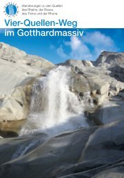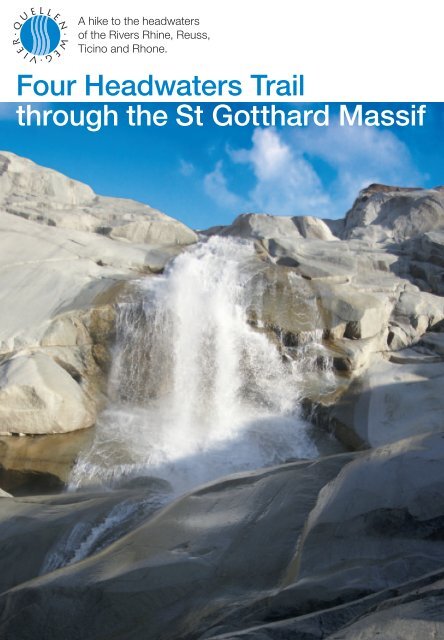
Four Headwaters Trail through the St Gotthard ... - Vier-Quellen-Weg
Four Headwaters Trail through the St Gotthard ... - Vier-Quellen-Weg
Four Headwaters Trail through the St Gotthard ... - Vier-Quellen-Weg
- No tags were found...

You also want an ePaper? Increase the reach of your titles
YUMPU automatically turns print PDFs into web optimized ePapers that Google loves.
Table of Contents5 <strong>Four</strong> <strong>Headwaters</strong> <strong>Trail</strong> <strong>through</strong> <strong>the</strong> <strong>St</strong> <strong>Gotthard</strong> Massif7 Off to <strong>the</strong> headwaters!8 From <strong>the</strong> Oberalp Pass to <strong>the</strong> Source of <strong>the</strong> Rhine<strong>St</strong>age 1: Oberalp Pass – Lake Toma (Sourceof <strong>the</strong> Rhine) – Maighel Pass – Vermigel Hut14 From <strong>the</strong> Vermigel Hut to <strong>the</strong> <strong>Gotthard</strong> Pass<strong>St</strong>age 2: Vermigel Hut – Sella Pass – Piz Giübin –Lake Sella – <strong>Gotthard</strong> PassAll rights reserved© 2012 <strong>Four</strong> <strong>Headwaters</strong> <strong>Trail</strong> Foundation, AltdorfCONTENT M A P A ND TR A IL D ESCRIPTIONSJosef Arnold-Luzzani, SchattdorfD ESIGN A ND L AYOUTArmin Furrer, Furrer Graphic Design, LucerneEDITORIAL A ND PRODUCTIONEdith Jörg, pr-work jörg, LucerneTr a n s l ationTim Neville, www.timneville.netproduction a nd d istributionGamma Druck + Verlag AG, Medien-Atelier, Altdorf1 st edition 2012Printed in SwitzerlandISBN: 978-3-906200-49-120 From <strong>the</strong> <strong>Gotthard</strong> Pass to <strong>the</strong> Source of <strong>the</strong> Reuss<strong>St</strong>age 3: <strong>Gotthard</strong> Pass – Lake Lucendro – Source of<strong>the</strong> Reuss – Lucendro Pass – Piansecco Hut26 From <strong>the</strong> Piansecco Hut to <strong>the</strong> headwaters of <strong>the</strong> Ticino<strong>St</strong>age 4: Piansecco Hut – <strong>Headwaters</strong> of<strong>the</strong> Ticino – Nufenen Pass – Obergesteln32 From <strong>the</strong> Upper Goms to <strong>the</strong> Source of <strong>the</strong> Rhone<strong>St</strong>age 5: Obergesteln – Gletsch – Furka Pass –Rhone Glacier (source of <strong>the</strong> Rhone) – Hotel Belvédère38 Rivers and Paths Shape DevelopmentThe <strong>Gotthard</strong> Region – A cultural overview52 Rich Diversity of Plants and AnimalsA natural history journey in five stages60 How Mountains Grow and RecedeA five-stage hike <strong>through</strong> geological history70 Reservoirs of Water PowerHarnessing water in <strong>the</strong> <strong>St</strong> <strong>Gotthard</strong> Massif76 Practical Information79 Appendix, bibliography and credits80 Acknowledgements
<strong>Four</strong> <strong>Headwaters</strong> <strong>Trail</strong> <strong>through</strong> <strong>the</strong> <strong>St</strong> Gottard MassifThe Rhine, Reuss, Ticino and Rhonerivers all begin in <strong>the</strong> <strong>Gotthard</strong> regionand that gave Paul Dubacher from Seedorf<strong>the</strong> idea for <strong>the</strong> <strong>Four</strong> <strong>Headwaters</strong><strong>Trail</strong>. He’s something of a specialistwhen it comes to hiking trails and wasinstrumental, for example, in formingroutes like <strong>the</strong> “Swiss Path” around LakeLucerne and <strong>the</strong> “Railway <strong>Trail</strong>s” of <strong>the</strong><strong>Gotthard</strong> region.In 2009 Dubacher got to work onceagain. That same year <strong>the</strong> <strong>Four</strong> <strong>Headwaters</strong><strong>Trail</strong> Foundation was foundedwith well-known people from <strong>the</strong> fourcantons that make up <strong>the</strong> <strong>Gotthard</strong> region(see page 78). The inaugurationfollowed in 2012.For more information please visitwww.four-headwaters-trail.ch.Mountain hiking in five stagesThe <strong>Four</strong> <strong>Headwaters</strong> <strong>Trail</strong> is a familyfriendlytrek of about 85 km <strong>through</strong><strong>the</strong> alpine country where <strong>the</strong> Rhine,Reuss, Ticino and Rhone rivers begin. Itis broken up into five segments, each ofwhich with starting and end points thatare serviced by public transport.Hiking <strong>through</strong> portions of cantonsUri, Graubünden, Ticino and Valaistakes you <strong>through</strong> unique landscapesPaul Dubacher,founder and projectleader of <strong>the</strong> <strong>Four</strong><strong>Headwaters</strong> <strong>Trail</strong>and highlights <strong>the</strong> central role that waterhas played for man, animals andplants.Things to know about <strong>the</strong> <strong>Gotthard</strong>The hiking guidebook to <strong>the</strong> <strong>Four</strong><strong>Headwaters</strong> <strong>Trail</strong> includes trail descriptionsas well as fascinating backgroundinformation on <strong>the</strong> region’s cultural history,flora and fauna, geological phenomena,climate change and <strong>the</strong> harnessingof water for hydropower.In this way a hiker can make senseof and learn more about <strong>the</strong> area. Thebest bits of background informationwill become apparent: How have humans<strong>through</strong>out <strong>the</strong> ages impacted <strong>the</strong><strong>Gotthard</strong> region; why mountains arenever at ease; which plants are worth acloser look; and how important is it toturn <strong>the</strong> region’s water into power.4 5
stage 1From <strong>the</strong> Oberalp Passto <strong>the</strong> Source of <strong>the</strong> RhineThe first stage leads from <strong>the</strong> OberalpPass, past <strong>the</strong> source of <strong>the</strong> Rhineat Lake Toma and concludes at <strong>the</strong>Vermigel Hut. The Maighel Pass marks<strong>the</strong> highest point of this section of <strong>the</strong>hike where <strong>the</strong> idyllic Lake Portgereninvites visitors to linger.The stage in four sectionsINFORMATION ABOUT STAGE 1A worthy goal – <strong>the</strong> idyllic Lake Toma.EFFORT Distance: 14.5 km/Time: 5 hrs. 20 min./Ascent: 1100m/Descent: 1100 mD IFFICULT Y Continuous, mostly hiking on marked trails (SAC rating T1/T2).STA R T A ND FINISH <strong>St</strong>art at <strong>the</strong> Oberalp Pass. Finish at <strong>the</strong> Vermigel Hut.Route Oberalp Pass (2044 m) – Lake Toma (2345 m) – Maighel Valley –Maighel Pass (2421 m) – Alp Portgeren – Vermigel Hut (2042 m)PROV ISIONS Maighel and Vermigel SAC huts (during hiking season).ACCOMMODATIONS STAG E 1 Vermigel Hut, reservations recommended, Tel. 041-887-17-73 or062-534-00-35, vermigel@sac-zofingen.ch. Maighel Hut (about halfway <strong>through</strong> first stage):Reservations: 081-949-15-51, info@maighelshuette.ch.G E T TING THERE Train to <strong>the</strong> Oberalp Pass from Andermatt (Uri) or Disentis Sedrun (Graubünden).R E T U R N FOR DAY HIKES Walk to Andermatt from <strong>the</strong> Vermigel Hut (2.5 hrs.). Train and busconnections available in Andermatt.M A PS Switzerland National Map: 1:50,000 No. 5001 “<strong>Gotthard</strong>” (good for all five stages).See page 10 for map excerpts of stage 1 (reduced 15 percent).INFORMATION www.four-headwaters-trail.ch; Tourist Info Uri: www.uri.info;Andermatt-Urserntal Tourismus GmbH: www.andermatt.ch;Graubünden Tourism: www.graubuenden.ch; Leventina Tourism: www.leventinaturismo.ch;Tessin Tourism: www.ticino.ch; Train and bus connections: www.sbb.chThe Matterhorn-<strong>Gotthard</strong> Railway (MGB)runs to <strong>the</strong> top of <strong>the</strong> 2044-meter-highOberalp Pass from canton Graubündenfrom <strong>the</strong> east or from Andermatt in <strong>the</strong>Ursern Valley from <strong>the</strong> west.It’s possible to reach <strong>the</strong> pass on footfrom Göschenen, Andermatt, Sedrun orTschamut (see map overview, page 1).Get your bearings at <strong>the</strong> yellow hikingsign and head out on <strong>the</strong> trail towardLake Toma.Those who prefer a longer, moresporty variation to reach <strong>the</strong> lake canfollow <strong>the</strong> signs to <strong>the</strong> Pazolastock(2740 m). After a short, sloping sectionalong <strong>the</strong> pass road 1 a path climbsgently across <strong>the</strong> flanks of <strong>the</strong> Pazolastock.The imposing wall of <strong>the</strong> dammedCurnera reservoir is visible for a shortwhile to <strong>the</strong> south. At a fork in <strong>the</strong> trailat Trutg (2056 m) 2 a path winds upwardsalong a gravel road to <strong>the</strong>Maighel Hut 6 . The hut, at 2310 meters,is run by <strong>the</strong> Swiss Alpine Club (SAC)and offers room and board. But to completethis section of <strong>the</strong> hike continueto climb southwesterly for about 300meters up some switchbacks <strong>through</strong>steep pastures that become increasinglyThe young Rhine flows toward Tschamut.The source of <strong>the</strong> Rhine at Lake Toma.Lake Urlaun in <strong>the</strong> Maighel Valley.The Vermigel Hut, <strong>the</strong> first day’s goal.8 9
From <strong>the</strong> Oberalp Pass to <strong>the</strong> Source of <strong>the</strong> Rhine stage 1THE WAY OF THE R HINEAfter a long, 1,230-km journey <strong>the</strong> Rhineflows into <strong>the</strong> North Sea near Rotterdam,Europe’s largest port. Along <strong>the</strong> way, manytributaries transform <strong>the</strong> feisty little stream atLake Toma into a wide river that has become<strong>the</strong> most heavily used waterway in Europe.At Reichenau/Tamis <strong>the</strong> Anterior and HinterRhine join toge<strong>the</strong>r to form <strong>the</strong> so-called AlpineRhine, which flows into Lake Constance.From <strong>the</strong>re it becomes <strong>the</strong> High Rhine untilBasel, with <strong>the</strong> Aare River flowing into it atKoblenz. After Basel, <strong>the</strong> river is known as<strong>the</strong> Upper Rhine, which runs to Bingen, Germany,and is joined by <strong>the</strong> Neckar and Mainrivers along <strong>the</strong> way. From <strong>the</strong>re <strong>the</strong> river becomes<strong>the</strong> Middle Rhine until Bonn, a stretchjoined by <strong>the</strong> Lahn and Mosel rivers thatflows around <strong>the</strong> mythical Loreley cliff near<strong>St</strong> Goarshausen. Finally <strong>the</strong> wide and placidLower Rhine begins after Bonn, flowing<strong>through</strong> <strong>the</strong> north German lowlands andforming <strong>the</strong> Rhine-Meuse Delta at <strong>the</strong> German-Dutchborder. It <strong>the</strong>n eases <strong>through</strong> alarge natural region to spill into <strong>the</strong> North Seanear Rotterdam.tersects <strong>the</strong> access road just mentioned(2263 m) 5 . A few meters beyond <strong>the</strong>intersection a trail branches off to <strong>the</strong>right toward Lolen Pass (Pass Tagliola,2399 m), and a bit fur<strong>the</strong>r to <strong>the</strong> south,a spur trail heads toward <strong>the</strong> manmadeCurnera reservoir.<strong>St</strong>ay on <strong>the</strong> access road that soonends with a well-beaten, often muckypath that leads into <strong>the</strong> wide, flat areaof <strong>the</strong> Maighel Valley and its many tadpole-chokedponds. The valley boasts<strong>the</strong> typical flora and fauna of a wetlandwith cottongrass, sedges and yellow-orangeblossoming saxifrage. The moorsare green in summer and spring, yellowand brown in autumn. In a few12places peat has formed over <strong>the</strong> centuries.(For more on <strong>the</strong> flora and faunasee page 53).At <strong>the</strong> “Piogn Crap” (roughly translatedas “Bridge by <strong>the</strong> Rock”), behold amagnificent masterpiece of nature: aseveral-meter-deep gorge, narrow at <strong>the</strong>top, carved by centuries of water flowingdown from <strong>the</strong> Maighel Glacier and<strong>the</strong> Bornengo Pass. It is so narrow at<strong>the</strong> top that one is almost lured intoleaping over it. Later <strong>the</strong> trail crosses<strong>the</strong> terminal moraine that <strong>the</strong> easternMaighel Glacier left behind after its lastadvance around 1850.Soon <strong>the</strong> trail arrives at ano<strong>the</strong>r forkat Plaunca Portgera (2374 m) and climbsto <strong>the</strong> right up to <strong>the</strong> Maighel Pass(2421 m) 7 , where <strong>the</strong> idyllic LakePortgeren twinkles. North Americanlake trout, brown trout as well as rainbowtrout make this a popular place foranglers. The view spreads to <strong>the</strong> northwith <strong>the</strong> Portgerenstock, to <strong>the</strong> southwestover <strong>the</strong> slopes of <strong>the</strong> Alp Wildenmattenand up to <strong>the</strong> Piz Giübin near<strong>the</strong> Sella Pass. The Maighel Pass marks<strong>the</strong> end of canton Graubünden and <strong>the</strong>Rhaeto-Romansh-speaking regions.Traditionally five dialects of Rhaeto-Romansh are spoken and written incanton Graubünden of sou<strong>the</strong>ast Switzerland:Sursilvan (in <strong>the</strong> AnteriorRhine region), Sutsilvan (in portions of<strong>the</strong> Hinter Rhine region), Surmiran (in<strong>the</strong> Upper Engadine and Al bula valleys),Puter (in <strong>the</strong> Upper Engadine)and Vallader (in <strong>the</strong> Lower Engadine).In order to create consistency out of<strong>the</strong> truly different dialects for bureaucraticmatters, a standard dialect called“Rumantsch Grishun” or “Romansh ofLake Toma, or Lai da Tuma in Rhaeto-Romansh, at <strong>the</strong>base of Piz Badus, means “lake behind <strong>the</strong> hill.”Graubünden” was developed and hasbeen used as <strong>the</strong> official dialect since2001. On <strong>the</strong> way from <strong>the</strong> OberalpPass to <strong>the</strong> Maighel Pass, one can learna few words of Sursilvan: plaunca(slope or flank), piogn (catwalk-likebridges often running along <strong>the</strong> sidesof cliffs), trutg (mountain path), crap(rock or crag).The route <strong>the</strong>n zig-zags along a path(that’s also an official mountain biketrail) over alpine meadows, past pondsand down to a bridge over <strong>the</strong> UnteralpReuss river (1978 m). A short but steepclimb brings you to <strong>the</strong> goal for <strong>the</strong>day, <strong>the</strong> Vermigel Hut (2042 m) 8 .which can sleep 40 people.DAY HIKING This section can be done as aday hike by wandering down <strong>through</strong>Shy marmots are always around.Scheuchzers cottongrass,a common wetland plant.<strong>the</strong> tranquil Unteralp Valley for a good2.5 hours to reach Andermatt. Watch forchamois on <strong>the</strong> eastern slopes of <strong>the</strong>Gafallengrat and <strong>the</strong> Gurschenstöckli,particularly during mornings and evenings.On <strong>the</strong> right you’ll probably seemarmots with <strong>the</strong>ir shrill whistles. Toavoid bike and vehicular traffic, you cancross <strong>the</strong> Unteralp Reuss near Heuplanggand wander <strong>through</strong> lonelymeadows, passing a rest area, to reach<strong>the</strong> center of Andermatt directly. Save alittle energy for a visit to <strong>the</strong> MariahilfChapel above <strong>the</strong> village. After a hardwinter in 1720 <strong>the</strong> priest is said to haveattached a picture of <strong>the</strong> Virgin Mary toa tree. The townspeople started to put<strong>the</strong>ir faith in this small wayside shrineand in 1724 build a chapel <strong>the</strong>re.13