activities report 3 months ended 31 december 2007 - UraniumSA
activities report 3 months ended 31 december 2007 - UraniumSA
activities report 3 months ended 31 december 2007 - UraniumSA

Create successful ePaper yourself
Turn your PDF publications into a flip-book with our unique Google optimized e-Paper software.
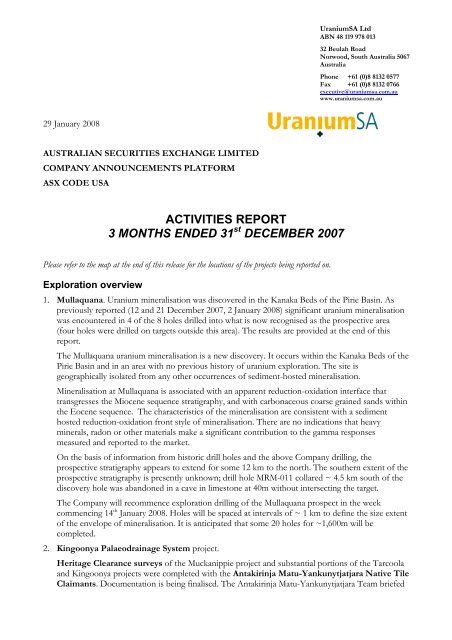
<strong>UraniumSA</strong> LtdABN 48 119 978 01332 Beulah RoadNorwood, South Australia 5067AustraliaPhone +61 (0)8 8132 0577Fax +61 (0)8 8132 0766executive@uraniumsa.com.auwww.uraniumsa.com.au29 January 2008AUSTRALIAN SECURITIES EXCHANGE LIMITEDCOMPANY ANNOUNCEMENTS PLATFORMASX CODE USAACTIVITIES REPORT3 MONTHS ENDED <strong>31</strong> st DECEMBER <strong>2007</strong>Please refer to the map at the end of this release for the locations of the projects being <strong>report</strong>ed on.Exploration overview1. Mullaquana. Uranium mineralisation was discovered in the Kanaka Beds of the Pirie Basin. Aspreviously <strong>report</strong>ed (12 and 21 December <strong>2007</strong>, 2 January 2008) significant uranium mineralisationwas encountered in 4 of the 8 holes drilled into what is now recognised as the prospective area(four holes were drilled on targets outside this area). The results are provided at the end of this<strong>report</strong>.The Mullaquana uranium mineralisation is a new discovery. It occurs within the Kanaka Beds of thePirie Basin and in an area with no previous history of uranium exploration. The site isgeographically isolated from any other occurrences of sediment-hosted mineralisation.Mineralisation at Mullaquana is associated with an apparent reduction-oxidation interface thattransgresses the Miocene sequence stratigraphy, and with carbonaceous coarse grained sands withinthe Eocene sequence. The characteristics of the mineralisation are consistent with a sedimenthosted reduction-oxidation front style of mineralisation. There are no indications that heavyminerals, radon or other materials make a significant contribution to the gamma responsesmeasured and <strong>report</strong>ed to the market.On the basis of information from historic drill holes and the above Company drilling, theprospective stratigraphy appears to extend for some 12 km to the north. The southern extent of theprospective stratigraphy is presently unknown; drill hole MRM-011 collared ~ 4.5 km south of thediscovery hole was abandoned in a cave in limestone at 40m without intersecting the target.The Company will recommence exploration drilling of the Mullaquana prospect in the weekcommencing 14 th January 2008. Holes will be spaced at intervals of ~ 1 km to define the size extentof the envelope of mineralisation. It is anticipated that some 20 holes for ~1,600m will becompleted.2. Kingoonya Palaeodrainage System project.Heritage Clearance surveys of the Muckanippie project and substantial portions of the Tarcoolaand Kingoonya projects were completed with the Antakirinja Matu-Yankunytjatjara Native TileClaimants. Documentation is being finalised. The Antakirinja Matu-Yankunytjatjara Team briefed
our Chief Geologist, Wade Bollenhagen, on the mythology and significance of the area and featureswithin it. This courtesy has provided the Company with a cultural context for its work in the areathat it is incorporating into its ongoing exploration <strong>activities</strong>.The Company has commenced the negotiation process with the other Native Title Claimant groupsin the area of its Kingoonya palaeodrainage tenements.Drilling. The start of sustained exploration drilling of the Tarcoola, Kingoonya and Muckanippieprojects has been delayed while the Company rig drills out the envelope of mineralisation atMullaquana. The rig is presently scheduled to move to Tarcoola on February 25 th 2008 and willremain on the Kingoonya Palaeodrainage project with work currently scheduled through to the endof June 2008.The Tarcoola project of the Stellar JV will be the first area drilled, commencing February 25 th2008, with priority given to AEM and other targets.The Kingoonya project, which includes the Marathon JV, will be drilled commencing April 7 th2008, initially following up the Blackoak Bore uranium mineralisation.The Muckanippie project will be drilled commencing May 19 th 2008, initially following up theBradman Outstation uranium mineralisation.It is anticipated that the rig will remain based at Tarcoola working across all three project areas asrequired.3. Cleve. The results of calcrete sampling have been received and are being complied. In-fill andextension sampling will be carried out in the first quarter of 2008.Assays from surface rock chipping of scintillometer anomalies over granites and metasediments inthe east of the tenement area returned evaluated but not anomalous uranium values. Further fieldwork will be carried out.4. Tumby Bay. Calcrete sampling that has been scheduled for this area has not yet commenced.5. Base Metal exploration.The Muckanippie project (<strong>UraniumSA</strong> 100%) covers a significant portion of the MuckanippieAnorthosite Complex, an assemblage of mafic rocks that are prospective for copper-nickel andplatinum group element (PGE) mineralisation. In the course of its exploration for sediment hosteduranium in the young cover sequences <strong>UraniumSA</strong> has compiled all of the historic exploration dataand integrated it with the results of its recent AEM surveys. From this work, the Company hascompiled an interpretive geological map of the complex and identified a range of geophysicaltargets in geologically permissive setting. The Company is continuing to work up the data to definetargets and rank their exploration potential.The Pyramid Bore tenement (<strong>UraniumSA</strong> 100%), part of the Kingoonya project, contains theKanara Bore and Lake Patricia geophysical targets.Kanara Bore is located on a regional 10 km by 20 km north-northeast trending ridge in the gravitydata that has a maximum amplitude of some 6 mGal. There are a number of discrete gravityanomalies within the regional feature and <strong>UraniumSA</strong> carried out in-fill gravity surveying to define adrillable target at a depth of 600m to 1,000m. The Kanara Bore target is prospective for IOCGmineralisation and is of a comparable quality to targets that are being regularly drill tested by otherexplorers across the Gawler Craton.Lake Patricia is targeted on partially coincident gravity and magnetic anomalies that areinterpreted as the eastern-most extent of the Harris Greenstone Belt. Dampier Mining Company(BHP) identified the target in 1978.Dampier developed geological concepts for copper-nickel and gold mineralisation, carried outgravity and magnetic surveys, and drilled a hole that terminated at 675m without reaching target.
Their geophysical work and drill testing was very innovative for its time and was at the limits of thetechnologies available to them. The Dampier targeting rationale remains valid and <strong>UraniumSA</strong>considers this an excellent exploration play.<strong>UraniumSA</strong> has carried out additional gravity surveying and used modern computer based dataprocessing to refine the modelling of the geophysical target. This work indicates that a hole collared~1.5 km east of the previous Dampier hole would intersect the target at a depth of ~800m.Projected activity to <strong>31</strong> March 2008Mullaquana. Drilling with the Company rig to outline the envelope of mineralisation will commenceJanuary 14 th 2008 and continue until 17 th February 2008. It is anticipated that up to 20 additional holeswill be drilled.Kingoonya Palaeodrainage System project – Tarcoola, Kingoonya and Muckanippie.The Company rig will arrive in Tarcoola to commence work on 25 th February 2008. Drilling has beenscheduled across the Tarcoola, Kingoonya and Muckanippie projects for the first two quarters of the2008-year.Native Tile negotiations will continue with Claimant groups.Cleve. The calcrete coverage will be ext<strong>ended</strong>. Work will commence to geophysically define theBoothby prospect.Tumby Bay. Calcrete sampling and geological mapping to follow up uranium anomalies obtained inthe aircore drilling will be completed.Base Metal projects. Technical work will continue on these projects to refine the geology, geophysicsand targeting. As this information becomes available, the Company will determine whether to continueto develop these projects for exploration by the Company, or to seek to Joint Venture them.Mullaquana – location of data points5 km5kMRM-001The Mullaquana project is located on theEastern Eyre Peninsula, some 23 kmsouth of the industrial city of Whyalla.Land tenure is privately owned PerpetualLeasehold pastoral land. The region hasa stable and skilled workforce andextensive, well established infrastructure.The project is located on the coastalplain and the tenement boundary is800m inland from the high-water line.Whyalla cityEL 3652, Mullaquana, boundaryExisting datahistoric drill holes with relevant data<strong>UraniumSA</strong> – discovery holesintersecting mineralisation<strong>UraniumSA</strong> drill holes with relevant data
Mullaquana drill resultsThe general location of the drill holes completed to date, and of relevant historic drill holes, is shown inthe attached figure. As these are broad spaced reconnaissance drill holes, collar locations in the tablebelow are given with reference to the discovery hole MRM-001 (refer to the attached figure) andspecific collar coordinates are not given.Hole ID Location Depth ResultMRM-001released 12/12/<strong>2007</strong>MRM-002released 12/12/<strong>2007</strong>MRM-003released 12/12/<strong>2007</strong>MRM-004released 12/12/<strong>2007</strong>MRM-005released 12/12/<strong>2007</strong>MRM-006released 12/12/<strong>2007</strong>MRM-007released 2/01/2008MRM-008released 2/01/2008MRM-009released 2/01/2008MRM-010released 2/01/2008MRM-011released 2/01/2008MRM-012released 2/01/200824 km SW of Whyalla 98m 57.98m to 59.91m, 1.92m @ 0.010% eU 3 O 81.2 km SW MRM-001 98m target stratigraphy intersected, uranium anomalous2.1 km SW MRM-001 98m target stratigraphy intersected, uranium anomalous1.0 km W MRM-001 98m 45.89m to 46.20m, 0.<strong>31</strong>m @ 0.010% eU 3 O 847.09m to 48.20m, 1.11m @ 0.010% eU 3 O 80.6 km E MRM-001 64m target stratigraphy intersected, uranium anomalous4.8 km W MRM-001 32m target stratigraphy not present5.5 km SW MRM-001 66m target stratigraphy intersected, uranium anomalous7.8 km SW MRM-001 22m target stratigraphy not present7.9 km SW MRM-001 28m target stratigraphy not present1.0 km S MRM-001 70m 47.1m to 49.0m, 1.9m @ 0.015% eU 3 O 856.6m to 57.7m, 1.1m @ 0.018% eU 3 O 84.5 km S MRM-001 40m abandoned in limestone short of target1.5 km NE MRM-001 92m 51.2m to 52.2m, 1.0m @ 0.013% eU 3 O 865.9m to 67.2m, 1.3m @ 0.014% eU 3 O 8The reader should refer to the Company <strong>report</strong>s to ASX of 12 th and 21 st December <strong>2007</strong> and 2 ndJanuary 2008 for more information on the drilling and the above results.
About <strong>UraniumSA</strong> Ltd<strong>UraniumSA</strong> is an Adelaide-baseduranium-only explorer specialising inpalaeochannel or rollfront and unconformitystyles of uranium mineralisation within asubstantial portfolio of properties in SouthAustralia’s Gawler Craton.The focus of the rollfront uranium search iswithin its substantial tenement holding overthe highly regarded KingoonyaPalaeodrainage System which hosts theWarrior and Ealbara uranium prospectsin adjoining tenements.The Company has discovered sedimenthosteduranium mineralisation atMullaquana on the eastern seaboard ofEyre Peninsula. Drilling to define theenvelope of mineralisation is presentlyunderway.Russel BluckManaging Director<strong>UraniumSA</strong> LimitedThe exploration results <strong>report</strong>ed herein, insofar as they relate to mineralisation, are based on information complied by Mr. Russel Bluck aMember of the Australian Institute of Geoscience and an employee of <strong>UraniumSA</strong> Limited. Mr Bluck has sufficient experience relevant to thestyle of mineralisation and type of deposits being considered and to the activity, which he is undertaking to qualify as a Competent Person asdefined by the 2004 Edition of the Australasian Code for Reporting of Exploration Results, Mineral Resources and Ore Reserves (the JORCCode, 2004 Edition). Mr Bluck consents to the inclusion in the <strong>report</strong> of matters based on his information in the form and context in which itappears. It should be noted that the abovementioned exploration results are preliminary.