

Banc y Celyn, Brecknockshire - Royal Commission on the Ancient ...
Banc y Celyn, Brecknockshire - Royal Commission on the Ancient ...
Banc y Celyn, Brecknockshire - Royal Commission on the Ancient ...
- No tags were found...

Create successful ePaper yourself
Turn your PDF publications into a flip-book with our unique Google optimized e-Paper software.
Uplands Initiative<str<strong>on</strong>g>Banc</str<strong>on</strong>g> y <str<strong>on</strong>g>Celyn</str<strong>on</strong>g>Archaeological Survey(Part One)For: The <str<strong>on</strong>g>Royal</str<strong>on</strong>g> <str<strong>on</strong>g>Commissi<strong>on</strong></str<strong>on</strong>g> <strong>on</strong> <strong>the</strong> <strong>Ancient</strong>and Historical M<strong>on</strong>uments of WalesMarch 2009
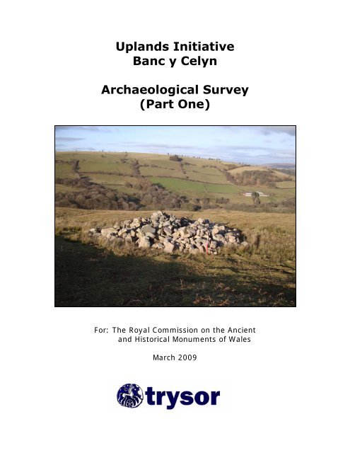
Uplands Initiative<str<strong>on</strong>g>Banc</str<strong>on</strong>g> y <str<strong>on</strong>g>Celyn</str<strong>on</strong>g>Archaeological Survey(Part One)ByJenny Hall MIFA & Paul SambrookTrysorTrysor Project No. 2009/138For: The <str<strong>on</strong>g>Royal</str<strong>on</strong>g> <str<strong>on</strong>g>Commissi<strong>on</strong></str<strong>on</strong>g> <strong>on</strong> <strong>the</strong> <strong>Ancient</strong>and Historical M<strong>on</strong>uments of Wales<str<strong>on</strong>g>Royal</str<strong>on</strong>g> <str<strong>on</strong>g>Commissi<strong>on</strong></str<strong>on</strong>g> Ref. No. RCS 1/2/79March 2009Cover photograph: A modern clearance cairn (NPRN 247320) near Cwm Hafotty, looking northwardstowards Groeswen Farm.
CONTENTSPART 11.1 Crynodeb 11.2. Summary 21.3 Introducti<strong>on</strong> 3Extent of area covered in km 2Previous FieldworkMethodology2.1 Analysis of Sites recorded in <strong>the</strong> Survey area 10Number of sitesSummary of sites by Broad ClassSummary of sites by PeriodSummary of sites by TypeSummary of sites by AltitudeSignificant new sites2.2 Value of AP mapping to <strong>the</strong> field project 233.1 <str<strong>on</strong>g>Banc</str<strong>on</strong>g> y <str<strong>on</strong>g>Celyn</str<strong>on</strong>g>: History and Archaeology 25Characteristics and comparis<strong>on</strong>s3.2 Prehistory 30Early PrehistoryBr<strong>on</strong>ze Age m<strong>on</strong>umentsSignificance of <strong>the</strong> prehistoric archaeology3.3 Medieval and Post Medieval Settlements & Agriculture 43Deserted Rural SettlementsFarmsteadsL<strong>on</strong>ghousesL<strong>on</strong>g HutsPlatformsEnclosures & Cultivati<strong>on</strong>Pillow MoundsClearance Cairns & MoundsSignificance of Medieval and Post Medievalsettlement and agriculture3.4 Post Medieval Industry & Water Management 65QuarryingWater SupplySignificance of <strong>the</strong> Industrial sites3.5 Roads & Trackways 683.6 Boundary st<strong>on</strong>es 654 C<strong>on</strong>clusi<strong>on</strong>s 725.1 Sources 73
6.1 Recommendati<strong>on</strong>s 75Detailed site analysisSites for inclusi<strong>on</strong> <strong>on</strong> Ordnance Survey mappingSites for pollen analysis and o<strong>the</strong>r envir<strong>on</strong>mental samplingAppendix A – Site Type Summary 80Appendix B – Period Summary 90Appendix C – C<strong>on</strong>tour Summary 99Appendix D - Uplands Initiative Air Photo Mapping Plynlim<strong>on</strong> (NW) 107FiguresFigure 1: Locati<strong>on</strong> of Study areaFigure 2: Place names within <strong>the</strong> study areaFigure 3: Areas not covered by 30m or 50m transectsFigure 4: Distributi<strong>on</strong> of sites by Broad ClassFigure 5: Distributi<strong>on</strong> of sites by PeriodFigure 6: Distributi<strong>on</strong> of sites by AltitudeFigure 7: Features plotted by <strong>the</strong> RCAHMW from aerial photographsFigure 8: Prehistoric funerary and ritual sitesFigure 9: Medieval and Post Medieval settlement sitesFigure 10: Banks and enclosures to <strong>the</strong> nor<strong>the</strong>ast of Nantyroffeiriad Fawr FarmFigure 11: Clearance Cairns and MoundsFigure 12: The Brec<strong>on</strong> to Builth roadFigure 13: Glanusk Estate boundary st<strong>on</strong>esFigure 14: Locati<strong>on</strong>s thought suitable for palaeoenvir<strong>on</strong>mental samplingTablesTable 1: Broad ClassTable 2: Sites by PeriodTable 3: Sites by TypeTable 4: Sites by c<strong>on</strong>tour bandTable 5: Br<strong>on</strong>ze Age sitesPART 2 (bound separately)Locati<strong>on</strong> mapsSite gazetteer
Uplands Initiative – <str<strong>on</strong>g>Banc</str<strong>on</strong>g> y <str<strong>on</strong>g>Celyn</str<strong>on</strong>g> 20081.1 CrynodebGwnaed arolwg archaeolegol yn ardal <str<strong>on</strong>g>Banc</str<strong>on</strong>g> y <str<strong>on</strong>g>Celyn</str<strong>on</strong>g> gan gwmni Trysor yn ystod MisI<strong>on</strong>awr a Mis Chwefror 2009. Ariannwyd y gwaith fel rhan o brosiect Menter yrUwchdiroedd gan y Comisiwn Brenhinol ar Henebi<strong>on</strong> Cymru. Mae ardal yr arolwg ynffurfio rhan bwysig o uwchdiroedd eang Mynydd Epynt yn Sir Powys, yng NghanolbarthCymru. Mae’r ardal yn gorwedd ychydig i’r gorllewin o Ddyffryn Gwy a phentrefiGwenddwr, Crug Cadarn ac Erwood, gyda thref Llanfair ym Muallt rhyw 3 cilomedr i’rgogledd. I’r gorllewin, ceir pentref Capel Uchaf, yn ogystal â SENTA, sef maes hyfforddi’rfyddin Brydeinig, sy’n ymestyn dros ran helaeth o uwchdiroedd Epynt.Cofnodwyd 439 o safleoedd ac oli<strong>on</strong> archaeolegol yn ystod y gwaith maes, o fewn ardal sy’nymestyn dros 20 cilomedr sgwâr o dir comin. Safleoedd a gofnodwyd am y tro gyntaf, yw’rrhan fwyaf o’r rhain.Ymhlith y rhestr hir o safleoedd archaeolegol a welwyd yn y maes, ceir enghraifft prin osiambr claddu sy’n dyddio i’r Oes Neolithig, math o safle nad yw’n gyffredin yn yruwchdiroedd. Ceir nifer o henebi<strong>on</strong> angladdol a defodol o Oes yr Efydd hefyd, rhaioh<strong>on</strong>ynt yn henebi<strong>on</strong> cofrestredig. Darganfuwyd nifer o garneddau claddu newydd gan yrarolwg, gan ehangu ein gwybodaeth am weithgarwch dynol yn y fro yn ystod y cyfnodaucynhanesyddol. Roedd nifer o safleoedd anheddiad yn dyddio i’r canoloesoedd a chyfnodôl-ganoloesoedd eisoes wedi’u cofnodi yma, <strong>on</strong>d mae nifer da o safleoedd newydd wedicael ei ychwanegu at y cofnodi<strong>on</strong> gan y prosiect. Mae hyn yn gwella ein dealltwriaeth o’rpatrwm anheddiad a mathau o aneddiadau o fewn yr ardal yn ystod y cyfnod hanesyddol.Llwyfannau tai canoloesol oedd llawer o’r safleoedd newydd, tystiolaeth posibl am henhafodydd a godwyd yma i fanteisio ar y porfeydd mynyddig dros fisoedd yr haf.Ar draws ardal <str<strong>on</strong>g>Banc</str<strong>on</strong>g> y <str<strong>on</strong>g>Celyn</str<strong>on</strong>g>, gwelir tystiolaeth o’r ymdrechi<strong>on</strong> a wnaed yn y gorffennol igau i mewn a ffermio rhai o’r llethrau a gwastadeddau sych a geir ar ymyl<strong>on</strong> y comin.Cofnodwyd llawer o gloddiau pridd a cherrig a godwyd i greu caeau, a hefyd tystiolaetham aredig i geisio gwella’r mynydd-dir a’i ffermio canrifoedd yn ôl. Ar ben hynny, ceirtystiolaeth am weithgarwch mwy diweddar i wella’r tir er mwyn gallu torri’r trwch oredyn sydd yn gorchuddio rhannau helaeth o’r ardal. Yn ystod yr hanner gan mlyneddddiwethaf, mae ffermwyr lleol wedi clirio cerrig oddi ar y wyneb dros rannau o’r ardal, achodi carneddau newydd, arwyddi<strong>on</strong> o’r pwysigrwydd maent yn rhoi ar dorri a bêlo’rrhedyn, i’w ddefnyddio fel sarn ar gyfer eu hanifeiliaid dros fisoedd y gaeaf.Heddiw, defnyddir y porfeydd mynyddig yma ar gyfer defaid o’r ffermydd sy’namgylchynu’r bryniau. Dros yr haf, mae prydferthwch yr ardal yn profi i fod ynatyniadol i gerddwyr ac ymwelwyr, ac mae rhai o olygfeydd gorau’r canolbarth i’w gaeloddi ar fryniau <str<strong>on</strong>g>Banc</str<strong>on</strong>g> y <str<strong>on</strong>g>Celyn</str<strong>on</strong>g>, gan gynnwys golygfeydd clir o Fannau Brycheiniog a’rMynyddoedd Du<strong>on</strong>.Y gobaith yw y bydd y cofnod cyflawn o oli<strong>on</strong> archaeolegol yr ardal a grëwyd gan yprosiect hwn yn cynyddu dealltwriaeth o’r ardal yn y dyfodol, a bod o gymorth iddiogelu’r oli<strong>on</strong> archaeolegol brau sy’n cynrychioli miloedd o flynyddoedd oweithgarwch dynol ar fryniau hanesyddol yr Epynt.1
Uplands Initiative – <str<strong>on</strong>g>Banc</str<strong>on</strong>g> y <str<strong>on</strong>g>Celyn</str<strong>on</strong>g> 20081.2 SummaryAn archaeological field survey of <strong>the</strong> <str<strong>on</strong>g>Banc</str<strong>on</strong>g> y <str<strong>on</strong>g>Celyn</str<strong>on</strong>g> area was undertaken by Trysorduring <strong>the</strong> winter of 2008-2009, grant aided as part of <strong>the</strong> RCAHMW's UplandsInitiative project. The area forms part of <strong>the</strong> extensive Mynydd Epynt upland block in<strong>the</strong> modern county of Powys, in mid-Wales. It lies just to <strong>the</strong> west of <strong>the</strong> Wye valleyand <strong>the</strong> villages of Gwenddwr, Crickadarn and Erwood, with <strong>the</strong> town of Builth Wellsless than 3km to <strong>the</strong> north. To <strong>the</strong> west is <strong>the</strong> village of Upper Chapel, as well as <strong>the</strong>extensive SENTA military range, which occupies a large porti<strong>on</strong> of <strong>the</strong> Epynt uplands.Fieldwork identified 439 archaeological sites and features in an area extending across20km 2 of comm<strong>on</strong> land. Most of <strong>the</strong>se sites were previously unrecorded.The range of archaeological features encountered included a rare upland example of aNeolithic Chambered Tomb, Br<strong>on</strong>ze Age funerary m<strong>on</strong>uments, several of which areprotected as Scheduled <strong>Ancient</strong> M<strong>on</strong>uments. Several new examples were recorded bythis project, expanding our knowledge of prehistoric activity in <strong>the</strong> area. Similarly, anumber of medieval and later settlement sites were also previously known, some of whichwere scheduled, to which significant new discoveries have been added, improving ourunderstanding of <strong>the</strong> extent and range of settlement in <str<strong>on</strong>g>Banc</str<strong>on</strong>g> y <str<strong>on</strong>g>Celyn</str<strong>on</strong>g>. The newly recordedsites were mostly of earthwork platforms of probable medieval date, which may representevidence of medieval transhumance <strong>on</strong> <strong>the</strong> upland pastures of <strong>the</strong> area.The study area also has c<strong>on</strong>siderable evidence of past efforts made to enclose andcultivate some of <strong>the</strong> well drained slopes <strong>on</strong> <strong>the</strong> fringes of <strong>the</strong> comm<strong>on</strong>. Manyearthwork banks, raised to create small field parcels or enclosures were recorded, andsome evidence of apparent ridge & furrow cultivati<strong>on</strong> was also noted. The extent ofsuch cultivati<strong>on</strong> was not always easy to define however, even with <strong>the</strong> assistance ofaerial photographic evidence, as parts of <strong>the</strong> area have been subject to modern attemptsat land improvement and <strong>the</strong> annual mowing of bracken is still practiced here. Groupsof modern clearance cairns mark <strong>the</strong> efforts made by farmers during <strong>the</strong> 20 th century tode-st<strong>on</strong>e areas where bracken could be cut, indicating <strong>the</strong> value placed <strong>on</strong> <strong>the</strong> plant as asource of winter bedding for animals wintered <strong>on</strong> <strong>the</strong> farms around <strong>the</strong> mountain fringe.Today <strong>the</strong> mountain pastures c<strong>on</strong>tinue to be used as <strong>the</strong> summer pastures for sheep fromfarms situated around <strong>the</strong> mountain fringes. During <strong>the</strong> summer m<strong>on</strong>ths, <strong>the</strong> beauty of<strong>the</strong> area proves to be a draw for those who enjoy walking, and some of <strong>the</strong> best views of<strong>the</strong> Brec<strong>on</strong>shire countryside can be found <strong>on</strong> <strong>the</strong> hilltops of <str<strong>on</strong>g>Banc</str<strong>on</strong>g> y <str<strong>on</strong>g>Celyn</str<strong>on</strong>g>, which offerclear views of <strong>the</strong> Brec<strong>on</strong> Beac<strong>on</strong>s and Black Mountain uplands.The creati<strong>on</strong> of a comprehensive record of archaeological features as a result of thisproject will hopefully enhance <strong>the</strong> understanding of <strong>the</strong> area in future, and help toprotect <strong>the</strong> fragile sites which tell <strong>the</strong> story of thousands of years of human activity inthis important and sensitive landscape.2
Uplands Initiative – <str<strong>on</strong>g>Banc</str<strong>on</strong>g> y <str<strong>on</strong>g>Celyn</str<strong>on</strong>g> 20081.3 Introducti<strong>on</strong>.This field project and related desktop research was undertaken by Trysor during 2008-2009,grant-aided by <strong>the</strong> <str<strong>on</strong>g>Royal</str<strong>on</strong>g> <str<strong>on</strong>g>Commissi<strong>on</strong></str<strong>on</strong>g> <strong>on</strong> <strong>Ancient</strong> and Historic M<strong>on</strong>uments in Wales(RCAHMW). Desktop research was undertaken during <strong>the</strong> autumn of 2008, and fieldworkwas carried out over 16 days during January and February 2009. The final report wascompiled during March 2009.The study area was designated as “<str<strong>on</strong>g>Banc</str<strong>on</strong>g> y <str<strong>on</strong>g>Celyn</str<strong>on</strong>g>” and included a large porti<strong>on</strong> of <strong>the</strong>unenclosed comm<strong>on</strong> land which forms <strong>the</strong> eastern side of <strong>the</strong> Mynydd Epynt upland block innor<strong>the</strong>rn Brec<strong>on</strong>shire. The Wye valley lies to <strong>the</strong> east and north of <strong>the</strong> study area and <strong>the</strong>main porti<strong>on</strong> of Mynydd Epynt, which is occupied by <strong>the</strong> British Army’s SennybridgeTraining Area, lies to <strong>the</strong> west. The highest ground within <strong>the</strong> study area reaches 472m at itsnor<strong>the</strong>rn end, <strong>on</strong> <str<strong>on</strong>g>Banc</str<strong>on</strong>g> y <str<strong>on</strong>g>Celyn</str<strong>on</strong>g> hill, and most of <strong>the</strong> area lies above <strong>the</strong> 350m c<strong>on</strong>tour.Geologically, <strong>the</strong> whole of <strong>the</strong> study area is underlain by rocks of Silurian age, includingLudlow beds and Raglan Marls. The strata <strong>the</strong>refore include mostly siltst<strong>on</strong>es and mudst<strong>on</strong>eswhich are of limited value as building st<strong>on</strong>e and c<strong>on</strong>sequently <strong>the</strong>re is relatively littlequarrying in <strong>the</strong> area. Most of <strong>the</strong> area is masked with boulder clay, and <strong>the</strong> numerousclearance cairns seen in <strong>the</strong> field include a wide range of st<strong>on</strong>e types which had beendeposited <strong>on</strong> <strong>the</strong> surface as glacial erratics or included in <strong>the</strong> makeup of <strong>the</strong> boulder clay itself.The topography of <strong>the</strong> area shows some variati<strong>on</strong>. Al<strong>on</strong>g <strong>the</strong> nor<strong>the</strong>rn edge of <strong>the</strong> areaare sometimes craggy hills and a steep north-facing escarpment. The interior of <strong>the</strong> areais gentler, but cut by <strong>the</strong> deep valleys at Blaen Gwenddwr and Nantyroffeiriad (CwmOwen). South of Cwm Owen <strong>the</strong> generally flat-topped ridges of Cefn Gledwen andCefn Clawdd jut eastwards from <strong>the</strong> main Epynt block. A line of lower, rounded hillsextend some 2km to <strong>the</strong> east of Cefn Clawdd, terminating <strong>on</strong> Cefn Llwydallt at <strong>the</strong>extreme sou<strong>the</strong>astern tip of <strong>the</strong> study area.The land across <strong>the</strong> study area is chiefly of open moorland, with a c<strong>on</strong>siderable areaunder bracken cover for a large part of <strong>the</strong> year. The bracken has not taken hold in <strong>the</strong>wetter areas found between Cefn Clawdd and Cefn Gledwen, or <strong>on</strong> <strong>the</strong> higher groundfound <strong>on</strong> <strong>the</strong>se ridges, or <strong>on</strong> <strong>the</strong> <str<strong>on</strong>g>Banc</str<strong>on</strong>g> y <str<strong>on</strong>g>Celyn</str<strong>on</strong>g> and Pant y Llyn Hill area to <strong>the</strong> north.Wherever <strong>the</strong> land is relatively well-drained, <strong>the</strong> carpet of bracken has taken hold, andthis applies to many areas around <strong>the</strong> margins of <strong>the</strong> comm<strong>on</strong>, where past landimprovement and cultivati<strong>on</strong> has been attempted. The bracken is still mown and baledby a number of farms which adjoin <strong>the</strong> comm<strong>on</strong>, an activity which has made someimpact <strong>on</strong> <strong>the</strong> archaeological record for <strong>the</strong> area.Today, pastoral farming holds sway and <strong>the</strong> area is almost wholly devoted to <strong>the</strong> pasturing ofsheep. Some mountain p<strong>on</strong>ies also graze <strong>the</strong> comm<strong>on</strong>. There is little improved pasture within<strong>the</strong> study area boundary, such as exists being c<strong>on</strong>fined to small field systems at <strong>the</strong> Pant y Llynand Cwm Hafotty farmsteads. There are no inhabited settlements within <strong>the</strong> area.A small porti<strong>on</strong> of <strong>the</strong> study area is designated as a Site of Special Scientific Interest,namely several minor streams <strong>on</strong> <strong>the</strong> sou<strong>the</strong>astern side of <strong>the</strong> area, which are included in<strong>the</strong> River Wye (Tributaries) SSSI (SSSI Code: 1431). The designati<strong>on</strong> <strong>on</strong>ly covers <strong>the</strong>water courses however, and does not extend bey<strong>on</strong>d <strong>the</strong> stream banks.3
Uplands Initiative – <str<strong>on</strong>g>Banc</str<strong>on</strong>g> y <str<strong>on</strong>g>Celyn</str<strong>on</strong>g> 2008Plate 1: Cefn Gledwen during summer, looking southwards towards <strong>the</strong> Brec<strong>on</strong> Beac<strong>on</strong>s.Plate 2: Looking eastwards towards <strong>the</strong> Black Mountains, February 2009.4
Uplands Initiative – <str<strong>on</strong>g>Banc</str<strong>on</strong>g> y <str<strong>on</strong>g>Celyn</str<strong>on</strong>g> 2008Figure 1: Locati<strong>on</strong> of study area5
Uplands Initiative – <str<strong>on</strong>g>Banc</str<strong>on</strong>g> y <str<strong>on</strong>g>Celyn</str<strong>on</strong>g> 2008Plate 3: Bracken covers a large porti<strong>on</strong> of <strong>the</strong> study area during <strong>the</strong> summer andautumn m<strong>on</strong>ths as seen here at Cwm Owen.1.3.1 Extent of area covered in km 2The extent of <strong>the</strong> <str<strong>on</strong>g>Banc</str<strong>on</strong>g> y <str<strong>on</strong>g>Celyn</str<strong>on</strong>g> study area was 20.19km 2 .1.3.2 Previous FieldworkOnly limited archaeological fieldwork had been carried out in <strong>the</strong> survey area prior tothis project. The Clwyd-Powys Archaeological Trust have undertaken partial surveywork, as part of Cadw’s pan-Wales Deserted Rural Settlements survey (CPAT, 1999)and Funerary and Ritual M<strong>on</strong>uments Survey (CPAT, 2004), both of which werem<strong>on</strong>ument specific project, designed to improve <strong>the</strong> understanding and management ofm<strong>on</strong>uments previously known. They did not include whole-area field surveys andc<strong>on</strong>sequently did not produce a comprehensive record of <strong>the</strong> archaeological evidencefor <strong>the</strong> m<strong>on</strong>ument type within <strong>the</strong> study area. Never<strong>the</strong>less, <strong>the</strong> NMR and regi<strong>on</strong>al HERbenefited from both projects and <strong>the</strong> record, with respect to some of <strong>the</strong> most significantm<strong>on</strong>ument types found <strong>on</strong> Mynydd Epynt, was much better informed as a result.The RCAHMW has also undertaken some m<strong>on</strong>ument specific fieldwork in <strong>the</strong> area in<strong>the</strong> past, <strong>the</strong> results of which help inform <strong>the</strong> relevant volume of <strong>the</strong> BrecknockInventory, which covers Later Prehistoric M<strong>on</strong>uments and Unenclosed Settlements(RCAHMW, 1997). An AP mapping project undertaken by <strong>the</strong> RCAHMW in 1997 <strong>on</strong> <strong>the</strong>adjacent SENTA military range also extended into parts of <strong>the</strong> study area (Driver, T, 1997),although no site visits appear to have been made here.6
Uplands Initiative – <str<strong>on</strong>g>Banc</str<strong>on</strong>g> y <str<strong>on</strong>g>Celyn</str<strong>on</strong>g> 2008One archaeological excavati<strong>on</strong> is known to have taken place within <strong>the</strong> study area. Thiswas a private excavati<strong>on</strong> of two of <strong>the</strong> Cwm Owen pillow mounds, undertaken in 1934(see Spurge<strong>on</strong>, 1967). A photograph of this excavati<strong>on</strong> is held by <strong>the</strong> RCAHMW, butno detail of <strong>the</strong> work or its findings was known to Spurge<strong>on</strong> in 1967.Figure 2: Place names within <strong>the</strong> study area7
Uplands Initiative – <str<strong>on</strong>g>Banc</str<strong>on</strong>g> y <str<strong>on</strong>g>Celyn</str<strong>on</strong>g> 20081.3.3 MethodologyDesktop ResearchDigital data from <strong>the</strong> databases maintained by <strong>the</strong> NMR (RCAHMW) and <strong>the</strong> PowysHistoric Envir<strong>on</strong>ment Record (held by CPAT) were <strong>the</strong> starting point for <strong>the</strong> desktopresearch undertaken prior to <strong>the</strong> fieldwork. The informati<strong>on</strong> <strong>on</strong> 1st, 2 nd and 1952editi<strong>on</strong> Ordnance Survey maps was interpreted and records created for sites of interestwithin <strong>the</strong> scope of <strong>the</strong> project. The relevant parish ti<strong>the</strong> and estate maps held by <strong>the</strong>Nati<strong>on</strong>al Library of Wales were also c<strong>on</strong>sulted. Documentary records in <strong>the</strong> NMR andaerial photographs were studied.The results from <strong>the</strong> desktop research were entered into a Microsoft Access 2003database, c<strong>on</strong>structed according to <strong>the</strong> guidelines given in <strong>the</strong> Revised Data Standard forUpland Survey. The material included in this database is reproduced in <strong>the</strong> site gazetteerof this report.FieldworkThe study area has good road access, with <strong>the</strong> main Brec<strong>on</strong> to Builth Wells roadforming <strong>the</strong> western boundary of <strong>the</strong> area. A minor road also crossed <strong>the</strong> nor<strong>the</strong>rn partof <strong>the</strong> area, linking <strong>the</strong> B4520 with <strong>the</strong> A470 in <strong>the</strong> Wye Valley. O<strong>the</strong>r minor roads in<strong>the</strong> Gwenddwr and Crickadarn area gave access to <strong>the</strong> eastern edge of <strong>the</strong> area. Most of<strong>the</strong> area was Open Access land and was also crossed by a network of easilyrecognisable bridleways and footpaths.The fieldwork element of <strong>the</strong> project covered 20.19km 2 . Fieldwork took 16 days, whichwas an average coverage rate of c.1.25km 2 per day. This was somewhat lower than <strong>the</strong>usual target of 1.5km 2 per day, as progress was slowed by <strong>the</strong> snows of early February2009, which affected 3 days of fieldwork.30m and 50m transects were used according to <strong>the</strong> nature of <strong>the</strong> terrain (wider transectswere favoured <strong>on</strong> steeper slopes). Difficulty was encountered <strong>on</strong>ly in a small, steep areaat <strong>the</strong> northwestern edge of Pant y Llyn Hill, overlooking Cwmhindda, where transectwalking was impossible (see Figure 3). This meant that 0.37km 2 of <strong>the</strong> steepest slopeswere not covered by transect walking, as well as <strong>the</strong> enclosed and farmed fields at <strong>the</strong>Cwm Hafotty and Pant y Llyn farmsteads, and a single field parcel associated with <strong>the</strong>settlement at Cwm Owen. The lack of field coverage in each case was not problematicas clear views could be gained into <strong>the</strong> enclosed land parcels.Features were recorded <strong>on</strong> pro-forma sheets derived from <strong>the</strong> database. This had a twofoldbenefit: ensuring previously recorded informati<strong>on</strong> was readily available in <strong>the</strong> fieldand that standard recording of features was undertaken. The pro-formas had space forfield sketches which were made where appropriate. The pro-forma sheets have beendeposited with <strong>the</strong> RCAHMW as part of <strong>the</strong> project archive. Digital photographs weretaken where appropriate and <strong>the</strong>se have also been included in <strong>the</strong> project archive asTIFF files.8
Uplands Initiative – <str<strong>on</strong>g>Banc</str<strong>on</strong>g> y <str<strong>on</strong>g>Celyn</str<strong>on</strong>g> 2008Figure 3: Areas not covered by 30m or 50m transects9
Uplands Initiative – <str<strong>on</strong>g>Banc</str<strong>on</strong>g> y <str<strong>on</strong>g>Celyn</str<strong>on</strong>g> 20082.1 Analysis of Sites recorded in <strong>the</strong> Survey area2.1.1 Number of sitesPrior to this survey, <strong>on</strong>ly 17 archaeological sites were recorded within <strong>the</strong> survey area in<strong>the</strong> RCAHMW’s Nati<strong>on</strong>al M<strong>on</strong>uments Record database (24 records were supplied by<strong>the</strong> RCAHMW, but 7 were found to be located outside <strong>the</strong> study area boundary).Following <strong>the</strong> field survey <strong>the</strong>re were a total of 439 sites recorded within <strong>the</strong> study area,representing an increase of nearly 2600%.There were also 66 sites recorded in <strong>the</strong> Clwyd/Powys Regi<strong>on</strong>al Historic Envir<strong>on</strong>mentRecord (HER). 1 These sites have been re-evaluated in <strong>the</strong> field and new NMR recordscreated in many cases. However, some of <strong>the</strong> sites recorded in <strong>the</strong> HER could not belocated, or <strong>the</strong> records were found to be err<strong>on</strong>eous, and <strong>the</strong>se have not been included in<strong>the</strong> project database. Ano<strong>the</strong>r 6 of <strong>the</strong> HER records proved to relate to events, naturalfeatures or were duplicate records and <strong>the</strong>refore were also not added to <strong>the</strong> projectdatabase. A fur<strong>the</strong>r 8 HER sites could not be found, nor correlated to any o<strong>the</strong>r sitesfound in <strong>the</strong> vicinity of <strong>the</strong> grid references provided. 14 HER sites could be matchedwith features <strong>on</strong> <strong>the</strong> ground and were given NPRNs, but were found to be over 30mfrom <strong>the</strong> HER grid references provided. For <strong>the</strong>se reas<strong>on</strong>s, <strong>the</strong>re is not a directcorrelati<strong>on</strong> between <strong>the</strong> NMR records and those recorded in <strong>the</strong> regi<strong>on</strong>al HER.Locati<strong>on</strong> maps for all sites recorded by <strong>the</strong> project can be found in Part 2 of this report,preceding <strong>the</strong> Site Gazetteer.Plate 4: The bleak and exposed moorland of Cefn Clawdd during January; a typicalview within <strong>the</strong> study area during <strong>the</strong> winter m<strong>on</strong>ths.1 Maintained by <strong>the</strong> Clwyd/Powys Archaeological Trust.10
Uplands Initiative – <str<strong>on</strong>g>Banc</str<strong>on</strong>g> y <str<strong>on</strong>g>Celyn</str<strong>on</strong>g> 20082.1.2 Summary of sites by Broad ClassThe 439 sites recorded by <strong>the</strong> project are categorised by Broad Class 2 in Table 1 and Figure 4.Broad ClassAgriculture andSubsistenceNumberof Sites80IncludesClearance Cairn, Cultivati<strong>on</strong> Marks,Farmstead, Field System, Pillow Mound,Rabbit Warren, Sheep Feeding Area,Sheep FoldCivil 2 Triangulati<strong>on</strong> PillarDefence 5 Fieldwork?DomesticDeserted Rural Settlement, Farmhouse?,9House, L<strong>on</strong>g Hut, L<strong>on</strong>ghouseIndustrialPeat Cutting, Quarry, Timber Processing96SiteM<strong>on</strong>ument Bank (Earthwork), Boundary St<strong>on</strong>e,175Cairn, Circular Enclosure, Earthwork,Enclosure, Mound, Natural Feature,Platform, Shelter, St<strong>on</strong>eReligious Ritual andFunerary 20TransportUnassignedWater Supply andDrainageTable 1: Broad Class181024Cairn, Chambered Tomb, PrehistoricM<strong>on</strong>ument Complex, Ring Barrow?,Ring Cairn?, St<strong>on</strong>e CircleBoat House, Bridge, Footbridge,Milest<strong>on</strong>e, Road, TrackwayBomb Crater, Geotechnical Test Pit,Hollow, Marker St<strong>on</strong>e, Pipeline, St<strong>on</strong>ePile, St<strong>on</strong>e SpreadDam, Drainage Ditch, Leat, Reservoir,Water TankThe Broad Class categories of <strong>the</strong> sites recorded within <strong>the</strong> study area very much reflect<strong>the</strong> prep<strong>on</strong>derance of activity associated with agriculture since medieval times. Of <strong>the</strong>total, 80 sites ( 18%) are specifically identified as being associated with Agriculture andSubsistence, but many of <strong>the</strong> larger group of sites categorised as M<strong>on</strong>ument , 175 (40%) are also associated with land improvement or land managementactivity (such as enclosures and earthwork banks). To this should also be added many of<strong>the</strong> sites recorded under Water Supply and Drainage (24 or 5%), which includes anumber of drainage ditches and leats created to assist in water management <strong>on</strong> <strong>the</strong> opencomm<strong>on</strong>.Religious, Ritual and Funerary m<strong>on</strong>uments are c<strong>on</strong>fined to a relatively low number of sites,<strong>on</strong>ly 20 (4.5% ) of <strong>the</strong> total, although <strong>the</strong>ir archaeological importance is more significantthan this number suggests. Several of <strong>the</strong>se sites are Scheduled <strong>Ancient</strong> M<strong>on</strong>uments and<strong>the</strong>y collectively represent <strong>the</strong> earliest evidence of human activity within <strong>the</strong> study area.2 Broad Class is used as defined by English Heritage in <strong>the</strong> m<strong>on</strong>uments <strong>the</strong>saurus,http://<strong>the</strong>saurus.english-heritage.org.uk11
Uplands Initiative – <str<strong>on</strong>g>Banc</str<strong>on</strong>g> y <str<strong>on</strong>g>Celyn</str<strong>on</strong>g> 2008Most of <strong>the</strong>se sites are Br<strong>on</strong>ze Age cairns, including round cairns and ring cairns, althougha rare example of a Neolithic chambered tomb is also present in <strong>the</strong> area.Settlement activity is poorly represented by <strong>the</strong> Domestic Broad Class, with <strong>on</strong>ly 9 sites(2%) although <strong>the</strong> platforms recorded under M<strong>on</strong>ument are thought torepresent <strong>the</strong> sites of medieval or early post medieval buildings and amount to at leastano<strong>the</strong>r 21 settlement-related sites (4.5%). As with funerary m<strong>on</strong>uments, <strong>the</strong>archaeological importance of <strong>the</strong> settlement-related sites outweighs <strong>the</strong>ir low number.Industrial activity is represented almost entirely by a large number of minor quarries,which tend to be found around <strong>the</strong> margins of <strong>the</strong> area. Rarely do <strong>the</strong>se quarries amountto more than small pits or clusters of shallow workings but collectively <strong>the</strong>y arestatistically significant and account for 86 sites, over 19% of <strong>the</strong> total.Figure 5, below, shows <strong>the</strong> distributi<strong>on</strong> of sites by Broad Class. Am<strong>on</strong>gst <strong>the</strong> patternsthat are immediately evident are that <strong>the</strong>re is a c<strong>on</strong>centrati<strong>on</strong> of quarrying activity at <strong>the</strong>sou<strong>the</strong>astern corner of <strong>the</strong> study area. The c<strong>on</strong>centrati<strong>on</strong> of prehistoric funerary andritual sites at <strong>the</strong> southwestern corner of <strong>the</strong> area is also noticeable.Plate 5: The bracken cover, seen here <strong>on</strong> <strong>the</strong> nor<strong>the</strong>rn flank of Cefn Gledwen, madefieldwork difficult in some areas during <strong>the</strong> summer m<strong>on</strong>ths.12
Uplands Initiative – <str<strong>on</strong>g>Banc</str<strong>on</strong>g> y <str<strong>on</strong>g>Celyn</str<strong>on</strong>g> 2008Figure 4: Distributi<strong>on</strong> of sites by Broad Class13
Uplands Initiative – <str<strong>on</strong>g>Banc</str<strong>on</strong>g> y <str<strong>on</strong>g>Celyn</str<strong>on</strong>g> 20082.1.3 Summary of sites by PeriodAs Table 2 dem<strong>on</strong>strates, <strong>the</strong> largest group of sites categorised by Period fall into <strong>the</strong>Post Medieval category, which includes 131 sites, 30% of <strong>the</strong> total. Probable PostMedieval represents ano<strong>the</strong>r 53 sites or 12%. A relatively high percentage of sites areascribed to <strong>the</strong> Modern period, 47 or 10.5%. These are chiefly related to landimprovement and st<strong>on</strong>e clearance associated with bracken cutting <strong>on</strong> <strong>the</strong> comm<strong>on</strong>, butincludes unusual sites such as two Sec<strong>on</strong>d World War bomb craters <strong>on</strong> Cefn Clawdd,caused when a German bomber dropped its bombs <strong>on</strong> its return journey (this story wasrelated by <strong>the</strong> farmer at Gelli Rhydd farm).Many of <strong>the</strong> sites recorded as being of Unknown period are thought likely to be of postmedieval or modern date, which indicates that a majority of <strong>the</strong> features encountered in<strong>the</strong> study area are <strong>the</strong> result of activity during relatively recent times.The number of sites attributed to prehistoric periods is low, amounting to <strong>on</strong>ly 21 sites intotal, or just under 5%. All but two of <strong>the</strong>se sites are Br<strong>on</strong>ze Age cairns or barrows. Thetwo excepti<strong>on</strong>s are <strong>the</strong> Bailey Bach Chambered Tomb (NPRN 275624), which isNeolithic in date, and <strong>the</strong> <str<strong>on</strong>g>Banc</str<strong>on</strong>g> y <str<strong>on</strong>g>Celyn</str<strong>on</strong>g> St<strong>on</strong>e Circle (NPRN 275623), which is attributedto <strong>the</strong> Br<strong>on</strong>ze Age.No sites can be firmly ascribed a medieval date, but <strong>the</strong> category Medieval?:PostMedieval includes settlement sites, enclosures and areas of possible cultivati<strong>on</strong> which arethought probable to be medieval or early post medieval in date. This group includes someof <strong>the</strong> more important sites in <strong>the</strong> area, such as <strong>the</strong> undated pillow mounds at Cwm Owenand <strong>the</strong> Cwmhindda Deserted Rural Settlement complex (NPRN 275640) north of Pant yLlyn, which is composed of several platforms and l<strong>on</strong>g huts and may credibly besuggested to be a medieval upland settlement, possibly associated with <strong>the</strong> hafodtraditi<strong>on</strong>.Plate 6: One of <strong>the</strong>more recent sitescreated <strong>on</strong> <strong>the</strong>comm<strong>on</strong>. Thiswater-filled hollow(NPRN 247381) isin fact a bombcrater caused by aGerman bombduring <strong>the</strong> Sec<strong>on</strong>dWorld War.14
Uplands Initiative – <str<strong>on</strong>g>Banc</str<strong>on</strong>g> y <str<strong>on</strong>g>Celyn</str<strong>on</strong>g> 2008PeriodNumber Includesof SitesNeolithic 1 Chambered TombBr<strong>on</strong>ze Age 13 Cairn, Prehistoric M<strong>on</strong>ument Complex,Br<strong>on</strong>ze Age? 6 Cairn, Cairn?, Ring Barrow?, Ring Cairn?Prehistoric 1 St<strong>on</strong>e CircleMedieval?;Post Medieval? 64 Bank (Earthwork), Cultivati<strong>on</strong> Marks,Deserted Rural Settlement, Enclosure, FieldSystem, L<strong>on</strong>g Hut, L<strong>on</strong>ghouse, PillowMound, Platform, Platform?, Rabbit Warren,Shelter?Post Medieval 131 Bank (Earthwork), Boat House, BoundarySt<strong>on</strong>e, Clearance Cairn, Cultivati<strong>on</strong> Marks,Drainage Ditch, Enclosure, Farmhouse?,Farmstead, Field System, House, Leat,Milest<strong>on</strong>e, Quarry, Road, Shelter, TrackwayPost Medieval? 53 Bank (Earthwork), Cultivati<strong>on</strong> Marks,Drainage Ditch?, Earthwork, Enclosure,Leat, Quarry, Shelter?, TrackwayPost Medieval?;Modern 21 Clearance Cairn, Leat, Quarry, ReservoirModern 47 Bomb Crater, Bridge, Clearance Cairn, Dam,Drainage Ditch, Enclosure, Footbridge,Geotechnical Test Pit, Pipeline, Quarry,Sheep Feeding Area, Sheep Fold, St<strong>on</strong>e Pile,Timber Processing Site, Trackway,Triangulati<strong>on</strong> Pillar, Water TankModern? 16 Clearance Cairn, Drainage Ditch,Fieldwork?, Quarry, St<strong>on</strong>e Pile, TrackwayUnknown 84 Bank (Earthwork), Cairn, Circular Enclosure,Clearance Cairn?, Earthwork, Enclosure,Hollow, Leat, Marker St<strong>on</strong>e, Mound, PeatCutting, Quarry?, St<strong>on</strong>e, St<strong>on</strong>e SpreadGeneral 2 Natural FeatureTable 2: Sites by Period15
Uplands Initiative – <str<strong>on</strong>g>Banc</str<strong>on</strong>g> y <str<strong>on</strong>g>Celyn</str<strong>on</strong>g> 2008Figure 5: Distributi<strong>on</strong> of sites by Period16
Uplands Initiative – <str<strong>on</strong>g>Banc</str<strong>on</strong>g> y <str<strong>on</strong>g>Celyn</str<strong>on</strong>g> 20082.1.4 Summary of sites found by TypeTable 3 shows <strong>the</strong> range and numbers of site types recorded by <strong>the</strong> project. A fullerbreakdown of this informati<strong>on</strong> is found in Appendix A and detailed site descripti<strong>on</strong>s areincluded in <strong>the</strong> Site Gazetteer in Part 2. Figs 8, 9, 11, 12 & 13 also map <strong>the</strong> distributi<strong>on</strong>of <strong>the</strong> most significant site types.BANK (EARTHWORK) 44BOAT HOUSE 1BOMB CRATER 2BOUNDARY STONE 14BRIDGE 2CAIRN 17CAIRN? 1CHAMBERED TOMB 1CIRCULAR ENCLOSURE 1CLEARANCE CAIRN 57CLEARANCE CAIRN? 1CULTIVATION MARKS 7DAM 3DESERTED RURAL SETTLEMENT 1DRAINAGE DITCH 4DRAINAGE DITCH? 1EARTHWORK 5ENCLOSURE 17ENCLOSURE? 2FARMHOUSE? 1FARMSTEAD 2FIELD SYSTEM 3FIELDWORK? 5FOOTBRIDGE 1GEOTECHNICAL TEST PIT 1HOLLOW 2HOUSE 1LEAT 9LEAT? 3LONG HUT 5LONGHOUSE 1MARKER STONE 1MILESTONE 5MOUND 54NATURAL FEATURE 2PEAT CUTTING 2PILLOW MOUND 7PIPELINE 1PLATFORM 21PLATFORM? 5PREHISTORIC MONUMENT COMPLEX 1QUARRY 86QUARRY? 7QUARRY?;MOUND? 1RABBIT WARREN 1RESERVOIR 1RING BARROW? 1RING CAIRN? 1ROAD 1SHEEP FEEDING AREA 1SHEEP FOLD 1SHELTER 1SHELTER? 4STONE 1STONE CIRCLE 1STONE PILE 2STONE SPREAD 1TIMBER PROCESSING SITE 1TRACKWAY 8TRIANGULATION PILLAR 2WATER TANK 3Table 3: Sites by Type17
Uplands Initiative – <str<strong>on</strong>g>Banc</str<strong>on</strong>g> y <str<strong>on</strong>g>Celyn</str<strong>on</strong>g> 20082.1.5 Summary of sites by AltitudeTable 4 shows <strong>the</strong> number of sites per 50m c<strong>on</strong>tour band, <strong>the</strong> amount of land in each50m band and <strong>the</strong> density of sites per square kilometre. Figure 6 shows <strong>the</strong> distributi<strong>on</strong>of sites over <strong>the</strong> 50m c<strong>on</strong>tour bands.The area has 6 c<strong>on</strong>tour bands, although <strong>the</strong> two lowest of <strong>the</strong>se account for small areas,at 0.01km 2 and 0.31km 2 . These cannot be relied up<strong>on</strong> to present meaningful statisticalinformati<strong>on</strong>.16.87km 2 or 83.5%) of <strong>the</strong> <str<strong>on</strong>g>Banc</str<strong>on</strong>g> y <str<strong>on</strong>g>Celyn</str<strong>on</strong>g> study area lies between <strong>the</strong> 350m and 450mc<strong>on</strong>tours and a large proporti<strong>on</strong> of <strong>the</strong> sites recorded also lie within this altitude range(371 or approximately 84.5%). Of <strong>the</strong> 6 c<strong>on</strong>tour bands, those which achieve <strong>the</strong> densestc<strong>on</strong>centrati<strong>on</strong> of sites are <strong>the</strong> 300m to 349m band and <strong>the</strong> 350m to 399m band, at 28.7and 29.4 sites per square kilometre.It is perhaps a reflecti<strong>on</strong> of <strong>the</strong> essentially bleak and exposed nature of <strong>the</strong> higherground within <strong>the</strong> study area that <strong>the</strong> density of site distributi<strong>on</strong> drops off markedly in<strong>the</strong> highest c<strong>on</strong>tour band, with <strong>on</strong>ly 3 sites recorded in nearly 1 km 2 <strong>on</strong> <str<strong>on</strong>g>Banc</str<strong>on</strong>g> y <str<strong>on</strong>g>Celyn</str<strong>on</strong>g>and Pant y Llyn hills at <strong>the</strong> nor<strong>the</strong>rn end of <strong>the</strong> area.Appendix C provides details of sites by NPRN, Name and c<strong>on</strong>tour band.C<strong>on</strong>tour bandNumber ofsitesSq km Sites per sqkm200m to 249m 0 0.01 0250m to 299m 7 0.31 22.6300m to 349m 58 2.02 28.7350m to 399m 258 8.76 29.4400m to 449m 113 8.11 13.9450m to 499m 3 0.98 3.0Total 439 20.19Table 4: Sites by c<strong>on</strong>tour band18
Uplands Initiative – <str<strong>on</strong>g>Banc</str<strong>on</strong>g> y <str<strong>on</strong>g>Celyn</str<strong>on</strong>g> 2008Figure 6: Distributi<strong>on</strong> of sites by Altitude19
Uplands Initiative – <str<strong>on</strong>g>Banc</str<strong>on</strong>g> y <str<strong>on</strong>g>Celyn</str<strong>on</strong>g> 20082.1.6 Significant new sitesFunerary m<strong>on</strong>umentsSeveral new funerary m<strong>on</strong>uments were recorded during fieldwork. Two of <strong>the</strong>se cairnswere recorded <strong>on</strong> <strong>the</strong> nor<strong>the</strong>rn flank of Cefn Gledwen (NPRNs 247197 & 247198).Both were recorded when several centimetres of snow lay <strong>on</strong> <strong>the</strong> ground, although <strong>the</strong>irmain characteristics were easily determined. NPRN 247197 was composed of wellpacked,small st<strong>on</strong>es, and measured 5m north-south x 4m and up to 0.25m high. It wasoval in plan, with a st<strong>on</strong>y bank forming its sou<strong>the</strong>rn side. A rectilinear, cist-like featurewas exposed in <strong>the</strong> interior of <strong>the</strong> sou<strong>the</strong>rn half of <strong>the</strong> cairn, measuring c.1m x 0.5m.A larger cairn, NPRN 247198, lays c.100m downslope to <strong>the</strong> north of NPRN 247198and is also thought to be Br<strong>on</strong>ze Age. This st<strong>on</strong>e cairn was also largely snow coveredwhen recorded but its main characteristics could be determined. The cairn body ismostly composed of small, well-packed st<strong>on</strong>es and measured c. 7m east-west x 6.5mand up to 0.25m high. These smaller st<strong>on</strong>es seem to form a distinctive ring, c.1m wide,around <strong>the</strong> edge of <strong>the</strong> cairn. Within, and partly <strong>on</strong> top of this ring, several larger blocksof st<strong>on</strong>e are seen. It is not clear if any of <strong>the</strong>se were part of <strong>the</strong> original cairn, or if <strong>the</strong>y<strong>the</strong> result of more recent field clearance activity.The Nantyroffeiriad Fawr cairn (NPRN 247224) shared many of <strong>the</strong> characteristics ofcairn NPRN 247198. The main body of <strong>the</strong> cairn was composed of small, well-packedst<strong>on</strong>es, and it measured 9.5m x 8.5m and was up to 0.5m high. Modern land clearancehad seen a number of st<strong>on</strong>e blocks deposited <strong>on</strong> <strong>the</strong> cairn mound.Plate 7: The Nantyroffeiriad Fawr Cairn NPRN 247224. The larger st<strong>on</strong>es are <strong>the</strong>result of modern clearance (NPRN 247376).20
Uplands Initiative – <str<strong>on</strong>g>Banc</str<strong>on</strong>g> y <str<strong>on</strong>g>Celyn</str<strong>on</strong>g> 2008A new cairn was also discovered at Gwaun Ymrys<strong>on</strong> (NPRN 247251). This example didnot appear to have been disturbed by recent st<strong>on</strong>e clearance and was similar in form to anumber of cairns recorded to <strong>the</strong> south around Cefn Clawdd (e.g. NPRNs 305781 &247232) Twyn y Post (NPRN 247188) and Blaen Llwyn Ddu (NPRN 305778). Each of<strong>the</strong>se cairns is characterised by a low st<strong>on</strong>y mound, up<strong>on</strong> which sits a pile of larger st<strong>on</strong>es.Previous workers have interpreted <strong>the</strong>se remains to represent a robbed cairn, with a laterclearance cairn or marker cairn placed <strong>on</strong> top of <strong>the</strong> denuded cairn mound. However, it ispossible that <strong>the</strong> piles of larger st<strong>on</strong>es actually represent original cairn features. A similarmound was observed <strong>on</strong> <strong>the</strong> well-preserved cairn NPRN 305784 <strong>on</strong> Cefn Clawdd.O<strong>the</strong>r than funerary m<strong>on</strong>uments in <strong>the</strong> sou<strong>the</strong>rn half of <strong>the</strong> study area, <strong>the</strong> most significantdiscoveries were those of medieval or post medieval platforms or o<strong>the</strong>r settlement types,which were mostly made at <strong>the</strong> nor<strong>the</strong>rn end of <strong>the</strong> area, around Pant y Llyn. There arerelatively few deserted settlement sites within <strong>the</strong> study area, and several had beenidentified by previous surveys.The most notable of <strong>the</strong> newly discovered sites included a fine l<strong>on</strong>ghouse (NPRN247069), recorded <strong>on</strong> <strong>the</strong> nor<strong>the</strong>rn side of Pant y Llyn hill. The l<strong>on</strong>ghouse was definedby low, denuded wall-bases, <strong>the</strong> overall measurement for <strong>the</strong> site being 12.5m l<strong>on</strong>gnorth-northwest to south-sou<strong>the</strong>ast x c.4m wide. The structure had two cells, <strong>the</strong>divisi<strong>on</strong> between <strong>the</strong> two represented by a step down in floor level of c.0.25m, as istypical in a l<strong>on</strong>ghouse type building.Several earthwork platforms were recorded around <strong>the</strong> western edge of <strong>the</strong> same hill.These included NPRN 247035, which was a well-preserved platform, cut cross-c<strong>on</strong>tourinto <strong>the</strong> west-facing slope and measuring 16.5m x 8m wide. This was <strong>on</strong>e of a pair ofplatforms, with <strong>the</strong> smaller platform NPRN 247036 located close by, measuring 8.5m x3.25m. Such platform pairs are found across <strong>the</strong> uplands of mid- and southwest Walesin <strong>the</strong> experience of <strong>the</strong> authors of this report.Fur<strong>the</strong>r to <strong>the</strong> north, a group of three platforms of different character were recorded,each being cut parallel to <strong>the</strong> c<strong>on</strong>tour (Pant y Llyn Platforms I, II & III – NPRNs247045, 247046 & 247048). NPRN 247046 was previously recorded in <strong>the</strong> regi<strong>on</strong>alHER, but its two neighbours had not been recognised before this survey.To <strong>the</strong> southwest of Pant y Llyn, at Beili Helyg, a loose group of platforms wererecorded. They were too dispersed to record as a Deserted Rural Settlement complex,but it seems credible to suggest that <strong>the</strong>y may have had some associati<strong>on</strong> with eacho<strong>the</strong>r. Four platforms were recorded here (NPRNs 247294, 247300, 247302 &247303), as well as two possible platforms (NPRNs 247296 & 247304). NPRN 247296is particularly interesting, as it survives as a terraced platform measuring c.5m x 5m.However, this seems to possibly be <strong>on</strong>ly part of a large platform which has beentruncated by <strong>the</strong> comm<strong>on</strong> boundary. A slight mound to <strong>the</strong> west of <strong>the</strong> boundary, in acultivated field, may well represent <strong>the</strong> denuded apr<strong>on</strong> of <strong>the</strong> platform. As <strong>the</strong> comm<strong>on</strong>boundary has been stable in this area since at least <strong>the</strong> first half of <strong>the</strong> 19 th century, itseems probable that <strong>the</strong> site predates that period.21
Uplands Initiative – <str<strong>on</strong>g>Banc</str<strong>on</strong>g> y <str<strong>on</strong>g>Celyn</str<strong>on</strong>g> 2008Plate 8: A large earthwork platform (NPRN 247035) west of Pant y Llyn, with CwmNant Gwyn in <strong>the</strong> background. The figure is standing <strong>on</strong> <strong>the</strong> centre of <strong>the</strong> platformapr<strong>on</strong>. This photograph gives an indicati<strong>on</strong> of <strong>the</strong> dense bracken cover found in someparts of <strong>the</strong> area even during winter.22
Uplands Initiative – <str<strong>on</strong>g>Banc</str<strong>on</strong>g> y <str<strong>on</strong>g>Celyn</str<strong>on</strong>g> 20082.2 Value of AP mapping to <strong>the</strong> field projectThe RCAHMW supplied interpretati<strong>on</strong> of aerial photographs as digital files, referred toas AP mapping in this report. Each of <strong>the</strong>se was investigated in <strong>the</strong> field, see Figure 7.231 separate records were supplied by <strong>the</strong> RCAHMW with <strong>the</strong> AP mapping (<strong>the</strong>se arelisted in Appendix D). 2 of <strong>the</strong>se were found to be outside <strong>the</strong> study area. 96 werefound to be identifiable archaeological features <strong>on</strong> <strong>the</strong> ground and given NPRNs. Theseincluded earthwork banks, cultivati<strong>on</strong> marks, enclosures, leats, various mounds,quarries and trackways and a small number of settlement sites.Many of <strong>the</strong> remaining 133 records supplied by <strong>the</strong> RCAHMW were found to be linearfeatures such as sheep tracks or tracks made by modern farm vehicles, as well as <strong>the</strong>braiding of existing trackways. The c<strong>on</strong>tinuing practice of bracken cutting alsoproduces linear features which, viewed from <strong>the</strong> air, bear similarity to ridge and furrowcultivati<strong>on</strong>. 42 of <strong>the</strong> AP features were found to have been caused by bracken cutting oro<strong>the</strong>r modern agricultural activity. 28 AP features were found to be natural orvegetati<strong>on</strong>al features, whilst 31 could not be identified <strong>on</strong> <strong>the</strong> ground at all.It is worth noting that many linear features such as leats and enclosure boundaries recorded<strong>on</strong> <strong>the</strong> ground were not picked up by AP mapping. More significant m<strong>on</strong>uments such asplatforms and funerary cairns were also not identified from AP sources. Overall, APmapping, proved to be of some benefit during fieldwork, but <strong>the</strong> fact that <strong>the</strong> majority offeatures identified proved not to be of archaeological interest, and <strong>the</strong> need for groundsurvey to identify some of <strong>the</strong> most important and characteristic upland m<strong>on</strong>ument types arereminders of <strong>the</strong> limitati<strong>on</strong>s of <strong>the</strong> use of aerial photography in some upland envir<strong>on</strong>ments.Plate 9: The snows of February 2009 were of assistance in identifying cultivati<strong>on</strong> marks, asseen here associated with Bank NPRN 247234. These are not visible <strong>on</strong> AP mapping23
Uplands Initiative – <str<strong>on</strong>g>Banc</str<strong>on</strong>g> y <str<strong>on</strong>g>Celyn</str<strong>on</strong>g> 2008Figure 7: Features plotted by <strong>the</strong> RCAHMW from aerial photographs24
Uplands Initiative – <str<strong>on</strong>g>Banc</str<strong>on</strong>g> y <str<strong>on</strong>g>Celyn</str<strong>on</strong>g> 20083.1 <str<strong>on</strong>g>Banc</str<strong>on</strong>g> y <str<strong>on</strong>g>Celyn</str<strong>on</strong>g> History and Archaeology3.1.1 Characteristics and comparis<strong>on</strong>sLike many upland areas, <strong>the</strong> history of <strong>the</strong> <str<strong>on</strong>g>Banc</str<strong>on</strong>g> y <str<strong>on</strong>g>Celyn</str<strong>on</strong>g> area is not well documentedand we are dependent <strong>on</strong> a small number of sources to attempt to c<strong>on</strong>struct anunderstanding of <strong>the</strong> past use of <strong>the</strong> land included in <strong>the</strong> study area.An obvious and important characteristic of <str<strong>on</strong>g>Banc</str<strong>on</strong>g> y <str<strong>on</strong>g>Celyn</str<strong>on</strong>g> is that it has remained an areaof unenclosed comm<strong>on</strong> land to <strong>the</strong> present day. Despite attempts at enclosure and landimprovement around <strong>the</strong> comm<strong>on</strong> fringe, <strong>the</strong> footprint of modern agriculture remainsrelatively light here, and as a result <strong>the</strong> survival of archaeological features is reas<strong>on</strong>ably good.We are wholly dependent <strong>on</strong> archaeology to interpret <strong>the</strong> level and nature of humanactivity <strong>on</strong> <strong>the</strong>se hills before <strong>the</strong> Medieval period. The archaeological record begins in<strong>the</strong> Neolithic period, for <strong>the</strong> Bailey Bach chambered tomb (NPRN 275624) is a rareexample of a Neolithic funerary m<strong>on</strong>ument in <strong>the</strong> mid-Wales uplands. It is not <strong>the</strong> <strong>on</strong>lysite of relevance to <strong>the</strong> Neolithic in <strong>the</strong> area however. The RCAHMW’s BrecknockInventory (RCAHMW, 1997, 290) records that <strong>the</strong> flint scrapers, a triangular arrowheadand worked and unworked flakes, all of Neolithic date, have been found near WaunGynllwch (SO063415). A Neolithic st<strong>on</strong>e hammer head has also been found atCrickadarn, just to <strong>the</strong> east of <strong>the</strong> study area (RCAHMW, 1997, 290).There is c<strong>on</strong>siderably more evidence of Br<strong>on</strong>ze Age activity in <strong>the</strong> study area, in <strong>the</strong>form of over 20 funerary cairns and barrows. The best preserved of <strong>the</strong>se is a finebarrow, possibly a ring cairn, <strong>on</strong> Cefn Clawdd (NPRN 305784), and <strong>the</strong> mainc<strong>on</strong>centrati<strong>on</strong> of <strong>the</strong>se m<strong>on</strong>uments occurs al<strong>on</strong>g or adjacent to <strong>the</strong> western end of <strong>the</strong>Cefn Clawdd ridge. This includes a group of features at Twyn y Post which have beenrecorded as a Prehistoric M<strong>on</strong>ument Complex (NPRN 307215). The group is shown <strong>on</strong><strong>the</strong> 1831 Ordnance Survey map as c<strong>on</strong>sisting of three cairns or barrows. Today, <strong>on</strong>est<strong>on</strong>e cairn (NPRN 247188) can be seen at Twyn y Post, al<strong>on</strong>gside what may be <strong>the</strong>very disturbed remains of a sec<strong>on</strong>d cairn (NPRN 247189), and an unusual earthworkwhich may well be a ring barrow (NPRN 247190). No settlement sites of <strong>the</strong> period areknown locally. Some finds of Br<strong>on</strong>ze Age artefacts from <strong>the</strong> surrounding area indicatefur<strong>the</strong>r activity, including a st<strong>on</strong>e axe from Erwood (RCAHMW, 1997, 294) and asocketed br<strong>on</strong>ze axe from Crickadarn (RCAHMW, 1997, 296). To <strong>the</strong> west of <strong>the</strong> studyarea, at Cornelau Uchaf, Upper Chapel, a sherd of possible Deverel-Rimbury ware,apparently from a “globular urn”, has also been reported (RCAHMW, 1997, 72).It is worth noting that <strong>the</strong>re are no round barrows in this study area, unlike those foundless that 5km to <strong>the</strong> nor<strong>the</strong>ast <strong>on</strong> Aberedw Hill, which was surveyed during 2007-2008(Hall & Sambrook, 2008a). The cairns of <str<strong>on</strong>g>Banc</str<strong>on</strong>g> y <str<strong>on</strong>g>Celyn</str<strong>on</strong>g> are mostly low, denudedmounds composed of small st<strong>on</strong>es, with piles of larger blocks (which are ei<strong>the</strong>r latermarker cairns or part of <strong>the</strong> original cairn structure) placed <strong>on</strong> <strong>the</strong> cairn body. They varyin size from as little as 4m in diameter (Gwaun Ymrys<strong>on</strong> Cairn IV, NPRN 247251) to18m (Cefn Clawdd II, NPRN 305784).Interestingly, in <strong>the</strong> nor<strong>the</strong>rn part of <strong>the</strong> area <strong>the</strong>re is a notable absence of cairns orbarrows, which mirrors <strong>the</strong> findings of <strong>the</strong> upland survey carried out <strong>on</strong> <strong>the</strong> SENTA rangeby Trysor in 2008 (Hall & Sambrook, 2008b). The sole prehistoric site recorded <strong>on</strong> <strong>the</strong>25
Uplands Initiative – <str<strong>on</strong>g>Banc</str<strong>on</strong>g> y <str<strong>on</strong>g>Celyn</str<strong>on</strong>g> 2008higher ground at <strong>the</strong> nor<strong>the</strong>rn end of <strong>the</strong> area is <strong>the</strong> <str<strong>on</strong>g>Banc</str<strong>on</strong>g> y <str<strong>on</strong>g>Celyn</str<strong>on</strong>g> St<strong>on</strong>e Circle, which is aScheduled <strong>Ancient</strong> M<strong>on</strong>ument.There is no evidence of Ir<strong>on</strong> Age activity in, or around <strong>the</strong> study area. A postulatedRoman road, which is shown <strong>on</strong> historic Ordnance Survey maps, has recently beendiscounted by CPAT’s Roman Roads project (CPAT, 1993). This old road (NPRN247185) is shown <strong>on</strong> Ogilby’s late 17 th century maps of <strong>the</strong> Welsh road network andwas <strong>the</strong> main route c<strong>on</strong>necting Brec<strong>on</strong> and Builth Wells. It survives as a linearearthwork and runs into <strong>the</strong> study area from Brec<strong>on</strong>, to <strong>the</strong> south, crossing Cefn Clawddand heading northwards to join with <strong>the</strong> modern B4520, heading to Builth Wells.There is an absence of evidence relating to <strong>the</strong> Early Medieval period within <strong>the</strong> studyarea, although a number of Early Christian M<strong>on</strong>uments, dating to <strong>the</strong> 8 th to 10 thcenturies AD are known from <strong>the</strong> wider area, The closest examples are a 9 th -10 thcentury moulded pillar cross, which originally stood at Maesmynis, to <strong>the</strong> northwest(RCAHMW, 1997, 287), but which is now kept at Brec<strong>on</strong> Museum. Two crossdecoratedst<strong>on</strong>es reportedly found at <strong>the</strong> evocatively named Mynachty, just to <strong>the</strong>southwest of <strong>the</strong> study area, were kept at Merthyr Cynog parish church in <strong>the</strong> early 19 thcentury, but have now been lost (RCAHMW, 1997, 288). This slight evidence ofecclesiastical activity in <strong>the</strong> area is in itself indicative of <strong>the</strong> presence of settled andorganised communities around <strong>the</strong> Mynydd Epynt uplands during <strong>the</strong> Early Medievalperiod. It is also probable that <strong>the</strong> extensive upland pastures offered by <strong>the</strong> hills of <strong>the</strong>study area were fully integrated into <strong>the</strong> pastoral regime which would have been <strong>the</strong>mainstay of such communities.It is <strong>on</strong>ly from medieval times <strong>on</strong>wards that we begin to have clues as to how <strong>the</strong>landscape here might have been managed. The history of <strong>the</strong> Lordship or Manor ofLlaneglwys is highly relevant to <strong>the</strong> study area during this period. This manor mayhave had roots in <strong>the</strong> social and agrarian divisi<strong>on</strong>s of earlier periods, but it appears inhistory as an upland land holding within Cantref Selyf, <strong>on</strong>e of <strong>the</strong> ancient cantrefi of <strong>the</strong>regi<strong>on</strong>. The history of <strong>the</strong>se land units is ill-defined, but it is apparent that <strong>the</strong> district,including Cantref Selyf and <strong>the</strong> Mynydd Epynt hills, had come under <strong>the</strong> c<strong>on</strong>trol of <strong>the</strong>Clifford family during <strong>the</strong> 12 th century, with <strong>the</strong>ir caput at Br<strong>on</strong>llys Castle. During <strong>the</strong>sec<strong>on</strong>d half of that century, Walter Clifford granted lands in <strong>the</strong> area to Abbey Dore,Herefordshire, including <strong>the</strong> Lordship of Llaneglwys. It would appear that <strong>the</strong> manorincluded <strong>the</strong> lands of <strong>the</strong> study area, and Walter’s grands<strong>on</strong>, also named Walter,c<strong>on</strong>firmed <strong>the</strong> gift to <strong>the</strong> m<strong>on</strong>ks of Abbey Dore in 1240, by charter. This charter isexcepti<strong>on</strong>ally interesting, as it c<strong>on</strong>firms that Llaneglwys included Gwenddwr,Crickadarn and Erwood, all of which are found al<strong>on</strong>g <strong>the</strong> eastern edge of <strong>the</strong> study area,and that <strong>the</strong>se lands had “been taken from <strong>the</strong> free forest” (Remfry, c.2004). Thedocument also restored rights of pasture and comm<strong>on</strong> to <strong>the</strong> m<strong>on</strong>ks <strong>on</strong> <strong>the</strong> adjacent hills,and it is likely that land included within <strong>the</strong> <str<strong>on</strong>g>Banc</str<strong>on</strong>g> y <str<strong>on</strong>g>Celyn</str<strong>on</strong>g> study area was included inthis grant.It is impossible to know if any of <strong>the</strong> sites recorded during <strong>the</strong> 2009 field survey date tomedieval times. The presence of settlements is largely c<strong>on</strong>fined to <strong>the</strong> nor<strong>the</strong>rn end of<strong>the</strong> study area, where <strong>the</strong> land reaches its highest points and also has some of its steepestslopes. The groups of platforms and l<strong>on</strong>g huts recorded at Cwmhindda and Beili Helygmay well represent medieval settlement; but <strong>the</strong>ir relati<strong>on</strong>ship to <strong>the</strong> activities of <strong>the</strong> Manorof Llaneglwys, or <strong>the</strong> aforementi<strong>on</strong>ed m<strong>on</strong>astic grange of Gwenddwr cannot be certain.26
Uplands Initiative – <str<strong>on</strong>g>Banc</str<strong>on</strong>g> y <str<strong>on</strong>g>Celyn</str<strong>on</strong>g> 2008The presence of m<strong>on</strong>astic names around <strong>the</strong> mountain fringe are undoubtedly echoes of<strong>the</strong> link with <strong>the</strong> Gwenddwr grange, especially that of <strong>the</strong> farm and stream atNantyroffeiriad (Priest’s Stream), which lie at <strong>the</strong> centre of <strong>the</strong> study area. At <strong>the</strong>sou<strong>the</strong>rn end of <strong>the</strong> study area, <strong>the</strong> aband<strong>on</strong>ed farmstead at Cwm Hafotty clearlyres<strong>on</strong>ates with a c<strong>on</strong>necti<strong>on</strong> to <strong>the</strong> medieval hafod traditi<strong>on</strong>. It is interesting to note that<strong>the</strong>re are no platforms or l<strong>on</strong>g huts closely associated with ei<strong>the</strong>r Nantyroffeiriad orCwm Hafotty, apart from <strong>the</strong> now ruined farmhouse at Cwm Hafotty was clearly al<strong>on</strong>ghouse and may have been <strong>the</strong> focus of medieval transhumant activity before <strong>the</strong>surrounding land was enclosed and improved to create a post medieval farmstead.The transiti<strong>on</strong> from medieval to post medieval exploitati<strong>on</strong> of <strong>the</strong> comm<strong>on</strong> land of <strong>the</strong>area is a process that is equally unclear, although it is likely that much of <strong>the</strong> settlementactivity and associated attempts at enclosure and cultivati<strong>on</strong> post-date <strong>the</strong> 16 th century.The farmsteads at Pant y Llyn and Cwm Hafotty may well have grown <strong>on</strong> <strong>the</strong>foundati<strong>on</strong> of earlier, medieval settlements, but it is probable also that <strong>the</strong> area ofcomm<strong>on</strong> land was itself reduced from <strong>the</strong> 17 th century <strong>on</strong>wards as part of <strong>the</strong> generalpressure <strong>on</strong> land caused by increasing populati<strong>on</strong>s and a changing ec<strong>on</strong>omy. The rise of<strong>the</strong> droving trade in early post medieval times, to supply meat to <strong>the</strong> large English cities,is a factor that would undoubtedly have made <strong>the</strong> uplands of Epynt valuable pastures, asthis pastoral ec<strong>on</strong>omy grew. There is no reas<strong>on</strong> to suppose that some, at least, of <strong>the</strong>platforms and l<strong>on</strong>g huts of <strong>the</strong> study area could not have c<strong>on</strong>tinued in occupati<strong>on</strong> into<strong>the</strong> early post medieval period, although a field survey is inadequate in terms ofunderstanding <strong>the</strong> dating and chr<strong>on</strong>ology of settlement in an upland area. It is clear,however, that when <strong>the</strong> area was mapped for <strong>the</strong> first time during <strong>the</strong> early 19 th century,<strong>the</strong> settlements <strong>on</strong> <strong>the</strong> comm<strong>on</strong> had already been aband<strong>on</strong>ed and forgotten.During <strong>the</strong> past 200 years, <strong>the</strong> hills within <strong>the</strong> study area have c<strong>on</strong>tinued to be used ascomm<strong>on</strong> pasture by <strong>the</strong> farms which are situated <strong>on</strong> <strong>the</strong> mountain fringe. Clearly <strong>the</strong>rehave been attempts to enclosure small parcels of land at <strong>the</strong> comm<strong>on</strong> edge, and <strong>the</strong>denuded earthwork banks of such field enclosures are still present <strong>on</strong> <strong>the</strong> comm<strong>on</strong> inmany locati<strong>on</strong>s, sometimes with evidence of attempts at cultivati<strong>on</strong> visible also. Across<strong>the</strong> drier and flatter parts of <strong>the</strong> comm<strong>on</strong> <strong>the</strong>re are hints that <strong>the</strong> ground has been brokenby ploughing in <strong>the</strong> past, although it is difficult to know when this activity wasundertaken; it seems unsafe to assume that <strong>the</strong> cultivati<strong>on</strong> marks which are encounteredare necessarily anything o<strong>the</strong>r that late post medieval in date, associated with landimprovement efforts during <strong>the</strong> 18 th or 19 th centuries. Some modern land improvement isevident, particularly with relati<strong>on</strong> to <strong>the</strong> de-st<strong>on</strong>ing of bracken invaded areas to facilitate<strong>the</strong> mechanical cutting and baling of bracken, which is still carried out to <strong>the</strong> present day.The de-st<strong>on</strong>ing process has led to <strong>the</strong> creati<strong>on</strong> of clusters of clearance cairns, some ofwhich have appeared within <strong>the</strong> past decade or so.Industrial activity appears to have <strong>on</strong>ly had a minor impact <strong>on</strong> <strong>the</strong> study area during <strong>the</strong>past 200 years. The quarries of <strong>the</strong> area are small and were clearly used to meet strictlylocal needs, particularly for wall c<strong>on</strong>structi<strong>on</strong> around <strong>the</strong> edge of <strong>the</strong> comm<strong>on</strong>. Theunderlying geology is mostly of Silurian mudst<strong>on</strong>es, siltst<strong>on</strong>es and marls, which aregenerally friable or thinly bedded and unsuitable as building st<strong>on</strong>e. The greatestc<strong>on</strong>centrati<strong>on</strong> of quarries occurs at <strong>the</strong> extreme sou<strong>the</strong>astern corner of <strong>the</strong> study area, atWun Gynllwch and Cefn Llwydallt, where more massive marls were clearly thoughtmore useful and have been extensively quarried, although mostly in very small pits.27
Uplands Initiative – <str<strong>on</strong>g>Banc</str<strong>on</strong>g> y <str<strong>on</strong>g>Celyn</str<strong>on</strong>g> 2008This low-scale level of quarrying is not untypical of this part of Brec<strong>on</strong>shire andadjacent parts of Radnorshire, where <strong>the</strong> geology mitigates against quarrying <strong>on</strong> anindustrial scale.Oral evidence, provided by <strong>the</strong> farmers at Gelli Rhydd and Fforest farms, indicates that<strong>the</strong> British Army did not take possessi<strong>on</strong> of <strong>the</strong> comm<strong>on</strong> within <strong>the</strong> <str<strong>on</strong>g>Banc</str<strong>on</strong>g> y <str<strong>on</strong>g>Celyn</str<strong>on</strong>g> studyarea, when <strong>the</strong>y occupied <strong>the</strong> main part of <strong>the</strong> Mynydd Epynt uplands in 1940.Therefore, <strong>the</strong> land here has c<strong>on</strong>tinued to be used as summer pasture throughout <strong>the</strong> 20 thcentury, without a break. Changes to <strong>the</strong> agricultural regime are clearly having an effect<strong>on</strong> <strong>the</strong> <str<strong>on</strong>g>Banc</str<strong>on</strong>g> y <str<strong>on</strong>g>Celyn</str<strong>on</strong>g> land. The reducti<strong>on</strong> of stocking rates has prevented over-grazing<strong>on</strong> <strong>the</strong> comm<strong>on</strong>, but as a result invasive gorse is taking hold in many parts of <strong>the</strong> studyarea. Oral testim<strong>on</strong>ies from local farmers <strong>on</strong> <str<strong>on</strong>g>Banc</str<strong>on</strong>g> y <str<strong>on</strong>g>Celyn</str<strong>on</strong>g> in 2009, and nearbyAberedw in 2008, indicate that gorse has spread <strong>on</strong>to <strong>the</strong> comm<strong>on</strong> pastures within <strong>the</strong>past 30 to 40 years and its growth rate is increasing. This trend which may mean thatwithin a few decades much of what is now open and accessible comm<strong>on</strong> land willbecome difficult to cross, with c<strong>on</strong>sequences for access to <strong>the</strong> archaeologicalm<strong>on</strong>uments of <strong>the</strong> area. With potentially fewer working farms in <strong>the</strong> district in future, areduced need for winter bedding may also see a decline or end to <strong>the</strong> l<strong>on</strong>g-held traditi<strong>on</strong>of bracken cutting, which would also have implicati<strong>on</strong>s for access to many parts of <strong>the</strong>comm<strong>on</strong>. These issues are undoubtedly pressing in many of <strong>the</strong> upland areas of Powys.Plate 10: A view from Cefn Gledwen, northwards towards Groeswen Farm (centre) andNantyroffeiriad Farm (extreme left), showing <strong>the</strong> typical farmed landscape around <strong>the</strong>fringes of Mynydd Epynt. Many of <strong>the</strong>se farms c<strong>on</strong>tinue to use <strong>the</strong> mountain pastureand some still cut and bale bracken <strong>on</strong> <strong>the</strong> comm<strong>on</strong>.28
Uplands Initiative – <str<strong>on</strong>g>Banc</str<strong>on</strong>g> y <str<strong>on</strong>g>Celyn</str<strong>on</strong>g> 2008Plate 11: The highest point in <strong>the</strong> study area is marked by <strong>the</strong> triangulati<strong>on</strong> pillar(NPRN 247078), <strong>on</strong> top of <str<strong>on</strong>g>Banc</str<strong>on</strong>g> y <str<strong>on</strong>g>Celyn</str<strong>on</strong>g> hill.Plate 12: Pant y Llyn is <strong>on</strong>e of several small natural lakes and p<strong>on</strong>ds in <strong>the</strong> study area,but <strong>the</strong> <strong>on</strong>ly <strong>on</strong>e to have been dammed and used as a domestic water source. It lies at<strong>the</strong> more rugged nor<strong>the</strong>rn end of <strong>the</strong> study area.29
Uplands Initiative – <str<strong>on</strong>g>Banc</str<strong>on</strong>g> y <str<strong>on</strong>g>Celyn</str<strong>on</strong>g> 20083.2 Prehistory3.2.1 Early PrehistoryAlthough artefactual evidence from <strong>the</strong> surrounding district indicates that <strong>the</strong>re was ahuman presence in <strong>the</strong> area during <strong>the</strong> Neolithic period (see above), <strong>the</strong>re is littlearchaeological evidence relating to <strong>the</strong> communities that existed here over 4,000 yearsago. One important Neolithic site does however survive within <strong>the</strong> <str<strong>on</strong>g>Banc</str<strong>on</strong>g> y <str<strong>on</strong>g>Celyn</str<strong>on</strong>g> studyarea, namely <strong>the</strong> Bailey Bach Chambered Tomb (NPRN 247264). This Scheduled<strong>Ancient</strong> M<strong>on</strong>ument sits <strong>on</strong> a small, natural hillock at <strong>the</strong> southwestern corner of <strong>the</strong>study area. It c<strong>on</strong>sists of a large capst<strong>on</strong>e, which measures c.2.9m l<strong>on</strong>g x 1.5m wide x0.5m thick, and is supported by two edge-set st<strong>on</strong>es, to form a small chamber. Al<strong>on</strong>g itsnor<strong>the</strong>rn edge, <strong>the</strong> capst<strong>on</strong>e seems to rest <strong>on</strong> <strong>the</strong> ground surface, possibly as intended by<strong>the</strong> builders of <strong>the</strong> m<strong>on</strong>ument. The m<strong>on</strong>ument was originally recorded in <strong>the</strong> NMR as apossible round cairn, <strong>on</strong> <strong>the</strong> assumpti<strong>on</strong> that <strong>the</strong> cairn mound has been lost throughrobbing or erosi<strong>on</strong>, exposing a st<strong>on</strong>e cist. When <strong>the</strong> m<strong>on</strong>ument was scheduled in 1993by Cadw, it was described as a chambered tomb, however, and <strong>the</strong> form of <strong>the</strong>m<strong>on</strong>ument seems to support this classificati<strong>on</strong>. It is certainly quite unlike any of <strong>the</strong>Br<strong>on</strong>ze Age cairns which exist <strong>on</strong> <str<strong>on</strong>g>Banc</str<strong>on</strong>g> y <str<strong>on</strong>g>Celyn</str<strong>on</strong>g>, all of which possess denuded, st<strong>on</strong>ymounds.Plate 13: The chambered tomb at Bailey Bach NPRN 275624.30
Uplands Initiative – <str<strong>on</strong>g>Banc</str<strong>on</strong>g> y <str<strong>on</strong>g>Celyn</str<strong>on</strong>g> 20083.2.2 Br<strong>on</strong>ze Age m<strong>on</strong>uments (see Fig. 8, p.39)St<strong>on</strong>e CircleA st<strong>on</strong>e circle (NPRN 275623) is recorded <strong>on</strong> <str<strong>on</strong>g>Banc</str<strong>on</strong>g> y <str<strong>on</strong>g>Celyn</str<strong>on</strong>g> hill, in <strong>the</strong> nor<strong>the</strong>rn part of<strong>the</strong> study area. It was recorded in 1993 and scheduled by Cadw in <strong>the</strong> same year. Thesite has been described by CPAT and Cadw in 1993 and <strong>the</strong> RCAHMW in 1995. Priorto <strong>the</strong> 2009 survey, <strong>the</strong> st<strong>on</strong>e circle has been described, from <strong>the</strong> outset, as c<strong>on</strong>sisting ofup to 24 st<strong>on</strong>es, many of which were noted as missing or not visible.In 2009, <strong>on</strong>ly two st<strong>on</strong>es could be seen standing upright at <strong>the</strong> site, and ano<strong>the</strong>r twobarely protruded through <strong>the</strong> grassy surface. The two upright st<strong>on</strong>es stood at <strong>the</strong> westernside of <strong>the</strong> area. The largest measures c.1.3m l<strong>on</strong>g x 0.2m thick and stands c.0.6m high.The o<strong>the</strong>r st<strong>on</strong>e stands c.4m to its south-southwest and is c.0.5m wide x 0.1m thick andstands up to 0.5m high. There are examples of o<strong>the</strong>r natural rock slabs standing uprightelsewhere <strong>on</strong> <str<strong>on</strong>g>Banc</str<strong>on</strong>g> y <str<strong>on</strong>g>Celyn</str<strong>on</strong>g>, and <strong>the</strong> larger of <strong>the</strong>se two st<strong>on</strong>es is reminiscent of anaturally occurring st<strong>on</strong>e slab that can be seen to <strong>the</strong> sou<strong>the</strong>ast at SO0569346118.Plate 14: The site of <strong>the</strong> scheduled <str<strong>on</strong>g>Banc</str<strong>on</strong>g> y <str<strong>on</strong>g>Celyn</str<strong>on</strong>g> st<strong>on</strong>e circle (NPRN 275623). Only twoupstanding st<strong>on</strong>es are present.There was no evidence of any o<strong>the</strong>r st<strong>on</strong>es forming a circle, and <strong>on</strong>ly <strong>on</strong>e slab layrecumbent c.3m to <strong>the</strong> northwest of <strong>the</strong> postulated circle. There was no obvious reas<strong>on</strong> whyit should be thought that this slab was anything o<strong>the</strong>r than a naturally occurring st<strong>on</strong>e,similar to many such examples <strong>on</strong> <str<strong>on</strong>g>Banc</str<strong>on</strong>g> y <str<strong>on</strong>g>Celyn</str<strong>on</strong>g> hill. It is also difficult to imagine whereany missing st<strong>on</strong>es could have g<strong>on</strong>e, as this is a remote site, well away from any trackways,so <strong>the</strong> probability of st<strong>on</strong>e robbing is low. In 1993, it was reported that prodding <strong>the</strong> ground31
Uplands Initiative – <str<strong>on</strong>g>Banc</str<strong>on</strong>g> y <str<strong>on</strong>g>Celyn</str<strong>on</strong>g> 2008suggested that <strong>the</strong>re were more st<strong>on</strong>es hidden from view beneath <strong>the</strong> surface, but as <strong>the</strong> siteis now a SAM, this exercise cannot be repeated.At <strong>the</strong> sou<strong>the</strong>astern side of <strong>the</strong> postulated circle lies a low mound of earth, with at leastthree st<strong>on</strong>es protruding through <strong>the</strong> grass or laying flat. The RCAHMWs<str<strong>on</strong>g>Brecknockshire</str<strong>on</strong>g> Inventory (RCAHMW, 1997, 158) interprets this mound as a “portal”into <strong>the</strong> st<strong>on</strong>e circle. However, <strong>the</strong>re is nothing to suggest that this mound is in any wayassociated with <strong>the</strong> two upright st<strong>on</strong>es to <strong>the</strong> northwest, as it appears to form a discretefeature and may ei<strong>the</strong>r be a naturally occurring mound or is even reminiscent of a smallcairn or barrow.The field evidence is at best inc<strong>on</strong>clusive as to whe<strong>the</strong>r this site is a Br<strong>on</strong>ze Age st<strong>on</strong>ecircle. On <strong>the</strong> basis of surface evidence, it seems difficult to accept <strong>the</strong> identificati<strong>on</strong> of<strong>the</strong> features here as being anything o<strong>the</strong>r than naturally occurring. Fur<strong>the</strong>rarchaeological investigati<strong>on</strong> is required to c<strong>on</strong>firm its designati<strong>on</strong> as a st<strong>on</strong>e circle.Cairns and BarrowsThe most significant field evidence for prehistoric activity in <strong>the</strong> <str<strong>on</strong>g>Banc</str<strong>on</strong>g> y <str<strong>on</strong>g>Celyn</str<strong>on</strong>g> studyarea are 17 Br<strong>on</strong>ze Age funerary cairns and 3 possible funerary cairns, which have beenidentified.Prior to <strong>the</strong> field survey, <strong>on</strong>ly 7 Br<strong>on</strong>ze Age funerary cairns or sites were recorded in <strong>the</strong>NMR for <strong>the</strong> area. These included six cairns;• Twyn y Bîg, Cairn – NPRN 305763• Blaen Llwyn Ddu Cairn - NPRN 305778• Gwaun Ymrys<strong>on</strong> Cairn I - NPRN 305782• Cefn Clawdd Cairn I - NPRN 305781• Cefn Clawdd Cairn II - NPRN 305784• Gwaun Ymrys<strong>on</strong> Cairn II - NPRN 305783Of <strong>the</strong>se six cairns, <strong>the</strong> most impressive is undoubtedly <strong>the</strong> Cefn Clawdd Cairn II,which is curiously <strong>on</strong>e of <strong>on</strong>ly two <strong>on</strong> <strong>the</strong> list which are not Scheduled <strong>Ancient</strong>M<strong>on</strong>uments (Blaen Llwyn Ddu being <strong>the</strong> sec<strong>on</strong>d). It is a relatively well-preservedcairn, <strong>the</strong> largest found within <strong>the</strong> study area. It survives as a prominent mound, visible<strong>on</strong> <strong>the</strong> skyline when viewed from lower ground to <strong>the</strong> north and east. It measures 18min diameter and up to 1.2m high. The cairn has a hollow at its centre that gives <strong>the</strong>m<strong>on</strong>ument a ring like appearance. Whe<strong>the</strong>r this is an original characteristic, whichwould suggest that <strong>the</strong> cairn is in fact a ring cairn, or <strong>the</strong> result of antiquarian excavati<strong>on</strong>or st<strong>on</strong>e robbing which has disturbed <strong>the</strong> interior of <strong>the</strong> mound, is unclear. 19 th centuryOrdnance Survey surveyors saw <strong>the</strong> m<strong>on</strong>ument as being a ring-like feature and <strong>the</strong> 1831Ordnance Survey map depicts it as a ring. The 1st editi<strong>on</strong> 1:2500 map of 1888 shows itas an “Old Sheepfold”, indicating that its ring-like bank was interpreted as <strong>the</strong> wall of aruined sheepfold.The <strong>on</strong>ly o<strong>the</strong>r feature of note is a st<strong>on</strong>y mound at <strong>the</strong> western side of <strong>the</strong> cairn, whichhas been interpreted as possibly being a spoil heap cast up when <strong>the</strong> centre of <strong>the</strong> cairnwas dug out at some time in <strong>the</strong> past. However, it is not impossible that this mound is an32
Uplands Initiative – <str<strong>on</strong>g>Banc</str<strong>on</strong>g> y <str<strong>on</strong>g>Celyn</str<strong>on</strong>g> 2008original feature, possibly even <strong>the</strong> locati<strong>on</strong> of a cist within <strong>the</strong> cairn body. It should benoted that several of <strong>the</strong> cairns recorded <strong>on</strong> Mynydd Epynt have similar mounds atop<strong>the</strong> denuded cairn body, which are often interpreted as recent “marker cairns” but couldwell be integral elements to <strong>the</strong> original structure. This is certainly true of <strong>the</strong> BlaenLlwyn Ddu Cairn, which is a far more denuded structure, with a prominent st<strong>on</strong>e piletowards its southwestern side, which may well be an exposed cist. Marker cairns are notused al<strong>on</strong>g this boundary, although single, usually inscribed, boundary st<strong>on</strong>es are. Itseems unlikely, <strong>the</strong>refore, that <strong>the</strong> st<strong>on</strong>e piles <strong>on</strong> <strong>the</strong> cairns are later additi<strong>on</strong>s.Menti<strong>on</strong> should also be made of <strong>the</strong> scheduled cairn at Twyn y Bîg. This is a muchdisturbed cairn or barrow with st<strong>on</strong>e structural elements. The damage to <strong>the</strong> featuremakes it difficult to be certain of its original dimensi<strong>on</strong>s, but was approximately 10m indiameter and up to 0.5m high. It has been partly excavated away <strong>on</strong> its south and eastsides and <strong>the</strong>re is also a rectilinear trench cut into <strong>the</strong> west side. Three edge-set st<strong>on</strong>esare visible and appear to be part of a structure within <strong>the</strong> cairn. It is interesting to notethat <strong>the</strong> 1831 Ordnance Survey map depicts this site as a standing st<strong>on</strong>e, ra<strong>the</strong>r than as acairn or barrow. The edge set st<strong>on</strong>es may explain this anomaly.Plate 15: This cairn at Twyn y Post (NPRN 247188) survives as a low st<strong>on</strong>y mound,with a pile of larger st<strong>on</strong>es at its western side. These may represent an original cist.33
Uplands Initiative – <str<strong>on</strong>g>Banc</str<strong>on</strong>g> y <str<strong>on</strong>g>Celyn</str<strong>on</strong>g> 2008Plate 16: O<strong>the</strong>r cairns in <strong>the</strong> vicinity of Twyn y Post display similar st<strong>on</strong>e piles <strong>on</strong> <strong>the</strong>cairn body. They have been interpreted as later marker cairns, but each seems to beintegral to <strong>the</strong> cairn structure, as seen at Blaen Llwyn Ddu Cairn NPRN 305778.The seventh site previously recorded as a funerary m<strong>on</strong>ument in <strong>the</strong> NMR was a groupof three features at Twyn y Post. This group was originally recorded as a Cairnfield(NPRN 307215), but has now been redefined by this project as a Prehistoric M<strong>on</strong>umentComplex. It includes;• Twyn y Post, Cairn I - NPRN 247188• Twyn y Post, Cairn? - NPRN 247189• Twyn y Post, Ring Barrow? - NPRN 247190The group of features at Twyn y Post was given Scheduled <strong>Ancient</strong> M<strong>on</strong>ument statusby Cadw in 1993. A variety of terms have been applied to describe <strong>the</strong> group and itsindividual features, creating some c<strong>on</strong>fusi<strong>on</strong> when <strong>the</strong> records of Cadw, <strong>the</strong> RCAHMWand CPAT are compared.The Antiquarian Theophilus J<strong>on</strong>es was <strong>the</strong> first pers<strong>on</strong> to describe <strong>the</strong>se features, in “AHistory of Brecknock”, published in 1809. J<strong>on</strong>es referred to <strong>the</strong> site by its earlier name ofPen y Pebyll, which undoubtedly corresp<strong>on</strong>ds with <strong>the</strong> name Post y Pabell, given to thislocati<strong>on</strong> <strong>on</strong> <strong>the</strong> 1831 Ordnance Survey map. The name Twyn y Post does not appear <strong>on</strong>Ordnance Survey mapping until <strong>the</strong> 2nd editi<strong>on</strong> Ordnance Survey maps of 1905.The RCAHMWs Brecknock Inventory mistakes J<strong>on</strong>es’ descripti<strong>on</strong> of Pen y Pebyll for ast<strong>on</strong>e circle at Ynys Hir, elsewhere <strong>on</strong> Mynydd Epynt. J<strong>on</strong>es’ provides an interestingdescripti<strong>on</strong> of features at Twyn y Post, however;34
Uplands Initiative – <str<strong>on</strong>g>Banc</str<strong>on</strong>g> y <str<strong>on</strong>g>Celyn</str<strong>on</strong>g> 2008“On <strong>the</strong> Epynt Hills, at a place called Pen y Pebyll, or <strong>the</strong> summit of tents (I believewithin <strong>the</strong> parish of Merthyr) are two circles similar to <strong>the</strong> Senor circles, described byBorlase 3 …; <strong>the</strong> largest is about 50 paces in diameter, <strong>the</strong> loose surrounding agger ofst<strong>on</strong>es about 7 or 8 feet in thickness, with an entrance <strong>on</strong> <strong>the</strong> east; <strong>the</strong> smaller about 14paces in diameter and near it a carn or raised heap of st<strong>on</strong>es.”This descripti<strong>on</strong> firstly identifies <strong>the</strong> large circular enclosure of Cornelau Uchaf (NPRN305776), near Twyn y Post. It <strong>the</strong>n menti<strong>on</strong>s a sec<strong>on</strong>d circle at Twyn y Post itself, withwhich was associated, importantly, a single cairn. It seems likely that this sec<strong>on</strong>d circlementi<strong>on</strong>ed by J<strong>on</strong>es is NPRN 247190, which has been described as a “hengiform”m<strong>on</strong>ument (Ordnance Survey 1980 & CPAT PRN 4066) or a ring cairn (RCAHMWBrecknock Inventory site no. RC236). The absence of any surface st<strong>on</strong>e at NPRN247190 has led this project to amend its site type to “Ring Barrow”, but it is not certainthat even this term does justice to <strong>the</strong> site.J<strong>on</strong>es’ reference to a single cairn al<strong>on</strong>gside <strong>the</strong> Twyn y Post circle is at odds with recentrecords (e.g. <strong>the</strong> regi<strong>on</strong>al HER and <strong>the</strong> RCAHMWs Brecknock Inventory and NMRdatabase), as well as <strong>the</strong> 1831 Ordnance Survey map. Each records three m<strong>on</strong>uments atTwyn y Post; <strong>the</strong> earthwork NPRN 247190 to <strong>the</strong> south, <strong>the</strong> st<strong>on</strong>e cairn NPRN 247188to <strong>the</strong> north, between which is a postulated third m<strong>on</strong>ument (NPRN 247189), describedvariously as a cairn (CPAT), a ring cairn (RCAHMW Brecknock Inventory) and a st<strong>on</strong>espread (Trysor, 2009, Uplands Initiative <str<strong>on</strong>g>Banc</str<strong>on</strong>g> y <str<strong>on</strong>g>Celyn</str<strong>on</strong>g> survey). It is worth noting thatthis ra<strong>the</strong>r ephemeral feature corresp<strong>on</strong>ds with <strong>the</strong> positi<strong>on</strong> of a triangulati<strong>on</strong> pointshown <strong>on</strong> <strong>the</strong> 1st and 2nd editi<strong>on</strong> 1:2500 Ordnance Survey maps of 1888 and 1904. Theerecti<strong>on</strong> and removal of <strong>the</strong> triangulati<strong>on</strong> point may have damaged an existing cairn.There is also evidence that a geological test pit was dug here in <strong>the</strong> early 1990s (NPRN247429), which may have caused fur<strong>the</strong>r disturbance.There is little doubt that <strong>the</strong> third feature in <strong>the</strong> group is indeed a Br<strong>on</strong>ze Age funerarycairn (NPRN 247188). Its st<strong>on</strong>y mound is partly obscured by reeds and grass, but can beseen to be largely intact and measure at least 11m in diameter and stand up to 0.4mhigh, with <strong>the</strong> st<strong>on</strong>es of a cist possibly standing at <strong>the</strong> northwestern end of <strong>the</strong> mound.The variati<strong>on</strong> in character between <strong>the</strong>se three m<strong>on</strong>uments is c<strong>on</strong>siderable and questi<strong>on</strong>sshould be raised as to whe<strong>the</strong>r <strong>the</strong>y are indeed c<strong>on</strong>temporary or share a comm<strong>on</strong>functi<strong>on</strong> as funerary or ritual m<strong>on</strong>uments. Their positi<strong>on</strong> at a crossroads of importanttracks across <strong>the</strong> Epynt comm<strong>on</strong> is interesting, as <strong>the</strong>y have undoubtedly providedimportant landmarks for many centuries.In additi<strong>on</strong> to <strong>the</strong> above, a fur<strong>the</strong>r 3 cairns were known through <strong>the</strong> regi<strong>on</strong>al HER.These were;• Twyn y Post Cairn II, NPRN 247191 (PRN 5878)• Cefn Clawdd Cairn III, NPRN 247232 (PRN 3082)• Llyn Pen y Lan Cairn, NPRN 247192 (PRN 3076)3 Dr Borlase described <strong>the</strong> antiquities of Zennor in his “History of Cornwall” published in 1769.35
Uplands Initiative – <str<strong>on</strong>g>Banc</str<strong>on</strong>g> y <str<strong>on</strong>g>Celyn</str<strong>on</strong>g> 2008The Llyn Pen y Lan cairn has been recorded by CPAT as a boundary cairn, but whenvisited in 2009, it was felt that it was more likely to be a funerary cairn. This slightlyoval cairn is intact and measures 4.6m x 4m and is up to 0.5m high. It sits close to <strong>the</strong>Crickadarn and Merthyr Cynog parish boundary and has probably served as a boundarymarker, but <strong>the</strong>re is no reas<strong>on</strong> to doubt that it predates <strong>the</strong> boundary. The parishboundaries within <strong>the</strong> study area are marked by 19 th century boundary st<strong>on</strong>es, andalthough <strong>the</strong>y occasi<strong>on</strong>ally make use of pre-existing cairns, <strong>the</strong>re is no evidence thatmounds or cairns were specifically raised as markers.The <str<strong>on</strong>g>Banc</str<strong>on</strong>g> y <str<strong>on</strong>g>Celyn</str<strong>on</strong>g> survey has added 4 funerary cairns and 4 possible funerary cairns to<strong>the</strong> NMR for <strong>the</strong> first time (see Table 5, p.40), which is a significant increase in view of<strong>the</strong> relatively low number of previously recorded funerary m<strong>on</strong>uments. Most of <strong>the</strong>new sites are to <strong>the</strong> north of those previously known, including several to <strong>the</strong> north of<strong>the</strong> Nantyroffeiriad stream, <strong>the</strong> first such sites to be recognised in <strong>the</strong> nor<strong>the</strong>rn half of<strong>the</strong> study area.The 4 newly recorded sites thought to be funerary cairns are;• Cefn Gledwen, Cairn II - NPRN 247198: This cairn is mostly composed of small,well-packed st<strong>on</strong>es and measures c. 7m east-west x 6.5m and is up to 0.25m high.These smaller st<strong>on</strong>es seem to form a distinctive ring, c.1m wide, around <strong>the</strong> edge of<strong>the</strong> cairn. Within, and partly <strong>on</strong> top of this ring, several larger blocks of st<strong>on</strong>e areseen. These may be <strong>the</strong> result of recent field clearance activity, as <strong>the</strong>re are severalrecent clearance cairns in <strong>the</strong> vicinity.• Cefn Gledwen, Cairn I - NPRN 247197: This small cairn is composed of wellpacked,small st<strong>on</strong>es, and measures 5m north-south x 4m, being up to 0.25m high. Itis oval in plan, with a st<strong>on</strong>y bank forming <strong>the</strong> sou<strong>the</strong>rn side. The nor<strong>the</strong>rn side islower. A rectilinear cist-like feature was exposed in <strong>the</strong> interior of <strong>the</strong> sou<strong>the</strong>rn halfof <strong>the</strong> cairn, measuring c.1m x 0.5m. This feature, and <strong>the</strong> general character of <strong>the</strong>cairn, suggests that this is a Br<strong>on</strong>ze Age funerary cairn, ra<strong>the</strong>r than a clearance cairn.• Nantyroffeiriad Fawr, Cairn I - NPRN 247224: This st<strong>on</strong>e cairn measures 9.5mby 8.5m and is up to 0.50m high. It c<strong>on</strong>sists of small, well packed st<strong>on</strong>es with largerblocks piled <strong>on</strong> its sou<strong>the</strong>rn side as <strong>the</strong> result of modern st<strong>on</strong>e clearance. (Theunderlying cairn is thought to be a funerary cairn.)• Gwaun Ymrys<strong>on</strong>, Cairn IV - NPRN 247251: This st<strong>on</strong>e cairn measuresapproximately 4m in diameter and is 0.25m high. The cairn body c<strong>on</strong>sists of smallst<strong>on</strong>es with a pile of larger blocks, 0.50m high in its sou<strong>the</strong>ast quadrant, which maybe part of <strong>the</strong> original cairn structure.The 4 possible funerary cairns recorded for <strong>the</strong> first time are relatively minor structures,Each seem to be <strong>the</strong> result of human activity. They are;• Nantyroffeiriad Fawr, Cairn III - NPRN 247215: A low st<strong>on</strong>e cairn, 2.5m indiameter and 0.20m high. It c<strong>on</strong>sists of small, packed st<strong>on</strong>es with <strong>on</strong>e larger st<strong>on</strong>etowards its nor<strong>the</strong>rn edge.36
Uplands Initiative – <str<strong>on</strong>g>Banc</str<strong>on</strong>g> y <str<strong>on</strong>g>Celyn</str<strong>on</strong>g> 2008• Nantyroffeiriad Fawr, Cairn II - NPRN 247216: A low st<strong>on</strong>e cairn, 2m indiameter and 0.15m high. It c<strong>on</strong>sists of small, packed st<strong>on</strong>es with some disturbanceat its sou<strong>the</strong>rn edge.• Gwaun Ymrys<strong>on</strong>, Cairn III - NPRN 247252: This small st<strong>on</strong>e cairn lies <strong>on</strong> <strong>the</strong>open comm<strong>on</strong>, just to <strong>the</strong> east of Twyn y Post and within a few hundred metres of<strong>the</strong> larger cairns NPRNs 305781, 305782 & 305783. It measures c.2m by 1.25mand is <strong>on</strong>ly 0.15m high, but it appears to be a man made feature.• Blaen Gwenddwr, Ring Cairn? - NPRN 247263: This site was obscured by deadbracken when recorded in 2009, but appeared to be a low st<strong>on</strong>e ring <strong>on</strong> <strong>the</strong> top of asmall spur. The st<strong>on</strong>e ring was up to 1.5m wide and <strong>the</strong> site measured 7m wide by6.5m overall. Interpretati<strong>on</strong> of <strong>the</strong> feature was difficult but it may be a very denudedring cairn.Plate 17: One of several funerary cairns identified during <strong>the</strong> snows of February 2009,when <strong>the</strong>y stood out in <strong>the</strong> landscape. This example, NPRN 247251, is at Gwaun Ymrys<strong>on</strong>.37
Uplands Initiative – <str<strong>on</strong>g>Banc</str<strong>on</strong>g> y <str<strong>on</strong>g>Celyn</str<strong>on</strong>g> 2008Plate 18: A probable funerary cairn (NPRN 247198), to which has been added largerst<strong>on</strong>e blocks through post medieval de-st<strong>on</strong>ing of <strong>the</strong> comm<strong>on</strong> <strong>on</strong> Cefn Gledwen.Plate 19: Ano<strong>the</strong>r funerary cairn (NPRN 247197) <strong>on</strong> Cefn Gledwen. Snow clearanceuncovered a cist-like feature exposed within <strong>the</strong> body of <strong>the</strong> cairn.38
Uplands Initiative – <str<strong>on</strong>g>Banc</str<strong>on</strong>g> y <str<strong>on</strong>g>Celyn</str<strong>on</strong>g> 2008Figure 8: Prehistoric funerary and ritual sites39
Uplands Initiative – <str<strong>on</strong>g>Banc</str<strong>on</strong>g> y <str<strong>on</strong>g>Celyn</str<strong>on</strong>g> 2008CAIRN 17305781 CEFN CLAWDD, CAIRN I Br<strong>on</strong>ze Age305763 TWYN-Y-BIG, CAIRN Br<strong>on</strong>ze Age247198 CEFN GLEDWEN, CAIRN II Br<strong>on</strong>ze Age247197 CEFN GLEDWEN, CAIRN I Br<strong>on</strong>ze Age247191 TWYN Y POST, CAIRN II Br<strong>on</strong>ze Age305782 GWAUN YMRYSON, CAIRN I Br<strong>on</strong>ze Age305784 CEFN CLAWDD, CAIRN II Br<strong>on</strong>ze Age305783 GWAUN YMRYSON, CAIRN II Br<strong>on</strong>ze Age247188 TWYN Y POST, CAIRN I Br<strong>on</strong>ze Age247232 CEFN CLAWDD, CAIRN II Br<strong>on</strong>ze Age247224 NANTYROFFEIRIAD FAWR, CAIRN Br<strong>on</strong>ze Age305778 BLAEN LLWYN DDU, CAIRN Br<strong>on</strong>ze Age247192 LLYN PEN Y LAN, CAIRN Br<strong>on</strong>ze Age?247251 GWAUN YMRYSON, CAIRN IV Br<strong>on</strong>ze Age?247252 GWAUN YMRYSON, CAIRN III Br<strong>on</strong>ze Age?247216 NANTYROFFEIRIAD FAWR, CAIRN Unknown247215 NANTYROFFEIRIAD FAWR, CAIRN UnknownCAIRN? 1247189 TWYN Y POST, STONE SPREAD II Br<strong>on</strong>ze Age?RING BARROW? 1247190 TWYN Y POST, EARTHWORK Br<strong>on</strong>ze Age?RING CAIRN? 1247263 BLAEN GWENDDWR, STONE SPREAD Br<strong>on</strong>ze Age?STONE CIRCLE 1275623 BANC Y CELYN STONE CIRCLE PrehistoricTable 5: Br<strong>on</strong>ze Age sites40
Uplands Initiative – <str<strong>on</strong>g>Banc</str<strong>on</strong>g> y <str<strong>on</strong>g>Celyn</str<strong>on</strong>g> 20083.2.3 Significance of <strong>the</strong> prehistoric archaeologyThe number of prehistoric m<strong>on</strong>uments and finds within <strong>the</strong> <str<strong>on</strong>g>Banc</str<strong>on</strong>g> y <str<strong>on</strong>g>Celyn</str<strong>on</strong>g> study area isnot high. There is no evidence of prehistoric settlement and <strong>the</strong> evidence from within<strong>the</strong> study area is limited to Neolithic and Br<strong>on</strong>ze Age funerary m<strong>on</strong>uments, as well as apossible Br<strong>on</strong>ze Age st<strong>on</strong>e circle <strong>on</strong> <str<strong>on</strong>g>Banc</str<strong>on</strong>g> y <str<strong>on</strong>g>Celyn</str<strong>on</strong>g> hill. Occasi<strong>on</strong>al finds of Neolithicand Br<strong>on</strong>ze Age artefacts outside <strong>the</strong> study area are, however, suggestive of settledcommunities exploiting <strong>the</strong> wider landscape during both periods.The presence of a small Neolithic chambered tomb at Bailey Bach is of c<strong>on</strong>siderablesignificance in view of <strong>the</strong> rarity of such m<strong>on</strong>uments in upland c<strong>on</strong>texts in mid-Wales.The major Neolithic chambered tombs of Brec<strong>on</strong>shire are located much fur<strong>the</strong>r to <strong>the</strong>east, and are c<strong>on</strong>siderably larger than <strong>the</strong> Bailey Bach example. Its diminutive sizemakes it unsurprising that Bailey Bach was originally described as a cist or a roundcairn, but it would appear to bear similar characteristics to some of <strong>the</strong> smaller, simplertombs or cromlechs seen in southwest Wales, such as <strong>the</strong> Carn Wnda burial chamber atLlanwnda, Pembrokeshire. The significance of this site is recognised by its protecti<strong>on</strong>as a Scheduled <strong>Ancient</strong> M<strong>on</strong>ument.The group of over 20 Br<strong>on</strong>ze Age cairns now recorded within <strong>the</strong> study area aresignificant as <strong>the</strong>y are evidence of a settled Br<strong>on</strong>ze Age populati<strong>on</strong> in <strong>the</strong> landscape, but<strong>the</strong> positi<strong>on</strong> of many of <strong>the</strong> large cairns al<strong>on</strong>g <strong>the</strong> high ground of Cefn Clawdd andTwyn y Post may also tell us that some may have been positi<strong>on</strong>ed to be visible from <strong>the</strong>east and nor<strong>the</strong>ast. The Cefn Clawdd Cairn NPRN 305784 is now <strong>the</strong> <strong>on</strong>ly <strong>on</strong>e of <strong>the</strong>group that is sufficiently well preserved to be seen <strong>on</strong> <strong>the</strong> skyline from that directi<strong>on</strong>.The cairns of Twyn y Post and Gwaun Ymrys<strong>on</strong> are now ra<strong>the</strong>r denuded, <strong>the</strong>refore it isdifficult to know how visible <strong>the</strong>y originally were in <strong>the</strong> landscape. However, it is veryinteresting to note that <strong>the</strong> old Brec<strong>on</strong> to Builth Wells road (NPRN 247185), which mayhave it origins as a medieval, or even a Roman road, follows a line of cairns northwardsfrom NPRN 247232 <strong>on</strong> Cefn Clawdd, past Twyn y Post Cairn II (NPRN 247191), <strong>the</strong>Prehistoric M<strong>on</strong>ument Complex at Twyn y Post (NPRN 307215), <strong>the</strong> Blaen Llwyn DduCairn (NPRN 305778) and also <strong>the</strong> Llyn Pen y Lan Cairn (NPRN 247192). It is notunreas<strong>on</strong>able to suspect that <strong>the</strong>se ancient cairns have been used to guide travellersacross <strong>the</strong> open moor for many centuries. It is also possible that much st<strong>on</strong>e was takenfrom <strong>the</strong>se cairns, over time, to help maintain or repair <strong>the</strong> road surface.Six of <strong>the</strong> <str<strong>on</strong>g>Banc</str<strong>on</strong>g> y <str<strong>on</strong>g>Celyn</str<strong>on</strong>g> Br<strong>on</strong>ze Age cairns are protected as Scheduled <strong>Ancient</strong>M<strong>on</strong>uments, including <strong>the</strong> three within <strong>the</strong> Twyn y Post Prehistoric M<strong>on</strong>umentComplex. Collectively, <strong>the</strong> funerary m<strong>on</strong>uments of <strong>the</strong> study area are of highsignificance as a group, despite <strong>the</strong> fact that most are now in poor c<strong>on</strong>diti<strong>on</strong> due to st<strong>on</strong>erobbing or erosi<strong>on</strong>.The <strong>on</strong>ly o<strong>the</strong>r prehistoric m<strong>on</strong>ument in <strong>the</strong> area is <strong>the</strong> <str<strong>on</strong>g>Banc</str<strong>on</strong>g> y <str<strong>on</strong>g>Celyn</str<strong>on</strong>g> St<strong>on</strong>e Circle. Itssignificance is questi<strong>on</strong>able, despite its status as a Scheduled <strong>Ancient</strong> M<strong>on</strong>ument, as itpresents little surface evidence of being a st<strong>on</strong>e circle. Without fur<strong>the</strong>r study, includingexcavati<strong>on</strong>, <strong>the</strong> archaeological significance of this site is difficult to determine, althoughCPAT have linked this site with several o<strong>the</strong>r small st<strong>on</strong>e circles as a new type of ritualm<strong>on</strong>ument in <strong>the</strong> Powys landscape (J<strong>on</strong>es, 2008, p.25-32).41
Uplands Initiative – <str<strong>on</strong>g>Banc</str<strong>on</strong>g> y <str<strong>on</strong>g>Celyn</str<strong>on</strong>g> 2008Plate 20: The unscheduled barrow <strong>on</strong> Cefn Clawdd (NPRN 305784) is probably <strong>the</strong>best preserved funerary m<strong>on</strong>ument in <strong>the</strong> study area and <strong>the</strong> <strong>on</strong>ly <strong>on</strong>e which remains aprominent landscape feature. It can be seen <strong>on</strong> <strong>the</strong> horiz<strong>on</strong> to <strong>the</strong> left of thisphotograph. Note <strong>the</strong> waterlogged ground around <strong>the</strong> Cefn Clawdd pool, which mayhave potential for <strong>the</strong> preservati<strong>on</strong> of palaeo-envir<strong>on</strong>mental evidence.42
Uplands Initiative – <str<strong>on</strong>g>Banc</str<strong>on</strong>g> y <str<strong>on</strong>g>Celyn</str<strong>on</strong>g> 20083.3 Medieval and Post Medieval Settlements and AgriculturePrior to this project, <strong>the</strong>re were <strong>on</strong>ly two medieval or post medieval settlement sitesrecorded in <strong>the</strong> NMR for <strong>the</strong> <str<strong>on</strong>g>Banc</str<strong>on</strong>g> y <str<strong>on</strong>g>Celyn</str<strong>on</strong>g> study area. These were;• Cwmhindda Deserted Rural Settlement - NPRN 275640• Hendy, L<strong>on</strong>g Hut I - NPRN 275641Both of <strong>the</strong>se sites are Scheduled <strong>Ancient</strong> M<strong>on</strong>uments. The Cwmhindda DRS includedseveral platforms and l<strong>on</strong>g huts and an enclosure (NPRNs 247056-247061), whilst <strong>the</strong>Hendy L<strong>on</strong>g Hut also had an associated enclosure (NPRN 247414).Records for 9 medieval or post medieval settlement sites could also be identified in <strong>the</strong>regi<strong>on</strong>al HER, held by <strong>the</strong> Clwyd-Powys Archaeological Trust, which had beenincluded in <strong>the</strong> Cadw grant-aided Deserted Rural Settlements project undertaken in <strong>the</strong>area (CPAT, 2000). These sites were;• Pant y Llyn Hill, Earthwork Platform II - NPRN 247046 (PRN 80011)• Cwmhindda, L<strong>on</strong>g Hut I - NPRN 247058 (PRN 33960)• Cwmhindda, L<strong>on</strong>g Hut II - NPRN 247059 (PRN 33961)• Cwmhindda, Earthwork Platform III - NPRN 247061 (PRN 80009)• <str<strong>on</strong>g>Banc</str<strong>on</strong>g> y <str<strong>on</strong>g>Celyn</str<strong>on</strong>g>, L<strong>on</strong>g Hut - NPRN 247074 (PRN 33963)• Waun Hirwaun, Earthwork Platform II - NPRN 247139 (PRN 80015)• Pant y Llyn, Building - NPRN 247277 (PRN 9250)• Pant y Llyn, Farmstead - NPRN 247281 (PRN 33962)• Hendy, L<strong>on</strong>g Hut I - NPRN 275641 (PRN 80014)Of <strong>the</strong> sites recorded in <strong>the</strong> regi<strong>on</strong>al HER, <strong>the</strong> Hendy L<strong>on</strong>g Hut and <strong>the</strong> CwmhinddaL<strong>on</strong>g Huts I and II are protected as Scheduled <strong>Ancient</strong> M<strong>on</strong>uments. The latter form partof <strong>the</strong> scheduled Cwmhindda Deserted Rural Settlement (NPRN 275640), whichincludes of several o<strong>the</strong>r features, as is shown in secti<strong>on</strong> 3.3.1 below.The record for settlement has been significantly boosted by this project, with <strong>the</strong>discovery of new l<strong>on</strong>ghouse, l<strong>on</strong>g hut and platform sites, predominantly at <strong>the</strong> nor<strong>the</strong>rnend of <strong>the</strong> study area (see Figure 9, p.55). A significant number of earthwork banks,areas of cultivati<strong>on</strong> and o<strong>the</strong>r minor features have also been recorded, in associati<strong>on</strong>with <strong>the</strong> settlements of <strong>the</strong> area. However, unlike o<strong>the</strong>r upland areas surveyed by <strong>the</strong>authors of this report in recent years, <strong>the</strong>re is a virtual absence of ancillary shelters, pensand folds in associati<strong>on</strong> with <strong>the</strong> settlement sites.43
Uplands Initiative – <str<strong>on</strong>g>Banc</str<strong>on</strong>g> y <str<strong>on</strong>g>Celyn</str<strong>on</strong>g> 20083.3.1 Deserted Rural SettlementsA Deserted Rural Settlement (DRS) is a complex of features that can include platforms,l<strong>on</strong>ghouses or l<strong>on</strong>g huts, associated with ancillary structures such as pens, shelters orfield enclosures. There is <strong>on</strong>ly a single complex of this kind recorded in <strong>the</strong> <str<strong>on</strong>g>Banc</str<strong>on</strong>g> y<str<strong>on</strong>g>Celyn</str<strong>on</strong>g> study area, namely <strong>the</strong> Cwmhindda DRS (NPRN 275640).The Cwmhindda DRS is a discrete group or complex of platforms and l<strong>on</strong>g huts, and asmall enclosure, (NPRNs 247056-247061 & 247065). These features are found justbelow <strong>the</strong> 400m c<strong>on</strong>tour, <strong>on</strong> a ra<strong>the</strong>r exposed north-facing hillslope, close to <strong>the</strong> nor<strong>the</strong>rnboundary of <strong>the</strong> study area. Most of <strong>the</strong> features in this DRS site are protected within <strong>the</strong> areaof <strong>the</strong> Cwmhindda DRS Scheduled <strong>Ancient</strong> M<strong>on</strong>ument (BR280). These are;• L<strong>on</strong>g Hut NPRN 247058: This l<strong>on</strong>g hut is built <strong>on</strong>to a slight platform terraced into anorth-nor<strong>the</strong>ast facing hill. It is defined by low wall bases, and measures 9m x 4.5m.• L<strong>on</strong>g Hut NPRN 247059: A l<strong>on</strong>g hut built <strong>on</strong>to a slight platform terraced into anor<strong>the</strong>ast-facing hill. It is defined by low wall bases and measures 9.5m x 5m wide.This l<strong>on</strong>g hut sits within enclosure (NPRN 247060).• Enclosure NPRN 247060: A small enclosure, defined by denuded earthwork banks,which encloses a l<strong>on</strong>g hut (NPRN 247059). It measures c.21m x c17m• Platform NPRN 247061: A classic cross-c<strong>on</strong>tour earthwork platform with a welldefinedfan and apr<strong>on</strong>. Overall it measures c.20m x c.7m wideThe 2009 survey identified a 3 more platforms in <strong>the</strong> group, located outside <strong>the</strong> scheduled area;• Platform NPRN 247056: This platform measures 12m x 5m and is slightlyembanked around three sides, with its south-southwestern end formed by a bedrockoutcrop, against which it has been c<strong>on</strong>structed.• Platform NPRN 247057: This D-shaped platform measures 10m east-west by 7.5mwide. It is slightly embanked around three sides, but its south-southwestern end isformed by a bedrock outcrop, against which it has been c<strong>on</strong>structed.• Platform NPRN 247065: which lies downslope and north of <strong>the</strong> main group offeatures, al<strong>on</strong>gside a trackway, which passes immediately to its western side. Itmeasures c.9m x 4m and has <strong>on</strong>ly a slight fan and apr<strong>on</strong>, being easily overlooked.The interpretati<strong>on</strong> of this DRS complex <strong>on</strong> <strong>the</strong> basis of field survey al<strong>on</strong>e is difficult. Clearly<strong>the</strong> structures that <strong>on</strong>ce stood here were timber-framed and had little st<strong>on</strong>e incorporated into<strong>the</strong>ir c<strong>on</strong>structi<strong>on</strong>. The grassed-over wall bases of <strong>the</strong> two l<strong>on</strong>g huts may obscure st<strong>on</strong>efoundati<strong>on</strong>s, but <strong>the</strong>re is no surface rubble to indicate that <strong>the</strong> walls were of st<strong>on</strong>e build. Thegeneral absence of building st<strong>on</strong>e in <strong>the</strong> vicinity undoubtedly explains this characteristic.The presence of platforms of various forms in <strong>the</strong> group is interesting. The 20m l<strong>on</strong>gplatform NPRN 247061 clearly had a different functi<strong>on</strong> to <strong>the</strong> smaller platforms of <strong>the</strong>group, particularly NPRN 247057, which is D-shaped and has a low, denudedearthwork bank around three sides. We cannot say what role <strong>the</strong> l<strong>on</strong>g huts played, orwhich of <strong>the</strong> structures were used as dwellings. The positi<strong>on</strong> of <strong>the</strong> settlement, and <strong>the</strong>apparent absence of cultivati<strong>on</strong> here, would seem to suggest that it is a probablemedieval hafod settlement, associated with <strong>the</strong> management of stock animals <strong>on</strong> <strong>the</strong> hillpastures during <strong>the</strong> summer m<strong>on</strong>ths. The settlement enjoys good views to <strong>the</strong> north andmay represent <strong>the</strong> hafod of a community located <strong>on</strong> <strong>the</strong> lowland in that directi<strong>on</strong>.44
Uplands Initiative – <str<strong>on</strong>g>Banc</str<strong>on</strong>g> y <str<strong>on</strong>g>Celyn</str<strong>on</strong>g> 2008Plate 21: Northward view of <strong>the</strong> scheduled Cwmhindda DRS (NPRN 275640). Thegreen patches in <strong>the</strong> brown bracken in <strong>the</strong> centre of <strong>the</strong> photograph are <strong>the</strong> sites of <strong>the</strong>l<strong>on</strong>g huts and platforms which make up <strong>the</strong> group.Plate 22: Cwmhindda L<strong>on</strong>g Hut NPRN 247058.45
Uplands Initiative – <str<strong>on</strong>g>Banc</str<strong>on</strong>g> y <str<strong>on</strong>g>Celyn</str<strong>on</strong>g> 20083.3.2. FarmsteadsThere are no occupied, modern farmsteads within <strong>the</strong> study area, <strong>on</strong>ly two desertedfarmsteads are found here, at Pant y Llyn (NPRN 247281) and Cwm Hafotty (NPRN247428).Both of <strong>the</strong>se farmsteads stand isolated, <strong>the</strong>ir field systems being surrounded bycomm<strong>on</strong> land. Both were also aband<strong>on</strong>ed before <strong>the</strong> 20 th century. We know nothing of<strong>the</strong>ir origins, but <strong>the</strong> name of Cwm Hafotty is suggestive of it having roots in <strong>the</strong>medieval hafod/hendre system.In <strong>the</strong> case of Pant y Llyn aband<strong>on</strong>ment appears to have occurred before <strong>the</strong> mid-19 thcentury, as <strong>the</strong> dwelling is not shown <strong>on</strong> <strong>the</strong> parish ti<strong>the</strong> map. Cwm Hafotty is shown asan occupied dwelling <strong>on</strong> late 19 th century Ordnance Survey maps (ra<strong>the</strong>r c<strong>on</strong>fusingly, itis named as Pant y Llyn <strong>on</strong> <strong>the</strong> 1891 Ordnance Survey series).At both sites, all buildings have been reduced to wall bases and <strong>on</strong>ly <strong>the</strong> general outlineof <strong>the</strong>ir ground plan can be made out. It appears that <strong>the</strong> farmhouses in both locati<strong>on</strong>sbel<strong>on</strong>ged to <strong>the</strong> l<strong>on</strong>ghouse traditi<strong>on</strong>.At Pant y Llyn, <strong>the</strong> farmhouse (NPRN 247277) is associated with a series or earthworkbanks which define apparent garden plots or possibly even folds, but <strong>the</strong>re is noindicati<strong>on</strong> that a substantial range of outbuildings ever stood here. Only a small shelterwas noted near <strong>the</strong> farmhouse (NPRN 247278).The Cwm Hafotty farmhouse (NPRN 247317) appears to have been a more substantialc<strong>on</strong>structi<strong>on</strong>, and a c<strong>on</strong>siderable amount of st<strong>on</strong>e was scattered across <strong>the</strong> site. Evidenceof outbuildings was apparent here too, including possible additi<strong>on</strong>al cells added <strong>on</strong>to <strong>the</strong>main house, which seems to have been a three-celled structure with a fourth cell addedto its upslope end. The whole structure measures 25.5m overall by 6m.Despite <strong>the</strong> fact that <strong>the</strong> dwellings at both farmsteads have l<strong>on</strong>g fallen into ruin, <strong>the</strong>irfield systems have never fallen out of use. At Pant y Llyn, several of <strong>the</strong> field boundarybanks within <strong>the</strong> holding have been grubbed out, but <strong>the</strong> perimeter fence around <strong>the</strong>field system (NPRN 247275) has been maintained and <strong>the</strong> land within is improvedpasture.The Cwm Hafotty field system (NPRN 247307) is also maintained, although <strong>the</strong>c<strong>on</strong>diti<strong>on</strong> of <strong>the</strong> pasture here is markedly better, possibly due to <strong>the</strong> lower altitude andmore sheltered positi<strong>on</strong> of its locati<strong>on</strong>. It has been farmed from nearby Fforest farmduring <strong>the</strong> past century. Most of <strong>the</strong> field boundaries seem to survive within <strong>the</strong> CwmHafotty field system, although <strong>the</strong>y are now generally denuded. Former hedgerowsal<strong>on</strong>g <strong>the</strong>se boundaries have matured during <strong>the</strong> decades in which <strong>the</strong> farm has beenunoccupied and most now have rows of mature deciduous trees growing al<strong>on</strong>g <strong>the</strong>m.46
Uplands Initiative – <str<strong>on</strong>g>Banc</str<strong>on</strong>g> y <str<strong>on</strong>g>Celyn</str<strong>on</strong>g> 2008Plate 23: The fields surrounding <strong>the</strong> now deserted Cwm Hafotty farm (NPRN 247428)are surrounded by comm<strong>on</strong> land. Its name is a reminder that <strong>the</strong> upland pastures heremust have been “hafod” lands during medieval times.Plate 24: Pant y Llyn (NPRN 247281) viewed from <strong>the</strong> north. The earthworks of whatseem to be garden plots can be seen to <strong>the</strong> left side of <strong>the</strong> field parcel at <strong>the</strong> centre of <strong>the</strong>photograph; <strong>the</strong> farmhouse is attached to <strong>the</strong> left side of <strong>the</strong> earthworks.47
Uplands Initiative – <str<strong>on</strong>g>Banc</str<strong>on</strong>g> y <str<strong>on</strong>g>Celyn</str<strong>on</strong>g> 20083.3.3 L<strong>on</strong>ghousesFigure 9 (p.55) shows that a number of settlement sites are recorded in <str<strong>on</strong>g>Banc</str<strong>on</strong>g> y <str<strong>on</strong>g>Celyn</str<strong>on</strong>g>,which are not included within Deserted Rural Settlement or Farmstead complexes.These sites range from <strong>the</strong> sites of solitary structures, or loosely grouped features, aswell as single dwellings associated with an enclosure or area of cultivati<strong>on</strong>. It isimportant to recognise that even solitary platforms, l<strong>on</strong>g huts or l<strong>on</strong>ghouses would havehad associati<strong>on</strong>s with o<strong>the</strong>r structures when <strong>the</strong>y were occupied, even though <strong>the</strong>seassociati<strong>on</strong>s cannot always be easily recognised today.One of <strong>the</strong> great problems with <strong>the</strong> interpretati<strong>on</strong> of l<strong>on</strong>g huts or l<strong>on</strong>ghouses <strong>on</strong> <strong>the</strong> basisof field observati<strong>on</strong> is that we can <strong>on</strong>ly presume that <strong>the</strong>y were originally built asdwellings. There is a possibility that some were c<strong>on</strong>structed as animal or fowl sheltersor even for <strong>the</strong> storage of foodstuffs. As documentary or cartographic evidence isusually not available for such structures, and few sites of this type have been excavatedin <strong>the</strong> regi<strong>on</strong>, our understanding of <strong>the</strong>ir functi<strong>on</strong> is limited and our assumpti<strong>on</strong> that <strong>the</strong>yare medieval or post medieval in date based to some extent <strong>on</strong> <strong>the</strong>ir rectilinear form andcomparis<strong>on</strong>s with similar, dated structures in o<strong>the</strong>r Welsh upland districts.Only <strong>on</strong>e l<strong>on</strong>ghouse (NPRN 247069) is recorded in <strong>the</strong> study area which lies outside<strong>on</strong>e of <strong>the</strong> previously described Deserted Rural Settlement or Farmstead complexes.This is a newly discovered site <strong>on</strong> <strong>the</strong> nor<strong>the</strong>rn side of Pant y Llyn hill which, despitebeing a fine example of <strong>the</strong> m<strong>on</strong>ument type, appeared to have no ancillary structures. Itmeasures 12.5m l<strong>on</strong>g x c.4m wide and has <strong>the</strong> characteristic change of floor levelbetween <strong>the</strong> upper and lower cells. Whe<strong>the</strong>r this is a dwelling or a field barn associatedwith ano<strong>the</strong>r settlement can <strong>on</strong>ly be guessed at, although in a classic l<strong>on</strong>ghouse, <strong>the</strong>upper cell would be expected to house domestic quarters.Plate 25: The l<strong>on</strong>ghouse <strong>on</strong> Pant y Llyn hill (NPRN 247069), looking northwards.48
Uplands Initiative – <str<strong>on</strong>g>Banc</str<strong>on</strong>g> y <str<strong>on</strong>g>Celyn</str<strong>on</strong>g> 20083.3.4 L<strong>on</strong>g HutsApart from <strong>the</strong> two l<strong>on</strong>g huts recorded within <strong>the</strong> Cwmhindda DRS complex, <strong>on</strong>ly threeo<strong>the</strong>r examples were recorded in <strong>the</strong> study area. Two of <strong>the</strong>se were previously knownsites, namely;Hendy L<strong>on</strong>g Hut I, (NPRN 275641): This site is a Scheduled <strong>Ancient</strong> M<strong>on</strong>ument(BR281). The l<strong>on</strong>g hut is positi<strong>on</strong>ed <strong>on</strong> a dry terrace al<strong>on</strong>gside a mountain stream. It isdefined by low st<strong>on</strong>y banks and measures 11m x 6m overall. On its nor<strong>the</strong>rn side, <strong>the</strong>hut has a rounded enclosure (NPRN 247414), measuring 19m x 21m and defined by alow broad bank. This was probably used for keeping stock as <strong>the</strong>re is no evidence ofcultivati<strong>on</strong> within <strong>the</strong> enclosure.<str<strong>on</strong>g>Banc</str<strong>on</strong>g> y <str<strong>on</strong>g>Celyn</str<strong>on</strong>g> L<strong>on</strong>g Hut (NPRN 247074): A well-preserved l<strong>on</strong>g hut, situated in asheltered valley positi<strong>on</strong>, al<strong>on</strong>gside a minor stream. The rectilinear building is definedby low, grassed-over wall bases and measures 11.5m northwest-sou<strong>the</strong>ast x 6m.A third l<strong>on</strong>g hut was identified by <strong>the</strong> 2009 survey, 225m to <strong>the</strong> north-nor<strong>the</strong>ast ofHendy L<strong>on</strong>g Hut I, although it is not known whe<strong>the</strong>r <strong>the</strong> two sites were associated inany way. This new site is;Hendy L<strong>on</strong>g Hut II (NPRN 247097): This l<strong>on</strong>g hut measures c.12m x 6m and sits <strong>on</strong> asheltered terrace al<strong>on</strong>gside a minor stream. It appears to be associated with a smallenclosure created by a bank (NPRN 247422) running off <strong>the</strong> boundary of <strong>the</strong> comm<strong>on</strong>land and turning northwards to meet <strong>the</strong> stream. The l<strong>on</strong>g hut seems to sit <strong>on</strong> top of thisbank, although this may have been d<strong>on</strong>e intenti<strong>on</strong>ally and <strong>the</strong> hut and bank may well bec<strong>on</strong>temporary.It is notable that each of <strong>the</strong>se l<strong>on</strong>g hut sites is found <strong>on</strong> <strong>the</strong> banks of minor mountainstreams, in sheltered positi<strong>on</strong>s. This is a fairly typical situati<strong>on</strong> for l<strong>on</strong>g huts across <strong>the</strong>uplands of mid-Wales. Possible differences in functi<strong>on</strong> may be suspected between <strong>the</strong>two Hendy l<strong>on</strong>g huts, which are associated with earthwork banks or enclosures, and <strong>the</strong><str<strong>on</strong>g>Banc</str<strong>on</strong>g> y <str<strong>on</strong>g>Celyn</str<strong>on</strong>g> L<strong>on</strong>g Hut, which does not appear to have any ancillary features. It ispossible that some or all of <strong>the</strong>se sites were field barn or animal houses, ra<strong>the</strong>r thandwellings, but this is purely speculative. They may equally have been <strong>the</strong> sites ofcottages representing encroachment <strong>on</strong>to <strong>the</strong> comm<strong>on</strong>, or dwellings used seas<strong>on</strong>allywhich are subsidiary to farmsteads away from <strong>the</strong> comm<strong>on</strong> land.It is striking that <strong>the</strong>se l<strong>on</strong>g huts, al<strong>on</strong>g with <strong>the</strong> Pant y Llyn l<strong>on</strong>ghouse (NPRN 247069),are found in sheltered positi<strong>on</strong>s around <strong>the</strong> highest part of <strong>the</strong> study area. No equivalentsites were noted <strong>on</strong> <strong>the</strong> lower ground to <strong>the</strong> south. This may support <strong>the</strong> suggesti<strong>on</strong> that<strong>the</strong>y were shepherding cottages used by lowland farms, where daily access from <strong>the</strong>home farm would be difficult, hence <strong>the</strong>re would be a requirement to have a herdsman<strong>on</strong> <strong>the</strong> hill for all or part of <strong>the</strong> year.49
Uplands Initiative – <str<strong>on</strong>g>Banc</str<strong>on</strong>g> y <str<strong>on</strong>g>Celyn</str<strong>on</strong>g> 2008Plate 26 (left): The <str<strong>on</strong>g>Banc</str<strong>on</strong>g> y<str<strong>on</strong>g>Celyn</str<strong>on</strong>g> L<strong>on</strong>g Hut, NPRN247074, lookingnorthwards.Plate 27 (below): HendyL<strong>on</strong>g Hut II, NPRN 247097,looking northwards.50
Uplands Initiative – <str<strong>on</strong>g>Banc</str<strong>on</strong>g> y <str<strong>on</strong>g>Celyn</str<strong>on</strong>g> 20083.3.5 PlatformsEarthwork platforms are <strong>the</strong> most comm<strong>on</strong> form of settlement type encountered in <strong>the</strong><str<strong>on</strong>g>Banc</str<strong>on</strong>g> y <str<strong>on</strong>g>Celyn</str<strong>on</strong>g> Area. Such platforms are generally thought to be of medieval date and torepresent <strong>the</strong> sites of timber framed buildings, including dwellings. The absence of anysurface evidence for such structures means that <strong>on</strong>ly archaeological excavati<strong>on</strong> canproperly identify <strong>the</strong> true character of <strong>the</strong>se sites.Prior to <strong>the</strong> 2009 survey, platforms had been recorded as part of <strong>the</strong> Cwmhindda DRS(NPRN 275640) and several could also be identified from <strong>the</strong> regi<strong>on</strong>al HER;Pant y Llyn Hill, Earthwork Platform II - NPRN 247046 (PRN 80011)Cwmhindda, Earthwork Platform III - NPRN 247061 (PRN 80009)Waun Hirwaun, Earthwork Platform, II - NPRN 247139 (PRN 80015)The previously known platforms are found at <strong>the</strong> nor<strong>the</strong>rn end of <strong>the</strong> study area. During2009, <strong>the</strong> number of platforms recorded in <strong>the</strong> area increased significantly, and included2 platforms found at Pant yr Hufen, in <strong>the</strong> sou<strong>the</strong>astern corner of <strong>the</strong> area. In total,records for 18 new platforms were entered into <strong>the</strong> NMR for <strong>the</strong> first time, although thisincludes <strong>the</strong> platforms for <strong>the</strong> Cwmhindda DRS, which had not been describedindividually before. These 18 sites are:• Pant y Llyn Hill, Earthwork III - NPRN 247066: A small cross-c<strong>on</strong>tour platform,measuring 3.5m x 2.5m.• Pant y Llyn Hill, Earthwork Platform V - NPRN 247068: Small, cross-c<strong>on</strong>tourplatform, measuring 7.5m l<strong>on</strong>g x 3m wide.• Waun Hirwaun, Earthwork Platform I - NPRN 247258: A cross-c<strong>on</strong>tourplatform measuring 7m x 3.5m.• Pant y Llyn Hill, Earthwork Platform I - NPRN 247045: A platform terracedparallel to <strong>the</strong> c<strong>on</strong>tour, measuring 7.5m x 4m.• Beili Helyg, Earthwork Platform II - NPRN 247302: A cross-c<strong>on</strong>tour platform,measuring 13m x 5m. It sits at <strong>the</strong> nor<strong>the</strong>rn end of enclosure NPRN 247301.• Pant yr Hufen, Earthwork Platform II - NPRN 247363: A cross-c<strong>on</strong>tourplatform measuring 14m x 6m.• Beili Helyg, Earthwork Platform IV - NPRN 247303: A cross-c<strong>on</strong>tour platformmeasuring 12m x 5.5m.• Beili Helyg, Earthwork Platform I - NPRN 247294: A platform cut parallel to <strong>the</strong>c<strong>on</strong>tour, measuring 6m x 3m.• Cwmhindda, Earthwork Platform IV - NPRN 247065: A platform cut parallel to<strong>the</strong> c<strong>on</strong>tour, measuring c.9m north-south x 4m. Part of <strong>the</strong> Cwmhindda DRS.• Pant y Llyn, Platform I - NPRN 247035: A cross-c<strong>on</strong>tour platform, measuring16.5m x 8m wide. Forms a platform pair with NPRN 247036.• Beili Helyg, Earthwork Platform III - NPRN 247300: A cross-c<strong>on</strong>tour platform,measuring 14m x 8m.• Pant y Llyn, Platform II - NPRN 247036: A cross-c<strong>on</strong>tour platform, measuring8.5m x 3.25m wide. Forms a platform pair with NPRN 247035.• Pant yr Hufen, Earthwork Platform I - NPRN 247311: A cross-c<strong>on</strong>tour platformmeasuring 11.25m x 4m.• Pant y Llyn Hill, Earthwork Platform III - NPRN 247048: A platform cutparallel to <strong>the</strong> c<strong>on</strong>tour, measuring 7m x 4.5m.51
Uplands Initiative – <str<strong>on</strong>g>Banc</str<strong>on</strong>g> y <str<strong>on</strong>g>Celyn</str<strong>on</strong>g> 2008• Pant y Llyn Hill, Earthwork Platform IV - NPRN 247050: A cross-c<strong>on</strong>tourplatform, measuring 13.5m west-southwest to east-nor<strong>the</strong>ast x 7m.• Cwmhindda, Earthwork Platform I - NPRN 247056: A cross-c<strong>on</strong>tour platform,measuring 12m x 5m.• Cwmhindda, Earthwork Platform II - NPRN 247057: A D-shaped platformterraced parallel to <strong>the</strong> c<strong>on</strong>tour, measuring 10m x 7.5m.• Cwmhindda, Earthwork Platform V - NPRN 247062: A small earthworkplatform, cut parallel to <strong>the</strong> c<strong>on</strong>tour, measuring <strong>on</strong>ly 4m x 2.75m.The platforms within <strong>the</strong> study area include examples which vary c<strong>on</strong>siderably in size,form and c<strong>on</strong>text. These differences are described in 3.3.9 below.Plate 28: Platform (NPRN 247046) <strong>on</strong> Pant y Llyn Hill. It is <strong>on</strong>e of three platforms inrelatively close proximity that are cut parallel to <strong>the</strong> slope.52
Uplands Initiative – <str<strong>on</strong>g>Banc</str<strong>on</strong>g> y <str<strong>on</strong>g>Celyn</str<strong>on</strong>g> 2008Plate 29: Beili Helyg Platform NPRN 247300, is a substantial platform and survives closeto <strong>the</strong> minor east-west road which crosses <str<strong>on</strong>g>Banc</str<strong>on</strong>g> y <str<strong>on</strong>g>Celyn</str<strong>on</strong>g>.Plate 30: Beili Helyg Platform NPRN 247303 is a well preserved earthwork cut into <strong>the</strong> sideof a minor stream valley.53
Uplands Initiative – <str<strong>on</strong>g>Banc</str<strong>on</strong>g> y <str<strong>on</strong>g>Celyn</str<strong>on</strong>g> 2008DESERTED RURAL SETTLEMENT 1275640 CWMHINDDA DESERTED RURAL SETTLEMENT Medieval?;Post Medieval?FARMSTEAD 2247428 CWM HAFOTTY, FARMSTEAD Post Medieval247281 PANT Y LLYN, FARMSTEAD Post MedievalHOUSE 1247277 PANT Y LLYN, BUILDING Post MedievalLONG HUT 5247058 CWMHINDDA, LONGHUT I Medieval?;Post Medieval?247097 HENDY, LONG HUT II Medieval?;Post Medieval?247074 BANC Y CELYN, LONG HUT Medieval?;Post Medieval?247059 CWMHINDDA, LONGHUT II Medieval?;Post Medieval?275641 HENDY, LONG HUT I Medieval?;Post Medieval?LONGHOUSE 1247069 PANT Y LLYN HILL, LONGHOUSE Medieval?;Post Medieval?PLATFORM 21247066 PANT Y LLYN HILL, EARTHWORK III Medieval?;Post Medieval?247068 PANT Y LLYN HILL, EARTHWORK PLATFORM V Medieval?;Post Medieval?247258 WAUN HIRWAUN, EARTHWORK PLATFORM I Medieval?;Post Medieval?247045 PANT Y LLYN HILL, EARTHWORK PLATFORM I Medieval?;Post Medieval?247302 BEILI HELYG, EARTHWORK PLATFORM II Medieval?;Post Medieval?247363 PANT YR HUFEN, EARTHWORK PLATFORM II Medieval?;Post Medieval?247303 BEILI HELYG, EARTHWORK PLATFORM IV Medieval?;Post Medieval?247046 PANT Y LLYN HILL, EARTHWORK PLATFORM II Medieval?;Post Medieval?247294 BEILI HELYG, EARTHWORK PLATFORM I Medieval?;Post Medieval?247065 CWMHINDDA, EARTHWORK PLATFORM IV Medieval?;Post Medieval?247035 PANT Y LLYN, PLATFORM I Medieval?;Post Medieval?247300 BEILI HELYG, EARTHWORK PLATFORM III Medieval?;Post Medieval?247036 PANT Y LLYN, PLATFORM II Medieval?;Post Medieval?247311 PANT YR HUFEN, EARTHWORK PLATFORM I Medieval?;Post Medieval?247048 PANT Y LLYN HILL, EARTHWORK PLATFORM III Medieval?;Post Medieval?247050 PANT Y LLYN HILL, EARTHWORK PLATFORM IV Medieval?;Post Medieval?247056 CWMHINDDA, EARTHWORK PLATFORM I Medieval?;Post Medieval?247057 CWMHINDDA, EARTHWORK PLATFORM II Medieval?;Post Medieval?247061 CWMHINDDA, EARTHWORK PLATFORM III Medieval?;Post Medieval?247139 WAUN HIRWAUN, EARTHWORK PLATFORM II Medieval?;Post Medieval?247062 CWMHINDDA, EARTHWORK PLATFORM V Medieval?;Post Medieval?SHELTER 1247278 PANT Y LLYN, SHELTER Post MedievalSHELTER? 4247051 PANT Y LLYN HILL, EARTHWORK II Medieval?;Post Medieval?247049 PANT Y LLYN HILL, EARTHWORK I Medieval?;Post Medieval?247005 NANTYROFFEIRIAD, SHELTER? Medieval?;Post Medieval?247081 ALLTMAWR, EARTHWORK Post Medieval?Table 6: Settlement sites in <strong>the</strong> study area54
Uplands Initiative – <str<strong>on</strong>g>Banc</str<strong>on</strong>g> y <str<strong>on</strong>g>Celyn</str<strong>on</strong>g> 2008Figure 9: Medieval and post medieval settlement sites.55
Uplands Initiative – <str<strong>on</strong>g>Banc</str<strong>on</strong>g> y <str<strong>on</strong>g>Celyn</str<strong>on</strong>g> 20083.3.6 Enclosures & Cultivati<strong>on</strong>The <str<strong>on</strong>g>Banc</str<strong>on</strong>g> y <str<strong>on</strong>g>Celyn</str<strong>on</strong>g> study area shares an important characteristic with areas of comm<strong>on</strong>land in adjacent areas of Brec<strong>on</strong>shire and Radnorshire, in that it has many examples ofattempts at enclosure and cultivati<strong>on</strong>, particularly at <strong>the</strong> edge of <strong>the</strong> comm<strong>on</strong>. Thisevidence of activity <strong>on</strong> <strong>the</strong> comm<strong>on</strong> is of particular relevance to AP mapping work, anda c<strong>on</strong>siderable number of banks, ditches and postulated areas of cultivati<strong>on</strong> wereincluded by <strong>the</strong> AP mapping coverage for this project.There are frequent examples of small and large enclosures, defined by earthwork banks,created just inside <strong>the</strong> boundary between <strong>the</strong> comm<strong>on</strong> and cultivated land. A number of<strong>the</strong>se enclosures are in reality small field parcels carved out of <strong>the</strong> comm<strong>on</strong>, butaband<strong>on</strong>ed at some point, probably before <strong>the</strong> 19 th century as <strong>the</strong>y do not appear <strong>on</strong>historic mapping. In general, surface vegetati<strong>on</strong>, especially bracken and hea<strong>the</strong>r, and <strong>the</strong>passage of time, makes it unclear as to whe<strong>the</strong>r <strong>the</strong>se enclosures were cultivated, or usedto c<strong>on</strong>trol stock. Their relatively low banks would suggest that cultivati<strong>on</strong> was <strong>the</strong> morelikely purpose, although ridge and furrow type cultivati<strong>on</strong> marks are not frequentlyseen, certainly not in a sufficiently well-preserved c<strong>on</strong>diti<strong>on</strong> for positive identificati<strong>on</strong><strong>on</strong> <strong>the</strong> ground.A good example of such an enclosure is seen at Alltmawr (NPRN 247079), at <strong>the</strong>nor<strong>the</strong>astern corner of <strong>the</strong> study area, which encloses an area of ridge and furrowcultivati<strong>on</strong> (NPRN 247096). An earthwork bank is used, al<strong>on</strong>g with a natural gully and<strong>the</strong> comm<strong>on</strong> edge, to create <strong>the</strong> enclosure.There is evidence of ploughing across a wide swa<strong>the</strong> of <strong>the</strong> comm<strong>on</strong> to <strong>the</strong> nor<strong>the</strong>ast ofNantyroffeiriad Fawr farm (see Figure 10 below), probably for <strong>the</strong> purpose of landimprovement. Numerous clearance cairns are also present here, most of which areprobably relatively recent and associated with bracken cutting activity. There is also alarge parcel of land in this area, enclosed by an earthwork bank (NPRN 247213),c<strong>on</strong>necting <strong>the</strong> comm<strong>on</strong> boundary with a stream valley to create <strong>the</strong> enclosure which isalmost 10ha in extent. The area to <strong>the</strong> northwest of this enclosure is partly enclosed byano<strong>the</strong>r earthwork bank (NPRN 247220), which is L-shaped and runs south westwardsfrom a stream valley before turning south and petering out c100m from enclosureNPRN 247213). In c<strong>on</strong>juncti<strong>on</strong> with <strong>the</strong> stream valley and <strong>the</strong> bank of NPRN 247213,<strong>the</strong> land partly enclosed by this bank is itself nearly 9ha in extent.Near Llyn Pen y Lan, <strong>on</strong> <strong>the</strong> western edge of <strong>the</strong> study area, a triangular enclosure(NPRN 247098) sits against <strong>the</strong> comm<strong>on</strong> boundary. This enclosure is about 1ha in area,but a much bigger enclosure is seen at Cornelau Uchaf, fur<strong>the</strong>r l<strong>on</strong>g <strong>the</strong> boundary to <strong>the</strong>south. Cornelau Uchaf Enclosure II (NPRN 247187) has an area of c.7ha and seems tobe associated with a group of 16 clearance cairns which may have been created when<strong>the</strong> field parcel was in use. The ground within this enclosure has clearly been ploughedat some time, but it is possible that this was to improve <strong>the</strong> pasture, ra<strong>the</strong>r than put <strong>the</strong>land under arable cultivati<strong>on</strong>. The fact that <strong>the</strong> clearance cairns have been left inside <strong>the</strong>enclosure supports this <strong>the</strong>ory.56
Uplands Initiative – <str<strong>on</strong>g>Banc</str<strong>on</strong>g> y <str<strong>on</strong>g>Celyn</str<strong>on</strong>g> 2008Figure 10: Banks and enclosures <strong>on</strong> <strong>the</strong> comm<strong>on</strong> to <strong>the</strong> nor<strong>the</strong>ast of NantyroffeiriadFawr FarmImmediately upslope, and no less than 100m to <strong>the</strong> east of Cornelau Uchaf Enclosure II,lies <strong>on</strong>e of <strong>the</strong> most unusual sites in <strong>the</strong> study area. Cornelau Uchaf Enclosure I (NPRN305776 - see Plate 31) is a Scheduled <strong>Ancient</strong> M<strong>on</strong>ument (BR202), but <strong>the</strong>re is adivergence of opini<strong>on</strong> with regard to its date and functi<strong>on</strong>. The site is scheduled as aprehistoric enclosure, but CPAT’s Funerary and Ritual M<strong>on</strong>uments project visited <strong>the</strong>site in 1997 and dismissed <strong>the</strong> prehistoric date and edited <strong>the</strong> HER record (PRN 3073)to reclassify <strong>the</strong> m<strong>on</strong>ument as a post medieval enclosure.This site is defined by a swa<strong>the</strong> of st<strong>on</strong>es, up to 5m wide, that marks out about <strong>on</strong>e halfof <strong>the</strong> circumference of a feature that is c.55m in diameter. The best preserved secti<strong>on</strong> isin <strong>the</strong> northwestern quarter (see Plate 31). The sou<strong>the</strong>astern half of <strong>the</strong> circle is muchless well defined, with <strong>the</strong> st<strong>on</strong>y swa<strong>the</strong> petering out in <strong>the</strong> southwestern quadrant,leaving a substantial break in <strong>the</strong> circuit al<strong>on</strong>g its sou<strong>the</strong>rn edge. Whe<strong>the</strong>r this is <strong>the</strong>result of st<strong>on</strong>e robbing, soil build up, or design, is impossible to determine from surfaceevidence. There does appear to be an entrance c<strong>on</strong>structed at <strong>the</strong> nor<strong>the</strong>astern side of <strong>the</strong>circle, although it is quite narrow, being no more than 2m wide.The st<strong>on</strong>y swa<strong>the</strong> is very low, no more than 0.15m high and, where best preserved,bears <strong>the</strong> appearance of two c<strong>on</strong>centric wall bases or banks, but again <strong>the</strong> surfaceevidence is not sufficiently clear to allow for ei<strong>the</strong>r a proper understanding of <strong>the</strong> natureof <strong>the</strong> c<strong>on</strong>structi<strong>on</strong>, or to be able to c<strong>on</strong>firm that such a double-ring of st<strong>on</strong>e ran around<strong>the</strong> whole circumference of <strong>the</strong> site. During this visit, it was noted that <strong>the</strong> interior of57
Uplands Initiative – <str<strong>on</strong>g>Banc</str<strong>on</strong>g> y <str<strong>on</strong>g>Celyn</str<strong>on</strong>g> 2008<strong>the</strong> circle appeared largely st<strong>on</strong>e-free, with no surface evidence of internal structures.Interpretati<strong>on</strong> of <strong>the</strong> evidence is difficult. It is felt likely that this is a ruined example ofan undated stock enclosure, but no certainty is possible <strong>on</strong> <strong>the</strong> basis of <strong>the</strong> surfaceevidence al<strong>on</strong>e. The site does not compare with any o<strong>the</strong>r site in <strong>the</strong> <str<strong>on</strong>g>Banc</str<strong>on</strong>g> y <str<strong>on</strong>g>Celyn</str<strong>on</strong>g> area,or <strong>on</strong> <strong>the</strong> adjacent SENTA Dry Training Area, which was surveyed during <strong>the</strong> spring of2008 (Trysor, 2008b).Plate 31: Thenorthwestern secti<strong>on</strong>of <strong>the</strong> st<strong>on</strong>e swa<strong>the</strong>defining <strong>the</strong>Cornelau UchafCircular EnclosureNPRN 305776At <strong>the</strong> sou<strong>the</strong>astern corner of <strong>the</strong> study area, an apparently cultivated enclosure (NPRN247231) stands detached from <strong>the</strong> comm<strong>on</strong> boundary near Fforest. In this general area<strong>the</strong>re are denuded traces of ploughing across <strong>the</strong> hills of Waun Gynllwch and CefnLlwydallt, although again this may well be <strong>the</strong> result of post medieval landimprovement, ra<strong>the</strong>r than attempts at arable farming.The project has recorded 44 earthwork banks, although <strong>the</strong>se are found in a variety oflocati<strong>on</strong>s, not always at <strong>the</strong> comm<strong>on</strong> edge and in some cases do not appear to createdistinctive enclosures. For example, bank NPRN 247415 at Hendy is a length ofearthwork bank approximately 75m l<strong>on</strong>g, up to 1m wide at its base and 0.30m high. Itruns parallel to a modern trackway but it is not known what its purpose was or whe<strong>the</strong>rit was associated with <strong>the</strong> nearby Hendy L<strong>on</strong>g Hut II (NPRN 275641). Possibly it hasbeen largely lost due to erosi<strong>on</strong> caused by <strong>the</strong> trackway that seems to have followed itscourse northwards, and it may originally have formed <strong>the</strong> western edge of an enclosuredefined to <strong>the</strong> north and south by mountain streams and <strong>the</strong> comm<strong>on</strong> boundary to <strong>the</strong>east. There is no visible cultivati<strong>on</strong> associated with this bank.Fur<strong>the</strong>r to <strong>the</strong> south, at Waun Hirwaun, an area of apparent ridge and furrow cultivati<strong>on</strong>(NPRN 247141) seems to be overlain, or partly enclosed by a relatively well-preserved,L-shaped earthwork bank (NPRN 247142). This bank seems to be an attempt to take inpart of <strong>the</strong> comm<strong>on</strong>, but it does not create a complete enclosure, similar to <strong>the</strong> example58
Uplands Initiative – <str<strong>on</strong>g>Banc</str<strong>on</strong>g> y <str<strong>on</strong>g>Celyn</str<strong>on</strong>g> 2008of NPRN 247220 near Nantyroffeiriad Fawr. It runs west-southwest for some 85m off<strong>the</strong> present comm<strong>on</strong> boundary, turns for c.90m to <strong>the</strong> south and <strong>the</strong>n seems to peter out,at least 250m from <strong>the</strong> nearest point <strong>on</strong> <strong>the</strong> comm<strong>on</strong> boundary. The purpose of such abank does not appear to completely enclose an area, but perhaps to loosely define anarea intended for improvement or cultivati<strong>on</strong>. Dating such a bank is difficult, but <strong>the</strong>fact that <strong>the</strong>re is ridge and furrow cultivati<strong>on</strong> across <strong>the</strong> wider area, as well as two crossc<strong>on</strong>tourplatforms nearby (NPRNs 247139 & 247258) may imply a medieval or postmedieval date. It is not clear what <strong>the</strong> relati<strong>on</strong>ship with <strong>the</strong> cultivati<strong>on</strong> is, as <strong>the</strong> bankmay overlie it, which would suggest a probable post medieval date.Such enclosures and banks rarely appear <strong>on</strong> historic mapping, and <strong>the</strong>y would seem tobel<strong>on</strong>g to <strong>the</strong> centuries before reliable mapping was produced for <strong>the</strong> area in <strong>the</strong> early19 th century. As a general point, <strong>the</strong> significance of enclosures abutting <strong>the</strong> comm<strong>on</strong>boundary is that <strong>the</strong>y may have been created at a time after <strong>the</strong> comm<strong>on</strong> boundary hadbeen properly defined, and thus are likely to be post medieval in date. However, <strong>the</strong>possibility that some parcels were created <strong>on</strong> <strong>the</strong> open comm<strong>on</strong> and <strong>the</strong>n joined to <strong>the</strong>area of cultivated land by later encroachment or enclosure cannot be dismissed.Possible cultivati<strong>on</strong> marks are visible <strong>on</strong> aerial photographs at a number of locati<strong>on</strong>s,such as <strong>the</strong> Waun Hirwaun locati<strong>on</strong> menti<strong>on</strong>ed above. However, it is rarely possible tobe certain whe<strong>the</strong>r <strong>on</strong>e is looking at cultivati<strong>on</strong> marks, more recent land improvement or<strong>the</strong> patterns left <strong>on</strong> <strong>the</strong> ground surface after bracken cutting. This issue poses somedifficulty when interpreting features observed <strong>on</strong> aerial photography and <strong>the</strong> comparingthat evidence with features <strong>on</strong> <strong>the</strong> ground.Some of <strong>the</strong> best ridge and furrow cultivati<strong>on</strong> evidence is best seen around <strong>the</strong> field systemat Pant y Llyn Farmstead, though it survives outside <strong>the</strong> field system which is currentlymaintained and fenced in. It is possible that modern agricultural activity within <strong>the</strong>maintained fields has removed traces of earlier ploughing, whilst those areas of cultivati<strong>on</strong>which were left outside <strong>the</strong> fence line of <strong>the</strong> field system have been left undisturbed.Plate 32: Thesubstantial earthworkbank above CwmGwenddwr (NPRN247368), which runs forover 700m al<strong>on</strong>g <strong>the</strong>spine of <strong>the</strong> ridge. Itsdate is unknown.59
Uplands Initiative – <str<strong>on</strong>g>Banc</str<strong>on</strong>g> y <str<strong>on</strong>g>Celyn</str<strong>on</strong>g> 20083.3.7 Pillow MoundsA single group of pillow mounds is recorded in <strong>the</strong> study area, at Cwm Owen (NPRN24380). The pillow mounds are mostly located in a parcel of improved pasture <strong>on</strong> <strong>the</strong>eastern side of <strong>the</strong> B4520 road, opposite <strong>the</strong> former Griffin Inn pub, which is nowknown as Cwm Owen.Previously, this group was thought to include 5 pillow mounds, but during February2009, melting snow across <strong>the</strong> site revealed that <strong>the</strong>re are in fact 7 mounds here, two ofwhich (NPRNs 247163 & 247184) are found outside <strong>the</strong> field parcel <strong>on</strong> <strong>the</strong> opencomm<strong>on</strong>. The 5 pillow mounds inside <strong>the</strong> field (NPRNs 247225-247229) are verydenuded and are usually <strong>on</strong>ly visible in low light. It appears that two of <strong>the</strong> moundswere excavated privately c.1934 (Spurge<strong>on</strong>, 1967, 20) but <strong>the</strong>re is no record of <strong>the</strong>purpose or results of <strong>the</strong> excavati<strong>on</strong>, apart from a photograph held by <strong>the</strong> RCAHMW.The best preserved of <strong>the</strong> mounds is <strong>the</strong> easternmost, NPRN 247184, which lies <strong>on</strong> <strong>the</strong>comm<strong>on</strong>. It measures 25m x 5m and stands up to 0.6m high.The date of <strong>the</strong>se pillow mounds is unknown, but <strong>the</strong>y would loosely be ascribed to <strong>the</strong>Medieval or Post-Medieval periods. The positi<strong>on</strong> of this group is of some interest, as<strong>the</strong>y are positi<strong>on</strong>ed immediately next to <strong>the</strong> historic Brec<strong>on</strong> to Builth Well road (now<strong>the</strong> B4520), which passes <strong>on</strong>ly 100m to <strong>the</strong> east. Whe<strong>the</strong>r <strong>the</strong> pillow mounds predatethis road, which was <strong>on</strong>ce thought to be Roman, but is now thought to be post medieval,is unknown. There is no clear evidence for a dwelling or buildings associated with <strong>the</strong>pillow mounds, although a small, denuded enclosure (NPRN 90359) <strong>on</strong> <strong>the</strong> stream bankto <strong>the</strong> south of <strong>the</strong> largest mound may be of relevance.Plate 33: Cwm Owen Pillow Mound NPRN 247184.60
Uplands Initiative – <str<strong>on</strong>g>Banc</str<strong>on</strong>g> y <str<strong>on</strong>g>Celyn</str<strong>on</strong>g> 20083.3.8 Clearance Cairns & MoundsThe occurrence of groups of clearance cairns and earth mounds in several parts of <strong>the</strong>study area is an interesting characteristic of <strong>the</strong> <str<strong>on</strong>g>Banc</str<strong>on</strong>g> y <str<strong>on</strong>g>Celyn</str<strong>on</strong>g> study area. Over 50clearance cairns and 50 earth mounds were recorded during fieldwork in 2009.As can be seen in Figure 11, most of <strong>the</strong>se features are found in 6 extensive groups.The two nor<strong>the</strong>rnmost are found to <strong>the</strong> west of Pant y Llyn and, fur<strong>the</strong>r east, aboveHendy. These groups are composed entirely of low earth mounds, which are usually 2or 3m in diameter, immediately upslope of which are found shallow hollows. It appearsthat <strong>the</strong>se mounds are not <strong>the</strong> product of animal burrows, and <strong>the</strong>y do not resemblebadger setts in any way. It is possible that <strong>the</strong> hollows have been created by <strong>the</strong>removal of a tree or boulder. The <strong>on</strong>ly logical explanati<strong>on</strong> is that <strong>the</strong>se features are insome way associated with land improvement, although this cannot be certain.Similar earth mounds, always associated with a shallow hollows, are found in fewernumbers and more widely scattered in <strong>the</strong> sou<strong>the</strong>rn half of <strong>the</strong> study area, but in generalst<strong>on</strong>e clearance cairns are <strong>the</strong> most comm<strong>on</strong> product of post medieval or modern landimprovement, with groups of such cairns seen near Nantyroffeiriad Fawr, CefnGledwen and Cornelau Uchaf. A more widely scattered group of clearance cairns isalso found between Gwaun Ymrys<strong>on</strong> and Cwm Hafotty, many of which have beencreated within <strong>the</strong> past 5-6 years to make bracken cutting easier.Figure 11: ClearanceCairns and Mounds61
Uplands Initiative – <str<strong>on</strong>g>Banc</str<strong>on</strong>g> y <str<strong>on</strong>g>Celyn</str<strong>on</strong>g> 2008Plate 34: Clearance Cairn NPRN 247102, <strong>on</strong>e of <strong>the</strong> Cornelau Uchaf group.Plate 35: Pant y Beili Clearance Cairn (NPRN 247320), <strong>the</strong> largest clearance cairnrecorded in <strong>the</strong> area, is a modern feature created to assist bracken cutting.62
Uplands Initiative – <str<strong>on</strong>g>Banc</str<strong>on</strong>g> y <str<strong>on</strong>g>Celyn</str<strong>on</strong>g> 20083.3.9 The significance of Medieval and Post Medieval settlement and agricultureThe widespread evidence for settlement or agricultural activity within <strong>the</strong> study clearlyshows that <strong>the</strong> identifiable human impact <strong>on</strong> <strong>the</strong> local landscape has been greatestduring <strong>the</strong> historic period.It is likely that many of <strong>the</strong> earthwork platforms and huts found in <strong>the</strong> area wereassociated with medieval or early post medieval pastoral activity. Where settlementsappear to be associated with enclosure and cultivati<strong>on</strong>, <strong>the</strong>y may represent early postmedievalencroachment <strong>on</strong>to <strong>the</strong> mountain wastes, as a populati<strong>on</strong> increase in <strong>the</strong>countryside created more pressure <strong>on</strong> <strong>the</strong> land resource. However, as <strong>the</strong> features inquesti<strong>on</strong> are invariably absent from early 19 th century maps of <strong>the</strong> area, <strong>the</strong>ir chr<strong>on</strong>ologyand functi<strong>on</strong> are impossible to assess <strong>on</strong> <strong>the</strong> basis of field observati<strong>on</strong> al<strong>on</strong>e.There are a number of characteristics relevant to <strong>the</strong> settlements of <strong>the</strong> study area thatseem to be of significance. The most obvious is <strong>the</strong> clustering of nearly all <strong>the</strong> desertedsettlement sites in <strong>the</strong> nor<strong>the</strong>rn porti<strong>on</strong> of <strong>the</strong> study area. Several explanati<strong>on</strong>s may beoffered as to why this should be so. It may be that <strong>the</strong> lower hills to <strong>the</strong> south were moreeasily accessible to <strong>the</strong> lowland communities of <strong>the</strong> Wye valley and <strong>the</strong>refore permanen<strong>the</strong>rding stati<strong>on</strong>s or shepherding cottages were not needed. Alternatively, it may be that<strong>the</strong> equivalent sites in <strong>the</strong> sou<strong>the</strong>rn half of <strong>the</strong> study area have been subsumed into <strong>the</strong>area of enclosed land and became permanent farmsteads, such as Cwm Hafotty, BlaenLlwyn Ddu or Gwaun Ymrys<strong>on</strong> (<strong>the</strong> latter two lie outside <strong>the</strong> study area), all of whichmay have originally stood <strong>on</strong> <strong>the</strong> open comm<strong>on</strong>. Evidence of <strong>the</strong>ir original settlementsmay have been lost after centuries of land improvement and farming. This is certainlypossible, as a similar phenomen<strong>on</strong> seemed to have occurred <strong>on</strong> <strong>the</strong> adjacent SENTADry Training Area lands to <strong>the</strong> east (Hall & Sambrook, 2008b).The settlement sites recorded in <strong>the</strong> NMR and regi<strong>on</strong>al HER are mainly earthworkplatforms and l<strong>on</strong>g huts. There is very little c<strong>on</strong>venient building st<strong>on</strong>e in <strong>the</strong> area,<strong>the</strong>refore timber, clom and reed thatch are likely to have been <strong>the</strong> main buildingmaterials until later post medieval times, all material which would have been locallyavailable. The exploitati<strong>on</strong> of locally available resources in this manner was reflectedacross most upland regi<strong>on</strong>s in <strong>the</strong> past.Although <strong>the</strong> forms of <strong>the</strong> single l<strong>on</strong>ghouse and small number of l<strong>on</strong>g huts found in <strong>the</strong>area compare with similar structures of medieval and post medieval date in o<strong>the</strong>r areas,<strong>the</strong> platforms recorded at <str<strong>on</strong>g>Banc</str<strong>on</strong>g> y <str<strong>on</strong>g>Celyn</str<strong>on</strong>g> show some diversity of form and locati<strong>on</strong>.Three platforms which had been recorded before <strong>the</strong> 2009 survey display <strong>the</strong> variati<strong>on</strong>sthat can be found am<strong>on</strong>gst this outwardly simple m<strong>on</strong>ument type. Cwmhindda PlatformIII (NPRN 247061) is a classic, bare, cross-c<strong>on</strong>tour platform, measuring up to 20ml<strong>on</strong>g, by 7m wide. There seems to be little similarity between such an earthwork and<strong>the</strong> Pant y Llyn Hill Platform II (NPRN 247046), which is cut almost parallel to <strong>the</strong>c<strong>on</strong>tour and measures <strong>on</strong>ly 9m x 6m. Both of <strong>the</strong>se platforms are associated with o<strong>the</strong>rsettlement features, but <strong>the</strong>re is no evidence of cultivati<strong>on</strong> in <strong>the</strong>ir vicinity and it mustbe presumed that <strong>the</strong>y bel<strong>on</strong>g to purely pastoral settlement sites, possibly medievalhafod complexes. They are close toge<strong>the</strong>r, being separated <strong>on</strong>ly by a hill and some200m, yet we cannot know if <strong>the</strong>y were c<strong>on</strong>temporary sites or in any way related. TheCwmhindda platform sits al<strong>on</strong>gside a group of l<strong>on</strong>g huts and smaller platforms; Pant y63
Uplands Initiative – <str<strong>on</strong>g>Banc</str<strong>on</strong>g> y <str<strong>on</strong>g>Celyn</str<strong>on</strong>g> 2008Llyn Hill Platform II is close to two o<strong>the</strong>r platforms of similar form to itself (NPRNs247045 & 247048).The third previously recorded platform, found at Waun Hirwaun II (NPRN 247139) isassociated with a very different agricultural and settlement regime. Placed <strong>on</strong> a southfacingslope, it is situated al<strong>on</strong>gside a cultivated field system (NPRN 247140), whereridge and furrow cultivati<strong>on</strong> marks can still be seen <strong>on</strong> <strong>the</strong> surrounding slopes. Thisseems to indicate that this it was permanently occupied settlement and not associatedwith seas<strong>on</strong>al pastoral farming. Whe<strong>the</strong>r it can be surmised that <strong>the</strong> Waun Hirwaunplatform bel<strong>on</strong>gs to a later period, perhaps <strong>the</strong> early post medieval, when populati<strong>on</strong>pressure may have seen more encroachments <strong>on</strong>to comm<strong>on</strong> land is not certain.A fourth platform type was encountered to <strong>the</strong> west of Pant y Llyn, where a platformpair was recorded (NPRNs 247035 & 247036). Such platform pairs are not uncomm<strong>on</strong>in o<strong>the</strong>r areas, and typically include a large and small platform. They are likely torepresent a dwelling and an ancillary structure.Platforms at <strong>the</strong> smaller end of <strong>the</strong> scale, platforms such as Pant y Llyn Hill III (NPRN247066) or Cwmhindda V (NPRN 247062) can <strong>on</strong>ly be interpreted as <strong>the</strong> sites of someform of structure ancillary to a settlement, or were possibly created as stackingplatforms or are even <strong>the</strong> result of land clearance activity (removal of boulders forexample).In summary, it can be said that;• those platforms and huts which are not associated with enclosures or cultivati<strong>on</strong> aremost likely to have been associated with <strong>the</strong> transhumant system of hafod andhendref that was fundamental to medieval management of <strong>the</strong> land resource inWales• The associati<strong>on</strong> of some of <strong>the</strong> settlements, enclosures or field systems, may suggestthat <strong>the</strong>y were attempts to permanently occupy and, in places, cultivate <strong>the</strong> mountainwastes, relating to an early post medieval expansi<strong>on</strong> of farming <strong>on</strong>to <strong>the</strong> hills at atime when populati<strong>on</strong> levels were rising and trade in stock was increasing betweenWales and <strong>the</strong> great English cities• As is usual for such m<strong>on</strong>uments, dating evidence is not available and it can <strong>on</strong>ly bespeculated that <strong>the</strong>se deserted settlements have medieval or post medieval origins,becoming aband<strong>on</strong>ed well before <strong>the</strong> first Ordnance Survey maps were produced in<strong>the</strong> early 19 th century, by which time <strong>the</strong>y had ceased to play a part in <strong>the</strong> life of <strong>the</strong>districtThe greatest significance of <strong>the</strong> deserted settlement sites recorded within <strong>the</strong> <str<strong>on</strong>g>Banc</str<strong>on</strong>g> y<str<strong>on</strong>g>Celyn</str<strong>on</strong>g> study area is that <strong>the</strong>y dem<strong>on</strong>strate that most parts of <strong>the</strong> area have been exploitedfor settlement and pastoral farming in <strong>the</strong> past. This belies <strong>the</strong> modern view of thisupland block as an uninhabited, mountainous tract.64
Uplands Initiative – <str<strong>on</strong>g>Banc</str<strong>on</strong>g> y <str<strong>on</strong>g>Celyn</str<strong>on</strong>g> 20083.4 Post Medieval Industry & Water ManagementFor geological reas<strong>on</strong>s, <strong>the</strong> <str<strong>on</strong>g>Banc</str<strong>on</strong>g> y <str<strong>on</strong>g>Celyn</str<strong>on</strong>g> study area has not historically been suited to<strong>the</strong> development of significant industries. The rocks of <strong>the</strong> area are mostly Silurianmudst<strong>on</strong>es, siltst<strong>on</strong>es and marls, and generally not suitable as building st<strong>on</strong>es. Theyalso do not include any metalliferous ores or o<strong>the</strong>r mineral deposits.It should also be noted that <strong>the</strong>re was very little evidence of turf or peat cutting in <strong>the</strong>study area. There are <strong>on</strong>ly thin peat deposits in limited areas of <strong>the</strong> comm<strong>on</strong>, such as <strong>on</strong><strong>the</strong> eastern end of Cefn Gledwen. Some traces of what may have been turf or peatcuttings were noted <strong>on</strong> Cefn Gledwen (NPRN 247004), but it does not appear that <strong>the</strong>rewas any widespread exploitati<strong>on</strong> of this resource.The <strong>on</strong>ly industrial activity has been <strong>the</strong> small scale quarrying of st<strong>on</strong>e, almost certainlyfor local use, as well as limited use of local lakes and streams as water sources.3.4.1 Quarrying86 quarries and 7 possible quarries have been recorded within <strong>the</strong> study area, but <strong>the</strong>seare all small workings. The quarries tend to be c<strong>on</strong>centrated chiefly al<strong>on</strong>g edge of <strong>the</strong>comm<strong>on</strong> land, and in some locati<strong>on</strong>s <strong>the</strong>y seem to have been worked to provide buildingst<strong>on</strong>e for <strong>the</strong> c<strong>on</strong>structi<strong>on</strong> of <strong>the</strong> walls defining <strong>the</strong> comm<strong>on</strong> boundary. It is likely thatquarrying has been a relatively recent activity, bel<strong>on</strong>ging to <strong>the</strong> post-18 th century period.The sou<strong>the</strong>rn edge of Cefn Llwydallt, at <strong>the</strong> sou<strong>the</strong>astern corner of <strong>the</strong> study area,possesses <strong>the</strong> greatest c<strong>on</strong>centrati<strong>on</strong> of quarries, <strong>the</strong> greyish sandst<strong>on</strong>e of this hillevidently proving to be a more suitable st<strong>on</strong>e than <strong>the</strong> friable, thinly bedded mud andsiltst<strong>on</strong>es found <strong>on</strong> <str<strong>on</strong>g>Banc</str<strong>on</strong>g> y <str<strong>on</strong>g>Celyn</str<strong>on</strong>g>, to <strong>the</strong> north.It is notable that <strong>the</strong>re are very few st<strong>on</strong>e structures in <strong>the</strong> study area, which is probablya reflecti<strong>on</strong> <strong>on</strong> <strong>the</strong> lack of good building st<strong>on</strong>e here. The high number of clearancecairns in <strong>the</strong> area shows that <strong>the</strong> best st<strong>on</strong>e available was usually <strong>the</strong> numerous erraticsmixed into <strong>the</strong> boulder clay that masks <strong>the</strong> hard geology of <strong>the</strong> area.3.4.2 Water SupplyWater management seems to have played an important role in <strong>the</strong> development of <strong>the</strong><str<strong>on</strong>g>Banc</str<strong>on</strong>g> y <str<strong>on</strong>g>Celyn</str<strong>on</strong>g> comm<strong>on</strong>, and numerous, disused, minor leats or drainage channels wererecorded which tapped into mountain streams to carry water. The largest of <strong>the</strong>se wasabove Groes Wen (NPRN 247371) and ran for over 800 metres across <strong>the</strong> comm<strong>on</strong>,although it is not clear where it was intended to carry water to, as it comes to an endwhere it meets <strong>the</strong> substantial earthwork bank NPRN 247368. The ditch still carriessome water and it may be that <strong>the</strong>se, and many of <strong>the</strong> smaller leats, were actually cut toassist with draining some slopes.There is <strong>on</strong>ly <strong>on</strong>e lake in <strong>the</strong> area which was large enough to provide a water supply.During <strong>the</strong> 20 th century, <strong>the</strong> small lake at Pant y Llyn (NPRN 247273) was dammed andslightly enlarged, and an underground water pipe was installed to carry water to <strong>the</strong>west, away from <strong>the</strong> comm<strong>on</strong>, presumably as a domestic water supply.65
Uplands Initiative – <str<strong>on</strong>g>Banc</str<strong>on</strong>g> y <str<strong>on</strong>g>Celyn</str<strong>on</strong>g> 2008Plate 36: Pant y Llyn lake (NPRN 247273), showing its nor<strong>the</strong>astern dam (NPRN 247275).Plate 37:The Groes Wen leat (NPRN 247371) still carries some water.66
Uplands Initiative – <str<strong>on</strong>g>Banc</str<strong>on</strong>g> y <str<strong>on</strong>g>Celyn</str<strong>on</strong>g> 20083.4.3 Significance of <strong>the</strong> Industrial SitesAlthough <strong>the</strong> quarries and o<strong>the</strong>r features recorded under <strong>the</strong> Industry broad classaccount for over 100 separate records in <strong>the</strong> project database, <strong>the</strong>ir individual andcollective importance is relatively low.As far as can be determined, <strong>the</strong> quarries do not include exposures of particulargeological interest and as a group <strong>the</strong>y appear to have been worked to meet <strong>the</strong> needs oflocal communities around <strong>the</strong> mountain fringe.Likewise, <strong>the</strong> features associated with water management are of a purely local interestand do not include any sites or structures of wider significance.N<strong>on</strong>e of <strong>the</strong> industrial or water management features recorded within <strong>the</strong> study areacould be said to be of nati<strong>on</strong>al importance and n<strong>on</strong>e would warrant statutory protecti<strong>on</strong>.Plate 38: Cefn Llwydallt Quarry NPRN 247154, <strong>on</strong>e of <strong>the</strong> larger quarry workings of<strong>the</strong> study area, but l<strong>on</strong>g disused and grassed over.67
Uplands Initiative – <str<strong>on</strong>g>Banc</str<strong>on</strong>g> y <str<strong>on</strong>g>Celyn</str<strong>on</strong>g> 20083.5 Roads and Trackways<str<strong>on</strong>g>Banc</str<strong>on</strong>g> y <str<strong>on</strong>g>Celyn</str<strong>on</strong>g> is crossed by many minor trackways and paths which have been created overcenturies by travellers, drovers and farmers. Few of <strong>the</strong>se possess any importance bey<strong>on</strong>dmeeting purely local needs to move from farm to pasture. Two tracks merit fur<strong>the</strong>r menti<strong>on</strong>however. A trackway shown <strong>on</strong> modern maps, and still well used, which runs to <strong>the</strong>nor<strong>the</strong>ast from Cwm Owen, until it turns eastwards to pass Twyn y Bîg and descend into<strong>the</strong> Wye Valley, is said to be an old droving route (Moore-Colyer, 2002, 145).The sou<strong>the</strong>rn end of <strong>the</strong> study area is crossed by <strong>the</strong> line of <strong>the</strong> early post medieval roadc<strong>on</strong>necting Brec<strong>on</strong> and Builth Wells (NPRN 247185). The road is shown <strong>on</strong> Ogilby'slate 17th century map of <strong>the</strong> road network in <strong>the</strong> county. It runs into <strong>the</strong> area from <strong>the</strong>south, and is a noticeable linear feature crossing Cefn Clawdd, before running northnorthwest,where it merges with <strong>the</strong> modern B4520. The modern road itself wasoriginally a turnpike road, built to improve communicati<strong>on</strong>s through <strong>the</strong> area and iteffectively replaced <strong>the</strong> old road.Some parts of <strong>the</strong> old road are in use as a modern trackway or footpath. Al<strong>on</strong>g itscourse, <strong>on</strong>e or two interesting features survive from <strong>the</strong> time when it was in fact <strong>the</strong>main north-south route through <strong>the</strong> district. Three old milest<strong>on</strong>es, still roughly 1 mileapart, can still be seen. The best of <strong>the</strong>se, NPRN 247024, is seen in Plate 39. Thisst<strong>on</strong>e has been re-erected, but <strong>the</strong> o<strong>the</strong>r two are now recumbent. They mark <strong>the</strong> distanceto Brec<strong>on</strong>, being 9, 8 and 7 miles as <strong>on</strong>e travels from north to south (NPRNs 247027 &247175 complete this series). Two o<strong>the</strong>r milest<strong>on</strong>es recorded fur<strong>the</strong>r north (NPRNs247176 & 247177) could not be found and seem to have been removed or buried as aresult of road maintenance al<strong>on</strong>g <strong>the</strong> B4520.Plate 40: The line of <strong>the</strong> old Brec<strong>on</strong> toBuilth road (NPRN 247185) is seenbelow as a snow-filled linear hollow,entering from <strong>the</strong> left.Plate 39: Milest<strong>on</strong>e NPRN 247024, has alsobeen used as a boundary st<strong>on</strong>e and bears <strong>the</strong>intials JBG (Joseph Bailey Glanusk).68
Uplands Initiative – <str<strong>on</strong>g>Banc</str<strong>on</strong>g> y <str<strong>on</strong>g>Celyn</str<strong>on</strong>g> 2008Figure 12: The line of <strong>the</strong> oldBrec<strong>on</strong> to Builth road is markedhere, al<strong>on</strong>g with <strong>the</strong> positi<strong>on</strong> of<strong>the</strong> three milest<strong>on</strong>es which survive(NPRNs 247027, 247024,247175). The fourth and fifthmilest<strong>on</strong>es (NPRN 247176 &247177) are lost, but wereprobably related to <strong>the</strong> turnpikeroad, now <strong>the</strong> B4520, ra<strong>the</strong>r than<strong>the</strong> road NPRN 247185.69
Uplands Initiative – <str<strong>on</strong>g>Banc</str<strong>on</strong>g> y <str<strong>on</strong>g>Celyn</str<strong>on</strong>g> 20083.6 Boundary St<strong>on</strong>esA series of parish boundaries run through <strong>the</strong> <str<strong>on</strong>g>Banc</str<strong>on</strong>g> y <str<strong>on</strong>g>Celyn</str<strong>on</strong>g> study area. The parishes ofGwenddwr and Crickadarn, to <strong>the</strong> west, are part of <strong>the</strong> Glanusk estate. They border <strong>the</strong>parishes of Merthyr Cynog and Llangynog to <strong>the</strong> east, and this boundary is marked by aseries of 14 boundary st<strong>on</strong>es, most of which bear <strong>the</strong> initials “JB” and “G”. Theseletters clearly stand for Joseph Bailey of Glanusk (1783-1858).Sir Joseph Bailey was an ir<strong>on</strong>master and a nephew of <strong>the</strong> Crawshay family of CyfarthfaCastle, Merthyr Tydfil. Having made his fortune in industry, Joseph Bailey boughtextensive lands in mid-Wales, including Glanusk Park. From 1830 <strong>on</strong>wards, he lived atGlanusk, effectively retiring from active management of his ir<strong>on</strong>works. He was to serveas <strong>the</strong> MP for Worcester and later Brec<strong>on</strong>. His s<strong>on</strong> Joseph died young and <strong>the</strong> Glanuskestate passed to his grands<strong>on</strong>, Sir Joseph Russell Bailey, when Joseph Bailey I died in1858.It seems likely that <strong>the</strong> st<strong>on</strong>es date to <strong>the</strong> lifetime of <strong>the</strong> first Joseph Bailey, as his s<strong>on</strong>did not live to gain his inheritance and his grands<strong>on</strong>, Joseph Russell Bailey, is likely tohave used <strong>the</strong> initials JRB. It is not difficult to imagine that Bailey sought to establishhis estate boundaries early <strong>on</strong> in his occupati<strong>on</strong> of Glanusk; <strong>the</strong>refore it is quite likelythat <strong>the</strong> boundary st<strong>on</strong>es date to <strong>the</strong> sec<strong>on</strong>d quarter of <strong>the</strong> 19 th century.Plate 41: Boundary st<strong>on</strong>e NPRN 247015. By rubbing snow into <strong>the</strong> lettering, <strong>the</strong> initialsJBG become much clearer.70
Uplands Initiative – <str<strong>on</strong>g>Banc</str<strong>on</strong>g> y <str<strong>on</strong>g>Celyn</str<strong>on</strong>g> 2008Figure 13: The positi<strong>on</strong> of <strong>the</strong> surviving Glanusk boundary st<strong>on</strong>es al<strong>on</strong>g <strong>the</strong> boundaries of<strong>the</strong> estate lands to <strong>the</strong> west with Merthyr Cynog and Llangynog to <strong>the</strong> east.71
Uplands Initiative – <str<strong>on</strong>g>Banc</str<strong>on</strong>g> y <str<strong>on</strong>g>Celyn</str<strong>on</strong>g> 20084. C<strong>on</strong>clusi<strong>on</strong>sThe <str<strong>on</strong>g>Banc</str<strong>on</strong>g> y <str<strong>on</strong>g>Celyn</str<strong>on</strong>g> study area is a ra<strong>the</strong>r untypical upland survey block, as its boundariesdefine a l<strong>on</strong>g, sinuous area between <strong>the</strong> eastern edge of Mynydd Epynt and <strong>the</strong> B4520 road.It extends eastwards al<strong>on</strong>g several narrow ridges, interspersed by enclosed farmland whichruns up <strong>on</strong>to <strong>the</strong> mountain fringe from <strong>the</strong> cultivated Wye Valley. With <strong>the</strong> modern roadforming its western edge, running parallel to an earlier road c<strong>on</strong>necting Brec<strong>on</strong> and BuilthWells, <strong>the</strong> land included is in no way remote or inaccessible. Access into <strong>the</strong> area is enhancedby numerous trackways, including an old droving route, as well as many minor tracksc<strong>on</strong>necting <strong>the</strong> farms and villages to <strong>the</strong> east with <strong>the</strong> mountain pastures. This ease of accessundoubtedly explains <strong>the</strong> wide range of modern and post medieval features across <strong>the</strong> studyarea. This includes evidence of modern clearance and land improvement, as well asc<strong>on</strong>siderable evidence of attempts to enclose, drain, cultivate and even settle <strong>the</strong> comm<strong>on</strong> duringlate post medieval times. The area has not been greatly affected by industrial activity, withsmall-scale quarrying, and possible peat or turf cutting, being carried out purely to supply localneed. Only al<strong>on</strong>g Cefn Llwydallt, in <strong>the</strong> sou<strong>the</strong>ast corner of <strong>the</strong> study area, is <strong>the</strong>re ac<strong>on</strong>centrati<strong>on</strong> of quarry workings. Even here <strong>the</strong> quarries are relatively minor features in <strong>the</strong>landscape.Underlying <strong>the</strong> plethora of features associated with modern and late post medieval activity are<strong>the</strong> less easily discerned traces of medieval and early post medieval activity. The mostobvious m<strong>on</strong>uments associated with <strong>the</strong>se periods are <strong>the</strong> earthwork remains of numerousplatforms and huts in <strong>the</strong> nor<strong>the</strong>rn porti<strong>on</strong> of <strong>the</strong> study area, around Pant y Llyn Hill. Most of<strong>the</strong>se appear to have been associated with pastoral farming and <strong>the</strong> use of <strong>the</strong> upland forsummer pasture. There are several settlements which appear to be associated with enclosureand cultivati<strong>on</strong>, such as two platforms at Waun Hirwaun which sit in a landscape of ridge andfurrow cultivati<strong>on</strong>, with which <strong>the</strong>y are thought to be c<strong>on</strong>temporary. It may well be that suchsites represent early post medieval encroachment <strong>on</strong>to <strong>the</strong> comm<strong>on</strong>s. The project succeededin significantly increasing <strong>the</strong> number of settlement sites recorded. It was noted that <strong>the</strong>re is ageneral absence of settlement evidence from <strong>the</strong> middle and sou<strong>the</strong>rn parts of <strong>the</strong> study area.There is also good evidence for prehistoric activity within <strong>the</strong> study area, chiefly in <strong>the</strong> formof Br<strong>on</strong>ze Age cairns. However, <strong>the</strong> Bailey Bach Chambered Tomb is a rare example of aNeolithic funerary m<strong>on</strong>ument in <strong>the</strong> Powys uplands. Several cairns were previously known,but <strong>the</strong> project has succeeded in increasing <strong>the</strong> number significantly. Interestingly, <strong>the</strong> cairnsare found away from <strong>the</strong> highest ground in <strong>the</strong> north of <strong>the</strong> study area, and are c<strong>on</strong>centratedaround <strong>the</strong> exposed ridges in <strong>the</strong> south. There is an important cairn group at Twyn y Post, anda very well-preserved cairn <strong>on</strong> Cefn Clawdd, and <strong>the</strong>se examples must at <strong>on</strong>e time have beenhighly visible in <strong>the</strong> landscape. The remaining cairns sit <strong>on</strong> less exposed positi<strong>on</strong>s <strong>on</strong> <strong>the</strong>flanks of <strong>the</strong>se ridges, with several newly recorded cairns being found much lower down <strong>on</strong><strong>the</strong> spurs of Cefn Gledwen and Nantyroffeiriad. A single prehistoric site is recorded at <strong>the</strong>higher, nor<strong>the</strong>rn end of <strong>the</strong> study area, namely <strong>the</strong> <str<strong>on</strong>g>Banc</str<strong>on</strong>g> y <str<strong>on</strong>g>Celyn</str<strong>on</strong>g> St<strong>on</strong>e Circle, where <strong>on</strong>ly twoupright st<strong>on</strong>es can be seen, but it is c<strong>on</strong>sidered to be a rare example of a new class of ritualst<strong>on</strong>e setting identified recently by <strong>the</strong> regi<strong>on</strong>al archaeological trust (J<strong>on</strong>es, 2008, pp.25-32).In c<strong>on</strong>clusi<strong>on</strong>, <strong>the</strong> <str<strong>on</strong>g>Banc</str<strong>on</strong>g> y <str<strong>on</strong>g>Celyn</str<strong>on</strong>g> study area includes a range of m<strong>on</strong>ument types that c<strong>on</strong>formsto those found in adjacent upland areas. This includes good examples of prehistoric funerary72
Uplands Initiative – <str<strong>on</strong>g>Banc</str<strong>on</strong>g> y <str<strong>on</strong>g>Celyn</str<strong>on</strong>g> 2008and ritual m<strong>on</strong>uments and medieval and post medieval settlements, set in an accessible andinteresting landscape.5. SourcesPublished Map SourcesOrdnance Survey 1” to a mile surveyOrdnance Survey, County Series 1 st editi<strong>on</strong>, 1889-91, <str<strong>on</strong>g>Brecknockshire</str<strong>on</strong>g>, scale 1:10560Ordnance Survey, County Series 1 st editi<strong>on</strong>, 1877-89, <str<strong>on</strong>g>Brecknockshire</str<strong>on</strong>g>, scale 1:2500Ordnance Survey, County Series 2 nd editi<strong>on</strong> 1905, <str<strong>on</strong>g>Brecknockshire</str<strong>on</strong>g>, scale 1:10560Ordnance Survey, County Series 2 nd editi<strong>on</strong> 1904, <str<strong>on</strong>g>Brecknockshire</str<strong>on</strong>g>, scale 1:2500Ordnance Survey, 1938-52 editi<strong>on</strong>, <str<strong>on</strong>g>Brecknockshire</str<strong>on</strong>g>, scale 1:10560Unpublished Map SourcesTi<strong>the</strong> map and apporti<strong>on</strong>ment for <strong>the</strong> parish of Merthyr Cynog, 1840 (apporti<strong>on</strong>ment 1840)Ti<strong>the</strong> map and apporti<strong>on</strong>ment for <strong>the</strong> parish of Allt-Mawr, 1845 (apporti<strong>on</strong>ment 1843)Ti<strong>the</strong> map and apporti<strong>on</strong>ment for <strong>the</strong> parish of Gwenddwr, 1844 (apporti<strong>on</strong>ment 184?)Ti<strong>the</strong> map and apporti<strong>on</strong>ment for <strong>the</strong> parish of Llangynog, 1847 (apporti<strong>on</strong>ment 1845)Ti<strong>the</strong> map and apporti<strong>on</strong>ment for <strong>the</strong> parish of Crickadarn, 1843 (apporti<strong>on</strong>ment 1842)Ti<strong>the</strong> map and apporti<strong>on</strong>ment for <strong>the</strong> parish of Llanddewi’r Cwm, 1841 (apporti<strong>on</strong>ment 1839)Aerial PhotographsRAF AP 106G/UK/1471-2129RAF AP 106G/UK/1471-2130RAF AP 106G/UK/1471-2131RAF AP 106G/UK/1471-2132RAF AP 106G/UK/1471-4146RAF AP 106G/UK/1471-4147Ordnance Survey AP 72/328-318CWelsh Assembly Government APs 200673
Uplands Initiative – <str<strong>on</strong>g>Banc</str<strong>on</strong>g> y <str<strong>on</strong>g>Celyn</str<strong>on</strong>g> 2008Published sourcesBissell, Derek, 2001, "Some Seventeenth century roads in Brec<strong>on</strong>shire ", Brycheiniog 33.Burl, A, 2000 , The St<strong>on</strong>e Circles of Britain, Ireland and BrittanyDriver, T, 1997, “Mynydd Epynt (Sennybridge Training Area): RCAHM(W) Air PhotoMapping and Record Creati<strong>on</strong>, <str<strong>on</strong>g>Brecknockshire</str<strong>on</strong>g> and Carmar<strong>the</strong>nshire” in Archaeology inWales, Volume 37.J<strong>on</strong>es, N, 1993, "<str<strong>on</strong>g>Banc</str<strong>on</strong>g> y celin st<strong>on</strong>e circle ", Archaeology in Wales 33, 45.J<strong>on</strong>es, N, 2008, “Crugiau Bach and Llorfa St<strong>on</strong>e Circles, Brecknock” in ArchaeologiaCambrensis Vol. 156 (2007), p.25-32.Moore-Colyer, RJ, 2002, Welsh Cattle Drovers. Landmark Collectors Library..RCAHMW, 1997, An Inventory of <strong>the</strong> <strong>Ancient</strong> M<strong>on</strong>uments in Brecknock(Brycheiniog); The Prehistoric and Roman M<strong>on</strong>uments, Part i.Remfry PM, 2004, Cantref Selyf and Trawscoed, The Lost Welsh Abbey. Articlepublished <strong>on</strong>line at www.castles99.ukprint.com/Essays/Trawscoed.htmlSpurge<strong>on</strong>, CJ, 1967, "Cwm Owen Mounds ", Archaeology in Wales 7, 20 .Unpublished sourcesHall J & Sambrook, RP, 2008a Aberedw Hill Archaeological Survey, for RCAHMWUplands Initiative Report No. RCS 1/2/74Hall J & Sambrook, RP, 2008b SENTA Dry Training Area Archaeological Survey, forRCAHMW Uplands Initiative Report No. RCS 1/2/73Silvester, R J, & Owen, W J, 2003. Roman Roads in Mid and North-East Wales: TheFirs Report, CPAT Report 527.J<strong>on</strong>es, N W, 2005. Prehistoric Funerary & Ritual Sites: Central Brecknock: ProjectReport, CPAT Report 693.Silvester, R J, 2000, Deserted medieval and later rural settlements in Brecknock: <strong>the</strong>first report, CPAT Report 358.74
Uplands Initiative – <str<strong>on</strong>g>Banc</str<strong>on</strong>g> y <str<strong>on</strong>g>Celyn</str<strong>on</strong>g> 20086. Recommendati<strong>on</strong>sThe following lists highlight those sites which might be suitable for fur<strong>the</strong>r analysis,inclusi<strong>on</strong> <strong>on</strong> future Ordnance Survey maps and palaeoenvir<strong>on</strong>mental analysis.6.1 Detailed site analysisIt is recommended that <strong>the</strong> following sites are c<strong>on</strong>sidered for detailed analysis andsurvey:NPRN 305776 Cornel Uchaf Circular Enclosure; This large enclosure is a SAM, andclearly a site of some significance. However, <strong>the</strong>re is a divergence of opini<strong>on</strong> as to itsdate. Cadw have it scheduled as a Prehistoric Enclosure. It was originally recorded as apossible funerary and ritual site by CPAT but has been reassessed and is now recordedin <strong>the</strong> HER as a Post Medieval Enclosure. Clearly a detailed topographical survey andclose analysis of <strong>the</strong> surface evidence is required to help make a clearer assessment ofwhat <strong>the</strong> true nature of this site might be. The 2009 visit to <strong>the</strong> site was undertaken inJanuary, when <strong>the</strong>re was little vegetati<strong>on</strong> and it is recommended that any survey wouldbe best carried out during <strong>the</strong> winter m<strong>on</strong>ths, as <strong>the</strong> site would usually be obscured bybracken between May and November.NPRN 247190 Twyn y Post Round Barrow; This site has been described as aHengiform M<strong>on</strong>ument and Ring Cairn by previous workers and is a SAM. Cadw havescheduled <strong>the</strong> site as part of a complex known as <strong>the</strong> Twyn y Post Cairns (BR203), andhave described this m<strong>on</strong>ument as a Ring Cairn. CPAT have recorded <strong>the</strong> site as aNeolithic Henge (PRN 4066), whilst <strong>the</strong> RCAHMW’s <str<strong>on</strong>g>Brecknockshire</str<strong>on</strong>g> Inventory alsodescribes <strong>the</strong> site as a Ring Cairn (RC 235, p.120). This site is very similar to that at Tiryr Onnen, Ystradfellte, recorded in <strong>the</strong> Inventory under RC107, p.93, and described as a“hengiform m<strong>on</strong>ument” as well as a “barrow” (capti<strong>on</strong> for plate <strong>on</strong> p.94). This is anexample of what appears to be a rare and evidently poorly understood prehistoricm<strong>on</strong>ument type and is deserving of a detailed survey.6.2 Sites for inclusi<strong>on</strong> <strong>on</strong> Ordnance Survey mappingThe following sites are recommended for c<strong>on</strong>siderati<strong>on</strong>;NPRN 247301NPRN 247302NPRN 275641NPRN 247139NPRN 247069NPRN 247015NPRN 275624NPRN 247224NPRN 247198Beili Helyg EnclosureBeili Helyg Platform IIHendy L<strong>on</strong>g Hut I (SAM)Waun Hirwaun Platform IIPant y Llyn Hill L<strong>on</strong>ghousePwll Du Boundary St<strong>on</strong>e VIIBailey Bach Chambered Tomb (SAM)Nantyroffeiriad Fawr CairnCefn Gledwen Cairn II75
Uplands Initiative – <str<strong>on</strong>g>Banc</str<strong>on</strong>g> y <str<strong>on</strong>g>Celyn</str<strong>on</strong>g> 20086.3 Sites for pollen analysis and o<strong>the</strong>r envir<strong>on</strong>mental sampling, see Fig. 14Centred <strong>on</strong>:SO0410846586SO0480846902SO0426540260Pant y Llyn Mire (see Figure 43): A large, waterlogged area,immediately adjacent to an area of settlement and ridge andfurrow cultivati<strong>on</strong>.Black Pit (see Figure 44): An area of raised bog, due west of <strong>the</strong>settlement and cultivati<strong>on</strong> at Pant y Llyn, and north of an area ofsettlement and cultivati<strong>on</strong> at Waun Hirwaun.Pool <strong>on</strong> Cefn Clawdd (see Figure 20): A small natural lake,close to <strong>the</strong> Cefn Clawdd Cairn II and south of <strong>the</strong> cultivatedfields at <strong>the</strong> Cwm Hafotty Farmstead.Plate 42: Erosi<strong>on</strong> <strong>on</strong> Cefn Gledwen, exposing a thin peat, c.0.4m deep, overlyingboulder clay. There is relatively little peat across <strong>the</strong> study area, and where it wasseen exposed it was rarely as thick as seen here.76
Uplands Initiative – <str<strong>on</strong>g>Banc</str<strong>on</strong>g> y <str<strong>on</strong>g>Celyn</str<strong>on</strong>g> 2008Plate 43: Adjacent to Pant y Llyn lake is a large area of very waterlogged ground whichhas been depicted <strong>on</strong> Ordnance Survey maps since 1831. It lies immediately al<strong>on</strong>gside anarea of ridge and furrow cultivati<strong>on</strong> at Pant y Llyn farmstead.Plate 44: A small raised bog, known as Black Pit. It may have palaeoenvir<strong>on</strong>mentalpotential as it lies due west of <strong>the</strong> cultivated area around Pant y Llyn and north of ano<strong>the</strong>rcultivated area <strong>on</strong> Waun Hirwaun, and also close to <strong>the</strong> <str<strong>on</strong>g>Banc</str<strong>on</strong>g> y <str<strong>on</strong>g>Celyn</str<strong>on</strong>g> St<strong>on</strong>e Circle.77
Uplands Initiative – <str<strong>on</strong>g>Banc</str<strong>on</strong>g> y <str<strong>on</strong>g>Celyn</str<strong>on</strong>g> 2008Figure 14: Locati<strong>on</strong>s thought suitable for palaeoenvir<strong>on</strong>mental sampling.78
Uplands Initiative – <str<strong>on</strong>g>Banc</str<strong>on</strong>g> y <str<strong>on</strong>g>Celyn</str<strong>on</strong>g> 2008APPENDICES79
Uplands Initiative – <str<strong>on</strong>g>Banc</str<strong>on</strong>g> y <str<strong>on</strong>g>Celyn</str<strong>on</strong>g> 2008Appendix A - Site Type SummarySite Type Number NPRN Site NameBANK 44(EARTHWORK)247043 PANT Y LLYN, BANK I247053 PANT Y LLYN, BANK III247054 PANT Y LLYN, BANK II247067 PANT Y LLYN HILL, BANK247082 ALLTMAWR, BANK I247083 ALLTMAWR, BANK II247086 HENDY, BANK I247125 CEFN LLWYDALLT, BANK I247129 CEFN LLWYDALLT, BANK III247132 CEFN LLWYDALLT, BANK V247142 WAUN HIRWAUN, BANK I247157 CEFN LLWYDALLT, BANK IV247174 NANT GWYN, BANK247181 CEFN LLWYDALLT, BANK II247183 BLAEN LLWYN DU, BANK247194 CEFN GLEDWEN, BANK I247208 CEFN GLEDWEN, BANK II247209 CEFN GLEDWEN, BANK III247212 CEFN GLEDWEN, BANK IV247220 NANTYROFFEIRIAD FAWR, BANK III247234 NANTYROFFEIRIAD FAWR, BANK IV247246 CEFN GLEDWEN, BANK VI247247 CEFN GLEDWEN, BANK V247259 WAUN HIRWAUN, BANK II247292 PEN Y GARREG, BANK247305 CWM GWENDDWR, BANK III247309 CWM GWENDDWR, BANK V247333 TIR BACH, BANK247341 CWM GWENDDWR, BANK IV247345 CWM GWENDDWR, BANK II247347 BWLCH Y GRAIG, BANK247353 WAUN GYNLLWCH, BANK247360 PANT YR HUFEN, BANK I247361 PANT YR HUFEN, BANK II247364 GROES WEN, BANK I247365 GROES WEN, BANK II247366 BEILI HELYG, BANK247368 CWM GWENDDWR, BANK VI247369 CWM GWENDDWR, BANK I247412 HENDY, BANK II247415 HENDY, BANK III247419 NANTYROFFEIRIAD FAWR, BANK II247420 NANTYROFFEIRIAD FAWR, BANK I247422 HENDY, BANK IVBOAT HOUSE 1247009 PANT Y LLYN, BOAT HOUSE80
Uplands Initiative – <str<strong>on</strong>g>Banc</str<strong>on</strong>g> y <str<strong>on</strong>g>Celyn</str<strong>on</strong>g> 2008Site Type Number NPRN Site NameBOMB CRATER 2247381 CEFN CLAWDD, EARTHWORK II247382 CEFN CLAWDD, EARTHWORK IBOUNDARY 14STONE247010 PANT Y LLYN, BOUNDARY STONE I247011 PANT Y LLYN, BOUNDARY STONE II247012 PANT Y LLYN, BOUNDARY STONE III247013 PANT Y LLYN, BOUNDARY STONE IV247014 PANT Y LLYN, BOUNDARY STONE VIII247015 PANT Y LLYN, BOUNDARY STONE VII247016 PANT Y LLYN, BOUNDARY STONE V247017 PANT Y LLYN, BOUNDARY STONE VI247018 PWLL DU, BOUNDARY STONE I247019 PWLL DU, BOUNDARY STONE V247020 PWLL DU, BOUNDARY STONE II247021 PWLL DU, BOUNDARY STONE III247022 PWLL DU, BOUNDARY STONE IV247023 LLYN PEN Y LAN, BOUNDARY STONEBRIDGE 2247316 CWM HAFOTTY, BRIDGE247355 FFOREST, BRIDGECAIRN 17247188 TWYN Y POST, CAIRN I247191 TWYN Y POST, CAIRN II247192 LLYN PEN Y LAN, CAIRN247197 CEFN GLEDWEN, CAIRN I247198 CEFN GLEDWEN, CAIRN II247215 NANTYROFFEIRIAD FAWR, CAIRN247216 NANTYROFFEIRIAD FAWR, CAIRN247224 NANTYROFFEIRIAD FAWR, CAIRN247232 CEFN CLAWDD, CAIRN II247251 GWAUN YMRYSON, CAIRN IV247252 GWAUN YMRYSON, CAIRN III305763 TWYN-Y-BIG, CAIRN305778 BLAEN LLWYN DDU, CAIRN305781 CEFN CLAWDD, CAIRN I305782 GWAUN YMRYSON, CAIRN I305783 GWAUN YMRYSON, CAIRN II305784 CEFN CLAWDD, CAIRN IICAIRN? 1247189 TWYN Y POST, STONE SPREAD IICHAMBERED 1TOMB275624 BAILEY BACH ROUND CAIRN & CISTCIRCULAR 1ENCLOSURE305776 CORNELAU UCHAF, ENCLOSURE ICLEARANCE 57CAIRN247007 CEFN GLEDWEN, CLEARANCE CAIRN I247008 CEFN GLEDWEN, CLEARANCE CAIRN II247102 CORNELAU UCHAF, CLEARANCE CAIRN I81
Uplands Initiative – <str<strong>on</strong>g>Banc</str<strong>on</strong>g> y <str<strong>on</strong>g>Celyn</str<strong>on</strong>g> 2008Site Type Number NPRN Site NameCLEARANCE247103 CORNELAU UCHAF, CLEARANCE CAIRN IICAIRN c<strong>on</strong>td247104 CORNELAU UCHAF, CLEARANCE CAIRN III247105 CORNELAU UCHAF, CLEARANCE CAIRN IV247106 CORNELAU UCHAF, CLEARANCE CAIRN V247107 CORNELAU UCHAF, CLEARANCE CAIRN VI247108 CORNELAU UCHAF, CLEARANCE CAIRN VII247109 CORNELAU UCHAF, CLEARANCE CAIRN VIII247110 CORNELAU UCHAF, CLEARANCE CAIRN IX247111 CORNELAU UCHAF, CLEARANCE CAIRN X247112 CORNELAU UCHAF, CLEARANCE CAIRN XI247113 CORNELAU UCHAF, CLEARANCE CAIRN XII247116 CORNELAU UCHAF, CLEARANCE CAIRN XIII247117 CORNELAU UCHAF, CLEARANCE CAIRN XIV247118 CORNELAU UCHAF, CLEARANCE CAIRN XV247119 CORNELAU UCHAF, CLEARANCE CAIRN XVI247180 BLAEN LLWYN DU, CLEARANCE CAIRN247195 CEFN GLEDWEN, CLEARANCE CAIRN III247199 CEFN GLEDWEN, CLEARANCE CAIRN VI247200 CEFN GLEDWEN, CLEARANCE CAIRN VII247201 CEFN GLEDWEN, CLEARANCE CAIRN VIII247202 CEFN GLEDWEN, CLEARANCE CAIRN IX247203 NANTYROFFEIRIAD FAWR, CLEARANCE CAIRN X247205 NANTYROFFEIRIAD FAWR, CLEARANCE CAIRN IX247206 NANTYROFFEIRIAD FAWR, CLEARANCE CAIRN VIII247210 CEFN GLEDWEN, CLEARANCE CAIRN XVI247211 CEFN GLEDWEN, CLEARANCE CAIRN XII247214 NANTYROFFEIRIAD FAWR, CLEARANCE CAIRN I247217 NANTYROFFEIRIAD FAWR, CAIRN247218 NANTYROFFEIRIAD FAWR, CLEARANCE CAIRN VI247219 NANTYROFFEIRIAD FAWR, CLEARANCE CAIRN V247221 NANTYROFFEIRIAD FAWR, CLEARANCE CAIRN IV247222 NANTYROFFEIRIAD FAWR, CLEARANCE CAIRN III247223 NANTYROFFEIRIAD FAWR, CLEARANCE CAIRN II247233 NANTYROFFEIRIAD FAWR, CLEARANCE CAIRN VII247239 CEFN GLEDWEN, CLEARANCE CAIRN IV247240 CEFN GLEDWEN, CLEARANCE CAIRN V247241 CEFN GLEDWEN, CLEARANCE CAIRN X247242 CEFN GLEDWEN, CLEARANCE CAIRN XI247243 CEFN GLEDWEN, CLEARANCE CAIRN XIII247244 CEFN GLEDWEN, CLEARANCE CAIRN XIV247245 CEFN GLEDWEN, CLEARANCE CAIRN XV247306 CWM GWENDDWR, CLEARANCE CAIRN II247314 CWM HAFOTTY, CLEARANCE CAIRN II247315 CWM HAFOTTY, CLEARANCE CAIRN III247318 GWAUN YMRYSON, CLEARANCE CAIRN247319 PANT Y BEILI, CLEARANCE CAIRN VI247320 PANT Y BEILI, CLEARANCE CAIRN III247321 PANT Y BEILI, CLEARANCE CAIRN IV247322 PANT Y BEILI, CLEARANCE CAIRN V247323 CWM HAFOTTY, CLEARANCE CAIRN I247330 PANT Y BEILI, CLEARANCE CAIRN II247331 PANT Y BEILI, CLEARANCE CAIRN I247376 NANTYROFFEIRIAD FAWR, CLEARANCE CAIRN XI247418 CWM GWENDDWR, CLEARANCE CAIRN I82
Uplands Initiative – <str<strong>on</strong>g>Banc</str<strong>on</strong>g> y <str<strong>on</strong>g>Celyn</str<strong>on</strong>g> 2008Site Type Number NPRN Site NameCLEARANCE 1CAIRN?CULTIVATION 7MARKSDAM 3DESERTED 1RURALSETTLEMENTDRAINAGE 4DITCHDRAINAGE 1DITCH?EARTHWORK 5ENCLOSURE 17247196 CEFN GLEDWEN, STONE SPREAD247072 ALLTMAWR, CULTIVATION I247096 ALLTMAWR, CULTIVATION II247141 WAUN HIRWAUN, CULTIVATION II247279 PANT Y LLYN, CULTIVATION247374 CWM GWENDDWR, CULTIVATION247389 WAUN GYNLLWCH, CULTIVATION247396 WAUN HIRWAUN, CULTIVATION I247033 PANT Y LLYN, DAM III247274 PANT Y LLYN, DAM I247275 PANT Y LLYN, DAM II275640 CWMHINDDA DESERTED RURAL SETTLEMENT247094 LLYN PEN Y LAN, GULLY247133 LLWYDIART, GULLY247370 CWM GWENDDWR, DITCH247430 BLAEN LLWYN DU, GULLY II247342 BWLCH Y GRAIG, GULLY247179 BLAEN LLWYN DU, EARTHWORK II247186 LLYN PEN Y LAN, EARTHWORK II247250 BLAEN LLWYN DU, EARTHWORK I247310 CWM GWENDDWR, EARTHWORK II247358 CWM GWENDDWR, EARTHWORK I247060 CWMHINDDA, ENCLOSURE247079 ALLTMAWR, ENCLOSURE247084 PANT Y LLYN, ENCLOSURE247098 LLYN PEN Y LAN, ENCLOSURE247173 NANT GWYN, ENCLOSURE247182 CEFN LLWYDALLT, ENCLOSURE247187 CORNELAU UCHAF, ENCLOSURE II247213 NANTYROFFEIRIAD FAWR, ENCLOSURE III247231 FFOREST, ENCLOSURE247236 NANTYROFFEIRIAD FAWR, ENCLOSURE II247301 BEILI HELYG, ENCLOSURE247312 PANT YR HUFEN, ENCLOSURE247313 CWM Y NANT, ENCLOSURE247337 TIR BACH, ENCLOSURE I247338 TIR BACH, ENCLOSURE II247373 CWM GWENDDWR, ENCLOSURE247414 HENDY, ENCLOSURE83
Uplands Initiative – <str<strong>on</strong>g>Banc</str<strong>on</strong>g> y <str<strong>on</strong>g>Celyn</str<strong>on</strong>g> 2008Site Type Number NPRN Site NamePLATFORM? c<strong>on</strong>td247296 BEILI HELYG, EARTHWORK II247304 BEILI HELYG, EARTHWORK I247340 WAUN GYNLLWCH, EARTHWORKPREHISTORIC 1MONUMENTCOMPLEX307215 CAIRNS, TWYN-Y-POST, UPPER CHAPELQUARRY 8690362 LLYN PEN-Y-LAN N247000 CWM OWEN, QUARRY III247001 PANT Y LLYN, QUARRY I247002 ALLTMAWR, QUARRY VI247025 WAUN GYNLLWCH, QUARRY I247037 PANT Y LLYN, QUARRY II247038 PANT Y LLYN, QUARRY III247039 PANT Y LLYN, QUARRY IV247040 PANT Y LLYN, QUARRY V247044 PANT Y LLYN HILL, QUARRY I247047 PANT Y LLYN HILL, QUARRY II247052 PANT Y LLYN, QUARRY VI247064 CWMHINDDA, QUARRY247070 ALLTMAWR, QUARRY I247071 ALLTMAWR, QUARRY II247073 ALLTMAWR, QUARRY III247076 BANC Y CELYN, QUARRY I247080 ALLTMAWR, QUARRY IV247085 HENDY, QUARRY I247088 LLYN PEN Y LAN, QUARRY I247089 LLYN PEN Y LAN, QUARRY II247091 LLYN PEN Y LAN, QUARRY III247114 CEFN LLWYDALLT, QUARRY I247115 CEFN LLWYDALLT, QUARRY II247120 CORNELAU UCHAF, QUARRY I247121 CEFN CLAWDD, QUARRY247124 BAILY BACH, QUARRY247126 CEFN LLWYDALLT, QUARRY X247127 CEFN LLWYDALLT, QUARRY XIV247128 CEFN LLWYDALLT, QUARRY XV247130 CEFN LLWYDALLT, QUARRY XX247131 CEFN LLWYDALLT, QUARRY XXI247134 LLWYDIART, QUARRY I247135 CEFN LLWYDALLT, QUARRY III247136 CEFN LLWYDALLT, QUARRY IV247143 BANC Y CELYN, QUARRY II247145 CEFN LLWYDALLT, QUARRY V247146 CEFN LLWYDALLT, QUARRY VI247147 CEFN LLWYDALLT, QUARRY VII247148 CEFN LLWYDALLT, QUARRY VIII247149 CEFN LLWYDALLT, QUARRY IX247150 CEFN LLWYDALLT, QUARRY XI247151 CEFN LLWYDALLT, QUARRY XII247152 CEFN LLWYDALLT, QUARRY XIII247153 CEFN LLWYDALLT, QUARRY XVI87
Uplands Initiative – <str<strong>on</strong>g>Banc</str<strong>on</strong>g> y <str<strong>on</strong>g>Celyn</str<strong>on</strong>g> 2008Site Type Number NPRN Site NameQUARRY c<strong>on</strong>td247154 CEFN LLWYDALLT, QUARRY XVII247155 CEFN LLWYDALLT, QUARRY XVIII247156 CEFN LLWYDALLT, QUARRY XIX247158 CEFN LLWYDALLT, QUARRY XXII247159 LLWYDIART, QUARRY II247160 LLWYDIART, QUARRY III247161 LLWYDIART, QUARRY IV247162 PWLL DU, QUARRY I247193 CWM OWEN, QUARRY II247230 PWLL DU, QUARRY II247257 WAUN HIRWAUN, QUARRY247260 BLAEN GWENDDWR, QUARRY I247261 BLAEN GWENDDWR, QUARRY III247269 BLAEN GWENDDWR, QUARRY IV247271 BLAEN GWENDDWR, QUARRY V247272 BLAEN GWENDDWR, QUARRY II247287 BEILI HELYG, QUARRY II247297 BEILI HELYG, QUARRY I247298 BEILI HELYG, QUARRY III247299 PANT Y COLLY, QUARRY III247308 CWM GWENDDWR, QUARRY I247325 PANT Y COLLY, QUARRY I247326 PANT Y COLLY, QUARRY II247327 PANT Y COLLY, QUARRY IV247328 PANT YR HUFEN, QUARRY247334 TIR BACH, QUARRY II247335 TIR BACH, QUARRY I247343 BWLCH Y GRAIG, EARTHWORK247344 BWLCH Y GRAIG, QUARRY I247346 WAUN GYNLLWCH, QUARRY II247348 BWLCH Y GRAIG, QUARRY II247350 PANT Y BEILI, QUARRY247351 BWLCH Y GRAIG, QUARRY III247367 PEN Y GARREG, QUARRY247372 CWM GWENDDWR, QUARRY II247392 CORNELAU UCHAF, QUARRY II247413 HENDY, QUARRY III247421 CEFN GLEDWEN, QUARRY247424 HENDY, QUARRY VI247425 HENDY, QUARRY IV247426 HENDY, QUARRY VQUARRY? 7247063 ALLTMAWR, QUARRY V247087 HENDY, QUARRY II247168 CWM OWEN, QUARRY I247336 TIR BACH, EARTHWORK247354 FFOREST, EARTHWORK247378 PANT Y LLYN, EARTHWORK II247380 PANT Y LLYN, EARTHWORK IIIQUARRY?;MOUND? 1247379 PANT Y LLYN, EARTHWORK I88
Uplands Initiative – <str<strong>on</strong>g>Banc</str<strong>on</strong>g> y <str<strong>on</strong>g>Celyn</str<strong>on</strong>g> 2008Site Type Number NPRN Site NameRABBIT WARREN 124380 CWM OWEN, MOUNDSRESERVOIR 1247273 PANT Y LLYN, RESERVOIRRING BARROW? 1247190 TWYN Y POST, EARTHWORKRING CAIRN? 1ROAD 1SHEEP FEEDING 1AREASHEEP FOLD 1SHELTER 1SHELTER? 4STONE 1STONE CIRCLE 1STONE PILE 2STONE SPREAD 1TIMBER 1PROCESSING SITETRACKWAY 8TRIANGULATION 2PILLARWATER TANK 3247263 BLAEN GWENDDWR, STONE SPREAD247185 BRECON TO BUILTH, ROAD247028 PANT Y LLYN, SHEEP FEEDING ENCLOSURE247280 PANT Y LLYN, SHEEP FOLD I247278 PANT Y LLYN, SHELTER247005 NANTYROFFEIRIAD, SHELTER?247049 PANT Y LLYN HILL, EARTHWORK I247051 PANT Y LLYN HILL, EARTHWORK II247081 ALLTMAWR, EARTHWORK247026 PANT YR HUFEN, STONE275623 BANC Y CELYN STONE CIRCLE247169 CWM OWEN, STONE PILE247356 FFOREST, STONE PILE247101 TWYN Y POST, STONE SPREAD I247166 CWM OWEN, TERRACE247003 CWM OWEN, TRACKWAY II247388 BWLCH Y GRAIG, TRACKWAY247390 CWM HAFOTTY, TRACKWAY247391 MYNYDD EPYNT, TRACKWAY247393 CEFN GLEDWEN, TRACKWAY I247394 CEFN GLEDWEN, TRACKWAY II247395 CWM OWEN, TRACKWAY I247427 CWM HAFOTTY, TRACKWAY247078 BANC Y CELYN, TRIANGULATION PILLAR247352 CRICKADARN, TRIANGULATION PILLAR247032 PANT Y LLYN, WATER TANK247092 HENDY, WATER TANK247207 NANTYROFFEIRIAD FAWR, WATER TANK89
Uplands Initiative – <str<strong>on</strong>g>Banc</str<strong>on</strong>g> y <str<strong>on</strong>g>Celyn</str<strong>on</strong>g> 2008Appendix B - Period SummaryPeriod Number NPRN Site NameNeolithic 1275624 BAILEY BACH ROUND CAIRN & CISTBr<strong>on</strong>ze Age 13Br<strong>on</strong>ze Age? 6Prehistoric 1Medieval?; 64Post Medieval?247188 TWYN Y POST, CAIRN I247191 TWYN Y POST, CAIRN II247197 CEFN GLEDWEN, CAIRN I247198 CEFN GLEDWEN, CAIRN II247224 NANTYROFFEIRIAD FAWR, CAIRN247232 CEFN CLAWDD, CAIRN II305763 TWYN-Y-BIG, CAIRN305778 BLAEN LLWYN DDU, CAIRN305781 CEFN CLAWDD, CAIRN I305782 GWAUN YMRYSON, CAIRN I305783 GWAUN YMRYSON, CAIRN II305784 CEFN CLAWDD, CAIRN II307215 CAIRNS, TWYN-Y-POST, UPPER CHAPEL247189 TWYN Y POST, STONE SPREAD II247190 TWYN Y POST, EARTHWORK247192 LLYN PEN Y LAN, CAIRN247251 GWAUN YMRYSON, CAIRN IV247252 GWAUN YMRYSON, CAIRN III247263 BLAEN GWENDDWR, STONE SPREAD275623 BANC Y CELYN STONE CIRCLE24380 CWM OWEN, MOUNDS247005 NANTYROFFEIRIAD , SHELTER?247035 PANT Y LLYN, PLATFORM I247036 PANT Y LLYN, PLATFORM II247043 PANT Y LLYN, BANK I247045 PANT Y LLYN HILL, EARTHWORK PLATFORM247046 PANT Y LLYN HILL, EARTHWORK PLATFORM II247048 PANT Y LLYN HILL, EARTHWORK PLATFORM III247049 PANT Y LLYN HILL, EARTHWORK I247050 PANT Y LLYN HILL, EARTHWORK PLATFORM IV247051 PANT Y LLYN HILL, EARTHWORK II247053 PANT Y LLYN, BANK III247054 PANT Y LLYN, BANK II247056 CWMHINDDA, EARTHWORK PLATFORM I247057 CWMHINDDA, EARTHWORK PLATFORM II247058 CWMHINDDA, LONGHUT I247059 CWMHINDDA, LONGHUT II247060 CWMHINDDA, ENCLOSURE247061 CWMHINDDA, EARTHWORK PLATFORM III247062 CWMHINDDA, EARTHWORK PLATFORM V247065 CWMHINDDA, EARTHWORK PLATFORM IV247066 PANT Y LLYN HILL, EARTHWORK III90
Uplands Initiative – <str<strong>on</strong>g>Banc</str<strong>on</strong>g> y <str<strong>on</strong>g>Celyn</str<strong>on</strong>g> 2008Period Number NPRN Site NameMedieval?; 247068 PANT Y LLYN HILL, EARTHWORK PLATFORM VPost Medieval? c<strong>on</strong>td247069 PANT Y LLYN HILL, LONGHOUSE247072 ALLTMAWR, CULTIVATION I247074 BANC Y CELYN, LONG HUT247079 ALLTMAWR, ENCLOSURE247082 ALLTMAWR, BANK I247083 ALLTMAWR, BANK II247086 HENDY, BANK I247096 ALLTMAWR, CULTIVATION II247097 HENDY, LONG HUT II247139 WAUN HIRWAUN, EARTHWORK PLATFORM II247140 WAUN HIRWAUN, FIELD SYSTEM247141 WAUN HIRWAUN, CULTIVATION II247163 CWM OWEN, PILLOW MOUND II247184 CWM OWEN, PILLOW MOUND I247225 CWM OWEN, PILLOW MOUND III247226 CWM OWEN, PILLOW MOUND IV247227 CWM OWEN, PILLOW MOUND V247228 CWM OWEN, PILLOW MOUND VI247229 CWM OWEN, PILLOW MOUND VII247258 WAUN HIRWAUN, EARTHWORK PLATFORM I247286 BEILI HELYG, EARTHWORK III247290 PEN Y GARREG, EARTHWORK247292 PEN Y GARREG, BANK247294 BEILI HELYG, EARTHWORK PLATFORM I247296 BEILI HELYG, EARTHWORK II247300 BEILI HELYG, EARTHWORK PLATFORM III247301 BEILI HELYG, ENCLOSURE247302 BEILI HELYG, EARTHWORK PLATFORM II247303 BEILI HELYG, EARTHWORK PLATFORM IV247304 BEILI HELYG, EARTHWORK I247311 PANT YR HUFEN, EARTHWORK PLATFORM I247340 WAUN GYNLLWCH, EARTHWORK247363 PANT YR HUFEN, EARTHWORK PLATFORM II247366 BEILI HELYG, BANK247389 WAUN GYNLLWCH, CULTIVATION247396 WAUN HIRWAUN, CULTIVATION I247414 HENDY, ENCLOSURE247415 HENDY, BANK III247422 HENDY, BANK IV275640 CWMHINDDA DESERTED RURAL SETTLEMENT275641 HENDY, LONG HUT IPost Medieval 13190362 LLYN PEN-Y-LAN N247001 PANT Y LLYN, QUARRY I247002 ALLTMAWR, QUARRY VI247009 PANT Y LLYN, BOAT HOUSE247010 PANT Y LLYN, BOUNDARY STONE I247011 PANT Y LLYN, BOUNDARY STONE II247012 PANT Y LLYN, BOUNDARY STONE III247013 PANT Y LLYN, BOUNDARY STONE IV247014 PANT Y LLYN, BOUNDARY STONE VIII247015 PANT Y LLYN, BOUNDARY STONE VII247016 PANT Y LLYN, BOUNDARY STONE V247017 PANT Y LLYN, BOUNDARY STONE VI91
Uplands Initiative – <str<strong>on</strong>g>Banc</str<strong>on</strong>g> y <str<strong>on</strong>g>Celyn</str<strong>on</strong>g> 2008Period Number NPRN Site NamePost Medieval c<strong>on</strong>td 247018 PWLL DU, BOUNDARY STONE I247019 PWLL DU, BOUNDARY STONE V247020 PWLL DU, BOUNDARY STONE II247021 PWLL DU, BOUNDARY STONE III247022 PWLL DU, BOUNDARY STONE IV247023 LLYN PEN Y LAN, BOUNDARY STONE247024 TWYN Y POST, MILESTONE247025 WAUN GYNLLWCH, QUARRY I247027 BAILY BACH, MILESTONE247030 PANT Y LLYN, LEAT I247037 PANT Y LLYN, QUARRY II247038 PANT Y LLYN, QUARRY III247039 PANT Y LLYN, QUARRY IV247040 PANT Y LLYN, QUARRY V247041 PANT Y LLYN, LEAT III247044 PANT Y LLYN HILL, QUARRY I247047 PANT Y LLYN HILL, QUARRY II247052 PANT Y LLYN, QUARRY VI247064 CWMHINDDA, QUARRY247067 PANT Y LLYN HILL, BANK247070 ALLTMAWR, QUARRY I247071 ALLTMAWR, QUARRY II247073 ALLTMAWR, QUARRY III247085 HENDY, QUARRY I247088 LLYN PEN Y LAN, QUARRY I247089 LLYN PEN Y LAN, QUARRY II247091 LLYN PEN Y LAN, QUARRY III247102 CORNELAU UCHAF, CLEARANCE CAIRN I247103 CORNELAU UCHAF, CLEARANCE CAIRN II247104 CORNELAU UCHAF, CLEARANCE CAIRN III247105 CORNELAU UCHAF, CLEARANCE CAIRN IV247106 CORNELAU UCHAF, CLEARANCE CAIRN V247107 CORNELAU UCHAF, CLEARANCE CAIRN VI247108 CORNELAU UCHAF, CLEARANCE CAIRN VII247109 CORNELAU UCHAF, CLEARANCE CAIRN VIII247110 CORNELAU UCHAF, CLEARANCE CAIRN IX247111 CORNELAU UCHAF, CLEARANCE CAIRN X247112 CORNELAU UCHAF, CLEARANCE CAIRN XI247113 CORNELAU UCHAF, CLEARANCE CAIRN XII247114 CEFN LLWYDALLT, QUARRY I247115 CEFN LLWYDALLT, QUARRY II247116 CORNELAU UCHAF, CLEARANCE CAIRN XIII247117 CORNELAU UCHAF, CLEARANCE CAIRN XIV247118 CORNELAU UCHAF, CLEARANCE CAIRN XV247119 CORNELAU UCHAF, CLEARANCE CAIRN XVI247120 CORNELAU UCHAF, QUARRY I247124 BAILY BACH, QUARRY247125 CEFN LLWYDALLT, BANK I247126 CEFN LLWYDALLT, QUARRY X247127 CEFN LLWYDALLT, QUARRY XIV247128 CEFN LLWYDALLT, QUARRY XV247129 CEFN LLWYDALLT, BANK III247130 CEFN LLWYDALLT, QUARRY XX247131 CEFN LLWYDALLT, QUARRY XXI247134 LLWYDIART, QUARRY I247135 CEFN LLWYDALLT, QUARRY III92
Uplands Initiative – <str<strong>on</strong>g>Banc</str<strong>on</strong>g> y <str<strong>on</strong>g>Celyn</str<strong>on</strong>g> 2008Period Number NPRN Site NamePost Medieval c<strong>on</strong>td 247136 CEFN LLWYDALLT, QUARRY IV247142 WAUN HIRWAUN, BANK I247145 CEFN LLWYDALLT, QUARRY V247146 CEFN LLWYDALLT, QUARRY VI247147 CEFN LLWYDALLT, QUARRY VII247148 CEFN LLWYDALLT, QUARRY VIII247149 CEFN LLWYDALLT, QUARRY IX247150 CEFN LLWYDALLT, QUARRY XI247151 CEFN LLWYDALLT, QUARRY XII247152 CEFN LLWYDALLT, QUARRY XIII247153 CEFN LLWYDALLT, QUARRY XVI247154 CEFN LLWYDALLT, QUARRY XVII247155 CEFN LLWYDALLT, QUARRY XVIII247156 CEFN LLWYDALLT, QUARRY XIX247157 CEFN LLWYDALLT, BANK IV247158 CEFN LLWYDALLT, QUARRY XXII247159 LLWYDIART, QUARRY II247160 LLWYDIART, QUARRY III247161 LLWYDIART, QUARRY IV247162 PWLL DU, QUARRY I247168 CWM OWEN, QUARRY I247171 NANT GWYN, LEAT I247172 NANT GWYN, LEAT II247174 NANT GWYN, BANK247175 BRECON TO BUILTH ROAD, MILESTONE247176 CEFN GLEDWEN, MILESTONE247177 PWLL DU, MILESTONE247181 CEFN LLWYDALLT, BANK II247182 CEFN LLWYDALLT, ENCLOSURE247185 BRECON TO BUILTH, ROAD247187 CORNELAU UCHAF, ENCLOSURE II247193 CWM OWEN, QUARRY II247194 CEFN GLEDWEN, BANK I247209 CEFN GLEDWEN, BANK III247220 NANTYROFFEIRIAD FAWR, BANK III247231 FFOREST, ENCLOSURE247246 CEFN GLEDWEN, BANK VI247247 CEFN GLEDWEN, BANK V247256 WAUN HIRWAUN, LEAT247276 PANT Y LLYN, FIELD SYSTEM247277 PANT Y LLYN, BUILDING247278 PANT Y LLYN, SHELTER247279 PANT Y LLYN, CULTIVATION247281 PANT Y LLYN, FARMSTEAD247307 CWM HAFOTTY, FIELD SYSTEM247317 CWM HAFOTTY, HOUSE247335 TIR BACH, QUARRY I247346 WAUN GYNLLWCH, QUARRY II247347 BWLCH Y GRAIG, BANK247370 CWM GWENDDWR, DITCH247372 CWM GWENDDWR, QUARRY II247390 CWM HAFOTTY, TRACKWAY247391 MYNYDD EPYNT, TRACKWAY247392 CORNELAU UCHAF, QUARRY II247393 CEFN GLEDWEN, TRACKWAY I247394 CEFN GLEDWEN, TRACKWAY II93
Uplands Initiative – <str<strong>on</strong>g>Banc</str<strong>on</strong>g> y <str<strong>on</strong>g>Celyn</str<strong>on</strong>g> 2008Period Number NPRN Site NamePost Medieval c<strong>on</strong>td 247421 CEFN GLEDWEN, QUARRY247424 HENDY, QUARRY VI247425 HENDY, QUARRY IV247426 HENDY, QUARRY V247427 CWM HAFOTTY, TRACKWAY247428 CWM HAFOTTY, FARMSTEAD247430 BLAEN LLWYN DU, GULLY IIPost Medieval? 53247000 CWM OWEN, QUARRY III247003 CWM OWEN, TRACKWAY II247063 ALLTMAWR, QUARRY V247080 ALLTMAWR, QUARRY IV247081 ALLTMAWR, EARTHWORK247098 LLYN PEN Y LAN, ENCLOSURE247132 CEFN LLWYDALLT, BANK V247183 BLAEN LLWYN DU, BANK247186 LLYN PEN Y LAN, EARTHWORK II247213 NANTYROFFEIRIAD FAWR, ENCLOSURE III247248 BLAEN LLWYN DU, GULLY I247257 WAUN HIRWAUN, QUARRY247259 WAUN HIRWAUN, BANK II247260 BLAEN GWENDDWR, QUARRY I247261 BLAEN GWENDDWR, QUARRY III247262 BLAEN GWENDDWR, GULLY247269 BLAEN GWENDDWR, QUARRY IV247271 BLAEN GWENDDWR, QUARRY V247272 BLAEN GWENDDWR, QUARRY II247287 BEILI HELYG, QUARRY II247297 BEILI HELYG, QUARRY I247298 BEILI HELYG, QUARRY III247305 CWM GWENDDWR, BANK III247308 CWM GWENDDWR, QUARRY I247309 CWM GWENDDWR, BANK V247312 PANT YR HUFEN, ENCLOSURE247313 CWM Y NANT, ENCLOSURE247328 PANT YR HUFEN, QUARRY247333 TIR BACH, BANK247334 TIR BACH, QUARRY II247336 TIR BACH, EARTHWORK247337 TIR BACH, ENCLOSURE I247341 CWM GWENDDWR, BANK IV247342 BWLCH Y GRAIG, GULLY247345 CWM GWENDDWR, BANK II247348 BWLCH Y GRAIG, QUARRY II247350 PANT Y BEILI, QUARRY247351 BWLCH Y GRAIG, QUARRY III247353 WAUN GYNLLWCH, BANK247360 PANT YR HUFEN, BANK I247364 GROES WEN, BANK I247365 GROES WEN, BANK II247367 PEN Y GARREG, QUARRY247368 CWM GWENDDWR, BANK VI247369 CWM GWENDDWR, BANK I247371 GROES WEN, WATERCOURSE247373 CWM GWENDDWR, ENCLOSURE94
Uplands Initiative – <str<strong>on</strong>g>Banc</str<strong>on</strong>g> y <str<strong>on</strong>g>Celyn</str<strong>on</strong>g> 2008Period Number NPRN Site NamePost Medieval? c<strong>on</strong>td 247374 CWM GWENDDWR, CULTIVATION247375 CWM GWENDDWR, WATERCOURSE247413 HENDY, QUARRY III247419 NANTYROFFEIRIAD FAWR, BANK II247420 NANTYROFFEIRIAD FAWR, BANK I247423 HENDY, LEATPost Medieval?; 21Modern?Modern 47247007 CEFN GLEDWEN, CLEARANCE CAIRN I247008 CEFN GLEDWEN, CLEARANCE CAIRN II247034 PANT Y LLYN, LEAT II247076 BANC Y CELYN, QUARRY I247195 CEFN GLEDWEN, CLEARANCE CAIRN III247199 CEFN GLEDWEN, CLEARANCE CAIRN VI247200 CEFN GLEDWEN, CLEARANCE CAIRN VII247201 CEFN GLEDWEN, CLEARANCE CAIRN VIII247202 CEFN GLEDWEN, CLEARANCE CAIRN IX247210 CEFN GLEDWEN, CLEARANCE CAIRN XVI247211 CEFN GLEDWEN, CLEARANCE CAIRN XII247239 CEFN GLEDWEN, CLEARANCE CAIRN IV247240 CEFN GLEDWEN, CLEARANCE CAIRN V247241 CEFN GLEDWEN, CLEARANCE CAIRN X247242 CEFN GLEDWEN, CLEARANCE CAIRN XI247243 CEFN GLEDWEN, CLEARANCE CAIRN XIII247244 CEFN GLEDWEN, CLEARANCE CAIRN XIV247245 CEFN GLEDWEN, CLEARANCE CAIRN XV247273 PANT Y LLYN, RESERVOIR247325 PANT Y COLLY, QUARRY I247344 BWLCH Y GRAIG, QUARRY I247028 PANT Y LLYN, SHEEP FEEDING ENCLOSURE247032 PANT Y LLYN, WATER TANK247033 PANT Y LLYN, DAM III247042 PANT Y LLYN, PIPELINE247078 BANC Y CELYN, TRIANGULATION PILLAR247084 PANT Y LLYN, ENCLOSURE247092 HENDY, WATER TANK247094 LLYN PEN Y LAN, GULLY247121 CEFN CLAWDD, QUARRY247143 BANC Y CELYN, QUARRY II247165 NANTYROFFEIRIAD , FOOTBRIDGE247166 CWM OWEN, TERRACE247173 NANT GWYN, ENCLOSURE247205 NANTYROFFEIRIAD FAWR, CLEARANCE CAIRN IX247206 NANTYROFFEIRIAD FAWR, CLEARANCE CAIRN VIII247207 NANTYROFFEIRIAD FAWR, WATER TANK247214 NANTYROFFEIRIAD FAWR, CLEARANCE CAIRN I247217 NANTYROFFEIRIAD FAWR, CAIRN247218 NANTYROFFEIRIAD FAWR, CLEARANCE CAIRN VI247219 NANTYROFFEIRIAD FAWR, CLEARANCE CAIRN V247221 NANTYROFFEIRIAD FAWR, CLEARANCE CAIRN IV247222 NANTYROFFEIRIAD FAWR, CLEARANCE CAIRN III247223 NANTYROFFEIRIAD FAWR, CLEARANCE CAIRN II247230 PWLL DU, QUARRY II247233 NANTYROFFEIRIAD FAWR, CLEARANCE CAIRN VII95
Uplands Initiative – <str<strong>on</strong>g>Banc</str<strong>on</strong>g> y <str<strong>on</strong>g>Celyn</str<strong>on</strong>g> 2008Period Number NPRN Site NameModern c<strong>on</strong>td 247274 PANT Y LLYN, DAM I247275 PANT Y LLYN, DAM II247280 PANT Y LLYN, SHEEP FOLD I247299 PANT Y COLLY, QUARRY III247314 CWM HAFOTTY, CLEARANCE CAIRN II247316 CWM HAFOTTY, BRIDGE247318 GWAUN YMRYSON, CLEARANCE CAIRN247319 PANT Y BEILI, CLEARANCE CAIRN VI247320 PANT Y BEILI, CLEARANCE CAIRN III247321 PANT Y BEILI, CLEARANCE CAIRN IV247322 PANT Y BEILI, CLEARANCE CAIRN V247323 CWM HAFOTTY, CLEARANCE CAIRN I247330 PANT Y BEILI, CLEARANCE CAIRN II247331 PANT Y BEILI, CLEARANCE CAIRN I247352 CRICKADARN, TRIANGULATION PILLAR247355 FFOREST, BRIDGE247356 FFOREST, STONE PILE247376 NANTYROFFEIRIAD FAWR, CLEARANCE CAIRN XI247381 CEFN CLAWDD, EARTHWORK II247382 CEFN CLAWDD, EARTHWORK I247388 BWLCH Y GRAIG, TRACKWAY247429 TWYN Y POST, HOLLOWModern? 16Unknown 84247090 LLYN PEN Y LAN, FIELDWORK I247095 LLYN PEN Y LAN, EARTHWORK I247099 LLYN PEN Y LAN, FIELDWORK II247100 LLYN PEN Y LAN, FIELDWORK III247133 LLWYDIART, GULLY247167 CWM OWEN, FIELDWORK247169 CWM OWEN, STONE PILE247180 BLAEN LLWYN DU, CLEARANCE CAIRN247203 NANTYROFFEIRIAD FAWR, CLEARANCE CAIRN X247306 CWM GWENDDWR, CLEARANCE CAIRN II247315 CWM HAFOTTY, CLEARANCE CAIRN III247326 PANT Y COLLY, QUARRY II247327 PANT Y COLLY, QUARRY IV247343 BWLCH Y GRAIG, EARTHWORK247395 CWM OWEN, TRACKWAY I247418 CWM GWENDDWR, CLEARANCE CAIRN I90359 CWM OWEN, ENCLOSURE247004 CEFN GLEDWEN, PEAT CUTTING247026 PANT YR HUFEN, STONE247029 PANT Y LLYN, MOUND I247031 PANT Y LLYN, MOUND II247075 BANC Y CELYN, MOUND IV247077 BANC Y CELYN, MOUND I247087 HENDY, QUARRY II247101 TWYN Y POST, STONE SPREAD I247122 LLYN BACH, MOUND I247123 LLYN BACH, MOUND II247137 BANC Y CELYN, MOUND II247138 BANC Y CELYN, MOUND III247144 BANC Y CELYN, MOUND V96
Uplands Initiative – <str<strong>on</strong>g>Banc</str<strong>on</strong>g> y <str<strong>on</strong>g>Celyn</str<strong>on</strong>g> 2008Period Number NPRN Site NameUnknown c<strong>on</strong>td 247178 BLAEN LLWYN DU, MOUND II247179 BLAEN LLWYN DU, EARTHWORK II247196 CEFN GLEDWEN, STONE SPREAD247204 NANTYROFFEIRIAD FAWR, MOUND II247208 CEFN GLEDWEN, BANK II247212 CEFN GLEDWEN, BANK IV247215 NANTYROFFEIRIAD FAWR, CAIRN247216 NANTYROFFEIRIAD FAWR, CAIRN247234 NANTYROFFEIRIAD FAWR, BANK IV247235 NANTYROFFEIRIAD FAWR, MOUND I247236 NANTYROFFEIRIAD FAWR, ENCLOSURE II247237 NANTYROFFEIRIAD FAWR, ENCLOSURE I247238 BLAEN GWENDDWR, MARKER STONE247249 BLAEN LLWYN DU, MOUND I247250 BLAEN LLWYN DU, EARTHWORK I247253 TWYN Y BIG, PEAT CUTTING247264 BEILI HELYG, MOUND I247265 BEILI HELYG, MOUND II247266 BEILI HELYG, MOUND III247267 BEILI HELYG, MOUND IV247268 PANT YR HUFEN, EARTHWORK II247270 BEILI HELYG, MOUND VI247282 BEILI HELYG, MOUND XIX247283 BEILI HELYG, MOUND XVII247284 BEILI HELYG, MOUND XVI247285 BEILI HELYG, MOUND VIII247288 BEILI HELYG, MOUND XVIII247289 PANT Y LLYN, MOUND III247291 PEN Y GARREG, MOUND I247293 BEILI HELYG, LEAT247295 BEILI HELYG, MOUND VII247310 CWM GWENDDWR, EARTHWORK II247329 GWAUN YMRYSON, MOUND247332 PANT Y BEILI, MOUND II247338 TIR BACH, ENCLOSURE II247349 BWLCH Y GRAIG, MOUND247354 FFOREST, EARTHWORK247357 PANT Y BEILI, MOUND I247358 CWM GWENDDWR, EARTHWORK I247359 CEFN CLAWDD, MOUND247361 PANT YR HUFEN, BANK II247362 PANT YR HUFEN, EARTHWORK I247377 BEILI HELYG, MOUND XII247378 PANT Y LLYN, EARTHWORK II247379 PANT Y LLYN, EARTHWORK I247380 PANT Y LLYN, EARTHWORK III247383 BEILI HELYG, MOUND IX247384 BEILI HELYG, MOUND XV247385 BEILI HELYG, MOUND XIV247386 BEILI HELYG, MOUND XIII247387 BEILI HELYG, MOUND X247397 HENDY, MOUND VII247398 HENDY, MOUND XIV247399 HENDY, MOUND XIII247400 HENDY, MOUND XII247401 HENDY, MOUND XI97
Uplands Initiative – <str<strong>on</strong>g>Banc</str<strong>on</strong>g> y <str<strong>on</strong>g>Celyn</str<strong>on</strong>g> 2008Period Number NPRN Site NameUnknown c<strong>on</strong>td 247402 HENDY, MOUND X247403 HENDY, MOUND I247404 HENDY, MOUND IX247405 HENDY, MOUND XV247406 HENDY, MOUND VI247407 HENDY, MOUND V247408 HENDY, MOUND IV247409 HENDY, MOUND III247410 HENDY, MOUND II247411 HENDY, MOUND VIII247412 HENDY, BANK II247416 BEILI HELYG, MOUND XI247417 BEILI HELYG, MOUND V305776 CORNELAU UCHAF, ENCLOSURE IGeneral 290357 PWLL-DU, NATURAL FEATURE90360 CWM OWEN, NATURAL FEATURE98
Uplands Initiative – <str<strong>on</strong>g>Banc</str<strong>on</strong>g> y <str<strong>on</strong>g>Celyn</str<strong>on</strong>g> 2008Appendix C – C<strong>on</strong>tour SummaryC<strong>on</strong>tour Band Number NPRN Site Name200m to 249m 0250m to 299m 7300m to 349m 58247001 PANT Y LLYN, QUARRY I247036 PANT Y LLYN, PLATFORM II247037 PANT Y LLYN, QUARRY II247038 PANT Y LLYN, QUARRY III247039 PANT Y LLYN, QUARRY IV247333 TIR BACH, BANK247334 TIR BACH, QUARRY II247026 PANT YR HUFEN, STONE247032 PANT Y LLYN, WATER TANK247033 PANT Y LLYN, DAM III247034 PANT Y LLYN, LEAT II247035 PANT Y LLYN, PLATFORM I247040 PANT Y LLYN, QUARRY V247041 PANT Y LLYN, LEAT III247047 PANT Y LLYN HILL, QUARRY II247048 PANT Y LLYN HILL, EARTHWORK PLATFORM III247049 PANT Y LLYN HILL, EARTHWORK I247050 PANT Y LLYN HILL, EARTHWORK PLATFORM IV247051 PANT Y LLYN HILL, EARTHWORK II247067 PANT Y LLYN HILL, BANK247092 HENDY, WATER TANK247133 LLWYDIART, GULLY247134 LLWYDIART, QUARRY I247159 LLWYDIART, QUARRY II247160 LLWYDIART, QUARRY III247161 LLWYDIART, QUARRY IV247165 NANTYROFFEIRIAD , FOOTBRIDGE247166 CWM OWEN, TERRACE247167 CWM OWEN, FIELDWORK247193 CWM OWEN, QUARRY II247200 CEFN GLEDWEN, CLEARANCE CAIRN VII247201 CEFN GLEDWEN, CLEARANCE CAIRN VIII247231 FFOREST, ENCLOSURE247247 CEFN GLEDWEN, BANK V247290 PEN Y GARREG, EARTHWORK247291 PEN Y GARREG, MOUND I247292 PEN Y GARREG, BANK247293 BEILI HELYG, LEAT247294 BEILI HELYG, EARTHWORK PLATFORM I247295 BEILI HELYG, MOUND VII247296 BEILI HELYG, EARTHWORK II247297 BEILI HELYG, QUARRY I247298 BEILI HELYG, QUARRY III247300 BEILI HELYG, EARTHWORK PLATFORM III247305 CWM GWENDDWR, BANK III247307 CWM HAFOTTY, FIELD SYSTEM247314 CWM HAFOTTY, CLEARANCE CAIRN II247318 GWAUN YMRYSON, CLEARANCE CAIRN247319 PANT Y BEILI, CLEARANCE CAIRN VI247325 PANT Y COLLY, QUARRY I247326 PANT Y COLLY, QUARRY II99
Uplands Initiative – <str<strong>on</strong>g>Banc</str<strong>on</strong>g> y <str<strong>on</strong>g>Celyn</str<strong>on</strong>g> 2008C<strong>on</strong>tour Band Number NPRN Site Name300m to 349m 247329 GWAUN YMRYSON, MOUNDc<strong>on</strong>td 247330 PANT Y BEILI, CLEARANCE CAIRN II247331 PANT Y BEILI, CLEARANCE CAIRN I247332 PANT Y BEILI, MOUND II247345 CWM GWENDDWR, BANK II247355 FFOREST, BRIDGE247356 FFOREST, STONE PILE247357 PANT Y BEILI, MOUND I247364 GROES WEN, BANK I247367 PEN Y GARREG, QUARRY247390 CWM HAFOTTY, TRACKWAY247393 CEFN GLEDWEN, TRACKWAY I247394 CEFN GLEDWEN, TRACKWAY II247428 CWM HAFOTTY, FARMSTEAD350m to 399m 25824380 CWM OWEN, MOUNDS90359 CWM OWEN, ENCLOSURE90360 CWM OWEN, NATURAL FEATURE247003 CWM OWEN, TRACKWAY II247007 CEFN GLEDWEN, CLEARANCE CAIRN I247008 CEFN GLEDWEN, CLEARANCE CAIRN II247013 PANT Y LLYN, BOUNDARY STONE IV247023 LLYN PEN Y LAN, BOUNDARY STONE247025 WAUN GYNLLWCH, QUARRY I247027 BAILY BACH, MILESTONE247031 PANT Y LLYN, MOUND II247044 PANT Y LLYN HILL, QUARRY I247045 PANT Y LLYN HILL, EARTHWORK PLATFORM I247046 PANT Y LLYN HILL, EARTHWORK PLATFORM II247061 CWMHINDDA, EARTHWORK PLATFORM III247062 CWMHINDDA, EARTHWORK PLATFORM V247064 CWMHINDDA, QUARRY247065 CWMHINDDA, EARTHWORK PLATFORM IV247066 PANT Y LLYN HILL, EARTHWORK III247068 PANT Y LLYN HILL, EARTHWORK PLATFORM V247069 PANT Y LLYN HILL, LONGHOUSE247070 ALLTMAWR, QUARRY I247071 ALLTMAWR, QUARRY II247072 ALLTMAWR, CULTIVATION I247073 ALLTMAWR, QUARRY III247075 BANC Y CELYN, MOUND IV247076 BANC Y CELYN, QUARRY I247085 HENDY, QUARRY I247086 HENDY, BANK I247087 HENDY, QUARRY II247094 LLYN PEN Y LAN, GULLY247095 LLYN PEN Y LAN, EARTHWORK I247097 HENDY, LONG HUT II247100 LLYN PEN Y LAN, FIELDWORK III247103 CORNELAU UCHAF, CLEARANCE CAIRN II247104 CORNELAU UCHAF, CLEARANCE CAIRN III247108 CORNELAU UCHAF, CLEARANCE CAIRN VII247109 CORNELAU UCHAF, CLEARANCE CAIRN VIII247110 CORNELAU UCHAF, CLEARANCE CAIRN IX247111 CORNELAU UCHAF, CLEARANCE CAIRN X100
Uplands Initiative – <str<strong>on</strong>g>Banc</str<strong>on</strong>g> y <str<strong>on</strong>g>Celyn</str<strong>on</strong>g> 2008C<strong>on</strong>tour Band Number NPRN Site Name350m to 399m 247112 CORNELAU UCHAF, CLEARANCE CAIRN XIc<strong>on</strong>td 247113 CORNELAU UCHAF, CLEARANCE CAIRN XII247114 CEFN LLWYDALLT, QUARRY I247115 CEFN LLWYDALLT, QUARRY II247116 CORNELAU UCHAF, CLEARANCE CAIRN XIII247117 CORNELAU UCHAF, CLEARANCE CAIRN XIV247118 CORNELAU UCHAF, CLEARANCE CAIRN XV247121 CEFN CLAWDD, QUARRY247124 BAILY BACH, QUARRY247125 CEFN LLWYDALLT, BANK I247126 CEFN LLWYDALLT, QUARRY X247127 CEFN LLWYDALLT, QUARRY XIV247128 CEFN LLWYDALLT, QUARRY XV247129 CEFN LLWYDALLT, BANK III247130 CEFN LLWYDALLT, QUARRY XX247131 CEFN LLWYDALLT, QUARRY XXI247132 CEFN LLWYDALLT, BANK V247135 CEFN LLWYDALLT, QUARRY III247136 CEFN LLWYDALLT, QUARRY IV247142 WAUN HIRWAUN, BANK I247145 CEFN LLWYDALLT, QUARRY V247146 CEFN LLWYDALLT, QUARRY VI247147 CEFN LLWYDALLT, QUARRY VII247148 CEFN LLWYDALLT, QUARRY VIII247149 CEFN LLWYDALLT, QUARRY IX247150 CEFN LLWYDALLT, QUARRY XI247151 CEFN LLWYDALLT, QUARRY XII247152 CEFN LLWYDALLT, QUARRY XIII247153 CEFN LLWYDALLT, QUARRY XVI247154 CEFN LLWYDALLT, QUARRY XVII247155 CEFN LLWYDALLT, QUARRY XVIII247156 CEFN LLWYDALLT, QUARRY XIX247157 CEFN LLWYDALLT, BANK IV247158 CEFN LLWYDALLT, QUARRY XXII247163 CWM OWEN, PILLOW MOUND II247171 NANT GWYN, LEAT I247172 NANT GWYN, LEAT II247173 NANT GWYN, ENCLOSURE247174 NANT GWYN, BANK247175 BRECON TO BUILTH ROAD, MILESTONE247177 PWLL DU, MILESTONE247178 BLAEN LLWYN DU, MOUND II247179 BLAEN LLWYN DU, EARTHWORK II247180 BLAEN LLWYN DU, CLEARANCE CAIRN247181 CEFN LLWYDALLT, BANK II247182 CEFN LLWYDALLT, ENCLOSURE247183 BLAEN LLWYN DU, BANK247184 CWM OWEN, PILLOW MOUND I247187 CORNELAU UCHAF, ENCLOSURE II247188 TWYN Y POST, CAIRN I247189 TWYN Y POST, STONE SPREAD II247190 TWYN Y POST, EARTHWORK247191 TWYN Y POST, CAIRN II247192 LLYN PEN Y LAN, CAIRN247194 CEFN GLEDWEN, BANK I247195 CEFN GLEDWEN, CLEARANCE CAIRN III247196 CEFN GLEDWEN, STONE SPREAD101
Uplands Initiative – <str<strong>on</strong>g>Banc</str<strong>on</strong>g> y <str<strong>on</strong>g>Celyn</str<strong>on</strong>g> 2008C<strong>on</strong>tour Band Number NPRN Site Name350m to 399m 247197 CEFN GLEDWEN, CAIRN Ic<strong>on</strong>td 247198 CEFN GLEDWEN, CAIRN II247202 CEFN GLEDWEN, CLEARANCE CAIRN IX247206 NANTYROFFEIRIAD FAWR, CLEARANCE CAIRN VIII247207 NANTYROFFEIRIAD FAWR, WATER TANK247208 CEFN GLEDWEN, BANK II247209 CEFN GLEDWEN, BANK III247210 CEFN GLEDWEN, CLEARANCE CAIRN XVI247211 CEFN GLEDWEN, CLEARANCE CAIRN XII247212 CEFN GLEDWEN, BANK IV247213 NANTYROFFEIRIAD FAWR, ENCLOSURE III247214 NANTYROFFEIRIAD FAWR, CLEARANCE CAIRN I247215 NANTYROFFEIRIAD FAWR, CAIRN247216 NANTYROFFEIRIAD FAWR, CAIRN247217 NANTYROFFEIRIAD FAWR, CAIRN247218 NANTYROFFEIRIAD FAWR, CLEARANCE CAIRN VI247219 NANTYROFFEIRIAD FAWR, CLEARANCE CAIRN V247225 CWM OWEN, PILLOW MOUND III247226 CWM OWEN, PILLOW MOUND IV247227 CWM OWEN, PILLOW MOUND V247228 CWM OWEN, PILLOW MOUND VI247229 CWM OWEN, PILLOW MOUND VII247230 PWLL DU, QUARRY II247233 NANTYROFFEIRIAD FAWR, CLEARANCE CAIRN VII247234 NANTYROFFEIRIAD FAWR, BANK IV247236 NANTYROFFEIRIAD FAWR, ENCLOSURE II247237 NANTYROFFEIRIAD FAWR, ENCLOSURE I247239 CEFN GLEDWEN, CLEARANCE CAIRN IV247240 CEFN GLEDWEN, CLEARANCE CAIRN V247241 CEFN GLEDWEN, CLEARANCE CAIRN X247242 CEFN GLEDWEN, CLEARANCE CAIRN XI247243 CEFN GLEDWEN, CLEARANCE CAIRN XIII247244 CEFN GLEDWEN, CLEARANCE CAIRN XIV247245 CEFN GLEDWEN, CLEARANCE CAIRN XV247246 CEFN GLEDWEN, BANK VI247248 BLAEN LLWYN DU, GULLY I247249 BLAEN LLWYN DU, MOUND I247250 BLAEN LLWYN DU, EARTHWORK I247251 GWAUN YMRYSON, CAIRN IV247253 TWYN Y BIG, PEAT CUTTING247256 WAUN HIRWAUN, LEAT247257 WAUN HIRWAUN, QUARRY247258 WAUN HIRWAUN, EARTHWORK PLATFORM I247259 WAUN HIRWAUN, BANK II247260 BLAEN GWENDDWR, QUARRY I247262 BLAEN GWENDDWR, GULLY247263 BLAEN GWENDDWR, STONE SPREAD247264 BEILI HELYG, MOUND I247265 BEILI HELYG, MOUND II247266 BEILI HELYG, MOUND III247267 BEILI HELYG, MOUND IV247268 PANT YR HUFEN, EARTHWORK II247270 BEILI HELYG, MOUND VI247282 BEILI HELYG, MOUND XIX247283 BEILI HELYG, MOUND XVII247284 BEILI HELYG, MOUND XVI247285 BEILI HELYG, MOUND VIII102
Uplands Initiative – <str<strong>on</strong>g>Banc</str<strong>on</strong>g> y <str<strong>on</strong>g>Celyn</str<strong>on</strong>g> 2008C<strong>on</strong>tour Band Number NPRN Site Name350m to 399m 247286 BEILI HELYG, EARTHWORK IIIc<strong>on</strong>td 247287 BEILI HELYG, QUARRY II247288 BEILI HELYG, MOUND XVIII247289 PANT Y LLYN, MOUND III247301 BEILI HELYG, ENCLOSURE247302 BEILI HELYG, EARTHWORK PLATFORM II247303 BEILI HELYG, EARTHWORK PLATFORM IV247304 BEILI HELYG, EARTHWORK I247306 CWM GWENDDWR, CLEARANCE CAIRN II247308 CWM GWENDDWR, QUARRY I247309 CWM GWENDDWR, BANK V247310 CWM GWENDDWR, EARTHWORK II247311 PANT YR HUFEN, EARTHWORK PLATFORM I247312 PANT YR HUFEN, ENCLOSURE247313 CWM Y NANT, ENCLOSURE247315 CWM HAFOTTY, CLEARANCE CAIRN III247316 CWM HAFOTTY, BRIDGE247317 CWM HAFOTTY, HOUSE247320 PANT Y BEILI, CLEARANCE CAIRN III247321 PANT Y BEILI, CLEARANCE CAIRN IV247322 PANT Y BEILI, CLEARANCE CAIRN V247323 CWM HAFOTTY, CLEARANCE CAIRN I247327 PANT Y COLLY, QUARRY IV247328 PANT YR HUFEN, QUARRY247335 TIR BACH, QUARRY I247337 TIR BACH, ENCLOSURE I247338 TIR BACH, ENCLOSURE II247340 WAUN GYNLLWCH, EARTHWORK247341 CWM GWENDDWR, BANK IV247342 BWLCH Y GRAIG, GULLY247343 BWLCH Y GRAIG, EARTHWORK247344 BWLCH Y GRAIG, QUARRY I247346 WAUN GYNLLWCH, QUARRY II247347 BWLCH Y GRAIG, BANK247348 BWLCH Y GRAIG, QUARRY II247350 PANT Y BEILI, QUARRY247353 WAUN GYNLLWCH, BANK247354 FFOREST, EARTHWORK247358 CWM GWENDDWR, EARTHWORK I247359 CEFN CLAWDD, MOUND247360 PANT YR HUFEN, BANK I247361 PANT YR HUFEN, BANK II247362 PANT YR HUFEN, EARTHWORK I247363 PANT YR HUFEN, EARTHWORK PLATFORM II247365 GROES WEN, BANK II247366 BEILI HELYG, BANK247368 CWM GWENDDWR, BANK VI247369 CWM GWENDDWR, BANK I247370 CWM GWENDDWR, DITCH247371 GROES WEN, WATERCOURSE247372 CWM GWENDDWR, QUARRY II247373 CWM GWENDDWR, ENCLOSURE247374 CWM GWENDDWR, CULTIVATION247375 CWM GWENDDWR, WATERCOURSE247377 BEILI HELYG, MOUND XII247378 PANT Y LLYN, EARTHWORK II247379 PANT Y LLYN, EARTHWORK I103
Uplands Initiative – <str<strong>on</strong>g>Banc</str<strong>on</strong>g> y <str<strong>on</strong>g>Celyn</str<strong>on</strong>g> 2008C<strong>on</strong>tour Band Number NPRN Site Name350m to 399m 247380 PANT Y LLYN, EARTHWORK IIIc<strong>on</strong>td 247383 BEILI HELYG, MOUND IX247384 BEILI HELYG, MOUND XV247385 BEILI HELYG, MOUND XIV247386 BEILI HELYG, MOUND XIII247387 BEILI HELYG, MOUND X247388 BWLCH Y GRAIG, TRACKWAY247389 WAUN GYNLLWCH, CULTIVATION247391 MYNYDD EPYNT, TRACKWAY247392 CORNELAU UCHAF, QUARRY II247395 CWM OWEN, TRACKWAY I247396 WAUN HIRWAUN, CULTIVATION I247397 HENDY, MOUND VII247398 HENDY, MOUND XIV247399 HENDY, MOUND XIII247400 HENDY, MOUND XII247401 HENDY, MOUND XI247402 HENDY, MOUND X247403 HENDY, MOUND I247404 HENDY, MOUND IX247405 HENDY, MOUND XV247406 HENDY, MOUND VI247407 HENDY, MOUND V247408 HENDY, MOUND IV247409 HENDY, MOUND III247410 HENDY, MOUND II247411 HENDY, MOUND VIII247412 HENDY, BANK II247413 HENDY, QUARRY III247414 HENDY, ENCLOSURE247415 HENDY, BANK III247416 BEILI HELYG, MOUND XI247417 BEILI HELYG, MOUND V247418 CWM GWENDDWR, CLEARANCE CAIRN I247419 NANTYROFFEIRIAD FAWR, BANK II247420 NANTYROFFEIRIAD FAWR, BANK I247421 CEFN GLEDWEN, QUARRY247422 HENDY, BANK IV247423 HENDY, LEAT247424 HENDY, QUARRY VI247427 CWM HAFOTTY, TRACKWAY247429 TWYN Y POST, HOLLOW247430 BLAEN LLWYN DU, GULLY II275640 CWMHINDDA DESERTED RURAL SETTLEMENT275641 HENDY, LONG HUT I305763 TWYN-Y-BIG, CAIRN307215 CAIRNS, TWYN-Y-POST, UPPER CHAPEL400m to 449m 11390357 PWLL-DU, NATURAL FEATURE90362 LLYN PEN-Y-LAN N247000 CWM OWEN, QUARRY III247002 ALLTMAWR, QUARRY VI247004 CEFN GLEDWEN, PEAT CUTTING247005 NANTYROFFEIRIAD , SHELTER?247009 PANT Y LLYN, BOAT HOUSE247010 PANT Y LLYN, BOUNDARY STONE I104
Uplands Initiative – <str<strong>on</strong>g>Banc</str<strong>on</strong>g> y <str<strong>on</strong>g>Celyn</str<strong>on</strong>g> 2008C<strong>on</strong>tour Band Number NPRN Site Name400m to 449m 247011 PANT Y LLYN, BOUNDARY STONE IIc<strong>on</strong>td 247012 PANT Y LLYN, BOUNDARY STONE III247014 PANT Y LLYN, BOUNDARY STONE VIII247015 PANT Y LLYN, BOUNDARY STONE VII247016 PANT Y LLYN, BOUNDARY STONE V247017 PANT Y LLYN, BOUNDARY STONE VI247018 PWLL DU, BOUNDARY STONE I247019 PWLL DU, BOUNDARY STONE V247020 PWLL DU, BOUNDARY STONE II247021 PWLL DU, BOUNDARY STONE III247022 PWLL DU, BOUNDARY STONE IV247024 TWYN Y POST, MILESTONE247028 PANT Y LLYN, SHEEP FEEDING ENCLOSURE247029 PANT Y LLYN, MOUND I247030 PANT Y LLYN, LEAT I247042 PANT Y LLYN, PIPELINE247043 PANT Y LLYN, BANK I247052 PANT Y LLYN, QUARRY VI247053 PANT Y LLYN, BANK III247054 PANT Y LLYN, BANK II247056 CWMHINDDA, EARTHWORK PLATFORM I247057 CWMHINDDA, EARTHWORK PLATFORM II247058 CWMHINDDA, LONGHUT I247059 CWMHINDDA, LONGHUT II247060 CWMHINDDA, ENCLOSURE247063 ALLTMAWR, QUARRY V247074 BANC Y CELYN, LONG HUT247077 BANC Y CELYN, MOUND I247079 ALLTMAWR, ENCLOSURE247080 ALLTMAWR, QUARRY IV247081 ALLTMAWR, EARTHWORK247082 ALLTMAWR, BANK I247083 ALLTMAWR, BANK II247088 LLYN PEN Y LAN, QUARRY I247089 LLYN PEN Y LAN, QUARRY II247090 LLYN PEN Y LAN, FIELDWORK I247091 LLYN PEN Y LAN, QUARRY III247096 ALLTMAWR, CULTIVATION II247098 LLYN PEN Y LAN, ENCLOSURE247099 LLYN PEN Y LAN, FIELDWORK II247101 TWYN Y POST, STONE SPREAD I247102 CORNELAU UCHAF, CLEARANCE CAIRN I247105 CORNELAU UCHAF, CLEARANCE CAIRN IV247106 CORNELAU UCHAF, CLEARANCE CAIRN V247107 CORNELAU UCHAF, CLEARANCE CAIRN VI247119 CORNELAU UCHAF, CLEARANCE CAIRN XVI247120 CORNELAU UCHAF, QUARRY I247122 LLYN BACH, MOUND I247123 LLYN BACH, MOUND II247137 BANC Y CELYN, MOUND II247138 BANC Y CELYN, MOUND III247139 WAUN HIRWAUN, EARTHWORK PLATFORM II247140 WAUN HIRWAUN, FIELD SYSTEM247141 WAUN HIRWAUN, CULTIVATION II247143 BANC Y CELYN, QUARRY II247144 BANC Y CELYN, MOUND V247162 PWLL DU, QUARRY I105
Uplands Initiative – <str<strong>on</strong>g>Banc</str<strong>on</strong>g> y <str<strong>on</strong>g>Celyn</str<strong>on</strong>g> 2008C<strong>on</strong>tour Band Number NPRN Site Name400m to 449m 247168 CWM OWEN, QUARRY Ic<strong>on</strong>td 247169 CWM OWEN, STONE PILE247176 CEFN GLEDWEN, MILESTONE247185 BRECON TO BUILTH, ROAD247186 LLYN PEN Y LAN, EARTHWORK II247203 NANTYROFFEIRIAD FAWR, CLEARANCE CAIRN X247204 NANTYROFFEIRIAD FAWR, MOUND II247205 NANTYROFFEIRIAD FAWR, CLEARANCE CAIRN IX247220 NANTYROFFEIRIAD FAWR, BANK III247221 NANTYROFFEIRIAD FAWR, CLEARANCE CAIRN IV247222 NANTYROFFEIRIAD FAWR, CLEARANCE CAIRN III247223 NANTYROFFEIRIAD FAWR, CLEARANCE CAIRN II247224 NANTYROFFEIRIAD FAWR, CAIRN247232 CEFN CLAWDD, CAIRN II247235 NANTYROFFEIRIAD FAWR, MOUND I247238 BLAEN GWENDDWR, MARKER STONE247252 GWAUN YMRYSON, CAIRN III247261 BLAEN GWENDDWR, QUARRY III247269 BLAEN GWENDDWR, QUARRY IV247271 BLAEN GWENDDWR, QUARRY V247272 BLAEN GWENDDWR, QUARRY II247273 PANT Y LLYN, RESERVOIR247274 PANT Y LLYN, DAM I247275 PANT Y LLYN, DAM II247276 PANT Y LLYN, FIELD SYSTEM247277 PANT Y LLYN, BUILDING247278 PANT Y LLYN, SHELTER247279 PANT Y LLYN, CULTIVATION247280 PANT Y LLYN, SHEEP FOLD I247281 PANT Y LLYN, FARMSTEAD247299 PANT Y COLLY, QUARRY III247336 TIR BACH, EARTHWORK247349 BWLCH Y GRAIG, MOUND247351 BWLCH Y GRAIG, QUARRY III247352 CRICKADARN, TRIANGULATION PILLAR247376 NANTYROFFEIRIAD FAWR, CLEARANCE CAIRN XI247381 CEFN CLAWDD, EARTHWORK II247382 CEFN CLAWDD, EARTHWORK I247425 HENDY, QUARRY IV247426 HENDY, QUARRY V275623 BANC Y CELYN STONE CIRCLE275624 BAILEY BACH ROUND CAIRN & CIST305776 CORNELAU UCHAF, ENCLOSURE I305778 BLAEN LLWYN DDU, CAIRN305781 CEFN CLAWDD, CAIRN I305782 GWAUN YMRYSON, CAIRN I305783 GWAUN YMRYSON, CAIRN II305784 CEFN CLAWDD, CAIRN II450m to 499m 3247078 BANC Y CELYN, TRIANGULATION PILLAR247084 PANT Y LLYN, ENCLOSURE247199 CEFN GLEDWEN, CLEARANCE CAIRN VI106
Uplands Initiative – <str<strong>on</strong>g>Banc</str<strong>on</strong>g> y <str<strong>on</strong>g>Celyn</str<strong>on</strong>g> 2008Appendix D - Uplands Initiative Aerial Photo MappingTemporary ID number: 1 NPRN:Initial Interpretati<strong>on</strong>: QUARRY identified from WAG APs 2006Field Interpretati<strong>on</strong>:Nothing at this locati<strong>on</strong>Temporary ID number: 2 NPRN:Initial Interpretati<strong>on</strong>: PLATFORM identified from WAG APs 2006Field Interpretati<strong>on</strong>:Nothing seen during fieldworkTemporary ID number: 3 NPRN:Initial Interpretati<strong>on</strong>: PLATFORM identified from WAG APs 2006Field Interpretati<strong>on</strong>:Nothing seen during fieldworkTemporary ID number: 4 NPRN:Initial Interpretati<strong>on</strong>: QUARRY identified from WAG APs 2006Field Interpretati<strong>on</strong>:Nothing seen during fieldworkTemporary ID number: 5 NPRN: 247425Initial Interpretati<strong>on</strong>: QUARRY identified from WAG APs 2006Field Interpretati<strong>on</strong>:QUARRYTemporary ID number: 6 NPRN: 247425Initial Interpretati<strong>on</strong>: SPOIL HEAP identified from WAG APs 2006Field Interpretati<strong>on</strong>:QUARRYTemporary ID number: 7 NPRN: 247426Initial Interpretati<strong>on</strong>: QUARRY identified from WAG APs 2006Field Interpretati<strong>on</strong>:QUARRYTemporary ID number: 8 NPRN:Initial Interpretati<strong>on</strong>: QUARRY identified from WAG APs 2006Field Interpretati<strong>on</strong>:Natural featureTemporary ID number: 9 NPRN: 247237Initial Interpretati<strong>on</strong>: PLATFORM identified from WAG APs 2006Field Interpretati<strong>on</strong>:ENCLOSURETemporary ID number: 10 NPRN: 247235Initial Interpretati<strong>on</strong>: PLATFORM identified from WAG APs 2006Field Interpretati<strong>on</strong>:MOUND107
Uplands Initiative – <str<strong>on</strong>g>Banc</str<strong>on</strong>g> y <str<strong>on</strong>g>Celyn</str<strong>on</strong>g> 2008Temporary ID number: 11 NPRN:Initial Interpretati<strong>on</strong>: PLATFORM identified from WAG APs 2006Field Interpretati<strong>on</strong>:Nothing seen during fieldworkTemporary ID number: 12 NPRN:Initial Interpretati<strong>on</strong>: PLATFORM identified from 106G/UK/1471-2130 & WAG APs 2006Field Interpretati<strong>on</strong>:Nothing seen during fieldworkTemporary ID number: 13 NPRN:Initial Interpretati<strong>on</strong>: PLATFORM identified from 106G/UK/1471-2130 & WAG APs 2006Field Interpretati<strong>on</strong>:Nothing seen during fieldworkTemporary ID number: 14 NPRN: 247246Initial Interpretati<strong>on</strong>: PLATFORM identified from 106G/UK/1471-2130 & WAG APs 2006Field Interpretati<strong>on</strong>:ENCLOSURETemporary ID number: 15 NPRN:Initial Interpretati<strong>on</strong>: PLATFORM identified from WAG APs 2006Field Interpretati<strong>on</strong>:Natural featureTemporary ID number: 16 NPRN:Initial Interpretati<strong>on</strong>: PLATFORM identified from WAG APs 2006Field Interpretati<strong>on</strong>:Natural featureTemporary ID number: 17 NPRN:Initial Interpretati<strong>on</strong>: PLATFORM identified from WAG APs 2006Field Interpretati<strong>on</strong>:Natural featureTemporary ID number: 18 NPRN:Initial Interpretati<strong>on</strong>: PLATFORM identified from WAG APs 2006Field Interpretati<strong>on</strong>:Natural featureTemporary ID number: 19 NPRN:Initial Interpretati<strong>on</strong>: PLATFORM identified from WAG APs 2006Field Interpretati<strong>on</strong>:Natural featureTemporary ID number: 20 NPRN:Initial Interpretati<strong>on</strong>: PLATFORM identified from WAG APs 2006Field Interpretati<strong>on</strong>:Natural featureTemporary ID number: 21 NPRN:Initial Interpretati<strong>on</strong>: PLATFORM identified from WAG APs 2006Field Interpretati<strong>on</strong>:Natural feature108
Uplands Initiative – <str<strong>on</strong>g>Banc</str<strong>on</strong>g> y <str<strong>on</strong>g>Celyn</str<strong>on</strong>g> 2008Temporary ID number: 22 NPRN:Initial Interpretati<strong>on</strong>: PLATFORM identified from WAG APs 2006Field Interpretati<strong>on</strong>:Initial Interpretati<strong>on</strong>:Field Interpretati<strong>on</strong>:Initial Interpretati<strong>on</strong>:Field Interpretati<strong>on</strong>:Initial Interpretati<strong>on</strong>:Field Interpretati<strong>on</strong>:Initial Interpretati<strong>on</strong>:Field Interpretati<strong>on</strong>:Initial Interpretati<strong>on</strong>:Field Interpretati<strong>on</strong>:Initial Interpretati<strong>on</strong>:Field Interpretati<strong>on</strong>:Initial Interpretati<strong>on</strong>:Field Interpretati<strong>on</strong>:Natural featureTemporary ID number: 23 NPRN: 247120QUARRY identified from RAF AP 106G/UK/1471-4147 & WAG APs2006QUARRYTemporary ID number: 24 NPRN: 247120QUARRY identified from RAF AP 106G/UK/1471-4147 & WAG APs2006QUARRYTemporary ID number: 25 NPRN: 247120QUARRY identified from RAF AP 106G/UK/1471-4147 & WAG APs2006QUARRYTemporary ID number: 26 NPRN: 247120QUARRY identified from RAF AP 106G/UK/1471-4147 & WAG APs2006QUARRYTemporary ID number: 27 NPRN: 247120QUARRY identified from RAF AP 106G/UK/1471-4147 & WAG APs2006QUARRYTemporary ID number: 28 NPRN: 247120QUARRY identified from RAF AP 106G/UK/1471-4147 & WAG APs2006QUARRYTemporary ID number: 29 NPRN: 247120QUARRY identified from RAF AP 106G/UK/1471-4147 & WAG APs2006QUARRYTemporary ID number: 30 NPRN:Initial Interpretati<strong>on</strong>: PLATFORM identified from WAG APs 2006Field Interpretati<strong>on</strong>:Natural featureTemporary ID number: 31 NPRN: 247344Initial Interpretati<strong>on</strong>: QUARRY identified from WAG APs 2006Field Interpretati<strong>on</strong>:QUARRYTemporary ID number: 32 NPRN: 247344Initial Interpretati<strong>on</strong>: QUARRY identified from WAG APs 2006Field Interpretati<strong>on</strong>:QUARRY109
Uplands Initiative – <str<strong>on</strong>g>Banc</str<strong>on</strong>g> y <str<strong>on</strong>g>Celyn</str<strong>on</strong>g> 2008Temporary ID number: 33 NPRN: 247344Initial Interpretati<strong>on</strong>: QUARRY identified from WAG APs 2006Field Interpretati<strong>on</strong>:QUARRYTemporary ID number: 34 NPRN: 247351Initial Interpretati<strong>on</strong>: QUARRY identified from WAG APs 2006Field Interpretati<strong>on</strong>:Linear QUARRYTemporary ID number: 35 NPRN:Initial Interpretati<strong>on</strong>: QUARRY identified from WAG APs 2006Field Interpretati<strong>on</strong>:Natural featureTemporary ID number: 36 NPRN:Initial Interpretati<strong>on</strong>: QUARRY identified from WAG APs 2006Field Interpretati<strong>on</strong>:Natural featureTemporary ID number: 37 NPRN:Initial Interpretati<strong>on</strong>: QUARRY identified from WAG APs 2006Field Interpretati<strong>on</strong>:Natural featureTemporary ID number: 38 NPRN: 247326Initial Interpretati<strong>on</strong>: QUARRY identified from WAG APs 2006Field Interpretati<strong>on</strong>:QUARRYTemporary ID number: 39 NPRN: 247411Initial Interpretati<strong>on</strong>: PLATFORM identified from WAG APs 2006Field Interpretati<strong>on</strong>:MOUNDTemporary ID number: 40 NPRN:Initial Interpretati<strong>on</strong>: PLATFORM identified from WAG APs 2006Field Interpretati<strong>on</strong>:Nothing seen during fieldwork, area obscured by bracken.Temporary ID number: 41 NPRN:Initial Interpretati<strong>on</strong>: PLATFORM identified from WAG APs 2006Field Interpretati<strong>on</strong>:Nothing seen during fieldwork, area obscured by bracken.Temporary ID number: 42 NPRN: 247409Initial Interpretati<strong>on</strong>: PLATFORM identified from WAG APs 2006Field Interpretati<strong>on</strong>:MOUNDTemporary ID number: 43 NPRN: 247407Initial Interpretati<strong>on</strong>: PLATFORM identified from WAG APs 2006Field Interpretati<strong>on</strong>:MOUND110
Uplands Initiative – <str<strong>on</strong>g>Banc</str<strong>on</strong>g> y <str<strong>on</strong>g>Celyn</str<strong>on</strong>g> 2008Temporary ID number: 44 NPRN: 247405Initial Interpretati<strong>on</strong>: PLATFORM identified from WAG APs 2006Field Interpretati<strong>on</strong>:MOUNDTemporary ID number: 45 NPRN: 247406Initial Interpretati<strong>on</strong>: PLATFORM identified from WAG APs 2006Field Interpretati<strong>on</strong>:MOUNDTemporary ID number: 46 NPRN: 247398Initial Interpretati<strong>on</strong>: PLATFORM identified from WAG APs 2006Field Interpretati<strong>on</strong>:MOUNDTemporary ID number: 47 NPRN: 247401Initial Interpretati<strong>on</strong>: PLATFORM identified from WAG APs 2006Field Interpretati<strong>on</strong>:MOUNDTemporary ID number: 48 NPRN: 247403Initial Interpretati<strong>on</strong>: PLATFORM identified from WAG APs 2006Field Interpretati<strong>on</strong>:MOUNDTemporary ID number: 49 NPRN: 247404Initial Interpretati<strong>on</strong>: PLATFORM identified from WAG APs 2006Field Interpretati<strong>on</strong>:MOUNDTemporary ID number: 50 NPRN: 247399Initial Interpretati<strong>on</strong>: PLATFORM identified from WAG APs 2006Field Interpretati<strong>on</strong>:MOUNDTemporary ID number: 51 NPRN: 247402Initial Interpretati<strong>on</strong>: PLATFORM identified from WAG APs 2006Field Interpretati<strong>on</strong>:MOUNDTemporary ID number: 52 NPRN:Initial Interpretati<strong>on</strong>: PLATFORM identified from WAG APs 2006Field Interpretati<strong>on</strong>:Nothing seen during fieldwork, area obscured by bracken.Temporary ID number: 53 NPRN: 247408Initial Interpretati<strong>on</strong>: PLATFORM identified from WAG APs 2006Field Interpretati<strong>on</strong>:MOUNDTemporary ID number: 54 NPRN: 247413Initial Interpretati<strong>on</strong>: PLATFORM identified from WAG APs 2006Field Interpretati<strong>on</strong>:QUARRY111
Uplands Initiative – <str<strong>on</strong>g>Banc</str<strong>on</strong>g> y <str<strong>on</strong>g>Celyn</str<strong>on</strong>g> 2008Temporary ID number: 55 NPRN:Initial Interpretati<strong>on</strong>: PLATFORM identified from WAG APs 2006Field Interpretati<strong>on</strong>:Nothing seen during fieldworkTemporary ID number: 56 NPRN:Initial Interpretati<strong>on</strong>: PLATFORM identified from WAG APs 2006Field Interpretati<strong>on</strong>:Nothing seen during fieldworkTemporary ID number: 57 NPRN: 247144Initial Interpretati<strong>on</strong>: PLATFORM identified from WAG APs 2006Field Interpretati<strong>on</strong>:MOUNDTemporary ID number: 58 NPRN:Initial Interpretati<strong>on</strong>: PLATFORM identified from WAG APs 2006Field Interpretati<strong>on</strong>:Nothing seen during fieldworkTemporary ID number: 59 NPRN: 247079Initial Interpretati<strong>on</strong>: BANK identified from WAG APs 2006Field Interpretati<strong>on</strong>:ENCLOSURETemporary ID number: 60 NPRN: 247079Initial Interpretati<strong>on</strong>: BANK identified from WAG APs 2006Field Interpretati<strong>on</strong>:ENCLOSURETemporary ID number: 61 NPRN: 247083Initial Interpretati<strong>on</strong>: DITCH identified from WAG APs 2006Field Interpretati<strong>on</strong>:BANK (EARTHWORK)Temporary ID number: 62 NPRN:Initial Interpretati<strong>on</strong>: DITCH identified from WAG APs 2006Field Interpretati<strong>on</strong>:Sheep trackTemporary ID number: 63 NPRN:Initial Interpretati<strong>on</strong>: TRACKWAY identified from WAG APs 2006Field Interpretati<strong>on</strong>:Modern trackwayTemporary ID number: 64 NPRN: 247096Initial Interpretati<strong>on</strong>: UNCLASSIFIED identified from WAG APs 2006Field Interpretati<strong>on</strong>: CULTIVATION MARKS within NPRN 247079Temporary ID number: 65 NPRN:Initial Interpretati<strong>on</strong>: TRACKWAY identified from WAG APs 2006Field Interpretati<strong>on</strong>:Modern trackway112
Uplands Initiative – <str<strong>on</strong>g>Banc</str<strong>on</strong>g> y <str<strong>on</strong>g>Celyn</str<strong>on</strong>g> 2008Temporary ID number: 66 NPRN:Initial Interpretati<strong>on</strong>: DITCH identified from WAG APs 2006Field Interpretati<strong>on</strong>:Natural featureTemporary ID number: 67 NPRN:Initial Interpretati<strong>on</strong>: BANK identified from WAG APs 2006Field Interpretati<strong>on</strong>:Nothing seen in <strong>the</strong> fieldTemporary ID number: 68 NPRN:Initial Interpretati<strong>on</strong>: TRACKWAY identified from WAG APs 2006Field Interpretati<strong>on</strong>:Braiding of trackwayTemporary ID number: 69 NPRN:Initial Interpretati<strong>on</strong>: TRACKWAY identified from WAG APs 2006Field Interpretati<strong>on</strong>:Braiding of trackwayTemporary ID number: 70 NPRN:Initial Interpretati<strong>on</strong>: WALL identified from WAG APs 2006Field Interpretati<strong>on</strong>:Nothing seen during fieldworkTemporary ID number: 71 NPRN:Initial Interpretati<strong>on</strong>: WALL identified from WAG APs 2006Field Interpretati<strong>on</strong>:Natural feature. No wall present.Temporary ID number: 72 NPRN:Initial Interpretati<strong>on</strong>: TRACKWAY identified from WAG APs 2006Field Interpretati<strong>on</strong>:Braiding of trackway across <strong>the</strong> comm<strong>on</strong>Temporary ID number: 73 NPRN:Initial Interpretati<strong>on</strong>: TRACKWAY identified from WAG APs 2006Field Interpretati<strong>on</strong>:Braiding of trackway across <strong>the</strong> comm<strong>on</strong>Temporary ID number: 74 NPRN:Initial Interpretati<strong>on</strong>: TRACKWAY identified from WAG APs 2006Field Interpretati<strong>on</strong>:Braiding of trackway across <strong>the</strong> comm<strong>on</strong>Temporary ID number: 75 NPRN:Initial Interpretati<strong>on</strong>: TRACKWAY identified from WAG APs 2006Field Interpretati<strong>on</strong>:Braiding of trackway across <strong>the</strong> comm<strong>on</strong>Temporary ID number: 76 NPRN:Initial Interpretati<strong>on</strong>: TRACKWAY identified from WAG APs 2006Field Interpretati<strong>on</strong>:Braiding of trackway across <strong>the</strong> comm<strong>on</strong>113
Uplands Initiative – <str<strong>on</strong>g>Banc</str<strong>on</strong>g> y <str<strong>on</strong>g>Celyn</str<strong>on</strong>g> 2008Temporary ID number: 77 NPRN:Initial Interpretati<strong>on</strong>: TRACKWAY identified from WAG APs 2006Field Interpretati<strong>on</strong>:Existing trackwayTemporary ID number: 78 NPRN: 247067Initial Interpretati<strong>on</strong>: BANK identified from WAG APs 2006Field Interpretati<strong>on</strong>:BANK (EARTHWORK)Temporary ID number: 79 NPRN: 247060Initial Interpretati<strong>on</strong>: BANK identified from RAF AP 106G/UK/1471-3132 & WAG APs 2006Field Interpretati<strong>on</strong>:ENCLOSURETemporary ID number: 80 NPRN: 247059Initial Interpretati<strong>on</strong>: BANK identified from RAF AP 106G/UK/1471-3132 & WAG APs 2006Field Interpretati<strong>on</strong>:LONG HUTTemporary ID number: 81 NPRN: 247058Initial Interpretati<strong>on</strong>: BANK identified from RAF AP 106G/UK/1471-3132 & WAG APs 2006Field Interpretati<strong>on</strong>:LONG HUTTemporary ID number: 82 NPRN: 247056Initial Interpretati<strong>on</strong>: BANK identified from RAF AP 106G/UK/1471-3132 & WAG APs 2006Field Interpretati<strong>on</strong>:PLATFORMTemporary ID number: 83 NPRN: 247057Initial Interpretati<strong>on</strong>: BANK identified from RAF AP 106G/UK/1471-3132 & WAG APs 2006Field Interpretati<strong>on</strong>:Initial Interpretati<strong>on</strong>:Field Interpretati<strong>on</strong>:PLATFORMTemporary ID number: 84 NPRN:TRACKWAY identified from RAF AP 106G/UK/1471-3132 & WAG APs2006Natural gullyTemporary ID number: 85 NPRN: 247064Initial Interpretati<strong>on</strong>: BANK identified from RAF AP 106G/UK/1471-3132 & WAG APs 2006Field Interpretati<strong>on</strong>:Initial Interpretati<strong>on</strong>:Field Interpretati<strong>on</strong>:QUARRYTemporary ID number: 86 NPRN:TRACKWAY identified from RAF AP 106G/UK/1471-3132 & WAG APs2006Sheep trackTemporary ID number: 87 NPRN:Initial Interpretati<strong>on</strong>: BANK identified from RAF AP 106G/UK/1471-3132 & WAG APs 2006Field Interpretati<strong>on</strong>:Nothing seen in field114
Uplands Initiative – <str<strong>on</strong>g>Banc</str<strong>on</strong>g> y <str<strong>on</strong>g>Celyn</str<strong>on</strong>g> 2008Initial Interpretati<strong>on</strong>:Field Interpretati<strong>on</strong>:Temporary ID number: 88 NPRN:TRACKWAY identified from RAF AP 106G/UK/1471-3132 & WAG APs2006Modern trackwayTemporary ID number: 89 NPRN: 247053Initial Interpretati<strong>on</strong>: BANK identified from RAF AP 106G/UK/1471-3132 & WAG APs 2006Field Interpretati<strong>on</strong>:Initial Interpretati<strong>on</strong>:Field Interpretati<strong>on</strong>:Initial Interpretati<strong>on</strong>:Field Interpretati<strong>on</strong>:Initial Interpretati<strong>on</strong>:Field Interpretati<strong>on</strong>:Initial Interpretati<strong>on</strong>:Field Interpretati<strong>on</strong>:Initial Interpretati<strong>on</strong>:Field Interpretati<strong>on</strong>:Initial Interpretati<strong>on</strong>:Field Interpretati<strong>on</strong>:Initial Interpretati<strong>on</strong>:Field Interpretati<strong>on</strong>:BANK (EARTHWORK)Temporary ID number: 90 NPRN: 247279CULTIVATION RIDGE LINES identified from RAF AP106G/UK/1471-3132 & WAG APs 2006CULTIVATION MARKSTemporary ID number: 91 NPRN: 247279CULTIVATION RIDGE LINES identified from RAF AP106G/UK/1471-3132 & WAG APs 2006CULTIVATION MARKSTemporary ID number: 92 NPRN: 247279UNCLASSIFIED identified from RAF AP 106G/UK/1471-3132 & WAGAPs 2006CULTIVATION MARKSTemporary ID number: 93 NPRN:UNCLASSIFIED identified from RAF AP 106G/UK/1471-3132 & WAGAPs 2006TrackwayTemporary ID number: 94 NPRN: 247279UNCLASSIFIED identified from RAF AP 106G/UK/1471-3132 & WAGAPs 2006CULTIVATION MARKSTemporary ID number: 95 NPRN: 247279CULTIVATION RIDGE LINES identified from RAF AP106G/UK/1471-3132 & WAG APs 2006CULTIVATION MARKSTemporary ID number: 96 NPRN:TRACKWAY identified from RAF AP 106G/UK/1471-3132 & WAG APs2006Sheep trackTemporary ID number: 97 NPRN: 247054Initial Interpretati<strong>on</strong>: BANK identified from RAF AP 106G/UK/1471-3132 & WAG APs 2006Field Interpretati<strong>on</strong>:BANK (EARTHWORK)115
Uplands Initiative – <str<strong>on</strong>g>Banc</str<strong>on</strong>g> y <str<strong>on</strong>g>Celyn</str<strong>on</strong>g> 2008Temporary ID number: 98 NPRN:Initial Interpretati<strong>on</strong>: DITCH identified from RAF AP 106G/UK/1471-3132 & WAG APs 2006Field Interpretati<strong>on</strong>:Initial Interpretati<strong>on</strong>:Field Interpretati<strong>on</strong>:Initial Interpretati<strong>on</strong>:Field Interpretati<strong>on</strong>:Initial Interpretati<strong>on</strong>:Field Interpretati<strong>on</strong>:Initial Interpretati<strong>on</strong>:Field Interpretati<strong>on</strong>:Initial Interpretati<strong>on</strong>:Field Interpretati<strong>on</strong>:Initial Interpretati<strong>on</strong>:Field Interpretati<strong>on</strong>:Initial Interpretati<strong>on</strong>:Field Interpretati<strong>on</strong>:Initial Interpretati<strong>on</strong>:Field Interpretati<strong>on</strong>:Not seen in fieldTemporary ID number: 99 NPRN: 247279CULTIVATION RIDGE LINES identified from RAF AP106G/UK/1471-3132 & WAG APs 2006CULTIVATION MARKSTemporary ID number: 100 NPRN:TRACKWAY identified from RAF AP 106G/UK/1471-3132 & WAG APs2006Sheep trackTemporary ID number: 101 NPRN:CULTIVATION RIDGE LINES identified from RAF AP106G/UK/1471-3132 & WAG APs 2006Not seen in fieldTemporary ID number: 102 NPRN:CULTIVATION RIDGE LINES identified from RAF AP106G/UK/1471-3132 & WAG APs 2006Natural featureTemporary ID number: 103 NPRN:CULTIVATION RIDGE LINES identified from RAF AP106G/UK/1471-3132 & WAG APs 2006Nothing seen in fieldTemporary ID number: 104 NPRN:CULTIVATION RIDGE LINES identified from RAF AP106G/UK/1471-3132 & WAG APs 2006Nothing seen in field. Area within maintained field systemTemporary ID number: 105 NPRN:CULTIVATION RIDGE LINES identified from RAF AP106G/UK/1471-3132 & WAG APs 2006Nothing seen in field. Area within maintained field systemTemporary ID number: 106 NPRN:CULTIVATION RIDGE LINES identified from RAF AP106G/UK/1471-3132 & WAG APs 2006Nothing seen in field. Area within maintained field systemTemporary ID number: 107 NPRN: 247276Initial Interpretati<strong>on</strong>: BANK identified from RAF AP 106G/UK/1471-3132 & WAG APs 2006Field Interpretati<strong>on</strong>:Part of FIELD SYSTEM116
Uplands Initiative – <str<strong>on</strong>g>Banc</str<strong>on</strong>g> y <str<strong>on</strong>g>Celyn</str<strong>on</strong>g> 2008Temporary ID number: 108 NPRN:Initial Interpretati<strong>on</strong>: BANK identified from RAF AP 106G/UK/1471-3132 & WAG APs 2006Field Interpretati<strong>on</strong>:Natural featureTemporary ID number: 109 NPRN:Initial Interpretati<strong>on</strong>: BANK identified from RAF AP 106G/UK/1471-3132 & WAG APs 2006Field Interpretati<strong>on</strong>:Natural featureTemporary ID number: 110 NPRN:Initial Interpretati<strong>on</strong>: TRACKWAY identified from WAG APs 2006Field Interpretati<strong>on</strong>:Modern trackwayTemporary ID number: 111 NPRN: 247220Initial Interpretati<strong>on</strong>: BANK identified from RAF AP 106G/UK/1471-2131 & WAG APs 2006Field Interpretati<strong>on</strong>:BANK (EARTHWORK)Temporary ID number: 112 NPRN:Initial Interpretati<strong>on</strong>: CULTIVATION RIDGE AREA identified from WAG APs 2006Field Interpretati<strong>on</strong>:Nothing seen in fieldTemporary ID number: 113 NPRN: 247213Initial Interpretati<strong>on</strong>: BANK identified from RAF AP 106G/UK/1471-2131 & WAG APs 2006Field Interpretati<strong>on</strong>:BANK (EARTHWORK), but does not c<strong>on</strong>tinue to <strong>the</strong> south, part ofenclosureTemporary ID number: 114 NPRN: 247213Initial Interpretati<strong>on</strong>: DITCH identified from RAF AP 106G/UK/1471-2131 & WAG APs 2006Field Interpretati<strong>on</strong>:Part of ENCLOSURETemporary ID number: 115 NPRN: 247213Initial Interpretati<strong>on</strong>: BANK identified from RAF AP 106G/UK/1471-2131 & WAG APs 2006Field Interpretati<strong>on</strong>:Part of ENCLOSURETemporary ID number: 116 NPRN: 247213Initial Interpretati<strong>on</strong>: DITCH identified from RAF AP 106G/UK/1471-2131 & WAG APs 2006Field Interpretati<strong>on</strong>:Part of ENCLOSURETemporary ID number: 117 NPRN: 247213Initial Interpretati<strong>on</strong>: BANK identified from RAF AP 106G/UK/1471-2131 & WAG APs 2006Field Interpretati<strong>on</strong>:Part of ENCLOSURETemporary ID number: 118 NPRN:Initial Interpretati<strong>on</strong>: UNCLASSIFIED identified from WAG APs 2006Field Interpretati<strong>on</strong>:Natural feature, combinati<strong>on</strong> of slope and vegetati<strong>on</strong>117
Uplands Initiative – <str<strong>on</strong>g>Banc</str<strong>on</strong>g> y <str<strong>on</strong>g>Celyn</str<strong>on</strong>g> 2008Initial Interpretati<strong>on</strong>:Field Interpretati<strong>on</strong>:Initial Interpretati<strong>on</strong>:Field Interpretati<strong>on</strong>:Initial Interpretati<strong>on</strong>:Field Interpretati<strong>on</strong>:Initial Interpretati<strong>on</strong>:Field Interpretati<strong>on</strong>:Initial Interpretati<strong>on</strong>:Field Interpretati<strong>on</strong>:Initial Interpretati<strong>on</strong>:Field Interpretati<strong>on</strong>:Initial Interpretati<strong>on</strong>:Field Interpretati<strong>on</strong>:Initial Interpretati<strong>on</strong>:Field Interpretati<strong>on</strong>:Initial Interpretati<strong>on</strong>:Field Interpretati<strong>on</strong>:Temporary ID number: 119 NPRN:TRACKWAY identified from RAF AP 106G/UK/1471-2131 & WAG APs2006Modern vehicular activityTemporary ID number: 120 NPRN:TRACKWAY identified from RAF AP 106G/UK/1471-2131 & WAG APs2006Modern trackwayTemporary ID number: 121 NPRN:TRACKWAY identified from RAF AP 106G/UK/1471-2131 & WAG APs2006Sheep trackTemporary ID number: 122 NPRN:TRACKWAY identified from RAF AP 106G/UK/1471-2131 & WAG APs2006Sheep trackTemporary ID number: 123 NPRN:TRACKWAY identified from RAF AP 106G/UK/1471-2131 & WAG APs2006Modern trackwayTemporary ID number: 124 NPRN:CULTIVATION RIDGE AREA identified from RAF AP106G/UK/1471-2131 & WAG APs 2006Modern bracken cuttingTemporary ID number: 125 NPRN:TRACKWAY identified from RAF AP 106G/UK/1471-2131 & WAG APs2006Sheep trackTemporary ID number: 126 NPRN:CULTIVATION RIDGE LINES identified from RAF AP106G/UK/1471-2131 & WAG APs 2006Modern bracken cutting?Temporary ID number: 127 NPRN:CULTIVATION RIDGE LINES identified from RAF AP106G/UK/1471-2131 & WAG APs 2006Modern bracken cuttingInitial Interpretati<strong>on</strong>:Field Interpretati<strong>on</strong>:Temporary ID number: 128 NPRN:CULTIVATION RIDGE LINES identified from RAF AP106G/UK/1471-2131 & WAG APs 2006Modern bracken cutting?118
Uplands Initiative – <str<strong>on</strong>g>Banc</str<strong>on</strong>g> y <str<strong>on</strong>g>Celyn</str<strong>on</strong>g> 2008Initial Interpretati<strong>on</strong>:Field Interpretati<strong>on</strong>:Initial Interpretati<strong>on</strong>:Field Interpretati<strong>on</strong>:Initial Interpretati<strong>on</strong>:Field Interpretati<strong>on</strong>:Temporary ID number: 129 NPRN:CULTIVATION RIDGE LINES identified from RAF AP106G/UK/1471-2131 & WAG APs 2006Modern bracken cuttingTemporary ID number: 130 NPRN:TRACKWAY identified from RAF AP 106G/UK/1471-2131 & WAG APs2006Sheep trackTemporary ID number: 131 NPRN:TRACKWAY identified from RAF AP 106G/UK/1471-2131 & WAG APs2006Sheep trackTemporary ID number: 132 NPRN: 247365Initial Interpretati<strong>on</strong>: BANK identified from RAF AP 106G/UK/1471-2132 & WAG APs 2006Field Interpretati<strong>on</strong>:BANK (EARTHWORK)Temporary ID number: 133 NPRN: 247364Initial Interpretati<strong>on</strong>: BANK identified from RAF AP 106G/UK/1471-2132 & WAG APs 2006Field Interpretati<strong>on</strong>:BANK (EARTHWORK)Temporary ID number: 134 NPRN: 247345Initial Interpretati<strong>on</strong>: BANK identified from RAF AP 106G/UK/1471-2132 & WAG APs 2006Field Interpretati<strong>on</strong>:BANK (EARTHWORK)Temporary ID number: 135 NPRN: 247305Initial Interpretati<strong>on</strong>: BANK identified from RAF AP 106G/UK/1471-2132 & WAG APs 2006Field Interpretati<strong>on</strong>:BANK (EARTHWORK)Temporary ID number: 136 NPRN: 247370Initial Interpretati<strong>on</strong>: DITCH identified from RAF AP 106G/UK/1471-2132 & WAG APs 2006Field Interpretati<strong>on</strong>:Part of DRAINAGE DITCHTemporary ID number: 137 NPRN: 247341Initial Interpretati<strong>on</strong>: BANK identified from RAF AP 106G/UK/1471-2132 & WAG APs 2006Field Interpretati<strong>on</strong>:BANK (EARTHWORK)Temporary ID number: 138 NPRN: 247309Initial Interpretati<strong>on</strong>: BANK identified from RAF AP 106G/UK/1471-2132 & WAG APs 2006Field Interpretati<strong>on</strong>:BANK (EARTHWORK)Temporary ID number: 139 NPRN: 247308Initial Interpretati<strong>on</strong>: BANK identified from RAF AP 106G/UK/1471-2132 & WAG APs 2006Field Interpretati<strong>on</strong>:Part of QUARRY119
Uplands Initiative – <str<strong>on</strong>g>Banc</str<strong>on</strong>g> y <str<strong>on</strong>g>Celyn</str<strong>on</strong>g> 2008Temporary ID number: 140 NPRN: 247372Initial Interpretati<strong>on</strong>: DITCH identified from RAF AP 106G/UK/1471-2132 & WAG APs 2006Field Interpretati<strong>on</strong>:Edge of area of possible QUARRYINGTemporary ID number: 141 NPRN:Initial Interpretati<strong>on</strong>: DITCH identified from RAF AP 106G/UK/1471-2132 & WAG APs 2006Field Interpretati<strong>on</strong>:Nothing seen during fieldworkTemporary ID number: 142 NPRN:Initial Interpretati<strong>on</strong>: BANK identified from RAF AP 106G/UK/1471-2132 & WAG APs 2006Field Interpretati<strong>on</strong>:Modern vehicular activityTemporary ID number: 143 NPRN: 247373Initial Interpretati<strong>on</strong>: BANK identified from RAF AP 106G/UK/1471-2132 & WAG APs 2006Field Interpretati<strong>on</strong>:Initial Interpretati<strong>on</strong>:Field Interpretati<strong>on</strong>:Initial Interpretati<strong>on</strong>:Field Interpretati<strong>on</strong>:Initial Interpretati<strong>on</strong>:Field Interpretati<strong>on</strong>:Initial Interpretati<strong>on</strong>:Field Interpretati<strong>on</strong>:ENCLOSURETemporary ID number: 144 NPRN: 247374CULTIVATION RIDGE LINES identified from RAF AP106G/UK/1471-2132 & WAG APs 2006CULTIVATION MARKSTemporary ID number: 145 NPRN: 247374CULTIVATION RIDGE LINES identified from RAF AP106G/UK/1471-2132 & WAG APs 2006CULTIVATION MARKSTemporary ID number: 146 NPRN:CULTIVATION RIDGE AREA identified from RAF AP106G/UK/1471-2132 & WAG APs 2006Modern agricultural activityTemporary ID number: 147 NPRN:CULTIVATION RIDGE LINES identified from RAF AP106G/UK/1471-2132 & WAG APs 2006Modern agricultural activityTemporary ID number: 148 NPRN:Initial Interpretati<strong>on</strong>: BANK identified from RAF AP 106G/UK/1471-2132 & WAG APs 2006Field Interpretati<strong>on</strong>:Combinati<strong>on</strong> of sheep tracks and natural features.Temporary ID number: 149 NPRN:Initial Interpretati<strong>on</strong>: DITCH identified from RAF AP 106G/UK/1471-2132 & WAG APs 2006Field Interpretati<strong>on</strong>:C<strong>on</strong>tinuati<strong>on</strong> of modern trackway to northwest and sou<strong>the</strong>ast.120
Uplands Initiative – <str<strong>on</strong>g>Banc</str<strong>on</strong>g> y <str<strong>on</strong>g>Celyn</str<strong>on</strong>g> 2008Initial Interpretati<strong>on</strong>:Field Interpretati<strong>on</strong>:Temporary ID number: 150 NPRN:CULTIVATION RIDGE LINES identified from RAF AP106G/UK/1471-2132 & WAG APs 2006Modern agricultural activityTemporary ID number: 151 NPRN:Initial Interpretati<strong>on</strong>: DITCH identified from RAF AP 106G/UK/1471-2132 & WAG APs 2006Field Interpretati<strong>on</strong>:Initial Interpretati<strong>on</strong>:Field Interpretati<strong>on</strong>:Initial Interpretati<strong>on</strong>:Field Interpretati<strong>on</strong>:Nothing seen during fieldworkTemporary ID number: 152 NPRN: 247375TRACKWAY identified from RAF AP 106G/UK/1471-2132 & WAG APs2006LEATTemporary ID number: 153 NPRN:TRACKWAY identified from RAF AP 106G/UK/1471-2132 & WAG APs2006Sheep trackTemporary ID number: 154 NPRN:Initial Interpretati<strong>on</strong>: BANK identified from RAF AP 106G/UK/1471-2131 & WAG APs 2006Field Interpretati<strong>on</strong>:Initial Interpretati<strong>on</strong>:Field Interpretati<strong>on</strong>:Sheep trackTemporary ID number: 155 NPRN:TRACKWAY identified from RAF AP 106G/UK/1471-2131 & WAG APs2006Sheep trackTemporary ID number: 156 NPRN:Initial Interpretati<strong>on</strong>: CULTIVATION RIDGE AREA identified from WAG APs 2006Field Interpretati<strong>on</strong>:Modern agricultural activity or natural featureTemporary ID number: 157 NPRN:Initial Interpretati<strong>on</strong>: CULTIVATION RIDGE LINES identified from WAG APs 2006Field Interpretati<strong>on</strong>:Initial Interpretati<strong>on</strong>:Field Interpretati<strong>on</strong>:Initial Interpretati<strong>on</strong>:Field Interpretati<strong>on</strong>:Modern agricultural activity or natural featureTemporary ID number: 158 NPRN: 247395TRACKWAY identified from RAF AP 106G/UK/1471-2129 & WAG APs2006Modern trackway across comm<strong>on</strong>, possibly associated with c<strong>on</strong>structi<strong>on</strong> ormaintenance of power lines.Temporary ID number: 159 NPRN:CULTIVATION RIDGE LINES identified from RAF AP106G/UK/1471-2129Outside area121
Uplands Initiative – <str<strong>on</strong>g>Banc</str<strong>on</strong>g> y <str<strong>on</strong>g>Celyn</str<strong>on</strong>g> 2008Initial Interpretati<strong>on</strong>:Field Interpretati<strong>on</strong>:Initial Interpretati<strong>on</strong>:Field Interpretati<strong>on</strong>:Initial Interpretati<strong>on</strong>:Field Interpretati<strong>on</strong>:Initial Interpretati<strong>on</strong>:Field Interpretati<strong>on</strong>:Initial Interpretati<strong>on</strong>:Field Interpretati<strong>on</strong>:Initial Interpretati<strong>on</strong>:Field Interpretati<strong>on</strong>:Initial Interpretati<strong>on</strong>:Field Interpretati<strong>on</strong>:Initial Interpretati<strong>on</strong>:Field Interpretati<strong>on</strong>:Initial Interpretati<strong>on</strong>:Field Interpretati<strong>on</strong>:Initial Interpretati<strong>on</strong>:Field Interpretati<strong>on</strong>:Temporary ID number: 160 NPRN:CULTIVATION RIDGE LINES identified from RAF AP106G/UK/1471-2129Outside areaTemporary ID number: 161 NPRN:CULTIVATION RIDGE AREA identified from RAF AP106G/UK/1471-2130 & WAG APs 2006Modern agricultural activityTemporary ID number: 162 NPRN:CULTIVATION RIDGE LINES identified from RAF AP106G/UK/1471-2130 & WAG APs 2006Modern agricultural activityTemporary ID number: 163 NPRN:CULTIVATION RIDGE AREA identified from RAF AP106G/UK/1471-2130 & WAG APs 2006Modern agricultural activityTemporary ID number: 164 NPRN:CULTIVATION RIDGE LINES identified from RAF AP106G/UK/1471-2130 & WAG APs 2006Modern agricultural activityTemporary ID number: 165 NPRN: 247393TRACKWAY identified from RAF AP 106G/UK/1471-2130 & WAG APs2006TRACKWAYTemporary ID number: 166 NPRN:TRACKWAY identified from RAF AP 106G/UK/1471-2130 & WAG APs2006Natural featureTemporary ID number: 167 NPRN:CULTIVATION RIDGE AREA identified from RAF AP106G/UK/1471-2130Post Medieval or modern land improvementTemporary ID number: 168 NPRN:CULTIVATION RIDGE LINES identified from RAF AP106G/UK/1471-2130Post Medieval or modern land improvementTemporary ID number: 169 NPRN:TRACKWAY identified from RAF AP 106G/UK/1471-2130 & WAG APs2006Modern trackway122
Uplands Initiative – <str<strong>on</strong>g>Banc</str<strong>on</strong>g> y <str<strong>on</strong>g>Celyn</str<strong>on</strong>g> 2008Initial Interpretati<strong>on</strong>:Field Interpretati<strong>on</strong>:Initial Interpretati<strong>on</strong>:Field Interpretati<strong>on</strong>:Temporary ID number: 170 NPRN:TRACKWAY identified from RAF AP 106G/UK/1471-2130 & WAG APs2006Braided trackwayTemporary ID number: 171 NPRN: 247394TRACKWAY identified from RAF AP 106G/UK/1471-2130 & WAG APs2006TRACKWAYTemporary ID number: 172 NPRN:Initial Interpretati<strong>on</strong>: WALL identified from WAG APs 2006Field Interpretati<strong>on</strong>:Vegetati<strong>on</strong>al featuresTemporary ID number: 173 NPRN:Initial Interpretati<strong>on</strong>: WALL identified from WAG APs 2006Field Interpretati<strong>on</strong>:Vegetati<strong>on</strong>al featuresTemporary ID number: 174 NPRN:Initial Interpretati<strong>on</strong>: WALL identified from WAG APs 2006Field Interpretati<strong>on</strong>:Initial Interpretati<strong>on</strong>:Field Interpretati<strong>on</strong>:Vegetati<strong>on</strong>al featuresTemporary ID number: 175 NPRN:TRACKWAY identified from RAF AP 106G/UK/1471-4146 & WAG APs2006Modern trackwayTemporary ID number: 176 NPRN:Initial Interpretati<strong>on</strong>: TRACKWAY identified from WAG APs 2006Field Interpretati<strong>on</strong>:Initial Interpretati<strong>on</strong>:Field Interpretati<strong>on</strong>:Initial Interpretati<strong>on</strong>:Field Interpretati<strong>on</strong>:Initial Interpretati<strong>on</strong>:Field Interpretati<strong>on</strong>:Initial Interpretati<strong>on</strong>:Field Interpretati<strong>on</strong>:Modern trackwayTemporary ID number: 177 NPRN:TRACKWAY identified from RAF AP 106G/UK/1471-4146 & WAG APs2006Modern trackwayTemporary ID number: 178 NPRN:TRACKWAY identified from RAF AP 106G/UK/1471-4146 & WAG APs2006Modern trackwayTemporary ID number: 179 NPRN:TRACKWAY identified from RAF AP 106G/UK/1471-4146 & WAG APs2006Modern trackwayTemporary ID number: 180 NPRN:BANK identified from RAF AP 106G/UK/1471-4146Natural feature123
Uplands Initiative – <str<strong>on</strong>g>Banc</str<strong>on</strong>g> y <str<strong>on</strong>g>Celyn</str<strong>on</strong>g> 2008Initial Interpretati<strong>on</strong>:Field Interpretati<strong>on</strong>:Initial Interpretati<strong>on</strong>:Field Interpretati<strong>on</strong>:Initial Interpretati<strong>on</strong>:Field Interpretati<strong>on</strong>:Initial Interpretati<strong>on</strong>:Field Interpretati<strong>on</strong>:Initial Interpretati<strong>on</strong>:Field Interpretati<strong>on</strong>:Initial Interpretati<strong>on</strong>:Field Interpretati<strong>on</strong>:Temporary ID number: 181 NPRN:CULTIVATION RIDGE LINES identified from RAF AP106G/UK/1471-4146Nothing seen during fieldworkTemporary ID number: 182 NPRN:CULTIVATION RIDGE LINES identified from RAF AP106G/UK/1471-4146Nothing seen during fieldworkTemporary ID number: 183 NPRN:CULTIVATION RIDGE LINES identified from RAF AP106G/UK/1471-4146Nothing seen during fieldworkTemporary ID number: 184 NPRN:CULTIVATION RIDGE LINES identified from RAF AP106G/UK/1471-4146Nothing seen during fieldworkTemporary ID number: 185 NPRN:CULTIVATION RIDGE LINES identified from RAF AP106G/UK/1471-4146Nothing seen during fieldworkTemporary ID number: 186 NPRN: 247391TRACKWAY identified from RAF AP 106G/UK/1471-4146 & WAG APs2006TRACKWAYTemporary ID number: 187 NPRN: 247187Initial Interpretati<strong>on</strong>: BANK identified from WAG APs 2006Field Interpretati<strong>on</strong>:bank defining ENCLOSURETemporary ID number: 188 NPRN: 247313Initial Interpretati<strong>on</strong>: BANK identified from OS AP 72/328-318C & WAG APs 2006Field Interpretati<strong>on</strong>:ENCLOSURETemporary ID number: 189 NPRN:Initial Interpretati<strong>on</strong>: TRACKWAY identified from OS AP 72/328-318C & WAG APs 2006Field Interpretati<strong>on</strong>:Modern trackwayTemporary ID number: 190 NPRN: 247360Initial Interpretati<strong>on</strong>: TRACKWAY identified from OS AP 72/328-318C & WAG APs 2006Field Interpretati<strong>on</strong>:BANK (EARTHWORK)Temporary ID number: 191 NPRN:Initial Interpretati<strong>on</strong>: TRACKWAY identified from OS AP 72/328-318C & WAG APs 2006Field Interpretati<strong>on</strong>:Modern trackway124
Uplands Initiative – <str<strong>on</strong>g>Banc</str<strong>on</strong>g> y <str<strong>on</strong>g>Celyn</str<strong>on</strong>g> 2008Initial Interpretati<strong>on</strong>:Field Interpretati<strong>on</strong>:Temporary ID number: 192 NPRN:CULTIVATION RIDGE LINES identified from OS AP 72/328-318C &WAG APs 2006Modern agricultural activityTemporary ID number: 193 NPRN: 247389Initial Interpretati<strong>on</strong>: CULTIVATION RIDGE AREA identified from WAG APs 2006Field Interpretati<strong>on</strong>:CULTIVATION MARKSTemporary ID number: 194 NPRN: 247389Initial Interpretati<strong>on</strong>: CULTIVATION RIDGE AREA identified from WAG APs 2006Field Interpretati<strong>on</strong>:CULTIVATION MARKSTemporary ID number: 195 NPRN: 247389Initial Interpretati<strong>on</strong>: CULTIVATION RIDGE LINES identified from WAG APs 2006Field Interpretati<strong>on</strong>:CULTIVATION MARKSTemporary ID number: 196 NPRN: 247389Initial Interpretati<strong>on</strong>: CULTIVATION RIDGE LINES identified from WAG APs 2006Field Interpretati<strong>on</strong>:CULTIVATION MARKSTemporary ID number: 197 NPRN:Initial Interpretati<strong>on</strong>: TRACKWAY identified from WAG APs 2006Field Interpretati<strong>on</strong>:Modern trackwayTemporary ID number: 198 NPRN: 247353Initial Interpretati<strong>on</strong>: TRACKWAY identified from OS AP 72/328-318C & WAG APs 2006Field Interpretati<strong>on</strong>:BANK (EARTHWORK)Temporary ID number: 199 NPRN: 247388Initial Interpretati<strong>on</strong>: TRACKWAY identified from WAG APs 2006Field Interpretati<strong>on</strong>:TRACKWAYTemporary ID number: 200 NPRN:Initial Interpretati<strong>on</strong>: TRACKWAY identified from OS AP 72/328-318C & WAG APs 2006Field Interpretati<strong>on</strong>:Sheep trackTemporary ID number: 201 NPRN:Initial Interpretati<strong>on</strong>: TRACKWAY identified from OS AP 72/328-318C & WAG APs 2006Field Interpretati<strong>on</strong>:Natural watercourseTemporary ID number: 202 NPRN:Initial Interpretati<strong>on</strong>: CULTIVATION RIDGE AREA identified from WAG APs 2006Field Interpretati<strong>on</strong>:Modern agricultural activity125
Uplands Initiative – <str<strong>on</strong>g>Banc</str<strong>on</strong>g> y <str<strong>on</strong>g>Celyn</str<strong>on</strong>g> 2008Temporary ID number: 203 NPRN:Initial Interpretati<strong>on</strong>: CULTIVATION RIDGE LINES identified from WAG APs 2006Field Interpretati<strong>on</strong>:Modern agricultural activityTemporary ID number: 204 NPRN:Initial Interpretati<strong>on</strong>: CULTIVATION RIDGE AREA identified from WAG APs 2006Field Interpretati<strong>on</strong>:Modern agricultural activityTemporary ID number: 205 NPRN:Initial Interpretati<strong>on</strong>: CULTIVATION RIDGE LINES identified from WAG APs 2006Field Interpretati<strong>on</strong>:Modern agricultural activityTemporary ID number: 206 NPRN:Initial Interpretati<strong>on</strong>: CULTIVATION RIDGE AREA identified from WAG APs 2006Field Interpretati<strong>on</strong>:Modern agricultural activityTemporary ID number: 207 NPRN:Initial Interpretati<strong>on</strong>: CULTIVATION RIDGE LINES identified from WAG APs 2006Field Interpretati<strong>on</strong>:Modern agricultural activityTemporary ID number: 208 NPRN:Initial Interpretati<strong>on</strong>: DITCH identified from WAG APs 2006Field Interpretati<strong>on</strong>:Natural watercourseTemporary ID number: 209 NPRN:Initial Interpretati<strong>on</strong>: DITCH identified from WAG APs 2006Field Interpretati<strong>on</strong>:Nothing seen during fieldworkTemporary ID number: 210 NPRN: 247415Initial Interpretati<strong>on</strong>: BANK identified from WAG APs 2006Field Interpretati<strong>on</strong>:BANK (EARTHWORK)Temporary ID number: 211 NPRN: 247422Initial Interpretati<strong>on</strong>: BANK identified from WAG APs 2006Field Interpretati<strong>on</strong>:BANK (EARTHWORK)Temporary ID number: 212 NPRN: 247423Initial Interpretati<strong>on</strong>: DITCH identified from WAG APs 2006Field Interpretati<strong>on</strong>:LEATTemporary ID number: 213 NPRN:Initial Interpretati<strong>on</strong>: TRACKWAY identified from WAG APs 2006Field Interpretati<strong>on</strong>:Sheep track or farm track126
Uplands Initiative – <str<strong>on</strong>g>Banc</str<strong>on</strong>g> y <str<strong>on</strong>g>Celyn</str<strong>on</strong>g> 2008Temporary ID number: 214 NPRN:Initial Interpretati<strong>on</strong>: TRACKWAY identified from WAG APs 2006Field Interpretati<strong>on</strong>:Sheep trackTemporary ID number: 215 NPRN:Initial Interpretati<strong>on</strong>: TRACKWAY identified from WAG APs 2006Field Interpretati<strong>on</strong>:drainage channelTemporary ID number: 216 NPRN: 247414Initial Interpretati<strong>on</strong>: BANK identified from WAG APs 2006Field Interpretati<strong>on</strong>:ENCLOSURETemporary ID number: 217 NPRN: 275641Initial Interpretati<strong>on</strong>: BANK identified from WAG APs 2006Field Interpretati<strong>on</strong>:LONG HUTTemporary ID number: 218 NPRN: 247412Initial Interpretati<strong>on</strong>: BANK identified from WAG APs 2006Field Interpretati<strong>on</strong>:BANK (EARTHWORK)Temporary ID number: 219 NPRN:Initial Interpretati<strong>on</strong>: BANK identified from WAG APs 2006Field Interpretati<strong>on</strong>:Natural featureTemporary ID number: 220 NPRN:Initial Interpretati<strong>on</strong>: TRACKWAY identified from WAG APs 2006Field Interpretati<strong>on</strong>:Sheep trackTemporary ID number: 221 NPRN: 247140Initial Interpretati<strong>on</strong>: BANK identified from WAG APs 2006Field Interpretati<strong>on</strong>:FIELD SYSTEMTemporary ID number: 222 NPRN: 247140Initial Interpretati<strong>on</strong>: BANK identified from WAG APs 2006Field Interpretati<strong>on</strong>:FIELD SYSTEMTemporary ID number: 223 NPRN: 247139Initial Interpretati<strong>on</strong>: BANK identified from WAG APs 2006Field Interpretati<strong>on</strong>:PLATFORMTemporary ID number: 224 NPRN: 247396Initial Interpretati<strong>on</strong>: CULTIVATION RIDGE LINES identified from WAG APs 2006Field Interpretati<strong>on</strong>:CULTIVATION MARKS127
Uplands Initiative – <str<strong>on</strong>g>Banc</str<strong>on</strong>g> y <str<strong>on</strong>g>Celyn</str<strong>on</strong>g> 2008Temporary ID number: 225 NPRN:Initial Interpretati<strong>on</strong>: CULTIVATION RIDGE AREA identified from WAG APs 2006Field Interpretati<strong>on</strong>:Modern agricultural activityTemporary ID number: 226 NPRN:Initial Interpretati<strong>on</strong>: CULTIVATION RIDGE LINES identified from WAG APs 2006Field Interpretati<strong>on</strong>:Modern agricultural activityTemporary ID number: 227 NPRN:Initial Interpretati<strong>on</strong>: CULTIVATION RIDGE AREA identified from WAG APs 2006Field Interpretati<strong>on</strong>:Modern agricultural activityTemporary ID number: 228 NPRN:Initial Interpretati<strong>on</strong>: CULTIVATION RIDGE LINES identified from WAG APs 2006Field Interpretati<strong>on</strong>:Modern agricultural activityTemporary ID number: 229 NPRN: 247413Initial Interpretati<strong>on</strong>: BANK identified from WAG APs 2006Field Interpretati<strong>on</strong>:QUARRYTemporary ID number: 230 NPRN: 247413Initial Interpretati<strong>on</strong>: BANK identified from WAG APs 2006Field Interpretati<strong>on</strong>:QUARRYTemporary ID number: 231 NPRN: 247413Initial Interpretati<strong>on</strong>: BANK identified from WAG APs 2006Field Interpretati<strong>on</strong>:QUARRY128


![The Source of the Usk Walk [2012 PDF]](https://img.yumpu.com/49285699/1/190x245/the-source-of-the-usk-walk-2012-pdf.jpg?quality=85)


