Implementation of the WRF Lightning Forecast Algorithm ... - GOES-R
Implementation of the WRF Lightning Forecast Algorithm ... - GOES-R
Implementation of the WRF Lightning Forecast Algorithm ... - GOES-R
- No tags were found...

Create successful ePaper yourself
Turn your PDF publications into a flip-book with our unique Google optimized e-Paper software.
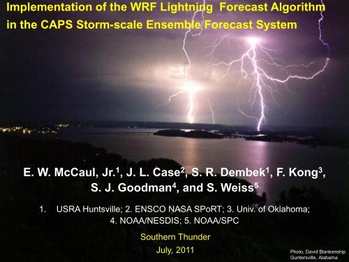
<strong>Implementation</strong> Earth-Sun System Division <strong>of</strong> <strong>the</strong> <strong>WRF</strong> <strong>Lightning</strong> <strong>Forecast</strong> <strong>Algorithm</strong>National Aeronautics and Space Administrationin <strong>the</strong> CAPS Storm-scale Ensemble <strong>Forecast</strong> SystemE. W. McCaul, Jr. 1 , J. L. Case 2 , S. R. Dembek 1 , F. Kong 3 ,S. J. Goodman 4 , and S. Weiss 51. USRA Huntsville; 2. ENSCO NASA SPoRT; 3. Univ. <strong>of</strong> Oklahoma;4. NOAA/NESDIS; 5. NOAA/SPCSou<strong>the</strong>rn ThunderJuly, 20111Photo, David BlankenshipGuntersville, AlabamaSou<strong>the</strong>rn Thunder, Jul 2011
Earth-Sun System DivisionNational Aeronautics and Space AdministrationMotivation: Compare coverage CAPE vs LFA Threat 12Sou<strong>the</strong>rn Thunder, Jul 2011
Earth-Sun System DivisionNational Aeronautics and Space AdministrationLFA ObjectivesGiven LTG link to large ice, and a cloud-scale model like<strong>WRF</strong>, which prognoses hydrometeors, LFA seeks to:1. Create <strong>WRF</strong> forecasts <strong>of</strong> LTG threat (1-36 h), based onsimple proxy fields from explicitly simulated convection2. Construct a calibrated threat that yields accuratequantitative peak flash rate densities for <strong>the</strong> strongeststorms, based on LMA total LTG observations3. Provide robust algorithm for use in making proxy LTGdata, and for potential uses with DA3Sou<strong>the</strong>rn Thunder, Jul 2011
Earth-Sun System DivisionNational Aeronautics and Space Administration<strong>WRF</strong> <strong>Lightning</strong> Threat <strong>Forecast</strong>s:LFA Methodology1. Use high-resolution 2-km <strong>WRF</strong> simulations to prognoseconvection for a diverse series <strong>of</strong> selected case studies2. Evaluate two proxy fields:- graupel fluxes at -15C level (FLX, handles t variations);- vertically integrated ice (VII, handles areal coverage)3. Calibrate <strong>the</strong>se proxies using peak total LTG flash ratedensities from NALMA vs. strongest simulated storms;relationships ~linear; regression line passes through origin4. Truncate low threat values to make threat areal coveragematch NALMA flash extent density obs5. Blend proxies to achieve optimal performance4Sou<strong>the</strong>rn Thunder, Jul 2011
Earth-Sun System DivisionNational Aeronautics and Space AdministrationCalibration CurveThreat 1 (FLX)F 1 = 0.042 FLXF 1 > 0.01Units <strong>of</strong> F 1 arefl/km 2 /5 minr = 0.675Sou<strong>the</strong>rn Thunder, Jul 2011
Earth-Sun System DivisionNational Aeronautics and Space AdministrationCalibration CurveThreat 2 (VII)F 2 = 0.2 VIIF 2 > 0.4Units <strong>of</strong> F 2 arefl/km 2 /5 minr = 0.836Sou<strong>the</strong>rn Thunder, Jul 2011
Earth-Sun System DivisionNational Aeronautics and Space AdministrationLTG Threat Methodology:Advantages• Methods based on LTG physics; should be robustand regime-independent• Can provide quantitative estimates <strong>of</strong> flash rate fields;use <strong>of</strong> thresholds allows for accurate threat arealcoverage• Methods are fast and simple; based on fundamentalmodel output fields; no need for complexelectrification modules7Sou<strong>the</strong>rn Thunder, Jul 2011
Earth-Sun System DivisionNational Aeronautics and Space AdministrationLTG Threat Methodology:Disadvantages• Methods are only as good as <strong>the</strong> numerical modeloutput; models usually do not make storms in <strong>the</strong>right place at <strong>the</strong> right time; saves at 15 minsometimes miss LTG jump peaks• Small number <strong>of</strong> cases, lack <strong>of</strong> extreme LTG eventsmeans uncertainty in calibrations• Calibrations should be redone whenever model ischanged, or error bars acknowledged regardingsensitivities to grid mesh, model microphysics (to beaddressed here and in future)8Sou<strong>the</strong>rn Thunder, Jul 2011
Earth-Sun System DivisionNational Aeronautics and Space Administration<strong>WRF</strong> Configuration (typical)30 March 2002 Case Study• 2-km horizontal grid mesh• 51 vertical sigma levels• Dynamics and physics:– Eulerian mass core– Dudhia SW radiation– RRTM LW radiation– YSU PBL scheme– Noah LSM– WSM 6-class microphysics scheme(graupel; no hail)• 8h forecast initialized at 00 UTC 30March 2002 with AWIP212 NCEP EDASanalysis;• Also used METAR, ACARS, and WSR-88D radial vel at 00 UTC;• Eta 3-h forecasts used for LBC’s9Sou<strong>the</strong>rn Thunder, Jul 2011
Earth-Sun System DivisionNational Aeronautics and Space Administration<strong>WRF</strong> <strong>Lightning</strong> Threat <strong>Forecast</strong>s:Case: 30 March 2002Squall Line plus Isolated Supercell10Sou<strong>the</strong>rn Thunder, Jul 2011
Earth-Sun System DivisionNational Aeronautics and Space AdministrationGround truth: LTG flash extent density + dBZ30 March 2002, 04Z11Sou<strong>the</strong>rn Thunder, Jul 2011
Earth-Sun System DivisionNational Aeronautics and Space Administration<strong>WRF</strong> forecast: Threat 1 (FLX) + 6km dBZ30 March 2002, 04Z12Sou<strong>the</strong>rn Thunder, Jul 2011
Earth-Sun System DivisionNational Aeronautics and Space Administration<strong>WRF</strong> forecast: Threat 2 (VII) + 10 km anvil ice30 March 2002, 04Z13Sou<strong>the</strong>rn Thunder, Jul 2011
Earth-Sun System DivisionNational Aeronautics and Space AdministrationConstruction <strong>of</strong> blended threat:1. Threat 1 and 2 are both calibrated to yield correct peak flashdensities2. The peaks <strong>of</strong> threats 1 and 2 also tend to be coincident in allsimulated storms, but threat 2 covers more area3. Thus, weighted linear combinations <strong>of</strong> <strong>the</strong> 2 threats will alsoyield <strong>the</strong> correct peak flash densities4. To preserve most <strong>of</strong> time variability in threat 1, use largeweight w 15. To preserve areal coverage from threat 2, avoid very smallweight w 26. Tests using 0.95 for w 1 , 0.05 for w 2 , yield satisfactory results14Sou<strong>the</strong>rn Thunder, Jul 2011
Earth-Sun System DivisionNational Aeronautics and Space AdministrationBlended Threat 3 + dBZ: 2002033004Z15Sou<strong>the</strong>rn Thunder, Jul 2011
Earth-Sun System DivisionNational Aeronautics and Space AdministrationGeneral Findings:1. LTG threats 1 and 2 yield reasonable peak flash rates2. LTG threats provide more realistic spatial coverage <strong>of</strong> LTGthan that suggested by coverage <strong>of</strong> positive CAPE, whichoverpredicts threat area, especially in summer- in AL cases, CAPE coverage ~60% at any t, but our LFA,NALMA obs show storm coverage only ~15%- in summer in AL, CAPE coverage almost 100%, but stormtime-integrated coverage only ~10-30%- in frontal cases in AL, CAPE coverage 88-100%, but squallline storm time-integrated coverage is 50-80%3. Blended threat retains proper peak flash rate densities,because constituents are calibrated and coincident4. Blended threat retains temporal variability <strong>of</strong> LTG threat 1,and <strong>of</strong>fers proper areal coverage, thanks to threat 216Sou<strong>the</strong>rn Thunder, Jul 2011
Earth-Sun System DivisionNational Aeronautics and Space AdministrationSample <strong>of</strong> NSSL <strong>WRF</strong> output, 20101130(see www.nssl.noaa.gov/wrf)17Sou<strong>the</strong>rn Thunder, Jul 2011
Earth-Sun System DivisionNational Aeronautics and Space AdministrationNSSL <strong>WRF</strong> data: 24 April 201018Sou<strong>the</strong>rn Thunder, Jul 2011
Earth-Sun System DivisionNational Aeronautics and Space AdministrationNSSL <strong>WRF</strong> data: 25 April 201019Sou<strong>the</strong>rn Thunder, Jul 2011
Earth-Sun System DivisionNational Aeronautics and Space AdministrationNSSL <strong>WRF</strong> output: 17 July 201020Sou<strong>the</strong>rn Thunder, Jul 2011
Earth-Sun System DivisionNational Aeronautics and Space AdministrationScatterplot <strong>of</strong> selected NSSL <strong>WRF</strong> outputfor threats 1, 2 (internal consistency check)Threats 1, 2 should cluster along diagonal; deviationat high flash rates indicates need for recalibration21Sou<strong>the</strong>rn Thunder, Jul 2011
Earth-Sun System DivisionNational Aeronautics and Space AdministrationRecent LFA studies, NSSL <strong>WRF</strong>, all 2010:(examined to test robustness in larger sample <strong>of</strong> model runs)1. Obtained NSSL daily output for full year 2010 for threeregions: HUN, OUN, USA2. HUN region examined (preliminary)3. OUN, USA regions to be examined soon4. 2011 data for <strong>the</strong> three regions to be examined soon5. Preliminary inspection <strong>of</strong> results shows:-frequent spurious activation <strong>of</strong> LFA in wintertime (VII)-occasional divergent Threat 1,2 values in high FRD cases,with Threat 1 always > Threat 2 (should be equal)22Sou<strong>the</strong>rn Thunder, Jul 2011
Earth-Sun System DivisionNational Aeronautics and Space AdministrationRecent LFA studies, NSSL <strong>WRF</strong>, all 2010:(examined to test robustness in larger sample <strong>of</strong> model runs)Preliminary findings for winter wea<strong>the</strong>r1. HUN region examined only (o<strong>the</strong>rs to be examined later)2. First findings, for winter wea<strong>the</strong>r:- LFA produces 895 h (61 d) <strong>of</strong> false alarms, mostly fromThreat 2, in DJFM (121 d); annualized hourly FAR=0.068(0.42 hourly, 0.50 daily FAR in DJFM only)- only 262 h <strong>of</strong> false alarms from Threat 1- no actual winter LTG in HUN in 2010 (but see Jan 2011!)- if require Threat 1>0, could reduce winter FAR hrs by70.7%,winter FAR days by 50.9%; higher Threat 1 threshold couldreduce FAR even more23Sou<strong>the</strong>rn Thunder, Jul 2011
Earth-Sun System DivisionNational Aeronautics and Space AdministrationRecent LFA studies, NSSL <strong>WRF</strong>, all 2010:(examined to test robustness in larger sample <strong>of</strong> model runs)Preliminary findings for convective wea<strong>the</strong>r1. HUN region examined only (o<strong>the</strong>rs to be examined later)2. First findings, for convective wea<strong>the</strong>r in HUN region,regarding general statistical behavior <strong>of</strong> LFA:- <strong>WRF</strong> predicts convection in HUN for all days in JJA 2010- LFA produces only 2 d <strong>of</strong> false alarms in JJA (FAR=0.022)- LFA produces zero false negative (miss) days (POD=1.00)- LFA has 5 false alarm days in May, 3 in September 201024Sou<strong>the</strong>rn Thunder, Jul 2011
Earth-Sun System DivisionNational Aeronautics and Space AdministrationRecent LFA studies, NSSL<strong>WRF</strong>, all 2010:(examined to test robustness in larger sample <strong>of</strong> model runs)Preliminary findings for convective wea<strong>the</strong>r3. O<strong>the</strong>r findings, for convective wea<strong>the</strong>r in HUN region,regarding high FRD (>20 fl/km 2 /5 min) behavior <strong>of</strong> LFA:- LFA produces Threat 1 FRD>20 on 27 days in JJA- Max Threat 1=43.75, max Threat 2=20.44 on 4 Aug 2010- <strong>WRF</strong> forecasts <strong>of</strong> strong storms tend to favor 0-6 h frame,with a weak relative bias beyond 18 h (next day’s storms)- in HUN, high FRD cases occur in summer (weak shear)25Sou<strong>the</strong>rn Thunder, Jul 2011
Earth-Sun System DivisionNational Aeronautics and Space AdministrationEnsemble studies, CAPS cases, 2011:(examined to test robustness under varying grids, physics)1. Will examine CAPS ensemble output for HUN, OUN, andUSA areas soon, as data become available.2. CAPS runs start 16 April 2011, end 10 June 2011.3. Statistics will be accumulated on max, min, mean, SD andmean-normalized SD <strong>of</strong> peak LFA FRD, using each CAPSrun (19 LFA-containing members each day).These statistics will show degree <strong>of</strong> sensitivity <strong>of</strong> LFA outputto model physics changes.4. Additional statistics will be obtained on thresholded envelopes<strong>of</strong> LFA areal coverage, and reliability relative to actual storms(may have to use NLDN to assess this)26Sou<strong>the</strong>rn Thunder, Jul 2011
Earth-Sun System DivisionNational Aeronautics and Space AdministrationFuture Work:1. Examine o<strong>the</strong>r data from 2010, 2011 NSSL and 2011 CAPS<strong>WRF</strong> runs;2. Compile list <strong>of</strong> intense storm cases, and use NALMA, OKLMAdata to recheck calibration curves for nonlinearities, or applychanges to calibration factors; assess threshold needed forthreat 1 (>0) to minimize spurious winter activation <strong>of</strong> LFA3. Assess performance <strong>of</strong> LFA in CAPS 2011 ensembles undervarying model configurations:- o<strong>the</strong>r physics schemes;- o<strong>the</strong>r combinations <strong>of</strong> hydrometeor species;4. Assess LFA for dry summer LTG storms in w USA;5. Examine H<strong>WRF</strong> runs (by o<strong>the</strong>rs) to assess LFA in TCs;27Sou<strong>the</strong>rn Thunder, Jul 2011
Earth-Sun System DivisionNational Aeronautics and Space AdministrationAcknowledgments:This research was first funded by <strong>the</strong> NASA Science MissionDirectorate’s Earth Science Division in support <strong>of</strong> <strong>the</strong> Short-termPrediction and Research Transition (SPoRT) project at MarshallSpace Flight Center, Huntsville, AL, and more recently by <strong>the</strong>NOAA <strong>GOES</strong>-R R3 Program. Thanks to Mark DeMaria, IngridGuch, and also Gary Jedlovec, Rich Blakeslee, and Bill Koshak(NASA), for ongoing support <strong>of</strong> this research. Thanks also toPaul Krehbiel, NMT, Bill Koshak, NASA, Walt Petersen, NASA,for helpful discussions. For published paper, see:McCaul, E. W., Jr., S. J. Goodman, K. LaCasse and D. Cecil, 2009:<strong>Forecast</strong>ing lightning threat using cloud-resolving modelsimulations. Wea. <strong>Forecast</strong>ing, 24, 709-729.28Sou<strong>the</strong>rn Thunder, Jul 2011