Volume 1 - Hillsborough County & City of Tampa Water Atlas
Volume 1 - Hillsborough County & City of Tampa Water Atlas
Volume 1 - Hillsborough County & City of Tampa Water Atlas
- No tags were found...
Create successful ePaper yourself
Turn your PDF publications into a flip-book with our unique Google optimized e-Paper software.
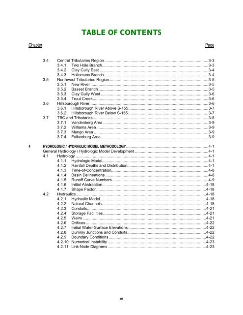
TABLE OF CONTENTSChapter Page3.4 Central Tributaries Region...........................................................................................3-33.4.1 Two Hole Branch.............................................................................................3-33.4.2 Clay Gully East ...............................................................................................3-43.4.3 Hollomans Branch ...........................................................................................3-43.5 Northwest Tributaries Region.......................................................................................3-53.5.1 New River .......................................................................................................3-53.5.2 Basset Branch ................................................................................................3-53.5.3 Clay Gully West ..............................................................................................3-63.5.4 Trout Creek.....................................................................................................3-63.6 <strong>Hillsborough</strong> River........................................................................................................3-63.6.1 <strong>Hillsborough</strong> River Above S-155......................................................................3-73.6.2 <strong>Hillsborough</strong> River Below S-155 ......................................................................3-73.7 TBC and Tributaries.....................................................................................................3-83.7.1 Vandenberg Area ............................................................................................3-93.7.2 Williams Area..................................................................................................3-93.7.3 Mango Area ....................................................................................................3-93.7.4 Falkenburg Area..............................................................................................3-94 HYDROLOGIC / HYDRAULIC MODEL METHODOLOGY........................................................................4-1General Hydrology / Hydrologic Model Development ................................................................4-14.1 Hydrology ....................................................................................................................4-14.1.1 Hydrologic Model.............................................................................................4-14.1.2 Rainfall Depths and Distribution.......................................................................4-14.1.3 Time-<strong>of</strong>-Concentration.....................................................................................4-84.1.4 Basin Delineations ..........................................................................................4-84.1.5 Run<strong>of</strong>f Curve Numbers....................................................................................4-94.1.6 Initial Abstraction...........................................................................................4-184.1.7 Shape Factor ................................................................................................4-184.2 Hydraulics..................................................................................................................4-184.2.1 Hydraulic Model.............................................................................................4-184.2.2 Natural Channels...........................................................................................4-184.2.3 Conduits........................................................................................................4-214.2.4 Storage Facilities..........................................................................................4-214.2.5 Weirs............................................................................................................4-214.2.6 Orifices .........................................................................................................4-224.2.7 Initial <strong>Water</strong> Surface Elevations ....................................................................4-224.2.8 Dummy Junctions and Conduits.....................................................................4-224.2.9 Boundary Conditions .....................................................................................4-224.2.10 Numerical Instability ......................................................................................4-234.2.11 Link-Node Diagrams......................................................................................4-23iii


