City of Grand Island - Net
City of Grand Island - Net
City of Grand Island - Net

Create successful ePaper yourself
Turn your PDF publications into a flip-book with our unique Google optimized e-Paper software.
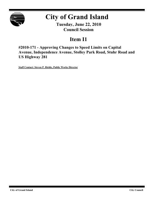
<strong>City</strong> <strong>of</strong> <strong>Grand</strong> <strong>Island</strong>Tuesday, June 22, 2010Council SessionItem I1#2010-171 - Approving Changes to Speed Limits on CapitalAvenue, Independence Avenue, Stolley Park Road, Stuhr Road andUS Highway 281Staff Contact: Steven P. Riehle, Public Works Director<strong>City</strong> <strong>of</strong> <strong>Grand</strong> <strong>Island</strong><strong>City</strong> Council
Council Agenda MemoFrom:Steven P. Riehle, Public Works DirectorMeeting: June 22, 2010Subject:Approving Changes to Speed Limits on Capital Ave,Independence Ave, Stolley Park Rd, Stuhr Rd and USHwy 281Item #’s: I-1Presenter(s):Steven P. Riehle, Public Works DirectorBackgroundNebraska state statute sets speed limits within municipalities as:· 20 mph within the Central Business District· 25 mph on residential streetsSpeed limits on city streets that are set by state statute can be modified by resolution <strong>of</strong>the city council. Modifications to speed limits are to be completed in accordance with theManual <strong>of</strong> Unuform Traffic Control Devices (MUTCD). Guidelines that are used include:A Traffic Engineering Technician gathers speed data using radar and prepares a report <strong>of</strong>:· Bar graph showing speeds observed· Number <strong>of</strong> vehicles observed· Median Speed· Average Speed· 85 th Percentile Speed· 10 mph pace speed· Percentage <strong>of</strong> vehicles in 10 mph paceA preliminary speed limit is selected and then adjusted based on field conditions:· Average test run speed by technicians· Total pavement width· Number <strong>of</strong> Lanes· Lane Width· Width and type <strong>of</strong> median· Parking and rate <strong>of</strong> turnover· Restricted sight distances
· Vehicle turning volumes· Traffic density· Accident history· Driveway and intersection density· Pedestrian activity· Roadside Development· Road and shoulder surface characteristics· Pedestrian and bicycle activity· Speed limits on adjoining roadway segments· Accident experienceDiscussionThe Engineering Division <strong>of</strong> the Public Works Department completed a review <strong>of</strong> speedlimits for the community and is bringing forth recommendations for councilconsideration to make the following changes:1. Capital Ave – The existing speed limit is 35 mph from Carleton Avenue to St Paul Roadand 45 mph from St Paul Road to Sky Park Road. The recommendation is to extend the35 mph east <strong>of</strong> St Paul Road to the NE Central Railroad Tracks (about 1,740 feet east <strong>of</strong>St Paul Road)2. Independence Avenue – The existing speed limit is 35 mph from Capital Avenue to NEHighway 2. The area is developing and filling in with houses. The recommendation is tolower the speed limit to 25 mph, thereby matching statute and eliminating it from thespeed limits listed in the table.3. Stolley Park Road - The existing speed limit is 35 mph from US Highway 281 to LocustStreet and 45 mph from Locust Street to Stuhr Road. The recommendation is to extendthe 35 mph east <strong>of</strong> Locust Street for approximately ½ mile to the Fonner Park / HeartlandEvents Center driveway.4. Stuhr Road – The existing speed limit (adjacent to the Fonner Park complex) is 55 mphfrom the south city limits (just north <strong>of</strong> the Wood River) to Fonner Park Road. Therecommendation is to lower the speed limit to 45 mph.5. US Hwy 281 – As part <strong>of</strong> the US Hwy 281 project from north <strong>of</strong> Interstate 80 to CapitalAvenue, the NDOR is requesting that the speed limit on US Highway 281 be loweredwhere there are 6 inch median curbs. The recommendation is to lower the speed limit onUS Highway 281 from the UPRR/Old Hwy 30 overpass to NE Hwy 2 from 50 mph to 45mph.AlternativesIt appears that the Council has the following alternatives concerning the issue at hand.The Council may:1. Move to approve2. Refer the issue to a Committee3. Postpone the issue to future date4. Take no action on the issue
RecommendationPublic Works Administration recommends that the Council pass a resolution making thespeed limit adjustments recommended by the Engineering Division <strong>of</strong> the Public WorksDepartment.Move to approve speed limit changes.Sample Motion
R E S O L U T I O N 2010-171WHEREAS, the <strong>City</strong> Council, by authority <strong>of</strong> Section 22-51 <strong>of</strong> the <strong>Grand</strong> <strong>Island</strong> <strong>City</strong>Code, may be resolution, establish speed limits upon the streets <strong>of</strong> the <strong>City</strong> <strong>of</strong> <strong>Grand</strong> <strong>Island</strong>.NOW, THEREFORE, BE IT RESOLVED BY THE MAYOR AND COUNCIL OFTHE CITY OF GRAND ISLAND, NEBRASKA, that speed limits within the <strong>City</strong> <strong>of</strong> <strong>Grand</strong> <strong>Island</strong> areestablished as follows:STREET FROM TO LIMITAbbott Road½ mile west <strong>of</strong> Sky Park Road(city limit)Sky Park Road 50Abbott Road Quandt Road Approximately ½ mile east <strong>of</strong>Quandt Road (city limit)50Adams Street Stolley Park Road Anna Street 30Airport Road¼ mile west <strong>of</strong> Sky Park Road(west city limits)Sky Park Road 55Airport Road Shady Bend Road Approximately ½ mile east <strong>of</strong> ShadyBend Road (east city limits)50Anna Street Blaine Street Locust Street 30Bismark Road Vine Street Stuhr Road 30Bismark Road Stuhr Road 400 feet east <strong>of</strong> Stuhr Road (citylimit)45Blaine Street U.S. Highway 34 Stolley Park Road 35Broadwell Avenue Anna Street Prospect Avenue 30Broadwell Avenue Prospect Street Nebraska Highway 2 (city route) 35Broadwell AvenueNebraska Highway 2 (city route) ¼ mile north <strong>of</strong> Roberts Street (northcity limits)45Capital Avenue Engleman Road North Road 35Approved as to Form ¤ ___________June 18, 2010 ¤ <strong>City</strong> Attorney
Capital Avenue North Road Carleton Avenue 45STREET FROM TO LIMITCapital Avenue Carleton Avenue St Paul Road NE Central RailroadTracks (approximately 1,740 feeteast <strong>of</strong> St Paul Road)35Capital AvenueSt. Paul Road NE CentralRailroad Tracks (approximately1,740 feet east <strong>of</strong> St Paul Road)Sky Park Road 45Capital Avenue Sky Park Road ½ mile east <strong>of</strong> Sky Park Road (citylimits)50Cherry Street Bismark Road Sutherland Street 30Concord Street Diers Avenue 370 feet north <strong>of</strong> Diers Avenue 30Custer AvenueOld Lincoln Highway/Old Potash HighwayCapital Avenue 30Diers Avenue Old Potash Highway Capital Avenue 30Eddy Street Fourth Street State Street 30Engleman Road Husker Highway 400 feet north <strong>of</strong> North Lane 45Engleman Road 200 feet south <strong>of</strong> Lariat Lane Capital Avenue 45Engleman Road Capital Avenue 1,000 feet north <strong>of</strong> Michigan Avenue 40Faidley Avenue U.S. Highway 281 Webb Road 35Faidley Avenue Webb Road Custer Avenue 30Fonner Park Road South Locust Street Stuhr Road 35Fourth Street Sycamore Street Plum Street 25Fourth Street Plum Street Beal Street 30- 2 -
Fourth Street Beal Street Taft Street 35Fourth Street Taft Street Seventh Street 45STREET FROM TO LIMITGold Core Road Wildwood Drive Schimmer Drive 40Husker Highway U.S. Highway 30 Schroeder Avenue 50Husker Highway Schroeder Avenue ¼ mile east <strong>of</strong> North Road (citylimits)40Husker Highway Prairieview Street U.S. Highway 281 40IndependenceAvenueCapital Avenue Nebraska Highway 2 35Juergen Road Wildwood Drive Schimmer Drive 30Locust StreetWood River Floodway (southcity limits)U.S. Highway 34 45Locust Street U.S. Highway 34 Stagecoach Road 40Locust Street Stagecoach Road Stolley Park Road 35Locust Street Stolley Park Road Charles Street 30Locust Street Charles Street First Street 25Nebraska Highway2½ mile west <strong>of</strong> IndependenceAvenue (west city limits)1,200 feet west <strong>of</strong> Diers Avenue 55Nebraska Highway21,200 feet west <strong>of</strong> Diers Avenue 100 feet west <strong>of</strong> O’Flannagan Street 50Nebraska Highway2 – <strong>City</strong> Route100 feet west <strong>of</strong> O’FlannaganStreetBroadwell Avenue 50North Road Husker Highway Stolley Park Road 35North Road Old Highway 30 U.S. Highway 30 35- 3 -
North Road U.S. Highway 30 Old Potash Highway 45North Road Old Potash Highway Nebraska Highway 2 40- 4 -
STREET FROM TO LIMITOldHighwayLincolnGarfield Street Broadwell Avenue 30Old Highway 30West intersection with U.S.Highway 30Webb Rod 45Old Highway 30 Webb Road East intersection with U.S. Highway3035OldHighwayPotash540 feet west <strong>of</strong> ArapahoeAvenue (west city limits)Kaufman Avenue 45OldHighwayPotashKaufman Avenue Custer Avenue 35Quandt Road Abbott Road ¼ mile north <strong>of</strong> Abbott Road 50Schimmer Drive½ mile west <strong>of</strong> U.S. Highway281 (west city limits)230 feet east <strong>of</strong> Scheel Road (eastcity limits)40Second Street Webb Road Ada Street 35Seedling Mile Road½ mile west <strong>of</strong> Museum Drive Shady Bend Road 35Seedling Mile RoadShady Bend RoadApproximately ¼ mile east <strong>of</strong> ShadyBend Road (east city limits)45Shady Bend Road Arabian Circle (city limits) Bronco Road (city limits) 45Shady Bend RoadApproximately ½ mile north <strong>of</strong>Bismark Road (city limits)880 feet south <strong>of</strong> Gregory Avenue(city limits)45Shady Bend Road231 feet south <strong>of</strong> GregoryAvenue (city limits)300 feet north <strong>of</strong> Shady Bend Way(city limits)35Shady Bend Road350 feet north <strong>of</strong> U.S. Highway30 (city limits)Union Pacific Railroad Right-<strong>of</strong>-Way(city limits)35Shady Bend Road1,910 feet north <strong>of</strong> CapitalAvenue- 5 -Airport Road 55
Sky Park Road Seventh Street Capital Avenue 45- 6 -
STREET FROM TO LIMITSky Park Road Capital Avenue Twin Star Lane 55Sky Park Road Twin Star Lane Gulf Stream Drive 45Sky Park Road Gulf Stream Drive White Cloud Road 55State Street North Road Ebony Lane 45State Street Ebony Lane U.S. Highway 281 35Stolley Park Road920 feet west <strong>of</strong> Freedom Drive(west city limits)U.S. Highway 30 50Stolley Park Road U.S. Highway 30 North Road 45Stolley Park Road North Road U.S. Highway 281 45Stolley Park Road U.S. Highway 281 Locust Street Fonner Park /Heartland Events Center Entrance(approximately ½ mile east <strong>of</strong> LocustStreet)35Stolley Park Road Locust Street Fonner Park /Heartland Events CenterEntrance (approximately ½ mileeast <strong>of</strong> Locust Street)Stuhr Road 45Stuhr Road270 feet south <strong>of</strong> the northintersection with Stolley ParkRoad (south city limits)Fonner Park Road 5545Stuhr Road Fonner Park Road U.S. Highway 30 35Sycamore Street Fourth Street Capital Avenue 30Thirteenth Street910 feet west <strong>of</strong> Branding IronLane (west city limits)Cedar Ridge Court 45Thirteenth Street Cedar Ridge Court U.S. Highway 281 35- 7 -
U.S. Highway 30 Husker Highway Johnstown Road 55- 8 -
STREET FROM TO LIMITU.S. Highway 30 Johnstown Road East Intersection with Old Highway3045U.S. Highway 30 East Intersection with OldHighway 30Grant Street 35U.S. Highway 30(2 nd Street)U.S. Highway 30(2 nd Street)U.S. Highway 30(eastbound) /Greenwich StreetU.S. Highway 30(1 st Street and 2 ndStreet)U.S. Highway 30(1 ST Street and 2 ndStreet)U.S. Highway 30(1 st Street and 2 ndStreet)Grant Street Broadwell Avenue 35Broadwell Avenue Greenwich Street 30Second Street First Street 30Greenwich Street Eddy Street 30Eddy Street Sycamore Street 25Sycamore Street 1,500 feet west <strong>of</strong> Willow Street 35U.S. Highway 30 1,500 feet west <strong>of</strong> Willow Street 2,500 feet west <strong>of</strong> Shady Bend Road 45U.S. Highway 302,500 feet west <strong>of</strong> Shady BendRoad270 feet west <strong>of</strong> Shady Bend Road(east city limits)50U.S. Highway 34(Husker Highway)U.S. Highway 281 Wortman Drive (city limits) 45U.S. Highway 34(Husker Highway)Wortman Drive (Begin NDORjurisdiction)Blaine Street 50- 9 -
STREET FROM TO LIMITU.S. Highway 34(Husker Highway)Blaine StreetApproximately ½ mile west <strong>of</strong>Locust Street (city limits) (End <strong>of</strong>NDOR jurisdiction)50U.S. Highway 34(Husker Highway)Approximately ½ mile west <strong>of</strong>Locust Street (city limits)Approximately ¼ mile west <strong>of</strong>Locust Street (DeAnn Road)50U.S. Highway 34(Husker Highway)Approximately ¼ mile west <strong>of</strong>Locust Street (DeAnn Road)¼ mile east <strong>of</strong> Locust Street (eastcity limits)45U.S.34/281HighwayMilepost No. 228.91 (1/4 milesouth <strong>of</strong> Wildwood Drive)Milepost No. 231.16 (HuskerHighway)55U.S. Highway 281Milepost No. 67.6 (HuskerHighway)Milepost No. 68.1 (southintersection with Webb Road)55U.S. Highway 281 Milepost No. 68.1 (southintersection with Webb Road)Milepost 68.9 (UPRR and Old Hwy30 Overpass)Milepost No. 72 (NE Highway 2)50U.S. Highway 281Milepost No. 68.9 (UPRR andOld Hwy 30 Overpass)Milepost No. 72 (NE Highway 2) 45Walnut Street Charles Street First Street 30Webb RoadSouth Intersection with U.S.Highway 281Nebraska Highway 2 (city route) 35Webb RoadNebraska Highway 2 – city route 1,410 feet north <strong>of</strong> NebraskaHighway 2 – city route (city limits)40Webb Road900 feet south <strong>of</strong> the northintersection with U.S. Highway281 (city limits)240 feet south <strong>of</strong> the northintersection with U.S. Highway 281(city limits)40White Cloud Road Sky Park Road 2,060 feet east <strong>of</strong> Sky Park Road(city limits)50Wildwood Drive380 feet west <strong>of</strong> Elk Drive (westcity limits)- 10 -610 feet east <strong>of</strong> Gold Core Drive(east city limits)45
- 11 -
OTHER SPEED ZONES:The speed limit for all alleys within the downtown Congested Parking Area as defined in Section 13-17 <strong>of</strong>the <strong>Grand</strong> <strong>Island</strong> <strong>City</strong> Code shall be 10 miles per hour.BE IT FURTHER RESOLVED, that this resolution supercedes any and all otherresolutions establishing or amending speed limits for the <strong>City</strong> <strong>of</strong> <strong>Grand</strong> <strong>Island</strong>.- - -Adopted by the <strong>City</strong> Council <strong>of</strong> the <strong>City</strong> <strong>of</strong> <strong>Grand</strong> <strong>Island</strong>, Nebraska, June 22, 2009.Attest:_______________________________________Margaret Hornady, Mayor_______________________________________RaNae Edwards, <strong>City</strong> Clerk- 12 -