Aerodrome Information - VFR Aerodromes and Heliports
Aerodrome Information - VFR Aerodromes and Heliports
Aerodrome Information - VFR Aerodromes and Heliports
- No tags were found...

You also want an ePaper? Increase the reach of your titles
YUMPU automatically turns print PDFs into web optimized ePapers that Google loves.
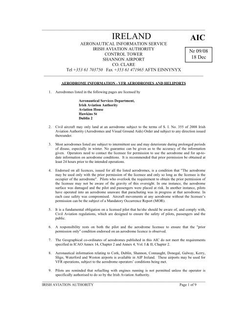
_______________________________________________________________________________________IRELAND AICAERONAUTICAL INFORMATION SERVICEIRISH AVIATION AUTHORITYNr 09/08CONTROL TOWERSHANNON AIRPORT18 DecCO. CLARETel +353 61 703750 Fax +353 61 471965 AFTN EINNYNYX_____________________________________________________________________________________AERODROME INFORMATION - <strong>VFR</strong> AERODROMES AND HELIPORTS1. <strong>Aerodrome</strong>s listed in the following pages are licensed byAeronautical Services Department,Irish Aviation AuthorityAviation HouseHawkins StDublin 22. Civil aircraft may only l<strong>and</strong> at an aerodrome subject to the terms of S. I. No. 355 of 2008 IrishAviation Authority (<strong>Aerodrome</strong>s <strong>and</strong> Visual Ground Aids) Order <strong>and</strong> subject to any direction issuedthereunder.3. Most aerodromes listed are subject to intermittent use <strong>and</strong> may deteriorate during prolonged periodsof disuse, especially in winter. No guarantee can be given as to the accuracy of the informationgiven. Operators need to contact the licensee for permission to use the aerodrome <strong>and</strong> for up-todateinformation on aerodrome conditions. It is recommended that prior permission be obtained atleast 24 hours prior to the intended operations.4. Endorsed on all licences, issued for all the listed aerodromes, is a condition that "The aerodromemay be used only with the prior permission of the licensee <strong>and</strong> only so long as the licensee is theoccupier of the aerodrome". Pilots who overlook the requirement to obtain the prior permission ofthe licensee may not be aware of the gravity of this oversight. In one instance, the aerodromesurface was damaged <strong>and</strong> the pilot <strong>and</strong> passengers were placed at risk. In another instance, pilotshave operated into an aerodrome unaware that parachuting was in progress at that aerodrome. Ineach case safety was compromised. Aircraft movements at any aerodrome without the licensee’spermission can be the subject of a M<strong>and</strong>atory Occurrence Report (MOR).5. It is a fundamental obligation on a licensed pilot that he/she should be aware of, <strong>and</strong> comply with,Civil Aviation regulations, which are designed to ensure the safety of pilots, passengers <strong>and</strong> thepublic.6. A responsibility rests on both the pilot <strong>and</strong> the aerodrome licensee to ensure that the "priorpermission only" condition endorsed on an aerodrome licence is observed.7. The Geographical co-ordinates of aerodromes published in this AIC do not meet the requirementsspecified in ICAO Annex 14, Chapter 2 <strong>and</strong> Annex 4, Vol. I & II, Chapter 2.8. Aeronautical information relating to Cork, Dublin, Shannon, Connaught, Donegal, Galway, Kerry,Sligo, Waterford <strong>and</strong> Weston airports is available in AIP Irel<strong>and</strong>. These airports may be used for<strong>VFR</strong> operations, subject to the aerodrome operators’ conditions being met.9. Pilots are reminded that refuelling with engines running is not permitted unless the operator isspecifically authorised to do so by the Irish Aviation Authority._______________________________________________________________________________________IRISH AVIATION AUTHORITY Page 1 of 9
_______________________________________________________________________________________<strong>Aerodrome</strong> Location <strong>and</strong> Elevation Licensee:Abbeyshrule, Co. LongfordEIAB53 35 29N07 38 34W12NM WNW of Mullingar195ftLongford Aviation Ltd,Abbeyshrule,Co. Longford.Tel: 044 9357424044 9357468Fax : 044 9357742L<strong>and</strong>ing Area Facilities Ground ServicesRunway 10/28 Lighting Nil Fuel Avgas 100 LLDimensions 620m x 18m Radio 122.6 MHz Hangar YesSurface Bituminous Customs NilREMARKS:Prior Permission Required.<strong>Aerodrome</strong> Location <strong>and</strong> Elevation Licensee:Aerphort Chonamara, Co. GalwayEICA53 13 50N09 28 04W15 NM West of Galway City70 ftGalway Aviation Services Ltd.Caislean,Inverin,Co. Galway.Tel: 091 593034Fax: 091 593238L<strong>and</strong>ing Area Facilities Ground ServicesRunway 05/23 Lighting Nil Fuel Avgas 100LLDimensions 600m x 18m Radio123.0 MHz Hangar YesSurface BituminousCustoms NilREMARKS:Prior Permission Required.Airport is CLOSED outside of the times of Aer Arann Isl<strong>and</strong>s Operations.L<strong>and</strong>ing <strong>and</strong> Takeoff prohibited if unable to establish radio contact on 123.00 MHz.Intense commercial operations serving the Aran Isl<strong>and</strong>s.<strong>Aerodrome</strong> Location <strong>and</strong> Elevation Licensee:Athboy, Co. MeathEIMH53 38 16N06 52 43W2NM NE of Athboy230 ftMr. Bernard CullenBallyboy HouseAthboyCo. Meath046 9430185087 2563070L<strong>and</strong>ing Area Facilities Ground ServicesRunway 11/29 Lighting Nil Fuel Jet A-1Avgas 100LLDimensions 400m x 18m Radio 118.55 MHz Hangar YesSurface Grass Customs NilREMARKS:Prior Permission Required._______________________________________________________________________________________IRISH AVIATION AUTHORITY Page 2 of 9
_______________________________________________________________________________________<strong>Aerodrome</strong> Location <strong>and</strong> Elevation Licensee:Bantry, Co. CorkEIBN51 40 08N09 29 04W1.5NM WSW of Bantry7 ftROWA Pharmaceuticals Ltd,BantryCo. Cork.Tel: 027 50077Fax 027 50417L<strong>and</strong>ing Area Facilities Ground ServicesRunway 07/25 Lighting Nil Fuel NilDimensions 390m x 15m Radio 122.4 MHz Hangar NilSurface Bituminous Customs NilREMARKS:-Caution:Prior Permission Required.All circuits must be conducted to NW of strip.Possible low-level turbulence with SE wind.Approaches are over the sea <strong>and</strong> terminate in stony beaches adjacent to the strip.<strong>Aerodrome</strong> Location <strong>and</strong> Elevation Licensee:Belmullet, Co. MayoEIBT54 13 22N10 01 51W2 NM West of Belmullet150ftComhar Iorrrais TeoBelmulletCo MayoTel: 097 81109Fax: 097 82303Mob: 086 2210525L<strong>and</strong>ing Area Facilities Ground ServicesRunway 07/25 Lighting Nil Fuel NilDimensions 450m x 18m Radio 123.6 MHz Hangar NilSurface Grass Customs NilREMARKS:Prior Permission Required.<strong>Aerodrome</strong> Location <strong>and</strong> Elevation Licensee:Birr, Co. OffalyEIBR53 04 15N07 53 55W1 NM South of Birr250 ftOrmond Flying Club Ltd.Montevideo Road,RoscreaCo. Tipperary057 9121300L<strong>and</strong>ing Area Facilities Ground ServicesRunway 18/36 Lighting Nil Fuel Avgas 100LLDimensions 570m x 18m Radio 122.95 MHz Hangar NilSurface Grass Customs NilREMARKS:Prior Permission Required._______________________________________________________________________________________IRISH AVIATION AUTHORITY Page 3 of 9
_______________________________________________________________________________________<strong>Aerodrome</strong> Location <strong>and</strong> Elevation Licensee:Clonbullogue, Co. OffalyEICL53 14 59N07 07 24W6NM South of Edenderry240 ftIrish Parachute Club Ltd.,The Airfield,Clonbullogue,Edenderry,Co. Offaly.1850 260 600fax 046 9730204email : info@skydive.ieL<strong>and</strong>ing Area Facilities Ground ServicesRunway 09/27 Lighting Nil Fuel Avgas 100LLJet A-1Dimensions 770 x 18m Radio 128.55MHz Hangar NilSurface Bituminous Customs On RequestREMARKS:WARNING:Caution:Prior Permission Required.Intensive parachuting activity mostly at weekends <strong>and</strong> on Public holidays.Significant numbers of trees penetrate the Approach <strong>and</strong> Transitional surfaces, inparticular the 09 approach.<strong>Aerodrome</strong> Location <strong>and</strong> Elevation Licensee:Coonagh, Co. LimerickEICN52 39 59N08 40 55W2NM West of Limerick6 ftMr. D. LehanePortdrine,CratloeCo. Clare061 357126061 326600085 1382386L<strong>and</strong>ing Area Facilities Ground ServicesRunway 10/28 Lighting Nil Fuel MogasDimensions 416m x 9m Radio 129.9 MHz Hangar YesSurface Bituminous Customs 48 HR Pn(outwards only)REMARKS:-Notes:Prior Permission Required.i. Only experienced, fully licensed pilots with recent currency in light aircraft shortfield techniques will be granted permission to use the airfield.ii. Prior to use, pilots intending to use Coonagh aerodrome should seek a localbriefing from a flying club instructor through www.limerickflyingclub.comiii. Movement of aircraft confined to runway <strong>and</strong> taxiway.iv. Caution : Narrow runway width may give the illusion of longer runway length<strong>and</strong> the runway may appear further away then it really is.v. Obstacles penetrating the 28 <strong>and</strong> 10 approaches <strong>and</strong> the transitional surfaces forRunway 10/28, including a mobile object on the road.vi. Short field operations are the norm.vii. All circuits should be flown to the south of the Shannon River at 800 ft avoidingbuilt up areas. Pilots are reminded of the proximity of the P9 <strong>and</strong> the ShannonControl Zone._______________________________________________________________________________________IRISH AVIATION AUTHORITY Page 4 of 9
_______________________________________________________________________________________<strong>Aerodrome</strong>Erinagh, Capperoe,Co. TipperaryEIERLocation <strong>and</strong> Elevation52 48 45N08 16 56W4NM SW of Nenagh155ftLicensee:Tipperary Aviation Ltd.Kilmore,Nenagh,Co. TipperaryTim Hanly087 234602201 2454122L<strong>and</strong>ing Area Facilities Ground ServicesRunway 06/24 Lighting Nil Fuel Avgas 100 LLDimensions 600m x 18m Radio 118.175 MHz Hangar YesSurface Grass Customs NilREMARKS:WARNING:Prior Permission Required.Intensive parachuting activity mostly at weekends <strong>and</strong> on Public holidays<strong>Aerodrome</strong> Location <strong>and</strong> Elevation Licensee:Inisheer (Aran Isl<strong>and</strong>s)EIIR53 03 31N09 30 22WEasterly Isl<strong>and</strong> of Aran Group.42ftComhar Caomhan TeorantaInisheer,Aran Isl<strong>and</strong>s,Co. Galway.Tel: 099 75008099 75039Fax: 099 75071L<strong>and</strong>ing Area Facilities Ground ServicesRunway 13/31 Lighting Emergency use only. FuelNilRWY Edge, THR ENDABN (flashing), OBSTAPAPI RWY 13 – 3.5°,MEHT 4mAPAPI RWY 31 – 3.5°,MEHT 5mDimensions 520m x 18m Radio 123.00 MHz Hangar NilSurface Bituminous Customs NilREMARKS:Caution:Prior Permission Required.Limited aircraft parking do not obstruct the intense commercial operations serving theisl<strong>and</strong>.Possible low level turbulence with Southerly winds._______________________________________________________________________________________IRISH AVIATION AUTHORITY Page 5 of 9
_______________________________________________________________________________________<strong>Aerodrome</strong> Location <strong>and</strong> Elevation Licensee:Inishmaan (Aran Isl<strong>and</strong>s)EIMN53 05 31N09 34 12WMiddle Isl<strong>and</strong> of Aran Group13ftComharchumann Inis MeáinInis Meáin, Aran Isl<strong>and</strong>s, CoGalwayTel 099 73010Fax 099 73052L<strong>and</strong>ing Area Facilities Ground ServicesRunway 15/33 (1)05/23 (2)LightingFuel NilDimensions 546m x 20m(1)265m x 20 m(2)Surface Bituminous (1)Grass (2)(1)Emergency use only.RWY EDGE, THR,END,ABN (Flashing)White/GreenOBST.APAPI RWY 15-3.5°,MEHT 4mAPAPI RWY 33-3.5°,MEHT 5m(2) NilRadio 123.00MHz Hangar NilCustomsNilREMARKS:-Caution:Prior Permission Required.Possible downdraughts <strong>and</strong> turbulence with S <strong>and</strong> NE winds.Dunes are obstacles at Eastern end of runway.Intense commercial operations serving the isl<strong>and</strong>.Exercise caution when using 05/23<strong>Aerodrome</strong> Location <strong>and</strong> Elevation Licensee:Inshmore (Aran Isl<strong>and</strong>s)EIIM53 06 25N09 39 14W1NM SE OF Kilronan on largest isl<strong>and</strong>of Aran Group24ftÚdarás na GaeltachtaNa Forbacha,Co. GalwayTel: 099 61109099 61131Fax:099 61300L<strong>and</strong>ing Area Facilities Ground ServicesRunway 14/32 Lighting Emergency use only RWYEDGE, THR, END, ABN(Flashing ), OBSTAPAPI RWY 32-3.5°MEHT 4mAPAPI RWY 14-4°,MEHT 4MDimensions 490m x 18m Radio 123.00MHz Hangar NILSurface Bituminous Customs NILFuelNILREMARKS: -Caution:Prior Permission Required.Intense commercial operations serving the isl<strong>and</strong>Possibility of sharp low-level turbulence in strong SW wind._______________________________________________________________________________________IRISH AVIATION AUTHORITY Page 6 of 9
_______________________________________________________________________________________<strong>Aerodrome</strong> Location <strong>and</strong> Elevation Licensee:KilkennyEIKK52 39 03N07 17 46W1.5NM West of Kilkenny300 ftMr P. NolanKilkenny Airport Co. Ltd.College Road,Kilkenny.Tel: 056 772 1427087 2411955L<strong>and</strong>ing Area Facilities Ground ServicesRunway 09/27 Lighting Nil Fuel NilDimensions 930m x 23m Radio 122.9 MHzHangar Limited130.4 MHz (Gliders)Surface Grass Customs 24 HR PNREMARKS:Prior Permission Required.<strong>Aerodrome</strong> Location <strong>and</strong> Elevation Licensee:Kilrush, Co. KildareEIKH53 03 49N06 51 19WKilrush, Narraghmore, Co Kildare303ftMr Ian Valentine,Moygashel,Dungannon,Co Tyrone.Tel059 86366130044 7802 357957 (mobile)L<strong>and</strong>ing Area Facilities Ground ServicesRunway 11/29 (1)01/19 (2)Lighting Nil Fuel Avgas 100LLJet A-1Dimensions 550m x 18m(1) Radio 123.425 MHz Hangar Yes606m x 10m(2)Surface Grass Customs NilREMARKS:CautionPrior Permission Required.Trees penetrate the 29 Approach <strong>and</strong> the Western 01/19 Transitional Surfaces.Power Cables on the 19 approach.<strong>Aerodrome</strong> Location <strong>and</strong> Elevation Licensee:Newcastle, Co. WicklowEINC53 04 16N06 02 44WNewcastle, Co Wicklow.1ftMr. John NugentNewcastle <strong>Aerodrome</strong>Sea RoadNewcastleCo. Wicklow086 2394417L<strong>and</strong>ing Area Facilities Ground ServicesRunway 18/36 Lighting Nil Fuel NilDimensions 690m x 18 m Radio 122.55 MHz Hangar YesSurface Grass Customs NilREMARKS:Prior Permission Required._______________________________________________________________________________________IRISH AVIATION AUTHORITY Page 7 of 9
_______________________________________________________________________________________<strong>Aerodrome</strong> Location <strong>and</strong> Elevation Licensee:Rathcoole, Co. CorkEIRT52 06 20N08 59 00W13NM West of Mallow281 ftRathcool Flying Club,Rathcoole,Mallow,Co. Cork.086 8189400 (Mr. Dennis Crowley)L<strong>and</strong>ing Area Facilities Ground ServicesRunway 09/27 Lighting Nil Fuel NilDimensions 450m x 18m Radio Nil Hangar YesSurface Grass Customs NilREMARKS:Prior Permission Required.<strong>Aerodrome</strong> Location <strong>and</strong> Elevation LicenseeTrevet, Co. MeathEITT53 32 37N06 31 55W2 NM N of Dunshaughlin385 ftMr Chris Rooney,Trevet <strong>Aerodrome</strong>Trevet FarmDunshaughlinCo. Meath087 2586816L<strong>and</strong>ing Area Facilities Ground ServicesRunway 04/22 Lighting Nil Fuel Avgas 100 LLDimensions 650m x 18m Radio 118.275 MHz Hangar LimitedSurface Grass Customs NilREMARKS:Caution:Prior Permission Required.Proximity of Dublin Control Zone.<strong>Aerodrome</strong> Location <strong>and</strong> Elevation LicenseeTrim, Co. MeathEITM53 34 30N06 44 19W2 NM NE of Trim200 ftMr. P. Murphy,Dunganny,Trim,Co. Meath046 9436489046 9431318L<strong>and</strong>ing Area Facilities Ground ServicesRunway 10/28 Lighting Nil Fuel Avgas 100LLDimensions 560m x 12m Radio 123.3 MHz Hangar NilSurface Grass Customs NilREMARKS:Caution:Prior Permission Required.Approach <strong>and</strong> Transitional surfaces penetrated by several trees._______________________________________________________________________________________IRISH AVIATION AUTHORITY Page 8 of 9
_______________________________________________________________________________________PRIVATE LICENSED HELIPORTSHeliport Location <strong>and</strong> Elevation LicenseeMidl<strong>and</strong> Heliport,BallinakillPortlaoiseCo. LaoisEIIH52 53 32N07 15 46W3 NM East-South-East ofAbbeyleix.614ftMr. Brian BrennanMidl<strong>and</strong> HeliportAughnacrossBallinakillPortlaoiseCo. Laois057 8733047087 2619151L<strong>and</strong>ing Area Facilities Ground ServicesFATO 18/36 Lighting Nil Fuel NilDimensions 400m x 20m Radio 131.9 MHz Hangar NilSurface Grass Customs NilREMARKS:Prior Permission Required.Caution: The surface of the FATO is not suitable for fixed wing operations.The site is for helicopter operations only.AIC To be cancelled – AIC 02/08-000-_______________________________________________________________________________________IRISH AVIATION AUTHORITY Page 9 of 9