BiZQ - SBF Download Area - Singapore Business Federation
BiZQ - SBF Download Area - Singapore Business Federation
BiZQ - SBF Download Area - Singapore Business Federation

Create successful ePaper yourself
Turn your PDF publications into a flip-book with our unique Google optimized e-Paper software.
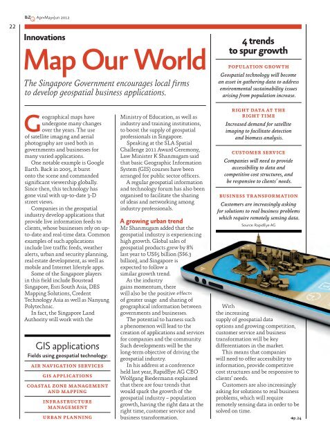
22Apr•May•Jun 2012InnovationsMap Our WorldThe <strong>Singapore</strong> Government encourages local firmsto develop geospatial business applications.4 trendsto spur growthPOPULATION GROWTHGeospatial technology will becomean asset in gathering data to addressenvironmental sustainability issuesarising from population increase.Geographical maps haveundergone many changesover the years. The useof satellite imaging and aerialphotography are used both ingovernments and businesses formany varied applications.One notable example is GoogleEarth. Back in 2005, it burstonto the scene and commandedsignificant viewership globally.Since then, this technology hasgone viral with up-to-date 3-Dstreet views.Companies in the geospatialindustry develop applications thatprovide live information feeds toclients, whose businesses rely on upto-dateand real-time data. Commonexamples of such applicationsinclude live traffic feeds, weatheralerts, urban and security planning,real estate development, as well asmobile and Internet lifestyle apps.Some of the <strong>Singapore</strong> playersin this field include Boustead<strong>Singapore</strong>, Esri South Asia, DESMapping Solutions, CredentTechnology Asia as well as NanyangPolytechnic.In fact, the <strong>Singapore</strong> LandAuthority will work with theGIS applicationsFields using geospatial technology:AIR NAVIGATION SERVICESGIS APPLICATIONSCOASTAL ZONE MANAGEMENTAND MAPPINGINFRASTRUCTUREMANAGEMENTURBAN PLANNINGMinistry of Education, as well asindustry and training institutions,to boost the supply of geospatialprofessionals in <strong>Singapore</strong>.Speaking at the SLA SpatialChallenge 2011 Award Ceremony,Law Minister K Shanmugam saidthat basic Geographic InformationSystem (GIS) courses have beenarranged for public sector officers.A regular geospatial informationand technology forum has also beenorganised to facilitate the sharingof ideas and networking amongindustry professionals.A growing urban trendMr Shanmugam added that thegeospatial industry is experiencinghigh growth. Global sales ofgeospatial products grew by 8%last year to US$5 billion (S$6.3billion), and <strong>Singapore</strong> isexpected to follow asimilar growth trend.As the industrygains momentum, therewill also be the positive effectsof greater usage and sharing ofgeographical information betweengovernments and businesses.The potential to harness sucha phenomenon will lead to thecreation of applications and servicesfor companies and the community.Such developments will be thelong-term objective of driving thegeospatial industry.In his address at a conferenceheld last year, RapidEye AG CEOWolfgang Biedermann explainedthat there are four trends thatwould spark the growth of thegeospatial industry – populationgrowth, having the right data at theright time, customer service andbusiness transformation.RIGHT DATA AT THERIGHT TIMEIncreased demand for satelliteimaging to facilitate detectionand biomass analysis.CUSTOMER SERVICECompanies will need to provideaccessibility to data andcompetitive cost structures, andbe responsive to clients’ needs.BUSINESS TRANSFORMATIONCustomers are increasingly askingfor solutions to real business problemswhich require remotely sensing data.Source: RapidEye AGWiththe increasingsupply of geospatial dataoptions and growing competition,customer service and businesstransformation will be keydifferentiators in the market.This means that companieswill need to offer accessibility toinformation, provide competitivecost structures and be responsive toclients’ needs.Customers are also increasinglyasking for solutions to real businessproblems, which will requireremotely sensing data in order to besolved on time.p.24