Myths and Mysteries of the - Australian History Mysteries
Myths and Mysteries of the - Australian History Mysteries
Myths and Mysteries of the - Australian History Mysteries
You also want an ePaper? Increase the reach of your titles
YUMPU automatically turns print PDFs into web optimized ePapers that Google loves.
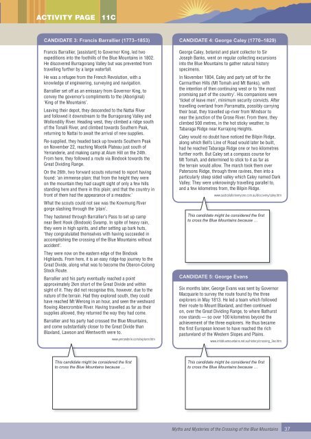
Activity page11CC<strong>and</strong>idate 3: Francis Barrallier (1773–1853)Francis Barrallier, [assistant] to Governor King, led twoexpeditions into <strong>the</strong> foothills <strong>of</strong> <strong>the</strong> Blue Mountains in 1802.He discovered Burragorang Valley but was prevented fromtravelling fur<strong>the</strong>r by a large waterfall.He was a refugee from <strong>the</strong> French Revolution, with aknowledge <strong>of</strong> engineering, surveying <strong>and</strong> navigation.Barrallier set <strong>of</strong>f as an emissary from Governor King, toconvey <strong>the</strong> governor’s compliments to <strong>the</strong> (Aboriginal)‘King <strong>of</strong> <strong>the</strong> Mountains’.Leaving <strong>the</strong>ir depot, <strong>the</strong>y descended to <strong>the</strong> Nattai River<strong>and</strong> followed it downstream to <strong>the</strong> Burragorang Valley <strong>and</strong>Wollondilly River. Heading west, <strong>the</strong>y climbed a ridge south<strong>of</strong> <strong>the</strong> Tonalli River, <strong>and</strong> climbed towards Sou<strong>the</strong>rn Peak,returning to Nattai to await <strong>the</strong> arrival <strong>of</strong> new supplies.Re-supplied, <strong>the</strong>y headed back up towards Sou<strong>the</strong>rn Peakon November 22, reaching Mootik Plateau just south <strong>of</strong>Yerr<strong>and</strong>erie, <strong>and</strong> making camp at Alum Hill on <strong>the</strong> 24th.From here, <strong>the</strong>y followed a route via Bindook towards <strong>the</strong>Great Dividing Range.On <strong>the</strong> 26th, two forward scouts returned to report havingfound: ‘an immense plain; that from <strong>the</strong> height <strong>the</strong>y wereon <strong>the</strong> mountain <strong>the</strong>y had caught sight <strong>of</strong> only a few hillsst<strong>and</strong>ing here <strong>and</strong> <strong>the</strong>re in this plain; <strong>and</strong> that <strong>the</strong> country infront <strong>of</strong> <strong>the</strong>m had <strong>the</strong> appearance <strong>of</strong> a meadow.’What <strong>the</strong> scouts could not see was <strong>the</strong> Kowmung Rivergorge slashing through <strong>the</strong> ‘plain’.They hastened through Barrallier’s Pass to set up campnear Bent Hook (Bindook) Swamp. In spite <strong>of</strong> heavy rain,<strong>the</strong>y were in high spirits, <strong>and</strong> after setting up bark huts,‘<strong>the</strong>y congratulated <strong>the</strong>mselves with having succeeded inaccomplishing <strong>the</strong> crossing <strong>of</strong> <strong>the</strong> Blue Mountains withoutaccident’.They were now on <strong>the</strong> eastern edge <strong>of</strong> <strong>the</strong> BindookHighl<strong>and</strong>s. From here, it is an easy ridge-top journey to <strong>the</strong>Great Divide, along what was to become <strong>the</strong> Oberon-ColongStock Route.Barrallier <strong>and</strong> his party eventually reached a pointapproximately 2km short <strong>of</strong> <strong>the</strong> Great Divide <strong>and</strong> withinsight <strong>of</strong> it. They did not recognise this, however, due to <strong>the</strong>nature <strong>of</strong> <strong>the</strong> terrain. Had <strong>the</strong>y explored south, <strong>the</strong>y couldhave reached Mt Werong in an hour, <strong>and</strong> seen <strong>the</strong> westwardflowing Abercrombie River. Having travelled as far as <strong>the</strong>irsupplies allowed, <strong>the</strong>y returned <strong>the</strong> way <strong>the</strong>y had come.Barrallier <strong>and</strong> his party had crossed <strong>the</strong> Blue Mountains,<strong>and</strong> come substantially closer to <strong>the</strong> Great Divide thanBlaxl<strong>and</strong>, Lawson <strong>and</strong> Wentworth were to.www.yerr<strong>and</strong>erie.com/explorer.htmC<strong>and</strong>idate 4: George Caley (1770–1829)George Caley, botanist <strong>and</strong> plant collector to SirJoseph Banks, went on regular collecting excursionsinto <strong>the</strong> Blue Mountains to ga<strong>the</strong>r natural historyspecimens.In November 1804, Caley <strong>and</strong> party set <strong>of</strong>f for <strong>the</strong>Carmar<strong>the</strong>n Hills (Mt Tomah <strong>and</strong> Mt Banks), with<strong>the</strong> intention <strong>of</strong> <strong>the</strong>n continuing west or to ‘<strong>the</strong> mostpromising part <strong>of</strong> <strong>the</strong> country’. His companions were‘ticket <strong>of</strong> leave men’, minimum security convicts. Aftertravelling overl<strong>and</strong> from Parramatta, possibly carrying<strong>the</strong>ir boat, <strong>the</strong>y travelled up-river from Windsor tonear <strong>the</strong> junction <strong>of</strong> <strong>the</strong> Grose River. From <strong>the</strong>re, <strong>the</strong>yclimbed 500 metres, in <strong>the</strong> hot sticky wea<strong>the</strong>r, toTabaraga Ridge near Kurrajong Heights.Caley would no doubt have noticed <strong>the</strong> Bilpin Ridge,along which Bell’s Line <strong>of</strong> Road would later be built,had he reached Tabaraga Ridge one or two kilometresfur<strong>the</strong>r north. But Caley set a compass course forMt Tomah, <strong>and</strong> determined to stick to it as far as<strong>the</strong> terrain would allow. The march took <strong>the</strong>m overPatersons Ridge, through three ravines, <strong>the</strong>n into aparticularly steep sided valley which Caley named DarkValley. They were unknowingly travelling parallel to,<strong>and</strong> a few kilometres from, <strong>the</strong> Bilpin Ridge.www.australiaforeveryone.com.au/discovery/caley.htmThis c<strong>and</strong>idate might be considered <strong>the</strong> firstto cross <strong>the</strong> Blue Mountains because …C<strong>and</strong>idate 5: George EvansSix months later, George Evans was sent by GovernorMacquarie to survey <strong>the</strong> route found by <strong>the</strong> threeexplorers in May 1813. He led a team which followed<strong>the</strong>ir route to Mount Blaxl<strong>and</strong>, <strong>and</strong> <strong>the</strong>n continuedon, over <strong>the</strong> Great Dividing Range, to where Bathurstnow st<strong>and</strong>s — so over 100 kilometres beyond <strong>the</strong>achievement <strong>of</strong> <strong>the</strong> three explorers. He thus became<strong>the</strong> first European known to have reached <strong>the</strong> richpasturel<strong>and</strong> <strong>of</strong> <strong>the</strong> Western Slopes <strong>and</strong> Plains.www.infobluemountains.net.au/history/crossing_3ex.htmThis c<strong>and</strong>idate might be considered <strong>the</strong> firstto cross <strong>the</strong> Blue Mountains because …This c<strong>and</strong>idate might be considered <strong>the</strong> firstto cross <strong>the</strong> Blue Mountains because …<strong>Myths</strong> <strong>and</strong> <strong>Mysteries</strong> <strong>of</strong> <strong>the</strong> Crossing <strong>of</strong> <strong>the</strong> Blue Mountains37


