Download Teacher Guide & Print Resources - Australian History ...
Download Teacher Guide & Print Resources - Australian History ...
Download Teacher Guide & Print Resources - Australian History ...

You also want an ePaper? Increase the reach of your titles
YUMPU automatically turns print PDFs into web optimized ePapers that Google loves.
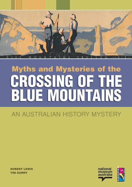
Myths and Mysteries of the<br />
Crossing of the<br />
Blue Mountains<br />
An <strong>Australian</strong> <strong>History</strong> Mystery<br />
Robert Lewis<br />
Tim Gurry
ISBN 978-0-949380-75-3<br />
© 2012 National Museum of Australia and Ryebuck Media Pty Ltd<br />
Written by Robert Lewis, Tim Gurry<br />
Cover art: NH Roughley, Blue Mountains Crossed 1813,191-?, National Library of Australia<br />
National Museum of Australia<br />
Education Section<br />
GPO Box 1901<br />
Canberra ACT 2601<br />
Phone (02) 6208 5239<br />
Fax (02) 6208 5198<br />
Email education@nma.gov.au<br />
Website www.nma.gov.au/education<br />
Ryebuck Media Pty Ltd<br />
31 Station Street Malvern<br />
Victoria 3144<br />
Phone (03) 9500 2399<br />
Fax (03) 9500 2388<br />
Email ryebuck@ryebuck.com.au<br />
Website www.ryebuck.com.au<br />
Designed by Polar Design, Melbourne, Victoria<br />
<strong>Print</strong>ed by Trojan <strong>Print</strong>, Melbourne, Victoria<br />
All efforts have been made to find copyright ownership of materials used in this publication.<br />
Any contraventions are accidental and will be redressed. For any copyright matters please<br />
contact Ryebuck Media Pty Ltd.<br />
<strong>Teacher</strong>s are permitted to duplicate any pages in this publication for educational purposes in<br />
their classrooms.<br />
For any other purposes contact Ryebuck Media Pty Ltd.
Contents<br />
<strong>Teacher</strong>’s guide to using this resource 4<br />
Student activities 8<br />
Inquiries Activity pages Page<br />
Prepare to explore! 1–3 8<br />
A ‘virtual visit’ to the Blue Mountains 4A–4B 13<br />
Investigations<br />
1<br />
What are the Blue Mountains? 5A–5C 15<br />
2<br />
How were the Blue Mountains formed? 6A–6C 18<br />
3<br />
Why did explorers want to cross the Blue Mountains? 7A–7C 21<br />
4<br />
Who actually crossed the Blue Mountains? 8A–8E 24<br />
5<br />
How did the explorers achieve their crossing in 1813? 9A–9D 29<br />
6<br />
What was their journey like? 10A–10B 33<br />
Were Blaxland, Lawson and Wentworth really the<br />
7 first to cross the Blue Mountains?<br />
11A–11E 35<br />
8<br />
What impacts did the crossing have? 12A–12C 40<br />
9<br />
How is the crossing of the Blue Mountains<br />
represented in the National Museum of Australia?<br />
13A–13C 43<br />
Conclusion and reflection: What does the crossing of<br />
the Blue Mountains tell us about <strong>Australian</strong> history?<br />
14 46
Myths and Mysteries of the Crossing of the Blue Mountains<br />
<strong>Teacher</strong>’s guide<br />
Myths and Mysteries of the Crossing of the Blue Mountains education resource<br />
Myths and Mysteries of the Crossing of the Blue Mountains is a multimedia education resource to help middle<br />
secondary students explore an aspect of Australia’s early colonial history: the crossing of the Blue Mountains<br />
in 1813.<br />
It is part of the <strong>Australian</strong> <strong>History</strong> Mystery series at www.australianhistorymysteries.info/.<br />
It comprises:<br />
> A 20-minute ‘virtual visit’ film, taking students to key places associated with the event, outlining the key<br />
issues associated with the event, and presenting some of the evidence that they need to use to develop<br />
their own conclusions<br />
> A 48-page set of practical and evidence-based activity pages, for photocopying, which can be used in<br />
the classroom<br />
> A decision-maker interactive activity, Would you be a good explorer?, that presents information and issues<br />
about the event through an alternative learning approach.<br />
Background briefing<br />
In 1813 New South Wales remained a British penal colony, but competing ideas about its future were developing.<br />
Governor Lachlan Macquarie saw New South Wales as predominantly a place where freed convicts would<br />
engage in self-sufficient, small-scale agriculture to feed the growing colony.<br />
Wealthy free immigrants, often enticed by the British Government to settle, saw the colony as a place where<br />
they could establish large landholdings on which to run cattle or, increasingly, sheep. They saw convicts as<br />
cheap pastoral labour rather than farmers working small plots of land.<br />
Macquarie developed expensive public works but he was under pressure to generate the income to pay for<br />
these developments, rather than relying on British Government expenditure.<br />
Continued convict and free immigration, as well as internal population growth, and several poor seasons —<br />
of drought, floods and insect infestations — put increasing pressure on the need to expand the colony beyond<br />
the encircling ring of the Blue Mountains. At the same time, however, Macquarie did not want to provide a<br />
means for convicts to escape the boundaries of the colony’s settlement.<br />
In 1813 he authorised three wealthy immigrants — Gregory Blaxland, William Lawson and William Charles<br />
Wentworth (who was born on a convict ship on the way to New South Wales) — to organise an expedition to<br />
find a way of crossing the Blue Mountains.<br />
Several other explorers had tried to cross the Blue Mountains previously, and some may even have<br />
succeeded, though we are not certain about this.<br />
The mountains were difficult to cross because of the rugged bush, many gorges and cliffs — but there was a<br />
way, by following a particular ridgeline. Aboriginal people knew at least two ways over the mountains (paths<br />
that are, today, followed by two major roads) but they were not involved in the 1813 crossing — Blaxland was<br />
dismissive of their knowledge.<br />
The party found this particular ridge line, and succeeded in reaching the end of the Blue Mountains and<br />
observing some open land — although they did not complete a crossing of the Great Dividing Range, and did<br />
not see the great plains towards Bathurst.<br />
After the party returned to the colony, Macquarie sent a surveyor, George Evans, to check on their findings.<br />
Evans followed their route, and then went much further, seeing the Bathurst plains. He returned, and<br />
Macquarie commissioned a narrow and rough road to be made — but one that was intended to be restricted<br />
for use by authorised travellers.<br />
Despite attempts to limit expansion of the colony, it gradually happened, and the plains were opened up to<br />
settlers who then took up the land, displacing the Aboriginal inhabitants in a series of bloody conflicts.<br />
As <strong>Australian</strong>s began to look to heroes in their history to obscure the convict ‘stain’ of the nation’s past,<br />
Blaxland, Lawson and Wentworth and their crossing of the Blue Mountains was seized upon as one of the<br />
great nation-forming achievements.<br />
Today, with our awareness of the harm as well as the good that resulted from the opening up of the area, we<br />
are more inclined to ‘commemorate’ the crossing, rather than ‘celebrate’ it, and to place greater weight on the<br />
4<br />
Myths and Mysteries of the Crossing of the Blue Mountains
dispossession of Aboriginal people and the destruction of their society and culture than previous generations<br />
did, with their greater emphasis on the advantages of national development.<br />
These ideas and values are explored in the unit through a Year 9-level, inquiry-based approach to the topic.<br />
Curriculum connection<br />
The resource is relevant to these areas of the <strong>Australian</strong> Curriculum: <strong>History</strong> at Year 9:<br />
The Industrial Revolution (1750–1914):<br />
The technological innovations that led to the Industrial Revolution, and other conditions that influenced<br />
the industrialisation of Britain (the agricultural revolution, access to raw materials, a wealthy middle class,<br />
cheap labour, the transport system, and an expanding empire) and of Australia.<br />
And<br />
Making a nation:<br />
The extension of settlement, including the effects of contact (intended and unintended) between European<br />
settlers in Australia and Aboriginal and Torres Strait Islander peoples.<br />
The resource enables students to gain knowledge and understanding of aspects of early <strong>Australian</strong> colonial<br />
history through a specific case study.<br />
It is inquiry-based to develop students’ analytical skills, including the development of an empathetic<br />
appreciation of the people involved in the event.<br />
It includes multiple perspectives on the event, including those of the local Indigenous people who, while<br />
not involved in the exploration of the Blue Mountains, had their lives and culture profoundly affected by<br />
developments that arose as a consequence of the crossing of the mountains.<br />
An inquiry methodology<br />
The resource follows an inquiry methodology. The film or ‘virtual visit’ raises a number of questions<br />
(or mysteries) about the crossing of the Blue Mountains in 1813. Students then use a variety of evidence<br />
and learning approaches to develop their own answers to these mysteries.<br />
The inquiry process involves key elements whereby students:<br />
Engage<br />
‘Tune in’<br />
Hypothesise<br />
Structure an inquiry<br />
Critically examine evidence<br />
Reach a conclusion<br />
Reflect and apply<br />
They reach a point where they are interested and engaged, and want to find out what<br />
has happened in this case.<br />
Students see the key concepts involved in the study in a way with which they can<br />
identify — the study has meaning for them.<br />
They draw on existing knowledge and ideas, and state what they expect to find, or<br />
what they anticipate the outcome might be. Their hypotheses then become the things<br />
that they are testing by evidence.<br />
To carry out their inquiry, students have to follow a logical and coherent structure.<br />
They determine what they need to know to answer the questions they are exploring.<br />
Students now go through the process of gathering, sorting, comprehending,<br />
classifying, interpreting, testing, accepting, rejecting, qualifying, contextualising and<br />
synthesising this evidence.<br />
Students are now ready to reach an informed conclusion that they can defend and<br />
justify. The conclusion is theirs, and they will be aware of the degree of certainty with<br />
which they can hold that conclusion. They are able to complete a summative task that<br />
demonstrates their knowledge and understanding, and that reflects the processes<br />
they have gone through to arrive at their conclusion.<br />
Students are able, finally, to go beyond the particular case studied, and think in<br />
terms of the broader concepts involved. They can apply their new knowledge and<br />
understanding to other periods, places and peoples.<br />
<strong>Teacher</strong>’s guide<br />
5
This is done in ways that suit Year 9-level students. Some of the tasks set are more challenging than others,<br />
and teachers will decide for themselves which tasks are most suitable for their own students.<br />
‘Mythbusting’<br />
Included at certain points are challenges for students to consider various ‘myths’, or commonly believed<br />
aspects of the story of the crossing of the Blue Mountains. In doing so students use evidence to decide if the<br />
myths are confirmed or ‘busted’!<br />
Classroom approaches<br />
The resource is ready to be used in the classroom as is, or teachers can adapt elements of it to suit their<br />
own needs.<br />
Using the film<br />
The 20-minute ‘virtual visit’ film has been specifically made to provide an effective classroom resource by<br />
taking students to the key sites to be investigated.<br />
Students can look at the film first, using Activity pages 4A-4B to gain an overall picture of the event, and an<br />
understanding of the key questions about the 1813 crossing of the Blue Mountains that are being investigated.<br />
Alternatively, teachers could show sections of the film as they start the different investigations. The activity<br />
pages clearly show which segments of the film are appropriate for the various investigations.<br />
Using the activity pages in the classroom<br />
The activity pages are all cleared for use, without permission, in classrooms by the teacher or school once the<br />
resource has been purchased.<br />
All activity pages can be used by individual students, but many are suitable for group work — with groups<br />
having to analyse an activity page, and report their findings to the whole class. In this way the overall reading<br />
workload can be shared and reduced.<br />
Activity pages 1–3 (Prepare to explore!)<br />
The three simple pieces of evidence provided set up the main inquiry by asking the simple question: What<br />
does a memorial tell us? The question that then automatically follows is: What is it not telling us? Students are<br />
provided with a way of pursuing an inquiry, and of collating and summarising the information, evidence and<br />
ideas that follow. They are also provided with a template on which they can create their own ‘textbook’ version<br />
of the crossing, either in print or as a comic strip, based on their investigations.<br />
Activity pages 4A–4B (Virtual visit)<br />
These provide a way of using the ‘virtual visit’ film component as a whole to introduce students to the range of<br />
issues explored in the unit.<br />
Alternatively, teachers might prefer to use segments of the film at different stages, focusing on one issue at<br />
a time rather than introducing them all at once. Methods for using the film in this way are provided on the<br />
appropriate activity pages.<br />
Activity pages 5A–5C & 6A–6C (Features and formation of the Blue Mountains)<br />
Students are in the present. They may know that it is easy to cross the Blue Mountains — we know what<br />
the mountains are like, what is there, and what lies beyond them. So it is important to help students develop<br />
empathy with the people of the past by having them look at the difficulties that the place would create for those<br />
who did not have the knowledge that we have today. The sequence of images on Activity Page 6B is: 3A, 3B,<br />
6, 4, 2, 5, 1.<br />
Activity pages 7A –7C (Why were the mountains explored?)<br />
These activities are about causation in history. Students will speculate on possible causes, and consider some<br />
of those that existed at the time. Most will decide that there was multiple causation.<br />
This activity is suitable for group work.<br />
Activity pages 8A–8E (Who were the explorers?)<br />
The initial evidence that students looked at named Blaxland, Lawson and Wentworth, but one item showed<br />
that there were others in the party. The party was larger than three members, but most commemoration does<br />
not stress this. Students come to understand how this ‘myth’ of the three explorers can be exposed.<br />
6<br />
Myths and Mysteries of the Crossing of the Blue Mountains
There has also been some assertion that the achievement of the crossing was possible because of an<br />
Aboriginal guide with local knowledge. Indeed, it was only very recently that the National Museum of Australia<br />
changed the text of its exhibition on the Blue Mountains to delete reference to an ‘Aboriginal guide’. Students<br />
will see that there seems to be no credible evidence of direct Aboriginal involvement.<br />
This activity is suitable for group work. Pairs of students can focus on one paragraph, and report back on<br />
this for the whole class to copy into their own summary table.<br />
Activity pages 9A–9D (How did they do it?)<br />
This evidence will clarify for students that the key factor in the explorers’ success lay in keeping to a particular,<br />
continuous ridgeline.<br />
This activity is suitable for group work.<br />
Activity pages 10A–10B (What was the journey like?)<br />
Students should do the interactive component ‘Would you be a good explorer?’ here. This puts them in the<br />
position of being decision-makers, and will increase their empathetic understanding of the nature of the<br />
journey. They will then better appreciate the implications of the Blaxland journal extracts in these pages.<br />
Examining the diary entries is suitable for group work.<br />
Activity pages 11A–11D (Were they the first to do it?)<br />
Historians today are undecided about whether other explorers preceded Blaxland, Lawson and Wentworth<br />
over the Blue Mountains. Of course, Aboriginal people did, and students will decide that. This is where a<br />
discussion of the other meanings of ‘crossing’ and ‘discover’ may be the main focus. If Aboriginal people knew<br />
about the crossing, why do we focus on a European crossing of the same range? And, of course, the answer<br />
is that profound impacts followed from the European crossing — as discussed in the next set of activity pages.<br />
This activity is suitable for group work.<br />
Activity pages 12A – 12C (Impacts of the crossing)<br />
Students understand the impacts, but distinguish between beneficial and harmful ones, and short-term and<br />
long-term ones.<br />
This activity is suitable for group work.<br />
Activity pages 13A–13C (A museum display)<br />
Students constantly see representations of history. This activity allows them to bring a knowledgeable and<br />
informed attitude to the way the National Museum of Australia presents the story of the 1813 crossing to<br />
visitors. Students can evaluate and appreciate the display. They can also critically examine the way in which<br />
other writers do this through history textbooks that are created specifically for this student audience.<br />
This is suitable as an assessment activity.<br />
Activity page 14 (Conclusion and reflection)<br />
This provides a way that students can use this relatively brief but detailed case study to reflect on the range<br />
of knowledge and understandings about early colonial history that are set out in the <strong>Australian</strong> Curriculum:<br />
<strong>History</strong>. Students, having been historians themselves in this unit, will be able to express sophisticated and<br />
mature reflections on these important aspects of <strong>Australian</strong> history listed.<br />
This is suitable as an assessment activity.<br />
Further information<br />
The most comprehensive resource is Chris Cunningham, The Blue Mountains Discovered. Beyond the Myths<br />
of Early <strong>Australian</strong> Exploration, Kangaroo Press, Kenthurst NSW, 1996.<br />
Acknowledgements<br />
Mitchell Preston, Senior Education Officer, National Museum of Australia<br />
Daniel Oakman, Senior Curator, National Museum of Australia<br />
Jan Koperberg<br />
Patsy Moppett<br />
Graham and Susan Warmbath, Blue Mountains Historical Society<br />
Myths and Mysteries of the Crossing of the Blue Mountains<br />
7
Activity page 1<br />
Prepare to explore!<br />
You have been driving through the magnificent Blue<br />
Mountains, to the west of Sydney, in New South Wales.<br />
You have gone up Mount York, and you see this memorial<br />
at the top:<br />
You read the main plaque.<br />
You say, ‘Hey, I’ve seen<br />
something about this before,<br />
in my history book!’<br />
You just happen to have your<br />
history textbook with you (yeah,<br />
right, as if …) and you flip it open<br />
to the two images below.<br />
So, you have three pieces of<br />
evidence about the crossing of<br />
the Blue Mountains.<br />
But do they all agree? Or are<br />
there differences between them?<br />
Source A<br />
Source B NH Roughley, Blue Mountains Crossed 1813,<br />
c. 191-?, National Library of Australia<br />
Source C<br />
Detail from The<br />
Blue Mountains<br />
Pioneers, Sydney Mail,<br />
Christmas Supplement<br />
1880, Dixson Library,<br />
State Library of<br />
New South Wales<br />
8<br />
Myths and Mysteries of the Crossing of the Blue Mountains
Activity page 2<br />
You be the historian<br />
1 Look at sources A – C, and using ONLY these images as evidence, decide if the following statements are<br />
Probably true (T), Probably false (F), or Cannot be known from this evidence (?). In each case decide what<br />
the best evidence is to support your conclusion, and why. One example has been done to help you.<br />
Statement T F ? Best supporting evidence<br />
The crossing was in 1813<br />
A and B both say this<br />
The crossing was made by three men<br />
Blaxland was the leader<br />
The crossing was difficult<br />
They crossed the mountains to find new land<br />
They were the first people to cross the Blue Mountains<br />
This resulted in the spread of settlement in New South Wales<br />
The explorers were proud of their achievement<br />
This is an important moment in <strong>Australian</strong> history<br />
The explorers were heroes<br />
2 You have realised that the three sources agree on some things, but disagree on others. Why do you think<br />
documents can disagree?<br />
3 Why do you think these documents can only partially answer some of the questions in the table?<br />
4 Which of these documents are you most likely to accept as the most accurate? Why?<br />
5 Some additional questions that you would like to ask about the sources are:<br />
6 Some additional questions that you would like to ask about the event are:<br />
Congratulations! You have just become a historian, because you have:<br />
> looked at a significant event in the past;<br />
> identified some evidence about it;<br />
> critically analysed or interrogated the evidence;<br />
> compared sources;<br />
> made judgements;<br />
> come to conclusions;<br />
> justified those conclusions;<br />
> identified strengths and weaknesses in your knowledge and understanding;<br />
> empathised with the people involved in the event; and<br />
> realised that you need to explore further to reach a final conclusion.<br />
And that’s what this unit does — it helps you to explore the crossing of the Blue Mountains in more detail, and<br />
to improve your knowledge, understanding and empathetic awareness of the event.<br />
In doing so, you will be introduced to some myths and mysteries associated with the event. By considering the<br />
evidence you will be able to ‘bust’ or confirm these myths, and solve some mysteries.<br />
Historical inquiry always involves some key questions:<br />
> What?<br />
> When?<br />
> How?<br />
> Who?<br />
> Why?<br />
> Impacts or consequences?<br />
> Significance?<br />
> Whose perspective is being presented?<br />
Your task at the end will be to answer these questions for the 1813 crossing of the Blue Mountains.<br />
Use the table on the next page to summarise information and ideas as you work through the evidence.<br />
Myths and Mysteries of the Crossing of the Blue Mountains<br />
9
Activity page<br />
3A<br />
Exploring the 1813 crossing of the Blue Mountains<br />
Question<br />
Your Summary<br />
What are the Blue Mountains?<br />
What happened?<br />
When did it happen, and why did it happen then?<br />
Who was involved?<br />
Why were they doing it?<br />
How did they do it?<br />
What impacts did this event have?<br />
What is the significance of the event?<br />
As you consider the evidence and compose summaries of your ideas, you will also be asked to create your own<br />
text for a Year 9 history text, using activity pages 3B and 3C. It will be interesting to compare your account with<br />
others that have been published in the history textbooks that you use in class.<br />
Your first step should be to ‘visit’ the Blue Mountains yourself — through the DVD-ROM in this unit. This will<br />
raise many myths and mysteries for you to explore further.<br />
So, start exploring — and good luck!<br />
Let’s go!<br />
10<br />
Myths and Mysteries of the Crossing of the Blue Mountains
Activity page<br />
3B<br />
How the Blue Mountains were crossed<br />
Your textbook account or comic strip<br />
1<br />
2<br />
3<br />
4<br />
5<br />
Myths and Mysteries of the Crossing of the Blue Mountains<br />
11
Activity page<br />
3C<br />
Your textbook account or comic strip<br />
6<br />
7<br />
8<br />
9<br />
10<br />
12<br />
Myths and Mysteries of the Crossing of the Blue Mountains
Activity page<br />
4A<br />
A ‘virtual visit’ to the Blue Mountains<br />
1<br />
What are you investigating?<br />
Watch the film from 00:00 to 02:20.<br />
1.1 What are the Blue Mountains?<br />
1.2 Where are they?<br />
1.3 What are your impressions of them?<br />
1.4 What are the three things that the memorial says happened?<br />
1.5 Why does the presenter think the memorial might not be accurate?<br />
2<br />
The context and the problem<br />
Watch the film from 02:20 to 05:50.<br />
2.1 Explain the background of Sydney as a penal colony during the<br />
period 1788–1830.<br />
2.2 What was the problem that the colony had to solve?<br />
2.3 How would crossing the Blue Mountains solve this problem?<br />
2.4 Why were the Blue Mountains so hard to cross?<br />
Learn more<br />
Go to>><br />
Prepare to explore<br />
Investigation 1:<br />
What are the Blue Mountains?<br />
Investigation 2:<br />
How were the Blue Mountains<br />
formed?<br />
Learn more<br />
Go to>><br />
Investigation 3:<br />
Why did explorers want to<br />
cross the Blue Mountains?<br />
3<br />
The explorers<br />
Watch the film from 05:50 to 08:45.<br />
3.1 What were the main qualities of the three explorers?<br />
3.2 What was their main interest in crossing the mountains?<br />
3.3 How do the objects at the National Museum of Australia help you<br />
to understand the explorers and their motivation?<br />
Learn more<br />
Go to>><br />
Investigation 4:<br />
Who actually crossed the<br />
Blue Mountains?<br />
Investigation 7:<br />
Were Blaxland, Lawson and<br />
Wentworth really the first to<br />
cross the Blue Mountains?<br />
4<br />
The journey<br />
Watch the film from 08:45 to 12:00.<br />
4.1 What were the difficulties and challenges the explorers faced?<br />
4.2 How did the explorers progress?<br />
4.3 What was the explorers’ ‘secret’?<br />
4.4 What is the significance of Red Hands Cave?<br />
4.5 Why did the explorers ignore the local Aboriginal people?<br />
4.6 What was the significance of what the explorers saw at Mount York?<br />
Learn more<br />
Go to>><br />
Investigation 5:<br />
How did the explorers achieve<br />
their crossing in 1813?<br />
Investigation 6:<br />
What was their journey like?<br />
Myths and Mysteries of the Crossing of the Blue Mountains<br />
13
Activity page<br />
4B<br />
5<br />
The outcomes<br />
Watch the film from 12:00 to 14:40.<br />
5.1 What were the main outcomes of the crossing? List them under these<br />
headings: Social, Economic and Environmental.<br />
6<br />
Impacts on the Aboriginal people and society<br />
Watch the film from 14:40 to 15:50.<br />
6.1 What impacts did the crossing have on the local Aboriginal people?<br />
6.2 How do the objects in the National Museum of Australia help us<br />
understand these impacts?<br />
7<br />
Reflecting on the meanings of the<br />
Crossing of the Blue Mountains<br />
Learn more<br />
Go to>><br />
Investigation 8:<br />
What impacts did the crossing<br />
have?<br />
Learn more<br />
Go to>><br />
Investigation 8:<br />
What impacts did the crossing<br />
have?<br />
Investigation 9:<br />
How is the crossing of the<br />
Blue Mountains in 1813<br />
represented in the National<br />
Museum of Australia?<br />
Watch the film from 15:50 – 18:30.<br />
7.1 What are the good outcomes of the crossing?<br />
7.2 What are the bad outcomes?<br />
7.3 The presenter uses the words ‘commemoration’ and ‘celebration’<br />
What is the difference between them?<br />
7.4 Do you think we should ‘celebrate’ or ‘commemorate’ the event today?<br />
Explain your reasons.<br />
Learn more<br />
Go to>><br />
Conclusions and reflection<br />
State Library of New South Wales<br />
14<br />
Myths and Mysteries of the Crossing of the Blue Mountains
Activity page 5A<br />
Investigation 1 What are the Blue Mountains?<br />
Here are some images of the Blue Mountains.<br />
1 Beside each image, write some words that describe its key features. For<br />
example, for the first image you might write ‘beautiful’ or ‘rugged’ or ‘thick<br />
bush’ — or all of these. In this way you are creating an awareness of the key<br />
features of the Blue Mountains that your explorers will soon try to cross.<br />
See the film<br />
‘virtual visit’<br />
from 00:00 to 02:20<br />
A<br />
Mark Sherborne, Destination NSW<br />
Google Earth<br />
B<br />
Myths and Mysteries of the Crossing of the Blue Mountains<br />
15
Activity page<br />
5B<br />
C<br />
Mark Sherborne, Destination NSW<br />
D<br />
E<br />
Richard Tulloch, www.richardtulloch.wordpress.com<br />
Mark Sherborne, Destination NSW<br />
16<br />
Myths and Mysteries of the Crossing of the Blue Mountains
Activity page<br />
5C<br />
F<br />
Hamilton Lund, Destination NSW<br />
G<br />
State Library of New South Wales<br />
2 Think like an explorer: Imagine that you have just been told that you have to cross the Blue Mountains, but<br />
you cannot use any roads. List the problems and difficulties that you will face, based on these images and<br />
the words that you have used to describe them.<br />
3 Add any information to your summary table on activity page 3A.<br />
4 Write a brief paragraph or do a comic strip sketch for your own history textbook<br />
(in box 1 of activity page 3B) to explain to readers what the Blue Mountains are.<br />
Myths and Mysteries of the Crossing of the Blue Mountains<br />
17
Activity page<br />
6A<br />
Investigation 2 How were the Blue Mountains formed? See the film<br />
The Blue Mountains are a mostly sandstone monocline or plateau, part of<br />
the Sydney Basin which was laid down in the Permian and Triassic geological<br />
periods, between 280 and 180 million years ago. The Sydney Basin extends<br />
from north of the Hunter Valley to the Bateman’s Bay district in the south.<br />
Erosion by water and wind have created the rugged surface. The range was<br />
named the Blue Mountains because, viewed from Sydney, they appeared to be<br />
that colour — the result of a mist of eucalyptus oil refracting light and creating a<br />
haze that looks blue from a distance.<br />
‘virtual visit’<br />
from 00:00 to 02:20<br />
© Commonwealth of Australia (Geoscience Australia) 2012. This product is released under the Creative Commons Attribution 3.0<br />
Australia Licence http://creativecommons.org/licences/by/3.0/au/legalcode<br />
JW Pickett and JD Adler, Layers of Time: The Blue Mountains and their Geology,<br />
NSW Department of Mineral <strong>Resources</strong>, Sydney, 1997, p. 4<br />
Environment New South Wales<br />
18<br />
Myths and Mysteries of the Crossing of the Blue Mountains
Activity page<br />
6B<br />
Here is a summary of the geological<br />
stages of the formation of the Blue<br />
Mountains, and diagrams to illustrate<br />
those stages — but the diagrams are not<br />
organised in order.<br />
1 Read the information about the various<br />
stages, then write the appropriate<br />
number beside each diagram.<br />
1<br />
The Devonian Sea 400 million<br />
years ago (mya)<br />
2 Carboniferous Swamp 350 mya<br />
Great Divide<br />
Great Divide<br />
3a<br />
3b<br />
Triassic Lake, 250–200 mya,<br />
deposit of Wianamatta Shale,<br />
formed when the sea rose and<br />
the resulting dead vegetation<br />
and marine life compressed to<br />
form coal.<br />
Triassic Lake, 250–200<br />
mya, deposit of Hawkesbury<br />
Sandstone as huge rivers from<br />
the west carried sand sediments<br />
that were layed down on top of<br />
the shale.<br />
Great<br />
Divide<br />
Blue<br />
Mountains<br />
Coastal Plain<br />
Sea Bed<br />
4<br />
5<br />
6<br />
Triassic alluvial plain formed<br />
when the layering of eroded soil<br />
stopped.<br />
First Earth Movement 170 mya,<br />
volcanic activity meant that the<br />
rocky bed rose to form a plateau<br />
Second Earth Movement tilted<br />
the plain, higher in the west than<br />
the east, and erosion started to<br />
produce the topography of today.<br />
Great Divide<br />
Great Divide<br />
2 Add any information to<br />
your summary table<br />
on activity page 3A.<br />
3 Write a brief paragraph or do a<br />
comic strip sketch for your own<br />
history textbook (in box 2 of activity<br />
page 3B) to explain to readers how<br />
the Blue Mountains were formed.<br />
Great Divide<br />
KEY<br />
Basalt caps<br />
Wianamatta Shales<br />
Hawkesbury Sandstone<br />
Narrabeen Sandstone<br />
Coal measures<br />
Older base rock<br />
Vegetation<br />
Sea<br />
Great Divide<br />
Eugene Stockton and John Merriman (eds), Blue Mountains Dreaming: The Aboriginal Heritage (2nd Edition),<br />
Blue Mountain Education and Research Trust, Lawson, 2009, p. 14<br />
Myths and Mysteries of the Crossing of the Blue Mountains<br />
19
Activity page<br />
6C<br />
So, here you are, it is 1813, and this is the view that you have of the Blue Mountains.<br />
You know that people have explored some parts of the Blue Mountains, but<br />
nobody has crossed them and come back to say what is on the other side, or even<br />
how far they extend.<br />
You have thought about some of the difficulties in crossing them.<br />
Why do you think people would want to cross the mountains? And, how would<br />
they do it?<br />
This is what we now need to investigate in more detail.<br />
State Library of New South Wales<br />
The Blue Mountains are part of<br />
the Great Dividing Range. True or False?<br />
20<br />
Myths and Mysteries of the Crossing of the Blue Mountains
Activity page<br />
Investigation 3<br />
7A<br />
Why did explorers want to cross the Blue Mountains? See the film<br />
We have seen that in 1813 a group of explorers crossed the Blue Mountains.<br />
Why did they do it?<br />
1 Think about possible reasons, and list them.<br />
‘virtual visit’<br />
from 02:20 to 05:50<br />
Some possible reasons are:<br />
Now look at the following evidence to test your ideas.<br />
2 How does Source 2 support the statement in Source 1?<br />
Source 2 A raised relief map of part of the Sydney Basin<br />
Source 1<br />
New South Wales, as it was<br />
by 1813<br />
When [Governor Macquarie] first<br />
assumed office, in 1810, the colony<br />
of New South Wales was closely<br />
defined by the encircling range of<br />
Blue Mountains. It was a small,<br />
compact area, no more than 60 by<br />
80 kilometres in extent. The central<br />
part was known as the Cumberland<br />
Plain, and it was bounded on its<br />
western edge by a powerfully<br />
eccentric river, the Hawkesbury,<br />
whose main catchment lay in the<br />
wide band of mountains beyond and<br />
which was subject to sudden and<br />
devastating floods.<br />
James Broadbent and Joy Hughes (eds),<br />
The Age of Macquarie, Melbourne University Press,<br />
1992, p. 66<br />
Geo Maps Company, Sydney<br />
Myths and Mysteries of the Crossing of the Blue Mountains<br />
21
Activity page<br />
7B<br />
Source 3 From a comic book version<br />
3 What motive is<br />
being suggested<br />
here for the<br />
crossing of the<br />
Blue Mountains?<br />
Peter Leyden (ed), Over The Blue<br />
Mountains, The <strong>Australian</strong> Children’s<br />
Pictorial Social Studies, Sydney, 1958<br />
Source 4 Some facts about the<br />
colony’s environment<br />
• The susceptibility of the Nepean–Hawkesbury<br />
and Georges River farms to flooding made<br />
the colony vulnerable to food shortfalls. In<br />
1809 floods resulted in a grain shortage in<br />
the colony.<br />
• There was a plague of destructive army<br />
worms and caterpillars in 1810.<br />
• There was drought in 1810–11.<br />
• The 1811–12 crop was good, but caterpillars<br />
returned in 1812.<br />
• Drought in 1812–13 reduced crops, and killed<br />
many animals.<br />
• In 1812 there were 10,000 people in New<br />
South Wales, in 1813 there were 13,000 —<br />
an increase of 30 per cent; cattle increased<br />
from 9000 to 26,000, and sheep increased<br />
from 26,000 to 75,000.<br />
• Grass on the Cumberland Plain (the flat area<br />
surrounding Sydney) had deteriorated under<br />
heavy cattle grazing, and was replaced by<br />
coarser grass.<br />
Adapted from Harry Dillon and Peter Butler,<br />
Macquarie from Colony to Country, Random House, North Sydney,<br />
2010, p.177<br />
4 What reason/s are being suggested here<br />
for the need to cross the Blue Mountains?<br />
Source 5<br />
Governor Macquarie controlled who would receive land. He<br />
had a vision of the Sydney settlement being made up mainly<br />
of small farmers growing food crops, not large landholders<br />
grazing cattle or sheep.<br />
He was also conscious that this New South Wales was a gaol<br />
without walls. If new areas were opened up for settlement,<br />
there would be more escapes by convicts.<br />
In addition, Macquarie was under pressure from the British<br />
Government to limit public works, such as roads, because of<br />
the costs involved. A growing colony would need more money<br />
spent on public works and Macquarie wanted to avoid this.<br />
5 What reason/s are being suggested here that there<br />
was NOT a need to cross the Blue Mountains?<br />
Source 6<br />
The Industrial Revolution of the nineteenth century resulted<br />
in an increased demand for the raw material — wool — to<br />
allow the factories of England to manufacture into textiles.<br />
This meant that there was a great incentive for people to grow<br />
wool. Sheep needed large areas of land on which to graze, and<br />
shepherds to care for them. New South Wales offered wealthy<br />
people the opportunity to develop great flocks of sheep, cared<br />
for by convict shepherds who did not need to be paid wages.<br />
The area around Sydney was good for cattle, but not for sheep.<br />
Access to new land was needed for the industry to grow.<br />
6 What reason/s are being suggested here for the<br />
need to cross the Blue Mountains?<br />
22<br />
Myths and Mysteries of the Crossing of the Blue Mountains
Activity page<br />
7C<br />
Source 7<br />
Though agriculture had become established, and the<br />
colony was no longer prey to desperate shortages,<br />
the quantity of food produced was still very small, and<br />
its production erratic. Droughts and floods caused<br />
fluctuating harvests; grain was still being imported,<br />
from Van Diemen’s Land one year, from India another.<br />
Sydney had founded its urban satellites early: the first<br />
was Norfolk Island, the second Parramatta; then the<br />
Green Hills on the Hawkesbury grew up as a military<br />
and service centre for the river farms near the mountain<br />
frontier. The search at sea continued, though the main<br />
body of settlers at Norfolk Island was removed to Van<br />
Diemen’s Land in 1808 and the island abandoned in<br />
1813. Newcastle, at the mouth of the Hunter River,<br />
became a convict depot, formed to isolate secondary<br />
offenders and exploit the coal, timber and shell-lime<br />
resources rather than to establish farming. Bass and<br />
Flinders had explored the southern coast; Port Phillip<br />
was known, briefly settled and then rejected by David<br />
Collins in favour of Hobart on the Derwent, which was<br />
strategically placed in the south to catch the vessels<br />
taking advantage of the ‘Roaring Forties’ spinning<br />
around the Antarctic seas.<br />
So the urban pattern remained centred on Sydney,<br />
but most of the secondary settlements were more like<br />
strategic satellites than agrarian centres. What is more,<br />
they were isolated at considerable distances from each<br />
other, and little or nothing was known of the land in<br />
between.<br />
James Broadbent and Joy Hughes (eds), The Age of Macquarie,<br />
Melbourne University Press, 1992, p. 66<br />
7 What other settlements existed apart from Sydney<br />
by 1813?<br />
8 Why were these not suitable for a large expansion<br />
of food or grazing?<br />
Source 8<br />
Blaxland and his elder brother John were immigrants<br />
from Kent, to whom liberal grants of land had been<br />
made on condition that they invested capital in New<br />
South Wales and engaged in agriculture. But they<br />
preferred to apply themselves to what Governor<br />
Macquarie called ‘the lazy object of rearing cattle’. They<br />
understood cattle-breeding and found it profitable,<br />
whereas Macquarie desired that settlers who obtained<br />
land grants should grow corn. The Blaxlands, working<br />
in partnership, wanted extensive areas for their herds;<br />
and whenever an area suitable for pasture came under<br />
their notice, they were prompt to apply for a slice,<br />
whilst the Governor was equally prompt to refuse them.<br />
They therefore had a pressing motive for ascertaining<br />
whether there was good cattle country beyond the<br />
limits of settlement. Gregory Blaxland had been on two<br />
exploring expeditions — the first of them in company<br />
with Macquarie — before he projected the enterprise of<br />
1813. In that year a severe drought afflicted the colony.<br />
No rain fell during what was normally the wet season.<br />
The greater part of the seed sown produced no crops,<br />
and ‘an alarming mortality’ occurred among the flocks<br />
and herds, It was therefore especially necessary to<br />
make an effort to find out whether there was fodder and<br />
water on the western side of the range.<br />
Ernest Scott (ed.), Australia, vol. VII, part 1 of the<br />
Cambridge <strong>History</strong> of the British Empire, Cambridge, 1988, p. 109<br />
9 What motives are being suggested here for<br />
crossing the Blue Mountains?<br />
10 You have now seen several possible reasons why<br />
explorers tackled the crossing in 1813. Which do<br />
you think most important?<br />
11 In question 1 you might have considered such<br />
things as curiosity, adventure or greed as<br />
reasons for the explorers’ desire to cross the<br />
Blue Mountains. Do you still think these might<br />
have been significant? Justify your views.<br />
12 Add any information to your<br />
summary table on activity page 3A.<br />
13 Write a brief paragraph or do a<br />
comic strip sketch for your own<br />
history textbook (in box 3 of activity page 3B)<br />
to explain to readers why the explorers wanted<br />
to cross the Blue Mountains in 1813.<br />
The crossing of the Blue Mountains in 1813 was done in response to the<br />
stimulus for wool created by the Industrial Revolution in Britain. True or False?<br />
Myths and Mysteries of the Crossing of the Blue Mountains<br />
23
Activity page<br />
8A<br />
Investigation 4 Who actually crossed the Blue Mountains? See the film<br />
We know that Blaxland, Lawson and Wentworth were involved in the crossing.<br />
But who were they, and why did they attempt the crossing?<br />
1 Your task is to look at the biographical information on the three explorers<br />
(activity pages 14–16) and complete this table about them.<br />
‘virtual visit’<br />
from 05:50 to 08:45<br />
Aspect Blaxland Lawson Wentworth<br />
Age in 1813<br />
Background<br />
Position in<br />
New South<br />
Wales<br />
Previous<br />
exploring<br />
experience<br />
Reason for<br />
involvement<br />
Personal<br />
qualities<br />
(good and<br />
bad)<br />
When you have completed looking at the information on the three explorers that follows,<br />
answer these questions:<br />
2 Do you think Blaxland, Lawson and Wentworth were heroes?<br />
3 Add any information to your summary table on activity page 3A.<br />
4 Write a brief paragraph or do a comic strip sketch for your own history textbook (in box 4<br />
of activity page 3B) to explain to readers who Blaxland, Lawson and Wentworth were.<br />
24<br />
Myths and Mysteries of the Crossing of the Blue Mountains
Activity page<br />
8B<br />
Gregory Blaxland (1778–1853)<br />
Gregory Blaxland (1778–1853),<br />
settler, was born on 17 June 1778 at<br />
Fordwich, Kent, England. In July 1799<br />
he married Elizabeth; they had five<br />
sons and two daughters.<br />
The British government promised<br />
them land, convict servants and free<br />
passages if they emigrated to NSW, in<br />
accord with its policy of encouraging<br />
‘settlers of responsibility and Capital’.<br />
Gregory sailed on 1 September 1805<br />
with his wife, three children, two<br />
servants, an overseer, a few sheep,<br />
seed, bees, tools, groceries and<br />
clothing. When he reached Sydney<br />
he sold many of these goods very<br />
profitably, bought eighty head of<br />
cattle so as to enter the meat trade,<br />
located 1619 hectares of land and was<br />
promised forty convict servants. Soon<br />
afterwards he also bought 182 more<br />
hectares of land.<br />
The Blaxlands bought a stockyard<br />
and expanded their cattle grazing.<br />
When Macquarie arrived he added<br />
to their land grants; this, he thought,<br />
satisfied all the claims for government<br />
assistance to which Gregory was<br />
entitled. He became very critical of<br />
the brothers for remaining ‘restless<br />
and dissatisfied’ and refusing to grow<br />
grain, despite their large numbers<br />
of convict servants; but Blaxland<br />
was concerned with his livestock.<br />
By 1813 he had come to realise that<br />
his flocks of sheep and cattle were<br />
expanding beyond the resources of<br />
his coastal grant. Macquarie could<br />
not be persuaded to grant extra lands<br />
to large flock owners on the coast,<br />
and Blaxland thus drew the correct<br />
conclusion that the solution to the<br />
pastoralists’ land problem lay in<br />
discovering a route to the interior.<br />
In 1810 he had explored part of<br />
the Nepean River. Early in 1813 he<br />
requested Macquarie’s approval of an<br />
exploring expedition across the Blue<br />
Mountains, and on 11 May he set<br />
out with William Lawson and William<br />
Charles Wentworth.<br />
In 1814, like many others almost<br />
insolvent because of drought and<br />
depression, he tried to persuade<br />
Macquarie to sanction a scheme for<br />
the exploitation of the interior by a<br />
large agricultural company. Macquarie<br />
would not agree nor would he allow<br />
Blaxland land in the interior for his<br />
own flocks. Since Blaxland then had<br />
to dispose of his livestock, it is not<br />
surprising that he joined the colonial<br />
opposition to Macquarie.<br />
By 1820 Blaxland had settled down<br />
on his Brush Farm estate. Here he<br />
conducted many experiments with<br />
crops and grasses, unsuccessfully<br />
with tobacco growing but most<br />
successfully with buffalo grass and<br />
viticulture. He had brought vines<br />
from the Cape of Good Hope, found<br />
a species resistant to blight, took a<br />
sample of his wine to London in 1822<br />
and won a silver medal for it. While<br />
in England he published his A Journal<br />
of a Tour of Discovery Across the<br />
Blue Mountains in New South Wales<br />
(London, 1823).<br />
Thereafter Blaxland disappeared<br />
from public activity and when he<br />
committed suicide on 1 January<br />
1853, his death was scarcely noticed<br />
in the press. Always a man of moody<br />
and mercurial character, Blaxland<br />
devoted his colonial activities<br />
almost entirely to the pursuit of his<br />
economic interests, and his diaries<br />
do not suggest great attachment to<br />
the colonial environment beyond<br />
what was suggested by the hope of<br />
personal gain.<br />
State Library of New South Wales<br />
Jill Conway, Online Dictionary of <strong>Australian</strong> Biography, http://adb.anu.edu.au/biography/blaxland-gregory-1795<br />
5 Complete the biographical table in Activity page 8A for Blaxland.<br />
Myths and Mysteries of the Crossing of the Blue Mountains<br />
25
Activity page<br />
8C<br />
William Lawson (1774–1850)<br />
William Lawson (1774-1850),<br />
explorer and pastoralist, was born on<br />
2 June 1774 at Finchley, Middlesex,<br />
England. Educated in London, William<br />
was trained as a surveyor, but in June<br />
1799 he bought a commission in the<br />
New South Wales Corps. He arrived<br />
at Sydney in November 1800 and was<br />
soon posted to the garrison at Norfolk<br />
Island, where he married Sarah<br />
Leadbeater. He returned to Sydney<br />
in 1806.<br />
Like many of his fellow officers<br />
Lawson quickly began to acquire<br />
agricultural interests. About 1807 he<br />
bought a small property, and in 1810<br />
received a grant of 202 hectares.<br />
In January 1812 he accepted a<br />
commission as lieutenant in the New<br />
South Wales Veterans Company. He<br />
now built a fine 40-room mansion in<br />
early colonial style.<br />
In 1813 Gregory Blaxland invited<br />
Lawson to accompany him and<br />
William Charles Wentworth on what<br />
proved to be the first successful<br />
attempt to find a route across the<br />
Blue Mountains. Lawson’s knowledge<br />
of surveying made him a particularly<br />
valuable member of the expedition.<br />
His journal, with its accurate record of<br />
times and distances, enables the route<br />
to be precisely retraced. Macquarie<br />
rewarded each explorer with a grant<br />
of 405 hectares on the west of the<br />
ranges. Lawson selected his on the<br />
Campbell River near Bathurst. In 1819<br />
he was appointed commandant of the<br />
new settlement of Bathurst, occupying<br />
this post until 1824 when he retired.<br />
During his years at Bathurst<br />
Lawson undertook three journeys of<br />
exploration to find a practicable pass<br />
through the ranges to the Liverpool<br />
Plains. In this he was unsuccessful<br />
but his journeys helped to open up<br />
the rich pastoral district of Mudgee.<br />
He owned many extensive estates. He<br />
imported merino rams and ewes from<br />
England, as well as Shorthorn cattle<br />
and blood horses. His horses were<br />
famous throughout the colony in the<br />
coaching days.<br />
A generous supporter of the<br />
Presbyterian Church, Lawson took<br />
an active part in the establishment<br />
of both Scots Church, Sydney, in<br />
1824 and Scots Church, Parramatta,<br />
State Library of New South Wales<br />
in 1838. As a magistrate he<br />
entered freely into public life and<br />
on 10 October 1825 signed a letter<br />
approving trial by jury. He entered<br />
politics in 1843 as a member for<br />
Cumberland in the first partly elective<br />
Legislative Council; he attended<br />
regularly until 1846, but took little part<br />
in its debates. On 16 June 1850 ‘Old<br />
Ironbark’ Lawson died, leaving most<br />
of his estates to his son William.<br />
EW Dunlop, Online Dictionary of <strong>Australian</strong> Biography, http://adb.anu.edu.au/biography/lawson-william-2338<br />
6 Complete the biographical table in activity page 8A for Lawson.<br />
26<br />
Myths and Mysteries of the Crossing of the Blue Mountains
Activity page<br />
8D<br />
William Charles Wentworth (1790–1872)<br />
William Charles Wentworth<br />
(1790–1872) was the son of Catherine<br />
Crowley, who was convicted in<br />
July 1788 of feloniously stealing<br />
‘wearing apparell’, was sentenced to<br />
transportation for seven years, reached<br />
Sydney in the transport Neptune<br />
in June 1790, and in the Surprize<br />
arrived at Norfolk Island with the<br />
infant William on 7 August. Dr D’Arcy<br />
Wentworth, who also sailed in the<br />
Neptune and Surprize, acknowledged<br />
William as his son. He accompanied<br />
his parents to Sydney in 1796 and then<br />
to Parramatta, where his mother died<br />
in 1800. In 1803 he was sent with his<br />
brother D’Arcy to England.<br />
Wentworth returned to Sydney in<br />
1810. He was granted 708 hectares on<br />
the Nepean.<br />
His adventurous spirit, drought, and<br />
the desire to discover new pastures<br />
led him in May 1813, in company with<br />
William Lawson, and Gregory Blaxland<br />
to take part in the first great feat of<br />
inland exploration, the crossing of the<br />
Blue Mountains.<br />
Uncertain that they had really crossed<br />
the mountains, he wrote in his journal:<br />
‘we have at all events proved that<br />
they are traversable, and that, too, by<br />
cattle’. The discovery gave impetus<br />
to great pastoral expansion in which<br />
Wentworth amply shared. He was<br />
rewarded with another 405 hectares.<br />
On the mountain journey, according<br />
to his father, he had developed a<br />
severe cough; to recover his health<br />
and to help his father secure valuable<br />
sandalwood from a Pacific island he<br />
joined a schooner as supercargo in<br />
1814. He was nearly killed by natives<br />
at Rarotonga while courageously<br />
attempting to save a sailor whom they<br />
clubbed to death. The captain died, and<br />
Wentworth, with knowledge gained on<br />
his earlier voyage from England and no<br />
mean mathematical skill, brought the<br />
ship safely to Sydney.<br />
In 1819 he published A Statistical,<br />
Historical, and Political Description<br />
of the Colony of New South Wales<br />
and Its Dependent Settlements in<br />
Van Diemen’s Land. His book did<br />
much to stimulate emigration and<br />
was reissued in revised and enlarged<br />
editions in 1820 and 1824.<br />
Other important aspects of his life<br />
were:<br />
• publisher of the first independent<br />
newspaper, the <strong>Australian</strong>;<br />
• initiator of political reforms that<br />
promoted greater democracy;<br />
• a wealthy landowner who<br />
protected the productive wealth of<br />
graziers;<br />
• member of the New South Wales<br />
Legislative Council;<br />
• a supporter of the right of the<br />
intelligent poor to vote as long as<br />
they proved their ability by gaining<br />
some wealth and property;<br />
Mitchell Library, State Library of<br />
New South Wales - P4/21<br />
• assisted in the establishment of<br />
free primary education in Sydney;<br />
• helped to create the first <strong>Australian</strong><br />
university, the University of<br />
Sydney; and<br />
• helped New South Wales to gain<br />
increased responsible government.<br />
He died in 1872 in England, and was<br />
returned for burial in Sydney.<br />
With all his apparent contradictions,<br />
more than any other man he secured<br />
our fundamental liberties and<br />
nationhood. His love of Australia was,<br />
he confessed, the ‘master passion’<br />
of his life. He felt a natural kinship<br />
with the founding fathers of the<br />
United States. It is his chief claim<br />
to greatness that, more than any<br />
other, he secured in Australia, the<br />
fundamental liberties of the British<br />
Constitution.<br />
Michael Persse, Online Dictionary of <strong>Australian</strong> Biography, http://adb.anu.edu.au/biography/wentworth-william-charles-2782<br />
7 Complete the biographical table in activity page 8A for Wentworth.<br />
Myths and Mysteries of the Crossing of the Blue Mountains<br />
27
Activity page<br />
8E<br />
Were there others involved in the crossing in 1813?<br />
We now know a lot about the three men named on<br />
the memorial at the very start of this unit. But were<br />
they the only ones involved in the crossing in 1813?<br />
Here is some more evidence about that crossing.<br />
Read it and decide on your answer to these<br />
questions. Support your answers from the evidence.<br />
8 Were Blaxland, Wentworth and Lawson the only<br />
people on the journey?<br />
9 Did they have an Aboriginal guide?<br />
10 How big was the exploring party?<br />
11 Was Blaxland the leader?<br />
12 Who was the most important person in the group?<br />
13 How certain can you be that your answers to these<br />
questions are correct? Explain your reasons.<br />
Source 1<br />
Blaxland, Lawson and Wentworth are invariably<br />
remembered as a trinity … the ‘dauntless three’. They<br />
were not, however, a threesome at all, for the party<br />
included four servants, five dogs, and four horses. This<br />
was a collaboration between animals and men. Among<br />
the latter was James Burns, selected by Blaxland, who<br />
was probably key to their success …. By profession a<br />
hunter of kangaroos, James Burns was one of those<br />
people who had lived out on the edge [of settlement].<br />
Martin Thomas The Artificial Horizon. Imagining the Blue Mountains,<br />
MUP, Melbourne, 2003, p. 50-51<br />
Source 2<br />
Having made every requisite preparation, I applied to<br />
the two gentlemen who accompanied me, to join in<br />
the expedition, and was fortunate in obtaining their<br />
consent. To these gentlemen I have to express my<br />
thanks for their company, and to acknowledge that<br />
without their assistance I should have had but little<br />
chance of success.<br />
Blaxland’s journal<br />
http://ebooks.adelaide.edu.au/b/blaxland/gregory/b64j/part1.html#part1<br />
Source 3 Information in the National<br />
Museum of Australia display Crossing<br />
the Blue Mountains<br />
In 1813 William Charles Wentworth, William Lawson<br />
and Gregory Blaxland, keen to expand their holdings,<br />
persuaded [Governor] Macquarie to support an attempt<br />
to cross the mountains. They departed Emu Plains with<br />
horses, an Aboriginal guide and three convict servants.<br />
National Museum of Australia, 2012<br />
Source 4<br />
It took until 1813 for a way across the mountains to<br />
be found. Once across, the three successful explorers,<br />
Gregory Blaxland, William Charles Wentworth and<br />
William Lawson, and their Aboriginal guide looked out<br />
upon a lightly forested expanse that stretched to the<br />
horizon.<br />
David Day, Claiming a Continent, Angus&Robertson, Sydney, 1996, p. 81<br />
Source 5<br />
There is no record that local Aboriginal guides were<br />
used for the 1813 crossing, but it does seem likely<br />
that the ridge-line followed an Aboriginal track, as a<br />
logical, fairly even route. The party used a colonial<br />
bushman, Mr Byrne, as a guide, and the name Byrne<br />
(or Burns) subsequently appears in Surveyor Evans’s<br />
list of men who accompanied him on his journey the<br />
following year, in which he followed up, surveyed and<br />
extended the previous journey to Mount Victoria to the<br />
site of Bathurst. Byrne was probably one of a number<br />
of bushmen who were familiar with the mountain lands,<br />
hunting there for game and exploring unofficially.<br />
James Broadbent and Joy Hughes (eds) The Age of Macquarie,<br />
Melbourne University Press, 1992, p. 67<br />
14 Add any information to your<br />
summary table on activity page 3A.<br />
15 Write a brief paragraph or do a<br />
comic strip sketch for your own<br />
history textbook (in box 4 of activity page 3B)<br />
to explain to readers who was involved in the<br />
crossing of the Blue Mountains in 1813.<br />
[*NOTE: The NMA has now<br />
changed its information about<br />
the Aboriginal guide]<br />
Look back at the<br />
inscription on the Mount York<br />
memorial. Would you say it is:<br />
True or False?<br />
28<br />
Myths and Mysteries of the Crossing of the Blue Mountains
Activity page 9A<br />
Investigation 5 How did the explorers achieve their crossing in 1813?<br />
<strong>Australian</strong>s today have the advantage of knowing all about the Blue Mountains<br />
— their size and extent, the route of the railway and highway, what is beyond<br />
them, and what they look like from the air. There is no mystery for us today about<br />
the crossing.<br />
But people in 1813 did not have that knowledge. So, let’s try and see the<br />
crossing from the perspective of their limited knowledge of the Blue Mountains,<br />
and try to understand the challenges that they faced in making the first crossing.<br />
Here are five different ways that the Blue Mountains could be crossed.<br />
1 Look at each method and brainstorm the possible advantages and<br />
disadvantages of each, remembering the limited knowledge that people had<br />
at the time about the nature and extent of the Blue Mountains.<br />
See the film<br />
‘virtual visit’<br />
from 08:45 to 12:00<br />
Possible way Image Possible advantages Possible disadvantages<br />
1 <br />
Follow main<br />
rivers to their<br />
source<br />
2 <br />
Follow the<br />
gorges<br />
between<br />
the cliffs<br />
3 <br />
Follow the<br />
ridges at the<br />
top of the cliffs<br />
4 & 5<br />
Head north<br />
or south to<br />
attempt to<br />
travel around<br />
the mountains<br />
Now, let’s look at evidence, and use it to decide how the explorers achieved their aim.<br />
Myths and Mysteries of the Crossing of the Blue Mountains<br />
29
Activity page<br />
9B<br />
NEWNES PLATEAU<br />
BILPIN<br />
BELL<br />
KURRAJONG<br />
HEIGHTS<br />
MT<br />
VICTORIA<br />
MEGALONG<br />
VALLEY<br />
BLACKHEATH<br />
MEDLOW<br />
BATH<br />
KATOOMBA<br />
GROSE<br />
VALLEY<br />
LEURA<br />
JAMIESON<br />
VALLEY<br />
GROSE RIVER<br />
WENTWORTH<br />
FALLS<br />
BEDFORD CK<br />
WENTWORTH CK<br />
LAWSON<br />
HAZELBROOK<br />
WOODFORD CK<br />
LINDEN<br />
FAULCONBRIDGE<br />
LINDEN CK<br />
SPRINGWOOD<br />
GROSE RIVER<br />
GLENBROOK CK<br />
SPRINGWOOD CK<br />
FITZGERALD CK<br />
WARRIMOO<br />
BLAXLAND<br />
NEPEAN RIVER<br />
Glenbrook<br />
KEDUMBA RIVER<br />
COXS RIVER<br />
ERSKINE CK<br />
CUMBERLAND<br />
PLAIN<br />
N<br />
WARRANGAMBA<br />
0 2.5 5KM<br />
NEPEAN RIVER<br />
30<br />
Myths and Mysteries of the Crossing of the Blue Mountains
Activity page<br />
9C<br />
Source 1 Blaxland on his unsuccessful<br />
1810 expedition (1)<br />
We ascended the River Hawkesbury, or Nepean, from<br />
above Emu Island [near Glenbrook], to the mouth of<br />
the Warragomby, or Great Western River, where it<br />
emerges from the mountains, and joins itself to that<br />
river, from its mouth. We proceeded as far as it was<br />
navigable by a small boat, which is only a few miles<br />
further. It was found to lose itself at different places,<br />
almost entirely underneath and between immense<br />
blocks of stones, being confined on each side by<br />
perpendicular cliffs of the same kind of stone, which<br />
sometimes rose as high as the tops of the mountains,<br />
through which it appears to have forced, or worn its<br />
way, with the assistance, probably, of an earthquake,<br />
or some other great convulsion of nature.<br />
Blaxland’s journal<br />
http://ebooks.adelaide.edu.au/b/blaxland/gregory/b64j/part1.html#part1<br />
2 Show this route on the map opposite. Note that<br />
the spelling of some names on the map and in the<br />
documents may be slightly different.<br />
3 To which of the five possible methods for crossing<br />
the Blue Mountains does this evidence refer?<br />
4 Was this method successful?<br />
Source 3<br />
The next European attempt at a crossing of the Blue<br />
Mountains, which succeeded by following the ridges<br />
and not the valleys, was the famous 1813 expedition<br />
of Blaxland, Wentworth and Lawson. In fact, they<br />
found the only accessible route, which the highway<br />
and railway still mainly follow today. The key to the<br />
crossing was locating the 20-metre wide Linden ridge<br />
and it appears they did this without assistance from the<br />
local people.<br />
Eugene Stockton and John Merriman (eds), Blue Mountains Dreaming:<br />
The Aboriginal Heritage (Second Edition), Blue Mountain Education<br />
and Research Trust, Lawson, 2009 p. 169<br />
8 Show this route on the map.<br />
9 To which of the five possible methods for crossing<br />
the Blue Mountains does this evidence refer?<br />
10 Was this method successful?<br />
Source 4 Map showing the topography of<br />
the Sydney Basin<br />
Source 2 Blaxland on his unsuccessful<br />
1810 expedition (2)<br />
This journey confirmed me in the opinion, that it was<br />
practicable to find a passage over the mountains,<br />
and I resolved at some future period to attempt it, by<br />
endeavouring to cross the river, and reach the high<br />
land on its northern bank by the ridge which appeared<br />
to run westward, between the Warragomby and the<br />
River Grose. I concluded, that if no more difficulties<br />
were found in travelling than had been experienced on<br />
the other side, we must be able to advance westward<br />
towards the interior of the country, and have a fair<br />
chance of passing the mountains. On inquiry, I found a<br />
person who had been accustomed to hunt the kangaroo<br />
in the mountains, in the direction I wished to go; who<br />
undertook to take the horses to the top of the first ridge.<br />
Before we set out, we laid down the plan to be pursued,<br />
and the course to be attempted, namely, to ascend the<br />
ridge before-mentioned, taking the streams of water on<br />
the left, which appeared to empty themselves into the<br />
Warragomby, as our guide; being careful not to cross<br />
any of them, but to go round their sources, so as to be<br />
certain of keeping between them and the streams that<br />
emptied themselves into the River Grose.<br />
Blaxland’s journal<br />
http://ebooks.adelaide.edu.au/b/blaxland/gregory/b64j/part1.html#part1<br />
www.environment.nsw.gov.au/resources/nature/SydneyBasinMapsTopography.pdf<br />
5 Show this route on the map.<br />
6 To which of the five possible methods for crossing<br />
the Blue Mountains does this evidence refer?<br />
7 Was this method successful?<br />
11 Which of the five possible methods for crossing<br />
the Blue Mountains does this evidence help you<br />
understand?<br />
12 Was this method successful?<br />
Myths and Mysteries of the Crossing of the Blue Mountains<br />
31
Activity page<br />
9D<br />
Here is an illustration of the path actually taken by the explorers in 1813.<br />
13 Which method does it show?<br />
14 Why do you think the explorers followed this path? Refer back to other evidence to help you to decide.<br />
Peter Leyden (ed), Over The Blue Mountains, The <strong>Australian</strong> Children’s Pictorial Social Studies, Sydney, 1958<br />
Here is a Google<br />
Earth map showing<br />
the road today<br />
through the Blue<br />
Mountains.<br />
Google Earth<br />
15 How closely does the road follow the path taken by the 1813 explorers?<br />
16 Add any information to your summary table on activity page 3A.<br />
17 Write a brief paragraph or do a comic strip sketch for your own<br />
history textbook (in box 5 of activity page 3B) to explain to readers how<br />
the explorers were able to cross the Blue Mountains in 1813.<br />
Blaxland, Lawson and Wentworth knew exactly how and where to cross<br />
the Blue Mountains because of information provided by people. True or False?<br />
32<br />
Myths and Mysteries of the Crossing of the Blue Mountains
Activity page<br />
10A<br />
Investigation 6 What was their journey like? See the film<br />
We now know how the exploring party was able to cross the Blue Mountains<br />
in 1813. But was it a hard task?<br />
1 Think about what qualities or characteristics<br />
a good explorer would need. Brainstorm, and<br />
list these.<br />
2 Read these extracts from entries in Blaxland’s<br />
journal of the trip (note that he writes in the third<br />
person, referring to himself as ‘Mr Blaxland’).<br />
Underline the difficulties or hardships that the<br />
party faced, as outlined in each entry.<br />
3 Beside each extract, brainstorm and write in<br />
words that describe the feelings the explorers<br />
might have had at each stage (empathy).<br />
NOTE: An Alternative Approach<br />
‘virtual visit’<br />
from 08:45 to 12:00<br />
To understand this you need to ‘take’ the journey.<br />
Go to www.australianhistorymysteries.info<br />
to see if you would be a good explorer on this<br />
journey. The interactive will require you to make<br />
many decisions — will you make ones that will<br />
help you succeed?<br />
Good luck!<br />
Extracts<br />
Empathy words<br />
May 12 The land was covered with scrubby brush-wood, very thick in places, with some trees of<br />
ordinary timber, which much incommoded the horses. The greater part of the way they had deep<br />
rocky gullies on each side of their track, and the ridge they followed was very crooked and intricate.<br />
In the evening they encamped at the head of a deep gully, which they had to descend for water; they<br />
found but just enough for the night, contained in a hole in the rock. A small patch of grass supplied<br />
the horses for the night.<br />
May 13 They had not proceeded above two miles, when they found themselves stopped by a<br />
brushwood much thicker than they had hitherto met with. This induced them to alter their course, and<br />
to endeavour to find another passage to the westward; but every ridge which they explored proved to<br />
terminate in a deep rocky precipice; and they had no alternative but to return to the thick brushwood,<br />
which appeared to be the main ridge, with the determination to cut a way through for the horses next<br />
day. This day some of the horses, while standing, fell several times under their loads. The dogs killed<br />
a large kangaroo. The party encamped in the forest tract, with plenty of good grass and water.<br />
Blaxland’s journal http://ebooks.adelaide.edu.au/b/blaxland/gregory/b64j/part1.html#part1<br />
May 14–15 On the next morning, leaving two men to take care of the horses and provisions, they<br />
proceeded to cut a path through the thick brushwood. As they ascended the mountain these gullies<br />
became much deeper and more rocky on each side. They now began to mark their track by cutting the<br />
bark of the trees on two sides. Having cut their way for about five miles, they returned in the evening<br />
to the spot on which they had encamped the night before. The fifth day was spent in prosecuting<br />
the same tedious operation; but, as much time was necessarily lost in walking twice over the track<br />
cleared the day before, they were unable to cut away more than two miles further. They found no food<br />
for the horses the whole way.<br />
May 16 On Sunday they rested, and arranged their future plan. They had reason, however, to regret<br />
this suspension of their proceedings, as it gave the men leisure to ruminate on their danger; and it<br />
was for some time doubtful whether, on the next day, they could be persuaded to venture farther.<br />
May 17 Having laden the horses with as much grass as could be put on them, in addition to their<br />
other burdens, they moved forward along the path which they had cleared and marked, about six<br />
miles and a half. They had to fetch water up the side of the precipice, about six hundred feet high, and<br />
could get scarcely enough for the party. The horses had none this night.<br />
May 18 The day was spent in cutting a passage through the brushwood, for a mile and a half further.<br />
They returned to their camp at five o’clock, very much tired and dispirited. The ridge, which was<br />
not more than fifteen or twenty yards over, with deep precipices on each side, was rendered almost<br />
impassable by a perpendicular mass of rock, nearly thirty feet high, extending across the whole<br />
breadth, with the exception of a small broken rugged track in the centre. By removing a few large<br />
stones, they were enabled to pass.<br />
Myths and Mysteries of the Crossing of the Blue Mountains<br />
33
Activity page<br />
10B<br />
Extracts<br />
Empathy words<br />
May 20 They proceeded with the horses nearly five miles, and encamped at noon at the head of a<br />
swamp about three acres in extent, covered with the same coarse rushy grass as the last station,<br />
with a stream of water running through it. The horses were obliged to feed on the swamp grass, as<br />
nothing better could be found for them. The ridge along which their course lay now became wider and<br />
more rocky, but was still covered with brush and small crooked timber, except at the heads of the<br />
different streams of water which ran down the side of the mountain, where the land was swampy and<br />
clear of trees. The track of scarcely any animal was to be seen, and very few birds. One man was here<br />
taken dangerously ill with a cold.<br />
May 21 In the beginning of the night the dogs ran off and barked violently. At the same time<br />
something was distinctly heard to run through the brushwood, which they supposed to be one of the<br />
horses got loose; but they had reason to believe afterwards that they had been in great danger — that<br />
the natives had followed their track, and advanced on them in the night, intending to have speared<br />
them by the light of their fire, but that the dogs drove them off.<br />
May 28 In the evening they contrived to get their horses down the mountain by cutting a small trench<br />
with a hoe, which kept them from slipping, where they again tasted fresh grass for the first time since<br />
they left the forest land on the other side of the mountain. They were getting into miserable condition.<br />
May 29 Part of the descent was so steep that the horses could but just keep their footing without a<br />
load, so that, for some way, the party were obliged to carry the packages themselves. The dogs killed<br />
a kangaroo, which was very acceptable, as the party had lived on salt meat since they caught the last.<br />
Blaxland’s journalnhttp://ebooks.adelaide.edu.au/b/blaxland/gregory/b64j/part1.html#part1<br />
May 31 In the afternoon they ascended its summit, from whence they descried all around, forest or<br />
grass land, sufficient in extent in their opinion, to support the stock of the colony for the next thirty<br />
years. This was the extreme point of their journey. Mr. Blaxland and one of the men nearly lost the<br />
party to-day by going too far in the pursuit of a kangaroo.<br />
They now conceived that they had sufficiently accomplished the design of their undertaking, having<br />
surmounted all the difficulties which had hitherto prevented the interior of the country from being<br />
explored, and the colony from being extended. They had partly cleared, or, at least, marked out, a<br />
road by which the passage of the mountain might easily be effected. Their provisions were nearly<br />
expended, their clothes and shoes were in very bad condition, and the whole party were ill with bowel<br />
complaints. These considerations determined them therefore, to return home by the track they came.<br />
June 4 They arrived at the end of their marked track, and encamped in the forest land where they had<br />
cut the grass for their horses. One of the horses fell this day with his load, quite exhausted, and was<br />
with difficulty got on, after having his load put on the other horses.<br />
June 5 This was the most unpleasant and fatiguing they had experienced. The track not being<br />
marked, they had great difficulty in finding their way back to the river, which they did not reach till<br />
four o’clock p.m. They then once more encamped for the night to refresh themselves and the horses.<br />
They had no provisions now left except a little flour, but procured some from the settlement on the<br />
other side of the river.<br />
June 6 They crossed the river after breakfast, and reached their homes, all in good health.<br />
4 Why do you think the<br />
explorers succeeded?<br />
Consider each of the<br />
following as possible factors:<br />
> luck<br />
> skill<br />
> logic<br />
> planning and preparation<br />
> personal qualities of the<br />
explorers<br />
> prior knowledge<br />
> other factors?<br />
5 Look back at the list of qualities or characteristics that you created in<br />
response to question 1 on the previous page. Which of these can you identify<br />
in these three explorers? Are there others you would now add to your list?<br />
6 Add any information to your summary table on<br />
activity page 3A.<br />
7 Write a brief paragraph or do a comic strip sketch for<br />
your own history textbook (in box 6 of activity page 3C)<br />
to explain to readers what the journey was like for the explorers.<br />
The crossing of the Blue Mountains<br />
was a difficult task: True or False?<br />
34<br />
Myths and Mysteries of the Crossing of the Blue Mountains
Activity page 11A<br />
Were Blaxland, Lawson and Wentworth really the first<br />
Investigation 7 to cross the Blue Mountains?<br />
Everything you have looked at so far in this unit has discussed Blaxland,<br />
Lawson and Wentworth as the first to cross the Blue Mountains.<br />
But, were they?<br />
Some historians have suggested that there might be others who could make<br />
that claim. So, we need to investigate this possibility.<br />
First, let’s be clear what we are looking for. What does ‘crossing’ mean?<br />
1 Here are four possibilities. Discuss each one.<br />
A It means making it all the way to the other side of the mountains.<br />
B It means making it far enough across the mountains to know the<br />
other side is close, but not actually arriving there.<br />
C It means making it far enough across the mountains to suspect<br />
the journey has ended, but not to be certain.<br />
D It means going across the mountains, returning, and creating a<br />
path that others can follow.<br />
Keep these in mind as you look at the following claims. As you read<br />
the information you can follow the different claims on the map on the<br />
next page.<br />
2 As you read the claims, make a short summary note beside each;<br />
for example, This candidate might be considered the first to cross<br />
the Blue Mountains because …<br />
Candidate 2: John Wilson<br />
In 1797, a former convict, John Wilson, recounted tales of his exploits in<br />
the bush to Governor Hunter and Judge Collins. He claimed to have been<br />
upwards of 160 km in every direction around Sydney, and described some of<br />
the landscape and animals he had seen. Whilst his stories were considered<br />
suspect, some details were recorded by Collins. In retrospect, it appears<br />
likely that Wilson was telling the truth.<br />
Wilson appears to have reached the granite country of the upper Cox’s River<br />
valley near Hartley. The two main Aboriginal ‘highways’ were the Bilpin Ridge<br />
from Richmond, and Cox’s River valley from the Burragorang Valley. Other<br />
records offer clues that he followed the Cox’s River route. This is, in fact, the<br />
easiest route through the Blue Mountains, and completely avoids the need<br />
to cross over them. A third possibility is via the Colo River gorge, and some<br />
evidence suggests that Wilson may even have travelled all three!<br />
In January 1798 Wilson, John Price and others crossed the Nepean River<br />
and moved south-west towards the present site of Mittagong. There they<br />
turned west and found a route along the ridge where today the Wombeyan<br />
Caves Road is located. In the process they found a way to go west of the<br />
mountains, by going around them instead of across them. In March of<br />
the same year, Wilson and Price ventured to the Camden area, and then<br />
continued further south until they discovered Thirlmere Lakes, finally almost<br />
reaching the present site of Goulburn.<br />
It is possible that the accomplishments of this expedition were suppressed<br />
by Hunter, who may not have wanted convicts to know that there was a<br />
relatively easy way out of Sydney. Wilson’s life came to an abrupt end at<br />
the age of 30, when he was killed by Aborigines after abducting one of their<br />
women for his personal use.<br />
But, he had accomplished much as an explorer. He was never recognised<br />
as the first person to cross the mountains, possibly because his Cox’s<br />
River journey could not be verified, while his route west of Mittagong may<br />
have been the ‘long way around’ for a colony that had its eyes fixed on the<br />
sandstone fortress west of the Nepean.<br />
http://infobluemountains.net.au/history/crossing_wil.htm<br />
Candidate 1:<br />
Matthew Everingham<br />
See the film<br />
‘virtual visit’<br />
from 05:50 to 08:45<br />
In October/November 1795 Matthew<br />
Everingham, with two other settlers<br />
(William Reed and John Ramsay)<br />
attempted to find a route across the<br />
Blue Mountains.<br />
Working from Everingham’s<br />
description of their journey, local<br />
experts have determined that they<br />
reached either Mt Wilson, Mt Tomah<br />
or Mt Irvine. They reached a point<br />
where they could see good country<br />
to the west but did not proceed any<br />
further as food supplies were running<br />
short. They were not more than one<br />
day’s trek from crossing the Blue<br />
Mountains when they turned back.<br />
This was 18 years before Blaxland,<br />
Lawson and Wentworth finally made<br />
their crossing in 1813.<br />
Their plan to return for a further<br />
attempt never eventuated. To help<br />
prevent the escape of convicts, the<br />
colonial government did not publicise<br />
the possibility of land to the west and<br />
discouraged exploration.<br />
www.firstfleetershunter.com.au/uploads/Family%20<br />
<strong>History</strong>/Matthew%20Everingham.pdf<br />
This candidate might be considered the first<br />
to cross the Blue Mountains because …<br />
This candidate might be considered the first<br />
to cross the Blue Mountains because …<br />
Myths and Mysteries of the Crossing of the Blue Mountains<br />
35
Activity page<br />
11B<br />
Based on information in Chris Cunningham, The Blue Mountains Rediscovered, Kangaroo Press, Kenthurst, 1996<br />
Note: George Caley also retraced Barralier path in July, 1806<br />
The start and end point of some exploration trips is not certain.<br />
36<br />
Myths and Mysteries of the Crossing of the Blue Mountains
Activity page<br />
11C<br />
Candidate 3: Francis Barrallier (1773–1853)<br />
Francis Barrallier, [assistant] to Governor King, led two<br />
expeditions into the foothills of the Blue Mountains in 1802.<br />
He discovered Burragorang Valley but was prevented from<br />
travelling further by a large waterfall.<br />
He was a refugee from the French Revolution, with a<br />
knowledge of engineering, surveying and navigation.<br />
Barrallier set off as an emissary from Governor King, to<br />
convey the governor’s compliments to the (Aboriginal)<br />
‘King of the Mountains’.<br />
Leaving their depot, they descended to the Nattai River<br />
and followed it downstream to the Burragorang Valley and<br />
Wollondilly River. Heading west, they climbed a ridge south<br />
of the Tonalli River, and climbed towards Southern Peak,<br />
returning to Nattai to await the arrival of new supplies.<br />
Re-supplied, they headed back up towards Southern Peak<br />
on November 22, reaching Mootik Plateau just south of<br />
Yerranderie, and making camp at Alum Hill on the 24th.<br />
From here, they followed a route via Bindook towards the<br />
Great Dividing Range.<br />
On the 26th, two forward scouts returned to report having<br />
found: ‘an immense plain; that from the height they were<br />
on the mountain they had caught sight of only a few hills<br />
standing here and there in this plain; and that the country in<br />
front of them had the appearance of a meadow.’<br />
What the scouts could not see was the Kowmung River<br />
gorge slashing through the ‘plain’.<br />
They hastened through Barrallier’s Pass to set up camp<br />
near Bent Hook (Bindook) Swamp. In spite of heavy rain,<br />
they were in high spirits, and after setting up bark huts,<br />
‘they congratulated themselves with having succeeded in<br />
accomplishing the crossing of the Blue Mountains without<br />
accident’.<br />
They were now on the eastern edge of the Bindook<br />
Highlands. From here, it is an easy ridge-top journey to the<br />
Great Divide, along what was to become the Oberon-Colong<br />
Stock Route.<br />
Barrallier and his party eventually reached a point<br />
approximately 2km short of the Great Divide and within<br />
sight of it. They did not recognise this, however, due to the<br />
nature of the terrain. Had they explored south, they could<br />
have reached Mt Werong in an hour, and seen the westward<br />
flowing Abercrombie River. Having travelled as far as their<br />
supplies allowed, they returned the way they had come.<br />
Barrallier and his party had crossed the Blue Mountains,<br />
and come substantially closer to the Great Divide than<br />
Blaxland, Lawson and Wentworth were to.<br />
www.yerranderie.com/explorer.htm<br />
Candidate 4: George Caley (1770–1829)<br />
George Caley, botanist and plant collector to Sir<br />
Joseph Banks, went on regular collecting excursions<br />
into the Blue Mountains to gather natural history<br />
specimens.<br />
In November 1804, Caley and party set off for the<br />
Carmarthen Hills (Mt Tomah and Mt Banks), with<br />
the intention of then continuing west or to ‘the most<br />
promising part of the country’. His companions were<br />
‘ticket of leave men’, minimum security convicts. After<br />
travelling overland from Parramatta, possibly carrying<br />
their boat, they travelled up-river from Windsor to<br />
near the junction of the Grose River. From there, they<br />
climbed 500 metres, in the hot sticky weather, to<br />
Tabaraga Ridge near Kurrajong Heights.<br />
Caley would no doubt have noticed the Bilpin Ridge,<br />
along which Bell’s Line of Road would later be built,<br />
had he reached Tabaraga Ridge one or two kilometres<br />
further north. But Caley set a compass course for<br />
Mt Tomah, and determined to stick to it as far as<br />
the terrain would allow. The march took them over<br />
Patersons Ridge, through three ravines, then into a<br />
particularly steep sided valley which Caley named Dark<br />
Valley. They were unknowingly travelling parallel to,<br />
and a few kilometres from, the Bilpin Ridge.<br />
www.australiaforeveryone.com.au/discovery/caley.htm<br />
This candidate might be considered the first<br />
to cross the Blue Mountains because …<br />
Candidate 5: George Evans<br />
Six months later, George Evans was sent by Governor<br />
Macquarie to survey the route found by the three<br />
explorers in May 1813. He led a team which followed<br />
their route to Mount Blaxland, and then continued<br />
on, over the Great Dividing Range, to where Bathurst<br />
now stands — so over 100 kilometres beyond the<br />
achievement of the three explorers. He thus became<br />
the first European known to have reached the rich<br />
pastureland of the Western Slopes and Plains.<br />
www.infobluemountains.net.au/history/crossing_3ex.htm<br />
This candidate might be considered the first<br />
to cross the Blue Mountains because …<br />
This candidate might be considered the first<br />
to cross the Blue Mountains because …<br />
Myths and Mysteries of the Crossing of the Blue Mountains<br />
37
Activity page<br />
11D<br />
Candidate 6: Aboriginal people<br />
MAP OF ABORIGINAL ARTEFACTS<br />
Note that since this map was created<br />
in 1991 more than four times as many<br />
sites have now been recorded.<br />
Eugene Stockton and John Merriman (eds), Blue Mountains Dreaming: The Aboriginal Heritage<br />
(Second Edition), Blue Mountain Education and Research Trust, Lawson, 2009, p. 10<br />
Red Hands Cave<br />
Examples of Aboriginal habitation<br />
can be found in many places. In the<br />
Red Hands Cave, a rock shelter near<br />
Glenbrook, the walls contain hand<br />
stencils from adults and children. On<br />
the southern side of Queen Elizabeth<br />
Drive, at Wentworth Falls, a rocky<br />
knoll has a large number of grinding<br />
grooves created by rubbing stone<br />
implements on the rock to shape<br />
and sharpen them. There are also<br />
carved images of animal tracks and<br />
an occupation cave. The site is known<br />
as Kings Tableland Aboriginal Site and<br />
dates back 22,000 years. The native<br />
Aborigines knew [at least] two routes<br />
across the mountains: Bilpin Ridge,<br />
which is now the location of Bells Line<br />
of Road between Richmond and Bell,<br />
and the Coxs River, a tributary of the<br />
Nepean River. It could be followed<br />
upstream to the open plains of the<br />
Kanimbla Valley, the type of country<br />
that farmers prize.<br />
This candidate might be considered the first<br />
to cross the Blue Mountains because …<br />
Candidate 7: Blaxland, Lawson and Wentworth<br />
This candidate might be considered the first<br />
to cross the Blue Mountains because …<br />
38<br />
Myths and Mysteries of the Crossing of the Blue Mountains
Activity page<br />
11E<br />
Coming to a conclusion<br />
You have now looked at various ‘candidates’ for the first crossing of the Blue Mountains.<br />
3 Who would you say should be given the credit as the first to cross the Blue Mountains?<br />
4 Look at this assessment of the place of Blaxland, Lawson and Wentworth in this history.<br />
Do you agree with it? Justify your view.<br />
The ‘official’ story<br />
Everyone knows that Blaxland, Lawson and Wentworth<br />
were the first Europeans to succeed in crossing Australia’s<br />
impenetrable Blue Mountains, and thus opened up the<br />
way for the colony to expand onto the vast fertile slopes<br />
and plains of the west. Previous expeditions had tried, of<br />
course, but all failed. The only way across was via the three<br />
explorers’ innovative ridge-top route.<br />
Well, it makes a nice story.<br />
By the time Gregory Blaxland, Lt William Lawson and<br />
William Charles Wentworth set out, a considerable amount<br />
of information had been gathered. Not only did they know<br />
of numerous routes which didn’t work, but they had George<br />
Caley’s observations of the main ridge, made from Mt<br />
Banks. They also knew that the most successful efforts were<br />
those which followed ridges.<br />
The view from Mt York is not, as implied by some accounts<br />
of history, one of expansive pastures. It is of the upper<br />
Cox’s valley, with the Great Dividing Range blocking the<br />
view to the west.<br />
Descending into the valley, they came to the same bank<br />
of the same river as they had been on 12 days ago — the<br />
Cox’s flows to the Nepean. They could have got there by<br />
following the river, as John Wilson apparently had.<br />
Their turn-around point was Mt Blaxland, some 12km short<br />
of the Great Divide. They had discovered a way over the<br />
Blue Mountains, and an area of pasture on the other side. It<br />
was May 31, they had been travelling for 21 days, and had<br />
covered about 93km; an average of about 4.5km per day.<br />
They returned to Emu Plains in 5 days.<br />
This route was later to become that of the highway and<br />
railway. However, it was Francis Barrallier’s route which<br />
became the stock route, as it offered better feed along the<br />
way.<br />
Their report to the Governor Macquarie was modest; it was<br />
later writers who polished up the story and made them into<br />
heroes. Macquarie took no action to exploit their discovery.<br />
Wentworth was later to advise that a railway across the Blue<br />
Mountains was impossible.<br />
Six months later, George Evans led a team which followed<br />
the Three Explorers’ route, and continued on, over the Great<br />
Dividing Range, to where Bathurst now stands. He thus<br />
became the first European known to have reached the rich<br />
pasture land of the Western Slopes and Plains.<br />
Governor Macquarie now became seriously interested. He<br />
commissioned George Cox to build a road along the route,<br />
and personally made the trip to Bathurst soon after it was<br />
completed. Bathurst, which did not yet exist as such, was to<br />
become Australia’s first inland city.<br />
Why do [the three explorers] get all the credit? Two reasons<br />
come to mind: the Three were respectable (unlike Wilson),<br />
and British (unlike Barrallier).<br />
Previously, it had been in the governor’s interests to<br />
promote the belief that the mountains were impenetrable.<br />
Had Governor Hunter been so inclined, he could have<br />
followed up on John Wilson’s explorations and had a road<br />
to Hartley by 1800, and one to Goulburn soon after.<br />
It is not our intention to denigrate the achievement of<br />
the Three Explorers. Rather, we seek to put it back into<br />
proper perspective; in fact, the perspective in which they<br />
themselves apparently saw it.<br />
www.infobluemountains.net.au/history/crossing_3ex.htm<br />
5 Add any information to your summary table on activity page 3A.<br />
6 Write a brief paragraph or do a comic strip sketch for your own<br />
history textbook (in box 7 of activity page 3C) to explain to readers<br />
if Blaxland, Lawson and Wentworth can be given the honour of<br />
being the first to cross the Blue Mountains.<br />
Blaxland, Lawson and Wentworth were the first<br />
to cross the Blue Mountains. True or False?<br />
Myths and Mysteries of the Crossing of the Blue Mountains<br />
39
Activity page<br />
12A<br />
Investigation 8 What impacts did the crossing have? See the film<br />
Did the crossing of the Blue Mountains in 1813 have significant impacts?<br />
To decide we need to look at what followed from the event.<br />
1 Read the comments below, and summarise them, using this table.<br />
As you add information and ideas, you can also annotate them with your<br />
judgements about whether the impacts were good (+ve) or bad (–ve), and<br />
short-term (ST) or long-term (LT). One example has been done to help you.<br />
‘virtual visit’<br />
from 12:00 to 14:40<br />
and 14:40 to 15:50<br />
Impacts of the Crossing of the Blue Mountains<br />
Economic<br />
New land for grazing sheep (LT) (+ve)<br />
Social<br />
Environmental<br />
Human<br />
Identity<br />
40<br />
Myths and Mysteries of the Crossing of the Blue Mountains
Activity page<br />
12B<br />
Source 1<br />
Since my return to England many of my friends<br />
have expressed a wish to peruse my Journal<br />
…. It may not be deemed wholly uninteresting,<br />
when it is considered what important alterations<br />
the result of the expedition has produced in<br />
the immediate interests and prosperity of the<br />
colony. This appears in nothing more decidedly<br />
than the unlimited pasturage already afforded<br />
to the very fine flocks of merino sheep, as well<br />
as the extensive field opened for the exertions<br />
of the present, as well as future generations. It<br />
has changed the aspect of the colony, from a<br />
confined insulated tract of land, to a rich and<br />
extensive continent.<br />
Dedication by Blaxland in his Journal, 1823<br />
http://ebooks.adelaide.edu.au/b/blaxland/gregory/b64j/part1.html#part1<br />
Source 4<br />
In the first place, Macquarie did not plan a rapid peopling of the<br />
inland region — his plans for Bathurst ‘rested on the assumption<br />
that there was no pressing need for people to go there’. His<br />
proposed regulations for settlement were not approved until<br />
1817, and even then he took no immediate action to put then<br />
into effect. Although a few soldiers and labouring men had been<br />
stationed at Bathurst, there were no settlers until 1818, when<br />
ten grantees were finally put on small farms. In 1820 Macquarie<br />
was still rejecting proposals for a large-scale convict settlement<br />
on the grounds that it posed a security risk, and he had actively<br />
discouraged settlement by reserving large areas as Crown land.<br />
The Bathurst area remained for many years a small official<br />
outpost.<br />
Grace Karskens, An Historical and Archaeological Study of Cox’s Road and Early Crossings of<br />
the Blue Mountains, New South Wales, Crown lands Office, Bicentennial Project Unit,<br />
Sydney, 1988 p. 41<br />
Source 2<br />
Cox’s Road itself, rough and steep as it was,<br />
constituted the appropriate first step towards<br />
the Colony’s perceived future development: it<br />
marked the line of European ‘civilisation’ through<br />
the wilderness and made possible Macquarie’s<br />
official claim over the vast interior for some<br />
future imperial destiny.<br />
Grace Karskens, An Historical and Archaeological Study of Cox’s Road<br />
and Early Crossings of the Blue Mountains, New South Wales, Crown<br />
lands Office, Bicentennial Project Unit, Sydney, 1988<br />
Source 5<br />
In 1788 the Aborigines of the Blue Mountains had had no contact<br />
with Europeans; within 30 years their traditional way of life had<br />
been irrevocably changed. Of the generations of new Mountains<br />
dwellers who followed, few appreciated the Aboriginal heritage<br />
of the region, even though evidence of their presence was known<br />
from the Nepean River and the adjacent escarpment.<br />
Eugene Stockton and John Merriman (eds), Blue Mountains Dreaming: The Aboriginal Heritage<br />
(Second Edition), Blue Mountain Education and Research Trust, Lawson, 2009, back cover<br />
Source 6<br />
Source 3<br />
What was needed in the meantime was, firstly<br />
an official claiming of the region in symbolic<br />
and practical ways, laying suitable foundations<br />
for later development, and secondly a means by<br />
which the colony’s starving stock might quickly<br />
be taken into the new country. Cox’s Road served<br />
both purposes admirably. While not untruthful<br />
this description was exaggerated. For the journey<br />
over Cox’s Road proved to be extremely difficult<br />
and laborious. Significantly, as the numbers<br />
of travellers gradually increased, so the long<br />
process of re-alignment and improvement<br />
followed. Cox’s original road was simply not<br />
suitable for the transport and communication<br />
required for inland settlement, and so while it<br />
was of considerable symbolic importance, it had<br />
only limited actual economic usefulness.<br />
Grace Karskens, An Historical and Archaeological Study of Cox’s Road<br />
and Early Crossings of the Blue Mountains, New South Wales, Crown<br />
lands Office, Bicentennial Project Unit, Sydney, 1988<br />
Items on display in the Crossing of the Blue Mountains exhibit<br />
in the National Museum of Australia — iron axe heads and nails,<br />
a breastplate given by settlers to Aboriginal leaders, Aboriginal<br />
stone tools found in the Bathurst area.<br />
2 Could this display represent a comment on the impact<br />
of the new settlers on Aboriginal life and culture?<br />
Discuss this idea.<br />
Myths and Mysteries of the Crossing of the Blue Mountains<br />
41
Activity page<br />
12C<br />
Source 7<br />
Bathurst was founded at the terminus of Cox’s Road on the<br />
orders of Governor Lachlan Macquarie who selected the<br />
site on 7 May 1815. It is the oldest inland town in Australia.<br />
The name Bathurst comes from the surname of the British<br />
Colonial Secretary Lord Bathurst. It was intended to be the<br />
administrative centre of the western plains of New South<br />
Wales, where orderly colonial settlement was planned. The<br />
settlers who crossed the Blue Mountains were harassed by<br />
Wiradjuri warriors, who killed or wounded stock-keepers<br />
and stock and were subjected to retaliatory killings. In<br />
response, Governor Brisbane proclaimed martial law on<br />
14 August 1824 to end ‘… the Slaughter of Black Women<br />
and Children, and unoffending White Men …’. It remained<br />
in force until 11 December 1824.<br />
http://en.wikipedia.org/wiki/Bathurst,_New_South_Wales andhttp://en.wikipedia.org/wiki/<strong>Australian</strong>_frontier_wars#New_South_Wales<br />
Source 8 Biography of Windradyne (c.1800–1829)<br />
Windradyne (c.1800–1829), Aboriginal resistance leader,<br />
also known as SATURDAY, was a northern Wiradjuri man of<br />
the upper Macquarie River region in central-western New<br />
South Wales. Emerging as a key protagonist in a period<br />
of Aboriginal-settler conflict later known as the ‘Bathurst<br />
Wars’, in December 1823 ‘Saturday’ was named as an<br />
instigator of clashes between Aborigines and settlers that<br />
culminated in the death of two convict stockmen at Kings<br />
Plains. He was arrested and imprisoned at Bathurst for one<br />
month; it was reported that six men and a severe beating<br />
with a musket were needed to secure him.<br />
After some of the most violent frontier incidents of the<br />
period, including the killing of seven stockmen in the<br />
Wyagdon Ranges north of Bathurst and the murder of<br />
Aboriginal women and children by settler–vigilantes near<br />
Raineville in May 1824, Governor Brisbane placed the<br />
western district under martial law on 14 August. The<br />
local military was increased to seventy-five troops, and<br />
magistrates were permitted to administer summary justice.<br />
Windradyne’s apparent involvement in the murder of<br />
European stockmen resulted in a reward of 200 hectares<br />
being offered for his capture. The crisis subsided quickly,<br />
although the failure to capture Windradyne delayed the<br />
repeal of martial law until 11 December. Two weeks later he<br />
and a large number of his people crossed the mountains to<br />
Parramatta to attend the annual feast there, where he was<br />
formally pardoned by Brisbane.<br />
The Sydney Gazette described Saturday as ‘without<br />
doubt, the most manly black native we have ever beheld<br />
… much stouter and more proportionable limbed’ than<br />
most Aborigines, with ‘a noble looking countenance, and<br />
piercing eye … calculated to impress the beholder’. Another<br />
observer thought him ‘a very fine figure, very muscular<br />
… a good model for the figure of Apollo’. His sobriety<br />
and affection for his family and kinsmen were considered<br />
remarkable.<br />
Apparently remaining camped in the domain at Parramatta<br />
for some time after the 1824 feast, Windradyne then<br />
returned to Bathurst. He declined to attend Governor<br />
Darling’s feast the following year. In later years, he was<br />
intermittently reported as being involved in raids on maize<br />
crops or in clashes with settlers around Lake George. In<br />
1828 an Aboriginal man being led to his execution for<br />
the murder of a stockman at Georges Plains attempted<br />
vainly to pin the crime on the ‘notorious Saturday’.<br />
Mortally wounded in a tribal fight on the Macquarie River,<br />
Windradyne died a few hours later on 21 March 1829 at<br />
Bathurst hospital, and was buried at Bathurst.<br />
Windradyne had been closely associated with George Suttor<br />
and his son William Henry, who were strong advocates on<br />
behalf of Aborigines during and after the period of martial<br />
law. Both lamented his passing in the Sydney press in<br />
April 1829. One of William Henry Suttor junior’s <strong>Australian</strong><br />
Stories Retold (1887) placed Windradyne at the scene of<br />
the Wyagdon attacks in May 1824 and described how his<br />
warriors had spared the life of the author’s father …<br />
In 1954 the Bathurst District Historical Society erected a<br />
monument beside a Wiradjuri burial mound at Brucedale,<br />
attaching a bronze plaque commemorating ‘The resting<br />
place of Windradene, alias ‘’Saturday”, last chief of the<br />
Aborigines: first a terror, but later a friend to the settlers….<br />
A true patriot’. His death date was erroneously given<br />
as 1835.<br />
In the late twentieth century Windradyne was transformed<br />
from a local figure to a character of national importance<br />
as a resistance hero. A suburb at Bathurst and a student<br />
accommodation village at Charles Sturt University, Wagga<br />
Wagga, were named after him. In May 2000 his presumed<br />
resting place was put under a voluntary conservation order,<br />
the occasion celebrated by Wiradjuri descendants and the<br />
Suttor family, continuing a 180-year-old friendship and<br />
creating a potent symbol of reconciliation.<br />
David Andrew Roberts, Online Dictionary of <strong>Australian</strong> Biography, http://adb.anu.edu.au/biography/windradyne-13251<br />
3 Add any information to your summary<br />
table on activity page 3A.<br />
4 Write a brief paragraph or do a comic<br />
strip sketch for your own history<br />
textbook (in box 8 of activity page 3C)<br />
to explain to readers what the main impacts<br />
of the crossing of the Blue Mountains were.<br />
The crossing of the<br />
Blue Mountains opened the<br />
west to an immediate rush of<br />
settlement. True or False?<br />
42<br />
Myths and Mysteries of the Crossing of the Blue Mountains
Activity page 13A<br />
How is the crossing of the Blue Mountains in 1813<br />
Investigation 9 represented in the National Museum of Australia?<br />
Here is the way the National Museum of Australia presents the story of the<br />
crossing of the Blue Mountains in 1813.<br />
1 Read the information on Activity Page 13B and then look at the Museum<br />
objects (Activity Pages 13B and 13C). Then critically evaluate the Museum’s<br />
representation, using the Site Study <strong>Guide</strong> below.<br />
SITE STUDY GUIDE — Analysing a Museum Display<br />
See the film<br />
‘virtual visit’<br />
from 15:50 to 18:30<br />
Aspects to consider<br />
The Museum display<br />
What is your first impression of the display<br />
before you start studying it in detail?<br />
What aspects of the event does the display<br />
show?<br />
Is the historical context clearly explained?<br />
Is the significance of this event clearly<br />
explained?<br />
Is a variety of evidence displayed?<br />
Are the objects displayed authentic for that<br />
event or period?<br />
Do the objects tell the story effectively?<br />
Are the text descriptions clear, accurate<br />
and informative?<br />
Do the surroundings influence your<br />
impression of the display?<br />
How is the display arranged — when you<br />
see it what stands out in the display?<br />
Is there a particular message being<br />
presented to you in the display?<br />
Is the nature of the event clearly identified<br />
(e.g. am I told if it is controversial or<br />
contested)?<br />
If so, is a variety of viewpoints clearly and<br />
fairly put?<br />
Do I know where the evidence has come<br />
from and what sort of evidence it is?<br />
Is its purpose to present objects (neutral),<br />
or to explain (impartial), or to argue a<br />
particular point of view (partisan)?<br />
At the end, do I feel that I really understand<br />
the event and its significance?<br />
What is your final judgement about the<br />
display? Has it changed from your initial<br />
impression? If so, suggest why.<br />
Myths and Mysteries of the Crossing of the Blue Mountains<br />
43
Activity page<br />
13B<br />
Blue Mountains Looking for land Crossing the Blue Mountains<br />
Soon after British colonists established<br />
their first settlements in New South<br />
Wales, they began searching for new<br />
pastures for their stock. They explored<br />
north and south, and inland as far<br />
as Evan (now Penrith), but found<br />
their way further west blocked by the<br />
Blue Mountains.<br />
Local Gundungurra, Wiradjuri,<br />
Wanaruah, Darug and Darkinjung<br />
peoples knew and used two main<br />
routes to cross the Blue Mountains.<br />
But most Europeans saw the range<br />
as a forbidding maze of sandstone<br />
bluffs, deep gorges and dense bush.<br />
Then, several expeditions managed to<br />
penetrate part way into the mountains,<br />
travelling up the Burragorang Valley,<br />
inland from Richmond, and around the<br />
range to the south.<br />
In 1813 Gregory Blaxland, William<br />
Lawson and William Charles Wentworth<br />
forged a route directly west from Evan.<br />
The following year a road tracing their<br />
route was built across the range and<br />
settlers began moving stock into the<br />
inland slopes and plains of Wiradjuri<br />
country. In the following decades the<br />
Blue Mountains became a holiday<br />
destination for Sydneysiders, and today<br />
more than three million people visit<br />
each year to admire the rugged views<br />
and walk the forest trails.<br />
All the difficulties were surmounted<br />
which had hitherto prevented the<br />
interior of the country from being<br />
explored and the Colony further<br />
extended.<br />
Gregory Blaxland, 1813<br />
From his arrival in New South Wales,<br />
Governor Lachlan Macquarie sought<br />
to increase the colony’s capacity to<br />
produce its own food. He instructed<br />
settlers to grow grain rather than<br />
raise sheep and cattle, but many large<br />
landholders refused to comply and<br />
continued to increase their stock. When<br />
drought struck the Sydney region they<br />
grew desperate for new pastures.<br />
In 1813 William Charles Wentworth,<br />
William Lawson and Gregory Blaxland,<br />
keen to expand their holdings,<br />
persuaded Macquarie to support an<br />
attempt to cross the mountains. They<br />
departed Emu Plains with horses, an<br />
Aboriginal guide and three convict<br />
servants. Twenty-one days and about<br />
93 kilometres later they climbed what<br />
is now Mount Blaxland and saw to the<br />
west country suited to sheep and cattle.<br />
They had proved that colonists could<br />
cross the Blue Mountains.<br />
I am more pleased with the Country<br />
every day; it is a great extent of<br />
Grazing land<br />
George William Evans, 1813<br />
After Blaxland, Lawson and Wentworth<br />
returned from the Blue Mountains with<br />
reports of promising land beyond,<br />
Governor Macquarie instructed<br />
surveyor George Evans to plan a road<br />
across the range. Evans traced the<br />
explorers’ trail of blazed (marked) trees<br />
and then followed a pathway made by<br />
local Aboriginal people down onto the<br />
inland slopes. He found rich grasslands,<br />
mostly created by the Wiradjuri people’s<br />
practice of periodic burning.<br />
Macquarie then commissioned<br />
ex-soldier William Cox to build a road<br />
through the mountains. In six months<br />
Cox’s team of 30 convicts and eight<br />
guards completed more than 160<br />
kilometres. Bathurst, the first settlement<br />
west of the range, was established<br />
in 1815, and pastoralists flooded<br />
into the inland. For the next decade<br />
there was armed conflict in the region<br />
as the Wiradjuri, led by the warrior<br />
Windradyne, resisted the invasion.<br />
2 Add any information to your summary table on activity page 3A.<br />
3 Write a brief paragraph or do a comic strip sketch for your own history textbook (in box 9<br />
of activity page 3C) to explain to readers how the crossing of the Blue Mountains might be<br />
presented differently by different historical representations. (Use the Museum display and<br />
other textbooks to answer this question.)<br />
4 Looking at activity page 3A, what are your final answers to each of the questions, based on<br />
the evidence, information and ideas that you have summarised throughout this unit?<br />
44<br />
Myths and Mysteries of the Crossing of the Blue Mountains
Activity page<br />
13C<br />
William Cox’s telescope early 1800<br />
Cox used this telescope as he supervised<br />
construction of the first road over the Blue<br />
Mountains in 1814 and 1815. Governor<br />
Macquarie rewarded Cox with the first land grant<br />
in the Bathurst area, 2000 acres (810 hectares)<br />
that Cox named ‘Hereford’.<br />
Private collection<br />
Black slate pendulum mantel clock<br />
Owned by the Blaxland family 1718. Gregory Blaxland<br />
arrived in New South Wales from Britain in 1806,<br />
and his brother, John, followed a year later. They<br />
brought with them this weighty clock made by<br />
London clockmaker Devereux Bowley. The Blaxlands’<br />
move was assisted by the British Government, under<br />
a scheme encouraging educated and prosperous<br />
migrants. In return for investing capital in the colony<br />
they were promised land grants, convict workers and<br />
free passage for themselves and their possessions.<br />
Donated by Daryl Blaxland, National Museum of Australia<br />
A Corrobbirree, or Dance of the Natives<br />
of Australia about 1836 (detail)<br />
By Charles Staniforth Hext<br />
British army officer Charles Staniforth Hext<br />
sketched this scene while stationed in New<br />
South Wales. Annotations name members of<br />
the ‘Bathurst tribe’ and ‘Burrogorang tribe’.<br />
National Museum of Australia<br />
Two hand-forged nails from<br />
Pilgrim Inn, Blaxland 1820s<br />
Pilgrim Inn was built by merchant<br />
and theatre director Barnett Levy on<br />
his land grant at Wascoe (now called<br />
Blaxland) in the lower Blue Mountains<br />
in the late 1920s. In need of money to<br />
fund construction of Sydney’s Theatre<br />
Royal, the first theatre in Australia,<br />
Levy sold the inn soon afterwards.<br />
Eventually, three major roads in the<br />
region — Cox’s Road, Mitchell’s Pass<br />
and Old Bathurst Road — converged<br />
at this point and for many decades<br />
the inn was a key stopping point for<br />
people travelling over the montains.<br />
Powerhouse Museum, Sydney. Gift of W Davis,<br />
1958<br />
Pocket watch<br />
Inset with pearls and diamonds, belonging to<br />
William Charles Wentworth 1816.<br />
Wentworth was born to a prosperous New South<br />
Wales family and became a leading figure in<br />
colonial society. As a young man he took up<br />
land on the Nepean River. Then in 1816, after<br />
traversing the Blue Mountains, he travelled to<br />
Britain to study law. From 1824 Wentworth settled<br />
in Sydney, serving in the Legislative Council<br />
and campaigning for a free press, trial by jury,<br />
self-government and the interests of ex-convicts.<br />
Historic Houses Trust of New South Wales<br />
Gunter’s chain used in the Bathurst<br />
area 19th century<br />
Surveyor George Evans travelled across<br />
the Blue Mountains to the future site<br />
of Bathurst in 1813. He measured the<br />
length of his return journey to Sydney<br />
with a Gunter’s chain, whose 100 links<br />
add up to 66 feet (just over 20 metres).<br />
Department of Lands, New South Wales<br />
White Mountain ash marker 1813<br />
Blaxland, Lawson and Wentworth<br />
marked their route through the Blue<br />
Mountains by blazing, or cutting, the<br />
bark of trees. This section of white<br />
mountain ash, removed from Pulpit<br />
Hill near Katoomba in 1901, shows<br />
markings believed to have been made<br />
by the explorers.<br />
Powerhouse Museum, Sydney.<br />
Collected by Mr Connelly, 1901<br />
Single-barrel shotgun<br />
Believed to have belonged<br />
to William Wentworth early<br />
19th century<br />
Powerhouse Museum, Sydney.<br />
Gift of Mr Minton, 1984<br />
Portrait medallion of<br />
Wentworth 1854<br />
By Thomas Woolner<br />
State Library of New South Wales<br />
Myths and Mysteries of the Crossing of the Blue Mountains<br />
45
Activity page<br />
13B<br />
Gregory Blaxland’s sword<br />
About 1800.<br />
State Library of New South Wales<br />
Breastplate 19th century<br />
In the 1830s George Larnach and his family<br />
became the first settlers in the Caloola Valley<br />
near Bathurst. They established friendly<br />
relations with the local Wiradjuri people.<br />
Lanarch presented this breastplate to an<br />
elder of the group as a mark of respect.<br />
On loan from Alan McRae<br />
Land grant made to Gregory Blaxland 1812<br />
In 1809 Lieutenant Governor William Paterson<br />
allocated Blaxland 2000 acres (810 hectares) at<br />
Evan, now Penrith. Three years later Governor<br />
Lachlan Macquarie granted him a further 2280<br />
acres (920 hectares) at the same location, and<br />
then, as detailed in this document, 500 acres<br />
(200 hectares) at what is now Cobbity. Macquarie<br />
believed this ended Blaxland’s entitlement, but<br />
the family disputed this in the court. Determined<br />
to expand his holdings, Blaxland looked for land<br />
west of the Blue Mountains.<br />
National Museum of Australia<br />
Surveyor and settler<br />
William Lawson arrived in Sydney in 1800 as an<br />
officer of the New South Wales Corps. He acted<br />
as a surveyor during the 1813 expedition into<br />
the Blue Mountains and may have been the first<br />
to take stock across the range. Lawson selected<br />
1000 acres (400 hectares) near Bathurst as<br />
his reward for a successful expedition. He was<br />
commandant of Bathurst from 1819 to 1824 and<br />
led expeditions to its west and north. Lawson<br />
eventually owned more than 200 000 acres,<br />
making his pastoral enterprise one of the largest<br />
in the colonies.<br />
William Lawson<br />
Mitchell Linrary, State Library of New South Wales<br />
Stone flakes found in the<br />
Bathurst area collected<br />
1900-60<br />
Wiradjuri craftspeople had<br />
made stone tools like these for<br />
thousands of years before the<br />
first settlers arrived. These flakes<br />
were collected by Percy Gresser,<br />
a Bathurst shearer who devoted<br />
his life to researching Indigenous<br />
culture and history.<br />
Bathurst Historical Society<br />
Brick from Fordwich House 1820s<br />
Blaxland hoped his 1813 expedition across the Blue<br />
Mountains would bring him new pastures. Governor<br />
Macquarie rewarded Blaxland, Lawson and Wentworth each<br />
with 1000 acres (400 hectares) west of the range, but refused<br />
Blaxland’s request for further grants inland of the mountains.<br />
Despite such disputes with colonial authorities, the Blaxland<br />
family developed a network of properties in New South Wales.<br />
This brick is from Fordwich House, built by the Blaxland<br />
family with convict labour at Boke, near Singleton, in 1824.<br />
Cattle were bred and fattened at Fordwich before being<br />
slaughtered and salted at John Blaxland’s large property,<br />
Newington, on the Parramatta River, west of Sydney.<br />
On loan from Darryl Blaxland<br />
Road making tools used for<br />
crossing the Blue Mountains<br />
William Cox’s team of<br />
convicts used basic tools<br />
like these while building<br />
the first road across the<br />
Blue Mountains, now the<br />
Great Western Highway.<br />
On loan from Ralph Hawkins<br />
46<br />
Myths and Mysteries of the Crossing of the Blue Mountains
Activity page 14<br />
Conclusion and reflection:<br />
What does the crossing of the Blue Mountains tell us about <strong>Australian</strong> history?<br />
You have now studied an event in great detail.<br />
It is time to make some judgements and assessments about the nature and significance of this event in<br />
<strong>Australian</strong> history.<br />
The <strong>Australian</strong> Curriculum: <strong>History</strong> asks you to consider the following areas. Compose your response to each,<br />
based on your knowledge, understanding and empathetic awareness (what it might have been like at the time)<br />
of the people and the event.<br />
1 What does the Crossing of the Blue Mountains tell us about:<br />
The Impact of the<br />
Industrial Revolution<br />
on Australia<br />
Convict life<br />
Impacts of<br />
settlement on<br />
Indigenous people<br />
The movement<br />
of people<br />
The nature of the<br />
free settlers<br />
Economic activity<br />
in New South Wales<br />
Land use in New<br />
South Wales<br />
What it was like<br />
(empathy)<br />
Causation<br />
Consequences of<br />
settlement<br />
Different views of<br />
the future of New<br />
South Wales<br />
2 Write a brief paragraph or do a comic strip sketch for your own history textbook<br />
(in box 10 of activity page 3C) to summarise for readers what you think the<br />
crossing of the Blue Mountains tells us about this part of our past.<br />
Myths and Mysteries of the Crossing of the Blue Mountains<br />
47
Country Women’s Association of NSW collection, National Museum of Australia