Introduction of Shannon Free Route Airspace - IAA ... - World Air Ops
Introduction of Shannon Free Route Airspace - IAA ... - World Air Ops
Introduction of Shannon Free Route Airspace - IAA ... - World Air Ops
You also want an ePaper? Increase the reach of your titles
YUMPU automatically turns print PDFs into web optimized ePapers that Google loves.
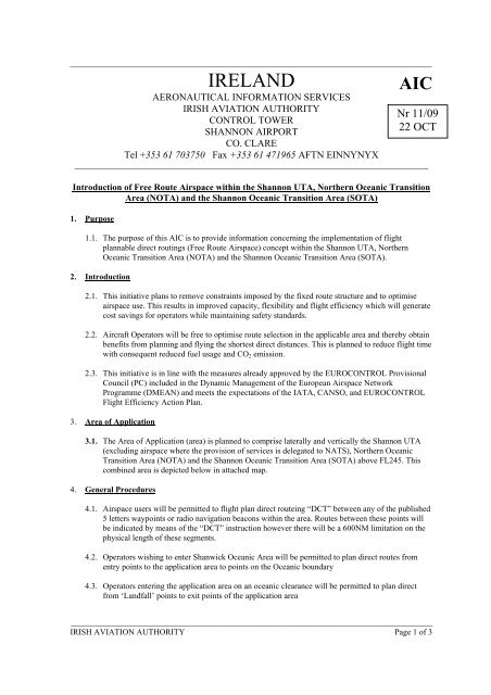
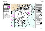
_______________________________________________________________________________________IRELANDAICAERONAUTICAL INFORMATION SERVICESIRISH AVIATION AUTHORITYNr 11/09CONTROL TOWERSHANNON AIRPORT22 OCTCO. CLARETel +353 61 703750 Fax +353 61 471965 AFTN EINNYNYX_____________________________________________________________________________________<strong>Introduction</strong> <strong>of</strong> <strong>Free</strong> <strong>Route</strong> <strong><strong>Air</strong>space</strong> within the <strong>Shannon</strong> UTA, Northern Oceanic TransitionArea (NOTA) and the <strong>Shannon</strong> Oceanic Transition Area (SOTA)1. Purpose1.1. The purpose <strong>of</strong> this AIC is to provide information concerning the implementation <strong>of</strong> flightplannable direct routings (<strong>Free</strong> <strong>Route</strong> <strong><strong>Air</strong>space</strong>) concept within the <strong>Shannon</strong> UTA, NorthernOceanic Transition Area (NOTA) and the <strong>Shannon</strong> Oceanic Transition Area (SOTA).2. <strong>Introduction</strong>2.1. This initiative plans to remove constraints imposed by the fixed route structure and to optimiseairspace use. This results in improved capacity, flexibility and flight efficiency which will generatecost savings for operators while maintaining safety standards.2.2. <strong>Air</strong>craft Operators will be free to optimise route selection in the applicable area and thereby obtainbenefits from planning and flying the shortest direct distances. This is planned to reduce flight timewith consequent reduced fuel usage and CO 2 emission.2.3. This initiative is in line with the measures already approved by the EUROCONTROL ProvisionalCouncil (PC) included in the Dynamic Management <strong>of</strong> the European <strong><strong>Air</strong>space</strong> NetworkProgramme (DMEAN) and meets the expectations <strong>of</strong> the IATA, CANSO, and EUROCONTROLFlight Efficiency Action Plan.3. Area <strong>of</strong> Application3.1. The Area <strong>of</strong> Application (area) is planned to comprise laterally and vertically the <strong>Shannon</strong> UTA(excluding airspace where the provision <strong>of</strong> services is delegated to NATS), Northern OceanicTransition Area (NOTA) and the <strong>Shannon</strong> Oceanic Transition Area (SOTA) above FL245. Thiscombined area is depicted below in attached map.4. General Procedures4.1. <strong><strong>Air</strong>space</strong> users will be permitted to flight plan direct routeing “DCT” between any <strong>of</strong> the published5 letters waypoints or radio navigation beacons within the area. <strong>Route</strong>s between these points willbe indicated by means <strong>of</strong> the “DCT” instruction however there will be a 600NM limitation on thephysical length <strong>of</strong> these segments.4.2. Operators wishing to enter Shanwick Oceanic Area will be permitted to plan direct routes fromentry points to the application area to points on the Oceanic boundary4.3. Operators entering the application area on an oceanic clearance will be permitted to plan directfrom ‘Landfall’ points to exit points <strong>of</strong> the application area_______________________________________________________________________________________IRISH AVIATION AUTHORITY Page 1 <strong>of</strong> 3
_______________________________________________________________________________________4.4. Traffic entering the application area on an oceanic clearance will continue on this clearance tolandfall points unless re-cleared by <strong>Shannon</strong> ACC.4.5. Over flight traffic should plan directly from entry point to exit point, except as required to remainclear <strong>of</strong> Active Danger areas.4.6. Cross border DCT is not permitted.4.7. Traffic landing at airports within the <strong>Shannon</strong> FIR should plan from the area entry point or‘Landfall’ point as follows;4.7.1. If the destination airport has published STARs then flight plan to the initial waypoint onthe STAR4.7.2. If the destination airport does not have published STARs then flight plan to the Navaidassociated with the destination airport.Note; <strong>Air</strong>craft not equipped to fly a STAR shall flight plan as per 4.7.2 and expect Radar vectoring.4.8. Traffic departing airports within the <strong>Shannon</strong> FIR should4.8.1. If the departing airport has published SIDSs then flight plan from last point on the SIDprocedure to the area exit point4.8.2. If the departing airport has not published SIDSs then flight plan from the navaid servingthe departure airport to the area exit point.Note; <strong>Air</strong>craft not equipped to fly a SID shall flight plan as per 4.8.2 and expect Radar vectoring..4.9. Waypoints will be established at the extremities <strong>of</strong> Danger areas including a buffer area to facilitaterouting clear <strong>of</strong> these areas when active. Radar monitoring will be provided to ensure separationfrom Danger areas when active.5. Navigation Performance5.1. <strong>Air</strong>craft must be capable <strong>of</strong> maintaining RNP5 performance within the area. Any aircraft unable toachieve RNP5 performance must inform ATC and request radar assistance if required.6. Implementation6.1. Implementation is planned for 17 th December, 20097. Further information7.1. Any exceptions to the above will be notified in AIP Ireland.7.2. The Irish Aviation Authority intends to hold a user consultation meeting prior to implementation.7.3. Further information on this AIC and the full implementation can be obtained from:John Mc Grath,Operations Manager,<strong>Shannon</strong> ACCIrish Aviation Authority,Ballycasey Cross,<strong>Shannon</strong>,Co Clare.Ph: +353 61 366074e-mail to john.mcgrath@iaa.ie_______________________________________________________________________________________IRISH AVIATION AUTHORITY Page 2 <strong>of</strong> 3
<strong>World</strong> <strong>Air</strong> <strong>Ops</strong> provides <strong>Air</strong>lines, <strong>Air</strong>craft Operators, and Pilots around the <strong>World</strong>with Operational Support, Flight Planning, Ferry Flights, and <strong>Air</strong>craft Deliveries.You may be interested to view other documents in our <strong>Free</strong> Resource Library - organised by region:North Atlantic Africa Europe Pacific South America North America Asia NATAFIEURPACSAMNAMASIOur Operations Room has live <strong><strong>Air</strong>space</strong>, Fuel, and Navigation information updates.www.worldairops.com/opsroom.htmlWe provide:<strong>Route</strong> planning and analysisComputerised Flight Planning for Business Aviation, <strong>Air</strong>lines, Charter, Cargo and Military.Co-ordination <strong>of</strong> 3rd party <strong>Air</strong>port handling, Ground Support, Contract Fuel, CustomsDelivery, Ferry, and Positioning FlightsCharter Flights, Overflight permits, ‘First Visit’ kits and aerodrome reviews.Oceanic Flights, Organised Track Systems, International Procedures.Visit our website for more:www.worldairops.comOr email us your question - we’re here to help : air.support@worldairops.com 15 minute response time.Our aim is to create a free, central Library for Flight Planning users worldwide.This document has been provided by <strong>World</strong> <strong>Air</strong> <strong>Ops</strong> in good faith, and assumed to bein the public domain and available to all airspace users as information material. In the event that this is not the case, please let us know!


