Evolution of land cover and land use mapping in Romania
Evolution of land cover and land use mapping in Romania
Evolution of land cover and land use mapping in Romania

You also want an ePaper? Increase the reach of your titles
YUMPU automatically turns print PDFs into web optimized ePapers that Google loves.
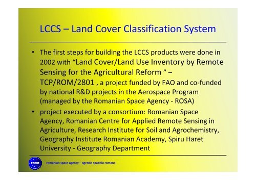
LCCS – L<strong>and</strong> Cover Classification System• The first steps for build<strong>in</strong>g the LCCS products were done <strong>in</strong>2002 with “L<strong>and</strong> Cover/L<strong>and</strong> Use Inventory by RemoteSens<strong>in</strong>g for the Agricultural Reform ” –TCP/ROM/2801 , a project funded by FAO <strong>and</strong> co-fundedby national R&D projects <strong>in</strong> the Aerospace Program(managed by the <strong>Romania</strong>n Space Agency - ROSA)• project executed by a consortium: <strong>Romania</strong>n SpaceAgency, <strong>Romania</strong>n Centre for Applied Remote Sens<strong>in</strong>g <strong>in</strong>Agriculture, Research Institute for Soil <strong>and</strong> Agrochemistry,Geography Institute <strong>Romania</strong>n Academy, Spiru HaretUniversity - Geography Departmentromanian space agency – agentia spatiala romana