Newcastle Under Lyme CAA DTP 1-09.indd
Newcastle Under Lyme CAA DTP 1-09.indd
Newcastle Under Lyme CAA DTP 1-09.indd

You also want an ePaper? Increase the reach of your titles
YUMPU automatically turns print PDFs into web optimized ePapers that Google loves.
This document has been written onbehalf of <strong>Newcastle</strong>-under-<strong>Lyme</strong> BoroughCouncil by The Conservation Studio,1 Querns Lane,Cirencester,Glos GL7 1RLTel: 01285 642428Email: info@theconservationstudio.co.ukWebsite: www.theconservationstudio.co.uk
CONTENTSPage1 Introduction 11.1 The <strong>Newcastle</strong> Town Centre Conservation Area 11.2 Summary of key characteristics and issues 11.3 The planning policy context 31.4 The local policy framework 31.5 Community involvement 42 Location and landscape setting 52.1 Location and activities 52.2 Topography and geology 62.3 Relationship of the conservation area to its surroundings 62.4 Biodiversity 73 Historic development and archaeology 83.1 Historic development 83.2 Archaeology 124 Spatial analysis 134.1 Layout and street pattern 134.2 Open spaces, trees and landscape 144.3 Focal points, focal buildings, views and vistas 154.4 Boundaries 164.5 Public realm 175 The buildings of the conservation area 195.1 Building types 195.2 Listed buildings 205.3 Locally listed buildings 215.4 Positive buildings 215.5 Building styles, materials and colours 225.6 Shopfronts 246 Character areas 256.1 Introduction to the Character Areas 25• 1 Town Centre – Ironmarket and High Street 25• 2 St Giles’ Church, Church Street, Bridge Street and part of High Street 26• 3 Georgian suburbs – Queen Street and King Street 27• 4 19 th century expansion – Barracks Road and Well Street 28• 5 20 th century municipal growth – Merrial Street 29• 6 Recent development – Castle Walk and the Bus Station 30• 7 1960s development – The Midway and Paradise Street 307 Issues 32• <strong>Newcastle</strong> and its setting 32• New development• Town Centre• Public Realm• Buildings• Site Specifi c• Conservation area boundary review
APPENDICESAppendix 1 Local Plan policies 33Appendix 2 Townscape Appraisal map 34Character Area map 34Appendix 3 Bibliography 35Appendix 4 Contact details 36
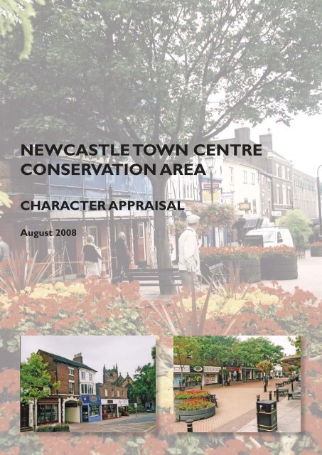
<strong>Newcastle</strong> Town Centre Conservation Area
• Hilly topography on south-west facing slopedropping down to the valley of the <strong>Lyme</strong> Brook;• Some glimpses of tree-lined slopes beyond thebrook;• Wide variety of shops and other commercialpremises provide vitality;• Largely traffi c-free Town Centre;• High Street retains its wide open market place‘The Stones’ which is still in almost daily use as astreet market; another wide space with a variety ofhistoric buildings;• Medieval burgage plots can be plotted in thesurviving boundaries to either side of the HighStreet and Ironmarket, with narrow alleys cuttingthrough to the back lanes;• The Guildhall, a 1861 remodelling of an early 18 thcentury building, dominates views along HighStreet;• No. 36 High Street retains an unusual timberframedfaçade and dates to the late 16 th century;• Other buildings from the 17 th to the 19 th centuries,some of them listed, can be seen along the sides ofthe principal streets;• Holy Trinity RC Church, built in 1834 from bluevitrifi ed brick;• Other good examples of 19 th and 20 th centuryeducational, municipal and military buildings;• Lancaster Buildings, an interesting building of thelate 1930s containing shops with offi ces above,is located on the junction of High Street andIronmarket;• Some surviving historic shopfronts;• Use of red brick with faience and terracottadetails;• Occasional red sandstone (St Giles’ Church) and afew timber-framed buildings;• Queen’s Gardens, with its statue of Queen Victoria,is a well used and generally well cared for publicpark;• A degree of uniformity in the public realm, such asstreet lighting, signage, and paving, has already beenachieved;• Impressive hanging baskets and other fl oral displaysthroughout the conservation area.This Character Appraisal concludes that the mainIssues in the <strong>Newcastle</strong> Town Centre ConservationArea are:• The protection and enhancement of the setting tothe conservation area;• The control of new development;• The improvement of the Town Centre, includingthe public realm;• The establishment of a Local List;• The serving of an Article 4 Direction;• A number of site specifi c enhancements;• One minor change is proposed to the existingconservation area boundary.Holy Trinity R.C. ChurchFloral displays in the town centre2 <strong>Newcastle</strong> Town Centre Conservation Area
1.3 The planning policy contextThe <strong>Newcastle</strong> Town Centre Conservation Areawas designated in November 1973 and subsequentlyextended to include properties in The Midway,London Road and Barracks Road. Conservation areasare designated under the provisions of Section 69 ofthe Planning (Listed Buildings and Conservation Areas)Act 1990. A conservation area is defi ned as “an areaof special architectural or historic interest the characteror appearance of which it is desirable to preserve orenhance”.Section 71 of the same Act requires local planningauthorities to formulate and publish proposals for thepreservation and enhancement of these conservationareas. Section 72 also specifi es that, in making adecision on an application for development withina conservation area, special attention must be paidto the desirability of preserving or enhancing thecharacter or appearance of that area.In response to these statutory requirements, thisdocument defi nes and records the special architecturaland historic interest of the <strong>Newcastle</strong>-under-<strong>Lyme</strong>Town Centre Conservation Area and identifi esopportunities for enhancement. It is in conformitywith English Heritage guidance as set out in “Guidanceon conservation area appraisals” (August 2005) and“Guidance on the management of conservation areas”(August 2005). Additional government guidanceregarding the management of historic buildings andconservation areas is set out within “Planning PolicyGuidance 15: Planning and the Historic Environment”(PPG15).This document therefore seeks to:• Defi ne the special interest of the <strong>Newcastle</strong>Town Centre Conservation Area and identify theissues which threaten the special qualities of theconservation area (in the form of the “CharacterAppraisal”);• Provide recommendations and guidance toprevent future harm to the conservation area, aswell as setting out suggestions for specifi c localenhancements (in the form of the “ManagementProposals”).These documents will therefore provide a fi rm basison which applications for development within the<strong>Newcastle</strong> Town Centre Conservation Area can beassessed. The omission of any particular feature ineither the Character Appraisal or the ManagementProposals does not imply that it is of no interest, and,because both will be subject to regular review, it will bepossible to amend any future documents accordingly.1.4 The local policy frameworkThis Character Appraisal, with its associatedManagement Proposals, should be read in conjunctionwith the wider Development Plan policy frameworkas set out in the following documents:• The West Midlands Regional Spatial Strategy;• The Staffordshire and Stoke on Trent StructurePlan 1996-2011 (adopted March 2001);• The Minerals Local Plan (adopted December1999);• The Local Waste Plan (adopted February 2002);• The <strong>Newcastle</strong>-under-<strong>Lyme</strong> Local Plan 2011(adopted October 2003).The last four documents will shortly be replaced bythe new Local Development Framework (LDF). Thisnew planning system was established by the Planningand Compulsory Purchase Act 2004, which abolishesStructure and Local Plans and replaces them with LocalDevelopment Documents. Policies in the Structure Planand the Local Plan remained in force until September2007, although some might be ‘saved’ into the newLDF. More information about this important changeto the planning system can be found on the BoroughCouncil ’s website: www.newcastle-staffs.gov.uk.For the moment, In the Local Plan, most of theTown Centre Conservation Area is covered by the‘<strong>Newcastle</strong> Town Centre Insert’ map. This confi rmsthat for Local Plan policies, the boundary of the TownCentre is defi ned by the Inner Ring Road. The mapconfi rms that the most relevant policies are:• Policies B9 -18, and 20 apply to the whole TownCentre.A summary of these policies is included at Appendix 1.Another relevant document, Security shutters for shopsConservation Area Character Appraisal3
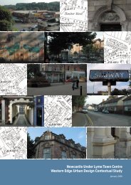
and business premises in conservation areas, was adoptedas supplementary planning guidance in December1992 and is in the process of being updated to refl ectchanges in legislation.A substantial amount of work has been carried outin the Town Centre area over the past few years anda number of reports completed. The most relevantare:• North Staffordshire Integrated EconomicDevelopment Strategy;• RENEW South Staffordshire (the Housing MarketRenewal Pathfi nder) – Assessment of HistoricalSignifi cance;• <strong>Newcastle</strong> Town Centre Area Action Plan Spring2007;• <strong>Newcastle</strong> Town Centre Public Realm Strategy(Taylor Young) 2004;• <strong>Newcastle</strong>-under-<strong>Lyme</strong> Town Centre: EasternApproaches Urban Design Study (LathamArchitects) June 2005;• <strong>Newcastle</strong>-under-<strong>Lyme</strong> Town Centre: WesternEdge Urban Design Contextual Study (LathamArchitects/ARUP) January 2006.1.5 Community involvementBefore writing this document, the views of localstakeholders on the particular issues facing theconservation area were sought via letter or email.These comments were integrated into the fi rst draftof the Character Appraisal and Management Proposalswhich was discussed at a public meeting at the CivicOffi ces in <strong>Newcastle</strong> on 31 st January 2008. Followingthis meeting, the documents were put on the Council’swebsite for six weeks until the end of March 2008,after which a Statement of Public Consultations wasprepared and the documents amended. The fi nal draftof the document was approved by <strong>Newcastle</strong>-under-<strong>Lyme</strong> Borough Council as Supplementary PlanningGuidance on 29 th July 2008.4 <strong>Newcastle</strong> Town Centre Conservation Area
2 LOCATION AND LANDSCAPE SETTING2.1 Location and activities<strong>Newcastle</strong> forms part of the North StaffordshireConurbation, lying between the Peak District to thenorth-east and the Cheshire Plain to the west. TheCity of Stoke is located just four kilometres to the east.Both settlements are served by the M6 Motorway,linking Birmingham to Manchester, which passes fi vekilometres to the west of the town, sweeping in a largecurve around the campus of the University of Keele.The county town of Stafford lies some 24 kilometresto the south and the historic market town of Leekabout 19 kilometres to the north-east. Some distanceto the west of <strong>Newcastle</strong> lie the towns of Crewe andNantwich, located on the edge of the Cheshire Plain.The <strong>Newcastle</strong> Town Centre Conservation Areais almost contained by the 1960s ring road whichprovides a complete circle around the historic coreof the town. Within this boundary lies the retailand commercial centre of <strong>Newcastle</strong>, with a varietyof shops, cafes, public houses, offi ces and othercommercial premises. <strong>Newcastle</strong> is defi ned as one ofthe two (with Stoke) most important strategic centresin the region, providing a wide range of shopping andleisure facilities within and on the edge of the TownCentre. Most of the major national retailers such asWoolworths, Boots or WH Smith’s are represented,although surprisingly there is no major store, such asDebenhams.Residential uses appear to be limited to a few propertiesin the Church Street/Bridge Street area, and, outsidethe ring road, in Well Street and Queen Street/KingStreet. A bus station between Barracks Road and theTown Centre is another major feature. The parishchurches of St Giles’, St George’s and the MethodistChurch in Merrial Street, where the Borough Counciloffi ces and police headquarters are also located,provide spiritual support. There is one operationalschool, the Hassell County Primary School in BarracksRoad, but the adjoining former school, facing QueensGardens, awaits a possible conversion scheme intosmall workspace suites. The former barracks, justto the south of the Hassell School, has already beenconverted into workshops and starter units for smallbusinesses. The Jubilee Baths pool still operates onthe corner of Brunswick Street, providing swimmingand other facilities (although this activity is proposedThe wooded setting to <strong>Newcastle</strong> to the south-east of thetown centre<strong>Newcastle</strong> town centre is well served with national shopsThe Barracks Workshop, Barracks RoadConservation Area Character Appraisal5
to relocate to the western edge of the town), and apublic library in Ironmarket provides another usefuland convenient local facility.2.2 Topography and geology<strong>Newcastle</strong> lies within an undulating landscape of lowhills and ridges on a west facing slope overlooking thevalley of the <strong>Lyme</strong> Brook, which fl ows in a roughlynorth to south direction around the edge of the originalhistoric settlement. The High Street rises slightly fromits junction with the ring road in the south, providinglong views down Friars Street to the ring road andover the valley bottom to an area of housing. This ischaracterised by mature trees, which provide a sylvansetting to the town when approaching from the west.The underlying geology is Carboniferous Keele Bedsof marl and new red sandstone, occasionally usedas for buildings or walls. The best and most visibleexample is St Giles’ Church. Between the sandstonelie varied deposits – coal, clay and ironstone. Thesehave all provided the raw materials for the industrialdevelopment of <strong>Newcastle</strong> from the 18 th centuryonwards. Of special note is the use of clay for theproduction of bricks, both red and blue/black, whichwere produced from the 17 th century onwards.Sandstone was used to build St Giles’ Church2.3 Relationship of the conservation areato its surroundings<strong>Newcastle</strong> is dominated to the east by the closenessof the densely built-up conurbation of Stoke City andits attendant towns and suburbs of Burslem, Hanley,Stoke and Trent Vale. A number of roads radiate from<strong>Newcastle</strong>, connecting to the recently improved A500,a major dual-carriageway which follows the line of theTrent and Mersey Canal. Large suburbs of late 19 thand early 20 th century housing remain, a reminder ofthe period when this part of Staffordshire was called‘The Potteries’ and was an important centre for theproduction of a variety of clay-based ceramics.To the north and south of <strong>Newcastle</strong> are similar areasof densely built-up housing, relieved by the line of the<strong>Lyme</strong> Brook, which provides an almost continuousswath of green open space to the immediate westof the Town Centre. Close to the town, this spaceis incrementally being lost to development, althoughTerracotta and brick details on the Primary School inHassell Street6 <strong>Newcastle</strong> Town Centre Conservation Area
further south the designation of the ‘<strong>Lyme</strong> ValleyParkway’ as Green Belt should prevent further losses.Also of note is the site of <strong>Newcastle</strong> Castle in SilverdaleRoad, next to Queen Elizabeth Park, although all thatremains is an overgrown mound marking the locationof the former castle motte, and some masonry of theformer access causeway.To the west of <strong>Newcastle</strong> is more open countryside,associated with Keele University, which is locatedwithin the historic parkland of Keele Hall. Some of thisis protected by being within the North StaffordshireGreen Belt, the Registered Park and Garden and theKeele Hall Conservation Area.2.4 BiodiversityThere are no special designations for the naturalenvironment in the conservation area, and indeed, nonatural green space of any signifi cance apart from thewoodland around St George’s Church, which providessome habitat opportunities for wildlife such as birds,hedgehogs and foxes. However, its northern boundarydoes connect to Station Walks.The Stubbs Walk Conservation Area and the BramptonConservation Area lie close to or butt up to the TownCentre Conservation Area, the latter continuing theprotection of the Georgian suburb which commencesat Nelson Place and continues up Queen Street.The area of landscaped public pathways, lying alongthe former railway line (Station Walks), provides anattractive green ‘lung’ through the urban centre of thetown.Entrance to St George’s ChurchyardConservation Area Character Appraisal7
3 HISTORIC DEVELOPMENT ANDARCHAEOLOGY3.1 Historic developmentThe Roman Watling Street traversed Staffordshirefurther south than <strong>Newcastle</strong>, but another route,the Via Debana, linked Derby to the salt mines ofCheshire. This can still be traced along the currentA50 through Longton and Stoke, and remnants canbe found at Hoon Avenue in the Borough. There wasa Roman garrison at Chesterton, to the north-westof <strong>Newcastle</strong>, where evidence of an early potteryindustry has been identifi ed. However, this wasabandoned when the Romans retreated.The Domesday Survey of 1086 mentions threemanors in the area of modern-day Stoke: Penkhull,Wolstanton and Trentham, which included the landnow associated with <strong>Newcastle</strong>. A settlement ofsorts fi rst appears in the 1140s, when the Normanstook advantage of the defensive opportunitiesprovided by the <strong>Lyme</strong> Brook and built a castle on alow hill to the east of the stream. To make the sitemore secure, the <strong>Lyme</strong> Brook was dammed to createan artifi cial lake. The name ‘<strong>Newcastle</strong>’ appears tohave been chosen to differentiate between an olderstructure at Chesterton.By 1172-73 the ‘Borough of <strong>Newcastle</strong>’ was paying moretax than any other royal estate, even more than Stafford.This appears to confirm that from the mid-12 th centuryonwards a new town had been laid out in a grid patternon rising round to the east of the castle, with long thinplots (“burgage” plots) radiating from the High Streetand the Ironmarket, sites of various animal markets andfairs from the early medieval period onwards. By 1212a royal survey revealed that there were 160 burgages inthe town, and at about this time the castle walls wererebuilt in stone, and part of St Giles’ Church (the stonetower) remains from this period. By the late 13 th centuryStafford merchants came regularly to <strong>Newcastle</strong> to selltheir wool and cloth at <strong>Newcastle</strong>’s Saturday market,which was moved to a Monday in 1590 – later, Saturdaysand Fridays were also added. On the outskirts of thesettlement, two religious separate foundations werealso built - a Dominican Friary (the Blackfriars), foundedbefore 1277 on a site at the southern end of what isnow Friars Street, and the Hospital of St John the Baptist(founded in 1266) but located some distance from thetown on the way to Stoke. In 1267 the King handedover the Borough to his son Edmund, later the Duke ofLancaster, allowing the Borough to become increasinglycontrolled by a Merchant Guild (first established by acharter in 1235), administered by the local burgesses.William Yates map of Staffordshire 17758 <strong>Newcastle</strong> Town Centre Conservation Area
By the 16 th century <strong>Newcastle</strong> had developed into asignificant market town, and a new Market House wasbuilt between 1622 and 1626 on a site close to thepresent Guildhall in the High Street. Corn mills hadalso been built next to Pool Dam, controlled by thewealthy Sneyd family of Bradwell and Keele. Meanwhile,there was a growth in industrial production, usinglocally sourced iron and coal which was mined locallyfrom the Middle Ages onwards. Limestone quarries atnearby Cauldon provided the flux for iron making, andsalt for pottery glazes was imported from Mobury nearNantwich, helping develop a ceramics industry. Tanningwas another activity which was locally important.However these industries were somewhat constrainedby the lack of good roads or a nearby navigable river.This was helped by the Turnpike Act of 1763 whichby the 1800s had provided a network of much bettermaintained roads. The construction of a canal into<strong>Newcastle</strong> in 1775 had more limited impact as it wasnot linked to the national network and it was quicklyreplaced in significance by the railways, which arrived inthe 1840s.Meanwhile other industries developed. Changesto import duties in the 17 th century meant that aflourishing hat-making industry developed based in<strong>Newcastle</strong>, which by the early 18 th century absorbeda large proportion of the local workforce. Felt hatswere in particular demand, usually made in cottages andassociated workshops, although by the mid-19 th centurydemand had fallen as silk became more fashionable, forwhich larger factories were provided in the area. No.21 Marsh Parade is an example of one such silk mill,used between 1822 and 1839 for this purpose. Textilemanufacturing and clay pipe making were other activitieswhich grew in importance from the 17 th centuryonwards, and other 19 th century industries includedclock making and brewing. Much of the expansionof <strong>Newcastle</strong> and Stoke during the 19 th century wascarried out under the patronage of the various Dukesof Sutherland, who owned the Trentham Estates, andwho succeeded in turning indifferent land into valuableassets through coal mining and iron production. Thispaved the way for the steel works which dominated theStoke area until the end of the 20 th century.The coming of the railways in the 1840s also helpedto revitalise the town - maps of the late-19 th centuryrecord the presence of major industrial sites : CastlehillFoundary next to the former castle motte on landreclaimed from the Pool; Knutton Ironworks to thenorth-west of <strong>Newcastle</strong>, with four collieries close by;Brampton Mills (for silk) and Enderley Mills off PoolMid 19th century map of <strong>Newcastle</strong>Conservation Area Character Appraisal9
Ordnance Survey 190010 <strong>Newcastle</strong> Town Centre Conservation Area
constructed in the King Street/Queen Street area. ACongregational Church was built in the same area in1859.The Former Ebenezer ChapelRoad; Kingsfi eld Pottery and Harpfi eld Tileries oneither side of George Street; and another Brick andTile Works at Springfi elds to the south of <strong>Newcastle</strong>,with other smaller clay fi elds and tile works near toSilverdale. Of note are the two separate railway lineswhich served both the north and the south of thetown, and the addition since the 1850s of large areasof factory workers’ terraced houses.<strong>Newcastle</strong> also benefi ted from a number of importantreligious buildings, all of them now listed. St Giles’Church was rebuilt in 1721 and rebuilt again, by SirGeorge Gilbert Scott, in 1876. The Old MeetingHouse was burnt down in 1715, rebuilt in 1717, andin 1926 an additional storey was added to it. Thisbuilding has connections with the famous factoryowner Josiah Wedgwood (1730-1795), one of theleading industrialists of the 18 th century, who livedlocally and worshipped there. A Roman Catholicchurch, Holy Trinity, was built in London Road in 1834,made from a striking purple-coloured vitrifi ed brick.In 1836 the Ebenezer Chapel, a Methodist place ofworship, was built facing Merrial Street, and a minister’shouse built a few years later on the adjoining site. StGeorge’s Church was provided in 1826, to serve themore prestigious Georgian houses which were beingIn the 19 th and 20 th centuries there was a strong senseof competition between the various pottery towns,as indicated by the quality of the various municipalbuildings which were erected at the time. <strong>Newcastle</strong>has for instance two very fine 19 th century schools,both on Barracks Road. The listed former barracks,also in Barracks Road, and now used as workshops, isa good example of its type. The Guildhall was first builtin 1713 but was extensively remodelled in 1861. Itslocation overlooking the market place in High Streetprovides it with a dominant position, although itscurrent somewhat neglected condition is a cause forconcern. In the 1920s the local council provided a newpublic park (Queen Victoria’s Gardens) at the easternend of Ironmarket, an important public open space forthe Town Centre. Nearby, a new Police Station wasbuilt between Merrial Street and Ironmarket. At theopposite end of Ironmarket, where it meets High Street,the demolition of a row of 18 th century buildings, andtheir replacement in 1936 with Lancaster Buildings, wascontroversial at the time but the replacement buildinghas now become part of the established street scene.During the last 100 years, <strong>Newcastle</strong> has lost most ofits industries as the area has taken on a more residentialcharacter. The Town Centre is now one of the twoprincipal shopping centres for the North Staffordshirearea (Hanley is the other) and is increasingly beingdeveloped with offi ces and other commercial premises.The construction of the ring road in the 1960sdestroyed medieval lanes and many older buildings,particularly along Lower Street, so the historic core ofthe settlement is now separated from its hinterland bya stream of fast moving traffi c. Allied to the new roadwas further development which removed buildingsalong the south-west side of the High Street, replacingthe 18 th and 19 th century buildings with large blockswhich failed to refl ect the more domestic scale of thesurrounding area. A further loss was the demolitionof the 1888 Municipal Hall in Ironmarket, again in the1960s, and its replacement with the building whichcurrently houses the Public Library. In the last fewyears Castle Walk has been provided, a relatively largeshopping precinct with Victorian-style frontages whichconnects to the recently revamped Bus Station.Conservation Area Character Appraisal11
3.2 ArchaeologyAn Extensive Urban Survey has been carried out of<strong>Newcastle</strong>, detailing the archaeological remains andother relevant information. Maps confi rm the locationof the Norman castle, the dammed lake, medievalstreets, burgage plots, and the friary. The HER(Historic Environment Record) for <strong>Newcastle</strong>, heldby Staffordshire County Council, includes a detaileddescription of the castle and its site, and also providesdetails of many buildings in the Town Centre, most ofwhich are listed. There does not appear to be anyevidence for Pre-Norman settlement.The Police Station in Merrial StreetThe Ring Road now separates the historical core of <strong>Newcastle</strong> with its hinterland12 <strong>Newcastle</strong> Town Centre Conservation Area
4 SPATIAL ANALYSIS4.1 Layout and street patternThe conservation area is based around a historicmarket town so the plan form refl ects its medievalorigins, most importantly the establishment of marketsand fairs to serve the nearby castle and the setting outof a ‘new town’ in the 12 th century. This provided thetwo principal streets – High Street and Ironmarket,originally lined with long thin burgage plots, remnantsof which remain in places. Despite later extensions,most notably the construction of a Georgian suburb tothe east of Ironmarket, the layout of the Town Centreremained reasonably intact until the 1960s, when newdevelopment removed historic buildings in both mainstreets. Even more signifi cantly, the construction ofthe Ring Road at the same time removed even morehistoric buildings and widened Lower Street so itsmedieval route was obliterated.The principal spatial feature of the conservation areais therefore the L-shape created by the two principalstreets – High Street and Ironmarket, each being verywide and lined with mainly historic buildings. HighStreet is narrow at its more southerly entrance,and widens considerably, refl ecting its medieval (andmodern) use as an open air market. This dramaticspace is terminated by the Guildhall with its tall clocktower, but is bisected by Hassell Street. Traffi c usingHassell Street sometimes causes a break in the senseof openness.Ironmarket is on a slightly smaller scale, with moretrees and again there is a slight change in level alongits length. From both High Street and Ironmarket areexamples of surviving medieval burgage plots, whichoften provide narrow alleys or lanes to the backlandareas. These long, thin plots, where they remain, arean important constituent to the character of theconservation area. The Midway and Market Lane bothmark the back lanes of burgage plots which once layoff the High Street.To the west, High Street continuous into the ChurchStreet/Bridge Street area, with much narrower, windinglanes which drop more steeply towards the RingRoad. Frontage buildings are mainly historic but therehas been some modern infi ll and changes to plots toaccommodate new service roads and the insertion ofthe Ring Road. St Giles’ Church sits on a prominentThe Guildhall is a key building in the town centreThe subways on the Ring Roadcorner site above the Ring Road with a church yardsurrounded by a high wall. This is the only green ‘openspace’ in this part of the conservation area apartfrom Queen’s Gardens, located at the eastern end ofIronmarket.The Ring Road encompasses most of the conservationarea, creating a complete circuit of mainly dual-carriageroads with a number of major intersections markedby large roundabouts. Access across and around theseis provided by underground subways, often decoratedwith hanging baskets, murals and other landscapefeatures. Despite these, the subways create a feelingof remoteness and contribute to the feeling that theTown Centre is cut off from the rest of <strong>Newcastle</strong>.The Midway, a 1960s road which links into the 1960sdevelopment to the south-west of High Street, issurrounded by large, bulky 1960s buildings, completelyout of character with the historic buildings in HighStreet and beyond.Conservation Area Character Appraisal13
4.2 Open spaces, trees and landscapeListed houses between King Street and Queen StreetThe principal open spaces in the conservation areaare urban in character and associated with two mainstreets – High Street and Ironmarket. These two streetswere partially pedestrianised in a comprehensivescheme which dates to the early 1990s. The marketplace in High Street, where the width of the road hasallowed the continuation of a regular street market, isan essential part of <strong>Newcastle</strong> life. This space curvesslightly and rises in height, providing vistas towardsthe Guildhall. The space is enhanced by street trees,and the use of a consistent range of street furnitureand paving, although some of these details are nowin need of replacement. Ironmarket is narrower butsimilar street trees, fl owers, planters and other streetfurniture all add vitality. Where Ironmarket and HighStreet meet, the road width is constrained by LancasterBuildings and a block of 19 th century development, butHigh Street continues in a north-westerly directionto form a triangular-shaped ‘square’ (called Red LionSquare) which provides an appropriate setting for theentrance to St Giles’ Church.IronmarketTo the west of the conservation area, Barracks Roadforms part of the Ring Road. Large blocks of moderndevelopment, allied to the widening of the street andthe creation of the open Bus Station, has removedany sense of historic context.Finally, to the north-east, beyond the roundaboutwhich marks the end of Ironmarket, lies the Georgianresidential suburb associated with the planned layoutsof Queen Street and King Street, which radiate fromthe roundabout. Large, prestigious houses, mainlyfacing the street frontage, but with large gardens andmature trees, give this part of <strong>Newcastle</strong> a differentcharacter, reinforced by St George’s Church and itschurchyard.Queen Victoria’s statue in Queen’s Gardens14 <strong>Newcastle</strong> Town Centre Conservation Area
In addition, there are three landscaped open spaces – StGiles’ Churchyard, Queen’s Gardens, and St George’sChurchyard. St Giles’ Churchyard sits on a moundoverlooking the Ring Road although, as mentionedabove, the building also relates to Church Street andthe western end of High Street. The churchyard isopen towards the west, but more enclosed to theeast where the boundary is marked by a number ofmature trees. Queen’s Gardens lie at the eastern endof Ironmarket and provide the conservation area witha much loved and well used public space. The gardensand surrounding 1930s walls and railings are well tendedand serve as a focus onto an impressive (listed) statueof Queen Victoria, currently awaiting restoration.Along the adjoining pavement in Ironmarket, maturetrees in an almost formal line complement thegardens. Nearby, the former school, which overlooksthe gardens, awaits a sensitive conversion scheme. Onthe edge of the conservation area, beyond the RingRoad, lies the churchyard to St George’s Church. Thislarge open space, enclosed by impressive stone andbricks walls, is notable for its many mature trees andhistoric gravestones. However, public seating, plantingand pathways all require urgent attention.Lancaster BuildingThe former Co-op, Queens ParadeEntrance to formerbarracks, Barrack Road4.3 Focal points, focal buildings, views andvistasFocal pointsThe conservation area provides an urban townscapewith a number of focal points, created by theintersecting medieval streets and the undulatingtopography. These are as follows:• In the High Street, which naturally centres on thebusiest area around the Guildhall;• The eastern end of Ironmarket around Queen’sGardens;• Along Merrial Street, where the Police Station andthe Borough Council offi ces all generate activityand focus.Focal buildings:There are a number of focal buildings in the conservationarea, all marked on the Townscape Appraisal map.Some of them are the result of deliberate positioning,others more a matter of accidental location. Becausethe streets are mainly defi ned by continuous groups ofbuildings, few of these stand out in a noticeable way, butwithin the historic core there are individual buildingswhich provide an end-stop in views along or acrossthe main streets. These buildings tend to have beenbuilt for non-domestic uses such as churches, offi ces,schools, banks, and shops, although a very few wereconstructed as prestigious town houses where theirsiting has meant that they have a signifi cant impact ontheir surroundings. They are:• St Giles’ Church;• The Old Unitarian Meeting House;• Nos. 26 and 28 High Street;• Nos. 37 to 41 High Street;• Lancaster Buildings;• The Guildhall;• The Public Library in Ironmarket;• No. 32 (former Co-op) Ironmarket (usually calledQueens Parade);• No. 1 Nelson Place and no. 1 King Street;• Ebenezer Church, Merrial Street;• The Congregational Church, King Street;• St George’s Church, Queen Street;• Nos. 10 and 11 Queen Street.;• Hassell Street Primary School;• The former barracks, Barracks Road;• Holy Trinity R C Church London RoadConservation Area Character Appraisal15
On the edges of the conservation area:• Civic Offi ces, Merrial Street.Unfortunately, there are in addition a number ofmodern buildings which could be considered to be‘focal’ but as their contribution is negative they arenot individually identifi ed although they are includedas ‘Negative Buildings’ on the Townscape Appraisalmap.Views and vistas<strong>Newcastle</strong> is surrounded by dense, urban developmentwhich provides no views out of the town, which isfurther constrained by its positioning on a south-westfacing slope. However, this slight hill does allow a vistaalong Friars Street, over the Ring Road, and thenceto wooded hillsides beyond. This gives the TownCentre its only visual contact with its setting, which isotherwise characterised by modern development orthe 19 th century buildings associated with the StubbsWalk/Brampton Conservation Area.Other views are urban vistas within the Town Centreand focus on the buildings identifi ed above. They areall marked on the Townscape Appraisal Map. The mainviews are along the High Street, towards the Guildhall,and along Ironmarket. In the Georgian suburb aroundQueen Street and King Street, long views along eachof the main streets are enlivened by the cohesive,historic form of development and the many maturetrees.4.4 BoundariesBecause of the densely developed street frontages,boundary details are not easily visible from the publicviewpoint. Where they are visible, most of the historicboundaries in <strong>Newcastle</strong> are built from locally madered, brown or blue/black brick and most of themdate to the 18 th or 19 th centuries, although they mayfollow the lines of medieval plots. Sometimes the redbrick is enlivened with blue/black headers, to create achequer pattern, as can be seen at the back of St Giles’Churchyard. Many of them are capped with stonecopings or alternatively semi-circular copings madefrom the same blue/black clay, a reference to the longtradition of ceramic manufacture in the locality. Thebest examples are in the Queen Street/King Street area.Local red sandstone is also used, most notably aroundthe churchyard to St Giles’ Church where a low wallis topped by cast iron railings, probably dating to themid-19 th century rebuilding of the church. The stoneis quite soft and weathers badly. It does not appearto have been used much beyond the mid-19 th century,possibly because quarrying ceased when the localbrick-making industry began to gain prominence.View down Queen Street towards <strong>Newcastle</strong> Town CentreBoundary walls and railings to St Giles’ Church16 <strong>Newcastle</strong> Town Centre Conservation Area
4.5 Public realmThere are few examples of historic features in thestreets of <strong>Newcastle</strong> apart from those mentionedbelow as much of the Town Centre appears to havebeen subject to incremental improvement schemesover the last 20 or so years. However, the overalleffect is not particularly discordant although someimprovements are needed and are discussed in greaterdetail in the Management Proposals.Street lightingThe street lighting in the Town Centre is usuallyprovided by modern lamps fi xed to the buildingswhich face the principal streets, or by simple whitepainted steel lamp standards, possibly dating to the1970s. CCTV columns are another feature, refl ectingthe need for greater security at certain times of theday. Outside the Town Centre, smaller concrete lightstandards light the street, again probably dating to the1960s or 1970s.Public realm in the High StreetPavingSeveral environmental improvement schemes appearto have been carried out in the Town Centre as partof the pedestrianisation scheme of the early 1990s.In High Street, the carriage way has disappeared andmuch of the street surface is covered in wall-to-wallconcrete or clay block paviors, sometimes laid incontrasting colours. Other sections are defi ned bycircular concrete planters or banks of brown brickplanters, sometimes surrounded by granite setts.Concrete slabs are another feature, such as thosein Hassell Street, where fortunately some of theoriginal granite kerbing and setted gutters have alsobeen retained. The use of street trees in both HighStreet and Ironmarket relieves the monotony of thesefeatures, but otherwise the quality of the historicenvironment is diminished by the use of materials anddetails which have no special ‘sense of place’.Staffordshire blue brick paving in Hanover SquareThere only meaningful remnant of historic paving isin Hanover Street, which retains a whole pavementof ‘Staffordshire blue’ brick paviors, once ubiquitousin the area. Some of the paviors have a distinctivecrisscross pattern. A few examples of similar paviors(though fl at) can be glimpsed in the occasional backalley, such as between nos. 18 and 20 High Street.Conservation Area Character Appraisal17
Street furniture (seating, signage)Most of the street furniture in the conservation areacomes from a defi ned range of ‘heritage’ products,including black cast iron bollards, cast iron and woodpublic seats, fi nger posts, and posts for hanging baskets.Together they are fairly neutral in their impact andwith the many colourful plants and trees, they createan attractive environment for the many shoppers andother users of the Town Centre. The removal of outof date signage would be advantageous.Blue brick paving in alley between no. 18 & 2018 <strong>Newcastle</strong> Town Centre Conservation Area
5 THE BUILDINGS OF THECONSERVATION AREA5.1 Building typesThe <strong>Newcastle</strong> Town Centre Conservation Areaprovides a variety of buildings, with a high proportionof modern buildings of little architectural merit, whichlargely but not exclusively date to the 1960s or 1970s.Historic buildings (both listed and those noted asmaking a ‘positive’ contribution) are concentratedalong the north-east side of High Street; around andto the north-east of St Giles’ Church; at either endof Ironmarket; and beyond Nelson Place. In theseareas it is possible to appreciate the quality of thehistoric environment and to get a glimpse of howcohesive and attractive the townscape once was.The reinstatement of that sense of architecturalworth must surely be a priority for the BoroughCouncil in the years to come as sites, particularlythose on the south-west side of High Street, comeup for redevelopment.Many of the surviving historic buildings were builtas residential properties and although the groundfl oors have been converted into shops and othercommercial uses, they retain a domestic scale. Goodexamples can be seen at the southern end of HighStreet where there is a row of ‘positive’ and listedbuildings (nos. 83 to 115 High Street). Unusuallythere are also a number of late 18 th or early 19 thcentury properties which were originally built withground fl oor shops, such as nos. 9 to 14 Ironmarketand nos. 22, 24 and 26 High Street, although ofcourse these retain their residential character onthe upper fl oors. Outside the Town Centre, thereare examples of more prestigious family houses inthe Queen Street/King Street area, many of whichare now in use as offi ces. Very few buildings in theconservation area are obviously used for residentialpurposes, apart from properties in the Well Street/Garden Street area, and Bridge Street.Listed and ‘positive’ buildings in the High StreetListed houses in Queen Street now used as offi cesOtherwise, the Town Centre retains a variety ofpurpose-built buildings, designed for specifi c nonresidentialuses. There are fi ve churches or chapels;the former barracks; two schools; and a number ofwell detailed but unlisted late 19 th /early 20 th centurybanks and other commercial buildings facing HighStreet or Ironmarket.Conservation Area Character Appraisal19
5.2 Listed buildingsThere are approximately 51 listed buildings orstructures in the conservation area, of which two(St Giles’ Church and St George’s Church) are listedgrade II*. The remainder are all listed grade II. Thelisted buildings divide into three groups:• Ecclesiastical• Residential/commercial• Municipal/community(i) Ecclesiastical usesThere are six listed churches in the conservation area.The oldest is St Giles’ Church, listed grade II*. Theparish church retains a medieval foundation, with arefaced 13 th century tower and some fragments oforiginal masonry, but what is visible today is largely theresult of a rebuild by Sir George Gilbert Scott in 1876.St George’s Church, also listed grade II*, was built inbrick in 1828 by Francis Bedford as a Commissioners’Church. Holy Trinity Roman Catholic Church wasbuilt in 1834 using blue vitrifi ed brick, arranged in tiersof arcading facing London Road.St Giles’ Church and the old Unitarian ChapelThere are also three Non-Conformist churches – theold Unitarian Meeting House in Lower Street, built in1650, restored in 1717, and altered again in 1926 whenan additional storey was added; Ebenezer House inMerrial Street, built in 1857-8 as a Methodist Chapeland now in commercial use; and the CongregationalChurch in King Street, built in 1859 in polychromebrick.(ii) Residential/commercial.There are many examples of good quality smaller scalelisted buildings in the conservation area, the earliestexamples being 16 th century and built using timberframing. The best remaining examples are in the HighStreet close to St Giles’ Church – nos. 14 and 16 (theformer Golden Bell Inn), which has a real timber framehidden by render painted to imitate timber framing)and no. 36 High Street, another former inn, dating tothe late 16 th century.The conservation area also retains a number of 18 thcentury buildings which appear to have been builtThe Congregational Church, King Street20 <strong>Newcastle</strong> Town Centre Conservation Area
No. 36 High Streetwith a shop to the ground fl oor, such as nos. 22 to28 High Street. Some of these retain their historicshopfronts, although largely these date to the late19 th century. The highest quality 18 th century housein the Town Centre is probably Fenton House, nos.5, 7 and 9 High Street which dates to 1747, althoughthe ground fl oor has a modern addition. Nos. 75 to77 High Street, prominently located on the cornerwith Hassell Street, is another good example althoughsomewhat altered more recently to accommodate anoffi ce use. Outside the central core, there are severalvery fi ne Georgian houses beyond Nelson Place, suchas the buildings facing King Street and the east side ofQueen Street. These provide evidence of the risingprosperity of the area from the 1700s onwards.(iii) Municipal/communityThe conservation area retains a number of listedbuildings or structures with more mixed uses – theGuildhall, built in 1713 and remodelled in 1861; theMarket Cross, a late 18 th century stone column whichwas repaired in the late 20 th century; Queen Victoria’sstatue in Queen’s Gardens, a bronze statue of 1913 byC B Birch; and the former Militia Barracks in BarracksRoad, built in 1855.High quality Georgian Houses in King Street5.3 Locally Listed buildingsThere are currently no ‘Locally Listed’ buildings inthe conservation area. This is a major issue which isaddressed in the Management Proposals.5.4 Positive buildingsIn addition to the listed buildings, a large number ofunlisted buildings have been identifi ed on the TownscapeAppraisal map as being positive buildings of townscapemerit. Buildings identifi ed as being positive will vary,but commonly they will be good examples of relativelyunaltered historic buildings where their style, detailingand building materials provides the streetscape withinterest and variety. Most importantly, they makea positive contribution to the special interest of theconservation area. Where a building has been heavilyaltered, and restoration would be impractical, they areexcluded. Examples include:Houses in Well StreetConservation Area Character Appraisal21
• Houses in Well Street and Garden Street – welldetailed late 19 th century terraced propertieswith a variety of details typical of the Staffordshirearea;• Hassell Street Primary School and the former C ofE school facing Queen’s Gardens;• 1930s building (the former Co-op) in QueensParade, at the end of Ironmarket;• 19 th century shops, clubs and public houses in HighStreet (e.g. nos. 97 to 125).Government guidance in PPG15 ‘Planning and thehistoric environment’ advises that a general presumptionexists in favour of retaining those buildings whichmake a positive contribution to the character orappearance of a conservation area (paragraph 4.27).The guidance note states that proposals to demolishsuch buildings should be assessed against the samebroad criteria as proposals to demolish listedbuildings. Again, further information is provided inthe Management Proposals.‘Positive’ unlisted buildings in the High Street5.5 Building styles, details, materials andcoloursBuilding stylesWhilst there are many building styles, using a variety ofmaterials, in the conservation the overall impressionis of a brick-built 19 th century market town, withclosely packed buildings facing the streets and novisible private gardens. These buildings are generallybuilt on the back of the pavement and are usuallythree storeys high, with lower heights away from theTown Centre. Roofs are similarly varied, with differenteaves and ridge heights, or they can be concealedbehind parapets, particularly in High Street. Thereare no ‘set pieces’ of town planning, such as a formalcrescent, although in the Queen Street/King Streetarea the spacious plots and cohesive architecturaldetails and materials refl ect the fact that the moreresidential area was developed in a relatively shortspace of time. Post-War development along HighStreet and in other locations has not provided suchinteresting or lively facades – plots widths are toowide, buildings tend to be bulky and blandly detailed,and the use of a mid-brown brick is not in keepingwith local precedents.Postwar development in the High StreetNo. 49 Ironmarket22 <strong>Newcastle</strong> Town Centre Conservation Area
institutional buildings of the 19 th century were builtfrom imported stone, such as Portland, and a goodexample of this is the HSBC bank in High Street (nos.64 and 66), a large neo-Classical three storey buildingclearly built to impress. Holy Trinity R C Church inLondon Road is an impressive and unusual exampleof the use of a bluey/black vitrifi ed brick, arranged inelaborate arcading with decorative brickwork. Thisdisplays a variety of techniques, including mouldedbricks, bricks with embossed or incised patterns andbricks laid to a projecting diaper pattern. The wholebuilding provides an eloquent example of the skills ofthe Staffordshire brick industry.Roofs, where they are visible, are covered in greyslate, imported from Wales, or, more commonly, fl ator occasionally fi shscale clay tiles (such as the ones onnos. 12-14 High Street), varying from red to blue. Brickchimneys, often topped by a variety of decorative claychimney pots, are another notable feature throughoutthe whole conservation area.5.6 ShopfrontsThere are a large number of historic shopfronts in theconservation, the best and most complete examplesbeing marked on the Townscape Appraisal map. Builtof timber, they tend to retain their original fascias,cornicing, or pilasters, and some have attractiveGeorgian columns. Most, but not all, are in listedbuildings where rigorous controls already exist toprotect and preserve them. However, many are inunlisted (though ‘positive’ buildings) where controlsmight be less stringent. A good example is the cornerblock made up of no. 2 Hickman Street and nos. 1and 3 High Street, a purpose built late 19 th centurytwo storey building with a continuous well detailedshopfront which curves around the corner. Moreinformation can be found in the Management Proposals,which includes guidance on alterations.Nos. 1 and 3 High Street24 <strong>Newcastle</strong> Town Centre Conservation Area
6 CHARACTER AREAS6.1 Introduction to the Character AreasThe <strong>Newcastle</strong> Town Centre Conservation Areadivides neatly into seven Character Areas accordingto historical development; street pattern and layout;built form; and uses and activities. These are:Positive Character Areas:Character Area 1:Town Centre – Ironmarket and High StreetCharacter Area 2:St Giles’ Church, Church Street, Bridge Street andpart of High StreetCharacter Area 3:Georgian suburbs – Queen Street and King StreetCharacter Area 4:19 th century expansion – Barracks Road and Well StreetCharacter Area 1: Town Centre – Ironmarket andHigh StreetKey positives:• Historic Town Centre with a variety of mainlycommercial uses;• 12 th century street plan with some evidence ofsurviving burgage plots;• Wide streets confi rm the past (and present) usefor street markets;• Almost completely pedestrianised, providing a safeand pleasant environment for shoppers and visitorsin general;• Street trees and hanging baskets add to the visualattractions of the area;• Queen’s Gardens provides a much needed andwell used public open green space;• Built-up street frontages with a variety ofbuildings;Character Area 5:20 th century municipal growth – Merrial StreetNeutral Character Area:Character Area 6:Recent development – Castle Walk and the BusStationNegative Character Area:Character Area 7:1960s development – The Midway and ParadiseStreetView along the High StreetThe purpose of this chapter is to assess each CharacterArea, to briefl y summarise its principal positive andnegative features, and from the later to develop a listof the principal ‘Issues’ which will provide the basisfor the Management Proposals (see Appendix 2 forCharacter Area map)6.2 Positive Character AreasThis Character Appraisal concludes that the keypositive and negative characteristics of the followingCharacter Areas are:Queen’s GardenConservation Area Character Appraisal25
• The occasional 16 th or 17 th century building remainsbut mainly the historic buildings are 18 th and 19 thcentury;• North-east side of High Street retains the bestpreserved street frontage;• A number of signifi cant 18 th and 19 th century listedbuildings, the most important of which are theGuildhall and the adjoining Market Cross;• Lancaster Buildings, an interesting 1930s blockbuilt as shops and offi ces.Key negatives:• 1960s and later development to the south-westhas obliterated the historic street layout and ledto the demolition of many historic buildings;• Much of this development is poorly designed anddetailed, and far too bulky in comparison to themore domestic scale of the historic buildings in theTown Centre;• The public realm is in need of improvement,including the replacement or upgrading of thepaving and planters;• A certain amount of unnecessary street ‘clutter’which creates a barrier to pedestrian movement;• Street trees have grown relatively large and havebecome visually dominant in some locations, cuttingoff light and creating a less secure environment;• Hassell Street cuts across High Street, bringingtraffi c through the pedestrianised area;• Late night noise from the various clubs and barscan be a problem;• Little or no residential uses;• Some vacant shops and offi ces;• The Guildhall is in poor condition;• Lancaster Buildings is also in need of repair;• Nos. 51 and 52 Ironmarket is in urgent need ofrestoration;• There are many out of scale, dominant modernshopfronts;• Use of modern materials and details, particularlyuPVC windows;• There are many well detailed buildings which arenot listed but which could be Locally Listed toprovide additional protection;• A minor change to the conservation area boundaryis proposed, to include the whole roundabout atthe southern end of High Street.Modern development in the High StreetThe Guildhall is in need ofrepairsCharacter Area 2: St Giles’ Church, Church Street,Bridge Street and part of High StreetKey positives:Add the wholeroundabout to theconservation Area• Medieval street plan, with small lanes and undulatingtopography;• Views across the valley of the <strong>Lyme</strong> Brook;• More village character than the more urban TownCentre;• With the two churches, a mixture of shops, cafes,and residential properties;• Examples of good quality 19 th century shopfronts(e.g. nos. 26 and 28 High Street);• Some surviving granite kerbs, setted gutters andblue brick paviors;26 <strong>Newcastle</strong> Town Centre Conservation Area
• Surviving street names – white letters on black e.g.’Liverpool Road’ sign on no. 3 Liverpool Road;• A high concentration of listed and ‘positive’buildings;• St Giles’ Church is the key focal building and retainsa 13 th century tower, the whole faced in the localred sandstone;• Attractive stone wall around the churchyard, withits assorted gravestones and memorials;• The church is set in a valuable ‘green’ space boundedby mature trees on one side;• The Old Meeting House, dating to the 17 th century,with associations with Josiah Wedgwood;• No. 36 High Street is the best surviving timberframed building in the conservation area;• A number of well detailed unlisted ‘positive’ buildingswhich could be considered for Local Listing.Key negatives:St Giles’ ChurchThis unlisted building inthe High Street could beconsidered for Local Listing• Secondary shopping area with some properties inneed of repair, especially along Church Lane;• A number of empty commercial properties;• Poor quality backland sites exposed by the RingRoad, which is the boundary to this Character Areaon the west side;• Wheelie bins and rubbish bins on corner of ChurchLane (next to no. 30 High Street);• Traffic infiltration poses risks to pedestrians;• A number of inappropriate 20 th century buildings;• Poor quality pavements (concrete slabs) andconcrete bollards;• Inappropriate modern windows and doors, oftenusing uPVC;• Some discordant shop frontages.Character Area 3: Georgian suburbs – Queen Streetand King StreetKey positives:• Georgian residential suburb with spacious plots andmature trees;• St George’s Church and its large churchyard is themost significant townscape feature;• Mostly listed buildings, in good condition, and oftenwith good doorcases and original sash windows;• The Congregational Church in King Street is notablefor its use of cream and black bricks, in contrastingstripes;Enhancements are neededto these commercialproperties in Church Lane• Varied uses including shops, clubs, offices andresidential;• Use of red brick for the walls and dark brown claytiles for the roofs;• Surviving Staffordshire blue brick paviors in HanoverStreet.Key negatives:St George’s Church• King Street is part of a one-way system (withBrunswick Street) and in both streets traffic travelsfar too fast;• Dominant commercial signage on the listed buildingsfacing Nelson Place;• Copthall House is a particularly obtrusive modernoffi ce block, made worse by the plethora of satellitedishes and aerials;• Other modern development in and aroundConservation Area Character Appraisal27
Brunswick Street is too bulky and out of keepingwith the more domestic scale of the historicbuildings;• New development in the rear garden of no. 9 KingStreet has impinged on open green space;• Various buildings in Hanover Street in a poor stateof repair;• A number of buildings vacant and to let;• Churchyard to St George’s Church requiresenhancement;• The severance of the area from the Town Centredue to the Inner Ring Road and subways.Character Area 4: 19 th century expansion – BarracksRoad and Well StreetKey positives:• Dispersed 19 th century buildings in a variety ofuses;• Views across the Ring Road and roundabout towooded hillside;• Impressive fl owers and other planting in the subwaygarden beneath the southernmost roundabout,pretty enough to encourage visitors to linger –seats are provided;• Open green space rises above Garden Street, withviews to St Paul’s Church;• The former Militia Barracks is grade II listed;• Holy Trinity R C Church has an impressive façadebuilt from blue vitrifi ed brick;• Two large schools, one of 1881, both well detailedand designated ‘positive’;• Terraces of well detailed housing in Well Street(dated 1897) and Garden Street.Busy traffi c cuts off the Georgian suburb from the towncentreViews from the Ring Road towards the wooded hills whichare to the south west of <strong>Newcastle</strong>Key negatives:• Location next to busy Ring Road;• Traffi c, walls and railings prevents pedestrianscrossing, isolating the Town Centre;• Despite the planting, the subways underneath theRing Road are still intimidating;• Some ‘To let’ signs on commercial property;• Poor quality pavements and street furniture;• ‘Left-over’ spaces where Barracks Road has beenwidened;• Over sized advertising hoarding at junction withHassell Street;The Hassell Street Primary school28 <strong>Newcastle</strong> Town Centre Conservation Area
• Views from Barracks Road into the service yardfor Castle Walk, revealing blank walls and highbulky buildings;• Unsympathetic alterations to houses, mainly inGarden Street, such as satellite dishes, uPVCwindows, painted brickwork and fake stone facing;• Wheelie bins left in the street;• A number of large, bulky buildings face BarracksRoad (only just outside CA boundary);• The former C of E School is vacant and its settingneeds improving.Advertising hoarding faces Barracks RoadMerrial Street looking eastCharacter Area 5: 20 th century municipal growth– Merrial StreetKey positives:• Mixed secondary shopping area with civic offi cesand the Police Station;• Wide street with street trees, some of themmature;• Varied buildings of different ages but with somesense of uniformity;• The 1930s Police Station is neo-Georgian and welldetailed;• 19 th century buildings on north side, interruptedby the 1960s Civic Offi ces;• No. 46 (Timpson) is a particularly fi ne example ofa late 19 th century shop (dated 1895);• South side has 1930s and later retail development,usually of two storeys;• York Place is a shopping mall and connects throughto Lad Lane and thence to Ironmarket;• The only listed building is the Conservative Club,an early 19 th century villa set back from the roadwith the only front garden in this part of theconservation area;• Well detailed early 20 th century public toilets.Key negatives:Adshel Bus stops in Merrial Street• York Place along the south side of the road isheavily detailed without any fenestration to thefi rst fl oor;• Many shops vacant;• Adshel Bus Stops with advertising hoardings;• Views to bulky modern development past theCivic Offi ces.Conservation Area Character Appraisal29
6.3 Neutral Character AreaCharacter Area 6: Recent development – CastleWalk and the Bus StationKey positives:• Well used and carefully laid out Bus Station,providing a valuable local service and supportingthe vitality of the town and sustainable travel;• Some limited planting.Key negatives:• Exposed backs of buildings facing Stubb Street;• Loss of sense of enclosure;• A number of large modern buildings judged asnegative face Barracks Road;• Provides poor setting to the listed building (theformer Barracks) on the east side of the RingRoad;• Busy traffi c along the Ring Road;• Poor quality public realm;• Castle Walk is a pastiche development with neo-Victorian facades;• The large scale and bulk of these buildings isrevealed from Market Lane and Barracks Road.View across the Bus Station to Barracks Road6.4 Negative Character AreaCharacter Area 7: 1960s development – The Midwayand Paradise StreetKey positives:View from the Ring Road• Pleasant views over the valley of the <strong>Lyme</strong> Brookto the wooded hillsides beyond;• Some of the buildings do retain occasionalfeatures of interest, mainly above the ground fl oorshopfronts, which tend to be of poor quality.Key negatives:• Large bulky development of the 1960s and later,mainly associated with the construction of theRing Road in the mid-1960s;• Some vacant offi ce space with ‘To let’ signs;• Use of concrete framing, curtain walling and midbrownbrick provides a bland environment with nosense of place;1960s development facing the Ring Road30 <strong>Newcastle</strong> Town Centre Conservation Area
• Unpleasant and in places threatening environmentfor pedestrians, particularly in the subways;• Busy traffi c cuts off the Town Centre from theresidential streets to the south;• The Midway Car Park requires furtherimprovements, compatible to those carried out inthe Vue complex, immediately adjacent;• Planters in The Midway Car Park are empty;• Friars Street and Pepper Street are the only linksbetween The Midway and High Street once theRoebuck Centre and Boots closes.Conservation Area Character Appraisal31
7 ISSUESBased on the Key Negatives/Issues summarised inChapter 6, the following are considered to be themost important Issues for the <strong>Newcastle</strong> Town CentreConservation Area at this point in time:<strong>Newcastle</strong> and its setting• The protection of views across the <strong>Lyme</strong> Valley;• New development on the edges of the conservationarea should be appropriately scaled and detailed.New development• 1960s development has already had a severelyadverse effect on the historic Town Centre;• Pressure for new development, particularly housingor offi ces on backland sites;• The protection of the existing historic plots andhistoric boundaries from new development;• Scale and form of development needs to refl ecthistoric precedent.Town Centre• The protection of the town’s economic vitalityand the encouragement of appropriate newbusinesses;• Improvements to shopfronts and the protection ofexisting historic shopfronts;• Instigate a Tree Management Programme;• Consider closing off Hassell Street to throughtraffi c;• Continue the protection of the high qualitytownscape, and insist on new development whichfi ts into the historic context;• Detailed shopfront guidance required.Public realm:• Public realm improvements, including changes topaving, street furniture and planters;• Protection of existing historic street surfaces;• Removal of street clutter and improvements tosignage, including removal of outdated signs;• Improved pedestrian access into the Town Centre.Buildings• Consider a Local List to provide additionalprotection to unlisted ‘positive’ buildings;• The control of unlisted positive buildings;• Article 4 Directions – these might be appropriate inresidential streets such as Well Street and GardenStreet;• Use planning enforcement powers to addressderelict and potentially dangerous buildings in theTown Centre.Site specifi c• Ensure that the Guildhall and Lancaster Buildingsare properly repaired and bought back into fullbenefi cial use;• Ensure the future of the former C of E Schoolfacing Queen’s Gardens;• Assist with the restoration of the Queen Victoriastatue in Queen’s Gardens;• Consider a grant scheme, such as the HLFTownscape Heritage Initiative (THI) in the ChurchStreet/Bridge Street area;• Take the opportunity of re-establishing <strong>Newcastle</strong>’sdistinctive character with the appropriateredevelopment/refurbishment of sites or buildings;• Encourage the demolition and suitableredevelopment of any of the buildings marked as‘negative’ on the Townscape Appraisal map.Design Guidance:• Introduce design guidance for shopfronts;• Update design guidance for security shutters.Conservation Area boundary review• One minor change is proposed to the existingconservation area boundary.32 <strong>Newcastle</strong> Town Centre Conservation Area
APPENDICESAppendix 1LOCAL PLAN POLICIES<strong>Newcastle</strong>-under-<strong>Lyme</strong> Town Centre Conservation Area - Relevant Local Plan policies as definedby the Proposals MapPolicies B9 -18, and 20 apply to the whole Town Centre.The most important conservation area policies are Policies B9 and B10Policy B9: Prevention of harm to conservation areasThe Council will resist applications that would harm the special architectural or historic character or appearanceof the Conservation Areas.Policy B10: The requirement to preserve or enhance the character or appearance of a conservationareaPermission will only be granted to construct, alter the external appearance or change the use of any buildingsonly if its proposed appearance or use will preserve or enhance the character or appearance of a conservationarea. This will be achieved by the following criteria being met:(i)The form, scale, bulk, height, materials, colour, vertical or horizontal emphasis and detailing respect thecharacteristics of the buildings in the area.(ii) The plot coverage characteristics respect those of the area.(iii) Historically signifi cant boundaries contributing to the established pattern of development in the areaare retained.(iv) Open spaces important to the character or historic value of the area are protected.(vi) Trees and other landscape features contributing to the character or appearance of the area areprotected.Other relevant policies relating to the historic environment are:Policy B11Policy B12Policy B13Policy B14Policy B15Policy B16Policy B17Policy B18Policy B20Conservation Area Character Appraisal33
Appendix 2TOWNSCAPE APPRAISAL MAPCHARACTER AREA MAP34 <strong>Newcastle</strong> Town Centre Conservation Area
Appendix 3BIBLIOGRAPHYBriggs, John <strong>Newcastle</strong> under <strong>Lyme</strong> 1173-1973 North Staffordshire PolytechnicEndicott, Delyth and Collingwood, Neil Images of England <strong>Newcastle</strong> under <strong>Lyme</strong>Conservation Area Character Appraisal35
Appendix 4CONTACT DETAILSFor information on planning matters generally in <strong>Newcastle</strong>, please contact:Louise Wallace,Design and Conservation Offi cer,<strong>Newcastle</strong>-under-<strong>Lyme</strong> Borough CouncilCivic Offi cesMerrial Street<strong>Newcastle</strong>-under-<strong>Lyme</strong>Staffordshire ST5 2AGTel: 01782 742408Email: Louise.Wallace@newcastle-staffs.gov.ukFor information on scheduled monuments and the County-wide Historic Environment Record (HER),please contact:Suzy BlakeHistoric Environment Records Offi cerStaffordshire County CouncilDevelopment Services DirectorateRiverwayStafford ST16 3TJTel: 01785 277281Email: suzy.blake@staffordshire.gov.uk36 <strong>Newcastle</strong> Town Centre Conservation Area
Conservation Area Character Appraisal37
ChurchKING STREETBOROUGH ROAD1475<strong>Newcastle</strong>-<strong>Under</strong>-<strong>Lyme</strong> Borough Council<strong>Newcastle</strong> Town CentreConservation AreaTownscape Appraisal MapNORTH STREET33a33(Not to scale)29125Existing conservation areaboundarySListed buildingsPositive buildingsNegative buildingsFocal buildingsSignificant open spacesSignificant trees1151251Historic pavingTennis CourtHistoric shopfrontsViewsCP1619Grove HouseChild Health H Centre7 9181614Church1917HANOVER STREET21BRUNSWICK STREETGarageDepotSchoolPrimary SchoolHassell CountyHolyTrinityLOWERNEWCASTLE-UNDER-LYMEPEPPER STREETSuperstoreNelson PlaceSwimming PoolGardensTimber YardWorksBarracks SquareWorksRC Church121.6mCar ParkWEST STCORONATION ROADBANKSIDE13BACK GARDENTennis CourtHouse MewsSt George'sHanover CourtMERRIAL STREETCastleHouseCommunity CentreQueen's126.5mHIGH STREET116.7mSTREETBuilding130.2mCopthall HouseBARRACKS ROADOfficeSCOTT STREETHASSELL STREETGARDENSTUBBS' STREETWELL STREETCastle WalkBull's VaultsPlaceFellgate CourtPWSt Giles' ChurchBM 125.52mLancaster BuildingRoebuck Shopping CentreGuildhallMarchesHallBlackburnBankBM 129.32mPHBowling GreenCHURCH STREETLOWER STREETBlackfriars BakeryEbenezerPresbyteryGROSVENORPARADISE STREETLIVERPOOL ROADBRIDGE STREETFROGHALLPOEl Sub StaTwyford119116SALibraryTrees6a1 to 1635Bandstand92 to 1254822241505 7697377 to 81118 to 124Civic OfficesPHShelters219125220IRONMARKET16249 1156593334 361011445CrossBank10810740 to 4920 to 298a279 to 1537 395 7 943 4513 15LBFountainsShelterBus StationShelterSubSeniorCentre39Shelter89132Fogg Street3 59 to 1215 178 to 1455aLAD37 to 4112a48 46586864708882 to 86Subway92Telephone ExchangeTHE MIDWAYMultistorey Car ParkFRIARS' STREET<strong>Lyme</strong>BrookTheCastle125.3m133.4mBM 130.48m129.1m143.8m136.5m130.9m131.2m129.5m134.7mQUEEN STREETBM 139.20mBM 129.05m(C of E Voluntary Controlled) School21STAFFORD STREETPolice StationBM 129.55mMARKET LANEHART COURTFOGG ST EASTFentonClubFOGG ST WESTTCBsPCs319SCARLETT STREETLBPosts3634121UndSubway121038412HANOVER STREET65321Subway3310SubwayHICKPH3 117 1511201PHPH97IRONMARKET2El Sub StaHall132729402 to 12StaMARKET LANE63866527352521PH288355CHEAPSIDEWorks764Multistorey Car ParkBank96110SubwayGarage92835311014 161511457 936210LOWER STREETLOWER STREET132.3m22LBCar ParkMultistoreyPHPostsPHShelterPHHall68134911MERRIAL STREET42BankPHPostsSurgery46ShelterhltBARRACKS ROAD2232Bank38ElPHPHCar ParkPH2TCB9711244310121121151El Sub StaShelters325123424149 4717181918227571351457321 3614034471286PCsBankPH14492HIGH STREET6059Bank74276DepotGarage116.8mSubwayElStaCar ParkHall21SubwayHASSELL STREET911Subway4751126138629469556195518ED & Ward BdyCFSTANIER STREETHIGHERLANDMethodist
Church138.6mBOROUGH ROAD1475<strong>Newcastle</strong>-<strong>Under</strong>-<strong>Lyme</strong> Borough Council<strong>Newcastle</strong> Town CentreConservation AreaCharacter Area Map(Not to scale)SExisting conservation areaboundaryTown Centre –Ironmarket and High Street1Car ParkSt Giles’ Church, Church Street,Bridge Street and part of High Street2Georgian suburbs –Queen Street and King Street319th century expansion –Barracks Road and Well Street420th century municipal growth –Merrial Street5Recent development –Castle Walk and the Bus Station611512511960s development –The Midway and Paradise Street7Tennis CourtCP1619Grove HouseChild Health H Centre367 93418161913BRUNSWICK STREETGaragePrimary SchoolHassell CountyDepotHolyTrinityLOWERNEWCASTLE-UNDER-LYMEPEPPER STREETSuperstoreNelson PlaceSwimming PoolGardensTimber Yard4WorksBarracks SquareWorksRC Church121.6mCar ParkWEST STREETWESTCORONATION ROADTennis CourtHouse MewsSt George'sHanover CourtMERRIAL STREETCastleCommunity CentreQueen's126.5mHIGH STREETSTREETBuilding130.2mCopthall HouseBARRACKS ROADOfficeHASSELL STREETGARDENSTUBBS' STREETWELL STREETCastle WalkBull's VaultsPlaceFellgate CourtPWBM 125.52m2St Giles' ChurchLancaster BuildingRoebuck Shopping CentreGuildhallMarchesHall7BlackburnBankBM 129.32mPHBowling GreenCHERRY ORCHARDCHURCH STREETLOWER STREETBlackfriars BakeryEbenezerPresbyteryPARADISE STREETLIVERPOOL ROADBRIDGE STREET5POEl Sub StaTwyford119116SALibraryTrees6a1 to 1635Bandstand92 to 1254822241505 7697377 to 81118 to 124Civic OfficesPH2FROGHALLIRONMARKET9 11114CrossGovShelters19El Sub StaBank10810720 to 298a279 to 1537 395 7 943 45125213 15LBFountainsShelterBus StationShelterSubSeniorCentre39Shelter89132RYE BANKFogg Street203 516249 to 1215 178 to 1455aLAD56593334 361037 to 4112a48 4645586864708882 to 86Subway92Telephone ExchangeTHE MIDWAYMultistorey Car ParkFRIARS' STREET<strong>Lyme</strong>BrookTheCastle125.3m133.4mBM 130.48m129.1m143.8m136.5m130.9m131.2m129.5m134.7m1214Church17HANOVER STREET21WEST STQUEEN STREETBM 139.20mBM 129.05m(C of E Voluntary Controlled) School21STAFFORD STREETPolice StationBM 129.55mMARKET LANEHART COURTFOGG ST EASTFentonClubFOGG ST WESTTCBsPCs319SCARLETT STREETLBPosts3HANOVER STREET5323310SubwayHICKPH3 117 1511201PHPHHall402 to 12Sta638627352521PH288355CHEAPSIDEWorks764Multistorey Car ParkBankGarageWorksWarehouse1210841261Subway97IRONMARKET132729MARKET LANE6596110SubwayGarage92835311014 161511457 936210LOWER STREETLOWER STREET132.3m22LBPHPostsPHShelterPHHall68134911MERRIAL STREET42BankPHPostsSurgery46ShelterhltBARRACKS ROAD12232Bank38ElPHPHCar ParkMultistoreyCar ParkPH2TCB9711244310121121151El Sub StaShelters325123424149 4717181918227571351457321 3614034471286PCsBankPH14492HIGH STREET6059Bank7427615DepotGarage116.8mSubwayCar ParkHall21SubwayHASSELL STREET911Subway4751126138629469556195513618ED & Ward BdyCFSTANIER STREETHIGHERLANDMethodist