Immovable Property Central Registration Office of the Republic of ...
Immovable Property Central Registration Office of the Republic of ...
Immovable Property Central Registration Office of the Republic of ...

You also want an ePaper? Increase the reach of your titles
YUMPU automatically turns print PDFs into web optimized ePapers that Google loves.
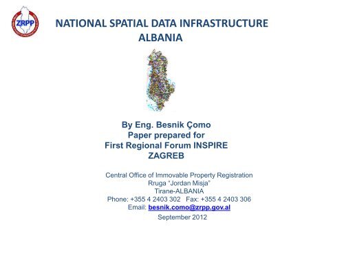
NATIONAL SPATIAL DATA INFRASTRUCTUREALBANIABy Eng. Besnik ÇomoPaper prepared forFirst Regional Forum INSPIREZAGREB<strong>Central</strong> <strong>Office</strong> <strong>of</strong> <strong>Immovable</strong> <strong>Property</strong> <strong>Registration</strong>Rruga “Jordan Misja”Tirane-ALBANIAPhone: +355 4 2403 302 Fax: +355 4 2403 306Email: besnik.como@zrpp.gov.alSeptember 2012
DEVELOPMENT OF NSDI IN ALBANIAGENERAL PRINCIPLES / INSPIRE FRAME WORK:- Policy <strong>of</strong> Measurements and Observation;- Required Data Sets;- Required Metadata (Information on Data);- Harmonization <strong>of</strong> Data;- Required Services;POLICY OF DATA.INSTITUTIONAL ASPECTS OF REALISATION :- Establishing a Governmental Commission for INSPIRE;- Monitoring and Reporting;
DEVELOPMENT OF NSDI IN ALBANIAINTRODUCTION- Very Important that since beginning <strong>of</strong> 2011 ALBANIA - efforts for Realisation <strong>of</strong> EuropeaneDirective INSPIRE 2007/2/EC.- Realisation <strong>of</strong> “Digital – ALBANIA” Project as well as <strong>the</strong> application <strong>of</strong> E_GOVERNMENT isalso a important precondition for aplying and implementation <strong>of</strong> INSPIRE.- INSPIRE is considered as one <strong>the</strong> most important basic componente in <strong>the</strong> frame <strong>of</strong>E_GOVERNMENTPolytically INSPIRE is estimated as a request for <strong>the</strong> integration in EC. .2.1 ALBANIA, SITUATION, DEVELOPMENTS FOR BUILDING NSDI.- YEAR 2010: Albanian Government appointed a National Coordinator for GIS in <strong>the</strong> Ministry <strong>of</strong>Information Technology and Communication in <strong>the</strong> Department <strong>of</strong> “Digital Albania”.- At <strong>the</strong> beginning <strong>of</strong> <strong>the</strong> Year 2011, Prime Minister <strong>of</strong> Albania signed executive order to establishan Interministerial Group, with tasks:1. COMPILATION AND MAPPING OF A POLICY DOCUMENT ON GEOSPATIAL DATA ;2. PLAN OF ACTION;3. LEGAL FRAME;4. ALBANIAN RESPONSIBLE INSTITUTIONS ON REFERENCE WITH DIRECTIVE INSPIRE2007/2/EC.
DEVELOPMENT OF NSDI IN ALBANIA- During <strong>the</strong> Year 2011, MITIK for Feedback <strong>of</strong> Inter-Ministerial Group carried out through aGeoinformation and Legislation Studio (MACK) supported and funded even by UNDP <strong>of</strong>ficein Tirana, an analyse & expertise for all <strong>the</strong> Tasks <strong>of</strong> Prime Minister Order with attention onINSPIRE Directive.The most important result and proposal from this activity was to establish:GOVERNMENTAL AUTHORITY FOR GEOSPATIAL DATA AND INFORMATION.This authority is ASIG “State Authority for Geospatial Information”Foreseen to be supported by a :OTHER RESULTS:BOARD OF GEOINFORMATION- DOCUMENT OF POLICY for BUILDING NSDI.- LAW ON GEOINFORMATION AND SPATIAL DATA:“On organisation and function <strong>of</strong> National Infrastructure on Geospatial Data in <strong>Republic</strong> <strong>of</strong>Albania”.All this activities – all important for implementation <strong>of</strong> NSDI in ALBANIA.DECISION : - Parlament <strong>of</strong> Albania approved <strong>the</strong> Law, No.72/2012, date 28.06.2012
DEVELOPMENTS OF NSDI IN ALBANIA
DEVELOPMENT OF NSDI IN ALBANIAQUESTIONS AND POSSIBILITIES FOR BUILDING OF NSDI IN ALBANIA :“Combine data from different sources allover Europe “seamlessly”, suggests as a first question to be solve:A Coordinative Refencing System ( Basic & Foundation Layer)1. Determination <strong>of</strong> a Coordinative Refencing System (a basic layer in INSPIRE), should bein coherence with <strong>the</strong> EUROPIANE Satellite Reference Frame( EUREF) and to be proper tosupport o<strong>the</strong>r NSDI Layers in optimal way for migration into Europiane INSPIRE Frame.2. Determination <strong>of</strong> Hights System( a Layer in SDI), with <strong>the</strong> same concept as in point 1. Inthis context a new overview on Hights Systems and undertaking studies, analyses as well as adesigned project for <strong>the</strong> local determination <strong>of</strong> <strong>the</strong> local GEOID included <strong>the</strong> overview <strong>the</strong>status and functioning <strong>of</strong> Mareograph/Durres, for a accurate MSL.
DEVELOPMENT OF NSDI IN ALBANIA( ALBPOS – Permanent Station on map and on Screen))
DEVELOPMENT OF NSDI IN ALBANIA2. SPATIAL DATA IN INSPIRE- Principle <strong>of</strong> Building INSPIRE: “Capture spatial data only once”and manage it where it can be done in <strong>the</strong> most efficient way”3. EO DATA SETS RESOURCES FOR INSPIRE ENTRY:(Who? What? Specification and Evaluation?)Albanian Geographic (Military) Institute ( AGMI)-Produced: Till 1990, for all Albanian Terrritory - Topografic Maps at ranges <strong>of</strong> scales, from1:10 000 till 1:100 000. Those Maps are actually digitised, georeferenced in Alb87, andevaluated for accuracy and quality. There are in TM and UTM format. Can be used inINSPIRE as “spatial data only once”.Albanian Geologic Survey (AGS), stakeholder :Main Produser <strong>of</strong> Geologic, Hidrologic, Risk and Natyral Hazards, Mineral Resources, etc. Atrange <strong>of</strong> scales 1:10000 till 1: 100 000 and in more, as 1: 200000. Those maps areimplemented by GIS, build with 11 layers. AGS has actually increased digital capacities and<strong>the</strong> volumes. Those data in digital format can be an entry to INSPIRE.
DEVELOPMENT OF NSDI IN ALBANIA
KretakusipermMOSHAINDEKSIQPg1(a)3Mollasa,nderthurje alevrolitesh me argjila.Nderthurje shtresa qymyrore.Ne pjesen e poshtme drejt lindjes ranore.(Formacioni Mezezi)Ranore shtrese trashe dhe mesme.(Formacioni Iba)Argjila-alevrolite me ndershtresa ranori.Ndershtresa e thjereza qymyrore.(Formacioni Skuterra)Ranor dhe gelqeror litotamnike,konglomerate, argjila.(Formacioni Friska)Flish argjilo-alevrolitor.Flish argjilo-ranore e argjilo - alevrolitorme horizonte te rralla konglomeratesh.Flish argjilo-ranore.Pako kalimtare.Gelqeror shtresor me boksite ne baze.Gelqeror shtresordolomite shtresore.794519° 45'41°25'874586858483828180Pergatitur per botim: Kodra, A.Naço, P.3tN 178.0 (b) 1c, 41° d, p Q h20'19° 45'54.6ujmb .124.0051.843 9696 43 97DritasiMezeziN 13t (c)45.0c, d, p Q p h136.070.084.0al Qh 1142.0k . KasollesBregu i Lumital Qp 3N 13t (c)Kamza1 km9763.0N 13t (d)93.057.078.0100.3al Qh 1123.089.077.0117.0113.0989893.0Koder Kamzal . Lanes al Qh 2114.095.1k . CerkezesCerkez - Morina78.075.0c, d, p Q p 3hal Qh 2l . Tiranes86.5108.0173.0c, d, p Q p 3h126.099k . Haxi Ketes9982.0126.03tNkroi i Mallhoxhes 1 (d)106.0al Qh 1121.0106.0127.0136.0k. Barakut103.0157.086.0105.0LAPRAKA93.444 00133.044 00107.0156.0Paskuqani97.0147.0205.0126.0Tr-1162.0217.0153.0sh. Bletes211.001182.0174.001256.3227.0124.0N 13t (d)179.1k. Pllasitl . Tiranes98.0k. Kuqe125.0198.0217.0226.0Pinariujmb .168.0228.0181.00202183.0Z.He-2Zall - Herri130.0128.0Z.He-1238.0ujmb .172.0252.0k. Pishes 156.0Babrujaal Qp3Perpiluar ne baze te rilevimeve gjeologjike ne shk.1:25 000 dhestudimeve pergji<strong>the</strong>suese: Jani, A., etj. 1990, Qirinxhi, A., etj.1978247.0278.003149.0k . Kertates3tN (c) 1207.003193.0299.0292.0209.0167.0Shkoza218.0455.0284.0165.0138.4k. Malthit251.0306.5249.0165.004Priska e Vogel209.0487.0k . Cerkanit041Pg (b)3322.0Ferrajc, d, p Q p h493.5 k . PapatitN3t 1 (a)N 13t (b)191.0160.0340.0ujmb .263.0448.0261.0ujmb .44 05451.0ujmb .1 432.0Pg (c)3ura e Brarit206.0perr. Peshkut223.044 051Pg (b)3321.0Brariujmb .k. Mallomatesk. Bausholles319.8418.0 605.0171.0al Qh 2445.0m. Shpatesk. BalliutCr2cQ p 3271.0232.0456.019°52'30``41°25'N3t 1 (a)8745450.0Punoi ne kompjuter: A. Avxhi, E. Plaku13838281807945861Pg (b)3858441°20'19°52'30``al Qh 2al Qh 1al Qp 3cQ p 31Pg (b)31Pg (a)3Pg 1PK3Pg 2Cr2a b ca b cALEGJENDA:BZ.He-1Kuaternar, zhavore, rera, alevrite.Kuaternar, alevrite, rera me copra.Kuaternar, alevrite, rera me copra.Kuaternar, zhavore, alevrite.Kuaternar, brekçie, popla, rera, alevrite te kuqe.Tortonian, Molase alevrolite, argjila me shtresa qymyre.(Formacioni Mezezi)Tortonian, Molase, ranore (Formacioni Iba).Tortonian, Molase, argjila, alevrolite, me ndershtresaranore e qymyre. (Formacioni Skuterra).Tortonian, Molase, gelqeror litotamnik, ranore,konglomerate, argjila. (Formacioni Priska).Oligocen i poshtem; flish argjilo - alevrolitor.Oligocen i poshtem; flish argjila, alevrolite, ranorme horizonte te rralla konglomeratike.Oligocen i poshtem; flish argjilo - ranor.Oligocen i poshtem; pakua kalimtare, mergledhe argjila mergelore.Eocen; Gelqeror shtresore me boksite ne baze.Kretak i siperm; Gelqeror e dolomiteKufi moshorKufi litologjikKufi tektonikKufi transgresivElemente te shtruarjes normale te shtresave.a-Renie e bute (0 - 30 ), b- Renie mesatare (30 - 60 )c- Renie e forte (60 - 90 ).Elemente te shtruarjes te permbysur te shtresave.a-Renie e bute (0 - 30 ), b- Renie mesatare (30 - 60 )c- Renie e forte (60 - 90 ).Pr<strong>of</strong>ile gjeologjikeArgjileAlevrolitRanorKonglomeratGelqeror litotamnikHorizont BoksitikGelqerorDolomitPuse per nafte e GazQymyreGelqeror ranorikReper litologjikNdryshim litologjik (facial)Liuza ranorike (kanale, bare)DEVELOPMENT OF NSDI IN ALBANIAPRODUCT GIS_PILOT INPLANSHETEN K-34-88-D-c0 m25050075010001250150017502000225025002750300032503500 mGIS_TDKDGIPKuaternar, zhavorePlansheti K-34-88-D-c (Tirana e veriut)KOLONA LITOSTATIGRAFIKEShkalla 1 : 25 000SH.1:250003tN (d) 13LITOLOGJIAPERSHKRIMIBal Qp 3 3tAluvione, Proluvione, brekçie shpati.N 1 (c)3tN (d)N 13t (a)1al Qh 2Pg (c)Pg 13EocenPg 1-22TIRANACr 2c, d, p Q hpe r . Pa rosesl . Tiranesl . LanesAl . T er k u z e sku r . Toka e Ka lmetitHARTA GJEOLOGJIKEu j m b . P a s k u q a n i tu j m b. i C e r k e z e sfaqja e Isufajvel . Terkuzespe r . Drenitpe r . Madhpe r . Cerokespe r. Isufajvepe r . Fracitl . Tiranespe r . Qershise3N 13t (d)pe r. Gjeorezesshka la e Bjeshitl . Tiranes
DEVELOPMENT OF NSDI IN ALBANIAAgency for Legalisation <strong>of</strong> Urban and Informal Zones and Buildings (ALUIZNI):- Provider <strong>of</strong> Orthophoto for all Albanian Territory, obtain from a flying Mission <strong>of</strong> 2007. High Accuracyand support topografic mapping in cities from <strong>the</strong> scales 1: 1000 and smaller. This EO product can be aentry in INSPIRE/SDI.<strong>Central</strong> Technical Archive in Tirana.Has archived and it is provider <strong>of</strong> all local geodetic nets and topografic&mapping syrvey plans, EngineeringGeologic Studies and maps, etc. <strong>of</strong> all Cities and Towns as well as many villages in Albania at ranges <strong>of</strong> Sc.1:500, 1:1000 and 1:2000 , done before <strong>the</strong> year ’90, from a EX- Technical Institute Geology _Geodesy. Allthose works or EO Data Sets are evaluated as with High accurassy standarts. Updating, filtering, migration,georeferencing <strong>of</strong> all those data first into <strong>the</strong> National Coordinative System Frame, adaptation <strong>of</strong> <strong>the</strong>m inrespect with specfication and standards <strong>of</strong> INSPIRE directive, can be result as EO data entry in NSDI.<strong>Central</strong> <strong>Office</strong> <strong>of</strong> <strong>Immovable</strong> Properties Registraton and its branchesOwnership Index Maps, Cadastral attributive data and mapas, Cadastral zoning, Ownership charts, addressing,codes, etc.OTHERS: National Agency <strong>of</strong> Forest, N.A.<strong>of</strong> Water, N.A.Environment, N.A. <strong>of</strong> TerritoryAdmnistration;etc. - are providers <strong>of</strong> various EO Data suitable for different Layers in SDI/ INSP.Urban Officies in Municipalities, Distrtricts or Cities Hall in Albania;Geo Private Companies;
DEVELOPMENT OF NSDI IN ALBANIAOrth<strong>of</strong>oto from ALUIZNI- Tirana
Compilation <strong>of</strong> Index Mapwith OrthoImagerySPATIAL DATA INFRASTRUCTUREALBANIA
DEVELOPMENTS OF NSDI IN ALBANIAINDEX MAP OF FIERI CITY FROM ORTHOPHOTO
DEVELOPMENT OF NSDI IN ALBANIA• 4. TECNOLOGIES OF GEOGRAFIC INFORMATION.1. GPS (Global Positioning Systems);2. Satellite Imaging (REMOTE SENSING);3. Geografic Information systems (GIS + WEB-GIS);- Those Technologies are foreseen as <strong>the</strong> main and basic Tools for production andprocessing <strong>of</strong> spatial data to be used for Building, Implementing and Admnistration <strong>of</strong> SDI –INSPIRE infrstructure.SITUATION IN ALBANIA , Comment: In respond <strong>of</strong> those importanttools to build <strong>the</strong> NSDI, Albania have developments as:1. Establishing ALBPOS, Albanian Sallite Positioning System, which comprises 16 permanentestations, a Control Center, actually not certified from EUPOS. Lach <strong>of</strong> expertise andmanegment in Control Center. (ALBPOS is seen as a basic technique for Building <strong>of</strong> NSDI).NEEDS: Qualification and training <strong>of</strong> Control Center staff.2. Orthophoto and Satellite images are very important for building <strong>of</strong> many layers andmonitoring in NSDI. Orthphoto (orthophoto images) is one <strong>of</strong> products to complete one <strong>of</strong><strong>the</strong> Layer in SDI. Based in principle: “only once”, Orthophoto done by ALUIZNI is seen as aProduct to be enter in <strong>the</strong> NSDI/ Albania.
INSPIRE AND DEVELOPMENTS OF NSDI IN ALBANIA2. Satellite Images are very important for Building NSDI / INSPIRE. Actually satellite Imagesand Remote Sensing data <strong>of</strong>er very accurate and qualitative Data. They <strong>of</strong>fer data on suchlayers like: Land Use, Waters, Seas, Protected Zones, Land Covers, etc.In this Context; Albania should think to Establish:A Certified Center for processing <strong>of</strong> Satellite Images and Remote Sensing.- To be a public institution;- With dependency from <strong>the</strong> National Authority <strong>of</strong> GeoSpatial data;- To generate productes for NSDI and Governmental Decision in <strong>the</strong> case <strong>of</strong> natyral hazarsand in consistent way for risks;3. GIS – have to play two roles:1. Like Builder <strong>of</strong> internals <strong>of</strong> NSDI ( Layers and DBASE) ;2. For export-import <strong>of</strong> data and Info through Portals ( Web_GIS),
INSPIRE AND DEVELOPMENTS OF NSDI IN ALBANIARELATION WITH EUROPEAN ORGANISATION and AGENCIES.- INSPIRE – Yearly Report on Implementation <strong>of</strong> NSDI from National Agencies to EU Agencies(EuroGraphics, EUREF, ESA,Etc).- Stakeholders-at and O<strong>the</strong>rs results- Under Inspire and even in <strong>the</strong> context <strong>of</strong> Inspiration, Stakeholders are identified all those organisations, publicAgencies, private, comercial, which dealt with data, geoinformation, geospatial data, etc.They seems to be very important role in Building INSPIRE and Usage <strong>of</strong> it under <strong>the</strong> precondition <strong>of</strong> <strong>the</strong>colloboration beetwen <strong>the</strong>m .The stakeholders in our country are identified to be devided by three parts dependent from <strong>the</strong>ir status <strong>of</strong> Data.:1. Produsers 2. Providers 3. Users- Albania through this Project has identify over 24 Stakeholders.- We except fullfilment <strong>of</strong> tasks <strong>of</strong> project, is trying to undertake some activities , in order to increaseunderstanding and wearness <strong>of</strong> institutions, Stakeholders, students, GIS Data specialist, government,public,etc.- Two Presantions with Pr<strong>of</strong>esors and MSc. Students as well as with over 100 surveyers <strong>of</strong> Pan- AlbanianGeodetic Association on INSPIRE DIRECTIVE and its Application in Albania and Balkan.- Participation in <strong>the</strong> Inter- governmental Group for preparation <strong>of</strong> Institutional Plan for Implementation <strong>of</strong>INSPIRE, etc.
DATA FROM THE MARKET PRICE IN TIRANA
DATA FROM THE MARKET PRICE IN TIRANAAVERAGE PRICES FOR YEARS 1996, 2002, 2003, 2004, 2005, 2006, 2007,2008ACCORDING TO THE MAIN ROAD AXES
DEVELOPMENT OF NSDI IN ALBANIA• On <strong>the</strong> next three years we foreseen to do this activities• Will finish <strong>the</strong> First <strong>Registration</strong> on <strong>the</strong> Urban area for entire Country• Will finish First <strong>Registration</strong> and index mapping for all Albania• The project for a new ortophoto and a new topographic map for Albania• The Gravimetric project, reason to built Albanian Geoids.• Will finish project <strong>of</strong> digitalization <strong>of</strong> registration process in 10 biggest <strong>Office</strong>s
DEVELOPMENTS OF NSDI IN ALBANIA• Collaboration with state on <strong>the</strong> region and more• The project with World Bank 21 Million $, First <strong>Registration</strong> and o<strong>the</strong>r activities.• The twining project with Lantmateriet (Swedeen)• The project for coordinative network with Military Institute <strong>of</strong> Florence (Italy)• The project for change <strong>the</strong> maps small scale from TM in UTM standard (NATO)• Orientation and interchange <strong>of</strong> information with Regional Country making jointproject.
THANK YOU