Hawaii FEP - Western Pacific Fishery Council
Hawaii FEP - Western Pacific Fishery Council
Hawaii FEP - Western Pacific Fishery Council

Create successful ePaper yourself
Turn your PDF publications into a flip-book with our unique Google optimized e-Paper software.
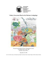
<strong>Fishery</strong> Ecosystem Plan for the <strong>Hawaii</strong> Archipelago<strong>Western</strong> <strong>Pacific</strong> Regional <strong>Fishery</strong> Management <strong>Council</strong>1164 Bishop Street, Suite 1400Honolulu, <strong>Hawaii</strong> 96813September 24, 2009Cover Artwork Courtesy of Jeffry Ejan, John F. Kennedy High School, Tamuning, Guam
EXECUTIVE SUMMARYThe Magnuson-Stevens <strong>Fishery</strong> Conservation and Management Act (MSA) authorizes fisherymanagement councils to create fishery management plans (FMP). The <strong>Western</strong> <strong>Pacific</strong> Regional<strong>Fishery</strong> Management <strong>Council</strong> developed this <strong>Fishery</strong> Ecosystem Plan (<strong>FEP</strong>) as an FMP,consistent with the MSA and the national standards for fishery conservation and management.The <strong>FEP</strong> represents the first step in an incremental and collaborative approach to implementecosystem approaches to fishery management in the <strong>Hawaii</strong>an Archipelago. Since the 1980s, the<strong>Council</strong> has managed fisheries throughout the <strong>Western</strong> <strong>Pacific</strong> Region through separate speciesbasedfishery management plans (FMP) – the Bottomfish and Seamount Groundfish FMP(WPRFMC 1986a), the Crustaceans FMP (WPRFMC 1981), the Precious Corals FMP(WPRFMC 1979), the Coral Reef Ecosystems FMP (WPRFMC 2001) and the Pelagic FMP(WPRFMC 1986b).However, the <strong>Council</strong> is now moving towards an ecosystem-based approach to fisheriesmanagement and is restructuring its management framework from species-based FMPs to placebased<strong>FEP</strong>s. Recognizing that a comprehensive ecosystem approach to fisheries managementmust be initiated through an incremental, collaborative, and adaptive management process, amulti-step approach is being used to develop and implement the <strong>FEP</strong>s. To be successful, this willrequire increased understanding of a range of issues including biological and trophicrelationships, ecosystem indicators and models, and the ecological effects of non-fishingactivities on the marine environment.The <strong>Hawaii</strong> Archipelago <strong>FEP</strong> establishes the framework under which the <strong>Council</strong> will managefishery resources, and begin the integration and implementation of ecosystem approaches tomanagement in the <strong>Hawaii</strong> Archipelago. This <strong>FEP</strong> does not establish any new fisherymanagement regulations at this time, but rather consolidates existing fishery regulations fordemersal species. Specifically, this <strong>FEP</strong> identifies as management unit species those currentmanagement unit species known to be present in waters around the <strong>Hawaii</strong> Archipelago andincorporates all of the management provisions of the Bottomfish and Seamount GroundfishFMP, the Crustaceans FMP, the Precious Corals FMP, and the Coral Reef Ecosystems FMP thatare applicable to the area. Although pelagic fishery resources play an important role in thebiological as well as the socioeconomic environment of these islands, they will be managedseparately through the <strong>Pacific</strong> Pelagic <strong>FEP</strong>.In 1998, the U.S. Congress charged the National Marine Fisheries Service (NMFS, also knownas NOAA Fisheries Service), with the establishment of an Ecosystem Principles Advisory Panel(EPAP), which was responsible for assessing the extent that ecosystem principles were beingused in fisheries management and research, and recommending how to further the use ofecosystem pricipals to improve the status and management of marine resources. The EPAP(1999) reached consensus that <strong>FEP</strong>s should be developed and implemented to manage U.S.fisheries and marine resources. According to the EPAP, a <strong>FEP</strong> should contain and implement amanagement framework to control harvests of marine resources on the basis of availableinformation regarding the structure and function of the ecosystem in which such harvests occur.The EPAP constructed eight ecosystem principles that it believes to be important to the
successful management of marine ecosystems. These were recognized and used as a guide by the<strong>Council</strong> in developing this <strong>FEP</strong>. The principles are as follows:• The ability to predict ecosystem behavior is limited.• Ecosystems have real thresholds and limits that, when exceeded, can affect major systemrestructuring.• Once thresholds and limits have been exceeded, changes can be irreversible.• Diversity is important to ecosystem functioning.• Multiple scales interact within and among ecosystems.• Components of ecosystems are linked.• Ecosystem boundaries are open.• Ecosystems change with time.The National Oceanic and Atmospheric Administration (NOAA) defines an ecosystem approachas “management that is adaptive, specified geographically, takes account of ecosystemknowledge and uncertainties, considers multiple external influences, and strives to balancediverse social objectives.” In addition, because of the wide ranging nature of ecosystems,successful implementation of ecosystem approaches will need to be incremental andcollaborative (NOAA 2004).The overall goal of the <strong>Hawaii</strong> Archipelago <strong>FEP</strong> is to establish a framework under which the<strong>Council</strong> will improve its abilities to realize the goals of the MSA through the incorporation ofecosystem science and principles. To achieve this goal, the <strong>Council</strong> has adopted the followingten objectives for the <strong>Hawaii</strong> Archipelago <strong>FEP</strong>:Objective 1: To maintain biologically diverse and productive marine ecosystems and foster thelong-term sustainable use of marine resources in an ecologically and culturally sensitive mannerthrough the use of a science-based ecosystem approach to resource management.Objective 2: To provide flexible and adaptive management systems that can rapidly address newscientific information and changes in environmental conditions or human use patterns.Objective 3: To improve public and government awareness and understanding of the marineenvironment in order to reduce unsustainable human impacts and foster support for responsiblestewardship.Objective 4: To encourage and provide for the sustained and substantive participation of localcommunities in the exploration, development, conservation, and management of marineresources.Objective 5: To minimize fishery bycatch and waste to the extent practicable.Objective 6: To manage and comanage protected species, protected habitats, and protected areas.Objective 7: To promote the safety of human life at sea.ii
Objective 8: To encourage and support appropriate compliance and enforcement with allapplicable local and federal fishery regulations.Objective 9: To increase collaboration with domestic and foreign regional fishery managementand other governmental and non-governmental organizations, communities, and the public atlarge to successfully manage marine ecosystems.Objective 10: To improve the quantity and quality of available information to support marineecosystem management.This document discusses the key components of the <strong>Hawaii</strong> Archipelago ecosystem, including anoverview of the region’s non-pelagic fisheries, and details how the measures contained here areconsistent with the MSA and other applicable laws. This <strong>FEP</strong>, in conjunction with the <strong>Council</strong>'sAmerican Samoa Archipelago, Mariana Archipelago, <strong>Pacific</strong> Remote Island Areas, and <strong>Pacific</strong>Pelagic <strong>FEP</strong>s, incorporates by reference and replaces the <strong>Council</strong>'s existing Bottomfish andSeamount Groundfish, Crustaceans, Precious Corals, Coral Reef Ecosystems and Pelagics<strong>Fishery</strong> Management Plans (and their amendments) and reorganizes their associated regulationsinto a place-based structure aligned with the <strong>FEP</strong>s.In addition, under the <strong>Hawaii</strong> Archipelago<strong>FEP</strong>, the organizational structure for developing and implementing <strong>Fishery</strong> Ecosystem Plansexplicitly incorporates community input and local knowledge into the management process.Future fishery management actions are anticipated to incorporate additional information as itbecomes available. An adaptive management approach will be used to further advance theimplementation of ecosystem science and principles. Such actions would be taken in accordancewith the Magnuson-Stevens <strong>Fishery</strong> Conservation and Management Act, the NationalEnvironmental Policy Act, the Endangered Species Act, the Marine Mammal Protection Act, andother applicable laws and statutes.iii
TABLE OF CONTENTSEXECUTIVE SUMMARY ............................................................................................................. iLIST OF TABLES......................................................................................................................... ixLIST OF FIGURES ........................................................................................................................ xACRONYMS................................................................................................................................. xiDEFINITIONS............................................................................................................................. xivCHAPTER 1: INTRODUCTION................................................................................................... 21.1 Introduction..................................................................................................................... 21.2 Purpose and Need for Action.......................................................................................... 31.3 Incremental Approach to Ecosystem-based Management.............................................. 51.4 <strong>Hawaii</strong> Archipelago <strong>FEP</strong> Boundaries ............................................................................. 51.4.1 Papahanaumokuakea Marine National Monument................................................. 61.5 <strong>Hawaii</strong> Archipelago <strong>FEP</strong> Management Objectives ........................................................ 71.6 <strong>Hawaii</strong> Archipelago <strong>FEP</strong> Management Unit Species ..................................................... 81.7 Regional Coordination.................................................................................................. 191.7.1 <strong>Council</strong> Panels and Committees ........................................................................... 191.7.2 Community Groups and Projects.......................................................................... 221.7.3 International Management .................................................................................... 24CHAPTER 2: TOPICS IN ECOSYSTEM APPROACHES TO MANAGEMENT .................... 262.1 Introduction................................................................................................................... 262.2 Ecosystem Boundaries.................................................................................................. 262.3 Precautionary Approach, Burden of Proof, and Adaptive Management ...................... 272.4 Ecological Effects of Fishing and Non-fishing Activities ............................................ 272.5 Data and Information Needs ......................................................................................... 282.6 Use of Indicators and Models ....................................................................................... 292.7 Single-species Management Versus Multi-species Management................................. 302.8 Ocean Zoning................................................................................................................ 312.9 Intra-agency and Inter-agency Cooperation.................................................................. 312.10 Community-based Management ................................................................................... 322.10.1 Community Participation...................................................................................... 332.10.2 Community Development..................................................................................... 34CHAPTER 3: DESCRIPTION OF THE ENVIRONMENT........................................................ 353.1 Introduction................................................................................................................... 353.2 Physical Environment ................................................................................................... 353.2.1 The <strong>Pacific</strong> Ocean................................................................................................. 353.2.2 Geology and Topography ..................................................................................... 353.2.3 Ocean Water Characteristics................................................................................. 373.2.4 Ocean Layers ........................................................................................................ 383.2.5 Ocean Zones.......................................................................................................... 393.2.6 Ocean Water Circulation....................................................................................... 403.2.7 Surface Currents.................................................................................................... 403.2.8 Transition Zones ................................................................................................... 413.2.9 Eddies.................................................................................................................... 423.2.10 Deep-ocean Currents............................................................................................. 433.2.11 Prominent <strong>Pacific</strong> Ocean Meteorological Features............................................... 43iv
3.2.12 <strong>Pacific</strong> Island Geography...................................................................................... 453.2.12.1 Micronesia..................................................................................................... 453.2.12.2 Melanesia ...................................................................................................... 463.2.12.3 Polynesia....................................................................................................... 473.3 Biological Environment................................................................................................ 493.3.1 Marine Food Chains, Trophic Levels, and Food Webs ........................................ 493.3.2 Benthic Environment ............................................................................................ 513.3.2.1 Intertidal Zone................................................................................................... 523.3.2.2 Seagrass Beds.................................................................................................... 523.3.2.3 Mangrove Forests.............................................................................................. 533.3.2.4 Coral Reefs........................................................................................................ 533.3.2.5 Deep Reef Slopes.............................................................................................. 613.3.2.6 Banks and Seamounts ....................................................................................... 613.3.2.7 Deep Ocean Floor ............................................................................................. 623.3.2.7.1 Benthic Species of Economic Importance .................................................... 633.3.3 Pelagic Environment............................................................................................. 673.3.4 Protected Species .................................................................................................. 703.3.4.1 Sea Turtles ........................................................................................................ 703.3.4.2 Marine Mammals.............................................................................................. 773.3.4.3 Seabirds............................................................................................................. 813.4 Social Environment....................................................................................................... 83CHAPTER 4: DESCRIPTION OF HAWAII ARCHIPELAGO FISHERIES............................. 894.1 Introduction................................................................................................................... 894.2 <strong>Hawaii</strong> ArchipelagoBottomfish Fisheries..................................................................... 894.2.1 History and Patterns of Use .................................................................................. 894.2.2 Review of Bycatch................................................................................................ 934.2.3 Status of Bottomfish <strong>Fishery</strong> ................................................................................ 984.2.4 Bottomfish MSY................................................................................................. 1044.2.5 Bottomfish Optimum Yield ................................................................................ 1044.2.6 Bottomfish Domestic Processing Capacity......................................................... 1044.2.7 Bottomfish Total Allowable Level of Foreign Fishing....................................... 1044.3 <strong>Hawaii</strong> Archipelago Crustacean Fisheries.................................................................. 1044.3.1 History and Patterns of Use ................................................................................ 1044.3.2 Review of Bycatch.............................................................................................. 1094.3.3 Status of Crustaceans <strong>Fishery</strong> ............................................................................. 1124.3.4 Crustaceans MSY................................................................................................ 1124.3.5 Crustaceans Optimum Yield............................................................................... 1124.3.6 Crustaceans Domestic Processing Capacity ....................................................... 1134.3.7 Crustaceans TALFF............................................................................................ 1134.4 <strong>Hawaii</strong> Archipelago Precious Coral Fisheries ............................................................ 1134.4.1 History of Patterns and Use ................................................................................ 1134.4.2 Review of Bycatch.............................................................................................. 1144.4.3 Status of Precious Corals <strong>Fishery</strong> ....................................................................... 1164.4.4 Precious Corals <strong>Fishery</strong> MSY............................................................................. 1174.4.5 Precious Corals Optimum Yield ......................................................................... 1184.4.6 Precious Corals Domestic Processing Capacity ................................................. 120v
8.2.4 <strong>Fishery</strong> Data Requirements................................................................................. 2228.2.5 Description of EFH............................................................................................. 2228.2.6 <strong>Fishery</strong> Impact Statement ................................................................................... 2228.2.7 Overfishing Criteria ............................................................................................ 2238.2.8 Bycatch Reporting .............................................................................................. 2238.2.9 Recreational Catch and Release.......................................................................... 2248.2.10 Description of <strong>Fishery</strong> Sectors............................................................................ 2258.2.11 National Standards for <strong>Fishery</strong> Conservation and Management ........................ 2258.3 Essential Fish Habitat ................................................................................................. 2278.4 Coastal Zone Management Act................................................................................... 2288.5 Endangered Species Act ............................................................................................. 2288.6 Marine Mammal Protection Act ................................................................................. 2308.7 National Environmental Policy Act............................................................................ 2328.8 Paperwork Reduction Act (PRA)................................................................................ 2328.9 Regulatory Flexibility Act (RFA)............................................................................... 2328.10 Executive Order 12866 ............................................................................................... 2338.11 Information Quality Act.............................................................................................. 2338.12 Executive Order 13112 ............................................................................................... 2348.13 Executive Order 13089 ............................................................................................... 2348.14 Papahanaumokuakea Marine National Monument..................................................... 235CHAPTER 9: STATE, LOCAL AND OTHER FEDERAL AGENCIES.................................. 2369.1 Introduction................................................................................................................. 2369.2 State of <strong>Hawaii</strong>............................................................................................................ 2369.3 U.S. Fish and Wildlife Refuges and Units.................................................................. 2379.4 Northwestern <strong>Hawaii</strong>an Islands Coral Reef Ecosystem Reserve ............................... 2379.5 <strong>Hawaii</strong>an Islands Humpback Whale National Marine Sanctuary............................... 2389.6 Department of Defense Naval Defensive Sea Areas .................................................. 239CHAPTER 10: DRAFT REGULATIONS ................................................................................. 240CHAPTER 11: REFERENCES .................................................................................................. 241viii
LIST OF TABLESTable 1: <strong>Hawaii</strong> Archipelago Bottomfish Management Unit Species............................................ 9Table 2: <strong>Hawaii</strong> Archipelago Crustaceans Management Unit Species ........................................ 10Table 3: <strong>Hawaii</strong> Archipelago Precious Corals Management Unit Species................................... 10Table 4: <strong>Hawaii</strong> Archipelago Coral Reef Ecosystem Management Units Species, CurrentlyHarvested Coral Reef Taxa........................................................................................................... 11Table 5: <strong>Hawaii</strong> Archipelago Coral Reef Ecosystem Management Unit Species, PotentiallyHarvested Coral Reef Taxa........................................................................................................... 16Table 6: <strong>FEP</strong> Advisory Panel and Sub-panel Structure................................................................ 20Table 7: Non-ESA Listed Marine Mammals of the <strong>Western</strong> <strong>Pacific</strong> ........................................... 80Table 8: <strong>Hawaii</strong>’s Gross State Product ......................................................................................... 83Table 9: <strong>Hawaii</strong>’s “Export” Industries.......................................................................................... 84Table 10: <strong>Hawaii</strong> Employment Statistics...................................................................................... 85Table 11: <strong>Hawaii</strong> Cost of Living Comparison.............................................................................. 85Table 12: Ex-vessel Revenues from <strong>Hawaii</strong>’s Demersal Fisheries .............................................. 88Table 13. Summary of Unique CML numbers by Area Fished.................................................... 90Table 14. Catch and Bycatch in the NWHI <strong>Fishery</strong> ..................................................................... 95Table 15: NWHI Lobster Permit Holder Entry/Exit Pattern ...................................................... 105Table 16: Volume and Value of Black Coral Landings in <strong>Hawaii</strong> 1990-1997........................... 114Table 17: MSY Estimates for Precious Corals in the Makapuu Bed.......................................... 118Table 18: OY values (Harvest Quotas) for <strong>Hawaii</strong> Precious Corals .......................................... 119Table 19: MHI Top Ten Catches of Coral Reef Associated Species 2000-2005 ....................... 122Table 20: Overfishing Threshold Specifications:Bottomfish and Seamount Groundfish Stocks144Table 21: Recruitment Overfishing Control Rule Specifications: Bottomfish and SeamountGroundfish Stocks....................................................................................................................... 145Table 22: Archipelagic Reference Values for the Dynamic Production Model (2004 data)...... 146Table 23: Overfishing Threshold Specifications: NWHI Lobster Stocks .................................. 158Table 24: Rebuilding Control Rule Specifications: NWHI Lobster Stocks ............................... 158Table 25: Estimates of MSY of Precious Corals in the Makapuu Bed....................................... 164Table 26: Precious Coral Harvest Quotas................................................................................... 164Table 27: CPUE-based Overfishing Limits and Reference Points: Coral Reef Species ............ 168Table 28: Change in Landings for Selected <strong>Hawaii</strong> CHCRT, 1948-1952 vs. 1995-1999.......... 171Table 29: Occurrence of Currently Harvested Management Unit Species................................. 183Table 30: Occurrence of Currently Harvested Management Unit Species: AquariumTaxa/Species ............................................................................................................................... 188Table 31: Summary of EFH Designations for Currently Harvested Coral Reef Taxa ............... 190Table 32: Occurrence of Potentially Harvested Coral Reef Taxa............................................... 193Table 33: Summary of EFH Designations for Potentially Harvested Coral Reef Taxa ............. 196Table 34: EFH and HAPC Designations for <strong>Hawaii</strong> Archipelago <strong>FEP</strong> MUS............................ 199Table 35: Coral Reef Ecosystem HAPC Designations in the <strong>Hawaii</strong> Archipelago.................... 202Table 36: Threats to Coral Reefs in the <strong>Hawaii</strong> Archipelago..................................................... 206Table 37: <strong>FEP</strong> Advisory Panel and Sub-panel Structure............................................................ 215Table 38: Bycatch Reporting Methodology for <strong>Hawaii</strong> Archipelago Demersal Fisheries......... 224Table 39: EFH and HAPC for MUS of the <strong>Western</strong> <strong>Pacific</strong> Region.......................................... 227ix
LIST OF FIGURESFigure 1: <strong>Western</strong> <strong>Pacific</strong> Region................................................................................................... 2Figure 2: Map of the <strong>Hawaii</strong> Archipelago ...................................................................................... 6Figure 3: Schematic Diagram of the Earth's Lithospheric Plates ................................................ 36Figure 4: Temperature and Salinity Profile of the Ocean............................................................. 39Figure 5: Depth Profile of Ocean Zones....................................................................................... 40Figure 6: Major Surface Currents of the <strong>Pacific</strong> Ocean................................................................ 41Figure 7: North <strong>Pacific</strong> Transition Zone....................................................................................... 42Figure 8: Deep Ocean Water Movement ...................................................................................... 43Figure 9: Central <strong>Pacific</strong> Pelagic Food Web................................................................................. 51Figure 10: Benthic Environment................................................................................................... 52Figure 11: Gross State Product, 1970-2005.................................................................................. 85Figure 12: <strong>Hawaii</strong> Median Household Income, 1975-2005.......................................................... 86Figure 13: MHI and NWHI Bottomfish Landings 1986–2003..................................................... 92Figure 14: <strong>Hawaii</strong> Bottomfish Revenue (Inflation Adjusted) by Area 1970–2003...................... 92Figure 15: Average Prices for NWHI and MHI BMUS Landings 1970–2003 ............................ 93Figure 16: NWHI Lobster <strong>Fishery</strong> Landings 1983–1999 (top) .................................................. 106Figure 17: NWHI Lobster <strong>Fishery</strong> Inflation-adjusted Ex-vessel Revenue, 1984-1999.............. 107Figure 18: MHI Coral Reef Associated Catches, Sales, and Ex-vessel Revenue, 2000-2005 ... 122Figure 19: MHI Top 10 Coral Reef-associated Species Catch Composition, 2000-2005 Avg. . 123Figure 20: Example MSY, Target, and Rebuilding Control Rules............................................. 135Figure 21: Combination of Control Rules and Reference Points for Bottomfish and SeamountGroundfish Stocks....................................................................................................................... 149Figure 22: Combination of Control Rules and Reference Points for NWHI Lobster Stocks..... 160Figure 23: Time Series of Aggregate CHCRT CPUE from HDAR Data................................... 169Figure 24: Time Series of Menpachi (Myripristis spp.) CPUE from HDAR Data..................... 169Figure 25: Time Series of Weke (Mulloidichthys spp.) CPUE from HDAR Data..................... 170Figure 26: Illustration of Institutional Linkages in the <strong>Council</strong> Process .................................... 220x
ACRONYMSAPA: Administrative Procedure ActB: Stock BiomassB FLAG : Minimum Biomass FlagB MSY : Biomass Maximum Sustainable YieldB OY : Biomass Optimum YieldBMUS: Bottomfish Management Unit SpeciesCFR: Code of Federal RegulationsCITES: <strong>Council</strong> on International Trade and Endangered Speciescm: centimetersCNMI: Commonwealth of the Northern Mariana IslandsCPUE: Catch per Unit EffortCPUE MSY : Catch per unit effort Maximum Sustainable YieldCPUE REF : Catch per unit effort at the Reference PointCRAMP: Coral Reef Assessment and Monitoring ProgramCRE: Coral Reef EcosystemCRE-FMP: Coral Reef Ecosystem <strong>Fishery</strong> Management PlanCRTF: Coral Reef Task ForceCZMA: Coastal Zone Management ActDAR: Division of Aquatic Resources, Government of <strong>Hawaii</strong>DBEDT: Department of Business, Economic Development and Tourism, State of <strong>Hawaii</strong>DLNR: Department of Land and Natural Resources, Government of <strong>Hawaii</strong>DOC: United States Department of CommerceDOD: United States Department of DefenseDOI: United States Department of the InteriorEEZ: Exclusive Economic ZoneEFH: Essential Fish HabitatEIS: Environmental Impact StatementE MSY : Effort Maximum Sustainable YieldENSO: El Niño Southern OscillationEO: Executive OrderEPAP: Ecosystem Principals Advisory PanelESA: Endangered Species ActF: Fishing mortalityF MSY : Fishing mortality Maximum Sustainable YieldF OY : Fishing mortality Optimum Yield<strong>FEP</strong>: <strong>Fishery</strong> Ecosystem PlanFDM: Farallon de Medinilla, CNMI<strong>FEP</strong>: <strong>Fishery</strong> Ecosystem PlanFFS: French Frigate ShoalsFLPMA: Federal Land Policy and Management Actfm: fathomsFMP: <strong>Fishery</strong> Management PlanFR: Federal Registerxi
FRFA: Final Regulatory Flexibility AnalysisFWCA: Fish and Wildlife Coordination ActGIS: Geographic information systemsGPS: Global Positioning SystemHAPC: Habitat Areas of Particular ConcernHCRI: <strong>Hawaii</strong> Coral Reef Initiative Research ProgramHINWR: <strong>Hawaii</strong>an Islands National Wildlife RefugeHIR: <strong>Hawaii</strong>an Islands ReservationHMSRT <strong>Hawaii</strong>an Monk Seal Recovery TeamIRFA Initial Regulatory Flexibility Analysiskg: kilogramskm: kilometersLOF List of FisheriesLORAN Long Range Aid to Navigationm: metersmt: metric tonsMFMT: Maximum Fishing Mortality ThresholdMHI: Main <strong>Hawaii</strong>an Islandsmm: millimetersMMPA: Marine Mammal Protection ActMPA: Marine Protected AreaMSA: Magnuson-Stevens Fisheries Conservation and Management ActMSST: Minimum Stock Size ThresholdMSY: Maximum Sustainable YieldMUS: Management Unit SpeciesNDSA: Naval Defense Sea AreasNEPA: National Environmental Policy Actnm or nmi: nautical milesNMFS: National Marine Fisheries Service (also known as NOAA Fisheries Service)NOAA: National Oceanic and Atmospheric AdministrationNWHI: Northwestern <strong>Hawaii</strong>an IslandsNWR: National Wildlife RefugeNWRSAA: National Wildlife Refuge System Administration ActOMB: Office of Management and BudgetOY: Optimum YieldPBR: Potential Biological RemovalPIFSC: <strong>Pacific</strong> Islands Fisheries Science Center, NMFSPIRO: <strong>Pacific</strong> Islands Regional Office, NMFSPRA: Paperwork Reduction ActPRIA: <strong>Pacific</strong> Remote Island AreasRFA: Regulatory Flexibility ActRIR: Regulatory Impact ReviewSFA: Sustainable Fisheries ActSLA: Submerged Lands ActSPR: Spawning Potential RatioSWR: State Wildlife Refugexii
SSC:TALFF:TSLA:USCG:USFWS:VMS:WPacFIN:WPRFMCScientific and Statistical CommitteeTotal Allowable Level of Foreign FishingTerritorial Submerged Lands ActUnited States Coast GuardUnited States Fish and Wildlife ServiceVessel Monitoring System<strong>Western</strong> <strong>Pacific</strong> Fisheries Information Network, NMFS<strong>Western</strong> <strong>Pacific</strong> Regional <strong>Fishery</strong> Management <strong>Council</strong>xiii
DEFINITIONSAdaptive Management: A program that adjusts regulations based on changing conditions of thefisheries and stocks.Bycatch: Any fish harvested in a fishery which are not sold or kept for personal use, andincludes economic discards and regulatory discards.Barrier Net: A small-mesh net used to capture coral reef or coastal pelagic fishes.Bioprospecting: The search for commercially valuable biochemical and genetic resources inplants, animals and microorganisms for use in food production, the development of newdrugs and other biotechnology applications.Charter Fishing: Fishing from a vessel carrying a passenger for hire (as defined in section2101(21a) of Title 46, United States Code) who is engaged in recreational fishing.Commercial Fishing: Fishing in which the fish harvested, either in whole or in part, areintended to enter commerce or enter commerce through sale, barter or trade. For thepurposes of this <strong>Fishery</strong> Ecosystem Plan, commercial fishing includes the commercialextraction of biocompounds.Consensual Management: Decision making process where stakeholders meet and reachconsensus on management measures and recommendations.Coral Reef Ecosystem (CRE): Those species, interactions, processes, habitats and resources ofthe water column and substrate located within any waters less than or equal to 50 fathomsin total depth.<strong>Council</strong>: The <strong>Western</strong> <strong>Pacific</strong> Regional <strong>Fishery</strong> Management <strong>Council</strong> (WPRFMC).Critical Habitat: Those geographical areas that are essential for bringing an endangered orthreatened species to the point where it no longer needs the legal protections of theEndangered Species Act (ESA), and which may require special managementconsiderations or protection. These areas are designated pursuant to the ESA as havingphysical or biological features essential to the conservation of listed species.Dealer: One who (1) Obtains, with the intention to resell management unit species, or portionsthereof, that were harvested or received by a vessel that holds a permit or is otherwiseregulated; or (2) Provides recordkeeping, purchase, or sales assistance in obtaining orselling such management unit species (such as the services provided by a wholesaleauction facility).xiv
Dip Net: A hand-held net consisting of a mesh bag suspended from a circular, oval, square orrectangular frame attached to a handle. A portion of the bag may be constructed ofmaterial, such as clear plastic, other than mesh.Ecology: The study of interactions between an organism (or organisms) and its (their)environment (biotic and abiotic).Ecological Integrity: Maintenance of the standing stock of resources at a level that allowsecosystem processes to continue. Ecosystem processes include replenishment ofresources, maintenance of interactions essential for self-perpetuation and, in the case ofcoral reefs, rates of accretion that are equal to or exceed rates of erosion. Ecologicalintegrity cannot be directly measured but can be inferred from observed ecologicalchanges.Economic Discards: <strong>Fishery</strong> resources that are the target of a fishery but which are not retainedbecause they are of an undesirable size, sex or quality or for other economic reasons.Ecosystem: A geographically specified system of organisms (including humans), theenvironment, and the processes that control its dynamics.Ecosystem-Based <strong>Fishery</strong> Management: <strong>Fishery</strong> management actions aimed at conserving thestructure and function of marine ecosystems in addition to conserving fishery resources.Ecotourism: Observing and experiencing, first hand, natural environments and ecosystems in amanner intended to be sensitive to their conservation.Environmental Impact Statement (EIS): A document required under the NationalEnvironmental Policy Act (NEPA) to assess alternatives and analyze the impact on theenvironment of proposed major Federal actions significantly affecting the humanenvironment.Essential Fish Habitat (EFH): Those waters and substrate necessary to a species or speciesgroup or complex, for spawning, breeding, feeding or growth to maturity.Exclusive Economic Zone (EEZ): The zone established by Proclamation number 5030, datedMarch 10, 1983. For purposes of the Magnuson Act, the inner boundary of that zone is aline coterminous with the seaward boundary of each of the coastal states,commonwealths, territories or possessions of the United States.Exporter: One who sends species in the fishery management unit to other countries for sale,barter or any other form of exchange (also applies to shipment to other states, territoriesor islands).Fish: Finfish, mollusks, crustaceans and all other forms of marine animal and plant life otherthan marine mammals and birds.xv
<strong>Fishery</strong>: One or more stocks of fish that can be treated as a unit for purposes of conservation andmanagement and that are identified on the basis of geographical, scientific, technical,recreational and economic characteristics; and any fishing for such stocks.<strong>Fishery</strong> Ecosystem Plan: A fishery ecosystem management plan that contains conservation andmanagement measures necessary and appropriate for fisheries within a given ecosystemto prevent overfishing and rebuild overfished stocks, and to protect, restore, and promotethe long-term health and stability of the fishery.Fishing: The catching, taking or harvesting of fish; the attempted catching, taking or harvestingof fish; any other activity that can reasonably be expected to result in the catching, takingor harvesting of fish; or any operations at sea in support of, or in preparation for, anyactivity described in this definition. Such term does not include any scientific researchactivity that is conducted by a scientific research vessel.Fishing Community: A community that is substantially dependent on or substantially engagedin the harvest or processing of fishery resources to meet social and economic needs andincludes fishing vessel owners, operators and crews and United States fish processors thatare based in such community.Food Web: Inter-relationships among species that depend on each other for food (predator-preypathways).Framework Measure: Management measure listed in an <strong>FEP</strong> for future consideration.Implementation can occur through an administratively simpler process than a full <strong>FEP</strong>amendment.Ghost Fishing: The chronic and/or inadvertent capture and/or loss of fish or other marineorganisms by lost or discarded fishing gear.Habitat: Living place of an organism or community, characterized by its physical and bioticproperties.Habitat Area of Particular Concern (HAPC): Those areas of EFH identified pursuant toSection 600.815(a)(8). In determining whether a type or area of EFH should bedesignated as a HAPC, one or more of the following criteria should be met: (1) ecologicalfunction provided by the habitat is important; (2) habitat is sensitive to human-inducedenvironmental degradation; (3) development activities are, or will be, stressing the habitattype; or (4) the habitat type is rare.Harvest: The catching or taking of a marine organism or fishery MUS by any means.Hook-and-line: Fishing gear that consists of one or more hooks attached to one or more lines.Live Rock: Any natural, hard substrate (including dead coral or rock) to which is attached, orwhich supports, any living marine life-form associated with coral reefs.xvi
Longline: A type of fishing gear consisting of a main line which is deployed horizontally fromwhich branched or dropper lines with hooks are attached.Low-Use MPA: A Marine Protected Area zoned to allow limited fishing activities.Main <strong>Hawaii</strong>an Islands (MHI): The islands of the <strong>Hawaii</strong>an islands archipelago consisting ofNiihau, Kauai, Oahu, Molokai, Lanai, Maui, Kahoolawe, <strong>Hawaii</strong> and all of the smallerassociated islets lying east of 161° W longitude.Marine Protected Area (MPA): An area designated to allow or prohibit certain fishingactivities.Maximum Sustainable Yield (MSY): The largest long-term average catch or yield that can betaken from a stock or stock complex under prevailing ecological and environmentalconditions, fishery technological characteristics (e.g., gear slectivity), and distribution ofcatch among fleets.National Marine Fisheries Service (NMFS): The component of the National Oceanic andAtmospheric Administration (NOAA), Department of Commerce, responsible for theconservation and management of living marine resources. Also known as NOAAFisheries Service.No-Take MPA: A Marine Protected Area where no fishing or removal of living marineresources is authorized.Northwestern <strong>Hawaii</strong>an Islands (NWHI): The islands of the <strong>Hawaii</strong> Archipelago lying to thewest of 161° W longitude.Optimum Yield (OY): With respect to the yield from a fishery “optimum” means the amount offish that: (a) will provide the greatest overall benefit to the nation, particularly withrespect to food production and recreational opportunities and taking into account theprotection of marine ecosystems; (b) is prescribed as such on the basis of the MSY fromthe fishery, as reduced by any relevant economic, social or ecological factor; and (c) inthe case of an overfished fishery, provides for rebuilding to a level consistent withproducing the MSY in such fishery.Overfished: A stock or stock complex is considered “overfished” when its biomass has declinedbelow a level that jeopardizes the capacity of the stock or stock complex to producemaximum sustainable yield on a continuing basis.Overfishing: (to overfish) occurs whenever a stock or stock complex is subjected to a level offishing mortality or total annual catch that jeopardizes the capacity of a stock or stockcomplex to produce maximum sustainable yield on a continuing basis.xvii
<strong>Pacific</strong> Remote Island Areas (PRIA): Baker Island, Howland Island, Jarvis Island, JohnstonAtoll, Kingman Reef, Midway Atoll, Wake Island and Palmyra Atoll.Passive Fishing Gear: Gear left unattended for a period of time prior to retrieval (e.g., traps, gillnets).Precautionary Approach: The implementation of conservation measures even in the absence ofscientific certainty that fish stocks are being overexploited.Recreational Fishing: Fishing for sport or pleasure.Recruitment: A measure of the weight or number of fish which enter a defined portion of thestock such as fishable stock (those fish above the minimum legal size) or spawning stock(those fish which are sexually mature).Reef: A ridgelike or mound-like structure built by sedentary calcareous organisms and consistingmostly of their remains. It is wave-resistant and stands above the surrounding sediment. Itis characteristically colonized by communities of encrusting and colonial invertebratesand calcareous algae.Reef-obligate Species: An organism dependent on coral reefs for survival.Regulatory Discards: Any species caught that fishermen are required by regulation to discardwhenever caught, or are required to retain but not sell.Resilience: The ability of a population or ecosystem to withstand change and to recover fromstress (natural or anthropogenic).Restoration: The transplanting of live organisms from their natural habitat in one area to anotherarea where losses of, or damage to, those organisms has occurred with the purpose ofrestoring the damaged or otherwise compromised area to its original, or a substantiallyimproved, condition; additionally, the altering of the physical characteristics (e.g.,substrate, water quality) of an area that has been changed through human activities toreturn it as close as possible to its natural state in order to restore habitat for organisms.Rock: Any consolidated or coherent and relatively hard, naturally formed, mass of mineralmatter.Rod-and-Reel: A hand-held fishing rod with a manually or electrically operated reel attached.Scuba-assisted Fishing: Fishing, typically by spear or by hand collection, using assistedbreathing apparatus.Secretary: The Secretary of Commerce or a designee.Sessile: Attached to a substrate; non-motile for all or part of the life cycle.xviii
Slurp Gun: A self-contained, typically hand-held, tube–shaped suction device that capturesorganisms by rapidly drawing seawater containing the organisms into a closed chamber.Social Acceptability: The acceptance of the suitability of management measures bystakeholders, taking cultural, traditional, political and individual benefits into account.Spear: A sharp, pointed, or barbed instrument on a shaft, operated manually or shot from a gunor sling.Stock Assessment: An evaluation of a stock in terms of abundance and fishing mortality levelsand trends, and relative to fishery management objectives and constraints if they havebeen specified.Stock of Fish: A species, subspecies, geographical grouping or other category of fish capable ofmanagement as a unit.Submersible: A manned or unmanned device that functions or operates primarily underwaterand is used to harvest fish.Subsistence Fishing: Fishing to obtain food for personal and/or community use rather than forprofit sales or recreation.Target Resources: Species or taxa sought after in a directed fishery.Trophic Web: A network that represents the predator/prey interactions of an ecosystem.Trap: A portable, enclosed, box-like device with one or more entrances used for catching andholding fish or marine organism.<strong>Western</strong> <strong>Pacific</strong> Regional <strong>Fishery</strong> Management <strong>Council</strong> (WPRFMC or <strong>Council</strong>): A Regional<strong>Fishery</strong> Management <strong>Council</strong> established under the MSA, consisting of the State of<strong>Hawaii</strong>, the Territory of American Samoa, the Territory of Guam, and theCommonwealth of the Northern Mariana Islands which has authority over the fisheries inthe <strong>Pacific</strong> Ocean seaward of such States, Territories, Commonwealths, and Possessionsof the United States in the <strong>Pacific</strong> Ocean Area. The <strong>Council</strong> has 13 voting membersincluding eight appointed by the Secretary of Commerce at least one of whom isappointed from each of the following States: <strong>Hawaii</strong>, the Territories of American Samoaand Guam, and the Commonwealth of the Northern Mariana Islands.xix
CHAPTER 1: INTRODUCTION1.1 IntroductionIn 1976, the United States Congress passed the Magnuson <strong>Fishery</strong> Conservation andManagement Act, which was subsequently twice reauthorized as the Magnuson–Stevens <strong>Fishery</strong>Conservation and Management Act (MSA). Under the MSA, the United States (U.S.) hasexclusive fishery management authority over all fishery resources found within its ExclusiveEconomic Zone (EEZ). For purposes of the MSA, the inner boundary of the U.S. EEZ extendsfrom the seaward boundary of each coastal state to a distance of 200 nautical miles from thebaseline from which the breadth of the territorial sea is measured. The <strong>Western</strong> <strong>Pacific</strong> Regional<strong>Fishery</strong> Management <strong>Council</strong> (<strong>Council</strong>) has authority over the fisheries based in, andsurrounding, the State of <strong>Hawaii</strong>, the Territory of American Samoa, the Territory of Guam, theCommonwealth of the Northern Mariana Islands, and the U.S. <strong>Pacific</strong> Remote Island Areas(PRIA) of the <strong>Western</strong> <strong>Pacific</strong> Region (Figure 1). 1160°E 180°160°W140°WNorthernMarianaIslandsGuamWake IJohnstonAtollPalmyra I<strong>Hawaii</strong>anIslands20°NHowland &Baker IsJarvis I0°AmericanSamoa20°SFigure 1: <strong>Western</strong> <strong>Pacific</strong> Region1 The <strong>Pacific</strong> Remote Island Areas comprise Baker Island, Howland Island, Jarvis Island, Johnston Atoll, KingmanReef, Wake Island, Palmyra Atoll, and Midway Atoll. Although physically located in the <strong>Hawaii</strong> Archipelago,administratively, Midway is considered part of the PRIA because it is not a part of the State of <strong>Hawaii</strong>. However,because Midway is located in the <strong>Hawaii</strong> Archipelago, it is included in the <strong>Hawaii</strong> Archipelago <strong>FEP</strong>. As used in theremainder of this document, “<strong>Pacific</strong> Remote Island Areas” and “PRIA” does not include Midway Atoll.2
In the <strong>Western</strong> <strong>Pacific</strong> Region, responsibility for the management of marine resources is sharedby a number of federal and local government agencies. At the federal level, the <strong>Council</strong>, theNational Marine Fisheries Service (NMFS, also known as NOAA Fisheries Service), theNational Oceanic and Atmospheric Administration (NOAA), and the U.S. Department ofCommerce develop and implement fishery management measures. Additionally, NOAA’s OceanService co-manages (with the State of <strong>Hawaii</strong>) the <strong>Hawaii</strong>an Islands Humpback Whale NationalMarine Sanctuary, manages the Fagatele Bay National Marine Sanctuary in American Samoa,and administers the Northwestern <strong>Hawaii</strong>an Islands Coral Reef Ecosystem Reserve.The U.S. Department of the Interior, through the U.S. Fish and Wildlife Service, manages tenNational Wildlife Refuges throughout the <strong>Western</strong> <strong>Pacific</strong> Region. Some refuges are co-managedwith other federal and state agencies, while others are not.The U.S. Department of Defense, through the Air Force, Army, Navy, and Marine Corps,controls access and use of various marine waters throughout the region.The Territory of American Samoa, the Territory of Guam, and the State of <strong>Hawaii</strong> manage allmarine resources within waters 0–3 miles from their shorelines. In the Commonwealth of theNorthern Mariana Islands (CNMI), the submerged lands and marine resources from the shorelineto 200 miles have been found to be owned by the federal government, although CNMI iscurrently seeking to acquire jurisdiction of the area from 0 to 3 miles through various legalmeans.1.2 Purpose and Need for ActionThe <strong>Western</strong> <strong>Pacific</strong> Region includes a series of archipelagos with distinct cultures,communities, and marine resources. For thousands of years, the indigenous people of these<strong>Pacific</strong> islands relied on healthy marine ecosystems to sustain themselves, their families, andtheir island communities. Today’s <strong>Pacific</strong> island communities continue to depend on theecological, economic, and social benefits of healthy marine ecosystems.On international, national, and local levels, institutions and agencies tasked with managingmarine resources are moving toward an ecosystem approach to fisheries management. Onereason for this shift is a growing awareness that many of Earth’s marine resources are stressedand the ecosystems that support them are degraded. In addition, increased concern regarding thepotential impacts of fishing and non-fishing activities on the marine environment, and a greaterunderstanding of the relationships between ecosystem changes and population dynamics, have allfostered support for a holistic approach to fisheries management that is science based andforward thinking (Pikitch et al. 2004).In 1998, the U.S. Congress charged NMFS with the establishment of an Ecosystem PrinciplesAdvisory Panel (EPAP), which was responsible for assessing the extent that ecosystemprinciples were being used in fisheries management and research, and recommending how tofurther the use of ecosystem principals to improve the status and management of marineresources. The EPAP was composed of members of academia, fishery and conservationorganizations, and fishery management agencies.3
The EPAP (1999) reached consensus that <strong>Fishery</strong> Ecosystem Plans (<strong>FEP</strong>s) should be developedand implemented to manage U.S. fisheries and marine resources. According to the EPAP, a <strong>FEP</strong>should contain and implement a management framework to control harvests of marine resourceson the basis of available information regarding the structure and function of the ecosystem inwhich such harvests occur. The EPAP constructed eight ecosystem principles that it believes tobe important to the successful management of marine ecosystems and these were recognized andused as a guide by the <strong>Council</strong> in developing this <strong>FEP</strong>. These principles are as follows:• The ability to predict ecosystem behavior is limited.• Ecosystems have real thresholds and limits that, when exceeded, canaffect major system restructuring.• Once thresholds and limits have been exceeded, changes can be irreversible.• Diversity is important to ecosystem functioning.• Multiple scales interact within and among ecosystems.• Components of ecosystems are linked.• Ecosystem boundaries are open.• Ecosystems change with time.The Food and Agriculture Organization of the United Nations provides that the purpose of anecosystem approach to fisheries “is to plan, develop and manage fisheries in a manner thataddresses the multiple needs and desires of societies, without jeopardizing the options for futuregenerations to benefit from a full range of goods and services provided by marine ecosystems”(Garcia et al. 2003).Similarly, NOAA defines an ecosystem approach as “management that is adaptive, specifiedgeographically, takes account of ecosystem knowledge and uncertainties, considers multipleexternal influences, and strives to balance diverse social objectives.” In addition, because of thewide ranging nature of ecosystems, successful implementation of ecosystem approaches willneed to be incremental and collaborative (NOAA 2004).Given the above, on December 20, 2005 the <strong>Council</strong> recommended the establishment andimplementation of this <strong>FEP</strong> for the Federal non-pelagic fisheries of the <strong>Hawaii</strong> Archipelago. Inparticular, this <strong>FEP</strong>:1. Identifies the management objectives of the <strong>Hawaii</strong> Archipelago <strong>FEP</strong>;2. Delineates the boundaries of the <strong>Hawaii</strong> Archipelago <strong>FEP</strong>;3. Designates the management unit species included in the <strong>Hawaii</strong> Archipelago <strong>FEP</strong>;4. Details the federal fishery regulations applicable under the <strong>Hawaii</strong> Archipelago <strong>FEP</strong>; and5. Etablishes appropriate <strong>Council</strong> structures and advisory bodies to provide scientific andmanagement advice to the <strong>Council</strong> regarding the <strong>Hawaii</strong> Archipelago <strong>FEP</strong>.In addition, this document provides the information and rationale for these measures; discussesthe key components of the <strong>Hawaii</strong> Archipelago ecosystem, including an overview of the region’snon-pelagic fisheries, and explains how the measures contained here are consistent with theMSA and other applicable laws. This <strong>FEP</strong>, in conjunction with the <strong>Council</strong>'s American SamoaArchipelago, Mariana Archipelago, <strong>Pacific</strong> Remote Island Areas, and <strong>Pacific</strong> Pelagic <strong>FEP</strong>s,4
eplaces the <strong>Council</strong>'s existing Bottomfish and Seamount Groundfish, Coral Reef Ecosystems,Crustaceans, Precious Corals and Pelagics <strong>Fishery</strong> Management Plans and reorganizes theirassociated regulations into a place-based structure aligned with the <strong>FEP</strong>s.1.3 Incremental Approach to Ecosystem-based ManagementAs discussed above, fishery scientists and managers have recognized that a comprehensiveecosystem approach to fisheries management must be implemented through an incremental andcollaborative process (Jennings 2004; NOAA 2004; Sissenwine and Murawski 2004). The<strong>Hawaii</strong> Archipelago <strong>FEP</strong> establishes the framework under which the <strong>Council</strong> will managefishery resources, and begin the integration and implementation of ecosystem approaches tomanagement. This <strong>FEP</strong> does not establish any new fishery management regulations at this timebut rather consolidates existing fishery regulations for demersal species. Specifically, this <strong>FEP</strong>identifies as management unit species those current management unit species known to bepresent in waters in <strong>Hawaii</strong> and incorporates all of the management provisions of the Bottomfishand Seamount Groundfish FMP, the Crustaceans FMP, the Precious Corals FMP, and the CoralReef Ecosystems FMP that are applicable to the area. Although pelagic fishery resources play animportant role in the biological as well as socioeconomic environment of these islands, they willbe managed separately through the <strong>Pacific</strong> Pelagic <strong>FEP</strong>. The goal of the measures contained inthis document is to begin this process by establishing a place-based <strong>FEP</strong> with appropriateboundaries, management unit species, and advisory structures.Successful ecosystem-based fisheries management will require an increased understanding of arange of social and scientific issues, including appropriate management objectives, biologicaland trophic relationships, ecosystem indicators and models, and the ecological effects of nonfishingactivities on the marine environment. Future fishery management actions are anticipatedto utilize this information as it becomes available, and adaptive management will be used tofurther advance the implementation of ecosystem science and principles.1.4 <strong>Hawaii</strong> Archipelago <strong>FEP</strong> BoundariesNOAA defines an ecosystem as a geographically specified system of organisms (includinghumans), the environment, and the processes that control its dynamics (NOAA 2004).Ecosystems can be considered at various geographic scales—from a coral reef ecosystem with itsdiverse species and benthic habitats to a large marine ecosystem such as the <strong>Pacific</strong> Ocean.From a marine ecosystem management perspective, the boundary of an ecosystem cannot bereadily defined and depends on many factors, including life history characteristics, habitatrequirements, and geographic ranges of fish and other marine resources including theirinterdependence between species and their environment. Additionally, processes that affect andinfluence abundance and distribution of natural resources, such as environmental cycles, extremenatural events, and acute or chronic anthropogenic impacts, must also be considered. Seriousconsiderations must also be given to social, economic, and/or political constraints. Humans andtheir society are considered to be an integral part of these ecosystems, and the alternativesconsidered here are cognizant of the human jurisdictional boundaries and varying managementauthorities that are present in the <strong>Western</strong> <strong>Pacific</strong> Region. This is also consistent with NMFS’s5
EPAP’s 1999 report to Congress recommending that <strong>Council</strong>s should develop <strong>FEP</strong>s for theecosystems under their jurisdiction and delineate the extent of those ecosystems.Taking these factors into account, the <strong>Council</strong> has determined that at this time, the <strong>Hawaii</strong> <strong>FEP</strong>boundary includes all waters and associated marine resources with EEZ waters surrounding the<strong>Hawaii</strong>an Islands (Figure 2). Although this overlaps with the boundaries of the <strong>Council</strong>’s <strong>Pacific</strong>Pelagic <strong>FEP</strong> for pelagic fisheries, the <strong>Hawaii</strong> Archipelago <strong>FEP</strong> specifically manages thosedemersal resources and habitats associated with the federal waters of the <strong>Hawaii</strong> Archipelago.Under the approach described in this document, continuing adaptive management could includesubsequent actions to refine these boundaries if and when supported by scientific data and/ormanagement requirements. Such actions would be taken in accordance with the MSA, theNational Environmental Policy Act (NEPA), the Endangered Species Act (ESA), the MarineMammal Protection Act (MMPA), and other applicable laws and statutes.Figure 2: Map of the <strong>Hawaii</strong> ArchipelagoSource: http://en.wikipedia.org/wiki/<strong>Hawaii</strong>an Archipelago1.4.1 Papahanaumokuakea Marine National MonumentIn June, 2006, the President issued a proclamation establishing the Northwestern <strong>Hawaii</strong>anIslands Marine National Monument, since renamed Papahanaumokuakea Marine NationalMonument, a status which significantly affects the NWHI commercial fishing operations. TheNational monument designation superseded the proposed NWHI National Marine Sanctuary.The President’s proclamation calls for the closure of commercial fisheries, including the limitedentry crustacean fishery within the Monument’s boundaries immediately and of the NWHIbottomfish fishery by June 15, 2011. Native <strong>Hawaii</strong>an cultural practices, including sustenancefishing may, however, be permitted to continue. Although the commercial bottomfish andassociated pelagic fishing operations in the NWHI may continue over the five-year period, theywill be subject to a landing limit on each species complex. No more than 350,000 pounds of6
ottomfish and no more than 180,000 pounds of pelagic fish may be landed within a given year.Furthermore, over the next five years, all bottomfish fishing operations in the NWHI mustcomply with new area closures, vessel monitoring and reporting requirements in addition toexisting regulations.1.5 <strong>Hawaii</strong> Archipelago <strong>FEP</strong> Management ObjectivesThe MSA mandates that fishery management measures achieve long-term sustainable yieldsfrom domestic fisheries while preventing overfishing. In 1999, the EPAP submitted a report toCongress arguing for management that—while not abandoning optimum yield and overfishingprinciples—takes an ecosystem-based approach (EPAP 1999).Heeding the basic principles, goals, and policies for ecosystem-based management outlined bythe EPAP, the <strong>Council</strong> initiated the development of <strong>FEP</strong>s for each major ecosystem under itsjurisdiction beginning with the Coral Reef Ecosystems <strong>Fishery</strong> Management Plan (FMP), whichwas implemented in March 2004. This <strong>Hawaii</strong> Archipelago <strong>FEP</strong> represents—along with the<strong>Pacific</strong> Pelagic <strong>FEP</strong>, the American Samoa <strong>FEP</strong>, the Mariana Archipelago <strong>FEP</strong>, and the <strong>Pacific</strong>Remote Island Areas <strong>FEP</strong>—the next step in the establishment and successful implementation ofplace-based <strong>FEP</strong>s for all of the fisheries within its jurisdiction.The overall goal of the <strong>Hawaii</strong> Archipelago <strong>FEP</strong> is to establish a framework under which the<strong>Council</strong> will improve its abilities to realize the goals of the MSA through the incorporation ofecosystem science and principles.To achieve this goal, the <strong>Council</strong> has adopted the following ten objectives for the <strong>Hawaii</strong>Archipelago <strong>FEP</strong>:Objective 1: To maintain biologically diverse and productive marine ecosystems and foster thelong-term sustainable use of marine resources in an ecologically and culturally sensitive mannerthrough the use of a science-based ecosystem approach to resource management.Objective 2: To provide flexible and adaptive management systems that can rapidly address newscientific information and changes in environmental conditions or human use patterns.Objective 3: To improve public and government awareness and understanding of the marineenvironment in order to reduce unsustainable human impacts and foster support for responsiblestewardship.Objective 4: To encourage and provide for the sustained and substantive participation of localcommunities in the exploration, development, conservation, and management of marineresources.Objective 5: To minimize fishery bycatch and waste to the extent practicable.Objective 6: To manage and comanage protected species, protected habitats, and protected areas.7
Objective 7: To promote the safety of human life at sea.Objective 8: To encourage and support appropriate compliance and enforcement with allapplicable local and federal fishery regulations.Objective 9: To increase collaboration with domestic and foreign regional fishery managementand other governmental and non-governmental organizations, communities, and the public atlarge to successfully manage marine ecosystems.Objective 10: To improve the quantity and quality of available information to support marineecosystem management.1.6 <strong>Hawaii</strong> Archipelago <strong>FEP</strong> Management Unit SpeciesManagement unit species (MUS) are those species that are managed under each <strong>FEP</strong> (formerlyunder the FMPs). The primary impact of inclusion of species in an MUS list is that the species(i.e., the fishery targeting that species) can be directly managed. In fisheries management, MUStypically include those species that are caught in quantities sufficient to warrant management orspecific monitoring by NMFS and the <strong>Council</strong>. An exception to this general rule is the inclusionof a range of little harvested species (termed Potentially Harvested Coral Reef Taxa) in the CoralReef Ecosystems FMP. This FMP was the <strong>Council</strong>’s first step towards ecosystem managementand inclusion of these species as MUS allowed the <strong>Council</strong> to require that harvesters obtainfederal permits and submit federal logbooks detailing their catch and effort and other fisheryinformation. Although not currently the target of focused harvests, the PHCRT are believed to bevulnerable to potentially rapid localized depletion should they become commercially valuabledue to shifting consumer tastes.National Standard 3 of the MSA requires that, to the extent practicable, an individual stock offish shall be managed as a unit throughout its range, and interrelated stocks of fish shall bemanaged as a unit or in close coordination. Under the <strong>Hawaii</strong> Archipelago <strong>FEP</strong>, MUS includeonly those current bottomfish and seamount MUS, crustacean MUS, precious coral MUS, andcoral reef ecosystem MUS that are known to be present within EEZ waters around the <strong>Hawaii</strong>Archipelago. Although, certain pelagic MUS are known to occur within the boundary of the<strong>Hawaii</strong> Archipelago <strong>FEP</strong>, they are managed under a separate Pelagic <strong>FEP</strong>.Tables 1–5 list those current bottomfish and seamount MUS, crustacean MUS, precious coralMUS, and coral reef ecosystem MUS that are known to be present within the boundary of the<strong>Hawaii</strong> Archipelago <strong>FEP</strong> and are thus managed under this plan. Those species for whichmaximum sustainable yields (MSYs) have been estimated are indicated with an asterisk and theirMSY values can be found in Sections 4.2.4 (bottomfish MUS), 4.3.4 (crustacean MUS), 4.4.4(precious coral MUS) and 4.5.4 (coral reef ecosystem MUS). Some of the species included asMUS are not subject to significant fishing pressure; and there are no estimates of MSY orminimum stock size threshold (MSST, the level of biomass below which a stock or stockcomplex is considered overfished) or maximum fishing mortality threshold (MFMT, the level offishing mortality, on an annual basis, above which overfishing is occurring), available for thesespecies at this time. However, these species are important components of the ecosystem and for8
that reason are included in this <strong>FEP</strong>. Permits, data collection measures (e.g., vessel registration,reporting, etc.) and gear and harvest restrictions established under the existing FMPs will becontinued under this <strong>FEP</strong>. Including these species as MUS in the <strong>FEP</strong> is consistent with MSANational Standard 3 which states at 50 CFR 600.320 that “To the extent practicable, anindividual stock of fish shall be managed as a stock throughout its range, and interrelated stocksof fish shall be managed as a unit or in close coordination.” 50 CFR 600.320 goes on to say that“A management unit may contain, in addition to regulated species, stocks of fish for which thereis not enough information available to specify MSY and optimum yield (OY) or to establishmanagement measures, so that data on these species may be collected under the FMP”. Underthe adaptive approach that utilizes the best available scientific information, the <strong>Council</strong>, incoordination with NMFS, will continue to develop and refine estimates or proxies of MSY forthese species when sufficient data are available. The establishment of MSY proxies is consistentwith 50 CFR 600.310 text regarding MSA National Standard 1 which states that “When data areinsufficient to estimate MSY directly, <strong>Council</strong>s should adopt other measures of productivecapacity that can serve as reasonable proxies of MSY to the extent possible.” Futuremanagement measures that would directly affect the harvest of any MUS contained in this <strong>FEP</strong>will be subject to the requirements of the MSA and other applicable laws.Table 1: <strong>Hawaii</strong> Archipelago Bottomfish Management Unit SpeciesScientific Name English Common Name Local Name*Aphareus rutilans silver jaw jobfish lehi*Aprion virescens gray jobfish uku*Caranx ignobilis giant trevally white papio/ulua au kea*C. lugubris black jack ulua la‘uli*E. quernus sea bass hāpu‘upu‘u*Etelis carbunculus red snapper ehu*E. coruscans longtail snapper onaga or ‘ula‘ula koa‘e*Lutjanus kasmira blue stripe snapper ta‘ape*Pristipomoides auricilla yellowtail snapper kalekale*P. filamentosus pink snapper ‘ōpakapaka*P. seiboldii pink snapper kalekale*P. zonatus snapper gindai9
Scientific Name English Common Name Local Name*Pseudocaranx dentex thicklip trevally pig ulua, butaguchi*Seriola dumerili amberjack kahalaSeamount GroundfishHyperoglyphe japonica raftfish NA*Beryx splendens alfonsin NA*Pseudopentaceros wheeleri armorhead NA* Indicates a species for which there is an estimated MSY value.Table 2: <strong>Hawaii</strong> Archipelago Crustaceans Management Unit SpeciesScientific Name English Common Name Local Name*Panulirus marginatus spiny lobster ula*Panulirus penicillatus spiny lobster ulaFamily Scyllaridae slipper lobster ula papapaRanina ranina Kona crab papa‘i kua loa*Heterocarpus spp. deepwater shrimp NA* Indicates a species for which there is an estimated MSY value.Table 3: <strong>Hawaii</strong> Archipelago Precious Corals Management Unit SpeciesScientific Name English Common Name Local Name*Corallium secundumpink coral(also called red coral)NA*Corallium regalepink coral(also called red coral)NA*Corallium laauensepink coral(also called red coral)NA*Gerardia spp. gold coral NA*Narella spp.*Lepidisis olapagold coralbamboo coralNANA10
*Antipathes dichotoma black coral NA*Antipathes grandis black coral NA*Antipathes ulex black coral NATable 4: <strong>Hawaii</strong> Archipelago Coral Reef Ecosystem Management Units Species, CurrentlyHarvested Coral Reef TaxaFamily Name Scientific Name English Common Local NameAcanthuridae(Surgeonfishes)AcanthurusolivaceusAcanthurusxanthopterusAcanthurustriostegusAcanthurusdussumieriNameorange-spot surgeonfishyellowfin surgeonfishconvict tangeye-striped surgeonfishna‘ena‘epualumaninipalaniAcanthurus nigroris blue-lined surgeon maikoAcanthurusleucopareiusAcanthurusnigricansAcanthurus guttatuswhitebar surgeonfishwhitecheek surgeonfishwhite-spottedsurgeonfishmaiko or maikoikoNA‘apiAcanthurus blochii ringtail surgeonfish PualuAcanthurusnigrofuscusCtenochaetusstrigosusCtenochaetusstriatusbrown surgeonfishyellow-eyed surgeonfishstriped bristletoothmai‘i‘ikoleNA11
Family Name Scientific Name English Common Local NameNameNaso unicornus bluespine unicornfish kalaAcanthuridae(Surgeonfishes)Naso lituratus orangespine unicornfish kalalei or umaumaleiNaso hexacanthus black tonguekala holounicornfishNaso annulatus whitemargin unicornfish kalaNaso brevirostris spotted unicornfish kala loloNaso caesius gray unicornfish NAZebrasomayellow tanglau‘ipalaflavescensBalistidae(Triggerfish)Carangidae(Jacks)Carcharhinidae(Sharks)Melichthys vidua pinktail triggerfish humuhumu hi‘ukoleMelichthys niger black triggerfish humuhumu ‘ele‘eleRhinecanthusaculeatuspicassofish humuhumu nukunukuapua‘aSufflamenbridled triggerfishNAfraenatumSelarbigeye scadakule or hahalucrumenophthalmusDecapterusmackerel scad ‘opelu or ‘opelu mamamacarellusCarcharhinusgrey reef sharkmanōamblyrhynchosCarcharhinusgalapagos sharkmanōgalapagensisCarcharhinusmelanopterusblacktip reef sharkmanōTriaenodon obesus whitetip reef shark manō lalakea12
Family Name Scientific Name English CommonHolocentridae(Solderfish/SquirrelfishKuhliidae(Flagtails)Kyphosidae(Rudderfish)NameLocal NameMyripristis berndti bigscale soldierfish menpachi or ‘u‘uMyripristis amaena brick soldierfish menpachi or ‘u‘uMyripristischryseresyellowfin soldierfishmenpachi or ‘u‘uMyripristis kuntee pearly soldierfish menpachi or ‘u‘uSargocentronmicrostomaSargocentrondiademaSargocentronpunctatissimumfile-lined squirrelfishcrown squirrelfishpeppered squirrelfish‘ala‘ihi‘ala‘ihi‘ala‘ihiSargocentron tiere blue-lined squirrelfish ‘ala‘ihiSargocentronxantherythrumSargocentronspiniferumhawaiian squirrelfishsaber or long jawsquirrelfish‘ala‘ihi‘ala‘ihiNeoniphon spp. spotfin squirrelfish ‘ala‘ihiKuhlia sandvicensis <strong>Hawaii</strong>an flag-tail ‘aholeholeKyphosus biggibus rudderfish nenueKyphosuscinerascensrudderfishnenueKyphosus vaigiensis rudderfish nenueLabridae(Wrasses)Bodianussaddleback hogfish‘a‘awabilunulatusOxycheilinusunifasciatusring-tailed wrassepo‘ouXyrichtys pavo razor wrasse laenihi or nabeta13
Family Name Scientific Name English CommonMullidae(Goatfishes)Mugilidae(Mullets)NameLocal NameCheilio inermis cigar wrasse kupoupouThalassomapurpureumThalassomaquinquevittatumThalassomalutescensNovaculichthystaeniourussurge wrassered ribbon wrassesunset wrasserockmover wrasseho‘uNANANAMulloidichthys spp. yellow goatfish wekeMulloidichthyspfleugeriMulloidichthysvanicolensisMulloidichthysflavolineatusorange goatfishyellowfin goatfishyellowstripe goatfishweke nonoweke‘ulaweke‘a orweke a‘aParupeneus spp. banded goatfish kumu or moanoParupeneusbifasciatusParupeneuscyclostomasParupeneuspleurostigmaParupeneusmultifaciatusdoublebar goatfishyellowsaddle goatfishside-spot goatfishmulti-barred goatfishmunumoano kea or moanokalemalumoanoUpeneus arge bandtail goatfish weke pueoMugil cephalus stripped mullet ‘ama‘amaNeomyxus leuciscus false mullet uouoa14
Family Name Scientific Name English CommonMuraenidae(Moray eels)GymnothoraxflavimarginatusGymnothoraxjavanicusNameyellowmargin moray eelgiant moray eelLocal Namepuhi pakapuhiOctopodidae(Octopus)GymnothoraxundulatusEnchelycorepardalisundulated moray eeldragon eelpuhi laumilopuhiOctopus cyanea octopus he‘e mauli or takoOctopus ornatus octopus he‘e or takoPolynemidae Polydactylus sexfilis threadfin moiPriacanthidae(Big-eyes)Scaridae(Parrotfish)Sphyraenidae(Barracuda)Heteropriacanthuscruentatusglasseye‘aweoweoPriacanthus hamrur bigeye ‘aweoweoScarus spp. parrotfish uhu or palukalukaCalotomuscarolinusstareye parrotfishpanuhunuhuSphyraena helleri Heller’s barracuda kawele‘a or kakuSphyraenabarracudagreat barracudakakuTurbinidae Turbo spp. green snailsNAturban shellsZanclidae Zanclus cornutus moorish idol kihikihiChaetodontidaeChaetodon auriga butterflyfish kikakapuChaetodon lunula raccoon butterflyfish kikakapuChaetodon saddleback butterflyfish kikakapuephippium15
Family Name Scientific Name English Common Local NameNameSabellidae featherduster worm NATable 5: <strong>Hawaii</strong> Archipelago Coral Reef Ecosystem Management Unit Species, PotentiallyHarvested Coral Reef TaxaScientific Name English Common Name Local NameLabridaeCarcharhinidaeSphyrnidaeDasyatididaeMyliobatidaewrasses(Those species not listed asCHCRT)sharks(Those species not listed asCHCRT)rays and skateshinaleamanōhihimanuSerrandiaegroupers, seabass(Those species not listed asCHCRT or in BMUS)roi, hapu‘upu‘uMalacanthidae tilefishes NACarangidaeHolocentridaeMullidaeAcanthuridaejacks and scads(Those species not listed asCHCRT or in BMUS)solderfishes andsquirrelfishes(Those species not listed asCHCRT)goatfishes(Those species not listed asCHCRT)surgeonfishes(Those species not listed asCHCRT)dobe, kagami, pa‘opa‘o,papa, omaka, ulua,‘u‘uweke, moano, kumuna‘ena‘e, maikoiko16
Scientific Name English Common Name Local NameEcheneidae remoras NAMuraenidaeCongridaeOphichthidaeeels(Those species not listed asCHCRT)puhiApogonidae cardinalfishes ‘upapaluClupeidae herrings NAEngraulidae anchovies nehuCaracanthidae coral crouchers NAGobiidae gobies ‘o‘opuLutjanidaesnappers(Those species not listed asCHCRT or in BMUS)to‘auAulostomus chinensis trumpetfish nunuFistularia commersoni cornetfish nunu pekeZanclidae moorish Idols kihikihiChaetodontidae butterflyfishes kikakapuPomacanthidae angelfishes NAPomacentridae damselfishes mamoScorpaenidae scorpionfishes, lionfishes nohu, okozeBlenniidae blennies pa o‘oSphyraenidaebarracudas(Those species not listed asCHCRT)kakuPinguipedidae sandperches NABothidaeSoleidaePleurnectidaeflounders and solespaki‘iOstraciidae trunkfishes makukanaBalistidaetrigger fishes(Those species not listed asCHCRT)humu humu17
Scientific Name English Common Name Local NameKyphosidaeCirrhitidaeTetradontidaerudderfishes(Those species not listed asCHCRT)hawkfishes(Those species not listed asCHCRT)puffer fishes and porcupinefishesnenuepo‘opa‘a‘o‘opu hue or fuguAntennariidae frogfishes NASyngnathidae pipefishes and seahorses NAEchinodermssea cucumbers and seaurchinsnamako, lole, wanaMollusca(Those species not listed asCHCRT)NAAzooxanthellates ahermatypic corals ko‘aFungiidae mushroom corals ko‘asmall and large coral polypssoft corals and gorgoniansko‘aNAActinaria anemones NAZoanthinaria soft zoanthid corals NASolanderidae hydroid corals NAStylasteridae lace corals ko‘aCrustaceanslobsters, shrimps,ula, a‘ama, mo‘ala, ‘alakumamantis shrimps, true crabsand hermit crabs(Those species not listed asCMUS)Hydrozoans and BryzoansNAPinctada margaritifera black lipped pearl oyster NAOther Bivalves other clams NATunicates sea squirts NAPorifera sponges NA18
Scientific Name English Common Name Local NameCephalopods octopi tako, he‘eGastropoda sea snails NAOpistobranchs sea slugs NAAlgae seaweed limuLive rockAnnelidssegmented wormsNANA(Those species not listed asCHCRT)All other coral reef ecosystem management unit species that are marine plants,invertebrates, and fishes that are not listed in the preceding tables or are not bottomfishmanagement unit species, crustacean management unit species, <strong>Pacific</strong> pelagicmanagement unit species, precious coral or seamount groundfish.1.7 Regional CoordinationIn the <strong>Western</strong> <strong>Pacific</strong> Region, the management of ocean and coastal activities is conducted by anumber of agencies and organizations at the federal, state, county, and even village levels. Thesegroups administer programs and initiatives that address often overlapping and sometimesconflicting ocean and coastal issues.To be successful, ecosystem approaches to management must be designed to foster intra- andinteragency cooperation and communication (Schrope 2002). Increased coordination with stateand local governments and community involvement will be especially important to the improvedmanagement of near-shore resources that are heavily used. To increase collaboration withdomestic and international management bodies, as well as other governmental and nongovernmentalorganizations, communities, and the public, the <strong>Council</strong> has adopted the multilevelapproach described below.1.7.1 <strong>Council</strong> Panels and Committees<strong>FEP</strong> Advisory PanelThe <strong>FEP</strong> Advisory Panel advises the <strong>Council</strong> on fishery management issues, provides input tothe <strong>Council</strong> regarding fishery management planning efforts, and advises the <strong>Council</strong> on thecontent and likely effects of management plans, amendments, and management measures.The place-based structure of the Advisory Panel and its sub-panels supports the <strong>Council</strong>’sobjective of management based on geographically-based ecosystems with the substantiveparticipation of local communities in the management and conservation process.The Advisory Panel consists of four sub-panels. In general, each Advisory Sub-panel includestwo representatives from the area’s commercial, recreational, and subsistence fisheries, as well19
as two additional members (fishermen or other interested parties) who are knowledgeable aboutthe area’s ecosystems and habitat. The exception is the Mariana <strong>FEP</strong> Sub-panel, which has fourrepresentatives from each group to represent the combined areas of Guam and the NorthernMariana Islands (see Table 6). The <strong>Hawaii</strong> <strong>FEP</strong> Sub-panel addresses issues pertaining todemersal fishing in the PRIA due to the lack of a permanent population and because such PRIAfishing has primarily originated in <strong>Hawaii</strong>. The <strong>FEP</strong> Advisory Panel meets at the direction of the<strong>Council</strong> to provide continuing and detailed participation by members representing variousfishery sectors and the general public. <strong>FEP</strong> Advisory Panel members are representatives fromvarious fishery sectors that are selected by the <strong>Council</strong> and serve two-year terms.Table 6: <strong>FEP</strong> Advisory Panel and Sub-panel StructureRepresentative AmericanSamoa <strong>FEP</strong>Sub-panel<strong>Hawaii</strong> <strong>FEP</strong>Sub-panelCommercial TwoTworepresentatives members membersRecreational Two members TworepresentativesmembersSubsistenceTwoTworepresentativesEcosystems andhabitatrepresentativesmembersTwomembersArchipelagic <strong>FEP</strong> Plan TeammembersTwomembersMariana <strong>FEP</strong>Sub-panelFourmembersFourmembersFourmembersFourmembersPelagic <strong>FEP</strong>Sub-panelTwomembersTwomembersTwomembersTwomembersThe Archipelagic <strong>FEP</strong> Plan Team oversees the ongoing development and implementation of theAmerican Samoa, <strong>Hawaii</strong>, Mariana, and PRIA <strong>FEP</strong>s and is responsible for reviewinginformation pertaining to the performance of all the fisheries and the status of all the stocksmanaged under the four Archipelagic <strong>FEP</strong>s. Similarly, the Pelagic <strong>FEP</strong> Plan Team oversees theongoing development and implementation of the <strong>Pacific</strong> Pelagic <strong>FEP</strong>. These teams monitor theperformance of the <strong>FEP</strong> through production of an annual stock assessment and fishery evaluation(SAFE) report and provide information on the status of the fish stocks and other components ofthe ecosystem. The <strong>FEP</strong> Plan Team also makes recommendations for conservation andmanagement adjustments under framework procedures to better achieve management objectives.The Archipelagic Plan Team meets at least once annually and comprises individuals from localand federal marine resource management agencies and non-governmental organizations. It is ledby a Chair who is appointed by the <strong>Council</strong> Chair after consultation with the <strong>Council</strong>’s ExecutiveStanding Committee. The Archipelagic Plan Team’s findings and recommendations are reportedto the <strong>Council</strong> at its regular meetings. Plan teams are a form of advisory panel authorized underSection 302(g) of the MSA. <strong>FEP</strong> Plan Team members comprise Federal, State and nongovernmentspecialists that are appointed by the <strong>Council</strong> and serve indefinite terms.Science and Statistical Committee20
The Scientific and Statistical Committee (SSC) is composed of scientists from local and federalagencies, academic institutions, and other organizations. These scientists represent a range ofdisciplines required for the scientific oversight of fishery management in the <strong>Western</strong> <strong>Pacific</strong>Region. The role of the SSC is to (a) identify scientific resources required for the development of<strong>FEP</strong>s and amendments, and recommend resources for Plan Teams; (b) provide multi-disciplinaryreview of management plans or amendments, and advise the <strong>Council</strong> on their scientific content;(c) assist the <strong>Council</strong> in the evaluation of such statistical, biological, economic, social, and otherscientific information as is relevant to the <strong>Council</strong>'s activities, and recommend methods andmeans for the development and collection of such information; and (d) advise the <strong>Council</strong> on thecomposition of both the Archipelagic and Pelagic Plan Teams. Members of the SSC are selectedby the <strong>Council</strong> from a pool of applicants with appropriate education and training in physical,natural, and social sciences and serve indefinite terms.The recently amended MSA may affect the duties of some of the various subgroups identified inthis section. For example, the SSC will now have a strong role in specifying total allowablecatches for stocks managed under this <strong>FEP</strong>.<strong>FEP</strong> Standing CommitteesThe <strong>Council</strong>’s four <strong>FEP</strong> Standing Committees are composed of <strong>Council</strong> members who, prior to<strong>Council</strong> action, review all relevant information and data including the recommendations of the<strong>FEP</strong> Advisory Panels, the Archipelagic and Pelagic Plan Teams, and the SSC. The StandingCommittees are the American Samoa <strong>FEP</strong> Standing Committee, the <strong>Hawaii</strong> <strong>FEP</strong> StandingCommittee (as in the Advisory Panels, the <strong>Hawaii</strong> Standing Committee will also considerdemersal issues in the PRIA), the Mariana <strong>FEP</strong> Standing Committee, and the Pelagic <strong>FEP</strong>Standing Committee. The recommendations of the <strong>FEP</strong> Standing Committees, along with therecommendations from all of the other advisory bodies described above, are presented to the full<strong>Council</strong> for their consideration prior to taking action on specific measures or recommendations.Regional Ecosystem Advisory CommitteesRegional Ecosystem Advisory Committees for each inhabited area (American Samoa, <strong>Hawaii</strong>,and the Mariana archipelago) comprise <strong>Council</strong> members and <strong>Council</strong> selected representativesfrom federal, state, and local government agencies; businesses; and non-governmentalorganizations that have responsibility or interest in land-based and non-fishing activities thatpotentially affect the area’s marine environment. Committee membership is by invitation andprovides a mechanism for the <strong>Council</strong> and member agencies to share information on programsand activities, as well as to coordinate management efforts or resources to address non-fishingrelated issues that could affect ocean and coastal resources within and beyond the jurisdiction ofthe <strong>Council</strong>. Committee meetings coincide with regularly scheduled <strong>Council</strong> meetings andrecommendations made by the Committees to the <strong>Council</strong> are advisory as are recommendationsmade by the <strong>Council</strong> to member agencies. Regional Ecosystem Advisory Committees are a formof advisory panel authorized under Section 302(g) of the MSA.21
1.7.2 Community Groups and ProjectsAs described above, communities and community members are involved in the <strong>Council</strong>’smanagement process in explicit advisory roles, as sources of fishery data and as stakeholdersinvited to participate in public meetings, hearings, and comment periods. In addition, cooperativeresearch initiatives have resulted in joint research projects in which scientists and fishermenwork together to increase both groups’ understanding of the interplay of humans and the marineenvironment, and both the <strong>Council</strong>’s Community Development Program and the CommunityDemonstration Projects Program foster increased fishery participation by indigenous residents ofthe <strong>Western</strong> <strong>Pacific</strong> Region.The <strong>Council</strong> is sponsoring the Hoohanohano I Na Kupuna (Honoring our Ancestors) conferenceseries in partnership with the Association of <strong>Hawaii</strong>an Civic Clubs and in consultation with thenative <strong>Hawaii</strong>an community. The conference has received the support of the KamehamehaSchools/Bishop Estate, Office of <strong>Hawaii</strong>an Affairs, various departments of the State of <strong>Hawaii</strong>,the <strong>Hawaii</strong> Tourism Authority and numerous community organizations and projects throughoutthe State of <strong>Hawaii</strong>. <strong>Fishery</strong> ecosystem management provides the <strong>Council</strong> with the opportunity toutilize the manao (thoughts) and ike (knowledge) of our kupuna (elders) – ideas and practicesthat have sustained na kanaka maoli (native <strong>Hawaii</strong>an) culture for millennia.The conference series was initiated by the <strong>Council</strong> to engage the Kanaka Maoli community inthe development of the <strong>Hawaii</strong> Archipelago <strong>FEP</strong> and to increase their participation in themanagement of fisheries under the <strong>FEP</strong>’s authority. A series of workshops with the KanakaMaoli community to promote the concept of ahupuaa (traditional natural resource unit)management began in 2003 through the AOHCC. This endeavor was continued by the <strong>Council</strong> inorder to take the ahupuaa concept to the next level, the development of a process to implementtraditional resource management practices into today’s management measures.Conference attendees, many of them native practitioners who continue traditional practices andrelationships with the natural environment taught to them by their kupuna, requested thattraditional resource management be incorporated into contemporary resource management andthat education play a major role in this effort. A motivation for the series was the often heardmanao that “we want to teach our keiki (children) a practice, not a memory.”The first conference (Puwalu I) was held in August 2006 and included over 100 ahupuaapractitioners who discussed the development of aha moku (traditional councils which governedone or more ahupuaa) that would manage natural resources for the aha moku through theimplementation of culturally based, site-specific conservation and utilization practices.The second conference (Puwalu II) was held in November 2006. At this conference culturalpractitioners and educators met and developed a declaration regarding the education of <strong>Hawaii</strong>’schildren, the development of appropriate consultation protocols, the customary and traditionalrights of na kanaka maoli, and a commitment to further action as follows:Having met to deliberate on how to incorporate traditional <strong>Hawaii</strong>an practices and knowledge,into the daily education of Hawai‘i’s children;22
Believing that na kanaka maoli have the right of self-determination and that the naturalresources of ka pae ‘aina Hawai‘i and associated traditional knowledge are by birthright thekuleana and intellectual property of na kanaka maoli, and, as such, the hana pono (forsustaining, developing, managing, utilizing and educating about ‘aina, kai, and wai, and shall beutilized to sustain these natural resources and promote the culture of na kanaka maoli;Emphasizing that it is the kuleana of na kanaka maoli to perpetuate their culture and knowledge,which if maintained, can sustain Hawai‘i’s natural resources for the benefit of futuregenerations;Recognizing that the vast cumulative knowledge of kanaka maoli kupuna, practitioners andexperts on Hawai‘i’s marine and terrestrial environments represents hundreds of years ofknowledge gained by hands on observation and experimentation integral to Native <strong>Hawaii</strong>anculture and values;Agreeing that educating Hawai‘i’s kamali‘I and opio on Native <strong>Hawaii</strong>an culture, values,practices, requiring learning through oli, mo‘olelo, place names, and ecosystem observationsheld by na kanaka maoli kupuna;Recognizing that there are examples of existing programs and schools that are attempting tointegrate traditional Native <strong>Hawaii</strong>an knowledge and practices into curriculum; however, theeffort lacks coordination and adequate funding as well as is being hindered by school policies onliability issues;Recognizing that this ‘ike is imparted through mo‘olelo and place names and not from books,requires the skill of patient listening and observing and teaches from the na‘au and not just thepo‘o;Agreeing that while the details of a practice may evolve, the relationship to a particular place, toa practice, to a resource remains, and that this relationship is important to the identity of nakanaka maoli, imparting values such as malama ‘aina, aloha ‘aina, and sharing;Believing that we must teach this ‘ike to people of all ages, all nationalities, be they‘ ohana,neighbors or visitors;We customary and traditional practitioners of the second Ho‘ohanohano I Na Kupuna Puwalu,building on the resolution of the first Ho‘ohanohano I Na Kupuna Puwalu, which called upon nakanaka maoli to begin the process to uphold and continue traditional land and ocean practicesin the governance and education of the <strong>Hawaii</strong> Archipelago,Affirm that na hana kupono (righteous procedures) shall be acknowledged as encompassing namea Hawai‘i (all things <strong>Hawaii</strong>an) and that the sharing of knowledge between culturalinformants and others shall include the following nah ana kupono:Kekipa ana e kahui ana (visiting and meeting procedures)1. Ho‘omakaukau ana (preparing for the call and interview)23
2. Ke kahea (proper introduction or call to the informant)3. Ka ho‘okupu (appropriate gift presented to the informant4. Ke kukakuka ana e kahuiana (discussion and negotiation)5. kapanina e ho‘okupu (closure)Ke ike (sharing knowledge and understanding procedures)1. Ka ho‘omakaumakau ana (preparation for sharing)2. Ke a‘o mai ana (sharing knowledge with the informant)3. Ka malama ana (agreement on how the knowledge will be used and protecting theknowledge)4. Ke a‘o aku ana (instruction to the guest and sharing of ‘ike)Furthermore we declare that Native <strong>Hawaii</strong>ans today are entitled to all customary andtraditional subsistence, cultural and religious rights that were possessed by ahupuaa tenantsprior to 1778, and .We further recommend, and will act to establish the following:• An Aha Moku on each island• Laws that prohibit the introduction of alien invasive species that would negatively impacton native, endemic and indigenous species,• Provisions to remove such species as noted above to make the land pono,• The inventory and monitoring of our natural resources,• Recommendations to be made based on the results of the above,• A State holiday (e.g., January 17 or July 31) to celebrate the Kanaka Maoli during whichwe shall walk our aina, and• Recognition and establishment by the State and county governments of a means forcommunity-based self enforcement (such as Native <strong>Hawaii</strong>an rangers) of the rules andpractices of each ahupua‘a.Translation notes: aha moku (district island councils); ahupua‘a (<strong>Hawaii</strong>ian land division); ‘aina (land);ike (knowledge or information); keiki (children); kuleana (responsibility); kupuna (elders or teachers);mo‘olelo (story or stories); ohana (family); oli (story chant); pono (righteous or correct).The third conference (Puwalu III) brought together practitioners, educators, government agenciesand policy makers to discuss the implementation of a community and cultural consultationprocess through the development of na aha moku for each island.Under the <strong>Hawaii</strong> Archipelago <strong>FEP</strong>, this conference series will continue in <strong>Hawaii</strong> and willsubsequently be extended to the other areas of the <strong>Western</strong> <strong>Pacific</strong> Region. Although the specificformat will be tailored to each area’s cultures and communities, in all cases the <strong>Council</strong> will seekto increase the participation of indigenous communities in the harvest, research, conservation andmanagement of marine resources as called for in Section 305 of the MSA.1.7.3 International Management24
The <strong>Council</strong> is an active participant in the development and implementation of internationalagreements regarding marine resources. The majority deal with management of the highlymigratory pelagic species and include decisions made by the Inter-American Tropical TunaCommission (IATTC), of which the U.S. is a member, and under the Convention on theConservation and Management of Highly Migratory Fish Stocks in the Central and <strong>Western</strong><strong>Pacific</strong> Region (Convention). On September 4, 2000, the United States voted for the adoption ofand signed the Convention along with 19 other participants in the Conference on theConservation and Management of Highly Migratory Fish Stocks of the Central and <strong>Western</strong><strong>Pacific</strong> (or MHLC, for Multilateral High-Level Conference). The Convention established theCommission (WCPFC) to conserve and manage highly migratory species in the vast area of thewestern and central <strong>Pacific</strong> west of 150° meridian of west longitude. As of December 8, 2006,with passage of the amended MSA, the WCPFC was ratified and the U.S. will be a member ofthe Convention upon depositing the articles of association with the repository nation (NewZealand).The <strong>Council</strong> is serving as a role model to other member nations with regards to ecosystem basedmanagementthrough its participation in these and other international organizations and it willcontinue to do so after implementation of this <strong>FEP</strong>. For example, the <strong>Council</strong>’s comprehensiveand interdisciplinary approach to pelagics fisheries management is an example of advances inconservation through improved gear technology; community participation through the publicmeeting process; sustainable fishing through limited entry programs and adherence to quotamanagement; and using the best available science through cooperative research, improved stockassessments, and sharing knowledge within the regional fishery management organization(RFMO) process.The <strong>Council</strong> also participates in and promotes the formation of regional and internationalarrangements through other RFMOs (e.g., the Forum Fisheries Agency, the Secretariat of the<strong>Pacific</strong> Community’s Oceanic Fisheries Programme, the Food and Agriculture Organization ofthe UN, the Intergovernmental Oceanographic Commission of UNESCO, the Inter-AmericanConvention for the Protection and Conservation of Sea Turtles, the International Scientific<strong>Council</strong>, and the North <strong>Pacific</strong> Marine Science Organization) for assessing and conserving allmarine resources throughout their range, including the ecosystems and habitats that they dependon. The <strong>Council</strong> is also developing similar linkages with the Southeast Asian FisheriesDevelopment Center and its turtle conservation program. Of increasing importance are bilateralagreements regarding demersal resources such as those authorized under <strong>Pacific</strong> Insular FishingAgreements.25
CHAPTER 2: TOPICS IN ECOSYSTEM APPROACHES TOMANAGEMENT2.1 IntroductionAn overarching goal of an ecosystem-based approach to fisheries management is to maintain andconserve the structure and function of marine ecosystems by managing fisheries in a holisticmanner that considers the ecological linkages and relationships between a species and itsenvironment, including its human uses and societal values (Garcia et al. 2003; Laffoley et al.2004; Pikitch et al. 2004). Although the literature on the objectives and principles of ecosystemapproaches to management is extensive, there remains a lack of consensus and much uncertaintyamong scientists and policy makers on how to best apply these often theoretical objectives andprinciples in a real-world regulatory environment (Garcia et al. 2003; Hilborn 2004). In manycases, it is a lack of scientific information that hinders their implementation (e.g., ecosystemindicators); in other cases, there are jurisdictional and institutional barriers that need to beovercome before the necessary changes can be accomplished to ensure healthy marine fisheriesand ecosystems (e.g., ocean zoning). These and other topics are briefly discussed below toprovide a context for the <strong>Council</strong>’s increasing focus on ecosystem approaches to management.2.2 Ecosystem BoundariesIt is widely recognized that ecosystems are not static, but that their structure and functions varyover time due to various dynamic processes (Christensen et al. 1996; Kay and Schneider 1994;EPAP 1999). The term ecosystem was coined in 1935 by A. G. Tansley, who defined it as “anecological community together with its environment, considered as a unit” (Tansley 1995). TheU.S. Fish and Wildlife Service has defined an ecosystem as “a system containing complexinteractions among organisms and their non-living, physical environment” (USFWS 1994), whileNOAA defines an ecosystem as “a geographically specified system of organisms (includinghumans), the environment, and the processes that control its dynamics” (NOAA 2004).Although these definitions are more or less consistent (only NOAA explicitly includes humansas part of ecosystems), the identification of ecosystems is often difficult and dependent on thescale of observation or application. Ecosystems can be reasonably identified (e.g., for anintertidal zone on Maui, <strong>Hawaii</strong>, as well as the entire North <strong>Pacific</strong> Ocean). For this reason,hierarchical classification systems are often used in mapping ecosystem linkages between habitattypes (Allen and Hoekstra 1992; Holthus and Maragos 1995). NOAA’s Ecosystem AdvisoryPanel found that although marine ecosystems are generally open systems, bathymetric andoceanographic features allow their identification on a variety of bases. In order to be used asfunctional management units, however, ecosystem boundaries need to be geographically basedand aligned with ecologically meaningful boundaries (FAO 2002). Furthermore, if used as abasis for management measures, an ecosystem must be defined in a manner that is bothscientifically and administratively defensible (Gonsalez 1996). Similarly, Sissenwine andMurawski (2004) found that delineating ecosystem boundaries is necessary to an ecosystemapproach, but that the scale of delineation must be based on the spatial extent of the system thatis to be studied or influenced by management. Thus, the identification of ecosystem boundaries26
for management purposes may differ from those resulting from purely scientific assessments, butin all cases ecosystems are geographically defined, or in other words, place-based.2.3 Precautionary Approach, Burden of Proof, and Adaptive ManagementThere is general consensus that a key component of ecosystem approaches to resourcemanagement is the use of precautionary approaches and adaptive management (NMFS 1999).The FAO Code of Conduct for Responsible Fisheries states that under a precautionary approach:…in the absence of adequate scientific information, cautious conservationmanagement measures such as catch limits and effort limits should beimplemented and remain in force until there is sufficient data to allowassessment of the impacts of an activity on the long-term sustainability ofthe stocks, whereupon conservation and management measures based onthat assessment should be implemented. (FAO 1995)This approach allows appropriate levels of resource utilization through increased buffers andother precautions where necessary to account for environmental fluctuations and uncertainimpacts of fishing and other activities on the ecology of the marine environment (Pikitch et al.2004).A notion often linked with the precautionary approach is shifting the “burden of proof” fromresource scientists and managers to those who are proposing to utilize those resources. Underthis approach, individuals would be required to prove that their proposed activity would notadversely affect the marine environment, as compared with the current situation that, in general,allows uses unless managers can demonstrate such impacts (Hildreth et al. 2005). Proponents ofthis approach believe it would appropriately shift the responsibility for the projection andanalysis of environmental impacts to potential resource users and fill information gaps, thusshortening the time period between management decisions (Hildreth et al. 2005). Others believethat it is unrealistic to expect fishery participants and other resource users to have access to thenecessary information and analytical skills to make such assessments.The precautionary approach is linked to adaptive management through continued research andmonitoring of approved activities (Hildreth et al. 2005). As increased information and animproved understanding of the managed ecosystem become available, adaptive managementrequires resource managers to operate within a flexible and timely decision structure that allowsfor quick management responses to new information or to changes in ecosystem conditions,fishing operations, or community structures.2.4 Ecological Effects of Fishing and Non-fishing ActivitiesFisheries may affect marine ecosystems in numerous ways, and vice versa. Populations of fishand other ecosystem components can be affected by the selectivity, magnitude, timing, location,and methods of fish removals. Fisheries can also affect marine ecosystems through vesseldisturbance, bycatch or discards, impacts on nutrient cycling, or introduction of exotic species,pollution, and habitat disturbance. Historically, federal fishery management focused primarily on27
ensuring long-term sustainability by preventing overfishing and by rebuilding overfished stocks.However, the reauthorization of the MSA in 1996 placed additional priority on reducing nontargetor incidental catches, minimizing fishing impacts to habitat, and eliminating interactionswith protected species. While fisheries management has significantly improved in these areas inrecent years, there is now an increasing emphasis on the need to account for and minimize theunintended and indirect consequences of fishing activities on other components of the marineenvironment such as predator–prey relationships, trophic guilds, and biodiversity (Browman andStergiou 2004; Dayton et al. 2002).For example, fishing for a particular species at a level below its maximum sustainable yield cannevertheless limit its availability to predators, which, in turn, may impact the abundance of thepredator species. Similarly, removal of top-level predators can potentially increase populationsof lower level trophic species, thus causing an imbalance or change in the community structureof an ecosystem (Pauly et al. 1998). Successful ecosystem management will require significantincreases in our understanding of the impacts of these changes and the formulation of appropriateresponses to adverse changes.Marine resources are also affected by non-fishing aquatic and land-based activities. For example,according to NOAA’s (2005b) State of Coral Reefs Ecosystems of the United States and <strong>Pacific</strong>Freely Associated States, anthropogenic stressors that are potentially detrimental to coral reefresources include the following:• Coastal development and runoff• Coastal pollution• Tourism and recreation• Ships, boats, and groundings• Anchoring• Marine debris• Aquatic invasive species• Security training activitiesNon-anthropogenic impacts arise from events such as weather cycles, hurricanes, andenvironmental regime changes. While managers cannot regulate or otherwise control suchevents, their occurrence can often be predicted and appropriate management responses can lessentheir adverse impacts.Understanding the complex inter-relationships between marine organisms and their physicalenvironment is a fundamental component of successful ecosystem approaches to management.Obtaining the necessary information to comprehensively assess, interpret, and manage theseinter-relationships will require in-depth and long-term research on specific ecosystems.2.5 Data and Information NeedsNumerous research and data collection projects and programs have been undertaken in the<strong>Western</strong> <strong>Pacific</strong> Region and have resulted in the collection of huge volumes of potentiallyvaluable detailed bathymetric, biological, and other data. Some of this information has been28
processed and analyzed by fishery scientists and managers; however, much has proven difficultto utilize and integrate due to differences in collection methodologies coupled with a lack ofmeta-data or documentation of how the data were collected and coded. This has resulted inincompatible datasets as well as data that are virtually inaccessible to anyone except the primaryresearchers. The rehabilitation and integration of existing datasets, as well as the establishmentof shared standards for the collection and documentation of new data, will be an essential part ofsuccessful and efficient ecosystem management in the <strong>Western</strong> <strong>Pacific</strong> Region.2.6 Use of Indicators and ModelsClearly, ecosystem-based management is enhanced by the ability to understand and predictenvironmental changes, as well as the development of measurable characteristics (e.g., indices)related to the structure, composition, or function of an ecological system (de Young et al. 2004;EPAP 1999; MAFAC 2003).IndicatorsThe development and use of indicators are an integral part of an ecosystem approach tomanagement as they provide a relatively simple mechanism to track complex trends inecosystems or ecosystem components. Indicators can be used to help answer questions aboutwhether ecosystem changes are occurring, and the extent (state variables; e.g., coral reefbiomass) to which causes of changes (pressure variables; e.g., bleaching) and the impacts ofchanges influence ecosystem patterns and processes. This information may be used to developappropriate response measures in terms of management action. This pressure–state–responseframework provides an intuitive mechanism for causal change analyses of complex phenomenain the marine environment and can clarify the presentation and communication of such analysesto a wide variety of stakeholders (Wakeford 2005).Monitoring and the use of indicator species as a means to track changes in ecological health (i.e.,as an identifier of stresses) have been studied in various marine ecosystems including Indo-<strong>Pacific</strong> coral reefs using butterflyfishes (Crosby and Reese 1996) and boreal marine ecosystemsin the Gulf of Alaska using pandalid shrimp, a major prey of many fish species (Anderson 2000).Others have examined the use of spatial patterns and processes as indicators of managementperformance (Babcock et al. 2005), and others have used population structure parameters, suchas mean length of target species, as an indicator of biomass depletion (Francis and Smith 1995).Much has been written on marine ecosystem indicators (FAO 1999; ICES 2000, 2005). Thereare, however, no established reference points for optimal ecosystem structures, composition, orfunctions. Due to the subjective nature of describing or defining the desirable ecosystems thatwould be associated with such reference points (e.g., a return to some set of prehistoricconditions vs. an ecosystem capable of sustainable harvests), this remains a topic of muchdiscussion.ModelsThe ecosystem approach is regarded by some as endlessly complicated as it is assumed thatmanagers need to completely understand the detailed structure and function of an entire29
ecosystem in order to implement effective ecosystem-based management measures (Browmanand Stergiou 2004). Although true in the ideal, interim approaches to ecosystem managementneed not be overly complex to achieve meaningful improvements.Increasing interest in ecosystem approaches to management has led to significant increases in themodeling of marine ecosystems using various degrees of parameter and spatial resolution.Ecosystem modeling of the <strong>Western</strong> <strong>Pacific</strong> Region has progressed from simple mathematicalmodels to dynamically parameterized simulation models (Polovina 1984; Polovina et al. 1994;Polovina et al. 2004).While physical oceanographic models are well developed, modeling of trophic ecosystemcomponents has lagged primarily because of the lack of reliable, detailed long-term data.Consequently, there is no single, fully integrated model that can simulate all of the ecologicallinkages between species and the environment (de Young et al. 2004).De Young et al. (2004) examined the challenges of ecosystem modeling and presented severalapproaches to incorporating uncertainty into such models. However, Walters (2005) cautionedagainst becoming overly reliant on models to assess the relative risks of various managementalternatives and suggested that modeling exercises should be used as aids in experimental designrather than as precise prescriptive tools.2.7 Single-species Management Versus Multi-species ManagementA major theme in ecosystem approaches to fisheries management is the movement fromconventional single-species management to multi-species management (Mace 2004; Sherman1986). Multi-species management is generally defined as management based on theconsideration of all fishery impacts on all marine species rather than focusing on the maximumsustainable yield for any one species. The fact that many of the ocean’s fish stocks are believedto be overexploited (FAO 2002) has been used by some as evidence that single-species modelsand single-species management have failed (Hilborn 2004; Mace 2004). Hilborn (2004) notedthat some of the species that were historically overexploited (e.g., whales, bluefin tuna) were notsubject to any management measures, single- species or otherwise. In other cases (e.g., northerncod), it was not the models that failed but the political processes surrounding them (Hilborn2004). Thus, a distinction must be made between the use of single-species or multi-speciesmodels and the application of their resultant management recommendations. Clearly, ecosystemmanagement requires that all fishery impacts be considered when formulating managementmeasures, and that both single-species and multi-species models are valuable tools in thisanalysis. In addition, fishery science and management must remain open and transparent, andmust not be subjected to distorting political perspectives, whether public or private. However, italso appears clear that fishery regulations must continue to be written on a species-specific basis(e.g., allowing participants to land no more than two bigeye tuna and two fish of any otherspecies per day), as to do otherwise would lead to species highgrading (e.g., allowingparticipants to land no more than four fish [all species combined] per day could result in eachparticipant landing four bigeye tuna per day) and likely lead to overexploitation of the mostdesirable species.30
Although successful ecosystem management will require the holistic analysis and considerationof marine organisms and their environment, the use of single-species models and managementmeasures will remain an important part of fishery management (Mace 2004). If applied to allsignificant fisheries within an ecosystem, conservative single-species management has thepotential to address many ecosystem management issues (ICES 2000; Murawski 2005; Witherellet al. 2000).Recognizing the lack of a concise blueprint to implement the use of ecosystem indicators andmodels, there is growing support for building upon traditional single-species management toincrementally integrate and operationalize ecosystem principles through the use ofgeographically parameterized indicators and models (Browman and Stergiou 2004; Sissenwineand Murawski 2004).2.8 Ocean ZoningThe use of ocean zoning to regulate fishing and non-fishing activities has been a second majortheme in the development of marine ecosystem management theory (Browman and Stergiou2004). In general, these zones are termed Marine Protected Areas (MPAs) and are implementedfor a wide variety of objectives ranging from establishing wilderness areas to protectingeconomically important spawning stocks (Lubchenco et al. 2003). In 2000, Executive Order13158 was issued for the purpose of expanding the Nation’s existing system of MPAs to“enhance the conservation of our Nation’s natural and cultural marine heritage and theecologically and economically sustainable use of the marine environment for future generations.”The Executive Order also established an MPA Federal Advisory Committee charged withproviding expert advice and recommendations on the development of a national system ofMPAs. In June 2005, this Committee released its first report, which includes a range ofobjectives and findings including the need for measurable goals, objectives, and assessments forall MPAs (NOAA 2005). Today, MPAs can be found throughout the <strong>Western</strong> <strong>Pacific</strong> Region andare considered to be an essential part of marine management. Ongoing research and outreach isanticipated to result in the implementation of additional MPAs as ecosystem research providesadditional insights regarding appropriate MPA locations and structures to achieve specificobjectives.2.9 Intra-agency and Inter-agency CooperationTo be successful, ecosystem approaches to management must be designed to foster intra- andinter-agency cooperation and communication (Schrope 2002). As discussed in Chapter 1, the<strong>Western</strong> <strong>Pacific</strong> Region includes an array of federal, state, commonwealth, territory, and localgovernment agencies with marine management authority. Given that these many agencies eithershare or each has jurisdiction over certain areas or activities, reaching consensus on how best tobalance resource use with resource protection is essential to resolving currently fragmentedpolicies and conflicting objectives. Coordination with state and local governments will beespecially important to the improved management of near-shore resources as these are not underfederal authority. The recently released U.S. Ocean Action Plan (issued in response to the reportof the U.S. Ocean Commission on Policy) recognized this need and established a new cabinetlevel Committee on Ocean Policy (U.S. Ocean Action Plan 2004) to examine and resolve these31
issues. One alternative would be to centralize virtually all domestic marine managementauthority within one agency; however, this would fail to utilize the local expertise andexperience contained in existing agencies and offices, and would likely lead to poor decisionmaking and increased social and political conflict.2.10 Community-based ManagementCommunities are created when people live or work together long enough to generate localsocieties. Community members associate to meet common needs and express common interests,and relationships built over many generations lead to common cultural values andunderstandings through which people relate to each other and to their environment. At this point,collective action may be taken to protect local resources if they appear threatened, scarce, orsubject to overexploitation. This is one example of community-based resource management.As ecosystem principles shift the focus of fishery management from species to places, increasedparticipation from the primary stakeholders (i.e., community members) can enhance marinemanagement by (a) incorporating local knowledge regarding specific locations and ecosystemconditions; (b) encouraging the participation of stakeholders in the management process, whichhas been shown to lead to improved data collection and compliance; and (c) improvingrelationships between communities and often centralized government agencies (Dyer andMcGoodwin 1994).Top-down management tends to center on policy positions that polarize different interest groupsand prevent consensus (Yaffee 1999). In contrast, “place”—a distinct locality imbued withmeaning—has value and identity for all partners and can serve to organize collaborativepartnerships. Despite often diverse backgrounds and frequently opposing perspectives, partnersare inspired to take collective on-the-ground actions organized around their connections andaffiliations with a particular place (Cheng et al. 2003).In August 2004, President Bush issued Executive Order 13352 to promote partnerships betweenfederal agencies and states, local governments, tribes, and individuals that will facilitatecooperative conservation and appropriate inclusion of local participation in federal decisionmaking regarding the Nation’s natural resources. Similarly, the U.S. Ocean Action Plan (2004)found that “local involvement by those closest to the resource and their communities is critical toensuring successful, effective, and long-lasting conservation results.”Successful resource management will need to incorporate the perspectives of both local andnational stakeholder groups in a transparent process that explicitly addresses issues of values,fairness, and identity (Hampshire et al. 2004). Given their long histories of sustainable use ofmarine resources, indigenous residents of the <strong>Western</strong> <strong>Pacific</strong> Region have not universallyembraced increasingly prohibitive management necessitated by the modern influx of foreigncolonizers and immigrants. In addition, some recent campaigns by non-governmentalorganizations representing often far-off groups vigorously opposed to virtually all use of marineresources have increased what many see as the separation of local residents from the naturalenvironment that surrounds them. As humans are increasingly removed and alienated from thenatural environment, feelings of local ownership and stewardship are likely to decline, and32
subsequent management and enforcement actions will become increasingly difficult (Hampshireet al. 2004). This is especially relevant in the <strong>Western</strong> <strong>Pacific</strong> Region, which comprises acollection of remote and far-flung island areas, most of which have poorly funded monitoringand enforcement capabilities.2.10.1 Community ParticipationThe <strong>Council</strong>’s community program developed out of the need for an indigenous program toaddress barriers to the participation of indigenous communities in fisheries managed by the<strong>Council</strong>. An objective of the indigenous program is to arrive at a point of collaboration,reconciliation and consensus between the native indigenous community and the larger immigrantcommunities in CNMI, Guam and <strong>Hawaii</strong>. The community in American Samoa is 80- 90 percentnative but the objective is the same—to arrive at a point of collaboration, reconciliation andconsensus with the larger U.S..The <strong>Council</strong>’s community program is consistent with the need for the development of <strong>Fishery</strong>Ecosystem Plans. <strong>Fishery</strong> Ecosystem Plans are place-based fishery management plans that allowthe <strong>Council</strong> to incorporate ecosystem principles into fishery management. Human communitiesare important elements for consideration in ecosystem-based resource management plans.Resources are managed for people, communities. NOAA has recognized that communities arepart of the ecosystem.Any community-based initiative is about empowering the community. The <strong>Council</strong>’s efforts todevelop <strong>Fishery</strong> Ecosystem Plans are focused on community collaboration, participation andpartnership. The efforts result in the development of strong community projects such ascommunity-led data collection and monitoring programs and revitalization of traditional andcultural fishing practices. Finding and partnering with communities and organizations is timeconsumingand resource depleting. Outreach to communities in the form of presentations andparticipation in school and community activities and other fora is ongoing to find projects thatthe <strong>Council</strong> can support.Community-Based Resource Management (CBRM) is a way for communities to gain control ofand manage their resources in ways that allow them to harvest and cultivate products in asustainable manner. CBRM is based on the principle of empowering people to manage thenatural and material resources that are critical to their community and regional success. This <strong>FEP</strong>increases the community’s capacity and expertise in natural resource management, and providesviable alternatives to uncontrolled resource depletion.Because of the <strong>Council</strong>’s role in fishery conservation and management, many resources andskills are available within the <strong>Council</strong>. These assets form the base for the application of AssetBased Community Development (ABCD) – Community assets connected to organization assetsproduce strong community-based projects.Community assets include, but are not limited to, cultural knowledge, resource areas, habitats,sites, organizations, schools, individuals, families, community diversity and all of the attributesthat bring value to and define a community.33
The community program of the <strong>Council</strong> is the application of <strong>Council</strong> assets to community assetsto produce community-based projects that strengthen the community’s ability to conserve andmanage their marine resources.2.10.2 Community DevelopmentIn recent years, attention has been given to the potential impact of growth and development oncommunities. In general, growth has been viewed as healthy and desirable for communitiesbecause it leads to additional jobs; increased economic opportunities; a broader tax base;increased access to public services and the enhancement of cultural amenities. Growth is alsoaccompanied by changes in social structure, increased fiscal expenditures for necessary publicservices and infrastructure, increased traffic, increased and changed utilization and consumptionof local natural resources and loss of open space and unique cultural attributes. Developmentdecisions are often made without a sufficient understanding of the consequences of thosedecisions on overall community well-being. Changes induced by growth in a community are notalways positive. <strong>Fishery</strong> ecosystem planning requires the participation of communities. Careful,planned decision-making is necessary for ensuring that growth and development is consistentwith the long-range goals of the community.34
CHAPTER 3: DESCRIPTION OF THE ENVIRONMENT3.1 IntroductionChapter 3 describes the environment and resources included within the <strong>Hawaii</strong> Archipelago <strong>FEP</strong>.For more information, please see the <strong>Council</strong>’s FMP, FMP amendments and associated annualreports. Additional information is available 2 in a 2008 environmental assessment for theCrustaceans FMP (WPRFMC 2008a), a 2001 Final EIS for the Coral Reef Ecosystems FMP(WPRFMC 2001a), 2007 and 2008 environmental assessments for the Precious Corals FMP(WPRFMC 2007b, WPRFMC 2008b), a 2005 Final EIS to the Bottomfish FMP (WPRFMC2005b), and a 2007 Final Supplemental EIS to the Bottomfish FMP (WPRFMC 2007a) whichare incorporated here by reference. Although this <strong>FEP</strong> will not manage the <strong>Western</strong> <strong>Pacific</strong>Region’s pelagic resources, successful ecosystem-based management requires consideration ofinteractions between the pelagic and demersal environments at an ecosystem level, and thus bothare discussed here. Similarly, although this <strong>FEP</strong> will apply only to Federal waters around the<strong>Hawaii</strong> Archipelago, the environment and resources of nearshore (i.e., State of <strong>Hawaii</strong>) watersare also discussed so as to provide an overview of the area’s entire demersal ecosystem.3.2 Physical EnvironmentThe following discussion presents a broad summary of the physical environment of the <strong>Pacific</strong>Ocean. The dynamics of the <strong>Pacific</strong> Ocean’s physical environment have direct and indirecteffects on the occurrence and distribution of life in marine ecosystems.3.2.1 The <strong>Pacific</strong> OceanThe <strong>Pacific</strong> Ocean is world’s largest body of water. Named by Ferdinand Magellan as Mare<strong>Pacific</strong>um (Latin for “peaceful sea”), the <strong>Pacific</strong> Ocean covers more than one third of Earth’ssurface (~64 million square miles). From north to south, it’s more than 9,000 miles long; fromeast to west, the <strong>Pacific</strong> Ocean is nearly 12,000 miles wide (on the Equator). The <strong>Pacific</strong> Oceancontains several large seas along its western margin including the South China Sea, Celebes Sea,Coral Sea, and Tasman Sea.3.2.2 Geology and Topography<strong>Pacific</strong> islands have been formed by geologic processes associated with plate tectonics,volcanism, and reef accretion. The theory of plate tectonics provides that Earth’s outer shell, the“lithosphere”, is constructed of more than a dozen large solid “plates” that migrate across theplanet surface over time and interact at their edges. The plates sit above a solid rocky mantle thatis hot, and capable of flow. Figure 3 is a schematic diagram of Earth’s lithospheric plates. Theseare made of various kinds of rock with different densities and can be thought of as pieces of agiant jigsaw puzzle–where the movement of one plate affects the position of others. Generally,the oceanic portion of plates is composed of basalt enriched with iron and magnesium which is2 Available from the <strong>Council</strong> at www.wpcouncil.org or at 1164 Bishop St. Ste 1400, Honolulu, HI 96813.35
denser than the continental portion composed of granite which is enriched with silica. 3 Tectonicprocesses and plate movements define the contours of the <strong>Pacific</strong> Ocean. Generally, the abyssalplain or seafloor of the central <strong>Pacific</strong> basin is relatively uniform, with a mean depth of about4270 m (14,000 ft). 4 Within the <strong>Pacific</strong> basin, however, are underwater plate boundaries thatdefine long mountainous chains, submerged volcanoes, islands and archipelagos, and variousother bathymetric features that influence the movement of water and the occurrence anddistribution of marine organisms.Figure 3: Schematic Diagram of the Earth's Lithospheric PlatesSource: Dr. C.H. Fletcher III, UH Dept. of Geology and Geophysics, personal communicationDivergent plate boundaries —locations where lithospheric plates separate from each other—form“spreading centers” where new seafloor is constructed atop high mid-ocean ridges. These ridgesstretch for thousands of kilometers 5 and are characterized by active submarine volcanism andearthquakes. At these ridges, magma is generated at the top of the mantle immediatelyunderlying an opening, or rift, in the lithosphere. As magma pushes up under the spreadinglithosphere it inflates the ridges until a fissure is created and lava erupts onto the sea floor (Fryerand Fryer 1999). The erupted lava, and its subsequent cooling, forms new seafloor on the edgesof the separating plates. This process is responsible for the phenomenon known as “seafloorspreading”, where new ocean floor is constantly forming and sliding away from either side of theridge. 6Convergent plate boundaries are locations where two plates move together and one plate, usuallycomposed of denser basalt, subducts or slides beneath the other which is composed of less dense3 http://www.soest.hawaii.edu/coasts/chip/ch02/ch_2_7.asp4 http://www.physicalgeography.net/fundamentals/8o.html (accessed January 2007)5 http://www.washington.edu/burkemuseum/geo_history_wa/The Restless Earth v.2.0.htm (accessed July 2006)6 http://www.washington.edu/burkemuseum/geo_history_wa/The Restless Earth v.2.0.htm (accessed July 2006)36
ock, and is recycled into the mantle. When two plates of equivalent density converge, the rockat the boundary fractures and shears like the front ends of two colliding cars, and forms a largemountain range. The Himalayan Range has this origin. There are three different types of plateconvergence: 1) ocean-continent convergence, 2) ocean-ocean convergence, and 3) continentcontinentconvergence (Fryer and Fryer 1999). A well known example of ocean-oceanconvergence is observed in the western <strong>Pacific</strong>, where the older and denser <strong>Pacific</strong> Platesubducts under the younger and less dense Philippine Plate at a very steep angle. This results inthe formation of the Marianas Trench which at nearly 11 km (~36,000 ft) is the deepest point ofthe seafloor. 7 Ocean-ocean convergent boundary movements may result in the formation ofisland arcs, where the denser (generally older) plate subducts under the less dense plate. Meltingin the upper mantle above the subducting plate generates magma that rises into the overlyinglithosphere and may lead to the formation of a chain of volcanoes known as an island arc. 8 TheIndonesian Archipelago has this geologic origin, as does the Aleutian Island chain.Transform boundaries, a third type of plate boundary, occur when lithospheric plates neitherconverge nor diverge, but shear past one another horizontally, like two ships at sea that rub sides.The result is the formation of very hazardous seismic zones of faulted rock, of which California’sSan Andreas Fault is an example (Fryer and Fryer 1999).In addition to the formation of island arcs from ocean-ocean convergence, dozens of linear islandchains across the <strong>Pacific</strong> Ocean are formed from the movement of the <strong>Pacific</strong> Plate overstationary sources of molten rock known as hot spots (Fryer and Fryer 1999). A well knownexample of hot spot island formation is the <strong>Hawaii</strong>an Ridge-Emperor Seamounts chain thatextends some 6,000 km from the "Big Island" of <strong>Hawaii</strong> (located astride the hotspot) to theAleutian Trench off Alaska where ancient islands are recycled into the mantle. 9 Although lesscommon, hot spots can also be found at mid-ocean ridges, exemplified by the Galapagos Islandsin the <strong>Pacific</strong> Ocean. 10The <strong>Pacific</strong> Ocean contains nearly 25,000 islands which can be simply classified as high islandsor low islands. High islands, like their name suggests, extend higher above sea level, and oftensupport a larger number of flora and fauna and generally have fertile soil. Low islands aregenerally atolls built by layers of calcium carbonate secreted by reef building corals andcalcareous algae on a volcanic core of a former high island that has submerged below sea level.Over geologic time, the rock of these low islands has eroded or subsided to where all that isremaining near the ocean surface is a broad reef platform surrounding a usually deep centrallagoon (Nunn 2003).3.2.3 Ocean Water CharacteristicsOver geologic time, the <strong>Pacific</strong> Ocean basin has been filled in by water produced by physical andbiological processes. A water molecule is the combination of two hydrogen atoms bonded withone oxygen atom. Water molecules have asymmetric charges, exhibiting a positive charge on the7 http://www.soest.hawaii.edu/coasts/chip/ch02/ch_2_7.asp8 http://www.soest.hawaii.edu/coasts/chip/ch02/ch_2_7.asp9 http://pubs.usgs.gov/publications/text/<strong>Hawaii</strong>an.html10 http://pubs.usgs.gov/publications/text/hotspots.html#anchor1962097937
hydrogen sides and a negative charge on the oxygen side of the molecule. This chargeasymmetry allows water to be an effective solvent, thus the ocean contains a diverse array ofdissolved substances. Relative to other molecules, water takes a lot of heat to changetemperature, and thus the oceans have the ability to store large amounts of heat. When waterevaporation occurs, large amounts of heat are absorbed by the ocean (Tomczak and Godfrey2003). The overall heat flux observed in the ocean is related to the dynamics of four processes:(a) incoming solar radiation, (b) outgoing back radiation,(c) evaporation, and (d) mechanical heattransfer between ocean and atmosphere (Bigg 2003).The major elements (> 100 ppm) present in ocean water include chlorine, sodium, magnesium,calcium, and potassium, with chlorine and sodium being the most prominent, and their residue(sea salt–NaCL) is left behind when seawater evaporates. Minor elements (1–100 ppm) includebromine, carbon, strontium, boron, silicon, and fluorine. Trace elements (< 1 ppm) includenitrogen, phosphorus, and iron (Levington 1995).Oxygen is added to seawater by two processes: (a) atmospheric mixing with surface water and(b) photosynthesis. Oxygen is subtracted from water through respiration and bacterialdecomposition of organic matter (Tomczak and Godfrey 2003).3.2.4 Ocean LayersOn the basis of the effects of temperature and salinity on the density of water (as well as otherfactors such as wind stress on water), the ocean can be separated into three layers: the surfacelayer or mixed layer, the thermocline or middle layer, and the deep layer. The surface layergenerally occurs from the surface of the ocean to a depth of around 400 meters (or lessdepending on location) and is the area where the water is mixed by currents, waves, and weather.The thermocline is generally from 400 meters –to 800 meters and where water temperaturessignificantly differ from the surface layer, forming a temperature gradient that inhibits mixingwith the surface layer. More than 90 percent of the ocean by volume occurs in the deep layer,which is generally below 800 meters and consists of water temperatures around 0–4° C. Thedeep zone is void of sunlight and experiences high water pressure (Levington 1995).The temperature of ocean water is important to oceanographic systems. For example, thetemperature of the mixed layer has an affect on the evaporation rate of water into theatmosphere, which in turn is linked to the formation of weather. The temperature of water alsoproduces density gradients within the ocean, which prevents mixing of the ocean layers (Bigg2003). See Figure 4 for a generalized representation of water temperatures and depth profiles.The amount of dissolved salt or salinity varies between ocean zones, as well as across oceans.For example, the Atlantic Ocean has higher salinity levels than the <strong>Pacific</strong> Ocean due to inputfrom the Mediterranean Sea (several large rivers flow into the Mediterranean). The average saltcontent of the ocean is 35 ppt, but it can vary at different latitudes depending on evaporation andprecipitation rates. Salinity is lower near the equator than at middle latitudes due to higherrainfall amounts. Salinity also varies with depth causing vertical salinity gradients often observedin the oceans (Bigg 2003). See Figure 4 for a generalized representation of salinity at variousocean depths.38
Figure 4: Temperature and Salinity Profile of the OceanSources: http://www.windows.ucar.edu/tour/link=/earth/Water/temp.html&edu=high (accessed July 2005http://www.windows.ucar.edu/tour/link=/earth/Water/salinity_depth.html&edu=high (accessed July2005).3.2.5 Ocean ZonesThe ocean can be separated into the following five zones (see Figure 5) relative to the amount ofsunlight that penetrates through seawater: (a) epipelagic, (b) mesopelagic, (c) bathypelagic, (d)abyssopelagic, and (e) hadalpelagic. Sunlight is the principle factor of primary production(phytoplankton) in marine ecosystems, and because sunlight diminishes with ocean depth, theamount of sunlight penetrating seawater and its affect on the occurrence and distribution ofmarine organisms are important. The epipelagic zone extends to nearly 200 meters and is thenear extent of visible light in the ocean. The mesopelagic zone occurs between 200 meters and1,000 meters and is sometimes referred to as the “twilight zone.” Although the light thatpenetrates to the mesopelagic zone is extremely faint, this zone is home to wide variety ofmarine species. The bathypelagic zone occurs from 1,000 feet to 4,000 meters, and the onlyvisible light seen is the product of marine organisms producing their own light, which is called“bioluminescence.” The next zone is the abyssopelagic zone (4,000 m–6,000 m), where there isextreme pressure and the water temperature is near freezing. This zone does not provide habitatfor very many creatures except small invertebrates such as squid and basket stars. The last zoneis the hadalpelagic (6,000 m and below) and occurs in trenches and canyons. Surprisingly,marine life such as tubeworms and starfish are found is this zone, often near hydrothermal vents.39
Figure 5: Depth Profile of Ocean ZonesSource: WPRFMC 2005b.3.2.6 Ocean Water CirculationThe circulation of ocean water is a complex system involving the interaction between the oceansand atmosphere. The system is primarily driven by solar radiation that results in wind beingproduced from the heating and cooling of ocean water, and the evaporation and precipitation ofatmospheric water. Except for the equatorial region, which receives a nearly constant amount ofsolar radiation, the latitude and seasons affect how much solar radiation is received in aparticular region of the ocean. This, in turn, has an affect on sea–surface temperatures and theproduction of wind through the heating and cooling of the system (Tomczak and Godfrey 2003).3.2.7 Surface CurrentsOcean currents can be thought of as organized flows of water that exist over a geographic scaleand time period in which water is transported from one part of the ocean to another part of theocean (Levington 1995). In addition to water, ocean currents also transport plankton, fish, heat,momentum, salts, oxygen, and carbon dioxide. Wind is the primary force that drives oceansurface currents; however, Earth’s rotation and wind determine the direction of current flow. Thesun and moon also influence ocean water movements by creating tidal flow, which is morereadily observed in coastal areas rather than in open-ocean environments (Tomczak and Godfrey2003). Figure 6 shows the major surface currents of the <strong>Pacific</strong> Ocean.40
Figure 6: Major Surface Currents of the <strong>Pacific</strong> OceanSource: Tomczak and Godfrey 2003Note:. Abbreviations are used for the Mindanao Eddy (ME), the Halmahera Eddy (HE), the New Guinea Coastal(NGCC), the North <strong>Pacific</strong> (NPC), and the Kamchatka Current (KC). Other abbreviations refer to fronts: NPC(North <strong>Pacific</strong> Current), STF (Subtropical Front), SAF (Subantarctic Front), PF (Polar Front), and CWB/WGB(Continental Water Boundary/Weddell Gyre Boundary). The shaded region indicates banded structure (SubtropicalCountercurrents). In the western South <strong>Pacific</strong> Ocean, the currents are shown for April–November when thedominant winds are the Trades. During December–March, the region is under the influence of the northwestmonsoon, flow along the Australian coast north of 18° S and along New Guinea reverses, the Halmahera Eddychanges its sense of rotation, and the South Equatorial Current joins the North Equatorial Countercurrent east of theeddy (Tomczak and Godfrey 2003).3.2.8 Transition ZonesTransition zones are areas of ocean water bounded to the north and south by large-scale surfacecurrents originating from subartic and subtropical locations (Polovina et al. 2001). Locatedgenerally between 32° N and 42° N, the North <strong>Pacific</strong> Transition Zone is an area between the41
southern boundary of the Subartic Frontal Zone (SAFZ) and the northern boundary of theSubtropical Frontal Zone (STFZ; see Figure 7). Individual temperature and salinity gradients areobserved within each front, but generally the SAFZ is colder (~8° C) and less salty (~33.0 ppm)than the STFZ (18° C, ~35.0 ppm, respectively). The North <strong>Pacific</strong> Transition Zone (NPTZ)supports a marine food chain that experiences variation in productivity in localized areas due tochanges in nutrient levels brought on, for example, by storms or eddies. A common characteristicamong some of the most abundant animals found in the Transition Zone such as flying squid,blue sharks, <strong>Pacific</strong> pomfret, and <strong>Pacific</strong> saury is that they undergo seasonal migrations fromsummer feeding grounds in subartic waters to winter spawning grounds in the subtropical waters.Other animals found in the NPTZ include swordfish, tuna, albatross, whales, and sea turtles(Polovina et al. 2001).3.2.9 EddiesEddies are generally short to medium term water movements that spin off of surface currents andcan play important roles in regional climate (e.g., heat exchange) as well as the distribution ofmarine organisms. Large-scale eddies spun off of the major surface currents often blend coldwater with warm water, the nutrient rich with the nutrient poor, and the salt laden with fresherwaters (Bigg 2003). The edges of eddies, where the mixing is greatest, are often targeted byfishermen as these are areas of high biological productivity.Figure 7: North <strong>Pacific</strong> Transition ZoneSource: http://www.pices.int/publications/special_publications/NPESR/2005/File_12_pp_201_210.pdf(accessed July 2005).42
3.2.10 Deep-ocean CurrentsDeep-ocean currents, or thermohaline movements, result from the effects of salinity andtemperature on the density of seawater (Tomczak and Godfrey 2003). In the Southern Ocean, forexample, water exuded from sea ice is extremely dense due to its high salt content. The denseseawater then sinks to the bottom and flows downhill filling up the deep polar ocean basins. Thesystem delivers water to deep portions of the polar basins as the dense water spills out intooceanic abyssal plains. The movement of the dense water is influenced by bathymetry. Forexample, the Arctic Ocean does not contribute much of its dense water to the <strong>Pacific</strong> Ocean dueto the narrow shallows of the Bering Strait. Generally, the deep-water currents flow through theAtlantic Basin, around South Africa, into the Indian Ocean, past Australia, and into the <strong>Pacific</strong>Ocean. This process has been labeled the “ocean conveyor belt”—taking nearly 1,200 years tocomplete one cycle. The movement of the thermohaline conveyor can affect global weatherpatterns, and has been the subject of much research as it relates to global climate variability. SeeFigure 8 for a simplified schematic diagram of the deep-ocean conveyor belt system.Figure 8: Deep Ocean Water MovementSource:U.N. GEO Yearbook 20043.2.11 Prominent <strong>Pacific</strong> Ocean Meteorological FeaturesThe air–sea interface is a dynamic relationship in which the ocean and atmosphere exchangeenergy and matter. This relationship is the basic driver for the circulation of surface water(through wind stress) as well as for atmospheric circulation (through evaporation). The formationof weather systems and atmospheric pressure gradients are linked to exchange of energy (e.g.,heat) and water between air and sea (Bigg 2003).43
Near the equator, intense solar heating causes air to rise and water to evaporate, thus resulting inareas of low pressure. Air flowing from higher trade wind pressure areas move to the lowpressure areas such as the Intertropical Convergence Zone (ITCZ) and the South <strong>Pacific</strong>Convergence Zone (SPCZ), which are located around 5° N and 30° S, respectively. Convergingtrade winds in these areas do not produce high winds, but instead often form areas that lacksignificant wind speeds. These areas of low winds are known as the “doldrums.” Theconvergence zones are associated near ridges of high sea–surface temperatures, withtemperatures of 28° C and above, and are areas of cloud accumulation and high rainfall amounts.The high rainfall amounts reduce ocean water salinity levels in these areas (Sturman andMcGowan 2003).The air that has risen in equatorial region fans out into the higher troposphere layer of theatmosphere and settles back toward Earth at middle latitudes. As air settles toward Earth, itcreates areas of high pressure known as subtropical high-pressure belts. One of these highpressureareas in the <strong>Pacific</strong> is called the “<strong>Hawaii</strong>an High Pressure Belt,” which is responsiblefor the prevailing trade wind pattern observed in the <strong>Hawaii</strong>an Islands (Sturman and McGowan2003).The Aleutian Low Pressure System is another prominent weather feature in the <strong>Pacific</strong> Oceanand is caused by dense polar air converging with air from the subtropical high-pressure belt. Asthese air masses converge around 60° N, air is uplifted, creating an area of low pressure. Whenthe relatively warm surface currents (Figure 8) meet the colder air temperatures of subpolarregions, latent heat is released, which causes precipitation. The Aleutian Low is an area wherelarge storms with high winds are produced. Such large storms and wind speeds have the abilityto affect the amount of mixing and upwelling between ocean layers (e.g., mixed layer andthermocline, Polovina et al. 1994).The <strong>Hawaii</strong> Archipelago is subject to high wave energy produced from weather systemsgenerated off the Aluetian Islands and other areas of the North <strong>Pacific</strong>. Such waves can havemajor effects on the nearshore environment. For example, high wave energies can break offpieces of coral, move underwater boulders, shift large volumes of sand, and erode islands (Grigg2002).The dynamics of the air–sea interface do not produce steady states of atmospheric pressuregradients and ocean circulation. As discussed in the previous sections, there are consistentweather patterns (e.g., ITCZ) and surface currents (e.g., north equatorial current); however,variability within the ocean–atmosphere system results in changes in winds, rainfall, currents,water column mixing, and sea-level heights, which can have profound effects on regionalclimates as well as on the abundance and distribution of marine organisms.One example of a shift in ocean–atmospheric conditions in the <strong>Pacific</strong> Ocean is El Niño–Southern Oscillation (ENSO). ENSO is linked to climatic changes in normal prominent weatherfeatures of the <strong>Pacific</strong> and Indian Oceans, such as the location of the ITCZ. ENSO, which canoccur every 2–10 years, results in the reduction of normal trade winds, which reduces theintensity of the westward flowing equatorial surface current (Sturman and McGowan 2003). Inturn, the eastward flowing countercurrent tends to dominate circulation, bringing warm, low-44
salinity low-nutrient water to the eastern margins of the <strong>Pacific</strong> Ocean. As the easterly tradewinds are reduced, the normal nutrient-rich upwelling system does not occur, leaving warmsurface water pooled in the eastern <strong>Pacific</strong> Ocean.The impacts of ENSO events are strongest in the <strong>Pacific</strong> through disruption of the atmosphericcirculation, generalized weather patterns, and fisheries. ENSO affects the ecosystem dynamics inthe equatorial and subtropical <strong>Pacific</strong> by considerable warming of the upper ocean layer, risingof the thermocline in the western <strong>Pacific</strong> and lowering in the east, strong variations in theintensity of ocean currents, low trade winds with frequent westerlies, high precipitation at thedateline, and drought in the western <strong>Pacific</strong> (Sturman and McGowan 2003). ENSO events havethe ability to significantly influence the abundance and distribution of organisms within marineecosystems. Human communities also experience a wide range of socioeconomic impacts fromENSO such as changes in weather patterns resulting in catastrophic events (e.g., mudslides inCalifornia due to high rainfall amounts) as well as reductions in fisheries harvests (e.g., collapseof anchovy fishery off Peru and Chile; Levington 1995; Polovina 2005).Changes in the Aleutian Low Pressure System are another example of interannual variation in aprominent <strong>Pacific</strong> Ocean weather feature profoundly affecting the abundance and distribution ofmarine organisms. Polovina et al. (1994) found that between 1977 and 1988 the intensification ofthe Aleutian Low Pressure System in the North <strong>Pacific</strong> resulted in a deeper mixed-layer depth,which led to higher nutrients levels in the top layer of the euphotic zone. This, in turn, led to anincrease in phytoplankton production, which resulted in higher productivity levels (higherabundance levels for some organisms) in the Northwestern <strong>Hawaii</strong>an Islands. Changes in theAleutian Low Pressure System and its resulting effects on phytoplankton productivity arethought to occur generally every ten years. The phenomenon is often referred to as the “<strong>Pacific</strong>Decadal Oscillation” (Polovina 2005; Polovina et al. 1994).3.2.12 <strong>Pacific</strong> Island GeographyThe following sections briefly describe the island areas of the <strong>Western</strong> <strong>Pacific</strong> Region to providebackground on the diversity of island nations and the corresponding physical and politicalgeography surrounding the <strong>Hawaii</strong> Archipelago. The <strong>Pacific</strong> islands can be generally groupedinto three major areas: (a) Micronesia, (b) Melanesia, and (c) Polynesia. However, the islands ofJapan and the Aleutian Islands in the North <strong>Pacific</strong> are generally not included in these threeareas, and they are not discussed here as this analysis focuses on the <strong>Western</strong> <strong>Pacific</strong> Region andits ecosystems. Information used in this section was obtained from the online version of theU.S.Central Intelligence Agency’s World Fact Book. 113.2.12.1 MicronesiaMicronesia, which is primarily located in the western <strong>Pacific</strong> Ocean, is made up of hundreds ofhigh and low islands within six archipelagos: (a) Caroline Islands, (b) Marshall Islands, (c)Mariana Islands, (d) Gilbert Islands, (e) Line Islands, and (f) Phoenix Islands.11 http://www.cia.gov/cia/publications/factbook/index.html45
The Caroline Islands (~850 square miles) are composed of many low coral atolls, with a fewhigh islands. Politically, the Caroline Islands are separated into two countries: Palau and theFederated States of Micronesia.The Marshall Islands (~180 square miles) are made up of 34 low-lying atolls separated by twochains: the southeastern Ratak Chain and the northwestern Ralik Chain. Wake Island isgeologically a part of the Marshall Islands archipelago.Nauru (~21 square miles), located southeast of the Marshall Islands, is a raised coral reef atollrich in phosphate. The island is governed by the Republic of Nauru, which is the smallestindependent nation in the world.The Mariana Islands (~396 square miles) are composed of 15 volcanic islands that are part of asubmerged mountain chain that stretches nearly 1,500 miles from Guam to Japan. Politically, theMariana Islands are split into the Territory of Guam and the Commonwealth of NorthernMariana Islands (CNMI), both of which are U.S. possessions.The Gilbert Islands are located south of the Marshall Islands and are made up of 16 low-lyingatolls.The Line Islands, located in the central South <strong>Pacific</strong>, are made up of ten coral atolls, of whichKirimati is the largest in the world (~609 square miles). The U.S. possessions of Kingman Reef,Palmyra Atoll, and Jarvis Island are located within the Line Islands. Most of the islands andatolls in these three chains, however, are part of the Republic of Kiribati (~ 811 square miles),which has an EEZ of nearly one million square miles.The Phoenix Islands, located to the southwest of the Gilbert Islands, are composed of eight coralatolls. Howland and Baker Islands (U.S. possessions) are located within the Phoenix archipelago.3.2.12.2 MelanesiaMelanesia is composed of several archipelagos that include: (a) Fiji Islands, (b) New Caledonia,(c) Solomon Islands, (d) New Guinea, (e) Bismarck Archipelago, (f) Louisiade Islands, (g)Tobriand Islands, (h) Maluku Islands, (i) Torres Strait Islands, and (j) Vanuatu Islands.Located approximately 3,500 miles northeast of Sydney, Australia, the Fiji archipelago (~18,700square miles) is composed of nearly 800 islands: the largest islands are volcanic in origin and thesmallest islands are coral atolls. The two largest islands, Viti Levu and Vanua Levu, make upnearly 85 percent of the total land area of the Republic of Fiji Islands.Located nearly 750 miles east–northeast of Australia, is the volcanic island of Grande Terre orNew Caledonia (~6,300 square miles). New Caledonia is French Territory and includes thenearby Loyalty Islands and the Chesterfield Islands, which are groups of small coral atolls.The Solomon Islands (~27,500 square miles) are located northwest of New Caledonia and east ofPapua New Guinea. Thirty volcanic islands and several small coral atolls make up this former46
British colony, which is now a member of the Commonwealth of Nations. The Solomon Islandsare made up of smaller groups of islands such as the New Georgia Islands, the Florida Islands,the Russell Islands, and the Santa Cruz Islands. Approximately 1,500 miles separate the westernand eastern island groups of the Solomon Islands.New Guinea is the world’s second largest island and is thought to have separated from Australiaaround 5000 BC. New Guinea is split between two nations: Indonesia (west) and Papua NewGuinea (east). Papua New Guinea (~178,700 square miles) is an independent nation that alsogoverns several hundred small islands within several groups. These groups include the BismarckArchipelago and the Louisiade Islands, which are located north of New Guinea, and TobriandIslands, which are southeast of New Guinea. Most of the islands within the Bismarck andLousiade groups are volcanic in origin, whereas the Tobriand Islands are primarily coral atolls.The Maluku Islands (east of New Guinea) and the Torres Strait Islands (between Australia andNew Guniea) are also classified as part of Melanesia. Both of these island groups are volcanic inorigin. The Maluku Islands are under Indonesia’s governance, while the Torres Strait Islands aregoverned by Australia.The Vanuatu Islands (~4,700 square miles) make up an archipelago that is located to thesoutheast of the Solomon Islands. There are 83 islands in the approximately 500-mile longVanuatu chain, most of which are volcanic in origin. Before becoming an independent nation in1980 (Republic of Vanuatu), the Vanuatu Islands were colonies of both France and Great Britain,and known as New Hebrides.3.2.12.3 PolynesiaPolynesia is composed of several archipelagos and island groups including (a) New Zealand andassociated islands, (b) Tonga, (c) Samoa Islands, (d) Tuvalu, (e) Tokelau, (f) Cook Islands, (g)Territory of French Polynesia , (h) Pitcairn Islands (i) Easter Island, and (h) <strong>Hawaii</strong>.New Zealand (~103,470 square miles) is composed of two large islands, North Island and SouthIsland, and several small island groups and islands. North Island (~44,035 square miles) andSouth Island (~58,200 square miles) extend for nearly 1,000 miles on a northeast–southwest axisand have a maximum width of 450 miles. The other small island groups within the former Britishcolony include the Chatham Islands and the Kermadec Islands. The Chatham Islands are a groupof ten volcanic islands located 800 kilometers east of South Island. The four emergent islands ofthe Kermadec Islands are located 1,000 kilometers northeast of North Island and are part of alarger island arc with numerous subsurface volcanoes. The Kermadec Islands are known to be anactive volcanic area where the <strong>Pacific</strong> Plate subducts under the Indo-Australian Plate.The islands of Tonga (~290 square miles) are located 450 miles east of Fiji and consist of 169islands of volcanic and raised limestone origin. The largest island, Tongatapu (~260 squaremiles), is home to two thirds of Tonga’s population (~106,000). The people of Tonga aregoverned under a hereditary constitutional monarchy.The Samoa archipelago is located northeast of Tonga and consists of seven major volcanicislands, several small islets, and two coral atolls. The largest islands in this chain are Upolu47
(~436 square miles) and Savai`i (~660 square miles). Upolu and Savai`i and its surroundingislets and small islands are governed by the Independent State of Samoa with a population ofapproximately 178,000 people. Tutuila (~55 square miles), the Manua Islands (a group of threevolcanic islands with a total land area of less than 20 square miles), and two coral atolls (RoseAtoll and Swains Island) are governed by the U.S. Territory of American Samoa. More than 90percent of American Samoa’s population (~68,000 people) live on Tutuila. The total land massof American Samoa is about 200 square kilometers, surrounded by an EEZ of approximately390,000 square kilometers.Approximately 600 miles northwest of the Samoa Islands is Tuvalu (~10 square miles), anindependent nation made up of nine low-lying coral atolls. None of the islands have elevationhigher than 14 feet, and the total population of the country is around 11,000 people. Tuvalu’scoral island chain extends for nearly 360 miles, and the country has an EEZ of 350,000 squaremiles.East of Tuvalu and north of Samoa are the Tokelau Islands (~4 square miles). Three coral atollsmake up this territory of New Zealand, and a fourth atoll (Swains Island) is of the same group,but is controlled by the U.S Territory of American Samoa.To the east of the Samoa archipelago are the Cook Islands (~90 square miles), which areseparated into the Northern Group and Southern Group. The Northern Group consists of sixsparsely populated coral atolls, and the Southern Group consists of seven volcanic islands andtwo coral atolls. Rorotonga (~26 square miles), located in the Southern Group, is the largestisland in the Cook Islands and also serves as the capitol of this independent island nation. Fromnorth to south, the Cook Islands spread nearly 900 miles, and the width between the most distantislands is nearly 450 miles. The Cook Islands EEZ is approximately 850,000 square miles.The 32 volcanic islands and 180 coral atolls of the Territory of French Polynesia (~ 1,622 squaremiles) are made up of the following six groups: the Austral Islands, Bass Islands, GambierIslands, Marquesas Islands, Society Islands, and the Tuamotu Islands. The Austral Islands are agroup of six volcanic islands in the southern portion of the territory. The Bass Islands are a groupof two islands in the southern-most part of the territory, with their vulcanism appearing to bemuch more recent than that of the Austral Islands. The Gambier Islands are a small group ofvolcanic islands in a southeastern portion of the Territory and are often associated with theTuamotu Islands because of their relative proximity; however, they are a distinct group becausethey are of volcanic origin rather than being coral atolls. The Tuamotu Islands, of which there are78, are located in the central portion of the Territory and are the world’s largest chain of coralatolls. The Society Islands are group of several volcanic islands that include the island of Tahiti.The island of Tahiti is home to nearly 70 percent of French Polynesia’s population ofapproximately 170,000 people. The Marquesa Islands are an isolated group of islands located inthe northeast portion of the territory, and are approximately 1,000 miles northeast of Tahiti. Allbut one of the 17 Marquesas Islands are volcanic in origin. French Polynesia has one of thelargest EEZs in the <strong>Pacific</strong> Ocean at nearly two million square miles.The Pitcairn Islands are a group of five islands thought to be an extension of the Tuamotuarchipelago. Pitcairn Island is the only volcanic island, with the others being coral atolls or48
uplifted limestone. Henderson Island is the largest in the group; however, Pitcairn Island is theonly one that is inhabited.Easter Island, a volcanic high island located approximately 2,185 miles west of Chile, is thoughtto be the eastern extent of the Polynesian expansion. Easter Island, which is governed by Chile,has a total land area of 63 square miles and a population of approximately 3,790 people.The northern extent of the Polynesian expansion is the <strong>Hawaii</strong>an Islands, which are made up of137 islands, islets, and coral atolls. The exposed islands are part of a great undersea mountainrange known as the <strong>Hawaii</strong>an-Emperor Seamount Chain, which was formed by a hot spot withinthe <strong>Pacific</strong> Plate. The <strong>Hawaii</strong>an Islands extend for nearly 1,500 miles from Kure Atoll in thenorthwest to the Island of <strong>Hawaii</strong> in the southeast. The <strong>Hawaii</strong>an Islands are often grouped intothe Northwestern <strong>Hawaii</strong>an Islands (Nihoa to Kure) and the Main <strong>Hawaii</strong>an Islands (<strong>Hawaii</strong> toNiihau). The total land area of the 19 primary islands and atolls is approximately 6,423 squaremiles, and the over 75 percent of the 1.2 million population lives on the island of Oahu.3.3 Biological EnvironmentThis section contains general descriptions of marine trophic levels, food chains, and food webs,as well as a description of two general marine environments: benthic or demersal (associatedwith the seafloor) and pelagic (the water column and open ocean). A broad description of thetypes of marine organisms found within these environments is provided, as well as a descriptionof organisms important to fisheries. Protected species are also described in this section. Thissection is intended to provide background information on the ecosystems which will be givenconsideration in managing the fisheries of the <strong>Hawaii</strong> Archipelago.3.3.1 Marine Food Chains, Trophic Levels, and Food WebsFood chains are often thought of as a linear representation of the basic flow of organic matterand energy through a series of organisms. Food chains in marine environments are normallysegmented into six trophic levels: primary producers, primary consumers, secondary consumers,tertiary consumers, quaternary consumers, and decomposers.Generally, primary producers in the marine ecosystems are organisms that fix inorganic carboninto organic carbon compounds using external sources of energy (i.e., sunlight). Such organismsinclude single-celled phytoplankton, bottom-dwelling algae, macroalgae (e.g., sea weeds), andvascular plants (e.g., kelp). All of these organisms share common cellular structures called“chloroplasts,” which contain chlorophyll. Chlorophyll is a pigment that absorbs the energy oflight to drive the biochemical process of photosynthesis. Photosynthesis results in thetransformation of inorganic carbon into organic carbon such as carbohydrates, which are used forcellular growth.Primary consumers in the marine environment are organisms that feed on primary or higher levelproducers, and depending on the environment (i.e., pelagic vs. benthic) include zooplankton,corals, sponges, many fish, sea turtles, and other herbivorous organisms. Secondary, tertiary, andquaternary consumers in the marine environment are organisms that feed on primary consumers49
and include fish, mollusks, crustaceans, mammals, and other carnivorous and omnivorousorganisms. Decomposers live off dead plants and animals, and are essential in food chains asthey break down organic matter and make it available for primary producers (Valiela 2003).The microbial loop is the trophic pathway in aquatic environments where dissolved organiccarbon (DOC) is reintroduced to the food web through the incorporation into bacteria. Bacteriaare consumed mostly by protists such as flagellates and ciliates. These protists, in turn, areconsumed by larger aquatic organisms (for example small crustaceans like copepods). The DOCis introduced into aquatic environments from several sources, such as the leakage of fixed carbonfrom algal cells or the excretion of waste products by aquatic animals and microbes. DOC is alsoproduced by the breakdown and dissolution of organic particles. In inland waters and coastalenvironments, DOC can originate from terrestrial plants and soils. For the most part, thisdissolved carbon is unavailable to aquatic organisms other than bacteria. Thus, the reclamationof this organic carbon into food web results in additional energy available to higher trophiclevels (e.g., fish). Because microbes are the base of the food web in most aquatic environments,the trophic efficiency of the microbial loop has a profound impact on important aquaticprocesses. Such processes include the productivity of fisheries and the amount of carbonexported to the ocean floor.Marine food webs are complex representations of overall patterns of feeding among organisms,but generally they are unable to reflect the true complexity of the relationships betweenorganisms, so they must be thought of as simplified representations. An example of a marinefood web applicable to the western <strong>Pacific</strong> is presented in Figure 9. The openness of marineecosystems, lack of specialists, long life spans, and large size changes and food preferencesacross the life histories of many marine species make marine food webs more complex than theirterrestrial and freshwater counterparts (Link 2002). Nevertheless, food webs are an importanttool in understanding ecological relationships among organisms.50
Figure 9: Central <strong>Pacific</strong> Pelagic Food WebSource: Kitchell et al. 19993.3.2 Benthic EnvironmentThe word benthic comes from the Greek work benthos or “depths of the sea.” The definition ofthe benthic (or demersal) environment is quite general in that it is regarded as extending from thehigh-tide mark to the deepest depths of the ocean floor. Benthic habitats are home to a widerange of marine organisms forming complex community structures. This section presents asimple description of the following benthic zones: (a) intertidal, (b) subtidal (e.g., coral reefs),(c) banks and seamounts, (d) deep-reef slope, and (e) deep-ocean bottom (see Figure 10).51
Figure 10: Benthic EnvironmentSource: WPRFMC 2005b3.3.2.1 Intertidal ZoneThe intertidal zone is a relatively small margin of seabed that exists between the highest andlowest extent of the tides. Because of wave action on unprotected coastlines, the intertidal zonecan sometimes extend beyond tidal limits due to the splashing effect of waves. Vertical zonationamong organisms is often observed in intertidal zones, where the lower limits of some organismsare determined by the presence of predators or competing species, whereas the upper limit isoften controlled by physiological limits and species’ tolerance to temperature and drying(Levington 1995). Organisms that inhabit the intertidal zone include algae, seaweeds, mollusks,crustaceans, worms, echinoderms (starfish), and cnidarians (e.g., anemones).Many organisms in the intertidal zone have adapted strategies to combat the effects oftemperature, salinity, and desiccation due to the wide-ranging tides of various locations.Secondary and tertiary consumers in intertidal zones include starfish, anemones, and seabirds.Marine algae are the primary produces in most intertidal areas. Many species’ primaryconsumers such as snails graze on algae growing on rocky substrates in the intertidal zone. Dueto the proximity of the intertidal zone to the shoreline, intertidal organisms are important fooditems to many human communities. In <strong>Hawaii</strong>, for example, intertidal limpet species (snails)such as `opihi (Cellana exarata) were eaten by early <strong>Hawaii</strong>an communities and are still apopular food item in <strong>Hawaii</strong> today. In addition to mollusks, intertidal seaweeds are alsoimportant food items for <strong>Pacific</strong> islanders.3.3.2.2 Seagrass BedsSeagrasses are common in all marine ecosystems and are a regular feature of most of the inshoreareas adjacent to coral reefs in the <strong>Pacific</strong> Islands. According to Hatcher et al. (1989), seagrassesstabilize sediments because leaves slow current flow, thus increasing sedimentation of particles.The roots and rhizomes form a complex matrix that binds sediments and stops erosion. Seagrassbeds are the habitat of certain commercially valuable shrimps, and provide food for reefassociatedspecies such as surgeonfishes (Acanthuridae). Seagrasses are also important sources52
of nutrition for higher vertebrates such as green sea turtles. A concise summary of the seagrassspecies found in the western tropical South <strong>Pacific</strong> is given by Coles and Kuo (1995). From thefisheries perspective, the fishes and other organisms harvested from the coral reef and associatedhabitats, such as mangroves, seagrass beds, shallow lagoons, bays, inlets and harbors, and thereef slope beyond the limit of coral reef growth, contribute to the total yield from coral reefassociatedfisheries.3.3.2.3 Mangrove ForestsMangroves are terrestrial shrubs and trees that are able to live in the salty environment of theintertidal zone. In their native habitat, their prop roots form important substrate on which sessileorganisms can grow, and they provide shelter for fishes. Mangroves are believed to also provideimportant nursery habitat for many juvenile reef fishes. The natural eastern limit of mangroves inthe <strong>Pacific</strong> is American Samoa. Apart from the usefulness of the wood for building, charcoal,and tannin, mangrove forests can stabilize areas where sedimentation is occurring and may beimportant as nursery grounds for peneaeid shrimps and some inshore fish species. They may alsoprovide a habitat for some commercially valuable crustaceans.The red mangrove (Rhizophora mangle) was introduced into <strong>Hawaii</strong> in 1902 and has become thedominant plant within a number of large protected bays and coastlines on both Oahu andMolokai (Gulko 1998). Oriental Mangrove (Bruguiera gymnorrhiza), another introduction, isknown from Oahu and Molokai and rapidly spreading in some areas. Mangroves are invasivespecies in <strong>Hawaii</strong> where they have become established on all the major <strong>Hawaii</strong>an Islands.Chimner et al. (2006) found that mangroves are still expanding at a rapid rate on Oahu and havecolonized many different landforms including tidal flats, riverbanks, fishponds, canals,embayments, lagoons, and some reef areas that are protected from strong waves and currents.Mangroves change water quality, alter food chains, and displace vegetation in areas where nativewaterbirds breed (Enoki 2004). Numerous research and restoration projects are beingimplemented to monitor and quantify mangrove expansion, and control mangroves throughremoval and efforts to prevent re-establishment.3.3.2.4 Coral ReefsCoral reefs are carbonate rock structures at or near sea level that support viable populations ofscleractinian or reef-building corals. Apart from a few exceptions in the <strong>Pacific</strong> Ocean, coralreefs are confined to the warm tropical and subtropical waters lying between 30° N and 30° S.Coral reef ecosystems are some of the most diverse and complex ecosystems on Earth. Theircomplexity is manifest on all conceptual dimensions, including geological history, growth andstructure, biological adaptation, evolution and biogeography, community structure, organism andecosystem metabolism, physical regimes, and anthropogenic interactions (Hatcher et al. 1989).Coral reefs and reef-building organisms are confined to the shallow upper euphotic zone.Maximum reef growth and productivity occur between 5 and 15 meters (Hopley and Kinsey1988), and maximum diversity of reef species occurs at 10–30 meters (Huston 1985). Thirtymeters has been described as a critical depth below which rates of growth (accretion) of coral53
eefs are often too slow to keep up with changes in sea level. This was true during the sea levelrises that occurred during the Holocene transgression, and many reefs below this depth drownedduring this period. Coral reef habitat does extend deeper than 30 meters, but few well-developedreefs are found below 50 meters. Many coral reefs are bordered by broad areas of shelf habitat(reef slope) between 50 and 100 meters that were formed by wave erosion during periods oflower sea levels. These reef slope habitats consist primarily of carbonate rubble, algae, andmicroinvertebrate communities, some of which may be important nursery grounds for some coralreef fish, as well as a habitat for several species of lobster. However, the ecology of this habitatis poorly known, and much more research is needed to define the lower depth limits of coralreefs, which by inclusion of shelf habitat could be viewed as extending to 100 meters.The symbiotic relationship between the animal coral polyps and algal cells (dinoflagellates)known as zooxanthellae is a key feature of reef-building corals. Incorporated into the coraltissue, these photosynthesizing zooxanthellae provide much of the polyp’s nutritional needs,primarily in the form of carbohydrates. Most corals supplement this food source by activelyfeeding on zooplankton or dissolved organic nitrogen, because of the low nitrogen content of thecarbohydrates derived from photosynthesis. Due to reef-building coral’s symbiotic relationshipwith photosynthetic zooxanthellae, reef-building corals do not generally occur at depths greaterthan 100 meters (~300 feet; Hunter 1995).Primary production on coral reefs is associated with phytoplankton, algae, seagrasses, andzooxanthellae. Primary consumers include many different species of corals, mollusks,crustaceans, echinoderms, gastropods, sea turtles, and fish (e.g., parrot fish). Secondaryconsumers include anemones, urchins, crustaceans, and fish. Tertiary consumers include eels,octopus, barracudas, and sharks.The corals and coral reefs of the <strong>Pacific</strong> are described in Wells and Jenkins (1988) and Veron(1995). The number of coral species declines in an easterly direction across the western andcentral <strong>Pacific</strong>, which is in common with the distribution of fish and invertebrate species. Morethan 330 species are contained in 70 genera on the Australian Barrier Reef, compared with only30 coral genera present in the Society Islands of French Polynesia and 10 genera in theMarquesas and Pitcairn Islands. <strong>Hawaii</strong>, by virtue of its isolated position in the <strong>Pacific</strong>, also hasrelatively few species of hard coral (about 65 species in 17 genera) and, more important, lacksmost of the branching or “tabletop” Acropora species that form the majority of reefs elsewherein the <strong>Pacific</strong>. The Acropora species provide a large amount of complex three-dimensionalstructure and protected habitat for a wide variety of fishes and invertebrates. As a consequence,<strong>Hawaii</strong>an coral reefs provide limited “protecting” three-dimensional space. This is thought toaccount for the exceptionally high rate of endemism among <strong>Hawaii</strong>an marine species.Furthermore, many believe that this is the reason certain fish and invertebrate species look andact very differently from similar members of the same species found in other parts of the South<strong>Pacific</strong> (Gulko 1998).Coral Reefs of the <strong>Hawaii</strong> ArchipelagoThe total potential coral reef area in <strong>Hawaii</strong> (MHI and NWHI) is estimated to be 2,826 squarekilometers within the 10-fathom curve, and 20,437 square miles within the 100-fathom curve,54
espectively (Rohmann et al. 2005). The MHI represent the younger portion of the <strong>Hawaii</strong>Archipelago, and have less well-developed fringing reefs that have not subsided as far belowsea level as those in the NWHI (Smith 1993). The potential coral reef area surrounding the MHIis estimated at 1,231 square kilometers within the 10-fathom contour (Rohmann et al. 2005).NOAA’s The State of Coral Reef Ecosystems of the United States and <strong>Pacific</strong> Freely AssociatedStates: 2005 (NOAA 2005a) concluded that the condition of coral reef ecosystems around the<strong>Hawaii</strong> Archipelago ranges from fair to excellent, but many MHI reefs are threatened bycontinued population growth, overfishing, urbanization, runoff and development. Oceanoutfalls, urban growth and coastal developments (i.e., hotels, golf courses etc.) are focal pointsfor coral reef degredation. NOAA also found that coral populations in the <strong>Hawaii</strong> Archipelagocontinue to be spared from the epidemic disease outbreaks seen in many other coral reefsaround the world, and no major die-off of corals has ever been documented due to disease in<strong>Hawaii</strong>. However, diseases are present and NOAA’s baseline study at 18 sites around Oahufound an average disease prevalence (number of diseased colonies/total number of colonies) of0.95 percent (range 0-4.4 percent). Diseases found include growth anamolies or “tumors”,trematode infection and general coral necroses. Similar studies in the NWHI found evidence ofcoral disease at very low levels at 68.5 percent of the sites studied. The most common wasPorites trematodiasis which was found at 57.5 percent of the sites. The overall prevalence ofdisease was estimated at 0.5 percent (range 0-7.1 percent).The following description of the impacts of tropical storms and storm related waves on<strong>Hawaii</strong>’s reefs is drawn from NOAA (2005a). Breaking waves from surf generated by <strong>Pacific</strong>storms is the single most important factor in determining the community structure of exposedreef communities throughout the MHI. The NWHI are only rarely in the path of tropical stormsand hurricanes but the impacts of large wave events resulting from extratropical storms passingacross the North <strong>Pacific</strong> each winter are thought to be significant. These extreme wave eventssubject the shallow water coral reef communities to at least one order of magnitude more energythan the typical winter waves. As such, these extreme wave events are believed to play afundamental role in forming and maintaining biogeographic (spatial and vertical) distributionsof corals, algae, and fishes in the coral reef ecosystems of the NWHI. A good understanding ofthe response of reef systems to natural stresses is an important aspect in evaluating the effects ofhuman activities because responses of coral reef ecosystems to human-induced stress aresuperimposed on natural cycles of impact and recovery.The majority of the following information is drawn from Grigg (1997) who summarized thecondition of the reefs on each island and concluded that 90 percent of <strong>Hawaii</strong>’s reefs arehealthy. However, he found increasing problems with excessive levels of fishing andenvironmental degradation associated with a growing human population, urbanization, anddevelopment (Friedlander 1996; Grigg 2002; J. Maragos, personal communication). Focalpoints for coral reef degradation in <strong>Hawaii</strong> include reefs adjacent to urban areas, coastalrecreational developments (e.g., hotels, golf courses), and ocean outfalls (Jokiel and Cox 1996in Friedlander 1996; J. Maragos personal communication).Grigg also found that a combination of natural and anthropogenic factors, including waveenergy, depth, sedimentation, turbidity, light, nutrient concentration, and other biological55
factors, control coral reef community structure in <strong>Hawaii</strong>. Most coastline areas in the state areexposed to the open ocean, and the reefs in these areas are frequently disturbed by waveinducedmortality. As such, the only significant buildup of reefs in the MHI is found in areasthat are reasonably sheltered from open-ocean swells and at depths that are not constrained bysea level. Such areas are typically restricted to embayments and areas sheltered from waveexposure by nearby islands. Examples include the Kona Coast of <strong>Hawaii</strong>, the south coast ofwest Maui, the north coast of Lanai and Kauai, Kaneohe Bay, Hanauma Bay, and Barber’sPoint on Oahu (Des Rochers 1992; J. Maragos personal communication). In most places, themodern Holocene reefs consist of only a thin veneer on top of the older Pleistocene reefs, whichsuggests that no accretion of living corals is taking place. Slow coral growth, low rates ofrecruitment, and sedimentation have also been proposed as factors that have contributed to theslow rate of coral reef formation in <strong>Hawaii</strong> (Friedlander 1996).In general, impacts related to anthropogenic factors such as point and nonpoint pollution tend tobe of most significance in wave-sheltered environments or in areas with high residence timesuch as embayments and lagoons (Freidlander et al. 2005; Grigg 2002). In cases in which theecology of reefs is under primary or dominant control by wave forces, the potential effects ofpollution may be less pronounced, except with respect to aesthetic values or water quality andhuman health (Grigg 2002). Friedlander (1996) and Grigg (1997) both noted that excessivefishing is a serious problem throughout the MHI. The <strong>Council</strong> will consider the existing andpotential future impacts on coral reefs when managing the coral reef fisheries included in this<strong>FEP</strong>, as described in Chapter 4. However, impacts on coral reefs within waters not included inthe EEZ of the <strong>Hawaii</strong> Archipelago are not specifically included in management of fisheries bythis <strong>FEP</strong>, as described in Section 1.4. Grigg also found that each of the MHI is characterized byother specific and localized threats to coral reef health as described below.Oahu: Grigg found that Oahu, being the population center of <strong>Hawaii</strong>, ranks highest among theMHI in terms of coral reef resource problems and the need for better long-term management.Most of the open coastline of Oahu is fringed by coral reefs with low natural coral cover due towave action. The best reef development is found in embayments or shelter areas, such asKaneohe Bay or Hanauma Bay. Reef communities are generally healthy except for local areaswhere shoreline use is high or in some embayments where water circulation is restricted. Pointand nonpoint source pollution has degraded many of these environments. Although, the mostserious anthropogenic impact to coral reef ecosystems islandwide is overfishing it should benoted that the “overfishing” determination made in Grigg (1997) is not based on the criteriaspecified in the Coral Reef Ecosystem FMP or the MSA’s National Standard 1.Grigg reported that many improvements in coastal environments have occurred on Oahu inrecent years. All shallow nearshore sewage discharges have been replaced by deep-wateroutfalls, and better land management practices and the curtailment of dredging and fillingactivities have greatly reduced sedimentation problems to coral reefs island-wide.Maui: Most coral reefs on Maui are also under primary control of wave forces. Healthy reefscan be found off Honokowai on the western end and the stretch of coastline between Olowaluand Papawai off the south coast of West Maui. Both of these areas were sheltered from theeffects of Hurricane Iniki in 1992, and coral cover ranges from 50–80 percent (depth: 10–20meters). Other pristine reefs also exist at 30–40 meters in the Auau Channel where they are56
totally sheltered from wave stress. Exposed areas, some with reefs containing greater than 50percent coral cover, were devastated by Hurricane Iniki, which resulted in mortality of up to 100percent (E. Brown, personal communication in Grigg 2002).The two most significant environmental problems affecting coral reefs on Maui are excessivefishing and increases in various species of invasive algae, which may be related to nutrientloading, periodic natural upwelling, the low abundance of urchins, or high fishing pressure onherbivorous fishes.Lanai: Virtually all of the reefs on Lanai are in a healthy condition, although those on thenorthern half experience episodic mortally as the result of sediment runoff (Grigg 2002; J.Maragos, personal communication in Green 1997). None of Lanai’s reefs seem to experiencepollution, although they all experience fishing pressure.The reefs of Molokai have been subjected to widespread and high fishing levels as well assedimentation, although other anthropogenic effects on these reefs appear minimal. There wasan outbreak of the starfish Acanthaster planci off the southeast coast in 1972, and an attemptwas made to eradicate the outbreak (Branham et al. 1972 in Grigg 2002). However, it appearsthat the starfish returned to their normal abundance level naturally over a period of severalyears.Molokai: The south coast of Molokai supports the longest fringing reef in <strong>Hawaii</strong> (~35 mileslong: J. Maragos, personal communication in Green 1997). The condition of this reef variesfrom poor to excellent; with much of the reef degradation associated with sedimentation due topoor land use practices (J. Maragos, personal communication).Kahoolawe: Kahoolawe was used as a military target for live firing and bombing for years,which resulted in high rates of sedimentation onto the reefs. The reefs are now in a state ofrecovery, since the bombing ceased in 1994. Interestingly, little ordinance can be found on anyreefs around Kahoolawe today, suggesting rapid overgrowth by coral and/or high accuracy ofthe military target practice.<strong>Hawaii</strong>: The island of <strong>Hawaii</strong> (the Big Island) is still geologically active. The reefs on thisisland are dramatically different on the windward and leeward coasts. Reefs on the windwardside (except in Hilo Bay) are controlled by wave stress, and are characterized by earlysuccessional reef stages (i.e., scattered coral colonies or thin veneers on basalt foundations:Grigg 2002; J. Maragos, personal communication in Green 1997). In contrast, rich coral reefcommunities exist along the sheltered leeward side of the island (Grigg 2002; J. Maragos,personal communication in Green 1997). However, Grigg noted that the reefs along the leewardshore are subject to severe storms with a periodicity of approximately 40 years, which mayexplain why fringing reefs are not well developed in this area. Human impacts have also hadsome effect on the reefs of this island. Reefs on the Hamakua Coast have been degraded bysugarcane waste waters in the past, while excessive fishing, aquarium fish collecting, andground water intrusion have caused serious human impacts on the reefs on the leeward coast.57
Kauai: Kauai is the oldest and wettest island in the MHI, and Grigg suggested thatsedimentation may be responsible for the lack of well-developed fringing reefs around most ofthe island. Grigg noted that the reefs that are most heavily impacted by sediments are those thatare in shallow or enclosed areas that have restricted circulation. In contrast, the healthiest reefswere found on the exposed northeast and north coasts where the sediment is washed away bywaves and currents (Grigg 2002; J. Maragos, personal communication in Green 1997). Griggalso noted that some of the best reefs on the island exist in deep water (15–25 m deep) in areaswith the least exposure to sediment-laden streams (e.g., reefs of Poipu and Makahuena).However, these reefs have been impacted by hurricanes in recent years (Ewa in 1982; Iniki in1992). In addition to the recent reefs, fossil limestone reefs are present off the southern shore offKauai (30–70 meters deep), where abundant populations of the black coral Antipathesdichotoma can be found. In addition to sedimentation, human impacts that are perceived to be aproblem on the reefs off Kauai include high fishing pressure and poor water quality.Niihau: Little is known about the reefs on the small, privately owned island of Niihau.However, they are believed to be in good condition, especially along the western coast (J.Maragos, personal communication in Green 1997).Penguin Bank: The reef habitat in federal waters in the MHI is restricted to Penguin Bank andKaula Rock (Hunter 1995). Very little is known of the condition of the reefs in these locations,although they are presumed to be in good condition because of their remoteness from humanpopulation areas. On the basis of interpretations of navigational charts, Hunter (1995) suggestedthat the Penguin Bank supports areas of coral or coralline algae at a depth of approximately 50meters. In deeper water (50–100 meters), the reef on Penguin Bank is dominated by corallinealgae, Halimeda, bryozoans, and pen shells, and corals are present in low abundances (Agegianand Abbott 1985 in Hunter 1995).NWHI: The NWHI comprise a multitude of reef areas (Hunter 1995; Maragos and Gulko2002), including the following: numerous islands or reefs (French Frigate Shoals, Kure, Laysan,Lisianski, Maro Reef, Midway Atoll, Necker Island, Nihoa Island, Pearl and Hermes Atoll, andGardner Pinnacles); two seamounts (Ladd and Nero); several banks (Brooks, Northhampton,Pioneer, Raita, Saint Rogatien, and Salmon); and eight shoals (Gambia Shoal and sevenunnamed shoals, including three between Nihoa and Necker and one north of St. Rogatien). Ingeneral, these coral reef areas tend to be in excellent condition with unique biodiversity andhigh-standing stock of many reef fishes, probably because of their isolation, protected status,and harsh seasonal weather conditions (Friedlander 1996). The “pristine” condition of thisresource is likely to continue because they are distant from land-based sources of pollution aswell as protected from any large-scale human activities in the region (Friedlander 1996;Maragos and Gulko 2002).Many reefs in the NWHI are made up of calcareous algae (Green 1997). A peak in coral speciesdiversity occurs in the middle of the <strong>Hawaii</strong> Archipelago at FFS and Maro Reef (Grigg 1983).Ingeneral, fish species diversity appears to be lower in the NWHI than in the MHI. Although theinshore fish assemblages of the two regions are similar, fish size, density, and biomass are higherin the NWHI, and fish communities in the NWHI are dominated by apex predators (sharks and58
jacks), whereas those in the MHI are not (Friedlander and DeMartini 2002). Some fish speciesthat are common in parts of the NWHI are rare in the MHI (Green 1997).Coral Reef ProductivityCoral reefs are among the most biologically productive environments in the world. The globalpotential for coral reef fisheries has been estimated at nine million metric tons per year, which isimpressive given the small area of reefs compared with the extent of other marine ecosystems,which collectively produce between 70 and 100 million metric tons per year (Munro 1984; Smith1978). An apparent paradox of coral reefs, however, is their location in the low-nutrient areas ofthe tropical oceans. Coral reefs themselves are characterized by the highest gross primaryproduction in the sea, with sand, rubble fields, reef flats, and margins adding to primaryproduction rates. The main primary producers on coral reefs are the benthic microalgae,macroalgae, symbiotic microalgae of corals, and other symbiont-bearing invertebrates(Levington 1995). Zooxanthellae living in the tissues of hard corals make a substantialcontribution to primary productivity in zones rich in corals due to their density—greater than 10 6cells cm -2 of live coral surface—and the high rugosity of the surfaces on which they live, as wellas their own photosynthetic potential. However, zones of high coral cover make up only a smallpart of entire coral reef ecosystems, so their contribution to total coral reef primary productivityis small (WPRFMC 2001).Although the ocean’s surface waters in the tropics generally have low productivity, these watersare continually moving. Coral reefs, therefore, have access to open-water productivity and thus,particularly in inshore waters, shallow benthic habitats such as reefs are not always the dominantsources of nutrients for fisheries. In coastal waters, detrital matter from land, plankton, andfringing marine plant communities are particularly abundant. There may be passive advection ofparticulate and dissolved detrital carbon onto reefs, as well as active transport onto reefs viafishes that shelter on reefs but that feed in adjacent habitats. There is, therefore, greater potentialfor nourishment of inshore reefs than offshore reefs by external sources, and this inshorenourishment is enhanced by large land masses (Birkeland 1997a).For most of the <strong>Pacific</strong> Islands, rainfall typically ranges from 2.0 to 3.5 m per year. Low islands,such as atolls, tend to have less rainfall and may suffer prolonged droughts. Furthermore, whenrain does fall on coral islands that have no major catchment area, there is little nutrient input intosurrounding coastal waters and lagoons. Lagoons and embayments around high islands in theSouth <strong>Pacific</strong> are, therefore, likely to be more productive than atoll lagoons. There are, however,some exceptions such as Palmyra Atoll and Rose Atoll which receive up to 4.3 m of rain peryear. The productivity of high-island coastal waters, particularly where there are lagoons andsheltered waters, is possibly reflected in the greater abundance of small pelagic fishes such asanchovies, sprats, sardines, scads, mackerels, and fusiliers. In addition, the range of differentenvironments that can be found in the immediate vicinity of the coasts of high islands alsocontributes to the greater range of biodiversity found in such locations.Coral Reef Communities59
A major portion of the primary production of the coral reef ecosystem comes from complexinterkingdom relationships of animal/plant photosymbioses hosted by animals of many taxa,most notably stony corals. Most of the geological structure of reefs and habitat are produced bythese complex symbiotic relationships. Complex symbiotic relationships for defense frompredation, removal of parasites, building of domiciles, and other functions are also prevalent.About 32 of the 33 animal phyla are represented on coral reefs (only 17 are represented interrestrial environments), and this diversity produces complex patterns of competition. Thediversity also produces a disproportionate representation of predators, which have stronginfluences on lower levels of the food web in the coral reef ecosystem (Birkeland 1997a).In areas with high gross primary production—such as rain forests and coral reefs—animals andplants tend to have a higher variety and concentration of natural chemicals as defenses againstherbivores, carnivores, competitors, and microbes. Because of this tendency, and the greaternumber of phyla in the system, coral reefs are now a major focus for bioprospecting, especiallyin the southwest tropical <strong>Pacific</strong> (Birkeland 1997a).Typically, spawning of coral reef fish occurs in the vicinity of the reef and is characterized byfrequent repetition throughout a protracted time of the year, a diverse array of behavioralpatterns, and an extremely high fecundity. Coral reef species exhibit a wide range of strategiesrelated to larval dispersal and ultimately recruitment into the same or new areas. Some larvae aredispersed as short-lived, yolk-dependent (lecithotrophic) organisms, but the majority of coralreef invertebrate species disperse their larvae into the pelagic environment to feed on varioustypes of plankton (planktotrophic)(Levington 1995). For example, larvae of the coralPocillopora damicornis, which is widespread throughout the <strong>Pacific</strong>, has been found in theplankton of the open ocean exhibiting a larval life span of more than 100 days (Levington 1995).Because many coral reefs are space limited for settlement, planktotrophic larvae are a likelystrategy to increase survival in other areas (Levington 1995). Coral reef fish experience theirhighest predation mortality in their first few days or weeks, thus rapid growth out of the juvenilestage is a common strategy. The condition of the overall populations of particular species islinked to the variability among subpopulations: the ratio of sources and sinks, their degrees ofrecruitment connection, and the proportion of the subpopulations with high variability inreproductive capacity. Recruitment to populations of coral reef organisms depends largely on thepathways of larval dispersal and “downstream” links.Reproduction and RecruitmentThe majority of coral reef associated species are very fecund, but temporal variations inrecruitment success have been recorded for some species and locations. Many of the large,commercially targeted coral reef species are long lived and reproduce for a number of years. Thisis in contrast to the majority of commercially targeted species in the tropical pelagic ecosystem.Long-lived species adapted to coral reef systems are often characterized by complexreproductive patterns like sequential hermaphroditism, sexual maturity delayed by socialhierarchy, multispecies mass spawnings, and spawning aggregations in predictable locations(Birkeland 1997a).Growth and Mortality Rates60
Recruitment of coral reef species is limited by high mortality of eggs and larvae, and also bycompetition for space to settle out on coral reefs. Predation intensity is due to a disproportionatenumber of predators, which limits juvenile survival (Birkeland 1997a). In response, somefishes—such as scarids (parrotfish) and labrids (wrasses)—grow rapidly compared with othercoral reef fishes. But they still grow relatively slowly compared with pelagic species. In addition,scarids and labrids may have complex haremic territorial social structures that contribute to theoverall effect of harvesting these resources. It appears that many tropical reef fishes grow rapidlyto near-adult size, and then often grow relatively little over a protracted adult life span; they arethus relatively long lived. In some groups of fishes, such as damselfish, individuals of the speciesare capable of rapid growth to adult size, but sexual maturity is still delayed by social pressure.This complex relationship between size and maturity makes resource management more difficult(Birkeland 1997a).Community VariabilityHigh temporal and spatial variability is characteristic of reef communities. At large spatialscales, variation in species assemblages may be due to major differences in habitat types orbiotopes. Seagrass beds, reef flats, lagoonal patch reefs, reef crests, and seaward reef slopes mayoccur in relatively close proximity, but represent notably different habitats. For example, reeffish communities from the geographically isolated <strong>Hawaii</strong>an Islands are characterized by lowspecies richness, high endemism, and exposure to large semiannual current gyres, which mayhelp retain planktonic larvae. The Northwestern <strong>Hawaii</strong>an Islands (NWHI) are furthercharacterized by (a) high-latitude coral atolls; (b) a mild temperate to subtropical climate, whereinshore water temperatures can drop below 18° C in late winter; (c) species that are common onshallow reefs and attain large sizes, which to the southeast occur only rarely or in deep water;and (d) inshore shallow reefs that are largely free of fishing pressure (Maragos and Gulko2002).3.3.2.5 Deep Reef SlopesAs most <strong>Pacific</strong> islands are oceanic islands versus continental islands, they generally lack anextensive shelf area of relatively shallow water extending beyond the shoreline. For example, theaverage global continental shelf extends 40 miles, with a depth of around 200 feet (Postma andZijlstra 1988). While lacking a shelf, many oceanic islands have a deep reef slope, which is oftenangled between 45° and 90° toward the ocean floor. The deep reef slope is home to a widevariety of marine of organisms that are important fisheries target species such as snappers andgroupers. Biological zonation does occur on the reef slope, and is related to the limit of lightpenetration beyond 100 meters. For example, reef-building corals can be observed at depths lessthan 100 meters, but at greater depths precious corals such as gorgonian and black corals aremore readily observed (Colin et al. 1986).3.3.2.6 Banks and SeamountsBanks are generally volcanic structures of various sizes and occur both on the continental shelfand in oceanic waters. Coralline structures tend to be associated with shallower parts of thebanks as reef-building corals are generally restricted to a maximum depth of 30 meters. Deeper61
parts of banks may be composed of rock, coral rubble, sand, or shell deposits. Banks thus supporta variety of habitats that in turn support a variety of fish species (Levington 1995).Fish distribution on banks is affected by substrate types and composition. Those suitable forlutjanids, serranids, and lethrinids tend to be patchy, leading to isolated groups of fish with littlelateral exchange or adult migration except when patches are close together. These types ofassemblages may be regarded as consisting of metapopulations that are associated with specificfeatures or habitats and are interconnected through larval dispersal.From a genetic perspective, individual patch assemblages may be considered as the samepopulation; however, not enough is known about exchange rates to distinguish discretepopulations.Seamounts are undersea mountains, mostly of volcanic origin, which rise steeply from the seabottom to below sea level (Rogers 1994). On seamounts and surrounding banks, speciescomposition is closely related to depth. Deep-slope fisheries typically occur in the 100–500meter depth range. A rapid decrease in species richness typically occurs between 200 and 400meters deep, and most fishes observed there are associated with hard substrates, holes, ledges, orcaves (Chave and Mundy 1994). Territoriality is considered to be less important for deep-waterspecies of serranids, and lutjanids tend to form loose aggregations. Adult deep-water species arebelieved to not normally migrate between isolated seamounts.Seamounts have complex effects on ocean circulation. One effect, known as the Taylor column,relates to eddies trapped over seamounts to form quasi-closed circulations. It is hypothesized thatthis helps retain pelagic larvae around seamounts and maintain the local fish population.Although evidence for retention of larvae over seamounts is sparse (Boehlert and Mundy 1993),endemism has been reported for a number of fish and invertebrate species at seamounts (Rogers1994). Wilson and Kaufman (1987) concluded that seamount species are dominated by those onnearby shelf areas, and that seamounts act as stepping stones for transoceanic dispersal. Snappersand groupers both produce pelagic eggs and larvae, which tend to be most abundant over deepreef slope waters, while larvae of Etelis snappers are generally found in oceanic waters. Itappears that populations of snappers and groupers on seamounts rely on inputs of larvae fromexternal sources.Within the <strong>Hawaii</strong> Archipelago, there are numerous banks and seamounts, with more observedin the NWHI rather than in the MHI. In the MHI, the largest bank is Penguin Bank which islocated southeast of Oahu.3.3.2.7 Deep Ocean FloorAt the end of reef slopes lies the dark and cold world of the deep ocean floor. Composed ofmostly mud and sand, the deep ocean floor is home to deposit feeders and suspension feeders, aswell as certain species of deep-sea fishes. Compared with shallower benthic areas (e.g., coralreefs), benthic seafloor areas are lower in productivity and biomass. Due to the lack of sunlight,primary productivity is low, and many organisms rely on deposition of organic matter that sinksto the bottom. The occurrence of secondary and tertiary consumers decreases the deeper one62
goes due to the lack of available prey. With increasing depth, suspension feeders become lessabundant and deposit feeders become the dominant feeding type (Levington 1995).Although most of the deep seabed is homogenous and low in productivity, there are hot spotsteeming with life. In areas of volcanic activity such as the mid-oceanic ridge, thermal vents existthat spew hot water loaded with various metals and dissolved sulfide. Bacteria found in theseareas are able to make energy from the sulfide (chemotrophs) and are thus considered primaryproducers. A variety of organisms either feed on or contain these bacteria in their bodies withinspecial organs called “trophosomes.” Types of organisms found near these thermal vents includecrabs, limpets, tubeworms, and bivalves (Levington 1995).3.3.2.7.1 Benthic Species of Economic ImportanceCoral Reef Associated SpeciesThe most commonly harvested species of coral reef associated organisms include the following:surgeonfishes (Acanthuridae), triggerfishes (Balistidae), jacks (Carangidae), parrotfishes(Scaridae), soldierfishes/squirrelfishes (Holocentridae), wrasses (Labridae), octopus (Octopuscyanea, O. ornatus), and goatfishes (Mullidae). Studies on coral reef fisheries are relativelyrecent, commencing with the major study by Munro and his co-workers during the late 1960s inthe Caribbean (Munro 1983). Even today, only a relatively few examples are available of indepthstudies on reef fisheries.It was initially thought that the maximum sustainable yields for coral reef fisheries were in therange of 0.5–5 t km -2 yr -1 , based on limited data (Marten and Polovina 1982; Stevenson andMarshall 1974). Much higher yields of around 20 t km -2 yr -1 , for reefs in the Philippines (Alcala1981; Alcala and Luchavez 1981) and American Samoa (Wass 1982), were thought to beunrepresentative (Marshall 1980), but high yields of this order have now been independentlyestimated for a number of sites in the South <strong>Pacific</strong> and Southeast Asia (Dalzell and Adams1997; Dalzell et al. 1996). These higher estimates are closer to the maximum levels of fishproduction predicted by trophic and other models of ecosystems (Polunin and Roberts 1996).Dalzell and Adams (1997) estimated the average MSY for <strong>Pacific</strong> reefs to be approximately 16 tkm -2 yr -1 based on 43 yield estimates where the proxy for fishing effort was population density.However, Birkeland (1997b) has expressed some skepticism about the sustainability of the highyields reported for <strong>Pacific</strong> and Southeast Asian reefs. Among other examples, he noted that thehigh values for American Samoa reported by Wass (1982) during the early 1970s were followedby a 70 percent drop in coral reef fishery catch rates between 1979 and 1994. Saucerman (1995)ascribed much of this decline to a series of catastrophic events over the same period. This beganwith a crown of thorns infestation in 1978, followed by hurricanes in 1990 and 1991, whichreduced the reefs to rubble, and a coral bleaching event in 1994, probably associated with the ElNiño phenomenon. These various factors reduced live coral cover in American Samoa from amean of 60 percent in 1979 to between 3 and 13 percent in 1993.Furthermore, problems still remain in rigorously quantifying the effects of factors on yieldestimates such as primary productivity, depth, sampling area, or coral cover. Polunin and Roberts(1996) noted that there was an inverse correlation between estimated reef fishery yield and the63
size of the reef area surveyed, based on a number of studies reported by Dalzell (1996). Arias-Gonzales et al. (1994) have also examined this feature of reef fisheries yield estimates and notedthat this was a problem when comparing reef fishery yields. The study noted that estimatedyields are based on the investigator’s perception of the maximum depth at which true reef fishesoccur. Small pelagic fishes, such as scads, may make up large fractions of the inshore catch froma particular reef and lagoon system, and if included in the total catch can greatly inflate the yieldestimate. The great variation in reef yield summarized by authors such as Arias-Gonzales et al.(1994), Dalzell (1996), and Dalzell and Adams (1997) may also be due in part to the differentsize and trophic levels included in catches.Another important aspect of the yield question is the resilience of reefs to fishing, and recoverypotential when overfishing or high levels of fishing effort have been conducted on coral reefs.Evidence from a <strong>Pacific</strong> atoll where reefs are regularly fished by community fishing methods,such as leaf sweeps and spearfishing, indicates that depleted biomass levels may recover topreexploitation levels within one to two years. In the Philippines, abundances of several reeffishes have increased in small reserves within a few years of their establishment (Russ andAlcala 1994; White 1988), although recovery in numbers of fish is much faster than recovery ofbiomass, especially in larger species such as groupers. Other studies in the Caribbean andSoutheast Asia (Polunin and Roberts 1996) indicate that reef fish populations in relatively smallareas have the potential to recover rapidly from depletion in the absence of further fishing.Conversely, Birkeland (1997b) cited the example of a pinnacle reef off Guam fished down over aperiod of six months in 1967 that has still not recovered 30 years later.Estimating the recovery from, and reversibility of, fishing effects over large reef areas appearsmore difficult to determine. Where growth overfishing predominates, recovery following effortreduction may be rapid if the fish in question are fast growing, as in the case of goatfish (Garciaand Demetropolous 1986). However, recovery may be slower if biomass reduction is due torecruitment overfishing because it takes time to rebuild adult spawning biomasses and highfecundities (Polunin and Morton 1992). Furthermore, many coral reef species have limiteddistributions; they may be confined to a single island or a cluster of proximate islands.Widespread heavy fishing could cause global extinctions of some such species, particularly ifthere is also associated habitat damage.CrustaceansCrustaceans are harvested on small scales throughout the inhabited islands of the <strong>Western</strong> <strong>Pacific</strong>Region. The most common harvests include lobster species of the taxonomic groups Palinuridae(spiny lobsters) and Scyllaridae (slipper lobsters). Adult spiny lobsters are typically found onrocky substrate in well-protected areas, in crevices, and under rocks. Unlike many other speciesof Panulirus, the juveniles and adults of P. marginatus are not found in separate habitat apartfrom one another (MacDonald and Stimson 1980; Parrish and Polovina 1994). Juvenile P.marginatus recruit directly to adult habitat; they do not utilize separate shallow-water nurseryhabitat apart from the adults as do many Palinurid lobsters (MacDonald and Stimson 1980;Parrish and Polovina 1994). Juvenile and adult P. marginatus do utilize shelter differently fromone another (MacDonald and Stimson 1980). Similarly, juvenile and adult P. penicillatus alsoshare the same habitat (Pitcher 1993).64
Pitcher also observed that, in the southwestern <strong>Pacific</strong>, spiny lobsters are typically found inassociation with coral reefs. Coral reefs provide shelter as well as a diverse and abundant supplyof food items, he noted. Pitcher also stated that in this region, P. penicillatus inhabits the rockyshelters in the windward surf zones of oceanic reefs, an observation also noted by Kanciruk(1980). Other species of Panulirus show more general patterns of habitat utilization with. P.penicillatus moving onto reef flat to forage at night.Spiny lobsters are non-clawed decapod crustaceans with slender walking legs of roughly equalsize. Spiny lobster have a large spiny carapace with two horns and antennae projecting forwardof their eyes and a large abdomen terminating in a flexible tail fan (Uchida et al.1980). Uchidaand Uchiyama (1986) provided a detailed description of the morphology of slipper lobsters (S.squammosus and S. haanii) and noted that the two species are very similar in appearance and areeasily confused (Uchida and Uchiyama 1986). The appearance of the slipper lobster is notablydifferent than that of the spiny lobster.Spiny lobsters (Panulirus spp.) are dioecious (i.e., male reproductive organs are in one individualand female in another)(Uchida and Uchiyama 1986). Generally, the different species of thegenus Panulirus have the same reproductive behavior and life cycle (Pitcher 1993). The malespiny lobster deposits a spermatophore or sperm packet on the female’s abdomen (WPRFMC1983). In Panulirus spp., the fertilization of the eggs occurs externally (Uchida et al. 1980). Thefemale lobster scratches and breaks the mass, releasing the spermatozoa (WPRFMC 1983).Simultaneously, ova are released from the female’s oviduct and are then fertilized and attach tothe setae of the female’s pleopods (WPRFMC 1983). At this point, the female lobster isovigerous, or “berried” (WPRFMC 1983). The fertilized eggs hatch into “leaf-like” larvae (orphyllosoma) larvae after 30–40 days (MacDonald 1986; Uchida and Uchiyama 1986). Spinylobsters are very fecund (WPRFMC 1983). The release of the phyllosoma larvae appears to betimed to coincide with the full moon, and in some species at dawn (Pitcher 1993). In Scyllaridesspp. fertilization is internal (Uchida and Uchiyama 1986).Very little is known about the planktonic phase of the phyllosoma larvae of Panulirusmarginatus (Uchida et al. 1980). After hatching, the phyllosoma enter a planktonic phase(WPRFMC 1983). The duration of this planktonic phase varies depending on the species andgeographic region (WPRFMC 1983). The planktonic larval stage may last from 6 months to 1year from the time of the hatching of the eggs (WPRFMC 1983, MacDonald 1986).Johnson (1968) suggested that fine-scale oceanographic features, such as eddies and currents,serve to retain lobster larvae within island areas. In the NWHI, for example, lobster’s larvaesettlement appears to be linked to the north and southward shifts of the North <strong>Pacific</strong> CentralWater type (MacDonald 1986). The relatively long pelagic larval phase for palinurids results invery wide dispersal of spiny lobster larvae; palinurid larvae are transported up to 2,000 miles byprevailing ocean currents (MacDonald 1986).Reef Slope, Bank, and Seamount Associated SpeciesBottomfish65
The families of bottomfish and seamount fish that are often targeted by fishermen includesnappers (Lutjanidae), groupers (Serranidae), and jacks (Carangidae). Distinct depth associationsare reported for certain species of snappers and groupers. Many snappers and some groupers arerestricted to feeding in deep water (Parrish 1987). Species of the genus Pristipomoides occur atintermediate depths, often schooling around rocky outcrops and promontories (Ralston et al.1986), while Eteline snappers are deep-water species. Groupers (Serranidae) are relatively largerand mostly occur in shallow areas, although some occupy deep-slope habitats. Groupers ingeneral are more sedentary and territorial than snappers or emperors, and are more dependent onhard substrata. In general, groupers may be less dependent on hard-bottom substrates at depth(Parrish 1987). For each family, schooling behavior is reported more frequently for juvenilesthan for adults. Spawning aggregations may, however, occur even for the solitary species atcertain times of the year, especially among groupers.A commonly reported trend is that juveniles occur in shallow water and adults are foundin deeper water (Parrish 1989). Juveniles also tend to feed in different habitats thanadults, possibly reflecting a way to reduce predation pressures. Not much is known onthe location and characteristics of nursery grounds for juvenile deep-slope snappers andgroupers. In <strong>Hawaii</strong>, juvenile opakapaka (P. filamentosus) have been found on flat, featurelessshallow banks, as opposed to high-relief areas where the adults occur. Similarly, juveniles of thedeep-slope grouper, hāpu`upu`u (Epinephelus quernus), are found in shallow water (Moffitt1993). Ralston and Williams (1988), however, found that for deep-slope species, size is poorlycorrelated with depth.The distribution of adult bottomfish is correlated with suitable physical habitat. Because of thevolcanic nature of the islands within the region, most bottomfish habitat consists of steep-slopeareas on the margins of the islands and banks. The habitat of the major bottomfish species tend tooverlap to some degree, as indicated by the depth range where they are caught. Within theoverall depth range, however, individual species are more common at specific depth intervals.Depth alone does not assure satisfactory habitat. Both the quantity and quality of habitat at depthare important. Bottomfish are typically distributed in a non-random patchy pattern, reflectingbottom habitat and oceanographic conditions. Much of the habitat within the depths ofoccurrence of bottomfish is a mosaic of sandy low-relief areas and rocky high-relief areas. Animportant component of the habitat for many bottomfish species appears to be the association ofhigh-relief areas with water movement. In the <strong>Hawaii</strong>an Islands and at Johnston Atoll,bottomfish density is correlated with areas of high relief and current flow (Haight 1989; Haightet al. 1993a; Ralston et al. 1986).Although the water depths utilized by bottomfish may overlap somewhat, the available resourcesmay be partitioned by species-specific behavioral differences. In a study of the feeding habitatsof the commercial bottomfish in the <strong>Hawaii</strong> Archipelago, Haight et al. (1993b) found thatecological competition between bottomfish species appears to be minimized through speciesspecifichabitat utilization. Species may partition the resource through both the depth and time offeeding activity, as well as through different prey preferences.Precious Corals66
Currently, there are minimal harvests of precious corals in the <strong>Western</strong> <strong>Pacific</strong> Region. However,in the 1970s to early 1990s both deep- and shallow-water precious corals were targeted in EEZwaters around <strong>Hawaii</strong>. The commonly harvested precious corals include pink coral (Coralliumsecundum, Corallium regale, Corallium laauense), gold coral (Narella spp., Gerardia spp.,Calyptrophora spp.), bamboo coral (Lepidisis olapa, Acanella spp.), and black coral (Antipathesdichotoma, Antipathes grandis, Antipathes ulex).In general, western <strong>Pacific</strong> precious corals share several ecological characteristics: they lacksymbiotic algae in tissues (they are ahermatypic), and most are found in deep water below theeuphotic zone; they are filter feeders; and many are fan shaped to maximize contact surfaceswith particles or microplankton in the water column. Because precious corals are filter feeders,most species thrive in areas swept by strong-to-moderate currents (Grigg 1993). Althoughprecious corals are known to grow on a variety of hard substrate, they are most abundant onsubstrates of shell sandstone, limestone, or basaltic rock with a limestone veneer.All precious corals are slow growing and are characterized by low rates of mortality andrecruitment. Natural populations are relatively stable, and a wide range of age classes isgenerally present. This life history pattern (longevity and many year classes) has two importantconsequences with respect to exploitation. First, the response of the population to exploitation isdrawn out over many years. Second, because of the great longevity of individuals and theassociated slow rates of turnover in the populations, a long period of reduced fishing effort isrequired to restore the ability of the stock to produce at the MSY if a stock has been overexploited for several years.Because of the great depths at which they live, precious corals may be insulated from someshort-term changes in the physical environment; however, not much is known regarding thelong-term effects of changes in environmental conditions, such as water temperature or currentvelocity, on the reproduction, growth, or other life history characteristics of the precious corals(Grigg 1993).3.3.3 Pelagic EnvironmentConnectivity of the different marine environments mandates the importance each has on theothers with regards to species diversity and abundance, reproduction, sustainable harvest, habitatneeds, and trophic connections. The pelagic or open ocean ecosystem is very large comparedwith any other marine ecosystem; however, other oceanic communities are vitally important topelagic species in part because of the food-poor nature of much of the pelagic environment. Forexample, the mesopelagic boundary area described as being between 200 and 1,000 m depth andbordered by the photic zone above, and the aphotic zone below, provides habitat for a uniquecommunity of fishes, crustaceans, mollusks and other invertebrates which become prey for tunasand other pelagic species. Acoustic sampling studies off the coasts of Oahu and Kona wereimplemented by Benoit-Bird et al. (2001) to assess the spatial heterogeneity, horizontal andvertical migration patterns, relative abundances, and temporal patterns of the mesopelagiccommunity as well as the linkages among this community, the influence of the coastlines, andoceanographic parameters. The Benoit-Bird et al. study showed that the horizontal component of67
the mesopelagic community migration indicates a clear link between the nearshore and oceanicecosystems in the <strong>Hawaii</strong>an Islands, which in turn affects the presence and abundance of thepelagic predator species.Studies near the <strong>Hawaii</strong>an Islands indicate that concentrations of spawning tuna near the islandsmay be due to increased forage species in these areas associated with elevated primaryproductivity (Itano 2000). Spawning in yellowfin tuna has been correlated to sea surfacetemperatures (SSTs), mainly above 24 - 26°C and may also be correlated with frontal areas suchas the edge of <strong>Western</strong> <strong>Pacific</strong> Warm Pool (WPWP). The WPWP is the largest oceanic body ofwarm water with surface temperatures consistently above 28°C (Yan et al. 1992 in Itano 2000).The edge zones of this warm area are convergence zones which bring up nutrient rich waters andcreate high productivity areas resulting in high densities of tuna forage (i.e., baitfish such asanchovy) and thus large numbers of tuna. Offshore areas of high pelagic catch rates andspawning frequencies were found around several productive seamounts which also exhibit highproductivity due to interactions of submarine topography, current gyres and being located in thelee of the main <strong>Hawaii</strong>an Islands (Itano 2000). Trophic linkages such as those evident in tunaswhereby ocean anchovy are a primary forage species [of tuna] which themselves feed primarilyon copepods provide a critical link between zooplankton and larger pelagic fishes (Ozawa andTsukahara 1973 in Itano 2000). Understanding these linkages is an essential component ofsuccessful ecosystem-based fishery management.Phytoplanktons contribute to more than 95 percent of primary production in the marineenvironment (Valiela 2003) and represent several different types of microscopic organisms thatrequire sunlight for photosynthesis. Phytoplankton primarily live in the upper 100 meters of theeuphotic zone of the water column and provide primary production in the marine ecosystem asfood for zooplankton, which in turn, feeds small organisms such as crustaceans and so forth onup the food chain. For example, large pelagic species are commonly most concentrated nearislands and seamounts that create divergences and convergences, which concentrate foragespecies, and also near upwelling zones along ocean current boundaries and along gradients intemperature, oxygen, and salinity. Swordfish and numerous other pelagic species tend toconcentrate along food-rich temperature fronts between cold upwelled plankton-rich water andwarmer oceanic water masses (NMFS 2001).These frontal zones have been identified as likely migratory pathways across the <strong>Pacific</strong> forloggerhead turtles (Polovina et al. 2000). Loggerhead turtles are opportunistic omnivores thatfeed on floating prey such as the pelagic cnidarian Vellela vellela (“by the wind sailor”) and thepelagic gastropod Janthia spp., both of which are likely to be concentrated by the weakdownwelling associated with frontal zones (Polovina et al. 2000).Migration patterns of pelagic fish stocks in the <strong>Pacific</strong> Ocean are not easily understood orcategorized, despite extensive tag-and-release projects for many of the species. This isparticularly evident for the more tropical tuna species (e.g., yellowfin, skipjack, bigeye) thatappear to roam extensively within a broad expanse of the <strong>Pacific</strong> centered on the equator.Although tagging and genetic studies have shown that some interchange does occur, it appearsthat short life spans and rapid growth rates restrict large-scale interchange and genetic mixing ofeastern, central, and far-western <strong>Pacific</strong> stocks of yellowfin and skipjack tuna. The movement of68
the cooler water tuna (e.g., bluefin, albacore) is more predictable and defined, with taggingstudies documenting regular, well-defined seasonal movement patterns relating to specificfeeding and spawning grounds. The oceanic migrations of billfish are poorly understood, but theresults of limited tagging work conclude that most billfish species are capable of transoceanicmovement, and some seasonal regularity has been noted (NMFS 2001).In the ocean, light and temperature diminish rapidly with increasing depth, especially in theregion of the thermocline. Many pelagic fish make vertical migrations through the water column.They tend to inhabit surface waters at night and deeper waters during the day, but several speciesmake extensive vertical migrations between surface and deeper waters throughout the day.Certain species, such as swordfish and bigeye tuna, are more vulnerable to fishing when they areconcentrated near the surface at night. Bigeye tuna may visit the surface during the night, butgenerally, longline catches of this fish are highest when hooks are set in deeper, cooler watersjust above the thermocline (275–550 m or 150-300 fm). Surface concentrations of juvenilealbacore are largely concentrated where the warm mixed layer of the ocean is shallow (above 90m or 50 fm), but adults are caught mostly in deeper water (90–275 m or 50–150 fm). Swordfishare usually caught near the ocean surface but are known to venture into deeper waters. Swordfishdemonstrate an affinity for thermal oceanic frontal systems that may act to aggregate their preyand enhance migration by providing an energetic gain through moving the fish along withfavorable currents (Olson et al. 1994).The <strong>Hawaii</strong> Archipelago’s position in the <strong>Pacific</strong> Ocean lies within the clockwise rotating North<strong>Pacific</strong> Subtropical Gyre, extending from the northern portion of the North Equatorial Currentinto the region south of the Subtropical High, where the water moves eastward in the North<strong>Pacific</strong> Current. At the pass between the MHI and the NWHI, there is often a westward flowfrom the region of Kauai along the lee side of the lower NWHI. This flow, the North <strong>Hawaii</strong>anRidge Current (NHRC), is extremely variable and can also be absent at times. The analysis of10 years of shipboard acoustic Doppler current-profiler data collected by the NOAA researchvessel Townsend Cromwell shows the mean flow through the ridge between Oahu and Nihoa,and extending to a depth of 200 meters. (J. Firing, personal communication 2005).Embedded in the mean east-to-west flow are an abundance of mesoscale eddies created from amixture of wind, current, and seafloor interactions. These eddies can rotate either clockwise orcounterclockwise and have important biological impacts. For example, eddies create verticalfluxes, with regions of divergence (upwelling), where the thermocline shoals and deep nutrientsare pumped into surface waters enhancing phytoplankton production, and also regions ofconvergence (downwelling) where the thermocline deepens. Sea–surface temperatures aroundthe <strong>Hawaii</strong> Archipelago experience seasonal variability, but generally vary between 18°–28° C(64°–82° F) with the colder waters occurring more often in the NWHI.Significant sources of interannual physical and biological variations around <strong>Hawaii</strong> are El Niñoand La Niña events. During an El Niño, the normal easterly trade winds weaken, resulting in aweakening of the westward equatorial surface current and a deepening of the thermocline in thecentral and eastern equatorial <strong>Pacific</strong>.Water in the central and eastern equatorial <strong>Pacific</strong>becomes warmer and more vertically stratified, with a substantial drop in surface chlorophyll.69
Physical and biological oceanographic changes have also been observed on decadal time scales.These low-frequency changes, termed regime shifts, can impact the entire ocean ecosystem.Recent regime shifts in the North <strong>Pacific</strong> have occurred in 1976 and 1989, with both physicaland biological (including fishery) impacts (Polovina 1996; Polovina et al. 1995). In the late1980s, an ecosystem shift from high-carrying capacity to low-carrying capacity occurred in theNWHI. The shift was associated with the weakening of the Aleutian Low Pressure System(North <strong>Pacific</strong>) and the Subtropical Counter Current. The ecosystem effects of this shift wereobserved in lower nutrient and productivity levels and decreased abundance of numerous speciesin the NWHI, including the spiny lobster, the <strong>Hawaii</strong>an monk seal, various reef fish, the redfootedbooby, and the red-tailed tropic bird (Demartini et. al., 2002; Polovina and Haight, 1999).3.3.4 Protected SpeciesTo varying degrees, protected species in the <strong>Western</strong> <strong>Pacific</strong> Region face various natural andanthropogenic threats to their continued existence. These threats include regime shifts, habitatdegradation, poaching, fisheries interactions, vessel strikes, disease, and behavioral alterationsfrom various disturbances associated with human activities. This section presents availableinformation on the current status of protected species (generally identified as sea turtles, marinemammals, and seabirds) known to occur (perhaps only occasionally) in the <strong>Western</strong> <strong>Pacific</strong>Region. <strong>Fishery</strong> interactions with protected species are routinely evaluated by NMFS through thepreparation and issuance of biological opinions (see Section 8.5). In summary, due to the targetspecies and gear types used in the fisheries managed under this <strong>FEP</strong>, very few interactions withprotected species have been reported or observed. These are described in Chapter 4.3.3.4.1 Sea TurtlesAll <strong>Pacific</strong> sea turtles are designated under the Endangered Species Act as either threatened orendangered. The breeding populations of Mexico’s olive ridley sea turtles (Lepidochelysolivacea) are currently listed as endangered, while all other ridley populations are listed asthreatened. Leatherback sea turtles (Dermochelys coriacea) and hawksbill turtles (Eretmochelysimbricata) are also classified as endangered. Loggerhead (Caretta caretta) and green sea turtles(Chelonia mydas) are listed as threatened (the green sea turtle is listed as threatened throughoutits <strong>Pacific</strong> range, except for the endangered population nesting on the <strong>Pacific</strong> coast of Mexico).These five species of sea turtles are highly migratory, or have a highly migratory phase in theirlife history (NMFS 2001).Green and hawksbill turtles are known to nest in <strong>Hawaii</strong> and forage in nearshore waters around<strong>Hawaii</strong>, and loggerhead, leatherback and olive ridley turtles have been sighted offshore by<strong>Hawaii</strong>-based pelagic longline vessels as they migrate through EEZ waters around the <strong>Hawaii</strong>Archipelago (NMFS 2005).Leatherback Sea TurtlesLeatherback turtles (Dermochelys coriacea) are widely distributed throughout the oceans of theworld, and are found in waters of the Atlantic, <strong>Pacific</strong>, and Indian Oceans; the Caribbean Sea;and the Gulf of Mexico (Dutton et al. 1999). Increases in the number of nesting females have70
een noted at some sites in the Atlantic (Dutton et al. 1999), but these are far outweighed bylocal extinctions, especially of island populations, and the demise of once-large populationsthroughout the <strong>Pacific</strong>, such as in Malaysia (Chan and Liew 1996) and Mexico (Sarti et al. 1996;Spotila et al. 1996). In other leatherback nesting areas, such as Papua New Guinea, Indonesia,and the Solomon Islands, there have been no systematic, consistent nesting surveys, so it isdifficult to assess the status and trends of leatherback turtles at these beaches. In all areas whereleatherback nesting has been documented, current nesting populations are reported by scientists,government officials, and local observers to be well below abundance levels of several decadesago. The collapse of these nesting populations was most likely precipitated by a tremendousoverharvest of eggs coupled with incidental mortality from fishing (Sarti et al. 1996).Leatherback turtles are the largest of the marine turtles, with a shell length often exceeding 150centimeters and front flippers that are proportionately larger than in other sea turtles and thatmay span 270 centimeters in an adult (NMFS and USFWS 1998c). The leatherback ismorphologically and physiologically distinct from other sea turtles, and it is thought that itsstreamlined body, with a smooth dermis-sheathed carapace and dorso-longitudinal ridges mayimprove laminar flow.Leatherback turtles lead a completely pelagic existence, foraging widely in temperate waters,except during the nesting season when gravid females return to tropical beaches to lay eggs.Males are rarely observed near nesting areas, and it has been proposed that mating most likelytakes place outside of tropical waters, before females move to their nesting beaches (Eckert andEckert 1988). Leatherbacks are highly migratory, exploiting convergence zones and upwellingareas in the open ocean, along continental margins, and in archipelagic waters (Eckert 1998). In asingle year, a leatherback may swim more than 10,000 kilometers (Eckert 1998).Satellite telemetry studies indicate that adult leatherback turtles follow bathymetric contours overtheir long pelagic migrations and typically feed on cnidarians (jellyfish and siphonophores) andtunicates (pyrosomas and salps), and their commensals, parasites, and prey (NMFS and USFWS1998c). Because of the low nutritient value of jellyfish and tunicates, it has been estimated thatan adult leatherback would need to eat about 50 large jellyfish (equivalent to approximately 200liters) per day to maintain its nutritional needs (Duron 1978). Compared with greens andloggerheads, which consume approximately 3–5 percent of their body weight per day,leatherback turtles may consume 20–30 percent of their body weight per day (Davenport andBalazs 1991).Females are believed to migrate long distances between foraging and breeding grounds, atintervals of typically two or four years (Spotila et al. 2000). The mean renesting interval offemales on Playa Grande and Costa Rica was estimated to be 3.7 years, while in Mexico, 3 yearswas the typical reported interval (L. Sarti, Universidad Naçional Autonoma de Mexico [UNAM],personal communication, 2000 in NMFS 2004). In Mexico, the nesting season generally extendsfrom November to February, although some females arrive as early as August (Sarti et al. 1996).Most of the nesting on Las Baulas takes place from the beginning of October to the end ofFebruary (Reina et al. 2002). In the western <strong>Pacific</strong>, nesting peaks on Jamursba-Medi Beach(Papua, Indonesia) from May to August, on War-Mon Beach (Papua) from November to January(Starbird and Suarez 1994), in peninsular Malaysia during June and July (Chan and Liew 1996),and in Queensland, Australia in December and January (Limpus and Reimer1994).71
Migratory routes of leatherback turtles originating from eastern and western <strong>Pacific</strong> nestingbeaches are not entirely known. However, satellite tracking of postnesting females and geneticanalyses of leatherback turtles caught in U.S. <strong>Pacific</strong> fisheries or stranded on the west coast ofthe U.S. presents some strong insights into at least a portion of their routes and the importance ofparticular foraging areas. Current data from genetic research suggest that <strong>Pacific</strong> leatherbackstock structure (natal origins) may vary by region. Due to the fact that leatherback turtles arehighly migratory and that stocks mix in high-seas foraging areas, and based on genetic analysesof samples collected by both <strong>Hawaii</strong>-based and west-coast-based longline observers, leatherbackturtles inhabiting the northern and central <strong>Pacific</strong> Ocean comprise individuals originating fromnesting assemblages located south of the equator in the western <strong>Pacific</strong> (e.g., Indonesia, SolomonIslands) and in the eastern <strong>Pacific</strong> along the Americas (e.g., Mexico, Costa Rica; Dutton et al.1999).Recent information on leatherbacks tagged off the west coast of the United States has alsorevealed an important migratory corridor from central California to south of the <strong>Hawaii</strong>anIslands, leading to western <strong>Pacific</strong> nesting beaches. Leatherback turtles originating from western<strong>Pacific</strong> beaches have also been found along the U.S. mainland. There, leatherback turtles havebeen sighted and reported stranded as far north as Alaska (60° N) and as far south as San Diego,California (NMFS 1998). Of the stranded leatherback turtles that have been sampled to date fromthe U.S. mainland, all have been of western <strong>Pacific</strong> nesting stock origin (P. Dutton NMFS,personal communication 2000 in NMFS 2004).Loggerhead Sea TurtlesThe loggerhead sea turtle (Caretta caretta) is characterized by a reddish brown, bony carapace,with a comparatively large head, up to 25 centimeters wide in some adults. Adults typicallyweigh between 80 and 150 kilograms, with average curved carapace length (CCL) measurementsfor adult females worldwide between 95-–100 centimeters CCL (Dodd 1988) and adult males inAustralia averaging around 97 centimeters CCL (Limpus 1985, in Eckert 1993). Juveniles foundoff California and Mexico measured between 20 and 80 centimeters (average 60 cm) in length(Bartlett 1989, in Eckert 1993). Skeletochronological age estimates and growth rates werederived from small loggerheads caught in the <strong>Pacific</strong> high-seas driftnet fishery. Loggerheads lessthan 20 centimeters were estimated to be 3 years old or less, while those greater than 36centimeters were estimated to be 6 years old or more. Age-specific growth rates for the first 10years were estimated to be 4.2 cm/year (Zug et al. 1995).For their first years of life, loggerheads forage in open-ocean pelagic habitats. Both juvenile andsubadult loggerheads feed on pelagic crustaceans, mollusks, fish, and algae. The largeaggregations of juveniles off Baja California have been observed foraging on denseconcentrations of the pelagic red crab Pleuronocodes planipes (Nichols et al. 2000). Datacollected from stomach samples of turtles captured in North <strong>Pacific</strong> driftnets indicate a diet ofgastropods (Janthina spp.), heteropods (Carinaria spp.), gooseneck barnacles (Lepas spp.),pelagic purple snails (Janthina spp.), medusae (Vellela spp.), and pyrosomas (tunicate zooids).Other common components include fish eggs, amphipods, and plastics (Parker et al. 2002).72
Loggerheads in the North <strong>Pacific</strong> are opportunistic feeders that target items floating at or near thesurface, and if high densities of prey are present, they will actively forage at depth (Parker et al.2002). As they age, loggerheads begin to move into shallower waters, where, as adults, theyforage over a variety of benthic hard- and soft-bottom habitats (reviewed in Dodd, 1988).Subadults and adults are found in nearshore benthic habitats around southern Japan, as well as inthe East China Sea and the South China Sea (e.g., Philippines, Taiwan, Vietnam).The loggerhead sea turtle is listed as threatened under the ESA throughout its range, primarilydue to direct take, incidental capture in various fisheries, and the alteration and destruction of itshabitat. In general, during the last 50 years, North <strong>Pacific</strong> loggerhead nesting populations havedeclined 50–90 percent (Kamezaki et al. 2003). From nesting data collected by the Sea TurtleAssociation of Japan since 1990, the latest estimates of the number of nesting females in almostall of the rookeries are as follows: 1998 −2,479 nests, 1999 −2,255 nests, and 2000 −2,589nests. 12In the South <strong>Pacific</strong>, Limpus (1982) reported an estimated 3,000 loggerheads nesting annually inQueensland, Australia during the late 1970s. However, long-term trend data from Queenslandindicate a 50 percent decline in nesting by 1988–89 due to incidental mortality of turtles in thecoastal trawl fishery. This decline is corroborated by studies of breeding females at adjacentfeeding grounds (Limpus and Reimer 1994). Currently, approximately 300 females nest annuallyin Queensland, mainly on offshore islands (Capricorn-Bunker Islands, Sandy Cape, SwainsHead; Dobbs 2001). In southern Great Barrier Reef waters, nesting loggerheads have declinedapproximately 8 percent per year since the mid-1980s (Heron Island), while the foraging groundpopulation has declined 3 percent and comprised less than 40 adults by 1992. Researchersattribute the declines to recruitment failure due to fox predation of eggs in the 1960s andmortality of pelagic juveniles from incidental capture in longline fisheries since the 1970s(Chaloupka and Limpus 2001).Green Sea TurtlesGreen turtles (Chelonia mydas) are distinguished from other sea turtles by their smooth carapacewith four pairs of lateral “scutes,” a single pair of prefrontal scutes, and a lower jaw edge that iscoarsely serrated. Adult green turtles have a light to dark brown carapace, sometimes shadedwith olive, and can exceed 1 meter in carapace length and 100 kilograms in body mass. Femalesnesting in <strong>Hawaii</strong> averaged 92 centimeters in straight carapace length (SCL), while at OlimaraoAtoll in Yap, females averaged 104 centimeters in curved carapace length and approximately140 kilograms in body mass. In the rookeries of Michoacán, Mexico, females averaged 82centimeters in CCL, while males averaged 77 centimeters in CCL (NMFS and USFWS 1998c ).Based on growth rates observed in wild green turtles, skeletochronological studies, and capture–recapture studies, all in <strong>Hawaii</strong>, it is estimated that an average of at least 25 years would beneeded to achieve sexual maturity (Eckert 1993).Although most adult green turtles appear to have a nearly exclusively herbivorous diet,consisting primarily of seagrass and algae (Wetherall 1993), those along the east <strong>Pacific</strong> coast12 In the 2001, 2002, and 2003 nesting seasons, a total of 3,122, 4,035 and 4,519 loggerhead nests, respectively,were recorded on Japanese beaches (Matsuzawa, March 2005, final report to the WPRFMC).73
seem to have a more carnivorous diet. Analysis of stomach contents of green turtles found offPeru revealed a large percentage of mollusks and polychaetes, while fish and fish eggs, jellyfish,and commensal amphipods made up a smaller percentage (Bjorndal 1997). Seminoff et al.(2000) found that 5.8 percent of gastric samples and 29.3 percent of the fecal samples of east<strong>Pacific</strong> green turtles foraging in the northern Sea of Cortéz, Mexico, contained the remains of thefleshy sea pen (Ptilosarcus undulatus).Green sea turtles are a circumglobal and highly migratory species, nesting and feeding intropical/subtropical regions. Their range can be defined by a general preference for watertemperature above 20° C. Green sea turtles are known to live in pelagic habitats asposthatchlings/juveniles, feeding at or near the ocean surface. The non-breeding range of thisspecies can lead a pelagic existence many miles from shore while the breeding population livesprimarily in bays and estuaries, and are rarely found in the open ocean. Most migration fromrookeries to feeding grounds is via coastal waters, with females migrating to breed only onceevery two years or more (Bjorndal 1997).Tag returns of eastern <strong>Pacific</strong> green turtles (often reported as black turtles) establish that theseturtles travel long distances between foraging and nesting grounds. In fact, 75 percent of tagrecoveries from 1982–1990 were from turtles that had traveled more than 1,000 kilometers fromMichoacán, Mexico. Even though these turtles were found in coastal waters, the species is notconfined to these areas, as indicated by sightings recorded in 1990 from a NOAA research ship.Observers documented green turtles 1,000–2,000 statute miles from shore (Eckert 1993). Theeast <strong>Pacific</strong> green is also the second-most sighted turtle in the east <strong>Pacific</strong> during tuna cruises;they frequent a north–south band from 15° N to 5° S along 90° W and an area between theGalapagos Islands and the Central American Coast (NMFS and USFWS 1998a).The non-breeding range of green turtles is generally tropical, and can extend approximately 500–800 miles from shore in certain regions (Eckert 1993). The underwater resting sites include coralrecesses, undersides of ledges, and sand bottom areas that are relatively free of strong currentsand disturbance from natural predators and humans. In the <strong>Pacific</strong>, the only major (> 2,000nesting females) populations of green turtles occur in Australia and Malaysia. Smaller coloniesoccur in the insular <strong>Pacific</strong> islands of Polynesia, Micronesia, and Melanesia (Wetherall 1993)and on six small sand islands at French Frigate Shoals, a long atoll situated in the middle of the<strong>Hawaii</strong> Archipelago (Balazs et al. 1994).Green turtles were listed as threatened under the ESA on July 28, 1978, except for breedingpopulations found in Florida and the <strong>Pacific</strong> coast of Mexico, which were listed as endangered.Using a precautionary estimate, the number of nesting female green turtles has declined by 48percent to 67 percent over the last three generations (~150 years; Troeng and Rankin 2005).Causes for this decline include harvest of eggs, subadults, and adults; incidental capture byfisheries; loss of habitat; and disease. The degree of population change is not consistent amongall index nesting beaches or among all regions. Some nesting populations are stable or increasing(Balazs and Chaloupka 2004; Chaloupka and Limpus 2001; Troeng and Rankin 2005). However,other populations or nesting stocks have markedly declined. Because many of the threats thathave led to these declines have not yet ceased, it is evident that green turtles face a measurablerisk of extinction (Troeng and Rankin 2005).74
Green turtles in <strong>Hawaii</strong> are considered genetically distinct and geographically isolated, althougha nesting population at Islas Revillagigedos in Mexico appears to share the mtDNA haplotypethat commonly occurs in <strong>Hawaii</strong>. In <strong>Hawaii</strong>, green turtles nest on six small sand islands atFrench Frigate Shoals, a crescent-shaped atoll situated in the middle of the <strong>Hawaii</strong> Archipelago(Northwestern <strong>Hawaii</strong>an Islands; Balazs et al. 1995). Ninety to 95 percent of the nesting andbreeding activity occurs at the French Frigate Shoals, and at least 50 percent of that nesting takesplace on East Island, a 12-acre island. Long-term monitoring of the population shows that thereis strong island fidelity within the regional rookery. Low-level nesting also occurs at LaysanIsland, Lisianski Island, and on Pearl and Hermes Reef (NMFS 1998).Since the establishment of the ESA in 1973, and following years of exploitation, the nestingpopulation of <strong>Hawaii</strong>an green turtles has shown a gradual but definite increase (Balazs 1996;Balazs and Chaloupka 2004). In three decades, the number of nesting females at East Islandincreased from 67 nesting females in 1973 to 467 nesting females in 2002. Nester abundanceincreased rapidly at this rookery during the early 1980s, leveled off during the early 1990s, andagain increased rapidly during the late 1990s to the present. This trend is very similar to theunderlying trend in the recovery of the much larger green turtle population that nests atTortuguero Costa Rica (Bjorndal et al. 1999). The stepwise increase of the long-term nester trendsince the mid-1980s is suggestive, but not conclusive, of a density-dependent adjustment processaffecting sea turtle abundance at the foraging grounds (Balazs and Chaloupka 2004; Bjorndal etal. 2000;). Balazs and Chaloupka (2004) concluded that the <strong>Hawaii</strong>an green sea turtle stock iswell on the way to recovery following 25 years of protection. This increase is attributed toincreased female survivorship since the harvesting of turtles was prohibited in addition to thecessation of habitat damage at the nesting beaches since the early 1950s (Balazs and Chaloupka2004).Hawksbill Sea TurtlesHawksbill sea turtles (Eretmochelys imbricata) are circumtropical in distribution, generallyoccurring from latitudes 30° N to 30° S within the Atlantic, <strong>Pacific</strong>, and Indian Oceans andassociated bodies of water (NMFS 1998). While data are somewhat limited on their diet in the<strong>Pacific</strong>, it is well documented that in the Caribbean hawksbill turtles are selective spongivores,preferring particular sponge species over others (Dam and Diez 1997b). Foraging dive durationsare often a function of turtle size, with larger turtles diving deeper and longer. At a study site alsoin the northern Caribbean, foraging dives were made only during the day and dive durationsranged from 19 to 26 minutes at depths of 8–10 meters. At night, resting dives ranged from 35 to47 minutes in duration (Dam and Diez 1997a).As a hawksbill turtle grows from a juvenile to an adult, data suggest that the turtle switchesforaging behaviors from pelagic surface feeding to benthic reef feeding (Limpus 1992). Withinthe Great Barrier Reef of Australia, hawksbills move from a pelagic existence to a “neritic” lifeon the reef at a minimum CCL of 35 centimeters. The maturing turtle establishes foragingterritory and will remain in this territory until it is displaced (Limpus 1992). As with other seaturtles, hawksbills will make long reproductive migrations between foraging and nesting areas(Meylan 1999), but otherwise they remain within coastal reef habitats. In Australia, juvenile75
turtles outnumber adults 100:1. These populations are also sex biased, with femalesoutnumbering males 2.57:1 (Limpus 1992).Along the far western and southeastern <strong>Pacific</strong>, hawksbill turtles nest on the islands andmainland of southeast Asia, from China to Japan, and throughout the Philippines, Malaysia,Indonesia, Papua New Guinea, the Solomon Islands (McKeown 1977), and Australia (Limpus1982).The hawksbill turtle is listed as endangered throughout its range. In the <strong>Pacific</strong> this species isthreatened by harvesting of the species for its meat, eggs, and shell, as well as the destruction ofnesting habitat by human occupation and disruption. Along the eastern <strong>Pacific</strong> Rim, hawksbillturtles were common to abundant in the 1930s (Cliffton et al. 1982). By the 1990s, the hawksbillturtle was rare to absent in most localities where it was once abundant (Cliffton et al. 1982).Hawksbill turtle populations are benefitting from conservation and recovery programs but havenot yet recovered. Hawksbill turtles occur in waters around the <strong>Hawaii</strong> Archipelago and nest onMaui and the southeast coast of the Big Island.Olive Ridley Sea TurtlesOlive ridley turtles (Lepidochelys olivacea) are olive or grayish green above, with a greenishwhite underpart, and adults are moderately sexually dimorphic (NMFS and USFWS 1998e).Olive ridleys lead a highly pelagic existence (Plotkin 1994). These sea turtles appear to foragethroughout the eastern tropical <strong>Pacific</strong> Ocean, often in large groups, or flotillas. In a 3-year studyof communities associated with floating objects in the eastern tropical <strong>Pacific</strong>, Arenas et al.(1992) found that 75 percent of sea turtles encountered were olive ridleys and were present in 15percent of the observations, thus implying that flotsam may provide the turtles with food, shelter,and/or orientation cues in an otherwise featureless landscape. It is possible that young turtlesmove offshore and occupy areas of surface-current convergences to find food and shelter amongaggregated floating objects until they are large enough to recruit to the nearshore benthic feedinggrounds of the adults, similar to the juvenile loggerheads mentioned previously.While it is true that olive ridleys generally have a tropical range, individuals do occasionallyventure north, some as far as the Gulf of Alaska (Hodge and Wing 2000). The postnestingmigration routes of olive ridleys, tracked via satellite from Costa Rica, traversed thousands ofkilometers of deep oceanic waters ranging from Mexico to Peru and more than 3,000 kilometersout into the central <strong>Pacific</strong> (Plotkin 1994). Stranding records from 1990–1999 indicate that oliveridleys are rarely found off the coast of California, averaging 1.3 strandings annually (J. Cordaro,NMFS, personal communication, NMFS 2004).The olive ridley turtle is omnivorous, and identified prey include a variety of benthic and pelagicprey items such as shrimp, jellyfish, crabs, snails, and fish, as well as algae and seagrass(Marquez 1990). It is also not unusual for olive ridley turtles in reasonably good health to befound entangled in scraps of net or other floating synthetic debris. Small crabs, barnacles, andother marine life often reside on debris and are likely to attract the turtles. Olive ridley turtlesalso forage at great depths, as a turtle was sighted foraging for crabs at a depth of 300 meters76
(Landis 1965, in Eckert et al. 1986). The average dive lengths for adult females and males arereported to be 54.3 and 28.5 minutes, respectively (Plotkin 1994, in Lutcavage and Lutz 1997).Declines in olive ridley populations have been documented in Playa Nancite, Costa Rica;however, other nesting populations along the <strong>Pacific</strong> coast of Mexico and Costa Rica appear tobe stable or increasing, after an initial large decline due to harvesting of adults. Historically, anestimated 10-million olive ridleys inhabited the waters in the eastern <strong>Pacific</strong> off Mexico (Clifftonet al. 1982, in NMFS and USFWS 1998e). However, human-induced mortality led to declines inthis population. Beginning in the 1960s, and lasting over the next 15 years, several million adultolive ridleys were harvested by Mexico for commercial trade with Europe and Japan (NMFS andUSFWS 1998e). Although olive ridley meat is palatable, it is not widely sought; eggs, however,are considered a delicacy, and egg harvest is considered one of the major causes for its decline.Fisheries for olive ridley turtles were also established in Ecuador during the 1960s and 1970s tosupply Europe with leather (Green and Ortiz-Crespo 1982). In the Indian Ocean, Gahirmathasupports perhaps the largest nesting population; however, this population continues to bethreatened by nearshore trawl fisheries. Direct harvest of adults and eggs, incidental capture incommercial fisheries, and loss of nesting habits are the main threats to the olive ridley’srecovery.3.3.4.2 Marine MammalsCetaceans listed as endangered under the ESA and that have been observed in the <strong>Western</strong><strong>Pacific</strong> Region include the humpback whale (Megaptera novaeangliae), sperm whale (Physetermacrocephalus), blue whale (Balaenoptera musculus), fin whale (B. physalus), and sei whale (B.borealis). In addition, one endangered pinniped, the <strong>Hawaii</strong>an monk seal (Monachusschauinslandi), occurs in the region.Humpback WhalesHumpback whales (Megaptera novaeangliae) can attain lengths of 16 meters. Humpback whaleswinter in shallow nearshore waters of usually 100 fathoms or less. Mature females are believedto conceive on the breeding grounds one winter and give birth the following winter. Genetic andphoto identification studies indicate that within the U.S. EEZ in the North <strong>Pacific</strong>, there are atleast three relatively separate populations of humpback whales that migrate between theirrespective summer/fall feeding areas to winter/spring calving and mating areas (Hill andDeMaster 1999). The Central North <strong>Pacific</strong> stock of humpback whales winters in the waters ofthe Main <strong>Hawaii</strong>an Islands (Hill et al. 1997). At least six well-defined breeding stocks ofhumpback whales occur in the Southern Hemisphere.There is no precise estimate of the worldwide humpback whale population. The humpback whalepopulation in the North <strong>Pacific</strong> Ocean basin is estimated to contain 6,000–8,000 individuals(Calambokidis et al. 1997). The Central North <strong>Pacific</strong> stock appears to have increased inabundance between the early 1980s and early 1990s; however, the status of this stock relative toits optimum sustainable population size is unknown (Hill and DeMaster 1999).77
Humpback whales migrate through waters around the NWHI and occur off all eight <strong>Hawaii</strong>anIslands during the winter breeding season, but particularly within the shallow waters of the“four-island” region (Kaho’olawe, Molokai, Lanai, Maui); the northwestern coast of the island of<strong>Hawaii</strong>; and the waters around Niihau, Kauai, and Oahu. This population is estimated to total6,000 – 10,000 individuals and researchers estimate that it is increasing by seven percent peryear, putting the species on a track to double in just over a decade.Sperm WhalesThe sperm whale (Physeter macrocephalus) is the most easily recognizable whale with a darkishgray-brown body and a wrinkled appearance. The head of the sperm whale is very large, makingup to 40 percent of its total body length. The current average size for male sperm whales is about15 meters, with females reaching up to 12 meters. Sperm whales are found in tropical to polarwaters throughout the world (Rice 1989). They are among the most abundant large cetaceans inthe region. Sperm whales have been sighted around several of the Northwestern <strong>Hawaii</strong>anIslands (Rice 1960) and off the main islands of <strong>Hawaii</strong> (Lee 1993). The sounds of sperm whaleshave been recorded throughout the year off Oahu (Thompson and Freidl 1982).According to NOAA (www.nmfs.noaa.gov/pr/species/mammals/cetaceans/spermwhale.htm,accessed April 17, 2009) the world’s population of sperm whales is estimated to be between200,000 and 1,500,000 individuals. However, the methods used to make this estimate are indispute, and there is considerable uncertainty over the number of sperm whales. The status ofsperm whales in <strong>Hawaii</strong> waters relative to the optimum sustainable population is unknown, andthere are insufficient data to evaluate trends in abundance (Forney et al. 2000).Blue WhalesThe blue whale (Balaenoptera musculus) is the largest living animal. Blue whales can reachlengths of 30 meters and weights of 160 tons (320,000 lbs), with females usually being largerthan males of the same age. They occur in all oceans, usually along continental shelves, but canalso be found in the shallow inshore waters and on the high seas. No sightings or strandings ofblue whales have been reported in <strong>Hawaii</strong>, but acoustic recordings made off Oahu and MidwayAtoll reported blue whales somewhere within the EEZ around <strong>Hawaii</strong> (Thompson and Freidl1982). The stock structure of blue whales in the North <strong>Pacific</strong> is uncertain (Forney et al. 2000).The status of this species in <strong>Hawaii</strong> waters relative to the optimum sustainable population isunknown, and there are insufficient data to evaluate trends in abundance (Forney et al. 2000).Prior to whaling, the worldwide population of blue whales is believed to have been about200,000 animals. Only 8,000-12,000 are estimated to be alive today. Blue whales have alwaysbeen more abundant in the Antarctic than in the northern hemisphere. An estimated 4,900 to6,000 blue whales are believed to have inhabited the north <strong>Pacific</strong> prior to whaling. The north<strong>Pacific</strong> population is now estimated at 1,200 to 1,700 animals.Fin WhalesFin whales (Balaenoptera physalus) are found throughout all oceans and seas of the world fromtropical to polar latitudes (Forney et al. 2000). Although it is generally believed that fin whales78
make poleward feeding migrations in summer and move toward the equator in winter, few actualobservations of fin whales in tropical and subtropical waters have been documented, particularlyin the <strong>Pacific</strong> Ocean away from continental coasts (Reeves et al. 1999). There have only been afew sightings of fin whales in <strong>Hawaii</strong> waters.There is insufficient information to accurately determine the population structure of fin whales inthe North <strong>Pacific</strong>, but there is evidence of multiple stocks. The status of fin whales in <strong>Hawaii</strong>waters relative to the optimum sustainable population is unknown, and there are insufficient datato evaluate trends in abundance (Forney et al. 2000).Sei WhalesSei whales (Balaenoptera borealis) have a worldwide distribution but are found mainly in coldtemperate to subpolar latitudes rather than in the tropics or near the poles (Horwood 1987). Theyare distributed far out to sea and do not appear to be associated with coastal features. Two seiwhales were tagged in the vicinity of the Northern Mariana Islands (Reeves et al. 1999). Seiwhales are rare in <strong>Hawaii</strong> waters. The International Whaling Commission only considers onestock of sei whales in the North <strong>Pacific</strong>, but some evidence exists for multiple populations(Forney et al. 2000). In the southern <strong>Pacific</strong> most observations have been south of 30°(Reeves etal. 1999).There are no data on trends in sei whale abundance in the North <strong>Pacific</strong> (Forney et al. 2000). It isespecially difficult to estimate their numbers because they are easily confused with Bryde’swhales, which have an overlapping, but more subtropical, distribution (Reeves et al. 1999).<strong>Hawaii</strong>an Monk SealsThe <strong>Hawaii</strong>an monk seal (Monachus schauinslandi) is a tropical seal endemic to the <strong>Hawaii</strong>anIslands. Today, the entire population of <strong>Hawaii</strong>an monk seals is about 1,300 to 1,400 and occursmainly in the NWHI. The six major reproductive sites are French Frigate Shoals, Laysan Island,Lisianski Island, Pearl and Hermes Reef, Midway Atoll, and Kure Atoll. Small populations atNecker Island and Nihoa Island are maintained by both reproduction and immigration, and anincreasing number of seals are distributed throughout the MHI where they are also reproducing.The subpopulation of monk seals on French Frigate Shoals has shown the most change inpopulation, increasing dramatically in the 1960s–70s and declining in the late 1980s–90s. In the1960s–70s, the other five subpopulations experienced declines. However, during the past decade,the number of monk seals increased at Kure Atoll, Midway Atoll, and Pearl and Hermes Reefwhile the subpopulations at Laysan Island and Lisianski Island remained relatively stable. Therecent subpopulation decline at French Frigate Shoals is thought to have been caused by maleaggression, shark attack, entanglement in marine debris, loss of habitat, and decreased preyavailability. The <strong>Hawaii</strong>an monk seal is assumed to be well below its optimum sustainablepopulation, and, since 1985, the overall population has declined approximately 3 percent per year(Forney et al. 2000).79
The 2004 U.S. <strong>Pacific</strong> Marine Mammal Stock Assessment estimates that there are 1,304 monkseals in the <strong>Hawaii</strong>an Islands, with at least 52 of those occurring in the Main <strong>Hawaii</strong>an Islands(NOAA 2005). There was an exceptional reporting of a pupping at Johnston Atoll in 1969;however, site visits by biologists have been infrequent and it is not known how regularly monkseals use the atoll.Aggressive male monk seals in the NWHI are known to mob females and sometimes kill pups.Mobbing behavior is thought to occur due to a skewed sex ratio, and 22 subadult males weretranslocated from Laysan Island in the NWHI to the Big Island in the MHI in 1994. In 1998, twomales were identified as aggressive at French Frigate Shoals. They were translocated to JohnstonAtoll in 1999 and were resighted at that location for a few months, although they have not beenresighted recently.At one time it was believed that NWHI lobsters were an important part of the diet of monk sealsand this concern may have contributed to the closure of the NWHI lobster fishery. However, anongoing analysis of fatty acid signatures in monk seal blubber indicates that lobster andcrustaceans in general do not appear to be very important to monk seals as there are species ofNWHI lobsters in relatively high abundance but monk seals are not eating them (PIFSC ScientistCharles Littnan in the Honolulu Advertiser, December 1, 2006).Other Marine MammalsTable 7 lists known non-ESA listed marine mammals that occur in the <strong>Western</strong> <strong>Pacific</strong> Region.Table 7: Non-ESA Listed Marine Mammals of the <strong>Western</strong> <strong>Pacific</strong>Common Name Scientific Name Common Name Scientific NameBlainsville beakedwhaleMesoplodondensirostrispygmy sperm whaleKogia brevicepsbottlenose dolphin Tursiops truncatus Risso’s dolphin Grampus griseusBryde’s whale Balaenoptera edeni rough-toothed dolphin Steno bredanensisCuvier’s beakedwhaleZiphius cavirostrisshort-finned pilotwhaleGlobicephalamacrorhynchusdwarf sperm whale Kogia simus spinner dolphin Stenella longirostrisfalse killer whale Pseudorca crassidens spotted dolphin Stenella attenuatakiller whale Orcinus orca striped dolphin Stenella coeruleoalbamelon-headed whalePeponocephalaelectra<strong>Pacific</strong> white-sideddolphinLagenorhynchusobliquidenspygmy killer whale Feresa attenuata minke whale Balaenopteraacutorostrata80
Common Name Scientific Name Common Name Scientific NameFraser’s dolphin Lagenodelphis hosei Dall’s porpoise Phocoenoides dalliLongman’s beakedwhaleIndopacetus pacificuscommon dolphinDelphinus delphisminke whaleBalaenopteraacutorostrataFraser’s dolphinLagenodelphis hosei3.3.4.3 SeabirdsSeabirds listed as threatened or endangered under the ESA are managed by the USFWS. Theshort-tailed albatross, which is listed as “endangered” under the ESA, is a migratory seabird thatis known to be occasionally present in the NWHI.Short-Tailed AlbatrossThe short-tailed albatross (Phoebastria immutabilis) is the largest seabird in the North <strong>Pacific</strong>,with a wingspan of more than 3 meters (9 ft) in length. It is characterized by a bright-pink billwith a light-blue tip and defining black line extending around the base. The plumage of a youngfledgling (i.e., a chick that has successfully flown from the colony for the first time) is brown,and at this stage, except for the bird’s pink bill and feet, the seabird can easily be mistaken for ablack-footed albatross. As the juvenile short-tailed albatross matures, the face and underbodybecome white and the seabird begins to resemble a Laysan albatross. In flight, however, theshort-tailed albatross is distinguished from the Laysan albatross by a white back and by whitepatches on the wings. As the short-tailed albatross continues to mature, the white plumage on itscrown and nape changes to a golden yellow.Before the 1880s, the short-tailed albatross population was estimated to be in the millions, and itwas considered the most common albatross species ranging over the continental shelf of the U.S.(DeGange 1981). Between 1885 and 1903, an estimated five million short-tailed albatrosses wereharvested from the Japanese breeding colonies for the feather, fertilizer, and egg trade, and by1949 the species was thought to be extinct (Austin 1949). In 1950, ten short-tailed albatrosseswere observed nesting on Torishima (Tickell 1973).The short-tailed albatross is known to breed only in the western North <strong>Pacific</strong> Ocean, south ofthe main islands of Japan. Although at one time there may have been more than ten breedinglocations (Hasegawa 1979), today there are only two known active breeding colonies: MinamiTori Shima Island and Minami-Kojima Island. On December 14, 2000, one short-tailed albatrosswas discovered incubating an egg on Yomejima Island of the Ogasawara Islands (southernmostisland among the Mukojima Islands). A few short-tailed albatrosses have also been observedattempting to breed, although unsuccessfully, at Midway Atoll in the NWHI.81
Historically, the short-tailed albatross ranged along the coasts of the entire North <strong>Pacific</strong> Oceanfrom China, including the Japan Sea and the Okhotsk Sea (Sherburne 1993) to the west coast ofNorth America. Prior to the harvesting of the short-tailed albatross at their breeding colonies byJapanese feather hunters, this albatross was considered common year-round off the western coastof North America (Robertson 1980). In 2000, the breeding population of the short-tailedalbatross was estimated at approximately 600 breeding age birds, with an additional 600immature birds, yielding a total population estimate of 1,200 individuals (65 FR 46643, July 31,2000). At that time, short-tailed albatrosses were estimated to have an overall annual survivalrate of 96 percent and a population growth rate of 7.8 percent (65 FR 46643, July 31, 2000).More recently, NMFS estimated the global population to consist of approximately 1,900individuals (P. Sievert, personal communication; in NMFS 2005), and the Torishima populationwas estimated to have increased by 9 percent between the 2003–04 and 2004–05 seasons(Harrison 2005).The short-tailed albatross was first listed under the Endangered Foreign Wildlife Act in June1970. On July 31, 2000, the United States Fish and Wildlife Service extended the endangeredstatus of the short-tailed albatross to include the species’ range in the United States. The primarythreats to the species are destruction of breeding habitat by volcanic eruption or mud- andlandslides, reduced genetic variability, limited breeding distribution, plastics ingestion,contaminants, airplane strikes, and incidental capture in longline fisheries in the western and farnorthern <strong>Pacific</strong>.The short-tailed albatross population is growing annually, likely the result of effective habitatprotection and management. Active breeding colonies are found on Torishima, south of HonshuIsland, Japan and Minami-kojima in the Senkaku islands north of Taiwan. An estimated 80-85%of the breeding short-tailed albatrosses occur in a single colony on Torishima. The currentworldwide population is estimate at 2,771 individuals (G. Blogh, USFWS pers comm. to L. VanFossen, NMFS, 2008). Based on breeding pair counts, the short-tailed albatross populationappears to be increasing by seven percent annually (Naughton et al. 2008). In 2006, there were341 breeding pairs counted at Torishima (Hasegawa 2007a), and 382 breeding pairs werecounted there in 2007 (Hasegawa 2007b). No critical habitat has been established for the shorttailedalbatross and none of the fisheries evaluated in this <strong>FEP</strong> are likely to interact with theendangered short-tailed albatross.Newell’s ShearwaterThe Newell’s shearwater (Puffinus auricularis newelli) is listed as threatened under the ESA.Generally, the at-sea distribution of the Newell’s shearwater is restricted to the waterssurrounding the <strong>Hawaii</strong> Archipelago, with preference given to the area east and south of the main<strong>Hawaii</strong>an Islands. The Newell’s shearwater has been listed as threatened because of its smallpopulation, approximately 14,600 breeding pairs, its isolated breeding colonies, and thenumerous hazards affecting them at their breeding colonies (Ainley et al. 1997). The Newell’sshearwater breeds only in colonies on the main <strong>Hawaii</strong>an Islands (Ainley et al. 1997), where it isthreatened by urban development and introduced predators like rats, cats, dogs, and mongooses(Ainley et al. 1997).82
Shearwaters are most active in the day and skim the ocean surface while foraging. During thebreeding season, shearwaters tend to forage within 50–62 miles (80–100 km) of their nestingburrows (Harrison 1990). Shearwaters also tend to be gregarious at sea, and the Newell’sshearwater is known to occasionally follow ships (Harrison 1990. Shearwaters feed by surfaceseizing and pursuit plunging (Warham 1990). Often shearwaters will dip their heads under thewater to sight their prey before submerging (Warham 1990).Shearwaters are extremely difficult to identify at sea, as the species is characterized by mostlydark plumage, long and thin wings, a slender bill with a pair of flat and wide nasal tubes at thebase, and dark legs and feet. Like the albatross, the nasal tubes at the base of the bill enhance thebird’s sense of smell, assisting them to locate food while foraging (Ainley et al. 1997).Other SeabirdsOther seabirds found in the region include the black-footed albatross (Phoebastria nigripes),Laysan albatross (Phoebastria immutabilis), masked booby (Sula dactylatra), brown booby (Sulaleucogaster), red-footed booby (Sula sula), wedge-tailed shearwater (Puffinus pacificus),Christmas shearwater (Puffinus nativitatis), petrels (Pseudobulweria spp., Pterodroma spp.),tropicbirds (Phaethon spp.), frigatebirds (Fregata spp.), and noddies (Anous spp.).Seabirds known to occur around <strong>Hawaii</strong> include short-tailed, black-footed, and Laysanalbatrosses; Christmas, Newell’s, flesh-footed, wedge-tailed, and sooty shearwaters; and masked,brown, and red-footed boobies. The world’s largest Laysan albatross colony is located on<strong>Hawaii</strong>’s Midway Atoll where lead paint is reported to be flaking off of deteriorating buildings.Paint chips are consumed by albatross chicks as they wait for their parents to return with foodand the American Bird Conservancy has stated that these chicks have shockingly high leadconcentrations. The organization estimates that 10,000 chicks die each year as a result. TheUSFWS has stated that they plan to clean up as many buildings as possible over the next two tofour years and will also excavate chip-contaminated soil from around the buildings and sixinches down. The soil will be replaced with clean beach sand (TenBruggencate 2006).3.4 Social Environment 13<strong>Hawaii</strong>’s economy is dominated by tourism and defense, with tourism by far the leading industryin terms of employment and expenditures. The two represent approximately one quarter of GrossState Product without consideration of ancillary services and also comprise the largest shares of“export” earnings (Tables 8 and 9).Table 8: <strong>Hawaii</strong>’s Gross State ProductYearGross State Product Per Capita(million $)State Product Resident Population2005 53,710 $42,119 1,275,194Source: DBEDT 2005. Table 13.0213 Unless otherwise noted, all data in this section are taken from the 2005 STATE OF HAWAII DATA BOOK, onlineedition, hereafter referenced DBEDT, 2005. [http://www.hawaii.gov/dbedt/ accessed April 7, 2007.]83
Table 9: <strong>Hawaii</strong>’s “Export” IndustriesSugar Pineapple U.S. Military TourismYear (million $) (million $) (million $) (million $)2004 14 94 123 4,772 10,862Source: DBEDT 2006Natural resource production remains important in <strong>Hawaii</strong>, although nothing compared to theperiod of the sugar and pineapple plantations from throughout the first 60 or 70 years of theTwentieth century. Crop and livestock sales were $516.1 million in 2004, with the primarydiversified agriculture crops being flower and nursery products, $94.5 million; macadamia nuts,$40.1 million; coffee, $19.8 million; cattle, $22.1 million; milk, $20.2 million (DBEDT 2006).Aquaculture production was $28.1 million in 2004 (DBEDT 2006), although much ofaquaculture’s value to <strong>Hawaii</strong> comes from development of technology. Commercial fishing exvesselvalue was $57.5 million, not including value added by the seafood processing sector(WPacFIN 2007), lower than some earlier years due to the closure of the longline fishery forswordfish from 2000-2004.<strong>Hawaii</strong>’s commercial economy was particularly vibrant between 2000 and 2005, with a 7.5percent growth in Gross State Product in 2005 and an average of 5.8 percent annual growth ratesince 2000. Figure 11 indicates the long-term trend in Gross State Product (1970-2005), with theinflation-adjusted figures clearly showing the downturns in the early 1980s and the mid-1990s,followed by recent growth.Gross State Product$ Million60,000Millions of currentdollarsInflation-adjusted50,00040,00030,00020,00010,000019701972197419761978198019821984198619881990199219941996199820002002200414 2004 is the most recent year when complete industry statistics are available.84
Figure 11: Gross State Product, 1970-2005The current unemployment rate (2006, see Table 10) of 2.6% (DBEDT 2007) is the lowest in theUnited States by far, and close to half the U.S. average rate. This marks a major turn-aroundfrom the 1990s when Asian economies declined, the U.S. military down-sized due to the end ofthe Cold War, and <strong>Hawaii</strong> plantation agriculture was battered by the cost effects of global trade.Construction, manufacturing and agriculture account for only 9% of wage and salary jobs. About30% of civilian workers are professional or managerial. Federal, state and local governmentaccounts for 20% of wage and salary jobs (DBEDT 2006).Table 10: <strong>Hawaii</strong> Employment Statistics2006Civilian labor force 651,850Employed 635,100Unemployment rate 2.6%Payroll jobs 624,650Real personal income ($ million) 46,766Tourism arrivals increased almost monotonically from 1970-1990, but growth was slower in the1990s until the past three years. There were 7.4 million tourists in <strong>Hawaii</strong> in 2005. Thisrepresents a daily rate of 185,445 tourists, 13% of the “de facto” population (resident, tourist,and military combined), indicating the weight of tourism in many sectors of <strong>Hawaii</strong>’s economyand society (DBEDT 2005). Tourism arrivals have become more evenly distributed acrosssource locations, with the continental U.S. and Japan being the mainstays, but with arrivalsincreasing from Europe and China. Nonetheless, <strong>Hawaii</strong>’s economy remains subject to nationaland international economic factors.Total federal expenditures were $12.2 billion in 2004, with 85,900 military personnel anddependents and 31,300 federal civilian workers (not all of whom work on military bases,DBEDT 2006). Research and development spending by the federal government (2003) was$349.6 million representing the importance of the University of <strong>Hawaii</strong> and a number of otherpublic and private research entities in particular.Despite these successes, at some individual and community levels <strong>Hawaii</strong>’s commercialeconomy has been less successful. For example, per capita disposable income in <strong>Hawaii</strong>($29,174) has fallen to below the national average despite a cost of living nearly double thenational average (Table 11).Table 11: <strong>Hawaii</strong> Cost of Living Comparison85
Cost of Living Analysis: Ratio of Honolulu living costs compared to U.S. Averageat four income levelsIncomelevel 1Incomelevel 2Incomelevel 3Incomelevel 4Honolulu cost of livingindexed to U.S. average 192.9 171.6 161.9 155.1Rent, utilities 241.4 235.4 230.3 229.0Source: DBEDT 2005. Table 14.11Indeed, per capita Gross State Product is the same today as it was in 1990. <strong>Hawaii</strong> per capitaincome has fallen from 122.5% of the U.S. average in 1970 to 99% in 2005 (Figure 12). Much ofthis is attributable to housing costs, with the average single family house selling for $744,174 in2005, with the median being $590,000, the latter discrepancy also indicating the uneven natureof the housing industry in <strong>Hawaii</strong> over the past several years.<strong>Hawaii</strong> median household incomeRatio HI/US<strong>Hawaii</strong> aspercent of U.S.<strong>Hawaii</strong>(dollars)125.0$80,000120.0$70,000$60,000115.0$50,000110.0$40,000105.0$30,000$20,000100.0$10,00095.0$0197519771979198119831985198719891991199319951997199920012003Figure 12: <strong>Hawaii</strong> Median Household Income, 1975-2005Tourism is a service industry, and as such, tends to have lower wage levels than manufacturing,for example. So the dominance of tourism means that many workers in <strong>Hawaii</strong> hold more thanone job, with 16% of the workforce reporting they work 49 or more hours per week (DBEDT2005. Table 12.38). Similarly, the benefits of the commercial economy are not spread evenlyacross either islands or ethnic groups in <strong>Hawaii</strong>. In 2004, 8.4% of <strong>Hawaii</strong>’s population wasbelow the poverty line (DBEDT 2005. Table 13.23). The effect of these conditions is that thevalue of common use resources, such as shorelines, forests, and the ocean, is important for bothsubsistence and recreational reasons.86
The State of <strong>Hawaii</strong> has been attempting to diversify its economy for many years. Industriesencouraged are science and technology, film and television production, sports, ocean researchand development, health and education tourism, diversified agriculture and floral and specialtyfood products. (DBEDT, 2006) However, these remain small percentage of the <strong>Hawaii</strong>commercial economy.Bank of <strong>Hawaii</strong> summarized the recent general trends as of August, 2008. At midyear, 2008,<strong>Hawaii</strong>’s economic growth had slowed to a crawl due to higher oil prices, falling tourism, andfalling residential investment. The decrease in tourism is fueled by both decreased domesticdemand and a reduction in the number of trans-<strong>Pacific</strong> flights resulting from the shutdown ofAloha Airlines and ATA, which previously represented 15-20 percent of the available seats to<strong>Hawaii</strong>. <strong>Hawaii</strong>’s unemployment rate rose to 3.5 percent in June 2008 on a seasonally-adjustedbasis, while job growth slowed to a few tenths of one percent, well below the rate necessary togenerate enough labor force absorption to prevent the unemployment rate from rising. Sincethen, <strong>Hawaii</strong>’s unemployment rate has continued to rise and as of September 2008, hit 4.5%.Honolulu’s inflation rate was 4.9 percent in first half 2008, up slightly from the 4.8 percent forall of 2007. While shelter costs began to moderate, energy costs rose significantly. Householdfuels and utilities costs rose 36.4 percent, year-over-year.The most recent estimate of the ex-vessel value of fish sold by the fisheries regulated by this <strong>FEP</strong>is $ 4.2 million. This amounts to a small percentage of Gross State Product, in fact, less than 1percent. On the other hand, the seafood industry is an important component of local and touristconsumption, and recreational and subsistence fishing represents a substantial proportion of thelocal population (estimated at 109,000 participants, 8.6% of <strong>Hawaii</strong>’s population). 15 Anadditional 41,000 tourists are also reported to go fishing while in <strong>Hawaii</strong>, and total fishingexpenditures (resident and tourist combined) were estimated at $125 million.The most recent estimate of the total economic contribution of the dermsal and pelagiccommercial, charter, and recreational fishing sectors to the state economy indicated that in1992, these sectors contributed $118.79 million of output (production) and $34.29 million ofhousehold income, employing 1,469 people (Sharma et al. 1999). These contributionsaccounted for 0.25 percent of total state output ($47.4 billion), 0.17 percent of householdincome ($20.2 billion), and 0.19 percent of employment (757,132 jobs). Recreational,subsistence and sport (e.g., charter) fisheries provide additional but unquantified economicbenefits in terms of angler satisfaction, protein sources, and tourism revenues.Although not a focus of this <strong>FEP</strong>, <strong>Hawaii</strong>’s pelagic fisheries are responsible for the largest shareof annual commercial landings and ex-vessel revenue, with 28.2 million pounds of pelagic fishlanded in 2005 at an ex-vessel value of $66.7 million. The domestic longline fishery for tuna,swordfish, and other pelagic species is the largest component of the fishery, landing 23 millionpounds in 2005 with an ex-vessel value of $58 million. Among the demersal fisheries,commercial harvests of CRE MUS dominate, with MHI and NWHI bottomfish relatively closebehind (Table 12). The remainder of <strong>Hawaii</strong>’s commercial fisheries are relatively small, with15 DBEDT, 2005. Table 7.56.87
annual fishery ex-vessel revenues of less than $150,000. Chapter 4 provides further informationon each of these fisheries.Table 12: Ex-vessel Revenues from <strong>Hawaii</strong>’s Demersal FisheriesPounds SoldEx-vessel RevenueCoral reef species (2005) 701,624 $1,796,764MHI bottomfish (2003) 272,569 $1,460,000NWHI bottomfish (2003) 222,000 $851,219MHI crustaceans (2005) 10,091 $110,927Precious corals (1997) 415 $10,394Total 1,206,699 $4,229,30488
CHAPTER 4: DESCRIPTION OF HAWAII ARCHIPELAGO FISHERIES4.1 IntroductionChapter 4 describes the fisheries of the <strong>Hawaii</strong> Archipelago and provides background on thehistory of fishing by the residents of the area, including information on catches, landings, andbycatch for each fishery managed under this <strong>FEP</strong>. For more information, please see the <strong>Council</strong>’sFMP, FMP amendments and associated annual reports. Additional information is available in a2008 environmental assessment for the Crustaceans FMP, a 2001 Final EIS for the Coral ReefEcosystems FMP, 2007 and 2008 environmental assessments for the Precious Corals FMP, a2005 Final EIS to the Bottomfish FMP, and a 2007 Final Supplemental EIS to the BottomfishFMP. The information presented in this chapter represents a summary of all the availableinformation relative to the fisheries covered by this <strong>FEP</strong>. Although this <strong>FEP</strong> will apply only toFederal waters around the <strong>Hawaii</strong> Archipelago, fisheries in nearshore (i.e., State of <strong>Hawaii</strong>)waters are also discussed so as to provide a comprehensive examination of fishing impacts on thearea’s demersal ecosystem.4.2 <strong>Hawaii</strong> Archipelago Bottomfish Fisheries4.2.1 History and Patterns of UseBottomfish fishing was a part of the economy and culture of the indigenous people of <strong>Hawaii</strong>long before European explorers first visited the islands. Descriptions of traditional fishingpractices indicate that Native <strong>Hawaii</strong>ans harvested the same deep-sea bottomfish species as themodern fishery and used some of the same specialized gear and techniques employed today.The deep-slope bottomfish fishery in <strong>Hawaii</strong> concentrates on species of eteline snappers (e.g.,opakapaka), carangids (e.g., jacks), and a single species of grouper (hapuupuu) concentrated atdepths of 30–150 fathoms. The fishery can be divided into two geographical areas: (a) theinhabited MHI with their surrounding reefs and offshore banks and the (b) NWHI, a 1,200-nautical mile chain of largely uninhabited islets, reefs, and shoals. In the MHI, approximately 47percent of the bottomfish habitat lies in state waters (Parke, 2007) Bottomfish fishing groundswithin federal waters around the MHI include Middle Bank, most of Penguin Bank, andapproximately 45 nautical miles of 100-fathom bottomfish habitat in the Maui–Lanai–Molokaicomplex. For management purposes, the NWHI fishery has been separated into the closer MauZone between 165° W and 161°20' W, and the more northwestern Hoomalu Zone to the west of165° W. The entire NWHI bottomfish fishery occurs within Federal waters as fishing isprohibited in State waters and all vessels are required to carry active vessel monitoring systems.In the small-boat bottomfish fishery that is active around the MHI, the distinction betweenrecreational and commercial fishermen is extremely tenuous, with many otherwise recreationalfishermen selling small amounts of fish to cover trip expenses. With the exception of noncommercialfishing participants fishing in federal waters,the MHI bottomfish fishery is notsubject to federal permit or reporting requirements but commercial fishermen (those who sell onefish during the year) are required to obtain commercial marine licenses (CML) and to submit89
State catch reports reporting their monthly fishing activity including all catches and bycatch(discards). It is difficult to separate catches originating from State (0-3 miles from shore) vs.Federal (3-200 miles from shore) waters as HDAR uses catch reporting forms which do notdifferentiate these areas. As a result, information on MHI catches is not spatially separated and,unless otherwise noted, represents catches from both State and Federal waters around the MHI.The number of fishermen engaged in commercial bottomfish fishing in the MHI increaseddramatically in the 1970s and peaked at 583 vessels in 1985. Participation declined in the early1990s, rebounded somewhat in the late 1990s, and in 2003 reached its lowest level since 1977with only 325 active vessels (WPRMC 2004). Data from various surveys indicate that theimportance of the MHI bottomfish fishery varies significantly among fishermen of differentislands. According to a 1987 survey of boat fishing club members, bottomfish representedroughly 13 percent of the catch of <strong>Hawaii</strong> fishermen, 25 percent of the catch of Oahu and Kauaifishermen, and 75 percent of the catch of Maui fishermen (Meyer Resources 1987). A survey oflicensed commercial fishermen conducted about the same time indicated that the percentage ofrespondents who used bottomfish fishing methods was 25 percent on <strong>Hawaii</strong>, 28 percent onKauai, 29 percent on Oahu, 33 percent on Lanai, 50 percent on Molokai, and 51 percent on Maui(Harman and Katekaru 1988). Presumably, the differences among islands relate to the proximityof productive bottomfish fishing grounds.Oahu landings account for roughly 30 percent of the MHI commercial landings of deepwaterbottomfish species from 1998 to 2004. Maui landings from the same time period represent 36percent of total MHI deepwater bottomfish landings, with <strong>Hawaii</strong>, Kauai and Molokai/Lanairepresenting 18, 10 and 5 percent, respectively (Kawamoto and Tao 2005). Specific bottomfishfishing locales favored by fishermen vary seasonally according to sea conditions and theavailability and price of target species. Historically, Penguin Bank is one of the most importantbottomfish fishing grounds in the MHI, as it is the most extensive shallow shelf area in the MHIand within easy reach of major population centers. Penguin Bank is particularly important for theMHI catch of uku, one of the few bottomfish species available in substantial quantities to <strong>Hawaii</strong>consumers during summer months.Table 13. Summary of Unique CML numbers by Area FishedZone Name 2000 2001 2002 2003<strong>Hawaii</strong> (island) State water (0–2) 76 62 64 57<strong>Hawaii</strong> (island) Federal water 116 98 84 44<strong>Hawaii</strong> (island) both 178 153 131 89MMLK State water (0–2) 81 63 61 59MMLK Federal water 102 91 80 66MMLK both 146 120 112 99Penguin Bank Federal water 77 58 59 50MMLK plus 331 Federal water 209 168 163 145Oahu State water (0–2) 56 41 51 53Oahu Federal water 76 51 52 46Oahu both 120 81 91 89Kauai State water (0–2) 32 35 40 3790
Kauai Federal water 61 46 42 16Kauai both 85 71 66 44Middle Bank Federal water 5 4 NA NASource: Kawamoto and Tao 2005.Note: MMLK (Maui, Molokai, Lanai, Kahoolawe) does not include Penguin Banks, unlessmentioned otherwise. Trip/License by areas may not be additive because the fisherman may havefished in more than one area during a single trip. A trip to more than one area may be dividedinto State and Federal or multiple areas within each broad destination. Trip = 1 day fishedBottomfish gear and fishing strategies are highly selective for desired species and sizes.Bottomfishers use a hook-and-line method of fishing in which weighted and baited lines arelowered and raised with electric, hydraulic, or hand-powered reels. The main line is typically400–450 pounds test, with hook leaders of 80–120 pound test monofilament. The hooks arecircle hooks, and a typical rig uses six to eight hooks branching off the main line. The weight istypically 5–6 pounds. The hook leaders are typically 2–3 feet long and separated by about 6 feetalong the main line. Squid is the bait typically used. It is sometimes supplemented with a chumbag containing chopped fish or squid suspended above the highest hook. The use of bottomtrawls, bottom gillnets, exposives, and poisons are prohibited.Bottomfish fishing in the NWHI is conducted solely by commercial fishermen, and the vesselsused tend to be larger than those fishing around the MHI, as the distance to fishing grounds isgreater. Participation in the NWHI bottomfish fishery is controlled through limited accessprograms in each of the two management zones (Mau and Hoomalu). These zones wereestablished to reduce the risk of biological overfishing and to improve the economic health andstability of the bottomfish fishery in the NWHI. The programs provide for a limited number offederal fishing permits to be issued each calendar year. Permits may not be sold, leased, orchartered. Based on the biological, economic, and social characteristics of the bottomfishfisheries in the two zones, the long-term target fleet sizes for the Hoomalu and Mau Zones havebeen determined to be seven and ten vessels, respectively. In 2006, four vessels fished in theHoomalu Zone, and four fished in the Mau Zone. All of these vessels are independent, owneroperatedfishing operations. The NWHI Bottomfish fishery will close on June 15, 2011, inaccordance with the provisions of the Papahanaumokuakea Marine National Monument, whichwas established in the NWHI through Presidential Proclamation No. 8031 on June 15,2006.Based on 1998–2002 data commercial bottomfish catches in the MHI fishery representapproximately 60 percent of the total commercial bottomfish harvest in <strong>Hawaii</strong> (WPRFMC2004). Preliminary data for 2003 indicate that a total of 272,569 pounds of commercial landingswere made by 325 vessels in the MHI, with a total ex-vessel value of $1,460,000 (Figures 13 and14). Mau Zone landings for 2003 were estimated to total 77,000 pounds, with a total ex-vesselvalue of $356,769, while Ho’omalu Zone landings were 145,000 pounds, with a total ex-vesselvalue of $494,450 (WPRFMC 2005a).91
1200(1000 lbs)100080060040020001986 1990 1995 2000 2003MHIMau ZoneHo'omalu ZoneFigure 13: MHI and NWHI Bottomfish Landings 1986–2003Source: WPRFMC 2005aFigure 14: <strong>Hawaii</strong> Bottomfish Revenue (Inflation Adjusted) by Area 1970–2003Source: WPRFMC 2005a92
Nearly all bottomfish caught in the NWHI fishery is sold through the Honolulu fish auction(United Fishing Agency, Ltd.). Bottomfish caught in the MHI fishery are sold in a wide varietyof market outlets (Haight et al. 1993b). Some are marketed through the fish auction andintermediary buyers on all islands. Sales of MHI bottomfish also occur through less formalmarket channels such as local restaurants, hotels, grocery stores, and to individual consumers.Unsold fish are consumed by fishermen and their families, given to friends and relatives as gifts,and bartered in exchange for various goods and services.Onaga and opakapaka make up the largest valued landings in each area for most years (ignoringthe highly fluctuating landings of uku). NWHI ex-vessel prices were $4.53 and $4.79 per pound,respectively, in 2003 while MHI were $5.89 and $5.01, respectively. However, the NWHIlandings are comprised of a higher percentage of these higher priced species compared with theMHI, so the difference in price for individual species by area is ironed out by the differentspecies compositions between the two areas (see Figure 15).According to U.S. Customs data for the Port of Honolulu, 801,000 pounds of snapper wereimported in 2003 worth $2.26 million ($2.82 per pound). This exceeded the domestic supply andthus was a significant factor in ex-vessel prices (WPRFMC 2004). Not only has the quantity offoreign-caught fresh fish increased during the past few years, but the number of countriesexporting fresh fish to <strong>Hawaii</strong> has also increased. A decade ago, for example, fresh snapper wasexported to <strong>Hawaii</strong> mainly from within the South <strong>Pacific</strong> region. In recent years, Tonga andAustralia were the largest sources of imported fresh snapper, with Fiji and New Zealand alsobeing major sources, and Viet Nam, Chad (freshwater), and Madagascar as minor sources.Figure 15: Average Prices for NWHI and MHI BMUS Landings 1970–2003Source: WPRFMC 20044.2.2 Review of BycatchEconomic DiscardsThe largest federally managed bottomfish fishery in <strong>Hawaii</strong> occurs in the NWHI. Two data93
sources have been used to assess bycatch rates in this fishery. Logbook data compiled by the<strong>Hawaii</strong> Division of Aquatic Resources (HDAR) indicate the reported disposition of the catchfrom all trips. Data were also compiled from 26 NWHI fishing trips that carried observersbetween October 1990 and December 1993 (Nitta 1999). The observer coverage represented 12percent of the 209 trips made during that period. In Table 9 is a summary of the 1990–1993observer data and the logbook data for the 1997–2001 period. The logbook figures are annualaverages, while the observer figures are aggregates of all data collected during the 3-yearprogram. 16 The two datasets indicate the same general discard patterns. Two species, kahala(Seriola dumerili) and butaguchi (Pseudocaranx dentex), made up the majority of the bycatch.Less than 5 percent of the catch of kahala was retained, and between about 50 and 75 percent ofthe catch of butaguchi was retained. Relatively large percentages of the catch of certain otherspecies, including white ulua (Caranx ignobilis), were discarded, but these species’ contributionto the catch was relatively small, so their contribution to absolute discards was relatively small.Non-BMUS that had relatively high-percentage discard rates (but relatively low absolute discardrates) in the observer data included opelu (Decapturus spp.), sharks, and a number of reefassociatedspecies.Target species are often discarded if they are damaged by predators. Sharks are responsible formost damage, but <strong>Hawaii</strong>an monk seals and bottlenose dolphins also cause damage. Thecarangids tend to be discarded because of their short shelf life and low market value. Butaguchi,for example, is palatable but of generally low value. Kahala, once a major component ofcommercial and recreational landings, is now seldom retained because it has been implicated inincidents of ciguatera poisoning (Kasaoka 1989).Although the logbook and observer data represent two different time periods and cannot bestrictly compared, substantial differences between the two indicate probable shortcomings in thelogbook data. The average overall discard rate indicated by the logbook data is 13 percent,compared with 25 percent for the observer data (Table 14). The differences suggest that thelogbook data—at least for some species—probably do not reliably reflect actual bycatch rates.The biggest differences were for the two most commonly discarded species: butaguchi andkahala.The two datasets indicated similar percentage discard rates for kahala, but the logbookdata indicated a substantially lower contribution of kahala to the total catch. The same was truefor butaguchi, but the percentage bycatch rates indicated in the two datasets were alsosubstantially different. Thus, as is common in many fisheries, underreporting of commonlydiscarded species appears to be a shortcoming of the logbook data. In 2003, NMFS redeployedobservers to the NWHI bottomfish fishery, in part, to collect additional bycatch observations andto calibrate the shortfall in discard reporting.16 HDAR logbook data report “number released” and “number damaged.” Assuming that all damaged fish werediscarded, these two categories were combined to estimate total bycatch. The observer data report the numberdiscarded and unknown disposition.Assuming that the discard rate where the disposition was unknown equaled therate where the disposition was known, the values in the unknown category were reduced by the proportion of knowndiscards to retained-plus-known discards. NWHI bottomfishing vessels often engage in pelagic trolling in additionto bottomfishing. The logbook data presented here include only fish recorded as being captured with bottomhandline gear; the observer data include relatively small numbers of troll-caught fish.94
Regulatory DiscardsThere are no finfish or invertebrate species captured in the bottomfish fisheries whose capture orretention is prohibited by law. Sea turtle species, which are protected under the ESA, are the onlyfish (as defined by the MSA) that, if captured in the bottomfish fishery, would be consideredregulatory discards.Table 14. Catch and Bycatch in the NWHI Bottomfish <strong>Fishery</strong>SpeciesNumbercaughtLogbook Data(1997–2001 annual averages)Number Percentdiscarded of totalcatchPercentdiscardedPercentof alldiscardsObserver Data(1990–1993 aggregated)PercentofcatchPercentdiscardedPercentof alldiscardsBMUS 46,684 5,492 98.02 11.76 94.28 95.3 23.7 89.0Opakapaka Pristipomoides 10,653 99 22.37 0.93 1.70 25.9 2.1 2.2filamentosusOnaga Etelis coruscans 9,836 70 20.65 0.71 1.20 5.8 0.7 0.2Ehu Etelis5,171 32 10.86 0.62 0.55 6.0 1.7 0.4carbunculusUku Aprion virescens 4,226 56 8.87 1.33 0.96 11.2 1.7 0.7Butaguchi Pseudocaranx 3,851 1,090 8.09 28.30 18.71 17.5 48.3 33.2dentexKalekale Pristipomoides 3,799 361 7.98 9.50 6.20 4.4 6.1 1.1sieboldiiHapuupuu Epinephelus 3,517 26 7.38 0.74 0.45 8.1 1.2 0.4quernusKahala Seriola dumerili 3,266 3,182 6.86 97.43 54.63 12.4 97.3 47.5Gindai Pristipomoides 1,391 22 2.92 1.58 0.38 2.3 0.7 0.1zonatusWhite ulua Caranx ignobilis 720 552 1.51 76.67 9.48 0.6 68.1 1.7Taape Lutjanus kasmira 132 0 0.28 0.00 0.00 0.6 36.7 0.8Lehi Aphareus rutilans 83 1 0.17 1.20 0.02 0.0 0.0 0.0Black ulua Caranx lugubris 32 0 0.07 0.00 0.00 0.1 50.0 0.2Yellowtail Pristipomoides 3 0 0.01 0.00 0.00 0.2 56.4 0.5kalekale auricillaArmorhead Pseudopentaceros 3 1 0.01 33.33 0.02 0.0 0.0 0.0wheeleriAlfonsin Beryx splendens 0 0 0.00 0.00 0.00 0.0 50.0 0.0Non-BMUS 943 334 1.98 35.42 5.73 4.7 59.9 11.0ALLSPECIES47,627 5,825 100.0 12.5 100.0 100.0 25.4 100.095
Protected Species InteractionsThe 1990–1993, NMFS’ observer program for the NWHI bottomfish fishery reported a moderatelevel of interactions between seabirds and the bottomfish fishery, with Laysan and black-footedalbatrosses described as aggressively stealing bait from hooks during deployment and retrieval ofbottomfish gear, causing lost fishing time (Nitta 1999). Birds were reported as being easilyscared away from handlines by waving a pole or gaff. No seabird injuries or mortalities wereobserved while fishermen were fishing for bottomfish. 17 Although there is a possibility ofaccidental hooking, the circle hooks used in the bottomfish fishery do not lend easily toincidental hooking of seabirds. One interaction involving a Laysan albatross occurred while abottomfish fishing vessel was trolling for pelagic species. The bird became hooked, but wassubsequently released.Fishermen have reported that other species of birds, particularly juvenile boobies (Sula spp.),dive on trolling lures (Nitta and Henderson 1993). The potential for the bottomfish fishery tocause adverse impacts on seabirds due to competition for prey is negligible, as seabirds do notprey on bottomfish species. The potential for other ecosystem links between the bottomfishfishery and seabirds is unknown; however the level of fishery interactions with seabirds isexpected to have no effect on seabird distribution, survival, or population structure (WPRFMC2001b).There have been no reported or observed physical interactions with any species of sea turtle andwhales in any of the bottomfish fisheries, including during the NMFS 1990–1993 NWHIbottomfish vessel observer program 18 (Nitta 1999).During the vessel observer program conducted in the NWHI bottomfish fishery from 1990through 1993, monk seals were observed taking and damaging hooked fish, with an average ofone such interaction every 67 hours of fishing (Nitta 1999). A total of 23 monk seal interactionevents were recorded during the program. Interactions occurred during 10 out of the 26 observedtrips, and were estimated to have involved a maximum of 26 seals. No entanglements orhookings of monk seals were observed (Nitta 1999). An average of 2.67 dolphin-damaged fishper 1,000 fish caught was also observed (Kobayashi and Kawamoto 1995). The impact of thebottomfish fishery on the behavior or foraging success of bottlenose dolphins is unknown, but isnot believed to be adverse.The NWHI vessel observer program was renewed in October 2003, with observer coverageaveraging 22 percent during 2004-2005. During the 2004-2005 time period a total of 26 tripscarried observers. No interactions with sea turtles, monk seals or endangered seabirds wereobserved. Eight interactions with seabirds were observed across six trips. Six of the interactionsoccurred during trolling operations and two during bottomfishing operations. Seven of the eightinteractions were with boobies, the remainder was with a Laysan albatross during trolling17 Although Nitta (1999) defined an interaction to mean instances in which an animal is “caught or entangled,” thereport’s statement that “many interactions” with albatrosses were observed appears to refer to instances in which theseabirds were not actually caught or entangled (as none were injured).18 Nitta (1999) defined “interaction” to mean “instances in which fish caught during bottomfishing operations werestolen or damaged by marine mammals or marine mammals [sic] and/or other protected species were caught orentangled in bottomfishing gear”.96
operations (PIRO Observer Program webpage accessed March 2007). It is believed that all eightinteractions were non-lethal and the seabirds were released alive.NMFS has received a number of reports from various sources of monk seals with hooksembedded in their mouths or other body parts. Positively attributing a given hooking event to aparticular fishery is difficult. A review of the reports led NMFS (2002b) to conclude that seveninstances of hookings since 1982 may have been attributable to direct interactions with thebottomfish fishery. There has been one report by fishery participants of a hooking of a monkseal. In 1994, a bottomfish fisherman reported that a seal had stolen the catch and becomehooked. The fisherman cut the leader line 12–18 inches from the seal. None of the hookingsdocumented in the MHI since 1989 can be confirmed as originating from the bottomfish fishery(NMFS 2008).The MHI bottomfish fishery catches some species that may be food resources for monk seals.Recent research on monk seal diets suggests that deepwater bottomfish are part of the monk sealdiet (unpublished report, NMFS PIFSC, Honolulu). However, under current levels of fishingpressure in the MHI, the monk seal population is growing, pupping is increasing, and the pupsappear to be foraging successfully. Considering that monk seal foraging success appears to behigh in the MHI despite fishing pressure, competition for forage with the MHI bottomfish fisherydoes not appear to adversely impact monk seals in the MHI at this time.Green turtles are sometimes killed by vessel collisions around the MHI, and it has been estimatedthat the current MHI bottomfish fishery is likely responsible for killing up to two green seaturtles per year due to vessel collisions. The resulting mortality is not believed to be likely tojeopardize the species because green sea turtles have been rapidly increasing in numbers inrecent years while bottomfishing was occurring at a higher level of effort than the currentfishery, and they are extremely unlikely to be hooked or entangled by bottomfishing gear.Following consultations under section 7 of the ESA, NMFS has determined that the bottomfishfisheries will not adversely affect any ESA-listed species or critical habitat in the <strong>Hawaii</strong>Archipelago.This <strong>FEP</strong> continues the existing federal regulations regarding fishery interactions with protectedspecies.Unlisted Species InteractionsSpecies of marine mammals that are not listed under the ESA but are protected under the MarineMammal Protection Act (MMPA; see Section 8.6) and occur in the areas of the <strong>Hawaii</strong>Archipelago where bottomfish fisheries operate are as follows:Whales• Blainsville beaked whale (Mesoplodon densirostris)• Bryde’s whale (Balaenoptera edeni)• Cuvier’s beaked whale (Ziphius cavirostris)• Dwarf sperm whale (Kogia simus)• False killer whale (Pseudorca crassidens)97
• Killer whale (Orcinus orca)• Longman’s beaked whale (Indopacetus pacificus)• Melon-headed whale (Peponocephala electra)• Minke whale (Balaenoptera acutorostrata)• Pygmy killer whale (Feresa attenuata)• Pygmy sperm whale (Kogia breviceps)• Short-finned pilot whale (Globicephala macrorhynchus)Dolphins• Bottlenose dolphin (Tursiops truncatus)• Dall’s porpoise (Phocoenoides dalli)• Fraser’s dolphin (Lagenodelphis hosei)• Risso’s dolphin (Grampus griseus)• Rough-toothed dolphin (Steno bredanensis)• Spinner dolphin (Stenella longirostris)• Spotted dolphin (Stenella attenuata)• Striped dolphin (Stenella coeruleoalba)Of the above species, bottomfish fisheries in Federal waters around the <strong>Hawaii</strong> Archipelago havebeen documented to interact with only one, the bottlenose dolphin. In the NWHI, the only area inwhich a vessel observer program has been conducted for the bottomfish fishery, bottlenosedolphins were observed taking fish from hooks, with an average of one bottlenose dolphininteraction observed for every 38 fishing hours (Nitta 1999). No hookings were observed duringthe 26 trips observed during the 1990-1993 observer program. Several sightings of spinnerdolphins were also made but no fishery interactions were observed (Nitta 1999). More recentlythe NWHI observer program was reactivated between October 2003 and December 2005. On the26 trips observed (22 percent of all trips taken), there were no reported or observed physicalinteractions with any species of marine mammals.The other species listed above may be found within Federal waters around the <strong>Hawaii</strong>Archipelago and could interact with Federal bottomfish fisheries; however, no reported orobserved incidental takes of these species have occurred in these fisheries.NMFS has concluded that the <strong>Hawaii</strong> Archipelago commercial bottomfish fisheries will notaffect marine mammals in any manner not considered or authorized under the Marine MammalProtection Act.4.2.3 Status of Bottomfish <strong>Fishery</strong>On May 27, 2005, NMFS informed the <strong>Council</strong> that the <strong>Hawaii</strong> Archipelagic bottomfish stockcomplex, which occurs in both Federal and State waters, was determined to be experiencingoverfishing, with the primary problem being excess fishing mortality in the MHI.98
The <strong>Council</strong> prepared and transmitted to NMFS in May, 2006, Amendment 14 to the BottomfishFMP, which proposed to close waters of Penguin and Middle Banks to fishing for deepwaterbottomfish in order to end overfishing.The <strong>Council</strong> originally recommended an annual summer closure from May 1 to August 31 ofeach year for the entire MHI bottomfish fishery (both commercial and recreational vessels).Targeting, possessing, landing, or selling MHI deepwater bottomfish species would be prohibitedduring the closed season. The <strong>Council</strong> could not fully implement this alternative, however,without a commitment from the State of <strong>Hawaii</strong> to adopt parallel regulations in State waters.The <strong>Council</strong> received a letter from the State’s Department of Land and Natural Resources onApril 5, 2006, stating that they would not support a corresponding seasonal closure. Therefore,the <strong>Council</strong> recommended its secondarily preferred alternative which would close Penguin andMiddle Banks, as these areas are entirely within federal waters and their closure does not requiresupport from the State of <strong>Hawaii</strong>.Before Amendment 14 was finalized and processed by NMFS, several notable events or changesoccurred which indicated a need to re-examine the prudent course of action with regards toending overfishing of bottomfish in the MHI. The most significant factors are as follows:• A phase-out of the bottomfish fishery by 2011 in the NWHI was mandated through thePresidential Monument designation. This may be significant because <strong>Hawaii</strong>’s bottomfishare assessed as a stock complex combining the MHI and the NWHI, and because larvaltransport may allow for one area to serve as a source of immigration to other areas suchthat management action in one may affect fish stocks in the other. This permanent closurewill also result in the elimination of one of the major sources of locally-caught bottomfishfor use in the local market/restaurants. After the phase-out vessel operators will have tobegin fishing in the MHI or discontinue fishing for bottomfish.• A late 2006 stock assessment by NMFS’ PIFSC concluded that the required reduction infishing mortality based on 2004 data would be 24 percent in order to end overfishing(Moffitt et al. 2006). Using a dynamic production model and assuming managementmeasures would be applied only to the MHI, this assessment concluded fishing effortwould need to be reduced from the 2004 level by 24 percent to bring archipelago-widefishing mortality down to the MFMT ratio of 1.0.The prior stock assessment which was based on 2003 data determined a 15 percentreduction in fishing effort was needed to end overfishing. Amendment 14 was designedto reduce fishing mortality by 15 percent in the MHI based on the 2003 assessment;however, to adequately end overfishing the precautionary approach calls for a 24 percentreduction.• Congress passed the newly reauthorized Magnuson-Stevens Act which contains severalnew provisions that may affect management of the bottomfish fishery. These include arequirement to move towards management incorporating total allowable catch (TAC)99
levels for all fisheries, and a provision requiring State consistency with federal fisherymanagement plans for <strong>Hawaii</strong>’s bottomfish fisheries.• Updated bottomfish habitat mapping undertaken by PIFSC with resulting estimates ofbottomfish habitat in federal waters, as opposed to state, being greatly increased. Currentestimates place 53 percent of habitat in federal waters with 47 percent in state waters(Parke 2007)• The State of <strong>Hawaii</strong> changed its bottomfish closed areas since the <strong>Council</strong> took itsoriginal final action on Amendment 14. The changes have resulted in reduced benefits (anet gain of 2 percent) to be gained by these closed areas as compared to those originallyanalyzed as part of Amendment 14.• The State of <strong>Hawaii</strong>’s current data collection system for the recreational fishery does notresult in an adequate estimation of the recreational catch. However, the State is prohibitedfrom amending its rules to require adequate data collection, such as vessel trip reports,without legislative action, whereas, the <strong>Council</strong> and the Federal managers can do thiswith the MSA as the statutory basis. In addition, the State’s commercial fishery datasystem provides extremely generalized spatial information which is of little use to fisheryscientists and managers.At its 137 th meeting (March 13-16, 2007 in Honolulu) the <strong>Council</strong> reviewed a range ofalternatives and their anticipated environmental impacts and took the following actions:Relating to MHI bottomfish overfishing:1. Recommended that a 5 month seasonal closure be implemented through State and Federalemergency rule making in federal and state waters for onaga, ehu, gindai, opakapaka,kalekale, lehi and hapuupuu (the deep-7 bottomfish species) harvested around the Main<strong>Hawaii</strong>an Islands from May 1 through September 30, 2007.2. Directed <strong>Council</strong> staff to begin analysis of the management measures detailed below for<strong>Council</strong> consideration at the June meeting.Relating to coordination and information collection:(1) That the State of <strong>Hawaii</strong> Division of Aquatic Resources (DAR) commercial marinelicense and reporting system be used as the primary tool for capturing commercialbottomfish catch and effort information, with the following changes implemented byOctober 1, 2007:a. A bottomfish reporting form be developed to allow reporting of longitude andlatitude position information to the nearest minute or one (1) nautical mile. Catchlocation data will be held confidential and not used for enforcement action.b. Reporting form be filed on a per trip basis, not on a monthly basis.(2) That the DAR seek to implement a seafood dealer licensing program to supplement theseafood dealer reporting program. In addition, the dealer reporting program should bemodified to allow for tracking bottomfish from origin/source to retailer.100
(3) That NMFS implement a federal permit and reporting program to capture catch and effortinformation for all bottomfish management unit species harvested in recreational fisheriesand landed in <strong>Hawaii</strong>. Recreational trip report forms will be created consistent (lat/long,per trip basis) with commercial catch reporting forms and filed after each trip.(4) That the <strong>Council</strong>, State, NMFS and USCG conduct a comprehensive education andoutreach program in coordination with the implementation of the new permit andreporting programs and fishing restrictions and in anticipation of total allowable catchlimits.(5) That <strong>Council</strong> staff reconvene the bottomfish working group to facilitate coordination ofthe above as well as scientific monitoring and enforcement activities.Relating to establishing State and Federal regulatory programs by 2007:(1) That the <strong>Council</strong> and NMFS develop and implement a Federal recreational permitprogram by October 1, 2007 followed by trip reporting program no later than February15, 2008 (see 3 above).(2) That the DAR seek to implement an improved State commercial license and tripreporting and seafood dealer licensing program (see 1 and 2 above).(3) That a 5 month seasonal closure be implemented through State and Federal emergencyrule making in federal and state waters for onaga, ehu, gindai, opakapaka, kalekale, lehiand hapuupuu (deep-7 bottomfish species) harvested around the Main <strong>Hawaii</strong>an Islandsfrom May 1 through September 30, 2007.(4) That a Total Allowable Catch limit based on commercial catch data be implemented in2007 (with the fishing year to start on October 1, 2007) based on reducing commercialfishing mortality by 24 precent relative to 2004 commercial fishing mortality. The <strong>Pacific</strong>Islands Fisheries Science Center, in consultation with <strong>Council</strong> advisory bodies, willcalculate a commercial TAC for consideration at the June 2007 <strong>Council</strong> meeting. TheTAC will apply to MHI deep-7 bottomfish species. Once the commercial TAC isreached, both commercial and recreational fisheries in the MHI will be closed.Recreational TAC will be developed in the future based on information collected throughthe new recreational permit and reporting program.(5) That DAR seek to modify its recreational bag limits to include all of the deep-7 species(currently only for onaga and ehu).Relating to establishing State and Federal regulatory programs by 2008 and beyond:(1) That a 4 month seasonal closure be implemented in federal and state waters for onaga,ehu, gindai, opakapaka, kalekale, lehi and hapuupuu (deep-7 bottomfish species)harvested around the Main <strong>Hawaii</strong>an Islands from May 1 through August 31 in 2008.(2) That a Total Allowable Catch limit (based on commercial and recreational catch data) beestablished annually beginning in 2008 (with the fishing year to start on September 1101
annually) to meet the FMP’s overfishing control rule, and based on the best availablescientific information.(3) The <strong>Pacific</strong> Islands Fisheries Science Center, in consultation with <strong>Council</strong> advisorybodies, will calculate a TAC for consideration by May 30 each year for <strong>Council</strong>consideration. The TAC will apply to MHI deep-7 bottomfish species. Once the TAC isreached, all fishing for deep-7 bottomfish species will cease.(4) Once the recreational bottomfish fishery is managed under a TAC, the recreational catchlimits will be removed.Amendment 14 to <strong>Hawaii</strong>’s Bottomfish FMP became effective April 1, 2008 (73 FR 18450),with the permit and reporting requirements effective as of August 18, 2008 (73 FR 41296).Amendment 14 implemented the following requirements for vessel-based bottomfish fishing inthe MHI:(1) Federal bottomfish permits are required for vessel owners and fishermen to conductvessel-based non-commercial fishing for any bottomfish management unit species(BMUS), not just deep-7 species, in Federal waters around the MHI (except customers ofcharter fishing trips).(2) Operators of non-commercial fishing vessels are required to submit daily Federallogbooks that document bottomfish fishing effort and catch for each fishing trip, andvessel owners share the responsibility for submitting the logbooks in a timely manner.The data from these logbooks will be the basis for calculating non-commercial fishingeffort and harvest of BMUS, bycatch, and interactions with protected species.(3) A closed season was implemented between May and August of 2008. During this closure,fishing for deep-7 species was prohibited in Federal waters. Fishing for bottomfishspecies other than deep-7 species was not prohibited during the closed season.(4) An annual total allowable catch (TAC) management system was established for the MHIcommercial bottomfish fishery. The TAC will be determined each fishing year using thebest available scientific information, commercial and non-commercial fishing data, andother information, and will consider the associated risk of overfishing. NMFS willpublish in the Federal Register by August 31 the TAC for the upcoming fishing year, andwill use other means to notify permit holders of the TAC. When the TAC is projected tobe reached, NMFS will publish notification in the Federal Register and use other meansto notify permit holders that the fishery will be closed on a specified date, providing aminimum of 14 days advance notice of the closure. The TAC for the 2007-08 fishing year(October 2007 through April 2008) was set at 178,000lbs (80,740 kg) of Deep 7 species.Progress toward the TAC is determined by the catch reported by holders of <strong>Hawaii</strong>commercial marine license (CML). When the TAC is projected to be reached, thecommercial and non-commercial fisheries for deep-7 bottomfish are closed. There is noprohibition on fishing for other bottomfish species throughout the year. NMFS intends torepeal the Federal non-commercial bag limits once the data collected from the non-102
commercial bottomfish fishery are determined to be adequate to include in the annualTAC calculation.(5) Non-commercial fishermen are allowed to catch, possess, and land as many as five deep -7 fish combined, per person, per fishing trip in Federal waters. The State of <strong>Hawaii</strong> alsohas a similar bag limit for non-commercial fishing.At the <strong>Council</strong>’s request, NMFS issued a final notice of specifications for the MHI Deep 7bottomfish fishery (74 FR 6998) which implemented a Total Allowable Catch of 241,000 lbs ofdeep 7 species caught by commercial fishermen in waters around the Main <strong>Hawaii</strong>an Islandsduring the 2008-2009 fishing year.Impact of NWHI Monument Designation and RegulationsDuring the phase-out and closure of the NWHI fishery mandated through the NWHI monumentdesignation, fishing effort may shift from the NWHI to the MHI. This effort shift may exacerbatethe fishing pressures on the MHI. To estimate the shift in fishing effort from the NWHI, it isessential to examine the current fishing activity of the eight vessels operating there. In 2003,fishermen made 76 trips into NWHI fishing areas and those trips resulted in 220,000 lbs ofbottomfish landings (for more information see the 2007 Bottomfish <strong>Fishery</strong> SEIS). This amountfalls well within the imposed landing limit (350,000 lbs annually) for the next five years.Bottomfish landings (by pounds) also fall within zone-specific maximum sustainable yields. In2003, fishermen landed 77,000 lbs in the Mau Zone and 145,000 lbs in the Hoomalu Zone, lessthan the areas’ maximum sustainable yields of 100,399 lbs and 348,385 lbs, respectively. Itappears the landing limit imposed for the next five years will have limited effect on currentfishing operations in the NWHI, and it is expected that the NWHI landings will be relativelystable, unless affected by outside factors such as a buyout.If all of the vessels that currently operate in the NWHI shift their bottomfish fishing effort to theMHI (once the NWHI fishery is closed on June 15, 2011), similar landings could theoretically bemade. However, recent effort control measures including 2007 and 2008 seasonal closures, anannual commercial TAC and reduced recreational bag limits may prevent overfishing of MHIbottomfish. It remains to be seen how fishermen will actually react to the NWHI fishery closure;reactions may include shifting to the MHI bottomfish fishery, shifting fishery or gear type (likelyto pelagics, longline or troll), or ceasing fishing operations altogether. It also possible that abuyout program will be established for the current NWHI bottomfish fishermen. If structuredappropriately, a buyout could limit or eliminate fishing effort shift by scrapping the vesseloutright or removing the USCG fishing endorsement from the vessel. The <strong>Council</strong> recommendeda control date of June 2, 2005, for the MHI bottomfish fishery which could be used by the<strong>Council</strong> and NMFS as criteria to limit fishing effort or participation in a future limited entryprogram (70 FR 40305, July 13, 2005).NMFS will continue to monitor the fishery and will periodically assess the status of the <strong>Hawaii</strong>Archipelago bottomfish stocks complex. State and Federal programs are in place to monitorshifts in effort from the NWHI to the MHI and other fisheries.103
4.2.4 Bottomfish MSYA 2009 report by PIFSC (Brodziak et al. 2009) provides the most recent estimates of MSY for<strong>Hawaii</strong>’s bottomfish complex. Although the report’s stock assessment considers the <strong>Hawaii</strong>anbottomfish stocks to be a single, archipelago-wide multispecies complex, annual MSY estimatesfor each of the three management zones are also provided as follows: MHI 456,000 lbs; MauZone 126,000 lbs; Ho’omalu Zone 437,800 lbs; Total 1,020,100 lbs.4.2.5 Bottomfish Optimum YieldOptimum yield for <strong>Hawaii</strong>’s bottomfish fishery is defined as the amount of fish that will becaught by fishermen fishing in accordance with applicable fishery regulations in this plan, in theEEZ and adjacent waters around the <strong>Hawaii</strong> Archipelago.4.2.6 Bottomfish Domestic Processing CapacityBottomfish harvested in <strong>Hawaii</strong> are marketed as fresh product with each vessel processing itscatch at sea. Therefore the domestic processing capacity and domestic processing levels willequal or exceed the harvest for the foreseeable future.4.2.7 Bottomfish Total Allowable Level of Foreign FishingDomestic vessels have sufficient harvesting capacity to take the entire OY. Therefore the level ofTotal Allowable Foreign Fishing (TALFF) appears to be zero.4.3 <strong>Hawaii</strong> Archipelago Crustacean Fisheries4.3.1 History and Patterns of UseUla (lobster) was a traditional source of food for Native <strong>Hawaii</strong>ans and was sometimes used inearly religious ceremonies (Titcomb 1978). After the arrival of Europeans in <strong>Hawaii</strong>, the lobsterfishery became by far the most productive of <strong>Hawaii</strong>’s commercial shellfish fisheries. It wasreported that the MHI commercial lobster catch in 1901 was 131,200 pounds (Cobb 1902).Bythe early 1950s, the commercial catch of spiny lobsters (P. penicillatus) around the MHI haddropped by 75 percent to 85 percent (Shomura 1987). A statewide analysis of MHI commerciallobster catch data by Kelly and Messer (2005) found that 185,263 pounds of lobster were caughtbetween 1984 and 2004 with annual landings ranging between 7,000 and 12,000 pounds.In the late 1970s NMFS, the U.S. Fish and Wildlife Service, <strong>Hawaii</strong>’s Division of AquaticResources, and the University of <strong>Hawaii</strong>’s Sea Grant Program joined in a cooperative agreementto conduct a 5-year assessment of the biotic resources of the NWHI. The survey reported thatNecker Island and Maro Reef had sufficiently large stocks of lobsters to support somecommercial exploitation (Uchida and Tagami 1984).Shortly after, several commercial vessels began lobster-trapping operations in the NWHI. Aperiod of low catches was followed by a rapid increase in landings as more vessels entered the104
10,000,0008,000,0006,000,0004,000,0002,000,00001984 1990 1995 1999Inflation-adjusted Revenue ($)Figure 17: NWHI Lobster <strong>Fishery</strong> Inflation-adjusted Ex-vessel Revenue, 1984-1999The average gross revenue per trap declined sharply since 1997 due to the overall decrease inCPUE and the higher catches of slipper lobsters which have a smaller average size and lower exvesselvalue in comparison to spiny lobsters (Kawamoto and Pooley 2000).A cost-earnings study of the NWHI lobster fleet was conducted by Clarke and Pooley (1988)based on economic data collected in 1985 and 1986. The study found that despite recordrevenues in the fishery in 1986, fishermen as a group earned little or no economic profit. Lowfleet net returns appeared to be tied to high fishing costs and diminished average catch rates.However, that study did not reflect the later operational characteristics of the fleet, as the fisheryin the mid-1980s was essentially a year-round fishery.In the mid-1980s, adjustments in the regulatory regime for the fishery changed the economicconditions of the fishery (Pooley and Kawamoto 1998). Because the fishery became seasonalrather than year-round, start-up costs became significant determinants in yearly participation bypermit holders. The brief fishing season meant that fixed costs had to be amortized over a shortertime period. Similarly, travel costs become a higher percentage of total costs due to a decrease inthe number of fishing days per trip. The establishment of area-specific quotas in 1998 and theresultant successive closure of banks during the 1998 and 1999 seasons as quotas were reachedcaused an increase in travel times and associated vessel operating costs as vessels were forced tomove from bank to bank.At least some of the permit holders were able to adapt to these changing economic conditions.<strong>Fishery</strong> participants during the 1998 season realized a positive return on operations (grossrevenues less operating costs) and were able to cover a portion of their fixed costs. In addition,the market value of the freely transferable limited access permits indicated that both economicand financial profits could still be earned in the fishery. Although the price of transferred permits107
is not recorded by NMFS, dockside reports in 1998 indicated that a permit was worth $40,000 to$100,000 (Pooley and Kawamoto 1998).As an internationally traded commodity, supply and demand circumstances for lobsters tend tobe volatile, resulting in frequent price adjustments (Samples and Gates 1987). In addition, the<strong>Hawaii</strong> fishery changed over the years in terms of target species and product form. In the earlyyears of the fishery (1977-1984) landings consisted mainly of spiny lobsters. However, for athree-year period from 1985 to 1987 the fishery targeted a previously lightly exploitedpopulation of slipper lobsters (Polovina 1993). Between 1988 and 1997 the target was againspiny lobsters, but the catch in 1998 and 1999 consisted mainly of slipper lobsters. Almost alllobsters harvested from the NWHI were sold as a frozen tails; however, from 1996 to 1998, thefleet also landed a significant quantity of live lobsters.The proportion of fishing effort and reported catch at each bank within the NWHI varied bothspatially and temporally. While as many as 16 banks within the NWHI were fished on an annualbasis, the majority of fishing effort was been directed at Maro Reef, Gardner Pinnacles, St.Rogatien, and Necker Island. Between 1984 and 1989 most of the fishing effort was directed atMaro Reef. After 1989, fishing effort decreased at Maro Reef and increased significantly atGardner Pinnacles and Necker Island. In 1997, most of the fishing effort was directed at NeckerIsland (64%), followed by Maro Reef (23%), Gardner Pinnacles (13%), and St. Rogatien (
In contrast, HDAR’s Commercial Marine Landings Summary Trend Reports indicate 2002 MHIcommercial landings of 10,157 lbs of lobsters and 14,149 lbs of Kona crabs. This report seriesalso lists 2003 landings of 7,377 lbs of lobsters and 12,279 lbs of Kona crabs. HDAR’s 2004report indicates that no lobsters were caught commercially in the MHI in 2004; however 12,120lbs of Kona crabs were reported. Information on the number of participants is unavailable.NMFS’ regional office has issued two 2007 MHI lobster fishing permits for EEZ waters aroundthe MHI. All crustacean permit holders are required to submit federal logbooks of their fishingactivities.Impact of NWHI Monument Designation and RegulationsIn 2006 the designation of the NWHI monument essentially closed the NWHI fishery as underthe monument’s regulations the annual harvest guideline was set at 0 lbs until 2011, at whichpoint commercial fishing will be prohibited in the monument.Eight species of deepwater shrimp in the genus Heterocarpus have been reported throughout thetropical <strong>Pacific</strong> (Heterocarpus ensifer, H. laevigatus, H. sibogae, H. gibbosus, H. lepidus, H.dorsalis, H. tricarinatus and H. longirostris). These shrimp are generally found at depths of 200to 1,200 meters on the outer reef slopes that surround islands and deepwater banks. Speciesdistribution tends to be stratified by depth with some overlap. The deepwater trap fisheries haveprimarily targeted Heterocarpus ensifer and H. laevigatus. <strong>Western</strong> <strong>Pacific</strong> commercial trapfisheries for deepwater shrimp are intermittent. There have been sporadic operations in <strong>Hawaii</strong>since the 1960s, small-scale fisheries in Guam during the 1970s, and some activity in the CNMIduring the mid-1990s. The fisheries have been unregulated, and there has been nocomprehensive collection of information about the fisheries. Most of these fishing ventures havebeen short-lived, probably as a result of sometimes-frequent loss of traps, a shrimp product witha short shelf life and history of inconsistent quality, and the rapid localized depletion ofdeepwater shrimp stocks leading to low catch rates.While fishing for deepwater shrimp has been highly sporadic over the last several decades, in1984, a total of 17 vessels reported catching approximately 159 tons of deepwater shrimp worthan estimated ex-vessel value of $780,000 across all western <strong>Pacific</strong> fisheries for Heterocarpus.4.3.2 Review of BycatchNontargeted species account for a small percentage of the total catch in the NWHI lobsterfishery, as the traps are designed for high selectivity. Using data from 1976–1991 (wire traps)and 1986–2003 (plastic traps) from research cruises in the NWHI, Moffitt et al. (2005) examinedthe diversity of catch composition. The traps used for the research were more conservative thancommercial traps as they did not have escape vents, but otherwise they conformed to fisheryregulations. Both wire and plastic traps were found to be highly selective; that is, they primarilycaught lobsters. Wire traps caught a total of 82 species over the study period, of which the twotarget species of lobsters accounted for 90.5 percent by number. Plastic traps caught a total of258 species over the study period, of which 73.1 percent by number were the two target species.Because lobsters are one of the larger organisms captured, they would be a much higher109
percentage of the total catch if measured by weight. Of the organisms that were caughtincidentally, hermit crabs made up the largest component followed by moray eels and small reeffish.Octopus abundance was also evaluated due to its potential as a prey species for the <strong>Hawaii</strong>anmonk seal. A total of 83 individuals were captured during the entire 1986–2003 study period,and examination of the data showed no significant decline or increase in their capture rate overtime. Based on the data, the study found that it is unlikely that lobster-trapping activities havelowered octopus abundance to such a degree that monk seal populations would be negativelyimpacted (Moffitt et al. 2005).Overall, Moffitt et al. (2005) concluded that lobster-trapping activities are responsible forchanges in abundance of a few species (target species have declined, and some crab species haveincreased due to competitive replacement) of the benthic community in the NWHI, but do notappear to have resulted in major changes to the ecosystem. Moffitt et al. (2005) also stated thatgear lost in this fishery has not been found to be “ghost fishing” (still catching organisms), andthat although direct damage to the benthic habitat by the traps has not been studied, it is notlikely to be substantial due to the low-relief, hard substrate that characterizes the fishing grounds.Currently, there is little information about bycatch associated with the Heterocarpus fishery andwhat is known comes primarily from research sampling.Protected Species InteractionsSince 1986, there have been no reports of direct interactions between the NWHI lobster fisheryand <strong>Hawaii</strong>an monk seals. However, in 1986 near Necker Island, one <strong>Hawaii</strong>an monk seal diedas a result of entanglement with a bridle rope from a lobster trap. Modifications to bridle ropeswere subsequently made and the <strong>Council</strong> implemented regulations to improve the ability torespond to any future reports of interactions between monk seals and lobster fishing gear (seeChapter 5). Observer reports show no <strong>Hawaii</strong>an monk seal entanglements or other interactionssince 1987. 14 As described in Chapter 3, at one time it was believed that NWHI lobsters were animportant part of the diet of monk seals. However, an ongoing analysis of fatty acid signatures inNWHI monk seal blubber indicates that lobster and crustaceans in general don’t appear to bevery important to monk seals as there are species of NWHI lobsters in relatively high abundancebut monk seals are not eating them (PIFSC Scientist Charles Littnan in the Honolulu Advertiser,December 1, 2006).There have been no observed or reported interactions between commercial lobster orHeterocarpus fisheries and any other protected species in Federal waters around the <strong>Hawaii</strong>Archipelago. Based on the limited potential for entanglement with float lines, on the lowlikelihood of protected species encountering a deployed Heterocarpus trap, and on the small trapopenings practically eliminating the likelihood that a seal could get stuck in a trap should one be14 The lobster fishery was observed on a voluntary basis starting in 1997. NMFS scientific data collectors weredispatched on each of the lobster trips during 1997 through 1999.110
encountered, the risk of adverse affects on protected species from entanglement or entrapment infishing gear related to this fishery is discountable.Following consultations under section 7 of the ESA, NMFS has determined that the crustaceanfisheries will not adversely affect any ESA-listed species or critical habitat in the <strong>Hawaii</strong>Archipelago.This <strong>FEP</strong> continues the existing federal regulations regarding fishery interactions with protectedspecies.Unlisted Species InteractionsSpecies of marine mammals that are not listed under the ESA but are protected under the MarineMammal Protection Act (MMPA; see Section 8.6) and occur in Federal waters of the <strong>Hawaii</strong>Archipelago where crustacean fisheries may operate are as follows:Whales• Blainsville beaked whale (Mesoplodon densirostris)• Bryde’s whale (Balaenoptera edeni)• Cuvier’s beaked whale (Ziphius cavirostris)• Dwarf sperm whale (Kogia simus)• False killer whale (Pseudorca crassidens)• Killer whale (Orcinus orca)• Longman’s beaked whale (Indopacetus pacificus)• Melon-headed whale (Peponocephala electra)• Minke whale (Balaenoptera acutorostrata)• Pygmy killer whale (Feresa attenuata)• Pygmy sperm whale (Kogia breviceps)• Short-finned pilot whale (Globicephala macrorhynchus)Dolphins• Bottlenose dolphin (Tursiops truncatus)• Dall’s porpoise (Phocoenoides dalli)• Fraser’s dolphin (Lagenodelphis hosei)• Risso’s dolphin (Grampus griseus)• Rough-toothed dolphin (Steno bredanensis)• Spinner dolphin (Stenella longirostris)• Spotted dolphin (Stenella attenuata)• Striped dolphin (Stenella coeruleoalba)The species listed above may be found in Federal waters around the <strong>Hawaii</strong> Archipelago andcould interact with Federal crustacean fisheries; however, no reported or observed incidentaltakes of these species have occurred in these fisheries and NMFS has concluded that the <strong>Hawaii</strong>Archipelago commercial crustacean fisheries will not affect marine mammals in any manner notconsidered or authorized under the Marine Mammal Protection Act.111
4.3.3 Status of Crustaceans <strong>Fishery</strong>The NWHI lobster fishery was closed in 2000 because of growing uncertainty in the populationmodels used to assess stock status (DeMartini et al 2003). It has remained closed since that time,in part due to the uncertainty in the population models and, more recently, due to the June, 2006imposition of the NWHI Marine National Monument which stipulates that any commerciallobster fishing permit shall be subject to a zero annual harvest limit within the monument. TheMHI fishery has not been determined to be overfished or subject to overfishing.In <strong>Hawaii</strong>, an intermittent deepwater shrimp fishery began in 1967 (Tagami and Ralston1988) and continues to be vary from year to year with an average of three vessels reporting thecatch of deepwater shrimp to the state of <strong>Hawaii</strong>. Vessels ranged in size from 7.5 to 40 m inlength, though the number of smaller vessels increased as larger vessels left the fishery (Tagamiand Barrows 1988). To date, the highest landings (~275,000 lbs) of deepwater shrimp in <strong>Hawaii</strong>occurred in 1984; however, in 1989 nearly 270,000 lbs were landed, with an estimated ex-vesselvalue of more than $1 million. In 2005, vessels from the <strong>Pacific</strong> Northwest fished forHeterocarpus spp. in <strong>Hawaii</strong> and landed over 100,000 lbs. Between 1982 and 2005, thecumulative landings of H. laevigatus amounted to over 1.5 million lbs, while during the sametime period, H. ensifer landings totaled over 20,000 lbs.4.3.4 Crustaceans MSYThe most recent estimates of MSY for the NWHI fishery are found in Polovina et al. (1987).These researchers estimated the annual MSY for NWHI spiny lobsters to be 900,000 lobsters andestimated an annual MSY of 600,000 NWHI slipper lobsters.In the absence of more complete and accurate data, the MSY for the spiny lobster stock aroundthe MHI can be provisionally estimated as approximately 15,000 – 30,000 lobsters per year of8.26 cm carapace length or longer. There are insufficient data to estimate MSY values for MHIslipper lobsters or Kona crabs, The MSY for the deepwater shrimp has been estimated for the<strong>Hawaii</strong>an Islands at 40 kg/nmi 2 (Tagami and Ralston 1988 in King 1993).4.3.5 Crustaceans Optimum YieldOY for the NWHI spiny and slipper lobster fishery is defined as the fishing mortality rateassociated with a 10 percent risk of recruitment overfishing.OY for the MHI spiny lobster fishery is defined as the greatest amount of non-berried spinylobster with a carapace length of 31/4 in. (8.26 cm) that can be taken each year from EEZ watersaround the MHI by vessels fishing in accordance with the measures in this plan. No OYestimates for MHI slipper lobsters or Kona crabs are available.OY for Heterocarpus in the MHI has not been determined. Improved catch reports have beenrecommended to enhance information available to fishery managers about deepwater shrimp inthe MHI and allow for improved fishery management in the future.112
4.3.6 Crustaceans Domestic Processing CapacityLobsters harvested in the <strong>Hawaii</strong> Archipelago are marketed as fresh product or as frozen lobstertails, with each vessel processing its catch at sea. In general, shrimp are considered luxury fooditems; therefore care in handling is practiced. Smaller vessels normally wash the shrimp andstore them in iced sea-water for transportation to protect the shrimp from enzyme-inducedreactions (King 1993). Larger vessels have the space on board to process the shrimp by quickfreezing them, which preserves their quality and allows them to be easily exported. Differentprocessing methods are acceptable for different uses of deepwater shrimp. Local markets,restaurants, and hotels use whole, fresh, chilled shrimp. Shrimp tails are less likely to be usedbecause of low meat recovery rates which is not commercially attractive (Oishi 1983).Thedomestic processing capacity and domestic processing levels will equal or exceed the harvest forthe foreseeable future.4.3.7 Crustaceans TALFFDomestic vessels have the capability to harvest the entire optimum yield from the fishery.Therefore the TALFF appears to be zero.4.4 <strong>Hawaii</strong> Archipelago Precious Coral Fisheries4.4.1 History of Patterns and UseThe ongoing collection of black coral from depths of 30–100 meters by scuba divers hascontinued in <strong>Hawaii</strong> since black coral beds were discovered off Lahaina, Maui, in the late1950s, although harvest levels have fluctuated with changes in demand. Since 1980, virtually allof the black coral harvested around the <strong>Hawaii</strong>an Islands has been taken by hand from a bedlocated in the Auau Channel. Most of the harvest has come from State of <strong>Hawaii</strong> waters;however, a portion of the black coral bed in the Auau Channel is located in the EEZ. In 1999,concern about the potential for greater harvesting pressure on the black coral resources led theState of <strong>Hawaii</strong> to prohibit the harvest of black coral with a base diameter of less than 3/4inches from state waters.After two decades of minimal activity, the domestic fishery for pink, gold, and bamboo preciouscorals in the EEZ of <strong>Hawaii</strong> resumed in December 1999. One company used two one-mansubmersibles to survey and harvest pink and gold corals at depths between 400–500 metersduring 1999 and 2001. However, they did not continue their operations after that time, and theactual harvests cannot be reported here because of data confidentiality policies that prohibit thepublication of proprietary information unless there are at least three separate operations includedin the dataset.In 1988, the domestic fishing vessel Kilauea used a tangle net dredge (now prohibited) to harvestbeds at Hancock Seamount in the NWHI. Their catch, however, consisted mostly of dead or lowqualitypink coral, and the operation was soon discontinued. In the mid-1980s, a companyexperimented with manned submersibles equipped with spotlights, cameras, and a variety of113
maneuverable tools to harvest individual colonies, chosen by size and quality prior to cutting, ina highly controlled and efficient manner (Carleton 1987).Between 1990 and 1997, the annual harvest of black coral in <strong>Hawaii</strong> varied from a low of 864pounds to a high of 6,017 pounds, with a yearly average of 3,084 pounds (Table 16). Landingsand ex-vessel revenues of the black corals recently harvested in <strong>Hawaii</strong> cannot be presented dueto the low number of active harvesting operations (less than three); however, current preciouscoral harvest is below MSY. There is no known recreational component to this fishery.Table 16: Volume and Value of Black Coral Landings in <strong>Hawaii</strong> 1990-1997Source: <strong>Hawaii</strong> Division of Aquatic ResourcesYear19901991199219931994199519961997Harvested (lb)Sold(lb)Value($)2,349 2,169 31,5752,305 2,250 35,0802,398 2,328 46,560864 769 15,3804,354 4,209 84,1806,017 5,912 122,7654,865 1,703 41,3251,520 415 10,3944.4.2 Review of BycatchBecause the Precious Corals FMP allows harvest only by selective gear (i.e., with submersiblesor by hand), Federal precious coral fisheries in <strong>Hawaii</strong> have no bycatch.Protected Species InteractionsThere have been no reported or observed interactions between marine mammals and Federalprecious corals fisheries in the region. The potential impacts on the <strong>Hawaii</strong>an monk seal arediscussed below. There could be some impact on marine mammals from routine fishing vesseloperations (e.g., behavioral or physiological reactions to noise, collisions, or releases ofpollutants), however such impacts would be extremely rare and therefore constitute a low-levelrisk to marine mammals. With implementation of this <strong>FEP</strong>, this extremely low-level risk tomarine mammals would remain.Monk seals have been observed diving to depths where gold corals and other deep-waterorganisms occur (> 100 m); however there is no evidence that any precious corals are important114
to monk seal foraging. Coral and fish inhabit the same type of high relief and high flow habitats;however, it is unknown if any impact occurs to monk seals or other protected species as a resultof coral harvest (Parrish 2006). There could be some impact from routine fishing vesseloperations (e.g., behavioral or physiological reactions to noise, collisions, or releases ofpollutants), however such impacts would be rare posing a very low-level risk to monk seals. Thecoral harvest uses extremely selective gear and operates on a small scale; therefore, it seemsprudent to expect little to no impact is occurring. There have been no reported or observedinteractions between sea turtles and <strong>Hawaii</strong>’s precious corals fishery. With implementation ofthis <strong>FEP</strong>, this extremely low-level risk to monk seals would remain.There have been no reported or observed interactions between sea turtles and precious coralsfisheries in the region. There could be some impact on sea turtles from routine fishing vesseloperations (e.g., behavioral or physiological reactions to noise, collisions, or releases ofpollutants). Such impacts, however, would be rare, and therefore constitute a very low-level riskto sea turtles. With implementation of this <strong>FEP</strong>, this extremely low-level risk to sea turtles wouldremain.The precious corals fishery relies on selective harvesting gear (hand harvest and submersibles)which is not likely to result in any interactions with seabirds, and no such interactions have beenreported or observed. Following consultations under section 7 of the ESA, NMFS hasdetermined that the precious corals fisheries will not adversely affect any ESA-listed species orcritical habitat in the <strong>Hawaii</strong> Archipelago.This <strong>FEP</strong> continues the existing federal regulations regarding fishery interactions with protectedspecies.Unlisted Species InteractionsSpecies of marine mammals that are not listed under the ESA but are protected under the MarineMammal Protection Act (MMPA; see Section 8.6) and occur in Federal waters of the <strong>Hawaii</strong>Archipelago where the precious corals fishery may operate are as follows:Whales• Blainsville beaked whale (Mesoplodon densirostris)• Bryde’s whale (Balaenoptera edeni)• Cuvier’s beaked whale (Ziphius cavirostris)• Dwarf sperm whale (Kogia simus)• False killer whale (Pseudorca crassidens)• Killer whale (Orcinus orca)• Longman’s beaked whale (Indopacetus pacificus)• Melon-headed whale (Peponocephala electra)• Minke whale (Balaenoptera acutorostrata)• Pygmy killer whale (Feresa attenuata)• Pygmy sperm whale (Kogia breviceps)• Short-finned pilot whale (Globicephala macrorhynchus)Dolphins• Bottlenose dolphin (Tursiops truncatus)115
• Dall’s porpoise (Phocoenoides dalli)• Fraser’s dolphin (Lagenodelphis hosei)• Risso’s dolphin (Grampus griseus)• Rough-toothed dolphin (Steno bredanensis)• Spinner dolphin (Stenella longirostris)• Spotted dolphin (Stenella attenuata)• Striped dolphin (Stenella coeruleoalba)The species listed above may be found in Federal waters around the <strong>Hawaii</strong> Archipelago andcould interact with Federal precious coral fisheries; however, no reported or observed incidentaltakes of these species have occurred in these fisheries and NMFS has concluded that the <strong>Hawaii</strong>Archipelago commercial precious corals fisheries will not affect marine mammals in any mannernot considered or authorized under the Marine Mammal Protection Act.4.4.3 Status of Precious Corals <strong>Fishery</strong>To date <strong>Hawaii</strong>’s precious corals fishery has not been determined to be overfished or subject tooverfishing. Several conservation and management measures have been recently recommendedby the <strong>Council</strong> and implemented by NMFS in response to biological concerns.The first measure was in response to the presence of an invasive soft coral Carijoa riisei orsnowflake coral, on black coral, as well as an observed decline in black coral biomass in<strong>Hawaii</strong>’s Auau Channel. Research revealed that the biomass of the Auau Channel black coralpopulation had decreased by at least 25 percent in the last 30 years. Data collected in late 2001during Pisces V dives showed a decline in recruitment, as well as a decrease in the relativeabundance of legal sized colonies. The decline in recruitment may be related to an increase inabundance of Carijoa riisei. This highly invasive soft coral was found to be overgrowing largeareas of black coral habitat particularly in deep water between 80-110 meters. Harvests ofshallower populations have also been increasing, additionally stressing these populations. As ofNovember 2007, all black coral harvested from waters of the <strong>Hawaii</strong> Archipelago must haveeither a one inch base diameter or a 48 inch height and a limited exemption from the sizerequirement was revoked to allow for a longer period of recruitment of black corals in the AuauChannel.The second measure was in response to a recent study indicating that the growth rate of goldcoral may be far lower than that previously believed. The best available data on gold coral citedin the current Precious Corals FMP indicates that the linear growth rate of gold coral isapproximately 6.6 centimeters per year, suggesting a relatively young age for large trees. Theseestimates are based on the assumption that growth rings are laid down annually as in otherprecious corals such as black coral and pink coral (Corallium rubrum and C. secundum). Recentresearch done on the aging of gold corals using radiometric dating on three samples collectedfrom the Makapuu Bed and off of the island of <strong>Hawaii</strong> found that gold coral may grow at a muchslower rate of 0.004 to 0.0014 cmper year aging those samples at 450-2,740 years old (Roark etal. 2006). Research conducted on Gerardia species in the Atlantic have estimated the age oflarge gold coral trees to be 1,800 years old (Druffel et al. 1995).116
The <strong>Western</strong> <strong>Pacific</strong> Region’s gold coral fishery is currently dormant, although research on goldcoral remains active. Recent research has called into question current assumptions about thecorrelation between linear and axial growth rates of gold coral. Based on recommendations fromfishery scientists and as a precautionary measure, at its December 21, 2006 meeting, the <strong>Council</strong>took final action to recommend a five-year moratorium to fish for, take, or retain any gold coralin any precious coral permit area. This moratorium includes all waters of the U.S. ExclusiveEconomic Zone of the <strong>Western</strong> <strong>Pacific</strong> Region and is currently in effect through June 30, 2013(73 FR 47098). During the moratorium, an associated research program will collect data on theage structure, growth rate, and correlations between length and age. Additional information willbe considered by the <strong>Council</strong> before lifting the moratorium.The third recent measure was the 2008 designation of the Auau Channel bed as an EstablishedBed with an annual harvest quota of 5,000 kg every 2 years (11,023.11 lbs every 2 years). Thisquota applies to black corals in both State and Federal waters, and existing gear and sizerequirements continue to apply (Table 18).4.4.4 Precious Corals <strong>Fishery</strong> MSYTo date, beds of pink, gold and/or bamboo corals have been found at various locations in EEZwaters around the <strong>Hawaii</strong> Archipealgo (see Table 18). Within the EEZ, the Makapuu EstablishedBed has experienced the greatest level of documented exploitation and scientific research, andthus is the source of much of the available information about <strong>Hawaii</strong>’s precious corals. Densityof occurrence estimates for precious corals colonies in their habitat, based on in situ observationsmade at the Makapuu Bed, reveal a fairly dense habit of growth. This bed was surveyed in the1970s, and again in 1997.In 1971, densities of commercial species were determined in an unexploited section of the bed,and the size frequency distribution of pink coral was determined (Grigg 1976). The averagedensity of pink coral in the Makapuu Bed was 0.022 colonies per square meter. Extrapolation ofthis figure to the entire bed (3.6 million m 2 ) results in a standing crop of 79,200 colonies. The 95percent confidence limits of the standing crop are 47,200 to 111,700 colonies. Conversion ofstanding crop colonies to biomass produced an estimate of 43,500 kg for C. secundum in theMakapuu Bed.The estimates of density for gold coral (Gerardia spp.) and bamboo coral (Lepidisis olapa) in theMakapuu Bed were 0.003 colonies/m 2 and 0.01 colonies/m 2 respectively. However, thedistributional patterns of both of these species were found to be very patchy, much more so thanC. secundum, and the area where they occurred was only about half that for pink coral, or 1.8million m 2 . The corresponding estimates of unfished abundance for gold and bamboo coloniesare 5,400 and 18,000 colonies respectively. Data for the mean weight of colonies in thepopulations of gold and bamboo coral in the Makapuu Bed are lacking, but rough estimates were2.2 kg for gold coral and 0.6 kg for bamboo coral. Multiplying mean weights by densities leadsto rough estimates of standing crop of about 11,800 kg for Gerardia spp. and 10,800 forLepidisis spp. A 1997 resurvey which used a newer technology enabling deeper dives, found theMakapuu bed to be about 15 percent larger than previously estimated (Grigg 2002).117
MSYs for the Makapuu Established Bed have been estimated using a Beverton and Holt cohortproduction model (Beverton and Holt 1957) where data are available for Corallium secundum,and the Gulland Model (MSY = 0.4 MBo, where M=natural mortality and Bo is virgin biomass)for Gerardia and Lepidisis (Gulland 1970). The Gulland (1969) method to estimate MSY wasused for gold and bamboo corals at the Makapuu Bed, where information on populationdynamics is lacking. MSY is 40 percent of the natural mortality rate times virgin stock biomass(estimated from the product of area of the bed, average colony density and weighted averageweight of a virgin colony; MSY = 0.4 x M x B). The mortality rate for pink coral (M=0.066) isused as a proxy for other species.Table 17: MSY Estimates for Precious Corals in the Makapuu BedSpecies (common name) MSY (kg/yr) Method of calculationCorallium secundum (pink) 1,185 Beverton and HoltCohort production modelCorallium secundum (pink) 1,148 Gulland modelGerardia spp. (gold) 313 Gulland modelLepidisis olapa (bamboo ) 285 Gulland modelHarvest quotas for <strong>Hawaii</strong>’s four Conditional Beds have been extrapolated, based on bed size, bycomparison with that of the Makapuu Established Bed using the following formula forConditional Beds for which detailed data are unavailable (see Table 18).MSY for Makapuu Bed = MSY for Conditional BedArea of Makapuu BedArea of Conditional BedAs discussed in Section 4.4.5, the harvest quotas represent OY values and are based onextrapolations from “rounded down MSY values” for the Makapuu Bed.Commercial harvests of black coral have occurred in waters around <strong>Hawaii</strong> for more than threedecades. Significant harvests have been made from the Auau Channel and around Kauai. In1976, Grigg estimated black coral MSYs of 6,174 kg/yr for the Auau Channel and 1,480 kg/yearfor the area around Kauai using a Beverton and Holt yield production model (Grigg 1976). Morerecently, Grigg discovered a greater impact to the black coral resource from an invasive softcoral, Carijoa riisei, and based on that, coupled with harvesting impacts, estimated a reducedMSY of 3,750 kg/yr (Grigg 2004) for this area.No MSY estimates are available for the Exploratory Areas; however harvest quotas have beenimplemented based on available information (see Section 4.4.5).4.4.5 Precious Corals Optimum YieldAs discussed above, optimum yield (OY) values for the six Established and Conditional beds arebased on MSY estimates for the Makapuu Bed, which were rounded downward for ecologicalreasons. The rounded down MSY values were then extrapolated to the Conditional Beds basedon relative bed size. The OY for the Makapuu Bed is expressed as a two-year harvest quota118
ecause it is economically disadvantageous to utilize the expensive specialized equipmentrequired for selective harvesting of precious coral for only part of each year on only one coralbed. The more flexible biannual schedule makes it easier for harvesters to deploy in other areasonce the two-year Makapuu Bed quota is taken.The OY values are used as the harvest quotas for all species except black coral (Table 18). Theharvest quota for the <strong>Hawaii</strong> Exploratory Area comprises 1,000 kg/year of all species of preciouscorals combined (except black coral). This harvest quota was set when non-selective gear wasallowed to be used and today is considered to be conservative as selective gear has very lowbycatch rates and does not damage nearby colonies during the harvesting process.Table 18: OY values (Harvest Quotas) for <strong>Hawaii</strong> Precious CoralsType of coralbedEstablished BedsName of coral bed Harvest quota in kilograms Number ofyearsAuau Channel Black: 5,000 2Conditional BedsMakapu‛u Pink: 2,000Gold: 0 (zero)Bamboo: 500180 Fathom Bank Pink: 222Gold: 67Bamboo: 56Brooks Bank Pink: 17Gold: 133Bamboo: 111Kaena Point Pink: 67Gold: 20Bamboo: 17Keahole Point Pink: 67Gold: 20Bamboo: 172--2111111111111Refugia Westpac All: 0 (zero) --Exploratory Areas <strong>Hawaii</strong>, AmericanSamoa, Guam, CNMI,U.S. <strong>Pacific</strong> RemoteIsland Areas1,000 per area (all speciescombined except black corals)Notes:1. The final rule implementing the FMP lists the harvest quota for pink coral at Brooks Bank as 17 kg.This is a typographical error; the correct harvest quota is 444 kg.2. No fishing for coral is authorized in refugia.1119
3. A moratorium on gold coral harvesting is in effect through June 30, 2013.4.4.6 Precious Corals Domestic Processing CapacityThere is sufficient domestic processing capacity to accommodate increased harvests. The U.S.imports semi-processed coral for finishing into jewelry. Under the <strong>FEP</strong>, domestic productioncould replace these imports. It is anticipated that domestic processing capacity and domesticprocessing levels will equal or exceed the domestic harvest for the foreseeable future.4.4.7 Precious Corals TALFFBased on available information domestic vessels can harvest the Precious Coral OY from theEstablished and Conditional Beds. Therefore the TALFF for these beds appears to be zero. TheTALFF for each Exploratory Area shall be its quota minus two times of the amount harvested bydomestic vessels between July 1 and December 31 of the proceeding year. The TALFF may bemade available for foreign fishing under a scientific research plan approved by NMFS inconsultation with the <strong>Council</strong> and State agencies.4.5 <strong>Hawaii</strong> Archipelago Coral Reef Fisheries4.5.1 History and Patterns of UseArchaeological evidence reveals that seafood, particularly coral reef species, was part of thecustomary diet of the earliest human inhabitants of the <strong>Hawaii</strong>an Islands (Goto 1986). Fishingand related activities in traditional <strong>Hawaii</strong> were also often highly ritualized and important inreligious beliefs and practices. The Kumulipo, or <strong>Hawaii</strong>an creation legend, says that fish werecreated after corals and mollusks, but before insects and birds (Beckwith 1951). Certain speciesof fish were venerated as personal, family, or professional gods, called aumakua. Like theNative <strong>Hawaii</strong>ans, nineteenth-century Asian immigrants imbued fish with symbolic meaning,extending their cultural significance beyond their value as a dietary staple.The history of commercial fishing in <strong>Hawaii</strong> begins with the arrival of British and Americanwhaling fleets during the early nineteenth century. Along with the introduction of a casheconomy and the growth of the foreign—or non–Native <strong>Hawaii</strong>an—community, whalersfostered its development. Initially, commercial fishing in <strong>Hawaii</strong> was monopolized by Native<strong>Hawaii</strong>ans, who supplied the local market with fish, using canoes, nets, traps, spears, and othertraditional fishing devices (Cobb 1902; Konishi 1930). However, the role that Native <strong>Hawaii</strong>ansplayed in <strong>Hawaii</strong>’s fishing industry gradually diminished through the latter half of the nineteenthcentury. During this period, successive waves of immigrants of various races and nationalitiesarrived in <strong>Hawaii</strong>, increasing the nonindigenous population from 5,366 in 1872 to 114,345 in1900. The new arrivals included Americans, Chinese, Portuguese, and Filipinos.Commercial fisheries saw a rise and subsequent fall in both participation and landings duringthe first half of the twentieth century. There were 2,000 to 2,500 commercial fishermen in 1900(Cobb 1902). In 1947, the number was about 3,500 (Hida and Skillman 1983), but by 1985 thenumber fell to about 2,600 (Shomura 1987).120
There is a long history of coral reef fishing in the NWHI. Iverson et al. (1990) found ampleevidence of fishing by the ancient <strong>Hawaii</strong>ans as far north as Necker Island. Starting in the1920s, a handful of commercial boats ventured into the NWHI to fish for shallow anddeepwater bottomfish, spiny lobsters, and other reef and inshore species. Black-lipped pearloysters at Pearl and Hermes Reef in the NWHI were overfished in the late 1920s, and recentsurveys show that stocks have still not recovered, due to lack of suitable oyster shell habitat(Green 1997). From the late 1940s to the late 1950s, there was a large commercial fishery forakule and reef fish around French Frigate Shoals and Nihoa Island.During the 1960s, and as recently as 1978, Asian fleets harvested tuna, billfish, preciouscorals, and groundfish in and around the NWHI using longliners, pole-and-line vessels,draggers, and trawlers. Foreign fishing is now prohibited throughout the archipelago.In recent decades, there has been a notable decline in nearshore fishery resources in the MHI(Shomura 1987). Excessive fishing is considered to be one of the major causes of this decline(Grigg 2002; Harman and Katekaru 1988), coastal construction, sedimentation, and other effectsof urbanization have also caused extensive damage to coral reefs and benthic habitat near thepopulated islands.The majority of the total commercial catch of inshore fishes, invertebrates, and seaweed comesfrom nearshore reef areas around the MHI; however harvests of some coral reef species alsooccur in federal waters (e.g., around Penguin Bank).As illustrated in Figure 18 and Table 19 total catches of coral reef ecosystems species aredominated by bigeye scad and mackerel scad, and variations in their harvests have largely driventhe downward trend observed in the 2000-2005 time period. Other species reported bycommercial fishermen include surgeonfishes, goatfishes, squirrelfishes and parrotfishes. Asdescribed above, because HDAR’s catch forms use reporting grids that do not differentiatebetween State and Federal waters, these data are for all (State and Federal) waters surroundingthe <strong>Hawaii</strong> Archipelago. Information on the number of fishery participants is unavailable.Coral reef taxa are currently harvested primarily in <strong>Hawaii</strong>’s state waters. No permits for coralreef fisheries in Federal waters have yet been issued. MHI catches of the ten most commonlyreported coral reef species are presented in Table 19, and their five year average is illustrated inFigure 19. Currently, there are no active coral reef fisheries in the NWHI.121
2,000,000$2,500,0001,800,0001,600,000$2,000,0001,400,000Pounds1,200,0001,000,000800,000$1,500,000$1,000,000Dollars600,000400,000$500,000200,00002000 2001 2002 2003 2004 2005YearPounds caught Pounds sold Total revenue$0Figure 18: MHI Coral Reef Associated Catches, Sales, and Ex-vessel Revenue, 2000-2005Source: WPacFin, accessed March 2007Table 19: MHI Top Ten Catches of Coral Reef Associated Species 2000-20052000 20001 2002 2003 2004 2005 AVGBigeye scad (akule) 1,105,273 729,985 614,306 501,220 743,052 656,434 725,045Mackerel scad 269,799 215,010 331,939 365,707 260,362 232,714 279,255Surgeon/tangs 98,625 118,841 133,517 124,251 95,138 94,495 110,811Goatfish 40,220 43,122 68,061 64,239 69,556 42,034 54,539Squirrelfish 38,548 52,235 53,650 47,154 41,059 37,928 45,096Parrotfish 29,084 26,656 50,174 70,363 35,374 33,111 40,794Octopus 23,736 28,985 27,698 26,336 23,115 24,244 25,686Rudderfish 14,004 16,313 32,102 24,214 23,573 20,417 21,771Pig-lipped ulua 43,900 36,204 35,836 27,454 29,092 14,959 31,241Invertebrates 12,780 19,050 11,813 7,697 15,149 11,668 13,026Algae 10,680 16,882 9,570 13,410 16,864 10,399 12,968Source: WPacFin, accessed March 2007122
Pig-lipped uluaRudderfishOctopusParrotfishSquirrelfishInvertebratesAlgaeGoatfishSurgeon/tangsBigeye scad (akule)Mackerel scadFigure 19: MHI Top 10 Coral Reef-associated Species Catch Composition, 2000-2005 Avg.Source: WPacFIN, accessed March 2007With the exception of the <strong>FEP</strong>’s special permit requirement (see Chapter 5) there are noreporting requirements for recreational and other non-commercial catches from waters aroundthe <strong>Hawaii</strong> Archipelago, but creel surveys at Kaneohe, Hanalei, and Hilo Bays suggest that thesecatches are at least equivalent to the reported commercial catch, and may be two or three timesgreater (Friedlander 1996). The majority of these catches are believed to be from State watersand would thus not be managed by this <strong>FEP</strong>; however, the ecosystem approach would warrantconsideration of inshore fisheries and stocks as they interrelate with those in Federal waters.4.5.2 Review of BycatchAll gears used to catch coral reef species are essentially artisanal in nature. Catch rates areminimal, usually only a few pounds per man hour or other unit of effort. Large catches thusdepend on fishing methods employing a lot of people, such as driven-in-net fishing or groupspear fishing. Because of the characteristics of gear and methods, in most cases, coral reeffishing generates very little bycatch. Bycatch is further reduced because almost all reef fish takenare eaten.In the <strong>Pacific</strong> Islands, discards, where they occur, are usually due to cultural or practical reasons.In some cultures, customary taboos may still adhere. For example, people may avoid nearshorecopraphageous scavengers, such as surf perches (Theraponidae) for this reason. Taboos may alsostem from the association between a species and gender, as is the case with moorish idols(Zanclidae). Some reef fish in <strong>Hawaii</strong> state waters are also subject to minimum size and weight123
estrictions for sale or for capture by spearfishing. These include species of parrotfish, goatfish,jacks, surgeonfish, mullet, milkfish, and threadfins.In other cases, fish may be avoided due to toxicity. Puffers, toad fish, and porcupine fish(Tetraodontidae, Diodontidae) carry ichthyotoxins, while ichthyosarcotoxicity (a type of poison)due to ciguatoxins and related toxins cause people to avoid a wide range of species, includingsome surgeon fishes (Ctenochaetus spp.), moray eels (Muraenidae), groupers (Serranidae),amberjack (Seriola dumerilli), and barracuda (Sphyraenidae). Ciguatera toxin is a concern forseveral coral reef fishes caught in <strong>Hawaii</strong>People in the <strong>Western</strong> <strong>Pacific</strong> Region consume a wide range of invertebrates. Titcomb (1972)cataloged an extensive list of invertebrates used by Native <strong>Hawaii</strong>ans, including many types ofcrustaceans, sea cucumbers, sea urchins sponges, corals, and various marine worms. Sometraditionally consumed marine invertebrates may be avoided by some people in the western<strong>Pacific</strong>, particularly as dietary habits become more westernized. Also, some religions, like theSeventh Day Adventist faith, follow dietary rules similar to the kosher dietary restrictions andavoid pork and shellfish. Inadvertent catches of shellfish would likely be discarded by Adventistsand may be included as bycatch.Four fishing gears predominate in <strong>Hawaii</strong> Archipelago coral reefs and lagoons: hook and line(including handline), spearguns, fish traps, and gillnets. The bycatch characteristics of each ofthe gear types are summarized below.Hook-and-Line CatchesHook-and-line catches generally target carnivorous species of fish, although herbivores can beenticed to take baited hooks. Catch and selectivity of hook-and-line gear is a function of hooksize, bait used, and the depth fished. Hook size and bait can select for size, with larger hooks andharder baits tending to catch larger fish. Similarly, fish size tends to increase with depth on thereef slope, although species diversity tends to decrease. Fishermen may use combinations ofthese factors to sharpen the focus of their fishing, particularly when targeting bottomfish on thedeep reef slope.The amberjack Seriola dumerilii, frequently a part of deep-slope bottomfish catches in theNWHI are discarded because they are thought to carry worms and the ciguatera toxin, whichmakes marketing this species difficult. This is reinforced by the selectivity of fish by the fishauction at Honolulu that does not accept these fish. However, a small amount of amberjack maybe retained for use as bait in crab pots. The other major discard in this fishery is the thick-lippedtrevally or butaguchi (Pseudocaranx dentex), which has a fairly short shelf life and commands alow price in local markets. Therefore, it is often discarded in the early days of a trip to avoidlosing room for more valuable fishes, but is retained in the later days to fill fish holds ifnecessary.SpearfishingUnderwater fishing with spearguns—either with scuba or snorkels—is extremely selective,because the act of capture involves a deliberate choice of target. Bycatch is likely restricted tospeared fish that escape with minor wounds. Spearfishing tends to select by size, with a bias124
toward larger size fish and larger sizes of a given species (Dalzell 1996). Catch composition mayalso be different between day and night when different groups of fish are active or sedentary.Night divers can take advantage of the sleeping habits of some parrotfish to cluster in“dormitories” on the reef and, therefore, be especially vulnerable to spearing.<strong>Hawaii</strong>an spearfish catches are dominated by parrotfish, surgeonfish, octopus, and squirrelfish.Other common families—such as emperors, snappers, and jacks—also contribute to catches.Fish TrapsFish trapping for finfish is not widely practiced in the <strong>Western</strong> <strong>Pacific</strong> region; however it isconducted in <strong>Hawaii</strong>. Traps, like nets, take a large random assortment of different species thatprobably reflects the proportions of different species groups on coral reefs. Surgeonfish dominatecatches in <strong>Hawaii</strong>, making up 31 percent of commercial landings, and are comparable to reef fishcatches in traps elsewhere in the <strong>Pacific</strong> (Dalzell 1996).The main commercial trap fishery on <strong>Hawaii</strong>’s coral reefs occurred in the NWHI targeting spinylobster and slipper lobster, rather than reef fish. This fishery is now effectively closed. However,there is some harvest of reef fishes using fish traps. Selection effects in traps are a function of thesoak time, mesh size, materials used to construct the traps, trap design, and the depth andposition of the set. Traps set in relatively shallow water with little or no bait will generallymaximize catches within 4–5 days. Traps baited with fish such as aku (skipjack tuna) or sardinesand set on deep reef slopes may catch sizeable quantities of fish in a matter of hours rather thandays, but the composition is very different, reflecting the generally large highly mobile carnivorecomplex of the deep reef slope. Lost traps may become a problem through ghost fishing,although eventually ingress and egress from the traps reaches equilibrium. As with the lobstertraps, seawater-degradable pins or panels can be built into traps so that they lose their ability tohold fish.NetsIn <strong>Hawaii</strong>, gillnets are used to catch a variety of species including surgeonfish, snappers,goatfish, and rudderfish (DeMello 2004). Gillnets are also often used to target bigeye scad orakule. For smooth fusiform—or cigar-shaped—fish, gillnets tend to select a normally distributedsize range, with the lower and upper size limits dependent on mesh size. Spiny fishes may bevery vulnerable to gillnet catches, regardless of mesh size, because of tangling. Seasonality canalso influence gillnet catches. Fish become more vulnerable during spawning season becausegonad development increases their girth and spawning changes behavior (Ehrhardt and Die1988). The selection effects of gillnets are further complicated by the type of material used, thehanging ratio or measure of meshes per unit of length, the way the net is deployed on a reef, thetime of day set, and length of soak. If gillnets are not checked regularly, bycatch may increase.Entangled fish build up in the net; if they are not removed, they are either preyed on or rot andbecome unsaleable. Gillnets are primarily used in State waters in <strong>Hawaii</strong>, where their use isincreasingly being regulated. Currently gillnets must generally have a minimum stretched meshsize of two inches. They must be checked at least once every two hours and cannot be left inplace for more than four hours in any 24 hour period.125
Seine nets are actively deployed around schools of fish, as opposed to gillnets, which—like fishtraps—are a passive gear. Beach seines, as the name implies, are set in an arc from the beach.Both wings are drawn together on the beach and hauled to concentrate the fish in the head of thenet, from where they can be bucketed ashore. Seine nets can also be used for drive-in-net, ormuro-ami, fishing. A barrier net is set in the lagoon or on a reef, and fish are driven with scarelines into the apex of the net, which is then closed to catch the fish. The amount of bycatch fromthis type of fishing depends on whether people are largely urbanized and used to eating a narrowrange of reef fish or whether they mainly rely on fishing for subsistence and eat a broader rangeof fish. Barrier nest are also used in combination with scoop nets to harvest aquarium fish innearshore waters.Surround seines can also be set on open schools in a lagoon in the same manner as a beach seine.This fishing method is employed in <strong>Hawaii</strong> to catch schools of big-eye scad or akule, which arelocated by spotting from light aircraft. This method of fishing is extremely selective; discardresults when not all the captured school is kept and excess fish are released. In such cases, therelease of fish is commendable because they are not wasted as dead bycatch.The State of <strong>Hawaii</strong> regulates the use of seine nets with the same regulations as are in place forgillnets.Lastly, cast or throw nets are also common in parts of the <strong>Pacific</strong>, where fishermen want to makemodest catches, usually of small nearshore schooling reef species. These catches are takenmainly for subsistence, and fishermen will select and stalk on foot schools of fish such assurgeonfish, herrings, rabbitfish, and mullets in the hope of obtaining a catch (Dalzell et al.1996). As with spearfishing, there is a high degree of selectivity in the target catch, so bycatch isnegligible.Protected Species InteractionsThere have been no reported or observed interactions between protected species and coral reeffisheries in Federal waters around the <strong>Hawaii</strong> Archipelago. There is some potential forinteractions between monk seals and sea turtles and the coral reef fishery in waters around the<strong>Hawaii</strong> Archipelago. For example, two monk seal deaths occurred in State waters, after Statelaws were violoated, due to entanglement in gill nets during 2006-2007 19 . It is surmised thatthese mortalities were a result of gillnets being left unchecked for extended periods of time suchas overnight. Under this <strong>FEP</strong> allowable gear types in Federal waters include: (1) hand harvest;(2) spear; (3) slurp gun; (4) hand/dip net; (5) hoop net for Kona crab; (6) throw net; (7) barriernet; (8) surround/purse net that is attended at all times; (9) hook-and-line (powered andunpowered handlines, rod and reel, and trolling); (10) crab and fish traps; and (11) remoteoperating vehicles/submersibles. These allowable gear types are not left unattended whichgreatly minimizes the potential for any lethal interactions. In addition, some anecdotalinformation exists indicating that some monk seal hookings may have occurred in near shorecoral reef fisheries.19 http://the.honoluluadvertiser.com/article/2007/Jun/07/br/br4325609817.html126
Following consultations under section 7 of the ESA, NMFS has determined that the coral reeffisheries will not adversely affect any ESA-listed species or critical habitat in the <strong>Hawaii</strong>ArchipelagoThis <strong>FEP</strong> continues the existing federal regulations regarding fishery interactions with protectedspecies.Unlisted Species InteractionsSpecies of marine mammals that are not listed under the ESA but are protected under the MarineMammal Protection Act (MMPA; see Section 8.6) and occur in Federal waters of the <strong>Hawaii</strong>Archipelago where coral reef fisheries may operate are as follows:Whales• Blainsville beaked whale (Mesoplodon densirostris)• Bryde’s whale (Balaenoptera edeni)• Cuvier’s beaked whale (Ziphius cavirostris)• Dwarf sperm whale (Kogia simus)• False killer whale (Pseudorca crassidens)• Killer whale (Orcinus orca)• Longman’s beaked whale (Indopacetus pacificus)• Melon-headed whale (Peponocephala electra)• Minke whale (Balaenoptera acutorostrata)• Pygmy killer whale (Feresa attenuata)• Pygmy sperm whale (Kogia breviceps)• Short-finned pilot whale (Globicephala macrorhynchus)Dolphins• Bottlenose dolphin (Tursiops truncatus)• Dall’s porpoise (Phocoenoides dalli)• Fraser’s dolphin (Lagenodelphis hosei)• Risso’s dolphin (Grampus griseus)• Rough-toothed dolphin (Steno bredanensis)• Spinner dolphin (Stenella longirostris)• Spotted dolphin (Stenella attenuata)• Striped dolphin (Stenella coeruleoalba)The species listed above may be found in Federal waters around the <strong>Hawaii</strong> Archipelago andcould interact with Federal coral reef fisheries; however, no reported or observed incidental takesof these species have occurred in these fisheries. There could be some impact on marinemammals from routine fishing vessel operations (e.g., behavioral or physiological reactions tonoise, collisions, or releases of pollutants); however such impacts would be extremely rare andtherefore constitute a low-level risk to marine mammals. NMFS has concluded that the <strong>Hawaii</strong>Archipelago commercial coral reef fisheries will not affect marine mammals in any manner notconsidered or authorized under the Marine Mammal Protection Act.127
4.5.3 Status of Coral Reef FisheriesTo date <strong>Hawaii</strong>’s coral reef fisheries have not been determined to be overfished or subject tooverfishing.4.5.4 Coral Reef Fisheries MSYThere are no available estimates of MSY values for coral reef ecosystem management unitspecies in the <strong>Hawaii</strong> Archipelago.4.5.5 Coral Reef Fisheries Optimum YieldOY for coral reef ecosystem associated species is defined as 75 percent of their MSY.4.5.6 Coral Reef Fisheries Domestic Processing CapacityAvailable information indicates that U.S. processors have sufficient capacity to process the entireOY.4.5.7 Coral Reef Fisheries TALFFAvailable information indicates that U.S. vessels currently have the capacity to harvest the OYon an annual basis and therefore no part of OY appears to be available for a TALFF.4.6 Description of <strong>Hawaii</strong> Archipelago Fishing CommunitiesThe community setting of the fisheries of the <strong>Hawaii</strong> Archipelago is a complex one. While theregion shares some features with domestic fishing community settings elsewhere, it is unlike anyother area of the U.S. or its territories and affiliates in terms of its geographic span, the relativerole of U.S. EEZ versus foreign EEZ versus high-seas area dependency, and its general socialand cultural history. Furthermore, the identification of specific, geographically identical andbounded communities in these small insular areas is often problematic, at least for the purpose ofsocial impact analysis. Participants in some fisheries may reside in one area on an island, mooror launch their vessels in another area, fish offshore of a different area, and land their fish in yetanother area. In these cases, an island or group of islands is the most logical unit of analysis fordescribing the community setting and assessing community-level impacts. On the other hand, incases such as the <strong>Hawaii</strong>-based longline fishery, the influence of and dependency on the fisheryappear to be concentrated in certain areas of a particular island. Unfortunately, in most instances,there is a paucity of socioeconomic data on fishery participants at a subisland level with which toillustrate these points.4.6.1 Identification of Fishing CommunitiesIn <strong>Hawaii</strong> the residential distribution of individuals who are substantially dependent on orsubstantially engaged in the harvest or processing of fishery resources approximates the total128
population distribution. These individuals are not set apart—physically, socially, oreconomically—from island populations as a whole.Key findings with respect to the identification of fishing communities in <strong>Hawaii</strong> include thefollowing: (a) <strong>Fishery</strong> resources have played a central role in shaping the social, cultural, andeconomic fabric of <strong>Hawaii</strong> society. A large number of <strong>Hawaii</strong>’s residents are substantiallydependent on or substantially engaged in fishing or fishing-related activities and industries tomeet social and economic needs. (b) <strong>Fishery</strong> participants tend to shift often among gear typesand fisheries. Participation in multiple fisheries and the ability to switch gear types and fisheriesare fundamental aspects of fisheries in <strong>Hawaii</strong> and are important to the viability of fishingoperations and industries. (c) <strong>Fishery</strong> participants often reside in one area, moor or launch theirvessels in other areas, fish offshore of other areas, and land their fish in yet other areas, and theytend to move among these areas according to the gear types used, weather conditions, and fishingconditions. (d) The shore-side activities associated with the large-vessel fisheries, particularly thelongline fishery, are mostly concentrated in the vicinity of Honolulu. Although many peopleparticipate in those fisheries and related activities, Honolulu is a large city with a large economy,so its dependency on those fisheries is relatively small. Activities associated with the smallvesselfisheries, in contrast, are fairly widely dispersed within and among islands. Participants inthese fisheries do not, generally, stand out geographically from the population as a whole, butthere are certain locations in each of the seven inhabited islands in which relatively largeconcentrations of fishery participants reside or where there are relatively large concentrations offishing activities or related services. (e) Because of the geographical barriers between <strong>Hawaii</strong>’sislands, social and economic interactions among fishery participants occur primarily at the islandlevel. For the same reason, fishery participants’ engagement in fisheries management, such asthrough public meetings and outreach programs of state and federal agencies, occurs primarily atthe island level. (e) The lowest level of government in <strong>Hawaii</strong> is the county. Each of <strong>Hawaii</strong>’smajor four counties includes one, two, or three inhabited islands.Given the economic importance of fishery resources to the island areas within the <strong>Western</strong><strong>Pacific</strong> Region and taking into account these islands’ distinctive geographic, demographic, andcultural attributes, the <strong>Council</strong> concluded that it is appropriate to characterize each of theinhabited <strong>Hawaii</strong>an Islands (Kauai, Niihau, Oahu, Maui, Molokai, Lanai, and <strong>Hawaii</strong>) as aseparate fishing community. Defining the boundaries of the fishing communities broadly helps toensure that fishery impact statements analyze the economic and social impacts on all segments ofisland populations that are substantially dependent on or engaged in fishing-related activities.4.6.2 Social Importance of FisheriesAs is the case for most <strong>Pacific</strong> islands, fishing has been an essential part of <strong>Hawaii</strong>’s culture andsociety since its first inhabitants settled in the archipelago. As waves of immigrants have arrived,<strong>Hawaii</strong> has been changed from a self-sufficient subsistence economy to a multi-ethnic cash andwage society largely dependent on imports, tourism and federal spending. As described inSection 3.4, commercial fishing comprises a small part of <strong>Hawaii</strong>’s total economy. Neverthelessfishing, in all its myriad forms, continues to play a significant role in <strong>Hawaii</strong>’s society andculture. These forms vary by place and individual, ranging from subsistence activities byresidents to non-consumptive recreational tag and release fishing and snorkeling by tourists, to129
commercial harvests of the “red fish” that are culturally important and much anticipated forChristmas and New Year’s holiday celebrations. The longest human use of <strong>Hawaii</strong>’s marineresources has obviously been that of subsistence use. The continuing importance of subsistenceactivities to today’s Native <strong>Hawaii</strong>ans has been recently described by Davianna McGregor(McGregor 2006) as follows below. Although McGregor wrote primarily about Native<strong>Hawaii</strong>ans, her words are also relevant for many other groups and individuals in <strong>Hawaii</strong>.Through subsistence, families attain essential resources to compensate for low incomes. Theycan also obtain food items, especially seafood that might be prohibitively expensive in a strictcash economy. If families on fixed incomes were required to purchase these items, they wouldprobably opt for cheaper, less healthy food that would predispose them to health problems. Inthis respect, subsistence not only provides food, but also ensures a healthy diet.Subsistence generally requires a great amount of physical exertion e.g., fishing, diving, hunting),which is a valuable form of exercise and stress reduction and contributes to good physical andmental health. It is also a form of recreation that the whole family can share in. Family membersof all ages contribute to different phases of subsistence, be it active hunting, fishing, gathering,or cleaning and preparing the food for eating. Older family members teach younger ones how toengage in subsistence and prepare the food, thus passing on ancestral knowledge, experience,and skill.Another benefit of subsistence is sharing and gift giving within the community. Families andneighbors exchange resources when they are abundant and available, and the elderly are oftenthe beneficiaries of resources shared by younger, more able-bodied practitioners. Most ku’ainabelieve that generosity is rewarded with better luck in the future.Resources obtained through subsistence are also used for a variety of special life cycle occasionsthat bond families and communities. Resources such as fish, limu, opihi, wild venison, and so onare foods served at luau for baby birthdays, graduations, weddings, and funerals. Ohana andcommunity residents participate in these gatherings, which cultivate and reinforce a sense offamily and community identity. If ohana members had to purchase such resources rather thanacquire through subsistence, the cost would be prohibitive, and the number of ohana gatheringswould decrease. Subsistence activities therefore enable ohana to gather frequently and reinforceimportant relationships and support networks.The author goes on to provide case studies of five cultural kipuka or areas in which Native<strong>Hawaii</strong>an traditions and lifestyles have persisted most strongly. In each area, subsistence fishing,hunting and gathering continues to play an essential role in allowing <strong>Hawaii</strong>ans (and surely somenon-<strong>Hawaii</strong>ans as well) to interact with the natural environment and to continue their family andcultural traditions on a daily basis.Few studies have attempted to quantify the importance of subsistence activities to <strong>Hawaii</strong>’sresidents. One study that did so was conducted by the University of <strong>Hawaii</strong> and focused onMolokai. A random survey of Molokai families found that 28 percent of their food came fromsubsistence activities, and for Native <strong>Hawaii</strong>an families 38 percent of their food came fromsubsistence activities. The authors also noted that virtually every family interviewed stated that130
subsistence was important (not just a necessary component but a desirable one) to the lifestyle ofMolokai. (Matsuoka et al. in McGregor 2006). Molokai is likely to represent the high end of thescale of subsistence activities among the islands due to its relative isolation, lack of employmentopportunities, rural character and continued availability of natural resources. However,subsistence fishing, hunting and gathering are important and respected aspects of life for many<strong>Hawaii</strong> residents.Fishing plays many roles in the lives of <strong>Hawaii</strong> residents and tourists, in addition to providingsubsistence resources. A myriad of books, television shows and magazines highlight variousaspects of <strong>Hawaii</strong>’s fisheries and fishery resources and local newspapers provide livelycommentary on fishery issues. <strong>Hawaii</strong>’s image as a marine wonderland is a major tourism drawand many tourists are likely to either view fish (e.g., go snorkeling visit an aquarium or buyattire, souvenirs or art with a fish motif), catch fish (e.g., go fishing) or eat fish during their visit.Indeed locally caught fish comprise many of <strong>Hawaii</strong>’s “signature dishes” which are a tourismdraw in themselves.Shoreline fishing is an important social and competitive activity in <strong>Hawaii</strong>. Shoreline fishingtournaments are extremely popular and both young and old fishermen can be seen along<strong>Hawaii</strong>’s shores every weekend (HDAR 2000). Many of these will be targeting ulua but pulsesof weke, akule and opelu will also draw crowds of fishermen to certain areas, includingHonolulu’s shoreline and major harbors. Smaller groups gather regularly at harbors, beaches,cliffs and breakwalls in the early morning and evening hours to fish and talk story with theirfriends and neighbors.Fishing clubs provide another avenue for social interaction, support, and service. Schultz et al.(2006) provide a list of 25 fishing clubs that were active in 2003. Many of <strong>Hawaii</strong>’s fishing clubsfocus on pelagic fishing; however the majority of club members are also likely to target nonpelagicspecies over the course of a year. Fishing clubs usually meet at least one time per monthand often engage in community services such as providing fishing opportunities for young,disabled or senior citizens who would otherwise be unable to participate. Not only do fishingclubs allow for social interaction between old friends, they also bring together people from manydisparate social and economic groups that may not otherwise interact on a regular basis (Schultzet al. 2006).As described in Chapter 4, landings by commercial fishermen (those who sell at least one fishduring the year) are captured through the State’s reporting system. The volume and ex-vesselvalue of these landings are described in Chapter 4. Due to the lack of either State or Federalreporting requirements for recreational (i.e., non-commercial, including subsistence) fishermen,available estimates of their landings are based primarily on data collected through intermittentcreel and phone surveys. Estimates of recreational catches have varied widely over the pastdecade, perhaps due to differences in survey definitions and/or wording, or perhaps due todifferences in sample design and subsequent data extrapolation. In several recent cases, nodefinition of the term “recreational” was provided to survey respondents, which is believed tohave resulted in double-counting of catches by fishermen who consider their motivation forfishing to be recreational, but who nevertheless sell some of their catch. Assuming that theserespondents followed State laws, their catches are categorized as, and included with, other131
commercial catches and to count them again as recreational catches inappropriately inflates total<strong>Hawaii</strong> landings.Reported commercial landings alone convey to some degree the importance of fishing to<strong>Hawaii</strong>’s society. As shown in Chapter 4 and Section 3.4, these landings and their sales (andrelated jobs and shoreside support industries) are a significant part of <strong>Hawaii</strong>’s dwindlingprimary production industries.In order to have the most complete understanding of the importance of fishing to <strong>Hawaii</strong>’ssociety, fishing and fishery related data need to be obtained and disaggregated based on bothfishing motivation (e.g., subsistence, family and cultural traditions, fun, camaraderie,competition, non-consumptive uses, income, or profit) and fish disposition (e.g., consumed byfamily, used for ohana or community events, bartered, displayed, or sold). Such informationwould provide a clearer picture of the many roles that fish and fishing play in <strong>Hawaii</strong>’scontemporary society. This is becoming increasingly important as non-fishermen have becomeinterested and active in the management of <strong>Hawaii</strong>’s fisheries and have sought to have theirvoices heard. One major initiative has been a movement to establish marine protected areas inwhich no fishing is allowed. Several such areas have been implemented, some with theagreement of the majority of affected fishermen, others against their wishes. Other recentconcerns include the potential impacts of fishing on protected species such as the <strong>Hawaii</strong>anmonk seal and green sea turtle, as well as questions regarding the appropriate levels of scientificanalysis needed for decision making in a social and political environment of conflicting valuesand priorities.132
CHAPTER 5: HAWAII ARCHIPELAGO FISHERY ECOSYSTEM PLANMANAGEMENT PROGRAM5.1 IntroductionThis chapter describes the <strong>Council</strong>’s existing management program for bottomfish, crustaceans,precious corals, and coral reef ecosystem fisheries of the <strong>Hawaii</strong> Archipelago as well as thecriteria used to assess the status of managed species. Existing management measures includeNWHI federal permit, reporting and observer requirements as well as limited entry programs,vessel size limits, harvest guidelines, quotas, minimum size limits and gear restrictions tomonitor and control NWHI harvests of bottomfish, lobsters and precious corals. There are noMSA management measures for NWHI coral reef ecosystem fisheries as the inclusion of thisarea in the Coral Reef Ecosystems FMP was disapproved by NMFS.MHI management measures include federal permitting and reporting requirements to providedata on harvests of precious corals and certain coral reef ecosystem species. In addition the MHIprecious corals fishery is subject to gear restrictions, quotas and minimum size limits. The MHIlobster fishery is subject to seasonal closures as well as minimum size and gear restrictions.Further, all federal fisheries are subject to control rules which allow evaluation of whether stocksare being overfished. If any stocks are determined by NMFS to be overfished (or subject tooverfishing) <strong>Council</strong>s and the agency now have two years from the notice of overfishing toprepare and implement plans to end overfishing and rebuild pursuant to the reauthorized MSA.For more information on these measures please see the <strong>Council</strong>’s FMPs and amendments asthose documents contain complete discussions of the need for and analysis of each measurediscussed here. All existing measures and pending recommendations were developed, analyzedand transmitted to NMFS in accordance with the MSA in response to changing fishery orenvironmental conditions. In this manner federal fisheries around <strong>Hawaii</strong> have been and willcontinue to be adaptively managed under the MSA using a precautionary approach which rejectsa lack of information as a basis for inaction.The 2003 administrative and enforcement costs of conserving and managing the domesticfisheries of the <strong>Western</strong> <strong>Pacific</strong> Region were estimated by NMFS and the <strong>Council</strong> to total $37million, with future annual costs predicted to be $74 million (NOAA and WPRFMC 2004).5.2 Description of National Standard 1 Guidelines on OverfishingOverfishing occurs when fishing mortality (F) is higher than the level at which fishing producesmaximum sustainable yield (MSY). MSY is the maximum long-term average yield that can beproduced by a stock on a continuing basis. A stock is overfished when stock biomass (B) hasfallen to a level substantially below what is necessary to produce MSY. So there are two aspectsthat managers must monitor to determine the status of a fishery: the level of F in relation to F atMSY (F MSY ), and the level of B in relation to B at MSY (B MSY ).133
The National Standard Guidelines for National Standard 1 call for rules identifying good versusbad fishing conditions in the fishery and the stock and describing how a variable such as F willbe controlled as a function of some stock size variable such as B in order to achieve good fishingconditions. Restrepo et al. 1998 provides a number of recommended default control rules thatmay be appropriate, depending on such things as the richness of data available. For the purposeof illustrating the following discussion of approaches for fulfilling the overfishing-relatedrequirements of the MSA, a generic model that includes example MSY, target, and rebuildingcontrol rules is shown in Figure 20. The y-axis, F/F MSY , indicates the variable which managersmust control as a function of B/B MSY on the x-axis. The specific application of these guidelinesto <strong>Hawaii</strong>’s fisheries is discussed for each fishery in turn in the remainder of this chapter. This<strong>FEP</strong> carries forward the provisions pertaining to compliance with the Sustainable Fisheries Actwhich were recommended by the <strong>Council</strong> and subsequently approved by NMFS (68 FR 16754,April 7, 2003). Because biological and fishery data are limited for all species managed by this<strong>FEP</strong>, MSY-based control rules and overfishing thresholds are specified for multi-species stockcomplexes.The Magnuson-Stevens <strong>Fishery</strong> Conservation and Management Reauthorization Act of 2006(MSRA) amended the MSA to include new requirements for annual catch limits (ACLs) andaccountability measures (AMs) and other provisions regarding preventing and endingoverfishing and rebuilding fisheries as follows:SEC. 302. REGIONAL FISHERY MANAGEMENT COUNCILS(h) FUNCTIONS.--Each <strong>Council</strong> shall, in accordance with the provisions of this Act--(6) develop annual catch limits for each of its managed fisheries that may not exceed the fishinglevel recommendations of its scientific and statistical committee or the peer review processestablished under subsection g;SEC. 303. CONTENTS OF FISHERY MANAGEMENT PLANS(a) REQUIRED PROVISIONS – Any fishery management plan which is prepared by any<strong>Council</strong>, or by the Secretary, with respect to any fishery, shall -(10) specify objective and measurable criteria for identifying when the fishery to which the planapplies is overfished (with an analysis of how the criteria were determined and the relationshipof the criteria to the reproductive potential of stocks of fish in that fishery) and, in the case of afishery which the <strong>Council</strong> or the Secretary has determined is approaching an overfishedcondition or is overfished, contain conservation and management measures to preventoverfishing or end overfishing and rebuild the fishery;(15) establish a mechanism for specifying annual catch limits in the plan (including a multiyearplan), implementing regulations, or annual specifications, at a level such that overfishing doesnot occur in the fishery, including measures to ensure accountability.EFFECTIVE DATES; APPLICATION TO CERTAIN SPECIES.—The amendment made bysubsection (a)(10) [and 303(a)(15) above]—(1) shall, unless otherwise provided for under an international agreement in which the UnitedStates participates, take effect—(A) in fishing year 2010 for fisheries determined by the Secretary to be subject to overfishing;and134
(B) in fishing year 2011 for all other fisheries; and(2) shall not apply to a fishery for species that have a life cycle of approximately 1 year unlessthe Secretary has determined the fishery is subject to overfishing of that species; and(3) shall not limit or otherwise affect the requirements of section 301(a)(1) or 304(e) of theMagnuson-Stevens <strong>Fishery</strong> Conservation and Management Act (16 U.S.C. 1851(a)(1) or1854(e), respectively..The <strong>Council</strong> will continue the development of a mechanism(s) to meet the new requirements forspecifying ACLs including measures to ensure accountability and this <strong>FEP</strong> will undergo futureamendments to meet the new MSRA requirements. For additional information on NMFS’guidance regarding National Standard 1, please see 74 FR 3178.5.2.1 MSY Control Rule and Stock Status Determination CriteriaAn MSY control rule is a control rule that specifies the relationship of F to B or other indicatorof productive capacity under an MSY harvest policy. Because fisheries must be managed toachieve optimum yield, not MSY, the MSY control rule is a benchmark control rule rather thanan operational one. However, the MSY control rule is useful for specifying objective andmeasurable criteria for identifying when the fishery to which the plan applies is overfished thatare required under the MSA. The National Standard Guidelines (74 FR 3178) refer to thesecriteria as “status determination criteria” and state that they must include two limit referencepoints, or thresholds: one for F that identifies when overfishing is occurring and a second for Bor its proxy that indicates when the stock is overfished.Figure 20: Example MSY, Target, and Rebuilding Control Rules135
Source: Restrepo et al. 1998In Figure 20 the dashed horizontal and diagonal line represents a model MSY control rule that isused as the MFMT; the solid horizontal and diagonal line represents a model integrated target(F target ) and rebuilding (F rebuilding ) control rule.The status determination criterion for F is the maximum fishing mortality threshold (MFMT).Minimum stock size threshold (MSST) is the criterion for B. If fishing mortality exceeds theMFMT for a period of one year or more, overfishing is occurring. A stock or stock complex isconsidered overfished when its biomass has declined below a level that jeopardizes the capacityof the stock to produce MSY on a continuing basis (i.e., the biomass falls below MSST). A<strong>Council</strong> must take remedial action in the form of a new FMP, an FMP amendment, or proposedregulations within two years following notification by the Secretary of Commerce thatoverfishing is occurring, a stock or stock complex is overfished or approaching an overfishedcondition, 20 or existing remedial action to end previously identified overfishing or to rebuild anoverfished stock has not resulted in adequate progress.The National Standard Guidelines state that the MFMT may be expressed as a single number oras a function of some measure of the stock’s productive capacity. Guidance in Restrepo et al.(1998:17) regarding specification of the MFMT is based on the premise that the MSY controlrule constitutes the MFMT. In the example in Figure 20 the MSY control rule sets the MFMTconstant at F MSY for values of B greater than the MSST and decreases the MFMT linearly withbiomass for values of B less than the MSST. This is the default MSY control rule recommendedin Restrepo et al. (1998). Again, if F is greater than the MFMT for a period of one year or more,overfishing is occurring.The National Standard Guidelines state that to the extent possible, the MSST should equalwhichever of the following is greater: One-half the MSY stock size, or the minimum stock sizeat which rebuilding to the MSY level would be expected to occur within 10 years if the stock orstock complex were exploited at the MFMT. The MSST is indicated in Figure 20 by a verticalline at a biomass level somewhat less than B MSY . A specification of MSST below B MSY wouldallow for some natural fluctuation of biomass above and below B MSY , which would be expectedunder, for example, an MSY harvest policy. Again, if B falls below MSST the stock isoverfished.Warning reference points comprise a category of reference points that will be consideredtogether with the required thresholds. Although not required under the MSA, warning referencepoints provide warning in advance of B or F approaching or reaching their respective thresholds.For example a stock biomass flag (B FLAG ) could be specified at some point above MSST, asindicated in Figure 20. The control rule would not call for any change in F as a result ofbreaching B FLAG – it would merely serve as a trigger for consideration of action or perhapspreparatory steps towards such action. Intermediate reference points set above the thresholds20 A stock or stock complex is approaching an overfished condition when it is projected that there is more than a 50percent chance that the biomass of the stock or stock complex will decline below MSST within two years (74 FR3178).136
could also be specified in order to trigger changes in F – in other words, the MFMT could haveadditional inflection points.5.2.2 Target Control Rule and Reference PointsA target control rule specifies the relationship of F to B for a harvest policy aimed at achieving agiven target. Optimum yield (OY) is one such target, and National Standard 1 requires thatconservation and management measures both prevent overfishing and achieve OY on acontinuing basis. Optimum yield is the yield that will provide the greatest overall benefits to thenation, and is prescribed on the basis of MSY, as reduced by any relevant economic, social, orecological factor. MSY is therefore an upper limit for OY.A target control rule can be specified using reference points similar to those used in the MSYcontrol rule, such as F TARGET and B TARGET . For example, the recommended default in Restrepo et al.(1998) for the target fishing mortality rate for certain situations (ignoring all economic, social,and ecological factors except the need to be cautious with respect to the thresholds) is 75 percentof the MFMT, as indicated in Figure 20. Simulation results using a deterministic model haveshown that fishing at 0.75 F MSY would tend to result in equilibrium biomass levels between 1.25and 1.31 B MSY and equilibrium yields of 0.94 MSY or higher (Mace 1994).It is emphasized that while MSST and MFMT are limits, the target reference points are merelytargets. They are guidelines for management action, not constraints. For example Restrepo et al.(1998) state that “Target reference points should not be exceeded more than 50% of the time, noron average”).5.2.3 Rebuilding Control Rule and Reference PointsIf it has been determined that overfishing is occurring, a stock or stock complex is overfished orapproaching an overfished condition, or existing remedial action to end previously identifiedoverfishing or to rebuild an overfished stock has not resulted in adequate progress, the <strong>Council</strong>must take remedial action within two years. In the case that a stock or stock complex isoverfished (i.e., biomass falls below MSST in a given year), the action must be taken through astock rebuilding plan (which is essentially a rebuilding control rule as supported by variousanalyses) with the purpose of rebuilding the stock or stock complex to the MSY level (B MSY )within an appropriate time frame, as required by MSA §304(e)(4). The details of such a plan,including specification of the time period for rebuilding, would take into account the bestavailable information regarding a number of biological, social, and economic factors, as requiredby the MSRA and National Standard Guidelines.If B falls below MSST, management of the fishery would shift from using the target control ruleto the rebuilding control rule. Under the rebuilding control rule in the example in Figure 20, Fwould be controlled as a linear function of B until B recovers to MSST (see F REBUILDING ), then heldconstant at F TARGET until B recovers to B MSY . At that point, rebuilding would have been achievedand management would shift back to using the target control rule (F set at F TARGET ). The targetand rebuilding control rules “overlap” for values of B between MSST and the rebuilding target(B MSY ). In that range of B, the rebuilding control rule is used only in the case that B is recovering137
from having fallen below MSST. In the example in Figure 20 the two rules are identical in thatrange of B (but they do not need to be), so the two rules can be considered a single, integrated,target control rule for all values of B.5.2.4 Measures to Prevent Overfishing and Overfished StocksThe control rules specify how fishing mortality will be controlled in response to observedchanges in stock biomass or its proxies. Implicitly associated with those control rules aremanagement actions that would be taken in order to manipulate fishing mortality according tothe rules. In the case of a fishery which has been determined to be “approaching an overfishedcondition or is overfished,” MSA §303(a)(10) requires that the FMP “contain conservation andmanagement measures to prevent overfishing or end overfishing and rebuild the fishery.”5.3 Management Program for Bottomfish and Seamount Groundfish Fisheries5.3.1 Management Areas and Sub-areasThe fishery management area in the <strong>Hawaii</strong>an Islands <strong>FEP</strong> is divided into three sub-areas:(1) Main <strong>Hawaii</strong>an Islands (MHI) means the EEZ of the <strong>Hawaii</strong>an Islands Archipelago lying tothe east of 161° W longitude.(2) Northwestern <strong>Hawaii</strong>an Islands (NWHI) means the EEZ of the <strong>Hawaii</strong>an Islands Archipelagolying to the west of 161° W. Midway Island is treated as part of the Northwestern <strong>Hawaii</strong>anIslands Subarea.(i) Ho’omalu Zone means that portion of the EEZ around the NWHI west of 165°W.longitude.(ii) Mau Zone means that portion of the EEZ around the NWHI between 161°' Wlongitude and 165° W longitude.(3) Hancock Seamount means that portion of the EEZ in the Northwestern <strong>Hawaii</strong>an Islands westof 180°00' W longitude and north of 28°00' N latitude.5.3.2 Permit and Reporting RequirementsThe Magnuson-Stevens <strong>Fishery</strong> Conservation and Management Act (Magnuson-Stevens Act),requires the registration of individuals who engage in recreational fishing. Effective October 1, 2008, aFederal bottomfish permit is required for vessel owners and fishermen to conduct vessel-basednon-commercial fishing for any bottomfish management unit species in Federal waters aroundthe MHI (except customers of charter fishing trips). The operators and owners of noncommercialfishing vessels must submit daily Federal logbooks that document bottomfish fishingeffort and catch for each fishing trip. <strong>Fishery</strong> participants have the option of using NMFSapproved electronic logbooks in lieu of paper logbooks.To date, there are no Federal permitting or reporting requirements for commercial vesseloperators targeting or harvesting bottomfish MUS in the MHI; however, commercial fisheryparticipants (those who sell at least one fish during the year) must obtain commercial marinelicenses from HDAR and submit monthly fishing reports (this reporting requirement isreinforced by a Federal regulation requiring compliance with State reporting requirements).138
Federal permits are required for any vessel fishing for bottomfish MUS in the NWHI Subareaand the permit must be registered for use with the vessel. A single vessel can not be registeredfor use with a Ho’omalu Zone permit and a Mau Zone permit at the same time and vesselsparticipating in the Mau Zone and Ho’omalu Zone limited entry fishery must meet therequirements and obtain a limited access permit. Requirements for a Ho’omalu Zone limitedaccess permit include:(i) A Ho’omalu zone permit may not be sold or otherwise transferred to a new owner. AHo'omalu zone permit or permits may be held by a partnership or corporation. If 50 percent ormore of the ownership of the vessel passes to persons other than those listed in the originalapplication, the permit will lapse and must be surrendered to the NMFS Regional Administrator.(ii) Upon application by the owner of a permitted vessel, the NMFS Regional Administrator willtransfer that owner’s permit to a replacement vessel owned by that owner, provided that thereplacement vessel does not exceed 60 ft (18.3 meters) in length. The replacement vessel must beput into service no later than 12 months after the owner applies for the transfer, or the transfershall be void. An owner of a permitted vessel may apply to the Regional Administrator fortransfer of that owner’s permit to a replacement vessel greater than 60 ft (18.3 meters) in length.The Regional Administrator may transfer the permit upon determining, after consultation withthe <strong>Council</strong> and considering the objectives of the limited access program, that the replacementvessel has catching power that is comparable to the rest of the vessels holding permits for thefishery, or has catching power that does not exceed that of the original vessel, and that thetransfer is not inconsistent with the objectives of the program. The Regional Administrator shallconsider vessel length, range, hold capacity, gear limitations, and other appropriate factors inmaking determinations of catching power equivalency and comparability of the catching powerof vessels in the fishery.(iii) Ho’omalu Zone limited access permit renewal-- A qualifying landing for Ho’omalu Zonepermit renewal is a landing of at least 2,500lbs (1,134 kilograms) of bottomfish management unitspecies from the Ho’omalu Zone or a landing of at least 2,500lbs (1,134 kilograms) of fish fromthe Ho’omalu Zone, of which at least 50 percent by weight was bottomfish management unitspecies. A permit is eligible for renewal for the next calendar year if the vessel covered by thepermit made three or more qualifying landings during the current calendar year.(iv) The NMFS Regional Administrator may issue new Ho’omalu Zone limited access permits ifthe Regional Administrator determines, in consultation with the <strong>Council</strong> that bottomfish stocksin the Ho’omalu Zone are able to support additional fishing effort. When the RegionalAdministrator has determined that new permits may be issued, they shall be issued to applicantsbased upon eligibility, determined as follows:(a) Point system:Two points will be assigned for each year in which the applicant was owner or captain of avessel that made three or more of any of the following types of landings in the NWHI: Anyamount of bottomfish management unit species, regardless of weight, if made on or beforeAugust 7, 1985; at least 2,500lbs (1,134 kilograms) of bottomfish management unit species, ifmade after August 7, 1985; or at least 2,500lbs (1,134 kilograms) of any fish lawfully harvestedfrom the NWHI, of which at least 50 percent by weight was bottomfish, if made after August 7,1985. One point will be assigned for each year in which the applicant was owner or captain of a139
vessel that landed at least 6,000lbs (2,722 kilograms) of bottomfish from the main <strong>Hawaii</strong>anIslands. For any one year, points will be assigned for landings in the Northwestern <strong>Hawaii</strong>anIslands Subarea or main <strong>Hawaii</strong>an Islands Subarea, but not in both subareas. New permits shallbe awarded to applicants in descending order, starting with the applicant with the largest numberof points. If two or more persons have an equal number of points, and there are insufficient newpermits for all such applicants, the new permits shall be awarded by the Regional Administratorthrough a lottery.(b) Before the NMFS Regional Administrator issues a Ho’omalu zone permit to fish forbottomfish, the primary operator and relief operator named on the application form must havecompleted a protected species workshop conducted by NMFS.(c) An applicant must own at least a 25 percent share in the vessel that the permit would cover,and only one permit will be assigned to any vessel.Requirements for a Mau Zone limited access permit include:(i) Eligibility for new Mau Zone limited access permits:(a) NMFS will issue an initial Mau Zone permit to a vessel owner who qualifies for at least threepoints under the following point system: An owner who held a Mau Zone permit on or beforeDecember 17, 1991, and whose permitted vessel made at least one qualifying landing ofbottomfish management unit species on or before December 17, 1991, shall be assigned 1.5points; an owner whose permitted vessel made at least one qualifying landing of bottomfishmanagement unit species during 1991, shall be assigned 0.5 point; an owner whose permittedvessel made at least one qualifying landing of bottomfish management unit species during 1992,shall be assigned 1.0 point; an owner whose permitted vessel made at least one qualifyinglanding of bottomfish management unit species during 1993, shall be assigned 1.5 points; anowner whose permitted vessel made at least one qualifying landing of bottomfish managementunit species during 1994, shall be assigned 2.0 points; an owner whose permitted vessel made atleast one qualifying landing of bottomfish management unit species during 1995, shall beassigned 2.5 points; an owner whose permitted vessel made at least one qualifying landing ofbottomfish management unit species during 1996, shall be assigned 3.0 points. A “qualifyinglanding” means any amount of bottomfish management unit species lawfully harvested from theMau Zone and offloaded for sale. No points shall be assigned to an owner for any qualifyinglandings reported to the State of <strong>Hawaii</strong> more than 1 year after the landing.(b) More than one Mau Zone permit may be issued to an owner of two or more vessels, providedeach of the owner’s vessels for which a permit will be registered for use has made the requiredqualifying landings for the owner to be assigned at least three eligibility points.(c) A Mau Zone permit holder who does not own a vessel at the time initial permits are issuedmust register the permit for use with a vessel owned by the permit holder within 12 months fromthe date the permit was issued. In the interim, the permit holder may register the permit for usewith a leased or chartered vessel. If within 12 months of initial permit issuance, the permit holderfails to apply to NMFS to register the permit for use with a vessel owned by the permit holder,then the permit expires.(d) Before NMFS issues a Mau Zone permit to fish for bottomfish, the primary operator andrelief operator named on the application form must have completed a protected species workshopconducted by NMFS.140
(e) A Mau Zone permit may be held by an individual, partnership, or corporation. No more than49 percent of the underlying ownership interest in a Mau Zone permit may be sold, leased,chartered, or otherwise transferred to another person or entity. If more than 49 percent of theunderlying ownership of the permit passes to persons or entities other than those listed in theoriginal permit application supplemental information sheet, then the permit expires and must besurrendered to NMFS. A Mau Zone permit holder may apply to NMFS to register the permit foruse with another vessel if that vessel is owned by the permit holder, and is no longer than 60 ft(18.3 meters). If a Mau Zone permit holder sells the vessel, for which the permit is registered foruse, the permit holder must within 12 months of the date of sale apply to NMFS to register thepermit for use with a vessel owned by the permit holder. If the permit holder has not applied toregister a replacement vessel within 12 months, then the permit expires. If a permitted vesselowned by the permit holder is sold or becomes un-seaworthy, the Mau Zone permit with whichthe vessel was registered may be registered for use with a leased or chartered vessel for a periodnot to exceed 12 months from the date of registration of the leased or chartered vessel. If by theend of that 12-month period the permit holder fails to apply to NMFS to register the permit foruse with a vessel owned by the permit holder, then the permit expires.(ii) A Mau Zone permit will be eligible for renewal if the vessel for which the permit isregistered for use made at least five separate fishing trips with landings of at least 500lbs (227kg) of bottomfish management unit species per trip during the calendar year. Only one landing ofbottomfish management unit species per fishing trip to the Mau Zone will be counted toward thelanding requirement. If the vessel for which the permit is registered for use fails to meet thelanding requirement, the owner may apply to the NMFS Regional Administrator for a waiver ofthe landing requirement. Grounds for a waiver are limited to captain incapacitation, vesselbreakdowns, and the loss of the vessel at sea if the event prevented the vessel from meeting thelanding requirement. Lack of profitability is not sufficient for waiver of the landing requirement.The NWHI Bottomfish fishery will close on June 15, 2011, in accordance with the provisions ofthe Papahanaumokuakea Marine National Monument, which was established in the NWHIthrough Presidential Proclamation No. 8031 on June 15, 2006.5.3.3 Gear RestrictionsGear restrictions include prohibitions against the use or possession of bottom trawls and bottomset gillnets; and the use or possession of poisons, explosives, or intoxicating substances toharvest bottomfish or seamount groundfish in the bottomfish fishery.5.3.4 At-sea Observer CoverageAll fishing vessels with bottomfish permits must carry an on-board observer when directed to doso by NMFS. Vessel owners or operators will be given at least 72 hour prior notice by NMFS ofan observer requirement. Required standards of treatment and accommodations for observersmust be followed.5.3.5 Framework for Regulatory Adjustments141
By June 30 of each year, a <strong>Council</strong>-appointed bottomfish monitoring team will prepare an annualreport on the fishery by area covering the following topics: fishery performance data; summaryof recent research and survey results; habitat conditions and recent alterations; enforcementactivities and problems; administrative actions (e.g., data collection and reporting, permits); andstate and territorial management actions. Indications of potential problems warranting furtherinvestigation may be signaled by the following indicator criteria: mean size of the catch of anyspecies in any area is a pre-reproductive size; ratio of fishing mortality to natural mortality forany species; harvest capacity of the existing fleet and/or annual landings exceed best estimate ofMSY in any area; significant decline (50 percent or more) in bottomfish catch per unit of effortfrom baseline levels; substantial decline in ex-vessel revenue relative to baseline levels;significant shift in the relative proportions of gear in any one area; significant change in thefrozen/fresh components of the bottomfish catch; entry/exit of fishermen in any area; per-tripcosts for bottomfishing exceed per-trip revenues for a significant percentage of trips; significantdecline or increase in total bottomfish landings in any area; change in species composition of thebottomfish catch in any area; research results; habitat degradation or environmental problems;and reported interactions between bottomfish fishing operations and protected species.The team may present management recommendations to the <strong>Council</strong> at any time.Recommendations may cover actions suggested for federal regulations, state/territorial action,enforcement or administrative elements, and research and data collection. Recommendations willinclude an assessment of urgency and the effects of not taking action. The <strong>Council</strong> will evaluatethe team’s reports and recommendations, and the indicators of concern. The <strong>Council</strong> will assessthe need for one or more of the following types of management action: catch limits, size limits,closures, effort limitations, access limitations, or other measures. The <strong>Council</strong> may recommendmanagement action by either the state/territorial governments or by federal regulation.If the <strong>Council</strong> believes that management action should be considered, it will make specificrecommendations to the NMFS Regional Administrator after requesting and considering theviews of its Scientific and Statistical Committee and Bottomfish Advisory Panel and obtainingpublic comments at a public hearing. The Regional Administrator will consider the <strong>Council</strong>’srecommendation and accompanying data, and, if he or she concurs with the <strong>Council</strong>’srecommendation, will propose regulations to carry out the action. If the Regional Administratorrejects the <strong>Council</strong>’s proposed action, a written explanation for the denial will be provided to the<strong>Council</strong> within two weeks of the decision. The <strong>Council</strong> may appeal denial by writing to theAssistant Administrator, who must respond in writing within 30 days.5.3.6 Bycatch MeasuresAs described in Chapter 4, bycatch in <strong>Hawaii</strong>’s bottomfish fisheries differs between the twoseparately managed fisheries: a strictly commercial fishery in the NWHI and a mixed,commercial, subsistence and recreational fishery in the MHI. The commercial fleet in the NWHIuses bottomfish gear types and fishing strategies that are highly selective for desired species andsizes while MHI fishery participants tend to be less selective and generally keep every fishcaught. Federal regulatory measures in place to reduce bycatch include prohibitions on the use ofnon-selective fishing methods including bottom trawls, bottom gillnets, explosive and poisons.142
As there is a moratorium on the seamount groundfish fishery, there is no bycatch or bycatchmortality associated with the fishery.Five types of non-regulatory measures aimed at reducing bycatch and bycatch mortality, andimproving bycatch reporting are also being implemented. They include: 1) outreach to fishermenand engagement of fishermen in management, including research and monitoring activities, toincrease awareness of bycatch issues and to aid in development of bycatch reduction methods; 2)research into fishing gear and method modifications to reduce bycatch quantity and mortality; 3)research into the development of markets for discard species; 4) improvement of data collectionand analysis systems to better quantify bycatch and 5) outreach and training of fishermen inmethods to reduce baraotrauma in fish that are to be released.To reduce the number and impact of potential protected species interactions in the NWHIbottomfish fishery, primary and relief operators (captains) in the NWHI limited access programare required to complete a one-time protected species workshop.5.3.7 Application of National Standard 1MSY Control RuleBiological and fishery data are poor for all bottomfish species in <strong>Hawaii</strong>. Generally, data areonly available on commercial landings by species and catch-per-unit-effort (CPUE) for themulti-species complexes as a whole. At this time, it is not possible to partition these effortmeasures among the various bottomfish MUS for any fishery except the MHI, where effort dataare available for the four major species caught.The overfishing criteria and control rules are applied to individual species within the multispeciesstock whenever possible. When this is not possible, they are based on an indicatorspecies for the multi-species stock. It is important to recognize that individual species areaffected differently based on this type of control rule, and it is important that for any givenspecies fishing mortality does not exceed a level that would lead to its required protection underthe Endangered Species Act (ESA). For the seamount groundfish stocks, armorhead serves as theindicator species. No indicator species are used for the four bottomfish multi-species stockcomplexes (American Samoa, CNMI, Guam and <strong>Hawaii</strong>). Instead, the control rules are appliedto each of the four stock complexes as a whole. 21The MSY control rule is used as the MFMT. The MFMT and MSST are specified based on therecommendations of Restrepo et al. (1998) and both are dependent on the natural mortality rate(M). The range of M among species within a stock complex is taken into consideration whenestimating and choosing the M to be used for the purpose of computing the reference pointvalues.21 The National Standards Guidelines allow overfishing of “other” components in a mixed stock complex if (1) longtermbenefits to the nation are obtained, (2) similar benefits cannot be obtained by modification of the fishery toprevent the overfishing, and (3) the results will not necessitate ESA protection of any stock component orecologically significant unit.143
In addition to the thresholds MFMT and MSST, a warning reference point, B FLAG , is alsospecified at a point above the MSST to provide a trigger for consideration of management actionprior to B reaching the threshold. MFMT, MSST, and B FLAG are specified as indicated in Table20.Table 20: Overfishing Threshold Specifications:Bottomfish and Seamount GroundfishStocksMFMT MSST B FLAGFMSYBF(B) =c BMSYF(B) = Ffor B ≤ c Bfor B > cMSYMSY BMSYc BMSYB MSYwhere c = max (1-M, 0.5)Standardized values of fishing effort (E) and catch-per-unit-effort (CPUE) are used as proxies forF and B, respectively, so E MSY , CPUE MSY , and CPUE FLAG are used as proxies for F MSY , B MSY , andB FLAG , respectively. In cases where reliable estimates of CPUE MSY and E MSY are not available, theywill be estimated from catch and effort times series, standardized for all identifiable biases.CPUE MSY would be calculated as half of a multi-year average reference CPUE, called CPUE REF .The multi-year reference window would be objectively positioned in time to maximize the valueof CPUE REF . E MSY will be calculated using the same approach or, following Restrepo et al. (1998),by setting E MSY equal to E AVE , where E AVE represents the long-term average effort prior to declinesin CPUE. When multiple estimates are available, the more precautionary one is used.In <strong>Hawaii</strong>, archipelago-wide estimates of the reference points are calculated as the weightedaverage of estimates for each of the three management zones (MHI, Mau, and Hoomalu).Weighting factors are calculated using the zone-specific fraction of the total length of the 100-fmcontour in the archipelago. Ralston and Polovina (1982) have shown that the 100-fm contour is avalid measure of available bottomfish habitat. These weightings are used when calculatingarchipelago-wide F and CPUE for the deep slope complex as a whole, rather than for anyspecific BMUS.Since the MSY control rule specified in this chapter applies to multi-species stock complexes, itis important to ensure that no particular species within the complex has a mortality rate that leadsto required protection under the ESA. In order to accomplish this, a secondary set of referencepoints is specified to evaluate stock status with respect to recruitment overfishing. A secondary“recruitment overfishing” control rule is specified to control fishing mortality with respect to thatstatus. The rule is applied only to those component stocks (species) for which adequate data areavailable. The ratio of a current spawning stock biomass proxy (SSBP t ) to a given reference level(SSBP REF ) is used to determine if individual stocks are experiencing recruitment overfishing.SSBP is CPUE scaled by percent mature fish in the catch. When the ratio SSBP t /SSBP REF , or the“SSBP ratio” (SSBPR) for any species drops below a certain limit (SSBPR MIN ), that species isconsidered to be recruitment overfished and management measures will be implemented toreduce fishing mortality on that species. The rule applies only when the SSBP ratio drops belowthe SSBPR MIN , but it will continue to apply until the ratio achieves the “SSBP ratio recovery144
target” (SSBPR TARGET ), which is set at a level no less than SSBPR MIN . These two reference pointsand their associated recruitment overfishing control rule, which prescribe a target fishingmortality rate (F RO-REBUILD ) as a function of the SSBP ratio, are specified as indicated in Table 21.Again, E MSY is used as a proxy for F MSY .Table 21: Recruitment Overfishing Control Rule Specifications: Bottomfish and SeamountGroundfish StocksF RO-REBUILD SSBPR MIN SSBPR TARGETF(SSBPR) = 0F(SSBPR) = 0.2 FF(SSBPR) = 0.5 Ffor SSBPR ≤ 0.10for 0.10 < SSBPR ≤for SSBPR MIN < SSBPR ≤ SSBPRMSY SSBPR MINMSYTARGET0.20 0.30Target Control Rule and Reference PointsWhile there is an established OY, it is not quantified or in the form of a target control rule forbottomfish stocks of the <strong>Hawaii</strong> Archipelago.Rebuilding Control Rule and Reference PointsNo rebuilding control rules or reference points are currently specified for bottomfish stocks ofthe <strong>Hawaii</strong> Archipelago. However, the seamount groundfish stock complex, the only stockdetermined to be overfished, is already subject to a rebuilding plan in which fishing mortality isset at zero.Stock Status Determination ProcessStock status determinations involve three procedural steps. First, the appropriate MSY, target orrebuilding reference points are specified. However, because environmental changes may affectthe productive capacity of the stocks, it may be necessary to occasionally modify thespecifications of some of the reference points or control rules. Modifications may also bedesirable when better assessment methods become available, when fishery objectives aremodified (e.g., OY), or better biological, socio-economic, or ecological data become available.Second, the values of the reference points are estimated; and third, the status of the stock isdetermined by estimating the current or recent values of fishing mortality and stock biomass ortheir proxies and comparing them with their respective reference points.The second step (including estimation of M, on which the values of the overfishing thresholdswould be dependent) and third step will be undertaken by NMFS and the latest results publishedannually in the Stock Assessment and <strong>Fishery</strong> Evaluation (SAFE) report. In practice, the secondand third steps may be done simultaneously—in other words, the reference point values could bere-estimated as often as the stocks’ status. No particular stock assessment period or schedule isspecified, but in practice the assessments are likely be conducted annually in coordination withthe preparation of the annual SAFE report.145
The best information available is used to estimate the values of the reference points and todetermine the status of stocks in relation to the status determination criteria. The determinationsare based on the latest available stock and fishery assessments. Information collected includeslogbook data, creel survey data, vessel observer data (the observer program in the NWHI fisherywas recently reinitiated), and occasional fishery-independent surveys; however, at this time onlythe logbook data are used in stock assessments.The combination of control rules and reference points is illustrated in Figure 21. The primarycontrol rules that are applied to the stock complexes are shown in part (a). Note that the positionof the MSST is illustrative only; its value would depend on the best estimate of M at any giventime. The secondary control rule that will be applied to particular species as needed to providefor recovery from recruitment overfishing is shown in part (b).Moffitt et al. (2006) employed a dynamic production model applied to a time series of 2004bottomfish catch and effort data for the three management zones in the <strong>Hawaii</strong> Archipelago. Inthe Hoomalu Zone and Mau Zone, the analysis involved commercial fishery data (catch-per-day)from vessel logbooks and interview data (1988−2004). In the MHI, only the State of <strong>Hawaii</strong>commercial catch data for the 1948−2004 period were used. A simplified three-parameterdynamic production model was fit simultaneously to the three time series of catch data bynonlinear regression. The model used is similar to the one described by Kobayashi (1996). Thisapproach reduces the number of fitted parameters by using outside information for someparameters and incorporating some shared parameters where applicable. It has been shown to bea useful approach for short time series involving geographically separate regions thought to havesimilar biological dynamics (Polovina 1989). The basic equation Moffitt et al.(2006) used for thedynamic production model is from Hilborn and Walters (1992) with a slight modification to thecatch formula that prevents catch from exceeding population size at high levels of exploitation(Dr. Richard B. Deriso, Inter-American Tropical Tuna Commission, pers. comm.). The equationcan be found in Moffitt et al. (2006). For each management zone, zonal MSY contribution(ZMC) reference points for the bottomfish fishery are calculated separately. Table 22 shows themetrics which resulted from this model and which indicated that MHI fishing mortality metricswere well above those of the other two zones and that excessive fishing pressure in the MHI wasthe major contributor to overfishing in the archipelago (Moffitt et al. 2006).Table 22: Archipelagic Reference Values for the Dynamic Production Model (2004 data)146
Source: Moffitt et al. (2006)An updated stock assessment and overfishing risk assessment was completed by PIFSC in 2008(Brodziak et al. 2008). Conducting the stock assessment on bottomfish throughout the <strong>Hawaii</strong>anarchipelago has been consistent with the <strong>Council</strong> and NMFS decision to treat <strong>Hawaii</strong> bottomfishas a single management unit (Amendment 3 to the Bottomfish FMP). Recent stock assessmentshave allowed fishery scientists to decompose the results into the three sub-areas: the MHI andthe two NWHI limited entry zones. PIFSC scientists used information developed in the recentlycompleted bottomfish CPUE standardization workshop to produce updated total allowable catchprojections with associated risks of overfishing (Brodziak et al. 2008).The assessment foundthat the <strong>Hawaii</strong>an Archipelagic bottomfish stocks are in better conditionthan the previous stock assessment indicated and concluded that, at present, <strong>Hawaii</strong>an bottomfishare currently not experiencing overfishing and are not overfished ; however the MHI remainvulnerable to excessive fishing effort.147
More recently, PIFSC published a stock assessment update (Brodziak et al. 2009) which reachedthe same conclusions regarding overfishing and which contained upwardly revised MSYestimates (see Section 4.2.4).Measures to Address Overfishing and Overfished StocksDuring the 1990’s, the best available scientific information indicated that onaga or 'ula'ula koa'e(Etelis coruscans) and ehu or 'ula'ula (Etelis carbunculus) were subject to excessive fishingpressure in the MHI. Evidence of these declining bottomfish stocks in the MHI spurred the Stateof <strong>Hawaii</strong> to implement several management measures applicable to seven species of bottomfishin State waters.They include gear restrictions, bag limits for non-commercial fishermen, and 20areas closed to fishing and possession of bottomfish.As described in Section 4.2.3, despite the State restrictions on bottomfish fishing, in June 2005(70 FR 34452, June 14, 2005), NMFS determined that overfishing of the bottomfish complexwas occurring in the <strong>Hawaii</strong> Archipelago. NMFS noted that the overfishing was primarilyoccurring in waters around the MHI, rather than the NWHI. In response to a notice from NMFSthat overfishing was occurring, the <strong>Council</strong> recommended and NMFS approved Amendment 14to the Bottomfish FMP which implemented an annual total allowable catch limit (TAC) forlandings of Deep 7 species by the MHI commercial fishery, federal non-commercial permits andreporting requirements, non-commercial bag limits and a closed season for fishing for Deep 7species in the Main <strong>Hawaii</strong>an Islands. Amendment 14 also defined the Main <strong>Hawaii</strong>an Islandsbottomfish fishing year as September 1-August 31 and implemented a TAC of 178,000 lbs forthe 2007-2008 fishing year.After reviewing the 2008 updated stock assessment, the <strong>Council</strong> recommended and NMFSapproved a 2008-09 MHI commercial Deep 7 TAC of 241,000lbs, which is associated with anapproximate 40 percent risk of overfishing (FY 2009) in the MHI management subarea,decreasing to a 25 percent risk for FY 2010. Given that the establishment of a TAC for Deep 7bottomfish in the MHI management subarea is a precautionary measure to address overfishing inthe entire <strong>Hawaii</strong>an Archipelago, it should be recognized that the probability of overfishingbottomfish in the <strong>Hawaii</strong>an Archipelago is essentially zero for all alternatives considered underthe most recent stock and risk assessments.Seamount Groundfish StocksThe Hancock Seamount, 1,400 miles northwest of Honolulu, is the only area where a seamountfishery has been conducted. This fishery was developed by foreign fishing vessels in the 1960’suntil the stocks of alfonsin and armorhead collapsed. In 1986 the Bottomfish FMP enacted amoratorium on this fishery to conserve pelagic armorhead (Psuedopentaceros wheeleri, formerlyPentaceros richardsoni) which has been determined to be overfished. Successive stock statusestimates have indicated no recovery of the stocks. The moratorium is currently in effect untilAugust 31, 2010.148
Figure 21: Combination of Control Rules and Reference Points for Bottomfish andSeamount Groundfish Stocks5.4 Management Program for Crustacean Fisheries5.4.1 Management Areas and Subareas149
The fishery management area for the <strong>Hawaii</strong>an Islands crustacean fisheries is divided into twoPermit Areas:(1) Permit Area 1 is the EEZ around the Northwestern <strong>Hawaii</strong>an Islands.(2) Permit Area 2 is the EEZ around the main <strong>Hawaii</strong>an Islands.Permit Area 1 is divided into four subareas:(1) Necker Island Lobster Grounds - waters bounded by straight lines connecting the followingcoordinates in the order presented: 24° 00' N latitude, 165°00' W longitude; 24° 00' N latitude,164°00' W longitude; 23°00' N latitude, 164°00' W longitude; and 23°00' N latitude, 165°00' Wlongitude.(2) Gardner Pinnacles Lobster Grounds - waters bounded by straight lines connecting thefollowing coordinates in the order presented: 25°20' N latitude, 168°20' W longitude; 25°20' Nlatitude, 167°40' W longitude; 24°20' N latitude, 167°40' W longitude; and 24°20' N latitude,168°20' W longitude.(3) Maro Reef Lobster Grounds - waters bounded by straight lines connecting the followingcoordinates in the order presented: 25°40' N latitude, 171°00' W longitude; 25°40' N latitude,170°20' W longitude; 25°00' N latitude, 170°20' W longitude; and 25°00' N latitude, 171°00' Wlongitude.(4) General NWHI Lobster Grounds - all waters within Crustaceans Permit Area 1 except for theNecker Island, Gardner Pinnacles, and Maro Reef Lobster Grounds.Crustaceans Permit Area 1 VMS Subarea means an area within the EEZ off the NWHI 50 nmfrom the center geographical positions of the islands and reefs in the NWHI as follows: NihoaIsland 23°05' N latitude, 161°55' W longitude; Necker Island 23°35' N latitude, 164°40' Wlongitude; French Frigate Shoals 23°45' N latitude, 166°15' W longitude; Gardner Pinnacles25°00' N latitude, 168°00' W longitude; Maro Reef 25°25' N latitude, 170°35' W longitude;Laysan Island 25°45' N latitude, 171°45' W longitude; Lisianski Island 26°00' N latitude, 173°55'W longitude; Pearl and Hermes Reef 27°50' N latitude, 175°50' W longitude; Midway Islands28°14' N latitude, 177°22' W longitude; and Kure Island 28°25' N latitude, 178°20' W longitude.The remainder of the VMS subarea is delimited by parallel lines tangent to and connecting the 50nm areas around the following: from Nihoa Island to Necker Island; from French Frigate Shoalsto Gardner Pinnacles; from Gardner Pinnacles to Maro Reef; from Laysan Island to LisianskiIsland; and from Lisianski Island to Pearl and Hermes Reef.5.4.2 Permit and Reporting RequirementsEach vessel used to fish for deepwater shrimp in Permit Areas 1 or 2 must have a permit issuedfor that vessel.Each vessel used to fish for lobster in Permit Area 1 must have a limited access permit issued forsuch vessel and only one permit will be assigned to any vessel. The owner of any vessel used tofish for lobster in Permit Area 2 or Permit Area 3 must have a permit issued for such a vessel. Novessel owner will have permits for a single vessel to harvest lobsters in Permit Areas 1 and 2 atthe same time. A limited access permit is valid for fishing only in Permit Area 1.150
To obtain a permit, an application must be submitted to the NMFS <strong>Pacific</strong> Islands RegionalOffice. If the application for a limited access permit is submitted on behalf of a partnership orcorporation, the application must be accompanied by a supplementary information sheet obtainedfrom NMFS and contain the names and mailing addresses of all partners or shareholders andtheir respective percentage of ownership in the partnership or corporation. A maximum of 15limited access permits can be valid at any time.Permits may be transferred or sold, but no one individual, partnership or corporation will beallowed to hold a whole or partial interest in more than one permit, except that an owner whoqualifies initially for more than one permit may maintain those permits, but may not obtainadditional permits. Layering of partnerships or corporations shall not insulate a permit holderfrom this requirement. If 50 percent or more of the ownership of a limited access permit ispassed to persons other than those listed on the permit application, NMFS must be notified of thechange in writing and provided copies of the appropriate documents confirming the changeswithin 30 days. Upon the transfer or sale of a limited access permit, a new application must besubmitted by the new permit owner. The transferred permit is not valid until this process iscompleted.A limited access permit may, without limitation as to frequency, be transferred by the permitholder to a replacement vessel owned by that person. The NMFS Regional Administrator mayissue limited access permits under this section when fewer than 15 vessel owners hold activepermits. When the Regional Administrator has determined that limited access permits may beissued to new persons, a notice shall be placed in the Federal Register, and other means will beused to notify prospective applicants of the opportunity to obtain permits under the limitedaccess management program. A period of 90 days will be provided after publication of theFederal Register notice for submission of new applications for a limited access permit. Firstpriority to receive limited access permits goes to owners of vessels that were used to land lobsterfrom Permit Area 1 during the period 1983 through 1990, and who were excluded from thefishery by implementation of the limited access system. If there are insufficient permits for allsuch applicants, the new permits shall be issued by the NMFS Regional Administrator through alottery. Second priority to receive limited access permits goes to owners with the most points,based upon a point system. If two or more owners have the same number of points and there areinsufficient permits for all such owners, the NMFS Regional Administrator shall issue thepermits through a lottery.Under the point system, limited access permits will be issued, in descending order, beginningwith owners who have the most points and proceeding to owners who have the least points,based on the following: three points shall be assigned for each calendar year after August 8,1985, that the applicant was the operator of a vessel that was used to land lobster from PermitArea 1; two points shall be assigned for each calendar year or partial year after August 8, 1985,that the applicant was the owner, operator, or crew member of a vessel engaged in eithercommercial fishing in Permit Area 2 for lobster, or fishing in Permit Area 1 for fish other thanlobster with an intention to sell all or part of the catch; and one point shall be assigned for eachcalendar year or partial year after August 8, 1985, that the applicant was the owner, operator, orcrew member of a vessel engaged in any other commercial fishing in the EEZ surrounding151
<strong>Hawaii</strong>. In addition, the holder of a new limited access permit must own at least a 50-percentshare in the vessel that the permit would cover.The operator of any fishing vessel must maintain on board the vessel an accurate and completerecord of catch, effort, and other data on report forms provided by the NMFS RegionalAdministrator. All information specified on the forms must be recorded on the forms within 24hours after the completion of each fishing day. The original logbook form for each day of thefishing trip must be submitted to the Regional Administrator within 72 hours of each landing ofcrustacean management unit species. Each form must be signed and dated by the fishing vesseloperator. <strong>Fishery</strong> participants have the option of using NMFS approved electronic logbooks inlieu of paper logbooks.The operator of any fishing vessel must submit to the Regional Administrator, within 72 hours ofoffloading of crustacean management unit species, an accurate and complete sales report on aform provided by the Regional Administrator. The form must be signed and dated by the fishingvessel operator.The operator of any fishing vessel must attach packing or weigh-out slips provided to theoperator by the first-level buyer(s), unless the packing or weigh-out slips have not been providedin time by the buyer(s). Upon request, any first-level buyer must immediately allow anauthorized officer and any employee of NMFS designated by the Regional Administrator, toaccess, inspect, and copy all records relating to the harvest, sale, or transfer of crustaceanmanagement unit species taken by vessels that have permits. The information must include, butis not limited to the name of the vessel involved in each transaction and the owner or operator ofthe vessel; the amount, number and size of each management unit species involved in eachtransaction; and prices paid by the buyer and proceeds to the seller in each transaction.5.4.3 ProhibitionsIn Permit Area 1, it is unlawful for any person to:(1) Fish for, take, or retain lobsters without a limited access permit; by methods other thanlobster traps or by hand for lobsters; from closed areas for lobsters; during a closed season; afterthe closure date, and until the fishery opens again in the following calendar year; or in a lobstergrounds after closure of that grounds.(2) Fail to report before landing or offloading.(3) Fail to comply with any protective measures.(4) Leave a trap unattended in the Management Area.(5) Maintain on board the vessel or in the water more than 1,200 traps per fishing vessel, ofwhich no more than 1,100 can be assembled traps.(6) Land lobsters taken in Permit Area 1 after the closure date until the fishery opens again thefollowing year.(7) Refuse to make available any required records to an authorized officer and employee ofNMFS designated by the Regional Administrator for inspection and copying.(8) Possess on a fishing vessel that has a limited access permit any lobster trap in CrustaceansPermit Area 1 when fishing for lobster is prohibited.152
(9) Possess on a fishing vessel that has a limited access permit any lobster trap in CrustaceansPermit Area 1 VMS Subarea when fishing for lobsters is prohibited.(10) Interfere with, tamper with, alter, damage, disable or impede the operation of a VMS unit orto attempt any of the same while engaged in the Permit Area 1 fishery or to move or remove aVMS unit while engaged in the Permit Area 1 fishery without first notifying the NMFS RegionalAdministrator.(11) Make a false statement, oral or written, to the NMFS Regional Administrator or anauthorized officer, regarding the certification, use, operation, or maintenance of a VMS unit usedin the fishery.(12) Fail to allow an authorized officer to inspect and certify a VMS unit used in the fishery.(13) Possess, on a fishing vessel that has a limited access permit, any lobster trap in a lobstergrounds that is closed, unless the vessel has an operational VMS unit, certified by NMFS, onboard.In Permit Area 2, it is unlawful for any person to:(1) Fish for, take, or retain lobsters by methods other than lobster traps or by hand; or during aclosed season.(2) Retain or possess on a fishing vessel any lobster taken in Permit Area 2 that is less than theminimum size.(3) Possess on a fishing vessel any lobster or lobster part taken in Permit Area 2 in a conditionwhere the lobster is not whole and undamaged.(4) Retain or possess on a fishing vessel, or remove the eggs from, any egg-bearing lobster.(5) Possess on a fishing vessel that has a permit for Permit Area 2 any lobster trap in Permit Area2 when fishing for lobster in the main <strong>Hawaii</strong>an Islands is prohibited during the months of May,June, July and August.In any Permit Area, it is unlawful for any person to:(1) Fish for, take, or retain deepwater shrimp without a permit.(2) Falsify or fail to make, keep, maintain, or submit Federal reports and records of harvests ofdeepwater shrimp.5.4.4 NotificationsVessel operators must report not less than 24 hours, but not more than 36 hours, before landing,the port, the approximate date and the approximate time at which spiny and slipper lobsters willbe landed. They must also report not less than six hours, and not more than twelve hours, beforeoffloading, the location and time that offloading spiny and slipper lobsters will begin. TheRegional Administrator will notify permit holders of any change in the reporting method andschedule required at least 30 days prior to the opening of the fishing season.5.4.5 Size RestrictionsIn Permit Area 2 only spiny lobsters with a carapace length of 8.26 cm or greater may beretained and any lobster with a punctured or mutilated body, or a separated carapace and tail,may not be retained. In addition, a female lobster of any size may not be retained if it is carryingeggs externally and eggs may not be removed from female lobsters.153
5.4.6 Closed SeasonsLobster fishing is prohibited in Permit Area 1 during the months of January through June,inclusive. In Permit Area 2 lobster fishing is prohibited during the months of May, June, July,and August.5.4.7 Closed AreasAll lobster fishing is prohibited within 20 nm of Laysan Island, and within the EEZ landward ofthe 10-fathom curve as depicted on National Ocean Survey Charts, Numbers 19022, 19019, and19016.5.4.8 Gear Identification and RestrictionsIn Permit Area 1, the vessel's official number must be marked legibly on all traps and floatsmaintained on board the vessel or in the water by that vessel. In Permit Area 1 lobsters may betaken only with lobster traps or by hand. Lobsters may not be taken by means of poisons, drugs,other chemicals, spears, nets, hooks, or explosives. The smallest opening of an entry way of anylobster trap may not allow any sphere or cylinder greater than 6.5 inches (16.5 cm) in diameter topass from outside the trap to inside the trap. Each lobster trap must have a minimum of twoescape vent panels that meet the following requirements: panels must have at least fourunobstructed circular holes no smaller than 67 mm in diameter, with centers at least 82 mmapart; the lowest part of any opening in an escape vent panel must not be more than 85 mmabove the floor of the trap; and panels must be placed opposite one another in each trap. A vesselfishing for or in possession of lobster in any permit area may not have on board the vessel anytrap that does not meet these requirements.A maximum of 1,200 traps per vessel may be maintained on board or in the water, provided thatno more than 1,100 assembled traps are maintained on board or in the water. If more than 1,100traps are maintained, the unassembled traps may be carried as spares only, in order to replaceassembled traps that may be lost or become unusable. Traps shall not be left unattended in anypermit area, except in the event of an emergency, in which case the vessel operator must notifythe NMFS Law Enforcement Office of the emergency that necessitated leaving the traps on thegrounds, and the location and number of the traps, within 24 hours after the vessel reaches port.A vessel whose owner has a limited access permit and has an operating VMS unit certified bythe NMFS may enter Crustaceans Permit Area 1 with lobster traps on board on or after June 25,but must remain outside the Crustaceans Permit Area 1 VMS Subarea until the NWHI lobsterseason opens on July 1. A vessel whose owner has a limited access permit and has on board anoperational VMS unit certified by NMFS may transit Crustaceans Permit Area 1, includingCrustaceans Permit Area 1 VMS Subarea, with lobster traps on board for the purpose of movingto another lobster grounds or returning to port following the closure date, providing the vesseldoes not stop or fish and is making steady progress to another lobster grounds or back to port asdetermined by NMFS. The operator of a permitted vessel must notify the NMFS RegionalAdministrator or an authorized officer no later than June 15 of each year if the vessel will use aVMS unit in the fishery and allow for inspection and certification of the unit.154
In Permit Area 2 lobsters may be taken only with lobster traps or by hand. Lobsters may not betaken by means of poisons, drugs, other chemicals, spears, nets, hooks, or explosives.5.4.9 Harvest Limitation ProgramHarvest guidelines for the Necker Island Lobster Grounds, Gardner Pinnacles Lobster Grounds,Maro Reef Lobster Grounds, and General NWHI Lobster Grounds for Permit Area 1 will be setannually for the calendar year and shall apply to the total catch of spiny and slipper lobsters andbe expressed in terms of numbers of lobsters. The NMFS Regional Administrator shall useinformation from daily lobster catch reports and lobster sales reports from previous years, andmay use information from research sampling and other sources to establish the annual harvestguideline in accordance with the FMP after consultation with the <strong>Council</strong>. NMFS shall publish adocument indicating the annual harvest guideline in the Federal Register by February 28 of eachyear and shall use other means to notify permit holders of the harvest guideline for the year. TheRegional Administrator shall determine, on the basis of the information reported to NMFS by theoperator of a vessel fishing, when the harvest guideline for each lobster ground will be reached.Notice of the date when the harvest guideline for a lobster ground is expected to be reached andspecification of the closure date will be provided to each permit holder and/or operator of eachpermitted vessel at least 24 hours in advance of the closure. After a closure, the harvest of lobsterin that lobster ground is prohibited, and the possession of lobster traps on board the vessel in thatlobster ground is prohibited by any permitted vessel that is not operating a VMS unit certified byNMFS. The operator of each vessel fishing during the open season shall report lobster catch (byspecies) and effort (number of trap hauls) data while at sea to NMFS in Honolulu. As describedabove, the designation of the NWHI monument included a requirement that the area’s annualharvest guideline be set at zero until 2011, at which time commercial fishing will be prohibitedin the monument.5.4.10 Monk Seal Protective MeasuresUpon receipt of a report of a monk seal mortality that appears to be related to the lobster fishery,the NMFS Regional Administrator will notify all interested parties of the facts known about theincident. The Regional Administrator will also notify them that an investigation is in progress,and that, if the investigation reveals a threat of harm to the monk seal population, protectivemeasures may be implemented. The Regional Administrator will investigate the incidentreported and will attempt to verify that the incident occurred; determine the extent of the harm tothe monk seal population; determine the probability of a similar incident recurring; determinedetails of the incident such as the number of animals involved, the cause of the mortality, the ageand sex of the dead animal(s), the relationship of the incident to the reproductive cycle, forexample, breeding season (March-September), non-breeding season (October- February), thepopulation estimates or counts of animals at the island where the incident occurred, and anyother relevant information; discover and evaluate any extenuating circumstances; and evaluateany other relevant factors. The Regional Administrator will make the results of the investigationavailable to the interested parties and request their advice and comments. The RegionalAdministrator will review and evaluate the results of the investigation and any commentsreceived from interested parties. If there is substantial evidence that the death of the monk seal155
was related to the lobster fishery, the Regional Administrator will advise the interested parties ofhis or her conclusion and the facts upon which it is based and request from the interested partiestheir advice on the necessity of protective measures and suggestions for appropriate protectivemeasures. Protective measures may include, but are not limited to, changes in trap design,changes in gear, closures of specific areas, or closures for specific periods of time.If the Regional Administrator decides that protective measures are necessary and appropriate, theRegional Administrator will prepare a document that describes the incident, the protectivemeasures proposed, and the reasons for the protective measures; provide it to the interestedparties; and request their comments. The Regional Administrator will then recommend theprotective measures to the Assistant Administrator and provide notice of this recommendation tothe Chairman of the <strong>Council</strong> and the Director of the Division of Aquatic Resources, Departmentof Land and Natural Resources, State of <strong>Hawaii</strong>. If the Assistant Administrator concurs with theRegional Administrator’s recommendation, NMFS will publish a notice in the Federal Registerthat includes a description of the incident that triggered the procedure described in this section,the protective measures to be taken, and the reasons for the protective measures. If, at any pointin the process, the Regional Administrator or Assistant Administrator decides that no furtheraction is required, the interested parties will be notified of this decision. The protective measureswill take effect 10 days after the date of publication in the Federal Register.If, at any time during the above process, the Regional Administrator determines that anemergency exists involving monk seal mortality related to the lobster fishery and that measuresare needed immediately to protect the monk seal population, the Regional Administrator willnotify the interested parties of this determination and request their immediate advice andcomments and forward a recommendation for emergency action and any advice and commentsreceived from interested parties to the Assistant Administrator. If the Assistant Administratoragrees with the recommendation for emergency action, the Regional Administrator willdetermine the appropriate emergency protective measures. NMFS will publish the emergencyprotective measures in the Federal Register and the Regional Administrator will notify theinterested parties of the emergency protective measures. Emergency protective measures areeffective for 10 days from the day following the day the first permit holder is notified of theprotective measures. Emergency protective measures may be extended for an additional 10 days,if necessary.5.4.11 At-sea Observer CoverageAll NWHI fishing vessels must carry an observer when requested to do so by the NMFSRegional Administrator. In addition, any fishing vessel (commercial or non-commercial)operating in the territorial seas or EEZ of the U.S. in a fishery identified through NMFS’ annualdetermination process must carry an observer when directed to do so.5.4.12 Framework ProceduresNew management measures may be added through rulemaking if new information demonstratesthat there are biological, social, or economic concerns in Permit Areas 1 or 2. By June 30 of eachyear, the <strong>Council</strong>-appointed Crustaceans Plan Team will prepare an annual report on the fisheries156
in the management area. The report shall contain, among other things, recommendations for<strong>Council</strong> action and an assessment of the urgency and effects of such action(s).Established measures are management measures that, at some time, have been included inregulations implementing the FMP, and for which the impacts have been evaluated in<strong>Council</strong>/NMFS documents in the context of current conditions. Following the frameworkprocedures of Amendment 9 to the FMP, the <strong>Council</strong> may recommend to the NMFS RegionalAdministrator that established measures be modified, removed, or re-instituted. Suchrecommendation shall include supporting rationale and analysis, and shall be made after advancepublic notice, public discussion, and consideration of public comment. NMFS may implementthe <strong>Council</strong>’s recommendation by rulemaking if approved by the Regional Administrator.New measures are management measures that have not been included in regulationsimplementing the FMP, or for which the impacts have not been evaluated in <strong>Council</strong>/NMFSdocuments in the context of current conditions. Following the framework procedures ofAmendment 9 to the FMP, the <strong>Council</strong> will publicize, including by a Federal Register document,and solicit public comment on, any proposed new management measure. After a <strong>Council</strong>meeting at which the measure is discussed, the <strong>Council</strong> will consider recommendations andprepare a Federal Register document summarizing the <strong>Council</strong>’s deliberations, rationale, andanalysis for the preferred action, and the time and place for any subsequent <strong>Council</strong> meeting(s) toconsider the new measure. At subsequent public meeting(s), the <strong>Council</strong> will consider publiccomments and other information received to make a recommendation to the RegionalAdministrator about any new measure. NMFS may implement the <strong>Council</strong>’s recommendation byrulemaking if approved by the Regional Administrator.5.4.13 Bycatch MeasuresBycatch of non-targeted species account for a small percentage of the total catch in the NWHIlobster fishery. This is due to the requirement that all lobster traps fished in the NWHI arerequired to be equipped with escape vents. In addition, to prevent the entrapment of juvenilemonk seals, the smallest opening of an entry way ma not allow any sphere or cylinder greaterthan 6.5 inches in diameter to pass from outside the trap to inside the trap. Section 5.5.10describes measures which would be taken if the lobster fishery interacted in any way with a<strong>Hawaii</strong>an monk seal. Bycatch in the MHI is also likely to be low as the most common harvestmethod for MHI lobsters is hand harvest, however details on gear types and bycatch are notavailable. No specific measures are currently needed to reduce interactions with the otherprotected species groups based on the absence of interactions.5.4.14 Application of National Standard 1MSY Control RuleThe MSY control rule is used as the MFMT. The specifications for MFMT, MSST, and B FLAG arespecified as indicated in Table 23. The MFMT is more conservative than the defaultrecommendation in Restrepo et al. (1998), as the inflection point would be at a higher level of B(B MSY rather than some level less than B MSY ). The MSST specification is based on the default157
ecommendation of Restrepo et al. (1998) and is dependent on the natural mortality rate (M). Thevalue of M to be used to determine the MSST is not specified in this document. The latestestimate, published annually in the SAFE report, is used, and the value is occasionally reestimatedusing the best available information.Table 23: Overfishing Threshold Specifications: NWHI Lobster StocksMFMT MSST B FLAGFMSYBF(B) =BMSYfor B ≤ BF(B) = F for B >MSYMSY BMSYc BMSYB MSYwhere c = max (1-M, 0.5)Target Control Rule and Reference PointsWhile there is an established OY, it is quantified or in the form of a target control rule for lobsterstocks of the <strong>Hawaii</strong> Archipelago.Rebuilding Control Rule and Reference PointsA rebuilding control rule is specified for the NWHI lobster stocks such that for levels of B wherethe rebuilding control rule is applicable (i.e., between 0 and the rebuilding target, B MSY ), asspecified in Table 24.Table 24: Rebuilding Control Rule Specifications: NWHI Lobster StocksF REBUILDINGF(B) = 0 for B ≤ c BMSYr FMSYBF(B) = for c BMSY< B ≤ BBMSYMSYwhere c = max (1-M, 0.5)and r is the value such that fishing at r F MSY would result in a 10% chance of SPR falling to 0.20Stock Status Determination ProcessStock status determinations involve three procedural steps. First, the appropriate MSY, target orrebuilding reference points are specified. However, because environmental changes may affectthe productive capacity of the stocks, it may be necessary to occasionally modify thespecifications of some of the reference points or control rules. Modifications may also bedesirable when better assessment methods become available, when fishery objectives aremodified (e.g., OY), or better biological, socio-economic, or ecological data become available.158
Second, the values of the reference points are estimated and third, the status of the stock isdetermined by estimating the current or recent values of fishing mortality and stock biomass ortheir proxies and comparing them with their respective reference points.The second step (including estimation of M, on which the values of the overfishing thresholdswould be dependent) and third step will be undertaken by NMFS and the latest results publishedannually in the Stock Assessment and <strong>Fishery</strong> Evaluation (SAFE) report. In practice, the secondand third steps may be done simultaneously—in other words, the reference point values could bere-estimated as often as the stocks’ status. No particular stock assessment period or schedule isspecified, but in practice the assessments are likely be conducted annually in coordination withthe preparation of the annual SAFE report.The best information available is used to estimate the values of the reference points and todetermine the status of stocks in relation to the status determination criteria. The determinationsare based on the latest available stock and fishery assessments. Information used in theassessments includes logbook data, vessel observer data, and the findings of fishery-independentsurveys when they are conducted.Measures to Address Overfishing and Overfished StocksAt present, no crustacean stocks in <strong>Hawaii</strong> have been determined to be overfished or thatoverfishing is occurring. If in the future it is determined that overfishing is occurring, a stock isoverfished, or either of those two conditions is being approached, the <strong>Council</strong> will establishadditional management measures using the <strong>FEP</strong> amendment process or the frameworkadjustment process. One important potential measure that would be considered is adjustments tothe harvest rate. Other potential measures that would be considered include additional areaclosures and adjustments to the NWHI seasonal closure.The combination of control rules and reference points is illustrated in Figure 22. Note that thepositions of the MSST and F OY are illustrative only; their values would depend on the bestestimates of M and r at any given time. As noted in Section 4.3.3, the NWHI lobster fishery hasbeen closed since 2000 due to uncertainty regarding NMFS’ population models, as well as theimpostion of the NWHI Marine National Monument which stipulates that any commerciallobster fishing permit shall be subject to a zero annual harvest limit.159
Figure 22: Combination of Control Rules and Reference Points for NWHI Lobster Stocks5.5 Management Program for Precious Corals Fisheries5.5.1 Permit and Reporting RequirementsAny vessel of the United States fishing for, taking or retaining precious corals in any preciouscorals permit area must have a permit. Each permit will be valid for fishing only in the permitarea. No more than one permit will be valid for any one person at any one time. The holder of avalid permit to fish one permit area may obtain a permit to fish another permit area only uponsurrendering to the NMFS Regional Administrator any current permit for the precious coralsfishery.The operator of any fishing vessel must maintain on board the vessel an accurate and completerecord of catch, effort, and other data on report forms provided by the NMFS RegionalAdministrator. All information specified on the forms must be recorded on the forms within 24hours after the completion of each fishing day. The original logbook form for each day of thefishing trip must be submitted to the Regional Administrator within 72 hours of each landing ofprecious corals management unit species. Each form must be signed and dated by the fishingvessel operator. <strong>Fishery</strong> participants have the option of using NMFS approved electroniclogbooks in lieu of paper logbooks.5.5.2 Seasons and QuotasThe fishing year for precious corals begins on July 1 and ends on June 30 the following year,except at the Makapuu and Au‛au Channel Beds, which have a two-year fishing period thatbegins July 1 and ends June 30, two years later. Precious coral permit areas are the areasencompassing the precious coral beds in a management area. Each bed is designated by a permit160
area code and assigned to one of the following four categories: Established, Conditional,Exploratory or Refugium.The Makapu‛u and Au‛au Channel Beds are the only two precious coral “Established Beds” inthe <strong>Hawaii</strong> Archipelago.(i) Makapu‛u (Oahu), Permit Area E-B-1, includes the area within a radius of 2.0 nm of apoint at 21° 18.0' N. lat., 157° 32.5' W. long.(ii) Au‛au Channel (Maui), Permit Area E-B-2, includes the area west and south of apoint at 21° 10' N. lat., 156° 40' W. long., and east of a point at 21° N. lat., 157° W. long., andwest and north of a point at 20° 45' N. lat., 156° 40' W. long.A conditional bed will be closed to all nonselective coral harvesting after the quota for onespecies has been taken. The quotas for exploratory areas will be held in reserve for harvest byvessels of the U.S. by determining at the beginning of each fishing year that the reserve for eachof the three exploratory areas will equal the quota minus the estimated domestic annual harvestfor that year. As soon as practicable after December 31, each year, the Regional Administratorwill determine the amount harvested by vessels of the U.S. between July 1 and December 31 ofthat year. NMFS will release to TALFF an amount of precious coral for each exploratory areaequal to the quota minus the two times amount harvested by vessels of the U.S. in that July 1 toDecember 31 period. Finally, NMFS will publish in the Federal Register a notification of theRegional Administrator’s determination and a summary of the information of which it is based asoon as practicable after the determination is made.Quotas are determined limiting the amount of precious corals that may be taken in any preciouscorals permit area during the fishing year. Only live coral is counted toward the quota. Live coralmeans any precious coral that has live coral polyps or tissue. The quota limiting the amount ofprecious corals that may be taken in any exploratory bed during the fishing year is 1,000 kg perarea, all species combined (except black corals). No fishing for coral is authorized in refugia andthere is a five-year moratorium on the harvest of gold coral in any precious coral permit area ineffect through June 30, 2013 to allow further studies of the growth rate of this species.5.5.3 ClosuresIf the NMFS Regional Administrator determines that the harvest quota for any coral bed will bereached prior to the end of the fishing year, or the end of the 2-year fishing period at MakapuuBed or Au‛au Channel Bed, NMFS will issue a Federal Register notice closing the bed and thepublic will be informed through appropriate news media. Any such field order must indicate thereason for the closure, delineate the bed being closed, and identify the effective date of theclosure. A closure is also effective for a permit holder upon the permit holder’s actual harvest ofthe applicable quota.5.5.4 Size RestrictionsThe height of a live coral specimen shall be determined by a straight line measurement takenfrom its base to its most distal extremity. The stem diameter of a living coral specimen shall bedetermined by measuring the greatest diameter of the stem at a point no less than one inch (2.54161
cm) from the top surface of the living holdfast. Live pink coral harvested from any preciouscorals permit area must have attained a minimum height of 10 inches (25.4 cm). Live black coralharvested from any precious corals permit area must have attained either a minimum stemdiameter of 1 inch (2.54 cm), or a minimum height of 48 inches (122 cm).5.5.5 Area RestrictionsFishing for coral on the WestPac Bed is not allowed. The specific area closed to fishing is allwaters within a 2-nm radius of the midpoint of 23°18.0' N latitude, 162°35.0' W longitude.5.5.6 Gear RestrictionsOnly selective gear may be used to harvest coral from any precious corals permit area. Selectivegear means any gear used for harvesting corals that can discriminate or differentiate betweentype, size, quality, or characteristics of living or dead corals.5.5.7 Framework ProceduresEstablished management measures may be revised and new management measures may beestablished and/or revised through rulemaking if new information demonstrates that there arebiological, social, or economic concerns in a precious corals permit area. By June 30 of eachyear, the <strong>Council</strong>-appointed Precious Corals Plan Team will prepare an annual report on thefishery in the management area. The report will contain, among other things, recommendationsfor <strong>Council</strong> action and an assessment of the urgency and effects of such action(s).Established measures are management measures that, at some time, have been included inregulations implementing the FMP, and for which the impacts have been evaluated in<strong>Council</strong>/NMFS documents in the context of current conditions. According to the frameworkprocedures of Amendment 3 to the FMP, the <strong>Council</strong> may recommend to the RegionalAdministrator that established measures be modified, removed, or re-instituted. Suchrecommendation will include supporting rationale and analysis and will be made after advancepublic notice, public discussion, and consideration of public comment. NMFS may implementthe <strong>Council</strong>’s recommendation by rulemaking if approved by the Regional Administrator.New measures are management measures that have not been included in regulationsimplementing the FMP, or for which the impacts have not been evaluated in <strong>Council</strong>/NMFSdocuments in the context of current conditions. Following the framework procedures ofAmendment 3 to the FMP, the <strong>Council</strong> will publicize, including by a Federal Register document,and solicit public comment on, any proposed new management measure. After a <strong>Council</strong>meeting at which the measure is discussed, the <strong>Council</strong> will consider recommendations andprepare a Federal Register document summarizing the <strong>Council</strong>’s deliberations, rationale, andanalysis for the preferred action and the time and place for any subsequent <strong>Council</strong> meeting(s) toconsider the new measure. At a subsequent public meeting, the <strong>Council</strong> will consider publiccomments and other information received before making a recommendation to the RegionalAdministrator about any new measure. If approved by the Regional Administrator, NMFS mayimplement the <strong>Council</strong>’s recommendation by rulemaking.162
5.5.8 Bycatch MeasuresA variety of invertebrates and fish are known to utilize the same habitat as precious corals. Suchorganisms include onaga (Etelis coruscans), kāhala (Seriola dumerallii), and the shrimp(Heterocarpus ensifer), however, there is no evidence that these species or others significantlydepend on precious coral beds for shelter or food. Given the highly selective nature of thisfishery, and the absence of reported or expected protected species interactions, no specificmeasures to reduce protected species interactions are considered necessary at this time. Inaddition any vessel (commercial or non-commercial) operating in the territorial seas or EEZ ofthe U.S. in a fishery identified through NMFS’ annual determination process must carry anobserver when directed to do so.5.5.9 Application of National Standard 1MSY Control RulePink, gold and bamboo corals occur in all six known beds, although only the “Established”Makapuu Bed has been quantitatively surveyed. While it is believed that harvestable quantitiesof precious corals may exist in other areas of the <strong>Western</strong> <strong>Pacific</strong> Region, no information existson their distribution, abundance or status.The definition of overfished for all species of precious corals is when the total spawning biomassis less than or equal to 20 percent of its unfished condition (SPR
Table 25: Estimates of MSY of Precious Corals in the Makapuu BedSpecies (common name) MSY (kg/yr) MSY (rounded) Method of calculationCorallium secundum(pink)1,185 1,000 Beverton and HoltCohort production modelCorallium secundum1,148 1,000 Gulland model(pink)Gerardia spp. (gold) 313 300 Gulland modelLepidisis olapa (bamboo ) 285 250 Gulland modelHarvest quotas for <strong>Hawaii</strong>’s four Conditional Beds have been extrapolated (see Table 26), basedon bed size as compared to that of the Makapuu Bed. As discussed in Section 4.4.5, the harvestquotas represent OY values and are based on extrapolations from the rounded down MSY valuesfor the Makapuu Bed.MSY has also been estimated to correspond to a 30 percent SPR level to maintain 30 percent ofthe spawning stock biomass. The <strong>Council</strong> currently manages at the MSY level. From the mid-1960s to late 1970s, annual landings from the Makapuu bed averaged 685 kg (below the MSY of1,000 kg). No known harvesting of precious corals has occurred in the U.S. EEZ for the past 20years. The 1997 resurvey found that pink coral in the Makapuu bed has recovered to 74-90percent of its pristine biomass, while recruitment of gold coral is low.Table 26: Precious Coral Harvest QuotasType of coral bed Name of coral bed Harvest quota in kilograms Number ofyearsEstablished BedsConditional BedsAuau Channel Black: 5,000 2Makapuu Pink: 2,000Gold: 0 (zero)Bamboo: 500180 Fathom Bank Pink: 222Gold: 67Bamboo: 56Brooks Bank Pink: 17Gold: 133Bamboo: 111Kaena Point Pink: 67Gold: 20Bamboo: 17Keahole Point Pink: 67Gold: 20Bamboo: 172--2111111111111164
Refugia Westpac All: 0 (zero) --Exploratory Areas <strong>Hawaii</strong>, AmericanSamoa, Guam, CNMI,U.S. <strong>Pacific</strong> RemoteIsland Areas1,000 per area (all speciescombined except black corals)Notes:1. The final rule implementing the FMP lists the harvest quota for pink coral at Brooks Bank as 17 kg.This is a typographical error; the correct harvest quota is 444 kg.2. No fishing for coral is authorized in refugia.3. A moratorium on gold coral harvesting is in effect through June 30, 2013.1Measures to Address Overfishing and Overfished StocksAt present no stocks of precious corals have been determined to be overfished or that overfishingis occurring. The provisions of the Precious Corals FMP, including minimum sizes and harvestquotas are sufficient to prevent overfishing and these measures are carried over into this <strong>FEP</strong>.Precious coral beds are classified as Established (with fairly accurate estimated harvest levels),Conditional (with extrapolated MSY estimates) and Refugia (reproductive reserves or baselineareas). Exploratory Areas are all other EEZ waters and are available for harvesting with anExploratory Permit, subject to the above quotas.5.6 Management Program for Coral Reef Ecosystem Fisheries5.6.1 Permit and Reporting RequirementsSpecial permits are required for any directed fisheries on potentially harvested coral reef taxa(PHCRT) or to fish for any CRE MUS with any gear not normally permitted. Those issued aFederal permit to fish for non-CRE MUS but who incidentally catch CRE MUS are exempt fromthe CRE permit requirement. Those fishing for currently harvested coral reef taxa (CHCRT)outside of an MPA and do not retain any incidentally-caught PHCRT, or any person collectingmarine organisms for scientific research are also exempt from the CRE permit requirement.Permits are only valid for fishing in the fishery management subarea specified on the permit.The harvest of live rock and living corals is prohibited throughout the federally managed U.S.EEZ waters of the region; however, under special permits with conditions specified by NMFSfollowing consultation with the <strong>Council</strong>, indigenous people could be allowed to harvest live rockor coral for traditional uses, and aquaculture operations could be permitted to harvest seed stock.A Federal reporting system for all fishing under special permits is in place. <strong>Fishery</strong> participantshave the option of using NMFS approved electronic logbooks in lieu of paper logbooks.Resource monitoring systems administered by state, territorial, and commonwealth agenciescontinue to collect fishery data on the existing coral reef fisheries that do not require specialpermits.165
5.6.2 NotificationAny special permit holder must contact the appropriate NMFS enforcement agent in <strong>Hawaii</strong> atleast 24 hours before landing any CRE MUS harvested under a special permit, and report theport and the approximate date and time at which the catch will be landed.5.6.3 Gear RestrictionsAllowable gear types include: (1) Hand harvest; (2) spear; (3) slurp gun; (4) hand/dip net; (5)hoop net for Kona crab; (6) throw net; (7) barrier net; (8) surround/purse net that is attended atall times; (9) hook-and-line (powered and unpowered handlines, rod and reel, and trolling); (10)crab and fish traps with vessel ID number affixed; and (11) remote operatingvehicles/submersibles. New fishing gears that are not included in the allowable gear list may beallowed under the special permit provision. CRE MUS may not be taken by means of poisons,explosives, or intoxicating substances. Possession and use of these materials is prohibited.All fish and crab trap gear used by permit holders must be identified with the vessel number.Unmarked traps and unattended surround nets or bait seine nets found deployed in the CREregulatory area will be considered unclaimed property and may be disposed of by NMFS or otherauthorized officers.5.6.4 Framework ProceduresA framework process, providing for an administratively simplified procedure to facilitateadjustments to management measures previously analyzed in the CRE FMP, is an importantcomponent of the <strong>FEP</strong>. These framework measures include designating “no-anchoring” zonesand establishing mooring buoys, requiring vessel monitoring systems on board fishing vessels,designating areas for the sole use of indigenous peoples, and moving species from the PHCRT tothe CHCRT list when sufficient data has been collected. A general fishing permit program couldalso be established for all U.S. EEZ coral reef ecosystem fisheries under the framework process.The framework process can be used for either established or new measures. Establishedmeasures are management measures that, at some time, have been included in regulationsimplementing the FMP or <strong>FEP</strong>, and for which the impacts have been evaluated in<strong>Council</strong>/NMFS documents in the context of current conditions. Under these conditions, the<strong>Council</strong> may recommend to the NMFS Regional Administrator that established measures bemodified, removed, or re-instituted. Such recommendation shall include supporting rationale andanalysis, and shall be made after advance public notice, public discussion, and consideration ofpublic comment. NMFS may implement the <strong>Council</strong>’s recommendation by rulemaking ifapproved by the Regional Administrator.New measures are management measures that have not been included in regulationsimplementing the FMP or <strong>FEP</strong>, or for which the impacts have not been evaluated in<strong>Council</strong>/NMFS documents in the context of current conditions. The <strong>Council</strong> will publicize,166
including by a Federal Register document, and solicit public comment on, any proposed newmanagement measure. After a <strong>Council</strong> meeting at which the measure is discussed, the <strong>Council</strong>will consider recommendations and prepare a Federal Register document summarizing the<strong>Council</strong>’s deliberations, rationale, and analysis for the preferred action, and the time and placefor any subsequent <strong>Council</strong> meeting(s) to consider the new measure. At subsequent publicmeeting(s), the <strong>Council</strong> will consider public comments and other information received to make arecommendation to the Regional Administrator about any new measure. NMFS may implementthe <strong>Council</strong>’s recommendation by rulemaking if approved by the Regional Administrator.5.6.5 Bycatch MeasuresAlmost all coral reef fishes caught in <strong>Hawaii</strong> are considered food fishes and are kept, regardlessor size or species. There is no specific information available on bycatch from coral reef fisheries,particularly inshore fisheries. However implementation of Federal prohibitions on the use ofnon-selective fishing methods including bottom trawls, bottom gillnets, explosive and poisonsare intended to reduce or avoid bycatch in this fishery in EEZ waters. These restrictions furtherreduce the potential for bycatch in this fishery. In addition any fishing vessel (commercial ornon-commercial) operating in the territorial seas or EEZ of the U.S. in a fishery identifiedthrough NMFS’ annual determination process must carry an observer when directed to do so.5.6.6 Other MeasuresThere are other non-regulatory measures consistent with plan objectives that are beingundertaken by the <strong>Council</strong> outside of the regulatory regime. These include a process and criteriafor EFH consultations; formal plan team coordination to identify and to address coral reefecosystem impacts from existing fisheries; a system to facilitate consistent state and territoriallevel management; and research and education efforts.5.6.7 Application of National Standard 1MSY Control RuleAvailable biological and fishery data are limited for most coral reef ecosystem management unitspecies in the <strong>Hawaii</strong> Archipelago. There is scant information on the life histories, ecosystemdynamics, fishery impact, community structure changes, yield potential, and managementreference points for many coral reef ecosystem species. Additionally, total fishing effort cannotbe adequately partitioned between the various management unit species (MUS) for any fishery orarea. Biomass, maximum sustainable yield, and fishing mortality estimates are not available forany single MUS. Once these data are available, fishery managers will then be able to establishlimits and reference points based on the multi-species coral reef ecosystem as a whole.When possible, the MSY control rule should be applied to the individual species in a multispeciesstock. When this is not possible, MSY may be specified for one or more species; thesevalues can then be used as indicators for the multi-species stock’s MSY.167
Clearly, any given species that is part of a multi-species complex will respond differently to anOY-determined level of fishing effort (F OY ). Thus, for a species complex that is fished at F OY ,managers still must track individual species’ mortality rates in order to prevent species-specificpopulation declines that would lead to excessive stock depletion. For the coral reef fisheries, themulti-species complex as a whole is used to establish limits and reference points for each area.When possible, available data for a particular species is used to evaluate the status of individualMUS stocks in order to prevent recruitment overfishing. When better data and the appropriatemulti-species stock assessment methodologies become available, all stocks will be evaluatedindependently, without proxy.Establishing Reference Point ValuesStandardized values of catch per unit effort (CPUE) and effort (E) are used to establish limit andreference point values, which act as proxies for relative biomass and fishing mortality,respectively. Limits and reference points are calculated in terms of CPUE MSY and E MSY includedin Table 27.Table 27: CPUE-based Overfishing Limits and Reference Points: Coral Reef SpeciesValue Proxy ExplanationMaxFMT (F MSY ) E MSY 0.91 CPUE MSYF OY 0.75 E MSY suggested default scaling for targetB MSY CPUE MSY operational counterpartB OY 1.3 CPUE MSY simulation results from Mace (1994)MinSST 0.7 CPUE MSY suggested default (1-M)B MSY with M=0.3*B FLAG 0.91 CPUE MSY suggested default (1-M)B OY with M=0.3*When reliable estimates of E MSY and CPUE MSY are not available, they are estimated from theavailable time series of catch and effort values, standardized for all identifiable biases using thebest available analytical tools. CPUE MSY is calculated as one-half a multi-year moving averagereference CPUE (CPUE REF ). This value has not been finalized yet; however, preliminary valuesfrom the types of commercial fishery data (not including aquarium or aquaculture fisheries)presently available for <strong>Hawaii</strong> are shown in Figures 23-25. These are time series of data from theState of <strong>Hawaii</strong> commercial catch reports, screened to include only CHCRT from all gear typesfor the entire area of the MHI. CPUE is estimated as the aggregate weight reported for that year,divided by the number of records for that year. A twenty-year time window is used for the multiyearaverage. Figure 23 presents all CHCRT in aggregate. Figure 24 is for menpachi (Myripristisspp.) while Figure 25 is for weke (Mulloidichthys spp.). These two latter examples were chosenbecause they are well-represented in the catch report database. CPUE REF and E MSY could beestimated directly from this, as shown in the figures. Alternatively, following Restrepo et al.(1998), they could be estimated as E MSY = E AVE , where E AVE represents the long-term averageeffort prior to declines in CPUE. When multiple estimates are available, the more precautionary168
value will be used. All values will be calculated using the best available data. When new databecome available, reference point values will be recalculated.HCRT CPUE504540Pounds per record3530252015105047 51 55 59 63 67 71 75 79 83 87 91 95 99yearFigure 23: Time Series of Aggregate CHCRT CPUE from HDAR DataMenpachi CPUE6050Pounds per record40302010047 51 55 59 63 67 71 75 79 83 87 91 95 99yearFigure 24: Time Series of Menpachi (Myripristis spp.) CPUE from HDAR Data169
Weke CPUE120100Pounds per record80604020047 51 55 59 63 67 71 75 79 83 87 91 95 99Figure 25: Time Series of Weke (Mulloidichthys spp.) CPUE from HDAR DataMeasures to Address Overfishing and Overfished StocksAt present, no CRE stocks in the <strong>Hawaii</strong> Archipelago have been determined to be overfished orthat overfishing is occurring. If in the future it is determined that overfishing is occurring, a stockis, or either of those two conditions is being approached, the <strong>Council</strong> will establish additionalmanagement measures. Measures that may be considered include additional area closures,seasonal closures, establishment of limited access systems, limits on catch per trip, limits oneffort per trip, and fleet-wide limits on catch or effort.The limits and reference points illustrated in Figure 23 can be applied to both multi-speciesstocks and to individual component species stocks, realizing however, that much of the data inthe State of <strong>Hawaii</strong> commercial catch reports are often at the genus or family level. As statedearlier, while managing the multi-species stock to provide maximum benefit, fishery managersmust also ensure that the resulting fishing mortality rate does not result in excessive stockdepletion. Preventing recruitment overfishing on any component stock will satisfy this need in aprecautionary manner. Best available data are used for each fishery to estimate these values.These reference points are related primarily to recruitment overfishing and are expressed in unitssuch as spawning potential ratio or spawning stock biomass. However, no examples can beprovided at present. Species’ for which managers have collected extensive survey data and knowtheir life history parameters, such as growth rate and size at reproduction, are the best candidatesfor determining these values.Using the best available data, managers will monitor changes in species abundance and/orcomposition. They will pay special attention to those species they consider important because oftheir trophic level or other ecological importance to the larger community. For <strong>Hawaii</strong>, apreliminary approach aggregates HDAR data into two five-year bins for comparison, an early bincomprising 1948-1952 and a recent bin comprising 1995-1999. Table 28 ranks coral reefecosystem management unit species based on their proportion of total commercial fisherylandings (not including aquarium or aquaculture fisheries) in the 1948-1952 data bin. Although itis difficult to draw definitive conclusions from this exercise, the differences in the landings datayear170
indicate, in a preliminary way, how in an exploited ecosystem species composition has changedover time.Table 28: Change in Landings for Selected <strong>Hawaii</strong> CHCRT, 1948-1952 vs. 1995-1999Note: Species are ranked based on 1948-1952 landings1948-1952 aggregate 1995-1999 aggregate<strong>Hawaii</strong>an, English & Latin names Pounds % Rank Pounds % RankMenpachi, soldierfish(Myripristis spp.)Ama ama, striped mullet(Mugil cephalus)Weke, yellow goatfish(Mulloidichthys spp.)Moano, banded goatfish(Parupeneus spp.)Wekeula, Pflueger’s goatfish(Mulloidichthys spp.)Moi, threadfin(Polydactylus sexfilis)Manini, convict tang(Acanthurus triostegus)Kumu, whitesaddle goatfish(Parupeneus porphyreus)Kawelea, Hellers barracuda(Sphyraena helleri)Kaku, great barracuda(Sphyraena barracuda)Tako, octopus(Octopus spp.)Uhu, parrotfish(Scaridae)Pualu, yellowfin surgeonfish(Acanthurus xanthopterus, A.blochii)Palani, eyestriped surgeonfish(Acanthurus dussumieri)Aweoweo, bigeye(Priacanthidae)Aholehole, flagtail(Kuhlia sandvicensis)Kala, unicornfish(Naso spp.)415,252 18.54 1 218,781 15.04 1321,480 14.35 2 27,285 1.88 12305,108 13.62 3 148,149 10.18 4172,493 7.70 4 20,656 1.42 19101,189 4.52 5 104,909 7.21 596,385 4.30 6 5,126 0.35 2888,335 3.94 7 70,448 4.84 786,445 3.86 8 23,620 1.62 1384,075 3.75 9 15,589 1.07 2182,062 3.66 10 14,847 1.02 2280,950 3.61 11 98,016 6.74 649,795 2.22 12 159,252 10.95 346,338 2.07 13 28,020 1.93 1143,054 1.92 14 165,164 11.35 232,058 1.43 15 22,133 1.52 1431,637 1.41 16 21,627 1.49 1827,727 1.24 17 66,686 4.58 8171
1948-1952 aggregate 1995-1999 aggregate<strong>Hawaii</strong>an, English & Latin names Pounds % Rank Pounds % RankNenue, rudderfish(Kyphosus spp.)Puhiuha, conger eel(Conger cinereus)Aawa, hogfish(Bodianus bilunulatus)Nabeta, razorfish(Xyrichthys spp., Cymolutes lecluse)Mu, porgy(Monotaxis grandoculis)Uouoa, false mullet(Neomyxus leuciscus)Humuhumu, triggerfish(Balistidae)Kamanu, rainbow runner(Elagatis bipinnulatus)Maiko, bluelined surgeonfish(Acanthurus nigroris)Alaihe, squirrelfish(Neoniphon spp., Sargocentronspp.)Panuhunuhu, parrotfish(Calotomus spp.)Kupoupou, cigar wrasse(Cheilio inermis)Kihikihi, Moorish idol(Zanclus cornutus)Naenae, orangespot surgeonfish(Acanthurus olivaceus)Amaama, summer mullet(Moolgarda engeli)Pakuikui, Achilles tang(Acanthurus achilles)Kole, goldring surgeonfish(Ctenochaetus strigosus)Maikoiko, whitebar surgeonfish(Acanthurus leucopareius)Uukanipou, squirrelfish(Sargocentron spiniferum)27,156 1.21 18 56,628 3.89 920,616 0.92 19 1,378 0.09 3320,173 0.90 20 13,576 0.93 2517,559 0.78 21 22,014 1.51 1515,937 0.71 22 11,479 0.79 2615,873 0.71 23 2,658 0.18 3014,460 0.65 24 873 0.06 3610,540 0.47 25 21,867 1.50 1710,067 0.45 26 17,953 1.23 209,718 0.43 27 1,376 0.09 348,117 0.36 28 5,316 0.37 272,035 0.09 29 227 0.02 391,768 0.08 30 0 0.00 43945 0.04 31 28,590 1.97 10376 0.02 32 421 0.03 38253 0.01 33 2,233 0.15 3265 0.00 34 13,882 0.95 2344 0.00 35 0 0.00 4432 0.00 36 873 0.06 37172
1948-1952 aggregate 1995-1999 aggregate<strong>Hawaii</strong>an, English & Latin names Pounds % Rank Pounds % RankPala, Yellow tang(Zebrasoma flavescens)Lauwiliwili, longnose butterflyfish(Forcipiger spp.)Wekepueo, bandtail goatfish(Upeneus arge)Opelu kala, unicornfish(Naso hexacanthus)Munu, striped goatfish(Parupeneus bifasciatus)Moanokea, blue goatfish(Parupeneus cyclostomus)Roi, seabass(Cephalopholis argus)Poopaa, hawkfish(Cirrhitidae)23 0.00 37 47 0.00 4111 0.00 38 1 0.00 428 0.00 39 60 0.00 400 0.00 40 22,001 1.51 160 0.00 41 1072 0.07 350 0.00 42 13,821 0.95 240 0.00 43 2,304 0.16 310 0.00 44 3,744 0.26 29173
CHAPTER 6: IDENTIFICATION AND DESCRIPTION OF ESSENTIALFISH HABITAT6.1 IntroductionIn 1996, Congress passed the Sustainable Fisheries Act, which amended the MSA and addedseveral new FMP provisions. From an ecosystem management perspective, the identification anddescription of EFH for all federally managed species were among the most important of theseadditions.According to the MSA, EFH is defined as “those waters and substrate necessary to fish forspawning, breeding or growth to maturity.” This new mandate represented a significant shift infishery management. Because the provision required councils to consider a MUS’s ecologicalrole and habitat requirements in managing fisheries, it allowed <strong>Council</strong>s to move beyond thetraditional single-species or multispecies management to a broader ecosystem-based approach.In 1999, NMFS issued guidelines intended to assist <strong>Council</strong>s in implementing the EFH provisionof the MSA, and set forth the following four broad tasks:1. Identify and describe EFH for all species managed under an FMP.2. Describe adverse impacts to EFH from fishing activities.3. Describe adverse impacts to EFH from non-fishing activities.4. Recommend conservation and enhancement measures to minimize and mitigatethe adverse impacts to EFH resulting from fishing and non–fishing relatedactivities.The guidelines recommended that each <strong>Council</strong> prepare a preliminary inventory of availableenvironmental and fisheries information on each managed species. Such an inventory is useful indescribing and identifying EFH, as it also helps to identify missing information about the habitatutilization patterns of particular species. The guidelines note that a wide range of basicinformation is needed to identify EFH. This includes data on current and historic stock size, thegeographic range of the managed species, the habitat requirements by life history stage, and thedistribution and characteristics of those habitats. Because EFH has to be identified for eachmajor life history stage, information about a species’ distribution, density, growth, mortality, andproduction within all of the habitats it occupies, or formerly occupied, is also necessary.The guidelines also state that the quality of available data used to identify EFH should be ratedusing the following four-level system:Level 1:Level 2:Level 3:Level 4:All that is known is where a species occurs based on distribution data forall or part of the geographic range of the species.Data on habitat-related densities or relative abundance of the species areavailable.Data on growth, reproduction, or survival rates within habitats areavailable.Production rates by habitat are available.174
With higher quality data, those habitats most utilized by a species could be identified, allowing amore precise designation of EFH. Habitats of lesser value to a species may also be essential,depending on the health of the fish population and the ecosystem. For example, if a species isoverfished, and habitat loss or degradation is thought to contribute to its overfished condition, allhabitats currently used by the species may be essential.The EFH provisions are especially important because of the procedural requirements theyimpose on both <strong>Council</strong>s and federal agencies. First, for each FMP, <strong>Council</strong>s must identifyadverse impacts to EFH resulting from both fishing and non-fishing activities, and describemeasures to minimize these impacts. Second, the provisions allow <strong>Council</strong>s to provide commentsand make recommendations to federal or state agencies that propose actions which may affecthabitat, including EFH, of a managed species. In 2002, NMFS revised the guidelines byproviding additional clarifications and guidance to ease implementation of the EFH provision by<strong>Council</strong>s.Based on the best available information on habitats in waters of the <strong>Hawaii</strong> Archipelago and theexisting fisheries, the <strong>Council</strong> has determined that the fisheries operating in the <strong>Hawaii</strong>Archipelago are not expected to have adverse impacts on EFH or HAPC for managed species.Continued and future operations of fisheries under the <strong>Hawaii</strong> Archipelago <strong>FEP</strong> are not likely tolead to substantial physical, chemical, or biological alterations to the habitat, or result in loss of,or injury to, these species or their prey.6.2 EFH DesignationsThe following EFH designations were developed by the <strong>Council</strong> and approved by the Secretaryof Commerce. EFH designations for Bottomfish and Seamount Groundfish, Crustaceans, andPrecious Corals were approved by the Secretary on February 3, 1999 (64 FR 19068). EFHdesignations for Coral Reef Ecosystem MUS were approved by the Secretary on June 14, 2002(69 FR 8336).In describing and identifying EFH for Bottomfish and Seamount Groundfish, Crustacean,Precious Coral, Coral Reef Ecosystem, and Pelagic MUS, four alternatives were considered: (1)designate EFH based on the best available scientific information (preferred alternative), (2)designate all waters EFH, (3) designate a minimal area as EFH, and (4) no action. Ultimately, the<strong>Council</strong> selected Alternative 1 designate EFH based on observed habitat utilization patterns inlocalized areas as the preferred alternative.This alternative was preferred by the <strong>Council</strong> for three reasons. First, it adhered to the intent ofthe MSA provisions and to the guidelines that have been set out through regulations andexpanded on by NMFS because the best available scientific data were used to make carefullyconsidered designations. Second, it resulted in more precise designations of EFH at the speciescomplex level than would be the case if Alternative 2 were chosen. At the same time, it did notrun the risk of being arbitrary and capricious as would be the case if Alternative 3 were chosen.Finally, it recognized that EFH designation is an ongoing process and set out a procedure for175
eviewing and refining EFH designations as more information on species’ habitat requirementsbecomes available.The <strong>Council</strong> has used the best available scientific information to describe EFH in text and tablesthat provide information on the biological requirements for each life stage (egg, larvae, juvenile,adult) of all MUS. Careful judgment was used in determining the extent of the essential fishhabitat that should be designated to ensure that sufficient habitat in good condition is available tomaintain a sustainable fishery and the managed species’ contribution to a healthy ecosystem.Because there are large gaps in scientific knowledge about the life histories and habitatrequirements of many MUS in the <strong>Western</strong> <strong>Pacific</strong> Region, the <strong>Council</strong> adopted a precautionaryapproach in designating EFH to ensure that enough habitats are protected to sustain managedspecies.The depth ranges specific life stages have been observed or identified as utilizing were used todesignate EFH for bottomfish and crustaceans. In the case of crustaceans, the designation wasfurther refined based on productivity data. The precious corals designation combines depth andbottom type as indicators, but it is further refined based on the known distribution of the mostproductive areas for these organisms. Species were grouped into complexes because availableinformation suggests that many of them occur together and share similar habitat.In addition to the narratives, the general distribution and geographic limits of EFH for each lifehistory stage are available in the form of maps. The <strong>Council</strong> incorporated these data into ageographic information system to facilitate analysis and presentation. More detailed andinformative maps will be produced as more complete information about population responses tohabitat characteristics (e.g., growth, survival or reproductive rates) becomes available.At the time the <strong>Council</strong>’s EFH designations were approved by the Secretary, there was notenough data on the relative productivity of different habitats to develop EFH designations basedon Level 3 or Level 4 data for any of the <strong>Western</strong> <strong>Pacific</strong> <strong>Council</strong>’s MUS. The <strong>Council</strong> adopted afifth level, denoted Level 0, for situations in which there is no information available about thegeographic extent of a particular managed species’ life stage. Subsequently, very limited habitatinformation has been made available for MUS for the <strong>Council</strong> to review and use to revise theinitial EFH designations previously approved by the Secretary. However, habitat-related studiesfor bottomfish and precious coral and to a limited extent, crustaceans, are currently ongoing inthe NWHI and MHI. Additionally, fish and benthic surveys conducted during the NMFS CoralReef Ecosystem Division’s <strong>Pacific</strong>-Wide Rapid Assessment and Monitoring Program, along withother near-shore coral reef habitat health assessments undertaken by other agencies, may provideadditional information to refine EFH designations for Coral Reef Ecosystem MUS in all islandareas, including the <strong>Hawaii</strong> Archipelago.For additional details on the life history and habitat utilization patterns of individual <strong>Hawaii</strong>MUS, please see the EFH descriptions and maps contained in Supplements to Amendment 4, 6,and 10 to the Precious Corals, Bottomfish and Seamount Groundfish, and Crustaceans FMPsrespectively (WPRFMC 2002), and the Coral Reef Ecosystems FMP (WPRFMC 2001).176
6.2.1 BottomfishExcept for several of the major commercial species, very little is known about the life histories,habitat utilization patterns, food habits, or spawning behavior of most adult bottomfish andseamount groundfish species. Furthermore, very little is known about the distribution and habitatrequirements of juvenile bottomfish.Generally, the distribution of adult bottomfish in the <strong>Western</strong> <strong>Pacific</strong> Region is closely linked tosuitable physical habitat. Unlike the U.S. mainland with its continental shelf ecosystems, <strong>Pacific</strong>islands are primarily volcanic peaks with steep drop-offs and limited shelf ecosystems. TheBMUS under the <strong>Council</strong>’s jurisdiction are found concentrated on the steep slopes of deepwaterbanks. The 100-fathom isobath is commonly used as an index of bottomfish habitat. Adultbottomfish are usually found in habitats characterized by a hard substrate of high structuralcomplexity. The total extent and geographic distribution of the preferred habitat of bottomfish isnot well known. Bottomfish populations are not evenly distributed within their natural habitat;instead, they are found dispersed in a non-random, patchy fashion. Deepwater snappers tend toaggregate in association with prominent underwater features, such as headlands andpromontories.There is regional variation in species composition, as well as a relative abundance of the MUS ofthe deepwater bottomfish complex in the <strong>Western</strong> <strong>Pacific</strong> Region. In American Samoa, Guam,and the Northern Mariana Islands, the bottomfish fishery can be divided into two distinctfisheries: a shallow- and a deep-water bottomfish fishery, based on species and depth. Theshallow-water (0–100 m) bottomfish complex comprises groupers, snappers, and jacks in thegenera Lethrinus, Lutjanus, Epinephelus, Aprion, Caranx, Variola, and Cephalopholis. Thedeep-water (100–400 m) bottomfish complex comprises primarily snappers and groupers in thegenera Pristipomoides, Etelis, Aphareus, Epinephelus, and Cephalopholis. In <strong>Hawaii</strong>, thebottomfish fishery targets several species of eteline snappers, carangids, and a single species ofgrouper. The target species are generally found at depths of 50–270 meters.To reduce the complexity and the number of EFH identifications required for individual speciesand life stages, the <strong>Council</strong> has designated EFH for bottomfish assemblages pursuant to Section600.805(b) of 62 FR 66551. The species complex designations include deep-slope bottomfish(shallow water and deep water) and seamount groundfish complexes. The designation of thesecomplexes is based on the ecological relationships among species and their preferred habitat.These species complexes are grouped by the known depth distributions of individual BMUSthroughout the <strong>Western</strong> <strong>Pacific</strong> Region. These are summarized in Table 28.At present, there are insufficient data on the relative productivity of different habitats to developEFH designations based on Level 3 or Level 4 data. Given the uncertainty concerning the lifehistories and habitat requirements of many BMUS, the <strong>Council</strong> designated EFH for adult andjuvenile bottomfish as the water column and all bottom habitat extending from the shoreline to adepth of 400 meters (200 fathoms) encompassing the steep drop-offs and high-relief habitats thatare important for bottomfish throughout the <strong>Western</strong> <strong>Pacific</strong> Region.177
The eggs and larvae of all BMUS are pelagic, floating at the surface until hatching and subjectthereafter to advection by the prevailing ocean currents. There have been few taxonomic studiesof these life stages of snappers (lutjanids) and groupers (epinepheline serranids). Presently, fewlarvae can be identified to species. As snapper and grouper larvae are rarely collected in planktonsurveys, it is extremely difficult to study their distribution. Because of the existing scientificuncertainty about the distribution of the eggs and larvae of bottomfish, the <strong>Council</strong> designatedthe water column extending from the shoreline to the outer boundary of the EEZ to a depth of400 meters as EFH for bottomfish eggs and larvae throughout the <strong>Western</strong> <strong>Pacific</strong> Region.In the past, a large-scale foreign seamount groundfish fishery extended throughout thesoutheastern reaches of the northern <strong>Hawaii</strong>an Ridge. The seamount groundfish complex consistsof three species (pelagic armorheads, alfonsins, and ratfish). These species dwell at 200–600meters on the submarine slopes and summits of seamounts. A collapse of the seamountgroundfish stocks has resulted in a greatly reduced yield in recent years. Although a moratoriumon the harvest of the seamount groundfish within the EEZ has been in place since 1986, nosubstantial recovery of the stocks has been observed. Historically, there has been no domesticseamount groundfish fishery.The life histories and distributional patterns of seamount groundfish are also poorly understood.Data are lacking on the effects of oceanographic variability on migration and recruitment ofindividual management unit species. On the basis of the best available data, the <strong>Council</strong>designated the EFH for the adult life stage of the seamount groundfish complex as all waters andbottom habitat bounded by latitude 29°–35° N and longitude 171° E–179° W between 80–600meters. EFH for eggs, larvae, and juveniles is the epipelagic zone (0-200 m) of all watersbounded by latitude 29°–35° N and longitude 171° E–179° W. This EFH designationencompasses the Hancock Seamounts, part of the northern extent of the <strong>Hawaii</strong>an Ridge, located1,500 nautical miles northwest of Honolulu.6.2.2 CrustaceansSpiny lobsters are found throughout the Indo-<strong>Pacific</strong> region. All spiny lobsters in the <strong>Western</strong><strong>Pacific</strong> Region belong to the family Palinuridae. The slipper lobsters belong to the closely relatedfamily Scyllaridae. There are 13 species of the genus Panulirus distributed in the tropical andsubtropical <strong>Pacific</strong> between 35° N and 35° S. Panulirus penicillatus is the most widelydistributed, the other three species are absent from the waters of many island nations of theregion. The <strong>Hawaii</strong>an spiny lobster (P. marginatus) is endemic to <strong>Hawaii</strong> and the Johnston Atolland was the primary species of interest in the NWHI fishery, the principal commercial lobsterfishery in the <strong>Western</strong> <strong>Pacific</strong> Region. This fishery also targeted the slipper lobster Scyllaridessquammosus. Three other species of lobster—pronghorn spiny lobster (Panulirus penicillatus),ridgeback slipper lobster (Scyllarides haanii), and Chinese slipper lobster (Parribacusantarcticus)—and the Kona crab, family Raninidae, were taken in low numbers in the NWHIfishery.In the NWHI, there is wide variation in lobster total density, size, and sex ratio among thedifferent islands. Neither the extent of species interaction between P. marginatus and Scyllaridessquammosus nor the role of density dependent factors in controlling population abundance is178
known although data strongly suggest that density-dependent increases in the fecundity of spinylobster larvae have occurred in response to decreases in stock density (DeMartini et al. 2002).In the MHI, most of the commercial, recreational, and subsistence catches of spiny lobster aretaken from waters under state jurisdiction. Between 1984 and 2004, total reported commercialcatch landings of lobsters around the MHI were 185,263 pounds with annual landings rangingbetween 7,000 and 12,000 pounds (Kelly and Messer 2005).In <strong>Hawaii</strong>, adult spiny lobsters are typically found on rocky substrate in well-protected areas, increvices, and under rocks. Unlike many other species of Panulirus, the juveniles and adults of P.marginatus are not found in separate habitats apart from one another. Juvenile P. marginatusrecruit directly to adult habitat; they do not utilize a separate shallow-water nursery habitat apartfrom the adults as do many palinurid lobsters. Similarly, juvenile and adult P. penicillatus alsoshare the same habitat. Panulirus marginatus is found seaward of the reefs and within thelagoons and atolls of the islands. The reported depth distribution of P. marginatus is from 3–200meters, however, it is most abundant in waters of 90 meters or less. Large adult spiny lobsters arecaptured at depths as shallow as 3 meters.In the southwestern <strong>Pacific</strong>, spiny lobsters are typically found in association with coral reefs.Coral reefs provide shelter as well as a diverse and abundant supply of food items. Panuliruspenicillatus inhabits the rocky shelters in the windward surf zones of oceanic reefs and moves onto the reef flat at night to forage.Very little is known about the planktonic phase of the phyllosoma larvae of Panulirusmarginatus. The oceanographic and physiographic features that result in the retention of lobsterlarvae within the <strong>Hawaii</strong> Archipelago are poorly understood. Evidence suggests that fine-scaleoceanographic features, such as eddies and currents, serve to retain phyllosoma larvae within the<strong>Hawaii</strong>an Island chain. While there is a wide range of lobster densities between banks within theNWHI, the spatial distribution of phyllosoma larvae appears to be homogenous (Polovina andMoffitt 1995).To reduce the complexity and the number of EFH identifications required for individual speciesand life stages, the <strong>Council</strong> has designated EFH for crustacean species assemblages. The speciescomplex designations are spiny and slipper lobsters and Kona crab. The designation of thesecomplexes is based on the ecological relationships among species and their preferred habitat.At present, there is not enough data on the relative productivity of different habitats of CMUS todevelop EFH designations based on Level 3 or Level 4 data. There are little data concerninggrowth rates, reproductive potentials, and natural mortality rates at the various life history stages.The relationship between egg production, larval settlement, and stock recruitment is also poorlyunderstood. Although there is a paucity of data on the preferred depth distribution of phyllosomalarvae in <strong>Hawaii</strong>, the depth distribution of phyllosoma larvae of other species of Panuliruscommon in the Indo-<strong>Pacific</strong> region has been documented. Later stages of panulirid phyllosomalarvae have been found at depths between 80 and 120 meters. For these reasons, the <strong>Council</strong>designated EFH for spiny lobster larvae as the water column from the shoreline to the outer limitof the EEZ down to a depth of 150 meters throughout the <strong>Western</strong> <strong>Pacific</strong> Region. The EFH for179
juvenile and adult spiny lobster is designated as the bottom habitat from the shoreline to a depthof 100 meters throughout the <strong>Western</strong> <strong>Pacific</strong> Region. The EFH for deepwater shrimp eggs andlarvae is designated as the water column and associated outer reef slopes between 550 m and700m, and the EFH for juveniles and adults is designated as the outer reef slopes at depthsbetween 300-700 m (see Table 28).6.2.3 Precious CoralsIn the <strong>Hawaii</strong>an Islands, precious coral beds have been found only in the deep interislandchannels and off promontories at depths between 300 and 1,500 meters and 30 and 100 meters.There are currently eight known beds of pink, gold, and bamboo corals including Keahole Point,Makapuu, Kaena Point, Wespac, Brooks Bank, and 180 Fathom Bank; and two recentlydiscovered beds, one near French Frigate Shoals in the NWHI, and a second on Cross Seamount,approximately 150 nm south of Oahu. The approximate areas of six of these eight beds havebeen determined. These beds are small; only two of them have an area greater than 1 km 2 , andthe largest is 3.6 km 2 in size. The Ke‘ahole Bed off <strong>Hawaii</strong>’s Kona coast, however, issubstantially larger than originally thought. Scientists and industry are currently assessing itsactual size. Initial calculations appear to increase its size twenty-fold. There are also three knownmajor black coral beds in the <strong>Western</strong> <strong>Pacific</strong> Region, in addition to several minor beds (Grigg1998). Most of these are located in <strong>Hawaii</strong>’s state waters (0-3 nm). However the largest (theAuau Channel Bed) extends into federal waters.Makapuu is the only bed that has been surveyed accurately enough to estimate MSY. TheWespac bed, located between Necker and Nihoa Islands in the NWHI, has been set aside for usein baseline studies and as a possible reproductive reserve. The harvesting of precious corals isprohibited in this area. Within the <strong>Western</strong> <strong>Pacific</strong> Region, the only directed fishery for preciouscorals has occurred in the <strong>Hawaii</strong>an Islands. At present, there is no commercial harvesting ofprecious corals in the EEZ, but several firms have expressed interest.Precious corals may be divided into deep- and shallow-water species. Deep-water precious coralsare generally found between 350 and 1,500 meters and include pink coral (Corallium secundum),gold coral (Gerardia spp. and Parazoanthus spp.), and bamboo coral (Lepidisis olapa). Shallowwaterspecies occur between 30 and 100 meters and consist primarily of three species of blackcoral: Antipathes dichotoma, Antipathes grandis, and Antipathes ulex. In <strong>Hawaii</strong>, Antipathesdichotoma accounts for around 90 percent of the commercial harvest of black coral, and virtuallyall of it is harvested in state waters.Precious corals are non–reef building and inhabit depth zones below the euphotic zone. They arefound on solid substrate in areas that are swept relatively clean by moderate-to-strong (> 25cm/sec) bottom currents. Strong currents help prevent the accumulation of sediments, whichwould smother young coral colonies and prevent settlement of new larvae. Precious coral yieldstend to be higher in areas of shell sandstone, limestone, and basaltic or metamorphic rock with alimestone veneer.Black corals are most frequently found under vertical drop-offs. Such features are common offKauai and Maui in the MHI, suggesting that their abundance is related to suitable habitat (Grigg180
1976). Off Oahu, many submarine terraces that otherwise would be suitable habitat for blackcorals are covered with sediments. In the MHI, the lower depth range of Antipathes dichotomaand A. grandis coincides with the top of the thermocline (ca. 100 m; Grigg 1993).Pink, bamboo, and gold corals all have planktonic larval stages and sessile adult stages. Larvaesettle on solid substrate where they form colonial branching colonies. The length of the larvalstage of all species of precious corals is unknown. Like other cnidarians, black corals have lifecycles that include both asexual and sexual reproduction. Asexual reproduction (budding) buildsthe colony by adding more living tissue that, in turn, secretes more skeleton. Regular growthrings laid down as the skeleton thickens can be used to estimate the age of the colony. Sexualreproduction involves the production of eggs and sperm to create young that can disperse andsettle new areas. Polyps are either male or female, but a single colony may be hermaphroditic,with both male and female polyps. The larval stage, called a planula, can drift with currents untila suitable surface is found. Once the larva settles, it metamorphoses into a polyp form andsecretes skeletal material that attaches it to the seafloor. Then it begins budding, creating morepolyps that will form a young colony. Asexual reproduction can also occur naturally byfragmentation of branch ends. In one <strong>Hawaii</strong>an species that have been studied (A. dichotoma),the colony may grow about 2.5 inches (6.4 cm) per year. Reproductive maturity may be reachedafter 10 to 12 years and reproduction may occur annually. A large six-foot (1.8 m) tall coral treeis estimated to be between 30 and 40 years old; a colony life span may be 70 years. Some speciesmay live even longer 22 .On <strong>Hawaii</strong>'s deep reef slopes and throughout the world, black corals host unique communities ofmarine life. Their tree-like colonies create habitat for crustaceans, bivalves, and fish. Each coralmay host a different combination of species. Some residents are commensals --dependentpartners that live only on the black coral. Many species in this deep reef community are new toscience. The habitat sustaining precious corals is generally believed to be in good condition.However, an alien species called snowflake coral, Carijoa riisei, has recently begun smotheringnative deep reef sea life including precious corals. 23 In 2001 deepwater surveys in the AuauChannel found a maximum impact between 70-110 m where more than 50 percent of blackcorals had snowflake coral overgrowth (Khang and Grigg 2005). A second survey in 2006reexamined conditions in the Auau Channel and found that the impact of snowflake corals hadnot worsened and it was possible that conditions in some areas had stabilized or improved. Thisled researchers to conclude that the ecological impact of snowflake coral on black corals mayhave stabilized or possibly abated slightly (Khang 2007).To reduce the complexity and the number of EFH identifications required for individual speciesand life stages, the <strong>Council</strong> designated EFH for precious coral assemblages. The species complexdesignations are deep- and shallow-water complexes (see Table 28). The designation of thesecomplexes is based on the ecological relationships among the individual species and theirpreferred habitat.The <strong>Council</strong> considered using the known depth range of individual PCMUS to designate EFH,but rejected this alternative because of the rarity of the occurrence of suitable habitat conditions.22 http://www.waquarium.org/MLP/root/pdf/MarineLife/Invertebrates/Cnidarians/BlackCoral.pdf23 http://www.cop.noaa.gov/ecosystems/coralreefs/features/fs-2005-12-12-cr.html181
Instead, the <strong>Council</strong> designated the six known beds of precious corals as EFH. The <strong>Council</strong>believes that the narrow EFH designation will facilitate the consultation process. In addition, the<strong>Council</strong> designated three black coral beds in the MHI—between Milolii and South Point on<strong>Hawaii</strong>, Auau Channel between Maui and Lanai, and the southern border of Kauai—as EFH.6.2.4 Coral Reef EcosystemsIn designating EFH for Coral Reef Ecosystem MUS, the <strong>Council</strong> used an approach similar to oneused by both the South Atlantic and the <strong>Pacific</strong> <strong>Fishery</strong> Management <strong>Council</strong>s. Using thisapproach, MUS are linked to specific habitat “composites” (e.g., sand, live coral, seagrass beds,mangrove, open ocean) for each life history stage, consistent with the depth of the ecosystem to50 fathoms and to the limit of the EEZ.Except for several of the major coral reef associated species, very little is known about the lifehistories, habitat utilization patterns, food habits, or spawning behavior of most coral reefassociated species. For this reason, the <strong>Council</strong>, through the CRE FMP, designated EFH using atwo-tiered approach based on the division of MUS into the Currently Harvested Coral Reef Taxa(CHCRT) and Potentially Harvested Coral Reef Taxa (PHCRT) categories. This is alsoconsistent with the use of habitat composites. Please see the Coral Reef Ecosystems FMP fordetails on these designations.Currently Harvested Coral Reef Taxa MUSIn the first tier, EFH has been identified for species that (a) are currently being harvested in stateand federal waters and for which some fishery information is available and (b) are likely to betargeted in the near future based on historical catch data. Tables 29-30 summarize the habitattypes used by CHCRT species.To reduce the complexity and the number of EFH identifications required for individual speciesand life stages, the <strong>Council</strong> has designated EFH for species assemblages pursuant to 50 CFR600.815 (a)(2)(ii)(E). The designation of these complexes is based on the ecological relationshipsamong species and their preferred habitat. These species complexes are grouped by the knowndepth distributions of individual MUS. The EFH designations for CHCRT in <strong>Hawaii</strong> aresummarized in Table 31.Potentially Harvested Coral Reef Taxa MUSEFH has also been designated for the second tier, PHCRT. These taxa include literally thousandsof species encompassing almost all coral reef fauna and flora. However, there is very littlescientific knowledge about the life histories and habitat requirements of the thousands of speciesof organisms that compose these taxa. In fact, a large percentage of these biota have not beendescribed by science. Therefore, the <strong>Council</strong> has used the precautionary approach in designatingEFH for PHCRT so that enough habitat is protected to sustain managed species. Table 32summarizes the habitat types used by PHCRT species. The designation of EFH for PHCRT in<strong>Hawaii</strong> is summarized in Table 33. As with CHCRT, the <strong>Council</strong> has designated EFH for speciesassemblages pursuant to the federal regulations cited above.182
Table 29: Occurrence of Currently Harvested Management Unit SpeciesHabitats: Mangrove (Ma), Lagoon (La), Estuarine (Es), Seagrass Beds (SB), Soft substrate (Ss), Coral Reef/Hard Substrate (Cr/Hr),Patch Reefs (Pr), Surge Zone (Sz), Deep-Slope Terraces (DST), Pelagic/Open Ocean (Pe)Life history stages: Egg (E), Larvae (L), Juvenile (J), Adult (A), Spawners (S)Species Ma La Es SB Ss Cr/Hs Pr Sz DST PeAcanthuridae (surgeonfishes)Subfamily Acanthurinae (surgeonfishes)Orange-spot surgeonfish (Acanthurusolivaceus)Yellowfin surgeonfish (Acanthurusxanthopterus)Convict tang (Acanthurus triostegus)Eye-striped surgeonfish (Acanthurusdussumieri)Blue-lined surgeon (Acanthurus nigroris)Whitebar surgeonfish (Acanthurusleucopareius)Whitecheek surgeonfish (Acanthurusnigricans)White-spotted surgeonfish (Acanthurusguttatus)Ringtail surgeonfish (Acanthurus blochii)Brown surgeonfish (Acanthurus nigrofuscus)Yellow-eyed surgeonfish (Ctenochaetusstrigosus)J A, J, S A, J, S J A, J, S A, J, S A, J, S A,J A, J E, L183
Species Ma La Es SB Ss Cr/Hs Pr Sz DST PeSubfamily Nasianae (unicornfishes)Bluespine unicornfish (Naso unicornus)Orangespine unicornfish (Naso lituratus)Blacktounge unicornfish (Naso hexacanthus)Whitemargin unicornfish (Naso annulatus)Spotted unicornfish (Naso brevirostris)Gray unicornfish (Naso caesius)J A, J, S J A, S A, J, S A, J, S A, S AllBalistidae (trigger fish)Pinktail triggerfish (Melichthys vidua)Black triggerfish (M. niger)Picassofish (Rhinecanthus aculeatus)Wedged Picassofish (R.. rectangulus)Bridled triggerfish (Sufflamen fraenatus)J A, J, S J J A, J, S A, J, S A A, S LCarangidae (jacks)Bigeye scad (Selar crumenophthalmus)Mackerel scad (Decapterus macarellus)A, J, S A, J, S A, J, S J A, J, S A, J, S A, J, S A, J,SAllE, LCarcharhinidaeGrey reef shark (Carcharhinusamblyrhynchos)Galapagos shark (Carcharhinus galapagenis)Blacktip reef shark (Carcharhinusmelanopterus)Whitetip reef shark (Triaenodon obesus)A, J A, J A, J J A, J A, J A, J A, J A, J184
Species Ma La Es SB Ss Cr/Hs Pr Sz DST PeHolocentridae (soldierfish/squirrelfish)Bigscale soldierfish (Myripristis berndti)Blotcheye soldierfish (Myripristis murdjan)Bricksoldierfish (Myripristis amaena)Yellowfin soldierfish (Myripristis chryseres)Pearly soldierfish (Myripristis kuntee)(Myripristis hexagona)File-lined squirrelfish (Sargocentronmicrostoma)Peppered squirrelfish (Sargocentronpunctatissimum)Blue-lined squirrelfish (Sargocentron tiere)<strong>Hawaii</strong>an squirrelfish (Sargocentronxantherythrum)Saber squirrelfish (Sargocentron spiniferum)Spotfin squirrelfish (Neoniphon spp.)A, J, S A, J, S J A, J, S A, J, S A, S E, LKuhliidae (flagtails)<strong>Hawaii</strong>an flagtail (Kuhlia sandvicensis)A, J A, J A, J A, J A E, LKyphosidae (rudderfishes)Highfin chub (K. cinerascens)Lowfin chub (K. vaigiensis)J A, J, S A, J, S A, J A, J, S A, J, S A, J AllLabridae (wrasses)J J A, J A, J, S A, J, S A, J, S A, J, S E, LRazor wrasse (Xyrichtys pavo) 26Saddleback hogfish (Bodianus bilunulatus) 2525 Randall (2007) followed the taxonomic revision of Bodianus by Gomon (2006) in recognizing the <strong>Hawaii</strong> Archipelago subspecies Bodianus bilunulatusalbotaeniatus as a distinct and valid species, B. albotaeniatus.26 Xyrichtys pavo and X. aneitensis have both now been placed in the genus Iniistius (Randall 2007).185
Species Ma La Es SB Ss Cr/Hs Pr Sz DST PeRing-tailed wrasse (Oxycheilinusunifasciatus)A, J A, J, S A, J, S A, J, S A, J, S E, LCigar wrasse (Cheilio inermis) A, J E, LSurge wrasse (Thalassoma purpureum)Redribbon wrasse (Thalassomaquinquevittatum)A, JJA, J, SA, J, SA, JE, LSunset wrasse (Thalassoma lutescens)A, JJA, J, SA, J, SA, J, SE, LRockmover wrasse (Novaculichthystaeniourus)A, JA, J, SA, J, SA, JMullidae (goatfish)Yellow goatfish (Mulloidichthys spp.)(Mulloidichthys pfleugeri)(Mulloidichthys vanicolensis)(Mulloidichthys flavolineatus)A, J A A, J A, J A, J A, J E, LBanded goatfish (Parupeneus spp.)(Parupeneus bifasciatus)(Parupeneus cyclostomas)(Parupeneus pleurostigma)(Parupeneus multifaciatus)Bandtail goatfish (Upeneus arge)Octopodidae (octopuses)Day octopus (Octopus cyanea)Night octopus (Octupus ornatus)A, J, S All A, J, S All All All All All L186
Species Ma La Es SB Ss Cr/Hs Pr Sz DST PeMugilidae (mullets)Stripped mullet (Mugil cephalus)Engel’s mullet (Moolgarda engeli)False mullet (Neomyxus leuciscus)Muraenidae (moray eels)Yellowmargin moray (Gymnothoraxflavimarginatus)Giant moray (Gymnothorax javanicus)Undulated moray (Gymnothorax undulatus)J A, J, S A, J, S J A, J A E, LA, J, S A, J, S A, J, S A, J A, J, S A, J, S A, J, S A, J,SE, LPolynemidae (threadfins)Threadfin/Moi (Polydactylus sexfilis)A, J A, J, S A, J, S A, J, S A, J E, LPriacanthidae (bigeyes)Glasseye (Heteropriacanthus cruentatus)Bigeye (Priacanthus hamrur)A, J A, J A, J E, LScaridae (parrotfishes)Parrotfishes (Scarus and Chlorurus spp.)Stareye parrotfish (Calotomus carolinus)J A, J, S A, J A, J, S A, J, S E, LSphyraenidae (barracudas)Heller’s barracuda (Sphyraena helleri)Great barracuda (Sphyraena barracuda)A, J A, J, S A, J, S J A, J, S A, J, S A, S AllNote: Some species names have been changed recently with updates made per Randall (2007).187
Table 30: Occurrence of Currently Harvested Management Unit Species: Aquarium Taxa/SpeciesHabitats: Mangrove (Ma), Lagoon (La), Estuarine (Es), Seagrass Beds (SB), Soft substrate (Ss), Coral Reef/Hard Substrate (Cr/Hr),Patch Reefs (Pr), Surge Zone (Sz), Deep-Slope Terraces (DST), Pelagic/Open Ocean (Pe)Life history stages: Egg (E), Larvae (L), Juvenile (J), Adult (A), Spawners (S)Species Ma La Es SB Ss Cr/Hs PR Sz DST PeAcanthuridae (surgeonfishes)Yellow tang (Zebrasoma flavescens)Yellow-eyed surgeonfish (Ctenochaetusstrigosus)Achilles tang (Acanthurus achilles)J A, J, S A, J, S J A, J,SA, J, S A, J,SA A, J E, LZanclidaeMoorish Idol (Zanclus cornutus)J A, J, S J J A, J, S A, J,SE, LMuraenidaeDragon moray (Enchelycore pardalis)A, J,SA, J, S A, J, S A, J A, J,SA, J, S A, J,SA A, J,SE, LCirrhitidae (hawkfishes)Longnose hawkfish (Oxycirrhites typus)A, J, S A, J, S A, J,SA A, J,SE, LChaetodontidae (butterflyfishes)Threadfin butterflyfish (Chaetodonauriga)Raccoon butterflyfish (Chaetodon lunula)Saddled butterflyfish (Chaetodonephippium)A, J A, J A, J E, L188
Species Ma La Es SB Ss Cr/Hs PR Sz DST PePomacentridae (damselfishes)Three-spot chromis (Chromis verater)<strong>Hawaii</strong>an dascyllus (Dascyllus albisella)A, J A, J, E A, J A A, J LSabellidae (feather-duster worms) A, J,SA, J, S A, J, S A, J,SA, J, S A, J,SA A, J,SE, L189
Table 31: Summary of EFH Designations for Currently Harvested Coral Reef TaxaSpecies Assemblage/Complex EFH (Egg and Larvae) EFH (Adult and Juvenile)AcanthuridaeBalistidaeCarangidaeThe water column from the shoreline to theouter boundary of the EEZ to a depth of 50fm.The water column from the shoreline to theouter boundary of the EEZ to a depth of 50fm.The water column from the shoreline to theouter boundary of the EEZ to a depth of 50fm.All bottom habitat and the adjacent watercolumn from 0 to 50 fm.All bottom habitat and the adjacent watercolumn from 0 to 50 fm.All bottom habitat and the adjacent watercolumn from 0 to 50 fm.Carcharhinidae N/A All bottom habitat and the adjacent watercolumn from 0 to 50 fm to the outer extent ofthe EEZ.HolocentridaeKuhliidaeThe water column from the shoreline to theouter boundary of the EEZ to a depth of 50fm.The water column from the shoreline to theouter limits of the EEZ to a depth of 50 fm.All rocky and coral areas and the adjacent watercolumn from 0 to 50 fm.All bottom habitat and the adjacent watercolumn from 0 to 25 fm.KyphosidaeLabridaeEgg, larvae, and juvenile: the water columnfrom the shoreline to the outer boundary ofthe EEZ to a depth of 50 fm.All rocky and coral bottom habitat and theadjacent water column from 0 to 15 fm.EFH for all life stages in the family Labridae is designated as the water column and all bottomhabitat extending from the shoreline to the outer boundary of the EEZ to a depth of 50 fm.190
Species Assemblage/Complex EFH (Egg and Larvae) EFH (Adult and Juvenile)MullidaeThe water column extending from theshoreline to the outer boundary of the EEZ toa depth of 50 fm.All rocky/coral and sand-bottom habitat andadjacent water column from 0 to 50 fm.MugilidaeMuraenidaeOctopodidaeThe water column from the shoreline to theouter limits of the EEZ to a depth of 50 fm.The water column from the shoreline to theouter boundary of the EEZ to a depth of 50fm.Larvae: The water column from the shorelineto the outer limits of the EEZ to a depth of 50fm.All sand and mud bottoms and the adjacentwater column from 0 to 25 fm.All rocky and coral areas and the adjacent watercolumn from 0 to 50 fm.EFH for the adult, juvenile phase, and demersaleggs is defined as all coral, rocky, and sandbottomareas from 0 to 50 fm.PolynemidaePriacanthidaeThe water column extending from theshoreline to the outer boundary of the EEZ toa depth of 50 fm.The water column extending from theshoreline to the outer boundary of the EEZ toa depth of 50 fm.All rocky/coral and sand-bottom habitat and theadjacent water column from 0 to 50 fm.All rocky/coral and sand-bottom habitat and theadjacent water column from 0 to 50 fm.ScaridaeSiganidaeThe water column from the shoreline to theouter limit of the EEZ to a depth of 50 fm.The water column from the shoreline to theouter boundary of the EEZ to a depth of 50fm.All bottom habitat and the adjacent watercolumn from 0 to 50 fmAll bottom habitat and the adjacent watercolumn from 0 to 50 fm.191
Species Assemblage/Complex EFH (Egg and Larvae) EFH (Adult and Juvenile)ScombridaeSphyraenidaeTurbinidaeAquarium Species/TaxaEFH for all life stages of dogtooth tuna is designated as the water column from the shoreline tothe outer boundary of the EEZ to a depth of 50 fm.EFH for all life stages in the family Sphyraenidae is designated as the water column from theshoreline to the outer boundary of the EEZ to a depth of 50 fm.The water column from the shoreline to theouter boundary of the EEZ to a depth of 50fm.All waters from 0–50 fm from the shoreline tothe limits of the EEZ.All bottom habitat and the adjacent watercolumn from 0 to 50 fm.All coral, rubble, or other hard-bottom featuresand the adjacent water column from 0–50 fm.192
Table 32: Occurrence of Potentially Harvested Coral Reef TaxaHabitat: Mangrove (Ma), Lagoon (La), Estuarine (Es), Seagrass Beds (SB), Soft substrate (Ss), Coral Reef/Hard Substrate (Cr/Hr),Patch Reefs (Pr), Deep-Slope Terraces (DST), Pelagic/Open Ocean (Pe)Life History Stage: Egg (E), Larvae (L), Juvenile (J), Adult (A), Spawners (S)MUS/Taxa Ma La Es SB Ss Cr/Hs Pr DST PeLabridae (wrasses) J A, J, E J J A, J A, J, S A, J, S A, J E, LKuhliidae A, J A, J All A, J A, S A, S E, LCarcharhinidae, Sphyrnidae, (sharks) A, J A, J A, J A, J A, J A, J A, J A, JDasyatididae, Myliobatidae, Mobulidae(rays)A, J A, J A, J A, J A, J A, J A, J A, JSerranidae (groupers) J A, J J A, J, S A, J, S A J, S A, S E, LCarangidae (jacks/trevallies) A, J, S A, J, S A, J, S J A, J, S A, J, S A, J, S A, J, S AllHolocentridae (soldierfish/squirrelfish) A, J, S A, J, S J A, J, S A, J, S A, S E, LScaridae (parrotfish) J A, J, S A, J A, J, S A, J, S E, LMullidae (goatfish) A, J, S A, J, S A, J, S A, J A, J, S A, J, S A, J, S A, J E, LAcanthuridae (surgeonfish/unicornfish) J A, J, S A, J, S J A, J, S A, J, S A, J, S A, J E, LChlopsidae, Congridae, Moringuidae,Ophichthidae, Muraenidae (eels)A, J, S A, J, S A, J, S A, J A, J, S A, J, S A, J, S A, J, S E, LApogonidae (cardinalfish) A, J, S A, J, S A, J, S A, J, S A, J, S A, J, S A, J, S E, LZanclidae (Moorish idols) A, J A, J A, J E, LChaetodontidae (butterflyfish) J A, J, S J J A, J, S A, J, S A, S E, LPomacanthidae (angelfish) J A, J, S J J A, J, S A, J, S A, S E, L193
MUS/Taxa Ma La Es SB Ss Cr/Hs Pr DST PePomacentridae (damselfish) J A, J, S J J A, J, S A, J, S A, S E, LScorpaenidae (scorpionfish) J A, J, S A, J, S J A, J, S A, J, S E, LBlenniidae (blennies) A, J, S A, J, S A, J, S A, J, S A, J, S A, J, S E, LEphippidae (batfish) J A, J, S J A, S A, J, S A, J, S A, S AllEcheneidae (remoras) A, J, S A, J, S A, J, S E, LMalacanthidae (tilefish) A, J, S A, J, S A, J, S A, J, S E, LCaracanthidae (coral crouchers) A, J, S A, J, S E, LGrammistidae (soapfish) A, J, S A, J, S E, LAulostomus chinensis (trumpetfish) J A, J, S A, J A A, J, S A, J, S E, LFistularia commersoni (coronetfish) J A, J, S A, J A, J, S A, J, S E, LClupeidae (herrings) A, J, S A, J, S A, J, S A, J, S A, J, S A, S AllEngraulidae (anchovies) A, J, S A, J, S A, J, S A, J, S A, J, S A, S AllGobiidae (gobies) All All All All All All All All AllLutjanidae (snappers) A, J, S A, J, S A, J, S J A, J, S A, J, S A, S E, LBalistidae/Monacanthidae J A, J, S J J A, J, S A, J, S A, S LKyphosidae J A, J, S A, J, S A, J, S A, J, S AllCirrhitidae A, J, S A, J, S A, J, S A, J, S E, LAntennariidae (frogfishes) All All All All LSyngnathidae (pipefishes/seahorses) All All All All All L194
MUS/Taxa Ma La Es SB Ss Cr/Hs Pr DST PeSphyraenidae spp. (barracudas) A, J A, J, S A, J, S J A, J, S A, J, S A, S AllPriacanthidae J A, J, S J A, J, S A, J, S A, S E, LStony corals A, J, S A, J, S A, J, S A, J, S A, J, S E, LAzooxanthellates (non–reef builders) A, J, S A, J, S A, J, S A, J, S A, J, S A, J, S E, LFungiidae (mushroom corals) A, J, S A, J, S A, J, S A, J, S A, J, S E, LSmall/Large polyped corals (endemicspp.)A, J A, J A, J A, JSoft corals and gorgonians A, J, S A, J, S A, J, S A, J, S A, J, S E, LAnemones (non-epifaunal) A, J, S A, J, S A, J, S A, J, S A, J, S A, J, S A, J, S A, J, S E, LZooanthids A, J, S A, J, S A, J, S A, J, S A, J, S A, J, S A, J, S E, LSponges A, J, S A, J, S A, J, S A, J, S A, J, S A, J, S A, J, S A, J, S E, LHydrozoans A, J, S A, J, S A, J, S A, J, S A, J, S A, J, S A, J, S A, J, S E, LStylasteridae (lace corals) A, J, S A, J, S A, J, S A, J, S A, J, S A, J, S E, LSolanderidae (hydroid fans) A, J, S A, J, S A, J, S A, J, S A, J, S A, J, S E, LBryozoans A, J, S A, J, S A, J, S A, J A, J, S A, J, S A, J, S E, LTunicates (solitary/colonial) A, J, S A, J, S A, J, S A, J, S A, J, S A, J, S A, J, S A, J, S E, LFeather duster worms (Sabellidae) A, J, S A, J, S A, J, S A, J, S A, J, S A, J, S A, J, S E, LEchinoderms (e.g., sea cucumbers, seaurchins)A, J, S A, J, S A, J, S A, J, S A, J, S A, J, S A, J, S A, J, S E, LMollusca A, J, S A, J, S A, J, S A, J, S A, J, S A, J, S A, J, S A, J, S E, L195
MUS/Taxa Ma La Es SB Ss Cr/Hs Pr DST PeSea Snails (gastropods) A, J, S A, J, S A, J, S A, J, S A, J, S A, J, S A, J, S A, J, S E, LOpistobranchs (sea slugs) A, J A, J, S A, J, S A, J, S A, J, S A, J, S A, J E, LPinctada margaritifera (black lipped pearloyster)A, J A, J, S A, J, S A, J, S A, J, S E, LTridacnidae A, J, S A, J, S A, J, S A, J, S E, LOther bivalves A, J, S A, J, S A, J, S A, J, S A, J, S A, J, S A, J, S A, J, S E, LCephalopods All A, J, S All All All All All E, LOctopodidae A, J, S All A, J, S All All All All All LCrustaceans A, J All A, J A, J A, J All All All LLobsters All A, J All All All LShrimp/Mantis All A, J A, J A, J All All All LCrabs A, J All A, J A, J A, J All All All LAnnelids A, J, S A J, S A, J, S A, J, S A, J, S A, J, S A, J, S A, J, S E, LAlgae All All All All All All All AllLive rock A, J A, J A, J, A A, J, A A J, A E, LTable 33: Summary of EFH Designations for Potentially Harvested Coral Reef TaxaSpecies Assemblage/Complex EFH (Egg and Larvae) EFH (Adult and Juvenile)All Potentially Harvested Coral Reef Taxa EFH for all life stages of Potentially Harvested Coral Reef Taxa is designated as thewater column and bottom habitat from the shoreline to the outer boundary of the EEZ toa depth of 50 fm.196
6.3 HAPC DesignationsIn addition to EFH, the <strong>Council</strong> identified habitat areas of particular concern (HAPCs) withinEFH for all FMPs. HAPCs are specific areas within EFH that are essential to the life cycle ofimportant coral reef species. In determining whether a type or area of EFH should be designatedas an HAPC, one or more of the following criteria established by NMFS should be met: (a) theecological function provided by the habitat is important; (b) the habitat is sensitive to humaninducedenvironmental degradation; (c) development activities are, or will be, stressing thehabitat type; or (d) the habitat type is rare. However, it is important to note that if an area meetsonly one of the HAPC criteria, it will not necessarily be designated an HAPC. Table 33summarizes the EFH and HAPC designations for all <strong>Western</strong> <strong>Pacific</strong> Archipelagic <strong>FEP</strong> MUS,including <strong>Hawaii</strong> Archipelago <strong>FEP</strong> MUS.6.3.1 BottomfishOn the basis of the known distribution and habitat requirements of adult bottomfish, the <strong>Council</strong>designated all escarpments/slopes between 40–280 meters throughout the <strong>Western</strong> <strong>Pacific</strong>Region, including the <strong>Hawaii</strong> Archipelago, as bottomfish HAPC. In addition, the <strong>Council</strong>designated the three known areas of juvenile opakapaka habitat (two off Oahu and one offMolokai) as HAPC. The basis for this designation is the ecological function that these areasprovide, the rarity of the habitat, and the susceptibility of these areas to human-inducedenvironmental degradation. Off Oahu, juvenile snappers occupy a flat, open bottom of primarilysoft substrate in depths ranging from 40 to 73 meters. This habitat is quite different from thatutilized by adult snappers. Surveys suggest that the preferred habitat of juvenile opakapaka in thewaters around <strong>Hawaii</strong> represents only a small fraction of the total habitat at the appropriatedepths. Areas of flat featureless bottom have typically been thought of as providing low-valuefishery habitat. It is possible that juvenile snappers occur in other habitat types, but in such lowdensities that they have yet to be observed.The recent discovery of concentrations of juvenile snappers in relatively shallow water andfeatureless bottom habitat indicates the need for more research to help identify, map, and studynursery habitat for juvenile snapper.6.3.2 CrustaceansResearch indicates that banks with summits less than 30 meters support successful recruitment ofjuvenile spiny lobster while those with summit deeper than 30 meters do not. For this reason, the<strong>Council</strong> has designated all banks in the NWHI with summits less than 30 meters as HAPC. Thebasis for designating these areas as HAPC is the ecological function provided, the rarity of thehabitat type, and the susceptibility of these areas to human-induced environmental degradation.The complex relationship between recruitment sources and sinks of spiny lobsters is poorlyunderstood. The <strong>Council</strong> feels that in the absence of a better understanding of these relationships,the adoption of a precautionary approach to protect and conserve habitat is warranted.197
The relatively long pelagic larval phase for palinurids results in very wide dispersal of spinylobster larvae. Palinurid larvae are transported up to 2,000 nautical miles by prevailing oceancurrents. Because phyllosoma larvae are transported by the prevailing ocean currents outside ofEEZ waters, the <strong>Council</strong> has identified habitat in these areas as “important habitat.” To dateHAPC has not been identified or designated for deepwater shrimp.6.3.3 Precious CoralsThe <strong>Council</strong> designated three of the six precious coral beds—Makapuu, Wespac and BrooksBank—as habitat areas of particular concern. Makapuu bed was designated as HAPC because ofthe ecological function it provides, the rarity of the habitat type, and its sensitivity to humaninducedenvironmental degradation. The potential commercial importance and the amount ofscientific information that has been collected on Makapuu bed were also considered. Wespac bedwas designated as HAPC because of the ecological function it provides and the rarity of thehabitat type. Its refugia status was also considered. Brooks Bank was designated HAPC becauseof the ecological function it provides and the rarity of the habitat type. Its possible importance asforaging habitat for the <strong>Hawaii</strong>an monk seal was also considered. For black corals, the <strong>Council</strong>designated the Auau Channel as HAPC because of the ecological function it provides, the rarityof the habitat type and its sensitivity to human-induced environmental degradation. Itscommercial importance was also considered.6.3.4 Coral Reef EcosystemsBecause of the already-noted lack of scientific data, the <strong>Council</strong> considered locations that areknown to support populations of Coral Reef Ecosystem MUS and meet NMFS criteria forHAPC. Although not one of the criteria established by NMFS, the <strong>Council</strong> considereddesignating areas that are already protected—for example, wildlife refuges—as HAPC. TheCoral Reef Ecosystem MUS HAPCs for <strong>Hawaii</strong> identified in Table 35 have met at least one ofthe four criteria listed above, or the fifth criterion (i.e., protected areas) identified by the <strong>Council</strong>.However, a great deal of life history work needs to be done in order to adequately identify theextent of HAPCs and link them to particular species or life stages.198
Table 34: EFH and HAPC Designations for <strong>Hawaii</strong> Archipelago <strong>FEP</strong> MUSBottomfishandSeamountGroundfishSpecies Complex EFH HAPCShallow-water species (0–50 fm): uku (Aprionvirescens), thicklip trevally (Pseudocaranxdentex), giant trevally (Caranx ignoblis), blacktrevally (Caranx lugubris), amberjack (Serioladumerili), taape (Lutjanus kasmira)Eggs and larvae: the water columnextending from the shoreline to theouter limit of the EEZ down to adepth of 400 m (200 fm).Juvenile/adults: the water columnand all bottom habitat extendingfrom the shoreline to a depth of 400m (200 fm)All slopes andescarpments between40–280 m (20 and 140fm)Three known areas ofjuvenile opakapakahabitat: two off Oahuand one off MolokaiBottomfishandSeamountGroundfishDeep-water species (50–200 fm): ehu (Eteliscarbunculus), onaga (Etelis coruscans), opakapaka(Pristipomoides filamentosus), yellowtail kalekale(P. auricilla), kalekale (P. sieboldii), gindai (P.zonatus), hapuupuu (Epinephelus quernus), lehi(Aphareus rutilans)Eggs and larvae: the water columnextending from the shoreline to theouter limit of the EEZ down to adepth of 400 m (200 fathoms)Juvenile/adults: the water columnand all bottom habitat extendingfrom the shoreline to a depth of 400meters (200 fm)All slopes andescarpments between40–280 m (20 and 140fm)Three known areas ofjuvenile opakapakahabitat: two off Oahuand one off Molokai199
BottomfishandSeamountGroundfishSpecies Complex EFH HAPCSeamount groundfish species (50–200 fm):armorhead (Pseudopentaceros richardsoni),ratfish/butterfish (Hyperoglyphe japonica),alfonsin (Beryx splendens)Eggs and larvae: the (epipelagiczone) water column down to adepth of 200 m (100 fm) of all EEZwaters bounded by latitude 29°–35°No HAPC designatedfor seamountgroundfishCrustaceansSpiny and slipper lobster complex:<strong>Hawaii</strong>an spiny lobster (Panulirus marginatus),spiny lobster (P. penicillatus, P. spp.), ridgebackslipper lobster (Scyllarides haanii), Chineseslipper lobster (Parribacus antarcticus)Kona crab :Kona crab (Ranina ranina)Juvenile/adults: all EEZ watersand bottom habitat bounded bylatitude 29°–35° N and longitude171° E–179° W between 200 and600 m (100 and 300 fm)Eggs and larvae: the water columnfrom the shoreline to the outer limitof the EEZ down to a depth of 150m (75 fm)Juvenile/adults: all of the bottomhabitat from the shoreline to a depthof 100 m (50 fm)Crustaceans Deepwater shrimp (Heterocarpus spp.) Eggs and larvae: the water columnand associated outer reef slopesbetween 550 and 700 mAll banks in theNWHI with summitsless than or equal to 30m (15 fathoms) fromthe surfaceNo HAPC designatedfor deepwater shrimp.Juvenile/adults: the outer reefslopes at depths between 300-700 m200
PreciousCoralsCoral ReefEcosystemsSpecies Complex EFH HAPCDeep-water precious corals (150–750 fm):Pink coral (Corallium secundum), red coral (C.regale), pink coral (C. laauense), midway deepseacoral (C. sp nov.), gold coral (Gerardia spp.), goldcoral (Callogorgia gilberti), gold coral (Narellaspp.), gold coral (Calyptrophora spp.), bamboocoral (Lepidisis olapa), bamboo coral (Acanellaspp.)Shallow-water precious corals (10-50 fm):black coral (Antipathes dichotoma), black coral(Antipathis grandis), black coral (Antipathes ulex)All Currently Harvested Coral Reef TaxaAll Potentially Harvested Coral Reef TaxaEFH for Precious Corals is confinedto six known precious coral bedslocated off Keahole Point,Makapuu, Kaena Point, Wespacbed, Brooks Bank, and 180 FathomBankEFH has also been designated forthree beds known for black coralsin the Main <strong>Hawaii</strong>an Islandsbetween Milolii and South Point onthe Big Island, the Auau Channel,and the southern border of KauaiEFH for the Coral Reef EcosystemMUS includes the water columnand all benthic substrate to a depthof 50 fm from the shoreline to theouter limit of the EEZIncludes the Makapuubed, Wespac bed,Brooks Banks bedFor Black Corals, theAuau Channel hasbeen identified as aHAPCIncludes all no-takeMPAs identified in theCRE-FMP, all <strong>Pacific</strong>remote islands, as wellas numerous existingMPAs, research sites,and coral reef habitatsthroughout the western<strong>Pacific</strong>201
Table 35: Coral Reef Ecosystem HAPC Designations in the <strong>Hawaii</strong> ArchipelagoRarityofHabitatEcologicalFunctionSusceptibilitytoHumanImpactLikelihoodof DevelopmentalImpactsExistingProtectiveStatusNWHIAll substrate 0–10 fm x x x xLaysan: All substrate 0–50fmxxMidway: All substrate 0–50fmx x x xFFS: All substrate 0–50 fm x x x xMain <strong>Hawaii</strong>an IslandsKaula Rock (entire bank) x x xNiihau (Lehua Island) x x xKauai (Kaliu Point) x xOahuPupukea (MLCD) x x x xShark’s Cove (MLCD) x x xWaikiki (MLCD) x x xMakapuu Head/TidePool Reef Areax x xKaneohe Bay x x x xKaena Point x xKahe Reef x xMauiMolokini x x x x xOlowalo Reef Area x x xHonolua-Mokuleia Bay(MLCD)Ahihiki Kinau NaturalArea Reservex x xx x x xMolokai (south shorereefs)xx202
LanaiRarityofHabitatEcologicalFunctionSusceptibilitytoHumanImpactHalope Bay x xLikelihoodof DevelopmentalImpactsManele Bay x x xFive Needles x x<strong>Hawaii</strong>Lapakahi Bay StatePark (MLCD)Pauko Bay and Reef(MLCD)ExistingProtectiveStatusx x xx x xKealakekua x x xWaialea Bay (MLCD) x x x xKawaihae Harbor-OldKona Airport (MLCD)Additional AreasAll Long-termResearch SitesAll CRAMP sites x xx x xxx6.4 Fishing Related Impacts That May Adversely Affect EFHThe <strong>Council</strong> is required to act to prevent, mitigate, or minimize adverse effects from fishing onevidence that a fishing practice has identifiable adverse effects on EFH for any MUS covered byan FMP or <strong>FEP</strong>. Adverse fishing impacts may include physical, chemical, or biologicalalterations of the substrate and loss of, or injury to, benthic organisms, prey species, and theirhabitat or other components of the ecosystem.The predominant fishing gear types—hook and line, longline, troll, traps—used in the fisheriesmanaged by the <strong>Council</strong> cause few fishing-related impacts to the benthic habitat utilized by coralreef species, bottomfish, crustaceans, or precious corals. The current management regimeprohibits the use of bottom trawls, bottom-set nets, explosives, and poisons. The use of nonselectivegear to harvest precious corals is prohibited and only selective and non-destructive gearmay be allowed to fish for Coral Reef Ecosystem MUS. The <strong>Council</strong> has determined that currentmanagement measures to protect fishery habitat are adequate and that no additional measures are203
necessary at this time. However, the <strong>Council</strong> has identified the following potential sources offishery-related impacts to benthic habitat that may occur during normal fishing operations:• Anchor damage from vessels attempting to maintain position over productive fishinghabitat.• Heavy weights and line entanglement occurring during normal hook-and-line fishingoperations.• Lost gear from lobster fishing operations.• Remotely operated vehicle (ROV) tether damage to precious coral during harvestingoperations.Trash and discarded and lost gear (leaders, hooks, weights) by fishing vessels operating in theEEZ, are a <strong>Council</strong> concern. A report on a submersible-supported research project conducted in2001 concluded that bottomfish gear had minimal to no impact on coral reef habitat (Kelley andMoffit, undated). A November 2001 cruise in the MHI determined that precious coralsharvesting has “negligible” impact on the habitat (R. Grigg, personal communication). Althoughlobster traps have a potential to impact benthic habitat, the NWHI fishery is essentially closedand traps are not widely used in the MHI, thus these are not viewed as a threat to EFH or HAPC.The <strong>Council</strong> is concerned with habitat impacts of marine debris originating from fishingoperations outside the <strong>Western</strong> <strong>Pacific</strong> Region. NMFS is currently investigating the source andimpacts of this debris. International cooperation will be necessary to find solutions to thisbroader problem.Because the habitat of pelagic species is the open ocean, and managed fisheries employ variantsof hook-and-line gear, there are no direct impacts to EFH. Lost gear may be a hazard to somespecies due to entanglement, but it has no direct effect on habitat. A possible impact would becaused by fisheries that target and deplete key prey species, but currently there is no such fishery.There is also a concern that invasive marine and terrestrial species may be introduced intosensitive environments by fishing vessels transiting from populated islands and grounding onshallow reef areas. Of most concern is the potential for unintentional introduction of rats (Rattusspp.) to the remote islands in the NWHI and PRIA that harbor endemic birds. Although there areno restrictions that prohibit fishing vessels from transiting near these remote island areas, noinvasive species introductions due to this activity have been documented. However, the <strong>Council</strong>is concerned that this could occur as fisheries expand and emerging fisheries develop in thefuture.While the <strong>Council</strong> has determined that current management measures to protect fishery habitatare adequate, should future research demonstrate a need, the <strong>Council</strong> will act accordingly toprotect habitat necessary to maintain a sustainable and productive fishery in the <strong>Western</strong> <strong>Pacific</strong>Region.In modern times, some reefs have been degraded by a range of human activities. Comprehensivelists of human threats to coral reefs in the U.S. <strong>Pacific</strong> Islands are provided by Maragos et al.204
(1996), Birkeland (1997b), Grigg 2002, and Clark and Gulko (1999). (These findings aresummarized in Table 36.) More recently, the U.S. Coral Reef Task Force identified six keythreats to coral reefs: (1) land based sources of pollutions, (2) overfishing, (3) recreationaloveruse, (4) lack of awareness, (5) climate change, and (6) coral bleaching and disease (Green1997).In general, reefs closest to human population centers are more heavily used and are in worsecondition than those in remote locations (Green 1997). Nonetheless, it is difficult to generalizeabout the present condition of coral reefs in the U.S. <strong>Pacific</strong> Islands because of their broadgeographic distribution and the lack of long-term monitoring to document environmental andbiological baselines. Coral reef conditions and use patterns vary throughout the U.S. <strong>Pacific</strong>Islands.A useful distinction is between coral reefs near inhabited islands of American Samoa, CNMI,Guam, and the main <strong>Hawaii</strong>an islands and coral reefs in the remote NWHI, PRIA, and northernislands of the CNMI. Reefs near the inhabited islands are heavily used for small-scale artisanal,recreational, and subsistence fisheries, and those in <strong>Hawaii</strong>, CNMI and Guam are also the focusof extensive non-consumptive marine recreation. Rather than a relatively few large-scalemechanized operations, many fishermen each deploy more limited gear. The more accessiblebanks in the MHI (e.g., Penguin Bank and Kaula Rock) are the most heavily fished offshorereefs in the <strong>Hawaii</strong> Archipelago.6.5 Non-Fishing Related Impacts That May Adversely Affect EFHOn the basis of the guidelines established by the Secretary under Section 305 (b)(1)(A) of theMSA, NMFS has developed a set of guidelines to assist councils meet the requirement todescribe adverse impacts to EFH from non-fishing activities in their FMPs or <strong>FEP</strong>s (67 FR2376). A wide range of non-fishing activities throughout the U.S. <strong>Pacific</strong> Islands contribute toEFH degradation. <strong>FEP</strong> implementation will not directly mitigate these activities. However, asalready noted, it will allow NMFS and the <strong>Council</strong> to make recommendations to any federal orstate agency about actions that may impact EFH. Not only could this be a mechanism tominimize the environmental impacts of agency action, it will help them focus their conservationand management efforts.The <strong>Council</strong> is required to identify non-fishing activities that have the potential to adverselyaffect EFH quality and, for each activity, describe its known potential adverse impacts and theEFH most likely to be adversely affected. The descriptions should explain the mechanisms orprocesses that may cause the adverse effects and how these may affect habitat function. The<strong>Council</strong> considered a wide range of non-fishing activities that may threaten important propertiesof the habitat used by managed species and their prey, including dredging, dredge materialdisposal, mineral exploration, water diversion, aquaculture, wastewater discharge, oil andhazardous substance discharge, construction of fish enhancement structures, coastaldevelopment, introduction of exotic species, and agricultural practices. These activities andimpacts, along with mitigation measures, are detailed in the next section.205
Table 36: Threats to Coral Reefs in the <strong>Hawaii</strong> ArchipelagoSources: Clark and Gulko 1999; Grigg 2002; Jokiel et al. 1999; Maragos et al. 1996Activity MHI NWHICoastal constructionDestructive fishingFloodingIndustrial pollutionOveruse/over harvestingNutrient loading (sewage/eutrophication)Poaching/depletion of rare speciesSoil erosion/sedimentationVessel groundings/oil spillsMilitary activity x xHazardous wasteTourist impactsUrbanizationThermal pollutionMarine debris x xIntroduced species6.5.1 Habitat Conservation and Enhancement RecommendationsAccording to NMFS guidelines, <strong>Council</strong>s must describe ways to avoid, minimize, or compensatefor the adverse effects to EFH and promote the conservation and enhancement of EFH.Generally, non-water dependent actions that may have adverse impacts should not be located inEFH. Activities that may result in significant adverse effects on EFH should be avoided whereless environmentally harmful alternatives are available. If there are no alternatives, the impactsof these actions should be minimized. Environmentally sound engineering and managementpractices should be employed for all actions that may adversely affect EFH. Disposal or spillageof any material (dredge material, sludge, industrial waste, or other potentially harmful materials)that would destroy or degrade EFH should be avoided. If avoidance or minimization is notpossible, or will not adequately protect EFH, compensatory mitigation to conserve and enhanceEFH should be recommended. <strong>FEP</strong>s may recommend proactive measures to conserve or enhanceEFH. When developing proactive measures, <strong>Council</strong>s may develop a priority ranking of thexxxxxxxxxxx206
ecommendations to assist federal and state agencies undertaking such measures. <strong>Council</strong>sshould describe a variety of options to conserve or enhance EFH, which may include, but are notlimited to the following:Enhancement of rivers, streams, and coastal areas through new federal, state, or localgovernment planning efforts to restore river, stream, or coastal area watersheds.Improve water quality and quantity through the use of the best land management practices toensure that water-quality standards at state and federal levels are met. The practices includeimproved sewage treatment, disposing of waste materials properly, and maintaining sufficient instreamflow to prevent adverse effects to estuarine areas.Restore or create habitat, or convert non-EFH to EFH, to replace lost or degraded EFH, ifconditions merit such activities. However, habitat conversion at the expense of other naturallyfunctioning systems must be justified within an ecosystem context.6.5.2 Description of Mitigation Measures for Identified Activities and ImpactsEstablished policies and procedures of the <strong>Council</strong> and NMFS provide the framework forconserving and enhancing EFH. Components of this framework include adverse impactavoidance and minimization, provision of compensatory mitigation whenever the impact issignificant and unavoidable, and incorporation of enhancement. New and expandedresponsibilities contained in the MSA will be met through appropriate application of thesepolicies and principles. In assessing the potential impacts of proposed projects, the <strong>Council</strong> andthe NMFS are guided by the following general considerations:• The extent to which the activity would directly and indirectly affect the occurrence,abundance, health, and continued existence of fishery resources.• The extent to which the potential for cumulative impacts exists.• The extent to which adverse impacts can be avoided through project modification,alternative site selection, or other safeguards.• The extent to which the activity is water dependent if loss or degradation of EFH isinvolved.• The extent to which mitigation may be used to offset unavoidable loss of habitatfunctions and values.Seven nonfishing activities have been identified that directly or indirectly affect habitat used byMUS. Impacts and conservation measures are summarized below for each of these activities.Although not all inclusive, what follows is a good example of the kinds of measures that can helpto minimize or avoid the adverse effects of identified nonfishing activities on EFH.Habitat Loss and DegradationImpacts• Infaunal and bottom-dwelling organisms• Turbidity plumes207
• Biological availability of toxic substances• Damage to sensitive habitats• Current patterns/water circulation modification• Loss of habitat function• Contaminant runoff• Sediment runoff• Shoreline stabilization projectsConservation Measures1. To the extent possible, fill materials resulting from dredging operations should be placedon an upland site. Fills should not be allowed in areas with subaquatic vegetation, coralreefs, or other areas of high productivity.2. The cumulative impacts of past and current fill operations on EFH should be addressedby federal, state, and local resource management and permitting agencies and should beconsidered in the permitting process.3. The disposal of contaminated dredge material should not be allowed in EFH.4. When reviewing open-water disposal permits for dredged material, state and federalagencies should identify the direct and indirect impacts such projects may have on EFH.When practicable, benthic productivity should be determined by sampling prior to anydischarge of fill material. Sampling design should be developed with input from state andfederal resource agencies.5. The areal extent of the disposal site should be minimized. However, in some cases, thinlayer disposal may be less deleterious. All non-avoidable impacts should be mitigated.6. All spoil disposal permits should reference latitude–longitude coordinates of the site sothat information can be incorporated into GIS systems. Inclusion of aerial photos mayalso be required to help geo-reference the site and evaluate impacts over time.7. Further fills in estuaries and bays for development of commercial enterprises should becurtailed.8. Prior to installation of any piers or docks, the presence or absence of coral reefs andsubmerged aquatic vegetation should be determined. These areas should be avoided.Benthic productivity should also be determined, and areas with high productivityavoided. Sampling design should be developed with input from state and federal resourceagencies.9. The use of dry stack storage is preferable to wet mooring of boats. If that method is notfeasible, construction of piers, docks, and marinas should be designed to minimizeimpacts to the coral reef substrate and subaquatic vegetation.208
10. Bioengineering should be used to protect altered shorelines. The alteration of natural,stable shorelines should be avoided.Pollution and ContaminationImpacts• Introduction of chemicals• Introduction of animal wastes• Increased sedimentation• Wastewater effluent with high contaminant levels• High nutrient levels downcurrent of outfalls• Biocides to prevent biofouling• Thermal effects• Turbidity plumes• Affected submerged aquatic vegetation sites• Stormwater runoff• Direct physical contact• Indirect exposure• CleanupConservation Measures1. Outfall structures should be placed sufficiently far offshore to prevent discharge waterfrom affecting areas designated as EFH. Discharges should be treated using the bestavailable technology, including implementation of up-to-date methodologies for reducingdischarges of biocides (e.g., chlorine) and other toxic substances.2. Benthic productivity should be determined by sampling prior to any construction activity.Areas of high productivity should be avoided to the maximum extent possible. Samplingdesign should be developed with input from state and federal resource agencies.3. Mitigation should be provided for the degradation or loss of habitat from placement ofthe outfall structure and pipeline as well as the treated water plume.4. Containment equipment and sufficient supplies to combat spills should be on-site at allfacilities that handle oil or hazardous substances.5. Each facility should have a Spill Contingency Plan, and all employees should be trainedin how to respond to a spill.6. To the maximum extent practicable, storage of oil and hazardous substances should belocated in an area that would prevent spills from reaching the aquatic environment.7. Construction of roads and facilities adjacent to aquatic environments should include astorm-water treatment component that would filter out oils and other petroleum products.8. The use of pesticides, herbicides, and fertilizers in areas that would allow for their entryinto the aquatic environment should be avoided.209
9. The best land management practices should be used to control topsoil erosion andsedimentation.DredgingImpacts• Infaunal and bottom-dwelling organisms• Turbidity plumes• Bioavailability of toxic substances• Damage to sensitive habitats• Water circulation modificationConservation Measures1. To the maximum extent practicable, dredging should be avoided. Activities that requiredredging (such as placement of piers, docks, marinas, etc.) should be sited in deep-waterareas or designed in such a way as to alleviate the need for maintenance dredging.Projects should be permitted only for water-dependent purposes, when no feasiblealternatives are available.2. Dredging in coastal and estuarine waters should be performed during the time framewhen MUS and prey species are least likely to be entrained. Dredging should be avoidedin areas with submerged aquatic vegetation and coral reefs.3. All dredging permits should reference latitude–longitude coordinates of the site so thatinformation can be incorporated into Geographic Information Systems (GIS). Inclusionof aerial photos may also be required to help geo-reference the site and evaluate impactsover time.4. Sediments should be tested for contaminants as per the EPA and U.S. Army Corps ofEngineers requirements.5. The cumulative impacts of past and current dredging operations on EFH should beaddressed by federal, state, and local resource management and permitting agencies andshould be considered in the permitting process.6. If dredging needs are caused by excessive sedimentation in the watershed, those causesshould be identified and appropriate management agencies contacted to assure action isdone to curtail those causes.7. Pipelines and accessory equipment used in conjunction with dredging operations should,to the maximum extent possible, avoid coral reefs, seagrass beds, estuarine habitats, andareas of subaquatic vegetation.Marine MiningImpacts• Loss of habitat function210
• Turbidity plumes• Resuspension of fine-grained mineral particlesComposition of the substrate alteredConservation Measures1. Mining in areas identified as a coral reef ecosystem should be avoided.2. Mining in areas of high biological productivity should be avoided.3. Mitigation should be provided for loss of habitat due to mining.Water Intake StructuresImpacts• Entrapment, impingement, and entrainment• Loss of prey speciesConservation Measures1. New facilities that rely on surface waters for cooling should not be located in areaswhere coral reef organisms are concentrated. Discharge points should be located inareas that have low concentrations of living marine resources, or they shouldincorporate cooling towers that employ sufficient safeguards to ensure against release ofblow-down pollutants into the aquatic environment.2. Intake structures should be designed to prevent entrainment or impingement of MUSlarvae and eggs.3. Discharge temperatures (both heated and cooled effluent) should not exceed thethermal tolerance of the plant and animal species in the receiving body of water.4. Mitigation should be provided for the loss of EFH from placement of the intakestructure and delivery pipeline.Aquaculture FacilitiesImpacts• Discharge of organic waste from the farms• Impacts to the seafloor below the cages or pens (including moorings or anchors)Conservation Measures1. Facilities should be located in upland areas as often as possible. Tidally influencedwetlands should not be enclosed or impounded for mariculture purposes. This includeshatchery and grow-out operations. Siting of facilities should also take into account thesize of the facility, the presence or absence of submerged aquatic vegetation and coralreef ecosystems, proximity of wild fish stocks, migratory patterns, competing uses,hydrographic conditions, and upstream uses. Benthic productivity should be determinedby sampling prior to any operations. Areas of high productivity should be avoided to the211
maximum extent possible. Sampling design should be developed with input from stateand federal resource agencies.2. To the extent practicable, water intakes should be designed to avoid entrainment andimpingement of native fauna.3. Water discharge should be treated to avoid contamination of the receiving water andshould be located only in areas having good mixing characteristics.4. Where cage mariculture operations are undertaken, water depths and circulation patternsshould be investigated and should be adequate to preclude the buildup of wasteproducts, excess feed, and chemical agents.5. Non-native, ecologically undesirable species that are reared may pose a risk of escape oraccidental release, which could adversely affect the ecological balance of an area. Athorough scientific review and risk assessment should be undertaken before any nonnativespecies are allowed to be introduced.6. Any net pen structure should have small enough webbing to prevent entanglement byprey species.7. Mitigation should be provided for the EFH areas impacted by the facility.Introduction of Exotic SpeciesImpacts• Habitat alteration• Trophic alteration• Gene pool alteration• Spatial alteration• Introduction of diseaseConservation Measures1. Vessels should discharge ballast water far enough out to sea to prevent introduction ofnonnative species to bays and estuaries.2. Vessels should conduct routine inspections for presence of exotic species in crewquarters and hull of the vessel prior to embarking to remote islands (PRIA, NWHI, andnorthern islands of the CNMI).3. Exotic species should not be introduced for aquaculture purposes unless a thoroughscientific evaluation and risk assessment are performed (see section on aquaculture).4. Effluent from public aquaria display laboratories and educational institutes using exoticspecies should be treated prior to discharge.212
6.6 EFH Research NeedsThe <strong>Council</strong> conducted an initial inventory of available environmental and fisheries data sourcesrelevant to the EFH of each managed fishery. Based on this inventory, a series of tables werecreated that indicated the existing level of data for individual MUS in each fishery. These tablesare presented in Essential Fish Habitat Descriptions for <strong>Western</strong> <strong>Pacific</strong> Archipelagic andRemote Island Areas <strong>Fishery</strong> Ecosystem Plan Management Unit Species.Additional research is needed to make available sufficient information to support a higher levelof description and identification of EFH and HAPC. Additional research may also be necessaryto identify and evaluate actual and potential adverse effects on EFH, including, but not limitedto, direct physical alteration; impaired habitat quality/functions; cumulative impacts fromfishing; or indirect adverse effects, such as sea level rise, global warming, and climate shifts.The following scientific data are needed to more effectively address EFH provisions:All Species• Distribution of early life history stages (eggs and larvae) of MUS by habitat• Juvenile habitat (including physical, chemical, and biological features that determinesuitable juvenile habitat)• Food habits (feeding depth, major prey species, etc.)• Habitat-related densities for all MUS life history stages• Habitat utilization patterns for different life history stages and species for BMUS• Growth, reproduction, and survival rates for MUS within habitatsBottomfish Species• Inventory of marine habitats in the EEZ of the <strong>Western</strong> <strong>Pacific</strong> Region• High-resolution maps of bottom topography/currents/water masses/primary productivityCrustaceans Species• Identification of postlarval settlement habitat of all CMUS• Identification of source–sink relationships in the NWHI and other regions (i.e.,relationships between spawning sites settlement using circulation models, and genetictechniques)• Research to determine habitat related densities for all CMUS life history stages in <strong>Hawaii</strong>• High-resolution mapping of bottom topography, bathymetry, currents, substrate types,algal beds, and habitat reliefPrecious Corals Species• Distribution, abundance, and status of precious corals in the <strong>Western</strong> <strong>Pacific</strong> Region213
Coral Reef Ecosystem Species• The distribution of early life history stages (eggs and larvae) of MUS by habitat• Description of juvenile habitat (including physical, chemical, and biological features thatdetermine suitable juvenile habitat)• Food habits (feeding depth, major prey species, etc.)• Habitat-related densities for all MUS life history stages• Habitat utilization patterns for different life history stages and species• Growth, reproduction, and survival rates for MUS within habitats.• Inventory of coral reef ecosystem habitats in the EEZ of the <strong>Western</strong> <strong>Pacific</strong> Region• Location of important spawning sites• Identification of postlarval settlement habitat• Establishment of baseline parameters for coral reef ecosystem resources• High-resolution mapping of bottom topography, bathymetry, currents, substrate types,algal beds, and habitat reliefNMFS guidelines suggest that the <strong>Council</strong> and NMFS periodically review and update the EFHcomponents of FMPs or <strong>FEP</strong>s as new data become available. The <strong>Council</strong> recommends that newinformation be reviewed, as necessary, during preparation of the annual reports by the PlanTeams. EFH designations may be changed under the <strong>FEP</strong> framework processes if informationpresented in an annual review indicates that modifications are justified.214
CHAPTER 7: COORDINATION OF ECOSYSTEM APPROACHES TOFISHERIES MANAGEMENT IN THE HAWAII ARCHIPELAGO <strong>FEP</strong>7.1 IntroductionIn the <strong>Western</strong> <strong>Pacific</strong> Region, the management of ocean and coastal activities is conducted by anumber of agencies and organizations at the federal, state, county, and even village levels. Thesegroups administer programs and initiatives that address often overlapping and sometimesconflicting ocean and coastal issues.To be successful, ecosystem approaches to management must be designed to foster intra andinter-agency cooperation and communication (Schrope 2002). Increased coordination with stateand local governments and community involvement will be especially important to the improvedmanagement of near-shore resources that are heavily used. To increase collaboration withdomestic and international management bodies, as well as other governmental andnongovernmental organizations, communities, and the public, the <strong>Council</strong> has adopted themultilevel approach described below. This process is depicted in Figure 21.7.2 <strong>Council</strong> Panels and Committees<strong>FEP</strong> Advisory PanelThe <strong>FEP</strong> Advisory Panel advises the <strong>Council</strong> on fishery management issues, provides input tothe <strong>Council</strong> regarding fishery management planning efforts, and advises the <strong>Council</strong> on thecontent and likely effects of management plans, amendments, and management measures.The Advisory Panel consists of four sub-panels. In general, each Advisory Sub-panel includestwo representatives from the area’s commercial, recreational, and subsistence fisheries, as wellas two additional members (fishermen or other interested parties) who are knowledgeable aboutthe area’s ecosystems and habitat. The exception is the Mariana <strong>FEP</strong> Sub-panel, which has fourrepresentatives from each group to represent the combined areas of Guam and the NorthernMariana Islands (see Table 37). The <strong>Hawaii</strong> <strong>FEP</strong> Sub-panel addresses issues pertaining todemersal fishing in the PRIA due to the lack of a permanent population and because such PRIAfishing has primarily originated in <strong>Hawaii</strong>. The <strong>FEP</strong> Advisory Panel meets at the direction of the<strong>Council</strong> to provide continuing and detailed participation by members representing variousfishery sectors and the general public.Table 37: <strong>FEP</strong> Advisory Panel and Sub-panel StructureRepresentative AmericanSamoa <strong>FEP</strong>Sub-panel<strong>Hawaii</strong> <strong>FEP</strong>Sub-panelCommercialrepresentativesRecreationalrepresentativesMariana <strong>FEP</strong>Sub-panelPelagic <strong>FEP</strong>Sub-panelTwo members Two members Four members Two membersTwo members Two members Four members Two members215
SubsistencerepresentativesEcosystems and habitatrepresentativesTwo members Two members Four members Two membersTwo members Two members Four members Two membersArchipelagic <strong>FEP</strong> Plan TeamThe Archipelagic <strong>FEP</strong> Plan Team oversees the ongoing development and implementation of theAmerican Samoa, <strong>Hawaii</strong>, Mariana, and PRIA <strong>FEP</strong>s and is responsible for reviewinginformation pertaining to the performance of all the fisheries and the status of all the stocksmanaged under the four Archipelagic <strong>FEP</strong>s. Similarly, the Pelagic <strong>FEP</strong> Plan Team oversees theongoing development and implementation of the <strong>Pacific</strong> Pelagic <strong>Fishery</strong> Ecosystem Plan.The Archipelagic Plan Team meets at least once annually and comprises individuals from localand federal marine resource management agencies and non-governmental organizations. It is ledby a Chair who is appointed by the <strong>Council</strong> Chair after consultation with the <strong>Council</strong>’s ExecutiveStanding Committee. The Archipelagic Plan Team’s findings and recommendations are reportedto the <strong>Council</strong> at its regular meetings. Plan teams are a form of advisory panel authorized underSection 302(g) of the MSA.Science and Statistical CommitteeThe Scientific and Statistical Committee (SSC) is composed of scientists from local and federalagencies, academic institutions, and other organizations. These scientists represent a range ofdisciplines required for the scientific oversight of fishery management in the <strong>Western</strong> <strong>Pacific</strong>Region. The role of the SSC is to (a) identify scientific resources required for the development of<strong>FEP</strong>s and amendments, and recommend resources for Plan Teams; (b) provide multi-disciplinaryreview of management plans or amendments, and advise the <strong>Council</strong> on their scientific content;(c) assist the <strong>Council</strong> in the evaluation of such statistical, biological, economic, social, and otherscientific information as is relevant to the <strong>Council</strong>'s activities, and recommend methods andmeans for the development and collection of such information; and (d) advise the <strong>Council</strong> on thecomposition of both the Archipelagic and Pelagic Plan Teams.<strong>FEP</strong> Standing CommitteesThe <strong>Council</strong>’s four <strong>FEP</strong> Standing Committees are composed of <strong>Council</strong> members who, prior to<strong>Council</strong> action, review all relevant information and data including the recommendations of the<strong>FEP</strong> Advisory Panels, the Archipelagic and Pelagic Plan Teams, and the SSC. The StandingCommittees are the American Samoa <strong>FEP</strong> Standing Committee, the <strong>Hawaii</strong> <strong>FEP</strong> StandingCommittee (as in the Advisory Panels, the <strong>Hawaii</strong> Standing Committee will also considerdemersal issues in the PRIA), the Mariana <strong>FEP</strong> Standing Committee, and the Pelagic <strong>FEP</strong>Standing Committee. The recommendations of the <strong>FEP</strong> Standing Committees, along with therecommendations from all of the other advisory bodies described above, are presented to the full<strong>Council</strong> for their consideration prior to taking action on specific measures or recommendations.Regional Ecosystem Advisory Committees216
Regional Ecosystem Advisory Committees for each inhabited area (American Samoa, <strong>Hawaii</strong>,and the Mariana archipelago) comprise <strong>Council</strong> members and representatives from federal, state,and local government agencies; businesses; and non-governmental organizations that haveresponsibility or interest in land-based and non-fishing activities that potentially affect the area’smarine environment. Committee membership is by invitation and provides a mechanism for the<strong>Council</strong> and member agencies to share information on programs and activities, as well as tocoordinate management efforts or resources to address non-fishing related issues that couldaffect ocean and coastal resources within and beyond the jurisdiction of the <strong>Council</strong>. Committeemeetings coincide with regularly scheduled <strong>Council</strong> meetings, and recommendations made bythe Committees to the <strong>Council</strong> are advisory as are recommendations made by the <strong>Council</strong> tomember agencies. REACs are a form of advisory panel authorized under Section 302(g) of theMSA.Advisory Body Coordination and Recommendations to <strong>Council</strong>Recommendations from each <strong>Council</strong> advisory body are reviewed separately by the <strong>Council</strong>,although there may be comments from one advisory body on the recommendations arising inanother team or panel. This is partially dependant on timing and typically, the SSC reviews thoserecommendations arising from the Plan Teams, Advisory Panels and other bodies that have metprior to a <strong>Council</strong> meeting, and either concurring with these recommendations or suggesting analternative. The same is true of any recommendations arising from the REACs; the <strong>Council</strong>would look to the SSC for any available comments on recommendations arising from theREACs. Finally, the Pelagics Plan Team coordinates with the Archipelagic Plan Team on smallboat issues, since the same fishing platform used for pelagic trolling and handlining, can be usedfor a variety of other fishing methods, e.g., bottomfish and coral reef fishes, and may involvecross cutting issues that have arisen in the past, such as shark depredation of fish catches.Community Groups and ProjectsAs described above and in Chapter 2, communities and community members are increasinglyinvolved in the <strong>Council</strong>’s management process in explicit advisory roles, as sources of fisherydata and as stakeholders invited to participate in public meetings, hearings, and commentperiods. In addition, cooperative research initiatives have resulted in joint research projects inwhich scientists and fishermen work together to increase both groups’ understanding of theinterplay of humans and the marine environment, and both the <strong>Council</strong>’s CommunityDevelopment Program and the Community Demonstration Projects Program, described below,foster increased fishery participation by indigenous residents of the <strong>Western</strong> <strong>Pacific</strong> Region.7.3. Indigenous ProgramThe <strong>Council</strong>’s indigenous program addresses the economic and social consequences ofmilitarization, colonization and immigration on the aboriginal people in the <strong>Council</strong>’s area ofresponsibility and authority. Generally, the resultant cultural hegemony has manifested inpoverty, unemployment, social disruption, poor education, poor housing, loss of traditional andcultural practices, and health problems for indigenous communities. These social disorders affect217
island society. Rapid changes in the patterns of environmental utilization are disruptive toecological systems that developed over millennia into a state of equilibrium with traditionalnative cultural practices. The environmental degradation and social disorder impacts the largercommunity by reducing the quality of life for all island residents. The result is stratificationalong social and economic lines and conflict within the greater community.The primary process for the indigenous community to formally participate in the <strong>Council</strong> processis through their participation in the Subsistence and Indigenous Advisory Panel discussions.Grant workshops and other <strong>Council</strong> public fora provide additional opportunity for the indigenouscommunity to participate in the <strong>Council</strong> process. As described in Chapter 1, the <strong>Council</strong> issponsoring the Hoohanohano I Na Kupuna (Honoring our Ancestors) conference series inpartnership with the Association of <strong>Hawaii</strong>an Civic Clubs (AOHCC) and in consultation with thenative <strong>Hawaii</strong>an community. The conference has received the support of the KamehamehaSchools/Bishop Estate, Office of <strong>Hawaii</strong>an Affairs, various departments of the State of <strong>Hawaii</strong>,the <strong>Hawaii</strong> Tourism Authority and numerous community organizations and projects throughoutthe State of <strong>Hawaii</strong>. <strong>Fishery</strong> ecosystem management provides the <strong>Council</strong> with the opportunity toutilize the manao (thoughts) and ike (knowledge) of our kupuna (elders) – ideas and practicesthat have sustained na kanaka maoli (native <strong>Hawaii</strong>an) culture for millennia.The conference series was initiated by the <strong>Council</strong> to engage the Kanaka Maoli community inthe development of the <strong>Hawaii</strong> Archipelago <strong>FEP</strong> and to increase their participation in themanagement of fisheries under the <strong>FEP</strong>’s authority. A series of workshops with the KanakaMaoli community to promote the concept of ahupuaa (traditional natural resource unit)management began in 2003 through the AOHCC. This endeavor was continued by the <strong>Council</strong> inorder to take the ahupuaa concept to the next level, the development of a process to implementtraditional resource management practices into today’s management measures.Under the <strong>Hawaii</strong> Archipelago <strong>FEP</strong>, this conference series will continue in <strong>Hawaii</strong> and willsubsequently be extended to the other areas of the <strong>Western</strong> <strong>Pacific</strong> Region. Although the specificformat will be tailored to each area’s cultures and communities, in all cases the <strong>Council</strong> will seekto increase the participation of indigenous communities in the harvest, research, conservation andmanagement of marine resources as called for in Section 305 of the MSA.There are two programs specifically mandated by the MSA for these communities to participatein the <strong>Council</strong> process: the <strong>Western</strong> <strong>Pacific</strong> Community Development Program and the <strong>Western</strong><strong>Pacific</strong> Community Demonstration Project Program.7.3.1 <strong>Western</strong> <strong>Pacific</strong> Community Development ProgramThe <strong>Western</strong> <strong>Pacific</strong> Community Development Program (CDP) establishes a process to increaseparticipation of the indigenous community in fisheries managed by the <strong>Council</strong> through fisheryplan amendments, program development or other administrative procedures to manage fisheries.The <strong>Council</strong> will put into service a Community Development Program Advisory Panel (CDPAP). The advisory panel will review recommendations made by a community and report to the218
<strong>Council</strong>. The AP will be one of the vehicles for communities to bring their concerns to the<strong>Council</strong> for consideration in the development and implementation of fishery ecosystem plans.7.3.2 <strong>Western</strong> <strong>Pacific</strong> Community Demonstration Project ProgramThe Community Demonstration Project Program (CDPP) is a grant program. The <strong>Council</strong> has anadvisory panel which reviews and ranks proposals and forwards to the <strong>Council</strong> for approval andtransmittal to the Secretary of Commerce.The purpose of the <strong>Western</strong> <strong>Pacific</strong> Demonstration Project Program is to promote theinvolvement of western <strong>Pacific</strong> communities in fisheries by demonstrating the application and/oradaptation of methods and concepts derived from traditional indigenous practices. Projects maydemonstrate the applicability and feasibility of traditional indigenous marine conservation andfishing practices; develop or enhance community-based opportunities to participate in fisheries;involve research, community education, or the acquisition of materials and equipment necessaryto carry out a demonstration project.To support this program, region wide grant application trainings and workshops are conductedby the <strong>Council</strong>. These workshops also provide a forum for the community to makerecommendations and participate in the <strong>Council</strong> process. The <strong>Council</strong> develops the fundingpriorities.7.4 International Management, Research and EducationThe <strong>Council</strong> participates in the development and implementation of international agreementsregarding marine resources. These include the <strong>Western</strong> and Central <strong>Pacific</strong> FisheriesCommission (of which one <strong>Council</strong> member is a U.S. commissioner) as well as the Inter-American Tropical Tuna Commission (of which the U.S. is a member). Although the focus ofthese commissions is the management of pelagic fisheries, the <strong>Council</strong> also participates inworkshops regarding demersal fisheries (e.g., the Tonga Bottomfish Workshop held in Januaryof 2007).The <strong>Council</strong> also participates in and promotes the formation of regional and internationalarrangements for assessing and conserving all marine resources throughout their range, includingthe ecosystems and habitats that they depend on (e.g., the Forum Fisheries Agency, theSecretariat of the <strong>Pacific</strong> Community’s Oceanic Fisheries Programme, the Food and AgricultureOrganization of the UN, the Intergovernmental Oceanographic Commission of UNESCO, theInter-American Convention for the Protection and Conservation of Sea Turtles, the InternationalScientific <strong>Council</strong>, and the North <strong>Pacific</strong> Marine Science Organization). The <strong>Council</strong> is alsodeveloping similar linkages with the Southeast Asian Fisheries Development Center and its turtleconservation program. Of increasing importance are bilateral agreements regarding demersalresources that are shared with adjacent countries. The <strong>Council</strong> also participates in broadinternational education initiatives such as the International <strong>Pacific</strong> Marine Educators Conference(held January 5-17, 2007 in Honolulu) as well as international marine debris conferences andfisheries forums. Figure 26 provides an illustration of the formal and informal institutionallinkages in the <strong>Council</strong> process.219
The <strong>Council</strong> is serving as a role model to other member nations with regard to ecosystem basedmanagementthrough its participation in these and other international organizations. Forexample, the <strong>Council</strong>’s comprehensive and interdisciplinary approach to pelagics fisheriesmanagement is an example of advances in conservation through improved gear technology;community participation through the public meeting process; sustainable fishing through limitedentry programs and adherence to quota management; and using the best available sciencethrough cooperative research, improved stock assessments, and sharing knowledge within theregional fishery management organization (RFMO) process. In the future this same type ofinformation sharing may include ecosystem-based management approaches for fisheriesmanaged under this <strong>FEP</strong>.Figure 26: Illustration of Institutional Linkages in the <strong>Council</strong> Process220
221
CHAPTER 8: CONSISTENCY WITH APPLICABLE LAWS8.1 IntroductionThis chapter provides the basis for the <strong>Council</strong>’s belief that the measures contained in thisdocument are consistent with the MSA and other applicable laws. All FMP managementmeasures included in this <strong>FEP</strong> were subject to review and approval by the Secretary ofCommerce before their implementation. This review included an examination of theirconsistency with all applicable laws (e.g., MSA, NEPA, ESA, MMPA, CZM) and all measureswere found to be consistent. Please see the FMPs for a detailed discussion of each measure.Nothing in this <strong>FEP</strong> changes or proposes changing those measures.8.2 MSA Requirements8.2.1 <strong>Fishery</strong> DescriptionsSee Chapter 4 of this document for descriptions of the bottomfish, coral reef, crustacean andprecious coral fisheries included in this <strong>FEP</strong>. Chapter 5 describes the management measures inplace for these fisheries. For additional information, see the <strong>Council</strong>’s annual reports which areavailable at www.wpcouncil.org or by mail. 278.2.2 MSY and OY EstimatesAvailable estimates of MSY and definitions of OY for each fishery managed under this <strong>FEP</strong> areprovided in Chapter 4.8.2.3 Domestic Capacity to Harvest and Process OYChapter 4 describes the domestic capacity to harvest and process OY for each fishery managedunder this <strong>FEP</strong>.8.2.4 <strong>Fishery</strong> Data RequirementsChapter 4 describes pertinent data with respect to the commercial, recreational, and chartersectors of demersal fisheries managed under this <strong>FEP</strong>. For information on the current Federalreporting requirements for <strong>Hawaii</strong>’s fisheries, please see Chapter 5.8.2.5 Description of EFHChapter 6 provides a description of EFH for fisheries managed under this <strong>FEP</strong>.8.2.6 <strong>Fishery</strong> Impact Statement27 <strong>Western</strong> <strong>Pacific</strong> <strong>Fishery</strong> Management <strong>Council</strong>. 1164 Bishop St. Ste. 1400, Honolulu, HI. 96813.222
The institutional structure for ecosystem approaches to management under this <strong>FEP</strong> does notintroduce any new regulatory changes to fishery operations; therefore no short-term impacts areanticipated for fishery participants or communities in the <strong>Hawaii</strong> Archipelago. However, ifsuccessful, the long-term impact of transforming to ecosystem management is anticipated to behighly beneficial, as it will result in the integration of scientific information and human needs ina manner that increases the involvement of local communities in the management andconservation of marine resources. Given that many of the fisheries in the <strong>Hawaii</strong> Archipelagooccur in remote areas, are almost exclusively prosecuted by local residents, and are subject tolow enforcement levels, community involvement is crucial to successful fishery management.Not only are communities essential to voluntary compliance, local residents possess the majorityof detailed place-based information regarding these resources and their interactions. Incombination with the larger scale information held by government agencies, their knowledgeprovides the foundation for informed ecosystem management. The explicit recognition andincreased inclusion of this local expertise in the management and conservation of marineresources could also stimulate and encourage communities to reclaim or continue their traditionalproprietary roles, and strengthen their identities in a complex and changing world.For detailed information on the economic and social impacts of the <strong>Hawaii</strong> Archipelago <strong>FEP</strong> seethe <strong>Council</strong>’s Draft Programmatic EIS on the <strong>Fishery</strong> Ecosystem Plans available from the<strong>Council</strong> by mail or online at www.wpcouncil.org.8.2.7 Overfishing CriteriaChapter 4 provides the stock status of each fishery managed under this <strong>FEP</strong>. Chapter 5 providesthe overfishing criteria used to evaluate the status of management unit species in the <strong>Hawaii</strong>Archipelago.8.2.8 Bycatch ReportingFor general information on bycatch issues in <strong>Hawaii</strong> Archipelago demersal fisheries refer toChapter 4. For information on measures to reduce bycatch, see Chapter 5. Bycatch reporting isaccomplished via the State and Federal reporting requirements described in Chapters 4 and 5.Bycatch data sources for the region’s bottomfish fisheries are listed in Table 38 below. Indicatedfor each program or survey instrument is the main agency responsible for implementing the datacollection program. Additional agencies may be involved in collecting, managing, interpreting,and disseminating the data, as described above. Not included in the table are fishery-independentsources of bycatch data and sources of fisheries data that do not generally provide information onbycatch, such as programs that monitor fish sales. The bycatch-related forms used in each ofthese data collection programs are included in Appendix 1 of Amendment 6 to the BottomfishFMP, Amendment 10 to the Crustaceans FMP and Amendment 4 to the Precious Corals FMP.Ensuring compliance with reporting requirements is difficult as data collection for these fisheriesis conducted via non-Federal programs over which the <strong>Council</strong> and NMFS have limitedauthority.223
Table 38: Bycatch Reporting Methodology for <strong>Hawaii</strong> Archipelago Demersal FisheriesObserverprograms 27NWHIBottomfishMHIBottomfishNMFS: 1981-1982,2003 - 2005HDAR: 1990-1993All fishing vesselsmust carry anobserver whendirected to do so bythe NMFS RegionalAdministrator.NoneNMFS FederalLogbook programs(EEZ waters)HDAR NWHIBottomfish TripDaily Log meetsFederal requirementFederal reportingrequirementrecommended by<strong>Council</strong>HDAR StateLogbookPrograms (Allwaters)NWHI BottomfishTrip Daily LogFish Catch Report(commercial only)Creelsurveys(All waters)NoneHI MarineRecreationalFishingSurveyCoral ReefEcosystemspeciesNoneRequired for allPHCRT catch andeffortFish Catch Report(commercial only)HI MarineRecreationalFishingSurveyPreciousCoralsNoneRequired for all catchand effortFish Catch Report(commercial only)NoneCrustaceansAll fishing vesselsmust carry anobserver whenrequested to do so bythe NMFS RegionalAdministrator.Required for alllobster and deepwatershrimp catch andeffortFish Catch Report(commercial only)HI MarineRecreationalFishingSurvey8.2.9 Recreational Catch and ReleaseChapter 4 of this document describes the recreational demersal fisheries in the <strong>Hawaii</strong>Archipelago. There are no MSA recognized catch and release fishery management programs inthe <strong>Hawaii</strong> Archipelago.27 Pursuant to the Endangered Species Act, NMFS may require fishing vessels in fisheries identified through anannual determination process to carry Federal observers (72 FR 43176, August 3, 2007).224
8.2.10 Description of <strong>Fishery</strong> SectorsChapter 4 of this document describes the different demersal fishery sectors in the <strong>Hawaii</strong>Archipelago.8.2.11 National Standards for <strong>Fishery</strong> Conservation and ManagementNational Standard 1 states that conservation and management measures shall prevent overfishingwhile achieving, on a continuing basis, the optimum yield from each fishery for the United Statesfishing industry.The measures in this <strong>FEP</strong> are consistent with National Standard 1 because they emphasizemanaging the fisheries in a sustainable manner to best obtain optimum yield. The measures inthis <strong>FEP</strong> are a result of the consolidation of the <strong>Council</strong>’s previous four species-based demersalFMPs (Bottomfish and Seamount Groundfish, Coral Reef Ecosystems, Crustaceans, andPrecious Corals) into one place-based <strong>Hawaii</strong> Archipelago <strong>Fishery</strong> Ecosystem Plan. Thereference points and control rules for species or species assemblages within those four FMPs aremaintained in this <strong>FEP</strong> without change.National Standard 2 states that conservation and management measures shall be based upon thebest scientific information available.The measures in the fisheries managed through this <strong>FEP</strong> are consistent with National Standard 2because they are based on the best scientific information available. Stock assessments and dataon catches, catch rates, and fishing effort are compiled by the NMFS’ <strong>Pacific</strong> Islands FisheriesScience Center and have gone through rigorous review processes. In addition, managementdecisions have complied with environmental laws including NEPA, which ensures that thepublic is part of the data review process.National Standard 3 states that, to the extent practicable, an individual stock of fish shall bemanaged as a unit throughout its range, and interrelated stocks of fish shall be managed as a unitor in close coordination.The measures in this <strong>FEP</strong> are consistent with National Standard 3 because they promote thecoordinated management of the full range of demersal species known to be present within EEZwaters around the <strong>Hawaii</strong> Archipelago.National Standard 4 states that conservation and management measures shall not discriminatebetween residents of different States. If it becomes necessary to allocate or assign fishingprivileges among various United States fishermen, such allocation shall be (A) fair and equitableto all such fishermen; (B) reasonably calculated to promote conservation; and (C) carried out insuch manner that no particular individual, corporation, or other entity acquires an excessive shareof such privileges.225
The measures in this <strong>FEP</strong> are consistent with National Standard 4 because they do notdiscriminate between residents of different States or allocate fishing privileges among fisheryparticipants.National Standard 5 states that conservation and management measures shall, where practicable,consider efficiency in the utilization of fishery resources; except that no such measure shall haveeconomic allocation as its sole purpose.The measures in this <strong>FEP</strong> are consistent with National Standard 5 because they do not require orpromote inefficient fishing practices nor is economic allocation among fishery participants theirsole purpose.National Standard 6 states that conservation and management action shall take into account andallow for variations among, and contingencies in, fisheries, fishery resources, and catches.The measures in this <strong>FEP</strong> are consistent with National Standard 6 because they establish amanagement structure that is explicitly place based to promote consideration of the local factorsaffecting fisheries, fishery resources, and catches.National Standard 7 states that conservation and management measures shall, where practicable,minimize costs and avoid unnecessary duplication.The measures in this <strong>FEP</strong> are consistent with National Standard 7 because they encourage thedevelopment of management measures that are tailored for the specific circumstances existing inthe <strong>Hawaii</strong> Archipelago.National Standard 8 states that conservation and management measures shall, consistent with theconservation requirements of this Act (including the prevention of overfishing and rebuilding ofoverfished stocks), take into account the importance of fishery resources to fishing communitiesin order to (A) provide for the sustained participation of such communities, and (B) to the extentpracticable, minimize adverse economic impacts on such communities.The measures in this <strong>FEP</strong> are consistent with National Standard 8 because they include explicitmechanisms to promote the participation of fishing communities in the development andimplementation of future management measures in the <strong>Hawaii</strong> Archipelago.National Standard 9 states that conservation and management measures shall, to the extentpracticable, (A) minimize bycatch and (B) to the extent bycatch cannot be avoided minimize themortality of such bycatch.The measures in this <strong>FEP</strong> are consistent with National Standard 9 because the bycatch provisionscontained within the <strong>Council</strong>’s previous FMPs which were previously determined to beconsistent with National Standard 9 are maintained in this <strong>FEP</strong> without change, and no newmeasures have been added that would increase bycatch or bycatch mortality.226
National Standard 10 states that conservation and management measures shall, to the extentpracticable, promote the safety of human life at sea.The measures in this <strong>FEP</strong> are consistent with National Standard 10 because they do not requireor promote any changes to current fishing practices or increase risks to fishery participants.8.3 Essential Fish HabitatNone of the measures in this <strong>FEP</strong> are expected to cause adverse impacts to EFH or HAPC forspecies managed under the <strong>Fishery</strong> Ecosystem Plans for <strong>Pacific</strong> Pelagics, the American SamoaArchipelago, the <strong>Hawaii</strong> Archipelago, the Mariana Archipelago, or the <strong>Pacific</strong> Remote IslandAreas (Table 39). Implementation of the <strong>FEP</strong>s is not expected to significantly affect the fishingoperations or catches of any fisheries, rather it would replace the FMPs with geographicallydefined ecosystem plans containing identical fishery regulations. Furthermore, the <strong>FEP</strong>s are notlikely to lead to substantial physical, chemical, or biological alterations to the oceanic and coastalhabitat, or result in any alteration to waters and substrate necessary for spawning, breeding,feeding, and growth of harvested species or their prey.The predominant fishing gear types (hook-and-line, troll, traps) used in the western <strong>Pacific</strong>fisheries included in this <strong>FEP</strong> cause few fishing-related impacts to the benthic habitat ofbottomfish, crustaceans, coral reefs, and precious corals. The current management regimeprotects habitat through prohibitions on the use of bottom-set nets, bottom trawls, explosives,and poisons. None of the measures in the <strong>FEP</strong> will result in a change in fishing gear or strategy,therefore, EFH and HAPC maintain the same level of protection.Table 39: EFH and HAPC for MUS of the <strong>Western</strong> <strong>Pacific</strong> RegionAll areas are bounded by the shoreline, and the seaward boundary of the EEZ, unless otherwiseindicated.MUSEFH(Juveniles and Adults)EFH(Eggs and Larvae)HAPCPelagicWater column down to1,000 mWater column downto 200 mWater column down to1,000 m that lies aboveseamounts and banksBottomfishWater column and bottomhabitat down to 400 mWater column downto 400 mAll escarpments andslopes between 40–280m and three knownareas of juvenileopakapaka habitatSeamountGroundfishWater column and bottomfrom 80 to 600 m, boundedby 29° E–35° E N and 171E E –179° E W (adultsonly)Epipelagic zone (0–200 nm) bounded by29° E–35° E N and171° E E -179° E W(includes juveniles)Not identified227
MUSEFH(Juveniles and Adults)EFH(Eggs and Larvae)HAPCPreciousCoralsKeahole, Makapuu, Kaena,Wespac, Brooks, and 180Fathom gold/red coral beds,and Milolii, S. Kauai, andAuau Channel black coralbedsNot applicableMakapuu, Wespac, andBrooks Bank beds, andthe Auau ChannelCrustaceansLobstersBottom habitat fromshoreline to a depth of100 mWater column downto 150 mAll banks withsummits less than 30 mDeepwater shrimpThe outer reef slopes atdepths between 300-700 mWater column andassociated outer reefslopes between 550and 700 mNo HAPC designatedfor deepwater shrimp.Coral reefecosystemWater column and benthicsubstrate to a depth of 100 mWater column andbenthic substrate to adepth of 100 mAll MPAs identified inthe FMP, all PRIA,many specific areas ofcoral reef habitat (seeChapter 6)8.4 Coastal Zone Management ActThe Coastal Zone Management Act requires a determination that a recommended managementmeasure has no effect on the land or water uses or natural resources of the coastal zone or isconsistent to the maximum extent practicable with the enforceable polices of an affected state’sapproved coastal zone management program. A copy of this document will be submitted to theappropriate state government agencies in <strong>Hawaii</strong> for review and concurrence with adetermination that the recommended measures are consistent, to the maximum extentpracticable, with the state coastal zone management program.8.5 Endangered Species ActThe ESA requires that any action authorized, funded, or carried out by a federal agency ensureits implementation would not jeopardize the continued existence of listed species or adverselymodify their critical habitat. Species listed as endangered or threatened under the ESA that havebeen observed, or may occur, in the <strong>Western</strong> <strong>Pacific</strong> Region are listed below (and are describedin more detail in Chapter 3):228
• All <strong>Pacific</strong> sea turtles including the following: olive ridley sea turtles (Lepidochelysolivacea), leatherback sea turtles (Dermochelys coriacea), hawksbill turtles(Eretmochelys imbricata), loggerhead (Caretta caretta), and green sea turtles (Cheloniamydas).• The humpback whale (Megaptera novaeangliae), sperm whale (Physetermacrocephalus), blue whale (Balaenoptera musculus), fin whale (B. physalus), and seiwhale (B. borealis). In addition, one endangered pinniped, the <strong>Hawaii</strong>an monk seal(Monachus schauinslandi).ESA consultations were conducted by NMFS and the U.S. Fish and Wildlife Service (for speciesunder their jurisdiction) to ensure ongoing fisheries operations —including the bottomfish andseamount groundfish fishery, the crustacean fishery, and the harvest of precious corals and coralreef species—are not jeopardizing the continued existence of any listed species or adverselymodifying critical habitat. The results of these consultations, conducted under section 7 of theESA, are briefly described below. Implementation of this <strong>FEP</strong> would not result in any additionalmeasures not previously analyzed. Therefore, the <strong>Council</strong> believes that there would be noadditional impacts to any listed species or habitat.Section 7 ConsultationsIn a biological opinion issued in March 2002 NMFS concluded that the ongoing operation of the<strong>Western</strong> <strong>Pacific</strong> Region’s bottomfish and seamount fisheries, as managed under the Bottomfishand Seamount Groundfish FMP, was not likely to jeopardize the continued existence of anythreatened or endangered species under NMFS’s jurisdiction or destroy or adversely modify anycritical habitat (NMFS 2002a). This determination was made pursuant to section 7 of the ESA.A biological opinion issued in March 2008 examined the impacts of MHI bottomfish fisheriesand concluded that they are likely to adversely affect up to two green sea turtles each year but arenot likely to jeopardize the species or adversely affect any other ESA-listed species or criticalhabitat (NMFS 2008).The management and conservation measures contained in this <strong>FEP</strong> for targeting bottomfish orseamount groundfish species are being carried forth from the Bottomfish and SeamountGroundfish FMP and no additional measures are proposed at this time. Therefore, the <strong>Council</strong>believes that the proposed bottomfish and seamount groundfish fishing activities under this <strong>FEP</strong>are not likely to jeopardize the continued existence of any threatened or endangered speciesunder NMFS’s jurisdiction or destroy or adversely modify critical habitat.A biological opinion issued by NMFS in May 1996 concluded that the ongoing operation of the<strong>Western</strong> <strong>Pacific</strong> Region’s crustacean fisheries were not likely to jeopardize the continuedexistence of any threatened or endangered species or destroy or adversely modify critical habitat(NMFS 1996).An informal consultation completed by NMFS in April 2008 concluded that <strong>Hawaii</strong> Archipelagocrustacean fisheries are not likely to adversely affect any ESA-listed species or critical habitat.229
The management and conservation measures contained in this <strong>FEP</strong> for targeting crustaceanspecies are being carried forth from the Crustaceans FMP and no additional measures areproposed at this time. Therefore, the <strong>Council</strong> believes that the proposed crustacean fishingactivities under this <strong>FEP</strong> not likely to jeopardize the continued existence of any threatened orendangered species under NMFS’s jurisdiction or destroy or adversely modify critical habitat.In a biological opinion issued in October 1978, NMFS concluded that the ongoing operation ofthe <strong>Western</strong> <strong>Pacific</strong> Region’s precious coral fisheries was not likely to jeopardize the continuedexistence of any threatened or endangered species under NMFS’s jurisdiction or destroy oradversely modify critical habitat (NMFS 1978).An informal consultation completed by NMFS in February 2008 concluded that <strong>Hawaii</strong>Archipelago precious coral fisheries are not likely to adversely affect any ESA-listed species orcritical habitat.The management and conservation measures contained in this <strong>FEP</strong> for targeting precious coralsare being carried forth from the Precious Corals FMP and no additional measures are proposed atthis time. Therefore, the <strong>Council</strong> believes that the proposed precious coral fishing activitiesunder this <strong>FEP</strong> not likely to jeopardize the continued existence of any threatened or endangeredspecies under NMFS’s jurisdiction or destroy or adversely modify critical habitat.An informal consultation completed by NMFS on March 7, 2002 concluded that that fishingactivities conducted under the Coral Reef Ecosystems FMP are not likely to adversely affectendangered or threatened species or critical habitat under NMFS’s jurisdiction (NMFS 2002b).On May 22, 2002, the USFWS concurred with the determination of NMFS that the activitiesconducted under the Coral Reef Ecosystems FMP are not likely to adversely affect listed speciesunder USFWS’s exclusive jurisdiction (i.e., seabirds and terrestrial plants) and listed speciesshared with NMFS (i.e., sea turtles).The management and conservation measures contained in this <strong>FEP</strong> for targeting coral reefspecies are being carried forth from the Coral Reef Ecosystems FMP and no additional measuresare proposed at this time. Therefore, the <strong>Council</strong> believes that the proposed coral reef fishingactivities under this <strong>FEP</strong> not likely to jeopardize the continued existence of any threatened orendangered species under NMFS’s jurisdiction or destroy or adversely modify critical habitat.8.6 Marine Mammal Protection ActUnder section 118 of the Marine Mammal Protection Act (MMPA), NMFS must publish, at leastannually, a List of Fisheries (LOF) that classifies U.S. commercial fisheries into one of threecategories. These categories are based on the level of serious injury and mortality of marinemammals that occurs incidental to each fishery. Specifically, the MMPA mandates that eachfishery be classified according to whether it has frequent, occasional, or a remote likelihood of orno-known incidental mortality or serious injury of marine mammals.NMFS uses fishery classification criteria, which consist of a two-tiered, stock-specific approach.230
This two-tiered approach first addresses the total impact of all fisheries on each marine mammalstock and then addresses the impact of individual fisheries on each stock. This approach is basedon the rate, in numbers of animals per year, of incidental mortalities and serious injuries ofmarine mammals due to commercial fishing operations relative to a stock’s Potential BiologicalRemoval (PBR) level. The PBR level is defined in 50 CFR 229.2 as the maximum number ofanimals, not including natural mortalities that may be removed from a marine mammal stockwhile allowing that stock to reach or maintain its optimum sustainable population.Tier 1:If the total annual mortality and serious injury across all fisheries that interact with a stock is lessthan or equal to 10 percent of the PBR level of this stock, all fisheries interacting with this stockwould be placed in Category III. Otherwise, these fisheries are subject to the next tier of analysisto determine their classification.Tier 2:Category I: Annual mortality and serious injury of a stock in a given fishery is greater than orequal to 50 percent of the PBR level.Category II: Annual mortality and serious injury of a stock in a given fishery is greater than 1percent and less than 50 percent of the PBR level.Category III: Annual mortality and serious injury of a stock in a given fishery is less than orequal to 1 percent of the PBR level.All of the demersal fisheries conducted in waters around the <strong>Hawaii</strong> Archipelago are listed asCategory III (73 FR 73032, December 1, 2008). Fisheries managed under this <strong>FEP</strong> are notexpected to change their historical fishing operations or patterns as a result of implementation ofthe <strong>FEP</strong>. Therefore, no increased impacts on marine mammals that occur in the waters aroundthe <strong>Hawaii</strong> Archipelago are expected. The regulations governing Category III fisheries (found at50 CFR 229.5) are listed below:§ 229.5 Requirements for Category III fisheries.• (a) General. Vessel owners and crew members of such vessels engaged only in CategoryIII fisheries may incidentally take marine mammals without registering for or receivingan Authorization Certificate.• (b) Reporting. Vessel owners engaged in a Category III fishery must comply with thereporting requirements specified in §229.6.• (c) Disposition of marine mammals. Any marine mammal incidentally taken must beimmediately returned to the sea with a minimum of further injury unless directedotherwise by NMFS personnel, a designated contractor, or an official observer, orauthorized otherwise by a scientific research permit in the possession of the operator.• (d) Monitoring. Vessel owners engaged in a Category III fishery must comply with theobserver requirements specified under §229.7(d).• (e) Deterrence. When necessary to deter a marine mammal from damaging fishing gear,catch, or other private property, or from endangering personal safety, vessel owners andcrew members engaged in commercial fishing operations must comply with all231
deterrence provisions set forth in the MMPA and any other applicable guidelines andprohibitions.• (f) Self-defense. When imminently necessary in self-defense or to save the life of a personin immediate danger, a marine mammal may be lethally taken if such taking is reported toNMFS in accordance with the requirements of §229.6.• (g) Emergency regulations. Vessel owners engaged in a Category III fishery must complywith any applicable emergency regulations.NMFS has concluded that <strong>Hawaii</strong> Archipelago commercial bottomfish, crustacean, preciouscorals, and coral reef fisheries will not affect marine mammals in any manner not considered orauthorized under the Marine Mammal Protection Act.8.7 National Environmental Policy ActTo comply with the National Environmental Policy Act, a Programmatic Environmental ImpactStatement (PEIS) has been prepared to analyze the proposed action to implement this <strong>FEP</strong>. ADraft PEIS (dated October 27, 2005) was circulated for public review from November 10, 2005to December 26, 2005 (70 FR 68443). The draft <strong>FEP</strong>s accompanied the Draft PEIS.Subsequent to the circulation of the 2005 Draft PEIS for public review, it was decided to expandthe document to contain analyses of impacts related specifically to the approval andimplementation of fishery ecosystems plans in the <strong>Western</strong> <strong>Pacific</strong> Region. As a result, NMFS’<strong>Pacific</strong> Islands Regional Office and <strong>Council</strong> staff revised the Draft PEIS that was released inOctober 2005 and published a notice of availability of a new Draft PEIS in the Federal Registeron April 13, 2007 (72 FR 18644). The public comment period for the revised Draft PEIS endedon May 29, 2007, and responses to the comments received have been incorporated into a FinalPEIS and this document where applicable.8.8 Paperwork Reduction Act (PRA)The purpose of the Paperwork Reduction Act (PRA) is to minimize the burden on the public byensuring that any information requirements are needed and are carried out in an efficient manner(44 U.S.C. 350191(1)). None of the measures contained in this <strong>FEP</strong> have any new publicregulatory compliance or other paperwork requirements and all existing requirements werelawfully approved and have been issued the appropriate OMB control numbers.8.9 Regulatory Flexibility Act (RFA)In order to meet the requirements of the Regulatory Flexibility Act (RFA), 5 U.S.C. 601 et seq.requires government agencies to assess the impact of their regulatory actions on small businessesand other small entities via the preparation of regulatory flexibility analyses. The RFA requiresgovernment agencies to assess the impact of significant regulatory actions on small businessesand other small organizations. The basis and purpose of the measures contained in this <strong>FEP</strong> aredescribed in Chapter 1, and the alternatives considered are discussed in the EIS prepared for thisaction. Because none of the alternatives contain any regulatory compliance or paperworkrequirements, the <strong>Council</strong> believes that this action is not significant (i.e., it will not have a232
significant impact on a substantial number of small entities) for the purposes of the RFA, and noInitial Regulatory Flexibility Analysis has been prepared.8.10 Executive Order 12866In order to meet the requirements of Executive Order 12866 (E.O. 12866), NMFS requires that aRegulatory Impact Review be prepared for all regulatory actions that are of public interest. Thisreview provides an overview of the problem, policy objectives, and anticipated impacts of theproposed action, and ensures that management alternatives are systematically andcomprehensively evaluated such that the public welfare can be enhanced in the most efficientand cost effective way. In accordance with E.O. 12866, the following is set forth by the <strong>Council</strong>:(1) This rule is not likely to have an annual effect on the economy of more than $100 million orto adversely affect in a material way the economy, a sector of the economy, productivity, jobs,the environment, public health or safety, or state, local, or tribal governments or communities;(2) This rule is not likely to create any serious inconsistencies or otherwise interfere with anyaction taken or planned by another agency; (3) This rule is not likely to materially alter thebudgetary impact of entitlements, grants, user fees, or loan programs or the rights or obligationsof recipients thereof; (4) This rule is not likely to raise novel or policy issues arising out of legalmandates, or the principles set forth in the Executive Order; (5) This rule is not controversial.The measures contained in this <strong>FEP</strong> are anticipated to yield net economic benefits to the nationby improving our ability to maintain healthy and productive marine ecosystems, and foster thelong-term sustainable use of marine resources in an ecologically and culturally sensitive mannerthat relies on the use of a science-based ecosystem approach to resource conservation andmanagement.8.11 Information Quality ActThis information complies with the Information Quality Act and NOAA standards (NOAAInformation Quality Guidelines, September 30, 2002) that recognize information quality iscomposed of three elements: utility, integrity, and objectivity. Central to the preparation of thisregulatory amendment is objectivity that consists of two distinct elements: presentation andsubstance. The presentation element includes whether disseminated information is presented inan accurate, clear, complete, and unbiased manner and in a proper context. The substanceelement involves a focus on ensuring accurate, reliable, and unbiased information. In a scientific,financial, or statistical context, the original and supporting data shall be generated, and theanalytic results shall be developed, using sound statistical and research methods.At the same time, however, the federal government has recognized that “information qualitycomes at a cost.” In this context, agencies are required to weigh the costs and the benefits ofhigher information quality in the development of information, and the level of quality to whichthe information disseminated will be held” (OMB Guidelines, pp. 8452–8453).One of the important potential costs in acquiring "perfect" information (which is neveravailable), is the cost of delay in decision- making. While the precautionary principle suggeststhat decisions should be made in favor of the environmental amenity at risk (in this case, marineecosystems), this does not suggest that perfect information is required for management and233
conservation measures to proceed. In brief, it does suggest that caution be taken but that it notlead to paralysis until perfect information is available. This document has used the best availableinformation and made a broad presentation of it. The process of public review of this documentprovides an opportunity for comment and challenge to this information, as well as for theprovision of additional information. A draft of this <strong>FEP</strong> was distributed for public review alongwith a revised draft of the Final Programmtic Environmental Impact Statement (see Section 8.7).8.12 Executive Order 13112Executive Order 13112 requires agencies to use authorities to prevent introduction of invasivespecies, respond to, and control invasions in a cost effective and environmentally sound manner,and to provide for restoration of native species and habitat conditions in ecosystems that havebeen invaded. Executive Order 13112 also provides that agencies shall not authorize, fund, orcarry out actions that are likely to cause or promote the introduction or spread of invasive speciesin the U.S. or elsewhere unless a determination is made that the benefits of such actions clearlyoutweigh the potential harm, and that all feasible and prudent measures to minimize the risk ofharm will be taken in conjunction with the actions. The <strong>Council</strong> has adopted severalrecommendations to increase the knowledge base of issues surrounding potential introductions ofinvasive species into waters included in this <strong>FEP</strong>. The first recommendation is to conductinvasive species risk assessments by characterizing the shipping industry, including fishing,cargo, military, and cruise ships for each <strong>FEP</strong>’s geographic area. This assessment will include acomparative analysis of the risk posed by U.S. fishing vessels in the western <strong>Pacific</strong> with othervectors of marine invasive species.The second recommendation is to develop a component in the <strong>Council</strong>’s existing educationprogram to educate fishermen on invasive species issues and inform the fishing industry ofmethods to minimize and mitigate the potential for inadvertent introduction of alien species toisland ecosystems.The measures contained in this document are not expected to result in changes to current fishingoperations and therefore are not expected to the risk or actual introduction of alien species to the<strong>Hawaii</strong> Archipelago or elsewhere.8.13 Executive Order 13089In June 1998 President Clinton signed an Executive Order for Coral Reef Protection, whichestablished the Coral Reef Task Force (CRTF) and directed all federal agencies with coral reefrelatedresponsibilities to develop a strategy for coral reef protection. Federal agencies weredirected to work cooperatively with state, territorial, commonwealth, and local agencies; nongovernmentalorganizations; the scientific community; and commercial interests to develop theplan. The Task Force was directed to develop and implement a comprehensive program ofresearch and mapping to inventory, monitor, and address the major causes and consequences ofdegradation of coral reef ecosystems. The Order directs federal agencies to use their authoritiesto protect coral reef ecosystems and, to the extent permitted by law, prohibits them fromauthorizing, funding, or carrying out any actions that will degrade these ecosystems.234
Of particular interest to the <strong>Council</strong> is the implementation of measures to address: (1) fishingactivities that may degrade coral reef ecosystems, such as overfishing, which could affectecosystem processes (e.g., the removal of herbivorous fishes leading to the overgrowth of coralsby algae) and destroy the availability of coral reef resources (e.g., extraction of spawningaggregations of groupers); (2) destructive fishing techniques, which can degrade EFH and arethereby counter to the Magnuson-Stevens Act; (3) removal of reef substrata; and (4) discardedand/or derelict fishing gear, which can degrade EFH and cause ghost fishing.@To meet the requirements of Executive Order 13089, the Coral Reef Task Force issued theNational Action Plan to Conserve Coral Reefs in March 2000. In response to therecommendations outlined in the Action Plan, President Clinton announced Executive Order13158, which is designed to strengthen and expand Marine Protected Areas.8.14 Papahanaumokuakea Marine National MonumentIn June, 2006, President Bush issued a proclamation establishing the Northwestern <strong>Hawaii</strong>anIslands Marine National Monument, since renamed Papahanaumokuakea Marine NationalMonument, a status which significantly affects the NWHI commercial fishing operations. TheNational monument designation superseded the proposed NWHI National Marine Sanctuary.The President’s proclamation calls for the closure of commercial fisheries, including the limitedentry crustacean fishery within the Monument’s boundaries immediately and of the NWHIbottomfish fishery by June 15, 2011. Native <strong>Hawaii</strong>an cultural practices, including sustenancefishing may, however, be permitted to continue. Although the commercial bottomfish andassociated pelagic fishing operations in the NWHI may continue over the five-year period, theyare subject to landing limits of 350,000 pounds of bottomfish and 180,000 pounds of pelagic fishwhich may be landed within a given year. Furthermore, until June 15, 2011 when commercialfishing will be prohibited in the monument, all bottomfish fishing operations in the NWHI mustcomply with new monument regulations including area closures, vessel monitoring and reportingrequirements in addition to existing regulations.235
CHAPTER 9: STATE, LOCAL AND OTHER FEDERAL AGENCIES9.1 IntroductionThis chapter provides information on current fishery management authorities for the <strong>Hawaii</strong>Archipelago that are relevant to ecosystem fishery management.9.2 State of <strong>Hawaii</strong>The State of <strong>Hawaii</strong> consists of all islands, together with their appurtenant reefs and territorialwaters, which were included in the Territory of <strong>Hawaii</strong> under the Organic Act of 1900. Under theAdmissions Act of 1959, Congress granted to <strong>Hawaii</strong> the status of statehood and all amenities ofa state, which included the reversion of title and ownership of the lands beneath the navigablewaters from the mean high-tide line seaward, out to a distance of three miles, as stated by theSubmerged Lands Act of 1953. Congress excluded Palmyra Atoll Kingman Reef, and JohnstonAtoll, including Sand Island, from the definition of the State of <strong>Hawaii</strong> in 1959. The federalgovernment also retained 1,765 acres of emergent land in the NWHI, which had been set asideby Executive Order 1019 in 1909, establishing the <strong>Hawaii</strong>an Islands Reservation (HIR).The HIRwas later renamed the <strong>Hawaii</strong>an Islands National Wildlife Refuge (HINWR) after it wastransferred from the Department of Agriculture to the Department of Interior in 1939 (Yamase1982). Kure Atoll was originally included in Executive Order 1019 but was returned to the Stateof <strong>Hawaii</strong> in 1952 by Executive Order 10413 (Yamase, 1982). The State of <strong>Hawaii</strong> claimsjurisdiction beyond its territorial seas of 0-3 nautical miles by claiming archipelagic status overchannel waters between the Main <strong>Hawaii</strong>an Islands (MacDonald and Mitsuyasu, 2000). Thefederal government does not recognize the State’s claim of archipelagic jurisdiction, butinterprets the State’s seaward authority to stop at three nautical miles from the baseline (Feder1997; MacDonald and Mitsuyasu 2000) such that the authority of the MSA begins at three milesfrom the shoreline around the Main <strong>Hawaii</strong>an Islands.Department of Land and Natural Resources, Division of Aquatic ResourcesThe management responsibility of marine resources in the State of <strong>Hawaii</strong> is vested in theDepartment of Land of Natural Resources through the <strong>Hawaii</strong> Division of Aquatic Resources.The mission of HDAR is to manage, conserve and restore the state's unique aquatic resourcesand ecosystems for present and future generations. HDAR manages the State's aquatic resourcesand ecosystems through programs in commercial fisheries and resource enhancement; aquaticresources protection, habitat enhancement and education; and recreational fisheries. Majorprogram areas include projects to manage or enhance fisheries for long-term sustainability of theresources, protect and restore the aquatic environment, protecting native and resident aquaticspecies and their habitat, and providing facilities and opportunities for recreational fishing.HDAR utilizes a range of fishery management tools to conserve and manage the state’s marineresources and ecosystem including gear restrictions, size and bag limits, closed seasons, permitand reporting requirements, and an array of marine managed areas (i.e., Regulated Fishing Areas,236
Public Fishing Areas, Marine Life Conservation Districts, and Marine Refuges) among othermeasures. Regulations governing fishing activities and harvest of marine resources can be foundin the <strong>Hawaii</strong> Revised Statutes, Title 13, Subtitle 4, Fisheries.9.3 U.S. Fish and Wildlife Refuges and UnitsThe USFWS has been given authority to manage National Wildlife Refuges (NWR) within the<strong>Hawaii</strong> Archipelago.Executive Order 1019 reserved and set apart the islands reefs and atolls from Nihoa to KureAtoll, excluding Midway, “as a preserve and breeding ground for native birds” to beadministered by the Department of Agriculture. The <strong>Hawaii</strong>an Islands Reservation wastransferred to the Department of the Interior in 1939 and in 1940 renamed the <strong>Hawaii</strong>an IslandsNWR through Presidential Proclamation 2466, with control transferred to the USFWS.Midway Atoll NWR, established under Executive Order 13022 in 1996, is located in the NWHIand identifies a refuge boundary of approximately 12 miles seaward from the shoreline (the exactboundary is disputed). The Navy established a Naval Air Facility at Midway in 1941 and theUSFWS established an overlay refuge in 1988 to manage fish and wildlife on the atoll. Throughthe Base Alignment Closure Act of 1990, as amended, the Naval Air Facility closed in 993 andthe property was transferred to the USFWS in 1996 (USFWS 1999a). The mission of the refugeis to protect and restore biological diversity and historic resources of Midway Atoll, whileproviding opportunities for compatible recreational activities, education and scientific research(Shallenberger 2000). USFWS regulations governing access and uses within National WildlifeRefuges can be found in 50 CFR Part 32.In accordance with the MSA, any regulations proposed by the <strong>Council</strong> would be consistent withthe Act and any other applicable law. Currently, the <strong>Council</strong> recognizes state waters in theNWHI from 0-3 miles and asserts management authority over fishery resources in all federalwaters (3-200 miles), except at Midway where it asserts authority from 0-200 miles (Gillman2000).9.4 Northwestern <strong>Hawaii</strong>an Islands Coral Reef Ecosystem ReserveIn May 2000, then President Clinton issued a Memorandum to implement a U.S. Coral ReefTask Force recommendation and comprehensively protect the coral reef ecosystem of the NWHI.The Memorandum directed the Secretaries of Interior and Commerce, in cooperation with theState of <strong>Hawaii</strong>, and in consultation with the WPRFMC, to develop recommendations for a new,coordinated management regime to increase protection for the NWHI coral reef ecosystem andprovide for sustainable use. After considering their recommendations and comments receivedduring the public visioning process on this initiative, President Clinton issued Executive Order13178 on December 4, 2000, establishing the Northwestern <strong>Hawaii</strong>an Islands Coral ReefEcosystem Reserve, pursuant to the National Marine Sanctuaries Amendments Act of 2000(NMSA). The Executive Order was revised and finalized by Executive Order 13196, issuedJanuary 18, 2001. Pursuant to Executive Order 13178 and the NMSA, NOAA was initiating theprocess to designate the Reserve as a national marine sanctuary (66 FR 5509, January 19, 2001)237
when on June 15, 2006, President George W. Bush signed Presidential Proclamation No. 8031establishing the Northwestern <strong>Hawaii</strong>an Islands Marine National Monument. Section 8.14discusses compliance with the Monument.Papahanaumokukea Marine National MonumentOn June 15, 2006, President George W. Bush signed Presidential Proclamation No. 8031establishing the Northwestern <strong>Hawaii</strong>an Islands Marine National Monument (NWHI monument,since renamed the Papahanaumokukea Marine National Monument). The proclamation set apartand reserved the Northwestern <strong>Hawaii</strong>an Islands for the purpose of protecting the historicobjects, landmarks, prehistoric structures and other objects of historic or scientific interest thatare situated upon lands owned and controlled by the federal Government of the United States.Proclamation No. 8031 directs the Secretary of Commerce and the Secretary of the Interior (theSecretaries) to prohibit access into the NWHI monument unless authorized, and limit or regulatevirtually all activities in the area through a permit and zoning system, among other measures.In establishing the NWHI monument, Proclamation No. 8031 assigns primary managementresponsibility of marine areas to the Secretary of Commerce, through NOAA, in consultationwith the Secretary of the Interior. The proclamation assigns the Secretary of the Interior, throughthe USFWS, with sole responsibility for management of the areas of the monument that overlaythe Midway Atoll National Wildlife Refuge, the Battle of Midway National Memorial and the<strong>Hawaii</strong>an Islands National Wildlife Refuge, in consultation with the Secretary of Commerce.Proclamation No. 8031 also requires the Secretary of Commerce to manage the NWHImonument in consultation with the Secretary of the Interior and the State of <strong>Hawaii</strong> and directsthe Secretaries to promulgate any additional regulations needed for the proper care andmanagement of the monument objects identified above, to the extent authorized by law.Proclamation No. 8031 allows the Secretary of Commerce and the Secretary of Interior(Secretaries) to issue permits for the following activities: (1) research activities; (2) educationalactivities; (3) conservation and management activities; (4) Native <strong>Hawaii</strong>an practices: (5) specialocean uses; and (6) recreational activities. Proclamation No. 8031 directs the Secretaries to allowall permitted vessels to conduct subsistence fishing while in the monument and, directs theSecretaries to prohibit commercial fishing in the monument five years from the date of themonument designation. Federal regulations for monument activities were published on August26, 2006 (71 FR 51134), and can be found at 50 CFR Part 404. The prohibitions for Monumentaccess do not apply to activities and exercises of the Armed Forces (including those carried outby the United States Coast Guard) or for emergencies threatening life, property, or theenvironment, or to activities necessary for law enforcement purposes.9.5 <strong>Hawaii</strong>an Islands Humpback Whale National Marine SanctuaryThe <strong>Hawaii</strong>an Islands Humpback Whale National Marine Sanctuary is located within watersfrom the shoreline to the 100 fathom isobath around the islands of <strong>Hawaii</strong>, Maui, Molokai,238
Lanai, and parts of Oahu and Kauai. The primary purpose of the sanctuary is to protecthumpback whales and their habitat. This sanctuary’s designation document does not provide forthe management of fishing operations at this time (NOAA 1997).9.6 Department of Defense Naval Defensive Sea AreasA number of Executive Orders have given administrative authority over territories andpossessions to the Army, Navy, or the Air Force for use as military airfields and for weaponstesting. In particular, Executive Order 8682 of 1941 authorizes the Secretary of the Navy tocontrol entry into the Naval Defensive Sea Areas (NDSA) around Johnston and Midway Atolls.The NDSA includes “territorial waters between the extreme high-water marks and the three-milemarine boundaries surrounding” the areas noted above. The objectives of the NDSA are tocontrol entry into naval defensive sea areas; to provide for the protection of military installations;and to protect the physical security of, and ensure the full effectiveness of, bases, stations,facilities, and other installations (32 CFR Part 761). In addition, the Navy has jointadministrative authority with the USFWS of Johnston Atoll. In 1996 Executive Order 13022rescinded the Midway Atoll NDSA.The Navy exerts jurisdiction over Ka‘ula Rock in the MHI, which is used as a military bombingrange. The Navy also exerts jurisdiction over a variety of waters offshore from military ports andair bases in the <strong>Hawaii</strong> Archipelago.239
CHAPTER 10: PROPOSED REGULATIONSIn preparation240
CHAPTER 11: REFERENCESAinley, D.G., T.C. Telfer and M.H. Reynolds. 1997. Townsend’s and Newell’s shearwater(Puffinus auricularis). The Birds of North America, No. 297 (A. Poole and F.Gill, Eds.).Philadelphia: The Academy of Natural Sciences; Washington, D.C.: The AmericanOrnithologist’s Union, 18 pp.Alcala, A.C. 1981. Fish yield of coral reefs of Sumilon Island, central Philippines. Bulletin of theNational Research <strong>Council</strong> of the Philippines. 36:1–7.Alcala, A.C. and T. Luchavez. 1981. Fish yield of a coral reef surrounding Apo Island, centralVisayas. Proceedings of the Fourth International Coral Reef Symposium, 69–73.Allen, T.F.H. and T.W. Hoekstra. 1992. Toward a unified ecology. Columbia University Press,NY.Anderson, P.J. 2000. Pandalid shrimp as indicators of ecosystem regime shift. J. Northw. Atl.Fish. Sci. 27:1−10.Arenas, P. Hall and M. Garcia. 1992. The association of tunas with floating objects anddolphins in the eastern pacific ocean. In: VI. Association of fauna with floating objectsand dolphins in the EPO Inter-American tropical tuna commission (unpublished). Inter-American Tropical Tuna Commission (IATTC), La Jolla, California. 38 pp.Arias-Gonzales, J.E., R. Galzin, J. Nielson, R. Mahon, and K. Aiken. 1994. Reference area as afactor affecting potential yield of coral reef fishes. NAGA: The ICLARM Quarterly.17(4):37–40.Austin O. 1949. The Status of Steller's Albatross. <strong>Pacific</strong> Science. 3:283-295.Babcock, E.A., E.R. Pikitch, M.K. Murdoch, P. Apostolaki, and C. Santora. 2005. Aperspective on the use of spatialized indicators for ecosystem-based fishery managementthrough spatial zoning. ICES Journal of Marine Science. 62:469-476.Balazs, G.H. 1996. Behavioral changes within the recovering <strong>Hawaii</strong>an green turtle population.Pp: 16-20 In: J.A. Keinath, D.E. Barnard, J.A. Musick, and B.A. Bell (compilers).Proceedings of the 15th Annual Symposium on Sea Turtle Biology and Conservation.NOAA Technical Memorandum NMFS-SEFSC-387. pp. 16-20.Balazs G. H., and M. Chaloupka. 2004. Thirty-year recovery trend in the once depleted<strong>Hawaii</strong>an green sea turtle stock. Biological Conservation. 117:491–498.Balazs, G. H., Craig, P., Winton, B. R. and Miya, R. K. 1994. Satellite telemetry of greenturtles nesting at French Frigate Shoals, <strong>Hawaii</strong>, and Rose Atoll, American Samoa. In:Bjorndal, K. A., Bolten, A. B., Johnson, D. A. and Eliazar, P. J. (Eds), Proc. 14th Ann.241
Symp. on Sea Turtle Biology and Conservation. NOAA Tech Memo NMFSSEFSC-351.,pp. 184–187.Bartlett, G. 1989. Juvenile Caretta off <strong>Pacific</strong> coast of Baja California. Noticias Caguamas. 2:1–10.Beckwith, M.W. 1951. The Kumulipo: a <strong>Hawaii</strong>an creation chant. University of Chicago Press.Chicago, IL.Benoit-Bird, K.J., W.W.L. Au, R.E. Brainard and M.O. Lammers. 2001. Diel horizontalmigration of the <strong>Hawaii</strong>an mesopelagic boundary community observed acoustically. Mar.Ecol. Prog. Ser.Vol. 217: 1-14.Beverton, R.J. H. and S.J. Holt. 1957. On the dynamics of fish populations. Chapman and Hall.London.BirdLife International. 2009. Bristle-thighed Curlew. http://www.birdlife.org/datazone/species/.Retrieved 2/2/09.Bigg, G. 2003. The oceans and climate (2nd ed.). Cambridge, England: Cambridge UniversityPress.Birkeland, C. (Ed.). 1997a. Life and death of coral reefs. New York: Chapman and Hall.Birkeland, C. 1997b. Status of coral reefs in the Marianas. In R. W. Grigg and C. Birkeland(Eds.), Status of Coral Reefs in the <strong>Pacific</strong> (pp. 91–100). Honolulu, <strong>Hawaii</strong>: Universityof <strong>Hawaii</strong> Sea Grant College Program.Bjorndal, K.A. 1997. Foraging ecology and nutrition of sea turtles. In P. L. Lutz and J. A.Musick (Eds.), The biology of sea turtles. Boca Raton, FL: CRC Press.Bjorndal, K.A., J.A. Wetherall, A.B. Bolten, and J.A. Mortimer. 1999. Twenty-six years of greenturtle nesting at Tortuguero, Costa Rica: an encouraging trend. Conservation Biol. 13:126-134.Bjorndal, K.A., A.B. Bolten, and M.Y. Chaloupka. 2000. Green turtle somatic growth model:evidence for density dependence. Ecol. Applic. 10:269–282.Boehlert, G.W. and B. C. Mundy. 1993. Ichthyoplankton assemblages at seamounts and oceanicislands. Bulletin of Marine Science. 53(2):336–361.Brodziak, J., R. Moffitt, and G. DiNardo. 2008. Summary of 2008 <strong>Hawaii</strong>an bottomfish stockassessment update. Unpublished manuscript from the National Marine Fisheries Service,<strong>Pacific</strong> Islands Fisheries Science Center, Honolulu, HI. 40 pp.242
Brodziak, J., R. Moffitt, and G. DiNardo. 2009. <strong>Hawaii</strong>an bottomfish stock assessment updatefor 2008. Administrative Report H-09-02. NMFS, <strong>Pacific</strong> Islands Fisheries ScienceCenter, Honolulu, HI.Browman, H.I. and K. I. Stergiou. 2004. Marine protected areas as central element of ecosystembasedmanagement: Defining their location, size, and number. Perspectives onecosystem-based approaches to the management of marine resources. Marine EcologyProgress Series. 274:269–303.Calambokidis J., G. Steiger, J. Straley, T. Quinn II, L. Herman, S. Cerchio, D. Salden, M.Yamaguchi, F. Sato, J. Urban, R. Jacobsen, O. von Ziegesar, K. Balcomb, C. Gabriele,M. Dahlheim, N. Higashi, S. Uchida, J. Ford, Y. Miyamura, P. de Guevara, S. Mizroch,L. Schlender, K. Rasmussen. 1997. Abundance and population structure of Humpbackwhales in the North <strong>Pacific</strong> Basin (Final Report). Cascadia Research Collective. Contract#50ABNF500113 report.Carleton, C. 1987. Report on a study of the marketing and processing of precious coralproducts in Taiwan, Japan and <strong>Hawaii</strong>. South <strong>Pacific</strong> Forum Fisheries Agency ReportNo. 87/13.Central Intelligence Agency (CIA) World Fact Book.http://www.cia.gov/cia/publications/factbook/Chaloupka, M., and C. Limpus. 2001. Trends in the abundance of sea turtles resident in southernGreat Barrier Reef waters. Biological Conservation. 102:235–249.Chan, E. and H. Liew. 1996. Decline of the leatherback population in Terengganu, Malaysia,1956–1995. Chelonian Conservation Biology. 2(2). 196–203.Chave, E. H. and B. C. Mundy. 1994. Deep-sea benthic fish of the <strong>Hawaii</strong>an Archipelago, CrossSeamount, and Johnston Atoll. <strong>Pacific</strong> Science.48:367–409.Cheng, A.S., Kruger, L.E., and S.E. Daniels. 2003. “Place” as an integrating concept in naturalresource politics: propositions for a social science research agenda. Society and NaturalResources. 16: 87-104.Chimner, R.A., B. Fry, M.Y. Kaneshiro, and N. Cormier. 2006. Current extent and historicalexpansion of introduced mangroves on O`ahu, Hawai`i. Pac. Sci. 60(3): 377-384.Christensen, N.L., A.M. Bartuska, J.H. Brown, S. Carpenter, C. Dantonio, R. Francis, J.F.Franklin, J.A. Macmahon, R.F. Noss, D.J. Parsons, C.H. Peterson, M.G. Turner, and R.G.Woodmansee. 1996. The report of the Ecological Society of America committee on thescientific basis for ecosystem applications. Ecological Applications. 6(3):665–691.243
Cliffton K., D. Cornejo, R., and Felger. 1982. Sea turtles of the <strong>Pacific</strong> coast of Mexico. In K.Bjorndal (Ed.), Biology and conservation of sea turtles (pp. 199–209). Washington, DC:Smithsonian Institution Press.Clark, A. and D. Gulko. 1999. <strong>Hawaii</strong>'s State of the Reefs Report, 1998. Report to theDepartment of Land and Natural Resources. Honolulu, <strong>Hawaii</strong>.Clarke, R. 1989. Annual report of the 1988 western <strong>Pacific</strong> lobster fishery. NMFS SWFSCHonolulu Laboratory Administrative Report H-89-5.Clarke, R. and S. Pooley. 1987. An Economic Analysis of Lobster Fishing Vessel Performancein the Northwestern <strong>Hawaii</strong>an Islands. NOAA Tech. Memo NMFS-SWFC-106. U.S.Dept. of Commerce. National Marine Fisheries Service. Southwest Fisheries ScienceCenter.Cobb, J. 1902. Commercial fisheries of the <strong>Hawaii</strong>an Islands. Extracted from the U.S.Fish Commission Report for 1901, U.S. Government Printing Office, Washington, D.C.Coles, R. and J. Kuo. 1995. Seagrasses. In: Marine and Coastal Biodiversity in theTropical Island <strong>Pacific</strong> Region, Volume 1, Systematics and Information ManagementPriorities. J.E. Maragos, M.N. Peterson, L.C. Eldredge, J.E. Bardach, and H.F. Takeuchi.Editors. East-West Center Honolulu. 39-57.Colin, P.L., D.M Devaney, L. Hills-Colinvaux, T.H. Suchanek, and J.T. Harrison, III. 1986.Geology and biological zonation of the reef slope, 50-360 m depth at Enewetak Atoll,Marshall Islands. Bull Mar. Sci. 38(1):111-128.Crosby M.P. and E.S. Reese. 1996. A Manual for Monitoring Coral Reefs with IndicatorSpecies: Butterflyfishes as Indicators of Change on Indo <strong>Pacific</strong> Reefs. Silver Spring,MD: Office of Ocean and Coastal Resource Management, NOAA. 45 pp.Dalzell, P. 1996. Catch rates, selectivity and yields of reef fishing. In N.V.C. Polunin and C.Roberts (Eds.), Tropical reef fisheries (pp. 161–192). London: Chapman and Hall:London.Dalzell, P. and T. Adams. 1997. Sustainability and management of reef fisheries in the <strong>Pacific</strong>Islands. Proceedings of the Eighth International Coral Reef Symposium, 2027–2032.Dalzell, P., T.J.H. Adams, and N.V.C. Polunin. 1996. Coastal fisheries in the <strong>Pacific</strong> islands.Oceanography and Marine Biology: An Annual Review. 34:395–531.Dam, R. and C. Diez. 1997a. Diving behavior on immature hawksbill turtle (Eretmochelysimbricata) in a Caribbean reef habitat. Coral Reefs.16:133–138.Dam, R. and C. Diez. 1997b. Predation by hawksbill turtles on sponges at Mona Island, PuertoRico. Proceedings of Eighth International Coral Reef Symposium, Vol. 2, 1412–1426.244
Davenport J. and G. Balazs. 1991. Fiery bodies—Are pyrosomas an important component of thediet of leatherback turtles? British Herpetological Society Bulletin. 31:33–38.Dayton P.K., S.F. Thrush, and F.C. Coleman. 2002. Ecological effects of fishing in marineecosystems of the United States. Arlington, VA: Pew Oceans Commision.DeGange A. 1981. The short-tailed albatross, Diomedea albatrus, its status, distributionand natural history. Unpublished report. U.S. Fish and Wildlife Service. 36p.DeMartini, E., F. Parrish, and R. Boland. 2002. Comprehensive evaluation of shallow reeffish populations at French Frigate Shoals and Midway Atoll, Northwestern <strong>Hawaii</strong>anIslands. NOAA Technical Memorandum. NOAA Fisheries.DeMello, J.K. 2004. Commercial marine landings from fisheries on the coral reef ecosystem ofthe <strong>Hawaii</strong>an Archipelago. pp 160-173 In: A.M. Friedlander (ed.) Status of <strong>Hawaii</strong>’scoastal fisheries in the new millennium. Proceedings of a symposium sponsored by theAmerican Fisheries Society, <strong>Hawaii</strong> Chapter. Honolulu, HI.Department of Business, Economic Development, and Tourism (DBEDT) 2005. 2005 STATEOF HAWAII DATA BOOK, on-line edition. [http://www.hawaii.gov/dbedt/ accessedApril 7, 2007.]Department of Business, Economic Development, and Tourism (DBEDT) 2006. <strong>Hawaii</strong> Facts.http://www.hawaii.gov/dbedt/info/economic/library/facts/stateDepartment of Business, Economic Development, and Tourism (DBEDT) 2007. QuarterlyStatistical and Economic Report, Quarter 1, 2007.de Young, B., M. Heath, F. Werner, F. Chai, B. Megrey, and P. Monfrey. 2004. Challenges ofmodeling ocean basin ecosystems. Science. 304:1463–1466.Des Rochers, K. 1992. The impact of an oil spill on <strong>Hawaii</strong>’s natural environment: a generaloverview. In: Oil Spills at Sea. Potential Impacts on <strong>Hawaii</strong>. Report prepared for theState of <strong>Hawaii</strong> Department of Health by the University of <strong>Hawaii</strong> Sea Grant Program.Report number CR-92-06. Honolulu: State of <strong>Hawaii</strong>. 166 pp.DiNardo, G., W.R. Haight, and J.A. Wetherall. Status of lobster stocks in the Northwestern<strong>Hawaii</strong>an Islands, 1995-1997, and outlook for 1998. National Marine Fisheries Service,<strong>Pacific</strong> Islands Fisheries Science Center. Admin Report H-98-05. Honolulu, <strong>Hawaii</strong>.Dobbs, K. 2001. Marine turtles in the Great Barrier Reef World Heritage Area (1st Ed.).Townsville, Queensland, Australia: Great Barrier Reef Park Authority.Dodd, C. K., Jr. 1988. Synopsis of the biological data on the loggerhead sea turtle Carettacaretta (Linnaeus 1758). U.S. Fish and Wildlife Service Biological Report. 88(14).245
Druffel, E. R. M., Griffin, S., Witter, A., Nelson, E., Southon, J., Kashgarian, M., Vogel,J. 1995. “Gerardia: Bristlecone pine of the deep sea?” Geochimica et CosmochimicaActa. 59(23):5031-5036.Duron, M. 1978. Contribution a L’Etude de la Biologie de Dermochelys Coriacea dans lesPertuis Charentais. Doctoral dissertation, L’Universite de Bordeaux.Dutton, P., B. Bowen, D. Owens, A. Barragán, and S. Davis. 1999. Global phylogeography ofthe leatherback turtle (Dermochelys coriacea). Journal of Zoology. 248:397–409.Dyer, C. and J.R. McGoodwin. (Eds.). 1994. Folk management in the world’s fisheries. . Niwot,CO: University of Colorado Press.Eckert, K.L. 1993. The biology and population status of marine turtles in the North <strong>Pacific</strong>Ocean (NOAA Tech. Memo, NOAA-TM-NMFS-SWFSC-186, 156 pp.). La Jolla, CA:National Marine Fisheries Service, Southwest Region.Eckert, S.A. 1998. Perspectives on the use of satellite telemetry and other electronic technologiesfor the study of marine turtles, with reference to the first year-long tracking ofleatherback sea turtles, p. 294. In: Proceedings of the Seventeenth 21 Annual Sea TurtleSymposium. S. P. Epperly and J. Braun (eds.). NOAA Technical Memorandum NMFS-SEFC-415, Miami.Eckert S., D. Nellis, K. Eckert, and G. Kooyman. 1986. Diving patterns of two leatherback seaturtles (Dermochelys coriacea) during interesting intervals at Sandy Point, St. Croix, U.S.Virgin Islands. Herpetologica: 42. 381-388.Eckert, K.L. and S.A. Eckert. 1988. Pre-reproductive movements of leatherback turtles(Dermochelys coriacea) nesting in the Caribbean. Copeia 1988(2):400-406.Ecosystem Principles Advisory Panel (EPAP). 1999. Ecosystem-based fishery management: Areport to Congress. Silver Springs, MD: NOAA National Marine Fisheries Service.Ehrhardt, N.M. and D.J. Die. 1988. Size-structured yield-per-recruit simulation fortheFlorida gill- net fishery for Spanish mackerel. Transactions of the American FisheriesSociety 117: 581-590.Enoki, T. 2004. Management of Forest Ecosystems on Islands: the mangrove in <strong>Hawaii</strong> as analien species. The Okinawan J. of Am. Stud. No. 1: 62-66.Food and Agriculture Organization of the United Nations (FAO). 1995. Code of conduct forresponsible fisheries. Rome.Food and Agriculture Organization of the United Nations (FAO). 1999. Indicators for246
sustainable development of marine capture fisheries: FAO guidelines for responsiblefisheries. Rome.Food and Agriculture Organization of the United Nations (FAO). 2002. FAO guidelines on theecosystem approach to fisheries. Rome.Forney K., J. Barlow, M. Muto, M. Lowry, J. Baker, G. Cameron, J. Mobley, C. Stinchcomb,and J. Carreta. 2000. Draft U.S. <strong>Pacific</strong> Marine Mammal Stock Assessments: 2000.NMFS Southwest Fisheries Science Center: La Jolla.Francis, R.I.C.C. and D.C. Smith. 1995. Mean length, age, and otolith weight as potentialindicators of biomass depletion for orange roughy, Hoplostethus atlanticus. New ZealandJournal of Marine and Freshwater Research. 29: 581-587.Friedlander, A.M. 1996. Assessment of the Coral Reef Resources of <strong>Hawaii</strong> With Emphasis onWaters of Federal Jurisdiction. Report to <strong>Western</strong> <strong>Pacific</strong> Regional <strong>Fishery</strong> Management<strong>Council</strong>, Honolulu, <strong>Hawaii</strong>.Friedlander, A. and E. DeMartini. 2002. Contrasts in density, size, and biomass of reef fishesbetween the northwestern and the main <strong>Hawaii</strong>an islands: the effects of fishing downapex predators. Mar. Ecol. Prog. Ser. 230: 253-264.Fryer, G. J. and Fryer, P. 1999. Geology, in <strong>Pacific</strong> Islands Environment and Society (M.Rapaport, Ed.), Bess Press, released March 22, 1999.Garcia, S., and A. Demetropolous. 1986. Management of Cyprus fisheries. FAO FisheriesTechnical Paper No. 250.Garcia, S. M., A. Zerbi, C. Aliaume, T. Do Chi, and G. Lasserre. 2003. The ecosystem approachto fisheries: Issues, terminology, principles, institutional foundations, implementation,and outlook. FAO Fisheries Technical Paper No. 443.Gillman, E. 2000. Existing marine resources management framework and recent initiatives tochange the governance of marine resources of the Northwestern <strong>Hawaii</strong>an Islands.Gonsalez, O.J. 1996. Formulating an ecosystem approach to environmental protection.Environmental-Management. 20(5):597–605.Goto, A. 1986. Prehistoric ecology and economy of fishing in <strong>Hawaii</strong>: anethnoarchaeological approach. Ph.D. dissertation, University of <strong>Hawaii</strong>, Honolulu.Green, A. 1997. An Assessment of the Status of the Coral Reef Resources, and TheirPatterns of Use in the U.S. <strong>Pacific</strong> Islands. Final report prepared for the <strong>Western</strong> <strong>Pacific</strong>Regional <strong>Fishery</strong> Management <strong>Council</strong>, Honolulu, <strong>Hawaii</strong>.Green D. and F. Ortiz-Crespo. 1982. Status of sea turtle populations in the central eastern247
<strong>Pacific</strong>. In K. Bjorndal, ed. Biology and Conservation of Sea Turtles. SmithsonianInstitution Press: Washington, D.C. 1-583.Grigg, R. 1976. <strong>Fishery</strong> management of precious and stoney corals in <strong>Hawaii</strong>. SeaGrant Tech. Rept. UNIHI-SEAGRANT-TR-77-03, University of <strong>Hawaii</strong>, Honolulu.Grigg, R. 1983. Community structure, succession and development of coral reefs in<strong>Hawaii</strong>. Mar. Ecol. Prog. Ser. 11:1-14.Grigg, R. 1993. Precious coral fisheries of <strong>Hawaii</strong> and the U.S. <strong>Pacific</strong> Islands. MarineFisheries Review. 55(2):50–60.Grigg, R.W. 2002. Precious Corals in <strong>Hawaii</strong>: Discovery of a New Bed and RevisedManagement Measures for Existing Beds. Mar. Fish. Rev. 64(1):13-20.Grigg R. 1998 Status of the black coral fishery in <strong>Hawaii</strong> -1998. Report prepared under contractwith Office of Scientific Authority, U.S. Fish and Wildlife Service.Grigg, R. 2004. Harvesting Impacts and Invasion by an Alien Species Decrease Estimates ofBlack Coral Yield off Maui, Hawai`i. Pac. Sci. 58(1):1-6.Gulko, D. 1998. <strong>Hawaii</strong>an coral reef ecology. Honolulu, HI: Mutual Publishing.Gulland, J. 1969. Manual of methods for fish stock assessment. Pt. 1. Fish populationanalysis. FAO Man. Fish. Sci. 4.Gulland, J. 1970. “The fish resources of the ocean.” FAO Tech. Paper 97, Food andAgriculture Organization, Rome.Haight, W. 1989. Trophic relationships, density and habitat associations of deepwatersnappers (Lutjanidae) at Penguin Bank, <strong>Hawaii</strong>. Master’s thesis, University of <strong>Hawaii</strong>.Haight, W., J. Parrish, and T. Hayes. 1993a. Feeding ecology of deepwater lutjanidsnappers at Penguin Bank, <strong>Hawaii</strong>: depth, time of day, diet, and temporal changes. Trans.Am. Fish. Soc. 122(3):38-347.Haight, W., D. Kobayashi and K. Kawamoto. 1993b. “Biology and management of deepwatersnappers of the <strong>Hawaii</strong>an Archipelago.” Marine Fisheries Review 55(2):20-27.Hampshire, K., S. Bell, G., Wallace, and F. Stepukonis. 2004. “Real” poachers andpredators: Shades of meaning in local understandings of threats to fisheries. Society andNatural Resources. 17(4).Harman, R.F. and A.Z. Katekaru. 1988. <strong>Hawaii</strong> commercial fishing survey: Summary ofresults. Division of Aquatic Resources, Department of Land and Natural Resources,Honolulu, <strong>Hawaii</strong>.248
Harrison, C.S. 1990. Seabirds of <strong>Hawaii</strong>: natural history and conservation. Cornell UniversityPress, Ithaca, NY. 249 pp.Harrison, C. 2005.<strong>Pacific</strong> Seabirds. 32(1).Hasegawa, H. 1979. Status of the short-tailed albatross of Torishima and in the SenkakuRetto in 1978-79. <strong>Pacific</strong> Seabird Group Bulletin 6: 806-814.Hasegawa, H. 2007a. “Short-tailed Albatrosses on Torishima in 2006-07.” Email to ThornSmith, Alaska Longliners Association, January 13, 2007.Hasegawa, H .2007b “RE:Report of Hasegawa’s latest survey survey on Torishima.” E-mail toGreg Balogh, UWFWS, December 12, 2007.Hatcher, B.G., R.E. Johannes, and A.I. Robertson. 1989. Review of research relevant to theconservation of shallow tropical marine ecosystems. Oceanography and Marine Biology:An Annual Review. 27: 337-414.<strong>Hawaii</strong> Division of Aquatic Resources (HDAR). 2000. Evaluation of the status of therecreational fishery for ulua in Hawai’I, and recommendations for future management.Technical Report 20-02. State of <strong>Hawaii</strong> Department of Land and Natural Resources.Honolulu, HI.Hida, T.S. and R.A. Skillman. 1983. A note on commercial fisheries in <strong>Hawaii</strong>. NMFSSouthwest Fisheries Science Center Administrative Report H-82-20. Honolulu, <strong>Hawaii</strong>.Hilborn, R. and C.J. Walters. 1992. Quantitative Fisheries Stock Assessment: Choice, Dynamicsand Uncertainty. Chapman and Hall. New York City, NY.Hilborn, R. 2004. Ecosystem-based fisheries management: the carrot for the stick?:Perspectives on ecosystem-based approaches to the management of marine resources.Marine Ecology Progress Series. 274:269–303.Hildreth, R., M.C. Jarman, and M. Landlas. 2005. Roles for precautionary approach in marineresources management. In: A. Chircop and M. McConnel (Eds.), Ocean yearbook 19.Chicago: University of Chicago Press.Hill, P. and D. DeMaster. 1999. Alaska marine mammal stock assessments 1999. NationalMarine Mammal Laboratory, NMFS Alaska Fisheries Science Center. Seattle.Hill, P., D. DeMaster, and R. Small. 1997. Alaska Marine Mammal Stock Assessments, 1996.U.S. <strong>Pacific</strong> Marine Mammal Stock Assessments: 1996. U.S. Dept. of Commerce,NOAA, Tech. Memo., NMFS, NOAA-0TM-NMFS-AFSC-78. 149p.249
Hodge, R. and B. Wing. 2000. Occurrence of marine turtles in Alaska Waters: 1960-1998.Herpetological Review. 31:148-151.Holthus, P.F., and J.E. Maragos. 1995. Marine ecosystem classification for the tropicalisland <strong>Pacific</strong>. In: J.E. Maragos, M. N. Peterson, L. G. Eldredge, J. E. Bardach, and H.E.Takeuchi (Eds.), Marine and coastal biodiversity in the tropical island <strong>Pacific</strong> region(pp. 239–278). Honolulu, HI: Program on Environment, East–West Center.Hopley, D. and D.W. Kinsey. 1988. The effects of a rapid short-term sea level rise on the GreatBarrier Reef. In G. I. Pearman (Ed.), Greenhouse: planning for a climate change (pp.189–201). New York: E. J. Brill.Horwood, J. 1987. The Sei Whale: Population Biology, Ecology and Management. Croom Helm.London.Hunter, C. 1995. Review of coral reefs around American Flag <strong>Pacific</strong> Islands and assessment ofneed, value, and feasibility of establishing a coral reef fishery management plan for the<strong>Western</strong> <strong>Pacific</strong> Region (Final report prepared for <strong>Western</strong> <strong>Pacific</strong> Regional <strong>Fishery</strong>Management <strong>Council</strong>). Honolulu, <strong>Hawaii</strong>: <strong>Western</strong> <strong>Pacific</strong> Regional <strong>Fishery</strong>Management <strong>Council</strong>.Huston, M. A. 1985. Patterns of species diversity on coral reefs. Annual Review of EcologicalSystems. 6:149–177.ICES. 2000. Ecosystem effects of fishing: Proceedings of an ICES/SCOR Symposium.ICES Journal of Marine Science. 57(3):465–791.ICES. 2005. ICES Journal of Marine Science. 62(4):307–614.Inouye. 2004. Congress passes bill with nearly half-billion dollars for defense relatedinitiatives in <strong>Hawaii</strong>. http://inouye.senate.gov/ (accessed July 30, 2004).Itano, David G., 2000. The reproductive biology of yellowfin tuna (Thunnus albacares) in<strong>Hawaii</strong>an waters and the western tropical <strong>Pacific</strong> Ocean: Project summary. SOESTPublication 00-01, JIMAR Contribution 00-328, 69 pp.Iversen, R., T. Dye, and L. Paul. 1990. Native <strong>Hawaii</strong>an fishing rights: Phase 2 Main <strong>Hawaii</strong>anIslands and the Northwestern <strong>Hawaii</strong>an Islands. <strong>Western</strong> <strong>Pacific</strong> Regional <strong>Fishery</strong>Management <strong>Council</strong>.Honolulu, <strong>Hawaii</strong>.Jennings, S. 2004. The ecosystem approach to fishery management: A significant steptowards sustainable use of the marine environment? Perspectives on ecosystem-basedapproaches to the management of marine resources. Marine Ecology Progress Series.274:269–303.250
Johnson, M. W. 1968. On phyllamphion larvae from the <strong>Hawaii</strong>an Islands and the South ChinaSea (Palinuridea). Crustaceana Supplement. 2:38-46.Jokiel P.L., B.Tissot, J. Pye and E.F.Cox. 1999. The <strong>Hawaii</strong> coral reef assessment andmonitoring program (CRAMP). Presented at the International Conference on ScientificAspects of Coral Reef Assessment, Monitoring, and Restoration. April 14-16, 1999. Ft.Lauderdale, Florida.Kamezaki, N., Y. Matsuzawa, O. Abe, H. Asakawa, T. Fujii, K. Goto, S. Hagino, M. Hayami, M.Ishii, T. Iwamoto, T. Kamata, H. Kato, J. Kodama, Y. Kondo, I. Miyawaki, K. Mizobuchi,Y. Nakamura, Y. Nakashima, H. Naruse, K. Omuta, M. Samejima, H. Suganuma, H.Takeshita, T. Tanaka, T. Toji, M. Uematsu, A. Yamamoto, T. Yamato, and I.Wakabayashi. 2003. Loggerhead turtles nesting in Japan. In A. B. Bolten and B. E.Witherington (Eds.), Loggerhead sea turtles (pp. 210–217). Washington, DC: SmithsonianInstitution.Kanciruk, P. 1980. Ecology of juvenile and adult Palinuridae (spiny lobsters). Pages 59-92. In:J.S. Cob and B.F. Philips, editors. The biology and management of lobsters, Vol. 2.Academic Press, New YorkKasaoka, L. 1989. Summary of small boat economic surveys from American Samoa, Guam andthe Northern Mariana Islands. NMFS Southwest Fisheries Center Honolulu LaboratoryAdministrative Report H-89-4C.Kawamoto, K and S. Pooley. 2000. Preliminary draft: annual report of the 1999 western<strong>Pacific</strong> lobster fishery. NMFS SWFSC Honolulu Laboratory.Kawamoto K. and P. Tao. 2005. Summary of bottomfishing effort in the main <strong>Hawaii</strong>an Islandsby commercial marine license holders, 2000-2003. NMFS <strong>Pacific</strong> Islands Science CenterInternal Report IR-05-011. Honolulu, HI.Kay, J. J., and E. Schneider. 1994. Embracing complexity: The challenge of the ecosystemapproach. Alternatives. 20(3):32–39.Kelley, C.K. and R. Moffitt. Undated. The impacts of bottomfishing on the Raita and West St.Rogatien reserve preservations areas in the Northwestern <strong>Hawaii</strong>an Islands Coral ReefEcosystem Reserve.Kelly, K.E., and A. Messer. 2005. Main <strong>Hawaii</strong>an Island Lobsters: Commercial catch and dealerdata analysis (1984-2004). Final report prepared for <strong>Western</strong> <strong>Pacific</strong> Regional <strong>Fishery</strong>Management <strong>Council</strong> and the State of <strong>Hawaii</strong> Department of Land and NaturalResources, Division of Aquatic Resources. October 2005 Honolulu, <strong>Hawaii</strong>: <strong>Western</strong><strong>Pacific</strong> Regional <strong>Fishery</strong> Management <strong>Council</strong>.Khang, S. E. 2007. Ecological impacts of Carijoa riiseai on black coral habitat. Report to the<strong>Western</strong> <strong>Pacific</strong> Fisheries Management <strong>Council</strong>, January 2007. Honolulu, HI.251
Khang S.E. and R.Grigg. 2005. Impact of an alien octocoral, Carijoa riisei, on black corals in<strong>Hawaii</strong>. Coral Reefs. 24:556-562.King, M. 1993. Deepwater shrimps. In Nearshore Marine Resources of the South <strong>Pacific</strong>, A.Wright and L. Hill (eds). Suva: Institute of <strong>Pacific</strong> Studies, Honiara: Forum FisheriesAgency and Halifax: International Centre for Ocean Development, 513-538.Kitchell, J. F., C. H. Boggs, X. He, and C. J. Walters. 1999. Keystone predators in thecentral <strong>Pacific</strong>. Pages 665-704. In: Alaska Sea Grant. Ecosystem approaches for fisheriesmanagement. University of Alaska, Anchorage, Alaska, USA.Kobayashi, D. 1996. An update of maximum sustainable yield for the bottomfish fishery in theNorthwestern <strong>Hawaii</strong>an Islands. Unpublished. National Marine Fisheries Service.Honolulu Laboratory. <strong>Hawaii</strong>.Kobayashi, D. and K. Kawamoto. 1995. Evaluation of shark, dolphin, and monk seal interactionswith Northwestern <strong>Hawaii</strong>an Island bottomfishing activity: a comparison of two timeperiods and an estimate of economic impacts. Fisheries Research 23:11-22.Konishi, O. 1930. Fishing industry of <strong>Hawaii</strong> with special reference to labor. Unpublishedmanuscript, Hamilton Library <strong>Pacific</strong> Collection, University of <strong>Hawaii</strong>. Honolulu,<strong>Hawaii</strong>.Laffoley, D.d’A, Maltby, E., Vincent, M.A, Mee, L., Dunn, E., Gilliland, P., Hamer, J,Mortimer, D., and Pound, D. 2004. The Ecosystem Approach. Coherent actions formarine and coastal environments. A report to the UK Government. English Nature. 65pp.Lee T. 1993. Summary of cetacean survey data collected between the years of 1974 and 1985.NOAA Tech. Mem. NMFS 181. 184p.Levington, J. S. 1995. Marine biology. New York: Oxford University Press.Limpus, C. J. 1982. The status of Australian sea turtle populations. In K. A. Bjorndal (Ed.),Biology and conservation of sea turtles. Washington, DC: Smithsonian Institution PressLimpus, C. J. 1985. A study of the Loggerhead sea turtle in eastern Australia. Ph. D. diss.University of Queensland, St. Lucia, Australia.Limpus C. 1992. The hawksbill turtle, Eretmochelys imbricata, in Queensland: Populationstructure within a southern Great Barrier Reef feeding ground. Wildlife Research 19. 489–506.Limpus, C. J., and D. Reimer. 1994. The loggerhead turtle, Caretta caretta, in Queensland: Apopulation in decline. In R. James (Compiler). Proceedings of the Australian Marine Turtle252
Conservation Workshop: November 14–17, 1990 Canberra, Australia: Australian NatureConservation Agency.Link, J. S. 2002. Does food web theory work for marine ecosystems? Marine Ecology ProgressSeries. 230:1–9.Lubchencho, J., S. R. Palumbi, S. D. Gaines, and S. Andelman. 2003. Plugging a hole inthe ocean: The emerging science of marine reserves. Ecological Applications.13(Suppl.):S3–S7.Lutcavage M.E. and P.L. Lutz. 1997. Diving physiology. In P. L. Lutz and J. A. Musick, ed. Thebiology of sea turtles. CRC Press, Boca Raton. 432 pp.Lutcavage, M.E., P. Plotkin, B. Witherington, and P.L. Lutz. 1997. Human impacts on sea turtlesurvival. In P.L. Lutz and J.A. Musick (Eds.), The biology of sea turtles (pp. 387–409).Boca Raton, FL: CRC Press.MacDonald, C. 1986. Recruitment of the puerulus of the spiny lobster, Panulirusmarginatus, in <strong>Hawaii</strong>. Canadian Journal of Fisheries and Aquatic Sciences. 43:2118–2125.MacDonald, C.D. and C.A. Mitsuyasu. 2000. Regulatory setting for very large floatingplatforms in <strong>Hawaii</strong>. Ocean and Coastal management 43: 65-85.MacDonald, C. and J. Stimson. 1980. Population biology of spiny lobsters in the lagoon at KureAtoll—preliminary findings and progress to date. In R. Grigg and R. Pfund (Eds.),Proceedings of the Symposium on Status of Resource Investigations in the Northwestern<strong>Hawaii</strong>an Islands (pp. 161–174). April 24–25, 1980, Honolulu, <strong>Hawaii</strong>. (UNIHI-SEAGRANT-MR-80-04).Mace, P. 2004. In defense of fisheries scientists, single-species models and other scapegoats:Confronting real problems. Perspectives on ecosystem-based approaches to themanagement of marine resources. Marine Ecology Progress Series. 274:269–303.Maragos, J. and D. Gulko. 2002. Coral reef ecosystems of the Northwestern <strong>Hawaii</strong>anIslands: Interim results emphasizing the 2000 surveys. Honolulu, HI: U.S. Fish andWildlife Service and the <strong>Hawaii</strong> Department of Land and Natural Resources.Maragos, J.E., M.P. Crosby, and J.W. McManus. 1996. Coral reefs and biodiversity: a criticaland threatened relationship. Oceanography.9(1):83-99.Marine Fisheries Advisory Committee (MAFAC) Ecosystem Approach Task Force. 2003.Technical guidance for implementing an ecosystem-based approach to fisheriesmanagement. Marine Fisheries Advisory Committee.Marquez, M. 1990. Sea turtles of the world. An annotated and illustrated catalogue of sea253
turtle species known to date. FAO species Catalog. FAO Fisheries Synopsis 11. (125).81p.Marshall, N. 1980. <strong>Fishery</strong> yields of coral reefs and adjacent shallow water environments.Page 103. In: Proceedings of an International Workshop on Stock Assessment forTropical Small Scale Fisheries (P.M. Roedel and S.B. Saila, Eds.). University of RhodeIsland, Kingston.Marten, G. G., and J. J. Polovina. 1982. A comparative study of fish yields from varioustropical ecosystems. In D. Pauly and G. I. Murphy (Eds.),Theory and management oftropical fisheries (pp. 255–286). Manila, Philippines: ICLARM.Matsuzawa, Y. March 2005. Nesting and beach management of eggs and pre-emergenthatchlings of pacific loggerhead sea turtles on Yakushima Island, Japan: April toSeptember 2004. Final Report to the <strong>Western</strong> <strong>Pacific</strong> Regional <strong>Fishery</strong> Management<strong>Council</strong>: Contract No. 04-WPC-011.McGregor, D. 2006. Na Kua’aina: Living <strong>Hawaii</strong>an Culture.University of <strong>Hawaii</strong> Press.McKeown, A. 1977. Marine turtles of the Solomon Islands. Honiara: Solomon Islands: Ministryof Natural Resources, Fisheries Division.Meyer Resources. 1987. A report on resident fishing in the <strong>Hawaii</strong>an Islands. NMFS SouthwestFisheries Center Honolulu Laboratory Administrative Report H-87-8C. Honolulu, HI.Meylan, A. 1985. The role of sponge collagens in the diet of the Hawksbill turtle,Eretmochelys imbricata. In A. Bairati and R. Garrone, (Eds.), Biology of invertebrate andlower vertebrate collagens. New York: Plenum Press.Meylan, A. 1988. Spongivory in hawksbill turtles: A diet of glass. Science. 239. 393–395.Moffitt, R. B. (1993). Deepwater demersal fish. In A. Wrightand L. Hill (Eds.), Nearshoremarine resources of the South <strong>Pacific</strong> (pp. 73–95). IPS (Suva), FFA (Honiara), ICOD(Canada).Moffitt, R., Johnson, J. and Dinardo, G. 2005 (in review). Spatiotemporal analysis oflobster trap catches: impacts of trap fishing on community structure. NMFS <strong>Pacific</strong>Islands Fisheries Science Center. Honolulu, HI.Moffitt, R.B., D.R. Kobayashi and G.T. DiNardo. 2006. Status of the <strong>Hawaii</strong>an bottomfishstocks, 2004. Administrative Report H-06-01. NMFS <strong>Pacific</strong> Islands Science Center.Honolulu, HI.Munro, J.L. (Ed.). 1983. Caribbean coral reef fishery resources. ICLARM Studies and Reviews 7.254
Munro, J.L. 1984. Coral reef fisheries and world fish production. NAGA: The ICLARMNewsletter. 7(4): 3–4.Murawski, S. 2005. Strategies for incorporating ecosystems considerations in ecosystemmanagement. Managing Our Nations Fisheries II: Focus on the future. Washington D.C.March 24-26, 2005.NMFS (National Marine Fisheries Service). 1978. Biological Opinion on the <strong>Fishery</strong>Management Plan for Precious Corals Fisheries of the <strong>Western</strong> <strong>Pacific</strong> Region.NMFS (National Marine Fisheries Service). 1996. Biological Opinion Regarding Amendment 9to the the <strong>Fishery</strong> Management Plan for Crustacean Fisheries of the <strong>Western</strong> <strong>Pacific</strong>Region.NMFS (National Marine Fisheries Service). 2001. Final Environmental Impact Statement for the<strong>Fishery</strong> Management Plan for the Pelagic Fisheries of the <strong>Western</strong> <strong>Pacific</strong> Region.NMFS (National Marine Fisheries Service). 2002a. Biological Opinion on the <strong>Fishery</strong>Management Plan for Bottomfish and Seamount Groundfish Fisheries of the <strong>Western</strong><strong>Pacific</strong> Region.NMFS (National Marine Fisheries Service). 2002b. Biological Opinion on the <strong>Fishery</strong>Management Plan for the Coral Reef Ecosystems of the <strong>Western</strong> <strong>Pacific</strong> Region.NMFS (National Marine Fisheries Service). 2004. Fisheries of the United States 2003.Washington, DC: U.S. Government Printing Office.NMFS (National Marine Fisheries Service). 2005. Final Environmental Impact Statement:Seabird Interaction Avoidance Methods and Pelagic Squid Management. <strong>Fishery</strong>Management Plan for the Pelagic Fisheries of the <strong>Western</strong> <strong>Pacific</strong> Region. Honolulu,<strong>Hawaii</strong>.NMFS (National Marine Fisheries Service). 2008. Biological Opinion on Amendment 14 to the<strong>Fishery</strong> Management Plan for Bottomfish and Seamount Groundfish Fisheries of the<strong>Western</strong> <strong>Pacific</strong> Region. Honolulu, <strong>Hawaii</strong>.NMFS (National Marine Fisheries Service) and USFWS (U.S. Fish and Wildlife Service). 1998a.Recovery Plan for U.S. <strong>Pacific</strong> Populations of the Green Turtle (Chelonia mydas).National Marine Fisheries Service. Silver Spring, MD.NMFS (National Marine Fisheries Service) and USFWS (U.S. Fish and Wildlife Service).1998b. Recovery Plan for U.S. <strong>Pacific</strong> Populations of the Hawksbill Turtle (Eretmochelysimbricata). National Marine Fisheries Service. Silver Spring, MD.255
NMFS (National Marine Fisheries Service) and USFWS (U.S. Fish and Wildlife Service).1998c. Recovery Plan for U.S. <strong>Pacific</strong> Populations of the Leatherback Turtle(Dermochelys Coriacea). National Marine Fisheries Service. Silver Spring, MD.NMFS (National Marine Fisheries Service) and USFWS (U.S. Fish and Wildlife Service).1998d. Recovery Plan for U.S. <strong>Pacific</strong> Populations of the Loggerhead Turtle (Carettacaretta). National Marine Fisheries Service. Silver Spring, MD.NMFS (National Marine Fisheries Service) and USFWS (U.S. Fish and Wildlife Service). 1998e.Recovery plan for U.S. <strong>Pacific</strong> Populations of the Olive Ridley Turtle (Lepidochelysolivacea). National Marine Fisheries Service. Silver Spring, MD.NOAA (National Oceanic and Atmospheric Administration). 1997. <strong>Hawaii</strong>an Islands HumpbackWhale National Marine Sanctuary Final Environmental Impact Statement/ManagementPlan.NOAA (National Oceanic and Atmospheric Administration). 2004. New priorities for the 21stcentury. NOAA’s Strategic Plan Updated for FY 2005–FY 2010.NOAA (National Oceanic and Atmospheric Administration). 2005a. Protecting America’sMarine Environment. A report of the Marine Protected Areas Federal AdvisoryCommittee on Establishing and Managing a National System of Marine Protected Areas.NOAA (National Oceanic and Atmospheric Administration). 2005b. The state of coralreef ecosystems of the United States and <strong>Pacific</strong> Freely Associated States. NOAATechnical Memo NOS NCCOS 11.NOAA (National Oceanic and Atmospheric Administration). 2005c. U.S. <strong>Pacific</strong> marinemammal stock assessments 2004. J. V. Caretta, K. A. Forney, M .M. Muto, J. Barlow, J.Baker, B. Hanson, and M. Lowry. NOAA Technical Memo NOAA-TM-NMFS-SWFSC-375.NOAA (National Oceanic and Atmospheric Administration) and WPRFMC (<strong>Western</strong> <strong>Pacific</strong>Regional <strong>Fishery</strong> Management <strong>Council</strong>). 2004. Strategic Plan for the Conservation andManagement of Marine Resources in the <strong>Western</strong> <strong>Pacific</strong> Region. Honolulu, <strong>Hawaii</strong>.Naughton, M., K. Morgan, and K. Rivera. 2008. Unpubl. Species Information – Short-tailedAlbatross (Phoebastaria albatrus). Prepared for the Fourth Meeting of the AdvisoryCommittee of the Agreement on the Conservation of Albatrosses and Petrels. August 22-25, 2008. Cape Town, South Africa.Nichols, W.J., A. Resendiz, and C. Mayoral-Russeau. 2000. Biology and conservation ofloggerhead turtles (Caretta caretta) in Baja California, Mexico. Proceedings of the 19thAnnual Symposium on Sea Turtle Conservation and Biology (pp. 169–171). March 2–6,1999, South Padre Island, Texas.256
Nitta, E. 1999. Draft. Summary report. Bottomfish observer trips in the Northwestern<strong>Hawaii</strong>an Islands. October 1990 to December 1993. NMFS <strong>Pacific</strong> Islands Area Office,<strong>Pacific</strong> Islands Protected Species Program, Honolulu, HI.Nitta, E. and J. Henderson. 1993. “A review of interactions between <strong>Hawaii</strong>’s fisheriesand protected species.” Marine Fisheries Review 55(2):83-92.Nunn, P. 2003. Geomorphology. The <strong>Pacific</strong> Islands: Environment and society. Honolulu: HI:The Bess Press.Olson D., A. Hitchcock, C. Mariano, G. Ashjian, G. Peng, R. Nero, and G. Podesta. 1994. Lifeon the edge: Marine life and fronts. Oceanography. 7(2):52–59.Oishi, F. 1983. Shrimp industry Development Project. Division of Aquatic Resources,Department of Land and Natural Resources, State of <strong>Hawaii</strong>. 22 p.Parke, M. 2007. Linking fishermen reported system commercial bottomfish catch data to habitatand proposed restricted fishing areas usng GIS and spatial analyis. NMFS, <strong>Pacific</strong> IslandsScience Center. Honolulu, HI.Parker, D.M., W. Cooke, and G.H. Balazs. 2002. Dietary components of pelagic loggerheadturtles in the North <strong>Pacific</strong> Ocean. Proceedings of the 20th Annual Sea Turtle Symposium(pp. 148–149). February 29–March 4, 2000, Orlando, Florida.Parrish, F. 1989. Identification of habitat of juvenile snappers in <strong>Hawaii</strong>. <strong>Fishery</strong> Bulletin.87:1001–1005.Parrish, F. 2006. Precious corals and subphotic fish assemblages. Atoll Res Bull 543 425-439.Parrish, F., and J. Polovina. 1994. Habitat thresholds and bottlenecks in production of the spinylobster (Panulirus marginatus) in the Northwestern <strong>Hawaii</strong>an Islands. Bulletin of MarineScience. 54(1):151–163.Parrish, J.D. 1987. The trophic biology of snappers and groupers. In J. J. Polovina and S. Ralston(Eds.), Tropical snappers and groupers: Biology and fisheries management (pp. 405–464). Boulder, CO: Westview Press.Pauly, D., Christensen, V., Dalsgaard, J., Froese, R., and F. Torres, Jr. 1998. Fishing downmarine food webs. Science279: 860–863.Pikitch, E. K., C. Santora, E. Babcock, A. Bakun, R. Bonfil, D. O. Conover, P. Dayton, P.Doukakis, D. Fluharty, B. Heneman, E. D. Houde, J. Link, P. A. Livingston, M. Mangel,M. K. McAllister, J. Pope, and K. J. Sainsbury. 2004. Ecosystem-based fisherymanagement. Science. 305:1–2.Pitcher, C.R. (1993) Chapter 17: Spiny Lobster, pp. 543-611. In: Inshore Marine257
Resources of the South <strong>Pacific</strong>: Information for fishery development and management (A.Wright and L. Hill, eds.), FFA/USP Press, Fiji.Plotkin, P.T. 1994. The migratory and reproductive behavior of the olive ridley, Lepidochelysolivacea (Eschscholtz, 1829), in the eastern <strong>Pacific</strong> Ocean. Ph.D. Thesis, Texas A&MUniv., College Station.Polovina, J.J. 1984. Model of a coral reef ecosystem: 1. The ECOPATH model and itsapplication to FFS. Coral Reefs 3: 1-11.Polovina, J.J. 1989. A system of simultaneous dynamic production and forecast models formultispecies or multiarea applications. Can. J. Fish Aquat. Sci. 46.Polovina, J. 1993. The lobster and shrimp fisheries in <strong>Hawaii</strong>. Mar. Fish. Rev. 55(2):28-33.Polovina J. 1996. Decadal variation in the trans-<strong>Pacific</strong> migration of northern bluefin tuna(Thunnus thynnus) coherent with climate-induced change in prey abundance. Fish.Oceanogr. 5(2).Polovina, J. J. E. 2005. Climate variation, regime shifts, and implications for sustainablefisheries. Bulletin of Marine Science. 76(2)233–244.Polovina, J. and W. Haight. 1999. Climate variation, ecosystem dynamics, and fisheriesmanagement in the Northwestern <strong>Hawaii</strong>an Islands. Ecosystem Approaches for FisheriesManagement, Alaska Sea Grant College Program.Polovina, J. and G. Mitchum. 1992. Variability in spiny lobster Panulirus marginatusrecruitment and sea level in the Northwestern <strong>Hawaii</strong>an Islands. Fish. Bull., U.S. 90:483-493.Polovina, J. and R. Moffitt. 1995. Spatial and temporal distribution of the phyllosomaof the spiny lobster, Panulirus marginatus, in the Northwestern <strong>Hawaii</strong>an Islands. Bull.Mar. Sci. 56:406-417.Polovina J., R.B. Moffitt and R. P. Clarke. 1987. Status of stocks of spiny and slipper lobsters inthe Northwestern <strong>Hawaii</strong>an Islands, 1986. National Marine Fisheries Service, SouthwestFisheries Science Center. Admin Report H-87-2. Honolulu, <strong>Hawaii</strong>.Polovina, J. J. E., G. Mitchum, N. Graham, M. Craig, E. DeMartini, and E. Flint. 1994.Physical and biological consequences of a climate event in the central North <strong>Pacific</strong>.Fisheries Oceanography. 3:15–21.Polovina, J., G. Mitchum and G. Evans. 1995. Decadal and basin-scale variation in mixedlayer depth and the impact on biological production in the Central and North <strong>Pacific</strong>,1960-88. Deep-Sea Research 42(10):1701-1716.258
Polovina J., D. Kobayashi, D. Parker, M. Seki, and G. Balazs. 2000. Turtles on the edge:Movement of loggerhead turtles (Caretta caretta) along oceanic fronts, spanning longlinefishing grounds in the central North <strong>Pacific</strong>, 1997–1998. Fisheries Oceanography. 9:71–82.Polovina, J. J., E. Howell, D. R., Kobayashi, and M. P. Seki. 2001. The transition zonechlorophyll front, a dynamic global feature defining migration and forage habitat formarine resources. Progress in Oceanography. 49:469–483.Polovina, J. J., G. H. Balazs, E. A. Howell, D. M. Parker, M. P. Seki, and P. H. Dutton.2004. Forage and migration habitat of loggerhead (Caretta caretta) and olive ridley(Lepidochelys olivacea) sea turtles in the central North <strong>Pacific</strong> Ocean. Fish. Oceanogr.13:36-51.Polunin, N.V.C. and R. D. Morton. 1992. Fecundity: Predicting the population fecundity of localfish Populations subject to varying fishing mortality. Unpublished report, Center forTropical Coastal Management, University of Newcastle upon Tyne, Newcastle.Polunin, N.V.C., and C. Roberts. (Eds.). 1996. Tropical reef fisheries. London: Chapman andHall.Polunin, N.V.C., C.M. Roberts, and D. Pauly. 1996. Developments in tropical reef fisheriesscience and management. In: N.V.C. Polunin and C. Roberts (Eds.). Tropical reeffisheries. London: Chapman and Hall.Pooley, S. 1993. Economics and <strong>Hawaii</strong>’s marine fisheries. Mar. Fish. Rev. 55(2):93-101.Postma, H., and J. J. Zijlstra. (Eds.). 1988. Ecosystems of the World 27: ContinentalShelves. Amsterdam: Elsevier.Ralston, S., M. Gooding, and G. Ludwig. 1986. An ecological survey and comparison ofbottomfish resource assessments (submersible versus hand-line fishing) at Johnston Atoll.<strong>Fishery</strong> Bulletin 84(1):141–155.Ralston, S. and J. Polovina. 1982. “A multispecies analysis of the commercial deep-sea handlinefishery in <strong>Hawaii</strong>.” Fish. Bull. 80(3):435-448.Ralston, S., and H. A. Williams. 1988. Depth distributions, growth, and mortality ofdeep slope fishes from the Mariana Archipelago. (NOAA Technical MemoNMFS)Reeves R., S. Leatherwood, G. Stone , L. Eldridge. 1999. Marine mammals in the areaserved by the South <strong>Pacific</strong> Regional Environment Programme (SPREP). South <strong>Pacific</strong>Regional Environment Programme: Apia, Samoa. 48p.259
Reina, R .D., P. A. Mayor, J. R. Spotila, R. Piedra, and F. V. Paladino. 2002. Nesting ecology ofthe leatherback turtle, Dermochelys coriacea, at Parque Nacional Marino Las Baulas, CostaRica: 1988–1989 to 1999–2000. Copeia 3:653–664.Restrepo, V. R., G. G. Thompson, P. M. Mace, W. L.Gabriel, L. L. Low, A. D. MacCall, R. D.Methot, J.E. Powers, B. L. Taylor, P. R. Wade, and J. F. Witzig 1998. Technical guidanceon the use of Precautionary Approaches to implementing National Standard 1 of theMagnuson-Stevens <strong>Fishery</strong> Conservation and Management Act. U.S. Department ofCommerce, National Oceanic and Atmospheric Administration Technical MemorandumNMFS-F/SPO-31, 54 p.Rice D. 1960. Distribution of bottle-nosed dolphin in the leeward <strong>Hawaii</strong>an Islands. J.Mamm. 41. 407-408.Rice D. 1989. Sperm whale Physeter macrocephalus. Academic Press. 442p.Roark, B. E., T. P. Guilderson, R. B. Dunbar and B. L. Ingram. 2006. “Radiocarbon-based agesand growth rates of <strong>Hawaii</strong>an deep-sea corals.” Marine Ecology Progress Series 327:1-14.Robertson D. 1980. Rare birds of the West Coast of North America. Woodcock Publications:<strong>Pacific</strong> Grove, CA. (pp: 6-9)Rogers, A. D. 1994. The biology of seamounts. Advances in Marine Biology. 30:305–350.Rohmann, S.O., J.J. Hayes, R.C. Newhall, M.E. Monaco, and R.W. Grigg. 2005. The area ofpotential shallow-water tropical and subtropical coral ecosystems in the United States.Coral Reefs, 24:370-383.Russ, G. R., and A. C. Alcala. 1994. Marine reserves: They enhance fisheries,reduce conflicts and protect resources. Naga: The ICLARM Quarterly. 17(3):4–7.Samples, K. and J. Sproul. 1988. An economic appraisal of effort management alternatives forthe Northwestern <strong>Hawaii</strong>an Islands commercial lobster fishery. NMFS SWFSC HonoluluLaboratory Administrative Report H-88-12C.Samples K. and P. Gates. 1987. Market situation and outlook for Northwestern <strong>Hawaii</strong>an Islandsspiny and slipper lobsters. NMFS SWFSC Honolulu Laboratory Administrative ReportH-87-4C.Sarti L., S. Eckert, N. Garcia, and A. Barragan. 1996. Decline of the world’s largest nestingassemblage of leatherback turtles. Marine Turtle Newsletter. 74:2–5.Saucerman, S. 1995. Assessing the management needs of a coral reef fishery in decline. In P.Dalzell and T. J. H. Adams (Eds.),South <strong>Pacific</strong> Commission and Forum FisheriesAgency Workshop on the Management of South <strong>Pacific</strong> Inshore Fisheries (pp. 441–445).260
Manuscript Collection of Country Statements and Background Papers, South <strong>Pacific</strong>Commission, Noumea.Schrope, M. 2002. Troubled waters. Nature. 418:718–720.Schultz, J., D. Curran, J. O’Malley, P. Dalzell and A. Griesemer. 2006. Pelagic FishingTournaments and Clubs in <strong>Hawaii</strong>. SOEST 06-02. Joint Institute for Marine andAtmospheric Research, University of <strong>Hawaii</strong> at Manoa. Hololulu, HI.Secretariat of the <strong>Pacific</strong> Community (SPC). http://www.spc.org.nc/demog/pop_data2000.htmlSeminoff, J., W. Nichole, and A. Hidalgo. 2000. Chelonia mydas agassizii diet. HerpetologicalReview. 31:103.Shallenberger, R. 2000. Statement of Rob Shallenberger, Midway Wildlife RefugeManager, USFWS <strong>Pacific</strong> Island Eco-Region, to the <strong>Western</strong> <strong>Pacific</strong> Regional <strong>Fishery</strong>Management <strong>Council</strong> at the 105th <strong>Council</strong> Meeting at Midway Atoll.Sharma, K., A. Peterson, S. Pooley, S. Nakamoto and P. Leung. 1999. Economiccontributions of <strong>Hawaii</strong>’s fisheries. SOEST 99-08/JIMAR Contribution 99-327, PelagicFisheries Research Program, Joint Institute of Marine and Atmospheric Research,University of <strong>Hawaii</strong>, Honolulu.Sherburne J. 1993. Status Report on the Short-tailed Albatross Diomedea albatrus.Unpublished Report for USFWS, Alaska Natural Heritage Program. 33p.Sherman, K. and M. Alexander. 1986. Variability and Management of Large MarineEcosystems. Boulder: Westerview Press.Shomura, R. 1987. “<strong>Hawaii</strong>’s marine fishery: yesterday and today.” NMFS SouthwestFisheries Center Honolulu Laboratory Administrative Report H-87-21.Sissenwine, M. and S. Murawski. 2004. Moving beyond ‘intelligent tinkering’:Advancing an ecosystem approach to fisheries. Perspectives on ecosystem-basedapproaches to the management of marine resources. Marine Ecology Progress Series.274:269–303.Smith, M.K. 1993. An ecological perspective on inshore fisheries in the Main <strong>Hawaii</strong>an Islands.Marine Fisheries Review 55(2):34-49.Smith, R.P. 2000a. Memorandum from Robert Smith, Manager, USFWS <strong>Pacific</strong> IslandEco-Region, to Penelope Dalton, Assistant Administrator, NMFS.Smith, R.P. 2000b. Statement of Robert Smith, Manager, USFWS <strong>Pacific</strong> Island Eco-Region, tothe <strong>Western</strong> <strong>Pacific</strong> Regional <strong>Fishery</strong> Management <strong>Council</strong> at the 104th <strong>Council</strong> Meetingat Makena, <strong>Hawaii</strong>.261
Smith, S.V. 1978. Coral-reef area and the contributions of reefs to processes and resources in theworld’s oceans. Nature.273: 225–226.Spotila J., A. Dunham, A. Leslie, A. Steyermark, P. Plotkin, and F. Paladino. 1996. Worldwidepopulation decline of Dermochelys coriacea: Are leatherback turtles going extinct?Chelonian Conservation Biology. 2(2):209–222.Spotila, J.R., Reina, R.D., Steyermark, A.C., Plotkin, P.T. and Paladino, F.V. 2000. <strong>Pacific</strong>leatherback turtles face extinction. Nature. 405:529-530.Starbird, C. H., and M. M. Suarez. 1994. Leatherback sea turtle nesting on the north Vogelkopcoast of Irian Jaya and the discovery of a leatherback sea turtle fishery on Kei Kecil Island.Fourteenth Annual Symposium on Sea Turtle Biology and Conservation (p. 143). March 1–5, 1994, Hilton Head, South Carolina.Stevenson, D. K., and N. Marshall. 1974. Generalizations on the fisheries potential of coral reefsand adjacent shallow-water environments. Proceedings of the Second International CoralReef Symposium (pp. 147–156). University of Queensland, Brisbane.Sturman, A. P., and H. McGowan. 2003. Climate. The <strong>Pacific</strong> Islands: Environment andsociety. M. Rapaport (Ed.). Honolulu, <strong>Hawaii</strong>: The Best Press.Tagami, D.T. and S. Barrows. 1988. Deep-sea shrimp trapping for Heterocarpuslaevigatus in the <strong>Hawaii</strong>an Archipelago by a commercial fishing vessel. NOAATechnical Memorandum, NMFS, 14 pp.Tagami, D.T. and S. Ralston. 1988. An assessment of exploitable biomass and projection ofmaximum sustainable yield for Heterocarpus laevigatus in the <strong>Hawaii</strong>an Islands.Southwest Fisheries Center Administration Report H-88-14, 22 pp.Tansley, A. G. 1935. The use and abuse of vegetational concepts and terms. Ecology 16: 284–307.TenBruggencate, J. 2006. Lead poisoning Midway albatross. In the Honolulu Advertiser,December 13, 2006.Thompson P. and W. Freidl. 1982. A long term study of low frequency sound from severalspecies of whales off Oahu, <strong>Hawaii</strong>. Cetology 45. 1-19.Tickell W. 1973. A visit to the breeding grounds of Steller's albatross, Diomedeaalbatrus. Sea Swallow. 23: 1-4.Titcomb, M. 1972. Native Use of Fish in <strong>Hawaii</strong>. The University of <strong>Hawaii</strong> Press,Honolulu.262
Tomczak, M., and J. S. Godfrey. 2003. Regional oceanography: An introduction (2nd ed.).Dehli, India: Daya Publishing House. (http://gaea.es.flinders.edu.au/approx.mattom/regoc/pdfversion.html)Troeng, S., and E. Rankin. 2005. Long-term conservation efforts contribute to positive greenturtle (Chelonia mydas) nesting trend at Tortuguero, Costa Rica. Biological Conservation.121:111–116.Uchida, R. and D. Tagami. 1984. Biology, distribution, population structure, and preexploitationabundance of spiny lobster, Panulirus marginatus (Quoy and Gaimard1825), in the Northwestern <strong>Hawaii</strong>an Islands. In: R. Grigg and K. Tanoue (eds.),Proceedings of the Second Symposium on Resource Investigations in the Northwestern<strong>Hawaii</strong>an Islands. University of <strong>Hawaii</strong> Sea Grant Miscellaneous Report UNIHI-SEAGRANT-MR-84-01.Uchida, R., and J. Uchiyama (Eds.). 1986. <strong>Fishery</strong> atlas of the Northwestern <strong>Hawaii</strong>anIslands(NOAA Tech. Rep. NMFS 38). Silver Springs, MD: NOAA National MarineFisheries Service.Uchida, R., J. Uchiyama, R. Humphreys, Jr., and D. Tagami. 1980. Biology, distribution, andestimates of apparent abundance of the spiny lobster, Panulirus marginatus (Quoy andGaimard), in waters of the Northwestern <strong>Hawaii</strong>an Islands: Part I. Distribution inrelationship to depth and geographical areas and estimates of apparent abundance. Part II.Size distribution, legal to sublegal ratio, sex ratio, reproductive cycle, and morphometriccharacteristics.” In: R. Grigg and R. Pfund (Eds.), Proceedings of the Symposium onStatus of Resource Investigations in the Northwestern <strong>Hawaii</strong>an Islands. April 24-25,1980, Honolulu, <strong>Hawaii</strong>. Honolulu, HI: University of <strong>Hawaii</strong> Press. (UNIHI-SEAGRANT-MR-80-04)U.S. Air Force (USAF). 2004. Final Environmental Impact Statement. Termination of theAir Force Mission at Johnston Atoll. May 2004.U.S. Fish and Wildlife Service.1994. Ecosystem approach to fish and wildlifemanagement. Washington, DC: U.S. Department of Interior.U.S. Ocean Action Plan. 2004.The Bush Administration’s response to the U.S. OceanCommission on Policy. Washington, DC: U.S. Government Printing Office.Valiela, I. 2003. Marine ecological processes (2nd ed.). New York: Springer.Veron, J. E. N. 1995. Corals of the tropical island <strong>Pacific</strong> region. In J. E. Maragos, M. N. A.Peterson, L. G. Eldredge, J. E. Bardach, and H. F. Tekeuchi (Eds.) Marine and coastalbiodiversity in the tropical island <strong>Pacific</strong> region: Vol. 1. Species systematics andinformation management priorities (pp. 75–82). . Honolulu, HI: The East–West Center.263
Wakeford, R. 2005. Personal Communication at the April 18–22, 2005, Ecosystem Science andManagement Planning Workshop. Convened by the <strong>Western</strong> <strong>Pacific</strong> <strong>Fishery</strong>Management <strong>Council</strong>. Honolulu, <strong>Hawaii</strong>.Walters, C. 2005. Personal Communication at the April 18–22, 2005 Ecosystem Scienceand Management Planning Workshop. Convened by the <strong>Western</strong> <strong>Pacific</strong> <strong>Fishery</strong>Management <strong>Council</strong>. Honolulu, <strong>Hawaii</strong>.Warham, J. 1990. The Shearwater Genus Puffinus. In: The petrels: their ecology and breedingsystem., Academic Press Limited, San Diego. pp. 157-170.Wass, R. C. 1982. The shoreline fishery of American Samoa: Past and present. In J. L. Munro(Ed.), Marine and coastal processes in the <strong>Pacific</strong>: Ecological aspects of coastal zonemanagement (pp. 51–83). Jakarta, Indonesia: UNESCO.Wells, S. M., and M. D. Jenkins. 1988. Coral reefs of the world. Vol. 3: Central and <strong>Western</strong><strong>Pacific</strong>. New York: United Nations Environment Programme /International Union for theConservation of Nature.WPRMFC (<strong>Western</strong> <strong>Pacific</strong> Regional <strong>Fishery</strong> Management <strong>Council</strong>). 1979. <strong>Fishery</strong>Management Plan for Precious Corals Fisheries of the <strong>Western</strong> <strong>Pacific</strong> Region. <strong>Western</strong><strong>Pacific</strong> Regional <strong>Fishery</strong> Management <strong>Council</strong>. Honolulu, <strong>Hawaii</strong>.WPRMFC (<strong>Western</strong> <strong>Pacific</strong> Regional <strong>Fishery</strong> Management <strong>Council</strong>). 1981. <strong>Fishery</strong>Management Plan for Crustacean Fisheries of the <strong>Western</strong> <strong>Pacific</strong> Region. <strong>Western</strong><strong>Pacific</strong> Regional <strong>Fishery</strong> Management <strong>Council</strong>. Honolulu, <strong>Hawaii</strong>WPRMFC (<strong>Western</strong> <strong>Pacific</strong> Regional <strong>Fishery</strong> Management <strong>Council</strong>). 1986a. <strong>Fishery</strong>Management Plan for Bottomfish and Seamount Fisheries of the <strong>Western</strong> <strong>Pacific</strong> Region.<strong>Western</strong> <strong>Pacific</strong> Regional <strong>Fishery</strong> Management <strong>Council</strong>. Honolulu, <strong>Hawaii</strong>.WPRMFC (<strong>Western</strong> <strong>Pacific</strong> Regional <strong>Fishery</strong> Management <strong>Council</strong>). 1986b. <strong>Fishery</strong>Management Plan for Pelagic Fisheries of the <strong>Western</strong> <strong>Pacific</strong> Region. <strong>Western</strong> <strong>Pacific</strong>Regional <strong>Fishery</strong> Management <strong>Council</strong>. Honolulu, <strong>Hawaii</strong>.WPRFMC (<strong>Western</strong> <strong>Pacific</strong> Regional <strong>Fishery</strong> Management <strong>Council</strong>). 1999. Bottomfishand seamount groundfish fisheries of the <strong>Western</strong> <strong>Pacific</strong> Region 1998 Annual Report.<strong>Western</strong> <strong>Pacific</strong> Regional <strong>Fishery</strong> Management <strong>Council</strong>, Honolulu, <strong>Hawaii</strong>.WPRFMC (<strong>Western</strong> <strong>Pacific</strong> Regional <strong>Fishery</strong> Management <strong>Council</strong>). 2000. Prohibition onfishing for pelagic management unit species within closed area around the islands ofAmerican Samoa by vessels more than 50 ft in length. Framework measure under theFMP for Pelagic Fisheries of the <strong>Western</strong> <strong>Pacific</strong> Region. <strong>Western</strong> <strong>Pacific</strong> Regional<strong>Fishery</strong> Management <strong>Council</strong>. Honolulu, <strong>Hawaii</strong>.264
WPRFMC (<strong>Western</strong> <strong>Pacific</strong> Regional <strong>Fishery</strong> Management <strong>Council</strong>). 2001. <strong>Fishery</strong>Management Plan and Final Environmental Impact Statement for Coral Reef EcosystemsFisheries of the <strong>Western</strong> <strong>Pacific</strong> Region. <strong>Western</strong> <strong>Pacific</strong> Regional <strong>Fishery</strong> Management<strong>Council</strong>. Honolulu, <strong>Hawaii</strong>.WPRFMC (<strong>Western</strong> <strong>Pacific</strong> Regional <strong>Fishery</strong> Management <strong>Council</strong>). 2003. Bottomfish andSeamount Groundfish Fisheries of the <strong>Western</strong> <strong>Pacific</strong> 2001 Annual Report. <strong>Western</strong><strong>Pacific</strong> Regional <strong>Fishery</strong> Management <strong>Council</strong>, Honolulu, <strong>Hawaii</strong>.WPRFMC (<strong>Western</strong> <strong>Pacific</strong> Regional <strong>Fishery</strong> Management <strong>Council</strong>). 2004. Bottomfishand Seamount Groundfish Fisheries of the <strong>Western</strong> <strong>Pacific</strong> 2002 Annual Report. <strong>Western</strong><strong>Pacific</strong> Regional <strong>Fishery</strong> Management <strong>Council</strong>, Honolulu, <strong>Hawaii</strong>.WPRFMC (<strong>Western</strong> <strong>Pacific</strong> Regional <strong>Fishery</strong> Management <strong>Council</strong>). 2005a. Bottomfishand Seamount Groundfish Fisheries of the <strong>Western</strong> <strong>Pacific</strong> 2003 Annual Report. <strong>Western</strong><strong>Pacific</strong> Regional <strong>Fishery</strong> Management <strong>Council</strong>, Honolulu, <strong>Hawaii</strong>.WPRFMC (<strong>Western</strong> <strong>Pacific</strong> Regional <strong>Fishery</strong> Management <strong>Council</strong>). 2005b. FinalEnvironmental Impact Statement on the Bottomfish and Seamount Groundfish <strong>Fishery</strong> inthe <strong>Western</strong> <strong>Pacific</strong> Region. <strong>Western</strong> <strong>Pacific</strong> Regional <strong>Fishery</strong> Management <strong>Council</strong> andNational Marine Fisheries Service, Honolulu.WPRFMC (<strong>Western</strong> <strong>Pacific</strong> Regional <strong>Fishery</strong> Management <strong>Council</strong>). 2007a. Amendment 14 tothe <strong>Fishery</strong> Management Plan for Bottomfish and Seamount Groundfish Fisheries of the<strong>Western</strong> <strong>Pacific</strong> Region. <strong>Western</strong> <strong>Pacific</strong> Regional <strong>Fishery</strong> Management <strong>Council</strong>.Honolulu, <strong>Hawaii</strong>.WPRFMC (<strong>Western</strong> <strong>Pacific</strong> Regional <strong>Fishery</strong> Management <strong>Council</strong>). 2007b. Amendment 6 tothe <strong>Fishery</strong> Management Plan for Precious Corals Fisheries of the <strong>Western</strong> <strong>Pacific</strong>Region. <strong>Western</strong> <strong>Pacific</strong> Regional <strong>Fishery</strong> Management <strong>Council</strong>. Honolulu, <strong>Hawaii</strong>.WPRFMC (<strong>Western</strong> <strong>Pacific</strong> Regional <strong>Fishery</strong> Management <strong>Council</strong>). 2008a. Amendment 13 tothe <strong>Fishery</strong> Management Plan for the Crustacean Fisheries of the <strong>Western</strong> <strong>Pacific</strong> Region.<strong>Western</strong> <strong>Pacific</strong> Regional <strong>Fishery</strong> Management <strong>Council</strong>. Honolulu, <strong>Hawaii</strong>.WPRFMC (<strong>Western</strong> <strong>Pacific</strong> Regional <strong>Fishery</strong> Management <strong>Council</strong>). 2008b. Amendment 7 tothe <strong>Fishery</strong> Management Plan for Precious Corals Fisheries of the <strong>Western</strong> <strong>Pacific</strong>Region. <strong>Western</strong> <strong>Pacific</strong> Regional <strong>Fishery</strong> Management <strong>Council</strong>. Honolulu, <strong>Hawaii</strong>.Wetherall, J.A. 1993. Pelagic distribution and size composition of turtles in the <strong>Hawaii</strong>longline fishing area. In G. H. Balazs and S. G. Pooley (Eds.), Research plan to assessmarine turtle hooking mortality: Results of an expert workshop held in Honolulu, <strong>Hawaii</strong>,November 16–18, 1993. (SWFSC Administrative Report H-93-18)White, A.T. 1988. The effect of community managed marine reserves in the Philippineson their associated coral reef fish populations. Asian Fish. Sci. 2: 27-41.265
Wilson, R.R., and R.S. Kaufman. 1987. Seamount biota and biogeography. GeophysicsMonographs. 43:355–377.Witherell, D., C. Pautzke, and D. Fluharty. 2000. An ecosystem-based approach forAlaska groundfish fisheries. ICES Journal of Marine Science. 57:771-777.WPacFIN, 2007. <strong>Western</strong> <strong>Pacific</strong> <strong>Fishery</strong> Information Network, <strong>Pacific</strong> Islands FisheriesScience Center, NOAA Fisheries. [http://www.pifsc.noaa.gov/wpacfin.]Yaffee, S. L. 1999. Three faces of ecosystem management. Conservation Biology. 13(4):713–725.Yamase, D. 1982. State-Federal Jurisdiction Conflict Over Submerged Lands in theNorthwestern <strong>Hawaii</strong>an Islands. University of <strong>Hawaii</strong> Law Review 4(1): 139-180.Zug, G. R., G. H. Balazs, and J. A. Wetherall. 1995. Growth in juvenile loggerhead sea turtles(Caretta caretta) in the North <strong>Pacific</strong> pelagic habitat. Copeia 1995(2):484–487.266