Breaking of mooring lines whilst mooring m.v. Edisongracht between ...
Breaking of mooring lines whilst mooring m.v. Edisongracht between ...
Breaking of mooring lines whilst mooring m.v. Edisongracht between ...

Create successful ePaper yourself
Turn your PDF publications into a flip-book with our unique Google optimized e-Paper software.
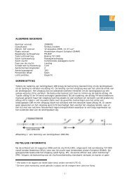
<strong>Breaking</strong> <strong>of</strong> <strong>mooring</strong> <strong>lines</strong> <strong>whilst</strong> <strong>mooring</strong>m.v. <strong>Edisongracht</strong> <strong>between</strong> two <strong>mooring</strong> buoysin the port <strong>of</strong> Soyo, Angola, 1 April 2010
<strong>Breaking</strong> <strong>of</strong> <strong>mooring</strong> <strong>lines</strong> <strong>whilst</strong> <strong>mooring</strong> m.v. <strong>Edisongracht</strong><strong>between</strong> two <strong>mooring</strong> buoys in the port <strong>of</strong> Soyo, Angola, 1 April2010Photo m.v. <strong>Edisongracht</strong> (Source: Shipping company)The Hague, May 2011
Investigation <strong>of</strong> very serious marine casualties is mandatory through international regulationsfrom the International Maritime Organization and the European Union. The Dutch Safety Boardhas started an investigation into the accident on-board <strong>of</strong> the <strong>Edisongracht</strong> on 1 April 2010 inAngola to comply with this obligation.The Dutch Safety Board did not have an opportunity to perform an on-site investigation, as it wasnot possible to travel to the accident site within a reasonable period <strong>of</strong> time after the accident.Information regarding the accident and the circumstances <strong>of</strong> the accident were requested through(registered) letters, faxes, e-mail and/or telephone from the Ministry <strong>of</strong> Transport, MaritimeInstitute <strong>of</strong> Ports <strong>of</strong> Angola (IMPA) in Angola itself as well as through the Consulate in Rotterdamand the Embassy in Brussels. No responses on these requests were received. This report istherefore mainly based on information from written and oral statements <strong>of</strong> the crew members,telephone interviews and e-mails from the Captain, the company’s internal accident report andinterviews with representatives <strong>of</strong> the shipping company’s <strong>of</strong>fice in the Netherlands.- 2 -
TABLE OF CONTENTS1 SUMMARY ------------------------------------------------------------------------- 42 DATA SUMMARY ------------------------------------------------------------------ 52.1 General information ------------------------------------------------------------ 52.2 Vessel particulars --------------------------------------------------------------- 52.3 Voyage particulars -------------------------------------------------------------- 52.4 Weather and current data ------------------------------------------------------ 52.5 Port characteristics ------------------------------------------------------------- 63 FACTUAL INFORMATION -------------------------------------------------------- 73.1 Before the accident ------------------------------------------------------------- 73.2 Mooring <strong>between</strong> the <strong>mooring</strong> buoys ------------------------------------------ 83.3 Tug assistance ------------------------------------------------------------------ 83.4 Setting out the <strong>mooring</strong> <strong>lines</strong> -------------------------------------------------- 93.5 The accident -------------------------------------------------------------------- 104 ANALYSIS ------------------------------------------------------------------------- 114.1 Before the accident ------------------------------------------------------------- 114.2 Mooring <strong>between</strong> the <strong>mooring</strong> buoys ------------------------------------------ 134.3 Tug assistance ------------------------------------------------------------------ 134.4 Setting out the <strong>mooring</strong> <strong>lines</strong> -------------------------------------------------- 134,5 The Voyage Data Recorder ----------------------------------------------------- 144.6 Safeguarding safety on board the vessel by the shipping company --------- 155 CONCLUSIONS ------------------------------------------------------------------- 16ANNEXESANNEX 1: Glossary --------------------------------------------------------------------- 17ANNEX 2: Information sources ------------------------------------------------------- 19ANNEX 3: Health and Safety Sheet: Mooring and un<strong>mooring</strong> --------------------- 20ANNEX 4: Comments by involved parties -------------------------------------------- 27- 3 -
1 SUMMARYDuring a <strong>mooring</strong> manoeuvre <strong>of</strong> mv <strong>Edisongracht</strong> <strong>between</strong> two <strong>mooring</strong> buoys* 1 in the port <strong>of</strong>Soyo, Angola on 1 April 2010 at around 9:00 a.m. (LT*) 2 , a <strong>mooring</strong> line slid <strong>of</strong>f a guide roller andsubsequently broke. The <strong>mooring</strong> line hit two crew members. One crew member was fatally injuredto his head and a second crew member suffered from a broken leg and a head injury. It was thethird time in a month that this crew would moor this vessel <strong>between</strong> the buoys in the port. Thecrew on the forecastle and the procedures to be followed were the same as those during thepreceding two <strong>mooring</strong> manoeuvres on 2 and 15 March 2010. Due to the late arrival <strong>of</strong> the pilot*,the <strong>mooring</strong> manoeuvre was initiated 2.5 hours later than planned. As a result, the manoeuvre wasperformed when the tidal current, was nearly at its peak: the moment at which the current is at itsstrongest. The speed <strong>of</strong> the current, it was spring tide, upon arrival at the buoys was estimated at2–4 knots by the Captain 3 .In the Pululu approach channel <strong>of</strong> Kwanda Base, which is a part <strong>of</strong> the port <strong>of</strong> Soyo, two <strong>mooring</strong>buoys, specifically placed for the delivery <strong>of</strong> the cargo, were present, <strong>between</strong> which the vessels <strong>of</strong>the shipping company could moor. The distance <strong>between</strong> the <strong>mooring</strong> buoys was approximately350 metres. Partly in view <strong>of</strong> the distance to the <strong>mooring</strong> buoys, the length <strong>of</strong> the fixed <strong>mooring</strong><strong>lines</strong> and the current, the crew deemed it desirable to extend the fixed <strong>mooring</strong> <strong>lines</strong> on the winchdrum at the forecastle just before initiating the <strong>mooring</strong> manoeuvre.After the crew had secured two <strong>mooring</strong> <strong>lines</strong> from the forecastle to the <strong>mooring</strong> buoy, both<strong>mooring</strong> <strong>lines</strong> did not immediately attain an equal tension. The <strong>mooring</strong> <strong>lines</strong> had namely not beensecured to the <strong>mooring</strong> buoy at the same time, but shortly after each other. Due to the stronglateral current, the vessel was already drifting away during this operation. Consequently, the<strong>mooring</strong> <strong>lines</strong> could not be set to the same tension in due time, as a result <strong>of</strong> which all forces wereborne by the starboard <strong>mooring</strong> line only, which was secured first.While the tension on the starboard <strong>mooring</strong> line was increasing, a few <strong>of</strong> the crew members were inthe area <strong>between</strong> the winches and the released <strong>mooring</strong> <strong>lines</strong> and were therefore within the dangerzones <strong>of</strong> these <strong>lines</strong>, should they break.Before the starboard <strong>mooring</strong> line attained the maximum load , the <strong>mooring</strong> line slid <strong>of</strong>f from thevertical <strong>mooring</strong> line guide and hit at great speed and subsequently broke a spindle <strong>of</strong> the anchorchain stopper on deck. Two crew members were injured, one <strong>of</strong> which fatally, by <strong>mooring</strong> line partsthat flew <strong>of</strong>f as the line broke.The portside <strong>mooring</strong> line broke approximately five minutes after the starboard <strong>mooring</strong> line hadbroken, due to overloading. The crew members had left the foredeck by this time and consequentlythe breaking <strong>of</strong> the portside <strong>mooring</strong> line did not cause any further injuries1Terms that are marked by an asterisk (*) are further explained in the glossary.2All times specified in this report are local times (LT).3One knot* is equal to one sea mile per hour. One sea mile is 1852 metres.- 4 -
2 DATA SUMMARY2.1 General informationIdentification number:IMO* Classification:Date and time <strong>of</strong> the incident:Location <strong>of</strong> occurrence:M2010SV0401-01Very serious marine casualty1 April 2010, 9:00 a.m.Kwanda Base, in the port <strong>of</strong> Soyo, Angola2.2 Vessel particularsName:m.v. <strong>Edisongracht</strong>Call sign*:PDUJIMO number*: 9081289Flag state*:the NetherlandsOfficial vessel number*: 9378 ZA 1994Vessel type:General cargo with container capacityLoading and unloading capability: 3 fixed cranes positioned on deckISM* manager:Splieth<strong>of</strong>f Agency & Forwarding B.V.Registered owner:Transport Qamutik, CanadaBareboat charterer*:C.V. Scheepvaartonderneming <strong>Edisongracht</strong>, AmsterdamHome port:AmsterdamClassification society*:Lloyd’s Register <strong>of</strong> ShippingYear <strong>of</strong> built: 1994Length overall (LOA)*:137.16 metresLength <strong>between</strong> perpendiculars (LPP)* 127.14 metresBreadth:18.90 metresMax. draught (summer)*:8.51 metresDeadweight (summer):12754 tonsGross tonnage*:8448 gtNet tonnage*:4651 ntMinimum required crew: 10Last survey: 26 August 2008Vessel certificates:All valid2.3 Voyage particularsDestination:Unloading location, <strong>between</strong> <strong>mooring</strong> buoys in Kwanda Base, in theport <strong>of</strong> SoyoDeparture:Anchoring location, near the port <strong>of</strong> SoyoCrew: 18Voyage type:International tradeCargo:Pipes for local <strong>of</strong>fshore projectPilot on-board:Yes2.4 Weather and current dataWind direction:Wind speed:Current:Current direction:Current speed (estimated):East10 knotsspring tideNorth-East2-4 knots- 5 -
High tide time/water level 4 : 05:37 a.m./1.8 metres (on 1 April, 2010)Low tide time/water level: 11:29 a.m./0.5 metres (on 1 April, 2010)2.5 Port characteristicsLocation:Sailing area properties:Compulsory pilotage:Details:Kwanda Base (see figure 1), part <strong>of</strong> the port <strong>of</strong> Soyo at the mouth<strong>of</strong> the Congo River in Angola. The Congo is the fifth largest river <strong>of</strong>the world with regard to length but the world's second largest riverwith regard to water volume. The river can be navigated up to 80miles inland by ocean-going vessels.Tidal port, twice-daily tide: twice a day high tide and twice a daylow tide with intervening times <strong>of</strong> approximately six hours.Compulsory pilotage for vessels from 500 GRT (Admiralty SailingDirections (Africa Pilot Vol. II, edition 2007)) 5 .Large differences can occur <strong>between</strong> surface currents andundercurrents.Warnings are issued that navigation data for this area can beunreliable.An LNG (Liquefied Natural Gas) terminal is under construction at theport site, south-east <strong>of</strong> the <strong>mooring</strong> buoys.Figure 1: Local map <strong>of</strong> Kwanda Base, including the location <strong>of</strong> the <strong>mooring</strong> buoys 6(source: Google Earth, map data: 18 September 2009)45Source: Admiralty Tide Tables, Volume 2, 2010An information booklet for seamen that includes details regarding navigation, buoyage systems,meteorological data, pilotage data, regulations and port facilities.- 6 -
3 FACTUAL INFORMATION3.1 Before the accidentA few weeks before the accident the vessel had sailed from Europe to the anchoring location at theport <strong>of</strong> Soyo, loaded with cargo (pipes) for a local <strong>of</strong>fshore project. Several vessels <strong>of</strong> the shippingcompany had undertaken this voyage before, and had also moored <strong>between</strong> the <strong>mooring</strong> buoys atunloading location. These <strong>mooring</strong> buoys in Kwanda Base were specifically placed for the delivery<strong>of</strong> the cargo for this project.The vessel left its berth in the vicinity <strong>of</strong> Soyo, Angola on 1 April 2010 around 07:30 a.m. Since itsarrival in Angola, the vessel was moored <strong>between</strong> the <strong>mooring</strong> buoys two times prior to the day <strong>of</strong>the accident (on 2 March and 15 March 2010) to discharge part <strong>of</strong> its cargo. The cargo, thatconsisted <strong>of</strong> cement-coated pipes, could not be unloaded to the pontoon, for which tug assistancewas present for the transfer to the specialised pipe layer, in one instance due to logistical reasons.After each time that a part <strong>of</strong> the cargo was discharged, the vessel returned to the anchoringlocation awaiting the next (partial) unloading. The discharge operations were planned and preparedby the <strong>of</strong>fshore company.The local authorities and the <strong>of</strong>fshore company had agreed that the pilot would come on board inthe approach channel at 6:00 a.m. to moor the vessel <strong>between</strong> the <strong>mooring</strong> buoys during slacktide. The Captain was also aware <strong>of</strong> this agreement. The pilot, however, did not arrive at the vesselat the agreed time. Around 8:00 a.m., the vessel, without the pilot on board and at a low speed,entered the approach channel with permission <strong>of</strong> the port authorities and with the assurance thatthe pilot would soon arrive (see figure 2 below). The pilot came on board at around 8:30 a.m., atwhich time the vessel had nearly arrived at its destination.By this time, the <strong>mooring</strong> preparations on the forecastle and aft deck had already been completed.The second <strong>of</strong>ficer was in charge on the forecastle. He was assisted by the boatswain and threeAB’s. The third <strong>of</strong>ficer was in charge at the aft deck. He was assisted by two AB’s and anapprentice.6Local map is the most recent Google Earth version and shows the situation about seven months beforethe accident. It could not be determined whether relevant changes have been made to the waterways.- 7 -
Figure 2: Local map <strong>of</strong> Pululu approach channel, including the <strong>mooring</strong> buoys andKwanda Base (source: BA 658 sea chart, issued 22 May 2008)3.2 Mooring <strong>between</strong> the <strong>mooring</strong> buoysThe intention was to execute the <strong>mooring</strong> manoeuvre in a similar way as the two previous timesthe vessel was moored <strong>between</strong> the <strong>mooring</strong> buoys. The only difference was that the <strong>mooring</strong> <strong>lines</strong>would now be released through the centre lead* because difficulty was experienced the previoustwo times with keeping the <strong>mooring</strong> <strong>lines</strong> at the same tension.3.3 Tug assistanceThe vessel would be assisted by two tugs during turning and positioning <strong>between</strong> the <strong>mooring</strong>buoys. (For a schematic representation <strong>of</strong> the performed manoeuvres see figure 3 below.)- 8 -
The vessel was turned around, under pilot’s advise in the channel near the <strong>mooring</strong> buoys (seeposition 2 in figure 3). The two tugs, on standby, assisted as found necessary.Figure 3: The performed manoeuvres (source: shipping company)3.4 Setting out the <strong>mooring</strong> <strong>lines</strong>The vessel was positioned <strong>between</strong> the <strong>mooring</strong> buoys with the assistance <strong>of</strong> the tugs. Similar tothe two previous times, both the fore and stern would be secured to the <strong>mooring</strong> buoys, with thebow <strong>of</strong> the vessel facing the northern direction. In order to bridge the distance to the <strong>mooring</strong>buoy, which was approximately 90 metres, the fixed starboard <strong>mooring</strong> line on the winch drum wasextended with another <strong>mooring</strong> line with a minimum breaking load (MBL 7 ) <strong>of</strong> 36.3 tons (see figure4) through a steel shackle with a Safe Working Load (SWL 8 ) <strong>of</strong> 20 tons. Synthetic <strong>mooring</strong> <strong>lines</strong>with a maximum strain <strong>of</strong> 18% were used on board the vessel.Figure 4: Example <strong>of</strong> a comparable <strong>mooring</strong> line extension as used during the <strong>mooring</strong> manoeuvreAround 8:50 a.m., the extended starboard <strong>mooring</strong> line was released through the centre lead <strong>of</strong>the forecastle and brought to and secured to the <strong>mooring</strong> buoy by boatmen*, using a motorboat. Asecond <strong>mooring</strong> line that had been extended in the same way as the starboard <strong>mooring</strong> line andoriginated from the fixed port winch was also released by the centre lead and secured by theboatmen to the <strong>mooring</strong> buoy. In the meantime, the pilot directed the tug from port to starboard inorder to prevent the vessel from being drifted away by the current, aiming to keep the vessel at its7SWL = Safe Working Load: the maximum allowed load for lifting tools such as shackles and cranes.8MBL = Minimum <strong>Breaking</strong> Load: the minimum load a <strong>mooring</strong> line should be able to withstand withoutbreaking For a <strong>mooring</strong> line the MBL is generally determined through a combination <strong>of</strong> designercalculation and testing (trial and error). The SWL is subsequently determined by applying a safety factoron an MBL.- 9 -
position. Both tugs on the vessel's starboard were next instructed to push at "full power". Thevessel’s main engine was put to "slow astern" and shortly after to "half astern" aiming to stop thevessel from drifting away. The bow thruster was not used to keep the vessel's bow near the<strong>mooring</strong> buoy. The Captain wanted to prevent the stern from going too far towards the quay underconstruction, on the vessel starboard side.3.5 The accidentDespite all efforts, the vessel could not be kept in position with the assistance <strong>of</strong> the tugs after ithad been positioned <strong>between</strong> the <strong>mooring</strong> buoys. Ultimately, as a result <strong>of</strong> the strong current thevessel drifted away from the front <strong>mooring</strong> buoy to the south and, later, to the south-east (seeposition 3 in figure 3). Due to this, the two <strong>mooring</strong> <strong>lines</strong> that were released through the centrelead were not directed straight ahead, but veered sharply to port. The crew could not keep both<strong>mooring</strong> <strong>lines</strong> under equal tension. Consequently, the starboard <strong>mooring</strong> line was put underconsiderable tension, slid <strong>of</strong>f from the stand roller fairlead and hit with great force a spindle <strong>of</strong> theanchor chain stopper on deck (see figures 5 and 6).stand roller fairleadSpindle <strong>of</strong> theAnchor chainstopperFigure 5: Photo <strong>of</strong> the foredeck <strong>of</strong> the m.v. <strong>Edisongracht</strong>- 10 -
Spindle <strong>of</strong> the anchor chainstand roller fairleadFigure 6: Crew member positions and cover <strong>of</strong> the <strong>mooring</strong> <strong>lines</strong> just before the accidentAs a result, the <strong>mooring</strong> line immediately broke in half. The break occurred just behind the splice <strong>of</strong>the <strong>mooring</strong> line’s eye. One <strong>of</strong> the AB’s was fatally injured by parts that flew <strong>of</strong>f the <strong>mooring</strong> line.The parts also hit the second <strong>of</strong>ficer, who fractured his upper leg and sustained a head injury fromfalling on the deck.After this, the vessel was only secured by the <strong>mooring</strong> line from the port winch. The tension on this<strong>mooring</strong> line became too high and, ultimately, the line broke as a result <strong>of</strong> overloading. The end <strong>of</strong>the broken starboard <strong>mooring</strong> line showed a nearly straight sharp break (see figure 7). The port<strong>mooring</strong> line, on the other hand, showed a frayed break pattern (see figure 8).Figure 7: Photo <strong>of</strong> the starboard <strong>mooring</strong>line fracture surfaceFigure 8: Photo <strong>of</strong> the port <strong>mooring</strong> linefracture surfaceAfter both <strong>mooring</strong> <strong>lines</strong> had broken, the Captain manoeuvred the vessel to the north <strong>of</strong> the<strong>mooring</strong> buoys to ensure the vessel would not drift away and hit the quay that was being built. Thevessel was finally moored at another quay at 10:05 a.m.- 11 -
4 ANALYSIS4.1 Before the accidentWork is being performed in Kwanda Base to build a new LNG terminal. The most recent sea chartfor this area (BA 658), which was also available on board <strong>of</strong> the m.v. <strong>Edisongracht</strong>, specifies thatdue to these continuous adjustments to the port there is no general up-to-date and reliableinformation (i.e. water depths, buoyage systems, current pr<strong>of</strong>iles, port facilities, etc.) about thelocal situation. Up-to-date information needs to be obtained from the local port authorities. Awarning specifically for this area is provided in the Admiralty Sailing Directions (Africa Pilot Vol. II),which was available on board the m.v. <strong>Edisongracht</strong>, that vessels may be very difficult tomanoeuvre or not be manoeuvrable at all as a result <strong>of</strong> the large differences <strong>between</strong> surfacecurrents and undercurrents.The Captain could only find reliable information about the time <strong>of</strong> high and low water with the fallin the tide tables. The Captain was therefore aware that it would be spring tide 9 that morning. Forthe required voyage planning the Captain also received information from the local representative <strong>of</strong>the <strong>of</strong>fshore company. Also, information issued by the shipping company was used. Thisinformation was based on earlier experiences gained in Kwanda Base during the previous voyagesthat were performed for this project. It was the third time that the Captain performed thismanoeuvre. As such, he as well as the other crew had experience with the <strong>mooring</strong> manoeuvre tobe performed <strong>between</strong> the <strong>mooring</strong> buoys. The Captain also knew that using the anchor during the<strong>mooring</strong> manoeuvre was not allowed in the port.The Captain had been informed by the shipping agent that the <strong>of</strong>fshore company with permissionfrom the port authorities, had arranged that the pilot would come on board in the Pululu channel at6:00 a.m. This would mean that the vessel could execute the <strong>mooring</strong> manoeuvres atapproximately 6:00 a.m., at which time it would be nearly slack tide. During slack tide there is noappreciable tidal current. The Captain had tried to contact the port authorities almost every hourthat morning as from 4:00 a.m. He was told by the port authorities that the pilot would not boardthe vessel at the agreed time. A reason was not given. After the Captain was assured by theauthorities that the pilot would board soon, he was given permission to already sail into the PululuChannel. He started to haul in the anchor at approximately 06:50 a.m. At that moment the Captainknew that he could not execute the <strong>mooring</strong> manoeuvres on slack tide. Next, at around 07:30 a.m.he set course to the entrance <strong>of</strong> the channel. The vessel reached the entrance <strong>of</strong> the channel at07:50 a.m. The Captain, still waiting for the pilot, kept the vessel running and tried to contact thepilot station several times. The pilot station assured the Captain each time that the pilot wouldboard soon.The pilot eventually arrived on board that morning at around 8:30 a.m. when the vessel wasalready sailing near the <strong>mooring</strong> buoys. Due to the late arrival <strong>of</strong> the pilot, the <strong>mooring</strong> manoeuvrewas initiated 2.5 hours later than planned. As a result, the <strong>mooring</strong> manoeuvre was executed whenthe tidal current was nearly at its peak: the moment at which the current is at its strongest.Moreover, the current was also more stronger than usual because <strong>of</strong> the spring tide(outgoing/ingoing tide approximately 1-3 knots on average and, with spring tide, 2-4 knots 10 ). Thisspring tide also caused the current flow not to run in the North-South direction <strong>of</strong> the channel, as910Spring tide: When the Sun, Moon and Earth form a straight line (which occurs twice a month), theycombine their forces and attract more water. The level <strong>of</strong> the water is then higher with high tide andlower with low tide. More flow is created <strong>between</strong> the tides than with the normal tide due to thisdifference in fall.Source: Admiralty Sailing Directions (Africa Pilot Vol. II, 2007 edition).- 12 -
usual, which would have been parallel to the heading <strong>of</strong> the vessel, but to run somewhat crosswiseto the vessel. This lateral current was caused by the additionally high water level, through whichsandbanks were washed over and water could flow into the channel without being hampered. Thecurrent estimated by the Captain on arrival <strong>between</strong> the <strong>mooring</strong> buoys was 2-4 knots 11 .The moment at which the <strong>mooring</strong> manoeuvre <strong>between</strong> the <strong>mooring</strong> buoys initiated, wasunsuitable due to the very strong tidal current that was present when the accident occurred. Theseunfavourable conditions were encountered as a result <strong>of</strong> the decision to moor the vessel <strong>between</strong>the <strong>mooring</strong> buoys despite the delay <strong>of</strong> 2.5 hours.The Captain knew that he would not be able to execute the <strong>mooring</strong> manoeuvre during slack tideas a result <strong>of</strong> the postponed departure and that a spring tide would be present. What the Captainpossibly could not have known and the pilot should well have known, is that this spring tide wouldnow run slightly crosswise <strong>of</strong> the vessel. Normally, this current would run in the North-Southdirection <strong>of</strong> the channel and therefore lengthwise <strong>of</strong> the vessel. This unusual diagonal current wasthe result <strong>of</strong> water running over the sandbanks, which could now flow freely without any obstacle.It could not be determined whether or not the Captain was informed about this.The Captain, who has the ultimate responsibility, must have sufficient information to ensure he cansafely manoeuvre. In this instance, the Captain was to a large extent depending on localknowledge and judgements <strong>of</strong> the pilot and port authorities. The Captain was - as transpired later -repeatedly incorrectly informed about the arrival time <strong>of</strong> the pilot and was not or insufficientlyinformed by the pilot that the moment chosen to initiate the <strong>mooring</strong> manoeuvre was unsuitable.4.2 Mooring <strong>between</strong> the <strong>mooring</strong> buoysIn the port <strong>of</strong> Kwanda Base two <strong>mooring</strong> buoys that were specifically placed for this project werepresent <strong>between</strong> which the vessel had to moor. The distance <strong>between</strong> the <strong>mooring</strong> buoys wasapproximately 350 metres. The location <strong>between</strong> the <strong>mooring</strong> buoys is used to speed up theunloading <strong>of</strong> the cargo. This way, the transfer <strong>of</strong> the pipes to the work boats can take place on bothsides <strong>of</strong> the ocean-going vessel with its on board cranes. It was deemed desirable by the crew toextend the <strong>mooring</strong> <strong>lines</strong> by using <strong>mooring</strong> <strong>lines</strong> with the same breaking load (36.3 MBL) due tothe length <strong>of</strong> the m.v. <strong>Edisongracht</strong>, the length <strong>of</strong> the fixed <strong>mooring</strong> <strong>lines</strong> on the winches and thecurrent that was flowing. The <strong>mooring</strong> <strong>lines</strong> were, however, connected using a shackle with a lowermaximum allowed load (20 SWL). This means that these parts (i.e. the <strong>mooring</strong> <strong>lines</strong> and shackle)were not properly matched.4.3 Tug assistanceIt was the third time in a month that this crew would moor the vessel <strong>between</strong> the <strong>mooring</strong> buoysin the port. Just like the previous two times the vessel was assisted by two tugs that sailedalongside the vessel in standby mode during the <strong>mooring</strong> manoeuvre <strong>between</strong> the <strong>mooring</strong> buoys.These tugs were stationed at the port <strong>of</strong> Soyo. Under the conditions that prevailed at the previoustwo times (average tide and little to no current), the performances <strong>of</strong> the tugs were sufficient toturn the vessel around, to stop it <strong>between</strong> the <strong>mooring</strong> buoys and to ensure it stayed in thatposition.11The Guide<strong>lines</strong> <strong>of</strong> Port Entry <strong>of</strong> Kwanda (review: 01-12-2008) specify that current speeds <strong>of</strong> more thanfive knots can be present at Kwanda Base.For reference purposes: The average peak current speed as a result <strong>of</strong> the effect <strong>of</strong> the tides on theNieuwe Waterweg (Port <strong>of</strong> Rotterdam, the Netherlands) is approximately 2.7 knots.- 13 -
The shape <strong>of</strong> a guide roller determines the maximum <strong>mooring</strong> line diameter to be used. Theextended <strong>mooring</strong> line could run <strong>of</strong>f the guide roller because the splices, the <strong>mooring</strong> <strong>lines</strong>’ eyesand the shackle, with their increased diameter and irregularities, were not kept free, but wereguided through the guide roller.The crew on the foredeck has not realised that by extending the <strong>mooring</strong> line the risk wasincreased that the <strong>mooring</strong> line would slid <strong>of</strong>f the stand roller fairlead and subsequently break.Approximately five minutes after the starboard <strong>mooring</strong> line broke because it slid <strong>of</strong>f the fairlead,the port <strong>mooring</strong> line also broke due to overloading.The fracture surface <strong>of</strong> the starboard <strong>mooring</strong> line was sharp, which indicates a local load (cuttingand/or damage). The fracture surface <strong>of</strong> the port <strong>mooring</strong> line had a frayed end, which is typical fora fracture due to overloading.4.5 The Voyage Data RecorderThe m.v. <strong>Edisongracht</strong> was equipped with a functioning Simplified Voyage Data Recorder (S-VDR)at the moment <strong>of</strong> the accident. The recorded data <strong>of</strong> an S-VDR contains relevant factualinformation useful for accident investigations such as ship’s positions, directions and bridgecommunication. In case <strong>of</strong> a serious accident this data has to be secured manually. Withoutintervention the data is automatically overwritten after a certain period <strong>of</strong> time. For the S-VDR <strong>of</strong>the m.v. <strong>Edisongracht</strong>, without intervention, recorded data is overwritten after 12 hours.Unfortunately, the Captain omitted this procedure <strong>of</strong> securing the VDR data. Data regarding theship’s navigation and VHF-conversation were not available for use in the accident investigation. Thelack <strong>of</strong> this data has hampered the investigation with regard to the reconstruction <strong>of</strong> themanoeuvres and communication. Although there are no legal obligations with regard to thesecuring <strong>of</strong> VDR data and also no procedure was included in the company manuals, this omissionhas impeded the independent investigation.Although the vessel was equipped with a Simplified Voyage Data Recorder (S-VDR), the data wasnot stored and therefore no data regarding the manoeuvres and communication was available foruse in the investigation. This omission has impeded the accident investigation.4.6 Safeguarding safety on board the vessel by the shipping company4.6.1 The Risk Assessment <strong>of</strong> the shipping companyThe shipping company had a “Risk Inventory and Evaluation” (RI&E)* and a Safety ManagementSystem*. However, at the time <strong>of</strong> the accident, these documents did not contain any additionalprocedures or guide<strong>lines</strong> for <strong>mooring</strong> and un<strong>mooring</strong> <strong>between</strong> <strong>mooring</strong> buoys when a current ispresent. The accident has been a reason for the shipping company to pay special attention to this.Attention has now been paid in the supplement to the Workplace risk assessment <strong>of</strong> 14 April 2010to the risks that exist when <strong>mooring</strong> and un<strong>mooring</strong> <strong>between</strong> the <strong>mooring</strong> buoys in Kwanda Base.The shipping company has used the Health and Safety Sheet Mooring and un<strong>mooring</strong> (D101) 12 asthe starting point, but further expanded this. In this Health and Safety Sheet the specific measures12Health and Safety Sheets are part <strong>of</strong> the health and safety catalogue for ocean shipping. Health andSafety Sheets are meant to be used by employers to meet the obligations arising from the DutchWorking Conditions Act. Employees can subsequently use the Health and Safety Sheets as a checklist.The Health and Safety Sheets describe the measures that must be implemented to ensure that work canbe performed safely.- 15 -
are described that must be implemented on board ocean-going vessels to ensure that work isperformed safely. However, this Health and Safety Sheet describes the procedures and measuresfor <strong>mooring</strong> at the quay: the specific <strong>mooring</strong> and un<strong>mooring</strong> <strong>between</strong> <strong>mooring</strong> buoys (and inpresence <strong>of</strong> currents) is not described. The shipping company has, therefore, not only expandedthe general measures for use on their own vessels with <strong>mooring</strong> and un<strong>mooring</strong> <strong>between</strong> <strong>mooring</strong>buoys but has also tightened these measures by assigning the complete forecastle deck* in itsRI&E as a danger zone (snap-back* zone).Due to the <strong>of</strong>ten complex lashing <strong>of</strong> <strong>mooring</strong> <strong>lines</strong> over <strong>mooring</strong> line guides (amongst others), thelocation <strong>of</strong> a <strong>mooring</strong> line failure and subsequent behaviour are unpredictable. It is thereforedifficult to determine safe places for crew members to stand clear.4.6.2 The internal accident investigation by the shipping companyThe shipping company started an internal investigation after the accident. The Dutch Safety Boardhas received the shipping company’s internal investigation report. The internal investigation reportindicates that the cause for the breaking <strong>of</strong> the first <strong>mooring</strong> line is the sliding <strong>of</strong>f <strong>of</strong> the <strong>mooring</strong>line from the stand roller fairlead due to the increasing tension. Next, the <strong>mooring</strong> line, that wasstill under tension, hit a spindle <strong>of</strong> an anchor chain stopper and broke on the point <strong>of</strong> contact. Theport <strong>mooring</strong> line then broke due to overloading. The fracture surfaces <strong>of</strong> the starboard and port<strong>mooring</strong> line correspond to the statements <strong>of</strong> the shipping company and crew regarding theaccident.The Dutch Safety Board, after analysing <strong>of</strong> the data regarding the accident, agrees with the directcause <strong>of</strong> the accident as found by the shipping company. During the course <strong>of</strong> the investigation,the Dutch Safety Board was informed by the shipping company <strong>of</strong> some additional measures thatwere taken to try to prevent accidents from occurring in the future. The shipping company did notonly extend the RI&E almost immediately after the accident to include measures specifically for<strong>mooring</strong> and un<strong>mooring</strong> <strong>between</strong> <strong>mooring</strong> buoys, but also tailored the general information from theapplicable Health and Safety Sheets for ocean-going vessel for use on their own vessels. The DutchSafety Board has, however, observed that safety when <strong>mooring</strong> and un<strong>mooring</strong> <strong>between</strong> <strong>mooring</strong>buoys is not yet sufficiently safeguarded for all parts despite this tightening and expanding <strong>of</strong>measures. During the accident, the <strong>mooring</strong> line broke because it had been extended and, because<strong>of</strong> the shackle that was used and the thick <strong>mooring</strong> line splices, was no longer led through thestand roller fairlead correctly. When the <strong>mooring</strong> line was put under tension, it slid <strong>of</strong>f from thefairlead’s roller, just behind the splice <strong>of</strong> the <strong>mooring</strong> line’s eye. The company’s own accidentinvestigation report has paid attention to the lengthening <strong>of</strong> <strong>mooring</strong> <strong>lines</strong>. It is stated lengthening<strong>lines</strong> should be avoided by using longer <strong>lines</strong>. In the “workplace risk assessment/ JSA” and the“safe working manual” however, lengthening <strong>of</strong> <strong>lines</strong> is not addressed.- 16 -
5 CONCLUSIONS• The moment at which the <strong>mooring</strong> manoeuvre <strong>between</strong> the <strong>mooring</strong> buoys initiated, wasunsuitable due to the very strong tidal current that was present when the accidentoccurred. These unfavourable conditions were encountered as a result <strong>of</strong> the decision tomoor the vessel <strong>between</strong> the <strong>mooring</strong> buoys despite the delay <strong>of</strong> 2.5 hours• The Captain, who has the ultimate responsibility, must have sufficient information toensure he can safely manoeuvre. In this instance, the Captain was to a large extentdepending on local knowledge and judgements <strong>of</strong> the pilot and port authorities. TheCaptain was - as transpired later - repeatedly incorrectly informed about the arrival time<strong>of</strong> the pilot and was not or insufficiently informed by the pilot that the moment chosen toinitiate the <strong>mooring</strong> manoeuvre was unsuitable.• The crew on the foredeck has not realised that by extending the <strong>mooring</strong> line the risk wasincreased that the <strong>mooring</strong> line would slid <strong>of</strong>f the stand roller fairlead and subsequentlybreak.• The shipping company has made a recommendation in their accident investigation reportthat lengthening <strong>of</strong> <strong>lines</strong> should be avoided. However no specific procedures in the ISM*related documents have been provided in case <strong>mooring</strong> <strong>lines</strong> do need to be extended.• Due to the <strong>of</strong>ten complex lashing <strong>of</strong> <strong>mooring</strong> <strong>lines</strong> over <strong>mooring</strong> line guides (amongstothers), the location <strong>of</strong> a <strong>mooring</strong> line failure and subsequent behaviour areunpredictable. It is therefore difficult to determine safe places for crew members to standclear.• The shape <strong>of</strong> a guide roller determines the maximum <strong>mooring</strong> line diameter to be used.The extended <strong>mooring</strong> line could run <strong>of</strong>f the guide roller because the splices, the <strong>mooring</strong><strong>lines</strong>’ eyes and the shackle, with their increased diameter and irregularities, were not keptfree, but were guided through the guide roller.• There are no (inter)national legal obligations with regard to securing (S-)VDR recordeddata. There were also no company procedures included in the ship’s instructions on whento store (S-)VDR recorded data. As a result, the relevant data was overwritten, which hasimpeded the accident investigation.Note: This report has been published in the English and Dutch language. If there are differencesin interpretation the Dutch text prevails.- 17 -
ANNEX 1: GLOSSARYBareboat charterBoatmenCall signCall signCentre leadClassification societyFlag stateVessel chartering arrangement where the people chartering pay aspecific sum for just the vessel without crew. All additional costssuch as those related to insurance and crew are borne by thepeople chartering the vessel.Quayside personnel who assist when <strong>mooring</strong> and un<strong>mooring</strong> <strong>of</strong>ocean-going vessels in a port.The radio call sign <strong>of</strong> a vessel that is used to identify from whom aradio call originates. The call sign for Dutch ocean-going vesselsstarts with the letters PA to PI followed by two letters.The radio call sign <strong>of</strong> a vessel that is used to identify from whom aradio call originates. The call sign for Dutch ocean-going vesselsstarts with the letters PA to PI followed by two letters.Central opening in the upright wall -the bulwark- <strong>of</strong> the foredeckfor passing through <strong>mooring</strong> <strong>lines</strong>.Organisation that determines the rules regarding the build andequipment <strong>of</strong> vessels and supervises this through surveys.Classification societies may be recognised by flag states toperform work for certifying purposes on behalf <strong>of</strong> the flag state.State to which a vessel belongs and is, therefore, entitled to wavethe relevant flag.Forecastle deckThe deck where the <strong>mooring</strong> and anchoring gear <strong>of</strong> the fore is setup.Gross tonnage (GT)Vessel size based on which it is determined which legislationapplies to a vessel.IMOInternational Maritime OrganizationIMO number Unique international vessel identifying number consisting <strong>of</strong> 7digits that is allocated when newly built and does not changewhen registration changes.ISMInternational Safety ManagementKnotOne knot is one sea mile per hour (1.852 km/hour)KVNRRoyal Dutch Shipowners AssociationLOA (Length overall)Maximum length <strong>of</strong> the hull <strong>of</strong> a vessel measured over the water.LPP (Length <strong>between</strong>perpendiculars)Length <strong>between</strong> perpendiculars – length size <strong>of</strong> a vessel based onwhich it is determined which legislation applies to a vessel.LTLocal timeMaximum draughtMaximum allowed draught up to where a vessel may be loaded. Adistinction is made into summer, winter and tropical areas as wellas fresh and salt water for certification purposes.Minimum <strong>Breaking</strong> Load(MBL)Minimum breaking load that can be resisted by a <strong>mooring</strong> linebefore it breaks.Mooring buoysBerth where the vessel is moored <strong>between</strong> <strong>mooring</strong> buoys withoutany further contact with other port <strong>mooring</strong> facilities.Nautical mile1,852 kmNet tonnage (NT)Vessel size for the loading capacity.- 18 -
Official vessel number.National registration number.PilotThe person who advises the Captain <strong>of</strong> an ocean-going vessel orwho replaces him with regard to navigation due to his or herknowledge <strong>of</strong> the fairway.RI&ERisk Inventory and Evaluation: an investigation into the riskswithin operational management with regard to health and safety<strong>of</strong> employees that is mandatory in accordance with the DutchWorking Conditions Act.Safe Working Load (SWL) A size for the maximum allowed load <strong>of</strong> lifting tools such asshackles, wires and cranes.Safety Management System The International Safety Management Code sets minimum(SMS)requirements with regard to the mandatory safety managementsystem (generally known as the Safety Management System) onboardand its goal is to promote safe operational management onboardand to prevent contamination by vessels.Snap-back zoneZone in which the snap-back <strong>of</strong> a broken <strong>mooring</strong> line may takeplace. The snap-back zone may be large and unpredictableespecially when <strong>mooring</strong> <strong>lines</strong> are set out under an angle.SOLAS Convention (International Convention for the Safety <strong>of</strong> Life at Sea ) -international treaty that falls under the IMO in which requirementsare set regarding vessel safety.SpindleShaft with screw thread.Voyage Data Recorder (VDR) A mandatory system in accordance with the SOLAS Convention*used on board that records prescribed data <strong>of</strong> the vessel (such asradar images, position and communication on the bridge) wherethe intention is that this data can be used for an investigation intothe causes <strong>of</strong> an accident. A Simplified Voyage Data Recorder (S-VDR) is a simplified option for which less strict design andrecording requirements exist.- 19 -
ANNEX 2: INFORMATION SOURCES• Internal investigation report into the accident on board the m.v. <strong>Edisongracht</strong>on 1 April 2010 at Soyo, Angola (Splieth<strong>of</strong>f, final version, 14 July 2010)• Workplace risk assessment/JSA Shipping company with regard to <strong>of</strong>floading to barges atSoyo Bay, Angola (14-04-2010)• Safety Management System <strong>of</strong> the shipping company• Drawings showing the position <strong>of</strong> objects during manoeuvres• Crew statements: Captain, <strong>of</strong>ficer, boatswain, mates (2)• M.v. <strong>Edisongracht</strong> crew list• Photos <strong>of</strong> the accident site• Photos <strong>of</strong> <strong>mooring</strong> line fracture surfaces• Mooring line certificate copy• Crew member work lists• Mooring and un<strong>mooring</strong>, Health and Safety Sheet D101• Admiralty Sailing Directions (Africa Pilot Vol. II, 2007 edition)• Guide<strong>lines</strong> <strong>of</strong> Port Entry <strong>of</strong> Kwanda (review: 01-12-2008)• Admiralty Charts and Publications, 658, Entrance to River Congo, 2008 (latest chart)• Admiralty Tide Tables, Vol. 2, NP 2020-10, 2010-10-21• Mooring arrangement, Acergy (06 May 2009)• Internet Google Maps (consulted during the investigation in 2010)• Vessel's logbook• Load plan• ISM report to the Inspectorate• Anchoring, <strong>mooring</strong> and towing operations (MSCP01/Ch25/Rev1.03)- 20 -
ANNEX 3: HEALTH AND SAFETY SHEET MOORING AND UNMOORING- 21 -
- 22 -
- 23 -
- 24 -
- 25 -
- 26 -
- 27 -
ANNEX 4: COMMENTS BY INVOLVED PARTIESA draft version <strong>of</strong> this report has been submitted to all involved parties in accordance with theKingdom Act concerning the Dutch Safety Investigation Board. These parties have been asked forcomments and were requested to verify the correctness <strong>of</strong> the report.The draft version <strong>of</strong> this report has been sent to:• The shipping company;• Employers’ organization Royal Dutch Shipowners Association;• Trade union Nautilus International;• The master <strong>of</strong> m.v. <strong>Edisongracht</strong>• The second <strong>of</strong>ficer <strong>of</strong> m.v. <strong>Edisongracht</strong>• The Angolan Embassy in Brussels, BelgiumOnly the shipping company commented on the draft report.The Dutch Safety Board has incorporated all received comments in the final report.- 28 -
The Dutch Safety Boardtelephone +31(0)70 333 70 00 • e-mail info@safetyboard.nl • website www.safetyboard.nlvisiting address Anna van Saksenlaan 50 • 2593 HT The Haguepostal address PO Box 95404 • 2509 CK The Hague • The Netherlands