Datasheet iNAV-FCAI - iMAR GmbH
Datasheet iNAV-FCAI - iMAR GmbH
Datasheet iNAV-FCAI - iMAR GmbH

You also want an ePaper? Increase the reach of your titles
YUMPU automatically turns print PDFs into web optimized ePapers that Google loves.
GESELLSCHAFT FUER INERTIALE MESS-,<br />
AUTOMATISIERUNGS- UND REGELSYSTEME MBH<br />
WWW.IMAR-NAVIGATION.DE<br />
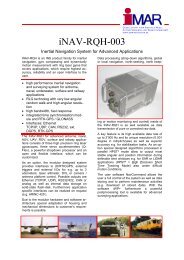
<strong>iNAV</strong>-<strong>FCAI</strong>-02<br />
Inertial Measurement System for Advanced Surveying Applications<br />
<strong>iNAV</strong>-<strong>FCAI</strong> is an INS product family for inertial<br />
navigation and guidance, stabilization and dynamically<br />
motion analysis with fiber optical gyros<br />
that covers applications, which require high accuracy,<br />
reliability and an open interface to the<br />
user.<br />
� accurate inertial navigation, guidance and<br />
surveying system for airborne, surface and<br />
underwater applications<br />
� FOG technolog with low angular random<br />
walk and high angular resolution<br />
� high bandwidth, fast response<br />
� integrated ual antenna GPS with RTK<br />
� integrated 2 cm accurate RTK-GPS /<br />
GLONASS / GALILEO aiding<br />
� Interfaces: Ethernet TCP/IP, UDP, CAN,<br />
RS232 / RS422 UART, ext. DGPS, RTK-<br />
GPS, MIL-STD1553B<br />
� No ITAR, no export restrictions within<br />
Europe, Canada, Australia, USA, Japan<br />
The <strong>iNAV</strong>-<strong>FCAI</strong> for airborne, naval, AUV, UAV,<br />
ROV, surface and railway applications consists<br />
of three high precision fiber optic gyroscopes,<br />
three servo accelerometers, a powerful strapdown<br />
processor and an open and flexible<br />
interface, which can be customized.<br />
As an option, the modular designed system provides<br />
interfaces to (D/RTK)GNSS, external triggers<br />
and external I/Os for e.g. up to 3<br />
odometers, laser altimeter, DVL or camera /<br />
antenna platform control. Possible outputs are<br />
Ethernet (TCP/IP, UDP), RS232/422 UART,<br />
CAN, MIL-STD-1553B or analog as well as internal<br />
data storage on solid-state flash-disk.<br />
Furthermore application specific interfaces can<br />
be realized on request (e.g. ARINC 429 ).<br />
Data processing (strap-down algorithms, global<br />
or local navigation, GNSS aided north keeping or<br />
motion monitoring and control) inside of the<br />
<strong>iNAV</strong>-<strong>FCAI</strong> is as well available as data transmission<br />
of pure or corrected raw data.<br />
A key feature is its high available data rate of up<br />
to 400 Hz and its high resolution (0.01 arcsec =<br />
2.8 E-06 degree in roll/pitch/ yaw) as well as high<br />
accuracy e.g. for stabilisation tasks. As an option<br />
special designed algorithms allow to output most<br />
stable angular and position information during<br />
definable time windows e.g. for SAR or LIDAR<br />
applications (HPST² = High Precision Short<br />
Time Tracking Mode) also under difficult motion<br />
conditions.<br />
No internal shock mounts are used to guarantee<br />
high angular performance regarding to laser<br />
scanner integration.<br />
The user software NavCommand allows the<br />
user a full control of the system as well as data<br />
storing and to perform maintenance activities<br />
(e.g. download of stored data). With the software<br />
iWP+ furthermore a powerful postprocessing<br />
tool is available for advanced surveying<br />
applications.<br />
The system <strong>iNAV</strong>-<strong>FCAI</strong> has no autonomous<br />
north seeking capability and is only export<br />
controlled with simplified EU001 procedure<br />
(but no ITAR restrictions). With <strong>iNAV</strong>-RQH-1003<br />
a form-fit-function (FFF) compatible system is<br />
provided on RLG technology. With <strong>iNAV</strong>-FJI-<br />
001-J a FFF compatible system with FOG<br />
technology is provided.
Technical Data of <strong>iNAV</strong>-<strong>FCAI</strong>-02 (1 sigma values):<br />
Measurement parameters:<br />
Measurement range:<br />
Accuracy:<br />
Position error:<br />
Velocity error:<br />
Alignment duration:<br />
Resolution:<br />
Nonlinearity:<br />
Scale factor error:<br />
AngularRandomWalk / Accel. Noise:<br />
Bias repeatability:<br />
Dynamics capability:<br />
Axis misalignment<br />
Sampling rate; Output rate:<br />
Latency:<br />
Data output (options):<br />
Data input (options):<br />
GNSS aiding:<br />
Weight:<br />
Size:<br />
MTBF:<br />
Temperature:<br />
Shock, Vibration:<br />
Qualification:<br />
Power supply:<br />
Software:<br />
<strong>iMAR</strong> has extended<br />
longtime experience in<br />
the manufacturing and<br />
development of inertial<br />
navigation and guidance<br />
systems for all<br />
application areas. All<br />
systems manufactured<br />
by <strong>iMAR</strong> are maintained<br />
at <strong>iMAR</strong> in Eu-<br />
GESELLSCHAFT FUER INERTIALE MESS-,<br />
AUTOMATISIERUNGS- UND REGELSYSTEME MBH<br />
WWW.IMAR-NAVIGATION.DE<br />
Roll, pitch, yaw, acceleration, velocity, rate, position<br />
� 500 °/s angular rate (the INS shall be powered on at < 250 deg/s)<br />
� 10 g acceleration (5g / 20 g as option)<br />
< 0.07 ° true north (with GPS/GNSS under motion)<br />
0.1 ° true north with dual-antenna GPS and 5 m antenna distance<br />
< 1 °/hr heading drift (during outages of GPS);<br />
< 0.05 °/hr short time stability at const. temperature<br />
< 0.1 ° roll/pitch (initially after power-on)<br />
< 0.05 ° roll/pitch (INS/GPS under dynamic flight conditions)<br />
< 0.03 ° roll/pitch (INS/GPS under static flight conditions)<br />
< 0.01 ° roll/pitch, < 0.03 ° heading with RTK post-proc under motion<br />
< 10 m with GPS (S/A off)<br />
< 1 m with DGPS, Omnistar supported [< 10 cm RTK mode option]<br />
< 0.1 m/s (aided with GPS), < 20 mm/s with RTK in post-proc.<br />
< 1 minute on land (for roll pitch inertially, heading by dual-antenna GPS)<br />
< 4 minutes on the fly with GPS aiding<br />
0.01 arcsec (roll/pitch/yaw) < 10 µg (accel.) (averaged)<br />
< 100 ppm (gyro) < 20 µg/g² (accel.)<br />
< 300 ppm (gyro) < 500 ppm (accel.)<br />
0.02 deg/sqrt(hr) < 25 µg/sqrt(Hz)<br />
< 1 deg/hr (1 sigma) < 500 µg (1 sigma)<br />
> 1’500 °/s²<br />
< 200 µrad<br />
400 Hz; 1...400 Hz (Ethernet, CAN, MIL-Bus)<br />
< 3 ms (time stamp �10µs)<br />
Ethernet 10/100/1000BaseT, TCP/IP, UDP, RS232RS422 UART, CAN,<br />
MIL-STD1553B (all data with time stamp)<br />
internal/external (RTK)GNSS, marker event trigger, 3 x odometer,<br />
(RS422 level), [PPS / SYNC]<br />
integrated L1/L2 GPS/GLONASS/GALILEO receiver, dual antenna<br />
approx. 10.5 kg<br />
approx. 360 x 213 x 179 mm or 299 x 213 x 179 mm<br />
> 20,000 hrs (estimated for surveying applications)<br />
-40...+63 °C operating and -45…+85 °C storage (case temper.)<br />
25 g, 11 ms; 60 g, 5 ms; 3 g rms 10…2’000 Hz endurance<br />
MIL-STD-810F, MIL-STD-461E, MIL-STD-704D, DO160E<br />
11...34 V, < 45 W; 50 ms hold up time according to DO160E<br />
NavCommand realtime, open I/F XIO, iWP+ postproc<br />
rope / Germany.<br />
In the <strong>iNAV</strong>-<strong>FCAI</strong> inertial<br />
navigation and guidance systems<br />
<strong>iMAR</strong> uses advanced<br />
FOG technology. The system<br />
requires only an European export<br />
license for the total system.<br />
<strong>iMAR</strong> <strong>GmbH</strong> � Im Reihersbruch 3 � D-66386 St. Ingbert / Germany<br />
Phone: +49-(0)-6894-9657-0 � Fax: +49-(0)-6894-9657-22<br />
www.imar-navigation.de � sales@imar-navigation.de<br />
� <strong>iMAR</strong> � / 11 (Technical modifications reserved)
Option: Separate Measuring Head:<br />
GESELLSCHAFT FUER INERTIALE MESS-,<br />
AUTOMATISIERUNGS- UND REGELSYSTEME MBH<br />
WWW.IMAR-NAVIGATION.DE<br />
Size, Weight of Measurement Head: approx. 145 x 115 x 140 mm (plus connector), approx. 2’300 grams<br />
Measurements of Allan variance:<br />
At constant temperature the gyro bias is stable over > 2’000 s with < 0.02 deg/hr,<br />
which provides exceptional advantages for INS/GNSS coupled systems.