Advanced Topics with ArcGIS Server - IGIC
Advanced Topics with ArcGIS Server - IGIC
Advanced Topics with ArcGIS Server - IGIC

Create successful ePaper yourself
Turn your PDF publications into a flip-book with our unique Google optimized e-Paper software.
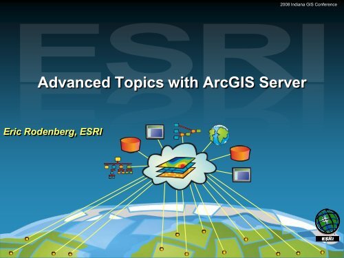
<strong>Advanced</strong> <strong>Topics</strong> <strong>with</strong> <strong>ArcGIS</strong> <strong>Server</strong><br />
Eric Rodenberg, ESRI<br />
2008 Indiana GIS Conference<br />
<strong>ArcGIS</strong> <strong>Server</strong> 9.2 Implementation Seminar
Environmental Systems Research Institute, Inc.<br />
Copyright © 1999–2007 ESRI All rights reserved. Printed in the United States of America.<br />
The information contained in this document is the exclusive property of ESRI. This work is protected under United States copyright law and the<br />
copyright laws of the given countries of origin and applicable international laws, treaties, and/or conventions. No part of this work may be reproduced<br />
or transmitted in any form or by any means, electronic or mechanical, including photocopying or recording, or by any information storage or retrieval<br />
system, except as expressly permitted in writing by ESRI. All requests should be sent to<br />
Attention: Contracts Manager, ESRI, 380 New York Street, Redlands, CA 92373-8100, USA.<br />
The information contained in this document is subject to change <strong>with</strong>out notice.<br />
ESRI, ARC/INFO, <strong>ArcGIS</strong>, ArcView, BusinessMAP, MapObjects, PC ARC/INFO, SDE, and the ESRI globe logo are trademarks of Environmental<br />
Systems Research Institute, Inc., registered in the United States and certain other countries; registration is pending in the European Community. 3D<br />
Analyst, ADF, ARC COGO, the ARC COGO logo, ARC GRID, the ARC GRID logo, the ARC/INFO logo, AML, ARC NETWORK, the ARC NETWORK<br />
logo, ArcNews, ARC TIN, the ARC TIN logo, ArcInfo, the ArcInfo logo, ArcInfo LIBRARIAN, ArcInfo—Professional GIS, ArcInfo—The World's GIS,<br />
ArcAtlas, the ArcAtlas logo, the ArcCAD logo, the ArcCAD WorkBench logo, ArcCatalog, the ArcData logo, the ArcData Online logo, ArcDoc,<br />
ARCEDIT, the ARCEDIT logo, ArcEurope, the ArcEurope logo, ArcEditor, ArcExplorer, the ArcExplorer logo, ArcExpress, the ArcExpress logo,<br />
ArcFM, the ArcFM logo, the ArcFM Viewer logo, <strong>ArcGIS</strong>, ArcIMS, the ArcIMS logo, ArcLogistics, the ArcLogistics Route logo, ArcMap, ArcObjects,<br />
ArcPad, the ArcPad logo, ARCPLOT, the ARCPLOT logo, ArcPress, the ArcPress logo, the ArcPress for ArcView logo, ArcScan, the ArcScan logo,<br />
ArcScene, the ArcScene logo, ArcSchool, ArcSDE, the ArcSDE logo, the ArcSDE CAD Client logo, ArcSdl, ArcStorm, the ArcStorm logo, ArcSurvey,<br />
ArcToolbox, ArcTools, the ArcTools logo, ArcUSA, the ArcUSA logo, ArcUser, the ArcView GIS logo, the ArcView 3D Analyst logo, the ArcView<br />
Business Analyst logo, the ArcView Data Publisher logo, the ArcView Image Analysis logo, the ArcView Internet Map <strong>Server</strong> logo, the ArcView<br />
Network Analyst logo, the ArcView Spatial Analyst logo, the ArcView StreetMap logo, the ArcView StreetMap 2000 logo, the ArcView Tracking<br />
Analyst logo, ArcVoyager, ArcWorld, the ArcWorld logo, Atlas GIS, the Atlas GIS logo, AtlasWare, Avenue, the Avenue logo, the BusinessMAP logo,<br />
DAK, the DAK logo, DATABASE INTEGRATOR, DBI Kit, the Digital Chart of the World logo, the ESRI Data logo, the ESRI Press logo, ESRI—Team<br />
GIS, ESRI—The GIS People, FormEdit, Geographic Design System, Geography Matters, GIS by ESRI, GIS Day, the GIS Day logo, GIS for<br />
Everyone, GISData <strong>Server</strong>, InsiteMAP, MapBeans, MapCafé, the MapCafé logo, the MapObjects logo, the MapObjects Internet Map <strong>Server</strong> logo,<br />
ModelBuilder, MOLE, the MOLE logo, NetEngine, the NetEngine logo, the PC ARC/INFO logo, PC ARCEDIT, PC ARCPLOT, PC ARCSHELL, PC<br />
DATA CONVERSION, PC NETWORK, PC OVERLAY, PC STARTER KIT, PC TABLES, the Production Line Tool Set logo, RouteMAP, the<br />
RouteMAP logo, the RouteMAP IMS logo, Spatial Database Engine, the SDE logo, SML, StreetEditor, StreetMap, TABLES, The World's Leading<br />
Desktop GIS, Water Writes, and Your Personal Geographic Information System are trademarks; and ArcData, ArcOpen, ArcQuest, ArcWatch,<br />
ArcWeb, Rent-a-Tech, Geography Network, the Geography Network logo, www.geographynetwork.com, @esri.com, and www.esri.com are service<br />
marks of ESRI.<br />
The names of other companies and products herein are trademarks or registered trademarks of their respective trademark owners. ArcView GIS uses<br />
Neuron Data’s Open Interface.<br />
2008 Indiana GIS Conference
Browser Based Editing<br />
2008 Indiana GIS Conference<br />
<strong>ArcGIS</strong> <strong>Server</strong> 9.2 Implementation Seminar
Session Overview<br />
• Web Editing<br />
- Web-based editing capabilities in 9.2<br />
- Creating a web application that supports Editing<br />
- Using the web-editor task<br />
• Creating a Geoprocessing Task<br />
• Publishing a Geoprocessing Task<br />
• Geodata Replication<br />
• Clip Zip and Ship<br />
2008 Indiana GIS Conference
Web Editing<br />
• New at <strong>ArcGIS</strong> 9.2<br />
• Available <strong>with</strong> <strong>ArcGIS</strong> <strong>Server</strong><br />
<strong>Advanced</strong> Workgroup and<br />
Enterprise Editions<br />
2008 Indiana GIS Conference
Web Editing Capabilities<br />
• Edit ArcSDE Geodatabase features and attributes<br />
• Versioned and Non-Versioned Data<br />
• The Editing Task tools include<br />
– Create, Move, Copy<br />
– Split, Merge, Delete<br />
• The Editing task is customizable<br />
2008 Indiana GIS Conference
Creating a Web Editing Application that<br />
Supports Editing<br />
• Author the map <strong>with</strong> the layers you want to edit<br />
• Publish the map to the server<br />
– Map Service can be Pooled or Non-Pooled<br />
• Create the web application <strong>with</strong> Manager<br />
• Use the web application for editing<br />
2008 Indiana GIS Conference
Author the Map Containing Editable Layers<br />
• How does the editing work?<br />
– All Geodatabase editing behavior is applied<br />
– Deleting a feature deletes related feature linked<br />
annotation<br />
– Editing features in a topology creates dirty areas<br />
– Supports attribute domains and subtypes of features<br />
• What kind of editing can I expect to do?<br />
– Simple editing : delete, create and copy features;<br />
update attributes; update geometry<br />
– Snap to feature vertices when editing geometry<br />
– Undo and Redo<br />
2008 Indiana GIS Conference
Publish The Map To The <strong>Server</strong><br />
• Editing is a stateful use of a GIS service<br />
• Create a non pooled service and connect via a<br />
local connection<br />
• Create one instance for each editor<br />
2008 Indiana GIS Conference
Create the Web Editing Application<br />
• Make an <strong>ArcGIS</strong> <strong>Server</strong> Local connection in<br />
Manager<br />
• Add your map service<br />
• Add the Editing task and configure it<br />
– Editable Layers<br />
– Versions<br />
– Settings<br />
• Add other tasks and map elements<br />
2008 Indiana GIS Conference
Using the Web Application For Editing<br />
• Choose the version to edit<br />
• Choose the layer to edit, the Editor displays the<br />
appropriate tools for the layer<br />
• Create and modify feature geometry<br />
• Update attributes<br />
2008 Indiana GIS Conference
Summary<br />
• Editing is a stateful use of a GIS Service<br />
• Editable Feature classes must reside in SDE<br />
• Map service can be pooled or non-pooled<br />
• Edit layers can be versioned on un-versioned<br />
• All Geodatabase behavior is applied to webediting<br />
2008 Indiana GIS Conference
Demo<br />
2008 Indiana GIS Conference<br />
<strong>ArcGIS</strong> <strong>Server</strong> 9.2 Implementation Seminar
Geoprocessing<br />
Spatial Analysis and Modeling<br />
2008 Indiana GIS Conference<br />
<strong>ArcGIS</strong> <strong>Server</strong> 9.2 Implementation Seminar
Session Overview<br />
• Web Editing<br />
• Creating a Geoprocessing Task<br />
– What is Geoprocessing <strong>with</strong> <strong>ArcGIS</strong> <strong>Server</strong><br />
– How does it work<br />
• Publishing a Geoprocessing Task<br />
• Geodata Replication<br />
• Clip Zip and Ship<br />
2008 Indiana GIS Conference
<strong>ArcGIS</strong> <strong>Server</strong> Functionality matrix<br />
Spatial Analysis/Geoprocessing<br />
Basic Standard <strong>Advanced</strong><br />
Geodatabase Management<br />
(ArcSDE)<br />
� � �<br />
Geodatabase Replication � � �<br />
Mapping � �<br />
3D Services (Globe, KML) � �<br />
ArcView-Level Geoprocessing � �<br />
ArcInfo-Level Geoprocessing �<br />
Web ADF (.NET or Java) � �<br />
Mobile ADF (.NET) �<br />
Enterprise Java Beans (Java) �<br />
Web-Based Editing �<br />
Support for Some Extensions * � �<br />
Support for All Extensions + �<br />
* Network, Data Interoperability extensions<br />
+ Spatial, 3D extensions<br />
2008 Indiana GIS Conference
What is Geoprocessing?<br />
• Geoprocessing is the process of defining and<br />
executing a workflow<br />
• A workflow defines the execution of a task<br />
– Find a path from here to there<br />
– Find all the homes <strong>with</strong>in a certain distance of here<br />
– Download data that meets certain criteria from a<br />
database<br />
– Etc<br />
• In <strong>ArcGIS</strong> a model<br />
is a workflow<br />
2008 Indiana GIS Conference
Geoprocessing is…<br />
...one of the 3 critical components of a GIS<br />
Data storage and integrity<br />
(Geodatabase)<br />
Processing data<br />
“computing <strong>with</strong> data”<br />
using Tools<br />
Visualization map-based<br />
analysis, exploration,<br />
interpretation and editing<br />
(Desktop applications)<br />
2008 Indiana GIS Conference
Geoprocessing <strong>with</strong> <strong>ArcGIS</strong> <strong>Server</strong><br />
• GIS professionals can publish tools used as<br />
tasks<br />
• Centralize both data and processing on the<br />
server<br />
• Geoprocessing operations to be run on the<br />
server from light weight clients across the web<br />
• Analyst expertise stored in models can be<br />
exposed to wider audiences and skill levels<br />
2008 Indiana GIS Conference
How a Geoprocessing Service Works -<br />
a high level peek behind the scenes<br />
Client receives results,<br />
<strong>Server</strong> receive request,<br />
Client deserializes Generates them,<br />
deserializes the inputs<br />
User fills in input input dialogs<br />
Dialogs and displays <strong>with</strong> them<br />
and runs the tool<br />
and hits ok<br />
tool information Client When What serializes tools the tool do inputs completes you have? to XML<br />
and the What sends server is the them serializes usage? to server the<br />
results to XML and sends<br />
them Tool to the Information client<br />
<strong>Server</strong><br />
Client App<br />
GP Services<br />
2008 Indiana GIS Conference
Geoprocessing Services<br />
• Author – Designing the service<br />
– A GIS Analyst authors a model.<br />
• Serve – Publish the service<br />
– Publish a toolbox that contains a model<br />
– Publish a map document <strong>with</strong> a Tool Layer<br />
• Use – Consume the service<br />
– Use the geoprocessing service in out of the box<br />
clients or custom clients<br />
2008 Indiana GIS Conference
Service Behavior<br />
• Geoprocessing Services are very flexible and<br />
allow many different behaviors and<br />
optimizations<br />
• Before Authoring and Publishing, identify what<br />
you want your service to do and how you want<br />
it to behave <strong>with</strong> clients.<br />
– Determines what you publish<br />
• Toolbox<br />
• Map <strong>with</strong> Tool Layer<br />
– Determines how you author your model.<br />
2008 Indiana GIS Conference
Demo<br />
2008 Indiana GIS Conference<br />
<strong>ArcGIS</strong> <strong>Server</strong> 9.2 Implementation Seminar
Session Overview<br />
• Web Editing<br />
• Creating a Geoprocessing Task<br />
• Publishing a Geoprocessing Task<br />
– Review considerations when publishing models<br />
– Using Geoprocessing services<br />
– Result Management, provide inputs<br />
– Serving (Publishing)<br />
– Authoring GP Services<br />
• Geodata Replication<br />
• Clip Zip and Ship<br />
2008 Indiana GIS Conference
Using Geoprocessing Services<br />
• Out of the Box Clients<br />
– <strong>ArcGIS</strong> Desktop<br />
– <strong>ArcGIS</strong> Explorer<br />
– Web Mapping Applications<br />
• Custom Clients<br />
– Programatically created clients<br />
2008 Indiana GIS Conference
Using GP Services in Web Applications<br />
Manager: Geoprocessing Tasks<br />
• Add Geoprocessing task<br />
• Set Supporting Services (GP Services)<br />
• Configure<br />
2008 Indiana GIS Conference
Consuming <strong>with</strong> <strong>ArcGIS</strong> Desktop<br />
“A Tool is a Tool is a Tool”<br />
• <strong>Server</strong> tools are treated the same as any other<br />
tool in the geoprocessing framework.<br />
– Run <strong>with</strong> Tool Dialog<br />
– Add the server tool to a model<br />
– Call the tool from command line<br />
– Run from scripting<br />
2008 Indiana GIS Conference
Using GP services <strong>ArcGIS</strong> Desktop<br />
Results Tab<br />
• Add Toolbox from <strong>Server</strong><br />
– Run Tool<br />
• View Progress and Results<br />
– Results Tab on Toolbox window<br />
• Outputs appear in TOC<br />
– Toolboxes return data to client<br />
– Tool Layers return image stored on server<br />
2008 Indiana GIS Conference
Using GP Services <strong>with</strong> <strong>ArcGIS</strong> Explorer<br />
Geoprocessing services are called “tasks” in <strong>ArcGIS</strong> Explorer<br />
• Add tasks to Explorer using<br />
the Task Manager<br />
• Tasks added to the Task Panel<br />
• Dialogs <strong>with</strong> inputs provide simple<br />
user experience<br />
• Progress can be tracked in Results panel<br />
• Upon completion, Outputs and messages<br />
available in Results panel<br />
2008 Indiana GIS Conference
Publishing – Overview<br />
• Depending on the desired behavior you can publish<br />
a map document or a toolbox.<br />
– ArcCatalog<br />
• Right click toolbox or map document � Publish to <strong>ArcGIS</strong> <strong>Server</strong><br />
• Right click <strong>Server</strong> � Add New Service…<br />
– <strong>ArcGIS</strong> <strong>Server</strong> Manager<br />
• Publish a GIS resource<br />
• Browse to toolbox or a map<br />
document<br />
2008 Indiana GIS Conference
Publishing a Toolbox<br />
Desktop - ArcCatalog<br />
• Publishing a toolbox creates a Geoprocessing<br />
Service<br />
• You want to publish a Toolbox if:<br />
– You want to send results datasets (features, rasters,<br />
etc) to the client.<br />
– You want the client to be responsible for drawing<br />
the results.<br />
2008 Indiana GIS Conference
Publishing a Map Document<br />
Desktop - ArcCatalog<br />
• Map documents <strong>with</strong> Tool Layers can be published<br />
to create Geoprocessing services.<br />
• Creates 2 services, Map and Geoprocessing Service<br />
• You want to publish a Map Document if:<br />
– You want the server to draw the results.<br />
– You do not want to send the datasets to the client.<br />
• The results of the service are massive (>1000’s of features)<br />
– You want control over the rendering of raster results<br />
– You want to use map layers (from TOC) in your model.<br />
2008 Indiana GIS Conference
Execution Mode<br />
Publishing Considerations<br />
• Asychronous<br />
– Results are saved on the server<br />
– Results can be drawn on the server<br />
– Clients free to do other tasks<br />
• e.g. in ArcMap you can pan/zoom, run other tools while the<br />
job is running<br />
• Synchronous<br />
– Results on the server are temporary<br />
– Results must be drawn by the client<br />
– Client waits until job is completed and results are<br />
returned<br />
2008 Indiana GIS Conference
Other Publishing Considerations<br />
• Maximum Number of Records (Default 500)<br />
– Limits the number of features returned from server.<br />
Prevents large amounts of data from being transported<br />
across the internet.<br />
– Warning will appear in the tool messages<br />
• Pooling<br />
– Overlay tools like ―Union‖ recommend 1 instance per SOC<br />
• Timeout<br />
– 10 Minutes is default, so adjust if you Model take longer<br />
2008 Indiana GIS Conference
Authoring – overview<br />
• Tools must be published to be executed<br />
– To access geoprocessing functionality as a service, the tool(s) must<br />
first be published as part of an <strong>ArcGIS</strong> <strong>Server</strong> Geoprocessing service<br />
– A geoprocessing service is a script or model tool plus its source data<br />
• Model tools or Script tools contain the geoprocessing<br />
functionality run by geoprocessing services<br />
– Do not publish system tools directly.<br />
Ø<br />
2008 Indiana GIS Conference
Authoring a Model suitable for publishing<br />
• Models that are run by services need to have<br />
certain characteristics to run correctly.<br />
• Changes will likely be required to allow existing<br />
toolboxes <strong>with</strong> models and/or scripts to be<br />
published.<br />
• Things to consider when creating a model for use<br />
as a Geoprocessing Service<br />
– Data Type of Parameters<br />
– Data Management (Source, Intermediate, Output)<br />
– Symbology<br />
– Optimization<br />
2008 Indiana GIS Conference
Parameter Types<br />
• A subset of desktop’s data<br />
types are supported as valid<br />
parameters to a geoprocessing<br />
service<br />
– Subset determined by ESRI’s<br />
out of the box light weight<br />
clients<br />
• <strong>ArcGIS</strong> Explorer<br />
• Web Mapping Applications<br />
• Publishable tools need to be<br />
built accordingly.<br />
-String<br />
-Long<br />
-Double<br />
-Boolean<br />
-Date<br />
-Linear Unit<br />
-Feature Set<br />
-Feature Class*<br />
-Record Set<br />
-Table*<br />
-Table View<br />
-Raster Dataset<br />
-File<br />
-Feature Layer<br />
-Raster Layer<br />
-Layer<br />
*output only<br />
2008 Indiana GIS Conference
Parameter Types – Features and Records<br />
• Feature Set and Record Set variables<br />
– Use Feature/Record Set for interactive input of<br />
features or rows<br />
– Schema defined in properties from existing layer,<br />
feature class or table<br />
• Fields<br />
• Field domains<br />
• Feature type<br />
• Symbology<br />
• Feature Class and Table variables<br />
– Publish only as output parameters.<br />
2008 Indiana GIS Conference
Parameter Types – Layers<br />
• Layer parameter type allows clients to select<br />
from layers in a map on the server.<br />
– Enables the use of datasets on the server.<br />
– Gives ability to work <strong>with</strong> ―non publishable‖ data<br />
types.<br />
• Models that use layers must be published as<br />
Tool Layers in Map Documents<br />
2008 Indiana GIS Conference
Parameter Types - File<br />
• Publishes as input or output parameter<br />
• Can be used to upload zip files to a server.<br />
– Samples in the help:<br />
http://webhelp.esri.com/arcgisdesktop/9.2/index.cfm<br />
?id=907&pid=899&topicname=Python_scripts_to_zi<br />
p_and_unzip_data<br />
– Can send anything up to the server in a zip file and<br />
unzip server side.<br />
2008 Indiana GIS Conference
Data Management – Source Data<br />
• The <strong>Server</strong> Object Container account (SOC)<br />
executes the geoprocessing tools in a<br />
geoprocessing service.<br />
• Data/Tools/Scripts must be accessible by this<br />
account<br />
• Troubleshooting technique.<br />
– Login as the SOC account and run the tool you want<br />
to publish. If there is an accessibility problem, the<br />
tool will fail.<br />
2008 Indiana GIS Conference
Data Management – Source Data<br />
• Use relative paths<br />
– http://webhelp.esri.com/arcgisdesktop/9.2/index.cfm?<br />
TopicName=Methods_for_distributing_tools<br />
• Use UNC paths data accessed over the network<br />
• Copy SDE Connection files relative to tbx.<br />
– Will not find ―Database Connections‖ node.<br />
• UNIX / Linux<br />
– Set up model / scripts to run <strong>with</strong> data relative to the<br />
tool.<br />
2008 Indiana GIS Conference
2008 Indiana GIS Conference
2008 Indiana GIS Conference
http://server/arcgisjobs<br />
2008 Indiana GIS Conference
Data Management – Intermediate and<br />
Output data<br />
• When the server runs a model, the output and<br />
intermediate data should be written to the<br />
arcgisjobs directory<br />
– Use the %ScratchWorkspace% inline variable in your<br />
paths.<br />
– A file geodatabase named ―scratch.gdb‖ is guaranteed to<br />
be in the jobs folder created for each job submission<br />
– Examples:<br />
• %scratchworkspace%\output.shp<br />
• %scratchworkspace%\scratch.gdb\output<br />
2008 Indiana GIS Conference
Symbology – Overview<br />
• As the author of a service you may want to set<br />
the symbology you want the client to use.<br />
• ESRI’s out of the box clients (<strong>ArcGIS</strong> Desktop<br />
and Explorer) will respect symbology set on<br />
services.<br />
2008 Indiana GIS Conference
Symbology – when publishing a toolbox<br />
• Symbology is stored in the<br />
variables of a model.<br />
– Import from a layer in the<br />
map or a layer file<br />
– both inputs and outputs.<br />
• Not all symbology<br />
supported on the light<br />
weight clients like <strong>ArcGIS</strong><br />
Explorer or Web<br />
Applications you publish.<br />
• Only simple symbols<br />
2008 Indiana GIS Conference
Symbology – when publishing a Map<br />
Document<br />
• Symbology stored in<br />
a Tool Layer<br />
• A Tool Layer is a group<br />
layer in the table of<br />
contents representing a<br />
tool and its parameters.<br />
• The map service that<br />
draws the result will use<br />
the symbology of the tool<br />
layer for inputs and<br />
outputs.<br />
2008 Indiana GIS Conference
Example Model Published as a Toolbox<br />
2008 Indiana GIS Conference
Optimization – Pre-Processing<br />
• It is smart to pre-process any geoprocessing<br />
operations that you can and remove them from<br />
your model.<br />
– EX: A suitability model may use slope and aspect as<br />
criteria. It is not necessary to run slope every time<br />
the model is executed. Pre-process slope and<br />
aspect.<br />
2008 Indiana GIS Conference
Optimization – In Memory<br />
• Data can be written to an ―in_memory‖<br />
workspace.<br />
– Only appropriate when overhead of writing to disk is<br />
significant portion of the total time it takes to run the<br />
model<br />
– If output is ―in_memory‖ the client must draw the<br />
result, therefore you must publish a toolbox<br />
• Use the ―in_memory‖ keyword to indicate that a<br />
dataset will be stored in memory.<br />
2008 Indiana GIS Conference
Optimization – Source Data<br />
• Models that have many source datasets can be<br />
optimized by using layers in a map.<br />
– Referencing layers in a map cuts out the time it<br />
takes to open the data when a job is run.<br />
2008 Indiana GIS Conference
Troubleshooting GP Services<br />
• Data Source doesn’t exist<br />
– the data source may have been inadvertently<br />
deleted<br />
– the ―all outputs are temporary by default‖ setting is<br />
checked on in Tools -> Options -> Geoprocessing<br />
Tab.<br />
• Path to the source is not readable by the<br />
publisher<br />
– for example the publisher is unable to read paths<br />
<strong>with</strong> ―~‖ in them.<br />
• ArcSOC account can’t see the location<br />
– its on a different machine and the SOC account<br />
cannot access the location.<br />
2008 Indiana GIS Conference
Troubleshooting<br />
• Troubleshooting website<br />
http://webhelp.esri.com/arcgisdesktop/9.2/index.cfm?TopicName=Troubleshooting_guide<br />
• Most common problems and their solutions<br />
– Tool does not show up<br />
• Usually this means there is a parameter <strong>with</strong> an invalid<br />
type.<br />
– Model/Script errors <strong>with</strong> ―cannot overwrite‖ or the<br />
result is always the same.<br />
• Scratchworkspace Environment is set in the model<br />
overriding the servers scratchworkspace.<br />
• Check the log files if you are getting errors<br />
– Via manager or on disk (..\<strong>ArcGIS</strong>\server\user\log)<br />
2008 Indiana GIS Conference
Summary<br />
• Geoprocessing is the process of defining data<br />
and a workflow<br />
• Use ArcMap and ArcCatalog to Author GP<br />
Tasks<br />
• ArcMap, ArcCatalog, <strong>ArcGIS</strong> Explorer, and<br />
Web Map Applications are all clients of<br />
Geoprocessing Tasks<br />
• Users can publish Map Documents containing<br />
GP Tools or Toolboxes from ArcCatalog<br />
2008 Indiana GIS Conference
Demo<br />
2008 Indiana GIS Conference<br />
<strong>ArcGIS</strong> <strong>Server</strong> 9.2 Implementation Seminar
2008 Indiana GIS Conference<br />
Geodatabase Management and Replication<br />
<strong>ArcGIS</strong> <strong>Server</strong> 9.2 Implementation Seminar
Geodatabase Management and Replication<br />
• Web Editing<br />
• Creating a Geoprocessing Task<br />
• Publishing a Geoprocessing Task<br />
• Geodata Replication<br />
– What is Distributed Data<br />
– Replica Types<br />
– Synchronization<br />
– Replication Considerations<br />
• Clip Zip and Ship<br />
2008 Indiana GIS Conference
<strong>ArcGIS</strong> <strong>Server</strong> Functionality matrix<br />
Geodatabase Replication<br />
Basic Standard <strong>Advanced</strong><br />
Geodatabase Management<br />
(ArcSDE)<br />
� � �<br />
Geodatabase Replication � � �<br />
Mapping (Extraction) � �<br />
3D Services (Globe, KML) � �<br />
ArcView-Level Geoprocessing � �<br />
ArcInfo-Level Geoprocessing �<br />
Web ADF (.NET or Java) � �<br />
Mobile ADF (.NET) �<br />
Enterprise Java Beans (Java) �<br />
Web-Based Editing �<br />
Support for Some Extensions * � �<br />
Support for All Extensions + �<br />
* Network, Data Interoperability extensions<br />
+ Spatial, 3D extensions<br />
2008 Indiana GIS Conference
Distributing data<br />
• Copies of data distributed in multiple locations<br />
• Can provide<br />
– Improved data availability <strong>with</strong> poor networks<br />
– Load balancing: Separate offices can work on same<br />
data<br />
– Field projects<br />
– Fail over<br />
• Options<br />
– Copy/Paste: Hard to synchronize edits<br />
– Geodatabase replication: Built into <strong>ArcGIS</strong> 9.2<br />
– DBMS replication: Limited support for geodatabases<br />
2008 Indiana GIS Conference
Distributed geodatabase overview<br />
• Distributed subsets of data<br />
– Two or more Geodatabases<br />
– Replica pair: Parent/child<br />
• Sender/receiver<br />
• Data edited independently<br />
– Synchronize changes<br />
• Implement as part of business workflow, examples:<br />
– Mobile field crews disconnected from network<br />
– Distribute work to contractors<br />
– Maintain copies of data at different<br />
organizational levels<br />
National<br />
State<br />
Local<br />
Hierarchy<br />
Central<br />
2008 Indiana GIS Conference
Replica creation<br />
• All replicas<br />
– Read/Write on data<br />
– Read on version<br />
– Data registered as versioned<br />
–<br />
• Filters<br />
• One-way and twoway<br />
– Global Unique IDs<br />
required<br />
– ArcSDE<br />
Geodatabases<br />
– Create filters before running check-out wizard<br />
– Customized for each object<br />
• Check-out related objects to preserve relationships<br />
2008 Indiana GIS Conference
Replica type: Check-out/Check-in<br />
• Single round trip<br />
– Check out once, check in once<br />
Check<br />
in<br />
Parent Replica<br />
Synchronization<br />
– Only one synchronization operation<br />
allowed<br />
• Synchronization<br />
– Connected check in or through delta database<br />
– Conflicts detected on check in<br />
• Same as pre 9.2 disconnected editing<br />
• Workflow scenarios<br />
Child Replica<br />
– Contractor delivering one set of updates at end of<br />
project<br />
– Mobile crew replicates small set of data for editing<br />
in the field<br />
Check<br />
out<br />
2008 Indiana GIS Conference
Replica type: One-way<br />
• Changes sent from parent to child<br />
• Replica model<br />
– Full—supports simple and complex data<br />
– Simple—supports only simple data<br />
• Data in child geodatabase not versioned<br />
• Child geodatabase must be ArcSDE<br />
• Synchronization<br />
– Connected or disconnected<br />
– No conflicts detected<br />
• Workflow scenarios<br />
– Read-only publication<br />
database requires updates<br />
Read /<br />
Write<br />
One<br />
Way<br />
Parent<br />
geodatabase<br />
Sync<br />
changes<br />
Child<br />
geodatabase<br />
Create<br />
replica<br />
Read<br />
Only ArcIMS<br />
2008 Indiana GIS Conference
Replica type: Two-way<br />
• Changes sent in both directions<br />
– Parent to child; child to parent<br />
• Child geodatabase must be multiuser<br />
• Synchronization:<br />
– Connected or disconnected<br />
– Conflicts detected on synchronization<br />
• Workflow scenarios:<br />
– Data edited in different offices<br />
• Functionally or geographically<br />
separated data<br />
– Inconsistent/slow network speeds<br />
• Subsets of data in different location;<br />
send changes back and forth<br />
Read /<br />
Write<br />
Parent<br />
geodatabase<br />
Sync<br />
changes<br />
Child<br />
geodatabase<br />
Two<br />
Way<br />
Create<br />
replica<br />
Read /<br />
Write<br />
2008 Indiana GIS Conference
Synchronization occurs via messaging<br />
• Replica pairs synchronize through messages<br />
– Data change message—includes data changes<br />
• All changes since last acknowledgement<br />
– Acknowledgement message<br />
• Data receiver acknowledges receipt of changes<br />
– Switch roles message<br />
• Data receiver now can send changes to replica relative<br />
• Online synchronization (connected on same<br />
network)<br />
– <strong>ArcGIS</strong> manages messages<br />
• Offline synchronization (not on same network)<br />
– Manual messaging required<br />
2008 Indiana GIS Conference
Understanding Distributed Data<br />
• Topic in <strong>ArcGIS</strong> Desktop Help<br />
• Outlines Scenarios and Desktop Tools<br />
2008 Indiana GIS Conference
GeoData Services<br />
2008 Indiana GIS Conference
Demo<br />
2008 Indiana GIS Conference<br />
<strong>ArcGIS</strong> <strong>Server</strong> 9.2 Implementation Seminar
Geodatabase Management and Replication<br />
• Web Editing<br />
• Creating a Geoprocessing Task<br />
• Publishing a Geoprocessing Task<br />
• Geodata Replication<br />
• Clip Zip and Ship<br />
– Publishing Geodata Services<br />
– Extracting Data<br />
– Data Transfer<br />
– Large Datasets<br />
2008 Indiana GIS Conference
Publishing GeoData Services<br />
• All Geodatabase Types can be Published<br />
– Personal Geodatabase (read only)<br />
– File Geodatabase (read only)<br />
– ArcSDE Geodatabases<br />
• Two ways to create a GeoData Service<br />
– Publish Geodatabase<br />
– Publish <strong>with</strong> Map Service*<br />
*Standard (or <strong>Advanced</strong>) Edition Required<br />
2008 Indiana GIS Conference
Allowed operations<br />
• Query<br />
– Requires code written <strong>with</strong> the SDK<br />
• Extraction<br />
– Standard Edition allows ArcMap to Extract data via Map<br />
Service<br />
• Replication<br />
– MUST manually enable Replication (ArcSDE ONLY)<br />
2008 Indiana GIS Conference
Data Transfer (Replication and Extraction)<br />
• Strongly recommend setting Output Directory<br />
• If not set, Data is embedded in messages<br />
– Default Max message size limit is 5 MB<br />
– Easily can be exceeded and will fail when<br />
• Creating large replicas<br />
• synchronizing lots of edits may fail<br />
2008 Indiana GIS Conference
Controlling Web Access to GeoData Services<br />
• Enable http authentication<br />
• Will require Login to Access GeoData Service<br />
• Users will need access to both:<br />
– GeoData Service<br />
– Virtual Directory<br />
• Messages will contain login/password<br />
– Can be encrypted using SSL<br />
2008 Indiana GIS Conference
Creating Replicas of Large Datasets<br />
1. Add global ids to the data in the source<br />
Geodatabase before sending to the<br />
destination Geodatabase.<br />
2. Export the data to an export format.<br />
a) XML workspace document<br />
or<br />
b) Using tools from the DBMS.<br />
3. Send it to the destination electronically (e.g.<br />
ftp or e-mail) or on media sent through a<br />
courier.<br />
4. Load the data into the destination<br />
Geodatabase.<br />
5. Create Replica using register existing data<br />
option<br />
2008 Indiana GIS Conference
Demo<br />
2008 Indiana GIS Conference<br />
<strong>ArcGIS</strong> <strong>Server</strong> 9.2 Implementation Seminar
Summary<br />
• Geodatabase Replication<br />
– Check Out/Check In Replicas<br />
– One Way Replicas<br />
– Two Way Replicas<br />
• GeoData Services<br />
– Query<br />
– Extract<br />
– Replication<br />
2008 Indiana GIS Conference
Questions ?<br />
2008 Indiana GIS Conference<br />
<strong>ArcGIS</strong> <strong>Server</strong> 9.2 Implementation Seminar