SAPOS DGNSS Reference Station System in Germany and its ...
SAPOS DGNSS Reference Station System in Germany and its ...
SAPOS DGNSS Reference Station System in Germany and its ...

Create successful ePaper yourself
Turn your PDF publications into a flip-book with our unique Google optimized e-Paper software.
Abstract<br />
UNITED NATIONS/UNITED STATES OF AMERICA<br />
WORKSHOP ON THE USE OF GLOBAL NAVIGATION SATELLITE SYSTEMS<br />
Vienna, Austria • 26 – 30 November, 2001<br />
<strong>SAPOS</strong> ® <strong>DGNSS</strong> <strong>Reference</strong> <strong>Station</strong> <strong>System</strong> <strong>in</strong> <strong>Germany</strong> <strong>and</strong> <strong>its</strong><br />
Analogue <strong>in</strong> Bulgaria<br />
Gerd Rosenthal, Georgi Milev,<br />
Friedrich Rokahr Keranka Vassileva<br />
<strong>Germany</strong> Bulgaria<br />
Compatible geodetic reference systems <strong>and</strong> their implementation as the basis of a uniform geodetic <strong>in</strong>frastructure<br />
are needed <strong>in</strong> connection with the <strong>in</strong>crease <strong>in</strong> the economic power vested <strong>in</strong> Europe, to manage <strong>and</strong> optimise the<br />
volume of traffic, <strong>and</strong> to meet the dem<strong>and</strong>s of plann<strong>in</strong>g, <strong>in</strong>vestment <strong>and</strong> the law.<br />
It is therefore necessary to provide geodetic reference systems with high efficiency <strong>and</strong> <strong>in</strong> accordance with the<br />
dem<strong>and</strong>s of a wide variety of applications. It is also necessary to reduce the costs for provid<strong>in</strong>g the geodetic reference<br />
systems. Multifunctional GNSS reference station networks, provid<strong>in</strong>g <strong>DGNSS</strong> correction data for real-time<br />
position<strong>in</strong>g <strong>and</strong> data for measurements for position<strong>in</strong>g with post-process<strong>in</strong>g, provide a technically appropriate<br />
way of satisfy<strong>in</strong>g these dem<strong>and</strong>s.<br />
The German National Survey Satellite Position<strong>in</strong>g Service <strong>SAPOS</strong> ® rema<strong>in</strong>s a good example of high precision<br />
GNSS reference station networks because of <strong>its</strong> technical <strong>in</strong>novations such as networked reference stations, antenna<br />
calibration <strong>and</strong> Null antennas. <strong>SAPOS</strong> ® was established <strong>in</strong> 1994 by the German survey<strong>in</strong>g authorities to<br />
fulfil their legal responsibilities <strong>in</strong> an efficient way.<br />
This report describes the philosophy <strong>and</strong> the current situation of <strong>SAPOS</strong> ® <strong>and</strong> discusses the importance of unified<br />
solutions to the <strong>in</strong>creas<strong>in</strong>g harmonisation of Europe. It describes also the common consideration of the Bulgarian<br />
<strong>and</strong> German partner for build<strong>in</strong>g up a <strong>SAPOS</strong> ® compatible reference station network <strong>in</strong> Bulgaria, too.<br />
Introduction<br />
In the ever <strong>in</strong>creas<strong>in</strong>g globalisation of economic relationships, Europe<br />
needs an <strong>in</strong>frastructure favourable for position<strong>in</strong>g <strong>and</strong> navigation, <strong>in</strong><br />
order to safeguard <strong>and</strong> to strengthen the region as a whole <strong>and</strong> <strong>its</strong> economic<br />
growth, to develop the social aspects of <strong>its</strong> cities <strong>and</strong> regions, to<br />
manage <strong>and</strong> to optimise traffic (Beer, Rosenthal 2001) <strong>and</strong>, last but not<br />
least, to protect <strong>its</strong> climate <strong>and</strong> environment. These constra<strong>in</strong>ts dem<strong>and</strong><br />
cost-effective solutions as well as the further development of technical<br />
capabilities <strong>and</strong> mastery of forward-look<strong>in</strong>g technologies. Reliable <strong>and</strong><br />
up-to-date <strong>in</strong>formation of high quality must be always available on-l<strong>in</strong>e,<br />
<strong>in</strong> a technically suitable form. Procedures <strong>and</strong> techniques must support<br />
<strong>in</strong>ternational st<strong>and</strong>ards <strong>and</strong> improve on them, as necessary, <strong>in</strong> accordance<br />
with their respective requirements.<br />
The technical possibilities offered by the Global Navigation Satellite<br />
<strong>System</strong>s (GNSS) give the state survey departments the chance to fulfil<br />
their mission of supply<strong>in</strong>g geodetic reference systems efficiently <strong>and</strong><br />
largely <strong>in</strong> accordance with their requirements. The availability of two<br />
systems <strong>in</strong> parallel, NAVSTAR GPS (Navigation Satellite Tim<strong>in</strong>g <strong>and</strong><br />
Rang<strong>in</strong>g – Global Position<strong>in</strong>g <strong>System</strong>) from the United States of Amer-<br />
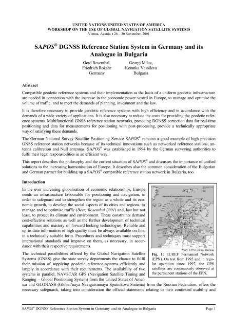
Map: EPN Central Bureau<br />
Fig. 1: EUREF Permanent Network<br />
(EPN). On test from 1995 <strong>and</strong> <strong>in</strong> regular<br />
operation s<strong>in</strong>ce 1997, the GPS<br />
satellites are cont<strong>in</strong>uously observed at<br />
the permanent stations of the EPN.<br />
ica <strong>and</strong> GLONASS (Global’naya Navigats<strong>in</strong>naya Sputnikova Sistema) from the Russian Federation, offers the<br />
necessary safeguards, tak<strong>in</strong>g <strong>in</strong>to consideration the official statements relat<strong>in</strong>g to their cont<strong>in</strong>ued usability <strong>and</strong><br />
<strong>SAPOS</strong> ® <strong>DGNSS</strong> <strong>Reference</strong> <strong>Station</strong> <strong>System</strong> <strong>in</strong> <strong>Germany</strong> <strong>and</strong> <strong>its</strong> Analogue <strong>in</strong> Bulgaria Page 1
future development. F<strong>in</strong>ally, these systems will be supplemented by the European development of Galileo, the first<br />
civilian GNSS.<br />
With the creation <strong>in</strong> 1989 of the European Terrestrial <strong>Reference</strong> <strong>System</strong> (ETRS 89), a three-dimensional geodetic<br />
reference system became available for the whole of Europe for the first time. Its world-wide spatial referenc<strong>in</strong>g<br />
connection is ma<strong>in</strong>ta<strong>in</strong>ed up-to-date, notably through the EUREF Permanent Network (EPN) which conta<strong>in</strong>s the<br />
European stations of the International GPS Service (IGS) [Fig. 1] (EUREF).<br />
For position fix<strong>in</strong>g with accuracies higher than about 7 m to 20 m, which is possible with absolute GPS, <strong>DGNSS</strong><br />
reference station services have been set up <strong>in</strong> many European countries s<strong>in</strong>ce the 1990s, provid<strong>in</strong>g differential<br />
GNSS correction data for real-time position<strong>in</strong>g or, at least, their observation<br />
data for <strong>DGNSS</strong> post-process<strong>in</strong>g.<br />
These conditions <strong>and</strong> developments def<strong>in</strong>e the basis <strong>and</strong> the direction<br />
to enable the creation of a basic unified European geodetic <strong>in</strong>frastructure.<br />
It is hard to judge whether this task, which is very important for<br />
the <strong>in</strong>creas<strong>in</strong>g unification of Europe, can be achieved through the farreach<strong>in</strong>g<br />
st<strong>and</strong>ardisation of procedures <strong>and</strong> techniques. However, the<br />
responsibilities of the state survey departments for their future bus<strong>in</strong>ess<br />
should be evaluated <strong>and</strong> considered <strong>in</strong> accordance with the requirements<br />
described <strong>in</strong> this paper, tak<strong>in</strong>g <strong>in</strong>to account the significantly<br />
<strong>in</strong>creased field of application of their products.<br />
Current requirements for the provision of a geodetic reference<br />
system for Europe<br />
With <strong>its</strong> products, the state survey departments provide the fundamental<br />
<strong>in</strong>frastructure for all spatial <strong>and</strong> l<strong>and</strong>-related <strong>in</strong>formation, thus supply<strong>in</strong>g<br />
an important basis for plann<strong>in</strong>g <strong>and</strong> action <strong>in</strong> the adm<strong>in</strong>istrative,<br />
legal, economic <strong>and</strong> scientific fields. The global <strong>in</strong>fluences <strong>and</strong> current<br />
technical possibilities mentioned <strong>in</strong> the <strong>in</strong>troduction have significantly<br />
changed the profile of requirements for the provision of geodetic reference<br />
systems:<br />
• The need for a unified reference system for the ever more tightly<br />
knit countries of Europe has become highly important. Especially<br />
for navigation <strong>and</strong> position<strong>in</strong>g, but also to meet nation-wide plann<strong>in</strong>g<br />
<strong>and</strong> bus<strong>in</strong>ess requirements, it is necessary <strong>in</strong> addition that <strong>in</strong><br />
such a unified reference system positions are described threedimensionally,<br />
rather than separat<strong>in</strong>g plan position from height<br />
data. ETRS 89 fulfils these important criteria.<br />
Many European countries have decided to <strong>in</strong>troduce ETRS 89 as<br />
an appropriate reference system. However, one can not count on<br />
<strong>its</strong> rapid <strong>and</strong> comprehensive <strong>in</strong>troduction everywhere. For <strong>Germany</strong>,<br />
the Work<strong>in</strong>g Committee of the Survey<strong>in</strong>g Authorities of the<br />
States of the Federal Republic of <strong>Germany</strong> (Arbe<strong>its</strong>geme<strong>in</strong>schaft<br />
der Vermessungsverwaltungen der Länder der Bundesrepublik<br />
Deutschl<strong>and</strong>, AdV) decided <strong>in</strong> 1991 on the comprehensive <strong>in</strong>troduction<br />
of ETRS 89, <strong>and</strong> re<strong>in</strong>forced this decision <strong>in</strong> 1995 by<br />
specify<strong>in</strong>g the use of plan coord<strong>in</strong>ates on the Universal Transverse<br />
Mercator Grid <strong>System</strong> (UTM) <strong>and</strong> normal heights based on the<br />
German primary levell<strong>in</strong>g network (Deutsches Haupthöhennetz<br />
Fig. 2: GPS/GLONASS choke r<strong>in</strong>g<br />
antenna at the Berl<strong>in</strong> 1 central reference<br />
<strong>and</strong> monitor<strong>in</strong>g station of the<br />
Berl<strong>in</strong> <strong>SAPOS</strong> ® reference station system.<br />
Fig. 3: Berl<strong>in</strong> Alex<strong>and</strong>erplatz TV<br />
tower, site of the <strong>SAPOS</strong> ® transmitter<br />
for <strong>DGNSS</strong> correction data via VHF<br />
radio <strong>and</strong> FM/RDS. The range of the<br />
VHF radio transmitter is about 65 km.<br />
1992, DHHN 92) for all l<strong>and</strong> survey purposes. However, even <strong>in</strong> <strong>Germany</strong> the full implementation of these<br />
decisions is runn<strong>in</strong>g rather hesitantly, both on account of the cost <strong>and</strong> because of the need for carefully coord<strong>in</strong>ated<br />
tim<strong>in</strong>g.<br />
<strong>SAPOS</strong> ® <strong>DGNSS</strong> <strong>Reference</strong> <strong>Station</strong> <strong>System</strong> <strong>in</strong> <strong>Germany</strong> <strong>and</strong> <strong>its</strong> Analogue <strong>in</strong> Bulgaria Page 2
• The traditional provision of local monumented control po<strong>in</strong>ts <strong>and</strong> their determ<strong>in</strong>ation <strong>in</strong> national or regional<br />
coord<strong>in</strong>ate systems no longer fulfils today’s requirements. The care <strong>and</strong> ma<strong>in</strong>tenance of conventional general<br />
control networks at their former density is no longer economic.<br />
• Many users need precise on-l<strong>in</strong>e <strong>and</strong> real-time position<strong>in</strong>g <strong>in</strong> order to carry out their tasks. Thus, no benefit<br />
can be ga<strong>in</strong>ed from conventional general control networks. Innovative solutions, with a guaranteed future <strong>and</strong><br />
offer<strong>in</strong>g a comprehensive range of products meet<strong>in</strong>g accuracy, reliability <strong>and</strong> safety requirements, are necessary<br />
to provide geodetic spatial referenc<strong>in</strong>g. These solutions are now represented either by GNSS or, for the<br />
many different applications with higher requirements, by <strong>DGNSS</strong> which is based on permanent reference station<br />
networks operat<strong>in</strong>g cont<strong>in</strong>uously.<br />
• A technically appropriate range of media <strong>and</strong> a choice of levels of accuracy are needed, <strong>in</strong> addition to high<br />
system availability <strong>and</strong> reliability of the results, <strong>in</strong> order to provide geodetic reference systems by means of<br />
precise <strong>DGNSS</strong>.<br />
• Cost-effective technical solutions for reference station operators <strong>and</strong> users can only be achieved if the <strong>in</strong>dustries<br />
<strong>in</strong>volved <strong>in</strong> their development <strong>and</strong> implementation are given economic <strong>in</strong>centives. In order to ensure the<br />
safety of their <strong>in</strong>vestment, the use of obligatory, <strong>and</strong> preferably <strong>in</strong>ternational, st<strong>and</strong>ards as well as the expectation<br />
of high sales of relevant equipment are essential. Unfortunately, the <strong>DGNSS</strong> services currently available<br />
<strong>in</strong> Europe vary considerably <strong>in</strong> their procedures <strong>and</strong> products, <strong>and</strong> technical conditions for their use are<br />
often <strong>in</strong>compatible.<br />
The <strong>SAPOS</strong> ® multi-functional satellite position<strong>in</strong>g service <strong>in</strong> <strong>Germany</strong><br />
The <strong>SAPOS</strong> ® <strong>DGNSS</strong> service provides an official geodetic <strong>in</strong>frastructure for all satellite-supported position<strong>in</strong>g<br />
<strong>and</strong> navigation applications for <strong>Germany</strong> (<strong>SAPOS</strong>). By means of permanently operat<strong>in</strong>g, multi-functional GNSS<br />
reference stations [Fig. 2], correction data for real-time GPS code <strong>and</strong> carrier phase measurements as well as<br />
orig<strong>in</strong>al observation data for GPS post-process<strong>in</strong>g<br />
are provided <strong>in</strong> <strong>in</strong>ternationally st<strong>and</strong>ardised data<br />
formats [Fig. 3]. A multi-media multi-function system,<br />
fulfill<strong>in</strong>g requirements <strong>and</strong> go<strong>in</strong>g far beyond the<br />
normal range of survey<strong>in</strong>g tasks, is ensured by four<br />
different levels of service [Table 1]:<br />
• <strong>SAPOS</strong> ® EPS: transmission of <strong>DGNSS</strong> correction<br />
data <strong>in</strong> co-operation with members of the<br />
association of German public broadcast<strong>in</strong>g authorities<br />
(Arbe<strong>its</strong>geme<strong>in</strong>schaft der öffentlichrechtlichen<br />
Rundfunkanstalten der Bundesrepublik<br />
Deutschl<strong>and</strong>, ARD) via FM/RDS sound<br />
broadcast<strong>in</strong>g transmitters, <strong>and</strong> <strong>in</strong> cooperation<br />
with Deutsche Telekom AG through the<br />
LW/RDS Ma<strong>in</strong>fl<strong>in</strong>gen transmitter for real-time<br />
position fix<strong>in</strong>g with an accuracy of 1 m to 3 m,<br />
as well as via the AdV’s own VHF (2 m b<strong>and</strong>)<br />
transmitters for real-time position<strong>in</strong>g enabl<strong>in</strong>g<br />
an accuracy of 0.5 m to 2 m.<br />
• <strong>SAPOS</strong> ® HEPS: transmission of <strong>DGNSS</strong> correction<br />
data via AdV-owned VHF radio transmitters<br />
for real-time position fix<strong>in</strong>g with an accuracy<br />
of 1cm to 5cm <strong>and</strong>, by us<strong>in</strong>g area correction<br />
parameters (FKP) of networked reference<br />
stations, an accuracy of ≤ 2 cm. In several<br />
states, <strong>SAPOS</strong> ® HEPS is also supplied via GSM telephone.<br />
Fig. 4: Cont<strong>in</strong>uous measurements with <strong>SAPOS</strong> ® HEPS<br />
<strong>and</strong> us<strong>in</strong>g area correction parameters (FKP), 12 January,<br />
12.01 p.m. to 13 January 2001, 12.00 noon. Distance<br />
between reference station <strong>and</strong> rover: 21.6 km. The site of<br />
the rover is almost free of obstructions. More than 99.9 %<br />
of measurements result <strong>in</strong> coord<strong>in</strong>ates with an accuracy<br />
of better than 2 cm. Three periods <strong>in</strong> the course of the 24<br />
hours, with durations of between 20 m<strong>in</strong>utes <strong>and</strong> one<br />
hour, <strong>and</strong> affect<strong>in</strong>g only a few of the solutions, <strong>in</strong>dicate an<br />
unfavourable GPS satellite configuration. These unfavourable<br />
periods should be covered by the planned additional<br />
use of the GLONASS satellites for <strong>SAPOS</strong> ® <strong>in</strong><br />
Berl<strong>in</strong>. Further measurements were able to show that<br />
similar results can be reached with the network<strong>in</strong>g solution<br />
over significantly longer distances between reference<br />
station <strong>and</strong> rover, <strong>and</strong> even with substantial extrapolations<br />
outside the reference station network.<br />
<strong>SAPOS</strong> ® <strong>DGNSS</strong> <strong>Reference</strong> <strong>Station</strong> <strong>System</strong> <strong>in</strong> <strong>Germany</strong> <strong>and</strong> <strong>its</strong> Analogue <strong>in</strong> Bulgaria Page 3
• <strong>SAPOS</strong> ® GPPS <strong>and</strong> GHPS: provision of GNSS observation data from the reference stations via the Internet<br />
for high-precision GNSS post-process<strong>in</strong>g with centimetre to sub-centimetre accuracy. Before convert<strong>in</strong>g data<br />
supply completely to Internet methods <strong>in</strong> the future, observation data is currently often supplied via mailboxes<br />
which can be <strong>in</strong>terrogated by conventional or mobile phone, or us<strong>in</strong>g other data media.<br />
Service level Availability Medium Accuracy Data<br />
rate<br />
In order to cover the whole of <strong>Germany</strong>, a network of about 250 <strong>SAPOS</strong> ® reference stations at <strong>in</strong>tervals of about<br />
40 km to 70 km is currently planned, of which more than 200 have already been set up. The hardware <strong>and</strong> software<br />
at the reference stations comply with specific st<strong>and</strong>ards fixed by the AdV <strong>and</strong> updated with<strong>in</strong> the framework<br />
of <strong>SAPOS</strong> ® quality assurance measures.<br />
<strong>Reference</strong> station sites have been chosen so as to ensure the long-term stability of the GNSS antennas. Sites <strong>and</strong><br />
antennas are also selected so as to provide a horizon which is as far as possible free of obstructions <strong>and</strong> so as to<br />
avoid external radio <strong>in</strong>terference <strong>and</strong> multipath effects on satellite signals. By us<strong>in</strong>g appropriately calibrated<br />
choke r<strong>in</strong>g antennas, possible multipath effects are further counteracted. Coord<strong>in</strong>ates are determ<strong>in</strong>ed with high<br />
precision, both <strong>in</strong> ETRS 89/Epoch 0 <strong>and</strong> <strong>in</strong> conventional geodetic reference systems by connect<strong>in</strong>g to EUREF<br />
D/NL 93 po<strong>in</strong>ts as well as to the denser derived networks of the German <strong>Reference</strong> Frame (DREF 91) <strong>and</strong> state<br />
reference networks, the German primary triangulation network (Deutsches Hauptdreiecksnetz, DHDN 90) <strong>and</strong><br />
the German primary levell<strong>in</strong>g network (Deutsches Haupthöhennetz, DHHN 92).<br />
Only high quality geodetic GNSS dual frequency receivers are used at <strong>SAPOS</strong> ® reference stations.<br />
User <strong>in</strong>terface<br />
<strong>SAPOS</strong> ® EPS real time FM/RDS, LW/RDS 1 to 3 m 3-5 s 7) RTCM 2.0 9)<br />
real time VHF 1) 0,5 to 2 m 3) 1 s 7) RTCM 2.0 9)<br />
<strong>SAPOS</strong> ® HEPS real time VHF 1) 1 to 5 cm 4)<br />
<strong>SAPOS</strong> ® GPPS near real time postprocess<strong>in</strong>g<br />
Internet 2)<br />
GSM/telephone,<br />
other media<br />
<strong>SAPOS</strong> ® GHPS post-process<strong>in</strong>g Internet 2)<br />
telephone,<br />
other media<br />
≤ 2 cm 5)<br />
1 s 7) RTCM 2.1<br />
(MSG 20, 21) 9) ,<br />
NMEA-AdV 10)<br />
< 1 cm 6) 1 s 8) RINEX 2.0 11)<br />
≤ 1 cm 6) 1 s 8) RINEX 2.0 11)<br />
(1) In some states mobile phone (GSM) also available; (2) until data supply via the Internet is fully implemented, <strong>in</strong> some cases via mailbox <strong>and</strong>/or<br />
other data media only; (3) dependent on the mobile receiver technology <strong>in</strong>stalled; (4) achievable accuracy without supplementary <strong>in</strong>formation<br />
from networked reference stations; (5) achievable accuracy with area correction parameters from networked reference stations; (6) dependent on<br />
duration of observations, us<strong>in</strong>g precise ephemeris as necessary; (7) for transmission of <strong>DGNSS</strong> correction data for all satellites received at the<br />
reference stations; (8) st<strong>and</strong>ard record<strong>in</strong>g <strong>in</strong>terval for observation data; by prior arrangement this can also be provided at ½ s <strong>in</strong>tervals; RINEX<br />
data can be th<strong>in</strong>ned for delivery as required; (9) <strong>in</strong>ternational st<strong>and</strong>ard data formats from the US Radio Technical Commission for Maritime<br />
Services, Special Committee No. 104: RTCM SC104 versions 2.0 <strong>and</strong> 2.1, the latter us<strong>in</strong>g message types 20 <strong>and</strong> 21 for code <strong>and</strong> carrier phase<br />
corrections; (10) <strong>in</strong>ternational st<strong>and</strong>ard format from the National Mar<strong>in</strong>e Electronics Association, for data exchange between electronic devices,<br />
enhanced <strong>in</strong> <strong>SAPOS</strong> ® for the supply of area correction parameters (FKP) from networked reference stations; (11) Receiver Independent Exchange<br />
Format version 2.0 (Commission VIII International Coord<strong>in</strong>ation for Space Techniques for Geodesy <strong>and</strong> Geodynamics)<br />
Table 1: Overview of <strong>SAPOS</strong> ® service levels <strong>and</strong> media<br />
Positions of reference station antennas are checked regularly (four times a year) for any displacement <strong>in</strong> relation<br />
to selected stations of the German GPS reference network (GREF), the European reference network (EUREF) <strong>and</strong><br />
the International GPS Service (IGS) network.<br />
<strong>SAPOS</strong> ® is based on <strong>in</strong>ternational st<strong>and</strong>ards <strong>and</strong> develops these st<strong>and</strong>ards, together with partners <strong>in</strong> the scientific<br />
<strong>and</strong> bus<strong>in</strong>ess sector, <strong>in</strong> accordance with <strong>in</strong>novations <strong>in</strong> procedures <strong>and</strong> techniques. In co-operation with <strong>in</strong>dustry,<br />
AdV strives for <strong>in</strong>ternationalisation of these st<strong>and</strong>ards. The <strong>SAPOS</strong> ® Technical Committee was formed <strong>in</strong> 1999,<br />
thus enabl<strong>in</strong>g two-way communication between government <strong>and</strong> <strong>in</strong>dustry, <strong>and</strong> the discussion <strong>and</strong> coord<strong>in</strong>ation of<br />
relevant activities. As a result of this co-operation, all of the well-known manufacturers of geodetic GNSS receivers<br />
are now <strong>in</strong>corporat<strong>in</strong>g full <strong>SAPOS</strong> ® compatibility <strong>in</strong> their equipment, where this had not already been done.<br />
<strong>SAPOS</strong> ® <strong>DGNSS</strong> <strong>Reference</strong> <strong>Station</strong> <strong>System</strong> <strong>in</strong> <strong>Germany</strong> <strong>and</strong> <strong>its</strong> Analogue <strong>in</strong> Bulgaria Page 4
With<strong>in</strong> the framework of <strong>SAPOS</strong> ® , technical <strong>in</strong>novations have been developed for high-precision GNSS reference<br />
station networks, offer<strong>in</strong>g solutions which are of <strong>in</strong>terest for other <strong>DGNSS</strong> services even at the <strong>in</strong>ternational level,<br />
as evidenced by the export of these solutions to other countries. The follow<strong>in</strong>g examples give an <strong>in</strong>dication of<br />
these developments:<br />
• The RTCM-AdV data format allow<strong>in</strong>g for complete transmission of <strong>DGNSS</strong> correction data for 12 satellites<br />
<strong>in</strong>clud<strong>in</strong>g area correction parameters (FKP) from networked reference stations with a data transmission rate<br />
of only 2400 b<strong>its</strong>/s. The <strong>in</strong>ternational RTCM SC 104/versions 2.0 <strong>and</strong> 2.1 <strong>and</strong>, <strong>in</strong> the future, version 2.3 data<br />
formats can be easily generated at the user <strong>in</strong>terface. Transmission of the same <strong>in</strong>formation us<strong>in</strong>g the RTCM<br />
SC 104/version 2.1 format would require a transmission capacity of 9600 b<strong>its</strong>/s. At the same time, RTCM-<br />
AdV provides an account<strong>in</strong>g system for prepaid service-related charges, us<strong>in</strong>g a Smart Card or appropriate<br />
firmware solutions <strong>in</strong> the mobile receiver.<br />
• Antenna calibration <strong>and</strong> the “Null antenna”, modell<strong>in</strong>g the effects of antenna phase centre variations (PCV)<br />
<strong>and</strong> of mean phase centre offsets, <strong>and</strong> so enabl<strong>in</strong>g GNSS antennas for reference station networks to be practically<br />
error-free (Wübbena et al 1996b, 2001). In the RTCM SC 104 version 2.3 antenna <strong>in</strong>formation will be<br />
<strong>in</strong>cluded <strong>and</strong> the “Null antenna” is as an antenna type compatible with this data format.<br />
• The networked reference station process, allow<strong>in</strong>g the modell<strong>in</strong>g of distance-dependent GNSS error components,<br />
tropospheric, ionospheric <strong>and</strong> orbit effects (Wübbena et al 1996a). As a result, the user ga<strong>in</strong>s shorter<br />
<strong>in</strong>itialisation times <strong>and</strong> improved accuracy for real-time position fix<strong>in</strong>g [Fig. 4].<br />
In September, 2001 the US Radio Technical Commission for Maritime Services (RTCM) has started st<strong>and</strong>ardisation<br />
discussions for the implementation of the <strong>in</strong>formation of networked reference station arrays as a st<strong>and</strong>ard of<br />
the RTCM Sub-Committee 104 <strong>in</strong> future (Euler et al 2001).<br />
Several state survey departments are test<strong>in</strong>g procedures <strong>and</strong> solutions go<strong>in</strong>g beyond current st<strong>and</strong>ard <strong>SAPOS</strong> ®<br />
service levels. For example, the Berl<strong>in</strong> state survey will <strong>in</strong>clude the Russian GLONASS <strong>in</strong> all <strong>SAPOS</strong> ® services<br />
Fig. 5: Schematic overview of the Berl<strong>in</strong> <strong>SAPOS</strong> ® reference station system. The additional use of GLONASS, the<br />
supply of RINEX data for the GPPS <strong>and</strong> GHPS service levels over the Internet, <strong>and</strong> the <strong>in</strong>corporation of the Potsdam<br />
reference station <strong>in</strong> the alarm plan <strong>in</strong> regular operation are all expected <strong>in</strong> the first half of 2002.<br />
<strong>SAPOS</strong> ® <strong>DGNSS</strong> <strong>Reference</strong> <strong>Station</strong> <strong>System</strong> <strong>in</strong> <strong>Germany</strong> <strong>and</strong> <strong>its</strong> Analogue <strong>in</strong> Bulgaria Page 5
<strong>in</strong> order to improve the availability of satellites with<strong>in</strong> the conurbation. In spite of the necessary changeover of the<br />
RTCM <strong>and</strong> RINEX data formats to their recent versions [Table 1, Fig. 5], the cont<strong>in</strong>ued usability of today’s<br />
technology will be ensured through full downward compatibility. GLONASS is expected to be <strong>in</strong>corporated <strong>in</strong>to<br />
regular <strong>SAPOS</strong> ® operation <strong>in</strong> Berl<strong>in</strong> <strong>in</strong> the first half of 2002.<br />
The highly reliable service provision <strong>and</strong> system <strong>in</strong>tegrity of <strong>SAPOS</strong> ® are ensured by quality management measures<br />
which are ever more widely dissem<strong>in</strong>ated <strong>in</strong> the state survey departments.<br />
Tak<strong>in</strong>g the Berl<strong>in</strong> conurbation as a particularly prom<strong>in</strong>ent<br />
example, <strong>SAPOS</strong> ® applications are used <strong>in</strong> survey<strong>in</strong>g [Fig. 6], construction<br />
logistics, public suburban transport [Fig. 7], traffic control<br />
<strong>and</strong> police [Fig. 8] etc., <strong>and</strong> require extremely high accuracy, availability<br />
<strong>and</strong> security of the system (Rosenthal, Rokahr 1999; Beer,<br />
Rosenthal 2000; SenStadt 2000a; SenStadt 2000b). Three reference<br />
stations <strong>in</strong> Berl<strong>in</strong> <strong>and</strong> another <strong>in</strong> the neighbour<strong>in</strong>g state of Br<strong>and</strong>enburg<br />
are networked <strong>and</strong>, together with the transmission equipment at the<br />
Alex<strong>and</strong>erplatz TV tower (VHF 2m b<strong>and</strong> radio) <strong>and</strong> the SFB transmit-<br />
ter (FM/RDS), form the metropolitan <strong>SAPOS</strong> ® system [Fig. 5]. A<br />
system availability of at least 99 % is guaranteed by the follow<strong>in</strong>g<br />
measures:<br />
• All components of the Berl<strong>in</strong> 1 pr<strong>in</strong>cipal reference station, all data<br />
l<strong>in</strong>ks to the transmitters as well as the transmitters themselves are<br />
duplicated. Because of network<strong>in</strong>g the reference stations are <strong>in</strong> effect<br />
quadrupled.<br />
• The <strong>SAPOS</strong> ® reference stations <strong>and</strong> the transmitters are protected<br />
from power fluctuations <strong>and</strong> failures by <strong>in</strong>dependent (un<strong>in</strong>terruptible)<br />
power supplies (UPS) <strong>and</strong> by connection to emergency power<br />
generators.<br />
• EPS <strong>and</strong> HEPS <strong>DGNSS</strong> correction data broadcast on VHF <strong>and</strong> by<br />
the SFB (Berl<strong>in</strong> City Radio) transmitter are received <strong>and</strong> checked<br />
cont<strong>in</strong>uously by the reference stations Berl<strong>in</strong> 1 <strong>and</strong> Berl<strong>in</strong> 3. The<br />
observed values for the GPPS <strong>and</strong> GHPS services are cont<strong>in</strong>uously<br />
monitored. Any malfunction, disruption or loss of quality is<br />
thus automatically recognised <strong>in</strong> real time.<br />
• Malfunctions etc. automatically activate an alarm plan which sets<br />
off appropriate corrective measures. Depend<strong>in</strong>g on the requirement,<br />
data l<strong>in</strong>ks, computers or transmitters are switched over <strong>and</strong><br />
another reference station is temporarily used as the pr<strong>in</strong>cipal station<br />
for the supply of correction data. The system is set up so that<br />
the technology can normally manage <strong>its</strong>elf successfully <strong>and</strong> the<br />
operation of <strong>SAPOS</strong> ® is ma<strong>in</strong>ta<strong>in</strong>ed. All malfunctions etc. are<br />
automatically logged <strong>and</strong> analysed as part of the quality management<br />
process.<br />
• Should a malfunction, a failure or a loss of quality nevertheless<br />
dem<strong>and</strong> manual <strong>in</strong>tervention, two members of the <strong>SAPOS</strong> ® emergency<br />
callout service are <strong>in</strong>formed automatically by GSM telephone<br />
by both monitor<strong>in</strong>g stations. The details of any earlier<br />
switch<strong>in</strong>g processes by the automated alarm plan will already have<br />
been sent to them via GSM short messages, <strong>in</strong> parallel with the<br />
emergency measures, so that they have access to all necessary <strong>in</strong>formation.<br />
The staff of the emergency service are on call day <strong>and</strong><br />
night <strong>and</strong> remedy any faults without delay, either by remote repair<br />
measures or on the spot.<br />
Fig. 6: Satellite-supported survey<strong>in</strong>g <strong>in</strong><br />
the centre of Berl<strong>in</strong>. With <strong>DGNSS</strong><br />
correction data from the <strong>SAPOS</strong> ®<br />
HEPS (with area correction parameters)<br />
via VHF radio, three-dimensional<br />
position fix<strong>in</strong>g can be carried out with<br />
centimetre accuracy <strong>in</strong> real time.<br />
Photo: BVG<br />
Fig. 7: Berl<strong>in</strong> transport services (BVG)<br />
bus with <strong>SAPOS</strong> ® position<strong>in</strong>g technology.<br />
With<strong>in</strong> the framework of the computer-supported<br />
operations management<br />
system (Rechnergestütztes Betriebsle<strong>its</strong>ystem,<br />
RBL) <strong>and</strong> based on<br />
<strong>SAPOS</strong> ® EPS (VHF), the positions of<br />
all BVG buses are cont<strong>in</strong>uously available<br />
for management, control <strong>and</strong><br />
<strong>in</strong>formation processes. Thus, punctuality<br />
<strong>and</strong> connections between services as<br />
well as the safety of both passengers<br />
<strong>and</strong> drivers are improved. Traffic<br />
speeds can be <strong>in</strong>creased by direct <strong>in</strong>tervention<br />
<strong>in</strong> traffic signal cycles. At<br />
selected bus stops, <strong>and</strong> <strong>in</strong> case of disruptions<br />
or diversions, dynamic passenger<br />
<strong>in</strong>formation assists customers<br />
on their journeys through the city.<br />
<strong>SAPOS</strong> ® <strong>DGNSS</strong> <strong>Reference</strong> <strong>Station</strong> <strong>System</strong> <strong>in</strong> <strong>Germany</strong> <strong>and</strong> <strong>its</strong> Analogue <strong>in</strong> Bulgaria Page 6
• As already mentioned above, the positions of the reference station antennas are regularly checked for any<br />
change four times a year, <strong>in</strong> relation to selected stations of the German GPS reference network (GREF), the<br />
European reference network (EUREF) <strong>and</strong> the International GPS Service (IGS) network. Comprehensive absolute<br />
calibrations are carried out <strong>in</strong>dividually on all reference station antennas.<br />
Identical requirements for <strong>SAPOS</strong> ® exist not only <strong>in</strong> urban areas (Albert 1999; Peuser, Hankemeier 1999; Schulz<br />
1999) [Fig. 9] but also far away from big cities, for position<strong>in</strong>g, navigation,<br />
<strong>in</strong>formation collection <strong>and</strong> other specific applications [Figs. 10<br />
to 12]. A particularly strik<strong>in</strong>g example is the movement of large vessels,<br />
after their completion by the Meyer shipyard <strong>in</strong> Papenburg on the<br />
Ems river, <strong>in</strong>to the deep navigable water of the North Sea (Wegener<br />
1998) [Fig. 13].<br />
The follow<strong>in</strong>g example illustrates the usefulness of the reliable supply<br />
of <strong>SAPOS</strong> ® data, far beyond the normal applications of position<strong>in</strong>g<br />
<strong>and</strong> navigation. S<strong>in</strong>ce March 2000 the AdV has been co-operat<strong>in</strong>g<br />
with the Potsdam earth sciences research centre (Geoforschungszentrum,<br />
GFZ) by supply<strong>in</strong>g RINEX observation data from <strong>SAPOS</strong> ®<br />
reference stations for an <strong>in</strong>novative <strong>in</strong>ternational research project on<br />
climate <strong>and</strong> <strong>its</strong> variability. From meteorological <strong>and</strong> GNSS observations<br />
at reference stations <strong>and</strong> on the GPS-equipped low-orbit satellites<br />
of the CHAMP <strong>and</strong> GRACE missions, fundamental parameters such<br />
as pressure, temperature <strong>and</strong> water vapour content <strong>in</strong> the troposphere<br />
<strong>and</strong> stratosphere can be determ<strong>in</strong>ed.<br />
Consideration <strong>and</strong> activities for a <strong>SAPOS</strong> ® compatible reference<br />
station network <strong>in</strong> Bulgaria<br />
The fields of application of <strong>SAPOS</strong> ® <strong>in</strong> Bulgaria are the same as<br />
above discussed. Accord<strong>in</strong>g to the accuracy requirements the system<br />
can be used for real-time determ<strong>in</strong>ations <strong>and</strong> post-process<strong>in</strong>g determ<strong>in</strong>ations.<br />
For example, for precise post-process<strong>in</strong>g determ<strong>in</strong>ation <strong>in</strong><br />
geodesy - geodetic networks, cadastre, local <strong>and</strong> regional geodynamics,<br />
for precise real-time navigation - approach <strong>and</strong> l<strong>and</strong><strong>in</strong>g of<br />
aircraft, approach of ships <strong>in</strong> harbors etc.<br />
In this stage of GNSS development two permanent stations exist <strong>in</strong><br />
Bulgaria. One of them is located near the capital of Bulgaria - Sofia<br />
station that is also EUREF station <strong>and</strong> permanent IGS station. The<br />
second one is located near the Black Sea - Varna station that is used<br />
for mar<strong>in</strong>e navigation. Two more permanent stations are foreseen accord<strong>in</strong>g<br />
to the central European regional geo-dynamic project<br />
CERGOP-2. With respect to the telecommunication, <strong>in</strong> Bulgaria it is<br />
developed quite a good media network - VHF 2 m-B<strong>and</strong>-Radio,<br />
UKW/Radio Data <strong>System</strong>, GSM - three operators.<br />
Two phased concepts are proposed for establishment of a <strong>SAPOS</strong> ®<br />
analogous reference system <strong>in</strong> Bulgaria:<br />
Photo: Berl<strong>in</strong> Police<br />
Fig. 8: <strong>SAPOS</strong> ® -supported operation<br />
of the central escort <strong>and</strong> traffic comm<strong>and</strong>o<br />
of the Berl<strong>in</strong> Police <strong>in</strong> action<br />
on the occasion of a state visit. The<br />
Central Traffic Service (ZVkD) of the<br />
Berl<strong>in</strong> Police uses <strong>SAPOS</strong> ® -EPS<br />
(VHF) <strong>in</strong> connection with, among<br />
other th<strong>in</strong>gs, escort<strong>in</strong>g important state<br />
visitors as well as while demonstrations,<br />
parades <strong>and</strong> similar events, <strong>in</strong><br />
order to be able to take timely traffic<br />
management measures as required, for<br />
example location-dependent safety or<br />
other precautions.<br />
Photo: Hamburg fire brigade<br />
Fig. 9: All fire <strong>and</strong> rescue vehicles of<br />
the Hamburg fire brigade are equipped<br />
with <strong>in</strong>cident location <strong>and</strong> guidance<br />
<strong>and</strong> operation control system technology,<br />
us<strong>in</strong>g <strong>SAPOS</strong> ® EPS (VHF) for<br />
precise position fix<strong>in</strong>g, <strong>and</strong> offer<strong>in</strong>g<br />
sufficient accuracy for the identification<br />
of access routes <strong>in</strong>to properties.<br />
• Establishment of stations <strong>in</strong> the areas with high requirements (urban<br />
areas, areas with hard build<strong>in</strong>g activity etc.) <strong>and</strong> after that accomplish<strong>in</strong>g of the reference station framework<br />
for the whole area of Bulgaria extensively,<br />
• surface cover<strong>in</strong>g of the country by few stations with significantly large distances between them <strong>and</strong> a subsequent<br />
<strong>in</strong>creas<strong>in</strong>g the density of the reference stations framework.<br />
Bulgaria is situated between 22 nd <strong>and</strong> 28 th meridians <strong>and</strong> between 41 st <strong>and</strong> 44 th parallels. The surface of the country<br />
is about 110 000 km 2 . If the distances between the reference stations will be accept to be 50-70 km then the<br />
<strong>SAPOS</strong> ® <strong>DGNSS</strong> <strong>Reference</strong> <strong>Station</strong> <strong>System</strong> <strong>in</strong> <strong>Germany</strong> <strong>and</strong> <strong>its</strong> Analogue <strong>in</strong> Bulgaria Page 7
eference network will consist of 28 stations (Fig. 14). The achievable real-time accuracy <strong>in</strong> horizontal position<br />
will be 1-2 cm <strong>and</strong> a little lower <strong>in</strong> the height. If the distances <strong>in</strong> a first phase will be <strong>in</strong>creased to 80-100 km then<br />
the number of reference stations will be decreased to about 10 stations. In this case, the accuracy <strong>in</strong> the horizontal<br />
position will achieve 2-4 cm <strong>and</strong> a little lower <strong>in</strong> the height. Some stations have to be chosen as central reference<br />
stations for the networked process. Some requirements have to be met at the establishment of the stations.<br />
However at last there are needed about 28 reference stations for a<br />
high quality multi-functional Bulgarian <strong>DGNSS</strong> service, which will<br />
fulfil all discussed dem<strong>and</strong>s <strong>in</strong> an efficient way <strong>and</strong> <strong>in</strong> agreement<br />
with the function.<br />
F<strong>in</strong>anc<strong>in</strong>g of the establishment of the system could be possible as<br />
follows:<br />
• entire f<strong>in</strong>anc<strong>in</strong>g by Bulgarian state <strong>in</strong>stitutions,<br />
• comb<strong>in</strong>ed f<strong>in</strong>anc<strong>in</strong>g - by state <strong>in</strong>stitutions <strong>and</strong> private companies,<br />
• by project on the EC <strong>and</strong> other Programs <strong>and</strong> sources.<br />
Conclusion<br />
The multi-functional <strong>and</strong> multi-media services supplied by <strong>SAPOS</strong> ®<br />
have provided a good example of the suitability of <strong>DGNSS</strong> services<br />
as an economic <strong>and</strong> effective application of the three-dimensional<br />
ETRS 89 reference system. The importance of a well-developed<br />
quality management system has been discussed <strong>and</strong> illustrated by the<br />
sample applications. Experience shows that it is beneficial for the<br />
state survey departments to share their know-how by support<strong>in</strong>g their<br />
customers with carefully targeted advice.<br />
Valid, precise <strong>and</strong> reproducible connections with conventional position<br />
<strong>and</strong> height reference systems are also possible for real-time applications<br />
by means of official transformation parameters <strong>and</strong> height<br />
anomaly models us<strong>in</strong>g appropriate software or, better by direct <strong>in</strong>corporation<br />
<strong>in</strong>to the firmware of GNSS rovers. Such solutions will<br />
be carried out up to regional levels only, because precise position<strong>in</strong>g<br />
over larger areas requires a multitude of suitable parameters to deal<br />
with <strong>in</strong>homogeneities <strong>and</strong> residual discrepancies <strong>in</strong> traditional control<br />
po<strong>in</strong>t networks.<br />
By transferr<strong>in</strong>g essential functions, especially those of conventional<br />
positional control po<strong>in</strong>ts, to the <strong>DGNSS</strong> reference stations, government<br />
<strong>and</strong> bus<strong>in</strong>ess can achieve a satisfactory return on their <strong>in</strong>vestment.<br />
Timetables should be developed <strong>and</strong> fixed for th<strong>in</strong>n<strong>in</strong>g out<br />
exist<strong>in</strong>g general control networks, for which it is then only necessary<br />
to neglect their ma<strong>in</strong>tenance. In order to guarantee the availability of<br />
an <strong>in</strong>dependent geodetic spatial reference system for special survey<br />
applications, for possible emergencies <strong>and</strong> crises as well as for national<br />
defence purposes, a residual network of conventional control<br />
po<strong>in</strong>ts should still be ma<strong>in</strong>ta<strong>in</strong>ed <strong>in</strong> the future <strong>in</strong> addition to the<br />
Photo: SFB<br />
Fig. 10: In order to ensure the supply<br />
of broadcast<strong>in</strong>g services, the ARD<br />
broadcast<strong>in</strong>g authorities must check<br />
their transmission <strong>in</strong>stallations. Field<br />
strength measurements are therefore<br />
carried out from a helicopter, fly<strong>in</strong>g at<br />
a distance of about 1 km around the<br />
transmitter to be checked. Position<strong>in</strong>g<br />
of the helicopter <strong>and</strong> spatial referenc<strong>in</strong>g<br />
of measurements is carried out by<br />
means of <strong>SAPOS</strong> ® EPS/FM.<br />
Photo: Brunswick Technical University<br />
Fig. 11: The usability of <strong>SAPOS</strong> ® VHF<br />
for precise navigation for special aircraft<br />
missions such as rescue operations,<br />
security tasks or dropp<strong>in</strong>g relief<br />
supplies has been successfully tested by<br />
Brunswick University. At the ILA‘96<br />
<strong>in</strong>ternational aviation <strong>and</strong> space exhibition<br />
<strong>in</strong> Berl<strong>in</strong>, the Integrated Navigation<br />
<strong>System</strong>s (INS) company based <strong>in</strong><br />
Hamburg had already demonstrated<br />
precise l<strong>and</strong><strong>in</strong>g approaches by means<br />
of this <strong>SAPOS</strong> ® medium.<br />
<strong>DGNSS</strong> reference station networks. It seems advisable to reta<strong>in</strong> the control po<strong>in</strong>ts of this reduced network for<br />
technical developments <strong>and</strong> possible further requirements <strong>in</strong> the future, select<strong>in</strong>g them for their long-term suitability<br />
for GNSS <strong>and</strong> monument<strong>in</strong>g them so as to enable their use for both position <strong>and</strong> height measurements (Rosenthal<br />
2001b).<br />
Re<strong>in</strong>forced co-operation between survey<strong>in</strong>g <strong>in</strong>stitutions, aimed at creat<strong>in</strong>g a unified geodetic <strong>in</strong>frastructure based<br />
on compatible <strong>DGNSS</strong> reference station networks, is important for the <strong>in</strong>creas<strong>in</strong>g unification of Europe. Com-<br />
<strong>SAPOS</strong> ® <strong>DGNSS</strong> <strong>Reference</strong> <strong>Station</strong> <strong>System</strong> <strong>in</strong> <strong>Germany</strong> <strong>and</strong> <strong>its</strong> Analogue <strong>in</strong> Bulgaria Page 8
patible technology <strong>and</strong> procedures offer better opportunities to <strong>in</strong>fluence <strong>in</strong>ternational st<strong>and</strong>ardisation <strong>and</strong> also<br />
improve the economic prospects of <strong>in</strong>vestments <strong>in</strong> forward-look<strong>in</strong>g <strong>and</strong> <strong>in</strong>novative solutions. As a contribution to<br />
this process, a workshop <strong>in</strong> Berl<strong>in</strong> on “Multi-functional GNSS <strong>Reference</strong><br />
<strong>Station</strong> Networks as Basic Geodetic Infrastructure” is planned for<br />
March 4-5, 2002, at which participants from about ten central <strong>and</strong><br />
eastern European countries are expected.<br />
For further improvement of GNSS satellite availability under unfavourable<br />
topographic conditions, especially <strong>in</strong> urban areas,<br />
GLONASS should be <strong>in</strong>tegrated <strong>in</strong> the <strong>DGNSS</strong> reference systems <strong>in</strong><br />
addition to GPS, <strong>and</strong> support of European activities for the GALILEO<br />
civilian GNSS should be cont<strong>in</strong>ued <strong>in</strong> the future.<br />
The need of establishment of a National Differential Global Navigation<br />
<strong>System</strong>s for position<strong>in</strong>g (<strong>DGNSS</strong>) <strong>in</strong> Bulgaria, based on the network<br />
of permanent multi-functional stations, is a matter of fact.<br />
For this purpose, the ma<strong>in</strong> concept, requirements <strong>and</strong> <strong>in</strong>formation<br />
about the establishment of such a system are proposed. Variants for<br />
the number of the reference stations, their equipment, possibilities for<br />
application, f<strong>in</strong>anc<strong>in</strong>g, phased concepts for <strong>in</strong>troduc<strong>in</strong>g have been proposed.<br />
The successful application <strong>and</strong> use of the German <strong>SAPOS</strong> ® is a reliable<br />
precondition for establishment of such a respective analog <strong>in</strong> Bulgaria.<br />
Along with that the collaboration between Bulgarian <strong>and</strong> German<br />
colleagues from the Berl<strong>in</strong> Senate dur<strong>in</strong>g the development, establishment<br />
<strong>and</strong> application of <strong>SAPOS</strong> ® is an important <strong>and</strong> favourable<br />
condition for <strong>its</strong> realization. One undisputed fact is the <strong>in</strong>surance of<br />
respective f<strong>in</strong>anc<strong>in</strong>g <strong>and</strong> there are different ways, <strong>and</strong> assistance from<br />
state <strong>in</strong>stitutions as well as help from foreign countries.<br />
<strong>Reference</strong>s<br />
AdV, Work<strong>in</strong>g Committee of the Survey<strong>in</strong>g Authorities of the Länder (States) of<br />
the Federal Republic of <strong>Germany</strong>: Onl<strong>in</strong>e <strong>in</strong> Internet: http://www.adv-onl<strong>in</strong>e.de<br />
Albert, H. (1999): Der aufgeklärte Fahrgast – Dynamische Leit- und Informationssysteme<br />
für den Hamburger ÖPNV. Telematik im Verkehr • Werkstattbericht Hamburg,<br />
publisher: Freie und Hansestadt Hamburg, Baubehörde • Amt für Verkehr,<br />
Hamburg, p. 25 - 46<br />
Beer, M., Rosenthal, G. (2000): <strong>SAPOS</strong> ® im Verkehr. Vermessung und ..., publisher:<br />
Senatsverwaltung für Stadtentwicklung Berl<strong>in</strong>, Berl<strong>in</strong> • M<strong>in</strong>isterium des<br />
Innern des L<strong>and</strong>es Br<strong>and</strong>enburg, Potsdam, p. 28 - 30<br />
Photo: BSH<br />
Fig. 12: The newest survey vessel of<br />
the Federal Adm<strong>in</strong>istration for Mar<strong>in</strong>e<br />
Navigation <strong>and</strong> Hydrography (Bundesamt<br />
für Seeschifffahrt und Hydrographie,<br />
BSH) <strong>in</strong>clud<strong>in</strong>g <strong>its</strong> subsidiary<br />
boats has been equipped with <strong>SAPOS</strong> ®<br />
VHF technology for the production of<br />
precise hydrographic charts.<br />
Photo: LGN<br />
Fig. 13: <strong>SAPOS</strong> ® -navigated movement<br />
of the Radiance of the Seas cruise ship<br />
on the Ems river from the Meyer shipyard<br />
<strong>in</strong> Papenburg to the North Sea on<br />
25 <strong>and</strong> 26 January 2001. EPS corrections<br />
supplied by VHF radion ensure<br />
the necessary accuracy of one meter<br />
required for this type of ship movement.<br />
The whole on-board<br />
<strong>SAPOS</strong> ® /DGPS technology is duplicated<br />
<strong>in</strong> order to prevent all conceivable<br />
failures <strong>and</strong> to avoid any damage.<br />
Beer, M., Rosenthal, G. (2001): Verkehrstelematik – Neue Chancen im Verkehrswesen.<br />
Nationalatlas Bundesrepublik Deutschl<strong>and</strong>, Volume 9 Verkehr und Kommunikation, Spektrum Akademischer Verlag, Heidelberg<br />
• Berl<strong>in</strong>, p. 148 - 149<br />
Euler, H.-J., Keenan, C. R., Wübbena, G., Zebhauser, B. E. (2001): Study of a Simplified Approach <strong>in</strong> Utiliz<strong>in</strong>g Information from<br />
Permanent <strong>Reference</strong> <strong>Station</strong> Arrays, Proceed<strong>in</strong>gs ION GPS-2001, Salt Lake City, USA<br />
EUREF: Homepage der Sub-Commission European <strong>Reference</strong> Frame der International Association of Geodesy (IAG), onl<strong>in</strong>e <strong>in</strong> Internet:<br />
http://www.euref-iag.org<br />
Milev, G., Rosenthal, G, Rokahr, F., Vassileva, K. (2001): <strong>SAPOS</strong> - <strong>System</strong> <strong>in</strong> Bulgaria. International Symposium on “Geodetic,<br />
Photogrammetric <strong>and</strong> Satellite Technologies – Development <strong>and</strong> Integrated Application”, 08-09 November, 2001, Sofia, Bulgaria, p.<br />
237 - 243<br />
Peuser, M., Hankemeier, P. (1999): Individuelle Verkehrslenkung für Sicherhe<strong>its</strong>dienste und öffentlichen Nahverkehr. Telematik im<br />
Verkehr • Werkstattbericht Hamburg, publisher: Freie und Hansestadt Hamburg, Baubehörde • Amt für Verkehr, Hamburg, p. 68 - 73<br />
Rosenthal, G., Rokahr, F. (1999): Über die Nutzung von Geo<strong>in</strong>formationen der deutschen L<strong>and</strong>esvermessung <strong>in</strong> der Verkehrstelematik.<br />
Ze<strong>its</strong>chrift für Vermessungswesen Volume 124, No. 4, Verlag Konrad Wittwer, Stuttgart, p. 112 - 121<br />
<strong>SAPOS</strong> ® <strong>DGNSS</strong> <strong>Reference</strong> <strong>Station</strong> <strong>System</strong> <strong>in</strong> <strong>Germany</strong> <strong>and</strong> <strong>its</strong> Analogue <strong>in</strong> Bulgaria Page 9
Rosenthal, G. (2001a): <strong>SAPOS</strong> ® - The German<br />
National Satellite Position<strong>in</strong>g Service. 1 st Common<br />
Baltic Symposium on „GPS-Heightimg<br />
based on the Concept of a Digital Height <strong>Reference</strong><br />
Surface (DFHRS) <strong>and</strong> Related Topics –<br />
GPS-Height<strong>in</strong>g <strong>and</strong> National-wide Permanent<br />
GPS <strong>Reference</strong> <strong>System</strong>s“, June 11, 2001, Riga,<br />
Latvia<br />
Rosenthal, G. (2001b): <strong>SAPOS</strong> ® - E<strong>in</strong> Netzwerk<br />
von GNSS-Referenzstationen als Grund<strong>in</strong>frastruktur<br />
zur Realisierung der geodätischen Bezugssysteme.<br />
125 Jahre Berl<strong>in</strong>er Vermessungsverwaltung,<br />
publisher: Senatsverwaltung für<br />
Stadtentwicklung • Geo<strong>in</strong>formation, Vermessung,<br />
Wertermittlung, Berl<strong>in</strong>, p. 31 - 38<br />
Rosenthal, G. (2001c): Requirements for the<br />
Implementation of Geodetic <strong>Reference</strong> <strong>System</strong>s<br />
<strong>and</strong> their Compliance with GNSS <strong>Reference</strong><br />
<strong>Station</strong> Networks. International Symposium on<br />
“Geodetic, Photogrammetric <strong>and</strong> Satellite Technologies<br />
– Development <strong>and</strong> Integrated Application”,<br />
08-09 November, 2001, Sofia, Bulgaria,<br />
p. 82 - 91<br />
Schulz, G. (1999): Fahrzeugpositionierung bei<br />
der Feuerwehr Hamburg. <strong>SAPOS</strong> ® 2000 - Ihr<br />
St<strong>and</strong>punkt • Vorträge des 2. <strong>SAPOS</strong> ® - Symposiums,<br />
publisher: Senatsverwaltung für Bauen,<br />
Wohnen und Verkehr • Geo<strong>in</strong>formation, Vermessung,<br />
Wertermittlung, Berl<strong>in</strong>, p. 120 - 123<br />
<strong>SAPOS</strong>: Homepage of the AdV onl<strong>in</strong>e <strong>in</strong> Internet:<br />
http://www.sapos.de<br />
Fig. 14: Project proposal for a permanent reference station network <strong>in</strong><br />
Bulgaria: 28 stations with distances between 50 km <strong>and</strong> 70 km<br />
Wegener, V. (1998): Schiffsüberführungen mit <strong>SAPOS</strong> ® Unterstützung. <strong>SAPOS</strong> ® schafft maßgeschneiderte Lösungen • Vorträge des<br />
ersten <strong>SAPOS</strong> ® - Symposiums, publisher: Freie und Hansestadt Hamburg - Baubehörde - Amt für Geo<strong>in</strong>formation und Vermessung,<br />
Hamburg, p. 97 - 103<br />
Wübbena, G., Bagge, A., Seeber, G., Böder, V., Hankemeier, H. (1996a): Reduc<strong>in</strong>g Distance Dependent Errors for Real-Time Precise<br />
DGPS-Applications by Establish<strong>in</strong>g <strong>Reference</strong> <strong>Station</strong> Networks. Proceed<strong>in</strong>gs on the International Technical Meet<strong>in</strong>g ION GPS-<br />
96, Kansas City, Missouri, p. 1845 - 1852<br />
Wübbena, G., Menge, F., Schmitz, M., Seeber, G., Völksen, C. (1996b): A New Approach for Field Calibration of Absolute Phase<br />
Center Variations. Proceed<strong>in</strong>gs on the International Technical Meet<strong>in</strong>g ION GPS-96, Kansas City, Missouri, p. 1205 - 1214<br />
Wübbena, G., Schmitz, M., Boettcher, F., Menge, F., Böder, V. Seeber, G. (2001): Absolutkalibrierung: Anforderungen, aktuelle<br />
absolute Ergebnisse, Anwendungen und Vergleiche, 3. GPS-Antennenworkshop 2001, Geodätisches Institut der Rhe<strong>in</strong>ischen Friedrich-<br />
Wilhelm-Universität Bonn, 11. Mai 2001<br />
SenStadt (2000a): <strong>SAPOS</strong> ® - Satellitenpositionierungsdienst der deutschen L<strong>and</strong>esvermessung <strong>in</strong> Berl<strong>in</strong>. publisher: Senatsverwaltung<br />
für Stadtentwicklung III B, Berl<strong>in</strong><br />
SenStadt (2000b): E<strong>in</strong>satz von satellitengestützten Vermessungsverfahren bei Katastervermessungen. Rundschreiben III Nr. 4/2000,<br />
Senatsverwaltung für Stadtentwicklung III A, Berl<strong>in</strong><br />
Certified Eng. Gerd Rosenthal Prof. Dr. Eng. Georgi Milev<br />
Senate Department for Urban Development Bulgarian Academy of Sciences<br />
Division III - Geo<strong>in</strong>formation, L<strong>and</strong> Survey, Valuation Central Laboratory for Geodesy<br />
III B - Geodetic Survey, Three Dimensional Geodesy Bulgaria, 1113 Sofia<br />
<strong>Germany</strong>, 10713 Berl<strong>in</strong>, Hohenzollerndamm 177 Acad. G. Bonchev Str., Bl. 1<br />
postal address: Senatsverwaltung Stadt, D-10702 Berl<strong>in</strong> phone: +35 92-70 04 06, 979 24 07<br />
phone: +49 30-90 12-56 15 fax: +35 92-72 08 41<br />
fax: +49 30-90 12-37 09 e-mail: milev@bgcict.acad.bg<br />
e-mail: gerd.rosenthal@senstadt.verwalt-berl<strong>in</strong>.de e-mail: milev@bas.bg<br />
Dr. Eng. Friedrich Rokahr Ass. Prof. Dr. Eng. Keranka Vassileva<br />
Senate Department for Urban Development Bulgarian Academy of Sciences<br />
Division III - Geo<strong>in</strong>formation, L<strong>and</strong> Survey, Valuation Central Laboratory for Geodesy<br />
<strong>Germany</strong>, 10713 Berl<strong>in</strong>, Hohenzollerndamm 177 Bulgaria, 1113 Sofia<br />
<strong>SAPOS</strong> ® <strong>DGNSS</strong> <strong>Reference</strong> <strong>Station</strong> <strong>System</strong> <strong>in</strong> <strong>Germany</strong> <strong>and</strong> <strong>its</strong> Analogue <strong>in</strong> Bulgaria Page 10
postal address: Senatsverwaltung Stadt, D-10702 Berl<strong>in</strong> Acad. G. Bonchev Str., Bl. 1<br />
phone: +49 30-90 12-55 94 phone: +35 92-979 24 57<br />
fax: +49 30-90 12-31 17 fax: +35 92-72 08 41<br />
e-mail: friedrich.rokahr@senstadt.verwalt-berl<strong>in</strong>.de e-mail: kvassileva53@yahoo.com<br />
<strong>SAPOS</strong> ® <strong>DGNSS</strong> <strong>Reference</strong> <strong>Station</strong> <strong>System</strong> <strong>in</strong> <strong>Germany</strong> <strong>and</strong> <strong>its</strong> Analogue <strong>in</strong> Bulgaria Page 11