Executive Summary - Maricopa Association of Governments
Executive Summary - Maricopa Association of Governments
Executive Summary - Maricopa Association of Governments

You also want an ePaper? Increase the reach of your titles
YUMPU automatically turns print PDFs into web optimized ePapers that Google loves.
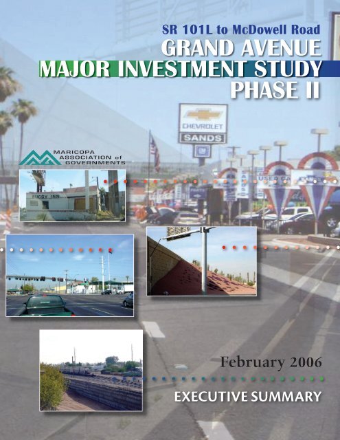
SR 101L to McDowell RoadGRAND AVENUEMajor Investment Studyphase IIMARICOPAASSOCIATION <strong>of</strong>GOVERNMENTSFebruary 2006<strong>Executive</strong> <strong>Summary</strong>
! "#$%%##&'("&) &% &*#&"#&*+&, -%#*&,,."/ %%#%01"2"-34
1'!&&% ! ,,,,,,,,,,,,,,,,,,,,,,,,,,,,,,,,,,,,,,,,,,,,,,,,,,,,,,,,,,,,,,,,5 ! ,,,,,,,,,,,,,,,,,,,,,,,,,,,,,,,,,,,,,,,,,,,,,,,,,,,,,,,,,,,,,,,,5 !00! ,,,,,,,,,,,,,,,,,,,,,,,,,,,,,56 ! ,,,,,,,,,,,,,,,,,,,,,,,,,,,,,,,,,,,,,,,,,,,,,,,57 0! ,,,,,,,,,,,,,,,,,,,,,,,,,,,,,,,,,,,,,,,,,,,,,,,540 ,,,,,,,,,,,,,,,,,,,,,,,,,,,,,,,,,,,,,,,,,,,,,,,,,,,,,,,,,,,,,,,,,,,,,,,,,,,,,,,,58! ,,,,,,,,,,,,,,,,,,,,,,,,,,,,,,,,,,,,,,,,,,,,,,,,,,,,58 ! " #" $!!" " ! " " % &" '( ,,,,,,,,,,,,,,,,,,,,,,,,,,,,,,,,,,,,,,,,,,,,,,,,,,,,,,,,,,,,59#%':;#1#%'*3526)" * +),# -). / 0 1 2" 4. ! . . )" 4 . +. '''/*((6*('(1 . . . -. - '3*/*(''*('21 . . . -. - '55/*(*'*(*21 . . . -. - '5Grand Avenue Major Investment Study Phase II<strong>Executive</strong> <strong>Summary</strong>i
THIS PAGE INTENTIONALLY LEFT BLANK
! Grand Avenue (US 60) runs diagonally across the one-mile grid system <strong>of</strong> arterial streets thatmake up the roadway network in Phoenix’s greater metropolitan area. Grand Avenue isoriented northwest/southeast and passes through the communities <strong>of</strong> Peoria, Glendale andPhoenix within the 12.5 mile Study Area from SR 101L to McDowell Road. Originallyconstructed in the late 1800’s, Grand Avenue served as a major connection between theagricultural communities <strong>of</strong> the West Valley and the business community in downtownPhoenix. With the introduction <strong>of</strong> the railroad parallel to Grand Avenue, the West Valleycontinued to develop and began to transform from an agriculture-centered region to anindustrial/agriculture-centered region. This change in land use and economic generators,along with the population growth that the West Valley began to experience, has led toincreasing congestion along Grand Avenue, both in terms <strong>of</strong> motorized and non-motorizedtransportation.In November 2004, the voters <strong>of</strong> <strong>Maricopa</strong> County passed Proposition 400, which extendedthe one-half cent sales tax designated for transportation improvements for another 20 years.The original tax, passed in 1985, has funded regional transportation improvements over thepast two decades including eight grade separations along and across Grand Avenue. The<strong>Maricopa</strong> <strong>Association</strong> <strong>of</strong> <strong>Governments</strong>’ (MAG’s) Regional Transportation Plan (RTP),which provides guidance for revenues generated from the tax during the next 20 years,includes $147 million for improvements to Grand Avenue within the Study Area. Thepurpose <strong>of</strong> this Study is to provide prioritized recommendations for these improvements.During development <strong>of</strong> the recommendations, consideration was given to pedestrian,bicyclist, transit and community mitigation projects in addition to traffic-related projects.Several Agency Steering Group (ASG) forums were held during the study period to provideinput into the issues and needs <strong>of</strong> the corridor and to review recommended improvements.Regular participants in the ASG forums included staff from the Cities <strong>of</strong> Glendale, Peoriaand Phoenix as well as, Valley Metro, Federal Highway Administration (FHWA), ArizonaDepartment <strong>of</strong> Transportation (ADOT), <strong>Maricopa</strong> County Department <strong>of</strong> Transportation(McDOT), and Burlington Northern Santa Fe Railway (BNSF). Two public meetings wereheld and attended by approximately 70 members <strong>of</strong> the public and other stakeholders.Fourteen individual meetings were held with various village planning committees and otherstakeholders. ! The Grand Avenue corridor and Study Area is shown on Exhibit ES.1. Grand Avenue is afour-lane arterial from SR 101L to approaching 83 rd Avenue and a six-lane arterialthroughout the remainder <strong>of</strong> the Study Area. The diagonal orientation <strong>of</strong> Grand Avenue andthe associated skewed intersections have resulted in excessive delays at north-south and eastwestarterials. In addition, congestion is magnified by delays due to at-grade railroadcrossings with the arterial streets.Throughout the Study Area, a raised median typically separates directional traffic on GrandAvenue. Exclusive left-turn lanes are provided at most median breaks and intersections.Grand Avenue Major Investment Study Phase II<strong>Executive</strong> <strong>Summary</strong>ES-1
:;#1#,
There are a total <strong>of</strong> 18 traffic signals (including the pair <strong>of</strong> signals at the SR 101L / GrandAvenue interchange) on Grand Avenue between SR 101L and McDowell Road. Trafficsignal spacing varies from less than one-quarter mile to over one mile.The right-<strong>of</strong>-way for Grand Avenue is generally 90 to 100 feet wide within the Study Area,but ranges from a minimum <strong>of</strong> 85 feet to a maximum <strong>of</strong> 166 feet.Below is a summary <strong>of</strong> the existing roadway, railroad, and traffic conditions within the StudyArea and the interrelationships <strong>of</strong> existing multi-modal elements.Existing Roadway and Railroad ConditionsGrand AvenueGrade Separations• Three travel lanes in each direction • Grand Ave over 27 th Ave / Thomas Rdeast <strong>of</strong> 83 rd Ave with raised median • Indian School Rd over 35 th Ave / Grand Ave• Two travel lanes in each direction • Grand Ave over 43 rd Ave / Camelback Rdwest <strong>of</strong> 83 rd Ave with raised median • Olive Ave over 75 th Ave / Grand Ave• Right-<strong>of</strong>-way width <strong>of</strong> 90 to 100 feet • Maryland Ave over 55 th Ave / Grand Ave• Access control at grade separations • 51 st Ave over Bethany Home Rd / Grand Aveand on railroad side only• Grand Ave under 59 th Ave / Glendale Ave• 18 traffic signals along Grand Ave (Under Construction as <strong>of</strong> March 2006)• 67 th Ave over Northern Ave / Grand AveBNSF(Recently Completed)• Railway parallels Grand Ave• Spur tracks cross Grand Avenue at Arterial Cross-Streetsone location south <strong>of</strong> Northern Ave • Typically three travel lanesNorthbound and westboundMajor Six-Legged Intersections • Typically two travel lanes• 19 th Ave/ McDowell Rd/ Grand Ave Southbound and eastbound• 35 th Ave/ Indian School Rd/ Grand • Center two-way left-turn lane(still operates as six-legged)Existing Traffic ConditionsTraffic VolumesCongestion and Delay• 2002 volumes on Grand Avenue: • Six-legged intersections operate at LOS21,000 - 32,900 vehicles per day E or F during peak hours• Train activity increases delay at someArterial Cross-Streetsapproaches by up to three minutes• Capacity limited by at-gradecrossings with RailroadCrashes• Over 1,300 crashes on Grand Avewithin Study Area in last three yearsGrand Avenue Major Investment Study Phase II<strong>Executive</strong> <strong>Summary</strong>ES-3
Existing Multi-Modal ElementsTransit Service• Grand Avenue Limited serves 138passengers per day and provides localbus service along Grand Avenue; itspassenger per mile ratio is below themetropolitan average• Transfer points at six-legged intersecttionsare difficult for pedestrians;particularly those with disabilities• Paratransit / vanpool service exist• Three park-and-ride lots existPlanned Improvements• Increased local / express bus service• Additional bike facilitiesOther Facilities• Existing bike facilities include bikelanes, bike routes and multi-use paths• Six-legged intersections are difficult forpedestrians to cross because <strong>of</strong> longcross distances• Sidewalks are not continuous withinthe Study AreaIntelligent Transportation Systems• Grand Avenue and Northern Avenueare AZTech “SMART Corridors”• Enhanced traffic detection, datacollection and signal coordination willbe implementedPrior to the initiation <strong>of</strong> grade separated structures along the Grand Avenue corridor, mostmodifications to Grand Avenue had been modest over the past 25 years. The eight gradeseparations represented a major investment in Grand Avenue. In addition, majorimprovements have been made to the regional transportation network during this time period.A summary <strong>of</strong> the improvements and changes to the regional transportation network thataffect travel on Grand Avenue is provided below:• Eight grade separations along or across Grand Avenue.• New traffic signal bridges at six-legged intersections along with operationalimprovements along Grand Avenue.• The Agua Fria Freeway (SR 101L) has been completed from the Black CanyonFreeway (I-17) to the Papago Freeway (I-10). Ramps exiting northbound SR 101Land entering southbound SR 101L are provided for along Grand Avenue and arecontrolled by traffic signals. Ramps exiting southbound SR 101L and enteringnorthbound SR 101L are provided for along 91 st Avenue and operate as directconnection ramps.• High Occupancy Vehicle (HOV) lanes and auxiliary lanes have been constructedalong I-17 between Thomas Road and Peoria Avenue. The traffic interchanges alongthis stretch have also been reconstructed.• Grand Avenue southeast <strong>of</strong> McDowell Road / 19 th Avenue has been refurbished withnew curb, gutter, sidewalk and landscaping and has been turned over to the City <strong>of</strong>Phoenix. !00! The estimated 2006 population for the Study Area is nearly 148,000 people. The Study Areahad a compounded annual growth rate <strong>of</strong> approximately 1.2 percent between 2000 and 2006.During the same period the Peoria, Glendale, and Phoenix Municipal Planning Areas are allestimated to have greater compounded annual growth rates <strong>of</strong> 6.0 percent, 3.5 percent, and 2.8percent, respectively.Grand Avenue Major Investment Study Phase II<strong>Executive</strong> <strong>Summary</strong>ES-4
The Study Area is expected to grow seven percent in population to nearly 160,000 people bythe year 2030. During the same period Peoria’s population is projected to increase nearly 80percent, followed by Phoenix with 40 percent growth, and then Glendale, which is anticipatedto experience 17 percent growth.These figures were used in updating MAG’s traffic demand forecasting, which was used todetermine needs and evaluate the recommended improvements. A comparison between the2002 Average Daily Traffic (ADT), the 2030 Base ADT, and the 2030 Plan ADT is shown inExhibit ES.2 below.:;#1#,35"&(
Twenty-two <strong>of</strong> the twenty-seven Census Tracts that comprise the Study Area have five ormore environmental justice populations above the County average. It is anticipated thattransportation improvement projects within the corridor will serve and benefit the residentsregardless <strong>of</strong> their census population classification. Further evaluation will be conducted aspart <strong>of</strong> ADOT’s project-level design concept report process. >"2% "#%Due to the number <strong>of</strong> listed hazardous sites, an initial site assessment (ISA) should beconducted when future projects are identified that may affect listed hazardous sites. The ISAwould confirm or deny the presence <strong>of</strong> hazardous materials at specific locations. #%"#6'"$"#%There are a total <strong>of</strong> nine sites previously recorded that are listed on the National Register <strong>of</strong>Historic Places (NRHP) within the Study Area. When future projects are identified that mayaffect historic properties that are NRHP listed or eligible, avoidance may be recommended.Mitigation <strong>of</strong> construction impacts through testing and data recovery may be considered asnecessary. 0! A number <strong>of</strong> issues concerning the Grand Avenue corridor were identified in the scope <strong>of</strong>work for the study, through consultation and through technical analyses. Consultationincluded discussions with the ASG and stakeholders for the corridor, input received at publicmeetings, and review <strong>of</strong> the previous 23 studies or reports related to the Grand Avenuecorridor. From this review and consultation, 14 issues were identified:1) Connectivity to I-10, I-17, and SR 101L2) Route Transfer3) Ultimate Concepts (Roadway, Transit, Bicycle, Pedestrian, and Community Mitigation)4) Grade Separations5) Intersection Improvements (including skewed & <strong>of</strong>fset intersections)6) Intelligent Transportation Systems (ITS) and signals7) Bottlenecks8) Access Management (including medians and local access needs)9) Safety10) Bicycle and Pedestrian Requirements11) Transit Requirements12) Goods Movement13) Community Mitigation14) DrainageThe study process addressed all <strong>of</strong> these areas in detail and findings are described in the FinalReport. However, study recommendations for funding by the MAG RTP Highway Programare focused on grade separations, intersection improvements, access management, andcommunity mitigation. It is anticipated that funding for other project areas will be addressedspecifically by those modal programs.Grand Avenue Major Investment Study Phase II<strong>Executive</strong> <strong>Summary</strong>ES-6
0 In 2003, the MAG RTP Highway Program identified $147 million <strong>of</strong> funding for GrandAvenue between SR 101L and Van Buren Street. For purposes <strong>of</strong> this study, the funding wasadjusted to $151.7 million, which includes 2005 cost estimates for the three grade separationsidentified for this segment in the RTP and inflation <strong>of</strong> the remaining funding from 2002 to2005 dollars.The revised funding allocation by phase is shown below:• Phase 1 (2006 to 2010) - $31.1 Million• Phase 2 (2011 to 2015) - $21.0 Million• Phase 3 (2016 to 2020) - $0.0• Phase 4 (2021 to 2025) - $99.6 MillionThere were three specific projects identified in the MAG RTP to be constructed in Phase 4 <strong>of</strong>the RTP. The three projects were:• A grade separation at the 51 st Avenue/Bethany Home Road intersection• A grade separation at the 35 th Avenue/Indian School Road intersection• A grade separation at the 19 th Avenue/McDowell Road intersectionUpdated estimates for the three grade separations total $89.2 million (2005 dollars) <strong>of</strong> the$99.6 million available in the revised Phase 4 funding estimate. The remaining funding;$31.1 million in Phase 1, $21.0 million in Phase II and $10.4 million in Phase 4, wasidentified for additional improvements along Grand Avenue. In addition to this funding, theCity <strong>of</strong> Glendale has approximately $10 million available to contribute to Phase 1 accessmanagement and community mitigation projects within the Glendale City boundaries.An alternative approach to identifying a funding target was raised during the study process.This methodology would inflate the original $147 million by an annual rate (3% wassuggested) to yield a total <strong>of</strong> $160.6 million in 2005 dollars, as opposed to the $151.7 millionarrived at above. The $151.7 million was used in the study process, because it is moreconservative and because the overall approach to cost increases and inflation has not yet beenfinalized for the ADOT Freeway/Highway Life Cycle Program.The recommendations covered in this study are directed at the $151.7 million in estimatedfunding and are described in detail below. A number <strong>of</strong> other potential projects identified inthe Study process may be funded from other MAG RTP funding sources including theStreets, Transit, Pedestrian, Bicycle, and ITS programs. Additional projects beyond the 20-year planning period and projects potentially funded by other modal sources are shown inAppendix G <strong>of</strong> the Final Report.! The following recommendations were derived from information developed during the studyprocess, including input from members <strong>of</strong> the ASG and the public. A major objective indeveloping the detailed recommendations was to improve traffic flow along and acrossGrand Avenue Major Investment Study Phase II<strong>Executive</strong> <strong>Summary</strong>ES-7
Grand Avenue. The recommended plan addresses four <strong>of</strong> the most important issues andneeds as identified by the ASG, including:• Grade Separations• Intersection Improvements• Access Management• Community Mitigation There were five grade separation projects identified in the study process. Two <strong>of</strong> the fivewere considered in the study process but not recommended for funding under the RTPHighway Program. These two grade separations are detailed below.• Northern Parkway Directional Ramps at Grand Avenue and 67 th Avenue - project iscurrently identified in the arterial street portion <strong>of</strong> the MAG RTP and, therefore, notrecommended for Highway Program funding.• Grand Avenue Under Peoria Avenue and 83 rd Avenue – completion <strong>of</strong> the projectdetermined to be beyond 20-year planning period. Improvements to 83 rdAvenue/Grand Avenue and Peoria Avenue/Grand Avenue intersections arerecommended for funding as an Intersection Improvement. Additional discussionswith Peoria staff should occur as part <strong>of</strong> a future ADOT design concept report todevelop detailed improvement plans, which might include phasing for a potentialfuture grade separation.The remaining three grade separations are recommended for full funding as shown below.• Bethany Home Road Under Grand Avenue and 51 st Avenue – recommended for fullfunding in Phase 4 <strong>of</strong> the MAG RTP Highway Program (as identified in the GrandAvenue Limited Expressway Design Concept Study in the Glendale Area, 2003(Grand Avenue DCR).• Grand Avenue Under Indian School Road and 35 th Avenue – recommended for fullfunding in Phase 4 <strong>of</strong> the MAG RTP Highway Program.• 19 th Avenue Over Grand Avenue and McDowell Road – recommended for fullfunding in Phase 4 <strong>of</strong> the MAG RTP Highway Program."&(&2?.;&- ) ?7 % (&2Bethany Home Road Under Grand Avenue and 51 st Avenue is the preferred configuration forthis intersection as identified in the Grand Avenue Limited Expressway Design ConceptStudy in the Glendale Area, 2003 (Grand Avenue DCR)."&(&2?&#&;?97 ; (&2Grand Avenue Under 35 th Avenue and Indian School Road is the preferred configuration forthis intersection. Even though Indian School Road is currently grade separated, the existingintersection still operates as a six-legged intersection because <strong>of</strong> allowed left-turnmovements. The Grand Avenue Underpass eliminates the six-legged intersection and theGrand Avenue signal, provides a greater Level <strong>of</strong> Service (LOS), and provides continuityGrand Avenue Major Investment Study Phase II<strong>Executive</strong> <strong>Summary</strong>ES-8
with the Grand Avenue Overpass at 27 th Avenue/ Thomas Road to the south and the GrandAvenue Overpass at 43 rd Avenue/Camelback Road to the north."&(&2? ?@ ; (&2Nineteenth Avenue Over Grand Avenue and McDowell Road is the preferred configurationfor this intersection. The 19 th Avenue Overpass provides greater service benefits than the19 th Avenue Flyover Ramps by eliminating the six-legged intersection and providing agreater LOS for existing traffic; however it could have greater impact to businesses and thehistoric neighborhood north <strong>of</strong> McDowell Road.! Within the Study Area, Grand Avenue is host to over 60 three-, four-, five- and six-leggedintersections that are either stop controlled or signal controlled. Of the 60-plus intersections,approximately 65 percent are skewed. The remaining intersections have been reconstructedinto perpendicular intersections or as grade separations.The study team identified five potential candidates for intersection improvements. Of thefive intersections, the 31 st Avenue/Osborn Road intersection and the 19 th Avenue dual leftturnlanes are recommended for funding with MAG RTP Highway funds. The remainingthree intersection improvements could be pursued in the future if additional funding sourcesare identified.Two additional intersections were identified following completion <strong>of</strong> the alternatives analysisphase <strong>of</strong> the study and are recommended for improvement. The first is the Grand Avenueintersection with Peoria Avenue and 83 rd Avenue in downtown Peoria. The close proximity<strong>of</strong> the two traffic signals contributes to congestion in the downtown area. The second is theintersection <strong>of</strong> Grand Avenue with Myrtle Avenue in downtown Glendale. Additional trafficvolume from Northern Parkway coupled with opening <strong>of</strong> the Grand Avenue underpass willcreate the need for additional capacity at Myrtle Avenue. The proposed solution is to provideSE bound dual left-turn lanes from Grand Avenue to Myrtle Avenue and to widen MyrtleAvenue from 59 th Avenue to 62 nd Avenue. The dual left-turn lane improvements on GrandAvenue are recommended for RTP Highway Program funds, while improvements to MyrtleAvenue itself, will require other funding sources. The latter improvements are listed inAppendix G <strong>of</strong> the Final Report, which covers projects beyond the 20-year planning periodand projects potentially funded by other sources."&(&2?"#(&2?A9 " (&2The existing intersection configuration currently has two signals spaced approximately 600feet apart along Grand Avenue. The northernmost intersection is a four-legged perpendicularintersection including Grand Avenue and Peoria Avenue. The southernmost intersection is afour-legged perpendicular intersection including Grand Avenue and 83 rd Avenue. Potentialimprovements to the intersections could include parcel purchase and access reconfiguration,installation <strong>of</strong> community mitigation features, installation <strong>of</strong> pedestrian facilities, right-<strong>of</strong>wayacquisition and intersection reconfiguration. Additional discussions with City <strong>of</strong> PeoriaGrand Avenue Major Investment Study Phase II<strong>Executive</strong> <strong>Summary</strong>ES-9
staff should be planned as part <strong>of</strong> a future ADOT design concept report to develop detailedimprovement plans, which might include phasing for a potential grade separation."&(&2? -"(&212&2'52"&&%Myrtle Avenue has been designated as a gateway street to downtown by the City <strong>of</strong> Glendale.Due to expected increases in traffic on gateway streets, the City <strong>of</strong> Glendale has developedconceptual plans to improve the connection to Grand Avenue. To implement theimprovements, Grand Avenue would be widened north and south <strong>of</strong> Myrtle Avenue to addthe SE bound dual left-turn lane. The City proposes to exchange right-turn lanes at MyrtleAvenue originally identified in this study for the additional left-turn lane. These changeshave been reflected in the study recommendations (Exhibits ES.3-ES.6). The conceptual planincludes the need for additional R/W along the north and east side <strong>of</strong> Grand Avenue.9 % (&2? %1"&The existing intersection configuration currently has two signals spaced approximately 900feet apart along Grand Avenue. The northernmost intersection is a five-legged skewedintersection including Grand Avenue, 31 st Avenue and Osborn Road to the west. Thesouthernmost intersection is a three-legged perpendicular intersection including GrandAvenue and Osborn Road to the east. The recommended realignment would eliminate one <strong>of</strong>the signals and create a perpendicular four-legged intersection.@ ; (&22'52"&&%The existing Grand Avenue/19 th Avenue/McDowell Road intersection experiences high leftturnsin the peak periods. Comments from the ASG identified a project to construct dual leftturnlanes on 19 th Avenue to alleviate some <strong>of</strong> the delays for travelers trying to access GrandAvenue from northbound 19 th Avenue. Therefore, funding a portion <strong>of</strong> this project withMAG RTP Highway funds is recommended. Since this would be an interim project until the19 th Avenue overpass is constructed, it is recommended as a Phase 1 project.!! ! One <strong>of</strong> the main goals <strong>of</strong> the ASG was to build upon the improvements identified in theoriginal Grand Avenue MIS and move Grand Avenue toward the status <strong>of</strong> an EnhancedArterial/ Limited Expressway. The steering group identified access management as theprime method to achieve this goal. Access management strategies recommended forconsideration in this study include:• Closing select median crossovers to reduce turning movements across Grand Avenue.• Reconfiguring minor collector intersections to right-in/right-out.• Removing unused driveways and curb cuts.• Constructing right-turn only and auxiliary lanes to remove the turning traffic from thethrough lanes <strong>of</strong> Grand Avenue.• Potentially constructing frontage roads.• Purchasing groups <strong>of</strong> parcels impacted by the addition <strong>of</strong> auxiliary lanes andreconfiguring access to streets other than Grand Avenue.As noted previously, the ASG identified the need to mitigate the impacts <strong>of</strong> the corridor onthe surrounding community. Community mitigation features that are directly associated withGrand Avenue Major Investment Study Phase II<strong>Executive</strong> <strong>Summary</strong>ES-10
the auxiliary and right-turn lanes include landscaping, pedestrian access, street lighting,utility undergrounding and screen walls. Details <strong>of</strong> specific design features, such as,landscape buffer widths, sidewalk widths, wall heights, etc., will be addressed by ADOT in afuture design concept report. The access management and community mitigationimprovements recommended for RTP Highway Program funding are shown in Exhibit ES.3.:;#1#,9B%% &*) &&!) ) 2&#- ##*#&) $"() &%SegmentSR 101L to91 st Ave91 st Ave to83 rd Ave83 rd Ave to75 th Ave75 th Ave to67 th Ave67 th Ave to59 th AveAccess ManagementImprovements (RTP Phase)• No recommendedimprovements• Auxiliary Lane and relateditems – 91 st Ave. to 89 th Ave.,88 th Dr. to 83 rd Ave. (2)• 4 driveway closures (2)• No recommendedimprovements• Parcel purchase andaccess reconfiguration –north <strong>of</strong> Northern frontingGrand Avenue (1)• Parcel purchase andaccess reconfiguration - 67 thAve. to 65 th Ave., 65 th Ave. to63 rd Ave., NE corner <strong>of</strong> 61 stAve. & Myrtle Ave. (1)• Reconfigure Access – NEand SE corner, OrangewoodAve. & 63 rd Ave. (1)• Rt-in/Rt-out – OrangewoodAve., 63 rd Ave. (1)• 7 driveway closures (1)• 2 median closures –Orangewood Ave./63 rd Ave. &62 nd Ave. (1)• 1 Rt. Turn Lane – MobileManor (1)Community MitigationImprovements (RTP Phase)• No recommended improvements• Non-RR side Landscaping (1)• Non-RR side Sidewalk (1)• Non-RR side Screen wall (1)• Median Landscaping (1)• RR-side Landscape/Barrier (4)• Street Lighting (both sides) (1)• Utility Undergrounding – 87 thAve. to 86 th Ave. (2)• Non-RR side Landscaping (1)• Non-RR side Sidewalk (1)• Non-RR side Screen wall (1)• Median Landscaping (1)• RR-side Landscape/Barrier (4)• Street Lighting (both sides) (1)• Utility Undergrounding – 83 rdAve. to 82 nd Ave. (1)• Street Lighting (both sides) (1)• Non-RR side Landscaping (1)• Non-RR side Sidewalk (1)• Non-RR side Screen wall (1)• Median Landscaping (1)• RR-side Landscape/Barrier (4)• Street Lighting (both sides) (1)• Utility Undergrounding – 67 thAve. to Palmaire Ave. (1)NotesImprovements identified as part<strong>of</strong> ADOT project, Grand Ave. –83 rd Ave. to 99 th Ave.No driveways from 89 th Ave. to88 th Dr.. Working with Peoria,the ADOT DCR process mayaddress a range <strong>of</strong> access andcommunity mitigation options,including frontage roads and/orpedestrian access.Existing landscaping on non-RR side from Mountain ViewRd. to 79 th Ave., some existingmedian landscapingImprovements from 71 st Ave. toRoyal Palm Dr. notrecommended for funding in the20-year planning period.Full-length improvements endat 60 th Ave. due to existingGrand Ave. underpassimprovements.Grand Avenue Major Investment Study Phase II<strong>Executive</strong> <strong>Summary</strong>ES-11
:;#1#,9!&B%% &*) &&!) ) 2&#- ##*#&) $"() &%Segment Access ManagementCommunity MitigationNotesImprovements (RTP Phase) Improvements (RTP Phase)59 th Ave to51 st Ave51 st Ave to43 rd Ave43 rd Ave to35 th Ave35 th Ave to27 th Ave27 th Ave to19 th Ave• Parcel purchase andaccess reconfiguration - 57 thDr. to 57 th Ave., parcel west<strong>of</strong> 51 st Ave overpass (1)• Remove Access – 57 th Ave.and Ocotillo Rd. (1)• Rt.-in/Rt.-out – 56 th Ave. (1)• Median closure – 56 th Ave.(1)• 2 Auxiliary Lanes – 53 rdAve. to 52 nd Ave. (1); 55 thAve. to 56 th Ave. (1)• 21 driveway closures (1)• Rt.-in Rt.-out – MissouriAve. (1)• Auxiliary Lane – MissouriAve. to on-ramp (1)• 4 median closures – 3 infront <strong>of</strong> school and basin, 1 at47 th Ave. & Missouri Ave. (1)• 3 driveway closures (1)• 4 median closures – 40 thAve., near 39 th Ave., 37 thAve., near 36 th Ave. (1)• Rt.-turn lane – 39 th Ave. (1)• Rt.-in/Rt.-out – 37 th Ave. (1)• 23 driveway closures (1)• Parcel purchase & accessreconfiguration – SW corner31 st Ave./Grand Ave. (2)• 2 Rt.-turn lanes – 33 rd Ave.,realigned Osborn Rd (1)• Rt.-in/Rt.-out – 31 st Ave. (1)• 2 median closures – nearcanal crossing, 31 st Ave. (1)• Remove Rd. – Osborn (1)• 12 driveway closures (1)• Reconfigure access – 21 stAve. to 20 th Ave. (1)• 4 Rt.-in/Rt.-out – 24 th Ave.,Monte Vista, 21 st Ave., 20 thAve. (1)• Rt.-turn lane – Encanto (1)• 5 median closures – 24 thDr., 24 th Ave., Monte Vista,21 st Ave., 20 th Ave. (1)• Non-RR side Landscaping (1)• Non-RR side Sidewalk (1)• Non-RR side Screen wall (1)• Median Landscaping (1)• RR-side Landscape/Barrier (4)• Street Lighting (both sides) (1)• Non-RR side Landscaping (1)• Non-RR side Sidewalk (1)• Non-RR side Screen wall (1)• Median Landscaping (1)• RR-side Landscape/Barrier (4)• Street Lighting (both sides) (1)• Sidewalk Only – 41 st Ave. to 36 thAve. (1)• Median Landscaping (1)• RR-side Landscape/Barrier (4)• Street Lighting (both sides) (1)• Utility Undergrounding – 41 stAve. to Indian School Road (2)• Sidewalk Only – 29 th Ave. toWeldon Ave. (1)• Median Landscaping (1)• RR-side Landscape/Barrier (4)• Street Lighting (both sides) (1)• Utility Undergrounding – 35 thAve. to 31 st Ave., Osborn Rd. toNW bound on-ramp (2)• Sidewalk Only – 24 th Ave. to 24 thDr. (1)• Median Landscaping (1)• RR-side Landscape/Barrier (4)• Street Lighting (both sides) (1)• Utility Undergrounding – north <strong>of</strong>Encanto Blvd. to south <strong>of</strong> MonteVista Rd. (2)Full-length improvements beginat 57 th Dr. due to existingGrand Avenue underpassimprovements.Full length improvements endat 43 rd Ave. on-ramp due toexisting Grand Ave. overpassimprovements.Full length improvements beginat 43 rd Ave. <strong>of</strong>f-ramp due toexisting Grand Ave. overpassimprovements and end atIndian School Rd. on-ramp.Other improvements identifiedbut not recommended in the20-year planning period due t<strong>of</strong>unding constraints.Other improvements identifiedbut not recommended forfunding in the 20-year planningperiod due to fundingconstraints.Full length improvements beginat 24 th Dr. due to existingGrand Ave. overpassimprovements.Other improvements identifiedbut not recommended forfunding in the 20-year planningperiod due to fundingconstraints.• 21 driveway closures (1)General Notes: 1) If limits for each specific improvement are not shown, it can be assumed that the improvementsextend for the entire limits. 2) All community mitigation improvements should be maintained by local forces. 3)Improvements identified between 91 st Ave. and 83 rd Ave. should be coordinated with ADOT’s Grand Ave. wideningproject to identify potential installation <strong>of</strong> low-cost items related to improvements in this study.Grand Avenue Major Investment Study Phase II<strong>Executive</strong> <strong>Summary</strong>ES-12
The study team evaluated a broad range <strong>of</strong> projects for the corridor and narrowed down thelist to those recommended in the previous section. An implementation plan for therecommended projects was developed with respect to the phased funding constraintsidentified in the MAG RTP Highway Program. The Phase 1, 2 and 4 implementation planswith estimated program costs are shown in Exhibits ES.4 through ES.6. Phase 3 <strong>of</strong> the MAGRTP Highway Program has no money programmed for Grand Avenue improvements withinthe Study Area; therefore an implementation plan is not shown for this phase. Below is asummary <strong>of</strong> the estimated funding available by phase.MAG RTP Highway ProgramMillionsPhase 1 $31.1Phase 2 $21.0Phase 4 $99.6Total RTP Funding Available $151.7City <strong>of</strong> Glendale Funding $10.0Note: The total estimated cost <strong>of</strong> the recommended projects is equal to the total fundingprojected to be available. Slight differences in available funding versus cost by phase can beaddressed by the future cash flow management process. The access management andcommunity mitigation improvements referenced in Exhibits ES.4 through ES.6 are describedin further detail in Exhibit ES.3.:;#1#,6B;%3453) ) &) $) &#&&Segment Item <strong>of</strong> Work Estimated 2005 Cost91 st Ave to83 rd AveAccess Management and Community Mitigation Improvements $941,00083 rd Ave to75 th AveAccess Management and Community Mitigation Improvements $1,706,00075 th Ave to67 th AveAccess Management and Community Mitigation Improvements $1,514,00067 th Ave to59 th AveAccess Management and Community Mitigation Improvements $15,584,00059 th Ave to51 st AveAccess Management and Community Mitigation Improvements $7,239,00051 st Ave to43 rd AveAccess Management and Community Mitigation Improvements $6,166,00043 rd Ave to35 th AveAccess Management and Community Mitigation Improvements $1,844,00035 th Ave to27 th AveAccess Management and Community Mitigation Improvements $1,222,00027 th Ave to19 th AveAccess Management and Community Mitigation Improvements $2,029,000Grand Ave /Myrtle AveIntersection Improvements (SE bound Dual Left-Turn Lanes) $1,219,00019 th Ave /McDowell RdIntersection Improvements $1,472,000Total Phase 1 2005 Cost Estimate $40,936,000Estimated MAG RTP Highway Program Phase 1 Funding Available $31,100,000 11 – Phase 1 money not available until FY 2010City <strong>of</strong> Glendale Funding Available $10,000,000Grand Avenue Major Investment Study Phase II<strong>Executive</strong> <strong>Summary</strong>ES-13
:;#1#,7B;%33537) ) &) $) &#&&Segment Item <strong>of</strong> Work Estimated 2005 Cost91 st Ave to83 rd AveAccess Management and Community Mitigation Improvements $8,774,00043 rd Ave to19 th AveAccess Management and Community Mitigation Improvements $5,249,00031 st Ave /Osborn RdIntersection Improvements $7,250,000Total Phase 2 2005 Cost Estimate $21,273,000Estimated MAG RTP Highway Program Phase 2 Funding Available $21,000,000:;#1#,4B;%6335337) ) &) $) &#&&Segment Item <strong>of</strong> Work Estimated 2005 Cost91 st Ave to19 th AveAccess Management and Community Mitigation Improvements $5,353,000Peoria Ave /83 rd AveIntersection Improvements 1 $5,000,00051 st Ave /Grand AveBethany Home Road Underpass $32,694,00035 th Ave/Indian SchoolGrand Avenue Underpass $37,472,000Grand Ave /McDowell Rd19 th Avenue Overpass $18,972,000Total Phase 4 2005 Cost Estimate $99,491,000Estimated MAG RTP Highway Program Phase 4 Funding Available $99,600,0001 – Detailed plans should be developed as part <strong>of</strong> future design concept report, in association with City <strong>of</strong> Peoria staff.Grand Avenue Major Investment Study Phase II<strong>Executive</strong> <strong>Summary</strong>ES-14