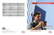
Come Closer… The Leica GS20 PDM - TerraPro GPS Surveys Ltd.
Come Closer… The Leica GS20 PDM - TerraPro GPS Surveys Ltd.
Come Closer… The Leica GS20 PDM - TerraPro GPS Surveys Ltd.

You also want an ePaper? Increase the reach of your titles
YUMPU automatically turns print PDFs into web optimized ePapers that Google loves.
Feel <strong>The</strong> Power…<br />
<strong>The</strong> <strong>GS20</strong> Professional Data Mapper (<strong>PDM</strong>) from <strong>Leica</strong> Geosystems is the most advanced handheld <strong>GPS</strong><br />
for GIS and mapping.<br />
Powerful Features<br />
Powerful Functionality<br />
And A Powerful Promise<br />
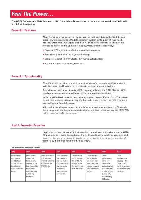
An Abbreviated Innovation Timeline<br />
1914<br />
Leitz Camera<br />
invents the<br />
world’s first<br />
35mm camera.<br />
Leitz Camera<br />
soon becomes<br />
<strong>Leica</strong>.<br />
1921<br />
<strong>Leica</strong> teams<br />
with Wild<br />
Instruments,<br />
makers of the<br />
first theodelite,<br />
to begin its<br />
world renown<br />
surveying<br />
business.<br />
Now there’s an even better way to collect and maintain data in the field. <strong>Leica</strong>’s<br />
<strong>GS20</strong> <strong>PDM</strong> puts an entire <strong>GPS</strong> data collection system in the palm of your hand.<br />
For field personnel, this rugged and highly portable device offers all the features<br />
needed to collect on-the-spot GIS data anywhere, anytime, accurately:<br />
Powerful <strong>GPS</strong> technology offering unmatched accuracy<br />
User-friendly interface and ergonomic design<br />
Cable-free operation with Bluetooth wireless technology<br />
D<strong>GPS</strong> and High Precision upgradability<br />
<strong>The</strong> <strong>GS20</strong> <strong>PDM</strong> combines the all-in-one simplicity of a recreational <strong>GPS</strong> handheld<br />
with the power and flexibility of a professional grade mapping system.<br />
Providing you with a true turn-key <strong>GPS</strong> mapping solution, the <strong>GS20</strong> <strong>PDM</strong> is a <strong>GPS</strong><br />
receiver, antenna, and data collector, all in an ergonomic handheld.<br />
With the <strong>GS20</strong> <strong>PDM</strong>, powerful functionality doesn’t mean difficult to use. <strong>The</strong> menudriven<br />
interface and graphical map display make it easy to learn so field crews can<br />
start collecting data right away.<br />
Add to this the wireless connectivity to PCs and accessories provided by Bluetooth<br />
technology, and you begin to understand what we mean when we say the <strong>GS20</strong> <strong>PDM</strong><br />
is the mapping tool of tomorrow.<br />
You know you are getting an industry-leading technology solution because the <strong>GS20</strong><br />
<strong>PDM</strong> comes from <strong>Leica</strong> Geosystems. Known throughout the world for precision and<br />
accuracy, the people at <strong>Leica</strong> Geosystems have been delivering on the promise of<br />
technology excellence for more than a century.<br />
1968<br />
<strong>Leica</strong> introduces<br />
the first commercial<br />
satellite<br />
navigator, the<br />
MX702 CA.<br />
1991<br />
<strong>Leica</strong> develops<br />
the first commercial<br />
D<strong>GPS</strong><br />
systems using<br />
marine radio<br />
beacons to<br />
transmit error<br />
corrections.<br />
1992<br />
<strong>Leica</strong> System<br />
200 is used for<br />
the first <strong>GPS</strong><br />
survey of Mt.<br />
Everest (height<br />
8846.10 meters).<br />
1996<br />
<strong>Leica</strong> designs<br />
the first high<br />
precision realtime<br />
reference<br />
station network<br />
for the Øresund<br />
project.<br />
1999<br />
<strong>Leica</strong><br />
Geosystems<br />
introduces<br />
System 500<br />
becoming the<br />
first company<br />
to offer survey<br />
quality <strong>GPS</strong><br />
for collecting<br />
GIS data.<br />
2002<br />
<strong>Leica</strong><br />
Geosystems<br />
develops the<br />
<strong>GS20</strong> <strong>PDM</strong>,<br />
the first wireless<br />
sub-meter D<strong>GPS</strong><br />
handheld.