Conservation Area Appraisal & Management Plan - Home Page
Conservation Area Appraisal & Management Plan - Home Page
Conservation Area Appraisal & Management Plan - Home Page

You also want an ePaper? Increase the reach of your titles
YUMPU automatically turns print PDFs into web optimized ePapers that Google loves.
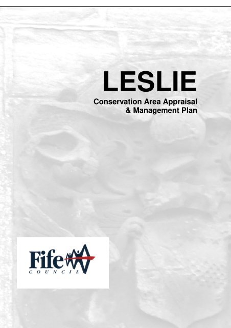
LESLIE<strong>Conservation</strong> <strong>Area</strong> <strong>Appraisal</strong>& <strong>Management</strong> <strong>Plan</strong>
Leslie <strong>Conservation</strong> <strong>Area</strong> <strong>Appraisal</strong> and <strong>Management</strong> <strong>Plan</strong>Contents1 Introduction 21.1 <strong>Conservation</strong> <strong>Area</strong>s1.2 The Purpose of this Document2 Historical Development 42.1 Origins and Development of Settlement2.2 Archaeological Significance3 Townscape Analysis 123.1 Location3.2 Street Pattern & Topography3.3 Building Styles3.4 Building Materials3.5 Key Listed and Unlisted Buildings3.6 Other Statutory/ Non-statutory Heritage Designations3.7 Public Spaces3.8 Trees & Landscaping3.9 Views3.10 Character <strong>Area</strong>s3.11 Activity & Movement3.12 Public Realm4 Negative Factors 254.1 Buildings at Risk4.2 Views4.3 Inappropriate Shop-fronts & Signage4.4 Use of Inappropriate Materials4.5 Interpretation panels5 <strong>Conservation</strong> <strong>Management</strong> Strategy 295.1 Development & Enhancement Opportunities5.2 Boundary Refinement5.3 <strong>Plan</strong>ning Policy5.4 Long-term <strong>Management</strong>5.5 Supplementary <strong>Plan</strong>ning Guidance5.6 Article 4 Directions5.7 Monitoring & ReviewAPPENDIX 1 – Description of the Leslie <strong>Conservation</strong><strong>Area</strong> Boundary 38APPENDIX 2 – Listed Buildings in Leslie <strong>Conservation</strong> <strong>Area</strong> 39APPENDIX 3 – Leslie Article 4 Direction 451
Leslie <strong>Conservation</strong> <strong>Area</strong> <strong>Appraisal</strong> and <strong>Management</strong> <strong>Plan</strong>1 INTRODUCTION1.1 <strong>Conservation</strong> <strong>Area</strong>sIn accordance with the provisions contained in the <strong>Plan</strong>ning (Listed Buildings and<strong>Conservation</strong> <strong>Area</strong>s) (Scotland) Act 1997 all planning authorities are obliged to considerthe designation of conservation areas from time to time. Leslie <strong>Conservation</strong> <strong>Area</strong>,designated in 1987, is one of 48 <strong>Conservation</strong> <strong>Area</strong>s located in Fife. These are all areasof particular architectural or historic value, the character or appearance of which it isdesirable to preserve or enhance. Fife Council is keen to ensure that the quality of theseareas is maintained for the benefit of present and future generations.<strong>Conservation</strong> area designation is not a means to preserve an area without change, butthere is a joint responsibility between residents and the council to ensure that change isnot indiscriminate or damaging, and that the unique character of each area is respected.In this way, communities can benefit from living in an environment that is of recognisablevalue. A written description of the Leslie <strong>Conservation</strong> <strong>Area</strong> boundary is included inAppendix 1.1.2 The Purpose of this DocumentThe purpose of the Leslie <strong>Conservation</strong> <strong>Area</strong> <strong>Appraisal</strong> is:• To confirm the importance of the designation of the area and to review thecurrent conservation area boundaries• To highlight the significance of the area in terms of townscape, architecture andhistory• To identify important issues affecting the area• To identify opportunities for development and enhancement• To stimulate interest and participation in conservation issues amongst peopleliving and working in the area• To provide a framework for conservation area management2
3Leslie <strong>Conservation</strong> <strong>Area</strong> <strong>Appraisal</strong> and <strong>Management</strong> <strong>Plan</strong>
Leslie <strong>Conservation</strong> <strong>Area</strong> <strong>Appraisal</strong> and <strong>Management</strong> <strong>Plan</strong>2 HISTORICAL DEVELOPMENT“Few burghs can claim such a long and progressive history as Leslie”Provost Eric Verden Anderson, 1957.2.1 Origins and Development of SettlementThere have been three main historical development phases for Leslie – theestablishment of the Old Town from the medieval period, the addition of the plannedNew Town and the industrial expansion of the town in the 18 th and 19 th centuries, anddevelopment during the 20 th century.Old TownThe earliest origins of settlement at Leslie are obscure. However it is clear fromdocumentary sources that a small settlement existed at Leslie by at least the 12 thcentury. The land was known as Fetkil, Fettykil or Fythkil, being established by MalcolmIV no later than 1178 and was a royal estate. The settlement is likely to have evolved asthe agricultural township that serviced this estate.The thanage of Fettykil was created a barony by the beginning of the 14 th centuryalthough the lands were still held directly by the king. His control over them was stillsufficient to ensure that the superior of the barony gave a cash teind of the revenue ofthe barony to Dunfermline Abbey. Indeed it seems likely that the barony of Fettykil wasfirst granted to Alexander Leslie, the eighth Earl of Ross, as a wedding gift in the 1380s.The barony was thereafter resigned into the hands of Robert III in 1398 as part of theprocess of granting the barony to Alexander Leslie’s kinsman, Sir George Leslie and hiswife Elizabeth, the king’s niece.It was the continued association of the family of Leslie as the feudal superiors of thebarony Fettykil during the 15 th Century that led to the name of Fettykil being dropped infavour of the name Leslie, originating from the family’s lands in Aberdeenshire andthought to mean “pleasant field or pasture”.In 1457 James II granted a charter erecting the “town of Leslie Green into a free burghof barony” which allowed the residents to hold markets each year and to buy and sellmerchandise. By 1900 the markets were only for amusement rather than for trade orhire of labour. The legal status of the Commonty was also established as a feudal rightof the burgesses of Leslie. This is an extensive area of grazing land to the north of thetown lying below the ridge and has been as such since the 13 th century and possiblybeyond. This area was also used for games in later periods.4
Leslie <strong>Conservation</strong> <strong>Area</strong> <strong>Appraisal</strong> and <strong>Management</strong> <strong>Plan</strong>Overlooking the north-east corner of The Green is Christ’s Kirk on the Green, built in1869 on a site which has been the location of several ecclesiastical buildings since the10 th century. Early records show these were served by the Abbey of Inchcolm.A previous church was partially demolished in 1821, of which there is still evidence inthe graveyard. It has been suggested that the two mausoleums in the cemetery (to theDouglas and Rothes families) are adapted from the two side aisles of the medievalchurch which once stood there. This church is said to be the original of the poem“Christ’s Kirk on the Green” by James V (1513-42).Estate Map 1811 (Property of the Earl of Rothes) (National Archives of Scotland)From James II’s charter it seems clear that the Old Town had its origins around theGreen. It is acceptable to presume that a church servicing the local population of theroyal estate would be sited adjacent to the family seat of the burgh and the barony’sfeudal superior, and that the settlement would grow up around this point.The headland of ground upon which the parish church and the early burgh stood isrestricted in size and the expansion westwards along a meandering line, which followedthe natural ridge, was the only evolutionary trend. The urban layout seems to haveformed as a result of planned growth originating from Sir George Leslie’s desire toestablish a commercial burgh.5
Leslie <strong>Conservation</strong> <strong>Area</strong> <strong>Appraisal</strong> and <strong>Management</strong> <strong>Plan</strong>It seems likely that the feus and the medieval burgh were planned and established bythe late 15 th century. The size of the riggs exhibit a degree of uniformity which suggeststhat the full extent of the medieval burgh was built in a short period of time, rather thanbeing a result of organic growth over the centuries. The burgh does not appear to havechanged in shape nor grown to any great degree between the 15 th and later 18 thcenturies. As a sub-regional market place it was unfortunately awkwardly situated fortrade and its barony burghal status prevented it from ever competing in more thanlocalised, non-specialised production and distribution, hence its size remained virtuallythe same as when it was conceived. With little development pressure throughout thecenturies the riggs are still largely intact, remaining as an important reminder of themedieval burgh.John Ainslie 1775 (National Library ofScotland)Sharp, Greenwood and Fowler 1828 (NationalLibrary of Scotland)Ordnance Survey 1903 (1 inch to 1 mile, 3rdedition)Ordnance Survey 1928 (1 inch popular edition)The actual western edge of the Old Town is a point of discussion. The building which isNo. 161 High Street is generally accepted to be the last on the north side of the HighStreet, although it is more likely to be No.145. For the south side of the street, the end ofthe Old Town appears to be No. 238 (now demolished).The Industrial Revolution and the New Town6
Leslie <strong>Conservation</strong> <strong>Area</strong> <strong>Appraisal</strong> and <strong>Management</strong> <strong>Plan</strong>The town grew significantly at the end of the 18 th century as the Industrial Revolutiontook hold of Leslie. Bleachfields and flaxmills were developed along the River Leven,and workers flocked to the area. As a result, the population grew from 786 to 1821between 1769 and 1831. The Rev.George Willis in the 1790s stated that:“The town is choakful of people and has neither an empty nor ruinous house in it.”To ensure a consistent water supply for the villages and for the growing industries “TheCut” was built – an engineered water course from the nearby Loch Leven. The loch wasalso lowered to increase water flow in the 1820s. This led to the development of furthermills, including some to process corn and paper. Paper mills opened in the same area inthe 1840s. At the same time the traditional eel fishing industry disappeared as the waterlevel changes discouraged eel spawning.To house the increasing numbers of workers, more housing was built between the1790s and 1820s to the west of the Old Town, in a more regular pattern with threeparallel streets forming a square and the continuation of the High Street as the mainaxis. In addition, the land around the edge of The Green was feued by the Countess ofRothes in the 1790s.The town expanded further west again from the New Town as both Prinlaws andWalkerton villages were built to accommodate the mill workers. Prinlaws was built andowned by John Fergus & Co., the flax mill owners. Two pillars - since removed - stoodon the road between Prinlaws and Leslie to denote the boundary at the top of ValleyDrive.Murray Place superseded the old route over the top of Hawk Hill, but the steep ascentfrom the Camby Burn remained the main route from the west until the Douglas Roadwas formed. Beyond Murray Place a small designed enclave of one storey vernaculardomiciles known as Croft Outerly was built. There are three parallel streets – FrontOuterly, Mid Outerly and Back Outerly. This area was outside of the burgh of Leslie andthe residents were not permitted to use wells or the Commonty.The houses built below and around the corner into Mansfield were the last to be built inthe Victorian style. Their construction completed the enclosure of The Common, andbrought an end to the development of Leslie during the Industrial Revolution.The town was provided with piped water in the 1830s (a spring was donated by ColonelDouglas of Strathendry). The water tower on Hawkhill meant that water could be pipedto stand pipes erected along the High Street. Previous to this there were wells on thenorth side of the ridge of the Commonty, for example: Geordie’s Well on Meadow Acre.Additionally, gasworks were built (in front of Croft Outerly) in the 1840s thus allowing themain streets to be lit.Later in this period the coal seams on the outskirts of the town were exploited by thelandowners (mainly the Rothes and Douglas families). Many of the local residentsworked in the mines as a result of feudal rights of the local landowners.7
Leslie <strong>Conservation</strong> <strong>Area</strong> <strong>Appraisal</strong> and <strong>Management</strong> <strong>Plan</strong>The arrival of the railway to Leslie had very little effect on the layout, particularly the OldTown. This was due to Lord Rothes refusing to allow the line to run through his policies.As a result the Cabbagehall Viaduct was built in 1861 in the River Leven valley, alongwith various railway buildings since demolished due to railway closures in 1967. Thenearby villas on Valley Drive are associated with this period.High Street West c.190020 th Century DevelopmentsMany of the mills closed in the early 20 th century, particularly after the First World War.By 1957 all had closed aside from Fettykil Paper Mill, which closed in June 2006.The Earls of Rothes sold off the estate of Leslie, including the town-land, in 1919. In1948 the new town of Glenrothes was founded on a greenfield site to the east of Leslie,formerly part of the Leslie estate. Glenrothes originated to provide housing for minersworking at the new Rothes Pit, and has more recently become a successful base fortechnological industries and a commuter town. Leslie has also become a commutertown by default but has not been subsumed by Glenrothes, retaining its own identity.In this century there were few changes to the Old Town with the majority of newdevelopments on the west of Leslie. A row of houses on the High Street was8
Leslie <strong>Conservation</strong> <strong>Area</strong> <strong>Appraisal</strong> and <strong>Management</strong> <strong>Plan</strong>demolished in the 1950s to construct the district known as The Barony. A tenementblock was also built over other 17 th century housing nearly opposite the Town Hall. Inthe 1970s other tenement blocks were built further up the High Street opposite thepublic car park.The old schoolhouse of 1877 which was located by Christ’s Kirk was demolished in the1960s to be replaced by simple detached and semi-detached buildings of nooutstanding architectural merit. The Greenside Hotel added a bleak modernistextension to three sides of its elevations which is strikingly obvious when viewed fromthe Commonty behind.Greenside Hotel & modernist extensionElsewhere in Leslie, the main street of Prinlaws village was demolished andredeveloped in 1957 when the flax mills (J.Fergus & Co.) closed. At the same time anew estate of houses and tenements were built on the north side of the High Street,called The Bowery, which won a Saltire Award for design in 1957.The Earls of Rothes & Leslie HouseThe Rothes and Leslie family originated from Aberdeenshire where most of their titleswere established. Their family has had a long and distinguished position in the historyof Scotland, with roots that can be traced back to a Hungarian nobleman in the retinueof Edgar the Atheling in 1067. Several members of the family have held powerfulpolitical positions.9
Leslie <strong>Conservation</strong> <strong>Area</strong> <strong>Appraisal</strong> and <strong>Management</strong> <strong>Plan</strong>Gouache of Leslie House, Attributed to LaporteThe imposing Leslie House (originally called Villa De Rothes) was built for the Earls ofRothes during 1667-74 by John Mylne jun. and son Robert, to a design by Sir WilliamBruce. It was burnt down in 1763. The west wing was rebuilt in 1765 but other parts ofthe original house still survive. Sir Robert Lorimer made some alterations in 1906 to thewest front and remodelled the south gable. Defoe (1726) says:“The town of Lessly is at a small distance west from the house or a little north-west.There is a good market, but otherwise it is not considerable. The house is the glory ofthe place, and indeed of the whole province of Fife.”Leslie House 2008, prior to fire damage in early 200910
Leslie <strong>Conservation</strong> <strong>Area</strong> <strong>Appraisal</strong> and <strong>Management</strong> <strong>Plan</strong>The house was sold to the Spencer Nairn family in 1919. The family donated it to theChurch of Scotland in 1956 after which it was used as a home for the elderly. In 2003the church sold the buildings and rehoused the residents. In early 2009 it was seriouslydamaged by fire, but plans are still underway to restore and convert the house to severalflats, with further houses in the parkland.2.2 Archaeological SignificanceThere are no Scheduled Monuments in the <strong>Conservation</strong> <strong>Area</strong> although the entire areashould be considered archaeologically sensitive. The <strong>Conservation</strong> <strong>Area</strong> equates closelywith the extent of the medieval burgh and so is likely to contain deposits from this date.The Green is also likely to contain the earliest archaeological deposits and is a highpriority for an investigation, should a development proposal present an opportunity.The street frontage of the High Street is likely to contain the most informativearchaeological deposits, and open sites in these areas should be recognised asopportunities for archaeological investigation in advance of redevelopment.The available plot where No.238 High Street once stood may well be an opportunity forarchaeological investigation.11
Leslie <strong>Conservation</strong> <strong>Area</strong> <strong>Appraisal</strong> and <strong>Management</strong> <strong>Plan</strong>3 TOWNSCAPE ANALYSIS3.1 LocationThe town of Leslie is located in central Fife, and on the immediate west side of the newtown of Glenrothes, although has not been subsumed by it. The Lomond Hills are to thenorth and west of the town and can be viewed from the outskirts.The town is located on a steep-sided gravel and sand ridge above the valley of the RiverLeven on one side, and the Camby Burn on the north. The plateau on which the townsits is approximately 100 feet above the valley bottom.The choice of location for the original village may be as a result of the protection which ahigh ridge may have afforded it. The road was also an important through route into Fife,following the easiest route skirting the south side of the Lomond Hills.3.2 Street Pattern and TopographyThe steep sided ridge on which Leslie is situated has been a significant factor in shapingthe Old Town. The narrow, meandering main street follows the line of the ridge top witha number of vennels running off it. This form of ‘fishbone’ pattern is common to manyScottish burghs. Behind the line of buildings in the main street extend exceptionally longriggs, north and south, up to the “Backhead Dyke” at the edge of the ridge (a stone andearth bank).The High Street opens out into The Green at the east end with a church forming a focalpoint. Christ’s Kirk on the Green is sited at the end of the protective crescent of houseswhich are sited around the grassed area.View of the Commonty from Greenside looking west12
Leslie <strong>Conservation</strong> <strong>Area</strong> <strong>Appraisal</strong> and <strong>Management</strong> <strong>Plan</strong>The area to the north of this is open land (The Commonty), and to the south is the rivervalley of the Leven.Vennels or Gotes (a local word corrupted from the phrase “go-outs”) run at right anglesoff the High Street of the old town, from which local residents were able to access theCommonty to the north or the River Leven to the south with their animals. A number stillexist; The Short Gote and Starks Gote for example, although many have been blockedoff, or built over. Other past names are Victoria Close, Wappin Lane, Baldies Close andBurghers Close. Now the vennels provide access to buildings in the backlands and fewexist in complete form.Vennel and pend with outbuildings alongsideThe practice of building along these vennels and behind the houses on the main streethas continued since the 17 th century and many of these buildings survive. Thesebacklands have now been severely compromised by 20 th century piecemeal buildingand the need to provide car access. The current practice of selling off gardens forredevelopment places the old feu patterns at risk.The original feu divisions are still evident and can still be recognised on modern maps.Very little has changed, although 20 th century development has been intrusive. Morephysical reminders of this Scottish feudal system could once be seen in the Old Townitself, for example, the March Stone at The Clansman marked the boundary of a feu.13
Leslie <strong>Conservation</strong> <strong>Area</strong> <strong>Appraisal</strong> and <strong>Management</strong> <strong>Plan</strong>Buildings front directly onto wide pavementsThe older buildings on the High Street front directly on to the pavements. A very smallnumber of late 19 th and 20 th century date are set back with small gardens to the front.The main road itself is quite wide in places but fluctuates. The pavements too are widein places but this again varies.More so than the value of individual buildings it is the origins of the burgh, the groupvalue of the building stock and particularly the well-preserved medieval urbanmorphology that makes the Old Town worthy of conservation area status.3.3 Building StylesEach building has been constructed as an individual unit, and there are a variety ofelevation designs with many different ridge and eave heights. However harmony instreet frontages has been achieved through:-• the uniform use of traditional finishes such as slated roofs and stone walls,• a common domestic scale,• the retention of multi-pane sash and case windows• the retention as far as possible of the traditional door and window proportions,and• the dominance of solid wall over these openings within it.Apart from the domestic vernacular there are the occasional large public buildings whichbreak up the street frontages. These are of a grander design with greater roof heights14
Leslie <strong>Conservation</strong> <strong>Area</strong> <strong>Appraisal</strong> and <strong>Management</strong> <strong>Plan</strong>than surrounding domestic buildings and more ornamentation. Local building materialsare still used in their construction.Little applied ornamentation exists on any of the domestic High Street properties exceptfor the scrolled skewputt, which is occasionally used, and also crow-stepped gables.The presence of the scrolled skewputts may be an indication of the influence of theLeslie family on their estate village or may represent the work of one local mason whowas active during the building period of this area.Thackstanes are also visible on a number of 17 th and 18 th century houses on the HighStreet which suggests that there were large numbers of thatched roofs at one time.These are now replaced by slate or pantiles. A number of palstanes are also visible oncorners of buildings which are reminders of days when carriages were prevalent.Original wrought and cast iron railings are no longer evident in the Old Town. Theywould have been reserved for the more prestigious 19 th century buildings such as theGreenside Hotel, the Duchess Lodge and No.91 High Street (a former bank). Theserailings were removed for salvage operations during WWII and so only remains of thestone plinths and lead-filled holes are visible. Some unsympathetic designs have beenadded in the 20 th century. An original design survives at No.153 High Street.Stone walls are also an important feature of the town, particularly high boundary wallsaround properties and at the back of riggs. These are rubble coursed with substantialfoundations and shaped coping stones (in some cases snap coping).A rare survival of a Victorian shop front can be seen at 101 High Street which exhibitsdecorative features unusual to the High Street – Corinthian capitals on columns, andmasque and floreate decoration. This is an important shop front for Leslie particularlybecause it adds embellishment to a relatively bland streetscape at this point.3.4 Building MaterialsMasonryAn important aspect of the <strong>Conservation</strong> <strong>Area</strong> is the use of whinstone for theconstruction of buildings, walls and pavement surfaces. This exceptionally hard igneousrock is dark coloured, fine grained and difficult to work. It is the principal building materialin the town and is normally only quarry-dressed. There are two known old quarries onnorth side of town (Pepperknowe being one of them) which were opened for whinstone.Buff coloured sandstone is used in door and window architraves to highlight theopenings. Red sandstone has also been used as the main construction material in late19 th and early 20 th century buildings with the Anderson Hall and Christ’s Kirk on theGreen two obvious examples. The use of brick is infrequent and tends to be used onlyfor repairs or for 19 th and 20 th century building extensions.15
Leslie <strong>Conservation</strong> <strong>Area</strong> <strong>Appraisal</strong> and <strong>Management</strong> <strong>Plan</strong>The oldest buildings are random rubble masonry. Later buildings from the 18 th and 19 thcentury are squared rubble walls, Aberdeen Bond or coursed ashlar.Greenside – whinstone & sandstoneRoofsThe traditional buildings are roofed with grey Scottish slate or pantiles. Pantiles are morelikely on the older domestic buildings and outbuildings. As slate was more expensiveand harder to get hold of it would appear on the more prestigious buildings.Occasionally Welsh slate has been used where roof coverings have been replaced inmore recent times.CoatingsCurrently a number of the traditional buildings are harled with cement-rich roughcastand/or painted. As are some window and door architraves, but these are usuallyhighlighted with a different or lighter colour to the render. Additionally, some olderbuildings have been dry-dashed with a pebble aggregate, which essentially disguisestheir age and architectural interest.3.5 Key Listed and Unlisted BuildingsMost buildings in the Old Town were built in the 18 th and 19 th centuries, with a smallnumber built in the 17 th century. A number still define the former feu pattern, as can beseen at 71 High Street. There are also a number of buildings of historic interest. Ofthese the following are considered key buildings for the <strong>Conservation</strong> <strong>Area</strong>, eitherhistorically or architecturally.• Anti-Burgher Kirk, 71 High Street;16
Leslie <strong>Conservation</strong> <strong>Area</strong> <strong>Appraisal</strong> and <strong>Management</strong> <strong>Plan</strong>• Burgher Kirk 106B High Street (now significantly altered);• 82-88 High Street – once called the “black hole” (previously a jail) used by 6 thEarl of Rothes to imprison Covenanters;• Town Hall;• Anderson Hall – built in 1904 and donated by paper manufacturer CharlesAnderson;• Christ’s Kirk on the Green – simple , Gothic Revival church;• Greenside Hotel;• No.91 High Street – formerly a bank;• The building behind no. 92 which is a good example of traditional constructionmethods;• 101 High Street – a C (S) listed Victorian shop front of a type unusual in Leslie.3.6 Other Statutory/ Non-statutory Heritage Designations in Leslie ParishThere are other designations in Leslie outside the <strong>Conservation</strong> <strong>Area</strong> which are relevantto the history of parish and burgh. The buildings recognised by listing include:-• Leslie House and policies, Category A;• Dukes Lodge, Leslie House, Category C(S);• The gates and piers of Dukes Lodge, Leslie House, Category B;• Forrester’s Lodge, Leslie House, Category C(S);• Keeper’s House, 5 Leslie Mains, Category B;• Mains Lodge, Leslie Mains, Category C(S);• 4 Leslie Mains, Category C(S).Leslie House policies are also included on the Inventory of Historic Gardens andDesigned Landscapes (a list maintained by Historic Scotland) which identifies the parkas one of national importance. The trees in the grounds are covered by a TreePreservation Order.17
Leslie <strong>Conservation</strong> <strong>Area</strong> <strong>Appraisal</strong> and <strong>Management</strong> <strong>Plan</strong>There are also a number of listed buildings outside the <strong>Conservation</strong> <strong>Area</strong> which relateto the New Town of Leslie and to its industrial period, including the Prinlaws stalk andvarious buildings in the New Town.Additionally the 14-arched Cabbagehall viaduct below the village in the River Levenvalley is Category B listed and currently used as a public pathway.3.7 Public SpacesWithin the <strong>Conservation</strong> <strong>Area</strong> there are two public areas of open space, at The Greenand at the public car-park near the south west end of the High Street. Their relationshipto the medieval urban morphology is important in that they are part of the originaldesigned urban layout and should be maintained as such.The GreenThis is a large open grassed area surrounded by 18 th and 19 th century buildings on 2sides, with the main road on the opposite edge. The grassed area was used in the pastby the locals for social and market gatherings.The GreenIt was the site of the Dule Tree or “tree of sorrows” (sited where the current warmemorial is, but which was cut down in 1903) which was where hangings and otherpunishments took place in the medieval period. It is currently the site of the Bull Stone(C listed and dating to the medieval period) to which bulls were tied and baited by dogsbefore fights (a game abolished in 1835).Much of the Green was lost to widening of the roads in the 19 th and 20 th centuries. The16 th Earl of Rothes wrote to the Council in 1858:18
Leslie <strong>Conservation</strong> <strong>Area</strong> <strong>Appraisal</strong> and <strong>Management</strong> <strong>Plan</strong>“…I may say the only redeeming feature of our town is the village green and the onlypity is that it is not larger.”The Bull StonePublic car-park & greenThere is a small green area for seating set above the car-park off the High Street, withbenches facing south that at one point overlooked the valley below. The planting nowobscures any view, with the result that the seating faces either on to the car park or ahedge, making it uninviting as a public space. It is largely well-maintained but remainsunsatisfactory for its purpose.Public car-park & green off the High Street3.8 Trees and LandscapingThere is a general lack of greenery throughout the <strong>Conservation</strong> <strong>Area</strong> which isunsurprising considering the town’s functional layout and its rural surroundings. As a19
Leslie <strong>Conservation</strong> <strong>Area</strong> <strong>Appraisal</strong> and <strong>Management</strong> <strong>Plan</strong>result, this emphasised the importance of the Green as a designed communal area forthe residents of the town.The trees lining the Green and those in the middle are mainly mature, contributingsignificantly to the character and appearance of this sector of the <strong>Conservation</strong> <strong>Area</strong>.The road up to Leslie from Glenrothes is lined with trees and hedging which continueonto the Green.A significant feature of the Green is the large tree to the north-east of the grassed area,known in local legend as the King’s Tree and alleged to be the place where Stuart Kingsheld court and from where they watched the games on the Green.Other trees and landscaping within the <strong>Conservation</strong> <strong>Area</strong> are mainly in private gardensin the back-riggs or in front gardens of the later 19 th century buildings. There is also amixture of trees and shrubs on the Backbraes.3.9 ViewsViews within the village are mainly short and truncated, due to the changes in angle ofthe High Street. Important views include that of the New Town High Street from wherethe Old Town High Street begins on the west, views of The Green from the High Streeton exiting the town, and views of the High Street on entry from the Glenrothes side.These are all strong impressive views of Leslie which might be developed.The view of Leslie from the Falkland road, north of the Commonty is rather disappointingbut does highlight regular and even roof heights throughout the Old Town, punctuatedby the tall red-brick chimneys rising from the mills in the valley below to the south andsmall church spires in the New Town in the distance. The chimneys in particular are asignificant feature of the town skyline and should be retained.3.10 Character <strong>Area</strong>sThe <strong>Conservation</strong> <strong>Area</strong> is comprised of two distinct character areas, namely The Greenand the High Street.The GreenThis is the oldest part of Leslie, although the current buildings are not from the earliestperiod. This area remains a focal point, and was initially the hub of the medieval townconcentrated around a large grassed area. The present church was built in 1868 andhas recently been converted to flats.The area around The Green was originally called the Douglas Croft. It initially belongedto the Douglases of Strathendry but appears to have changed ownership to the Leslies’at some stage, as indicated by the development of the area by the Countess of Rothesin 1795. She planned and feued the land to the west of the Kirk, providing work andhousing for locals.A sense of uniformity is apparent in the terraced housing built around the west side ofThe Green. Two storeys high, with a continuous roof line, the properties at 1-1320
Leslie <strong>Conservation</strong> <strong>Area</strong> <strong>Appraisal</strong> and <strong>Management</strong> <strong>Plan</strong>Greenside are of exceptional group value. Built of squared rubble with scrolledskewputts, chimney gablets and elliptical arched pends, it is an extremely wellproportionedand detailed piece of early 19 th century architecture.The other buildings on the north side add to the total group value of the character area,continuing the building style and the palette of materials.GreensideHigh StreetThe oldest domestic houses of Leslie exist along here, particularly nearest The Green.These buildings front directly onto the pavements, with vennels running at right angles tothe main road between them, at intervals. Other outbuildings along these vennels havebeen built over time and have since been abandoned, demolished or turned intodomestic housing.Traditional construction techniques and materials have been used, although are mostlymasked at present by more modern renders. Crow-stepping, stone construction andsash and case windows are important features of the area. Buildings are mainly twostoreys.The buildings are mainly residential with only one or two converted to businesses atground level. Larger and later buildings were built for commercial premises, many ofwhich still exist.21
Leslie <strong>Conservation</strong> <strong>Area</strong> <strong>Appraisal</strong> and <strong>Management</strong> <strong>Plan</strong>3.11 Activity and MovementThe bulk of the activity and movement is on the High Street. The majority of the trafficappears to be travelling to and from Glenrothes to the east and out to the M90 to thewest. It is moderately heavy and constant.Otherwise local traffic is for the sparse retail provision along the High Street or forresidential access. Both local traffic and pedestrian movement are greatly influenced bythe heavier through-traffic. Little provision is made for the pedestrian. Additionally thethrough-traffic has little effect on the economy and is detrimental to the overall characterof the town.Little use is made of the remaining vennels and pends except for access to buildings onbacklands, although one still runs from the High Street to the Commonty to the north,with high stone walls on either side. Some have been widened to provide access forcars.3.12 Public RealmLeslie <strong>Conservation</strong> <strong>Area</strong> is very simply provided with varieties of lampposts, seatingand waste bins. Maintenance of the greens appears to be regular and therefore not aproblem.LightingThe Green which is the main focus of the <strong>Conservation</strong> <strong>Area</strong>, has four different types oflamps sited around the grassed area, ranging from wall-mounted Victorian-style to tallsteel modern lamps. The High Street also has tall steel lamps which tend to overlydominate the streetscape and are considered unsympathetic to the <strong>Conservation</strong> <strong>Area</strong>.SurfacesOlder pavement surfaces consist of whinstone setts which still exist in certain areas,particularly along some of the frontages of houses. The original pavements were wide(not much different to today) and mainly of regularly shaped whinstone (square orrectangular) with granite kerbstones. The setts appear to be laid irregularly in the mainbut there are later instances of regularly laid patterns.Currently the pavements along the High Street are paved with a variety of surfaces,these being the setts, blacktop, or concrete, or all three together.22
Leslie <strong>Conservation</strong> <strong>Area</strong> <strong>Appraisal</strong> and <strong>Management</strong> <strong>Plan</strong>Variation in pavement surfacesSeatingThere are two main areas of seating – The Green and above the Car Park along theHigh Street. On The Green they are wooden seats with cast iron frames, painted green.These are well maintained and appropriate for this area.Other benches are located on the small green above the car park on the High Street.These are manufactured in a brown-coloured recycled plastic and do nothing toenhance what is already such an uninteresting and bland area. Consideration should begiven to this area to improve it, with regards its function and appearance.Street Name SignageModern black and white steel street signage is in use in the Leslie <strong>Conservation</strong> <strong>Area</strong>,either set on steel tubular poles or fixed onto walls. Whilst these look well maintainedstandard wall-mounted signs might be more appropriate than the stand alone steelexamples in the context. There does not appear to be a consistent style of signagewhich would support the character of the town.23
Leslie <strong>Conservation</strong> <strong>Area</strong> <strong>Appraisal</strong> and <strong>Management</strong> <strong>Plan</strong>Freestanding street signageTraffic & Utilities EngineeringThere is a patchwork of blacktop on all pavements and roads in the <strong>Conservation</strong> <strong>Area</strong>which is visually poor. Some of the remaining stone setts have also been affected andhave been replaced with tarmac or concrete paving slabs. The replacement of setts withmore modern materials is currently evident in front of No.76 High Street.There are only a few visible satellite dishes on High Street frontages. A majority havealready been sited on the backs or sides of properties. They are unfortunately visible onthe fronts of a small number of 20 th century buildings on the High Street which should bediscouraged.BinsAs well as the standard red dog bins there are Council black stand-alone plasticcylindrical types and small black pole-mounted types. These are placed at occasionalintervals throughout along the street and on The Green, and are therefore not visuallyintrusive as is often the case.24
Leslie <strong>Conservation</strong> <strong>Area</strong> <strong>Appraisal</strong> and <strong>Management</strong> <strong>Plan</strong>4 NEGATIVE FACTORS4.1 Buildings at RiskA “Building at Risk” is usually a listed building, or an unlisted building within aconservation area, that meets one or several of the following criteria:• Vacant with no identified new use• Suffering from neglect and/or poor maintenance• Suffering from structural problems• Fire damaged• Unsecured• Open to the elements• Threatened with demolitionHowever, this list is not exhaustive, and other criteria may sometimes be consideredwhen assessing a building for inclusion in the Register.There are four buildings currently within the Leslie <strong>Conservation</strong> <strong>Area</strong> on the Buildings atRisk Register (The Buildings at Risk Register is maintained by the Scottish Civic Truston behalf of Historic Scotland):• No. 135 High Street (unlisted);• the building to the rear of No.92 High Street (B listed);• No. 170 High Street (B listed);• No. 222 High Street (C (S) listed).No.135 High Street25
Leslie <strong>Conservation</strong> <strong>Area</strong> <strong>Appraisal</strong> and <strong>Management</strong> <strong>Plan</strong>No.170 High StreetNo.222 High StreetEach is currently unoccupied and in serious disrepair. These should be kept on theRegister for the meantime.A number of additional properties can be considered to be detrimental to the<strong>Conservation</strong> <strong>Area</strong>:-• The Town Hall, High Street (C listed) – the side and back elevations areshabby and show signs of poor maintenance;• No. 9 High Street (listed C(S)) is currently vacant and is affected by vandalism;• Buildings behind furniture showroom (No.74 High Street) are in poorcondition and boarded up.• The Anderson Hall, High Street – the red sandstone on the front gable isdeteriorating badly. In addition the replacement of the stained glass windows onone side with plastic windows is unfortunate.26
Leslie <strong>Conservation</strong> <strong>Area</strong> <strong>Appraisal</strong> and <strong>Management</strong> <strong>Plan</strong>Deteriorating stonework – Anderson HallThe graveyard (Christ’s Kirk on the Green) is in poor condition, with vandalised anddamaged headstones, and badly maintained walls. The entrance has become an areawhere the local residents of the church (recently converted to flats) store their “wheelie”bins, and unfortunately loose rubbish is strewn into the graveyard. Whilst the grassedarea is well maintained, the buildings and gravestones are neglected. The Rothes andDouglas vaults have recently been re-roofed, but this has not been adequatelycompleted.4.2 ViewsThe view from the Falkland road of the north side of the Old Town is visuallydisappointing. It is an unflattering view, particularly as it is of the backs of manybuildings, but which has much potential for enhancement. Boarded up windows andneglected scrubland are two aspects that could potentially be targeted.4.3 Inappropriate Shop-fronts & SignageWhile a number of businesses in Leslie have respected the traditional building in whichthey are housed, and have kept well proportioned fascias and signs which do notobscure architectural detail, this is by no means the case throughout. Oversizedbrightly-coloured fascias and signage should be avoided on listed and traditionalbuildings.Inappropriate brightly coloured shop-fronts with cluttering of signage27
Leslie <strong>Conservation</strong> <strong>Area</strong> <strong>Appraisal</strong> and <strong>Management</strong> <strong>Plan</strong>Additionally fixed projecting signage boxes are used in abundance and look cluttered inplaces. These should be avoided. Lighting, lettering and the use of roller shutter doorsshould also be reviewed. More information on shopfronts can be found in the FifeCouncil Shopfront Design Guide.4.4 Use of Inappropriate MaterialsThe lack of uniformity through use of cementitious materials as render or for roofingmaterials has meant that the overall visual image of the Old Town is “down at heel”. Anumber of traditional houses have been extensively and unsympathetically altered whichgive a misleading impression of the age of the town.Additionally the increasing use of uPVC windows and doors in place of the traditionalsash and case windows and timber doors further erodes the character of individualbuildings and the <strong>Conservation</strong> <strong>Area</strong> as a whole.The main obstacle to the appreciation of Leslie as a historic settlement is the 20 thcentury treatment of many of the older buildings. Interventions such as pebble dashedrender and plastic windows tend to disguise the age and architectural value of many ofthe buildings and this prevents Leslie from fulfilling its potential as an attractivetraditional small town.4.5 Interpretation PanelsTwo interpretation panels in the village – on the High Street at the public car park and onthe Green contain outdated information. The wooden frames are deteriorating and oneof the panels is damaged by light. Additionally they are not maintained, are dirty andare unreadable in places. They do not enhance the <strong>Conservation</strong> <strong>Area</strong> and should bereplaced and updated.Interpretation panel at public car-park28
Leslie <strong>Conservation</strong> <strong>Area</strong> <strong>Appraisal</strong> and <strong>Management</strong> <strong>Plan</strong>4 CONSERVATION MANAGEMENT STRATEGY5.1 Development & Enhancement OpportunitiesInterpretation PanelsThe Glenrothes Local <strong>Plan</strong> 2003 is committed to promoting the interpretation ofimportant townscape and historic features through the provision of signs, leaflets andguides, and also by the promotion of appropriate visitor attractions, in accordance withthe Fife Signing Strategy. The two existing panels should be renewed and updated.Additionally there is an opportunity to provide interpretation for the Bull Stone, and forthe graveyard at Christ’s Kirk on the Green.Development of Brownfield SitesThe Glenrothes Local <strong>Plan</strong> 2003 supports the more sustainable use and re-use of landand buildings in an urban setting, assuming it is compatible with the fabric, setting andcharacter of the historic environment. The focus will be on the re-use of brownfield sitesin order to avoid the physical spread of development.The following brownfield sites have been identified as possible redevelopmentopportunities within the <strong>Conservation</strong> <strong>Area</strong>:-• No.238 High Street – a recently demolished building has made available asmall area for re-development. It is currently an untidy area at the edge of the<strong>Conservation</strong> <strong>Area</strong> and possibly suitable for housing.No.238 High Street• No.135 High Street - this is currently vacant and run-down, with an unsightlygarage canopy in front. The building requires maintenance but the fore-courtcould be suitable for further development for commercial purposes.29
Leslie <strong>Conservation</strong> <strong>Area</strong> <strong>Appraisal</strong> and <strong>Management</strong> <strong>Plan</strong>The Council expects high standards of design and environmental quality in all newdevelopments in order to enhance the built environment and to protect the character ofindividual areas.Scale, height and massing are all important considerations for these three proposedredevelopment sites. The overall heights should be no higher or lower than surroundingbuildings; the strong horizontal lines and the proportions of solid wall to windowcomponents should be maintained. Additionally, traditional materials should beconsidered to complement surroundings.View from Falkland roadEnhancement of the Backbraes of the village on the north side would serve to enrich thecharm of the village and encourage visitors to explore. Positive measures have alreadybeen put in place by the Council, such as path improvements. Further improvementscould be made to buildings and to Commonty land to augment the appearance of thetown.GraveyardThe management of the graveyard behind Christ’s Kirk on the Green and access to it isclearly an issue and needs to be resolved. There is also an opportunity for restoration ofthe headstones and buildings.Work to the Rothes and Douglas vaults requires to be adequately completed.Traffic <strong>Management</strong>Traffic calming measures should be considered for Leslie as a whole, as well asimprovements for pedestrians. It may be necessary to consider diverting through-trafficaway from the town centre.Shop frontsShop fronts and other business premises are an important part of the town’s appeal.Attractive, well designed frontages complementing the style and character of itsbuildings will help to promote Leslie, encourage investment and spending, and benefitall traders. Those shop fronts which are designed in isolation, or which clash with thestyle of their buildings or relate poorly to their surroundings are to be discouraged.Projecting signs should be avoided and the lighting, lettering and the use of roller shutterdoors should also be reviewed.The Victorian shop front at 101 High Street is important to the streetscape in Leslie andshould be enhanced where possible. The owners should be encouraged to protect andcare for the frontage to ensure its survival. For further information on shop fronts seeFife Council’s Shopfront Design Guide.Street Furniture and SurfacesThe quality and design of the street furniture should be considered for the future,particularly the street lamps and street name signage.30
Leslie <strong>Conservation</strong> <strong>Area</strong> <strong>Appraisal</strong> and <strong>Management</strong> <strong>Plan</strong>Street lamps along High Street are detrimental to the characterAdditionally, patched road and pavement surfaces have a poor visual impact on theappearance of the <strong>Conservation</strong> <strong>Area</strong>. Setts should be retained wherever possible andany new or replacement surfaces must be sympathetic to the traditional materials usedalongside them. A more appropriate design of street lighting should be considered forthe Green and the High Street.Re-use of Redundant Historic BuildingsThe Glenrothes Local <strong>Plan</strong> 2003 and its successor, the Kirkcaldy and Mid Fife Local<strong>Plan</strong> recognise the need to seek the rehabilitation or repair of buildings at risk in the<strong>Conservation</strong> <strong>Area</strong>. The rehabilitation or repair of buildings at risk will be sought, throughnegotiation, financial assistance or direct intervention using the powers available to it,including that of serving Repairs Notices. The best means of ensuring the maintenanceof historic buildings is through an appropriate and sustainable use. Imaginative andsympathetic re-use of redundant buildings should be encouraged, most notably in thecase of the vulnerable historic buildings on the Scottish Civic Trust Buildings at RiskRegister, as identified in section 4.1. In accordance with national planning policy,demolition should only be considered once all other options have been fully investigated.5.2 <strong>Plan</strong>ning Action Opportunities: Boundary RefinementThe original <strong>Conservation</strong> <strong>Area</strong> was designated in 1987. As a part of this currentappraisal recommendations are made to extend the boundary to include the followingareas (see map below on p.33):-1. The New Town31
Leslie <strong>Conservation</strong> <strong>Area</strong> <strong>Appraisal</strong> and <strong>Management</strong> <strong>Plan</strong>The proposed extension takes in an area of late 18 th and early 19 th century planneddevelopment resulting from the industrial growth in the area in this period. The NewTown was a continuation of the High Street and takes the form of a rectangle shaped bythree parallel roads (the main central axis being the High Street). The west end of theperimeter stops before the village of Prinlaws and seeks to cover the 18 th and 19 thcentury’s High Street development and the planned New Town only.David Martin survey 1798 – proposals for the New TownThe area was meticulously planned and designed in a rigid form, as seen in the earlyplans by David Martin in 1798. It was a product of later 18 th century industrial economicplanning and a physical expression of the experimental approach to industry and humanresource management that emerged on the back of the Industrial Revolution. As aplanned village other surviving examples exist in Fife, with Charlestown being a notableexample. Leslie is also of interest in a national context for its quality and as a rareexample of a later Georgian planned village designed to expand an existing settlement.The majority of the buildings front directly onto the pavements, and are constructed ofwhinstone or sandstone. They vary between one and two-storey buildings, with mainlyslate roofs. Dominating buildings in this area are the churches, all of which are listed.The tradition of long riggs at the back of the buildings is continued in this area, butmainly on the north side, extending back to the Commonty. Those on the south side ofthe High Street are smaller and are built over. The area includes a large number oflisted buildings.Pressures for redevelopment of brownfield sites in this area are increasing. The NewTown would benefit from conservation area designation in order to preserve andenhance its character, and recognise its significance. The specific shape of the New32
Leslie <strong>Conservation</strong> <strong>Area</strong> <strong>Appraisal</strong> and <strong>Management</strong> <strong>Plan</strong>Town and its layout over the three roads should be retained and reinforced wherepossible.2. Croft OuterlyThis small planned area of workers cottages dates from the same period as the NewTown and is part of the historical evolution of the town of Leslie. It forms around threeparallel streets (Front, Mid and Back Row Outerly) of small one-storey buildings. Theseare stone built with slate and/or pantiled roofs. This area is already compromised by thedevelopment of industry on part of the Mid Row and some early 20 th centurydevelopment on the Back Row. The designation of a <strong>Conservation</strong> <strong>Area</strong> in this casewould safeguard the character of this area and guide new development.33
34Leslie <strong>Conservation</strong> <strong>Area</strong> <strong>Appraisal</strong> and <strong>Management</strong> <strong>Plan</strong>
Leslie <strong>Conservation</strong> <strong>Area</strong> <strong>Appraisal</strong> and <strong>Management</strong> <strong>Plan</strong>5.3 <strong>Plan</strong>ning PolicyThe policies contained in this management strategy complement the conservation areaappraisal, and comply with:• <strong>Plan</strong>ning (Listed Buildings and <strong>Conservation</strong> <strong>Area</strong>s)(Scotland) Act 1997• Town and Country <strong>Plan</strong>ning (Scotland) Act 2007• <strong>Plan</strong>ning etc (Scotland) Act 2006• Historic Buildings and Ancient Monuments Act 1979• Town and Country (General Permitted Development) (Scotland) Order 1992• Scottish Historic Environmental Policy (SHEP) – October 2008• Scottish planning Policy (Historic Environment) – 2009• <strong>Plan</strong>ning Advice Note 71: <strong>Conservation</strong> <strong>Area</strong> <strong>Management</strong> – 2005• The Finalised Fife Structure <strong>Plan</strong> 2006-2026 – Adopted by Fife Council April2006• Fife Council Glenrothes <strong>Area</strong> Local <strong>Plan</strong> – Adopted March 2003• Mid Fife Local <strong>Plan</strong> – to be adopted 2011• Article 4 Directions (Article 4 of the Town and Country (General PermittedDevelopment) (Scotland) Order 1992)• Fife Council Urban Design Guidelines• Fife Masterplans Handbook• Fife Council Design Guidance Notes - VariousThe Fife Structure <strong>Plan</strong> seeks to safeguard Fife's heritage and natural environment byencouraging the re-use of buildings of historical or architectural interest; prioritising theuse of brownfield sites for housing or other appropriate development; and encouragingdevelopment which would assist in urban regeneration. Policy SS1: SettlementDevelopment Strategy puts the onus upon Local <strong>Plan</strong>s to focus future developmentwithin existing settlements, and amongst other things the policy states that “the Councilwill have regard to the protection of built heritage or natural environment”. Although theStructure <strong>Plan</strong> has no specific policy relating to built heritage it does recognise theimportance of Fife’s historic environments and for the need to preserve and enhancethese. Once again the Structure <strong>Plan</strong> puts the emphasis upon the Local <strong>Plan</strong> Policiesto provide for protection for the built and historic environments and for archaeology.The Glenrothes <strong>Area</strong> Local <strong>Plan</strong> (March 2003) provides the main policy framework forLeslie. In summary, this framework is as follows:• Policies BE8 to BE13, covering <strong>Conservation</strong> <strong>Area</strong>s, alterations and extensionsto listed buildings, demolition of listed buildings, setting of listed buildings,window policies and changes of use of listed buildings;• Proposal 2 states that Article 4 Directions for <strong>Conservation</strong> <strong>Area</strong>s will beupdated and revised within the <strong>Plan</strong> period (Completed in 2005);35
Leslie <strong>Conservation</strong> <strong>Area</strong> <strong>Appraisal</strong> and <strong>Management</strong> <strong>Plan</strong>• Proposal 3 states that <strong>Conservation</strong> <strong>Area</strong> appraisals will be undertaken withinthe <strong>Plan</strong> period, with the potential to provide design guidance and draw up aschedule of required improvements for the building stock and streetscape; and• Proposal 4 indicates that the rehabilitation and repair of historic buildings at riskwill be promoted.5.4 Long Term <strong>Management</strong>The Draft Mid-Fife Local <strong>Plan</strong> issued in October 2008 will be adopted by 2011. Thisplan will replace the Glenrothes <strong>Area</strong> Local <strong>Plan</strong> (2003). The policies contained withinthe replacement plan provide a continuing commitment to regeneration andenhancement of the built heritage up until 2021. A list of relevant policies andproposals is outlined below:• Policy E2 Development Within Town and Village Envelopes• Policy E3 Development Quality – Environmental Impact• Policy E4 Development Quality – Design• Policy E5 Housing Development and Open Space• Policy E7 <strong>Conservation</strong> <strong>Area</strong>s• Policy E8 Listed Buildings• Policy E9 Demolition of Listed Buildings• Policy E11 Protection of Orchards and Riggs• Policy E12 Ancient Monuments and Archaeological SitesAlthough the plan is designed to cover a 10 year period it will be reviewed after 5years.5.5 Supplementary <strong>Plan</strong>ning GuidanceIn addition to the statutory plan framework outlined above, Fife Council has a series of<strong>Plan</strong>ning Customer Guidelines that supplement the adopted policy framework andprovide general and specific guidance and set design standards for conservationareas. Relevant <strong>Plan</strong>ning Customer Guidelines from the series include:• Windows in Listed Buildings and <strong>Conservation</strong> <strong>Area</strong>s• Display of Advertisements• Creating Better Places – The Fife Urban Design GuideFife Council also takes enforcement action against unauthorised development. Inparticular, it has a track record of ensuring that the quality and attractiveness of historicbuildings and areas are not eroded by unauthorised or inappropriate development.This is further supplemented by the use of urgent and full repair notices that are mostcommonly applied under Building Regulations legislation. Where necessary theCouncil is also committed to the use of Compulsory Purchase to secure the repair orredevelopment of buildings and sites.5.6 Article 4 DirectionsIn order to properly ensure that the character of a conservation area is not affected byinappropriate alteration or development additional controls are generally used by36
Leslie <strong>Conservation</strong> <strong>Area</strong> <strong>Appraisal</strong> and <strong>Management</strong> <strong>Plan</strong>making what is known as Article 4 Directions (Directions under Article 4 of the Townand Country (General Permitted Development) Scotland Order 1992). Article 4Directions are in place in all existing conservation areas in Fife and they can be variedaccording to the particular needs and character of an area.Details of the Leslie <strong>Conservation</strong> <strong>Area</strong> Article 4 Directions are provided in Appendix 3.5.7 Monitoring and ReviewThe conservation area boundaries will be reviewed following the recommendationsoutlined in Section 5.2 through the local plan process. Policies relating to theconservation area will also be reviewed at 5 year intervals with the production of theLocal <strong>Plan</strong> which covers Leslie.5.8 Further AdviceFor general advice on conservation areas and listed buildings contact:<strong>Plan</strong>ner (Built Heritage)Fife Council Development ServicesTown House1 WemyssfieldKirkcaldyKY1 1XWTelephone: 08451 555 555 473 742/ 473816Historic ScotlandLongmore HouseSalisbury PlaceEdinburghEH9 1SHTelephone: 0131 668 860037
Leslie <strong>Conservation</strong> <strong>Area</strong> <strong>Appraisal</strong> and <strong>Management</strong> <strong>Plan</strong>APPENDIX 1 – Description of the Leslie <strong>Conservation</strong> <strong>Area</strong> BoundaryStarting at Leslie Bridge, on the A911, the boundary follows the left bank of the Camby Burn untilthe Commonty is reached. From there, the boundary separating The Commonty from theproperties fronting onto the Green, Greenside, Greenside Place, and whilst the latter propertiesare incorporated, those at Monks Walk are not included. From the Town Hall the boundary turnswestwards along the wall between the Commonty and the properties in the High Street andBarony Place. At No.89 High Street, the boundary turns to include the properties fronting theHigh Street but not those fronting The Bowery, by following the boundary between them, untilthe road known as the Bowery of reached. The boundary takes the middle of the road as far asNorth Street, where it continues by a similar description in a south-westerly direction. At a pointadjacent to the north westerly corner of No.161 High Street, that property’s western edge isfollowed and continued along a line to the middle of High Street West. From that point, theboundary runs north eastwards up the middle of the road to opposite the Wynd, east of No.248High Street. The boundary proceeds down the Wynd to the end of the adjacent propertiesfronting onto the High Street, and runs in a general north-easterly direction until the grounds ofLeslie House are met. From this junction, the boundary follows the westernmost edge of theLeslie House Garden, but incorporates the Duchess Lodge. It then runs eastwards along themain entrance to and on the wall on the northern boundary of the Leslie House Garden, as faras the Leslie Bridge.38
Leslie <strong>Conservation</strong> <strong>Area</strong> <strong>Appraisal</strong> and <strong>Management</strong> <strong>Plan</strong>APPENDIX 2 – Listed buildings in Leslie <strong>Conservation</strong> <strong>Area</strong>ADDRESS DESCRIPTION CATEGORY1-12 Greenside (inc. Row of 2 storey houses late 18th C; rubble; scrolledBno.s)skewputts; 1-12 have slated roofs; 1-8 have chimney gablets(x3) and an elliptical-arched pend; 9-12 also have pend,Blocked and coursed whinstone, ashlar margins some droved,eaves course from 1 to 11; pebble-dash to rear, skewputt atNo.2 dated 179313 Greenside Late 18th to early 19th century. 2-storey, 3-bay rectangular Bplan house, later piend-roofed garage abutting at right.Squared and coursed whinstone with small area of Aberdeenbond; Pantiles, ashlar coped skews with scroll skewputts;coped ashlar stacks with cans.14 (& 15) Greenside 18th century, much-altered in early 20th century. 2-storey, 3- Bbay pair of harled houses, part of irregular terrace to E. Centrebay with crowstepped gable, 1st floor swept-roofed dormerwindows breaking eaves. Purple slates, crowstepped gable atW with beak skewputt, harled and coped stacks with cans.16 Greenside 18th century, altered in early 20th century. 2-storey, 3-bayBrectangular-plan, harled house with stone margins, part ofirregular terrace. Purple slates and crowstepped E gable withbeak skewputt. Harled, coped stacks with cans, W stack set inroof pitch.17 Greenside 18th century with later alterations. 2-storey, near square-plan C(S)house. Harled with ashlar margins. piend-roofed dormers(later). Pantiled roof with grey slates to dormers. Gableheadstacks and beak skewputts.20 (& 21) Greenside Dated 1824. 2-storey, 3-bay, rectangular-plan house withsubstantial modern additions to rear. Squared and sneckedrubble, random at base, harled at sides and rear; stonemullions to enlarged windows, long and short work sandstonequoins. Red pantiles with slate eaves easing course.C(S)Christ’s Kirk on theGreen, GreensideRothes and DouglasVaults, GreensideJames Maitland Wardrop, 1869 incorporating earlier fabric of1819 by Thomas or James Barclay possibly designed byAlexander Leslie, Inspector of Works; lychgate by Rodgie,1875; minor alterations by James Gillespie and Scott, 1932.Simple M-gabled aisle-less church with Gothic details (N gableearlier); 2-stage tower abutting SE gable and gabled vestibuleto W with bargeboarded lychgate abutting: plate traceriedwindows, some stained glass. Stugged ashlar, squared andsnecked whinstone, contrasting long and short work quoinswith voussoirs to rear, chamfered ashlar base course onrubble bed, eaves course, gargoyles on tower, pyramidal spiregrey slates.Two burial vaults standing close together and of similardesign, corbie-stepped, ashlar and rubble, slated roofs,BB39
Leslie <strong>Conservation</strong> <strong>Area</strong> <strong>Appraisal</strong> and <strong>Management</strong> <strong>Plan</strong>ADDRESS DESCRIPTION CATEGORYpointed doors and windows; Rothes vault is 17 th C.Greenside House & Originally the manse. 1811 with rear extension soon afterBoutbuildings, (same date as stables?), new dormer windows by JamesGreenside Gillespie and Scott, 1920. 2-storey with attic, 3-bay, T-planformer manse. Coursed whinstone with contrasting raisedashlar quoins, slated roof with gabled dormers, rear wing.Former stables and outbuildings: Robert Hutchison, 1836.Forming 3-sided stable courtyard to E of main building. SingleGreenside Hotelwith archway, 1High Streetstorey, slated whinstone rubble.Mid 19th century. 2-storey and attic, 3-bay pedimented houseconverted to hotel with modern harled extensions. Squaredand snecked whinstone heavily pointed, stone quoins, marginsand base course; coursed ashlar and stone mullions to S face.Plaque on east elevation (weaver's tools) possibly from anolder building; flat top gable above. Grey slates, pyramidcoped ashlar skews stepped in S gable, pyramid skewputts on'S' scrolls. Arched gateway is said to be the entrance arch toformer stable for The Green Inn sited approximately at TheWar Memorial.7 High Street Earlier 19th century. 2-storey, 3-bay pair of flatted dwellingsconverted to single house in irregular terrace, extended at Ecorner with flat-roofed extension. Coursed, ashlar blocks withbase and eaves course, stone cills and mitred, randomwhinstone rubble to rear. Grey slates. Ashlar skews with 1slate row on outer verge, thackstanes truncated rubblegablehead stack at rear.9 High Street 18th century. 2-storey, 3-bay pair of dwellings in irregularterrace with 2-storey and single storey buildings to rear,converted to single house. Dry-dashed with pink painted stonemargins and base course, stop-chamfered arrises; randomwhinstone rubble to rear. Pantiles. Deeply coped mutual ashlarstack and thackstane to W, brick stack to N gable.11 High Street 18th century. 2-storey, small tenement in irregular terrace,converted to single dwelling. Dry-dashed with cream paintedmargins. Grey slates. Raised ashlar skew to W, deeply copedashlar stacks with cans and thackstanes.15 (& 17) HighStreetTown Hall, HighStreetDated 1798. Small 2-storey, 3-bay former tenement in irregularterrace, converted to single dwelling. Harled with painted stonemargins and base course, random whinstone rubble andharled projections to rear. Pantiles with slate eaves easingcourse. Ashlar skews with coped ashlar stacks to E and N, Wstack lined concrete.Dated 1872. 3-bay rectangular-plan hall, with simple Gothicdetail, extensions over main door and to rear, adjoining No 13in irregular terrace to E. Aberdeen bond whinstone to S andW, squared and snecked whinstone to N and E; contrastinglong and short sandstone quoins, base course and mouldedC(S)C(S)C(S)C(S)C(S)C(S)40
Leslie <strong>Conservation</strong> <strong>Area</strong> <strong>Appraisal</strong> and <strong>Management</strong> <strong>Plan</strong>ADDRESS DESCRIPTION CATEGORYstring course/hood-mould; main door with masque label stops,quatrefoil window and date plaques in S gable (18 - 72). Greyslates with stepped ashlar skews, square skewputts andcoped ashlar stacks. Moulded eaves guttering with decoratedbrackets and rainwater hopper.50 (& 52) High 18th century. 3-storey, irregular 5-bay rectangular-planBStreettenement with single storey lean-to extension at rear, inirregular terrace. Harled with stone margins and mouldeddoorcase to left, stone mullion and base course. Grey slates.Crowstepped gables with single slate row to outer verge;rendered and coped stacks with cans; moulded door-piece.71 High Street Earlier to mid 18th century. 2-storey, 2-bay tenement inBirregular terrace to W, gable end to street. Harled with cementrenderedmargins and inscribed door lintel, "G 1768 F"; eavescourse to E. Pantiles with slate eaves easing course,crowstepped gables.80 High Street Reworked earlier to mid 19th century, incorporating earlier C(S)fabric. Narrow 2-storey, 2-bay house adjoining No 82-88 at Wand extending back, triple gable to E. Dry-dashed with paintedstone margins, stone mullion. Grey slates. Coped ashlar skewto NE slope of front gable, coped ashlar stacks, dry-dashed to82-88 (Even No.s)High Street91 High Street withboundary wallsE, and thackstanes.17th century. 3-storey, 3-bay rectangular-plan tenement inirregular terrace with turnpike stair tower to front. Harled withbase course and painted margins. The west elevation isadjoining slightly recessed No 92 in irregular terrace with semicircularmoulding at W corner suggesting former neighbourwas jettied at 2nd floor. Red pantiles with slate eaves easingcourse, crowstepped, steeply-pitched gables; single row ofpantiles to W gablehead evidencing former height ofneighbour. Ashlar stacks with some cans.Mid to later 19th century. 2-storey, 3-bay, square-plan Tudordetailed villa with flat-roofed extension converted to bank andbank house in 20th century. Formerly rendered, now strippedand stone-cleaned to reveal squared and snecked masonry,stone mullions and chamfered arrises; hoodmoulds; chevroncorbel table at eaves. Harled to sides and rear. Grey slates.Shouldered and coped wallhead stack with full complement ofpolygonal cans. Boundary walls coped rubble wall withsquared piers closing garden to right side. Low, saddle-backcoped boundary wall to Street, formerly with railings.92 High Street 18th century, substantially refurbished and extended circa1990. 2-storey, 4-bay house (1-2-1) adjoining 88 High Street toE. Eliptical arched cart pend giving access to house at rear.Dry-dash with cement-rendered margins and eaves course.Modern red pantiles. Crowstepped gable to W with copedashlar stack.BBC(S)41
Leslie <strong>Conservation</strong> <strong>Area</strong> <strong>Appraisal</strong> and <strong>Management</strong> <strong>Plan</strong>ADDRESS DESCRIPTION CATEGORYBuilding behind 92 18th century. 2-storey with attic, 3-bay house, semi-derelict, BHigh Street presumably originally with workshop/livestock below. Randomwhinstone rubble with roughly dressed quoins, stone windowand door margins. Red pantiles and crowstepped gables,remains of gablehead stack. Centre door of main elevation atforestair height (steps missing).101 High Street Later 19th century. 2-storey, 3-bay shop with dwelling over, in C(S)irregular terrace. Coursed ashlar blocks with moulded stringcourse, stone base and eaves course, moulded reveals andstilted-segmental-arch windows at ground, door surrounded byashlar colonnettes with Corinthian capitals; paired columns setinto recesses at E and W bearing composite capitals, floreateand masque decoration respectively, regular fenestration at1st floor. Grey slates. Ashlar skews with coped gableheadstacks, cans and thackstanes, single slate row at W verge,moulded gutter and decorated rainwater hopper. Bothcolonnettes and capitals are in poor condition.104 High Street(Elmbank House)with walls130 High Streetwith outbuildingsLater to late 19th century. 2-storey, 1-by 6-bay irregularrectangular plan house with single storey wing, converted toclub house 1930 by James Gillespie and Scott, now in use ashouse (1994). Aberdeen Bond whinstone, contrasting drovedashlar long and shortwork quoins, with gable to street; withcorbelled stone bracketed oriel at 1st floor and stone halfpiendroof. Grey slates with small roof-light. Crowsteppedgables, square finialled to N, beak skewputts, Decoratedrainwater hoppers.19th century incorporating earlier fabric. 2-storey, 6-bay pair ofhouses in irregular terrace, converted to house and office. Drydashwith stone margins, base course, stone mullions andshop fascia board to front, random whinstone rubble to rearwith rendered single storey extensions. W building with pendat right and small window over, single storey 19th centuryoutbuildings (former house?) abutting at left with roof pitchbreaking eaves of street front block. E building with modernbrown concrete tiles, W building with grey slate to N, redpantiles and slate eaves easing course to S. Ashlar skews,thackstanes, W building with hipped, harled stack; E buildingwith coped part rubble, part harled stack; square hopper.Exposed decorative eaves and finial on slated pitch roofextension. Outbuildings to rear of property. Pair of 18thcentury single storey cottages adjoining 19th century singlestorey cottage. Heavily dressed squared and snecked stoneblock with stone cills and eaves lintel course, timberarchitraved door surround to right cottage with letterboxfanlight, chamfered outer right corner, pantiles. Joining onslightly sloping ground in an irregular terrace, single storeycottage dressed stone quoins, some whinstone blocks andC(S)B42
Leslie <strong>Conservation</strong> <strong>Area</strong> <strong>Appraisal</strong> and <strong>Management</strong> <strong>Plan</strong>ADDRESS DESCRIPTION CATEGORYsome rubble, modern pantiles.Old Anti-Burgher William and James Gardener and John Jellson, dated 1744 on C(S)Kirk, 132 High lintel. Altered single storey, 3-bay rectangular plan randomStreetrubble meeting house of anti-seceeders now used as joiner'sworkshop. Some long and shortwork ashlar dressings; ogivalcanopy sounding board to pulpit made by Peter Wilkie in 1745;chains below site of gallery reputedly used for the punishmentof sinners. Corrugated asbestos roof, stepped ashlar skewswith beak skewputts, block finial bases at gableheads.144 High Street Later 18th century. 2-storey, 3-bay altered L-plan tenement in C(S)irregular terrace, converted to single house. Part squared andsnecked rubble part random with evidence of base course.Random rubble to rear elevation. Bull-faced outer dressingssurrounding droved ashlar inner margins.Centre pend openingwith windows in flanking bays, regular bays at 1st floor. Onsouth elevation pend opening at centre, door over withforestair. Projecting wing to right with rubble outbuildingadjoining S gable.161 High Street withboundary walls170 High Street &outbuildingsMid 19th century. 3-storey, 3-bay, T-plan tenement in irregularterrace to W. Squared and snecked whinstone with cementrender at rear, painted stone margins and eaves lintelcourse.Grey slates. Ashlar coped skews, coped whinstonegablehead stacks with some cans.Dated 1763 on lintel. 2-storey, 4-bay tenement in irregularterrace with chamfered bay at far left, altered at front andconverted to single house in 20th century. Squared andsnecked sandstone? to N and E, random rubble to S. Dressedashlar margins, long and shortwork quoins; pend opening inchamfered angle; forestair leading to centre door with( twowindows in flanking bays).Red pantiles with slate eaves easingcourse. Coped gablehead stacks with thackstanes and cans.Cobbled area to front. Outbuildings to rear of property, 18thcentury. E facing single storey, irregular 3-bay harled cottage;piended roof, pantiled with central brick stack. N facing 2-storey, 3-bay tenement, cement rendered over random rubble,harled at S, whinstone rubble to E; dressed margins. Nelevation 2-leaf boarded door at centre with windows inflanking bays; S elevation forestair leading to 1st floor centre.Red pantiles with coped skews, truncated W stack.222 High Street Early 19th century with minor later alterations. 2-storey, 3-bayrectangular plan house, closing irregular terrace. Pebbledashed,ashlar base and eaves course, architraved openings(later additions). Graded grey slates, ashlar skew with scrolledand decorated skewputt and coped gablehead stack to W.WestLodge/DuchessLodgeProbably late 17th century, altered and with addition to streetin mid 19th century, altered 1927 and 1955-6 by JamesGillespie and Scott with addition of gablet dormers and NC(S)BC(S)B43
Leslie <strong>Conservation</strong> <strong>Area</strong> <strong>Appraisal</strong> and <strong>Management</strong> <strong>Plan</strong>ADDRESS DESCRIPTION CATEGORYgable, late 17th century panel bearing arms of Rothes andLindsay. 2-storey, irregular 5-bay, rectangular plancrowstepped lodge house. Random whinstone rubble & ashlarmargins.44
Appendix 3: Leslie Article 4 DirectionLeslie <strong>Conservation</strong> <strong>Area</strong> <strong>Appraisal</strong> and <strong>Management</strong> <strong>Plan</strong>USE CLASS SUMMARY DESCRIPTION OF USE CLASS REQUIREMENT FOR USE CLASSPart 1Class 1The enlargement, improvement or other alteration of adwellinghouse.To protect the special character, fabric and layout of an historic building and thesurrounding area in order to prevent uncontrolled site coverage.Part 1Class 2Any alterations to the roof of a dwellinghouse includingthe enlargement of a dwellinghouse by way of anTo protect the special character, fabric and layout of an historic building and thesurrounding area in order to prevent uncontrolled site coverage.Part 1Class 3Part 1Class 6Part 2Class 7Part 2Class 8alteration to its roof.The provision within the curtilage of a dwellinghouse ofany building or enclosure, swimming or other poolrequired for a purpose incidental to the enjoyment of thedwellinghouse, or the maintenance, improvement or otheralteration of such a building or enclosure.The installation, alteration or replacement of a satelliteantenna on a dwellinghouse or within the curtilage of adwellinghouse.The erection, construction, maintenance, improvement oralteration of a gate, fence, wall or other means ofenclosure.The formation, laying out and construction of a means ofaccess to a road which is not a trunk road or a classifiedroad, where that access is required in connection withdevelopment permitted by any class in this Schedule otherthan Class 7.To protect the historic fabric, special character and visual amenity of the area.To protect the special character, fabric and layout of an historic building and thesurrounding area in order to prevent uncontrolled site coverage.To prevent indiscriminate repair of the historic fabric (boundary walls) throughuse of inappropriate building methods and materials or inappropriate alterationor new build within garden ground boundaries.To prevent unmitigated development and inappropriate alteration and/ordevelopment within garden ground.Part 9Class 27Part 12Class 30Part 12Class 31Part 12Class 33The carrying out on land within the boundaries of a privateroad or private way of works required for the maintenanceor improvement of the road or way.The erection or construction and the maintenance,improvement or other alteration by a local authority ofcertain buildings, works or equipment.The carrying out by a roads authority on land outwith butadjoining the boundary of an existing road or worksrequired for or incidental to the maintenance orimprovement of the road.The carrying out within their own district by a planningauthority of works for the erection of dwellinghouses; anydevelopment under the Housing (Scotland Act 1987 (b);any development under any enactment the estimated cost45To prevent unmitigated development and inappropriate alteration and/ordevelopment within garden ground.To protect the special character, fabric and layout of an historic building and thesurrounding area in order to prevent uncontrolled site coverage.To protect the historic fabric of the area and ensure the replacement and repairof such areas is carried out sympathetically using appropriate building methodsand materials where applicable.To protect the townscape and aesthetic integrity of the area by ensuring thatnew development is sympathetic in design, layout, fabric and character.
Part 13Class 38Part 13Class 39Part 13Class 40Part 13Class 41Part 13Class 43Part 13Class 43Aof which does not exceed £100,000.Development for the purposes of water undertakings.Development for a public gas supplier required for thepurposes of its undertaking.Development by statutory undertakers for the generation,transmission or supply of electricity for the purposes oftheir undertaking.Tramway or road transport undertakings.Development required for the purposes of the Post Office.To allow permitted development rights to East of ScotlandWater for development consisting of the erection,construction and maintenance in relation to their statutoryfunctions.Leslie <strong>Conservation</strong> <strong>Area</strong> <strong>Appraisal</strong> and <strong>Management</strong> <strong>Plan</strong>To protect the special character, fabric and layout of an historic building and thesurrounding area in order to prevent uncontrolled site coverage.To protect the historic fabric of the area and ensure the replacement and repairof such areas is carried out sympathetically using appropriate building methodsand materials where necessary.To protect the historic fabric of the area and ensure the replacement and repairof such areas is carried out sympathetically using appropriate building methodsand materials where necessary.To protect the historic fabric of the area and ensure the replacement and repairof such areas is carried out sympathetically using appropriate building methodsand materials where necessary.To protect the townscape form indiscriminate installation of boxes, pouches ormachines.To protect the townscape from indiscriminate installation of pipelines andequipment and cabins, antennae and other plan machinery or equipment.14 December 200446