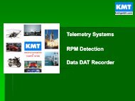
The complete GPS vehicle testing solution for land, sea and air
The complete GPS vehicle testing solution for land, sea and air
The complete GPS vehicle testing solution for land, sea and air

You also want an ePaper? Increase the reach of your titles
YUMPU automatically turns print PDFs into web optimized ePapers that Google loves.
How does the MicroSAT harness<br />
the power of <strong>GPS</strong>? _<br />
Orbiting the earth there are between 24 <strong>and</strong> 32 <strong>GPS</strong> satellites. <strong>The</strong>ir position<br />
over the earth is constantly changing. <strong>The</strong>y are not in geo-stationary orbits.<br />
Instead they orbit in about 12 hours at a height of about 20000km. In the<br />
normal constellation there are six orbit paths, each one is inclined at 60<br />
degrees relative to the equator. Each path has space <strong>for</strong> 4 satellites, giving<br />
space <strong>for</strong> 24 satellites in a full constellation. Currently there are 27 or 28<br />
satellites in orbit, some of the satellites are extras in case of failures.<br />
Each satellite knows its exact position at any time, this is transmitted<br />
to <strong>GPS</strong> receivers on earth so that we can compute the satellite's position.<br />
<strong>The</strong> details of the satellite's position is called the ephemeris. Due to gravity<br />
variations across the earth the orbit of the satellite changes, so the ephemeris<br />
is adjusted every few hours. Five ground stations are responsible<br />
<strong>for</strong> measuring the precise position of the satellite <strong>and</strong> keeping the <strong>GPS</strong><br />
system accurate.<br />
<strong>The</strong> signal transmitted from each satellite is similar to a spread-spectrum<br />
radio. <strong>The</strong> satellite's data is mixed with a pseudo-r<strong>and</strong>om number sequence.<br />
This sequence is known as the satellite's PRN <strong>and</strong> the sequence is different<br />
<strong>for</strong> each satellite. All the satellites are at the same frequency (1575MHz),<br />
so it is only possible to pick up a <strong>GPS</strong> satellite if you know its PRN sequence.<br />
And if you are tuned to one satellite's PRN then you don't get any in<strong>for</strong>mation<br />
from the other satellites.<br />
<strong>The</strong> clever bit about the <strong>GPS</strong> signals is that the carrier-wave (at 1575MHz)<br />
<strong>and</strong> the PRN sequence are synchronised in time. To pick up the satellite<br />
it is essential to line-up your local copy of the PRN with the satellites; in<br />
carrier-phase tracking receivers (like the MicroSAT) the carrier-wave of the<br />
satellite is also lined up in time with the satellite's carrier-wave; this is essential<br />
<strong>for</strong> good velocity measurement.<br />
Brendel Associates Limited<br />
Tel: (313) 729-9898<br />
1<br />
01100010100111010101101<br />
01100010100111010<br />
011000100110<br />
01100010<br />
LAND SEA AIR<br />
011<br />
0 1<br />
03