HISTORICAL SKETCHES OF SALEM, CONNECTICUT The town of ...
HISTORICAL SKETCHES OF SALEM, CONNECTICUT The town of ...
HISTORICAL SKETCHES OF SALEM, CONNECTICUT The town of ...
Create successful ePaper yourself
Turn your PDF publications into a flip-book with our unique Google optimized e-Paper software.
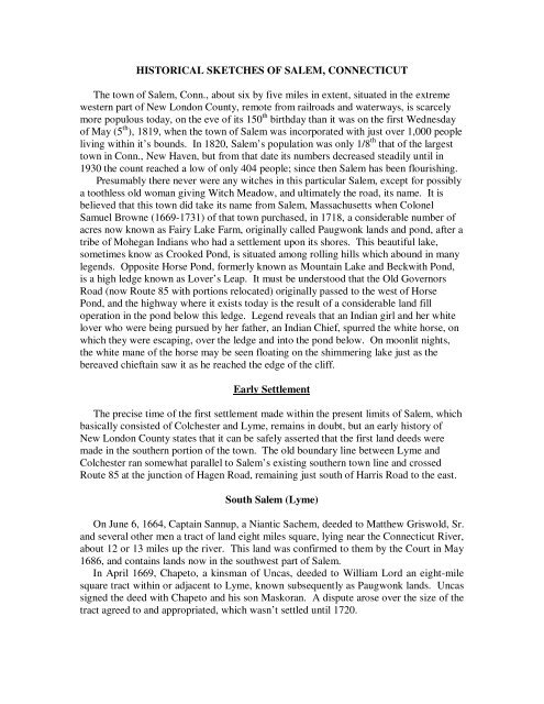
<strong>HISTORICAL</strong> <strong>SKETCHES</strong> <strong>OF</strong> <strong>SALEM</strong>, <strong>CONNECTICUT</strong><br />
<strong>The</strong> <strong>town</strong> <strong>of</strong> Salem, Conn., about six by five miles in extent, situated in the extreme<br />
western part <strong>of</strong> New London County, remote from railroads and waterways, is scarcely<br />
more populous today, on the eve <strong>of</strong> its 150 th birthday than it was on the first Wednesday<br />
<strong>of</strong> May (5 th ), 1819, when the <strong>town</strong> <strong>of</strong> Salem was incorporated with just over 1,000 people<br />
living within it’s bounds. In 1820, Salem’s population was only 1/8 th that <strong>of</strong> the largest<br />
<strong>town</strong> in Conn., New Haven, but from that date its numbers decreased steadily until in<br />
1930 the count reached a low <strong>of</strong> only 404 people; since then Salem has been flourishing.<br />
Presumably there never were any witches in this particular Salem, except for possibly<br />
a toothless old woman giving Witch Meadow, and ultimately the road, its name. It is<br />
believed that this <strong>town</strong> did take its name from Salem, Massachusetts when Colonel<br />
Samuel Browne (1669-1731) <strong>of</strong> that <strong>town</strong> purchased, in 1718, a considerable number <strong>of</strong><br />
acres now known as Fairy Lake Farm, originally called Paugwonk lands and pond, after a<br />
tribe <strong>of</strong> Mohegan Indians who had a settlement upon its shores. This beautiful lake,<br />
sometimes know as Crooked Pond, is situated among rolling hills which abound in many<br />
legends. Opposite Horse Pond, formerly known as Mountain Lake and Beckwith Pond,<br />
is a high ledge known as Lover’s Leap. It must be understood that the Old Governors<br />
Road (now Route 85 with portions relocated) originally passed to the west <strong>of</strong> Horse<br />
Pond, and the highway where it exists today is the result <strong>of</strong> a considerable land fill<br />
operation in the pond below this ledge. Legend reveals that an Indian girl and her white<br />
lover who were being pursued by her father, an Indian Chief, spurred the white horse, on<br />
which they were escaping, over the ledge and into the pond below. On moonlit nights,<br />
the white mane <strong>of</strong> the horse may be seen floating on the shimmering lake just as the<br />
bereaved chieftain saw it as he reached the edge <strong>of</strong> the cliff.<br />
Early Settlement<br />
<strong>The</strong> precise time <strong>of</strong> the first settlement made within the present limits <strong>of</strong> Salem, which<br />
basically consisted <strong>of</strong> Colchester and Lyme, remains in doubt, but an early history <strong>of</strong><br />
New London County states that it can be safely asserted that the first land deeds were<br />
made in the southern portion <strong>of</strong> the <strong>town</strong>. <strong>The</strong> old boundary line between Lyme and<br />
Colchester ran somewhat parallel to Salem’s existing southern <strong>town</strong> line and crossed<br />
Route 85 at the junction <strong>of</strong> Hagen Road, remaining just south <strong>of</strong> Harris Road to the east.<br />
South Salem (Lyme)<br />
On June 6, 1664, Captain Sannup, a Niantic Sachem, deeded to Matthew Griswold, Sr.<br />
and several other men a tract <strong>of</strong> land eight miles square, lying near the Connecticut River,<br />
about 12 or 13 miles up the river. This land was confirmed to them by the Court in May<br />
1686, and contains lands now in the southwest part <strong>of</strong> Salem.<br />
In April 1669, Chapeto, a kinsman <strong>of</strong> Uncas, deeded to William Lord an eight-mile<br />
square tract within or adjacent to Lyme, known subsequently as Paugwonk lands. Uncas<br />
signed the deed with Chapeto and his son Maskoran. A dispute arose over the size <strong>of</strong> the<br />
tract agreed to and appropriated, which wasn’t settled until 1720.
Samuel Chester owned a large tract <strong>of</strong> land, containing several thousand acres in what<br />
is now the Chesterfield portion <strong>of</strong> Montville and a portion <strong>of</strong> which extended into the<br />
southeastern part <strong>of</strong> Salem. Uncas conveyed this land to him just prior to his death in<br />
1683. From Mr. Chester the name <strong>of</strong> “Chesterfield” is supposed to be derived.<br />
By 1700 nearly all the lands now comprising the south part <strong>of</strong> Salem were in the<br />
possession <strong>of</strong> either Matthew Griswold or his son Matthew Griswold, Jr. Between the<br />
years 1718-1729 all this land (approx. 6500 acres) had been bought by one man, Colonel<br />
Samuel Brown. In 1729, there were three houses and a sawmill in South Salem: (1) the<br />
house built for Colonel Browne in 1720 under the superintendence <strong>of</strong> Capt. Samuel<br />
Gilbert, son <strong>of</strong> a wealthy innkeeper <strong>of</strong> Hartford and a veteran <strong>of</strong> Queen Anne’s War.<br />
Capt. Gilbert operated this residence as possibly Salem’s first inn until his death in 1733.<br />
<strong>The</strong> site <strong>of</strong> this inn is located in the vicinity <strong>of</strong> Attorney Richard Corkey’s home; (2) a<br />
small house on the Samuel Peck farm in southwest Salem; and (3) a small house and<br />
sawmill on the “Wheatfield Hill” farm in the vicinity <strong>of</strong> land now owned by Charles<br />
Dimmock.<br />
Salem was, even from very early times, a great wheat-growing region. Land to the<br />
west <strong>of</strong> Route 85 and between Salem Four Corners and the junction <strong>of</strong> Hagen Road and<br />
Route 85 was known as Wheatfield Hill farm as early as 1717. <strong>The</strong> residents <strong>of</strong> the Col.<br />
Browne and Fitch estates sent great quantities <strong>of</strong> the grain to Boston.<br />
North Salem (Colchester)<br />
On Dec. 9, 1686, Owaneco, Sachem <strong>of</strong> Mohegan and son <strong>of</strong> Uncas, confirmed to<br />
Daniel Mason <strong>of</strong> Stonington his title to land given by Uncas to his father, Major John<br />
Mason, a famous Indian fighter. This tract contained 500 acres lying west <strong>of</strong> “a great<br />
pond called Massapaug” (Gardiner’s Lake) and a mansion house was built by the Masons<br />
prior to 1717.<br />
In June 1699, Owaneco, “in consideration <strong>of</strong> the love and respect he bore to his friend<br />
Nathaniel Foot <strong>of</strong> Wethersfield, and for promoting and encouraging <strong>of</strong> sundry persons,<br />
who presented a petition to ye General Court in October, last past, for a tract <strong>of</strong> land for a<br />
<strong>town</strong>ship…being willing to show his willingness to promote Plantation and in<br />
consideration <strong>of</strong> a sum <strong>of</strong> money sold to Nathaniel Foot and Samuel Rogers, two <strong>of</strong> the<br />
grantees, all his rights in the land <strong>of</strong> said Township.” A part <strong>of</strong> this tract is now the north<br />
part <strong>of</strong> Salem.<br />
After the turn <strong>of</strong> the century, settlement started to take place. Two <strong>of</strong> the earliest<br />
settlers were Joseph Pumery and Ebenezer Coleman, who in 1703 were each appropriated<br />
100 acres by the <strong>town</strong>, having already established their residence west <strong>of</strong> the Governor’s<br />
Road (Rt. 85) and north <strong>of</strong> the Lyme line. <strong>The</strong> <strong>town</strong> gave them the land “for their<br />
encouragement to eject Major Palmes or any other person who shall make entrance or<br />
improve any land in the bounds <strong>of</strong> Colchester.” Major Palmes was about to sell “his”<br />
large parcel <strong>of</strong> land under the pretense <strong>of</strong> an Indian grant from Capt. Sannup <strong>of</strong> which<br />
had no validity. <strong>The</strong> Coleman and Pumery grant was laid out through a survey on Feb. 7,<br />
1706. It wasn’t until 1710 that land in North Salem was <strong>of</strong>fered for sale.<br />
In May 1705, “the Gentlemen <strong>of</strong> Lyme and Colchester summoned John Plumbe <strong>of</strong><br />
New London to run the dividing line between the <strong>town</strong>s.” Prior to this time, the lands
north <strong>of</strong> the Lyme line and extending to Colchester Center were the hunting grounds for<br />
the Mohegan Indians. From this period forth, the Mohegan became a migratory tribe.<br />
Capt. William Gardiner <strong>of</strong> South Kings<strong>town</strong>, R.I., bought in 1724 the land on the west<br />
side <strong>of</strong> Gardiner’s Lake, which had been owned by Mason. Although he owned this land<br />
for only six months the lake bears his name today due to the prestige and esteem, which<br />
encompassed him. Other names given to the lake in the past are Massapaug, Great Pond,<br />
Twenty Mile Pond, and Mason’s Pond.<br />
Opposite Rathbun Hill Road on the west side <strong>of</strong> the Old Colchester Road was situated<br />
a 100 acre farm bought in 1726 by Robert Jacklin, a free Negro man from New London,<br />
who owned this land for several years and was probably the first man <strong>of</strong> his race to own<br />
land in Salem. Due to the fact that Colonel Samuel Browne only owned 1500 acres in<br />
North Salem, a greater portion <strong>of</strong> acreage was made available. <strong>The</strong> second largest<br />
landowner in 1725 was Colonel Thomas Fitch, a wealthy Boston merchant, who owned<br />
over 1,000 acres (300 acres in South Salem). His land holdings contained the northwest<br />
quarter <strong>of</strong> Salem. After his death in 1736 the lands were divided between his sons-inlaw,<br />
Lt. Governor Andrew Oliver <strong>of</strong> Boston and William Brattle <strong>of</strong> Cambridge, both<br />
prominent men <strong>of</strong> their times and Tories. Other large landowners were Joshua<br />
Hempstead <strong>of</strong> New London – 1724; John Dolbeare, a wealthy brazier from Boston –<br />
1720 (who died in 1725 leaving the immense number <strong>of</strong> 24 children); Capt. Simon Ray<br />
<strong>of</strong> Block Island – 1716.<br />
By the year 1729, there were at least seven houses and a smith shop in North Salem:<br />
(1) two mansion houses near Round Hill and a smith shop built for Lt. James Harris<br />
around 1727; (2) a small house built by Thomas Jones in 1726 and located on the Music<br />
Vale Seminary property: (3) a small house built by Jonathan Cutler in 1706 and situated<br />
on the north side <strong>of</strong> Music Vale Road; (4) a small house built by Nathaniel Foot before<br />
1728 and still standing on Rt. 85, north <strong>of</strong> Music Vale Road; the former residence <strong>of</strong> Rev.<br />
John Whittlesey (father <strong>of</strong> Oramel) and more recently the Buron residence; (5) a mansion<br />
house built before 1717 by Peter Mason on the west side <strong>of</strong> Gardiner’s Lake; and (6) an<br />
immense mansion house built by William Browne (eldest son <strong>of</strong> Colonel Samuel) during<br />
the 1720’s on the south side <strong>of</strong> Music Vale Road near the Governor’s Road.<br />
* * * * *<br />
Gradually Colonel Brown acquired the whole tract <strong>of</strong> country round about, embracing<br />
the whole <strong>of</strong> South Salem, as we know it today, and amounting to over 8,000 acres. In<br />
1725, land was designated from the <strong>town</strong>s <strong>of</strong> Colchester and Lyme to form the parish <strong>of</strong><br />
New Salem, although many settlers still referred to their parish by it’s Indian name <strong>of</strong><br />
“Paugwonk” through the 1700’s.<br />
Colonel Samuel Browne was born at Salem, Mass., on Oct. 8, 1669. His father and<br />
grandfather were among the wealthiest and most influential citizens <strong>of</strong> that <strong>town</strong>, and<br />
famed for their benevolence to the poor, and their benefactions to Harvard College.<br />
Benjamin Pickman, who wrote in 1793 a sketch <strong>of</strong> early Salem, called them “the most<br />
remarkable family that has ever lived in the <strong>town</strong>.” Col. Browne was said to have been<br />
“by far the greatest merchant <strong>of</strong> his day in Essex County.” He lived in what was in those<br />
days a style <strong>of</strong> great magnificence, entertaining in a princely manner. <strong>The</strong> eldest son,<br />
William, after his marriage, lived in regal style at Salem, Conn., by building a<br />
magnificent country house, which he named Browne Hall for the family home in
England, but which always bore the name <strong>of</strong> Browne’s Folly. Browne Hall, built<br />
probably during the late 1720’s was an imposing building, with a front <strong>of</strong> 80 feet and<br />
built in the form <strong>of</strong> the letter H. <strong>The</strong> center was a large hall with paneled walls and<br />
massive beams surrounded by a circular gallery and surmounted by a dome. <strong>The</strong> floor<br />
was painted in imitation <strong>of</strong> mosaic. <strong>The</strong> house was so damaged by the earthquake that<br />
destroyed Lisbon in 1755, and which also shook New England, that it was not considered<br />
safe and was therefore moved to the foot <strong>of</strong> the hill, where it stood for many years. <strong>The</strong><br />
mansion also provided shelter for the Browne Land Agents and stood just north <strong>of</strong> the<br />
Colchester-Lyme line, facing west near the Governor’s Road. Nathaniel Hawthorne<br />
refers to the house in one <strong>of</strong> his works.<br />
<strong>The</strong> period <strong>of</strong> the War for Independence marked an important transition in the life <strong>of</strong><br />
New Salem. Sympathy with the patriot cause was strong with most everyone except the<br />
large landowner, and approximately two dozen men from the parish enlisted, some <strong>of</strong><br />
who took part in the Lexington alarm. Before long it was discovered that Col. William<br />
Browne, grandson and heir <strong>of</strong> Colonel Samuel, was persisting in his loyalties to the<br />
mother country (England). Consequently, as a Tory, he left Salem forever in October<br />
1774, and took refuge in Boston, and in 1776, when the British evacuated that city; he<br />
sailed with his son for England. His wife and daughter later joined him. Colonel Brown<br />
was appointed Governor <strong>of</strong> Bermuda in 1780, but finally returned to England, where he<br />
died in 1802. John Adams, the second President, said <strong>of</strong> him, “Society made <strong>of</strong> him a<br />
refugee; a Tory, I verily believe he never was.”<br />
<strong>The</strong> confiscation <strong>of</strong> the Browne estates, which were declared, forfeited to the State <strong>of</strong><br />
Conn. On Feb 1, 1779, was naturally followed by their dispersal into a considerable<br />
number <strong>of</strong> small farms.<br />
<strong>The</strong> parish <strong>of</strong> New Salem was divided in 1769, and the southeastern portion was set<br />
<strong>of</strong>f as a part <strong>of</strong> Chesterfield Parish. <strong>The</strong>n in 1786, New London North Parish, with the<br />
eastern part <strong>of</strong> Salem Parish and a part <strong>of</strong> Chesterfield Parish, was made the <strong>town</strong> <strong>of</strong><br />
Montville.<br />
Old Roads<br />
<strong>The</strong> main road leading north-south through the center <strong>of</strong> Salem, being the most direct<br />
route between New London and Hartford, was an old Indian trail used by the early<br />
settlers and known as “ the Country Road” from New London to Colchester, John<br />
Winthrop, Jr., while he served as Governor in Hartford between 1657-76, undoubtedly<br />
used this trail during the winter months to visit his mansion in New London when the<br />
Conn. River was navigable because <strong>of</strong> ice. Another Governor, Gurdon Saltonstall, also<br />
residing in New London, had the road formally laid out starting in 1716 (but not<br />
completed until 1740); thus it became known as “<strong>The</strong> Governor’s Road.” <strong>The</strong> original<br />
road prior to 1800 veered to the west <strong>of</strong> the existing highway south <strong>of</strong> the Town Clerk,<br />
Mary Beebe’s home, and connected with Pratt Road, then <strong>of</strong>f to the south on Hagen<br />
Road, and west on the Hamburg Road (Rt. 82) to Shingle Mill Road, which took the road<br />
around the west shore <strong>of</strong> Horse Pond passing near Capt. Gilbert’s Inn and then back to<br />
the existing road south <strong>of</strong> the pond. As it approached the southern <strong>town</strong> line the old road<br />
veered to the east following an old abandoned extension <strong>of</strong> Beckwith Road where it<br />
entered Montville. <strong>The</strong> Hartford and New London Turnpike Company, which received
the right to operate the road from the Conn. Assembly in Oct. 1800, immediately<br />
commenced building an improved road as Rt. 85 travels today.<br />
<strong>The</strong> main road leading east west through the center <strong>of</strong> Salem was the Norwich and<br />
Essex Turnpike laid out in 1827. As it attempted to straighten portions <strong>of</strong> the old<br />
winding roads, new roads were created across Harris Road and from Music Vale to<br />
Hagen Roads, thereby establishing Salem Four Corners. To the west, Darling Road was<br />
straightened by White Birch Road as the coaches proceeded through Lyme to Hamburg<br />
and beyond to Ely’s Ferry, which transported the carriages across the Conn. River at<br />
Essex to the Lower Post Road.<br />
<strong>The</strong> following dates <strong>of</strong> old <strong>town</strong> roads are listed below for roads that have shown little<br />
or no change from their original layout: Buckley Hill and Way Road – 1780; Witter Road<br />
– 1787; Rathbun Hill Road – before 1769; Old Colchester Road (north portion) – 1721;<br />
Heilwield Road – 1716 (previously and old Indian trail called “Chosechacomuck”);<br />
Round Hill Road – shortly after 1733; Old Cross Road thru Harris and Music Vale Roads<br />
– 1743; Music Vale Road (altered to present location) – 1764; West Road (known as<br />
Lyme Road) – 1716; Gungy Road, Darling Road, Rt. 82 east to Hagen Road – 1724;<br />
Darling Road (s.w. portion) – 1763; Old New London – 1770.<br />
<strong>The</strong> western portion <strong>of</strong> the North Cross Highway left West Road opposite Mill Lane<br />
Road and connected with Cherry Tree Road before 1720. <strong>The</strong> remaining portion <strong>of</strong> road<br />
from Witch Meadow to the Governor’s Road wasn’t laid out as a highway until 1760, due<br />
to a long controversy with the landowner, Colonel Brattle. <strong>The</strong> eastern portion starting at<br />
the Governor’s Road, around 1750, proceeded on Rattlesnake Ledge Road, up over<br />
Cockle Hill and through a district known as “Wales.” In 1757 the road connected with<br />
the Old Colchester Road near the present Colchester line. <strong>The</strong> northern portion <strong>of</strong> the<br />
highway was discontinued in 1852.<br />
Religious Activities<br />
In 1725, the General Assembly allowed the <strong>town</strong> to levy a tax <strong>of</strong> one penny an acre on<br />
all unimproved land for the support <strong>of</strong> the church. In 1726, Lt. Harris deeded in trust a<br />
tract <strong>of</strong> land containing 2 acres for a meetinghouse, burying ground, and training field.<br />
This was located on the north side <strong>of</strong> Music Vale Road, west <strong>of</strong> a colonial home now<br />
owned by Mrs. William Leiserson. As other settlers came, they felt the need <strong>of</strong> a<br />
meetinghouse “for ye public worship <strong>of</strong> God, in ye new parish partly in Colchester and<br />
partly in Lyme commonly called New Salem.”<br />
Ecclesiastical Society <strong>of</strong> New Salem<br />
In the year 1728, a church was built on this land and Lt. Harris called it “a<br />
Presbyterian meeting house.” Church affairs did not prosper in Salem. In 1739, the<br />
society was allowed to levy a penny tax for the support <strong>of</strong> the ministry. From the<br />
following entry <strong>of</strong> Feb. 4, 1742, in the diary <strong>of</strong> Joshua Hempstead <strong>of</strong> New London, we<br />
learn the name <strong>of</strong> the Salem minister: “Mr. Lovit is the minister <strong>of</strong> New Salem and his<br />
rate is 13 shillings, 4 pence for the last year <strong>of</strong> taxing (he informs me).” In May <strong>of</strong> year,<br />
on complaint <strong>of</strong> the people, the tax was abated to one-half penny. For the next four years<br />
the parish was without a minister. This church was either burnt or destroyed, possibly
efore 1763, when a new church was built on the north corner <strong>of</strong> Witch Meadow Road<br />
and the Governor’s Road, through a grant <strong>of</strong> 15 rods <strong>of</strong> land by Asa Jones. Two churches<br />
were built on this site. <strong>The</strong> last was taken down in 1838 and these timbers were used to<br />
build the present Congregational Church on the Town Green. In 1890, the Ecclesiastical<br />
Society was disbanded and the Congregational Society was organized.<br />
Baptist Society<br />
<strong>The</strong> first Baptist Church was built in 1751. Josiah Gates deeded 7 ½ acres <strong>of</strong> land and<br />
a dwelling house to Ichabod Allen <strong>of</strong> New London, with the understanding that he settle<br />
as Minister <strong>of</strong> said congregation. This church stood on the west side <strong>of</strong> the Old<br />
Colchester Road near the top <strong>of</strong> the hill a short distance north <strong>of</strong> Heilwield Corner (Rt.<br />
354 and Witter Roads) Here was located the Baptist meeting house, which remained until<br />
1846 when a new church was erected farther down the road to the south. This church is<br />
still standing and retains the name <strong>of</strong> the early community (the Paugwonk Baptist<br />
Church).<br />
Methodist Society<br />
<strong>The</strong> first Methodist Church was erected on Meeting House Hill opposite the house<br />
located on the site <strong>of</strong> Music Vale Seminary. This church fell into disrepair and inactivity<br />
and was bought by Mr. Herrick, a blacksmith, in 1871, after he came to Salem from<br />
Norwich. <strong>The</strong> church was moved in 1878 to recently purchased land fronting on the<br />
Governor’s Road and south <strong>of</strong> Witch Meadow Road. Although the structure is now gone,<br />
Mr. Herrick did operate the building for many years as a blacksmith shop.<br />
<strong>The</strong> second Methodist Organization, known as the Captain David Seaman’s Chapel,<br />
was built July 17, 1881, with ten members under the Reverend Henry Brown. This<br />
structure, located on Pratt Road, was used for many years as a Grange Hall until it burned<br />
midway through the 20 th century.<br />
Episcopal Society<br />
` <strong>The</strong> Episcopal Society <strong>of</strong> Salem was organized in 1829. When a new Episcopal<br />
Church was erected on Church St. in Norwich, the old church edifice, which had been<br />
built in 1749, was no longer needed, and was sold in 1830 to the Episcopal Society <strong>of</strong><br />
Salem. During the following year the structure was moved from Norwich to the Salem<br />
Green. This society after a time declined, and in 1843 the old building, then almost a<br />
hundred years old, was sold to the <strong>town</strong> <strong>of</strong> Salem for $500.00, table and stove included.<br />
<strong>The</strong> spire, tower and pews were removed, and the building became a Town Hall. <strong>The</strong><br />
Episcopal Society was allowed the privilege <strong>of</strong> meeting there occasionally for public<br />
worship for the next 10 years. We may justly be proud <strong>of</strong> this 220-year-old building.<br />
* * * * * *<br />
Finally, in 1819, all the land belonging to the old Salem Parish, including a part <strong>of</strong><br />
Montville (formerly New London North Parish) on the east was incorporated as the
<strong>town</strong> <strong>of</strong> Salem. During this period Salem was a thriving farm community in which<br />
blacksmith shops, gristmills, and sawmills were kept busy. Salem was well known<br />
for its taverns, among them the Stickland Tavern (now the Avery home on Rt. 85),<br />
the Dolbeare Tavern (torn down), operated by Samuel Dolbeare after 1772 and<br />
reached via Clark Lane, and the old Bland Tavern (now the home <strong>of</strong> Mr. and Mrs.<br />
George Gadbois), both located on the Norwich Turnpike Road. <strong>The</strong> latter had its<br />
days <strong>of</strong> activity during the War <strong>of</strong> 1812 and at a later date it had the honor <strong>of</strong><br />
accommodating as overnight guests, President Andrew Jackson and his staff who<br />
were on their way from Norwich to New Haven. Before leaving, the General<br />
addressed a throng <strong>of</strong> Salemites from a high balcony on the front <strong>of</strong> the tavern, which<br />
has since been removed.<br />
Between the years <strong>of</strong> 1835 and 1876, Salem rose to national prominence as a<br />
cultural center for music under the genius <strong>of</strong> Oramel Whittlesey and Music Vale<br />
Seminary. As young boys, Oramel and his two brothers persuaded their father to buy<br />
them a piano, and for this they each practiced judiciously two hours a day, working in<br />
shifts. Once each week, after they had finished their day’s work, they drove to New<br />
London for piano lessons; leaving Salem at eight p.m., they arrived at New London at<br />
eleven-thirty. <strong>The</strong>ir lessons <strong>of</strong> one hour each were finished at two-thirty a.m., and<br />
they drove back to Salem, arriving at five-thirty am; just in time to start the day’s<br />
chores. Oramel was greatly respected by the farmers in the community and was at<br />
different times justice <strong>of</strong> the peace, judge <strong>of</strong> probate, postmaster, and senator.<br />
Immediately after his marriage at Salem in 1826, he moved to Buffalo and with his<br />
two brothers began the manufacture <strong>of</strong> pianos, which were made <strong>of</strong> rosewood and<br />
mahogany. All the finer workmanship, such as the sawing <strong>of</strong> the ivories and the<br />
inlaying <strong>of</strong> mother-<strong>of</strong>-pearl letters and ornamentations, was done entirely by hand, the<br />
work <strong>of</strong> the three brothers. In 1833, Oramel Whittlesey and his brothers returned to<br />
their old home in Salem where they continued the manufacture <strong>of</strong> pianos. Later<br />
Henry Whittlesey built a small factory next to his residence north <strong>of</strong> Smuckler’s<br />
Garage on the east side <strong>of</strong> the Governor’s Road. <strong>The</strong> brothers, however, carried on<br />
the work, as something more constructive became the ambition <strong>of</strong> Oramel. Oramel’s<br />
reputation as a musician was becoming widely known. In 1835, he established Mr.<br />
Whittlesey’s Music School, later known as Music Vale Seminary and Normal<br />
Academy <strong>of</strong> Music. It was the first normal school <strong>of</strong> music in the United States<br />
authorized to confer degrees. In those days when colleges for women were unknown,<br />
every gentlewoman was expected to give creditable performance on the harp, piano<br />
or guitar. Salem soon became a cultural center. Young ladies came from all parts <strong>of</strong><br />
the United States, Canada and the West Indies, and soon the student body grew to an<br />
average <strong>of</strong> eighty during the year, with its peak being one hundred pupils. <strong>The</strong> pupils<br />
were taught voice culture and there were lessons on the organ, harp, and guitar as<br />
well as piano, and Pr<strong>of</strong>essor Whittlesey along with some well-known musicians as<br />
instructors, maintained the strictest discipline. <strong>The</strong> graduates <strong>of</strong> Music Vale were<br />
among the most accomplished musical artists <strong>of</strong> their day. Special Concord coaches<br />
were ordered hung on the best leather springs with luxurious appointment and painted<br />
a royal blue. Horses were perfectly matched, while the coachmen and footmen were<br />
all six-footers, descendants <strong>of</strong> the Colonel Browne slaves, and every one <strong>of</strong> them<br />
stood at attention and saluted when addressed. <strong>The</strong> coaches were one extravagance,
ut the elaborate musicals and operas (some composed by Whittlesey) staged in the<br />
great auditorium <strong>of</strong> MusicVale were even more ambitious and expensive<br />
undertakings. <strong>The</strong> hall itself, designed by a New York architect, with its frescoed<br />
walls and ceilings, elaborate boxes at the sides <strong>of</strong> the stage and a gallery at the rear,<br />
far exceeded in detail the appointments any concert hall <strong>of</strong> the prosperous cities <strong>of</strong><br />
New London or Norwich. <strong>The</strong> curtains, one with a painting <strong>of</strong> Music Vale, and<br />
another with a likeness <strong>of</strong> the Arch <strong>of</strong> Titus with the Tiber in the distance, were a<br />
source <strong>of</strong> wonder to many visitors. Prominent persons gathered from far distant<br />
places to attend the spectacular performances and to talk for months afterward <strong>of</strong> the<br />
amazing lighting and sound effects. “Real thunder” crashed when stage hands rolled<br />
iron balls across white oak boards in the wings, and lightning flashed from lighted<br />
blasting powder strung out on a tin plate. A reporter for a New York newspaper who<br />
saw one performance, wrote in October 1855:”When we were ushered into the<br />
reception hall filled with such a splendid array <strong>of</strong> beauty, grace and loveliness we<br />
could scarcely imagine that it was all real, but our minds reverted to the stories in the<br />
Arabian Nights Tales, and we were half inclined to believe the whole a dream. We<br />
might as well attempt to describe on paper the beauties <strong>of</strong> the rainbow as to give a<br />
description <strong>of</strong> the entertainment. <strong>The</strong>re was not a poor singer among them, and what<br />
was really surprising was the admirable discipline under which they performed. We<br />
left the hall gratified with what we had heard and fascinated with what we had seen.”<br />
During the performance <strong>of</strong> an opera in 1868, some blasting powder got out <strong>of</strong> control<br />
and fired the seminary. A larger, more luxuriously equipped building was<br />
immediately erected with a tower at the center, topped with a harp as a weathervane,<br />
but the disaster <strong>of</strong> the Civil War in the South was already making inroads on the<br />
seminary’s enrollment. Oramel Whittlesey died in 1876; his daughters carried on the<br />
school for only a few years longer. Another fire, in 1897, destroyed the vacant<br />
structure and left Music Vale a memory. In the earlier part <strong>of</strong> this century, it was<br />
common to see motorists with license plates from distant places stop and search for<br />
some tangible evidence <strong>of</strong> Music Vale. Sometimes delicate old ladies would walk<br />
slowly through the long grass, pausing and listening – listening for the faint music <strong>of</strong><br />
their past.<br />
Salem gradually returned to its role as an agricultural community. During the<br />
early 1900’s Fairy Lake Farm, consisting <strong>of</strong> twenty-eight hundred acres, was the<br />
pride <strong>of</strong> the locality by pioneering rural hydroelectric power and marketing its<br />
produce throughout the region.<br />
Today, Salem’s only links with the past are approximately forty old homes and<br />
buildings, all well over one hundred years old, and dating as early as 1728. Our <strong>town</strong><br />
is expected to grow substantially during the last quarter <strong>of</strong> this century; it is my hope<br />
that some <strong>of</strong> these structures will be preserved and possibly restored, so that they<br />
might endure the ages as a reminder <strong>of</strong> our heritage.<br />
June, 1969 by: David Hazard Wordell


