St. Johns Conservation Area Appraisal - Bromsgrove District Council
St. Johns Conservation Area Appraisal - Bromsgrove District Council
St. Johns Conservation Area Appraisal - Bromsgrove District Council

Create successful ePaper yourself
Turn your PDF publications into a flip-book with our unique Google optimized e-Paper software.
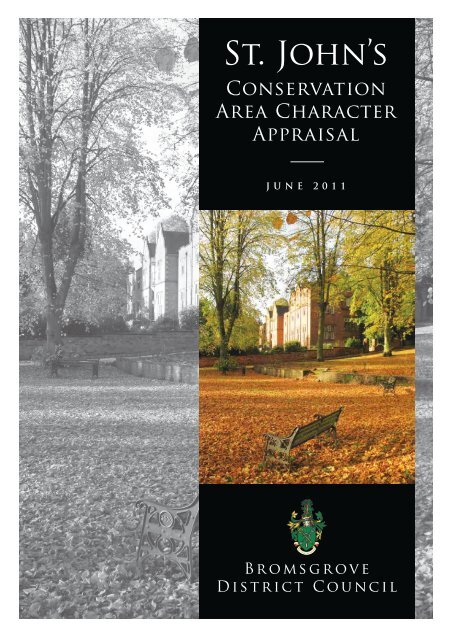
<strong>St</strong>. John’s<strong>Conservation</strong><strong>Area</strong> Character<strong>Appraisal</strong>JUNE 2011<strong>Bromsgrove</strong><strong>District</strong> <strong>Council</strong>
C o n t e n t s1.0 Introduction2.0 Planning Policy Context3.0 Summary of Special Interest4.0 Assessment of Special InterestLocation and SettingHistoric Development and ArchaeologyKey ViewsPrevailing and Former UsesCharacter ZonesArchitectural Character and Key BuildingsBuilding MaterialsPublic RealmImportant Trees and Green SpacesGeneral Condition of the <strong>Area</strong>Challenges and Opportunities5.0 Proposed Boundary Changes6.0 Management Proposals7.0 Public ConsultationAppendicesAppendix 1 List of Properties in the <strong>Conservation</strong><strong>Area</strong>Appendix 2 Management and EnhancementProposalsAppendix 3 Relevant Local Plan PoliciesAppendix 4 GlossaryList of MapsMap 1 Existing boundary of the <strong>Bromsgrove</strong>Town <strong>Conservation</strong> <strong>Area</strong>Map 2 Proposed boundary of the <strong>St</strong>. John’s<strong>Conservation</strong> <strong>Area</strong>Comments are welcome and should be sent to the<strong>St</strong>rategic Planning Team, <strong>Bromsgrove</strong> <strong>District</strong><strong>Council</strong>, Burcot Lane, <strong>Bromsgrove</strong>, B60 1AA.Email conservation@bromsgrove.gov.uk ortelephone 01527 881326<strong>St</strong>. John’s <strong>Conservation</strong> <strong>Area</strong> character <strong>Appraisal</strong>1
1.0 Introduction1.1 The purpose of a <strong>Conservation</strong> <strong>Area</strong> Character <strong>Appraisal</strong> is toidentify the factors and features which make an area special,based on an in-depth assessment of an area’s buildings,spaces, evolution and sense of place. This is the first step indeveloping a management plan for the continuedpreservation and enhancement of a <strong>Conservation</strong> <strong>Area</strong>.An appraisal evaluates the positive, neutral and negativefeatures of the area and suggests opportunities forimprovement. It is not unusual for the boundary of a<strong>Conservation</strong> <strong>Area</strong> to fluctuate over time as the area evolves,and an assessment of the current and potential boundaries isnormally part of the appraisal process.1.2 The <strong>St</strong> John’s area was originally part of the <strong>Bromsgrove</strong> Town<strong>Conservation</strong> <strong>Area</strong> designated by Worcestershire County<strong>Council</strong> in 1968. During the recent appraisal of the Town<strong>Conservation</strong> <strong>Area</strong> it was recognised that the <strong>St</strong>. <strong>Johns</strong> areawas worthy of its own independent status in view of itsunique character.1.3 This appraisal of the <strong>St</strong>. John’s <strong>Conservation</strong> <strong>Area</strong> was carriedout in February 2011 in accordance with the guidance givenby English Heritage in their ‘Guidance on <strong>Conservation</strong> <strong>Area</strong><strong>Appraisal</strong>s’ publication. Although produced by the <strong>Council</strong>,local societies and residents will be encouraged to contributeto and comment on the draft document. This will result in awell rounded assessment of the area incorporating localknowledge, perceptions and suggestions.1.4 During the public consultation the draft character appraisalwas made available on the <strong>Council</strong>’s website, at theCustomer Service centre and the <strong>Council</strong> House to ensurethat it reached a wide audience.1.5 Map 2 identifies positive, neutral and negative buildingswithin the <strong>St</strong>. John’s <strong>Conservation</strong> <strong>Area</strong> – this is not anexclusive list and omission of any particular building shouldnot be taken as an indication that it has no value. Positivebuildings make a notable contribution to the character andappearance of the <strong>Conservation</strong> <strong>Area</strong> and are usually goodexamples of historic buildings with only minor alterationsor additions. Neutral buildings make a limited contributionand are generally the much altered historic buildings, butmay provide opportunities for enhancement. Neutralbuildings are those properties which detract from thecharacter and appearance of the <strong>Conservation</strong> <strong>Area</strong>, wherereplacement with a new building would be encouraged,subject to compliance with other planning policies.2<strong>St</strong>. John’s <strong>Conservation</strong> <strong>Area</strong> character <strong>Appraisal</strong>
Aerial view of <strong>St</strong>. John’s and <strong>Bromsgrove</strong> Town Centre © Crown Copyright. All rights reserved <strong>Bromsgrove</strong> <strong>District</strong> <strong>Council</strong> 100023519. 20112.0 Planning PolicyContext2.1 A <strong>Conservation</strong> <strong>Area</strong> is defined in the 1967 Civic AmenitiesAct as “an area of special architectural or historic interest,the character or appearance of which it is desirable topreserve or enhance”. It is not the purpose of a<strong>Conservation</strong> <strong>Area</strong> to prevent development, but to managechange in a positive and proactive way that benefitscurrent and future generations.2.2 <strong>Conservation</strong> <strong>Area</strong> status means that a special form ofPlanning Permission called <strong>Conservation</strong> <strong>Area</strong> Consent isrequired for the total or substantial demolition of anybuilding over 115m3 in size, the demolition of a boundarywall over 1m in height next to the highway or 2melsewhere and the removal of any pre-1925 gravestones(except on land associated with the Church). There is ageneral presumption against the loss of buildings whichmake a positive contribution to the character orappearance of the <strong>Conservation</strong> <strong>Area</strong>. Additional controlsare also placed over trees within the area, meaning that anowner must submit a formal notification of works to the<strong>Council</strong> six weeks before starting work. Permitteddevelopment rights (works that can be done withoutPlanning Permission) are also slightly different withindesignated <strong>Conservation</strong> <strong>Area</strong>s.<strong>St</strong>. John’s <strong>Conservation</strong> <strong>Area</strong> character <strong>Appraisal</strong>3
3.0 Definition of SpecialInterest3.1 The special interest of a <strong>Conservation</strong> <strong>Area</strong> is defined bymore than its appearance and includes the atmosphere,texture, sense of place and setting as well as more obviousqualities such as groups of historic buildings. Notablebuildings and the spaces between buildings set an overallcontext for an area, but a designated <strong>Conservation</strong> <strong>Area</strong>should be more than just a collection of attractivebuildings.3.2 The <strong>St</strong>. John’s <strong>Conservation</strong> <strong>Area</strong> has substantial historicand architectural interest, with some of the oldest survivingbuildings in the town within the <strong>Conservation</strong> <strong>Area</strong>.The Church is a strong landmark feature for the town, and issupported by a collection of surrounding listed andunlisted historic buildings dating from the 17th to 19thcenturies. The area as a whole has a leafy green settingwhich contributes to the local sense of place andestablishes a positive relationship between the built andthe natural environment.<strong>St</strong>. John’s <strong>Conservation</strong> <strong>Area</strong> character <strong>Appraisal</strong>5
4.0 Assessment of SpecialInterest4.1 Location and SettingThe <strong>St</strong>. John’s <strong>Conservation</strong> <strong>Area</strong> is located to the west of<strong>Bromsgrove</strong> town centre, which itself lies in the south-westof the <strong>District</strong> of <strong>Bromsgrove</strong>, approximately 15 milessouth-west of Birmingham and 15 miles north-east ofWorcester. The proposed <strong>Conservation</strong> <strong>Area</strong> is centredupon the Grade I listed <strong>St</strong>. John’s Church, which has anelevated position to the west of the town centre, andincludes the 16th century churchyard and the 1857cemetery further to the north. The adjacent <strong>Bromsgrove</strong>Town <strong>Conservation</strong> <strong>Area</strong> which focuses on the historic High<strong>St</strong>reet was designated in 1968, and subsequently extendedin 1983 and 1989.Location Map of<strong>St</strong>. John’s<strong>Conservation</strong> <strong>Area</strong> inRelation to<strong>Bromsgrove</strong> <strong>District</strong>This map is reproduced from Ordnance Survey material with the permission ofOrdnance Survey on behalf of the Controller of Her Majesty’s <strong>St</strong>ationery Office© Crown Copyright. Unauthorized reproduction infringes Crown copyright andmay lead to prosecution or civil proceedings. <strong>Bromsgrove</strong> <strong>District</strong> <strong>Council</strong>100023519. 20096<strong>St</strong>. John’s <strong>Conservation</strong> <strong>Area</strong> character <strong>Appraisal</strong>
4.2 Historic Development and Archaeology<strong>St</strong> <strong>Johns</strong> Church and Churchyard lies immediately to thewest of the town on an area of raised ground overlookingwhat was once the Roman Road between Droitwich andthe north midlands. This area may have been the site of anearlier Anglo Saxon Church, and the earliest remnants inthe existing Church date from the 12th century,incorporating what was once a cruciform aisleless building.It has been speculated that the site of the existing Church isclose to that of a much older nunnery and certainly recordsof <strong>Bromsgrove</strong> refer to a priest within the manor in 1086.The extent of the medieval churchyard has not beenclearly identified but 13th and 14th century deposits havebeen found on the former Market Hall site on <strong>St</strong>. John<strong>St</strong>reet. The Grade I listed Church, its Grade II listed lychgateand the Grade II listed Ye Olde Black Cross public house onWorcester Road are the only surviving medieval buildingswithin and around the <strong>Conservation</strong> <strong>Area</strong> boundary.Previous archaeological investigations behind <strong>St</strong>. John<strong>St</strong>reet (which contains 17th and 18th century buildings)discovered pre 17th century deposits - further evidencethat this part of <strong>Bromsgrove</strong> was the focus of the earliestsettlement. Limited archaeological investigation has takenplace within the <strong>Conservation</strong> <strong>Area</strong>, however it is likely thatfurther medieval deposits survive along <strong>St</strong>. John <strong>St</strong>reet.The parish of <strong>St</strong>. John’s was substantial and once providedone of the wealthiest Church livings in the country. The firstparish register was recorded in 1590 and included details ofthe earliest burials within the churchyard. The southern sideof <strong>St</strong>. John <strong>St</strong>reet was developed as tenement housing andevidence of 17th and 18th century buildings which mayhave burnt down was discovered on the Market Hall sitein 1994. The expansion of <strong>St</strong>. <strong>Johns</strong> continued steadilythroughout the 19th and 20th century with the growth ofthe town centre to the south and east and a large area ofhousing established to the north.<strong>St</strong>. John’s <strong>Conservation</strong> <strong>Area</strong> character <strong>Appraisal</strong> 7
4.3 Key ViewsThe Grade I listed Church is very prominent in views from inand around <strong>Bromsgrove</strong> town centre and in and out ofthe <strong>St</strong>. John’s <strong>Conservation</strong> <strong>Area</strong>. The group of historicbuildings along <strong>St</strong>. John <strong>St</strong>reet have significant group value,a fact which was referenced in the various statutory listingdescriptions for the buildings. These views are enhanced bythe number of fine trees and leafy setting of the area, whichis quite different from the busy retail activity within theadjacent <strong>Bromsgrove</strong> Town <strong>Conservation</strong> <strong>Area</strong>. Significantviews have been identified in Map 2 attached as anappendix.4.4 Prevailing and Former UsesThe majority of the <strong>Conservation</strong> <strong>Area</strong> was historicallyoccupied by ecclesiastical land, with commercial andresidential properties appearing along <strong>St</strong>. John <strong>St</strong>reet fromthe 17th century. Crown Close was once part of a largerarea of glebe land, leased for grazing etc to support theChurch. The area is now predominantly residential withcommercial businesses and offices along <strong>St</strong>. John <strong>St</strong>reetand Kidderminster Road.4.5 Architectural Character and Key Buildings<strong>St</strong>. John <strong>St</strong>reetThe group of historic buildings along <strong>St</strong> John <strong>St</strong>reet, whichincludes several listed buildings, has a strong streetscenepresence and defines the southern boundary of the<strong>Conservation</strong> <strong>Area</strong>. Views of this group are prominent fromthe adjacent <strong>Bromsgrove</strong> Town <strong>Conservation</strong> <strong>Area</strong> andcontribute to the setting of <strong>St</strong>. John’s Churchyard.<strong>St</strong> John’s House at no 22 <strong>St</strong> John <strong>St</strong>reet is Grade II listed anddates from the 18th century, although it was substantiallyrebuilt and extended in 1975. The building is two storey,constructed in traditional red brick with timber sliding sashwindows and a panelled door with fanlight above.The building wraps around the corner onto KidderminsterRoad, with an open car park area facing the roundabout.A notable yew tree (which is contemporary with thebuilding) softens this corner and improves the setting ofthe listed building, which has been undermined by thedominance of the highway.8<strong>St</strong>. John’s <strong>Conservation</strong> <strong>Area</strong> character <strong>Appraisal</strong>
The Wishing Well PH at no.16 <strong>St</strong>. John <strong>St</strong>reet (formerly theShoulder of Mutton) was built in the early 19th century, buta pub is thought to have existed on the site since the 15thcentury. The building is constructed of painted brickworkwith timber weatherboarding at the first floor and a tiledroof. The windows and doors have been replaced and thebuilding extended and internally modernised bysuccessive owners, but the building retains a historiccharacter which makes a positive contribution to the<strong>Conservation</strong> <strong>Area</strong>. The caves to the rear were explored andidentified as post medieval icehouses or outbuildings in1995, although there are conjectural references to historictunnels running between the Church and <strong>St</strong> John <strong>St</strong>reet.No.14 <strong>St</strong>. John <strong>St</strong>reet (currently occupied by the GeorgeDavis salon) is also Grade II listed and dates from the 17thcentury. The most distinctive feature of this simplesandstone building is the single head of square timberframing at attic level inscribed RD1674. No.12a to the rightis a 19th century addition, which has been reworked againin the 20th century.The Grade II listed no.10 <strong>St</strong> John <strong>St</strong>reet dates from the 18thcentury and is officially listed as no.12. This wellproportioned Georgian house (now in office use) retainstypical detailing of the period with a symmetrical form,central doorpiece with curved pediment and timber slidingsash windows. This building forms a positive foreground tothe listed Church on the hill above, and features strongly inviews of the <strong>Conservation</strong> <strong>Area</strong> from Market Place.Adjacent to this and set back from the road is the former<strong>District</strong> <strong>Council</strong> Offices, which was converted to the<strong>St</strong>. John’s Court care home in the 1980’s. This grandJacobean style building was once a much smaller butstill ornate 19th century vicarage but was significantlyextended in the 1940s and 1960s, before it becameGrade II listed in 1971. The wrought iron gates weredesigned in 1953 by the <strong>Bromsgrove</strong> Guild.<strong>St</strong>. John’s <strong>Conservation</strong> <strong>Area</strong> character <strong>Appraisal</strong> 9
The Church and ChurchyardThe Grade I listed Church of <strong>St</strong> John the Baptist is at the heart ofthe <strong>St</strong>. John’s <strong>Conservation</strong> <strong>Area</strong> and incorporates an earlier 12thcentury Church with later phases from the 15th to 19thcenturies. It is conjectured that an earlier minster may haveexisted on the site based on topographical surveys (the site is ona hill, next to a stream and a Roman Road) and certainly recordsrefer to a priest in the manor of <strong>Bromsgrove</strong> in 1086. The earliestChurch had an aisleless cruciform layout, with the aisles addedand the chancel rebuilt in the 13th century. The aisles weresubsequently rebuilt in the 15th century and the porch added -the tracery on the north aisle windows survives from this period.The building was extensively restored by Sir George Gilbert Scottin 1858 and is now an impressive Perpendicular Gothic stylebuilding with a battlemented parapet and crocketed pinnacles.The three stone statues of <strong>St</strong> Peter, <strong>St</strong> Paul and <strong>St</strong> John the Baptistabove the great west window are medieval. The octagonal spire,which is a significant landmark in distant views, is 200ft high.The interior contains the 15th century tombs of Sir Henry<strong>St</strong>afford and Sir John Talbot of Grafton, as well as later featuresand detailing such as the mosaic chancel floor designed by the<strong>Bromsgrove</strong> Guild. The existing Church has a commandingposition overlooking the town, and features strongly in viewsfrom the nearby High <strong>St</strong>reet and from the cemetery because ofits elevated location.The Church steps leading down to <strong>St</strong>. John <strong>St</strong>reet are medievaland predate the lychgate which was erected in 1656. Originally63 steps, now 48, the sandstone steps are important to thesetting of the Church and were extensively repaired in 2006.The lychgate which is Grade II listed, is unfortunately in very poorcondition due to continued acts of vandalism but is scheduled tobe repaired in May 2011.The extent of the medieval churchyard is not known, but existinggravestones date from 1617 to 1857, when the new cemeterywas opened to the north. The Lime trees which surround thechurchyard were planted around 1790 and the stone boundarywalls added in 1815. Many 17th and 18th century memorialssurvive within the churchyard, although somewhat eroded bytime. One of the more notable examples is the pair ofgravestones erected for Thomas Scaife and Joseph Rutherfordwho were engineers of the Birmingham and Gloucester Railwaykilled in an industrial accident in November 1840. Theirgravestones were funded by their former colleagues and includea railway based poem and plaques depicting steam locomotives.10<strong>St</strong>. John’s <strong>Conservation</strong> <strong>Area</strong> character <strong>Appraisal</strong>
Perry Hall, Perry Lane and Church LanePerry Hall on Kidderminster Road is a Grade II listed building,and dates from the early 19th century but is thought to havebeen built on the site of an earlier farm. The building is now partof <strong>Bromsgrove</strong> School but was built in 1828 by Captain JohnAdams, a key local figure, who was commemorated by theGothic memorial cross which until recently stood in the centreof <strong>Bromsgrove</strong> cemetery. In 1860 the property passed to theHousman family and was the childhood home of A.E Housmanthe poet, his brother Laurence Housman the playwright andsister Clemence who was a novelist and suffragette.Perry Lane adjacent was once part of John Adams estate with thefour cottages built in the early 1850’s. The cottages have all beenaltered and extended but remain in residential use. The adjacentcottages at 7-11 Kidderminster Road are of similar age but arenow in a mix of residential and office use. Their appearance hasunfortunately been affected by the introduction of PVC windowsand concrete tiled roofs.Almost opposite Perry Hall at 16 Kidderminster Road is RydalMount, which was built in the late 1850’s by nailmaster ThomasScroxton. The building was originally named Alma House afterthe Battle of Alma in 1854 – the first battle of the Crimean War.The house later became the Vicarage to <strong>St</strong>. <strong>Johns</strong> Church beforeit was sold in 1977. The site also includes a rendered octagonalgatehouse facing Church Lane which adds interest to thestreetscene along with the historic stone boundary walls.Opposite this on the corner of Church Lane and KidderminsterRoad, is the <strong>Bromsgrove</strong> Unionist Club, originally known asOakdene and built in 1887 to a design by John Cotton (nowburied in <strong>Bromsgrove</strong> Cemetery) for the Sanders family.Benjamin Sanders was a very influential <strong>Bromsgrove</strong> citizen,owner of the town’s Button Factory, and lived in the house untilhis death in 1910. His daughters gifted the land opposite to thetown, now the site of Sanders Park. The trees within the groundsof Oakdene are protected by a Tree Preservation Order, the onlyone within the <strong>Conservation</strong> <strong>Area</strong> boundary12<strong>St</strong>. John’s <strong>Conservation</strong> <strong>Area</strong> character <strong>Appraisal</strong>
4.6 Building MaterialsRed brick is the predominant building material within the<strong>Conservation</strong> <strong>Area</strong>, with some painted and timber framedbuildings on <strong>St</strong>. John <strong>St</strong>reet. The Church is red sandstone,most of the memorials and gravestones are also sandstonewith cast iron railings around some of the Victorianmonuments within the cemetery. The stone boundary wallsaround the Churchyard and cemetery define thestreetscene particularly along Church Lane and make apositive contribution to the character and appearance ofthe <strong>Conservation</strong> <strong>Area</strong>.4.7 Public RealmThe public realm along <strong>St</strong>. John’s <strong>St</strong>reet has undoubtablybeen affected by the intrusion of the highway, whicheffectively severs the area from the rest of the town centre.The Spadesbourne Brook on the opposite side (now next toa temporary surface car park) is the only softening featurebut has limited effect given its continuing condition issuesand past culverting. Fortunately the large grassed area by<strong>St</strong> John’s Court and Crown Close have been retained andcontribute positively to the approach to the Church fromthe south.The most positive aspect of the existing public realm is thesurvival of the historic stone walls which help frame viewsthrough the streetscene and encircle key open spaces.4.8 Important Trees and Green Spaces<strong>St</strong>. <strong>Johns</strong> churchyard is the key open space within the<strong>Conservation</strong> <strong>Area</strong>, followed closely by the cemetery to thenorth. The 2007 English Heritage publication “ParadisePreserved” summed up the value of historic cemeteries asopen spaces,“Cemeteries were conceived and designed both as gardensof the dead and as a memorial. They are functionallandscapes and many of our historic cemeteries are stillbeing used for the business of burying and mourning, andas places for quiet reflection. They are valued and enjoyedby local people as open spaces and for the wildlife and theymake an important contribution to the quality of life of thelocal community. Cemeteries are distinct from other burialplaces and other green spaces. This interweaving ofarchitecture, sculpture, landscape, wildlife and poetry is likeno other place in the historic environment”<strong>St</strong>. John’s <strong>Conservation</strong> <strong>Area</strong> character <strong>Appraisal</strong> 13
5.0 Proposed BoundaryChanges<strong>St</strong> John <strong>St</strong>reet, <strong>St</strong> <strong>Johns</strong> Church and Churchyard, Perry Lane,part of Kidderminster Road and part of Crown Close wasoriginally included as part of the <strong>Bromsgrove</strong> Town<strong>Conservation</strong> <strong>Area</strong> in 1968. Initially defined as two subareas the <strong>St</strong>. <strong>Johns</strong> section became part of the town centredesignation over time, despite a physical gap in theboundary between the High <strong>St</strong>reet and <strong>St</strong>. John <strong>St</strong>reet.Map 1 shows the existing designated boundary.As part of the formal review of the <strong>Bromsgrove</strong> Town<strong>Conservation</strong> <strong>Area</strong> in 2011, the designation and expansionof the <strong>St</strong>. <strong>Johns</strong> as an individual <strong>Conservation</strong> <strong>Area</strong> wasidentified as a possible revision. This was in recognition ofthe unique character of <strong>St</strong>. <strong>Johns</strong> and distinct specialinterest, which is significantly different from the characterand appearance of the <strong>Bromsgrove</strong> Town <strong>Conservation</strong><strong>Area</strong>. Map 2 shows the extended boundary of the <strong>St</strong>. John’s<strong>Conservation</strong> <strong>Area</strong> which includes <strong>Bromsgrove</strong> Cemeteryand some additional properties on Church Lane and CrownClose. A list of properties within the revised boundary isattached as Appendix 1 for clarity.The separation of the town centre and <strong>St</strong>. John’sdesignations and associated boundary amendments wasformally approved by the <strong>Council</strong>’s Cabinet on 1st June2011, following a public consultation period on theproposed <strong>St</strong>. <strong>Johns</strong> <strong>Conservation</strong> <strong>Area</strong> boundary andcharacter appraisal. The consultation period on the<strong>Bromsgrove</strong> Town <strong>Conservation</strong> <strong>Area</strong> amendments andcharacter appraisal ended on 4th March 2011 and noobjections were raised to the proposed separation intotwo designated conservation areas.16<strong>St</strong>. John’s <strong>Conservation</strong> <strong>Area</strong> character <strong>Appraisal</strong>
6.0 Management ProposalsAppendix 2 includes a draft management plan for thearea. This is not an absolute list but outlines the main issueswhich need to be addressed and possible tasks andtimescales. It should be made clear that the <strong>Council</strong> cannotgive a definite commitment to undertake these tasks, whichwill ultimately depend on future financial and staffresources.The main issues which need ongoing management areEnsuring that the redevelopment of the market sitepreserves or enhances the conservation area, andpositively contributes to its settingQuality of signage should adhere to the <strong>Council</strong>’sadopted supplementary guidance on shopfronts andadvertisementsMaintenance of the open spaces and treesRepairs to the historic gravestones within thechurchyard7.0 Public ConsultationBefore final publication this document was subject to asix week public consultation period to gather views on theassessment of the area, the proposed boundary changesand the draft management plan.<strong>St</strong>. John’s <strong>Conservation</strong> <strong>Area</strong> character <strong>Appraisal</strong> 17
Appendices18<strong>St</strong>. John’s <strong>Conservation</strong> <strong>Area</strong> character <strong>Appraisal</strong>
A p p e n d i x 1List of Properties in the <strong>Conservation</strong> <strong>Area</strong>4 Church Lane44 Church Road<strong>Bromsgrove</strong> Cemetery, Lodge (2 Church Lane) and lychgateRMC House, Church Lane1, 3, 5, 7, 9 and 11 Church Lane<strong>St</strong>. John’s House, 16 Church <strong>St</strong>reet18 Church <strong>St</strong>reetAmphlet Hall, Crown Close2, 4, 6, 6a and 6b Crown Close<strong>St</strong>. <strong>Johns</strong> Surgery, 5 Kidderminster Road7, 9 and 11 Kidderminster RoadPerry Hall, Kidderminster Road8, 10 and 12 Kidderminster Road<strong>St</strong> <strong>Johns</strong> Church Hall, 14 Kidderminster RoadRydal Mount, 16 Kidderminster RoadUnionist Club, 18 Kidderminster Road9, 11,13 and 15 Perry LaneChurch of <strong>St</strong> John the Baptist (Grade I) and lychgate (Grade II)10 and 12 <strong>St</strong>. John <strong>St</strong>reet (Grade II)12a <strong>St</strong> John <strong>St</strong>reet14 <strong>St</strong>. John <strong>St</strong>reet (Grade II)16 <strong>St</strong>. John <strong>St</strong>reet18 <strong>St</strong>. John <strong>St</strong>reet20 <strong>St</strong>. John <strong>St</strong>reet22 <strong>St</strong> John <strong>St</strong>reet (Grade II)<strong>St</strong>. <strong>Johns</strong> Court, 28 <strong>St</strong>. John <strong>St</strong>reet (Grade II)<strong>St</strong>. John’s <strong>Conservation</strong> <strong>Area</strong> character <strong>Appraisal</strong> 19
A p p e n d i x 2Management and Enhancement ProposalsPriority Task TimescaleRedevelopment of MarketHall siteImprovements toadvertisementsImprove condition of historicbuildings and structureMaintenance of trees andopen spacesEnvironmental Improvementsto Spadesbourne BrookEnsure that the scale and design of anynew buildings respect the setting of the<strong>Conservation</strong> <strong>Area</strong> and adjacent listedbuildingsInvestigate any unauthorised shopfronts andsignage, and take enforcement action whereappropriateIdentify any Buildings at Risk and develop astrategy for their repairSupport the repair and maintenance ofhistoric gravestones through providingguidance and highlighting options forexternal grant assistanceProvide guidance and advice on theappropriate maintenance of historic buildingsto owners and residentsEnsure that regular maintenance preserves keyfeatures, enhances amenity value and respectsthe green character of the <strong>Conservation</strong> <strong>Area</strong>Improvements to the Brook will enhance thesetting of the <strong>Conservation</strong> <strong>Area</strong>, althoughoutside the designated boundary. The <strong>Council</strong>will ensure that the proposed improvementsenhance the Brook as a community asset whilstprotecting its biodiversity importance.2012 onwardsOngoingEnd of 2011OngoingOngoingOngoing2012 onwards20<strong>St</strong>. John’s <strong>Conservation</strong> <strong>Area</strong> character <strong>Appraisal</strong>
A p p e n d i x 3<strong>Bromsgrove</strong> <strong>District</strong> Local Plan -adopted January 2004S25S26S27S27AS27BS35AS36S37S39S39aS41S42S43S44S45C17C19C36C37C38C39RAT4ES11New ShopfrontsShopfront Fascias<strong>St</strong>andards of Fascia DesignProjecting SignsDesign and Materials within <strong>Conservation</strong> <strong>Area</strong>sDevelopment in <strong>Conservation</strong> <strong>Area</strong>sDesign of development within <strong>Conservation</strong> <strong>Area</strong>sDemolition in <strong>Conservation</strong> <strong>Area</strong>sAlterations to Listed BuildingsDemolition of Listed BuildingsListed Buildings in Shopping <strong>Area</strong>sShopfronts in <strong>Conservation</strong> <strong>Area</strong>sTraffic Calming SchemesReinstatement of Features in <strong>Conservation</strong> <strong>Area</strong>sImprovements to <strong>Conservation</strong> <strong>Area</strong>sRetention of existing treesTree Preservation OrdersPreservation of Archaeological ResourcesExcavation around Archaeological RemainsDevelopment Criteria for Archaeological SitesSite access for ArchaeologistsRetention of Open SpaceEnergy Efficiency in Buildings<strong>Bromsgrove</strong> Draft Core <strong>St</strong>rategy 2 -published January 2011CP16CP17Managing the Historic EnvironmentNatural EnvironmentWorcestershire County <strong>St</strong>ructure PlanCTC.5 Trees and WoodlandsCTC.6 Green Open Spaces and CorridorsCTC.8 Flood Risk and Surface Water DrainageCTC.17 Archaeological Sites of Regional or Local ImportanceCTC.18 Enhancement and Management of Archaeological SitesCTC.19 <strong>Area</strong>s and Features of Historic and Architectural SignificanceCTC.20 <strong>Conservation</strong> <strong>Area</strong>sCTC.21 Reuse and Conversion of Buildings<strong>St</strong>. John’s <strong>Conservation</strong> <strong>Area</strong> character <strong>Appraisal</strong> 21
A p p e n d i x 4GlossaryBattlemented<strong>Conservation</strong> <strong>Area</strong>CorniceCrockettedCruciformCulvertCurtilage listedEcclesiasticalFanlightA notched parapet on top of a wall, also known as crenellatedAn area of special architectural or historic interest, the character or appearance ofwhich, it is desirable to preserve or enhance. Local authorities are responsible fordesignating new <strong>Conservation</strong> <strong>Area</strong>s.Projecting moulding often found at eaves level, or as part of a pedimentGothic ornament with floral details found on spires, turrets etcCross shaped building footprintA man made channel beneath a road or buildingAll ancillary buildings and structures constructed before 1st July 1948 are coveredby the listed status of the principal building, and known as curtilage listed.A building designed for use as a place of worshipSemi circular or rectangular window above a doorGeorgian Dates from 1714-1830Glebe landGothicJacobeanListed BuildingLand owned by the Diocese and used to support the income of the clergyAn architectural style from 12th to 16th centuries but revived in the late Victorianperiod. Typical details include elaborate tracery, heavily mullioned windows andpointed arches.An architectural style popular from the early 17th century and revived in the late19th century sometimes. Typical details include heraldic emblems, grotesques andcurved Dutch gables. The mixing of Jacobean and Elizabethan forms and detailsduring the Victorian period is known as Jacobethan.A building of special architectural or historic interest included on a national register.English Heritage is responsible for adding new entries to the statutory list.Medieval Dates from 950-1547PedimentTraceryLow pitched moulded triangle often found over doorways or windows and at rooflevel.Window details of moulded stone bars or ribsVictorian Dates from 1837-1901WeatherboardingTimber cladding in overlapping boards22<strong>St</strong>. John’s <strong>Conservation</strong> <strong>Area</strong> character <strong>Appraisal</strong>
Map 1PreviousBoundary of the<strong>Bromsgrove</strong> Town<strong>Conservation</strong><strong>Area</strong>FMap not to scaleThis map is reproduced from Ordnance Survey material with the permission ofOrdnance Survey on behalf of the Controller of Her Majesty’s <strong>St</strong>ationery Office© Crown Copyright. Unauthorized reproduction infringes Crown copyright andmay lead to prosecution or civil proceedings. <strong>Bromsgrove</strong> <strong>District</strong> <strong>Council</strong>100023519. 2011Key<strong>Conservation</strong> <strong>Area</strong>
Map 2<strong>St</strong>. John’s<strong>Conservation</strong><strong>Area</strong>New RoadCrabtree LaneRecreation GroundChurch RoadCemeteryCemeteryCar ParkASDAChurch <strong>St</strong>reetChurchLaneKidderminster RoadSandersPark<strong>St</strong>. John theBaptist ChurchMarket <strong>St</strong>reet<strong>Bromsgrove</strong>Town CentreHigh <strong>St</strong>reetFSchoolPerry LaneMap not to scaleThis map is reproduced from Ordnance Survey material with the permission ofOrdnance Survey on behalf of the Controller of Her Majesty’s <strong>St</strong>ationery Office© Crown Copyright. Unauthorized reproduction infringes Crown copyright andmay lead to prosecution or civil proceedings. <strong>Bromsgrove</strong> <strong>District</strong> <strong>Council</strong>100023519. 2011<strong>St</strong>. John <strong>St</strong>reetKey<strong>Conservation</strong><strong>Area</strong>ViewsListed BuildingsPositive BuildingsNeutral BuildingsNegative Buildings
This appraisal can be provided in large print, Braille,on audio CD or tape, or on computer disc.<strong>Bromsgrove</strong> <strong>District</strong><strong>Council</strong>h e a d ofp l a n n i n g a n d r e g e n e r at i ont h e c o u n c i l h o u s e ,b u r c ot l a n e ,br o m s g r o v e b 6 0 1 a a