

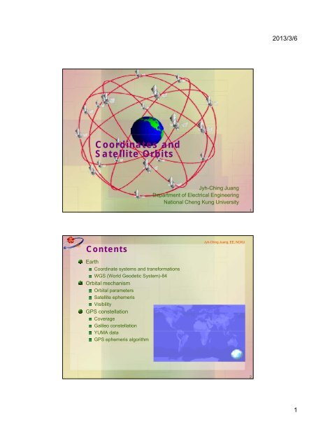
Coordinates and Satellite Orbits
Coordinates and Satellite Orbits
Coordinates and Satellite Orbits

You also want an ePaper? Increase the reach of your titles
YUMPU automatically turns print PDFs into web optimized ePapers that Google loves.
2013/3/6Latitude <strong>and</strong> LongitudeJyh-Ching Juang, EE, NCKUA position on the surface of the Earth is expressed in terms oflatitude <strong>and</strong> longitude.Latitude is expressed as being either north or south of theequatorLongitude as either east or west of the prime meridian.Longitude <strong>and</strong> latitude are measured in terms ofdegree:minute:second North polePi Prime meridianTo vernal equinox equator3Jyh-Ching Juang, EE, NCKUEarth Coordinate SystemsEarth-Centered Inertial (ECI) coordinate system.Origin: geocenterx-axis: points toward vernal equinoxz-axis: aligns with the Earth’s spinaxisy-axis: completes a right-h<strong>and</strong>ed systemEarth-Centered Earth-Fixed (ECEF) coordinate system.Origin: geocenterz-axis: along the polar axisx-axis: through the Greenwich meridiany-axis: through 90-deg east longitudeRelationship between ECI <strong>and</strong> ECEF systemsThe ECI coordinate system is related to the ECEF coordinate systemby the Earth rate <strong>and</strong> the time of the year.[ e ] [ i ]r R ( 3 ) r42
2013/3/6HeightEllipsoid height h:Geoidal height N:Orthometric height H:h = H + NJyh-Ching Juang, EE, NCKUTopographyDatum: refers to a direction, level,or position from which angles,heights, depths, speeds, ordistances are conventionallymeasured.H hNReference ellipsoidJyh-Ching Juang, EE, NCKUGeiod: equipotential surface that best equates to mean sea levelgravitational acceleration is uniform9TransformationThe position can be characterized in terms of Cartesiancoordinates (x, y, z) or spherical coordinates (,,h)From (,,h) to (x, y, z)x ( N h)coscos z[ e]r y( N h)cossin 2z ( N(1 e ) h)sin2 2a a bN <strong>and</strong> e 2 221e sin aFrom(x,y,z)to(,,h)(,,h)An iterative processClosed-form solutionhPyx105
2013/3/6Topocentric <strong>Coordinates</strong>Jyh-Ching Juang, EE, NCKUThe topocentric local tangent coordinate system is typicallyeither east-north-up (ENU) system or north-east-down (NED)system.The origin is at the location of the observer (topocentric).The reference plane is a local-level frame with its (n 1 , n 2 ) axes ina plane tangent to the reference ellipsoid <strong>and</strong> the n 3 axisperpendicular to that ellipsoid.In the ENU system, the n 1 -axis points to the east (E), the n 2 -axisnorth (N), <strong>and</strong> the n 3 -axis up (U).zThe observation <strong>and</strong> tracking ofthe satellite from the groundNUtracking station is generallyEh Pmade in the topocentriccoordinate system.yx11Coordinate TransformsJyh-Ching Juang, EE, NCKUThe transformation from the ECEF frame to the navigation ENUframe is given by sincos0 n' ' ' 'C eR 3 ( /2) R 2 ( /2 ) R3( )cos sin sin sin cos' ' 'coscos sin cos sinThe transformation matrix from the ECI frame to the ENU frameis thusC R ( /2 ) R ( /2 ' ) R ( )ni3 2 3e3,i3r'n 2n 3n 1e 2i 1i 2e 1126
2013/3/6Observation of <strong>Satellite</strong>sJyh-Ching Juang, EE, NCKUThe azimuth <strong>and</strong> elevation of an orbiting satellite is a function oftime.The elevation <strong>and</strong> slant range are related by the followingformula2 2 2d ( aE h) aE(sin 1) aEsinwherea E: radius of the Earthh : altitude of the satellited: slant range: elevationRd a EOShP13WGS-84Jyh-Ching Juang, EE, NCKUThe World Geodetic System WGS 84 represents the best globalgeodetic reference system for the Earth available at this time forpractical applications of mapping, charting, geo-positioning, <strong>and</strong>navigation.The WGS 84 is defined <strong>and</strong> maintained by NIMA (NationalImagery <strong>and</strong> Mapping Agency).WGS 84 coordinate system Origin: Earth's center of massz-axis: direction of the IERS (International Earth Rotation Service)reference Pole.x-axis: intersection of the IERS reference meridian <strong>and</strong> the planepassing through the origin <strong>and</strong> normal to the z-axis.y-axis: completes a right-h<strong>and</strong>ed, Earth-centered Earth-Fixed(ECEF) orthogonal coordinate system.147
2013/3/6WGS-84 ParametersJyh-Ching Juang, EE, NCKUDefining parametersSemimajor axis of ellipsoid, a = 6378137 m.Geometric flattening, f = 1/298.257223563Earth's geocentric gravitational constant, =GM= 3986004.418418×10 8 m 3 /sec 2Angular velocity of the Earth, = 7292115 ×10 -11 rad/secDerived geometric <strong>and</strong> physical constantsZonal harmonic coefficient of second degreeSemiminor axis, b = 6356752.3142 m.Square of major eccentricity,Normal gravitySpeed of light, c = 299792458 m/sec.15Orbital MechanismJyh-Ching Juang, EE, NCKUOrbital mechanics is concerned with the motion of natural orman-made celestial bodies under the influence of gravity <strong>and</strong> isgoverned by Newton's laws.Why do we have to know the GNSS orbits?An GNSS orbital error directly affect the positional error.GNSS orbital information can be obtained by either processing theGNSS broadcast message or from control/monitoring centers.Needs of satellite orbital informationPlanning the use of GNSS, satellite selectionSignal acquisitionGNSS broadcast information processingPoint position computation improvement168
2013/3/6Kepler’s LawJyh-Ching Juang, EE, NCKU1. The orbit of each planet is an ellipse with the sun at one of the foci.2. Each planet revolves so that the line joining it to the sun sweepsout equal areas in equal lengths of time regardless of the positionof the position of the planet in its orbit.3. The squares of the periods of any two planets are in the sameproportion as the cubes of their mean distances from the sun.3a 2bT periapsis(perigee)apoapsis(apogee)r ar paSemimajor axis17Newton’s LawJyh-Ching Juang, EE, NCKUAssume that two point masses M <strong>and</strong> m are separated by thedistance r. Applying Newtonian mechanics to the two-body systemyields the equation that governs the motion of m relative to M2( )dr r 0r r 02 3rdt r2d G M mdt2 3r : vector from M to mr r : distanceG: universal gravitational constant GM ( m)GMFor the two-body system, the following properties are valid.The center of mass of the two-body system is unaccelerated <strong>and</strong> thusmay serve as the origin of an inertial reference frame.The energy is conserved.The angular momentum of the system is constant; as a result, themotion is in a plane normal to the angular momentum vector.The masses M <strong>and</strong> m follow paths that are conic sections with theircenter of mass as one focus; thus, the possible orbits are a circle, anellipse, a parabola, or a hyperbola.189
2013/3/6ConservationJyh-Ching Juang, EE, NCKUBoth the energy <strong>and</strong> angular momentum are conserved.Position vector : r re2dv Velocity vector :v r re reEnergy dt2 r Inner product: vr rvv rr03 3 r rKinetic energy Potential energyAngular momentum h r vvr19Conic SectionsThe trajectory of m with respect to M, when written in polarcoordinates, is a conic section. d Jyh-Ching Juang, EE, NCKU Cross product: hr r h v r 0 b h v r is constant3r dtr r 2rbr( hv) rr brcosh rrA conic section in polar coordinates with its primary focus at M2can be described byhp : parameter or semilatur rectumpr 1 ecosbe : eccentricityThe polar equation governsthe motion of elliptic (e < 1),parabolic (e=1), <strong>and</strong> : true anomalyhyperbolic (e >1) trajectories.2 2a b p pr2 arpe , r , , (1 ), 2 prap a e ea 1e 1e r rap2010
2013/3/6AnomaliesJyh-Ching Juang, EE, NCKUThe true anomaly is the angle between the major axis <strong>and</strong> thevector from M <strong>and</strong> m.The eccentric anomaly E is the angle between the major axis <strong>and</strong>the vector from the center of the ellipse to the point P which isestablished by intersecting the line from the point m that isperpendicular to the major axis <strong>and</strong> the circle of radius a.The mean anomaly M is the average orbital angular positionLet t 0 be the epoch of perigee passage, the mean anomaly at epoch tisM = n (t-t 0 )Pmean angular velocity(mean motion)tperigee2n E 3T a 1e Etan( ) tan( )2 1e 2t 02cos 1sincos E e , sine E1ecos E 1ecosE21Motion in Elliptic <strong>Orbits</strong>Kepler’s equation: E esinE MJyh-Ching Juang, EE, NCKUWhen both the mean anomaly <strong>and</strong> eccentricity are known, theeccentric anomaly <strong>and</strong> the position in the elliptic orbit can bedetermined.Define the perifocal (Keplerian) coordinate system as follows.The origin of the coordinate is at the center of the Earth.The p 1 axis points toward the periapsis of the orbitThe p 2 axis is in the plane of motion advanced /2 from thep 1 axis in the direction of motionThe p 3 axis is normal to the orbit plane <strong>and</strong> completes aright-h<strong>and</strong>ed system.The inertial position vector in thep 2perifocal coordinate system is cos Ee cos[ ] 2 1 sin sinpr a e E r 0 0 p 12211
2013/3/6Jyh-Ching Juang, EE, NCKUKeplerian Orbital ParametersThe orbital elements can be categorized into two groups:One corresponds to the ellipse on the orbital plane <strong>and</strong> anotherdetermines the orientation of the orbital plane.The first three elements specify the size <strong>and</strong> shape of the orbit <strong>and</strong>the time of latest perigee passage.The last three provides information on the coordinatetransformation.The six Keplerian orbital parameters area (semimajor axis of orbital ellipse): half length of the orbital ellipse.e (orbital eccentricity of ellipse): the apogee radius minus theperigee radius divided by their sum. e specifies the elongation ofthe orbital conic section.t 0 (latest epoch of perigee passage): the time at which the satellitepasses its perigee. This element can sometimes by equivalentlycharacterized by the mean anomaly M or the true anomaly . (argument of perigee): the angle between the ascending node<strong>and</strong> the perigee of the orbit measured in the orbital plane. Theargument is positive with increasing mean anomaly.i (inclination of orbital plane): the angle between the equatorialplane of the central body (Earth) <strong>and</strong> the satellite's orbital plane. (right ascension of the ascending node): the ascending nodalcrossing point measured in the equatorial plane from the vernalequinox to the nodal crossing point.23Jyh-Ching Juang, EE, NCKUKeplerian Orbital ParametersZEquatorial planeperigeegeocenterVernal equinox iAscending nodeGreenwich2412
2013/3/6ECEF PositionJyh-Ching Juang, EE, NCKULet u=+, the position of the satellite in the ECI frame isrelated to the position in the perifocal coordinate system viacosucos sin ucos isin[] i[ p]r R 3( ) R1( i) R3( ) r r cosusinsinucosicossin usini The ECEF position can likely be obtained.25Jyh-Ching Juang, EE, NCKUGPS <strong>Satellite</strong> ConstellationSemimajor axis 26560 km (12 sidereal hour)Inclination: 55 0Eccentricity: near 0 (at most 0.02)6 orbit planesNominally 60 0 apart4 or 5 satellites per plane<strong>Satellite</strong> phasing optimized for coverageNot equally spaced, some areas emphasizedReference 24 satellite constellationActual constellationMore than 30 satellitesConstellation illustration2613
2013/3/6Jyh-Ching Juang, EE, NCKUGPS <strong>Satellite</strong> Orbit ParametersConstellation plane Semimajor axis (km) eccentricity Inclination (deg) Argument of perigee (deg) Mean anomaly (deg) RAAN (deg)A1 26559.8 0 55 0 -91.874 -87.153A2 26559.8 0 55 0 161.786 -87.153A3 26559.8 0 55 0 11.676 -87.153A4 26559.8 0 55 0 41.806 -87.153B1 26559.8 0 55 0 80.956 -27.153B2 26559.8 0 55 0 173.336 -27.153B3 26559.8 0 55 0 -155.624 -27.153B4 26559.8 0 55 0 -50.024 -27.153C1 26559.8 0 55 0 111.876 32.847C2 26559.8 0 55 0 11.796 32.847C3 26559.8 0 55 0 -20.334 32.847C4 26559.8 0 55 0 -118.444 32.847D1 26559.8 0 55 0 135.226 92.847D2 26559.8 0 55 0 -94.554 92.847D3 26559.8 0 55 0 35.156 92.847D4 26559.8 0 55 0 167.356 92.847E1 26559.8 0 55 0 -162.954 152.847E2 26559.8 0 55 0 -57.404 152.847E3 26559.8 0 55 0 66.066 152.847E4 26559.8 0 55 0 -26.314 152.847F1 26559.8 0 55 0 -121.114 -147.153F2 26559.8 0 55 0 -14.774 -147.153F3 26559.8 0 55 0 105.206 -147.153F4 26559.8 0 55 0 135.346 -147.15327GPS TimeJyh-Ching Juang, EE, NCKUGPS timeEach Block II/IIA satellite contains two cesium (Cs) <strong>and</strong> two rubidium (Rb)atomic clocks. Each Block IIR satellite contains three Rb atomic clocks.GPS time is given by its composite clock which is the atomic time scaleimplemented by the atomic clocks in the GPS ground control stations ti <strong>and</strong> theGPS satellites themselves.The GPS epoch is 0000 UT (midnight) on January 6, 1980. GPS time is notadjusted <strong>and</strong> therefore is offset from UTC by an integer number of seconds,due to the insertion of leap seconds.As of January 1, 2006, GPS time is ahead of UTC by fourteen (14) seconds.In addition to the leap seconds, there are additional corrections given in theNAV message.UTC, Coordinated Universal Time, popularly known as GMT (GreenwichMean Time), or Zulu time. Local time differs from UTC by the number ofhours of timezone.TAI, Temps Atomique International, is the international atomic time scalebased on a continuous counting of the SI second. TAI is currently aheadof UTC by 33 seconds.2814
2013/3/6GPS Clock CorrectionJyh-Ching Juang, EE, NCKUGPS clock parametersClock reference time t ocClock bias coefficient a f0Clock drift coefficient a f1Clock frequency drift coefficient a f2User algorithm for satellite clock correctionGPS system timet t tThe code phase offset is given bysvsv<strong>Satellite</strong> code phase time offsetEffective satellite code phase time at message transmission timet a a ( t t ) a ( t t ) t2sv f 0 f 1 oc f 2 oc rIn the above, the relativistic correction term is2 2 Ttr e asinEk r v2cc29GPS WeekGPS Week Number: countbegan at midnight on theevening of 05 January 1980 /morning of 06 January 1980.Since that time, the count hasbeen incremented by 1 eachweek, <strong>and</strong> broadcast as part ofthe GPS message.The GPS Week Number field ismodulo 1024.Week beginningat 0000 GPStime on06 Jan., 1980 0::15 Aug., 1999 1023Jyh-Ching Juang, EE, NCKUGPS weeknumber::22 Aug., 1999 0 (1024)::::3 Mar., 2013 706 (1730)3015
2013/3/6Matlab ExercisesJyh-Ching Juang, EE, NCKUGPS satellite constellationVisible satellitesSky plotCoordinate transformTool used: matlab <strong>and</strong> GPS satellite navigation toolboxGPS, Galileo, <strong>and</strong> Geo (WAAS, EGNOS) simulation <strong>and</strong>analysis toolboxPseudo-range <strong>and</strong> carrier-phase measurementgenerationError source emulation (multipath, th noise, troposphere,ionosphere)St<strong>and</strong>-alone positioning, DGPS, differential carrier-phaseReal data processing through RINEX support31SkyplotJyh-Ching Juang, EE, NCKUA representative skyplot with respect to GPS satellites3216
2013/3/6Jyh-Ching Juang, EE, NCKUGPS/Galileo <strong>Satellite</strong> VisibilityVisible satellites33Galileo ConstellationJyh-Ching Juang, EE, NCKUWalker 27/3/1 + 3 spare satellitesWalker T/P/FT: total number of satellitesP: number of orbit planesF: phasing or mean anomaly difference satellites in adjacent planeOrbit: 10 day/17 orbits repeat cycleOrbital period: approximately 14 hourOrbit parametersSemimajor axis 29600.318 kmEccentricity: near 0, bounded by 0.002Inclination: 560 3417
2013/3/6GPS Orbit PerturbationJyh-Ching Juang, EE, NCKUPerturbationMaximumperturbation (g)Dominantperturbationperiod (hour)Earth attraction 5 x 10 -2 12 _2nd zonal harmonic 5 x 10 -6 Secular + 6 1000Lunar gravity 5 x 10 -7 Secular + 12 130Solar gravity 3 x 10 -7 Secular + 12 654th zonal harmonic 1 x 10 -8 3 2Solar radiation 1 x 10 -8 Secular + 3 2pressureGravity anomalies 1 x 10 -9 various 0.2others 1 x 10 -9 various 0.2Maximalexcursion growth(ft) in one hourThe 2nd zonal harmonic coefficient induces secular motions of the right ascensionof the ascending node <strong>and</strong> the argument of perigee of an orbit. As a result,the orbit regresses each revolution <strong>and</strong> is no longer a closed ellipse.37GPS Orbit ParametersJyh-Ching Juang, EE, NCKUGPS orbit parameters (16 parameters in total)Keplerian parametersEphemeris reference time t oeSquare root of the semi-major axis a 1/2Eccentricity eInclination at the reference time i 0Longitude of the ascending node at the beginning of the GPS week 0Argument of perigee Mean anomaly at the reference time M 0CorrectionsCorrection to the computed mean motion nRate of change of inclination with time di/dtRate of change of right ascension of the ascending node with timed/dtAmplitudes of harmonic correction terms for the computed argument oflatitude C uc <strong>and</strong> C usAmplitudes of harmonic correction terms for the computed orbit radiusC rc <strong>and</strong> C rsAmplitudes of harmonic correction terms for the computed inclinationC ic <strong>and</strong> C is3819
2013/3/6Jyh-Ching Juang, EE, NCKUGPS Ephemeris AlgorithmThe ephemeris algorithm is to determine the position of the satellite.Time since ephemeris reference time (<strong>and</strong> correction for end-of-week)tk t - toetk 604800, if tk 302400Semimajor axist , if 302400 302400ktk tk1/2a= a 2t k 604800, elsewhereMean motion <strong>and</strong> corrected mean motionn 0n n a 30nMean anomalyMkM0ntkEccentric anomaly (by solving the Kepler’s equation)M k E k e sinEkTrue anomaly cos E - kecossinEk1-ecosE 2 ksink1 ek1- e cos EArgument of latitude (in the orbital plane) kkk39Jyh-Ching Juang, EE, NCKUGPS Ephemeris AlgorithmThe ephemeris algorithm is to determine the position of the satellite.Corrected argument of latitudeu C cos(2 ) Csin(2 )Corrected radiusk k uc k us krk a(1ecos Ek) Crccos(2 k) Crssin(2 k)Corrected inclinationdiik i0 Ciccos(2 k) Cissin(2 k) tkdtCorrected longitude of ascending node 0 ttPosition in the orbital planek earth k earth oe' x cosuk k r' k y sinukk Position in ECEF frame''x kxkcos kyk cosik sink ' 'yk xk sinkykcosik cos k'z k yk sinik4020
2013/3/6GPS AlmanacJyh-Ching Juang, EE, NCKUAlmanac data: satellite orbit data to facilitate satellite search <strong>and</strong>planning.GPS almanac: broadcast in navigation message for the wholeconstellation<strong>Satellite</strong> PRN<strong>Satellite</strong> health statusCurrent GPS weekReference epochSquare root of semimajor axisEccentricityMean anomaly at reference epochArgument of perigeeOffset in inclinationLongitude of the node at weekly epochRate of the node’s right ascensionClock phase biasClock frequency biasAlmanac algorithm: a simplified ephemeris algorithm4121