Download file - Victoria County History
Download file - Victoria County History
Download file - Victoria County History

You also want an ePaper? Increase the reach of your titles
YUMPU automatically turns print PDFs into web optimized ePapers that Google loves.
Basingstoke before RedevelopmentBob ApplinIntroductionThe <strong>Victoria</strong> <strong>County</strong> <strong>History</strong> project chose the Basingstoke Hundred as the pilot for the revision of itsHampshire volumes originally published in 1911. 1 Basingstoke was chosen because the town itselfunderwent a major planned expansion between 1964 and 1978 under an overspill agreement betweenthe London <strong>County</strong> Council and its successors, Hampshire <strong>County</strong> Council and Basingstoke BoroughCouncil. 2 The population grew from about 28,000 in 1964 to about 78,000 in 1978 and continued bynatural expansion to around 100,000 in 2013. The surrounding villages were caught up in thisexpansion and many have grown considerably as commuter dormitory areas.The planned expansion involved the large-scale demolition of the northern part of the centralshopping area, much of the surrounding low quality mid-<strong>Victoria</strong>n workers’ housing and severalsubstantial industrial/commercial premises.The town changed from a small market town with four engineering works and a pharmaceuticalcompany, between them employing about a third of the working population, to a diversified industrialtown with mainly ‘blue collar’ employment but also with a large element of office work. Many of theemployers who moved from London have since either gone to other parts of the country or shut down.Their place was taken by communication, finance and service industries and many smaller high-techfirms in the IT industry. Several international companies have established their head offices in thetown. In 2013 the town had a thriving and diversified employment pro<strong>file</strong>. The town and itssurrounding villages also housed a large commuter community that took advantage of the excellenttransport routes to other centres of employment.This essay is my recollection of what the central area of the town was like physically before most of itwas cleared for redevelopment; written fifty years after the event, it is necessarily subjective. I was inmy mid 20s when demolition started; I was not sorry to see a lot of the buildings go and I am still ofthat opinion.Basingstoke evolved from a pre-Conquest royal manor, through being a chartered borough ofimportance to the Wessex woollen industry to an industrialised modern borough. To put this intocontext I have included a broad-brush outline of the town’s history to set the scene for Basingstokeimmediately before the trauma of the redevelopment programme. I have made no attempt to discussthe social or political aspects of life in 1960s Basingstoke.Because of its nodal position on the transport routes to the south and west (M3& A303 and therailway), and its proximity to London, Basingstoke would have expanded rapidly naturally, as it hasin the post-development years. Who knows what the town would have looked like? What is certain isthat there would have been considerable redevelopment of the shopping area utilising the derelict landthat had been the gardens of the properties fronting Church St and Wote St and the canal wharf area.1 William Page (Ed) The <strong>Victoria</strong> <strong>History</strong> of Hampshire and the Isle of Wight, Constable & Co,19112 Basingstoke – Town Development – description of the scheme, Basingstoke Town Development Committee,19621
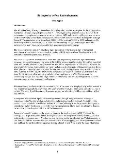
Two north-south routes converged on the town and met the Great Western Road in Basingstoke’sMarket Square. These were the road from Oxford via Newbury and the road from Reading. South ofthe town the roads went via Alton to Chichester and to Alresford and onwards to Portsmouth.In addition to this geographically nodal position Basingstoke was also a day’s travelling distance fromthe nearest other larger settlements. Winchester, Reading, Newbury and Andover are all about a day’stravel away on foot or horseback, so there was a need for overnight accommodation for travellers. Anumber of old-established inns became important in the coaching era, for example The Angel, TheFeathers and The Crown.There were several major fires in the town in the 14th and 15th centuries 9 so there are very fewrecords of the town that give a picture of the town and its industry until the 16th century when it hadbecome one of the centres of the Wessex woollen cloth industry. 10 In the 16th century Basingstokewas recorded as the fifth largest town in Hampshire 11 and there are records of several wealthy familiesinvolved in the cloth industry. 12 Another fire in 1656 destroyed many more records when the TownHall was burnt to the ground.As the production of broadcloth moved westward into Somerset and the surrounding areasBasingstoke became a centre for the production of coarser woollen fabrics known as druggetts andshalloons, but even this industry had died out by the early 17th century. 13 A manufacturer of horseblankets is recorded in the late 18 th century. 14 A short-lived attempt to introduce silk production wasunsuccessful. Within living memory the Rectory garden, now Glebe Gardens, near a building knownas the Silk Mill (demolished during the redevelopment), contained a large mulberry tree. 15During the 18th century malting became a major industry, in both the town and the surrounding area,with the product being supplied to London brewers as well as being used locally. In1758 Thomas Mayestablished a brewery in Brook St that was to become a more than local supplier, having 81 tiedhouses, from Sandhurst in the east to Winchester in the south, when it was sold to Simonds ofReading in 1948. 169 Baigent FW & Millard JE, A <strong>History</strong> of the Ancient Town and Manor of Basingstoke, CJ Jacob, 1889,75,78,172, 685.10 Jonathan Brown, Market Towns and Downland in Hampshire 1780-1914, Southern <strong>History</strong>, 28, 2006, 74-93.This article has a good account of why Basingstoke and some other Hampshire towns prospered atthe expense of other nearby towns.11 John Hare, Church-Building and Urban Prosperity on the Eve of the Reformation, Hampshire Studies, 62,2007, 181-192.12 For example HRO, 1554B/34 – William South.13 Daniel Defoe, A Tour Through the Whole Island of Great Britain, 1724-6, edited by P. N. Furbank, W. R.Owens and A. J. Coulson (Folio Society, London, 2006), 88.14 The Universal British Directory (1792).15 Personal Communication – Debbie Reavell, 2012.16 Keith Osborne, Hampshire Hogsheads, Vol 1 – North Hampshire, Hampshire Hogsheads, 1996, 36-37.4
Figure 3 May’s Brewery© Robert BrownWith the establishment of the Post coaching system in the latter half of the 18th century, using theimproved roads produced by turnpiking, Basingstoke became an important staging point on the routesto the south and west. By the 1830s up to 37 coaches a day changed horses at seven inns in the town. 17This gave employment to a large supporting workforce to feed and accommodate the travellers andservice the horses needed for the stage change. In addition a large number of agricultural workerswere needed to supply the fodder etc for the ‘local’ horses. The coaching employment came to anabrupt end with the arrival of the railway in 1839 and its completion as a through route toSouthampton in 1840; only one coach a day went to London in 1841. This had a major effect on thetown; its population growth for the next 20 years was well below the national average. 18In 1794 a canal was opened from the Wey Navigation (linked to the Thames) to Basingstoke; for awhile it was moderately profitable but never paid a dividend. It also was affected by the railway andthe section from Basingstoke to the Greywell tunnel was finally abandoned in 1910. 19 The extensivewharf area was used as a timber yard for many years and finally used as the local bus depot.However, it was not all bad news. In the 1850s the ‘industrialisation’ of the town began. A branch ofthe Wallis family of corn merchants, earlier, had moved from Reading and had established adiversified business at the canal wharf as bargemasters and dealers in the goods transported; they alsoran a foundry on the site. 2017 Derek Spruce, Basingstoke 1780-1860. Aspects of the Development of North Hampshire Market Town. MScDissertation, 1977. Copy in Reference Section of Basingstoke Discovery Centre (Basingstoke Library).18 Eric Stokes, The Making of Basingstoke, Basingstoke Archaeological & Historical Society, 2008, 122-3.19 P.A.L. Vine, London’s Lost Route To Basingstoke, Alan Sutton Publishing Ltd, 1994, xiv.20 R. A. Whitehead, Wallis & Steevens A <strong>History</strong>, The Road Locomotive Society, 1983, 9.5
One of the sons, Arthur, was apprenticed as an engineer in the north of England and returned to takethe place of an older brother (who had died) in an ironmonger’s business that also had a foundry. 21 Inthe mid 1850s Arthur Wallis, with partner Charles Haslam, established the North Hants Ironworks atthe bottom of the hill to the rail station (which became Station Hill) at what was then the outskirts ofthe town, to supply cast iron agricultural products. 22 This business expanded over the years, first byacting as agents for farm equipment and then manufacturing their own and branching out into themanufacture of steam engines and road rollers. At the height of their output in 1914 they employednearly 400 staff. The buildings of the North Hants Ironworks were demolished during the townredevelopment and Crown Heights now occupies (approximately) the site. The company ceasedtrading in 1972. 23A second agricultural engineer, Henry Smith, came from the Midlands in the 1860s and established aflourishing business as agent for the major agricultural equipment manufacturers. His son Fredexpanded the business further and by the time of town redevelopment, what had become Fred SmithLtd had an Austin Morris car dealership as well as the agricultural engineering and supply business.The combined businesses occupied most of the block of premises on the west side of Station Hill, thesouth side of Junction Rd and the east side of Chapel St.A second Smith family (no relation) established a corn and seed merchants business that expandedinto milling and they established a steam mill in an old chalk pit in Reading Rd, appropriately namedSteam Dell. This four storey building existed as a furniture repository until town redevelopment.Trade directories of the period show that while there were long established family retail businessestrading in the town there was a large turn over of businesses that only lasted a few years. Amongincomers who were successful were Alfred Milward from Henley-on-Thames in 1857 and ThomasBurberry from near Dorking in 1856.Alfred Milward from humble beginnings with a hand cart going from door to door selling boots hehad bought from wholesalers, grew his business into a major shoe shop chain that was sold to Clarksin 1994. 2421 Whitehead, 10.22 Whitehead, 10.23 Whitehead, 44.24 Anon, The Milward Story, Milward Co, c1957.6
Figure 4 Station Hill looking towards the Station, 1964© Hants Library & Information ServiceThomas Burberry came to the town and purchased the drapery business of Thomas Loader in 1856.This was the start of the tailoring business that evolved into the internationally renowned qualitygoods manufacturer and retailer of today. He also established a household goods store. As hisbusinesses expanded, Thomas sold off various parts of his tailoring business: the ready-made side toGerrish, Ames and Simpkins in 1878 , the bespoke general tailoring factory to John Mares in 1894and ‘The Emporium’, his departmental store, to Edgar Lanham in 1922. All of these purchasers(except Simpkins) were ex-employees. It is not known if Burberry retained any shareholding in thebusinesses that he sold off. The tailoring businesses, along with his own factory for manufacture ofhigh class bespoke tailoring, were major employers of female labour in the town. The connection withBasingstoke ended with the cessation of tailoring in the Basingstoke factory in 1957.Although the depression caused by the loss of the coaching trade caused the population of the town togrow at a much lower rate than the national average between 1841 and 1861, 25 there was some growthand the town began to expand with housing for the workers coming into the town, many of whomworked on the railways.The area between Basing Rd, Reading Rd and Gashouse Rd was filled with ‘two up two down’houses that opened directly onto the street. Similar houses had been built in Bunnian Place, and laterto the south of the Market Square off Southern Rd (Cambridge, Oxford Terraces and Caston’s andJubilee Rds.) and in Flaxfield Rd. In the 1880s the Newtown area (later known as May St) wasdeveloped with a better quality of workers’ housing; this was also largely occupied by railwayworkers.25 Census 1841,1851, 1861.7
© Hants Library & Information ServiceFigure 5 Bunnian Place looking north to railway, 1964With the exception of those in Flaxfield Rd and Jubilee Rd these low quality houses were alldemolished during town redevelopment. A better standard of house was being built from the 1870s onland north of the railway and also from the mid 1880s onwards to the west of the town on Worting Rdand the Essex Rd area. Similar properties were also built south of the town in the Fairfields area withmore substantial ‘gentlemen’s residences’ in Chequers Rd, Cliddesden Rd, parts of Fairfields andWinchester Rd. Many of these still exist, some as offices and dental surgeries, but a number havebeen replaced by blocks of flats.8
Figure 6 May Street looking east c. 1966© Robert BrownIn 1898 J. I. Thornycroft Ltd (a steam-ship builder at Chiswick and at Woolston on the Itchen)established a factory on the West Ham estate west of Deep Lane to manufacture steam-driven lorries.The business expanded rapidly to include motor vehicles and quickly became the dominant employerin the town, employing 200 by 1904. 26 They produced motor cars until 1913, but ceased thisproduction to concentrate on building motor lorries; the manufacture of steam lorries was phased outby 1911. 27 The company was a major contributor to the war effort in both world wars. At the height ofproduction during World War Two the factory employed about 2,500 workers, of whom at least 500were women. After several amalgamations, which culminated in the Basingstoke factory becomingpart of British Leyland, the factory was sold in 1972 to the American Eaton Corporation whichmanufactured gear boxes for commercial vehicles. The site closed in 1982.The growing importance of Basingstoke’s position in the national railway network was emphasisedwhen the London & South Western Railway was expanded from two to four tracks as far as theBattledown junction west of Worting and a major expansion of the goods yards and a rebuild of thestation were made in 1900-01.Expansion of the town continued in the late 19th and early 20th centuries when housing of variousstandards was built in Worting Rd, Queen’s Rd, Alexandra Rd, George St, the west end of LowerBrook St and off the Reading Rd north of the railway to house the growing population which wasabout 9,800 by 1911. 28 In 1914 the first Council houses were built – a crescent of 14 houses inCranbourne Lane, then at the edge of the town, off Winchester Rd and now demolished.26 Eric Stokes, The Making of Basingstoke, Basingstoke Archaeological & Historical Society, 2008, 23.27 AlanTownsin, Thornycroft, Ian Allen Publishing Ltd, 2001, 14.28 1911 census.9
© Crown copyright 1912Figure 7 6" Ordnance Survey map of Basingstoke, 1912By the later 19th century the shopping area had expanded to the lower parts of Wote St, Church Stand the area around the Wallis and Steevens factory. The Basingstoke Co-operative Society had beenformed in 1892 with premises in Brook St and later in Essex Rd outside the main shopping areas. 29A leather goods factory, Percy Fisher, moved to premises north of the railway in 1914.The town’s infra-structure was significantly improved by the provision of an adequate and pure watersupply after a Typhoid epidemic in 1906 caused by sewage contamination of the existing well at theSteam Dell. (This was after years of the Town Council ignoring the medical officer’s warnings of thepoor quality of the water supply and prevarication about the cost to the rates of providing a source ofsupply.) 30 In 1914 electricity was installed. A 110 volt generating station was built in Brook St. Aprevious attempt to introduce a supply in 1910 had been defeated by councillors’ concerns about thecost to the rates of the loan needed. 31This brief summary of the development of the town up to1914 sets the scene for the post World WarOne progress of the town which grew to have a population of about 28,000 at the start of the LondonOverspill Agreement in 1964. 3229 Barbara Applin, The Co-op and Basingstoke, Basingstoke Archaeological & Historical Society, 2012, 14.30 Dr Webb, Medical Officer’s Annual Reports to Basingstoke Borough Council, 1891-1905, HRO,148M71/1/5/32/15.31 Eric Stokes, The Making of Basingstoke, Basingstoke Archaeological & Historical Society, 2008, 131-3.10
The 20th Century© Crown copyright 1938Figure 8 6" Ordnance Survey map of central Basingstoke, 1938The road pattern of the core of the town had remained unchanged from at least the 16th century andby the 1960s had become totally inadequate for the traffic it had to carry (a bypass to divert the A30south of the town had been opened in 1932 as part of the national work creation scheme during theDepression of the 1920s and 1930s).Before World War One, national grocery and butchery chains began to move into the main shoppingarea of Winchester St and London St, displacing the family-owned businesses. As the 20th centuryprogressed more national chains, such as Timothy Whites (hardware and pharmacy), Woolworth,Boots, Currys, took over more of the shops in Winchester St and London St. There was somerebuilding, for example, Marks and Spencer, Burton and Lloyds Bank, but mainly the existingbuilding were modified and expanded onto land at the rear of the properties. By 1939 these two streetsand the Market Square area were dominated by the national companies and banks; although therewere some local businesses, at a guess about 20 per cent were local, including the Lanhamdepartmental store that had been established by Burberry as his ‘Emporium’.In addition to the streets already mentioned, shops and commercial enterprises occupied most ofChurch St, Wote St, Potters Lane, New St, Cross St, Brook St and Station Hill; most of the shops32 Eric Stokes, 122-3.11
were independent traders. The Basingstoke Cooperative Society had gradually taken over severalshops on the west side of New St. 33Figure 9 London Street c. 1950© Hants Library & Information Service33 Barbara Applin, 43.12
© Robert BrownFigure 10 Winchester Street c. 1958© Hants Library & Information ServiceFigure 11 Lower Wote Street looking towards Station Hill, 196413
Figure 12 Wote Street, 1964© Derek WrenIn addition to the shops there were numerous public houses – one on most corners and then more inbetween in the central area. In the older parts of the residential areas there were numerous ‘cornershops’ (usually literally) which were mainly food shops including bakers and greengrocers, although arange of other businesses were also operating: hairdressers (male and female), newspapers, usuallycombined with tobacconist and confectionery, and shoe repairers. The vast majority of these premiseswere compulsorily purchased and demolished in the 1960s for the comprehensive development of thecentral area.Figure 13 Lower Church Street, 1964© Derek Wren14
In the interwar years, although Basingstoke did not escape the effects of the 1920 and 1930sDepression (for example, there were layoffs at Thornycroft), the town continued to grow naturallywith council housing being built at Kingsclere Rd, Grove Rd and South Ham, private development atEastrop and Deep Lane, and ribbon development along Winchester Rd and Worting Rd. Smallerscale, but still significant development was also happening in the three nearby ‘dormitory’ villages,Old Basing, Worting and Kempshott (all within two to three miles of the town).The Town Council actively promoted the town as a place for industry 34 and succeeded in attractingKelvin, Bottomley & Baird (later Kelvin Hughes, then Smiths Industries) manufacturers of aircraftinstruments and Eli Lilly, pharmaceuticals, to the town by the outbreak of WW2.Basingstoke got off relatively lightly from bombing during World War Two; early in the war ChurchSquare, St Michael’s and the Wesleyan Methodist churches were extensively damaged and in separateraids Solbys Rd, Burgess Rd and Cliddesden Rd were also attacked. In 1944 a V1 aimed atThornycrofts fell harmlessly (not counting the many broken windows) where Milestones Museum isnow.The 1944 Abercrombie report on post-war reconstruction identified Basingstoke as a potential site fordispersal of some of London’s population. This had the effect of putting ‘planning blight’ on thecentral area; owners generally were not willing to invest in rebuilding/improving their properties, sofor the period up to the Town Development scheme the shopping areas remained basically as theywere before World War Two. The exceptions to this statement were the opening in the late 1950s of adepartmental store and supermarket on the west side of New St by the Basingstoke Co-operativeSociety 35 and a major car showroom and garage for Jacksons on the corner of Wote St and Basing Rd.Figure 14 New Street c. 1980© Sid PennyThe Co-op stores became a victim of the central area redevelopment as the main shopping areamoved away from the older area to the new shopping centre. The Co-op stores were demolished in34 Eric Stokes, The Making of Basingstoke, Basingstoke Archaeological & Historical Society, 2008,p140-1.35 Barbara Applin, The Co-op and Basingstoke, Basingstoke Archaeological & Historical Society, 2012, 90.15
1984, to be replaced by an office block. 36 Jacksons remained until demolished in the second phase ofthe town centre redevelopment.Post-war Basingstoke continued to expand, with Council housing being built at South View andfurther development at South Ham. In the early 1950s 400 houses were built at Oakridge by theMinistry of Supply to accommodate some of the workers being recruited to AWRE Aldermaston.Once the post-war building restrictions were lifted, private developers built several estates on theoutskirts of the town: the Clarke Estate at Winklebury, Harroway off Cliddesden Rd, the Berg Estatenorth of Pack Lane at Kempshott and Riverdene east of Eastrop Lane.Lansing Bagnall came to the town in 1948 and from small beginnings became, for a while, the majoremployer. An industrial estate (Bilton) was built on land south of Winchester Rd and a variety ofbusinesses moved there, some local and others from outside the town. Most of these businesses havesince either moved from the town or ceased trading, their place being taken by wholesalers and otherservice-type businesses. By the 1960s employment in the town was dominated by engineering, withabout a third of the working population being employed by four engineering companies mentionedabove. The town was prosperous and unemployment was below the national average. 37This was the situation just prior to the huge upheaval of the redevelopment of the central area and theassociated road works. The town’s population had grown to about 28,000, but the shopping area withthe same kind of shops was basically that which had served a much smaller population pre-war, alsothe war-time Retail Price Maintenance legislation had not long been repealed. This led to acomplacent attitude by some of the shopkeepers (not all, by any means, but a noticeable number) whothought they were doing their customers a favour by serving their needs with a restricted range ofgoods at high prices.With the growth of car ownership the ancient road layout, with everything converging on the MarketSquare in narrow streets, was grossly overloaded, despite efforts at alleviation in the form of one-waysystems and a sort of inner ring road using residential streets.To sum up, these are the recollections and impressions of someone who was in his mid 20s whenTown Development started and who was an enthusiastic supporter of the concept. This was the era ofHarold Wilson’s ‘White Heat of Technology’ and most of us of that age wanted change. Basingstokedid not get all that was planned and was let down in several respects by developers and centralgovernment, (because of the national economic problems of the 1970s). But what we have today isprobably better than it would have been had the town continued to expand naturally. What is certain isthat there would have been growth, probably quite rapid, particularly after the electrification of therailway and the building of the M3. There would have been major redevelopment of the town centre,probably from Potters Lane northwards, using the derelict land to the rear of the properties frontingChurch St and Wote St as well as the Wharf area.There were six houses of architectural merit that were demolished that I consider were worth saving ifwas possible; unfortunately they were isolated buildings in the mass of <strong>Victoria</strong>n and later in-fillingand it is difficult to see how they could have been saved. They were: Warren House and the FriendsMeeting House in Wote St, Brook House and Brewery House in Brook St and Queen Anne House andBedford House in Church St. The first four were late 18th century buildings and the two Church Sthouses near St Michael’s Church had been refronted in the 18th century. 38The small market town of folk memory would have disappeared anyway. Malcolm Parker, in theIntroduction to his book of Basingstoke photos, sums this up very well. Basingstoke changedmonumentally, but so did the rest of the country. In the unlikely event that Basingstoke remained36 Barbara Applin, 116.37 Eric Stokes, The Making of Basingstoke, Basingstoke Archaeological & Historical Society, 2008, 188.38 Personal Communication, Bill Fergie, 2013.16
untouched by developers, it is inconceivable that the …… community that existed just after the warwould have remained unchanged. Like a much-loved old coat, the town was worn at the seams, nolonger fitted properly and had simply gone out of fashion. 39Figure 15 Central Basingstoke c. 1950©HCMAS, Photo Barbara Large39 Malcolm Parker, Images of England – Basingstoke, Tempus Publishing Ltd, 2007, 8.17