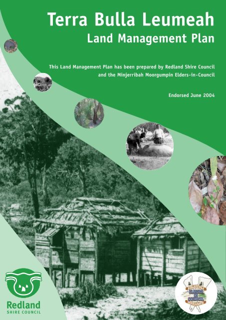
Terra Bulla Leumeah Land Management Plan - Redland City Council
Terra Bulla Leumeah Land Management Plan - Redland City Council
Terra Bulla Leumeah Land Management Plan - Redland City Council

Create successful ePaper yourself
Turn your PDF publications into a flip-book with our unique Google optimized e-Paper software.
Hoyle IRS for a V8 RoadsterprojectClub member, Andrew Wooding, wasseeking the views of fellow memberswho had installed a Hoyle upgrade. Thefeedback was useful.Andrew Wooding said "I own a 1977 MGBRoadster and am planning to convert it to aV8 through 2013. I'm not wanting some firebreathingdragon, just a nicely spec'd B witha bit of go when needed. My briefspecification is as follows: 3.9/40 EFI engine(have access to a low mileage FSH TVR230bhp-270lb/ft unit), an LT77 or R380 'box,RV8 fuel tank, Hoyle front and rearsuspension and all the extras. Is theresomeone local to me within the V8 Registerwho has a car with fitted the Hoyle orexperience of the IRS upgrade that I couldtalk to? I live in Bladon so anyone withinOxfordshire or Berkshire area would begood." This message was posted on the V8Bulletin Board.Victor Smith responded saying we haveGeoff King's article on the V8 website whichdescribes the Hoyle upgrade on his V8Roadster and with the annual MG Show atStoneleigh on Sunday 17th February 2013there will be an opportunity to discuss theinstallation with John Hoyle who usually hasa stand with his upgrades on display. He isa most helpful person and not someone topush a sale but someone who will spendtime with you explaining the essential detailsof his upgrades and how to set them up. Onthat point it's worth reading the RV8NOTEby Angus Munro on setting up a Hoyle IRSon his RV8 – see the links at the foot of thisnote.Angus Munro added that he agreed, “theman to talk to is John Hoyle himself.However, you may feel that John will try to'sell' his product and that you will not get anobjective point of view. Let me take thisopportunity to assure you that John Hoyle isprobably the least pushy salesman I haveever met. I know John well by now and hewill understand that I am teasing him a little.He is however a very good engineer and hiscustomers, of whom I am one, do the sellingfor him. I am abroad at the moment but uponmy return to Britain I will give you a callregarding my experience with the Hoyle IRS,with which I am very pleased.”Angus added that looking at the spec thatAndrew mentioned for his project car, hewould go for the R380 gearbox if you have achoice between the R380 and the L77. TheTVR engine that Andrew has access toproduces a greater BHP than the unit in theRV8 and he should finish up with a very nicecar indeed.Mike Howlett responded saying “my 1969GTV8 conversion has the complete Hoyleset up, front and rear along with hisupgraded disc brakes as well.” He thenprovided detailed feedback on hisexperience saying “first let me reinforcewhat Angus has told you. John Hoyle is aperfect English gentleman and will not try tosell you something you don't want. Hisproduct is good enough to sell itself. He hasbeen extremely kind while I was sorting outhow I wanted my car to be, sending mereplacement springs at no cost to me.My car is a 1969 MGB GT that I have builtup from a £250 wreck. I decided at theoutset to "go the whole hog" and build thecar to be as good as I could make it, so Ispecified the Hoyle suspension from theoutset, way back in 2003. Like you, I alsohave a 3.9 engine, although mine is a lessertune than a TVR as it came from a 1991Range Rover, complete with the hot-wireinjection. To all intents and purposes it isidentical to an RV8 engine, with similarpower outputs. As for the gearbox, I havetried both the LT77 and the R380. Neither isa wonderfully slick unit, and both suffer froma slow change from first to second. If you tryto snap that change it will graunch. In factmy GT has so much torque that I only usefirst gear for hill starts or traffic crawling. Thecar will step away very smartly in secondgear with no need to slip the clutch.The rest of the gears select well enoughbut you could never describe it as a sportinggearbox. I went for the R380 which is adevelopment of the LT77 and has a bit moresophistication, and probably strongercomponents. They do need to be properlyreconditioned after around 100,000 miles,and I bought one from TM Transmissions inBirmingham. You need to specify that youwant one for a 2-wheel drive application.Now the Hoyle suspension. First, it isbeautifully made and I have absolutely noissues with quality since putting the car onthe road over 3 years ago, during which timeit has covered over 13,000 miles. The onlyslight issue has been deterioration of thepowder coating on the rear sub-frame whichhas needed some repainting. I fitted thewhole car up myself and the Hoyle pieceswere not difficult to install, although the rearframe with diff is quite heavy. As youprobably know the front cross-member hasto be modified, but if you can make a basicMIG weld, this is not difficult. The rear framehas to be spaced accurately with largespacer washers so that it sits dead centralunder the car, and two lugs on the framehave to be drilled to allow them to bolt to theattachment points that normally carry theaxle rebound straps. Apparently the positionof these points on an MGB shell is notconstant.What is it like to use?To be honest, in average everyday motoringit is entirely unremarkable. The componentsmake no noise, and there are no untowardV8 Register – MG Car Club 121222 Hoyle upgrades on an MGV8 R2 V8NOTE459 1
<strong>Terra</strong> <strong>Bulla</strong> <strong>Leumeah</strong> <strong>Land</strong> <strong>Management</strong> <strong>Plan</strong>AcknowledgmentsThe Environmental <strong>Management</strong> Group wishes to thank the Minjerribah MoorgumpinElders-in-<strong>Council</strong> for their patience and cooperation in preparing this document.ContributorsThanks are due to the following people who have contributed to this project:Aunty Margaret Iselin (Minjerribah Moorgumpin Elders-in-<strong>Council</strong>)Uncle Pat Iselin (Minjerribah Moorgumpin Elders-in-<strong>Council</strong>)Aunty Faye Campbell (Minjerribah Moorgumpin Elders-in-<strong>Council</strong>)Uncle Cliff Campbell (Minjerribah Moorgumpin Elders-in-<strong>Council</strong>)Uncle Sid Campbell (Minjerribah Moorgumpin Elders-in-<strong>Council</strong>)Emma Hosfield (Environmental Support Officer)Fleur Langford (Advisor Reserve <strong>Management</strong>)Dale Russell (Senior Advisor Natural Area <strong>Management</strong>)Dan Carter (Acting Senior Advisor Natural Area <strong>Management</strong>)Lex Smith (Project Delivery Office Manager)Gary Photinos (Manager, Environmental <strong>Management</strong>)Jonathan Moore (Principal Conservation Officer, North Stradbroke Island)<strong>Council</strong>lor Frank Bradley<strong>Council</strong>lor Craig OgilivieDon Seccombe (Mayor)Adrian Caneris (Biodiversity Assessment and <strong>Management</strong> P/L)Prepared by RSC and Minjerribah Moorgumpin Elders-in-<strong>Council</strong> Page 2 of 34
<strong>Terra</strong> <strong>Bulla</strong> <strong>Leumeah</strong> <strong>Land</strong> <strong>Management</strong> <strong>Plan</strong>1 INTRODUCTION ..................................................................................................................................51.1 CONTEXT......................................................................................................................................51.2 MANAGEMENT INTENT.................................................................................................................51.3 LEGISLATIVE OBLIGATIONS......................................................................................................51.4 PROCESS OF PLAN PREPARATION............................................................................................62.0 RESERVE DESCRIPTION .........................................................................................................62.1 PROPERTY DESCRIPTION ......................................................................................................6MAP 1 TERRA BULLA LEUMEAH .....................................................................................................7MAP 2 TERRA BULLA LEUMEAH .....................................................................................................82.2 ADJOINING PROPERTIES/IMMEDIATE AREA .......................................................................93.0 THE SITE’S VALUES..................................................................................................................93.1.1 PRESERVATION OF BUSHLAND ..............................................................................................93.1.3 CONNECTIVITY.............................................................................................................................93.2 CULTURAL VALUES......................................................................................................................104.0 RESOURCE ASSESSMENT ...........................................................................................................114.1 FLORA................................................................................................................................................114.1.1 DEGRADED AREAS .........................................................................................................................114.2 FAUNA................................................................................................................................................114.2.2 FAUNA ...........................................................................................................................................124.2.3 RECOMMENDATIONS .....................................................................................................................13MAP 3 WEED INFESTATION/DEGRADATION .............................................................................14MAP 4 VEGETATION COMMUNITIES............................................................................................155.0 MANAGEMENT PLANNING ........................................................................................................165.1 MANAGEMENT OBJECTIVES ....................................................................................................165.2 SITE USES .........................................................................................................................................165.3 RECREATION ..................................................................................................................................175.3.1 OPPORTUNITIES .............................................................................................................................175.3.2 CONCEPT PLAN..............................................................................................................................175.3.3 INFRASTRUCTURE DESIGN.............................................................................................................175.4 MANAGEMENT ACTION PLANNING .......................................................................................18TABLE 1 MANAGEMENT ACTIONS................................................................................................20ATTACHMENT 1 CULTURAL ASSESSMENT................................................................................23ATTACHMENT 2 FLORA SPECIES LIST........................................................................................27Prepared by RSC and Minjerribah Moorgumpin Elders-in-<strong>Council</strong> Page 3 of 34
<strong>Terra</strong> <strong>Bulla</strong> <strong>Leumeah</strong> <strong>Land</strong> <strong>Management</strong> <strong>Plan</strong>ATTACHMENT 3 FAUNA SPECIES LIST........................................................................................29ATTACHMENT 4 TERRA BULLA CONCEPT PLAN 1 .................................................................33ATTACHMENT 5 TERRA BULLA CONCEPT PLAN 2 .................................................................34Prepared by RSC and Minjerribah Moorgumpin Elders-in-<strong>Council</strong> Page 4 of 34
<strong>Terra</strong> <strong>Bulla</strong> <strong>Leumeah</strong> <strong>Land</strong> <strong>Management</strong> <strong>Plan</strong>1 INTRODUCTION1.1 Context<strong>Terra</strong> <strong>Bulla</strong> <strong>Leumeah</strong> is a 1.5 hectare bushland property situated on Dickson Way,Dunwich, North Stradbroke Island (refer Maps 1 and 2). The property andsurrounding areas have been identified as a significant environmental and culturalresource by members of the community and by a number of governmentorganisations. It is also adjacent to the Moreton Bay Marine Park.The Myora region is environmentally significant as it provides habitat for a variety offlora and fauna including rare and threatened species such as the swamp orchidPhaius tancarvilleae, the Water Mouse Xeromys myoides and the Wallum FrogletCrinia tinnula. The site is utilised by the koala and the echidna, both of which alsohave cultural significance under the Nature Conservation Act 1999.In order to provide appropriate protection and management of the site for natureconservation purposes, <strong>Redland</strong> Shire <strong>Council</strong> resolved to purchase the site withEnvironment Charge funds. During investigations, it was also identified that the sitehas significant cultural value to the local indigenous community as it forms part of theold “Myora Aboriginal Mission Site”. Due to this, the Minjerribah Moorgumpin Eldersin-<strong>Council</strong>(the Elders) expressed their desire to co-manage the site to ensure thatthese cultural and historical values are protected and managed.This management plan has been developed in order to outline the managementobjectives of the site to ensure the sites' environmental, historical and cultural valuesare protected, managed and enhanced.1.2 <strong>Management</strong> intentThis plan presents the necessary strategies and actions required for retaining andenhancing the environmental, cultural and historical values of the site. The purposeof the plan is to:• Document the existing environmental, physical, historical and cultural values of<strong>Terra</strong> <strong>Bulla</strong> <strong>Leumeah</strong>;• Identify current management issues;• Detail an action plan for conserving and enhancing the values of <strong>Terra</strong> <strong>Bulla</strong><strong>Leumeah</strong>; and• Presents a basis for a co-management agreement for the combined managementof the site between <strong>Redland</strong> Shire <strong>Council</strong> and the Minjerribah MoorgumpinElders-in-<strong>Council</strong>.1.3 Legislative ObligationsThe Aboriginal Cultural Heritage Act 2003 and the Torres Strait Islanders CulturalHeritage Act 2003 states that <strong>Council</strong> has a duty of care to protect cultural heritage.One of the objectives of this <strong>Land</strong> <strong>Management</strong> <strong>Plan</strong> is to protect and manage thecultural values that exist on this site.Prepared by RSC and Minjerribah Moorgumpin Elders-in-<strong>Council</strong> Page 5 of 34
<strong>Terra</strong> <strong>Bulla</strong> <strong>Leumeah</strong> <strong>Land</strong> <strong>Management</strong> <strong>Plan</strong>1.4 Process of plan preparationConsultation with the Minjerribah Moorgumpin Elders-in-<strong>Council</strong> to determineobjectives, values and concerns for the sitePrepare technical reports addressing management issuesFormulate and prioritise management objectivesDevelop a draft action plan including tasks, priorities, and resources and formulate amonitoring schedule identifying performance indicatorsCompile draft plan for <strong>Council</strong> consideration and consult with the communityReview comments, prepare final draft and present to <strong>Council</strong> for adoptionImplement plan and review as needed2.0 RESERVE DESCRIPTION2.1 Property DescriptionThe site is roughly rectangular in shape and located on the western side of DicksonWay, Dunwich, North Stradbroke Island (refer Maps 1 and 2).Description:Address:Area:Lot 35 on SL4267151 Dickson Way, Dunwich, North Stradbroke Island1.56haPrepared by RSC and Minjerribah Moorgumpin Elders-in-<strong>Council</strong> Page 6 of 34
<strong>Terra</strong> <strong>Bulla</strong> <strong>Leumeah</strong><strong>Land</strong> <strong>Management</strong> <strong>Plan</strong>MAP 1Produced by GIS ServicesFebruary 2003©<strong>Redland</strong> Shire <strong>Council</strong> 2003©Natural Resources & Mines 2003Disclaimer:"Some information shown on this drawingmay be inaccurate. Users should takeappropriate measures to verify any informationobtained from this drawing.This drawing shall not be reproducedeither in part or full without <strong>Redland</strong>Shire <strong>Council</strong> approval"
<strong>Terra</strong> <strong>Bulla</strong> <strong>Leumeah</strong><strong>Land</strong> <strong>Management</strong> <strong>Plan</strong>MAP 2Photo Details:Photo Scale: 1:8,000Date: 25.04.2001Produced by GIS ServicesFebruary 2003©<strong>Redland</strong> Shire <strong>Council</strong> 2003©Natural Resources & Mines 2003LegendCadastral Boundaries<strong>Terra</strong> <strong>Bulla</strong> <strong>Leumeah</strong>0 25 50 100MetersDisclaimer:"Some information shown on this drawingmay be inaccurate. Users should takeappropriate measures to verify any informationobtained from this drawing.This drawing shall not be reproducedeither in part or full without <strong>Redland</strong>Shire <strong>Council</strong> approval"
<strong>Terra</strong> <strong>Bulla</strong> <strong>Leumeah</strong> <strong>Land</strong> <strong>Management</strong> <strong>Plan</strong>2.2 Adjoining properties/immediate areaThe property is surrounded by mainly undeveloped land west of East CoastRoad/Dickson Way (refer Map 2). The habitat within the Myora area has highenvironmental value as it contains diverse vegetation communities and significantwildlife species.Additionally <strong>Terra</strong> <strong>Bulla</strong> <strong>Leumeah</strong> serves as a buffer for the fish and wetland habitatsalong this coastline. To the north is the Mungal Nature Refuge (owned by NaturalResources and Mines (NRM)) and the National Estate listed Aboriginal CemeteryReserve. To the west is Moreton Bay Fish Habitat Reserve No.1. To the south is theold lease of Kath Walker/Oodgeroo Noonuckle and her resting place.This area makes a highly important contribution to the Island's unique landscape andecological function and, as such, warrants a high level of protection and carefullyintegrated land management regimes.3.0 THE SITE’S VALUESDuring the assessment for the purchase of this property with Environment Chargefunds, it was recognised that the site has significant environmental and visualcharacter values which are:• Preservation of bushland;• Preservation of water quality; and• Connectivity3.1.1 Preservation of bushlandThe site is surrounded by bushland and is regionally significant for natureconservation. The vegetation has been identified as "Of Concern" as it consists ofCallitris columellaris and Acacia species, varying from open forest to low closedforest on beach ridges under Regional Ecosystem mapping undertaken by theEnvironmental Protection Agency. It provides habitat for a variety of flora and fauna(refer Attachments 2 and 3) including the endangered Swamp Orchid Phaiustancarvilleae.3.1.2 Preservation of water qualityThe site is positioned high on a ridgeline above a melaleuca wetland that is situatedto the west of the property. A small gully runs east-west through the middle of theproperty. Any water and associated runoff will be filtered by the natural vegetationand sandy soils before being deposited in the water basin and wetland area below.3.1.3 ConnectivityThe area connects to other conservation areas, predominantly State owned. It alsoconnects to areas that must retain environmental values under the current Strategic<strong>Plan</strong> which guides development for the Shire.Further development of land in this designation should be low key, of a similar natureto existing uses and not compromise the environmental and visual character value ofthe site.Prepared by RSC and Minjerribah Moorgumpin Elders-in-<strong>Council</strong> Page 9 of 34
<strong>Terra</strong> <strong>Bulla</strong> <strong>Leumeah</strong> <strong>Land</strong> <strong>Management</strong> <strong>Plan</strong>3.2 Cultural ValuesThe site has a strong link to the recent and long term past of Aboriginal people in theregion. Prior to European settlement on the Island, the area was an importantgathering place as evidenced by the numerous shellfish middens in the surroundingarea. The Elders recall stories of their grandparents living on the land in the Myoraarea prior to European settlement. Many of the Aboriginal people remained here afterthe establishment of the mission.An Aboriginal Mission was established at a traditional gathering place known asMoongalba, north of Dunwich at North Stradbroke Island in 1892. "The governmentdesignatedname for the Mission was 'Myora' but the Aborigines who had a longassociation with the site knew it as 'Moongalba'" (Fisher 9:1997).In the late nineteenth century, four men sailed west from the French speaking SouthPacific Islands. They eventually landed on North Stradbroke Island on the beach thatwas later named after them at Point Lookout – Frenchmen’s Beach. These four men,Jack Newfong, John Lifu, George Fenoch and Richard Martin were all taken to theMyora Mission until their papers were cleared. All ended up settling at Myora andraising families there. Grandfather Newfong grew the mango trees that are still on theproperty today. Some of the descendents of these four men still reside on NorthStradbroke Island today.Many of the members of the Minjerribah Moorgumpin Elders-in-<strong>Council</strong> spent theirchildhoods and early adult life at the mission during its operation. Some materialremnants of the mission are still present on the block today including five large, oldmango trees, a large bush lemon tree and cypress fenceposts. These trees andfenceposts should be protected due to their cultural and historical significance. Othermaterial remnants on neighbouring blocks include stonework from the mission schoolflagpole and stones from the school garden.Some of the history of the site and Myora region can be evidenced through thestories and photos presented at the back of this <strong>Management</strong> <strong>Plan</strong> (Attachment 1).3.2.1 Naming of sitePrior to European settlement, the area was known to the local indigenous groups asMoongalba, meaning "sitting down place" as the Aborigines had a long associationwith the area (Fischer 9: 1997). "The government-designated name for the Missionwas "Myora"" despite several pleas by various parties to have the government adoptthe traditional Aboriginal name. The government refused each request.The property to the immediate south is once again commonly known as "Moongalba".The property to the north-west of Lot 35 is called Mungal Nature Refuge.The Elders have created and chosen as a group the name "<strong>Terra</strong> <strong>Bulla</strong> <strong>Leumeah</strong>" forthe site meaning "a beautiful place, here I rest". This name will give the property it'sown identity whilst still retaining the original meaning. This name is made up of arange of derivatives to reflect the multicultural nature of the mission.Prepared by RSC and Minjerribah Moorgumpin Elders-in-<strong>Council</strong> Page 10 of 34
<strong>Terra</strong> <strong>Bulla</strong> <strong>Leumeah</strong> <strong>Land</strong> <strong>Management</strong> <strong>Plan</strong>4.0 RESOURCE ASSESSMENT4.1 FloraHigh species diversity (refer Flora Species List - Attachment 2) was recorded within<strong>Terra</strong> <strong>Bulla</strong> <strong>Leumeah</strong> which is made up of littoral rainforest/paperbark woodland,interspersed with Bloodwood/Bribie Island Pine Forest (refer Map 4). Species foundin the Myora region have also been listed in Attachment 2. It has also been mappedas a Regional Ecosystem “of concern” (RE 12.2.5) by the Environmental ProtectionAgency (EPA) due to the presence of Callitris columellaris and Acacia species.The trees are generally in good health. Weed invasion is high in the southern andwetter section of the site (refer Map 3). Weed species most dominant includeUmbrella tree, fishbone fern and asparagus fern.Throughout the site there are a number of bushtucker foods and plants of culturalsignificance such as the Midyim berry, Bunya pine, Lilly pilly as well as mango,Brazilian Cherry and other fruit trees planted during the mission years. These existingfruit trees will be retained and/or managed due to their historical and culturalsignificance. Any fruit trees that become invasive eg Brazilian Cherry will requireeither pruning or removal to avoid competition with native species.A flat area runs through the middle of the site, supporting vegetation requiring moistsoils such as the endangered Swamp Orchid Phaius tancarvilleae.4.1.1 Degraded areasOld squatters huts and rubbish has been removed from the site leaving areas devoidof vegetation and degraded (refer Map 3). Weed invasion will occur rapidly due tothis disturbance. These areas should therefore be targeted for restoration andrevegetation works and would be suitable areas for bushtucker gardens as theywould receive adequate sunlight to promote flowering and fruiting. These areas willalso be used for locating infrastructure if possible.4.2 FaunaA field survey was undertaken by Biodiversity Assessment and <strong>Management</strong> P/L onthe 19 th February 2003 (refer Fauna Species list - Attachment 3).4.2.1 Habitat valuesThe site contains a number of faunal habitats which support a diverse range ofspecies. The site's habitat values have been diminished by previous land use anddisturbances. However the area still contains many prominent faunal values,principally the middle and lower storeys of the forest structure. There are also avariety of ground habitats within logs, leaf litter and ground vegetation/thick shrubs.There are few hollow bearing trees providing limited upper storey habitats. Thehabitats should be protected and maintained.The faunal assessment also identified that the habitat values within the Myora regionis extremely valuable to North Stradbroke Island's ecology.Prepared by RSC and Minjerribah Moorgumpin Elders-in-<strong>Council</strong> Page 11 of 34
<strong>Terra</strong> <strong>Bulla</strong> <strong>Leumeah</strong> <strong>Land</strong> <strong>Management</strong> <strong>Plan</strong>4.2.2 FaunaIt is evident that the site is used by echidnas, wallabies and koalas as is recorded inAttachment 3. Koalas have been sighted as have wallaby tracks subsequent to thefaunal assessment. During the fauna field survey, there was a distinct lack of birdspecies present however numerous species have been sighted during subsequentvisits. Very few reptilian species such as snakes and lizards have been observedduring site visits.The site inspection did not reveal any species recognised as a species of specialconservation significance under schedules in Federal and State Governmentlegislations. The legislations are the Commonwealth’s Environment Protection andBiodiversity Conservation Act 1999 that includes the Japan-Australia Migratory BirdAgreement, the China-Australia Migratory Bird Agreement and the Bonn Convention;Queensland’s Nature Conservation (Wildlife) Regulation 1994 (NCWR 1994).The Rainbow Bee-eater Merops ornatus was seen flying through the site. It is listedin the international migratory treaties and thus comes under the EnvironmentProtection and Biodiversity Conservation Act 1999.It must be noted that there is federally and state listed species known to exist withinthe Myora Springs area and/or its immediately adjoining habitats. Chiefly, the WaterMouse Xeromys myoides, is known to nest below the site within the marineenvironment and any changes in current land use or vegetation structure could haveindirect impacts on the species. Any development on the site will mitigate impacts tothe Water Mouse and all other native species. The site also contains potential feedtrees for the Glossy Black Cockatoo although none were detected during the siteinspection.KOALAS AND ECHIDNASEvidence of koala visitation (scratches and scats) was common on the site. OneKoala has been observed utilising the site. It is important to note the site containsvegetation that is relatively uncommon on the island and contains their primary foodtree species. The koala has recently been nominated for listing as "vulnerable" in theSoutheast Queensland bioregion under the Nature Conservation Act 1994.Evidence of Echidnas was across the site. The site has numerous terrestrial termiteand ant mounds many of which showed damage distinctive of echidna visitation.Both the Short-beaked Echidna Tachyglossus aculeatus and Koala Phascolarctoscinereus are also listed as ‘Special Cultural Significance’ under the same act. Thislisting recommends, “…governments have regard to the special cultural significanceof the wildlife and the management requirements needed to conserve existingpopulations of the wildlife”. Relatively many of the species are widespread andtransitory and probably rely on the remnant vegetation for refuge, a feeding andbreeding resource and as wildlife corridors in a number of ways.INTRODUCED SPECIESThe introduced species recorded from the site are Cane Toad Bufo marinus, HouseMouse Mus musculus, European Fox Canis vulpes and Cat Felis catus. Thesespecies are not surprising or significant for an area in such close proximity to urbandevelopment areas. Even so, it is essential these are monitored and preferablyactively managed during any future site disturbances eg weed removal, trackbuilding.Prepared by RSC and Minjerribah Moorgumpin Elders-in-<strong>Council</strong> Page 12 of 34
<strong>Terra</strong> <strong>Bulla</strong> <strong>Leumeah</strong> <strong>Land</strong> <strong>Management</strong> <strong>Plan</strong>4.2.3 RecommendationsThe site is considered to contain significant fauna and flora values. The ongoingprotection and management of these values should be primary in any future use ortreatment of the site. However, positive actions can be undertaken to ameliorate thepossible negative impacts of the proposed activities.The following are recommended:• That all significant vegetation is accurately identified for protection beforeundertaking infrastructure design and location.• That the native vegetation be disturbed as little as possible during any habitatregeneration or infrastructure construction.• The placement of any major infrastructure, such as car parking facilities, requirescareful and thorough consideration to ensure no major or long-term detrimentalimpacts. Referral to the relevant state and federal agencies for approval may berequired. Only further detailed field investigations would establish the need andextent of such.• Removal of weed infestations is highly desirable. However extreme care shouldbe taken to ensure sufficient refuge is maintained at all times. A mosaic ofcorridors and refuges should be identified and maintained.• Due to the presence and value of the area to the koala, ensure any future actionsare consistent with the RSC Koala Conservation and <strong>Management</strong> Policy andStrategy.• The removal of the prolific number of camphor laurel and umbrella tree seedlingsis seen as a high priority. The replacement of these should be consistent with,and contain the same species and ratios as the existing habitat.• Lantana should only be removed strategically and similar replacement habitattype and quality achieved before removing such from other areasPrepared by RSC and Minjerribah Moorgumpin Elders-in-<strong>Council</strong> Page 13 of 34
<strong>Terra</strong> <strong>Bulla</strong> <strong>Leumeah</strong><strong>Land</strong> <strong>Management</strong> <strong>Plan</strong>MAP 3Photo Details:Photo Scale: 1:8,000Date: 25.04.2001Produced by GIS ServicesFebruary 2003©<strong>Redland</strong> Shire <strong>Council</strong> 2003©Natural Resources & Mines 2003LEGENDCadastral Boundaries INFESTATION<strong>Terra</strong> <strong>Bulla</strong> <strong>Leumeah</strong>Degraded AreasWeed Infestation0 25 50 100MetersDisclaimer:"Some information shown on this drawingmay be inaccurate. Users should takeappropriate measures to verify any informationobtained from this drawing.This drawing shall not be reproducedeither in part or full without <strong>Redland</strong>Shire <strong>Council</strong> approval"
<strong>Terra</strong> <strong>Bulla</strong> <strong>Leumeah</strong><strong>Land</strong> <strong>Management</strong> <strong>Plan</strong>MAP 4Photo Details:Photo Scale: 1:8,000Date: 25.04.2001Produced by GIS ServicesOctober 2003©<strong>Redland</strong> Shire <strong>Council</strong> 2003©Natural Resources & Mines 2003LEGENDCadastral Boundaries VEGETATION COMMUNITIES<strong>Terra</strong> <strong>Bulla</strong> <strong>Leumeah</strong>Vine/Rainforest SpeciesRemaining Fruittrees0 25 50 100MetersDisclaimer:"Some information shown on this drawingmay be inaccurate. Users should takeappropriate measures to verify any informationobtained from this drawing.This drawing shall not be reproducedeither in part or full without <strong>Redland</strong>Shire <strong>Council</strong> approval"
<strong>Terra</strong> <strong>Bulla</strong> <strong>Leumeah</strong> <strong>Land</strong> <strong>Management</strong> <strong>Plan</strong>5.0 MANAGEMENT PLANNING5.1 <strong>Management</strong> objectivesThese management objectives are derived from management issues identified duringresource assessment stages. Objectives represent strategies for achieving corporateenvironmental and social goals as well as the community's cultural goals within theMyora area and constitute the basis from which actions and tasks have been derived.1. To ensure the cultural heritage, habitat and environmental values and features areprotected.• Map and protect material remnants from Mission days such as mango trees andfenceposts• Implement a fire management plan for the site• Develop and implement action plan for weed management• Develop and implement action plan for habitat rehabilitation• Minimise disturbance to all native plants2. To increase the community's appreciation of the site as a significant site of culturalheritage, historical and environmental significance. The infrastructure must aim topromote the process of cultural awareness and accommodate this process within aculturally enriching environment.• Erect boundary and area identification signage• Develop interpretive material for distribution• Carry out a range of cultural awareness education activities on• Identify and promote the area for its unique cultural and natural significance andits historical importance3. To provide informal bushland recreational and educational opportunities for visitorswhilst enhancing the environment.• Formalise the designated access and entry points to the area with appropriatesignage and infrastructure• Erect directional and interpretive signage designating acceptable uses,behaviour and activitiesDesired Outcomes include:• Protection, management and enhancement of the property's environmentalvalues;• Protection, management and enhancement of the community's shared culturalheritage;• Recognition and respect for Aboriginal cultural values;• Protection of biological diversity; and• Effective integrated management of the cultural and natural resources in keepingwith the principles of ecologically sustainable development.5.2 Site UsesThe site is well suited to a number of low key, passive uses. It is recommended thatany uses protect and enhance the site's environmental and cultural values. Thefollowing uses would be compatible with these principles:• Bushtucker gardens• Environmental interpretationPrepared by RSC and Minjerribah Moorgumpin Elders-in-<strong>Council</strong> Page 16 of 34
<strong>Terra</strong> <strong>Bulla</strong> <strong>Leumeah</strong> <strong>Land</strong> <strong>Management</strong> <strong>Plan</strong>• Cultural activities eg:• Ceremonies• Interpretive talks• Bushfood cooking5.3 Recreation5.3.1 OpportunitiesThis site provides opportunities for the following low key recreational activities:• Walking (ie walking on designated tracks);• Interpretation - environmental and cultural;• Wildlife observation; and• Bushland regeneration.5.3.2 Concept <strong>Plan</strong>To facilitate the appreciation of its environmental and cultural significance, it isproposed that the following recreation infrastructure be included in the planning of thesite (refer Concept <strong>Plan</strong> Attachments 4 and 5):• Small carpark• Walking track• Interpretive signage at a number of significant areas• Gazebo (with interpretive material on walls) to hold cultural talks• Bushtucker gardens• Potentially a composting toilet dependant upon visitor numbers5.3.3 Infrastructure DesignIt is suggested that any infrastructure be low key and complement the naturalenvironment.Carpark: Carparking facilities should adequately allow a maximum of fivecarparking spaces. Carpark designs should also consider visitation tothe site by tour buses. The carpark is to be designed so as to minimisevegetation clearing. Options to be considered include using the areaalready cleared of weed species outside of the southeast corner of theproperty (within the road reserve) or angle parking on road reservesouth of the access point. Stormwater runoff from the carpark can bereduced by minimising surface hardening and minimising impacts onnormal flow regimes.Walking track: Walking track to be constructed along current access track. The trackshould be maintained so as to be accessible by wheelchairs andvehicles. The track will be sealed off by use of bollards to only allowauthorised vehicle access.Interpretive signage: Interpretive signage placed in strategic areas along the walkingtrack can highlight the environmental and/or cultural significance offlora and fauna as well provide information about the history of thePrepared by RSC and Minjerribah Moorgumpin Elders-in-<strong>Council</strong> Page 17 of 34
<strong>Terra</strong> <strong>Bulla</strong> <strong>Leumeah</strong> <strong>Land</strong> <strong>Management</strong> <strong>Plan</strong>area. Signage could also be incorporated into the construction of thegazebo.Gazebo:It is recommended that the design of the gazebo reflect the missionhuts used for dwellings during the mission era (refer Attachment 1 andConcept <strong>Plan</strong> Attachment 5). The gazebo should be large enough toseat a school group of approximately 30 children for interpretive talks.Bushtucker gardens: There are currently a number of edible species of plants on sitehowever the Elders will plant a range of bushtucker and bush medicinespecies that naturally occur on North Stradbroke Island. Theseplantings should occur in degraded areas to capture sunlight.Composting toilet: Once visitation rates have been determined, it may be necessaryto construct a public toilet. Due to the sandy soils on the site, it isrecommended that if a toilet is required, it be a composting variety thatrequires minimal or no water for flushing, as well as producing minimaloutput. A toilet block should be constructed in the same manner toreflect a mission hut - similar to that of the gazebo (refer Attachment5).5.4 <strong>Management</strong> Action <strong>Plan</strong>ningAction Tables represent operational requirements for achieving managementplanning objectives. The Action Tables contain the following information:IssueDetailsGeneral management issueSpecific issue to be addressed<strong>Management</strong> action Details of tasks that need to be completed to address themanagement issuePriorityWhoTime FramePriority refers to the importance of a particular task (High,medium or low)Group responsible for implementing the taskPC = Parks and Conservation UnitAC = Animal ControlEM = Environmental <strong>Management</strong> GroupMME = Minjerribah Moorgumpin EldersIN = Infrastructure DevelopmentQFRS = Queensland Fire and Rescue ServiceThere may be instances where other groups or individuals canget involved in actions. These groups/individuals could include:BC = Community Bushcare groupNRM = Department of Natural Resources and MinesTime frame for completion of taskShort term = 0 – 2 years for task to be implementedMedium term = 2 – 5 years for task to be implementedLong term = greater than 5 years for task to be implementedPrepared by RSC and Minjerribah Moorgumpin Elders-in-<strong>Council</strong> Page 18 of 34
<strong>Terra</strong> <strong>Bulla</strong> <strong>Leumeah</strong> <strong>Land</strong> <strong>Management</strong> <strong>Plan</strong>Once off = after task has been implemented no follow-upworks are requiredOccasional = after task has been implemented follow-up worksare required once or twice per yearContinuous = after task has been implemented follow-up worksare required quarterly.Prepared by RSC and Minjerribah Moorgumpin Elders-in-<strong>Council</strong> Page 19 of 34
Myora <strong>Land</strong> <strong>Management</strong> <strong>Plan</strong>DRAFTTable 1 <strong>Management</strong> ActionsIssue Details <strong>Management</strong> tasks Priority Who Time frameFire management The site will requireperiodic firemanagement• Undertake fire risk assessment and developan action plan in consultation with the Eldersand the Myora local communityMedium PC, QFRS,MME, localcommunityContinuousWeed removalRestorationLinkages to adjoiningpropertiesFeral animalsExotic weed invasionparticularly area asper Map 3Degraded areas(refer Map 3) requirerestoration andregenerationMaintain vegetationlinks with adjoiningpropertiesLimiting the impact offeral animals on theflora and fauna withinthe site• Undertake exotic weed eradication (as perpriorities outlined in Attachment 2) in asystematic approach so as to ensure sufficientrefuge is maintained at all times• Ensure weed removal is followed byrestoration (see below)• Direct seeding, replanting of indigenousspecies• Maintain newly revegetated area to reduceweed competition• <strong>Plan</strong>ting of indigenous bush tucker foodspecies especially in degraded areas• <strong>Plan</strong>t similar and complementary nativespecies to maintain habitat linkage withadjoining reserves• Ensure weed management and fire control isundertaken in co-ordination with adjoiningpropertiesHighHighPC, BC,MMEPC, BC,MMEContinuousMediumMedium PC, BC and MediumMMEHigh PC, MME LongHighPC, QFRS,NRMContinuous• Investigate the feasibility of a trappingprogram to reduce the impact of feral animalson wildlifeLow AC Continuous• Construction of gravel pathways - High PC Short tomediumPrepared by RSC and Minjerribah Moorgumpin Elders-in-<strong>Council</strong> Page 20 of 34
Myora <strong>Land</strong> <strong>Management</strong> <strong>Plan</strong>DRAFTDomestic animalsSignageInfrastructurelocationGeneral educationLimiting the impact ofdomestic animals onthe site• Promote awareness of the impacts ofdomestic animals in reserve eg attacks onwildlife, faecesLow PC, EM, AC Long• Prohibit domestic animals on site - signage High PC, EM, AC ContinuousPlace name signage • Install naming signs at the entrance High EM ShortRegulatory signage • Install regulatory signage at access High PC ShortInterpretive signage • Design and install interpretive signage alongtracksMinimise the impact • Ensure minimal native vegetation and fruitof infrastructure on trees are removed, utilise degraded areasthe environment • Use of degraded areas for the construction ofgazebo and toilet• Low maintenance track constructed alongpath previously cleared for rubbish removalCommunity and • Develop education initiatives for communityvisitorsand visitors regarding the intent of the blockand management techniques• The Elders would like to hold culturalawareness talks on the site discussingAboriginal culture and life on the MyoraMission• Undertake activities for the local community toparticipate in eg spotlighting, informative talksRecreational uses • Install regulatory signs to promote appropriatebehaviourMedium EM and MediumMMEHigh PC LongHigh PC LongHigh PC ShortMedium EM, MME LongHigh MME ContinuousHigh MME, EM, ContinuousRICHigh PC ContinuousPrepared by RSC and Minjerribah Moorgumpin Elders-in-<strong>Council</strong> Page 21 of 34
Myora Project Sharing stories of our historyHistories of past Aboriginal residentsand people who visited this land1Minjerribah Moorgumpin Elders in <strong>Council</strong>
Myora Sharing stories of our historyA group photograph from thelate nineteenth century taken atthe Myora Aboriginal MissionAncestors of several Aboriginalfamilies on North StradbrokeIsland are pictured here2Minjerribah Moorgumpin Elders in <strong>Council</strong>
Myora Sharing stories of our historyThis is a photo of the MyoraMission looking towardsCampebahNote the design of the huts -use a similar design for gazeboand toilet2Minjerribah Moorgumpin Elders in <strong>Council</strong>
Myora Sharing stories of our historyIn the late nineteenth century, four men sailed west from the French-speaking South Pacific Islands. They eventually landed onNorth Stradbroke Island on the beach that was later named after them at Point Lookout - Frenchman’s Beach.Jack NewfongJohn LifiuGeorge FenochRichard Martin3Minjerribah Moorgumpin Elders in <strong>Council</strong>
Myora <strong>Land</strong> <strong>Management</strong> <strong>Plan</strong>DRAFTAttachment 2 Flora species listBotanical Name Common Name Exotic Priority forremovalAbrus precatoriusGidee Gidee, Crabs eye vine,rosary peaAcacia ConcurrensBlack WattleAcmena smithiiLilly PillyAlphitonia excelsaSoap treeAraucaria bidwilliiBunya PineArchontophoenix cunninghamiana Piccabean/Bangalow palmAustromyrtus dulcisMidyim BerryBanksia serrataOld Man BanksiaCallitris columellarisBribie Island CypressCallitris rhomboideaCypress PineCaustis blakeiFoxtails/ Curly wigCinnamomum camphora Camphor Laurel 4 4Cissus hypoglaucaWater vineCrinum pedunculatumCrinum/Spider LillyCupaniopsis anacardioides TuckerooDianella caeruleaFlax LillyDiospyros humilis var ferreaDodonaea triquetraHop bushDuranta repens Duranata 4 8Eucalyptus pilularisBlackbuttEucalyptus resiniferaRed MahoganyEucalyptus robustaSwamp MahoganyEucalyptus tereticornisBlue gumEugenia uniflora Brazillian cherry 4 6Elaeocarpus reticulatusBlueberry AshGeitonoplesium cymosumScrambling lillyGlochidion ferdinandiiCheese treeGomphocarpus fruiticosus Balloon cotton 4 5Grevillia robustaSilky OakHibbertia scandensSnake vineHistiopteris incisaBatswing fernImperata cylindrica var major Bladey grassLantana camara Lantana 4 2Leptospermum polygalifolium Wild mayLeucopogon margarodesBearded heathLobelia alataLobeliaLomandra longifoliaLomandraLomandra MulitifloraLonicera japonica Japanese Honeysuckle 4 3Lophostemon confertusBrush boxMacaranga tanariusMacarangaMangifera indica Mango 4 Not necessaryMelaleuca quinquenerviaPaperbarkMelastoma affineBlue tongueMelicope ellaryana syn. Euodia Pink euodiaNephrolepis cordifolia Fish bone Fern 4 7Nerium oleander Oleander 4 Not necessaryOlearia hygrophila Swamp daisy EndangeredOmalanthus populifoliusBleeding HeartOttochloa gracillimaSlender Shade grassPhaius bernaysii Swamp Orchid EndangeredPhaius tancarvilleae Swamp Orchid EndangeredPrepared by RSC and Minjerribah Moorgumpin Elders-in-<strong>Council</strong> Page 27 of 34
Myora <strong>Land</strong> <strong>Management</strong> <strong>Plan</strong>DRAFTProtasparagus densiflorus Asparagus fern 4 1Prunus persica Common peach 4 Not necessaryPsidium guajava Cherry Guava 4 9Rubus parvifoliusSmall leaved raspberrySchefflera actinophylla Umbrella tree 4 8Smilax australisBarb Wire VineTodea barbaraKing fernViola hederaceaNative violetPrepared by RSC and Minjerribah Moorgumpin Elders-in-<strong>Council</strong> Page 28 of 34
Myora <strong>Land</strong> <strong>Management</strong> <strong>Plan</strong>DRAFTAttachment 3 Fauna species listThe following species list has been compiled from the fieldwork and incorporates theauthors personal records from the surrounding area, a distance of approximately nofurther than 1.5 Km. The additional records are provided for reference only and theirlisting does not necessitate their presence on the site.Species Status abbreviations are as follows for the Federal Environment Protection and BiodiversityConservation Act 1999: V = vulnerable, J = Japan-Australia Migratory Bird Agreement, H = China-Australia Migratory Bird Agreement, B = Bonn Convention, Schedule 2; for Queensland’s NatureConservation (Wildlife) Regulation 1994, E = Endangered, Q = Special Cultural Significance, C =Common wildlife; and I = Introduced. Site abbreviations are as follows: S1 = Study Sites OS = otherspecies previously recorded by the author in the immediately surrounding area and considered as likelyto visit the site.Zoological Name Common Name S1 OS Status CommentsTACHYGLOSSIDAETachyglossus aculeatus Short-beaked Echidna X QLots of evidence of regularvisitationDASYURIDAEAntechinus flavipes Yellow-footed Antechinus X<strong>Plan</strong>igale maculata Common <strong>Plan</strong>igale XPERAMELIDAEIsoodon macrourus Northern Brown Bandicoot XPHASCOLARCTIDAEPhascolarctos cinereus Koala X Q Lots of evidencePSEUDOCHEIRIDAEPseudocheirus peregrinus Common Ringtail Possum XMACROPODIDAEMacropus giganteus Eastern Grey Kangaroo XWallabia bicolor Swamp Wallaby XPTEROPODIDAEPteropus poliocephalus Grey-headed Flying-fox X V Known to feed in the area.MOLOSSIDAEMormopterus beccarii Beccari’s Freetail-bat XNyctinomus australis White-striped Freetail-bat XMURIDAEMelomys burtoni Grassland Melomys XMus musculus House Mouse X I Common on the siteRattus lutreolus Swamp Rat XRattus rattus Black Rat X ICANIDAEVulpes vulpes Fox X ILepus capensis Brown Hare X IFELIDAEFelis catus Feral Cat X IPYGOPODIDAELialis burtonis Burton’s Snake-lizard XVARANIDAEVaranus varius Lace Goanna XSCINCIDAEAnomalopus verreauxi Verreaux's Skink XCalyptotis scutirostrumCarlia vivax Lively Skink XXPrepared by RSC and Minjerribah Moorgumpin Elders-in-<strong>Council</strong> Page 29 of 34
Myora <strong>Land</strong> <strong>Management</strong> <strong>Plan</strong>DRAFTZoological Name Common Name S1 OS Status CommentsCryptoblepharus virgatus Wall Skink XEulamprus quoyii Eastern Water Skink XLampropholis delicata Garden Skink XEastern Blue-tonguedTiliqua scincoidesLizardXBOIDAEMorelia spilota variegata Carpet Python XCOLUBRIDAEDendrelaphis punctulata Common Tree Snake XELAPIDAERhinoplocephalusnigrescens Eastern Small-eyed Snake XHemiaspis signata Marsh Snake XHYLIDAELitoria freycineti Wallum Rocketfrog X EMYOBATRACHIDAECrinia tinnula Wallum Froglet X EPseudophryne raveni Copper-backed Broodfrog XBUFONIDAEBufo marinus Cane Toad X IPHASIANIDAECoturnix ypsilophora Brown Quail XANATIDAEChenonetta jubata Australian Wood Duck XPHALACROCORACIDAEPhalacrocorax sulcirostris Little Black Cormorant XPhalacrocorax varius Pied Cormorant XARDEIDAEArdea alba Great Egret X CJArdea ibis Cattle Egret X CJArdea intermedia Intermediate Egret XArdea pacifica White-necked Heron XEgretta novaehollandiae White-faced Heron XNycticorax caledonicus Nankeen Night Heron XTHRESKIORNITHIDAEThreskiornis molucca Australian White Ibis XThreskiornis spinicollis Straw-necked Ibis XACCIPITRIDAEHalastur indus Brahminy Kite XHaliastur sphenurus Whistling Kite XPandion haliaetus Osprey XAviceda subcristata Pacific Baza XFALCONIDAEFalco longipennis Australian Hobby XTURNICIDAETurnix velox Little Button-quail XCHARADRIIDAEVanellus miles Masked Lapwing XCOLUMBIDAEPrepared by RSC and Minjerribah Moorgumpin Elders-in-<strong>Council</strong> Page 30 of 34
Myora <strong>Land</strong> <strong>Management</strong> <strong>Plan</strong>DRAFTZoological Name Common Name S1 OS Status CommentsGeopelia humeralis Bar-shouldered Dove XGeopelia striata Peaceful Dove XMacropygia amboinensis Brown Cuckoo-Dove XOcyphaps lophotes Crested Pigeon XStreptopelia chinensis Spotted Turtle-Dove X ICACATUIDAECacatua galerita Sulphur-crested Cockatoo XCacatua roseicapilla Galah XCacatua sanguineaLittle CorellaCalyptrohynchus lathami Glossy Black Cockatoo X VPSITTACIDAEGlossopsitta pusilla Little Lorikeet XPlatycercus adscitus Pale-headed Rosella XTrichoglossuschlorolepidotus Scaly-breasted Lorikeet XTrichoglossus haematodus Rainbow Lorikeet X XCUCULIDAECacomantis flabelliformis Fan-tailed Cuckoo XCENTROPODIDAECentropus phasianinus Pheasant Coucal XEudynamys scolopacea Common Koel XScythrops novaehollandiae Channel-billed CuckooSTRIGIDAENinox novaeseelandiae Southern Boobook XPODARGIDAEPodargus strigoides Tawny Frogmouth XAEGOTHELIDAEAegotheles cristatus Australian Owlet-nightjar XAPODIDAHirundapus caudacutus White-throated Needletail X CJHALCYONIDAEDacelo novaeguineae Laughing Kookaburra XTodiramphus macleayii Forest Kingfisher XTodiramphus sanctus Sacred Kingfisher XMEROPIDAEEurystomus orientalis Dollarbird XMerops ornatus Rainbow Bee-eater X JPITTIDAEXKnown to feed nearby butno evidence of visitation onthe site.Dead Specimen found onsitePitta versicolor Noisy Pitta X Feeding evidenceCLIMACTERIDAECormobates leucophaeus White-throated Treecreeper XMALURIDAEMalurus lamberti Variegated Fairy-wren XMalurus melanocephalus Red-backed Fairy-wren XPARDALOTIDAEGerygone olivacea White-throated Gerygone XSericornis frontalis White-browed Scrubwren XMELIPHAGIDAEEntomyzon cyanotis Blue-faced Honeyeater XLichmera indistincta Brown Honeyeater XPrepared by RSC and Minjerribah Moorgumpin Elders-in-<strong>Council</strong> Page 31 of 34
Myora <strong>Land</strong> <strong>Management</strong> <strong>Plan</strong>DRAFTZoological Name Common Name S1 OS Status CommentsManorina melanocephala Noisy Miner XMeliphaga lewinii Lewin’s Honeyeater XMelithreptus albogularis White-throated Honeyeater XMyzomela sanguinolenta Scarlet Honeyeater XPhilemon corniculatus Noisy Friarbird XPhylidonyris nigra White-cheeked Honeyeater XEOPSALTRIIDAEEopsaltria australis Eastern Yellow Robin XCINCLOSTOMIDAEPsophodes olivaceus Eastern Whipbird XNEOSITTIDADaphoenositta chrysoptera Varied SittellaXPACHYCEPHALIDAEColluricincla harmonica Grey Shrike-thrush XPachycephala rufiventris Rufous Whistler XDICRURIDAEDicrurus bracteatus Spangled Drongo XGrallina cyanoleuca Magpie-lark XMyiagra rubecula Leaden Flycatcher XRhipidura fuliginosa Grey Fantail XRhipidura leucophyrs Willie Wagtail XRhipidura rufifrons Rufous Fantail XCAMPEPHAGIDAECoracina novaehollandiae Black-faced Cuckoo-shrike XCoracina tenuirostris Cicadabird XLalage leucomela Varied Triller XORIOLIDAESphecotheres viridis Figbird XARTAMIDAECracticus torquatus Grey Butcherbird XGymnorhina tibicen Australian Magpie XCORVIDAECorvus orru Torresian Crow XPASSERIDAENeochmia temporalis Red-browed Finch XTaeniopygia bichenovii Double-barred Finch XDICAEIDAEDicaeum hirundinaceum Mistletoebird XHIRUNDINIDAEHirundo neoxena Welcome Swallow XSYLVIIDAECisticola exilis Golden-headed Cisticola XMegalurus timoriensis Tawny Grassbird XZOSTEROPIDAEZosterops lateralis Silvereye XPrepared by RSC and Minjerribah Moorgumpin Elders-in-<strong>Council</strong> Page 32 of 34