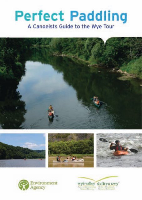
Perfect Paddling, A Canoeists Guide to the River Wye - Forest of Dean
Perfect Paddling, A Canoeists Guide to the River Wye - Forest of Dean
Perfect Paddling, A Canoeists Guide to the River Wye - Forest of Dean

You also want an ePaper? Increase the reach of your titles
YUMPU automatically turns print PDFs into web optimized ePapers that Google loves.
IntroductionThe <strong>Wye</strong> Valley Area <strong>of</strong> Outstanding Natural Beauty (AONB) 1Wildlife 2Protected Woodlands 3Himalayan Balsam 3<strong>River</strong>sideTrees 4His<strong>to</strong>ry and heritage 4Industry 5The Picturesque ‘<strong>Wye</strong> Tour’ 5Overlooking <strong>the</strong> <strong>Wye</strong> 6Navigation rights and access 6<strong>Canoeists</strong> ConductCare for Wildlife 7Stay Safe 8Help Keep a Healthy <strong>River</strong> 9Be Fishing Friendly 10Consider O<strong>the</strong>r People 11Safety on <strong>the</strong> <strong>River</strong> 13<strong>River</strong> <strong>Wye</strong> – Hereford <strong>to</strong> Cheps<strong>to</strong>w 14Map Section 1 – Hereford <strong>to</strong> Fownhope 15Map Section 2 – Fownhope <strong>to</strong> Backney 17Map Section 3 – Backney <strong>to</strong> Kerne Bridge 19Map Section 4 – Kerne Bridge <strong>to</strong> Symonds Yat 21Map Section 5 – Symonds Yat <strong>to</strong> Monmouth 23Map Section 6 – Monmouth <strong>to</strong> Bigsweir 25Map Section 7 – Bigsweir <strong>to</strong> Lancaut 27Map Section 8 – Lancaut <strong>to</strong> Cheps<strong>to</strong>w 29New Threats <strong>to</strong> <strong>the</strong> <strong>River</strong> <strong>Wye</strong> 31
IntroductionWelcome <strong>to</strong> <strong>the</strong> <strong>River</strong> <strong>Wye</strong> in <strong>the</strong> <strong>Wye</strong> Valley Area <strong>of</strong>Outstanding Natural Beauty (AONB). This booklet will helpyou discover more about <strong>the</strong> important wildlife, his<strong>to</strong>ry andlandscape that you will be passing through on your boat trip.This booklet also contains important safety and navigationinformation as well as <strong>the</strong> Canoeist’s Code <strong>of</strong> Conduct. Pleasetake <strong>the</strong> time <strong>to</strong> read this information and enjoy your visit <strong>to</strong><strong>the</strong> <strong>Wye</strong> Valley AONB.The <strong>Wye</strong> Valley Area <strong>of</strong> OutstandingNatural Beauty (AONB)The <strong>Wye</strong> Valley is an internationally important protectedlandscape containing some <strong>of</strong> <strong>the</strong> most beautiful lowlandscenery in Britain. Designated in 1971, this unique landscapestraddles <strong>the</strong> border between England and Wales. It includesareas within Gloucestershire, <strong>Forest</strong> <strong>of</strong> <strong>Dean</strong>, Herefordshireand Monmouthshire. Covering 326Km 2 <strong>the</strong>re is plenty <strong>to</strong> seeand do and <strong>the</strong>re are many ways <strong>to</strong> explore <strong>the</strong> area shouldyou wish <strong>to</strong> return in <strong>the</strong> future.Female Banded Damoiselle1
Otter pair eating fishWildlifeDepending on <strong>the</strong> stretch <strong>of</strong> water youtravel along you may be lucky <strong>to</strong> see some<strong>of</strong> <strong>the</strong> special wildlife that inhabits <strong>the</strong> area.The river supports good populations <strong>of</strong>otter, an elusive and largely nocturnalanimal which feeds on fish particularly eels.In o<strong>the</strong>r areas you may see peregrinefalcons catching pigeons above <strong>the</strong>ir cliffledge haunts. However, for <strong>the</strong> observant,<strong>the</strong>re is an abundance <strong>of</strong> wildlife all along<strong>the</strong> river and you can commonly seekingfishers, herons and dragonflies as par<strong>to</strong>f a rich diversity <strong>of</strong> animals and plants. Inall <strong>the</strong>re are three Special Areas <strong>of</strong>Conservation (SAC), four National NatureReserves (NNR’s) and over forty Sites <strong>of</strong>Special Scientific Interest (SSSI) in <strong>the</strong> <strong>Wye</strong>Valley AONB.Male Banded DamoiselleMute SwansThe <strong>River</strong> <strong>Wye</strong> is a particularly uniquehabitat and is highly protected because itcontains internationally importantpopulations <strong>of</strong> salmon, twait and allis shad,white clawed crayfish, bullhead and otter.Please take care not <strong>to</strong> disturb wildlife asyou travel downstream.2Moorhen Chick
<strong>Wye</strong> Valley bluebell woodlandsProtected WoodlandsAs you travel down <strong>the</strong> valley,particularly between Kerne Bridge andCheps<strong>to</strong>w, you pass through apredominantly wooded landscape. Much<strong>of</strong> <strong>the</strong>se woodlands are ei<strong>the</strong>rinternationally protected as SSSI's orSAC. Toge<strong>the</strong>r <strong>the</strong>y form one <strong>of</strong> <strong>the</strong> mostimportant lowland woodland complexesin Britain and support rare species suchas Goshawks and Lesser Horseshoe Bats.Dormouse in <strong>to</strong>rporWild Garlic or RamsomsHimalayan BalsamBetween July and Oc<strong>to</strong>ber you willnotice an abundance <strong>of</strong> pink floweringplants growing tall on <strong>the</strong> riverbanks.This sweet smelling plant is HimalayanBalsam, an attractive but invasive nonnativespecies that grows dominantstands on streamsides and in woodlands.Concerns are increasing over <strong>the</strong> plants’expansion both locally and nationally asit threatens <strong>to</strong> out-compete nativespecies. It is a fast growing annual thatpropagates itself every year from <strong>the</strong>abundant seed it produces.Himalayan Balsam3
<strong>River</strong>sideTreesMost <strong>of</strong> <strong>the</strong> trees you will see growingalong <strong>the</strong> riverbank are ei<strong>the</strong>r species<strong>of</strong> willow or alder. Both are importanthabitats for birds and bats. Many <strong>of</strong> <strong>the</strong>alder trees are suffering from a diseasecalled Phy<strong>to</strong>thorum, a fungi that inhibitstree growth <strong>of</strong>ten leading <strong>to</strong> obviousdead branches.Diseased Alders near FownhopeCheps<strong>to</strong>w CastleEarly His<strong>to</strong>ryAfter <strong>the</strong> last Ice Age nomadichunters moved through <strong>the</strong>area. By <strong>the</strong> Iron Age, <strong>the</strong>dominant Silure tribe had builthillforts at Symonds Yat, GaerHill, Chase Wood and LittleDoward. The Romans exploitediron in <strong>the</strong> valley and built <strong>the</strong><strong>to</strong>wn <strong>of</strong> Ariconium near Rosson-<strong>Wye</strong>.Then <strong>the</strong> Saxons,under King Offa <strong>of</strong> Mercia, builtOffa’s Dyke, <strong>the</strong> longestarchaeological ‘Keep Out’ signin Britain. The Normansstamped <strong>the</strong>ir mark with s<strong>to</strong>nefortresses at Cheps<strong>to</strong>w,Goodrich and St Briavels. LaterCistercians founded <strong>the</strong> firstWelsh Abbey at Tintern in 1131.Bow Hauliers on <strong>the</strong> <strong>Wye</strong>, Nelson Museum4
IndustryFor centuries <strong>the</strong> <strong>Wye</strong> Valley was exploitedfor its timber, iron ore, s<strong>to</strong>ne and coal.Wireworks were established at Tintern in1556, boat-building in Llandogo andBrockweir, paperworks in Whitebrook andnationally important tinplate and copperworks in Redbrook. Echoing <strong>to</strong> <strong>the</strong> sound<strong>of</strong> hammers and forges, smoke wouldhave wrea<strong>the</strong>d <strong>the</strong> valley and <strong>the</strong> viewswould have been very different from<strong>to</strong>day – fewer trees and far more people.Brockweir Quay, Nelson MuseumThe Picturesque‘<strong>Wye</strong> Tour’The <strong>Wye</strong> Valley is arguably <strong>the</strong> birth place <strong>of</strong> British<strong>to</strong>urism. In <strong>the</strong> 1700’s <strong>the</strong> first <strong>to</strong>urists <strong>to</strong> <strong>the</strong> areawere artists and writers floating down <strong>the</strong> <strong>Wye</strong>,armed with sketch pads and poetic leanings, on whatwas <strong>to</strong> become known as <strong>the</strong> <strong>Wye</strong> Tour. Among <strong>the</strong>nation’s first <strong>to</strong>urists were Turner, Coleridge andWordsworth. Reverend Gilpin defined <strong>the</strong>Picturesque movement from his <strong>Wye</strong> Tour in 1770,<strong>the</strong> principles <strong>of</strong> which were taken up by artists in<strong>the</strong> <strong>the</strong>atre and cinema and are used <strong>to</strong> this day.Tintern AbbeySymonds Yat, Nelson Museum5View from Eagles Nest, Cheps<strong>to</strong>w Museum
Between 2009 and 2011 <strong>the</strong>Heritage Lottery Funded‘Overlooking <strong>the</strong> <strong>Wye</strong>’ LandscapePartnership Scheme carried out work <strong>to</strong> conserve<strong>the</strong> his<strong>to</strong>ric environment and increase understanding<strong>of</strong> <strong>the</strong> picturesque landscape <strong>of</strong> <strong>the</strong> <strong>Wye</strong> Valley AONB.The scheme had four key <strong>the</strong>mes ‘Hidden Industry’,‘<strong>River</strong> Connections’, ‘Viewpoints’ and ‘Hillforts’ andmanaged works on 40 sites through <strong>the</strong> <strong>Wye</strong> ValleyAONB Partnership. You may pass close <strong>to</strong> many <strong>of</strong><strong>the</strong>se sites whilst on your trip, some <strong>of</strong> which aredescribed in more detail in this booklet.Redbrook Tinworks, Nelson MuseumNavigation rights& accessThe <strong>River</strong> <strong>Wye</strong> has been used for navigation formany centuries. In <strong>the</strong> past <strong>the</strong> <strong>Wye</strong> was animportant commercial waterway. Today boatingon <strong>the</strong> river is mostly canoeing and rowing, butwith some passenger sightseeing boats operatingaround Symonds Yat.A public right <strong>of</strong> navigation extends from The Severnupstream <strong>to</strong> Hay Town Bridge on <strong>the</strong> main <strong>River</strong><strong>Wye</strong> and on <strong>the</strong> <strong>River</strong> Lugg between its confluencewith <strong>the</strong> <strong>Wye</strong> and Presteigne Town Bridge. Publicnavigation <strong>of</strong> this stretch upstream <strong>of</strong> BigsweirBridge is <strong>the</strong> responsibility <strong>of</strong> <strong>the</strong> EnvironmentAgency. Below Bigsweir Bridge public right <strong>of</strong>navigation is under <strong>the</strong> auspices <strong>of</strong> <strong>the</strong> GloucesterHarbour Trustees. The river is also tidal for thislower stretch and <strong>of</strong>ten dangerous for canoeists.Water wheel at Tintern,Nelson MuseumTintern Abbey, Nelson MuseumThe right <strong>of</strong> navigation does not give a right <strong>of</strong>access <strong>to</strong> <strong>the</strong> riverbank o<strong>the</strong>r than at acceptedpublic sites; you must get <strong>the</strong> permission <strong>of</strong> <strong>the</strong>landowner before launching and landing canoes.Permission is also needed <strong>to</strong> camp or picnic on<strong>the</strong> banks or neighbouring fields.6The Quay at Monmouth, Nelson Museum
<strong>Canoeists</strong>ConductThe code <strong>of</strong> conduct is intended <strong>to</strong> helppeople enjoy <strong>the</strong> river without reducing <strong>the</strong>enjoyment <strong>of</strong> o<strong>the</strong>rs or damaging <strong>the</strong>environment. It is expected that canoeistsfollow <strong>the</strong> code on all river trips.Care for WildlifeOne <strong>of</strong> <strong>the</strong> joys <strong>of</strong> a trip on <strong>the</strong> <strong>River</strong> <strong>Wye</strong> is watching its abundant wildlife.We have a responsibility <strong>to</strong> protect our countryside now and for futuregenerations, so make sure you don’t harm animals, birds, plants and trees.Some fish species are particularly sensitive <strong>to</strong> disturbance, especially during <strong>the</strong>spawning seasons. During winter salmon spawn in <strong>the</strong> upper reaches <strong>of</strong> <strong>the</strong> <strong>Wye</strong>.Between 1st <strong>of</strong> April and 31st July many coarse fish are breeding and Twait andAllis Shad use shallow gravel beds for egg laying. Please do not land on gravelbeds during this period and at all o<strong>the</strong>r times try <strong>to</strong>:7• Avoid disturbing nestingbirds along <strong>the</strong> riverbanks, particularly inspring time• Avoid damaging beds<strong>of</strong> waterweed• S<strong>to</strong>p your activity ifyou are clearly disturbingwildlifeThe river habitat and many<strong>of</strong> <strong>the</strong> species it supportsare protected by law.Ignoring this advice couldresult in a criminal <strong>of</strong>fencebeing committed, and youmay be subject <strong>to</strong>enforcement action
Stay SafeYou are responsible for your own safety and for o<strong>the</strong>rs in your care, so beprepared for changes in <strong>the</strong> wea<strong>the</strong>r and o<strong>the</strong>r events. The river conditions canchange rapidly. We advise you <strong>to</strong> check <strong>the</strong> river level just prior <strong>to</strong> your trip via <strong>the</strong>Environment Agency’s au<strong>to</strong>mated telephone service on 0906 6197755 (BTpremium rate). Alternatively <strong>the</strong> <strong>Wye</strong> and Usk Foundation provide free river levelinformation on <strong>the</strong>ir website www.wyeuskfoundation.org/conditions/index.phpWhen planning or partaking in your river trip always consider:• That you use <strong>the</strong> river in a safefashion and that you have <strong>the</strong>appropriate safety equipment• That any groups <strong>of</strong> young noviceboaters are led by suitablyexperienced responsible persons– preferably a qualified instruc<strong>to</strong>r• That you don’t drink alcoholduring and just prior <strong>to</strong> your tripon <strong>the</strong> river• That you follow instructionsgiven <strong>to</strong> you by your canoe hireopera<strong>to</strong>r and/or group leaderAnd finally. …if in doubt, don’t!8
Help Keep aHealthy <strong>River</strong>The <strong>River</strong> <strong>Wye</strong> boasts excellent waterquality in a largely unmodified watercourse. You can help maintain ahealthy river by:• Taking your rubbish away with you• Avoiding damage <strong>to</strong> banks, <strong>the</strong>riverbed and bankside vegetation -this can lead <strong>to</strong> erosion. You canhelp by only launching and landingat purpose made launch points• Avoid dragging boats andequipment over rock slabsand s<strong>to</strong>nes.9
Be Fishing FriendlyCanoeing and kayaking can have a bigger impact on anglers than any o<strong>the</strong>r riverusers, particularly if you are in a large group. By following a few simpleguidelines you can limit <strong>the</strong> effect your boating will have on anglers and <strong>the</strong>irenjoyment. If you are travelling in a group please keep <strong>to</strong>ge<strong>the</strong>r and pass anglersin one go <strong>to</strong> prevent prolonged disturbance, and in all instances try <strong>to</strong>:• Pass anglers with as little noise and disturbance as possible• Keep away from banks being fished and fishing tackle• Avoid loitering in pools if anyone is fishing• Comply with reasonable directional requestsPlease also note that fishing from a boat is not allowed unless you have a validrod licence and permission from <strong>the</strong> owner/tenant <strong>of</strong> <strong>the</strong> fishery rights.10
Consider O<strong>the</strong>r PeopleShowing consideration and respect for o<strong>the</strong>r people makes <strong>the</strong> countryside apleasant environment for everyone. Pay particular respect <strong>to</strong> local residents andavoid situations that may result in argument and remember <strong>to</strong> always:• Park sensibly without causing obstruction, do not block gatewaysor load and unload vehicles in awkward places• Keep noise <strong>to</strong> a minimum• Get changed out <strong>of</strong> public view• Whenever possible come ashore at recognised landing places;do not trespass on private property or moorings11
• When canoeing have special regard for beginners, as you wouldfor learner drivers on <strong>the</strong> road• Remember that larger boats are less manoeuvrable and cannot usesuch shallow waters as canoes, rafts and rowing boats• Give way <strong>to</strong> those engaged in organised competition and have regard<strong>to</strong> any instructions given by <strong>of</strong>ficials• Hail <strong>to</strong> draw a person’s attention <strong>to</strong> a situation which might o<strong>the</strong>rwiseresult in inconvenience, damage or collision. Please treat a hail as afriendly warning and not as an insultThere is an agreement for canoeing on <strong>the</strong> upper river. Details can be found atwww.wyeuskfoundation.org/navigation/index.php12
Safety on <strong>the</strong> <strong>River</strong>Tintern Abbey in <strong>the</strong> mist, Linda WightThe <strong>Wye</strong> can be dangerous and has been <strong>the</strong> cause <strong>of</strong> many accidents. It is at itsmost dangerous when <strong>the</strong>re are strong currents, high water levels or cold wea<strong>the</strong>rconditions. Don’t take risks and never underestimate <strong>the</strong> power <strong>of</strong> <strong>the</strong> river. The <strong>Wye</strong>is a fast flooding river, which can rise after heavy rain at a rate <strong>of</strong> over 30cm an hour.TidesBelow Bigsweir Bridge<strong>the</strong> <strong>Wye</strong> is tidal and canbe very dangerous,especially below Tintern.If you intend <strong>to</strong> canoethis stretch, leaveTintern no later thanone hour after highwater and travel downwithout s<strong>to</strong>pping.Inexperienced canoeistsare advised <strong>to</strong> avoid thisstretch and should on noaccount travel belowCheps<strong>to</strong>w, as currents in<strong>the</strong> Severn Estuary areextremely dangerous.Health and HygieneThe water quality <strong>of</strong> <strong>the</strong> <strong>Wye</strong> is generally good, but containsnatural bacteria and o<strong>the</strong>r micro-organisms. Although <strong>the</strong> risk <strong>of</strong>contracting an illness is small, <strong>the</strong>re are sensible precautions whichcan help you stay healthy:• Do not swallow river water;• Cover cuts or sores with gloves or waterpro<strong>of</strong> plasters;• Where possible, wash or shower after taking part inwater sports, especially if you have capsized;• Wash your hands before eating;• See your doc<strong>to</strong>r if you feel ill after exposure <strong>to</strong> <strong>the</strong>water. If you develop flu like symp<strong>to</strong>ms it is possibleyou may have contracted Lep<strong>to</strong>spirosis(a rare disease, but one which can have seriouscomplications).Have a good trip!13
A 49MAP SECTION 1Hereford<strong>to</strong> FownhopeMAP SECTION 2Fownhope<strong>to</strong> Backney- - - -<strong>River</strong> <strong>Wye</strong>Hereford <strong>to</strong>Cheps<strong>to</strong>wyMAP SECTION 3Backney<strong>to</strong> Kerne Bridge∞MAP SECTION 4Kerne Bridge<strong>to</strong> Symonds YatMAP SECTION 5Symonds Yat<strong>to</strong> Monmouth∞‹Ÿæ∞©z9åt∞9∞MAP SECTION 6Monmouth<strong>to</strong> Bigsweirå∞‹∞å©‹∞å‹Ÿ æås9∞s- - - -MAP SECTION 7Bigsweir<strong>to</strong> Lancaut∞∞å‹‹‹∞ ‹åŸ‹ ‹å∞ å‹9‹ z‹trMAP SECTION 8Lancaut<strong>to</strong> Cheps<strong>to</strong>w‹Ÿæ∞©z9åå<strong>River</strong> <strong>Wye</strong>t814© Crown copyright. All rightsreserved. 100024168. (2011)
<strong>River</strong> LuggMAP SECTION 1Hereford <strong>to</strong> FownhopeDISTANCE • 9 miles • 4 hours• Hereford<strong>River</strong> <strong>Wye</strong>Lucksall Camp SiteSituated 200m downstream <strong>of</strong><strong>the</strong> modern Holme LacyBridge is Lucksall camp site,open 1 March – 30 November.Landing at <strong>the</strong> site is by priorpermission only (tel. 01432870213). The site has a shop,shower, <strong>to</strong>ilets and water.Mordiford• Lucksall Camp SiteHolme Lacy •• Fownhope© Crown copyright. All rightsreserved. 100024168. (2011)15View from Capler Viewpoint
Mordiford VillageMordiford Bridge and ChurchMordiford village grew up around an ancient ford over <strong>the</strong> <strong>River</strong> Lugg. The river isnow crossed by <strong>the</strong> oldest surviving bridge in Herefordshire, dating in part <strong>to</strong> c. 1352and completed in <strong>the</strong> 16th century. Legend has it that Mordiford was once terrorisedby a dragon that lived in nearby Haugh Wood. The dragon, green in colour, was said <strong>to</strong>have loved a small girl named Maud who resided in Mordiford and had nurtured itfrom infancy. When <strong>the</strong> dragon grew it desired meat and started devouring sheep andcattle and on occasion even <strong>the</strong> locals! Only Maud remained safe from its reign upuntil it was eventually slain by a local nobleman.Mordiford is also where <strong>the</strong> river Lugg flows in<strong>to</strong> <strong>the</strong> <strong>Wye</strong> (<strong>the</strong> Lugg enters from <strong>the</strong>left) and <strong>the</strong> boundary <strong>of</strong> <strong>the</strong> <strong>Wye</strong> Valley Area <strong>of</strong> Outstanding Natural Beauty (AONB).Hereford City<strong>River</strong>bank at FownhopeThe name ‘Hereford’ is said <strong>to</strong> come from<strong>the</strong> Anglo Saxon ‘here’, an army orformation <strong>of</strong> soldiers, and <strong>the</strong> ‘ford’, aplace for crossing a river. The City’s mostfamous landmark is its Ca<strong>the</strong>dral whichdates from 1079 and contains <strong>the</strong> MappaMundi, a medieval map <strong>of</strong> <strong>the</strong> worlddating from <strong>the</strong> 13th century. It alsocontains <strong>the</strong> world famous ChainedLibrary. The city is an importantagricultural trading place. Locallydistinctive products include; cider andHerefordshire cattle. The city is alsoknown for being home <strong>to</strong> <strong>the</strong> BritishSpecial Air Service (SAS).16
MAP SECTION 2Fownhope <strong>to</strong> BackneyDISTANCE • 15 miles • 7 hours• FownhopeCamping and launch/landing points aresituated on both banks <strong>of</strong><strong>the</strong> river at Hoarwithy.On right bank shortly Ballingham •after bridge take <strong>the</strong> steps <strong>to</strong> <strong>the</strong> <strong>to</strong>p <strong>of</strong> <strong>the</strong>bank. Water and <strong>to</strong>ilets available and easyaccess <strong>to</strong> <strong>the</strong> village pub. Contact Mrs Roberts,Tresseck Farm (01432 840235)open Easter – endSeptember.Capler CampCapler ViewpointHoarwithyCamp site,<strong>the</strong> NewHarp InnandHoarwithyChurchKings CapleFoy•Hole in<strong>the</strong> WallSellackFootbridgeBackney •HoarwithyThe attractive village <strong>of</strong> Hoarwithyis dominated by <strong>the</strong> remarkable ItalianateChurch <strong>of</strong> St Ca<strong>the</strong>rine. The original church,built in 1840 by Reverend Thomas Hutchinson,was a simple rectangular s<strong>to</strong>ne structure.When William Poole became vicar in 1854 hewas not impressed and decided <strong>to</strong> beautify itusing sands<strong>to</strong>ne in a Romanesque style. Thechurch has since been used in many films andis an unusual, eye catching landmark.© Crown copyright. All rightsreserved. 100024168. (2011)17Entrance <strong>to</strong> Hoarwithy Church
Capler Camp and ViewpointAt this point <strong>the</strong> wooded slope <strong>to</strong> your left rises up 150m (500 feet) <strong>to</strong> <strong>the</strong> IronAge hillfort <strong>of</strong> Capler Camp. The camp was occupied from 500BC <strong>to</strong> approximately200-300AD. Recent Geo-Physical surveys discovered evidence <strong>of</strong> a round house,possibly with a s<strong>to</strong>ne floor and central fire pit. The popular Capler Viewpoint issituated on <strong>the</strong> nearby Fownhope <strong>to</strong> Brockhamp<strong>to</strong>n Road with spectacular viewswest across <strong>the</strong> river and rolling Herefordshire countryside.On <strong>the</strong> riverside below Capler Hill is <strong>the</strong> remains <strong>of</strong> a small quarry where s<strong>to</strong>newas extracted and taken by barge upstream <strong>to</strong> Hereford for <strong>the</strong> construction <strong>of</strong><strong>the</strong> ca<strong>the</strong>dral.Foy and Hole in <strong>the</strong> WallFoy footbridgeA single span suspension bridge, builtin 1919, links <strong>the</strong>se two riverside hamlets.According <strong>to</strong> <strong>the</strong> Domesday recordsHole in <strong>the</strong> Wall was originally called‘Turles<strong>to</strong>ne’, a name meaning ‘Hole S<strong>to</strong>ne’.It was <strong>the</strong> location <strong>of</strong> <strong>the</strong> early episodes<strong>of</strong> <strong>the</strong> apocalyptic 1970’s TV series‘Survivors’ by Terry Nation. The serieshas recently been remade. It was also <strong>the</strong>first PGL outdoor activity centre. Founder,Peter Gordon Lawrence (PGL) startedwhat is now a multi-million poundcompany in 1957 with canoeing andcamping trips down <strong>the</strong> <strong>Wye</strong>.Sellack Boat FootbridgeFoSellack Boat connects Kings Caple withSellack, and as <strong>the</strong> name suggests itwas a ferry crossing replaced by <strong>the</strong>foot bridge in 1895. It is also <strong>to</strong>ld tha<strong>to</strong>ne vicar in earlier times used stilts <strong>to</strong>ford <strong>the</strong> <strong>Wye</strong> here <strong>to</strong> avoid a lengthyde<strong>to</strong>ur. Under <strong>the</strong> bridge is a s<strong>to</strong>nebuilt in<strong>to</strong> <strong>the</strong> buttress with <strong>the</strong>inscription - ‘To <strong>the</strong> honour <strong>of</strong> God and<strong>the</strong> lasting union <strong>of</strong> <strong>the</strong>se parishes’.18Sellack foot bridge and church
MAP SECTION 3Backney <strong>to</strong> Kerne BridgeBackney•DISTANCE • 8 miles • 3.5 hours© Crown copyright. All rightsreserved. 100024168. (2011)View south from Wil<strong>to</strong>n BridgeThe <strong>Wye</strong> TourUse middle arch <strong>of</strong><strong>the</strong> Wil<strong>to</strong>n Bridge,and channel <strong>to</strong> <strong>the</strong>right <strong>of</strong> <strong>the</strong> islandWil<strong>to</strong>n BridgeRosson-<strong>Wye</strong>Ross-on-<strong>Wye</strong> was traditionally <strong>the</strong>starting point for <strong>the</strong> ‘<strong>Wye</strong> Tour’ whichin <strong>the</strong> late eighteenth and earlynineteenth centuries was popular withartists and poets. At this time it wasfashionable <strong>to</strong> take a boat <strong>to</strong>urdown <strong>the</strong> <strong>Wye</strong> Valley, <strong>to</strong> view itsromantic sites and picturesquelandscape. These early ‘<strong>to</strong>urists’dined at specific locations, <strong>to</strong>okwalks <strong>to</strong> particular viewpointsand visited specific romanticruins, making <strong>the</strong> ‘<strong>Wye</strong> Tour’one <strong>of</strong> <strong>the</strong> first ‘package holidays’Their his<strong>to</strong>ric journey can be repeated<strong>to</strong>day by navigating <strong>the</strong> river in acanoe or kayak allowing you <strong>to</strong> viewsights that inspired <strong>the</strong> likes <strong>of</strong>GoodrichColeridge, Turner and Wordsworth.Kerne Bridge LaunchLanding at steps on left bank 800m below ancientroad bridge. Picnic site and car park. No permissionrequired. Please do not land/ launch at <strong>the</strong> bridge.The ‘Inn on <strong>the</strong> <strong>Wye</strong>’ Public House is a shortwalk up <strong>the</strong> road from <strong>the</strong> launch. 19GoodrichCastleRoss-on-<strong>Wye</strong> is situatedon a horseshoe bend in<strong>the</strong> river from <strong>the</strong> A40bridge <strong>to</strong> Wil<strong>to</strong>n Bridge.Landing steps are situated100m downstream <strong>of</strong> <strong>the</strong>Hope and Anchor Pub, nopermission required.Please do not land atWil<strong>to</strong>n Bridge fur<strong>the</strong>rdownstream.Kerne Bridge• Canoe launch
Goodrich CastleGoodrich CastleGoodrich stands majestically on a woodedhill commanding <strong>the</strong> passage <strong>of</strong> <strong>the</strong> <strong>River</strong><strong>Wye</strong> as it enters <strong>the</strong> <strong>Wye</strong> gorge. The castle’sconstruction began in <strong>the</strong> late 11th centuryand is considered <strong>to</strong> be one <strong>of</strong> <strong>the</strong> mostcomplete sets <strong>of</strong> medieval domesticbuildings surviving in any English castle.During <strong>the</strong> Civil War, Goodrich was heldsuccessively by both sides, Sir HenryLingen's Royalists eventually surrendered in1646 from threats <strong>of</strong> undermining <strong>the</strong> castleand a deadly Parliamentarian canon, <strong>the</strong>famous 'Roaring Meg', <strong>the</strong> only survivingCivil War canon.Wil<strong>to</strong>n CastleWil<strong>to</strong>n Castle was originally aNorman earthwork motte and baileyfortress. It was originally built <strong>to</strong>guard <strong>the</strong> important strategicposition where <strong>the</strong> road betweenAnglo-Saxon England and Walescrossed <strong>the</strong> <strong>River</strong> <strong>Wye</strong>. As part <strong>of</strong><strong>the</strong>ir plan <strong>to</strong> consolidate <strong>the</strong>ir holdon <strong>the</strong>ir newly acquired land <strong>the</strong>Normans embarked on a vastprogram <strong>of</strong> castle building whichincluded, in <strong>the</strong> Twelfth Century,construction <strong>of</strong> a new castle atWil<strong>to</strong>n using <strong>the</strong> locally availablesands<strong>to</strong>ne. In <strong>the</strong> 16th Century,Charles Brydges built an Elizabethanmansion on <strong>the</strong> site <strong>of</strong> <strong>the</strong> keep andgatehouse but it was attacked andburnt during <strong>the</strong> Civil War. Part <strong>of</strong><strong>the</strong> ruined mansion wassubsequently rebuilt and is nowinhabited, parts <strong>of</strong> <strong>the</strong> Castle areopen <strong>to</strong> <strong>the</strong> public periodically.20Wil<strong>to</strong>n WharvesWil<strong>to</strong>n CastleAt one time Wil<strong>to</strong>n had wharves bothupstream and downstream <strong>of</strong> <strong>the</strong> bridgeon <strong>the</strong> western bank <strong>of</strong> <strong>the</strong> river. This iswhere barges were loaded and unloadedwith goods. Large warehouses were onceassociated with <strong>the</strong>se wharves <strong>to</strong> s<strong>to</strong>regoods, but little evidence <strong>of</strong> <strong>the</strong>seremain. Only one wharf downstream <strong>of</strong><strong>the</strong> bridge is now visible.
Map Section 4Kerne Bridge <strong>to</strong> Symonds YatDISTANCE • 8 miles • 2.5 hoursSymonds Yat West Please look out forpassenger carrying pleasure boats and arope ferry for crossing <strong>the</strong> river that arebased here. Landing at Ye Olde Ferrie Inneon <strong>the</strong> right bank. Permission required from<strong>the</strong> Inn (Tel 01600 890 232).Kerne Bridge• Canoe launch© Crown copyright. All rightsreserved. 100024168. (2011)LydbrookRailway BridgeWelsh BicknorYouth HostelSymondsYat WestNew WeirForgeYatRockViewPointColdwellRocksSymondsYat EastLydbrook• English BicknorLowerLydbrookWelsh Bicknor Church and Youth Hostel on rightbank followed by a railway bridge, now used as afootbridge. This is an important fishing stretch anda good place <strong>to</strong> see salmon. Please pass throughquietly and do not linger.Lower Lydbrook Inn on left bank above rapids.Keep <strong>to</strong> <strong>the</strong> left <strong>of</strong> <strong>the</strong> island down Lydbrookshallows. Landing on <strong>the</strong> left bank at <strong>the</strong> steps <strong>to</strong> <strong>the</strong>picnic site and car park. Launching for individualsbut NOT groups. Donations requested in honesty box.Lydbrook was once a hive <strong>of</strong> metal working industry and abusy river port, although little evidence <strong>of</strong> <strong>the</strong>se survive.Parts <strong>of</strong> <strong>the</strong> Trans Atlantic cable were manufactured in <strong>the</strong>Lydbrook cable works just downstream from <strong>the</strong> old railwaybridge. There used <strong>to</strong> be a large railway viaduct thatstraddled <strong>the</strong> village but this was dismantled in <strong>the</strong> 1960s.Welsh Bicknor Church21
Yat RockAs you follow <strong>the</strong> sweep <strong>of</strong> <strong>the</strong> river underColdwell Rocks <strong>the</strong> Yat Rock viewpoint comes in<strong>to</strong>view, noticeable by its flagpole. The most famous<strong>of</strong> <strong>the</strong> <strong>Wye</strong> Valley viewpoints, it is visited byhundreds <strong>of</strong> thousands <strong>of</strong> visi<strong>to</strong>rs a year <strong>to</strong>appreciate <strong>the</strong> scenery and watch <strong>the</strong> peregrinefalcons. It is also an Iron Age hillfort and <strong>the</strong>ramparts <strong>of</strong> <strong>the</strong> hillfort are still visible asconcentric ‘curves’ which cross <strong>the</strong> pathway from<strong>the</strong> car park <strong>to</strong> <strong>the</strong> log cabin. It was also verypopular on <strong>the</strong> <strong>Wye</strong> Tour as many <strong>to</strong>urists left<strong>the</strong>ir boats and walked up <strong>to</strong> <strong>the</strong> viewpoint at YatRock whilst <strong>the</strong> crew rowed <strong>the</strong> boat around <strong>the</strong>four mile loop <strong>to</strong> meet <strong>the</strong>m on <strong>the</strong> o<strong>the</strong>r side.Coldwell Rocks near Symonds YatLinda WrightPeregrine Falconsand Coldwell RocksThe impressive cliffs that<strong>to</strong>wer up <strong>to</strong> your left at thispoint are called ColdwellRocks and since 1982 haveprovided home <strong>to</strong> successivefamilies <strong>of</strong> peregrine falcons.From April <strong>to</strong> August <strong>the</strong>ycan frequently be seen from<strong>the</strong> river as <strong>the</strong>y hunt andraise <strong>the</strong>ir young. Theperegrine is <strong>the</strong> fastestanimal in <strong>the</strong> world. The birdspair for several years andraise broods <strong>of</strong> up <strong>to</strong> fouryoung. They live on mediumsizedbirds <strong>of</strong>ten catchingwood pigeons in flight. O<strong>the</strong>rbirds <strong>of</strong> prey such asgoshawks and buzzards canalso be seen here.New Weir Forge, Symonds Yat WestNew Weir Forge is located on <strong>the</strong> right bank,opposite <strong>the</strong> island by <strong>the</strong> rapids and was in usefrom at least <strong>the</strong> 1590s and up until <strong>the</strong> 1800s.This was one <strong>of</strong> <strong>the</strong> many sites in <strong>the</strong> <strong>Wye</strong> Valleyand <strong>Forest</strong> <strong>of</strong> <strong>Dean</strong> involved in iron production.The site would have been chosen because <strong>of</strong> <strong>the</strong>proximity <strong>of</strong> iron ore from <strong>the</strong> <strong>Forest</strong>, charcoalfrom <strong>the</strong> woodland and water <strong>to</strong> power <strong>the</strong>waterwheels. New Weir is so named because <strong>of</strong><strong>the</strong> weir that controlled water flow in<strong>to</strong> <strong>the</strong>ironworks. Boats would have navigated <strong>the</strong> rivervia a lock which was on <strong>the</strong> left bank. The slagfrom <strong>the</strong> furnace and <strong>the</strong> remains <strong>of</strong> <strong>the</strong> Weirare now part <strong>of</strong> <strong>the</strong> island and rapids.22Pleasure cruises at Symonds Yat
Map Section 5Symonds Yat <strong>to</strong> MonmouthDISTANCE • 5 miles • 2 hoursExcavations at New Weir ForgeSeven SistersThe Lower <strong>Wye</strong> landscape was formed by <strong>the</strong> riveracting on a series <strong>of</strong> rock layers that dip <strong>to</strong>wards <strong>the</strong>east and <strong>the</strong> <strong>Forest</strong> <strong>of</strong> <strong>Dean</strong>. The river cuts throughcarboniferous limes<strong>to</strong>ne <strong>to</strong> form a gorge withsubstantial river cliffs such as <strong>the</strong> Seven Sisters.Monmouth and its QuayRainbow over Wyas<strong>to</strong>neand <strong>the</strong> <strong>River</strong> <strong>Wye</strong>23Canoe Launch •MonmouthMonmouthThe river runsalongside <strong>the</strong> A40 forapproximately 1 mileon <strong>the</strong> approach <strong>to</strong>Monmouth. Landingat <strong>the</strong> second set <strong>of</strong>steps on <strong>the</strong> rightimmediatelydownstream <strong>of</strong> rowingclub by <strong>the</strong> car park.No permissionrequired. The <strong>to</strong>wn isa short walk from <strong>the</strong>canoe launch where<strong>the</strong>re are numerousshops and services.Dix<strong>to</strong>n ChurchMonmouth was <strong>the</strong> half way stage on <strong>the</strong> <strong>Wye</strong> Tour wheretravellers would s<strong>to</strong>p overnight in one <strong>of</strong> <strong>the</strong> <strong>to</strong>wn’s manyhotels and inns. The impressive and recently res<strong>to</strong>red ShireHall is situated in Monmouth’s Agincourt Square. Erected in 1724, <strong>the</strong> building wasdesigned <strong>to</strong> house two "Courts <strong>of</strong>Judicature" and a room for <strong>the</strong> Grand Jury atAssizes and Sessions. One <strong>of</strong> <strong>the</strong> most famous trials held here was that <strong>of</strong> <strong>the</strong>leaders <strong>of</strong> <strong>the</strong> Chartists, originally condemned <strong>to</strong> death but subsequentlytransported <strong>to</strong> Van Diemen´s Land.The Quay that is visible <strong>to</strong>day is only a small part <strong>of</strong> <strong>the</strong> river port that existedhere since Roman times, in <strong>the</strong> 19th century warehouses dominated <strong>the</strong> riversidescene. These were demolished in <strong>the</strong> 1960s when <strong>the</strong> dual carriageway was built.The remaining quay was res<strong>to</strong>red in 2009.
© Crown copyright. All rights reserved. 100024168. (2011)• Little Doward HillfortSymonds Yat WestLimekilnKing Arthurs Cave •SevernSistersRocksNew WeirForgeSymondsYatEastKing Arthurs CaveBiblinsFootbridgeHigh above <strong>the</strong> present day <strong>River</strong> <strong>Wye</strong> on Little Doward Hill is evidencethat <strong>the</strong> river once flowed far from its current course. Limes<strong>to</strong>ne cliffshave been eroded and worn smooth by <strong>the</strong> <strong>Wye</strong>’s running water andformed numerous caves. One <strong>of</strong> <strong>the</strong>se is King Arthur’s Cave, an importantsite showing early human occupation from Palaeolithic times (during <strong>the</strong>S<strong>to</strong>ne Age, 10,000 <strong>to</strong> 12,000 years ago). Early excavations by <strong>the</strong> Revd W SSymond in 1871 also found <strong>the</strong> remains <strong>of</strong> hyena, lion, cave and brownbears, giant Irish elk, reindeer, mammoth, woolly rhino and a horse! Many<strong>of</strong> <strong>the</strong> bones had been gnawed by hyenas.Little Doward HillfortLittle Doward <strong>to</strong> your right has an Iron Age Hillfort at its summit and alimekiln at <strong>the</strong> foot <strong>of</strong> <strong>the</strong> hill, close by <strong>the</strong> <strong>Wye</strong> Valley Walk alongside <strong>the</strong>river. This hillfort is protected by arampart and steep cliffs. Thesurrounding landscape was changedfrom common land in <strong>the</strong> early 19thcentury in<strong>to</strong> a private deer park and‘designed landscape’ by RichardBlakemore, an ironmaster at Wyas<strong>to</strong>neLeys. In 2008 conifers were cleared <strong>to</strong>reveal <strong>the</strong> features <strong>of</strong> <strong>the</strong> hillfort, openup viewpoints and res<strong>to</strong>re <strong>the</strong> site <strong>to</strong>natural limes<strong>to</strong>ne grassland habitat.Little Doward Hillfort24
Map Section 6Monmouth <strong>to</strong> BigsweirDISTANCE • 6 miles • 2.5 hoursJunction <strong>of</strong> <strong>River</strong>Monnow <strong>River</strong> Monnowjoins <strong>the</strong> <strong>Wye</strong> from <strong>the</strong>right. Beware <strong>of</strong>underwater obstructionsresulting from <strong>the</strong>demolition <strong>of</strong> <strong>the</strong> tworailway bridges. Rockyshallows in this area.RedbrookMonmouth<strong>River</strong> MonnowCanoe •LaunchKymin© Crown copyright. All rightsreserved. 100024168. (2011)RedbrookVillage with shop onleft and inn on right.Large boulders inriver. Disused railwaybridge now used as afootbridge.The village <strong>of</strong> Redbrook has a long industrialpast at one time home <strong>to</strong> more than 40 forges andmills for both iron and copper production (more than26 copper furnaces were at work in 1725). Ironworkings turned many <strong>of</strong> <strong>the</strong> tributary streams redgiving <strong>the</strong> village its name. Later <strong>the</strong> village becameworld renowned for manufacturing high quality tinplatewhich continued until 1962. Railways also made <strong>the</strong>irimpact on <strong>the</strong> village with <strong>the</strong> Penallt viaduct crossing<strong>the</strong> river and a tramway and railway bringing coal downfrom <strong>the</strong> <strong>Forest</strong> <strong>of</strong> <strong>Dean</strong>. In 1880 an act <strong>of</strong> piracy <strong>to</strong>okplace in Redbrook when a mob captured a barge andseized its cargo <strong>of</strong> wheat and flour.Prisk WoodPenallt ViaductRedbrookBigsweir BridgeElegant roadbridge on <strong>the</strong>A466. Note thatthis is <strong>the</strong> upstreamlimit <strong>of</strong> tidal water.Rapids 800mdownstream <strong>of</strong>bridge.WhitebrookBigsweirView north from Penallt viaduct Linda Wright25
The KyminThe small two-s<strong>to</strong>rey circular Georgianbanqueting house, also known as <strong>the</strong>Round House, that stands on <strong>to</strong>p <strong>of</strong>The Kymin was built in 1794 by <strong>the</strong>Monmouth Picnic Club. Guests whocame here received instructions onhow <strong>to</strong> observe <strong>the</strong> views in <strong>the</strong>‘correct’ Picturesque manner. A NavalTemple was built in 1801 and whenNelson visited Monmouth <strong>the</strong> followingyear guns boomed out from <strong>the</strong>Temple <strong>to</strong> greet him as his boat camein<strong>to</strong> view on <strong>the</strong> river below. Nelson itis said enjoyed a ‘handsome’ breakfastin <strong>the</strong> Round House. The site is nowowned by The National Trust and isopen <strong>to</strong> <strong>the</strong> public.The Kymin Roundhouse, Linda WrightWhitebrookAt this point <strong>the</strong> Whitebrook streamflows in<strong>to</strong> <strong>the</strong> river on your right. TheWhitebrook Valley was an importantwater-powered industrial basebetween <strong>the</strong> 17th and 19th centuries.A branch <strong>of</strong> Tintern wireworks wasestablished here in 1606, and wireworking continued <strong>to</strong> be <strong>the</strong> mainindustry <strong>of</strong> <strong>the</strong> valley until about 1720.By about 1760, paper mills had takenover, and much <strong>of</strong> <strong>the</strong> housing in <strong>the</strong>valley was built for millworkersaround that time. Pollution from <strong>the</strong>paper mills turned <strong>the</strong> brook whitegiving <strong>the</strong> village its name.26Remains <strong>of</strong> <strong>the</strong> old viaduct at Monmouth
Map Section 7Bigsweir <strong>to</strong> LancautBigsweirDISTANCE • 9 miles • 4 hoursBrockweir (and downstream)Village on left with shop and an inn. Landingat Brockweir Quay on left bank just upstream<strong>of</strong> <strong>the</strong> bridge. Can be awkward and muddy. Nopermission required. Old Station Tintern, now ateashop , information centre and picnic site, canbe accessed by crossing <strong>the</strong> bridge and walkinghalf a mile along <strong>the</strong> old railway trackLlandogo •Important: Downstream from Brockweir, <strong>the</strong> rivershould only be used by canoeists with reasonableexperience. There is currently no landing site atTintern or downstream until Cheps<strong>to</strong>w. Dangerousweirs are exposed at low water. The tide isconsiderable and canoeists should leave no laterthan one hour after high water and travelstraight through <strong>to</strong> Cheps<strong>to</strong>w. High water atTintern is four hours before Dover.LowerWireworksOld StationTinternAbbey •Mill TinternLimekiln AbbeyBrockweirQuayDevilsPulpitTintern AbbeyTintern AbbeyBuilt by Cistercian monks in 1131, TinternAbbey was <strong>the</strong> architectural highlight <strong>of</strong><strong>the</strong> <strong>Wye</strong> Tour, a <strong>to</strong>urist destination since<strong>the</strong> 1750s when The Duke <strong>of</strong> Beaufortcleared <strong>the</strong> interior <strong>of</strong> <strong>the</strong> Abbey andlaid a lawn <strong>to</strong> make it easier forvisi<strong>to</strong>rs <strong>to</strong> view <strong>the</strong> ruins.27Lancaut Church© Crowncopyright. Allrights reserved.100024168.(2011)
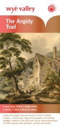
Brockweir QuayBrockweir QuayBrockweir Quay is <strong>the</strong> last remaining functional quayon <strong>the</strong> <strong>Wye</strong>. In <strong>the</strong> 17th and 18th centuries, large trowsnavigated from Bris<strong>to</strong>l and Cheps<strong>to</strong>w on a high tide <strong>to</strong>unload goods on <strong>to</strong> smaller barges. These were pulledupstream by teams <strong>of</strong> men called ‘bow hauliers’ <strong>to</strong>Monmouth, Ross and Hereford. Ships were built here in<strong>the</strong> 17th and 18th centuries. It was a busy port withvessels loading and unloading cargoes, sailors andcrew working <strong>the</strong> trows and steamers, and <strong>the</strong> noise <strong>of</strong>construction and repairs.The Angidy ValleyIndustrial activity began in <strong>the</strong> Angidy Valley in <strong>the</strong> 1500s. By 1800 up <strong>to</strong> 20waterwheels powered furnaces and mills along <strong>the</strong> river. Two <strong>of</strong> <strong>the</strong>se sites arestill accessible using <strong>the</strong> footpath which follows <strong>the</strong> route <strong>of</strong> <strong>the</strong> leat from LowerWireworks upstream <strong>to</strong> Angidy Furnace. In 1568 <strong>the</strong> first brass in Britain wasproduced in Tintern, whilst later part <strong>of</strong> <strong>the</strong> trans-atlantic cable wasmanufactured in Lower Wireworks. The site was convenient, as <strong>the</strong> <strong>Wye</strong> <strong>of</strong>feredtransportation, <strong>the</strong> Angidy stream water power, trees in nearby woods providedcharcoal fuel and <strong>the</strong> <strong>Forest</strong> <strong>of</strong> <strong>Dean</strong> iron ore.Abbey MillAbbey Mill was an important part <strong>of</strong> <strong>the</strong> industrial heritage <strong>of</strong> Tintern wheregoods were loaded on <strong>to</strong> vessels in <strong>the</strong> tidal dock that was here until <strong>the</strong> dockwas filled in as part <strong>of</strong> a flood alleviation scheme. Originally <strong>the</strong> site was used <strong>to</strong>mill corn for <strong>the</strong> nearby Tintern Abbey and was possibly also used as a woollenmill. Finally <strong>the</strong> site was used as a wood turnery and saw mill until <strong>the</strong> 1970s.Today <strong>the</strong> Abbey Mill complex houses craft shops and a licensed restaurant.Devil’s PulpitView <strong>of</strong> Tintern Abbey fromDevil’s Pulpit, Linda Wright28Nestled high in <strong>the</strong> trees <strong>to</strong> <strong>the</strong> sou<strong>the</strong>ast <strong>of</strong> Tintern Abbey is ‘Devil’s Pulpit’a popular viewpoint on <strong>the</strong> Offa’s DykePath National Trail. Devil’s Pulpit itselfis a small rocky outcrop that overlooks<strong>the</strong> Abbey. According <strong>to</strong> local legend,<strong>the</strong> Devil used <strong>to</strong> preach from <strong>the</strong>outcrop and attempt <strong>to</strong> seduce <strong>the</strong>abbey's monks away from Christianity.
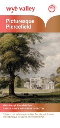
Map Section 8Lancaut <strong>to</strong> Cheps<strong>to</strong>wEagle'sNestDISTANCE • 2.5 miles • 1.5 hoursPiercefield Park –a designed landscapeThe wooded landscape <strong>of</strong>Piercefield Park contains <strong>the</strong>remains <strong>of</strong> paths laid out byValentine Morris in <strong>the</strong> 1750s.Morris’s picturesque walks hadviewpoints and features along <strong>the</strong>route and were extremely popularwith <strong>to</strong>urists on <strong>the</strong> <strong>Wye</strong> Tour. Infact, Piercefield became anunmissable attraction on <strong>the</strong> <strong>Wye</strong>Tour as Gilpin wrote, “Mr Morris’simprovements at Persfield.... aregenerally thought as much worth atraveller’s notice, as anything on<strong>the</strong> banks <strong>of</strong> <strong>the</strong> <strong>Wye</strong>.”GiantsCaveMany <strong>of</strong> Morris’s features remainand underwent substantialconservation works in 2009. The<strong>Wye</strong> Valley Walk links a sequence <strong>of</strong>viewpoints called The Alcove, ThePlatform, The Grot<strong>to</strong>, Giant’s Cave,Lover’s Leap and Eagle’s NestLover’sLeapThe Grot<strong>to</strong>Piercefield Park •The PlatformThe AlcoveLancautChurchCheps<strong>to</strong>w CastleCheps<strong>to</strong>wCheps<strong>to</strong>wLanding on slipwaynear Boat Inn. Pleasenote that landing hereusually involves wadingthrough s<strong>of</strong>t mud thatcan be very dangerous.Wyn<strong>to</strong>ur'sLeapandViewpointCheps<strong>to</strong>w• Old Bridge& RailwayBridgeImportant: <strong>Canoeists</strong>are recommended not<strong>to</strong> attempt <strong>to</strong> canoebelow Cheps<strong>to</strong>w as <strong>the</strong>junction with <strong>the</strong> <strong>River</strong>Severn has verydangerous currents© Crown copyright. All rightsreserved. 100024168. (2011)Eagles Nest viewpoint29
Wyn<strong>to</strong>urs LeapLancaut ChurchThe remains <strong>of</strong> Lancaut Church,nestled on <strong>the</strong> banks <strong>of</strong> <strong>the</strong> <strong>Wye</strong>, canbe seen on your left as you complete<strong>the</strong> meander around <strong>the</strong> Lancautpeninsula. The name is derived fromLlan Cewydd, a 6th Century WelshSaint <strong>to</strong> which <strong>the</strong> church wasoriginally dedicated although later itsdedication was changed <strong>to</strong> St James.The church is thought <strong>to</strong> date from <strong>the</strong>mid-twelfth century but received majorres<strong>to</strong>ration work in <strong>the</strong> 18th century. Itcontinued <strong>to</strong> serve a smallcongregation before falling out <strong>of</strong> usearound 1865. Conservation works herehave involved <strong>the</strong> re-construction <strong>of</strong><strong>the</strong> churchyard wall.One <strong>of</strong> <strong>the</strong> finest viewpoints on <strong>the</strong> <strong>Wye</strong> is from Wyn<strong>to</strong>urs Leap situated high a<strong>to</strong>p <strong>the</strong>cliffs on your left. The views can be accessed via <strong>the</strong> Offa’s Dyke Path National Trail.Legend has it that Sir John Wyn<strong>to</strong>ur, an ardent Royalist, burnt Whitecross House in1645 <strong>to</strong> s<strong>to</strong>p it falling in<strong>to</strong> <strong>the</strong> hands <strong>of</strong> <strong>the</strong> Roundheads. Fleeing <strong>the</strong> Roundheads onhorseback he was said <strong>to</strong> have jumped <strong>of</strong>f <strong>the</strong> cliffs at Woodcr<strong>of</strong>t. However, he mayhave known a ‘secret’ path down <strong>to</strong> <strong>the</strong> river and <strong>the</strong>refore evaded capture, but <strong>the</strong>escapade gave rise <strong>to</strong> <strong>the</strong> name ‘Wyn<strong>to</strong>urs Leap’ for <strong>the</strong> cliff face.Cheps<strong>to</strong>w CastleIn <strong>the</strong> late eighteenth century <strong>the</strong> ruins <strong>of</strong> Cheps<strong>to</strong>w Castle were <strong>the</strong> highlight at <strong>the</strong>end <strong>of</strong> <strong>the</strong> <strong>Wye</strong> Tour. The Castle is <strong>the</strong> oldest surviving s<strong>to</strong>ne fortification in Britain.Construction started from 1067 under <strong>the</strong> instruction <strong>of</strong> <strong>the</strong> Norman Lord WilliamFitzOsbern, later made Earl <strong>of</strong> Hereford and was <strong>the</strong> sou<strong>the</strong>rnmost <strong>of</strong> a chain <strong>of</strong>castles built along <strong>the</strong> English-Welsh border in <strong>the</strong> Welsh Marches.Cheps<strong>to</strong>w MuseumLancaut ChurchView from Wyn<strong>to</strong>urs LeapTo find out more about <strong>the</strong> Picturesque <strong>to</strong>ur and <strong>the</strong> <strong>Wye</strong> Valley take <strong>the</strong> time <strong>to</strong> visitCheps<strong>to</strong>w Museum. This also has extensive material about <strong>the</strong> Piercefield Estate andits people. Similarly it describes local industries in Cheps<strong>to</strong>w and houses an example<strong>of</strong> a s<strong>to</strong>pnet fishing boat which was used <strong>to</strong> catch salmon in <strong>the</strong> <strong>Wye</strong>. You can alsoexperience a ‘virtual’ <strong>Wye</strong> Tour <strong>to</strong> compare <strong>to</strong> your canoe trip.30
NEW THREATS TO THE RIVER WYEImportant Information for canoeistsAll river users benefit from ahealthy aquatic environment.Clothing and equipment that hasnot been thoroughly dried ordisinfected can carry invasivespecies and diseases that caninfect water bodies, <strong>of</strong>ten withdevastating effects. Crayfishplague is just such a disease.Ano<strong>the</strong>r potentially damagingplague is Gyrodactylus salaris(GS) which affects salmon andthis could and be brought in from<strong>the</strong> continent. It has devastatedrivers in Norway.Ano<strong>the</strong>r, more recent threat hascome from <strong>the</strong> killer shrimpDikerogammarus villosus, adestructive species that hasarrived in UK waters from EasternEurope. It <strong>to</strong>o could have adevastating effect on wildlife andfish. They can easily betransported in <strong>the</strong> webbing andwater in <strong>the</strong> bot<strong>to</strong>m <strong>of</strong> canoesand kayaks.To reduce <strong>the</strong> risk <strong>of</strong> Crayfishplague ,GS and killer shrimpspreading in UK waters it isimportant <strong>to</strong> take <strong>the</strong> followingprecautions.WHAT YOU MUST DOIf you intend <strong>to</strong> reuse your canoeingequipment on trips <strong>to</strong> different UKwaters or abroad and <strong>the</strong>re will be lessthan a seven day gap between yourtrips, you must ensure that yourclothing and equipment has beenproperly sterilised through one <strong>of</strong> <strong>the</strong>following methods.METHOD ADrying <strong>to</strong> a minimum <strong>of</strong> 20 degCfor at least 2 days.Method BHeating <strong>to</strong> above 60 degCfor at least one hour.Method CDeep freezing for at least one day.Method DImmersion <strong>of</strong> materials in a solution<strong>of</strong>, or addition <strong>of</strong> one <strong>of</strong> <strong>the</strong>following chemicals <strong>to</strong> <strong>the</strong>concentration indicated for aminimum <strong>of</strong> 10 minutes:• Virkon 1%• Wescodyne 1%• Sodium chloride (common salt) 3%• Sodium hydroxide 0.2%31
<strong>Canoeists</strong> below Yat Rock
Canoes at Symonds Yat‘This project has been supported by Advantage West Midland’s Natural Assets Programme in partnership with Natural England’<strong>Wye</strong> Valley A.O.N.B. Office, Hadnock Road, Monmouth, Monmouthshire, NP25 3NGwww.wyevalleyaonb.org.ukwww.environment-agency.gov.uk