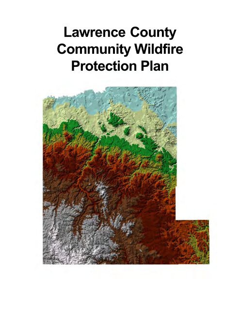
Lawrence County Community Wildfire Protection Plan - Black Hills ...
Lawrence County Community Wildfire Protection Plan - Black Hills ...
Lawrence County Community Wildfire Protection Plan - Black Hills ...

Create successful ePaper yourself
Turn your PDF publications into a flip-book with our unique Google optimized e-Paper software.
<strong>Lawrence</strong> <strong>County</strong><strong>Community</strong> <strong>Wildfire</strong><strong>Protection</strong> <strong>Plan</strong>
Prepared For:<strong>Lawrence</strong> <strong>County</strong>PO Box FDeadwood, SD 57732Office: (605) 578-2122Email: pthomson@lawrence.sd.usWorking document:1/3/2012Prepared By:<strong>Black</strong> <strong>Hills</strong> Land AnalysisRob Mattox12007 Coyote Ridge RoadDeadwood, SD 57732Office: (605) 578-1556Email: rob@matttox.bizwww.mattox.biz
Table of Contents<strong>Community</strong> Discussion …………………………………….....……………..……......4The Healthy Forest Restoration Act .........................................................................5Fire History ……………………………………………………..…………..….............5Fire Regime Condition ..............................................................................................7Agency Projects ........................................................................................................7Topography …………………………..............……………..…………...………..…...8Weather ……………………………………………………....................…………..…9Water Sources ...........................................................................................................9Risks .........................................................................................................................11Hazards ....................................................................................................................12Values ......................................................................................................................14Wildland Urban Interface Zones ............................................................................15Ingress & Egress ...................................................................................................19Powerline Right of Way ..........................................................................................19Watersheds .............................................................................................................19Historical Sites .........................................................................................................20Goals and Objectives ..................……………………………………...….…..…….21Hazardous Fuels Reduction Programs.………………………………......….….....22Fire Departments and Apparatus ……………………………………….….....…....24Fire Departments Response Times ......................................................................30Action Items ...........................................................................................................30Recommendations and Firewise Practices ..........................................................30Fuel Treatment Requirements ...............................................................................33Fire Resistive Building Requirements ...................................................................34Fire Resistive <strong>Plan</strong>t Species ..................................................................................36Firewise Landscaping .............................................................................................37Fire Hazard Severity Form 502 ..............................................................................38Required Survivable Space ....................................................................................40Ignition-resistive Construction ................................................................................41Signature Page ……………………………………………….………………….......42Glossary ..................................................................................................................43Bibliography ………………………………...……………………………………......46<strong>Lawrence</strong> <strong>County</strong> <strong>Community</strong> <strong>Wildfire</strong> <strong>Protection</strong> <strong>Plan</strong> 3
<strong>Community</strong> DiscussionThe principal objective of thiscommunity wildlife protection plan is toreduce the risk from wildfire to life, property,critical infrastructure and natural resourcesin Wildland Urban Interface areas of<strong>Lawrence</strong> <strong>County</strong>. The Wildland UrbanInterface, (WUI), is a set of conditions thatexist when structures and other humandevelopment meet or intermingle withwildland or vegetative fuels. The USDAForest Service in conjunction with the USDIBureau of Land Management identified alist of communities and placed them in theFederal Register. These communities arein the WUI areas and in the vicinity of federallands that have been identified as being athigh risk from wildfire. Other areas of<strong>Lawrence</strong> <strong>County</strong> are also at high risk fromwildfire including, but not limited to, thecommunities identified in the FederalRegister. A community is a group ofpeople living in the same locality and underthe same government. Everyone living in<strong>Lawrence</strong> <strong>County</strong> should be eligible toreceive the same consideration andbenefits as the people that are identified inthe Federal Register if they live in the WUIand are at risk from wildfire. Data from the2000 census indicates there are a total of21,802 people in <strong>Lawrence</strong> <strong>County</strong>. Theaverage population per household is 2.33persons.<strong>Lawrence</strong> <strong>County</strong> is located in thenorthern portion of the <strong>Black</strong> <strong>Hills</strong> in westernSouth Dakota. The total area of the countyis approximately 800 square miles or511,940 acres. There are 4 primarylandowners within <strong>Lawrence</strong> <strong>County</strong>, whichinclude: Private, State, USDI Bureau ofLand Management and USDA ForestService. The private property is scatteredacross the entire county consisting of4 <strong>Lawrence</strong> <strong>County</strong> <strong>Community</strong> <strong>Wildfire</strong> <strong>Protection</strong> <strong>Plan</strong>agricultural/range land, mining claims,residential and commercial and historicalproperty. There are approximately 229,060acres of private property in <strong>Lawrence</strong><strong>County</strong>. The Bureau of Land Managementmanages approximately 5,220 acres withinthe exemption area, (See page 8). Thereis also state land consisting of gameproduction areas, fish hatcheries, and lakesand streams. There are approximately4,335 acres of state owned land in<strong>Lawrence</strong> <strong>County</strong>. There are approximately273,335 acres owned by the United StatesDepartment of Agriculture in <strong>Lawrence</strong><strong>County</strong> known as the <strong>Black</strong> <strong>Hills</strong> NationalForest.<strong>Wildfire</strong> doesn’t recognize propertyboundaries and the occurrence of firecrossing these boundaries is a commonoccurrence. Cooperation between allagencies is important to reduce the riskfrom wildfire. Sharing information anddeveloping plans will enhanceeffectiveness of wildfire mitigation.Firefighter and public safety is the numberone priority. Reducing the risk to values
from all hazards is an important concernfor all the stakeholders in <strong>Lawrence</strong> <strong>County</strong>.The Healthy Forest Restoration ActThe <strong>Community</strong> <strong>Wildfire</strong> <strong>Protection</strong><strong>Plan</strong>, (CWPP), concept is outlined in theHealthy Forest Restoration Act, (HFRA), of2003. This Act provides the basis toencourage and allow comprehensivecommunity-based forest planning and theprioritization of fuel reduction and othervegetative management projects. Thislegislation includes statutory incentives forthe USDA Forest Service and the USDIBureau of Land Management to giveconsideration to these priorities andplanning suggestions set out in individual<strong>Community</strong> <strong>Wildfire</strong> <strong>Protection</strong> <strong>Plan</strong>s.The HFRA, builds on the NationalFire <strong>Plan</strong> and the Ten Year ComprehensiveStrategy for Reducing Wildland Fires Risksto Communities and the Environment inestablishing an expectation that federal landmanagement agencies will work withcommunities and local governments toreduce fire and forest health risks within andaround WUIs and communities at risk . TheHFRA specifically encourages efforts torestore healthy forest conditions byauthorizing expedited environmentalassessments, administrative appeals, andjudicial review for hazardous fuels projectson federal land, and gives preference inthe use of these authorities to agencies whopartner with communities in a collaborativefashion.The HFRA specifically requires thatthe federal government work collaborativelywith local communities that have prepareda CWPP. This is particularly important in<strong>Lawrence</strong> <strong>County</strong> since the federalgovernment owns over 50% of the <strong>County</strong>.With such a large area controlled by thefederal government, collaborativelandscape vegetative planning is absolutelynecessary to effectively protect the WUIsand communities at risk within <strong>Lawrence</strong><strong>County</strong>.A CWPP may provide communitieswith a tremendous level of influence overwhere and how federal agenciesimplement fuel reduction projects onfederal lands and how additional federalfunds may be distributed for projects onnon-federal lands. Federal agencyleadership has also clearly indicated thatfiscal resources appropriated for thepreparation and implementation of HFRAprojects will be preferentially distributed toareas where CWPPs have beencompleted.The National Environmental PolicyAct, (NEPA), also supports thiscollaborative planning by allowing localgovernments where they provide specialexpertise to cooperate with the federalgovernment on NEPA projects. In manyareas <strong>Lawrence</strong> <strong>County</strong> has this specialand unique expertise that would provide thefederal government with valuable input inplanning and prioritizing vegetativetreatments. Where desired by the <strong>County</strong>the USDA Forest Service and/or USDIBureau of Land Management should givethe county, cooperating agency status onvegetative projects that are planned to beimplemented in the <strong>County</strong>.Fire HistoryThere have been many fires that haveoccured in <strong>Lawrence</strong> <strong>County</strong>. All of thesefires range from .01 acres to 11,000 acres.Many of the fire records for the past 100years are not accurate or the data isincomplete. Many large fires have names,acres burned and possibly an ignition point<strong>Lawrence</strong> <strong>County</strong> <strong>Community</strong> <strong>Wildfire</strong> <strong>Protection</strong> <strong>Plan</strong> 5
ut no specific perimeter, severity data, fuelor weather conditions during the event. Thefire history data was acquired and analyzedby the South Dakota Department ofAgriculture Wildland Fire SuppressionLarge Fire HistoryNAME YEAR ACRES CAUSE1. Grizzly Gulch 2002 11,000 acres Unknown2. Beaver 2001 50 acres Lightning3. Maitland 2000 75 acres Lumbering4. Deadwood 1959 4,501 acres Debris burning5. Nemo 1959 273 acres Power line6. Dry Lake 195? 282 acres Unknown7. Big Elk 1949 6,630 acres Smoker8. Buskala 1947 2,200 acres Smoker9. Galena Mill 1937 1,181 acres Lumbering10. <strong>Black</strong> Fox 1934 635 acres Lightning11. Rochford 1931 21,640 acres Incendiary12. Lost Gulch 1931 1,079 acres Smoker13. Whitewood Canyon1917 600 acres Railroad14. Sterns Park 1914 500 acres Unknown15. Sheep Mountain 1911 320 acres Unknown16. Tilly 1911 600 acres Hunter17. Thein 1911 300 acres Lightning18. Thein #2 1911 640 acres Unknown19. Smith Peak 1911 1,280 acres Unknown20. Haka 1911 1,840 acres Burning brush21. Galena 1908 2,000 acres Unknown22. Iron Creek 1899 38,400 acres Unknown23. Roubaix 1893 1,111 acres Unknown24. Two Bit 1894 2,000 acres Unknown25. Dumont 1890 3,000 acres Unknown26. Savoy 1890 1,000 acres Unknown27. Iron Creek 1890 38,000 acres Unknown6 <strong>Lawrence</strong> <strong>County</strong> <strong>Community</strong> <strong>Wildfire</strong> <strong>Protection</strong> <strong>Plan</strong>Division for this plan in 2002. The previouslist of large fires was compiled from USDAForest Service, State of South Dakota andlocal knowledge. These fires all burnedwithin <strong>Lawrence</strong> <strong>County</strong>. There areparticular years that fire activity was muchmore severe; 1890, 1911, 1931, 1959 and2002 show more activity and more acresburned. Many fire scars, from the 1930’son, were still evident on a 1973 land satelliteimage. This could indicate that some ofthese fires burned very intensely andcaused stand mortality to a majority of theacres burned. These years of higher fireactivity may have had dryer conditions priorto and during the fire season and fireweather during the burn period that mayhave caused increased fire severity. Firehistory in the northern <strong>Black</strong> <strong>Hills</strong> showsfires burned more frequently but with muchless intensity. This resulted in a more opensavanna type condition with widely spacedstands of mature Ponderosa Pine.Indications show pre-settlement foreststand density levels may have typicallybeen 30-40 mature trees per acre. Thiswould generally provide 15-20 feet of
separation between the canopies. Thegreater amount of acres burned annuallyhelped the ground fuel from accumulatinginto dense fire prone fuel conditions.Timber litter or surface loads weremaintained at lower levels by naturallyoccurring ground fires. The dead litter andconifer vegetation regeneration were notgiven a chance to form the vertical continuitythat fire requires to get off the ground andinto the forest canopy thus maintaining lessintense fires.Fire history is important and effortsto develop and maintain accurateinformation are essential. Cooperationbetween agencies to improvedocumentation of fire history should be acontinuing effort. The circumstances duringa fire event such as conditions of fuels,temperature, relative humidity, fire behaviorand topography are important whenplanning mitigation strategies.Fire Regime ConditionThe fire regime condition classes arequalitative measures describing the degreeof departure from historical fire regimes.Alterations of key ecosystem componentssuch as species composition, structuralstage, stand age, stand density, canopyclosure and fuel loads may result fromdeparture of historic conditions. One ormore of the following may have caused thisdeparture: fire suppression, timberharvesting, livestock grazing, introductionand establishment of exotic plant species,insects or disease or other pastmanagement activities.The USDA Forest Service, dataclassifies the <strong>Black</strong> <strong>Hills</strong> National Foresthistorical fire regime as low intensity, withhigh frequency. This means that a historicalfire frequency was 35-years or less and thatfires generally burned at low intensities andlow to moderate severities. Conditionclasses range from 1-3 where a rating of 1means that the forest environment is not atrisk of losing any major components or atrisk of significant change of one or moreof its major ecosystem components. Arating of 3 indicates that the forest area isat high risk of significant change on one ofthose components. An easy indicator ofcondition class is to count the number offire return intervals or frequency intervalsmissed. Generally speaking, if an area hasmissed 3 or more frequency return intervalsthen the stand is at high risk of significantchange. The USDA Forest Service dataidentifies the <strong>Black</strong> <strong>Hills</strong> National Forest tobe in a Condition Class 3.Fire regime condition classes in<strong>Lawrence</strong> <strong>County</strong> have been significantlyaltered from the historical range. The riskof losing key ecosystem components ishigh. Fire frequencies have departed fromhistoric frequencies by multiple returnintervals. This has resulted in dramaticchanges to one or more of the following:fire size, intensity, severity and landscapepatterns. Vegetation attributes have beensignificantly altered from their historicrange. The structure and orientation offuels in <strong>Lawrence</strong> <strong>County</strong> varytremendously. Some areas have had fuelsreduction projects done in recent history;other areas have not. Areas that have hadsome type of fire or fuels activity may haveless hazardous fuels than areas that havenot had any vegetation management inmany years.Agency ProjectsLandscape projects planned andimplemented by local agencies in<strong>Lawrence</strong> <strong>County</strong> have an effect on fire and<strong>Lawrence</strong> <strong>County</strong> <strong>Community</strong> <strong>Wildfire</strong> <strong>Protection</strong> <strong>Plan</strong> 7
fuels across the county. These projectsfocus on specific areas that have beenidentified as needing treatment. The goalof each of the specific projects in <strong>Lawrence</strong><strong>County</strong> is to provide proactive landmanagement practices. Reducing the riskfrom catastrophic wildfire and insectinfestation by performing vegetationmanagement is one aspect of theseprojects.<strong>Lawrence</strong> <strong>County</strong> will cooperate withagencies to review and provide input forthe purpose of reducing risk to values in<strong>Lawrence</strong> <strong>County</strong> from uncontrolledwildfire. Cooperation between allstakeholders will provide a more effectiveproduct to protect life, property andresources in <strong>Lawrence</strong> <strong>County</strong>.<strong>Lawrence</strong> <strong>County</strong> has a very uniquearea known as the Exemption Area.Approximately 22,520 acres were exemptfrom the <strong>Black</strong> <strong>Hills</strong> National Forest in 1896when the forest was designated. Theownership of the area was so intermingledwith mining claims and other ownership thatthe area was excluded from the NationalForest. The USDI Bureau of LandManagement now manages public landswithin the exemption area.Federal lands within the <strong>Black</strong> <strong>Hills</strong>fall under the jurisdiction of the USDAForest Service and are managed by projectareas through procedures set by theUSDA.Private lands within <strong>Lawrence</strong> <strong>County</strong>should be managed by the landowner.Help is available through differentprograms and also through the State ofSouth Dakota Department of Agriculture.The South Dakota Wildland Fire SuppressionDivision is currently managing ahazardous fuels reduction program thatprovides a 50/50 cost share program forprivate landowners that are interested in reducinghazardous fuels. This program focuseson the survivable space aroundstructures. They also have another programthat provides 100% funding for hazardousfuels reductions in areas that surroundcommunities in WUI zones. The intentof this program is to reduce fire intensityand provide values at risk a better opportunityto survive wildfire.8 <strong>Lawrence</strong> <strong>County</strong> <strong>Community</strong> <strong>Wildfire</strong> <strong>Protection</strong> <strong>Plan</strong>TopographyThe topography of <strong>Lawrence</strong> <strong>County</strong>must be considered when mitigating forwildfire. The following slope and aspectvalues were derived from a digital elevationmodel of <strong>Lawrence</strong> <strong>County</strong>. The shape ofthe country can influence the intensity andspread of wildland fire. Slopes with southor west aspects will become drier and thefuels will cure earlier in the season. Thereare 5,203 acres in <strong>Lawrence</strong> <strong>County</strong> on aslope of more than 30% with a south orwest aspect. 741 of these acres are onprivate land. Topography alters the normalheat transfer process and modifies the
general weather patterns, producinglocalized weather conditions that influencefire behavior. Fires starting at the base ofslopes become larger and more intensebecause of availability of up-slope fuels.As slope increases, rate of spread andflame lengths also increase. Thetopographic configurations of narrowcanyons pose dangerous conditions thatShout “Watch Out” for fire suppressioncrews. The fuels on these slopes are alsopreheated from the sun and may producemore erratic fire behavior. Down slopeareas adjacent to structures need toincrease the amount of survivable spaceto provide additional protection to thesevalues from wildfire. We cannot controlwhen or where fire will occur but withproactive planning and preparedness wemay be able to lessen the impact it has onlife, property and resources.WeatherCurrent weather patterns are creatingdrought conditions in <strong>Lawrence</strong> <strong>County</strong> thatmay be contributing to the risk from wildfire.The overall climate of the <strong>Black</strong> <strong>Hills</strong> areais continental, which is characterizedgenerally by low precipitation, hotsummers, cold winters and extremevariations in both precipitation andtemperatures. Local climatic conditions areaffected by topography, with generally lowertemperatures and higher precipitation at thehigher altitudes. Research indicates thathistorically there have been long durationsof drought and wet periods dating back asfar as the 1600’s. Long periods of droughtdirectly affect tree mortality, insect activityand possibly contribute to more severe firebehavior.During fire season in western SouthDakota, when the winds are from the souththe temperatures are usually higher and therelative humidity is usually lower. Theseconditions are conducive for fires to easilybecome large conflagrations that are hardto manage. Large fires also occur that arewind driven events. The spread rate anddirection vary according to predominantwind direction, topography, fuel conditionsand relative humidity.Water SourcesThe municipalities of Lead,Deadwood, Central City, Pluma, Spearfish,Whitewood and St. Onge all havepressurized water systems with hydrants.The water sources in the rural areas of<strong>Lawrence</strong> county may be limited to dry<strong>Lawrence</strong> <strong>County</strong> <strong>Community</strong> <strong>Wildfire</strong> <strong>Protection</strong> <strong>Plan</strong> 9
hydrants, creeks and dams. Water sourcesshould be developed to provide a usablewater supply for fire suppression crews.The water source should be signed andclearly indicate the extent of the source andhow it is supplied. Standardized fire hosefittings should be used to accommodatefire apparatus. There have been 138 watersources mapped in <strong>Lawrence</strong> <strong>County</strong>.These do not include the hydrants in themunicipal water systems, with theexception of that a few hydrants on theedges of the cities are included. Duringdrought conditions, some water sourcesmay be inadequate for fire suppressionactivities.Water sources should be created forthe purpose of fire suppression and firefightingagencies should be made awareof the locations and amount of water onhand and how these sources aremaintained. Many areas in <strong>Lawrence</strong><strong>County</strong> may not have readily available watersources for fire suppression and this couldgreatly impact fire suppression activities.Water sources will be mapped andinformation will be documented about thesesources. This information will be available10 <strong>Lawrence</strong> <strong>County</strong> <strong>Community</strong> <strong>Wildfire</strong> <strong>Protection</strong> <strong>Plan</strong>to fire departments for suppressionactivities.The municipalities of Lead,Deadwood, Central City, Pluma and someother surrounding communities all use acommon water source. The HomestakeMining Company developed this watersource over 100 years ago. It consists ofa series of collection sites south and westof the city of Lead, some as far away as 10miles. The majority of the system is gravityfed with only one lift station. Thewatersheds that feed this collection systemare comprised of private and federal landwith a total of 34,160 acres. Large amountsof ash and sediment could cause failure ofthe collection system by cloggingtransportation pipelines and other adverseeffects. The majority of the transportationsystem is underground in clay tile pipes.There are a few structures that are aboveground that also need consideration; oneof these is the Reno Bridge that is a steelstructure with a redwood flume that carries100% of the water to the municipalities. Afuels reduction project was preformed atthis location in 2004 in a collaborative effortbetween the USDI Bureau of LandManagement, City of Lead, the State ofSouth Dakota and <strong>Lawrence</strong> <strong>County</strong>. This
project will help insure this importantinfrastructure is more prepared to survivea wildfire event.There are 16 active water intakes thatwould be in jeopardy in the event of acatastrophic wildfire. Treatment areas havebeen identified which will help protect thiscritical infrastructure. These treatmentareas need to receive treatments whichwould significantly reduce the threat of astand replacement type fire within theidentified treatment areas. Adequatecanopy spacing within these treatmentareas should be maintained to reduce thechance of a sustained crown fire. Surfacefuel loads need to be treated to reduce theamount of debris that could threaten thewater system infrastructure in the event ofa fire and subsequent precipitation events,upstream and upslope from the waterintakes. GIS data of these treatment areaswill be provided to agencies as required.There are 2 collection points on theClark & Bowen Ditch; these intakes are atrisk due to over stocked stand conditions.The identified treatment areas consist ofapproximately 381 acres that are upstreamand upslope from the intake points.There are 3 collections intakes on thePeake Ditch which are also at risk. Theidentified treatment areas for these 2 sitesconsist of approximately 1,473 acres.There are 3 water intakes on the LittleRapid Ditch that will require mitigationefforts to protect critical infrastructure.These areas consist of approximately 910acres.The Spearfish Ditch has 7 collectionpoints. This area consists of approximately1,455 acres that also needs mitigationefforts.The Hanna pump house intake alsois at risk, and 440 acres have beenidentified to help protect this critical area.This water collection system is thesole source of water to these communitiesand mitigation efforts should beimplemented as soon as possible to helpensure the integrity of the water system.The Lead Deadwood Sanitary Districtwill be contacted whenever there is any typeof work to be performed in the vicinity ofany of the components of the watercollection system including pipes, lines,structures, intake basins or any othercomponent of the system. Collaborationbetween entities is very import to protectthis important infrastructure which servesthe municipalities in central <strong>Lawrence</strong><strong>County</strong>.RisksThe risk of wildfire occurring in<strong>Lawrence</strong> <strong>County</strong> is evident based on thefire history within the <strong>County</strong>. Ignitions haveoccurred from railroads, vehicles, lightning,sawmills, burning debris, power lines,incendiary, and other human causedevents. <strong>Lawrence</strong> <strong>County</strong> has seen a largeamount of rural development over the pastseveral years. These areas are typicallysmaller tracts of land that are being brokenup into subdivisions for individualdevelopment. Considering the increasingnumber of people living in WUI areas,mitigating the risk from wildfire must be apriority. Utilizing better community planningof WUI areas, using Firewise choices topreserve life and property, updating firesuppression apparatus and by utilizingpublic education we can possibly decreasethe potential risk from wildfire. It is not amatter of “if it burns, but when it burns”.Heightened awareness of current forest<strong>Lawrence</strong> <strong>County</strong> <strong>Community</strong> <strong>Wildfire</strong> <strong>Protection</strong> <strong>Plan</strong> 11
condition verses historical forest conditionsmay help people become aware that weneed to work toward getting the forest backinto a more natural condition. Reducing therisk from wildfire by lowering fire intensitiescan help save lives, property andresources.Structure density should also beconsidered when reducing the risk fromwildfire. A structure burning inside ofanother structure’s survivable space addsto the overall intensity and spread of awildfire. In many cases structure afterstructure are consumed by fire and thenatural vegetation does not burn. In thesecases it is the urban fuels that aresupporting the spread of the wildfire.Another important consideration isthe insurability of property in the <strong>County</strong>. Ifstructures are at higher risk from wildfire,insurance companies may not insure theseproperties, or they may insure them at muchhigher rates. Insurance companies arerecognizing Firewise practices andtechniques to reduce the exposure fromwildfire. If we can make the overall areabetter prepared for wildfire, this will helpreduce insurance costs or possibly preventinsurance companies from cancelingexisting policies, or denying insurancealtogether.HazardsThe vegetation coverage acrossnorthern <strong>Lawrence</strong> <strong>County</strong> is very diverse.The northern portion of the <strong>County</strong> isprimarily Great Plains Grasses withhardwoods in various draws and drainages.There may also be areas of PonderosaPine stands that could pose a threat tostructures in <strong>Lawrence</strong> <strong>County</strong>. Hardwoodsdominate the lower foothills surrounding the<strong>Black</strong> <strong>Hills</strong>. Burr Oak, Iron Wood, QuakingAspen and Paper Birch are some of theprimary hardwood vegetation types. Theseareas of deciduous vegetation types arenot as conducive to high intensity wildfires.That is they are not as likely to carrysustained fire through the canopy.Hardwood stands throughout the <strong>County</strong>should be identified and measures takento promote the restoration of these fireresistive species. These areas ofdeciduous vegetation create a diversity offuels that significantly reduce fire intensities.Meadow enhancement programsshould also be implemented to reduce theencroachment of conifers and other nonnativevegetation into meadows and openspaces. These open spaces provide fuelbreaks and areas of opportunity for firesuppression activities. The <strong>Black</strong> <strong>Hills</strong> havean abundance of White Spruce also knownas “<strong>Black</strong> <strong>Hills</strong> Spruce”. Spruce typicallygrows on the northern slopes and in thebottoms of drainages where more moistureis available. The vegetation on these Northslopes is generally much denser due to thehigher moisture levels and the relationshipto the sun. North slopes usually have lessfire frequency than south and west slopes.Occasionally hot, dry weather patterns12 <strong>Lawrence</strong> <strong>County</strong> <strong>Community</strong> <strong>Wildfire</strong> <strong>Protection</strong> <strong>Plan</strong>
make conditions right for north slope fuelsto burn and possibly with extremeintensities. The branching habit of a Sprucetree is usually continuous from the groundto the top of the tree, which makes themmore conducive to torching and crowning.When a Spruce tree torches it showersembers and firebrands that can createhazards associated with spot fires. Drierwinters and lack of spring storms reducesthe fuel moisture in large fuel sources thatare present in the forest. This maycontribute to increased fire behavior.Spruce regeneration in areas that are nothistorically Spruce stands should bereduced to help protect and promote theoriginal stand species.Hazardous fuels can also beassociated with cured grasses found on theprairie. Tall grasses that are cured andavailable to burn can generate high intensityfires that can spread very quickly. Thesegrass fires can be very dangerous becauseof the volatility of the fuels involved. Severalfirefighter fatalities in South Dakota haveoccurred on the prairie with grass as thefuel model. Shelterbelts need mitigationfrom wildfire and are areas of concern ifthey are not maintained properly.Maintenance may include disking betweenrows of trees to reduce the amount of fuelsfrom grasses. Removing dead materialand restoring with fire resistive plantspecies may help a shelterbelt survive awildfire event by reducing fire intensity.Shelterbelts need to be continuouslyregenerated and maintained to be efficient.The primary vegetation affectingwildfire in <strong>Lawrence</strong> <strong>County</strong> is mediumgrass, forbs, Ponderosa Pine and WhiteSpruce. Thinning of live conifers to createcanopy separation helps reduce the chanceof high intensity stand replacement firesfrom occurring. A surface fire generallyburns with lower intensities and provideslarger more mature trees a better chanceof survival. These surface fires also helpconsume typical forest litter and keep fuelsfrom building up to a hazardous level. Fuelreduction activities should target reducingsurface fuels such as storm-damagedtrees, slash and timber litter. Breaking thevertical continuity of the ladder fuels thatcontribute to torching and crowning firebehavior help reduce the chance of the firespreading into the canopy and alsoimproves forest health. Another benefit ofreducing crown fires is maintaining theaesthetics after a fire event, thus protectingthe ecological sustainability across thelandscape.There are many areas in <strong>Lawrence</strong><strong>County</strong> that have had the absence of firefor over 100 years. This has resulted in<strong>Lawrence</strong> <strong>County</strong> <strong>Community</strong> <strong>Wildfire</strong> <strong>Protection</strong> <strong>Plan</strong> 13
abnormally high fuel loads measured intons/acre ratios of fuel. These fuelsincrease the threat from wildfire byincreasing fire intensities and possiblyproviding a path for the fire to spread intothe forest canopy. This is not onlydetrimental to the forest but it can allow afire to become a large enough conflagrationto quickly overwhelm fire suppressioncrews.Fire history in <strong>Lawrence</strong> <strong>County</strong>shows fires can grow to large sizes withextreme fire behavior thus being verydetrimental to forest health. Proactiveplanning and mitigation efforts can lowerfire intensities, thereby reducing the lossof life, property, and resources. ExistingHardwood stands should be favored, byreducing the encroachment of conifers.Not only does restoration of these originalspecies maintain the forest in a more naturalstate but also the deciduous vegetation ismuch more resistant to sustained crownfire. The USDAForest Servicehas developedvegetation datacoverage onNational Forestsystem lands. Of284,163 acres,2.7% isgrassland, 7% isAspen/Birch, 5%is White Spruce and 85% is PonderosaPine. 150,000 acres are unclassified orare irrelevant. Stocking data on private landis unavailable.ValuesValues at risk in <strong>Lawrence</strong> <strong>County</strong> aremanaged by many different entitiesincluding federal, state, county, municipaland private. Agricultural, rangeland, wildlifehabitat, recreational, residential, commercialand historical property are all values presentin <strong>Lawrence</strong> <strong>County</strong>. The USDA ForestService manages 54% of the land in<strong>Lawrence</strong> <strong>County</strong>. This land is valued forwood fiber products, grazing, recreationaland the tourism industry. The majority ofthe other 46% is private property. Theeconomic value of private land in <strong>Lawrence</strong><strong>County</strong> is very diverse, but very importantfor sustained economic growth. Theseproperties must be protected fromuncontrolled wildfire.As of March 2011, there were 5,559inhabited structures and associated outbuildings located in the unincorporatedportion of the <strong>County</strong>. These do not includestructures within the municipalities ofSpearfish, Lead, Deadwood, Whitewood,and Central City. These homes and thesurrounding land, including the aestheticimportance of the vegetation, must beprotected to maintain the value of the area.The beauty and appeal of living in the <strong>Black</strong>14 <strong>Lawrence</strong> <strong>County</strong> <strong>Community</strong> <strong>Wildfire</strong> <strong>Protection</strong> <strong>Plan</strong>
<strong>Hills</strong> could be jeopardized by uncontrolledhigh intensity wildfires.This plan will help identify ways todevelop interagency cooperation forhazardous fuel treatments within the<strong>County</strong>. If the landowners or stakeholderscan work together to develop continuitybetween different fuel projects this willmake these treatments more effective. Anyand all agencies/landowners should sharethe burden of wildfire prevention in the<strong>County</strong>.22% of the rural structures in<strong>Lawrence</strong> <strong>County</strong> have been assessed forrisk from wildfire. Access, signage,vegetation, topography, water source, firedepartment response time, survivablespace, roofing material, buildingconstruction and placement of utilities wereall considered during the assessmentprocess.• Greater than 80% were rated high orextreme hazard from wildfire.• 46% were at risk from crown firewithin 100 feet of the structure.• 90% have treated between 30% and70% of their survivable space.• Less than 6% have treated more than70% of their survivable space.• Over 8% have non-fire rated roofcoverings.Assessment data was used toanalyze existing conditions within thesurvivable space of structures in <strong>Lawrence</strong><strong>County</strong>. Fuels, slope and survivable spacedata indicate that hazardous fuel conditionsaround structures exist throughout the WUIareas of the county. Prioritization of fuelsreduction projects will be coordinatedbetween local, state and federal agenciesto reduce the hazardous fuels across thelandscape, regardless of ownership.Wildland Urban Interface ZonesThe new cohesive strategy suggeststhat managers should focus on three majoritems; landscape restoration, fire adaptivecommunities and response to wildfire.Developing Wildland Urban Interfacezones will help <strong>Lawrence</strong> <strong>County</strong> worktowards all of these goals. Landscapetreatments will restore our ecosystem backto a more natural condition. Not only willthis restore the landscape, but it alsoreduces the risk of loss to property andresources from wildfire. Adaptingcommunities to the ecosystem will also beobtained through Firewise practices.Improved response coupled withenhanced suppression capability willproduce more cost effective results duringwildfire incident management. Reducingfire intensity across the landscape as itapproaches values in the WUI will beaccomplished by systematically reducingfuels as the fire approaches throughidentified WUI zones. Treatments will bemore aggressive closer to the structureswhich will provide better opportunities forprotection of these values. WUIboundaries have been developed withconsideration to fuels, topography, andvalues in the area.Treatments in identified ½, 1½ and 3mile buffers will all fall under generalprescription parameters until site-specificproject areas are identified, at which timeprescription elements will be developedaccording to site specific needs andconditions. The goal of fuels reductionprojects will be to reduce the risk from fireby lowering fire intensities and reducingcrowning and torching activities thatthreaten values in the WUI. Treatmentsshould utilize wood fiber as commerciallogs, firewood or other forest products<strong>Lawrence</strong> <strong>County</strong> <strong>Community</strong> <strong>Wildfire</strong> <strong>Protection</strong> <strong>Plan</strong> 15
where practical. Main considerations forthese projects should provide coniferseperation and enhance meadows byreducing encroachment of open spacefrom Pine or Spruce. This will help reducefuels, generate fuel breaks and provide firesuppression crews better opportunity forsuppression activities. Restoration oforiginal species in stands where PonderosaPine and White Spruce have encroachedin the last century will help maintain a mosaicof vegetation and species viability of thesestands. Existing Spruce stands tend to beuneven aged but usually prevail overHardwoods. Spruce stands need to betreated as any other Conifer duringhazardous fuel activities. Land managersshould consider the use of free-thinningpractices to maintain uneven aged or multistoriedstand structure to obtain standdiversity. These stands may need to beretained in a more open condition if theyare to be managed for multi-storiedstructure classes and achieve ladder fuelreduction objectives. Canopy base heightshould be considered to reduce torchingand crowning during a fire event. This isachieved by interrupting the verticalcontinuity of the fuels also known as ladderfuels. Crowning index and torching indexwill help identify areas at higher risk. Whereavailable, this data will be referenced to helpdevelop fuels treatments. Dead standingtrees that contribute to the threat in the WUIshould be addressed especially if theypose a safety hazard to firefighters and thepublic. Riparian areas and north slopesmay retain higher stocking levels whereappropriate.Site-specific spatial data will beanalyzed to identify hazards and helpdevelop projects that reduce risk anddecrease the potential of structural ignitionfrom wildfire. Structure assessments in theWUI areas will continue to help assessconditions in the <strong>County</strong> and determinefuture mitigation planning strategies. Thisinformation in conjunction with GIS willdisplay information more efficiently to helpshow relationships that may not be apparentotherwise. This data is also important tomanagers during suppression activities andstructure protection during a wildfire.Contact with homeowners duringassessment activities allows one-on-onediscussion of mitigation efforts landownerscan do to reduce the threat from wildfire.People are more aware and interested inwildfire mitigation when it is their ownproperty being discussed. Heightenedinterest by landowners in wildfire issues willhelp generate more support in the area ofwildfire mitigation and promote higher levelsof participation in the future. Encouragingpeople to live Firewise lives is crucial toprotecting life and property. This cannotbe achieved easily but will require theshared responsibility of everyone that hasa stake in its success.16 <strong>Lawrence</strong> <strong>County</strong> <strong>Community</strong> <strong>Wildfire</strong> <strong>Protection</strong> <strong>Plan</strong>
The ½-mile buffer zones will have atarget prescription average of 20-feet ofseparation between conifer canopies. Thiscan reduce the chance of active crown firein the general vicinity of structures and otherimprovements. Structure data of <strong>Lawrence</strong><strong>County</strong> contributed to the development of200 ½ mile WUI zones that consist ofapproximately 309,376 acres. These ½mile buffers have been identified aroundinhabited structures and definedcommunities at risk.½ mile WUI zones will be prioritizedfor treatments based on structure densitywithin these areas. The WUI data has beendeveloped with priority ratings to reflect theorder of precedence. Areas within the ½mile buffers that are thinned, open or donot contain hazardous fuels will beexcluded from required treatments. Theseareas must not contain fuel loads which willsupport sustained crown fire.Hazardous topography will beidentified as areas greater than 8% slopeon a south or west aspect. The areas whichclassify as hazardous topography willrequire more aggressive treatment. Conifercrown spacing should be maintainedgreater than the average 20 foot spacingto reduce the risk of crowning and torchingon steeper slopes with south and westaspect. Property ownership will determinewho is responsible for treatments. This planwill encourage private landowners to treattheir land also to improve the continuity ofthe fuels reduction efforts in <strong>Lawrence</strong><strong>County</strong>.The intent of these buffer zones is toreduce hazardous fuels to the point wherethe average worst condition during a wildfirewould not support a high intensity crownfire in the vicinity of values in the WUI. Thisshould be done by providing conifer canopyseparation, removal of ladder fuels andremoving or treating surface fuels. Coniferstands need aggressive treatment toreduce the chance of high intensity fire orlofted embers from endangeringcommunities ahead of severe wildfire.When a wildfire approaches a structurethrough these ½ mile buffers, it shoulddecrease in intensity and burn on theground. This would give suppressioncrews a safer environment and betteropportunities for protecting life, propertyand resources.The 1½-mile buffer zones will have atarget prescription of an average of 10 feetbetween conifer canopies. Stands may bestocked at higher levels if they do notthreaten WUI values during a fire eventfrom radiant, convective heat or loftedfirebrands. 1½ mile WUI buffers havebeen developed which cover approximately177,746 acres which will help protect<strong>Lawrence</strong> <strong>County</strong>.The 3-mile WUI buffer zones will betreated to reduce uncontrolled high intensitywildfire such as the 1959 Deadwood Fire<strong>Lawrence</strong> <strong>County</strong> <strong>Community</strong> <strong>Wildfire</strong> <strong>Protection</strong> <strong>Plan</strong> 17
or the Grizzly Gulch Fire of 2002. Theidentified 3-mile buffer zones consist ofapproximately 100,573 acres and enableland managers to design projects at alandscape level. Large areas of slash mayrequire the creation of fuel breaks whereslash will be piled and burned or chipped.The homogeneity of the forest will bediversified at a landscape level to providestrategic protections emphasizing safetyand survivability for homeowners andlandowners to escape a fire event.Additionally, these treatments will reducethe hazardous fuels and increase thesurvivability of the forest environmentsurrounding private property. Firefighterswill then have opportunities to engage infirefighting activities in an environmentwhere their life safety is not compromisedand the probability of success is greatlyincreased.Slopes with south or west aspect,“hot slopes”, that are situated with asoutherly orientation from communities orthat are below communities on a slope mayneed more aggressive treatments. Southand west slopes may require moreaggressive thinning to provide greater openspaces, which would significantly lower fuelloads that would influence fire behavior inthese critical topographic areas from fastmoving fires spreading from dry southerlywinds. Under story and ladder fuels shouldbe managed to reduce the risk of crowningand torching.Prescribed fire should be used tomanage surface fuel levels and maintainhistorical fire scars where appropriate.Burned areas may need future fueltreatments because of fuels that were notcompletely consumed during the initial fireevent. Generally, forest thinning or loggingslash should be removed, chipped,ground, or piled and burned in such amanner that would minimize the potentialfor residual forest stands to be damaged ifthe resulting residue was consumed duringa fire event. Slash created by forestoperations should be managed accordingto federal, state and local requirements. Atthe minimum, all slash will be lopped andscattered and will not exceed a depth ofmore than 18 inches. Forested areasshould be managed in such a manner thatwill minimize the chances of a catastrophiccrown fire from threatening WUI values,forest health and aesthetics. Not all foreststands will be required to be thinned. Thereare many areas in the <strong>Black</strong> <strong>Hills</strong> that arenot conducive to landscape treatments dueto topography and terrain characteristics.The intent of these treatmentguidelines is to reduce the risk to values inthe WUI. Interagency collaboration by allinterested stakeholders will help reduce theconflict with other land managementprograms and forest managementobjectives. Areas of endangered species,critical wildlife habitat or areas withmandated special requirements wouldrequire special considerations but shouldnot exclude treatment opportunities.Various treatments across thelandscape should be developed to dovetail18 <strong>Lawrence</strong> <strong>County</strong> <strong>Community</strong> <strong>Wildfire</strong> <strong>Protection</strong> <strong>Plan</strong>
together to reduce risk from uncontrolledwildfire. Prescribed burning, mechanicalthinning and slash treatment activities arevery important for reducing hazardous fuelconditions. Fire and fuel managementthrough above described methods will helpprotect biological and aesthetic values, butreducing the risk to the values in theWildland Urban Interface will takeprecedence not only to protect structuresbut also aesthetics and valuation ofproperty and resources.Ingress & EgressAccess is an important considerationfor emergency response whether it is fire,ambulance or law enforcement vehicles. Allof these agencies may be responding intoan incident area. Another considerationwould be the public evacuating during awildfire incident and emergency servicepersonnel responding into the area.Properly planned access would provide asafer and more efficient transportationsystem. Primary access roads should bebuilt to <strong>County</strong> specifications. Design loadsfor bridges on driveways longer than 200-feet should be rated to support themaximum weight of the respondingapparatus.Primary ingress/egress roads in<strong>Lawrence</strong> <strong>County</strong> have been identified andshould be treated to provide for safeaccess during a fire event. These roadshave been buffered at 180-feet on eitherside; with the last 30-feet tapering into anatural forest habitat creating a shaded fuelbreak. These shaded fuel breaks providea more pleasing aesthetic appearancebecause the treatments do not end abruptlyat the edge of the treatment area. Theforested areas of these travel corridorsneed to be managed in such a manner thatwill minimize the chances of a catastrophiccrown fire threatening the use of these travelroutes during a fire event. If the 180 footbuffer cannot be achieved the entire roadright-of-way shall be treated. Ladder fuelsand timber litter would be greatly reducedor eliminated within these fuel breaks.Conifer canopy separation of approximately20 feet between individual crowns isdesirable with small clusters of treesallowable to create diversity. These fuelbreaks will also provide fire crewsopportunities to conduct tacticalsuppression activities and possibly reducespread of a wildfire.Powerline Right of WayUtility right-of-ways should bebuffered at 30 to 100 feet depending onthe utility. Larger structures with highercapacity may require increased buffers.The risk of branches contacting and treesfalling on electrical lines is significant forwildland fire ignitions. Right-of-wayenhancement will reduce contact betweenvegetation and the utility which will reducefuture ignitions. Utility location data isavailable and should be utilized for planningand maintenance activities.WatershedsWatersheds in <strong>Lawrence</strong> <strong>County</strong>must to be managed in such a way as tominimize the chance of catastrophic fire thatwould threaten forested areas. Whenmanaging watersheds, consideration toprotecting and enhancing soil productivity,water quality and quantity and timing ofwater flows. Maintaining healthywatersheds is critical to supporting a healthyforest and also provides water sources tocommunities by transferring water intoaquifers. Watershed management will<strong>Lawrence</strong> <strong>County</strong> <strong>Community</strong> <strong>Wildfire</strong> <strong>Protection</strong> <strong>Plan</strong> 19
enhance watersheds by implementingpractices to retain soil stability and improveor maintain water production. Securingfavorable conditions of water flow andpreserving or enhancing aquatic valuesshould be a major concern. <strong>Wildfire</strong>ssignificantly alter the collection andtransportation of water through awatershed. Increased flow rates after acatastrophic fire event may include severeash and mud slides that may be verydetrimental to areas down-stream.In <strong>Lawrence</strong> <strong>County</strong> the majorbedrock aquifers are the Madison and theMinnelusa formations. The outcrops of theMadison and Minnelusa formations occurin many areas of <strong>Lawrence</strong> <strong>County</strong>. On thewestern side the outcrops occur on theLimestone Plateau; on the eastern andnorthern sides they generally occur nearthe foothills. Losses that contribute toaquifer recharge occur in numerousstreams that cross outcrops of various rockformations that are exposed in <strong>Lawrence</strong><strong>County</strong>. The Madison and Minnelusaaquifers receive recharge from stream flowlosses and precipitation on the outcrop.These primary aquifers provide theresource for communities to draw preciouswater for daily activities. Stream flowrecharge to the Minnelusa aquifer generallyis less than to the Madison aquifer becausemuch stream-flow is lost to the Madisonaquifer before reaching downhill to theoutcrop of the Minnelusa Formation. Thesestream flow losses are recognized as animportant source of local recharge toregional bedrock aquifers. Some streamslose all of their flow up to some thresholdrate. Stream flow is maintained through aloss zone when the threshold is exceeded.Watersheds upstream of recharge areas20 <strong>Lawrence</strong> <strong>County</strong> <strong>Community</strong> <strong>Wildfire</strong> <strong>Protection</strong> <strong>Plan</strong>need to be protected from catastrophicwildfire.Historical SitesProperties listed in the NationalRegister of Historic Places include districts,sites, buildings, structures, and objects thatare significant in American history,architecture, archeology, engineering, andculture. The National Park Serviceadministers the National Register, which isa branch of the United States Departmentof the Interior.There are 50 registered historicalsites in <strong>Lawrence</strong> <strong>County</strong>. Of these, 35sites are located in Spearfish. Deadwood,Lead and Central City contain 5 sites andSt. Onge has 5 sites. Galena, Nemo andBrownsville all are registered with 1historical site each and Whitewood also has1 site. One historical site may consist ofmany structures, for example the town ofDeadwood has many significant historicalbuildings and sites but the town as a wholeis just counted in the Register as 1 site.These sites present a range ofbeautiful historic places throughout the
<strong>County</strong>. Visitors can access places wellworth visiting in the <strong>Black</strong> <strong>Hills</strong>. Bothindividual historic destinations and districtscan be easily found that cover atremendous range for points of interest.The historical places in <strong>Lawrence</strong> <strong>County</strong>are not only important for historical valuebut local residents and tourists value them.Mitigation efforts to help preserve thesesights are important and should beconsidered during fuel treatments in theseareas.Goals And ObjectivesThe intent of this plan is to reducethe threat of catastrophic fire that wouldthreaten life, property or natural resources.Hazardous fuels reduction projects will beidentified through a methodical effortbetween local government, local fireauthorities and state and federal agencies.Prioritization of fuels reduction projects willbe developed through a coorporativeprocess to reduce the risk of catastrophicfire events threatening WUI areas.Structure density, fuel loads, canopycondition, hazardous topography and otherexisting conditions will help determinetreatment priority. Building continuitybetween different agency projects willmake them more effective in the mitigationof severe wildfire events.The hazardous fuels reductionprograms identified in this plan will facilitatethe thinning of hazardous fuels therebycreating canopy separation to reduce thechance of sustained catastrophic crown firein the survivable space of structures in theWUI. Ladder fuels and the dead and downtimber litter will also be treated to reducefire intensities.Public education programs will bedeveloped to inform people, who live in theWUI, what they can do to reduce their riskfrom wildfire. Pamphlets, flyers, letters,articles and spots in various media outlets,community meetings, Firewise workshopsand forums will be developed andimplemented. Educating stakeholdersabout Firewise practices and procedureswill help them understand ways to mitigatethe threat from wildfire.Development or improvement ofsurvivable space by removing hazardousfuels within the home ignition zone willincrease a structures chance of survivability.This will also provide fire suppressioncrews a safer work area so they can bemore effective.Assessment data of structures inWUI areas of <strong>Lawrence</strong> <strong>County</strong> willdetermine areas that are at high risk fromwildfire and provide information that iscritical in continued mitigation efforts.Current data of the <strong>County</strong> will be providedas needed, prior to the fire seasons for usein the field by fire departments and firemanagement operations. These pre-attackplans will be GIS based so the plans canbe updated as current GIS data isdeveloped.The <strong>Community</strong> <strong>Wildfire</strong> <strong>Protection</strong><strong>Plan</strong> is a working document that will providethe best protection possible for theresidents of <strong>Lawrence</strong> <strong>County</strong>. The<strong>Lawrence</strong> <strong>County</strong> Subdivison ordinancepromotes safer, more responsible planningand development by requiring vegetationand fuels management in WUI areas.Current requirements promote betterroads, more survivable space, more openareas, better water sources and fireresistive building materials and firewisebuilding practices. As a result of updatedregualtion there may be a significant<strong>Lawrence</strong> <strong>County</strong> <strong>Community</strong> <strong>Wildfire</strong> <strong>Protection</strong> <strong>Plan</strong> 21
eduction in loss of values from wildfire inthe future.Collaboration will be developedbetween federal, state, county and localagencies. Hazardous fuels reductiontreatments can be more effective bycoordinating and sharing information aboutplans and projects. The intent of thisinteragency effort will be to help various firemitigation programs become moreeffective by generating continuity betweentreatment areas.Reducing fire intensity and incidentseverity will increase the fire suppressioneffectiveness during an incident. Providinga safer environment for firefighters and thegeneral public will help provide higherdegree of protection for values at risk.to reduce risk. Helping these entitiesidentify and take steps to become morefire safe can reduce potential loss of life,property and resources.Structure assessments of privateproperty in the WUI areas will continue tobe done to help assess conditions in the<strong>County</strong> and determine future mitigationplanning strategies. Form 502 will be usedin conjunction with GPS and GIS to mapand display this information more efficientlyto show relationships that may not beapparent otherwise. Contact withhomeowners during this process allows aone-on-one discussion of ideaslandowners can do to reduce the threat fromwildfire. People are more aware andinterested in wildfire mitigation when it istheir own property being discussed.Heightened interest by landowners inwildfire issues will help generate moresupport in the area of wildfire mitigation andpromote participation in the future.The Individual Hazardous Fuels CostShare Program will provide a mechanismto achieve a structural condition of fuels thatmay reduce the risk to the values in<strong>Lawrence</strong> <strong>County</strong>. All ladder fuels must betrimmed up a minimum of 6-feet off theground. This breaks the vertical continuityof the fuel and prevents the fire fromspreading into the canopy. Isolatedpatches of volatile shrubs and regenerationcan exist if they are well separated fromsurrounding canopy. Under story and deadforest litter must be removed.Conifer canopy shall have an averageof 20 feet of separation betweenneighboring conifer canopies. Steepslopes require more spacing between treesto maintain canopy separation and toprotect against more aggressive firebehavior. When selecting trees forHazardous Fuels Reduction ProgramsProperty owners will be informedabout the Individual Hazardous Fuels CostShare Program and the results of theassessment of property in the WUI areawill be used to determine what needs tobe done to mitigate for hazards. Fuel loads,topography and survivable space are theprimary considerations for priority ofparticipants. Properties with high orextreme grant eligibility ratings would havea higher priority to receive funds from theprogram than property that has a low rating.Once it has been determined that theproperty is eligible for the program thelandowner would fill out a request for costsharing assistance form. It is important toremember this program only reduces therisk from wildfire. It does not eliminatethe risk from wildfire.Assistance will be provided to firedepartments, homeowners associationsand other communities in the WUI areas toidentify hazards and help develop projectsremoval, large dominant trees that are22 <strong>Lawrence</strong> <strong>County</strong> <strong>Community</strong> <strong>Wildfire</strong> <strong>Protection</strong> <strong>Plan</strong>
straight, with good form and vigor shouldbe left providing they meet the minimumspacing requirements. Remove all stormbent or damaged trees. Also dead, splittop or trees with stem cankers should beremoved. Remove unhealthy or defectivetrees first and then remove remaining treesuntil desired spacing is achieved.Mitigating the threat from wildfire byreducing hazardous fuels will beaccomplished through a cost-sharingprogram between private land owners whoare interested in participating and <strong>Lawrence</strong><strong>County</strong>. The liaison for this program will bethe Wildland Urban Interface Specialist.The main focus of this fuels reductionprogram will be in the 30-200 foot survivablespace around structures and associatedoutbuildings. This area may be enlarged ifit would be beneficial to other structures orvalues in the area. The WUI Specialistadministrating the program will determinethe area to be treated and required costshare. Landowners will also be encouragedto consider mitigating other hazardous fuelson their property to allow the ecologicalsustainability of the forest. This will not onlypromote a healthier forest, but it will maintainthe value and aesthetics of the area in theevent of a fire.To diminish the threat from wildfireaction needs to be taken to reduce fireintensity in proximity to structures,associated outbuildings and other valuesat risk. This will provide fire suppressioncrews a better opportunity to performsuppression activities and a safer workingenvironment.Landowners participating in theIndividual Hazardous Fuels Cost ShareProgram will be required to submit 2 bidsfrom contractors for the project area. Costshare assistance will be based on thelowest bid. The landowner will beresponsible for all work being preformedon the property and for the project beingdone to the specifications of theprescription. The landowner will track allcosts and provide documentation of suchat the completion of the project. Revenuefrom forest products generated from theproject may be used as cost share funds.Any self-sustaining project is not eligiblefor cost share through the <strong>County</strong> program.Documentation of any and all revenue thelandowner receives as a result of the fuelsreduction must also be provided at thecompletion of the project. The programwill reimburse the landowner 50% of amaximum of $1000 per acre. Thecommitment to maintain this prescriptionfor 10 years by the landowner will increasethe cost share of the program to 60% of$1000 per acre. There would be noreimbursement for this maintenance afterthe initial completion of the project.Qualification of a property for the programand associated cost share will be basedon assessment data using Form 502, (seepage 38), and the discretion of the WUISpecialist.This program will provide amaximum of $600 per acre of matchingfunds for hazardous fuels reduction.Projects that will be eligible for the costshare program include; thinning densestands of trees, thinning dense understory, using prescribed fire to reducehazardous fuels, slash or biomassdisposal, eliminating ladder fuels andremoval of volatile fuels in close proximityto structures. This program is not intendedto provide selective tree removal if theentire survivable space of the structure andassociated outbuildings are notconsidered and treated.<strong>Lawrence</strong> <strong>County</strong> <strong>Community</strong> <strong>Wildfire</strong> <strong>Protection</strong> <strong>Plan</strong> 23
When the project is complete acertificate of completion form must besubmitted to <strong>Lawrence</strong> <strong>County</strong> along witha W-9 form, a claim against <strong>Lawrence</strong><strong>County</strong> form and a copy of the invoice withthe cancelled check. The project will beinspected to insure all requirements havebeen met and then the landowner wouldbe reimbursed for the amount approvedfor the project.Firewise landowners that haveparticipated in the hazardous fuelsreduction program may receive acertificate of completion and upon requestcould be provided with a sign indicatingthat they occupy a <strong>Lawrence</strong> <strong>County</strong>Firewise home.<strong>Lawrence</strong> <strong>County</strong> will not be heldliable for work that is conducted under thisprogram on a landowner’s property. Theproperty owner will be responsible for allwork being completed to the standards ofthe prescription. All issues that arise withthe contractor will be the responsibility ofthe landowner. The <strong>Lawrence</strong> <strong>County</strong> WUISpeicalist will provide any needed supportfor the project.Funding for additional hazardousfuels reduction programs will be pursuedto continue reducing risk from wildfire in<strong>Lawrence</strong> <strong>County</strong>. These projects mayinclude larger landscape scale treatments.Projects may vary depending on thesituation, cost-share requirements andavailable funding.Forest products generated from thetreatments may be used as in-kind matchor cost-share. Existing values in the WUIwill be assessed using Form 502 andratings of high or extreme will beconsidered for mitigation projects. Anarrative for newly identified projects willbe developed to justify the need. Thisnarrative will be used to support theapplication of funding opportunities.There is no guarantee that theproperty treated will survive a wildfire event.This program is only intended to reducethe risk from wildfire.Fire Departments And ApparatusThe level of Emergencypreparedness in <strong>Lawrence</strong> <strong>County</strong> relieson volunteer fire fighters. Responsecapability may vary dramatically dependingon the day and time of the incident. Mostdepartments can respond and be effectiveuntil the incident severity exceeds thecapability of the responding agency. Asthe severity of an incident increases thecapability and effectiveness of suppressioncrews may be dramatically reduced. All ofthe departments in <strong>Lawrence</strong> <strong>County</strong> haveincreased their wildland responsecapability in recent years. Considering thedownward trend of volunteer firedepartment memberships, mostdepartments would be unable to man all oftheir apparatus 24 hours a day, 7 days a24 <strong>Lawrence</strong> <strong>County</strong> <strong>Community</strong> <strong>Wildfire</strong> <strong>Protection</strong> <strong>Plan</strong>
week. Most volunteers cannot stay out ona fire for extended amounts of timebecause they have employment and otherobligations.Many of the fire departments areoperating on a limited annual income. Thecost of refurbishing or replacing fireapparatus makes it prohibitive for many ofthe departments to upgrade olderapparatus. Many of the older apparatus arestill in use but the serviceability of this olderequipment may be a concern.There are 10 volunteer firedepartment protection districts in <strong>Lawrence</strong><strong>County</strong>. The following is a comprehensivelisting of all the fire apparatus located in<strong>Lawrence</strong> <strong>County</strong>; Brownsville, Deadwood,Lead, Nemo, Rochford, South DakotaWildland Fire Suppression Division(Nevada Gulch), Spearfish, SpearfishCanyon, St. Onge, Sturgis and Whitewood.Because the fire departments are mannedby volunteers the status and responsecapability may vary.Brownsville Fire Department11790 Brownsville RoadDeadwood, SD 57732*Type 1 Engine 1984 Chevrolet*Type 6 Engine 2003 Ford F550*Type 6 Engine 2007 Ford F550*Type 3 Tender 1979 Ford F600(Data from 2011)<strong>Lawrence</strong> <strong>County</strong> <strong>Community</strong> <strong>Wildfire</strong> <strong>Protection</strong> <strong>Plan</strong> 25
Deadwood Fire Department737 Main StreetDeadwood, SD 57732*Type 1 Engine 2003 6x6 International*Type 1 Engine 2008 International*Type 1 Engine 1989 Ford 4x2*Type 6 Engine 2003 Ford*Type 6 Engine 2003 Ford F350*Type 2 Tender 2006 International*1982 American LaFrance 100 ft. Ladder Truck*Type 9 CAFS 2001 ATV<strong>County</strong> Equipment housed at theDeadwood Fire Department*Type 2 Tender 1999 Oshkosh(Data from 2011)Lead Fire Department801 West Main StreetLead, SD 57754*Type I Engine 1986 Volvo*Type 6 Engine CAFS 2002 Ford*Type 6 Engine 2002 Ford*Type 6 Engine 1988 GMC*1989 Ford Utility*Type 7 Engine 1961 International 4x4*Cascade Truck 1981 Jeep*Rescue Vehicle 1994 Ford*Type 6 Engine 2008 Ford(Data from 2011)Nemo Fire Department12752 Nemo RoadNemo, SD 57759*Type 2 Engine 1996 Pierce*Type 3 Tender 2006 Freightliner*Type 6 Engine 2006 Ford F550*Type 6 Engine 2003 Ford F550*2010 Polaris Ranger 6x6(Data from 2011)26 <strong>Lawrence</strong> <strong>County</strong> <strong>Community</strong> <strong>Wildfire</strong> <strong>Protection</strong> <strong>Plan</strong>
Rochford Fire Department11696 Rochford RoadRochford, SD 57745*Type 2 Tactical Tender 1968 Kaiser*Type 6 Engine 1987 Chevrolet*Type 1 Engine 2005 Crimson*Type 3 Engine 2005 Pierce/Urban InterfaceTruck CAFS(Data from 2011)S.D. Wildland Fire SuppressionDivision, Nevada Gulch11361 Nevada Gulch RoadLead, SD 57754*Type 3 Engine 2008 CAFS*Type 6 Brush Engine 2000*Type 6 Brush Engine 2004(Rapid City District)4 personnel all winter2 20 person crews in summer*4 Type 6 Engines*Type 4 Engine CAFS(Data from 2011)Spearfish Fire Department Main Station622 Canyon StreetSpearfish, SD 57783*Type 1 Engine 2008 Spartan*Type 1 Engine 2003 Spartan*Type 3 Engine 2004 International*Type 6 Engine 2000 Ford*Type 2 Tender 2010 Kenworth*Type 6 Engine 2003 FordEast Substation*Rescue Truck Ford F350 2008*Type 6 Engine 2004 Chevy*Type 1 Engine 2009 Spartan*Type 2 Tender 2008 International(Data from 2011)<strong>Lawrence</strong> <strong>County</strong> <strong>Community</strong> <strong>Wildfire</strong> <strong>Protection</strong> <strong>Plan</strong> 27
Spearfish Canyon Fire Department21116 US Highway 14ALead, SD 57754*Type 2 Engine 1983 Ford*Type 3 Tender 1989 International*Type 6 Engine 2003 Ford*Type 6 Engine 2003 Ford(Data from 2011)St. Onge Fire Department234 1st StreetSt. Onge, SD 57779*Type 3 Tender 1987 Chevy C65*Type 6 Engine 2003 Ford*Type 6 Engine 1989 Chevy(Data from 2011)28 <strong>Lawrence</strong> <strong>County</strong> <strong>Community</strong> <strong>Wildfire</strong> <strong>Protection</strong> <strong>Plan</strong>Sturgis Fire Department1901 Ball Park RoadSturgis, SD 57785*One-ton Utility #1 1991 Chevy*Rescue-Medium #1 1995 International*Rescue 1991 Ford F350*Command/IC 2004 Chevy Suburban*Command/Transportation 1989 Chevy*Type 2 Engine #1 1969 Ford*Type 2 Tender #5 2004 International*Type 2 Tender #6 2003 International*Type 6 Brush #1 2003 CAFS Dodge*Type 6 Brush #2 1998 CAFS Dodge*Type 6 Brush #3 1978 Dodge*Type 6 Brush #4 2000 Dodge*Type 6 Brush #5 2002 Dodge*Type 1 Engine #2 2006 Spartan*Type 1 Engine #4 2000 International*Type 1 Engine 2010 International(Data from 2011)
Whitewood Fire Department912 Garfield StreetWhitewood, SD 57793*Type 1 Engine 1976 Ward LaFrance*Type 1 Engine 2006 Crimson*Type 6 Engine 2003 Ford F550*Type 6 Engine 2003 Ford F550*Command/IC Transportation Rescue 2007 FordF250*Type 2 Tender 2006 Sterling(Data from 2011)<strong>Lawrence</strong> <strong>County</strong> <strong>Community</strong> <strong>Wildfire</strong> <strong>Protection</strong> <strong>Plan</strong> 29
Fire Department Response TimesResponse times for the 10 volunteerfire departments that provide fire protectionin <strong>Lawrence</strong> <strong>County</strong> have been analyzedto determine areas of coverage for 6 and16-minute response times. Theseresponse times depict the coverageavailable by driving from a fire station in anydirection for the times identified. Theseareas do not reflect the response timerequired for personnel to respond to thestation and go into service.Volunteer fire departments,especially in rural settings, will not be inservice in the 1 minute and at the scene inan additional 5 minutes as suggested in theNFPA 1710 code. They may, however, beable to respond in the 16-minute time frameperiod. The 16-minute response timeshows significant coverage of the <strong>County</strong>.There are a few areas in the west and southwestern corner of <strong>Lawrence</strong> <strong>County</strong> thathave a deficiency in response times fromexisting fire stations. This analysis showsthe need for future development of firstresponse in these areas of the <strong>County</strong>.30 <strong>Lawrence</strong> <strong>County</strong> <strong>Community</strong> <strong>Wildfire</strong> <strong>Protection</strong> <strong>Plan</strong>Action Items• Firewise forums may be held annually.• Public mailings may be provided toinform landowners about thehazardous fuels reduction cost shareprogram.• Advertisements will be placed in localpublishing.• Firewise public serviceannouncements will be broadcast onlocal radio stations.• Fire departments should participate inpublic activities to promote Firewise.• Additional funding opportunities shouldbe explored to provide fuels reductionto protect values in <strong>Lawrence</strong> <strong>County</strong>.• A 379 acre fuels reduction project hasbeen identified in the vicinity of theMountain Plains Subdivision, locatednear Spearfish.• Prioritize treatment areas in <strong>Lawrence</strong><strong>County</strong> based on current GIS modeland data.Recommendations and FirewisePracticesThe public shall be provided withimportant information pertaining tomaintaining a safe Firewise property.Building construction and fuel modificationare the key factors in preventing initialiginition. Fire resistive building materialsneed to be used to keep a wildfire fromigniting a structure from direct flameimpingement or from radiant or convectiveheat transfer. Fire resistive vegetationshould be used in the home ignition zoneof a structure to help reduce fire intensity.Interrupting fuel can reduce the spread offire to values in <strong>Lawrence</strong> <strong>County</strong>.Firewood, combustible materials andother fuel sources should not be stored inunenclosed spaces beneath structures, on
decks, under eaves, canopies oroverhangs. These materials should be aminimum of 30-feet from the structure.These items should, however be within thesurvivable space of the structure so theycan be protected but situated so they donot present a hazard during a fire event.See page 34 & 35 for fire resistive buildingconstruction requirements.All structures should be marked withthe appropriate address signage. If thestructure is not visible from the primary roadthe structures address should be postedat the primary road. Signage should beclearly visible and constructed with fireresistant material.Residents should be encouraged todevelop a fire protection plan thataddresses specific details to be moreprepared from wildfire. These may include:topography, slope/aspect, flammablevegetation, climatic conditions, fire history,water sources, access, building ignition, fireresistant factors, equipment, survivablespace and vegetation management.Survivable space is very importantwhen mitigating for wildfire. Buildingmaterials, types of vegetation and fuel loadsare key considerations when determininghow much survivable space is required.Effective survivable space may beanywhere from 30-200 feet. Structures thatare built on steeper slopes require moresurvivable space on the down slope side.There is documented scientific researchthat indicates structures that are 100- feetor farther from high intensity crown firenormally do not ignite from radiant orconvective heat. Usually, it is the smallthings that people overlook that cause initialignition of the structure. Privately ownedparcels should be maintained so that theywill not support high intensity crown fire.Ladder fuels need to be removed to lowerthe possibility of the fire spreading up intothe canopy from the ground. Not only isthere a danger of a fire approaching fromoutside an area but there is also thedanger of a fire starting within thesurvivable space and spreading outward.Surface fuels need to be significantlyreduced or eliminated to reduce surfacefire intensity. See page 33 for fueltreatment requirements. Fire resistivevegetation is an efficient way to reduce fireintensities. Hardwoods and deciduoustypes of vegetation are good ways toprovide safety, while providing pleasingaesthetic value. See page 36, FireResistive <strong>Plan</strong>t Species for the GreatPlains, for a complete list of fire resistivevegetation.Structures situated in the open areasalso need to give consideration to thehazards associated with fuels such ascured grasses. Mitigation efforts couldinclude graveled driveways and/or diskingfuel brakes. This will interrupt the continuityof the natural fuels that threaten a structure.A fire resistive roof covering isneeded to protect a structure from initialignition from firebrands. Windows andskylights should be double pained ortempered glass. No vinyl or plasticwindows, door assemblies or siding. Allstructure openings need 1/8-inch medalscreen to keep out embers and windblownfuels. Eaves should be enclosedand not vented. All external walls anddecks should have a minimum of a 20-minute fire rating. Debris needs to be keptoff roofs and out of gutters. These areasshould be rechecked throughout fireseason. Heavy timber or log constructionis acceptable; these materials have a lot<strong>Lawrence</strong> <strong>County</strong> <strong>Community</strong> <strong>Wildfire</strong> <strong>Protection</strong> <strong>Plan</strong> 31
of mass and possess high heatabsorbency characteristics.The <strong>Lawrence</strong> <strong>County</strong> HazardousFuels Reduction Program will be availableto help landowners achieve desired fuelloads. This cost share program will beoffered for as long as the funding is available.FireWise property will help to protectvalues against uncontrolled wildfire.Encouraging people to live Firewiselives is crucial to protecting life and property.This cannot be achieved easily butwill require the shared responsibility of everyonethat has a stake in its success.32 <strong>Lawrence</strong> <strong>County</strong> <strong>Community</strong> <strong>Wildfire</strong> <strong>Protection</strong> <strong>Plan</strong>
Fuel Treatment Requirements<strong>Lawrence</strong> <strong>County</strong> requires fuel modifications and maintenance be performedto comply with the <strong>Lawrence</strong> <strong>County</strong> subdivision ordinance. When required, thesetreatments may be completed in phases as outlined in the ordinance. Landscapetreatments refer to overstory thinning which reduces the risk from crowning andtorching fire behavior. Surface and ladder fuel modification within the survivablespace of buildings will occur during individual parcel development.The following prescription is recommended for all fuel modifications in <strong>Lawrence</strong><strong>County</strong>:1. For the entire project area (e.g. ½ mile WUI zones):A. Conifer canopy spacing shall be separated by an average of 20 feetdepending on forest conditions. Additional mitigation measures may berequired because of fire hazard in the following area:1. Where hazardous topography exists. (Greater than 8% slope onsouth or west aspects) conifer canopy spacing shall be increased to 25to 30 foot; or2. Where a specific fire threat is identified.B. All surface fuels must be removed or treated.C. Ladder fuels under trees within the fuel modification area shall bemaintained at a height that will preclude ground fire from spreadingvertically into the conifer canopy.2. In the survivable space of the home site:A. All conifer canopy spacing shall be maintained at an average of 20 feet.B. All surface fuels must be removed or treated.C. Ladder fuels under trees within the fuel modification area shall bemaintained at a height that will preclude ground fire from spreadingvertically into the conifer canopy.3. In the area extending to the road right-of-way from a road:A. All conifer canopy spacing shall be maintained at an average of 20 feet.D. All surface fuels must be removed or treated.B. Ladder fuels shall be trimmed up a minimum of 6 feet above the ground tothe interrupt vertical fuel continuity.<strong>Lawrence</strong> <strong>County</strong> <strong>Community</strong> <strong>Wildfire</strong> <strong>Protection</strong> <strong>Plan</strong> 33
Fire Resistive Building RequirementsRequirements addressing building design, location and construction are set forth asbelow; according to NFPA 1144:A. Shingles shall be Class A, B, or C fire resistant material.B. No wooden shake shingles are allowed.C. Vents shall be screened with a corrosion resistant, noncombustible wire meshwith the mesh opening not to exceed nominal 1/8 inch in size.D. Eaves shall be boxed in with 5/8 inch nominal sheathing or noncombustiblematerials.E. Where the roof profile allows space between the roof covering and the roofdecking, the spaces shall be constructed to prevent the intrusion of flames andembers, be fire stopped with approved materials, or have additional assemblycomponents of noncombustible materials to prevent ignition.F. Attic or foundation ventilation louvers or ventilation openings in vertical walls shallbe covered with nominal 1/8 inch mesh corrosion-resistant metal screen or othernoncombustible and approved material that offers equivalent protection.G. No attic ventilation openings or ventilation louvers shall be permitted in soffits, ineave overhangs, between rafters at eaves, or in other overhanging areas onthose exposures facing hazardous vegetation.H. Attic spaces shall be ventilated as approved for the building configuration, theclimatological conditions of the site, and the moisture and temperature conditionsassociated with the occupancy and use of the building.I. All overhanging projections and overhanging buildings shall be of heavy timberconstruction; be constructed of noncombustible material, fire retardant treatedwood, or other ignition resistant material; or be 1-hour fire-rated assembly.J. Exterior vertical walls shall meet the requirements for heavy timber construction,ignition-resistive material, fire-retardants-treated wood, or a minimum 20-minutefire-rated assembly where walls are potentially exposed to a wildland fire.K. All exterior walls shall be protected with 2 inch nominal solid blocking betweenexposed rafters at all roof overhangs, under the exterior wall covering on allsides exposed to native vegetation.L. When appendages and projections are attached to exterior fire resistive walls,they shall be constructed to maintain the fire resistive integrity of the wall.M. Structural elements that result in or could result in the collection of combustiblematerials proximal to the structure shall be protected.N. Exterior windows, windows within exterior doors, and skylights shall be temperedglass, multi-layered glazed panels, glass block, or have a fire-resistance rating ofno less than 20 minutes.O. Window screening shall be noncombustible mesh and installed to prevent thecollection of firebrands ad embers or their entry into open windows.34 <strong>Lawrence</strong> <strong>County</strong> <strong>Community</strong> <strong>Wildfire</strong> <strong>Protection</strong> <strong>Plan</strong>
P. Exterior doors shall be solid core wood no less than 1¾-inch thick, approvednoncombustible construction, or have a fire protection rating of no less than 20minutes.Q. Vents for attic and sub-floor ventilation shall be screened with a corrosionresistantwire mesh, with the mesh opening not exceeding nominal 1/8 inch insize.R. No vents shall be installed in a location that faces heavy vegetative fuels.S. Every fireplace and wood stove chimney and flue shall be provided with anapproved spark arrester constructed of a minimum 12-gauge welded wire orwoven wire mesh, with openings not exceeding ½ inch.T. Vegetation shall not be allowed within 10 ft of a chimney outlet.U. Accessory structures shall meet all of the requirements of this section or shall beseparated from the main structure by a minimum of 30 feet.V. Permanently located mobile and manufactured homes with an open spacebeneath shall have a skirt of noncombustible material or material that has aminimum fire-resistive rating of 20 minutes.W. Any enclosed space beneath the mobile or manufactured home shall be ventedaccording to C. above.<strong>Lawrence</strong> <strong>County</strong> <strong>Community</strong> <strong>Wildfire</strong> <strong>Protection</strong> <strong>Plan</strong> 35
Fire Resistive <strong>Plan</strong>t Species for the Great PlainsAll <strong>Plan</strong>t material will burn but the following is a list of plants that are more fireresistive.Trees: Common Name: Perennials: Common Name:Betula Birch Achillea spp. YarrowAcer spp. Maple amur and silver Allium schoenoprasum ChivesAlnus spp. Alder Bergenia spp. BergeniaCatalpa speciosa Northern Cataplpa Brodiaea spp. LilyCornus florida Flowing Dogwood Coroepsis spp. CoreopsisFraxinus spp. Ash green Erysimum linifolium Wall flowerGleditsia tricanthos Honeylocust Eschscholzia spp. California poppyMalus spp. Apple siberian crab Fragaria sp. Wild StrawberriesPopulus spp. Aspen, Cottonwood, Popular Geranium spp. GeraniumPrunus spp. Cherry common chokecherry Hemerocallis hybrids DaylilliesQuercus spp. Oak (bur) Heuchera spp. Coral bellsRobinia pseudoacacia <strong>Black</strong> locust Iris spp. IrisSalix spp. Willow golden and white Kniphofia uvaria Red hot pokerUlmus pumila Siberian elm Lupinus spp. LupinePyrus ussuriensis Harbin pear Oenotheria spp. Evening primrosePenstemon spp.Beard tongueSolidago spp.GoldenrodStrachys bysantina Lamb’s earShrubs: Common Name: Groundcovers: Common Name:Amelanchier spp. Serviceberry Succulents:Atriplex canesecns Four Wing Saltbush Delospema nubigenum Hardest ice plantBuddilia davidi Butterfly Bush Echeveria spp. Hens & ChicksCaryopteris x clandonesis Blue-Mist Spiria Sudem spp. Stone cropsCornus sericaRed Osier DogwoodCotoneaster spp. Cotoneaster Non-succulents:Liqustrum spp. Privet Schillea tomentosa Wolly yarrowMahonia spp. Creeping Grape Holly Ajuga reptans Carpet buglePachistima canbyi Dqarf Mountain Lover Arctostaphylois uva-ursi KinnikinnickPhiladelphus spp. Mock Orange; Syringa Armeria meritima Sea pink; thriftRhamnus fragula Buckthorn Cerastium tomentosa Snow in summerRhododendron spp. Azalaes, Rhododendrons Cotoneaster dammeri Bearberry cotoneasterRibes spp. Currant Euonymus fortunei Winter creeperSheperdia argentea Silver buffaloberry Potentilla tabernaemontanii Spring cinquefoilSymphoricarpos albus Snowberry Senecio cineraria Dusty millerViburnum trilobum Cranberry bush Thymus praecox articus Mother of thymeYucca spp. Yucca Verbenia bipinnatifida VerbeniaSyringa vulgarisCommon lilacThe highlighted species have a higher chance of survival; the other species may growas a landscape species with proper care and recommendation.36 <strong>Lawrence</strong> <strong>County</strong> <strong>Community</strong> <strong>Wildfire</strong> <strong>Protection</strong> <strong>Plan</strong>
Firewise LandscapingPhoto courtesy of U.S. Fish and Wildlife Service. Battle Creek fire of 2002.The following guidelines can help to reduce the risk from wildfire.· Make sure your house number is visible.· Keep grass and lawns cut short and well irrigated· Use fire resistive vegetation in close proximity to structures· Separate natural fuels from combustible structure materials· Provide survivable space for structures· Keep dead organic material maintained· Keep trees a minimum of 15 feet away from chimneys· Combustible materials attached to the house may be a concern· Topography will influence the amount of survivable space required· Provide a hose and ladder for fire service personnel· Keep firewood and other fuels at least 30 feet from structures<strong>Lawrence</strong> <strong>County</strong> <strong>Community</strong> <strong>Wildfire</strong> <strong>Protection</strong> <strong>Plan</strong> 37
Fire Hazard Severity FormForm 502A. Subdivision Design Points1. Ingress/EgressTwo or more primary roadsOne roadOne-way road in, one-way road out1 ____3 ____5 ____2. Width of Primary Road24 feet or more 1 ____Less than 24 feet3 ____3. Accessibility Road grade5% or less 1 ____5% to 10% 5 ____10% or more 10 ____4. Secondary Road Terminus,Loop roads, cul-de-sacs with an outside turning radius of 45’ or greaterCul-de-sac turnaround or dead end roads 200 feet or less in lengthDead-end roads greater than 200 feet in length5. Street SignsPresentNot presentB. Vegetation1. GrassLight – Only grass/forbs less than 2 feet tallMedium – Grass greater than 2 feet tallHeavy – Grass with conifer reproduction covering 25% or more ground area1 ____3 ____5 ____1 ____5 ____1 ____3 ____5 ____2. Conifer: Ponderosa pine or pine spruce mixLight – Open well space conifers greater than 10 feet tall with grass/forbs 3 ____Medium light–Conifers more than 50% of vegetation,crowns not touching w/ no ladder fuels 5 ____Medium – Conifers more than 50% of the vegetation, crowns not touching,with under story or ladder fuels7 ____Heavy – Dense conifers with crowns touching 10 ____Extreme – Dense conifers w/ crowns touching & thick dead and down fuelsand ladder fuels12 ____3. Aspen/birchLight – Sparse or mature aspen with grass/forbs under storyMedium – Aspen/birch intermixed with scattered conifersHeavy – Decadent aspen/birch with standing and fallen deadand intermixed conifers4. Oak/hardwood brushLight – Patchy oak with less than 25% of the area covered with grassMedium – Mature oak with scattered (less than 10%) coniferHeavy – Continuous oak brush covering more than 50% of area with grass1 ____3 ____5 ____1 ____3 ____5 ____38 <strong>Lawrence</strong> <strong>County</strong> <strong>Community</strong> <strong>Wildfire</strong> <strong>Protection</strong> <strong>Plan</strong>
C. Topography (Slope Hazard Rating)8% or less 1 ____More than 8%, but less than 20%4 ____20% or more, but less than 30% 7 ____30% or more 10 ____D. Fire <strong>Protection</strong>-Water Source1000 GPM hydrant within 500 feet 1 ____Hydrant farther than 500 feet or draft site2 ____Water source 20 min. or less, round trip5 ____Water source farther than 20 min., and45 min. or less, round trip 7 ____Water source farther than 45 min., round trip 10 ____E. Fire Department Response Time (Type I Engine)Less than 15 minutes1 ____15 to 30 minutes 5 ____More than 30 minutes 10 ____F. Survivable Space70% or more of the site 1 ____30% or more, but less than 70% of site 10 ____Less than 30% of site 20 ____G. Existing Building Roofing MaterialFire Proof1 ____Resistive5 ____Non-Fire Rated 20 ____H. Existing Building Construction MaterialsNoncombustible siding/deck1 ____Noncombustible Siding/combustible deck5 ____Combustible siding and deck 10 ____I. Utilities (gas and/or electric)All underground utilitiesOne underground, one abovegroundAll aboveground1 ____3 ____5 ____Total______Individual Structure RatingOverall <strong>Community</strong> Rating(Sum of B, C, F) Total _____ Low Hazard 32-39Low 4 – 20 Moderate Hazard 40-59High 21 – 28 High Hazard 60-74Extreme 29 – 42 Extreme Hazard 75-150<strong>Lawrence</strong> <strong>County</strong> <strong>Community</strong> <strong>Wildfire</strong> <strong>Protection</strong> <strong>Plan</strong> 39
REQUIRED SURVIVABLE SPACECOMBINED SCORE B & C FORM 502URBAN-WILDLAND INTERFACE AREA FUEL MODIFICATION DISTANCE0-8 100-feet9-12 150-feet13+ 200-feetModerate hazardCombined score of 12For down slope side of structure add 25% to fuel modification distanceUnmodifiedModifiedFuelDeckTabulatedDistanceModifiedFuelTabulatedDistanceUnmodifiedFuelMEASUREMENTS OF FUEL MODIFICATION DISTANCE40 <strong>Lawrence</strong> <strong>County</strong> <strong>Community</strong> <strong>Wildfire</strong> <strong>Protection</strong> <strong>Plan</strong>
<strong>Lawrence</strong> <strong>County</strong> <strong>Community</strong> <strong>Wildfire</strong> <strong>Protection</strong> <strong>Plan</strong> 41
GlossaryCAR— <strong>Community</strong> at Risk.Canopy Base Height—The distance from the ground to where the canopy begins.<strong>Community</strong>—A group of people living in the same locality and under the samegovernment.<strong>Community</strong> At Risk— A group of homes and other structures with basic infrastructurein an area that is at risk from uncontrolled wildfire.<strong>Community</strong> <strong>Wildfire</strong> <strong>Protection</strong> <strong>Plan</strong>—A document that addresses the needs of thepeople involved in its development. Issues such as wildfire response, hazardmitigation, community preparedness, and structure protection may be covered topics.Crowning Index—Conditions needed for fire to spread through the canopy.Crown Fire—A wildfire that spreads across the tops, (crowns), of trees, more or lessindependant of any fire on the ground.Dry Hydrant—A non-pressurized pipe connected to a water source that can beaccessed by a fire protection agency to draft water.Hazard—A fuel complex defined by kind arrangement volume, condition and locationthat forms a special threat of ignition or of suppression difficulty.HFRA— Healthy Forest Restoration Act; 2003.Fire Regime Condition Class 3 —This term means the condition class descriptiondeveloped by the USDA Forest Service Rocky Mountain Research Station in theDevelopment of Coarse-Scale Spatial Data for Wildland Fire and Fuel Management(RMRS-GTR-87, http://www.fs.fed.us/rm/pubs/rmrs_gtr87.html), dated April 2000(including any subsequent revisions).Fire regimes on the land have been significantly altered from historical ranges. A highrisk exists of losing key ecosystem components from fire. Fire frequencies havedeparted from historical frequencies by multiple return intervals, resulting in dramaticchanges to the size, frequency, intensity, or severity of fires or landscape patterns.Values of vegetation attributes have been significantly altered from their historicalranges.<strong>Lawrence</strong> <strong>County</strong> <strong>Community</strong> <strong>Wildfire</strong> <strong>Protection</strong> <strong>Plan</strong> 43
Fire Regime I—This term means an area that historically has had low-severity firesevery 0 to 35 years that is located primarily in low-elevation forests of pine, oak, andpinyon-juniper.Fire Regime II—This term means an area that historically has had stand-replacementseverityfires every 0 to 35 years that is located primarily in low- to mid-elevationrangeland, grassland, or shrub land.Fire Regime III—This term means an area that historically has had mixed-severity firesevery 35 to 100 years that is located primarily in forests of mixed conifer, dry Douglasfir,or wet ponderosa pine.Firewise Construction—The use of materials and systems in the design andconstruction of a building or structure to safegaurd against the spread of fire within thebuilding or structure as well as the spread of fire to other buildings or structures or toadjacent natural areas.Firewise Landscaping—Vegetation placed around a home or other structure in amanner so as to reduce the exposure of the building to an encroaching wildfire, orslow/inhibit the spread of fire from an adjacent wildland area to the building or from thebuilding to the wildland area.Fuel—Native vegetation that is available to burn in a wildfire.Home Ignition Zone—See Survivable Space.Infrastructure—The physical support systems of a subdivision, including roads,power lines and central water and sewage.Ladder Fuels—Fuels that provide vertical continuity between strata, thereby allowingfire to move from surface fuels to the crowns of trees, (or to structures), with relativeease.Municipal Watershed—A community water system “that serves at least 15 serviceconnections used by year-round residents of the area served by the system; orregularly serves at least 25 year-round residents” (Safe Drinking Water Act, Section1401, 42 U.S.C.A. 300f.(15)).Municipal Water Supply System—This term means the:Reservoirs, canals, ditches, flumes, laterals, pipes, pipelines, and other surfacefacilities and systems constructed or installed for the collection, impoundment,storage, transportation, or distribution of drinking water.44 <strong>Lawrence</strong> <strong>County</strong> <strong>Community</strong> <strong>Wildfire</strong> <strong>Protection</strong> <strong>Plan</strong>
NFP—National Fire <strong>Plan</strong>; August 2000.Outcrop—A part of a geologic formation that is exposed to the land surface.Prescribed Burning/Prescribed Fires—Carefully controlled fires set by landmanagers to reduce hazardous accumulations of wildland vegetation, (fuel), controlforest insect and diseases, improve forage for livestock, improve wildlife habitat andmaintian healthy ecosystems.Risk—Activities or things that provide a source of heat sufficient to result in a fireignition.Survivable Space—The area between wildland fuels and structures, (typically a widthof 30 feet or more), that allows firefighters to protect the structure from wildfire. In theabsence of firefighters, this safety zone increases the likelihood that the structure willsurvive on its own.Shelterbelt—A barrier of trees and shrubs that protects against the wind and reduceserosion.Torching Index—The conditions needed to torch individual trees.Understory—An underlying layer of vegetation, especially the plants that growbeneath a forest’s canopy.Value—Natural resources, improvements, or other values that may be jeopardized orlost if a fire occurs.<strong>Wildfire</strong>—A fire that burns out of conrol in forest or wildlnad areas damaging ordestroying natural resources and sometimes threatening or destroying life andproperty.Wildland Urban Interface—A zone where structures and other human developmentmeet and intermingle with undeveloped wildland or vegetative fuels.Wildland Urban Interface Buffer Zones (½, 1½ and 3-mile) —Geographic areascentered around values at risk that help develop mitigation strategies to reduce the riskfrom wildfire.<strong>Lawrence</strong> <strong>County</strong> <strong>Community</strong> <strong>Wildfire</strong> <strong>Protection</strong> <strong>Plan</strong> 45
Bibliography*American Heritage® Dictionary of the English Language; Fourth Edition.* Atlas of Water Resources in the <strong>Black</strong> <strong>Hills</strong> Area, South Dakota. U.S. Department ofthe Interior and U.S. Geological Survey. 1/10/2006.* <strong>Black</strong> <strong>Hills</strong> Natioanal Forest Land and Resource Management <strong>Plan</strong> 1997 andPhase II Amendment.*Development Strategies in the Wildland/Urban Interface; c.1996; Western Fire ChiefsAssociation.*Elk Bugs and Fuels Draft Environmental Impact Statement; c.2003; USDA.*Federal Emergency Management Administration; www.fema.gov.*Fire Management <strong>Plan</strong>/<strong>Plan</strong> Amendment Environmental Assessment for Montana andthe Dakotas; c.2001; BLM Exemption Area.*Firewise Communities; www.firewise.org.*Fire Science Lab, USFS Rocky Mountain Research Station; www.firelab.org.*FRCC Source: Development of course-scale spatial data for wildland fire and fuelmanagement, United States Department of Agriculture.*Intermediate Wildland Fire Behavior; c.1994; National <strong>Wildfire</strong> Coordinating Group.* National Fire <strong>Protection</strong> Association; www.nfpa.org.*NFPA 256 Fire Tests of Roof Coverings 1993 Edition; c.1993; TechnicalCommittee on Forest and Rural Fire <strong>Protection</strong>.*NFPA 299 Standard for <strong>Protection</strong> of Life and Property from <strong>Wildfire</strong> 1997Edition; c.1997; Technical Committee on Forest and Rural Fire <strong>Protection</strong>.*NFPA 1141 Fire <strong>Protection</strong> in <strong>Plan</strong>ned Building Groups 1990 Edition;c.1990; Technical Committee on Forest and Rural Fire <strong>Protection</strong>.*<strong>Plan</strong>ning for Water Supply and Distribution; NFPA.*National Resister of Historical Places; http://nationalregisterofhistoricplaces.com/SD/Pennington/state.html.*Sharp Bits; c.1960; Homestake Mining Company.46 <strong>Lawrence</strong> <strong>County</strong> <strong>Community</strong> <strong>Wildfire</strong> <strong>Protection</strong> <strong>Plan</strong>
*South Dakota Priority <strong>Plan</strong> for Implementation of the USDA Forest Service,Land Enhancement Program; c.2003; South Dakota Department of AgricultureResource Conservation and Forestry Division.Forest* Streamflow losses in the <strong>Black</strong> <strong>Hills</strong> of western South Dakota: U.S. Geological SurveyWater-Resources Investigations Report 98-4116. Hortness. J.E., and Driscoll, D.G.,1998. 1/10/2006.*United States Department of Agriculture Forest Service; www.fs.fed.us.*Urban Wildlife Interface Code 2000;c.200; International Fire Code Institute.*<strong>Wildfire</strong> Hazard Assessment Guide for Florida Homeowners; c. 2002; Department ofAgriculture and Consumer Services.*Wildland Fire Suppression Tactics Reference Guide; c.1996; National <strong>Wildfire</strong>Coordinating Group.<strong>Lawrence</strong> <strong>County</strong> <strong>Community</strong> <strong>Wildfire</strong> <strong>Protection</strong> <strong>Plan</strong> 47