Aaron Hanson Thesis Book.pdf - NDSU - North Dakota State ...
Aaron Hanson Thesis Book.pdf - NDSU - North Dakota State ...
Aaron Hanson Thesis Book.pdf - NDSU - North Dakota State ...

Create successful ePaper yourself
Turn your PDF publications into a flip-book with our unique Google optimized e-Paper software.
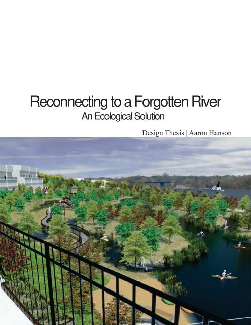
abstractWaterways are a vital and productive resource to ourenvironment. Rivers provide a variety of amenities andservices to communities across the world such as drinkingwater, food, travel, recreation, wildlife habitat, connection toplace, aesthetic appeal, economic development, etc. This thesisproject examines the importance of the Mississippi River to itsurban community and how riverfront design can function asa unifying element for the city center and its ecosystem. Overhalf of the world’s future population will be living in urbanenvironments by 2030, which will dramatically increase thestress on a vulnerable network of water systems. A restorationof a river can bring awareness to people while improvingphysical and ecological corridor connections (Bernhardt &Palmer, 2007).Keywords: Mississippi, river, community,ecosystem, restoration, urban, connection5
problem statementHow can riverfront design beused to unify an urban core tothe Mississippi River’s naturalecology?6
statement of intentProject TypologyA river in an urban environment.ClaimThe Mississippi River is a vital resource to nearby cities and itsresilience is often undermined by unsustainable developmenttechniques in the urban environment. Landscape architecture iscapable of healing our injured riparian ecosystem by making peopleaware of this issue through design strategies focused on unifyingpeople to the river.PremisesActor: Landscape architects, planners, and natural resourcemanagement practitioners have the ability to restore a river’s naturalecology.Action: Revitalization techniques should be used to coincide withthe urban environment and the river’s natural habitat.Object: Mississippi Riverfront in downtown St. Cloud, Minnesota.Theoretical Premise | Unifying IdeaA city sensitive to its riverfront will provide strong connectionsand benefits for urban dwellers and the natural ecology. A systemof strategies can be integrated to create an effective waterfrontrestoration that provides a unified living society between people andthe natural environment.Project JustificationIncorporating community connection through an ecological solutioncan provide amenities and aesthetic values that will unify an urbancenter. Instead of having the environment adapt to us, it is essentialthat we adapt to it and live within an ecosystem’s natural process.7
narrativeI grew up on the countryside of a rural community near a small river thatconnected a few towns along its route. I spent most of my childhoodoutdoors doing various activities along this memorable river. It hadn’toccurred to me at the time how truly connected I was to the river’secological setting until I began living in an urban environment.In many urban cities there is little connection between the ecologyof a river and its urban dwellers. Many urban settings include builtinfrastructure with poor connections to natural elements and/or paying littleattention to the river.Why is there a missing connection between the river and its urban setting?Is it because cities have turned their back away from the river? How canlandscape architecture help urban communities reconnect to a river?An ecological restoration can restore the missing link between peopleand a river. Creating areas of interest and activities through green spacedesign can create opportunities for stormwater infiltration, alternativetransportation uses, and educational elements. The goal is to use the rivercorridor to unify urban communities and in doing so, promote a sustainablefuture for our ecosystem while providing economical and cultural growth.8
user | client descriptionCLIENTThe client is the city of St. Cloud and other organizations working withthe wildlife, habitat, and ecology of the Mississippi River, specifically theDepartment of Natural Resources (DNR) and the Mississippi InterstateCooperative Resource Association (MICRA).USERSUrban DwellersThis user group will be local residents and college students who livewithin a mile of the Mississippi River in St. Cloud. This group can usealternative transportation, bike, or walk to the site. Amenities createdfor them include biking and walking routes, public transit access, eatingavailability, open green areas, designated fishing spots, ADA accessibility,and connections to the urban fabric. Further research will determine thequantity of urban dwellers, but anticipated peak usage will be spring,summer, and fall. However, it will be important to add winter value,which will create a year-round riverfront usage for the community.Water RecreationalistsThis user group will be water recreationalists who may live in or awayfrom St. Cloud or up or down stream along the Mississippi River.Anticipated peak usage will be in the summer for enjoying the river withboats and other water vehicles, canoes, kayaks, paddleboats, etc. As aresult, this user group will need easy access to the river, boat landings,parking, green areas, eating availability, informational kiosks, and otherdestinations. Further research will determine the quantity of waterrecreationalists; however, enhancing the quality of one’s experience withthe Mississippi will be essential in raising the economic vitality of St.Cloud.Tourists | Nature EnthusiastsAn attraction will be designed to incorporate tourist and natureenthusiasts to the area. It is anticipated that this user group’s peak usagewill mainly be in spring, summer, and fall for fishing, sightseeing, hiking,and wildlife viewing. As a result, these users will need trails, overnightstay accommodations, green areas, destinations, ADA compatibility,informational kiosks, parking, and eating availability. Further researchwill determine the quantity of tourists and nature enthusiasts; however,increasing the amount of this user will bring social and cultural aspects tothe city that are currently lacking and will raise the value of St. Cloud’seconomy.9
major project elementsGreenwaysA series of greenways will be used to connect the river corridor to theurban fabric of downtown St. Cloud. To unify these green areas, the use ofhard and natural trails will be used to provide direct walking and bicyclingroutes along the river. Green areas will address stormwater runoff,erosion control, and wetland filtration to enhance the water quality of theMississippi River.Destination AreasThese areas will include future and existing parks, plazas, and areasof interest. Major emphases will be to attract people to and along theriverfront of the Mississippi River. These areas will need to incorporateovernight sleeping (hotels, campgrounds), parking, eating areas(restaurants, picnic areas) by either providing or connecting to existingdestinations.Recreational ElementsThere will be multiple recreational elements carried throughout this designprocess in order to draw people to the river and promote interaction withthe water. Potential design elements include fishing piers, docks, rentalstations for canoes, kayaks and paddleboats, boat landings, water accessareas, and swimming areas. Further research will determine the need andlocation of these different elements along the Mississippi River.Educational ElementsIn order to fully understand the importance of water quality and existingconditions, informational kiosks and interpretive art will be used to informpeople of the ecological restoration taking place. This may be implementedby showing users the effects grey water has on natural ecosystems. Anexample of this can include a series of filtration viewing areas that wouldclean stormwater runoff before it enters the river. Developing publicawareness will promote further protection of the Mississippi River’secology.10
site informationFigure 1. Mississippi Watershed.The Mississippi River begins at Itasca <strong>State</strong> Park, Minnesota, and releasesat New Orleans, Louisiana, into the Gulf of Mexico. The MississippiRiver Basin is the fourth largest watershed in the world and is the largestwatershed in the U.S. The watershed measures approximately 1.2 millionsquare miles, draining all or part of 31 states and 2 Canadian provinces,according to the MICRA (“MICRA Rivers,” 1991).St. CloudMinneapolisSt. PaulFigure 2. Surrounding <strong>State</strong>s.This project site’s emphasis is a 12 mile stretch along the MississippiRiver corridor that connects the cities of Sartell, Sauk Rapids, and St.Cloud in Minnesota. These cities are growing, and it is estimated thatby 2020, there will be 20,858 more people living within them. Thepopulation rising means greater urban runoff and pollution in the river. Itis important to enhance and preserve the water quality at the beginning ofthe Mississippi River’s tributary.11
site informationMississippi RiverSt. CloudFigure 3. St. Cloud, MN.Mississippi RiverSt. CloudFigure 4. St. Cloud, MN.Specifically, this project will look at enhancing a one milestretch of riverfront in downtown St. Cloud.12
project emphasisThe major emphasis of this project is the social and ecological qualityof the Mississippi River corridor in downtown St. Cloud, Minnesota.The goal is to implement a riverfront design that will reconnect theurban community to the river’s natural environment. In order tosuccessfully complete this task, a strategic plan will be implementedthat includes recreational and educational elements, greenways, andcommunity destinations used to unify St. Cloud’s ecosystem alongthe Mississippi River. Instead of St. Cloud turning its back on theriver, this thesis will look at refocusing the urban center towards theriverfront; in return, it will provide economical, social, and ecologicalbenefits to the city of St. Cloud.13
plan for proceedingResearch DirectionThis thesis will use in-depth research in both qualitative and quantitativedata to guide its development. Research will be conducted in areasfollowing the theoretical premise, project typology, historical context, siteanalysis, and programmatic requirements.Design MethodologyThe method that will be utilized is a mixed-method approach, whichuses both quantitative and qualitative data. Analyzing, interpreting, andreporting results will occur throughout the research process and will bepresented in both text and graphics. The research will be guided by thetheoretical premise. Quantitative data will include statistical and scientificdata gathered through local surveys and archival searches done by the cityof St. Cloud. Qualitative data will be gathered from direct observations andarchival searches.Documenting Design ProcessAll research and design for this project will be compiled and documenteddigitally. The design process will be documented with photos, graphics,drawings, and research findings.Final DocumentationThe final conclusion of this thesis will be presented through a digitalpresentation. All of the research, text, and graphics will be documented ina bound hardcopy as well as a digital file that will be made available at the<strong>NDSU</strong>’s library for future use.14
previous studio experienceFall Semester | 2008 | Kathleen PeppleSumi & Haiku PaintingTea House & Garden Protect | Fargo, NDHalverson Park | Battle Lake, MNSpring Semester | 2009 | Mark LindquistCold Smoke, Bison Turf | Fargo, NDAubrey Green Protect | Winnipeg, CanadaNP Ave. & 1st Ave. Project | Fargo, NDFall Semester | 2009 | Stevie FamulariDefiant Garden Project | Fargo, NDRegent Project | Regent, NDFargo Analysis | Fargo, NDSnow Symposium | Winnipeg, CanadaSpring Semester | 2010 | Kathleen Pepple, Jason KostRoosevelt Project | Fargo, NDUTTC Plan | Bismark, NDFall Semester | 2010 | Jason KostFigure Ground Study | Ciaro, EgyptConventional Zoning | Fargo, NDForm Based Zoning | Fargo, NDDuluth Urban Redevelopment | Duluth, MNSpring Semester | 2011 | Stevie FamulariPhytoremediation | Fargo, NDHESCO Barriers: Window Well Protection | Fargo NDFall Semester | 2011 | Dominic FischerRed River Basin Watershed Study & Design | MN, ND,SD, Manitoba15
theoretical premise researchHuman’s Historical Connection to RiversHistory has shown how <strong>North</strong> America has relied heavily its waternetwork systems. With cities developing around rivers for more than fourcenturies, streams have faced tremendous amount of pressure because ofurban settlements (Otto, McCormick, & Leccese, 2004). Since the early19th century, a major element of <strong>North</strong> American rivers has been thetransportation of goods. According to Wrenn (1983), covered wagonswould transport goods from the coasts to the Ohio and Mississippi Rivers;then the goods would travel 1,800 miles downstream to the coast of NewOrleans (as cited in Otto et al., 2004).When railroads took over transportation, the river corridors becameless important to social and retail space. Typically, riverfront land wasexpanded to make room for rail infrastructure and warehouses whichdominated many cities’ waterfronts by the early 20th century (Otto etal., 2004, as cited in Wrenn, 1983). However, through this waterfrontshift, urban riverfronts were still vital as the economic center of cities.“Throughout the nineteenth and twentieth centuries, river cities…have grown in a relatively consistent pattern. Because this pattern hasdetermined today’s riverfront land uses and will deeply influence futureurban development patterns, uses and functions, it is important for plannersto understand the history of river town expansion” (Otto et al., 2004, p. 2).History also shows the value of urban waterfronts and how they becameimportant to designers like Frederick Law Olmsted Jr. In the early 1900s,many waterfronts were dominated by industrial and factory buildings,causing a disconnection between people and their natural waterways. Sincethen, waterfront industries have been abandoned and this loss provides arare opportunity to reconnect people to green environments and to the calminevitability of water. Olmsted Jr. recommended protecting ecosystemsagainst harmful human intrusion while opening up natural environmentsfor large number of people to enjoy (Garvin, 2000). An example of this isrecognized with the Ping Tom Memorial Park, created in 2000 and locatedin the Chicago Park District: It was originally used by surplus railroadproperty boarding the river and was transformed into a public parks system.Figure 5. Ping Tom Memorial Park, Chicago, 2000.16
theoretical premise researchSimilarly, in Denver, Colorado, Cherry Creek was “once a manufacturingand warehousing haven” (Garvin, 2000, p. 47), and in 2000, it wasconverted into a park system with bike, running, and rollerblading paths,becoming one of the city’sgreatest amenities (Garvin,2000).Figure 6. Cherry Creek, Denver, CO, 2000.A major problem with rivers is that they can be prone to flooding. One canlook at this situation in two ways: an engineering perspective of functionover form approach with low up-front cost, or a more holistic landscapedesign approach that factors in sustainability and future economicalimpacts. An example of an engineering approach is the Los Angeles River,which in 1938, the U.S. Army Corps of Engineers developed a controlledwater system for moving water as fast as possible. The water systemonly incorporating the removal of flood water, a single function. This waseffective for immediate results but wasn’t sustainable for the future of thecity. Now, the Los Angeles River is looking to reclaim its river by usingrevitalization techniques and converting the river corridor into a network ofparks, pedestrian trails, and water access points (Otto et al., 2004). This iscosting much more money than it would have had they analyzed the riverwith a strategic landscape architectural approach.Figure7. Los Angeles River, 1996. Much of the river flows through fenced-in concreteculverts with “no trespassing” signs (Garvin, 2000, p. 55).17
theoretical premise researchA better solution is the San Antonio’s Paseo del Rio (Riverwalk),1941, which strategically transformed a flood hazard into a majortourist attraction (the second most visited area in Texas). It provides anaesthetically pleasing public park system that solves flooding problemswhile providing green relief. It is a model for adaptive re-use ofwaterfronts; its upfront cost may have been expensive but has paid off byraising the value of the city (Garvin, 2000).Another similar situation occurred with Boulder Creek, located in Colorado.In 1983, the city finally used Frederick Law Olmsted Jr. and CharlesEliot’s earlier recommendations (Improvement of Boulder Colorado Plan)to create an area that controlled flood water while providing public parksystems for fishing, picnicking, and other recreational uses. Olmsted Jr. andBartholomew recommended a similar solution for the Los Angeles Riverin 1930, but instead, the city of L.A. used an effective but unsustainableengineering approach (Garvin, 2000).Figure 8. Boulder, Colorado, 2000. The Boulder Creek floodplain includes tree-linedpathways used for skating, jogging, and bicycle riding. Top right shows a local fishermanat his favorite fishing spot along Boulder Creek (Garvin, 2000, p. 56).ConclusionFortunately, recent years have lead to a wholistic view on rivers and watersystems where even an engineering approach of function over form ischanging to account for ecological benefits. Comparing the Los AngelesRiver and San Antonio River, where both had similar situations back in themid 1900s, it is interesting to see the outcome of the chosen strategies. SanAntonio’s river has been thriving through the years while the city of LosAngeles is realizing the opportunities their river can bring.18
theoretical premise researchIt is important to look deep into the history of a city’s river to know wherethe city has been and to know the influence a river may or may not havehad on the city. Studying the Mississippi River further through researchwill determine how St. Cloud has viewed its river and if there is somethingto restore from the past. If St. Cloud has been historically founded by thegreat river, it should be part of the city’s identity.Population IncreasingIt took an estimated 1 million years for the human species to number 1billion people, reached in the mid-1800s; today, we near 7 billion andcan roughly add another billion about every fifteen years (Kellert, 2005).Where do all these people live? Around two-thirds of the developedworld lives within a metropolitan area, and this migration to urban cities isdramatically increasing. According to Restoring Streams in an UrbanizingWorld, over half of the world’s future population is expected to dwell in anurban setting by the year 2030 (Bernhardt & Palmer, 2007).Why is this relevant? With population on the rise and agreeably thegreatest human migration in history, according to Kellert (2005), urbancity environments will face greater challenges than ever before. St.Cloud and other urban cities will face an increase of impervious surfaces,infrastructure, resource consumption, pollution, and waste. These rises willdramatically impact natural water systems like the Mississippi River byincreasing urban run-off and consumption of freshwater resources, resultingin water pollution and lower water quality.Currently, urban cities consume 40% of energy resources, 30% of naturalresources and 25% of freshwater resources while generating one-third ofair and water pollutants and 25 percent of solid wastes (Kellert, 2005).Environmental degradation is already happening and is expected toincrease from rising population; creating an opportunity to protect urbanenvironments while reconnecting people to the inevitable joy rivers bring tocommunities will strengthen an urban core.The Human-Nature ConnectionDesigning cities within their natural ecosystem is not only importantbecause it forces civilizations to have environmentally friendlyprinciples like stormwater management, sustainable design of buildingsand landscapes, etc., but also because it provides contact with nature.Interaction with nature has been proven to enhance human well-being anddevelopment. According to Kellert (2005), “Human physical, mental, andeven spiritual well-being relies on experiencing healthy and diverse naturalsystems” (2005, p. 9). When creating natural ecosystems within an urbansetting, designing for interaction with nature will be a key element for acity’s success.19
theoretical premise researchPeoplePositiveFeedback LoopNatureFigure 9. Relationship between Human and Natural Systems. (Kellert, 2005, p. 10)It is in human DNA to be connected with nature, and one can see howpeople may subjectively incorporate it in their daily lives by the forms,patterns and language of everyday life (Kellert, 2005). Whether one realizesit or not, nature influences the stories people tell, the places they liveand visit, the recreational activities they do, food they consume, and thematerials they use. “Despite the evident connections, contemporary societystill fails to recognize and defend the importance of healthy and diversenatural systems to sustaining the quality of people’s lives, especially inurban areas” (Kellert, 2005, p. 3). With deliberate design, the connectionbetween humans and nature can be repaired and restored.A city’s river provides a great opportunity where this connection canbe fulfilled. Currently, many urban cities are isolated by buildings andinfrastructure without regard for the natural environment due to poorconventional design. It is important for urban communities to exposeparks, open space, and natural settings for stress relief, emotional wellbeing,and intellectual functioning (Kellert, 2005). A study conducted bysocial scientist Terry Hartig and his colleagues examined the emotionallyrestorative and intellectually enhancing effects of park-like settings inurban areas. The study surveyed college students and concluded that the“greatest gains in emotional restoration (higher levels of positive and lowerlevels of negative affect), as well as greater attentiveness and concentration,occurred among students who walked in the park and the study foundsignificantly lower levels of emotional and intellectual restoration occurredamong the ‘urban activity’ and ‘indoor activity’ groups” (as cited in Kellert,2005, p. 14-15).River corridors also provide recreational activity opportunities, which canenhance people’s physical and mental well-being. According to Kellert(2005), research has suggested that “outdoor recreational activity can exertsignificant and even life-changing effects on participants, particularlylate adolescents, when substantial challenge and adventure occur in thecompany of others” (p. 16).20
theoretical premise researchAlan Ewert, an outdoor recreational researcher, conducted a wide rangeof studies and concluded that “outdoor programs can result in significantphysical, psychological, social, and educational benefits that sometimesaffect participants for long periods of time in their ordinary lives” (as citedin Kellert, 2005, p. 17). Some of these benefits described by Ewert includeenhanced self-esteem, self-confidence, personal effectiveness, improvedcoping skills, greater independence, and increased willingness to takerisks. Activity also brings obvious health benefits of strength, endurance,and stamina that are increasingly important with rising concerns of obesityin America. In many situations, recreational activity involves workingin teams. Ewert found in his studies that this can improve cooperation,the ability to work in teams, avoidance of conflict, respect for others,leadership, and capacity to make new friends; all of these things areimportant to a healthy unified community (Kellert, 2005, p. 16).ThoughtsMy design thesis will look to provide the healthy benefits of recreationalactivity by designing specific areas throughout the corridor. Riverfrontspresent a great opportunity for walking, running, and bicycling trails alongwith using the water for boating, canoeing, and other water recreationalactivities. It will be important to analyze specific locations along theMississippi River where activity can be expanded upon.Nature and CommunitiesMost of the research thus far has been conducted on individual peoplethemselves, but how does environmental quality affect communities andneighborhoods? Many rivers connect communities along their route, andit is important to have a strong relationship between neighborhoods andthe natural environment to provide a higher quality of life. Stephen Kellert(2005) and his colleagues conducted a large scale study that examinedrural, suburban, and urban communities located within a single watershed.They found a strong correlation between environmental quality, people’senvironmental values, and human physical and mental well-being indifferent urban and nonurban communities.Within watersheds that had a high value of landscape features such as goodroad qualities, large attractive trees, open spaces, views of rivers, healthystreams, and other aesthetically pleasing land use variables, the people hada greater awareness and appreciation for their environment. Specifically,Kellert (2005) reported, “Communities with higher environmental qualityhad more positive environmental values and a higher quality of life,whereas those with lower environmental quality tended to reveal lessenvironmental interest and a lower quality of life” (p. 44).21
theoretical premise researchIt is interesting to see in our highly developed urban age the way interaction with thenatural environment can dictate and enhance human physical and mental well-being.This relationship can be further understood with three elements: ecosystem health,landscape features, and human environmental values (described in Figure 10).EcosystemHealth Includes:Human EnvironmentalValues Includes:BiodiversityBiomassBiogeochemical cyclingEnergy processingHydrologic regulationAestheticHumanisticNegativisticScientificDominionisticNaturalisticMoralisticSymbolicUtilitarianLandscapeFeatures Includes:Vegetative coverWaterwaysOutdoor recreationOpen SpaceQuality of lifeFigure 10. Hypothesized relationship between Ecosystem Health, Environment Values,and Landscape Features (Kellert, 2005, p. 46).The factors listed in the diagram above occur in a “linked hierarchical fashion, withhealthy ecosystems providing essential ecological services that foster the developmentof various biophilic values, which in turn encourage an attachment to and stewardshipof these places where people work and reside” (Kellert, 2005, p. 46).22
theoretical premise researchImportance of Landscape ArchitectureInteraction between nature and a society can be greatly beneficial forhuman physical and mental well-being. Successfully incorporatingtheories of connecting human and natural systems together in an urbancommunity depends on regenerative design strategies. Regenerative designgoes beyond restorative and sustainable environmental design; it is a coevolutionbetween humans and nature. Kellert (2005) explains the goalof regenerative design as harmonizing nature with humanity. Two mainobjectives are to reduce adverse effects of modern design and developmenton natural systems and human health and to promote positive contactbetween people and nature in the built environment (Kellert, 2005).The principles achieved through regenerative environmental design, furtherindicated in Figure 11, lead to building a sustainable, healthy, secure future,successfully resolving our modern day environmental predicament.Theories ConnectingHuman NaturalSystemsEcosystem ServicesBiophiliaSense of PlaceDesign StrategiesLinking Human &Natural SystemsLow-Impact DesignOrganic DesignVernacular DesignFigure 11. Theory Connecting Human and Natural Systems with the Principles ofRestorative Environmental Design (Kellert, 2005, p. 179).ThoughtsMy design thesis will look to use the Mississippi River as an amenity tothe city of St. Cloud. Using regenerative design principles will enable St.Cloud’s community to reconnect with its water and nature. The goal willbe to strengthen neighborhoods using the river corridor and ultimatelyprotect St. Cloud’s economy and the future of its residents.23
theoretical premise researchRestoring Streams in an Urbanizing WorldUrbanization will continue to damage sensitive water ecosystems due to anincrease of urban runoff entering river systems. These impacts will affectthe hydrology and geomorphology of streams, resulting in detrimentalalteration of the ecology in waterways. In order to combat this trend, riverrestoration has been an increasingly popular management strategy forimproving physical and ecological conditions of degraded urban streams(Bernhardt & Palmer, 2007).According to Palmer (2007), the goal of urban river restoration shouldbe to restore the essence of the ecological structure and function, whichcharacterize non-urban streams, and to reestablish the natural temporaland spatial variation in ecological attributes to stable conditions (p. 747).Findings from the National River Restoration Science Synthesis (NRRSS)indicate that restoration projects across the United <strong>State</strong>s fall into fourmain categories: stormwater management, bank stabilization, channelreconfiguration and grade control, and riparian replanting and management.ThoughtsIt is pleasing to see that projects fall into one of the four main categorieslisted by NRRSS; however, not all projects incorporate improving vitalbiological communities or ecosystem functioning, which are important to ahealthy river. My design thesis will focus on using an ecological solutionthat will go beyond the four main categories mentioned by NRRSS.Further research will determine the most important management strategyfor the Mississippi River at St. Cloud; however, using each of the four mainprinciples will allow for the best design solutions for St. Cloud’s riverfront.Realizing The Importance of RiversAfter degrading urban rivers through years of abuse, it is encouragingto see that people have realized the economic and community value ariver can bring. According to Ecological Riverfront Design, “Cities arerediscovering their rivers. For At least the past 30 years, cities and townshave been turning back to their rivers, transforming industrial and derelictland into new parks, residences, and commercial space” (Otto et al., 2004,p. v). This trend is continuing to rise for great reason; cities have a majoropportunity to promote revitalization along riverfronts that will not onlybring rivers back to health, but also the communities that depend on them.24
theoretical premise researchHowever, restoring rivers will not be an easy task. Urban river healthsteadily declined through the first 70 years of the twentieth century dueto “massive physical alterations of riverbanks, overharvesting of fish andother aquatic animals, and dumping of larger and larger volumes of sewageand industrial pollutants into rivers” (Otto et al., 2004, p. 12).According to Schneider (1997), in the Clean Water Act of 1972,environmentalist demanded something to be done to protect the degradedrivers, and by 2000, the nation’s urban rivers and other water bodiesbecame remarkably cleaner (as cited in Otto et al., 2004) This was agreat sign but “despite significant progress in cleaning up point sourcesof water pollution, the Clean Water Act’s sweeping goal has not yet beenachieved” (Otto et al., 2004, p. 13). Many species depend directly onwetland ecosystems, and with today’s streams, many species are threatenedbecause of a river’s poor health. The Environmental Protection Agency(EPA) estimates 46% of threatened and endangered species rely directly orindirectly on wetlands for their survival (U.S. EPA, 1998).Moving ForwardFor communities to restore, revitalize, and/or enhance an urban river’sedge, it is important to incorporate strong ecological principles that takeinto account ecosystem services. “Restoring ecological systems such asriverbanks and stream buffers contributes to healthier environments andimproves conditions for activities such as fishing, boating, swimming, andwildlife watching” (Otto et al., 2004, p. 31). Urban riverfront restorationis a complex process of in-depth analysis and research because eachwaterfront requires different strategies to account for site-specific problems.According to Schueler (2003), basic strategies must reflect the intensityof current development, the nature and intensity of planned developmentor redevelopment, the geometry and constraints of the riverfront, and theintended riverfront purposes and management (as cited in Otto et al., 2004).Within these strategies are general principles to follow when attemptingto reclaim urban waterfronts. These include but are not limited toecological goals and economic development goals that are mutuallybeneficial, protection and restoration of natural river features and functions,regeneration of the riverfront as a human realm, compromises are necessaryto achieve multiple objectives, and making the process of planning anddesigning riverfronts involve public participation (Otto et al., 2004). Iwill briefly touch the three I consider most important for my thesisdevelopment: ecological goals and economic development, protecting andrestoring, and regenerating the riverfront.25
theoretical premise research1. Ecological Goals and Economic DevelopmentIt is important to understand that ecological and economical benefits go hand-in-handwhen developing a successful waterfront. Defining a river’s beauty is its natural appealand healthy aquatic ecosystem supported by rich diversity. Development that bringspeople to the waterfront builds a connection and stewardship for the river. “Healthy,functioning rivers are appealing and attractive to residents and businesses” (Otto et al.,2004, p. 34). A good example of the way ecological and economical benefits cometogether is the South Platte River in Denver, elaborated further in case study research.A generation ago, the river functioned as a problematic urban ditch, but after the cityimproved it, it became one of Denver’s most popular recreational areas.2. Protecting and RestoringRelating to the first principle, a river’s habitat is rich in species diversity and is importantto protect its natural features to support wildlife. Rivers provide vital natural benefitsthat must be protected to serve essential ecological functions. Restoring a river’s healthmay be viewed as impossible; however, severe degradation can be overcome throughtime. According to Ecological Riverfront Design, small efforts have positive impacts,and improvements can be made along the most heavily impacted rivers. A good exampleis looking at the Anacostia River in Washington, D.C (Otto et al., 2004).Figure 12. Anacostia Riverwalk BoardwalkThe Anacostia River had been viewed as dumping grounds for years but still offeredrich wildlife. In 2000, plans were made to improve the river quality to swimming andfishing standards. The goal is to energize the waterfront by revitalizing neighborhoods,enhancing and protecting parks, improving water quality, and increasing access towaterfront destinations (Anacostia Waterfront Initiative, 2002).Figure 13. Anacostia Riverwalk, the vision at night canlight up the riverfront district.26
theoretical premise research3. Regenerating the RiverfrontMany urban riverfronts are challenged with physical, political, social, and economictasks, but if successfully done, they can increase public enjoyment and create strongconnections to communities. “Good riverfront designs consider the needs of allneighborhoods, ages, and cultures in the community” (Otto et al., 2004, p. 37).Allowing the community to experience a river up-close promotes lively and diverseplaces while encouraging a connection to communities and an appreciation fornature. A good example of this is Hartford, Connecticut’s Riverfront Plaza; the city’sinvestments have brought much needed economic vitality to the city.Figure 14. Mortensen Riverfront Plaza. This plaza is the centerpiece of the Riverfront Park System.The city’s design consisted of building a plaza that connects downtown to theriverfront corridor, including terraces, trails, docks, and a park system. The success ofthe development was proven with over 850,000 visitors that accumulated $17 millionto the local economy (Riverfront Recapture, 2002).Figure 15. Mortensen Riverfront Trail. Trees planted along theriverfront’s dike needed to be encased in concrete to prevent theirroots from compromising the earthen structure.27
theoretical premise researchDesign PrinciplesFurther research will determine my design strategies and goals; however,Ecological Riverfront Design (Otto et al., 2004) lays out principles foran ecologically sound riverfront design that I will be considering. Theseprinciples include preserving natural river features and functions; bufferingsensitive natural areas; restoring riparian and in-stream habitats; usingnonstructural alternatives to manage water resources; reducing hardscapes;managing stormwater on site using nonstructural approaches; balancingrecreational and public access goals with river protection; and incorporatinginformation about a river’s natural resources and cultural history into thedesign of riverfronts features, public art, and interpretive signs. Theseprinciples are formed around a no-harm approach while emphasizingprotection of the river’s healthiest features. Ecological Riverfront Designconsiders its principles as some of the most effective techniques and bestmanagement practices. I will briefly cover the three strategies deemed mostimportant to my thesis typology: managing stormwater on site; balancingrecreation and public access; and incorporating information and culturalhistory.1. Managing Stormwater on SiteIt is essential to consider capturing, storing, and infiltrating stormwaterbefore releasing it into the water for an ecologically sound urban riverfront.Poorly designed and engineered stormwater pipes and other structuresonly degrade a riverfront’s edge. A natural water management approachcan provide wildlife habitat and aesthetic value to an ecosystem. Naturalmanagement techniques include detention ponds, bioretention ponds andswales, cisterns, stormwater planters, and infiltration ponds. Accordingto Ecological Riverfront Design, these “techniques can supplementinfrastructure to cleanse and control stormwater, resulting in substantialsavings for developers and local governments” (Otto et al., 2004, p.84).2. Recreation and Public AccessA great way to bring people to an urban riverfront is by providingrecreational opportunities. But how much recreation is enough? Accordingto Ecological Riverfront Design, “Riverfront communities should providefacilities for as many recreational uses as possible while balancing someconflicting uses and managing possible overuse of the river corridor” (Ottoet al., 2004, p. 87). Riverfront recreation includes canoeing, kayaking,rafting, fishing, boating, bicycling, riverwalks, etc., which provide revenueto the local community and increase human health. It is noted thatrecreational users are on the rise. According to the Outdoor RecreationCoalition of America, 34 million Americans over the age 16 went canoeing,rafting, or kayaking in 2001, and 71 million people went bicycling onriverfront trials and greenways. Economically, the EPA reported in 2000that anglers spend 38 billion dollars on fishing every year. This is why it isimportant for cities to encourage recreation and for Americans to return totheir urban riverfronts.28
theoretical premise researchAnother recreational opportunity for waterfronts is a water trail. A watertrail is “a stretch of river, shoreline, or ocean that has been designated toprovide educational, scenic, and challenging nature-based experiences torecreational boaters” (Otto et al., 2004, p. 91). Water trails are valuablefor a healthy economy and can protect vital natural areas while providinga close experience with nature. People can become inspired by watertrails, and they are a good opportunity for educational and classroomdevelopment.When incorporating recreational uses to riverfronts, designers shouldcombine river trails and greenways that provide riverfront enhancementsand infrastructure. According to Smith and Hellmund (1993), properlydesigned greenways and river trails can protect floodplains and providewildlife migration corridors between otherwise isolated “patches” of nativehabitat (as cited in Otto et al., 2004). They can also provide buffer zonesfor filtering stormwater and provide alternative transportation. Promotingalternative transportation can limit carbon emissions by connectingriverfront paths with businesses and homes. For example, a 60 milegreenways system in Boulder, Colorado, links neighborhoods to schools,jobs, and shopping. Even though only 12% of Boulder’s populationcommutes by bike, it is about 12 times the national average (Otto et al.,2004).Greenways usually include riverfront parks. These areas are importantbecause if properly designed, they can minimize or mitigate stormwatereffects on the natural environment. It is critical to build greenways to workwith sensitive areas like wetlands, meadows, or eroded banks so users don’thave a negative impact on them (Otto et al., 2004). A greenway can alsoincorporate pedestrian bridges that allow for movement around privatelyowned land while permitting an intimate and closer connection to thewater. A successful riverway trail system may increase public support forriver protection, tributary restoration, and trails while encouraging a socialconnection between communities (Otto et al., 2004).ThoughtsIt is evident that the Mississippi River corridor in St. Cloud has public landthat I will have to strategize a greenway system around. Further analysismust determine locations where trail systems can be connected. The use ofpedestrian bridges and infrastructure may be an essential part in developinga strong connection throughout the river corridor and in promotingrecreational activity.29
theoretical premise research3. Information and Cultural HistoryRivers have rich history in the United <strong>State</strong>s. However, many naturalsystems’ histories have been forgotten or lost through the years. Thelocal public may not know about their river’s history or function andif they don’t know about it, it’s unlikely tourists will know either. “Aninformed public that understands river ecology as well as the potential forregeneration will support efforts to improve and protect its river” (Otto etal., 2004, p. 91). Education and signage promote an opportunity to bringout rich history, and in doing so, they can also provide information onwater quality issues and boat navigation. This concept should explain ariver’s unique characteristics and natural assets (Otto et al., 2004). Waysthis can be included are through interpretive signs, public art and specialevents, and interpretive programs. This is a good way to bring people ofall ages, ethnic backgrounds, and social classes together to experienceinterpretations and activities. Education encourages people to explore theriverfront and connect with nature while enhancing the city’s economic andcultural vitality.ThoughtsLooking further into St. Cloud’s history and the Mississippi River willallow me to pull forgotten local cultural elements. When exploring St.Cloud’s past, it will be important to look for certain characteristics thatI can develop throughout my design proposal. This will allow me tocreate a consistent theme of informational kiosks, art displays, and otherinformative programs for the community to reconnect with.30
summary of researchDigging deep into a city’s history, one can discover missing elementsthat may reconnect a city to its forgotten culture, ancestors, and/or vitalwaters. Revealing an urban riverfront’s pattern through time is importantfor planners in order to understand land use and development, which caninfluence the city’s future expansion. Further research will determine St.Cloud’s historical past and development around the Mississippi River.Finding a broken link in its past will be important to expose through thedesign proposal phase in order to promote a strong social and culturalconnection within St. Cloud.Population is on the rise; Bernhardt and Palmer (2007) believe by 2030,85% of <strong>North</strong> American populations will be living in urban areas. Withpopulation growth, urban riverfronts design becomes an important elementin protecting natural waters and habitats. To prevent further environmentaldegradation, an urban river corridor is a great area to protect the naturalenvironment from water pollution and waste while connecting people totheir natural waters.Humans have an unconscious tendency to involve nature in their dailylives with the forms, patterns, and language of everyday life. Studies haveshown that interaction with nature can enhance human physical, mental,and spiritual well-being. However, contemporary society fails to promotehealthy and diverse natural systems in urban environments.Riverfront corridors, like the Mississippi River in St. Cloud, can use greenspaces and natural areas for stress relief and improving emotional wellbeingand intellectual functioning. Studies by Terry Hartig (2005) andcolleagues have proven greater emotional gains from people who walkthrough parks and who have the availability of green fabric within their city(as cited in Kellert, 2005).Within river corridors are opportunities for recreational activity; StephenKellert’s (2005) research has suggested that activity can exert significanteffects on participants. Additionally, recreational activity usually consistsof working in teams, which can improve cooperation, leadership andteamwork skills, conflict avoidance, and respect for others.St. Cloud’s Mississippi River connects neighborhoods along its route,however, these communities are currently lacking a strong relationship totheir natural environment. Kellert (2005) has found a strong correlationbetween people’s environmental values and quality, which is beneficial tohuman physical and mental health within urban communities.31
summary of researchMany human benefits can come about through natural environmentswhen implementing regenerative design principles. The main goal ofregenerative design is for humans and nature to coexist by creating systemswithin the natural environment. Conventional design has mainly consistedof building human environments around natural areas instead of withinnature.When dealing with urban riverfronts, it’s important to use strong ecologicalprinciples that restore, revitalize, and enhance a river’s edge. Usingthese principles successfully through an ecological solution can increasepublic enjoyment and create a powerful connection to the city and theenvironment while benefiting the city socially, economically, and culturally.32
the future of st. cloudThe City of St. Cloud recognizes its need to plan for future expansion andto set a vision for the community. In 2003, the city produced a plan (St.Cloud Comprehensive Plan) to set forth basic guiding principles of land useand public improvements, which have been embraced by the city, to shapeits future. The comprehensive plan has been developed by the Planningand Zoning Department with public input to shape its vision for a morelivable and sustainable city (St. Cloud Comprehensive Plan, 2003).Elements of St. Cloud’s vision calls for the city to be a place:• Where natural resources are preserved• That recognizes the importance of the Mississippi and Sauk Rivers• Where development is compatible with the environment• With economic opportunity• With a strong, diverse, and growing downtown• That is aesthetically pleasing• Of quality neighborhoods• Of recreational opportunities• Accepting of diverse populations and opinions• Where an effective public/private transportation system is availableThe St. Cloud Comprehensive Plan states the results of a survey done bythe city that asked participants a variety of questions about their city. I willbriefly cover a few issues and results I deemed most important to my thesis.Question: What are the city’s strengths, opportunities, and positivecommunity attributes? (most concerning to least concerning)• Rivers• Parks and trails have a good start• Historic resources• Downtown arts and paramount• Good neighborsQuestion: What are the city’s weaknesses, threats, and negative attributes?(most concerning to least concerning)• Traffic problems/roads and bridges in decline• Lack of access to Mississippi• Ugly signage• Attitude/resistance toward cultural diversity• Lack of bike routes• Sprawl33
the future of st. cloudMy design thesis will look at excelling the strengths of the city whileimproving its weaknesses. St. Cloud’s community is concerned with thepoorly designed current conditions that don’t rectify the city’s positiveattributes. Using ecological and regenerative principles as an ecologicalsolution, these issues can be refined and strengthened to enhance the qualityof St. Cloud.According to the St. Cloud Comprehensive Plan, the city is expected tohave considerable growth over the next 20 years, mainly in urban areas(Comprehensive Plan, 2003). The Mississippi Riverfront may be a keyelement for the future success of St. Cloud.34
case study #1Above The FallsLocation | Upper Mississippi River, Minneapolis, MinnesotaInvolvement | Lead by BRW, Inc. (A Dames & Moore Group Company)Others: Robbin B. Sotir & Associates, Inc., Anton & Associates, Inc., andMcComb Group, Ltd.Scale | 90 acres of park, 15 miles of bike lanes and recreational trails, 4miles restored riverbank, 5.25 miles of parkway and boulevard, 2,500housing unitsCompletion | Implementations for first phase began in 2009Objectives• Provide public access to river.• Create a system of riverway streets.• Enhance the ecological function of river corridor.• Link upper river to Grand Rounds parkway system.• Realize the area’s potential for economic development.• Establish urban design guidelines.Figure 16. ATF, 1999. River City located south of 26th Ave. Takes advantage ofgreat views of the river and downtown with high-rises and mixed-use buildings.Goal is to create a vibrant urban environment. 35
case study #1Above The Falls (ATF) is a preferred plan that the city of Minneapolis hastaken on and includes features such as a new neighborhood on the westbank, a pedestrian promenade along the river, the West River Parkway thatacts as buffer between uses, opportunities for entertainment and hospitalitydestinations, mixed-use and higher-intensity development, a BN bridgeconverted into a pedestrian and bicycle facility, and rail use.Figure 17. ATF, 1999. The preferred plan.36
case study #1OverviewATF is a bold vision for developing the Mississippi Riverfront into aregional park amenity for north and northeast Minneapolis (ATF, 1999).Building a strong connection between the central waterfront and thenorthern corridor will provide multiple benefits for Minneapolis. ATFrecognizes the need to replace heavy industrial industries along the riverthat pose land-use conflicts. The surrounding neighborhoods have blockedviews and access to the poorly developed waterfront. When people domake it to the water’s edge, one can see an environmentally degradedriverfront, unpleasing to the eye. This has caused a lack of demand to useand be part of the urban waterfront. However, according to BRW Inc., theopportunity is clear and simple: “There is only one Mississippi, and theUpper River is the best potential large-scale amenity awaiting developmentin the city of Minneapolis.”Figure 18. ATF, 1999. River City, located south of 26th Ave. This area offersresidential high-rises, parkway, water filtration park, and a riverfront promenade.37
case study #1Figure 19. ATF, 1999. West River Parkway <strong>North</strong> of Dowling Ave.The ATF Proposed Plan:• Proposes that the highest and best use of the Upper River area has yet to be developed• Recognizes the future economic development value of riverfront amenities• Helps to stabilize communities in north and northeast Minneapolis• Meets Metropolitan Council goals for growth within established urban areasFigure 20. ATF, 1999. West River Parkway South of Dowling Ave.According to the Minneapolis Park & Recreation Board, in the last decade, the ATF project has“captured the attention of a citizenry anxious to reconnect to the world-reowned river that hasso influenced the city’s history.” The plan has successfully created a vision for the banks of theMississippi River in Minneapolis. Its vision will allow for residents to enjoy the urban waterfrontwith recreation and social development. By providing locations for lively riverfront entertainmentand hospitality sites, it will take full advantage of looking at the river as an amenity to the city ratherthan only a resource.Figure 21. ATF, 1999. 26th Ave. meets the Mississippi River.38
case study #1Continuing DevelopmentImprovements and enhancements are still being made to the originalAbove The Falls plan. In 2005, the Minneapolis Park and RecreationBoard completed a schematic plan to create new recreational trail systemsthat connect to existing trails. In this plan, other amenities will includeimproved access to the river, lighting and signage, plazas and gateways,stormwater management, and riverbank stabilization (Minneapolis Parkand Recreation Board, 2006).Figure 22. ATF, 2006. Orvin “Ole” Olson Park, located towards the north endof project area. Vision for the park is to be the southern terminus for intenselyredeveloped mixed-use39
case study #1Figure 23. ATF, 2006. 17th Ave. N. Terminus. This area will be used to strengthen theconnection to the river by enhancing the streetscape and planting trees closely together tocreate a green tunnel.The first phase of construction for this plan, West Bank, focuses onrecreational and environmental improvements that can be made withinexisting land uses and ownership. This area will give the greatestimmediate impact and will be unaffected by future construction. The fourmain focus areas will include bike and pedestrian rim trails, treatment ofstormwater run-off, streambank stabilization, and Bur Oak plantings alongthe riverfront corridor.The project area is a critical link in completing the chain of green spacethroughout the City of Minneapolis (ATF, 2006). ATF-Phase One WestBank will provide the crucial public access to the Mississippi Riverfor water recreationalist and have aesthetically pleasing views of thedowntown skyline.Figure 24. ATF, 2006. The Garden and Overlook at 22n Ave. N. Rain gardens will be used totreat stormwater runoff, stable slope, and remove sediments.40
case study #1Continuing development will look to carry out the industrial history ofthe local city to link it to existing downstream interventions. The WestBank area land use is predominantly heavy industry; however, mixed-usedredevelopment has begun occurring along the riverfront.ConclusionThis case study is a good example of how a design intervention is takingplace along the Mississippi River in the similar climate of my proposedproject area, St. Cloud. The Above The Falls plan shows the importance ofbringing the inter city out to experience the urban waterfront. The way thisplan has phased out its design interventions is a strategy I may use whendeveloping my design proposal.41
case study #2Paseo Del Rio (Riverwalk)Location | San Antonio, TexasInvolvement | Conceptual idea lead by Robert H. H. HugmanScale | 17,000 ft new sidewalks, 31 stairways, 3 dams, 4,000trees, shrubs, and plantsCompletion | March 13th, 1941 first opened to publicHistoryThe San Antonio River has a rich historical background. The “city wasfounded in 1691 as a Spanish mission near a cluster of springs that fedthe San Antonio River” (Black, 1979, p. 33). It has been used by NativeAmericans, Franciscan missionaries, and other explorers as a mode oftransportation, a source of sustenance, and as a spiritual element, givingreason to encourage settlement (Hammat, 2002). The history of the river hasplayed and continues to play a major role in the development of communitiesin San Antonio.Figure 25. San Antonio River, 1800s. This image helped illustrate the river as a “street” toshow the importance the river held for early transportation.In September of 1921, a major flood caused 50 lives lost and $50 million indamage, primarily in the downtown area (Black, 1979). A strategy neededto be developed to project the city from flooding. In 1929, Robert Hugmanbegan imagining a riverfront corridor that resembled cities in Spain withsmall streets and nice shops and restaurants. Hugman began to express hisinterest in the river in a way architects know best: by preparing an elaborateset of drawings and maps. Hugman suggested a flood cutoff channel orbypass with gates to the entrance and exit of the big bend to protect it fromhigh waters, freeing the area from potential flooding and allowing it tobecome a linear park (Black, 1979).42
case study #2Figure 26. San Antonio River Walk. Robert Hugman’s early visions of the river’s development.Hugman’s plan enthused C.M. Chambers (the mayor at the time). Then theplan began being presented to civic and community leaders, stressing thegreat commercial opportunity and benefits it would bring (Eckardt, n.d).According to Gregg Eckardt, an estimated 50,000 people waited in line forthe River Walks grand opening. At first, the community didn’t take to thedesign too well because of criminal activity, resulting in the downtown areaturning its back on the river. It wasn’t until 1962 when the establishment ofthe River Walk District and Advisory Commission that San Antonio’s RiverWalk reached its full potential (Eckardt, n.d).Figure 27. San Antonio River Walk at Casa Rio, 1946.43
case study #21950s - 1960s: Enhancing The Original DesignAs suburban sprawl began being promoted across the U.S. in the late 1950s, the SanAntonio Chamber of Commerce began organizing a strategy to bring life back into the citycenter. “It is to the credit of the San Antonio Chamber that it produced a man like DavidStrauss, who could see the river’s potential as the catalyst for downtown revitalization”(Black, 1979, p. 36).The committee wanted to preserve and promote the natural beauty and distinctively quaintand romantic character of the river walk area while integrating shopping, entertainment,and recreational areas. This would result in economic benefits for the city and maintainingthe urban center of San Antonio as a leading attraction for tourists (Black, 1979).Figure 28. San Antonio River Walk, 1979 Figure 29. San Antonio River Walk, 1979Cyrus Wagner (AIA committee member) sparked attention in the same way Hugman didin 1929. He used inspirational drawings that imprinted an image into the minds of SanAntonio’s leaders in 1964. These upgrades were developed and built between the years of1964 and 1968 (Black, 1979).44
case study #21970s: Experiencing The River WalkThe River Walk became more and more popular to both the tourist andthe citizens. “The San Antonio River is the downtown area’s majoramenity and is currently recognized as its most powerful catalyst forredevelopment” (Black, 1979, p. 30). According to Sinclair Black (1979),strolling through the area is like a “linear paradise of infinitely changingvistas” (p. 30). The River Walk is made up of impressive displays oftexture and color from the plant material, continuously entertainingmovement of the water, the varied patterns of the walkway underfoot,buildings, shops, restaurants, and many people (Black, 1979).Figure 30. San Antonio River Walk, 1979Even when a building is put up on the riverthat is out of scale because of its size, (forexample, the Hilton), the beauty and powerof the river still controls and defines thespace. When one is proposing a building tobe built along a river corridor, according toBlack (1979), “the most appropriate solutionis probably a quiet building which simplyresponds to the space defined by the river”(Black, 1979, p. 36).Figure 31. San Antonio RiverWalk, 1979. The Hilton.45
case study #21970s: Impact of the River WalkIn 1973, a study by Skidmore, Owings, and Merril of San Franciscoconducted a deep analysis of the San Antonio River within the city’s limits.The study found the river to be a pedestrian link between downtown and1,000 acres of open space, two colleges, two museums, the major city bank,numerous older neighborhoods, and the metropolitan zoo. These areas alsoserved as a link to the major historical site of the King William District(Black, 1979).The San Antonio River Walk was an economical powerhouse. Recorded in1978, a total of 488 conventions (more than one per a day) and contributedover $34 million to the San Antonio economy (Black, 1979).A reason why the River Walk is so great is because it can be experienced insix separate trips, and in each trip you may reveal something different thanyou did the first time. Black (1979) explains the different ways one canexperience the site are by walking on each side of the corridor in both northand south directions (equaling 4 different views) and by riding a river boateach direction (equaling 2 different views).Figure 32. San Antonio River Walk, 1979Another major success of the San Antonio River is the “cooperationbetween the public and the private sectors; small-scale, incrementalwork and careful attention to physical as well as historic and culturalfabric of the area” (Black, 1979, p. 39).46
case study #2Thoughts on The River Walk (1940 - 1970)San Antonio’s River Walk is aesthetically pleasing because of all thedifferent views one can perceive in the area. This is something I can carrythroughout my design proposal of the Mississippi River corridor. It will beimportant to think about how each day can be experienced differently. Thiscan be done by using techniques of lighting and materials to create a senseof place while incorporating the effects of each season.Another method used by the leaders of San Antonio during the designprocess was using the local community. A strong sense of place is feltwithin the River Walk today because of a strategy of only employing localpeople, using only local materials, and responding to the sensibility of localculture and history.Figure 33. San Antonio River Walk, 197947
case study #21980’s River WalkIn 1988, an addition to the San Antonio River Walk was created to be agrand entrance to the Rivercenter retail-and-hotel complex and was linkedto the earlier 1968 extensions (mentioned previously). The new expansionwas designed by San Antonio’s firm of Ford, Powell & Carson Architects& Planners, Inc. They built off Hugman’s vision and designed a “livingroom” that created an unique space to be “imposing and intimate, secludedand lively, varied and coherent, functional and fun” (Greenberg, 1991, p.32).Figure 34. San Antonio River Walk. Grand Plaza. Master PlanAccording to Ken Greenberg (1991), the Grand Plaza is most memorablefor its sense of arrival as either a river-level pedestrian or as passenger ofa barge. Approaching the Rivercenter through unique spaces of low andshady areas to vast and sunny areas creates a memorable experience.Figure 35. San Antonio River Walk. Grand Plaza, 1991.48
case study #21990’s River WalkIn the early 1990s, San Antonio began looking to extend its attractingurban riverfront to the local community. “With an emphasis onrestoration and community interaction, landscape architects plan toextend the success of the San Antonio river walk” (Hammatt, 2002, p.73). Lead by the SWA Group of Houston, a 13 mile extension northand south of the existing river is planned to create new connections andcommunity interaction with the river. According to Heather Hammat(2002) of the Landscape Architecture Journal, the proposal won theASLA Honor Award for Analysis and Planning in 2001. The new planfocuses on nature, people, and hydrology with an overall goal to improvethe health of surrounding environments and to provide access to the riverusing the riverfront as a community amenity.Figure 36. San Antonio River Walk. <strong>North</strong> Reach Perspective. The new design willrestore a more natural habitat into this narrow urban corridor.Community leaders wanted to extend the River Walk beyond tourism andthe inner city to focusing on the community as a whole and revitalizationof potential vulnerable areas. It sought to create habitats and places forpeople to use and enjoy while enhancing the quality of life. Each area offocus, the <strong>North</strong> and the South Reach, have different characteristics andproblems associated with them (Hammatt, 2002).49
case study #2<strong>North</strong> ReachExisting Conditions: High density urban area, steep sloping river banks, narrow river areas, 80 foot wideright-of-way, and private properties including the San Antonio Art Museum and the University of theIncarnate Word.Goal: Restore natural habitat while creating pedestrian and bicycle access.The <strong>North</strong> Reach plan will restorenatural habitat while creatingbicycle and pedestrian access in anarrow urban corridor. Overlooksand pedestrian bridges also promoteinteraction with the river’s edge.Figure 37. San Antonio River Walk. <strong>North</strong> Reach Plan.Strategy: Damming the <strong>North</strong> reach at Brooklyn Avenue while creating planted crib walls in place of standardretaining walls will gain the width of the steep slopes and allow introduced vegetation. Also, the river bottomwill be lined with cobblestones, becoming a food source for fish and creating a healthier habitat. Figure 38 is anexample of an area the SWA Group are proposing, Brooklyn Avenue Dam (Hammatt, 2002).Figure 38. San Antonio River Walk. <strong>North</strong> Reach at Brooklyn Avenue. Dammingthe <strong>North</strong> Reach will enable passenger barges from the existing river walk tonavigate farther north. Bottom, planted crib walls allow for vegetation and bankstabilization while cobblestones line the river bottom, promoting the growth oforganisms and a healthier river ecosystem.50
case study #2South ReachExisting Conditions: Suburban area with rural and agricultural landscapes, erosion, concrete riprap thatcauses the river to flow in a linear path, and property owned by the city, county, and the National ParkService.Goal: Recreating the flow of the river to a naturally flowing pattern by using principles of geomorphologyand grade control, incorporating water recreationalists, and connecting adjacent mission properties.MILITARY DRIVE to White Avenue, this typical segmentof the south reach plan illustrates new grade controlstructures and realigned river banks that incorporatefluvial geomorphology to recreate how a river flowsthrough the landscape naturally.Figure 39. San Antonio River Walk. South Reach Plan.Strategy: Restoring the river’s natural meandering path wherever possible and creating slopes that are laid backat a gradual angle. Also, using small weirs throughout the south reach to provide grade control and improvewater quality with the use of indigenous limestone. Figure 40 is an example of the proposed small weir.Figure 40. San Antonio River Walk. South Reach Plan. GradeControl Structures, in the form of indigenous limestone weirs, spanthe south reach, controlling water flow so that it does not scourand erode the bottom of the river. The weirs are designed to allowpassage through a narrow opening, a nod to local canoe enthusiasts.51
case study #2CurrentlyAccording to the San Antonio River Improvements Project, phases ofimprovements have already been opened to the public. Only the <strong>North</strong>Reach, also known as the Mission Reach, has yet to be completed; itsfinal phase is scheduled to be completed by the end of 2013 (San AntonioRiver Improvements Project, 2012).Figure 41. San Antonio River Walk, 2010ThoughtsThe San Antonio River Walk is known across the United <strong>State</strong>s for goodreason. The River Walk’s history is a great story in itself, and whenone passes through the site, it is felt. It proves to be an economical andecological success to the city and a great example of how a landscapearchitecture, holistic design approach, can be much better than anengineering, now approach.A couple areas that will be carried into my design thesis are the ways theSan Antonio River connects neighborhoods along its route and the riveris used for recreational purposes. Over 10 miles of walking and bikingtrails and water recreation have been proven to be successful as a greatamenity to the city.52
case study #3South Platte RiverfrontLocation | Denver, ColoradoInvolvement | Design Workshop, Wenk and Associates, Norris Dullea,Architerra Design Group, Civitas Inc.Scale | 10.5 Mile Green Network SystemCompletion | Commons Park, 2001; Cuernavaca Park, 2003; CentennialGardens, 2002.OverviewThe city of Denver wanted to improve the health of the South PlatteRiverfront along a 10.5 mile stretch in the 1970s. A campaign waslaunched to develop a systematic greenway of parks along the river thatwould include Commons Park, Cuernavaca Park, Confluence Park, andCentennial Gardens. The overall goal of the Denver Comprehensive Planwas to change the South Platte River into uniting neighborhoods on the eastand west sides.Figure 42. South Platte Riverfront. Model by Civitas Inc.South Platte RiverAt the heart of Denver’s birth place, where Cherry Creek and the SouthPlatte River meets, use to lie a brown field left from industrial dumpsites, railroad tracks, and “dirty” manufacturing. The city needed toreclaim its origin along the river. Ken Salazar, attorney and formerdirector of the state’s Department of Natural Resources, saw this as anenvironmental opportunity (Chandler, 2002).53
case study #3Figure 43. South Platte Riverfront, Commons Park. Plan done by Civitas, Inc. shows zonesof more natural landscape along the river and a linear sweep of lawn at the center.A legacy was born in the dreams of the 1970s and later was captured inanother administration’s plans (Chandler, 2002). It started with ConfluencePark where head of Platte River Development Committee, Joe Shoemaker(former state senator), was intent on creating an area for residents to enjoya park reach by either foot or water. Confluence Park opened in 1976 withtrails, rocky waterfalls, and facilities for kayakers, as well as hardscapeelements such as a plaza (Chandler, 2002). This foundation began acontinuing effort to promote growth of the riverfront park system. The riverand park began to work together as cities were turning to their rivers for“rejuvenation as well commerce” (Chandler, 2002).Figure 44. South Platte Riverfront, Commons Park. Rendering done by Design Workshoppromotes a concept of a built-out Valley.Commons Park, designed by Civitas and completed in 1999, became themajor link for parks along the riverfront. It is Denver’s first major city parkbuilt in 50 years, featuring 20 acres of open green space, numerous trails,park benches, a stone amphitheater/seating area, a sun garden (mound),and artwork. Local residents stated their input for the new park (CommonsPark); they wanted a new park to not consist of hard edges and be withoutsoft infrastructure because Confluence Park was already created that way.Commons Park was created into a green passive space for recreation andreflection.54
case study #3Commons Park started an evolution of parks, paving the way for multiplenew green spaces and habitats built alongside the South Platte River. The10 and a half mile river corridor contains Commons Park, Confluence Park(updated in 2002), Cuernavaca Park (updated in 2003), Centennial Gardens(2002), and Denver Skate Park (2001). Each project area “accommodatesdifferent uses and offers different amenities and design elements”(Chandler, 2002, p. 90).Figure 45. South Platte Riverfront, Cuernavaca Park.CurrentlyAccording to the New Urban Network, today, on any given day at CentralPlatte Valley, one would see people walking or biking to work on the trails,playing in the riverfront parks, and enjoying the views from the cafés andplazas associated with new high-density mixed-use buildings. The majorpark that links the riverfront together is Commons Park, which creates astrong connection to the citizens and the South Platte River.Figure 46. South Platte Riverfront, Commons Park. The park is a place for people to gatherand reflect while having access to the South Platte River.55
case study #3Denver knows the importance of parks and the river corridor as bothrespites and connections (Chandler, 2002). The results of the downtownarea are impressive: “for residents, 80 plus acres of public parkland (outof a river chain of more than 100 acres), river access, and recreationfacilities; for developers, land for high-end housing, retail, and officespace lured by these new parks; for the city, new property tax revenueand removal of a big swath of blight; for wildlife, a cleaner river andshoreline” (Chandler, 2002, p. 88).Figure 47. South Platte Riverfront, Confluence Park. The park was the early impetus forthe city to turn to its river resources for recreation, respite, and protection of wildlife.ThoughtsOne element of my thesis is the notion of connection. This case studyexploits the different uses an urban waterfront can bring by connectingneighborhoods through a river. A river can often times be viewed as abarrier between one side of the river to the other, but the South Platte Riverworks with trail systems and greenways to unite each side. This allows forpedestrian trails being used to guide people through the urban setting with astrong connection to the downtown district.The Mississippi River in St. Cloud has a major disconnection betweeneach district, and it will be important going further in my research todevise a system of strategies that can create a unified connection betweencommunities by using the riverfront.56
summary of case studiesAbove The FallsThe Above the Falls case study is a good example to show the importanceof bringing people out of the downtown to enjoy the waterfront. Similarlyto St. Cloud, ATF recognized the poorly developed water’s edge andriverfront access and changed the riverfront in ways to draw the communityto their forgotten river. This recognition allows opportunities for families toparticipate in outdoor recreational activity. This activity will bring peoplecloser to nature and enhances physical, spiritual, and mental well-being.Continuing development of the ATF master plan shows the strategy offocusing on immediate impact areas that won’t be affected by future designs.This is important to be aware of in order to be cost effective and to provide ahierarchy of important elements needing to be accomplished.Figure 48. Minneapolis, Mississippi River.Paseo Del Rio (Riverwalk)This case study is unique in its rich history and its tie to San Antonio’s localcommunity. Going back to Hugman’s initial design proposal built in 1941and going through all of the different design phases through the years, eachdesign has a strong correlation between designers/developers and publicopinion. This strong public connection is one of the reasons why the SanAntonio River Walk is so successful. While developing my design thesis,it will be important to recognize the needs of the public when analyzing thecity of St. Cloud.The San Antonio River Walk is directly located in the heart of the downtowndistrict, and with the development of a river corridor, it shows the numerousimpacts a riverfront can have on a community. Beneficial effects on theeconomy, ecology, and culture are evident in this case study. Although theMississippi River in St. Cloud differs in demographics, the amount of water,the width of the river, and climate, it is still important to acknowledge SanAntonio’s ultimate goal of bring people to the waterfront and creating uniquespaces and uses for the community, resulting in the state’s greatest touristdestination.Figure 49. San Antonio River Walk.57
summary of case studiesSouth Platte RiverfrontThe South Platte River is a great case study showing the resilience of a riverand a city. Once degraded by industrialization, the riverfront is thriving asboth an economical and ecological asset to the community. Ten and a halfmiles of trails in the heart of the city’s origin connect a series of parks thatprovide various amenities for recreation, reflection, and artwork. The SouthPlatte Riverfront can be viewed as a symbol of success.Figure 50. South Platte Riverfront. Confluence Park, 2008.58
climate data for st. cloud, mnOverviewWith the site being located in central Minnesota, it is important to know the different seasons the regionbrings. Four seasons a year make it especially important for a design to be enjoyable year round. Figures51 through 63 are explained and analyzed according to my design thesis in St. Cloud, Minnesota.Average TemperaturesFigure 51. St. Cloud, MN.The average temperature is important for determining when people will most likely use the river corridor inSt. Cloud. April through October have average temperatures roughly above 50F, which is suitable weatherfor outside activity. The cooler months of November to March can be expected to have less outdoor activityalong the river corridor. These months will need to incorporate winter activities such as skiing and iceskating.In 2010, the annually temperature was 44.4F and the annual temperature through 1981 to 2010 was 42.8F.This could mean temperature may be slightly rising as the years go on. In this case, it will be important tolocate and use different types of shade trees for people to cool off during warmer months.59
climate data for st. cloud, mnGrowing Degree DaysFigure 52. St. Cloud, MN.The growth rate of many biological organisms is primarily controlled by temperatures (Gibson, 2003).Growing degree days (GDD) are used to predict vegetation development rates, which can determine whena plant may bloom or reach maturity. It is defined by a base temperature, which in this case is 50F, andtemperatures above that number increase the growth rate. For St. Cloud, the months from June to Augustcan expect to have the most growth in vegetation.HumidityFigure 53. St. Cloud, MN.The percentage of humidity can be related to the human comfort level ofpeople. This can be used to approximate when more people may be outside,and when there is a higher level of humidity, more people may want to beby the river to cool down. There is a higher humidity in the mornings in St.Cloud than in the evenings.60
climate data for st. cloud, mnHeating Degree Days & Cooling Degree DaysFigure 54. St. Cloud, MN.Heating degree days and cooling degree days are calculations relating to the effect of outside air temperatureon building energy consumption. (“Custom degree day,” 2011) Defined by a base temperature, in this case65F, it will allow one to predict the amount of energy used to heat or cool a building in kilowatts per hour(kWh). For St. Cloud, the months of November to March can expect to have the most energy used to heat abuilding. June through August will have the most energy used to cool a building.VisibilityFigure 55. St. Cloud, MN.Visibility data is measured by the average number of days in a month that itmay be foggy, clear, cloudy, and partly cloudy. This can be used to determinehow far one may be able to see a certain focal point during a given month.61
climate data for st. cloud, mnWind SpeedFigure 56. St. Cloud, MN.There are higher wind speeds through the months of March through May,October, and November. This is important for determining the use of treebarriers to slow wind speeds down.Snowfall & Snow DepthFigure 57. St. Cloud, MN.Snow fall is the average amount of snow that has fallen in a given month,and snow depth is the average depth of snow in a month. According tothe data in 2010, St. Cloud had its greatest amount of snowfall duringDecember and January. These months can promote community winteractivity such as building different types of snow structures. Incorporatingareas for this may help build a stronger community connection.62
climate data for st. cloud, mnPrecipitationFigure 58. St. Cloud, MN.Comparing the precipitation from 2010 to 1981 through 2010precipitation suggests that St. Cloud is averaging more rain than in thepast. This trend may continue, so it will be important to consider areaswhere people can take shelter from the rain but can still be outside tocontinue activity after the rain subsides.Mississippi River Water Discharge (1989-2010)Figure 59. St. Cloud, MN.This data is used to get an idea of the average flow of water through the past 21 years. The linear linein the red suggests a downward trend in the discharge rate along the Mississippi River in St. Cloud.63
climate data for st. cloud, mnMississippi River Historical HighsFigure 60. St. Cloud, MN.Mississippi River Historical LowsFigure 61. St. Cloud, MN.Knowing historical high water and low water of theMississippi River in St. Cloud is important to be aware ofwhen building along the river. Knowing how high the watergoes will help determine placement of vegetation, trails, andinfrastructure, in order to sustain against high water levels.Knowing how low the river can get will help determinewhere vegetation may need to be added to help preventerosion. Also, seeing how the Mississippi River water levelvaries, it may be important to add terraced infrastructurealong the river corridor for accessibility during low and highwaters.64
climate data for st. cloud, mnMississippi River Monthly Water DischargeFigure 62. St. Cloud, MN.This data can be use to determine what months water recreation may the best. The five year (2005-2009)discharge average suggests that during the months June through September, the water is moving theslowest.Mississippi River Surface WaterDepth & Peakflow DischargeFigure 63. St. Cloud, MN.This data is the yearly average of river depths, peakflow depths, and peakflowdischarge in 2005 through 2009. Knowing the average water depth of theMississippi River will help determine where it will be most appropriate tobuild trials and other infrastructure. Also, considering the average depth andhigh of the water can help determine the different levels of a terrace builtalong the river’s edge. Knowing how fast the water can move during itspeakflow can help assist in determining water recreation activity.65
historical contextHistory of St. CloudThe city of St. Cloud, Minnesota, was established in 1856. The town wascomposed of a collection of small villages: Upper Town, Middle Town, andLower Town. The villages are located along the Mississippi River withMiddle Town being located where the heart of downtown St. Cloud is today.Each small village had distinguishing background characteristics; UpperTown was settled by southerners who brought servants from Tennessee,Middle Town was earlier a homestead taken over by a French Huguenotsettler named John L. Wilson, Lower Town was settled by “Yankee lovingProtestants,” who demeaned a local Gothic Revival Style hotel (“HistoricDowntown,” n.d).Figure 64. St. Cloud, MN, 1907. St. Germain StreetMiddle TownThis town is most known for French descendent John Wilson who purchaseda 320 acre homestead and sold land, even giving away land, to devotedbusiness men. The offer attracted people to the area, which predominatelybecame settled by industrious German Catholics seeking location for aGerman Colony. Wilson is also known as the founder of St. Cloud; hechose the name from a Paris suburb after reading a biography of his admirer,Napolean. (“Historic Downtown,” n.d)Lower TownThis area was developed by George F. Brott, who owned the first localnewspaper company in St. Cloud called the Minnesota Advertiser. Brottdescribed himself as “farmer, wagon and carriage maker, real estate dealer,editor, townsite promoter, owner of flour mills, steamboats and sailing craft,merchant, member constitutional convention, colonel of engineers, canal andrailroad president and inventor” (“Historic Downtown,” n.d). He ended uppassing away in 1902, in Washington, DC.66
historical contextAlso in Lower Town was the home of the Stearns House,which was the Gothic Style Hotel mentioned previously,located on property of the “St. Cloud Normal SchoolCampus” (“Historic Downtown,” n.d). Interestingly, theschool stayed in the same area and is currently the homeof St. Cloud <strong>State</strong> University.Interesting Downtown HistoryAn early unique local attraction to downtown was SteveTenvoorde’s Bicycle Band. During the mobile age,Tenvoorde fashioned special bicycle handle bars whichheld musical instruments (“Historic Downtown,” n.d).This was later shutdown a year after by St. Cloud’sfirst automobile shop in 1899, which was owned byTenvoorde and Peter Theilman. In 1905, the city sported5 automobiles among nearly 10,000 residents (“HistoricDowntown,” n.d).Illustration 48. JohnWilson.In 1897, a man who had built a reputation on the art of candy making cameto settle in the city. Candyman Jones, opened a business called Jones CandyCo., which was popular for 39 years before closing. The name Jones wascarved in granite and is still visible today on the front of the St. Cloud Floralbuilding (“Historic Downtown,” n.d).In the 1880s, an important developer named John Neimann came to settle inSt. Cloud at the age of 24. He was already skilled in the building trade andbecame one of the leading contractors and builders in the area (“HistoricDowntown,” n.d). Buildings he worked on are St. Nicholas Church, St.Raphael’s Hospital, Carter Building, and part of Norman School where St.Cloud <strong>State</strong> University is located today.Figure 65. St. Cloud, MN. Early Streetscape.67
historical contextFigure 66. St. Cloud, MN, 1885. Micthell Building.The Sherman Theatre and Breen Hotel use to serve as a local vaudeville, film,and legitimate theatre before falling to disrepair in the mid 60’s. Byron Barrused to usher in the building and is now known by the name Gig Young, whois an academy award winning actor. The building was entirely restored in the1990s and is now home to the Paramount Theatre and Germain Towers, whereover 80,000 people use the building each year (“Historic Downtown,” n.d).Figure 67. St. Cloud, MN, 1893. Fandel & Nugent.68
historical contextThoughtsThe downtown district (Historic Downtown) of St. Cloud has a rich historical past containing thetown’s heritage. As the city has been trying to preserve these areas through the years, St. Cloud wasadded to the Preserve America Community in 2005. “Preserve America is a federal initiative thatencourages and supports community efforts to preserve and enjoy our priceless cultural and naturalheritage” (“Preserve America,” n.d). This is already an important aspect to the city, and my designthesis can carry this out further into the river corridor.Figure 68. St. Cloud, MN, 2005. Local Historic DistrictsHistoric Districts are currently located near the Mississippi River, and itmay be beneficial for the culture of St. Cloud to pull historic elements intomy design proposal. Looking at Figure 68 shows the areas of each historicdistrict in St. Cloud. Opportunities of building strong connections to theareas closest to the river are present, which can promote further awareness ofthe community’s cultural history while providing an educational experience.69
historical contextHistory of the Mississippi RiverThe Upper Mississippi River area (where St. Cloud is located) was home to several American Indian nationsbefore the coming of the white man. Early Indian nations included the Cheyenne and later the <strong>Dakota</strong> andOjibway tribes (Minnesota, 1996). Native Americans and white settlers used the river as a water highway,hunting ground, and place for settlement. As settlements developed along the river, it made the Mississippiearly conflicting grounds between <strong>Dakota</strong>, Ojibway, and other tribes.Figure 69. St. Cloud, MN, 1869.The first white men of the area were mainly trappers, traders, and explorers.There were many trading posts developed along the Mississippi River,specifically between the areas that are now St. Cloud and Anoka. A fewfamous early explorers of the area are Father Hennepin, Jonathan Carver,Zebulon Pike, J.C. Beltrami, and Henry Schoolcraft (Minnesota, 1996).The lumber industry became an important part of the Mississippi River in themid and late 19th century. Several towns between St. Cloud and Anoka hadlarge sawmills that could process large amounts of lumber. Other importantindustries were flour milling and rock quarrying.70
historical contextWith settlements increasing came the development of transportation networks.The most famous network is the Red River Ox Cart trail, which small piecesof can still be seen. These trails ran parallel to the Mississippi River alongthe east side, connecting southern areas, like St. Paul Minnesota, to northernareas, like the Red River Valley. The trails were mainly used by settlers andtradesmen. Another transportation method was by steamboat, which becameimportant in the 1850s and 1860s. (Minnesota, 1996).In the early 1850s, many people thought of St. Cloud as the head of the UpperMississippi navigation; however, this wasn’t the case. Sauk Rapids was theearly terminate for continuous navigation between St. Anthony and CrowWing (which was a major route) because of the shallow waters just north ofthe St. Cloud area. The major steamboat route was from St. Anthony to St.Cloud. Once you get north of Sauk Rapids, where the river is twenty feetdeep, there was navigation for a good two hundred miles (Reps, 1994). Thesteam boat era came to an end by the 1860s due to a severe drought that theMississippi suffered from.The Mississippi River is directly linked to the city of St. Cloud and its earlysuccess. According to Minnesota Department of Natural Resources (1975),the area along the Mississippi River corridor from St. Cloud to Anoka hashistorical values of “statewide significance because of the integral part whichthe river has played in the exploration, settlement, and development ofMinnesota” (p. 3).Interesting Facts About St. Cloud• 1867, first bank opened.• 1870s marked a period of growth in the downtown area. Mainly consistedof blacksmiths, wheelwrights, grocers, druggists, hardware men, andbankers.• 1883, first gas lamps installed as well as first phone service.• St. cloud was headquarters for the Red River Oxcart Co.• By 1880s, St. Cloud became a well equipped city with complete electricand gas lights, piped water, and sewage systems.• A tornado on April 14th, 1886, destroyed most of downtown Sauk Rapidsand made business owners move existing facilities and services to St.Cloud. This led St. Cloud into being the dominant city in the area andinto an economic boom. In 1880 to 1892, the population of St. Cloudexpanded from 2,500 to nearly 10,000 people.Information found from (Reps, 1994), (“Historic Downtown,” n.d), and(Minnesota, 1996).71
project goalsAcademic GoalThe academic goal for this thesis project is to provide valuable knowledge onthe way a river corridor can function within an urban community to enhancesocial, economic, and cultural elements of a city while improving humanphysical, emotional, and mental well-being. This is developed by analyzingcurrent uses of a river corridor and identifying missing links that may bebeneficial to a city. The goal is achieved through in-depth documentation andanalysis that can be used for future academic uses.Professional GoalThe professional goal for this project is to create a clear, cohesive documentthat can be presented outside of the academic world and into the professionalrealm. The document should show professional level skills of analyzing,problem solving, graphic display, and rendering to communicate projectfindings and proposals. Thus, the finished project may propel me into desiredprofessional work.Personal GoalThe personal goal for this thesis document involve learning, analyzing, andbuilding upon skills and knowledge learned from the past and enhancing themfor the future. Another goal is to use this design thesis as a stepping stone inthe academic world that will prepare me for my future career of landscapearchitecture.72
site analysisWhy choose the Mississippi River corridor areaaround St. Cloud as a design thesis?• The location is an urban community with a poor connection to the river,specifically in St. Cloud.• The area is expanding and the city is proposing to revitalize theMississippi River corridor.• There are major disconnections with pedestrian and bicycling trails,however, at the same time, there is a great opportunity to enhanceexisting trails and to strategize a systematic network of routes that couldpotentially go beyond the site location.• The St. Cloud area is already a beautiful location, and creating asuccessful river corridor could build economic and social growth thatwould ensure the community’s future.73
SartellSt. Cloud to Fargo170 Miles (2 hrs 45 mins)site analysisSite Context2.5 MilesHwy 10Sauk Rapids2 MilesProposed Extension of LakeWobegon Regional TrailAmtrakStationHwy 23Project Focus AreaSt. Cloud<strong>North</strong>star LinkBus StationEmpire Builder - Passenger TrainFuture <strong>North</strong>star Commuter RailHwy 15Mississippi RiverI-94St. Cloud to Minneapolis67 Miles (1 hr 15 mins)74
Sartell2512St. CloudSauk Rapids65site analysisRiver Uses134 346Mississippi RiverBoat AccessFishing AreaDam75
The site location along the Mississippi River corridormainly consists of medium and highly developedareas. These local developments have little access tothe river and lack an overall connection along the river.The buildings are set back from the river and face theopposite side, towards the streetscape.DevelopedHigh Intensitysite analysisLand CoverDevelopedMedium IntensityVegetationOpen WaterLand CoverKeyOpen WaterDeveloped, Open SpaceDeveloped, Low IntensityDeveloped, Medium IntensityDeveloped, High IntensityDeciduous ForestEvergreen ForestShrubGrassland/HerbaceousPasture/HayCultivatedWoody WetlandsEmergent Herbaceous WetlandsThere is a lack of dense vegetation cover in thedeveloped areas and as well in the overall sitelocation. Vegetation is scattered throughoutthe site, lacking grouped habitat areas andconnection from the south to the north of theentire site.76
Sartellsite analysisDeveloped Medium to High IntensityPopulation Rising+ 20,8562020ProjectionSauk Rapids12,773Sauk Rapids15,876Sartell65,842St. CloudSt. CloudMississippi RiverDowntown St. CloudStormwater OutletsDeveloped AreasStormwater Outlet77
site analysisDeveloped Medium to High IntensitySartellSartell is the smallest city in the site location but the town is expanding.There is a good pedestrian connection to the city on the east side of theMississippi to Sauk Rapids. However, the highly developed areas do notattract out of town people. Its major development on the river also acts as abarrier to the river corridor, the Verso Paper Sartell Mill.Sauk RapidsThis area provides the best walking and bicycling connection to and alongthe river corridor, specifically on the east side of the river. However, SaukRapids has been developed away from the river, making the distancebetween the river and developed areas greater. The bridge constructedacross the Mississippi is very pedestrian friendly and provides a goodconnection to the other part of town.St. Cloud AreaSt. Cloud has consistent materials like benches, pavement, and signagebut only in a few locations. The east side of the Mississippi seems totallydifferent from the west side. The main developed areas on the east sideconsist of retail buildings, fast food restaurants, and other commercialbuildings. Also, the east side seems for out-of-date compared to the westside of the river. This could be why it feels like you’re in a different townwhen visiting the east side compared to the west side.The west side of the Mississippi River is where St. Cloud’s downtownarea is. This area has a totally different atmosphere, more people walkingaround, more outside lights, updated materials, and a night life. Popularbars and restaurants and St. Cloud <strong>State</strong> campus are on this side. Althoughthere are more people on the west side, there is a lack of a connection andaccess to the river. This developed area, more populated with the nearbycampus, holds the most potential for local residents to have access to anduse of the river corridor.SummaryEach developed area has its own unique characteristics to it; however, thereis a major disconnection between these the highly developed areas. One ofthe major reasons why there is a disconnection is because the dense areasare separated by residential housing. Further analysis will have to strategizeways to connect the high intensity development areas. A key element maybe the use of boardwalks to create a strong river corridor connection.78
Great Blue Heronsite analysisVegetation Cover | Habitat Fragmentationhttp://blogs.longhollow.com/david/?p=3275KingfishersSartellhttp://birds-pic.blogspot.com/2011/11/kingfishers-photos-images-and.htmlWild TurkeySauk Rapidshttp://www.northrup.org/photos/turkey/River Otterhttp://thephotonaturalist.com/2011/03/27/otterly-funtastic/river-otter-st-louis-riverduluth-mn-img_0034324/WalleyeSt. Cloudhttp://www.dfw.state.or.us/resources/fishing/warm_water_fishing/Walleye.aspSmallmouth Basshttp://fish.dnr.cornell.edu/nyfish/Centrarchidae/smallmouth_bass.htmlMississippi RiverVegetation VoidDeciduous ForestEvergreen ForestShrubGrassland/HerbaceousPasture/HayWoody WetlandsEmergent HerbaceousWetlands79
site analysisVegetation Cover | Habitat FragmentationThe vegetation cover and habitat fragmentation map is used to showthat the existing vegetation cover is within the river corridor and to raiseawareness of the disconnection between them. The total vegetation coversonly about 25% of the total 11 mile river corridor.The majority of the vegetative land cover in the corridor is deciduousforest, over half of which is located in the southern portion of the map.The voids between the deciduous areas are the results of intensivelydeveloped locations. The major issue is with species diversity throughoutthe Mississippi River corridor. Vegetation provides natural habitats forwildlife, and major voids in the land due to development cause nativespecies to be confined in a small area. The goal would be to provide andincrease native vegetation that connects to existing habitats, which wouldallow for wildlife to expand along the river corridor. This would providethe opportunity for nature to expand into the urban setting, which wouldcreate aesthetically pleasing environments while incorporating peoplewith wildlife.80
Sartellsite analysisElevation & Water DrainageSauk RapidsSt. CloudThe darkest areas on the map indicate the lowestelevations and the lighter areas are the highest.From the elevation contours you can see wherethe steepest slopes are; those areas will have to becarefully monitored for erosion control issues.Focus Area (1/2 mile radius)81
site analysisSt. Cloud zoningRailroad1st St NDivision StMississippiRiver53%18%12%17%Commercial/BusinessInstitutional/PublicIndustrialLivingUniversity Dr82
site analysisBuilding Footprints & ContoursRailroad1st St NDivision StCity ProposedBuilding RemovalHistoric RavineMississippiRiverFocus Area (1/2 mile radius)Downtown DistrictUniversity DrSt. Cloud <strong>State</strong>University District83
HesterParkWilsonParksite analysisOpen Space SystemsSt. Cloud ParkHope ParkRailroad1st St N11Division St2EastmanParkMississippiRiverHistoric DistrictBarden ParkBeaver Island TrailWestwood TrailNo TrailTrail Distance = 2.65 MilesSt. Cloud Parks = 1,272 AcresParks Shown = 119 Acres2University DrMunsingerPark84RiversidePark
site analysisUrban River CorridorSt. Cloud <strong>State</strong> UniversityResidential VoidDowntown50 Feet 45 Feet30 FeetDivision St1st St NBuilding HeightsHalf MileTrail Along River’s EdgeDivision St1st St NExiting TrailNo TrailBuilding FaceBuilding RemovalThe River Corridor1st St NDivision St• Provide riverfront trail• Connect the University toDowntownUnifying The River Corridor• Re-orientate areatowards the river• Link to downtown• Continueriverfront trailJoin to existing trail85
250’535’5280 ft(1 Mile)1,360’site analysisSlope Analysis100’ 150’395’Looking west alongDivision St. bridge1st St N2,490’Division St0Slope0 - 5%5 - 25%25 - 50%50 - 60%60 - 70%70 - 100%Potential Areas For:Terraced Retaining WallBoardwalksWater AccessWetland Filtration86
site analysisTypical Mississippi River12345Without The CityUplandLow LandStreams EdgeAquatic HabitatDeep WaterImage Source1. http://dollysodsphotography.photoshelter.com/gallery-image/Fall-2009-Portfolio/G00004IBzvglic1k/I0000pGsuov3IeG02. http://urbanomnibus.net/main/wp-content/uploads/2010/10/fieldguide_tree.jpgWith The City3. http://www.petworldshop.com/pictures/water-wonders-aquatic-plant-multi-packs.jpg4. http://www.fotolia.com/id/142797315. http://www.clker.com/clipart-11815.htmlDevelopedErosionRiprapObjective:• re-focus towards the river• terraced filtration areas• establish the river’s natural ecologyPoor Aquatic Habitat &Water Quality Conditions87
Historically St. Cloud was developed around 3 small villagessite analysisHistorically Developed1st St Nupper townDivision Stmiddle townMississippiRiverlower town88
econnecting to a forgotten riveran ecological solutionIntroductionThe design approach for Reconnecting to a Forgotten River in St. Cloud,Minnesota, is an ecological solution that will re-link the urban core to theMississippi River. This is done by creating a one mile riverfront trail systemthat connects to existing trails and links the St. Cloud <strong>State</strong> University Districtto the Downtown District, providing public destinations, riverfront access,riverfront views, and recreational areas, protecting sensitive habitats, andcreating green stormwater management systems.The inventory and analysis concluded that there are three main elements thatthe design will be focused around ecological renewal, reconnecting to theriverfront, and linking social and cultural facilities. These three elementsdefine three different areas along the riverfront trail: upper town, middle town,and lower town. (The locations of these towns are located on the next page)Upper Town | Ecological RenewalThis river corridor will look to provide river access for watercrafts, interactionwith water, green open space, increase habitat diversity, and public trails tocreate a unified ecosystem.Middle Town | Reconnecting to the RiverfrontThis river corridor will look to provide a strong connection to downtown andthe Mississippi River with overlooks, event areas, small plazas, and publicdestinations for pedestrians and riverboats.Lower Town | Linking Social and Cultural FacilitiesThis river corridor will look to provide a vital social and cultural identitywhile protecting sensitive habitats. It is essential to create a strong connectionbetween St. Cloud <strong>State</strong> University and downtown.ProgramEach town/district will have one focal design intervention taking place.In upper town there is the Eco Beach, in middle town there is the UrbanRiverfront Hub, and in lower town there is the Educational Conservation. (Thelocations of these programs are located on the next page.)89
master plan3eco beachupper town | ecological renewal1st St NCivic Centerurban riverfront hubmiddle town | reconnecting to the riverfront2Division StMississippiRiverlower town | linking social & cultural facilitiesKeyeducational conservationTerraced Retaining StructureOverlookProposed Mix-use InfrastructureBoardwalkExisting TrailProposed Trail0 300' 600'190
iverfront trail characteristicsEach town has different characteristics that are unique to its setting. This means thetrail will be designed to fit the character of each town (upper, middle, and lower).This will give users an acknowledgment of when they have reached the differenttowns, however, materials and informational kiosks will be used to create oneunified trail system.Upper Town | Ecological RenewalMajority of upper town has the lowest incline of slope and the greatest setback ofbuildings which will make this area effective for revitalization, slope stabilization,and stormwater filtration.Middle Town | Reconnecting to the RiverfrontMiddle town is St. Cloud’s commercial district with the steepest riverbanks whichcreates the need of retaining wall structures.Lower Town | Linking Social and Cultural FacilitiesLower town is home to one of St. Cloud’s neighborhood historic districts. It isimportant to create a public path that doesn’t interfere with the local residents.91
typical upper town section123elements12Bike PathFiltration Swale 3Root Wad0100' 200'92
typical middle town section1 234elements123Mix-use InfrastructurePlaza SpaceRetaining Wall45Bike PathExisting Seawall0100' 200'593
typical lower town section1234elements1 South Side Neighborhood District2 Bike Path Structure34Bank StabilizationAccess to Rivers Edge0100' 200'94
eco beachEco Beach is located in upper town and focuses on ecological renewal. Aftertalking with the city of St. Cloud’s Planning Department, they stated thatthis area has the greatest opportunity for major design involvement. This isthe primary design intervention for this thesis, which will set the standardof riverfront design along the Mississippi River corridor near St. Cloud,Minnesota. Principles, solutions, and techniques used for Eco Beach is anexample of the way a river corridor can successfully create an aestheticallypleasing, environmental friendly, and socially and culturally diverse riverfront.This area is for all users to interact with water and enjoy the great MississippiRiver while protecting its natural ecosystem. Eco Beach is an ecologicalsolution for the Mississippi Riverfront in St. Cloud, Minnesota.Elements• Interaction with Water (Swim)• Improve Boat Landing• Canoe Access• Wetland Filtration• Green Stormwater Management• Increase Habitat Diversity• Green Space• Mix-use InfrastructureTrees• red maple• sugar maple• paper birch• bur oak• honey locust• common hackberry• quaking aspen• chokecherry• basswood• cotton wood• willowMaterials• local granite• epay woodSeed Mix• mixed height/mesic grass mix• tall wet grass mix• shoreline grass mix• northern upland meadow grass mix95
eco beachmaster plan5th Ave NBike Rack StationBoat LandingPervious AsphaltCanoe | Kayak LandingADA Pedestrian BridgeStaffed Kiosk | RentalBStormwater RetentionPervious AsphaltADA Parking6th Ave N1007985Mississippi RiverGrass PaversPlazaUnderground Parking5th St N986CBike PathBoardwalk9771005979985Recreational WatersMix-Use (25% Affordable Living)Wetland985Exposed StormwaterADA Pedestrian Bridge1003Eco BeachADA Underwater RampADA Sand AreaSandy BeachDEAPergolaPublic RestroomSteamboat Ferry PierADA ParkingPervious AsphaltStormwater RetentionCatharses High School10041014101010021006998986978982Boat Trailer Parking9905th Ave N9940100' 300'96
eco beachsite furnitureA south entrance to eco beach3’- 9”3’- 6”1’5’10”2’- 4”2’ 2’kioskgarbage bin6’7’1’- 6”3’2’1’- 6” 1’- 6”6”2’2’- 6”light postpath lightbench97
eco beachB canoe | kayak landingCstand up paddle boarding through recreational waterswater trails98
eco beachDboardwalk view of eco beachEbalcony view of eco beach99
urban riverfront hubUrban Riverfront Hub is located in middle town and focuses on reconnectingto the riverfront. After talking with the city of St. Cloud’s PlanningDepartment, they stated that an existing hotel is proposed to relocate, whichcreates a great opportunity to provide a riverfront hub. This area will be ableto congregate large events that can be co-hosted with the neighboring CivicCenter. The main goal of the Urban Riverfront Hub is to create a publicriverfront destination that will connect the downtown commercial district tothe Mississippi River.Elements• Plaza• Amphitheater• Terraced Lawn Seating• Public Events• Informational Kiosks• Interpretive Stormwater Management• Water Feature• Exhibit Display• Mix-use Infrastructure100
urban riverfront hubmaster plan2C12elementsBus ShelterAmphitheater3Bike TrailCivic Center | Underground Parking4Terraced Lawn SeatingD6435678PlazaWater FeatureInterpretive StormwaterManagementMix-use Infrastructure5BA781Restaurant | LivingKeyKiosk0100' 200'Light Post101
urban riverfront hubsection8726543A birds-eye looking east2345678elementsAmphitheaterBike TrailTerraced Lawn SeatingPlazaWater FeatureInterpretive StormwaterManagementMix-use Infrastructure102
urban riverfront hubBbalcony viewCbirds-eye looking west103
urban riverfront hubDoverlooking the mississippi river104
educational conservationEducational conservation is located in lower town and focuses on linkingsocial and cultural facilities. After talking with the city of St. Cloud’sPlanning Department, they declared this historical ravine to be undevelopedbecause of a native silver-haired bat that is currently under the MinnesotaDNR species of special concern list. This challenged the original conceptualdesign; however, the common goal of creating a strong connection from St.Cloud <strong>State</strong> University to the downtown commercial district was still able tobe provided.This area has been designated to be a bat conservation where native plantingswill act as a buffer to protect bats and a pedestrian bat bridge will be designedto provide a new habitat for bats. Natural bat habitats are diminishing such ascaves and old growth forest; as a result, bridges are becoming bat havens oflast resort (Weeley, Tuttle, 1999, p. 8). Information kiosks about the bats andthe historic ravine will be located around the paths and the bridge.Elements• Bike Trail• Pedestrian Bat Bridge• Native Plantings• Mix-use Infrastructure• Re-use Infrastructure105
educational conservationmaster plan61historic ravineelements1Bike Trail32Pedestrian Bat Bridge3Native Plantings4254Mix-use InfrastructureKey5Re-use Infrastructure0Kiosk50' 100'6Existing Infrastructure106
educational conservationpedestrian bat bridge sectionelements1Wire Mesh Exit Cones21" by 12" Deep Vertical Crevices3Night Rest Timbers12 3 44Plywood Entry Panel0100' 200'107
econnecting to a forgotten riveran ecological solutionConclusionThis design thesis examined the importance of the Mississippi River toits urban community and how riverfront design can function as a unifyingelement for a city’s center and its ecosystem. Eco Beach, Urban RiverfrontHub, and Educational Conservation set the foundation for a successfulriverfront along the Mississippi River corridor in St. Cloud, Minnesota.educational conservationlinking social & cultural facilitieseco beachurban riverfront hubecological renewalreconnecting to the riverfrontmississippi river108
personal identification<strong>Aaron</strong> <strong>Hanson</strong>15712 Co. Rd. 35Elk River MN, 55330Cell: 763.742.4705Email: <strong>Aaron</strong>.<strong>Hanson</strong>.1@my.ndsu.eduHome Town: Elk River MinnesotaLandscape Architecture at <strong>NDSU</strong> has enabled me to growas an individual and made me truly learn that you need tobe happy with what you do.... but never be satisfied.109
eference listAbove The Falls, 1999. Minnesota, BRW Group.Bernardt, E. S., & Palmer, M. A. (2007). Restoring streams in an urbanizing world. Freshwater Biology,52(4), 738-751. doi:10.1111/j.1365-2427.2006.01718.xBlack, S. (1979). San Antonio’s linear paradise. AIA Journal, 68(8), 30-39.Chandler M. How Denver got its river back. Landscape Architecture [serial online]. November2002;92(11):86.Custom degree day data. (2011). Retrieved from http://www.degreedays.net/Eckhardt, G. (n.d.). The edwards aquifer website. Retrieved from http://www.edwardsaquifer.net/sariver.htmlGarvin, A. G. (2000). Parks, recreation, and open space: a twenty-first century agenda. Chicago, IL: AmericanPlanning Association.Gibson, L. R. (2003, September 23). Growing degree-day calculation. Retrieved from http://www.agron.iastate.edu/courses/agron212/Calculations/GDD.htmGreenberg, K. (1991). Rivers in the city. LA Journal, 81, 35-35.Hammatt, H. (2002). Going with the flow [San Antonio River]. Landscape Architecture, 92(1), 72-77.Keeley, W. B., & Tuttle, D. M. (1999) Bats in American Bridges. Bat Conservation International, Inc. PublicationNo. 4Kellert, S. (2005). Building for life: Designing and understanding the human-nature connection. Island Press.Minneapolis parks and recreation board. (n.d.). Retrieved from http://www.minneapolisparks.org/home.aspMinnesota. (1975). A management plan for the Mississippi River: St. Cloud to Anoka. St. Paul: The Department.Mississippi Interstate Cooperative Resource Association. (1991). Retrieved from http://www.micrarivers.org/Otto, B., Leccese, M., McCormick, K. (2004). Ecological riverfront design: Restoring rivers, connectingcommunities. Chicago: American Planning Association.“Perserve America.” (n.d). Retrieved from http://www.preserveamerica.gov/PAcommunity-stcloudMN.htmlReps, J. W. (1994). Cities of the Mississippi: Nineteenth-century images of urban development. Columbia:University of Missouri Press.San Antonio River Improvement Project. (2012). San Antonio River Authority. Retrieved from http://www.sanantonioriver.org/110
figure reference1. http://www.micrarivers.org/2–4. http://www.bing.com/maps/explore5-8. Garvin, A. G. (2000). Parks, recreation, and open space : a twenty-first century agenda . Chicago, IL :American Planning Association.9-11. Kellert, S. (2005). Building for Life: Designing and Understanding the Human-Nature Connection.Island Press.12-13. http://dcmud.blogspot.com/2011/11/capitol-riverwalk-trail-gets-new.html14. http://www.riverfront.org/parks/mortensen/15. http://springfieldintruder.com/archives/243716-21. Above The Falls, 1999. Minnesota, BRW Group.22-24. http://www2.minneapolis.org/sites/default/files/u7/mm-images/V_GM_MM_Above-the-Falls25. http://www.edwardsaquifer.net/sariver.html26-33. Black, S. (1979). San Antonio’S linear paradise. AIA Journal, 68(8), 30-39.34-35. Greenberg, K. (1991). Rivers in the city. LA Journal, 81, ,35-35.36-40. Hammatt, H. (2002). Going with the flow [San Antonio River]. Landscape Architecture, 92 (1), 72-77.41. www.sanantonioriver.org.42-47. Chandler M. How Denver got its river back. Landscape Architecture [serial online]. November2002;92(11):86.48. http://www2.minneapolis.org/sites/default/files/u7/mm-images/V_GM_MM_Above-the-Falls.png49. http://www.sanantonioriver.org/50. http://denverinfill.com/blog/2008/05/confluence-park.html51.Data from http://www.nws.noaa.gov/climate/xmacis.php?wfo=mpx52. Data from http://www.agron.iastate.edu/courses/agron212/Calculations/GDD.htm53. Data from http://www.weatherbase.com/weather/weatherall.php3?s=55627&refer=&cityname=St.-Cloud-Minnesota-United-<strong>State</strong>s-of-America&units=54. Data from http://www.degreedays.net/55-58. Data from http://www.weatherbase.com/weather/weatherall.59. Data from http://waterdata.usgs.gov/nwis/annual/?referred_module=sw&60-61. Data from http://www.southernclimate.org/products/trends.php62. Data from http://water.weather.gov/ahps2/hydrograph.php?wfo=mpx&gage=scom5&view63. Data from http://waterdata.usgs.gov/nwis/annual/?referred_module=sw&64. http://www.preserveamerica.gov/PAcommunity-stcloudMN.html65-68. http://www.preserveamerica.gov/PAcommunity-stcloudMN.html69. https://mn-stcloud.civicplus.com/index.aspx?NID=25070. http://www.preserveamerica.gov/PAcommunity-stcloudMN.html111