

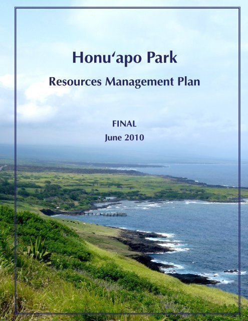
Honu'apo Park Resource Management Plan
Honu'apo Park Resource Management Plan
Honu'apo Park Resource Management Plan

Create successful ePaper yourself
Turn your PDF publications into a flip-book with our unique Google optimized e-Paper software.
Honu‘apo <strong>Park</strong><br />
<strong>Resource</strong>s <strong>Management</strong> <strong>Plan</strong><br />
FINAL<br />
June 2010
Honuÿapo <strong>Park</strong><br />
<strong>Resource</strong>s <strong>Management</strong> <strong>Plan</strong><br />
Final<br />
June 2010<br />
Prepared for:<br />
Hawaiÿi County Finance Department<br />
Prepared by:<br />
Townscape, Inc.
This page intentionally left blank.
Honuÿapo <strong>Park</strong> Final <strong>Resource</strong>s <strong>Management</strong> <strong>Plan</strong><br />
ENDORSEMENT<br />
This <strong>Resource</strong>s <strong>Management</strong> <strong>Plan</strong> for Honuÿapo <strong>Park</strong> in the District of Kaÿü,<br />
prepared by Townscape, Inc. for the County of Hawaiÿi Finance Department, has<br />
been reviewed and is hereby endorsed on this day of _______________. ________<br />
by the County of Hawaiÿi Department of <strong>Park</strong>s and Recreation and by Ka ÿOhana O<br />
Honuÿapo.<br />
___________________________<br />
County of Hawaiÿi Department of <strong>Park</strong>s and Recreation<br />
___________________________<br />
Ka ÿOhana O Honuÿapo<br />
Page i
Honuÿapo <strong>Park</strong> Final <strong>Resource</strong>s <strong>Management</strong> <strong>Plan</strong><br />
This page intentionally left blank.<br />
Page ii
Honuÿapo <strong>Park</strong> Final <strong>Resource</strong>s <strong>Management</strong> <strong>Plan</strong><br />
TABLE OF CONTENTS<br />
Project Team.................................................................................................................. vii<br />
Acronyms and Abbreviations......................................................................................... viii<br />
Glossary.......................................................................................................................... ix<br />
1 Introduction ............................................................................................................... 1<br />
1.1 Purpose of the <strong>Resource</strong>s <strong>Management</strong> <strong>Plan</strong>..................................................... 1<br />
2 Honuÿapo <strong>Park</strong> Profile ................................................................................................ 2<br />
2.1 <strong>Park</strong> Property ................................................................................................... 3<br />
2.2 Regional Setting ............................................................................................... 6<br />
2.3 Environmental Setting .................................................................................... 10<br />
2.4 Historic and Cultural Setting........................................................................... 15<br />
2.5 Archaeological Sites....................................................................................... 18<br />
2.6 Historic Sites.................................................................................................. 20<br />
2.7 Existing <strong>Park</strong> Facilities and Utilities ................................................................ 20<br />
2.8 Circulation and Access................................................................................... 21<br />
2.9 Visual <strong>Resource</strong>s ............................................................................................ 22<br />
2.10 <strong>Park</strong> Visitation................................................................................................ 22<br />
3 Regulatory Profile..................................................................................................... 23<br />
3.1 State Land Use Districts.................................................................................. 23<br />
3.2 Hawaiÿi County Land Use Pattern Allocation Guide ....................................... 25<br />
3.3 Hawaiÿi County Zoning.................................................................................. 25<br />
3.4 Special <strong>Management</strong> Area.............................................................................. 27<br />
3.5 Hawaiÿi County Floodplain <strong>Management</strong> ....................................................... 27<br />
3.6 State Historic Preservation.............................................................................. 29<br />
3.7 Federal Coastal and Estuarine Land Conservation Program ............................. 30<br />
4 Community Consultation.......................................................................................... 31<br />
4.1 Working Meetings with Ka ÿOhana O Honuÿapo (KOOH) .............................. 31<br />
4.2 Community Small Group Meetings................................................................. 31<br />
4.3 July 4 th Speak Out .......................................................................................... 31<br />
4.4 November – December 2009 Speak Out series .............................................. 33<br />
5 Proposed <strong>Park</strong> Land Uses and Improvements ........................................................... 34<br />
5.1 <strong>Plan</strong>ning Objectives ....................................................................................... 34<br />
5.2 <strong>Park</strong> Land Uses .............................................................................................. 34<br />
5.3 <strong>Park</strong> Site <strong>Plan</strong> and Proposed Improvements .................................................... 37<br />
Page iii
Honuÿapo <strong>Park</strong> Final <strong>Resource</strong>s <strong>Management</strong> <strong>Plan</strong><br />
5.4 Potential Additional Future Improvements...................................................... 45<br />
6 Implementation of Projects and Programs................................................................ 47<br />
6.1 Phase I Projects .............................................................................................. 48<br />
6.2 Phase II Projects ............................................................................................. 50<br />
6.3 Phase III Projects ............................................................................................ 52<br />
6.4 Phase IV Projects............................................................................................ 54<br />
6.5 On-going Programs ........................................................................................ 55<br />
6.6 Project Funding and Implementation Entities.................................................. 55<br />
6.7 <strong>Park</strong> <strong>Management</strong> and <strong>Resource</strong> Protection.................................................... 56<br />
6.8 Next Steps...................................................................................................... 58<br />
7 References................................................................................................................ 59<br />
TABLES<br />
Table 2-1: Honuÿapo <strong>Park</strong> Parcels (2006 land acquisition)................................................ 3<br />
Table 2-2: Honuÿapo <strong>Park</strong> Excluded Parcels (2006 land acquisition)................................. 4<br />
Table 5-1: Proposed plant species for Honuÿapo Coastal Area ........................................ 39<br />
Table 6-1: <strong>Plan</strong> Implementation Summary...................................................................... 47<br />
FIGURES<br />
Figure 2-1: Site Location ................................................................................................. 2<br />
Figure 2-2: Honuÿapo <strong>Park</strong> Parcels ................................................................................. 5<br />
Figure 2-3: Site Regional Setting ....................................................................................... 6<br />
Figure 2-4: Surrounding Landowners................................................................................ 9<br />
Figure 3-1: State Land Use Districts ................................................................................ 24<br />
Figure 3-2: Hawaiÿi County Zoning ................................................................................ 26<br />
Figure 3-3: Honuÿapo <strong>Park</strong> area FIRM map..................................................................... 28<br />
Figure 5-1: Land Use <strong>Plan</strong> .............................................................................................. 36<br />
Figure 5-2: Site <strong>Plan</strong> ....................................................................................................... 43<br />
Page iv
Honuÿapo <strong>Park</strong> Final <strong>Resource</strong>s <strong>Management</strong> <strong>Plan</strong><br />
APPENDICES<br />
Appendix A Additional Botanical Data Memo (Geometrician Associates)<br />
Appendix B Cultural <strong>Resource</strong>s of the Ahupuaÿa of Honuÿapo, Hiÿonaÿä,<br />
Hökükano, Kaÿaläiki, Hïlea Nui, Hïlea Iki, Nïnole and Wailau<br />
(Rechtman Consulting)<br />
Appendix C Federal Coastal and Estuarine Land Conservation Program Final<br />
Guidelines (National Oceanic and Atmospheric Administration)<br />
Appendix D Honuÿapo <strong>Park</strong> Implementation Permitting Matrix<br />
Page v
Honuÿapo <strong>Park</strong> Final <strong>Resource</strong>s <strong>Management</strong> <strong>Plan</strong><br />
This page intentionally left blank.<br />
Page vi
Hawaiÿi County Finance<br />
Department<br />
Townscape, Inc.<br />
Honuÿapo <strong>Park</strong> Final <strong>Resource</strong>s <strong>Management</strong> <strong>Plan</strong><br />
PROJECT TEAM<br />
Project Managing Agency<br />
Prime consultant for the Honuÿapo <strong>Resource</strong>s<br />
<strong>Management</strong> <strong>Plan</strong><br />
Rechtman Consulting, LLC Archaeological Inventory Survey (North portion of<br />
Honuÿapo property and coastal conservation zone)<br />
Archaeological Preservation <strong>Plan</strong> for Honuÿapo lands<br />
Burial Treatment <strong>Plan</strong> for Honuÿapo lands<br />
Geometrician Associates Botanical Investigations and Natural <strong>Resource</strong>s<br />
<strong>Management</strong> Recommendations<br />
Hawaiÿi County Department of<br />
<strong>Park</strong>s and Recreation<br />
Ka ÿOhana O Honuÿapo<br />
PARTNERS<br />
Managing Agency of Honuÿapo <strong>Park</strong>.<br />
Non-profit Kaÿü community organization that has<br />
entered into a formal Memorandum of Understanding<br />
with the County of Hawai’i Department of <strong>Park</strong>s and<br />
Recreation to assist with the restoration,<br />
maintenance, and protection of Honu’apo <strong>Park</strong><br />
resources.<br />
Page vii
Honuÿapo <strong>Park</strong> Final <strong>Resource</strong>s <strong>Management</strong> <strong>Plan</strong><br />
ACRONYMS AND ABBREVIATIONS<br />
ADA Americans with Disabilities Act<br />
CELCP Coastal Estuarine Land Conservation Program<br />
County County of Hawaiÿi<br />
DAR Department of Land and Natural <strong>Resource</strong>s Division of Aquatic<br />
<strong>Resource</strong>s<br />
DLNR Department of Land and Natural <strong>Resource</strong>s<br />
DOCARE Department of Land and Natural <strong>Resource</strong>s Division of Conservation and<br />
<strong>Resource</strong> Enforcement<br />
DOT State Department of Transportation<br />
DPR County Department of <strong>Park</strong>s and Recreation<br />
EPA Environmental Protection Agency<br />
FEMA Federal Emergency <strong>Management</strong> Agency<br />
FIRM Flood Insurance Rate Map<br />
HCC Hawaiÿi County Code<br />
HAR Hawaiÿi Administrative Rules<br />
HAVO Hawaiÿi Volcanoes National <strong>Park</strong><br />
HRS Hawaiÿi Revised Statutes<br />
KOOH Ka ÿOhana O Honuÿapo<br />
LCA Land Court Award<br />
NPS National <strong>Park</strong> Service<br />
NOAA National Oceanic and Atmospheric Administration<br />
NRCS U.S. Department of Agriculture, Natural <strong>Resource</strong>s Conservation Service<br />
SHPD State Historic Preservation Division<br />
SMA Special <strong>Management</strong> Area<br />
State State of Hawaiÿi<br />
TMK Tax Map Key<br />
TPL Trust for Public Land<br />
USFWS United States Fish and Wildlife Service<br />
USDA United States Department of Agriculture<br />
USGS United States Geological Survey<br />
Page viii
Honuÿapo <strong>Park</strong> Final <strong>Resource</strong>s <strong>Management</strong> <strong>Plan</strong><br />
GLOSSARY<br />
ÿAÿä One of the two main types of Hawaiÿi lava flows,<br />
characterized by a rough, jagged, spiny, and generally<br />
clinkery surface.<br />
Ahupuaÿa Native Hawaiian land division usually extending from the<br />
uplands to the outer reef, so called because the boundary<br />
was marked by a stone altar (ahu) surmounted by an image<br />
of a pig (puaÿa), or because a pig or other offering was laid<br />
on the altar as tribute to the chief.<br />
Endemic A species native and confined to a certain region; having<br />
comparatively restricted distribution.<br />
Heiau Native Hawaiian place of worship, shrine; some heiau were<br />
elaborately constructed stone platforms, others simple earth<br />
terraces.<br />
Kupuna Grandparent, ancestor, relative or close friend of the<br />
(pl. Küpuna) grandparent’s generation.<br />
Mähele ÿÄina also know as the Great Mähele, the 1848 Mähele ÿÄina was<br />
the division of land that established private ownership of<br />
native lands in Hawaiÿi.<br />
Ma kai On the seaside, toward the sea, in the direction of the sea.<br />
Ma uka Inland, upland, towards the mountain, shoreward (if at sea).<br />
Pähoehoe One of the two main types of Hawaiian lava flows,<br />
characterized by a smooth, billowy, or ropy surface.<br />
Native species With respect to a particular ecosystem, a species that, other<br />
than as a result of an introduction, historically occurred or<br />
currently occurs in that ecosystem.<br />
Page ix
Honuÿapo <strong>Park</strong> Final <strong>Resource</strong>s <strong>Management</strong> <strong>Plan</strong><br />
This page intentionally left blank<br />
Page x
1 INTRODUCTION<br />
Honuÿapo <strong>Park</strong> Final <strong>Resource</strong>s <strong>Management</strong> <strong>Plan</strong><br />
The Honuÿapo <strong>Park</strong> is a mostly undeveloped land parcel, approximately 231 acres<br />
in size, located on the rugged and wild Kaÿü coast. The parcel is part of an 80-mile<br />
stretch of spectacular undeveloped coastline within the District of Kaÿü on the<br />
Island of Hawaiÿi. The park offers unspoiled vistas of the coast and Mauna Loa’s<br />
south flank, as well as unique and pristine habitats for marine and near-shore fauna<br />
and flora. The Honuÿapo area also has a long history of Hawaiian settlement and is<br />
rich in important historic, cultural, and archaeological features.<br />
In 2005, Hawaiÿi State and County governments, the non-profit community<br />
organization Ka ÿOhana O Honuÿapo (KOOH), the Trust for Public Land (TPL), the<br />
National Oceanic and Atmospheric Administration (NOAA), the Kaÿü community<br />
and other individual donors came together to purchase the Honuÿapo <strong>Park</strong> property,<br />
north of Whittington Beach <strong>Park</strong>, to protect it from development interests. The<br />
property was purchased in 2006 and is now owned by the State of Hawaiÿi (the<br />
State). It was set aside to the County of Hawaiÿi (the County) for Estuarine Land<br />
Conservation and Public Recreation purposes by Executive Order No. 4164 on<br />
March 30, 2006.<br />
The County’s Department of <strong>Park</strong>s and Recreation (DPR) signed a Memorandum of<br />
Understanding (MOU) with KOOH on August 14, 2008 for a pilot project at<br />
Whittington Beach <strong>Park</strong> and expanded Honuÿapo lands. The MOU allows KOOH<br />
to assist the County in maintaining current park facilities, and to plan for additional<br />
restoration and conservation activities and community park improvements,<br />
provided that the proper approvals and permits are obtained.<br />
1.1 Purpose of the <strong>Resource</strong>s <strong>Management</strong> <strong>Plan</strong><br />
In Fiscal Year 2007/2008, the County Finance Department allocated funds for the<br />
development of a <strong>Resource</strong>s <strong>Management</strong> <strong>Plan</strong> for publicly owned lands from<br />
Käwä Bay to Honuÿapo. The Department selected a planning consultant to develop<br />
the <strong>Plan</strong>, and the consultant began work in August 2008. Due to a number of issues<br />
relating to site access and land ownership, the scope of the planning work was<br />
revised to focus specifically on Honuÿapo <strong>Park</strong> lands.<br />
The purpose of the Honuÿapo <strong>Park</strong> <strong>Resource</strong>s <strong>Management</strong> <strong>Plan</strong> is to assemble<br />
existing information about the resources of the property and its surroundings and to<br />
engage the Kaÿü community in planning for the long-term stewardship of the park.<br />
The goal of the plan is to provide land use guidance to help protect and restore the<br />
important natural and cultural resources of the property while providing integrated<br />
and respectful recreational and educational opportunities for the Kaÿü Community.<br />
Page 1
2 HONUÿAPO PARK PROFILE<br />
Honuÿapo <strong>Park</strong> Final <strong>Resource</strong>s <strong>Management</strong> <strong>Plan</strong><br />
The Honuÿapo <strong>Park</strong> property is located within Hawaiÿi County’s Kaÿü District<br />
(figure 2-1). Kaÿü is the largest district of the Island of Hawaiÿi and covers an area of<br />
922.5 square miles from the southernmost point of the island to the Hawaiÿi<br />
Volcanoes National <strong>Park</strong>, encompassing the caldera of Kilauea Volcano and<br />
extending inland up to the Mauna Loa caldera.<br />
Figure 2-1: Site Location<br />
Page 2
2.1 <strong>Park</strong> Property<br />
Honuÿapo <strong>Park</strong> Final <strong>Resource</strong>s <strong>Management</strong> <strong>Plan</strong><br />
The Honuÿapo <strong>Park</strong> <strong>Resource</strong>s <strong>Management</strong> <strong>Plan</strong> covers the entire property of<br />
Honuÿapo <strong>Park</strong>, which includes the nine parcels acquired by the State of Hawaiÿi in<br />
2006 and set aside to the County of Hawaiÿi by Executive Order Number 4164.<br />
These parcels are listed in Table 2-1 below.<br />
Table 2-1: Honuÿapo <strong>Park</strong> Parcels (2006 land acquisition)<br />
Tax Map Key Area (acres)<br />
9-5-14-007 145.021<br />
9-5-14-006 3.412<br />
9-5-14-053 16.424<br />
9-5-14-054 14.669<br />
9-5-14-055 10.820<br />
9-5-14-056 1.022<br />
9-5-14-057 1.770<br />
9-5-14-058 10.645<br />
9-5-14-059 18.92<br />
Total Acreage 222.703<br />
Additionally, the <strong>Resource</strong>s <strong>Management</strong> <strong>Plan</strong> also covers the Whittington Beach<br />
<strong>Park</strong> Parcel (Tax Map Key Number 9-5-14-1, 0.825 acres) and two land parcels<br />
(Tax Map Key Number 9-5-14-60, 6.465 acres, and 9-5-14-29, 1.011 acres) that<br />
the County of Hawaiÿi is in the process of acquiring. Parcel 60, although privately<br />
owned, includes the access road to Whittington Beach <strong>Park</strong> and is currently<br />
maintained as part of the county park. It is assumed that parcels 60 and 29 will<br />
become property of the county; however, in the event that the acquisition fails, this<br />
<strong>Resource</strong>s <strong>Management</strong> <strong>Plan</strong> may need to be amended.<br />
The total land area thus covered by the <strong>Resource</strong>s <strong>Management</strong> <strong>Plan</strong> is 231 acres.<br />
Figure 2-2 shows the parcels included in the Honuÿapo <strong>Park</strong> <strong>Resource</strong>s<br />
<strong>Management</strong> <strong>Plan</strong>.<br />
There are five kuleana parcels and one school grant parcel within Honuÿapo <strong>Park</strong>,<br />
which are excluded from the park property. These parcels are listed in Table 2-2<br />
with Land Commission Award (LCA) information from the 1936 Tax Map Bureau<br />
and Survey Department Plat Map Number 9-5-14. Parcels excluded from the<br />
property are also shown on Figure 2-2.<br />
Page 3
Honuÿapo <strong>Park</strong> Final <strong>Resource</strong>s <strong>Management</strong> <strong>Plan</strong><br />
Table 2-2: Honuÿapo <strong>Park</strong> Excluded Parcels (2006 land acquisition)<br />
Tax Map Key<br />
Land Commission<br />
Award Number<br />
Grantee Area (acres)<br />
9-5-14-002 10516:1 Nahakuelua 0.20<br />
9-5-14-003 9564-B Kalaukoa 0.45<br />
9-5-14-004 9212:1 Hoolapa 0.46<br />
9-5-14-005 School Grant 5:8 N/A 0.76<br />
9-5-14-027 10008:2 Lepoloa 0.29<br />
9-5-14-052 9955B:1 Lilikalani 0.63<br />
Total Acreage 2.79<br />
There are six distinct rights associated with kuleana parcels and/or native<br />
Hawaiians with ancestral connections to the kuleana, which will need to be taken<br />
into consideration when planning for Honuÿapo <strong>Park</strong>. These rights are:<br />
1) Reasonable access to the land-locked kuleana from major thoroughfares;<br />
2) Agricultural uses, such as taro cultivation;<br />
3) Traditional and customary gathering rights in the ahupuaÿa;<br />
4) A single family dwelling no larger than one quarter of an acre (subject to<br />
zoning regulations), if the lot was originally awarded as a house lot;<br />
5) Sufficient water for drinking and irrigation from nearby streams and fresh water<br />
springs;<br />
6) Fishing rights in the kunalu (beach to reef zone) of the ahupuaÿa.<br />
Additional information on Honuÿapo’s kuleana parcels is provided in Section 2.4.2.<br />
Page 4
Honuÿapo <strong>Park</strong> Final <strong>Resource</strong>s <strong>Management</strong> <strong>Plan</strong><br />
Figure 2-2: Honuÿapo <strong>Park</strong> Parcels<br />
Page 5
2.2 Regional Setting<br />
Honuÿapo <strong>Park</strong> Final <strong>Resource</strong>s <strong>Management</strong> <strong>Plan</strong><br />
The lands of Honuÿapo <strong>Park</strong> are made up of the coastal portions of the ahupuaÿa of<br />
Honuÿapo and Hiÿonaÿä. The nearest town to Honuÿapo is Näÿälehu, approximately<br />
3 miles to the southwest. The relatively level topography of the park and its<br />
proximity to Hawaiÿi Belt Road make it a more accessible stretch of the Kaÿü Coast<br />
than surrounding lands (Figure 2-3). The park also offers an exceptional experience<br />
of coastal Kaÿü, with sweeping views of surrounding hillsides, unique estuarine and<br />
coastal natural resources, and a rich regional history. The regional setting of the<br />
Honuÿapo <strong>Park</strong> property is described in more detail in the following sections.<br />
Figure 2-3: Site Regional Setting<br />
Page 6
2.2.1 Climate<br />
Honuÿapo <strong>Park</strong> Final <strong>Resource</strong>s <strong>Management</strong> <strong>Plan</strong><br />
The climate of the project area is semi-arid and mild. Average daily temperatures<br />
range from the low 70s (F) to the mid 80s, depending on the time of day and<br />
season, and mean annual rainfall is about 45 inches. Monthly average temperatures<br />
vary only about five degrees from the warmest months of August and September to<br />
the coolest months of December and January. Wind speeds average 10 to 15 miles<br />
per hour with gusts frequently exceeding 20 miles per hour. Prevailing wind<br />
directions are northeasterly and easterly. High winds and relatively clear skies lead<br />
to high rates of evapotranspiration.<br />
Air pollution in Ka‘ü is mainly derived from volcanic emissions of sulfur dioxide<br />
(SO2), which convert into particulate sulfate and produce a volcanic haze (vog) that<br />
periodically blankets the district. Changing levels of SO2 output from Kïlauea<br />
volcano, as well as variable winds and weather patterns, can drastically affect the<br />
level of vog pollution in Kaÿü. The State Department of Health and U.S. Geological<br />
Survey (USGS) continuously monitor SO2 levels throughout the island of Hawaiÿi.<br />
Vog has become more prevalent in Kaÿü since the opening of a new vent at<br />
Halemaumau Crater at the summit of Kilauea Volcano in March 2008. Recent SO2<br />
emission rate measurements were about 660 tonnes/day in April 2010, well above<br />
the 2003-2007 average of 140 tonnes/day. Due to the unpredictable nature of<br />
volcanic eruptions, it is difficult to forecast how SO2 emissions from Kïlauea<br />
Volcano will fluctuate in the future.<br />
2.2.2 Topography<br />
The topography at Honuÿapo is relatively level throughout the area of the park,<br />
with lowest land elevations near Honuÿapo Estuary and Honuÿapo Bay, near sea<br />
level, and slightly higher elevations in the central and northern sections of the park<br />
at 20 to 40 feet above mean sea level.<br />
Honuÿapo <strong>Park</strong> represents a low point in the coastal topography, with the tall, steep<br />
Pohina cliffs located just to the south of the park, and a massive ÿaÿä flow along the<br />
northern boundary of the park. About 1,000 feet inland from Honuÿapo <strong>Park</strong>, the<br />
lowland plain begins to ascend into moderate to steep slopes up the flank of<br />
Mauna Loa.<br />
2.2.3 Regional Geology and Hydrogeology<br />
Extending north from Ka Lae Point the southeast coast of the island of Hawaiÿi is<br />
made up of rocky headlands that transition to a low-lying coastal plain in the<br />
vicinity of Honuÿapo Bay. Surface lava flows in the coastal zone surrounding<br />
Honuÿapo come from Mauna Loa volcano and range in age from 200 to 5,000<br />
years before the present.<br />
Page 7
Honuÿapo <strong>Park</strong> Final <strong>Resource</strong>s <strong>Management</strong> <strong>Plan</strong><br />
According to the U.S. Department of Agriculture (USDA) Natural <strong>Resource</strong>s<br />
Conservation Service (NRCS), the region generally lacks true soil, being primarily of<br />
pähoehoe or ‘a‘ä lava too young for soil formation. “Pähala ash” helped build the<br />
soils (Andisols order) that sustained the Ka‘ü district’s sugar cane industry through<br />
much of the 19 th and 20 th centuries.<br />
No permanent streams are present in the vicinity of Honuÿapo. Subsurface streams<br />
fed by upland precipitation penetrate the relatively young porous basalt flows of<br />
the area, creating a system of sub-surface fresh water flows that feed coastal<br />
wetlands and offshore freshwater seeps, such as those of Honuÿapo Bay. Anchialine<br />
ponds, which contain brackish waters and exhibit tidal fluctuations without a<br />
surface connection to the ocean, also occur in the coastal zone throughout the<br />
district.<br />
2.2.4 Surrounding Landowners and Land Uses<br />
Lands surrounding Honuÿapo <strong>Park</strong> are dominated by open space and extensive<br />
agricultural uses. The majority of the Honuÿapo <strong>Park</strong> property itself is currently<br />
undeveloped open space, with only the southernmost portion of the property, near<br />
Honuÿapo Estuary and Honuÿapo Bay, being maintained as a public park.<br />
Lands ma uka of Honuÿapo <strong>Park</strong> are privately owned and leased for cattle grazing.<br />
Directly to the northeast of Honuÿapo <strong>Park</strong>, the rugged coastal land is owned by the<br />
State of Hawaiÿi and is undeveloped open space. Residential development in<br />
coastal areas of South Kaÿü has been very limited, except for the Sea Mountain<br />
Resort at Punaluÿu and one house, located on the ÿaÿä flow to the north of the park.<br />
To the south of Honuÿapo, a few houses are located along the highway as it begins<br />
to ascend along the hillside; the remainder of the land around Honuÿapo Bay is<br />
open space or used for cattle grazing. Figure 2-4 indicates the major landowners in<br />
the vicinity of Honuÿapo <strong>Park</strong>.<br />
Page 8
Honuÿapo <strong>Park</strong> Final <strong>Resource</strong>s <strong>Management</strong> <strong>Plan</strong><br />
Figure 2-4: Surrounding Landowners<br />
Page 9
2.3 Environmental Setting<br />
Honuÿapo <strong>Park</strong> Final <strong>Resource</strong>s <strong>Management</strong> <strong>Plan</strong><br />
The physical setting and natural ecosystems of the Honuÿapo <strong>Park</strong> property provide<br />
clues as to what can and should be done at the site. In order to better understand<br />
the site’s natural environment and historic changes, interviews were conducted<br />
with knowledgeable area küpuna in May and June 2009, and site visits were<br />
conducted in March, June, and September 2009.<br />
2.3.1 Soils<br />
The USDA Soil Conservation Service Soil Survey identified four different soil types<br />
within the boundaries of the Honuÿapo <strong>Park</strong> Property:<br />
- Lava flows, pähoehoe (rLW) in the southern portion of the property, around<br />
Honuÿapo Bay and extending northward along the coast;<br />
- Rock land (rRO), consisting of pähoehoe lava bedrock covered in places by a<br />
thin layer of soil material, generally in the ma uka portions of the property,<br />
- Lava flows, ÿaÿä (rLV), in the northern portion of the site.<br />
- Punaluÿu extremely rocky peat, 6 to 20 percent slopes (rPYD), consisting of<br />
well drained organic soils over pähoehoe lava bedrock, in a small portion<br />
along the southwestern edge of the site.<br />
The land cover at the property has been drastically modified by operations of the<br />
Hutchinson Sugar Company, which was present at Honuÿapo from 1881 to 1973.<br />
Sugar mill waste material resulting from sugar processing operations was disposed<br />
of throughout the site, around the estuary and along coastal areas. Settling ponds<br />
for plantation waste fiber were also created in the central and northern portions of<br />
the property after enactment of the Clean Water Act, which prohibited disposal of<br />
industrial waste streams directly into navigable waters.<br />
2.3.2 Hydrology<br />
Regional hydrology has created fresh<br />
water springs that feed into the<br />
wetlands of Honuÿapo Estuary. No<br />
permanent streams are located on the<br />
property. A former manmade drainage<br />
swale leads from the old sugar mill to<br />
the ocean across the property, which<br />
was formerly used to transport waste<br />
cane fiber from the mill to the ocean<br />
for disposal.<br />
Overland runoff from the hillsides<br />
above Honuÿapo historically caused<br />
Flooding at Honuÿapo Village<br />
Photo Courtesy of Iwao Yonemitsu<br />
Page 10
Honuÿapo <strong>Park</strong> Final <strong>Resource</strong>s <strong>Management</strong> <strong>Plan</strong><br />
flooding on the subject property. An irrigation system developed and formerly<br />
maintained by the sugar plantations of Kaÿü has affected the surface hydrology of<br />
the area and, according to verbal accounts, decreased the number of flooding<br />
events at Honuÿapo. With the shutting down of the sugar industry in Kaÿü and the<br />
subdivision of plantation lands into smaller parcels, the irrigation system is no<br />
longer maintained.<br />
2.3.3 Natural Hazards<br />
Volcanic hazard in the vicinity of Honuÿapo is assessed by the USGS as “6” in the<br />
southern and central portion of the park, and “3” in the northernmost zone of the<br />
park, on a scale of ascending risk from “9” to “1”. This moderate to high hazard<br />
designation is based on the fact that Mauna Loa is an active volcano, having last<br />
erupted in 1984.<br />
In terms of seismic risk, the entire Island of Hawai‘i is rated Zone 4 Seismic Hazard,<br />
which means it is at risk from major earthquake damage, especially to structures<br />
that are poorly designed or built. The most significant earthquake occurring in Kaÿü<br />
in recorded history was in March and April 1868. Written accounts of Kaÿü<br />
residents attest to the tremendous damage caused by the earthquakes and ensuing<br />
tsunami. A written account by C. J. Waialoha (Ka Nupepa Kuÿokoÿa, April 11,<br />
1868), a Hawaiian resident of Kaÿü describes the disaster (Handy et al. 1991:566):<br />
… The earthquakes were terrible from the 27 th [of March] to the<br />
30 th . The earth shook constantly. We had never before known<br />
anything like this. The stones on our beaches and the cliffs are<br />
scattered and broken… The famous cliffs of Pohina [at Honuÿapo]<br />
were broken in places and some of the natives there feared a<br />
similar fate… At three o’clock on Thursday, April 2, came a great<br />
quake which made it impossible for man and animals to stand<br />
upright. The earth below rose to the sky like a cloud, from the land<br />
slides; big trees toppled over; gulches were filled and houses<br />
collapsed… fifteen minutes after the earthquake, a tidal wave arose,<br />
which killed a number of people. Those who died numbered 46<br />
and those who barely escaped are not numbered… When the sea<br />
ebbed, all kinds of fish were left ashore, except the whale and the<br />
shark.<br />
The houses at Kaÿaluÿalu, Paiahaÿa, Honuÿapo, Hokukano,<br />
Kaÿalaiki, the two Hilea, Ninole, Wailau, Punaluÿu, and as far as<br />
Keauhou, were all swept away by the sea.<br />
The 1868 earthquake that caused the destructive tsunami was estimated to have<br />
had a magnitude of 7.9. Another tsunami in 1946, generated by an earthquake in<br />
Page 11
Honuÿapo <strong>Park</strong> Final <strong>Resource</strong>s <strong>Management</strong> <strong>Plan</strong><br />
the Aleutian Islands, destroyed the Honuÿapo wharf that was built in 1883. Two<br />
additional major tsunami events affected Honuÿapo and caused extensive damage<br />
to structures near the shoreline in 1960 (generated by an earthquake in Chile) and<br />
1975 (generated by a local earthquake). Locally generated tsunami are<br />
unpredictable and generally only allow for a few minutes of warning time;<br />
evacuation in these conditions is extremely difficult. Locally generated earthquakes<br />
have also caused land subsidence in the Kaÿü and Puna districts. During the 1975<br />
earthquake, fault displacements resulted in widespread subsidence, as much as 10<br />
feet near Halape in Puna District, and as much as 2 to 3 feet to the south and<br />
southwest of the zone of maximum subsidence (Stover & Coffman, 1993).<br />
Ocean conditions in the South Kaÿü area are generally rough, with strong currents<br />
and intense wave energy. Coral reefs are absent along this rugged and exposed<br />
coast, thus creating hazardous sea conditions.<br />
2.3.4 Botany<br />
Geometrician Associates conducted a limited botanical investigation at Honuÿapo<br />
<strong>Park</strong> to provide information on vegetation zones and plant species present at the<br />
park (Appendix A). There are several distinct vegetation zones within the property.<br />
The coastal strand vegetation is dominated by native plants specifically adapted to<br />
an environment of sea spray and little soil; this vegetation includes naupaka<br />
(Scaevola taccada), ‘ilima (Sida fallax), paÿu o Hi‘iaka (Jacquemontia ovalifolia),<br />
pohuehue (Ipomoea pescaprae brasiliensis), ÿakulikuli (Sesuvium portulacastrum),<br />
nehe (Melanthera integrifolia), and seaside heliotrope (Heliotropium curassavicum).<br />
Native coastal strand vegetation –<br />
ÿakulikuli and ÿilima<br />
Ma uka of the coastal strand zone and<br />
extending up to the highway is the highly<br />
modified coastal dry shrubland community.<br />
Centuries of human disturbance have<br />
resulted in a lowland plant community<br />
mostly devoid of native species and<br />
dominated by haole koa (Leucaena<br />
leucocephala), Guinea grass (Panicum<br />
maximum) and kiawe (Prosopis pallida), with<br />
other dry shrubland species such as<br />
Christmas berry (Schinus terebinthifolius),<br />
java plum (Syzigium cumini), and sourbush<br />
(Pluchea odorata).<br />
The wetland area of Honuÿapo estuary is also<br />
dominated by invasive species including<br />
kiawe (Prosopis pallida) and California grass<br />
Page 12
Honuÿapo <strong>Park</strong> Final <strong>Resource</strong>s <strong>Management</strong> <strong>Plan</strong><br />
(Urochola mutica) in drier zones, and seashore paspalum (Paspalum vaginatum) in<br />
the brackish intertidal zone. Makaloa (Cyperus laevigatus) and milo (Thespesia<br />
populnea) are among the few native species found in the intertidal marsh zone of<br />
the estuary.<br />
2.3.5 Fauna<br />
Honuÿapo <strong>Park</strong> has the potential to provide habitat for many species of birds, native<br />
and alien. Coastal and estuarine zones are habitat for a variety of indigenous<br />
migratory shorebirds, including the ruddy turnstone (Arenaria interpres), Pacific<br />
golden-plover (Pluvialis fulva), wandering tattler (Heteroscelus incanus), and<br />
possibly bristle-thighed curlew (Numenius tahitiensis) and sanderling (Calidris alba).<br />
The estuary could also support native water birds, including the indigenous blackcrowned<br />
night-heron (Nycticorax nycticorax hoactli) and the endangered Hawaiian<br />
coot (Fulica alai). The seabird black noddy or noio (Anous minutus melanogenys) is<br />
frequently seen flying in and out of refuges in the rocky coastal cliffs of the area,<br />
and the white-tailed tropic bird (Phaethon lepturus dorotheae) has been observed at<br />
Honuÿapo (NPS 2006). Introduced birds that are also common at Honuÿapo include<br />
the common barn owl (Tyto alba), northern cardinal (Cardinalis cardinalis),<br />
Japanese white-eye (Zosterops japonicus), spotted dove (Streptopelia chinensis) and<br />
zebra dove (Geopelia striata).<br />
Other rare, endangered or threatened species with variable levels of occurrence in<br />
the area include the endangered Hawaiian hoary bat (Lasiurus cinereus semotus),<br />
endangered Hawaiian duck (Anas wyvilliana), the endangered Hawaiian hawk<br />
(Buteo solitarius), and Hawaiian black-necked stilt or äe‘o (Himantopus mexicanus<br />
knudensi).<br />
The orange-black Hawaiian damselfly (Megalagrion xanthomelas), a candidate<br />
insect species for listing under the Endangered Species Act, has been seen at<br />
Honuÿapo Estuary.<br />
Several species of introduced animals including feral dogs (Canis familiaris), cats<br />
(Felis sylvestris catus), pigs (Sus scrofa), goats (Capra aegagrus hircus), rats (Rattus<br />
rattus), mice (Mus musculus) and mongooses (Herpestes auropunctatus) are present<br />
in the park area and are detrimental to native plant and animal species. The<br />
presence of cats, rats, and mongooses on the park property is believed to be the<br />
primary cause of low numbers of native bird sightings at Honuÿapo Estuary.<br />
2.3.6 Estuarine, Tide pool and Marine Habitats<br />
The rugged shoreline in the vicinity of Honuÿapo offers an array of habitats, ranging<br />
from coastal cliffs, to tide pools and spring-fed brackish wetlands, which produce a<br />
great diversity of biological communities. A limited survey by the National <strong>Park</strong><br />
Page 13
Honuÿapo <strong>Park</strong> Final <strong>Resource</strong>s <strong>Management</strong> <strong>Plan</strong><br />
Service (NPS) along the Kaÿü coast found no alien algae and a healthy balance of<br />
algae and benthic invertebrates, which is indicative of minimal nutrient input from<br />
land and no overexploitation of fish and invertebrate herbivores (NPS, 2006).<br />
The water of Honuÿapo estuary is brackish and fed by fresh water springs on the ma<br />
uka side of the estuary pond and by tidal influx on the ma kai side. Native fish<br />
species that have been recorded in Honuÿapo estuary during quarterly sampling<br />
conducted in 2007 through 2009 as part of an Environmental Protection Agency<br />
(EPA) grant project included alpheidae snapping shrimp, ÿoÿopu (Eleotris<br />
sandvicensis), ÿöpae huna (Palaemon debilis), the threatened naniha goby<br />
(Stenogobius hawaiiensis), striped mullet or ÿamaÿama (Mugil cephalus), äholehole<br />
(Kuhlia sandvicensis), Hawaiian shrimp goby (Psilogobius mainlandi), and<br />
yellowfin goatfish (Mulloidichthys vanicolensis). The estuary also attracts green sea<br />
turtles (Chelonia mydas), a threatened species. Area residents also recall that the<br />
estuary used to provide habitat for päpio (juvenile ulua).<br />
A University of Hawaiÿi at Hilo graduate student (Megan Lamson) conducted a 13month<br />
baseline survey of the shallow near shore habitats (less than 6 feet deep) of<br />
Honuÿapo Bay near Honuÿapo Estuary in 2009 (Lamson, 2010). The survey area<br />
was dominated by turf algae, with some patches of sand and coral. The survey<br />
recorded 119 fish species, with most<br />
species either indigenous (68%) or<br />
endemic (29%), and only a few<br />
introduced species (3%). Fish were<br />
found to be more abundant in the<br />
higher turbidity areas adjacent to the<br />
channel between Honu’apo Estuary<br />
and the ocean. The survey also found<br />
a high abundance of juvenile fish,<br />
suggesting the area could possibly<br />
serve as nursery grounds for certain<br />
fish species.<br />
Honuÿapo Estuary<br />
A “Rapid Ecological Assessment” conducted in 2005 by NOAA along the<br />
southeastern coast of the Island of Hawaiÿi recorded boulder habitat in the shallow<br />
waters of Honuÿapo Bay and especially high coral cover, exceeding 80%, in ocean<br />
waters 10 to 15 feet deep (NOAA, 2006). A total of seventeen coral species were<br />
recorded at the survey site. The corals were generally encrusting, mound or robust<br />
branched corals that can thrive in high-energy exposed coasts. The survey also<br />
noted a variety of fish species, an abundance of invertebrates, including tiger<br />
cowries and lobsters, and an endangered Hawaiian Hawksbill turtle. The<br />
endangered Hawaiian monk seal (Monachus schauinslandi) has also been observed<br />
in the marine waters off Honuÿapo.<br />
Page 14
2.4 Historic and Cultural Setting<br />
Honuÿapo <strong>Park</strong> Final <strong>Resource</strong>s <strong>Management</strong> <strong>Plan</strong><br />
Honuÿapo has a rich historic and cultural background. The abundant coastal and<br />
marine resources and the presence of fresh water springs at Honuÿapo Bay allowed<br />
for the settlement of thriving villages as early as the 14 th century in this part of Kaÿü.<br />
This section briefly describes the history of Honuÿapo in the larger context of<br />
historic events in Kaÿü and the Hawaiian Islands. Additional information on the<br />
history of the region is presented in Appendix B – Cultural <strong>Resource</strong>s of the<br />
ahupuaÿa of Honuÿapo, Hiÿonaÿä, Hökükano, Kaÿaläiki, Hïlea Nui, Hïlea Iki, Nïnole<br />
and Wailau written by Rechtman Consulting.<br />
2.4.1 Area Pre-contact History<br />
In Kaÿü, where the land is dry and rugged, a few small communities were initially<br />
established along sheltered bays with access to fresh water and rich marine<br />
resources. Punaluÿu, Nïnole, Käwä, and Honuÿapo were four well-established<br />
coastal villages in Kaÿü because they had sheltered bays and access to fresh water<br />
in the form of coastal springs. According to radiocarbon dating sample results from<br />
the 2004 inventory survey conducted by Haun & Associates at Honuÿapo, some<br />
permanent habitations on areas of higher ground date back to the mid-1400s. At<br />
Honuÿapo, the coastal springs formed a brackish pond with direct connection with<br />
the ocean, which was used as a fishpond.<br />
By the fourteenth century, ma uka lands were being turned into dryland agricultural<br />
fields. By the fifteenth century, residency in the uplands was becoming permanent,<br />
and there was an increasing separation of the chiefly class from the common<br />
people. Coastal (kula kai) villages depended on marine resources and used these in<br />
turn to exchange with their ma uka (kula uka) relatives for foods and other<br />
resources that they could not grow along the shore (Handy et al. 1972:555).<br />
Land Commission testimonies taken during the Great Mähele of 1848 for areas<br />
around Honuÿapo indicate that dryland taro and sweet potatoes were the most<br />
commonly cultivated crops between 500 and 800 foot elevations. In the 1,500 to<br />
3,000 ft elevation zone, yams and arrowroot were cultivated in the lower portion of<br />
the zone and bananas, forest taro, and plantains were cultivated in the upper<br />
portion. The forest zone in Honuÿapo began at about 3,000 ft elevation on the<br />
southern flank of Mauna Loa.<br />
2.4.2 Post-Contact History<br />
Western Contact<br />
Captain James Cook visited South Point on Hawaiÿi Island for the first time on<br />
board his ships the Resolution and Discovery in January 1779. Cook recorded a<br />
large village at Ka Lae (South) Point and also noted volcano damage in the region.<br />
Page 15
King, who accompanied Cook on the voyage, wrote:<br />
Honuÿapo <strong>Park</strong> Final <strong>Resource</strong>s <strong>Management</strong> <strong>Plan</strong><br />
It is not only the worst part of the Island but as barren waste looking<br />
a country as can be conceived to exist… we could discern black<br />
streaks coming from the Mountain even down to the seaside…<br />
horrid and dismal as this part of the Island appears, yet there are<br />
many villages interspersed, and it struck as being more populous<br />
than the part of Opoona [Puna] which joins Koa [Kaÿü]. There are<br />
houses built even on the ruins [lava flows] we have described<br />
(Beaglehole, 1967:611)<br />
The Reverend William Ellis, one of the Protestant missionaries that arrived in<br />
Hawaiÿi in 1820, visited the Kaÿü district in July of 1823. His accounts provide<br />
details on the villages of Honuÿapo:<br />
From the manner in which we were received at Honuapo, we should<br />
not think this village had been often visited by foreigners; for on our<br />
descending from the high land to the lava on which the town stands,<br />
the natives came running out to meet us from all quarters, and soon<br />
gathered so thickly around us, that we found it difficult to proceed…<br />
We passed through the town to the residence of the head man,<br />
situated on the farthest point towards the sea. He invited us to his<br />
house, procured us water to wash our feet with, and immediately<br />
sent to an adjacent pond for some fish for our supper. While that<br />
was preparing, the people assembled in crowds around the house,<br />
and a little before sun-set Mr. Thurston preached to them in the<br />
front yard. Upwards of 200 were present…<br />
After the service, some of our number visited the ruins of a heiau,<br />
on a point of lava near our lodging. During the evening we made<br />
some inquiries respecting it, found it had been dedicated to Tairi,<br />
and was thrown down in the general destruction of idols in 1819…<br />
(Ellis 2004)<br />
Kelly (1969) estimated that the Kaÿü District had a population of between 10,000<br />
and 13,500 at the time of European contact, but that it declined to less than 2,000<br />
people by 1872 due to a variety of reasons ranging from diseases to migration to<br />
other islands and foreign countries.<br />
By the mid-nineteenth century, the ever-growing population of Westerners forced<br />
socioeconomic and demographic changes that promoted the establishment of a<br />
Euro-American style of land ownership, and in 1848 the Mähele ÿÄina became the<br />
Page 16
Honuÿapo <strong>Park</strong> Final <strong>Resource</strong>s <strong>Management</strong> <strong>Plan</strong><br />
vehicle for determining ownership of native lands. The Mähele defined the land<br />
interests of Kamehameha III (the King), the high-ranking chiefs, and the konohiki.<br />
During the Mähele, all lands in the Kingdom of Hawai‘i were placed in one of<br />
three categories: (1) Crown Lands (for the occupant of the throne); (2) Government<br />
Lands; and (3) Konohiki Lands (Chinen 1958:vii and Chinen 1961:13).<br />
Additionally, native tenants could claim and acquire title to kuleana parcels that<br />
they actively lived on or farmed at the time of the Mähele. The Kuleana Act of<br />
December 21, 1849 provided the framework by which native tenants could apply<br />
for and receive fee-simple interest in their kuleana lands from the Land<br />
Commission.<br />
As a result of the Mähele, Honu‘apo ahupuaÿa (totaling 2,200 acres) was awarded<br />
as Konohiki Land to William Charles Lunalilo (LCAw. 8559), and Hiÿonaÿä<br />
Ahupua‘a was retained as Government Land. A total of twenty-four kuleana were<br />
awarded in Honu‘apo Ahupua’a, and five were awarded in Hi‘onaÿä.<br />
Five kuleana were awarded ma kai of what is now Highway 11 within the<br />
Honu‘apo <strong>Park</strong> area, all in the vicinity of Honuÿapo Estuary. These kuleana<br />
included LCAw. 9212:1 to Hoolapa, LCAw. 9564B:1 to Kalaukoa, LCAw. 9955B:1<br />
to Lilikalani, LCAw. 10008:2 to Lepoloa, and LCAw.10516:1 to Nahakuelua. The<br />
uses of the five awards were as follows:<br />
- Hoolapa’s award (LCAw. 9212:1) was for a 0.29 acre house lot;<br />
- Kaulukoa’s award (LCAw. 9564B) consisted of 0.44 acres that included a<br />
house lot and perhaps two salt beds;<br />
- Lilikalani’s award (LCAw. 9955B) included a portion of the fish pond at<br />
Honu‘apo and three salt cellars;<br />
- Lepoloa’s award (LCAw. 10008:2) of 0.3 acres appears to have been for 4<br />
kihapai (wauke fields);<br />
- Nahakuelua’s award (LCAw.10516:1) was for a salt basin, and two house<br />
lots.<br />
These kuleana parcels are identified as exclusions to the park property and are<br />
shown on Figure 2-2.<br />
Sugar <strong>Plan</strong>tation Era<br />
The 1870s saw the rise of sugar plantations throughout Kaÿü. Sugar mills were built<br />
in Pähala (1868), Hïlea (1878), and Honuÿapo (1881). Honuÿapo and Hïlea<br />
plantations became the property of Hutchinson Sugar Company, while Pähala was<br />
owned by Hawaiian Agriculture. Sugar from the Pähala sugar mill was originally<br />
transported to Punaluÿu wharf for shipping. However, access to Punaluÿu Bay was<br />
limited and, after the dredging of Honuÿapo Bay in the 1870s and construction of<br />
the landing at Honuÿapo by 1883, most of the sugar in Kaÿü was shipped out of<br />
Honuÿapo. A railroad system transported sugar from the mills to Honuÿapo Harbor.<br />
Page 17
Honuÿapo <strong>Park</strong> Final <strong>Resource</strong>s <strong>Management</strong> <strong>Plan</strong><br />
Page 18<br />
The concrete pier still<br />
visible at Honuÿapo<br />
Bay was constructed in<br />
1910. The harbor at<br />
Honuÿapo continued<br />
operations until 1942.<br />
After that, sugar was<br />
trucked to Hilo for offisland<br />
shipment.<br />
While in operation, the<br />
Honuÿapo sugar mill<br />
used a flume to<br />
Old Photograph of Honuÿapo Sugar Mill<br />
transport bagasse from<br />
the mill directly to the<br />
Photograph Courtesy of Iwao Yonemitsu<br />
coast and out to the<br />
ocean. This practice<br />
was discontinued and replaced by settling ponds along the coast after the EPA<br />
passed the Clean Water Act (CWA) in 1972.<br />
The Honuÿapo mill was shut down in 1973 and sugar plantation activities in Kaÿü<br />
were then centered at the Pähala plantation, under the ownership of C. Brewer<br />
Company. In 1996, because of decreasing revenues caused by increasing<br />
competition from developing countries and decreasing demand for cane sugar, the<br />
Pähala plantation ceased operation. This marked the end of the sugar plantation era<br />
in Kaÿü.<br />
2.5 Archaeological Sites<br />
Five archaeological studies have<br />
been conducted within the<br />
Honuÿapo <strong>Park</strong> property between<br />
1906 and 2009. These studies have<br />
recorded over 200 archaeological<br />
features, the majority of which are<br />
located in the northern portion of the<br />
property, in Hiÿonaÿä ahupuaÿa.<br />
These studies also indicate that waste<br />
fill disposal by the Honuÿapo Sugar<br />
<strong>Plan</strong>tation in various areas of the<br />
property and particularly around the<br />
estuary have likely covered many<br />
other archaeological sites.<br />
Archaeological feature at Honuÿapo
Honuÿapo <strong>Park</strong> Final <strong>Resource</strong>s <strong>Management</strong> <strong>Plan</strong><br />
Based on the results of inventory surveys conducted by Haun and Associates in<br />
2004 and Rechtman Consulting LLC in 2009, a total of 88 sites encompassing 217<br />
features have been identified, of which 65 sites were considered significant under<br />
State Historic Preservation Criteria. Archaeological sites include the remains of the<br />
Kamalaÿi Heiau, Precontact burial and ceremonial complexes, Precontact<br />
temporary and permanent habitation sites and complexes, platforms, salt basins,<br />
and petroglyphs. Two partial alignments of the alanui aupuni (Old Government<br />
Road), which dates back to the mid-nineteenth century, are also present in the<br />
northern portion of the site within Hiÿonaÿä ahupuaÿa and extending into Hökükano<br />
Ahupua’a.<br />
Within Hiÿonaÿä ahupuaÿa, the survey conducted by Rechtman Consulting LLC in<br />
2009 recorded 18 habitation sites, including single and clustered C-shaped and<br />
rectangular enclosures along the shoreline, and multi-feature complexes with large<br />
rectangular enclosures and platforms on the coastal lowlands. This distribution<br />
suggests that shoreline constructions may have been temporary shelters associated<br />
with resource (fish, shellfish, salt) collection activities. The more complex coastal<br />
lowland habitations, some with burial features, are suggestive of more permanent<br />
(year-round or recurrent seasonal) residence. The survey also identified eleven<br />
burial sites within the Hiÿonaÿä portion of the park, with features ranging from<br />
solitary platforms to clusters of features. A major burial complex is located just<br />
north of the Honuÿapo <strong>Park</strong> boundary (outside of the park property), within<br />
Hökükano ahupuaÿa with features interpreted as having ceremonial significance<br />
extending into Honuÿapo <strong>Park</strong> area.<br />
The survey conducted by Rechtman Consulting, LLC also recorded a series of<br />
bedrock salt basins in the tidal zone within Honuÿapo ahupuaÿa. These salt basins<br />
likely provided an important resource for area inhabitants as salt was traditionally<br />
used for spiritual purposes, medicine, as a condiment and for curing of fish.<br />
The lack of Historic Period artifacts (ceramics, metal, glass, etc…) observed at<br />
Native Hawaiian sites within Honuÿapo and Hiÿonaÿä ahupuaÿa suggests that these<br />
sites date back to Pre-contact times. Radiocarbon dating conducted by Haun et al.<br />
(2004) at three Native Hawaiian permanent habitation features in the Honuÿapo<br />
portion of the park indicated a date interval of 1450 to 1685 A.D., thus suggesting<br />
that the area may have been inhabited as early as the 15 th Century.<br />
Results of the studies and inventory surveys conducted within the Honuÿapo <strong>Park</strong><br />
area and its vicinity highlight the richness of cultural and archaeological resources<br />
within the project area.<br />
Page 19
2.6 Historic Sites<br />
Honuÿapo <strong>Park</strong> Final <strong>Resource</strong>s <strong>Management</strong> <strong>Plan</strong><br />
Few signs remain of the former village, industrial area, and harbor that were<br />
present at Honuÿapo during the 19 th and 20 th Centuries. The concrete foundations<br />
of the pier that was used for shipping of sugar from Honuÿapo are still present at the<br />
southern end of Whittington Beach <strong>Park</strong>. The concrete piles are in poor condition<br />
due to the high wave intensity of this coast and tsunami events that have impacted<br />
Honuÿapo. Concrete foundations of the industrial warehouses that were previously<br />
present at the harbor are also still visible at Whittington Beach <strong>Park</strong>. Several of<br />
these concrete foundations are currently used as parking areas for park users. No<br />
other above-ground structures from the <strong>Plan</strong>tation Era remain at Whittington <strong>Park</strong>.<br />
Historic remains of Japanese-style garden in northern portion<br />
of the estuary<br />
2.7 Existing <strong>Park</strong> Facilities and Utilities<br />
Page 20<br />
On the northern side of the<br />
Honuÿapo Estuary, a club<br />
house and Japanese-style<br />
garden were constructed in<br />
the 1950s. These structures<br />
were destroyed by the 1960<br />
tsunami. Concrete foundations<br />
of buildings are still visible in<br />
that area, as well as some of<br />
the structures of the Japanese<br />
garden, including a Japanesestyle<br />
lantern, a small bridge,<br />
and path stones.<br />
A small portion of the Honuÿapo <strong>Park</strong> property located between the estuary and the<br />
southern end of the property is currently maintained as a community park and is<br />
named “Whittington Beach <strong>Park</strong>” (TMK 9-5-14:001). This park has parking areas,<br />
landscaped grass areas, picnic tables, a shower, public restrooms, and three<br />
covered concrete block pavilions with tables. Camping is also authorized at the<br />
park with a DPR permit.<br />
Water for the restrooms and showers is stored in an aboveground storage tank, and<br />
the restrooms are connected to an onsite septic tank. A water truck comes to refill<br />
the water supply storage tank as needed. There is no County water system or<br />
sanitary sewer in the vicinity of the park.<br />
According to Stearns & Macdonald (1946), water, formerly needed for Hutchinson<br />
sugar mill operations, was supplied by a number of drilled wells at the sugar mill;
Honuÿapo <strong>Park</strong> Final <strong>Resource</strong>s <strong>Management</strong> <strong>Plan</strong><br />
which had a combined capacity of 2,000 gallons of water per minute. The water<br />
pumped from these wells was slightly brackish. The wells at the former mill are<br />
currently unused. The sugar plantation also used a surface water collection system<br />
and tunnels, drilled horizontally into the mountainside, to tap perched groundwater.<br />
The closest active tunnel to Honuÿapo is the Mountain House Tunnel, located<br />
above Näÿälehu, at an altitude of 3,097 feet. According to Stearns & Macdonald,<br />
the tunnel had a yield of nearly 1.3 million gallons per day, the largest of any<br />
tunnel in Kaÿü. Area land owners are currently working with the Department of<br />
Land and Natural <strong>Resource</strong>s to<br />
permit the use of tunnel water<br />
for agricultural purposes.<br />
Camping and picnic table at Whittington Beach <strong>Park</strong><br />
2.8 Circulation and Access<br />
Page 21<br />
Electricity is provided by<br />
Hawaiÿi Electric Light<br />
Company (HELCO) at<br />
Whittington Beach <strong>Park</strong> for<br />
lighting of the existing<br />
pavilions and restrooms. There<br />
is no lighting in other areas of<br />
the park. Aboveground<br />
electric lines are present along<br />
Hawaiÿi Belt Road.<br />
There are currently two main access roads to the park from Hawaiÿi Belt Road. One<br />
road, on the south end of the park, at the base of the hillside, is paved and provides<br />
access to Whittington Beach <strong>Park</strong>. The beach park access road intersects Hawaiÿi<br />
Belt Road at an acute angle at the bottom of a slope; consequently, lack of visibility<br />
and downhill driving can make access to the park dangerous. There are two<br />
parking areas at Whittington Beach <strong>Park</strong>, offering ample parking space for park<br />
users.<br />
The second access road to the property is unpaved, located to the north of<br />
Honuÿapo Estuary, and is referred to as “Mill Ditch Road” because it follows the<br />
alignment of the former ditch used by the Hutchinson Sugar <strong>Plan</strong>tation to transport<br />
waste cane fiber to the ocean. Mill Ditch Road is the main access to coastal areas<br />
in the northern portions of the park. A coastal four-wheel-drive (4WD) trail<br />
provides access along the shoreline of Honuÿapo <strong>Park</strong>. Local residents use that area<br />
of the park for fishing and gathering. There is no formal parking area in this part of<br />
the site and 4WD vehicles generally park on the pähoehoe lava along the coast.
2.9 Visual <strong>Resource</strong>s<br />
Due to the relatively level topography<br />
of the property and the low level<br />
vegetation near the shoreline, coastal<br />
areas of Honuÿapo <strong>Park</strong> offer sweeping<br />
views of the hillsides of Mauna Loa<br />
and the Pohina Cliffs, particularly in<br />
areas north of the estuary. These views<br />
provide a striking panorama of the<br />
rugged and wild beauty of Kaÿü.<br />
Honuÿapo <strong>Park</strong> Final <strong>Resource</strong>s <strong>Management</strong> <strong>Plan</strong><br />
The open landscape of Kaÿü, with<br />
moderately sloping hillsides and open<br />
vegetation, provides panoramic views<br />
Scenic view of Mauna Loa hillsides from Honuÿapo <strong>Park</strong><br />
of Mauna Loa and coastal areas at<br />
various locations along Hawaiÿi Belt<br />
Road throughout the district. A scenic lookout is located at the top of the Pohina<br />
Cliffs, to the south of the park, and offers sweeping views of the Kaÿü landscape and<br />
the Honuÿapo property.<br />
2.10 <strong>Park</strong> Visitation<br />
There are currently only two developed County Beach <strong>Park</strong>s in Kaÿü: Punaluÿu and<br />
Whittington. They also are the only two coastal recreational areas in Kaÿü with<br />
camping and pavilion facilities available to the general public (Volcanoes National<br />
<strong>Park</strong> has hiking-accessible campsites at Keauhou, Halapë and Kaluÿe). According to<br />
County <strong>Park</strong>s and Recreation maintenance personnel, at least one of the three<br />
pavilions at Punaluÿu is rented for parties every weekend. Whittington Beach <strong>Park</strong><br />
is visited primarily by local Kaÿü residents that use the park for fishing, camping,<br />
picnicking, and parties.<br />
Few Hawaiÿi tourists currently stop at Whittington Beach <strong>Park</strong>. A large number of<br />
tourists drive through Kaÿü from Kona on their way to the Hawaiÿi Volcanoes<br />
National <strong>Park</strong> (HAVO). In the past 10 years, annual recreational visits to Hawaiÿi<br />
Volcanoes National <strong>Park</strong> have fluctuated between about 1 to 1.5 million. About 20<br />
percent of these recreational visitors arrived at HAVO by tour bus and the rest in<br />
personal vehicles.<br />
About 30,000 to 35,000 personal vehicles carrying about 85,000 visitors arrive at<br />
HAVO on a monthly basis. Assuming that one third of those vehicles come from<br />
the Hilo side of the island and the other two thirds from the Kona side,<br />
approximately 55,000 visitors in 20,000 vehicles pass through Kaÿu on their way<br />
from Kona to Volcano on a monthly basis. Few of these visitors stop to visit<br />
Honuÿapo.<br />
Page 22
3 REGULATORY PROFILE<br />
Honuÿapo <strong>Park</strong> Final <strong>Resource</strong>s <strong>Management</strong> <strong>Plan</strong><br />
In order to understand the policy setting for developing the management plan, a<br />
review of County, State, and other relevant policies and regulations was conducted.<br />
This chapter describes the policies and land use regulations that should be<br />
considered as part of the planning process for Honuÿapo <strong>Park</strong>.<br />
3.1 State Land Use Districts<br />
Related Laws and Regulations:<br />
• Hawaii Revised Statutes (HRS) Chapters 205-2 and 205-4.5.<br />
• Hawaii Administrative Rules (HAR) 13-5,<br />
The State Land Use Law establishes an overall framework for land use management<br />
whereby all lands in the State are classified into one of four Districts: Urban, Rural,<br />
Agriculture, and Conservation. The part of the property located in the Honuÿapo<br />
ahupuaÿa is within the state’s Agricultural District, which is defined by the State<br />
Land Use Commission as consisting of lands for the cultivation of crops, livestock<br />
raising, wind energy facilities, and lands with significant potential for agriculture<br />
uses. Overnight camping facilities are not a permitted use within the State<br />
Agricultural District. Implementation of overnight camping within the Agricultural<br />
District at Honuÿapo <strong>Park</strong> will require a Special Permit approved by Hawaiÿi<br />
County Council (camp areas of less than 15 acres). Camping areas larger than 15<br />
acres would require a Land Use Variance from the State’s Land Use Commission.<br />
The northern area of the property located within the Hiÿonaÿä ahupuaÿa and the<br />
shoreline area are within the state’s Conservation District, which consists of lands<br />
necessary for protecting watersheds; lands necessary for the preservation of scenic,<br />
cultural, historic, and archaeological sites, or sites of ecological significance; lands<br />
necessary for providing parklands, wilderness, and beach reserves; and lands with<br />
elevations below the shoreline.<br />
There are five conservation district “subzones”, which include, from most<br />
protective to least: Protective Subzone, Limited Subzone, <strong>Resource</strong> Subzone,<br />
General Subzone, and Special Subzone. The coastal area of Honuÿapo <strong>Park</strong>,<br />
including nearly the entire area of Whittington Beach <strong>Park</strong>, is within the <strong>Resource</strong><br />
Subzone, while inland portions of the park within Hiÿonaÿä ahupuaÿa are part of the<br />
Limited and General Subzones. Permitted land uses and activities within each<br />
conservation district subzone are restricted and generally require a Conservation<br />
District Use Permit from the Department or the Board of Land and Natural<br />
<strong>Resource</strong>s.<br />
Page 23
Honuÿapo <strong>Park</strong> Final <strong>Resource</strong>s <strong>Management</strong> <strong>Plan</strong><br />
Figure 3-1: State Land Use Districts<br />
Honuÿapo <strong>Park</strong><br />
Page 24
3.2 Hawaiÿi County Land Use Pattern Allocation Guide<br />
Honuÿapo <strong>Park</strong> Final <strong>Resource</strong>s <strong>Management</strong> <strong>Plan</strong><br />
The Hawaiÿi County Land Use Pattern Allocation Guide Map (LUPAG) is part of the<br />
Hawaiÿi County General <strong>Plan</strong>, the latest version of which was enacted by County<br />
Council in February 2005. The LUPAG specifies the general location of land uses<br />
in the County of Hawaiÿi.<br />
LUPAG classes within Honuÿapo <strong>Park</strong> include “Open” along the shoreline,<br />
“Extensive Agriculture” in the southern portion of the park within the Honuÿapo<br />
ahupuaÿa, and “Conservation” in the northern section of the park within Hiÿonaÿä<br />
ahupuaÿa.<br />
3.3 Hawaiÿi County Zoning<br />
Related Laws and Regulations<br />
• Hawaiÿi County Code (HCC) Section 25-5-70 thru 77 and 25-5-160 thru 167<br />
Hawaiÿi County Zoning Code (HCC Chapter 25) specifies permitted uses of lands<br />
on the Island of Hawaiÿi. The section of the park located in the Honuÿapo ahupuaÿa<br />
is zoned as Agricultural District (A-20) (20-ac minimum lot size); while the area<br />
located in the Hiÿonaÿä ahupuaÿa is zoned as Open Space (O).<br />
The Agricultural District is defined as providing for agricultural and very low<br />
density agriculturally-based residential use, encompassing rural areas of good to<br />
marginal agricultural and grazing land, forest land, game habitats, and areas where<br />
urbanization is not found to be appropriate. The Open District applies to areas that<br />
contribute to the general welfare, the full enjoyment, or the economic well-being of<br />
open land type uses, including preservation of valuable scenic vistas, areas of<br />
special historical significance, or submerged lands and fishponds. Permitted uses<br />
within this district are generally associated with passive recreation, forestry, and<br />
preservation of sites of historic, cultural, or natural significance. Figure 3-2 below<br />
shows County zoning for Honuÿapo <strong>Park</strong> and its vicinity.<br />
Page 25
Honuÿapo <strong>Park</strong> Final <strong>Resource</strong>s <strong>Management</strong> <strong>Plan</strong><br />
Figure 3-2: Hawaiÿi County Zoning<br />
Page 26
3.4 Special <strong>Management</strong> Area<br />
Related Laws and Regulations<br />
• HRS Chapters 205A-21 to 205A-33 and 343<br />
• Hawaiÿi County <strong>Plan</strong>ning Commission Rule 9<br />
Honuÿapo <strong>Park</strong> Final <strong>Resource</strong>s <strong>Management</strong> <strong>Plan</strong><br />
The entire area of Honuÿapo <strong>Park</strong> is within the Special <strong>Management</strong> Area (SMA)<br />
boundaries, which extend up to Hawaiÿi Belt Road along this stretch of coastline.<br />
SMAs are those “land[s] extending inland from the coastal lines” that are placed<br />
under special development control to “avoid permanent losses of valuable<br />
resources and the foreclosure of management options, and to ensure that adequate<br />
public access…. to public owned or used beaches, recreation areas, and natural<br />
reserves is provided.”<br />
<strong>Plan</strong>ning Commission Rule 9 requires that any uses and activities classified as<br />
“development” within the SMA have either an SMA minor permit or an SMA Use<br />
Permit (SMP). An SMA Minor Permit is applicable to proposed developments with<br />
total costs of less than $125,000 and with no significant environmental impacts.<br />
For a proposed development with a total value exceeding $125,000, or one that<br />
may result in significant environmental impacts including potential cumulative<br />
impacts, an SMP is required.<br />
3.5 Hawaiÿi County Floodplain <strong>Management</strong><br />
Related Laws and Regulations<br />
• HCC Chapter 27<br />
The Hawaiÿi County Floodplain <strong>Management</strong> Code (HCC Chapter 27) specifies<br />
restrictions on construction and grading as well as prohibited uses within flood<br />
hazard areas of the County of Hawaiÿi. Flood hazard areas are identified by the<br />
Federal Emergency <strong>Management</strong> Agency (FEMA) in the Flood Insurance Rate Maps<br />
(FIRMs), which specify the type of flooding hazard and base flood elevation,<br />
defined as the water surface elevation of a flood having a one percent chance of<br />
being equaled or exceeded in any given year (also called “one-hundred-year<br />
flood”).<br />
Areas of Honuÿapo <strong>Park</strong> closest to the coast are classified as Zone VE, which<br />
denotes areas affected by coastal flooding and subject to high velocity wave action<br />
from storms and seismic sources (tsunami). Inland of Zone VE, significant portions<br />
of Honuÿapo <strong>Park</strong>, including all of Whittington Beach <strong>Park</strong>, are classified as Zone<br />
AE, which indicates a 100-year floodplain where base flood elevations have been<br />
determined. Base flood elevations within Honuÿapo <strong>Park</strong> range from 22 feet closest<br />
to the shore to 14 feet in more inland locations. A portion of the official FIRM map<br />
for the area surrounding Honuÿapo was extracted using F-MIT On-line and is<br />
Page 27
presented in Figure 3-3 below.<br />
Honuÿapo <strong>Park</strong> Final <strong>Resource</strong>s <strong>Management</strong> <strong>Plan</strong><br />
The Director of Public Works of the County of Hawaiÿi is responsible for the<br />
administration and enforcement of the Floodplain <strong>Management</strong> regulations and<br />
must approve all building and grading permits with regards to compliance with the<br />
Code. Buildings constructed within the floodplain must be built using materials and<br />
utility equipment resistant to flood damage; additionally, within Zone AE, the floors<br />
of buildings should be above the base flood level plus a one-foot freeboard. Filling<br />
within Zone AE must not contribute to increases in water surface elevation of the<br />
base flood (by constricting flow). Due to the low elevation and flooding potential at<br />
Whittington Beach <strong>Park</strong>, building construction and improvements in that area<br />
would require a variance from the requirements of HCC Chapter 27.<br />
Figure 3-3: Honuÿapo <strong>Park</strong> area FIRM map<br />
Honuÿapo <strong>Park</strong><br />
Page 28
3.6 State Historic Preservation<br />
Related Laws and Regulations<br />
• HRS Chapters 6E and 226-12<br />
• HAR 13-13-275, 13-13-300 and 13-13-264<br />
Honuÿapo <strong>Park</strong> Final <strong>Resource</strong>s <strong>Management</strong> <strong>Plan</strong><br />
None of the archaeological sites found on the property are listed on the State or<br />
National Registers of Historic Places or are designated as historic landmarks.<br />
However, several sites, including burial sites, were determined to be ‘significant’<br />
archaeological findings and were recommended for preservation in the 2004 and<br />
2009 inventory surveys conducted at the Honuÿapo <strong>Park</strong> property.<br />
The State Historic Preservation Division (SHPD) of the Department of Land and<br />
Natural <strong>Resource</strong>s (DLNR) is the State agency empowered to review State and<br />
County projects that may affect historic sites and structures, including any structure<br />
over fifty years old. State and County projects that might affect historic resources<br />
may not start without written consent of the SHPD. In the event that significant<br />
archaeological sites or historic structures exist, a determination of the impact of the<br />
proposed development should be carried out by the applicant (State or County<br />
agency proposing the development). If the project will have an impact on the<br />
significant archaeological sites, the applicant must submit a Mitigation<br />
Commitment with a detailed mitigation plan to the SHPD for their review. The<br />
detailed mitigation plan includes, but is not limited to, a preservation plan, a<br />
historic data recovery plan, and an ethnographic documentation plan.<br />
Additionally, SHPD is also responsible for the management of burial sites over 50<br />
years old. Five Island Burial Councils are administratively attached to SHPD to<br />
address concerns relating to Native Hawaiian burial sites. Anyone wishing to<br />
relocate or preserve in place any previously identified Hawaiian burials over 50<br />
years old must submit a request in the form of a Burial Treatment <strong>Plan</strong> and obtain<br />
the approval of the appropriate Island Burial Council.<br />
Page 29
Honuÿapo <strong>Park</strong> Final <strong>Resource</strong>s <strong>Management</strong> <strong>Plan</strong><br />
3.7 Federal Coastal and Estuarine Land Conservation Program<br />
Several public agencies as well as private companies, community organizations,<br />
and individuals contributed funds toward the purchase of the Honuÿapo <strong>Park</strong><br />
property. Of the public agencies, NOAA committed funds for the purchase<br />
through the Coastal and Estuarine Land Conservation Program (CELCP). The CELCP<br />
is a program designed to protect coastal and estuarine areas “with important<br />
conservation, recreation, ecological, historical, or aesthetic values, or that are<br />
threatened by conversion from their natural or recreational state to other use.”<br />
The requirements for planned uses on lands purchased with a CELCP grant are<br />
specified in the CELCP Final Guidelines (Appendix C) and include:<br />
• The general public should be allowed access to the property. For this<br />
purpose, user fees should not be charged, or if so, the amount of the fee<br />
should comply with the local state standard. All revenues accumulated from<br />
the fees shall only be used for maintenance or management of the property.<br />
• Activities that are considered consistent with the conservation purposes of<br />
the grant include: resource protection, restoration and enhancement, such<br />
as vegetative erosion control; recreational activities, such as hiking, hunting<br />
and fishing; access for swimming, kayaking and canoeing; research and<br />
educational activities. Small scale construction, such as restrooms or<br />
boardwalks for the purpose of facilitating activities is allowed.<br />
• Activities generally considered to be inconsistent include: active agricultural<br />
or aquaculture production, shoreline armoring or other hard erosion control<br />
structures, expansion of roads, facilities for active recreation such as sport<br />
facilities, water parks, playgrounds, etc.<br />
• Pre-existing uses on the property should not be expanded or converted to<br />
other uses without prior approval of NOAA.<br />
The project team communicated with NOAA to ensure that the proposed plan met<br />
the requirements of the CELCP. NOAA requested that developed park areas not<br />
exceed 15 acres or about 6% of the entire property to ensure the conservation of<br />
important coastal and estuarine resources. NOAA also requested that roads,<br />
parking areas, and hard trails be paved using low-impact development techniques<br />
such as permeable pavers or pervious asphalt.<br />
Page 30
4 COMMUNITY CONSULTATION<br />
Honuÿapo <strong>Park</strong> Final <strong>Resource</strong>s <strong>Management</strong> <strong>Plan</strong><br />
The Honuÿapo <strong>Park</strong> <strong>Resource</strong>s <strong>Management</strong> <strong>Plan</strong>ning process was designed to<br />
include various stakeholders at different levels of involvement to ensure that the<br />
plan was built upon a foundation of ideas generated by those that will actually<br />
utilize and benefit from the park. This stakeholder involvement process and<br />
comments received are summarized below.<br />
4.1 Working Meetings with Ka ÿOhana O Honuÿapo (KOOH)<br />
The mission of KOOH is to “restore, care for, and protect the natural and cultural<br />
resources within the Honuÿapo area. Utilizing the values of malama ‘aina (care for<br />
the land), kupono (honesty and integrity), and kuleana (duty and responsibility), we<br />
will work in community partnerships to preserve this area for future generations.”<br />
On August 14, 2008, a Memorandum of Understanding was signed between the<br />
Hawaiÿi County DPR and KOOH acknowledging that KOOH could provide<br />
support to DPR’s mission through park improvements, maintenance, and<br />
educational programs, provided that the group obtained appropriate approvals and<br />
permits.<br />
KOOH was involved throughout the planning process through a series of working<br />
meetings to provide opportunities for the group to better understand the planning<br />
process and requirements for public land. Additionally, KOOH provided<br />
information on existing park conditions and the surrounding community, and<br />
helped develop objectives and ideas for park uses and resources management.<br />
KOOH also provided valuable support for community outreach including setting<br />
up several community small group meetings, and providing volunteer manpower<br />
for community Speak Outs.<br />
4.2 Community Small Group Meetings<br />
Eight small group meetings were held with Kaÿü community küpuna, adjacent<br />
landowners, resource experts, and local residents to learn about the history of<br />
Honuÿapo, and to begin understanding important aspects of the park from the<br />
community perspective as well as what was desired for the property.<br />
4.3 July 4 th Speak Out<br />
To consult with the larger community on their thoughts, ideas and concerns on<br />
planning for Honuÿapo <strong>Park</strong>, a community “Speak Out” event was held at the July<br />
4 th Hoÿolauleÿa in Näÿälehu, with the support of volunteers from KOOH. Modeled<br />
after the Speak Out participatory method, community members were invited to<br />
drop in at the project information pavilion at any time throughout the event and<br />
share their thoughts on a number of topics.<br />
Page 31
Honuÿapo <strong>Park</strong> Final <strong>Resource</strong>s <strong>Management</strong> <strong>Plan</strong><br />
There were 71 participants that signed<br />
in at the event and more came<br />
through the booth without signing in.<br />
Attendees could choose to visit any or<br />
all of four displays: Natural <strong>Resource</strong>s,<br />
Archaeological and Historic Sites,<br />
Recreation and Public Safety, and Kids.<br />
Each booth had display boards with<br />
photographs and discussion questions.<br />
Participants were encouraged to share<br />
their thoughts, opinions, and concerns<br />
on each topic – or other information<br />
July 4 Speak Out at Näÿälehu Hoÿolauleÿa<br />
they felt was relevant – by verbally<br />
commenting to a note taker, or by filling out comment cards.<br />
4.3.1 Small Group Meetings and July 4 Speak Out Community Ideas<br />
Major recurring themes and ideas from community comments gathered during<br />
small group meetings and the July 4 Speak Out are listed below:<br />
• Provide more park facilities: restrooms and showers, potable water, BBQ<br />
pits, picnic tables, campsites<br />
• Keep the park’s wilderness feel<br />
• Provide more hiking trails, Ala Kahakai Trail<br />
• Restore the pier / provide ocean access<br />
• Impose some fishing regulations (esp. regulate/ban gillnetting), but do not<br />
ban all fishing. Provide information/education on fishing regulations.<br />
• Provide more natural and cultural education programs, a more interactive<br />
experience<br />
• Preserve archaeological/native Hawaiian sites; involve küpuna<br />
• Conserve/restore the estuary and native flora<br />
• Provide interpretive signage<br />
• Support for environmentally friendly facilities and improvements<br />
• Consider impacts of flooding and tsunami in planning<br />
• Provide areas for dog walking<br />
• Limit vehicular access to the shoreline<br />
• Improve park security<br />
• Involve the community as volunteers<br />
Page 32
4.4 November – December 2009 Speak Out series<br />
Honuÿapo <strong>Park</strong> Final <strong>Resource</strong>s <strong>Management</strong> <strong>Plan</strong><br />
Public comment on the Draft Honuÿapo <strong>Park</strong> <strong>Resource</strong>s <strong>Management</strong> <strong>Plan</strong> was<br />
solicited at a series of four speakout exhibits in November and December 2009.<br />
The exhibits were held in open-air booths in conjunction with other local events at<br />
the following locations:<br />
Ocean View Swap Meet - November 21, 2009<br />
Volcano Farmers Market - November 22, 2009<br />
Näÿälehu Farmers Market - November 25, 2009<br />
Pähala Music Festival - December 5, 2009<br />
SpeakOut series at Näÿälehu and Volcano Farmers Markets<br />
At each of these events, Townscape set up a Speak Out booth with the assistance of<br />
KOOH, which displayed maps and information about the proposed plan and<br />
improvements at Honu‘apo <strong>Park</strong>. At each event, volunteers were available to<br />
answer questions about the Draft <strong>Plan</strong> and solicited comments from the community.<br />
Community comments were written down on large sheets of paper or were<br />
submitted on comment cards. A total of 110 people signed in at the four events and<br />
more came through the booths without signing in.<br />
4.4.1 Draft <strong>Plan</strong> Community Comments<br />
In general, community comments on the Draft <strong>Resource</strong>s <strong>Management</strong> <strong>Plan</strong> were<br />
positive. Many people were supportive of restoring native flora and fauna of the<br />
wetlands of Honuÿapo and of protecting Native Hawaiian sites by limiting<br />
vehicular access in the northern portions of the park. A number of people were also<br />
interested in the restoration of Honuÿapo Pier for fishing, in providing additional<br />
hiking and camping at Honuÿapo <strong>Park</strong>, particularly in correlation with the Ala<br />
Kahakai Trail, and in providing access for dogs. Some community members,<br />
however, were concerned about changing the feel of the coastal area of Honuÿapo<br />
by having built and paved structures near the coast and providing access to more<br />
people. Several community members were supportive of having a local community<br />
group such as KOOH monitor camping areas to increase security.<br />
Page 33
Honuÿapo <strong>Park</strong> Final <strong>Resource</strong>s <strong>Management</strong> <strong>Plan</strong><br />
5 PROPOSED PARK LAND USES AND IMPROVEMENTS<br />
Based on analysis of site conditions and community ideas and input, the project<br />
team identified planning objectives that helped guide the development of park land<br />
uses and improvements.<br />
5.1 <strong>Plan</strong>ning Objectives<br />
• Preserve and enhance natural and cultural resources of the <strong>Park</strong><br />
• Provide improved access for park users while limiting use impacts<br />
• Promote cultural and environmental education and awareness<br />
• Provide recreational opportunities that support awareness objective<br />
5.2 <strong>Park</strong> Land Uses<br />
Proposed land uses for Honuÿapo <strong>Park</strong> were developed based on community,<br />
KOOH, and agency input, and reflect the planning objectives of preserving and<br />
enhancing natural and cultural resources of the park, while providing improved<br />
access and recreational opportunities for park users. General land use types are<br />
described below and are depicted graphically on Figure 5-1.<br />
Community <strong>Park</strong> (CP): improved community park areas including the Whittington<br />
Section (5 acres) and a new coastal park section (8 acres) – camping, picnic areas,<br />
multi-use pavilions, educational displays and activities, native plant preservation<br />
and restoration, vehicle access and parking, access to coastal areas. The<br />
community park areas are located in zones where no significant archaeological<br />
sites were recorded in previous inventory surveys. It is possible, however, that<br />
archaeological sites were previously present in those areas and have been<br />
disturbed or buried by sugar plantation activities.<br />
Coastal Zone (CZ): preservation and restoration of native vegetation and shoreline<br />
habitats; pedestrian access on designated trails; fishing and gathering allowed with<br />
appropriate gear; monitoring of human use and biological condition; no motorized<br />
vehicles allowed - parking for coastal zone access provided at the Community <strong>Park</strong><br />
areas.<br />
Estuary Zone (E): preservation and restoration of the estuary ecosystem; measures<br />
will be described in further detail in an Estuary Study and Restoration <strong>Plan</strong> to be<br />
conducted by KOOH in 2010. Restoration measures could include but not be<br />
limited to biological condition and human use monitoring, limited-take zone<br />
(regulated fishing, no gillnets, etc…), native plant restoration in wetland areas and<br />
along the edges of the estuary, and predator control measures including a “predator<br />
excluder fence” to keep noxious animal species out of sensitive habitats.<br />
Page 34
Honuÿapo <strong>Park</strong> Final <strong>Resource</strong>s <strong>Management</strong> <strong>Plan</strong><br />
Archaeological Areas: areas rich in native Hawaiian sites, no motorized vehicle<br />
access, preservation by avoidance. These areas are located within the Wilderness<br />
Zone and, due to the sensitivity of the sites, are not shown on Figure 5-1.<br />
Wilderness Zone (W): leave “as is”, fire-tolerant native plant propagation near<br />
hiking trails where appropriate; maintained unimproved hiking trails; inland hiking<br />
trails doubling as fire control roads/emergency access and maintenance access.<br />
Remove signs of access (gate) along Hawaiÿi Belt Road in the northern portion of<br />
the Site.<br />
<strong>Park</strong> <strong>Management</strong> (M): <strong>Park</strong> maintenance and management warehouse and small<br />
office.<br />
<strong>Park</strong> Access: Paved Access Roads provide vehicular access to community park<br />
areas; unimproved hiking trails provide walking access to coastal lands; Ala<br />
Kahakai Trail provides access along the coast and connects with the National <strong>Park</strong><br />
Service Ala Kahakai system of coastal trails.<br />
Page 35
Honuÿapo <strong>Park</strong> Final <strong>Resource</strong>s <strong>Management</strong> <strong>Plan</strong><br />
Figure 5-1: Land Use <strong>Plan</strong><br />
Page 36
5.3 <strong>Park</strong> Site <strong>Plan</strong> and Proposed Improvements<br />
Honuÿapo <strong>Park</strong> Final <strong>Resource</strong>s <strong>Management</strong> <strong>Plan</strong><br />
The proposed Honuÿapo <strong>Park</strong> site plan was developed with agency and KOOH<br />
input and through observation of site conditions from field reconnaissance visits to<br />
the property. The Site <strong>Plan</strong> is more detailed than the Land Use <strong>Plan</strong>. Elements of the<br />
site plan are described below by major park land use area and are presented<br />
graphically in Figure 5-2. This plan proposes that areas in the northern portions of<br />
the property, which are rich in archaeological resources, remain “as is” with<br />
limited improvements and human access; consequently, these areas are not<br />
included on the site plan.<br />
Site <strong>Plan</strong> Elements:<br />
New Coastal <strong>Park</strong> Section<br />
The new coastal park section’s theme is the protection of the wild Kaÿü landscape,<br />
with sweeping views both ma uka and ma kai, and with a focus on restoration of<br />
indigenous and endemic coastal plants of Hawaiÿi. This park area is the starting<br />
point for hiking trails along the coastline and is accessed via paved “Mill Ditch<br />
Road”. Access roads, parking areas, and hardened trails are paved using lowimpact<br />
development materials such as porous asphalt or permeable pavers, as<br />
requested by NOAA to comply with the requirements of the CELCP grant.<br />
In order to help protect marine fauna and nocturnal birds from light pollution, the<br />
parking areas and pavilion in this section of Honuÿapo <strong>Park</strong> are lighted only during<br />
evening hours instead of overnight. Due to its remoteness, no potable water or<br />
showers are available at this park area.<br />
Elements include:<br />
� An open multiuse pavilion, up to<br />
1,500-square feet in size, is<br />
located on elevated ground (~<br />
10-12 ft above grade) in the<br />
central part of the park and<br />
provides sweeping views of the<br />
Kaÿü coast and hillsides. The<br />
pavilion is constructed without<br />
sidewalls, and painted so as to<br />
blend well into the surrounding<br />
landscape. Landscaping and<br />
trees around the pavilion also<br />
help screen and integrate it into<br />
the landscape. Interpretive<br />
displays that provide information<br />
on the park’s natural history and<br />
Page 37<br />
Example interpretive display that could be<br />
used in Honuÿapo park pavilions and<br />
Discovery Garden
Honuÿapo <strong>Park</strong> Final <strong>Resource</strong>s <strong>Management</strong> <strong>Plan</strong><br />
Native Hawaiian heritage are located at the pavilion. The pavilion can be<br />
used for educational activities, parties, etc. and is lighted in the evening<br />
using solar photovoltaic energy. Pavilion access from the parking area is<br />
ADA compliant and uses low-impact paving materials.<br />
� A “Native <strong>Plan</strong>ts Discovery Garden” with specimens of native coastal plants<br />
protected and restored in the park and along the coast, has interpretive signs<br />
to provide information on the various plant species. The “Native <strong>Plan</strong>ts<br />
Discovery Garden” is created and maintained in partnership with area<br />
schools and volunteer groups.<br />
� Vehicle-accessible campgrounds with barbecue (BBQ) pits, accommodating<br />
up to a total of 30 campers, are located on the ma kai side of the park. The<br />
campgrounds are shaded to the extent possible using native droughtresistant<br />
and salt-tolerant trees and shrubs. BBQ pits and their surroundings<br />
are constructed and landscaped to minimize the potential for wildfire<br />
ignition. Other areas of the park are also equipped with picnic tables and<br />
BBQs.<br />
� Due to the lack of utilities for water supply at the park, it is equipped with a<br />
composting toilet or vault toilet. The composting or vault toilet also is<br />
beneficial as it is a fully contained apparatus that does not release any solid<br />
or liquid waste to subsurface soils or the groundwater.<br />
� Landscaping of this park area and plantings along the coastline is done with<br />
drought-tolerant native coastal plants to the extent possible. <strong>Plan</strong>ts provide<br />
wind breaks and shade and are also used to screen paved and constructed<br />
park improvements. A preliminary list of plant species to use for park<br />
landscaping and coastal plant restoration is presented in Table 5-1.<br />
� <strong>Park</strong> regulation signage is consolidated on one sign at the main parking area<br />
of this new park section to decrease clutter and conform with DPR’s signage<br />
guidelines at other parks. Signage should include wildfire and ocean safety<br />
guidance.<br />
Page 38
Honuÿapo <strong>Park</strong> Final <strong>Resource</strong>s <strong>Management</strong> <strong>Plan</strong><br />
Table 5-1: Proposed native plant species for landscaping and restoration<br />
<strong>Plan</strong>t type Scientific Name Common Name Status<br />
Tree Pandanus tectorius Hala Indigenous<br />
Tree Erythrina sandwicensis Wiliwili Endemic<br />
Tree Thespesia populnea Milo Indigenous<br />
Shrub/tree Capparis sandwichiana<br />
Page 39<br />
Maia pilo / Pua<br />
pilo Endemic<br />
Shrub/tree Calophyllum inophyllum Kamani Indigenous<br />
Shrub/tree Myoporum sandwicense Naio Endemic<br />
Shrub Scaevola taccada Naupaka Indigenous<br />
Shrub Sida fallax ÿIlima Indigenous<br />
Shrub Dodonaea viscosa Kumakani Indigenous<br />
Shrub Vitex rotundifolia Pohinahina Indigenous<br />
Shrub Wikstroemia uva-ursi ÿAkia Endemic<br />
Shrub Sesbania tomentosa ÿOhai Endangered<br />
Vine Jacquemontia ovalifolia Paÿu o Hiÿiaka Indigenous<br />
Sedge Heteropogon contortus Pili grass Indigenous<br />
Sedge Fimbristylis cymosa Mauÿu ÿaki ÿaki Indigenous<br />
Bold italics: plant already present at Honuÿapo <strong>Park</strong><br />
Whittington <strong>Park</strong> Section<br />
The Whittington section of Honuÿapo <strong>Park</strong> retains its existing uses and also has<br />
interpretive displays with information on Honuÿapo’s plantation history and the<br />
estuary.<br />
Elements include:<br />
� At the south end of the Whittington park section, the three existing enclosed<br />
pavilions are replaced by a large open multi-use pavilion, approximately<br />
1,600-square feet in size. The pavilion is constructed without sidewalls and<br />
painted so as to blend well with the surrounding landscape. The pavilion<br />
includes educational displays on the sugar industry and tsunami history of<br />
Honuÿapo, as well as information on the restoration of unique habitat and<br />
species of Honuÿapo Estuary. Water supply from the nearby water tank is<br />
retained, as well as conventional electric power for lighting in the evening.<br />
Access to this pavilion and the nearby restroom is ADA compliant.
Honuÿapo <strong>Park</strong> Final <strong>Resource</strong>s <strong>Management</strong> <strong>Plan</strong><br />
� Additional park improvements include BBQ pits at picnic tables and<br />
campsites, and replacement of the current restroom on septic system with a<br />
more environmentally-friendly composting or vault toilet. The construction<br />
of the restroom should include breakaway walls that would not impede the<br />
flow of waves in the event of coastal flooding.<br />
� Landscaping near the estuary is done with native plants compatible with the<br />
estuary ecosystem and is aimed at retaining good views of the estuary from<br />
the park area.<br />
� <strong>Park</strong> regulation signage is consolidated on one sign at the main parking area<br />
for the Whittington section and includes information on wildfire and ocean<br />
safety.<br />
� This park section is accessed via a new and safer road around the back of<br />
the estuary that connects with the paved Mill Ditch Road. The park’s new<br />
access road and new parking areas are paved using low-impact pavement<br />
such as porous asphalt or concrete. Note: State Department of<br />
Transportation (DOT) approval will be required for this new intersection<br />
with the Hawaiÿi Belt Road.<br />
Honuÿapo Estuary<br />
The Honuÿapo Estuary has a unique ecosystem that is protected through<br />
preservation and restoration of native habitats for shorebirds and marine species.<br />
Preservation strategy and measures for Honuÿapo Estuary will be detailed in the<br />
Wetlands Study and Preservation <strong>Plan</strong> to be conducted by Ka ÿOhana O Honuÿapo<br />
in 2010.<br />
Elements of the Preservation <strong>Plan</strong> may include but not be limited to the<br />
following measures:<br />
� Native plant restoration in wetlands and along the edges of the estuary and<br />
selective removal of non-native and invasive plant species.<br />
� Predator control, which may involve a trapping program or a “predator<br />
excluder fence” extending around a large portion of the estuary. The<br />
“predator excluder fence” is a specially designed fence that effectively<br />
prevents entry of rats, mongooses, cats, dogs, and other noxious species.<br />
This fence may be a preferable and more effective alternative to repeated<br />
intensive trapping. However, the “predator excluder fence” can be visually<br />
obtrusive and should be concealed, to the extent practicable from estuary<br />
viewpoints at the Whittington park section. Additionally, if the fence is<br />
implemented, access to kuleana parcels near the estuary will need to be<br />
maintained.<br />
Page 40
Honuÿapo <strong>Park</strong> Final <strong>Resource</strong>s <strong>Management</strong> <strong>Plan</strong><br />
� Views of the estuary for bird and nature viewing are preserved at the<br />
Whittington park section and at locations near the ma kai side of the estuary.<br />
A nature trail or boardwalk could provide additional viewing opportunities<br />
ma uka of the estuary.<br />
Coastal Zone<br />
The rugged beauty, native ecosystems, and Hawaiian cultural sites of the coastal<br />
zone of Honuÿapo are protected and enhanced through preservation and<br />
restoration of native coastal-strand vegetation and by allowing walking access only.<br />
Elements include:<br />
� Creation of a “Makai Watch” for the estuarine and coastal areas around<br />
Honuÿapo <strong>Park</strong> to monitor human use and biological condition of the<br />
coastal zone, increase awareness, and enforce fishing regulations.<br />
The “Makai Watch” Program was initiated in 2005 as a partnership effort by<br />
the State Department of Land and Natural <strong>Resource</strong>s (DLNR) and several<br />
non-governmental organizations, including The Nature Conservancy,<br />
Community Conservation Network, Hawaiÿi Wildlife Fund and several<br />
community-based organizations. The goal of Makai Watch is to provide<br />
local communities concerned about the health of near shore marine<br />
resources the opportunity to become directly involved in their protection.<br />
There are three main components of Makai Watch:<br />
o Awareness raising and outreach – Makai Watch participants provide<br />
information to the public regarding the local marine ecology,<br />
regulations, culture, history, and safety.<br />
o Biological and human use monitoring – Makai Watch participants<br />
collect data on human use and biological condition of marine<br />
resources. These data can help assess the success of the Makai Watch<br />
program.<br />
o Observation and compliance – Makai Watch participants encourage<br />
users to follow regulations and report illegal activities to State<br />
conservation and resource enforcement officers (DOCARE).<br />
If monitoring indicates that estuarine and marine resources of Honuÿapo<br />
need to be further protected, the estuary and near shore marine areas<br />
around Honuÿapo could be recommended for designation as a Marine<br />
Managed Area. The designation of a Marine Managed Area is evaluated by<br />
DLNR’s Division of Aquatic <strong>Resource</strong>s (DAR) and adopted by the Board of<br />
Land and Natural <strong>Resource</strong>s. Regulations of the designated Marine Managed<br />
Area are enforced by DLNR’s Division of Conservation and <strong>Resource</strong>s<br />
Enforcement (DOCARE).<br />
Page 41
Honuÿapo <strong>Park</strong> Final <strong>Resource</strong>s <strong>Management</strong> <strong>Plan</strong><br />
� Maintenance of the unimproved coastal trail along the length of Honuÿapo<br />
<strong>Park</strong>. This trail is walking access only and ties into the portion of the historic<br />
alanui aupuni (Old Government Road) remaining at the northern end of the<br />
park. This coastal trail can be part of the Ala Kahakai National Historic Trail<br />
and can be managed through a partnership between community groups and<br />
the National <strong>Park</strong> Service.<br />
The Ala Kahakai National Historic Trail is administered by the National <strong>Park</strong><br />
Service and was added to the National Trails System in November 2000.<br />
The Ala Kahakai National Historic Trail corridor is approximately 175 miles<br />
long, from ÿUpolu Point on the north tip of Hawaiÿi Island down the west<br />
coast of the island around Ka Lae (South Point) and along the south coast to<br />
the east boundary of Hawaiÿi Volcanoes National <strong>Park</strong>. While the trail<br />
corridor has been defined, the actual trail path has not been identified along<br />
the entire length of the corridor and many issues remain including<br />
protection of archaeological resources, land ownership and liability along<br />
the trail corridor. The intent of the Ala Kahakai Trail is to combine<br />
remaining elements of the ancient ala loa coastal trail with segments of the<br />
later alanui aupuni (Old Government Road), and more recent trails and<br />
roads providing connection between the historic trail segments. The<br />
National <strong>Park</strong> Service is interested in working with küpuna, local<br />
community groups, and landowners to manage the proposed trail. This plan<br />
only addresses the portion of the Ala Kahakai that would be located within<br />
Honuÿapo <strong>Park</strong>.<br />
� Invasive plant control, particularly guinea grass, and native plant restoration<br />
along coastal trails to mitigate wildfire hazard and help protect the native<br />
coastal ecosystems.<br />
<strong>Park</strong> <strong>Management</strong><br />
The park management facility provides a central location for storage of<br />
maintenance equipment and for basic office duties associated with the park. The<br />
facility is used both by DPR employees and by KOOH. Camping permits can be<br />
purchased at the management office during designated hours and the facility also<br />
serves as a base of operations for KOOH activities, including wetlands restoration<br />
and the “Makai Watch” program.<br />
� <strong>Park</strong> maintenance and management warehouse with office space and<br />
storeroom for maintenance equipment;<br />
� Gated and fenced parking for maintenance crew and KOOH staff vehicles.<br />
Page 42
Figure 5-2: Site <strong>Plan</strong><br />
New Intersection<br />
Page 43<br />
Honuÿapo <strong>Park</strong> Final <strong>Resource</strong>s <strong>Management</strong> <strong>Plan</strong><br />
Figure 5-2: Site <strong>Plan</strong>
This page intentionally left blank<br />
Page 44<br />
Honuÿapo <strong>Park</strong> Final <strong>Resource</strong>s <strong>Management</strong> <strong>Plan</strong>
5.4 Potential Additional Future Improvements<br />
Honuÿapo <strong>Park</strong> Final <strong>Resource</strong>s <strong>Management</strong> <strong>Plan</strong><br />
During the planning process for Honuÿapo <strong>Park</strong>, some park improvement ideas<br />
were eliminated from the Pre-final <strong>Plan</strong> because they could create implementation<br />
and/or long-term management concerns for implementing parties. However, these<br />
proposed improvements also had strong community support and are listed below<br />
as potential future projects that need a project champion for implementation and<br />
long-term management.<br />
Wilderness Camp Area<br />
Proposed Improvement Idea: The wilderness camp area is more remote than other<br />
campsites of the park, is accessed via a hiking trail, and provides a unique<br />
experience of the Kaÿu coastal landscape. Access for maintenance and emergency<br />
vehicles is provided via an unpaved road from the coastal park area. This road is<br />
not accessible to the general public in order to protect the coastal resources of this<br />
site.<br />
Elements include:<br />
� Three wilderness campsites accommodating a combined maximum of 9<br />
campers, with hike-in access only (road access for maintenance and<br />
emergency vehicles only), located close to the shoreline and at a distance<br />
from community park areas.<br />
� Campsites landscaped with fire-resistant native coastal plants. BBQ pits<br />
constructed to minimize the potential for wildfire ignition.<br />
� Composting toilet located nearby and useable by campers and day hikers.<br />
� No drinking water. No outdoor lighting.<br />
<strong>Management</strong> and Maintenance Issues: the remoteness of the wilderness campsites<br />
is a concern for DPR maintenance and management because of the higher<br />
potential for squatters to establish camps in this area, which could cause a<br />
significant enforcement issue. Additionally, providing an unpaved access road to<br />
the wilderness campsites could lead to illegal use by 4x4 vehicles to access the<br />
coastline, which would also be an enforcement issue.<br />
Possible Future Implementation Lead: DPR is interested in partnering with KOOH<br />
to provide monitoring of campsites at Honuÿapo <strong>Park</strong> and thus improve security. If<br />
it becomes apparent that illegal camping occurs often along the coastline in the<br />
wilderness areas of Honuÿapo <strong>Park</strong> and KOOH is interested in implementing and<br />
monitoring the wilderness campsites, then the community group could work with<br />
DPR to obtain appropriate approvals and permits for implementation.<br />
Permits Required: State Conservation District Use Permit (CDUP), County Special<br />
<strong>Management</strong> Area (SMA) permit, Shoreline Certification.<br />
Page 45
Honuÿapo <strong>Park</strong> Final <strong>Resource</strong>s <strong>Management</strong> <strong>Plan</strong><br />
Implementation Projects and Estimated Cost:<br />
• New hiking/maintenance trail alignments with gates from the coastal park<br />
to wilderness campsites - Preliminary Implementation Cost Estimate:<br />
$10,000<br />
• Composting Toilets at Wilderness Camp Area – Preliminary Cost Estimate:<br />
$75,000<br />
• Grubbing and planting of campsite areas with native plants; installation of<br />
rubbish receptacles and BBQ pits. No lighting provided – Preliminary<br />
Cost Estimate: $15,000<br />
Honuÿapo Pier Restoration<br />
Proposed Improvement idea: The Kaÿu community has expressed a strong interest<br />
in seeing the historic pier located at the south end of Honuÿapo <strong>Park</strong> restored for<br />
recreational purposes. Restoration of the pier for pedestrian access and fishing<br />
would need to include the performance of a structural evaluation of existing<br />
concrete pilings and new construction work to restore structural integrity.<br />
Restoration would also include the installation of wooden decking for pedestrian<br />
access, safety rails and signage.<br />
Implementation and <strong>Management</strong> Issues: The historic pier is owned by the State’s<br />
Department of Land and Natural <strong>Resource</strong>s, Land Division, and is not part of the<br />
Honuÿapo <strong>Park</strong> property. Restoration implementation would have to be undertaken<br />
by DLNR or with DLNR supervision and approval.<br />
Due to the rough ocean conditions prevailing along the Kaÿü Coast and at<br />
Honuÿapo Bay, restoration of the pier for recreational use could carry significant<br />
liability for DLNR. DLNR would also be responsible for long-term management and<br />
maintenance of the pier. At this time, DLNR does not have any plan for restoration<br />
of this pier.<br />
Required documents and permits: Project-specific Environmental Assessment, SMA<br />
permit, State CDUP; Archaeological Preservation <strong>Plan</strong>.<br />
Page 46
Honuÿapo <strong>Park</strong> Final <strong>Resource</strong>s <strong>Management</strong> <strong>Plan</strong><br />
6 IMPLEMENTATION OF PROJECTS AND PROGRAMS<br />
A list of projects and programs was developed to implement the proposed<br />
improvements at Honuÿapo <strong>Park</strong>. Due to the resource constraints of DPR and<br />
KOOH, the implementation of these projects and programs has been divided into<br />
four phases over a period of 25 years. The projects and programs are summarized<br />
by implementation phase in Table 6-1 below with budgetary cost estimate, park<br />
area and lead entity. The projects and programs are further described in the<br />
following sections with brief project scopes, budgetary implementation cost<br />
estimates, and potential long-term management issues and considerations.<br />
Required permits for project implementation are listed in Appendix D.<br />
The total order of magnitude cost estimate for implementation of all Honuÿapo <strong>Park</strong><br />
projects and programs in 2010 dollars is $2,400,000. Cost estimates are<br />
preliminary and for budgetary purposes only. More detailed cost estimates will be<br />
developed as part of design work for the proposed projects.<br />
Phasing <strong>Park</strong> Area Project<br />
I<br />
II<br />
Estuary<br />
Zone<br />
WP<br />
Table 6-1: <strong>Plan</strong> Implementation Summary<br />
Page 47<br />
Preliminary<br />
cost estimate<br />
Project<br />
lead<br />
Long-term<br />
Mgmt Lead<br />
Wetland Study and Restoration <strong>Plan</strong> $60,000 KOOH KOOH<br />
New park access from Mill Ditch Road<br />
(low-impact pavement), and removal of<br />
existing park access road<br />
$310,000 DPR DPR<br />
WP New BBQ pits at Whittington Beach <strong>Park</strong> $15,000 KOOH DPR<br />
Shoreline<br />
Zone<br />
NCP<br />
NCP<br />
NCP<br />
NCP<br />
NCP<br />
Makai Watch Program allow $5,000 KOOH KOOH<br />
Clearing and surface grading at <strong>Park</strong><br />
(plateau for pavilion and parking)<br />
Access road with low-impact pavement to<br />
community park and campsites<br />
<strong>Park</strong>ing areas at park and campsites, paved<br />
with low-impact pavement<br />
Native <strong>Plan</strong>t Restoration at <strong>Park</strong>, and along<br />
shoreline<br />
<strong>Park</strong> regulatory signage (Honuÿapo and<br />
Whittington parks)<br />
$350,000 DPR DPR<br />
$230,000 DPR DPR<br />
$60,000 DPR DPR<br />
$130,000<br />
DPR /<br />
KOOH<br />
DPR /<br />
KOOH<br />
$5,000 DPR DPR<br />
<strong>Park</strong> Mgmt <strong>Park</strong> management warehouse and parking $300,000 DPR DPR<br />
Estuary<br />
Zone<br />
Shoreline<br />
Zone<br />
WP: Whittington <strong>Park</strong> Area<br />
NCP: New Coastal <strong>Park</strong> Area<br />
Implementation of Wetland Restoration<br />
<strong>Plan</strong><br />
N/A KOOH KOOH<br />
Ala Kahakai Trail Segment allow $10,000 KOOH KOOH
Phasing <strong>Park</strong> Area Project<br />
III<br />
IV<br />
NCP<br />
Honuÿapo <strong>Park</strong> Final <strong>Resource</strong>s <strong>Management</strong> <strong>Plan</strong><br />
Table 6-1: <strong>Plan</strong> Implementation Summary (continued)<br />
<strong>Park</strong> facilities: pavilion, picnic tables,<br />
campsites, BBQ pits, trails, ADA access<br />
Page 48<br />
Preliminary<br />
cost estimate<br />
Project<br />
lead<br />
$270,000 DPR<br />
Long-term<br />
Mgmt Lead<br />
DPR / KOOH<br />
(campsites)<br />
NCP Composting or vault toilet $130,000 DPR DPR<br />
WP <strong>Park</strong> interpretive displays $20,000 KOOH KOOH<br />
NCP <strong>Park</strong> interpretive displays $20,000 KOOH KOOH<br />
NCP Discovery Garden plantings and displays allow $20,000 KOOH KOOH<br />
WP<br />
WP<br />
WP<br />
WP<br />
Educational<br />
on- Programs<br />
going Educational<br />
Programs<br />
WP: Whittington <strong>Park</strong> Area<br />
NCP: New Coastal <strong>Park</strong> Area<br />
Implementation Phasing:<br />
New paved parking area in southern<br />
portion of park<br />
Demolish existing small pavilions and<br />
replace with new larger open pavilion<br />
with ADA access<br />
Demolish existing toilets on septic<br />
system and replace with composting<br />
toilet (or vault)<br />
Removal of several concrete foundations<br />
and structures at Whittington Beach <strong>Park</strong><br />
Cultural education programs<br />
Natural/environmental/ocean education<br />
programs and activities<br />
$80,000 DPR DPR<br />
$170,000 DPR DPR<br />
$140,000 DPR DPR<br />
$70,000 DPR N/A<br />
$10,000<br />
annual<br />
$10,000<br />
annual<br />
I - 1-4 years : Cost to DPR: $310,000 Cost to KOOH: $80,000<br />
KOOH KOOH<br />
KOOH KOOH<br />
II – 5-9 years: Cost to DPR: $1,080,000 Cost to KOOH: wetlands restoration cost N/A<br />
III – 10-14 years: Cost to DPR: $400,000 Cost to KOOH: $60,000<br />
IV - 15-25 years: Cost to DPR: $460,000 Cost to KOOH: $0<br />
6.1 Phase I Projects<br />
A. Wetlands Study and Restoration <strong>Plan</strong><br />
Project Description: Conduct appropriate wetlands studies, including a<br />
hydrologic study, topographic survey, and botanical survey. Based on the<br />
results of these studies, develop a Wetlands Restoration <strong>Plan</strong> that will detail<br />
restoration goals and objectives, recommended projects, and an<br />
implementation plan with alternative strategies to preserve and restore the<br />
native ecosystem of the Honuÿapo Estuary. The Wetlands Restoration <strong>Plan</strong><br />
should take into account the kuleana parcels around the estuary, which are<br />
excluded from the park property, and thus should not be included in key<br />
habitat restoration areas.<br />
Preliminary <strong>Plan</strong>ning Cost Estimate: $60,000
Honuÿapo <strong>Park</strong> Final <strong>Resource</strong>s <strong>Management</strong> <strong>Plan</strong><br />
B. New Honuÿapo <strong>Park</strong> access from Mill Ditch Road and Removal of Existing<br />
<strong>Park</strong> Entrance.<br />
Project Description: Clear, grub, grade, and construct a paved 20-foot-wide<br />
by 900 feet long road access to the Whittington and new coastal park<br />
sections of Honuÿapo <strong>Park</strong> using low-impact paving materials such as<br />
porous asphalt. Porous asphalt is similar to conventional asphalt except that<br />
its mix has a lower concentration of fine material, thus allowing water to<br />
drain through. A recharge bed consisting of uniformly-graded stone mix<br />
must be placed beneath the asphalt to serve as storm water storage and<br />
filtration. Design and construction of porous pavement is more elaborate<br />
than conventional pavement; consequently, installation cost of porous<br />
asphalt may be approximately 10 to 15% higher than conventional asphalt.<br />
However, porous asphalt can provide cost savings by not requiring storm<br />
water drains.<br />
No road lighting provided. Demolish existing paved entrance to Whittington<br />
<strong>Park</strong>.<br />
Preliminary Implementation Cost Estimate: $310,000<br />
Long-term <strong>Management</strong> Considerations: Porous asphalt is generally as<br />
durable as conventional asphalt; however, its drainage effectiveness can be<br />
affected by clogging from fine particles. It is generally recommended that<br />
the pavement surface be vacuum-swept annually to maintain drainage<br />
effectiveness.<br />
C. New BBQ pits at Whittington <strong>Park</strong> Section<br />
Project Description: Construct BBQ pits near campsites and picnic tables at<br />
Whittington park section.<br />
Preliminary Implementation Cost Estimate: $15,000<br />
D. Makai Watch Program<br />
Project Description: Work with the Hawaiÿi branch of DOCARE to establish<br />
a Makai Watch program that could be tailored to KOOH’s goals and<br />
objectives. As part of the Makai Watch program, KOOH could monitor<br />
human use, increase awareness, enforce fishing regulations, and monitor the<br />
biological condition of the shoreline zone.<br />
Preliminary Implementation Cost Estimate: $5,000 for supplies assuming<br />
labor is on a volunteer basis.<br />
Long-term <strong>Management</strong> Considerations: If monitoring indicates that the<br />
marine resources around Honuÿapo would benefit from additional<br />
protection measures, the coastal zone and Honuÿapo Estuary could be<br />
recommended for designation as a Marine Managed Area. The designation<br />
Page 49
Honuÿapo <strong>Park</strong> Final <strong>Resource</strong>s <strong>Management</strong> <strong>Plan</strong><br />
of a marine area is evaluated by DAR and adopted by the Board of Land and<br />
Natural <strong>Resource</strong>s. Enforcement of regulations in designated Marine<br />
Managed Areas is conducted by DOCARE, which would benefit from the<br />
support of KOOH.<br />
6.2 Phase II Projects<br />
E. Surface Grading at New Coastal <strong>Park</strong> Section<br />
Project Description: Clear and grade existing mill waste soil piles to provide<br />
a large plateau for the multiuse pavilion and the parking area of the new<br />
coastal park section. Fine grade ground surfaces around proposed buildings,<br />
paved trail areas and campsites.<br />
Preliminary Implementation Cost Estimate: $350,000<br />
F. New Access Road to New Coastal <strong>Park</strong> and Campsites<br />
Project Description: Clear, grub, grade, and construct paved 20-foot-wide<br />
access road to new coastal park section using low-impact paving such as<br />
porous asphalt. See Project B – Honuÿapo <strong>Park</strong> Access for a discussion on<br />
porous asphalt paving and maintenance.<br />
No road lighting provided. For improved safety, fill the Mill Ditch, which<br />
roughly follows the coastal park road alignment, using onsite material.<br />
Preliminary Implementation Cost Estimate: $230,000<br />
Long-term <strong>Management</strong> Considerations: Roads paved with porous asphalt<br />
should be swept annually to maintain drainage effectiveness. See Project B –<br />
Honuÿapo <strong>Park</strong> Access for discussion on porous asphalt pavement<br />
maintenance.<br />
G. <strong>Park</strong>ing Areas at New Coastal <strong>Park</strong> Section<br />
Project Description: Clear, grub, grade, and construct a paved parking area<br />
at new coastal park using low-impact pervious paving. Provide photovoltaic<br />
pole lighting designed to minimize impact on nocturnal birds and marine<br />
fauna at this parking area. For parking areas at the campsites, grade and<br />
make a gravel parking strip adjacent to the campsite access road; no lighting<br />
provided.<br />
Preliminary Implementation Cost Estimate: $60,000<br />
Long-term <strong>Management</strong> Considerations: As with roads paved with porous<br />
asphalt, parking areas should be vacuum-swept annually to maintain<br />
drainage effectiveness.<br />
Page 50
Honuÿapo <strong>Park</strong> Final <strong>Resource</strong>s <strong>Management</strong> <strong>Plan</strong><br />
H. Drought-tolerant Native <strong>Plan</strong>t Restoration at <strong>Park</strong> and along Shoreline<br />
Project Description: Phased planting and propagation of native coastal<br />
strand and drought tolerant ground covers, shrubs, and trees for landscaping<br />
of the park and camping areas, as well as preservation/restoration of native<br />
shoreline habitats. The existing vegetation in inland disturbed areas of<br />
Honuÿapo <strong>Park</strong> is dominated by guinea grass and is especially prone to<br />
wildfires. Native plant restoration and preservation at the park, camping<br />
areas, and along hiking trails will be an important measure to lessen the<br />
threat of wildfires.<br />
Preliminary Implementation Cost Estimate: $130,000<br />
Long-term <strong>Management</strong> Considerations: Maintenance of native coastal<br />
vegetation at the park will require regular weeding that can be<br />
accomplished by DPR maintenance crews in park areas but may need to be<br />
supplemented by volunteer help along hiking trails. Careful consideration of<br />
maintenance requirements of various plant species will be important to<br />
lessen the maintenance burden, particularly in more remote locations.<br />
I. <strong>Park</strong> Regulatory Signage<br />
Project Description: Install safety and regulatory signage at the parking lots<br />
of Honuÿapo <strong>Park</strong>. Signage will be consolidated into one large sign at each<br />
parking lot to conform with DPR’s signage at other County parks.<br />
Preliminary Implementation Cost Estimate: $5,000<br />
J. <strong>Park</strong> <strong>Management</strong> Warehouse and <strong>Park</strong>ing<br />
Project Description: Construct a 1,000-square-foot park maintenance<br />
warehouse and office building for DPR maintenance and KOOH staff use,<br />
with a fenced parking area adjacent to the warehouse.<br />
Preliminary Implementation Cost Estimate: $300,000<br />
K. Implementation of the Wetlands Restoration <strong>Plan</strong><br />
Project Description: Implement recommended projects of the Wetlands<br />
Restoration <strong>Plan</strong> (Project A), which may include but not be limited to<br />
removal of invasive exotic plants and native plant restoration, predator<br />
eradication and exclusion (“excluder fence”), Makai Watch program, etc.<br />
Preliminary Implementation Cost Estimate: will be detailed in the Wetlands<br />
Restoration <strong>Plan</strong>.<br />
Long-term <strong>Management</strong> Considerations: the Wetlands Restoration <strong>Plan</strong><br />
should take into account that KOOH will be responsible for the long-term<br />
management of estuary restoration activities. KOOH should not only<br />
Page 51
Honuÿapo <strong>Park</strong> Final <strong>Resource</strong>s <strong>Management</strong> <strong>Plan</strong><br />
consider one-time implementation costs but also annual costs and labor<br />
requirements of different wetlands restoration alternatives in their plan.<br />
Alternatives that are more labor intensive in the long run may not be<br />
desirable as KOOH relies primarily on volunteer labor support. KOOH<br />
should identify funding sources for long-term management of estuary<br />
restoration, as well as entities and organizations that can provide specialized<br />
support.<br />
L. Ala Kahakai Trail Segment<br />
Project Description: Maintenance of the unimproved coastal trail along the<br />
length of Honuÿapo <strong>Park</strong>. This trail is “walking access only” and ties into the<br />
section of the historic alanui aupuni (Old Government Road) remaining at<br />
the northern end of the park. This coastal trail can be part of the Ala Kahakai<br />
National Historic Trail and can be managed in partnership with community<br />
groups and the NPS. Maintenance activities in the trail corridor should<br />
include removal of fire prone invasive plants, particularly California and<br />
Guinea grass, and propagation of drought- and salt-tolerant native coastal<br />
plants.<br />
Preliminary Implementation Cost Estimate: $10,000 for supplies assuming<br />
labor is on a volunteer basis.<br />
Long-term <strong>Management</strong> Considerations: the NPS is interested in working<br />
with local community groups and küpuna on the establishment and longterm<br />
maintenance of the Ala Kahakai Trail. Several community groups and<br />
individuals have expressed interest in providing support to KOOH for<br />
maintenance of the Ala Kahakai Trail at Honuÿapo.<br />
6.3 Phase III Projects<br />
M. New <strong>Park</strong> and Camping Facilities: pavilion, picnic tables, campsites, BBQ<br />
pits<br />
Project Description: Construct a 1,500-square-foot open multiuse pavilion<br />
with concrete foundation, designed to blend well with its environment.<br />
Electrical power is provided for the pavilion using solar photovoltaic energy.<br />
Construct ADA compliant access to the pavilion and restrooms using lowimpact<br />
paving materials such as permeable pavers. Install picnic tables,<br />
trash receptacles, and BBQ pits around the park and at campsites with<br />
attention to decreasing potential for wildfire ignition. No lighting provided at<br />
campsites to minimize light pollution.<br />
Preliminary Implementation Cost Estimate: $270,000<br />
Page 52
N. Composting Toilet at New Coastal <strong>Park</strong> Section<br />
Honuÿapo <strong>Park</strong> Final <strong>Resource</strong>s <strong>Management</strong> <strong>Plan</strong><br />
Project Description: Install a solar-powered composting toilet or vault toilet<br />
designed to blend in with the surrounding environment and to minimize<br />
maintenance difficulty. The composting or vault toilet is constructed with<br />
breakaway walls so as not to impede water flow from coastal flooding. The<br />
composting toilet would need to accommodate four users at a time.<br />
Preliminary Implementation Cost Estimate: $130,000<br />
Long-term <strong>Management</strong> Considerations: Composting toilets, while being<br />
especially adapted for remote areas like Honuÿapo with no readily available<br />
water source and plenty of sunshine, require some behavioral adaptation<br />
from maintenance personnel as well as park users. Maintenance of a public<br />
composting toilet would require use of special cleaning agents and<br />
monitoring of the toilet’s “computer” to ensure that it is functioning<br />
properly; on the other hand, a composting toilet significantly reduces the<br />
volume of final product, which needs to be removed only annually or<br />
biannually. A vault toilet would require less initial adaptation from<br />
maintenance personnel but will have the additional cost of frequent waste<br />
removal and disposal.<br />
O. <strong>Park</strong> Interpretive Displays<br />
Project Description: Design and install interpretive displays at the two new<br />
open pavilions of Honuÿapo <strong>Park</strong>, and at the Native <strong>Plan</strong>t Discovery Garden.<br />
The interpretive displays should be designed in consultation with Kaÿü<br />
küpuna knowledgeable of the area’s history and resources, and could be<br />
done in partnership with area schools.<br />
Preliminary Implementation Cost Estimate: $30,000<br />
P. Native <strong>Plan</strong>ts Discovery Garden <strong>Plan</strong>tings and Displays<br />
Project Description: Partner with area schools and community volunteers to<br />
clear the Discovery Garden area and replant with native coastal strand and<br />
drought tolerant plants used for restoration around the park and along the<br />
shoreline. Partner with area schools to create informational displays on<br />
native plants.<br />
Preliminary Implementation Cost Estimate: $20,000 for supplies and plants,<br />
assuming labor provided for clearing, planting, and display design is on a<br />
volunteer basis.<br />
Long-term <strong>Management</strong> Considerations: creation and maintenance of the<br />
Discovery Garden is generally beyond the scope of DPR’s activities and will<br />
need to be managed by volunteer groups such as KOOH.<br />
Page 53
6.4 Phase IV Projects<br />
Q. Paved <strong>Park</strong>ing Area at Whittington <strong>Park</strong> Section<br />
Honuÿapo <strong>Park</strong> Final <strong>Resource</strong>s <strong>Management</strong> <strong>Plan</strong><br />
Project Description: Grade and pave one parking area (currently unpaved) at<br />
Whittington park section using low-impact pervious paving such as porous<br />
asphalt. Provide parking area lighting designed to minimize impact on<br />
nocturnal birds and marine fauna.<br />
Preliminary Implementation Cost Estimate: $80,000<br />
Long-term <strong>Management</strong> Considerations: As with roads paved with porous<br />
asphalt, parking areas should be vacuum-swept annually to maintain<br />
drainage effectiveness.<br />
R. Replacement of Existing Small Pavilions with One Larger Open Pavilion at<br />
Whittington <strong>Park</strong> Section<br />
Project Description: Demolish three old enclosed concrete pavilions and<br />
construct a large open multi-use pavilion in their place. Provide water for<br />
this pavilion using existing water lines from nearby above-ground storage<br />
tank. The pavilion should be designed so as to minimize impact on views<br />
and so as not to impede water flow in the event of coastal flooding. The<br />
pavilion will be painted to blend in with its surroundings. An ADA<br />
accessible path will be provided from the parking area to the pavilion and<br />
restroom and will be paved using permeable pavement.<br />
Preliminary Implementation Cost Estimate: $170,000<br />
S. Replacement of Existing Restrooms with Composting Toilet<br />
Project Description: Demolish existing restroom and abandon existing<br />
seepage pit in-place. Install a solar-powered composting toilet or vault toilet<br />
accommodating four users at a time and with ADA compliant access. The<br />
composting toilet will need to be constructed using breakaway walls so as<br />
not to impede the flow of flood waters in the event of coastal flooding.<br />
Preliminary Implementation Cost Estimate: $140,000<br />
Long-term <strong>Management</strong> Considerations: see Project N – Composting toilet at<br />
New Coastal <strong>Park</strong> Section.<br />
Page 54
Honuÿapo <strong>Park</strong> Final <strong>Resource</strong>s <strong>Management</strong> <strong>Plan</strong><br />
T. Removal of Existing Concrete Foundations at Whittington <strong>Park</strong> Section<br />
Project Description: Remove several existing concrete foundations that<br />
remain from the former industrial facilities of Honuÿapo Harbor and that are<br />
located throughout the Whittington park section. Concrete structures that<br />
can be incorporated into proposed park improvements shall remain. Areas<br />
where concrete slabs are removed will be landscaped with grass and shrubs.<br />
Preliminary Implementation Cost Estimate: $65,000<br />
6.5 On-going Programs<br />
U. Cultural Education Programs<br />
Project Description: Cultural education activities and programs conducted<br />
in partnership with area schools and community groups with a common<br />
interest.<br />
Preliminary Implementation Cost Estimate: $10,000 per year for supplies<br />
and KOOH staffing, assuming presenters are on a volunteer basis<br />
V. Natural/Environmental/Ocean Education Programs and Activities<br />
Project Description: Environmental/ocean education activities and programs<br />
conducted in partnership with DAR, area schools and community groups<br />
with a common interest.<br />
Preliminary Implementation Cost Estimate: $10,000 per year for supplies<br />
and KOOH staffing, assuming presenters are on a volunteer basis<br />
6.6 Project Funding and Implementation Entities<br />
The Hawaiÿi County DPR will be the lead agency for implementation of this plan,<br />
with support from the community group KOOH. The Memorandum of<br />
Understanding between DPR and KOOH dated August 14, 2008 indicates that<br />
KOOH can support DPR’s mission through planning, park improvements,<br />
maintenance, and educational programs, provided that appropriate approvals and<br />
permits are obtained.<br />
Larger park improvement projects that require the use of heavy machinery and<br />
professional labor, such as new paved access and parking structures, should be<br />
implemented by DPR. Funding for these projects could be appropriated through the<br />
County’s Capital Improvements Program (CIP) and applicable grants and<br />
sponsorships. KOOH can support DPR in obtaining funding for and implementing<br />
certain park facilities. Potential grant sources for park improvements include the<br />
Page 55
Honuÿapo <strong>Park</strong> Final <strong>Resource</strong>s <strong>Management</strong> <strong>Plan</strong><br />
Land and Water Conservation Fund, NOAA CELCP program, and private<br />
foundations and organizations such as the Kellogg and Doris Duke foundations.<br />
Smaller park improvement projects, such as installation of BBQ pits and picnic<br />
tables, and all projects related to native plant and habitat restoration can be<br />
implemented by KOOH and community volunteers. Projects managed by KOOH<br />
can be funded through grants from various sources, including federal, state, and<br />
county governments, and private foundations and organizations. In addition,<br />
technical support for certain projects can be provided by associated government<br />
entities, e.g. NPS for Ala Kahakai Trail and DOCARE for Makai Watch Program.<br />
6.7 <strong>Park</strong> <strong>Management</strong> and <strong>Resource</strong> Protection<br />
The purpose of this plan is to preserve, protect, and enhance the natural, cultural,<br />
and recreational resources of the park. Improved access and recreational resources<br />
in some areas of the park will provide additional challenges for protection of<br />
natural and cultural resources. If 5 to 10 percent of the Hawaiÿi visitors driving from<br />
Kona to the Hawaiÿi Volcanoes National <strong>Park</strong> stop at Honuÿapo <strong>Park</strong> on their way,<br />
approximately 3,000 to 5,000 additional visitors (1,000-2,000 vehicles) could visit<br />
Honuÿapo <strong>Park</strong> on a monthly basis, averaging about 100 to 160 visitors (30 to 65<br />
vehicles) each day. In addition, there are only two coastal county parks in Kaÿü:<br />
Punaluÿu and Honuÿapo. If 20 percent of the population in Kaÿü makes use of the<br />
coastal county parks located within relatively close driving distance at least once or<br />
twice a month for recreational purposes, approximately 2,000 to 5,000 residents<br />
could visit Honuÿapo and Punaluÿu on a monthly basis. Increased visitation from<br />
both locals and tourists will increase the pressure on Honuÿapo’s natural and<br />
cultural resources, thus particular attention to long-term management of these<br />
resources will be needed to maintain and enhance them.<br />
Specific threats to Honuÿapo’s resources include ignition of wildfires, litter and<br />
broken glass, vandalism, overharvesting of marine/coastal resources, light pollution<br />
to nocturnal wildlife, inadvertent damage to Hawaiian cultural sites, and stealing of<br />
Hawaiian artifacts. These challenges can be mitigated through planning and<br />
education, and through regulations and enforcement.<br />
Wildfire Mitigation<br />
With the arid conditions and strong winds that prevail at Honuÿapo <strong>Park</strong>, ignition of<br />
wildfires will become an increased threat to park visitors if not properly managed.<br />
A Wildfire <strong>Management</strong> <strong>Plan</strong> should be developed by DPR to mitigate those threats,<br />
which could include but not be limited to the following recommendations:<br />
• No open fires allowed outside of BBQ pits.<br />
• Wildfire ignition mitigation measures at BBQ pits: wind break, lava rock<br />
construction, 15-foot diameter sand base around pit<br />
Page 56
Honuÿapo <strong>Park</strong> Final <strong>Resource</strong>s <strong>Management</strong> <strong>Plan</strong><br />
• Removal of California and Guinea grass in parks, campsites, and along trails<br />
and roads, and replacement with fire and drought tolerant vegetation<br />
• Maintenance of fire truck emergency access route<br />
• Caution signage<br />
• Controlled burns near park areas to serve as fire breaks in the event of<br />
wildfire ignition<br />
<strong>Park</strong> Access and Facilities<br />
The Hawaiÿi County DPR will be the lead agency for maintenance and operation of<br />
park areas with support from the community group KOOH and community<br />
volunteers. Operation and maintenance of park facilities including park access,<br />
parking structures, pavilions, picnic areas and BBQs, campsites, and restrooms will<br />
be the responsibility of DPR. <strong>Park</strong> access will be of particular importance for<br />
protecting natural resources and native Hawaiian sites. This plan recommends the<br />
following use restrictions to be enforced by DPR with the support of KOOH:<br />
• No motorized vehicle access along Honuÿapo coastal trail.<br />
• Camping at designated camp areas only; combined capacity of all existing<br />
and planned camping areas of Honuÿapo <strong>Park</strong> is approximately 50 campers.<br />
• No bright lights in coastal park areas after dark.<br />
• Access to the wetlands restoration area from Whittington park section and<br />
the coastal side of the estuary only; restricted access in wetland habitat areas<br />
to decrease the potential for predator entry.<br />
Due to DPR’s budget constraints, the successful implementation and management<br />
of additional campsites at Honuÿapo <strong>Park</strong> will depend on the partnership between<br />
DPR and KOOH. A successful management model for the park is the partnership<br />
between DPR and “Kamaÿaina United to Protect the ÿAina” (KUPA) at Hoÿokena<br />
Beach <strong>Park</strong> in South Kona. KUPA has hired a security group, the “Aloha Patrol”,<br />
which is made up of local Hoÿokena residents that are onsite daily. The Aloha<br />
Patrol issues permits for camping at the park and provides education and<br />
information to park users. KUPA turns in daily reports to DPR of activities at<br />
Hoÿokena. KUPA uses the proceeds from the campsite permits and a concession at<br />
the beach park to compensate the Aloha Patrol.<br />
KOOH could use a similar model to provide management support to DPR for<br />
improved park areas as well as for coastal and estuarine areas, which would be key<br />
to the protection of sensitive areas, as well as the security and well-being of park<br />
users. KOOH could consider operating a small concession at the park and also<br />
could organize guided tours of some of the wetlands restoration areas as a means<br />
of earning steady income for their activities.<br />
Page 57
Honuÿapo <strong>Park</strong> Final <strong>Resource</strong>s <strong>Management</strong> <strong>Plan</strong><br />
Natural and Cultural <strong>Resource</strong>s Monitoring<br />
<strong>Management</strong> of restored wetlands of Honuÿapo Estuary and monitoring of human<br />
use and biological health of coastal areas will be the responsibility of KOOH<br />
through a Makai Watch Program. Additionally, KOOH will be responsible for the<br />
maintenance of the portion of the Ala Kahakai trail within the park area. As part of<br />
this duty, KOOH should monitor the use of the trail and the condition of<br />
archaeological sites located near the trail.<br />
One important aspect of natural and cultural resources protection is education of<br />
park visitors through displays and educational programs. KOOH will be<br />
responsible for putting together interpretive and educational displays about the<br />
park’s cultural and natural resources, and for managing educational programs at<br />
the park. KOOH could work with area schools and küpuna to develop displays and<br />
educational programs.<br />
6.8 Next Steps<br />
There are several planning steps needed in order to be able to begin implementing<br />
the recommendations of this <strong>Resource</strong>s <strong>Management</strong> <strong>Plan</strong>. As shown on the<br />
permitting matrix included in Appendix D, a Special <strong>Management</strong> Area (SMA) Use<br />
Permit Application will need to be submitted to the County of Hawaiÿi <strong>Plan</strong>ning<br />
Department for most of the proposed actions at Honuÿapo <strong>Park</strong>. Several documents<br />
need to be completed as part of the SMA Permit Application:<br />
• An Environmental Assessment (EA) developed in accordance with HRS<br />
Chapter 343 Environmental Impact Statement Law;<br />
• An Archaeological Inventory Survey of the property approved by SHPD;<br />
• An Archaeological Preservation <strong>Plan</strong> and a Burial Treatment <strong>Plan</strong> approved<br />
by SHPD.<br />
Archaeological Inventory Surveys of Honuÿapo <strong>Park</strong> were conducted in 2004 by<br />
Haun & Associates and in 2009 by Rechtman Consulting (pending SHPD approval).<br />
After approval of the Archaeological Inventory Survey, a Preservation <strong>Plan</strong> and a<br />
Burial Treatment <strong>Plan</strong> will be developed for Honuÿapo <strong>Park</strong>. The Preservation <strong>Plan</strong><br />
will be reviewed by SHPD, and the Burial Treatment <strong>Plan</strong> will be reviewed by<br />
SHPD and the Hawaiÿi Island Burial Council.<br />
In addition to the SMA permit, additional permits and approvals that will be<br />
important to obtain in order to begin implementing the plan include a State<br />
Department of Transportation Approval for the new park access-road intersection<br />
with Highway 11 and the removal of the existing access road. Additionally, a<br />
variance from Hawaiÿi County Code Chapter 27, Floodplain <strong>Management</strong>, will be<br />
needed for grading at the new coastal park area, which is in a FEMA flood zone.<br />
Page 58
7 REFERENCES<br />
Honuÿapo <strong>Park</strong> Final <strong>Resource</strong>s <strong>Management</strong> <strong>Plan</strong><br />
Clark, M.R., Dirks Ah Sam, A.K., Ketner, A.M., and Rechtman, R.B. 2010. An<br />
Archaeological Inventory Survey of TMKs: 3-9-5-14:007 por., 053, 054, 055,<br />
056, 057, 058, and 059 for the Proposed Expansion of the County <strong>Park</strong> at<br />
Honuÿapo Bay. Honuÿapo and Hiÿonaÿä ahupuaÿa, Kaÿü District, Island of<br />
Hawaiÿi.<br />
Fletcher, Charles H. III. Atlas of Natural Hazards in the Hawaiian Coastal Zone.<br />
U.S. Geological Survey. 2002.<br />
Haun, A., Henry, D., and Ayres, W. 2004. Archaeological Inventory Survey (TMK:<br />
3-9-5-14:6, Por. 7, 29), Land of Honuÿapo, Kaÿü District, Island of Hawaiÿi.<br />
Haun & Associates Report 013-071500. Prepared for LANDCO, Burlingame,<br />
California.<br />
Handy, E.S.C and Handy E.G, with M. Pukui. 1991. Native <strong>Plan</strong>ters in Old Hawaiÿi.<br />
B.P. Bishop Museum Bulletin 233. Bishop Museum Press, Honolulu.<br />
Kelly, M. 1980. Majestic Kaÿü: Moÿolelo of Nine Ahupuaÿa. Departmental Report<br />
Series 80-2. Department of Anthropology, B.P. Bishop Museum, Honolulu.<br />
Lamson, Megan R. 2010. One Year at Honuÿapo Bay: A Social and Biological<br />
Monitoring Project in SE Hawaiÿi (Kaÿü). Draft thesis manuscript for the<br />
Tropical Conservation Biology and Environmental Science (TCBES) Masters<br />
Program, University of Hawaiÿi at Hilo. [Final publication expected for May<br />
15, 2010].<br />
National Oceanic and Atmospheric Administration, National Marine Fisheries<br />
Service. 2006. PIFSC Cruise Report CR-06-007, Issued May 31, 2006.<br />
Downloaded 04/14/2010 from:<br />
http://www.pifsc.noaa.gov/cruise/Sette/CR0502-PSV.pdf<br />
National Oceanic and Atmospheric Administration, National Ocean Service. 2003.<br />
Coastal and Estuarine Land Conservation Program, Final Guidelines.<br />
U.S. Department of the Interior, National <strong>Park</strong> Service (NPS). 2006. Ka‘u Coast,<br />
Island of Hawai‘i Reconnaissance Survey.<br />
NPS. August, 2007. Draft Comprehensive <strong>Management</strong> <strong>Plan</strong> and Environmental<br />
Impact Statement, Ala Kahakai National Historic Trail.<br />
NPS. May 2009. Comprehensive <strong>Management</strong> <strong>Plan</strong>, Ala Kahakai National Historic<br />
Trail.<br />
Strearns, H.T. and MacDonald, G.A. 1946. Geology and Ground-Water <strong>Resource</strong>s<br />
of the Island of Hawaii. Hawaii Division of Hydrography Bulletin 9. In<br />
cooperation with the Geological Survey, United States Department of the<br />
Interior. Advertiser Publishing Co., Ltd., Honolulu, Hawaii.<br />
Page 59
Honuÿapo <strong>Park</strong> Final <strong>Resource</strong>s <strong>Management</strong> <strong>Plan</strong><br />
Stover, Carl W. and Coffman, Jerry L. 1993. Seismicity of the United States, 1568-<br />
1989 (revised). U.S. Geological Survey Professional Paper 1527, United<br />
States Government Printing Office, Washington.<br />
U.S. Soil Conservation Service. 1973. Soil Survey of Island of Hawai‘i, State of<br />
Hawai‘i.<br />
University of Hawai‘i at Hilo, Dept. of Geography. 1998. Atlas of Hawai‘i. 3rd ed.<br />
Honolulu: University of Hawai‘i Press.<br />
Wolfe, E.W., and J. Morris. 1996. Geologic Map of the Island of Hawai‘i. USGS<br />
Misc. Investigations Series Map i-2524-A. Washington, D.C.: U.S.<br />
Geological Survey.<br />
Page 60
APPENDIX A<br />
Additional Botanical Data Memo<br />
Geometrician Associates
September 28, 2009<br />
geometrician<br />
A S S O C I A T E S , L L C<br />
integrating geographic science and planning<br />
phone: (808) 969-7090 PO Box 396 Hilo Hawai i 96721 rterry@hawaii.rr.com<br />
Bruce Tsuchida, Principal<br />
Townscape Development<br />
Via email<br />
Cc: Agnes Topp<br />
Dear Mr. Tsuchida:<br />
Subject: Additional Botanical Data, Honuapo <strong>Resource</strong> <strong>Management</strong> <strong>Plan</strong>, Ka‘u,<br />
Island of Hawai‘i<br />
This letter is to provide some information on our botanical investigations of Honuapo to<br />
supplement the information on the Kawā to Honuapo area provided in our previous submittals.<br />
On September 15, biologist Pat Hart and I visited the site to make more detailed biological<br />
investigations than those we had done for the broader planning area, including delineation of<br />
general vegetation zones, 100 percent pedestrian surveys of some areas and full plant species<br />
lists.<br />
Based on this reconnaissance and earlier ones, as well as studies of airphotos, we were able to<br />
classify the area into six basic vegetation types, as shown schematically on the attached<br />
annotated airphoto. These are Lava Flow, Mixed Alien Shrub and Grass, Guinea Grass, Coastal<br />
Strand, Pond Fringe, and Developed County <strong>Park</strong>.<br />
As much of the Honuapo property is clearly completely covered in alien scrub vegetation and<br />
grass with almost no native species, we focused on areas that had a higher potential for natives.<br />
We concentrated on four specific areas:<br />
• Shoreline zone in the northern half of the property<br />
• Hiona‘a ‘a‘a lava flow<br />
• Honuapo estuary<br />
• Developed County park area<br />
We covered almost the entire surface within each of the areas above, except for the lava flow,<br />
over which we did a number of transects. In general, we found nothing unexpected,
including any threatened or endangered species that might constrain certain recreational uses.<br />
Attached is a species list that indicates all the species we observed in our reconnaissance, by<br />
zone. We also have some observations and recommendations.<br />
The southern edge of the Hiona‘a lava flow is interesting, although it may be just outside the<br />
project area. The combination of soil build-up, rainfall splash and runoff, and shade from<br />
banyans and haole koa trees makes for almost mesic conditions. We found a number of native<br />
plants there that, while not rare on the island, were found nowhere else on the property, including<br />
Plectranthus parviflorus and Peperomia leptostachya. This area offers opportunities for<br />
restoration with native plants that might not be appropriate in other areas of the site, including<br />
those named above, as well as wiliwili (Erythrina sandwicensis), alahe‘e (Psydrax odoratum),<br />
and rare species such as ohe makai (Reynoldsia sandwicensis), maiapilo (Capparis<br />
sandwichiana), and koko‘olau (Bidens spp.) Because this margin is isolated, planting with rare<br />
and even endangered species would be appropriate, as there is little potential for them to be<br />
damaged, as might occur in other locations with recreational uses. We are cognizant of the<br />
burials that are present in the lava flow above, which must be a consideration.<br />
The majority of the Honuapo property is Guinea grass or alien shrubs and trees in areas set far<br />
back from the shoreline. Strictly from the biological perspective, these areas are the best to put<br />
any infrastructure such as support facilities, parking lots, etc. Again, we understand that some of<br />
these areas have archaeological features that present a different kind of constraint.<br />
Finally, the area is extremely fire prone. This is a major consideration in what activities people<br />
engage in, what equipment or vehicles they use to do so, and how the park is set up to respond<br />
brush fires. We are particularly concerned about campsites and the possibility of ignition from<br />
campers cooking or smoking. We recommend close coordination with the Hawai‘i Division of<br />
Forestry and Wildlife and the Hawai‘i Fire Department for recommendations to make the park<br />
fire-safe.<br />
Again, thank you for the opportunity of collaborating with you on this worthwhile project. If<br />
you have any questions or require further information, please contact me by email or by phone at<br />
(808) 969-7090.<br />
Sincerely,<br />
Ron Terry, Principal<br />
Geometrician Associates
<strong>Plan</strong>t Species Recorded at Honuÿapo <strong>Park</strong><br />
Scientific Name Family Common Name Life<br />
Form<br />
Status* Location**<br />
Boerhavia coccinea Nyctaginaceae Boerhavia Herb A A<br />
Brachiaria mutica Poaceae California grass Grass A E, P<br />
Capparis sandwichiana Capparaceae Maiapilo Shrub E A<br />
Casuarina equisetifolia Casuarinaceae Ironwood Tree A P<br />
Chamaecrista nictitans Fabaceae Partridge pea Herb A A<br />
Chamaesyce hirta Euphorbiaceae Garden spurge Herb A A<br />
Chloris barbata Poaceae Swollen finger grass Grass A S<br />
Coccoloba uvifera Polygonaceae Sea grape Tree A P<br />
Cocculus trilobus Menispermaceae Huehue Vine I A<br />
Cocos nucifera Arecaceae Niu Tree A E, P<br />
Crassocephalum<br />
crepidiodes<br />
Asteraceae Crassocephalum Herb A A<br />
Crotalaria sp. Fabaceae Rattlepod Herb A A<br />
Cynodon dactylon Poaceae Bermuda grass Grass A S, E, P<br />
Cyperus javanicus Cyperaceae Ahu‘awa Sedge I A<br />
Cyperus laevigatus Cyperaceae Makaloa Sedge I E<br />
Cyrtomium falcatum Dryopteridaceae Holly fern Fern A A<br />
Dactyloctenium aegyptium Poaceae Beach wiregrass Grass A S<br />
Desmanthus virgatus Fabaceae Slender mimosa Shrub A A<br />
Eleusine indica Poaceae Wire grass Grass A E<br />
Emilia sp. Asteraceae Pualele Herb A A<br />
Ficus elastica Moraceae Rubber tree Tree A A<br />
Ficus benghalensis Moraceae Indian banyan Tree A A<br />
Ficus microcarpa Moraceae Banyan Tree A P<br />
Fimbristylis cymosa Cyperaceae Mau‘u Sedge I A, S<br />
Heliotropium<br />
curassavicum<br />
Boraginaceae Seaside heliotrope Vine I S<br />
Hibiscus rosa-sinensis Malvaceae Chinese hibiscus Shrub A P<br />
Jacquemontia ovalifolia Convolvulaceae Pau o Hi‘iaka Vine I S<br />
Lantana camara Verbenaceae Lantana Shrub A A<br />
Leucaena leucocephala Fabaceae Haole koa Tree A A<br />
Melanthera integrifolia Asteraceae Nehe Shrub I S<br />
Mimosa pudica Fabaceae Sensitive plant Herb A A<br />
Myoporum sandwicensis Myoporaceae Naio Shrub E A<br />
Nephrolepis multiflora Nephrolepidaceae Sword Fern Herb A A<br />
Panicum maximum Poaceae Guinea grass Herb A A, E, P<br />
Paspalum vaginatum Poaceae Seashore paspalum Grass A S, E, P<br />
Peperomia leptostachya Peperomiaceae ‘Ala ‘ala wai nui Herb I A<br />
Pithecellobium dulce Fabaceae Opiuma Tree A E, P<br />
Pityrogramma<br />
calomelanos<br />
Pteridaceae Silver fern Fern A A<br />
Plectranthus parviflorus Lamiaceae ‘Ala ‘ala wai nui<br />
wahine<br />
Herb I A<br />
Pluchea symphytifolia Asteraceae Sourbush Shrub A A, E, P<br />
Portulaca oleracea Portulacaceae Pigweed Herb A S<br />
Portulaca pilosa Portulacaceae Portulaca Herb A A, S
Prosopis pallida Fabaceae Kiawe Tree A A, E, P<br />
Psydrax odoratum Rubiaceae Alahe‘e Tree I A<br />
Rhynchelytrum repens Poaceae Natal red-top Grass A A<br />
Ricinus communis Euphorbiaceae Castor Bean Shrub A A, P<br />
Samanea saman Fabaceae Monkeypod Tree A P<br />
Scaevola taccada Goodeniaceae Naupaka Shrub I S<br />
Schinus terebinthifolius Anacardiaceae Christmas Berry Shrub A A<br />
Sesuvium portulacastrum Aizoaceae ‘Akulikuli Herb I S<br />
Sida fallax Malvaceae Ilima Shrub I A<br />
Sporobolus virginicus Poaceae ‘Aki‘aki Grass I S<br />
Thespesia populnea Malvaceae Milo Tree I E, P<br />
Tournefourtia argentea Boraginaceae Tree heliotrope Tree A P<br />
Waltheria indica Sterculiaceae Uhaloa Herb I A<br />
* A = alien, E = endemic, I = indigenous<br />
** A = Lava Flow at Hiona‘a, S = Coastal Strand, E = Honuapo Estuary, P = County <strong>Park</strong><br />
Note: list based on reconnaissance, and additional species may be present and area designation may not<br />
be comprehensive.
APPENDIX B<br />
Cultural <strong>Resource</strong>s of the Ahupuaÿa of Honuÿapo, Hiÿonaÿä, Hökükano,<br />
Kaÿaläiki, Hïlea Nui, Hïlea Iki, Nïnole and Wailau<br />
Rechtman Consulting
CULTURAL RESOURCES<br />
This section contains a discussion of the regional culture-historical context for the study area, a<br />
presentation of ahupua‘a specific history, archaeology, and settlement patterns. Also discussed are the<br />
historic trails, traditional cultural properties, and cultural practices (ancient and on-going) that have been<br />
identified for the specific study area.<br />
Culture-Historical Context<br />
The current project area is in the district of Ka‘ū, the largest of the six traditional districts on the island of<br />
Hawai‘i. The project area encompasses the ahupua‘a of Honu‘apo, Hi‘ona‘ā, Hōkūkano, Ka‘alāiki, Hīlea<br />
Nui, Hīlea Iki, Nīnole, and Wailau.<br />
Generalized model of Hawaiian Prehistory<br />
Archaeologists and historians describe the inhabiting of the Hawaiian Islands in the context of settlement<br />
that resulted from voyages taken across the open ocean. For many years, researchers have proposed that<br />
early Polynesian settlement voyages between Kahiki (the ancestral homelands of the Hawaiian gods and<br />
people) and Hawai‘i were underway by A.D. 300, with long distance voyages occurring fairly regularly<br />
through at least the thirteenth century. It has been generally reported that the sources of the early Hawaiian<br />
population—the Hawaiian Kahiki—were the Marquesas and Society Islands (Emory in Tatar 1982:16-18).<br />
The southern part of Hawai‘i Island was likely one of the first places to be settled.<br />
Over a period of several centuries areas with the richest natural resources became populated and<br />
perhaps crowded, and by about A.D. 900 to 1100, the population began expanding to the kona (leeward<br />
side) and more remote regions of the island (Cordy 2000:130). In Ka‘ū, where the land is dry and rugged, a<br />
few small communities were initially established along sheltered bays with access to fresh water and rich<br />
marine resources. Punalu‘u, Nīnole, Kāwā, and Honu‘apo were four well-established coastal villages in<br />
Ka‘ū because they had sheltered bays and access to fresh water in the form of coastal springs. The<br />
freshwater at Punalu‘u was found slightly offshore and was tapped by an experienced diver capping a<br />
coconut or gourd over the bubbling spring (Handy et al. 1972:558). The spring here also helped create a<br />
brackish fishpond. Honu‘apo also had a fishpond. Besides Punalu‘u and Honu‘apo, other notable springs<br />
along the shoreline between these two ahupua‘a are the springs at Nīnole (Pūhau Spring), and Ka‘alāiki<br />
(Kāwā Spring).<br />
The communities shared extended familial relations, and there was an occupational focus on the<br />
collection of marine resources. By the fourteenth century, inland elevations were being turned into dryland<br />
agricultural fields. By the fifteenth century, residency in the uplands was becoming permanent, and there<br />
was an increasing separation of the chiefly class from the common people. Coastal (kula kai) villages<br />
depended on marine resources and used these in turn to trade with their mauka (kula uka) relatives for<br />
foods that they could not grow along the shore (Handy et al. 1972:555). In the sixteenth century the<br />
population stabilized and the ahupua‘a land management system was established as a socioeconomic unit<br />
(see Ellis 1963; Handy et al. 1972; Kamakau 1992 [1961]; Kelly 1983; and Tomonari-Tuggle 1985). Soon,<br />
large areas of land began to be controlled by the most powerful chiefs.<br />
In the first part of the 18 th century Kalaniopu‘u (Kamehameha I’s uncle) established himself as the<br />
high chief of Ka‘ū. In 1754, after many bloody battles, Kalaniopu‘u defeated Keaweopala in South Kona<br />
and declared himself ruler of the Island of Hawai‘i (Kamakau 1992:78 [1961]). Kalaniopu‘u went on to<br />
rule for nearly thirty years and was ruler during the first recorded visit to Hawai‘i by European explorers.<br />
History After Contact<br />
Captain James Cook landed in the Hawaiian Islands on January 18, 1778. In January of 1779 he visited<br />
South Point for the first time on board his ships the Resolution and Discovery. Cook recorded a large<br />
village on the point and he met with some of the inhabitants who brought supplies to his ships. Cook was<br />
not overly impressed with the size of the pigs, nor the amount of fruit and vegetables offered, and he noted<br />
that “the Country did not seem capable of producing many of either having been destroyed by a<br />
Volcano…” (Beaglehole 1967:486). King, who accompanied Cook on the voyage, wrote:<br />
1
It is not only by far the worst part of the Island but as barren waste looking a country as<br />
can be conceived to exist…we could discern black Streaks coming from the Mountain<br />
even down to the Seaside. But the [southern] neck seems to have undergone a total<br />
change from the Effect of Volcanoes, Earthquakes, etc…By the SE side were black<br />
honey combed rocks, …horrid & dismal as this part of the Island appears, yet there are<br />
many Villages interspersed, & it struck as being more populous than the part of Opoona<br />
[Puna] which joins Koa [Ka‛ū]. There are houses built even on the ruins [lava flows] we<br />
have described (Beaglehole 1967:611)<br />
Around 1781, after the Resolution and Discovery had come and gone, a rebel Puna chief named<br />
Imakakolo‘a led an uprising against Kalaniopu‘u. The rebel chief was defeated in Puna by Kalaniopu‘u’s<br />
superior forces, but Imakakolo‘a managed to avoid capture and hide from detection for the better part of a<br />
year. While the rebel chief was sought, Kalaniopu‘u “went to Ka‘ū and stayed first at Punalu‘u, then at<br />
Waiohinu, then at Kama‘oa in the part of Ka‘u, and erected a heiau called Pakini, or Halauwailua, near<br />
Kama‘oa” (Kamakau 1992:108 [1961]). Imakakolo‘a was eventually captured and brought to the heiau,<br />
where Kiwala‘o (Kalaniopu‘u’s son) was to sacrifice him as an offering. “The routine of the sacrifice<br />
required that the presiding chief should first offer up the pigs prepared for the occasion, then bananas, fruit,<br />
and lastly the captive chief” (Fornander 1996:202). However, before Kiwala‘o could finish the first<br />
offerings, Kamehameha, following the counsel of chiefs loyal to him, “grasped the body of Imakakolo‘a<br />
and offered it up to the god, and the freeing of the tabu for the heiau was completed” (Kamakau 1992:109<br />
[1961]). Upon observing this single act of insubordination, many of the chiefs believed that Kamehameha<br />
would eventually rule over all of Hawai‘i.<br />
By 1796 Kamehemeha had indeed conquered all of the islands except Kaua‘i. It wasn’t until 1810<br />
when Kaumuali‘i of Kauai gave his allegiance to Kamehameha that the Hawaiian Islands were unified<br />
under one ruler (Kuykendall and Day 1976). Kamehameha died on May 8, 1819 at Kamakahonu in Kailua-<br />
Kona, and once again the culture of Hawai‘i was to change radically. Following the death of a prominent<br />
chief, it was customary to remove all of the regular kapu that maintained social order and the separation of<br />
men and women and elite and commoner. Thus, following Kamehameha’s death a period of ‘ai noa (free<br />
eating) was observed along with the relaxation of other traditional kapu. It was for the new ruler and<br />
kahuna to re-establish kapu and restore social order, but at this point in history traditional customs saw a<br />
change:<br />
The death of Kamehameha was the first step in the ending of the tabus; the second<br />
was the modifying of the mourning ceremonies; the third, the ending of the tabu of the<br />
chief; the fourth, the ending of carrying the tabu chiefs in the arms and feeding them; the<br />
fifth, the ruling chief's decision to introduce free eating (‘ainoa) after the death of<br />
Kamehameha; the sixth, the cooperation of his aunts, Ka-ahu-manu and Ka-heihei-malie;<br />
the seventh, the joint action of the chiefs in eating together at the suggestion of the ruling<br />
chief, so that free eating became an established fact and the credit of establishing the<br />
custom went to the ruling chief. This custom was not so much of an innovation as might<br />
be supposed. In old days the period of mourning at the death of a ruling chief who had<br />
been greatly beloved was a time of license. The women were allowed to enter the heiau,<br />
to eat bananas, coconuts, and pork, and to climb over the sacred places. You will find<br />
record of this in the history of Ka-ula-hea-nui-o-ka-moku, in that of Ku-ali‘i, and in most<br />
of the histories of ancient rulers. Free eating followed the death of the ruling chief; after<br />
the period of mourning was over the new ruler placed the land under a new tabu<br />
following old lines (Kamakau 1992: 222).<br />
Immediately upon the death of Kamehameha I, Liholiho (his son and to be successor) was sent away to<br />
Kawaihae to keep him safe from the impurities of Kamakahonu brought about from the death of<br />
Kamehameha. After purification ceremonies Liholiho returned to Kamakahonu:<br />
Then Liholiho on this first night of his arrival ate some of the tabu dog meat free<br />
only to the chiefesses; he entered the lauhala house free only to them; whatever he<br />
desired he reached out for; everything was supplied, even those things generally to be<br />
2
found only in a tabu house. The people saw the men drinking rum with the women kahu<br />
and smoking tobacco, and thought it was to mark the ending of the tabu of a chief. The<br />
chiefs saw with satisfaction the ending of the chief’s tabu and the freeing of the eating<br />
tabu. The kahu said to the chief, “Make eating free over the whole kingdom from Hawaii<br />
to Oahu and let it be extended to Kauai!” and Liholiho consented. Then pork to be eaten<br />
free was taken to the country districts and given to commoners, both men and women,<br />
and free eating was introduced all over the group. Messengers were sent to Maui,<br />
Molokai, Oahu and all the way to Kauai, Ka-umu-ali‘i consented to the free eating and it<br />
was accepted on Kauai (Kamakau 1992: 225).<br />
When Liholiho, Kamehameha II, ate the kapu dog meat, entered the lauhala house and did whatever<br />
he desired it was still during a time when he had not reinstituted the eating kapu but others appear to have<br />
thought otherwise. With an indefinite period of free-eating and the lack of the reinstatement of other kapu<br />
extending from Hawai‘i to Kaua‘i, and the arrival of the Christian missionaries shortly thereafter, the<br />
traditional religion had been officially replaced by Christianity within a year following the death of<br />
Kamehameha I.<br />
Liholiho’s cousin, Kekuaokalani, caretaker of the war god Ku-Kailimoku, dismayed by the extended<br />
period of ‘ai noa, revolted. By December of 1819 the revolution was quelled. Kamehameha II sent edicts<br />
throughout the kingdom renouncing the ancient state religion, ordering the destruction of the heiau images,<br />
and ordering that the heiau structures be destroyed or abandoned and left to deteriorate. He did, however,<br />
allow the personal family religion, the ‘aumakua worship, to continue (Oliver 1961; Kamakau 1992<br />
[1961]).<br />
In October of 1819, seventeen Protestant missionaries set sail from Boston to Hawai‘i. They arrived in<br />
Kailua-Kona on March 30, 1820 to a society with a religious void to fill. Many of the ali‘i, who were<br />
already exposed to western material culture, welcomed the opportunity to become educated in a western<br />
style and adopt their dress and religion. Soon they were rewarding their teachers with land and positions in<br />
the Hawaiian government.<br />
The Reverend William Ellis, one of the missionaries, visited the Ka‘ū District in July of 1823. An<br />
abbreviated account of Ellis’ travels from Honu‘apo Ahupua‘a to Nīnole Ahupua‘a is presented below:<br />
From the manner in which we were received at Honuapo, we should not think this village<br />
had been often visited by foreigners; for on our descending from the high land to the lava<br />
on which the town stands, the natives came running out to meet us from all quarters, and<br />
soon gathered so thickly around us, that we found it difficult to proceed…<br />
…We passed through the town to the residence of the head man, situated on the farthest<br />
point towards the sea. He invited us to his house, procured us water to wash our feet with,<br />
and immediately sent to an adjacent pond for some fish for our supper. While that was<br />
preparing, the people assembled in crowds around the house, and a little before sun-set<br />
Mr. Thurston preached to them in the front yard. Upwards of 200 were present…<br />
…After the service, some of our number visited the ruins of a heiau, on a point of lava<br />
near our lodging. During the evening we made some inquiries respecting it, found it had<br />
been dedicated to Tairi, and was thrown down in the general destruction of idols in<br />
1819…<br />
…On the morning of the 30 th , we arose much refreshed, but Makoa not having arrived<br />
with our baggage, we did not leave Honuapo so early as we could have wished…<br />
…We waited till after nine o’clock when, the men not arriving with our baggage, we<br />
proceeded on our way, leaving Makoa to wait for them, and come after us as far as<br />
Kapapala, where we expected to spend the night…<br />
3
…After traveling some time over a wide tract of lava, in some places almost as rugged as<br />
any we had yet seen, we reached Hokukano. Here we found an excellent spring of fresh<br />
water, the first we had yet seen on our tour, though we had traveled upwards of a hundred<br />
miles.<br />
While we were stopping to drink, and rest ourselves, many natives gathered around<br />
us from the neighborhood. We requested them to accompany us to a cluster of houses a<br />
little further on, which they very cheerfully did…<br />
…We travelled over another rugged tract of lava about two hundred rods wide. It had<br />
been most violently torn to pieces, and thrown up in the wildest confusion; in some<br />
places it was heaped forty or fifty feet high. The road across it was formed of large<br />
smooth round stones, placed in a line two or three feet apart…<br />
…About half-past eleven we reached Hilea, a pleasant village belonging to the governor.<br />
As we approached it, we observed a number of artificial fish-ponds, formed by<br />
excavating the earth to the depth of two or three feet, and banking up the sides. The sea is<br />
let into them occasionally, and they are generally well stocked with excellent fish of the<br />
mullet kind.<br />
We went into the house of the head man, and asked him to collect the people<br />
together, as we wished to speak to them about the true God. He sent out, and most of the<br />
people of the village, then at home, about two hundred in number, soon collected in his<br />
house…<br />
…The head man then asked us to stop till he could prepare some refreshment; saying he<br />
had hogs, fish, taro, potatoes, and banana in abundance…<br />
…As we left Hilea our guide pointed out a small hill, called Makanau, where Keoua,<br />
the last rival of Tamehameha, surrendered himself up to the warriors under Taiana…<br />
…We had not travelled far before we reached Ninole, a small village on the seashore,<br />
celebrated on account of a short pebbly beach called Korea [Kōloa], the stones of<br />
which were reported to possess very singular properties, amongst others, that of<br />
propagating their species.<br />
The natives told us it was a wahi pana (place famous) for supplying the stones<br />
employed in making small adzes and hatchets, before they were acquainted with the use<br />
of iron; but particularly for furnishing the stones of which the gods were made, who<br />
presided over most of the games of Hawaii…<br />
…Korea [Koloa] was also a place of importance in times of war, as the best stones used<br />
in their slings were procured here…This place is also celebrated as furnishing the small<br />
black and white stones used by the natives in playing konane, a native game, resembling<br />
drafts, and apparently more intricate.<br />
…After traveling about two miles, we came to Punaruu, where the people of that and the<br />
next village, Wailau, collected together in a large house…(Ellis 2004:191, 192, 194-197,<br />
200, 201).<br />
The coastal trail (ala loa) that Ellis walked would later be modified to accommodate horse and cart as<br />
foreign population into the area increased. The trail maintained its original alignment at least through<br />
Nīnole and Punalu‘u (Rosendahl 1991). The trail appears to have remained intact through to the Māhele of<br />
1848, although at this time there was pressure to create a “Government Road” (alanui aupuni). The 1868<br />
earthquake and tsunami devastated the Ka‘ū coastline and washed out much of the ala loa. Following this,<br />
the trail was straightened, realigned and widened, and took a course running mauka of the Nīnole pond<br />
4
(Rosendahl 1991). This “trail” is now considered the Government Road and was made such after the 1868<br />
earthquake and tsunami. Although the road was originally the most direct means by which to reach villages<br />
and commerce, people have since moved away from the coast. The road is now used by all terrain vehicles<br />
(ATVs), four-wheel drive vehicles, and foot traffic. The former ala loa provided area residents access to<br />
neighboring villages and resources. The missionary census reports that were compiled after Ellis visited the<br />
area are indicators of the amount of foot traffic that may have once traveled the trail prior to horse and cart.<br />
The missionaries first initiated population census reports for the Hawaiian Islands in 1831-1832 and<br />
1835-1836, before which there were only rough estimates. The missionary census data from 1835-1836<br />
lists 423 people in Honu‘apo/Hi‘ona‘ā, 124 in Hōkūkano, 238 in Ka‘alāiki/Hīlea Nui, and 330 total in Hīlea<br />
Iki, Nīnole, and Wailau. (Schmitt 1973:30).<br />
Kelly (1969) estimated that the Ka‘ū District had a population of between 10,000 and 13,500 at the<br />
time European contact, but that it declined to less than 2,000 people by 1872. There was not a single reason<br />
for the decrease in population, but rather it occurred through an accumulation of changes that took place<br />
after European contact. One often cited reason is that foreigners brought foreign diseases with them, to<br />
which the Native Hawaiians had no resistance. In addition to this, many people migrated to other islands,<br />
such as when Governor Kuakini moved from Hawai‘i Island to O‘ahu, and many of his people followed<br />
him. Also, men who began working on foreign whaling ships emigrated to foreign countries and rarely ever<br />
returned to Hawai‘i (Schmitt 1973:16).<br />
Native land tenure practices also underwent drastic changes during the early Historic Period. In<br />
Precontact Hawai‘i the districts, such as Ka‘ū, were divided into ahupua‘a. In these land units the native<br />
tenants tended fields and cultivated crops necessary to sustain their families, and the chiefly communities<br />
with which they were associated. As long as sufficient tribute was offered and kapu (restrictions) were<br />
observed, the common people, who lived in a given ahupua‘a had access to most of the resources from<br />
mountain slopes to the ocean. These access rights were almost uniformly tied to residency on a particular<br />
land, and earned as a result of taking responsibility for stewardship of the natural environment, and<br />
supplying the needs of the ali‘i (see Kamakau 1961:372-377 and Malo 1951:63-67).<br />
Entire ahupua‘a, or portions of the land were generally under the jurisdiction of appointed konohiki or<br />
lesser chief-landlords, who answered to an ali‘i-‘ai-ahupua‘a (chief who controlled the ahupua‘a<br />
resources). The ali‘i-‘ai-ahupua‘a in turn answered to an ali‘i ‘ai moku (chief who claimed the abundance<br />
of the entire district). Thus, ahupua‘a resources supported not only the maka‘āinana and ‘ohana who lived<br />
on the land, but also contributed to the support of the royal community of regional and/or island kingdoms.<br />
This form of district subdividing was integral to Hawaiian life and was the product of strictly adhered to<br />
resources management planning. In this system, the land provided fruits and vegetables and some meat for<br />
the diet, and the ocean provided a wealth of protein resources. Also, in communities with long-term royal<br />
residents, divisions of labor (with specialists in various occupations on land and in procurement of marine<br />
resources) came to be strictly adhered to.<br />
Handy et al. (1972:554) provides a cartographic sketch indicating the various zones of sea and land in<br />
the District of Ka‘ū and their uses by Hawaiians. The construct is based on the Hawaiian terms for the<br />
major vegetation zones that are used to define and segregate space within the regions ahupua‘a. The zones<br />
are bands roughly parallel to the coast that mark changes in elevation and rainfall. The current project area<br />
falls within what has been termed the kula kai zone. The kula kai was the lowest habitable zone. Residents<br />
of the kula kai depended largely on marine resources, but also grew sweet potato and gourds. Other<br />
vegetables were acquired through trade with mauka relatives (Handy et al. 1972).<br />
The socioeconomic and demographic changes that took place in the period between 1790 and the<br />
1840s altered the traditional Hawaiian land tenure system and promoted the establishment of a<br />
Euroamerican style of land ownership. In 1848, the Māhele was the vehicle for determining ownership of<br />
the native land. The Māhele defined the land interests of Kamehameha III (the King), the high-ranking<br />
chiefs, and the konohiki. As a result of the Māhele, all land in the Kingdom of Hawai‘i came to be placed in<br />
one of three categories: (a) Crown Lands (for the occupant of the throne); (b) Government Lands; and (c)<br />
Konohiki Lands. Laws in the period of the Māhele record that ownership rights to all lands in the kingdom<br />
5
were “subject to the rights of the native tenants;” those individuals who lived on the land and worked it for<br />
their subsistence and the welfare of the chiefs (Sinoto and Kelly 1970).<br />
In 1862, the Commission of Boundaries (Boundary Commission) was established in the Kingdom of<br />
Hawai‘i to legally set the boundaries of all the ahupua‘a that had been awarded as a part of the Māhele.<br />
Subsequently, in 1874, the Commissioners of Boundaries were authorized to certify the boundaries for<br />
lands brought before them. The primary informants for the boundary descriptions were old native residents<br />
of the lands, many of which had also been claimants for kuleana during the Māhele. This information was<br />
collected primarily between 1873 and 1885 and was usually given in Hawaiian and transcribed in English<br />
as it occurred.<br />
Following the Māhele, the Kingdom initiated a program of selling parcels of land to interested<br />
residents. The lands were those reserved as Government lands-those lands given outright by the King, or<br />
commuted to the Government in lieu of paying for other parcels retained by the ali‘i awardees of the<br />
Māhele. The grant program was initiated in an effort to encourage more native tenants onto fee-simple<br />
parcels of land. The parcels of land sold in the grants were quite large, ranging in size from approximately<br />
ten acres to many hundreds of acres. When the sales were agreed upon, Royal Patents were issued and<br />
recorded following a numerical system that remains in use today.<br />
Many Native Hawaiians that received kuleana lands took part in the pulu trade of the 1860’s. The pulu<br />
trade pulled families away from their land and houses and created a dependency on pulu for material<br />
possessions. This was a sharp contrast to the self-subsistent lifestyle they were accustomed to. The Rev.<br />
Shipman wrote about the effects of the pulu trade on the people:<br />
…The effect—on them—is not good; not that the pulu is not a source from which they<br />
might secure comfort to themselves and families, but the actual result is the reverse.<br />
They are offered goods to almost any amount, to be paid for in pulu; this to a native is<br />
a strong temptation to go into debt…When once in this condition they are almost<br />
entirely under the control of their creditors, and are compelled to live in the pulu<br />
regions, at the peril of losing their houses and lots, and whatever other property they<br />
possess. Thus their homes are almost in reality deserted, ground uncultivated (Station<br />
Report, Ms. [1860] in Kelly 1980).<br />
In 1868, as must have happened countless times during the Precontact Period, a volcanic eruption<br />
emanating from Mauna Loa shook Ka‘ū, changing the landscape forever. Beginning on March 27 th , a series<br />
of earthquakes were felt and lava began flowing on the slopes of Mauna Loa. These initial eruptions<br />
“destroyed a large stone church at Kahuku, and also all the stone dwelling houses in that place, including<br />
the houses….at the foot of the mountain” (Coan 1868: 106). Then on April 4 th an even larger eruption<br />
occurred. Fredrick S. Lyman, who witnessed the eruption first hand, wrote:<br />
Soon after four o’clock p.m. on Thursday we experienced a most fearful earthquake. First<br />
the earth swayed to and fro from north to south, then from east to west, then round and<br />
round, up and down, and finally in every imaginable direction, for several minutes,<br />
everything crashing around, and the trees thrashing as if torn by a hurricane, and there<br />
was a sound as of a mighty rushing wind. It was impossible to stand: we had to sit on the<br />
ground, bracing with hands and feet to keep from being rolled over…we saw…an<br />
immense torrent of molten lava, which rushed across the plain below…swallowing<br />
everything in its way;--trees, houses, cattle, horses, goats, and men, all overwhelmed in<br />
an instant. This devouring current passed over a distance of about three miles in as many<br />
minutes, and then ceased (Lyman 1868: 109).<br />
Within minutes of the initial quake, the ocean rose up and a tsunami pounded the coast, washing inland<br />
in some locations as far as 150 yards (Sinoto and Kelly 1970: 51). It was recorded that the wave destroyed<br />
108 houses in Ka‘ū and drowned forty-six people (Coan 1882:316). A ship passing South Point, about three<br />
miles distant from land, at the time of the eruption reported that a conical island four hundred feet high rose<br />
out of the ocean midway between the vessel and shore (Whitney 1868:114). The tsunami devastated coastal<br />
6
villages and forced people to move inland to towns such as Nā‘ālehu and Pāhala. Frederick Lyman<br />
(1868:110) wrote:<br />
The villages on the shore were swept away by the great wave that rushed upon the land<br />
immediately after the earthquake. The eruption of earth destroyed thirty-one lives, but the<br />
waves swallowed a great number.<br />
The volcanic eruption also caused a massive mudslide to occur in the area of Hīlea:<br />
…This earthly eruption is said to be four to fifteen feet deep, and the disgorgement was<br />
so rapid that thirty people…were crushed, and all the houses of the village buried from<br />
sight (Coan 1868: 108).<br />
The passing of the Reciprocity Treaty in 1876 granted the Hawaiian Islands free trade in certain<br />
commodities, such as sugar. A sugar mill was built in Hīlea in 1878 to accommodate the Hīlea Plnatation<br />
and another was built in Honu‘apo in 1881 to accommodate the Hutchinson Sugar <strong>Plan</strong>tation (Kelly 1980).<br />
Honu‘apo Bay was deepened in the 1870’s to replace Ka‘alu‘alu Bay and was made into a wharf by 1883.<br />
Honu‘apo wharf served the communities of Wai‘ōhinu, Nā‘ālehu, Hīlea, and Honu‘apo. Punalu‘u harbor<br />
served the sugar plantation at Pāhala, as well as the communities of Nīnole and Punalu‘u, as well as visitors<br />
to the volcano (Kelly 1980). The Hīlea <strong>Plan</strong>tation was purchased by the Hutchinson Sugar <strong>Plan</strong>tation in<br />
1890, and the mill at Hīlea was gone by 1907. Sugar was then processed at Honu‘apo. The wharf at<br />
Honu‘apo Bay ceased operations in 1942 during WWII. After the closing of the wharf, sugar was sent to<br />
Hilo for off-island shipment. In 1972, C. Brewer & Co. combined the Hutchinson Sugar <strong>Plan</strong>tation and the<br />
Hawaiian Agricultural Company to create a new entity called the Ka‘u Sugar Company. In 1996, the Ka‘u<br />
Sugar Company ceased operations, thereby ending the sugar industry in Ka‘ū.<br />
Ahupua‘a Specific History and Settlement Patterns<br />
The current area of study is the coastal region from Honu‘apo Ahupua‘a in the south to Wailau Ahupua‘a<br />
in the north and extends mauka to the current alignment of Highway 11. This stretch of coastline once<br />
supported Precontact Hawaiian villages and places of religious importance. The Historic earthquake and<br />
tsunami of 1868 impacted the land and forced the abandonment of the coast. Some of the coastal areas were<br />
resettled following the tsunami. Most of this coastline has not been adequately surveyed for archaeological<br />
and cultural features, but those surveys that have been undertaken provide baseline data concerning the<br />
archaeological resources that withstood the earthquake and tsunami and those that were rebuilt or built new<br />
and reflect a post 1868 settlement pattern. Provided below is a summary of the archaeological work that has<br />
taken place by ahupua‘a (along with any ahupua‘a specific legendary references), beginning in the south<br />
with Honu‘apo and ending in the north with Wailau. The information presented is limited to the area<br />
between Highway 11 and the coastline.<br />
Honu‘apo Ahupua‘a<br />
Honu‘apo is literally translated as “caught turtle” (Pukui et al. 1974:51), but according to Handy et al.<br />
(1972:604) Honu‘apo was originally Honua‘apo, meaning “embraced land”, or land embraced by a kapu.<br />
‘Honua‘apo’ has its origin with a cave that was a place of refuge and was therefore kapu. Honu‘apo is well<br />
known for its sizable fishpond, which is fed by underground springs. The fishpond previously supported a<br />
fairly large village as witnessed by Ellis in 1823. Ellis reported that in Honu‘apo there were at least 200<br />
people in attendance for his sermon (Ellis 2004:191). Missionary reports between 1835-1836 state that<br />
there were 432 people in Honu‘apo/Hi‘ona‘ā, including 142 children (Schmitt 1973:30). The fishpond<br />
supplied fresh drinking water to the residents as well as fish, and water for agricultural pursuits. Most<br />
legendary references are only generalized to the entire Ka‘ū District, but one legendary reference (The<br />
Legend of Kawelohea) about Honu‘apo was told to Ellis as he passed through the ahupua‘a:<br />
As we approached this place [Honu‘apo], the natives led us to a steep precipice,<br />
overhanging the sea, and pointed out a rock in the water below, called Kaverohea. They<br />
seemed to regard both the place where we were, and the rock below, with strong feelings<br />
of superstistion; at which we were not surprised, when they informed us, that formerly a<br />
7
jealous husband, who resided a short distance from the place, murdered his wife in a<br />
cruel manner with a stone, and afterwards dragged her down to the place where we stood,<br />
and threw her into the sea; that she fell on the rock which we saw, and, immediately<br />
afterwards, while he stood ruminating on what he had done, called out to him in the most<br />
affectionate and lamentable strains, attesting her innocence of the crime for which she<br />
had been murdered.<br />
From the rock, which is still called by her name, they said her voice was often heard<br />
calling to her husband, and there her form was sometimes seen. They also informed us,<br />
that her lamentations were considered by them us [sic] ominous of some great disaster; as<br />
of war, or famine, or the death of a distinguished chief (Ellis 2004:190).<br />
Soon after Ellis’s visit to Honu‘apo there was an influx of Westerners. The ever-growing population of<br />
Westerners throughout Hawai‘i forced socioeconomic and demographic changes that promoted the<br />
establishment of a Euro-American style of land ownership, and the Māhele became the vehicle for<br />
determining ownership of native lands. As a result of the Māhele, Honu‘apo was awarded to Lunalilo as<br />
konohiki land (Land Commission Award [LCAw.] 8559) and consisted of 2,200 acres (Kelly 1980:51). In<br />
addition, there were a total of nineteen kuleana. awarded in Honu‘apo, with five of these in the coastal<br />
portion of the ahupua‘a, makai of Highway 11 and one straddling the Highway. Three of the kuleana<br />
awardees claimed house lots (9564-B, 9212, and 10516:1), one claimed a potato field (9564-B), one<br />
claimed goats (10516:1), one claimed kihapai (10008:2), one claimed a salt basin (10516:1), and one<br />
claimed two ponds and three salt cellars (9955B). There was no information concerning land use for<br />
LCAw. 10323. There were no land grants in the coastal portion of Honu‘apo.<br />
By the end of the 1800s Honu‘apo Bay was deepened and turned into a wharf to serve the needs of a<br />
growing sugarcane industry in the area. The sugar industry quickly set down roots in Honu‘apo and erected<br />
a sugar mill, a large sugar warehouse to go along with the mill, and various out buildings. All of these<br />
developed areas were connected with a small gauge railroad network. Honu‘apo was transformed into a<br />
major port of call, serving the needs of the sugar industry and the communities of Wai‘ōhinu, Nā‘ālehu,<br />
Hīlea, and Honu‘apo. The wharf at Honu‘apo Bay ceased operations in 1942 during WWII. After the<br />
closing of the wharf, sugar was sent to Hilo for off-island shipment.<br />
The first mention of archaeological resources in Honu‘apo Ahupua‘a comes from Stokes (Stokes and<br />
Dye 1991). John Stokes worked for the Bishop museum beginning in 1899 managing the museums library<br />
and assisting in superintending the collections. In 1906 Stokes came to the Island of Hawai‘i and began<br />
recording heiau and documenting native stories and/or traditions associated with them. He recorded one<br />
heiau in Honu‘apo Ahupua‘a and one heiau at the border of Honu‘apo and Hi‘ona‘ā:<br />
Kamala‘i Heiau<br />
Heiau of Kamala‘i, land of Honu‘apo, Ka‘ū. Now entirely destroyed, the site is on the<br />
point northeast of Honu‘apo harbor. It was said to have been a sacrificial heiau for human<br />
victims and to have been an enclosure. It was thought to have been dedicated to Kane and<br />
Lono.<br />
There has also been a heiau kū‘ula between Kamala‘i and the harbor. My informant<br />
had put fish there for luck, placing them on the walls on the east side, without prayer. The<br />
destruction of these places was by tidal waves.<br />
Auolele Heiau<br />
Heiau of Auolele, near the boundary of Honu‘apo and Hi‘ona‘ā. It said to have been for<br />
human sacrifice. Not seen (Stokes and Dye 1991:126).<br />
8
The Kamala‘i Heiau may be the one that Ellis described as “the ruins of a heiau, on a point of lava near<br />
our lodgingg” (Ellis 2004:191,192). He states that this heiau “had been dedicated to Tairi, and was thrown<br />
down in the general destruction of idols in 1819” (Ellis 2004:191, 92).<br />
Following the heiau survey conducted by Stokes, three other archaeological surveys have been<br />
conducted on the coastal portion of Honu‘apo Ahupua‘a: Ayres (1970); Rosendahl (1986); and Haun et al.<br />
(2004).<br />
In 1970, the Bishop Museum Department of Anthropology conducted a preliminary report on the<br />
archaeological survey of coastal areas of Honu‘apo, Hi‘ona‘ā, and Hōkūkano ahupua‘a, in Ka‘ū, Hawai‘i<br />
(Ayres 1970). Within Honu‘apo a total of seventy-three sites were recorded. Twenty-two of these sites<br />
were stone walled houses or shelters, thirteen were stone platforms (likely house foundations), sixteen were<br />
stone wall sections, seven were modified depressions (likely agricultural), two were ahu, four were<br />
modified outcrops (likely shelters), one was a natural depression with a stone path through it, one was a<br />
possible burial, one was the Government Road, one was the fishpond, and two were the heiau sites<br />
associated with Honu‘apo mentioned above (see Stokes and Dye 1991:126). The heiau are no longer<br />
present. Most of the archaeological sites were concentrated along the elevated pāhoehoe pressure ridges<br />
that follow the coastline. Archaeological sites that may have once existed makai of the pressure ridges were<br />
likely destroyed by tsunami action.<br />
In 1986, Paul H. Rosendahl, Ph.D., Inc (PHRI) conducted an archaeological reconnaissance of 25 acres<br />
of coastal land in Honu‘apo Ahupua‘a (Rosendahl 1986). The surveyed area consisted of pasture and<br />
former cane land. As a result of their survey they recorded three sites with five component features The<br />
features were comprised of a planting area, an ahu, a mound and two walls. The planting area and ahu<br />
correspond to two sites (Sites B13-60 and –64) that were previously identified by the Bishop Museum in<br />
1970 (Ayres 1970).<br />
In 2004, Haun & Associates conducted an archaeological inventory survey of TMK: 3-9-5-14: 6, por.<br />
7, 29 in Honu‘apo Ahupua‘a (Haun et al. 2004). The survey area included approximately 129 acres of the<br />
253.579 acre TMK: 3-9-5-14:7 and two smaller interior parcels (TMK: 3-9-5-14:6 and 29). As a result of<br />
their survey they identified thirty-two sites comprising seventy-six features. The sites included eleven<br />
complexes of features and twenty-one single feature sites. Feature types included enclosures, mounds,<br />
concrete slabs, stone walls, historic artifact scatters, platforms, petroglyphs, modified outcrops, and several<br />
miscellaneous types. The sites include seventeen that were considered Precontact to early Historic, fourteen<br />
that were associated with Historic to modern use of the area, and one site (fishpond) that was utilized<br />
during Precontact times through the Historic Period.<br />
The Precontact sites consisted of permanent and temporary habitations, agricultural features,<br />
petroglyphs, two burials, and the fishpond. These sites represent the remains of the Honu‘apo coastal<br />
village that dates to at least the 1400-1500s, was described in the 1800’s by early visitors, and was nearly<br />
wiped out by a tsunami and modern land alterations. The Historic sites included mostly structural remains<br />
of the former Hutchinson Sugar Company, which began in 1884. These sites were generally concentrated<br />
around the fishpond and wharf. There were no archaeological features associated with kuleana lands<br />
located within their project area. Seven sites were recommended for preservation, seven sites were assessed<br />
as having no significance, and the other eighteen were adequately mapped, described, and photographed as<br />
to have mitigated all potential adverse effects.<br />
The Haun et al. (2004) report included a portion of the areas surveyed by Ayres (1970) and Rosendahl<br />
(1986). Of the 73 sites identified by Ayres (1970), thirty-two sites were found to have been destroyed,<br />
twenty-nine were recorded and given State Inventory of Historic Places (SIHP) site numbers, and the<br />
remaining sites were either located outside the Haun et al. (2004) project area or did not appear to have<br />
been modified and were therefore not designated as sites.<br />
Hi‘ona‘ā Ahupua‘a<br />
Hi‘ona‘ā literally translates as “rocky appearance” (Pukui et al. 1974:46). Much of the coastal portion of<br />
Hi‘ona‘ā fronts a low cliff and is composed of ‘a‘ā lava rock. Hi‘ona‘ā was not mentioned in any of the<br />
9
legendary literature reviewed for this project. When Ellis traveled north from Honu‘apo, the next village he<br />
mentioned was Hōkūkano, which is the ahupua‘a the to the north of Hi‘ona‘ā. Missionary reports between<br />
1835-1836 state that there were 432 people in Honu‘apo/Hi‘ona‘ā, including 142 children (Schmitt<br />
1973:30). Hi‘ona‘ā was retained as government land during the Māhele and the only kuleana awarded were<br />
mauka of Highway 11. There were three land grants purchased makai of Highway 11. Grant number 826<br />
was purchased by Kelii in the year 1852 and consisted of 39.4 acres. Grant number 3151 was purchased by<br />
Kahanu in 1875 and consisted of 25.6 acres. Grant number 2693 is partially mauka of Highway 11. This<br />
parcel of land was purchased by Napali-Kaanaana in 1860 and consisted of 51 acres.<br />
There has been little archaeological work conducted in Hi‘ona‘ā. John Stokes recorded Auolele Heiau<br />
(Stokes and Dye 1991:126), which is at the border of Honu‘apo and Hi‘ona‘ā ahupua‘a (see Honu‘apo<br />
section above). The heiau no longer exists. An archaeological survey conducted in Hi‘ona‘ā was done by<br />
the Bishop Museum (Ayres 1970). This report was mentioned in the above Honu‘apo discussion. The<br />
Ayres (1970) report grouped the findings of Hi‘ona‘ā and Hōkūkano ahupua‘a together. In this section of<br />
their survey they recorded a total of 135 sites, nine of which lie in Hōkūkano. Thirty-one of the sites were<br />
stone walled house sites, with twenty-six exhibiting a stone platform (likely used as a house foundation).<br />
Twenty-three sites were isolated wall remnants. Seven sites were depressions likely used for agricultural,<br />
although most did not have any modification. Eleven sites were ahu. Fourteen sites were overhang shelters<br />
that were partially enclosed. Eight sites were designated as burials and were rock filled crevices. Three sites<br />
were stone piles. One site was a small round platform of unknown use. The Government Road also passes<br />
through both Hi‘ona‘ā and Hōkūkano ahupua‘a.<br />
Hōkūkano Ahupua‘a<br />
Hōkūkano was named for a star called Hōkū-pōkano (Pukui et al. 1974:47). Like Hi‘ona‘ā, legendary<br />
references could not be found. A historical reference was located in Ellis’ tour around Hawai‘i:<br />
…After traveling some time over a wide tract of lava, in some places almost as rugged as<br />
any we had yet seen, we reached Hokukano. Here we found an excellent spring of fresh<br />
water, the first we had yet seen on our tour, though we had traveled upwards of a hundred<br />
miles.<br />
While we were stopping to drink, and rest ourselves, many natives gathered around<br />
us from the neighborhood. We requested them to accompany us to a cluster of houses a<br />
little further on, which they very cheerfully did…<br />
…We traveled over another rugged tract of lava about two hundred rods wide. It had<br />
been most violently torn to pieces, and thrown up in the wildest confusion; in some<br />
places it was heaped forty or fifty feet high. The road across it was formed of large<br />
smooth round stones, placed in a line two or three feet apart…(Ellis 2004:195, 196).<br />
No springs were found on any cartographic resources reviewed for Hōkūkano. It’s possible that Ellis<br />
was actually in Ka‘alāiki Ahupua‘a, where there are springs.<br />
The missionary census data from 1835-1836 lists 124 people, including thirty-six children in<br />
Hōkūkano (Schmitt 1973:30). During the Māhele, Hōkūkano was retained as government land. Kuleana<br />
awards were located in the mauka reaches of the ahupua‘a. There were no land grants purchased in the<br />
coastal portion of Hōkūkano.<br />
Only one archaeological survey has taken place in Hōkūkano Ahupua‘a. The Bishop Museum survey<br />
conducted by Ayres (1970), previously mentioned for Honu‘apo and Hi‘ona‘ā, also included a small<br />
portion of Hōkūkano at the border with Hi‘ona‘ā. Within the Hōkūkano portion of the survey, Ayres (1970)<br />
recorded nine archaeological sites. These sites included three platforms (house, burial, or unknown<br />
function), one cave shelter, one stone wall (unknown function), three ahu, and one miscellaneous site.<br />
Ka‘alāiki Ahupua‘a<br />
10
Ka‘alāiki literally translates as “small lava rock” (Pukui et al. 1974:60). It is well known for its springs and<br />
pond along the coast. The coastal area of Ka‘alāiki, including a portion of the southern part of Hīlea Nui is<br />
generally referred to as Kāwā. Kāwā was and still is known for its surf break (I‘i 1963:134). Little has been<br />
written in legendary or historical literature about Ka‘alāiki. Marion Kelly makes mention of a large red<br />
stone in the middle of the pond that is the kū ula, or fish god (Kelly 1980:26). Population reports for 1835<br />
combine Ka‘alāiki and Hīlea Nui together, reporting 238 people, including 67 children (Schmitt 1973:30).<br />
During the Māhele, Ka‘alāiki was retained as Government land. There was one kuleana awarded makai of<br />
Highway 11 (LCAw. 7091). LCAw. 7091 was awarded to Kaluahine. Two land grants (por. 993, and por.<br />
2370) purchased within Ka‘alāiki are partially located makai of Highway 11. Grant number 993 was<br />
purchased by Kimokeo Keawe in 1852 and consisted of 119.50 acres. Grant number 2370 was purchased<br />
by Noa Malailua in 1857 and consisted of 350.0 acres. A third land grant (1530) was purchased by<br />
Kimokeo Keawe in 1855 and consisted of 15.70 acres surrounding the pond at Ka‘alāiki. While the land<br />
grant encompassed the pond, the land commission specifically reserved the fishpond as belonging to the<br />
government (Kelly 1980:30).<br />
Early archaeology in Ka‘alāiki began with John Stokes. Stokes recorded one heiau in Ka‘alāiki (Stokes<br />
and Dye 1991:126,127). The heiau was called ‘Imakakaloa Heiau or ‘Imakakoloa Heiau, and was located<br />
approximately one mile inland from the ocean, mauka of Highway 11, and out of the current study area. It<br />
is unclear whether this heiau still exists.<br />
In 1967 Francis Ching investigated selected areas on Hawai‘i Island to determine where National<br />
Historic Landmark plaques would be placed (Ching 1967). Three of the areas he investigated are relevant<br />
to the current study; Ka‘alāiki, Hīlea Nui, and Nīnole. Around Kāwā Bay, in Ka‘alāiki, Ching reiterated<br />
what was written in a 1967 Lloyd Soehren letter; that from the southern side of Kāwā Bay to the next lava<br />
flow there were “…a considerable number of house sites, grave sites, camp sites, and other architectural<br />
features pertaining to the aboriginal and early post-European Hawaiian culture” (Ching 1967:10).<br />
In 1970, the Bishop Museum Department of Anthropology conducted an inventory of archaeological<br />
and historical sites in the districts of Kona, and Ka‘ū and in Anaehoomalu, South Kohala, Island of Hawai‘i<br />
(Emory 1970). The work for this study was largely based on Violet Hansen’s island wide survey and the<br />
Bishop Museum’s register. All of the sites and features were already listed in the Bishop Museum register,<br />
and this report was only a visit to the sites to observe their present condition. In Ka‘alāiki, Kāwā, there<br />
were 97 sites recorded. In the immediate vicinity of the Kāwā Spring there were six sites, two wells, and<br />
one enclosure. To the south of the spring there were ten house sites, two platforms, twenty-two burials, ten<br />
enclosures, and one shelter. On the coast at Kailiiki, within Ka‘alāiki were two house complexes, a shelter<br />
cave, a platform, a burial platform, and a house site. On the coast at Wailea, within Ka‘alāiki there were<br />
five house sites, two agricultural features, two burial platforms, and a walled pond. From Wailea to<br />
Hawaloa, in the extreme southern part of the ahupua‘a there were eight house sites, five platforms, three<br />
agricultural features, and thirty or more burials, mostly the platform type. A petroglyph consisting of a<br />
large circle, with small circles on the interior was located at the boundary between Ka‘alāiki and<br />
Hōkūkano.<br />
In 1978, the Archaeological Research Center Hawaii, Inc. (ARCH) conducted an archaeological<br />
reconnaissance of TMK: 3-9-5-16:32 por. in Ka‘alāiki Ahupua‘a (Ewart 1978). The area investigated was a<br />
portion of Parcel 36, on the mauka side of the government road. The property owner, Arthur Ulrich, had<br />
done an initial investigation of his property. After having located numerous archaeological features he<br />
contacted ARCH and requested a professional evaluation of those resources. An ARCH archaeologist spent<br />
one day in the field reviewing the sites and features recorded by Mr. Ulrich. Archaeological features<br />
included platforms, walls, enclosures, and modified sinks, lava blisters, and caves. Ewart suggests that the<br />
features post date 1868 and are those of habitation areas (platforms), with nearby agricultural use areas<br />
(modified sinks, lava blisters, and caves), and animal pens (enclosures). Evidence such as ash and faunal<br />
remains suggested possible shelter use within some of the sinks, caves, and blisters. Cultural deposits<br />
encountered were disturbed and with the exception of three platforms, the archaeological features were<br />
evaluated as being in poor condition.<br />
11
In 1976, two graduate students (Herbert Mann and Anne Bowen) undertook an archaeological survey<br />
of Kāwā, located along the coast of Ka‘alāiki and Hīlea Nui ahupua‘a, for the purpose of attaining graduate<br />
credit (Mann and Bowen 1976). Their survey extended from Highway 11 to the coast and was bordered to<br />
the north by Hīlea Stream, and to the south by a property fence line within Ka‘alāiki Ahupua‘a. They reidentified<br />
and mapped previous Bishop Museum sites (Emory 1961). Those sites in which they were unsure<br />
of the exact site number received the nearest site number, followed by the letter “A”. They recorded three<br />
house sites that were not previously identified in Bishop Museum records. There were seven house sites<br />
that were identified as having Bishop Museum site numbers. Some of the house sites appeared to predate<br />
the 1868 tsunami. There were also enclosures (animal or garden use), and planting holes (mākālua)<br />
associated with the house sites. Although they did not go into detail about the burials in the area, they did<br />
state that there were seven gravesites said to be of the Kinin Family. A number of petroglyphs were<br />
recorded along the coast that represented birds, fish, and anthropomorphic figures, as well as pecked bait<br />
cups. Large concentrations of traditional and transitional artifacts were located on the hill mauka of Hīlea<br />
Stream. It appeared that this area may have once been settled, but was in disarray and badly disturbed,<br />
presumably by the 1868 tsunami. The tsunami was said to have “destroyed the villages of Ninole, Kawaa<br />
[sic] and Honuapo” (Hawaiian Gazette in Kelly 1980:41). As a result of their survey they did not identify<br />
any sites that were exclusively Precontact in age. The last member of the original Kāwā resident families<br />
was reported to be Mrs. Lydia Papalimu (Mann and Bowen 1976). She is said to have left the area in 1957.<br />
Hīlea Nui and Hīlea Iki ahupua‘a<br />
Hīlea is made up of two ahupua‘a, Hīlea Nui and Hīlea Iki. Hīlea literally translates as “careless” (Pukui et<br />
al. 1974:45). The northern portion of the area known as Kāwā is in Hīlea Nui. The Hīlea Stream empties<br />
into Kāwā Bay. Like Ka‘alāiki, Hīlea was known for its surf break (I‘i 1963:134). Legendary references to<br />
the ahupua‘a of Hīlea are scarce and have only been found in conjunction with the Heiau of Kohāikalani.<br />
John Stokes recorded Kohāikalani Heiau and Ke‘ekū Heiau, in Hīlea Nui around 1906:<br />
Ke‘ekū Heiau<br />
Heiau of Ke‘ekū, land of Hīlea 1, Ka‘ū. Located on the point at the northeast side of<br />
Kawa [sic] Bay…<br />
This is very heavy-walled enclosure with several platforms. It is bounded on the land<br />
side with a light wall. The sea cliff at the point is about 30 feet high, yet the southwest<br />
wall of the heiau has been almost entirely destroyed by the sea… (Stokes and Dye<br />
1991:128).<br />
Kohāikalani Heiau<br />
Heiau of Kohāikalani, Land of Hīlea 1, Ka‘ū. Located on the southern brow of<br />
Makanau plateau…<br />
This is an enclosure with walls from 4.5 to 5.5 feet high inside and averaging 6.5 feet<br />
high on the outside. All the interior fittings are gone, having been lost to cane growing…<br />
It was a heiau for human sacrifices (Stokes and Dye 1991:130).<br />
During construction of the Kohāikalani Heiau it was said that an oppressive chief pushed his people<br />
too hard and that they, with the help of priests, revolted and killed him at the end of construction. John<br />
Stokes retold a French translation of the story in his description of the heiau:<br />
Kohaokalani was, according to tradition, the most important chief on the island and<br />
reigned in royal state at Hīlea. He it was who built the heiau situated on the great plain of<br />
Makanau. The sea-worn pebbles may still be seen which Kohaokalani and his people<br />
carried up onto the height, about two leagues from the slope. These pebbles were<br />
intended for the interior pavement of the temple…(Remy in Stokes and Dye 1991:130).<br />
12
Thrum suggests that the pebbles for the pavement of the heiau came from the shore of Kāwā (Thrum in<br />
Kelly 1980:5). The people working on the heiau became worn out and a conspiracy was soon formed<br />
between the workers and the priests.<br />
The temple was completed, and it only remained to carry a god up there. The divinity<br />
was nothing but an ‘ōhi‘a tree of enormous size, which had been cut down in the forest<br />
on Nīnole…Arriving at the base of the precipice, all pulled at the rope, but the god, either<br />
by the contrivance of the priests or owing to the obstacles which the roughness of the<br />
rock presented, ascended with only great difficulty. “The god will never come to the top<br />
of the pali,” said the kahuna, “if the chief continues to walk before him; the god should<br />
go first by right of power and the chief below, following, to push the lower end;<br />
otherwise we shall never overcome his resistance.” The high chief Kohaokalani complied<br />
with the advice of the priests, placed himself beneath the god, and pushed the end from<br />
below. Instantly the priests and people let go the cord, and the enormous god rolled upon<br />
the chief, crushing him at once. The death of Kohaokalani is attributed chiefly to the<br />
kahuna (Remy in Stokes and Dye 1991:130).<br />
One of the first historical references to Hīlea is from Ellis. The passage from his tour of Hawai‘i<br />
covering Hīlea is as follows:<br />
…About half-past eleven we reached Hilea, a pleasant village belonging to the governor.<br />
As we approached it, we observed a number of artificial fish-ponds, formed by<br />
excavating the earth to the depth of two or three feet, and banking up the sides. The sea is<br />
let into them occasionally, and they are generally well stocked with excellent fish of the<br />
mullet kind.<br />
We went into the house of the head man, and asked him to collect the people<br />
together, as we wished to speak to them about the true God. He sent out, and most of the<br />
people of the village, then at home, about two hundred in number, soon collected in his<br />
house, which was large, where Mr. Thurston preached to them. They appeared gratified<br />
with what they had heard, and pressed us very much to spend the day with them. We<br />
could not consent to this, as we had travelled but a short distance since leaving honuapo.<br />
The head man then asked us to stop till he could prepare some refreshment; saying<br />
he had hogs, fish, taro, potatoes, and banana in abundance…We ate a few ripe plantains<br />
which he placed before us, and then took our leave…<br />
As we left Hilea our guide pointed out a small hill, called Makanau, where Keoua,<br />
the last rival of Tamehameha, surrendered himself up to the warriors under Taiana…<br />
(Ellis 2004:196, 197).<br />
Ellis stated that about two hundred people attended the sermon by Thurston. This is consistent with the<br />
census report for 1835 that listed 238 people for Ka‘alāiki and Hīlea Nui together. Hīlea Iki was grouped<br />
with Nīnole and Wailau for a total population of 330 in 1835 (Schmitt 1973:30).<br />
In 1870, the Hilea Sugar Company was started (Mann and Bowen 1976). A sugar mill was built at<br />
Hīlea in 1878 to accommodate the Hīlea <strong>Plan</strong>tation, which was purchased by the Hutchinson Sugar<br />
<strong>Plan</strong>tation in 1890, and the mill at Hīlea was gone by 1907. In 1928, the plantation camps of the<br />
Hutchinson Sugar <strong>Plan</strong>tation were torn down and the residents were moved to Nā‘ālehu (Mann and Bowen<br />
1976). The main residential area for Hīlea was mauka of Highway 11, where the main structures of the<br />
Hutchinson Sugar <strong>Plan</strong>tation were located. There was also a school in the mauka town of Hīlea. School<br />
records for the district of Ka‘ū report that in 1865 there were 49 students.<br />
As a result of the Māhele, Hīlea Nui was awarded to Leleiohoku as konohiki land (LCAw. 9971) and<br />
consisted of 4,400 acres (Kelly 1980:51). With the exception of three LCAw. (9225-B, 10190, and 7733),<br />
all kuleana awarded in Hīlea Nui were around the mauka town of Hīlea where the sugar mill was located.<br />
13
LCAw. 9225-B, 10190, and 7733 are all located near the coast and the boundary of Ka‘alāiki Ahupua‘a.<br />
LCAw. 9225-B was awarded to Keawe, although he was deceased. The kuleana was transferred to<br />
Keawe’s heir, his son Keohomu. LCAw. 10190 was awarded to Maluae, although he was deceased. The<br />
kuleana was transferred to his heir Paku (wahine). LCAw. 7733 was awarded to Moa or Moo. There were<br />
no land grants purchased in Hīlea Nui makai of Highway 11.<br />
Hīlea Iki was awarded to Lot Kamehameha as konohiki land (LCAw. 7715) and consisted of 2,015<br />
acres (Kelly 1980:51). Six kuleana were awarded in Hīlea Iki, all mauka of Highway 11 near the town of<br />
Hīlea. There were no land grants purchased in the coastal portion of Hīlea Iki.<br />
The earthquake and tsunami of 1868 greatly affected the coastal portion of Hīlea Nui, as it did much of<br />
the Ka‘ū coastline.<br />
There has been little archaeological work conducted in the coastal portion of Hīlea. There were three<br />
archaeological studies conducted in Hīlea Nui (Ching 1967; Emory 1970; Mann and Bowen 1976), and one<br />
in Hīlea Iki (Emory 1970).<br />
In 1967 Francis Ching investigated selected areas on Hawai‘i Island to determine where National<br />
Historic Landmark plaques would be placed (Ching 1967). Four of the areas he investigated are relevant to<br />
the current study; Ka‘alāiki, Hilea Nui, and Nīnole. In Hīlea Nui, Ching identified the major feature of the<br />
area to be Ke‘ekū Heiau situated on the Ka Lae Puloulou. This heiau, he states, “features a number of large<br />
enclosures and platforms” (Ching 1967).<br />
In Hīlea Nui seven sites were reported on in the 1970 Bishop Museum survey (Emory 1970). The<br />
description of Ke‘ekū Heiau was consistent with the description given previously by Ching (1967), with the<br />
additional information that the heiau was for human sacrifice. Kāwā Bay was said to contain five house<br />
sites and a burial, and that there were petroglyphs located near one of the house sites.<br />
In Hīlea Iki, eleven sites were reported on. These sites include: a trail partially paved with waterworn<br />
cobbles; a cluster of four sites consisting of a platform, a walled house site, a shelter, and two camp sites;<br />
another trail that traversed north/south passing many sites; a cluster of five sites consisting of a walled<br />
house site, a pen, two platforms, and two field shelters (Emory 1970:5).<br />
A historically occupied house site was recorded in Hīlea Nui (Site B-10-10) during the Mann and<br />
Bowen (1976) survey. This house site was rectangular and consisted of a large block outline and was filled<br />
with small pebbles (‘ili‘ili). Large stone stepping blocks were located at the east and south sides of the<br />
house site. Large concentrations of traditional and transitional artifacts were located on the hill mauka of<br />
Hīlea Stream. It appeared that this area may have once been settled and, but was in disarray and badly<br />
disturbed by the tsunami of 1868.<br />
Nīnole Ahupua‘a<br />
Nīnole literally translates as “bending” (Pukui et al. 1974:165). Nīnole is another ahupua‘a that is famous<br />
for its springs. The spring at Nīnole is called Pūhau, meaning “icy spring” (Pukui et al. 1974:192). These<br />
springs form an inner pond that empties into another tidal pond. Another pond borders the tidal pond on the<br />
Punalu‘u side and is fed by the springs named Kauhewa. In a legendary reference to Nīnole we learn of a<br />
cannibalistic old woman:<br />
Old woman Kaikapu lives in a cave in Ninole, Kau district, on Hawaii. She is a cannibal<br />
and uses her pretty granddaughter Ninole to decoy travelers to her cave, whereupon she<br />
will take them out one by one and kill and devour them raw. She eats her own grandson,<br />
Ninole’s brother, before she discovers who he is. (Beckwith 1970:264)<br />
There are many shark stories associated with Ka‘ū. This legend is specific to Nīnole:<br />
One of the most famous of the named sharks of Ka‘ū was Keali‘ikaua o Ka‘ū. He<br />
was born at Nīnole, was a friend of man and served man by killing those sharks that ate<br />
14
human flesh. His last caretaker (kahu) was a man named ‘Ai who died in 1878 at Nīnole.<br />
(Kelly 1980:82)<br />
Nīnole is also known for its birthing stones (‘ili ‘ili hānau) at Kōloa Beach.<br />
…We had not travelled far before we reached Ninole, a small village on the seashore,<br />
celebrated on account of a short pebbly beach called Korea [Kōloa], the stones of<br />
which were reported to possess very singular properties, amongst others, that of<br />
propagating their species.<br />
The natives told us it was a wahi pana (place famous) for supplying the stones<br />
employed in making small adzes and hatchets, before they were acquainted with the use<br />
of iron; but particularly for furnishing the stones of which the gods were made, who<br />
presided over most of the games of Hawaii. Some powers of discrimination, they told us,<br />
were necessary to discover the stones which would answer to be deified.<br />
When selected, they were taken to the heiau, and there several ceremonies were<br />
performed over them. Afterwards, when dressed, and taken to the place where the games<br />
were practiced, if the parties to whom they belonged were successful, their fame was<br />
established; but if unsuccessful for several times together, they were either broken to<br />
pieces, or thrown contemptuously away.<br />
When any were removed for the purpose of being transformed into gods, one of each<br />
sex was generally selected, and were always wrapped very carefully together in a piece of<br />
native cloth. After a certain time, they said a small stone would be found with them,<br />
which, when grown to the size of its parents, was taken to the heiau or temple, and<br />
afterwards made to preside at the games.<br />
…Korea [Koloa] was also a place of importance in times of war, as the best stones used<br />
in their slings were procured here…This place is also celebrated as furnishing the small<br />
black and white stones used by the natives in playing konane, a native game, resembling<br />
drafts, and apparently more intricate (Ellis 2004:200, 201).<br />
These famous birthing stones were collected by Emerson and even written about in the<br />
newspaper Ka Nupepa Kuokoa (see Kelly 1980:34-36).<br />
In 1846 Chester H. Lyman wrote that the area beside the black pebble beach of Nīnole contains “a<br />
succession of small villages” along the coast and that the people who lived there were “extensively engaged<br />
in fishing” (Lyman in Handy et al. 1972:605). The population in 1835 for Hīlea Iki, Nīnole and Wailau was<br />
330 (Schmitt 1973:30).<br />
During the Māhele, Nīnole was retained as government lands, having been forfeited by Lunalilo as<br />
commutation for other lands (Kelly 1980:51). There were eighteen kuleana awards, with five located along<br />
the coast. Interestingly, Wailau, which is the name of the neighboring ahupua‘a is listed as an ‘ili name in<br />
some of the claims for Nīnole. H. M. Lyman, a land surveyor for kuleana claimants in 1852, said this about<br />
the fishponds in Nīnole:<br />
The only lot that I have surveyed in Kau containing fishponds is Holoua’s in Ninole,<br />
which has one pond (but no fish) near the Southern corner as you will see by referring to<br />
the survey. There is also a slime pool misnamed a “pond” below the road, but it contains<br />
no fish except the hogs of Ninole who spend most of their time in its odoriferous waters.<br />
In the contract made with Holoua the ponds were particularly reserved for the Aupuni<br />
[government], and because of the privilege of freshwater, the land, which is miserable,<br />
was valued at 25¢ per acre without deducting anything for kuleanas or ponds reserved.<br />
Holoua wished to pay for the land, and then he was desirous of purchasing the pond, for<br />
which he would give $20.00 per acre (Inter. Dept., Land File in Kelly 1980:29, 30).<br />
15
There were three land grants (821, 823, and 825) sold in the coastal portion of Nīnole, with a fourth<br />
(824) located partially makai of Highway 11. Grant number 821 was purchased by Holoua in 1852 and<br />
consisted of 42.65 acres. Grant number 823 was purchased by Kalaikahuna in 1852 and consisted of 36.95<br />
acres. Grant number 825 was purchased by S. Kaui in 1852 and consisted of 46.70 acres. Grant number 824<br />
was purchased by Kapuhonua in 852 and consisted of 48.75 acres.<br />
In a story about Nīnole that took place during the tsunami of 1868 and was published in the Hawaiian<br />
Gazette we learn of a man who survived the tsunami.<br />
I have just been told an incident that occurred at Ninole, during the inundation of that<br />
place. At the time of the shock on Thursday, a man named Holoua, and his wife, ran out<br />
of the house and started for the hills above, but remembering the money he had in the<br />
house, the man left his wife and returned to bring it away. Just as he has entered the<br />
house the sea broke on the shore, and, enveloping the building, first washed it several<br />
yards inland, and then, as the wave receded, swept it off to sea, with him in it. Being a<br />
powerful man, and one of the most expert swimmers in that region, he succeeded in<br />
wrenching off a board or a rafter, and with this as a papa hoo-nalu, (surfboard), he boldly<br />
struck out for the shore (50, perhaps 60, feet) the feat seems almost incredible, were it not<br />
that he is now alive to attest it, as well as the people on the hillside who saw him.<br />
(Hawaiian Gazette in Kelly 1980:40)<br />
A passenger aboard the schooner Oddfellow reported that after the tsunami there were only three<br />
houses left at Nīnole (Brigham in Kelly 1969:35).<br />
The first record of archaeological resources in Nīnole Ahupua‘a comes from John Stokes (Stokes and<br />
Dye 1991). More recent archeological work is limited to two surveys (Ching 1967; Emory 1970). An<br />
archaeological survey conducted by the Bishop Museum (Hommon n.d.) also included Nīnole and is<br />
discussed in the proceeding section on Wailau Ahupua‘a.<br />
John Stokes recorded two heiau in Nīnole:<br />
Ka‘ie‘ie Heiau<br />
Heiau of Ka‘ie‘ie, land of Nīnole, Ka‘ū. Situated at the edge of the ‘a‘ā flow on the<br />
west side of Nīnole Bay… All that was found was a cleared level stretch of ‘a‘ā paved<br />
with beach pebbles. On the east it overhung the sea, the rough ‘a‘ā forming the other<br />
boundaries. On account of these natural limits, it is probable that the place was never<br />
enclosed with walls.<br />
Mokini Heiau<br />
Heiau of Mokini, land of Nīnole, Ka‘ū. Perhaps identical with Ka‘ie‘ie Heiau. It was<br />
a name heard in Wai‘ōhinu and Honu‘apo, but the single resident of Nīnole I met with<br />
knew only of Ka‘ie‘ie Heiau.<br />
In Nīnole Ahupua‘a, Ching (1967) stated that the Ka‘ie‘ie Heiau was located south of the Nīnole<br />
Springs and was in good condition, despite the seaward walls having collapsed into the ocean. He goes on<br />
to state that there was another heiau located directly behind Ka‘ie‘ie Heiau, on a hill. To the right, and<br />
mauka of the unnamed heiau, there was an interesting site consisting of a raised stone pathway that<br />
connected the outer wall with the inner platform. This heiau may the one named Mokini that Stokes<br />
believed was confused with Ka‘ie‘ie Heiau.<br />
Within Nīnole Ahupua‘a, Emory (1970) recorded fourteen sites consisting of the Nīnole Pond, Mokini<br />
Heiau, Ka‘ie‘ie Heiau, A cluster of sites including a pen, a corral, a house complex, a trail, a walled house<br />
site, a burial platform, a portion of the old Government Road, the reported site of the old Nīnole School, a<br />
complex of sites consisting of a canoe shed, a fishing shrine, two trails, and a platform.<br />
Wailau Ahupua‘a<br />
Wailau literally translates as “many waters” (Pukui et al. 1974:224). Information about Wailau could not be<br />
located in any of the legendary or historical literature referenced during this study. It’s likely that Wailau<br />
16
was an important locale due to its close proximity to the freshwater resources and fishponds of Nīnole and<br />
Punalu‘u.<br />
In 1835, the population census recorded 330 people for the ahupua‘a of Hīlea Iki, Nīnole and Wailau<br />
(Schmitt 1973:30). During the Māhele of 1848, Wailau was retained as government land. A total of eight<br />
kuleana land claims were awarded in Wailau. Two of these (LCAw. 7313 and por. 7557) were located<br />
along the coast. The other six LCAw. were located inland where the ground was presumably suitable for<br />
agriculture. A single land grant (828) was purchased in the coastal portion of Wailau. Grant number 828<br />
was purchased by Kekaula in 1852 and consisted of 114.0 aces. An 1887 map, done by Monserrat, of land<br />
holdings between Nīnole and Punalu‘u ahupua‘a shows a church and school lot in Wailau (Kelly 1980:96).<br />
It is unclear if these two locations actually housed a church or school.<br />
Archaeological work in Wailau has been conducted by the Bishop Museum (Hommon n.d.).<br />
Archaeological sites identified during the Bishop Museum survey were later subject to salvage archaeology<br />
(Barrera and Hommon 1972; Kaschko 1973).<br />
In 1970, the Bishop Museum surveyed from Highway 11 to the coast in both Nīnole and Wailau<br />
ahupua‘a (Hommon n.d). That survey was the first part of a two part investigation, the second being<br />
archaeological salvaging of select sites. As a result of their survey they recorded 112 sites. Forty-four sites<br />
were recorded within Wailau and sixty-eight sites were recorded in Nīnole. The site types for Nīnole and<br />
Wailau were similar and included enclosures, platforms, walls, rock shelters, depressions, terraces, Cshaped<br />
structures, and mounds. The enclosures were interpreted as house sites, as well as many of the<br />
platforms. Platforms were also interpreted as burials, or possible burials. Long wall segments were<br />
interpreted as boundary or livestock control, whereas shorter wall segments likely served a variety of<br />
different functions or were at one point longer and served to function much in the dame as the longer wall<br />
segments. Rock shelters were interpreted as having been used on a short-term basis and most had evidence<br />
of human occupation in the form of food refuse. The mounds appeared to be clearing mounds or may have<br />
been associated with dryland agriculture. The terraces were interpreted as house foundations and the Cshapes<br />
as temporary habitation sites.<br />
In 1972, the Bishop Museum conducted salvage archaeology at nine sites in the coastal portion of<br />
Wailau Ahupua‘a and nine sites slightly inland from Nīnole Cove in Nīnole Ahupua‘a (Barrera and<br />
Hommon 1972). The salvage archaeology followed the inventory survey discussed above. The nine<br />
excavated sites within Wailau consisted of a natural hole along a wall (Site B9-18) that contained glass<br />
bottles; two house enclosures (Site B9-19 and Site B9-23); a wall-enclosed area (Site B9-20); a twoplatform<br />
site (B9-33); two rock shelters (one of five features within Site B9-34 and Site B9-110); an<br />
enclosure with platform (Site B9-171); and an enclosure (Site B-9-172). The nine excavated sites in Nīnole<br />
Ahupua‘a consisted of three walled enclosures (Site B9-43; Site B9-48; and Site B9-72); a platform<br />
(Feature A of Site B9-56); two rock shelters (Shelter C of Site B9-66 and Site B9-69); two rock shelter<br />
features (Site B9-70); three natural rock ledges (Site B9-75); and a Historic trash dump (Site B9-76).<br />
Excavations revealed primarily Historic Period artifacts. Artifacts that were considered Precontact included<br />
two Echinoidea (urchin) files and a bone fishhook. The glass bottles recovered from a hole near Site B9-18<br />
were tentatively dated to between 1880 and 1910. The conclusion about the Historic nature of the sites and<br />
the lack of Precontact artifacts in the coastal portions of Wailau and Nīnole is that Precontact structures that<br />
may have once existed on the landscape were swept away by the 1868 tsunami. Following the tsunami<br />
homes were rebuilt and now reflect a post tsunami settlement pattern.<br />
In 1973, the Bishop Museum conducted salvage archaeology at Site B9-21 within Wailau Ahupua‘a<br />
(Kaschko 1974). This site was first surveyed by the Bishop Museum in 1970 (Hommon n.d.) and was<br />
slated for preservation. The Hawaiiana Investment Company contacted the Bishop Museum when it had<br />
been determined that a road they were building was going to impact the site. The Bishop Museum agreed to<br />
salvage the site with an agreement by the Hawaiiana Investment Company that the site would be<br />
reconstructed at a different location. Site B9-21 was recorded as probable house enclosure. Excavation<br />
revealed artifacts consistent with the Historic Period with the exception of three coral abraders, two<br />
hammerstones, a volcanic glass flake, and one possible lava abrader. Site B9-21 was interpreted as a house<br />
site of the late Historic Period. The historic artifact assemblage suggests that the site was likely built in the<br />
early twentieth century.<br />
17
Trails and Roads<br />
Extending north/south across the entire study area there was a primary coastal trail (ala loa) dating from<br />
Precontact times. The existence of this trail is referenced in legendary accounts of the region (Rosendahl<br />
1991) and its physical appearance, constructed with water-worn stepping-stones, was documented as early<br />
as 1823 by the Reverend William Ellis (Ellis 1963). This trail functioned to connect the coastal settlements<br />
and provide access to coastal resources as part of an integrated trail network that also included<br />
mauka/makai trails. Typically every ahupua‘a had at least one mauka/makai trail that connected inland<br />
habitation and resources areas to the coastal habitation and resources areas. Evidence for the existence of<br />
these mauka/makai trails is visible today in the form of cleared and/or stepping-stone alignments in ‘a‘ā<br />
flows and worn pathways across pāhoehoe flows. Several such trails were observed during a recent field<br />
inspection of the study area.<br />
Beginning in the middle nineteenth century, the Hawaiian Government began a program of road<br />
improvements and the establishment of a Government Road system. The logical place to start was with the<br />
existing primary transportation routes; thus, the ala loa was adapted for use by horse and cart modes of<br />
transportation. In some places the new Government Road (Alanui Aupuni) was built over the ala loa, and in<br />
others it was constructed in a linear fashion mauka of the ala loa. Typically this road is 4 to 6 feet wide<br />
with kerbstones bordering the travel surface. The present alignment of the coastal Government Road across<br />
the study area took shape following the 1868 earthquake and tsunami.<br />
Traditional Cultural Properties and Practices<br />
The Office of Environmental Quality Control guidelines identify several possible types of cultural practices<br />
and beliefs that are subject to assessment and thus should be considered in project planning. These include<br />
subsistence, commercial, residential, agricultural, access-related, recreational, and religious and spiritual<br />
customs. The guidelines also identify the types of potential cultural resources, associated with cultural<br />
practices and beliefs that are subject to assessment. Essentially these are nature features of the landscape<br />
and historic sites, including traditional cultural properties. “Traditional cultural property” means any<br />
historic property associated with the traditional practices and beliefs of an ethnic community or members of<br />
that community for more than fifty years. These traditions shall be founded in an ethnic community’s<br />
history and contribute to maintaining the ethnic community’s cultural identity. Traditional associations are<br />
those demonstrating a continuity of practice or belief until present or those documented in historical source<br />
materials, or both. The origin of the concept of traditional cultural property is found in National Register<br />
Bulletin 38 published by the U.S. Department of Interior-National <strong>Park</strong> Service. “Traditional” as it is used,<br />
implies a time depth of at least 50 years, and a generalized mode of transmission of information from one<br />
generation to the next, either orally or by act. “Cultural” refers to the beliefs, practices, lifeways, and social<br />
institutions of a given community. The use of the term “Property” defines this category of resource as an<br />
identifiable place. Traditional cultural properties are not intangible, they must have some kind of boundary;<br />
and are subject to the same kind of evaluation as any other historic resource, with one very important<br />
exception. By definition, the significance of traditional cultural properties should be determined by the<br />
community that values them.<br />
There are no sites within the current study area have been officially recognized as traditional cultural<br />
properties, however, there are several sites that potentially could be considered traditional cultural<br />
properties. Some of these are archaeological sites (such as heiau, shrines, and burial sites) that have been<br />
both recorded and have yet to be recorded, and others are significant landscape or geomorphic features<br />
(such as the red rock in the Kāwā pond identified as a ku‘ula [fishing shrine], or for that matter the pond<br />
itself), again that have been both recorded and have yet to be recorded. Such sites would be documented<br />
during archaeological study and oral-historical interviews. It would also be during interviews that specific<br />
cultural practices would be identified. However, it is safe to say that in a general sense access to and use of<br />
the entire shoreline within the study area for recreational, subsistence, and spiritual purposes can be<br />
considered an ancient as well as ongoing practice. Additionally, many within the Hawaiian community<br />
along with the Office of Hawaiian Affairs, recognize caretakership of the land (malama ‘āina) as an<br />
ongoing cultural practice with traditional roots.<br />
18
REFERENCES CITED<br />
Ayres, W.<br />
1970 Preliminary Report on the Archaeological Survey of Coastal Areas of Honu‘apo, Hiona‘a<br />
and Hokukano Ahupua‘a, Kau, Hawaii. B.P. Bishop Museum, Department of<br />
Anthropology. Prepared for C. Brewer Corporation and the Kau Historical Society.<br />
Barrera, W., Jr., and R. Hommon<br />
1972 Salvage Archaeology at Wailau-Niole, Ka‘i, Island of Hawaii. Departmental Report<br />
Series 72-1. Department of Anthropology, B.P. Bishop Museum, Honolulu.<br />
Beaglehole, J.<br />
1967 The Journals of Captain James Cook on His Voyages of Discovery. London: The Hakluyt<br />
Society. (edited from the original manuscripts by J.C. Beaglehoe)<br />
Brigham, W.<br />
1909 The Volcanoes of Kilauea and Mauna Loa, Vol. 2, No. 4. Honolulu: B.P. Bishop<br />
Museum.<br />
Ching, F.<br />
1967 Report on Sites (Archaeological-Historical) Visited on Hawaii October 16-18, 1967: Ka<br />
Lae, Kaalaiki, Hilea Nui, Hilea Iki, Ninole, and Punaluu in Ka‘u and Honokohau and<br />
Napoopoo in Kona.<br />
Coan, T.<br />
1868 Letter to J. D. Dana, pp.106-109. In J.D. Dana, Eruption of Mauna Loa and Kilauea,<br />
Article XIII, pp. 105-123. American Journal of Science, Vol. 46, series 2, New Haven,<br />
Ct.<br />
Cordy, R.<br />
2000 Exalted Sits the Chief. The Ancient History of Hawai‘i Island. Mutual Publishing:<br />
Honolulu, Hawai‘i.<br />
Crozier, S.<br />
1972 Archaeological Survey and Excavations at Punalu‘u, Island of Hawaii. Typescript report<br />
in Department of Anthropology, B.P Bishop Museum.<br />
Crozier, S., and D. Barrère<br />
1974 Archaeological Survey and Excavations at Punalu‘u, Island of Hawaii. B.P. Bishop<br />
Museum Department of Anthropology. Prepared for Ka‘u Historical Society.<br />
19
Ellis, W.<br />
2004 [1825] A Journal of a Tour Around Hawaii, the Largest of the Sandwich Islands. Crocker and<br />
Brewster. Boston, MA.<br />
1963 Journal of William Ellis. Honolulu: Advertiser Publishing Co., Ltd.<br />
Emory, K.<br />
1970 Inventory of Archaeological and Historical Sites in the Districts of Kona and Ka‘u and in<br />
Anaehoomalu, South Kohala, Island of Hawaii. Departmental Report Series 70-12<br />
(Report 61-1, Reprinted 1971) Department of Anthropology, B.P. Bishop Museum,<br />
Honolulu. Prepared for The Department of Land and Natural <strong>Resource</strong>s, State of Hawaii.<br />
Ewart, N.<br />
1978 Archaeological Reconnaissance, Ka‘alāiki, Ka‘ū, Hawai‘i Island (Tax Map Key 9-5-16-<br />
36). Archaeological research Center Hawaii, Inc. prepared for Arthur H. Ulrich.<br />
Fornander, A.<br />
1996 Ancient History of the Hawaiian People. Mutual Publishing, Australia.<br />
Handy, E.S.C., and E.G. Handy, with M. Pukui<br />
1972 Native <strong>Plan</strong>ters in Old Hawai‘i. B.P. Bishop Museum Bulletin 233. Bishop Museum<br />
Press, Honolulu. (with M.K. Pukui).<br />
Hansen, V.<br />
1980 An Historic Sites Survey of a portion of Punalu‘u, Ka‘u, Hawai‘i. TMK: 3-9-6-02:6.<br />
Prepared for Edward Crook, ADM International, Na‘alehu, Hawai‘i.<br />
Haun, A., D. Henry, and W. Ayres<br />
2004 Archaeological Inventory Survey (TMK: 3-9-5-14:6, Por. 7, 29), Land of Honu‘apo,<br />
Ka‘u District, Island of Hawaii. Haun & Associates Report 013-071500. Prepared for<br />
LANDCO, Burlingame, California.<br />
Hawaiian Gazette<br />
1868 “The Volcano!” April 29, 1868, P.4, cols.2-5.<br />
Hommon, R.<br />
n.d. Report on an Archaeological Survey of Ninole and Wailau (1971). Ms. in Department of<br />
Anthropology. B.P. Bishop Museum. Honolulu.<br />
I‘i, J.<br />
1963 Fragment of Hawaiian History. Honolulu: Kamehameha Schools Press.<br />
Interior Department<br />
Ms. Department of the interior, Hawaiian Kingdom, files. In Hawaii State Archives.<br />
Honolulu.<br />
Kamakau, S.M.<br />
1992 [1961] Ruling Chiefs of Hawaii. The Kamehameha Schools Press, Honolulu (Revised Edition).<br />
Kaschko, M.<br />
1974 Salvage Excavation of Site 50-Ha-B9-21, Ninole-Wailau, Ka‘u, Hawaii. Typescript<br />
report. Department of Anthropology, B.P. Bishop Museum, Honolulu.<br />
20
Kelly, M.<br />
1983 Na Mala O Kona: Gardens of Kona. A History of Land Use in Kona, Hawai‘i.<br />
Departmental Report Series 83-2. Department of Anthropology, B.P. Bishop Museum,<br />
Honolulu. Prepared for the Department of Transportation, State of Hawaii.<br />
1980 Majestic Ka‘ū: Mo‘olelo of Nine Ahupua‘a. B.P. Bishop Museum, Department of<br />
Anthropology. Prepared for Ka‘ū Historical Society.<br />
Kuykendall, R., and A. Day<br />
1976 Hawaii: A History; From Polynesian Kingdom to American Statehood. Englewood<br />
Cliffs: Prentice-Hall, Inc.<br />
Lyman, C.<br />
Ms. Journal. Book IV, Aug 20-Oct 10, 1846. Library, Mission Children’s Society, Honolulu.<br />
Lyman, F.<br />
1868 Extracts from a letter to D.B. Lyman. pp. 109-112. In J.D. Dana, Eruption of Mauna Loa<br />
and Kilauea, Article XIII, pp. 105-123. American Journal of Science, Vol. 46, series 2,<br />
New Haven, Ct.<br />
Malo, D.<br />
1951 Hawaiian Antiquities. B.P. Bishop Museum Special Publication 2. B.P. Bishop Museum<br />
Press, Honolulu. (2nd edition) (Translated by N. Emerson)<br />
Mann, H., and A. Bowen<br />
1976 An Archaeological Reconnaissance of Kāwā, Ka‘u, Island of Hawaii. Department of<br />
Anthropology University of Hawaii at Hilo.<br />
Oliver, D.<br />
1961 The Pacific Islands. Honolulu: University of Hawaii Press.<br />
Pukui, M., S. Elbert, and E. Mo‘okini<br />
1974 Place Names of Hawaii. Revised and Expanded Edition. Honolulu: University of Hawaii<br />
Press, Honolulu.<br />
Remy, J.<br />
1868 [1859] Contributions of a venerable savage to the ancient history of the Hawaiian Islands.<br />
Trans. William T. Brigham. Privately printed. Boston press: Press of A.A. Kingman.<br />
Rosendahl, M.<br />
1986 Archaeological Reconnaissance Survey, Honuapo Development Parcel, Land of<br />
Honuapo, Kau District, Island of Hawaii. Paul H. Rosendahl, Ph.D., Inc., Report 233.<br />
Prepared for Mr. Raymons Suefuji.<br />
Rosendahl, M., and P. Rosendahl<br />
1986 Preliminary Report Upon Completion of Field Work: Full Archaeological<br />
Reconnaissance Survey for Environmental Impact Statement (EIS), Punalu‘u Resort,<br />
Ka‘u District, Island of Hawai‘i (TMK:3-9-5-19:Var.; 3-9-6-01, 02:Var.). Paul H.<br />
Rosendahl, Ph.D., Inc., Report 237-092486. Prepared for C. Brewer Properties, Inc.<br />
1991 Information on Old Government Beach Road, Punalu‘u, Ka‘u. Letter dated October 30,<br />
1991 by Paul Rosendahl, PHRI (Report 1069-103091).<br />
21
Schmitt, R.<br />
1973 The Missionary Censuses of Hawai‘i. Pacific Anthropological Records 20. Department<br />
of Anthropology, Bishop Museum.<br />
Sinoto, Y., and M. Kelly<br />
1970 Archaeological and Historical Survey of Pakini-Nui and Pakini-Iki Coastal Sites,<br />
Waiahukini, Kailikii, and Hawea, Ka‘u, Hawaii. Departmental Report Series 75-1.<br />
Department of Anthropology, B.P. Bishop Museum, Honolulu.<br />
Station Reports<br />
Mss. Station reports, Ka‘u District, Hawaii, by various Congretional ministers at Waiohinu<br />
(1841-1863). Typescript. In Library, Hawaiian Mission Children’s Society. Honolulu.<br />
Stokes, J., and T. Dye<br />
1991 Heiau of the Island of Hawai‘i: A Historic Survey of Native Hawaiian Temple Sites.<br />
Bishop Museum Bulletin in Anthropology 2. Bishop Museum Press, Honolulu.<br />
Tatar, E.<br />
1982 Nineteenth Century Hawaiian Chant. Pacific Anthropological Records No. 33.<br />
Department of Anthropology, B.P. Bishop Museum, Honolulu.<br />
Thrum, T.<br />
1909 Heiaus and Heiau Sites Throughout the Hawaiian Islands. Island of Hawaii. Hawaiian<br />
Almanac and Annual 1909:38–43. Honolulu.<br />
Tomonari-Tuggle, M.<br />
1985 Cultural <strong>Resource</strong> <strong>Management</strong> <strong>Plan</strong>, Cultural <strong>Resource</strong> <strong>Management</strong> at the Keauhou<br />
Resort. PHRI Report 89-060185. Prepared for Kamehameha Investment Corp.<br />
Whitney, H.<br />
1868 Extracts from a letter published in the Honolulu Advertiser, Apr. 13, 1868. pp. 112-115.<br />
In J.D. Dana, Eruption of Mauna Loa and Kilauea, Article XIII, pp. 105-123. American<br />
Journal of Science, Vol. 46, series 2, New Haven, Ct.<br />
22
APPENDIX C<br />
Coastal and Estuarine Lands Conservation Program, Final Guidelines<br />
June 2003<br />
Office of Ocean and Coastal <strong>Resource</strong> <strong>Management</strong>, National Ocean Service<br />
National Oceanic and Atmospheric Administration
Coastal and Estuarine<br />
Land Conservation<br />
Program<br />
Final Guidelines<br />
June 2003<br />
Office of Ocean and Coastal <strong>Resource</strong> <strong>Management</strong><br />
National Ocean Service<br />
National Oceanic and Atmospheric Administration
Table of Contents<br />
Coastal and Estuarine Land Conservation Program<br />
Final Program Guidelines – June 6, 2003<br />
1. General Information ........................................ 1<br />
1.1 Authority and Purpose for the Program<br />
1.2. Purpose of the Guidelines<br />
1.3 Definition of Terms<br />
2. Eligibility Requirements .................................... 4<br />
2.1 Who May Participate in the CELCP<br />
2.2 Who May Submit a Project Application to the Competitive Process<br />
2.3 Qualifying Projects<br />
2.4 Who May Receive Funds and Hold Title to Land<br />
2.5 Uses of CELCP Funds<br />
2.6 Ownership, Use and Long-Term Stewardship<br />
2.7 Cost-sharing Requirements<br />
3. State Coastal and Estuarine Land Conservation <strong>Plan</strong>s .............. 9<br />
3.1 Development of CELC <strong>Plan</strong>s<br />
3.2 Approval of <strong>Plan</strong>s<br />
3.3 Update of <strong>Plan</strong>s<br />
4. Application, Review and Ranking Process ..................... 10<br />
4.1 State Nomination and Selection Process<br />
4.2 Information Required in Project Applications to NOAA<br />
4.3 National Ranking and Selection Process<br />
4.4 Grant Application to NOAA - Selected Projects<br />
5. Acceptance and Use of Funds ............................... 14<br />
5.1 Allowable Costs<br />
5.2 Expenditure of Funds<br />
5.3 Conditions on Uses of Funds<br />
5.4 Information the State Must Retain on File<br />
6. Applicability of Other Federal Requirements ................... 17<br />
6.1 National Flood Insurance Program<br />
6.2 Coastal Barrier <strong>Resource</strong>s Act<br />
6.3 Endangered Species Act<br />
6.4 National Environmental Policy Act<br />
6.5 Magnuson-Stevens Fishery Conservation and <strong>Management</strong> Act<br />
6.6 National Historic Preservation Act<br />
6.7 Americans with Disabilities Act<br />
6.8 Uniform Relocation Assistance and Real Property Acquisitions Policies<br />
6.9 Environmental Justice<br />
6.10 Commerce Pre-Award Notification Requirements<br />
7. Classification ............................................ 19<br />
Appendix A. CZMA Policies Relating to the CELCP<br />
Appendix B. Project Application Checklist<br />
Appendix C. Sample Title
Coastal and Estuarine Land Conservation Program<br />
Final Program Guidelines – June 6, 2003<br />
1. General Information<br />
1.1 Authority and Purpose for the Program<br />
The Department of Commerce, Justice, and State Appropriations Act of 2002<br />
(Public Law 107-77), directed the Secretary of Commerce to establish a Coastal and<br />
Estuarine Land Conservation Program “for the purpose of protecting important coastal<br />
and estuarine areas that have significant conservation, recreation, ecological, historical, or<br />
aesthetic values, or that are threatened by conversion from their natural or recreational<br />
state to other uses,” giving priority to lands which can be effectively managed and<br />
protected and that have significant ecological value. The law further directed the<br />
Secretary to issue guidelines for this program delineating the criteria for grant awards and<br />
to distribute funds in consultation with the States' Coastal Zone Managers' or Governors'<br />
designated representatives based on demonstrated need and ability to successfully<br />
leverage funds. Grants funded under this program shall require a 100 percent match from<br />
other sources. The authority for this program is codified at 16 U.S.C. 1456d.<br />
The National Oceanic and Atmospheric Administration will work with the coastal<br />
states and territories through formal relationships established through its role in<br />
implementing the Coastal Zone <strong>Management</strong> Act of 1972, as amended (16 USC 1451 et<br />
seq.) (CZMA), to carry out this program. The CZMA highlights the importance of<br />
coastal and estuarine areas and contains policies related to the ecological, conservation,<br />
recreational, and aesthetic values of coastal areas.<br />
1.2. Purpose of the Guidelines<br />
These guidelines establish the eligibility, procedural, and programmatic<br />
requirements for participation in the Coastal and Estuarine Land Conservation Program<br />
(CELCP), authorized by the FY 2002 Appropriations Act. As required by the Act, these<br />
guidelines delineate the criteria for all financial assistance awards under the CELCP.<br />
These guidelines outline a three-stage process for competitive funding under the program:<br />
development of a state coastal and estuarine land conservation plan; a process for<br />
identifying and ranking qualified projects within the state and nominating them to a<br />
national competitive selection process annually; and a process for conducting peer review<br />
and selection of projects at the national level. State participation in this program is<br />
voluntary. Coastal states that choose to participate in the CELCP, including eligible<br />
project applicants, shall use the guidelines when developing state conservation plans,<br />
proposing or soliciting land acquisition projects, applying for funds, and carrying out<br />
selected projects under this program.<br />
NOAA National Ocean Service, Office of Ocean and Coastal <strong>Resource</strong> <strong>Management</strong><br />
National Oceanic and Atmospheric Administration 2
Coastal and Estuarine Land Conservation Program<br />
Final Program Guidelines – June 6, 2003<br />
1.3 Definition of Terms<br />
Appropriations Act or Act. The Departments of Commerce, Justice, and State, the<br />
Judiciary, and Related Agencies Appropriations Act, 2002 (P.L. 107-77).<br />
CELCP. The Coastal and Estuarine Land Conservation Program established by these<br />
guidelines pursuant to the Act.<br />
Coastal and Estuarine Areas. Those areas within a coastal state that are: part of the<br />
state’s coastal zone, as designated in the state’s federally approved coastal management<br />
program under the CZMA or within the state’s coastal watershed boundary as described<br />
in NOAA’s Coastal Zone Boundary Review (October 1992). The coastal watershed<br />
boundary is defined: for estuarine drainage areas by the inland boundary of those 8-digit<br />
USGS hydrologic cataloguing units that contain the head of tide, and; for the Great Lakes<br />
region or those portions of watersheds along the marine coast that drain directly to marine<br />
waters by those cataloguing units that are located adjacent to the coast.<br />
Coastal and Estuarine Land Conservation <strong>Plan</strong> or CELC <strong>Plan</strong>. A plan, to be developed<br />
by each coastal state in order to participate in the program, that provides an assessment of<br />
priority land conservation needs and clear guidance for nominating and selecting land<br />
conservation projects within the state.<br />
Coastal State(s). As defined in section 304(4) of the Coastal Zone <strong>Management</strong> Act (16<br />
USC section 1453(4)), “coastal state(s)” means a state of the United States in, or<br />
bordering on, the Atlantic, Pacific, or Arctic Ocean, the Gulf of Mexico, Long Island<br />
Sound, or one or more of the Great Lakes. The term also includes Puerto Rico, the Virgin<br />
Islands, Guam, the Commonwealth of the Northern Mariana Islands, and American<br />
Samoa.<br />
CZMA. The Coastal Zone <strong>Management</strong> Act of 1972, as amended (16 USC 1451 et seq.).<br />
Land Acquisition. Acquisition of real property, or interests therein, by fee title, lease,<br />
easement, or any other method consistent with applicable State law or regulation.<br />
NERR or Reserve. A National Estuarine Research Reserve designated pursuant to<br />
Section 315 of the CZMA.<br />
NOAA. The National Oceanic and Atmospheric Administration, within the Department<br />
of Commerce.<br />
OCRM. The Office of Ocean and Coastal <strong>Resource</strong> <strong>Management</strong>, within the NOAA<br />
National Ocean Service.<br />
Project Areas. Discrete areas to be identified within a CELC <strong>Plan</strong> that describe the<br />
state’s priority areas for conservation based on national and state criteria, representing the<br />
values to be protected through the program and areas threatened by conversion. Project<br />
areas may consist, for example, of: geographic areas or habitat types identified by a state<br />
coastal management plan as areas of concern; significant areas within other coastal,<br />
NOAA National Ocean Service, Office of Ocean and Coastal <strong>Resource</strong> <strong>Management</strong><br />
National Oceanic and Atmospheric Administration 3
Coastal and Estuarine Land Conservation Program<br />
Final Program Guidelines – June 6, 2003<br />
estuarine, or watershed management plan(s) that may be priority areas for conservation;<br />
or areas that provide linkages or corridors among conservation areas within a<br />
geographical area.<br />
Secretary. The Secretary of Commerce.<br />
State lead agency. The agency or entity responsible for coordinating the establishment<br />
and implementation of the CELCP at the state level. The lead agency will be presumed to<br />
be the lead agency designated for implementing the state’s coastal management program,<br />
as approved pursuant to the CZMA, unless otherwise designated by the Governor. If a<br />
state’s coastal management program does not wish to assume the lead role, the Governor<br />
may designate as the lead agency another state agency with authority to plan, acquire or<br />
manage land for conservation purposes.<br />
2. Eligibility Requirements<br />
2.1 Who May Participate in the CELCP<br />
Coastal states with approved coastal zone management plans or National<br />
Estuarine Research Reserves are eligible to participate in the CELCP. State participation<br />
is voluntary, and states may choose to participate by developing a Coastal and Estuarine<br />
Conservation <strong>Plan</strong> for approval by NOAA. The state lead agency will be responsible for<br />
coordinating the establishment and implementation of the CELCP at the state level.<br />
2.2 Who May Submit a Project Application to the Competitive Process<br />
Eligible coastal states that have submitted, and received approval of, a Coastal and<br />
Estuarine Land Conservation <strong>Plan</strong>, may submit proposals to NOAA for federal funding<br />
under this program, provided that appropriated funds are available for competitive<br />
awards. The state lead agency may solicit, and include in their application, project<br />
proposals from additional state agencies, or local governments as defined at 15 CFR 24.3,<br />
or entities eligible for assistance under section 306A(e) of the CZMA (16 USC 1455a(e)),<br />
provided that each has the authority to acquire and manage land for conservation<br />
purposes.<br />
The state lead agency will be responsible for: soliciting projects that are consistent<br />
with priorities outlined in the state’s plan, reviewing them for completeness, prioritizing<br />
them according to state criteria, and nominating projects to the national selection process.<br />
States are encouraged to submit proposals from multiple agencies as a consolidated<br />
package to NOAA. The state will also be responsible for ensuring that allocated funds<br />
are used for the purposes of and in a manner consistent with this program.<br />
NOAA National Ocean Service, Office of Ocean and Coastal <strong>Resource</strong> <strong>Management</strong><br />
National Oceanic and Atmospheric Administration 4
Coastal and Estuarine Land Conservation Program<br />
Final Program Guidelines – June 6, 2003<br />
2.3 Qualifying Projects<br />
To be eligible for funding under the CELCP, a project must:<br />
• be located in a coastal or estuarine area included within a state’s approved coastal and<br />
estuarine land conservation (CELC) plan and meet the national criteria described in<br />
section 3.1.b.;<br />
• match federal CELCP funds with non-federal funds at a ratio of 1:1;<br />
• be held in public ownership (fee simple or conservation easements) and provide<br />
conservation in perpetuity; and<br />
• provide for access to the general public or other public benefit, as appropriate and<br />
consistent with resource protection.<br />
2.4 Who May Receive Funds and Hold Title to Land<br />
NOAA may make financial assistance awards to eligible coastal states, including<br />
the state’s lead agency for implementing the CELCP, the state’s coastal management<br />
program or its National Estuarine Research Reserve(s). The recipient may in turn allocate<br />
grants or make sub-awards to other state agencies, local governments as defined at 15<br />
CFR 24.3, or entities eligible for assistance under section 306A(e) of the CZMA (16 USC<br />
1455a(e)) to carry out approved projects. NOAA may, at its discretion and in<br />
consultation with the applicable coastal state, make grants directly to any of these eligible<br />
entities in order to expedite completion of an approved project. The recipient, or other<br />
appropriate public agency designated by the recipient, will hold title to the land, or<br />
interests in land, in perpetuity. NOAA will not make grants under the CELCP to nongovernmental<br />
organizations unless otherwise directed by Congress.<br />
2.5 Uses of CELCP Funds<br />
The purpose of funding under the CELCP is to protect important coastal and<br />
estuarine areas with significant values or that are threatened by conversion, and that can<br />
be effectively managed. NOAA has outlined the following uses of CELCP funding that<br />
are consistent with these purposes, as well as some that are not considered to be<br />
consistent.<br />
a. Eligible uses. CELCP funds may be used for the following purposes:<br />
1. State <strong>Plan</strong>ning:<br />
• Development of CELC plans to carry out this program. Each eligible state’s lead<br />
agency may receive up to a total of $50,000 for this purpose, which must be matched<br />
with non-federal funds at a ratio of 1:1 through cash and/or in-kind contributions.<br />
2. Program Administration:<br />
• Administration of the program, including such direct or indirect costs as salaries and<br />
benefits of staff directly involved in program planning, implementation, project<br />
review, etc., that shall not exceed 5 percent of the amount appropriated to the<br />
Secretary each year. If a state proposes indirect costs as part of an application, the<br />
total dollar amount of the proposed indirect costs must not exceed the indirect cost<br />
rate negotiated and approved by a cognizant Federal agency.<br />
NOAA National Ocean Service, Office of Ocean and Coastal <strong>Resource</strong> <strong>Management</strong><br />
National Oceanic and Atmospheric Administration 5
Coastal and Estuarine Land Conservation Program<br />
Final Program Guidelines – June 6, 2003<br />
3. Acquisition Projects:<br />
• Acquisition of properties or interests in properties from willing sellers, provided that<br />
the terms and conditions will ensure that the property will be administered for<br />
conservation in perpetuity, including direct expenses relating to the acquisition of<br />
lands and interests in lands acquired under the authority of the CELCP; and<br />
• Certain initial costs for land stewardship, not to exceed 5 percent of the award and not<br />
to exceed 3 years or the duration of award period, to allow for signage, public safety,<br />
or other stewardship purposes.<br />
b. Ineligible uses. The federal share of CELCP funds may not be used for the following<br />
purposes:<br />
• Funding long-term operations, maintenance, and management of the land;<br />
• Construction of buildings, boat launching facilities, docks or piers, shoreline<br />
armoring, or other facilities;<br />
• Research;<br />
• Acquisition of lands, or interests in lands, that completely restrict access to specific<br />
persons (e.g. non-residents of a community);<br />
• Acquisition of lands, or interests in lands, to comply with mandatory or compensatory<br />
mitigation for recent or pending habitat losses resulting from the actions of agencies,<br />
organizations, companies or individuals;<br />
• The sole or primary purpose of enforcing fish, wildlife, or other regulations, except<br />
when necessary for the accomplishment of approved project purposes; and<br />
• Acquisition of land for active recreation, such as sports facilities, water parks,<br />
playgrounds, or similar uses.<br />
Some of these purposes are allowable under the non-federal matching share. Refer to<br />
section 2.7(b), Source of Matching Funds, for additional information.<br />
2.6 Ownership, Use and Long-term Stewardship<br />
a. The title of property or interests in property will be held in perpetuity by the grant<br />
recipient or other appropriate public agency designated by the recipient. As a<br />
condition of any grant award, NOAA will require that the recipient, or the designated<br />
public agency, register and furnish to NOAA a lien, covenant, or other appropriate<br />
notice of record to advise that the property has been acquired or improved in whole or<br />
in part with federal financial assistance funds (pursuant to 15 CFR 24.31) and<br />
assurances that the land will be held for conservation in perpetuity. The terms and<br />
conditions specified in conservation easements must also be consistent with the<br />
purposes of the CELCP.<br />
b. In general, lands acquired with CELCP funds will allow access to the general public.<br />
However, access may be limited or controlled in an equitable manner for resource<br />
protection, public safety, or for other reasonable cause. User fees should not be<br />
charged to access lands acquired through this program. However, if user fees are<br />
charged, they should comply with any applicable state standards for user fees. In such<br />
NOAA National Ocean Service, Office of Ocean and Coastal <strong>Resource</strong> <strong>Management</strong><br />
National Oceanic and Atmospheric Administration 6
Coastal and Estuarine Land Conservation Program<br />
Final Program Guidelines – June 6, 2003<br />
cases, all income or other revenues derived from the fees shall be used for the<br />
maintenance or management of the property.<br />
c. The property shall be managed in a manner that is consistent with the purposes for<br />
which it was entered into the program and shall not convert to other uses. As a<br />
condition of the grant award, a strategy for long-term stewardship must be developed<br />
for each project that identifies the entity(ies) responsible for ongoing stewardship,<br />
including financial or staff support, and monitoring of conservation easements or<br />
ongoing activities to ensure that they are consistent with long-term conservation.<br />
Activities that may be considered to be consistent with conservation purposes include:<br />
resource protection; restoration and enhancement, such as vegetative erosion control<br />
or restoration of natural water flow to the area; recreational activities, such as: hiking,<br />
hunting, and fishing; access for swimming, canoeing, kayaking; and research and<br />
educational activities. Construction of facilities on a minor scale, such as restrooms<br />
or boardwalks, to facilitate these activities and/or for the purpose of minimizing harm<br />
to coastal resources due to public access and recreation may be allowed depending on<br />
the proposed use of the property and the site environment.<br />
Activities that are considered to be inconsistent include: active agricultural or<br />
aquaculture production; shoreline armoring or other hard erosion control structures;<br />
construction or expansion of roads, buildings or facilities except as noted above, or<br />
such facilities for active recreation as sports facilities, water parks, playgrounds, or<br />
similar uses.<br />
d. Non-governmental organizations, corporations, or individuals may participate in the<br />
acquisition and long-term stewardship of lands through this program, except as<br />
provided under sections 2.2 and 2.4 of these guidelines.<br />
e. Leasing or renting of the property or interest in property acquired through the CELCP<br />
to a third party is prohibited unless specifically authorized by NOAA. The recipient<br />
agrees that any authorized arrangement for leasing or renting property involved in the<br />
project must be: consistent with the authorized general and special purpose of the<br />
award; for adequate consideration; and consistent with applicable Department of<br />
Commerce requirements concerning, but not limited to, nondiscrimination and<br />
environmental compliance. All income or other revenues derived from an approved<br />
lease or rent arrangement shall be used to maintain or manage the property.<br />
f. Pre-existing uses on the property must be identified as part of the project application.<br />
NOAA will review such uses for potential impacts and to determine whether they are<br />
consistent with the purposes of the CELCP. Applicants may wish to consider<br />
protecting land that contains pre-existing uses through a conservation easement, rather<br />
than through fee simple acquisition. If a project is approved with pre-existing uses,<br />
such uses may not be expanded or converted to other uses without prior approval of<br />
NOAA.<br />
g. If the property or interest in the land acquired with CELCP funds is sold, exchanged,<br />
divested, or converted to other uses that are inconsistent with the purposes for which<br />
it was acquired without prior approval of NOAA, the recipient must return to NOAA<br />
NOAA National Ocean Service, Office of Ocean and Coastal <strong>Resource</strong> <strong>Management</strong><br />
National Oceanic and Atmospheric Administration 7
Coastal and Estuarine Land Conservation Program<br />
Final Program Guidelines – June 6, 2003<br />
the full amount of the federal share of funds for re-distribution in the CELCP grant<br />
process. In some cases, at the recipient’s request, NOAA may approve the<br />
disposition of the property and issue instructions to sell the property. In such cases,<br />
the correct value to be returned will be calculated by applying the federal share of<br />
participation in the cost of the original purchase to the proceeds of the sale after<br />
deduction of any actual and reasonable selling expenses.<br />
2.7. Cost-sharing requirements<br />
a. Matching requirement. Federal funds awarded under this program shall be matched<br />
with funds from non-federal sources on a 1:1 basis. The coastal state is responsible for<br />
ensuring that the full amount of the matching requirement is provided, particularly when<br />
the non-federal share includes contributions from other agencies, groups or individuals.<br />
Notwithstanding any other provision herein, and in accordance with 48 U.S.C. 1469a(d),<br />
the Program shall waive the requirement for local matching funds for any project under<br />
$200,000 (including in-kind contribution) to the governments of Insular Areas, defined as<br />
the jurisdictions of the U.S. Virgin Islands, Guam, American Samoa, and the<br />
Commonwealth of the Northern Mariana Islands.<br />
b. Source of matching funds. The non-federal share of funding may be derived from<br />
state, local, non-governmental or private sources in the form of cash or the value of nonmonetary<br />
or in-kind contributions, such as the value of donated lands or interests therein,<br />
or services such as on-site remediation, restoration, enhancement, or donated labor and<br />
supplies, provided that the in-kind contributions are necessary and reasonable to<br />
accomplish the objectives of the project. Such in-kind contributions must be identified in<br />
the project application, completed within the financial assistance award period, and<br />
documented as part of the completed project. Any land used as match must be located<br />
within the vicinity of the property being acquired, in the same project area identified in<br />
the state’s plan, or be substantially related in terms of conservation values or objectives,<br />
and must meet the eligibility criteria, ownership and stewardship conditions described in<br />
sections 2.3 through 2.6. The value of land used as match must be documented with the<br />
grant application, and must reflect nationally recognized appraisal standards, including, to<br />
the extent appropriate, the Uniform Appraisal Standards for Federal Land Acquisition<br />
(http://www.usdoj.gov/enrd/land-ack/).<br />
No funds or in-kind contributions from federal or non-federal sources, including<br />
the value of donated lands or services, that have been previously used to satisfy the<br />
matching requirements of this program or that have been or will be counted or used to<br />
satisfy another federal grant, can be counted toward the non-federal matching share.<br />
Unless otherwise provided by law, the value of property or interests in property that were<br />
acquired with federal funding may not be used as non-federal match.<br />
See 15 CFR 24.24 Matching or Cost-Sharing (Uniform Administrative<br />
Requirements for Grants and Cooperative Agreements to State and Local Governments)<br />
for determining the value of in-kind contributions.<br />
c. Banked match. States may apply the value of land or in-kind services accrued up to 3<br />
years prior to submission of the grant application toward the non-federal share of funding.<br />
Such “banked match” is subject to the same terms described under section 2.7.b. above.<br />
NOAA National Ocean Service, Office of Ocean and Coastal <strong>Resource</strong> <strong>Management</strong><br />
National Oceanic and Atmospheric Administration 8
Coastal and Estuarine Land Conservation Program<br />
Final Program Guidelines – June 6, 2003<br />
3. State Coastal and Estuarine Land Conservation <strong>Plan</strong>s<br />
3.1 Development of CELC <strong>Plan</strong>s<br />
In order to qualify to receive funds under this program, a coastal state must<br />
develop and submit to NOAA for approval, a Coastal and Estuarine Land Conservation<br />
<strong>Plan</strong> that provides an assessment of priority conservation needs and clear guidance for<br />
nominating and selecting land conservation projects within the state. State plans will be<br />
developed and submitted by the state lead agency, in conjunction with: the state’s coastal<br />
management program (if different from the lead agency); any NERRs in that state; any<br />
other state or federal agencies involved in coastal land acquisition, conservation, or<br />
management in the state; and other interested parties.<br />
<strong>Plan</strong>s are intended to be fairly simple and concise, and may make use of work that<br />
has already been done in the state or region, such as regional, state or local watershed<br />
protection, restoration or land conservation plans. A state may incorporate existing plans,<br />
or portions thereof, by reference into a CELC plan. States are encouraged to consider<br />
conservation needs on a multi-state or regional scale, and to work with neighboring states<br />
where appropriate for the conservation of coastal and estuarine resources within the<br />
region. State plans must be developed through a public process, which would include a<br />
public scoping process and comment period. If a state CELC plan incorporates existing<br />
plans, or elements thereof, that were developed and vetted through a public review<br />
process, the state may choose to seek comment on whether those plans or elements should<br />
be incorporated into the CELC plan, rather than seeking comment on the substance of<br />
those plans or elements.<br />
a. State CELC plans must include the following information:<br />
• A map or description of the geographic extent of coastal and estuarine areas within<br />
the state, as defined for the purposes of the CELCP;<br />
• A description of the types of lands or values to be protected through the program and<br />
the need for conservation through acquisition;<br />
• Identification of “project areas” that represent the state’s priority areas for<br />
conservation, including areas threatened by conversion, based on state and national<br />
criteria (listed below) for the program;<br />
• A description of existing plans, or elements thereof, that are incorporated into this<br />
plan;<br />
• A list of state or local agencies, or types of agencies, that are eligible to hold title to<br />
property acquired through the CELCP;<br />
• A description of the state’s process for reviewing and prioritizing qualified proposals<br />
for nomination to the national selection process. The vetting process should, at a<br />
minimum, involve representatives from the state’s coastal zone management program,<br />
NERR(s), and any other agencies or entities that the state considers appropriate; and<br />
• A description of public involvement and interagency coordination that occurred<br />
during the development of the plan.<br />
NOAA National Ocean Service, Office of Ocean and Coastal <strong>Resource</strong> <strong>Management</strong><br />
National Oceanic and Atmospheric Administration 9
Coastal and Estuarine Land Conservation Program<br />
Final Program Guidelines – June 6, 2003<br />
b. State plans must address the following national criteria for projects and project areas<br />
as they relate to the purpose of the CELCP:<br />
• Protects important coastal and estuarine areas that have significant conservation,<br />
recreation, ecological, historical, or aesthetic values, or that are threatened by<br />
conversion from their natural or recreational state to other uses;<br />
• Gives priority to lands which can be effectively managed and protected and that have<br />
significant ecological value;<br />
• Directly advances the goals, objectives, or implementation of the state’s coastal<br />
management plan or program, NERR management plans approved under the CZMA,<br />
national objectives of the CZMA, or a regional or state watershed protection plan<br />
involving coastal states with approved coastal management plans; and<br />
• Is consistent with the state’s approved coastal management program.<br />
3.2 Approval of plans. The Assistant Administrator for Ocean Services and Coastal<br />
Zone <strong>Management</strong> or his/her designee, shall be the approving official for plans submitted<br />
to NOAA under this program. Upon approval of its plan, a state will be eligible to<br />
receive competitive funding under the CELCP.<br />
3.3 Update of plans. States must update their CELC plans at least once every 5 years<br />
to reflect changes that have taken place within the state or region and submit the updated<br />
plans to OCRM.<br />
4. Application, Review and Ranking Process<br />
4.1 State Nomination and Selection Process<br />
a. Solicitation of Projects.<br />
Based on notification from NOAA of the availability of funding to implement this<br />
program in any given year, states with approved CELC plans may notify and solicit<br />
project applications from qualified entities. States may, at their discretion, focus their<br />
annual project solicitation toward specific priorities or areas identified in their approved<br />
CELC plan.<br />
Based on the requirements of the state’s solicitation for project applications,<br />
eligible applicants should submit proposals to the state’s lead agency. A project proposal<br />
that includes several separate and distinct phases may be submitted in phases, but any<br />
succeeding phases must compete against other proposals in the year submitted.<br />
b. State review and prioritization<br />
i. Proposal acceptance. The state lead agency determines whether a proposal should be<br />
accepted for consideration on the basis that it is complete and eligible under the criteria<br />
identified in section 2. If the application is incomplete, the lead agency may provide an<br />
opportunity for applicants to submit any information that is missing.<br />
NOAA National Ocean Service, Office of Ocean and Coastal <strong>Resource</strong> <strong>Management</strong><br />
National Oceanic and Atmospheric Administration 10
Coastal and Estuarine Land Conservation Program<br />
Final Program Guidelines – June 6, 2003<br />
ii. Proposal review and ranking. The state lead agency reviews and prioritizes project<br />
applications through the process described in its CELC plan. Projects should be ranked<br />
according to the degree to which it meets the state’s CELC plan. A list of prioritized<br />
projects is then submitted to NOAA for consideration at the national level.<br />
4.2. Information Required in Project Applications to NOAA<br />
Applications submitted to NOAA for the national competitive process must contain the<br />
following:<br />
a. A completed and signed Project Application Checklist (Appendix B). The checklist<br />
addresses some of the information requested in items b. through f., below. NOAA may<br />
modify this checklist as needed to effectively implement the project application and<br />
selection process;<br />
b. Project Description. A statement that describes:<br />
• The nature of the project, including acreage and types of habitats or land values to be<br />
protected, the legal rights to be acquired (i.e., fee title or easement), how the funds<br />
(federal and non-federal) will be used, and conversion threats to the property, as well<br />
as a description of these same characteristics for any property that will be used as<br />
match;<br />
• How the proposed project meets the state and national criteria and its expected<br />
benefits in terms of coastal and estuarine land conservation;<br />
• Any pre-existing uses of the property, the nature of those uses, and whether those uses<br />
will continue after acquisition;<br />
• Discrete benchmarks for completing the project within a specified time period. These<br />
benchmarks should indicate whether the project is “ready to go,” has any deadlines<br />
associated with it, and whether the project is likely to be completed within the award<br />
period.<br />
• The types of activities that would be allowed to take place on the land and a strategy<br />
for long-term stewardship, including support for long-term operations, such as<br />
maintenance or enforcement against illegal uses; and<br />
• Whether this project has been submitted in application for other sources of federal<br />
funding, and if so, which federal program(s) and year(s).<br />
c. Project Location. Two maps, as follows:<br />
• A map of the state or coastal county showing the general location of the project;<br />
• A map of the project site, which shows the location and extent of the proposed<br />
acquisition, and its relationship to significant natural features (slope, wetlands, dunes,<br />
floodplains, access points, etc.), as well as adjacent land uses.<br />
d. Project Budget and Justification of Proposed Costs/Appraisal.<br />
The project budget must include a breakdown of the following costs, as applicable, by<br />
category -- salary, fringe benefits, travel, equipment, supplies, contractual, construction,<br />
other. (Note: Use of Standard Form 424A is suggested as it provides a model template<br />
for this information, and will be required in the grant application package for all projects<br />
NOAA National Ocean Service, Office of Ocean and Coastal <strong>Resource</strong> <strong>Management</strong><br />
National Oceanic and Atmospheric Administration 11
Coastal and Estuarine Land Conservation Program<br />
Final Program Guidelines – June 6, 2003<br />
that are selected for funding.) The total budget must reflect the 1:1 match required by<br />
statute. For information on what may be counted as the non-federal matching share, refer<br />
to section 2.7. Applicants wishing approval of pre-award costs should include such a<br />
request in their application to NOAA and identify the costs, the time period in which they<br />
occurred, and a justification for their need as associated with the project. For information<br />
regarding pre-award costs, refer to section 5.1.b.<br />
The negotiated price of the property, or interest in property, should be based on the<br />
fair market value determined by an independent appraisal conducted by a state-approved<br />
appraiser. Before funds can be disbursed to the grant recipient for purchase of a property,<br />
or interest in property, using CELCP funds, the applicant must obtain and submit the<br />
appraisal to NOAA (refer to section 4.4.b.) Independent appraisals must reflect<br />
nationally recognized appraisal standards, including, to the extent appropriate, the<br />
Uniform Appraisal Standards for Federal Land Acquisition,<br />
(http://www.usdoj.gov/enrd/land-ack/).<br />
If an appraisal has been completed at the time of application and the applicant wishes<br />
to pursue the acquisition at a price above the appraised value, the applicant will need to<br />
demonstrate reasonable effort to negotiate at the appraised value and submit written<br />
justification for the higher price based on reasonableness, prudence, public interest,<br />
additional or updated appraisals, estimated condemnation/trial costs, and/or valuation.<br />
If an appraisal is not available at the time the project application is submitted, the<br />
applicant may submit a good-faith estimate of the cost for the project based on market<br />
value or agreement with the willing seller. However, if the project is selected for<br />
funding, the amount of the grant cannot exceed the estimated cost in the project<br />
application. An appraisal will be required at the time the applicant submits a formal grant<br />
application to NOAA (refer to section 5.4). If the appraised value is higher than the<br />
estimated cost, the applicant will be required to make up the difference, and if that is not<br />
possible, the project may have to be withdrawn or terminated.<br />
e. Certification of compliance with federal laws, regulations and policies. As part of the<br />
project application checklist (attached as Appendix B), the applicant must answer<br />
questions that will enable NOAA to determine whether a project may have an adverse<br />
impact and whether additional information may be required to satisfy the requirements of<br />
applicable federal laws, regulations, or policies. If an Environmental Assessment or<br />
Environmental Impact Statement has been prepared for the project, attach a copy with the<br />
application. States will be responsible for ensuring that any project applications<br />
submitted to NOAA are consistent with the state’s approved coastal management<br />
program and any applicable NERR <strong>Management</strong> <strong>Plan</strong>s. Refer to section 6.0, which<br />
describes the applicability of requirements under federal laws, regulations and policies.<br />
f. Documentation of Willingness or Intent to Sell. The applicant must submit<br />
documentation that the current owner is a willing participant in a process of negotiation<br />
for possible sale of property, or interests in property, for conservation purposes and that<br />
the landowner has been advised of the applicability of Public Law 91-646, Uniform<br />
Relocation Assistance and Real Property Acquisitions Policies Act of 1970 (refer to<br />
section 6.8). This documentation may be in the form of a letter of willingness or intent,<br />
NOAA National Ocean Service, Office of Ocean and Coastal <strong>Resource</strong> <strong>Management</strong><br />
National Oceanic and Atmospheric Administration 12
Coastal and Estuarine Land Conservation Program<br />
Final Program Guidelines – June 6, 2003<br />
option letter, contract, or other similar form. If not submitted with the project application,<br />
it will be required with the grant application to NOAA.<br />
4.3 National Ranking and Selection Process<br />
NOAA will conduct a peer review process to prioritize and select among all projects<br />
nominated by states through their competitive process as follows:<br />
a. Peer review and ranking process. A national peer review panel that consists of at least<br />
six members will review each project nominated by a state. Membership of the panel will<br />
be made up of at least one representative from each of the following: NOAA, another<br />
federal land conservation program, the state coastal resource management community,<br />
estuarine reserve community, and two from the non-governmental sector (i.e., industry,<br />
conservation community). Each member will rank projects according to the degree to<br />
which they meet national criteria and submit individual rankings to NOAA. No member<br />
may have a vested interest or stand to benefit from any of the proposed projects.<br />
Membership of the panel may be reconstituted annually, and NOAA may identify<br />
alternates in the event that substitutions are needed.<br />
b. Ranking criteria. Projects will be reviewed and prioritized according to the degree to<br />
which they meet the national criteria described in section 3.1b. NOAA will establish<br />
weighting factors for these criteria, in consultation with the coastal states, and will<br />
provide these ranking criteria to the states with its notification of availability of funding.<br />
Within these criteria, NOAA may also consider the availability of support for long-term<br />
management and stewardship, and success in leveraging other sources of funding. All<br />
ranking factors will be described in the annual notification.<br />
c. Selection of approved projects. The Assistant Administrator for Ocean Services and<br />
Coastal Zone <strong>Management</strong> or his/her designee will serve as the selecting official for<br />
projects, based on the national rankings as well as availability of funds. In selecting<br />
projects, NOAA may consider geographic distribution of projects, as well as other factors<br />
deemed necessary to select among similarly-ranked projects, as described in the annual<br />
notification. The selecting official may maintain and select from a contingency list, in the<br />
event that any approved projects fall through or are completed below the planned cost.<br />
4.4 Grant Application to NOAA – Selected Projects<br />
NOAA will notify each state of projects that have been selected through the<br />
competitive process. For each of these projects, the state must submit the following<br />
materials, which, when combined with the original project application, will complete the<br />
application for federal financial assistance. States are encouraged to consolidate multiple<br />
projects into one application, with each project as a separate task, particularly for projects<br />
that will be awarded to local governments. NOAA may, at its discretion and in<br />
consultation with the relevant coastal state, agree with the state to accept an application<br />
from, and make a grant directly to, an agency other than the lead agency in order to<br />
expedite the completion of an approved project that will be implemented by that other<br />
agency.<br />
NOAA National Ocean Service, Office of Ocean and Coastal <strong>Resource</strong> <strong>Management</strong><br />
National Oceanic and Atmospheric Administration 13
Coastal and Estuarine Land Conservation Program<br />
Final Program Guidelines – June 6, 2003<br />
Grant application materials. The following materials must be submitted to NOAA, in<br />
order to complete the application for federal financial assistance:<br />
a. Standard forms for federal financial assistance. These forms can be found at the<br />
NOAA Grants <strong>Management</strong> Web site (http://www.rdc.noaa.gov/~grants/) along with<br />
detailed application instructions.<br />
- Application for Federal Assistance (Standard Form 424);<br />
- Budget Information (Standard Form 424A);<br />
- Statement of Assurances (Standard Form 424B);<br />
- Certifications Regarding Debarment, Suspension, Drug-Free Workplace and<br />
Lobbying (CD-511)<br />
b. Appraisal. If an appraisal was not previously submitted as part of the project<br />
application described in section 4.2, it must be submitted with the grant application.<br />
Refer to section 4.2 for guidelines regarding the appraisal.<br />
c. Title Opinion for the land(s) that will be purchased. The opinion should identify the<br />
current owner from which the land will be purchased, and whether there are any<br />
easements or other encumbrances on the land to be acquired. If there are easements or<br />
encumbrances, the applicant’s attorney should specify the nature of these and certify that<br />
they would not interfere with the purposes for which the land is being acquired. A<br />
sample title opinion can be found at Appendix C.<br />
5. Acceptance and Use of Funds<br />
5.1 Allowable costs<br />
a. Cost principles. Allowable grant costs are limited to costs necessary and reasonable to<br />
achieve the approved objectives of the grant and be consistent with general cost principles<br />
for grants awarded by federal agencies, as contained in the Office of <strong>Management</strong> and<br />
Budget (OMB) Circular A-87 “Cost Principals for State, Local, and Indian Tribal<br />
Governments,” which will be incorporated into the grant award. A copy of OMB<br />
Circular A-87 can be found at http://www.whitehouse.gov/omb/grants/.<br />
b. Pre-award costs. If an applicant incurs costs before the effective date of the grant, they<br />
do so at their own risk. Pre-award costs cannot be reimbursed except as approved by<br />
NOAA, although they may be counted as match. When approved, pre-award costs may<br />
include such costs as those necessary for conducting: environmental assessments,<br />
including risk assessments; feasibility surveys; appraisals; title searches or opinions; or<br />
preparation of documents needed to satisfy federal legal requirements, such as the<br />
National Environmental Policy Act. In some cases, with prior approval from NOAA, the<br />
cost of the land acquisition (fee simple or easement) may be reimbursed as a pre-award<br />
cost if the acquisition occurred between the date the project was recommended for<br />
funding through the competitive selection process (“selected”) and the date that the grant<br />
award was approved by NOAA.<br />
NOAA National Ocean Service, Office of Ocean and Coastal <strong>Resource</strong> <strong>Management</strong><br />
National Oceanic and Atmospheric Administration 14
Coastal and Estuarine Land Conservation Program<br />
Final Program Guidelines – June 6, 2003<br />
5.2 Expenditure of funds<br />
a. Availability of funds. Once a grant agreement has been signed, a recipient may draw<br />
funds, as needed, toward completion of the project, in accordance with 15 CFR 24.21<br />
Payment.<br />
b. Timetable for expenditure of funds. The standard financial assistance award period is<br />
18 months, and may be extended an additional 18 months if circumstances warrant, but<br />
may not exceed 3 years. Awards may also be closed out early if the project is completed<br />
in less time.<br />
c. Unexpended funds. Any funds not expended within the grant period shall be deobligated<br />
and revert to NOAA for redistribution through the CELCP process, including<br />
projects that fall through.<br />
d. Projects that exceed planned costs. All requests for additional federal funding for<br />
approved CELC projects must be submitted to the review process along with new grants.<br />
e. Funds from the CELCP may be supplemented with funding from other federal or nonfederal<br />
sources, subject to any conditions that may apply to the expenditure of funds from<br />
such sources.<br />
f. Amending a proposal. Any amendments to a proposal or request to reallocate funding<br />
within a grant proposal must be approved by NOAA. In general, if negotiations on a<br />
selected project fall through, the applicant cannot substitute an alternate site.<br />
g. Performance reports. The state lead agency, and/or any other agency that received a<br />
financial assistance award directly from NOAA, is responsible for submitting to NOAA<br />
semi-annual reports documenting progress toward completion of each project, and a final<br />
report documenting completion of the projects and all terms and conditions of the award.<br />
5.3 Conditions on use of funds<br />
All CELCP financial assistance awards will contain the following special award<br />
conditions and/or other applicable requirements for the Department of Commerce<br />
described in the Federal Register, October 1, 2001 (66 FR 49917), as amended<br />
October 30, 2002 (67 FR 66109):<br />
• In the event there are title discrepancies or encumbrances that NOAA deems interfere<br />
with the purpose for which these funds were granted, or if NOAA determines that the<br />
property is no longer used for the purpose for which it was acquired, the recipient<br />
shall reimburse NOAA or its successor agencies for the federal funds received for the<br />
project, subject to “use” and “disposition” instructions from NOAA or its successor<br />
agencies.<br />
• Federal funds for this project will not be transferred to the recipient for the acquisition<br />
of land or interest(s) in land until the recipient has submitted the following to NOAA<br />
NOAA National Ocean Service, Office of Ocean and Coastal <strong>Resource</strong> <strong>Management</strong><br />
National Oceanic and Atmospheric Administration 15
Coastal and Estuarine Land Conservation Program<br />
Final Program Guidelines – June 6, 2003<br />
for review and approval: a completed and signed project checklist; appraisals of land<br />
made by a qualified independent appraiser and performed in accordance with federal<br />
or state appraisal standards; evidence of title insurance or an opinion of title and a<br />
copy of the real estate contract for each parcel; and a map indicating the tract<br />
boundaries for the property or portion of property being acquired.<br />
• Deeds for real property acquired with federal funds provided through this award shall<br />
contain substantially the following provision:<br />
“This property has been acquired with funds from a federal financial assistance<br />
award. Title of the property conveyed by this deed shall vest in the [recipient of the<br />
award or other appropriate public agency designated by the recipient] subject to the<br />
condition that the property shall be managed for conservation purposes, consistent<br />
with the purposes for which it was entered into the CELCP, and shall not convert to<br />
other uses. In the event that the property is sold, exchanged, or converts to other uses,<br />
NOAA shall consult with the recipient before deciding to exercise any of the rights<br />
regarding disposition of the property and reimbursement of the Federal Government.”<br />
• Upon completion of all real estate closings, the recipient shall submit to<br />
NOAA/OCRM copies of the closing documents.<br />
• The recipient shall cause to be erected and maintained at the site of any project, a<br />
permanent sign or plaque, satisfactory to NOAA, that identifies the project and<br />
indicates that the project has been funded under the Coastal and Estuarine Land<br />
Conservation Program by NOAA, in conjunction with the coastal state and/or<br />
National Estuarine Research Reserve or other partner.<br />
5.4 Information the Recipient Must Retain on File<br />
A grant recipient is expected to retain the following information for at least 3 years after a<br />
grant has been closed by NOAA at the end of the award period:<br />
• A copy of the grant application, including project proposal, submitted to NOAA;<br />
• Site location maps;<br />
• Title opinion or certification;<br />
• Appraisal;<br />
• State Historic Preservation Officer’s clearance; and<br />
• Copies of any notices or determinations that pertain to compliance or consistency<br />
with federal requirements.<br />
6. Applicability of Other Federal Requirements<br />
The approval of plans under this program and award of financial assistance are<br />
federal activities subject to authorities such as the National Environmental Policy Act,<br />
Endangered Species Act, and the federal consistency provisions of the CZMA. Before<br />
awarding funds, NOAA is responsible for ensuring that projects comply with these and<br />
other relevant authorities. A checklist, provided as part of the project application, will be<br />
NOAA National Ocean Service, Office of Ocean and Coastal <strong>Resource</strong> <strong>Management</strong><br />
National Oceanic and Atmospheric Administration 16
Coastal and Estuarine Land Conservation Program<br />
Final Program Guidelines – June 6, 2003<br />
used to determine whether additional information may be required to satisfy these<br />
requirements for any project.<br />
6.1 National Flood Insurance Program (NFIP). The NFIP prohibits the use of funds<br />
for acquisition or construction of buildings in special flood hazard areas in communities<br />
that are not participating in the Flood Insurance Program, as identified in the NFIP’s<br />
Community Status Book. Construction of buildings is not an eligible use of CELCP<br />
funds. A community is not precluded from proposing projects within the floodplain for<br />
conservation purposes.<br />
6.2 Coastal Barriers <strong>Resource</strong> Act (CoBRA). In order to receive federal funds, all<br />
proposed projects located on undeveloped coastal barriers designated in the CoBRA<br />
system must be consistent with the purposes of minimizing: the loss of human life;<br />
wasteful federal expenditures; and damage to fish, wildlife, and other natural resources.<br />
For projects in these areas, the Office of Coastal and <strong>Resource</strong> <strong>Management</strong> (OCRM)<br />
must consult with the regional office of the U.S. Fish and Wildlife Service (USFWS) and<br />
allow 30 days for them to determine whether the project is consistent with CoBRA.<br />
Because OCRM defers to their opinion in these cases, some projects or grant awards may<br />
be conditioned pending the results of the consultation process. Early coordination by the<br />
applicant with the USFWS is advisable.<br />
6.3 Endangered Species Act. An applicant shall indicate whether it believes that a<br />
proposed project may affect threatened or endangered species or critical habitat as defined<br />
by the Endangered Species Act (ESA), and shall state the basis for its conclusion. If a<br />
proposed project may have minor and temporary effects, OCRM will informally consult<br />
with the relevant federal agency – either the USFWS or NOAA’s National Marine<br />
Fisheries Service (NMFS). If a proposed project may significantly affect threatened or<br />
endangered species or critical habitat, OCRM will consult with the applicant regarding<br />
further steps that may need to be taken. If the applicant still wants to proceed, OCRM<br />
will enter into formal consultation with the USFWS or NMFS, pursuant to section 7 of<br />
the ESA. OCRM will not approve a proposed project that the USFWS or NMFS has<br />
determined will adversely and significantly affect threatened or endangered species or<br />
critical habitat.<br />
6.4 National Environmental Policy Act (NEPA). These guidelines are administrative<br />
and financial in nature, and therefore are considered a categorical exclusion under NEPA.<br />
Subsequent actions concerning the approval of CELC plans, or acquisition, restoration, or<br />
enhancement of properties may require further analysis on a programmatic or case-bycase<br />
basis to determine compliance with NEPA. As part of the application for each<br />
project, applicants must complete an environmental compliance checklist that will be<br />
used to determine whether additional information or an Environmental Assessment or<br />
Environmental Impact Statement is needed.<br />
6.5 Magnuson-Stevens Fishery Conservation and <strong>Management</strong> Act. The Magnuson-<br />
Stevens Act requires that federal agencies consult with NMFS regarding any action<br />
authorized, funded, or undertaken that may adversely affect essential fish habitat (EFH)<br />
for federally managed fish. Consultation is generally initiated when a federal agency<br />
notifies NMFS of an action that may adversely affect EFH, and provides NMFS with an<br />
assessment of the action. In response, NMFS provides Conservation Recommendations<br />
NOAA National Ocean Service, Office of Ocean and Coastal <strong>Resource</strong> <strong>Management</strong><br />
National Oceanic and Atmospheric Administration 17
Coastal and Estuarine Land Conservation Program<br />
Final Program Guidelines – June 6, 2003<br />
to avoid, minimize, mitigate, or otherwise offset adverse effects on EFH. Federal<br />
agencies must provide a detailed response in writing to NMFS that includes proposed<br />
measures for avoiding, mitigating, or offsetting the impact of the proposed activity on<br />
EFH. If the federal agency chooses not to adopt NMFS' EFH Conservation<br />
Recommendations, it must provide an explanation. EFH consultation and coordination<br />
should be consolidated, where appropriate, with interagency consultation, coordination,<br />
and environmental review procedures required by other statutes. Consultation procedures<br />
are outlined at 50 CFR 600.920.<br />
6.6 National Historic Preservation Act. Under the provisions of Section 106 of the<br />
National Historic Preservation Act of 1966, the Secretary of the Interior has compiled a<br />
national register of sites and buildings of significant importance to America’s history.<br />
Before submitting an application, the applicant must determine whether land<br />
acquisitions or other grant-supported activities will affect a property listed on the national<br />
register. If so, the applicant must obtain clearance from the appropriate State Historic<br />
Preservation Office before submitting the application.<br />
6.7 Americans with Disabilities Act (ADA). As a general rule, no qualified<br />
individual with a disability shall be subject to discrimination or be excluded from<br />
participation or benefits of the services, programs, or activities of a public entity. The<br />
ADA does not address issues of handicapped accessibility for outdoor recreation projects<br />
and public access projects that are needed to reduce harm to natural resources. Each<br />
project shall be handicapped accessible to the extent that conditions allow. Any<br />
construction associated with projects that provide for recreation, using funds other than<br />
CELCP, shall be handicapped accessible unless the construction of a handicapped<br />
accessible structure would damage coastal resources. Requirements for handicapped<br />
accessibility for the ADA are based on 42 U.S.C. §§ 12101 et. seq., and the U.S.<br />
Architectural and Transportation Barriers Compliance Board.<br />
6.8 Uniform Relocation Assistance and Real Property Acquisitions Policies Act of<br />
1970. This Act, Public Law 91-646, as amended, (42 U.S.C. 4601 et. seq.) requires<br />
certain assurances for projects conducted by a state agency or its agent that involve the<br />
acquisition and/or modernization of real property or cause the displacement of persons,<br />
businesses, or farm operations. Because CELCP only supports acquisition of property or<br />
interests in property from willing sellers, it is not anticipated that this program will result<br />
in any displacements. In cases of displacement, P.L. 91-646 requires that applicants<br />
ensure that fair and reasonable relocation payments and advisory services will be<br />
provided to any displaced persons and that safe, decent, and sanitary replacement<br />
dwellings will be available to such persons within a reasonable period of time prior to<br />
displacement. The state agency must be guided by the real property acquisition policies<br />
of the Act, and the property owners must be paid or reimbursed for necessary expenses as<br />
specified in the Act. The Act provides for an exemption to the appraisal, review and<br />
certification rules for “voluntary transactions” that meet the conditions specified at 49<br />
C.F.R. §24.101(a)(1), including written notification to the owner that the agency will not<br />
acquire the property in the event negotiations fail to result in an amicable agreement.<br />
Department of Commerce regulations implementing the Act can be found at 15 CFR Part<br />
11.<br />
NOAA National Ocean Service, Office of Ocean and Coastal <strong>Resource</strong> <strong>Management</strong><br />
National Oceanic and Atmospheric Administration 18
Coastal and Estuarine Land Conservation Program<br />
Final Program Guidelines – June 6, 2003<br />
6.9 Environmental Justice. Consistent with the President’s Executive Order on<br />
Environmental Justice (Feb. 11, 1994) and the Department of Commerce’s<br />
Environmental Justice Strategy, applicants shall ensure that their CELCP projects will not<br />
have disproportionately high and adverse human health or environmental effects on<br />
minority or low income populations.<br />
6.10 Commerce Pre-Award Notification Requirements for Grants and Cooperative<br />
Agreements. The Department of Commerce has published in the Federal Register,<br />
October 1, 2001 (66 FR 49917), as amended October 30, 2002 (67 FR66109), a set of<br />
requirements that are applicable to all federal financial assistance awards issued by the<br />
Department. These will be addressed as Special Award Conditions on financial assistance<br />
awards.<br />
7. Classification<br />
Opinion<br />
7.1 Administrative Procedure Act/Regulatory Flexibility Act.<br />
Prior notice and an opportunity for public comment are not required by the<br />
Administrative Procedure Act for rules concerning public property, loans, grants,<br />
benefits, and contracts (5 USC 553 (a) (2)). Because notice and opportunity for comment<br />
are not required pursuant to 5 USC 553 or any other law, the analytical requirements of<br />
the Regulatory Flexibility Act (5 USC 601 et seq.) are inapplicable. Therefore, a<br />
regulatory flexibility analysis is not required and has not been prepared.<br />
7.2 Executive Order 12866.<br />
These draft guidelines do not constitute a “significant regulatory action” as<br />
defined by Executive Order 12866 because: (1) they will not have an annual effect on<br />
the economy of $100 million or more , or adversely affect in a material way the<br />
economy, a sector of the economy, productivity, competition, jobs, the environment,<br />
public health or safety, or State, local or tribal governments or communities; (2) they<br />
will not create a serious inconsistency or otherwise interfere with an action taken or<br />
planned by another agency; (3) they will not materially alter the budgetary impact of<br />
entitlements, grants, user fees, or loan programs or the rights and obligations of<br />
recipients thereof; and (4) they will not raise novel legal or policy issues arising out of<br />
legal mandates, the President’s priorities, or the principles set forth in the Executive<br />
Order.<br />
7.3 Paperwork Reduction Act.<br />
This document contains collection-of-information requirements subject to the<br />
Paperwork Reduction Act (PRA), and which have been approved by OMB. The use of<br />
Standard Forms 424, 424A, 424B, and SF-LLL have been approved by OMB under the<br />
respective control numbers 0348-0043, 0348-0044, 0348-0040, and 0348-0046. The<br />
information to be collected under these guidelines through conservation plans, the<br />
NOAA National Ocean Service, Office of Ocean and Coastal <strong>Resource</strong> <strong>Management</strong><br />
National Oceanic and Atmospheric Administration 19
Coastal and Estuarine Land Conservation Program<br />
Final Program Guidelines – June 6, 2003<br />
project application, checklist, and grant application materials has been approved by<br />
OMB under control number 0648-0459.<br />
Notwithstanding any other provision of law, no person is required to respond to,<br />
nor shall any person be subject to a penalty for failure to comply with a collection of<br />
information subject to the Paperwork Reduction Act unless that collection displays a<br />
currently valid OMB Control Number.<br />
NOAA National Ocean Service, Office of Ocean and Coastal <strong>Resource</strong> <strong>Management</strong><br />
National Oceanic and Atmospheric Administration 20
Coastal and Estuarine Land Conservation Program<br />
Final Program Guidelines – June 6, 2003<br />
APPENDIX A<br />
Policies of the Coastal Zone <strong>Management</strong> Act<br />
Relating to Coastal and Estuarine Land Conservation.<br />
Related to ecological and conservation values, the CZMA declares it national policy to:<br />
• Protect fish and wildlife and their habitat in the coastal zone;<br />
• Protect estuaries to provide opportunities for long-term research, education,<br />
interpretation, and stewardship;<br />
• Manage development to maintain and improve coastal water quality to protect and<br />
enhance natural resources and existing uses of those waters;<br />
Related to recreational, historical, and aesthetic values, the CZMA declares it national<br />
policy to:<br />
• Maintain and enhance environmentally sound public access to the coasts for recreation<br />
purposes;<br />
• Protect barrier islands within the coastal zone to provide protection against storm surge,<br />
wave damage and flooding, and maintain sand supplies and protect important<br />
recreational areas;<br />
• Give priority consideration for coast dependent uses, including recreation; and<br />
• Assist in the sensitive preservation and restoration of historic, cultural, and esthetic<br />
coastal features.<br />
NOAA National Ocean Service, Office of Ocean and Coastal <strong>Resource</strong> <strong>Management</strong><br />
National Oceanic and Atmospheric Administration 21
Coastal and Estuarine Land Conservation Program<br />
Final Program Guidelines – June 6, 2003<br />
APPENDIX B – OMB Control # 0648-0459<br />
Project Application Checklist<br />
(Note: NOAA may modify this checklist as needed, and consistent with the Paperwork Reduction Act,<br />
to effectively implement the project application and selection process.)<br />
The project applicant must complete and sign this Project Checklist and submit it to the National<br />
Oceanic and Atmospheric Administration, along with the other required application materials, in<br />
order to receive approval of a project.<br />
Applicant and Project Information<br />
1. State: Award Number: [provided by NOAA]<br />
2. Project Title:<br />
3. Project Location (Approximate): (City, County, Major Intersections)<br />
4. Project Applicant (Must be a public entity at the state or local level):<br />
5. Total Cost: $ CELCP Federal share (requested amount): $<br />
State/Local Match Contributions: $<br />
Other Federal $ : $<br />
Other Non-Federal $ : $<br />
I ATTEST TO THE FOLLOWING: (1) THE STATEMENTS MADE AND OTHER INFORMATION<br />
PROVIDED IN THIS CHECKLIST ARE, TO THE BEST OF MY KNOWLEDGE, TRUE AND ACCURATE;<br />
(2) THE RECIPIENT HAS ON FILE THE DOCUMENTS IDENTIFIED IN THIS CHECKLIST; AND (3) I<br />
UNDERSTAND THE CONSEQUENCES OF NON-COMPLIANCE WITH THE SPECIAL AWARD<br />
CONDITIONS THAT WILL BE PLACED ON THIS GRANT.<br />
____________________________________________________________________________<br />
Signature of Applicant Date<br />
Name of Signatory (please print or type): _________________________________________<br />
Title: __________________________________________________________________<br />
Address: __________________________________________________________________<br />
Phone Number:<br />
NOAA National Ocean Service, Office of Ocean and Coastal <strong>Resource</strong> <strong>Management</strong><br />
National Oceanic and Atmospheric Administration 22
Coastal and Estuarine Land Conservation Program<br />
Final Program Guidelines – June 6, 2003<br />
6. Project Description: (briefly describe the nature of the project, location, expected benefits, role of<br />
partnerships in the project, other information required in section 4.2 of the guidance, and any explain special<br />
circumstances noted elsewhere on the checklist.)<br />
7. Project Eligibility: (Check all that apply)<br />
The proposed project:<br />
____ is located in a coastal or estuarine area included within a state’s approved coastal<br />
and estuarine land conservation (CELC) plan;<br />
____ matches federal funds with non-federal funds at a ratio of 1:1;<br />
____ will be held in public ownership and provide conservation in perpetuity;<br />
____ will provide for access to the general public, or other public benefit, as appropriate<br />
and consistent with resource protection;<br />
____ protects important coastal and estuarine areas that have significant conservation,<br />
ecological, historical, aesthetic, or recreation values, or that are threatened by<br />
conversion from their natural or recreational state to other uses;<br />
____ can be effectively managed and protected;<br />
____ directly advances the goals, objectives, or implementation of state coastal<br />
management plan or program, NERR management plans approved under the<br />
CZMA, national objectives of the CZMA, or a regional or state watershed<br />
protection plan involving coastal states with approved coastal management plans;<br />
and<br />
____ is consistent with the state’s approved coastal management program.<br />
NOAA National Ocean Service, Office of Ocean and Coastal <strong>Resource</strong> <strong>Management</strong><br />
National Oceanic and Atmospheric Administration 23
Coastal and Estuarine Land Conservation Program<br />
Final Program Guidelines – June 6, 2003<br />
8. Land Acquisition<br />
For land acquisition projects,<br />
a. What are the legal rights that will be acquired? _____ Fee title ______ Easement ______<br />
_____ Other (please explain)<br />
b. If an easement, what is the life of the document? _____ In perpetuity<br />
_____ Duration (please specify, e.g., in years)<br />
c. What public agency or entity will hold title to the land?<br />
__________________________________________<br />
d. Is a long-term stewardship or management strategy attached that describes the proposed method<br />
for ensuring long-term operations, maintenance, and safety needs related to the property?<br />
_____Yes _____No<br />
e. What type of activities/uses currently exist or are envisioned on the property? _______<br />
______________________________________________________________________<br />
______________________________________________________________________<br />
f. Will the recipient contract with a private or non-profit organization to complete part or all of<br />
this project. ____ Yes ____ No<br />
If Yes, the name of the organization is: _______________________<br />
9. What is the acreage of the proposed project or property to be acquired (via fee title or easement)?<br />
_________________<br />
10. What values are contained within the proposed project or property to be acquired?<br />
Ecological – what type of habitats, species, or other features of significant ecological value are<br />
contained on the property? (include acreage where appropriate)<br />
__________________________________________________________<br />
__________________________________________________________<br />
__________________________________________________________<br />
Historical – what historical features of significant value are contained on the property?<br />
__________________________________________________________<br />
__________________________________________________________<br />
Aesthetic – what is the aesthetic value of the property? what significant contribution<br />
does this property make to the aesthetic character of the surrounding area?<br />
__________________________________________________________<br />
__________________________________________________________<br />
Recreational – what is the property’s significance with regard to coast-dependent or<br />
nature-based recreation?<br />
__________________________________________________________<br />
__________________________________________________________<br />
_________________________________________________________<br />
NOAA National Ocean Service, Office of Ocean and Coastal <strong>Resource</strong> <strong>Management</strong><br />
National Oceanic and Atmospheric Administration 24
Coastal and Estuarine Land Conservation Program<br />
Final Program Guidelines – June 6, 2003<br />
Conservation – What values does this land provide in terms of establishing linkages or corridors<br />
among existing conservation lands, filling conservation gaps in the geographic area, or protecting land<br />
from converting to other uses.<br />
__________________________________________________________<br />
__________________________________________________________<br />
_________________________________________________________<br />
11. Public Benefit:<br />
a. The acquisition will be publicly held or under publicly controlled easement and is for public<br />
benefit. The project does not improve private property for private or commercial gain. _____ Yes<br />
_____ No<br />
b. The property will be accessible to the general public. ____ Yes _____ No<br />
c. If the answer to 6.b. is No, check any of the following reasons that apply and explain why access to<br />
the property will be limited.<br />
_____ Public Safety _____ <strong>Resource</strong> Protection _____ Geographically Isolated/Inaccessible<br />
_____ School Outings _____ Scientific Research _____ Other (Please explain.) _________<br />
________________________________________________________________________<br />
________________________________________________________________________<br />
d. The property will be leased or rented. ____ Yes _____ No If yes, please explain.<br />
___________________________________________________________________________<br />
_____________________________________________________________________<br />
e. The public will be charged a user fee for access to or activities on the proposed property.<br />
_____ Yes _____ No<br />
If Yes, please attach a description of the user fee that includes: how much, differential fees (if any),<br />
the need for the fees, and proposed use of the revenue.<br />
12. Title Opinion and Appraisal:<br />
a. Documentation that the current owner is a willing participant in a process of negotiation<br />
for possible sale of property, or interests in property, for conservation purposes is attached.<br />
(This documentation may be in the form of a letter of willingness or intent, option letter, contract,<br />
or similar form.) ____ Yes _____ No<br />
b. The applicant has obtained and attached an independent appraisal.<br />
_____ Yes _____ No<br />
If No, the applicant has attached a good-faith estimate and justification of the cost for the<br />
project based on market value or agreement with the willing seller. _____ Yes _____ No<br />
(Note: An appraisal will be required at the time the applicant submits a formal grant application to<br />
NOAA for projects that have been selected for funding. If the appraised value is higher than the<br />
estimated cost, the applicant will be required to make up the difference in cost.)<br />
c. A title opinion or certificate is attached (Note: A title opinion not required at this stage of the<br />
NOAA National Ocean Service, Office of Ocean and Coastal <strong>Resource</strong> <strong>Management</strong><br />
National Oceanic and Atmospheric Administration 25
Coastal and Estuarine Land Conservation Program<br />
Final Program Guidelines – June 6, 2003<br />
process, but will be required later for selected projects). ____ Yes _____ No<br />
13. Site Location Map: Site location maps are attached. _____ Yes _____ No<br />
Attach a map of the state or coastal county showing the general location of the project, and a map of the<br />
project site, which shows the location and extent of the proposed acquisition, as well as relationship to<br />
significant natural features (slope, wetlands, dunes, floodplains, access, etc.) and adjacent land uses.<br />
14. State Historic Preservation Officer’s (SHPO’s) Clearance and National Historic Preservation<br />
Act:<br />
a. The project will affect properties listed on the National Register of Historic Places<br />
(www.cr.nps.gov/nr/), eligible to be listed, or otherwise protected by section 106 of the National<br />
Historic Preservation Act (www2.cr.nps.gov/laws/NHPA1966.htm) or a similar State<br />
Preservation Act. _____ Yes _____ No<br />
b. The Recipient has on file the SHPO’s clearance. _____ Yes _____ No (If No, the Recipient<br />
certifies, by signing this checklist, that the SHPO clearance is being sought and that work will<br />
not begin and land will not be purchased until SHPO clearance is received by the Recipient.)<br />
15. National Flood Insurance Program:<br />
a. Is the project located in a designated floodway or “V” zone on a National Flood Insurance<br />
Program Floodway Map (www.fema.gov/maps)? ____ Yes _____ No<br />
(If No, go to 16)<br />
b. Is the community in which the project is located in special flood hazard areas shown on an<br />
FIA map is participating in the Flood Insurance Program (www.fema.gov/nfip). _____ Yes<br />
_____ No<br />
16. Coastal Barriers <strong>Resource</strong> Act: The project is located on an undeveloped coastal barrier designated<br />
by the Coastal Barriers <strong>Resource</strong>s Act (www.fws.gov/cep/cbrunits.html).<br />
_____ Yes _____ No<br />
If the answer to 11. is Yes, attach to this checklist a brief analysis as to how the proposed project<br />
is consistent with the three CBRA purposes: to minimize (1) the loss of human life, (2) wasteful<br />
federal expenditures, and (3) damage to fish, wildlife and other natural resources.<br />
17. Endangered Species Act: May the proposed project affect threatened or endangered species or<br />
critical habitat under the jurisdiction of the National Marine Fisheries Service (NMFS) or U.S. Fish and<br />
Wildlife Service (USFWS) as defined by the Endangered Species Act? (endangered.fws.gov/) or<br />
(www.nmfs.noaa.gov/endangered.htm).<br />
_____ Yes _____ No<br />
If the answer to 12. is No, please provide a brief statement explaining the basis for the<br />
conclusion. If the answer to 12 is Yes, attach a description of the effects (minor and significant<br />
effects), the species or habitat affected, and any coordination between the state and the USFWS<br />
or NMFS. OCRM will not approve a project that USFWS or NMFS has determined will<br />
significantly affect threatened or endangered species or critical habitat.<br />
NOAA National Ocean Service, Office of Ocean and Coastal <strong>Resource</strong> <strong>Management</strong><br />
National Oceanic and Atmospheric Administration 26
Coastal and Estuarine Land Conservation Program<br />
Final Program Guidelines – June 6, 2003<br />
18. Magnuson-Stevens Fishery Conservation and <strong>Management</strong> Act.<br />
Could the proposed project have significant adverse impacts on essential fish habitat for federally<br />
managed fish? _____ Yes _____ No<br />
19. National Environmental Policy Act:<br />
a. The proposed project may significantly affect the human environment.<br />
_____ Yes _____ No<br />
b. The proposed project involves unresolved conflicts concerning alternative uses of available<br />
resources.<br />
_____ Yes _____ No<br />
c. This action would have significant adverse effects on public health and safety.<br />
_____ Yes _____ No<br />
d. This action will have highly controversial environmental effects. ____Yes ____ No<br />
e. This action will have highly uncertain environmental effects or involve unique or unknown<br />
environmental impacts. _____ Yes _____ No<br />
f. The project will have significant adverse impacts on other natural resources not covered<br />
elsewhere in this checklist, e.g., beaches and dunes, wetlands, estuarine areas, wildlife habitat,<br />
wild or scenic rivers, reefs, or other coastal resources. _____ Yes _____ No<br />
g. The project will have insignificant effects when performed separately, but will have significant<br />
cumulative effects. _____ Yes _____ No<br />
If the answer to any one subpart of 19. is Yes, then an Environmental Assessment (EA) or<br />
Environmental Impact Statement (EIS) may be required. For items answered Yes, please attach a<br />
description of the resource(s) affected and the nature and scope of the effects.<br />
20. Uniform Relocation Assistance and Real Property Acquisitions Policies Act of 1970. If the<br />
proposed project involves the acquisition and/or modernization of real property, will the proposed project<br />
cause the displacement of:<br />
a. persons, _____ Yes _____ No<br />
b. businesses, or _____ Yes _____ No<br />
c. farm operations? _____ Yes _____ No<br />
If yes to any of the above, please explain: the number of displaced persons, including businesses<br />
and farm operations; what fair and reasonable relocation payments and advisory services will be<br />
provided to any displaced persons; and what provisions will be made to ensure that safe, decent,<br />
and sanitary replacement dwellings will be available to such persons within a reasonable period<br />
of time prior to displacement.<br />
NOAA National Ocean Service, Office of Ocean and Coastal <strong>Resource</strong> <strong>Management</strong><br />
National Oceanic and Atmospheric Administration 27
Coastal and Estuarine Land Conservation Program<br />
Final Program Guidelines – June 6, 2003<br />
21. Handicapped accessibility: Will the proposed project be handicapped accessible?<br />
_____ Yes _____ No _____ N/A<br />
If No, attach to this checklist an explanation as to how the project meets ADA handicapped<br />
accessibility requirements.<br />
23. Environmental Justice. Will the project have disproportionately high and adverse human health or<br />
environmental effects on minority or low-income populations? _____ Yes _____ No<br />
24. State, Local and Tribal Laws. The project is consistent with state, local, and tribal laws to protect<br />
the environment. _____ Yes _____ No<br />
25. Required permits: Please list local, state, tribal, or federal permits required for this project and the<br />
status of the permits. If the permits have not been obtained, then the Recipient certifies, by signing this<br />
checklist, that the Recipient (or other public entity) is seeking the required local, state and federal permits<br />
and that work will not begin and land will not be purchased until the permits have been issued and<br />
received by the Recipient.<br />
26. Public Coordination<br />
Has the project for which you propose to use CELCP funds been subject to public scrutiny and<br />
coordination through a public notice or other public review process? _____Yes _____No<br />
If "yes," please describe the results of that process and note when the coordination occurred.<br />
_____________________________________________________________________________<br />
_____________________________________________________________________________<br />
If “no,” please explain.<br />
_____________________________________________________________________________<br />
_____________________________________________________________________________<br />
_____________________________________________________________________________<br />
NOAA is requesting this information in order to adequately assess the eligibility of proposed projects. The public<br />
reporting burden for this collection of information is estimated to average 10 hours per response, including the time<br />
for reviewing instructions, searching existing data sources, gathering and maintaining the data needed, and<br />
completing and reviewing the collection of information. Send comments regarding this burden estimate or any other<br />
aspect of this collection of information, including suggestions for reducing this burden, to Elaine Vaudreuil, OCRM,<br />
1305 East-West Hwy (N/ORM), Silver Spring, Maryland 20910. This reporting is authorized under P.L. 107-77, and<br />
has been approved under OMB #0648-0459. Information submitted will be treated as public record.<br />
Notwithstanding any other provision of the law, no person is required to respond to, nor shall any person be subject<br />
to a penalty for failure to comply with, a collection of information subject to the requirements of the Paperwork<br />
Reduction Act unless that collection displays a currently valid OMB Control Number.<br />
NOAA National Ocean Service, Office of Ocean and Coastal <strong>Resource</strong> <strong>Management</strong><br />
National Oceanic and Atmospheric Administration 28
Coastal and Estuarine Land Conservation Program<br />
Final Program Guidelines – June 6, 2003<br />
APPENDIX C<br />
Sample Title Opinion<br />
Date:<br />
RE:<br />
Project Name<br />
I hereby certify that I am a member in good standing of the bar of [state] and have<br />
been requested to determine record ownership for the parcel (s) of property to be acquired or for which an<br />
easement will be obtained, [name and brief description of land]. After thoroughly<br />
examining the public land records or other appropriate records in accordance with laws of<br />
[state], I hereby certify that record title to the parcel is held by<br />
in [check one]:<br />
Fee simple absolute<br />
Other (specify)<br />
I have determined that there are (check one)<br />
No easements or other encumbrances on the property<br />
Easements or other encumbrances on the property (list below or attach); however, they will not<br />
interfere with the proposed acquisition and the proposed uses of the property<br />
Other Comments:<br />
Signature Bar Number (required)<br />
Name: Telephone Number:<br />
Address:<br />
NOAA National Ocean Service, Office of Ocean and Coastal <strong>Resource</strong> <strong>Management</strong><br />
National Oceanic and Atmospheric Administration 29
APPENDIX D<br />
Honuÿapo <strong>Park</strong> Implementation<br />
Permitting Matrix
Implementation<br />
Phase<br />
I<br />
II<br />
III<br />
IV<br />
<strong>Park</strong> Area Project EA SMA CDUP<br />
Estuary Wetland Study and Restoration <strong>Plan</strong><br />
Whittington<br />
New park access from Mill Ditch Road (lowimpact<br />
pavement), and removal of previous park<br />
access road<br />
APPENDIX D - HONU'APO PARK IIMPLEMENTATION PERMITTING MATRIX<br />
Archaeological<br />
Preservation<br />
<strong>Plan</strong><br />
Whittington New BBQ pits at Whittington Beach <strong>Park</strong> � � �<br />
Flood<br />
Variance<br />
DOT<br />
approval<br />
Special<br />
Permit<br />
Grading<br />
Permit<br />
� � � � � �<br />
Building<br />
Permit<br />
Sewage facility<br />
abandonment<br />
CoE Permit Sign permit DOCARE<br />
Agreement<br />
Shoreline Makai Watch Program �<br />
New <strong>Park</strong> Area<br />
New <strong>Park</strong> Area<br />
New <strong>Park</strong> Area<br />
New <strong>Park</strong> Area<br />
New <strong>Park</strong> Area,<br />
Whittington<br />
Clearing and surface grading at <strong>Park</strong> (plateau for<br />
pavilion and parking) � � � � �<br />
Access road with low-impact pavement to<br />
community park and campsites � � � � �<br />
<strong>Park</strong>ing areas at park and campsites, paved with<br />
low-impact pavement � � � � �<br />
Native <strong>Plan</strong>t Restoration at <strong>Park</strong>, and along<br />
shoreline � � �<br />
<strong>Park</strong> regulatory signage (Honuÿapo and<br />
Whittington parks) � � � �<br />
<strong>Park</strong> <strong>Management</strong> <strong>Park</strong> management warehouse and parking � � � � �<br />
Estuary Implementation of Wetland Restoration <strong>Plan</strong>* � � � � � � �<br />
Shoreline Ala Kahakai Trail Segment � �<br />
New <strong>Park</strong> Area<br />
<strong>Park</strong> facilities: pavilion, picnic tables, campsites,<br />
BBQ pits, trails, ADA access. � � � � � �<br />
New <strong>Park</strong> Area Composting or vault toilet � � � �<br />
New <strong>Park</strong> Area,<br />
Whittington<br />
<strong>Park</strong> interpretive displays<br />
New <strong>Park</strong> Area Discovery Garden plantings and displays � � �<br />
Whittington<br />
Whittington<br />
Whittington<br />
Whittington<br />
Required Documents and Permits<br />
New paved parking area in southern portion of<br />
park � � � � � �<br />
Demolish existing small pavilions and replace with<br />
new larger open pavilion with ADA access � � � � �<br />
Demolish existing toilets on septic system and<br />
replace with composting toilet (or vault) � � � � � �<br />
Removal of several concrete foundations and<br />
structures at Whittington Beach <strong>Park</strong> � � � � �<br />
* Required documents and permits for implementation of the Wetlands Restoration <strong>Plan</strong> will depend on recommended restoration actions and will be further detailed in the Wetlands Restoration <strong>Plan</strong>.