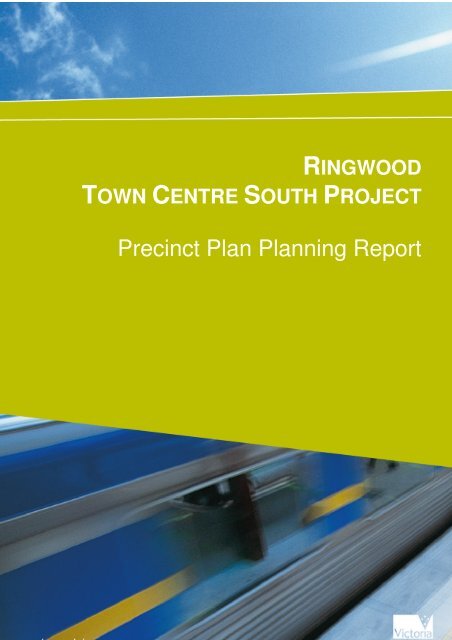
RINGWOOD TOWN CENTRE SOUTH PROJECT
Precinct Plan Planning Report - Maroondah City Council
Precinct Plan Planning Report - Maroondah City Council
- No tags were found...

Create successful ePaper yourself
Turn your PDF publications into a flip-book with our unique Google optimized e-Paper software.
Ringwood Town Centre South ProjectPrecinct Plan Planning reportStart Typing<strong>RINGWOOD</strong><strong>TOWN</strong> <strong>CENTRE</strong> <strong>SOUTH</strong> <strong>PROJECT</strong>Precinct Plan Planning ReportPage 1 of 16
Ringwood Town Centre South ProjectPrecinct Plan Planning reportRingwood Town Centre South ProjectPrecinct Plans Planning reportSubmitted by:Department of TransportPO Box 2797MELBOURE VIC 3001Table of Contents1 Purpose...................................................................................................................32 Background............................................................................................................33 Site description.......................................................................................................34 Plans attached to this report ...................................................................................45 DoT Works.............................................................................................................46 Policy review .........................................................................................................56.1 Ringwood Transit City Urban Design Master Plan (2004) ...........................56.2 Melbourne@5Million and Victorian Transport Plan.....................................77 Maroondah Planning Scheme ................................................................................77.1 State Planning Policy Framework..................................................................77.2 Municipal Strategic Statement.......................................................................87.3 Zones............................................................................................................117.4 Overlays .......................................................................................................118 Plans for Precincts One, Two and Three .............................................................159 Conclusion ...........................................................................................................15Appendix One Precinct Plans .....................................................................................16Page 2 of 16
Ringwood Town Centre South ProjectPrecinct Plan Planning report1 PurposeThe Victorian Government has committed to creating a new urban heart forRingwood. The aim is to create an attractive, safe and pedestrian-friendly town centrewith improved public amenity and connectivity between precincts, particularlybetween Ringwood Station and the rest of central Ringwood.This document provides the policy and planning context for Precinct Plans preparedby Cox Architects Pty Ltd on behalf of the Department of Transport for Precinct Four(4) (Station superblock) of Ringwood Town Centre in accordance with theMaroondah Planning Scheme and the Ringwood Transit City Urban DesignMasterplan 2004.Works currently proposed to be undertaken by the Department of Transport (DoT)and Vicroads will result in a new town square south, improved safety aroundMaroondah Highway including a new pedestrian crossing, a new bus interchange andheritage restoration works to the northern façade of the station building on Platform 3.2 BackgroundThe Precinct Plans respond to Schedule Two of the Development Plan Overlayaffecting the site and provides plans for land identified as Precinct Four (4) by theoverlay. The precinct plans show how the proposed redevelopment and upgrade ofthe public transport interchange meets the requirements of the Maroondah PlanningScheme by:• identifying a new area of public open space (Town Square South),• identifying two sites for potential future commercial development,• redesigning Maroondah Highway,• integrating the proposed public transport infrastructure development with theproposed mixed use development to the north of Maroondah highway.The plans include future stages of development including potential upgrades ofRingwood Station. The precinct plans balance the impacts of the development onsensitive land uses within the precinct, especially Clocktower Park recognising thepark’s unique importance to the local community, and the heritage listed RingwoodStation building.3 Site descriptionThe Precinct Plans cover the area bounded to the north by Maroondah Highway, tothe east by Warrandyte Road, to the south by Station Street and to the west byWantirna Road.Land use on the site includes:• Ringwood Railway Station, bus interchange, station car park and associatedinfrastructure.• Two blocks utilised for retail purposes, one in the north west of the site andone in the south eastern corner.• Clocktower Park.Page 3 of 16
Ringwood Town Centre South ProjectPrecinct Plan Planning report• Small pockets of planted vegetation between Maroondah Highway and therailway in the east, south of Clocktower Park and either side of the railway inthe south eastern section of the site.• Public car parking, taxi rank and roads including Maroondah Highway,Warrandyte Road, Station Street, Wantirna Road and Railway Place.The site has access to the Eastland retail development to the north of MaroondahHighway by mid-block signalised at-grade pedestrian crossings, as well as viapedestrian crossings at Wantirna Road/Maroondah Highway and WarrandyteRoad/Maroondah Highway intersections. The site has access to residential areas to thesouth via a mid-block pedestrian crossing on Station Street.4 Plans attached to this reportThe following plans have been prepared for Precinct Four of the Ringwood TownCentre and are attached at Appendix One.Location Plan (DO1)Aerial photograph shows the location of Precinct Four within the Ringwood CentralActivities District.Site Context and Existing Conditions Plan (DO2)Plan showing the existing conditions on the siteBus Interchange Project Plan (DO3)Showing proposed DoT works.Ground Level and Level One Precinct Plans (DO4, DO5)Precinct Plans showing the key land use features of the Town Centre South precinct.Pedestrian and Traffic Plan (DO6)Plan showing pedestrian and vehicle movements in the precinct.Future development (DO7)Plans showing future stages of development at a conceptual level.Cross sections (DO8, DO9)Cross sections showing key aspects of the ground and level one plans.5 DoT WorksThe DoT component of the Ringwood Town Centre South Project (the Project)involves the redevelopment of the Ringwood public transport interchange includingthe following:• A new bus interchange, incorporating:o A new canopy over the paved bus interchange area.o A new road for buses to access the site from Wantirna Road.o Bus bays within the interchange and indented bus bays on MaroondahHighway.Page 4 of 16
o New signalised exit to Maroondah Highway.Ringwood Town Centre South ProjectPrecinct Plan Planning reporto Public toilets and a toilet and meals room for bus drivers.• Establishing a new ‘Town Square South’.• Redesign of Maroondah Highway between Ringwood Street and WarrandyteRoad, including providing for new roadside kiss n ride parking, disabledparking and taxi bays.• Improvements to the Maroondah Highway streetscape adjacent to the businterchange and Town Square South, including median landscaping andpaving, street furniture and landscaping to the south side of the Highway.• Establishing new pedestrian and bicycle flow paths and amenities, including anew wide, double-cycled, at-grade signalised pedestrian crossing onMaroondah Highway connecting the new Town Square South and businterchange with the north side of the Highway.• Improvements to the existing heritage listed Station building facade.The Project is stand alone but is intended to be one phase of a completeredevelopment of the station precinct and adjacent areas. The broad scope of the fullredevelopment of the precinct could involve additional public transport infrastructuresuch as upgrades to the station and its facilities, and redevelopment of sites within theprecinct for mixed use by the private sector.The project also interfaces with improvement works to Clocktower Park on the northwest corner of the site. Works to the park will be carried out by Maroondah CityCouncil following completion of DoT’s works.Ringwood Central Activities District is a key element of the Government’s 2030Strategy and Melbourne @ 5 Million statement which identifies Ringwood as part ofa policy to support a ‘multi-centre’ city structure that provides a better distribution ofjobs and activity. The Project will support the delivery of this policy aim.6 Policy reviewThe Precinct Plans are prepared within the context of recent State and localgovernment policies.6.1 Ringwood Transit City Urban Design Master Plan (2004)The 2004 Urban Design Masterplan was commissioned by Maroondah City Council.It was adopted by Council in 2004 and given effect in the Maroondah PlanningScheme by amendment C57, although the amendment did not include the Masterplanas an incorporated document in the Maroondah Planning Scheme. The plan covers theRingwood town centre area from the Ringwood bypass in the north, to the intersectionof Mount Dandenong Road and Maroondah Highway in the east, the rail corridor tothe south and Eastlink to the west.The overall vision of the Masterplan is to: ‘establish Ringwood as the primary mixeduse hub in Melbourne’s outer east, boasting a vibrant and contemporary hilltop TownCentre with wholly integrated and sustainable retail, commercial, employment,Page 5 of 16
Ringwood Town Centre South ProjectPrecinct Plan Planning reportleisure, civic and residential activities in a natural landscape setting connectedthrough an advanced road and rail network’ (p4).The urban design Masterplan identifies 21 features which require initiatives andactions to achieve the plan’s objectives. Of these, the following are relevant to thePrecinct Plan for the Station Superblock:Ringwood Town Centre: Central Axis.• Formation of a direct physical and visual connector between nodes to eitherside of the Maroondah Highway to link disparate parts of the Transit City.• Connect Ringwood Station with a new interactive Eastland entry.• Town Centre links should be expressed through clear, legible and strong builtedges, street corridors and urban spaces.Ringwood Town Parks Link.• Town Park and Station Square spaces serve as the primary public places inRingwood with the capacity to be interconnected with the existing ClocktowerPark and a new urban space fronting Ringwood Street close to RingwoodMarket.2.2.3 Station Superblock Redevelopment.• Generate significant mixed use (residential and commercial) development in apodium and tower form to a height in excess of eight storeys on this land, overand above its transit function.• Improved links across the railway may also be achieved within a new andintegrated station design.2.2.4 Ringwood Station/ Line Upgrade.• A new visually prominent Station concourse and transit hall, platform shelters,escalators and decked commuter car parking.• The complex should establish active public spaces to Maroondah Highwayand the duplicated Station Street.• Provision of a third rail line to improve the passage of express rail services toand from Ringwood.2.2.5 Integrated Bus/ Rail Interchange.• Upgrade of the facility should consider the use of real time scheduling and theprospect of off-site holding areas.• The upgrading of the facility should be DDA compliant and consistent withCPTED principles.The Precinct Plan responds to the initiatives and actions in the Urban DesignMasterplan by providing for an upgraded bus interchange including a new TownSquare South which provides a physical and visual link between the precinct anddevelopment north of Maroondah Highway. The Precinct Plan provides for goodquality urban design through clear, legible and strong built edges, street corridors andurban spaces and identifies sites for significant mixed use redevelopment and avisually prominent bus canopy. Potential future development envisaged by thePage 6 of 16
Ringwood Town Centre South ProjectPrecinct Plan Planning reportPrecinct Plan includes further upgrade of Ringwood Station in line with the UrbanDesign Masterplan.6.2 Melbourne@5Million and Victorian Transport PlanThe Ringwood Central Activities District (CAD) is identified in the VictorianGovernment’s 2008 Melbourne@5Million policy review document. The policy isaimed at actively managing future growth and change to support Melbourne’s futureliveability.Ringwood is one of six new Central Activities Districts identified as part of a multicentredcity policy, aimed at reducing congestion and commuting times, andconsequently enhancing community and family life. As part of this process, futureinitiatives will support linking Ringwood with universities, research and technologyprecincts, medical precincts, and areas with high employment.The Victorian Transport Plan supports the directions of Melbourne@5Million byprioritising public transport infrastructure that helps support the role of the CentralActivities District to provide access to retail and commercial services, specialisedservices and employment opportunities in the CAD. Quality transport infrastructurewill also enhance the role of the Ringwood CAD as a vibrant centre of communityactivity with a wide range of public facilities.7 Maroondah Planning SchemeThis section outlines how the Precinct Plan responds to the Maroondah PlanningScheme.7.1 State Planning Policy FrameworkThe Precinct Plans respond to the State Planning Policy Framework, particularly thefollowing sections:Clause 12.01 - Activity centresEnsuring activity centres are developed in a way that improves access by walking,cycling and public transport to services and facilities for local and regionalpopulations and supporting the development of the Principal Public TransportNetwork.The Precinct Plan supports this aim by upgrading the existing Ringwood Bus Stationand making changes to the functional layout of Maroondah Highway to improvepedestrian, cycling and public transport infrastructure. All changes to the highway aresubject to VicRoads approval.Clause 12.05 – 2 - Urban DesignClause 12.08 – Better Transport LinksEnsuring transport corridors integrate land use planning, urban design and transportplanning and are developed and managed with particular attention to urban designaspects such as open space potential. Give more priority to walking and cycling inplanning urban development and in managing the road system.Page 7 of 16
Ringwood Town Centre South ProjectPrecinct Plan Planning reportThe Precinct Plan supports this by integrating development of land use within theprecinct with an upgraded transport interchange and enhancing links to the adjacentretail and mixed use development to the north of Maroondah Highway. The Precinctplan also provides new open space at Town Square South and envisages a high levelof urban design.Clause 18.01 - Declared highways, railways and tramways –To integrate land use and transport planning around existing and planned declaredhighways, railways, principal bus routes and tram lines.The Precinct Plan consolidates the integration of existing infrastructure, includingRingwood Station and the Maroondah Highway, with surrounding land uses.Clause 19.03 Design and built formTo achieve high quality urban design and architecture.The Precinct Plan provides for high quality urban design and architectural outcomesin key locations within the precinct including a new canopy as part of an upgradedbus interchange7.2 Municipal Strategic StatementClause 21.04 Transport and accessibilityObjectives:• To promote design and development that encourages pedestrian activity andwhere possible, increases the permeability of our suburbs.The Precinct Plan encourages pedestrian activity by establishing a strong link todevelopment north of Maroondah Highway via a wide, signalised pedestrian crossing,and to the bus interchange. Existing pedestrian permeability in the precinct isenhanced and shown on the Pedestrian and Traffic Plan.Clause 21.06 Open SpaceObjectives:• To provide equitable access to open space that caters for a diverse range ofactive and passive leisure uses for the entire community.• To ensure the preservation and enhancement of open space resources in themunicipality.• To enhance the visual and physical amenity of the municipality through theprovision of an extensive open space network.The Precinct Plan recognises the importance of public open space by providing a newTown Square South north of Ringwood Station and the re-landscaping of ClocktowerPark to enhance its function and appearance and interface with its frontages to thenew bus access road and proposed NW station precinct site development.Clause 21.07 Image and Urban DesignObjectives:• To ensure the ongoing development of a quality and attractive builtenvironment based on sound planning and consistent urban design principles.Page 8 of 16
Ringwood Town Centre South ProjectPrecinct Plan Planning report• To protect and enhance the visual amenity of residential, commercial andindustrial precincts and streetscape.• To encourage development that provides and creates high quality urbanplaces.The Precinct Plan establishes a plan for ongoing development of a high quality andattractive built environment. This includes a new layout for the bus interchangeincluding a new canopy that will provide a feature form within the precinct and thenew Town Square South to provide a high quality urban place.By providing a high quality urban design outcome, the bus interchange upgrade andnew Town Square South will encourage development of similar quality, particularlyfor the nominated development sites within the Station Superblock Precinct.Clause 21.09 Retail and Commercial ActivityObjectives:• To ensure the successful operation of retail and commercial centres inMaroondah through sustainable planning and economic development.• To promote the retail and business activities of commercial centres inMaroondah.The Precinct Plan identifies two sites for future mixed use commercial development.The sites take advantage of the strategic location of the precinct around the publictransport node and links to the rest of the CAD to the north, most notably the Eastlanddevelopment.Clause 22.07 Ringwood Activity Centre PolicyClause 22.07 provides the main policy basis for development of the Precinct Planwithin the planning scheme.The precinct plans respond to the following sections of clause 22.07:Policy basisThe Precinct Plan responds to the purposes of the Ringwood Activity Centre Policy toimplement the vision of the Ringwood Transit City Urban Design Masterplan 2004,ensure all services and activities within the Activity Centre are accessible via anintegrated transport network and facilitates public and private investment andactivities within the Activity Centre.It does this by implementing a number of the initiatives and actions set out in theUrban Design Masterplan including reinforcing the transport function through aredesign of the bus interchange and Maroondah Highway to achieve closer integrationof public, private and pedestrian transport options. The Precinct Plan also identifiesdevelopment sites to facilitate private and public investment.Land use and activityThe objectives of this clause include the integration of public transport and land useplanning and to encourage the consolidation of small fragmented allotments in orderto create greater opportunities to intensify the level of all forms of developmentwithin Ringwood Activity Centre.Page 9 of 16
Ringwood Town Centre South ProjectPrecinct Plan Planning reportThe Precinct Plan integrates the development of the public transport interchange withthe development of public space in the new Town Square South and the identifiedcommercial development site within the precinct. Land use in the precinct is alsointegrated with the mixed use and retail development proposed north of MaroondahHighway and residential areas to the south.The Precinct Plan seeks to increase the intensity of development through theidentification of parcels of land for mixed-use development along MaroondahHighway and to the south east of the station.Built form and scaleObjectives of this clause include an urban form that is safe and attractive with clearphysical linkages, excellence in architectural design and landmark buildings andactive retail and commercial uses at street level with legible movement systems. Theclause also seeks to encourage development that creates a sense of place and publicownership of common areas and a strong visual connection between the RingwoodActivity Centre’s transport and commercial hubs.The Precinct Plan addresses this policy by providing active frontages abuttingClocktower Park, Town Square South and Maroondah Highway to increase activityand public surveillance of open areas. The redesigned transport interchange has beendesigned to provide a land mark feature in the form of a new bus canopy at the easterngateway to the precinct.The Precinct Plan identifies a development site to the south of Maroondah Highwaywith a minimum height of seven storeys which will exceed the surrounding generalbuilding scale forming a topographical highpoint and western gateway to the precinctthat compliments adjacent developments and spaces and respects the value and use ofClocktower Park. This is inline with the planning scheme controls affecting the site.A further development site is identified in the south west corner of the site.Development on this site is envisaged to a maximum of six storeys reflecting theplanning scheme controls affecting this site.Landscape and environmentThis policy requires development to use the natural environmental features andintegrate environmentally sustainable design principles and techniques into thedesign, construction and operation stages of new development.The Precinct Plan responds to this by recognising Ringwood Station as a high pointon the site and enhancing the visual links to the station from other parts of the CentralActivities District. Planing and landscaping will also reflect the ecological values ofthe Ringwood area. The design provides for a multimodal transport interchange withincreased access by more environmentally sustainable transport options includingwalking, cycling and public transport.Access and movementThis policy seeks to reduce the emphasis on through traffic and regenerate theMaroondah Highway as the primary Activity Centre streetscape whilst strengtheningPage 10 of 16
Ringwood Town Centre South ProjectPrecinct Plan Planning reportthe role of Ringwood Station as the primary modal interchange for the region. Theclause recognises the need to provide car parking and safe, convenient and attractivepedestrian and cyclist links.The Precinct Plan responds to these objectives by incorporating bicycle lanes and busstops on Maroondah Highway. The redesigned bus interchange and potential futureredevelopment of Ringwood Station enhance Ringwood’s role as the primary modalinterchange for the region. The Precinct Plan reinforces the location of railwayparking to the south of Ringwood Station and identifies pedestrian circulation in theprecinct.The Precinct Plan provides for a larger signalised at grade crossing of MaroondahHighway, DDA compliant access to the bus interchange and Town Square South,bicycle facilities and improved legibility and wayfinding.Town centreThe objectives of this clause include development of the built form that highlights keyTown Centre landmarks, vistas and gateways and ensures a highly visible and uniqueTown Centre focus and community meeting place. The clause also emphasisesconvenient and safe access between the transport interchange and the RingwoodTown Centre and the integration of a safe and efficient bus interchange with directconnections to rail, taxi, and commuter parking facilities and neighbouringcommercial destinations.The precinct plans implements the objectives of this clause through theredevelopment of the bus interchange and the identification of landmark sites withinthe precinct including the development site adjacent to Clocktower Park and the businterchange canopy. The Precinct Plan emphasises access between the publictransport infrastructure and services and activity within the centre by providing anenhanced at grade crossing of Maroondah Highway and legible access from thestation and bus interchange. Town Square South is designed to increase levels ofactivity in the precinct and provide a new community meeting place.7.3 ZonesThe Precinct Plan covers land affected by the following zones:Clause 36.01 Public Use Zone 4 (PUZ4)Clause 34.01 Business 1 Zone (B1Z)Clause 34.02 Business 2 Zone (B2Z)Clause 36.04 Road Zone 1 and 2 (RDZ1 and RDZ2)The Precinct Plan responds to the objectives of the relevant zones.7.4 OverlaysClause 42.02 Design and Development Overlay:The attached Precinct Plan responds to the Design Controls of Schedule 3 of theDesign and Development Overlay.Page 11 of 16
Ringwood Town Centre South ProjectPrecinct Plan Planning reportSpecifically future development sites are identified to support development at a heightand intensity which is in accordance with Clause 42.02.Clause 43.04 Development Plan OverlayThe attached Precinct Plan responds to Schedule 2 of the Development Plan Overlayin the following ways:Clause 2.1 requirements:Railway Station, library and retail link:The Precinct Plan integrates the retail and mixed use development north ofMaroondah Highway by providing a new, wide, double-cycled, at-grade signalisedpedestrian crossing of the highway.Ringwood Station focus:The Precinct Plan provides for the development of Ringwood Railway Station into anintegrated transport interchange including upgrade of the existing bus interchange,improvements to the existing station building and practical, safe and convenientaccess between the different levels and components of the transport interchange forpeople of all mobility levels. The Precinct Plan provides an architecturally designedcommuter shelter which acts as a feature form and identifies potential future stages ofdevelopment including upgrades to Ringwood Station. The Precinct Plan retainsexisting commuter parking on the south side of Ringwood Station, and commuterdrop off zones. Existing disabled parking, taxi bays and informal drop-off zones onRailway Place South will be relocated to Maroondah Highway.Corner Gateway BuildingThe Precinct Plan provides for the ‘definition and identification’ of the primaryeastern and western corners of the Town Centre with landmark buildings including anew architecturally designed commuter shelter in the east and a mixed usedevelopment in the west.Expand Existing Bus TerminalThe Precinct Plan includes the redevelopment of the bus interchange that is integratedwith the public transport hub and the Ringwood Town Centre.Frontage to the Clocktower ParkThe Precinct Plan provides an ‘increased and meaningfully dynamic’ role for theClocktower Park by requiring an active and attractive frontage from the mixed usedevelopment site to the east of the park. Additionally, the park will be re-landscapedto council specification and any loss of land from the park from constructionassociated with the upgraded bus interchange will be offset on other park boundariesto ensure no net loss of Clocktower Park land.Station Street WideningThe Precinct Plan provides for the widening of Station Street, between Wantirna andBedford Roads as a future stage of development.Specific Precinct Plan for Precinct Four – Station SuperblockThe Precinct Plan provides an overall scheme of development for the precinct andlandmark feature buildings in locations as provided for in the Design & DevelopmentPage 12 of 16
Ringwood Town Centre South ProjectPrecinct Plan Planning reportOverlay Schedule 3. The plan also integrates the location of public areas such asTown Square South and the redeveloped bus interchange with access to key buildingssuch as Ringwood Station and other sites within the precinct. As outlined above thePrecinct Plan meets the requirements of the Ringwood Activity Centre Policy atClause 22.07.Clause 2.2 requirementsThe Precinct Plan meets the requirements of Clause 2.2 of the overlay in thefollowing ways:Planning scheme requirementImprovements to public transport throughthe provision of major integrated rail andbus interchange facilities, andstrengthening the role of the precinct asthe primary modal interchange for theregion.A broad mix of land uses that strengthensthe mixed use role of the stationsuperblock as a primary node within theTransit City with clear activity links andpedestrian connections to the TownCentre north of Maroondah Highway.The traffic movement plan to address:- Bicycle facilities, taxi zones, commutercar parking and commuter drop off zones.- The minimisation of conflict betweenbuses/vehicles and pedestrian movementwithin the precinct.A pedestrian movement plan, includingaccess for people with mobilityimpairment to all public areas and strongpedestrian connections to the north acrossMaroondah Highway, to the residentialareas south of the station and to allcommuter car parking areas.An attractive and active interface withClocktower Park that respects thesignificance of the memorial function ofthe Clocktower Park.Development of the Station Square areaas a focal point between the railwayPrecinct Plan ResponseSets out a major upgrade to theRingwood bus interchange including acommuter shelter as a ‘feature form’.Upgrades to Ringwood Station areidentified as potential future stages ofdevelopment.Provides two mixed use developmentsites, public open space at ClocktowerPark and a new Town Square South andenhanced pedestrian links acrossMaroondah Highway and to RingwoodStation.The Pedestrian and Traffic plan addressesthe movement of vehicles and pedestriansand shows bicycle facilities, taxi and dropoff zones and commuter parking. Theplan also states all new development mustcomply with the DisabilityDiscrimination Act 1992. The plan alsoshows how strong links are providedacross Maroondah Highway, toresidential areas and to commuterparking, and across the bus access roadbetween the station and the businterchange / Town Square South. Theprovision of a bus-only access road to thebus interchange segregates busmovements from other traffic.An active and attractive frontage will beprovided from the mixed usedevelopment area to the east ofClocktower Park to reflect thesignificance and function of the park. Thepark will be re-landscaped to councilspecifications.Town Square South creates an area ofpublic space between Ringwood StationPage 13 of 16
Ringwood Town Centre South ProjectPrecinct Plan Planning reportstation and the public areas to the north ofMaroondah Highway.The development of a transit loungefacility that has a high level of publicsurveillance and activity.The ability to accommodate projected busoperations.Active frontages to street level areas ofMaroondah Highway and the StationSquare.An appropriate response to the buildingsand structures of heritage significancewithin the precinct.A site context plan explaining the contextof the precinct, the key elements of theprecinct and the way in which theproposed development responds to thosekey elements.and Maroondah Highway. The square islocated at the end of the vista created bydevelopment proposed north of thehighway and takes advantage of activefrontages on the mixed use developmentsite to the west. The square is integratedwith the redeveloped bus interchangefacility and will create a focal point of therestored façade of the heritage stationbuilding.The redeveloped bus interchangeprovides a canopy for weather protectionfor public transport users to wait forservices. The redeveloped businterchange allows for the developmentof ‘retail pods’ to activate this space andenhance levels of public surveillance andactivity.The plan provides for proposed busoperations.The plan seeks to maximise activefrontages at street level, providing foractive and attractive developmentfrontages to Maroondah Highway, TownSquare South and Clocktower Park.The plan recognises the heritagestructures within the precinct and seeks tominimise impacts or improve heritagevalues, predominantly by restoring thefaçade of the heritage station building onPlatform 3.The plan provides for development thatresponds to the key elements with theprecinct. For example, the planrecognises the importance of existingpublic open space including ClocktowerPark. The plan also improves access tothe transport interchange which is a keyexisting land use element within theprecinct.Clause 53.01 Heritage OverlayThe Precinct Plan has regard to heritage with the precinct area. The stationsuperblock precinct contains three heritage overlays. These are Clocktower Park(HO40), Ringwood Station Complex (HO39 and VHR listing H1587) and the BloodBrothers site (HO5). Any development that impacts on these sites must be approvedby the relevant authority, either the City of Maroondah or Heritage Victoria.Page 14 of 16
Ringwood Town Centre South ProjectPrecinct Plan Planning report8 Plans for Precincts One, Two and ThreeEastland Property Holdings Limited (EPHL) has submitted precinct plans for landidentified as Precinct 1 – 3 on the Development Plan Overlay. These plans wereadopted by council on 27 August 2008. The plans submitted for Precinct Four arefully integrated with the EPHL plans and responds to requirements of the MaroondahPlanning Scheme and the Ringwood Transit City Urban Design Masterplan (2004).9 ConclusionThe attached precinct plans were prepared following consultation with MaroondahCity Council and are submitted for consideration and approval. This planning reportdemonstrates how the plans meet the requirements of the Maroondah PlanningScheme. The DoT understands that the precinct plans will be subject to a process ofpublic consultation and is anticipating providing all appropriate support for thisprocess.Page 15 of 16
Ringwood Town Centre South ProjectPrecinct Plan Planning reportAppendix One Precinct PlansPage 16 of 16