

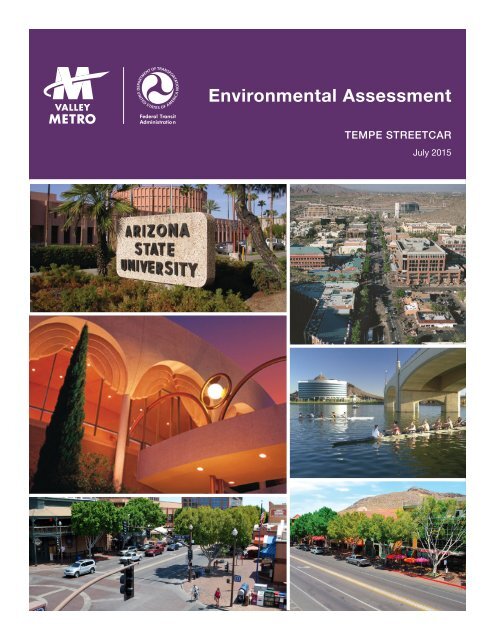
Environmental Assessment
Tempe_Streetcar_EA_07-29-2015
Tempe_Streetcar_EA_07-29-2015
- No tags were found...

Create successful ePaper yourself
Turn your PDF publications into a flip-book with our unique Google optimized e-Paper software.
<strong>Environmental</strong> <strong>Assessment</strong>Federal TransitAdministratio nTEMPE STREETCARJuly 2015
Prepared in accordance with:TEMPE STREETCARENVIRONMENTAL ASSESSMENT• National <strong>Environmental</strong> Policy Act of 1969 (42 U.S.C. § 4332 et seq.), as amended• Federal Transit Act (49 U.S.C. § 5301 et seq.), as amended• Moving Ahead for Progress in the 21st Century (MAP-21) (Public Law 112-141)By the:Federal Transit Administration, U.S. Department of Transportation, and Valley MetroLead Agencies: Federal Transit Administration and Valley MetroFor additional information concerning this document, contact:Robert Forrest<strong>Environmental</strong> Program ManagerValley Metro101 N. 1st Avenue, Suite 1300Phoenix, AZ 85003(602) 322-4514Dominique M. PaukowitsFederal Transit Administration, Region IX201 Mission Street, Suite 1650San Francisco, CA 94105-1831(415) 744-2735
TABLE OF CONTENTSEXECUTIVE SUMMARY ........................................................................................... ES-1ES.1 WHAT IS THE TEMPE STREETCAR AND WHERE IS ITLOCATED? .......................................................................................... ES-1ES.2 WHY WAS THE ENVIRONMENTAL ASSESSMENT WRITTENAND WHAT DOES IT INCLUDE? ........................................................ ES-4ES.3 WHY IS THE PROJECT NEEDED AND WHAT ISSUES WOULDIT ADDRESS? ..................................................................................... ES-5ES.4 WHAT ALTERNATIVES HAVE BEEN CONSIDERED AND HOWDID WE GET TO THE PROJECT NOW PROPOSED? ....................... ES-6ES.5 WOULD THERE BE ANY ADVERSE ENVIRONMENTALIMPACTS? ........................................................................................... ES-8ES.6 HOW MUCH WOULD THE PROJECT COST AND HOW WOULDIT BE FUNDED? ................................................................................ ES-19ES.6.1 Capital Costs Funding Sources ............................................. ES-19ES.6.2 Operating Costs Funding Sources ........................................ ES-201.0 INTRODUCTION AND PURPOSE AND NEED FOR THE PROPOSEDPROJECT .......................................................................................................... 1-11.1 WHAT IS THE PROPOSED PROJECT AND WHY IS ANENVIRONMENTAL ASSESSMENT BEING PREPARED? ..................... 1-11.2 WHY IS HIGH-CAPACITY TRANSIT SERVICE NEEDED IN THESTUDY AREA? ....................................................................................... 1-21.2.1 Accommodating the Travel Needs of a Growing Populationand Employment Center ............................................................ 1-31.2.2 Improving Local and Regional Mobility, Especially duringPeak Travel Times ..................................................................... 1-41.2.3 Enhancing Access to Regional Employment Centers andActivity Destinations ................................................................... 1-61.2.4 Supporting Current and Planned Economic and Transit-Oriented Development in the Project Corridors .......................... 1-61.3 WHAT IS THE PURPOSE OF THE PROPOSED PROJECT? ............... 1-81.4 WHAT ARE THE GOALS FOR THE PROPOSED PROJECT? .............. 1-9<strong>Environmental</strong> <strong>Assessment</strong> Page i July 2015Tempe Streetcar
2.0 ALTERNATIVES TO THE PROPOSED PROJECT ........................................... 2-12.1 WHAT ALTERNATIVES HAVE BEEN CONSIDERED AND HOWDID WE GET TO THE ALTERNATIVES SELECTED FOREVALUATION IN THIS EA? .................................................................... 2-12.2 WHAT ALTERNATIVES ARE EVALUATED IN THIS EA? ..................... 2-52.2.1 No-Build Alternative ................................................................... 2-52.2.2 Build Alternative ......................................................................... 2-92.3 BUILD ALTERNATIVE TRANSIT NETWORK ...................................... 2-223.0 ENVIRONMENTAL IMPACTS—WHAT IMPACTS ARE LIKELY TOOCCUR AND HOW WILL MAJOR ADVERSE IMPACTS BE AVOIDEDOR MINIMIZED? ............................................................................................... 3-13.1 LAND ACQUISITION AND RELOCATION ............................................. 3-23.1.1 <strong>Environmental</strong> Setting ................................................................ 3-23.1.2 No-Build Alternative ................................................................... 3-23.1.3 Build Alternative ......................................................................... 3-23.1.4 Mitigation.................................................................................... 3-53.2 EXISTING LAND USE ............................................................................ 3-63.2.1 <strong>Environmental</strong> Setting ................................................................ 3-63.2.2 No-Build Alternative ................................................................... 3-63.2.3 Build Alternative ......................................................................... 3-73.2.4 Mitigation.................................................................................... 3-73.3 CONSISTENCY WITH LOCAL PLANS .................................................. 3-83.3.1 <strong>Environmental</strong> Setting ................................................................ 3-83.3.2 No-Build Alternative ................................................................... 3-93.3.3 Build Alternative ......................................................................... 3-93.3.4 Mitigation.................................................................................... 3-93.4 ECONOMIC EFFECTS ........................................................................... 3-93.4.1 <strong>Environmental</strong> Setting ................................................................ 3-93.4.2 No-Build Alternative ................................................................. 3-103.4.3 Build Alternative ....................................................................... 3-103.4.4 Mitigation.................................................................................. 3-123.5 GROWTH AND GROWTH-INDUCED IMPACTS ................................. 3-123.5.1 <strong>Environmental</strong> Setting .............................................................. 3-123.5.2 No-Build Alternative ................................................................. 3-14<strong>Environmental</strong> <strong>Assessment</strong> Page ii July 2015Tempe Streetcar
3.5.3 Build Alternative ....................................................................... 3-143.5.4 Mitigation.................................................................................. 3-143.6 TRAFFIC/PARKING/PEDESTRIANS/BICYCLES/FREIGHTROUTES/TRANSIT............................................................................... 3-143.6.1 <strong>Environmental</strong> Setting .............................................................. 3-143.6.2 No-Build Alternative ................................................................. 3-163.6.3 Build Alternative ....................................................................... 3-193.6.4 Mitigation.................................................................................. 3-273.7 AIR QUALITY AND GREENHOUSE GASES ....................................... 3-273.7.1 <strong>Environmental</strong> Setting .............................................................. 3-273.7.2 No-Build Alternative ................................................................. 3-283.7.3 Build Alternative ....................................................................... 3-293.7.4 Mitigation.................................................................................. 3-323.8 NOISE AND VIBRATION ...................................................................... 3-323.8.1 <strong>Environmental</strong> Setting .............................................................. 3-323.8.2 No-Build Alternative ................................................................. 3-393.8.3 Build Alternative ....................................................................... 3-393.8.4 Mitigation.................................................................................. 3-473.9 ENERGY REQUIREMENTS AND POTENTIALFOR CONSERVATION ......................................................................... 3-483.9.1 <strong>Environmental</strong> Setting .............................................................. 3-483.9.2 No-Build Alternative ................................................................. 3-503.9.3 Build Alternative ....................................................................... 3-503.9.4 Mitigation.................................................................................. 3-523.10 HISTORIC, ARCHAEOLOGICAL AND CULTURAL PROPERTIES ..... 3-523.10.1 <strong>Environmental</strong> Setting .............................................................. 3-523.10.2 No-Build Alternative ................................................................. 3-633.10.3 Build Alternative ....................................................................... 3-633.10.4 Measures to Minimize and Avoid Effects ................................. 3-673.11 SECTION 4(F)/6(F) EVALUATION ....................................................... 3-693.11.1 <strong>Environmental</strong> Setting .............................................................. 3-693.11.2 No-Build Alternative ................................................................. 3-723.11.3 Build Alternative ....................................................................... 3-723.11.4 Measures to Minimize Harm .................................................... 3-75<strong>Environmental</strong> <strong>Assessment</strong> Page iii July 2015Tempe Streetcar
3.18 ECOLOGICALLY SENSITIVE AREAS/THREATENEDAND ENDANGERED SPECIES ......................................................... 3-1133.18.1 <strong>Environmental</strong> Setting ............................................................ 3-1133.18.2 No-Build Alternative ............................................................... 3-1143.18.3 Build Alternative ..................................................................... 3-1143.18.4 Mitigation................................................................................ 3-1153.19 CONSTRUCTION ............................................................................... 3-1153.19.1 <strong>Environmental</strong> Setting ............................................................ 3-1153.19.2 No-Build Alternative ............................................................... 3-1153.19.3 Build Alternative ..................................................................... 3-1163.19.4 Measures to Minimize Short-Term Construction Impacts ...... 3-1193.20 CUMULATIVE IMPACTS .................................................................... 3-1233.20.1 <strong>Environmental</strong> Setting ............................................................ 3-1233.20.2 No-Build Alternative ............................................................... 3-1253.20.3 Build Alternative ..................................................................... 3-1254.0 WHO ARE THE AGENCIES AND PERSONS CONSULTED? .......................... 4-14.1 INTRODUCTION .................................................................................... 4-14.2 SUMMARY OF PUBLIC INVOLVEMENT ACTIVITIES........................... 4-14.3 COMMUNITY OUTREACH BY STUDY PHASE ..................................... 4-34.3.1 Alternatives Analysis Outreach Activities ................................... 4-34.3.2 Community Working Group ........................................................ 4-54.3.3 EA Scoping and Outreach Activities .......................................... 4-64.3.4 Current Build Alternative Public Outreach .................................. 4-74.3.5 Project Definition Updates.......................................................... 4-84.4 BOARDS/COMMITTEES/CITY COUNCIL .............................................. 4-84.5 STAKEHOLDER MEETINGS ............................................................... 4-134.6 PUBLIC REVIEW OF THE ENVIRONMENTAL ASSESSMENT .......... 4-155.0 HOW MUCH WILL THE PROPOSED PROJECT COST AND HOW WILLIT BE FUNDED? ................................................................................................ 5-16.0 SOURCES AND REFERENCES CITED ............................................................ 6-1<strong>Environmental</strong> <strong>Assessment</strong> Page v July 2015Tempe Streetcar
TABLE OF TABLESTABLE ES-1: TEMPE STREETCAR BUILD ALTERNATIVE AT-A-GLANCE ........... ES-2TABLE ES-2: BUILD ALTERNATIVE ENVIRONMENTAL IMPACTS SUMMARY .... ES-9TABLE ES-3: ESTIMATED CAPITAL COSTS AND FUNDING SOURCES ............ ES-19TABLE ES-4: ESTIMATED ANNUAL OPERATING COSTS AND FUNDINGSOURCES ........................................................................................ ES-20TABLE 2-1: TIER 2 ALTERATIVES CONSIDERED..................................................... 2-4TABLE 2-2: ROADWAY PROJECTS BY 2035 – NO-BUILD ALTERNATIVE .............. 2-6TABLE 2-3: NO-BUILD TRANSIT NETWORK (2035) .................................................. 2-7TABLE 2-4: EXISTING TRANSIT FACILITIES IN STUDY AREA ................................ 2-9TABLE 2-5: TEMPE STREETCAR AT-A-GLANCE .................................................... 2-12TABLE 2-6: STOP LOCATION BY TYPE ................................................................... 2-20TABLE 2-7: KEY MODERN STREETCAR FEATURES ............................................. 2-21TABLE 2-8: BUILD TRANSIT NETWORK (2035) ...................................................... 2-24TABLE 3-1: RIGHT-OF-WAY NEEDS AND CURB MODIFICATIONS ......................... 3-3TABLE 3-2: RIGHT-OF-WAY NEEDS FOR TPSS ....................................................... 3-4TABLE 3-3: CONSISTENCY WITH LOCAL PLANS .................................................... 3-8TABLE 3-4: ANTICIPATED EFFECTS OF THE PROPOSED PROJECT ON TAXREVENUES AND EMPLOYMENT ......................................................... 3-12TABLE 3-5: EXISTING TEMPE BUS TRANSIT ROUTES ......................................... 3-15TABLE 3-6: PM PEAK INTERSECTION LEVEL OF SERVICE AND DELAY ............ 3-17TABLE 3-7: INTERSECTIONS OPERATING AT LOS E AND LOS F (PM PEAK) .... 3-20TABLE 3-8: DOWNTOWN TEMPE ON-STREET PARKING INVENTORYAND IMPACTS WITH 2035 BUILD ALTERNATIVE ............................... 3-23TABLE 3-9: SHARED BUS STOP AND STREETCAR STATION LOCATION ........... 3-26TABLE 3-10: 2035 8-HOUR HIGHEST CO CONCENTRATION (PPM) ..................... 3-30TABLE 3-11: 2035 TOTAL 8-HOUR CO CONCENTRATIONS (PPM) ....................... 3-30TABLE 3-12: FTA NOISE IMPACT CRITERIA ........................................................... 3-37TABLE 3-13: SUMMARY OF NOISE IMPACT ASSESSMENT FORCATEGORY 1 ....................................................................................... 3-40TABLE 3-14: SUMMARY OF NOISE IMPACT ASSESSMENT FORCATEGORY 2 ....................................................................................... 3-40<strong>Environmental</strong> <strong>Assessment</strong> Page vi July 2015Tempe Streetcar
TABLE 3-15: SUMMARY OF NOISE IMPACT ASSESSMENT FORCATEGORY 3 ....................................................................................... 3-42TABLE 3-16: SUMMARY OF VIBRATION IMPACT ASSESSMENT FORCATEGORY 2 ....................................................................................... 3-44TABLE 3-17: SUMMARY OF VIBRATION IMPACT ASSESSMENT FORCATEGORY 3 ....................................................................................... 3-46TABLE 3-18: SUMMARY OF VIBRATION IMPACT ASSESSMENT FORSPECIAL BUILDINGS .......................................................................... 3-47TABLE 3-19: ENERGY CONSUMPTION FACTORS ................................................. 3-49TABLE 3-20: FORECAST ANNUAL VMT BY ALTERNATIVE IN 2035 ...................... 3-50TABLE 3-21: ESTIMATED ANNUAL ENERGY CONSUMPTION FORTHE NO-BUILD AND BUILD ALTERNATIVES IN 2035 ....................... 3-50TABLE 3-22: HISTORIC PROPERTIES AND DISTRICTS LISTED ANDELIGIBLE IN THE APE ......................................................................... 3-58TABLE 3-23: PROPERTY ELIGIBILITY RECOMMENDATIONS ............................... 3-61TABLE 3-24: ARCHAEOLOGICAL SITES WITHIN THE APE ................................... 3-62TABLE 3-25: MEASURES TO MINIMIZE AND AVOID EFFECTS TO HISTORICRESOURCES ....................................................................................... 3-68TABLE 3-26: SECTION 4(F) RESOURCES AND TRACTION POWERSUBSTATION LOCATIONS ................................................................. 3-74TABLE 3-27: COMPARISON OF CHARACTERISTICS BY VISUAL UNIT ................ 3-78TABLE 3-28: VISUAL IMPACTS DEFINITION AND MITIGATION GUIDELINES ...... 3-82TABLE 3-29: VIEWER TYPES AND VISUAL IMPACTS SENSITIVITY ..................... 3-82TABLE 3-30: IMPACTS BY VISUAL UNIT ................................................................. 3-84TABLE 3-31: TPSS AND SIGNAL BUILDING LOCATIONS ...................................... 3-86TABLE 3-32: MINORITY AND LOW-INCOME POPULATIONS ................................. 3-92TABLE 3-33: SITES ON AGENCY DATABASES .................................................... 3-104TABLE 3-34: TEMPE STREETCAR — CONSTRUCTION ACTIVITIES .................. 3-117TABLE 3-35: OPTIONS TO MINIMIZE CONSTRUCTION DURATION ................... 3-119TABLE 3-36: CONSTRUCTION-RELATED IMPACTS/MITIGATION MEASURES.. 3-120TABLE 3-37: OTHER PLANNED PROJECTS IN VICINITY BY 2018 ...................... 3-123TABLE 3-38: CUMULATIVE IMPACTS ANALYSIS ................................................. 3-125<strong>Environmental</strong> <strong>Assessment</strong> Page vii July 2015Tempe Streetcar
TABLE 4-1: OBJECTIVES OF THE PUBLIC INVOLVEMENT PROGRAM ................. 4-1TABLE 4-2: STAFF AND AGENCY MEETINGS .......................................................... 4-2TABLE 4-3: PUBLIC MEETINGS DURING ALTERNATIVES ANALYSIS .................... 4-4TABLE 4-4: TEMPE STREETCAR COMMUNITY WORKING GROUPMEETINGS ............................................................................................. 4-5TABLE 4-5: PROJECT DEFINITION UPDATES .......................................................... 4-9TABLE 4-6: BOARDS AND COMMITTEES MEETINGS ............................................ 4-10TABLE 4-7: STAKEHOLDER MEETINGS ................................................................. 4-13TABLE 5-1: ESTIMATED CAPITAL COSTS AND FUNDING SOURCES .................... 5-1TABLE 5-2: ESTIMATED ANNUAL OPERATING COSTS AND FUNDINGSOURCES ............................................................................................... 5-2<strong>Environmental</strong> <strong>Assessment</strong> Page viii July 2015Tempe Streetcar
TABLE OF FIGURESFIGURE ES-1: BUILD ALTERNATIVE ...................................................................... ES-3FIGURE ES-2: HIGH CAPACITY/LIGHT RAIL TRANSIT CORRIDORS .................. ES-4FIGURE ES-3: ALTERNATIVES DEVELOPMENT PROCESS ................................ ES-6FIGURE ES-4: COMPARISON OF TRANSIT MODES CONSIDERED .................... ES-7FIGURE 1-1: VALLEY METRO HIGH CAPACITY TRANSIT CORRIDORS ................ 1-2FIGURE 1-2: TEMPE STREETCAR STUDY AREA ..................................................... 1-3FIGURE 1-3: ACTIVITY CENTERS WITHIN THE STUDY AREA ................................ 1-7FIGURE 1-4: DEVELOPMENT ALONG PROPOSED STREETCAR ALIGNMENT ..... 1-9FIGURE 2-1: ALTERNATIVES DEVELOPMENT PROCESS ...................................... 2-1FIGURE 2-2: COMPARISON OF TRANSIT MODES CONSIDERED .......................... 2-2FIGURE 2-3: NO-BUILD ALTERNATIVE TRANSIT NETWORK (2035) ...................... 2-8FIGURE 2-4: BUILD ALTERNATIVE .......................................................................... 2-11FIGURE 2-5: BUILD ALTERNATIVE, RIO SALADO PARKWAY EAST OF MILLAVENUE – LOOKING EAST ................................................................ 2-13FIGURE 2-6: BUILD ALTERNATIVE, RIO SALADO PARKWAY WEST OF MILLAVENUE – LOOKING EAST ................................................................ 2-14FIGURE 2-7: BUILD ALTERNATIVE, ASH AVENUE LOOKING NORTH .................. 2-15FIGURE 2-8: BUILD ALTERNATIVE, UNIVERSITY DRIVE LOOKING EAST ........... 2-16FIGURE 2-9: BUILD ALTERNATIVE, MILL AVENUE NORTH OF UNIVERSITYDRIVE – LOOKING NORTH ................................................................. 2-17FIGURE 2-10: BUILD ALTERNATIVE, MILL AVENUE SOUTH OF UNIVERSITYDRIVE – LOOKING NORTH .............................................................. 2-18FIGURE 2-11: BUILD ALTERNATIVE, APACHE BOULEVARD LOOKING EAST .... 2-19FIGURE 2-12: STREETCAR STOP EXAMPLE ......................................................... 2-22FIGURE 2-13: BUILD ALTERNATIVE TRANSIT NETWORK (2035) ......................... 2-23FIGURE 3-1: EXISTING LAND USE ............................................................................ 3-7FIGURE 3-2: VALLEY METRO LIGHT RAIL ALIGNMENT AND STATIONS ............ 3-16FIGURE 3-3: 2035 SCENARIO STUDY INTERSECTIONS ....................................... 3-21FIGURE 3-4: NOISE AND VIBRATION TEST SITE LOCATIONS – RIO SALADOPARKWAY TO UNIVERSITY DRIVE.................................................... 3-34<strong>Environmental</strong> <strong>Assessment</strong> Page ix July 2015Tempe Streetcar
FIGURE 3-5: NOISE AND VIBRATION TEST SITE LOCATIONS – UNIVERSITYDRIVE TO DORSEY LANE .................................................................. 3-34FIGURE 3-6: TYPICAL NOISE LEVELS .................................................................... 3-35FIGURE 3-7: STANDARD FROG .............................................................................. 3-44FIGURE 3-8: AREA OF POTENTIAL EFFECT AND LOCATIONS FORMEASURES TO AVOID AND MINIMIZE EFFECTS ............................. 3-54FIGURE 3-9: PARKS AND RECREATION AREAS ADJACENT TO THE BUILDALTERNATIVE CORRIDOR ................................................................. 3-71FIGURE 3-10: VISUAL UNITS ................................................................................... 3-77FIGURE 3-11: MODERN STREETCAR SIMULATION IN DOWNTOWN TEMPE ..... 3-85FIGURE 3-12: STUDY AREA PERCENT MINORITY POPULATIONCOMPARISON ................................................................................... 3-93FIGURE 3-13: STUDY AREA PERCENT LOW-INCOME POPULATIONCOMPARISON ................................................................................... 3-94FIGURE 3-14: SITES ON AGENCY DATABASES – RIO SALADO PARKWAYTO UNIVERSITY DRIVE .................................................................. 3-101FIGURE 3-15: SITES ON AGENCY DATABASES – UNIVERSITY DRIVE ANDMILL AVENUE TO RURAL ROAD AND APACHE BOULEVARD .... 3-102FIGURE 3-16: SITES ON AGENCY DATABASES – APACHEBOULEVARD-RURAL ROAD TO DORSEY LANE .......................... 3-103FIGURE 3-17: CURRENT AND FUTURE DEVELOPMENT PROJECTS ................ 3-124<strong>Environmental</strong> <strong>Assessment</strong> Page x July 2015Tempe Streetcar
APPENDICESABCDEFGHIJKLCONCEPTUAL ENGINEERING DRAWINGSLAND USE AND ECONOMIC DEVELOPMENT INFORMATION FOR SMALLSTARTS TEMPLATEENVIRONMENTAL ASSESSMENT, ECONOMIC IMPACTS EVALUATIONTRANSPORTATION TECHNICAL REPORTAIR QUALITY TECHNICAL REPORTNOISE AND VIBRATION TECHNICAL REPORTINVENTORY AND EVALUATION OF HISTORIC RESOURCESSECTION 4(F) AND 6(F) TECHNICAL REPORTENVIRONMENTAL JUSTICE TECHNICAL MEMORANDUMSAFETY AND SECURITY TECHNICAL MEMOECOSYSTEM AND NATURAL RESOURCES TECHNICAL MEMOLIST OF PREPARERSNote: The Technical Report “An <strong>Assessment</strong> of Archeological Resources” is availableunder separate cover upon request. Requests should be made to Anne Kurtenbach atakurtenbach@valleymetro.org or (602) 523-6008.<strong>Environmental</strong> <strong>Assessment</strong> Page xi July 2015Tempe Streetcar
LIST OF ACRONYMSAAACHPACSADAADEQADOTADWRAGFDAPEAPSASMASUAZPDESBRTBTUCCTVCEQCFRCHPOCNGCOCO 2CTCWGdBdBADHSEAEDRAlternatives AnalysisAdvisory Council on Historic PreservationAmerican Community SurveyAmericans with Disabilities ActArizona Department of <strong>Environmental</strong> QualityArizona Department of TransportationArizona Department of Water ResourcesArizona Game and Fish DepartmentArea of Potential EffectArizona Public ServiceArizona State MuseumArizona State UniversityArizona Pollutant Discharge Elimination SystemBus Rapid TransitBritish Thermal UnitClosed Circuit TelevisionCouncil on <strong>Environmental</strong> QualityCode of Federal RegulationsCity of Tempe Historic Preservation OfficeCompressed Natural GasCarbon MonoxideCarbon DioxideCensus TractCommunity Working GroupDecibelA-weighted DecibelU.S. Department of Homeland Security<strong>Environmental</strong> <strong>Assessment</strong><strong>Environmental</strong> Data Resources, Inc.<strong>Environmental</strong> <strong>Assessment</strong> Page xii July 2015Tempe Streetcar
EOEPAESAFHWAftFTAFYLeqLmaxLNGLOSLRTLUSTLWCFMAGMAP-21MFRmphMSATNAAQSNational RegisterNEPANHPANO 2O 3OCSOMCPbPMPM 2.5PM 10Executive OrderU.S. <strong>Environmental</strong> Protection Agency<strong>Environmental</strong> Site <strong>Assessment</strong>Federal Highway AdministrationFeetFederal Transit AdministrationFiscal YearEquivalent Sound LevelMaximum Sound LevelLiquefied Natural GasLevel of ServiceLight Rail TransitLeaking Underground Storage TankLand and Water Conservation FundMaricopa Association of GovernmentsMoving Ahead for Progress in the 21st CenturyMultifamily ResidenceMiles per HourMobile Source Air ToxicNational Ambient Air Quality StandardsNational Register of Historic PlacesNational <strong>Environmental</strong> Policy ActNational Historic Preservation ActNitrogen DioxideOzoneOverhead Catenary SystemOperations and Maintenance CenterLeadAfternoonParticulate Matter Equal to or Smaller Than 2.5 MicronsParticulate Matter Equal to or Smaller Than 10 Microns<strong>Environmental</strong> <strong>Assessment</strong> Page xiii July 2015Tempe Streetcar
ppmROWRPTARTPsfSFRSHPOSIPSO 2SWPPPTCETEDBTIPTMPTODTPSSTTCUPRRU.S.C.USDOTUSFWSUSTVMTWPAParts per MillionRight-of-wayRegional Public Transportation AuthorityRegional Transportation PlanSquare FeetSingle-family ResidenceArizona State Historic Preservation OfficeState Implementation PlanSulfur DioxideStormwater Pollution Prevention PlanTemporary Construction EasementTransportation Energy Data BookTransportation Improvement ProgramTransportation Master PlanTransportation Overlay DistrictTraction Power SubstationTempe Transportation CenterUnion Pacific RailroadUnited States CodeU.S. Department of TransportationU.S. Fish and Wildlife ServiceUnderground Storage TankVehicle Miles TraveledWork Projects Administration<strong>Environmental</strong> <strong>Assessment</strong> Page xiv July 2015Tempe Streetcar
EXECUTIVE SUMMARYES.1 WHAT IS THE TEMPE STREETCAR AND WHERE IS IT LOCATED?The proposed project, also known as theBuild Alternative, is a 3-mile-long streetcarline that begins on Rio Salado Parkway atMarina Heights near Packard Drive, uses theMill Avenue/Ash Avenue loop in DowntownTempe, travels south on Mill Avenuebetween University Drive and the GammageCurve, turns east onto Apache Boulevardand continues to its terminus near theDorsey/Apache Boulevard light rail station.The Build Alternative links Tempe TownLake, the region’s light rail system,What is a Streetcar?• Electric-powered rail vehicle• Often shares traffic lanes with autos• Typically operates as a single-car unit• Simple stations are often similar to a busstop• Streamlined fare collection and passengerinformation systemDowntown Tempe, several destinations within Arizona State University’s (ASU’s)campus, including Gammage Auditorium and dense student housing developmentsalong the Apache Boulevard corridor, and future employment and activity destinationssuch as Marina Heights. Under the Build Alternative, the modern streetcar vehiclesoperate on tracks, typically mixed with automobile traffic, and are powered by overheadpower lines. Stops are also more frequent than light rail and feature simple designssimilar to bus stops. The streetcar would operate as a single-car unit and featurestreamlined fare collection and passenger information systems. Figure ES-1 depicts theproposed project and the study area evaluated. Major characteristics of the proposedproject are listed in Table ES-1. Refer to Chapter 2 of this <strong>Environmental</strong> <strong>Assessment</strong>(EA) for more information about the project.The Tempe Streetcar project is part of the 2004 voter-approved Regional TransportationPlan (RTP) concept to build 57 miles of high-capacity/light rail transit (LRT)improvements in the Maricopa Association of Governments (MAG) region. Highcapacitytransit is generally defined as a service that operates on a fixed or semiexclusiveguideway, features greater frequency and carrying capacity than a standardfixed route bus system and serves moderate- to high-density urban/suburban areas.The Tempe Streetcar project will be included in an amended TransportationImprovement Program/RTP that will be adopted by the MAG Regional Council inJune 2015. Figure ES-2 displays the Tempe Streetcar corridor in relation to the ValleyMetro 20-mile light rail line and other planned high-capacity transit corridorimprovements. Valley Metro plans to begin streetcar operations in 2018.<strong>Environmental</strong> <strong>Assessment</strong> Page ES-1 July 2015Tempe Streetcar
From – To:TABLE ES-1: TEMPE STREETCAR BUILD ALTERNATIVE AT-A-GLANCEDistance/Number of stopsPower requirementsTraffic lanesOperations begin 2018HeadwaysVehicle capacityHours of operationNumber of vehiclesAnticipated weekday ridership 2,250–2,750Source: Valley Metro, November 2014.Rio Salado Parkway (between the Marina Heights development and intersection of MillAvenue and Rio Salado Parkway) – This segment has a double-track configuration.Downtown Tempe (between University Drive and Rio Salado Parkway) – This segmentincludes a single track, one-way counter-clockwise loop west on Rio Salado Parkway,south on Ash Avenue, and east on University Drive to Mill Avenue. Northbound trains willoperate on a single track, one-way alignment north on Mill Avenue.Mill Avenue (south of University Drive to Apache Boulevard) and Apache Boulevard (eastof Mill Avenue to Dorsey Lane) – This segment contains a double-track configuration withthe exception of the single-track configuration east of Terrace Road to Dorsey Lane.3.0 route miles/14 total stopsElectric vehicles powered by overhead catenary lines and 3–4 traction power substations(TPSSs)Operates on fixed-rail guideway and generally shares travel lanes with autos except on RioSalado Parkway, Ash Avenue, University Drive and Mill Avenue south of University Drive,where it operates in semi-exclusive guideway. Existing numbers of traffic lanes aregenerally maintained with two exceptions: 1) between University Drive and 11th Street,where existing three southbound lanes would be reduced to two and a bike lane would beadded (existing one northbound lane would be increased to two lanes and existing bikelane remains) and 2) southbound Ash Avenue, where two southbound lanes are reducedto one lane.Weekdays: 10-minute frequency in each direction most of the day. 20-minute frequency ineach direction in early mornings and late eveningsCarrying capacity of 125–150 passengers depending on vehicle and seating configurationSunday through Thursday: 19 hours (5 a.m. to 12 a.m.)Friday and Saturday: 22 hours (5 a.m. to 3 a.m.)6 – includes revenue service vehicles and spares<strong>Environmental</strong> <strong>Assessment</strong> Page ES-2 July 2015Tempe Streetcar
FIGURE ES-1: BUILD ALTERNATIVE<strong>Environmental</strong> <strong>Assessment</strong> Page ES-3 July 2015Tempe Streetcar
FIGURE ES-2: HIGH CAPACITY/LIGHT RAIL TRANSIT CORRIDORSES.2 WHY WAS THE ENVIRONMENTAL ASSESSMENT WRITTEN AND WHATDOES IT INCLUDE?Valley Metro will seek federal funding from the Federal Transit Administration (FTA)for the project. Therefore, an environmental analysis is required under the National<strong>Environmental</strong> Policy Act (NEPA) of 1969. This EA has been prepared in accordancewith NEPA, the Council on <strong>Environmental</strong> Quality Regulations (40 Code of FederalRegulations [CFR] 1500), Regulations for Implementing the Procedural Provisions ofthe National <strong>Environmental</strong> Policy Act, and the joint FTA/Federal HighwayAdministration <strong>Environmental</strong> Impact and Related Procedures under 23 CFR 771.FTA serves as the lead federal agency under NEPA. Valley Metro participated withFTA as a joint lead agency in the planning, preparation and review of all technical andenvironmental documents.The purpose of an EA is to describe the need for a proposed action, alternatives forimplementing or constructing a proposed action including the No-Build Alternative andthe environmental impacts of a proposed action and alternatives. The EA also providesa listing of agencies and persons consulted. This document serves as a tool for FTA<strong>Environmental</strong> <strong>Assessment</strong> Page ES-4 July 2015Tempe Streetcar
• Support the current and planned economic and transit-oriented development in theproject corridorsES.4 WHAT ALTERNATIVES HAVE BEEN CONSIDERED AND HOW DID WE GETTO THE PROJECT NOW PROPOSED?Several alternatives were developed during the Alternatives Analysis (AA) process andwere evaluated with the following major points in mind:• Meet the purpose and need for the Tempe South Corridor (subsequently renamedthe Tempe Streetcar Corridor after the AA was completed)• Address the travel markets in the study area• Minimize environmental impacts• Respond to agency and community inputA two-tiered alternatives development process (Figure ES-3) was used to evaluatealternatives and incorporate input from a wide variety of individual stakeholders, thecommunity and agencies. Chapter 2 ofthe EA presents additional informationabout the AA; Chapter 4 provides moreinformation about community outreachand the opportunities for stakeholderinvolvement to date. The first phase(Tier 1) of the evaluation processanalyzed the initial alternatives beingconsidered and specifically concentratedon the alignment and technology (e.g.,light rail, bus rapid transit, modernstreetcar and commuter rail) with a centralobjective of identifying “fatal flaws.” Thesecond phase (Tier 2) evaluated in moredetail the remaining alternatives andincluded quantifying ridership potential,capital and operating and maintenancecosts, land use and economicdevelopment impacts, traffic issues,environmental factors, conceptualengineering and public preferences.During early scoping, alignments in thefollowing corridors were consideredbetween the Valley Metro light rail line tothe north and State Route 202L (Santan Freeway) to the south:FIGURE ES-3: ALTERNATIVESDEVELOPMENT PROCESS<strong>Environmental</strong> <strong>Assessment</strong> Page ES-6 July 2015Tempe Streetcar
• Tempe Branch of the Union Pacific Railroad• Mill Avenue/Kyrene Road• Rural Road• McClintock DriveAvailable data that contributed to the development of the Build Alternative were highwaycongestion, transit service levels and ridership information and population andemployment demographic forecasts. The list of alternatives considered wascomprehensive, and included transit modes such as LRT, bus rapid transit, commuterrail and modern streetcar. The primary differences between these modes are shown inFigure ES-4.FIGURE ES-4: COMPARISON OF TRANSIT MODES CONSIDEREDSource: Valley Metro, 2011 (Modified 2015).At the conclusion of the Tier 2 evaluation in 2010, the Tempe City Council voted in favorof the Tempe Streetcar (formerly known as the Mill Avenue Modern Streetcar)alternative, subsequently establishing the streetcar as the Build Alternative for morerigorous environmental analysis during the EA planning phase. Additionally, theDowntown Tempe Authority (formerly the Downtown Tempe Community), a nonprofit<strong>Environmental</strong> <strong>Assessment</strong> Page ES-7 July 2015Tempe Streetcar
coalition of local business and property owners advocating for enhancements to the MillAvenue District and Downtown Tempe, adopted a resolution endorsing the TempeStreetcar as the preferred option.The Build Alternative for the original Tempe Streetcar project located the streetcar onMill Avenue between Downtown Tempe and Southern Avenue. However, after furtherconsultation with FTA, and at the request of the City of Tempe Council, Valley Metroand City of Tempe staff reevaluated the location of the project to capitalize on emerginggrowth and development concentrating in the downtown core and ASU campus area.Revised population and employment forecasts provided by MAG demonstratepopulation and employment growth in the immediate future in these areas. In the timesince the Build Alternative was adopted, several high-rise developments have beenconstructed for residential and commercial office/retail space in Downtown Tempe andalong the Apache Boulevard and Rio Salado Parkway corridors. Additionally, eight newdevelopments are currently under construction and another nine are planned thattogether will bring an additional 7.6 million square feet of new office, residential, retailand hotel space to the proposed project’s study area. Furthermore, ASU, a year-roundacademic institution, boasts the largest student enrollment of all public universitiesacross the country with over 50,000 students at its Tempe campus alone, and thisnumber is expected to grow to 60,000 by 2020. Recognizing the significant mobilityimprovements that could be realized by providing high-capacity transit service along MillAvenue linking several major regional trip generators and attractions, Valley Metro andCity of Tempe staff modified the streetcar route to serve the emerging growth along theRio Salado Parkway and Apache Boulevard corridors in addition to serving DowntownTempe.The Build Alternative is widely seen as beneficial to economic development anddowntown redevelopment. The major benefits of the proposed Build Alternative include:• Increasing transit ridership in the corridor• Connecting residents to neighborhood services• Encouraging redevelopment of underutilized parcels• Encouraging reinvestment in neighborhoods• Promoting livable city and green initiatives• Providing a seamless connection to LRT• Supporting ASU travel demand• Improving service for special eventsES.5 WOULD THERE BE ANY ADVERSE ENVIRONMENTAL IMPACTS?This EA compares the impacts of the No-Build and Build Alternatives in 2035. Thetechnical studies summarized in Chapter 3 of the EA, and noted in Table ES-2 below,have determined that, with implementation of the proposed mitigation measures whereneeded, the Build Alternative would generally not result in any adverse impacts.<strong>Environmental</strong> <strong>Assessment</strong> Page ES-8 July 2015Tempe Streetcar
Build Alternative ImpactLand Acquisition 1,2 and RelocationsFull acquisition (no. of parcels): 0Partial acquisition (no. of parcels): 8Business relocations: 0Residence relocations: 0With the implementation of mitigation measures, therewould be no adverse impact.TABLE ES-2: BUILD ALTERNATIVE ENVIRONMENTAL IMPACTS SUMMARYConsistency with Existing Land Uses and Local Plans Related to CorridorNo adverse impact; project is consistentEconomic/Growth-Inducing ImpactsNo adverse impact; project is generally positiveTraffic OperationsAlthough some intersections’ delays increase in the BuildAlternative when compared to the No-Build Alternative, theincrease in delay is not enough to cause the level of service(LOS) 3 to fall below an acceptable LOS E. The exception isthe intersection of Rural Road/Rio Salado Parkway east ofthe streetcar alignment, which would operate at LOS F(congested conditions) during the PM peak hour (3 to 6p.m.). The poor LOS also occurs with the No-BuildAlternative and is the result of planned regional growth andlocal development and not as a consequence of the TempeStreetcar project. Therefore, the project would have noadverse impact on traffic operations.Mitigation MeasurePrior to construction, Valley Metro would be responsible for ensuring the provisions of the Uniform Relocation and RealProperty Acquisition Policies Act of 1970, as amended, are followed for any land acquisition (no full takes anticipated).Valley Metro would compensate property owners whose land would be temporarily used for temporary constructioneasements or staging areas for their loss of use during the construction period. The property would be restored afterconstruction to preexisting conditions as needed.N/AN/AN/A<strong>Environmental</strong> <strong>Assessment</strong> Page ES-9 July 2015Tempe Streetcar
ParkingBuild Alternative ImpactOn-street Spaces DisplacedNorth of University Dr.: 11 on Mill Ave/19 on Ash AveAn additional two to four parking spaces on 6th Street wouldreplace a displaced loading zone on Mill Avenue. Theparking spaces would only be lost during certain times ofday for loading, but otherwise parking would be available.South of University Dr.: 14 on Apache BoulevardOff-Street Spaces Displaced 4 : 0City of Tempe’s plan to convert nearby 5th Street parallelparking with angled parking would provide more than 30additional spaces along 5th Street. The loss of parkingattributable to the project is minor and there is more thanenough available parking (even without the City of Tempe’sparking project) in the study area; therefore, the BuildAlternative would not adversely impact the supply ofparking.Loading Zones DisplacedA loading zone on the Mill Avenue between 5th and 6thStreets would be displaced. No adverse impact withimplementation of mitigation measure.Pedestrians/BicyclistsThe Build Alternative would construct a dedicated bicyclelane along Mill Ave. Other bicycle lanes and sidewalkswould be maintained, with minor reconfigurations; therefore,there would be no adverse impact. Addition of bicycle laneis a benefit.N/AMitigation MeasurePrior to construction, the City of Tempe would relocate the displaced loading zone on Mill Ave to 6th St where betweentwo and four parking spaces would serve as a new loading zone. Through on-street signage and City policy, on-streetparking availability may be temporarily restricted at certain locations and times during low-volume travel periods onweekdays to accommodate loading and deliveries for businesses.N/A<strong>Environmental</strong> <strong>Assessment</strong> Page ES-10 July 2015Tempe Streetcar
Build Alternative ImpactFreight Railroad/Truck RoutesNo truck routes exist in the study area. The backup of rightturns onto 5th St as a result of freight trains passing nearAsh and 5th St is an existing condition in the study area.The backup is considered minor because 5th St is a lowvolumeresidential collector. The streetcar will act asanother vehicle and thus will have negligible impact.Therefore, there are no adverse impacts to railroads or truckroutes.Air Quality and Greenhouse GasesThe project is not a project of air quality concern and doesnot cause or contribute to any new violation of any airquality standard in the area, increase the frequency orseverity of an existing violation or delay attainment of an airquality standard; therefore, the project will not result inadverse impacts to air quality.The Build Alternative would support existing developmentand proposed commercial and residential redevelopment,thereby encouraging higher-density land uses that wouldreduce vehicle miles traveled and, as a result, greenhousegas emissions; therefore, there is no adverse impact ongreenhouse gases.N/AN/AMitigation Measure<strong>Environmental</strong> <strong>Assessment</strong> Page ES-11 July 2015Tempe Streetcar
Noise and VibrationBuild Alternative ImpactNoiseBetween 13th St and 14th St: 1 single-family residence, 72units at 1 hotel, and 45 units at 1 ASU residential hall wouldbe adversely affected due to wheel squeal as streetcaroperates along the Gammage CurveMill Ave south of University Dr: 4 single-family residenceson Ash Avenue could be impacted if a TPSS option locatedin an adjacent parking lot is selected for implementationBetween 9th St and 10th St on Mill Ave: 5 units at 1 moteland 12 units at 1 multifamily residence adversely affectedowing to nearby special trackworkVibrationNo adverse impact with implementation of mitigationmeasures.Energy Requirements and Potential for ConservationThe decrease in passenger vehicle energy consumption isoffset by the increase in streetcar energy consumption.Decrease in passenger vehicle energy attributable togreater number of people using streetcar. Potential forconservation. There are no adverse energy impacts.Mitigation MeasureValley Metro would be responsible for ensuring that the following mitigation measures would be included in the finaldesign of the proposed project.Noise• For areas where wheel squeal is an issue, include friction control in the design to help reduce the occurrence ofwheel squeal.• If the TPSS option south of University Dr is selected, strategically locate the TPSS building within the parcel orconstruct a sound enclosure around the TPSS unit to reduce noise levels.Vibration• Install low-impact frogs for the special trackwork located on Mill Ave between 9th St and 10th St.N/A<strong>Environmental</strong> <strong>Assessment</strong> Page ES-12 July 2015Tempe Streetcar
Historic/Cultural PropertiesBuild Alternative ImpactNo direct effects on historic properties. Indirect effectsinclude visual, noise and vibration impacts.Visual effects to Hayden Flour Mill, Sun Devil Stadium,Tempe Women’s Club, University Park Historic District, ParkTract Historic District and Gage Addition Historic District if aTPSS is located nearbyNoise effects to four-single family residences that arecontributors to the Park Tract Historic District and HaydenResidence Hall from wheel squealVibration effects to University Inn and Mullen House fromspecial trackwork. No vibration impacts to Hayden Houseare anticipated even though its adobe has deteriorated overtime.There is potential for archeological deposits at two sites.With implementation of measures to minimize effects, therewould be no adverse effect to properties in the Area ofPotential Effect.Mitigation Measure• If any of the selected TPSS options evaluated are near or adjacent to historic properties or districts, Valley Metrowould ensure appropriate shielding of the TPSS is included in the project’s design to avoid visual impacts to thesehistoric properties.• If any of the selected TPSS options evaluated are near or adjacent to historic properties or districts, Valley Metrowould orient TPSS units so that the major noise source, the cooling fans, are facing Mill Avenue reducing the noiselevels to below the applicable threshold such that it will not alter characteristics that qualify the property for inclusionin the National Register of Historic Places.• Valley Metro would include friction control in the design to reduce the occurrence of wheel squeal at the four singlefamilyresidences contributing to the Park Tract Historic District and at the Charles Hayden Hall to reduce predictednoise levels to below the FTA moderate noise impact threshold at these residences.• During design, Valley Metro would include the installation of low-impact frogs in special trackwork located inproximity to Mullen House and the University Inn and Suites to reduce the predicted vibration levels to acceptablelevels• Although no adverse vibration impacts to Hayden House are anticipated as a result of the streetcar construction oroperation (and thus mitigation is not warranted), Valley Metro would document the existing conditions of HaydenHouse to create a baseline for monitoring potential architectural or structural changes to the property.• WPA sidewalk stamps are not eligible for listing on the National Register of Historic Places and therefore, nomitigation is required. Nonetheless, Valley Metro will ensure that the WPA sidewalk stamps that need to beremoved will be preserved and made available for future interpretive displays.• Valley Metro would arrange for a qualified archaeological monitor during construction excavations of 3 feet orgreater at the two sites with potential archeological deposits.• Prior to ground-disturbing activity, Valley Metro would develop a treatment plan for discovery of unanticipatedburied cultural resources during construction.• If unanticipated buried cultural resource be discovered during construction, activities at that location would ceaseimmediately and the contractor would contact Valley Metro immediately. Valley Metro would contact a qualifiedarchaeologist to make an assessment for the proper treatment of those resources. If human remains or associatedfunerary objects are discovered, notify the Arizona State Museum as required by Arizona Revised Statutes§ 41-865.<strong>Environmental</strong> <strong>Assessment</strong> Page ES-13 July 2015Tempe Streetcar
Build Alternative ImpactSection 4(f) and Section 6(f) Resources 5There is no direct use of properties subject to Section 4(f)and Section 6(f).Proximity impacts to Section 4(f) properties:Access: No impacts to existing accessVisual, noise and vibration impacts to historic properties(see previous row for specifics). Proximity impacts would notbe so severe as to result in a constructive use of theresource.There are no Section 6(f) resources in the study area;therefore, there are no adverse impacts.Visual and AestheticsModerate effect for Downtown Mill Ave due to contrastbetween the gray concrete trackway and the black asphaltroadway and patterned intersection treatments andcrosswalks.There will be moderate effects from the removal of existingstreetscape elements along Rio Salado Pkwy between MillAve and the east side of the Hayden Ferry Lakesidedevelopment, as well as some tree removal along ApacheBlvd.TPSS candidate sites may result in moderate effectdepending on locations selected.Overall, the project would not substantially alter the generalurban visual character. With implementation of Valley Metrodesign standards and mitigation measures, the BuildAlternative would have no adverse visual impacts.Mitigation MeasureWhen there is no direct or constructive use of a Section 4(f) property, measures to minimize harm are not required.Nevertheless, Valley Metro has committed to the following:• Access to Section 4(f) properties will be maintained during construction.• For additional measures to minimize harm to Section 4(f) properties, see mitigation measures related to visual,noise and vibration impacts provided under “Historic/Cultural Properties” (above).• The project will conform to guidance and specifications contained in the Urban Design Standards, Tempe StreetcarUrban Design Guidelines, and other Valley Metro applicable design criteria for stations, stops, landscape, etc.,which include methods to minimize moderate visual and aesthetic impacts from the Build Alternative, lessen thevisual intrusion of the trackway, and generally blend the project’s features into the existing setting.• Where existing streetscape elements or trees must be removed, Valley Metro will replace streetscape elements inkind or transplant trees, where ROW allows. Once the extent of tree loss is quantified, when the design is morerefined, Valley Metro will work with the City of Tempe to develop acceptable solutions to the loss of mature treesand other important streetscape elements.• During final design, Valley Metro will incorporate appropriate shielding of TPSSs using techniques such as screenwalls and vegetation and take advantage of grade changes and mature vegetation to screen TPSS buildings,minimize the size and contrast of TPSS and signal building access drives with appropriate landscape surfacematerials and place TPSS buildings out of drivers’ cones of vision (20 to 30 degrees from the left side of the travellane) when on side.<strong>Environmental</strong> <strong>Assessment</strong> Page ES-14 July 2015Tempe Streetcar
Community ImpactsBuild Alternative ImpactProject would cause no permanent barriers to themovement of people, goods and services in the area and nodisruption of the community. Access to community servicesand facilities would be maintained during construction.Positive effects from the Build Alternative would includeincreased mobility and access to the area, business and jobgrowth stimulation and a reduction in overall vehicle milestraveled. The Build Alternative would not result in adversecommunity impacts.<strong>Environmental</strong> Justice 6No disproportionately high and adverse impact on lowincomeor minority populations.Hazardous MaterialsA database search identified 62 sites considered to be ofpotential concern to the Build Alternative because ofproximity. Thirty of those sites are closed and nearly all thehistoric service stations and dry cleaners have beenreplaced by extensive modern development in the corridor.The amount of subsurface material to be excavated isexpected to be low since the majority of the excavationwould be to depths of only 2 to 2.5 feet. In some locations,the excavation could go as deep as 6 feet in the vicinity ofsome utilities. No adverse impact with implementation ofmitigation measures.N/AN/AMitigation Measure• In the event that potentially hazardous materials are encountered, an odor is identified or significantly stained soil isvisible, all construction contractors would be instructed to immediately stop all subsurface activities in thepotentially affected area. Contractors would be required to conform to Valley Metro’s Master Specifications01.35.30, Unknown Hazardous and Contaminated Substances, which, in addition to stopping construction, requiresspecific procedures be followed in such an event. The construction contractors would be held to the level ofperformance in the specified procedures. As part of requirements of this specification, the contractor is required tosubmit several reports including a Cleanup Action Plan and a Contaminant Management Plan. This specification isbased on 29 CFR Part 1910 (Hazardous Waste Operations and Emergency Response) and Part 1926 (PersonalProtective Equipment) and Arizona Administrative Code Title 18 <strong>Environmental</strong> Quality.• The Taco Bell property (Site AW) has been identified as a site of concern; therefore, The City of Tempe willconduct a Phase I <strong>Environmental</strong> Site <strong>Assessment</strong> (ESA) prior to ground-disturbing activity. Depending on theresults of the Phase I ESA and extent of ground-disturbing activities, further assessment may be required.• The City of Tempe will conduct Phase I ESAs for properties identified for full or partial acquisition prior to grounddisturbingactivity to verify impacts and refine mitigation. Depending on the results of the Phase I ESAs and extentof ground-disturbing activities, further assessment may be required.<strong>Environmental</strong> <strong>Assessment</strong> Page ES-15 July 2015Tempe Streetcar
Safety and SecurityBuild Alternative ImpactValley Metro has established a set of comprehensivesecurity activities that emphasize the importance of securityin all aspects of the Valley Metro rail system and associatedextensions. As a result, there would be no adverse impact.Water QualityThere are no waters of the United States in the project areaand no sole source aquifers. The project would not increasestormwater runoff. Streetcar vehicles include provisions forcontaining possible pollutants such as oil and grease;however, infiltration of incidental losses of pollutants into thegroundwater is possible. With the implementation ofmitigation measures, there would be no adverse impact onwater.N/AMitigation Measure• The contractor would comply with Arizona Pollutant Discharge Elimination System (AZPDES) regulations andpermit requirements. The AZPDES requires that a Stormwater Pollution Prevention Plan (SWPPP) be developedthat includes best management practices. The SWPPP would incorporate temporary erosion control measuresduring construction, permanent erosion control measures when the project is completed and good housekeepingpractices for the control and prevention of release of water pollutants. The SWPPP would identify the project scope,anticipated acreage of land disturbance and the pollution control measures that would be implemented to reducesoil erosion while containing and minimizing the construction pollutants (including oils, gasoline and otherchemicals released by construction equipment and vehicles) that may be released to surface waters through runoffduring a storm event. A Notice of Intent and Notice of Termination would be filed with the Arizona Department of<strong>Environmental</strong> Quality.• The contractor would comply with the City of Tempe’s Stormwater Pollution Control Ordinance and City of Tempe’sStormwater Management Plan.• During construction, the contractor would ensure that construction materials are not introduced into the washes(i.e., outside project area). Excess concrete, curing agents, form work, waste materials, lubricants and fuel wouldnot be disposed of within the project boundaries. In the event of accidental chemical spills during construction, thesite would be cleaned up to prevent chemical introduction into the surface or groundwater systems.Ecologically Sensitive Areas/Threatened and Endangered SpeciesThere is no suitable habitat for federally listed species withinthe project area; therefore, the project will not result inadverse effect to those species.N/A<strong>Environmental</strong> <strong>Assessment</strong> Page ES-16 July 2015Tempe Streetcar
ConstructionBuild Alternative ImpactProject would result in short-term disruption impacts onbusinesses and residents surrounding construction. Shorttermimpacts also anticipated on utilities,traffic/pedestrians/bicycles and air and water quality.Construction noise is also likely to be an issue. Avoidance ofadverse impacts where possible, methods to minimize theoverall construction duration as well as in any one locationand mitigation to minimize these short-term adverse impactswill be implemented. As with any construction project, theadverse impacts will end upon construction completion.Mitigation Measure• Valley Metro, its contractor(s), and the City of Tempe would work together on the creation of a construction planand schedule. The plan and schedule would be developed in coordination with the community, especially thoseproperty and business owners most affected so that their major concerns can be addressed.• Implement programs similar to those developed for the LRT starter line that included extensive business outreachprograms, a Community Advisory Board to evaluate construction contractors and construction outreach support tohelp resolve construction-related issues.• The contractor would develop a construction staging plan during final design when the details for construction arebetter known and identify laydown, staging and equipment storage areas needed for the period of construction inconsultation with Valley Metro and the City of Tempe. The contractor would be required to follow standard ValleyMetro specifications to minimize adverse impacts on the surrounding community.• The City of Tempe and Valley Metro would launch a public outreach program prior to construction to notifyresidents, businesses and commuters of the upcoming construction activity and provide information to the publicabout ways to avoid construction or minimize the potential hassle of the construction activities.• The contractor would adhere to Valley Metro and the City of Tempe standard requirements for utility work.• The contractor would transport debris and soil generated by construction to approved disposal sites and obtain thenecessary State and local permits.• The contractor would develop a traffic control plan compliant with the City of Tempe, Valley Metro and MAGspecifications.• The contractor would comply with the noise control ordinance for the City of Tempe.• The contractor would comply with all local air quality and dust control rules, regulations and ordinances that applyto any construction work on the Build Alternative• The construction contractor would be required to obtain an AZPDES permit prior to construction and to comply withthe stipulations of the permit.• The contractor will comply with the City of Tempe’s Stormwater Pollution Control Ordinance.• Valley Metro will conduct a preconstruction inspection to determine existing conditions of buildings within 200 feetof high-vibration generating construction activities; this would include all listed or eligible historic buildings.<strong>Environmental</strong> <strong>Assessment</strong> Page ES-17 July 2015Tempe Streetcar
Cumulative ImpactsBuild Alternative ImpactOverall, contributes positively to cumulative benefits in thearea. Mitigation measures, when implemented, would helpto offset any cumulative impacts of the Build Alternative;therefore, the project is not expected to individually orcumulatively have a significant environmental effect.Farmlands/Wetlands/Floodplains/Navigable Waterways/Coastal ZonesMitigation Measure• If several projects are being constructed concurrently, Valley Metro would work with the City of Tempe tocoordinate construction efforts and appropriate short-term mitigation efforts, such as enhanced signage forbusiness during construction, to minimize disruption.• The construction contractor would be required to obtain an AZPDES permit prior to construction and to comply withthe stipulations of the permit.• The construction contractor would be required to comply with the City of Tempe’s Stormwater Management Plan.The AZPDES requires a SWPPP be developed that includes best management practices. The SWPPP wouldincorporate temporary erosion control measures during construction, permanent erosion control measures whenthe project is completed and good housekeeping practices for the control and prevention of release of waterpollutants. The SWPPP would identify the project scope, anticipated acreage of land disturbance and the pollutioncontrol measures that would be implemented to reduce soil erosion, while containing and minimizing theconstruction pollutants (including oils, gasoline and other chemicals released by construction equipment andvehicles) that may be released to surface waters through runoff during a storm event. A Notice of Intent and Noticeof Terminations would be filed with the Arizona Department of <strong>Environmental</strong> Quality.• The contractor would comply with all local air quality and dust control rules, regulations and ordinances that applyto construction of this project.None located within or adjacent to project area.N/A1Does not include property required for TPSS since eight options are under consideration, but only three or four will be selected.2Based on current conceptual design plans.3LOS is a quantitative measure of traffic flow and is frequently expressed in qualitative terms as LOS A (free-flow) to LOS F (congested). During the PM peak, the City of Tempe considers LOS F to beunacceptable congestion and all other LOS designations to be acceptable.4No permanent park-and-ride lot is needed.5Section 4(f) requires FTA to only approve a project using publicly owned land of a public park or recreation area, or wildlife/waterfowl refuge or historic site of national, state, or local significance only ifthere is no prudent or feasible alternative to using that land, and the project includes all planning to minimize harm resulting from use of the resource. Section 6(f) pertains to projects that would causeimpacts on, or require permanent conversion of, outdoor recreational property acquired with Land and Water Conservation Fund Act assistance.6Presidential Executive Order 12898, Federal Actions to Address <strong>Environmental</strong> Justice in Minority Populations and Low-Income Populations, requires federal agencies to consider and addressdisproportionately high and adverse environmental effects of proposed federal projects on the health and environment of minority and low-income populations. If adverse impacts of a project falldisproportionately on these populations, additional mitigation measures beyond those already identified may be required. If strategies cannot be taken to adequately mitigate these impacts, then selectionof an alternative with less adverse impacts may need to be considered.<strong>Environmental</strong> <strong>Assessment</strong> Page ES-18 July 2015Tempe Streetcar
The possible exception would be due to impacts during construction. Even with theconstruction measures proposed, there could still be some short-term impacts such astraffic delays due to construction and construction noise that would end at theconclusion of construction. Both Chapter 3 of the EA and the technical studies, includedas appendices to the EA, provide detailed information regarding impacts and mitigationstrategies.ES.6 HOW MUCH WOULD THE PROJECT COST AND HOW WOULD IT BEFUNDED?The estimated capital costs for the 3-mile Build Alternative is $177 million in year-ofexpendituredollars. The estimated annual operating cost for the Build Alternative is$4.017 million in opening year dollars. For additional information, refer to Chapter 5 ofthe EA. Sections ES.6.1 and ES.6.2 provide an overview of the anticipated capital andoperating costs for the project. The amounts and percentages of federal and localfunding sources shown are approximate, and are subject to change if other fundingsources become available. Valley Metro is pursuing FTA Small Starts discretionarygrant funding for the project, but these funds have not yet been programmed.ES.6.1Capital Costs Funding SourcesTable ES-3 presents a breakdown of estimated capital costs and funding sources.Approximately 60 percent of the funds for capital costs are programmed to come fromfederal sources including Small Starts and Congestion Mitigation and Air QualityImprovement funds. The remaining 40 percent is programmed to come from theProposition 400 regional transit tax approved by Maricopa County voters in 2004 andother local sources. No funds from the State of Arizona will be used for this project.TABLE ES-3: ESTIMATED CAPITAL COSTS AND FUNDING SOURCESSourceAmount(Million $)% of TotalCapital CostsFederalSmall Starts 75 42Congestion Mitigation and Air Quality 32 18LocalProposition 400 47 27Other 23 13Total 177 100Source: Valley Metro, 2015.<strong>Environmental</strong> <strong>Assessment</strong> Page ES-19 July 2015Tempe Streetcar
ES.6.2Operating Costs Funding SourcesApproximately 75 percent of the funds that will be used for operations are supported bya dedicated, perpetual City of Tempe transit tax, potential recurring and non-recurringfunding, and federal preventative maintenance funds. The remaining 25 percent of theoperating costs are anticipated to come from farebox revenues (Table ES-4). A25 percent farebox recovery rate is considered a conservative estimate, especiallyconsidering the current farebox recovery rate for the existing light rail system is40 percent (fiscal year 2014).In 2014, the Tempe City Council committed to funding the annual operations andmaintenance costs associated with the project.TABLE ES-4: ESTIMATED ANNUAL OPERATING COSTSAND FUNDING SOURCESSourceAmount(Million $)% of TotalOperating CostsCity of Tempe Transit Tax 3 75Farebox Recovery 1 25Total 4 100Source: Valley Metro, 2015.<strong>Environmental</strong> <strong>Assessment</strong> Page ES-20 July 2015Tempe Streetcar
1.0 INTRODUCTION AND PURPOSE AND NEED FOR THEPROPOSED PROJECT1.1 WHAT IS THE PROPOSED PROJECT AND WHY IS AN ENVIRONMENTALASSESSMENT BEING PREPARED?Valley Metro, in cooperation with the City of Tempe and the Federal TransitAdministration (FTA), proposes to construct the Tempe Streetcar project in the City ofTempe, Arizona. The purpose of this <strong>Environmental</strong> <strong>Assessment</strong> (EA) is to analyze andpresent the environmental effects of the Proposed Action, or Build Alternative, inaccordance with the requirements of the National <strong>Environmental</strong> Policy Act (NEPA)of 1969. This EA also includes a discussion of a No-Build Alternative, pursuant to therequirements of NEPA, to address what environmental effects could occur withoutimplementation of the Build Alternative. Because the proposed Build Alternative isanticipated to be partially funded through one or more Federal sources, it must beevaluated in accordance with Council on <strong>Environmental</strong> Quality (CEQ) regulations(40 Code of Federal Regulations [CFR] Parts 1500–1508) and FTA regulations forimplementation of NEPA (23 CFR 771). Chapter 5 provides additional information aboutpotential sources of funding.The Build Alternative is part of the 2004 voter-approved Regional Transportation Plan’s(RTP’s) concept to build 57 miles of high-capacity transit improvements in the MaricopaAssociation of Governments (MAG) region. These improvements include theconstruction of fixed-rail facilities including light rail and modern streetcar. Figure 1-1displays the proposed Build Alternative’s route in relation to the existing Valley Metro20-mile light rail line and other planned high-capacity transit corridor improvements. TheBuild Alternative is proposed to serve the study area illustrated in Figure 1-2 that isroughly bounded by Tempe Town Lake to the north, Broadway Road to the south,Hardy Drive to the west and McClintock Drive to the east. Valley Metro plans to beginstreetcar operations in 2018.In 2009, the City of Tempe Council adopted a Build Alternative for a 2.6-mile modernstreetcar line running from Downtown Tempe (Mill Avenue/Rio Salado Parkway) at thenorthern end to the intersection of Mill Avenue and Southern Avenue south ofdowntown. Following further review of available data at the request of the FTA and theCity of Tempe Council, and in anticipation of future development previously unknown,Valley Metro and city planning staff re-evaluated the extent of the Build Alternative andthe areas served. In 2013, Valley Metro evaluated two alternative streetcar alignmentsand eventually determined, along with the City of Tempe, that a combination of the tworoutes would best serve Tempe’s transportation needs.The proposed Build Alternative consists of a 3-mile-long streetcar line that begins onRio Salado Parkway at Marina Heights near Packard Drive, uses the loop in DowntownTempe, travels south on Mill Avenue between University Drive and the Gammage<strong>Environmental</strong> <strong>Assessment</strong> Page 1-1 July 2015Tempe Streetcar
Curve, turns east onto Apache Boulevard and continues to its terminus near theDorsey/Apache Boulevard light rail platform. Additional information about the BuildAlternative evaluated in this EA can be found in Chapter 2.FIGURE 1-1: VALLEY METRO HIGH CAPACITY TRANSIT CORRIDORSSource: Valley Metro, 2014.1.2 WHY IS HIGH-CAPACITY TRANSIT SERVICE NEEDED IN THE STUDYAREA?The need for the Build Alternative is based on several anticipated future transportationdeficiencies that have been identified during previous studies of Downtown Tempe. Theneed for the Build Alternative is demonstrated in four areas:• Accommodating the travel needs of a growing population and employment center• Improving local and regional mobility, especially during peak travel times 11 A higher than average traffic volume occurring on a roadway, generally during morning and eveningcommutes, is referred to as “peak-hour traffic.” For this project, peaks are defined as follows: morning/AMpeak = 6 to 9 a.m. and evening/PM peak = 3 to 6 p.m.<strong>Environmental</strong> <strong>Assessment</strong> Page 1-2 July 2015Tempe Streetcar
• Enhancing access to regional employment centers and activity destinations,including Arizona State University’s (ASU’s) Tempe campus• Supporting current and planned economic and transit-oriented development in theBuild Alternative corridorsFIGURE 1-2: TEMPE STREETCAR STUDY AREASource: Valley Metro, 2014.1.2.1 Accommodating the Travel Needs of a Growing Population andEmployment CenterTempe is confronting several transportation challenges in the proposed BuildAlternative’s study area that are affecting the convenient and efficient movement ofpeople, goods and services in the city. These challenges must be addressed in order foreconomic progress to continue in the most densely populated area of the greatermetropolitan region. Paramount among the needs for the proposed Build Alternative isto serve the existing and projected growth in population and employment. Surroundedby municipalities, the sustained growth of the city has resulted in Tempe becoming a<strong>Environmental</strong> <strong>Assessment</strong> Page 1-3 July 2015Tempe Streetcar
fully built-out, land-locked city. Tempe can only satisfy the forecast growth in populationand employment by growing vertically.Downtown Tempe’s continued population and employment growth has contributed to ahigh trip demand to and within the study area corridors. The intensification ofneighboring land areas over time has also led to a growing number of intra-corridortrips, with increasingly heavy volumes of pedestrian and bicycle traffic. In response tothe exponential growth in demand in the study area, Tempe identified the need for anefficient, safe and reliable transit solution to ensure Downtown Tempe retains its statusas an economic engine for both the city and the region. Several high-rise developmentshave been constructed, are under construction, or are being planned in DowntownTempe and along the Apache Boulevard and Rio Salado Parkway corridors. These newdevelopments will bring an additional 7.6 million square feet (sf) of office, residential,retail and hotel space to the study area.According to an analysis of MAG forecast data, the greater Phoenix region’s populationis expected to increase by over two million people by 2035, with Tempe assumingapproximately 3.2 percent of this growth despite accounting for just 1.8 percent of theregion’s total land area. Specifically, Tempe anticipates a growth of 65,000 people andan additional 19,000 housing units by the year 2035. Roughly 40 percent of this growthin both population and housing units is expected to occur within a half mile of theproposed streetcar alignment. Accompanying this growth in residential population is aprojected growth in employment, particularly in the downtown core. By the year 2035,employment in Tempe is expected to grow by 44,000, with 52 percent of the growthoccurring within a half mile of the proposed streetcar alignment. This surge in populationand employment growth will undoubtedly lead to increased demand for daily trips. WhileDowntown Tempe is served by a variety of transportation modes, the existingtransportation network is currently operating near design capacity. Downtown streetsfrequently experience congested traffic conditions that increase travel delays, restraintransit performance, create safety challenges and affect Tempe’s economic growthpotential. As a major economic engine of the region, Tempe’s continued growth willincreasingly restrict mobility to, within and through Downtown Tempe withoutimplementation of the proposed Build Alternative.Over half of the households in Tempe are car-lite (own one car or fewer) (Source:American Community Survey 5-year estimates, 2008-2012). This percentage isexpected to increase in the future, especially given policies planned for both Tempe andASU that will reduce the number of parking spaces available. Therefore, a reliable andexpedient transit option is needed to provide these households with access to jobs,health care, education, shopping and entertainment.1.2.2 Improving Local and Regional Mobility, Especially during Peak TravelTimesTraffic conditions in the study area are anticipated to worsen by 2035, especially duringpeak travel times. The City of Tempe predicts traffic volumes along most of the major<strong>Environmental</strong> <strong>Assessment</strong> Page 1-4 July 2015Tempe Streetcar
oadways in the study area will increase approximately 20 percent between nowand 2035. The increase is even more pronounced along Rio Salado Parkway due tocurrent and planned development along that corridor. The Marina Heights development,which is currently under construction and located near Packard Drive, is anticipated togenerate an additional 3,000 trips during the afternoon (PM) peak, which is the heaviestpeak period of the day. Other planned development along that major arterial willincrease traffic even more by 2035. On a typical weekday, between 16,000 and20,000 vehicle trips are made along Mill Avenue between Rio Salado Parkway andApache Boulevard. Over 18,000 vehicle trips are made along Apache Boulevardbetween Rural Road and Mill Avenue.Downtown streets frequently experience congested traffic conditions that increase traveldelays, restrain transit performance, create safety challenges and can affect theeconomic growth potential of the City. The light rail system periodically operates overcapacity in Tempe as major events attract thousands of attendees. As a majoreconomic engine of the region, the continued growth of the City will increasingly restrictmobility to, within, and through Downtown Tempe that, in turn, will affect economicperformance.While a variety of transportation modes serve Downtown Tempe, the existingtransportation network is currently operating near design capacity. Roadway capacity inTempe is considered built out with no new arterial roadway improvements planned.Over time, enhancements to Downtown Tempe have been made to improve traffic flow;however, traffic levels of service (LOS) are anticipated to deteriorate as new residentialand commercial developments are constructed, resulting in a growth of trips along allportions of the proposed streetcar alignment. While no intersections are currentlyoperating at LOS E or F along the Build Alternative congestion delay is anticipated tobecome worse at all intersections within the study area by 2035.The addition of streetcar service would provide commuters with a high-capacity traveloption capable of minimizing impacts to congested local streets and freeways.Connected to the regional light rail system, the streetcar system will help capture tripsthat otherwise must be made by car today. Current travel forecasts conservativelyanticipate between 2,250 and 2,750 daily trips.Tempe has been proactive in focusing on developing and implementing projects thatpromote transit and other alternative transportation choices to address roadwayconditions to meet the future growth. Tempe currently operates local circulator service(Orbit), which serves as one example of how the City is promoting transit to serve manyneighborhoods with convenient, frequent and reliable access to Downtown Tempe,ASU, the light rail and other local destinations.<strong>Environmental</strong> <strong>Assessment</strong> Page 1-5 July 2015Tempe Streetcar
1.2.3 Enhancing Access to Regional Employment Centers and ActivityDestinationsTempe’s growth has fueled the creation of multiple activity nodes across the city andwithin the streetcar study area for employment, entertainment, commercial andeducational purposes. Building on Downtown Tempe’s past success, the proposedBuild Alternative should continue to enhance economic and transit-orienteddevelopment potential by linking several activity nodes, major commercial intersectionsand educational and institutional facilities within the study area. The Build Alternativeshould also create a seamless connection with the existing light rail line and plannedfuture transit corridors, thus further enhancing connections with major regionalemployment centers, academic institutions, entertainment and commercial destinations.Current analysis of regional travel demand patterns suggest that a large proportion oftrips are destined for the regional employment centers of Downtown Tempe, ASU, SkyHarbor International Airport and downtown Phoenix as well as major attractions andeducational institutions such as US Airways Center, Chase Field, Gateway CommunityCollege, ASU downtown campus, University of Arizona College of Medicine and theMesa Arts Center. A net importer of jobs, Tempe, specifically downtown, houses severalnational and regional corporate headquarters including Limelight Productions andChase Bank, both of which serve as large employers and trip generators. Additionally,Downtown Tempe hosts numerous special events that attract over one million visitorsannually, including the Cactus Bowl Block Party, the semiannual Festival of the Arts, theP.F. Chang’s Rock-and-Roll Marathon and Pat Tillman’s Run (Pat’s Run). ASU is thenation’s largest university with a 2014-2015 student body on its Tempe campus of over50,000 and a planned 2020 enrollment of 60,000 (Source: Arizona State University2011 Master Plan Update). Moreover, numerous ASU educational facilities are locatedalong Apache Boulevard, making this street a major access point and activity area forthe many students, faculty and staff who work at or attend the university. In addition, alarge, dense student and faculty population resides within the substantial amount ofhigh-rise housing recently built along Apache Boulevard. Finally, Sun Devil Stadium,Gammage Auditorium, Wells Fargo Arena and Tempe Center for the Arts are just a fewof the venues that together draw nearly five million people annually to the proposedBuild Alternative’s study area. In addition to serving these large employment and activitycenters directly, the proposed Build Alternative will provide connectivity to destinationsregion-wide by offering a convenient connection to the Valley Metro light rail. Figure 1-3depicts important activity centers located within the study area.1.2.4 Supporting Current and Planned Economic and Transit-OrientedDevelopment in the Project CorridorsSignificant opportunities for economic development are possible within the BuildAlternative study area. Given the proximity to current transit options, the city’s diverseeconomy, its commitment to transit-supportive initiatives and the vibrancy, density andwalkability of downtown, Tempe is uniquely qualified to support a high-capacity transitproject that provides a transit alternative for residents, visitors, employees and students.<strong>Environmental</strong> <strong>Assessment</strong> Page 1-6 July 2015Tempe Streetcar
The introduction of a streetcar supports the City’s goals for promoting concentratedurban development in Downtown Tempe.FIGURE 1-3: ACTIVITY CENTERS WITHIN THE STUDY AREASource: Valley Metro, 2014.<strong>Environmental</strong> <strong>Assessment</strong> Page 1-7 July 2015Tempe Streetcar
Tempe’s General Plan encourages high-density, mixed-use development andrevitalization and intensification of underutilized properties. Most recently, Valley Metro’slight rail development provides a good guide to market trends in the area. Since openingat the end of 2008, approximately $1.9 billion in private development has occurred inTempe adjacent to the light rail system. With Downtown Tempe already featuring thestate’s highest population and employment densities, eight new developments arecurrently under construction that together will bring an additional 4.3 million sf of newoffice, residential, retail and hotel space to the proposed Build Alternative’s study area.Furthermore, another nine developments are planned that will supply an additional3.3 million sf of office, residential, retail and hotel space to the study area by 2018.(Source: City of Tempe Development Projects, 2014). Figure 1-4 depicts thedevelopment sites within the study area.The proposed Build Alternative’s ridership in this area would benefit from currentredevelopment projects and has the potential to spur additional transit-orienteddevelopment projects in the future. Redevelopment opportunities in Downtown Tempe,Apache Boulevard and Rio Salado Parkway will conform to Tempe’s vision of asustainable, transit-supportive urban development pattern. An efficient intermodaltransfer for residents, workers and visitors will spur economic and transit-orienteddevelopment within the corridor.1.3 WHAT IS THE PURPOSE OF THE PROPOSED PROJECT?The purpose of the proposed Build Alternative is to improve mobility and provideadditional capacity in the Rio Salado Parkway, Mill Avenue and Apache Boulevardcorridors in Downtown Tempe. The proposed Build Alternative is intended to provideresidents of Tempe and neighboring communities with an alternative convenient andreliable two-way, peak and off-peak period transit service with sufficient capacity tomeet the existing and projected population and employment growth along the corridor.Additionally, the purpose of the Build Alternative is to satisfy continued and growingtravel demand between corridor activity centers including Downtown Tempe, the ASUcampus, Tempe neighborhoods and emerging mixed-use centers in Downtown Tempeand along Apache Boulevard and Rio Salado Parkway.The proposed Build Alternative would improve regional transit service efficiencies byoptimizing the use of existing transit fleet resources to serve neighboring transitcorridors, relieving bus overcrowding during weekday peak periods and special eventsand expanding to meet future demand.<strong>Environmental</strong> <strong>Assessment</strong> Page 1-8 July 2015Tempe Streetcar
FIGURE 1-4: DEVELOPMENT ALONG PROPOSED STREETCAR ALIGNMENTSource: Valley Metro, 2014.1.4 WHAT ARE THE GOALS FOR THE PROPOSED PROJECT?In addition to the purpose and need, the four goals and objectives listed below wereformulated based on public and stakeholder input to help further guide Build Alternativedevelopment.Goal 1 – Improve mobility of the business, university and recreationalcommunities within the Build Alternative corridor and region.• Enhance connectivity to existing and planned major activity centers and attractionsnear Downtown Tempe, the ASU campus and along the Apache Boulevard and RioSalado Parkway corridors, as well as cultural and entertainment destinations andemerging mixed-use centers.• Improve access for transit-dependent populations.<strong>Environmental</strong> <strong>Assessment</strong> Page 1-9 July 2015Tempe Streetcar
Goal 2 – Maximize efficiency and effectiveness of the transportation system andaccommodate travel demand growth.• Maintain an acceptable and reliable level of transportation service.• Facilitate continued growth and development of a comprehensive, multimodalregional transit network.• Provide expanded public transportation choices to address travel demand and busovercrowding.• Attract new riders to the transit system.Goal 3 – Achieve a transportation system consistent with local, state and federalinitiatives by supporting local and regional land use and development goals andenhancing the use of transit-supported land use, planning and design strategies.• Ensure consistency with local and regional plans, including MAG’s 2035 RTP andSustainable Transportation and Land Use Integration Study, Valley Metro’s TempeStreetcar Urban Design Guidelines, City of Tempe Transportation Overlay District(TOD) and ASU’s Comprehensive Development Plan for a New American University.• Ensure consistency with recommendations from the City of Tempe 2014Transportation Master Plan (TMP).• Ensure compliance with Tempe-adopted economic, transportation and communitydevelopment policies as stated in the City of Tempe General Plan 2040.• Continue development of the regional, 57-mile high capacity transit system containedin the RTP 2014 Update.• Support economic development and enhanced connectivity among emerging transitorienteddevelopment, high density land uses, activity centers and attractions in thestudy area.Goal 4 – Provide a public transportation project that is compatible with and enhancesthe local general plans.• Promote a pedestrian and bicycle-friendly environment.• Promote economic vitality in the Build Alternative corridor.• Connect major activity centers within the Build Alternative corridor.<strong>Environmental</strong> <strong>Assessment</strong> Page 1-10 July 2015Tempe Streetcar
2.0 ALTERNATIVES TO THE PROPOSED PROJECTThis chapter discusses the alternatives considered for the Tempe Streetcar project andthe rationale for determining the alternative selected for evaluation in this EA. Theselection of the proposed Build Alternative was based on a multi-tiered planningevaluation process, beginning with the Tempe South Alternatives Analysis report,focused on identifying an alternative mode and alignment that best met the purpose andneed for the Build Alternative. Section 2.1 discusses the process used to screen theinitial array of alternative transit modes and alignments, Section 2.2 defines thealternatives considered in this EA and Section 2.3 discusses potential future extensionsand the future transit network serving the City of Tempe.2.1 WHAT ALTERNATIVES HAVE BEEN CONSIDERED AND HOW DID WE GETTO THE ALTERNATIVES SELECTED FOR EVALUATION IN THIS EA?The development of alternatives for the Tempe Streetcar project was a collaborativeprocess involving technical evaluation led by Valley Metro and the City of Tempe, withinput from the general public, and a range of public agencies. Originally referred to asthe Tempe South Corridor Study, the initialphases of the project evaluated several buildalternatives and transit modes. Thesealternatives were developed following athorough review of past planning studies, publicinput and stakeholder interaction (includingopen houses and workshops), meetings withindividual community and businessassociations and stakeholders and written andwebsite correspondence. Additionally, aCommunity Working Group (CWG)—an ad hoccommittee consisting of city officials, businessowners and community members—was createdto provide input and guidance on systemdesign elements as they related to corridoraesthetics and characteristics of DowntownTempe. Figure 2-1 illustrates the process usedin the development of alternatives considered.Chapter 4 provides additional information onthe public outreach activities undertaken aspart of the Build Alternative’s development.FIGURE 2-1: ALTERNATIVESDEVELOPMENT PROCESSAn Alternatives Analysis (AA) was initially conducted that utilized a two-tiered evaluationprocess to assess conceptual alternatives. 1 The list of alternatives considered was1 An AA was conducted to screen down a variety of alternatives considered. Three documents were prepared and arehereby incorporated by reference into this EA document. The reports include: 1) Tempe South Alternatives Analysis,<strong>Environmental</strong> <strong>Assessment</strong> Page 2-1 July 2015Tempe Streetcar
comprehensive and included transit modes such as light rail transit (LRT), bus rapidtransit (BRT), commuter rail and modern streetcar. The primary differences betweenthese modes are shown in Figure 2-2.FIGURE 2-2: COMPARISON OF TRANSIT MODES CONSIDEREDSource: Valley Metro, 2011 (Modified 2015).A two-tiered analysis process was used to screen the alternative modes and alignmentsdeveloped. The first phase (Tier 1) of the evaluation process analyzed the initialalternatives under consideration and specifically concentrated on the alignment andtechnology (e.g., light rail, BRT, modern streetcar and commuter rail) with a centralobjective of identifying “fatal flaws.” Twelve alternative alignments utilizing varioustransit technologies were considered for the corridors listed below.• Tempe Branch of the Union Pacific Railroad (UPRR)• Mill Avenue/Kyrene Road• Rural Road• McClintock DriveTier 1 Evaluation Report, May 2008; 2) Tempe South Alternatives Analysis, Tier 2 Evaluation Report, November 2009and 3) Tempe South Alternatives Analysis, Locally Preferred Alternative Report, December 2010. These documentsare available for review at the offices of Valley Metro at 101 North 1 st Avenue, Suite 1300, Phoenix, AZ 85003.<strong>Environmental</strong> <strong>Assessment</strong> Page 2-2 July 2015Tempe Streetcar
At this stage of the study, issues were assessed to determine how the alternativescompared when environmental factors were studied in greater detail. The environmentalfactors that were assessed ranged from urban elements to natural environmentelements and cultural attributes. Urban elements included consideration of impacts fromland use, property acquisition and right-of-way (ROW), visual and aesthetic implications,safety and security and potential for economic development.At the conclusion of the Tier 1 analysis, the commuter rail mode and proposedalignment was eliminated from further consideration because it did not achieve thegoals and objectives specified for the project, as outlined in the AA. A high-capacitytransit service on McClintock Drive was eliminated during the Tier 1 screening due tothe lack of activity centers served, the limited number of transit-dependent householdsserved and adverse effects to traffic operations and local access points due to the needfor a fixed guideway.The second phase (Tier 2) consisted of a more detailed evaluation of the remainingalternatives and included quantifying ridership potential, capital and operating andmaintenance costs, land use and economic development impacts, traffic issues,environmental factors, conceptual engineering and public preferences. Data on highwaycongestion, transit service levels and ridership information were also utilized.Table 2-1 provides a summary of the alternatives considered during the Tier 2 analysisphase and rationale for the recommendation of advancement or elimination from furtherconsideration.At the conclusion of the AA Tier 2 evaluation, the Tempe City Council voted in favor ofthe Tempe Streetcar (formerly known as the Mill Avenue Modern Streetcar) alternativeon October 21, 2010. On November 17, 2010, the Valley Metro Rail Board of Directorsapproved the selection of the Tempe Streetcar as the locally preferred alternative.Subsequently, these actions established the streetcar as the Build Alternative to beadvanced for further environmental and engineering analysis during the EA phase of theproject development process. The Rural Road BRT alignment was also recommendedas part of the locally preferred alternative; however, streetcar was identified as a priorityof the two projects due to the mobility needs of Downtown Tempe and because offunding limitations beyond the RTP 2035 funding program. Light rail was not advancedgiven prohibitive construction costs for infrastructure features necessary for operationsand the impacts identified to surrounding neighborhoods and the crossing of UPRR atRural Road. The UPRR and Mill/Kyrene BRT alignment options were eliminatedbecause of their extensive ROW requirements, limited potential ridership, lack ofcommunity support and challenges associated with the operation of UPRR trains.Modern streetcar was determined to be the transit technology best capable of achievingthe purpose and need for the project by increasing the people-carrying capacity withinthe existing traffic lanes and by offering a feasible transportation alternative for bothmotorized and non-motorized users to access the many activity centers within the study<strong>Environmental</strong> <strong>Assessment</strong> Page 2-3 July 2015Tempe Streetcar
area and throughout the region through its convenient connection with Valley Metro lightrail service. Additionally, the Downtown Tempe Authority (formerly the DowntownTempe Community), a non-profit coalition of local business and property ownersadvocating for enhancements to the Mill Avenue District and Downtown Tempe,adopted a resolution endorsing the Tempe Streetcar as the preferred option.TABLE 2-1: TIER 2 ALTERATIVES CONSIDEREDAlternative Recommendation Evaluation SummaryUPRR LRT Eliminate Limited community supportHigher capital costCommunity cohesion concernsPotential conflict with future commuter rail operationsExtensive ROW requirementsAdverse effects to historic properties and archeological sitesUtility conflictsMill/Kyrene BRT Eliminate Limited ridershipLimited community supportExtensive ROW requirementsAdverse effects to historic propertiesMill Avenue Modern Streetcar Advance Few ROW requirementsLower capital costStreetcar well suited for urban environmentRural Road LRT Eliminate Higher capital costPotential impacts to neighborhoodsAdverse effects to traffic operations and local accessUtility conflictsRural Road BRT Evaluate Reduced ROW requirementsSlow operating speeds on a congested arterialSource: Tempe South Alternatives Analysis, Tier 2 Evaluation Report, November, 2009.The Build Alternative for the original Tempe Streetcar project located the streetcar onMill Avenue between Downtown Tempe and Southern Avenue. However, after furtherconsultation with the FTA, and at the request of the City of Tempe Council, Valley Metroand City of Tempe staff reevaluated the location of the project Build Alternative tocapitalize on emerging growth and development concentrating in the downtown coreand ASU campus area. Revised population and employment forecasts provided byMAG clearly demonstrate the anticipated growth in population and employment in theimmediate future. <strong>Environmental</strong> analysis was completed for the original BuildAlternative. When the original Build Alternative was reevaluated, some portions of theoriginal alignment remained and new segments were added. The environmental workon the segments of the original alignment that were carried over to the current BuildAlternative was updated, and new analysis was conducted on the new portions of theBuild Alternative.<strong>Environmental</strong> <strong>Assessment</strong> Page 2-4 July 2015Tempe Streetcar
Tempe’s new General Plan envisions nearly 40 percent of the city’s population andemployment growth between today and 2040 will be in and around the downtown core.In the time since the Build Alternative was adopted, several high-rise developmentshave been constructed for residential and commercial office/retail space in DowntownTempe and along the Apache Boulevard and Rio Salado Parkway corridors.Additionally, eight new developments are currently under construction and another nineare planned that together will bring an additional 7.6 million sf of office, residential, retailand hotel space to the proposed Build Alternative’s study area. Furthermore, ASU, ayear-round academic institution, boasts the largest student enrollment of all publicuniversities across the country with over 50,000 students at its Tempe campus alone,with this number expecting to grow to 60,000 by 2020. Without sufficient public ROWspace to add vehicle travel lanes to expand capacity, the cost to acquire new ROW toserve the anticipated growth would be dramatic. Adding more ROW would also bedetrimental to the built environment surrounding the corridor. As such, any proposedtransportation improvement must provide enhanced travel capacity in Downtown Tempewithout adding vehicular traffic lanes.In recognition of the mobility improvements that could be realized by providing a highcapacitytransit service along Mill Avenue linking several major regional trip generatorsand attractions, Valley Metro and City of Tempe staff modified the streetcar route toserve the emerging growth along the Rio Salado Parkway and Apache Boulevardcorridors in addition to serving Downtown Tempe. Important actions taken to advancethe modified Build Alternative include:• June 2014: Tempe City Council approves the revised alignment.• January 2015: Tempe City Council approves stop locations.• February 2015: The Valley Metro Board of Directors approves the reconfigured BuildAlternative alignment for inclusion in MAG’s Air Quality Conformity Analysis, which isa precursor to adoption of the Build Alternative into the RTP.The definition of the Build Alternative being carried forward can be found in Section 2.2.2.2 WHAT ALTERNATIVES ARE EVALUATED IN THIS EA?As part of this EA, a Build Alternative and a No-Build Alternative were evaluated.Section 2.2.1 provides a discussion of the No-Build Alternative and Section 2.2.2describes the Build Alternative. Additionally, this chapter discusses the ancillary facilitiesnecessary for operation of the streetcar system. Information specific to the evaluation ofpotential environmental issues is provided in Chapter 3.2.2.1 No-Build AlternativeThe No-Build Alternative evaluates conditions in 2035 if the Tempe Streetcar project isnot built. The No-Build Alternative provides a point of comparison to the BuildAlternative, and is defined as the existing transit and roadway/highway system plus<strong>Environmental</strong> <strong>Assessment</strong> Page 2-5 July 2015Tempe Streetcar
programmed (committed) transportation improvement projects. Valley Metro took aconservative approach and assumed “committed” transit projects as only those projectscontained in the current MAG fiscally constrained RTP. The programmed freeway,roadway and transit improvements are briefly described in the sections below.2.2.1.1 Freeway/Highway and Roadway ImprovementsThe regional highway and roadway system consists of interstate and state highways,county roads and arterial roadways. Mill Avenue is identified as an urban minor arterialroadway in the RTP. Rio Salado Parkway, University Drive and Apache Boulevard areall classified as urban arterial roads, with between four and six travel lanes. Table 2-2displays roadway improvements planned for the No-Build Alternative in the study areaby 2035.TABLE 2-2: ROADWAY PROJECTS BY 2035 – NO-BUILD ALTERNATIVELeadOrganizationProject LocationDescriptionMAG Transportation Improvement Program (TIP) Fiscal Year (FY) 2014–2018Creamery Railroad: Rural Rd to McClintock Dr Construct multi-use path8th StConstruct connection for multi-use pathBroadway Rd: Rural Rd to Mill AveRoadway Safety ImprovementsCity of Tempe Transportation Master Plan (TMP), 2014 15th St: Farmer Ave to College Ave/Veterans Way Streetscape improvements 2City of Tempe University Dr: Ash Ave to Tempe Canal Streetscape improvements 2Broadway Rd: Rural Rd to Tempe Canal Lane reduction, streetscape improvements, addbuffered/protected bicycle lanesMill Ave: University Dr to Baseline RdStreetscape improvements 2 , add bicycle lanesMcClintock Dr: Loop 202 to Southern Ave Add bicycle lanesRural Rd: Continental Dr to Baseline RdLane reduction, streetscape improvements 2 , add bicyclelanesMcClintock Dr: Loop 202 to Southern Ave Lane reduction, streetscape improvements 21The City of Tempe’s TMP identifies short-term (2020) and long-term (2040) roadway improvement projects, but does not specify the year ofimplementation.2The City of Tempe’s TMP does not specify the type of streetscape improvements planned.Sources: City of Tempe TMP (2014), MAG RTP – 2014 Update (2014), MAG TIP FY 2014–2018 (2014).2.2.1.2 Transit Service and Facility ImprovementsThe regional transit system serving the City of Tempe for the No-Build Alternative issimilar to that now serving the project area. The No-Build transit network consists ofneighborhood circulator bus services, local bus service, express bus services servingdowntown Phoenix and LRT service. Transit services generally operate on arterialstreets in a grid pattern and serve a range of local and regional travel needs. Circulatorbuses provide neighborhood access to Downtown Tempe. Downtown Tempe is servedby two light rail stations, with one stop at Mill Avenue and 3rd Street and a second stopat a transportation center located on the east side of the ASU campus. Table 2-3<strong>Environmental</strong> <strong>Assessment</strong> Page 2-6 July 2015Tempe Streetcar
illustrates the basic operating characteristics of transit services with the No-BuildAlternative. Figure 2-3 illustrates the No-Build transit network in 2035.TABLE 2-3: NO-BUILD TRANSIT NETWORK (2035)RouteWeekday Headways/Frequencies 1 (Minutes)PeakOff-PeakAverage Daily RidershipHigh Capacity TransitLight Rail 12 12 44,002Local BusRoute 1 – Washington St/Jefferson St 45 45 276Route 30 – University Dr 30 30 3,036Route 40 – Apache Blvd/Main St 30 30 1,777Route 45 – Broadway Rd 15 15 4,918Route 48 – 48th St/Rio Salado Pkwy 15 15 1,231Route 56 – Priest Dr 15 30 2,139Route 61 – Southern Ave 15 30 6,194Route 62 – Hardy Dr/Guadalupe Rd 15 30 1,219Route 65 – Mill Ave/Kyrene Rd 30 30 1,153Route 66 – Mill Ave/Kyrene Rd 30 30 1,046Route 72 – Scottsdale Rd/Rural Rd 20 20 4,563Route 81 – Hayden Rd/McClintock Dr 15 15 3,045CirculatorsFlash 10 10 1,092Orbit Earth 15 15 1,543Orbit Jupiter 15 15 1,698Orbit Mars 15 15 1,587Orbit Mercury 10 10 2,315Orbit Venus 15 15 1,536ASU Shuttles 2ASU Shuttle – Tempe to Polytechnic 30 30 N/AASU Shuttle – Tempe to CDB 60 60 N/AASU Shuttle – Tempe to West Campus 30 30 N/A1Headway - frequency of service2ASU Shuttle services operate between ASU campuses and are not open to the public. Average daily ridership data are unavailable.Source: Valley Metro, 2014.<strong>Environmental</strong> <strong>Assessment</strong> Page 2-7 July 2015Tempe Streetcar
FIGURE 2-3: NO-BUILD ALTERNATIVE TRANSIT NETWORK (2035)Source: Valley Metro, 2014.<strong>Environmental</strong> <strong>Assessment</strong> Page 2-8 July 2015Tempe Streetcar
There are no new transit facilities planned or programmed for implementation by 2035in the study area beyond basic maintenance or minor enhancements to existingfacilities. Table 2-4 describes the existing transit facilities in the Build Alternative studyarea.TABLE 2-4: EXISTING TRANSIT FACILITIES IN STUDY AREAExisting FacilitiesStops – Fixed Route BusLight Rail StationsTempe Transportation Center (TTC)CommentsBus stops, including shelters and open-air stops, are spaced approximately 1/8 to1/4 mile on arterial streets served by local bus routes and neighborhood circulators.Two stations, Mill Ave/3rd St and the ASU/TTC, provide access to light rail within thestudy area. There are no planned improvements for either station.The TTC is a multimodal hub located immediately east of Downtown Tempe. Servedby the current LRT line, the TTC includes bus bays for both local fixed-route busesand the Orbit circulator buses, and also includes connections to non-motorizedmodes. There are no planned improvements for this facility.2.2.2 Build AlternativeThe Build Alternative discussed in this EA consists of a 3-mile long streetcar line alongthe Rio Salado Parkway, Mill Avenue, and Apache Boulevard corridors in DowntownTempe. The following section provides a definition of the Build Alternative.2.2.2.1 Alignment, Stops, and Associated FacilitiesThe proposed streetcar alignment connects the emerging commercial district of RioSalado Parkway along the Tempe Town Lake front with Downtown Tempe. South ofUniversity Drive and Downtown Tempe, the alignment continues on Mill Avenue andwraps around the southern portion of ASU’scampus along Apache Boulevard to its terminusnear the Dorsey/Apache Blvd LRT station. Thisalignment provides a direct linkage betweenTempe Town Lake, the region’s LRT system,Downtown Tempe, several destinations withinASU’s campus including Gammage Auditorium,dense student housing developments along theApache Boulevard corridor and futureemployment and activity destinations includingMarina Heights. Under the Build Alternative, themodern streetcar vehicles operate on tracks,What is a Streetcar?• Electrically-powered rail vehicle• Often shares traffic lanes withautomobiles• Typically operates as a single-car unit• Simple stations—often similar to a busstop• Streamlined fare collection andpassenger information systemtypically mixed with automobile traffic, and are powered by overhead power lines. Stopsare also more frequent than light rail and feature simple designs similar to bus stops.The streetcar would operate as a single-car unit and feature fare collection andpassenger information systems.Described from north to south, the streetcar would operate bi-directionally on RioSalado Parkway between the new Marina Heights development near Packard Drive and<strong>Environmental</strong> <strong>Assessment</strong> Page 2-9 July 2015Tempe Streetcar
the intersection of Mill Avenue and Rio Salado Parkway. The streetcar would then looparound Downtown Tempe, operating on a one-way, counter-clockwise loop west on RioSalado Parkway, south on Ash Avenue and east on University Drive. During somespecial events in Downtown Tempe the streetcar would complete the counter-clockwiseloop by turning north on Mill Avenue at University Drive and continue to Rio SaladoParkway. However, during normal operations, where the trains on eastbound UniversityDrive intersect with Mill Avenue, they would turn south and travel bi-directionally on MillAvenue to 11th Street near ASU’s Gammage Auditorium. The bi-directional trackwaywould then follow the roadway curve around the southwest perimeter of GammageAuditorium, turning onto Apache Boulevard and continuing in an east-west direction,eventually terminating just south of the Dorsey/Apache Blvd light rail station. The BuildAlternative is shown in Figure 2-4.The existing number of traffic lanes would be maintained with two exceptions: 1) theshort segment along Mill Avenue between University Drive and 11th Street (In thatsegment, the existing three southbound through lanes would be reduced to two lanesand a southbound bicycle lane would be added. An additional northbound through lanewould be added to provide a total of two northbound through lanes and a bicycle lane.At 10th Street, the left-turn lane would be removed.) and 2) Ash Avenue southboundbetween Rio Salado Parkway and University Drive (In that segment, the existing twosouthbound through lanes would be reduced to one lane and the southbound bicyclelane would be moved adjacent to the remaining southbound through lane.).The primary features of the Build Alternative are described in Table 2-5. The proposedstreetcar system would operate with a single car and primarily share the existing autotravel lanes with the exception of Rio Salado Parkway, Ash Avenue, University Driveand a portion of Mill Avenue south of University Drive, where it would operate in semiexclusiveguideway. In some locations the streetcar will share the left turn lanes withauto traffic. The Build Alternative intends to use modern streetcar vehicles powered byan overhead catenary system. A specific streetcar vehicle has not been selected for thisproject. Streetcar vehicle lengths typically range from 66 to 82 feet, with passengercapacities of 125 to 150 persons. The streetcar is anticipated to have a minimum of twoarticulations (movable joints) to maneuver tight turns. A portion of the vehicle will have alow floor to accommodate level boarding from platforms. The vehicle will either haveadjustable suspension or bridge plates to accommodate Americans with Disabilities Act(ADA) requirements for vehicle/platform interface. Valley Metro’s current procurementschedule for vehicles anticipates proposals from vehicle manufacturers and award of amanufacturing contract in the summer or fall of 2016. Average weekday ridership isconservatively forecast to be between 2,250 and 2,750 riders in the opening year, risingto 3,500 to 4,000 riders in 2035.<strong>Environmental</strong> <strong>Assessment</strong> Page 2-10 July 2015Tempe Streetcar
FIGURE 2-4: BUILD ALTERNATIVESource: Valley Metro, 2014.Figures 2-5 through 2-11 show cross sections of the existing roadway, roadway with thestreetcar trackway and representative stop locations along the alignment. A trackcrossover would be located just south of University Drive on Mill Avenue to allownorthbound streetcars to operate contra-flow on University Drive and Ash Avenue whenMill Avenue is closed to traffic due to special events. During this operation, temporarytraffic cones or barriers would be installed to preclude vehicles from driving on thetrackway to prevent operational conflicts.<strong>Environmental</strong> <strong>Assessment</strong> Page 2-11 July 2015Tempe Streetcar
From – To:Distance/Number of stopsPower requirementsTraffic lanesOperations begin 2018HeadwaysVehicle capacityHours of operationNumber of vehiclesAnticipated weekday ridership 2,250–2,750Source: Valley Metro, November 2014.TABLE 2-5: TEMPE STREETCAR AT-A-GLANCERio Salado Parkway (between the Marina Heights development and intersection of MillAvenue and Rio Salado Parkway) – This segment has a double-track configuration.Downtown Tempe (between University Drive and Rio Salado Parkway) – This segmentincludes a single track, one-way counter-clockwise loop west on Rio Salado Parkway,south on Ash Avenue, and east on University Drive to Mill Avenue. Northbound trains willoperate on a single track, one-way alignment north on Mill Avenue.Mill Avenue (south of University Drive to Apache Boulevard) and Apache Boulevard (eastof Mill Avenue to Dorsey Lane) – This segment contains a double-track configuration withthe exception of the single-track configuration east of Terrace Road to Dorsey Lane.3.0 route miles/14 total stopsElectric vehicles powered by overhead catenary lines and 3–4 traction power substations(TPSSs)Operates on fixed-rail guideway and generally shares travel lanes with autos except on RioSalado Parkway, Ash Avenue, University Drive and Mill Avenue south of University Drive,where it operates in semi-exclusive guideway. Existing numbers of traffic lanes aregenerally maintained with two exceptions: 1) between University Drive and 11th Street,where existing three southbound lanes would be reduced to two and a bike lane would beadded (existing one northbound lane would be increased to two lanes and existing bikelane remains) and 2) southbound Ash Avenue, where two southbound lanes are reducedto one lane.Weekdays: 10-minute frequency in each direction most of the day. 20-minute frequency ineach direction in early mornings and late eveningsCarrying capacity of 125–150 passengers depending on vehicle and seating configurationSunday through Thursday: 19 hours (5 a.m. to 12 a.m.)Friday and Saturday: 22 hours (5 a.m. to 3 a.m.)6 – includes revenue service vehicles and spares<strong>Environmental</strong> <strong>Assessment</strong> Page 2-12 July 2015Tempe Streetcar
FIGURE 2-5: BUILD ALTERNATIVE, RIO SALADO PARKWAYEAST OF MILL AVENUE – LOOKING EAST<strong>Environmental</strong> <strong>Assessment</strong> Page 2-13 July 2015Tempe Streetcar
FIGURE 2-6: BUILD ALTERNATIVE, RIO SALADO PARKWAYWEST OF MILL AVENUE – LOOKING EAST<strong>Environmental</strong> <strong>Assessment</strong> Page 2-14 July 2015Tempe Streetcar
FIGURE 2-7: BUILD ALTERNATIVE, ASH AVENUE LOOKING NORTH<strong>Environmental</strong> <strong>Assessment</strong> Page 2-15 July 2015Tempe Streetcar
FIGURE 2-8: BUILD ALTERNATIVE, UNIVERSITY DRIVE LOOKING EAST<strong>Environmental</strong> <strong>Assessment</strong> Page 2-16 July 2015Tempe Streetcar
FIGURE 2-9: BUILD ALTERNATIVE, MILL AVENUE NORTHOF UNIVERSITY DRIVE – LOOKING NORTH<strong>Environmental</strong> <strong>Assessment</strong> Page 2-17 July 2015Tempe Streetcar
FIGURE 2-10: BUILD ALTERNATIVE, MILL AVENUE SOUTHOF UNIVERSITY DRIVE – LOOKING NORTH<strong>Environmental</strong> <strong>Assessment</strong> Page 2-18 July 2015Tempe Streetcar
FIGURE 2-11: BUILD ALTERNATIVE, APACHE BOULEVARD LOOKING EAST<strong>Environmental</strong> <strong>Assessment</strong> Page 2-19 July 2015Tempe Streetcar
The proposed Build Alternative’s vehicles will use the Operations and MaintenanceCenter (OMC) currently used to maintain and store light rail vehicles for the ValleyMetro light rail system. The vehicles would use the existing light rail tracks to access theOMC. A total of 14 streetcar stops would be distributed throughout the 3.0-mile corridoras shown in Table 2-6.In addition to the streetcar stops, ancillary facilities also include the construction of abasic operator break room at the Dorsey Lane stop and a minor expansion of thecurrent OMC to accommodate secure fare collection handling.TABLE 2-6: STOP LOCATION BY TYPELocation Platform Type Orientation of Stop on StreetMarina Heights/Rio Salado Pkwy Center platform Center of streetHayden Ferry/Rio Salado Pkwy Center platform Center of streetTempe Beach Park/Rio Salado Pkwy Center platform Center of street3rd St/Ash Ave Side platform on curbside lane Southbound5th St/Ash Ave Side platform on curbside lane SouthboundUniversity Dr/Ash Ave Side platform on curbside lane Southbound6th St/Mill Ave Side platform on curbside lane Northbound3rd St/Mill Ave Side platform on curbside lane Northbound9th St/Mill Ave Center platform Center of street11th St/Mill Ave Center platform Center of streetCollege Ave/Apache Blvd Center platform Center of streetMcAllister Ave/Apache Blvd Center platform Center of streetRural Rd/Apache Blvd Center platform Center of streetDorsey/Apache Blvd Side platform Center of streetSource: Valley Metro, 2014.With few exceptions, the streetcar trackway, stops and lane configurations wouldremain within the existing public ROW footprint; however, ROW would be necessary fortraction power substations (TPSSs) and signal buildings. Additional information onROW needs is provided in Chapter 3. The TPSSs would be spaced approximately1 mile apart from one another to provide electrical power for streetcar vehicles andspecial trackwork. The TPSS facilities convert electrical current to an appropriatevoltage, type (AC to DC) and frequency to power streetcar vehicles. Signal houses areused to electronically activate special trackwork switches, allowing the streetcar toswitch from one track to another. Eight candidate locations for TPSS facilities wereidentified and are listed in Section 3.1 of Chapter 3. Each location, with a land need(including setbacks and access drives) of approximately 70 feet by 100 feet, was sitedto minimize impacts to the surrounding properties. Three of the candidate TPSS sitesalso include signal houses.<strong>Environmental</strong> <strong>Assessment</strong> Page 2-20 July 2015Tempe Streetcar
Eight potential sites have been analyzed for environmental clearance for this BuildAlternative since the final sites cannot be selected until more detailed engineeringoccurs during preliminary engineering and final design. TPSS sites are selected tobalance safety, reliability, cost, operational efficiency requirements and aesthetics.Table 2-7 discusses key features of the streetcar system.TABLE 2-7: KEY MODERN STREETCAR FEATURESFeatureTrackworkStopsModern Streetcar VehicleOverhead Catenary System(OCS)TPSSSignal BuildingsAdditional InformationContinuously welded steel rails for a smooth ride and that minimize the “clackety-clack” noise ofthe wheels as they pass over each individual track segment.Track rails embedded in a concrete slab for aesthetic purposes.Rails cast flush with ground surface and with an exposed flangeway gap, allowing auto andstreetcar operations to share the travel lane.Platform size for streetcar stops is dependent on the specific streetcar vehicle selected sincedoors for passenger loading/unloading can be located differently depending on manufacturer.Ramps to the platforms will be ADA-accessible.Specific stop design would be determined during final design.Modern streetcars differ from historic or heritage streetcars in that they have a modern look anduse the latest technologies to power the system.Can carry 125-150 passengers per vehicle depending on specific vehicle selected and seatingconfiguration.Typically operate as a single-car unit.Operating speed in corridor is the same as posted speed limit.Specific vehicle would be determined during final design.Distributes electricity to modern streetcar vehicles, TPSS, and signaling and communicationsystems.Steel or concrete poles support the overhead power line. Poles typically installed at 80-footintervals.Poles located on curbside of trackway with overhead electrical line suspended over tracks eitherby span wires or with cantilevered attachments.Supplies electricity for streetcar operations.Enclosed structure is sometimes smaller in scale than an LRT TPSS depending on specificvehicle selected.Approximately 3 or 4 TPSSs would be required for the proposed Build Alternative.Eight potential locations have been identified as candidate sites for TPSS.Specific locations would be determined as design is further refined.Supply electricity to activate the switches at the special trackwork locations.While stop design may vary to fit within the context of each unique stop area, a numberof basic amenities will be included at each location. These include a shelter, levelboarding platform, lighting, trash receptacle, map and advertising panel, publicaddress/variable message board and public art. Figure 2-12 depicts an example of astandard streetcar stop for illustrative purposes with some of the key elements thatwould be included.<strong>Environmental</strong> <strong>Assessment</strong> Page 2-21 July 2015Tempe Streetcar
FIGURE 2-12: STREETCAR STOP EXAMPLE2.3 BUILD ALTERNATIVE TRANSIT NETWORKThis Build Alternative would support a transit network that provides riders with aconnection between fixed route buses, circulators, light rail and the streetcar. Figure 2-13 depicts the Build Alternative 2035 transit network. Table 2-8 lists the transit servicesin the study area for both the Build and No-Build Alternatives and summarizes theirrespective peak and off-peak headways. The only difference between the BuildAlternative and the No-Build Alternative transit network described previously is theinclusion of the proposed streetcar. No changes to routes, stops or frequencies fortransit service within the Build Alternative study area are planned since the streetcarand bus service would serve two different markets.The bus service would provide service to citizens commuting and making longer (and insome cases) regional trips, whereas the primary goals of the streetcar are to enhanceeconomic development and to serve shorter, more frequent trip patterns into andthrough Downtown Tempe.<strong>Environmental</strong> <strong>Assessment</strong> Page 2-22 July 2015Tempe Streetcar
FIGURE 2-13: BUILD ALTERNATIVE TRANSIT NETWORK (2035)Source: Valley Metro, 2014.<strong>Environmental</strong> <strong>Assessment</strong> Page 2-23 July 2015Tempe Streetcar
High Capacity TransitTABLE 2-8: BUILD TRANSIT NETWORK (2035)Transit Mode/RouteWeekday Headway/Frequency (Minutes)No-Build Alternative (2035) Build Alternative (2035)Peak Off-Peak Peak Off-PeakTempe Streetcar 10 10 N/A N/ALight Rail 12 12 12 12Local BusRoute 1 – Washington St/Jefferson St 45 45 45 45Route 30 – University Dr 30 30 30 30Route 40 – Apache Blvd/Main St 30 30 30 30Route 45 – Broadway Rd 15 15 15 15Route 48 – 48th St/Rio Salado Pkwy 15 15 15 15Route 56 – Priest Dr 15 30 15 30Route 61 – Southern Ave 15 30 15 30Route 62 – Hardy Dr/Guadalupe Rd 15 30 15 30Route 65 – Mill Ave/Kyrene Rd 30 30 30 30Route 66 – Mill Ave/Kyrene Rd 30 30 30 30Route 72 – Scottsdale Rd/Rural Rd 20 20 20 20Route 81 – Hayden Rd/McClintock Dr 15 15 15 15CirculatorsFlash 10 10 10 10Orbit Earth 15 15 15 15Orbit Jupiter 15 15 15 15Orbit Mars 15 15 15 15Orbit Mercury 10 10 10 10Orbit Venus 15 15 15 15ASU Shuttles 1ASU Shuttle – Tempe to Polytechnic 30 30 30 30ASU Shuttle – Tempe to CDB 60 60 60 60ASU Shuttle – Tempe to West Campus 30 30 30 301ASU Shuttle services operate between ASU campuses and are not open to the public.Source: Valley Metro, 2014.<strong>Environmental</strong> <strong>Assessment</strong> Page 2-24 July 2015Tempe Streetcar
3.0 ENVIRONMENTAL IMPACTS—WHAT IMPACTS ARE LIKELY TOOCCUR AND HOW WILL MAJOR ADVERSE IMPACTS BEAVOIDED OR MINIMIZED?Because it is anticipated that federal funds will be available for the Tempe Streetcar,NEPA requires evaluation of the proposed project’s impacts on the human and naturalenvironment. The proposed project, or Build Alternative, must be compared with aNo-Build Alternative that provides the baseline conditions for analysis so that theproject’s impacts can be determined.The purpose of this chapter is to compare the potential environmental impacts, bothbeneficial and adverse, of the No-Build Alternative to those expected to occur as aresult of construction and operation of the Tempe Streetcar (the Build Alternative). (SeeChapter 2 for definitions of the No-Build and Build Alternatives.) The base year forcomparison of the alternatives is 2035.The environmental features analyzed were:3.1 Land Acquisition and Relocation3.2 Existing Land Use3.3 Consistency with Local Plans3.4 Economic Effects3.5 Growth and Growth-Induced Impacts3.6 Traffic/Parking/Pedestrians/Bicycles/Freight Routes/Transit3.7 Air Quality and Greenhouse Gases3.8 Noise and Vibration3.9 Energy Requirements and Potentialfor Conservation3.10 Historic, Archaeological and CulturalProperties3.11 Section 4(f)/6(f) Evaluation3.12 Visual and Aesthetics3.13 Community Impacts3.14 <strong>Environmental</strong> Justice3.15 Hazardous Materials3.16 Safety and Security3.17 Water Quality3.18 Ecologically Sensitive Areas/Threatened and EndangeredSpecies3.19 Construction3.20 Cumulative ImpactsThe following resources are not present within the study area or not affected and arethus not discussed in detail in the EA:• Wetlands 1• Floodplains 1• Navigable Waterways• Coastal Zones• Farmlands• Geology/soils/seismicity1 The proposed Build Alternative, although adjacent to Tempe Town Lake, is outside the 100-yearfloodplain and would have no effect on the lake or the floodplain. There are no wetlands in the study area.<strong>Environmental</strong> <strong>Assessment</strong> Page 3-1 July 2015Tempe Streetcar
Based on the technical analysis conducted, the proposed Build Alternative will notadversely affect the following resources:• Existing Land Use• Consistency with Local Plans• Economy• Growth-Induced Impacts• Air Quality and Greenhouse Gases• Energy• <strong>Environmental</strong> Justice• Section 4(f)/6(f) Resources• Historic Properties• Community Disruption (Long Term)• Safety and Security• Ecologically Sensitive Areas/Threatened and Endangered Species• Cumulative ImpactsWhere adverse impacts have been identified, strategies to minimize the impacts(mitigation) are listed at the end of the specific environmental category. For thoseresources that are adversely impacted, minimization and mitigation measures areproposed. With the implementation of these measures, the impacts would not beadverse.Technical reports or memorandums have been prepared to provide more detailedanalysis for several of the categories listed above. They are included in the appendicesof the EA with the specific appendix referenced at the beginning of those discussions inthis chapter.3.1 LAND ACQUISITION AND RELOCATION3.1.1 <strong>Environmental</strong> SettingThe properties surrounding the proposed streetcar route include a mix of commercial,office, retail, educational, residential (single-family to high density) and open space. Fora more detailed description of land uses along the corridor, see Section 3.2 andFigure 3-1.3.1.2 No-Build AlternativeThe No-Build Alternative would require no additional property acquisition toaccommodate the planned roadway and transit improvements discussed in Section 2.1of this EA. Therefore, the No-Build Alternative would have no impact related to landacquisition and relocations.3.1.3 Build AlternativeThe Build Alternative is located almost entirely within existing public street ROWs. Assuch, it is expected that any land acquisition will be minor and limited to land for TPSSsites and signal buildings, small ROW acquisitions for streetcar stops and modificationsof the existing curb.The Build Alternative may require street widening along Rio Salado Parkway toaccommodate bi-directional bicycle lanes, streetcar platforms, and the streetcar<strong>Environmental</strong> <strong>Assessment</strong> Page 3-2 July 2015Tempe Streetcar
guideway. The City of Tempe has right-of-way easements beyond the current curb lineon the north of the street that allow the city to widen the street as part of futuretransportation projects. As such, Rio Salado Parkway may be widened without needingto acquire additional rights-of-way or causing any physical impacts to buildings on thenorth side of the street. On Apache Boulevard, the streetcar trackway would share themedian running east and westbound travel lanes, and streetcar stops would replaceexisting paved medians that are dimensionally proportional to typical streetcar stops.Along the 3-mile alignment, 14 new streetcar stops are proposed. Although the majorityof the alignment and stops are in the existing public street ROWs, there are someexpected curb modifications and minor ROW acquisitions. A typical streetcar stop is8 feet by 65 feet for side running and 12 feet by 65 feet for median running, all of whichis contained in the current ROW. Table 3-1 lists the expected curb modifications andROW acquisitions. The sheet number references the individual drawings in Appendix A.In summary, the Build Alternative will not require any full acquisitions and relocations. Inother words, no whole parcel and any associated structures would be acquired for theBuild Alternative. There would be only limited partial acquisitions of parcels, meaningthat only a portion of a parcel would be needed.DrawingSheetTABLE 3-1: RIGHT-OF-WAY NEEDS AND CURB MODIFICATIONSROW Needs and Curb ModificationsApproximateROW Needed(Square Feet)AffectedLand Use2 Curb will need to be replaced on the north and south sides of Rio Salado Pkwy. 0 N/A3 Curb will need to be replaced on the north and south sides of Rio Salado Pkwy. 0 N/A4 Curb will need to be replaced on the north and south sides of Rio Salado Pkwy0 N/Aeast of Mill Ave.5 ROW will be needed on the west side of Ash Avenue for a streetcar stop. 1,151 Commercial(1 parcel)11 ROW will be needed at driveway for property at northeast corner of Apache Blvdand Rural Rd.Curb will need to be replaced at the same driveway.1,095 Commercial(1 parcel)12 Curb will need to be replaced on the south side of Apache Blvd. near Terrace Rd. 1,256 Commercial(1 parcel)Residential(1 parcel)13 Curb will need to be replaced on the south side of Apache Blvd.ROW needed from 4 parcels on south side of Apache Blvd to accommodate theDorsey/Apache Blvd streetcar stop.Source: Conceptual Engineering drawings, Valley Metro, May 2015. Drawing sheets can be found in Appendix A.5,063 Residential(1 parcel)Vacant(3 parcels)Eight candidate locations have been identified as possible TPSS locations and areshown in the drawings in Appendix A. The TPSSs would be spaced approximately1 mile apart from one another to provide electrical power for streetcar vehicles and<strong>Environmental</strong> <strong>Assessment</strong> Page 3-3 July 2015Tempe Streetcar
special trackwork. Three of the candidate sites will also need to contain a signal house,which is used to electronically activate the special trackwork switches, allowing thestreetcar to switch from one track to another. Additional information about TPSSfacilities can be found in Chapter 2. All eight TPSS sites are being environmentallycleared for this EA. However, only an estimated three or four of these sites will beneeded for the Build Alternative. The actual sites selected for implementation will bedetermined during project development when more detailed information is available andthe actual power load requirements can be calculated. Each TPSS site will requireapproximately 4,000 to 5,500 sf (Table 3-2), depending on the location andconfiguration of the site. This total includes the TPSS structure as well as the drivewayand access area for the TPSS site.DrawingSheetTABLE 3-2: RIGHT-OF-WAY NEEDS FOR TPSS 1TPSS Site Option LocationApproximateROW Needed(Square Feet)AffectedLand Use2 Rio Salado Parkway/Packard Drive (RSP/P Option 2) 2 5,100 Public and Other Employment(1 parcel)3 Rio Salado Parkway/Packard Drive (RSP/P Option 1) 2 5,100 Public and Other Employment(2 parcels)4 Rio Salado Parkway/Ash Avenue (RS/A) 0 3 Transportation and Parking(1 parcel)5 Third Street/Mill Avenue (3/M) 4,900 Transportation and Parking(2 parcels)5 Third Street/Ash Avenue (3/A) 4,000 Transportation and Parking(1 parcel)7 University Drive/Mill Avenue (U/M) 4,000 Commercial(2 parcels)9 13th Street/Mill Avenue (13/M) 4,300 Transportation and Parking(0 parcels) 412 Apache Boulevard/Terrace Road (A/T) 2 5,500 Vacant(1 parcel)1Only three or four of these sites will be selected for implementation. However, all eight sites are being environmentally cleared since specificlocations cannot be determined until the design is further refined.2TPSS sites that will require a signal house to electronically activate the switch in the special trackwork.3TPSS Option RS/A is on City of Tempe-owned property that contains the TPSS for the existing light rail line.4TPSS in this location is located entirely within City of Tempe ROW.Source: Conceptual Engineering drawings, Valley Metro, May 2015. Drawing sheets can be found in Appendix A.No park-and-ride facilities outside of what already exists would be provided sinceinsufficient parking demand exists to necessitate extra parking for normal streetcaroperations. Therefore, property acquisition for this type of facility is not needed.The proposed Build Alternative would include temporary construction easements(TCEs) and staging areas, which are described below.<strong>Environmental</strong> <strong>Assessment</strong> Page 3-4 July 2015Tempe Streetcar
TCE – TCEs are typically acquired adjacent to the ROW where construction activitiesapproach the limits of the ROW and where the construction itself may require additionalconstruction beyond the limits of the ROW to provide an acceptable transition fromexisting conditions to the new street configuration. This often occurs at existingdriveways where the elevation of the street improvement is different from the existingstreet elevation. The TCE allows the contractor to access private property and makealterations to ensure the driveway functions with the new street elevation. Anothertypical use of TCEs is related to the repair of landscaping impacted by removals ofexisting features or the construction of improvements within the ROW. In some cases, ashort retaining wall is constructed at the ROW to protect private property. While theretaining wall is located within ROW, some construction disturbance is required beyondthe ROW limits.A typical project will acquire a 5-foot TCE adjacent to new ROW where no driveways orsignificant elevation differentials are anticipated and a 10-foot TCE adjacent todriveways. TCEs are generally needed only where roadways are widened, wheresidewalks are relocated and where access driveways are reconstructed. Disturbance tothe property within the TCEs would be restored upon construction completion.Construction Staging Areas – Staging areas are used for the storage of constructionmaterials and equipment, location(s) of temporary offices for field personnel, parking forfield personnel and for the fabrication of construction materials (e.g., on-site welding ofrail strings). Temporary fencing would likely be installed around the staging areas tosecure the materials and equipment during non-working hours. Industry practice is toallow the contractor to select its staging areas. Staging areas would likely be placed inCity-owned vacant parcels and parking lots, privately owned surface parking lots andASU vacant parcels with no plans for other uses during the streetcar constructionperiod. The priority would be to use City-owned parcels or ASU vacant parcels to theextent possible, but privately owned property may also be necessary. Property ownerswould be compensated for their loss of use during the construction period, and theproperty would be restored after construction to preexisting conditions as needed. TheCity of Tempe will require that the land have zoning appropriate for the use and that allapplicable zoning regulations are applied. The City of Tempe would require a specialpermit that may include special provisions to protect adjacent land uses if sensitiveareas are identified.Construction staging areas and TCEs are identified and analyzed to the extent possiblein the EA. Any changes to the Build Alternative’s scope of work, including propertyacquisition and additional TCEs or staging areas, would be subject to environmentalreview in accordance with NEPA and 23 CFR Part 771.129 and must be approved byFTA.3.1.4 MitigationSince federal funds would be used for construction, the Build Alternative is subject toprovisions of the Uniform Relocation Assistance and Real Property Acquisition Policies<strong>Environmental</strong> <strong>Assessment</strong> Page 3-5 July 2015Tempe Streetcar
Act of 1970 (Public Law 91-646, 84 Statute 1894), as amended by the UniformRelocation Act Amendments of 1987, Title IV of the Surface Transportation and UniformRelocation Assistance Act of 1987 (Public Law 100-17, 101 Statute 246-256). TheUniform Relocation Act and its amendments provide protection and assistance forresidents and businesses affected by the acquisition or demolition of real propertyduring construction of federally funded projects.At this conceptual stage of design, no full acquisition of properties or relocations ofresidents or businesses are anticipated. In the event that advanced design effortsdetermine the need for full acquisitions or relocations, the Uniform RelocationAssistance and Real Property Acquisition Policies Act mandates that relocation servicesand payments be made available to eligible residents and businesses. Partialacquisitions and full acquisitions (if any) of properties will also conform to the provisionsof the Uniform Relocation and Real Property Acquisition Policies Act of 1970, asamended. Valley Metro would be responsible for ensuring that the provisions of theUniform Relocation Assistance and Real Property Acquisition Policies Act are followed.The Build Alternative would require TCEs and staging areas. Valley Metro wouldcompensate property owners, whose land would be temporarily used for TCEs orstaging areas, for their loss of use during the construction period. The property would berestored after construction to preexisting conditions as needed.With implementation of mitigation, there would be no adverse effect.3.2 EXISTING LAND USE3.2.1 <strong>Environmental</strong> SettingThe Build Alternative corridor includes multiple land uses, ranging from a dense, mixeduseurban core to single-family residential districts. North of University Drive, the landuse is primarily mixed-use, office, educational and commercial. Tempe Town Lake,Tempe Beach Park and Hayden Butte Preserve Park provide a large amount of publicopen space north of University Drive. South of University Drive, ASU dominates theeast side of Mill Avenue and north side of Apache Boulevard to Rural Road. To the westof Mill Avenue and to the south of Apache Boulevard, single-family residential usespredominate, with some commercial on the corners and along the major streets. Landuse south of University Drive, especially to the east of Mill Avenue and south of ApacheBoulevard to the east of Rural Road, is primarily multifamily housing marketed to ASUstudents (Figure 3-1).3.2.2 No-Build AlternativeNo changes to land use would occur, and no land would be acquired for ROW purposesunder the No-Build Alternative. Existing residential land use patterns and trends wouldbe maintained. Therefore, the No-Build Alternative would have no impact related toexisting land use. The potential for other planned and programmed development in thestudy area to affect existing land use is discussed in Section 3.20, Cumulative Impacts.<strong>Environmental</strong> <strong>Assessment</strong> Page 3-6 July 2015Tempe Streetcar
FIGURE 3-1: EXISTING LAND USESource: MAG, 2012.3.2.3 Build AlternativeThe Build Alternative is located within existing Tempe public street ROWs with theexception of the minor property acquisitions presented in Section 3.1. Because only afew partial acquisitions are needed, the Build Alternative will not result in conversion ofexisting uses to transportation use. Therefore, the Build Alternative would not result inadverse impacts to existing land uses. Refer to Sections 3.4 and 3.5 for informationregarding economic and growth impacts.3.2.4 MitigationNo mitigation is needed. The Build Alternative would result in no adverse impact.<strong>Environmental</strong> <strong>Assessment</strong> Page 3-7 July 2015Tempe Streetcar
3.3 CONSISTENCY WITH LOCAL PLANSAdditional discussion about the specific policies and regulations to encourage smartgrowth may be found in Appendix B, Land Use and Economic Development Informationfor Small Starts Template.3.3.1 <strong>Environmental</strong> SettingThe City of Tempe has a demonstrated record of implementing transit-supportive plansand policies to encourage transit investments. Many of these plans (listed in Table 3-3)have been developed by the City of Tempe to encourage smart growth, transit-orienteddevelopment, sustainability and a balanced transportation system throughout the City.The City’s planning documents and regulatory ordinances include objectives, goals andpolicies intended to promote land use development in the Build Alternative corridor thatis consistent with high-capacity transit use. These land use concepts emphasize acommitment to transit and transit-oriented development intended to enhance livability,encourage mixed-use high-density development and create pedestrian-friendlyenvironments.TABLE 3-3: CONSISTENCY WITH LOCAL PLANSPlan Lead Agency Is the Proposed Project Consistent with the Plan?2035 RTP (2014) MAG Yes – The plan lists this project as a high-capacity transit corridor withregional funding.Sustainable Transportationand Land Use IntegrationStudy (2013)Tempe Streetcar UrbanDesign Guidelines (2012)City of Tempe GeneralPlan 2040 (2014)City of TempeTransportation MasterPlan (2014)Transportation OverlayDistrict (2006)MAGValley MetroCity of TempeCity of TempeCity of TempeYes – This study recommends the region “provide a high quality, productivetransit system supported by compact walkable and transit-oriented places.”Yes – These design guidelines were established to guide the urban designof any type of streetcar project in the Tempe.Yes – The plan states Tempe’s vision for itself in the year 2040 is “a city thatis visually attractive and accessible by multiple modes of transportation…acity comprised of and defined by vibrant mixed-use hubs that not onlyprovide for daily needs, but function as social gathering places for itsresidents and visitors; a city with homes of distinctive quality and varieddensity, revitalized neighborhoods that are walkable, pleasant and safe, andconnected within a 20-minute walk, bike or transit ride.”Yes – The master plan recommends the development of the BuildAlternative in the short-term (2020) transit goals and its expansion in thelong-term (2040) transit goals.Yes – The overlay was adopted to encourage appropriate land developmentand redevelopment consistent with and complementary to the community’sfocused investment in transit, bicycle and pedestrian infrastructure.Dedicated Sales Tax City of Tempe Yes – In 1996, Tempe passed a dedicated sales tax for transit service.ComprehensiveDevelopment Plan for aNew American University(2006)ASUYes – A master plan that manages ASU’s growth by integrating educationalland uses with surrounding neighborhoods, and subsidizing student transitpasses.<strong>Environmental</strong> <strong>Assessment</strong> Page 3-8 July 2015Tempe Streetcar
3.3.2 No-Build AlternativeThe No-Build Alternative maintains the status quo and, therefore, would not address thestated goals and objectives for the community as outlined in the documents presentedin Table 3-3 and also for the proposed Build Alternative as discussed earlier inSection 1.2. Therefore, the No-Build Alternative would have an effect on consistencywith local plans, but there would be no adverse effects.3.3.3 Build AlternativeThe Build Alternative is consistent with major plans and policies as demonstrated inTable 3-3.3.3.4 MitigationNo mitigation is needed. The Build Alternative would have no adverse impacts on localplans.3.4 ECONOMIC EFFECTSFor additional information on economic effects, refer to Appendix B, Land Use andEconomic Development Information for Small Starts Template, and Appendix C, TempeStreetcar, <strong>Environmental</strong> <strong>Assessment</strong>, Economic Impacts Evaluation.3.4.1 <strong>Environmental</strong> SettingOver the last several years, the City of Tempe has experienced dramatic urban growth,fostered in part by investments in public transportation infrastructure. In addition to thecreation of new mixed-use developments and high-rise office commercial andresidential space, the intensification of Downtown Tempe, supported by majoremployers including ASU, has attracted thousands of new residents to the city,catalyzed the creation of round-the-clock cultural, entertainment and sporting activities,and commercial services, leading to a greater variety of retail and dining options, as wellas organized community events. Collectively, development anticipated within a half-mileof the Build Alternative corridor by the opening year (2018) includes approximately100,000 sf of single family residential, 550,000 sf of hotel, 2,287,000 sf of multifamilyresidential, and 5,619,000 sf of office space. One-third of this office space has alreadybeen completed, as have the 22-story and 30-story residential towers of the West Sixdevelopment. Among the development projects known, almost 60 percent are identifiedas being mixed-use, thereby incorporating housing and commercial uses (office or retailspace) along the streetcar corridor.With over five million visitors annually, more than 30,000 residents, and nearly30,000 employees, the Central Business District of Tempe is a premier activity centerdestination in the Valley. Downtown Tempe is the home of several national or regionalcorporate headquarters including Limelight Productions and Chase Bank, which serveas large employers. As the center of commerce in the City, Downtown Tempe has anoffice and commercial property vacancy rate of approximately 11 percent, the lowest<strong>Environmental</strong> <strong>Assessment</strong> Page 3-9 July 2015Tempe Streetcar
eported vacancy rate within the greater Phoenix region, 1.2 percent below the samequarter in 2013 and 7 percentage points below the current Phoenix regional averageoffice and commercial property vacancy rate. Projections suggest that this vacancy ratewill continue to fall in the coming quarters.State Farm Insurance is the anchor tenant of the Marina Heights project currently underconstruction, and will establish its western regional operations center at this facility,bringing over 7,000 additional employees to Downtown Tempe in 2015. Recently,construction of two new high-rise towers was announced at the intersection of MillAvenue and Rio Salado Parkway that will include 280,000 sf of Class A office space,retail and restaurant commercial space and a 274-room downtown hotel.3.4.2 No-Build AlternativeThe No-Build Alternative would have no impact on property values, development, taxrevenues or employment because this alternative includes only improvements to thetransportation network previously programmed for implementation. The plans andpolicies described indicate that some sectors of the study area are targeted forredevelopment, and the City of Tempe is poised to benefit from overall regional growth.By maintaining the status quo, the No-Build Alternative would not stimulate economicdevelopment activities within the study area, generate fiscal impacts or create the needfor additional government services. The No-Build Alternative would not require anyproperty acquisition, and there would be no reduction in property tax revenues over theshort- or long-term time frames, beyond changes due to natural market forces.3.4.3 Build AlternativeWith a high volume of regular pedestrian traffic and linkages to regional transit networksin Downtown Tempe, the Build Alternative is anticipated to capitalize on the rapid urbandevelopment currently occurring and foster future growth and urban intensification. TheBuild Alternative is also anticipated to generate both short- and long-term economicincentives within the study area, including direct and indirect benefits from the creationof jobs and purchases of materials and equipment for construction. These benefits willbe on a regional basis, because not all employees or materials necessary forconstruction and operation of the streetcar would come from the City of Tempe. Whilethe long-term direct economic impacts will be positive, the short-term economic benefitslikely will be experienced outside the corridor. For additional information, refer toAppendix B, Land Use and Economic Development Information for Small StartsTemplate.3.4.3.1 How Can the Project Influence Property Values?Previous studies around the country have illustrated the positive economic effects fixedguidewaytransit facilities can have on surrounding property values. Despite therelatively short history of modern streetcar systems in the United States, empirical datasuggest that streetcars have successfully stimulated transit-oriented development,leading to increased property values and revitalized urban neighborhoods. Like LRT<strong>Environmental</strong> <strong>Assessment</strong> Page 3-10 July 2015Tempe Streetcar
systems, streetcars have had a measurable impact on property values due to theirpermanence, connectivity and marketability. Empirical research shows that transitorienteddevelopment yields social and economic benefits for communities. Thesecommunity development benefits are typically reflected through the appreciation ofproperty values for both commercial and residential sectors, thereby resulting inincreased tax revenues. The Build Alternative is anticipated to have similar positiveeffects on commercial and residential property values located along the corridor,especially near the streetcar stops. For additional information on how fixed guidewaytransit systems can affect property values and on studies and data referred to in thissection, see Appendix C, Tempe Streetcar, <strong>Environmental</strong> <strong>Assessment</strong>, EconomicImpacts Evaluation.3.4.3.2 How is the Proposed Project Expected to Affect Tax Revenues,Employment and Overall Economic Development?Construction and the continuing operation of the streetcar system represent asubstantial capital investment in the local economy that is anticipated to positivelyinfluence economic activity. Market reaction to the availability of improved transit serviceis also expected to positively influence economic activity. Project construction wouldexpand local earnings for the duration of the construction cycle. Operation of thestreetcar is anticipated to stimulate local economic activity through increased earningsand output, particularly around stops. The new jobs required to operate and maintainthe Build Alternative would be a long-term benefit, unlike the one-time capitalconstruction spending. Together, the short- and long-term jobs represent the directeffects of investment in the Build Alternative study area. The earnings of these newconstruction and transit workers would translate into a proportional increase inconsumer demand as these workers purchase goods and services in the region. Afurther increase of new employment across a wide variety of industrial sectors andoccupational classifications is expected as employers hire to meet this increase in localconsumer demand. This type of hiring represents the Build Alternative’s indirect impactand the anticipated effects to tax revenues and employment in the Build Alternativestudy area, the City of Tempe and the region. Table 3-4 summarizes the anticipatedeffects on tax revenues and employment.The economic impact of expenditures for the streetcar varies substantially by activityand depends on the amount of goods and services procured locally. Severalconstruction goods and services (labor, tools and materials such as concrete) will bepurchased in the local economy, as will professional services (e.g., engineering, designand other agency costs). Goods and services procured locally have a direct impact onthe local economy. Conversely, some materials and services will be procured fromoutside the city and county. Steel for rails will be procured from outside sources, and thepurchase and manufacturing of vehicles will not occur locally. Transit vehicles are notmanufactured within the City of Tempe or Maricopa County, and because no local laborwould be used to produce the vehicles, no local impact generated by their purchase isrealized by the local economy. Some assembly would be required upon delivery of the<strong>Environmental</strong> <strong>Assessment</strong> Page 3-11 July 2015Tempe Streetcar
vehicles, and it is possible that a component of the vehicle could be made by a localsupplier; however, these possibilities represent a negligible share of the vehicles’ totalcost and are excluded from this analysis. This analysis assumed that funding foroperations and maintenance would be procured primarily from local funds and BuildAlternative-generated funds.TABLE 3-4: ANTICIPATED EFFECTS OF THE PROPOSED PROJECTON TAX REVENUES AND EMPLOYMENTFactorTax RevenuesEmploymentAnticipated EffectsProperty Taxes – The Build Alternative is anticipated to require only a small amount of private property. MinorROW acquisition is necessary for system features such as TPSSs. No full acquisitions or relocations will berequired. With relatively few property acquisitions along the alignment, the reduction in the County’s and City’sproperty tax bases will be minimal.Sales Taxes – No businesses will be displaced as a result of the Build Alternative, and therefore, no losses insales tax revenue would occur. The long-term effect on property and sales taxes is likely to be positive due togains from new businesses opening or businesses relocating near stop locations and potential increases insales tax revenues for current area businesses.Direct Employment – New and sustained employment opportunities will be created to operate and maintainthe streetcar system and, should the system expand to serve other areas of the city and region, additionalemployment could follow.Indirect Employment – Long-term employment opportunities are likely to be only partially driven by operationsand maintenance of the system; long-term employment is more likely to come from indirect employmentopportunities in retail, service and municipal services sectors that would result from the anticipated growth andincreased densities within the corridor.The enhanced access and mobility that the streetcar offers, coupled with potentialinvestment in pedestrian-oriented development and implementation of transit-orienteddevelopment policies already adopted by the City of Tempe, are likely to generateadditional jobs within the study area. This would serve to not only create newbusinesses but could boost the economic activity of existing businesses in the vicinity ofthe alignment as employees and visitors purchase goods and services. Thus, operationof the streetcar could result in indirect spin-off economic growth.3.4.4 MitigationNo mitigation is necessary. The Build Alternative would not result in an adverse impact.3.5 GROWTH AND GROWTH-INDUCED IMPACTSFor additional information on economic effects, refer to Appendix B, Land Use andEconomic Development Information for Small Starts Template, and Appendix C, TempeStreetcar, <strong>Environmental</strong> <strong>Assessment</strong>, Economic Impacts Evaluation.3.5.1 <strong>Environmental</strong> SettingGrowth-inducing impacts occur as a result of an action and are generally later in time orfarther removed in distance but still reasonably foreseeable. Proactive plans and<strong>Environmental</strong> <strong>Assessment</strong> Page 3-12 July 2015Tempe Streetcar
In conclusion, under the No-Build Alternative, the majority of intersections operate at anacceptable LOS and thus there are no adverse effects. One intersection, however, doesresult in an adverse impact under the No-Build Alternative because it would becongested in 2035, resulting in unacceptable travel delays. There is no adverse impactto sidewalks or the pedestrian environment, existing or planned bicycle facilities in thecorridor or freight railroads and truck routes since there are no planned roadwayimprovements. The No-Build Alternative would also have no adverse impacts on currenttransit services except at the Rural Road/Rio Salado Parkway intersection, where buseswould experience the same delays as vehicles. Light rail is generally given priority overother traffic and thus would not experience adverse impacts.3.6.3 Build AlternativeThe proposed Build Alternative would reconfigure the travel lanes at three locations:• Mill Avenue between University Drive and 11th Street – the number of southboundlanes is reduced from three lanes to two lanes to accommodate the streetcar.• University Drive and Ash Avenue – the westbound to southbound left-turn movementis removed/restricted to allow streetcar operations.• Apache Boulevard and Dorsey Lane – the eastbound left-turn lane is removed and ischanged to two through lanes with shared left-turn and right-turn movements fromthese through lanes.The turn movement restrictions at Ash Avenue and University Drive and at ApacheBoulevard and Dorsey Lane increase the overall intersection delay by 11 seconds and16 seconds, respectively. Although the Build Alternative experiences delays, the impactis minimal since these intersections still operate at an acceptable LOS of E or better.The Mill Avenue southbound lane reduction between University Drive and 11th Streetdoes not impact the intersections along Mill Avenue.For the Build Alternative, the streetcar operations, in general, occur in the travel lanesalong Mill Avenue, University Drive and Apache Boulevard (i.e., streetcar and vehiclesshare the lanes). Along Ash Avenue, the streetcar operates in semi-exclusive ROW, analignment where motor vehicles, pedestrians and bicycles have limited access andcross at designated locations in the southbound curb lane but mix with right-turningvehicles/lanes at intersections and driveway locations. Along Rio Salado Parkway, thestreetcar is median running between Mill Avenue and Packard Drive.The current light rail operations throughout the system, including the 3rd Street/AshAvenue and 3rd Street/Mill Avenue intersections in Tempe, have priority over vehicularand bus traffic at signalized intersections. Since the streetcar will operate in mixed trafficmuch like automobiles and buses, light rail will continue to have priority through thesetwo intersections where it will also interact with streetcar operations once implemented.Therefore, there would be no adverse impact to light rail operations.<strong>Environmental</strong> <strong>Assessment</strong> Page 3-19 July 2015Tempe Streetcar
An evaluation was conducted to determine whether the proposed Build Alternative willincrease congestion and motorist delay at the existing and proposed signalizedintersections along the streetcar route. LOS E during peak periods to be an acceptablelevel of congestion. LOS F is considered unacceptable congestion. This was the criteriaused to determine traffic impacts.The PM peak hour was selected for analysis because it is typically when the highestpotential for congestion occurs, thus representing a worst-case scenario. The PM peakperiod is from 3 p.m. to 6 p.m. Table 3-6 shows the results on the overall PM peak houraverage intersection LOS and delay (expressed as seconds per vehicle) for existingconditions as well as the No-Build and Build Alternatives. Locations of the intersectionsstudied are shown in Figure 3-3. Based on the results, these intersections currentlyoperate at an acceptable LOS A through D. Those intersections operating at LOS Eand F in the three study scenarios are summarized in Table 3-7. Although LOS E isconsidered acceptable during peak periods, this LOS indicates the intersections areapproaching congestion and should be monitored for future traffic flow changes.As with the No-Build Alternative, the 2035 Build Alternative will operate at an acceptableLOS at all the study intersections, with the exception of the Rural Road/Rio SaladoParkway intersection, which would operate at LOS F. The LOS F is due to the additionaltraffic generated by the regional growth and is not a result of the Build Alternative. Aswith the No-Build Alternative, all the Rural Road study intersections would operate atLOS E or F.The Rio Salado Parkway intersection at Mill Avenue changes from LOS D with theNo-Build Alternative to LOS E (an increase of 37 seconds of intersection delay) in thePM peak with the addition of transit phases to each traffic signal cycle length in theBuild Alternative. A transit phase is triggered by a transit priority system mounted on thetransit vehicle (streetcar) to assign priority for the movement of transit (streetcar)vehicles, allowing them to clear the intersection with minimum delay.TABLE 3-7: INTERSECTIONS OPERATING AT LOS E AND LOS F (PM PEAK) 1Scenario Intersections Operating at LOS E 1 Intersections Operating at LOS F2015 Existing None None2035 No-BuildRio Salado Pkwy/Packard RdRural Rd/Apache BlvdRural Rd/University DrRio Salado Pkwy/Rural Rd2035 BuildRio Salado Pkwy/Mill AveRio Salado Pkwy/Packard RdRural Rd/Apache BlvdRio Salado Pkwy/Rural RdRural Rd/University Dr1Although the City of Tempe considers LOS E to be acceptable during peak periods, this LOS indicates the intersections are approachingcongestion and should be monitored for future traffic flow changes.<strong>Environmental</strong> <strong>Assessment</strong> Page 3-20 July 2015Tempe Streetcar
FIGURE 3-3: 2035 SCENARIO STUDY INTERSECTIONS<strong>Environmental</strong> <strong>Assessment</strong> Page 3-21 July 2015Tempe Streetcar
A cycle length consists of the total signal time to serve all of the signal phases to includetransit and pedestrian phases, including the green time plus any change interval. Theanalysis assumes a conservative approach that a streetcar will travel from northboundto eastbound and westbound once every phase. During the streetcar operation, onlyone streetcar will travel through the intersection each traffic signal cycle length, and amaximum of 12 cycle lengths will have the streetcar phase during the peak hour, whichwill improve the intersection performance as compared to the conservative approach.LOS E is still considered an acceptable LOS in the PM peak.Two other intersections on Apache Boulevard would have more than a 10-secondincrease in intersection delay compared to the No-Build Alternative: Paseo Del Saber, apedestrian signal (an increase of 13 seconds) and Dorsey Lane (an increase of16 seconds). However, even with these short delays, the intersections would still havean overall acceptable LOS B and D, respectively. Note that most of the other studyintersections along the alignment still operate at an acceptable LOS D or better in theBuild Alternative.The City of Tempe vision is for complete streets with multimodal transportation options,especially in Downtown and around ASU. Because no roadway capacity improvementsare planned along the Build Alternative alignment, the likelihood of use of alternativetransportation modes is high. The addition of actuated traffic signals to includepedestrian signals at streetcar stations in the Build Alternative is expected to have aminor impact on travel times. Because these are actuated signals, the Build Alternativealignment corridor would have green all the time, except when the side street or pushbutton is activated. The current analysis assumes no alternative transportation modeshift for traffic for the Build Alternative over the No-Build Alternative, which is aconservative approach. With the expected increase in use of alternative transportationmodes and the likelihood of underestimated intersection performance, especially at themost traveled intersections, the increase in travel times for both auto and transit isexpected to be minor over the No-Build Alternative.Based on acceptable LOS criteria, increases in travel times will be minor compared tothe No-Build Alternative, such that they do not degrade the intersection LOS to operatebelow LOS F compared to the No-Build Alternative. The only location with anunacceptable LOS F during the PM peak also occurs in the No-Build Alternative and isa result of regional growth, not because of the proposed Build Alternative.3.6.3.1 ParkingAn inventory was conducted of all existing on-street parking spaces along Rio SaladoParkway, University Drive, Mill Avenue, Ash Avenue and Apache Boulevard. No onstreetparking spaces occur along the portions of the proposed streetcar alignment onRio Salado Parkway, University Drive or Mill Avenue south of University Drive. Theinventory of existing on-street parking spaces and anticipated losses due to theproposed Build Alternative are presented in Table 3-8. In summary, the Build Alternativewill result in the loss of 44 on-street parking spaces (19 spaces on Ash Avenue, 11<strong>Environmental</strong> <strong>Assessment</strong> Page 3-22 July 2015Tempe Streetcar
spaces on Mill Avenue and 14 spaces on Apache Boulevard). Impacts to existing onstreetparking, by street, are described below.The loss of 11 spaces on Mill Avenue will be more than offset by the City of Tempe’splan to convert nearby 5th Street parallel parking with angled parking. The angledparking will provide more than 30 additional spaces along 5th Street. The City of Tempeanticipates the engineering design of the new 5th Street streetscape featuring theangled parking spaces to begin in fall 2015, with construction and pavement stripingbeginning in late 2016 or early 2017 (prior to implementation of the Build Alternative, ifselected).Even without the City’s project, there is ample parking in the area to accommodate theloss of these spaces.TABLE 3-8: DOWNTOWN TEMPE ON-STREET PARKING INVENTORYAND IMPACTS WITH 2035 BUILD ALTERNATIVEStreet SegmentMill AveEast Side 1No-Build2035BuildAsh AveWest SideNo-Build2035BuildApache BlvdNorth SideNo-Build2035BuildApache BlvdSouth SideNo-Build2035BuildRio Salado/3rd St 11 2 3 0 — — — —3rd St/4th St 4 6— — — —16 04th St/5th St 5 5 — — — —5th St/6th St 5 1— — — —6th St/7th St 5 5 0 0 — — — —7th St/University 3 3 — — — —Forest/College — — — — 5 5 0 0College/Normal — — — — 16 16 12 12Normal/McAllister — — — — 5 5 19 19McAllister/Paseo Del Saber — — — — 9 9 8 8Paseo Del Saber/Rural — — — — 19 19 8 8Rural/Terrace — — — — 15 12 13 2Total Parking 33 22 19 0 69 66 60 49Parking Losses -11 0 -19 -3 -111There is no existing on-street parking on Mill Ave south of University Dr.Source: Parking Inventory, Valley Metro, March 2015.A loading zone located on Mill Avenue and 5th Street will be relocated to 6th Street,where between two and four parking spaces would serve as the new loading zone.These parking spaces would be temporarily restricted only during specific times of dayfor loading and unloading activities. There is enough parking in the area to offset theloss of these spaces during the loading and unloading period of the day.<strong>Environmental</strong> <strong>Assessment</strong> Page 3-23 July 2015Tempe Streetcar
Visual observations of the existing on-street metered/short-term parking on Ash Avenueindicate that the spaces are not used during most times of the day (non-special-eventdays), and most drivers parking in this area are more likely to use the free off-streetsurface parking for the nearby businesses they would be visiting, such as Macayo’s andthe Bash on Ash restaurants, or they use the covered pay parking garage south of5th Street. Overall, the number of on-street parking spaces to be removed as a result ofthe Build Alternative is minor; therefore, the Build Alternative would not adversely affectthe supply of on-street parking spaces.The loss of 14 spaces on Apache Boulevard could not be replaced by creatingadditional on-street parking in the vicinity. Visual observations indicate low utilization ofthe parking spaces along Apache Boulevard where the losses would occur, soelimination of these spaces would not result in an adverse impact.According to the Downtown Tempe Authority, there are currently approximately7,500 off-street parking spaces and more are being included with several privatedevelopments such as Marina Heights and Hayden Ferry on Rio Salado Parkway,which include structured parking facilities for employees and visitors. Additionally, ASUprovides ample off-street parking spaces for students, staff and faculty in the form ofparking structures and surface lots along Apache Boulevard, Rural Road and RioSalado Parkway. As ASU’s planned Athletics District development takes root, severalsurface lots will be converted to campus buildings, but parking capacity will be retainedthrough the construction of parking structures. It is conservatively estimated thatbetween 11,000 and 14,000 off-street parking spaces are available throughout the BuildAlternative study area, which is more than sufficient parking to meet current and futureparking demand in the area. The abundance of off-street parking indicates that there isinsufficient demand for a park-and-ride facility to accommodate daily streetcaroperations during the regular work week. However, there may be a temporary need forparking to accommodate some special events that occur in Downtown Tempeas the City of Tempe and ASU host special events throughout the year such as theInsight Block Party, Festival of the Arts and P.F. Chang’s Rock-and-Roll Marathon.Sufficient off-street parking facilities exist to accommodate parking for these infrequentuses. The Build Alternative will have no impact on off-street parking.3.6.3.2 Loading ZonesFour on-street loading zones on the east side of Mill Avenue currently exist and arelocated in the four block segments between 3rd and 7th Streets. The loading zone onMill Avenue between 5th and 6th Streets would be displaced by the Build Alternative.Four on-street loading zones are also located on the west side of Mill Avenue betweenRio Salado Parkway and University Drive. The Build Alternative would have no impacton any of these loading zones.<strong>Environmental</strong> <strong>Assessment</strong> Page 3-24 July 2015Tempe Streetcar
3.6.3.3 Pedestrian and Bicycle FacilitiesRelocation of the existing sidewalks around the curbside streetcar stops may berequired, and crosswalks and curb ramps may need to be replaced. The design of newpedestrian facilities will be based on the Tempe Streetcar Urban DesignGuidelines. These guidelines were developed and are being updated especially for thisBuild Alternative and will be consistent with the City of Tempe and ADA standards. Thestreetcar stop design and pedestrian connectivity are an important component of thesenew guidelines. The pedestrian-activated signals and pedestrian pushbuttons atsignalized intersections will benefit the pedestrian traffic operations and safety along thestreetcar alignment.Street widening may be needed to accommodate stop locations and bike lanes atcertain points along the alignment, such as Rio Salado Parkway. On Mill and AshAvenues in Downtown Tempe, on Mill Avenue south of University Drive and along theApache Curve fronting Gammage Auditorium and on Apache Boulevard between MillAvenue and Terrace Road, the existing curb lines will remain. To construct the southernterminus stop next to the Dorsey Lane light rail station, the current LRT trackway ROWwill be widened and will therefore require the eastbound through travel lanesimmediately south of the station to be adjusted farther south of their current alignment.This adjustment will require the acquisition of new ROW for the widening of the street.Sidewalk widths, however, will not be affected.Continuous, striped bicycle lanes are generally located all along the Build Alternativeroute on Mill Avenue, Rio Salado Parkway and Ash Avenue. However, there is asegment along southbound Mill Avenue, between University Drive and 12th Street, thatis not striped, but cyclists currently share the third southbound travel lane. The BuildAlternative will maintain the continuous striped bicycle facilities, with minorreconfiguration. The segment along Mill Avenue southbound where there currently is nobicycle lane would receive an exclusive striped bicycle lane. This can beaccommodated because the three southbound travel lanes would be reduced to twotravel lanes plus a bicycle lane to accommodate the proposed Build Alternative.The bicycle lanes would be located between the streetcar trackway and the sidewalk forall locations except on Ash Avenue where the bicycle lanes would be located to the leftof the side-running trackway. Where on-street parking is maintained, bicycle laneswould be located between the trackway and parking spaces. At streetcar stops locatedon one side of the street, the bicycle lane would be located between the stop and thesidewalk. See Chapter 2 for typical cross sections showing the bicycle lanes in relationto the proposed Build Alternative. In summary, the Build Alternative would have noadverse impact on pedestrians and bicyclists.3.6.3.4 Truck Routes and Freight RailroadsNo truck routes exist within the Build Alternative study area. Therefore, the BuildAlternative would have no impact on truck routes. The Build Alternative would also have<strong>Environmental</strong> <strong>Assessment</strong> Page 3-25 July 2015Tempe Streetcar
no impact on the movement of freight on the UPRR since that railroad is gradeseparatedfrom traffic where it crosses Mill Avenue on a bridge, and this crossing issouth of Apache Boulevard and outside the study area.One to six trains travel through the study area each day. Freight rail operations occurabout 30 feet west of the intersection of Ash Avenue and 5th Street. Current safetymeasures include gates and illuminated “Train Activity” signs to inform turning trafficfrom Ash Avenue to westbound 5th Street of the presence of freight trains. The rightturnmovement from the southbound-to-westbound direction of travel is prohibited whenfreight rail activity is present near the intersection. The City of Tempe states that thebackup caused by the freight rail at that location is minor because 5th Street west ofAsh Avenue is a residential collector that experiences low traffic. When trains arepresent, it is possible a short queue of vehicles making the right-turn movement onto5th Street would develop; the streetcar will act as another vehicle in the queue, causinga negligible impact on the travel time.3.6.3.5 TransitThere are currently no changes in transit frequency or other operational changesproposed for Valley Metro bus and light rail operations for the Build Alternative ascompared to the No-Build Alternative. Streetcar will be operating in addition to theexisting Valley Metro bus and light rail operations. Valley Metro bus routes andFlash/Orbit circulator service would interline with the streetcar on Mill and Ash Avenues,and they would share several of the stops, as listed in Table 3-9.TABLE 3-9: SHARED BUS STOP AND STREETCAR STATION LOCATIONLocation Platform Type Orientation Of Stop On Street3rd St/Ash Ave Side platform on curbside lane Southbound5th St/Ash Ave Side platform on curbside lane SouthboundUniversity Dr/Ash Ave Side platform on curbside lane Southbound6th St/Mill Ave Side platform on curbside lane Northbound3rd St/Mill Ave Side platform on curbside lane NorthboundThere is no change to bus routes and circulator service between the No-Build and BuildAlternatives. There will be added streetcar stop delays at the locations where they sharethe stops along Mill Avenue and Ash Avenue. However, the added delay would result inLOS E or better during the PM peak at the nearby intersections. Therefore, the impactwould not be adverse. There are no added delays at bus stops along Rio SaladoParkway as the streetcar is median running and also along Apache Boulevard wherestreetcar stations are in the median.The Build Alternative would improve the availability of alternative modes oftransportation in the corridor as well as connectivity to other transit modes.<strong>Environmental</strong> <strong>Assessment</strong> Page 3-26 July 2015Tempe Streetcar
3.6.4 MitigationPrior to construction, the City of Tempe would relocate the displaced loading zone onMill Avenue to 6th Street, where between two and four parking spaces would serve as anew loading zone. Through on-street signage and City policy, on-street parkingavailability may be temporarily restricted at certain locations and times to accommodateloading and deliveries for businesses.No other mitigation is needed because the Build Alternative would have no adverseimpact on traffic, transit or any of these other facilities.3.7 AIR QUALITY AND GREENHOUSE GASESFor additional information about air quality impacts, refer to Appendix E, Air QualityTechnical Report.3.7.1 <strong>Environmental</strong> Setting3.7.1.1 Air QualityThe federal and state ambient air quality standards are applicable to the MaricopaCounty region. The National Ambient Air Quality Standards (NAAQS) were establishedby the federal Clean Air Act of 1970, as amended in 1977 and 1990. The NAAQSrepresent the maximum levels of pollution considered safe, with an adequate margin ofsafety, to protect public health and welfare. The six primary air pollutants of concern forwhich NAAQS have been established are carbon monoxide (CO), ozone (O 3 ),particulate matter equal to or smaller than 10 microns (PM 10 ) or 2.5 microns (PM 2.5 ) indiameter, sulfur dioxide (SO 2 ), nitrogen dioxide (NO 2 ), and lead (Pb). The State ofArizona’s ambient air quality standards are identical to the federal NAAQS. MaricopaCounty is currently designated as a federal nonattainment area for 8-hour O 3 andclassified as Subpart 1 (Basic). Maricopa County is also classified as a nonattainmentarea for PM 10 . The U.S. <strong>Environmental</strong> Protection Agency (EPA) published a final ruleon June 10, 2014, approving the MAG Five Percent Plan for PM 10 for the County’sNonattainment Area. The County is also designated a maintenance area for CO andunclassifiable/attainment for SO 2 , Pb, NO 2 and PM 2.5 .3.7.1.2 Greenhouse GasesThe transportation sector is the second-largest source of total greenhouse gases in theUnited States and the largest source of carbon dioxide (CO 2 ) emissions, thepredominant greenhouse gas. In 2009, the transportation sector was responsible for 27percent of all CO 2 emissions produced in the United States (EPA 2011). A leadingtrigger of high emissions is the swelling of Downtown Tempe’s daytime population whenthe City adds roughly 30,000 workers, along with the ASU main campus that attractsnearly 100,000 students, faculty, staff and visitors each day. With over 5 million visitorsannually, Downtown Tempe is a premier regional activity center. According to Tempe’sGeneral Plan, the City will add an estimated 55,000 persons between 2010 and 2040,and adding 18,000 housing units. Over 40 percent of Tempe’s forecast growth is<strong>Environmental</strong> <strong>Assessment</strong> Page 3-27 July 2015Tempe Streetcar
expected to occur within one-half mile of the proposed streetcar alignment. Similarly,current projections suggest substantial growth in total employment, with the City adding75,000 employees in the same time period. The surge in population and employmentgrowth has fueled an increase in demand for daily trips.One of the City of Tempe’s primary strategies to reduce greenhouse gas emissions is toprovide choices for travel so that options other than single-occupant vehicle travel areavailable. The City of Tempe’s General Plan and TMP both identify streetcar as one ofthe transportation measures to be taken to address climate change.Recognizing this concern, FTA and the Federal Highway Administration (FHWA) areworking with other agencies through the U.S. Department of Transportation (USDOT)Center for Climate Change and <strong>Environmental</strong> Forecasting to develop strategies toreduce transportation’s contribution to greenhouse gases—particularly CO 2 emissions—and to assess the risks to transportation systems and services from climate changes. In2011, the City of Tempe released an energy conservation plan specifying steps the Cityintended to take to improve energy efficiencies, including a reduction in greenhouse gasemissions. In 2006, ASU published the Carbon Neutrality Action Plan, committing theuniversity to the elimination of greenhouse gases from building energy sources by 2025and from all sources by 2035. In 2010, 5 percent of Tempe residents commuted bymass transit and just over 5 percent of households did not own cars. The City ofTempe’s General Plan, TMP, and energy conservation efforts all support a reduction infossil fuel-based energy as an action to reduce greenhouse gas emissions.Because climate change is a global issue and the emission changes due to theproposed action would be very small compared to global totals, greenhouse gasemissions were not estimated for the Build and No-Build Alternatives. Instead thediscussion focuses on vehicle miles traveled (VMT) for both of these alternatives andhow this is likely to affect greenhouse gas emissions.3.7.2 No-Build AlternativeThe No-Build Alternative is not expected to have an adverse impact on air quality. Noviolations of the current CO standards are projected. However, because the No-BuildAlternative would not attract the ridership associated with the proposed BuildAlternative, it would not be as supportive of the need for attainment and maintenance ofair quality standards in the region.The No-Build Alternative will not result in reduced VMT, lower energy use, or reductionin greenhouse gas emissions. The No-Build Alternative does not support the City ofTempe’s strategies, as formally laid out in its General Plan and TMP, to reducegreenhouse gas emissions by providing alternative transit modes.<strong>Environmental</strong> <strong>Assessment</strong> Page 3-28 July 2015Tempe Streetcar
3.7.3 Build Alternative3.7.3.1 Air QualityThe Clean Air Act requires that federal agencies and metropolitan planningorganizations not approve any transportation project, program or plan that does notconform to the approved State Implementation Plan (SIP). The Federal TransportationConformity Rule requires that FHWA and FTA projects must be found to conform beforethey are adopted, accepted, approved or funded. The rule requires both a regional andproject-level hot-spot analysis.• Regional Analysis: The Build Alternative is included in the Fiscal Year (FY) 2014–2018 MAG Transportation Improvement Program (TIP) and 2035 RTP andcorresponding conformity analysis adopted by the MAG Regional Council inJanuary 2014. Subsequent to this date, the Build Alternative route was modified, andseveral of the stop locations changed to accommodate the revised alignment. Foradditional discussion of the Build Alternative modifications, refer to Chapter 2 of theEA. MAG has completed the new air quality conformity analysis to include thecurrent Build Alternative definition. The Build Alternative is included in an amendedFY 2014–2018 MAG TIP and updated 2035 RTP that was adopted by the MAGRegional Council on June 24, 2015. FTA and FHWA federal approval occurred onJuly 16, 2015.• Hot-Spot Analysis: Section 93.123 of the Federal Transportation Conformity Ruleprovides procedures for determining localized CO concentrations (hot-spot analysis).The demonstrations must be based on quantitative analysis using the applicable airquality models, databases, and other requirements specified in 40 CFR Part 51.These procedures shall be used in the following cases:o For projects in or affecting locations, areas or categories of sites that areidentified in the applicable implementation plan as sites of violation or possibleviolation. The area has an approved CO Maintenance Plan that does not identifyany sites of violation or possible violation through the 2015 horizon year. As aresult, the Build Alternative does not meet this criterion for CO hot-spot analysis.o EPA’s Guideline for Modeling Carbon Monoxide from Roadway Intersectionsindicates that all signalized intersections in the study area should be reviewed.As part of the procedure for determining critical intersections, those intersectionsat LOS D, E or F in the base year or those that will change to LOS D, E or Fbecause of increased volumes of traffic related to a new project should beconsidered for modeling. Those intersections should then be ranked based ontraffic volumes. The Guideline concludes that the top three intersections basedon the worst LOS and the highest traffic volumes should be selected formodeling. It is assumed that if the selected intersections do not show anexceedance of the CO standards, none of the ranked intersections will.<strong>Environmental</strong> <strong>Assessment</strong> Page 3-29 July 2015Tempe Streetcar
A CO hotspot analysis was conducted per the EPA Guidelines (Section 3.7.1) for threeintersections in the study area in terms of the worst LOS and the highest traffic volumes.A total of 39 intersections in the study area were reviewed. The three intersectionsselected for modeling CO concentrations are presented in Table 3-10. Project-levelmodeling is used to predict CO concentrations resulting from emissions from motorvehicles using roadways immediately adjacent to the location at which predictions arebeing made.TABLE 3-10: 2035 8-HOUR HIGHEST CO CONCENTRATION (PPM) 1Intersection 2035 No-Build 2035 BuildRio Salado Pkwy/Rural Rd 0.14 0.14Rural Rd/University Dr 0.14 0.14Apache Blvd/Rural Rd 0.14 0.141Does not include background CO concentrations; ppm – parts per million.Source: Cari Anderson Consulting, 2015.A CO “background” level must be added to this value to account for CO entering thearea from other sources upwind of the receptors. The total 8-hour CO concentrationspresented in Table 3-11 are calculated by adding the “background” concentration of4.1 parts per million (ppm), with the highest 8-hour CO concentrations previouslypresented in Table 3-10.TABLE 3-11: 2035 TOTAL 8-HOUR CO CONCENTRATIONS (PPM) 1,2Intersection 2035 No-Build 2035 BuildRio Salado Pkwy/Rural Rd 4.24 4.24Rural Rd/University Dr 4.24 4.24Apache Blvd/Rural Rd 4.24 4.241Total 8-hour concentration = 8-hour highest CO concentration (Table 3-10) + background concentration (4.1 ppm).2NAAQS for 8-hour CO concentration = 9 ppm.Source: Cari Anderson Consulting, 2015.The NAAQS for CO is 9 ppm for the 8-hour average. The estimated total concentrationsin 2035 for the Build Alternative at all three intersections are approximately 50 percentbelow the standard. In accordance with EPA guidance, since the selected intersectionswith the worst LOS and highest traffic volumes do not show exceedances of the COstandard, it is assumed that the Build Alternative will not result in any exceedances.Both the regional and hot-spot analyses comply with the Federal Transportation Ruleand indicate that the proposed Build Alternative will not 1) cause or contribute to anynew violation of any standard in any area, 2) increase the frequency or severity of anyexisting violation of any standard in any area or 3) delay timely attainment of anystandard or any required interim emission reductions or other milestones in any area.<strong>Environmental</strong> <strong>Assessment</strong> Page 3-30 July 2015Tempe Streetcar
For PM 10 areas without approved conformity SIPs, EPA guidance is used to completethe quantitative PM 10 hot-spot analyses only for “projects of air quality concern” asdefined in the Section 93.123 of the Transportation Conformity Rule. Maricopa Countydoes not have an approved conformity SIP. The Build Alternative does not meet any ofthe five screening criteria in Section 93.123 used to define a “project of air qualityconcern”:1. The Build Alternative is not a new highway project, nor does it expand a highway.2. The affected intersections do not experience significant numbers of diesel vehicles;nor will the Build Alternative result in increased traffic volumes from a significantnumber of diesel vehicles related to the Build Alternative.3. New or expanded bus and rail terminals and transfer points associated with the BuildAlternative will not have a significant number of diesel vehicles congregating at asingle location. The associated bus fleet in the future is assumed to be compressednatural gas (CNG)/liquefied natural gas (LNG) and diesel-electric hybrids (August 18,2011, email from Jason Hartong, City of Tempe, to Robert Forrest, Valley MetroRail—see email in Appendix E).4. The 2012 Five Percent Plan for PM 10 for the Maricopa County region projectedattainment of the PM 10 standards by December 31, 2012; the plan was approved byEPA effective July 10, 2014. The attainment demonstration is based on high windconditions and focuses on the West 43rd Avenue monitor in the Salt River area.Since none of the screening criteria were met, the Build Alternative has beendetermined not to be a Project of Air Quality Concern. Therefore, no additionalquantitative assessment is required. Construction-related activities were not included inthe hot-spot analysis because the construction period is less than 5 years andconsidered temporary under the Federal Transportation Conformity Rule.On December 6, 2012, USDOT FHWA issued Interim Guidance Update on MobileSource Air Toxic Analysis in NEPA documents. The guidance provides a tieredapproach to analysis of mobile source air toxics (MSATs). The first tier indicates that ifthe project does not increase highway capacity and does not contribute to dieselparticulate matter, then no MSAT analysis is required. The Build Alternative is not ahighway project and, therefore, will not increase highway capacity, nor will it operatestreetcar vehicles that contribute to diesel particulate matter. Therefore, no MSATanalysis is necessary.3.7.3.2 Greenhouse GasesAccording to initial projections, the Build Alternative would reduce overall regionalannual VMT by nearly 482,000 as compared to the No-Build Alternative. Broken downby vehicle type, auto VMT would be reduced by about 625,000 while rail (light rail andstreetcar) would increase by almost 193,000. Bus VMT would be similar between the<strong>Environmental</strong> <strong>Assessment</strong> Page 3-31 July 2015Tempe Streetcar
two alternatives. Refer to Section 3.9 for additional information about VMT for the Buildand No-Build Alternatives.One of the City of Tempe’s primary strategies to reduce greenhouse gas emissions is toprovide choices for travel so that options other than single-occupant vehicle travel areavailable. The Build Alternative supports the City of Tempe’s strategies and GeneralPlan and TMP efforts to reduce greenhouse gases because it would provide a transittravel option that does not currently exist in the Downtown Tempe or the greaterPhoenix metropolitan area, and it is specifically identified in the two plans as atransportation measure to be taken to address climate change. The City has the benefitof dense development, availability of mass transit and walkable neighborhoods, whichsupport efforts to reduce greenhouse gas emissions. Addition of the streetcar andrelated streetscape improvements to the transportation options available within thestudy area would support national, regional and City of Tempe missions to reducegreenhouse gas emissions and VMT.The Build Alternative would support existing development and proposed commercialand residential redevelopment, thereby encouraging higher-density land uses thatwould reduce VMT and, as a result, greenhouse gas emissions.3.7.4 MitigationMitigation is not required. The Build Alternative will have no adverse impact on airquality or greenhouse gas emissions.3.8 NOISE AND VIBRATIONFor additional information about noise and vibration impacts, refer to Appendix F, Noiseand Vibration Technical Report. This report follows the guidelines of the FTA’s manual,Transit Noise and Vibration Impact <strong>Assessment</strong>, May 2006.3.8.1 <strong>Environmental</strong> SettingTo assist the reader in understanding the findings of the noise and vibration analysis,this section summarizes the existing noise and vibration environment, the basicprinciples of noise and vibration and the FTA methodologies used to evaluate effects.More detailed information may be found in the appendix cited above.Noise and vibration measurements were performed at multiple sites along the proposedstreetcar alignment. Maps of the noise and vibration test sites are shown in Figures 3-4and 3-5, and the details of the measurements are discussed in this section.<strong>Environmental</strong> <strong>Assessment</strong> Page 3-32 July 2015Tempe Streetcar
3.8.1.1 NoiseThe FTA noise impact analysis is based on the existing ambient noise in the BuildAlternative area and how much noise the proposed Build Alternative would add to theexisting noise environment. The primary existing noise source along the proposed routeis vehicular traffic along the roadways that the streetcar would traverse. Secondarytransportation noise sources include freight rail, light rail and airplanes.The FTA’s noise guidelines define three land use categories that are used to decidewhich noise metric should be used and what the threshold for impact should be.• Land Use Category 1 is reserved for land where quiet is an essential element of theintended purpose. In the study area, the Valley Art Theater, ASU Music Building andGammage Auditorium fall under Category 1.• Land Use Category 2 includes residences, hospitals and hotels where nighttimesensitivity to noise is important. Land uses that fall into this category along thealignment include multifamily residences, a few scattered single-family residences,motels and hotels.• Land Use Category 3 includes institutional land uses with mostly daytime use.Category 3 land uses along the route include several churches, several ASUbuildings and a post office.Figures 3-4 and 3-5 also present the major land uses along the streetcar route.<strong>Environmental</strong> <strong>Assessment</strong> Page 3-33 July 2015Tempe Streetcar
FIGURE 3-4: NOISE AND VIBRATION TEST SITE LOCATIONS– RIO SALADO PARKWAY TO UNIVERSITY DRIVE* Special land uses include the following: Valley Arts Theater, ASU New Music Building, and Gammage Auditorium. These fall into differentcategories for noise and vibration due to the sensitivities to each.FIGURE 3-5: NOISE AND VIBRATION TEST SITE LOCATIONS– UNIVERSITY DRIVE TO DORSEY LANE* Special land uses include the following: Valley Arts Theater, ASU New Music Building, and Gammage Auditorium. These fall into differentcategories for noise and vibration due to the sensitivities to each.<strong>Environmental</strong> <strong>Assessment</strong> Page 3-34 July 2015Tempe Streetcar
Noise measurements were performed at five long-term sites for a period of 24 hoursand at six short-term sites for durations ranging from 30 minutes to 1 hour. The daytimenoise levels varied from 62 to 67 dBA Leq. Figure 3-6 provides a point of reference byillustrating typical noise levels from various sources. Refer to Appendix F for a moredetailed explanation of the results.What is dBA Leq?The term dBA indicates that the decibel (dB) level is A-weighted to approximate the humanear’s sensitivity to sounds of different frequencies. Leq, also known as equivalent sound level,is a descriptor used to describe a person’s cumulative exposure to all sound events occurringover a certain period, (e.g., 1 hour or 24 hours). Leq differs from Lmax, which describes themaximum sound level derived from one sound event, such as an airplane overflight.In an urban setting, a change of 1 decibel (dBA) or less is generally not detectable by thehuman ear, while a change of 3 dBA will be noticeable to most people. A change of 5 dBA isreadily perceived. A change of 10 dBA, up or down, is typically perceived as a doubling orhalving of an urban noise level, respectively.FIGURE 3-6: TYPICAL NOISE LEVELSSource: FTA, 2006 and ATS Consultants, 2011.<strong>Environmental</strong> <strong>Assessment</strong> Page 3-35 July 2015Tempe Streetcar
3.8.1.2 VibrationThe potential adverse effects of streetcar groundborne vibration include perceptiblebuilding vibration, rattle noises, reradiated noise (groundborne noise) and cosmetic orstructural damage to buildings. Existing vibration sources in the Build Alternativecorridor primarily consist of vehicular traffic. Secondary sources include light rail andfreight rail operations, and intermittent construction activities. Existing vibration levelswere measured at representative locations shown in Figures 3-4 and 3-5. The existingmeasurements were used to characterize vibration levels from buses, light rail andfreight train pass-bys in the Build Alternative area.There are no FTA Category 1 (highly sensitive) land uses for groundborne vibrationalong the Build Alternative corridor. Typical Category 1 land uses include: vibrationsensitiveresearch and manufacturing, hospitals with vibration-sensitive equipment anduniversity research operations. ASU was contacted and it has been verified that novibration-sensitive university research operations occur in ASU buildings near thestreetcar route. Category 2 uses in the corridor include, but are not limited to,condominiums, hotels, a senior living complex and ASU student housing. Category 3uses include churches, several ASU buildings and a post office. The FTA guidancemanual 3 identifies “special buildings” for vibration impact evaluation that fall outside ofthe land use Categories 1, 2 and 3. These buildings include theaters, auditoriums,recording studios, TV studios and concert halls. The “special buildings” identified in theBuild Alternative area include the Valley Art Theater, the Gammage Auditorium and theASU Music Building.3.8.1.3 Evaluation ApproachNoiseThe detailed assessment for noise included the following steps:1. Identify sensitive receivers. Noise-sensitive land uses along the corridor wereidentified using aerial photography and field visits. Predictions are based on thedistance from the proposed Build Alternative to the closest sensitive receiver.2. Determine existing conditions. As previously described, existing noise levels weremeasured along the Build Alternative corridor at five long-term sites for 24 hours,and at six short-term sites for 30 minutes to one hour. The measurements were usedto estimate the existing Ldn (day-night equivalent level: A-weighted, Leq sound level,measured over a 24-hour period, with a 10 dB penalty added to the levels between11 p.m. and 7 a.m.) and daytime Leq at all of the sensitive receiver clusters.3. Develop prediction models. The noise prediction models are based on formulasprovided in the FTA Guidance Manual and noise measurements of the existing3 Federal Transit Administration Office of Planning and Environment. 2006. Transit Noise and VibrationImpact <strong>Assessment</strong>. Document FTA-VA-90-1003-06, May.<strong>Environmental</strong> <strong>Assessment</strong> Page 3-36 July 2015Tempe Streetcar
Metro light rail line. The predictions of streetcar noise are based on the forecastfuture number of daily streetcars; the distribution of these streetcars throughout theday; the distance from the tracks; the streetcar speed; the presence of walls, bermsor other structures that reduce noise levels and other site-specific conditions. Thestreetcar shares the ROW with vehicular traffic, and the proposed Build Alternativewould result in minimal changes in traffic patterns and volumes in the BuildAlternative area. Therefore, only minimal changes in sound levels may be expectedfrom these potential changes. As a result, a detailed assessment of impacts fromtraffic noise is not a part of this study; however, a brief traffic noise analysis wasconducted for one area of the alignment where a new roadway lane is being added.4. Estimate future noise levels at the representative receivers. The prediction modelswere used to predict noise levels from streetcar operations at all clusters of sensitivereceivers in the corridor. The predictions were compared to the applicable FTAimpact thresholds to identify potential noise impacts. The FTA considers a noiselevel to be an impact if the project equals or exceeds the impact threshold. The FTAguidance manual provides two levels of noise impact: moderate and severe. FTAdetermines the noise limit by comparing predicted future project noise to the existingnoise level. If the change in noise is noticeable, but not significant enough to cause anegative reaction from the community, it is considered moderate. If the change innoise is adversely impacting a large percentage of the population, it is consideredsevere. The FTA noise impact criteria are presented in Table 3-12. For TPSS, thecriteria level used for this Build Alternative to determine impact is more stringentthan the FTA criteria. 4 This approach, based on standard industry practice, ensuresthat no impacts are overlooked. The criteria define an impact when the predictedTPSS nighttime Leq noise level exceeds the existing nighttime Leq minus5 decibels. The criteria do not differentiate between moderate and severe impacts.5. Evaluate mitigation options. Mitigation options were evaluated for all locations wherethe predicted noise levels exceed the FTA impact thresholds.TABLE 3-12: FTA NOISE IMPACT CRITERIAExisting Noise Exposure,Project Noise Exposure Impact Thresholds, Leq or Ldn (dBA)Leq or LdnCategory 1 or 2 Land UsesCategory 3 Land UsesModerate Impact Moderate Impact Severe Impact Moderate Impact Severe Impact
Existing Noise Exposure,Leq or LdnProject Noise Exposure Impact Thresholds, Leq or Ldn (dBA)Category 1 or 2 Land UsesCategory 3 Land UsesModerate Impact Moderate Impact Severe Impact Moderate Impact Severe Impact47 53 59 58 6448 53 59 58 6449 54 59 59 6450 54 59 59 6451 54 60 59 6552 55 60 60 6553 54 60 60 6554 55 61 60 6655 56 61 61 6656 56 62 61 6757 57 62 62 6758 57 62 62 6759 58 63 63 6860 58 63 63 6861 59 64 64 6962 59 64 64 6963 60 65 65 7064 61 65 66 7065 61 66 66 7166 62 67 67 7267 63 67 68 7268 63 68 68 7369 64 69 69 7470 65 69 70 7471 65 70 71 7572 66 71 71 7673 66 71 71 7674 66 72 71 7775 66 73 71 7876 66 74 71 7977 66 74 71 79>77 66 75 71 80Source: FTA Guidance Manual, May 2006.Note: Ldn is used for land uses where nighttime sensitivity is a factor; maximum 1 hour Leq is used for land use involving only daytimeactivities.<strong>Environmental</strong> <strong>Assessment</strong> Page 3-38 July 2015Tempe Streetcar
VibrationThe detailed assessments for vibration included the following steps:1. Identify sensitive receivers. Vibration-sensitive land uses along the corridor wereidentified using a similar procedure as followed for the noise analysis.2. Develop prediction models. The vibration prediction models are based on the forcedensity level measurements from the Portland and Seattle Modern Streetcarsystems (performed by ATS in June 2006 and July 2011) and vibration propagationtests at representative sites along the Build Alternative corridor spacedapproximately a half-mile apart or less. The vibration prediction models are based onthe FTA guidance manual’s detailed vibration assessment methodology.3. Estimate future vibration levels at the representative receivers. The predictionmodels were used to predict vibration levels from streetcar operations at all sensitivereceivers in the Build Alternative corridor. The predictions were compared to theapplicable FTA impact thresholds to identify potential vibration impacts.4. Evaluate mitigation options. Mitigation options were evaluated for all locations wherethe predicted vibration levels exceed the FTA impact thresholds.3.8.2 No-Build AlternativeThe No-Build Alternative may result in increased traffic volumes in the study area asprojected growth occurs and the traffic projects, discussed in Chapter 2, areimplemented. However, traffic volumes would need to double by 2015 for noise levels toincrease by 3 decibels, the point at which a change is typically discernible to the humanear—this is not likely to occur. Therefore, no noise and vibration impacts would resultfrom the No-Build Alternative.3.8.3 Build AlternativeThe following sections summarize the noise and vibration impact assessments of theproposed Build Alternative. Figures 3-4 and 3-5 show the sensitive land uses and noiseand vibration impact locations.3.8.3.1 NoiseThe following is the summary of the noise impact assessment of the proposed BuildAlternative. Locations of potential impacts are presented in Figures 3-4 and 3-5.• Category 1: No noise impacts are predicted at Category 1 (highly sensitive) landuses (Table 3-13).• Category 2: No severe noise impacts are predicted at Category 2 land uses(residential or other sensitive receivers with both daytime and nighttime use, e.g.,residences, hotels, motels). Moderate noise impacts of 1 dB or less are predictedfrom streetcar operations at seven Category 2 land uses as shown in Table 3-14.Five of these land uses are single-family residences (R8, R11, R12, R13, R19), oneis the Graduate Hotel (R20, 72 units impacted) and one is Hayden Hall (R21), an<strong>Environmental</strong> <strong>Assessment</strong> Page 3-39 July 2015Tempe Streetcar
ASU residence hall (45 units impacted). All of the receivers where impact ispredicted are located near the curve as the tracks transition from Mill Avenue ontoApache Boulevard. Predicted streetcar noise levels are higher at sensitive receiverslocated near a curve because wheel squeal often occurs on curves and can increasenoise levels by as much as 10 decibels.• Category 3: No noise impacts are predicted from streetcar operations at Category 3(institutional with primarily daytime use) land uses as shown in Table 3-15.TABLE 3-13: SUMMARY OF NOISE IMPACT ASSESSMENT FOR CATEGORY 1Desc. 1NearExist.Leq (dBA)Speed# of ImpactsTrackNoiseImpact Threshold(mph)Dist. (ft)Site Existing Project 2,3Mod. Severe Mod. SevereValley Art Theater 27 25 N15 68 55 63 68 — —ASU Music Building 96 25 N17 64 55 c 60 66 — —Gammage Auditorium 258 25 LT3 59 48 57 63 — —1Desc. = Name of receiver.2Maximum 1-hour Leq during daytime when facility is in use.3Includes streetcar bell noise at the stoplights or streetcar stops.Source: ATS Consultants, May 2015.TABLE 3-14: SUMMARY OF NOISE IMPACT ASSESSMENT FOR CATEGORY 2ID 1,10 Desc. 2NearTrackDist. (ft)Sensitive ReceiverLocationSpeed(mph)Exist.NoiseSiteLdn (dBA) 3Impact # of Impacts 5Existing Project 4 ThresholdMod. Severe Mod. SevereR1 MFR 75Bridgeview CondosE Rio Salado Pkwy25 N11 68 53 63 68 — —R2 MFR 222Hayden Condos154 W 5th St25 N13 64 46 60 66 — —R3 Hotel 59 Courtyard Hotel 25 N13 74 55 f 65 73 — —R4 MFR 196 111 6th St Condos 25 N13 65 46 61 66 — —R5 MFR 198Encore on FarmerSenior Housing25 N13 64 46 60 65 — —R6 Hotel 51 University Inn & Suites 25 N16 73 62 6,7 65 72 — —R7 MFR 66 918 S Mill Ave 25 N16 70 58 6 65 70 — —R8 SFR 70 1100 S Mill Ave 25 N16 70 64 7,8 64 69 1 —R9 SFR 68 1104 S Mill Ave 25 N16 70 63 8 64 69 — —R10 SFR 70 1110 S Mill Ave 25 N16 70 63 8 64 69 — —R10A SFR 71 1112 S Mill Ave 25 N16 70 63 8 64 69 — —R11 SFR 83 1160 S Mill Ave 25 N16 67 62 8 62 9 68 1 —R12 SFR 95 1170 S Mill Ave 25 N16 67 62 8 62 67 1 —R13 SFR 107 1190 S Mill Ave 25 N16 66 62 8 62 67 1 —<strong>Environmental</strong> <strong>Assessment</strong> Page 3-40 July 2015Tempe Streetcar
ID 1,10 Desc. 2NearTrackDist. (ft)Sensitive ReceiverLocationSpeed(mph)Exist.NoiseSiteLdn (dBA) 3Existing Project 4ImpactThresholdMod.# of Impacts 5Severe Mod. SevereR14 SFR 155 1202 S Mill Ave 25 N21 65 60 8 61 66 — —R15 SFR 182 1204 S Mill Ave 25 N21 65 60 8 61 66 — —R16 SFR 219 1208 S Mill Ave 25 N21 64 59 8 60 65 — —R17 SFR 210 21 E 13th St 25 N21 64 59 8 60 65 — —R18 SFR 173 25 E 13th St 25 N21 65 60 8 61 9 66 — —R19 SFR 142 33 E 13th St 25 N21 66 61 8 61 9 67 1 —R20 Hotel 128 Graduate Hotel 25 N18 65 61 8 61 66 72 —R21 MFR 88R22 MFR 50R23 MFR 70R24 MFR 61R25 MFR 58ASU Residence HallsHaydenASU Student HousingVillas at Vista Del SolASU Student HousingVista Del Sol Towers I,J, & KASU Student HousingAdelphi CommonsASU Residence HallsChuparosa, Jojoba,Agave, Sage, Cereus,Cottonwood, Juniper25 N18 67 63 7,8 62 67 45 —25 N18 69 60 7 64 69 — —25 N18 68 57 7 63 68 — —25 N18 68 54 63 68 — —25 N18 70 58 7 64 69 — —R26 MFR 43 922 E Apache Blvd 25 N19 71 57 7 65 70 — —R27 MFR 48 977 E Apache Blvd 25 N19 70 55 65 70 — —R28 Hotel 66 Super 8 Hotel 25 N19 68 54 63 68 — —R29 Hotel 87 Holiday Inn Express 25 N19 67 52 62 68 — —R30 MFR 68 1123 E Apache Blvd 25 N19 68 54 63 68 — —R33 MFR 140 Sunset Villas Apts 25 N19 71 55 65 70 — —R34 Hotel 175 Tempe Mission Palms 25 N13 65 47 61 66 — —R35 SFR (4) 220S Maple AvenueHomes25 N16 63 49 60 65 — —R36 MFR 44 Lennar Development 25 N19 73 58 65 71 — —1See Figures 3-4 and 3-5 for receiver locations. 2 Desc. =Type of land use, SFR = single-family residence, MFR = multifamily residence.3Ldn values are rounded off to the nearest whole number unless shown otherwise.4Project Ldn is the additional noise that would be created by the streetcar operations.5Number of Impacts. This is a count of the number of SFR in the cluster plus the estimated number of residential units in multifamily buildings,rooms in motels/hotels where people sleep.6Includes +6 dB amplification from special trackwork.7Includes streetcar bell noise at the stoplights or streetcar stops.8Includes wheel squeal noise from small radius curves.9FTA considers a noise level to be an impact if the project equals or exceeds the impact threshold.10R31 and R32 are not listed in this table; the Sonoran Ridge Apartments (R31) and Days Inn (R32) have recently been replaced with theLennar Development (R36) scheduled to begin construction in July 2015.Source: ATS Consultants, May 2015.<strong>Environmental</strong> <strong>Assessment</strong> Page 3-41 July 2015Tempe Streetcar
I1I2I3I4I5I6I8I9I10I11I12I13TABLE 3-15: SUMMARY OF NOISE IMPACT ASSESSMENT FOR CATEGORY 3ID 1,6ReceiverTempe Beach Park54 W Rio Salado PkwyBrickyard Engr. Bldg.699 S Mill AveTempe Post Office500 S Mill AveASU building (use unknown,previously Ceramic ResearchCenter)10th and MillHillel Jewish Student Center1012 S Mill AveAlleluia Lutheran StudentSchool1034 S Mill AveBirchett Parkadjacent to Gammage Curve7th Day Adventist Church41 E 13th StTen40 Church1040 E Apache BlvdSouthwest Institute of HealingArts (school)1100 E Apache BlvdSouthwest Institute of NaturalAesthetics (school)1112 E Apache BlvdNew School for the Arts andAcademics2016 E Apache BlvdNearTrackDist.(ft)Speed(mph)ExistNoiseSiteLeq (dBA)Existing Project 2ImpactThresholdMod. Severe Mod.# of ImpactsSevere24 25 N12 72 52 70 76 — —40 25 N16 66 53 4 66 72 — —80 25 N15 65 52 4 65 71 — —81 25 N16 63 57 3,4 65 70 — —57 25 N16 68 58 3,4 68 73 — —69 25 N16 66 53 3,4 67 72 — —30 25 N21 70 63 4 70 75 — —110 25 N21 63 58 5 65 70 — —170 25 N19 61 46 63 69 — —98 25 N19 63 49 65 70 — —163 25 N19 61 51 4 63 69 — —96 25 N20 62 48 3 64 70 — —1See Figures 3-4 and 3-5 for receiver locations.2Maximum 1-hour Leq that would be created by the streetcar operations during daytime when facility is in use.3Includes +6 dB amplification from special trackwork.4Includes streetcar bell noise at the stoplights or streetcar stops.5Includes wheel squeal noise from small radius curves.6There is no I7 listed in this table; this identification was previously assigned to Chabad at ASU, which appears to now be located farther fromthe alignment. The sensitive receiver is now a residential land use, listed as receiver R10A in Category 2.Source: ATS Consultants, March 2015.<strong>Environmental</strong> <strong>Assessment</strong> Page 3-42 July 2015Tempe Streetcar
In addition, the predicted noise level from the TPSS option located near University Driveand Mill Avenue would meet, but not exceed, the TPSS criteria level used for this BuildAlternative, which is more stringent than the FTA criteria. This approach ensures that noimpacts are overlooked. The criteria define an impact when the predicted TPSSnighttime Leq noise level exceeds the existing nighttime Leq minus 5 decibels. ThisTPSS option, if selected for implementation, would be located within 50 feet of thefaçade of the nearest home of the four grouped-together single-family residences onMaple Avenue between University Drive and 9th Street (identified on Figure 3-5).Note that a traffic noise analysis was conducted in one location where the roadwaydesign modifications would bring the street closer to sensitive receivers. The location ison the east side of Mill Avenue between University Drive and 11th Street. An analysisusing FHWA’s Traffic Noise Model showed that the proposed Build Alternative wouldresult in a minor (less than 1 dB) increase in traffic noise levels at that location and thus,there would be no adverse impact. No additional traffic noise modeling was performedwith regard to increased traffic volumes because the Build Alternative would not result ina 10 percent change (up or down) in traffic in 2035 (compared to the No-BuildAlternative). Because the change in traffic volume due to the Build Alternative isnegligible, a traffic noise analysis related to volume is not warranted.3.8.3.2 VibrationThe key vibration impact thresholds applicable to the Build Alternative are a maximumvibration level of 72 VdB for Category 2 (residential) land uses and 78 VdB forCategory 3 (institutional) land uses. The thresholds apply to 1/3 octave frequencies onthe range of 8 to 80 Hz. This means that for residential land uses, an impact wouldoccur if any 1/3 octave band level between 8 and 80 Hz is predicted to exceed 72 VdB.The following is the summary of the vibration impact assessment of the proposed BuildAlternative:• There are no FTA Category 1 (highly sensitive) land uses for groundborne vibrationalong the Build Alternative corridor.<strong>Environmental</strong> <strong>Assessment</strong> Page 3-43 July 2015Tempe Streetcar
• Groundborne vibration from streetcar operations ispredicted to exceed the FTA impact threshold at twoCategory 2 (residential) land uses. They include theUniversity Inn Hotel (R6) where five units are anticipatedto be adversely affected as well as a multifamilyapartment building (R7) where one or more units areanticipated to be adversely affected without mitigation.All are located near special trackwork where two railscross on Mill Avenue between 9th and 10th Streets.Typical frogs cause vibration to increase 10 dB. Theramps on typical streetcar flange-bearing frogs(Figure 3-7) are short enough that the transfer of the loadis quite abrupt and generates substantial noise andvibration. Predicted vibration levels are below the FTAimpact threshold for all Category 3 (institutional) landuses.• Predicted vibration levels are below the FTA impactthresholds at all of the “special buildings.”FIGURE 3-7:STANDARD FROGThe vibration predictions are presented in Tables 3-16, 3-17and 3-18 for Category 2, Category 3 and Special Buildingland uses, respectively.TABLE 3-16: SUMMARY OF VIBRATION IMPACTASSESSMENT FOR CATEGORY 2ID 1,4 Desc. 2NearTrackDist. (ft)Sensitive Receiver LocationR1 MFR 75Bridgeview CondosE Rio Salado PkwyR2 MFR 222Hayden Condos154 W 5th StSpeed(mph)MaxBand(Hz)MaxLv(VdB)ImpactThresh.(VdB)DetailAssess.Impact?# Units 325 40 61 72 — —25 25 49 72 — —R3 Hotel 59 Courtyard Hotel 25 40 65 72 — —R4 MFR 196 111 6th St Condos 25 25 50 72 — —R5 MFR 198 Encore on Farmer Senior Housing 25 25 50 72 — —R6 4 Hotel 51 University Inn & Suites 25 40 77 4 72 Y 5R7 4 MFR 66 918 S Mill Ave 25 40 73 4 72 Y 1+R8 SFR 70 1100 S Mill Ave 25 40 62 72 — —R9 SFR 68 1104 S Mill Ave 25 40 63 72 — —R10 SFR 70 1110 S Mill Ave 25 40 62 72 — —R10A SFR 71 1112 S Mill Ave 25 40 62 72 — —R11 SFR 83 1160 S Mill Ave 25 40 60 72 — —<strong>Environmental</strong> <strong>Assessment</strong> Page 3-44 July 2015Tempe Streetcar
ID 1,4 Desc. 2NearTrackDist. (ft)Sensitive Receiver LocationSpeed(mph)MaxBand(Hz)MaxLv(VdB)ImpactThresh.(VdB)DetailAssess.Impact?R12 SFR 95 1170 S Mill Ave 25 40 58 72 — —R13 SFR 107 1190 S Mill Ave 25 25 56 72 — —R14 SFR 155 1202 S Mill Ave 25 25 53 72 — —R15 SFR 182 1204 S Mill Ave 25 25 51 72 — —R16 SFR 219 1208 S Mill Ave 25 25 49 72 — —R17 SFR 210 21 E 13th St 25 25 50 72 — —R18 SFR 173 25 E 13th St 25 25 51 72 — —R19 SFR 142 33 E 13th St 25 25 53 72 — —R20 Hotel 128 Graduate Hotel 25 25 54 72 — —R21 MFR 88 ASU Residence Halls Hayden 25 40 59 72 — —R22 MFR 50R23 MFR 70R24 MFR 61R25 MFR 58ASU Student Housing Villas atVista Del SolASU Student Housing Vista Del SolTowers I, J, and KASU Student Housing AdelphiCommonsASU Residence Halls Chuparosa,Jojoba, Agave, Sage, Cereus,Cottonwood, Juniper# Units 325 40 68 72 — —25 40 62 72 — —25 40 65 72 — —25 40 65 72 — —R26 MFR 43 922 E Apache Blvd 25 40 70 72 — —R27 MFR 48 977 E Apache Blvd 25 40 68 72 — —R28 Hotel 66 Super 8 Hotel 25 40 63 72 — —R29 Hotel 87 Holiday Inn Express 25 40 59 72 — —R30 MFR 68 1123 E Apache Blvd 25 40 63 72 — —R33 MFR 59 Sunset Villas Apts 25 40 65 72 — —R34 Hotel 175 Tempe Mission Palms 25 25 51 72 — —R35 SFR 220 S Maple Avenue Homes 25 25 49 72 — —R36 MFR 44 Lennar Development 25 40 70 72 — —1See Figures 3-4 and 3-5 for locations of sensitive receivers.2Desc. = Type of land use, SFR = single-family residence, MFR = multifamily residence.3Number of impacted units. Note that only units that are within the impact distance and where people sleep are counted for the vibrationimpacts.4R31 and R32 are not listed in this table; the Sonoran Ridge Apartments (R31) and Days Inn (R32) have recently been replaced with theLennar Development (R36) which is planned to begin construction in July 2015.Source: ATS Consultants, May 2015.<strong>Environmental</strong> <strong>Assessment</strong> Page 3-45 July 2015Tempe Streetcar
TABLE 3-17: SUMMARY OF VIBRATION IMPACTASSESSMENT FOR CATEGORY 3ID 1,5 Desc. 2NearTrackDist. (ft)Sensitive Receiver LocationSpeed(mph)MaxBand(Hz)MaxLv(VdB)ImpactThresh.(VdB)DetailAssess.Impact?# Units 3I2 SC 40I3 80I4 SC 81I5 CH 57I6 SC 69I9 CH 110I10 CH 170I11 SC 98I12 SC 163Brickyard Engr. Bldg.699 S Mill AveTempe Post Office500 S Mill AveASU building (use unknown,previously Ceramic ResearchCenter)10th and MillHillel Jewish Student Center1012 S Mill AveAlleluia Lutheran StudentSchool1034 S Mill Ave7th Day Adventist Church41 E 13th StTen40 Church1040 E Apache BlvdSouthwest Institute of HealingArts (school)1100 E Apache BlvdSouthwest Institute of NaturalAesthetics (school)1112 E Apache Blvd25 40 71 78 — —25 40 60 78 — —25 40 70 4 78 — —25 40 76 4 78 — —25 40 63 78 — —25 25 56 78 — —25 25 52 78 — —25 40 57 78 — —25 25 52 78 — —New School for the Arts andI13 SC 130 Academics25 25 54 78 — —2016 E Apache Blvd1See Figures 3-4 and 3-5 for locations of sensitive receivers.2Desc. = Type of land use, SC = School, CH = Church, PK = Park3Number of impacted units.4The predicted vibration includes +10 dB for amplification from special trackwork.5There is no I1 or I8 listed in this table; these are outdoor spaces (i.e., parks) and were not analyzed for vibration. There is also no I7 listed inthis table; this identification was previously assigned to Chabad at ASU, which appears to now be located farther from the alignment. Thesensitive receiver is now a residential land use, listed as receiver R10A in Category 2.Source: ATS Consultants, May 2015.<strong>Environmental</strong> <strong>Assessment</strong> Page 3-46 July 2015Tempe Streetcar
TABLE 3-18: SUMMARY OF VIBRATION IMPACTASSESSMENT FOR SPECIAL BUILDINGSDesc. 1Near TrackDist. 2 (ft)Speed(mph)FTA ImpactCriteriaPredictedVibrationVibration ImpactGBV 3 GBN 3 GBV 3 GBN 3 GBV 3 GBN 3Valley Art Theater 4 80 d 25 72 35 65 32 No NoASU Music Building (Jazz Rehearsal Hall) 95 25 65 25 53 17 No NoASU Music Building(W230 Electronic Music Studio No. 1)95 25 65 25 50 24 No NoGammage Auditorium 255 25 65 25 48 13 No No1Desc. = Name of receiver.2Distance to the near track is rounded off to the nearest 5 ft.3GBV = groundborne vibration, GBN = groundborne noise4Distance from the track centerline to the seating area of the building. Note that the criterion for the "Special Buildings" applies to the screeningarea and not to the lobby and concession stands.Source: ATS Consultants, May 2015.3.8.4 MitigationWith implementation of the mitigation discussed below, the Build Alternative would haveno adverse noise or vibration impacts.3.8.4.1 NoiseThe predicted noise impacts from streetcar operations where wheel squeal is an issueare located at four single-family residential properties in the 1100 block of Mill Avenue, asingle-family residence on the 13th Street, Charles Hayden Residence Hall on ApacheBoulevard and a hotel on Apache Boulevard (i.e., Gammage Curve connecting MillAvenue to Apache Boulevard). Valley Metro would be responsible for ensuring that thefollowing mitigation measures would be included in the final design of the proposedBuild Alternative:• Friction control measures that may consist of installing lubricators on the rail or usingan onboard lubrication system that applies lubrication directly to the wheel. Includingfriction control in the design would reduce the predicted noise levels to below theFTA moderate noise impact threshold at all noise-sensitive receivers.Noise impacts to four single-family houses (R35) adjacent to a proposed TPSS option, ifimplemented would include:• Locate the TPSS unit strategically within the site, with the major noise source, thecooling fans, being as far from the residences as possible and facing toward MillAvenue. If the TPSS unit is located within the parcel as far as feasible and orientedwith the cooling fans facing away from the sensitive receivers, the predicted noiselevel would be reduced to below the applicable threshold.<strong>Environmental</strong> <strong>Assessment</strong> Page 3-47 July 2015Tempe Streetcar
• If there is not much flexibility on where to locate the unit within the parcel, themitigation measure would be to build a sound enclosure around the TPSS unit toreduce noise levels at sensitive receivers.3.8.4.2 VibrationThe predicted vibration impacts from streetcar operations would occur at two locationson South Mill Avenue: the University Inn Hotel and a multifamily apartment building.Valley Metro would be responsible for ensuring that the following mitigation measurewould be included in the final design of the proposed Build Alternative:• Installing low-impact frogs at the special trackwork near vibration-sensitive receivers.Low-impact frogs can reduce vibration levels by creating a smoother transitionthrough the gap in the rails at the special trackwork. Examples of low-impact frogsinclude monoblock frogs or flange-bearing frogs. Installing low-impact frogs wouldreduce the predicted vibration levels to below the FTA impact threshold at allsensitive receivers.Vibration mitigation measures would be reviewed and finalized in the final design phaseof the Build Alternative when the design is more refined.3.9 ENERGY REQUIREMENTS AND POTENTIAL FOR CONSERVATION3.9.1 <strong>Environmental</strong> Setting3.9.1.1 BackgroundThe region directly consumes various forms of energy each day, ranging from electricityand gas for homes and offices to different fuels for automobile, truck, and busoperations as well as electricity to operate light rail and the proposed streetcar.The study area for the energy analysis includes the Phoenix metropolitan region. Themost common energy sources for transportation include petroleum-based fuels forautomobiles, trucks, and buses. Currently, 66 percent of the Valley Metro bus fleetoperates on CNG fuel, approximately 19 percent on bio-diesel fuel, and approximatelyeight percent on LNG. The remaining 7 percent of the fleet operates on either unleadedgasoline or hybrid electric-diesel fuel. Valley Metro also operates light rail vehicles usingelectric power purchased from two regional power providers: Arizona Public Service(APS) Corporation and Salt River Project, the two primary suppliers of electricity tothe Phoenix region. Among the power generation facilities owned by APS is the PaloVerde Nuclear Generating Station, the largest nuclear plant in the United States.3.9.1.2 MethodologyIn accordance with NEPA regulations, CEQ requires that the energy requirements foreach alternative be analyzed and the energy conservation and mitigation measures beidentified [40 CFR 1502.16(e)]. This section examines the proposed Build Alternative’senergy needs and the Build Alternative’s effects on the region’s energy resources.<strong>Environmental</strong> <strong>Assessment</strong> Page 3-48 July 2015Tempe Streetcar
Energy consumption was calculated based on travel forecasts for the Phoenixmetropolitan region. Implementation of the Build Alternative is considered to haveenergy consumption impacts if it creates a substantial increase in study area energyusage. For purposes of this analysis, a “substantial increase” is defined as an increaseof 5 percent in energy consumption. Conversely, it is considered to have beneficialenvironmental consequences if it decreases energy consumption, specifically VMT,given the region’s heavy use of petroleum-based fuels. Daily and annual automobile,truck and bus VMT were calculated using the MAG travel demand model.Direct energy consumption involves energy used by the operation of vehicles(automobile, truck or bus) within the region. In assessing the direct energy impact,consideration was given to annual VMT associated with the proposed Build Alternativeand fuel consumption rates by vehicle type. The use of any energy source generatesheat. For example, the energy used to rub a person’s hands together generates friction,causing the hands to warm. Energy usage rates are traditionally measured using Britishthermal units (BTUs). In simplified terms, a BTU is the amount of energy needed to heator cool 1 pound of water by 1 degree Fahrenheit. For transportation projects, energyusage is predominantly influenced by the amount of fuel used. The average BTUcontent of fuels is the heat value (or energy content) per quantity of fuel, as determinedfrom tests of fuel samples.The U.S. Department of Energy’s Office of Energy Efficiency and Renewable Energy,Oak Ridge National Laboratory publishes the Transportation Energy Data Book (TEDB),a compendium of transportation data focused on energy use. The most recent edition ofthe TEDB was published in July 2014, and includes BTU/vehicle mile factors for severaltransportation modes including passenger vehicles, transit buses and passenger railvehicles. Also, the FTA’s Small Starts Templates provide factors for BTU/vehicle milefor passenger vehicles and select types of transit vehicles. For the purposes of thisanalysis, the BTU/vehicle mile factors for transit buses and light rail vehicles werederived from the TEDB, and the factor for passenger vehicles from the FTA’s SmallStarts Templates was used. These factors are displayed in Table 3-19.TABLE 3-19: ENERGY CONSUMPTION FACTORSHorizon Year FactorMode(BTU/Vehicle Mile)Passenger Vehicles (automobiles, vans, light trucks) 1 0.005633Transit Bus (all vehicle types) 2 0.037105Light Rail Vehicle 0.063469Sources: FTA, Small Starts Template, 2014.TEDB, Edition 33. Oak Ridge National Laboratory, U.S. Department of Energy’s Office of Energy Efficiency and Renewable Energy, July 2014.1FTA Small Starts Template BTU/Vehicle Mile factor, 20142FTA recommends utilizing a transit bus energy consumption factor of 37,105 BTUs/VMT for all bus types (including alternative fueled buses).BTUs per vehicle mile consumption factors have not been developed for alternative fuels such as CNG, LNG, hybrid electric-gasoline vehiclesand others specifically.<strong>Environmental</strong> <strong>Assessment</strong> Page 3-49 July 2015Tempe Streetcar
3.9.2 No-Build AlternativeThe No Build Alternative assumes no new improvements would be constructed otherthan currently committed projects identified in the fiscally constrained 2035 RTP. Sinceconstruction would not be performed under the No-Build Alternative, there would be noconstruction-related impacts to energy use or resources. However, the No-BuildAlternative does nothing to reduce dependence on oil because this alternative continuesto rely on the existing motorized transportation modes in the study area (automobiles,motorcycles, buses, light rail) and does not provide new options. Energy consumptionrates for transportation, particularly petroleum-based energy sources, would continue togrow. Tables 3-20 and 3-21 compare the projected annual VMT and energyconsumption (in millions of BTUs) for the No-Build and Build Alternatives in 2035.TABLE 3-20: FORECAST ANNUAL VMT BY ALTERNATIVE IN 2035ModeForecast Annual VMT by AlternativeNo-Build Alternative Build Alternative Change 1Passenger Vehicles (automobiles, vans, light trucks) 44,926,706,461 44,926,031,920 (674,541)Transit Bus (all vehicle types) 60,140,877 60,140,877 0Light Rail Vehicle 5,237,400 5,430,120 192,720Source: MAG Travel Demand Model, 2014.1Numbers with parentheses denote negative numbers, or a reduction in VMT between the No-Build and Build Alternatives.TABLE 3-21: ESTIMATED ANNUAL ENERGY CONSUMPTIONFOR THE NO-BUILD AND BUILD ALTERNATIVES IN 2035ModeEstimated Annual Energy Consumption by AlternativeNo-BuildAlternative(Million BTU)Build Alternative(Million BTU)Change in EnergyConsumption(Million BTU)Passenger Vehicles (automobiles, vans, light trucks) 253,072,137 253,068,338 (3,800)Transit Bus Vehicles (all vehicle types) 2,231,527 2,231,527 0Light Rail/Streetcar Vehicles 332,413 344,644 12,232Total 255,636,077 255,644,509 8,432Source: Valley Metro, 2015.3.9.3 Build AlternativeThe proposed Build Alternative would utilize electrically powered streetcar vehicles, withpower supplied to the vehicles by overhead wires transmitting electricity from TPSSfacilities located at discrete points along the alignment. These TPSS facilities areconnected to the electrical grid. The Build Alternative is located in a heavily urbanizedarea, with several power substations near the proposed facility. The Build Alternativewould be connected to the electrical grid at multiple points to help ensure a constantsupply of energy, thereby helping to ensure that if an electrical failure occurs at onepoint, the streetcar system would continue to be powered. The Build Alternative would<strong>Environmental</strong> <strong>Assessment</strong> Page 3-50 July 2015Tempe Streetcar
not require new electrical lines or substations to be constructed or result in anysubstantial alterations to existing systems. The Build Alternative would not require newoff-site energy supply facilities and distribution infrastructure or capacity enhancingalterations to existing facilities.Implementation of the Build Alternative is expected to change the dynamics of vehicleuse with regard to VMT. Changes in VMT, in turn, would affect energy consumption.Under the Build Alternative, the decrease in passenger vehicle energy consumptionshown in Table 3-21 is offset by the increase in streetcar energy consumption.However, the decrease in passenger vehicle energy use is likely attributable to agreater number of persons using the streetcar. It is important to note that no changes inbus routing patterns or schedules are currently planned in the current or horizon years.Therefore, no changes in energy consumption rates are forecast for bus vehicles.Implementation of the Build Alternative is anticipated to reduce energy needs amongpassenger vehicles, but would increase the energy needs for rail transit modes.However, this increase amounts to less than one half of 1 percent, and as such is notconsidered a substantial increase. The overall difference in energy needs between theNo-Build and Build Alternatives is negligible. Both the No-Build and Build Alternativeswould result in no beneficial or negative energy impacts and, as such, no mitigationmeasures are necessary.In addition to the direct propulsion requirements, one-time, non-recoverable indirectenergy expenditures would result from construction. A construction schedule has notbeen determined at this time, but the temporary construction period of the BuildAlternative is not anticipated to result in a substantial energy use.The City of Tempe is committed to conserving energy. On June 12, 2014, the TempeCity Council adopted a goal to provide a minimum of 20 percent of municipal operationsenergy from renewable energy sources by 2025. In addition, the City’s energyconservation goals are to reduce energy consumption, increase energy efficiency andultimately reduce utility costs. Although the Build Alternative will not result in a largereduction in energy consumed or VMT, the Build Alternative represents a substantialeffort on the part of both the City of Tempe and Valley Metro to encourage fewerpassenger vehicles on the road and fewer VMT. Implementation of either the No-Buildor Build Alternative would result in comparable regional energy consumption. Futuretransit-oriented development near the proposed streetcar stops could promote moreefficient use of land and public infrastructure, both of which would reverse past trends ofenergy consumption increasing faster than population. Therefore, implementation of theBuild Alternative could result in an overall energy reduction in future years.Note also that the Tempe Streetcar Urban Design Guidelines, developed by ValleyMetro and City of Tempe in consultation with project stakeholders, include energyconservingrecommendations for the design of the proposed Build Alternative such as:<strong>Environmental</strong> <strong>Assessment</strong> Page 3-51 July 2015Tempe Streetcar
• Stormwater harvesting• Earth-friendly paints and materials• Xeriscape (low-water use) plantsValley Metro’s policy for light rail has been to maximize the feasible use of recycledmaterials in the construction and operation of the light rail system. This policy would beextended to the Build Alternative.3.9.4 MitigationNo mitigation is needed. The Build Alternative would have no adverse impact on energysupplies or conservation.3.10 HISTORIC, ARCHAEOLOGICAL AND CULTURAL PROPERTIESFor additional information, refer to Appendix G, Inventory and Evaluation of HistoricResources.3.10.1 <strong>Environmental</strong> Setting3.10.1.1 MethodologyHistoric and archaeological resources within theproposed Build Alternative’s Area of PotentialEffect (APE) were inventoried and evaluated inaccordance with Section 106 of the NationalHistoric Preservation Act (NHPA). The APEincludes properties that may be directly impacted(e.g., physical destruction or disturbance of anyor all of the property either by the built project orduring construction activities), as well asproperties that may be indirectly impacted (e.g.,through visual or audible impacts, changes intraffic circulation or other effects to theenvironment that would diminish the integrity of aproperty’s surroundings) by project activities.The APE has been defined through coordinationwith the Arizona State Historic PreservationOffice (SHPO) and the City of Tempe HistoricPreservation Office (CHPO) as the propertiesimmediately adjacent (first tier of properties) tothe Build Alternative ROW. This limitation of thefirst tier properties results in an apparent “hole”within the APE in the downtown area. In caseswhere the potentially affected parcel is acomponent of a potential district or group ofWhat is Section 106?Section 106 of the National HistoricPreservation Act requires federalagencies to consider the effects oftheir projects on historic propertiesand consider the views of the publicduring project planning. Section 106requires agencies to:• Determine for properties that maybe affected by the project, whichproperties are listed or are eligiblefor listing in the National Register ofHistoric Places (National Register).• Determine how those historicproperties might be affected.• Explore measures to avoid orreduce harm to historic properties.• Reach agreement with the SHPOand Native American groups onsuch measures to resolve anyadverse effects, or, failing that,obtain advisory comments from theAdvisory Council on HistoricPreservation (ACHP).• ACHP sends comments to head offederal agency who then mustconsider the comments in decidingwhether the project may proceed.<strong>Environmental</strong> <strong>Assessment</strong> Page 3-52 July 2015Tempe Streetcar
associated buildings, the entire potential district boundary is included within the APE.The historic district is considered as a single unit for the sake of evaluation just asthough it were an individual building on a single parcel. The effect of the proposedundertaking on the entire district is evaluated for its impact not only on the fewproperties adjacent to the track alignment, but also on the historic district as a whole.Because ground disturbance will range between 24 and 30 inches along most of theroute and go as deep as 6 feet in places for utility relocations, the APE forarchaeological resources will include the same horizontal extent as the APE forarchitectural resources plus a vertical depth of approximately 6 feet. The APE ispresented in Figure 3-8.Cultural resources within the APE are evaluated for their eligibility to the NationalRegister. To be eligible for inclusion in the National Register, a cultural resource mustbe at least 50 years old (unless it meets Criteria Condition G for Properties that HaveAchieved Significance within the Past 50 Years if it is of exceptional importance), andmeet one or more of the criteria set forth in 36 CFR 60.4:• Criterion A: applies to properties that are associated with events that have made asignificant contribution to the broad patterns of our history.• Criterion B: applies to properties that are associated with the lives of personssignificant in our past.• Criterion C: applies to properties that embody the distinctive characteristics of atype, period or method of construction; or that represent the work of a master; or thatpossess high artistic values or that represent a significant and distinguishable entitywhose components may lack individual distinction.• Criterion D: applies to properties that have yielded, or may be likely to yield,information important in prehistory or history.In addition to meeting one or more criteria, cultural resources must be significant withinthe context of prehistory or history. To determine a property’s significance, five thingsmust be evaluated:• The context of prehistory or history of the local area, state or nation.• The significance of the context of prehistory or history.• Relevancy of the property type in illustrating the context.• How the property illustrates that history.• If the property’s physical features convey the context of prehistory or history withwhich it is associated.All properties of historic age within the APE, that is properties constructed before 1968(50 years prior to the Build Alternative estimated year of opening), were inventoried; noproperties were identified within the APE that would qualify under CriteriaConsideration G.<strong>Environmental</strong> <strong>Assessment</strong> Page 3-53 July 2015Tempe Streetcar
FIGURE 3-8: AREA OF POTENTIAL EFFECT AND LOCATIONSFOR MEASURES TO AVOID AND MINIMIZE EFFECTSFor those properties identified as listed or eligible for listing on the National Register, anevaluation of the proposed project’s effect on them is then undertaken to determine ifthe project would have no effect, no adverse effect or an adverse effect. The specificdefinitions for each type of effect for this Build Alternative were developed inconsultation with the SHPO and the CHPO. Where an adverse effect is identified,measures to minimize the effect must be developed, and a Memorandum of Agreementis often executed to assure appropriate treatments are implemented to minimize harmto cultural resources.<strong>Environmental</strong> <strong>Assessment</strong> Page 3-54 July 2015Tempe Streetcar
3.10.1.2 Project BackgroundIn 2008, Valley Metro, with the authorization of the FTA, commenced Section 106Consultation on the original Build Alternative, which included the current BuildAlternative’s downtown loop on Mill Avenue, Rio Salado Parkway, Ash Avenue andUniversity Drive as well as a continuation of the route south on Mill Avenue where itwould have terminated at Southern Avenue. The consulting parties included the SHPOand the CHPO and also included ASU. In addition, several Native American tribes(Inter-tribal Council of Arizona, Fort McDowell Yavapai Nation, Hopi Tribe, Salt RiverPima-Maricopa Indian Community, Gila River Indian Community, Ak-Chin IndianCommunity) and groups were notified, and Valley Metro requested their input on theBuild Alternative. SHPO concurred on the definition of the APE on July 26, 2011. SHPOalso concurred with the determinations of eligibility and findings of no adverse effect forboth archaeological and historic resources on May 14, 2012. Since that time, the BuildAlternative alignment has been revised. Additional information about the initial BuildAlternative can be found in Chapter 2 of this EA. As a result, the APE was revised toinclude alignment extensions on Rio Salado Parkway east of Mill Avenue and onApache Boulevard. On May 21, 2015, FTA submitted a revised APE to SHPO forconcurrence. On June 5, 2015, SHPO concurred with the revised APE. The findings ofeffect and eligibility recommendations will be submitted to SHPO for concurrencefollowing the opportunity for public input on both the Section 106 and NEPA processesduring circulation of the EA to the public.In 2014, the Build Alternative was modified to include the same downtown loop andportion of Mill Avenue south of University Drive to approximately 11th Street. However,the current Build Alternative also includes a new segment on Rio Salado Parkwaybetween Mill Avenue and Marina Heights (near Packard Drive). Another segmenttraversing the Gammage Curve between Mill Avenue and Apache Boulevard was alsoadded that will extend east on Apache Boulevard to approximately Dorsey Lane. ThisBuild Alternative is the subject of this EA as well as the Section 106 evaluation.Therefore, consultation was continued in 2014 with SHPO, CHPO, ASU, the City ofTempe’s Historic Preservation Commission and the originally contacted NativeAmerican tribes. Additional tribes were also contacted in 2014 because of their potentialinterest in the Tempe Butte located adjacent to Rio Salado Parkway and within the APEof the current Build Alternative. A total of nine tribes have been contacted: Ak-ChinIndian Community, Gila River Indian Community, Hopi Tribe, Pascua Yaqui Tribe, SaltRiver Pima-Maricopa Indian Community, Tohono O’odham Nation, Tonto Apache Tribe,White Mountain Apache Tribe and Yavapai-Apache Nation. All parties have beenprovided an opportunity to review the historic and archaeological properties andpotential effects of these new portions of the Build Alternative. The Gila River IndianCommunity and the Hopi Tribe have requested continuing with the Section 106Consultation process. Consultation with these parties will continue through the designand construction phases of the Build Alternative, as applicable. Other potentiallyinterested parties include the Tempe Historic Preservation Commission (Valley Metro<strong>Environmental</strong> <strong>Assessment</strong> Page 3-55 July 2015Tempe Streetcar
met with the commission in the spring of 2015), the Rio Salado Foundation, the TempeHistoric Preservation Foundation and the Arizona Historical Society.3.10.1.3 Historic Overview of the Study AreaThe Build Alternative is located in a unique cultural setting. The Tempe Butte, 5 and itspositioning next to the Salt River, has been a focal point of human activity for amillennium. Tempe Butte is a prominent natural landmark in the Salt River Valley andan important place on the cultural landscapes of Native American communities. Thelocation was a natural crossing point on the river. The Butte provides an excellentvantage point for viewing the surrounding Salt River Valley. Hydrological conditionsmade the area favorable for development, irrigation systems, and placement of canalheadgates. It is no coincidence that the area around the base of Tempe Butte was thelocation of large prehistoric Hohokam settlements and the place of the original Tempetownsite.Tempe began as an agricultural community created by homesteaders moving into thearea and developing canal systems following those of the Hohokam on the south side ofthe Salt River. Charles T. Hayden established the Hayden Milling and Farming DitchCompany in November 1870. Hayden planned to excavate a ditch near Tempe Butte topower a flour mill. William Kirkland and James McKinney also excavated a short ditchin 1870, and in 1871 joined forces with the Tempe Irrigating Canal Company (that wasoriginally organized as the Hardy Irrigating Canal Company) and Hayden to develop thefirst major historic-era canal irrigation system on the south side of the river. This TempeCanal was extended to provide outlying farmers with irrigation water as the settlementexpanded. Early settlers included both Anglo Americans and Mexican Americans.Hispanic residents of Barrio San Pablo worked in exchange for water rights and securedemployment with Valley residents, including Charles Hayden (Aguila 1999; Smith 1990).In 1872, Hayden established a Salt River ferry crossing and store near Tempe Butte atthe north end of modern-day Tempe’s Downtown. Soon after, the Hayden flour mill wasbuilt, and a post office was established as Hayden’s Ferry. Located approximately8 miles east of Phoenix and across the river, Hayden’s Ferry became an importanttransportation and agricultural center. The name of the settlement was officiallychanged to Tempe in 1879. Tempe became a center of education for the territoryin 1885, when the state legislature appropriated funds for the Territorial Normal Schoolat Tempe (renamed Normal School of Arizona in 1895 and then the Tempe NormalSchool of Arizona in 1903). The arrival of the railroad in 1887 further strengthenedTempe’s position as a major transportation center for the Salt River Valley(Aguila 1999).5 The terms Tempe Butte and Hayden Butte Preserve Park refer to the same location. From a historical andarchaeological perspective, the term Tempe Butte is used as the official location name. The same location is also aCity of Tempe park preserve officially known as Hayden Butte Preserve Park.<strong>Environmental</strong> <strong>Assessment</strong> Page 3-56 July 2015Tempe Streetcar
The community consisted largely of farmers and students at the Tempe Normal School,and agriculture dominated the economy of Tempe until after World War II. The GreatDepression had relatively little adverse effect on the city of Tempe. In 1925, the NormalSchool was renamed the Tempe State Teacher’s College, and in 1928 the ArizonaState Teacher’s College at Tempe, reflecting its growth. During the 1930s, more peoplemoved into the city hoping to find economic success or cures for health problems.During World War II, Tempe continued as a community based in agriculture andeducation. The growth of businesses along the city’s main street, Mill Avenue, and asmall surrounding residential area stagnated due to wartime restrictions on buildingmaterials. Also, attendance at Arizona State Teacher’s College declined as young menwent off to war.The growing population after the World War II led to the development of new housingsubdivisions, and new industrial parks and high-technology industries also came to theValley. Transportation to, from and through Tempe remained important as the city grew.Mill Avenue, Apache Boulevard and their curved connection form a traditionaltransportation corridor through Tempe from Phoenix to Mesa that has had a constantlychanging character in response to many external forces. The evolution of the MillAvenue and Apache Boulevard ROWs and their adjacent private properties intertwineswith the influences of a transcontinental highway (US 60, 1927 to 1977), with localcommercial and residential development and with a college growing into a universitycampus. Today, few streetscape segments along the old US 60 alignment retain thecharacter of the highway’s historic period.Following the removal of federal highway designation of Mill Avenue and ApacheBoulevard, the City of Tempe transformed the character in the Downtown area toimprove commercial trade. In following the motifs of private commercial redevelopment,the City created a pedestrian-friendly atmosphere by introducing modern widenedsidewalks, narrowed streets, textured paving at intersections, landscaped medians,dense street trees and street furniture. Mill Avenue became the center for severalannual community street fairs and holiday celebrations. Additional information about thecultural history can be found in Appendix G.3.10.1.4 National Register Listed and Eligible Properties within the APEThe inventories and research conducted in 2012 for the initial Build Alternativedocumented 76 historic properties and nine historic districts, of which 43 individualhistoric properties and three historic districts (Gage Addition, Park Tract, and UniversityPark) fall within the APE of the current Build Alternative (Table 3-22). Of those historicproperties and districts within the current APE, 13 individual properties and one historicdistrict are currently listed on the National Register. SHPO concurred in 2012 with thedeterminations of eligibility for those properties and districts.The three historic districts are residential subdivisions that represent a broad range ofearly and mid-20th century architectural styles. The Gage Addition began constructionin 1919 and continued through 1954 with the homes built Postwar representing infill of<strong>Environmental</strong> <strong>Assessment</strong> Page 3-57 July 2015Tempe Streetcar
the remaining lots in the older established neighborhood. The homes represent a broadrange of early and mid-20th century styles including Transitional/Early Ranch andNational Folk. This subdivision is associated with the contexts of Community Planningand Development and Builders and Developers.The residential subdivision in the Park Tract Historic District was initiated in 1920 withthe organization of the Park Tract Trust; however, development of the subdivision didnot begin until the 1930s. The homes represent a broad range of early and mid-20thcentury styles, including Spanish Colonial Ranch and French Provincial Ranch. There issome encroachment of later high-density residential development. Large irrigated lotshave mature trees and lush vegetation. Homes built during the Postwar periodrepresent infill of remaining lots in an older neighborhood. This subdivision is associatedwith the contexts of Community Planning and Development and Builders andDevelopers.The University Park Historic District is an 80-acre subdivision built starting inapproximately in 1945 and consists of large custom homes on large irrigated lots withmature trees and lush vegetation. Representative home styles include Transitional/EarlyRanch, Spanish Colonial Ranch, and French Provincial Ranch. Most homes are wellmaintained and have a very high level of architectural integrity. Two churches, TempeSeventh-Day Adventist Church and Lutheran Church of the Good Shepherd, are locatedin the tract. This subdivision is also associated with the contexts of Community Planningand Development and Builders and Developers.An additional four properties have been identified as eligible for listing in the segmentsof the current Build Alternative that were not previously evaluated. All are located alongApache Boulevard. No additional historic districts were identified. In total there are 47individual buildings and structures and 3 historic districts within the APE. Valley Metroand FTA are seeking SHPO’s concurrence with the determination of eligibility for thefour new properties presented in Table 3-23. Additional information about their eligibilitycan be found in Appendix G.TABLE 3-22: HISTORIC PROPERTIES AND DISTRICTSLISTED AND ELIGIBLE IN THE APE 1PropertyProperty NameNumber2Individual Historic Properties Listed and Eligible1.1 Frankenberg House(relocated and rehabilitated asoffice)1.2 Long House (relocated andrehabilitated as office)1.3 House (relocated andrehabilitated as office)AddressYearBuiltStatus and Criteria 3180 S Ash Avenue 1910 Treated as Eligible (Listed prior to move)– Criterion C and Consideration B150 S Ash Avenue 1910 Treated as Eligible (Listed prior to move)– Criterion C and Consideration B150 S Ash Avenue ca. 1910 Treated as Eligible – Criterion C andConsideration B<strong>Environmental</strong> <strong>Assessment</strong> Page 3-58 July 2015Tempe Streetcar
PropertyNumberProperty Name 21.4 House (relocated andrehabilitated as office)1.5 House (relocated andrehabilitated as office)AddressYearBuiltStatus and Criteria 3150 S Ash Avenue ca. 1910 Treated as Eligible – Criterion C andConsideration B150 S Ash Avenue ca. 1910 Treated as Eligible – Criterion C andConsideration B1.18 Brown/Strong/Reeves House 604 S Ash Avenue 1883 Listed – Criterion C1.6 Tempe Beach Stadium Ash Avenue at 1stStreet1.7 Hayden House (adobe)(Monti’s La Casa Vieja)1937 Listed – Criterion A3 W 1st Street 1873 Listed – Criterion C1.8 Hayden Flour Mill (vacant) 119 S Mill Avenue 1918 Eligible – Criteria A, C and D1.9 Hotel Casa Loma 398 S Mill Avenue 1899 Listed – Criterion C1.10 Andre Building (Rula Bula) 401–403 S Mill Avenue 1900 Listed – Criteria A and C1.11 Vienna Bakery (Ra Sushi) 415 S Mill Avenue 1893 Listed – Criteria A and C1.12 Restaurant Mexico 423 S Mill Avenue 1955 Eligible – Criterion A1.13 College Theatre (Valley Art) 505–509 S Mill Avenue 1938 Eligible – Criterion A1.14 Goodwin Building 512–518 S Mill Avenue 1907 Listed – Criteria A and C1.15 Tempe Hardware/Curry Hall 520 S Mill Avenue 1898 Listed – Criteria A and C1.16 Tempe National Bank 526 S Mill Avenue 1912 Listed – Criterion A1.17 Joseph A. Birchett Building(Hippie Gypsy)601 S Mill Avenue 1935 Eligible – Criteria A and C2.1 Gage House (Mrs. Rita’s) 115 W University Drive 1888 Eligible – Criteria A and B2.2 University Inn and Suites 902 S Mill Avenue 1956 Eligible – Criterion A2.3 Mullen House 918 S Mill Avenue 1924 Listed – Criteria B and C2.4 State Farm Insurance Office 928 S Mill Avenue 1925 Contributor to Eligible Gage HouseAddition HD – Criterion A2.5 Living Canvas Tattoos 930 S Mill Avenue 1930 Contributor to Eligible Gage Addition HD– Criterion A2.6 Vanity on Mill Hair Gallery 944 S Mill Avenue 1933 Contributor to Eligible Gage Addition HD– Criterion A2.7 Campus Cellular 946 S Mill Avenue 1955 Contributor to Eligible Gage Addition HD– Criterion A2.8 3 Roots Coffee House 1020 S Mill Avenue 1964 Eligible – Criterion A2.9 Minson House (Church) 1034 S Mill Avenue 1925 Eligible (also a contributor to Eligible ParkTract HD) – Criterion C2.11 Residence 1100 S Mill Avenue 1942 Contributor to Eligible Park Tract HD –Criteria A and C2.12 Selleh House 1104 S Mill Avenue 1940 Listed – Criteria B and C2.13 Residence 1110 S Mill Avenue 1935 Contributor to Eligible Park Tract HD –Criteria A and C<strong>Environmental</strong> <strong>Assessment</strong> Page 3-59 July 2015Tempe Streetcar
PropertyNumberProperty Name 2AddressYearBuiltStatus and Criteria 32.14 Residence 1112 S Mill Avenue 1952 Contributor to Eligible Park Tract HD –Criteria A and C2.15 Residence 1160 S Mill Avenue 1950 Contributor to Eligible Park Tract HD –Criteria A and C2.16 Residence 1170 S Mill Avenue 1935 Contributor to Eligible Park Tract HD –Criteria A and C2.17 Residence 1190 S Mill Avenue 1935 Contributor to Eligible Park Tract HD –Criteria A and C2.10 Grady Gammage Auditorium 1200 S Mill Avenue 1964 Listed – Criterion C2.18 Residence 1202 S Mill Avenue 1940 Contributor to Eligible Park Tract HD –Criteria A and C2.19 Residence 1212 S Mill Avenue 1950 Contributor to Eligible Park Tract HD –Criteria A and C2.20 Butler (Gray) House 1220 S Mill Avenue 1939 Eligible (also a contributor to Eligible ParkTract HD) – Criteria A and C2.21 Tempe Women’s Club 1290 S Mill Avenue 1936 Listed – Criteria A and C3.2 Residence 1319 S Mill Avenue 1947 Contributor to Listed University Park HD– Criteria A and C3.3 Residence 1421 S Mill Avenue 1952 Contributor to Listed University Park HD– Criteria A and C3.4 Residence 1427 S Mill Avenue 1946 Contributor to Listed University Park HD– Criteria A and C3.5 Residence 1433 S Mill Avenue 1947 Contributor to Listed University Park HD– Criteria A and CHistoric Districts Listed and EligibleTSC-HD1 4 Gage Addition Historic District NWC 10th St and Mill 1919-1954TSC-HD2 4 Park Tract Historic District SWC 10th St and Mill 1930-1960Eligible – Criteria A and CEligible – Criteria A and CTSC-HD4 4 University Park Historic SEC Apache Blvd and 1946- Listed – Criteria A and CDistrictMill19561The majority of the historic-age properties in the current APE were previously evaluated in 2012 (Ryden Architects Inc. 2012) in conjunctionwith an initial streetcar alignment originally considered but never advanced. SHPO concurred on the determinations of eligibility on May 14,2012. ACS subsequently evaluated additional properties that include historic-era properties in those segments of the current APE that were notevaluated in 2012 because those segments were not part of the initial streetcar project. Locations of individually listed and eligible propertiescan be found in Appendix G.2The first entry under “Property Name” was the name of the business, building, property, etc., when first built. The name in parenthesesindicates the current name as of the date of the field survey.3The 2012 Ryden study did not evaluate the relocated Olde Towne Square properties for integrity. Valley Metro worked with the CHPO andSHPO and all parties agreed that reevaluation of those properties was not required as the project would not result in an adverse effect to them.As the previous 2012 Tempe Streetcar assessment was concurred on by SHPO (Limmer [FTA] to Garrison [SHPO], May 4, 2012; SHPOconcurrence May 14, 2012), properties included in that study are listed as “Eligible.”4HD = Historic District. There is no TSC-HD3 (College View Historic District) within the APE. The eligible historic district assigned this numberhas been removed from the APE because no portion of the district is adjacent to the current project.<strong>Environmental</strong> <strong>Assessment</strong> Page 3-60 July 2015Tempe Streetcar
PropertyNumberTABLE 3-23: PROPERTY ELIGIBILITY RECOMMENDATIONS 1Property NameAddressYearBuiltACS-9 Sun Devil Stadium 500 E Veteran’s Way 1958 Eligible – Criterion AStatus and CriteriaACS-6 Charles Hayden Hall 250 E Apache Blvd 1951 Eligible – Criterion A and CACS-7 Best Hall 1215 S Forest Ave 1956 Eligible – Criterion A and CRYDEN T-438 Irish Hall 1201 S Forest Ave 1940 Eligible – Criteria A and C1Valley Metro and FTA seek SHPO concurrence with the recommendations of eligibility of these four properties. Note that SHPO concurred in2012 with the determinations of eligibility of all other properties and districts in the APE. See Appendix G for additional information.Source: ACS, 2015.Note that historic-era curbs and sidewalks are present within the APE, but the curbs andsidewalks are not individually eligible, nor are they contributors to an eligiblestreetscape or district. SHPO and CHPO have determined that the “WPA” (WorkProjects Administration) impression stamps in the existing concrete sidewalks, runningperpendicular to Mill Avenue, along the west side of Mill Avenue south of UniversityDrive are character-defining features of a ROW that is so lacking in integrity as to be nolonger able to convey historic significance. Thus, they are not eligible for NationalRegister listing.The Build Alternative area is in a developed urban setting and, as a result,archaeological survey was not possible. The assessment was, therefore, based oninformation gleaned from existing literature describing cultural resources in the area andon the results of previous archaeological projects.Twelve archaeological sites have been documented within the APE (Table 3-24). Ten ofthe 12 archaeological sites were also in the APE of the original Tempe Streetcar project,and SHPO concurred with the determination of eligibility in 2012. The two sites shown inbolded text are additional sites identified within the APE of the modified portion of thecurrent Build Alternative and were previously determined eligible for the NationalRegister. The twelfth site is the original settlement of Hayden’s Ferry and has beenassigned an Arizona State Museum (ASM) site number, although it was never definedarchaeologically and evaluated. The site designation refers to the general area of theHayden’s Ferry settlement established in 1870: generally the northern end of theDowntown Tempe area. The name of the settlement was officially changed to Tempein 1879. The original Tempe settlement included a much broader area of DowntownTempe than what is shown on AZSITE. The Build Alternative skirts the boundary of theHayden’s Ferry settlement along Rio Salado Parkway from Mill Avenue to Ash Avenue,and along Ash Avenue and Mill Avenue between Rio Salado Parkway and 5th Street.This portion of Downtown Tempe has been heavily developed over the last fewdecades; therefore, archeological survey was not possible and the site could not beevaluated.<strong>Environmental</strong> <strong>Assessment</strong> Page 3-61 July 2015Tempe Streetcar
TABLE 3-24: ARCHAEOLOGICAL SITES WITHIN THE APE 1Site Number Site Name/Type National Register Status CommentsAZ U:9:6 (ASM)Hayden’s Ferry; originalTempe settlementNot evaluated 2AZ U:9:80 (ASM) Railroad bridge piers Previously Determined Eligible –Criterion DAZ U:9:114 (ASM)AZ U:9:115 (ASM)Tempe Glyph site(Part of the Tempe ButteHistoric Property)Terraced Butte site(Part of the Tempe HistoricButte Property)Previously Determined Eligible –Criterion D; contributor toTempe Butte which is listedunder Criteria C and DPreviously Determined Eligible –Criterion D; contributor toTempe Butte which is listedunder Criteria C and DAZ U:9:165 (ASM) La Plaza site Previously DeterminedEligible – Criterion DAZ U:9:187 (ASM) San Francisco Canal Previously Determined Eligible –Criterion DAZ U:9:188 (ASM) Tempe Beach Park features Previously Determined Eligible –Criterion DAZ U:9:189 (ASM) Hayden Canal Previously Determined Eligible–Criterion DAZ U:9:190 (ASM)Hayden Blacksmith andWagon ShopPreviously Determined Eligible –Criterion DAZ U:9:216 (ASM) Brickyard site Previously Determined Eligible –Criterion DAZ U:9:278 (ASM) Hayden Flour Mill Complex Previously Determined Eligible –Criteria A, B, C, DAZ U:9:299 (ASM) Phoenix & Eastern Railroad Previously DeterminedEligible – Criteria A, DNo physical evidence; location basedon historical documentsNot within construction footprint;destroyed by developmentNot within construction footprintPortion within the constructionfootprint previously mitigatedWithin construction footprintNot within construction footprintNot within construction footprintPortion within construction footprintpreviously mitigatedPortion within the constructionfootprint previously mitigatedNot within construction footprintNot within construction footprintPortion within the constructionfootprint dismantled andobliterated1Sites shown in bold were not included in the APE of the prior (2012) streetcar assessment. SHPO previously concurred on the NationalRegister eligibility for all sites listed in the table in May 2012.2Not defined archaeologicallySources: HDR, 2012, 2015.It is unknown if archaeological deposits and features associated with the original Tempesettlement exist. This portion of Downtown Tempe has been heavily developed over thelast few decades; therefore, archeological survey was not possible and the site couldnot be evaluated. The Charles T. Hayden House property and First Street, which wasestablished early on as a transportation corridor and therefore never developed, havepotential to retain archaeological deposits associated with the original Hayden’s Ferrysettlement.Tempe Butte, which was listed on the National Register in March 2011, has traditionalcultural values for the Akimel O’odham and has also been documented within the APE<strong>Environmental</strong> <strong>Assessment</strong> Page 3-62 July 2015Tempe Streetcar
as a Traditional Cultural Property (TCP). The Terraced Butte and the Tempe Glyphssites encompass the Tempe Butte TCP. The Tempe Glyph site covers the southern halfof Tempe Butte. Its boundaries do not extend into the Build Alternative constructionfootprint. The Terraced Butte site has been defined as the northern half of the Butte.The site extends across Rio Salado Parkway east of Mill Avenue and, therefore, iswithin the Build Alternative’s construction footprint. The Terraced Butte and TempeGlyph sites, along with the La Plaza site (a large habitation that extends south and eastfrom the southern base of the Butte), form an extensive prehistoric complex on andaround Tempe Butte.3.10.2 No-Build AlternativeThe No-Build Alternative will have no impacts on cultural resources because thisalternative includes only improvements to the transportation network that have alreadybeen approved and included in the RTP, or improvements will be assessed by othersand appropriate avoidance or mitigation treatment, where avoidance cannot beaccomplished, will be developed prior to implementation.3.10.3 Build Alternative3.10.3.1 Effects on Historic PropertiesThe direct and indirect effects of the Build Alternative are presented below.Direct EffectsThe Build Alternative is nearly entirely within the existing street curbs with the exceptionof minimal ROW acquisitions to accommodate a few streetcar stops and the TPSSfacilities needed to provide electric power to operate the streetcar. None of these ROWacquisitions will be on contributing properties in historic districts or on individualproperties listed in or eligible for listing in the National Register and would not involveany physical destruction, damage, removal or alteration, or the transfer/sale/lease ofany historic properties. The Build Alternative also would not change the character of anyproperty’s use or physical features within the property’s setting that contribute to itshistoric significance.As discussed in Section 3.10.1.4, the APE contains WPA impression stamps in theexisting concrete sidewalks along the west side of Mill Avenue south of University Drive.The stamps occur in sidewalks that are perpendicular to the sidewalk along Mill Avenueand would not be directly affected by construction. Therefore, there are no direct effectson historic properties as a result of the Build Alternative.Indirect Effects• Indirect effects can include visual, noise or vibration elements that would diminishthe integrity of the features qualifying the property for eligibility for listing in theNational Register. As stated in Section 3.1, a total of eight TPSS sites have beenidentified along the alignment to power the streetcar. However, only about three or<strong>Environmental</strong> <strong>Assessment</strong> Page 3-63 July 2015Tempe Streetcar
four TPSS sites will be needed for the entire Build Alternative. None of the TPSSswould be placed within any of the historic properties or districts; however, they wouldbe placed on parcels near or adjacent to the following historic property and/ordistrict:o Two eligible properties: Hayden Flour Mill (near Mill Avenue and Rio SaladoParkway) and Sun Devil Stadium (near the Build Alternative northern terminuson Rio Salado Parkway). A TPSS could potentially be located approximately400 feet from the Hayden Flour Mill and potentially two others between 726 and557 feet from Sun Devil Stadium.o One listed property: Tempe Women’s Club (west side of Mill Avenue north of13th Street). A TPSS could potentially be located adjacent to the historic districtand another approximately 120 feet from the listed site.o One listed historic district: University Park (east side of Mill Avenue south of 13thStreet). A TPSS could be located adjacent to this historic district.o Two eligible historic districts: Gage Addition (west side of Mill Avenue north of10th Street) and Park Tract (west side of Mill Avenue south of 10th Street). ATPSS could be located adjacent to the Gage Addition historic district andanother approximately 120 feet from the Park Tract historic district.Appropriate shielding, such as screen walls or vegetation that fit into the existingcharacteristic of the surrounding area, would be provided for the TPSSs on propertiesnext to historic properties. With the implementation of the appropriate shielding for eachof the three or four TPSSs, the Build Alternative would have no adverse visual impactsto these historic properties.There are several historic properties located in an area where potential noise impactsdue to streetcar vehicle wheel squeal have been identified. These properties include:• Four single-family residences (all in the 1100 block of Mill Avenue) that arecontributors to the Park Tract Historic District.• Hayden Residence Hall (250 East Apache Boulevard). The dormitory is one of theproperties in the revised APE that FTA and Valley Metro are seeking concurrence onits eligibility for inclusion on the National Register.As noted in Section 3.8.4, friction control would be included in the design to reduce theoccurrence of wheel squeal, reducing the predicted noise levels to below the FTAmoderate noise impact threshold at these sites. Therefore, the Build Alternative wouldnot result in noise impacts to historic resources.Four single-family residences near University Drive and Mill Avenue within the GageAddition Historic District could experience noise impacts from the placement of a TPSSunit on an adjacent parcel. As noted in Section 3.8.4, the TPSS unit would be placedstrategically within the site, with the cooling fans facing Mill Avenue. This orientation ofthe TPSS unit would reduce the level of noise below the applicable threshold and wouldnot result in a noise impact to the historic district.<strong>Environmental</strong> <strong>Assessment</strong> Page 3-64 July 2015Tempe Streetcar
There are two historic properties (University Inn [an eligible property at 902 South MillAvenue] and Mullen House [a listed property at 918 South Mill Avenue]) located atapproximately 51 feet and 66 feet, respectively, to special trackwork that could result invibration impacts. As noted in Section 3.8, installation of low-impact frogs would reducethe predicted vibration levels to below the FTA impact threshold. Therefore, the BuildAlternative would not result in vibration impacts to these historic resources.The Build Alternative is located within existing urban transportation corridors thatcontain traffic signals, street lights, electric power lines and landscaping in the medianand along the sides of the roadways. The addition of overhead catenary wires andpoles, tracks, traffic and pedestrian signals and stops will not introduce structures tallerthan existing buildings and street features or a massing effect to the visual character ofany historic properties or districts. The addition of these new streetcar features would beconsistent with the existing urban character along the alignment and, therefore, wouldnot introduce an adverse visual effect or disruption of the historic setting.In summary, the Build Alternative avoids direct and indirect impacts to historicproperties. Therefore, the Build Alternative is expected overall to have no adverse effecton historic properties within the APE, for the undertaking does not alter, either directly orindirectly, any of the characteristics of historic properties that qualify those properties forinclusion in the National Register in a manner that would diminish their integrity.3.10.3.2 Effects on Archaeological ResourcesThe trackway bed will require construction excavations between 24 to 30 inches indepth, which is typically not deep enough to detect significant prehistoric deposits.However, some utility work for the Build Alternative will require subsurface excavationsto a depth of approximately 6 feet, which could have an effect on prehistoric depositspreserved below the upper layers of modern disturbance.The Build Alternative would entail construction and operation of the streetcar facilitieswithin the boundaries of four archaeological sites: the Terraced Butte site, HaydenCanal, Hayden Blacksmith and Wagon Shop, and La Plaza site. All four archaeologicalsites were previously determined eligible for National Register listing under Criterion Dfor their information potential.The Terraced Butte site is located on the northern side of the Tempe Butte and extendsinto the construction footprint along Rio Salado Parkway east of Mill Avenue. Thisportion of the Terraced Butte site was previously mitigated through data recoveryexcavations; therefore, no further treatment, such as avoidance, monitoring, oradditional excavations, is required.The Hayden Canal site occurs within the Build Alternative construction footprint on RioSalado Parkway east of Mill Avenue, and data recovery excavations uncovered twocanal alignments associated with the Hayden Canal, located approximately 150 to160 feet east of the center of the intersection at Mill Avenue. The data recovery<strong>Environmental</strong> <strong>Assessment</strong> Page 3-65 July 2015Tempe Streetcar
excavations at this site have exhausted the site’s information potential within theconstruction footprint of the Build Alternative; therefore, that portion of the site no longercontributes to its National Register eligibility. Because the site has effectively beenmitigated within the Rio Salado Parkway ROW, it is recommended that no furthertreatment is required.The Charles T. Hayden Blacksmith and Wagon Shop site is located in the northern halfof Rio Salado Parkway immediately east of Mill Avenue. The remains of the buildingswere situated below the Hayden Flour Mill River Warehouse Building, which had beenconstructed across the Rio Salado Parkway alignment in 1935 and was destroyed forthe Rio Salado Parkway in 2002. Data recovery excavations were conducted as part ofthe Rio Salado Parkway project and provided important information about early historiccommercial buildings in Tempe circa 1870 to 1900. The excavations have effectivelymitigated the site; therefore, no further treatment such as avoidance or monitoring isrequired.Data recovery at these three sites provided useful information on the depths of culturaldeposits and features associated with this site. Extensive development and groundalteringactivities have occurred in Downtown Tempe over the last 100 years (cutting,filling, grading, etc.), so the depth of cultural deposits below the modern grounddisturbance can be varied. Cultural deposits and features were found beginning at adepth of 6 inches to approximately 30 inches below the ground surface.A portion of the La Plaza site occurs within the construction footprint of the BuildAlternative from approximately 800 feet east of the center of the intersection of RuralRoad and Apache Boulevard to the eastern terminus near Dorsey Lane. Prior datarecovery excavations at the La Plaza site have occurred within and near the ASUcampus on Stadium Drive for the construction of the existing light rail starter line inTempe and are outside the Build Alternative’s construction footprint. Cultural depositsand features at this site were found generally beginning at approximately 12 inchesbelow the ground surface. Little is known of the southern and eastern areas of the sitethat lie within the boundaries of this project. Archaeological monitoring for theconstruction of the LRT starter line east of Rural Road and along Terrace Road withinthe APE yielded a few historic artifacts (bottles, cans, etc.) and no prehistoric artifacts orfeatures. Nevertheless, prehistoric features were documented in the general area. It istherefore recommended that any ground-disturbing activities for the project that exceeda depth of 3 feet within the boundaries of the La Plaza site would be monitored by aqualified archaeologist so that any discoveries can be documented and properlymanaged.The Hayden’s Ferry site occurs within the general area of the Hayden’s Ferry settlementalong Rio Salado Parkway from Mill Avenue to Ash Avenue, and along Ash Avenue andMill Avenue between Rio Salado Parkway and Fifth Street. It is unknown whetherarchaeological deposits and features associated with the original Tempe settlementexist in this area, but there is certainly potential. This portion of Downtown Tempe has<strong>Environmental</strong> <strong>Assessment</strong> Page 3-66 July 2015Tempe Streetcar
een heavily developed over the last few decades; therefore, archeological survey wasnot possible and the site could not be evaluated. The Charles T. Hayden Houseproperty and Rio Salado Parkway between Mill Avenue and Ash Avenue, which wasestablished early on as a transportation corridor and therefore never developed, havepotential to retain archaeological deposits associated with the original Hayden’s Ferrysettlement. It is therefore recommended that archaeological monitoring be requiredwithin the vicinity of Hayden’s Ferry for construction activities requiring excavations over3 feet in depth. Note that SHPO previously concurred with this managementrecommendation for Hayden’s Ferry in 2012 in consultation for the initial TempeStreetcar project.The Tempe Butte (a TCP) has traditional cultural values to the Akimel O’odham.Although the Build Alternative would extend along the northern base of the Butte alongRio Salado Parkway, construction and operation of the Build Alternative would not affectthe qualities that contribute to the TCP’s cultural significance. It would also not impedetraditional activities performed on the butte, which are understood to take place towardthe upper elevations above the height of the proposed streetcar infrastructure.3.10.4 Measures to Minimize and Avoid Effects3.10.4.1 Historic PropertiesWith the implementation of minimization and avoidance measures identified inTable 3-25, the project would result in no adverse effect to historic properties.Locations of these properties are shown in Figure 3-8, and the appropriate measureswill be coordinated between FTA, Valley Metro, SHPO and City of Tempe throughconsultation. Note that most of the planned measures have to do with the potentiallocation of a TPSS to supply electric power to the streetcar vehicles. TPSSs would beappropriately shielded using techniques such as screen walls or vegetation that fit intothe existing characteristic of the surrounding area to avoid visual effects to nearbyhistoric resources. Refer to Section 3.12 for additional information about the shielding.3.10.4.2 Archaeological ResourcesA qualified archaeologist will monitor the following two locations in areas where grounddisturbing activities exceed a depth of 3 feet so that any discoveries can be documentedand properly managed:• Apache Boulevard, East of Rural Road. Segment is within the La Plaza site, whichhas not been archaeologically investigated.• 1st Street, Ash Avenue and Mill Avenue between 1st and 5th Streets. Segments arewithin the original settlement of Hayden’s Ferry, which has been documentedthrough historical records but not defined archaeologically.A treatment plan will be developed for the Build Alternative that defines the methodsand procedures to be used for the monitoring and for any unanticipated discoverysituations.<strong>Environmental</strong> <strong>Assessment</strong> Page 3-67 July 2015Tempe Streetcar
TABLE 3-25: MEASURES TO MINIMIZE AND AVOID EFFECTSTO HISTORIC RESOURCES 1PropertyNumberIndividual PropertiesACS-91.82.21PropertyNameASU Sun DevilStadiumHayden FlourMillTempeWomen’s ClubAddress500 E. VeteransWay119 S. Mill Ave1290 S. Mill Ave2.2 University Inn 902 S. Mill Ave2.3 Mullen House 918 S. Mill Ave2.112.152.162.17ACS-6All arecontributors toPark Tract HD:SFRSFRSFRSFRHaydenResidence Hall1100 S. Mill Ave1160 S. Mill Ave1170 S. Mill Ave1190 S. Mill Ave250 E. ApacheBlvd1.7 Hayden House 3 W. 1st StN/AWPA sidewalkstampsVarious locationsalong Mill Avesouth of UniversityDrMeasures to Minimize and Avoid EffectsProvide appropriate shielding of the TPSS using techniques such asscreen walls or vegetation that fits into the existing characteristic of thesurrounding area such that the TPSS does not alter characteristics of theproperty that qualify the property for inclusion in the National Register. Thismeasure would avoid visual impacts.Provide appropriate shielding of the TPSS using techniques such asscreen walls or vegetation that fits into the existing characteristic of thesurrounding area such that the TPSS does not alter characteristics of theproperty that qualify the property for inclusion in the National Register. Thismeasure would avoid visual impacts.Provide appropriate shielding of the TPSS using techniques such asscreen walls or vegetation that fits into the existing characteristic of thesurrounding area such that the TPSS does not alter characteristics of theproperty that qualify the property for inclusion in the National Register. Thismeasure would avoid visual impacts.Installation of low-impact frogs for the special trackwork to reduce vibrationimpacts to acceptable levels. This measure would minimize noise impacts.Installation of low-impact frogs for the special trackwork to reduce vibrationimpacts to acceptable levels. This measure would minimize noise impacts.Application of friction control would be included in the design to helpreduce the occurrence of wheel squeal. This measure would minimizenoise impacts.Application of friction control would be included in the design to helpreduce the occurrence of wheel squeal. This measure would minimizenoise impacts.This adobe building has undergone deterioration over the years. Althoughno adverse vibration impacts are anticipated as a result of the streetcarconstruction or operation, documentation of the existing conditions of theadobe building is advised prior to Build Alternative construction to create abaseline for monitoring potential architectural or structural changes to theHayden House in the future.Although not eligible for listing on the National Register, Valley Metro willensure that the WPA sidewalk stamps that need to be removed will bepreserved and made available for future interpretive displays. Thismeasure would avoid impacts.<strong>Environmental</strong> <strong>Assessment</strong> Page 3-68 July 2015Tempe Streetcar
PropertyNumberHistoric DistrictsPropertyNameAddressMeasures to Minimize and Avoid EffectsTSC-HD 1Gage AdditionHistoric DistrictNWC 10th St andMill AveProvide appropriate shielding of the TPSS using techniques such asscreen walls or vegetation that fits into the existing characteristic of thesurrounding area such that the TPSS does not alter characteristics of theproperty that qualify the property for inclusion in the National Register. Inaddition, the TPSS unit will be oriented where the major noise source, thecooling fans, face Mill Avenue, reducing the noise levels to below theapplicable threshold such that it will not alter characteristics of the propertythat qualify the property for inclusion in the National Register. Thismeasure would avoid visual impacts.TSC-HD 2Park TractHistoric DistrictSWC 10th St andMill AveProvide appropriate shielding of the TPSS using techniques such asscreen walls or vegetation that fits into the existing characteristic of thesurrounding area such that the TPSS does not alter characteristics of theproperty that qualify the property for inclusion in the National Register. Thismeasure would avoid visual impacts.TSC-HD 4University ParkHistoric DistrictSEC Apache Blvd.and Mill Ave.Provide appropriate shielding of the TPSS using techniques such asscreen walls or vegetation that fits into the existing characteristic of thesurrounding area such that the TPSS does not alter characteristics of theproperty that qualify the property for inclusion in the National Register. Thismeasure would avoid visual impacts.HD = Historic District; SFR = Single-Family Residence; NWC = northwest corner; SWC = southwest corner; SEC = southeast corner1It is possible that not all TPSS locations noted in this table will be required for the Build Alternative. The table shows the maximum number oflocations that would require shielding.If unanticipated buried cultural resources are discovered during construction, includingprehistoric canals, activities at that location would cease immediately and Valley Metrowould be notified. Valley Metro would contact a qualified archaeologist to make anassessment for the proper treatment of those resources. If human remains orassociated funerary objects are discovered, the ASM must be notified as required byArizona Revised Statutes § 41-865.3.11 SECTION 4(F)/6(F) EVALUATIONFor additional information, refer to Appendix H, Section 4(f) and 6(f) Technical Report.3.11.1 <strong>Environmental</strong> SettingSection 4(f) of the U.S. Department of Transportation Act of 1966, as amended, statesthat the FTA “may approve a transportation program or project requiring publicly ownedland of a public park or recreation area, or wildlife and waterfowl refuge of national,state, or local significance, or land of a historic site of national, state, or localsignificance (as determined by the Federal, State, or local officials having jurisdictionover the park, area, or site) only if there is no prudent or feasible alignment to using thatland and the program or project includes all possible planning to minimize harm to thepark, recreation area, wildlife or waterfowl refuge, or historic site resulting from the use”(49 United States Code [U.S.C.] 303). Section 4(f) applies to archeological sites that are<strong>Environmental</strong> <strong>Assessment</strong> Page 3-69 July 2015Tempe Streetcar
on or eligible for the National Register and that warrant preservation in place. Historicdistricts identified in the National Register are also considered Section 4(f) resources.Section 6(f) of the Land and Water Conservation Fund (LWCF) Act, administered by theInteragency Committee for Outdoor Recreation and the Department of the Interior’sNational Park Service, pertains to projects that would cause impacts on, or thepermanent conversion of, outdoor recreational property acquired with LWCF assistance.No properties along the proposed streetcar route have received LWCF funds.There are five city-owned parks and recreation areas located adjacent to the proposedBuild Alternative: Tempe Beach Park, Rio Salado Park, Birchett Park, Plazita deDescanso Park and Hayden Butte Preserve Park (Figure 3-9). 6The City of Tempe Parks and Recreation Department, the official with jurisdiction, wascontacted by letter on November 2, 2010, to elicit the information necessary todetermine Section 4(f) and Section 6(f) eligibility of parks and recreational resources. Inits letter, dated January 3, 2011, the department identified Tempe Beach Park as a parkand recreational area of local significance. Rio Salado Park, Birchett Park and Plazitade Descanso Park were not considered locally significant and thus, not consideredSection 4(f) resources. At the time of the City of Tempe’s letter, Hayden Butte PreservePark was not part of the project and thus the city did not comment. As the BuildAlternative evolved, Hayden Butte Preserve Park was identified as being adjacent to theproposed alternative. The City of Tempe’s website indicates that Hayden ButtePreserve Park is a significant resource for the city; therefore, it is assumed to besignificant for Section 4(f) purposes (City of Tempe 2015) (see Appendix H, Section 4(f)and 6(f) Technical Report, for further information and correspondence from the City).There are historic and archeological resources that qualify as Section 4(f) resourceswithin the APE. They include 47 properties listed on or eligible for listing on the NationalRegister, 1 listed historic district, and 2 historic districts eligible for listing on the NationalRegister as shown in Tables 3-22 and 3-23. In addition, 12 archeological sites havebeen documented within the APE, as shown in Table 3-24. Eleven of these sites havebeen previously determined eligible for listing on the National Register, 9 of which wereconcurred to by SHPO in 2012 as part of the original Tempe Streetcar project. The twoarchaeological sites identified when the APE was modified for the current BuildAlternative were concurred to by SHPO through previous projects. The twelfth site hasbeen assigned an ASM site number but has not been defined archaeologically andevaluated. Of these, 7 sites (Railroad Bridge Piers, La Plaza, San Francisco Canal,Tempe Beach Park, Hayden Canal, Hayden Blacksmith and Wagon Shop, Brickyard)are eligible based on their information potential (Criterion D); in other words, what can6 Tempe Butte and Hayden Butte Preserve Park are eligible for Section 4(f) consideration as an archeologicalresource and a preserve/park. The terms Tempe Butte and Hayden Butte Preserve Park refer to the same location.From a historic and archeological perspective, the term Tempe Butte is used as the official location name. The samelocation is also a City of Tempe park preserve officially known as Hayden Butte Preserve Park.<strong>Environmental</strong> <strong>Assessment</strong> Page 3-70 July 2015Tempe Streetcar
e gained through data recovery (see Table 3-24). Because these sites have minimalvalue for protection in place, Section 4(f) does not apply to them.FIGURE 3-9: PARKS AND RECREATION AREAS ADJACENTTO THE BUILD ALTERNATIVE CORRIDORThe other 4 archeological sites, Tempe Glyph site, Terraced Butte site, Hayden FlourMill Complex and the Phoenix & Eastern Railroad, are eligible for Section 4(f)consideration because they warrant protection in place. The Arizona SHPO concurredin 2012 as part of the original Tempe Streetcar project with the eligibility determinationof these 4 sites. In addition, the Tempe Butte (a TCP) is eligible for Section 4(f)consideration. Of these sites, only the Terraced Butte site is located in the BuildAlternative footprint. Additional information about historic and archeological resourcessubject to Section 4(f) and potential effects and uses are discussed in Section 3.10 ofthis EA and also in the Section 4(f) and 6(f) Technical Report and the Inventory andEvaluation of Historic Resources, in Appendixes H and G, respectively. It should benoted that the determinations of effects to historic resources under Section 106 aresubject to consultation with the SHPO.<strong>Environmental</strong> <strong>Assessment</strong> Page 3-71 July 2015Tempe Streetcar
3.11.2 No-Build AlternativeThe No-Build Alternative would result in no direct or constructive use of parklands orother resources subject to protection under Section 4(f). The No-Build Alternative alsowould have no impact or result in conversion of properties receiving assistance withLWCF funds.3.11.3 Build AlternativeSince no recreational facilities along the Build Alternative alignment have receivedLWCF funds, the Build Alternative would have no impact on properties subject toSection 6(f). The potential for direct, constructive or temporary use of Section 4(f)properties is evaluated below.3.11.3.1 Direct Use of Section 4(f) PropertiesIn the immediate vicinity of Section 4(f) properties, the proposed Build Alternative wouldbe located in the existing roadway prism and would not result in the acquisition orconversion of any portion of a Section 4(f) property to a transportation use. TheTerraced Butte site is located on the northern side of the Tempe Butte and extends intothe construction footprint along Rio Salado Parkway east of Mill Avenue. This portion ofthe Terraced Butte site was previously mitigated through data recovery excavations,and the Build Alternative would not result in an adverse effect under Section 106 of theNational Historic Preservation Act. Therefore, the Build Alternative would not result in aSection 4(f) direct use of the Terraced Butte site. None of the TPSSs are located withinthe parcel boundaries of Section 4(f) properties (Table 3-26). Therefore, the BuildAlternative will not result in a direct use of any Section 4(f) properties.During construction, unknown archaeological resources (unanticipated discoveries)determined eligible for listing in the National Register could be encountered, includingthose warranting preservation in place. For such archaeological resources, preservationof resources in place through avoidance would be accomplished whenever feasible. Tothe extent preservation in place is not feasible and data recovery is implemented, noSection 4(f) use would occur because the importance of a resource is primarilyattributable to what can be learned from data recovery and not preservation in place[thus, impacts to the resources would be considered an exception pursuant to23 CFR 774.13(b)]. To account for the possibility of an unanticipated discovery ofarchaeological resources during project-related ground disturbance, mitigationmeasures described in Section 3.10.4 would be implemented. Accordingly, at this time,no use of Section 4(f) historic properties or archaeological resources is anticipated.3.11.3.2 Constructive Use of Section 4(f) PropertiesA constructive use of a Section 4(f) resource occurs when the transportation projectdoes not permanently incorporate land from the resource, but the proximity of theproject results in impacts (e.g., property access, noise, vibration and visual) that are so<strong>Environmental</strong> <strong>Assessment</strong> Page 3-72 July 2015Tempe Streetcar
severe that the protected activities, features or attributes that qualify a resource forprotection under Section 4(f) are substantially impaired.Access ImpactsThe proposed Build Alternative will not result in any changes to how Section 4(f)properties are currently accessed. No driveways or parking lots used to accessSection 4(f) properties will be modified. Therefore, there will be no impacts to access.Visual ImpactsSection 4(f) parks along the proposed streetcar alignment do not have viewshedcharacteristics that contribute to their importance as Section 4(f) resources. Therefore,no further analysis of these proximity impacts to determine whether they wouldsubstantially impair the resource is necessary (23 CFR 774.15).There are six historic resources that have viewshed characteristics that contribute totheir importance as Section 4(f) resources: Gage Historic District, Park Tract HistoricDistrict, University Historic District, Hayden Flour Mill, Tempe Women’s Club and SunDevil Stadium. The proposed Build Alternative will include TPSSs located near thesehistoric resources (see Table 3-26). As previously noted in Section 3.10, a total of eightoptions for TPSS sites have been identified for environmental clearance. However, onlyabout three or four of the eight options will be selected for the entire Build Alternative. Ifa TPSS option is selected near one of the six historic resources, proximity impactsrelated to viewshed could result. These impacts, however, would not be so severe as todiminish the qualities that make the resources eligibility for the National Register.Valley Metro’s Tempe Streetcar Urban Design Guidelines (developed especially for theBuild Alternative) and other Valley Metro applicable design criteria for stops,landscaping, etc. would be implemented. These documents include methods toenhance and maintain the urban continuity and blending the Build Alternative’s featuresinto the existing setting.Noise ImpactsSection 4(f) parks along the proposed streetcar alignment do not have noise-sensitiveactivities that contribute to their importance as a Section 4(f) resources. Therefore, nofurther analysis of these proximity impacts to determine whether they wouldsubstantially impair the resource is necessary (23 CFR 774.15).<strong>Environmental</strong> <strong>Assessment</strong> Page 3-73 July 2015Tempe Streetcar
Section 4(f)ResourcesGage AdditionHistoric DistrictPark Tract HistoricDistrictUniversity ParkHistoric DistrictTABLE 3-26: SECTION 4(F) RESOURCES AND TRACTIONPOWER SUBSTATION LOCATIONSSection 4(f) Resource LocationNorthwestern corner of 10th St andMill AveSouthwestern corner of 10th St andMill AveSoutheastern corner of Apache Blvdand Mill AveTPSS LocationBetween Maple Ave and Mill Ave west of University Dr andadjacent to the historic district.Southeast corner of Mill Ave and 13th St across the street (MillAve) from the historic district. The TPSS would be approximately120 feet southeast of the historic district.Southeast corner of Mill Ave and 13th St adjacent to the historicdistrict.Hayden Flour Mill 119 S Mill Ave Parking lot of the Twin Palms Hotel, which is south of Hayden Milleast of Mill Ave and directly north of the existing LRT line. TheTPSS would be approximately 400 feet south of Hayden Flour Mill.Tempe Women’sClub1290 S Mill Ave Southeast corner of Mill Ave and 13th St across the street (MillAve) from the Tempe Women’s Club (The TPSS is about 120 feetfrom the Tempe Women’s Club) and adjacent to the UniversityPark Historic District.Sun Devil Stadium 500 E Veteran’s Way Two TPSS optional sites are located just south of Rio SaladoParkway (between 726 and 557 feet from the stadium).There are several historic properties located in an area where potential noise impactsdue to streetcar vehicle squeal have been identified (Section 3.8). These propertiesinclude four single-family residences (all in the 1100 block of Mill Avenue) that arecontributors to the Park Tract Historic District and the Charles Hayden (Residence) Hall(250 East Apache Boulevard). Additionally, four-single family residences on MapleAvenue between University Drive and 9th Street and contributing to the Gage AdditionHistoric District are located in an area where there would be noise impacts from a TPSSstation located 50 feet from the nearest of the four single-family residences. Noiseimpacts, even without implementation of the mitigation described in Section 3.8.4 wouldnot be so severe as to diminish the qualities that make these historic resources eligiblefor the NRHP; therefore, there would be no constructive use.Vibration ImpactsTwo historic properties, University Inn (902 South Mill Avenue) and Mullen House (918South Mill Avenue) are located in proximity to special trackwork that could result invibration impacts (Section 3.8). The vibration impacts, even without the mitigationdescribed in Section 3.8.4, would not be so severe as to damage the structures ordiminish the qualities that make the properties eligible for the National Register;therefore, no constructive use of these properties would occur.3.11.3.3 Temporary Use or Occupancy of Section 4(f) PropertiesThere would be no temporary occupancy of any Section 4(f) properties nor will accessto these properties be impeded at any time.<strong>Environmental</strong> <strong>Assessment</strong> Page 3-74 July 2015Tempe Streetcar
3.11.4 Measures to Minimize HarmSection 4(f) requires consideration and documentation of all possible planning tominimize harm to a Section 4(f) property [23 CFR 774.3(a)(2)] that includes avoidance,minimization, mitigation or enhancement measures. Because there is no use ofSection 4(f) resources, measures to minimize harm are not required. Nonetheless,Valley Metro has committed to minimizing proximity impacts to these resources asfollows:• If any of the selected TPSS options evaluated are near or adjacent to historicproperties or districts, Valley Metro would ensure appropriate shielding, such asscreen walls or vegetation that fits into the existing character of the surroundingarea, of the TPSS is included in the project’s design to avoid visual impacts to thesehistoric properties.• During final design, Valley Metro would strategically locate the TPSS within the site,with the major noise source, the cooling fans, being as far from the residences aspossible. If the TPSS unit is located within the parcel as far as feasible and orientedwith the cooling fans facing away from the sensitive receivers, the predicted noiselevel would be reduced to below the applicable threshold. The cooling fans on theTPSS unit should be facing toward Mill Avenue and located more than 50 feet fromthe nearest residence to reduce the predicted noise levels to below the impactthreshold. If there is not much flexibility on where to locate the unit within the parcel,Valley Metro would incorporate a sound enclosure around the TPSS unit to reducenoise levels at sensitive receivers.• Valley Metro would include friction control in the design to reduce the occurrence ofwheel squeal at the four single-family residences contributing to the Park TractHistoric District and at the Charles Hayden Hall to reduce predicted noise levels tobelow the FTA moderate noise impact threshold at these residences.• During design, Valley Metro would include the installation of low-impact frogs inspecial trackwork located in proximity to Mullen House and the University Inn andSuites to reduce the predicted vibration levels to acceptable levels.• Although no adverse vibration impacts to Hayden House are anticipated as a resultof the streetcar construction or operation, Valley Metro would document the existingconditions of Hayden House to create a baseline for monitoring potentialarchitectural or structural changes to the property.3.12 VISUAL AND AESTHETICS3.12.1 <strong>Environmental</strong> Setting3.12.1.1 Existing ConditionsProject impacts to existing visual resources and aesthetic character are important to theevaluation of project alternatives. This section examines the Build Alternative area,analyzing impacts of the No-Build and Build Alternatives to the visual quality andaesthetic character of the corridor.<strong>Environmental</strong> <strong>Assessment</strong> Page 3-75 July 2015Tempe Streetcar
The No-Build and Build Alternatives could affect existing visual resources at severallevels. First, they could add, alter or remove some of the visible features that composethe basic visual resources of the landscape. These features include landforms andtopography, vegetation and commercial structures (including existing transportationfacilities). Second, they could change the visual character of existing resources. Byassessing the existing visual character of an area, it is possible to identify the extent towhich the visual character of a project would contrast with the landscape or,alternatively, be visually compatible with the landscape.Existing visual resources and features that define the visual character include:• Landforms – type, gradient and scale• Transportation facilities – type, size, scale and directional orientation• Overhead structures, utilities and lighting – type, size and scale• Vegetation – type, size and continuity• Land uses – size, scale and character of associated buildings and ancillary siteuses; types of open space (including parks, reserves or greenbelts and vacant orundeveloped land)• Viewpoints and views to visual resources – hills and mountains, natural areas, urbanlandscapes, historic structures and dramatic skylinesTo evaluate the visual and aesthetic effects of a project on the surrounding area, anunderstanding of the environment without the project is necessary. For the evaluation ofthe Build Alternative’s impacts on visual and aesthetics, the 3-mile study corridor wasdivided into seven visual units, as shown in Figure 3-10. Each unit represents a set ofland use, vegetation, urban form, scale and material characteristics. Each unitrepresents an area that is relatively unique in character and visual/aesthetic qualitiesfrom adjacent visual units.In general, the Build Alternative corridor has a variety of land uses typical of suburbanarterial streets as well as an intact, active downtown that serves as a center for eventsand activity. Land uses range from large grocery store and fast-food chains, high-rise (8to 15 story) and mid-rise (2 to 7 story) multifamily apartments and condominiums, midrise(2 to 8 story) office buildings, retail, restaurant and university campus facilities.Contrasts between the visual units are roadway and building scale, presence orabsence of streetscape elements, the rhythm or pacing of parcel divisions and buildingsetbacks and compactness.The corridor is either dense urban downtown core or institutional or commercial scale.The downtown is differentiated by its enhanced thematic streetscape, variety of landuses, compact building form and minimum setbacks, increased density and variety ofbuilding heights, including one-story historic buildings and multistory high-rise buildings.Table 3-27 summarizes the existing visual setting and land uses within each visual unit.<strong>Environmental</strong> <strong>Assessment</strong> Page 3-76 July 2015Tempe Streetcar
FIGURE 3-10: VISUAL UNITS<strong>Environmental</strong> <strong>Assessment</strong> Page 3-77 July 2015Tempe Streetcar
TABLE 3-27: COMPARISON OF CHARACTERISTICS BY VISUAL UNITLand UseFeaturesAdjacent Historic andVisual ResourcesUnit 1 – Rio Salado Pkwy and Ash Ave, Mill Ave to 7th St (0.44 mile)Mix of officebuildings, includingrelocated historichomes now used foroffices, parkinglots/garages, hotel,active UPRRcorridorRio Salado PkwyRoadwayFive traffic lanesBicycle lane both sidesStreetscapeRed brick walkways and decorative streetlights both sidesStreet treesHeritage live oaks both sidesViews2-12 story office and residential buildings, city park, Hayden FlourMill, Tempe Butte, Tempe Town Lake bridges and UPRR/ValleyMetro LRT tracksAsh AveRoadwayThree traffic lanesBicycle lane both sidesIntermittent parallel parking both sidesStreetscapeRed brick walkways and decorative streetlights both sidesStreet treesHeritage live oaks both sidesViews3–25+ story office and apartment buildings, Tempe Butte andUPRR/Valley Metro LRT tracksHistoricHayden House (Monti’s)Tempe Beach StadiumOld Towne Square (five houses)Brown/Strong/Reeve HouseVisualTempe Beach ParkDepot CantinaUnit 2 – Ash Ave and University Dr, 7th St to Mill Ave (0.21 mile)Office buildings,restaurants, retailstores, fire station,parking garages,Madcap TheaterAsh AveRoadwayThree traffic lanesBicycle lane both sidesStreetscapeRed brick walkways and decorative streetlights both sidesStreet treesHeritage live oaks both sidesViews3–25+ story apartment buildings, Tempe Butte and UPRR/ValleyMetro LRT tracksUniversity DrRoadwayFive traffic lanesBicycle lane both sidesHistoricGage HouseGage Addition District<strong>Environmental</strong> <strong>Assessment</strong> Page 3-78 July 2015Tempe Streetcar
Land UseFeaturesStreetscapeRed brick walkways and decorative streetlights, north side andportion of south sideConcrete sidewalk and heritage-themed streetlights, portion ofsouth sideStreet treesHeritage live oaks north sideViews1-4 story office and retail buildings, 25+ story apartmentbuildings, 1-story stand-alone commercial buildings andresidences, Tempe Butte ASU campus buildingsAdjacent Historic andVisual ResourcesUnit 3 – Mill Ave, University Dr to Rio Salado Pkwy (0.45 mile)Center of DowntownTempeMix of closelyspaced retail,commercial,restaurant, officeand institutionalbuildingscharacteristic of adowntown coreA mix of olderbuildings with infillof newer buildingsat various locationsMill AveRoadwayThree traffic lanesBicycle lane both sidesIntermittent parallel parking both sidesStreetscapeRed brick walkways and decorative streetlights both sidesStreet treesLarge Indian fig and evergreen elm that cast deep shade on thepedestrian environmentPlanted medianViews2–20+ story office and residential buildings, Hayden Flour Mill,Tempe Butte, streetlight poles on the Mill Ave bridge acrossTempe Town LakeHistoricHayden Flour MillHayden House (Monti’s)Hotel Casa LomaAndre BuildingVienna BakeryRestaurant MexicoCollege Theater (Valley Art)Goodwin BuildingTempe HardwareTempe National BankBirchett BuildingVisualTempe ButteMill Ave. streetscapeUnit 4 – Mill Ave, University Dr to 11th St (0.29 mile)West sideNeighborhoods withhouses converted toretail use along MillAve and infill of newsmall-scalecommercialbuildings, TempeWomen’s ClubEast sideASU buildings,former shoppingcenterMill AveRoadwaySix traffic lanesBicycle lane northbound onlyStreetscapeRed brick walkways and decorative streetlights both sides fromUniversity Dr to 10th StConcrete sidewalks 10th St to 11th StStreet treesNo consistent species – species include fan palms, palo verdeand Heritage live oakPlanted median 9th St to 11th StHistoricUniversity Inn SuitesMullen HouseState Farm OfficeLiving Canvas TattoosVanity on Mill Hair GalleryCampus Cellular3 Roots Coffee HouseMinson HouseGage Addition DistrictPark Tract DistrictCollege View District<strong>Environmental</strong> <strong>Assessment</strong> Page 3-79 July 2015Tempe Streetcar
Land UseFeaturesViews1-25+ story office, commercial, and residential buildings,Downtown Tempe, Tempe) Butte, ASU campus buildings, tall fanpalms along the Gammage CurveAdjacent Historic andVisual ResourcesVisualASU campus including NelsonFine Art and School of MusicbuildingsUnit 5 – Rio Salado Pkwy., Mill Ave to Packard Dr (0.65 mile)North sideExisting and underconstruction highrise office andresidential buildings,parking garagesSouth sideSun Devil Stadiumand stadium parkinglotRio Salado PkwyRoadwayFive traffic lanesBicycle lane both sidesStreetscapeRed brick walkways and decorative streetlights both sides fromMill Ave to entrance road to Hayden Ferry Lakeside development,and continuing on north side only another 700 feet eastConcrete sidewalks from entrance road to Hayden FerryLakeside development to Packard Dr both sides, except wherebuildings are under construction and no sidewalk exists atpresentStreet treesHeritage live oaks both sides from Mill Ave to entrance road toHayden Ferry Lakeside developmentIronwood and palo verde trees along south side only at base ofTempe ButteNo trees along Sun Devil Stadium parking or where buildings arestill under constructionPlanted medianViews8+ story office and residential buildings, Tempe Butte, HaydenFlour Mill, ASU Sun Devil Stadium, distant mountains; glimpsesbetween the buildings on the north side of street of Tempe TownLakeHistoricHayden Flour MillASU Sun Devil StadiumVisualTempe ButteUnit 6 – Apache Blvd, Mill Ave and 11th St, Gammage Curve to Rural Rd (0.66 mile)Residentialbuildings for ASUstudents, parkinggarages, hotelApache BlvdRoadwayFive traffic lanesBicycle lanes both sides except south side along GammageCurveParallel parking north side from Forest Ave to Rural Rd, and onsouth side from College Ave to Rural RdStreetscapeConcrete sidewalk both sides except south side along GammageCurveStandard street lights both sidesHistoricGammage AuditoriumSelleh HouseButler HouseTempe Women’s ClubOther residences (8)Hayden HallIrish HallBest HallPark Tract DistrictUniversity Park District<strong>Environmental</strong> <strong>Assessment</strong> Page 3-80 July 2015Tempe Streetcar
Land UseFeaturesStreet treesFan palm trees both sides from 11th St to Normal AveNo consistent species from Normal Ave to Rural Rd – speciesinclude Heritage live oak, mesquite and palo verde treesPlanted medianViews1-7 story residential, hotel and commercial building and parkinggarages with distant mountains to the eastAdjacent Historic andVisual ResourcesVisualApache Blvd streetscapeBirchett ParkUnit 7– Apache Blvd, Rural Rd to Oak St (0.95 mile)Residentialbuildings, hotels,retail strip centersLocations of Visual Units are presented in Figure 3-10.Source: HDR, Inc., 2015.Apache BlvdRoadwayFive traffic lanesBicycle lanes both sidesStreetscapeConcrete sidewalk both sidesStandard street lights and decorative pedestrian lights both sidesStreet treesNo consistent species – species include Heritage Live oak,evergreen elm, palo verde and mesquite treesPlanted medianViews1-9 story residential, motel and commercial buildings with distantmountains to the eastNone3.12.1.2 MethodologyTo determine the effects on the visual environment, the project team used a ratingsystem—similar to systems used by the U.S. Forest Service, Bureau of LandManagement and FHWA—to depict the levels of impact the Build Alternative might haveon the visual quality in each visual assessment unit. A visual impact on existing viewswill occur if a visual change will contrast incompatibly or noticeably with the existingcharacter of the area. This assessment focuses on effects to existing views, streetscapeelements and other roadway or land use features. Potential visual impacts wereassessed by identifying Build Alternative-related changes to existing views and applyingcriteria for assessing the severity of the associated impacts. Impacts were rated “none,”“low,” “moderate” or “high” in accordance with the guidelines presented in Table 3-28.<strong>Environmental</strong> <strong>Assessment</strong> Page 3-81 July 2015Tempe Streetcar
TABLE 3-28: VISUAL IMPACTS DEFINITION AND MITIGATION GUIDELINESImpact Definition MitigationNone None or negligible change None neededLow Minor change, elements introduced are similar to existing features Mitigation may not be requiredModerate Noticeable change, elements obstruct or alter views or character Mitigation needed to reduce impactsHighMajor change, elements obstruct views or substantially altercharacterExtraordinary mitigation needed toreduce impactsViewer type and length of stay in the Build Alternative area were also considered.Sensitivity is usually higher for those viewers who live or work in a Build Alternative areaversus those who are driving or riding transit through the area (Table 3-29).TABLE 3-29: VIEWER TYPES AND VISUAL IMPACTS SENSITIVITYViewer TypeResidentsBusiness owners/clienteleMotoristsPedestrian/bicyclistsDefinitionResidents are the most sensitive viewers. They spend the most time near the Build Alternativeelements.People working in or visiting businesses spend typical business hours in the area or makefrequent but short buying trips.Motorists generally travel parallel to the Build Alternative and their exposure is short term.Pedestrians and bicyclists generally travel parallel to the Build Alternative but at slower ratesthan motorists; however, their overall exposure is still considered short term.3.12.2 No-Build AlternativeThe No-Build Alternative assumes that the streetcar and supporting facilities would notbe constructed; therefore, there would not be physical alteration of the built or naturalcomponents within the area other than the few roadway and transit capitalimprovements included in the RTP that have already been approved for funding. In theNo-Build scenario, arterial-running local bus routes and Orbit, a neighborhood circulator,would continue operation. The patterns and trends of land development andsocioeconomic activity currently occurring in the corridor would continue to prevail,including a continued increase in development and redevelopment actions. Changeswould come about through typical market forces and the implementation of variousgovernmental plans for development and redevelopment. The general character of thearea would be expected to remain relatively constant, with some infill occurring.Therefore, the existing character of the corridor would not be affected with the decisionto implement the No-Build Alternative.<strong>Environmental</strong> <strong>Assessment</strong> Page 3-82 July 2015Tempe Streetcar
3.12.3 Build AlternativeStreetcar power is supplied by overhead electric lines. The overhead electric lineswould be suspended by poles and hardware placed in the street ROW at intervals ofapproximately 80 feet. The poles and hardware would be designed to be compatiblewith visual and aesthetic characteristics of the existing corridor. Where the track is siderunning,the poles would be located on the curb side of the streetcar trackway with theoverhead electrical line suspended over the streetcar tracks either by span wires or withcantilevered attachments. Where the track is median-running, the poles would generallybe located within the median with the overhead line suspended over the streetcartracks.Trackway would be standard gray concrete pavement, approximately 8 feet wide. Theproperty requirements for each TPSS site would be approximately 70 feet x 100 feet,which would accommodate the TPSS structure, as well as required setbacks andaccess drives. Their specific design would likely be a prefabricated metal building.Landscaping and screen walls would be placed around the structure for screening, on acase-by-case basis, depending on whether the TPSS structure is near eligible or listedhistoric properties or districts or other sensitive land uses.Platform sizing could vary depending on the specific streetcar vehicle selected, but eachwill likely be approximately 25 to 26 feet in length and 8 feet wide. Seating will beprovided at each platform. The amount and type of shade or any screening elements;the platform surface treatment, colors and patterns and inclusion of public art will be sitespecific and determined during final design.In general, the corridor is absent of scenic vistas, with the predominant land uses urbanand suburban in character; therefore, the streetcar facilities are generally visuallyconsistent or compatible with the surrounding existing urban and suburbanenvironment. The OCS and trackway would be the most visible additions. The trackwaywould introduce a new linear element into the roadway but would not disrupt the visualcontext.Most power lines are underground in the corridor, with the exception of the largetransmission lines along the south side of Rio Salado Parkway in the Sun Devil Stadiumparking lot, bordering the UPRR track paralleling Ash Avenue and on Rural Road,perpendicular to the Build Alternative corridor. However, the presence of electrical wireswill be muted due to the level of vegetation and development along the corridor. As ageneral treatment, the OCS poles would reflect their context. The Build Alternativewould not substantially alter the general urban visual character and, thus, would haveno adverse impact. In general, the Build Alternative will have no or moderate impact onthe study area. Table 3-30 summarizes the impacts by visual unit.<strong>Environmental</strong> <strong>Assessment</strong> Page 3-83 July 2015Tempe Streetcar
TABLE 3-30: IMPACTS BY VISUAL UNITUnit 1 Impact 21 No adverse impacts2 No adverse impacts3 Downtown Mill Avenue would be moderately affected by the proposed Build Alternative. The most notable change inthis unit would be the presence of the gray concrete trackway that would contrast with the existing black asphaltroadway and patterned intersection treatments and crosswalks. A simulation of the streetcar along Mill Avenue inDowntown Tempe with the Valley Metro light rail in the background is presented in Figure 3-11.4 No adverse impacts5 This unit would be moderately affected by the proposed Build Alternative. The most notable change in this unit wouldbe the removal of the existing streetscape elements (trees, decorative street lights, brick paving) along Rio SaladoParkway between Mill Avenue and the east side of the Hayden Ferry Lakeside development. Where ROW allows, alltrees and streetscape features would be replaced in kind to restore the Rio Salado Parkway streetscape, in whichcase the visual change will be minimal.6 This unit would be moderately affected by the proposed Build Alternative. The most notable change in this unit wouldbe the removal of the existing fan palm trees from the median where the median would be replaced entirely bytrackway. The palm trees would be relocated to the south side of the curve in Birchett Park to the extent possible. Ifsome trees cannot be accommodated on the south side of the curve, then other suitable locations in Tempe wouldbe considered for the relocation.7 No adverse impacts.1Locations of Visual Units are presented in Figure 3-10.2Impacts are reported without mitigation. The mitigation measures specified in Section 3.12.4 would reduce all impacts to less than adverse.Source: HDR, Inc., 2015.Eight sites have been identified for potential TPSS and signal building locations (seeTable 3-31, the two figures in Section 3.8 [showing sensitive land uses along the route],and Appendix A, Conceptual Engineering Drawings). These will be narrowed to three orfour TPSS sites and two signal building sites during final design when more detail aboutpower loading requirements become known. See Sections 2.3 and 3.1 for additionalinformation about TPSS facilities.Sites RS/A (west side of Ash Avenue north of Rio Salado Parkway), 3/A (southeastcorner of 3rd Street and Ash Avenue), and A/T (northwest corner of Apache Boulevardand Terrace Road) will have no impact. The RS/A TPSS building would be on a sitewith a similar, larger utility building. The 3/A TPSS building would be located on a corneradjacent to a parking lot, with a parking lot across Ash Avenue to the west and the lightrail tracks across 3rd Street to the north. The A/T TPSS site would be located on avacant lot bordered by two arterial streets and a parking lot.<strong>Environmental</strong> <strong>Assessment</strong> Page 3-84 July 2015Tempe Streetcar
FIGURE 3-11: MODERN STREETCAR SIMULATION IN DOWNTOWN TEMPE 11Note: The specific streetcar vehicle will be selected during final design. A typical vehicle on Mill Avenue downtown is shown in this simulationfor illustrative purposes.Sites RS/P 1 and 2 (Sun Devil stadium parking lot), 3/M (parking lot northeast corner of3rd Street and Mill Avenue), U/M (west of Mill Avenue between University Drive and9th Street), and 13/M (southeast corner of 13th Street and Mill Avenue) will moderatelyimpact their surroundings and are adjacent to eligible or listed historic properties ordistricts. For information on visual impacts to historic resources, refer to Section 3.10and the Inventory and Evaluation of Historic Resources in Appendix G. With appropriateshielding, such as textured screens and/or vegetation, provided for the TPSS structures,there would be no impact to these properties should a TPSS option be selected in anyof these locations.<strong>Environmental</strong> <strong>Assessment</strong> Page 3-85 July 2015Tempe Streetcar
TABLE 3-31: TPSS AND SIGNAL BUILDING LOCATIONSTPSS Site #VisualUnitLocation Impact 1RS/P Option 1 5 Rio Salado Pkwy, in Sun Devil Stadium parking lot, west of parking lot Moderatedriveway, at base of Tempe ButteRS/P Option 2 5 Rio Salado Pkwy, in Sun Devil Stadium parking lot, east of parking lot Moderatedriveway near base of Tempe ButteRS/A 1 West side of Ash Ave, north of Rio Salado Pkwy None3/A 1 Southeast corner of Ash Ave and 3rd St None3/M 3 East of Mill Ave, north of light rail tracks ModerateU/M 2 West side of Mill Ave, in parking lot between Chase Bank and CVS ModeratePharmacy13/M 6 Southeast corner of Mill Ave and 13th Street ModerateA/T 7 Northwest corner of Apache Blvd and Terrace Rd None1Impact would be moderate without appropriate shielding. There would be no adverse impact with shielding.The three historic districts in the Build Alternative area are located near Mill Avenue andApache Boulevard. Many of the parcels that front on Mill Avenue have converted fromresidential to commercial, adding to the urban character of Mill Avenue. Along ApacheBoulevard, most of the district’s properties do not front onto Apache Boulevard, andadditionally are located behind the commercial properties that do front on ApacheBoulevard. The streetcar tracks and facilities will be located within the existing ROW.The impact of the poles and wires would be muted by the existing street lights andmany palm trees. For these reasons, the streetcar will have no impact on the historicdistricts.3.12.4 MitigationAs previously stated, the Build Alternative would not substantially alter the generalurban visual character and, thus, would have no adverse impact. Mitigation measuresare typically implemented where high (adverse) impacts have been identified, of whichthere are none with this Build Alternative. Although not required, moderate impacts, ofwhich there are some, would be reduced through specific design approaches describedbelow for the Build Alternative including its TPSS sites. Valley Metro would beresponsible for implementing the following measures.The final design of the Build Alternative would include incorporating specific aestheticstop, platform, overhead catenary poles and wires and trackway guidelines into theBuild Alternative where possible. The Build Alternative would conform to the guidanceand specifications contained in Valley Metro’s Urban Design Standards, Valley Metro’sTempe Streetcar Urban Design Guidelines (developed especially for the BuildAlternative in conjunction with the City of Tempe), and other Valley Metro applicabledesign criteria for stops, landscape, etc., including any updates that may be adoptedprior to construction of this Build Alternative. These documents include methods to<strong>Environmental</strong> <strong>Assessment</strong> Page 3-86 July 2015Tempe Streetcar
enhance and maintain the urban continuity and to blend the Build Alternative’s featuresinto the existing setting.Specific design approaches to minimize moderate visual and aesthetic impacts for thisalternative are intended to lessen the visual intrusion of the trackway in the Mill Avenue(Visual Unit 3) roadway and streetscape environment. Adding a similar material, textureand/or color to the trackway concrete will help minimize the contrast between the newtrackway and the existing asphalt and paver patterns at intersections along Mill Avenuefrom Rio Salado Parkway to University Drive, which, as proposed, partially obliteratesthe paver pattern.In addition, where existing streetscape elements (trees, decorative street lights, brickpaving) must be removed along Rio Salado Parkway between Mill Avenue and the eastside of Hayden Ferry Lakeside development (Visual Unit 5), the elements would bereplaced in kind, where ROW allows, to restore the Rio Salado Parkway streetscape.Therefore, the visual change would be minimal, resulting in no adverse impact.Where large palm trees must be removed from the median in Visual Unit 6 along theGammage Curve, the palm trees will be relocated to the south side of the curve inBirchett Park to the extent possible. If some trees cannot be accommodated on thesouth side of the curve, then other suitable locations in Tempe would be considered forthe relocation. When the extent of tree removal is better quantified, Valley Metro willwork with the City of Tempe to determine appropriate locations in the event that not allremoved palms can be relocated on the south side of the curve.Mitigation methods specific to TPSS sites which Valley Metro would implement duringfinal design would include the following, where applicable:• Add textured screen walls compatible with surrounding architectural features, anduse a landscape palette of materials similar in character to the site context andstreet landscape buffers per the Tempe Streetcar Urban Design Guidelines.• Minimize the size and contrast of the TPSS and signal building access drives withappropriate landscape surface materials. Take advantage of grade changes andmature vegetation to screen TPSS buildings.With the implementation of the mitigation measures above, the Build Alternative wouldhave no adverse visual impacts.3.13 COMMUNITY IMPACTS3.13.1 <strong>Environmental</strong> SettingThe city of Tempe is the most densely populated city in Arizona and the highlyurbanized study area is indicative of this characterization (Tempe 2014). As discussedin Section 3.2, the Build Alternative corridor varies from a dense, mixed-use urban coreto single-family residential districts. North of University Drive, the land use is primarily<strong>Environmental</strong> <strong>Assessment</strong> Page 3-87 July 2015Tempe Streetcar
mixed-use, office, educational and commercial. Tempe Town Lake, Tempe Beach Parkand Hayden Butte Preserve Park provide a large amount of public open space north ofUniversity Drive. South of University Drive, ASU facilities predominate on the east sideof Mill Avenue and the north side of Apache Boulevard to Rural Road. On the south sideof Apache Boulevard east of Rural Road is primarily multifamily housing marketed toASU students. To the west of Mill Avenue and to the south of Apache Boulevard, singlefamilyresidential uses predominate, with some commercial on the corners and alongthe major streets.There are numerous community facilities in the immediate vicinity of the study areaconsisting of schools, parks, sidewalks and bicycle lanes, transit services andemergency services. Below is a list of representative facilities and services in the vicinityof the study area.• Schools: There are several schools in the vicinity of the study area including themain ASU campus and Tempe Union High School.• Parks: Within the vicinity of the study area there are a number of parks that providea large amount of open space, including Tempe Town Lake, Hayden Butte PreservePark, Birchett Park, 6th Street Park, Rio Salado Park and Descanso Park.• Churches: There are several churches in the study vicinity including the SalvationArmy Worship Center, First Congregational, Campus Christian Center, TempeSeventh Day Adventists, All Saints Catholic Newman Center, Church on Mill FirstSouthern Baptists, First United Methodist Church and the Church of Jesus ChristLatter Day Saints.• Sidewalks and bicycle lanes: The City of Tempe has a well-developed network ofbicycle paths and sidewalks throughout the majority of the study area.• Transit service: The study area and vicinity are served by a network of fixed-routebuses, circulators and LRT (see Table 2-4 in Chapter 2).• Emergency services: St. Luke’s hospital, the City of Tempe Fire Station 1, and ASUPolice are located in the study area or in its immediate vicinity.• Other: Other facilities include the Islamic Cultural Center, several libraries andvarious cultural venues including Gammage Theater. (For more information, seeFigure 1-3 in Chapter 1).In addition to its multitude of community facilities, the City of Tempe hosts an array offestivals and events in the vicinity of the study area including the Tempe Festival of theArts, Arizona Dragon Boat Festival, P.F. Chang’s Rock-n-Roll Marathon, Cactus LeagueSpring Training and many ASU sporting and cultural events.3.13.2 No-Build AlternativeSince the No-Build Alternative would not involve any new transportation infrastructure,construction or major service changes beyond what is identified in the RTP, the No-Build Alternative would not result in disruption of the following characteristics:<strong>Environmental</strong> <strong>Assessment</strong> Page 3-88 July 2015Tempe Streetcar
• Neighborhood or community boundaries will not be split or altered.• Community facility service areas will not be reduced.• Community area access will not be reduced.• Existing circulation patterns will not be disrupted.• Physical or psychological separation or barriers in the community will not be created.Quality of life, however, could be reduced by decreases in community mobility. Thecommunity would not benefit from the additional transportation service, access andbusiness and job growth stimulation that the Build Alternative would provide.3.13.3 Build AlternativeSimilar to the No-Build Alternative, the operation of the Build Alternative would notdisrupt the characteristics listed above because the proposed Build Alternative would belocated almost entirely within existing public street ROWs with the exception of minoracquisitions for TPSS sites, signal buildings, streetcar stops and modifications of theexisting curb. Therefore, the Build Alternative would cause no permanent barriers to themovement of people, goods and services in the area and no disruption of thecommunity. Furthermore, access to community services and facilities would bemaintained during construction, therefore, it is anticipated that there will be no continuityor community cohesion concerns that will result from the proposed Build Alternative. Forfurther information on temporary disruptions that may occur during construction, seeTable 3-36.Positive effects from the Build Alternative would include increased mobility and accessto the area, business and job growth stimulation and a reduction in overall VMT.3.13.4 MitigationNo mitigation is necessary. The Build Alternative would result in no adverse impacts.3.14 ENVIRONMENTAL JUSTICEFor additional information on environmental justice impacts, refer to Appendix I,<strong>Environmental</strong> Justice Technical Memorandum.3.14.1 <strong>Environmental</strong> Setting3.14.1.1 Regulatory FrameworkExecutive Order (EO) 12898, Federal Actions to Address <strong>Environmental</strong> Justice (EJ) inMinority Populations and Low-Income Populations, requires that federal agenciesconsider and address disproportionately high and adverse environmental effects ofproposed federal projects on the health and environment of minority and low-incomepopulations to the greatest extent practicable by law. Following the direction ofEO 12898, federal agencies developed their own guidelines for implementingenvironmental justice. USDOT Order 5610.2(a) defines the fundamental principles ofenvironmental justice as follows:<strong>Environmental</strong> <strong>Assessment</strong> Page 3-89 July 2015Tempe Streetcar
• Avoid, minimize or mitigate disproportionately high and adverse human health orenvironmental effects, including social and economic effects, on minority and lowincomepopulations.• Ensure the full and fair participation by all potentially affected communities in thetransportation decision-making process.• Prevent the denial of, reduction in or significant delay in the receipt of benefits byminority and low-income populations.USDOT Order 5610.2(a) requires the following:• Identifying and evaluating environmental, public health and interrelated social andeconomic effects of USDOT programs, policies and activities.• Proposing measures to avoid, minimize and/or mitigate disproportionately high andadverse environmental and public health effects and interrelated social andeconomic effects, and providing offsetting benefits and opportunities to enhancecommunities, neighborhoods and individuals affected by USDOT programs, policiesand activities, where permitted by law and consistent with EO 12898.• Considering alternatives to proposed programs, policies and activities, where suchalternatives would result in avoiding and/or minimizing disproportionately high andadverse human health or environmental impacts, consistent with EO 12898.• Eliciting public involvement opportunities and considering the results thereof,including soliciting input from affected minority and low-income populations inconsidering alternatives.3.14.1.2 Evaluation MethodologyThe FTA Circular 4703.1 guidance defines a “minority person” as any individual who isa member of any of the following populations groups: American Indian, Alaska Native,Asian, Native Hawaiian and other Pacific Islander, Black or African American orHispanic or Latino. Low-income is defined as a person whose median householdincome is at or below 150 percent of the poverty level as determined by theU.S. Department of Health and Human Services. The methodology for analyzing theeffects of the proposed Build Alternative on environmental justice populations (anyidentifiable population group meeting the requirements for minority or low-income)consists of the following steps:• Define the unit of geographic analysis impacted by the proposed Build Alternative.The boundaries of the geographic unit should be large enough to include the arealikely to experience adverse effects, but not so large as to artificially dilute theminority and/or low-income population.• Gather the relevant demographic data from a reliable source such as U.S. Censusdata or American Community Survey (ACS) data at the census tract (CT) or blockgroup level.• Analyze the impacts associated with the Build Alternative.• Identify the mitigation to avoid or minimize the impacts.<strong>Environmental</strong> <strong>Assessment</strong> Page 3-90 July 2015Tempe Streetcar
• Identify the Build Alternative benefits.• Determine disproportionately high adverse impacts (if any).The study area level identified for this analysis is within approximately a half mile of theBuild Alternative alignment and other facilities associated with streetcar. MaricopaCounty has been selected as the unit of geographic analysis for comparison to thestudy area level as per FTA Circular 4703.1. The county was selected as the unit ofcomparison because it includes Valley Metro’s transit service area, which is one of thegeographic units the FTA circular recommends for comparison, and this unit is notexpected to artificially dilute the environmental justice populations that should beconsidered for comparison purposes. Data used to evaluate both minority and lowincomepopulations within the Build Alternative corridor are based on 2009–2013 ACS5-year estimates and are aggregated at the CT level because this was the smallestgeographic level at which data for both groups were available. A total of ten CTs fallwithin the study area and are evaluated in greater detail below. (Note that while a smallportion of the CT directly north of downtown falls within the study area, it was excludedfrom this analysis because the area in question encompasses portions of Papago Parkand the Loop 202 freeway, where no population resides.)USDOT Order 5610.2(a) defines disproportionately high and adverse effects on minorityand low-income populations as an adverse effect that:• Is predominantly borne by a minority populations and/or a low-income population, or• Will be suffered by the minority population and/or low-income population and isappreciably more severe or greater in magnitude than the adverse effect that will besuffered by the non-minority population and/or non-low-income population.The identification and avoidance of whether a project will have disproportionately highand adverse environmental effects on minority and low-income populations depends ona number of factors including 1) identifying and evaluating environmental, public healthand interrelated social and economic effects; 2) proposing measures to avoid, minimizeand/or mitigate the adverse effects and provide offsetting benefits and opportunities toenhance communities, neighborhoods and individuals impacted; 3) the alternativesconsidered and 4) the public involvement process itself. Potential adverse impacts, asidentified in this EA, were examined in these critical areas 1) displacements andrelocations, 2) transportation, 3) noise and vibration, 4) community facilities/parklandsand 5) construction impacts.The identification of environmental justice areas included those CTs where theconcentration of environmental justice populations exceeded regional averages or wasgreater than 50 percent of the total population.3.14.1.3 Locations of High Concentrations of Minority and Low-IncomeThe Build Alternative study area features a relatively high concentration of both minorityand low-income populations. In general, minority and low-income populations are found<strong>Environmental</strong> <strong>Assessment</strong> Page 3-91 July 2015Tempe Streetcar
throughout the study area and are not concentrated in specific locations. There are,however, slightly higher percentages of minority and low-income populations located inthe southeast portion of the study area (Figures 3-12 and 3-13).Seven out of the 10 CTs within the study area feature concentrations of minoritypopulations that exceed the 42 percent average for Maricopa County. The percentminority population in the study area CTs ranges from 30 percent to 58 percent(Figure 3-12 and Table 3-32). Similarly, all 10 of the study area’s CTs containconcentrations of low-income populations that exceed the 26 percent average forMaricopa County. The percent of the total population with incomes at or below150 percent of the U.S. Department of Health and Human Services poverty level inthese CTs ranges from 28 percent to 71 percent (Figure 3-13 and Table 3-32).No efforts were taken to identify pocket populations of low-income and minorityhouseholds since most of the CTs feature concentrations of minority populations and allof the CTs include high concentrations of low-income populations. Therefore, foranalysis purposes, the entire CT, and not any specific location within the CT, wasconsidered to consist of low-income and minority households. Table 3-32 summarizesthe evaluation results for minority and low-income populations in the Build Alternativestudy area.TABLE 3-32: MINORITY AND LOW-INCOME POPULATIONSMinorityLow-incomeAreaMinorityPopulationTotalPopulationPercentMinorityPopulationLow-IncomePopulation 1Total Population forwhich Low-IncomeStatus is Defined 2PercentLow-IncomePopulation 1Study Area Census TractsCT - 3184 1,842 4,108 45% 1,087 3,898 28%CT - 3187 1,072 3,140 34% 246 639 38%CT - 3188 2,829 6,121 46% 2,436 6,047 40%CT - 3189 2,399 6,408 37% 2,453 6,408 38%CT - 3190 2,187 7,295 30% 718 2,077 35%CT - 3191.01 1,511 2,699 56% 1,530 2,268 67%CT - 3191.03 2,636 4,527 58% 3,206 4,527 71%CT - 3191.04 3,229 5,529 58% 2,381 5,529 43%CT - 3192.01 2,673 4,815 56% 2,197 4,815 46%CT - 3192.02 1,847 3,291 56% 1,623 3,291 49%MaricopaCounty1,624,496 3,889,161 42% 993,917 3,839,007 26%1Low-income is defined as a person whose median household income is at or below 150 percent of the poverty level as determined by theU.S. Department of Health and Human Services.2Defined as the population for whom poverty status is determined by the U.S. Census Bureau. Excludes persons living in college dormitoriesand institutional group quarters.Source: ACS, 2013.<strong>Environmental</strong> <strong>Assessment</strong> Page 3-92 July 2015Tempe Streetcar
FIGURE 3-12: STUDY AREA PERCENT MINORITY POPULATION COMPARISON<strong>Environmental</strong> <strong>Assessment</strong> Page 3-93 July 2015Tempe Streetcar
FIGURE 3-13: STUDY AREA PERCENT LOW-INCOMEPOPULATION COMPARISON3.14.2 Identification of Potential Adverse Effects and Measures to Avoid,Minimize and/or Mitigate3.14.2.1 No-Build AlternativeThe No-Build Alternative assumes no new improvements would be constructed otherthan currently committed projects identified in the fiscally constrained 2035 RTP. Sinceconstruction would not be performed under the No-Build Alternative, there would be noconstruction-related impacts to environmental justice areas. Operationally, the BuildAlternative is one component of a staged implementation of the voter-approved 2035RTP. The No-Build Alternative would not substantially increase transit service within the<strong>Environmental</strong> <strong>Assessment</strong> Page 3-94 July 2015Tempe Streetcar
study area. The No-Build Alternative maintains the status quo with the existing transitservice levels and access to employment and regional destinations.3.14.2.2 Build AlternativeImplementation of the Build Alternative is anticipated to have several positive impactsfor the City of Tempe and the greater region. However, the implementation of the BuildAlternative would necessitate some mitigation for certain environmental features. Thepotential impacts of the Build Alternative, their effects on environmental justice areasand populations and mitigation measures are discussed below.Displacements and RelocationsThe Build Alternative would require small amounts of ROW for the TPSSs, signalhouses and streetcar stops. All of the proposed TPSS sites and signal houses would belocated on vacant land and would not require any business or residential relocations.Therefore, the Build Alternative would not require any displacements or relocations ofbusinesses or residences. Refer to Section 3.1 of this EA for additional informationabout land acquisition and relocation. With respect to displacements and relocations,the Build Alternative would not result in a disproportionately high and adverseenvironmental impact to environmental justice populations.TransportationThe Build Alternative is not anticipated to have an adverse effect on traffic. The RioSalado Parkway/Rural Road intersection is the only intersection in the study areaprojected to have an adverse effect, and that would result from regional growth by 2035and local development and would not result from the Build Alternative. This intersectionis located east of the streetcar route in an area just south of the Rural Road bridge overTempe Town Lake. The area is surrounded by ASU facilities and land that is currentlyvacant, but planned for development. The on-street parking losses are anticipated to beminimal and would result in no adverse effect. A total of 44 spaces would be removed,with the losses occurring on Mill Avenue (11 spaces), Ash Avenue (19 spaces) andApache Boulevard (14 spaces). Visual observations of the existing on-street parking onAsh Avenue indicate that the spaces are not used during most times of the day (nonspecial-eventdays), and most drivers parking in this area are more likely to use the freeoff-street surface parking for the nearby businesses they would be visiting, or they usethe covered pay parking garage south of 5th Street. The parking losses along ApacheBoulevard occur in areas where there is low utilization, and the loss of 14 spaces wouldnot result in an adverse impact. The loss of 11 spaces on Mill Avenue is anticipated tobe offset by the City of Tempe’s plan to convert parallel parking on nearby 5th Street toangled parking, which will add over 30 spaces to that area. Even without the angledparking, there is ample on-street and off-street parking in the area to compensate forthe loss of these spaces.<strong>Environmental</strong> <strong>Assessment</strong> Page 3-95 July 2015Tempe Streetcar
The displaced loading zone on Mill Avenue between 5th and 6th Streets would berelocated to 6th Street, where between two and four parking spaces would serve as anew loading zone. Through on-street signage and city policy, on-street parkingavailability may be temporarily restricted at certain locations and times during lowvolumetravel periods on weekdays to accommodate loading and deliveries forbusinesses. As mentioned previously, there is more than enough on-street and offstreetparking in the area to accommodate the lost spaces.There would be no adverse effect on off-street parking, sidewalks or the pedestrianenvironment, existing or planned bicycle facilities or freight railroads and truck routes.Refer to Section 3.6 of this EA for additional information about transportation impacts.Potential impacts associated with the Build Alternative would result in no adverse effectwith implementation of the mitigation measures.No region-wide transit service or local transit service will be reduced as a result of theproposed Build Alternative.With respect to transportation, the Build Alternative would not result in adisproportionately high and adverse environmental impact to environmental justicepopulations.Noise and VibrationThe proposed Build Alternative would result in moderate noise impacts at certainlocations along the Build Alternative alignment including four residences on MapleAvenue between University Drive and 9th Street. Noise impacts at this location wouldonly occur if the candidate TPSS site along Mill Avenue south of University Drive isselected. While eight potential TPSS sites have been proposed for environmentalclearance, only three to four will be needed for the Build Alternative. Final TPSSlocations will be determined in the more refined design stages of the Build Alternativewhen the energy loading requirements can be determined.Additional moderate noise impacts would occur at one single-family residence on13th Street, four single-family residences on Mill Avenue, the Graduate Tempe Hoteland Hayden Hall (ASU dormitory) near the Gammage Curve. Potential vibration impactsare also likely to occur at the University Inn Suites (five units) and one adjacent singlefamily residence at 9th Street and Mill Avenue. Section 3.8 provides additionalinformation about the impacts and locations of the affected sensitive uses relative to thestreetcar alignment.Mitigation measures have been identified in Section 3.8 to reduce all noise and vibrationimpacts to acceptable levels. Therefore, with respect to noise and vibration, the BuildAlternative would not result in a disproportionately high and adverse environmentalimpact to environmental justice populations.<strong>Environmental</strong> <strong>Assessment</strong> Page 3-96 July 2015Tempe Streetcar
Communities, Community Character/Cohesion, Facilities and ParksSimilar to the No-Build Alternative, the operation of the Build Alternative would notdisrupt the characteristics listed above because the proposed Build Alternative would belocated almost entirely within existing public street ROWs with the exception of minoracquisitions for TPSS sites, signal buildings, streetcar stops and modifications of theexisting curb. Therefore, the Build Alternative would cause no permanent barriers to themovement of people, goods and services in the area and no disruption of thecommunity. Furthermore, access to community services and facilities would bemaintained during construction; therefore, it is anticipated that there will be no continuityor community cohesion concerns that will result from the proposed Build Alternative.The Build Alternative does not acquire any land from community facilities or parks. TheBuild Alternative is designed to enhance access to community destinations, facilitiesand services, and will not create any physical barriers that restrict access or divide thesurrounding community. As a result, no adverse or disproportionate effects will be borneby environmental justice areas or populations. For further information on temporarydisruptions that may occur during construction, see Table 3-36.Positive effects from the Build Alternative would include increased mobility and accessto the area, business and job growth stimulation, and a reduction in overall VMT. Withrespect to communities, community character/cohesion, facilities and parks, the BuildAlternative would not result in a disproportionately high and adverse environmentalimpact to environmental justice populations.ConstructionThe major impacts during construction would relate to air quality, noise and traffic. Asummary of the impacts and mitigation measures available to minimize these types ofadverse impacts is provided in Table 3-36. Additional mitigation measures related toconstruction are presented in Section 3.19 of this EA. With respect to construction, theadverse impacts would be temporary and last the period of construction for the entirelength of the Build Alternative. Although the proposed mitigation measures would lessenthe severity of the impacts, some adverse impacts would still exist at times during theconstruction period. The adverse impacts would be borne equally by all populations,and the mitigation would be applied throughout the Build Alternative as needed andwould not be concentrated in any particular area.3.14.3 BenefitsThe proposed Build Alternative would provide improved transit access to major localdestinations such as Downtown Tempe, Tempe Beach Park, Gammage Auditorium, theforthcoming State Farm Headquarters at Marina Heights and ASU. In addition, the BuildAlternative would provide more convenient and reliable transit access to regionaldestinations through its connection to the existing Valley Metro light rail system that nowserves portions of west Mesa, Tempe and Phoenix. The Valley Metro light rail lineserves many of the major regional employment centers, higher educational institutions,health care services and other significant activity centers in the region. With a high<strong>Environmental</strong> <strong>Assessment</strong> Page 3-97 July 2015Tempe Streetcar
volume of regular pedestrian traffic and linkages to regional transit networks inDowntown Tempe, the streetcar would capitalize on the rapid urban developmentcurrently occurring, foster future growth and urban intensification and greatly improveurban circulation throughout Downtown Tempe. As such, the proposed Build Alternativeis anticipated to have positive economic effects for minority and low-incomepopulations, the City of Tempe at large and the region as whole.The proposed Build Alternative is anticipated to have positive effects on bothcommercial and residential development located near its alignment and stops. As aresult, some of the growth that would have occurred elsewhere in the City or the regionwill be drawn to the Build Alternative corridors. This growth can help lead to more localopportunities for employment for low-income and minority populations residing in theBuild Alternative area.3.14.4 Public EngagementThe public involvement program has been designed and executed to reach the affectedpopulation, including the environmental justice populations in the area. Public meetingsincluded means to ensure access and understanding for non-English speakers withinterpreters available and bilingual reading materials provided. Handouts and readingmaterials were made available in both English and Spanish, and Valley Metro is readyto provide materials in other languages upon request. All public meetings have beenheld in transit-accessible locations, including the TTC, served by Tempe’s Orbitcirculator, local fixed-route buses and light rail.Valley Metro held meetings with various City of Tempe and MAG board and committeemeetings and community stakeholder meetings that were open to the general publicand accessible to minority and low-income members of the community. Following theapproval of the initial Build Alternative in 2010, Valley Metro and the City of Tempeestablished the CWG consisting of 23 members representing property owners, businessowners, residents, community groups and other interested parties. The purpose of theCWG was to provide input regarding track alignment, stop locations, TPSS locationsand urban design concepts associated with a streetcar on Mill Avenue. The CWG metmonthly from January 2010 to January 2012 to discuss each of these Build Alternativecomponents.Public notification of these meetings was widely publicized through:• Individual outreach to key businesses, residents, government officials and otherstakeholders.• Group outreach to community groups, government agencies, chambers ofcommerce, churches, schools and neighborhood/homeowners’ groups.• Media outreach through press releases in local media including Wrangler News,Arizona Republic, East Valley Tribune and Spanish language publications La Voz,Latino Perspectives, Monitor Hispano and Prensa Hispana.<strong>Environmental</strong> <strong>Assessment</strong> Page 3-98 July 2015Tempe Streetcar
• Valley Metro website that posts public meeting and project details(http://www.valleymetro.org/projects_and_planning/project_detail/tempe_streetcar/).On May 21, 2013, a public meeting was held to discuss potential changes to the initialBuild Alternative alignment. The potential changes included extensions along RioSalado Parkway and Apache Boulevard as well as an alignment on Mill Avenue thattruncated at Apache Boulevard instead of Southern Avenue. The changes arediscussed in more detail in Chapter 2 of the EA. The public was notified of the meetingusing similar methods for the previous public meetings.On December 1, 2014, a public scoping meeting was held to present recommendationson the Tempe City Council-approved modified streetcar route (the Build Alternativeevaluated in this EA), stop locations and street configuration and to seek public input onthe scope of issues to be addressed in the EA. Approximately 8,000 door hangers weredistributed to homes and businesses located in an area from the Loop 202, the railroadtracks (between Apache Boulevard and Broadway Road) and from Roosevelt Street toDorsey Lane. An additional distribution area was also included from Don Carlos Avenueto Spence Avenue and Dorsey Lane to McClintock Drive. Notification for the meetingwas also published on the project website, advertised in the Arizona Republicnewspaper and emailed to the streetcar distribution list of 545 people. Prior to themeeting, a press release was also sent to local media outlets.As this Build Alternative moves forward through the environmental process and intodesign and construction, Valley Metro will continue to work with the community throughmeetings at public venues accessible to all members of the community includingminority and low-income households and businesses, and populations with limitedEnglish proficiency.Refer to Chapter 4 for additional information on public outreach.3.14.5 Determination of Whether <strong>Environmental</strong> Justice Populations Would BeSubjected to Disproportionately High and Adverse EffectsMinority and low-income residents are present throughout the half mile area around theproposed Build Alternative as discussed in Section 3.14.2. The impacts evaluation andmitigation measures for adverse impacts presented in Section 3.14.3 indicate thatpotential impacts associated with the Build Alternative would result in no long-termadverse effects with implementation of the mitigation measures specified in this EA. Theproposed mitigation measures would also minimize short-term impacts associated withthe Build Alternative’s construction. The adverse impacts would be borne equally by allpopulations, and the mitigation would be applied throughout the Build Alternative asneeded and would not be concentrated in any particular area.In view of the mitigation measures identified, considerable Build Alternative benefits andlocal support for implementing a high-capacity transit alternative in the Build Alternative<strong>Environmental</strong> <strong>Assessment</strong> Page 3-99 July 2015Tempe Streetcar
corridors in Tempe, there would be no disproportionately high and adverse impacts tolow-income or minority populations in accordance with EO 12898 or USDOTOrder 5610(a).3.15 HAZARDOUS MATERIALS3.15.1 <strong>Environmental</strong> SettingThe study area is located in an urban area of mixed-use development, which includesresidential developments, a fire station, retail and commercial facilities, parking lots andstructures, commercial warehouses and ASU. Over the last 50 to 60 years this area hasundergone considerable redevelopment focused on the expansion of ASU and thePhoenix metropolitan area. Downtown Tempe has also undergone considerableredevelopment with many former uses such as service stations and dry cleaners havingbeen replaced by residential and commercial development.A review of the Arizona Department of Water Resources (ADWR) mapping indicatesthat groundwater in the vicinity of the Build Alternative area ranges between 100 and140 feet below the ground surface. Some of the monitoring wells on the northern end ofthe study area near the Salt River have shown depths as high as 18 feet. There are nogroundwater wells or sole source aquifers located in the Build Alternative area.A database search 7 identified 62 sites considered to be of potential concern to the BuildAlternative. The sites include former service stations and dry cleaners, and areas ofknown contamination as defined by the EPA. The sites are located throughout the entirelength of the Build Alternative. Table 3-33 and Figures 3-14 through 3-16 show thesesites and their current status based on the <strong>Environmental</strong> Data Resources, Inc. (EDR),database and windshield survey to determine current land use. Of these 62 sites,30 have been closed, meaning that any leaking underground storage tanks have beenremoved and the any contaminated soils have been satisfactorily remediated. All but4 sites have been redeveloped and no longer contain the use or facility identified inTable 3-33. The database search also identifies facilities that are known to handlehazardous materials, but have not necessarily had a release to the environment, as wellas sites that are documented as closed cases that were satisfactorily remediated.7 <strong>Environmental</strong> Data Resources, Inc., December 2014.<strong>Environmental</strong> <strong>Assessment</strong> Page 3-100 July 2015Tempe Streetcar
FIGURE 3-14: SITES ON AGENCY DATABASES – RIOSALADO PARKWAY TO UNIVERSITY DRIVE<strong>Environmental</strong> <strong>Assessment</strong> Page 3-101 July 2015Tempe Streetcar
FIGURE 3-15: SITES ON AGENCY DATABASES – UNIVERSITY DRIVEAND MILL AVENUE TO RURAL ROAD AND APACHE BOULEVARD<strong>Environmental</strong> <strong>Assessment</strong> Page 3-102 July 2015Tempe Streetcar
FIGURE 3-16: SITES ON AGENCY DATABASES – APACHEBOULEVARD-RURAL ROAD TO DORSEY LANE<strong>Environmental</strong> <strong>Assessment</strong> Page 3-103 July 2015Tempe Streetcar
MapCode 1N/ATABLE 3-33: SITES ON AGENCY DATABASESProperty Name 2 Property Address 2 StatusIndian Bend WashAreaMcDowell Rd andHayden RdSite was listed as an active NPL site. The boundary of theknown contamination plume extends to within 1 mile of the BuildAlternative, as defined by the EPA.(this site is located just northof Tempe Town Lake)Current land use: Riparian preserveA D & S Auto Care 414 W 1st St Current land use: Residential (multistory)B Hayden Flour Mill 119 S Mill Ave Site was listed in the Leaking Underground Storage Tank(LUST) and Underground Storage Tank (UST) databasesStatus: LUST closed 05/04/1994; UST Tank 1 permanentlyremoved 04/08/1993; UST Tank 2 permanently removed04/08/1993Current land use: Decommissioned flour millCDEFGHThoren’s ArchitecturalWoodworkingBud & Dave’s MobilServiceTempe Beach ServiceStationWakefield ServiceStationMeyers TexacoServiceDana Bros ServiceStation149 S Farmer Ave Site was listed in the UST databaseStatus: Tank 1 permanently removed 07/17/2003Current land use: Restaurant198 S Mill Ave Status: Closed 1965Current land use: Restaurant200 S Mill Ave Current land use: Parking lot201 S Mill Ave Current land use: Parking lot202 S Mill Ave Current land use: Office building (multistory)211 S Mill Ave Current land use: Parking lotI Butte Garage 212 S Mill Ave Current land use: Office building (multistory)JRichardson’s SignalService216 S Mill Ave Current land use: Parking lotK Terrell Service Station 220 S Mill Ave Current land use: Parking lotLSouthern PacificTransportation249 S Farmer Ave Site was listed in the LUST and UST databasesStatus: LUST closed 05/04/2000; UST Tank 1 permanentlyremoved 11/20/1990; UST Tank 2 permanently removed11/20/1990Current land use: RestaurantM Tempe Garage 301 S Mill Ave Current land use: Parking lotN Tempe Motor Co 303 S Mill Ave Status: Closed 1957Current land use: Parking lotO Corta Michl 307 S Mill Ave Current land use: Parking lotP Hayes Cleaners 311 S Mill Ave Current land use: Parking lotQ Jack’s Garage 36 E 4th St Current land use: RestaurantR Gardner Drycleaners 413 S Mill Ave Current land use: Restaurant<strong>Environmental</strong> <strong>Assessment</strong> Page 3-104 July 2015Tempe Streetcar
MapCode 1Property Name 2 Property Address 2 StatusS Cactus Cleaners 417 S Mill Ave Site was listed in the DRYCLEANERS databaseStatus: Closed 1952Current land use: Mixed useT Allen Cleaners 5 E 5th St Site was listed in the DRYCLEANERS databaseStatus: Closed 1952Current land use: Parking lotU City Hall Parking Lot 31 E 5th St Site was listed in the LUST and UST databasesStatus: LUST Tank 1 closed 07/13/1995; UST Tank 1permanently removed 06/20/1994Current land use: Government buildingVPost OfficeLaunderette34 E 5th St Current land use: Mixed UseW Tempe Mission Palms 60 E 5th St Site was listed in the UST databaseStatus: Tank 1 permanently removed 07/21/1998Current land use: HotelX Tempe Main Co. 25 W 5th St Site was listed in the LUST and UST databasesStatus: LUST Tank 1 closed 07/10/1995; LUST Tank 2 closed07/21/2005; UST Tank 1 permanently removed 03/01/1993;UST Tank 2 permanently removed 01/15/2004; UST Tank 3status not reported on 01/01/1900Current land use: Post OfficeY Tony’s Cleaners 505 S Mill Ave Current land use: RestaurantZ Bringntakit Cleaners 518 S Mill Ave Current land use: RetailAA Snow White Cleaners 15 E 6th St Site was listed in the DRYCLEANERS databaseStatus: Closed 1965Current land use: RestaurantABTempe Laundry &Dry Cleaners15 W 6th St Site was listed in the DRYCLEANERS databaseStatus: Closed 1970Current land use: RestaurantAC Harris Super Service 600 S Mill Ave Status: Closed 1965Current land use: RestaurantADTempe Laundry &Dry Cleaners608 S Mill Ave Site was listed in the DRYCLEANERS databaseStatus: Closed 1980Current land use: RestaurantAE Tarkington RL 611 S Mill Ave Current land use: RetailAFNevitts RichfieldService Station700 S Mill Ave Current land use: RetailAG Dunlap’s Launderette 700 S Mill Ave Current land use: RestaurantAH University/Mill 740 S Mill Ave Site was listed in the UST databaseStatus: UST Tank 1 permanently removed 02/04/1997Current land use: Retail<strong>Environmental</strong> <strong>Assessment</strong> Page 3-105 July 2015Tempe Streetcar
MapCode 1Property Name 2 Property Address 2 StatusAI Ruby Tuesdays 4 E University Dr Site was listed in the UST databaseStatus: UST Tank 1 permanently removed 02/20/1995; USTTank 2 permanently removed 07/06/1995Current land use: RestaurantAJ Mobil 802 S Mill Ave Site was listed in the LUST and UST databasesStatus: Closed 2000Current land use: RetailAK AA Fiesta Cleaners 817 S Mill Ave Site was listed in the DRYCLEANERS databaseStatus: Closed 2000Current land use: Vacant building (former Chili’s restaurant)AL Former Chevron 4 E 10th St Site was listed in the LUST and UST databasesStatus: Closed 01/20/1999Current land use: ASU Art MuseumAM Service Station 51 E Apache Trail Current land use: Gateway/ open space/ planterANAllen's AutomotiveService125 Hayden Hall Current land use: ResidentialAO Jack’s Garage 408 E Apache Blvd Status: Closed 1957Current land use: ClassroomsAPAQARASJim’s Union ServiceStationBrodie’s RichfieldServiceHank’s AmericanServiceCraddocksLaundromat422 E Apache Blvd Current land use: Residential530 E Apache Blvd Status: Closed 1965Current land use: Classrooms606 E Apache Blvd Current land use: Classrooms727 E Apache Blvd Current land use: ResidentialAT ASU 739 E Apache Blvd Site was listed in the LUST and UST databasesStatus: LUST Tank 1 closed 06/11/1997; UST Tank 1permanently removed 09/06/1995; UST Tank 2 permanentlyremoved 09/06/1995Current land use: ResidentialAU Chevron 825 E Apache Blvd Site was listed in the LUST and UST databasesStatus: LUST Tank 1 closed 09/03/1996; UST permanentlyremoved four tanks on 01/16/1996; UST status not reported forthree tanks on 01/01/1990Current land use: Gas stationAVSunset ServiceStation739 E Apache Blvd Status: Closed 1965Current land use: Residential<strong>Environmental</strong> <strong>Assessment</strong> Page 3-106 July 2015Tempe Streetcar
MapCode 1Property Name 2 Property Address 2 StatusAW Mobil 904 E Apache Blvd Site was listed in the LUST, UST, RCRA Non-Gen/NLR, andSPILLS databasesStatus: LUST Tank 1 closed 08/21/2006; UST permanentlyremoved three tanks 01/01/1989; UST permanently removedfour tanks 08/11/1999Current land use: Restaurant (Taco Bell)AX ASU 1001 S Palm Walk Site was listed in the RCRA-LQG and FTTS databasesStatus: Hazardous materials are stored on site temporarily,collected by a vendor, and disposed of off siteCurrent land use: ClassroomsAY Pete's Diesel Repair 1017 E Apache Blvd Current land use: RestaurantAZ European Motors 1121 E Apache Blvd Current land use: Residential (multistory)BA Whitewater Oasis 1250 E Apache Blvd Site was listed in the DRYCLEANERS databaseStatus: Closed 2000Current land use: Mixed useBBZzzona Laundry &Cleaners1302 S Rural Rd. Status: Closed 1970Current land use: Vacant building (Former Wendy’s Restaurant)BC Varsity Cleaners 1330 E Apache Blvd Site was listed in the DRYCLEANERS databaseStatus: Closed 1985Current land use: Mixed useBDZzzona Laundry &Cleaners1348 E Apache Blvd Site was listed in the DRYCLEANERS databaseStatus: Closed 1972Current land use: Mixed useBE Regal Service Station 1395 E Apache Blvd Current land use: MotelBFWaymire DrycleanersW E1400 E Apache Blvd Current land use: Fire stationBG Troy's Garage 922 E Apache Blvd Current land use: Residential (multistory)BHBITom’s RadiatorService StationTempe Enco ServiceStation1For use with Figures 3-14 through 3-16.2Property names and address are shown as identified in the EDR report.924 E Apache Blvd Status: Closed 1957Current land use: Residential (multistory)915 E Apache Blvd Status: Closed 1965Current land use: Residential (multistory)3.15.2 No-Build AlternativeNo adverse impacts are anticipated as a result of the No-Build Alternative because thisalternative includes only improvements to the transportation network that have alreadybeen approved and included in the RTP, or improvements will be assessed by others,and appropriate measures would be included in those projects to avoid adverseimpacts.<strong>Environmental</strong> <strong>Assessment</strong> Page 3-107 July 2015Tempe Streetcar
3.15.3 Build AlternativeOf the sites listed in the table above, one is located on property anticipated for partialacquisition. It is designated as Site AW which previously was a Mobil service station at904 East Apache Boulevard. A Taco Bell Restaurant is now located on this property.The Build Alternative requires approximately 1,100 sf of this parcel so that a newdriveway can be installed to allow restaurant customers to make right-in and right-outturns. Depth of excavation for this work is expected to be less than 1 foot and mainlyinvolves adding concrete on top of existing concrete. The Build Alternative would notrequire partial acquisition of any of the other sites listed in the table. The BuildAlternative does not require any full parcel acquisitions.The amount of subsurface disturbance for the Build Alternative is expected to be low.The trackway bed will require construction excavation of 24 to 30 inches. The deepestexcavations are expected for some of the utility work, which could go as deep as 6 feet.As mentioned, there are monitoring wells in the vicinity of the Build Alternative, but noneare anticipated to be impacted by the Build Alternative.Phase I ESAs are a requirement for any land acquisitions and would be conducted aspart of the appraisal and would be the responsibility of the City of Tempe. Contractorswould be directed to follow standard Valley Metro procedures, as outlined inSection 3.15.4, in the event that contamination is unexpectedly encountered duringconstruction. The Build Alternative is expected to have no adverse effect.No buildings would be demolished as part of the Build Alternative. Therefore, noimpacts would occur as a result of the demolition of structures containing lead-basedpaint or asbestos.3.15.4 MitigationThe following measures will be implemented to minimize potential for encounteringhazardous materials during construction:• In the event that potentially hazardous materials are encountered, an odor isidentified or significantly stained soil is visible, all construction contractors would beinstructed to immediately stop all subsurface activities in the potentially affectedarea. Contractors would be required to conform to Valley Metro’s MasterSpecifications 01.35.30, Unknown Hazardous and Contaminated Substances,which, in addition to stopping construction, requires specific procedures be followedin such an event. The construction contractors would be held to the level ofperformance in the specified procedures. As part of requirements of thisspecification, the contractor is required to submit several reports including a CleanupAction Plan and a Contaminant Management Plan. This specification is based on29 CFR Part 1910 (Hazardous Waste Operations and Emergency Response) andPart 1926 (Personal Protective Equipment) and Arizona Administrative Code Title 18<strong>Environmental</strong> Quality.<strong>Environmental</strong> <strong>Assessment</strong> Page 3-108 July 2015Tempe Streetcar
• The Taco Bell property (Site AW) has been identified as a site of concern; therefore,the City of Tempe will conduct a Phase I ESA as part of the appraisal process andprior to ground-disturbing activity. Depending on the results of the Phase I ESA andextent of ground-disturbing activities, further assessment may be required.• The City of Tempe will conduct Phase I ESA for properties identified for full or partialacquisition prior to acquisition of the property to verify impacts and refine mitigation.Depending on the results of the Phase I ESAs and extent of ground-disturbingactivities, a Phase II ESA may be required to further delineate potentialcontamination and guide construction activities.3.16 SAFETY AND SECURITYFor additional information on safety and security issues, refer to Appendix J, Safety andSecurity Technical Memo.3.16.1 <strong>Environmental</strong> SettingThe proposed Build Alternative route would travel through the dense urban environmentof Downtown Tempe and ASU. Both Tempe and ASU provide police, fire, healthcareand other public services within the proposed Build Alternative corridor. Valley Metroprovides security at transit facilities and on transit vehicles.The Build Alternative corridor includes the following major public service facilities:• Tempe St. Luke’s Hospital (just south of the corridor on Mill Avenue and HudsonLane)• ASU Health Services (University Drive and Palm Walk)• Tempe Fire Station 1 (Apache Boulevard and Chief Jones Way)• ASU Police Station (Apache Boulevard and College Avenue)3.16.2 No-Build AlternativeThe No-Build Alternative would require no extra safety and security measures.Therefore, the No-Build Alternative would have no impact related to safety and security.3.16.3 Build AlternativeThe design criteria for Valley Metro projects require the streetcar stops to be designedin accordance with Crime Prevention through <strong>Environmental</strong> Design guidelines. Boththe streetcar vehicles and stops would be designed in accordance with the ADA. Thestreetcar stops would function similar to a local bus stop and thus would not beequipped with closed circuit television (CCTV) or emergency call boxes. The U.S.Department of Homeland Security (DHS) also requires all such facilities to install DHScomplianttrash cans for either resistance to explosives or as an open metal frame andclear bag.<strong>Environmental</strong> <strong>Assessment</strong> Page 3-109 July 2015Tempe Streetcar
The streetcar vehicles would include passenger emergency reporting devices that allowpassengers to communicate with the train operator, and the interior and exterior wouldbe equipped with CCTV. The train operator would report problems directly to the ValleyMetro Operations Control Center, which would then contact security or local police.Bells, horns and flashing headlights would provide both audible and visual warnings asneeded to alert drivers and pedestrians of an approaching train. In addition, thestreetcars would be designed with energy-absorbing bumpers to lessen potentialimpacts in the event of a collision; the streetcar would also have low ground clearance,which will reduce the likelihood of a pedestrian sliding underneath the train in the eventof a collision. Valley Metro design standards require certain features to be included inthe design to discourage pedestrians from illegally crossing the tracks and to enhancesafety at permitted crossing locations. These features include, but are not limited to,pedestrian signals, lighting and well-marked crosswalks that would be provided at allcrossing locations. Additionally, stop platforms would be marked with “Do Not CrossTracks,” and signs to direct pedestrians to the proper crossing locations would beincorporated into the Build Alternative design.Valley Metro, as identified in our Safety and Security Management Plans, would workwith the Downtown Tempe Authority and ASU, among other groups, to educate riders,automobile drivers, bicyclists and pedestrians about safety and security along thestreetcar corridor. This would include advertising, social media and other outreachefforts to explain how the streetcar interacts with automobile traffic, bicycle lanes andpedestrian activities. This program would commence during the initial testing phase ofstreetcar operations and would work hand-in-hand with other safety and securityoutreach efforts for the regional transit system.One part of the education and outreach program would be working with emergencyresponse officials to train them on how to interact with the streetcar. This training will besimilar to what they currently receive on how to interact with the light rail. This trainingwill ensure that the streetcar will not affect emergency response time or hinder accessfor emergency responders. Since the streetcar runs in mixed traffic, it will operate in asimilar manner as a bus. Streetcar stops will also be located in either a current medianor along the public ROW and will be approximately the size of a large bus stop. Assuch, they will not hinder access for emergency responders.Security personnel would patrol the streetcar stops and trains. Security services for theBuild Alternative would be provided through a contract between Valley Metro and aprivate security services firm similar to the contract Valley Metro has for the current lightrail service. Fare inspections would be conducted by security personnel, who, alongwith the train operators, would be trained to spot potentially suspicious activities and totake appropriate action. The City of Tempe Police Department would respond toproblems, such as criminal incidents and auto or pedestrian accidents with thestreetcar, and the City’s Fire Department would respond to fire and rescueemergencies. Police and fire officials will also have special training so they are<strong>Environmental</strong> <strong>Assessment</strong> Page 3-110 July 2015Tempe Streetcar
comfortable with the layout of the streetcar vehicle and how to enter it if there is anincident onboard.Valley Metro has established a set of comprehensive security activities emphasizing theimportance of security in all aspects of the LRT Starter Line system and associatedextensions. These activities are documented in the following plans and will be updatedto include the streetcar system:• System Security Program Plan (Revision 11, 2015) – Documents and assists in theimplementation and monitoring of the System Security Program, describes theresponsibilities of all staff, ensures secure design, sets security goals and objectives,establishes relationships with emergency management personnel and complies withFTA 49 CFR Part 659 and Arizona Department of Transportation (ADOT) guidelines.• System Safety Program Plan (Revision 11, 2015) – Establishes requirements for theidentification, evaluation and minimization of safety risks throughout all Valley Metrosystems and complies with FTA 49 CFR Part 659 and ADOT guidelines.• Emergency Management Plan (Revision 9, 2015) – Assists in identifying, planningfor, responding to and resolving emergency situations in an efficient, controlled andcoordinated manner.• Accident/Incident Investigation Plan (Revision 8, 2015) – Establishes therequirements, responsibilities and procedures for the investigation anddocumentation of all accidents or incidents involving Valley Metro patrons,employees, facilities, vehicles and/or persons or equipment who may come incontact with the system.Valley Metro’s Office of Safety and Security would continually evaluate safety andsecurity elements for the Build Alternative, including, but not limited to, the following:• Threats and hazards associated with the Build Alternative• Design and architectural details to enhance safety• Use of CCTV cameras and lighting as specific design measures• Security patrols of transit property and vehicles• Ongoing train safety awareness educationValley Metro previously coordinated the design of the Build Alternative with the majoremergency responders (fire, police, ambulance) in the study area to afford them theopportunity to comment on proposed street and access modifications. The coordinationwill continue as needed throughout the design process so that the design and operationof the streetcar will not adversely affect emergency response time and services.In summary, the Build Alternative is not expected to result in an adverse effect.3.16.4 MitigationNo adverse effects would occur; therefore, mitigation is not required.<strong>Environmental</strong> <strong>Assessment</strong> Page 3-111 July 2015Tempe Streetcar
System (AZPDES) permit prior to construction and to comply with the stipulations of thepermit.The contractor would also be required to comply with the City of Tempe’s StormwaterManagement Plan. The AZPDES requires a Stormwater Pollution Prevention Plan(SWPPP) be developed that includes best management practices. The SWPPP wouldincorporate temporary erosion control measures during construction, permanent erosioncontrol measures when the Build Alternative is completed and good housekeepingpractices for the control and prevention of release of water pollutants. The SWPPPwould identify the project scope, anticipated acreage of land disturbance and thepollution control measures that would be implemented to reduce soil erosion whilecontaining and minimizing the construction pollutants (including oils, gasoline and otherchemicals released by construction equipment and vehicles) that may be released tosurface waters through runoff during a storm event. A Notice of Intent and Notice ofTermination would be filed with the Arizona Department of <strong>Environmental</strong> Quality(ADEQ).During construction of the Build Alternative, the contractor will ensure that constructionmaterials are not introduced into the washes. Excess concrete, curing agents, formwork, waste materials, lubricants and fuel would not be disposed of within the BuildAlternative boundaries. In the event of accidental chemical spills during construction,the site would be cleaned up to prevent chemical introduction into the surface orgroundwater systems.No springs, traditional navigable waters, tributaries to traditional navigable waters,natural wetlands or other special aquatic sites intersect the Build Alternative. Therefore,no mitigation for jurisdictional waters is required.With implementation of the mitigation measures, the Build Alternative would have noadverse effect on water quality.3.18 ECOLOGICALLY SENSITIVE AREAS/THREATENED AND ENDANGEREDSPECIESFor additional information, refer to Appendix K, Ecosystem and Natural ResourcesTechnical Memo.3.18.1 <strong>Environmental</strong> SettingThe Build Alternative study area occurs within the highly urbanized setting of the City ofTempe. The environmental setting for the Build Alternative occurs within the Basin andRange physiographic province at an average elevation of 1,165 feet above mean sealevel. The local topography is relatively flat with the Salt River and the Tempe TownLake located to the north and Hayden Butte Preserve Park to the northeast ofDowntown Tempe. The Build Alternative falls within the Lower Colorado River ValleySubdivision of the Sonoran Desert, a biotic region characterized by high temperatures<strong>Environmental</strong> <strong>Assessment</strong> Page 3-113 July 2015Tempe Streetcar
and low precipitation throughout most of the year. Dominant vegetation associated withthis Subdivision consists of drought-tolerant desert scrub species that vary according towater availability. Due to the high degree of urbanization within the study area, mostnaturally occurring desert scrub vegetation has been removed and replaced with typicallandscaping vegetation.3.18.2 No-Build AlternativeThe No-Build Alternative would result in no direct project-related impacts on ecosystemsand natural resources.3.18.3 Build AlternativeThe Build Alternative is not located in or near ecologically sensitive areas that includewoodlands, prairies, marshes, bogs, lakes, streams, scenic areas, landforms andgeological formations and pristine natural areas. There are no wetlands located withinthe study area. No large mammals are expected to persist within the study area due tothe high degree of urbanization.The Arizona Game and Fish Department’s (AGFD’s) On-Line <strong>Environmental</strong> ReviewTool was accessed on November 25, 2014, to determine special status speciesoccurrences and critical habitat within approximately 2 miles of the Build Alternativevicinity (Appendix K). The AGFD identified the bald eagle (wintering population) asoccurring within 2 miles of the study area. In 2011, when Valley Metro first evaluated theproposed Build Alternative for potential impacts to threatened and endangered speciesas well as other protected wildlife, AGFD provided a letter dated May 23, 2011, statingthat wintering bald eagles have been spotted in the vicinity of the Build Alternative(Appendix K). Although the bald eagle has been delisted, they are protected under theBald and Golden Eagle Act, and AGFD recommended that Valley Metro contact theU.S. Fish and Wildlife Service (USFWS) to determine potential impacts on the BaldEagle.Valley Metro contacted the USFWS’s Arizona Ecological Services Field Office byphone to solicit information on the bald eagles occurring within the BuildAlternative vicinity and learned that there is a breeding pair of eagles nesting alongthe Salt River bed approximately 4.5 miles east of the Downtown Tempe portion ofthe Build Alternative. Valley Metro submitted a letter to the USFWS requesting itsreview of the proposed Build Alternative and if it had any specific concerns orsuggestions pertaining to the proposed Build Alternative on bald eagles (Appendix K).In a response letter dated July 11, 2011, the USFWS stated that bald eagles are knownto occur nearby along the Salt River between the Loop 101 and 202 interchange andSky Harbor International Airport; the study area does not have any habitat which thebald eagles rely upon and that the Build Alternative is a long distance from any knownnesting area.<strong>Environmental</strong> <strong>Assessment</strong> Page 3-114 July 2015Tempe Streetcar
Construction activities could have short-term effects on wildlife that use the BuildAlternative area, as they may be deterred by the equipment and vehicles; however,adverse impacts to wildlife would be minimal considering the urban environment and thetemporary nature of the impacts. Additionally, removal of vegetation will have minor,short-term effects on wildlife using the site. Because of streetscape enhancements,Build Alternative landscape elements may provide enhanced vegetation and wildliferesources and a beneficial long-term impact to wildlife.No suitable habitat for federally listed species occurs within the Build Alternative area;therefore, the Build Alternative will not result in adverse effects to those species.Although wintering bald eagles occur in the vicinity of the Build Alternative, there is nosuitable foraging or nesting habitat within the Build Alternative area. The USFWSindicated in its 2011 letter (Appendix K) that if the proposed Build Alternative occurswithin the City of Tempe’s existing infrastructure, a Bald and Golden Eagle Act permit isnot required. Although the proposed Build Alternative is now heading east on RioSalado Parkway for approximately one half mile, the Build Alternative remains withinTempe’s existing infrastructure and the existing conditions have not changed since theletter was submitted. Therefore, the conclusions of the USFWS are still valid. Therefore,the Build Alternative will have no impact on the bald eagle. No impacts to species ofconcern are anticipated due to the urbanized nature of the area and because thestreetcar will be operating almost exclusively within the existing transportation corridorswithin Tempe.3.18.4 MitigationNo mitigation is needed. No adverse effects would occur.3.19 CONSTRUCTION3.19.1 <strong>Environmental</strong> SettingConstruction activities will occur within the urban setting of the City of Tempe. All workwill require conformance with industry and other applicable federal, state and localspecifications and standards. The timing for the construction process would varydepending on how the construction activities are staged, but would be between 18 and24 months. The most disruptive construction activities will be related to installation ofunderground elements in the roadway.3.19.2 No-Build AlternativeThe No-Build Alternative would not include any construction-related activities as it onlyincludes improvements to the transportation network that have already been approvedand funded (see Section 2.2 for additional information). Therefore, no adverse impactswould occur. However, this alternative would not provide any short-term benefits, suchas residual employment related to construction that would be associated with the BuildAlternative.<strong>Environmental</strong> <strong>Assessment</strong> Page 3-115 July 2015Tempe Streetcar
3.19.3 Build Alternative3.19.3.1 Construction ActivitiesConstruction of the Build Alternative would require the installation of a number of newinfrastructure elements including a concrete track slab in the roadway, specialtrackwork, streetcar stops with shelters, OCS poles, duct bank for the portion of theexisting light rail tracks that the streetcars would use to access the operationsmaintenance center, conduit for TPSSs and signal buildings and communications andsignaling systems in the vicinity of the light rail tracks. Buildings for TPSSs and cabinetsfor signal equipment would also be installed. Because streetcar construction does nottypically involve rebuilding the entire roadway, as is often done with LRT, constructionactivities can be focused on the travel lane containing the trackway, thus minimizingtraffic, pedestrian, bike and access impacts. Temporary impacts are likely to occur attimes during construction; all work would conform to industry specifications andstandards. It may be necessary to acquire property or obtain TCEs to accommodatestaging of equipment and materials during construction of the Build Alternative. Theneed for this would be determined by the contractor selected to build the BuildAlternative. Section 3.1 provides additional information about TCEs and constructionstaging areas.This section summarizes the construction activities associated with the Build Alternativethat would be implemented to minimize disruption to the surrounding community duringconstruction.The key construction steps are described in Table 3-34.3.19.3.2 Construction ImpactsAlthough construction would provide short-term employment opportunities, it wouldresult in temporary disruptions to businesses, residences and those traveling throughthe area, such as ASU students. For example, water lines or electrical utilities may needto be temporarily suspended to ensure their safe relocation. It is Valley Metro’s intent tominimize the duration of any street closure or suspension of utility service, and acommunication plan would be in place to notice businesses and residents of thetemporary suspension of utility service. Typical construction impacts are discussedbelow and the mitigation measures proposed to reduce these impacts are described inTable 3-36.<strong>Environmental</strong> <strong>Assessment</strong> Page 3-116 July 2015Tempe Streetcar
StepTABLE 3-34: TEMPE STREETCAR — CONSTRUCTION ACTIVITIESActivities/CommentsConstruction preparation May include removal of landscaping and fencing and relocation of signs and other surface features.Street wideningUtility relocationTrackwork, undergroundsystems work, andstreetcar stopsTraction power andOCS systemTraffic signalimprovementsSource: URS, 2011.Utility RelocationsStreet widening may be needed to accommodate stop locations and bike lanes at certain points alongthe alignment, such as Rio Salado Parkway. On Mill and Ash Avenues in Downtown Tempe, on MillAvenue south of University Drive and along the Apache Curve fronting Gammage Auditorium and onApache Boulevard between Mill Avenue and Terrace Road, the existing curb lines will remain. Toconstruct the southern terminus stop next to the Dorsey Lane LRT station, the current LRT trackwayROW will be widened and will therefore require the eastbound through travel lanes immediately southof the station to be adjusted farther south of their current alignment. This adjustment will require theacquisition of new ROW for the widening of the street.Relocations of underground utilities such as fiber optic cable, sewer storm drains, water lines,irrigation, and electrical cabinets and conduits. Primarily in the roadway lane with the trackway orunder stop platforms.Includes installation of drainage structures, conduit and vaults for both traction power and signal andcommunication systems, concrete slabs for track and platforms, and OCS poles and traffic signal polefoundations. The track guideway and street pavement are then finalized.Streetcar OCS poles would be placed along the sides of the roadway to hold the contact wire thatsupplies power to the streetcars. Installation of the TPSSs and cabinets for signal equipment.Installation of traffic signal improvements including poles and equipment.Prior to construction of the Build Alternative, it would be necessary to relocate, modify orprotect in place many of the utilities along the alignment that would conflict withexcavations for trackwork, stop platforms, street reconstruction, TPSSs,communications and signaling. Temporary interruptions in services (typically lasting lessthan 1 hour) could be experienced during relocation or rerouting of utilities. Utilitycompanies are typically responsible for notifying their customers of potential disruptions.It is customary for Valley Metro and the City of Tempe to inform businesses andresidents of any service disruptions and provide a timeframe for the approximatebeginning and ending of any service disruptions.Transportation (Traffic, Pedestrians and Bicycles)The Build Alternative would result in temporary disruptions to automobile, truck, bus,pedestrian and bicycle traffic along the streetcar route. It is possible that temporaryclosures of traffic lanes, sidewalks or bicycle lanes may occur as a result of constructionvehicles needing to move or during utility relocations. A traffic control plan would bedeveloped in concert with the City of Tempe and those property and business ownersmost affected, and would conform to local, state and federal policies to minimize trafficimpacts and maintain access to residences, businesses, community facilities andservices and local streets.<strong>Environmental</strong> <strong>Assessment</strong> Page 3-117 July 2015Tempe Streetcar
Installation of special trackwork for the junction of the proposed streetcar with theexisting light rail on Apache Boulevard near Dorsey Lane would affect light railoperations during construction of this trackwork. A temporary disruption to eastboundservice may occur when trackway turnout is installed. Similarly, the crossings of thecurrent light rail trackway at the intersections of Mill Avenue and 3rd Street and AshAvenue and 3rd Street would temporarily affect light rail operations. In both instances,Valley Metro would provide a bus bridge to transport passengers between light railstations. Valley Metro would seek to provide this service to be as consistent withscheduled light rail service as possible; however, daily traffic conditions may affect thisoperation. Signage and announcements of temporary station closures will be publicized,and both Valley Metro and the City of Tempe will work with area stakeholders to notifythem of any disruptions to light rail service.Noise and VibrationConstruction activities have the potential to result in adverse, yet temporary, increasesin local noise levels along the corridor. To reduce the increase in noise levels duringconstruction, the contractor would comply with the noise control ordinance for the City ofTempe. Additional measures to reduce construction noise are identified in Table 3-36.Air QualityConstruction activities associated with the Build Alternative would produce air pollutantsfrom two types of sources: exhaust emissions from construction equipment and fugitivedust emissions associated with clearing and grading of the Build Alternative site. Theemissions associated with construction activities are of short-term duration and wouldcease when the Build Alternative is built. Contractors would be required to conform to allapplicable local and regional air quality regulations during construction. A dust controlplan would be developed and implemented per Rule 310 for Fugitive Dust of theMaricopa County Air Quality Department. The contractor must also conform to MAG’sUniform Standard Specifications for Public Works Construction, Section 225, as well aswith Valley Metro’s master specifications for dust control, applicable City of Tempeconstruction specifications and the approved Erosion and Sediment Control Plan orProgram as applicable. These regulations and specifications require implementation ofbest management practices to control fugitive dust from various activities, such as landclearing, earthmoving and other construction site activities.Water QualityPotential water quality impacts would be confined to those associated with the transportof sediment-laden runoff from excavation activities at the construction site to thestormwater and/or surface water systems. The nature of these types of impacts wouldbe site specific, depend upon the soil texture present, and, as the Build Alternativewould be developed in a desert environment, a function of the duration and intensity ofrainfall events. Contractors and construction activity would be required to adhere to theprovisions of the Clean Water Act and other federal, state and local guidelines. AnAZDPES permit and accompanying SWPPP would be secured from the permitting<strong>Environmental</strong> <strong>Assessment</strong> Page 3-118 July 2015Tempe Streetcar
agencies prior to construction for ground-disturbing activities exceeding one acre. TheBuild Alternative would also conform to the City of Tempe’s Stormwater PollutionControl Ordinance.3.19.3.3 Construction TimingThe timing for the construction process would vary depending on how activities arephased. The most disruptive construction activities would be the relocation ofunderground utilities beneath the roadway. These activities could take approximately 3to 4 weeks at any one location as the effort moves along the corridor. Construction isgenerally forecast to occur between spring 2016 and spring 2018 with a total durationbetween 18 and 24 months. As the Build Alternative design advances to the later stagesof engineering and design, and a construction method is determined, a more refinedBuild Alternative construction schedule will be developed and coordinated with the Cityof Tempe and project stakeholders. Several options, summarized in Table 3-35, arebeing considered to minimize the Build Alternative construction period. The specificoptions and timing for construction would be determined during final design.3.19.4 Measures to Minimize Short-Term Construction ImpactsThe temporary impacts anticipated during construction of the Build Alternative and themitigation measures to minimize these impacts are summarized in Table 3-36.Additional information may be found in the construction impacts sections of the variousother technical reports and memos in the appendices of this EA. Short-termconstruction impacts are temporary and would end upon construction completion. Withthe implementation of mitigation measures, construction impacts would not be adverse.TABLE 3-35: OPTIONS TO MINIMIZE CONSTRUCTION DURATIONOptionDetailsComplete closure of Mill Ave • Likely to reduce construction time and costs due to a wider construction zone and fewernorthbound in the downtown traffic handling activities.area• Will restrict delivery/loading/unloading for businesses along east side of Mill Ave.• Will eliminate curbside parking on east side during construction.• Will require northbound traffic to divert to other streets during the closure, resulting intemporary driver inconvenience and possible congestion on the detour routes.Allow construction to occur • May be desirable in areas with low sensitivity to nighttime activities. In areas with more24 hours per daynighttime sensitivity, restrict activities to those that cause minimal disruption at night.Use additional construction • May be an option for specific locations as long as costs for added labor and hourly wagescrews or allow use of overtime do not dramatically increase overall construction costs.Work with utility companies to • Preliminary estimates of utility relocations would be completed as part of the advancedminimize pipeline relocations conceptual engineering effort associated with the EA. Final determination of relocationsand coordination with utility companies would take place during final design.Design to decreaseSeveral design features can be implemented to reduce construction time. Examples include:construction time• Abandon already abandoned utilities in place in lieu of removal.Source: Valley Metro and URS, 2011.<strong>Environmental</strong> <strong>Assessment</strong> Page 3-119 July 2015Tempe Streetcar
TABLE 3-36: CONSTRUCTION-RELATED IMPACTS/MITIGATION MEASURESCommunity Disruption/Economic ActivityMitigation Measures By Type of Potential ImpactStrategies to minimize temporary disruptions include:• Valley Metro, its contractor(s), and the City of Tempe would work together on the creation of a construction plan and schedule.The plan and schedule would be developed in coordination with the community, especially those property and business ownersmost affected so that their major concerns can be addressed.• Implement programs similar to those developed for the LRT starter line that included extensive business outreach programs; aCommunity Advisory Board to evaluate construction contractors and construction outreach support to help resolve constructionrelatedissues.• The contractor would develop a construction staging plan during final design when the details for construction are better knownand identify laydown, staging and equipment storage areas needed for the period of construction in consultation with ValleyMetro and the City of Tempe. The contractor would be required to follow standard Valley Metro specifications to minimizeadverse impacts on the surrounding community. Options to minimize impacts could include, but may not be limited to:- Locate laydown, staging and equipment storage areas away from residential uses.- Limit unnecessary idling of equipment.- Use light-shielding if necessary to avoid shining lights into sensitive areas at night.- Minimize dirt track-out by washing or cleaning trucks before leaving construction sites.- Sweep and clean roadways regularly.- Install temporary fencing around material laydown areas.- Provide security for these areas to prevent unauthorized persons from entering and either hurting themselves ordamaging/vandalizing equipment and materials.• The City of Tempe and Valley Metro would launch a public outreach program prior to construction to notify residents,businesses and commuters of the upcoming construction activity and provide information to the public about ways to avoidconstruction or minimize the potential hassle of the construction activities.UtilitiesThe contractor would adhere to Valley Metro and the City of Tempe standard requirements for utility work that includes but maynot be limited to:• Use advance planning to minimize utility service interruptions. Notify affected properties of planned temporary service cut-offsin advance of the interruptions.• Coordinate with utility providers during final design and construction to identify issues or conflicts and provide opportunities toresolve them prior to occurrence.• Develop and implement emergency response procedures to ensure quick and effective repair in the event of accidental servicecuts.Debris and Soil• Transport debris and soil generated by construction to approved disposal sites and obtain the necessary state and localpermits.<strong>Environmental</strong> <strong>Assessment</strong> Page 3-120 July 2015Tempe Streetcar
Transportation (Traffic, Pedestrians and Bicycles)Mitigation Measures By Type of Potential ImpactThe traffic control plan would include measures per City of Tempe, Valley Metro master specifications, and MAG standards suchas:• Maintain a minimum of one traffic lane in each direction on Mill Ave. (south of University Dr.), Ash Ave., Rio Salado Pkwy.,University Dr., Apache Blvd. and on intersecting streets where construction activities may also occur near the streetcar route.There may be short duration (weekend or night) full closures for construction of trackwork at intersections. Evaluation of suchfull closures versus longer construction in stages at each intersection would be evaluated during Build Alternative development.For Mill Ave. (north of University Dr.), on-street parking could be temporarily removed to allow trackway construction so thatnorthbound and southbound traffic could continue to travel in both directions on the southbound side of the street.• Temporary closure of sidewalks and crosswalks are possible. Detours would be established to safely guide pedestrians untilthe sidewalks and crosswalks are restored per ADA accessibility guidelines.• Temporary closure of bike lanes may be required and detour routes provided. Proper wayfinding signs and pavement markingswould be used to safely guide cyclists through the detours and temporary routes.• Include methods to minimize adverse impacts on bus travel. Methods to minimize impacts could include installing alternativetemporary bus stop locations where needed; avoiding construction during peak transit travel times; and implementingcommunity outreach to notify transit providers and passengers of upcoming changes to bus stop locations or detours.• The Standard Specifications and/or Special Provisions for the contractor would require the contractor to coordinate its activitieswith the fire and police departments so these emergency services would be aware of what is being done during constructionthat could affect them.Valley Metro would implement measures to maintain light rail service and connectivity to transit services including, not limited to:• Temporarily remove each LRT track from service and operate LRT as a single track during short periods (most likely over aweekend or overnight) while installing the special trackwork. A bus bridge would be provided between affected light railstations.• Temporarily close LRT tracks in both directions during the installation and transfer passengers via bus to continue their tripeither east or west of Apache Boulevard and Dorsey Lane. A bus bridge would be provided between affected light rail stations.NoiseThe contractor would comply with the noise control ordinance for the City of Tempe. Listed below are some typical approaches toreducing noise levels associated with the construction phase of major projects.• If nighttime construction is required, the contractor would apply for a variance permit from the City of Tempe as required by itsnoise ordinance.• Use specialty equipment with enclosed engines and/or high-performance mufflers.• Locate equipment and staging areas as far from noise-sensitive receptors as possible.• Limit unnecessary idling of equipment.• Install temporary noise barriers. This approach can be particularly effective for stationary noise sources such as compressorsand generators.• Reroute construction-related truck traffic away from local residential streets.<strong>Environmental</strong> <strong>Assessment</strong> Page 3-121 July 2015Tempe Streetcar
Air QualityMitigation Measures By Type of Potential Impact• The contractor shall comply with all local air quality and dust control rules, regulations and ordinances that apply to anyconstruction work on the Build Alternative.• Specific best management practices that may be implemented include, but may not be limited to:- Minimize area of land disturbance.- Use watering trucks to minimize dust.- Cover trucks when hauling dirt or transferring materials.- Stabilize surface of dirt piles if not removed immediately.- Use windbreaks to prevent any accidental dust pollution.- Limit vehicular paths and stabilize these temporary roads.- Pave all unpaved construction roads and parking areas to road grade for a length no less than 50 feet where such roads andparking areas exit construction site to prevent dirt from washing onto paved roadways.- Use dust suppressants on traveled paths that are not paved.- Minimize dirt track-out by washing or cleaning trucks before leaving construction site.- Reduce use, trips and unnecessary idling of heavy equipment.- Employ periodic, unscheduled inspections to limit unnecessary idling and to ensure that construction equipment is properlymaintained and tuned.- Prohibit tampering with engines and require adherence to manufacturers’ recommendations.- Whenever possible, use alternative fuels such as natural gas and electric.- Prepare an inventory of all equipment prior to construction and identify the suitability of add-on emission control devices foreach piece of equipment before groundbreaking.- Identify where implementation of mitigation measures is rejected based on economic infeasibility.- Identify sensitive receptors in the Build Alternative area, such as daycare centers, senior housing and hospitals, and specifyhow impacts to them would be minimized.• Best management practices for post construction that may be implemented include, but may not be limited to:- Revegetate any disturbed land not used.- Remove unused material.- Remove dirt piles.- Revegetate all vehicular paths created during construction to avoid future off-road vehicular activities.Water QualityThe AZPDES permit and City of Tempe’s Stormwater Pollution Control Ordinance require identification of development andimplementation of best management practices that may include the following:• Limiting vegetation removal and soil disturbance to areas required for actual construction, access and construction stagingareas.• Diverting storm runoff from construction areas to temporary sedimentation basins to settle silt and sediments beforedischarging runoff to surface water and storm runoff drainage facilities.• Wetting down exposed or stockpiled dirt, trackout “rumble” devised at all stockpile and construction yards, concrete wash-offcontainment facilities.• Designing detention basins to enable silt to settle out before controlled discharge of water from detention basins.• Sweeping and cleaning roadway to reduce first-flush concentration of pollutants at construction completion.Vibration• Conduct a pre-construction inspection to determine existing conditions of buildings within 200 feet of high-vibration generatingconstruction activities; this would include all listed or eligible historic buildings.<strong>Environmental</strong> <strong>Assessment</strong> Page 3-122 July 2015Tempe Streetcar
3.20 CUMULATIVE IMPACTS3.20.1 <strong>Environmental</strong> SettingCumulative impacts are described as the impacts which result from the incrementalimpact of the proposed Build Alternative when added to other past, present andreasonably foreseeable future actions regardless of who undertakes such other actions.The list of developments approved or likely to take place by the time operations beginfor the proposed Build Alternative (2018) is provided in Table 3-37. Figure 3-17 providesa map of the projects identified in Table 3-37. There are no substantive transportationprojects planned or programed in the study area during the construction duration of theproposed Build Alternative.The ASU Athletics Facilities District is a planned development project that will upgradeexisting structures and facilities or locate new structures on existing surface parkinglots. The Build Alternative will include expansion of staff and faculty office space,classroom and research facilities and on-campus student housing facilities. Specifictimelines for development have not been announced, but the project is anticipated tooccur over the next 20- to 30-year timeframe.TABLE 3-37: OTHER PLANNED PROJECTS IN VICINITY BY 2018Project Address Uses StatusState Farm at Marina HeightsHayden Ferry Lakeside –Phase III300 E Rio SaladoPkwyMixed-use; office/residentialConstructionunderway40 E Rio Salado Pkwy Mixed-use; office/retail ConstructionunderwayHanover Mill Avenue 101 W 5th St Mixed-use; residential/retail ConstructionunderwayUniversity House - Phase II 323 E Veterans Way Mixed-use; residential /commercialConstructionunderwayResidences on Farmer Ave 615 S Farmer Ave Mixed-use; residential ConstructionunderwayThe Lofts at Hayden FerryLakeside260 E Rio SaladoPkwyMultifamily residentialConstructionunderwayClarendon Townhomes 425 W 6th St Single-family residential Planned 2016AnticipatedCompletionOct. 2015to 2017Fall 2015July 2015July 2015Fall 2015Farmer Arts District 280 W University Dr Mixed-use; residential/ Planned TBDoffice/library/live-workThe Grove 1000 E Apache Blvd Multifamily residential Planned Summer 2017AC Tempe by MarriotThe Hayden at DorseyStation2016100 E Rio Salado Hotel Planned 2016Pkwy1221 E Apache Blvd Mixed-use; residential/retail Planned 2016<strong>Environmental</strong> <strong>Assessment</strong> Page 3-123 July 2015Tempe Streetcar
Project Address Uses StatusUniversity & Ash 234 W University Dr Mixed-use; residential/retail Planned TBDAnticipatedCompletionMill Ave & Rio Salado 3 W Rio Salado Pkwy Mixed-use;hotel/office/retail5th Street Streetscape Mill Ave and 5th St Angled parking,landscaping/bike andpedestrian enhancementsJefferson Town Lake 909 E Playa del Norte Mixed-use; multifamilyresidential/retailSource: City of Tempe, 2014.Planned 2017 to 2018Planned 2016 to 2017Planned 2017FIGURE 3-17: CURRENT AND FUTURE DEVELOPMENT PROJECTSSource: Valley Metro and City of Tempe, 2014.<strong>Environmental</strong> <strong>Assessment</strong> Page 3-124 July 2015Tempe Streetcar
Recently completed development projects in the study area that are similar to thecurrent and planned development projects include:• Gracie’s Village: a 50-unit mixed-use, affordable housing development• Encore on Farmer: a 55-unit senior affordable housing development• Villas at Vista Del Sol: a 104-unit student housing development• Marriott Courtyard Tempe Downtown: an 11-story, 173-room hotel3.20.2 No-Build AlternativeThe No-Build Alternative would not include any major service improvements or newtransportation infrastructure beyond what is shown in the MAG RTP for 2035. Thetransit network within the area would remain largely the same. Therefore, the No-BuildAlternative would not contribute to cumulative effects.3.20.3 Build AlternativeCumulative impacts are analyzed in terms of the specific resource being affected. Thelist of environmental impacts focuses on those impacts and affected resources that aretruly meaningful. The analysis of the proposed Build Alternative with regard tocumulative impacts is presented in Table 3-38.PotentialImpactsLand Use/EconomicDevelopmentTABLE 3-38: CUMULATIVE IMPACTS ANALYSISProject’sContribution toFindingsCumulativeImpacts 1• The Build Alternative would integrate communities within the corridor and encouragetransit-oriented development that would likely be more pedestrian-friendly. Asdiscussed in Section 3.3, the Build Alternative would be compatible with local landuse plans and policies and, as a result, would further local plan goals and policieswithin the study area. The City of Tempe’s General Plan 2040 states a renewedemphasis on “the movement of people and goods instead of the movement of carsto encourage the reduction of single occupancy vehicle trips.” The City has alsoadopted plans and ordinances such as the TOD and Station Area Planningordinance to encourage appropriate land development and redevelopmentconsistent with the community’s focus on a high-quality transit system within thecontext of the community’s development concepts. Development could beaccelerated within the corridor as a result of the Build Alternative, which wouldprimarily represent decisions of businesses and residents to locate within thecorridor, rather than locate in other areas of the region. Development would becompatible with local land use plans; therefore, the Build Alternative is not expectedto individually or cumulatively have a significant environmental effect.Traffic Potential impacts to traffic are discussed in Section 3.6. The findings of the trafficanalysis suggest that the Build Alternative will have no adverse impact to trafficoperations. As Downtown Tempe continues to grow, adding population andemployment, traffic is anticipated to naturally increase. Projects currently inconstruction or planned for construction in the near future would increase vehicletraffic volumes and vehicular trips, adding to an increasingly congested study area.The Build Alternative would improve transit access to those new developments and,therefore, the Build Alternative would result in no cumulative adverse impacts<strong>Environmental</strong> <strong>Assessment</strong> Page 3-125 July 2015Tempe Streetcar
PotentialImpactsProject’sContribution toCumulativeImpacts 1Findingsrelated to traffic. Implementation of the Build Alternative is intended to help reduceautomobile dependency and could reduce vehicular trips and vehicle miles percapita. The Build Alternative is not expected to generate additional traffic volumes,and thus is not expected to contribute to a cumulative impact on air quality. TheBuild Alternative offers an alternative to vehicles and thus can reduce automobileuse in the area. Future vehicle emission levels are anticipated to decrease over timeby the use of cleaner-burning fuels, technological advances in automotive design(including the greater use of alternative fuel vehicles), reformulated gasoline, gascan standards, stricter enforcement of emission standards during inspections,heavy-duty diesel engine and others. The Build Alternative is not expected toindividually or cumulatively have a significant environmental effect.Air Quality The Build Alternative’s air quality analysis showed no adverse impacts. Analysiswas based on MAG’s RTP 2014 update that includes all reasonably foreseeabletransportation projects in the region for the forecast year of 2035. The RTP is basedon regionally adopted population and employment forecasts that are consistent withadopted regional and local land use and development plans. Therefore, the BuildAlternative is not expected to individually or cumulatively have a significantenvironmental effect. If future federally funded projects, such as future light rail orstreetcar extensions, are proposed, they would require separate air quality studies.Federally funded projects are required to demonstrate project-level air qualityconformity with the RTP.WaterQualityPlanned and approved projects, including the Build Alternative, have potential toresult in short-term construction-related impacts on surface waters andgroundwater. Specifically, stormwater flow from other projects may includecommercial and residential development, which would result in less permeablesurfaces to accommodate recharge and more impervious surfaces that act aspollution collection surfaces. This associated development would result in higherrunoff volumes and a higher potential for pollutant discharges into receivingstreams. With the implementation of mitigation measures, these effects would notbe adverse. The Build Alternative is not expected to individually or cumulativelyhave a significant environmental effect.Energy • As previously discussed in Section 3.9, the proposed Build Alternative has thepotential to conserve energy; therefore, the Build Alternative is not expected toindividually or cumulatively have a significant environmental effect.1• = Beneficial = No Effect = AdverseIn summary, the Build Alternative is generally expected to contribute beneficially to thecumulative impact of the reasonably foreseeable projects in the study area. Projectspecificmitigation measures as proposed to address direct impacts inherently addressreductions in such overall impacts as well. Mitigation measures presented throughoutthe EA, when implemented, would help to offset any cumulative impacts of the BuildAlternative; therefore, the Build Alternative is not expected to individually or cumulativelyhave a significant environmental effect. Mitigation measures directly related tocumulative impacts are presented below:• If several projects are being constructed concurrently, Valley Metro would work withthe City of Tempe to coordinate construction efforts and appropriate short-termmitigation efforts, such as enhanced signage for business, during construction tominimize disruption.<strong>Environmental</strong> <strong>Assessment</strong> Page 3-126 July 2015Tempe Streetcar
• The construction contractor would be required to obtain an AZPDES permit prior toconstruction and to comply with the stipulations of the permit.• The construction contractor would be required to comply with the City of Tempe’sStormwater Management Plan. The AZPDES requires that a SWPPP be developedthat includes best management practices. The SWPPP would incorporate temporaryerosion control measures during construction, permanent erosion control measureswhen the Build Alternative is completed and good housekeeping practices for thecontrol and prevention of release of water pollutants. The SWPPP would identify theproject scope, anticipated acreage of land disturbance and the pollution controlmeasures that would be implemented to reduce soil erosion, while containing andminimizing the construction pollutants (including oils, gasoline and other chemicalsreleased by construction equipment and vehicles) that may be released to surfacewaters through runoff during a storm event. A Notice of Intent and Notice ofTermination would be filed with ADEQ.• The contractor shall comply with all local air quality and dust control rules,regulations and ordinances that apply to any work performed pursuant to thecontract.<strong>Environmental</strong> <strong>Assessment</strong> Page 3-127 July 2015Tempe Streetcar
4.0 WHO ARE THE AGENCIES AND PERSONS CONSULTED?4.1 INTRODUCTION<strong>Environmental</strong> analysis and community outreach have been an integral part of theTempe Streetcar project since its inception. A comprehensive environmental analysiswas performed on the original Build Alternative. When the Build Alternative location wasreevaluated, as described in Section 2.1, the environmental analysis was updated forthose portions of the alternative that were carried forward into the current BuildAlternative. New analysis was conducted for the new segments of the Build Alternative.As with the environmental analysis, a comprehensive community outreach program wasconducted for the original Tempe Streetcar alignment; this outreach continues to beconducted as part of the EA to coordinate with and obtain input from public agencies,private interests, community organizations and the public at large. This chaptersummarizes the coordination and community outreach activities and approachesconducted to date. The major objectives of the outreach program are presented inTable 4-1.TABLE 4-1: OBJECTIVES OF THE PUBLIC INVOLVEMENT PROGRAMMajor Objectives• Obtain full and continuous public participation and involvement throughout the project.• Ensure that the process is open and fair and that community concerns are incorporated into the Build Alternativeplanning.• Comply with FTA, NEPA, and Section 106 of the NHPA requirements for public participation.• Develop and continue a program for public participation and community involvement in the subsequent phases of theproject.• Achieve consensus, to the maximum extent possible, on ongoing Build Alternative development.4.2 SUMMARY OF PUBLIC INVOLVEMENT ACTIVITIESCommunity outreach has played an important role in the development of the BuildAlternative, from the initial AA study through the current project development phase,and continues during the EA. Most recently, a public scoping meeting for this EA washeld on December 1, 2014, initiating this environmental review process for the BuildAlternative.Community outreach activities will continue to be offered during subsequent BuildAlternative development, design and construction phases. Activities have included thefollowing:• Staff and agency meetings• Public meetings• City of Tempe boards and committees• Tempe City Council• Community stakeholder meetings<strong>Environmental</strong> <strong>Assessment</strong> Page 4-1 July 2015Tempe Streetcar
A summary of the meetings with various agencies and staff is provided in Table 4-2.TABLE 4-2: STAFF AND AGENCY MEETINGSStaff/AgencyProject Management Team meetingsPublic involvement coordination meetingsAgency EA scoping meetingCity of Tempe departmentpresentations/briefingsAgencies with an interest in the projectState Historic Preservation Office/CityHistoric Preservation Office/Arizona StateUniversityConsultation/coordination with otheragenciesAdditional InformationOngoing since 2007. Monthly meetings between Valley Metro project team andCity of Tempe staff to provide opportunity for staff to inform the project team aboutcommunity and stakeholders interests.Ongoing since 2008. Valley Metro and City of Tempe public involvement andcommunications meetings.April 6, 2011. More than 40 federal, state and local government agencies wereafforded the opportunity to help identify important issues and bring fresh ideas forsolutions to the table. Valley Metro, City of Tempe, MAG, ADOT and City ofPhoenix were represented at the meeting.December 1, 2014. Following modifications to the project’s definition, and at therequest of FTA, a new scoping phase was initiated. Nearly 100 communitymembers attended this scoping meeting and provided comments in person, onlineand by telephone on the scope of the EA and the Build Alternative.Ongoing since 2007. Occurred during scoping, AA Tier 1, AA Tier 2 and selectionof recommended Build Alternative for EA evaluation.Departments briefed include: City Manager, Traffic Engineering andTransportation, Planning, Engineering, Finance, Real Estate, CommunityDevelopment, Community Services, Economic Development, Police and Fire.Ongoing since 2007. Federal, state and local agencies with an interest in theproject have been afforded the opportunity to provide comment on draft reportsprior to finalization.Agencies expressing interest include: U.S. Department of Army, Corps ofEngineers; U.S. Department of Housing and Urban Development;U.S. Department of the Interior; EPA; FHWA; Federal Aviation Administration;U.S. Federal Railroad Administration; USFWS; ADEQ; MAG; Regional PublicTransportation Authority (RPTA); City of Tempe.Ongoing process since 2008. Valley Metro is the delegated representative for FTAin coordination of Section 106 of the NHPA. SHPO, CHPO, and ASU have beenactively involved in the alternatives selection process, developing a historicpreservation identification and evaluation methodology, identifying the APE,identifying eligible resources, evaluating effects on resources and developingappropriate mitigation treatments. Consultation with SHPO, CHPO, and ASU hascontinued with the study of the alignment.Ongoing since 2007. Items for which input was sought include: existingenvironmental conditions, quality of resources with potential to be affected, extentor severity of potential impacts and review of mitigation strategies proposed tooffset Build Alternative-related impacts.Agencies contacted include: USFWS, AGFD, Ak-Chin Indian Community, FortMcDowell-Yavapai Nation, Gila River Indian Community, Hopi Tribe, PascuaYaqui Tribe, Salt River Pima-Maricopa Indian Community, Tonto Apache Tribe,Tohono O’odham Nation, White Mountain Apache Tribe, Yavapai-Apache Nationand Inter-tribal Council of Arizona<strong>Environmental</strong> <strong>Assessment</strong> Page 4-2 July 2015Tempe Streetcar
4.3 COMMUNITY OUTREACH BY STUDY PHASEThe Tempe Streetcar project has evolved significantly over time. Between 2007and 2008, Valley Metro and the City of Tempe conducted an FTA-compliant AAplanning process to review and evaluate alternative transit modes, system alignmentsand supportive infrastructure for a transit capital infrastructure project in Tempe. Publicoutreach played an important role in the decision-making process. Following completionof the AA phase, the project advanced into the later phases of planning and design,including environmental review. This section discusses the major public involvementopportunities since study inception to what is now being studied in this EA.4.3.1 Alternatives Analysis Outreach ActivitiesThe AA phase of the project centered on a two-tier analysis approach to evaluate arange of alternatives. The first tier included a qualitative evaluation of the alternativemodes and alignments considered. As a result of the findings and public input receivedduring Tier 1, the range of alternatives considered were narrowed down, and theseveral highest-performing alternatives were selected for more detailed evaluationduring Tier 2 of the two-tiered analysis.A range of public and agency engagement activities were conducted during the Tier 1study phase. Outreach to individual businesses, residents, government officials andother stakeholders was coupled with direct communication efforts to community groups,government agencies, chambers of commerce, churches, schools andneighborhood/homeowners’ groups. A letter was sent to community groups within theCity of Tempe providing a brief project overview and contact information that thecommunity group could use to request a presentation by a member of the project team.Additionally, media outreach in the form of press releases were sent to local andregional news outlets including Tempe Today, Wrangler News, Ahwatukee FoothillsNews, the Arizona Republic and City of Tempe’s Public Access Channel 11. Existingwebsites including the City of Tempe, City of Chandler and Valley Metro websitesposted public meeting and project details.During public meetings, members of the project team reviewed the purpose and need ofthe project, explained the FTA’s approach to transit funding and described thealternative modes and alignments being studied. Following formal presentations,members of the audience were invited to ask questions, comment and complete surveyforms. The public was also able to submit comments and survey forms following thepublic meetings via the project and City of Tempe websites, email, mail or telephone.Copies of the draft Tier 1 Evaluation Report were sent to agencies with an interest in theproject for review and comment. The agencies were also individually invited to attendthe Tier 1 public meetings.Following completion of the Tier 1 analysis, a refined set of alternatives was advancedfor further consideration in the Tier 2 phase. Public outreach efforts included amultifaceted approach and began well in advance of the Tier 2 public meetings. The<strong>Environmental</strong> <strong>Assessment</strong> Page 4-3 July 2015Tempe Streetcar
overarching goals of the Tier 2 public outreach effort were to re-engage the public,present project findings and recommended alternatives and provide a forum for publicinput. Public meetings for the Tier 2 phase of the study occurred in early December2008 and—similar to the Tier 1 public outreach efforts—included communication withkey businesses, residents, government officials, other stakeholders, community groups,government agencies, chambers of commerce, churches, schools andneighborhood/homeowners’ groups and outreach to local and regional media outlets. Asalways, Spanish translation and ADA-accessible facilities were available at each of thepublic meetings. In addition, informational materials in alternative formats were availablefor those who requested them.During the Tier 2 public meetings, members of the project team presented the studyprocess and provided information on the results of the AA; evaluation criteria used;detailed findings regarding operational frequency and capacity, daily ridership andproject capital costs; impacts to historic and cultural resources; economic developmentpotential and a summary of the study alternatives’ highest performers.Following the formal presentation, members of the audience were invited to askquestions, comment and complete a survey form. The public was also able to submitcomments and survey forms following the public meetings via the website, email, mailor telephone. Agencies with an interest in the project were sent a copy of the draft Tier 2Evaluation Report for review and comment.Table 4-3 summarizes the public meetings held during the AA phase of the project.TABLE 4-3: PUBLIC MEETINGS DURING ALTERNATIVES ANALYSISPublic MeetingEarly Scoping – two meetingsAA Tier 1 – two meetingsAA Tier 2 – two meetingsProject Update – two meetingsBuild Alternative – two meetingsEA Scoping – two meetingsAdditional InformationJan 29, 2008; 41 attendedJan 30, 2008; 40 attendedJun 10, 2008; 38 attendedJun 11, 2008; 32 attendedDec 9, 2008; 38 attendedDec 10, 2008; 56 attendedJun 15, 2010; 21 attendedJun 16, 2010; 55 attendedSep 23, 2010; 112 attendedOct 11, 2010; 14 attendedApr 6, 2011; 39 attendedDec 1, 2014; 89 attended<strong>Environmental</strong> <strong>Assessment</strong> Page 4-4 July 2015Tempe Streetcar
4.3.2 Community Working GroupUpon completion of the AA and selection of a proposed Build Alternative, the TempeStreetcar CWG was established in partnership with the City of Tempe. This committeeconsisted of 23 members representing property owners, business owners, residents,community groups and other interested parties. The purpose of the CWG is to provideinput regarding track alignment, stop locations, TPSS locations and urban designconcepts associated with a streetcar on Mill Avenue. The CWG met monthly fromJanuary 2010 to January 2012. A summary of the CWG meetings is presented inTable 4-4.TABLE 4-4: TEMPE STREETCAR COMMUNITY WORKING GROUP MEETINGSDateJan 24, 2011Feb 28, 2011Mar 28, 2011Apr 25, 2011May 23, 2011Jun 27, 2011Jul 25, 2011Aug 22, 2011Jan 31, 2012Topics DiscussedGoals, objectives and processes of the CWG, overview of Tempe StreetcarTrack configuration and stop location discussion from Southern Ave to 13th St activityTrack configuration and stop location discussion from 13th St to Rio Salado Pkwy activityReview of downtown Mill Ave streetscape integrated with streetcar, traffic analysis and conceptualapproach to streetcar design guidelinesInput from key stakeholders (ASU, Downtown Tempe Community, Tempe High School, TempeSt. Luke’s Hospital) on impact of streetcar, pros and cons of track configuration and stop locationsTrack configuration and stop locations recommendations, electrical substation location options,urban design guidelines update and overview of art programVehicle overview, summary of input, final update on urban design guidelines and next stepsTempe-specific urban design criteria, construction, business outreach overview and committeewrap-upUrban Design GuidelinesThe Valley Metro project team provided project definition updates to the City Council,City of Tempe boards and commissions and community groups. Table 4-7 lists thebriefings the project team provided. A public open house was held on September 6,2011, to provide the public the opportunity to review and comment on the stop locationsand street configurations. Approximately 13,500 door hangers were distributed toresidents and businesses from US 60 to the south, Rio Salado Parkway to the north,Roosevelt Street to the west and Terrace Road to the east. Prior to the meeting, theproject team canvassed each business on Mill and Ash Avenues. Notification for themeeting was also published on the Valley Metro and City of Tempe websites as well ason Facebook and Twitter.A public open house was held on February 8, 2012, to provide the public the opportunityto review and comment on the Urban Design Guidelines for the project. Approximately11,500 door hangers were distributed to residents and businesses from US 60 to thesouth, Rio Salado Parkway to the north, Roosevelt Street to the west and Terrace Roadto the east. Notification for the meeting was also published on the Valley Metro and Cityof Tempe websites and on Facebook and Twitter accounts; posted in the Tempe Today<strong>Environmental</strong> <strong>Assessment</strong> Page 4-5 July 2015Tempe Streetcar
publication that is inserted in the City’s water bill; and emailed to the streetcardistribution list of 381 people.On May 21, 2013, a public meeting was held to discuss potential changes to the originalstreetcar alignment. The potential changes included extensions along Rio SaladoParkway and Apache Boulevard as well as an alignment on Mill Avenue, whichtruncated at Apache Boulevard instead of Southern Avenue. The changes arediscussed in more detail in Chapter 2 of the EA. The public was notified of the meetingusing similar methods for the previous public meetings.On December 1, 2014, a public scoping meeting was held to present recommendationson the Tempe City Council-approved modified streetcar route, stop locations and streetconfiguration, and to seek public input on the scope of issues to be addressed in theEA. Approximately 8,000 door hangers were distributed to homes and businesseslocated in an area from the Loop 202, the railroad tracks (between Apache Boulevardand Broadway Road) and from Roosevelt Street to Dorsey Lane. An additionaldistribution area was also included from Don Carlos Avenue to Spence Avenue andDorsey Lane to McClintock Drive. Notification for the meeting was also published on theproject website; advertised in the Arizona Republic, East Valley Tribune and La Voznewspapers; and emailed to the streetcar distribution list of 545 people. Prior to themeeting, a press release was also sent to local media outlets. Announcements of themeeting were also made on a variety of social media platforms including the Facebookand Twitter pages of both Valley Metro and the City of Tempe.4.3.3 EA Scoping and Outreach ActivitiesThe work of the CWG, City of Tempe staff and Council and members of the publichelped the project advance to the environmental review phase, the EA. In April 2011, aninitial public scoping meeting was held to begin the EA process for the streetcar project.This meeting was designed to inform the public, interest groups and governmentagencies about the proposed project and the alternatives considered, and to seek inputon concerns the public had regarding potential environmental impacts, especiallycultural resources, with implementation of the Build Alternative. The primary goals ofscoping are to encourage active participation of the public and agencies early in thedecision-making process and to establish a means of communication between thepublic, agencies and the project team. A listing of the agency scoping meetings isprovided in Table 4-2 above.Public notification of the scoping process was widely publicized through:• The Scoping Information Brochure• Individual outreach to key businesses, residents, government officials and otherstakeholders• Group outreach to community groups, government agencies, chambers ofcommerce, churches, schools and neighborhood/homeowners’ groups<strong>Environmental</strong> <strong>Assessment</strong> Page 4-6 July 2015Tempe Streetcar
• Media outreach to publish press releases in local media including Tempe Today,Wrangler News, Ahwatukee Foothills News, Arizona Republic, La Voz (Spanishlanguage publication) and City of Tempe’s Public Access Channel 11• Existing websites including the City of Tempe, City of Chandler and Valley Metrowebsites, which posted public meeting and project detailsDuring the public scoping meetings, project display boards were available for viewingand a formal presentation was given to provide information about the project. After thepresentation, the audience was invited to ask the project team questions. The publicwas also encouraged to submit comments and survey forms following the publicmeetings via the website, email, mail or telephone. Spanish translation and ADAaccessiblefacilities were available at each of the public scoping meetings. In addition,informational materials in alternative formats were made available upon request (e.g.,foreign languages, Braille scripts).A total of 447 residents, business owners and property owners attended the meetingsduring the early phases of the project. Those who attended engaged in meaningfuldiscussion and provided valuable input regarding the alignment alternatives that werebeing studied and the transit technologies under consideration. Furthermore,stakeholders who could not attend the public meetings contacted Valley Metro throughtelephone and email inquiries, allowing Valley Metro to assist and provide them withinformation over the telephone and via the Internet.All scoping activities, including a summary of public and agency comments received, forthe early scoping meeting and the scoping initiating the EA process are documented intwo separate Scoping Summary Reports that are available for review at the offices ofValley Metro, 101 N. 1st Avenue, Suite 1300, Phoenix, AZ 85003.4.3.4 Current Build Alternative Public OutreachIn 2011, Valley Metro initiated environmental review of the original Build Alternativealignment to Southern Avenue, as discussed in Chapter 2. However, after reevaluatingthe location of the alignment, the Build Alternative was revised to include the downtownloop on Mill Avenue, Rio Salado Parkway, Ash Avenue and Apache Boulevard in orderto capitalize on emerging growth in areas of Downtown Tempe and the ASU campus,as described in Section 2.1.As part of the current Build Alternative revision process, Valley Metro and the City ofTempe conducted a public outreach effort to engage members of the public and publicagencies in the decision-making process. This included meetings with local businesses,residents, government officials and other stakeholders; informational materials inalternative formats and languages were available for those who requested them.Following the public outreach program and technical review of alternative alignments,the Tempe City Council adopted the current Build Alternative in June 2014.Subsequently, the environmental review process was reinitiated on December 1, 2014,<strong>Environmental</strong> <strong>Assessment</strong> Page 4-7 July 2015Tempe Streetcar
when a public scoping meeting was held. Approximately 100 local residents attendedthis meeting, several of whom asked questions about what environmental featureswould be evaluated in the EA. Furthermore, stakeholders who could not attend thepublic meetings contacted Valley Metro through telephone and email inquiries, allowingValley Metro to assist and provide them with information over the telephone and via theInternet.A summary of public and agency comments received during the scoping meeting for theoriginal project, along with previous comments regarding environmental issues, aredocumented in the Scoping Summary Report that is available for review at the offices ofValley Metro, 101 N. 1st Avenue, Suite 1300, Phoenix, AZ 85003.4.3.5 Project Definition UpdatesAs discussed, the Tempe Streetcar project definition has changed over time. At eachpoint, the public and responsible public agencies have been consulted directly onproject definition changes and elements. Table 4-5 provides an overview of the projectdefinition update meetings conducted with the public during the different phases of theproject’s development. It is important to note that project definition update meetingswere held for the previously recommended Build Alternative, and more recently, for thecurrently recommended Build Alternative.4.4 BOARDS/COMMITTEES/CITY COUNCILThis section summarizes meetings with various committees and boards with an interestin the Tempe Streetcar project (Table 4-6). It also discusses the several briefings withthe Tempe City Council members, Tempe commissions and the Tempe and ChandlerCouncil Committees.<strong>Environmental</strong> <strong>Assessment</strong> Page 4-8 July 2015Tempe Streetcar
TABLE 4-5: PROJECT DEFINITION UPDATESBoard/CommitteeDatesInitially Recommended Build AlternativeDowntown Tempe Community Board of Directors Aug 2, 2011Tempe Transportation Commission Aug 9, 2011Tempe City Council Transportation Committee Aug 9, 2011Public Open House Sep 6, 2011Tempe City Council Issue Review Session Sep 8, 2011Tempe Historic Preservation Commission Sep 8, 2011Tempe Convention and Visitors Bureau Board of Directors Sep 20, 2011Public Open House Feb 8, 2012Currently Recommended Build AlternativeTempe City Council Issue Review Session Dec 13, 2012; Mar 7, 2013Tempe Chamber of Commerce Jan 9, 2013Tempe City Council Transportation Committee Feb 19, 2013Tempe Transportation Commission Mar 12, 2013Downtown Tempe Community Board of Directors Apr 3, 2013Public Meeting May 21, 2013Tempe Chamber of Commerce May 14, 2014; Sep 4, 2013Tempe Transportation Commission Jun 10, 2014Tempe City Council Issue Review Session Jun 12, 2014Downtown Tempe Community Board of Directors Jul 2, 2014Tempe City Council Issue Review Session Nov 13, 2014Tempe Transportation Commission Nov 18, 2014Public Meeting Dec 1, 2014Tempe Chamber of Commerce Dec 3, 2014Tempe Transportation Commission Jan 6, 2015Downtown Tempe Authority Board Jan 7, 2015Tempe City Council Issue Review Session Jan 8, 2015Tempe Transportation Commission Feb 10, 2015Tempe Historic Preservation Commission Feb 12, 2015Tempe City Council Issue Review Session Feb 19, 2015Tempe Transportation Commission Mar 17, 2015Tempe City Council Issue Review Session Mar 26, 2015Tempe Transportation Commission Apr 14, 2015Tempe City Council Issue Review Session Apr 23, 2015Tempe Transportation Commission May 12, 2015Tempe City Council Issue Review Session May 14, 2015<strong>Environmental</strong> <strong>Assessment</strong> Page 4-9 July 2015Tempe Streetcar
TABLE 4-6: BOARDS AND COMMITTEES MEETINGSBoard/Committee Description DatesTempe City CouncilTransportation,Housing andEnvironmentCommitteeTempe City CouncilTransportationCommitteeTempe TransportationCommissionThis committee works to mitigate noise impacts onneighborhoods under the flight paths for Phoenix Sky HarborInternational Airport, encourages the implementation of noisereduction measures for new developments in redevelopmentareas around Town Lake, ensures the safe and efficientmovement of people and vehicles along the street system andrecognizes and encourages pedestrian and bicycle travel as animportant part of the transportation system. It also exploresregulatory-based incentives for developing affordable housingand implementing inclusionary housing programs, developing anaffordable housing strategy to guide the City’s overall efforts,creating new affordable housing programs and evaluating existingprograms and providing a forum for dialogue with the communityto understand the needs of affordable housing throughout the city.The committee encourages additional funding and continuedsupport of the Homeless Outreach Program Effort program andbuilds partnerships that increase access to permanent affordablehousing for homeless individuals and families.In 2009, the Tempe City Council Transportation Committeeseparated from the Tempe City Council Transportation, Housingand Environment Committee. This committee works to mitigatenoise impacts on neighborhoods under the flight paths forPhoenix Sky Harbor International Airport, encourages theimplementation of noise reduction measures for newdevelopments in redevelopment areas around Town Lake,ensures the safe and efficient movement of people and vehiclesalong the street system and recognizes and encouragespedestrian and bicycle travel as an important part of thetransportation system.The Transportation Commission advises and makesrecommendations to the City Council and assists Citydepartments and the City Manager regarding:a balanced transportation system;appropriate performance standards and benchmarks for use inevaluating the City’s transportation system and program;transportation plans, projects and ordinances;elements of prioritized, unified operating and capital improvementprogram budgets for transportation, providing a forum for publichearings and other public involvement mechanisms to ensurecommunity-based transportation plans, and to meet all federaland other guidelines where applicable.Scoping:Feb 27, 2008; Apr 22, 2008AA Tier 1: Jun 17, 2008AA Tier 2: Feb 24, 2009Build Alternative: May 4, 2010;Jun 15, 2010; Sep 14, 2010AA Tier 1: Nov 2007; Apr 8,2008; May 13, 2008; Jun 10,2008; Oct 16, 2008AA Tier 2: Dec 16, 2008Build Alternative: Apr 27, 2010;Jun 8, 2010; Sep 14, 2010;Oct 12, 2010; Dec 14, 2010;Mar 12, 2013Modified Build Alternative:Jun 10, 2014; Nov 18, 2014Stop locations, vehiclepropulsion and type: Jan 6, 2015Project update, streetconfiguration: Feb 10, 2015;Mar 17, 2015; Apr 14, 2015;May 12, 2015<strong>Environmental</strong> <strong>Assessment</strong> Page 4-10 July 2015Tempe Streetcar
Board/Committee Description DatesTempe TransportationCommission –Multimodal Planningand Project ReviewCommitteeChandlerTransportationCommissionThe Commission reviews transportation issues that impactoperations and capital improvement projects.The Committee works to review, monitor and propose changes tothe City of Chandler’s Transportation Study, Transit Study andBicycle Plan and advises the Transportation andDevelopment Director in establishing priorities at budget time inrelation to transportation programs and projects.Scoping: Dec 12, 2007; Jan 7,2008AA Tier 1: Mar 4, 2008; May 14,2008; Jun 11, 2008; Jul 9, 2008;Aug 13, 2008AA Tier 2: Oct 8, 2008; Jan 14,2009Build Alternative: Jun 10, 2010;Feb. 10, 2010; May 11, 2010;Aug 11, 2010; Oct 14, 2010Community WorkingGroupChandler City CouncilTransportation andDevelopmentSubcommitteeChandler City CouncilStudy SessionAd-Hoc AdvisoryCommitteeThe CWG was formed for the purposes of gauging public,business and neighborhood interests and concerns as well asinitiating the identification of community issues and values duringthe development of project alternatives.This committee focuses on transportation and developmentissues for the City of Chandler.AA Tier 1: Mar 24, 2008; May 19,2008; Aug 18, 2008AA Tier 2: Dec 1, 2008; Feb 17,2009; Aug 17, 2009Build Alternative: Apr 26, 2010;May 20, 2010; Aug 16, 2010;Sep 20, 2010; Jan 24, 2011;Feb 28, 2011; Mar 28, 2011;Apr 25, 2011; May 23, 2011;June 27, 2011; Jul 25, 2011;Aug 22, 2011Urban Design Guidelines/EA:Jan 31, 2012Build Alternative: Nov 4, 2010Briefing for the City Council on alternatives under consideration. Build Alternative: Nov 15, 2010;Nov 18, 2010In June 2010, the Tempe City Council authorized staff to form anAd-Hoc Advisory Committee to proceed with analyzing, for furtherconsideration, two corridors and technologies within the TempeSouth study area, as follows: Advance Modern Streetcar on MillAve and Advance BRT on Rural Road. The Ad-Hoc AdvisoryCommittee oversaw the streetcar study findings and maderecommendations to Mayor and Council.Build Alternative: Jun 23, 2010;Jul 14, 2010; Aug 4, 2010;Aug 18, 2010; Sep 15, 2010;Oct 13, 2010<strong>Environmental</strong> <strong>Assessment</strong> Page 4-11 July 2015Tempe Streetcar
Board/Committee Description DatesTempe NeighborhoodAdvisory CommissionTempe Commission onDisability ConcernsTempe HistoricPreservationCommissionMaricopa Associationof GovernmentsRegional CouncilMaricopa Associationof Governments TransitCommitteeMaricopa Associationof GovernmentsTransportation PolicyCommitteeMaricopa Associationof GovernmentsManagementCommitteeThe Neighborhood Advisory Commission consists of 21 Temperesidents and is charged with the following duties: proposingand/or making recommendations to the Mayor and City Counciland City departments on specific programs that are designed tobuild upon neighborhood strengths as well as to prevent thedecline of neighborhoods; reviewing projects and conceptsdeveloped or proposed by the Neighborhood Services Divisionstaff, the Neighborhood Advisory Commission and by citizens tothe Commission and assisting and advising the Mayor and CityCouncil and City departments on ways in which information onneighborhood topics can be gathered and/or disseminatedthrough surveys, neighborhood recognition programs or forums.Meeting of agency representatives and citizens that identifyneeds and coordinates programs for a variety of disabilityissues. Hosts the Annual Mayor's Awards for People withDisabilities for the City of Tempe.The purpose of the commission is to: provide protection forsignificant properties and archaeological sites that representimportant aspects of Tempe's heritage; enhance the character ofthe community by taking such properties and sites into accountduring development and assist owners in the preservation andrestoration of their properties.The Regional Council is the governing and policy-making body forthe organization and consists of elected officials appointed byeach member agency at MAG.The Transit Committee includes representatives from MAGmember agencies, RPTA, Valley Metro and ADOT. Thecommittee also reviews and provides recommendations onvarious regional transit studies that are conducted by MAG, RPTAand Valley Metro.The Transportation Policy Committee provides a uniqueopportunity for business representatives to have a direct say indeveloping transportation policy for the region. It is charged withdeveloping regional transportation policy positions for RegionalCouncil consideration and provides oversight for theimplementation of Proposition 400.The MAG Management Committee provides a key role in thepolicymaking decisions at MAG. The Committee is responsible forreceiving input from technical committees, analyzing the technicaland policy implications and providing recommendations to theMAG Regional Council.Scoping: Oct. 30, 2007AA Tier 1: Aug 6, 2008AA Tier 2: Dec 3, 2008Build Alternative: Jun 5, 2010AA Tier 1: Sep 4, 2008Build Alternative: Oct 6, 2011AA Tier 2: Jan 8, 2009Section 106 Update: Jun 9, 2011Section 106 Update: Sep 8, 2011Preliminary Section 106Determinations and Findings:Oct 13, 2011Section 106 Update: Feb 12,2015Build Alternative: Dec 8, 2010Build Alternative: Sep 14, 2010;Oct 28, 2010Build Alternative: Nov 17, 2010Build Alternative: Nov 10, 2010<strong>Environmental</strong> <strong>Assessment</strong> Page 4-12 July 2015Tempe Streetcar
Board/Committee Description DatesTempe City CouncilIssue Review SessionCouncil Issue Review Sessions Scoping: Apr 19, 2007AA Tier 1: Jan 24, 2008AA Tier 2: Aug 14, 2008; Apr 9,2009Build Alternative: Sep 16, 2010;Jan 27, 2011; Sep 8, 2011;Sep 22, 2011; Dec 13, 2012;Mar 7, 2013Modified Build Alternative:Jun 12, 2014Stop locations, vehicle type andpropulsion: Jan 8, 2015Project update: Feb 19, 2015;Mar 26, 2015; Apr 23, 2015;May 14, 2015Tempe City Council General Council project progress updates Build Alternative: Jun 10, 2010;Jul 1, 2010; Oct 21, 2010; Nov 4,2010General Updates: Sep 20, 2012;Dec 13, 2012; Mar 7, 20134.5 STAKEHOLDER MEETINGSThe Valley Metro project team has made an effort to meet with interested businesses,residents, community groups, civic associations and transportation groups. Table 4-7lists the stakeholders the project team visited between July 2007 and March 2015.TABLE 4-7: STAKEHOLDER MEETINGSDateAug 7, 2007May 14, 2008Aug 4, 2008Sep 10, 2008Nov 26, 2008Jan 2, 2009Jan 14, 2009Feb 3, 2009Feb 5, 2009Sep 8, 2008Oct 13, 2008Jan 4, 2009Jan 6, 2009Jan 14, 2009StakeholderASU Office of Public AffairsTempe Apache Boulevard AssociationMesa Community College – Leadership CommitteeTempe Chamber of Commerce Transportation CommissionDowntown Tempe CommunityMaple-Ash Neighborhood Association, TempeTempe Chamber of CommerceDowntown Tempe Community Board of DirectorsTempe Historical Museum Advisory BoardApache Boulevard Project Area CommitteeApache Boulevard Project Area CommitteeMaple-Ash Neighborhood Association, TempeRiverside Sunset Neighborhood Association, TempeTempe Chamber of Commerce Transportation Commission<strong>Environmental</strong> <strong>Assessment</strong> Page 4-13 July 2015Tempe Streetcar
DateFeb 3, 2009Sep 2, 2009Apr 7, 2010Apr 28, 2010May 5, 2010May 27, 2010Jun 6, 2010Jun 21, 2010Jul 24, 2010Aug 3, 2010Aug 3, 2010Aug 17, 2010Sep 2, 2010Sep 8, 2010Sep 27, 2010Oct 5, 2010Oct 6, 2010Oct 17, 2010Oct 19, 2010Nov 13, 2010Mar 3, 2011May 6, 2011May 6, 2011May 6, 2011May 6, 2011Jun 27, 2011Jul 14, 2011Aug 2, 2011Sep 6, 2011Sep 8, 2011Sep 20, 2011Oct 6, 2011Apr 5, 2012Jan 9, 2013Apr 2, 2013Apr 3, 2013Jul 9, 2013StakeholderDowntown Tempe CommunityTempe Chamber of Commerce Transportation CommissionStan Nippon, Owner, Pizzeria UnoASU – Judi Nelson and Sam Wheeler – Parking and TransitTempe Chamber of Commerce Transportation CommissionJames Poggemeyer, SuncorMaple-Ash Neighborhood Association, TempeSuperstition Neighborhood Association, TempeClark Park Neighborhood Association, TempeDowntown Tempe Community BoardRiverside Sunset Neighborhood Association, TempeHughes Acres Neighborhood Association, TempeSteven Voss – LVA Urban Design StudioTempe Historical SocietyShelly Arredondo, Assistant Principal Tempe High SchoolDowntown Tempe CommunityTempe Chamber of CommerceGeneva Block Watch (Tempe neighborhood)Tempe Convention and Visitors Bureau Board of DirectorsBrentwood Cavalier Neighborhood Association, TempeASU Gammage and Assistant VP Cultural Affairs, Colleen Jennings-RoggensackSteve Scott, Resident 1 E. Geneva Dr., TempeDaniel Wilhelm, Resident 7 E. Geneva Dr., TempeUniversity Inn and SuitesTrillium/Avenue CommunitiesNelson\Nygaard Consulting AssociatesConstruction Management Association of America, AZ ChapterDowntown Tempe Community BoardTempe Chamber of Commerce Board of Directors & Government RelationsCHPOTempe Convention and Visitors Bureau BoardTempe Commission on Disabilities ConcernsSteven Voss – LVA Urban Design StudioTempe Chamber of CommerceSteven Voss – LVA Urban Design StudioDowntown Tempe Community BoardSteven Voss – LVA Urban Design Studio<strong>Environmental</strong> <strong>Assessment</strong> Page 4-14 July 2015Tempe Streetcar
DateJul 10, 2013Aug 20, 2013Aug 29, 2013Sep 4, 2013Sep 18, 2013May 14, 2014June 10, 2014Jun 24, 2014Jul 2, 2014Aug 7, 2014Oct 1, 2014Nov 18, 2014Dec 3, 2014Dec 3, 2014Dec 4, 2014Dec 9, 2014Jan 6, 2015Jan 7, 2015Jan 21, 2015Jan 22, 2015Feb 10, 2015Feb 12, 2015Mar 17, 2015StakeholderASU Office of Public AffairsCity of Tempe Mayor’s Community RoundtableASU Stakeholder MeetingTempe Chamber of Commerce Transportation SubcommitteeUniversity Park Neighborhood Association, TempeTempe Chamber of CommerceTempe Transportation CommissionCity of Tempe Mayor’s Community RoundtableDowntown Tempe Community BoardASU – Monthly Coordination MeetingDowntown Tempe Community Quarterly Merchants MeetingTempe Transportation CommissionTempe Chamber of Commerce – Government Relations and Transportation CommitteeDowntown Tempe Authority (previously Downtown Tempe Community) Board of DirectorsASU – Monthly Coordination MeetingSteven Voss – LVA Urban Design StudioTempe Transportation CommissionDowntown Tempe Authority BoardDowntown Tempe Authority Quarterly Merchants MeetingASU Residential Life Governing BoardTempe Transportation CommissionTempe Historic Preservation CommissionTempe Transportation CommissionThe Valley Metro project team will provide updates to all business and residentialstakeholders, civic associations and community groups within the Tempe Streetcarcorridor throughout the duration of the study and project.4.6 PUBLIC REVIEW OF THE ENVIRONMENTAL ASSESSMENTThe EA will be released for a 30-day public comment period. During the commentperiod, stakeholders will be notified that the EA will be available for public review at thelocal library (Tempe Library, 3500 S. Rural Road, Tempe, Arizona) and Valley Metroheadquarters and will be available for download from the Valley Metro website(http://www.valleymetro.org/projects_and_planning/project_detail/tempe_streetcar). TheEA will also be sent to affected and interested agencies. Notification for review of theEA will include advertisements in local newspapers, including the Arizona Republic,East Valley Tribune and La Voz.<strong>Environmental</strong> <strong>Assessment</strong> Page 4-15 July 2015Tempe Streetcar
This page is intentionally left blank.<strong>Environmental</strong> <strong>Assessment</strong> Page 4-16 July 2015Tempe Streetcar
5.0 HOW MUCH WILL THE PROPOSED BUILD ALTERNATIVE COSTAND HOW WILL IT BE FUNDED?This chapter provides the estimated capital and operating costs associated withconstruction and operation of the proposed Tempe Streetcar project, and discusses thefederal and local financial resources used to construct and operate the proposed BuildAlternative. The amounts and percentages of federal and local funding sources shownare approximate and are subject to change if other funding sources become available.Valley Metro is pursuing FTA Small Starts discretionary grant funding for the BuildAlternative, but these funds have not yet been programmed.The estimated total capital cost for the 3.0-mile Build Alternative evaluated in this EA isapproximately $177 million in year of expenditure dollars. Approximately 27 percent($47 million) of the funds for capital costs is programmed to come from the Proposition400 Regional Transit Tax approved by Maricopa County voters in 2004 as the localmatch. Thirteen percent ($23 million) would be derived from local funds. The remainingfunding would be derived from federal sources including Small Starts funds ($75 million,or 42 percent) and Congestion Mitigation and Air Quality Improvement funds($32 million, or 18 percent). No funds from the State of Arizona will be used for thisproject. Table 5-1 outlines the estimated capital costs and funding sources.TABLE 5-1: ESTIMATED CAPITAL COSTS AND FUNDING SOURCESSourceAmount(Million $)% of TotalCapital CostsFederalSmall Starts 75 42Congestion Mitigation and Air Quality 32 18LocalProposition 400 47 27Other 23 13Total 177 100Source: Valley Metro, 2015.The estimated annual operating costs for the proposed Build Alternative areapproximately $4.0 million in opening year dollars. Approximately 75 percent of thefunds that will be used for operations are supported by a dedicated, perpetual City ofTempe transit tax, potential recurring and non-recurring funding and federalpreventative maintenance funds. The remaining 25 percent of the operating cost isanticipated to be derived from farebox revenues. A 25 percent farebox recovery rate isconsidered a conservative estimate, especially considering the current farebox recoveryrate for the existing light rail system is 40 percent (FY 2014).<strong>Environmental</strong> <strong>Assessment</strong> Page 5-1 July 2015Tempe Streetcar
In 2014, the City of Tempe Council committed to funding the annual operations andmaintenance costs associated with the Build Alternative. Table 5-2 provides an outlineof the estimated annual operating costs and founding sources.TABLE 5-2: ESTIMATED ANNUAL OPERATING COSTS AND FUNDING SOURCESSourceAmount(Million $)% of TotalOperating CostsCity of Tempe Transit Tax 3 75Farebox Recovery 1 25Total 4 100Source: Valley Metro, 2015.<strong>Environmental</strong> <strong>Assessment</strong> Page 5-2 July 2015Tempe Streetcar
6.0 SOURCES AND REFERENCES CITEDEXECUTIVE SUMMARY42 U.S.C. 83 Stat. 852. Public Law 91-190. National <strong>Environmental</strong> Policy Act of 1969.Council on <strong>Environmental</strong> Quality (CEQ) regulations (40 CFR 1500). 1978. Regulationsfor Implementing the Procedural Provisions of the National <strong>Environmental</strong> PolicyAct (NEPA). http://ceq.hss.doe.gov/ceq_regulations/regulations.htmlFederal Transit Administration (FTA)/Federal Highway Administration (FHWA)regulations (23 CFR 771). 2013. <strong>Environmental</strong> Impact and Related Procedures.Maricopa Association of Governments (MAG). 2014. Regional Transportation Plan,2014 Update.Valley Metro. 2001. Central Phoenix/East Valley Light Rail Transit Project Urban DesignGuidelines.Valley Metro. 2008. Tempe South Alternatives Analysis, Tier 1 Evaluation Report. May.Valley Metro. 2011. “Tempe Streetcar Urban Design Guidelines (Draft).” November.http://www.valleymetro.org/images/uploads/lightrail_future_ext_uploads/TSC_UDG_1-20-11_DRAFT-web.pdfCHAPTER 1Arizona State University (ASU). 2011. Master Plan Update. Phoenix.City of Tempe. 2014. City of Tempe Development Projects.Council on <strong>Environmental</strong> Quality (CEQ) regulations (40 CFR 1500). 1978. “Regulationsfor Implementing the Procedural Provisions of the National <strong>Environmental</strong> PolicyAct (NEPA).” http://ceq.hss.doe.gov/ceq_regulations/regulations.htmlFederal Transit Administration (FTA)/Federal Highway Administration (FHWA)regulations (23 CFR 771). 2013. <strong>Environmental</strong> Impact and Related Procedures.Maricopa Association of Governments (MAG). 2014. Regional Transportation Plan,2014 Update.U.S. Census Bureau. 2013. 2008–2012 American Community Survey 5-year Estimates.<strong>Environmental</strong> <strong>Assessment</strong> Page 6-1 July 2015Tempe Streetcar
CHAPTER 2Arizona State University (ASU). 2011. Master Plan Update. Phoenix.City of Tempe. 2014. City of Tempe Development Projects.U.S. Census Bureau. 2013. 2008–2012 American Community Survey 5-year Estimates.CHAPTER 3Abbott, David R. 2000. Ceramics and Community Organization among the Hohokam.Tucson: University of Arizona.Advisory Council on Historic Preservation (ACHP). 2002. “National Register EvaluationCriteria.” http://www.achp.gov/nrcriteria.htmlAguila, Lourdes. 1999. A Literature Review for the Proposed Union Pacific RailroadCreamery Branch, Tempe, Maricopa County, Arizona. Tempe, AZ:Archaeological Consulting Services.Altschul, Jeffrey H. 1995. “Introduction.” Kiva 60(4): 457–64.American Association of State Highway and Transportation Officials. 1993. Guide onEvaluation and Abatement of Traffic Noise. Prepared by the AASHTO HighwaySubcommittee on Design, Task Force for <strong>Environmental</strong> Design.American Automobile Association. 1930. Arizona Official AAA Road Map. Map on file.Phoenix: Arizona Historical Foundation, Hayden Library, Arizona StateUniversity.Andersen, Fred. 1989. Tempe Canal: South Side of Salt River, Tempe, Mesa, andPhoenix, Maricopa County, Arizona. Photographs, Written Historical andDescriptive Data. AZ Historic Engineering Record No. AZ-16. Historic AmericanBuildings Survey. San Francisco: National Park Service, Western Region,U.S. Department of the Interior.Antevs, Ernst. 1948. “Climatic Changes and Pre-White Man.” Bulletin 38: 168–91. SaltLake City: University of Utah.Antevs, Ernst. 1955. “Geologic-Climatic Dating in the West.” American Antiquity 20:317–35.Antieau, John M. 1977. Investigations of Archaeological Sites along the 500 kV TontoNational Forest Boundary to Kyrene Transmission Line Route, Coronado Station<strong>Environmental</strong> <strong>Assessment</strong> Page 6-2 July 2015Tempe Streetcar
Project, Pinal and Maricopa Counties, Arizona. Tempe: Department ofAnthropology, Arizona State University.Archaeological Consulting Services. 2001. Tempe Post World War II Context Study.Tempe.Archaeological Consulting Services. 2011. Tracks through Time: Urban Archaeologyalong the METRO Light Rail Corridor Volume IV Part II: PaleoethnobiologicalAnalyses and Archaeological Synthesis. Report No. 147. Tempe.Archaeological Research Services. 1992. Archaeological Data Recovery at SiteAZ U:9:115(ASM), Locus C, on Tempe Butte in Tempe, Maricopa County,Arizona. Project Report No. 92:41b. Tempe.Archaeological Research Services. 1997. Cultural Resources Survey of the ProposedHayden’s Ferry Redevelopment Area, Tempe, Maricopa County, Arizona. ProjectReport 97:83. Tempe.Archaeological Research Services. 1999. The Rio Salado Parkway RealignmentProject: Prehistoric and Historic Archaeological Investigations at the Foot ofTempe Butte, Tempe, Arizona. Report 98:10. Tempe.Archaeological Research Services. 2001. Archaeological Investigations atAZ U:9:216(ASM) in the Brickyard Redevelopment Area: A Prehistoric andHistoric Archaeological Site in Downtown Tempe, Maricopa County, Arizona.Report 99:63. Tempe.Arizona Board of Control. 1912. Annual Report of the Board of Control of the State ofArizona for the Fiscal Year Ended June 30, 1912.Arizona Board of Control, 1913. Annual Report of the Board of Control of the State ofArizona for the Fiscal Year Ended June 30, 1913.Arizona Citizen. 1887. “[L]arge land sale at Tempe by Mr. C.T. Hayden, is about to beconsummated.” Tucson.Arizona Department of <strong>Environmental</strong> Quality (ADEQ). “State of Arizona Air MonitoringNetwork Plan for the Year 2014.”http://www.azdeq.gov/environ/air/assessment/download/amnp2014.pdfArizona Directory Company. 1916. Phoenix City and Salt River Valley Directory. LosAngeles.<strong>Environmental</strong> <strong>Assessment</strong> Page 6-3 July 2015Tempe Streetcar
Arizona Directory Company. 1917. Phoenix City and Salt River Valley Directory. LosAngeles.Arizona Directory Company. 1918. Phoenix City and Salt River Valley Directory. LosAngeles.Arizona Directory Company. 1920. Phoenix City and Salt River Valley Directory. LosAngeles.Arizona Directory Company. 1930. Phoenix City and Salt River Valley Directory. LosAngeles.Arizona Enterprise. 1878. “Hayden’s Ferry and Tempe as described by an aislecorrespondent of the Enterprise.”Arizona Good Roads Association. 1987. Arizona Good Roads Association IllustratedRoad Maps and Tour Book. Reprinted. Originally published 1913. Phoenix:Arizona Highways Magazine.Arizona Highway Department. 1924. Sixth Biennial Report of the State Engineer to theGovernor of the State of Arizona. Phoenix: Arizona Highway Department.Arizona State Athletics. 2014. “Sun Devil Stadium, Frank Kush Field”. Sun DevilsAthletics. Accessed January 12, 2015.http://www.thesundevils.com/ViewArticle.dbml?ATCLID=208254937Arizona State Engineer. 1914. Report of the State Engineer of the State of Arizona:July 1, 1909 to June 30, 1914. Phoenix: Arizona State Press.Arizona State Highway Commission. 1933. Arizona Road Map. Map on file. Phoenix:Arizona Historical Foundation, Hayden Library, Arizona State University.Arizona State Highway Commission. 1942. Arizona Road Map. Map on file. Phoenix:Arizona Historical Foundation, Hayden Library, Arizona State University.Arizona State Highway Commission. 1970. Arizona Road Map. Phoenix: ArizonaHistorical Foundation, Hayden Library, Arizona State University.Arizona State Highway Department. 1939. History of the Arizona State HighwayDepartment. Phoenix.Arizona State University (ASU). 1968. Thirteenth Arizona Town Hall on Traffic andHighways; Research Report, Recommendations, and List of Participants.Phoenix: Arizona Academy.<strong>Environmental</strong> <strong>Assessment</strong> Page 6-4 July 2015Tempe Streetcar
Barnes, Will C. 1988. Arizona Place Names. Tucson: The University of Arizona Press.Bayham, Frank, Donald H. Morris, and M. Steven Shackley. 1986. Prehistoric Hunter-Gatherers of South Central Arizona: The Picacho Reservoir Archaic Project.Anthropological Field Studies 13. Tempe: Arizona State University.Berry, Claudia F., and William S. Marmaduke. 1982. The Middle Gila Basin: AnArchaeological and Historical Overview. Flagstaff: Northland Research.Bose, Sudip. 2008. “What is Modernism?” Accessed January 5, 2015.http://www.preservationnation.org/magazine/2008/may-june/what-ismodernism.htmlBostwick, Todd W., David H. Greenwald, and Mary-Ellen Walsh-Anduze. 1996. “TheHohokam Post-Classic Period Occupation and a Piman Presence on the SaltRiver Floodplain.” In Life on the Floodplain: Further Investigations at PuebloSalado for the Phoenix Sky Harbor International Airport, edited by David H.Greenwald, J. H. Ballagh, D. R. Mitchell, and R. A. Anduze, 419–48.Anthropological Paper 4. Phoenix: Pueblo Grande Museum.Brown, D. E. 1994. Biotic Communities of the Southwestern United States andNorthwestern Mexico. Salt Lake City: University of Utah Press.Bruder, J. Simon. 1972. AZ U:9:72(ASU), the Stadium Site. Historic ComponentMexican Settlement. Tempe: Submitted for Arizona State Museum AN 500Laboratory Methods.Cable, John. 1990. “Who Were the Prehistoric Occupants of the Ak-Chin?” InArchaeology of the Ak-Chin Indian Community West Side Farms Project:Subsistence Studies and Synthesis and Interpretation, compiled by R. Gasser,C. Robinson, and C. Breternitz. Phoenix: Publications in Archaeology 9, Vol. 5.Soil Systems.Cable, John S., and David E. Doyel. 1985. “The Pueblo Patricio Sequence: ItsImplications for the Study of Hohokam Origins, Pioneer Period Site Structure andProcesses of Sedentism.” In City of Phoenix, Archaeology of the OriginalTownsite, Block 24-East, edited by J. S. Cable, K. S. Hoffman, D. E. Doyel, andF. Ritz, 211–70. Phoenix: Publications in Archaeology 8. Soil Systems.Cable, John S., and David E. Doyel. 1987. “Pioneer Period Village Structure andSettlement Pattern in the Phoenix Basin.” In The Hohokam Village: Site Structureand Organization, edited by David E. Doyel, 21–71. Glenwood Springs, CO:<strong>Environmental</strong> <strong>Assessment</strong> Page 6-5 July 2015Tempe Streetcar
Southwestern and Rocky Mountain Division, American Association for theAdvancement of Science.Center for Desert Archaeology. 2004. “Update to the Middle Gila Buff Ware CeramicSequence.” In Hohokam Farming on the Salt River Floodplain: Refining Modelsand Analytical Methods, edited by T. Kathleen Henderson, 59–146. Tucson:Anthropological Papers 43.Chenault, Mark L. 1996. “Hohokam Post-Classic Polvorón Phase.” In Early DesertFarming and Irrigation Settlements: Archaeological Investigations in the PhoenixSky Harbor Center: Vol. 4. Special Studies, Synthesis, and Conclusions, editedby D. H. Greenwald and J. H. Ballagh, 117–40. Anthropological ResearchPapers 4. Tucson: SWCA <strong>Environmental</strong> Consultants.Chenault, Mark L. 2000. “In Defense of the Polvorón Phase.” In The Hohokam VillageRevisited, edited by David E. Doyel, Suzanne K. Fish, and Paul R. Fish, 277–86.Fort Collins: Southwestern and Rocky Mountain Division, American Associationfor the Advancement of Science.City-Data.com. 2013. “Tempe, Arizona.” Accessed January 5, 2015. http://www.citydata.com/city/Tempe-Arizona.htmlCity of Tempe. 2015. “Hayden Butte Preserve Park/A Mountain.” Accessed January 7,2015. http://www.tempe.gov/city-hall/community-services/tempe-historymuseum/hayden-butte-preserve-park-a-mountain.Clayton, Roberta Flake. 1974. Pioneer Men of Arizona.Clean Air Act, as amended November 15, 1990. 42 U.S.C. Section 7401 et seq.Cox, Erix S., and A. E. (Gene) Rogge. 2012. Archaeological Excavations at theNorthwestern Edge of La Plaza, A Hohokam Village Site in Tempe. Report2012-10(AZ). Phoenix: URS Corporation.Cross, Jack L., Elizabeth H. Shaw, and Kathleen Schifele (editors). 1960. Arizona: ItsPeople and Resources. Tucson: University of Arizona Press.Crown, Patricia L., and James Judge (editors). 1991. Chaco and Hohokam: PrehistoricRegional Systems in the American Southwest. Santa Fe: School of AmericanResearch Press.Crown, Patricia L., and Earl W. Sires, Jr. 1984. The Hohokam Chronology and Salt-GilaAqueduct Research. In Hohokam Archaeology Along the Salt-Gila Aqueduct,Central Arizona Project, Volume 9: Synthesis and Conclusions, edited by Lynn S.<strong>Environmental</strong> <strong>Assessment</strong> Page 6-6 July 2015Tempe Streetcar
Teague and Patricia L. Crown, 73–86. Tucson: Archaeological Series 150.Arizona State Museum, University of Arizona.Crownover, C. Scott, Holly S. DeMaagd, and Lourdes Aguila. 1997. ArchaeologicalTesting Along the Hayden Butte Trail, Tempe, Maricopa County, Arizona. ProjectNo. 96-51. Tempe: Archaeological Consulting Services.Dames & Moore. 1993. Technical Memorandum: A Consideration of the Tempe andWestern Canals. Phoenix.Deaver, William L., and Richard Ciolek-Torrello. 1995. “Early Formative PeriodChronology for the Tucson Basin.” Kiva 60(4): 481–529.DeLuse, Stephanie R., and Denise E. Bates. 2012. The Campus History Series: ArizonaState University. Charleston: Arcadia Publishing.Denzer, Anthony S. 2004. “Masters of Modernism.” Accessed January 5, 2015.http://www.mastersofmodernism.com/?page=ModernismDi Peso, Charles C. 1956. The Upper Pima of San Cayetano del Tumacacori. Dragoon,Arizona: Amerind Foundation Publications 7.Di Peso, Charles C. 1979. “Prehistory: O’Otam.” In Southwest, edited by Alfonso Ortiz,91–99. Handbook of North American Indians, Volume 9, William G. Sturtevant,general editor. Washington D.C.: Smithsonian Institution.Doelle, William H., and Henry D. Wallace. 1991. “The Changing Role of the TucsonBasin in the Hohokam Regional System.” In Exploring the Hohokam: PrehistoricDesert People in the American Southwest, edited by George J. Gumerman, 279–346. Albuquerque: Amerind Foundation, Dragoon, Arizona, and University ofNew Mexico Press.Doelle, William H., Frederick Huntington, and Henry Wallace. 1987. “Rincon PhaseCommunity Reorganization in the Tucson Basin. In The Hohokam Village: SiteStructure and Organization, edited by David E. Doyel, 71–96. Glenwood Springs:Southwestern and Rocky Mountain Division, American Association for theAdvancement of Science.Dyer, Czar J. 1888. Tempe, Maricopa Co., Arizona. Looking North East. Map on file.Tempe: Department of Archives and Manuscripts, Arizona State University.Dyer, Czar J. 1888. Tempe, Maricopa County, Arizona, Looking North East. Map on file.Tempe: Tempe Historical Museum.<strong>Environmental</strong> <strong>Assessment</strong> Page 6-7 July 2015Tempe Streetcar
Erickson, Kirsten, A. E. (Gene) Rogge, and Don W. Ryden. 2009. Tempe South HighCapacity Transit Corridor Study: Cultural Resource Overview and Tier 1Alternatives Analysis. Phoenix, Arizona: Valley Metro Rail.Fairchild, David. 1944. The World was My Garden; Travels of a Plant Explorer. NewYork: Charles Scribner’s Sons.Federal Highway Administration (FHWA). 2005. “Guidance for Determining De MinimisImpacts to Section 4(f) Resources.”http://www.fhwa.dot.gov/hep/guidedeminimis.htmFederal Highway Administration (FHWA) and U.S. <strong>Environmental</strong> Protection Agency(EPA). 2006. “Transportation Conformity Guidance for Qualitative Hot-spotAnalyses in PM 2.5 and PM 10 Nonattainment and Maintenance Areas.” March.http://www.epa.gov/otaq/stateresources/transconf/policy/420b06902.pdfFederal Transit Administration (FTA) Office of Planning and Environment. 2006. “TransitNoise and Vibration Impact <strong>Assessment</strong>.” FTA-VA-90-1003-06.http://www.environment.fhwa.dot.gov/projdev/4fpolicy.asp#7Fireman, Bert. 1976. Historical and Architectural Survey Prepared for the City of TempeNeighborhood Development Program. Phoenix: CNWC Architects, Tempe, andGerald A. Doyle and Associates.Goodwin, James. 1887. Map of Prehistoric Canals in the Salt River Valley. Cambridge:Peabody Museum, Harvard University.Gregory, David A. 1991. “Form and Variation in Hohokam Settlement Patterns.” InChaco and Hohokam: Prehistoric Regional Systems in the American Southwest,edited by Patricia L. Crown and W. James Judge, 159–93. Santa Fe: School ofAmerican Research.Goff, John S. 1996. Arizona Territorial Officials VI – Members of the Legislature A–L.Cave Creek, Arizona: Black Mountain Press.Goodson, Gregory L. 1971. Our Lady of Mt. Carmel; A History of the Catholic Church inTempe. Unpublished manuscript on file. Tempe: Newman Center Archives.Gregory, Michael M. 1992. AZ U:9:115(ASM) Site Form. AZSITE.Gregory, David A., and Jonathan B. Mabry. 1998. Revised Research Design for theArchaeological Treatment Plan, Interstate 10 Corridor Improvement Project,Tangerine Road to Interstate 19 Interchange. Technical Report 97-19. Tucson:Center for Desert Archaeology.<strong>Environmental</strong> <strong>Assessment</strong> Page 6-8 July 2015Tempe Streetcar
Hackbarth, Mark R. 1998. Archaic and Hohokam Occupation of the Mayo BoulevardProject Area in Northeast Phoenix, Arizona. Anthropological Papers 8. Phoenix:Pueblo Grande Museum.Hackbarth, Mark R. 1999. “The Last Ditch Site: Archaeology along Mayo Boulevard,Scottsdale, Arizona.” In McDowell Mountains Archaeological Symposium, editedby K. J. Schroeder, 49–70. Publications in Anthropology 10. Tempe: RoadrunnerArchaeology & Consulting.Hanson, Glen T. 1972. Ceramics and Stratigraphy, AZ U:9:72(ASU), the Stadium Site.Tempe: Manuscript on file, Department of Anthropology, Arizona StateUniversity.Haury, Emil W. 1945. The Excavations of Los Muertos and Neighboring Ruins in theSalt River Valley, Southern Arizona. Papers of the Peabody Museum ofAmerican Archaeology and Ethnology 24(1). Cambridge: Harvard University.Haury, Emil W. 1950. The Stratigraphy and Archaeology of Ventana Cave.Albuquerque: University of New Mexico Press.Haury, Emil W. 1976. The Hohokam, Desert Farmers and Craftsmen: Excavations atSnaketown, 1964–1965. Tucson: University of Arizona Press.Hayden, Carl T. 1972. Charles Trumbull Hayden, Pioneer. Tucson: Arizona HistoricalSociety.Heidke, James M. 1997. “The Earliest Tucson Basin Pottery.” Archaeology inTucson 11(3): 9–10.Henderson, T. Kathleen. 1995. “Historic Native American Ceramics.” In The PrehistoricArchaeology of Heritage Square, edited by T. Kathleen Henderson, 211–24.Phoenix: Anthropological Papers 2. Pueblo Grande Museum.Henderson, T. Kathleen. 1995. The Prehistoric Archaeology of Heritage Square.Anthropological Papers 3. Phoenix: Pueblo Grande Museum.Henderson, T. Kathleen, and Mark R. Hackbarth. 2000. “What is Going on at theHohokam Village? A Fourteenth and Fifteenth Century Perspective.” In TheHohokam Village Revisited, edited by David E. Doyel, Suzanne K. Fish, and PaulR. Fish, 287–316. Fort Collins, Colorado: Southwestern and Rocky MountainDivision, American Association for the Advancement of Science.<strong>Environmental</strong> <strong>Assessment</strong> Page 6-9 July 2015Tempe Streetcar
Hitchcock, Henry Russell, and Philip Johnson. 1966. The International Style. W.W. NewYork: Norton & Company, Inc.Hi-way Travel Services. ca. 1935. US 80 Ocean to Ocean Travel Guide. Map on file.Phoenix: Arizona Historical Foundation, Hayden Library, Arizona StateUniversity.Hopkins, Ernest J., and Alfred Thomas, Jr. 1960. The Arizona State University Story.Phoenix: Southwest Publishing.Howard, Jerry B. 1985. “Courtyard Groups and Domestic Cycling: A Hypothetical Modelof Growth.” In Proceedings of the 1983 Hohokam Conference, edited by Alfred E.Dittert, Jr., and Donald Dove, 311–26. Occasional Paper 2(1). Phoenix: ArizonaArchaeological Society.Howard, Jerry B. 1987. “The Lehi Canal System: Organization of a Classic PeriodCommunity.” In The Hohokam Village: Site Structure and Organization, edited byDavid E. Doyel, 211–22. Glenwood Springs: American Association for theAdvancement of Science.Huckell, Bruce B. 1995. Of Marshes and Maize: Preceramic Agricultural Settlements inthe Cienega Valley, Southeastern Arizona. Anthropological Paper 59. Tucson:University of Arizona Press.Huckell, Bruce B. 1996. “The Archaic Prehistory of the North American Southwest.”Journal of World Prehistory 10(3): 305–73.Idso, Sherwood B., and Carolyn M.W. Idso. 1980. Out of Small Things Proceedeth thatWhich is Great: A History of the Church of Jesus Christ of Latter-Day Saints inTempe, Arizona. Tempe: Tempe Arizona Stake, the Church of Jesus Christ ofLatter-Day Saints.Jacobs, David (editor). 2001. Excavation at La Plaza and San Pablo, the North CampusDormitory Project. Report No. 97. Tempe: Office of Cultural ResourceManagement, Department of Anthropology, Arizona State University.Jacobs, David, and Glen E. Rice. 2001. “Conclusions.” In Excavations at La Plaza andSan Pablo, the North Campus Dormitory Project, edited by David Jacobs. ReportNumber 97. Tempe: Office of Cultural Resources Management, Department ofAnthropology, Arizona State University.Janus Associates, Inc. 1983. Tempe Historic Property Survey and Multiple ResourceArea Nomination to the National Register of Historic Places. Tempe: TempeHistorical Society and Museum.<strong>Environmental</strong> <strong>Assessment</strong> Page 6-10 July 2015Tempe Streetcar
Jones, Joshua G. 2008. Cultural Resource Monitoring and Discovery Report for theAT&T NexGen/Core Project: Arizona and California Portions. Report No.WCRM(F)279. Farmington: Western Cultural Resource Management, Inc.Jones, Thomas E., Michael S. Droz, Paige B. Florie, Joanne C. Tactikos, and Robert J.Stokes. 2008. “AZ U:9:189(ASM) – The Hayden Ditch Site.” In Hayden Flour Mill:Landscape, Economy, and Community Diversity in Tempe, Arizona. Volume 2:Archaeology, Project Synthesis, and Management Summary. Report No. 143.Tempe: Archaeological Consulting Services, Ltd.Kaszynski, William. 2000. The American Highway: The History and Culture of Roads inthe United States. Jefferson, NC: McFarland & Company.Keane, Melissa, and J. Simon Bruder. 2004. Good Roads Everywhere: A History ofRoad Building in Arizona. Cultural Resource Report 2003-28(AZ). Phoenix: URSCorporation.Kent, Edward. 1910. Decision and Decree, No. 4564, in the District Court of ThirdJudicial District of the Territory of Arizona, in and for the County of Maricopa.Phoenix: Salt River Valley Water Users Association.Ketelaar, Roger J. 1990. Tempe Police Department History Project. Unpublishedmanuscript on file. Tempe: Tempe Historical Museum.Kwiatkowski, Scott. 1997. A Cultural Resources Survey of the Proposed Rio SaladoParkway Realignment, Tempe, Maricopa County, Arizona. Project Report 97:82.Tempe: Archaeological Research Services.Kwiatkowski, Scott M., and Thomas E. Wright. 2004. Tempe (Hayden) Butte & EnvironsArchaeological & Cultural Resource Study. Project 204:55. Tempe:Archaeological Research Services.Lamb, Blaine P. 1981. Historical Overview of Tempe, Arizona, 1870–1930. Manuscripton file. Tempe: Arizona Historical Foundation, Hayden Library, Arizona StateUniversity.Liebs, Chester H. 1985. Main Street to Miracle Mile: American Roadside Architecture.Boston: Little, Brown and Company.Lindeman, Michael, and Henry D. Wallace. 2004. “A Revised Chronology of the PlainWare and Red Ware Horizons in South and Central Arizona.” Kiva 70(2): 97–120.<strong>Environmental</strong> <strong>Assessment</strong> Page 6-11 July 2015Tempe Streetcar
Luckingham, Bradford. 1989. Phoenix: The History of a Southwestern Metropolis.Tucson: University of Arizona Press.Mabry, Jonathan B. (editor). 1998. Archaeological Investigations of Early Village Sites inthe Middle Santa Cruz Valley: Analyses and Synthesis. AnthropologicalPapers 19. Tucson: Center for Desert Archaeology.Mabry, Jonathan B. 2000. “The Red Mountain Phase and the Origins of HohokamVillages.” In The Hohokam Village Revisited, edited by David E. Doyel, SuzanneK. Fish, and Paul R. Fish, 37–63. Fort Collins, Colorado: Southwestern andRocky Mountain Division, American Association for the Advancement of Science.Mabry, Jonathan B., D. L. Swartz, H. Wocherl, J. J. Clark, G. H. Archer, and M. W.Lindeman. 1997. Archaeological Investigations of Early Village Sites in theMiddle Santa Cruz Valley: Descriptions of the Santa Cruz Bend, Square Hearth,Stone Pipe, and Canal Sites. Anthropological Papers 18. Tucson: Center forDesert Archaeology.Macnider, Barbara S. 1985. Cultural Resources Overview for the Papago Park PlanningArea. Phoenix: Soil Systems.Maricopa Association of Governments (MAG). 1999. “Revised MAG 1999 Serious AreaParticulate Plan for PM 10 for the Maricopa County Nonattainment Area.”February 2002. http://www.azmag.gov/Documents/pdf/cms.resource/pm-10-exsum99_941.pdfMaricopa Association of Governments (MAG). 2003. “Carbon Monoxide RedesignationRequest and Maintenance Plan for the Maricopa County Nonattainment Area.”May. http://www.azmag.gov/Documents/pdf/cms.resource/CO-MaintenancePlan.pdfMaricopa Association of Governments (MAG). 2012. “MAG 2012 Five Percent Plan forPM-10 for the Maricopa County Nonattainment Area.” May.http://www.gpo.gov/fdsys/pkg/FR-2010-03-02/html/2010-4312.htmMaricopa Association of Governments (MAG). 2014. “2014 MAG Conformity Analysisfor the FY 2014–2018 MAG Transportation Improvement Program and the 2035MAG Regional Transportation Plan.” January.http://www.azmag.gov/Documents/EP_2014-01-30_2014-MAG-Conformity-Analysis.pdfMaricopa County. 2013. “GIS Portal.” Accessed October 9, 2013.http://www.maricopa.gov/assessor/gisPortal/gis_portal.asp,<strong>Environmental</strong> <strong>Assessment</strong> Page 6-12 July 2015Tempe Streetcar
Maricopa County Air Quality Department. 2010. “Rule 310 – Fugitive Dust from DustGenerating Operations.” Adopted January 27, 2010.http://www.maricopa.gov/aq/divisions/planning_analysis/rules/docs/310-1001.pdfMaricopa County Air Quality Department. 2013. “2013 Air Monitoring Network Plan.”http://www.maricopa.gov/aq/divisions/monitoring/docs/pdf/2013_Network_Plan.pdfMartin, Paul Schultz. 1963. The Last 10,000 Years: A Fossil Pollen Record of theAmerican Southwest. Tucson: University of Arizona Press.Matson, R. G. 1991. The Origins of Southwestern Agriculture. University of ArizonaPress, Tucson.McAlester, Virginia, and Lee McAlester. 1989. A Field Guide to American Houses. NewYork: Alfred A. Knopf.McClintock, James H. 1985. Mormon Settlement in Arizona. Originally published 1921.Tucson: University of Arizona Press.McGowen, Joseph C. 1961. History of Extra-Long Staple Cottons. Phoenix: ArizonaCotton Growers Association.Midvale, Frank. 1966. The Prehistoric Irrigation of the Salt River Valley, 4th ed. Map onfile. Tempe: Arizona Room Special Collections, Hayden Library, Arizona StateUniversity.Morris, Donald. 1969. “Red Mountain: An Early Pioneer Period Hohokam Site in the SaltRiver Valley of Central Arizona.” American Antiquity 34: 40–53.Mullin-Kille Company. 1960. Mesa, Tempe, Chandler and Gilbert, Arizona ConSurveyDirectory. Phoenix.Myrick, David F. 1980. Railroads of Arizona, Volume II: Phoenix and the Central Roads.San Diego: Howell-North Books.Patrick, Herbert R. 1903. The Ancient Canal System and Pueblos of the Salt RiverValley, Arizona. Bulletin No. 1. Phoenix: Phoenix Free Museum.Peterson, Herbert B. 1975. A Twentieth Century Journey to Cibola: Tragedy of theBracero in Maricopa County, Arizona, 1917–1921. Unpublished Master’s thesis.Tempe: Department of History, Arizona State University.<strong>Environmental</strong> <strong>Assessment</strong> Page 6-13 July 2015Tempe Streetcar
Phillips, Bruce G., Gregory E. Berg, Lourdes Aguila, and Barbara S. Macnider. 2001.Data Recovery at AZ U:5:33(ASM) within the Pima Freeway Corridor, Phoenix,Maricopa County, Arizona. Report 116. Archaeological Consulting Services,Tempe.Phoenix Herald. 1887. “At last the difficulties in the way of the legal transfer of the townsiteof Tempe.” April 14: 3. Phoenix.Pinter, Teresa L., Don W. Ryden, and Victoria D. Vargas. 2008. Hayden Flour Mill:Landscape, Economy, and Community Diversity in Tempe, Arizona Vol. 3:Hayden Flour Mill Historic Preservation Plan. Report No. 143. Tempe:Archaeological Consulting Services, Ltd.Pry, Mark E. 2003. Oasis in the Valley: The Story of Water in Tempe. Tempe: TempeHistorical Museum and Tempe Water Utilities Department, City of Tempe.Rea, Amadeo M. 1997. At the Desert’s Green Edge: An Ethnobotany of the Gila RiverPima. Tucson: University of Arizona Press.Rice, Glen E., and Stephen R. James. 1988. Archaeological Testing for ParkingStructure No. 5, Arizona State University, Tempe. OCRM Survey ReportNo. 88-401. Tempe: Office of Cultural Resource Management, Department ofAnthropology, Arizona State University.Rogge, A. E., Grace Ellis, and Heather Louis. 2002. Central Phoenix/East Valley LightRail Transit Project Final Archaeological Monitoring of Subsurface UtilityEngineering. Submitted to Regional Public Transportation Authority, Valley MetroRail. Copies available from URS Corporation.Rossignol, Jacqueline, and LuAnn Wandsnider (editors). 1992. Space, Time, andArchaeological Landscapes. New York: Plenum Press.Roth, Barbara J. 1992. “Cortaro Points and the Archaic of Southern Arizona.” Kiva57(4): 353–70.Roth, Barbara J. 1993. “Changing Perceptions of the Late Archaic: An Example fromthe Southern Southwest.” North American Archaeologist 14(2): 123–37.Rush, Tillman Stout. 1922. Tourist’s Guide and Good Road Map. Phoenix. Tempe:Arizona Collection, Hayden Library, Arizona State University.Ryden Architects, Inc. 1997. City of Tempe Multiple Resource Area Update, Volume 1:Survey Report. Phoenix: Don W. Ryden, AIA/Architects.<strong>Environmental</strong> <strong>Assessment</strong> Page 6-14 July 2015Tempe Streetcar
Ryden Architects, Inc. 1997. City of Tempe Multiple Resource Area Update, Volume 2:Inventory Forms. Phoenix: Don W. Ryden, AIA/Architects.Ryden Architects Inc. 2012. Tempe Streetcar <strong>Environmental</strong> <strong>Assessment</strong>: Inventory andEvaluation of Historic Resources. Phoenix: Prepared for Valley Metro Rail.Salisbury Publishing Co. 1948. City Directory of Mesa, Chandler, Gilbert, Tempe.Phoenix.Salt River Herald. 1878. “Phoenix [sic], something of her past history and presentprosperous condition.” December 28: 1.Schilz, Allan J., Margerie Green, Lourdes Aguila, and Glennda Gene Luhnow (editors).2011. Tracks through Time: Urban Archaeology along the METRO Light RailCorridor Volume II: Investigations at Pueblo Grande and La Plaza, and WaterManagement. Report No. 147. Tempe: Archaeological Consulting Services, Ltd.Simkins, Larry Dean. 1989. The Rise of the Southeastern Salt River Valley: Tempe,Mesa, Chandler, Gilbert, 1871–1920. Unpublished Ph.D. dissertation. Tempe:Department of History, Arizona State University.Simon, Arleyn W. 1989. Excavation Notes, Parking Structure No. 5, January 1989.Tempe: Manuscript on file at Archaeological Research Institute, Department ofAnthropology, Arizona State University.Sires, Earl W., Jr. 1983. “Archaeological Investigations at Los Fosas (AZ U:15:19): AClassic Period Settlement on the Gila River.” In Hohokam Archaeology along theSalt-Gila Aqueduct, Central Arizona Project, Volume 6: Habitation Sites on theGila River, edited by Lynn S. Teague and Patricia L. Crown, 493–658. Tucson:Archaeological Series 150. Arizona State Museum, University of Arizona.Smith, Dean. 1990. Tempe-Arizona Crossroads: An Illustrated History. Chatsworth,California: Windsor Publications.Soil Systems. 1991. “The Role of Irrigation Agriculture in the Formative andSociopolitical Development of Early Hohokam Villages in the Lowlands of thePhoenix Basin, Arizona.” In Prehistoric Irrigation in Arizona: Symposium 1988,edited by Cory Dale Breternitz, 107–37. Phoenix: Publication in Archaeology 17.Solliday, Scott. 1993. The Journey to Rio Salado: Hispanic Migrations to Tempe,Arizona. Unpublished Master’s thesis. Tempe: Department of History, ArizonaState University.<strong>Environmental</strong> <strong>Assessment</strong> Page 6-15 July 2015Tempe Streetcar
Solliday, Scott. 2000. “E. W. Hudson: The Man Who Leveled the Salt River Valley.” InProceedings of the 41st Annual Arizona History Convention. Yuma.Solliday, Scott. 2001. Post-World War II Subdivisions Tempe, Arizona: 1945–1960:Neighborhood & House-type Context Development. Submitted to TempeDevelopment Services Department.Solliday, Scott, and Victoria D. Vargas. 2008. “Community Planning and Development.”In Hayden Flour Mill: Landscape, Economy, and Community Diversity, Vol. 1:Introduction, Historical Research, and Historic Architecture, 81–98. Tempe:Archaeological Consulting Services.Solliday, Scott, Victoria D. Vargas, and Thomas E. Jones. 2008. “TransportationCorridors through the Salt River Valley and Tempe.” In Hayden Flour Mill:Landscape, Economy, and Community Diversity in Tempe, Arizona. Volume 1:Introduction, Historical Research, and Historic Architecture. Report. CulturalResources Report No. 143. Tempe: Archaeological Consulting Services, Ltd.Stark, Barbara L. 1974. Report to the Arizona State Museum on Excavations at AZU:9:73(ASU). Tempe: Department of Anthropology, Arizona State University.Stevens, Robert Conway. 1955. A History of Chandler, Arizona, 1912–1953. Tucson:University of Arizona Press.Stokes, Robert J., and Victoria D. Vargas. 2008. Hayden Flour Mill: Landscape,Economy, and Community Diversity in Tempe, Arizona. Vol. 2: Archaeology,Synthesis, and Management Summary. Cultural Resources Report No. 143.Tempe: Archaeological Consulting Services, Ltd., Tempe.Stone, Lyle M. 1990. Cultural Resources (Archaeological) Survey for the ProposedChannelization/Levee Construction Element of the Tempe Rio Salado Project inTempe, Maricopa County, Arizona. Tempe: Archaeological Research Services,Inc.Stone, Lyle M., and James E. Ayres. 1985. An Archaeological and Historical Evaluationof Proposed Redevelopment Parcels on Blocks 50, 53, and 59, Tempe, Arizona.Tempe: Archaeological Research Services.Stone, Tammy. 1991. Cemetery and Architectural Features of the Stadium Locus ofTempe Plaza AZ U:9:72(ASU). Report No. 79. Tucson: Office of CulturalResource Management, Department of Anthropology, Arizona State University.Teague, Lynn S. 1993. “Prehistory and the Traditions of the O’odham and Hopi.” Kiva58(4): 435–54.<strong>Environmental</strong> <strong>Assessment</strong> Page 6-16 July 2015Tempe Streetcar
Tempe Daily News. 1924. “The new short staple cotton gin owned by the Tempe CottonExchange will gin its first bale of cotton tomorrow.” August 23. Tempe.Tempe Irrigating Canal Company. 1870–1879. “Minutes.” Copy of manuscript on file,Tempe Historical Museum, Tempe.Tempe News. 1888. “Advertisement for Shultz and Franklin.” Tempe.Tempe News. 1888. “Prof. O. S. Frambes, a former president of a California college.”Tempe.Tempe News. 1888. “The beautiful bird's-eye view of Tempe drawn by C.J. Dyer.”Tempe.Tempe News. 1889. “Next to Phoenix in the Salt River Valley, is the coming town ofTempe.” Tempe.Tempe News. 1892. “Now that ‘election times’ have passed.” Tempe.Tempe News. 1892. “Our Boom is On!” Tempe.Tempe News. 1892. “Phoenix and Maricopa Railroad.” Tempe.Tempe News. 1893. “A meeting of the stockholders of the Tempe Land andImprovement Company.” January 28. Tempe.Tempe News. 1893. “Lon Forsee is putting on city airs.” Tempe.Tempe News. 1893. “Phoenicians are [illegible text] alert and ever have an eye on themain chance.” Tempe.Tempe News. 1893. “Two new stores are about to be built on Fifth Street.” Tempe.Tempe News. 1897. “The town has been at a standstill for a long time.” Tempe.Tempe News. 1912. “Tempe Land & Improvement Company meeting.” Tempe.Tempe News. 1913. “Theo Dickenson this morning received a telegram announcing thedeath of George N. Gage at Los Angeles last night.” Tempe.Tempe News. 1914. “The article of incorporation of the Tempe Cotton Exchange arenow being published.” Tempe.<strong>Environmental</strong> <strong>Assessment</strong> Page 6-17 July 2015Tempe Streetcar
Tempe News. 1915. “The Tempe cotton gin will start tomorrow on another short run.”Tempe.Tempe News. 1917. “The E.A. Shaw & Company, cotton buyers, have rented offices inthe Windes building.” Tempe.Thomas, Alfred, Jr. 1960. Arizona State University: A Documentary History of the FirstSeventy-Five Years, 1885–1960. Vol. 4. Tempe: Arizona State University.Touring Guide Publishing Company. 1926. Motor Map of Arizona. San Francisco. Mapon file. Phoenix: Arizona Historical Foundation, Hayden Library, Arizona StateUniversity.Turney, Omar A. 1929. “Prehistoric Irrigation.” Arizona Historical Review 2(5).U.S. Army Corps of Engineers. 1987. Corps of Engineers Wetlands Delineation Manual.Wetlands Research Program Technical Report Y-087-1. Vicksburg, MS.U.S. Census Bureau. 1880. Federal Census Manuscripts. Microfilm Series T9, Roll 36.Washington, D.C.: National Archives.U.S. <strong>Environmental</strong> Protection Agency (EPA). 1992. “Guideline for Modeling CarbonMonoxide from Roadway Intersections.” November.http://www.epa.gov/scram001/guidance/guide/coguide.pdfU.S. <strong>Environmental</strong> Protection Agency (EPA). 1995. “User’s Guide to CAL3QHCVersion 2.0: A Modeling Methodology for Predicting Pollutant ConcentrationsNear Roadway Intersections.” September.http://www.epa.gov/scram001/dispersion_prefrec.htm#cal3qhcU.S. <strong>Environmental</strong> Protection Agency (EPA). 2005. “Guideline on Air Quality Models.”November. FR Vol. 70. No. 216. p. 68218http://www.epa.gov/scram001/guidance/guide/appw_05.pdfU.S. <strong>Environmental</strong> Protection Agency (EPA). 2006. “Transportation Conformity FinalRule: PM 2.5 and PM 10 Hot-Spot Analyses in Project-Level TransportationConformity Determinations for the PM 2.5 and PM 10 National Ambient Air QualityStandards. March 10. http://www.epa.gov/otaq/stateresources/transconf/confregs-PMhotspot.htmU.S. <strong>Environmental</strong> Protection Agency (EPA). 2010. “Official Release of theMOVES2010 Motor Vehicle Emissions Model for Emissions Inventories in SIPsand Transportation Conformity.” March 2. http://www.gpo.gov/fdsys/pkg/FR-2010-03-02/html/2010-4312.htm<strong>Environmental</strong> <strong>Assessment</strong> Page 6-18 July 2015Tempe Streetcar
U.S. <strong>Environmental</strong> Protection Agency (EPA). 2010. “Transportation Conformity FinalRule: PM 2.5 and PM 10 Amendments.” March 24.http://www.regulations.gov/#!documentDetail;D=EPA-HQ-OAR-2008-0540-0036;oldLink=falseU.S. <strong>Environmental</strong> Protection Agency (EPA). 2013. “Transportation ConformityGuidance for Quantitative Hot-spot Analyses in PM 2.5 and PM 10 Nonattainmentand Maintenance Areas.” December 2010; updated November 2013.http://www.epa.gov/otaq/stateresources/transconf/policy/420b13053-sec.pdfU.S. <strong>Environmental</strong> Protection Agency (EPA). 2015. “National Ambient Air QualityStandards (NAAQS).” http://epa.gov/air/criteria.htmlVan Defender, Thomas R., and W. Geoffrey Spaulding. 1979. “Development ofVegetation and Climate in the Southwestern United States.”Science 204: 701–10.Vargas, Victoria D., et al. 2008. Hayden Flour Mill: Landscape, Economy, andCommunity Diversity in Tempe, Arizona. Volume 1–3. Cultural Resources ReportNo. 143. Archaeological Consulting Services, Tempe, Arizona. Tempe:Archaeological Consulting Services, Ltd.Vargas, Victoria D., and Thomas E. Jones. 2008. “Transportation Corridors through theSalt River Valley and Tempe.” In Hayden Flour Mill: Landscape, Economy, andCommunity Diversity in Tempe, Arizona, Vol. 1, 61–80. Tempe: ArchaeologicalConsulting Services.Vargas, Victoria D., Thomas E. Jones, Scott Solliday, and Don W. Ryden. 2008.Hayden Flour Mill: Landscape, Economy, and Community Diversity in Tempe,Arizona. Volume 1: Introduction, Historical Research, and Historic Architecture.Tempe: Archaeological Consulting Services, Ltd.Walker, Lester. 1997. American Shelter; the Classic Reference to American HousingStyles. Woodstock, NY: Overlook Press.Wallace, Henry D. 2001. “Time Serration and Typological Refinement of the Middle GilaBuff ware Sequence: Snaketown Through Shoo Phases.” In The GrewArchaeological Research Project, Volume 2, Part 1: Ceramic Studies, edited byDavid R. Abbott, 177–262. Anthropological Papers 99-1. Tempe: NorthlandResearch.Weingroff, Richard F. 2004. “The Dixie Overland Highway.”http://www.fhwa.dot.gov/infrastructure/history.htm.<strong>Environmental</strong> <strong>Assessment</strong> Page 6-19 July 2015Tempe Streetcar
Wilcox, David R. 1979. “The Hohokam Regional System.” In An Archaeological Test ofSites in the Gila Butte-Santan Region, South-Central Arizona by Glenn E. Rice,David R. Wilcox, Kevin Rafferty, and James Schoenwetter, 77–116. Tempe:Anthropological Research Papers 18. Arizona State University.Wilcox, David R. 1980. “The Current Status of the Hohokam Concept.” In CurrentIssues in Hohokam Prehistory: Proceeding of a Symposium, edited by David E.Doyel and Fred Plog, 236–42. Anthropological Research Papers 23. Tempe:Arizona State University.Wilcox, David R., and Charles Sternberg. 1983. Hohokam Ballcourts and TheirInterpretation. Tucson: Archaeological Series 160. Arizona State Museum,University of Arizona.Wilcox, David R., Thomas R. McGuire, and Charles Sternberg. 1981. SnaketownRevisited: A Partial Cultural Resource Survey, Analysis of Site Structure, and anEthnohistoric Study of the Proposed Hohokam-Pima National Monument.Archaeological Series No. 155. Tucson: Arizona State Museum, University ofArizona.Wills, W. H. 1988. Early Prehistoric Agriculture in the American Southwest. Santa Fe:School of American Research Press.Wright, Fredrick C. 1901. “A History of Tempe, Profusely Illustrated.” ArizonaRepublican 25 December 10–12.Ziemann, Jay C. 1986. Photographs, Written and Descriptive Data. Historic AmericanEngineering Record Documentation of the San Francisco Canal (HAER No.AZ-8). San Francisco: Historic American Building Survey, National Park Service,Western Region.<strong>Environmental</strong> <strong>Assessment</strong> Page 6-20 July 2015Tempe Streetcar