

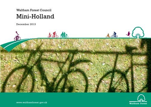
Mini-Holland
mini-holland-tender-13-dec
mini-holland-tender-13-dec
- No tags were found...

You also want an ePaper? Increase the reach of your titles
YUMPU automatically turns print PDFs into web optimized ePapers that Google loves.
Waltham Forest Council<br />
<strong>Mini</strong>-<strong>Holland</strong><br />
December 2013<br />
www.walthamforest.gov.uk
Contents<br />
Foreword 3<br />
Introduction and work to date 4<br />
Programme Vision 8<br />
Overview of <strong>Mini</strong> <strong>Holland</strong> Bid 11<br />
Opportunities, Challenges and Issues 15<br />
Programme Objectives 18<br />
2<br />
Benefits Strategy 20<br />
Walthamstow 22<br />
Walthamstow Town Centre 23<br />
Walthamstow Villages 28<br />
Forest Road 32<br />
Secondary Centres - <strong>Mini</strong> Town Centre 38<br />
Addressing Severance 40<br />
Lea Bridge Road - The Borough’s first Cycle Superhighway 42<br />
A Network of good Cycle Routes 49<br />
Cycle Superhubs 62<br />
Significant local marketing and promotional efforts 63<br />
Consultation, Engagement and Involvement 66<br />
New Developments 76<br />
Complementary measures - Technology and Innovation 77<br />
Equality Impact Statement 78<br />
Conclusion 79
<strong>Mini</strong> <strong>Holland</strong> •<br />
Foreword<br />
Waltham Forest Council wants to dramatically improve<br />
The Cycle Superhighway will run past Whipps Cross Hospital<br />
need to make some tough decisions about how vehicles use<br />
conditions for cyclists around Walthamstow town centre, to<br />
where our flagship Dutch-style roundabout will help break<br />
the borough’s roads. Stepping up our ambitions for cycling<br />
help trigger a cycling culture across the whole borough.<br />
down physical and psychological barriers to Epping Forest, and<br />
and a better public realm will involve reallocating space away<br />
eastwards, onward into Redbridge.<br />
from the car - including reducing or moving parking, where this<br />
Drawing on international best practice we are committed to<br />
compromises cyclist safety and wellbeing.<br />
delivering an ambitious programme of improvements that will<br />
We will also be working to improve cycle links outwards from<br />
remove the barriers to cycling within the borough. We hope that<br />
the town centre. A new Quietway will extend across the North<br />
The Council will not shy away from this challenge. The latest<br />
communities across London and the country will be inspired to<br />
Circular Road to Highams Park. In the south of the Borough<br />
Census data shows that the proportion of households owning<br />
follow our example.<br />
improved links will be created on backstreets to Leyton and<br />
through to the Queen Elizabeth Olympic Park.<br />
a car has declined over the last decade in favour of other<br />
means of transport, including walking and cycling. In four wards<br />
3<br />
As a Council we want to see many more people choose a bike<br />
(including two in the mini <strong>Holland</strong> area) more than half the<br />
as the default mode for local trips. Bordered by the forests,<br />
Our promotional efforts will compliment with the borough’s<br />
population now live in a household which does not have access<br />
parks and marshes of the Lea Valley and Epping Forest, we<br />
hosting of the third stage of the 2014 Tour de France (which<br />
to a car.<br />
already have a strong culture of off-road leisure cycling.<br />
will take riders along Lea Bridge Road). We will use this event<br />
and our annual Tour de Waltham Forest rides to engage and<br />
The Council’s three-year Cycling Action Plan has marked the<br />
In Walthamstow, the core mini <strong>Holland</strong> area located between<br />
consult on the roll out of the mini <strong>Holland</strong> transformations;<br />
beginning of a real step change in our ambitions. Transport<br />
these green open spaces we are introducing a radical cycle-<br />
further increase interest and awareness of cycling as a mode of<br />
for London support for our mini-<strong>Holland</strong> would enable us to<br />
friendly scheme to calm the streets - through pocket parks,<br />
transport and prepare for major ‘Smarter Travel’ initiatives once<br />
become one of the UK’s very best places to ride a bike.<br />
home zones and strategic cycle filters. We will introduce a linear<br />
the new infrastructure is in place.<br />
park in place of the former Hoe Street gyratory and build a<br />
major cycle parking hub near the busy Walthamstow market -<br />
With half of all car trips in Outer London less than two miles,<br />
Councillor Clyde Loakes<br />
the longest street market in Europe.<br />
there is enormous scope to get more people cycling for<br />
Deputy Leader and Portfolio Lead for Environment<br />
transport – to work, to school, to the shops. This potential can<br />
But we also want to act to support the surge in cycling taking<br />
only be realised if we can make it feel easy, pleasant and safe<br />
place on the southern edge of our mini <strong>Holland</strong> zone on the<br />
and reduce the fear of injury and stress associated with motor<br />
Lea Bridge Road. The segregated Cycle Superhighway planned<br />
traffic which currently stops people from cycling - especially<br />
there will provide a key commuter route to Hackney and into<br />
women, children and older people.<br />
central London. It will also help protect the safety of rapidly<br />
increasing numbers of cyclists, with counts in the area showing<br />
In order to make cycling for transport more attractive, we not<br />
cycling increasing by more than 40 per cent over the past<br />
only have to make sure that our residents are aware of the<br />
year alone.<br />
health, economic and environmental benefits, but we may also
Introduction and Work to Date<br />
An ambitious borough<br />
Major Regeneration Projects 2013/14<br />
The Marlowe Road Estate multi-million pound scheme in<br />
Wood Street will include the demolition and re-provision of<br />
2012 was an extraordinary year for Waltham Forest. We<br />
hosted the Olympic and Paralympic Games, a visit from the<br />
Queen and kick-started our regeneration programme. With so<br />
We’re transforming our high streets and shop fronts throughout<br />
2013/14 making significant improvement for local businesses<br />
and residents in Blackhorse Lane, Walthamstow, South<br />
approximately 140 council homes, the building of approximately<br />
a further 250 private homes, new retail units and a new design of<br />
Wood Street Plaza.<br />
4<br />
many achievements in 2012 we endeavoured to continue this<br />
momentum in 2013 and make Waltham Forest an even better<br />
place to live for our residents.<br />
Over 50 council and externally led regeneration projects either<br />
commenced or were delivered during 2013 under the public<br />
campaign title ‘Creating a better place 2013’. This represented<br />
Chingford, Francis Road, Leyton, Leytonstone Higham Hill,<br />
Wood Street and Lea Bridge Road and Bakers Arms.<br />
We secured £6.5million to reopen Lea Bridge Station in<br />
December 2014 providing a regular train service throughout<br />
the day with a five minute journey time to either Stratford or<br />
Tottenham Hale.<br />
The Blackhorse Lane area has the potential to provide over 2,000<br />
new homes and 1,000 new jobs over the next ten years as part<br />
of the comprehensive regeneration of the local area including<br />
new parks, roads, schools and community facilities. It links to the<br />
Walthamstow Wetlands which was awarded £288,000 Heritage<br />
Lottery Funding.<br />
investment of over £160million into the borough’s high streets,<br />
leisure facilities, schools, housing and new flagship developments.<br />
We’ve invested £9million into our town centres to improve the<br />
high street experience by enhancing shop fronts and streets.<br />
Over £30million is being spent on upgrading our leisure centres,<br />
parks and playgrounds to ensure our residents have a first<br />
class leisure offer. Our libraries are undergoing a £5million<br />
refurbishment and we are rebuilding schools to ensure that our<br />
children get the best start in life.<br />
2013 saw major initiatives change the very fabric of our town<br />
centres. The cornerstone of these will be the Arcade Site<br />
development in Walthamstow. £30million investment will bring<br />
homes, shops, jobs and a cinema opening late 2014.<br />
In February 2014, the £20million Walthamstow Central Station<br />
development is scheduled to be completed, bringing homes,<br />
jobs and a new hotel to Waltham Forest. The scheme will see<br />
£22m investment in the area creating a new station square, a<br />
We have made significant investment in our leisure offer. In<br />
partnership with our leisure provider we have refurbished Leisure<br />
Centres in Leyton and Walthamstow through £24.5million<br />
investment. Both Leyton Jubilee Park and Drapers Field have<br />
undergone significant works, and 28 parks and play areas were<br />
refurbished in 2013 through b£1.9million investment providing<br />
natural and adventure play, multi-sports areas, outdoor gyms,<br />
safer surfacing and art works and sculpture. Furthermore, four<br />
libraries are set for an overhaul.<br />
new pedestrian link towards Walthamstow Queen’s Road Station,<br />
We secured over £160million of investment in 2013 and expect<br />
that to rise to over £700million as we move towards 2018. The<br />
next four years will see dramatic changes in the shape of Waltham<br />
Forest as the physical infrastructure develops and grows. The<br />
69 residential apartments, 5 new retail units and a 107 room<br />
Travelodge hotel.<br />
The South Grove site in Walthamstow will deliver an investment<br />
Schools across the borough have been improved with over<br />
£50million secured o meet the current and future demand. 52<br />
primary school sites have been improved in 2013 and further<br />
£22million investment in 2014.<br />
large regeneration projects will be a catalyst for growth, bringing<br />
of over £65 million into the town centre with a large format<br />
opportunities for both business and employment in the borough.<br />
Morrisons store, and additional retail space. It will create<br />
approximately 450 new, permanent jobs and training/<br />
apprenticeship opportunities – 300 of the jobs will be in<br />
Morrisons. It will provide around 240 much-needed new homes<br />
for local people, including affordable and larger family homes.
<strong>Mini</strong> <strong>Holland</strong> •<br />
Cycling Infrastructure and Initiatives<br />
In April 2012, the Council pledged its support for the London Cycling<br />
Campaign’s “Love London, Go Dutch” campaign, to make the<br />
borough more liveable by making our streets as safe and convenient<br />
for cycling as they are in <strong>Holland</strong>. It committed to delivering a<br />
comprehensive Cycling Action Plan, to be delivered over three years.<br />
We are implementing a 20mph default speed limit in residential<br />
areas (and some high streets) across the borough, to make<br />
cycling feel safer and our streets more liveable for all residents.<br />
We have also worked closely with local cyclists to identify a<br />
shortlist of 20 junctions that pose hazards for cyclists, and have<br />
started work to improve these.<br />
5<br />
In partnership with Bikeworks, a not for profit social enterprise,<br />
the Council has expanded and relocated its successful bike<br />
recycling scheme to Leytonstone High Road, creating a<br />
community cycling hub for the whole borough. Opened in mid-<br />
June 2013, this offers access to refurbished bikes at low cost,<br />
high quality repairs, maintenance and build-a-bike workshops,<br />
as well as industry-accredited training and jobs in cycle<br />
maintenance for young people and ex-offenders.<br />
A programme to permit two-way cycling in one way streets is<br />
under way, aimed at making local travel by bike more direct<br />
and convenient. This has already dramatically improved links<br />
between Lloyd Park, the Town Hall, residential areas and shops<br />
on Hoe Street.<br />
We have aligned borough policies and strategies with this<br />
ambition, including our Local Plan, and require all new developments<br />
to have “future proof” levels of cycle parking and access.
Introduction and Work to Date, continued<br />
The Council has committed to conducting an annual borough<br />
wide survey of cyclists, and those who would like to cycle,<br />
asking what would encourage them to cycle more. In our first<br />
at 2% of journeys the borough still has a low mode share when<br />
compared to Inner London and towns like Hull, Cambridge and York.<br />
We want to keep the cyclists we already have, but are committed<br />
Future proofing infrastructure to ensure supply<br />
meets increasing demand<br />
survey, they have told us where they like to ride, and the parts<br />
of the borough where things need to improve. Insights from the<br />
survey are informing our Action Plan, cycling strategy and this<br />
submission.<br />
to creating streets that will make cycling genuinely attractive to<br />
a much wider range of residents – children and young people,<br />
women, older people and Black, Asian and Ethnic Minority<br />
residents.<br />
As one of the five Olympic host Boroughs, Waltham Forest is in a<br />
key position to capitalise upon the legacy opportunities emerging<br />
in Stratford and the Lower Lea Valley. Development at Stratford<br />
and the Olympic Village will bring numerous benefits to Waltham<br />
Forest residents including improved job opportunities as well<br />
6<br />
Progress has been made in ensuring the borough’s HGVs<br />
and those of developers are equipped with the latest safety<br />
equipment, and drivers trained to interact safely with cyclists.<br />
In 2012, we ran a campaign to highlight cycle safety to driving<br />
schools and taxi firms.<br />
We want people to see and feel the difference on our streets, and<br />
believe that creating a pleasant and safe environment for cycling<br />
will improve quality of life for everyone in the borough.<br />
Local Developments<br />
as access to high quality sporting facilities and new areas of<br />
parkland. In order to capture the benefits of planned growth in<br />
these and other neighbouring areas, it is vital that the Borough<br />
apply intervention measures locally to manage and achieve<br />
growth in the most sustainable way.<br />
Cycling is now being mainstreamed in Council activities<br />
and across departments, such as regeneration, economic<br />
development, sport and leisure. In addition, cycling and walking<br />
have been an important element of our public health strategy<br />
since 2010.<br />
The Council is encouraging staff and councillors to lead by<br />
example and undertake more business by bike. As well as<br />
reducing our transport impact on the community, we think<br />
In line with Council policy to reduce reliance on the car for local<br />
journeys, all recent residential developments in the town centre<br />
have been car free, with limited parking for retail and schools (in<br />
areas of lower public transport accessibility). All integrate high<br />
quality facilities and generous cycle parking as standard.<br />
The Council expects these developments to generate significant<br />
additional cycling trips, providing further justification for<br />
The 2011 Census data shows that 42% of households in the<br />
borough are car free (a 4% increase over the last decade). In<br />
the wards around the Town Centre, household access to a car<br />
is in most cases below 50%. Mosaic analysis of this area shows<br />
a relatively high Propensity to Cycle (and Census data for 2011<br />
indicates that around 4% are cycling to work) though there is<br />
also a significant proportion of Aspire to Drive households further<br />
from railway stations.<br />
cycling for business improves our knowledge of the borough and<br />
brings us closer to the community we serve. Our Portfolio Lead<br />
for Environment and Transport is himself a keen utility cyclist and<br />
the borough’s cycling champion. This has increased the profile of<br />
cycling amongst other members, Council officers, the public and<br />
the local media.<br />
We are proud of the progress of our Cycling Action Plan, but are<br />
keen to secure <strong>Mini</strong>-<strong>Holland</strong> funding as we want to go much further<br />
and much faster. While cycling is increasing, we recognize that<br />
improving on-street conditions for cycling and more attractive<br />
public spaces. This new development provides opportunities to<br />
enhance TfL funding for cycling with developer contributions.<br />
Further, Walthamstow Town Centre is becoming a destination for<br />
tourism, close to cultural attractions such as the Vestry House<br />
Museum and William Morris Gallery, as well as the borough’s<br />
“green lungs”, Walthamstow Marshes, Walthamstow Wetlands<br />
and Epping Forest.<br />
By creating truly excellent facilities for cycling via a <strong>Mini</strong>-<strong>Holland</strong>,<br />
as part of the holistic regeneration in the area, and targeted<br />
promotional events focussing on Aspire to Drive groups, we<br />
seek to make cycling pleasant, sociable and more aspirational,<br />
increasing the number of households that embrace car free/<br />
car reduced lifestyles, locking in sustainable local travel and<br />
creating a cycling “unique selling point” for Waltham Forest to<br />
draw in people who seek a high quality of life in a greener, more<br />
attractive borough.
<strong>Mini</strong> <strong>Holland</strong> •<br />
Residential street with modal filter<br />
7
Programme Vision<br />
8<br />
Overarching Vision<br />
• Create distinctive cycle friendly urban quarter wedged<br />
between forest and marshland, comprehensively integrated<br />
into sub regional transport network.<br />
• Deliver exemplary streetscape typologies which facilitate<br />
change in the way people travel/make cycling and walking the<br />
default for local trips.<br />
• Implement innovative schemes, drawing on international best<br />
practice, which will benchmark cycling provision in the UK.<br />
We share the Mayor’s vision of a cleaner, greener, fitter and less<br />
congested London.To achieve this, we will need to convince a<br />
much wider public of the joy and wider benefits of cycling.<br />
We want mini-<strong>Holland</strong> funding to ‘normalise’ cycling, making it<br />
something everyone feels comfortable doing.<br />
Progress to date<br />
Waltham Forest Council has long been working towards<br />
improving conditions for cyclists, although this has become a<br />
priority in recent years, in response to increased interest and<br />
pressure from residents and ward members. In April 2012, the<br />
Council launched its cycling action plan, to be implemented over<br />
three years, including the following initiatives:<br />
• Ensure that Council lorries, and those of our contractors, are<br />
fitted with the appropriate cycle safety devices.<br />
• Ensure that Council and contractor commercial drivers receive<br />
appropriate on-road cycle safety training.<br />
• Identify the borough’s 20 most dangerous junctions and roads<br />
and introduce measures to improve cycle safety.<br />
• Substantially increase funding on cycle infrastructure and<br />
initiatives.<br />
• Carry out an annual cycle count across the borough to<br />
accurately assess cycling levels in Waltham Forest.<br />
• Improve consultation arrangements with cycling groups and<br />
seek residents’ views on our approach to cycling.<br />
• Maintain, upgrade and expand secure cycle parking provision<br />
at all our tube and rail stations - and ensure it is included in all<br />
new developments.<br />
• Increase route choice and reduce diversions to enable cyclists<br />
to get about the borough more easily. This includes the<br />
introduction of a scheme to allow contra flow cycling (cycling<br />
in the opposite direction to the traffic) in some one way<br />
streets. This is working well in other London boroughs, and is<br />
the default in many European countries and cities with high<br />
levels of cycling.<br />
• Introduce a 20mph default speed limit across the borough in<br />
all our residential areas, improving safety and quality of life for<br />
all Waltham Forest residents.
<strong>Mini</strong> <strong>Holland</strong> •<br />
9<br />
Expand and relocate the Council’s successful bike scheme.<br />
Launched in June 2013 in partnership with Bikeworks, this<br />
community cycling hub offers access to refurbished bikes at<br />
low cost, high quality repairs, maintenance and build-a-bike<br />
workshops, as well as industry-accredited training and jobs in<br />
cycle maintenance for young people and ex-offenders.<br />
We have aligned borough policies and strategies with our<br />
ambition, including our Local Plan, and require all new developments<br />
to have “future proof” levels of cycle parking and access.<br />
Since 2012 the Council has been conducting an annual borough<br />
wide survey of cyclists, and those who would like to cycle,<br />
asking what would encourage them to cycle more.This has given<br />
us valuable infiormation on where they like to ride, and the parts<br />
of the borough where things need to improve.<br />
Progress has been made in ensuring the borough’s HGVs<br />
and those of developers are equipped with the latest safety<br />
equipment, and drivers trained to interact safely with cyclists.<br />
In 2012, we ran a campaign to highlight cycle safety to driving<br />
schools and taxi firms. Cycling is now being mainstreamed in<br />
Council activities and across departments, such as regeneration,<br />
economic development, sport and leisure. In addition, cycling<br />
and walking have been an important element of our public health<br />
strategy since 2010.<br />
The Council is encouraging staff and councillors to lead by<br />
example and undertake more business by bike. As well as<br />
reducing our transport impact on the community, we think<br />
cycling for business improves our knowledge of the borough<br />
and brings us closer to the community we serve.<br />
We are proud of the progress of our Cycling Action Plan, but<br />
are keen to secure <strong>Mini</strong>-<strong>Holland</strong> funding as we want to go much<br />
further and much faster. While cycling is increasing, we recognise<br />
that at 2% of journeys the borough still has a low mode share<br />
when compared to Inner London and even some provincial<br />
towns such as Hull, Cambridge and York.<br />
However, we acknowledge the issue and see an opportunity to<br />
rapidly grow cycling modal share in the borough by providing the<br />
right types of cycle provision in the right places through the mini<br />
<strong>Holland</strong> programme.<br />
We have already had the pleasure of seeing a little bit of the<br />
borough ‘going Dutch’. During the London 2012 Olympics our<br />
own temporary ‘mini <strong>Holland</strong>’ was created in the Walthamstow<br />
Marshes where supporters of the Dutch Olympians were<br />
camping for the duration of the Games. In order to travel to the<br />
Olympic Park the Dutch brought their own ‘OV fiets’ cycle hire<br />
bikes with them.
10<br />
Markhouse Road semi-segregation
ROAD<br />
<strong>Mini</strong> <strong>Holland</strong> •<br />
Overview of <strong>Mini</strong> <strong>Holland</strong> Bid<br />
Our mini-<strong>Holland</strong> proposals comprise a set of integrated<br />
schemes that will deliver dramatic improvements in safety<br />
and convenience for cyclists, with imaginative public realm<br />
enhancements for residential and local shopping areas. The<br />
overall result will be a modal shift to cycling and walking that<br />
is excellent value for money.<br />
We have prioritised our schemes using feedback from our<br />
annual cyclists surveys, and considered how the proposals<br />
support wider regeneration plans for the borough and the East<br />
London area.<br />
<strong>Mini</strong>-<strong>Holland</strong> key schemes overview<br />
Central Area<br />
Primary Areas<br />
Secondary Areas<br />
FOREST ROAD<br />
CHINGFORD<br />
HIGHAMS PARK<br />
CHINGSFORD<br />
FOREST ROAD<br />
11<br />
Our mini <strong>Holland</strong> bid comprises six main elements which are<br />
described below (in order of priority):<br />
1. A substantial redesign of the main town<br />
centre to make it genuinely excellent for<br />
cyclists.<br />
Walthamstow Town Centre and the Villages<br />
The Council is proposing Walthamstow Town Centre and<br />
the surrounding mainly residential streets as the focus of its<br />
“<strong>Mini</strong>-<strong>Holland</strong>”. This covers 55,000 residents, roughly a fifth<br />
of the borough’s population, and an area of approximately 4.5<br />
square miles. This forms a “crooked” square consisting of four<br />
segments, with Walthamstow Town Centre at its centre, and<br />
bounded by roads which currently can be classified (according<br />
to TfL’s new Road Task Force typology) as high roads, with<br />
high street characteristics in parts. These are Wood Street to<br />
the east, Markhouse Road to the west and Forest Road and<br />
Lea Bridge Road to the north and south respectively.<br />
MARSHES<br />
BLACKHORSE<br />
VILLAGE<br />
MARKHOUSE<br />
VILLAGE<br />
CENTRAL AREA<br />
SELBOURNE ROAD<br />
MARKHOUSE ROAD<br />
LEYTON<br />
HOE STREET<br />
WALTHAMSTOW<br />
VILLAGE<br />
HIGH<br />
ROAD<br />
LEYTONSTONE<br />
EPPING FOREST<br />
The Town Centre is one of the borough’s principal growth<br />
LEYTON<br />
areas and is undergoing significant mixed use development,
Overview of <strong>Mini</strong> <strong>Holland</strong> Bid, continued<br />
providing an excellent opportunity to build cycling in to the<br />
2. Lea Bridge Road Cycle Superhighway<br />
3. A network of good cycle routes<br />
physical, social and economic fabric of the area. For example,<br />
200 homes, shops and a hotel are currently being built at<br />
We propose a Cycle Superhighway along Lea Bridge Road (from<br />
The main design principles for our cycle route network<br />
Walthamstow Central Station.<br />
Waterworks Roundabout to Hackney Powerscroft Rd). This will<br />
proposals include:<br />
12<br />
Another 120 homes, shops, restaurants and a cinema are<br />
taking shape on the former Arcade site next to Walthamstow<br />
Town Square, and the Council has approved a residential/<br />
retail development on the site of the Council’s South Grove car<br />
park. New schools are being built at Blackhorse Road and on<br />
Hoe Street, and others are expanding. An estimated 4,600 new<br />
homes are to be built in the <strong>Mini</strong>-<strong>Holland</strong> wider area (Town Centre,<br />
Blackhorse Road, Wood Street) over the next 15 years.<br />
fill a gap in London’s CSH map. It will be the first in the borough,<br />
stretching from Lower Clapton and Walthamstow Marshes to<br />
the remodelled Whipps Cross roundabout and on to Waterworks<br />
roundabout (or Epping Forest) via Bakers Arms, linking with<br />
both of our key north-south cycle routes and connecting our<br />
<strong>Mini</strong> <strong>Holland</strong> to the City and central London. Borough cycle<br />
counts demonstrate that this route has the highest cyclist flows<br />
in Waltham Forest at 6% of all traffic in the peak. There has<br />
been a 42% increase in cycling over the last year alone – an<br />
• Safe space for cycling - Selbourne Road, Coppermill Lane,<br />
Markhouse Road, the Walthamstow Gyratory, - drawing<br />
on international best practise our proposed treatment of<br />
these and other streets represents a step-change in the way<br />
Waltham Forest and outer London treat cyclists.<br />
• Direct routes - key, simple and direct routes east-west and<br />
north-south that recognise cyclists like riding directly to<br />
where they want to go without lengthy diversions.<br />
However, key routes within the centre are currently dominated<br />
by road traffic creating an unwelcoming environment for cyclists<br />
and pedestrians, spoiling the look of the area and causing<br />
extra 500 cyclists a day. It is an even more important route into<br />
the borough in winter and at night when quiet routes across<br />
Walthamstow Marshes are less attractive (currently unlit, though<br />
we propose to address this through the Quietways programme).<br />
The key routes include two main north-south routes linking the<br />
secondary town centres and the east-west route, Coppermill<br />
Lane to Wood Street.<br />
air quality problems. The Council has already made a policy<br />
decision to prioritise walking, cycling and public transport<br />
within the town centre in its LIP and Area Action Plan. <strong>Mini</strong>-<br />
<strong>Holland</strong> funding would enable us to accelerate the change.<br />
A key feature of our Walthamstow <strong>Mini</strong> <strong>Holland</strong> proposals is<br />
Currently, high traffic speeds and volume make Lea Bridge<br />
Road a threatening environment for the less experienced<br />
cyclists we are keen to attract: observation in situ shows that<br />
cyclists are mainly young men on fast road bikes. (Problem<br />
junctions along on Lea Bridge Road are covered in the<br />
A. Leyton to Blackhorse Road: A high quality cycle route<br />
providing a link via Markhouse Road-Church Road-Grange Park<br />
Road- and High Road Leyton to the Queen Elizabeth Olympic<br />
Park, Stratford and onto Canary Wharf/the city via the award<br />
winning Leyton Town Centre.<br />
the concept of “Villagisation” – which includes removal of<br />
through traffic in residential areas in central Walthamstow,<br />
building on work already underway to make Walthamstow a<br />
more cycle-permeable place, and addressing rat-running.<br />
Forest Road<br />
Forest Road is the northern boundary of the Walthamstow<br />
mini <strong>Holland</strong> area. It is also the A503 providing a link between<br />
Tottenham Hale (via ferry Lane) with Upper Walthamstow and<br />
the North Circular Road. This route is the northern part of<br />
the frame of cycle routes for the mini <strong>Holland</strong> area and forms<br />
our network of good cycling routes. The costs for Forest<br />
Road have been incorporated within the outlined costs for<br />
Walthastow town centre.<br />
Junctions section, below).<br />
The 2014 Tour de France will pass along this road, and Lea<br />
Bridge Station is set to reopen in December 2014. Substantial<br />
development (residential and commercial) is taking place<br />
at the border with Hackney, which we expect to generate<br />
significant extra demand for cycling.<br />
Adressing Severance (part 1)<br />
Integral to our Lea Bridge Road Cycle Superhighway<br />
proposals are the sources of severence found at:<br />
• Walthamstow/Hoe Street Gyratory<br />
• Whipps Cross Roundabout<br />
• Junction at Lea Bridge Road/Argyll Way/Orient Way<br />
B. Leyton to North Chingford:<br />
With substantial stretches of segregation this route will run<br />
from Leyton, via Chingford Road, Chingford Mount Road to<br />
North Chingford.<br />
C. Coppermill Lane to Wood Street:<br />
An exemplar quiet route taking its influence from Dutch<br />
‘fietstraats’ (cycle streets), this route will run through the heart<br />
of Walthamstow’s <strong>Mini</strong> <strong>Holland</strong> from Coppermill Lane and<br />
the Walthamstow Wetlands in the west, to Wood Street with<br />
its shops, market and station to the east. (The stretch from<br />
Walthamstow Town Centre to the Hackney border is part of<br />
the proposed Quietway 38 to Bloomsbury).<br />
• Junction at Lea Bridge Road/Church Road/Markhouse Road
<strong>Mini</strong> <strong>Holland</strong> •<br />
A network of good cycle routes<br />
STATION ROAD<br />
KINGS HEAD HILL<br />
CHINGSFORD<br />
KINGS ROAD<br />
WWHITEHALL ROAD<br />
L A R KSHALL ROAD<br />
CHINGSFORD<br />
HATCH LANE<br />
OLD CHURCH ROAD<br />
NEW ROAD<br />
HALL LANE<br />
HIGHAMS PARK<br />
CHINGFORD ROAD<br />
N O R T H C I R C U L A R R O A D<br />
N O R T H C I R C U L A R R O A D<br />
FULBOURNE ROAD<br />
FOREST ROAD<br />
CHINGFORD ROAD<br />
BADLIS ROAD<br />
FOREST ROAD<br />
JEWEL ROAD<br />
PEARL ROAD<br />
HOE STREET<br />
BROOKDALE ROAD<br />
ROSEBANK GR<br />
HAVANT ROAD<br />
THE DRIVE<br />
WOOD STREET<br />
TURNER ROAD<br />
HOWARD ROAD<br />
GREENLEAF ROAD<br />
CHURCH HILL ROAD<br />
PROSPECT HILL<br />
THE DRIVE<br />
RECTORY ROAD<br />
HATHERLEY ROAD<br />
VALENTIN ROAD<br />
CAIRO ROAD<br />
CHURCH HILL<br />
CLEVELAND RD<br />
CHURCH LANE<br />
HOE STREET<br />
BROOKE ROAD<br />
BARRETT ROAD<br />
SHERNHAL L<br />
HIGH STREET<br />
LEA BRIDGE ROAD<br />
ST MARY ROAD<br />
OLIVER ROAD<br />
VESTRY RD<br />
S T R E E T<br />
ADDISON ROAD<br />
ORFORD ROAD<br />
EAST AVE<br />
WEST AVENUE<br />
SELBOURNE ROAD<br />
FIRST AVENUE<br />
RAGLAN ROAD<br />
MAYNARD ROAD<br />
WALTHAMSTOW<br />
VILLAGE<br />
SHERNHALL ST<br />
THIRD AVENUE<br />
WALTHAMSTOW<br />
CENTRAL<br />
BARCLAY ROAD<br />
WHIPPS CROSS ROAD<br />
SALISBURY RD<br />
BEULAH ROAD<br />
PEMBROKE ROAD<br />
SHRUBLAND RD<br />
EXMOUTH ROAD<br />
ALBERT ROAD<br />
QUEENS ROAD<br />
GROVE ROAD<br />
EDINBURGH ROAD<br />
GROVE ROAD<br />
HOE STREET<br />
CONNAUGHT RD<br />
LORNE ROAD<br />
LEA BRIDGE ROAD<br />
CLARENDON ROAD<br />
CHELMSFORD RD<br />
JAMES LANE<br />
PETERBOROUGH ROAD<br />
BELGRAVE ROAD<br />
WELLESLEY ROAD<br />
HIGH ROAD<br />
BOUNDARY ROAD BOUNDARY ROAD<br />
ST BARNABAS RD<br />
CHELMSFORD RD<br />
JAMES LANE<br />
LEA BRIDGE RD<br />
BOWDEN ROAD LILY ROAD<br />
SHRUBLAND<br />
FARMILO ROAD<br />
ABBOTTS PARK ROAD<br />
HIGH ROAD LEYTON<br />
LEA BRIDGE ROAD<br />
LEIGH ROAD<br />
CAPWORTH STREET<br />
CAPWORTH STREET<br />
CHURCH ROAD<br />
DAWLISH ROAD<br />
CHURCH ROAD<br />
MURCHISON ROAD<br />
WINDSOR ROAD<br />
OLIVR ROAD<br />
ORIENT WAY<br />
LEYTON LEYTONSTONE<br />
HIG H ROAD LEY TON<br />
LEYTON<br />
13<br />
WALTHAM WAY<br />
BERNSTED RD<br />
MELVILLE RD<br />
ESKINE ROAD<br />
Cycle Superhighway<br />
Leyton to Blackhorse Road<br />
Leyton to Chingford<br />
Coppermill Lane to Wood Street<br />
Forest Road<br />
N<br />
WINNS AVENUE<br />
FOREST ROAD<br />
QUEEN ELISABETH ROAD<br />
BUNYAN RD<br />
BLENHEIM ROAD<br />
RENNESS ROAD<br />
CENTURY ROAD<br />
TAVISTOCK AVENUE<br />
RUSSELL RD<br />
COLERIDGE ROAD<br />
WELLINGTON RD<br />
FOREST ROAD<br />
SUFFOLK PARK ROAD<br />
PITCHINGS AVENUE<br />
ELMSDALE ROAD<br />
PALMERSTON ROAD<br />
PRETORIA AVE<br />
WARNER ROAD<br />
MANSFIELD RD<br />
BLACKHORSE RD<br />
BLACKHORSE<br />
CENTRAL<br />
SOMERS ROAD<br />
NORTHCOTE ROAD<br />
LONGFIELD AVE<br />
CHEWTON ROAD<br />
BUXTON RD<br />
CARLSBROOKE<br />
PRETORIA AVE<br />
EDWARD ROAD<br />
MISSION GROVE<br />
CRANBROOK MEWS<br />
HIGH STREET<br />
HAZELWOOD ROAD<br />
BLACKHORSE<br />
VILLAGE<br />
SO UT H G R O VE<br />
COPPERMILL LANE<br />
STATION RD<br />
LYNMOUTH ROAD<br />
HARTINGTON ROAD<br />
RINGWOOD ROA D<br />
MARKHOUSE AVENUE<br />
QUEENS ROAD<br />
LOW HALL LANE<br />
DOWNSFIELD RD<br />
SOUTH ACCESS RD<br />
ACACIA ROAD<br />
MARKHOUSE ROAD<br />
THEYDON RD<br />
MARKHOUSE<br />
VILLAGE<br />
HIBBERT ROAD<br />
BLYTH ROAD<br />
HITCHAM ROAD<br />
ARGALL AVENUE<br />
FLEMPTON ROAD<br />
OVERTON ROAD<br />
BELVEDERE ROAD<br />
STAFFA ROAD<br />
LEA BRIDGE ROAD<br />
SEYMOUR ROAD<br />
ARGALL WAY<br />
CLEMENTINA ROAD<br />
PERTH ROAD<br />
ORIENT WAY
Overview of <strong>Mini</strong> <strong>Holland</strong> Bid, continued<br />
4. Redesigns of some of the secondary town centres<br />
6. Cycle superhubs at local railway stations<br />
14<br />
Although the secondary centres are fourth on the list in<br />
priority, we do not underestimate the importance of these<br />
locations in terms of delivering the overall objectives of the<br />
<strong>Mini</strong>-<strong>Holland</strong> programme and the Mayor’s Cycling vision.<br />
With Chingford and Highams Park in the North of the Borough,<br />
redesigning these centres will be critical in ensuring a network<br />
of direct, high-capacity, joined-up cycle routes across the<br />
borough, as will measures to mitigate the severance caused<br />
by the North Circular.<br />
Our cycle superhub proposals include for secure parking at rail<br />
stations, leisure centres and town centres.<br />
A new cycle store providing secure cycle parking for 160<br />
commuter bikes is currently being built at Walthamstow<br />
Central Station site as part of a S106 agreement relating to the<br />
development of the site. This will include Visitor cycle parking<br />
for the retail units (and generous residential cycle parking for the<br />
apartments)<br />
Our proposals focus on four secondary centres:<br />
• North Chingford<br />
• Highams Park<br />
• Leyton<br />
• Leytonstone<br />
5. Addressing severance (section 2)<br />
Our <strong>Mini</strong> <strong>Holland</strong> addresses the main sources of severance<br />
within the Borough, these include:<br />
• Whipps Cross Roundabout<br />
• Bell Junction (Forest Road/Hoe Street)<br />
• A406 Barriers, we propose enhancing the existing<br />
footbridges<br />
There is also cycle parking for 40 bikes close to the main<br />
(Selborne Road) entrance to the Underground station but this is<br />
insufficient.<br />
We propose to add:<br />
• An iconic cycle parking facility for a further 100 bikes in the<br />
Town Square Gardens opposite Walthamstow Central Station<br />
• Cycle parking will be provided at junctions along the length of<br />
the High Street (from Hoe Street to St James Street) to enable<br />
cyclists to park easily wherever they want to shop or eat.<br />
• Secure cycle parking (monitored by CCTV) for a further<br />
40 bikes will be added, with space to expand as demand<br />
increases at St James Street Station<br />
• Additional secure cycle parking at Wood Street Station, where<br />
under-provision is likely to be suppressing cycling to the<br />
station<br />
• Additional secure cycle parking at Blackhorse Road<br />
Underground/Overground station. We propose an additional<br />
50 secure spaces within a card operated bike store, so that<br />
both long and short stay commuters are catered for.
<strong>Mini</strong> <strong>Holland</strong> •<br />
Opportunities, Challenges and Issues<br />
Briefly describe the current situation and the<br />
problems and/or opportunities that the proposed<br />
programme will address<br />
Current Situation/Problem - There are many sources<br />
of severance within the Borough, including Walthamstow/<br />
Hoe Street Gyratory and Whipps Cross Roundabout, as well<br />
accommodation works for the reopening of the station). A<br />
main issue is the width of the bridge structure and the wider<br />
requirements for the new station. With the additional funding<br />
as main roads such as; Blackhorse Road, the A12/M11 link<br />
available from the <strong>Mini</strong> <strong>Holland</strong> programme we propose to<br />
The current situation has obviously been a key driver in<br />
road (which has cut historic links between the Town Centre<br />
introduce an additional bridge span similar to the well received<br />
shaping the programme vision and objectives. The vision<br />
and Leytonstone) and the A406 North Circular Road which<br />
Ruckholt Road bridge into the Queen Elizabeth Olympic Park.<br />
and objectives defined in the following two chapters set a<br />
framework for the opportunities for change for Waltham Forest<br />
which can be summarized as:<br />
• Substantially increase cycling within the borough<br />
• Shift a significant proportion of short local car trips to the bike<br />
• Improve the look and feel of public spaces<br />
separates the northern and southern halves of the borough,<br />
making cycling to the Town Centre a less obvious choice. Car<br />
ownership is significantly higher in the north of the borough, in<br />
part as a consequence of this severance.<br />
Opportunity - Creating simple and direct routes east-west<br />
and north-south that recognise cyclists like riding directly to<br />
Shift a significant proportion of short local car<br />
trips to the bike<br />
Current Situation/Problem – We know one-way streets<br />
are bad for cyclists, creating convoluted routes and in some<br />
instances encouraging higher vehicle speeds. In light of the<br />
15<br />
• Economic regeneration<br />
• Safety<br />
• Health<br />
their destination, will have a major impact on cycling numbers.<br />
Innovative and bold approaches to tackling these sources of<br />
severance along with coherent and consistent design along<br />
the routes will be key to success.<br />
proposed road closures/modal filters in the town centre, the<br />
villages and the secondary centres we will review all existing<br />
one-way systems in this area with the aim of removing them or<br />
at the very least introducing contraflow cycling.<br />
Increase cycling within the borough<br />
Opportunity - Addressing severance, as a complementary<br />
A programme to permit two-way cycling in one way streets is<br />
Current Situation/Problem - One of the key features of<br />
the existing situation in Walthamstow is that the High Street<br />
cannot be used as a cycle route due to Walthamstow Market,<br />
reputedly Europe’s longest daily street market, with over<br />
450 stalls. The centre and south of the borough have narrow<br />
and highly congested Victorian main roads and ‘rat running’<br />
is a probem in the four residential “quarters” of Central<br />
Walthamstow.<br />
measure we are also working with other boroughs in the<br />
Northern sub-region, to develop a separate proposal for a<br />
northern Quietway to parallel the A406 North Circular Road,<br />
to provide better orbital links for cyclists across borough<br />
boundaries<br />
Opportunity - Lea Bridge Road is a corridor of opportunity.<br />
It links the heart of the borough and Walthamstow <strong>Mini</strong><br />
<strong>Holland</strong> with the greenspaces of Walthamstow, Hackney and<br />
under way, aimed at making local travel by bike more direct<br />
and convenient. This has already dramatically improved links<br />
between Lloyd Park, the Town Hall, residential areas and<br />
shops on Hoe Street. We have aligned borough policies and<br />
strategies with this ambition, including our Local Plan, and<br />
require all new developments to have “future proof” levels of<br />
cycle parking and access.<br />
Within the secondary centres there are areas of high cycling<br />
Opportunity - An opportunity therefore exists for<br />
“Villagisation” facilitated by the removal of through traffic in<br />
residential areas in central Walthamstow. This will build on the<br />
work already underway to make Walthamstow more cyclepermeable<br />
and address rat running.<br />
Leyton Marshes. In the west it provides the link to the cycling<br />
communities in the London Borough of Hackney and on to<br />
central London.<br />
Issues - Lea Bridge Station is to reopen in 2015. A redesign<br />
of the main junction is planned to improve facilities for<br />
potential, with an increasing proportion of young professionals<br />
in areas such as Leytonstone, with new pubs, restaurants<br />
and artist studios/pop up exhibitions. Anecdotally, many<br />
are moving into the borough from Hackney, where rents and<br />
property prices are higher, and are bringing that borough’s<br />
cycling culture with them. The Council and social enterprise<br />
pedestrians and cyclists (being developed as part of the<br />
Bikeworks have also set up a bike hub in Leytonstone High
Opportunities, Challenges and Issues, continued<br />
Road, offering a range of bike related activities and training<br />
Opportunity – There are opportunities to apply visual<br />
economy, which is being driven by the cinema development at<br />
programmes. Leyton Sixth Form College, with over 2000<br />
gateway treatments leading into residential quarters and<br />
the top of the High Street.<br />
students, low car mode share and an enthusiastic staff cycling<br />
secondary centres. Space freed up through road closures will<br />
champion, is located midway along the route.<br />
become available for “pocket park” community use - planters,<br />
While Walthamstow has a range of shops and services, these<br />
benches, green gym and, community gardens.<br />
are focused primarily at the lower and discount end of the<br />
Opportunity – A key feature of our proposals will be value<br />
market and there is a lack of higher value retail. The centre<br />
engineering, examples of these opportunities would include<br />
use of planters and other cost effective measures to segregate<br />
Economic regeneration<br />
is a major focal point for shopping, but too much spending<br />
power leaves the Borough. There is a need to capture more of<br />
16<br />
cycle lanes and create temporary road closures. We will also<br />
introduce a number of road closures, some initially on an<br />
Current Situation/Problem - Three key factors make<br />
the spend of higher earners within the borough.<br />
experimental basis, to reduce the amount of through vehicular<br />
Walthamstow different from other town centres:<br />
With the exception of retail jobs, Walthamstow performs a<br />
traffic in residential areas. This will improve conditions for<br />
cyclists and pedestrians and residents generally.<br />
Opportunity – To increase cycle use for short trips we have<br />
focused on some key opportunities including: the creation of<br />
a cycle hubs at all key stations within the secondary centres;<br />
• Walthamstow Market.<br />
• High proportion of independent retailers offering a range of<br />
retail and other services.<br />
• Local community is ethnically and culturally diverse, giving<br />
vibrancy to the centre.<br />
limited employment role. A large number of residents travel<br />
outside of the area for work. A large proportion of the local<br />
population have no qualifications (33%) and a large proportion<br />
is employed within low-value occupations. The occupational<br />
profile of Walthamstow and the surrounding area reinforces<br />
the importance of facilitating economic diversification, the<br />
Providing additional cycle parking in residential and key<br />
shopping areas; Increasing car club coverage; and creating<br />
parklets and pocket parks in residential areas that will improve<br />
the physical characteristics of the area for communities.<br />
Improve the look and feel of public spaces<br />
Current Situation/Problem - While the key motivation of<br />
However, the centre has been underperforming for a number<br />
of years and if this is not reversed it will lead to long term<br />
commercial decline due to departing investment. The centre<br />
is facing increased competition from neighbouring centres,<br />
particularly from the new shopping centre at Stratford City.<br />
Walthamstow currently does not have units of sufficient size to<br />
attract and accommodate some of the higher quality retailers<br />
the Council wishes to attract.<br />
need to raise average incomes and the need to ensure good<br />
access to local training and skills development opportunities<br />
Opportunity - The major investment in infrastructure provided<br />
by <strong>Mini</strong> <strong>Holland</strong> funding will help attract investment from<br />
professional workers and high value business sectors such<br />
as IT, the media and arts. Providing safer and more attractive<br />
routes into and out of the borough will enable our residents<br />
to access jobs in Central London and the City, promote the<br />
the <strong>Mini</strong> <strong>Holland</strong> submission is to increase cycling amongst<br />
all sections of community, a desired co-benefit is the creation<br />
of an improved public realm which provides a welcoming<br />
context for economic sectors with higher value jobs, such as<br />
the services, IT and creative industries, and to ensure that<br />
local people have easy and sustainable access to jobs in<br />
employment centres such as Stratford and the City.<br />
Currently, the evening economy in the centre is very limited<br />
and with shops often closed by 6pm the town centre can be<br />
deserted and is a quiet place where people can feel unsafe.<br />
There is a lack of non-retail uses, such as leisure, tourism<br />
and cultural uses, within the centre. Currently, the evening<br />
economy in the centre is very limited. Shops are often<br />
closed by 6pm leaving the centre deserted and quiet place<br />
where people can feel unsafe. The current evening offer is<br />
dominated by takeaways and there are few quality restaurants.<br />
Despite current low use of the town centre as a leisure<br />
destination, the size and proximity of a large local population<br />
represents a significant opportunity to develop the evening<br />
visitor economy and facilitate sustainable travel to jobs and<br />
town centres in the borough. S`ection 106 opportunities for<br />
improving cycling (and walking) conditions for the major<br />
residential and retail developments which are due for<br />
completion over the next three to four years in the area will be<br />
a major complimentary measure and opportunity alongside<br />
this programme. With proposed new access to the Olympic<br />
Park provided via Eton Manor, opportunities exist for Cycle<br />
Hire into the park and potentially into LBWF through funding<br />
generated by S106 agreements.
<strong>Mini</strong> <strong>Holland</strong> •<br />
Opportunities, Challenges and Issues, continued<br />
Opportunity - High Streets/local shops: There is a growing<br />
feel safe to cycle for transport will enable them to exercise<br />
An increase in cycling has the potential to reduce the burden<br />
body of evidence from London and cycling cities abroad<br />
while going about their daily routine, making it accessible to<br />
of preventable disease in the borough by increasing the<br />
demonstrating that cyclists (along with public transport users<br />
those with busy lifestyles and on lower incomes.<br />
number of adults and children undertaking physical activity.<br />
and pedestrians) are loyal supporters of local shops and<br />
services. They tend to use local shops and services more<br />
frequently and spend more money per month than those<br />
arriving by car. In addition, they do not require expensive/<br />
Opportunity - We are in discussions with a number of<br />
providers of innovative technology solutions that we hope will<br />
improve conditions for all road users, particularly at problem<br />
Generic Issues/Risks in tacking problems and<br />
realising opportunities<br />
limited facilities such as car parking. An improved public<br />
junctions. Example of the technology we would like to use<br />
realm, with significant greening as proposed as part of WF’s<br />
<strong>Mini</strong> <strong>Holland</strong> bid, is likely to benefit the local economy by<br />
include the M100BR Radar Bicycle Detector, designed for<br />
use on cycle lane approaches and at advance stop lines, and<br />
There are a number of generic issues and risks that need to be<br />
understood in terms of how we approach the current problems<br />
17<br />
increasing property values and rental income.<br />
also green wave lights installed in the edge of cycle commuter<br />
for cyclists within Waltham Forest and the opportunities that<br />
routes in advance of signalised junctions. We have included<br />
exist to deliver a major step change in cycling infrastructure<br />
Issues – We need to be mindful of short term parking and<br />
further details on these within the technology section in the<br />
and culture change amongst its residents and commuters.<br />
loading requirements for local business.<br />
last chapter of our response.<br />
Coherence and consistency in design is crucial. Radical<br />
Safety<br />
Health<br />
differences of approach between different streets and routes<br />
will be confusing for cyclists and drivers. Which we believe<br />
will result in schemes failing to deliver the results we all want<br />
Current Situation/Problem - Numerous studies and our<br />
Current Situation/Problem - Creating an environment<br />
i.e. a higher number and broader range of cyclists in a safer<br />
own consultation with over 500 cyclists have shown clearly<br />
where residents feel safe to cycle for transport will enable<br />
environment.<br />
that fear of injury and stress associated with motor traffic<br />
them to exercise while going about their daily routine, making<br />
are what stop people from cycling, especially for women,<br />
it accessable to those with busy lifestyles and on lower<br />
We want to avoid the issue of ‘business as usual’ clutter<br />
children and older people. So to make cycling an enjoyable<br />
incomes. While Waltham Forest residents are reasonably<br />
where design approaches to junctions will deliver relatively<br />
and mainstream mode of travel, we know that we will need<br />
active compared to England as a whole, there is room<br />
marginal benefits to cyclists. We want to ensure that our<br />
to employ more innovative measures to manage traffic,<br />
for improvement and not all parts of the population take<br />
proposals represent a step change in design, are consistent in<br />
and create better routes which protect cyclists from motor<br />
sufficient exercise. Increasing opportunities for more people<br />
approach and will deliver significant improvements to cycling,<br />
vehicles, including segregation.<br />
to cycle more often will help prevent the onset and aid the<br />
not just treat this programme as an opportunity to design<br />
management of chronic diseases.<br />
more business as usual interventions that don’t challenge<br />
Opportunity - Introduce a 20mph default speed limit across<br />
conventional design and modal priority.<br />
the borough in all our residential areas and ensure the<br />
Opportunity - Access to nature. Our proposed “Marshes to<br />
borough’s HGVs and those of developers are equipped with<br />
Forest” route puts the borough’s green spaces just a short<br />
the latest safety equipment. Identify the borough’s 20 most<br />
cycle ride away from 100,000 people, many of whom are living<br />
dangerous junctions and roads and introduce measures to<br />
in the central part of the borough, which is categorised as an<br />
improve cycle safety. Creating an environment where residents<br />
area deprived of access to nature.
Programme Objectives<br />
Describe briefly why the programme is needed e.g.<br />
how it will help promote a significant uptake of cycling<br />
while also meeting wider transport, public realm and<br />
regeneration benefits<br />
In our 2012 and 2013, 39.5% of cyclists responding to our<br />
survey were women. We would like to see a more even split<br />
between the genders, as is the case in the Netherlands,<br />
Denmark and Germany, and aim to increase the proportion of<br />
and more attractive routes into and out of the borough will<br />
enable our residents to access jobs in central London and the<br />
City, promote the visitor economy and facilitate sustainable<br />
travel to jobs and town centres in the borough. Creating and<br />
publicizing a network of local routes and secure, high quality<br />
cycle parking will encourage even more cyclists to use local<br />
shops and services.<br />
• Safety: To improve actual and perceived safety for cyclists<br />
on our streets and achieve significant reductions in KSIs and<br />
slight injuries. A focus on reducing danger for cyclists will<br />
have positive co-benefits for all road users.<br />
• Health: To reduce the burden of preventable disease in the<br />
borough by increasing the number of adults and children<br />
incorporating physical activity into their daily routines.<br />
18<br />
Waltham Forest Council shares the Mayor’s Vision for cycling<br />
and seeks to dramatically improve conditions for cyclists<br />
across the Borough. With current funding levels provided<br />
through the Local Implementation Plan we expect the cycle<br />
modal share within the Borough to increase from the current<br />
1.8% to 3.2% by 2016/17. However, if successful in our bid<br />
for <strong>Mini</strong> <strong>Holland</strong> funding, we aim to achieve a more ambitious,<br />
but, we believe, realistic target of 10% mode share by 2020.<br />
At the same time, as part of our <strong>Mini</strong> <strong>Holland</strong> objective to<br />
reduce short local car trips, we will set a target to reduce<br />
single occupancy vehicle use mode share in the borough by<br />
5% by 2020, to 35% (from 2011/2012 baseline of 40% for<br />
Waltham Forest).<br />
While we want to boost levels of cycling generally, WF is<br />
particularly keen to increase cycling among specific groups<br />
in order to better reflect the ethnic make-up of the borough.<br />
For example, 81% of cyclists responding to Waltham Forest’s<br />
2013 cycling survey were white, although Census 2011 data<br />
shows that only 53% of the borough’s residents fall into this<br />
category. 22% of Waltham Forest’s residents are Asian/Asian<br />
women cycling to at least 45% by 2020.<br />
In 2012, 6.7% of respondents to were over 60. This had<br />
increased slightly by 2013 to 7.1%, but as improved<br />
infrastructure and cycle friendly policies in Waltham Forest<br />
give more people the confidence to ride a bike in the borough,<br />
we aim to increase the proportion of trips made by bicycle in<br />
this age group.<br />
Objectives:<br />
• To substantially increase cycling within the borough, to<br />
make it an attractive and mainstream mode of transport. In<br />
particular, we want to attract people who do not currently<br />
cycle due to fear of traffic, including more women, children,<br />
families, older people and BME groups.<br />
• To shift a significant proportion of short local car trips to the<br />
bike. Reducing the dominance of motor traffic will benefit<br />
all residents by reducing congestion, improving air quality<br />
and creating a safer, happier, more sociable town centre<br />
that is accessible to all.<br />
• To improve the look and feel of public spaces: Roads and<br />
streets make up most of the public space in Waltham<br />
British/Chinese, yet in our 2013 survey, only 6% described<br />
Forest. As part of our <strong>Mini</strong> <strong>Holland</strong>, we are planning<br />
themselves as belonging to this category. By 2020, we would<br />
extensive greening measures, including tree planting as well<br />
like the proportion of Asian/Asian British/Chinese to increase<br />
as traffic management, which will improve the public realm<br />
to 10% of respondents. Similarly, 17.4 % of the borough’s<br />
residents are black, but only 4% of cyclists responding to<br />
our survey were black. By 2020, with <strong>Mini</strong> <strong>Holland</strong>, we would<br />
seek to increase this to 8% of respondents.<br />
for residents, visitors and businesses in the borough.<br />
• Economic regeneration: <strong>Mini</strong> <strong>Holland</strong> will help us attract<br />
investment from professional workers and high value business<br />
sectors such as IT, the media and arts. Providing safer
<strong>Mini</strong> <strong>Holland</strong> •<br />
Somers Road - before<br />
19<br />
Newly improved modal filter at Somers Road
Benefits Strategy<br />
20<br />
We will develop a monitoring programme in order to assess<br />
the relative benefits of the overall programme and the relative<br />
benefits of the differing elements. Due to the temporary/<br />
low cost nature of many of our proposed measures (planters<br />
to close roads, armadillos to semi-segregate cycle tracks<br />
monitoring success will be vitally important if we are to be<br />
able to modify proposals to provide the optimum solutions.<br />
The collation of baseline data will be vital to the monitoring<br />
of the impact of all changes and whilst some traffic data is<br />
available via the DfT and TfL we would like to understand the<br />
impact of changes on most if not all roads.<br />
To support the monitoring of benefits we will:<br />
• Introduce traffic counters throughout the town centre area<br />
to evaluate the impact of closures and revised traffic routes,<br />
this monitoring will assess not just cycle numbers but all<br />
vehicle movements so we can ascertain the impact of<br />
closures on neighbouring roads or how changes to traffic<br />
movements may impact on junctions.<br />
• On main cycle routes (Lea Bridge Road cycle super<br />
highway, north-south routes and marshes to forest) we will<br />
use the same technology as will be used for traffic signal<br />
management to monitor all vehicle numbers (including<br />
cyclists) in order to assess the impact of the implementation<br />
of proposals on cycle numbers, private car trips.<br />
• We will promote the use of our cycle routes with cycle<br />
counters and visual displays on key routes and at key<br />
locations.<br />
• We will monitor accident numbers and locations in order<br />
to understand the impacts of changes to provision,<br />
improvements to junctions.<br />
• Working with schools we will monitor the number of children<br />
cycling to school and the number of schools with STARS<br />
accreditation.<br />
• Through wider promotion of our cycle survey and by<br />
engaging through new channels such as employers and<br />
community leaders we will gain a greater understanding of<br />
cycle usage and promote the results through a variety of<br />
media including regular press releases.<br />
Benefits expected from the programme<br />
Environmental<br />
• Reduction in CO2 (and other greenhouse gas) emissions<br />
• Improvements in air quality (reducing morbidity and<br />
mortality attributable to particulate air pollution, as well as<br />
reductions in air pollution damage to plants, other wildlife,<br />
buildings and watercourses).<br />
• Noise pollution reduction<br />
• Greening and improving the public realm provide direct<br />
aesthetic benefits, but will also encourage people to spend<br />
time outside and access green spaces. (Within Waltham<br />
Forest over 40 % of households, in 8 out of 20 wards, have<br />
deficient access to nature).<br />
Health<br />
• Increased life expectancy through increased physical<br />
activity: Creating an environment where residents feel safe<br />
to cycle for transport will enable them to exercise while<br />
going about their daily routine, making it accessible to<br />
those with busy lifestyles and on lower incomes. Whilst<br />
adults and children are reasonably active in the borough<br />
(when compared to the rest of England) there is room<br />
for improvement and not all parts of the population take<br />
sufficient exercise.<br />
• Chronic diseases: Waltham Forest has high comparative<br />
mortality from chronic disease in the under 75s. Increased<br />
active travel, such as cycling, may help prevent onset<br />
of chronic disease – diabetes, cardiovascular disease<br />
and some cancers – and may help in the management of<br />
disease once onset.<br />
• Obesity: Evidence shows that populations which travel<br />
actively tend to have lower rates of obesity. Waltham<br />
Forest’s adult obesity prevalence is 23.4 %, which is not<br />
significantly different from the England average of 23.4 %.<br />
Obesity among primary school children (year 6) is, at 23.4<br />
%, significantly higher than the England rate of 19%, but<br />
not significantly higher than that for London (22%).<br />
• Improved air quality, reducing incidence, severity and<br />
deaths from respiratory disease: On some of Waltham<br />
Forest’s main arterial roads, including Lea Bridge Road, Hoe<br />
Street and Forest Road, there are high concentrations of<br />
NO2 which are above EU and health based limits. Waltham<br />
Forest can attribute 7.4% of local mortality to long term<br />
exposure to particulate matter. This compares to an average<br />
of 5.4% across London (range 6.8 – 8.9) and 3.01 in<br />
England overall.<br />
• Improved access to safe, green spaces which are<br />
underused by some ethnic groups and women.<br />
• Improvements in mental health and wellbeing brought about<br />
by more active travel.<br />
• Improved road safety for cyclists and pedestrians Improved<br />
safety for other road users brought about by traffic calming<br />
and reallocation of road space to non-motorized modes.<br />
Economic and social benefits<br />
• Mode shift from car to bike has the potential to reduce<br />
congestion, leading to journey time savings for all road<br />
users, including bus passengers.<br />
• More trips by bicycle will improved journey time reliability.
<strong>Mini</strong> <strong>Holland</strong> •<br />
The benefits would accrue to all road users through reduced<br />
general congestion, but also to individuals who take up<br />
cycling as cyclists are generally less delayed by vehicle<br />
congestion. Increased public transport capacity created by<br />
public transport users transferring shorter trips to cycling.<br />
• High Streets/local shops: There is a growing body<br />
of evidence from London and cycling cities abroad<br />
demonstrating that cyclists (along with public transport<br />
users and pedestrians) are loyal supporters of local shops<br />
and services. They tend to use local shops and services<br />
more frequently and spend more money per month that<br />
those arriving by car. In addition, they do not require<br />
expensive/limited facilities such as car parking.<br />
• An improved public realm, as proposed as part of WF’s <strong>Mini</strong><br />
<strong>Holland</strong> bid, will benefit the local economy by increasing<br />
property values and rental income.<br />
• Increasing cycling has the potential to reduce NHS<br />
spending on at least 20 common diseases linked to lack<br />
of physical activity (including heart disease, stroke, Type 2<br />
diabetes and several cancers), while improvements in air<br />
quality and road safety will result in a lower demand for<br />
spending on respiratory disease and trauma-related injuries/<br />
rehabilitation.<br />
• High tech industries (IT, media) tend to have higher<br />
proportions of cyclists among their workforces, so<br />
improving facilities for cycling will help attract high<br />
value jobs and investment in the area (as has occurred<br />
in Hackney). Provision for cyclists is increasingly a<br />
consideration for European companies seeking to invest in/<br />
relocate to the UK.<br />
• Medical evidence links increased active travel and<br />
physical activity in school children to improved academic<br />
performance and concentration.<br />
• More people cycling in the borough will increase the<br />
requirement for cycling related services and equipment<br />
(such as training, maintenance, bikes and accessories),<br />
providing opportunities for entrepreneurs and social<br />
enterprises.<br />
• Training opportunities for residents in bicycle retail and<br />
maintenance can improve the economic prospects of<br />
residents. (WF has already started working with Bikeworks<br />
at the Leytonstone Community Bike Hub to realize some of<br />
these opportunities).<br />
• Social inclusion will be facilitated and physical severance<br />
addressed by reducing the domination of traffic as part<br />
of the <strong>Mini</strong> <strong>Holland</strong> proposals. Real and perceived fear<br />
of traffic has limited the freedom of all residents, but<br />
particularly children and older people, to move around their<br />
communities. There is strong evidence from studies in the<br />
UK and the US that traffic calming increases positive social<br />
interaction in streets and neighbourhoods, and that cycling<br />
helps to make cities happier and more sociable spaces.<br />
Security<br />
• Improved public realm security brought about by increased<br />
natural surveillance from cyclists and increased numbers of<br />
pedestrians taking advantage of enhanced public realm.<br />
21
ROAD<br />
ROAD<br />
Walthamstow<br />
22<br />
Walthamstow (from the Anglo-Saxon Wilcumstow or ‘place of<br />
welcome’), the borough’s only major centre and the focus of<br />
this bid will be the area from which the new cycling culture in<br />
the borough will emanate.<br />
The area includes and is bounded by four main roads (and<br />
important cycle routes): Forest Road (A503) to the north,<br />
Markhouse Road/Blackhorse Road to the west, Wood Street<br />
to the east and Lea Bridge Road (A104), to the south.<br />
This area will be the centre of our wider proposals, making it<br />
the cycling heart of the borough, providing all residents and<br />
visitors with easy access by bike to amenities, shops and<br />
public transport links.<br />
The area around Walthamstow town centre has 55,000<br />
residents accounting for about a 20% of the borough’s<br />
population, and covers about 4.5 square miles. At the core of<br />
the mini-<strong>Holland</strong> area is Walthamstow Town Centre. The wider<br />
area of influence includes the industrial area Argall Business<br />
Improvement District.<br />
are ethnically and culturally more diverse than the average for<br />
Waltham Forest and London, with a high proportion of Asian<br />
and British Asian residents.<br />
The mini <strong>Holland</strong> area can be broken down into 4 distinct<br />
smaller adjoining areas or villages:<br />
Walthamstow Town Centre<br />
The main shopping area in the borough including the High<br />
Street, the market, Walthamstow Central Station and the Mall<br />
Shopping Centre. The area has a dense concentration of<br />
shops and offices employing just under 3000 people.<br />
Walthamstow Village<br />
An historic residential area bordered by Hoe Street, Forest<br />
Road, Wood Street and Lea Bridge Road. Walthamstow Village<br />
includes ‘the Village’ itself in the roads surrounding the Vestry<br />
House Museum and Wood Street with its mainline train station,<br />
shops and increasingly popular craft and vintage market.<br />
Blackhorse Village<br />
A predominantly residential area to the north and west of the<br />
town centre characterised by the architecture of the Warner<br />
Estate Company.<br />
Markhouse Village<br />
A residential area immediately to the north of our proposed<br />
Cycle Superhighway, bordered by our north-south routes and<br />
the town centre.<br />
Forest Road<br />
To compliment our proposals for the town centre and the<br />
villages we propose a fully /semi segregated cycle route along<br />
Forest Road between the borough boundary with London<br />
Borough Harringey and Woodford New Road. Where road<br />
widths do not allow we will take the opportunity to redesign<br />
CHINGSFORD<br />
the streetscape to create a sense of place 20mph speed limit<br />
and an enhanced public realm.<br />
CHINGFORD<br />
HIGHAMS PARK<br />
Within a 10 minute cycle ride of our mini <strong>Holland</strong> area are<br />
Walthamstow Wetlands to the west, and Epping Forest to the<br />
east.<br />
FOREST ROAD<br />
FOREST ROAD<br />
All main council buildings are within the mini <strong>Holland</strong> area<br />
including The Town Hall, Forest Road and Low Hall Depot in<br />
Argall Avenue<br />
Walthamstow mini <strong>Holland</strong> comprises four wards: High<br />
Street, William Morris, Hoe St, and Markhouse (the wider area<br />
includes parts of Lea Bridge and Wood Street wards).<br />
These wards are densely populated, have younger<br />
populations, higher levels of deprivation, lower incomes and<br />
MARSHES<br />
BLACKHORSE<br />
VILLAGE<br />
MARKHOUSE<br />
VILLAGE<br />
CENTRAL AREA<br />
SELBOURNE ROAD<br />
MARKHOUSE ROAD<br />
HOE STREET<br />
WALTHAMSTOW<br />
VILLAGE<br />
EPPING FOREST<br />
LEYTON<br />
HIGH<br />
LEYTONSTONE<br />
LEYTON
<strong>Mini</strong> <strong>Holland</strong> •<br />
Walthamstow Town Centre<br />
Walthamstow Town Centre is the main commercial centre in<br />
the borough, where retail is the most important economic<br />
activity. It is the borough’s main shopping area, and includes<br />
the High Street, the market, Walthamstow Central Station, the<br />
Both supermarkets have multi storey car parks together<br />
providing spaces for around 1200 cars.<br />
Access for HGVs/delivery vehicles<br />
A substantial redesign of the main town<br />
centre to make it genuinely excellent for<br />
cyclists<br />
Mall Shopping Centre and Selborne Road.<br />
The High Street is dominated by Walthamstow Market, which<br />
began in 1885 and has around 450 stalls. The town centre and<br />
market together employ around 2,700 people.<br />
Heavy goods vehicle access for deliveries and servicing is<br />
currently provided via Selborne Road.<br />
Public Transport<br />
The town centre is well served by public transport with<br />
Walthamstow Central Station the main node. It is a<br />
Our vision of Walthamstow mini <strong>Holland</strong> is one of a vibrant<br />
social and economic centre with attractive streets and green<br />
spaces and a relaxed feel. One that makes you want to spend<br />
time shopping in the market, walking the quiet back streets or<br />
cycling to the borough’s museums and parks.<br />
23<br />
The market is open five days a week (from Tuesday to<br />
Saturday), and a farmers’ market is held on Sunday. The<br />
street is lined with shops: a selection of high-street chains,<br />
but also many small independent shops specialising in<br />
international food, fabrics, household goods, as well as cafés<br />
An increasing number of these have street terraces.<br />
convergence of mainline rail services to/from Chingford<br />
and Liverpool Street, the termination of the Victoria Line<br />
from Brixton and is also served by 14 bus routes linking<br />
Walthamstow with central London and town centres in<br />
Chingford, Newham, Hackney, Barnet and Redbridge, playing<br />
a key strategic role in north-east London.<br />
Walthamstow High Street, which hosts the market from<br />
Tuesday to Saturday, and the Town Square (where a Farmers’<br />
Market takes place on Sunday mornings) are already car free.<br />
The whole of the High Street (from Hoe Street to St James<br />
Street) is officially designated a pedestrian zone, but cycling is<br />
(informally) permitted outside market hours, and conflict with<br />
Two major retail developments, the Mall Shopping Centre<br />
Two additional stations serve the Walthamstow Town Centre<br />
pedestrians is low.<br />
(home to 75 businesses including an Asda supermarket, other<br />
high street chains and a number of independent stores) and a<br />
Sainsburys’ Supermarket (near the junction with South Grove)<br />
‘book end’ the main area of retail area.<br />
Access by private car<br />
The town centre is highly accessible by car and there are a<br />
range of parking options provided both on-street and off-street.<br />
Two experimental road closures with modal filters have been<br />
introduced at Somers Road and Cleveland Park Avenue<br />
Short term parking is provided in most adjoining side roads<br />
area: St James’ Street Station (Liverpool Street to Chingford<br />
line) and Queen’s Road (London Overground Barking to<br />
Gospel Oak line).<br />
Access by cycle<br />
Existing cycle provision in Walthamstow Town Centre is limited<br />
The pedestrianisation of the High Street causes severance by<br />
preventing north-south travel through the area by bike.<br />
It will be challenging to make this permeable for cyclists<br />
during market trading hours, due to the sheer density of<br />
shoppers and stalls, but we will explore relocating/removing<br />
market stalls at two junctions along the High Street to provide<br />
24 hour permeability for cycling, linking in with the network of<br />
quietways. However, traffic signs at each end of the market<br />
will be used to make explicit to cyclists that they are welcome<br />
to travel in both directions outside market hours, though<br />
pedestrians will have overall priority (essentially formalizing<br />
current practice).<br />
in the form of pay by phone limited waiting bays. There are<br />
currently in the region of 334 on-street spaces which are used<br />
by 75% vehicles on weekdays and 96% vehicles on Saturdays .<br />
We want parents to feel confident about allowing their children<br />
to go to the shops on their bikes, people to cycle to meet their<br />
friends for coffee on Hoe Street or to take a quiet summer<br />
stroll down to the Walthamstow Wetlands.
Walthamstow Town Centre, continued<br />
24<br />
In order to realise this vision we know that we will need to<br />
reallocate road space to reduce domination of the streets by<br />
traffic.<br />
We are already making changes to the public realm to<br />
facilitate this and businesses and developers are working<br />
with us to regenerate the area at a number of key sites and<br />
locations.<br />
The Town Centre is one of the borough’s principal growth<br />
areas and is undergoing significant mixed use development,<br />
providing an excellent opportunity to build cycling in to the<br />
physical, social and economic fabric of the area.<br />
The Council expects these developments to generate<br />
significant additional cycling trips, providing further<br />
justification for improving on-street conditions for cycling<br />
and more attractive public spaces. This new development<br />
provides opportunities to enhance TfL funding for cycling with<br />
developer contributions.<br />
The Council has already made a policy decision to prioritise<br />
walking, cycling and public transport within the town centre<br />
in its LIP and Area Action Plan. <strong>Mini</strong>-<strong>Holland</strong> funding would<br />
enable us to accelerate the change.<br />
• 200 homes, shops and a hotel are currently being built at<br />
Walthamstow Central Station.<br />
• 120 homes, shops, restaurants and a cinema are taking<br />
shape on the former Arcade site next to Walthamstow Town<br />
Square,<br />
• A planning permission has been granted for a retail-led<br />
residential development on the site of the Council’s South<br />
Grove car park (the residential unit will be car free).<br />
• New schools are being built at Blackhorse Road and on Hoe<br />
Street, and others are expanding. An estimated 4,600 new<br />
homes are to be built in the <strong>Mini</strong>-<strong>Holland</strong> wider area (Town<br />
Centre, Blackhorse Road, Wood Street) over the next 15 years.<br />
Selbourne Road<br />
One example of the Council’s progress towards our vision for<br />
a more cyle friendly town centre is our ambitious proposal for<br />
Selborne Road.<br />
This project (funded by the Council and the Mayor’s Air Quality<br />
Fund) aims to reduce concentrations of traffic-generated NOx/<br />
PM in Walthamstow Town Centre by increasing pollutantscrubbing<br />
vegetation around the bus station and along<br />
Selborne Road, including a new tree lined corridor which<br />
provides segregated cycling facilities.<br />
Cranbrook Mews, St James Street Station and the new retail<br />
development at South Grove separating cyclists from HGVs<br />
and buses along this busy local transport corridor;<br />
• Improved footway and segregate cycle route with enhanced<br />
crossing facilities and permeability into the High Street;<br />
• New pollution-absorbing trees along Selborne Road and<br />
bus station outer contour (focus: NO 2<br />
absorption);<br />
• Remove feeder road to create wider footway (improving<br />
pedestrian/commuter environment);<br />
• Growing panels (NO 2<br />
-absorbing natives) to be erected on/<br />
alongside railway boundary fencing<br />
• PV powered hydroponic pre-grown green-walling on<br />
Sainsbury’s supermarket wall (water for irrigation harvested<br />
from car-park roof);<br />
• Cable stay planting on multi storey car-park;<br />
• Ongoing NO 2<br />
monitoring throughout the project area with<br />
triplicate diffusion tubes to assess success of measures at<br />
reducing NO 2<br />
levels.<br />
Hoe Street<br />
The Council is currently implementing a public realm<br />
improvement scheme on the Hoe Street corridor between<br />
Walthamstow Gyratory and Forest Road.<br />
In line with Council policy to reduce reliance on the car for<br />
local journeys, all recent residential developments in the town<br />
centre have been car free, with limited parking for retail and<br />
schools (in areas of lower public transport accessibility). All<br />
integrate high quality facilities and generous cycle parking as<br />
standard.<br />
On-going development in the mini <strong>Holland</strong> area includes:<br />
While planting will directly benefit air quality, the reallocation<br />
of road space to provide a safer and more attractive<br />
environment for walking and cycling, integrated with public<br />
transport, seeks to promote shift from car for local trips.<br />
Key elements of the scheme include:<br />
A segregated east-west cycle track linking Walthamstow<br />
Central Station and the Mall shopping centre with the<br />
Key elements of this scheme include:<br />
• Better designed parking layout in Church End Road to<br />
reduce the risk of conflict with cyclists and pedestrians<br />
• 20mph zone reinforced by physical design<br />
• Improved pedestrian access to the High Street and market via<br />
a new shared space in front of the Scene development site<br />
• Footway improvements along Hoe Street
<strong>Mini</strong> <strong>Holland</strong> •<br />
Walthamstow Town Centre, continued<br />
• Rationalisation of waiting and loading along Hoe Street<br />
• Improved bus stops with enhanced accessibility for<br />
passengers<br />
PROPOSALS<br />
We propose to make Walthamstow a destination for cyclists,<br />
known for its attractive, safe and convenient network of<br />
cycle routes, with plentiful and secure cycle parking. We<br />
think this will widen access to our diverse range of shops,<br />
cafes, cultural centres and green spaces, and catalyse new<br />
economic activity to support cycling.<br />
Walthamstow Gyratory<br />
Walthamstow Gyratory and Hoe Street are barriers to cycling<br />
due to the traffic dominated landscape and the limited and<br />
complicated junction facilities provided for cyclists. One<br />
of the key elements of our proposals to radically improve<br />
conditions for cyclists in Walthamstow is a major redesign<br />
of the gyratory. This will also have significant benefits for<br />
pedestrians.<br />
This junction links several important elements of our bid. It<br />
is where a key ”marshes to forest” route crosses from a<br />
redesigned and greener Selborne Road into Walthamstow<br />
village and meets our north-south route from Chingford to<br />
Leyton.<br />
A cycle parking hub at Walthamstow Central Station for 160<br />
bikes is already proposed as part of the improvements to<br />
the station. We will focus on providing smaller cycle parking<br />
locations throughout the town centre area so cyclists find<br />
it easy to park their bikes near the shops and other places<br />
they wish to visit, and businesses can take advantage of the<br />
increase passing trade.<br />
Potential on-street cycle parking solutions for the town centre<br />
include:<br />
Banks of Sheffield stands in existing car parking bays as<br />
is commonplace in most major European cities and many<br />
London Boroughs (see picture overleaf).<br />
25<br />
We propose the following specific measures to complement<br />
the regeneration programme already underway in the Town<br />
Centre:<br />
Improved access for cyclists and pedestrians<br />
Our network of segregated and semi segregated cycle routes<br />
will mean most residents of the borough are within 15 minutes<br />
cycle ride of Walthamstow.<br />
Building upon feasibility work already carried out, we propose<br />
to close the western section of the bridge to vehicular traffic<br />
and introduce a linear park with areas for recreation and an<br />
outdoor market. The revised junction design will provide much<br />
improved crossing facilities for cyclists and pedestrians from<br />
Selborne Road, alleviating severance issues caused by the<br />
busy Hoe Street and ensuring continuity to the Coppermill to<br />
Wood Street link into St Mary’s Road.<br />
Pictures 3 and 4 (overleaf): Architectural cycle parking<br />
such as the car bike port from cyclehoop which shows how<br />
many bikes can fit in a standard car space or the cycle plant<br />
lock which combines cycle parking with greening.<br />
We intend to produce our own eye catching cycle parking<br />
design which will make a statement about the borough and<br />
cycling being at the heart of a new Waltham Forest, these will be<br />
developed further through a design competition that will allow<br />
The incorporation of the Coppermill to Wood Street (marshes<br />
to forest) link through the town centre via the Selborne Road<br />
Air Quality scheme, providing a walking and cycling spine into<br />
the heart of the town centre.<br />
A new cycle track from Selborne Road to the High Street<br />
through the Town Square Gardens, addressing the<br />
severance issues created by the impermeable nature of the<br />
pedestrianised High Street, the market and the Mall Shopping<br />
Centre.<br />
Cycle parking<br />
We know that the key to cycle parking is providing the right<br />
levels of the right provision in the right places. We therefore<br />
propose to introduce a range of cycle parking options into the<br />
streetscape in the town centre.<br />
We have a number of locations specifically in mind including<br />
Walthamstow Central Station and Town Square, Blackhorse<br />
Road Station and Leyton Town Centre, with the recent<br />
Waltham Forest Cycle Survey providing information on where<br />
the community opportunities to get involved in the design.<br />
As part of this process we will look to declutter the public<br />
realm, removing unnecessary street furniture and wherever<br />
possible, replace with cycle parking facilities and greening<br />
including planters and trees. We hope to engage the<br />
local business community in this part of the mini <strong>Holland</strong><br />
programme and develop shared investment and maintenance<br />
agreements.<br />
respondents want parking
Walthamstow Town Centre, continued<br />
1 2 3 4<br />
26<br />
Areas for recreation and play<br />
Areas for recreation, resting and play will be vital to creating<br />
the relaxed village feel that we wish to introduce into<br />
Walthamstow as part of the mini <strong>Holland</strong> implementation.<br />
While there are a number of major public realm proposals<br />
already underway as part of our wider regeneration<br />
programme and included in this bid (such as the proposal<br />
for Walthamstow Gyratory), the introduction of smaller public<br />
realm improvements throughout the area will help create a<br />
sense of place and reduce the dominance of the car in the<br />
town centre.<br />
Pocket parks<br />
Pocket parks are small areas of public space that are<br />
redesigned to provide new areas of public space for<br />
recreation, play or the arts. Opportunities for the introduction<br />
of pocket parks include:<br />
• Westbury Road near the junction with the High Street and<br />
Gillards Way<br />
• Storey Street near the junction with the High Street, next to<br />
the Chequers Public House<br />
• The area surrounding the junction of Mission Grove and<br />
Palmerston Road<br />
• The junction of Palmerston Road and the High Street<br />
Pictures 5 and 6: In central Barcelona, lanes of traffic have<br />
been replaced by a combination of pocket parks, enhanced<br />
bus stops and cycle facilities to improve corridors for all<br />
users, with priority for sustainable and collective modes.<br />
Parklets<br />
A parklet is a small space serving as an extension of the<br />
pavement to provide amenity and green space for people using<br />
the street. It is typically the size of several parking spaces, or<br />
can be located on the pavement where it is wide enough to<br />
accommodate a parklet with ease.<br />
Parklets typically extend out from the level of the pavement to<br />
the width of the adjacent parking space, though some have been<br />
built at the level of the street with access from the footway.<br />
Parklets are intended for people. They offer a place to stop, to<br />
sit, and to rest while taking in the activities of the street. Parklets<br />
can also provide additional areas of seating for cafes, restaurants<br />
and pubs. This is common in Copenhagen, Amsterdam, and,<br />
more recently, in New York.<br />
A parklet may also provide greenery, art, or some other visual<br />
amenity. bicycle parking may be accommodated within it, or<br />
adjacent to it.<br />
We propose to introduce parklets throughout Walthamstow<br />
mini <strong>Holland</strong> and in the secondary centres. We will work with<br />
the local community including businesses to identify the best<br />
locations for and types of parklets. The scope of an assessment<br />
of suitable locations would include but not be limited to:<br />
• Parking stress<br />
• Potential use by businesses (e.g. additional outdoor<br />
seating)<br />
• Potential for anti social behaviour (e.g. street drinking)<br />
We hope that working with the community from the outset<br />
on these elements of the proposals will create feelings<br />
of inclusion and ownership and that joint funding and<br />
maintenance agreements can be put in place to ensure these<br />
new pockets of greenspace and recreation are planted,<br />
painted and maintained to the highest possible standard.<br />
Ensuring access by car for those who need it<br />
While we want travelling by bike into Walthamstow town<br />
centre to be the default choice for local trips, we understand<br />
that some people will still need to travel to the town centre by<br />
car, due to mobility issues or to pick up and deliver goods.<br />
The proposals for the town centre mini <strong>Holland</strong> will not<br />
prevent access to town centre parking locations such as the<br />
Mall and Sainsbury’s multi storey car parks (although demand
<strong>Mini</strong> <strong>Holland</strong> •<br />
Walthamstow Town Centre, continued<br />
5 6 7 8<br />
27<br />
for car parking spaces in these facilities is already reducing).<br />
As part of the town centre improvements we will review<br />
parking allocations with residents and businesses in adjoining<br />
side streets to ensure they are fit for purpose and make best<br />
use of available kerb space.<br />
Near the High Street priority will be given to short term parking<br />
for cyclists, while accommodating delivery vehicles, drivers<br />
with mobility issues and some short stay parking for cars<br />
Ensuring access for servicing and deliveries<br />
We will work with businesses, market traders, delivery<br />
companies and developers to ensure convenient and safe<br />
delivery of goods and services to premises in the town centre,<br />
through the agreement of delivery and servicing plans. We<br />
will minimise the potential for conflict between LGVs, HGVs,<br />
pedestrians and cyclists through the development of agreed<br />
routes for goods vehicles. We will also work with relevant<br />
stakeholders to reduce danger to cyclists and pedestrians by<br />
limiting HGV deliveries/collections in the peak. Wherever possible<br />
we will separate these routes from those priortised for cyclists<br />
and pedestrians. Where the same route will be used by both, as<br />
in Selborne Road, we will ensure segregation or, at least, semi<br />
segregation to reduce the potential for conflict.<br />
Our current proposal for goods vehicle access to the Town<br />
Centre are via Hoe Street and Selborne Road. Palmerston<br />
Road is currently closed to vehicles over 3 tonnes while bridge<br />
strengthening works are undertaken. However, this road is<br />
a busy local high street, with new residential development<br />
underway, as well as an important route for pedestrians and<br />
cyclists. For this reason we intend to retain the closure to<br />
HGVs permanently.<br />
As part of the redesign of the town centre we will carry out<br />
a holistic review of loading provision with businesses to<br />
ensure the right provision is provided in the right place but<br />
that redundant loading space is reallocated to public realm<br />
improvements, such as parklets.<br />
Van sharing<br />
Businesses often need access to vans or cars for deliveries<br />
or to pick up stock and while use of the vehicles can be<br />
infrequent, access to vehicles is still an important part of<br />
many business operations. This can lead to a perception that<br />
businesses must have their own vehicles.<br />
Members of the Waltham Forest team have a wealth of<br />
experience in working with businesses on transport issues,<br />
in particular on the introduction of car club vehicles as<br />
an alternative to private ownership. One of our team was<br />
responsible for the introduction of the first pay as you go van<br />
in the UK in Angel in 2007.<br />
We know that car club vehicles have a range of benefits that<br />
have the potential to reinforce our mini <strong>Holland</strong> proposals,<br />
including as they can significantly reduce ownership and<br />
use of private vehicles, easing congestion and demand for<br />
kerbside space for parking. They can save businesses money<br />
through reduced operating costs, and enhance their green<br />
credentials with customers<br />
In addition, having vehicles that are available for business<br />
use when needed will mean that there is less need for<br />
shopkeepers and workers to drive their vehicles into the town<br />
centre area.<br />
We therefore propose to introduce a number of pay as you go<br />
vans and cars into the streets surrounding the High Street so<br />
that businesses have a viable alternative to private fleet use.<br />
The borough’s car club operator Zipcar are fully supportive of<br />
the proposal and will assist in the promotion and marketing of<br />
this element of the mini <strong>Holland</strong> bid.
Walthamstow Villages<br />
28<br />
Our proposal for the residential area of Walthamstow mini<br />
<strong>Holland</strong> is based upon the woonerf principles. We want to<br />
return the streets to local people by removing through traffic,<br />
providing safer, quieter and more pleasant streets which<br />
make walking and cycling the obvious ways to get around<br />
Our approach has been designed to be modular with the hope<br />
that the mini <strong>Holland</strong> area will be the first three areas of a<br />
programme that will extend beyond the geographical scope<br />
and project lifecycle of the mini <strong>Holland</strong> itself. This approach<br />
also complements the work already underway as part of our<br />
20mph and 2013 “Better Places” programmes.<br />
We will soften the streetscape, by removing unnecessary<br />
line markings and street furniture which address perceptions<br />
that the streets are for cars and not for people - that they are<br />
connections rather than places in their own right.<br />
We will use innovative/experimental features and items such<br />
as planters, seating and greening to block through routes,<br />
applying design philosophies associated with woonerfs (home<br />
zones) to cells of streets selected to have maximum strategic<br />
impact in facilitating cycling and walking, and reducing<br />
problems such as rat running.<br />
1. Walthamstow Village<br />
An historic residential area bordered by Hoe Street, Forest<br />
Road, Wood Street and Lea Bridge Road. Walthamstow<br />
Village includes ‘the Village’ itself in the roads surrounding the<br />
Vestry House Museum and Wood Street with its mainline train<br />
station, shops and increasingly popular market.<br />
2. Markhouse Village<br />
A residential area immediately to the north of our proposed<br />
cycle superhighway; bordered by our north-south routes and<br />
the town centre.<br />
3. Blackhorse Village<br />
Next to the Walthamstow Wetlands, to the north and west of<br />
the town centre, the Blackhorse Lane regeneration area has<br />
long been primarily industrial in nature. However, around<br />
2,500 new homes are to be built over the coming decade and<br />
it is undergoing significant change and developing a much<br />
more residential character. Workshops, business starter units,<br />
studios, schools, an art gallery and student accommodation<br />
are also changing the feel of the area and attracting a<br />
demographic that is likely to have a high propensity to<br />
cycle, especially if we can improve provision for cyclists on<br />
Blackhorse Lane and Forest Road.<br />
Walthamstow Village<br />
The Walthamstow Village area will benefit from direct access<br />
to five of our proposed cycle routes. To the north Forest Road<br />
will provide a direct primarily segregated link to Walthamstow<br />
Wetlands and onto Tottenham Hale and the London Borough<br />
of Enfield.<br />
To the south our Cycle Superhighway will provide a direct link<br />
into central London. Wood Street and Hoe Street will provide<br />
semi-segregated links to the north and south of the borough.<br />
Additionally our Marshes to Forest link (part of the 38<br />
Quietway proposal) travels through the heart of Walthamstow<br />
Village.<br />
Markhouse Villages<br />
The spine of Markhouse Village is Markhouse Road which also<br />
forms part of the Leyton to Blackhorse Lane route. Segregated<br />
cycle tracks are proposed for the entire length of Markhouse<br />
Road with a dutch style roundabout at the junction with St<br />
James Street and South Grove.<br />
The Marshes to Forest (Coppermill Lane to Wood Street) route<br />
also travels through Markhouse Village providing a link onto<br />
Walthamstow Marshes, into the town centre and east to Wood<br />
Street and onto Epping Forest.<br />
To facilitate the creation of filtered permeability in clusters of<br />
streets, in the outer mini <strong>Holland</strong> area, we have divided it into<br />
three distinct residential “villages”;<br />
The villages and our network of cycle routes<br />
The cycle routes in our proposal will link up the villages with<br />
each other and town centre while also providing safe high<br />
quality connections between the town centre in Walthamstow<br />
The southern boundary of Markhouse Village is Lea Bridge<br />
Road, our main commuter route to central London. Access for<br />
cyclists from Markhouse Village will be possible via either the<br />
Markhouse Road cycle route or through the many modal filters<br />
introduced on the northern kerbline of Lea Bridge Road.<br />
and secondary town centres within the borough as well as<br />
destinations outside the borough.
<strong>Mini</strong> <strong>Holland</strong> •<br />
Walthamstow Villages, continued<br />
Blackhorse Village<br />
Access to our network of cycle routes will be made very easy<br />
for those living and working in Blackhorse Village. The area is<br />
bounded by Forest Road, Hoe Street and Blackhorse Road<br />
which are all part of our proposed network of cycle routes and<br />
the High Street area. Access to the routes will be direct from<br />
the residential roads in the area via improved junctions (cycle<br />
friendly sinusoidal raised junctions and modal filters).<br />
Programme<br />
Engagement, consultation and implementation will follow<br />
the order outlined above with the following stages. We have<br />
developed a 3 staged approach but it has been designed<br />
These closures will be installed at:<br />
• Grove Road – At the junction with Pembroke Road<br />
• Shernhall Street – At the junction with Lea Bridge Road and<br />
Grove Road<br />
• Church Hill – At the junction with Prospect Hill and<br />
Church Hill Road<br />
Where possible key features will be installed alongside or<br />
forming part of these closures e.g. the creation of pocket<br />
parks at the Queens Road and Grove Road closures. The<br />
closures at Grove Road, Church Hill, and Queens Road<br />
would offer the largest opportunities in terms of public realm<br />
improvements.<br />
satisfactorily locating these closures additional measures will<br />
be incorporated within them such as cycle parking provisions.<br />
Stage 3<br />
The third and final stage will introduce a number of<br />
permanent and experimental closures within the Blackhorse<br />
Lane area. It will be beneficial to introduce all the road<br />
closures within this area more or less simultaneously.<br />
Following their introduction the traffic conditions will again be<br />
monitored and the final locations of the closures determined.<br />
Experimental Traffic Management Orders will be used to close<br />
29<br />
so stages one an two could commence simultaneously for a<br />
bigger impact.<br />
Stage 1<br />
Key road closures will be introduced in the Markhouse Village<br />
to limit the main east-west vehicle movements which account<br />
for a large proportional of trips into the area.<br />
Permanent closures would be installed at:<br />
• Queens Road – At the junction of Chelmsford Road and<br />
Edinburgh Road;<br />
• Boundary Road – At the junction of St Barnabas Road and<br />
Westmorland Road; &<br />
• Bowden Road – At the junction of Westmorland Road and<br />
Lilly Road.<br />
With these closures in place at all arms of the junctions it<br />
will be possible to create large pocket parks improving the<br />
physical landscape whilst tying into existing features (such as<br />
the existing park at Grove Road and Pembroke Road). These<br />
areas would also incorporate features allowing cyclists to<br />
move freely through the pocket parks.<br />
These closures would restrict the main cut-through routes and<br />
the potential for inter-village cut through routes. The traffic<br />
situation in both areas will be monitored to assess the impacts<br />
of their introduction, e.g. on neighbouring streets.<br />
Stage 2<br />
Experimental closures will be installed at various locations<br />
within both the Markhouse and Walthamstow Village areas<br />
the selected streets. This will enable the council to work with<br />
the local community during the experimental period to ensure<br />
the best solution for the area is put into place. The Council<br />
and the community will then have a further 12 months to refine<br />
the closure programme.<br />
Measures<br />
Road closures and reducing traffic levels<br />
To encourage traffic reduction and traffic evaporation<br />
throughout the mini <strong>Holland</strong> area we will introduce a series<br />
of road closures with modal filters building on lessons learnt<br />
from Europe and other London Boroughs (Hackney, Islington,<br />
Camden) preventing vehicular traffic travelling through<br />
residential areas while still maintaining access.<br />
At the same time additional permanent closures will be<br />
introduced in the neighbouring Walthamstow Village area<br />
to remove the opportunities for east-west cut through<br />
movements by motor vehicles.<br />
effectively plugging any potential gaps for cut through traffic.<br />
These closures will significantly reduce the amount of traffic<br />
entering and using these areas.<br />
Again after installing these closures the traffic conditions<br />
will be monitored and any alterations can be made. After<br />
We know from experience that we will have to consider and<br />
test a broad range of issues to ensure that we do not create<br />
traffic issues that may have a detrimental impact on public<br />
perception and acceptance of the changes proposed as<br />
part of the programme. The location of closures will also be
Walthamstow Villages, continued<br />
carefully considered during this process and another reason<br />
we will develop a number of innovative solutions that combine<br />
examples of such uses of greening in neighbouring boroughs.<br />
why we will use temporary materials in many locations initially.<br />
closures with greening, a place to rest such as benches or<br />
There may in some instances be opportunities to use junction<br />
functions such as cycle parking.<br />
As part of the creation of the villages we will introduce pocket<br />
heads adjacent to main roads as loading or parking areas,<br />
parks, trees and planting where feasible.<br />
removing these activities from the main carriageway. Other<br />
Cycle access from the villages<br />
locations may benefit from closures half way down roads<br />
The entire mini <strong>Holland</strong> area is within 5 minutes cycle ride of<br />
Resident led design<br />
rather than at junctions.<br />
the town centre and all of the villages are served directly by at<br />
One of the opportunities for the community to become<br />
least one of our proposed cycle routes.<br />
involved in the design and development of the mini <strong>Holland</strong><br />
30<br />
The mini <strong>Holland</strong> area will be subject to extensive modelling<br />
and investigation prior to the implementation of the second<br />
20mph and traffic calming<br />
programme is to help us redesign the residential streets<br />
they live in to accommodate modal filters, cycle parking or<br />
phase of closures to minimise the risk of creating gridlock.<br />
By the time the mini <strong>Holland</strong> programme commences all roads<br />
a revised parking layout. We have outlined a consultation<br />
It should however be remembered that it is highly likely that<br />
within the mini <strong>Holland</strong> area will be subject to 20mph speed<br />
strategy which will encourage resident participation and<br />
issues will be experienced while drivers adjust to the fact that<br />
limits and traffic calming introduced.<br />
ownership of improvements to their streets. (discussed in<br />
‘rat runs’ they have been using are no longer available.<br />
more detail in the consultation and engagement section of this<br />
As a part of the implementation of the villages we will review<br />
document).<br />
Experimental closures will be introduced wherever possible<br />
existing traffic calming features, replacing measures that are<br />
using temporary features such as planters and experimental<br />
not cycle friendly and introducing new measures such as<br />
Cycle parking<br />
traffic orders so if modifications are required they can be<br />
sinusoidal (cycle friendly) speed humps and tables.<br />
We know from our own surveys with cyclists and from<br />
made relatively easily and without significant abortive works<br />
experience from elsewhere that the lack of safe, secure high<br />
costs.<br />
One-way roads<br />
quality cycle parking, both at destinations (commercial/retail<br />
There are a number of existing one-way systems/streets within<br />
centres, transport nodes) and at home is a barrier to cycling.<br />
Within each area roads that will provide access, known as<br />
the mini <strong>Holland</strong> area. Originally introduced to address rat<br />
‘neighbourhood links’, will be identified. These will be the<br />
running issues one-way streets are barriers to cycling as they<br />
The Waltham Forest team have experience of delivering a<br />
main routes for traffic in and out of the smaller cells of closed<br />
increase journey times and can increase traffic speeds.<br />
wide variety of cycle parking solutions, including cycle parking<br />
roads.<br />
hubs at stations, within new commercial developments and<br />
Part of the initial focus of the ‘villagising’ of the mini <strong>Holland</strong><br />
residential cycle parking storage. We think that there could<br />
During the second and third phases of the village programmes<br />
area will be to remove one-way workings where road<br />
be opportunities for local businesses, such as, Iniko, which<br />
further experimental closures will be made, and initial closures<br />
closures will render them obsolete, and to investigate contra<br />
specialises in cycle parking , which supports this bid and<br />
that have proved successful made permanent.<br />
flow cycling on those that remain (subject to local traffic<br />
is located just to the north of our mini <strong>Holland</strong> boundary in<br />
conditions).<br />
Bunyan Road, E17.<br />
Modal filters<br />
We will introduce modal filters at road closures providing safe<br />
Pocket parks<br />
Iniko have designed a modular cycle parking storage unit<br />
and easy access by foot and bike throughout the mini <strong>Holland</strong><br />
The introduction of modal filters and road closures provides<br />
which can fit 12 cycles in 6 units within the space of a<br />
area. Initially, modal filters may be temporary, such as the one<br />
an opportunity to enhance the public realm through the<br />
standard car parking space. The unit has been designed to<br />
we recently introduced in Cleveland Park Avenue. However<br />
introduction of complementary greening. There are many<br />
fit within standard residential parking bays (see image) and
<strong>Mini</strong> <strong>Holland</strong> •<br />
Walthamstow Villages, continued<br />
thanks to its modular design can make use of small sections<br />
of redundant or underused kerbside space.<br />
Car clubs<br />
We will work with the borough’s appointed car club operator<br />
Zipcar to introduce car club cars throughout the mini<br />
<strong>Holland</strong> area. Studies of car club members carried out by the<br />
Transport Research Laboratory show that they walk, cycle and<br />
use public transport more than those who own their own cars.<br />
The introduction of a car club car can also remove up to 25<br />
cars from local roads through people selling their vehicles or<br />
deferred purchases.<br />
Public Transport interchanges<br />
Our local public transport interchanges play a central role in<br />
the movement of people around the borough and to work.<br />
The bike plays a vital role in combined mobility journeys and<br />
the Council is keen to enable more people to access their<br />
local bus, train and underground stations by bike. Secure bike<br />
parking will be key to this, and this mini <strong>Holland</strong> proposes<br />
Cycle parking and railings are already at capacity at<br />
Walthamstow Central and Blackhorse Road stations, so cycle<br />
hubs are proposed for these locations, and additional secure<br />
cycle parking within outside St James St and Wood Street<br />
stations.<br />
Play streets<br />
Play Streets provide an opportunity for children to reclaim the<br />
streets from vehicles and traffic for a few hours on selected<br />
streets on agreed days.<br />
The roads are closed to traffic and are fully supervised by<br />
the parents or guardians of the children playing out. This<br />
also supports the view that roads are not there purely for the<br />
movement and parking of cars.<br />
Children like to play near home and have traditionally done so.<br />
A 2007 poll found that only 21% of children today are allowed<br />
to play out. (Play England). The main reason cited for not<br />
playing outside was traffic.<br />
We know children need to play. It is vital for their physical and<br />
emotional development and for their social learning. Children<br />
are far more likely to get a good daily dose of physical activity<br />
if allowed to play outside which helps address many social,<br />
environmental and health issues.<br />
The borough has been supporting street parties and play<br />
streets through the ‘get together Initiative’ including £5,000<br />
to each community ward forum. There are currently two<br />
permanent play streets – Brooke Road and also a new<br />
coordinated play street across 4 streets.<br />
The Council is promoting play streets vigorously, and sees<br />
mini <strong>Holland</strong> as an excellent opportunity to formalise existing<br />
play streets and create new ones, as communities see the<br />
benefit of low traffic streets.<br />
31<br />
This allows children who do not live near to a park or<br />
playground to safely play in their street, let their hair down and<br />
blow off some steam.
Forest Road<br />
Forest Road is the northern boundary of the Walthamstow<br />
place with popular local destinations such as the Town Hall,<br />
Upper Lea Valley. Internal surveys undertaken by the Council<br />
mini <strong>Holland</strong> area. It is also the A503 providing a link between<br />
Waltham Forest College, Lloyd Park, schools and Blackhorse<br />
have also revealed that this stretch of Forest Road has a<br />
Tottenham Hale (via ferry Lane) with Upper Walthamstow and<br />
Road station all located along its length.<br />
relatively high level of accident rate with 34 incidents recorded<br />
the North Circular Road.<br />
over a 3 year period with a high percentage of these relating<br />
Depending on the location along the corridor, it can (using<br />
to vulnerable road users.<br />
Forest Road is also one of the key east-west arterial routes<br />
TfL’s new roads typology) be classified as a high road,<br />
in the borough and connects Waltham Forest with key<br />
connector, or high street. It is also highly residential in nature.<br />
In addition to our cycling proposals, a LIP funded scheme<br />
destinations such as Blackhorse Lane and the Upper Lea<br />
As shown in the graph, DfT traffic data shows while traffic<br />
is being implemented to address road safety concerns and<br />
32<br />
Valley Opportunity Area which is forecast to create a minimum<br />
volumes have been decreasing, cycling has been growing<br />
rapidly since it peaked in the road in 2001 and tailed off<br />
recorded personal injury collisions on Forest Road between<br />
Brookdale Road and Hoe Street. It will also improve the visual<br />
severely to a low in 2004 of 29. 127 cyclists were recorded<br />
setting of Lloyd Park and William Morris Gallery, and enhance<br />
using the road in 2011 and 110 in 2012. Our own recent 2013<br />
the street environment along this section of Forest Road.<br />
cycle counts show 565 cyclists using The Bell junction (where<br />
The proposals include a 20mph zone, a Restricted Zone (no<br />
Forest Road meets Hoe Street and Chingford Mount Road)<br />
road markings), coach parking review, removal of pedestrian<br />
in a twelve hour period on an early autumn weekday. This<br />
islands (cycle pinch points), and new and relocated Zebra<br />
respresents an increase of 56.1% (or 203) on 2012 figures.<br />
Crossings. A public consultation in 2013 showed 93% in<br />
favour of these proposals.<br />
The 2012 and 2013 cycling surveys and the Council’s<br />
own staff travel survey cites Forest Road as a deterrent to<br />
Outline proposal<br />
cycling, Existing issues include speed, volume, proximity of<br />
traffic to cyclists (exacerbated by pedestrian islands), and<br />
Forest Road will form the northern boundary of the<br />
narrow advisory cycle lanes blocked by loading, and parked<br />
Walthamstow mini <strong>Holland</strong> area between the borough<br />
cars in the evenings and at weekends. These problems<br />
boundary with Haringey in the west and Wood Street to the<br />
may be suppressing cycling in the otherwise fairly cycle-<br />
east, and become an exemplary cycle route in its own right;<br />
of 15,000 additional jobs in the period up to 2031. The new<br />
friendly/”propensity to cycle” residential streets to the north of<br />
it will connect with our two strategic north-south cycle routes<br />
north London Sub-Regional Plan (SRTP) has highlighted the<br />
Forest Road.<br />
at Blackhorse Road station and at Bell Corner. We propose a<br />
importance of good road management of this route as part of<br />
combination of solutions to create a better balance between<br />
the 6 kilometre potential connectivity corridor from Tottenham<br />
Additionally a streetscape condition survey has shown that<br />
the movement and place functions of the street. Wherever<br />
to Stratford.<br />
this corridor exhibits poor pedestrian crossing conditions,<br />
feasible cyclists will be provided enhanced segregated or semi<br />
poor bus stop alignment, inconsistent cycle path widths<br />
segregated facilities. Where due to limiting road widths space<br />
It is a busy road carrying in the region of 17,000 vehicles per<br />
and inadequate levels of cycle parking outside shops. There<br />
cannot be allocated purely to cyclists traffic will be slowed by<br />
day in 2012. Traffic volumes on the corridor have however<br />
are also some issues relating to the inappropriate sitting of<br />
the introduction of traffic calming features and carriageway<br />
fallen consistently since 2000 (21,336 vehicles per day) with<br />
pedestrian refuges causing difficulties for larger vehicles, a<br />
narrowing. The additional space provided will be given over<br />
last year’s figures representing a 17% reduction since 2000.<br />
problem that compromises safety on this stretch of the A503<br />
to pedestrians, improving the public realm for all. It will mean<br />
Whilst it is a strategic road and a key cycle route it is also a<br />
and one that could reasonably be expected to exacerbate<br />
exemplary cycle facilities are provided to the front doors of<br />
with the planned industrial growth at Blackhorse Lane and the<br />
The Town Hall, Waltham Forest College, Thorpe Coombe
<strong>Mini</strong> <strong>Holland</strong> •<br />
Hospital and Blackhorse Road, meaning cycling to these local<br />
destinations is a no brainer. The improved Forest Road will<br />
also be a fitting gateway to the award winning Walthamstow<br />
Wetlands development with the main visitor centre to be<br />
located to the west of Blackhorse Road station.<br />
Key benefits<br />
high volumes of vehicular traffic. Traffic speed is an issue<br />
along this stretch of the road, and there is a traffic speed<br />
camera to deter high speeds.<br />
Properties along this stretch are limited to commercial<br />
premises east of Wickford Way, but there are no residential<br />
addresses. Over the three year period there were 8 collisions,<br />
6 involving cyclists (1 involving a pedestrian – 3 in darkness).<br />
Dubbed London’s best kept secret” by the Mayor of London,<br />
the site borders Waltham Forest, Haringey and Hackney and<br />
its proximity to the Olympic Park ties it into the other facilities<br />
in the area providing a legacy from the 2012 Games. The<br />
site is part of the Lee Valley, linking to Hackney Marshes and<br />
Leyton Jubilee Park and through to the Olympic Park.<br />
Proposal<br />
Benefits to cyclists on Forest Road will be a greener, more<br />
attractive environment, providing a more appropriate gateway<br />
to the Wetlands, as well as improved safety and comfort on<br />
this section of Forest Road especially east bound. Possible<br />
risks include potential delays to buses as traffic is restricted to<br />
one lane in each direction.<br />
The Forest Road proposal will provide:<br />
• ‘The northern part of the frame of cycle routes for the mini<br />
<strong>Holland</strong> area<br />
• ‘Much improved cycling and walking access to the Town<br />
Hall and Walthamstow College<br />
• ‘A sustainable gateway to the Walthamstow Wetlands<br />
development<br />
• ‘A greener corridor with sustainable drainage and additional<br />
tree planting<br />
• ‘New public spaces in the form of pocket parks<br />
• ‘Improved access to nature for residents of the borough and<br />
those wishing to visit the marshes and Epping Forest.<br />
We will implement segregation on both sides of Forest Road<br />
on the wider section from Farnan Ave to Wood Street<br />
The project won the 2012 London Planning Awards Best<br />
Conceptual Project and involves:<br />
• ‘Transforming a 200 hectare site into London’s largest urban<br />
wetland nature reserve through £6.5m Heritage Lottery<br />
Fund and Thames Water funding of £1.5m.<br />
• ‘Enhancing the environmental, recreational and educational<br />
potential of the Walthamstow Reservoirs with improved<br />
habitats and biodiversity, nature trails, heritage walks and<br />
Borough boundary to Blackhorse Lane Junction<br />
Semi-segregated treatment is proposed from the west up to<br />
the bridge structure, then a segregated cycle track as per the<br />
visualisation and using sustainable drainage systems (SUDS)<br />
is proposed between the reservoirs. This section of highway<br />
will be totally re-configured; there is no built-up areas with<br />
frontage requirements and very few stats to deal with.<br />
As the route reaches the eastern end of the reservoirs, the<br />
highway becomes wider and the cycle route will seamlessly<br />
continue into semi-segregated facilities up until the<br />
Blackhorse Rd junction (and for much of the route until east<br />
of the Bell Corner junction). Much of this section of highway is<br />
very wide with central hatching that be more usefully utilised<br />
as cycle lane.<br />
33<br />
junction (and on to Epping Forest), using armadillos,<br />
bollards and/or planters.<br />
Section 1: Borough Boundary to Blackhorse Road<br />
Existing<br />
The current road space allocation is one lane eastbound with<br />
two lanes westbound (including bus lane – Mon to Sat 7am<br />
to 7pm). Currently westbound cyclists can use the footway<br />
(shared) or bus lane with eastbound cyclists afforded a<br />
segregated lane situated on the northern footway.<br />
The current carriageway design suggests a road suitable for<br />
a three kilometre cycle route through the site. It has the<br />
largest fishery in London and is a wildlife site of international<br />
importance<br />
• ‘‘Water and Life’ visitor centre in a renovated pumping<br />
station, a café overlooking the reservoirs, a viewing platform<br />
and hides and an annual river festival.<br />
• ‘Provide public access to nature to enjoy the green oasis in<br />
the heart of North East London. Over 300,000 people live<br />
within two miles of the site, which is close to Tottenham<br />
Hale and Blackhorse Lane stations, providing easy access<br />
by public transport.<br />
Junction 1 –Blackhorse Road/Blackhorse Lane Junction<br />
The current situation on this node includes:<br />
• ‘Traffic signalled cross-roads – 3 stages including early cutoff<br />
on westbound<br />
• ‘Two or more traffic lanes on each arm<br />
• ‘Staggered pedestrian facility across all arms<br />
• ‘Yellow box marking over southern part of junction for<br />
westbound traffic<br />
• ‘Advanced cycle stop lines on three arms<br />
• ‘Pre-cycle signal on west arm of Forest Road
Forest Road, continued<br />
34<br />
• ‘Over three year period – 10 collisions 2 involving cyclists (2<br />
involving pedestrians – 2 in darkness)<br />
Our proposals are:<br />
• ‘pre-cycle signals on all arms<br />
• ‘all green phase for cyclists subject to junction modelling<br />
• ‘two-stage right-turns if all green not implemented<br />
• ‘low-level signal heads for cyclists once DfT approval<br />
granted<br />
• ‘feeder’ bus lane on eastern arm<br />
The benefits will include cyclists having advantage over<br />
general traffic and drivers made more aware of cyclists with<br />
slower traffic through junction. Risks include reduced capacity<br />
of the junction and potential for increased delays for buses<br />
through the junction. There may be additional delays and<br />
congestion on approaches to the junction.<br />
Forest Road just past junction with Palmerston Rd. Unofficial<br />
pavement parking and parking in cycle lanes causes hazard<br />
and stress to pedestrians and cyclists, and blocks shop<br />
fronts. Fast moving traffic deters younger, older novice and<br />
leisure cyclists.<br />
Section 2: Blackhorse Road to Palmerston Road<br />
The current situation on this link includes:<br />
• ‘Generally one lane in each direction<br />
• ‘Advisory cycle lanes provided in each direction on<br />
carriageway<br />
• ‘Toucan crossing by Pembar Road<br />
• ‘Small pockets of commercial/retail frontages<br />
• ‘Mainly residential frontages<br />
• ‘Waiting restrictions mainly Mon to Sat between 8am and<br />
6.30pm – both sides<br />
• ‘Loading restrictions mainly Mon to Fri between 8am and<br />
9.30am and between 4.30pm and 6.30pm<br />
• ‘Over three year period – 14 collisions 4 involving cyclists (1<br />
involving pedestrian – 3 in darkness)<br />
• ‘Road width mainly between 7.5m to 8.5m with relatively<br />
narrow footways<br />
Our proposals are:<br />
• ‘2.0-metre semi-segregated cycle lanes in both directions<br />
• ‘Raised level cycle lanes at bus stops with pedestrian<br />
priority<br />
• ‘entry treatments at side roads<br />
• ‘reviewing waiting and loading restrictions<br />
• ‘remove carriageway centre lines<br />
This will improve cycle safety by reducing speed and control<br />
traffic turning in/out of side roads.<br />
Junction 2 – Palmerston Road/Higham Hill Road Junction<br />
The current situation on this junction includes:<br />
• ‘Traffic signalled staggered cross-roads – 4 stages including<br />
pedestrian stage<br />
• ‘Internal stop lines<br />
• ‘Advanced cycle stop lines on all arms<br />
• ‘Yellow box marking eastbound<br />
• ‘2 lanes on westbound arm<br />
• ‘Over three year period – 10 collisions 0 involving cyclists (4<br />
involving pedestrians – 3 in darkness)<br />
Our proposals are:<br />
• ‘pre-cycle signals on all arms<br />
• ‘all green phase for cyclists subject to junction modelling<br />
• ‘two-stage right-turns if all green not implemented<br />
• ‘low-level signal heads for cyclists once DfT approval<br />
granted<br />
• ‘removal of right turn lane on eastern arm<br />
Benefits will include slower traffic through junction, allowing<br />
drivers to be more aware of cyclists. This may however cause<br />
additional delays and increase congestion on approaches to<br />
junction and Increase delays to buses<br />
Section 3: Higham Hill Road to Hoe Street<br />
The current situation on this link includes:<br />
• ‘Generally one lane in each direction<br />
• ‘Advisory cycle lane in each direction<br />
• ‘Mainly residential frontages<br />
• ‘Small pockets of commercial/retail frontages especially<br />
between Higham Hill Road and Rosebank Grove<br />
• ‘Westbound bus lane (Mon to Fri – 7am to 10am & 4pm to<br />
7pm) from just west of Wolsey Avenue to just west of Luton<br />
Road<br />
• ‘3 zebra crossings<br />
• ‘Greenleaf Primary School frontage between Greenleaf<br />
Road and Melville Road<br />
• ‘Lloyd Park with William Morris Museum located between<br />
Winns Terrace and Bedford Road<br />
• ‘Waiting and loading restrictions generally the same as in<br />
Link 2<br />
• ‘Along ‘narrow’ section At Any Time waiting restrictions
<strong>Mini</strong> <strong>Holland</strong> •<br />
Walthamstow Town Hall Forest Road - Existing<br />
35<br />
Walthamstow Town Hall Forest Road - Proposed
Forest Road, continued<br />
36<br />
north side with peak period loading restrictions<br />
• ‘Carriageway width between 8.5m to 10m with 1.7m to 2.5m<br />
footways<br />
• ‘Over three year period – 32 collisions 3 involving cyclists (8<br />
involving pedestrians – 11 in darkness)<br />
Our proposals are:<br />
• ‘2.0-metre semi-segregated cycle lanes in both directions<br />
• ‘Raised level cycle lanes at bus stops and Zebra crossings<br />
with pedestrian priority<br />
• ‘entry treatments at side roads<br />
• ‘reviewing waiting and loading restrictions<br />
• ‘remove central hatching in carriageway and right-turn<br />
pockets; do not replace with centre lines.<br />
This will improve safety for cyclists and pedestrians and<br />
reduce the speed of traffic turning in/out of Forest Road, slow<br />
traffic along narrow section and improve flow of traffic offpeak.<br />
Junction 3 – Hoe Street/Chingford Road junction (Bell Corner)<br />
The current situation on this node includes:<br />
• ‘Traffic signalled cross-roads – 3 stages including a<br />
pedestrian stage<br />
• ‘Advanced cycle stop lines on all arms<br />
• ‘Two or three lanes on all arms – narrow lanes<br />
• ‘Yellow box marking<br />
• ‘High turning movements during peak periods<br />
• ‘Over three year period – 18 collisions 1 involving cyclist (4<br />
involving pedestrians – 4 in darkness)<br />
Our proposals are:<br />
• ‘pre-cycle signals on all arms<br />
• ‘all green phase for cyclists subject to junction modelling<br />
• ‘two-stage right-turns if all green not implemented<br />
• ‘low-level signal heads for cyclists once DfT approval<br />
granted<br />
This will provide improved driver awareness of cyclists and<br />
reduced traffic speed through the junction, removing vehicle<br />
conflict at Howard Road<br />
Risks include increased delays and congestion on all arms<br />
and access restricted to/from Howard Road with possible<br />
increase in delays to buses<br />
Section 4: Hoe Street to Shernhall Street<br />
The current situation on this link includes:<br />
• ‘One lane in each direction<br />
• ‘Advisory cycle lane in each direction and/or two-way<br />
segregated lanes along northern footway<br />
• ‘Waiting and loading restrictions similar to those in link 2<br />
• ‘Staggered pedestrian crossing outside Town Hall<br />
• ‘Sections of central island<br />
• ‘Commercial/retail frontages between Hoe Street and<br />
Farnan Avenue – both sides<br />
• ‘Waltham Forest College and Walthamstow Town Hall<br />
located between Farnan Avenue and Shernhall Street north<br />
side<br />
• ‘YMCA located south side<br />
• ‘Some residential frontages<br />
• ‘Over three year period – 12 collisions 1 involving cyclist (3<br />
involving pedestrians – 3 in darkness)<br />
Our proposals are:<br />
• ‘Fully segregated cycle track on both sides of highway<br />
• ‘review of waiting and loading restrictions<br />
• ‘removal of median islands in carriageway<br />
This will improved cycle facilities generally as well as creating<br />
an improved public realm with a linear ‘green border’ along the<br />
northern side of the highway.<br />
Risks include restriction on-street parking at night and<br />
Sundays<br />
Junction 4: Shernhall Street Junction<br />
The current situation on this node includes:<br />
• ‘Traffic signalled T-junction – 3 stages<br />
• ‘Staggered pedestrian facilities across all arms<br />
• ‘Advanced cycle stop lines on Shernhall Street and Forest<br />
Road east arm<br />
• ‘Two or three lane approaches<br />
• ‘Yellow box marking eastbound<br />
• ‘Over three year period – 3 collisions 0 involving cyclists (0<br />
involving pedestrian – 1 in darkness)<br />
Our proposals are:<br />
• ‘pre-cycle signals on all arms<br />
• ‘all green phase for cyclists subject to junction modelling<br />
• ‘two-stage right-turns if all green not implemented<br />
• ‘low-level signal heads for cyclists once DfT approval<br />
granted<br />
This will improve cycle safety generally with reduced traffic<br />
speeds through junction. Risks include additional delays and<br />
congestion on all arms and increased delays to buses.
<strong>Mini</strong> <strong>Holland</strong> •<br />
Section 5: Shernhall Street to Wood Street<br />
The current situation on this link includes:<br />
• ‘One lane in each direction<br />
• ‘Advisory cycle lane in each direction<br />
• ‘Mainly commercial/retail frontages<br />
• ‘Similar waiting and loading restrictions as in link 2<br />
• ‘Over three year period – 7 collisions 2 involving cyclists (1<br />
involving pedestrian – 3 in darkness)<br />
Our proposals are:<br />
• ‘2.0-metre semi-segregated cycle lanes in both directions<br />
• ‘Raised level cycle lanes at bus stops and Zebra crossings<br />
with pedestrian priority<br />
• ‘entry treatments at side roads<br />
• ‘reviewing waiting and loading restrictions<br />
• ‘removing central hatching in carriageway and right-turn<br />
pockets; centre lines to be installed only at approach to<br />
junctions<br />
• ‘Advanced cycle stop lines on all arms<br />
• ‘Over three year period – 14 collisions 0 involving cyclists (2<br />
involving pedestrians – 4 in darkness)<br />
Our proposals are:<br />
• ‘pre-cycle signals on all arms<br />
• ‘all green phase for cyclists subject to junction modelling<br />
• ‘two-stage right-turns if all green not implemented<br />
• ‘low-level signal heads for cyclists once DfT approval<br />
granted<br />
Benefits include improved safety for cyclists and pedestrians,<br />
reduced traffic speeds through the junction. Risks include<br />
additional delays and congestion on all arms and increase in<br />
delays to buses.<br />
37<br />
This will improve cycle facilities generally and reduce delays<br />
to traffic especially off-peak. Risks include restriction on<br />
servicing frontages.<br />
Junction 5 – Wood Street/Fulbourne Road Junction<br />
The current situation on this node includes:<br />
• ‘Traffic signalled cross-roads – 3 stages including<br />
pedestrian stage<br />
• ‘Sub-standard staggered pedestrian facilities on both arms<br />
of Forest Road<br />
• ‘Two lanes on all approaches except Wood Street (only 1 lane)
Secondary Centres - <strong>Mini</strong> Town Centre<br />
38<br />
Introduction<br />
We would undertake a similar approach within our secondary<br />
centres as to that proposed in our main hub of the<br />
Walthamstow Town Centre with shared aims and objectives.<br />
It is our aspiration that the positives gained through the <strong>Mini</strong><br />
<strong>Holland</strong> scheme would reach residents in all areas of the<br />
borough. These secondary centres therefore play a vital role<br />
in ensuring that the benefits of the scheme achieve their full<br />
potential. The aims of our approach within the secondary<br />
centres look to:<br />
• Increase the number of short journeys undertaken by<br />
bicycle both in terms of commuting and recreational usage.<br />
• Improve the local streetscene through planting and<br />
landscaping that will help communities ‘reclaim’ their<br />
streets.<br />
• Introduce a number of temporary road closures on an<br />
experimental basis to reduce the amount of cut through<br />
vehicular traffic in residential areas which will in turn<br />
improve conditions for cyclists and pedestrians alike.<br />
• Work together with local schools to ensure that cycling is a<br />
viable alternative to both school children and parents alike.<br />
• Be mindful of the need for short term parking and loading<br />
provisions for local business who play a key role in bonding<br />
local communities together.<br />
These secondary centres have been divided into keys areas<br />
with further sub-areas or ‘Villages’ being identified within<br />
some of them. These secondary centres include Leyton,<br />
Leytonstone, Highams Park and Chingford.<br />
The measures proposed within these secondary centres can<br />
be considered specific to the individual area; however there<br />
are elements that will apply to all areas. Those more general<br />
measures include:<br />
• The creation of a cycle hubs at all key stations within the<br />
secondary centres.<br />
• Providing additional cycle parking provisions in residential<br />
and key shopping areas.<br />
• Increasing the number of car club provisions.<br />
• Creating parklets and pocket parks in residential areas<br />
that will improve the physical characteristics of the area for<br />
communities.<br />
Leyton area<br />
Our specific proposals in the Leyton area include:<br />
• Installation of Barclays Cycle Hire Scheme docking stations<br />
at various locations including Leyton Station, the future Lea<br />
Bridge Road Station and the Leyton town centre area for<br />
easy access to the Queen Elizabeth Olympic Park.<br />
• The creation of an improved north to south cycle route<br />
along Ruckholt Road linking Leyton with the Queen<br />
Elizabeth Olympic Park, Stratford and Stratford International<br />
Stations as well as the River Lea and River Lea Navigation<br />
tow paths.<br />
• Providing an east to west cycle route from Fairlop Road to<br />
High Road Leyton that will improve conditions for cyclists<br />
whilst providing a link from Leytonstone via Leyton to the<br />
main <strong>Mini</strong> <strong>Holland</strong> area.<br />
• The creation of a pedestrian zone along Francis Road<br />
between Albert Road and Claude Road to tie with the recent<br />
regeneration scheme that has already been undertaken<br />
here.<br />
• Installation of key road closures to restrict cut-through<br />
traffic in residential areas.<br />
Leyton area closures<br />
The closures in the Leyton area have been divided into<br />
two further sub-areas or ‘Villages’, the Capworth Village –<br />
surrounded by Lea Bridge Road, Church Road and High<br />
Road Leyton and Francis Road Village – surrounded by High<br />
Road Leyton, Grove Green Road and Gospel Oak to Barking<br />
Railway line.<br />
Proposed closures in the Capworth Village include:<br />
• A diagonal closure at the junction of Vicarage Road and<br />
Capworth Street – preventing north / south cut through<br />
traffic on Vicarage Road and east / west traffic along<br />
Capworth Street.<br />
• A diagonal closure at the junction of Park Road and Farmer<br />
Road – Preventing north / south traffic along Vicarage Road<br />
and east / west traffic on Farmer Road and Park Road.<br />
• A linear closure at the end of Brewster Road at the junction<br />
of Vicargae Road – To prevent traffic from entering Vicarage<br />
Road from Brewster Road.<br />
Proposed closures in the Francis Road Village include:<br />
• A linear closure along Norlington Road at the junction<br />
of Grosvenor Road – To prevent northbound traffic from<br />
entering Hainault Road which has been highlighted as a key<br />
cycle link route.<br />
Leytonstone area<br />
Our specific proposals in the Leytonstone area include:<br />
• The creation of a new quiet way cycle route along<br />
Gainsborough Road, Fairlop Road and Essex Road that<br />
will link Leytonstone to Wood Street and the Walthamstow<br />
Village area.<br />
• Installation of key road closures to restrict cut-through<br />
traffic in residential areas.
<strong>Mini</strong> <strong>Holland</strong> •<br />
Leytonstone area closures<br />
The proposed road closures in the Leytonstone area have<br />
concentrated on preventing cut through traffic between Lea<br />
Bridge Road and the A12 as well as the Leytonstone town<br />
centre. Particular care and consideration has been given to<br />
the close proximity of Whipps Cross Hospital to this area<br />
and the key routes used by emergency service vehicles to<br />
minimise any potential disruption.<br />
Proposed closures in the Leytonstone area include:<br />
• A linear closure at the junction of Essex Road South and<br />
James Lane – To prevent north / south cut through traffic<br />
along the proposed quiet way cycle route.<br />
• The creation of a one-way system in Peterborough Road<br />
and Essex Road to compliment the road closure and quiet<br />
way cycle route. Making Essex Road one way will reduce<br />
the amount of carriageway dedicated to vehicular traffic and<br />
in turn increase that for cyclists on the quiet route.<br />
Highams Park area<br />
Our specific proposals in the Highways Park area include:<br />
• Improving cycle links along Beech Hall Road and The<br />
Avenue to increase permeability of cyclists from the<br />
Walthamstow area to the Chingford area.<br />
• Creating an improved cycle access point at Beech Hall<br />
Road by Hale End Road, which currently has a road closure<br />
in place.<br />
• Working together alongside the Corporation of London to<br />
improve cyclist access points to Epping Forest along the<br />
Forest’s eastern corridor within the area.<br />
Chingford Area<br />
Our specific proposals in the Chingford Area include:<br />
• The creation of a quiet way cycle route linking Chingford<br />
Hatch with Chingford Station and Chingford Plains<br />
via Friday Hill, Whitehall Road, Long Decon Road and<br />
Beresford Road.<br />
• Working together alongside the Corporation of London to<br />
improve cyclist access points to Epping Forest along the<br />
Forest’s eastern corridor within the area.<br />
• The introduction of road closures to prevent cut through<br />
traffic in residential areas.<br />
Proposed closures in the Chingford area<br />
At the current time there are limited opportunities for vehicles<br />
to make east / west movements across Chingford and into<br />
the Highams Park areas. However, as part of our proposals<br />
we intend to introduce road closures to prevent this traffic<br />
from using residential streets. The proposed road closures will<br />
include:<br />
• A diagonal closure at the Ainslie Wood Road junction with<br />
Underwood Road and Inks Green.<br />
• A linear closure in Heathcote Grove at the junction with<br />
Chingford Avenue.<br />
• A linear closure at the junction of Endlebury Road and The<br />
Ridgeway.<br />
• A linear closure at the junction of Beresford Road and<br />
Rangers Road in order to discourage cut through traffic<br />
in the residential streets situated to the east of Chingford<br />
Station.<br />
39
Addressing Severance<br />
New cycle and pedestrian crossings of major<br />
roads, railway lines or waterways<br />
Key junctions and linear barriers that cause severance include:<br />
• Walthamstow/Hoe Street Gyratory<br />
• Whipps Cross Roundabout<br />
40<br />
• Junction at Lea Bridge Road/Argyll Way/Orient Way<br />
• Junction at Lea Bridge Road/Church Road/Markhouse Road<br />
• Junction at Bakers arms<br />
• Junction at Bell Junction, Forest Road<br />
• A406 Barriers including enhancement of existing<br />
footbridges<br />
Our proposals for Walthamstow/Hoe Street Gyratory, Whipps<br />
Cross Roundabout and the junctions on the Lea Bridge Road<br />
are described in detail on our section on the Cycle Super<br />
Highway. The Junctions at Bakers arms is described in the<br />
north-south routes and bell junction is described in the section<br />
on Forest Road.<br />
Significant severance issues exist elsewhere in Waltham Forest.<br />
The A12/M11 link road has cut historic links between the Town<br />
Centre and Leytonstone (secondary centre), making walking<br />
and cycling between them more difficult. The A406 North<br />
Circular Road separates the northern and southern halves of the<br />
borough, making cycling to the Town Centre and less obvious<br />
choice. Car ownership is significantly higher in the north of the<br />
borough, in part as a consequence of this severance. With other<br />
boroughs in the Northern sub-region, Waltham Forest Council<br />
is developing a separate proposal for a northern Quiet way to<br />
parallel the A406 North Circular Road to provide better orbital<br />
links for cyclists across borough boundaries.
<strong>Mini</strong> <strong>Holland</strong> •<br />
Lea Bridge Road<br />
41
Lea Bridge Road - the first Borough Superhighway<br />
We are proposing to create a Cycle Superhighway, or Principal<br />
Cycling Route, from the borough boundary on Woodford New<br />
Road, along Lea Bridge Road (A104). Preliminary discussions<br />
with LB Hackney and Redbridge have confirmed their interest<br />
space are required. It intersects with our two key north to<br />
south routes at the junctions with Markhouse Road/Church<br />
Road and the recently improved Bakers Arms junction (with<br />
Hoe Street/High Road Leyton). Between these junctions the<br />
SECTION A: BOROUGH BOUNDARY<br />
WITH LB HACKNEY TO JUNCTION WITH<br />
ARGALL WAY/ORIENT WAY<br />
and support.<br />
road is a bustling commercial centre with shops, restaurants<br />
and cafes. Further east the road leads on to Whipps Cross<br />
Existing situation<br />
42<br />
Lea Bridge Road is a corridor of opportunity. It links the heart<br />
of the borough and Walthamstow mini <strong>Holland</strong> with the vast<br />
greenspace of Walthamstow, Hackney and Leyton Marshes.<br />
In the west it provides the link to the cycling culture of our<br />
neighbours, the London Borough of Hackney and on to<br />
central London.<br />
Borough cycle counts demonstrate that this route has the<br />
Roundabout and into Epping Forest and the London Borough<br />
of Redbridge.<br />
Our vision<br />
Our vision is for a world class cycling and walking corridor<br />
providing commuters with a safe direct route through the<br />
Cycle facilities along this section are currently satisfactory<br />
but there is an opportunity to enhance provision further. On<br />
the southern kerb-line a cycle track (at pavement height) is<br />
in place. The width of is however very narrow (≤1m) and not<br />
suitable for overtaking. On the eastbound (northern kerbline)<br />
cyclists are provided an off carriageway segregated facility<br />
for part of this section.<br />
highest cyclist flows in Waltham Forest at 6%of all traffic in<br />
the peak. It is an even more important route into the borough<br />
in winter and at night when quiet routes across Walthamstow<br />
Marshes (currently without lighting) are less attractive.<br />
heart of the borough into the London Borough of Hackney and<br />
central London.<br />
Junctions for vehicular traffic are limited with Rigg Approach<br />
and Lammas Road the only formal side roads. There are a<br />
number of other vehicular accesses along this section of the<br />
route to the Thames Valley Ice Centre and to a Thames Water<br />
The 2014 Tour de France will pass along this road, and Lea<br />
site on the south side.<br />
Bridge Station is set to reopen in December 2014. Substantial<br />
development (residential and business) is taking place at the<br />
border with Hackney, which we expect to generate significant<br />
extra demand for cycling.<br />
Bridge structures crossing the River Lee at the borough<br />
boundary, the Flood Relief Channel and over the railway line<br />
(Argall Way) act as pinch points limiting available road space<br />
for all users.<br />
Lea Bridge Road is a key commuter route for one of the<br />
borough’s large employers, Whipps Cross Hospital. We<br />
know from travel planning work that it has a reasonably<br />
high cycle mode share for an Outer London workplace, but<br />
Traffic issues (non compliance) are also currently experienced<br />
along this section with cars using the hatching (for right turn<br />
into Rigg Approach) as unofficial outside eastbound lane.<br />
there is potential to increase this substantially if the on-road<br />
environment can be improved).<br />
Lea Bridge Road was highlighted by residents in our cycling<br />
survey as a priority and to be a viable commuter route for a<br />
wider range of cyclists, lower traffic speeds and/or protected
<strong>Mini</strong> <strong>Holland</strong> •<br />
Our proposal<br />
Our proposal for this section of Lea Bridge Road includes:<br />
• An improved and widened eastbound segregated cycle track<br />
• A new off carriageway westbound cycle track including<br />
a new bridge over the Thames cycle path with improved<br />
merging of the routes<br />
• Improved pedestrian facilities along corridor length<br />
including footway improvements, raised junctions and new<br />
JUNCTION 1: LEA BRIDGE ROAD/<br />
ARGALL WAY/ORIENT WAY<br />
along Argall Way and Leyton, Leytonstone and the Queen<br />
Elizabeth Olympic Park converging.<br />
The cycle facilities at the junction are confusing and neither<br />
continuous nor consistent. Travelling westbound cyclists are<br />
effectively offered two routes across either side of the junction<br />
with spurs to Leyton and the industrial area of Argyll Way.<br />
Most cyclists travelling west use the bus lane either for all or<br />
part of their journey through the junction due to the fact the<br />
routes provided are elongated and truncated.<br />
43<br />
improved crossing facilities<br />
• Entry treatments for all junctions<br />
• Public realm improvements at Lea Bridge (by the Princess<br />
of Wales PH and Essex Wharf developments) and at the<br />
junction with Lammas Road<br />
• Improved facilities for bus passengers with relocated<br />
bus stops and floating bus stops to mitigate conflict with<br />
cyclists<br />
The only element of the proposal for this section of the route<br />
which has associated land ownership issues is the new cycle<br />
bridge over the existing Thames cycle Path. We hope to take<br />
advantage of an existing redundant bridge pier for locating<br />
the new structure either by using the existing structure or at<br />
least the foundations and footprint. Whilst land ownership is<br />
a potential issue on this section of the corridor, the Lea Valley<br />
Partnership are fully supportive of the proposal and cost of<br />
land transfer is highly unlikely to be prohibitive.<br />
Existing situation<br />
The junction of Lea Bridge Road/Argall Avenue/Orient Way is<br />
a key junction. There are however perceived safety issues with<br />
cyclists considering it a barrier to cycling due to its imposing<br />
nature.<br />
It is the main access point to the industrial and commercial<br />
areas on Argall Way including:<br />
• Leyton Industrial Village<br />
• Eastgate Business Park<br />
• Cromwell industrial Estate<br />
• Forest Business Park<br />
• Dorma Trading Park<br />
The facilities provided to cyclists on the western side of the<br />
junction are extremely narrow (≤ 1.0) with similar due to the<br />
limited bridge span of the existing bridge with Travelling east<br />
cyclists are afforded a simpler route through the junction.<br />
Cycle routes to Leyton and Walthamstow are also simpler<br />
travelling east although the route to Leyton currently involves<br />
a narrow unlit underpass under Lea Bridge Road.<br />
Bus passengers are provided two bus stop locations which<br />
are inaccessible and isolated. East bound there is a stop on<br />
the approach to the bridge and west bound it is located on an<br />
island in the middle of the junction.<br />
Options and feasibility<br />
This junction has the scope to become a new gateway to the<br />
borough. The reopening of Lea Bridge Road Station combined<br />
with mini <strong>Holland</strong> would provide the scope to make real<br />
change to this junction and the wider public realm instilling a<br />
sense of place and function.<br />
Via Orient Way it also provides a route to:<br />
• Ruckholt Road and onto Leyton and Straftord.<br />
• Temple Mills Depot (Abelllio Greater Anglia and Eurostar),<br />
With regard cycling the junction is also very important with<br />
cycle routes to Walthamstow and the Lea Valley Cycle Path<br />
In addition a number of nearby sites are earmarked for<br />
residential development meaning the need to make<br />
improvements to the public realm and particularly cycling and<br />
walking will be a pre-requisite.
Lea Bridge Road, continued<br />
The station is to reopen in 2014 with services to Stratford<br />
and Tottenham Hale stopping at the new station once open.<br />
The route which is earmarked for absorption into the London<br />
Overground network will provide a link to Liverpool Street from<br />
the area in 10 minutes.<br />
SECTION B: ORIENT WAY/ARGALL WAY<br />
TO MARKHOUSE ROAD/CHURCH ROAD<br />
There is a reasonably high frequency of junctions with side<br />
roads on both north and south side. The majority of these<br />
junctions allow left and right turns in and out with only Hibbert<br />
Road closed to vehicular traffic (whilst still providing cycle<br />
permeability).<br />
44<br />
The redesign of this junction to improve facilities for<br />
pedestrians and cyclists is currently being developed as part<br />
of the works for the reopening of the station.<br />
With the additional funding available from mini <strong>Holland</strong> we<br />
propose to introduce an additional bridge span similar to the<br />
well received Ruckholt Road bridge into the Queen Elizabeth<br />
Olympic Park.<br />
This will enable us to provide wider footways, fully segregated<br />
cycle facilities and cycle friendly signals. We would propose<br />
incorporating the bicycle radar detector solution (see<br />
technology section) to insure that cyclists are provided green<br />
time when needed and the impact on all traffic is minimised.<br />
Our proposal for this junction:<br />
• Simplified junction design<br />
• Linkages to new Lea Bridge Road Stations and wider<br />
proposed redevelopment<br />
• Cycle signals<br />
• Improved crossing facilities for pedestrians<br />
• Introduction of improved signage for pedestrians and<br />
cyclists<br />
• Relocated bus stops to more accessible locations<br />
Existing situation<br />
The existing road layout along this section of the corridor is<br />
dominated by traffic. It is wide and there are very few crossing<br />
points provided for pedestrians with a handful of informal<br />
crossing points and two signalised crossings (at the junctions<br />
with Heybridge Way and Dagenham Road). Land use is mixed<br />
with residential and commercial pockets.<br />
There is a general traffic lane and bus lane in each direction.<br />
Bus lanes operate during peak hours in both directions<br />
(Mon-Sat 7am-10am and 4pm-7pm). When bus lanes are not<br />
in operation much of the space is available to be used as<br />
unofficial parking. In locations nearer the junction with Church<br />
road/Markhouse Road the council has introduced voucher<br />
parking bays that operate off peak.<br />
The permitting of parking and loading in bus lanes out of peak<br />
hours means the routes for cyclists (who are advised to use<br />
the bus lane) are obstructed by vehicles, creating pinch points<br />
and potential for conflicts.<br />
Options and feasibility<br />
The width of the carriageway provides an opportunity to<br />
introduce hybrid, grade separated or partially segregated<br />
cycle lanes along this length of the corridor.<br />
The effectiveness and requirements for bus lanes along this<br />
section of the corridor should also be considered. Whilst the<br />
bus lane may provide journey time savings for buses during<br />
peak hours the road space allocated is in many instances<br />
parking and loading space for the remainder of the day and it<br />
is likely that more dynamic use of the space may be possible.<br />
Our proposal for this section of the route includes:<br />
• Segregated or semi segregated cycle tracks of at least 2.0m<br />
in each direction<br />
• Rationalised bus lanes with some space allocated to other<br />
uses<br />
• Increased operational hours (7am-7pm) for new sections of<br />
bus lane<br />
• Parking relocated onto side roads and still provided in bus<br />
lanes outside of operational hours<br />
• Road closures with modal filters on Sanderstead Road,<br />
Kettlebaston Road, Flempton Road, Morieu Road, Hitcham Road<br />
• Entry treatments on all other side roads<br />
• Improved cycle/pedestrian toucan crossings<br />
• Improved footway along entire length<br />
• Resurfaced and remarked carriageway
<strong>Mini</strong> <strong>Holland</strong> •<br />
Lea Bridge Road, continued<br />
JUNCTION 2: LEA BRIDGE ROAD/CHURCH<br />
ROAD/MARKHOUSE ROAD<br />
SECTION C: CHURCH ROAD/MARKHOUSE<br />
ROAD TO BICKLEY ROAD<br />
45<br />
Existing situation<br />
Existing situation<br />
This junction is the convergence of Lea Bridge road with the<br />
A1006 which links Leyton to the south (via Church Road)<br />
and Walthamstow and Blackhorse Lane to the north (via<br />
Markhouse Road).<br />
In addition to the main signalised junction there is a left<br />
turn slip lane into Church Road (southbound) from Lea<br />
Bridge Road (westbound). This adds an additional vehicular<br />
movement prior to the main junction on the westbound<br />
approach (but reduces traffic volume at the junction).<br />
An island with clock tower and phone box exists to the south<br />
of the main junction forming the existing layout (see picture).<br />
Proposal<br />
• Cycle priority signals with bicycle radar detection<br />
• Copenhagen style right turns<br />
• Improved lighting<br />
• Removal of left turn from Lea Bridge Road into<br />
Church Road and creation of new public space<br />
• Business Opportunity for cafe at junction<br />
This section of the corridor has a peak hour bus lane in place<br />
westbound, a cycle lane on the eastbound kerbline with<br />
limited sections of bus lane. Cyclists are protected from door<br />
swipe through a hatched area offsetting the cycle lane from<br />
adjacent parking bays.<br />
A central median island or hatching is also in place along parts<br />
of this section. The westbound bus lane is used by cyclists<br />
but as with other sections along the route the bus lanes only<br />
operate at peak times.<br />
This means the lane is effectively converted into parking<br />
and loading provision outside of these hours and whilst<br />
the volumes of vehicles parking or loading are low, issues<br />
surrounding cyclists having to manoeuvre around these<br />
activities exist.<br />
Junctions with side roads currently allow most traffic<br />
movements with the exception of right turns out of the<br />
junctions prevented by the central medium.<br />
Options and feasibility<br />
There is scope to provide hybrid cycle lanes or partially<br />
segregated cycle facilities along this section of the route.<br />
Additional road space could be gained by removing the<br />
central median strip and potentially the westbound bus lane.<br />
With the additional width wider cycle facilities could be<br />
introduced in both directions on the inside of parking and<br />
loading provision.<br />
Proposal<br />
• 2.5m segregated cycle track<br />
• New pedestrian/cycle crossing<br />
• Improved access to Friendship Gardens with cycle rest<br />
point facilities<br />
• Parking and loading islands<br />
• Side road entry treatments<br />
• Shorter bus lanes with longer operating hours
Lea Bridge Road, continued<br />
46<br />
SECTION D: BICKLEY ROAD TO BAKERS<br />
ARMS, JUNCTION 3 BAKERS ARMS AND<br />
SECTION E SECTION E- BAKER ARMS TO<br />
KNOTTS GREEN ROAD<br />
A new public realm corridor scheme has recently been<br />
implemented along this section of Lea Bridge Road, also<br />
incorporating the Bakers Arms junction. Whilst the new design<br />
includes wider footways, 20mph speed limit and improved<br />
crossing facilities cyclists are not prioritised as highly as they<br />
should.<br />
The proposal also includes new inset parking and loading<br />
facilities on both the northern and southern kerblines. Whilst<br />
this will mean that parked vehicles are not located in the<br />
carriageway the scheme will limit available road width along<br />
this section and therefore limit possibilities for additional<br />
cycling infrastructure.<br />
At the junction the scheme includes a rationalisation of the<br />
junction and the removal of the left turn from Hoe Street<br />
(southbound) onto Lea Bridge Road (eastbound).<br />
Proposal<br />
Whilst the new scheme provides a number of improvements<br />
and benefits to all users we think the cycle super highway<br />
along the Lea Bridge Road corridor should be continuous. For<br />
that reason we propose to:<br />
• Relocate cyclists to new cycle tracks inside parked cars<br />
• Review signals at junctions with the aim of introducing<br />
separate cycle signals combined with bicycle radar<br />
detectors<br />
• Investigate the possibility to relocate (and provide net gains<br />
of) parking and loading onto side streets<br />
SECTION F: KNOTTS GREEN ROAD TO<br />
LEYTON GREEN ROAD<br />
Existing situation<br />
Cyclists are provided with a reasonably wide (1.5m) cycle lane<br />
in both directions. Parking is provided for businesses and their<br />
customer on the southern kerb. Pedestrian crossing facilities<br />
are limited with no crossing points provided.<br />
Proposal<br />
• Relocated wider westbound cycle track on the inside of<br />
parked cars<br />
• East bound cycle lane protected by armidillos and wands<br />
• Raised entry treatments on side roads<br />
• Public realm improvements including Greening the<br />
streetscape<br />
• Westbound 2.5m segregated cycle track<br />
SECTION G: LEYTON GREEN ROAD TO<br />
WOOD STREET<br />
Existing situation<br />
The pavement along this section of the corridor is relatively<br />
wide on the south eastern side of Lea Bridge Road. Parking<br />
bays and bus stops are inset into the kerb with cyclists<br />
currently provided a cycle lane.<br />
There are only one junction between Leyton Green Road and<br />
Peterborough Road on the south eastern kerb line, namely the<br />
junction with Essex Road.<br />
Peterborough Road provides a quiet route for cyclists to/from<br />
the Green Man roundabout and Woodford. The interaction<br />
between this and cycling facilities on Lea Bridge Road would<br />
have to be considered as part of any design development.<br />
Proposal<br />
• Eastbound bus Lane between Western Road and<br />
Raglan Road<br />
• New cycle pedestrian Toucan crossing at end of<br />
Raglan Road<br />
• 2.5m segregated cycle track eastbound and westbound<br />
• Closure of Shernall Street and creation of linear park<br />
• Parking and Loading islands<br />
• Improvements to junction with Leyton Green Road<br />
• Shared pedestrian cycle crossing to link to Leytonstone<br />
Quietway (Essex Road)
<strong>Mini</strong> <strong>Holland</strong> •<br />
Lea Bridge Road, continued<br />
JUNCTION 4: LEA BRIDGE ROAD/WOOD<br />
STREET<br />
Existing situation<br />
The junction of Lea Bridge Road and Wood Street is currently<br />
constrained with limited carriageway width. The right turn<br />
into Wood Street is heavily used (observed during PM peak).<br />
Cyclists are provided with a cycle track at footway level<br />
(westbound).<br />
The cycle track is however narrow and space is very limited<br />
when cyclists and pedestrians are using both facilities.<br />
No cycle facilities are currently provided eastbound at this<br />
location.<br />
Options and feasibility<br />
It appears there is scope to realign the carriageway at this<br />
location by moving the junction back into Wood Street,<br />
utilising existing space at the junction. This would enable the<br />
introduction of a wider cycle path/track westbound and new<br />
provision on the eastbound. Lanes for general traffic including<br />
the right turn from Lea Bridge Road (westbound) into Wood<br />
Street could also be facilitated.<br />
JUNCTION 5: WHIPPS CROSS<br />
ROUNDABOUT<br />
Whipps Cross Roundabout is a large conventional roundabout<br />
which is on a number of important desire lines for cycle<br />
journeys. These include longer distance movements through<br />
the centre of the borough via the Lea Bridge Road corridor,<br />
together with trips to nearby destinations such as Whipps<br />
Cross University Hospital and Epping Forest.<br />
The junction is very hostile to cycling at present, with heavy<br />
motor traffic flows entering and circulating at high speeds,<br />
and there have been eight collisions involving cyclists over the<br />
last five years. Left untreated it will continue to deter most<br />
people from choosing to cycle in this part of the Borough and<br />
a substantial improvement to the junction is needed. This<br />
scheme forms a major element within our mini <strong>Holland</strong> Bid.<br />
A number of options have been considered at this initial<br />
stage, and the design shown on figure 1200-01 represents<br />
our current thinking. This would be reviewed and refined when<br />
funding has been secured, but we believe that a layout of this<br />
form is likely to provide the best balance between the various<br />
complex demands at this location.<br />
The scheme involves the construction of a signal-controlled<br />
junction in the centre of the existing roundabout, which would be<br />
designed primarily for motor traffic. Cycle traffic would be routed<br />
away from this space via direct separated tracks which in places<br />
make use of the existing (narrowed) roundabout carriageway.<br />
Cyclists would be able to cross the junction via direct signalised<br />
crossings, phased in with the main signals so that delays are<br />
minimised. The aim will be to ensure that there is no time or<br />
distance advantage to cyclists remaining on the main carriageway.<br />
The associated junction of Wood Street and Lea Bridge Road,<br />
currently a T-junction with limited movements, would be<br />
changed to a small satellite Dutch-style roundabout, with a<br />
priority crossing for cyclists and pedestrians on the relatively<br />
quiet Wood Street arm. We envisage that this will involve the<br />
introduction of a cycle crossing adjacent to the existing zebra,<br />
using a layout which the Department for Transport is expected<br />
to authorise in 2014/5.<br />
There is an important bus interchange on the south-western<br />
side of the junction which would be retained under the<br />
scheme. Buses would be able to turn into the interchange<br />
area from all directions and would leave via a separate<br />
signalised node adjacent to and phased with the cycle<br />
crossing. This area would also include an improved area of<br />
public realm adjacent to the war memorial, which is presently<br />
dominated by fast roundabout traffic.<br />
Although the scheme would require the removal of the clump<br />
of trees in the centre of the island, the revised layout would<br />
provide an opportunity to increase tree cover, extending this<br />
corner of Epping Forest and bringing the woodland up to the<br />
start of the Lea Bridge Road corridor.<br />
Raglan Road is also a key cycle route which would be fully<br />
integrated into the scheme, with the existing staggered<br />
pelican crossing at the connection to Lea Bridge Road being<br />
upgraded to a direct Toucan.<br />
The existing cafe at the junction of Raglan Road and Lea<br />
Bridge Road, which has outdoor seating with potential access<br />
from both routes, provides an excellent opportunity to create<br />
a cycling-themed venue. We will work with the owners to<br />
support them in this venture. Conversion of part of Raglan<br />
Road to a home-zone shared space may offer the opportunity<br />
for the café to place tables and chairs on the public highway.<br />
47
48<br />
Lea Bridge Road, continued
<strong>Mini</strong> <strong>Holland</strong> •<br />
A Network of good Cycle Routes<br />
Design statement<br />
This design option provides the best possible facilities for<br />
cyclists but may not be feasible in some locations unless this is<br />
radar detector to ensure cyclists are given time to cross junctions<br />
when they need it. To help decision making as to whether to rush<br />
We will adopt wherever possible simpler, safer street designs that<br />
through a combination of innovative measures, 20 mph speed<br />
limits and the reclamation of space for pedestrians change the<br />
feeling of our key corridors which are after all the places where<br />
residents’ of our borough should want to spend time, enjoying<br />
the rich cultural mix of our borough.<br />
Space for cycling will be provided through semi or fully<br />
segregated facilities. In locations where this is not feasible we will<br />
ensure the design of streets encourage low speeds and driver<br />
awareness of cyclists is raised.<br />
at the detriment to other road users. We understand the need to<br />
get the balance right and only propose full segregation where we<br />
know conditions are right.<br />
Segregation light<br />
to make green lights we will introduce green wave technology<br />
(see technology and innovation).<br />
We will also provide cyclists with Copenhagen turns, making<br />
the navigation of major junctions easier especially for less<br />
accomplished cyclists. Where there is a requirement we will<br />
also consider the introduction of pan handle crossings. We have<br />
identified locations where we feel ‘Dutch’ roundabout designs<br />
can be applied and propose to introduce one at the junction of<br />
Markhouse Road and St James Street and where New Road<br />
meets Larkshall Road.<br />
49<br />
Segregation<br />
We will monitor the success of these locations and the proposal<br />
for Wood Street junction with Lea Bridge Road monitor, learn<br />
and then apply similar design principles to other junctions in the<br />
borough.<br />
New improved crossings will be introduced to improve<br />
conditions for pedestrians as well as cyclists and meaning that<br />
the severance caused to communities by being dissected by<br />
On the north-south routes semi segregation will be our most<br />
main roads is greatly reduced.<br />
commonly used solution. Where we adopt segregation light<br />
it will be through the use of a combination armadillos, wands<br />
Public transport<br />
and planters. This will provide us with some flexibility with the<br />
implementation of proposals. Where we are unsure of the right<br />
We want all road users to benefit from the mini <strong>Holland</strong><br />
balance and want to experiment with road space reallocation<br />
programme. Where we can improve bus journey times by<br />
we will use temporary/removable features so if we need to make<br />
amending bus lanes or improve bus stop accessibility by<br />
modifications we can.<br />
relocating bus stops this will be incorporated into revised<br />
Full segregation will be used along sections of our cycle routes<br />
where there is adequate carriageway width or land available<br />
adjacent to routes that can be used to widen corridors. This<br />
design option would be used along sections of carriageway with<br />
high volumes of cyclists and/or motor traffic.<br />
Addressing severance at junctions<br />
Key junctions on all main routes will be redesigned where<br />
necessary to ensure they are safer for cyclists. We will introduce<br />
cycle signal phasings, using innovations such as the bicycle<br />
streetscapes.<br />
Sustainability and greening<br />
Where we can we will apply sustainable drainage techniques,<br />
with the aim of reducing flood risks and to provide more varied
A Network of good Cycle Routes, continued<br />
ecosystems along the corridors. On Forest Road Lea Bridge<br />
Road there are real opportunities to introduce new drainage<br />
LEYTON – WALTHAMSTOW – CHINGFORD<br />
focusing on cycling are aimed at making places and enhancing<br />
the public realm of these local destinations.<br />
50<br />
systems.<br />
Opportunities to green the corridors of the cycle routes such<br />
as by the creation of pocket parks will be incorporated into our<br />
designs again making better places for all.<br />
It is likely that we may need to remove trees to realign kerb lines<br />
and provide additional road width to accommodate cycling.<br />
Where we have to do this we will ensure that more trees are<br />
The proposed routes to be enhanced for cyclists are aligned<br />
along the main thoroughfares that already provide north-south<br />
links for general traffic in the borough. The A112 links Leyton in<br />
the south and Chingford in the north via the mini-<strong>Holland</strong> hub of<br />
Walthamstow town centre, a major interchange and destination<br />
in its own right. The A1006 links Leyton and Blackhorse Road,<br />
one of the key development sites in the borough again via the<br />
town centre and surrounding villages.<br />
Enhancing cycling provides us with the means of mitigating the<br />
tension between the ‘route’ and ‘place’ function of these streets.<br />
The potential to do this arises from the overall trend in the<br />
reduction of general motor traffic levels we have seen across the<br />
borough generally, combined with the potential for a modal shift<br />
to cycling arising from the enhanced environment for cycling as<br />
a result of our proposals. An enhanced environment for cycling<br />
also enhances the public realm as it reduces the dominance of<br />
planted than are taken out. We will make sure that new trees plug<br />
gaps in tree canopy coverage and introduce and reintroduce<br />
different species focusing on native flora improving air quality<br />
and biodiversity.<br />
Our new cycle network<br />
Our network of cycle routes designed to complement the<br />
transformation of Walthamstow Town Centre and the surrounding<br />
villages. In addition to the Cycle Superhighway on Lea Bridge<br />
The north-south routes will also open up the Olympic Park and<br />
the wider regeneration to residents of the borough and enable<br />
them to access world-class facilities by bike, thus capitalising<br />
on the Olympic legacy. What could be considered the biggest<br />
barrier in east London is now a major destination, made<br />
accessible by bike to local people. Further afield, the opportunity<br />
areas of Stratford and Canary Wharf will be that much more<br />
accessible by bike because of our proposals.<br />
motor traffic, and with our proposals we aim to get more of the<br />
local trips currently being driven to be made by bike.<br />
Enhancing the highway for cycling provides us with opportunities<br />
for improving the public realm. But these will not be merely<br />
cosmetic – we have been looking for opportunities to create<br />
open-air public spaces outsides cafes and restaurants,<br />
opportunities for ‘pocket parks’ to make the high street more<br />
attractive, yet at the same time looking for alternative provision<br />
Road and the marshes to forest quietway, our proposed network<br />
comprises of two north-south spine routes (both commencing<br />
in Leyton, terminating in Blackhorse Road and Chingford) and<br />
Forest Road, which provides an east-west link across the top of<br />
the town centre and villages (see page x).<br />
The North Circular Road is a major road in the north of the<br />
borough that presents severance issues, effectively cutting<br />
the borough in half for those on foot or bicycle. Our northsouth<br />
routes begin to mitigate the effects of this severance by<br />
providing enhanced cycle routes between Chingford and the<br />
for parking and loading where our cycling proposals require<br />
removal of parking bays. In other words, we are looking to<br />
enhance the local economy as well as improving access for local<br />
people.<br />
The following sections provide a commentary along each of<br />
north of the borough with Walthamstow and Leyton in the south.<br />
these three routes, how they interact with other elements of the<br />
proposal, with a focus on key barriers such as major junctions.<br />
We will be improving the links along the north-south routes but<br />
also the cycling facilities through major junctions such as the<br />
Crooked Billet roundabout by improving the existing facilities<br />
with better lighting and signage.<br />
Much of these routes have significant sections of retail frontage<br />
and are therefore both through routes and local high streets (links<br />
and places). Our proposed improvements to these routes, whilst
<strong>Mini</strong> <strong>Holland</strong> •<br />
A Network of good Cycle Routes, continued<br />
Section A: High Road Leyton (A112) Borough<br />
boundary to Leyton Station Bridge<br />
public realm improvements already underway, the introduction of<br />
a 20mph speed limit, associated traffic calming features, planting<br />
and other features to introduce a boulevard feel.<br />
Benefits<br />
• An enhanced high street through public realm improvements<br />
and reduced motor traffic<br />
• A vibrant local economy through facilitating local trips by bike<br />
• An enhanced local cycling route to local destinations and<br />
opportunity areas further afield<br />
51<br />
Section B: Leyton Station Bridge<br />
On-going public realm improvements on High Road Leyton<br />
Characteristics and Existing Situation<br />
Bus stop locations also create potential issues with conflict due<br />
High Road Leyton is a gateway to the borough and one of the to cyclists having to navigate around buses stopping at them,<br />
main routes from the borough to the Queen Elizabeth Olympic often with vehicular traffic trying to advance past buses at the<br />
Park and the wider Stratford regeneration area and the London same time. Pavement widths are quite narrow with little scope for<br />
Borough of Newham. This section of the route is a local high further narrowing.<br />
street and is the main retail centre for south Leyton. Advisory<br />
cycle lanes are provided in both directions but these are narrow, Proposals<br />
on the southbound side next to parked cars raising concerns of The preferred option for this section is to introduce semisegregated<br />
cycle lanes along the northbound kerb-line. The<br />
door swipe and on the northbound side blocked by buses and<br />
parked cars. It is currently subject to a high street improvement closure of Etchingham Road may facilitate enough room to<br />
scheme focusing on improving the appearance of the buildings introduce a new floating bus stop at this location.<br />
and road safety and environmental improvements.<br />
The removal of some parking on the southbound side will be<br />
Key issues along this section of the route are congestion which feasible providing space for a section of segregated track<br />
can be severe particularly at weekends and evenings and the between Calderon Road and Frith Road. South of this we<br />
provision for parking and loading creating potential conflict propose to provide cyclists with a new wider ‘path’ outside of<br />
between cyclists and motor vehicles.<br />
the reach of car doors. These proposals will be supported by the<br />
Leyton Station is on the Central Line and provides a high<br />
frequency service into the City and the West End from the centre<br />
of Leyton. It is a vital transport node for the Borough and carries<br />
a large volume of commuters, as well as people travelling to and<br />
from the town centre, and Leyton Orient FC on match days.<br />
The station building is on Leyton High Road, close to the point<br />
where it bridges over the A12 dual carriageway and the Central<br />
Line tracks. The building is therefore situated above the level of<br />
the tracks and platforms, which run parallel to the A12. There is<br />
only limited cycle parking at the station, which is on a structure<br />
at footway level adjacent to the station entrance.<br />
Leyton High Road itself is a busy route, including for buses,<br />
which links the north of the Borough with Stratford and the<br />
Olympic Park. To the north of the A12 it is lined with retail and<br />
commercial businesses while to the south it is more residential in<br />
nature. On either side of the A12 / rail bridges Leyton High Road<br />
is bounded by retaining structures with minor roads at a lower<br />
level. The carriageway and footway through this section are
2<br />
14<br />
130<br />
2<br />
19<br />
11<br />
1<br />
2<br />
19<br />
11<br />
1<br />
2<br />
1<br />
1<br />
154<br />
2<br />
164<br />
2<br />
21b<br />
2<br />
164<br />
2<br />
1<br />
1<br />
Hughendon Terrace<br />
17 to 24<br />
Ward Bdy<br />
65a<br />
ROAD<br />
Signal Gantry<br />
14<br />
14<br />
13<br />
44<br />
27<br />
El Sub Sta<br />
10<br />
1<br />
1 to 8<br />
245<br />
55<br />
23<br />
21b<br />
25<br />
MAUD ROAD<br />
Proposed street layout design of High Road Leyton near Leyton Station<br />
30<br />
Heights<br />
Plaza<br />
9 to 16<br />
6<br />
237<br />
1<br />
21a<br />
12<br />
41<br />
17 to 24<br />
229<br />
HIGH ROAD LEYTON<br />
NUTFIELD ROAD<br />
Shelter<br />
44<br />
27<br />
1<br />
13<br />
245<br />
16<br />
23<br />
25<br />
30<br />
21a<br />
12.0m<br />
LB<br />
237<br />
194<br />
Ward Bdy<br />
229<br />
HIGH ROAD LEYTON<br />
192<br />
NUTFIELD ROAD<br />
Shelter<br />
13<br />
1<br />
16<br />
215<br />
211<br />
12.0m<br />
LB<br />
194<br />
2<br />
205<br />
1<br />
197<br />
Hughendon<br />
Terrace<br />
14.9m<br />
14.4m<br />
192<br />
1<br />
52<br />
187<br />
211<br />
215<br />
Leyton Station<br />
CR<br />
2<br />
205<br />
LB<br />
185<br />
10.9m<br />
197<br />
Hughendon<br />
Terrace<br />
Leyton Station<br />
14.9m<br />
14.4m<br />
1<br />
159<br />
161<br />
187<br />
Shelter<br />
Hughendon Terrace<br />
Cycle ramp<br />
11.2m<br />
1<br />
Leyton Station<br />
CR<br />
Leyton Station<br />
LB<br />
10.0m<br />
LB<br />
HIGH ROAD LEYTON<br />
185<br />
10.9m<br />
3<br />
159<br />
161<br />
154<br />
PO<br />
Shelter<br />
Cycle ramp<br />
142<br />
20<br />
11.2m<br />
1<br />
10.0m<br />
HIGH ROAD LEYTON<br />
LB<br />
16<br />
13<br />
Path<br />
140<br />
28<br />
4<br />
2<br />
PO<br />
30a<br />
Surgery<br />
20<br />
142<br />
140<br />
16<br />
28<br />
30<br />
13<br />
Path<br />
Rev A.<br />
4<br />
2<br />
1a<br />
30a<br />
34<br />
23<br />
Surgery<br />
30<br />
Rev A.<br />
2a<br />
1a<br />
34<br />
38<br />
23<br />
GOODALL ROAD<br />
2a<br />
38<br />
Seven House, H<br />
Longbridge, Birm<br />
GOODALL ROAD<br />
14<br />
48<br />
11.5m<br />
33<br />
33<br />
Tel: 0121 475 0<br />
Seven House, Hig<br />
Longbridge,<br />
admin@philjone<br />
Birmi<br />
www.philjonesa<br />
Tel: 0121 475 02<br />
admin@philjonesa<br />
www.philjonesass<br />
CALDERON ROAD<br />
14<br />
48<br />
11.5m<br />
FRITH ROAD<br />
CALDERON ROAD<br />
FRITH ROAD<br />
43<br />
15<br />
El Sub Sta<br />
43<br />
15<br />
El Sub Sta<br />
7<br />
16<br />
16<br />
7<br />
W<br />
WEBSTER ROAD<br />
WEBSTER ROAD<br />
SP<br />
SP<br />
1<br />
1<br />
25<br />
25<br />
25<br />
28<br />
28<br />
19<br />
19<br />
55<br />
55<br />
51 to<br />
51 to<br />
to<br />
52<br />
56<br />
to<br />
52<br />
56<br />
55<br />
55<br />
Hi<br />
Propo<br />
H<br />
Prop<br />
37<br />
13<br />
37<br />
33 to<br />
JL<br />
13<br />
33 to<br />
65<br />
JL
<strong>Mini</strong> <strong>Holland</strong> •<br />
A Network of good Cycle Routes, continued<br />
constrained and there are well-used bus stops on the downhill<br />
for around a 50m length. Here 1.5m (downhill) and 1.8m (uphill)<br />
extend as far north at Maud Road (an additional length of around<br />
sections on both sides.<br />
advisory cycle lanes would continue on both sides leaving a<br />
80m). Northbound buses would need to cross the cycle lane to<br />
central carriageway wide enough for cars to pass two-way with<br />
access the bus stop lay-by outside the retail park.<br />
The area around Leyton Station is important for cycling; both for<br />
caution (4.8m) but which would require larger vehicles to travel<br />
people travelling to and from the station and for people passing<br />
slowly behind a cyclist. The central carriageway would be paved<br />
In addition to the highway works, we see the opportunity for a<br />
by along Leyton High Road. While there have been no recorded<br />
in a surface which encourages slower speeds through this section.<br />
major expansion of the cycle parking at the station, by extending<br />
casualties involving cyclists on the raised section in the last 5<br />
the existing structure to the east in the space between the A12<br />
years, the constrained nature of the route, the need to interact<br />
South of the ‘cycle street’, cyclists would then by pass the<br />
and the Central Line. This could be progressively expanded over<br />
with heavy bus flows and the very limited cycle parking means<br />
that significant improvements are needed if the potential demand<br />
southbound bus stop on their own dedicated alignment.<br />
Although pedestrian flows are reasonably high, it is possible to<br />
time and also include parking at ground level (subject to railway<br />
operational requirements).<br />
53<br />
is to be met.<br />
accommodate a very large area of footway between the cycle<br />
track and the carriageway which we believe will be sufficient to<br />
A further option would be to create a ramped access to the<br />
Achieving a step-change in quality will involve considerable<br />
accommodate the number of people waiting as well as people<br />
cycle parking area from the Langthorne Road pedestrian/<br />
engineering works which will require further investigation during<br />
walking through.<br />
cycle bridge at the eastern end of the station, providing good<br />
the next phase of the project; however at this stage we have<br />
access to the facility from the residential areas east of Leyton<br />
been able to prepare two options, shown on Figures 1169-04-01<br />
The southern bus stop bypass – common to both options – is<br />
town centre. Looking even further into the future, should ever a<br />
and 1169-04-02 that we believe are feasible and should be<br />
achieved by building out the retaining structure on the eastern<br />
redevelopment of Leyton station take place, this could provide<br />
taken forward for detailed consideration.<br />
side onto the footway of Goodall Road; that street would be<br />
further opportunity for improvement of the road alignment across<br />
repaved as a slow-speed level-surfaced ‘home zone’ to minimise<br />
the A12 and railway line by setting the station building further<br />
Option 1 entails constructing a new footbridge parallel to Leyton<br />
any impact on pedestrian amenity or safety. About four parking<br />
back from the current road.<br />
High Road on its west side. This only extends partly alongside<br />
spaces would be lost on Goodall Road to accommodate<br />
the existing structure because of land ownership constraints.<br />
This new bridge provides improved a wider path for pedestrians<br />
walking from Leyton station to Leyton Mills Retail Park, the<br />
pedestrian movements and the cycle track however a similar<br />
number of spaces could be reclaimed from existing yellow lines<br />
on Westdown Road.<br />
Section C: High Road Leyton (A112) to Grange<br />
Park Road (one-way/ gyratory junction)<br />
northbound bus stop, and Leyton town centre. This arrangement<br />
allows cyclists to join the former western footway opposite<br />
Cyclists would be brought back onto Leyton High Road just to<br />
Characteristics and Existing Situation<br />
the station, then proceed north on a track leading around the<br />
the north of the junction with Calderon Road, with road narrowing<br />
This section of the route is also Leyton town centre. We<br />
northbound bus stop outside the retail park to re-join Leyton<br />
to make this a safe transition. This would require the vehicle<br />
have already begun transforming the area with a £3 million<br />
High Road at the junction with Maud Road. The layout of this<br />
entry into Calderon Road for motor vehicles to be removed, but<br />
regeneration project implemented in time for the London 2012<br />
‘bus stop by-pass’ cycle track would require careful evaluation<br />
access into the area via Frith Road to the south would remain.<br />
Olympics. This public realm project was awarded the town centre<br />
because of the heavy pedestrian footfall at this location.<br />
There have been 4 cycle casualties at this junction in the last<br />
award at the 2012/13 London Planning Awards.<br />
five years.<br />
To the south of the A12 there is no opportunity to widen or<br />
As part of the improvement works side roads were treated with<br />
extend the bridge structure without acquiring third party land,<br />
Option 2 does not include a new footbridge over the A12 and<br />
raised table entry treatments and footways widened. Cyclists<br />
and therefore we propose to use a ‘cycle street’ arrangement<br />
railway line. Therefore, the ‘cycle street’ treatment is required to<br />
are afforded an advisory cycle lane northbound with a peak hour
A Network of good Cycle Routes, continued<br />
(one-way eastbound) has mostly residential frontage with parking<br />
restrictions 8.00am – 6.30pm.<br />
54<br />
bus lane southbound (7am-10am, 4pm-7pm) which converts to<br />
parking bays/cycle lane out of operational bus lane hours.<br />
As with most commercial/retail centres issues for cyclists<br />
using this section of the route are associated with loading and<br />
unloading, buses and parked vehicles. This coupled with traffic<br />
congestion make conditions for cyclists difficult and potentially<br />
dangerous.<br />
Proposals<br />
• Semi-segregated cycle lanes will be installed on links between<br />
junctions, shortened bus lanes and floating parking bays<br />
• Floating bus stop between Adelaide Road and Dunedin Road<br />
with speed ramp in cycle track bypass<br />
• A consolidation of parking and loading onto side streets where<br />
feasible<br />
Benefits<br />
• An enhanced high street through public realm improvements<br />
and reduced motor traffic<br />
Design option for Floating Bus Stop<br />
• A vibrant local economy through facilitating local trips by bike<br />
• An enhanced local cycling route to local destinations and<br />
opportunity areas further afield<br />
Junction 1: High Road Leyton/Grange Park Road /<br />
Church Road gyratory<br />
Characteristics and Existing Situation<br />
A112 High Road Leyton section (one-way southbound) has<br />
mostly retail frontage requiring parking/ loading. Bus lane<br />
effectively operational during parking restrictions: 7.00am to<br />
10.00am and 4.00pm to 7.00pm; used for parking most of the<br />
day. The Grange Park Road section (one-way northbound) has<br />
mostly residential frontage with parking restrictions 8.00am –<br />
6.30pm.<br />
Cycle lanes are in situ on both sides of the road providing<br />
cyclists with a route either towards Markhouse Road or towards<br />
Leyton Green Road. The Church Road section<br />
Proposals<br />
• Maintain one-way working of gyratory but reduce general<br />
traffic lanes to one lane on all arms.<br />
• Install semi-segregated lanes on Grange Park Road, with the<br />
eastern cycle lane converted to a southbound cycle contraflow<br />
lane. This will complement the Quietway proposal for the<br />
northern section of Grove Green Road.<br />
• Install semi-segregated near-side lane (east-bound) on Church<br />
Road.<br />
• Replace existing bus lane on High Road Leyton section<br />
(southbound) with semi-segregated inside lane, retaining<br />
parking bay adjacent outside lane but widening footway.<br />
• Existing bus stop on High Road Leyton section (southbound):<br />
Designs will be drawn up for an island/ floating design with<br />
speed ramp in cycle track as highway wider at this point.<br />
• Link cycle lanes at two northern junctions on Church Road.<br />
• Each of the three junctions will have either tight geometry<br />
priority junctions giving priority to cyclists, or a tight<br />
‘Continental’ geometry mini-roundabout with over-runs; all<br />
options to have raised junctions/ speed tables.<br />
• Connectivity with adjoining streets will be implemented where<br />
access is currently impeded, e.g. Grange Park Road.<br />
Benefits<br />
• Mitigation of the barrier of the one-way system<br />
• Re-instating connectivity to adjoining streets for cyclists
<strong>Mini</strong> <strong>Holland</strong> •<br />
A Network of good Cycle Routes, continued<br />
Section D: High Road Leyton (A112): Church<br />
Road to Lea Bridge Road<br />
Characteristics and Existing Situation<br />
• Mostly residential from Church Rd to Leyton Midland station.<br />
• Mostly retail frontage from Leyton Midland station to Lea<br />
Bridge Rd.<br />
Proposals<br />
• Existing cycle lanes to be widened and enhanced with semisegregation.<br />
• Central hatching, right-turn pockets, and central islands to be<br />
removed as required to facilitate semi-segregated cycle lanes.<br />
• Breaks in semi-segregation will be used for bus stops rather<br />
than ‘floating’ bus stops as available footway and highway is<br />
limited in this section.<br />
• Junction with Hainault Rd: northbound approach lanes<br />
be reduced to one general lane to accommodate semisegregated<br />
cycle lane.<br />
• Parade of shops (e.g. nos 581 to 627; 670 to 688): Move<br />
parking bays over creating ‘floating’ bays to provide cycle lane<br />
on the inside.<br />
• Junction with Leyton Green Road: Scope to overall reduce<br />
junction size (e.g. remove right-turn pockets) and re-allocate<br />
space to cycling facilities through junction; these to be<br />
advisory cycle lanes highlighted with red surfacing.<br />
• Junction with Leyton Green Road longer term option: Remove<br />
one arm of highway around triangular section of Leyton Green<br />
Road.<br />
• Possible re-use of urban space at junction with Leyton Green<br />
Road to create/ improve pocket parks, or as extension to<br />
footway/ retail space for cafe’s, events, etc.<br />
Benefits (overall)<br />
• Improved cycle routes for local trips and through routes<br />
• An enhanced high street through public realm improvements<br />
and reduced motor traffic<br />
• A vibrant local economy through facilitating local trips by bike<br />
Junction 2: Baker’s Arms junction- Addressing<br />
Severance<br />
The Bakers Arms junction has been subject to major investment<br />
in the public realm as part of our corridor regeneration scheme.<br />
The junction, and the adjoining parts of High Road Leyton, Hoe<br />
Street and Lea Bridge Road will be transformed with more public<br />
space, improved crossing facilities for pedestrians and improved<br />
priority for cyclists. The improvements are aimed at making<br />
Bakers Arms more attractive as a destination and creating a<br />
sense of place.<br />
Proposal<br />
Despite the improvements which are already well underway to<br />
completion the junction can be further improved for cyclists,<br />
particularly with the introduction of our Cycle Superhighway<br />
proposal on Lea Bridge Road.<br />
To further improve the junction we will:<br />
• Introduce cycle signals with bicycle radar detection to ensure<br />
efficiency (see technology)<br />
• Introduce ‘Copenhagen turns’<br />
• Implement additional cycle parking<br />
Section E: Hoe Street – Baker’s Arms to<br />
Walthamstow Central<br />
Characteristics and Existing Situation<br />
This section of the route is mixed residential/retail in land use.<br />
It is a busy corridor and high street with many small businesses<br />
located along its length meaning there is a high level of loading<br />
and short term parking activity. Bus services including the 58, 69,<br />
97, 257, and the W15 use the route. This section of the route has<br />
a relatively high level of cycle and pedestrian accidents with six<br />
cycle and eight pedestrian accidents recorded between<br />
July 2010 and July 2013.<br />
Options and Opportunities<br />
• Existing cycle lanes to be widened with semi-segregation<br />
installed.<br />
• Breaks in semi-segregation to be used for bus stops rather<br />
than ‘floating’ bus stops and where vehicular access to<br />
properties is required.<br />
• Granville Rd to Leamington Av: Northbound bus lane to be<br />
replace with semi-segregated lane with break for bus stops.<br />
• Approach lanes at junctions will be reduced to single lanes<br />
to allow width for semi-segregated cycle lane up to junctions<br />
(e.g. junction with Queens Rd/ Orford Rd).<br />
Benefits<br />
• Improved cycle routes for local trips and through routes<br />
• An enhanced high street through public realm improvements<br />
and reduced motor traffic<br />
• A vibrant local economy through facilitating local trips by bike<br />
55
A Network of good Cycle Routes, continued<br />
Junction 3: Walthamstow Gyratory<br />
56<br />
Characteristics and Existing Situation<br />
Walthamstow Gyratory is a local landmark and is known for as<br />
a complicated potentially dangerous location for cyclists and<br />
pedestrians. The junction is comprised of two bridge structures<br />
over railway with traffic a gyratory movement. In the past three<br />
years there have been no recorded cycle accidents but six<br />
pedestrian accidents and one serious have been recorded.<br />
Options and Opportunities<br />
• Eastern arm to be two-way and carry general traffic including<br />
buses.<br />
• Western arm to become a ‘linear park’ with an opportunity<br />
for a small market, a cycle path and links to the marshes<br />
to forest Quietway, incorporated into general public realm<br />
enhancements at this location.<br />
• Signal phasing required to allow cyclists into eastern arm,<br />
with phasing required to allow buses into Selborne Rd for the<br />
bus station, and access required for cyclists into proposed<br />
Selborne Rd facility and St Mary’s Rd.<br />
Benefits<br />
• Improved cycle routes for local trips and through routes<br />
• An enhanced high street through public realm improvements<br />
and reduced motor traffic<br />
• A vibrant local economy through facilitating local trips by bike
<strong>Mini</strong> <strong>Holland</strong> •<br />
A Network of good Cycle Routes, continued<br />
Section F: Hoe Street – Walthamstow Central to<br />
Forest Road<br />
Junction 4: Hoe Street/Forest Road (Bell Corner)<br />
Section G: Bell Corner to Crooked Billet<br />
Roundabout<br />
Characteristics and Existing Situation<br />
Bell Corner is an important local junction for all traffic but is<br />
also a particularly busy one for cyclists. It is the junction of<br />
Hoe Street (A112) and Forest Road (A503) Our 2013 cycle<br />
count recorded 565 cyclists using the junction in a 12 hour<br />
period, a 56.1% increase on 2012. The nature of the junction<br />
creates psychological barriers and severs the local area.<br />
Crossing facilities for pedestrians are satisfactory but have<br />
been engineered to address concerns associated with speeding<br />
vehicles and therefore the nature of the road suggests it is a link<br />
for vehicles and not a place for people.<br />
Characteristics and Existing Situation<br />
This section of the route is mostly retail frontage and is to a<br />
certain extent a continuation of the town centre. The section from<br />
Selborne Rd to High St/ Church Hill is quite narrow but parking<br />
is restricted through yellow line restrictions. This section of the<br />
route is the subject of a public realm improvement scheme which<br />
will be implemented in the next few months.<br />
Characteristics and Existing Situation<br />
Chingford Mount Road is primarily a residential road but is also<br />
an important local link between Walthamstow and the north<br />
of the borough. Cycle paths have been introduced in both<br />
directions but are only advisory and protected by single yellow<br />
lines meaning cars often park in the cycle lanes out of hours. The<br />
road is also a bus route with the 34, 97, 215 and the 357 services<br />
all using the corridor.<br />
57<br />
Options and Opportunities<br />
With the additional funding from the mini <strong>Holland</strong> programme we<br />
In places the road has been designed using measures which are<br />
akin to main roads and this has created an environment which is<br />
unfriendly to pedestrians and cyclists.<br />
will add:<br />
• Semi-segregated cycle lane north and southbound.<br />
• Floating bus stops.<br />
Benefits<br />
• Improved cycle routes for local trips and through routes<br />
• An enhanced high street through public realm improvements<br />
and reduced motor traffic<br />
• A vibrant local economy through facilitating local trips by bike<br />
• Footway widening where feasible<br />
Addressing severance<br />
As part of the implementation of the north-south route we will:<br />
• Redesign the junction with more priority for pedestrians and<br />
cyclists including separate cycle signals with bicycle radar<br />
detection<br />
• Introduce Copenhagen turns so cyclists can easily switch<br />
between the east west route on Forest Road and the northsouth<br />
routes<br />
• Introduce softer landscaping including a pocket park adjacent<br />
to number 8 Hoe Street<br />
Benefits<br />
• Improved interchange between north-south and east west<br />
routes<br />
• An enhanced public realm<br />
• Better crossing facilities for pedestrians<br />
Proposals<br />
Our proposals for this section of the route include:<br />
• Semi-segregated cycle lane north and southbound<br />
• Installation of floating bus stops<br />
• Removal of mini roundabout at junction with Omnibus Way<br />
and introduction of new T-junction<br />
• The removal of central median, right turns pockets (where<br />
feasible), central islands and associated markings<br />
• A declutter of unnecessary street furniture<br />
• The introduction of zebra crossings for pedestrians and shared<br />
pedestrian/cycle toucan crossings<br />
Benefits<br />
• Improved facilities for cyclists on north-south routes<br />
• An enhanced public realm along the corridor with an improved<br />
crossing facilities and footway improvements where feasible<br />
• A vibrant local economy through facilitating local trips by bike<br />
• Footway widening where feasible
A Network of good Cycle Routes, continued<br />
Junction 5: Crooked Billet Roundabout<br />
Characteristics and Existing Situation<br />
Crooked Billet roundabout is a major junction and is one of the<br />
main vehicular routes into the borough from the North Circular<br />
Road (A406). Whilst the North Circular Road is considered<br />
a barrier to cyclists they are provided with a subway which<br />
bypasses the roundabout and provides a traffic free route under<br />
the main traffic junction. There have been 31 collisions but none<br />
involving cyclists or pedestrians.<br />
Section H: Crooked Billet Roundabout to<br />
junction with New Road/Hall Lane<br />
This section of Chingford Road is quite wide (circa 11m). Cyclists<br />
are provided an advisory cycle lane in both directions but due to<br />
kerbside space only being protected by single yellow line cars<br />
can park in the cycle lane outside of operational hours.<br />
Benefits<br />
• Improved facilities for cyclists on north-south routes<br />
• An enhanced public realm along the corridor with an improved<br />
crossing facilities and footway improvements where feasible<br />
Junction 6: Chingford Mount Road/New Road/<br />
Hall Lane<br />
58<br />
Whilst the conditions for cyclists and pedestrians are reasonable<br />
lighting and surface conditions could be improved.<br />
This section of the route is subject to major change with the<br />
redevelopment of Walthamstow Stadium. Discussions are ongoing<br />
with the developer at the time of writing this document<br />
but the redevelopment will impact upon the use of the road and<br />
changes to the road layout are likely.<br />
The junction of Chingford Mount Road/New Road/Hall Lane<br />
(A1009) currently prioritises vehicular traffic with limited facilities<br />
for cyclists and pedestrians. It is intimidating for cyclists,<br />
particularly turning right. Pedestrian crossing facilities are also<br />
limited. There is an island located between Hall Lane, Old Church<br />
Road and Hall Lane with some planting and seating.<br />
Addressing severance<br />
Proposals<br />
As part of the implementation of the north-south route we will:<br />
• Enhance surface conditions on the approaches and through<br />
the subway<br />
• Introduce improved street lighting<br />
• Soften the public realm with the introduction of greening<br />
(pocket park)<br />
Benefits<br />
• Improved conditions for pedestrians and cyclists<br />
• Improved public safety<br />
• Increased biodiversity and greening<br />
Our proposals for this section of the route include:<br />
• Working with developers on the introduction of segregated of<br />
road cycle track along the development frontage<br />
• The introduction of semi-segregation for the remainder of the<br />
section using armadillos primarily to ensure access to the<br />
many off-street parking spaces<br />
• Improvements to the junctions with Walthamstow Avenue and<br />
Morrison Avenue/Higham Station Avenue<br />
• Raised junctions on side roads<br />
• Installation of floating bus stops<br />
• The removal of central median right turns, central islands and<br />
associated markings<br />
• A declutter of unnecessary street furniture<br />
• The introduction of zebra crossings for pedestrians and shared<br />
pedestrian/cycle toucan crossings<br />
Addressing severance<br />
As part of the implementation of the route we will:<br />
• Tighten junction radii<br />
• Improve street lighting<br />
• Investigate the potential to join the island to either Hall Lane or<br />
Old Church Road to provide a new area of public space<br />
Benefits<br />
• Improved conditions for pedestrians and cyclists<br />
• Improved public safety<br />
• Increased biodiversity and greening
<strong>Mini</strong> <strong>Holland</strong> •<br />
A Network of good Cycle Routes, continued<br />
Section I: New Road<br />
New Road is a main road (A1009) but also a residential road<br />
with many driveways. The road is quite heavily parked and no<br />
parking controls are currently in place. Between the junction<br />
with Chingford Mount Road and Grove Road the carriageway<br />
width is quite narrow. Between Grove Road and the junction with<br />
Larkshall Road the road widens with a service road to the north<br />
with separating grass verge providing additional width.<br />
Proposals<br />
Junction 6: New Road/Larkshall Road<br />
The junction of New Road/Larkshall Road is a four arm<br />
roundabout. The footprint of the roundabout is quite large with<br />
additional highway land surrounding the feature. The only existing<br />
cycle facilities are cycle lanes provided to/from Larkshall Road.<br />
Addressing severance<br />
As part of the implementation of the north-south route we will:<br />
• Convert the roundabout to a ‘Dutch’ style roundabout with<br />
pedestrian/cycle zebra crossing<br />
• On the southbound side there is scope to use the grass verge<br />
to move the footway out and provide wider provision<br />
• Replace the existing mini roundabout at the junction with<br />
Simmonds Lane to a ‘Dutch’ style roundabout with pedestrian/<br />
cycle zebra facilities<br />
• The introduction of a 20mph speed limit and traffic calming<br />
features including raised junctions and sinusoidal speed<br />
humps<br />
Section J: Kings Road<br />
59<br />
Our proposals for this section of the route include:<br />
• The introduction of 20mph speed limit and cycle friendly traffic<br />
calming features between the junction with Chingford Mount<br />
Road and Grove Road<br />
• The introduction of semi-segregation (and potentially<br />
segregated cycle track) for the remainder of the section using<br />
armadillos/wands<br />
• Cycle friendly side road entry treatments<br />
• The introduction of shared zebra crossings for pedestrians and<br />
cyclists<br />
Benefits<br />
• Improved facilities for cyclists on the north-south routes<br />
• An enhanced public realm along the corridor with improved<br />
crossing facilities and footway improvements<br />
Section J: Larkshall Road<br />
Larkshall Road (B160) is one of the main routes into Chingford<br />
but also a residential road with many driveways. Lukin Road runs<br />
parallel to the road and provides parking space for houses that<br />
face the road to the east. Between Dale View Crescent and the<br />
junction with Simmons Lane the road narrows again but cyclists<br />
are provided with an advisory cycle lane in both directions.<br />
The section of Larkshall Road between the junction with<br />
Simmonds Lane and Kings Road is very narrow with narrow<br />
cycle lanes and very narrow footway. In some sections on the<br />
eastern side there is no footway provided at all.<br />
Proposals<br />
Our proposals for this section of the route include:<br />
• Between Colvin Gardens and Dale View Crescent introduce<br />
semi-segregated cycle facilities using armadillos to maintain<br />
access to off street parking<br />
• Removal of the existing pedestrian islands and replacement<br />
with zebra crossing facilities<br />
Kings Road between the junction with Larkshall Road and<br />
Station Road is relatively wide (circa 8m). Land use is mixed<br />
between residential and commercial. Chingford Church of<br />
England school is also located on the road. Cyclists are afforded<br />
an advisory cycle lane in both directions between the junction<br />
with Pretoria Road and the junction with Larkshall Road.<br />
Our proposals for this section of the route include:<br />
• The introduction of a 20mph speed limit and traffic calming<br />
features including raised carriageway in front of the Chingford<br />
CoE School and sinusoidal speed humps placed along the<br />
remainder of the route<br />
• A redesign of the junction with Station Road to provide<br />
improved facilities for cyclists and pedestrians
A Network of good Cycle Routes, continued<br />
LEYTON TO BLACKHORSE ROAD<br />
The Leyton to Blackhorse Road route follows the same path<br />
as the Leyton to Chingford route until the junction with Grange<br />
Park Road. For the proposals for this section of the route please<br />
refer to section A-C and Junction 1 of the Leyton-Walthamstow-<br />
Chingford section.<br />
60<br />
Section D: Church Road<br />
Land use along Church Road is a mixture of residential/<br />
commercial. The 58 and 158 bus services travel along the road<br />
with two stops in each direction. Cyclists along this section of<br />
the route are provided an advisory cycle lane on both sides of<br />
the road but this breaks for residential car parking. Central hatch<br />
markings are in place for sections of the road with right turn<br />
lanes and pedestrian islands incorporated into the layout.<br />
Proposals<br />
• Semi segregated cycle tracks northbound and southbound<br />
• Raised junction entry treatments on side roads<br />
Junction 2: Church Road/Lea Bridge Road/<br />
Markhouse Road<br />
Addressing severance<br />
The junction with Lea Bridge Road is a key junction in terms of<br />
local connections and severance for cyclists. The junction is<br />
busy with a number of turning movements currently permitted.<br />
There is also a left turn slip into Church Road from Lea Bridge<br />
Road which bypasses the signalised junction.<br />
Proposals<br />
• Simplified junction with cycle signals and bicycle radar<br />
detectors<br />
• Introduction of Copenhagen turns for cyclists joining from Lea<br />
Bridge Road cycle super highway<br />
• Improved crossing facilities for pedestrians<br />
• New public space created by closing slip road from<br />
Lea Bridge Road<br />
Section E: Markhouse Road<br />
Markhouse Road is a key local link between the Blackhorse<br />
village area and Lea Bridge Road but is also the central spine of<br />
a residential area. It is a busy cycle route with cyclists provided<br />
advisory cycle lanes along the entire length of the road. South<br />
Grove Primary, Kelmscott School and Walthamstow Leisure<br />
Centre are located on the road.<br />
Proposal<br />
• Semi segregated/segregated cycle track in both north and<br />
southbound directions
<strong>Mini</strong> <strong>Holland</strong> •<br />
A Network of good Cycle Routes, continued<br />
• Raised side road junction entry treatments<br />
• Floating bus stops<br />
• Dutch style roundabout at junction with South Grove and St<br />
James Street<br />
• Six zebra crossings and two signalised pedestrian crossings<br />
Section F: St James Street/Blackhorse Road<br />
This section of the route could be typified as a high street, but is<br />
also an important link between Forest Road and Walthamstow.<br />
61<br />
Proposal<br />
• Semi segregated cycle tracks in both directions of travel for<br />
majority of the section<br />
• A shared surface treatment between Grange Road and<br />
Mission Grove with interaction with the route 38 quietway at<br />
either Coppermill Lane or Leucha Road (quietways discussions<br />
on-going)<br />
• Raised junction entry treatments on side roads<br />
Junction 3: Blackhorse Road/Forest Road<br />
This is a busy junction for vehicular traffic and is also the location<br />
of Blackhorse Road station which has both national rail and<br />
underground services calling at the station.<br />
The existing junction layout includes:<br />
• Traffic signalled cross-roads<br />
• Two or more traffic lanes on each arm<br />
• Staggered pedestrian facility across all arms<br />
• Yellow box marking over southern part of junction for<br />
westbound traffic<br />
• Advanced cycle stop lines on three arms<br />
• Pre-cycle signal on west arm of Forest Road<br />
• Over three year period – ten collisions two involving cyclists<br />
(two involving pedestrians – two in darkness)<br />
Proposal<br />
• Pre-cycle signals on all arms<br />
• Improved pedestrian crossing facilities<br />
• All green phase for cyclists subject to junction modelling<br />
• Two-stage right-turns if all green not implemented<br />
• Low-level signal heads for cyclists once DfT approval granted<br />
• ‘Feeder’ bus lane on eastern arm
Cycle Superhubs<br />
Providing large amounts of secure cycle parking<br />
at local railway stations<br />
62<br />
As part of a S106 agreement, a new cycle store providing<br />
secure cycle parking for 160 commuter bikes is currently<br />
being built by the developer of the Walthamstow Central<br />
Station site, in addition to visitor cycle parking for the<br />
retail units (and generous residential cycle parking for the<br />
apartments). There is also limited cycle parking close to the<br />
main (Selborne Road) entrance to the Underground station.<br />
However, if successful in the <strong>Mini</strong>-<strong>Holland</strong> bid, we propose<br />
adding an iconic cycle parking facility for a further 80 bikes<br />
in the Town Square Gardens opposite Walthamstow Central<br />
Station, catering for visitors, shoppers and commuters. This<br />
is particularly important as space for cycle parking along the<br />
High Street is limited by the daily market from Tuesday to<br />
Saturday.<br />
At St James Street Station, which lies on the proposed<br />
Quietway into Hackney and the Marshes, we also plan to<br />
add covered, secure cycle parking (monitored by CCTV)<br />
for a further 40 bikes, with space to expand as demand<br />
increases. Additional secure cycle parking is also required<br />
at Wood Street Station, where under-provision is likely to be<br />
supressing cycling to the station, resulting in additional short<br />
car journeys.<br />
Significantly more secure cycle parking is required at<br />
Blackhorse Road Underground/Overground station (the<br />
existing 50 spaces are often full and spilling onto railings –<br />
and ongoing residential development in the area will increase<br />
demand). We propose adding another 50 secure spaces in<br />
a card operated bike store, so that both long and short stay<br />
commuters are catered for.
<strong>Mini</strong> <strong>Holland</strong> •<br />
Significant local marketing and promotional efforts<br />
We have a unique opportunity, a once in a lifetime opportunity<br />
to promote cycling in the borough beyond all expectations<br />
through the <strong>Mini</strong>-<strong>Holland</strong> funding and the Tour de France<br />
when it travels through the borough in July next year, will<br />
act as a perfect springboard for our marketing plan and<br />
engagement strategy.<br />
We want all residents to feel that cycling is a real safe, healthy<br />
reliable transport option and that it is their <strong>Mini</strong> <strong>Holland</strong>.<br />
Therefore we want all people in the borough to be able<br />
to input into the development of the proposals. The input<br />
may be small, just telling us where they think a new tree<br />
should go or where some cycle parking would be valuable<br />
input and will be vital to ensuring that the residents and<br />
businesses feel empowered and ultimately the owners of<br />
this unique opportunity. The mini <strong>Holland</strong> programme will<br />
not be successful unless people choose to take up cycling.<br />
There are a number of key stakeholder groups that will need<br />
to be engaged fully in the process and in order to gain their<br />
views different approaches and strategies will have to be<br />
put in place to ensure they understand the proposals, the<br />
legitimisation for them and where necessary informed or<br />
educated as to why the council is proposing such changes.<br />
The view of differing stakeholder groups will vary massively<br />
and is likely to change throughout the engagement, design<br />
and implementation process. We have provided details in<br />
the next section of our approach to engagement on the<br />
different elements of the mini <strong>Holland</strong> programme and special<br />
engagement approaches developed to ensure the differing<br />
views and opinions are heard. As with any marketing strategy<br />
there will need to be a plan in place for implementation,<br />
with details of the marketing mix and communications mix<br />
to ensure that targeted groups are reached and the desired<br />
message is clear and understood. Proposed channels will<br />
include:<br />
• Social media development and on-line content<br />
• Traditional advertising including posters, particularly around<br />
known traffic bottle necks<br />
• Radio interviews with key council officers<br />
• Event Management and PR including launch events<br />
• Targeted cycle training<br />
• Try before you buy cycle promotions<br />
• Stakeholder consultation on local scheme sand<br />
interventions<br />
• Improved wayfinding and cycle maps (inc online)<br />
Expanded events and activities<br />
The funding applied or within this submission has been based<br />
not only on the substantial infrastructure improvements but<br />
also the significant marketing and promotion strategy and<br />
plan, with a structured programme of events and activities to<br />
market cycling to staff, shoppers and the general public.<br />
Give the high proportion of BAME residents in the <strong>Mini</strong><br />
<strong>Holland</strong> area, we will develop tailored campaigns to target<br />
these groups as there are significant growth opportunities<br />
among then (eg all woman cycling groups, family cycle<br />
training and rides and maintenance classes, building on best<br />
practice from the work of others, such as the London Cycling<br />
Campaign, Ealing and Lancashire County Council).<br />
We know that many more children would like to cycle to school,<br />
but concerns about safety can often prevent schools from<br />
actively promoting cycling. All borough schools are already<br />
offered Bikeability training, but once we can point to real<br />
improvements in the on-street environment around schools<br />
(eg in Blackhorse Road, St James Street, Forest Road), we will<br />
run additional school-focussed promotions, targeting teachers<br />
(important role models) parents and students.<br />
63
Significant local marketing and promotional efforts, continued<br />
Tour de France<br />
64<br />
There is a a great opportunity to raise the profile of cycling<br />
in the Borough when the Tour de France travels through the<br />
borough in July 2014 along the Lea Bridge Road – the route<br />
which forms the southern boundary of the <strong>Mini</strong> <strong>Holland</strong> area<br />
and contains several of the flagship schemes including the<br />
fully LCDS-compliant Lea Bridge Road Cycle Superhighway<br />
and the proposed Dutch-style cycle-friendly roundabout at<br />
Whipps Cross.<br />
Engagement with residents and businesses along the route<br />
will include roadshows promoting the public realm benefits<br />
of the two proposed schemes. Promotion during the event<br />
will also focus on the predicted boost in trade to local<br />
shops and businesses from the resulting increase in cyclists<br />
and pedestrians that are expected when the schemes are<br />
complete.<br />
Tour de Waltham Forest<br />
The event will be used to promote a series of major<br />
engagement/marketing events organised under the banner<br />
Tour de Waltham Forest. This consists of a series of rides<br />
aimed at all types of cyclists beginning with a Grand Tour two<br />
weeks after the Tour de France cycling the entire borough<br />
boundary. Key portfolio holders and ward councillors will get<br />
on their bikes and cycle along with local cyclists. The ride will<br />
aim to celebrate Walthamstow’s natural existing advantages<br />
for cycling – its local green fringes of Marsh and Forest. The<br />
idea of developing routes into and out of the Borough will<br />
be symbolised by involving the Mayors of Waltham Forest’s<br />
neighbouring councils (Hackney, Newham, Haringey, Enfield<br />
and Redbridge)<br />
<strong>Mini</strong> Tour<br />
Secondly, there will be the <strong>Mini</strong> Tour in September 2014<br />
which will be focus on a meandering route through the core<br />
<strong>Mini</strong> <strong>Holland</strong> area which will be used to further raise the<br />
profile of the <strong>Mini</strong> <strong>Holland</strong> transformation combined with<br />
a more focussed consultation on the smaller schemes in<br />
Walthamstow Village and the Markhouse and Blackhorse<br />
districts. The <strong>Mini</strong> Tour will also involve schools and health<br />
care providers, promoting the public health and environmental<br />
benefits of a cycling culture.<br />
The <strong>Mini</strong> Tour will be linked in with a relaunch of the Borough’s<br />
travel plans. These will include all of the school travel plans;<br />
the work-based travel plans and the Council and hospital<br />
travel plans. The first phase of the relaunched plans will be<br />
a review of all physical infrastructures requested in these<br />
plans and will include updated ideas to complement the<br />
<strong>Mini</strong> <strong>Holland</strong> proposals. An important part of this will be a<br />
campaign to improve secure residential cycle parking both in<br />
social housing estates and in private residential streets.<br />
We will look at pooling funding from a variety of TfL, LIP,<br />
Section 106 and Community funds to implement these<br />
schemes. Planning for phase two of the Travel Plan relaunch<br />
will also be made. The second phase will focus on Smarter<br />
Travel measures to encourage people to switch to cycling<br />
once the hard infrastructure measures are in place.
<strong>Mini</strong> <strong>Holland</strong> •<br />
Pocket Parks/DIY Streets<br />
developments. Some messages will be targeted at particular<br />
area-based and religious/ethnic groups.<br />
Travel Plan Relaunch<br />
A third phase of the Tour de Waltham Forest will in Spring<br />
2015 will focus on cycle rides and walks and linking sites<br />
local historic interest recently regenerated streets and public<br />
spaces and local businesses (pubs restaurants, shops) and<br />
will lead on to Dr Bike/DIY Streets workshops at the sites of<br />
the proposed pocket parks and other local cycling schemes<br />
A travel plan mailing list will also be set up for schools,<br />
workplace and development-based travel plans to update<br />
them of all relevant development. New infrastructure will be<br />
also be promoted through permanent on-street signage and<br />
temporary banners and notices.<br />
Post launch, the second phase of the relaunched travel plans<br />
will focus on Smarter Travel measures to encourage people to<br />
switch to cycling once the hard infrastructure measures are<br />
in place. The Smarter Choices measures will also go beyond<br />
the borough’s existing travel plans to reach out to new harder<br />
to reach groups through a series of monitored personalised<br />
in the core <strong>Mini</strong> <strong>Holland</strong> area. The walking elements of these<br />
events will draw on some of the programmes developed by<br />
<strong>Mini</strong> <strong>Holland</strong> Launch<br />
travel planning campaigns based on areas and target markets<br />
informed by mosaic geodemographic segmentation studies.<br />
65<br />
Living Streets in their Step Out in London campaign.<br />
The <strong>Mini</strong> <strong>Holland</strong> Launch will include early engagement and<br />
The timing of the second and third phases of the Tour de<br />
communication of outline plans of the most highly visible parts<br />
Waltham Forest will be designed to take advantage of<br />
of the <strong>Mini</strong> <strong>Holland</strong> programme. These include Whipps Cross<br />
the opening up of a series of broader public realm and<br />
roundabout, Walthamstow Gyratory , Lea Bridge Road Cycle<br />
regeneration schemes being developed in the <strong>Mini</strong> <strong>Holland</strong><br />
Superhighway, the Cycle Hub and the Hoe Street /Forest Road<br />
Area. These include:<br />
• The Scene<br />
• Town Square<br />
• William Morris Museum<br />
• The Great Green Wall<br />
• Walthamstow Wetlands<br />
• The Stow Festival/Apple Festival<br />
Communications<br />
<strong>Mini</strong> <strong>Holland</strong> will be publicised in local newspapers including<br />
the Waltham Forest Guardian, Waltham Forest News, E17<br />
Listings. Updates from the project will also be tweeted on the<br />
#WF<strong>Mini</strong><strong>Holland</strong> twitter account and on the Council’s website.<br />
A mailing list for community, campaigning and religious<br />
organisations in the <strong>Mini</strong> <strong>Holland</strong> area will be updated with<br />
Wayfinding Toolkit<br />
A series of planned wayfinding tools will be launched at this<br />
event at roadshows at all four of flagship locations. These<br />
include<br />
• Improved cycle signing and way finding on all key cycling<br />
routes (including destinations and cycle times and<br />
distances)<br />
• A cycling app for the borough<br />
• Waterproof cycling (and walking) maps for distribution to<br />
cyclists in the borough<br />
• On line cycling and walking interactive maps<br />
• Cycling information, maps and details of events at council<br />
buildings including all main buildings, libraries and schools<br />
• A professionally-designed <strong>Mini</strong> <strong>Holland</strong> page/web page<br />
incorporating all the newly launched on-line wayfinding<br />
tools will be publicised
Consultation, Engagement and Involvement<br />
66<br />
Including targeted efforts to increase cycling<br />
by key demographic groups in the borough who<br />
cycle less than average<br />
We want the implementation of our mini <strong>Holland</strong> programme<br />
to evoke a modal and cultural shift towards cycling. Our<br />
existing base line aim is to increase cycling modal share from<br />
1.8% to 3.2% by 2016/17. With mini <strong>Holland</strong> funding we<br />
propose to increase this to a more ambitious but achievable<br />
aim of 10% mode share by 2020.<br />
cycling’ strategy which will incorporate and build on:<br />
• The Mayors vision for cycling<br />
• Our existing cycle action plan<br />
• Our mini <strong>Holland</strong> programme<br />
• Our Quietways proposals developed in partnership with TfL,<br />
Sustrans and key stakeholders<br />
• The boroughs wider regeneration proposals<br />
This consultation and engagement strategy has been<br />
engaged with key stakeholders including:<br />
• London Borough of Waltham Forest Transportation,<br />
Highways, Planning and Parking team<br />
• Councillors<br />
• Waltham Forest Cycling campaign<br />
• Friends of Lea valley<br />
• Network Rail<br />
During the development of this second submission we have<br />
Our mini <strong>Holland</strong> bid consists of 5 main parts, all aimed at<br />
increasing cycling through the provision of much improved<br />
facilities, reduced traffic levels and an improved public realm<br />
for all. The main elements of our proposal are:<br />
• A redesign of Walthamstow Town Centre<br />
• A superhighway on Lea Bridge Road<br />
• Enhanced North-South cycle routes<br />
• A route through the Town Centre from Walthamstow<br />
Marshes to Epping Forest<br />
• Redesign of Chingford, Highams Park, Leyton and<br />
Leytonstone<br />
The mini <strong>Holland</strong> programme will be delivered over a Five<br />
Year period with a number of major changes proposed to key<br />
transport corridors in the borough, major improvements to<br />
key junctions and a the introduction of a range of measures<br />
in the town centre and secondary centres aimed at promoting<br />
cycling and a reduction on the reliance of the private car for<br />
short journeys.<br />
developed to outline the work we have already done with key<br />
stakeholders and how we propose to engage the community<br />
and key stakeholders during the implementation of the mini<br />
<strong>Holland</strong> programme.<br />
It outlines how we will engage, communicate and work with<br />
residents, businesses and specific groups such as children<br />
or minority ethnic groups. It explains the principles and<br />
processes that will be applied to stakeholder engagement,<br />
public consultation and how we will work with our delivery<br />
partners.<br />
The approach to consulting on the differing routes and areas<br />
that the programme will impact will be finalised once funding<br />
and a works programme has been agreed. This document<br />
provides an insight into the scope, approaches, events<br />
and specific engagement programmes that will be used<br />
including how we will utilise social media and other innovative<br />
approaches to engagement allowing us to have a continual<br />
conversation with the community during the development and<br />
implementation of the programme.<br />
engaged with a range of stakeholders in addition to those<br />
above including (but not limited to):<br />
• Presentations to and discussions with ward forums<br />
• Presentations to and discussions with businesses including<br />
small business forums such as the Asian Business Centre<br />
• Discussion with the Metropolitan Police (Waltham Forest<br />
Borough Commander) who have given their full support to<br />
the bid<br />
• Further discussions with Network Rail to develop proposals<br />
for the new Lea Bridge Station and works on the nearby<br />
junction<br />
• Discussions with delivery partners such as NSL (parking<br />
enforcement), Riney (highways contractor) Zipcar (car club<br />
provider)<br />
• Invitations to schools to show their support and how they<br />
would like to get involved<br />
• A social media (twitter) campaign to ‘back the bid’.<br />
Further details are available in Appendix A of this document.<br />
As one of the first steps towards implementing our mini<br />
<strong>Holland</strong> programme we will develop our own ‘vision for<br />
On-going conversations<br />
As part of the development of the initial scoping of the<br />
expression of interest for the mini <strong>Holland</strong> programme we<br />
Engagement timetable and programme<br />
The Consultation and engagement programme will reflect<br />
the overall implementation and review timetable of the
<strong>Mini</strong> <strong>Holland</strong> •<br />
Public Transport and<br />
Pedestrian Route Map<br />
Bus Stops<br />
Railway Station<br />
Uncontrolled Pedestrian Crossing<br />
Controlled Pedestrian Crossing<br />
90<br />
LEWES ROAD<br />
To Universities,<br />
Lewes and away<br />
from City<br />
RINGMER ROAD<br />
HOUSING<br />
SUPERCENTRE<br />
16<br />
SHORTGATE RO<br />
67<br />
BOLN<br />
APPLEDORE ROAD<br />
Cycle Lane (on road)<br />
Recommended Walking and<br />
Cycling Routes to Site<br />
National Cycle Route 90<br />
90<br />
FAIRWAY<br />
INDUSTRIAL<br />
ESTATE<br />
BUS STOP<br />
49<br />
towards<br />
Portslade<br />
Eastergate Rd<br />
Roads suitable for Cycling<br />
Cycle Parking (16x)<br />
49<br />
Working In<br />
partnership with<br />
MOULSECOOMB WAY<br />
BUS STOP<br />
towards<br />
Portslade and<br />
Hollingbury<br />
49 88<br />
BUS STOP<br />
towards<br />
East<br />
Moulsecoomb<br />
D<br />
ROAD<br />
49 70<br />
ROAD<br />
IELD W
Consultation, engagement and involvement, continued<br />
68<br />
mini <strong>Holland</strong> programme. Due to the fact that many of our<br />
proposals use temporary or modular measures our approach<br />
to engagement will enable stakeholders to provide on-going<br />
feedback. This will enable changes to be made in light of<br />
feedback and schemes can be modified to ensure they benefit<br />
the entire community before more permanent features or<br />
measures are implemented.<br />
The aim is for phase 1 of our proposals to be in place by 2015,<br />
phase 2 by 2016 and phase 3 to be implemented by spring<br />
2017/18.<br />
Raising awareness<br />
Whilst we have worked hard to raise awareness of the mini<br />
<strong>Holland</strong> bid and received a wide range of responses from<br />
We know that many in our community may have a language<br />
barrier to overcome before overcoming any barriers to cycling.<br />
We will therefore work with our own communications team<br />
with welcome support from TfL and other stakeholder partners<br />
to develop an initial awareness and promotional campaign<br />
including:<br />
• A Waltham Forest cycle app<br />
• Basic information in leaflets (in English, Polish, Urdu,<br />
Turkish, Somali and Punjab)<br />
• A poster campaign<br />
• Special information for schools and children<br />
• Community press releases through community and<br />
religious leaders<br />
The proposals that make up our bid will likely:<br />
• Increase the number of residents, employees and visitors<br />
using cycling as primary mode of transport<br />
• Impact on journey times for all road users<br />
• Modify access to residential and commercial/shopping<br />
areas<br />
• Changes to parking and loading provision<br />
The consultation and engagement carried out as part of the<br />
mini <strong>Holland</strong> programme will be more than just an opportunity<br />
to receive comments of proposals. The process is a much<br />
larger opportunity to reach out and engage the community to<br />
evoke the modal shift towards cycling that will be needed if<br />
the mini <strong>Holland</strong> programme is to be a success.<br />
many different stakeholders in the borough and media<br />
coverage we know that many people will be unaware of the<br />
mini <strong>Holland</strong> proposals. Many will not know about the various<br />
initiatives and the support that already exists related to<br />
training, purchasing, maintaining cycles or know the existing<br />
routes in the borough.<br />
Waltham Forest is an ethnically diverse borough, with 64%<br />
of the population from ethnic descent. This divervesity can<br />
make engaging with communities more challenging as different<br />
approaches may be needed for each group. Our Engagement team<br />
have vast experience with this. Working on the Neighbourhood<br />
Enhancement Programme (NEP)- Resident led design project in<br />
Why engage and consult?<br />
Our <strong>Mini</strong> <strong>Holland</strong> proposals are designed to radically change travel<br />
behaviour in the borough. Large parts of the project will involve<br />
the relocation of road space and the closure of some parts of<br />
roads to vehicular traffic. The outcome of this will have a positive<br />
impact on the residents, businesses and road users, however the<br />
initial change will affect everyone’s daily habits which some will<br />
feel as a negative. Once the transition has taken place the benefits<br />
will become clear to all, with safer roads, improved public realm,<br />
increased footfall; with wider benefits for the local economy as<br />
well improvements to the health and wellbeing of residents and<br />
people who work in the borough.<br />
It is an opportunity to:<br />
• Educate- residents, businesses and visitors alike to<br />
the benefits of cycling (including health, economic,<br />
environmental and social benefits)<br />
• Involve- the engagement and consultation is an opportunity<br />
to involve the entire community in the development of<br />
proposals<br />
• Empower- the boroughs residents, businesses and visitors<br />
to embrace cycling and the wide ranging benefits an<br />
increase in cycling could bring<br />
Lambeth involving the engagement of 66,000 residents – our team<br />
along with foreign language experts went to find the communities<br />
holding casual impromptu consultations in hairdressers, coffee<br />
shops, parks and launderettes. These engagements radically<br />
increased the diversity of the attendees at our public consultations,<br />
as people informed their friends and relatives of what was<br />
happening and how to get involved.<br />
Change whether for good or bad creates issues and<br />
opportunities. We understand that if the residents and<br />
businesses are to benefit involvement, knowledge,<br />
empowerment and ownership of the changes will be key to<br />
this. Not just to aid the acceptance and implementation of the<br />
physical changes but also to fully benefit and buy-in to the<br />
associated lifestyle changes.<br />
The benefits of consultation and engagement<br />
Better informed decision: Identifies issues not considered<br />
during the design and allows for a better understanding of<br />
stakeholder views<br />
Local ownership: residents and businesses will play a<br />
central role in the development of proposals and take local
<strong>Mini</strong> <strong>Holland</strong> •<br />
Consultation, engagement and involvement, continued<br />
ownership of the developments’ elements such as the design<br />
of pocket parks or the location of cycle parking<br />
Identify contentious issues: Early warning of contentious<br />
issues allows time to develop a response and mitigate risks<br />
Raise awareness: Opportunity to explain the wider benefits of<br />
cycling and the specific benefits of the individual proposals<br />
Enhance reputation: Demonstrates that the council and our<br />
delivery partners to be proactively seeking and responding to<br />
our stakeholders and the public<br />
Public expectation: People expect to be consulted on major<br />
publicly-funded schemes which could change the places they<br />
live, work and travel<br />
Monitoring: Providing the community with mechanisms to<br />
provide feedback on successes and areas for improvement<br />
including the reporting of carriageway conditions. Our<br />
implementation approach using a mix of temporary and<br />
permanent measures will mean we can react and make<br />
changes<br />
Statutory consultation: The scheme will involve many changes<br />
to waiting and loading restrictions, which require statutory<br />
consultation with stakeholders, focusing on those who live and<br />
work in the affected areas. Our approach to consultation using<br />
experimental changes in the first instance will hopefully mean<br />
that concerns associated with the proposed changes can be<br />
monitored and seen ‘in real life’ so informed decisions can be<br />
made by all<br />
• Tailored approaches for minority ethnic and other hard to<br />
reach groups<br />
• Targeted business engagement and consultation<br />
spaces in the public realm that could be improved as part of the<br />
town centre improvements or spaces that due to road closures<br />
can now be converted to pocket parks or food growing.<br />
Early engagement<br />
We want to build on the on-going engagement work we<br />
have conducted with the community in order to continue the<br />
momentum that has gathered during the development of the<br />
proposal. We will hold a series of key stakeholder meetings<br />
and awareness events as soon as funding is confirmed<br />
including:<br />
• A celebration of cycling in the borough<br />
• A workshop with councillors including training on the new<br />
approach to providing for cyclists<br />
• Meetings and design reviews with key stakeholders<br />
• Route rides and<br />
• Ward forum presentations<br />
• Visits to all schools in the area immediately affected by<br />
the proposals<br />
• A series of business workshops<br />
We will provide a variety of media for feedback and comment<br />
including:<br />
• Email<br />
• Social media<br />
• Dedicated engagement phone line<br />
• Displays with feedback opportunities in libraries and other<br />
public buildings<br />
Phase Two – Public Consultation<br />
The public consultation will be developed to work in parallel<br />
with the delivery of the overall mini <strong>Holland</strong> programme. As<br />
previously discussed we will be gathering the views of the<br />
local community from an early stage and feeding this into the<br />
scoping and design development.<br />
It is vital from the outset that we manage expectations and<br />
clearly explain what we will be consulting on, when and<br />
why. Whilst we want to hear the views of all on the various<br />
69<br />
These events will focus on both the mini <strong>Holland</strong> programme<br />
and the other related opportunities, benefits and issues; and a<br />
broader engagement on cycling in the borough.<br />
proposals in order to ensure the consultation is manageable<br />
When will we engage and consult?<br />
We will manage a number of stages as streams of engagement<br />
and consultation with stakeholders including:<br />
• Engagement with existing cyclists who will be our<br />
champions and trail blazers<br />
• Engagement with future cyclists<br />
• Engagement with schools<br />
Due to the use of experimental/temporary measures,<br />
particularly in the town centre and surrounding area our<br />
engagement will be an on-going conversation throughout the<br />
delivery programme. The early engagement stage will focus<br />
on gathering views of the community on the wider scope of<br />
proposals to encourage involvement.<br />
This will include letting residents and businesses identify unloved<br />
and effective we will:<br />
• Consult informally across the town centre (including the<br />
villages) and the secondary town centre areas on proposals<br />
• Use experimental traffic orders that can be modified with an<br />
on-going consultation during the experimental period<br />
• On cycle routes consult affected frontages and adjoining<br />
side roads<br />
• Conduct statutory consultations for changes to waiting<br />
and loading restrictions that require amendments to Traffic<br />
Management Orders (TMO)
Consultation, engagement and involvement, continued<br />
70<br />
For the public consultation we will use the following methods:<br />
• Dedicated website with scheme details, information and<br />
online surveys<br />
• Consultation events, with survey forms for responses<br />
Leaflet production and distribution as outlined above<br />
Translations into key local languages and use community<br />
leads to raise awareness of programme and consultations<br />
Working with the community<br />
The following section provides more detail on the specific<br />
engagement and consultation we conduct with specific<br />
groups and sections of the community to ensure our mini<br />
<strong>Holland</strong> programme is open and inclusive and empowers all<br />
members of the community whether cyclists or not to feed<br />
into the development of proposals and benefit when they are<br />
implemented.<br />
Working with politicians<br />
Political support for cycling in the borough is growing and<br />
as more residents take up cycling the importance of political<br />
understanding of the issues and solutions will become<br />
paramount. In order to make sure our politicians are fully<br />
informed we will hold a series of events at the outset of the<br />
roll-out of the programme. The focus of these events will be:<br />
A presentation of the full scope of the funded programme<br />
A research trip to a European city to experience cycling in a<br />
cycle friendly city<br />
Cycle training<br />
A councilor cycle ride taking in all the key routes and locations<br />
involved in the programme<br />
We hope that this approach will lead to our councilors<br />
becoming political champions of cycling and a greater<br />
understanding of cycling and the benefits. Whilst we realise<br />
that councillors will always work on behalf of the entire<br />
community and that currently provision for cyclists is not<br />
always considered to the benefit of all we hope that this range<br />
of events and initiatives will mean a better understanding and<br />
therefore a stronger working relationship.<br />
Working with existing cyclists<br />
Our existing cyclists are early adopters, pioneers and champions.<br />
They cycle on a regular basis in the borough and further afield.<br />
They know where the best routes for cyclists are, where cycle<br />
parking is missing and potentially dangerous locations. We<br />
already have a good working relationship with the cycling<br />
community. We meet regularly with them and engage them<br />
early on in the development of proposed changes to streets and<br />
places to make sure our proposals are cycle friendly.<br />
As part of the mini <strong>Holland</strong> programme we will build on and<br />
enhance this relationship. We will work in partnership with use<br />
their expert knowledge to guide the delivery of the programme<br />
and identify cycling champions within the community that can<br />
help us promote cycling within the community.<br />
• Attend resident and community group meetings to talk<br />
about the benefits of cycling, the role of the council, WFCC<br />
and explore opportunities for wider membership<br />
• Develop and promote the Waltham Forest Festival of Cycling<br />
Working with future (and reborn) cyclists<br />
We already offer cycle training through our cycle training<br />
partner Cycle Confident and maintenance courses with Dr Bike.<br />
As part of the mini <strong>Holland</strong> programme we will broaden and<br />
increase the number of events available to potential cyclists<br />
of all ages and backgrounds. Whilst we consider our existing<br />
training and awareness programmes to be inclusive we know<br />
that we will have to engage some sections of our community<br />
through more innovative and targeted approaches.<br />
As part of the mini <strong>Holland</strong> we will offer:<br />
• Parent and child cycle training (through working with schools)<br />
• Cycle confident training<br />
• Refresher courses for adults who want to take up cycling<br />
again<br />
Working with businesses and major employers<br />
Working with the business community and the other major<br />
employers in the borough will be key to the successful<br />
implementation of the mini <strong>Holland</strong> programme. Businesses<br />
will likely be one of the most affected groups but are also one<br />
of the groups that can benefit most.<br />
Many of the businesses of the borough are SMEs with only<br />
A series of learning events on new cycling design standards,<br />
the benefits cycling can bring to the borough (health, social,<br />
economic, environmental)<br />
Whilst a lot of this can be done through Waltham Forest<br />
Cycling Campaign we want to identify cycling champions that<br />
are not your stereotypical cyclist. We want a range of cycling<br />
champions that all members of the community can identify with.<br />
Working with our existing cycling community we will:<br />
• Form a ‘cycling working group’ for the mini <strong>Holland</strong><br />
programme which will carry out design reviews, site visits<br />
12% of companies employing more than 10 staff. Smaller<br />
companies are unlikely to be able to support their own human<br />
resources or green travel capability and this is itself a barrier<br />
to the organisations and employees to take advantage of the<br />
cycle to work scheme or similar initiatives.
<strong>Mini</strong> <strong>Holland</strong> •<br />
Consultation, engagement and involvement, continued<br />
71
Consultation, engagement and involvement, continued<br />
72<br />
We will work to engage the business community, meeting proprietors<br />
face-to-face and discussing issues and concerns.<br />
Most businesses will be concerned with the impact of these<br />
changes fearing that it will detract customers as there is no/reduced<br />
parking and making it difficult to receive deliveries. By talking<br />
through these issues we can reassure and educate businesses<br />
of the benefits that will come with the mini <strong>Holland</strong> improvements.<br />
We also expect that in the wake of these cycle improvements a<br />
number of green initiatives will set up and offer pedal power deliveries.<br />
The largest employer in the borough is the council, we would like<br />
our employees to set the example to the rest of the borough and<br />
get on their bikes. We will develop our green travel plan, advertise<br />
the ‘Cycle to work scheme’ encouraging those without bikes to<br />
join in, increase our fleet office pool bikes and encourage all site<br />
visits to be done by bike. We will increase or cycle parking for staff<br />
as well as for visitors.<br />
We will also raise awareness of the wide range of opportunities<br />
available to businesses that will come along with the mini<br />
<strong>Holland</strong> programme but also those already available from the<br />
council, Transport for London and national initiatives.<br />
Shopping and cycling<br />
There is a general misconception that kerbside space should be<br />
prioritised for car parking in order to support local shops and<br />
high streets. Whilst some shops such as those that sell bulky<br />
items need some parking provision and those with mobility<br />
issues need space to park close to shops and businesses there<br />
is a wealth of evidence to show that people who walk, cycle or<br />
use public transport spend more money locally.<br />
We will carry out extensive shopping surveys to gain a greater<br />
understanding of our shoppers and what triggers them to go out<br />
and buy locally to ensure our plans have a positive affect.<br />
The Department of Transport (DoT) in New York has recently<br />
published a report called Measuring the Street: New Metrics for<br />
21st Century Streets. The report focuses on streets in the city that<br />
have been redesigned to improve conditions for all road users<br />
through the reallocation of space, dedicated space for cyclists,<br />
more public space and rationalised parking and loading provision.<br />
In 8th and 9th Avenues in Manhattan the DoT introduced the<br />
first protected bike lane in the US. Monitoring of the scheme has<br />
shown:<br />
• A 35% decrease in injuries to all street users on 8th Ave<br />
• A 58% decrease in injuries to all street users on 9th Ave<br />
• Up to 49% increase in retail sales<br />
As part of the consultation and engagement for the mini <strong>Holland</strong><br />
programme we will set-up a specific business support and<br />
engagement team that will:<br />
• Work with the business community to raise awareness of<br />
the opportunities for adopting cycling as part of their own<br />
business operations (including the potential for cargo bikes,<br />
utilisation of car club vehicles instead of grey fleet);<br />
• Promote the benefits of cycling culture to the business<br />
community;<br />
• Promote workplace travel planning<br />
• Work with businesses to review parking needs in Walthamstow<br />
Town Centre, in our secondary centres and along the key<br />
cycling corridor;<br />
• Advise on the initiatives available for staff such as cycle<br />
training, cycle to work scheme<br />
• Encourage businesses to help us monitor the success of the<br />
implementation of the scheme by monitoring sales and travel<br />
choices of customers<br />
Public transport companies<br />
As part of the implementation of the mini <strong>Holland</strong> programme<br />
we will work with local transport operators including community<br />
transport operators, taxi companies and coach companies to<br />
ensure that opportunities are taken for the companies to support<br />
and benefit from the successful bid.<br />
We know that there is a risk there will be issues surrounding the<br />
implementation of the works associated with the bid and certain<br />
business groups. For example taxi companies are often located<br />
on main corridors and parked vehicles on these routes outside<br />
of the hours of limits waiting restrictions, sometimes rendering<br />
existing cycle infrastructure useless.<br />
There are however real opportunities for taxi companies as part<br />
of the mini <strong>Holland</strong> programme. In Denmark, all taxis are fitted<br />
with cycle racks so you can combine the two modes where<br />
necessary e.g. a late night puncture or a longer stay at the pub.<br />
We want to try to emulate this and as part of the mini <strong>Holland</strong><br />
programme we will:<br />
• Work with taxi companies to find solutions to their parking<br />
requirements that do not impact on cycle provision<br />
• Offer taxi companies the opportunity to take part in NVQ driver<br />
training.<br />
• Provide drivers the opportunity to take part in the cycling<br />
introduction/reintroduction courses,<br />
• Give companies opportunities to purchase cycle friendly<br />
equipment for their vehicles including additional mirrors and<br />
cycle racks<br />
• Promote cycle friendly public transport/taxi operators<br />
including information on key cycle routes and locations
<strong>Mini</strong> <strong>Holland</strong> •<br />
Consultation, engagement and involvement, continued<br />
Health<br />
The opportunities to work on improving health and fitness levels<br />
we ask for the views of the emergency services during the<br />
development of proposals.<br />
Working with schools<br />
in the borough are obvious but there are a number of specific<br />
initiatives which we would like to introduce as part of the mini<br />
<strong>Holland</strong> programme. We already work closely with Whipps Cross<br />
Hospital on both encouraging staff to cycle to work and.<br />
The Borough Commander of the Metropolitan Police has<br />
provided a letter of support to this bid and is in full support of<br />
the proposals. We are currently working with the Police as part<br />
of Operation Safeway at a number of locations in the borough.<br />
Waltham Forest – Work with schools to promote walking and<br />
cycling<br />
The Road Safety Team at Waltham Forest provides the main<br />
contact with schools and the public in relation to cycling and<br />
Whipps Cross hospital has supported the development of this<br />
bid recognising the wide range of health benefits that cycling<br />
can bring to the individual and wider society. We will work<br />
closely with the hospital and the wider public health industry.<br />
The operation is aimed at cyclists and HGVs drivers and<br />
involves the stopping of both groups, checking vehicle safety<br />
and reminding road users of their responsibilities under the<br />
Highway Code and other relevant legislation.<br />
walking.<br />
Under the TfL framework contract with Cycle Confident,<br />
we provide free cycle training for adults living, working or<br />
studying in the borough.<br />
73<br />
Lambeth council has successfully incorporated cycle training<br />
into its Exercise on Referral scheme. Cycling was added to the<br />
scheme which includes gym, pilates and tai chi to give users of<br />
the scheme more choice.<br />
The scheme is open to people with high risk cardiac and low to<br />
mid mental health issues who are referred by their GP in addition to<br />
hospital referral cases of pulmonary diseases/cardiac rehabilitation.<br />
Cyclists are taken through the national standards cycle training<br />
programme from Level 1 (off-road) to Level 3 (busy roads).<br />
Working with neighbouring authorities<br />
We already have good working relationships with our<br />
neighbouring boroughs and realise that these relationships<br />
and cross border working are crucial if London is to effectively<br />
deal with issues associated with cycling. This is of particular<br />
importance for the mini <strong>Holland</strong> programme as cycling<br />
facilities cannot stop at borough boundaries nor be developed<br />
in isolation without consideration of the issues and proposals<br />
of neighbouring authorities.<br />
All primary schools are invited to arrange Bikeability training<br />
for Years 5 and 6.<br />
Since this contract was established in July 2013, over 120<br />
adults and more than 120 children have received training.<br />
The Council’s revised road safety strategy reflects the<br />
reduction in staff resources in recent years, and the road<br />
safety team will aim to provide a more targeted resource to<br />
schools. This includes:<br />
We would like to replicate the GP referral scheme in Waltham<br />
forest as part of the mini <strong>Holland</strong> programme learning from our<br />
colleagues experience south of the river.<br />
The emergency services<br />
We have a good working relationship with the Police and other<br />
emergency services in the borough and wish to further develop<br />
this relationship as part of the roll-out of the mini <strong>Holland</strong><br />
programme.<br />
We support and have received reciprocal support from our<br />
neighbours in Newham and Hackney. Our major cycle routes<br />
including Lea Bridge Road, the north-south routes from<br />
Leyton and our marshes to forest route have all been designed<br />
to be contiguous with proposals from our border colleagues.<br />
We will continue to develop this working relationship through<br />
the mini <strong>Holland</strong> programme and will look to agree targets for<br />
cross border cycling as part of the monitoring of the success<br />
of the programme.<br />
A library of downloadable guidance for teachers, parents,<br />
young adults and the public. Play equipment to help primary<br />
pupils learn about road safety, such as road layouts, traffic<br />
signals and zebra crossings, are available for free loan to<br />
schools.<br />
We promote the Youth Travel Ambassador and Childrens<br />
Traffic Club schemes and will provide a more targeted<br />
approach to the schools within the <strong>Mini</strong> <strong>Holland</strong> area.<br />
The emergency services are already consulted on all traffic<br />
We arrange for theatre education events to make pupils and<br />
schemes as part of our statutory consultation process and<br />
students aware of issues such as distraction, speed, drink
Consultation, engagement and involvement, continued<br />
driving and use of seatbelts. 1000 Year 12 students attended<br />
the Safe Drive Stay Alive Event in Chingford in October 2013.<br />
74<br />
We support schools seeking to update their travel plans<br />
to reflect expansion or changes in circumstance, including<br />
promoting the STARS travel plan award scheme. This year<br />
another school was awarded a Silver STAR for their efforts<br />
to promote healthy sustainable travel, and a further 10-12<br />
achieved their Bronze award.<br />
We are seeking to engage with all 22 schools and colleges<br />
in or adjacent to the <strong>Mini</strong> <strong>Holland</strong> area to ensure their travel<br />
plans are fit for purpose, with a view to having all of them<br />
updated and to encourage greater levels of walking and<br />
cycling to school. As part of our strategy, where a school<br />
seeks new engineering measures outside its premises we will<br />
look at their travel plan in the first instance to ensure that the<br />
measure has been identified and consulted upon adequately.<br />
We manage the school crossing patrol service for the 14<br />
remaining crossing sites in Waltham Forest, and engage<br />
with schools seeking new crossings to recruit officers under<br />
a service level agreement process. One primary school has<br />
recently signed an agreement and we will be assisting the<br />
school in recruiting suitable staff in November.
<strong>Mini</strong> <strong>Holland</strong> •<br />
New street market at Walthamstow Gyratory<br />
75
Ensuring that all new developments and projects<br />
are genuinely cycle-friendly<br />
76<br />
As part of a S106 agreement, a new cycle store providing<br />
secure cycle parking for 160 commuter bikes is currently<br />
being built by the developer of the Walthamstow Central<br />
Station site, in addition to visitor cycle parking for the<br />
retail units (and generous residential cycle parking for the<br />
apartments).<br />
There is also limited cycle parking close to the main (Selborne<br />
Road) entrance to the Underground station. However, if<br />
successful in the <strong>Mini</strong>-<strong>Holland</strong> bid, we propose adding<br />
an iconic cycle parking facility for a further 100 bikes in<br />
the Town Square Gardens opposite Walthamstow Central<br />
Station, catering for visitors, shoppers and commuters. This<br />
is particularly important as space for cycle parking along the<br />
High Street is limited by the daily market from Tuesday to<br />
Saturday.<br />
At St James Street Station, which lies on the proposed<br />
Quietway into Hackney and the Marshes, we also plan to<br />
add covered secure cycle parking (monitored by CCTV)<br />
for a further 40 bikes, with space to expand as demand<br />
increases. Additional secure cycle parking is also required<br />
at Wood Street Station, where under-provision is likely to be<br />
supressing cycling to the station, resulting in additional short<br />
car journeys.<br />
Significantly more secure cycle parking is required at<br />
Blackhorse Road Underground/Overground station (the<br />
existing 50 spaces are often full and spilling onto railings –<br />
and ongoing residential development in the area will increase<br />
demand). We propose adding another 50 secure spaces in<br />
a card operated bike store, so that both long and short stay<br />
commuters are catered for. We will seek to provide room<br />
to expand these facilities as demand increases (as new<br />
development is completed)<br />
Cycling and new development<br />
Waltham Forest has integrated cycle parking into its Local<br />
Plan, to make owning and using a bike as convenient as<br />
possible. Our minimum cycle parking standards are higher<br />
than those required by the London Plan (and our car parking<br />
standards lower). The Council’s transport planners liaise<br />
directly with developers to ensure that cycle parking is<br />
suitably designed, secure and conveniently located – for all<br />
land use classes. Provision for cycling is a central theme in<br />
our emerging Sustainable Transport Supplementary Planning<br />
Document.<br />
Through pre-application discussions we seek to ensure that<br />
developments provide safe and pleasant access for cyclists<br />
(including low speeds within residential development which<br />
enable younger children to experiment with cycling in safety).<br />
In larger developments, we encourage home zones and<br />
filtered permeability. We secure and monitor robust travel<br />
plans for all significant developments (e.g. all residential<br />
developments with 20 units or more). We also secure<br />
developer contributions to improve local sustainable transport<br />
infrastructure, including cycling.<br />
In addition, we work with developers to ensure that<br />
servicing and loading does not conflict with cycling within<br />
the development and on local cycle routes. The Council’s<br />
Cycling Action Plan also commits us to implementation of the<br />
LCC Safer Lorries Pledge, whereby a condition of planning<br />
permission is that HGVs involved in construction and servicing<br />
new developments have the latest safety equipment, and that<br />
their drivers have undertaken Safe Urban Driver training.
<strong>Mini</strong> <strong>Holland</strong> •<br />
Complementary measures - Technology and Innovation<br />
Improving junctions for all<br />
Cyclists green wave<br />
We know that in order to provide space for cyclists we will<br />
have to review the way junctions operate and how road space<br />
is allocated to all users. We seek to minimise negative impacts<br />
by taking advantage of the latest technology and innovations<br />
in signal technology, with a view to improving conditions for all<br />
users.<br />
An example of the technology we would like to use is the<br />
M100BR Radar Bicycle Detector.<br />
Designed for use on cycle lane approaches and at advance<br />
stop lines, the M100BR integrates with a wireless vehicle<br />
detection system to detect bicycles , adjusting timing and<br />
phasing of traffic signals so as to significantly enhance<br />
junction safety for cyclists and ensure fair passage for all road<br />
users.<br />
Members of the Waltham Forest delivery team have<br />
undertaken study trips to Copenhagen, where they travelled<br />
a number of commuter routes into and express cycle routes<br />
through the city. Among features and measures implemented<br />
to improve safety and convenience for cycling were green<br />
wave lights installed in the edge of cycle commuter routes in<br />
advance of signalised junctions.<br />
The lights on the road surface go out sequentially or ‘wave’<br />
towards the traffic signals as the bicycle phase on the traffic<br />
signals is running down. If the cyclist is keeping up with the<br />
wave on the ground they will know whether they will make the<br />
green signal and those who are not keeping up can slow down<br />
and relax as they approach the junction.<br />
Monitoring success<br />
77<br />
The M100BR sensor incorporates a low power, wide-band<br />
radar with secure radio technology. Sensors are installed<br />
very close to the roadway surface and are able to detect cars,<br />
trucks, bicycles and pedestrians. M100BR sensors are also<br />
capable of detecting and distinguishing objects in motion from<br />
objects that are stationary and distinguishing large objects<br />
from small objects.<br />
As part of our <strong>Mini</strong> <strong>Holland</strong>, We propose introducing these at<br />
all major junctions on the commuter routes (Lea Bridge Road<br />
and north-south commuter links).<br />
We will want to be able to monitor, measure and evaluate<br />
success of the implementation of the entire programme<br />
ensuring that we can learn and improve further, provide<br />
residents’, stakeholders and other interested parties<br />
information on the success, this will involve the use of:<br />
• Cycle counters<br />
• Vehicle counters<br />
• Real time monitoring giving opportunity to modify measures
Equality Impact Statement<br />
A statement of intent to complete Equality Impact<br />
and marketing strategies, we will actively engage with people<br />
access, yet provides similar benefits of flexible point to<br />
78<br />
Assessments on proposed schemes to demonstrate<br />
intended benefits to local communities, ensuring there are<br />
no discriminatory outcomes and that, where possible, ‘mini-<br />
<strong>Holland</strong>’ programmes promote equality.<br />
Waltham Forest Council has a well-established and well<br />
regarded Equality Analysis (previously known as Equality<br />
Impact Assessments) process that is embedded into the<br />
way the council develops services and proposals and forms<br />
an essential part of all our decision-making processes. The<br />
current approach involves undertaking Equality Analysis<br />
at the formative stages to help identify opportunities to<br />
advance equality of opportunity for all protected equality<br />
characteristics, as well as to identify and mitigate any<br />
potential for negative impacts.<br />
Waltham Forest Council will conduct equality impact<br />
assessments and consult equality target groups on all<br />
schemes proposed as part of the mini <strong>Holland</strong> initiative, to<br />
demonstrate the benefits to local communities and ensure that<br />
there are no discriminatory outcomes, as well as using the<br />
EIA process to identify opportunities to advance equality and<br />
foster good relations.<br />
from all equalities groups to promote the benefits of cycling to<br />
them and take into account any concerns raised with a view to<br />
informing our approach.<br />
The Council believes that mini-<strong>Holland</strong> programmes will<br />
actively promote and advance equality in numerous ways.<br />
Key areas of benefit are highlighted below:<br />
• Fear of traffic is a key barrier to cycling for many people.<br />
Providing attractive, safe and convenient cycling<br />
infrastructure will remove key obstacles to cycling for all<br />
sections of the community, in particular women, children,<br />
older people and those with disabilities. All of these groups<br />
are currently underrepresented among cyclists in the<br />
borough.<br />
• Calming traffic as part of <strong>Mini</strong> <strong>Holland</strong> will reduce road<br />
danger for all, but particularly those on lower incomes and<br />
from BAME communities, who are more likely to live on<br />
busy roads and are disproportionately represented in KSI<br />
figures.<br />
• People on low incomes and BAME groups also tend to<br />
suffer disproportionately from the impacts of traffic noise<br />
and air pollution. Reducing the dominance of traffic on<br />
residential and other streets will reduce noise and improve<br />
point travel.<br />
• Making cycling genuinely safe and welcoming for all<br />
sections of the community will increase opportunities for<br />
regular physical activity, social interaction and leisure, with<br />
known positive impacts on physical and mental health and<br />
wellbeing.<br />
• The Council is already working with Bikeworks to provide<br />
low cost bikes and maintenance training to low income<br />
and marginalised groups, and to promote all ability cycling<br />
in the borough. <strong>Mini</strong> <strong>Holland</strong> will enable us to build on<br />
these programmes, as well as improving our infrastructure<br />
to better accommodate disability adapted cycles, trailers,<br />
cargo bikes and other bikes which make cycling a realistic<br />
mode of travel for a wider demographic.<br />
We will review our mini <strong>Holland</strong> strategy regularly and put<br />
in place equality monitoring systems to check the effects<br />
our policy has on ethnic, disability and other equality target<br />
groups.<br />
Waltham Forest is ethnically, economically and culturally<br />
air quality, benefitting these groups - in particular children,<br />
older people and those with existing health conditions/<br />
disabilities, who are most at risk from the effects of air<br />
pollution.<br />
• As real and perceived danger from traffic is reduced, cycling<br />
will become a realistic mode of travel for all, increasing<br />
diverse, and our mini <strong>Holland</strong> aims to making cycling<br />
opportunities to access jobs, training, services and<br />
available to all. Everyone should feel able to cycle on our<br />
leisure opportunities. Many of our residents face financial<br />
streets regardless of their race, ability, faith, gender, sexual<br />
constraints. Cycling is much more widely accessible than<br />
orientation or age. As part of our mini <strong>Holland</strong> consultation<br />
private car ownership in that it is relatively inexpensive to
<strong>Mini</strong> <strong>Holland</strong> •<br />
Conclusion<br />
Engaging with residents, councillors, businesses and other<br />
stakeholders for this <strong>Mini</strong> <strong>Holland</strong> bid has demonstrated the<br />
very high levels of public support for change in Waltham<br />
Forest. We have received over 200 messages of support<br />
in response to our Back the Bid campaign, and one<br />
Walthamstow resident has even submitted a short film to<br />
accompany our submission. We would love you to view our<br />
film so you can see what people of the borough think about<br />
cycling in Waltham Forest and their views on our proposals.<br />
The film can be viewed at: http://youtu.be/v09o5DR7jo8<br />
Walthamstow<br />
mini <strong>Holland</strong> on<br />
Twitter.<br />
79<br />
With Council leadership and the provision of truly excellent<br />
infrastructure, we seek to create a critical mass that makes<br />
cycling the obvious way to get around, helping to unclog our<br />
borough’s arteries and reinvigorate our town centres.<br />
The measures proposed in this bid have clear benefits for<br />
all. Improved accessibility, safer, quieter, greener and more<br />
sociable streets, cleaner air, more active and independent<br />
children – in short, a better quality of life.<br />
Though we have mainstreamed cycling in our LIP, we were<br />
unsuccessful in our bid for Biking Borough funding, and have<br />
not benefited from the impetus provided by Barclays Bike<br />
Hire and – to date - the Superhighways. But we are ready to<br />
raise our sights – we think <strong>Mini</strong> <strong>Holland</strong> could transform this<br />
borough into a true cycling community.<br />
We have already reached important milestones on our<br />
Cycling Action Plan. Our cycle counts show levels of cycling<br />
on borough roads have grown by almost a quarter since 2012.<br />
With <strong>Mini</strong> <strong>Holland</strong> funding and support from Transport for<br />
London we believe we can create world class facilities<br />
for cycling in Waltham Forest.