

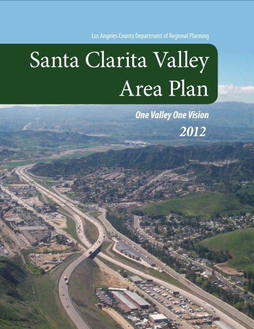
Santa Clarita Valley Area Plan
i. purpose of the santa clarita valley area plan - SCVTV.com
i. purpose of the santa clarita valley area plan - SCVTV.com
- No tags were found...

You also want an ePaper? Increase the reach of your titles
YUMPU automatically turns print PDFs into web optimized ePapers that Google loves.
Los Angeles County Department of Regional <strong>Plan</strong>ning<br />
<strong>Santa</strong> <strong>Clarita</strong> <strong>Valley</strong><br />
<strong>Area</strong> <strong>Plan</strong><br />
One <strong>Valley</strong> One Vision<br />
2012
Los Angeles County Department of Regional <strong>Plan</strong>ning<br />
<strong>Santa</strong> <strong>Clarita</strong> <strong>Valley</strong><br />
<strong>Area</strong> <strong>Plan</strong><br />
One <strong>Valley</strong> One Vision<br />
2012
ACKNOWLEDGMENTS<br />
Board of Supervisors<br />
• Zev Yaroslavsky, Chair<br />
Third District<br />
• Gloria Molina<br />
First District<br />
• Mark Ridley-Thomas<br />
Second District<br />
• Don Knabe<br />
Fourth District<br />
• Michael D. Antonovich<br />
Fifth District<br />
Regional <strong>Plan</strong>ning Commission<br />
• Curt Pedersen, Chair<br />
Fourth District<br />
• Esther L. Valadez<br />
First District<br />
• David W. Louie<br />
Second District<br />
• Harold V. Helsley<br />
Third District<br />
• Pat Modugno<br />
Fifth District<br />
Department of Regional <strong>Plan</strong>ning<br />
• Richard J. Bruckner<br />
Director of <strong>Plan</strong>ning<br />
• Dennis Slavin<br />
Chief Deputy Director<br />
• Jon Sanabria<br />
Deputy Director<br />
Community Studies North<br />
• Mitch Glaser, AICP<br />
Supervising Regional <strong>Plan</strong>ner<br />
• Thuy Hua, AICP<br />
Senior Regional <strong>Plan</strong>ner<br />
• Emma Howard<br />
Assistant Regional <strong>Plan</strong>ner<br />
Geographic Information Systems<br />
• Nick Franchino, AICP<br />
GIS Manager<br />
• Dan Hoffman<br />
Principal Regional <strong>Plan</strong>ner<br />
• Martha Selig<br />
Assistant Regional <strong>Plan</strong>ner<br />
Contributing Staff<br />
• Rob Glaser<br />
Principal Regional <strong>Plan</strong>ner<br />
Former Staff<br />
• Andy Malakates<br />
Countywide Studies<br />
• Kari Davis<br />
Countywide Studies<br />
• Marshall Adams, AICP<br />
Countywide Studies
City of <strong>Santa</strong> <strong>Clarita</strong><br />
• Jeff Hogan, AICP<br />
<strong>Plan</strong>ning Manager<br />
• Jason Smisko<br />
Senior <strong>Plan</strong>ner<br />
• Ben Jarvis<br />
Associate <strong>Plan</strong>ner<br />
• Mike Ascione<br />
Assistant <strong>Plan</strong>ner II<br />
Former Staff<br />
• Paul Brotzman<br />
Director of Community Development<br />
• Lisa Webber, AICP<br />
<strong>Plan</strong>ning Manager<br />
Consultant Team<br />
• Molly Bogh<br />
Lilburn Corporation<br />
• Caitlin Morais<br />
DM Geographics<br />
• Fred Greve<br />
Mestre Greve Associates<br />
• Daryl Zerfas<br />
Austin-Foust Associates<br />
“To enrich lives through effective and caring service.”<br />
“To improve the quality of life through innovative and<br />
resourceful physical and environmental planning, balancing<br />
individual rights and community needs.”
TABLE OF CONTENTS<br />
TABLE OF CONTENTS<br />
TABLE OF CONTENTS<br />
INTRODUCTION 1<br />
I. PURPOSE OF THE SANTA CLARITA VALLEY AREA PLAN . . . . . . . . . 2<br />
II. COMPONENTS OF THE ONE VALLEY ONE VISION PLANNING<br />
EFFORT . . . . . . . . . . . . . . . . . . . . . . . . . . . . . . . . . . . . . . . . . . . . . . . . . . . . . . . . . 3<br />
III. ENVIRONMENTAL IMPACT REPORTS . . . . . . . . . . . . . . . . . . . . . . . . . 3<br />
IV. PLANNING AREA . . . . . . . . . . . . . . . . . . . . . . . . . . . . . . . . . . . . . . . . . . . . . 3<br />
Location and Setting . . . . . . . . . . . . . . . . . . . . . . . . . . . . . . . . . . . . . . . . . . . 3<br />
Governance . . . . . . . . . . . . . . . . . . . . . . . . . . . . . . . . . . . . . . . . . . . . . . . . . . 4<br />
Historical Overview . . . . . . . . . . . . . . . . . . . . . . . . . . . . . . . . . . . . . . . . . . . . 5<br />
V. PREVIOUS PLANNING EFFORTS . . . . . . . . . . . . . . . . . . . . . . . . . . . . . . . 6<br />
1984 <strong>Santa</strong> <strong>Clarita</strong> <strong>Valley</strong> <strong>Area</strong> <strong>Plan</strong> (County of Los Angeles) . . . . . . . . . . . . 6<br />
City of <strong>Santa</strong> <strong>Clarita</strong> <strong>Plan</strong>s . . . . . . . . . . . . . . . . . . . . . . . . . . . . . . . . . . . . . . . 6<br />
Specific <strong>Plan</strong>s . . . . . . . . . . . . . . . . . . . . . . . . . . . . . . . . . . . . . . . . . . . . . . . . . 6<br />
VI. PLANNING ISSUES . . . . . . . . . . . . . . . . . . . . . . . . . . . . . . . . . . . . . . . . . . . 7<br />
VII. ORGANIZATION OF THE SANTA CLARITA VALLEY AREA PLAN 8<br />
Land Use Element . . . . . . . . . . . . . . . . . . . . . . . . . . . . . . . . . . . . . . . . . . . . . 8<br />
Circulation Element . . . . . . . . . . . . . . . . . . . . . . . . . . . . . . . . . . . . . . . . . . . . 8<br />
Conservation and Open Space Element . . . . . . . . . . . . . . . . . . . . . . . . . . . . . 8<br />
Safety Element . . . . . . . . . . . . . . . . . . . . . . . . . . . . . . . . . . . . . . . . . . . . . . . 8<br />
Noise Element . . . . . . . . . . . . . . . . . . . . . . . . . . . . . . . . . . . . . . . . . . . . . . . . 9<br />
VIII. HOW TO USE THE SANTA CLARITA VALLEY AREA PLAN . . . . . . 9<br />
IX. VISION AND GUIDING PRINCIPLES . . . . . . . . . . . . . . . . . . . . . . . . . . 10<br />
Vision . . . . . . . . . . . . . . . . . . . . . . . . . . . . . . . . . . . . . . . . . . . . . . . . . . . . . 10<br />
Guiding Principles . . . . . . . . . . . . . . . . . . . . . . . . . . . . . . . . . . . . . . . . . . . . 11<br />
LAND USE ELEMENT 15<br />
I. PURPOSE & INTENT . . . . . . . . . . . . . . . . . . . . . . . . . . . . . . . . . . . . . . . . . . 16<br />
II. RELATION OF THE LAND USE ELEMENT TO OTHER ELEMENTS OF<br />
THE AREA PLAN . . . . . . . . . . . . . . . . . . . . . . . . . . . . . . . . . . . . . . . . . . . . . . . . 17<br />
Circulation Element . . . . . . . . . . . . . . . . . . . . . . . . . . . . . . . . . . . . . . . . . . . 17<br />
Housing Element . . . . . . . . . . . . . . . . . . . . . . . . . . . . . . . . . . . . . . . . . . . . . 17<br />
iii<br />
Conservation and Open Space Element . . . . . . . . . . . . . . . . . . . . . . . . . . . . 18<br />
Noise Element . . . . . . . . . . . . . . . . . . . . . . . . . . . . . . . . . . . . . . . . . . . . . . . 18<br />
Safety Element . . . . . . . . . . . . . . . . . . . . . . . . . . . . . . . . . . . . . . . . . . . . . . 18<br />
IV. MEETING THE CHALLENGES OF REGIONAL GROWTH . . . . . . . . . 19<br />
V. VALLEY OF VILLAGES . . . . . . . . . . . . . . . . . . . . . . . . . . . . . . . . . . . . . . . . 20<br />
Newhall . . . . . . . . . . . . . . . . . . . . . . . . . . . . . . . . . . . . . . . . . . . . . . . . . . . . 21<br />
Valencia . . . . . . . . . . . . . . . . . . . . . . . . . . . . . . . . . . . . . . . . . . . . . . . . . . . . 22<br />
Saugus . . . . . . . . . . . . . . . . . . . . . . . . . . . . . . . . . . . . . . . . . . . . . . . . . . . . . 22<br />
Canyon Country . . . . . . . . . . . . . . . . . . . . . . . . . . . . . . . . . . . . . . . . . . . . . . 23<br />
Sand Canyon . . . . . . . . . . . . . . . . . . . . . . . . . . . . . . . . . . . . . . . . . . . . . . . . 23<br />
Placerita Canyon . . . . . . . . . . . . . . . . . . . . . . . . . . . . . . . . . . . . . . . . . . . . . 24<br />
Castaic . . . . . . . . . . . . . . . . . . . . . . . . . . . . . . . . . . . . . . . . . . . . . . . . . . . . . 24<br />
Val Verde . . . . . . . . . . . . . . . . . . . . . . . . . . . . . . . . . . . . . . . . . . . . . . . . . . . 25<br />
Agua Dulce . . . . . . . . . . . . . . . . . . . . . . . . . . . . . . . . . . . . . . . . . . . . . . . . . 25<br />
West Ranch (Stevenson Ranch, Sunset Pointe, Westridge, & Pico Canyon) . 25<br />
VI. SPECIFIC PLANS . . . . . . . . . . . . . . . . . . . . . . . . . . . . . . . . . . . . . . . . . . . . 26<br />
Specific <strong>Plan</strong> Process . . . . . . . . . . . . . . . . . . . . . . . . . . . . . . . . . . . . . . . . . . 26<br />
Approved Specific <strong>Plan</strong>s . . . . . . . . . . . . . . . . . . . . . . . . . . . . . . . . . . . . . . . 26<br />
Newhall Ranch . . . . . . . . . . . . . . . . . . . . . . . . . . . . . . . . . . . . . . . . . . . . . . 26<br />
Northlake . . . . . . . . . . . . . . . . . . . . . . . . . . . . . . . . . . . . . . . . . . . . . . . . . . 27<br />
Canyon Park (Fair Oaks Ranch) . . . . . . . . . . . . . . . . . . . . . . . . . . . . . . . . . . 27<br />
Whittaker Bermite Property . . . . . . . . . . . . . . . . . . . . . . . . . . . . . . . . . . . . 27<br />
Downtown Newhall Specific <strong>Plan</strong> . . . . . . . . . . . . . . . . . . . . . . . . . . . . . . . . 27<br />
Valencia Specific <strong>Plan</strong>s . . . . . . . . . . . . . . . . . . . . . . . . . . . . . . . . . . . . . . . . 28<br />
Pending and Future Specific <strong>Plan</strong>s . . . . . . . . . . . . . . . . . . . . . . . . . . . . . . . 28<br />
VII. DEMOGRAPHICS CHARACTERISTICS OF THE SANTA CLARITA<br />
VALLEY . . . . . . . . . . . . . . . . . . . . . . . . . . . . . . . . . . . . . . . . . . . . . . . . . . . . . . . . 28<br />
Past Population Trends . . . . . . . . . . . . . . . . . . . . . . . . . . . . . . . . . . . . . . . . 28<br />
Projections for Population and Households . . . . . . . . . . . . . . . . . . . . . . . . 29<br />
VIII. ECONOMIC ISSUES FOR THE SANTA CLARITA VALLEY . . . . . . . 30<br />
Economic Assets in the <strong>Valley</strong> . . . . . . . . . . . . . . . . . . . . . . . . . . . . . . . . . . . 30<br />
Employment Trends . . . . . . . . . . . . . . . . . . . . . . . . . . . . . . . . . . . . . . . . . . 31<br />
Employment Projections . . . . . . . . . . . . . . . . . . . . . . . . . . . . . . . . . . . . . . . 32<br />
Projections for Commercial and Industrial Development . . . . . . . . . . . . . . 32<br />
Jobs/Housing Balance . . . . . . . . . . . . . . . . . . . . . . . . . . . . . . . . . . . . . . . . . 33<br />
Economic Development Efforts . . . . . . . . . . . . . . . . . . . . . . . . . . . . . . . . . . 34<br />
IX. URBAN FORM, COMMUNITY DESIGN, AND CITY<br />
BEAUTIFICATION . . . . . . . . . . . . . . . . . . . . . . . . . . . . . . . . . . . . . . . . . . . . . . 35<br />
Urban Form . . . . . . . . . . . . . . . . . . . . . . . . . . . . . . . . . . . . . . . . . . . . . . . . . 36<br />
iii
Community Design . . . . . . . . . . . . . . . . . . . . . . . . . . . . . . . . . . . . . . . . . . . 37<br />
City Beautification . . . . . . . . . . . . . . . . . . . . . . . . . . . . . . . . . . . . . . . . . . . . 38<br />
X. PLANNING FOR PUBLIC HEALTH AND ENVIRONMENTAL<br />
QUALITY . . . . . . . . . . . . . . . . . . . . . . . . . . . . . . . . . . . . . . . . . . . . . . . . . . . . . . . 39<br />
XI. COORDINATION OF LAND USE PLAN WITH RESOURCES AND<br />
OTHER AGENCIES . . . . . . . . . . . . . . . . . . . . . . . . . . . . . . . . . . . . . . . . . . . . . . 40<br />
Water Availability . . . . . . . . . . . . . . . . . . . . . . . . . . . . . . . . . . . . . . . . . . . . 40<br />
Schools . . . . . . . . . . . . . . . . . . . . . . . . . . . . . . . . . . . . . . . . . . . . . . . . . . . . 41<br />
Parks . . . . . . . . . . . . . . . . . . . . . . . . . . . . . . . . . . . . . . . . . . . . . . . . . . . . . . 43<br />
Libraries . . . . . . . . . . . . . . . . . . . . . . . . . . . . . . . . . . . . . . . . . . . . . . . . . . . 44<br />
Local Government Offices . . . . . . . . . . . . . . . . . . . . . . . . . . . . . . . . . . . . . . 44<br />
Health Services . . . . . . . . . . . . . . . . . . . . . . . . . . . . . . . . . . . . . . . . . . . . . . 44<br />
Cultural Amenities . . . . . . . . . . . . . . . . . . . . . . . . . . . . . . . . . . . . . . . . . . . 45<br />
Landfills . . . . . . . . . . . . . . . . . . . . . . . . . . . . . . . . . . . . . . . . . . . . . . . . . . . . 46<br />
Mineral Resources . . . . . . . . . . . . . . . . . . . . . . . . . . . . . . . . . . . . . . . . . . . . 46<br />
Noise and Flood Hazards . . . . . . . . . . . . . . . . . . . . . . . . . . . . . . . . . . . . . . . 47<br />
Agricultural Resources . . . . . . . . . . . . . . . . . . . . . . . . . . . . . . . . . . . . . . . . 47<br />
Law Enforcement and Fire Protection . . . . . . . . . . . . . . . . . . . . . . . . . . . . . 48<br />
XII. LAND USE MAP DESIGNATIONS . . . . . . . . . . . . . . . . . . . . . . . . . . . . 49<br />
Land Use Designation Descriptions . . . . . . . . . . . . . . . . . . . . . . . . . . . . . . . 50<br />
XIII. REFERENCE TO OTHER AREA PLAN ELEMENTS . . . . . . . . . . . . . 55<br />
XIV. SUMMARY OF NEEDS FOR LAND USE PLANNING IN THE SANTA<br />
CLARITA VALLEY . . . . . . . . . . . . . . . . . . . . . . . . . . . . . . . . . . . . . . . . . . . . . . . 56<br />
XV. GOALS, OBJECTIVES, AND POLICIES . . . . . . . . . . . . . . . . . . . . . . . . 57<br />
XVI. IMPLEMENTATION OF THE LAND USE ELEMENT . . . . . . . . . . . . 69<br />
CIRCULATION ELEMENT 71<br />
I. PURPOSE & INTENT . . . . . . . . . . . . . . . . . . . . . . . . . . . . . . . . . . . . . . . . . . 72<br />
II. BACKGROUND . . . . . . . . . . . . . . . . . . . . . . . . . . . . . . . . . . . . . . . . . . . . . . . 72<br />
III. FUNDAMENTAL CONCEPTS FOR CIRCULATION PLANNING . . . 73<br />
Access and Mobility . . . . . . . . . . . . . . . . . . . . . . . . . . . . . . . . . . . . . . . . . . . 73<br />
Capacity and Connectivity . . . . . . . . . . . . . . . . . . . . . . . . . . . . . . . . . . . . . . 74<br />
Level of Service . . . . . . . . . . . . . . . . . . . . . . . . . . . . . . . . . . . . . . . . . . . . . . 74<br />
Peak Hour and Average Daily Traffic Volumes . . . . . . . . . . . . . . . . . . . . . . . 75<br />
Intersection Capacity . . . . . . . . . . . . . . . . . . . . . . . . . . . . . . . . . . . . . . . . . 75<br />
Air Quality and Safety Issues . . . . . . . . . . . . . . . . . . . . . . . . . . . . . . . . . . . . 75<br />
IV. CONGESTION MANAGEMENT . . . . . . . . . . . . . . . . . . . . . . . . . . . . . . . . 76<br />
V. EXISTING ROADWAY SYSTEM WITHIN THE SANTA CLARITA<br />
VALLEY . . . . . . . . . . . . . . . . . . . . . . . . . . . . . . . . . . . . . . . . . . . . . . . . . . . . . . . . 77<br />
Regional Access . . . . . . . . . . . . . . . . . . . . . . . . . . . . . . . . . . . . . . . . . . . . . . 77<br />
Streets and Highways . . . . . . . . . . . . . . . . . . . . . . . . . . . . . . . . . . . . . . . . . 77<br />
Arterial Highways and Collectors in the <strong>Santa</strong> <strong>Clarita</strong> <strong>Valley</strong> . . . . . . . . . . . 78<br />
Cross-<strong>Valley</strong> Connector . . . . . . . . . . . . . . . . . . . . . . . . . . . . . . . . . . . . . . . . 79<br />
Major Roadway Improvements Recently Completed or Underway . . . . . . . 80<br />
Peak Hour Traffic Conditions . . . . . . . . . . . . . . . . . . . . . . . . . . . . . . . . . . . . 80<br />
Transportation Management System . . . . . . . . . . . . . . . . . . . . . . . . . . . . . 80<br />
Neighborhood Traffic Management . . . . . . . . . . . . . . . . . . . . . . . . . . . . . . 81<br />
Street Maintenance . . . . . . . . . . . . . . . . . . . . . . . . . . . . . . . . . . . . . . . . . . . 81<br />
VI. METHODOLOGY FOR TRAFFIC ANALYSIS . . . . . . . . . . . . . . . . . . . . 81<br />
VII. RECOMMENDATIONS FOR STREET AND HIGHWAY SYSTEM . 82<br />
Level of Service Standard . . . . . . . . . . . . . . . . . . . . . . . . . . . . . . . . . . . . . . 82<br />
Revised Roadway Designations . . . . . . . . . . . . . . . . . . . . . . . . . . . . . . . . . . 82<br />
Standard Cross Sections . . . . . . . . . . . . . . . . . . . . . . . . . . . . . . . . . . . . . . . 91<br />
Truck Route <strong>Plan</strong> . . . . . . . . . . . . . . . . . . . . . . . . . . . . . . . . . . . . . . . . . . . . . 98<br />
Additional Access for Castaic . . . . . . . . . . . . . . . . . . . . . . . . . . . . . . . . . . . . 98<br />
San Francisquito Canyon Road Extension . . . . . . . . . . . . . . . . . . . . . . . . . . 98<br />
VIII. CONSTRAINTS AND OPPORTUNITIES FOR IMPROVING<br />
ROADWAYS . . . . . . . . . . . . . . . . . . . . . . . . . . . . . . . . . . . . . . . . . . . . . . . . . . . . 99<br />
Funding for Roadways . . . . . . . . . . . . . . . . . . . . . . . . . . . . . . . . . . . . . . . . . 99<br />
Travel Demand Management . . . . . . . . . . . . . . . . . . . . . . . . . . . . . . . . . . . 99<br />
Parking Management . . . . . . . . . . . . . . . . . . . . . . . . . . . . . . . . . . . . . . . . 100<br />
Intersection Improvements . . . . . . . . . . . . . . . . . . . . . . . . . . . . . . . . . . . 100<br />
Land Use Strategies . . . . . . . . . . . . . . . . . . . . . . . . . . . . . . . . . . . . . . . . . . 100<br />
Congestion Relief . . . . . . . . . . . . . . . . . . . . . . . . . . . . . . . . . . . . . . . . . . . 100<br />
IX. RAIL SERVICE . . . . . . . . . . . . . . . . . . . . . . . . . . . . . . . . . . . . . . . . . . . . . . 101<br />
Rail Freight Service . . . . . . . . . . . . . . . . . . . . . . . . . . . . . . . . . . . . . . . . . . 101<br />
Metrolink Service . . . . . . . . . . . . . . . . . . . . . . . . . . . . . . . . . . . . . . . . . . . 101<br />
Amtrak California . . . . . . . . . . . . . . . . . . . . . . . . . . . . . . . . . . . . . . . . . . . 102<br />
High Speed Rail Development . . . . . . . . . . . . . . . . . . . . . . . . . . . . . . . . . . 102<br />
X. AIR SERVICE . . . . . . . . . . . . . . . . . . . . . . . . . . . . . . . . . . . . . . . . . . . . . . . . 103<br />
XI. PUBLIC TRANSIT AND OTHER TRANSPORTATION SERVICES 103<br />
City of <strong>Santa</strong> <strong>Clarita</strong> Transit . . . . . . . . . . . . . . . . . . . . . . . . . . . . . . . . . . . . 103<br />
Commuter Transit Service . . . . . . . . . . . . . . . . . . . . . . . . . . . . . . . . . . . . . 105<br />
Special Transit Services . . . . . . . . . . . . . . . . . . . . . . . . . . . . . . . . . . . . . . . 105<br />
Bus Stop Improvement Program . . . . . . . . . . . . . . . . . . . . . . . . . . . . . . . . 105<br />
Park-and-ride Lots . . . . . . . . . . . . . . . . . . . . . . . . . . . . . . . . . . . . . . . . . . 105<br />
School Bus Transportation . . . . . . . . . . . . . . . . . . . . . . . . . . . . . . . . . . . . 106<br />
Taxi Service . . . . . . . . . . . . . . . . . . . . . . . . . . . . . . . . . . . . . . . . . . . . . . . . 106<br />
XII. NON-MOTORIZED TRAVEL MODES . . . . . . . . . . . . . . . . . . . . . . . . . 106<br />
<strong>Plan</strong>ning for Bikeways . . . . . . . . . . . . . . . . . . . . . . . . . . . . . . . . . . . . . . . . 106<br />
Regional Bikeway <strong>Plan</strong>ning . . . . . . . . . . . . . . . . . . . . . . . . . . . . . . . . . . . . 107<br />
City of <strong>Santa</strong> <strong>Clarita</strong> Bikeway <strong>Plan</strong>ning . . . . . . . . . . . . . . . . . . . . . . . . . . . 107<br />
Bicycle Parking and Support Facilities . . . . . . . . . . . . . . . . . . . . . . . . . . . . 108<br />
Pedestrian Circulation System . . . . . . . . . . . . . . . . . . . . . . . . . . . . . . . . . 108<br />
Hiking Trails . . . . . . . . . . . . . . . . . . . . . . . . . . . . . . . . . . . . . . . . . . . . . . . . 110<br />
XIII. HEALTHY STREETS FOR WALKABLE COMMUNITIES . . . . . . . 110<br />
XIV. CIRCULATION SYSTEMS, CARBON EMISSIONS, AND GLOBAL<br />
CLIMATE CHANGE . . . . . . . . . . . . . . . . . . . . . . . . . . . . . . . . . . . . . . . . . . . . . 112<br />
XV. SUMMARY OF CIRCULATION NEEDS . . . . . . . . . . . . . . . . . . . . . . . 113<br />
XVI. GOALS, OBJECTIVES, AND POLICIES . . . . . . . . . . . . . . . . . . . . . . 114<br />
XVII. IMPLEMENTATION OF THE CIRCULATION ELEMENT . . . . . . 123<br />
CONSERVATION AND OPEN SPACE ELEMENT 125<br />
I. PURPOSE & INTENT . . . . . . . . . . . . . . . . . . . . . . . . . . . . . . . . . . . . . . . . . 126<br />
II. BACKGROUND . . . . . . . . . . . . . . . . . . . . . . . . . . . . . . . . . . . . . . . . . . . . . . 126<br />
Consistency with Other <strong>Area</strong> <strong>Plan</strong> Elements . . . . . . . . . . . . . . . . . . . . . . . 126<br />
Resource Maps . . . . . . . . . . . . . . . . . . . . . . . . . . . . . . . . . . . . . . . . . . . . . 126<br />
Organization of the Element . . . . . . . . . . . . . . . . . . . . . . . . . . . . . . . . . . . 127<br />
III. PRIOR PLANNING EFFORTS FOR CONSERVATION & OPEN<br />
SPACE . . . . . . . . . . . . . . . . . . . . . . . . . . . . . . . . . . . . . . . . . . . . . . . . . . . . . . . . . 127<br />
City <strong>Plan</strong>ning for Conservation & Open Space . . . . . . . . . . . . . . . . . . . . . . 127<br />
County <strong>Plan</strong>ning for Conservation & Open Space . . . . . . . . . . . . . . . . . . . 127<br />
IV. ENVIRONMENTAL SUSTAINABILITY . . . . . . . . . . . . . . . . . . . . . . . . 127<br />
V. SOILS & GEOLOGIC RESOURCES . . . . . . . . . . . . . . . . . . . . . . . . . . . . 129<br />
Soils & Geologic Resource Issues . . . . . . . . . . . . . . . . . . . . . . . . . . . . . . . . 129<br />
iv
Soil Resources & Conservation . . . . . . . . . . . . . . . . . . . . . . . . . . . . . . . . . 129<br />
Hillside Development & Ridgeline Protection . . . . . . . . . . . . . . . . . . . . . . 129<br />
Mineral Resources . . . . . . . . . . . . . . . . . . . . . . . . . . . . . . . . . . . . . . . . . . . 130<br />
VI. WATER RESOURCES . . . . . . . . . . . . . . . . . . . . . . . . . . . . . . . . . . . . . . . . 131<br />
Surface Water Resources . . . . . . . . . . . . . . . . . . . . . . . . . . . . . . . . . . . . . . 131<br />
Streams . . . . . . . . . . . . . . . . . . . . . . . . . . . . . . . . . . . . . . . . . . . . . . . . . . . 131<br />
Groundwater Resources . . . . . . . . . . . . . . . . . . . . . . . . . . . . . . . . . . . . . . 132<br />
Water Supply . . . . . . . . . . . . . . . . . . . . . . . . . . . . . . . . . . . . . . . . . . . . . . . 133<br />
Sacramento-San Joaquin Delta Issues Affecting Water Supply . . . . . . . . . 134<br />
Water Conservation . . . . . . . . . . . . . . . . . . . . . . . . . . . . . . . . . . . . . . . . . . 137<br />
Water Recycling . . . . . . . . . . . . . . . . . . . . . . . . . . . . . . . . . . . . . . . . . . . . 138<br />
AB 1881 . . . . . . . . . . . . . . . . . . . . . . . . . . . . . . . . . . . . . . . . . . . . . . . . . . . 139<br />
Water Quality . . . . . . . . . . . . . . . . . . . . . . . . . . . . . . . . . . . . . . . . . . . . . . 139<br />
Low Impact Development . . . . . . . . . . . . . . . . . . . . . . . . . . . . . . . . . . . . . 140<br />
VII. BIOLOGICAL RESOURCES . . . . . . . . . . . . . . . . . . . . . . . . . . . . . . . . . . 141<br />
Biological Setting . . . . . . . . . . . . . . . . . . . . . . . . . . . . . . . . . . . . . . . . . . . 141<br />
Sensitive Species . . . . . . . . . . . . . . . . . . . . . . . . . . . . . . . . . . . . . . . . . . . . 142<br />
Significant Ecological <strong>Area</strong>s . . . . . . . . . . . . . . . . . . . . . . . . . . . . . . . . . . . 143<br />
Wildlife Corridors . . . . . . . . . . . . . . . . . . . . . . . . . . . . . . . . . . . . . . . . . . . 144<br />
National Forest Lands . . . . . . . . . . . . . . . . . . . . . . . . . . . . . . . . . . . . . . . . 145<br />
Urban Forestry Program . . . . . . . . . . . . . . . . . . . . . . . . . . . . . . . . . . . . . . 146<br />
Development Impacts on Biological Resources . . . . . . . . . . . . . . . . . . . . . 146<br />
VII. CULTURAL & HISTORICAL RESOURCES . . . . . . . . . . . . . . . . . . . . 147<br />
Historical Overview of the <strong>Santa</strong> <strong>Clarita</strong> <strong>Valley</strong> . . . . . . . . . . . . . . . . . . . . . 147<br />
Identification of Historical Sites . . . . . . . . . . . . . . . . . . . . . . . . . . . . . . . . 150<br />
Historic Preservation Efforts . . . . . . . . . . . . . . . . . . . . . . . . . . . . . . . . . . . 150<br />
VIII. SCENIC RESOURCES . . . . . . . . . . . . . . . . . . . . . . . . . . . . . . . . . . . . . . 156<br />
The Value of Scenic Resources . . . . . . . . . . . . . . . . . . . . . . . . . . . . . . . . . . 156<br />
Scenic Mountains and Canyons . . . . . . . . . . . . . . . . . . . . . . . . . . . . . . . . . 156<br />
Scenic Woodlands . . . . . . . . . . . . . . . . . . . . . . . . . . . . . . . . . . . . . . . . . . . 158<br />
Scenic Water Bodies . . . . . . . . . . . . . . . . . . . . . . . . . . . . . . . . . . . . . . . . . 158<br />
Vasquez Rocks . . . . . . . . . . . . . . . . . . . . . . . . . . . . . . . . . . . . . . . . . . . . . . 158<br />
Impacts of Development on Scenic Views . . . . . . . . . . . . . . . . . . . . . . . . . 158<br />
IX. AIR RESOURCES . . . . . . . . . . . . . . . . . . . . . . . . . . . . . . . . . . . . . . . . . . . 158<br />
X. CLIMATE CHANGE & ENERGY CONSERVATION . . . . . . . . . . . . . . . 160<br />
Background & Legal Requirements . . . . . . . . . . . . . . . . . . . . . . . . . . . . . . 160<br />
Actions to Address Climate Change in the <strong>Santa</strong> <strong>Clarita</strong> <strong>Valley</strong> . . . . . . . . . 163<br />
Additional Programs & Policies to Address Climate Change . . . . . . . . . . . 163<br />
XI. PARK & RECREATION RESOURCES & FACILITIES . . . . . . . . . . . . 164<br />
County & State Parks . . . . . . . . . . . . . . . . . . . . . . . . . . . . . . . . . . . . . . . . . 164<br />
City Parks & Recreation <strong>Plan</strong>ning . . . . . . . . . . . . . . . . . . . . . . . . . . . . . . . 165<br />
Joint Park <strong>Plan</strong>ning Issues . . . . . . . . . . . . . . . . . . . . . . . . . . . . . . . . . . . . . 166<br />
XII. OPEN SPACE RESOURCES . . . . . . . . . . . . . . . . . . . . . . . . . . . . . . . . . . 169<br />
Legal Requirements for Open Space Preservation . . . . . . . . . . . . . . . . . . 169<br />
Open Space Designations in the <strong>Santa</strong> <strong>Clarita</strong> <strong>Valley</strong> . . . . . . . . . . . . . . . . 170<br />
Open Space Preservation Efforts . . . . . . . . . . . . . . . . . . . . . . . . . . . . . . . . 170<br />
Future Directions for Open Space . . . . . . . . . . . . . . . . . . . . . . . . . . . . . . . 172<br />
XIII. RECREATIONAL TRAILS . . . . . . . . . . . . . . . . . . . . . . . . . . . . . . . . . . . 172<br />
XIV. SUMMARY OF CONSERVATION AND OPEN SPACE NEEDS IN THE<br />
SANTA CLARITA VALLEY . . . . . . . . . . . . . . . . . . . . . . . . . . . . . . . . . . . . . . . 173<br />
XV. GOALS, OBJECTIVES, AND POLICIES . . . . . . . . . . . . . . . . . . . . . . . 175<br />
XVI. IMPLEMENTATION OF THE CONSERVATION AND OPEN SPACE<br />
ELEMENT . . . . . . . . . . . . . . . . . . . . . . . . . . . . . . . . . . . . . . . . . . . . . . . . . . . . . 190<br />
SAFETY ELEMENT 193<br />
I. PURPOSE & INTENT . . . . . . . . . . . . . . . . . . . . . . . . . . . . . . . . . . . . . . . . . 194<br />
II. BACKGROUND . . . . . . . . . . . . . . . . . . . . . . . . . . . . . . . . . . . . . . . . . . . . . . 194<br />
III. SEISMIC & GEOLOGICAL HAZARDS . . . . . . . . . . . . . . . . . . . . . . . . . 194<br />
Earthquakes & Fault Zones Affecting the <strong>Plan</strong>ning <strong>Area</strong> . . . . . . . . . . . . . 194<br />
Impacts of Earthquakes . . . . . . . . . . . . . . . . . . . . . . . . . . . . . . . . . . . . . . . 198<br />
Seismic Design Requirements . . . . . . . . . . . . . . . . . . . . . . . . . . . . . . . . . . 199<br />
Landslides . . . . . . . . . . . . . . . . . . . . . . . . . . . . . . . . . . . . . . . . . . . . . . . . . 199<br />
Subsidence . . . . . . . . . . . . . . . . . . . . . . . . . . . . . . . . . . . . . . . . . . . . . . . . 200<br />
IV. FLOOD HAZARDS . . . . . . . . . . . . . . . . . . . . . . . . . . . . . . . . . . . . . . . . . . 200<br />
Surface Water Drainage Patterns . . . . . . . . . . . . . . . . . . . . . . . . . . . . . . . 200<br />
Flood Control Regulations . . . . . . . . . . . . . . . . . . . . . . . . . . . . . . . . . . . . . 202<br />
Dam Failure . . . . . . . . . . . . . . . . . . . . . . . . . . . . . . . . . . . . . . . . . . . . . . . . 202<br />
V. FIRE HAZARD . . . . . . . . . . . . . . . . . . . . . . . . . . . . . . . . . . . . . . . . . . . . . . . 203<br />
Fire Protection Services . . . . . . . . . . . . . . . . . . . . . . . . . . . . . . . . . . . . . . . 203<br />
Wildland Fire Protection . . . . . . . . . . . . . . . . . . . . . . . . . . . . . . . . . . . . . . 204<br />
VI. SEVERE WEATHER CONDITIONS . . . . . . . . . . . . . . . . . . . . . . . . . . . . 206<br />
VII. HAZARDOUS MATERIALS . . . . . . . . . . . . . . . . . . . . . . . . . . . . . . . . . 206<br />
VIII. EMERGENCY PREPAREDNESS AND RESPONSE . . . . . . . . . . . . 207<br />
Emergency Preparedness <strong>Plan</strong>s . . . . . . . . . . . . . . . . . . . . . . . . . . . . . . . . 207<br />
Community Preparedness and Training . . . . . . . . . . . . . . . . . . . . . . . . . . 209<br />
Emergency Access . . . . . . . . . . . . . . . . . . . . . . . . . . . . . . . . . . . . . . . . . . . 210<br />
IX. LAW ENFORCEMENT AND CRIME PREVENTION . . . . . . . . . . . . . 211<br />
Police Protection . . . . . . . . . . . . . . . . . . . . . . . . . . . . . . . . . . . . . . . . . . . . 211<br />
Detention Facilities . . . . . . . . . . . . . . . . . . . . . . . . . . . . . . . . . . . . . . . . . . 212<br />
Crime Prevention Through Environmental Design . . . . . . . . . . . . . . . . . . 212<br />
X. TERRORISM . . . . . . . . . . . . . . . . . . . . . . . . . . . . . . . . . . . . . . . . . . . . . . . . 213<br />
Bioterrorism <strong>Plan</strong>ning . . . . . . . . . . . . . . . . . . . . . . . . . . . . . . . . . . . . . . . . 215<br />
Emergency Medical Services . . . . . . . . . . . . . . . . . . . . . . . . . . . . . . . . . . 216<br />
XI. ACCIDENT PREVENTION . . . . . . . . . . . . . . . . . . . . . . . . . . . . . . . . . . . . 216<br />
XII. SUMMARY OF SAFETY PLANNING NEEDS IN THE SANTA CLARITA<br />
VALLEY . . . . . . . . . . . . . . . . . . . . . . . . . . . . . . . . . . . . . . . . . . . . . . . . . . . . . . . 216<br />
XII. GOALS, OBJECTIVES, AND POLICIES . . . . . . . . . . . . . . . . . . . . . . . 218<br />
XIV. IMPLEMENTATION OF THE SAFETY ELEMENT . . . . . . . . . . . . . 222<br />
NOISE ELEMENT 225<br />
I. PURPOSE & INTENT . . . . . . . . . . . . . . . . . . . . . . . . . . . . . . . . . . . . . . . . 226<br />
II. BACKGROUND . . . . . . . . . . . . . . . . . . . . . . . . . . . . . . . . . . . . . . . . . . . . . 226<br />
III. FUNDAMENTAL CONCEPTS FOR NOISE ANALYSIS . . . . . . . . . . 227<br />
Sound Level and Frequency . . . . . . . . . . . . . . . . . . . . . . . . . . . . . . . . . . . 227<br />
Propagation of Noise . . . . . . . . . . . . . . . . . . . . . . . . . . . . . . . . . . . . . . . . . 227<br />
Duration of Sound . . . . . . . . . . . . . . . . . . . . . . . . . . . . . . . . . . . . . . . . . . 228<br />
Change in Noise . . . . . . . . . . . . . . . . . . . . . . . . . . . . . . . . . . . . . . . . . . . . . 228<br />
Masking Effect . . . . . . . . . . . . . . . . . . . . . . . . . . . . . . . . . . . . . . . . . . . . . . 228<br />
Factors Influencing Human Response to Sound . . . . . . . . . . . . . . . . . . . . 229<br />
Sound Rating Scales . . . . . . . . . . . . . . . . . . . . . . . . . . . . . . . . . . . . . . . . . 229<br />
Single Event Metrics . . . . . . . . . . . . . . . . . . . . . . . . . . . . . . . . . . . . . . . . . 229<br />
Cumulative Metrics . . . . . . . . . . . . . . . . . . . . . . . . . . . . . . . . . . . . . . . . . . 230<br />
IV. HEALTH EFFECTS OF NOISE . . . . . . . . . . . . . . . . . . . . . . . . . . . . . . . . 231<br />
Hearing Loss . . . . . . . . . . . . . . . . . . . . . . . . . . . . . . . . . . . . . . . . . . . . . . . 232<br />
v
Communication Interference . . . . . . . . . . . . . . . . . . . . . . . . . . . . . . . . . . 232<br />
Sleep Interference . . . . . . . . . . . . . . . . . . . . . . . . . . . . . . . . . . . . . . . . . . . 232<br />
Physiological Responses to Noise . . . . . . . . . . . . . . . . . . . . . . . . . . . . . . . 232<br />
Annoyance . . . . . . . . . . . . . . . . . . . . . . . . . . . . . . . . . . . . . . . . . . . . . . . . 232<br />
School Room Effects . . . . . . . . . . . . . . . . . . . . . . . . . . . . . . . . . . . . . . . . 233<br />
V. ANALYSIS OF EXISTING AND FUTURE NOISE ENVIRONMENT IN<br />
THE PLANNING AREA . . . . . . . . . . . . . . . . . . . . . . . . . . . . . . . . . . . . . . . . . 233<br />
Methodology . . . . . . . . . . . . . . . . . . . . . . . . . . . . . . . . . . . . . . . . . . . . . . . 233<br />
Results . . . . . . . . . . . . . . . . . . . . . . . . . . . . . . . . . . . . . . . . . . . . . . . . . . . . 234<br />
Noise Contour Maps . . . . . . . . . . . . . . . . . . . . . . . . . . . . . . . . . . . . . . . . . 234<br />
Projected Noise Impacts from City General <strong>Plan</strong> and County <strong>Area</strong> <strong>Plan</strong><br />
Buildout . . . . . . . . . . . . . . . . . . . . . . . . . . . . . . . . . . . . . . . . . . . . . . . . . . 235<br />
VI. OTHER NOISE ISSUES IN THE PLANNING AREA . . . . . . . . . . . . . 238<br />
High-Speed Rail Line . . . . . . . . . . . . . . . . . . . . . . . . . . . . . . . . . . . . . . . . . 238<br />
High Density Residential Development Adjacent to Railroad . . . . . . . . . . 238<br />
Mixed-Use Developments that Combine Residential and Non-Residential<br />
Uses . . . . . . . . . . . . . . . . . . . . . . . . . . . . . . . . . . . . . . . . . . . . . . . . . . . . . . 239<br />
Agua Dulce Airport . . . . . . . . . . . . . . . . . . . . . . . . . . . . . . . . . . . . . . . . . . 239<br />
Six Flags Magic Mountain Theme Park . . . . . . . . . . . . . . . . . . . . . . . . . . . 239<br />
Special Events . . . . . . . . . . . . . . . . . . . . . . . . . . . . . . . . . . . . . . . . . . . . . . 240<br />
Emergency Vehicles . . . . . . . . . . . . . . . . . . . . . . . . . . . . . . . . . . . . . . . . . 240<br />
VII. PLANNING STRATEGIES TO MINIMIZE NOISE IMPACTS . . . 240<br />
VIII. SUMMARY OF NOISE PLANNING ISSUES . . . . . . . . . . . . . . . . . 241<br />
IX. GOALS, OBJECTIVES, AND POLICIES . . . . . . . . . . . . . . . . . . . . . . . 242<br />
X. IMPLEMENTATION OF THE NOISE ELEMENT . . . . . . . . . . . . . . . . 244<br />
APPENDIX I 245<br />
I. SIGNIFICANT ECOLOGICAL AREA STUDIES . . . . . . . . . . . . . . . . . . . 246<br />
II. CRUZAN MESA VERNAL POOLS . . . . . . . . . . . . . . . . . . . . . . . . . . . . . 248<br />
General . . . . . . . . . . . . . . . . . . . . . . . . . . . . . . . . . . . . . . . . . . . . . . . . . . . 248<br />
Description . . . . . . . . . . . . . . . . . . . . . . . . . . . . . . . . . . . . . . . . . . . . . . . . 248<br />
Vegetation . . . . . . . . . . . . . . . . . . . . . . . . . . . . . . . . . . . . . . . . . . . . . . . . 249<br />
Wildlife . . . . . . . . . . . . . . . . . . . . . . . . . . . . . . . . . . . . . . . . . . . . . . . . . . . 249<br />
Wildlife Movement . . . . . . . . . . . . . . . . . . . . . . . . . . . . . . . . . . . . . . . . . . 250<br />
Sensitive Biological Resources . . . . . . . . . . . . . . . . . . . . . . . . . . . . . . . . . 250<br />
Sensitive <strong>Plan</strong>t Communities/Habitats . . . . . . . . . . . . . . . . . . . . . . . . . . . 251<br />
Sensitive Species . . . . . . . . . . . . . . . . . . . . . . . . . . . . . . . . . . . . . . . . . . . . 251<br />
III. SANTA CLARA RIVER . . . . . . . . . . . . . . . . . . . . . . . . . . . . . . . . . . . . . . 251<br />
General . . . . . . . . . . . . . . . . . . . . . . . . . . . . . . . . . . . . . . . . . . . . . . . . . . . 251<br />
Description . . . . . . . . . . . . . . . . . . . . . . . . . . . . . . . . . . . . . . . . . . . . . . . . 251<br />
Vegetation . . . . . . . . . . . . . . . . . . . . . . . . . . . . . . . . . . . . . . . . . . . . . . . . 252<br />
Wildlife . . . . . . . . . . . . . . . . . . . . . . . . . . . . . . . . . . . . . . . . . . . . . . . . . . . 255<br />
Wildlife Movement . . . . . . . . . . . . . . . . . . . . . . . . . . . . . . . . . . . . . . . . . . 256<br />
Sensitive Biological Resources . . . . . . . . . . . . . . . . . . . . . . . . . . . . . . . . . 256<br />
Sensitive <strong>Plan</strong>t Communities/Habitats . . . . . . . . . . . . . . . . . . . . . . . . . . . 256<br />
Sensitive Species . . . . . . . . . . . . . . . . . . . . . . . . . . . . . . . . . . . . . . . . . . . . 256<br />
IV. SANTA FELICIA . . . . . . . . . . . . . . . . . . . . . . . . . . . . . . . . . . . . . . . . . . . . 257<br />
General . . . . . . . . . . . . . . . . . . . . . . . . . . . . . . . . . . . . . . . . . . . . . . . . . . . 257<br />
Description . . . . . . . . . . . . . . . . . . . . . . . . . . . . . . . . . . . . . . . . . . . . . . . . 257<br />
Vegetation . . . . . . . . . . . . . . . . . . . . . . . . . . . . . . . . . . . . . . . . . . . . . . . . 257<br />
Wildlife . . . . . . . . . . . . . . . . . . . . . . . . . . . . . . . . . . . . . . . . . . . . . . . . . . . 258<br />
Wildlife Movement . . . . . . . . . . . . . . . . . . . . . . . . . . . . . . . . . . . . . . . . . . 258<br />
Sensitive Biological Resources . . . . . . . . . . . . . . . . . . . . . . . . . . . . . . . . . 258<br />
Sensitive <strong>Plan</strong>t Communities/Habitats . . . . . . . . . . . . . . . . . . . . . . . . . . . 258<br />
Sensitive Species . . . . . . . . . . . . . . . . . . . . . . . . . . . . . . . . . . . . . . . . . . . . 259<br />
V. SANTA SUSANA MOUNTAINS/SIMI HILLS . . . . . . . . . . . . . . . . . . . 259<br />
General . . . . . . . . . . . . . . . . . . . . . . . . . . . . . . . . . . . . . . . . . . . . . . . . . . . 259<br />
Description . . . . . . . . . . . . . . . . . . . . . . . . . . . . . . . . . . . . . . . . . . . . . . . . 259<br />
Vegetation . . . . . . . . . . . . . . . . . . . . . . . . . . . . . . . . . . . . . . . . . . . . . . . . 259<br />
Wildlife . . . . . . . . . . . . . . . . . . . . . . . . . . . . . . . . . . . . . . . . . . . . . . . . . . . 261<br />
Wildlife Movement . . . . . . . . . . . . . . . . . . . . . . . . . . . . . . . . . . . . . . . . . . 261<br />
Sensitive Biological Resources . . . . . . . . . . . . . . . . . . . . . . . . . . . . . . . . . 261<br />
Sensitive <strong>Plan</strong>t Communities/Habitats . . . . . . . . . . . . . . . . . . . . . . . . . . . 262<br />
Sensitive Species . . . . . . . . . . . . . . . . . . . . . . . . . . . . . . . . . . . . . . . . . . . . 262<br />
VI. VALLEY OAKS SAVANNAH . . . . . . . . . . . . . . . . . . . . . . . . . . . . . . . . . 262<br />
General . . . . . . . . . . . . . . . . . . . . . . . . . . . . . . . . . . . . . . . . . . . . . . . . . . . 262<br />
Description . . . . . . . . . . . . . . . . . . . . . . . . . . . . . . . . . . . . . . . . . . . . . . . . 262<br />
Vegetation . . . . . . . . . . . . . . . . . . . . . . . . . . . . . . . . . . . . . . . . . . . . . . . . 262<br />
Wildlife . . . . . . . . . . . . . . . . . . . . . . . . . . . . . . . . . . . . . . . . . . . . . . . . . . . 263<br />
Wildlife Movement . . . . . . . . . . . . . . . . . . . . . . . . . . . . . . . . . . . . . . . . . . 263<br />
Sensitive Biological Resources . . . . . . . . . . . . . . . . . . . . . . . . . . . . . . . . . 263<br />
Sensitive <strong>Plan</strong>t Communities/Habitats . . . . . . . . . . . . . . . . . . . . . . . . . . . 263<br />
Sensitive Species . . . . . . . . . . . . . . . . . . . . . . . . . . . . . . . . . . . . . . . . . . . . 264<br />
APPENDIX II 265<br />
LIST OF TABLES<br />
Table I-1: LJurisdictional <strong>Area</strong>s in the <strong>Santa</strong> <strong>Clarita</strong> <strong>Valley</strong> <strong>Plan</strong>ning <strong>Area</strong> . . . . . . . . 4<br />
Table I-2: Major Adopted Specific <strong>Plan</strong>s in the <strong>Plan</strong>ning <strong>Area</strong>. . . . . . . . . . . . . . . . . 7<br />
Table L-1: Farmland Designations in the <strong>Plan</strong>ning <strong>Area</strong> . . . . . . . . . . . . . . . . . . . . . . 48<br />
Table C-1: Level of Service Standards for Urban Streets . . . . . . . . . . . . . . . . . . . . . . 75<br />
Table C-2: Highway <strong>Plan</strong> Roadways in the <strong>Plan</strong>ning <strong>Area</strong> . . . . . . . . . . . . . . . . . . . . . 84<br />
Table C-3: Roadway Improvements Needed for Build-Out of Highway <strong>Plan</strong>. . . . . . . 86<br />
Table C-4: Gaps in the Inter-Jurisdictional Bikeway Network - <strong>Santa</strong> <strong>Clarita</strong> <strong>Valley</strong> 106<br />
Table CO-1: Historical Resources in the <strong>Santa</strong> <strong>Clarita</strong> <strong>Valley</strong> <strong>Plan</strong>ning <strong>Area</strong> . . . . . .152<br />
Table CO-2: Inventory of Park and Open Space Lands . . . . . . . . . . . . . . . . . . . . . . .167<br />
Table S-1: Richter Scale of Magnitude for Earthquakes . . . . . . . . . . . . . . . . . . . . .195<br />
Table S-2: Historic Earthquakes Affecting the <strong>Santa</strong> <strong>Clarita</strong> <strong>Valley</strong> <strong>Plan</strong>ning <strong>Area</strong> from<br />
1855-1999 . . . . . . . . . . . . . . . . . . . . . . . . . . . . . . . . . . . . . . . . . . . . . . . . . . . . . . . .198<br />
Table N-1: Factors Affecting Human Response to Noise . . . . . . . . . . . . . . . . . . 229<br />
Table N-2: Projected Noise Increases Along roadway Links . . . . . . . . . . . . . . 237<br />
TABLE A1-1: Los Angeles County SEA Update Study Criteria . . . . . . . . . . . . . . . . 247<br />
LIST OF FIGURES<br />
Figure C-3: Standard Roadway Cross Sections . . . . . . . . . . . . . . . . . . . . . . . . . . . . . 91<br />
Figure N-1: Typical Sound Levels in A-Weighted Decibels . . . . . . . . . . . . . . . 228<br />
Figure N-2: Single & Cumulative Noise Metric Definitions . . . . . . . . . . . . . . . 230<br />
Figure N-3: Examples of Typical Outdoor CNEL Levels . . . . . . . . . . . . . . . . . . 231<br />
vi
Chapter 1<br />
INTRODUCTION<br />
TABLE OF CONTENTS<br />
I. PURPOSE OF THE SANTA CLARITA VALLEY AREA PLAN . . . . . . . . . 2<br />
II. COMPONENTS OF THE ONE VALLEY ONE VISION PLANNING<br />
EFFORT . . . . . . . . . . . . . . . . . . . . . . . . . . . . . . . . . . . . . . . . . . . . . . . . . . . . . . . . . 3<br />
III. ENVIRONMENTAL IMPACT REPORTS . . . . . . . . . . . . . . . . . . . . . . . . . 3<br />
IV. PLANNING AREA . . . . . . . . . . . . . . . . . . . . . . . . . . . . . . . . . . . . . . . . . . . . . 3<br />
Location and Setting . . . . . . . . . . . . . . . . . . . . . . . . . . . . . . . . . . . . . . . . . . . 3<br />
Governance . . . . . . . . . . . . . . . . . . . . . . . . . . . . . . . . . . . . . . . . . . . . . . . . . . 4<br />
Historical Overview . . . . . . . . . . . . . . . . . . . . . . . . . . . . . . . . . . . . . . . . . . . . 5<br />
V. PREVIOUS PLANNING EFFORTS . . . . . . . . . . . . . . . . . . . . . . . . . . . . . . . 6<br />
1984 <strong>Santa</strong> <strong>Clarita</strong> <strong>Valley</strong> <strong>Area</strong> <strong>Plan</strong> (County of Los Angeles) . . . . . . . . . . . . 6<br />
City of <strong>Santa</strong> <strong>Clarita</strong> <strong>Plan</strong>s . . . . . . . . . . . . . . . . . . . . . . . . . . . . . . . . . . . . . . . 6<br />
Specific <strong>Plan</strong>s . . . . . . . . . . . . . . . . . . . . . . . . . . . . . . . . . . . . . . . . . . . . . . . . . 6<br />
VI. PLANNING ISSUES . . . . . . . . . . . . . . . . . . . . . . . . . . . . . . . . . . . . . . . . . . . 7<br />
VII. ORGANIZATION OF THE SANTA CLARITA VALLEY AREA PLAN 8<br />
Land Use Element . . . . . . . . . . . . . . . . . . . . . . . . . . . . . . . . . . . . . . . . . . . . . 8<br />
Circulation Element . . . . . . . . . . . . . . . . . . . . . . . . . . . . . . . . . . . . . . . . . . . . 8<br />
Conservation and Open Space Element . . . . . . . . . . . . . . . . . . . . . . . . . . . . . 8<br />
Safety Element . . . . . . . . . . . . . . . . . . . . . . . . . . . . . . . . . . . . . . . . . . . . . . . 8<br />
Noise Element . . . . . . . . . . . . . . . . . . . . . . . . . . . . . . . . . . . . . . . . . . . . . . . . 9<br />
VIII. HOW TO USE THE SANTA CLARITA VALLEY AREA PLAN . . . . . . 9<br />
IX. VISION AND GUIDING PRINCIPLES . . . . . . . . . . . . . . . . . . . . . . . . . . 10<br />
Vision . . . . . . . . . . . . . . . . . . . . . . . . . . . . . . . . . . . . . . . . . . . . . . . . . . . . . 10<br />
Guiding Principles . . . . . . . . . . . . . . . . . . . . . . . . . . . . . . . . . . . . . . . . . . . . 11<br />
LIST OF TABLES<br />
Table I-1: Jurisdictional <strong>Area</strong>s in the <strong>Santa</strong> <strong>Clarita</strong> <strong>Valley</strong> <strong>Plan</strong>ning <strong>Area</strong> . . . . . . . . . 4<br />
Table I-2: Major Adopted Specific <strong>Plan</strong>s in the <strong>Plan</strong>ning <strong>Area</strong>. . . . . . . . . . . . . . . . . 7<br />
1
I. PURPOSE OF THE SANTA CLARITA<br />
VALLEY AREA PLAN<br />
The <strong>Santa</strong> <strong>Clarita</strong> <strong>Valley</strong> <strong>Area</strong> <strong>Plan</strong> is a component of the<br />
Los Angeles County General <strong>Plan</strong> and is intended to provide<br />
focused goals, policies, and maps to guide the regulation<br />
of development within the unincorporated portions of the<br />
<strong>Santa</strong> <strong>Clarita</strong> <strong>Valley</strong>. This updated <strong>Santa</strong> <strong>Clarita</strong> <strong>Valley</strong> <strong>Area</strong><br />
<strong>Plan</strong> replaces in its entirety the <strong>Santa</strong> <strong>Clarita</strong> <strong>Valley</strong> <strong>Area</strong><br />
<strong>Plan</strong> adopted by the Los Angeles County Board of Supervisors<br />
on February 16, 1984 and subsequently amended on<br />
December 6, 1990, which had previously served as the basic<br />
planning tool for the unincorporated portions of the <strong>Santa</strong><br />
<strong>Clarita</strong> <strong>Valley</strong>. This <strong>Area</strong> <strong>Plan</strong>, as it may be amended from<br />
time to time, is intended to serve as a long-term blueprint for<br />
development over the next approximately 20-year planning<br />
period, except where specific policies address other target<br />
dates as set forth in the plan.<br />
According to the General <strong>Plan</strong> Guidelines published by<br />
the State of California 1 , an “<strong>Area</strong> <strong>Plan</strong>” is a planning tool<br />
that focuses on a particular region or community within<br />
the overall General <strong>Plan</strong> area. An <strong>Area</strong> <strong>Plan</strong> is adopted<br />
by resolution as an amendment to the General <strong>Plan</strong> as set<br />
forth in Section 65350 et. seq. of the California Government<br />
Code. It refines the policies of the General <strong>Plan</strong> as they<br />
apply to a smaller geographic area and is implemented by<br />
ordinances and other discretionary actions, such as zoning<br />
regulations and Community Standards Districts. The <strong>Area</strong><br />
<strong>Plan</strong> must be internally consistent with the General <strong>Plan</strong><br />
of which it is a part. An <strong>Area</strong> <strong>Plan</strong> need not address all of<br />
the required elements of the General <strong>Plan</strong>, when the overall<br />
General <strong>Plan</strong> satisfies these requirements.<br />
This <strong>Santa</strong> <strong>Clarita</strong> <strong>Valley</strong> <strong>Area</strong> <strong>Plan</strong> has been prepared to<br />
ensure consistency with both the County’s comprehensive<br />
General <strong>Plan</strong> and with the City of <strong>Santa</strong> <strong>Clarita</strong>’s General<br />
<strong>Plan</strong>. The <strong>Area</strong> <strong>Plan</strong> does not include all of the mandatory<br />
General <strong>Plan</strong> Elements, such as Housing, because<br />
the County’s overall General <strong>Plan</strong> addresses all these<br />
mandatory issues on a Countywide basis. The <strong>Area</strong> <strong>Plan</strong><br />
contains detailed background, maps, goals and policies<br />
regarding land use and circulation planning, and policy-<br />
1 Governor’s Office of <strong>Plan</strong>ning and Research, State of California General <strong>Plan</strong> Guidelines, 2003,<br />
p. 17.<br />
INTRODUCTION<br />
level discussions of other issues relating to specific needs<br />
and characteristics of the <strong>Santa</strong> <strong>Clarita</strong> <strong>Valley</strong> such as open<br />
space preservation, trail planning, hillside development,<br />
and historic preservation.<br />
The 2010 <strong>Santa</strong> <strong>Clarita</strong> <strong>Valley</strong> <strong>Area</strong> <strong>Plan</strong> is the culmination<br />
of a unique cooperative effort with the City of <strong>Santa</strong> <strong>Clarita</strong><br />
to work together in creating a unified vision for the <strong>Santa</strong><br />
<strong>Clarita</strong> <strong>Valley</strong>. The <strong>Santa</strong> <strong>Clarita</strong> City Council and Los<br />
Angeles County Board of Supervisors initiated this joint<br />
planning effort, called One <strong>Valley</strong> One Vision, in recognition<br />
of a mutual need to coordinate land uses and the pace<br />
of development with provision of adequate infrastructure,<br />
conservation of natural resources, and common objectives<br />
for the <strong>Valley</strong>. Major goals of the One <strong>Valley</strong> One Vision<br />
joint planning effort were to achieve greater cooperation<br />
between the County and the City, coordinated planning<br />
for roadways, infrastructure, and resource management,<br />
and enhanced quality of life for all who live and work in<br />
the <strong>Santa</strong> <strong>Clarita</strong> <strong>Valley</strong>.<br />
The One <strong>Valley</strong> One Vision project included public input<br />
during all stages of the planning process. Community<br />
participation was solicited through surveys, meetings and<br />
workshops, mailings, maintenance of an informational<br />
website, stakeholder interviews, children’s and youth activities,<br />
visioning workshops, outreach to Spanish-speaking<br />
residents through meetings and personal contact, placement<br />
of door-hangers, bus-shelter advertising, newspaper<br />
advertisements, the <strong>Valley</strong> Congress, correspondence, study<br />
sessions, and public hearings. An initial year-long public<br />
participation process resulted in formulation of community<br />
recommendations for the future of the <strong>Valley</strong>. These<br />
recommendations were published and ratified by a diverse<br />
collection of community representatives as the Vision and<br />
Guiding Principles, and are set forth in their entirety in Section<br />
IX, below. The Guiding Principles also form the basis<br />
for more specific issue-based goals and policies contained<br />
in the various <strong>Area</strong> <strong>Plan</strong> elements.<br />
Implementation of the One <strong>Valley</strong> One Vision policies will<br />
be managed by the County of Los Angeles through adoption<br />
of this <strong>Area</strong> <strong>Plan</strong> as a part of its General <strong>Plan</strong>, and through<br />
use of the goals, policies and maps contained herein to<br />
establish zoning regulations and guide new development<br />
proposals within unincorporated portions of the <strong>Santa</strong><br />
2
Los Angeles County <strong>Santa</strong> <strong>Clarita</strong> <strong>Valley</strong> <strong>Area</strong> <strong>Plan</strong><br />
<strong>Clarita</strong> <strong>Valley</strong>. Those portions of the planning area within<br />
the incorporated boundaries of the City of <strong>Santa</strong> <strong>Clarita</strong><br />
will be regulated by adoption of the City’s updated General<br />
<strong>Plan</strong>, which has also been revised to reflect the common<br />
goals and policies agreed to as part of the One <strong>Valley</strong> One<br />
Vision effort.<br />
Together, the <strong>Santa</strong> <strong>Clarita</strong> <strong>Valley</strong> <strong>Area</strong> <strong>Plan</strong> and the City’s<br />
General <strong>Plan</strong> will clarify and articulate the County’s and<br />
City’s intentions with respect to the rights and expectations<br />
of the general public, property owners, special<br />
interest groups, prospective investors, and business interests.<br />
Through these documents, the County and the City<br />
inform the community of their common goals, policies,<br />
and standards.<br />
II. COMPONENTS OF THE ONE VALLEY ONE<br />
VISION PLANNING EFFORT<br />
The joint County-City effort to provide for comprehensive<br />
planning of the <strong>Santa</strong> <strong>Clarita</strong> <strong>Valley</strong> has resulted in adoption<br />
of the following planning documents:<br />
• This <strong>Santa</strong> <strong>Clarita</strong> <strong>Valley</strong> <strong>Area</strong> <strong>Plan</strong>, adopted by the<br />
Board of Supervisors on __________ by adoption of<br />
Resolution No. _____________. The <strong>Santa</strong> <strong>Clarita</strong><br />
<strong>Valley</strong> <strong>Area</strong> <strong>Plan</strong> includes the following elements, with<br />
maps, goals and policies specifically targeting the <strong>Santa</strong><br />
<strong>Clarita</strong> <strong>Valley</strong>:<br />
• Land Use<br />
• Circulation<br />
• Safety<br />
• Conservation and Open Space<br />
• Noise.<br />
• The updated City of <strong>Santa</strong> <strong>Clarita</strong> General <strong>Plan</strong>, adopted<br />
by the City Council on June 14, 2011 by adoption of<br />
Resolution No. 11-61 and 11-62. The City’s General<br />
<strong>Plan</strong> includes all elements mandated by State law (Section<br />
65300 et. seq. of the California Government Code),<br />
with open space and conservation combined into one<br />
element, as follows:<br />
• Land Use<br />
• Circulation<br />
• Housing<br />
• Noise<br />
• Conservation and Open Space<br />
• Safety<br />
• Economic Development<br />
Both documents became effective on their respective date<br />
of adoption. As required by State law, all subsequent planning<br />
and development decisions within the <strong>Santa</strong> <strong>Clarita</strong><br />
<strong>Valley</strong> planning area shall be determined to be consistent<br />
with these documents, except as provided herein for any<br />
land use applications pending during the plan preparation<br />
and adoption process.<br />
III. ENVIRONMENTAL IMPACT REPORTS<br />
Separate Environmental Impact Reports were prepared for<br />
the One <strong>Valley</strong> One Vision effort, one for the <strong>Santa</strong> <strong>Clarita</strong><br />
<strong>Valley</strong> <strong>Area</strong> <strong>Plan</strong> one for the City’s General <strong>Plan</strong> Update.<br />
The Draft Environmental Impact Reports (DEIRs) were was<br />
prepared in accordance with the requirements of the California<br />
Environmental Quality Act. A DEIR prepared for<br />
the County’s <strong>Area</strong> <strong>Plan</strong> (SCH #2008071119) was circulated<br />
for public review on September 4, 2009. A Revised DEIR<br />
(RDEIR) was circulated for public review on November 23,<br />
2010. Responses to the comments received on the RDEIR<br />
were prepared and transmitted to responding agencies<br />
on September 14, 2011. The RDEIR was reviewed by the<br />
Regional <strong>Plan</strong>ning Commission at a noticed public hearing<br />
on December 8, 2010. Responses to comments and other<br />
relevant documentation were incorporated into the Final<br />
EIR, which was certified after a public hearing by the Board<br />
of Supervisors on February 28, 2012.<br />
IV. PLANNING AREA<br />
Location and Setting<br />
The One <strong>Valley</strong> One Vision planning effort encompassed<br />
the entire <strong>Santa</strong> <strong>Clarita</strong> <strong>Valley</strong>, generally bounded on the<br />
west by the Ventura County line, on the north by the Los<br />
Padres and Angeles National Forest areas, on the east by the<br />
Angeles National Forest, and on the south by the major ridgeline<br />
separating the <strong>Santa</strong> <strong>Clarita</strong> from the San Fernando<br />
<strong>Valley</strong>. The County’s <strong>Area</strong> <strong>Plan</strong> includes unincorporated<br />
areas, including the communities of Agua Dulce, Bouquet<br />
3
Chapter 1: Introduction<br />
Canyon, Castaic, Fair Oaks Ranch, Hasley Canyon, Newhall<br />
Ranch, San Francisquito Canyon, Val Verde, Sunset Pointe,<br />
Southern Oaks, Stevenson Ranch, and Westridge. The<br />
incorporated City of <strong>Santa</strong> <strong>Clarita</strong> communities of Canyon<br />
Country, Newhall, Saugus, and Valencia are included<br />
in the City’s General <strong>Plan</strong> update. The entire planning<br />
area includes over 480 square miles, of which 432 square<br />
miles are in the County unincorporated area (including<br />
235 square miles within the National Forest boundaries)<br />
and 52 square miles are within the City limits. The City’s<br />
adopted sphere of influence includes approximately 29<br />
square miles which, although still under County jurisdiction,<br />
are also addressed in the City’s General <strong>Plan</strong>. Table<br />
I-1 below summarizes jurisdictional areas, and Figure I-1<br />
shows the planning area boundaries.<br />
Table I-1:<br />
Jurisdictional <strong>Area</strong>s in <strong>Santa</strong> <strong>Clarita</strong> <strong>Valley</strong> <strong>Plan</strong>ning <strong>Area</strong><br />
Jurisdiction<br />
<strong>Area</strong> (square miles)<br />
Total <strong>Plan</strong>ning <strong>Area</strong><br />
485.40<br />
• One <strong>Valley</strong> One Vision <strong>Area</strong><br />
250.21<br />
• United States Forest Service <strong>Area</strong> 235.19<br />
County of Los Angeles 197.53<br />
City of <strong>Santa</strong> <strong>Clarita</strong> (incorporated<br />
52.68<br />
boundaries)<br />
City’s Adopted Sphere of Influence* 29.48<br />
*Note: The City’s Sphere of Influence is included in County area, but<br />
must also be included in the City’s General <strong>Plan</strong> area boundaries for<br />
planning purposes.<br />
The planning area is located approximately 30-40 miles<br />
northwest of downtown Los Angeles. Existing land use<br />
patterns can be traced largely to the influence of geographic<br />
constraints. The <strong>Valley</strong> is framed by mountain ranges,<br />
including the San Gabriel, <strong>Santa</strong> Susana, and Sierra Pelona<br />
ranges. Angeles National Forest land, most of which is<br />
undeveloped and protected, surrounds much of the planning<br />
area. The natural topography of the <strong>Santa</strong> Clara River<br />
and its many tributary canyons, in conjunction with the<br />
National Forest holdings, has focused growth in the <strong>Santa</strong><br />
<strong>Clarita</strong> <strong>Valley</strong> on the more central, level areas between the<br />
<strong>Valley</strong>’s two major freeways. Most of the development has<br />
occurred adjacent to the Golden State (Interstate 5) and<br />
Antelope <strong>Valley</strong> (State Route 14) freeways, concentrating<br />
urbanization within a “V” shaped area formed by these<br />
two major transportation routes.<br />
The <strong>Valley</strong>’s topography is characterized by rolling terrain,<br />
canyons, creeks, and the <strong>Santa</strong> Clara River. The river flows<br />
from east to west for almost 100 miles from its headwaters<br />
near Acton to the Pacific Ocean, through a valley formed<br />
between the <strong>Santa</strong> Susana Mountains. That portion of the<br />
river within the planning area is known as the Upper <strong>Santa</strong><br />
Clara River, and has a watershed consisting of approximately<br />
680 square miles.<br />
The <strong>Santa</strong> <strong>Clarita</strong> <strong>Valley</strong> is located at the convergence of<br />
several major transportation and utility facilities. The<br />
Southern Pacific Railroad, the Golden State and Antelope<br />
<strong>Valley</strong> freeways, and two major aqueducts traverse the<br />
<strong>Valley</strong>. Oil, natural gas and power lines enter from the<br />
north through the Tejon Pass, cross the Valencia-Newhall<br />
community, and then exit near Newhall Pass.<br />
Governance<br />
The <strong>Santa</strong> <strong>Clarita</strong> <strong>Valley</strong> contains territory under the jurisdiction<br />
of two political entities. The unincorporated areas<br />
under the jurisdiction of Los Angeles County are addressed<br />
in this <strong>Area</strong> <strong>Plan</strong>, and the incorporated area within the<br />
boundaries of the City of <strong>Santa</strong> <strong>Clarita</strong> is included in the<br />
City’s General <strong>Plan</strong>. Both agencies have revised their <strong>Plan</strong>s<br />
to reflect the goals and policies of the One <strong>Valley</strong> One Vision<br />
planning process. The City’s jurisdiction is located generally<br />
in the central portion of the <strong>Valley</strong>, and is largely developed.<br />
The unincorporated area generally surrounds the<br />
City and much of it is either undeveloped or is developed<br />
with lower density residential and rural uses. However,<br />
there are several areas within the County’s jurisdiction that<br />
have developed or are in the process of being developed<br />
with urban uses; some of these areas have been developed<br />
through adoption of Specific <strong>Plan</strong>s, as described in Section<br />
V, below.<br />
The County has established various advisory groups and<br />
councils to advise the Board of Supervisors and staff regarding<br />
local planning issues. These include the Agua Dulce<br />
Town Council; the Castaic <strong>Area</strong> Town Council; the San<br />
Francisquito Canyon Preservation Association; the West<br />
Ranch Town Council (including West Ridge, Stevenson<br />
Ranch, Southern Oaks, and Sunset Pointe); and the Val<br />
Verde Civic Association. Although these groups do not<br />
have statutory authority, they provide valuable input to<br />
decision makers regarding local issues.<br />
1<br />
2<br />
3<br />
4<br />
5<br />
6<br />
A1<br />
A2<br />
4
Los Angeles County <strong>Santa</strong> <strong>Clarita</strong> <strong>Valley</strong> <strong>Area</strong> <strong>Plan</strong><br />
The City of <strong>Santa</strong> <strong>Clarita</strong> incorporated on December 15,<br />
1987. At incorporation, the City boundaries included 39.78<br />
square miles and a population of about 130,000. From 1987<br />
through 2006 the City processed 28 annexations, expanding<br />
its boundaries to include territory for which residents or<br />
property owners had petitioned to join the City. The City’s<br />
2006 population was 177,400, representing a three percent<br />
annual growth rate since incorporation (including natural<br />
growth, in-migration and annexation).<br />
The City’s policy on annexation requests has been to welcome<br />
additional residents who wish to join the City and<br />
to provide new residents with full representation and City<br />
services. Both the City and the County have taken the<br />
position that residents in unincorporated areas have the<br />
right and responsibility to determine the jurisdictional<br />
boundaries that are appropriate for their area.<br />
Historical Overview<br />
The earliest evidence of human occupation in the Upper<br />
<strong>Santa</strong> Clara River area dates from 7,000 to 4,000 years ago,<br />
and was recovered from two sites near Vasquez Rocks.<br />
Native Americans of Shoshonean-speaking culture groups<br />
probably began to reach the planning area about 1,500 years<br />
ago. Members of the Tataviam culture group – a Takicspeaking<br />
subgroup of the Shoshonean language group<br />
– have been in the <strong>Valley</strong> since about 1,000 B.C., and were<br />
described as a distinct linguistic group when they were first<br />
encountered by Pedro Fages in 1776. The Tataviam lived<br />
primarily on the upper reaches of the <strong>Santa</strong> Clara River, east<br />
of Piru Creek and extending from the Antelope <strong>Valley</strong> to<br />
the San Gabriel Mountains. Archaeological data indicate<br />
that subsistence patterns and ritual practices were similar<br />
to neighboring Chumash and Gabrielino culture groups;<br />
these groups were hunter-gatherers, subsisting on acorns,<br />
yucca, juniper berries, seeds, and small game. Many of the<br />
place names in the valley, such as Castaic, Piru, and Hasley,<br />
reflect a Tataviam linguistic origin.<br />
In the late 1770’s, Gaspar de Portola claimed the <strong>Valley</strong> for<br />
Spain and European colonists began to arrive. Around 1779,<br />
the <strong>Valley</strong> became part of the San Fernando Mission and<br />
was used for cattle grazing. The mission was divided into<br />
large ranches when California was added to the Mexican<br />
Republic, and the western portion of the <strong>Santa</strong> <strong>Clarita</strong><br />
<strong>Valley</strong> became part of Rancho San Francisco. In 1842 gold<br />
was discovered in Placerita Canyon, initiating California’s<br />
first gold rush; several million dollars worth of gold was<br />
mined in the valley during this period. After the war with<br />
Mexico ended in 1848, the United States gained control of<br />
the area. Two years later, California was admitted to the<br />
Union as a state.<br />
Most of the growth in the <strong>Santa</strong> <strong>Clarita</strong> <strong>Valley</strong> after 1850<br />
was fueled by the development of railroads and oil production.<br />
In 1875, Henry Mayo Newhall purchased Rancho San<br />
Francisco and renamed it Newhall Ranch. Newhall knew<br />
the railroad would transect the area and sold rights-of-way<br />
and a town site to the Southern Pacific Railroad. In 1876,<br />
the northerly and southerly rail lines were joined in Canyon<br />
Country at Lang Station.<br />
Also in 1876, California’s first oil producing well began<br />
operation in Pico Canyon and the state’s first oil refinery<br />
was built in Railroad Canyon. Besides railroad and oil<br />
activities, the <strong>Valley</strong> was also discovered to be a good setting<br />
for filmmakers shooting westerns. The <strong>Valley</strong>’s rugged<br />
canyons have been used as a backdrop for many television<br />
shows and feature films. Several of the <strong>Valley</strong>’s remaining<br />
historical sites are associated with this era.<br />
From the 1960’s on, growth in the <strong>Santa</strong> <strong>Clarita</strong> <strong>Valley</strong> was<br />
fueled by the need for affordable housing in proximity to the<br />
Los Angeles basin and San Fernando <strong>Valley</strong>. Post-war suburban<br />
growth pushed its way north from the San Fernando<br />
<strong>Valley</strong> after the designation and expansion of Interstate 5<br />
as a federal highway. Based on statistics from the Department<br />
of Regional <strong>Plan</strong>ning, the <strong>Santa</strong> <strong>Clarita</strong> <strong>Valley</strong> grew<br />
by over 45,000 dwelling units from 1960 through 1989, with<br />
over 20,000 units constructed during the 1980’s. Rapid<br />
residential growth during this period led to a call for local<br />
government and incorporation of the City in 1987. After<br />
incorporation, residential growth continued within both<br />
City and County areas and development of commercial<br />
retail, office, and industrial uses increased, particularly<br />
along the Interstate 5 corridor. According to City and<br />
County estimates, in 2008 there were approximately 57,000<br />
dwelling units within the City and 23,000 units in County<br />
unincorporated areas. An additional 39,500 units have<br />
been approved (6,000 in the City and 33,500 in the County),<br />
and other applications for new development are pending.<br />
Moreover, planning for areas adjacent to the <strong>Santa</strong> <strong>Clarita</strong><br />
<strong>Valley</strong>, such as the Tejon Ranch north of Castaic and the<br />
growing cities of Lancaster and Palmdale to the north along<br />
5
Chapter 1: Introduction<br />
State Route 14, are expected to impact transportation and<br />
other infrastructure within the <strong>Valley</strong>. A major challenge<br />
in future planning for the <strong>Santa</strong> <strong>Clarita</strong> <strong>Valley</strong> will be managing<br />
the anticipated growth within the north Los Angeles<br />
County region, in a manner that preserves both quality of<br />
life and the environment.<br />
V. PREVIOUS PLANNING EFFORTS<br />
The <strong>Santa</strong> <strong>Clarita</strong> <strong>Valley</strong> has been the subject of several<br />
previous planning efforts by the County and the City of<br />
<strong>Santa</strong> <strong>Clarita</strong>. Following is a brief summary of prior adopted<br />
plans.<br />
1984 <strong>Santa</strong> <strong>Clarita</strong> <strong>Valley</strong> <strong>Area</strong> <strong>Plan</strong><br />
(County of Los Angeles)<br />
The initial <strong>Santa</strong> <strong>Clarita</strong> <strong>Valley</strong> <strong>Area</strong> <strong>Plan</strong> was adopted in<br />
1984, based on assistance from the <strong>Santa</strong> <strong>Clarita</strong> <strong>Valley</strong><br />
<strong>Plan</strong>ning Advisory Committee (a citizens’ advisory committee<br />
representing a variety of local interests and expertise).<br />
It was designed to provide decision-makers with a policy<br />
framework to guide development decisions in the <strong>Valley</strong>.<br />
Following its adoption by the Board of Supervisors in 1984,<br />
two significant changes occurred which affected the <strong>Area</strong><br />
<strong>Plan</strong>. The first of these was the incorporation of the City of<br />
<strong>Santa</strong> <strong>Clarita</strong> in 1987, including the communities of Newhall,<br />
Valencia, Saugus and portions of Canyon Country and<br />
Sand Canyon. Second, growth in the <strong>Santa</strong> <strong>Clarita</strong> <strong>Valley</strong><br />
during the 1980’s exceeded initial expectations, requiring<br />
revision of growth projections for population, employment,<br />
and housing. To reflect these changes, the Board of<br />
Supervisors adopted a comprehensive update of the <strong>Santa</strong><br />
<strong>Clarita</strong> <strong>Valley</strong> <strong>Area</strong> <strong>Plan</strong> in 1990.<br />
City of <strong>Santa</strong> <strong>Clarita</strong> <strong>Plan</strong>s<br />
After its incorporation in 1987, the City undertook preparation<br />
of its first comprehensive General <strong>Plan</strong>, which was<br />
adopted on June 26, 1991 by City Council Resolution 91-98.<br />
The City's firest General <strong>Plan</strong> included the following elements:<br />
Land Use, Housing, Community Design, Economic<br />
Development, Circulation, Human Resources, Public Services,<br />
Parks and Recreation, Open Space and Conservation,<br />
Air Quality, Noise, and Safety. Various elements were<br />
updated from time to time to reflect conditions, requirements,<br />
and policies.<br />
To implement its General <strong>Plan</strong> the City adopted a Unified<br />
Development Code, containing zoning and subdivision<br />
regulations, which was most recently updated in 2008. In<br />
2001, the City adopted the <strong>Santa</strong> <strong>Clarita</strong> Beautification Master<br />
<strong>Plan</strong>, which contains citywide design guidelines as well<br />
as specific guidelines tailored to maintain community character<br />
within Canyon Country, Newhall, Saugus, and Valencia.<br />
According to the document, “the Beautification Master<br />
<strong>Plan</strong> addresses concepts for streetscape design, landscape<br />
enhancement, gateways, and monumentation and signage,<br />
on both a regional and a community scale. The Master <strong>Plan</strong><br />
strives to maintain the identity of individual communities<br />
while unifying the entire City through design.”<br />
In addition, the City adopted a set of Architectural Guidelines<br />
in 2002 for the purpose of giving “clear direction for<br />
the renovation of existing buildings and construction of<br />
new buildings.” These Guidelines were updated in 2009 and<br />
renamed the Community Character and Design Guidelines.<br />
The Guidelines were prepared with the stated intent of<br />
retaining and encouraging architectural variety, promoting<br />
quality, and maintaining the scale and appearance of<br />
the City, with attractive development that preserves and<br />
enhances natural features and provides amenities for enjoyment<br />
of the community.<br />
Specific <strong>Plan</strong>s<br />
Both the County and the City have used the Specific <strong>Plan</strong><br />
process to provide comprehensive planning for large<br />
residential communities and business complexes in the<br />
planning area. As described in the State’s General <strong>Plan</strong><br />
Guidelines, a Specific <strong>Plan</strong> is often used to address the<br />
development requirements for a single project, such as a<br />
planned community. It may combine policy statements<br />
with development regulations, and typically emphasizes<br />
development criteria and standards. The text and diagrams<br />
of a Specific <strong>Plan</strong> address necessary infrastructure and<br />
facilities as well as land uses and open space, including<br />
programs and regulations necessary to finance infrastructure<br />
and public facilities. Specific <strong>Plan</strong>s may be adopted by<br />
resolution or ordinance, and they must be consistent with<br />
the General <strong>Plan</strong>.<br />
Table I-2 summarizes some of the major specific plans<br />
already adopted within the planning area that govern land<br />
use and development for larger development projects:<br />
1<br />
2<br />
3<br />
4<br />
5<br />
6<br />
A1<br />
A2<br />
6
Los Angeles County <strong>Santa</strong> <strong>Clarita</strong> <strong>Valley</strong> <strong>Area</strong> <strong>Plan</strong><br />
Table I-2: Major Adopted Specific <strong>Plan</strong>s in <strong>Plan</strong>ning <strong>Area</strong><br />
Name Jurisdiction Acres Uses<br />
Newhall<br />
Ranch<br />
County 11,963 20,885 du*<br />
Northlake County 1330<br />
Canyon<br />
Park (Fair<br />
Oaks<br />
Ranch)<br />
North<br />
Valencia I<br />
North<br />
Valencia II<br />
County 308<br />
City 707<br />
City 596<br />
Porta Bella City 988<br />
Downtown<br />
Newhall<br />
City 550<br />
3623 du,<br />
2 schools,<br />
commercial<br />
area<br />
4,763 multifamily<br />
units<br />
and 637<br />
singlefamily<br />
units<br />
2,000 du,<br />
636,000<br />
sq.ft.<br />
commercial,<br />
167,000<br />
sq ft.<br />
industrial,<br />
open space<br />
1900 du,<br />
150,000<br />
sq.ft.<br />
commercial<br />
2911 du, 96<br />
ac commercial/office,<br />
open space<br />
1092 new<br />
du<br />
1,017,000<br />
new sq. ft.<br />
commercial<br />
2007<br />
Status<br />
Two tracts<br />
pending<br />
(10,686<br />
du)<br />
Specific<br />
plan<br />
amendment<br />
in<br />
process<br />
Partially<br />
built<br />
Res. uses<br />
built out<br />
Res. uses<br />
built out<br />
Awaiting<br />
clean-up<br />
of hazardous<br />
materials<br />
Adopted<br />
Dec.<br />
2005;<br />
street<br />
improvements<br />
underway<br />
*du=dwelling units<br />
Since adoption of the previous City and County <strong>Plan</strong>s in the<br />
1990's, the <strong>Santa</strong> <strong>Clarita</strong> <strong>Valley</strong> has evolved from a rural and<br />
suburban bedroom community into more of a sustainable<br />
community with commercial centers, balancing the small<br />
town charm with urban sophistication. <strong>Valley</strong> residents<br />
and policy makers have recognized the need for updated<br />
planning that focuses on the challenges and opportunities<br />
of the coming decades, leading to the One <strong>Valley</strong> One Vision<br />
planning process.<br />
VI. PLANNING ISSUES<br />
Through the planning and visioning process of the One<br />
<strong>Valley</strong> One Vision effort, the County and City identified<br />
issues of <strong>Valley</strong>-wide significance that, it was felt, were best<br />
addressed in a comprehensive and coordinated manner. In<br />
recognition of the anticipated continuation of rapid growth,<br />
the One <strong>Valley</strong> One Vision planning effort focused on ways<br />
to manage this growth and addressed the need for mutual<br />
cooperation on the following issues:<br />
1. Phasing of new development with provision of adequate<br />
infrastructure required to serve such new development,<br />
in a manner that does not adversely impact existing<br />
residents;<br />
2. <strong>Plan</strong>ning for adequate sports, park and recreation<br />
facilities to serve both City and County residents;<br />
3. Coordination on planning and construction of streets,<br />
including location, design, and timing of improvements,<br />
in order to increase mobility and access, and<br />
reduce congestion;<br />
4. Preservation of an open space green belt around the<br />
urbanized central portions of the <strong>Valley</strong>, in order<br />
to preserve hillside areas and significant ridgelines,<br />
conserve biological resources and water quality, provide<br />
opportunities for recreation, and make more<br />
efficient use of existing urban infrastructure in the<br />
core areas;<br />
5. <strong>Plan</strong>ning for integrated trail systems, including bikeways,<br />
walkways, and multi-purpose trails;<br />
6. <strong>Plan</strong>ning for a balanced mix of residential and business-oriented<br />
uses that will increase job creation, promote<br />
a vibrant economy, provide a wide variety of<br />
goods and services to residents, and ensure adequate<br />
housing opportunities to serve all income levels and<br />
household types;<br />
7. Preservation and enhancement of rural, suburban,<br />
and urban lifestyles and community character within<br />
the diverse communities comprising the <strong>Santa</strong> <strong>Clarita</strong><br />
<strong>Valley</strong>;<br />
7
Chapter 1: Introduction<br />
8. Conservation of significant resources, including historic<br />
and cultural sites, riparian and other protected<br />
habitat areas, water quality, and scenic areas;<br />
9. Preservation of public health, safety, and welfare,<br />
through identification of natural and environmental<br />
hazards, including noise, seismic, fire, and airborne<br />
emissions, and designation of land uses in an appropriate<br />
manner to mitigate these impacts;<br />
10. Creation of vibrant town centers with access to public<br />
transit systems through planning for transit-oriented<br />
development around rail stations;<br />
11. Coordination on enhancing public and community<br />
services such as law enforcement, fire protection,<br />
libraries, and cultural centers;<br />
12. <strong>Plan</strong>ning for those intensive uses with potential land<br />
use and environmental impacts which are needed to<br />
support the <strong>Valley</strong>’s anticipated growth, including landfills,<br />
aggregate mining and processing, waste transfer<br />
and processing facilities, and similar facilities;<br />
13. <strong>Plan</strong>ning for social infrastructure and services needed<br />
to ensure that the basic needs of all <strong>Valley</strong> residents<br />
are met, including emergency housing, transitional<br />
housing, social care facilities, medical care and related<br />
services, and ongoing coordination with school districts<br />
and colleges; and<br />
14. Growing the economy at a rate commensurate with<br />
residential growth, in order to generate financial<br />
resources needed to support provision of services to<br />
the public at acceptable levels of service.<br />
VII. ORGANIZATION OF THE SANTA<br />
CLARITA VALLEY AREA PLAN<br />
The <strong>Santa</strong> <strong>Clarita</strong> <strong>Valley</strong> <strong>Area</strong> <strong>Plan</strong> consists of various elements,<br />
described below. Each element contains a section<br />
describing the background and issues addressed in the element,<br />
a set of goals, objectives and policies to be achieved<br />
during the planning period, and a list of implementation<br />
measures to ensure compliance with the goals and policies<br />
outlined in the element.<br />
Land Use Element<br />
The Land Use Element contains a land use map and descriptions<br />
of the designations applied to land within the <strong>Santa</strong><br />
<strong>Clarita</strong> <strong>Valley</strong> to guide the type, intensity, and density of<br />
future uses. The element also contains goals, policies, and<br />
implementation measures to ensure that new development<br />
and the use of land reflect community goals, enhance<br />
quality of life, are supported by adequate services, utilities,<br />
roadways and other infrastructure, ensure public safety<br />
through consideration of hazardous land use conditions,<br />
and conserve valuable resources and amenities within<br />
the <strong>Valley</strong>.<br />
Circulation Element<br />
The Circulation Element contains maps showing major<br />
transportation facilities within the <strong>Santa</strong> <strong>Clarita</strong> <strong>Valley</strong>,<br />
including streets and highways, rail and public transit<br />
routes, stations and terminals, airport facilities, and trails.<br />
Descriptions of each type of transportation facility are given<br />
in the element, along with goals, policies, and implementation<br />
measures to ensure that circulation needs are met in a<br />
timely manner to meet the needs of <strong>Valley</strong> residents.<br />
Conservation and Open Space Element<br />
The Conservation and Open Space Element contains maps,<br />
goals, policies, and implementation measures to ensure<br />
preservation of an open space greenbelt around most portions<br />
of the <strong>Santa</strong> <strong>Clarita</strong> <strong>Valley</strong>, in addition to preserving<br />
water quality, historic and cultural resources, scenic views,<br />
and providing recreational facilities to enhance the quality<br />
of life for <strong>Valley</strong> residents. A key component of this element<br />
is preservation of resources within portions of designated<br />
Significant Ecological <strong>Area</strong>s (SEA’s) within the County<br />
General <strong>Plan</strong>. More comprehensive Countywide policies<br />
are contained within elements of the County General <strong>Plan</strong>;<br />
however, conservation and open space issues specific to<br />
the unincorporated <strong>Santa</strong> <strong>Clarita</strong> <strong>Valley</strong> are addressed in<br />
this <strong>Area</strong> <strong>Plan</strong>.<br />
Safety Element<br />
The Safety Element contains maps, goals, policies, and implementation<br />
measures to ensure that residents are not exposed<br />
to health risks due to air pollution, earthquakes, wildland<br />
fires, or other environmental hazards, and that adequate<br />
provisions are made for crime prevention, law enforcement,<br />
and fire protection services. While the County’s General<br />
1<br />
2<br />
3<br />
4<br />
5<br />
6<br />
A1<br />
A2<br />
8
Los Angeles County <strong>Santa</strong> <strong>Clarita</strong> <strong>Valley</strong> <strong>Area</strong> <strong>Plan</strong><br />
<strong>Plan</strong> contains a comprehensive Safety Element, this <strong>Area</strong><br />
<strong>Plan</strong> contains specific public safety information and policies<br />
to guide development decisions in the <strong>Santa</strong> <strong>Clarita</strong> <strong>Valley</strong><br />
based upon local conditions.<br />
Noise Element<br />
The Noise Element contains maps and policies to ensure<br />
that residnets are not exposed to health risks or nuisances<br />
due to noise generated from freeways and high-volume<br />
roadways, airports, industiral and recreation uses, special<br />
events and other uses emitting loud sounds. Policies<br />
address sound attenuation measures such as setbacks, noise<br />
barriers, and buffering to protect the public health, safety<br />
and welfare. While the County's General <strong>Plan</strong> contains<br />
a comprehensive, countywide Noise Element, the <strong>Santa</strong><br />
<strong>Clarita</strong> <strong>Valley</strong> <strong>Area</strong> <strong>Plan</strong> contains specific noise information<br />
and policies to guide development decisions in the<br />
unincorporated portions of the <strong>Santa</strong> <strong>Clarita</strong> <strong>Valley</strong> based<br />
upon local conditions.<br />
VIII. HOW TO USE THE SANTA CLARITA<br />
VALLEY AREA PLAN<br />
This <strong>Santa</strong> <strong>Clarita</strong> <strong>Valley</strong> <strong>Area</strong> <strong>Plan</strong> is a component of the<br />
Los Angeles County General <strong>Plan</strong>. All of its maps, goals,<br />
policies, and implementing actions must be consistent with<br />
the Countywide chapters and elements of the General <strong>Plan</strong>.<br />
Users should be guided by the following:<br />
• Should any areas of conflicting interpretation arise,<br />
unless specifically noted, the provisions of the Countywide<br />
General <strong>Plan</strong> shall prevail.<br />
• No policy, whether in written or diagram form, shall be<br />
given greater weight than any other policy in evaluating<br />
the policy intent of this <strong>Santa</strong> <strong>Clarita</strong> <strong>Valley</strong> <strong>Area</strong><br />
<strong>Plan</strong>.<br />
• The Land Use Policy Map is never to be interpreted as a<br />
stand-alone document, but must be interpreted in light<br />
of applicable written policies in the <strong>Area</strong> <strong>Plan</strong>.<br />
• The interpretation of policy should be governed by the<br />
Vision and Guiding Principles of the <strong>Santa</strong> <strong>Clarita</strong> <strong>Valley</strong><br />
<strong>Area</strong> <strong>Plan</strong>, as further clarified in the <strong>Area</strong> <strong>Plan</strong>.<br />
• Density Transfer: In accordance with the provisions<br />
of the County’s General <strong>Plan</strong>, “a transfer of density<br />
within a project is allowed, regardless of the urban/<br />
non-urban boundary, where supported by geologic<br />
and/or topographic data and the change results in<br />
a superior design,” subject to consistency findings<br />
with policies of the <strong>Santa</strong> <strong>Clarita</strong> <strong>Valley</strong> <strong>Area</strong> <strong>Plan</strong>.<br />
The <strong>Santa</strong> <strong>Clarita</strong> <strong>Valley</strong> <strong>Area</strong> <strong>Plan</strong> does not, however,<br />
permit the creation of urban densities (exceeding one<br />
dwelling unit per acre) within rural areas.<br />
• Staff Consultation: While the <strong>Santa</strong> <strong>Clarita</strong> <strong>Valley</strong> <strong>Area</strong><br />
<strong>Plan</strong> is meant to be a guide for the public in determining<br />
allowable uses of private property, the public is<br />
encouraged to consult with members of the County’s<br />
planning staff prior to investing in the preparation of<br />
development plans that might later prove to be inconsistent<br />
with the <strong>Santa</strong> <strong>Clarita</strong> <strong>Valley</strong> <strong>Area</strong> <strong>Plan</strong>.<br />
• Non-Conforming Uses: All legally established uses in<br />
existence at the time of adoption of this <strong>Santa</strong> <strong>Clarita</strong><br />
<strong>Valley</strong> <strong>Area</strong> <strong>Plan</strong> are deemed to be consistent with this<br />
<strong>Plan</strong>, although Zoning Ordinance provisions regarding<br />
Non-Conforming Uses may apply. Existing legal<br />
lots may be developed (following current development<br />
requirements) regardless of lot size.<br />
• Completed applications filed prior to the effective date<br />
of this <strong>Area</strong> <strong>Plan</strong> shall be allowed to be reviewed for<br />
consistency with the previously adopted <strong>Area</strong> <strong>Plan</strong>.<br />
Projects may be maintained as originally approved<br />
provided the approval is still valid and has not expired.<br />
Any subsequent change(s) of use or intensity shall be<br />
subject to the policies of this <strong>Area</strong> <strong>Plan</strong>.<br />
In some instances, this <strong>Area</strong> <strong>Plan</strong>’s land use designation<br />
boundaries follow Highways that were proposed at the time<br />
this <strong>Area</strong> <strong>Plan</strong> was prepared, as depicted on the Highway<br />
<strong>Plan</strong> in this <strong>Area</strong> <strong>Plan</strong>. During the time this <strong>Area</strong> <strong>Plan</strong> is<br />
in effect, it is possible that the alignment of the proposed<br />
Highways will be adjusted pursuant to review and approval<br />
by the County’s Interdepartmental Engineering Committee<br />
(IEC). In those instances, it is the intent of this <strong>Area</strong> <strong>Plan</strong><br />
to allow adjustments to this <strong>Area</strong> <strong>Plan</strong>’s land use designation<br />
boundaries to follow the adjusted Highway alignment<br />
without a <strong>Plan</strong> Amendment. Such adjustments may be<br />
9
Chapter 1: Introduction<br />
made by the reviewing authority (Director, Hearing Officer,<br />
or Regional <strong>Plan</strong>ning Commission), provided that the<br />
reviewing authority finds:<br />
• The adjustment is necessitated by an adjusted Highway<br />
alignment that was approved by the IEC in a duly<br />
noticed public meeting;<br />
• The adjustment maintains the basic relationship<br />
between land use types; and<br />
• The adjustment is consistent with the goals and objectives<br />
of this <strong>Area</strong> <strong>Plan</strong>.<br />
If a Highway, street, or right-of-way is vacated, it is the intent<br />
of this <strong>Area</strong> <strong>Plan</strong> to allow the adjoining <strong>Area</strong> <strong>Plan</strong> land use<br />
designation to be extended into the vacated Highway, street,<br />
or other right-of-way without a <strong>Plan</strong> Amendment.<br />
In addition to the direction provided by this <strong>Santa</strong> <strong>Clarita</strong><br />
<strong>Valley</strong> <strong>Area</strong> <strong>Plan</strong>, new development and land use activities<br />
are regulated by many agencies other than the Department<br />
of Regional <strong>Plan</strong>ning. Obtaining approval for certain types<br />
of actions may require proof of the availability of public<br />
services – including water/sewer, power, police, fire and<br />
schools – as well as fair-share provisions for public parks,<br />
libraries, streets, and other public facilities.<br />
Along with the standard building requirements and zoning<br />
regulations that apply throughout the County, development<br />
in hillside areas often requires special considerations<br />
and permits from local, state, and federal agencies. Such<br />
controls are intended to ensure compatibility with off-site<br />
resources – such as downstream water quality – in addition<br />
to regulating the on-site impacts. For example, on-site sewage<br />
disposal systems, necessary in the more remote areas<br />
not served by public sewers, may require adherence to the<br />
requirements of several agencies due to requirements for<br />
grading, soil conditions, and water quality. These agencies<br />
include the County Departments of Public Works and Public<br />
Health, as well as the California Regional Water Quality<br />
Control Board. Also, any alteration of a streambed will<br />
likely require permits from the California Department of<br />
Fish and Game, and possibly from the U. S. Army Corps<br />
of Engineers, in addition to compliance with County site<br />
design regulations. The applicant for any such application<br />
is advised to consult all applicable departments and<br />
agencies.<br />
IX. VISION AND GUIDING PRINCIPLES<br />
The following Vision and Guiding Principles have been<br />
formulated to serve as the framework for the preparation<br />
of consistent <strong>Plan</strong>s for the <strong>Santa</strong> <strong>Clarita</strong> <strong>Valley</strong> by the City<br />
of <strong>Santa</strong> <strong>Clarita</strong> and County of Los Angeles. They have<br />
been written in consideration of the extensive public input<br />
received during the One <strong>Valley</strong> One Vision process through<br />
surveys, stakeholder interviews, children’s and youth activities,<br />
Visioning Workshops, and the <strong>Valley</strong> Congress. Previous<br />
drafts of the Guiding Principles have been modified<br />
to reflect the majority opinion and suggestions of the<br />
October 25, 2001 <strong>Valley</strong> Congress participants. Additional<br />
changes have been made in language to simplify language<br />
and improve the technical accuracy of the document. The<br />
Guiding Principles have also been included throughout the<br />
<strong>Area</strong> <strong>Plan</strong> in the goals and policies of each element.<br />
Vision<br />
The <strong>Santa</strong> <strong>Clarita</strong> <strong>Valley</strong> is a wonderful place to live, work,<br />
play, and raise a family. The <strong>Valley</strong> is a mosaic of unique<br />
villages with growing ethnic diversity, each with individual<br />
identities, surrounded by a greenbelt of forest lands and<br />
natural open spaces. These villages are unified by the <strong>Valley</strong><br />
Center activity core, a beautiful environmental setting<br />
that includes the skyline and <strong>Santa</strong> Clara River, a vibrant<br />
growing economy, and a rich history of common social<br />
values. The <strong>Valley</strong>’s network of roads, transit, and trails<br />
links these villages and provides access to a wide offering of<br />
quality education, cultural, recreation, and social services<br />
and facilities.<br />
Life in the <strong>Santa</strong> <strong>Clarita</strong> <strong>Valley</strong> will continue to be exciting,<br />
enjoyable, and rewarding through a broad range of housing<br />
types, an increase in quality jobs in close proximity to all<br />
neighborhoods, and transit-oriented villages complemented<br />
by excellent schools, attractive parks and other recreational<br />
amenities, expanded trail networks, and preserved natural<br />
resource areas. As the <strong>Valley</strong> moves forward, it is crucial<br />
that sound and sustainable planning principles shape new<br />
villages and enhance established neighborhoods. Implementing<br />
policies to increase mobility and accessibility,<br />
manage traffic congestion, improve air quality, and conserve<br />
water and energy resources throughout the <strong>Valley</strong> is<br />
essential to maintain the overall high quality of life.<br />
1<br />
2<br />
3<br />
4<br />
5<br />
6<br />
A1<br />
A2<br />
10
Los Angeles County <strong>Santa</strong> <strong>Clarita</strong> <strong>Valley</strong> <strong>Area</strong> <strong>Plan</strong><br />
Guiding Principles<br />
Development in the <strong>Santa</strong> <strong>Clarita</strong> <strong>Valley</strong> shall be consistent<br />
with these guiding principles as agreed upon by the City<br />
of <strong>Santa</strong> <strong>Clarita</strong> and the County of Los Angeles. The principles<br />
will be carried out with the application of common<br />
standards for land use development, infrastructure and<br />
resource management, as appropriate or applicable. The<br />
principles implement the vision for the <strong>Santa</strong> <strong>Clarita</strong> <strong>Valley</strong>,<br />
which is intended to sustain and enhance environmental<br />
resources, economic vitality, and the social well being of<br />
its residents.<br />
Management of Growth<br />
1. Growth in the <strong>Santa</strong> <strong>Clarita</strong> <strong>Valley</strong> shall account for<br />
the visions and objectives for each community and<br />
must be consistent with principles, as subsequently<br />
defined in this document, for the protection of the<br />
<strong>Valley</strong>’s significant environmental resources. It must<br />
also be based on the availability of or ability to provide<br />
adequate infrastructure, schools, and public services,<br />
and must be carefully planned to benefit the community’s<br />
economy, lifestyles and needs.<br />
2. Growth shall occur within and on the periphery of<br />
previously developed areas, rather than as “leapfrog”<br />
development or in areas of critical environmental habitat<br />
or natural hazards, and taking into consideration<br />
accessibility to infrastructure and public services.<br />
3. Development shall be prioritized in areas for infill and<br />
redevelopment sites within currently developed areas<br />
consistent with community character objectives and<br />
those for which the City and County have approved<br />
entitlements. Commitments for new development<br />
outside of these areas shall be made in accordance with<br />
the other principles defined in this document.<br />
4. Higher density development, including multi-family<br />
housing and mixed use projects that integrate housing<br />
with commercial uses, shall be targeted in areas<br />
adjacent to existing and planned transit corridors,<br />
stations and key activity centers, such as the Valencia<br />
Town Center and portions of Newhall and Soledad<br />
Canyon Road.<br />
Environmental Resources<br />
5. The natural buffer area surrounding the entire <strong>Valley</strong>,<br />
which includes the Angeles National Forest, <strong>Santa</strong><br />
Susanna, San Gabriel, Sierra Pelona, and Del Sur<br />
mountains, shall be preserved as a regional recreational,<br />
ecological, and aesthetic resource.<br />
6. The <strong>Santa</strong> Clara River corridor and its major tributaries<br />
shall be preserved as open space to accommodate<br />
storm water flows and protect critical plant and animal<br />
species.<br />
a. Uses and improvements within the corridor<br />
shall be limited to those that benefit<br />
the community’s use of the river in its natural<br />
state.<br />
b. Development on properties adjacent to, but<br />
outside of the defined primary river corridor,<br />
shall be:<br />
• located and designed to protect the river’s water<br />
quality, plants, and animal habitats, controlling<br />
the type and density of uses, drainage runoff<br />
(water treatment), and other relevant elements;<br />
and<br />
• designed to maximize the full range of river amenities,<br />
including views and recreational access,<br />
while minimizing adverse impacts to the river.<br />
7. The <strong>Santa</strong> <strong>Clarita</strong> <strong>Valley</strong>’s prominent ridgelines shall<br />
be preserved and hillside development shall be limited<br />
to protect their valuable aesthetic and visual qualities<br />
intrinsic to the <strong>Valley</strong> landscape.<br />
8. Development shall be located and designed to minimize<br />
the impact on the <strong>Valley</strong> topography, emphasizing<br />
the use of grading techniques for development pads<br />
that mimic the natural topography in lieu of repetitive<br />
flat pads to the extent feasible and consistent with a<br />
community’s open space objectives.<br />
9. Development shall be located and designed to protect<br />
oak, sycamore, and other significant indigenous<br />
woodlands.<br />
11
Chapter 1: Introduction<br />
10. Biological resources in the designated Significant Ecological<br />
<strong>Area</strong>s (SEAs) shall be protected through the<br />
siting and design of development to account for and<br />
be highly compatible with the SEA resources. Specific<br />
development standards shall be identified to control<br />
the types of land use, density, building location and<br />
size, roadways and other infrastructure, landscape,<br />
drainage, and other elements to assure the protection<br />
of the critical and important plant and animal habitats<br />
of each SEA. In general, the principle shall be to<br />
minimize the intrusion and impacts of development<br />
in these areas with sufficient setbacks, or buffers, to<br />
adequately protect the resources.<br />
11. New development shall be designed to improve energy<br />
efficiency, reducing energy and natural resource consumption<br />
by such techniques as the use of solar generators,<br />
recycling of treated wastewater, capture of<br />
storm runoff on-site, and use of recycled materials in<br />
building construction, native and drought-tolerant<br />
landscape, and energy and water efficient appliances<br />
and systems.<br />
Land Uses<br />
12. The <strong>Santa</strong> <strong>Clarita</strong> <strong>Valley</strong> shall contain a diversity of<br />
land uses that support the needs of current and future<br />
residents including housing, schools, libraries, parks,<br />
retail, business and industry, civic institutions, medical<br />
and social services, cultural, entertainment, open<br />
spaces, and comparable uses.<br />
13. The type and density of land uses in the <strong>Santa</strong> <strong>Clarita</strong><br />
<strong>Valley</strong> shall be varied to reflect the special characteristics,<br />
life styles, and opportunities that differentiate<br />
its communities. A choice of urban, suburban, and<br />
rural environments will be provided.<br />
14. <strong>Valley</strong> communities shall contain a mix of uses that<br />
support the basic needs of residents – places to live,<br />
shop, recreate, meet, socialize, and enjoy the environmental<br />
setting – that are appropriate and consistent<br />
with their community character. Regionally<br />
oriented uses that serve residents of the entire <strong>Valley</strong><br />
or export goods and services may be concentrated in<br />
key business centers rather than uniformly dispersed<br />
throughout the <strong>Valley</strong> communities.<br />
15. Development in the <strong>Valley</strong> shall be guided by a common<br />
set of land use designations and standards for<br />
comparable uses in comparable locations. These standards,<br />
however, may be varied to reflect the unique<br />
intentions for the quality and character of the distinct<br />
communities that comprise the <strong>Valley</strong>.<br />
Residential Neighborhoods<br />
16. The <strong>Valley</strong> shall contain a mix of housing types that<br />
meet the diverse needs of residents, and offer choices for<br />
the <strong>Valley</strong>’s population and lifestyles (e.g. ages, education,<br />
income, etc.) that are appropriate and consistent<br />
with their community character. This shall include a<br />
combination of single- and multi-family, owner occupied<br />
and rental units within each community, and<br />
mixed-use (i.e., integrated housing with commercial<br />
or office uses) development in key activity centers.<br />
17. The <strong>Valley</strong> is committed to providing affordable<br />
work force housing to meet the needs of individuals<br />
employed in the <strong>Santa</strong> <strong>Clarita</strong> <strong>Valley</strong>.<br />
18. Multi-family housing developments shall contain adequate<br />
recreational and open space amenities on-site<br />
and be designed to ensure a high quality living environment.<br />
Their architectural treatment and building<br />
massing shall complement the characteristics of surrounding<br />
single-family residential neighborhoods.<br />
19. Neighborhood scale development shall be encouraged<br />
by promoting mixed density of housing units consistent<br />
with community character objectives and limiting<br />
the number and acreage of multi-family units that can<br />
be developed in any single location.<br />
20. Housing developments located in the more urbanized<br />
communities of the <strong>Valley</strong> shall be designed to create<br />
a sense of neighborhood by:<br />
• promoting walkability and containing places<br />
that serve as centers of activity and identity (e.g.<br />
schools, multi-purpose facilities, parks, convenience<br />
services, neighborhood commercial centers,<br />
etc.);<br />
• containing a mix of housing types, densities, and<br />
parcel sizes, avoiding large areas and an overconcentration<br />
of homogeneous density units;<br />
1<br />
2<br />
3<br />
4<br />
5<br />
6<br />
A1<br />
A2<br />
12
Los Angeles County <strong>Santa</strong> <strong>Clarita</strong> <strong>Valley</strong> <strong>Area</strong> <strong>Plan</strong><br />
• minimizing the dependence on, prominence, and<br />
area dedicated to the automobile;<br />
• featuring architectural design treatments along<br />
all frontages of new housing to promote continuity<br />
of architectural scale and rhythm and avoid<br />
“blank walls”; and<br />
• including pedestrian linkages, landscaped parkways<br />
and green corridors, and separated trails (e.g.<br />
pedestrian, bicycle or equestrian) where appropriate<br />
and feasible.<br />
Vital Economy<br />
21. Commercial and retail uses will be expanded and new<br />
centers developed to meet the needs of the <strong>Valley</strong>’s<br />
residents, as supportable by the market, minimize<br />
the need to travel outside of the <strong>Valley</strong>, complement<br />
(and not adversely compete with) existing uses, and<br />
contribute to a balanced <strong>Valley</strong> economy.<br />
22. New “clean” industries and businesses that provide<br />
job opportunities for local residents and enhance the<br />
economy shall be encouraged within and adjacent<br />
to existing and planned business centers/parks, and<br />
adjacent to transportation corridors.<br />
23. Older commercial areas and corridors that are economically<br />
and/or physically obsolete or deteriorated,<br />
such as portions of Castaic, Val Verde, Newhall, Lyons<br />
Avenue, Sierra Highway, San Fernando Road, and Soledad<br />
Canyon Road, shall be redeveloped for commercial,<br />
mixed use, residential or other appropriate uses that<br />
complement and serve adjoining land uses and can be<br />
adequately supported by the market. Where appropriate,<br />
redeveloped uses and buildings shall reflect the<br />
area’s important architectural and cultural history.<br />
Mobility<br />
24. A unified and well-maintained network of highways,<br />
streets, truck routes, bikeways, and pedestrian paths<br />
will provide access among <strong>Valley</strong> communities and to<br />
regional centers outside of the <strong>Valley</strong>.<br />
25. <strong>Santa</strong> <strong>Clarita</strong> <strong>Valley</strong>’s streets and highways shall be<br />
developed and maintained according to common standards<br />
for right-of-way, paving and other improvements,<br />
landscape, signage, lighting, and curb cuts for “like”<br />
street categories. These standards shall consider objectives<br />
for the character of the <strong>Valley</strong>’s communities,<br />
consistent with public health and safety.<br />
26. A continuous bikeway network shall provide circulation<br />
within each community, connect the various<br />
<strong>Santa</strong> <strong>Clarita</strong> <strong>Valley</strong> communities, and provide access<br />
to surrounding open spaces.<br />
27. An integrated transit system shall serve the <strong>Valley</strong><br />
(rail, bus, shuttle, other) offering convenient alternatives<br />
to the automobile, minimizing congestion and<br />
providing access to regional transportation systems,<br />
such as Metrolink.<br />
Infrastructure<br />
28. The location and timing of development shall be coordinated<br />
with the provision of adequate water, wastewater<br />
treatment, storm drainage, telecommunications,<br />
energy, roads and other infrastructure.<br />
29. Public infrastructure shall be improved, maintained<br />
and expanded as needed to meet the needs of projected<br />
population and employment growth and contribute<br />
to the <strong>Valley</strong>’s quality of life.<br />
30. Common standards for providing utility infrastructure<br />
(e.g. flood control channels, energy transmission, and<br />
telecommunications) shall be developed and applied<br />
throughout the <strong>Valley</strong>, in consideration of the character<br />
of each community.<br />
Schools and Public Services<br />
31. The City and County shall work in partnership with<br />
the <strong>Santa</strong> <strong>Clarita</strong> <strong>Valley</strong> school districts and the State<br />
of California to ensure the development of adequate<br />
facilities and programs to serve the needs and achieve<br />
a high level of academic excellence for local students.<br />
32. While the City and County do not have direct authority<br />
over the development of public schools, they shall<br />
continue to coordinate with the school districts on<br />
issues of mutual interest such as transportation services,<br />
shared facilities, and long-range planning for<br />
<strong>Valley</strong> schools.<br />
13
Chapter 1: Introduction<br />
33. Public services (e.g. police, fire, health care, youth,<br />
seniors, homeless, etc.) shall be expanded to support<br />
community needs and population growth.<br />
Recreation<br />
34. The City and County shall recognize that trails are<br />
an important recreational asset that, when integrated<br />
with transportation systems, contribute to mobility<br />
throughout the <strong>Santa</strong> <strong>Clarita</strong> <strong>Valley</strong>.<br />
35. A continuous and unified hiking and equestrian trail<br />
network for a variety of users and developed according<br />
to common standards shall connect and unify <strong>Santa</strong><br />
<strong>Clarita</strong> <strong>Valley</strong> communities and be interconnected<br />
with the regional and statewide system (e.g., Pacific<br />
Crest Trail).<br />
36. New parklands will be developed throughout the <strong>Santa</strong><br />
<strong>Clarita</strong> <strong>Valley</strong>, with priority on locations that are not<br />
now adequately served. These shall encompass a diversity<br />
of park types and functions, including passive and<br />
active areas, in consideration of the recreational needs<br />
of the residents to be served.<br />
1<br />
2<br />
3<br />
4<br />
5<br />
6<br />
A1<br />
A2<br />
a. Common park standards shall be developed<br />
and applied throughout the <strong>Valley</strong>, consistent<br />
with community character objectives.<br />
b. A range of parkland types, sizes and uses shall<br />
be provided to accommodate recreational and<br />
leisure activities.<br />
14
Chapter 2<br />
LAND USE ELEMENT<br />
TABLE OF CONTENTS<br />
I. PURPOSE & INTENT . . . . . . . . . . . . . . . . . . . . . . . . . . . . . . . . . . . . . . . . . . 16<br />
II. RELATION OF THE LAND USE ELEMENT TO OTHER ELEMENTS OF<br />
THE AREA PLAN . . . . . . . . . . . . . . . . . . . . . . . . . . . . . . . . . . . . . . . . . . . . . . . . 17<br />
Circulation Element . . . . . . . . . . . . . . . . . . . . . . . . . . . . . . . . . . . . . . . . . . . 17<br />
Housing Element . . . . . . . . . . . . . . . . . . . . . . . . . . . . . . . . . . . . . . . . . . . . . 17<br />
Conservation and Open Space Element . . . . . . . . . . . . . . . . . . . . . . . . . . . . 18<br />
Noise Element . . . . . . . . . . . . . . . . . . . . . . . . . . . . . . . . . . . . . . . . . . . . . . . 18<br />
Safety Element . . . . . . . . . . . . . . . . . . . . . . . . . . . . . . . . . . . . . . . . . . . . . . 18<br />
III. LAND USE CATEGORIES . . . . . . . . . . . . . . . . . . . . . . . . . . . . . . . . . . . . . 18<br />
IV. MEETING THE CHALLENGES OF REGIONAL GROWTH . . . . . . . . . 19<br />
V. VALLEY OF VILLAGES . . . . . . . . . . . . . . . . . . . . . . . . . . . . . . . . . . . . . . . . 20<br />
Newhall . . . . . . . . . . . . . . . . . . . . . . . . . . . . . . . . . . . . . . . . . . . . . . . . . . . . 21<br />
Valencia . . . . . . . . . . . . . . . . . . . . . . . . . . . . . . . . . . . . . . . . . . . . . . . . . . . . 22<br />
Saugus . . . . . . . . . . . . . . . . . . . . . . . . . . . . . . . . . . . . . . . . . . . . . . . . . . . . . 22<br />
Canyon Country . . . . . . . . . . . . . . . . . . . . . . . . . . . . . . . . . . . . . . . . . . . . . . 23<br />
Sand Canyon . . . . . . . . . . . . . . . . . . . . . . . . . . . . . . . . . . . . . . . . . . . . . . . . 23<br />
Placerita Canyon . . . . . . . . . . . . . . . . . . . . . . . . . . . . . . . . . . . . . . . . . . . . . 24<br />
Castaic . . . . . . . . . . . . . . . . . . . . . . . . . . . . . . . . . . . . . . . . . . . . . . . . . . . . . 24<br />
Val Verde . . . . . . . . . . . . . . . . . . . . . . . . . . . . . . . . . . . . . . . . . . . . . . . . . . . 25<br />
Agua Dulce . . . . . . . . . . . . . . . . . . . . . . . . . . . . . . . . . . . . . . . . . . . . . . . . . 25<br />
West Ranch (Stevenson Ranch, Sunset Pointe, Westridge, and Pico<br />
Canyon) . . . . . . . . . . . . . . . . . . . . . . . . . . . . . . . . . . . . . . . . . . . . . . . . . . . . 25<br />
VI. SPECIFIC PLANS . . . . . . . . . . . . . . . . . . . . . . . . . . . . . . . . . . . . . . . . . . . . 26<br />
Specific <strong>Plan</strong> Process . . . . . . . . . . . . . . . . . . . . . . . . . . . . . . . . . . . . . . . . . . 26<br />
Approved Specific <strong>Plan</strong>s . . . . . . . . . . . . . . . . . . . . . . . . . . . . . . . . . . . . . . . 26<br />
Newhall Ranch . . . . . . . . . . . . . . . . . . . . . . . . . . . . . . . . . . . . . . . . . . . . . . 26<br />
Northlake . . . . . . . . . . . . . . . . . . . . . . . . . . . . . . . . . . . . . . . . . . . . . . . . . . 27<br />
Canyon Park (Fair Oaks Ranch) . . . . . . . . . . . . . . . . . . . . . . . . . . . . . . . . . . 27<br />
Whittaker Bermite Property . . . . . . . . . . . . . . . . . . . . . . . . . . . . . . . . . . . . 27<br />
Downtown Newhall Specific <strong>Plan</strong> . . . . . . . . . . . . . . . . . . . . . . . . . . . . . . . . 27<br />
Valencia Specific <strong>Plan</strong>s . . . . . . . . . . . . . . . . . . . . . . . . . . . . . . . . . . . . . . . . 28<br />
Pending and Future Specific <strong>Plan</strong>s . . . . . . . . . . . . . . . . . . . . . . . . . . . . . . . 28<br />
VII. DEMOGRAPHICS CHARACTERISTICS OF THE SANTA CLARITA<br />
VALLEY . . . . . . . . . . . . . . . . . . . . . . . . . . . . . . . . . . . . . . . . . . . . . . . . . . . . . . . . 28<br />
Past Population Trends . . . . . . . . . . . . . . . . . . . . . . . . . . . . . . . . . . . . . . . . 28<br />
Projections for Population and Households . . . . . . . . . . . . . . . . . . . . . . . . 29<br />
VIII. ECONOMIC ISSUES FOR THE SANTA CLARITA VALLEY . . . . . . . 30<br />
Economic Assets in the <strong>Valley</strong> . . . . . . . . . . . . . . . . . . . . . . . . . . . . . . . . . . . 30<br />
Employment Trends . . . . . . . . . . . . . . . . . . . . . . . . . . . . . . . . . . . . . . . . . . 31<br />
Employment Projections . . . . . . . . . . . . . . . . . . . . . . . . . . . . . . . . . . . . . . . 32<br />
Projections for Commercial and Industrial Development . . . . . . . . . . . . . . 32<br />
Jobs/Housing Balance . . . . . . . . . . . . . . . . . . . . . . . . . . . . . . . . . . . . . . . . . 33<br />
Economic Development Efforts . . . . . . . . . . . . . . . . . . . . . . . . . . . . . . . . . . 34<br />
IX. URBAN FORM, COMMUNITY DESIGN, AND CITY<br />
BEAUTIFICATION . . . . . . . . . . . . . . . . . . . . . . . . . . . . . . . . . . . . . . . . . . . . . . 35<br />
Urban Form . . . . . . . . . . . . . . . . . . . . . . . . . . . . . . . . . . . . . . . . . . . . . . . . . 36<br />
Community Design . . . . . . . . . . . . . . . . . . . . . . . . . . . . . . . . . . . . . . . . . . . 37<br />
City Beautification . . . . . . . . . . . . . . . . . . . . . . . . . . . . . . . . . . . . . . . . . . . . 38<br />
X. PLANNING FOR PUBLIC HEALTH AND ENVIRONMENTAL<br />
QUALITY . . . . . . . . . . . . . . . . . . . . . . . . . . . . . . . . . . . . . . . . . . . . . . . . . . . . . . . 39<br />
XI. COORDINATION OF LAND USE PLAN WITH RESOURCES AND OTHER<br />
AGENCIES . . . . . . . . . . . . . . . . . . . . . . . . . . . . . . . . . . . . . . . . . . . . . . . . . . . . . . 40<br />
Water Availability . . . . . . . . . . . . . . . . . . . . . . . . . . . . . . . . . . . . . . . . . . . . 40<br />
Schools . . . . . . . . . . . . . . . . . . . . . . . . . . . . . . . . . . . . . . . . . . . . . . . . . . . . 41<br />
Parks . . . . . . . . . . . . . . . . . . . . . . . . . . . . . . . . . . . . . . . . . . . . . . . . . . . . . . 43<br />
Libraries . . . . . . . . . . . . . . . . . . . . . . . . . . . . . . . . . . . . . . . . . . . . . . . . . . . 44<br />
Local Government Offices . . . . . . . . . . . . . . . . . . . . . . . . . . . . . . . . . . . . . . 44<br />
Health Services . . . . . . . . . . . . . . . . . . . . . . . . . . . . . . . . . . . . . . . . . . . . . . 44<br />
Cultural Amenities . . . . . . . . . . . . . . . . . . . . . . . . . . . . . . . . . . . . . . . . . . . 45<br />
Landfills . . . . . . . . . . . . . . . . . . . . . . . . . . . . . . . . . . . . . . . . . . . . . . . . . . . . 46<br />
Mineral Resources . . . . . . . . . . . . . . . . . . . . . . . . . . . . . . . . . . . . . . . . . . . . 46<br />
Noise and Flood Hazards . . . . . . . . . . . . . . . . . . . . . . . . . . . . . . . . . . . . . . . 47<br />
Agricultural Resources . . . . . . . . . . . . . . . . . . . . . . . . . . . . . . . . . . . . . . . . 47<br />
Law Enforcement and Fire Protection . . . . . . . . . . . . . . . . . . . . . . . . . . . . . 48<br />
XII. LAND USE MAP DESIGNATIONS . . . . . . . . . . . . . . . . . . . . . . . . . . . . 49<br />
Land Use Designation Descriptions . . . . . . . . . . . . . . . . . . . . . . . . . . . . . . . 50<br />
XIII. REFERENCE TO OTHER AREA PLAN ELEMENTS . . . . . . . . . . . . . 55<br />
XIV. SUMMARY OF NEEDS FOR LAND USE PLANNING IN THE SANTA<br />
CLARITA VALLEY . . . . . . . . . . . . . . . . . . . . . . . . . . . . . . . . . . . . . . . . . . . . . . . 56<br />
XV. GOALS, OBJECTIVES, AND POLICIES . . . . . . . . . . . . . . . . . . . . . . . . 57<br />
XVI. IMPLEMENTATION OF THE LAND USE ELEMENT . . . . . . . . . . . . 69<br />
LIST OF TABLES<br />
Table L-1: Farmland Designations in the <strong>Plan</strong>ning <strong>Area</strong> . . . . . . . . . . . . . . . . . . . . 48<br />
15
I. PURPOSE & INTENT<br />
State law requires that the <strong>Area</strong> <strong>Plan</strong> include a Land Use<br />
Element that designates land for housing, business, industry,<br />
and open space, as well as other uses deemed appropriate<br />
by the agency (Government Code Sections 65302-03).<br />
Although all the <strong>Area</strong> <strong>Plan</strong> elements are needed to comprehensively<br />
address multiple planning issues, the Land Use<br />
Element is generally considered to be the most representative<br />
of and essential to the <strong>Area</strong> <strong>Plan</strong>, because it guides and<br />
directs the physical development of the community. This<br />
element constitutes the required Land Use Element for<br />
the City’s General <strong>Plan</strong>; in addition, it forms the land use<br />
component of the <strong>Area</strong> <strong>Plan</strong> adopted for the <strong>Santa</strong> <strong>Clarita</strong><br />
<strong>Valley</strong> by the County of Los Angeles.<br />
The Land Use Element is the City’s and County’s long-term<br />
blueprint for development of property to meet the <strong>Santa</strong><br />
<strong>Clarita</strong> <strong>Valley</strong>’s future needs for new housing, retail, office,<br />
industrial, parks, open space, and other uses. The Element<br />
contains a Land Use Map and goals, policies and programs<br />
designed to address the development issues facing the community<br />
through a variety of land use planning strategies,<br />
along with the type, intensity, quality, and location of future<br />
uses within the planning area. Issues identified within each<br />
of the other <strong>Area</strong> <strong>Plan</strong> elements have been integrated into<br />
this element, to the extent that they affect land use planning.<br />
The element also serves as a statement of the standards and<br />
targets for residential population density and building<br />
intensity. The Land Use Element is the broadest of the elements<br />
in its scope, and forms the basis for implementing<br />
sound land use policies.<br />
The Land Use Element addresses existing development<br />
patterns in the <strong>Santa</strong> <strong>Clarita</strong> <strong>Valley</strong> planning area and<br />
establishes a framework for focusing future growth in a<br />
logical and orderly manner. All of the principles of community<br />
and land use planning are applied to the preparation<br />
and adoption of a comprehensive, long-term land use plan<br />
for the physical development of the <strong>Valley</strong>. The process of<br />
developing the land use plan involves analysis of existing<br />
land use patterns and projected growth; current and future<br />
availability of public services and facilities; availability of<br />
water and other needed resources; the need to protect sensitive<br />
habitats and natural resources; protection of existing<br />
and future residents from natural and man-made hazards;<br />
LAND USE ELEMENT<br />
analysis of social and economic conditions and needs; and<br />
consideration of the constraints and opportunities inherent<br />
in the physical environment. Based on this analysis, the<br />
element establishes the distribution of land uses by type and<br />
intensity. In addition, the element addresses the <strong>Valley</strong>’s<br />
development pattern as an integrated network of villages,<br />
each with its own community character. Equally important<br />
in the Land Use Element is the goal to provide all residents<br />
with a well-rounded and healthy lifestyle including a variety<br />
of jobs, housing, goods, and services to meet the diverse<br />
needs of the <strong>Valley</strong>’s growing population.<br />
Specifically, the Land Use Element serves the following<br />
purposes:<br />
1. The Land Use Element informs the public of the City’s<br />
and County’s land use goals, objectives, and policies<br />
for long-term development, and outlines programs<br />
designed to implement the stated goals.<br />
2. The Element serves as a guide for the day-to-day operational<br />
decisions of staff and decision makers with<br />
respect to development matters. It sets forth policies on<br />
which to base recommendations and decisions regarding<br />
land use issues, and provides a basis for informing<br />
citizens and developers about the City’s and County’s<br />
policies on growth and development.<br />
3. The Element establishes land use classifications for<br />
property within the planning area and sets forth standards<br />
of density and intensity for each classification,<br />
as well as projections of future population growth and<br />
its spatial distribution.<br />
4. The Element addresses issues identified in other <strong>Area</strong><br />
<strong>Plan</strong> elements that affect land uses and development<br />
patterns, including circulation systems, infrastructure<br />
availability, housing needs, economic development<br />
goals, resource conservation, open space preservation,<br />
and public safety.<br />
5. As a State-mandated element, it fulfills one of the<br />
requirements of California Government Code Section<br />
65000 et. seq. for preparation of adequate <strong>Area</strong><br />
<strong>Plan</strong> documents.<br />
16
Los Angeles County <strong>Santa</strong> <strong>Clarita</strong> <strong>Valley</strong> <strong>Area</strong> <strong>Plan</strong><br />
II. RELATION OF THE LAND USE ELEMENT<br />
TO OTHER ELEMENTS OF THE AREA PLAN<br />
State law requires that each element within an <strong>Area</strong> <strong>Plan</strong><br />
be consistent with all the other elements of the <strong>Plan</strong>. This<br />
section describes how the Land Use Element has been prepared<br />
to maintain consistency with each of the other <strong>Plan</strong><br />
elements adopted by both the City and the County.<br />
Circulation Element<br />
Closely related to the Land Use Element is the Circulation<br />
Element, which is directly affected by and has a constraining<br />
effect upon the viability of the land use plan. The Circulation<br />
Element contains a map showing major transportation<br />
facilities within the <strong>Santa</strong> <strong>Clarita</strong> <strong>Valley</strong>, including major<br />
streets (highways), rail and public transit routes, stations<br />
and terminals, and airport facilities. A logical correspondence<br />
between land use and circulation is essential for an<br />
effective plan.<br />
This Land Use Element was evaluated in conjunction with<br />
the system of streets and highways set forth in the Circulation<br />
Element, through use of a computerized traffic model<br />
analysis. The objective of the traffic model analysis was to<br />
ensure that streets and highways are designed to convey<br />
vehicles through the planning area at acceptable service<br />
levels when the land uses shown in the Land Use Element<br />
are developed.<br />
In addition, the map and policies of the Land Use Element<br />
were designed to encourage reduction of vehicle trips and<br />
use of other transportation modes, including public transit,<br />
cycling, and walking. This goal is promoted through inclusion<br />
of mixed-use districts, which allow supportive services<br />
to be located in proximity to residential neighborhoods;<br />
inclusion of a master plan for trails into the Circulation<br />
Element; and designation of higher residential densities in<br />
areas served by public transit.<br />
The relationship between the Land Use and Circulation<br />
Elements cannot be over-emphasized. Traffic conditions<br />
and congestion are a direct result of the land uses that are<br />
approved and constructed in the planning area. When land<br />
use types are separated to an extent that residents are forced<br />
to take multiple vehicle trips to obtain services and reach<br />
employment centers, the number of vehicles on roadways<br />
will increase. The only way to allow continued economic<br />
development and creation of housing within the <strong>Santa</strong><br />
<strong>Clarita</strong> <strong>Valley</strong>, without exacerbating traffic congestion to<br />
unacceptable service levels, is to plan for alternatives to use<br />
of the single-occupant vehicle and single-purpose vehicle<br />
trips. This can be done in a number of ways, some of which<br />
are described in the Circulation Element. With respect to<br />
the Land Use Element, emphasis has been placed on allowing<br />
mixed uses in order to allow residents to reach services<br />
in ways that are not exclusively automobile-dependent.<br />
Limited commercial service centers will be allowed within<br />
residential neighborhoods, and will be accessible by walking,<br />
bicycling, and bus transit. Multiple family residential uses<br />
will be allowed in regional and community commercial<br />
areas. More residences will be allowed within walking<br />
distance to rail transit stations to facilitate rail commuting<br />
to employment outside of the <strong>Santa</strong> <strong>Clarita</strong> <strong>Valley</strong>. Mixed<br />
residential densities will be allowed, to permit housing alternatives<br />
at all income levels and age preferences in proximity<br />
to transit jobs, and services. Through design of the Land<br />
Use Map in consideration of circulation patterns and needs,<br />
this <strong>Area</strong> <strong>Plan</strong> will result in projected traffic impacts that<br />
are less significant than the previous <strong>Area</strong> <strong>Plan</strong>, which was<br />
largely based on the separation of land uses.<br />
Housing Element<br />
The separate Housing Elements prepared for the City and<br />
the County each contain policies and programs to ensure<br />
that adequate housing is provided to meet the needs of<br />
all <strong>Valley</strong> residents. These elements address the need for<br />
affordable housing, housing for people with special needs,<br />
constraints to providing affordable housing, the agency’s<br />
progress in meeting its housing goals, quantified objectives<br />
for provision of housing, a survey of adequate sites for<br />
housing, a resource inventory, and identification of at-risk<br />
affordable units and methods of preservation.<br />
This Land Use Element is consistent with the Housing Elements<br />
prepared for both the City and the County because<br />
the location and density ranges shown for residential land<br />
use districts on the Land Use Map have been designated<br />
in consideration of the housing needs projected for all economic<br />
and demographic segments of the <strong>Valley</strong>’s residents,<br />
including households with special needs and those with<br />
incomes of less than the County median. Adequate sites<br />
for attached and multi-family housing have been identified<br />
to ensure that the need for affordable housing has been met<br />
in the <strong>Santa</strong> <strong>Clarita</strong> <strong>Valley</strong>. Further, the number of dwelling<br />
units that can be built in the planning area based on the<br />
17
Chapter 2: Land Use Element<br />
land use plan will ensure that the regional housing needs<br />
allocated to the <strong>Santa</strong> <strong>Clarita</strong> <strong>Valley</strong> by the Southern California<br />
Association of Governments (SCAG) will be met.<br />
Conservation and Open Space Element<br />
The Conservation and Open Space Element contains maps<br />
and policies to ensure preservation of an open space greenbelt<br />
around large portions of the <strong>Santa</strong> <strong>Clarita</strong> <strong>Valley</strong>, in<br />
addition to preserving water quality, historic and cultural<br />
resources, scenic views, and providing recreational facilities<br />
to enhance the quality of life for <strong>Valley</strong> residents.<br />
The Land Use Element was designed to ensure that irreplaceable<br />
natural resources and open spaces are preserved<br />
and protected from encroachment by future development.<br />
The Land Use Map designates a “green belt” of undeveloped<br />
land within and adjacent to the foothills surrounding the<br />
<strong>Santa</strong> <strong>Clarita</strong> <strong>Valley</strong>, with areas designated for rural development<br />
located between urban and suburban densities and<br />
the foothills. In addition, the Land Use Map was designed<br />
to protect Significant Ecological <strong>Area</strong>s and the riparian<br />
areas adjacent to the <strong>Santa</strong> Clara River and its tributaries,<br />
as well as ensuring provision of adequate open space for<br />
recreational purposes, water conservation and quality, and<br />
habitat preservation.<br />
Noise Element<br />
The Noise Element contains maps and policies to ensure<br />
that residents are not exposed to health risks or nuisances<br />
due to noise generated from freeways and high-volume<br />
roadways, airports, industrial and recreational uses, special<br />
events, and other uses emitting loud sounds. Policies in<br />
the Noise Element address sound attenuation measures<br />
to protect the public health, safety, and welfare, such as<br />
setbacks, noise barriers, and buffering.<br />
The Land Use Element is consistent with the map and policies<br />
of the Noise Element through its requirements for buffer<br />
areas between “sensitive receptor” uses and noise sources.<br />
Sensitive receptors include residences, schools, hospitals,<br />
preschools, and other uses for which intrusive noise is<br />
considered annoying and/or unsafe. Policies have also<br />
been included in the Land Use Element to ensure noise<br />
attenuation to safe levels within individual development<br />
projects.<br />
Safety Element<br />
The Safety Element contains maps and policies to ensure<br />
that residents are not exposed to health risks due to air pollution,<br />
earthquakes, wildland fires, or other environmental<br />
hazards, and that adequate provisions are made for crime<br />
prevention, law enforcement, and fire protection services.<br />
The Land Use Element is consistent with the Safety Element<br />
because land uses were designated in consideration of the<br />
locations of hazard areas, including known earthquake<br />
fault zones, areas subject to flooding or wild fires, unstable<br />
soils, and other environmental hazards. In addition, the<br />
Land Use Element includes policies to ensure that new<br />
development plans in the City and County are evaluated<br />
for conformance with accepted crime prevention measures,<br />
and that adequate law enforcement and fire protection services<br />
are provided to ensure the safety of City and County<br />
residents.<br />
III. LAND USE CATEGORIES<br />
When developing a Land Use Element and Land Use Map,<br />
certain terms are typically used to describe existing and<br />
planned land use types. Since these land use categories are<br />
referred to often throughout the text of this element, the<br />
following general descriptions are intended to clarify what<br />
is meant by the terms residential, commercial, industrial,<br />
and so forth. It should be noted that the following terms<br />
are general in nature and list uses typically found in most<br />
urban areas. The general land use terms listed below should<br />
not be interpreted as a description of permitted uses in this<br />
<strong>Plan</strong>; a general description of permitted uses in this <strong>Plan</strong> is<br />
contained in Section XII of this Element.<br />
Residential<br />
The residential category includes dwelling units developed at<br />
various densities and with varying housing types, including<br />
single-family detached, single-family attached, multiplefamily,<br />
mobile home parks, and senior housing. Special<br />
residential uses include live-work units and group living<br />
facilities.<br />
Commercial<br />
The commercial category includes retail and offices providing<br />
goods and services to the general public, and wholesale<br />
and service uses provided to businesses. Commercial uses<br />
also include food services, personal services, automobile<br />
1<br />
2<br />
3<br />
4<br />
5<br />
6<br />
A1<br />
A2<br />
18
Los Angeles County <strong>Santa</strong> <strong>Clarita</strong> <strong>Valley</strong> <strong>Area</strong> <strong>Plan</strong><br />
services, entertainment and hospitality services, day care<br />
services, and regional commercial uses such as big box<br />
retailers and auto malls.<br />
Mixed Use<br />
The mixed-use category generally includes commercial<br />
retail, office, and service uses intermingled with higher<br />
density residential uses, within a master-planned complex<br />
(consisting of one or more buildings) designed to ensure<br />
that residents are not adversely impacted by commercial<br />
operations or traffic, and that businesses benefit from the<br />
proximity of customers living nearby. The intended benefits<br />
of mixed-use development include a reduction in vehicle<br />
trips by residents to shopping areas, and the proximity of<br />
residents to employment-generating uses.<br />
Industrial<br />
The industrial category includes heavy manufacturing, less<br />
intensive industrial uses that are typically located in business<br />
parks, and research and development complexes. Light<br />
industrial activities include warehousing, wholesale trade,<br />
and some assembly. Industrial uses may include fabrication<br />
and assembly of large items, resource extraction, processing<br />
of raw or recycled materials, and businesses that use or<br />
generate hazardous materials.<br />
Public and Institutional<br />
The public and institutional category includes government<br />
buildings, hospitals, libraries, schools, colleges, fire and<br />
police stations, solid waste facilities, museums, cultural<br />
and community centers, and other similar public uses.<br />
In addition, private schools, churches, convalescent care<br />
and other social care facilities, day care services, private<br />
meeting and convention facilities, and similar uses may be<br />
included. Special uses in this category include correctional<br />
facilities.<br />
Transportation and Communication<br />
The transportation and communication category includes<br />
freeways and major arterials, bikeways, railroads, park and<br />
ride lots, truck terminals, airports, train stations, multimodal<br />
transit stations, communication facilities, and similar<br />
uses.<br />
Open Space and Recreation<br />
The open space and recreation category includes the Angeles<br />
National Forest and land used for private and public<br />
recreational facilities, conservancy land and other land set<br />
aside for preservation of open space and natural resources,<br />
and local and regional parks and multi-purpose trails. Golf<br />
courses and water bodies are also included.<br />
Rural<br />
The rural lands category includes low-density residential<br />
uses on large lots, in areas characterized by rural development<br />
interspersed with natural open space. Agricultural<br />
uses in rural lands include grazing, horticulture, row, field,<br />
and tree crops, and limited keeping of livestock, horses and<br />
other large animals.<br />
IV. MEETING THE CHALLENGES OF<br />
REGIONAL GROWTH<br />
According to the regional planning agency for the Los Angeles<br />
basin, the Southern California Association of Governments<br />
(SCAG), a major challenge for Southern California<br />
will be continuing to meet the demands of rapid urban<br />
growth over the next several decades. A 2006 SCAG report<br />
states:<br />
For decades, Southern California has experienced<br />
some of the most dramatic growth seen anywhere in<br />
the world. Our collective population now surpasses<br />
18 million. But it’s not going to stop there. By 2035,<br />
experts tell us that another six million people are<br />
coming and that more than two-thirds of these will<br />
be children born to our growing families. Even<br />
as we have enjoyed a robust economy and weathered<br />
the recent downturn better than many parts<br />
of the state, growth and development issues are at<br />
the forefront of public concern. High on the list of<br />
complaints are increasing congestion, loss of open<br />
space, and an ill-defined but strongly held belief that<br />
“livability” is slipping away.<br />
As the region’s Metropolitan <strong>Plan</strong>ning Agency responsible<br />
for preparing regional plans for mobility, air quality, and<br />
housing, SCAG urges all local planning agencies to consider<br />
regional needs when preparing their general plans. Issues<br />
such as air quality, open space, transportation, housing,<br />
water supply, and jobs are not confined within city or county<br />
boundaries. A unique opportunity for the City of <strong>Santa</strong><br />
<strong>Clarita</strong> and the County of Los Angeles in the One <strong>Valley</strong><br />
19
Chapter 2: Land Use Element<br />
One Vision planning effort is to consider regional issues<br />
within an appropriate, meaningful context for the entire<br />
<strong>Santa</strong> <strong>Clarita</strong> <strong>Valley</strong>.<br />
The challenges of determining where growth should occur<br />
and ensuring that housing is provided to new residents are<br />
also linked to transportation. Location of new housing<br />
without consideration for where residents will work and<br />
shop will result in more traffic congestion and air pollution.<br />
To address regional planning needs, SCAG has developed a<br />
regional growth vision based on four key principles:<br />
• Mobility – Getting where we want to go;<br />
• Livability – Creating positive communities;<br />
• Prosperity – Long-term health for the region; and<br />
• Sustainability – Preserving natural surroundings.<br />
In order to achieve these principles SCAG has formulated<br />
a plan for its six-county Southern California planning area<br />
calling for the following measures:<br />
• Focusing growth in existing and emerging centers and<br />
along major transportation corridors;<br />
• Creating significant areas of mixed-use development<br />
and walkable communities;<br />
• Targeting growth around existing and planned transit<br />
stations; and<br />
• Preserving existing open space and stable residential<br />
uses.<br />
SCAG’s growth strategy calls for changes to land use and<br />
transportation trends on two percent of the land area within<br />
the six-county metropolitan region in order accommodate<br />
projected growth to achieve the goals of mobility, livability,<br />
prosperity, and sustainability. Within the <strong>Santa</strong> <strong>Clarita</strong><br />
<strong>Valley</strong>, the two-percent growth strategy identifies areas with<br />
potential for growth in proximity to the three Metrolink<br />
commuter stations in Downtown Newhall, Saugus, and<br />
Canyon Country. (The existing temporary Via Princessa<br />
Metrolink station is being evaluated for relocation in the<br />
future to a permanent Metrolink station on the <strong>Valley</strong>’s<br />
east side).<br />
City and County staff compiled growth statistics and projections<br />
for the <strong>Santa</strong> <strong>Clarita</strong> <strong>Valley</strong> when preparing the<br />
Land Use Map for the <strong>Area</strong> <strong>Plan</strong> update. As of 2008, there<br />
were approximately 80,000 dwelling units within the <strong>Valley</strong>,<br />
of which 57,000 were in the City and 23,000 were in<br />
the County. Another 39,500 dwelling units had received<br />
land use approval, including 33,500 units in County areas<br />
and 6,000 units within the City, and several thousand<br />
more dwelling units were the subject of pending land use<br />
applications. The estimated population of the <strong>Santa</strong> <strong>Clarita</strong><br />
<strong>Valley</strong> in 2008 was 252,000, with 177,000 people living in the<br />
City and 75,000 residing in unincorporated County areas.<br />
From these numbers, it is expected that growth, and the<br />
related issues of quality of life, will continue to be pressing<br />
for <strong>Valley</strong> residents and decision makers in the coming<br />
decades. According to a citizen survey in 2000, <strong>Valley</strong><br />
residents identified traffic, growth, community, cultural arts,<br />
environmental issues, public safety, economic development,<br />
parks, open space, and transit as significant concerns. The<br />
primary objective of the Land Use Element is to demonstrate<br />
how projected growth can be accommodated within<br />
the <strong>Valley</strong>, and managed to maintain livability, mobility,<br />
sustainability, and prosperity for all residents.<br />
V. VALLEY OF VILLAGES<br />
The physical setting and history of the <strong>Santa</strong> <strong>Clarita</strong> <strong>Valley</strong><br />
have combined to create several distinctive communities,<br />
each with its own special character, development patterns,<br />
and lifestyles. Topographically, many neighborhoods are<br />
separated from adjacent development by ridgelines or canyons.<br />
The location of the <strong>Santa</strong> Clara River and Interstate 5,<br />
both of which transect the planning area, also act as barriers<br />
that separate communities. In addition, the historical<br />
development of the <strong>Valley</strong> took place over a long period of<br />
time during which development occurred in different areas,<br />
at different times, and for different reasons. Old Town<br />
Newhall, Saugus, and Castaic developed along transportation<br />
routes, while Valencia and Stevenson Ranch developed<br />
according to master plans prepared by residential builders.<br />
Outlying areas, such as Val Verde and Hasley Canyon,<br />
developed as low-density rural areas based on their residents’<br />
desire for retreat from high-intensity urban centers.<br />
The diversity of settlement patterns within the <strong>Santa</strong> <strong>Clarita</strong><br />
<strong>Valley</strong> is viewed as a positive aspect of the community, an<br />
acknowledgement of the area’s history and topography, in<br />
recognition that the <strong>Valley</strong> can accommodate and provide<br />
diverse areas suitable for different lifestyles. However, the<br />
benefits of a unified approach to good planning cannot be<br />
ignored in favor of diversity. It may appear that <strong>Valley</strong> residents<br />
desire two seemingly inconsistent goals: maintenance<br />
of diversity and community identity, and a coordinated<br />
approach to orderly development. It is the aim of the One<br />
1<br />
2<br />
3<br />
4<br />
5<br />
6<br />
A1<br />
A2<br />
20
Los Angeles County <strong>Santa</strong> <strong>Clarita</strong> <strong>Valley</strong> <strong>Area</strong> <strong>Plan</strong><br />
<strong>Valley</strong> One Vision planning effort to bring these two goals<br />
together into two workable planning policy documents, the<br />
City’s General <strong>Plan</strong> and the County’s <strong>Area</strong> <strong>Plan</strong>. The theme<br />
of these updated <strong>Plan</strong>s is “<strong>Valley</strong> of Villages,” in recognition<br />
of the various communities and neighborhoods within<br />
the <strong>Santa</strong> <strong>Clarita</strong> <strong>Valley</strong> that wish to maintain their own<br />
distinctive character, while at the same time recognizing<br />
their place in the “big picture” plan for development within<br />
the entire planning area.<br />
The term “village” brings many images to mind. A village<br />
is a community in which people know one another, support<br />
local businesses, gather together at community events, and<br />
share common ideals about their future. The term “village”<br />
also implies a community that can sustain itself over many<br />
years without being severely impacted by economic setbacks,<br />
loss of housing, lack of education, inadequate parks or<br />
public services, and hazards or pollution that threatens its<br />
residents. Village residents typically send their children to<br />
neighborhood schools, use neighborhood parks, walk along<br />
neighborhood streets and trails, and work close to home.<br />
More than anything else, a village invokes the concept of<br />
quality of life based on a healthy living environment and<br />
productive social and civic interaction. Village residents<br />
can also be a part of a larger network of comprised of<br />
neighboring villages, connected by transportation routes<br />
and sharing major community facilities that benefit the<br />
larger <strong>Valley</strong> area.<br />
The various existing communities identified in the <strong>Santa</strong><br />
<strong>Clarita</strong> <strong>Valley</strong>, including approved specific plans are<br />
described below, and their general locations are indicated<br />
on Figure L-1.<br />
Newhall<br />
Newhall is generally located in the City of <strong>Santa</strong> <strong>Clarita</strong> and<br />
was one of the earliest permanent settlements in the <strong>Valley</strong>,<br />
established in 1876 in conjunction with the construction of<br />
the Southern Pacific Railroad. Henry Mayo-Newhall, who<br />
had deeded land to Southern Pacific Railroad to lay track<br />
connecting Los Angeles and San Francisco, also deeded<br />
Southern Pacific a parcel of land to build a depot and a town<br />
to be called Newhall. Old Newhall was once the largest<br />
community in the <strong>Valley</strong>, and its early development, typical<br />
of many western towns, was based on oil, mining, and<br />
the railroad. Newhall maintains its historic character, and<br />
includes the residence of silent film star William S. Hart,<br />
whose 300-acre ranch is now a County park, museum, and<br />
tourist attraction.<br />
Prior to completion of the interstate highway system, Main<br />
Street (formerly San Fernando Road), which runs parallel<br />
to the railroad tracks and served as the community’s main<br />
street, was a principal link between the San Joaquin <strong>Valley</strong><br />
and the Los Angeles Basin. It still serves as the backbone<br />
for Downtown Newhall’s commercial district.<br />
Commercial land uses are concentrated in what has been<br />
called Old Town Newhall, along Lyons Avenue and Main<br />
Street. Residential uses in Newhall include higher density<br />
multi-family and single family uses, both north and south<br />
of Lyons Avenue. Some of the older single family and<br />
mobile home residences in east Newhall are in need of<br />
rehabilitation. The City recently completed a new 17,000<br />
square foot recreation and community center in Old Town<br />
Newhall, offering a variety of programs and containing a<br />
Sheriff’s substation. The new Metrolink train station, which<br />
provides commuter services and a parking lot adjacent to<br />
the community center, was built on the site of the original<br />
Newhall train station.<br />
In December 2005 the City of <strong>Santa</strong> <strong>Clarita</strong> adopted the<br />
Downtown Newhall Specific <strong>Plan</strong> as a foundation for facilitating<br />
redevelopment and enhancement of the area. Based<br />
on extensive public input, economic analysis, and planning<br />
design, the Specific <strong>Plan</strong> encompasses 20 blocks (550 acres,<br />
including Hart Park) and provides opportunities for mixed<br />
use and transit-oriented development. Approximately 700<br />
new dwelling units and over 250,000 square feet of new<br />
commercial space are projected by the Specific <strong>Plan</strong>, in<br />
addition to existing housing and business in the area. Both<br />
new development and redevelopment are accommodated<br />
in the Specific <strong>Plan</strong>.<br />
Because the Downtown Newhall Specific <strong>Plan</strong> was the first<br />
plan targeted by the City towards transit-oriented development,<br />
it will serve as a prototype for other districts in the<br />
<strong>Valley</strong> that will be clustered around transit centers. The<br />
Design Principles for Transit Oriented Development as<br />
identified in the document will be considered in planning<br />
for similar districts near other existing and future transit<br />
centers. These principles included the following:<br />
21
Chapter 2: Land Use Element<br />
• Make great public places;<br />
• Make great streets (both commercial and<br />
residential);<br />
• Live above stores;<br />
• Live near transit;<br />
• Build a variety of buildings;<br />
• Create a variety of housing choices;<br />
• Provide for the right mix of retail; and<br />
• Provide the right amount of parking, in the right<br />
locations.<br />
Implementation strategies in the Specific <strong>Plan</strong> included<br />
street improvements, provision of additional on-street parking<br />
and a future parking structure, re-routing of throughtraffic<br />
to Railroad Avenue, bicycle baths, streetscape beautification,<br />
utility upgrades, affordable housing assistance,<br />
billboard abatement, historic preservation, and creation of a<br />
plaza for outdoor markets. The plan also contains detailed<br />
architectural guidelines designed to promote human-scale,<br />
pedestrian-oriented streets and buildings consistent with<br />
the old-town themes.<br />
The primary planning issues for Newhall include implementation<br />
of the Downtown Newhall Specific <strong>Plan</strong> through<br />
redevelopment efforts, attracting private investment combined<br />
with public funds to create a mixed-use, transitoriented,<br />
pedestrian-friendly, live-work-play environment<br />
that will provide dining, entertainment, retail, commercial,<br />
and housing choices to both residents and visitors. This will<br />
result in Newhall providing additional services, including<br />
parking amenities and a new branch library. Other planning<br />
issues include the future extension of Dockweiler<br />
Drive to Lyons Avenue, the future expansion of The Master’s<br />
College campus, development of the 4.2 million square<br />
foot Gate-King industrial park, and providing any needed<br />
drainage infrastructure improvements.<br />
Valencia<br />
The community of Valencia is generally located within the<br />
City of <strong>Santa</strong> <strong>Clarita</strong> and is part of the original 37,500-acre<br />
Newhall Ranch, a Mexican land grant acquired by Henry<br />
Mayo Newhall and later owned by the Newhall Land and<br />
Farming Company. Named after a city in Spain, Valencia<br />
was initiated in 1965 as a master planned community.<br />
Residential, commercial, and industrial developments form<br />
the basic community structure, supported by shopping<br />
centers, recreational facilities, schools, colleges, a medical<br />
campus, golf courses, professional offices, and other support<br />
services connected by a system of walkways called paseos.<br />
The community is home to the local Los Angeles County<br />
Civic Center, College of the Canyons, California Institute<br />
of the Arts, <strong>Santa</strong> <strong>Clarita</strong>’s City Hall, the Valencia Town<br />
Center Mall, and Six Flags Magic Mountain. Developments<br />
such as the Valencia Gateway (comprised of the Valencia<br />
Industrial Center and Valencia Commerce Center) have<br />
made Valencia the largest center for business and technology<br />
in the <strong>Valley</strong> and have resulted in the creation of<br />
approximately 60,000 jobs. New industrial development<br />
continues west of Interstate 5 in North Valencia, including<br />
a postal distribution facility.<br />
Both the City and the County have jurisdiction over portions<br />
of Valencia, although the majority of the land is within<br />
City limits. Since 1965 more than 20,000 residential units<br />
have been constructed and over 50,000 residents call Valencia<br />
home. The primary planning issues for Valencia will be<br />
promoting development that provides employment opportunities<br />
for <strong>Valley</strong> residents, and maintaining Valencia’s<br />
role as an economic center for the <strong>Valley</strong>, as other regional<br />
commercial uses are constructed in neighboring areas.<br />
Saugus<br />
Generally located within the City of <strong>Santa</strong> <strong>Clarita</strong> and established<br />
in 1887, Saugus was named for the Massachusetts<br />
birthplace of Henry Mayo Newhall and owes its existence<br />
to the Southern Pacific Railroad. Saugus has a colorful<br />
history. The Saugus Speedway, originally designed in 1924<br />
as a rodeo arena, was the setting for the last great train<br />
robbery in California, which took place behind the speedway<br />
in 1928. A Metrolink station is now located near the<br />
speedway, which includes parking and provides a transfer<br />
point between commuter rail and buses. The 80-acre <strong>Santa</strong><br />
<strong>Clarita</strong> Central Park is located in Saugus.<br />
Residential areas of Saugus are located in Seco Canyon<br />
and Bouquet Canyon. Residential development has also<br />
occurred in Haskell Canyon and Plum Canyon. Commercial<br />
uses in the area primarily serve local residents. Saugus<br />
also contains older industrial development along Railroad<br />
Avenue, interspersed with newer commercial uses.<br />
The northern portions of Saugus are hilly, with tree-lined<br />
streets adjacent to hills covered with natural vegetation.<br />
The natural areas remaining along Bouquet Canyon Creek<br />
present an opportunity to enhance the area by creating a<br />
greenbelt connecting the community with other parts of<br />
the <strong>Valley</strong>.<br />
1<br />
2<br />
3<br />
4<br />
5<br />
6<br />
A1<br />
A2<br />
22
Los Angeles County <strong>Santa</strong> <strong>Clarita</strong> <strong>Valley</strong> <strong>Area</strong> <strong>Plan</strong><br />
The primary planning issues for Saugus include addressing<br />
traffic congestion in established neighborhoods, vehicular<br />
access to activity centers and freeways, the need for beautification<br />
and public amenities such as roadway landscaping,<br />
trails, and the need for enhanced commercial to serve a<br />
broader range of needs for Saugus residents.<br />
Canyon Country<br />
Canyon Country is partially located within the City of<br />
<strong>Santa</strong> <strong>Clarita</strong> and partially located within unincorporated<br />
Los Angeles County, in the eastern portion of the <strong>Santa</strong><br />
<strong>Clarita</strong> <strong>Valley</strong> along Soledad Canyon Road east of Saugus<br />
and extending north of Sand Canyon along State Route 14<br />
to Agua Dulce. Portions of Canyon Country lie within both<br />
the City and the County. This area has the largest population<br />
of any community in the <strong>Valley</strong> and contains a wide<br />
range of housing types, including large-lot single-family<br />
custom homes, single-family tract homes, multiple-family<br />
developments, and mobile home parks. Commercial and<br />
manufacturing activities are concentrated along both sides<br />
of Soledad Canyon Road and along the northerly portion of<br />
Sierra Highway within the planning area. A business park/<br />
industrial hub, Centre Pointe Business Park, is located on<br />
Golden <strong>Valley</strong> Road. The City’s Sports Complex and Aquatics<br />
Center provide recreational facilities serving all <strong>Valley</strong><br />
residents, and the Via Princessa Metrolink station serves<br />
the east <strong>Valley</strong> communities. Commercial development is<br />
located along Soledad Canyon Road between White’s Canyon<br />
and Sierra Highway, which includes the Jo Anne Darcy<br />
Canyon Country Library and a movie theater complex.<br />
Newer townhomes and apartment are located along State<br />
Route 14 between Sand Canyon and Via Princessa. In addition,<br />
there are residential neighborhoods in Mint Canyon<br />
and Tick Canyon within unincorporated County territory.<br />
A variety of architectural styles exist along Soledad Canyon<br />
Road. Homes along the northern section of Sierra Highway<br />
are generally rural and of very low density, with the exception<br />
of multi-family development near the intersection of<br />
Sierra Highway and Soledad Canyon Road.<br />
One issue for residents in Canyon Country has been access<br />
to jobs in the Valencia area to the west. However, with the<br />
planned completion of the Cross-<strong>Valley</strong> Connector, traffic<br />
movement between Canyon Country and employment centers<br />
along Interstate 5 is expected to improve significantly.<br />
Transit service improvements and additional park-and-ride<br />
facilities will also be evaluated to address this need.<br />
College of the Canyons opened an East <strong>Valley</strong> campus on<br />
Sierra Highway in Canyon Country during the fall of 2007.<br />
The campus, which is open to students while construction<br />
continues, will encompass 70 acres and accommodate 8,000<br />
full-time students when fully built out. The campus will<br />
operate as a full-service community college to residents<br />
on the east side of the <strong>Santa</strong> <strong>Clarita</strong> <strong>Valley</strong>.<br />
<strong>Plan</strong>ning issues for Canyon Country include an opportunity<br />
to upgrade land uses along Sierra Highway in the area of<br />
the new college campus, from Soledad Canyon Road north<br />
to Vasquez Canyon Road. In this area Sierra Highway will<br />
be widened to six lanes, and there is an opportunity to<br />
provide services to area residents and the college on vacant<br />
land fronting the highway. Canyon Country residents<br />
have expressed a desire for higher end retail and restaurant<br />
uses in their area. In addition, older non-conforming<br />
uses in the area can be gradually phased out to upgrade<br />
the character of development and encourage new users<br />
to Canyon Country. This area will be planned as a mixed<br />
use corridor in order to create jobs and provide new housing<br />
and commercial services for area residents, as well as<br />
for college students and faculty. The mixed use corridor<br />
designation will encourage a mix of uses in a pedestrianfriendly<br />
environment, creating a focal point for Canyon<br />
Country. In order to realize the redevelopment potential<br />
along this corridor, a coordinated effort will be needed to<br />
address regional drainage infrastructure issues.Another<br />
planning opportunity for Canyon Country lies in the land<br />
adjacent to State Route 14 access points. Four existing onand<br />
off-ramp systems provide direct freeway access to the<br />
area, and represent opportunities to enhance entryways<br />
into the community.<br />
Sand Canyon<br />
The Sand Canyon area is generally located within the<br />
City of <strong>Santa</strong> <strong>Clarita</strong>, southeast of Canyon Country and<br />
is comprised predominantly of low-density single-family<br />
residential uses. The area is rural with extensive stands of<br />
oak trees and is characterized by large estate homes and<br />
lots, many of which are equestrian and enjoy direct access<br />
to an equestrian trail system linking the community. The<br />
community is accessible via Sand Canyon Road and Placerita<br />
Canyon Road, and is bordered on the south and east<br />
by the Angeles National Forest.<br />
23
Chapter 2: Land Use Element<br />
Sand Canyon is largely developed. A challenge for the<br />
Sand Canyon area will be ensuring land use compatibility<br />
between homes and adjacent natural areas in Angeles<br />
National Forest and along the <strong>Santa</strong> Clara River. Major<br />
planning issues include protecting the rural and equestrian<br />
character from development pressures to create more traditional<br />
subdivisions in this low-density area; increasing<br />
multiple purpose trail linkages; and providing an effective<br />
interface between residents and National Forest lands. In<br />
addition, development in the area must comply with the<br />
City’s Special Standards District to maintain the rural<br />
community character desired by residents.<br />
The eastern portion of the Sand Canyon region, outside<br />
the <strong>Santa</strong> <strong>Clarita</strong> city limits, is home to disturbed lands<br />
resulting from current and past aggregate mining practices,<br />
former military industrial support activities, and Superfund<br />
hazard properties. It is to the benefit of the region to have<br />
these properties restored to an economic land use rather<br />
than left in a disturbed state. These highly impaired lands<br />
are appropriate for future conversion to land uses complementary<br />
to the surrounding topography, national forest,<br />
and <strong>Santa</strong> Clara River setting. Such land uses should be<br />
consistent with the policies of this plan including jobs/<br />
housing balance, shortened commute times, and siting of<br />
new uses largely within the footprint of the disturbance area.<br />
Such uses should be planned so as to avoid adverse effects<br />
on the <strong>Santa</strong> Clara River Significant Ecological <strong>Area</strong>.<br />
Placerita Canyon<br />
Site of the first gold strike in California in 1842, Placerita<br />
Canyon is generally located within the City of <strong>Santa</strong> <strong>Clarita</strong><br />
and is now a rural residential area located northeast of<br />
downtown Newhall. Equestrian-oriented residential uses<br />
among oak woodlands typify development in this area,<br />
which still contains scattered ranches. Oil fields are located<br />
in the eastern portion of the canyon, west of State Route<br />
14. East of State Route 14, Placerita Canyon is predominantly<br />
undeveloped with much of the land contained in<br />
the Angeles National Forest. Placerita Canyon is home<br />
to The Master’s College, a private four-year liberal arts<br />
institution, and the Placerita Canyon Nature Center. Two<br />
historic ranches in Placerita Canyon have been converted<br />
to other uses but retain the rural character of the area:<br />
The Melody Ranch is now used primarily for filming and<br />
to host the annual Cowboy Festival and other events; and<br />
the Golden Oak Ranch is used by the Disney Company for<br />
filming and other corporate uses. A substantial number<br />
of newer estate homes on large lots have been constructed<br />
in the area in recent years.<br />
<strong>Plan</strong>ning issues in Placerita Canyon include accommodating<br />
expansion plans for The Master’s College; upgrading noncompliant<br />
older structures; extending sewer lines to serve<br />
existing uses throughout the area to protect groundwater<br />
quality; providing flood control and drainage improvements;<br />
providing additional vehicular access (possibly<br />
through extension of Dockweiler Drive); and opportunities<br />
for future development of the 100-acre site located<br />
at the westerly entrance of Placerita Canyon. In addition,<br />
development in the area must comply with the City’s Special<br />
Standards District to maintain the rural community<br />
character desired by residents.<br />
Castaic<br />
Castaic, located in unincorporated Los Angeles County,<br />
developed from its role as a highway stop containing small<br />
cafes, hotels and automotive services along the old Ridge<br />
Route, which opened in 1914. By-passed when Highway<br />
99 (now Interstate 5) opened in 1933, portions of the Ridge<br />
Route can still be driven today. When the Ridge Route<br />
was first constructed, it cut 30 miles off the Los Angeles to<br />
Bakersfield route and allowed the journey to be completed<br />
by automobile in only four days. The eight lanes of Interstate<br />
5 now bisect Castaic, with new residential development<br />
on both sides of the freeway and the older portion of the<br />
community on the east side.<br />
The 600-mile long California Water Project has turned the<br />
community of Castaic into one of the planning area’s major<br />
recreational centers. Man-made Castaic Lake, the water<br />
project’s western terminus, is a popular spot for swimming,<br />
sailing, fishing, boating, and water skiing. The Castaic<br />
Sports Complex is located just south of Castaic Lake and<br />
provides sports opportunities for all ages. These recreational<br />
attractions have increased Castaic’s growth potential,<br />
but have also resulted in traffic impacts, especially on<br />
weekends.<br />
Land use in Castaic is mixed, with new residential development<br />
surrounding freeway-oriented commercial uses along<br />
Castaic/Parker and Lake Hughes Roads. The community<br />
still provides important services and facilities to the trucking<br />
industry, and there is a need to ensure that long-term<br />
parking and servicing of big rigs does not adversely impact<br />
1<br />
2<br />
3<br />
4<br />
5<br />
6<br />
A1<br />
A2<br />
24
Los Angeles County <strong>Santa</strong> <strong>Clarita</strong> <strong>Valley</strong> <strong>Area</strong> <strong>Plan</strong><br />
area residents. Castaic’s commercial corridor is changing<br />
from a small highway oriented service center along I-5 to<br />
include more goods and services for residents. There is<br />
potential for additional commercial infill development.<br />
In addition, there is an opportunity to expand services to<br />
recreational users of the local lakes.<br />
Also within Castaic is the Pitchess Detention Center (Wayside<br />
Honor Rancho), a Los Angeles County incarceration<br />
facility. A portion of the property is unused and presents<br />
an opportunity for future planning.<br />
Hasley Canyon, located north of Val Verde and southwest<br />
of Castaic, is considered an outlying subarea of the Castaic<br />
community. With the exception of an older existing mobile<br />
home park, the area is characterized by low-density estate<br />
homes on larger lots amid scattered oak trees, and supports<br />
a rural equestrian lifestyle. Major planning issues for Hasley<br />
Canyon include maintaining compatibility of proposed<br />
development with the area’s rural character.<br />
Los Angeles County developed a Community Standards<br />
District (CSD) for Castaic to address a wide range of planning<br />
issues for this evolving community. Regulations in the<br />
CSD include lot size requirements for new homes, hillside<br />
development restrictions, provisions for trail connections<br />
and protection of native vegetation, and buffering between<br />
incompatible uses. In addition, the CSD limited the expansion<br />
of trucking-related uses in the Castaic center and<br />
prohibited clustered subdivisions in the Hasley Canyon<br />
and Sloan Canyon areas.<br />
Val Verde<br />
Val Verde is located in unincorporated Los Angeles County,<br />
three miles west of Interstate 5, and is developed primarily<br />
with single-family homes in a rural setting, surrounded<br />
by chaparral-covered hillsides and scattered canyon oaks.<br />
The community is located near the intersection of San<br />
Martinez and Chiquita Canyon Roads in the hills north<br />
of State Route 126. The area was subdivided in the 1920’s<br />
and lots were sold for use as vacation homes by African-<br />
American residents of Los Angeles. Today the area is ethnically<br />
diverse. The County of Los Angeles operates Val<br />
Verde Park, a community park with a swimming pool, open<br />
space, equestrian stables, and recreational amenities that<br />
provides a focal point for area residents.<br />
Major planning issues for Val Verde include potential nuisance<br />
impacts from expansion of the landfill in Chiquita<br />
Canyon, the compatibility of proposed developments with<br />
the village’s rural character, and providing residents with<br />
increased access to employment opportunities, social services,<br />
and adequate infrastructure.<br />
Agua Dulce<br />
Agua Dulce is located in unincorporated Los Angeles County,<br />
in the Sierra Pelona <strong>Valley</strong> northeast of Canyon Country.<br />
The Antelope <strong>Valley</strong> Freeway (State Route 14) is located to<br />
the south, providing access to the community via Agua<br />
Dulce Canyon Road and Escondido Canyon Road. The<br />
community’s setting is distinctively rural and completely<br />
surrounded by hills, imparting a feeling of separation from<br />
nearby urban areas. Vasquez Rocks County Park, located<br />
just north of Agua Dulce off of State Route 14, is an area of<br />
unique geologic formations that has been the site of many<br />
movies and television shows.<br />
Agua Dulce has been ranching country since the 1870’s.<br />
Mining activity in nearby Soledad Canyon first brought<br />
attention to the area, bringing more ranchers into the community.<br />
The construction of Sierra Highway and the Antelope<br />
<strong>Valley</strong> Freeway have increased accessibility into the<br />
community, bringing additional residents; however, the land<br />
use character remains rural and equestrian, with a small<br />
commercial “town center,” and a privately-owned airport.<br />
Residents wish to maintain Agua Dulce as a rural community,<br />
but are generally open to additional low-density,<br />
large-lot, equestrian-oriented homes in the area utilizing<br />
non-urban infrastructure systems, in accordance with its<br />
Community Standards District (CSD). There is also an<br />
opportunity to enhance the rustic village center to provide<br />
residents with more goods and services and serve as a community<br />
focal point.<br />
West Ranch (Stevenson Ranch, Sunset Pointe,<br />
Westridge, and Pico Canyon)<br />
West of Interstate 5 are various communities in unincorporated<br />
Los Angeles County that have a common setting<br />
and shared interests, generally referred to as West Ranch.<br />
One of these is Stevenson Ranch, located west of Interstate<br />
5 and north of Pico Canyon Road, a master-planned community<br />
developed in phases under a plan approved by<br />
Los Angeles County. The project’s 4,000 acres are largely<br />
developed except for the last phase, which proposes 3,467<br />
25
Chapter 2: Land Use Element<br />
residential units. Over 100 acres of commercial uses were<br />
included, nearly all of which are developed with regional<br />
commercial, restaurant and office uses along the freeway<br />
corridor (Valencia Marketplace). The project also included<br />
45 acres of parkland.<br />
Adjacent to Stevenson Ranch is Westridge, a residential<br />
community that includes elementary, junior high, and high<br />
school sites. South of Stevenson Ranch lie the residential<br />
community of Sunset Pointe and the rural residential area<br />
of Pico Canyon, located west of The Old Road. Pico Canyon<br />
extends into both City and County areas, and includes the<br />
<strong>Santa</strong> <strong>Clarita</strong> Woodlands State Park, Towsley Canyon State<br />
Park, Ed Davis Park, and the historic oil town of Mentryville.<br />
Mentryville is the location of Pico #4, the first successful<br />
oil well in the western United States. Surrounding the<br />
developed areas are significant stands of oak trees and the<br />
Lyons Canyon Significant Ecological <strong>Area</strong>.<br />
The primary planning issues for Pico Canyon include compatibility<br />
of proposed developments with the Lyons Canyon<br />
SEA, the <strong>Santa</strong> <strong>Clarita</strong> Woodlands, and other parks and<br />
natural areas in the area.<br />
VI. SPECIFIC PLANS<br />
Specific <strong>Plan</strong> Process<br />
State planning law provides a process for local governments<br />
to use in approving large, complex development projects<br />
in a manner that provides for long-term buildout, phased<br />
with construction of infrastructure and public facilities, and<br />
supported with funding plans and implementation strategies.<br />
Such projects may be approved using the Specific <strong>Plan</strong><br />
process, pursuant to Government Code Sections 65450-<br />
65457 and applicable local ordinances. Any applicant that<br />
meets the minimum requirements for filing a Specific <strong>Plan</strong><br />
(including public agencies) may submit a project for review<br />
under these statutes, and each Specific <strong>Plan</strong> submittal will be<br />
reviewed on its own merit by the reviewing authority (City<br />
or County, depending on the location of the project).<br />
Every Specific <strong>Plan</strong> approved in California must be reviewed<br />
using the same process used for a General <strong>Plan</strong> or <strong>Area</strong> <strong>Plan</strong>,<br />
and must include the following components:<br />
• The distribution, location, and extent of the uses of<br />
land, including open space, within the area covered<br />
by the <strong>Plan</strong>;<br />
• The proposed distribution, location, and extent and<br />
intensity of major components of public and private<br />
transportation, sewage, water, drainage, solid waste<br />
disposal, energy, and other essential facilities proposed<br />
to be located within the area covered by the<br />
<strong>Plan</strong> and needed to support the land uses described<br />
in the <strong>Plan</strong>;<br />
• Standards and criteria by which development will<br />
proceed, and standards for the conservation, development,<br />
and utilization of natural resources, where<br />
applicable;<br />
• A program of implementation measures, including regulations,<br />
programs, public works projects, and financing<br />
measures necessary to carry out the project;<br />
• An explanation of how the Specific <strong>Plan</strong> is consistent<br />
with the General <strong>Plan</strong> and/or <strong>Area</strong> <strong>Plan</strong>; and<br />
• Any other subjects who in the judgment of the planning<br />
agency are necessary or desirable for implementation<br />
of the General <strong>Plan</strong> and/or <strong>Area</strong> <strong>Plan</strong>.<br />
Approved Specific <strong>Plan</strong>s<br />
Significant portions of the planning area encompassed<br />
by the <strong>Area</strong> <strong>Plan</strong> are included in Specific <strong>Plan</strong>s that have<br />
already received land use approval. As these areas build out<br />
pursuant to approved Specific <strong>Plan</strong>s and subdivision maps,<br />
the resulting land uses will be integrated into the <strong>Valley</strong>’s<br />
development pattern and circulation network. Therefore,<br />
the following previously approved projects were considered<br />
in drafting the <strong>Area</strong> <strong>Plan</strong> Land Use Element and other<br />
related Elements.<br />
Newhall Ranch<br />
The County of Los Angeles adopted the Newhall Ranch<br />
Specific <strong>Plan</strong> on May 27, 2003. The planning area encompasses<br />
11,963 acres and extends approximately 5 miles from<br />
east to west, and 5½ miles from north to south, from about<br />
one mile west of Interstate 5 to the Ventura County Line,<br />
both north and south of State Route 126. The southerly<br />
portion of the site contains steep terrain and high plateaus<br />
of the <strong>Santa</strong> Susana Mountains; over 6,000 acres of the<br />
planning area will remain in open space, including two<br />
special resource management areas. The adopted plan will<br />
allow construction of 20,885 dwelling units, 629 acres of<br />
mixed-use development, 67 acres of commercial, 249 acres<br />
1<br />
2<br />
3<br />
4<br />
5<br />
6<br />
A1<br />
A2<br />
26
Los Angeles County <strong>Santa</strong> <strong>Clarita</strong> <strong>Valley</strong> <strong>Area</strong> <strong>Plan</strong><br />
of business park, and 37 acres of visitor commercial uses.<br />
Neighborhood parks, a 15-acre lake, public trails, an 18-hole<br />
golf course, fire stations, a branch library, and school sites<br />
are also planned, along with water and sewer infrastructure.<br />
The Specific <strong>Plan</strong> states the project’s intent is to provide a<br />
high-quality, master planned environment, which offers<br />
homes, shopping, employment, and recreational opportunities.<br />
Development of the project is expected to occur over<br />
a 25-year timeframe.<br />
A key design feature of the Newhall Ranch Specific <strong>Plan</strong> is its<br />
emphasis on the creation of interrelated villages, separated<br />
by significant open space areas and natural landforms. The<br />
plan avoids “leap-frog” development into the <strong>Santa</strong> Susana<br />
foothills and instead accommodates projected growth in<br />
areas adjacent to existing and planned infrastructure, urban<br />
services, transportation routes and employment centers.<br />
Villages proposed by the project include Landmark Village,<br />
Mission Village, Homestead Village, and Potrero Village.<br />
Natural landmarks and topographical features define each<br />
village. According to the Specific <strong>Plan</strong>, dividing the large<br />
project into villages allows for the creation of convenient<br />
village centers and gives future residents optimal access to<br />
commercial, recreational, and public facilities. In addition,<br />
this design gives residents access to nature by providing<br />
undeveloped open space accessible by trails from each village.<br />
Land uses were located to accommodate and preserve<br />
major natural landforms and significant environmental<br />
features, such as the river corridor, ridgelines, hillsides,<br />
creeks, bluffs, and oak woodlands. Each village and its<br />
central activity area will be allowed to develop a unique<br />
sense of identity, inspired by the natural features of the site.<br />
The village concept was designed to provide residents with<br />
a greater sense of identity with their community. Through<br />
its design and planned development pattern, the Newhall<br />
Ranch Specific <strong>Plan</strong> reinforces the theme for the <strong>Santa</strong><br />
<strong>Clarita</strong> <strong>Valley</strong> as a <strong>Valley</strong> of Villages.<br />
Northlake<br />
The Northlake Specific <strong>Plan</strong> was approved for 3,623 residential<br />
units, both single family and multi-family, on 1,330<br />
acres located two miles north of Castaic. The plan also calls<br />
for 450 acres of open space, school sites, and a golf course;<br />
however, the project proponents have requested revisions<br />
to the proposed project amenities that are under review by<br />
Los Angeles County. When developed, this project will be<br />
considered a part of the Castaic village community.<br />
Canyon Park (Fair Oaks Ranch)<br />
The Canyon Park Specific <strong>Plan</strong> (commonly known as Fair<br />
Oaks Ranch) is a residential development located between<br />
Sierra Highway and State Route 14, near Via Princessa. The<br />
project includes 4,763 multi-family units and 637 singlefamily<br />
units on approximately 308 acres, and is nearly<br />
built-out. The project is bisected by the Antelope <strong>Valley</strong><br />
Freeway and contains no commercial uses. Therefore, there<br />
is an opportunity to create a service center for Fair Oaks<br />
Ranch in the vicinity of the project.<br />
Whittaker Bermite Property<br />
The 989-acre Whittaker Bermite site is situated in the center<br />
of the City and was used for over 80 years as a production<br />
site for military explosives and flares by various manufacturers.<br />
Manufacturing operations ceased in 1987. During<br />
these years, manufacturing and testing of various chemicals<br />
on the site involved use and improper disposal of hazardous<br />
materials, resulting in chemical contamination of both soil<br />
and groundwater. Directly beneath the site lies the Saugus<br />
Aquifer, a significant groundwater source for the <strong>Valley</strong>.<br />
Since manufacturing operations ended, remediation of soil<br />
and groundwater contamination (including perchlorate)<br />
has been ongoing; however, more progress must be made<br />
prior to redevelopment of the site.<br />
The Porta Bella Specific <strong>Plan</strong> was approved for the property,<br />
which proposed clean-up of contaminants and re-use of<br />
the site for mixed uses, including 1,244 single-family units,<br />
1,667 multi-family units, 96 acres of commercial and office<br />
uses, 407 acres of open space, and 42 acres of recreational<br />
use. Extension of major roadways designed to traverse<br />
the planning area include Via Princessa, Magic Mountain<br />
Parkway, and <strong>Santa</strong> <strong>Clarita</strong> Parkway. However, more work<br />
is needed to ensure site clean-up and the location of uses in<br />
an appropriate manner to avoid future health risks. The City<br />
has joined environmental agencies and the water district in<br />
promoting remediation of this brownfield site and re-use<br />
of the property for productive purposes.<br />
Downtown Newhall Specific <strong>Plan</strong><br />
As noted above in the description of Newhall, the Downtown<br />
Newhall Specific <strong>Plan</strong> has been adopted by the City to<br />
encourage mixed-use and transit-oriented development in<br />
the historic community of Newhall, in order to promote new<br />
investment, spur economic development, and create new<br />
residential opportunities in this area. Other opportunities<br />
27
Chapter 2: Land Use Element<br />
include creation of an arts district in the vicinity of existing<br />
theaters in the area, and construction of a new library. The<br />
Downtown Newhall Specific <strong>Plan</strong> was adopted in 2005.<br />
Valencia Specific <strong>Plan</strong>s<br />
The North Valencia Specific <strong>Plan</strong> was adopted in 1998.<br />
The project encompassed 707 acres generally bordered by<br />
Newhall Ranch Road, Bouquet Canyon Road, and Magic<br />
Mountain Parkway, east of San Francisquito Creek. The Specific<br />
<strong>Plan</strong> provided for a mix of residential and commercial<br />
uses, open space, and an industrial center. A significant<br />
segment of the <strong>Santa</strong> Clara River was preserved as open<br />
space as part of the Specific <strong>Plan</strong>.<br />
The North Valencia Specific <strong>Plan</strong> No. 2 was adopted in 2000<br />
for 596 acres in the northern portion of the City, generally<br />
located north of Newhall Ranch Road west of McBean<br />
Parkway. The Specific <strong>Plan</strong> called for mixed use development,<br />
including residential, industrial and commercial<br />
uses. A major component of this project was preservation<br />
of open space in environmentally sensitive areas along San<br />
Francisquito Creek.<br />
These Specific <strong>Plan</strong> areas have been fully built out.<br />
Pending and Future Specific <strong>Plan</strong>s<br />
At the time this <strong>Area</strong> <strong>Plan</strong> was adopted, several Specific <strong>Plan</strong><br />
projects were in the process of being prepared for properties<br />
within the planning area, but were not yet ready for public<br />
hearings or land use decisions. The City and County agreed<br />
that these projects would not be shown on the Land Use<br />
Map or reflected in the City’s General <strong>Plan</strong> or the County’s<br />
<strong>Area</strong> <strong>Plan</strong> until such time as each such Specific <strong>Plan</strong> project<br />
is completed and reviewed, in conjunction with an environmental<br />
document prepared to meet the requirements of the<br />
California Environmental Quality Act, and circulated for<br />
public review and input. However, the decision not to reflect<br />
these projects in the City’s General <strong>Plan</strong> or the County’s<br />
<strong>Area</strong> <strong>Plan</strong> until the required review process for each project<br />
is completed should not be interpreted to mean that any of<br />
the pending Specific <strong>Plan</strong>s will or will not be approved in<br />
the future. Nothing in this <strong>Area</strong> <strong>Plan</strong> shall be interpreted to<br />
preclude the future review of any application for a Specific<br />
<strong>Plan</strong> that is pending at the time of <strong>Area</strong> <strong>Plan</strong> adoption. If<br />
and when the applicants for each pending Specific <strong>Plan</strong><br />
project complete the requirements for review and approval,<br />
the decision on each project will be made based on the<br />
merits of the project, which shall include conformance<br />
with all applicable policies of the City’s General <strong>Plan</strong> or<br />
the County’s <strong>Area</strong> <strong>Plan</strong>. In addition, other Specific <strong>Plan</strong>s<br />
may be undertaken in the future that are not yet identified,<br />
and each Specific <strong>Plan</strong> will be evaluated based on its own<br />
merits and conformance with the applicable policies of the<br />
City’s General <strong>Plan</strong> or the County’s <strong>Area</strong> <strong>Plan</strong>.<br />
It should be noted that both the City and the County encourage<br />
use of the Specific <strong>Plan</strong> process for preparation of comprehensive<br />
master plans for development. This process<br />
allows for flexibility that can lead to innovative design<br />
solutions beyond that allowed by regulations in the Zoning<br />
Ordinance. Particularly in mixed-use developments where<br />
walkable, pedestrian-oriented neighborhoods are desired,<br />
such as near transit centers, the Specific <strong>Plan</strong> process is<br />
encouraged. Policies have been included in this element to<br />
encourage preparation of Specific <strong>Plan</strong>s where appropriate<br />
to meet the goals for more healthy, vibrant, and attractive<br />
communities.<br />
VII. DEMOGRAPHICS CHARACTERISTICS<br />
OF THE SANTA CLARITA VALLEY<br />
Past Population Trends<br />
A significant amount of the population growth in Los Angeles<br />
County over the past two decades has occurred in North<br />
Los Angeles County, which includes both the <strong>Santa</strong> <strong>Clarita</strong><br />
<strong>Valley</strong> and the Antelope <strong>Valley</strong> (including the cities of Palmdale<br />
and Lancaster). In 2000 the City of <strong>Santa</strong> <strong>Clarita</strong> was<br />
the fourth largest city within the County in terms of population<br />
(following Los Angeles, Long Beach, and Glendale).<br />
The fastest-growing cities from 1990 to 2000 were <strong>Santa</strong><br />
<strong>Clarita</strong>, Palmdale and Lancaster, which maintained annual<br />
average growth rates significantly higher than the County<br />
as a whole. During that decade, the <strong>Santa</strong> <strong>Clarita</strong> <strong>Valley</strong><br />
grew by almost 60,000 residents to reach 212,611 by 2000,<br />
a population growth of over 39 percent.<br />
The <strong>Valley</strong>’s population has diversified as a result of this<br />
growth, with the percentage of residents who are of Hispanic,<br />
Asian, African-American, and mixed ethnicity backgrounds<br />
growing by over 75 percent between 1990 and 2000<br />
(from 41,555 to 73,733). Households within the <strong>Valley</strong> had<br />
a higher average household income than County residents<br />
as a whole ($83,900 in the <strong>Valley</strong> compared to $63,909 as a<br />
Countywide average in 2000). The population continues<br />
to reflect larger households than the Countywide average,<br />
indicative of young families with children. Average household<br />
size increased from 2.93 to 3.09 persons per household<br />
1<br />
2<br />
3<br />
4<br />
5<br />
6<br />
A1<br />
A2<br />
28
Los Angeles County <strong>Santa</strong> <strong>Clarita</strong> <strong>Valley</strong> <strong>Area</strong> <strong>Plan</strong><br />
over the Census decade. In the 2000 Census, the largest<br />
age group represented in the <strong>Valley</strong> was the “5 to 17” age<br />
bracket. Almost a third of the population in the planning<br />
area is under the age of 18, and less than 10 percent of the<br />
population in 2000 were in the over 65-year age bracket.<br />
Projections for Population and Households<br />
Based on a detailed analysis of the planning area conducted<br />
by traffic analysis zones, staff from the City and County have<br />
determined that population of the <strong>Santa</strong> <strong>Clarita</strong> <strong>Valley</strong> at<br />
full build-out of the uses shown on the Land Use Maps of<br />
the City’s General <strong>Plan</strong> and the County’s <strong>Area</strong> <strong>Plan</strong> will be<br />
approximately 460,000 to 485,000 residents, comprising<br />
approximately 150,000 to 155,000 households. This analysis<br />
was conducted based on the need to project ultimate development<br />
in terms of various indicators, including dwelling<br />
units, commercial-industrial space, job creation, water use,<br />
traffic generation, noise generation, housing needs, park<br />
needs, and other public services and facilities. In compiling<br />
these projections, staff members from the City and County<br />
planning and traffic divisions reviewed data from multiple<br />
sources, including existing geographic information system<br />
(GIS) data layers, existing and proposed zoning, existing<br />
and proposed General and <strong>Area</strong> <strong>Plan</strong> land use designations,<br />
property subdivisions, existing development patterns,<br />
pending development applications, approved planning<br />
entitlements, topographic and environmental constraints,<br />
and other relevant information. The methodology used by<br />
staff to develop these detailed demographic projections<br />
involved the following steps:<br />
1. Staff prepared projections for each traffic analysis zone<br />
(TAZ) contained in the traffic model. For purposes of<br />
traffic modeling, a TAZ is a portion of land within the<br />
planning area in which certain land uses have been<br />
designated, the development of which is expected to<br />
generate new vehicle trips to serve future development.<br />
Only undeveloped or under-utilized land will<br />
be expected to be used for new development that will<br />
generate new vehicle trips. Therefore, each TAZ must<br />
be analyzed to determine the percentage of land that is<br />
already fully built-out, and the amount of land that is<br />
available for new development or rebuilding. There are<br />
455 TAZs in the traffic model for the planning area.<br />
2. Staff compared each TAZ with a current aerial photograph<br />
and <strong>Plan</strong>ning Department records to determine<br />
the amount of developable land in each one. Land<br />
was considered to be developable if it was vacant or<br />
under-utilized, privately owned, designated and zoned<br />
for future development, and free of major constraints<br />
such as ridgelines and floodways.<br />
3. For undeveloped and under-utilized land within each<br />
TAZ, staff estimated the projected actual build-out<br />
capacity under the draft Land Use Map, considering<br />
parcelization, surrounding development, access,<br />
topography, drainage patterns, infrastructure capacity,<br />
and similar site constraints.<br />
4. The result of this analysis was an estimated buildout<br />
capacity for each TAZ in terms of dwelling unit<br />
number and type; non-residential development potential<br />
(including commercial, business park, retail, and<br />
institutional space); public uses, including government<br />
and school facilities, parks and open space; and<br />
land devoted to infrastructure (such as streets and<br />
highways, transmission corridors, and flood control<br />
easements).<br />
The projections generated from the TAZ analysis represent<br />
staff’s best efforts to achieve a realistic vision of actual buildout<br />
potential for the planning area. In preparing the One<br />
<strong>Valley</strong> One Vision land use projections, staff acknowledged<br />
that portions of the planning area are already largely developed,<br />
and that the City’s General <strong>Plan</strong> and the County’s <strong>Area</strong><br />
<strong>Plan</strong> are not based on a “clean slate” of vacant, undeveloped<br />
land. Existing uses and development patterns must be<br />
recognized in planning for new uses.<br />
For purposes of a theoretical comparison, the TAZ analysis<br />
could be compared to the “worst case” build-out projections<br />
of the Land Use Maps of the City’s General <strong>Plan</strong> and the<br />
County’s <strong>Area</strong> <strong>Plan</strong>. The worst case scenario assumes that<br />
all existing uses are subject to demolition, reconstruction,<br />
or intensification to achieve the maximum density allowed<br />
by the Land Use Map. For example, if an area is designated<br />
for single-family residential uses at five dwelling units per<br />
acre and the area is already developed at four dwellings<br />
per acre, the worst case scenario assumes that the existing<br />
subdivisions would be replaced with new subdivisions at a<br />
higher density, or that existing units would be subdivided<br />
into multi-family structures to achieve the higher density.<br />
Because many areas of the <strong>Santa</strong> <strong>Clarita</strong> <strong>Valley</strong> have been<br />
developed within the last 20 years with structures that have<br />
useful life-spans of 50 years or longer, staff determined<br />
that it would be unreasonable to assume that all existing<br />
development would be replaced with new development at<br />
29
Chapter 2: Land Use Element<br />
the highest possible density allowed by the Land Use Map.<br />
For this reason, the “worst case” scenario under the land<br />
use plan was not used as the basis for demographic projections.<br />
Instead, the TAZ analysis described above formed<br />
the basis for reasonable build-out projections of land use,<br />
dwelling units, population, and employment.<br />
VIII. ECONOMIC ISSUES FOR THE SANTA<br />
CLARITA VALLEY<br />
Economic Assets in the <strong>Valley</strong><br />
The <strong>Santa</strong> <strong>Clarita</strong> <strong>Valley</strong> contains a wide variety of retail,<br />
office, industrial, medical, and entertainment centers that<br />
provide employment, goods, and services to both regional<br />
and local market areas. As an example, the Valencia Gateway<br />
consists of six commerce centers, including the regional<br />
mall, auto mall, office, and industrial parks; contains 4,700<br />
acres; and houses more than 5,000 businesses. At build-out,<br />
the Gateway will encompass 22.5 million square feet. The<br />
following summary of some of the major economic assets<br />
in the <strong>Valley</strong> is intended to be representative of the quality<br />
and scale of these developments, rather than a complete<br />
listing of all business projects in the planning area.<br />
Retail Centers<br />
Primary shopping districts in the <strong>Valley</strong> include the<br />
following:<br />
• Valencia Marketplace – a power center located west of<br />
Interstate 5 in Stevenson Ranch, containing a variety<br />
of big box anchor stores and supportive retail and food<br />
establishments;<br />
• Westfield Valencia Town Center – a regional shopping<br />
mall with almost 2 million square feet of retail,<br />
restaurants, and office space, and a cinema complex.<br />
In 2008, a 300,000-square foot expansion of the mall<br />
was approved and construction began to add 40 new<br />
retailers, more outdoor pedestrian plazas and seating,<br />
and children’s play areas;<br />
• Old Town Newhall – as planned within the adopted<br />
Downtown Newhall Specific <strong>Plan</strong>, this area has potential<br />
for growth into a prime specialty retail and dining<br />
area with a direct rail link to Los Angeles;<br />
• The Valencia Auto Center - home to over 20 auto dealer<br />
brands located in central Valencia;<br />
• The Plaza at Golden <strong>Valley</strong> – a lifestyle center on the<br />
east side of State Route 14 at Golden <strong>Valley</strong> Road in<br />
Canyon Country, slated for 618,000 square feet of<br />
retail space for home and discount department stores,<br />
restaurants, specialty retail, a fire station and clinic.<br />
Office Parks<br />
Primary office parks in the <strong>Valley</strong> are generally located<br />
within the City adjacent to the Golden State Freeway (Interstate<br />
5) and include the following:<br />
• Valencia Corporate Center – an 80 acre office park with<br />
1.6 million square feet of office space;<br />
• Town Center Drive – a 23-acre office park with 395,000<br />
square feet of office space.<br />
Industrial Parks<br />
Primary industrial parks in the <strong>Valley</strong> include the<br />
following:<br />
• Valencia Industrial Center - a 1,150 acre business park<br />
with 10.4 million square feet of manufacturing and<br />
warehousing space;<br />
• Rye Canyon Business Park – a 377 acre business park<br />
with 3.1 million square feet of office, manufacturing<br />
and warehousing space;<br />
• Gate King Industrial Park – a 203 acre business park<br />
with 4.2 million square feet of manufacturing and warehousing<br />
space approved but not yet constructed;<br />
• Valencia Commerce Center – a 1,600 acre business<br />
park with 12.9 million square feet of manufacturing<br />
and warehousing space;<br />
• Centre Pointe Business Park – a 240 acre business<br />
park with 4.5 million square feet of manufacturing<br />
and warehousing space.<br />
Medical Center<br />
The Henry Mayo Newhall Memorial Hospital (HMNMH)<br />
campus located in west Valencia, with 750 employees,<br />
includes a 230-bed inpatient facility, medical offices, and<br />
outpatient services that provide health services to <strong>Valley</strong><br />
residents. The HMNMH medical campus currently includes<br />
1<br />
2<br />
3<br />
4<br />
5<br />
6<br />
A1<br />
A2<br />
30
Los Angeles County <strong>Santa</strong> <strong>Clarita</strong> <strong>Valley</strong> <strong>Area</strong> <strong>Plan</strong><br />
the <strong>Santa</strong> <strong>Clarita</strong> <strong>Valley</strong>’s only trauma center. The approved<br />
15-year HMNMH Master <strong>Plan</strong> includes an additional inpatient<br />
building, three medical offices, on-site parking facilities,<br />
and two helipads.<br />
Entertainment Center<br />
Six Flags Magic Mountain and Six Flags Hurricane Harbor<br />
theme parks together attract more than 3 million annual<br />
visitors from the national and international tourist markets<br />
with world-class roller coasters and water rides. The<br />
Six Flags theme parks are jointly one of the <strong>Santa</strong> <strong>Clarita</strong><br />
<strong>Valley</strong>’s largest employers, providing 3,900 jobs during the<br />
summer months.<br />
Higher Education Institutions<br />
The <strong>Santa</strong> <strong>Clarita</strong> <strong>Valley</strong> is home to three colleges, with a<br />
total enrollment of over 15,000 students and a variety of<br />
educational programs providing job training and employment<br />
development, as described below:<br />
• College of the Canyons (COC) – a full-service community<br />
college with an enrollment of approximately<br />
16,000 students and two locations, the East and West<br />
<strong>Valley</strong> campuses. COC provides several award-winning<br />
programs focused on economic and workforce<br />
development of the <strong>Santa</strong> <strong>Clarita</strong> <strong>Valley</strong>, including<br />
the Center for Applied Competitive Technologies, the<br />
Advanced Technology Incubator, the Small Business<br />
Development Center, and additional programs that<br />
retrain the existing workforce with marketable skill<br />
sets targeted to existing business industry clusters.<br />
• California Institute of the Arts (CalArts) – the nation’s<br />
first art institute to offer Bachelors of Fine Arts and<br />
Master of Fine Arts in both the visual and performing<br />
arts, CalArts is dedicated to training and nurturing<br />
the next generation of professional artists, fostering<br />
brilliance and innovation within the broadest context<br />
possible.<br />
• The Master’s College – a private four-year liberal arts<br />
college; a 10-year Master <strong>Plan</strong> was approved in 2009<br />
which will add additional educational facilities, dormitories<br />
and a new chapel/auditorium.<br />
Transportation Links<br />
The location of the <strong>Santa</strong> <strong>Clarita</strong> <strong>Valley</strong> at the confluence<br />
of major highway and rail corridors provides an excellent<br />
opportunity to move both people and freight efficiently in<br />
and out of the <strong>Valley</strong>. These links include the following:<br />
• Freeways - Interstate 5 provides links between the Los<br />
Angeles basin, the San Joaquin/Central <strong>Valley</strong>, and<br />
northern California. State Route 14 provides access<br />
to Palmdale and Lancaster, and to major vacation<br />
resorts along the eastern Sierra Nevada Mountains.<br />
State Route 126 provides access to the coastal areas<br />
of Ventura County. Just to the south of the planning<br />
area, Interstate 210 provides links to the San Gabriel<br />
<strong>Valley</strong> and Inland Empire region of San Bernardino<br />
and Riverside Counties.<br />
• Rail – Metrolink, a service of the Southern California<br />
Regional Rail Authority, is a regional rail system providing<br />
commuter and passenger service between the<br />
<strong>Valley</strong> and employment centers in the San Fernando<br />
<strong>Valley</strong>, Los Angeles, and other areas to the south. There<br />
are three Metrolink stations in the <strong>Santa</strong> <strong>Clarita</strong> <strong>Valley</strong>,<br />
which are served by a public bus system. In addition,<br />
plans for a future high-speed rail linking northern and<br />
southern California show a route generally following<br />
State Route 14 through the Newhall Pass. Freight rail<br />
service is provided by Union Pacific, using the same<br />
tracks as Metrolink. Freight rail spurs service some<br />
of the industrial areas of the community.<br />
• Airports – the <strong>Valley</strong> has access to the Los Angeles<br />
International Airport, the Bob Hope (formerly Burbank/Glendale/Pasadena)<br />
Airport, and the Palmdale<br />
Airport. The Agua Dulce Airport is also located in<br />
the <strong>Santa</strong> <strong>Clarita</strong> <strong>Valley</strong>.<br />
Employment Trends<br />
From 1992 to 2005, almost 40,000 new jobs were created<br />
in the <strong>Santa</strong> <strong>Clarita</strong> <strong>Valley</strong>. Between 2000 and 2005, job<br />
growth averaged about 3,900 jobs per year. Most of this job<br />
growth occurred in the manufacturing, services, retail trade,<br />
and construction sectors. The planning area is becoming<br />
a significant employment center in north Los Angeles<br />
County.<br />
31
Chapter 2: Land Use Element<br />
Growth in construction was due to the rapid rate of development<br />
in the <strong>Valley</strong> since 1990, but construction as a<br />
component of the economy will slow as the <strong>Valley</strong> builds<br />
out and construction activities decline. More lasting are<br />
jobs in the manufacturing sector, which has added jobs<br />
in the <strong>Valley</strong>; this sector is involved in manufacture of<br />
machinery, transportation equipment, and electronics.<br />
Wholesale trade also showed an increase in job creation,<br />
reflecting the <strong>Valley</strong>’s excellent location for warehousing<br />
and distribution of goods.<br />
The Services sector accounted for the greatest number of<br />
new jobs in the planning area, adding 18,960 new jobs<br />
between 1992 and 2005. Nearly half of these were in Business<br />
Services, including office workers and support staff.<br />
Job growth in other areas included Transportation and<br />
Utilities, and Retail Trade.<br />
The total number of jobs in the <strong>Santa</strong> <strong>Clarita</strong> <strong>Valley</strong> in 2005<br />
was 124,200, of which about 60 percent (74,889) were located<br />
within the City limits. The remaining 49,311 jobs were<br />
located in the unincorporated County areas, primarily west<br />
of Interstate 5 within Magic Mountain, Stevenson Ranch,<br />
and the Valencia Commerce Center (including the Postal<br />
Distribution Center). Major <strong>Valley</strong> employers include Six<br />
Flags Magic Mountain, the William S. Hart School District,<br />
Princess Cruises, the Henry Mayo Newhall Memorial Hospital,<br />
H. R. Textron, and Specialty Labs.<br />
Although the planning area had higher job growth than<br />
the County as a whole, average pay per worker in the <strong>Valley</strong><br />
has been only about 75 percent of the County average.<br />
In 2000, an average employee in the <strong>Valley</strong> earned $29,201<br />
annually compared to $39,671 for Los Angeles County. This<br />
may reflect the number of service workers in the <strong>Valley</strong>,<br />
the lack of major corporate headquarters, and fewer jobs<br />
in financial and legal services.<br />
Employment Projections<br />
To project future job growth, a variety of data sources were<br />
used to identify actual employment numbers for existing<br />
businesses in the <strong>Valley</strong>. Based on this data, an average<br />
number of jobs per square foot of non-residential uses was<br />
derived; this number projected an employment generation<br />
range of one employee per approximately 550 to 725 square<br />
feet of floor area. Staff then estimated the potential for future<br />
construction or expansion of non-residential development<br />
on vacant and underutilized land in the planning area that<br />
is developable and designated for employment-generating<br />
uses. Based on this analysis, staff estimated that over 59<br />
million square feet of new commercial, industrial and/<br />
or institutional space could be built within the <strong>Valley</strong>. (It<br />
should be noted that the actual number may fluctuate<br />
based upon floor areas of new construction). Using the<br />
employment generation factors and the estimated square<br />
footage of new employment-generating uses, staff developed<br />
a range of estimated employment at build-out of the Land<br />
Use Maps of the City’s General <strong>Plan</strong> and the County’s <strong>Area</strong><br />
<strong>Plan</strong>. The estimated number of new jobs under build-out of<br />
the City’s General <strong>Plan</strong> and the County’s <strong>Area</strong> <strong>Plan</strong> ranges<br />
from 98,322 to 128,850. Added to existing jobs within the<br />
<strong>Valley</strong>, the total number of jobs in the planning area is<br />
estimated to range from 217,910 to 286,254 at build-out of<br />
the City’s General <strong>Plan</strong> and the County’s <strong>Area</strong> <strong>Plan</strong>.<br />
Projections for Commercial and Industrial<br />
Development<br />
To project future commercial and industrial development,<br />
an ad-hoc task force of staff members from the City and<br />
County conducted a detailed analysis of the planning area<br />
according to traffic analysis zones. This task force reviewed<br />
data from multiple sources, including existing geographic<br />
information system (GIS) data layers, existing and proposed<br />
zoning, existing and proposed General and <strong>Area</strong> <strong>Plan</strong> land<br />
use designations, property subdivisions, existing development<br />
patterns, pending development applications, approved<br />
planning entitlements, topographic and environmental<br />
constraints, and other relevant information. The methodology<br />
used by staff to develop these detailed development<br />
projections involved the following steps:<br />
1. Staff prepared projections for each traffic analysis zone<br />
(TAZ) contained in the traffic model. For purposes of<br />
traffic modeling, a TAZ is a portion of land within the<br />
planning area in which certain land uses have been<br />
designated, the development of which is expected to<br />
generate new vehicle trips to serve future development.<br />
Only undeveloped or under-utilized land is expected<br />
to contain future development that will generate new<br />
vehicle trips. Therefore, each TAZ must be analyzed to<br />
determine the percentage of land that is already fully<br />
built-out, and the amount of land that is available for<br />
new development or rebuilding. There are 455 TAZs<br />
in the planning area’s traffic model.<br />
1<br />
2<br />
3<br />
4<br />
5<br />
6<br />
A1<br />
A2<br />
32
Los Angeles County <strong>Santa</strong> <strong>Clarita</strong> <strong>Valley</strong> <strong>Area</strong> <strong>Plan</strong><br />
2. Staff compared each TAZ with a current aerial photograph<br />
and <strong>Plan</strong>ning Department records to determine<br />
the amount of developable land in each one. Land was<br />
considered to be developable if it was vacant or underutilized,<br />
privately owned, appropriately designated and<br />
zoned, and free of major constraints such as ridgelines<br />
and floodways.<br />
3. For undeveloped and under-utilized land within each<br />
TAZ, staff estimated the projected actual build-out<br />
capacity under the draft Land Use Map, considering<br />
historical development trends, parcelization, surrounding<br />
development, access, topography, drainage patterns,<br />
infrastructure capacity, and similar site constraints.<br />
4. The result of this analysis was an estimated build-out<br />
capacity for each TAZ in terms of commercial and<br />
industrial development potential (square footage). The<br />
estimated build-out capacity for the entire planning<br />
area is 40,896,590 square feet of of commercial space<br />
and 40,735,960 square feet of industrial space.<br />
The projections generated from the TAZ analysis represent<br />
staff’s best efforts to achieve a realistic vision of actual<br />
commercial and industrial development potential for the<br />
planning area. In preparing the One <strong>Valley</strong> One Vision<br />
commercial and industrial development projections, staff<br />
acknowledged that portions of the planning area are already<br />
largely developed and that the <strong>Area</strong> <strong>Plan</strong> is not based on<br />
a “clean slate” of vacant, undeveloped land. Existing uses<br />
and development patterns must be recognized in planning<br />
for new uses.<br />
For purposes of a theoretical comparison, the TAZ analysis<br />
could be compared to the “worst case” commercial and<br />
industrial build-out projections of the <strong>Area</strong> <strong>Plan</strong> land use<br />
map. The worst case scenario assumes that all existing uses<br />
are subject to demolition, reconstruction, or intensification<br />
to achieve the maximum density allowed by the land<br />
use map. For commercial and industrial uses, maximum<br />
density is established by the calculation of floor to area<br />
ratios (FARs). An FAR is the total floor area of a building<br />
to the area of land on which the building is located. The<br />
<strong>Area</strong> <strong>Plan</strong> specifies a maximum density of 1.0 FAR for the<br />
General Commercial (CG) and Light Industrial (IL) land<br />
use designations and a maximum density of 2.0 FAR for the<br />
Major Commercial (CM) and Industrial Office (IO) land<br />
use designations. Because many areas of the <strong>Santa</strong> <strong>Clarita</strong><br />
<strong>Valley</strong> have been developed within the last 20 years that<br />
have useful life-spans of 50 years of longer, staff determined<br />
that it would be unreasonable to assume that all existing<br />
development would be replaced with new development at<br />
the highest possible density allowed by the land use map.<br />
For this reason, the “worst case” scenario under the land<br />
use plan was not used as the basis for commercial and<br />
industrial build-out projections. Instead, the TAZ analysis<br />
described above formed the basis for reasonable build-out<br />
projections.<br />
Jobs/Housing Balance<br />
The jobs/housing balance compares the available housing<br />
and available jobs within a community. Currently, over half<br />
of employed <strong>Valley</strong> residents must travel out of the <strong>Valley</strong><br />
to work. In 2000, the <strong>Valley</strong> had a jobs-household ratio of<br />
0.88, as compared to the County-wide ratio of 1.43 jobs<br />
per household. By 2008, the <strong>Valley</strong>’s jobs/housing ratio<br />
was estimated to range from 1.3 to 1.5 jobs per household.<br />
Achieving a jobs/housing balance can significantly reduce<br />
the total number of vehicle trips on the road network and<br />
provide greater quality of life for residents. Improving the<br />
jobs/housing balance requires planning for the location,<br />
intensity, and nature of jobs and housing in order to encourage<br />
a reduction in vehicle trips and miles traveled, and a<br />
corresponding increase in the use of mass transit and alternative<br />
transportation methods such as bicycles, carpools,<br />
and walking. Strategies include locating higher-density<br />
housing near employment centers, promoting infill development,<br />
promoting transit-oriented development, actively<br />
recruiting businesses that will utilize the local workforce,<br />
developing a robust telecommunications infrastructure<br />
(including broadband service to homes and businesses),<br />
developing workforce skills consistent with evolving local<br />
economies, and providing affordable housing opportunities<br />
within the community.<br />
Using projected estimates of employment and residential<br />
development allowed by the Land Use Maps of the City’s<br />
General <strong>Plan</strong> and the County’s <strong>Area</strong> <strong>Plan</strong>, it is estimated<br />
that the jobs-housing ratio within the <strong>Santa</strong> <strong>Clarita</strong> <strong>Valley</strong><br />
will maintain a minimum of 1.5 jobs per household and<br />
could approach nearly 2:1 depending on development trends.<br />
The City and County have identified a goal of achieving at<br />
least 1.5 jobs per household, as stated in the policy section<br />
of this Element.<br />
33
Chapter 2: Land Use Element<br />
Economic Development Efforts<br />
The term economic development as used in the context of<br />
this Land Use Element describes efforts by the City and the<br />
County to promote land use planning that enhances the<br />
local economy of the <strong>Santa</strong> <strong>Clarita</strong> <strong>Valley</strong>, by expanding<br />
job creation, provision of goods and services to both retail<br />
and wholesale consumers, movement of goods, diversification<br />
of the economic base, enhancement of land values,<br />
attraction of new businesses to the area, and retention<br />
and expansion of existing businesses within the <strong>Valley</strong>.<br />
Although successful economic development will benefit<br />
local jurisdictions by enhancing the local tax base, this is<br />
not the primary consideration for these efforts. The City<br />
and County understand that economic vitality is necessary<br />
to ensure the health and well-being of <strong>Valley</strong> residents.<br />
In 2006, the City obtained approval of a State of California<br />
Enterprise Zone designation as one of 42 designated zones<br />
throughout the State. The <strong>Santa</strong> <strong>Clarita</strong> Enterprise Zone<br />
designation became effective July 1, 2007 and will remain in<br />
effect for 15 years. The designation provides for tax credits<br />
for qualifying businesses that can substantially reduce their<br />
State income tax obligation.<br />
The City has formed a Redevelopment Agency, with the<br />
City Council acting as the Agency Board of Directors.<br />
The Redevelopment Agency has designated a Redevelopment<br />
Project <strong>Area</strong> and adopted a Redevelopment <strong>Plan</strong> for<br />
this area, which generally includes about 913 acres within<br />
Downtown Newhall, along Main Street, and south of Lyons<br />
Avenue. The Agency funded the preparation of the Downtown<br />
Newhall Specific <strong>Plan</strong> and is undertaking roadway and<br />
infrastructure improvements in the area pursuant to the<br />
adopted plan. During the life of the Redevelopment <strong>Plan</strong>,<br />
the Redevelopment Agency expects approximately 1,780<br />
housing units will be either constructed or rehabilitated<br />
within the Redevelopment <strong>Area</strong>.<br />
The City of <strong>Santa</strong> <strong>Clarita</strong>’s Economic Development mission<br />
is to aid in the economic growth of the <strong>Santa</strong> <strong>Clarita</strong><br />
<strong>Valley</strong> by fostering and encouraging responsible economic<br />
development opportunities that result in: 1) a jobs/housing<br />
balance established through quality employment opportunities<br />
for residents; 2) an economic base through increased<br />
sales tax generation; and 3) economic wealth by attracting<br />
external monies to the local economy.<br />
In working towards a jobs/housing balance, the City and<br />
County have targeted four main industry clusters for expansion<br />
in the <strong>Santa</strong> <strong>Clarita</strong> <strong>Valley</strong> – Entertainment, Aerospace,<br />
Biomedical, and Technology, further described below.<br />
• Entertainment: According to a 2005 Labor Base<br />
Analysis compiled by Alfred Gobar and Associates,<br />
approximately 6,600 <strong>Santa</strong> <strong>Clarita</strong> residents currently<br />
work in the film industry and approximately 58 percent<br />
of those workers commute out of the <strong>Valley</strong> for work.<br />
The <strong>Valley</strong> is home to over 20 sound stages that serve<br />
as the ongoing production home for several television<br />
shows as well as hosting temporary filming for movies,<br />
commercials, and music videos.<br />
• Aerospace: With existing employers such as Aerospace<br />
Dynamics, ITT Aerospace Technologies, and HR Textron,<br />
the future is bright for aerospace advancement in<br />
the <strong>Santa</strong> <strong>Clarita</strong> <strong>Valley</strong>. Through a partnership with<br />
College of the Canyons, local aerospace companies<br />
in the <strong>Valley</strong> have been able to train new and retrain<br />
existing employees. This training partnership has<br />
produced a collaboration model that is recognized<br />
statewide for its innovation.<br />
• Biomedical: Several companies have relocated to the<br />
<strong>Santa</strong> <strong>Clarita</strong> <strong>Valley</strong> since 2000 that specialize in biomedical<br />
and life sciences, creating a biomedical cluster<br />
in the <strong>Valley</strong> with companies such as Mann Biomedical,<br />
Advanced Bionics, Specialty Laboratories, Boston<br />
Scientific, BioNess, Celestis, and more. Many of these<br />
businesses are located in the Mann Biomedical Park,<br />
located in the Rye Canyon Business Park. The <strong>Valley</strong><br />
is now home to more than 1,100 biotechnology jobs,<br />
and there are opportunities for continued job growth<br />
in this clean industry to create high paying jobs for<br />
residents of the <strong>Valley</strong>.<br />
• Technology: A unique feature of the <strong>Santa</strong> <strong>Clarita</strong> <strong>Valley</strong>’s<br />
business environment is the location of a thriving<br />
business district. The Valencia Gateway hosts nearly<br />
1,500 companies and 45,000 employees, making it the<br />
largest and fastest growing center for business, technology,<br />
and industry in Los Angeles County. Three of<br />
Southern California’s premier technology companies<br />
merged in 2005 to offer audio, video, and information<br />
1<br />
2<br />
3<br />
4<br />
5<br />
6<br />
A1<br />
A2<br />
34
Los Angeles County <strong>Santa</strong> <strong>Clarita</strong> <strong>Valley</strong> <strong>Area</strong> <strong>Plan</strong><br />
technology services to businesses, homeowners and<br />
homebuilders, all under one roof, with the creation<br />
of Access Tech, Inc. in Valencia.<br />
In order to reach the goal of enhancing and expanding the<br />
local economic base, the City and County work to attract<br />
and retain businesses in the retail, restaurant, and entertainment<br />
sectors that <strong>Santa</strong> <strong>Clarita</strong> <strong>Valley</strong> residents wish<br />
to patronize, thereby reducing sales tax leakage to other<br />
areas outside the <strong>Valley</strong>.<br />
To generate economic wealth from external sources, the<br />
City and the County target two primary opportunities:<br />
location filming and visitor attraction. These efforts are<br />
described below:<br />
• The City of <strong>Santa</strong> <strong>Clarita</strong> launched its Film Office in<br />
2002 to increase filming in the <strong>Santa</strong> <strong>Clarita</strong> <strong>Valley</strong><br />
and to brand the <strong>Valley</strong> as one of Los Angeles County’s<br />
most filmed and film-friendly areas. <strong>Santa</strong> <strong>Clarita</strong> has<br />
several advantages for the film industry, including a<br />
varied landscape suitable to depict international and<br />
domestic locations as well as being located within<br />
the 30-mile zone of several studios and production<br />
companies. Despite statewide loss of filming to other<br />
states and countries in recent years, the <strong>Santa</strong> <strong>Clarita</strong><br />
<strong>Valley</strong> has been able to increase location filming. In<br />
2007, location filming contributed over $20 million to<br />
the local economy.<br />
• In addition to the tourist attractions of Six Flags Magic<br />
Mountain and Six Flags Hurricane Harbor theme<br />
parks, the City focuses on visitor attractions through<br />
event tourism. The City sponsors or supports several<br />
special events throughout the year to attract visitors<br />
who positively impact the local economy without<br />
increasing need for public services. Some of these<br />
events include the AT&T Champions Golf Classic,<br />
the Amgen Tour of California cycling race, the Cowboy<br />
Festival, and adult and youth sport tournaments.<br />
These events along with the two theme parks in the<br />
<strong>Valley</strong> draw more than 3 million business and tourist<br />
travelers annually to the <strong>Valley</strong>.<br />
IX. URBAN FORM, COMMUNITY DESIGN,<br />
AND CITY BEAUTIFICATION<br />
The legal basis for all land use regulation is the police power<br />
granted to cities and counties to protect the public health,<br />
safety, and welfare of their residents. Justice William O.<br />
Douglas, speaking for the Supreme Court on this matter,<br />
wrote:<br />
The concept of the public welfare is broad and inclusive…the<br />
values it represents are spiritual as well as<br />
physical, aesthetic as well as monetary. It is within<br />
the power of the legislature to determine that the<br />
community should be beautiful as well as healthy,<br />
spacious as well as clean, well balanced as well as<br />
carefully patrolled. (Berman v. Parker, 348 U. S. at<br />
33)<br />
As noted above, the authority granted to local planning<br />
agencies has been interpreted by the Supreme Court as<br />
extending to land use regulation for the purpose of creating<br />
an attractive, aesthetically pleasing community character.<br />
In 2004, the California Legislature codified this authority<br />
by adopting the following legislation:<br />
The text and diagrams in the Land Use Element that<br />
address the location and extent of land uses, and the<br />
zoning ordinances that implement these provisions,<br />
may also express community intentions regarding<br />
urban form and design. These expressions may<br />
differentiate neighborhoods, districts, and corridors,<br />
provide for a mixture of land uses and housing<br />
types within each, and provide specific measures<br />
for regulating relationships between buildings, and<br />
between buildings and outdoor public areas, including<br />
streets. (California Government Code Section<br />
65302.4)<br />
The City of <strong>Santa</strong> <strong>Clarita</strong> has adopted the Community Character<br />
and Design Guidelines (2009) and a Beautification<br />
Master <strong>Plan</strong> (2001), which contain design guidelines for<br />
individual development projects and for overall community<br />
design. During the One <strong>Valley</strong> One Vision planning<br />
effort undertaken by the City and the County to develop<br />
consistent <strong>Plan</strong>s for the <strong>Santa</strong> <strong>Clarita</strong> <strong>Valley</strong>, much discussion<br />
focused on the urban form and design characteristics<br />
desired throughout the <strong>Valley</strong>.<br />
35
Chapter 2: Land Use Element<br />
Urban form refers to the combination of individual elements<br />
in the built environment which together make up the cities<br />
and neighborhoods in which we live, work, play, and travel:<br />
the houses, schools, parking lots, shopping centers, streets,<br />
parks, business centers, offices and public buildings which<br />
together create urban places. The idea of urban form can be<br />
considered at varying scales of development. At the largest<br />
scale, the distribution of land uses and open space within<br />
the <strong>Valley</strong> can be considered one aspect of urban form.<br />
At the smallest scale, within the context of an individual<br />
development site, urban form can describe the placement of<br />
a building on a lot, the location of parking and access, and<br />
the height and massing of the building relative to the street.<br />
At an intermediate scale, urban form can describe the physical<br />
relationships between neighborhoods and streets, and<br />
between residential and non-residential uses. Urban form<br />
is partly determined by natural features in the area, such<br />
as rivers, mountains, lakes and forests. Urban form also<br />
results from thousands of small, incremental decisions made<br />
over many years, each decision adding a building, parking<br />
lot, or other feature to the urban landscape. Sometimes<br />
these decisions result in unintended consequences that<br />
are not recognized until much later. Urban planners use<br />
terms such as density, concentration, centrality, diversity,<br />
mixed use, connectivity, and proximity to define aspects<br />
of urban form.<br />
Community design is a term often used by planners to refer<br />
to the overall style and “look” of a community, based on<br />
predominant architectural styles, landscape materials, use<br />
of signs, street lights and street furniture, and other aspects<br />
of the built environment that convey a visual message<br />
about the community’s setting, history, and character. For<br />
example, mountain communities often encourage use of<br />
gable roof designs and architecture typical of European<br />
mountain areas; desert communities often emphasize use<br />
of adobe-style southwestern motifs; and California Mission<br />
communities often promote Mission-style buildings.<br />
Collectively, these elements are referred as the “community<br />
design” of the area. Even communities that do not have<br />
specific design themes such as Alpine, Mission, or Southwest,<br />
often develop a general design style based on prevalent<br />
development trends in the region. Cities that have no community<br />
design standards risk losing a particular community<br />
identity, as corporations and franchises that use standard<br />
building plans tend to construct the same big boxes, chain<br />
stores, and fast food restaurants throughout their service<br />
area. Loss of community identity has been criticized by<br />
urban planners and social critics in recent years, most<br />
notably in James Howard Kunstler’s book The Geography of<br />
Nowhere, which labels many modern cities as “depressing,<br />
brutal, ugly, unhealthy, and spiritually degrading”.<br />
City beautification, as used in the City’s master plan, refers<br />
to the City of <strong>Santa</strong> <strong>Clarita</strong>’s efforts to enhance public spaces<br />
such as streets, gateways, public buildings, and plazas with<br />
landscaping, lighting, signage and other improvements,<br />
in order to eliminate blight and beautify the city. Beautification<br />
also includes ongoing maintenance of these<br />
improvements.<br />
A summary of how the <strong>Area</strong> <strong>Plan</strong> deals with urban form,<br />
community design, and beautification in the <strong>Santa</strong> <strong>Clarita</strong><br />
<strong>Valley</strong> is provided below.<br />
Urban Form<br />
At a macro scale, looking at the distribution of land uses<br />
throughout the <strong>Santa</strong> <strong>Clarita</strong> <strong>Valley</strong>, development has been<br />
shaped by the National Forest lands occupying the mountain<br />
ranges to the north, east, and south of <strong>Valley</strong> communities.<br />
The Land Use Maps for the City’s General <strong>Plan</strong> and<br />
the County’s <strong>Area</strong> <strong>Plan</strong> have reinforced the concentration<br />
of urban land uses within central portions of the <strong>Valley</strong><br />
by designating significant areas of open space and rural<br />
residential uses between more developed areas and the<br />
National Forest lands. The intent of these designations<br />
is to maintain urban uses within the flatter portions of<br />
the <strong>Valley</strong> that have access to infrastructure, roads, and<br />
public facilities, and to minimize encroachment of urban<br />
development into hillside areas. The overall urban form<br />
has also preserved open space near the <strong>Santa</strong> Clara River<br />
throughout most of the <strong>Valley</strong>, in order to protect water<br />
quality and provide scenic views, recreational trails, and<br />
habitat preservation.<br />
At the intermediate scale, or neighborhood level of urban<br />
form, the City’s General <strong>Plan</strong> and the County’s <strong>Area</strong> <strong>Plan</strong><br />
provide opportunities in some areas to create more urban<br />
environments with mixed uses, walkable pathways, and<br />
ready access to public transit. Residential densities and<br />
building heights in these areas have been increased to<br />
promote additional housing opportunities in proximity to<br />
supportive commercial and public services. In particular,<br />
the areas around rail commuter stations in Newhall and<br />
Saugus have been designated through Specific <strong>Plan</strong>s with<br />
denser mixed uses to promote transit-oriented development,<br />
1<br />
2<br />
3<br />
4<br />
5<br />
6<br />
A1<br />
A2<br />
36
Los Angeles County <strong>Santa</strong> <strong>Clarita</strong> <strong>Valley</strong> <strong>Area</strong> <strong>Plan</strong><br />
as suggested by SCAG in the Compass 2% Strategy discussed<br />
in Section IV, above. The urban form desired in these areas<br />
is called Transit-Oriented Development (TOD), which is<br />
defined as moderate- to high-density development located<br />
within an easy walk of a major transit stop, generally with<br />
a mix of residential, employment, and shopping opportunities.<br />
TOD encourages walking and transit use without<br />
excluding the automobile. TOD can be new construction<br />
or redevelopment of one or more buildings whose design<br />
and orientation facilitate transit use. Benefits of a welldesigned,<br />
vibrant TOD neighborhood include increased<br />
transit ridership and decrease of vehicle trips; provision<br />
of mobility choices; increased public safety; reduction in<br />
household income devoted to transportation cost; reduced<br />
air pollution and energy consumption; conservation of<br />
resources and open space; enhanced economic development;<br />
and increased housing supply.<br />
In order to promote TOD, policies have been included in the<br />
<strong>Area</strong> <strong>Plan</strong> that encourage supportive densities, a mix of land<br />
uses, and design characteristics which may include but are<br />
not limited to higher residential density, reduced parking<br />
requirements, traffic calming strategies, street patterns with<br />
smaller blocks and high connectivity, and architecture that<br />
orients buildings to sidewalks, plazas and parks, rather than<br />
to parking lots. Within the planning area, transit-oriented<br />
development is planned in proximity to the Metrolink stations<br />
in downtown Newhall, Valencia, and Canyon Country<br />
(at the permanent east-<strong>Valley</strong> station location).<br />
At the scale of site-specific development, the <strong>Area</strong> <strong>Plan</strong><br />
contains policies to encourage the maintenance of neighborhood<br />
character in the various villages throughout the<br />
planning area, and to ensure that each new development<br />
incorporates measures for pedestrian accessibility, multimodal<br />
opportunities, water conservation and quality, energy<br />
conservation, and other similar measures.<br />
Throughout all elements and policies of the <strong>Area</strong> <strong>Plan</strong>, the<br />
focus has been to avoid the negative effects of urban sprawl.<br />
Urban sprawl has been described by Oliver Gillham in The<br />
Limitless City as “a form of urbanization distinguished by<br />
leapfrog patterns of development, commercial strips, low<br />
density, separated land uses, automobile dominance, and a<br />
minimum of public open space.” Urban sprawl is a function<br />
of the following factors:<br />
• The strength or vibrancy of activity centers and downtown<br />
areas;<br />
• Accessibility of the street network;<br />
• Residential density; and<br />
• The mix of homes, jobs, and services at the neighborhood<br />
level.<br />
In general, areas with vibrant commercial areas, accessible<br />
and walkable street networks, higher residential densities,<br />
and mixed uses can avoid the urban forms characteristic<br />
of urban sprawl. Sprawl is created by both transportation<br />
and land use patterns; therefore, both issues must be<br />
addressed in order to avoid the negative effects of this urban<br />
form. Policies have been included in both the Land Use<br />
and Circulation Elements to address this issue.<br />
Community Design<br />
According to the City of <strong>Santa</strong> <strong>Clarita</strong>’s Architectural Design<br />
Guidelines, “no single architectural theme is being promoted,<br />
but rather the emphasis is to promote variety…<br />
Caution should be exercised when considering architectural<br />
styles that have recently become popular (i.e. ’trendy’),<br />
but have not yet stood the test of time. In addition, historic<br />
styles that cannot be faithfully replicated should be<br />
avoided.”<br />
In keeping with the <strong>Valley</strong> of Villages concept, each neighborhood<br />
or community within the City may define the community<br />
characteristics that are considered appropriate for<br />
that area. For example, residents in Canyon Country have<br />
endorsed rustic and natural building styles with emphasis<br />
on materials such as wood, stone, and enhanced paving.<br />
Design standards specific to Sand Canyon and Placerita<br />
Canyon have been included in the City’s Zoning Ordinance,<br />
and will remain in place. Because of its historical character,<br />
development in Newhall is subject to a Special Standards<br />
District and the Downtown Newhall Specific <strong>Plan</strong> standards.<br />
Saugus, an area that is largely developed but may experience<br />
rebuilding over time, is seeking renovation of its older commercial<br />
areas with more architectural detailing. Valencia,<br />
with the largest commercial and industrial areas in the city,<br />
is also the site of more modern multi-story development and<br />
contemporary designs. Although Valencia is nearly built<br />
out, any new development within the remaining industrial<br />
portions of Valencia will be required to follow the City’s<br />
design guidelines.<br />
37
Chapter 2: Land Use Element<br />
Within the County portion of the planning area, the design<br />
standards for Newhall Ranch are outlined in the adopted<br />
Specific <strong>Plan</strong>. The Community Standards Districts adopted<br />
by Los Angeles County will maintain desired design characteristics<br />
in Agua Dulce, Castaic, and San Francisquito<br />
Canyon.<br />
City Beautification<br />
Because the City and County are working together to promote<br />
comprehensive planning for the <strong>Santa</strong> <strong>Clarita</strong> <strong>Valley</strong>,<br />
opportunities exist for the One <strong>Valley</strong> One Vision effort<br />
to identify means of preserving and enhancing the scenic<br />
environment through a common approach to streetscape<br />
design and landscaping along arterial streets and highways<br />
and major gateways. In addition, preservation and<br />
enhancement of significant ridgelines, hillsides, and the<br />
<strong>Santa</strong> Clara River provide opportunities for beautification<br />
efforts throughout the <strong>Valley</strong>.<br />
Streetscapes along Major Arterials<br />
In its Beautification <strong>Plan</strong>, the City has identified a goal of<br />
providing landscaped medians within major arterial roadways,<br />
in order to provide aesthetic appeal, control vehicle<br />
circulation, calm traffic, and provide area for directional<br />
and traffic signs. Specifically, the following arterials are<br />
identified for landscape median enhancement:<br />
• Via Princessa<br />
• <strong>Santa</strong> <strong>Clarita</strong> Parkway<br />
• Soledad Canyon Road<br />
• RoadRailroad Avenue<br />
• Newhall Ranch Road (Cross-<strong>Valley</strong> Connector)<br />
• Lyons Avenue<br />
• Sierra Highway<br />
• Bouquet Canyon Road<br />
Standardized, drought-tolerant plant palettes along with<br />
decorative concrete are desired in the medians, which will<br />
help to enhance and unify the community. Policies and<br />
implementation measures have been included in this Element<br />
to promote coordination between the City and County<br />
on uniform approaches to streetscape design, including<br />
plant materials, hardscape, and street furniture.<br />
Unified Sign Program and Street Furniture<br />
Another area in which the City and County can coordinate<br />
beautification efforts is provision of unified signs, especially<br />
for regional trails, trail heads, open space and preserve areas.<br />
In addition, consistent street furniture such as bus shelters,<br />
benches and trash cans can be used to unify streetscapes<br />
throughout the <strong>Valley</strong>.<br />
Both the City and the County will continue to require new<br />
development to provide utilities underground, in order to<br />
avoid the visual effects of overhead lines. In addition, the<br />
two agencies may coordinate on undergrounding projects<br />
for major arterials where appropriate.<br />
Preservation of Significant Ridgelines, Hillsides, and Scenic<br />
Resources<br />
The <strong>Santa</strong> <strong>Clarita</strong> <strong>Valley</strong> is characterized by numerous<br />
canyons, hills, and mountains. The planning area consists<br />
of a mountainous complex of sedimentary rock formations,<br />
dissected by long, narrow tributary valleys of the <strong>Santa</strong><br />
Clara River. The <strong>Valley</strong> floor, which ranges in elevation<br />
from 1,000 to 3,000 feet above sea level, is surrounded by<br />
mountain ranges, including the San Gabriel, <strong>Santa</strong> Susana,<br />
and Sierra Pelona ranges. About half of the planning area<br />
consists of land on slopes of 10 percent or less, with the<br />
remaining area containing steeper slopes.<br />
Both the City and the County have recognized the hillside<br />
areas of the <strong>Valley</strong> to be important resources and have<br />
adopted hillside management regulations to restrict development<br />
on steeper slopes, but the current hillside ordinances<br />
of the two agencies differ as to both process and<br />
intent. The County’s ordinance applies to average slopes<br />
of 25 percent and greater, while the City regulates development<br />
on areas with an average cross slope of greater than 10<br />
percent. The ordinances also vary in terms of development<br />
requirements for hillside areas. While both the City and<br />
the County regulate density of development based upon<br />
slope steepness, the City’s ordinance also regulates building<br />
placement to preserve designated ridgelines. Although<br />
County policies do not prohibit building placement on<br />
ridgelines, the County has adopted ridgeline development<br />
standards in the Castaic <strong>Area</strong> Community Standards District<br />
(CSD) and the San Francisquito Canyon CSD, and the<br />
County’s hillside ordinance is intended to protect hillsides<br />
from environmental degradation, preserve public safety<br />
and property, and maintain the natural topography to the<br />
extent possible. The County has prepared Hillside Design<br />
Guidelines (1989) to assist developers in preparing plans<br />
for hillside areas, but these are advisory only. The County’s<br />
hillside ordinance requires no discretionary review for new<br />
development below density thresholds. The City’s ordinance<br />
1<br />
2<br />
3<br />
4<br />
5<br />
6<br />
A1<br />
A2<br />
38
Los Angeles County <strong>Santa</strong> <strong>Clarita</strong> <strong>Valley</strong> <strong>Area</strong> <strong>Plan</strong><br />
requires preservation of natural topographic features, designated<br />
ridgelines, maintenance of off-site and on-site views,<br />
and landform grading.<br />
Sensitive treatment of the <strong>Valley</strong>’s prominent hillsides and<br />
ridgelines is considered to be important for several reasons.<br />
These features contribute to the character of the <strong>Valley</strong> of<br />
Villages by forming a distinctive backdrop between neighborhood<br />
communities. They provide a scenic open space<br />
greenbelt around the perimeter of the <strong>Valley</strong> and provide<br />
residents with a connection to the natural mountain environment.<br />
In addition, as the supply of land in level portions<br />
of the <strong>Valley</strong> diminishes, the development pressure for<br />
building in hillside areas is likely to increase. Therefore,<br />
it was considered to be important in the One <strong>Valley</strong> One<br />
Vision planning effort to reach agreement between the City<br />
and the County on a coordinated approach to ridgeline<br />
preservation and hillside protection, and policies have been<br />
added to the Land Use Element to address these issues.<br />
Preservation of the <strong>Santa</strong> Clara River as an Ecological Resource<br />
The <strong>Santa</strong> Clara River traverses the entire <strong>Valley</strong> and represents<br />
a joint opportunity to preserve and plan for the protection<br />
and enhancement of this significant resource. Los<br />
Angeles County has designated over 40,000 acres adjacent<br />
to the <strong>Santa</strong> Clara River as a Significant Ecological <strong>Area</strong>,<br />
which encompasses the surface and subsurface hydrology<br />
of the river from its headwaters to the western county<br />
border. As the last unchannelized river in Los Angeles<br />
County, the <strong>Santa</strong> Clara River represents opportunities to<br />
support diverse wildlife and vegetation communities. In<br />
some areas of the <strong>Valley</strong> open space and trails are provided<br />
adjacent to the river, and future plans for Newhall Ranch<br />
will preserve the river corridor in that project. Land use<br />
policies have been included to require that future planning<br />
in both City and County areas adjacent to the river consider<br />
the scenic and environmental qualities of this resource,<br />
with the goal of creating a continuous greenbelt along the<br />
river to the extent feasible.<br />
X. PLANNING FOR PUBLIC HEALTH AND<br />
ENVIRONMENTAL QUALITY<br />
Throughout much of the last sixty years, a period that has<br />
seen substantial growth in suburban areas, the relationship<br />
between city planning and public health has often<br />
received little emphasis in local land use policies. <strong>Plan</strong>ners<br />
have tended to focus more on other aspects of the urban<br />
environment such as zoning regulation, design guidelines,<br />
provision of infrastructure, and economic development.<br />
Recently, however, several studies have raised concerns<br />
about the link between health and the urban environment,<br />
particularly the effects of urban sprawl. These studies cite<br />
increasing cases of obesity, diabetes, asthma, cancer, depression,<br />
and other ills that appear to be related to the lifestyle<br />
in modern urban areas. 1 In the book Urban Sprawl and<br />
Public Health, the authors ask:<br />
What is life like in the expanding metropolitan<br />
areas? It is automobile-oriented; many young<br />
families live in neighborhoods with neither sidewalks<br />
nor walkable destinations. It is transient;<br />
most Americans cannot live in the same community<br />
throughout their lives and grow old with friends<br />
from school or child-raising years. It lacks diversity;<br />
in homogeneous subdivisions, many children<br />
grow up never befriending or even meeting anybody<br />
from a lower social class or, for that matter, from a<br />
wealthier social class. It is restrictive; many young<br />
people without driving licenses or cars, living in<br />
subdivisions without shops, community centers,<br />
and public transportation, are bored and alienated.<br />
As we age and reach the point where we no<br />
longer should be driving, there are few options such<br />
as walkable town centers with nearby services and<br />
user-friendly transit, a matter of growing concern to<br />
the baby boomer generation. 2<br />
Post-World War II actions of the federal government that<br />
led to creation of sprawling suburbs around American cities,<br />
including funding of freeway construction and provision<br />
of home mortgage lending guarantees, were intended to<br />
promote adequate housing, jobs, and healthy lifestyles.<br />
However, some of the unintended consequences of suburban<br />
development are now being recognized. Increased use of the<br />
automobile for commuting between suburban residential<br />
areas and urban job centers has raised air pollution levels<br />
significantly, leading to rising rates of respiratory illness<br />
and contributing to climate change. Increased paving over<br />
native vegetation and soil to create streets and parking lots<br />
has resulted in more stormwater runoff and less infiltration<br />
of surface water into the water tables, causing increased<br />
1 See Urban Sprawl and Public Health: Designing, <strong>Plan</strong>ning, and Building for Healthy Communities,<br />
by Howard Frumkin, Lawrence Frank, and Richard Jackson, Island Press, Washington,<br />
2004, for an extensive bibliography on the subject.<br />
2 Op. cit., page xiii.<br />
39
Chapter 2: Land Use Element<br />
water pollution and flood control needs. Lengthy commutes<br />
by parents to out-of-town jobs takes away valuable<br />
time with their children. Young people and seniors without<br />
access to vehicles become isolated. Increased energy<br />
use for gasoline, and for heating and cooling of inefficient<br />
building construction, has increased our dependence on<br />
fossil fuels. Sedentary lifestyles contribute to epidemics<br />
of obesity, diabetes and associated diseases. In addition,<br />
urban environments dominated by automobile use are<br />
often unsightly.<br />
According to the U. S. Green Building Council, new development<br />
can affect ecosystems in many ways, including land<br />
consumption, habitat destruction, and increased erosion.<br />
“The impacts of increased impervious surfaces to stormwater<br />
runoff should be controlled to mimic natural conditions<br />
and protect water quality…Heat from the sun is absorbed by<br />
buildings and paved surfaces and is radiated back, increasing<br />
temperatures in surrounding areas. External lighting<br />
systems may cause light pollution to the night sky and<br />
interfere with nocturnal ecology.” 3<br />
New development also affects the environment based on the<br />
need and options for travel to and from the site. According<br />
to the Federal Bureau of Transportation Statistics, vehicle<br />
use in the United States nearly tripled, from 1 to 2.85 trillion<br />
miles per year, between 1970 and 2002. Vehicles are<br />
responsible for approximately 20 percent of U. S. greenhouse<br />
gas emissions annually. Vehicle fuel consumption and emissions<br />
contribute to climate change, smog, and particulate<br />
pollution, all of which have negative impacts on human<br />
health. The infrastructure required to support vehicle<br />
travel (parking and roadway surfaces, service stations, fuel<br />
distribution networks, etc.) increases the consumption of<br />
land and nonrenewable resources, alters storm water flow,<br />
and absorbs heat energy exacerbating heat island effects.<br />
The use of zoning to separate land uses by allocating different<br />
uses within different areas was intended to create more<br />
orderly and organized cities. In the early years of the 1900’s,<br />
zoning was used and supported by the courts to separate<br />
residences from noxious industrial uses. In the One <strong>Valley</strong><br />
One Vision planning effort, the City and County have<br />
addressed the public health issues associated with urban<br />
sprawl and separation of land uses through the Land Use<br />
Maps and policies found in all of the Elements of the City’s<br />
3 U. S. Green Building Council, LEED-NC (New Construction) Version 2.2 Reference Guide,<br />
2006, page 19.<br />
General <strong>Plan</strong> and the County’s <strong>Area</strong> <strong>Plan</strong>. The Land Use<br />
Maps of the City’s General <strong>Plan</strong> and the County’s <strong>Area</strong> <strong>Plan</strong><br />
have been designed to limit urban uses within rural and<br />
hillside areas in order to preserve a greenbelt around the<br />
developed portions of the <strong>Santa</strong> <strong>Clarita</strong> <strong>Valley</strong> and promote<br />
infill development within the urban core areas. Opportunities<br />
to mix compatible service uses with residential uses are<br />
provided within all rural and urban residential land use<br />
designations, subject to agency review. Commercial land use<br />
designations will allow inclusion of multi-family residential<br />
uses, where appropriate. Mixed-use designations have been<br />
included for transit-oriented urban areas, underutilized<br />
commercial corridors, and neighborhood village areas.<br />
Emphasis has been placed on higher residential densities<br />
near transit centers to limit dependence on the automobile<br />
and promote non-motorized transportation methods, and<br />
policies have been included to ensure that public health<br />
factors such as walkability are considered in all aspects of<br />
design review for future development projects.<br />
XI. COORDINATION OF LAND USE PLAN<br />
WITH RESOURCES AND OTHER AGENCIES<br />
In addition to the issues identified in the preceding sections,<br />
State law requires that a Land Use Element be coordinated<br />
with other agencies to ensure that adequate resources and<br />
support services will be provided in the planning area to<br />
support build-out of the designations shown on the Land<br />
Use Map. A summary of how the land use element has<br />
addressed these issues follows.<br />
Water Availability<br />
The Castaic Lake Water Agency (CLWA) was formed in 1962<br />
for the purpose of contracting with the California Department<br />
of Water Resources (DWR) to provide a supplemental<br />
supply of imported water to the water purveyors in the<br />
<strong>Valley</strong>. CLWA serves an area of 195 square miles in Los<br />
Angeles and Ventura Counties, and wholesales imported<br />
water to local retail water purveyors through an extensive<br />
transmission pipeline system. In 2005, the retail water<br />
purveyors served about 65,800 connections.<br />
The California Urban Water <strong>Plan</strong>ning Act requires water<br />
utilities with more than 3,000 connections to update and<br />
submit an Urban Water Management <strong>Plan</strong> (UWMP) every<br />
five years. In 2005, the Castaic Lake Water Agency (CLWA)<br />
prepared an UWMP that included CLWA and four local<br />
1<br />
2<br />
3<br />
4<br />
5<br />
6<br />
A1<br />
A2<br />
40
Los Angeles County <strong>Santa</strong> <strong>Clarita</strong> <strong>Valley</strong> <strong>Area</strong> <strong>Plan</strong><br />
retail water purveyors that provide retail water service to<br />
customers in the <strong>Santa</strong> <strong>Clarita</strong> <strong>Valley</strong>: CLWA <strong>Santa</strong> <strong>Clarita</strong><br />
Water Division; Newhall County Water District; Valencia<br />
Water Company; and Los Angeles County Waterworks<br />
District No. 36 (which participated even though it has fewer<br />
than 3,000 connections). The UWMP was prepared for a<br />
25-year period, from 2005 – 2030. Growth projections for<br />
this planning period were based on the One <strong>Valley</strong> One<br />
Vision planning effort jointly undertaken by the City and<br />
County.<br />
Water resources available to CLWA and the retail water<br />
purveyors include wholesale (imported) water supplies from<br />
the State Water Project (SWP); local groundwater supplies<br />
from the Alluvium and Saugus Formation aquifers; and<br />
transfers, exchanges, and groundwater banking programs.<br />
The use of recycled water is also an important component of<br />
the districts’ water management planning. The UWMP also<br />
details plans for short-term contingencies such as droughts,<br />
earthquakes, or service interruptions.<br />
The 2005 Urban Water Management <strong>Plan</strong> adopted for the<br />
<strong>Valley</strong>’s water providers concluded that adequate water<br />
would be available to serve projected growth through year<br />
2030. However, a subsequent 2007 federal court decision to<br />
protect habitat in the threatened Sacramento-San Joaquin<br />
Delta curtailed SWP allocations for 2008-09. SWP reductions<br />
may be experienced in future years if habitat conditions<br />
for the Delta smelt and other endangered species<br />
are not improved. In order to address potential future<br />
reductions of SWP allocations, the local water districts<br />
are currently working to update the UWMP for the <strong>Santa</strong><br />
<strong>Clarita</strong> <strong>Valley</strong>.<br />
The districts are also developing additional plans and programs<br />
to ensure long-term water supply for the <strong>Valley</strong> in<br />
future planning periods beyond year 2030. According to<br />
the 2005 UWMP, the districts are aggressively implementing<br />
water audits/repairs, public outreach, conservation<br />
pricing, residential plumbing retrofit, residential ultra-low<br />
flush toilet replacement, large landscape conservation, and<br />
conservation programs for commercial, industrial, and<br />
institutional uses. In addition, the CLWA has explored<br />
opportunities for water exchanges, water banking, and<br />
conjunctive use (the coordinated operation of multiple water<br />
supplies to achieve improved supply reliability).<br />
CLWA has also developed plans for use of recycled water to<br />
meet long-term water supply needs. Currently, wastewater<br />
from the two water reclamation plants operated by the<br />
County Sanitation Districts is treated to tertiary levels and<br />
discharged to the <strong>Santa</strong> Clara River. Recycled water from<br />
the Valencia reclamation plant has been used for landscape<br />
irrigation (including Westridge Golf Course) and construction.<br />
The Newhall Ranch development is also planning to<br />
construct a water recycling facility, and water is available<br />
from oilfield production. By 2030, CLWA projects that<br />
17,400 acre-feet per year of recycled water will be available<br />
for landscaping purposes. However, more infrastructure<br />
will be needed in order to deliver this water to end users.<br />
Two major factors that affect water usage are weather and<br />
water conservation. Historically, the districts have found<br />
that when the weather is hot and dry, water usage increases.<br />
During the 1987-1992 drought period, overall water requirements<br />
due to the effects of hot, dry weather were projected to<br />
increase by approximately 10 percent. However, as a result<br />
of extraordinary conservation measures enacted during this<br />
period, the overall water requirements actually decreased<br />
by more than 10 percent. The greatest opportunity for<br />
conservation is in developing greater efficiency and reduction<br />
in landscape irrigation, which can represent more than<br />
50 percent of the water demand for residential customers,<br />
depending on lot size and amount of landscaping. The <strong>Area</strong><br />
<strong>Plan</strong> contains policies for conservation of irrigation water<br />
through implementation of drought resistant landscaping<br />
materials and irrigation techniques.<br />
More detailed information about water supply is contained<br />
in the Conservation and Open Space Element of the <strong>Area</strong><br />
<strong>Plan</strong>.<br />
Schools<br />
Seven public school districts serve the <strong>Santa</strong> <strong>Clarita</strong> <strong>Valley</strong><br />
planning area, listed below:<br />
• William S. Hart Union High School District;<br />
• Saugus Union Elementary School District;<br />
• Newhall Elementary School District;<br />
• Sulphur Springs Union Elementary School District;<br />
• Castaic Union School District<br />
• Acton-Agua Dulce Unified School District; and<br />
• Los Angeles Unified School District.<br />
41
Chapter 2: Land Use Element<br />
All school districts have been impacted by residential growth<br />
over the last decade, and all schools are using temporary<br />
portable classrooms to accommodate student enrollment.<br />
In addition to public schools, the planning area includes<br />
nine private schools, the Golden Oak Adult School, and<br />
the Learning Post.<br />
In planning for school capacity needs, school districts consider<br />
two factors: 1) the addition of new dwelling units<br />
within their district boundaries; and 2) changes in household<br />
size due to changing demographics, which may lead<br />
to increased enrollment. Given the existing overcrowding<br />
of public schools in the planning area, anticipated growth,<br />
and competing land use interests between schools and<br />
other public facilities, opportunities to share resources<br />
are being explored. While some of the districts have used<br />
year-round academic calendars in this past, none of the districts<br />
are using multi-track year-round education anymore<br />
for capacity expansion, and it is unlikely to be used in the<br />
future within the <strong>Santa</strong> <strong>Clarita</strong> <strong>Valley</strong>. Other methods of<br />
expanding facility space are being considered, including<br />
continued use of portable classrooms, use of two-story<br />
buildings, use of multi-purpose rooms, shared library<br />
facilities, joint use of technological resources, and shared<br />
recreational facilities. In addition, various funding sources<br />
are being explored such as developer impact fees, state bond<br />
proceeds, or local bond measures.<br />
In general, an elementary school campus is recommended<br />
to include a minimum of 10 net usable acres; middle schools<br />
require 25 acres; and high schools require 35-40 acres. Many<br />
of the existing schools in the <strong>Valley</strong> are below these recommended<br />
areas. Because of the use of portable classrooms,<br />
outdoor play and field area is limited at many schools.<br />
Funding for new school construction is provided by statewide<br />
bond measures and development impact fees. Funding<br />
to support students generated by new development is<br />
provided through a combination of these revenue sources,<br />
which may vary based on voter approval of bond measures<br />
and State funding availability. In addition, districts<br />
may use mitigation agreements reached with developers<br />
to ensure construction of new schools as dwellings are<br />
occupied.<br />
Colleges within the planning area include the following:<br />
• College of the Canyons (COC). Part of the California<br />
Community College System and fully accredited,<br />
COC offers a variety of two-year degree programs<br />
in academic and technical fields as well as access to<br />
four year and graduate degrees through the University<br />
Center. The University Center is an innovative<br />
concept in higher education with a mission to provide<br />
immediate access to upper-division and graduate level<br />
education opportunities through its affiliation with<br />
partnering universities, such as the University of La<br />
Verne, Chapman, University, California State University<br />
Bakersfield, California State University Northridge,<br />
and the University of California Los Angeles. Enrollment<br />
in both COC campus locations for spring, 2008<br />
was 21,300 students, surpassing the State’s enrollment<br />
target for 2016. The west campus is located on 158<br />
acres in Valencia and contains 664,623 square feet of<br />
building space, including a 950 seat theater. Recent<br />
additions to the Valencia campus include three new<br />
buildings, two additions to existing buildings (the<br />
Library and Media Arts building) and one building<br />
under construction (Student Services/Administration,<br />
scheduled for completion in 2011). In addition to college<br />
classrooms, COC includes facilities for the William<br />
S. Hart Union High School District’s Early College<br />
High School (ECHS), where students can take both<br />
high school and college level classes in order to graduate<br />
with both a high school diploma and an associate’s<br />
degree. The ECHS opened with 86 freshman students<br />
in 2008 and will add a new class each year.<br />
• The College of the Canyons east campus, located on 70<br />
acres in Canyon Country, opened in 2007 with 35,000<br />
square feet of instructional space including science labs,<br />
computer labs, library, book store, classrooms, and<br />
other facilities. The east campus served 3,500 students<br />
and offered more than 300 courses in its first semester.<br />
At build-out, the east campus will serve nearly 10,000<br />
students and contain at least seven permanent multistory<br />
buildings.<br />
• California Institute of the Arts (Cal Arts). Cal Arts is<br />
the Nation’s only fully accredited visual and performing<br />
arts college and has won a national reputation as<br />
the first art institute to offer Bachelor’s of Fine Arts<br />
and Master’s of Fine Arts degrees in both the visual<br />
and performing arts. Founded through a partnership<br />
between Walt Disney, the Los Angeles Conservatory<br />
1<br />
2<br />
3<br />
4<br />
5<br />
6<br />
A1<br />
A2<br />
42
Los Angeles County <strong>Santa</strong> <strong>Clarita</strong> <strong>Valley</strong> <strong>Area</strong> <strong>Plan</strong><br />
of Music, and the Choinard Art Institute, the campus<br />
is located on a 60-acre site in Valencia. Cal Arts has a<br />
film and entertainment focus and animation training<br />
program. Emphasis is placed on new and experimental<br />
work, and students are admitted solely on the basis of<br />
artistic ability.<br />
• The Master’s College is a private liberal arts college<br />
located on over 100 acres in Placerita Canyon, and<br />
offers 50 Bachelor of Arts and Bachelor of Science<br />
degrees. Enrollment is estimated at 1,000 students.<br />
The Master’s College is planning a facility expansion<br />
on the current campus.<br />
The challenge to provide additional school facilities needed<br />
to support new development will be met through on-going<br />
cooperation between the City, County, and school districts.<br />
Master-planned communities, such as Newhall Ranch,<br />
provide for school sites and funding mechanisms in their<br />
Specific <strong>Plan</strong>s. As infill occurs in other portions of the<br />
planning area, however, it will be necessary to explore<br />
all options to alleviate over-crowding. Policies have been<br />
included in the <strong>Area</strong> <strong>Plan</strong> to address coordination of land<br />
use planning with school facility planning.<br />
Parks<br />
The provision of adequate park space and facilities to serve<br />
residents is not only required by State planning law, but is<br />
recognized as necessary to provide for public health and<br />
quality of life. Parkland provides recreational and aesthetic<br />
benefits as well as increased environmental quality, through<br />
maintenance of open space, permeable land area for surface<br />
water infiltration and percolation, trees and vegetation for<br />
habitat, and the economic benefits of increased property<br />
values. The Land Use Element is required to consider the<br />
number, size, and distribution of parklands and facilities to<br />
ensure that these public amenities will be adequate to serve<br />
the ultimate population level at build-out of uses permitted<br />
by the Land Use Map.<br />
Based on a 2003 GIS inventory, the <strong>Valley</strong> contains over<br />
14,000 acres of parkland, including both local and regional<br />
parks located within City and County areas; however, much<br />
of this parkland consists of natural open space and is not<br />
developed for active recreational uses. There are four State<br />
Parks located within the <strong>Plan</strong>ning <strong>Area</strong>: Castaic Lake Recreation<br />
<strong>Area</strong>, Placerita Canyon State Park, Vasquez Rocks<br />
State Park, and the <strong>Santa</strong> <strong>Clarita</strong> Woodlands. In addition,<br />
recreational facilities within the Angeles National Forest<br />
and Los Padres National Forest lands within and adjacent<br />
to the planning area are available for public use by <strong>Valley</strong><br />
residents. A more detailed discussion of specific park<br />
locations and acreage is contained in the Conservation and<br />
Open Space Element.<br />
In addition to parkland, the <strong>Valley</strong> contains an integrated<br />
trail system traversing both City and County areas and<br />
available for use by equestrians, hikers, joggers, and cyclists.<br />
Long-term plans call for a continuous trail along the <strong>Santa</strong><br />
Clara River, to be completed as right-of-way is acquired.<br />
Schools also provide land and facilities for recreational use<br />
on a limited basis, through joint use agreements.<br />
Developed parkland in the planning area accommodates<br />
a variety of organized sports, including soccer, baseball,<br />
tennis, volleyball, basketball, and a skateboard park. Facilities<br />
also include picnic areas and playgrounds. A 58-acre<br />
Sports Complex was constructed by the City within a former<br />
industrial complex in 2002, with an aquatic center added in<br />
2003. Future expansion plans include multi-purpose fields,<br />
a second gymnasium, the expanded skate park (which was<br />
completed in 2009), and other amenities. The County has<br />
constructed a 53-acre sports complex in Castaic. Both the<br />
City and County operate recreational programs at their park<br />
facilities. Passive recreational areas include conservancy<br />
land located in Towsley Canyon and the Water Conservatory<br />
Garden and Learning Center owned by the Castaic<br />
Lake Water Agency.<br />
The City has adopted a standard 5 acres of parkland per<br />
1,000 residents, and the County has adopted a standard<br />
of 3 acres per 1,000 residents. Based on these standards<br />
and without considering improvements or distribution of<br />
park property, it may appear that the planning area has<br />
adequate overall parkland acreage to serve the existing<br />
population. However, much of the land designated for<br />
parks and open space is not accessible to residents or developed<br />
for recreational use. More parks are needed to handle<br />
specific recreational activities, such as ball fields for youth,<br />
in order to better serve the existing population and future<br />
growth. Within the City, there are only about 1.5 to 2 acres<br />
of developed parkland per 1,000 population, and the City<br />
has developed a separate master plan for parks to prioritize<br />
actions needed to expand parkland and services. Another<br />
issue for park development is distribution of park facilities,<br />
as many local parks are concentrated within master planned<br />
43
Chapter 2: Land Use Element<br />
communities, and outlying areas have access to fewer local<br />
parks. There is a need for additional regional parks throughout<br />
the <strong>Valley</strong>, as both City and County residents are active<br />
park users in this family-oriented community.<br />
It is anticipated that future dedications of parkland will<br />
be made from new developments in the planning area as<br />
development occurs. In addition, both the City and the<br />
County are planning for a variety of new parks to serve<br />
the growing population’s recreational needs.<br />
The City and County will continue to explore joint use<br />
opportunities with school districts, utility corridors, and<br />
other service providers and agencies to expand parkland<br />
and recreational facilities, including trails and playfields. It<br />
will be critical in the future to identify sources of funding<br />
and reserve lands for future parkland as the planning area<br />
continues to develop, in order to provide adequate parkland<br />
for all residents. More information about park planning is<br />
provided in the Open Space and Conservation Element.<br />
Libraries<br />
The County of Los Angeles operates all public libraries in<br />
the planning area, including the branches in Valencia, Canyon<br />
Country, Newhall, Castaic, and Acton/Agua Dulce. In<br />
addition, a bookmobile serves the community of Val Verde<br />
and the Friendly <strong>Valley</strong> senior community. The County’s<br />
system contains over eight million items in its collections<br />
and provides inter-library loan programs with other local<br />
and national libraries. <strong>Santa</strong> <strong>Clarita</strong> library branches also<br />
maintain local and regional history collections.<br />
In addition to the public libraries, schools provide library<br />
facilities to their students. Both Cal Arts and The Master’s<br />
College provide libraries for students, and College of<br />
the Canyons opens their library to both students and the<br />
general public.<br />
Based on the County Library’s service guidelines, the area<br />
and number of items within the <strong>Santa</strong> <strong>Clarita</strong> branches<br />
are not meeting service level standards. As population<br />
increases based on growth anticipated by the <strong>Area</strong> <strong>Plan</strong>,<br />
it will be necessary to increase funding to support library<br />
development. In order to meet the library needs of new<br />
development in the <strong>Valley</strong>, both the City and County assess<br />
a development impact fee for library construction. Other<br />
funding sources include property taxes, bond measures,<br />
and voter-approved special taxes.<br />
In 2008 the City Council approved purchase of three parcels<br />
on Lyons Avenue so that the City can move ahead<br />
with plans to build a new public library in Downtown<br />
Newhall. Along with the new community center, this new<br />
library facility is part of the plan to revitalize Downtown<br />
Newhall.<br />
In 2010, the <strong>Santa</strong> <strong>Clarita</strong> City Council voted to take over<br />
operations of the libraries located within the City limits<br />
starting July 1, 2011.<br />
Local Government Offices<br />
Local government offices in the planning area include the<br />
<strong>Santa</strong> <strong>Clarita</strong> City Hall and Los Angeles County Civic<br />
Center (which includes County administrative offices and<br />
the Municipal Court), both located in Valencia. The planning<br />
area also has offices of the County Department of<br />
Children and Family Services, and the County Department<br />
of Senior and Social Services, which provide services for<br />
child welfare, emergency housing, food, domestic violence<br />
assistance, and referrals to other agencies. The County<br />
Department of Public Social Service (DPSS) has an office in<br />
Canyon Country that provides services for low-income and<br />
disabled persons, homeless assistance, and aid to families<br />
with dependent children.<br />
<strong>Plan</strong>ning issues for government service providers include<br />
providing more accessible service to outlying portions of<br />
the planning area, and expansion of services as the population<br />
increases over the build-out horizon of the Land Use<br />
<strong>Plan</strong>. Working together, the City and County are exploring<br />
opportunities to maximize efficiency and provide enhanced<br />
public service by co-locating services within a unified civic<br />
center complex, which could include City Hall, County<br />
Administrative Offices, and the central Sheriff’s Station.<br />
Health Services<br />
Henry Mayo Newhall Memorial Hospital, located in Valencia,<br />
is the primary acute care hospital serving the planning<br />
area with 230 beds for inpatient care. The hospital has<br />
a 21-bed emergency room and is certified for pediatrics,<br />
outpatient surgery, intensive care, and obstetrics, among<br />
other services.<br />
The hospital undertook seismic retrofitting, which was<br />
completed in 2002. The facility contains a Level 2 regional<br />
trauma unit, one of 13 such centers in the County; as this is<br />
1<br />
2<br />
3<br />
4<br />
5<br />
6<br />
A1<br />
A2<br />
44
Los Angeles County <strong>Santa</strong> <strong>Clarita</strong> <strong>Valley</strong> <strong>Area</strong> <strong>Plan</strong><br />
the only trauma center in the planning area, its maintenance<br />
and continued financial viability is of critical importance<br />
to <strong>Valley</strong> residents. The Hospital is planning for expansion,<br />
along with additional medical office space for outpatient<br />
services, specialized services, doctors offices, and hospital<br />
administrative functions.<br />
The <strong>Santa</strong> <strong>Clarita</strong> Convalescent Hospital in Newhall is a<br />
99-bed facility specializing in senior care, including physical<br />
therapy and rehabilitation. Kaiser Permanente operates<br />
a facility on Tourney Road that offers family medicine,<br />
internal medicine, obstetrics, gynecology, dermatology,<br />
optometry, endocrinology, physical therapy, and a pharmacy.<br />
Facey Medical Group is the largest medical care<br />
provider, with six facilities throughout the <strong>Valley</strong> in Canyon<br />
Country, Valencia, Stevenson Ranch and Castaic, with<br />
urgent care provided at the Valencia office. Several other<br />
medical groups provide health care services in the planning<br />
area, including an office of UCLA’s Johnson Cancer<br />
Center in Valencia. The closest medical facilities for <strong>Valley</strong><br />
military veterans are Wadsworth Hospital Center in West<br />
Los Angeles and the Sepulveda Ambulatory Hospital.<br />
Residents in remote rural portions of the planning area<br />
generally do not have easy access to health care services.<br />
However, the Samuel Dixon Family Health Center in Val<br />
Verde provides health care services to residents in the northwest<br />
portion of the planning area, and the Center also<br />
operates mobile clinics.<br />
The provision of emergency medical services is divided<br />
between basic life support (EMT) and advanced life support<br />
(paramedic service), and is overseen by the Los Angeles<br />
County Fire Department. All fire fighters are trained in<br />
basic EMT, while paramedic units provide advanced life<br />
support. Private ambulance companies provide emergency<br />
transportation services.<br />
Mental health treatment is available at the Henry Mayo<br />
Newhall Memorial Hospital psychiatric unit, the Child and<br />
Family Center, and through a number of family counseling<br />
and mental health professionals. Services provided by both<br />
private and non-profit organizations also include substance<br />
abuse treatment, pregnancy counseling, parenting classes,<br />
programs for AIDS and other sexually transmitted diseases,<br />
and programs for disabled residents and those with special<br />
education needs.<br />
As baby boomers age, the fastest-growing segment of the<br />
population is expected to be people in the age group 50<br />
and older, generating increased needs for long-term care<br />
and gerontology services. Primary planning issues for the<br />
<strong>Santa</strong> <strong>Clarita</strong> <strong>Valley</strong> will be maintaining the trauma center,<br />
providing more services to outlying areas, and meeting the<br />
health needs of an aging population while maintaining<br />
services to children and young people.<br />
Cultural Amenities<br />
In 1996 the City of <strong>Santa</strong> <strong>Clarita</strong>, in cooperation with the<br />
Arts Alliance (a representative task force of arts community<br />
leaders) undertook an initiative to identify and address<br />
the community’s cultural needs. In 1997 the cultural task<br />
force began Phase 1 of the Cultural Arts Master <strong>Plan</strong>, the<br />
first of a two-part process, with the objective of assessing<br />
the needs of the arts community, determining how arts<br />
organizations can cooperate, and make recommendations<br />
for future cultural arts planning.<br />
Facilities for performing and visual arts are located at California<br />
Institute of the Arts, Valencia High School, Hart<br />
Performing Arts Theater, College of the Canyons (COC),<br />
Canyon Theatre Guild, and Repertory East Playhouse in<br />
Newhall. In addition, the City sponsors events with temporary<br />
stages in City parks. However, use of these facilities by<br />
the general public is limited, and there is a lack of exhibition<br />
space for visual arts display.<br />
The City is the largest individual cultural arts provider, offering<br />
a variety of programs including the Cowboy Festival,<br />
Summer Concerts in the Parks, Street Arts Festival, art<br />
and cultural grant and scholarship programs, and classes<br />
in painting, dance, and the fine arts. Cultural awareness<br />
is celebrated annually through the Season of Diversity<br />
program, which includes essay and poster contests in cooperation<br />
with local schools. The City also provided funding<br />
for construction of the Performing Arts Center at COC,<br />
thereby facilitating joint use of that facility by the public.<br />
Cultural arts programming occurs throughout the year in<br />
this 47,000 square foot center, including performances by<br />
the <strong>Santa</strong> <strong>Clarita</strong> Symphony, COC Theatre, <strong>Santa</strong> <strong>Clarita</strong><br />
Ballet, <strong>Santa</strong> <strong>Clarita</strong> Regional Theatre, <strong>Santa</strong> <strong>Clarita</strong> Mas-<br />
45
Chapter 2: Land Use Element<br />
ter Chorale, and more. Los Angeles County also sponsors<br />
cultural events throughout the year, including the Native<br />
American Festival.<br />
There is an active community of artists, performers, and<br />
musicians in the planning area that contribute to the cultural<br />
life of the community. The <strong>Santa</strong> <strong>Clarita</strong> Artists’ Association<br />
sponsors fine arts exhibits, and the <strong>Santa</strong> <strong>Clarita</strong><br />
<strong>Valley</strong> Film Festival highlights the community’s importance<br />
in the film industry.<br />
The Cultural Arts Master <strong>Plan</strong> identified the need to provide<br />
cultural arts to all members of the community, create a<br />
local arts agency for better coordination, and expand facilities.<br />
Community benefits from access to the arts include<br />
increased educational opportunities, an enriched cultural<br />
life, economic development, and redevelopment in the<br />
Newhall area. There are opportunities to share resources<br />
in the <strong>Valley</strong>, such as school auditoriums, libraries, technology<br />
centers, and recreational facilities for cultural arts<br />
purposes. Future planning for cultural arts expansion in<br />
the <strong>Valley</strong> includes development of an arts district in Old<br />
Town Newhall, as envisioned by the 2005 Specific <strong>Plan</strong> for<br />
that area; the need for more museum space; and expansion<br />
of performance venues, including evaluating the feasibility<br />
of an outdoor amphitheater.<br />
Landfills<br />
The Los Angeles County Department of Public Works has<br />
the responsibility to develop plans and strategies to manage<br />
and coordinate the solid waste generated in unincorporated<br />
areas and to address the disposal needs of the County as<br />
a whole. With respect to land use planning, solid waste<br />
transfer and disposal sites were reviewed for their potential<br />
impacts on adjacent uses and future residents. Based on<br />
the County’s estimates, residents generate about 11 pounds<br />
of solid waste per day.<br />
The <strong>Santa</strong> <strong>Clarita</strong> <strong>Valley</strong> is served primarily by three Class<br />
III (non-hazardous) landfills: Chiquita Canyon Landfill<br />
near Val Verde, the Antelope <strong>Valley</strong> Landfill in Palmdale,<br />
and Sunshine Canyon Landfill in Sylmar. Class III<br />
landfills receive more than 50,000 tons of solid waste per<br />
year. With approved expansions, these landfills will have<br />
capacity to serve the <strong>Valley</strong> beyond year 2020. However,<br />
the proposed expansion of the Chiquita Canyon Landfill<br />
has raised concerns by residents of nearby Val Verde, who<br />
are often impacted by wind-borne odors and truck traffic;<br />
compatibility of landfills with adjacent development must<br />
continue to be addressed.<br />
Both the City and County manage programs to reduce waste<br />
generation through diversion programs such as recycling<br />
and re-use. Although these efforts will increase the life<br />
expectancy of local landfills, they do not eliminate the need<br />
for new landfill space. In 2000, a consortium of 78 cities<br />
and Los Angeles County signed agreements to purchase<br />
the Eagle Mountain Landfill in Riverside County and the<br />
Mesquite Regional Landfill in Imperial County. The plan<br />
calls for solid waste to be transported to these landfills by<br />
rail.<br />
Additional facilities are needed for sorting and resource<br />
recovery from solid waste, including materials recovery<br />
facilities (MRFs), composting facilities, collection centers<br />
for electronic waste (such as discarded computers and televisions),<br />
and recycling facilities. In addition, the re-use<br />
of construction demolition debris requires storing and<br />
crushing of old asphalt and concrete for use as road base,<br />
and sites for these uses are needed. However, siting these<br />
facilities is often difficult due to local controversy from<br />
neighbors. <strong>Plan</strong>ning issues for the <strong>Valley</strong> include identifying<br />
areas for these uses that are required to support <strong>Valley</strong><br />
businesses and residents.<br />
A previous issue regarding landfill planning, which has<br />
since been resolved, relates to Elsmere Canyon, a canyon<br />
with coastal sage and oak woodlands habitat that provides<br />
a wildlife corridor from the <strong>Santa</strong> Susana Mountains to the<br />
San Gabriel range. Proposed as a site for a landfill in 1989,<br />
a coordinated citizen effort to preserve Elsmere Canyon<br />
resulted in eventual withdrawal of the application. During<br />
the environmental process for this project, thousands<br />
of <strong>Valley</strong> residents opposed development of a landfill in<br />
Elsmere Canyon. Public concern ultimately culminated<br />
in legislation in 1996 prohibiting the use of any land in the<br />
Angeles National Forest for landfill purposes. In 2007, 400<br />
acres in Elsmere Canyon were donated by the owners to a<br />
conservancy for permanent open space.<br />
Mineral Resources<br />
The planning area contains extensive mineral resources.<br />
Historically, gold mining and oil production have been the<br />
primary mineral extraction activities in and around the<br />
1<br />
2<br />
3<br />
4<br />
5<br />
6<br />
A1<br />
A2<br />
46
Los Angeles County <strong>Santa</strong> <strong>Clarita</strong> <strong>Valley</strong> <strong>Area</strong> <strong>Plan</strong><br />
<strong>Santa</strong> <strong>Clarita</strong> <strong>Valley</strong>. Other minerals in the area include<br />
construction aggregate (sand and gravel), titanium, tuff,<br />
and rock.<br />
Existing oil and natural gas fields are primarily located in<br />
the western portion of the <strong>Valley</strong>, with over 700 wells in<br />
production. In 2003, approximately 3,180 acres were used<br />
for oil and natural gas extraction in the planning area.<br />
Over 800 abandoned well sites remain in the planning area,<br />
which may be subject to re-use or remediation.<br />
Sand and gravel resources are primarily concentrated along<br />
waterways, including the <strong>Santa</strong> Clara River, Castaic Creek,<br />
and east of Sand Canyon Road. A significant deposit of<br />
construction-grade aggregate extends along the <strong>Santa</strong> Clara<br />
River approximately 15 miles from Agua Dulce Creek in<br />
the east, to the Ventura County line on the west. Almost<br />
19,000 acres in the planning area are designated by the State<br />
as Mineral Resource Zone-2, or areas of prime importance<br />
due to known economic mineral deposits.<br />
As of 2003 there were about 525 acres of land used for mineral<br />
extraction of sand, gravel, and rock. Generally, mining<br />
sites are located in Canyon Country, Agua Dulce, and Mint<br />
Canyon in the planning area, and in Acton to the north.<br />
A proposed sand and gravel mining operation in Soledad<br />
Canyon has been controversial due to concerns about noise,<br />
air pollution, truck traffic, and visual impacts.<br />
Additional information about mineral resources is contained<br />
in the Conservation and Open Space Element. For<br />
purposes of the Land Use Element, however, the issues of<br />
land use compatibility between less intense uses and extraction<br />
operations must be considered, in order to provide for<br />
adequate separation of these uses. In addition, significant<br />
resource areas should be protected from development as<br />
they provide a needed resource to support the construction<br />
of new homes, businesses, and roads. Finally, the Land Use<br />
Element must consider restoration and re-use of mined<br />
areas once mining operations cease.<br />
Finally, the Land Use Element must consider restoration<br />
and re-use of mined areas once mining operations cease.<br />
Where restoration to open space is not a practical end use<br />
solution, an alternative development program which contributes<br />
to economic development, jobs-housing balance,<br />
and/or destination eco-tourism should be encouraged.<br />
Noise and Flood Hazards<br />
A complete discussion of flood hazards is contained in the<br />
Safety Element, and noise is addressed in the Noise Element<br />
of the <strong>Area</strong> <strong>Plan</strong>. For purposes of the Land Use Element, it<br />
was necessary to identify areas within the <strong>Valley</strong> that are or<br />
will be subject to flooding or excessive noise, and to ensure<br />
that the Land Use Map avoided placing uses in these areas<br />
that would be detrimentally affected.<br />
In general, sensitive receptors with regard to noise impacts<br />
include residences, hospitals, schools, convalescent care,<br />
and similar uses. The <strong>Area</strong> <strong>Plan</strong> standard for these uses is<br />
established with a rating scale known as Community Noise<br />
Equivalent Levels (CNEL). For land planning purposes,<br />
sensitive receptors should be set back, away from noise<br />
sources such as freeways, or otherwise protected by sound<br />
barriers such as walls or earthen berms.<br />
Development in the <strong>Valley</strong> is required to be protected from<br />
flood hazards by either staying out of areas prone to flooding,<br />
or through elevation of building pads in certain areas.<br />
<strong>Area</strong>s prone to flooding are shown on the Floodplain Map<br />
in the Safety Element. Policies in the <strong>Area</strong> <strong>Plan</strong> encourage<br />
accepted flood control standards for construction.<br />
Agricultural Resources<br />
Agricultural resources of significance to the land use planning<br />
process are those which have been classified by the<br />
California Department of Conservation (CDC) as important<br />
to the local or state agricultural economy. Agricultural<br />
lands are classified by soil type, slope, and potential<br />
for flooding and erosion hazards, with the most arable<br />
land identified as Class I and Class II by the United States<br />
Soil Conservation Service. The best soils for agriculture<br />
are deep, generally well drained, and easily worked. The<br />
western portion of the planning area contains soils within<br />
the Class I and Class II categories. The remainder of the<br />
planning area contains soils less suitable for agriculture,<br />
ranging from Class III to Class VIII.<br />
Based on soil characteristics and the presence of agricultural<br />
uses, the CDC has designated land suitable for agriculture<br />
on a set of maps called the “Important Farmland Series”.<br />
In order to be identified on the Important Farmland maps,<br />
land must have been farmed within the last four years<br />
47
Chapter 2: Land Use Element<br />
prior to mapping. There are five categories of farmland<br />
within the planning area shown on the state farmland<br />
maps, described below:<br />
• Prime Farmland – land with the best combination of<br />
physical and chemical features able to sustain longterm<br />
production of agricultural crops, due to soil quality,<br />
growing season, and moisture supply needed to<br />
produce sustained high yields;<br />
• Farmland of Statewide Importance – land with<br />
good potential for agricultural production, but with<br />
slightly more gradient or less soil fertility than prime<br />
farmland;<br />
• Unique Farmland – land of lesser quality soil used<br />
for production of agricultural crops, including nonirrigated<br />
orchards or vineyards;<br />
• Farmland of Local Importance – land used for agriculture<br />
that is determined by the County Board of Supervisors<br />
to be significant to the local economy; and<br />
• Grazing Land – land with native vegetation that is<br />
suited to the grazing of livestock.<br />
Table L-1: Farmland Designations in the <strong>Plan</strong>ning <strong>Area</strong><br />
State Farmland<br />
Designation<br />
Acres in<br />
County<br />
Acres in<br />
City<br />
Total Acres in<br />
<strong>Plan</strong>ning <strong>Area</strong><br />
Prime Farmland 1,172.36 128.70 1,301.06<br />
Farmland of<br />
Statewide<br />
178.25 0 178.25<br />
Importance<br />
Unique Farmland 364.11 2.45 366.56<br />
Farmland of Local<br />
Importance<br />
130.17 18.42 148.59<br />
Total Acreage 1,844.98 149.46 1,994.44<br />
The planning area contains about 1,994 acres of land designated<br />
on the State’s Farmland Map, of which about 150<br />
acres are located within the City of <strong>Santa</strong> <strong>Clarita</strong>. Farmland<br />
acreage is shown on Table L-1.<br />
These designated farmlands occur in scattered locations,<br />
generally on alluvial soils adjacent to the <strong>Santa</strong> Clara River,<br />
Castaic Creek, San Francisquito Canyon, and Bouquet<br />
Canyon. The largest areas of farmland are located along the<br />
<strong>Santa</strong> Clara River in the western portion of the planning<br />
area, north and south of State Route 126 in the area slated<br />
for development of Newhall Ranch. Designated farmlands<br />
extending along the east side of Interstate 5 along Castaic<br />
Creek, along San Francisquito Canyon, and near the intersection<br />
of Bouquet Canyon Road and Vasquez Canyon<br />
Road, are generally smaller in scale; some are used for<br />
horse ranches, non-irrigated cropland, improved pasture<br />
lands, and vineyards.<br />
The largest category of designated farmland in the planning<br />
area is Grazing Land, which includes over 61,000 acres<br />
within the planning area. Much of this land will remain<br />
vacant in the undeveloped foothills surrounding the <strong>Valley</strong><br />
and adjacent to U. S. Forest Service land. Land use<br />
designations for these areas will be Rural Land, allowing<br />
low-density development on large lots to maintain the rural<br />
and open character of designated Grazing Lands.<br />
Law Enforcement and Fire Protection<br />
A full discussion of law enforcement and fire protection<br />
services is contained in the Safety Element. However, the<br />
Land Use Element addresses these issues in order to assure<br />
that new development allowed by the land use plan will not<br />
be adversely affected by wildland fire or lack of adequate<br />
services. In addition, policies have been added to the Land<br />
Use Element to ensure that development plans for new<br />
structures have incorporated design measures to reduce<br />
the potential for danger from crime and wildland fires.<br />
Fire protection in the <strong>Santa</strong> <strong>Clarita</strong> <strong>Valley</strong> is provided by<br />
the Los Angeles County Fire Department. There are 11 fire<br />
stations with 12 engine companies, four paramedic squads,<br />
one hazardous material squad, and one ladder truck serving<br />
the planning area. In addition, the U. S. Forest Service has<br />
responsibility for non-structure fires in federal forests, and<br />
maintains five fire stations in the planning area at Bouquet<br />
Canyon, Oak Flat, Sand Canyon, and Agua Dulce.<br />
According to the Fire Department, the average response<br />
time to emergency calls in the <strong>Valley</strong> is about five to seven<br />
minutes. However, response distances and times vary<br />
due to terrain, distance, and the size of the planning area.<br />
The department’s median response times throughout the<br />
County are 4.5 minutes in urban areas, 5.8 minutes in<br />
suburban areas, and 8.3 minutes in rural areas.<br />
1<br />
2<br />
3<br />
4<br />
5<br />
6<br />
A1<br />
A2<br />
48
Los Angeles County <strong>Santa</strong> <strong>Clarita</strong> <strong>Valley</strong> <strong>Area</strong> <strong>Plan</strong><br />
The planning area is susceptible to wildland fires because of<br />
its hilly terrain, dry weather conditions, and native vegetation.<br />
Steep slopes allow for the quick spread of flames during<br />
fires, and pose difficulties for fire suppression due to access<br />
constraints for firefighting equipments. Late summer and<br />
fall are critical times for wildland fires, as <strong>Santa</strong> Ana winds<br />
deliver hot, dry desert air into the region. Chaparral and<br />
sage vegetation allows fires to spread easily in hillside areas.<br />
The Fire Department has classified 80 to 90 percent of the<br />
planning area as a Very High Fire Hazard Severity Zone.<br />
<strong>Area</strong>s in the City that are prone to wildland fire include portions<br />
of Newhall and Canyon Country, areas surrounding<br />
Sand Canyon, portions of Pico Canyon, Placerita Canyon,<br />
Hasley Canyon, Whites Canyon, Bouquet Canyon, and all<br />
areas at the interface between native vegetation with urban<br />
development. Records indicate that wildland fires occur<br />
almost every year, with large fires occurring fairly regularly<br />
about every ten years. This fire cycle is based upon the<br />
growth of vegetation in fire-prone areas.<br />
The Fire Department operates fire suppression camps and<br />
maintains crews used for fire protection and suppression<br />
through use of fire cuts, water-dropping helicopters, and<br />
other equipment. However, the best planning tools for wildland<br />
fire safety are to protect hillside areas from encroachment<br />
by urban development, to provide adequate fire flow<br />
and fire access roads in hillside areas, and to maintain fuel<br />
modification zones between wildland areas and structures<br />
where possible.<br />
With regard to law enforcement, the planning area is served<br />
by the Los Angeles County Sheriff’s Department’s <strong>Santa</strong><br />
<strong>Clarita</strong> <strong>Valley</strong> Station, which serves over 600 square miles.<br />
Law enforcement within the City is provided by the Sheriff’s<br />
Department under contract. The Sheriff’s station, located<br />
in Valencia, is insufficient to meet current needs. The<br />
Department also operates a storefront station in Newhall.<br />
New facilities and additional staffing, along with equipment<br />
and vehicles, will be needed to serve anticipated growth<br />
allowed under the land use plan. Discussions are underway<br />
regarding a new Sheriff Station to be jointly funded by the<br />
City and County to serve <strong>Valley</strong> residents.<br />
The Peter J. Pitchess Detention Center (Wayside Honor<br />
Rancho) in Castaic serves the entire County. The jail consists<br />
of several facilities which together comprise the largest<br />
jail complex in the County. In addition to these facilities,<br />
three youth camps serving the region are located within the<br />
planning area. The Los Angeles County Probation Department<br />
provides secure detention for delinquent minors in<br />
juvenile halls and control and rehabilitation programs in<br />
camps such as Camp Scott, Camp Scudder, and Camp<br />
Francis J. Scobee. These juvenile halls and camps provide<br />
confinement to minors ranging in age from 8 to 18<br />
who await adjudication and disposition of legal matters.<br />
Camps provide treatment, care, custody, and training for<br />
the rehabilitation of delinquent minors as wards of the<br />
Juvenile Court.<br />
<strong>Plan</strong>ning issues for law enforcement include expanding<br />
Sheriff station facilities and identifying funding sources<br />
for staffing and operational needs to support the <strong>Valley</strong>’s<br />
growing population.<br />
XII. LAND USE MAP DESIGNATIONS<br />
The Land Use Element and accompanying Land Use Map<br />
(provided as a separate figure) describe and designate the<br />
distribution of land uses by type, location, intensity, and<br />
extent of use. Designations show land planned for development<br />
as residential, commercial, industrial, open space,<br />
public facilities, and other categories of public and private<br />
land use. Prior to adoption of this <strong>Area</strong> <strong>Plan</strong> a comprehensive<br />
assessment of existing land uses and their distribution<br />
was conducted using aerial photo analysis, field surveys,<br />
and a geographic information system. Land was evaluated<br />
for suitability of development type and intensity based on<br />
topography, access, proximity to infrastructure, environmental<br />
constraints, character of surrounding development,<br />
economic viability, and other criteria. Input on future land<br />
use needs was solicited through extensive public participation<br />
at workshops, meetings, through correspondence and<br />
the City’s website. Based on this analysis and input, a Land<br />
Use Map was developed.<br />
This <strong>Area</strong> <strong>Plan</strong> is unique in that the City of <strong>Santa</strong> <strong>Clarita</strong><br />
and the County of Los Angeles have collaborated on a compatible<br />
system of land use designations that will maintain<br />
consistency of planning policies throughout the entire<br />
<strong>Santa</strong> <strong>Clarita</strong> <strong>Valley</strong>. The compatible land use designations<br />
will ensure that property owners, residents, and developers<br />
throughout the planning area understand the relationship<br />
between the <strong>Area</strong> <strong>Plan</strong> and the City of <strong>Santa</strong> <strong>Clarita</strong>’s General<br />
<strong>Plan</strong> and operate from the same set of guidelines.<br />
49
Chapter 2: Land Use Element<br />
Land Use Designation Descriptions<br />
The following descriptions identify the type, density, and/or<br />
intensity of land uses that conform to each of the land use<br />
designations shown on the Land Use Map. Any interpretation<br />
regarding uses that are not specifically included in the<br />
following land use designation descriptions shall be made<br />
by the designated authority, pursuant to applicable zoning<br />
regulations and based on the intent of each designation, as<br />
set forth in this section.<br />
It is important to note, when reading the Land Use Map<br />
and the descriptions of each land use designation, that the<br />
maximum density or intensity is not guaranteed for any<br />
land use category. In determining the most appropriate use<br />
for each property shown on the Land Use Map, consideration<br />
will be given to topography; availability of roads and<br />
infrastructure; existing development patterns; potential<br />
land use conflicts; public health, safety, and welfare; presence<br />
of environmental resources and hazards; and other<br />
site constraints. Therefore, the upper range of residential<br />
density and non-residential use intensity will be granted<br />
only when the reviewing authority determines that all other<br />
applicable <strong>Area</strong> <strong>Plan</strong> policies, codes, and requirements can<br />
be met on the site.<br />
The density designations in the urban Residential land<br />
use designations are considered to be net density and the<br />
density designations in the Rural Land use designations<br />
are considered to be gross density. In practice, this means<br />
that the number of dwelling units allowed within each<br />
development site shall be divided by the net or gross area<br />
of the property, depending on the designation. <strong>Area</strong> <strong>Plan</strong><br />
density is an indicator of the maximum number of dwelling<br />
units per unit of area; it does not regulate minimum lot size,<br />
which is a requirement of the Zoning Ordinance.<br />
The California Legislature has identified second dwellings<br />
on residential lots as a valuable form of housing (Government<br />
Code Section 65852.150). State law requires that cities<br />
and counties allow second dwelling units on residential<br />
lots without imposing onerous requirements that would<br />
unreasonably restrict these units, except where findings are<br />
made that second units would result in “specific adverse<br />
impacts on the public health, safety, and welfare” (Section<br />
65852.2). The County and City of <strong>Santa</strong> <strong>Clarita</strong> have both<br />
adopted ordinances regarding second units in residential<br />
areas, to implement state law; procedures and standards for<br />
second units shall be required as set forth in the applicable<br />
zoning ordinance.<br />
The <strong>Area</strong> <strong>Plan</strong> recognizes that there are existing utilities<br />
and associated infrastructure, operating with previous<br />
approvals, located in all land use designations. The County’s<br />
ability to regulate or condition these uses is limited and, in<br />
some cases, preempted by other lead government agencies.<br />
It is expected that these uses will continue, that necessary<br />
operations and maintenance will continue to be performed,<br />
that on-site testing will continue to be necessary, and that<br />
expansion will occur as demands increase.<br />
There are several parcels in the unincorporated <strong>Santa</strong> <strong>Clarita</strong><br />
<strong>Valley</strong> that contain an easement for the Los Angeles Aqueducts<br />
(Aqueducts) or that are adjacent to an easement for<br />
the Aqueducts. At the time this <strong>Area</strong> <strong>Plan</strong> was adopted,<br />
those parcels were identified as:<br />
• Assessor's Parcel Number (APN) 2827-032-003;<br />
• APN 2581-001-008;<br />
• APN 2581-001-009; and<br />
• APN 2581-001-010.<br />
The Aqueducts are a crucial piece of public infrastructure<br />
that must be protected. Therefore, as a matter of <strong>Area</strong> <strong>Plan</strong><br />
policy, any proposed development on these parcels that<br />
requires discretionary approval shall be referred to the City<br />
of Los Angeles Department of Water and Power (LADWP)<br />
for review and comment. In addition, appropriate conditions<br />
and/or mitigation measures to protect the Aqueducts<br />
shall be developed in collaboration with LADWP.<br />
In the titles of the following land use designation descriptions,<br />
the County’s terminology for each designation is<br />
given first, with the corresponding designation in the City’s<br />
General <strong>Plan</strong> shown in parenthesis.<br />
RL20 – Rural Land 20 (NU1 – Non-Urban 1)<br />
The Rural Land 20 designation identifies lands in the planning<br />
area that are distinguished by significant environmental<br />
features and extreme development constraints. Lands<br />
in this designation are largely undeveloped and consist of<br />
rolling hillside areas, steep slopes, and remote mountain<br />
lands with limited access.<br />
1<br />
2<br />
3<br />
4<br />
5<br />
6<br />
A1<br />
A2<br />
50
Los Angeles County <strong>Santa</strong> <strong>Clarita</strong> <strong>Valley</strong> <strong>Area</strong> <strong>Plan</strong><br />
Allowable uses in this designation include single-family<br />
homes at a maximum density of 1 dwelling unit per 20<br />
acres, agriculture, equestrian uses, private recreation, and<br />
public and institutional facilities serving the local area.<br />
Specific allowable uses and development standards shall be<br />
determined by the underlying zoning designation.<br />
Density-controlled development (clustering) is permitted<br />
in this designation in accordance with the provisions of<br />
the Zoning Ordinance, provided that all residential lots<br />
meet the minimum lot size requirements of a Community<br />
Standards District, where applicable. Individual homes<br />
and other structures should be designed in consideration<br />
of topographic and environmental constraints.<br />
RL10 – Rural Land 10 (NU2 – Non-Urban 2)<br />
The Rural Land 10 designation identifies lands in the planning<br />
area that include environmental features and are<br />
not appropriate for intense development requiring urban<br />
services. Lands in this category are largely undeveloped<br />
and consist of rolling hillside areas, slopes, and mountain<br />
lands with limited access.<br />
Allowable uses in this designation include single-family<br />
homes at a maximum density of 1 dwelling unit per 10<br />
acres, agriculture, equestrian uses, private recreation, and<br />
public and institutional facilities serving the local area.<br />
Specific allowable uses and development standards shall be<br />
determined by the underlying zoning designation.<br />
Density-controlled development (clustering) is permitted<br />
in this designation in accordance with the provisions of<br />
the Zoning Ordinance, provided that all residential lots<br />
meet the minimum lot size requirements of a Community<br />
Standards District, where applicable. Individual homes<br />
and other structures should be designed in consideration<br />
of topographic and environmental constraints.<br />
RL5 – Rural Land 5 (NU3 – Non-Urban 3)<br />
The Rural Land 5 designation identifies lands in the planning<br />
area that include environmental features and are not<br />
appropriate for intense development requiring urban services.<br />
Lands in this category are undeveloped or partially<br />
developed and consist of rolling hillside areas with limited<br />
access.<br />
Allowable uses in this designation include single-family<br />
homes at a maximum density of 1 dwelling unit per 5 acres,<br />
agriculture, equestrian uses, private recreation, and public<br />
and institutional facilities serving the local area. Specific<br />
allowable uses and development standards shall be determined<br />
by the underlying zoning designation.<br />
Density-controlled development (clustering) is permitted<br />
in this designation in accordance with the provisions of<br />
the Zoning Ordinance, provided that all residential lots<br />
meet the minimum lot size requirements of a Community<br />
Standards District, where applicable. Individual homes<br />
and other structures should be designed in consideration<br />
of topographic and environmental constraints.<br />
RL2 – Rural Land 2 (NU4 – Non-Urban 4)<br />
The Rural Land 2 designation provides for the maintenance<br />
and expansion of rural communities in the planning area<br />
that are distinguished by large lot sizes (generally two<br />
acres or greater), agricultural and equestrian uses, and an<br />
absence of urban services.<br />
Allowable uses in this designation include single-family<br />
homes at a maximum density of 1 dwelling unit per 2 acres,<br />
agriculture, equestrian uses, private recreation, and public<br />
and institutional facilities serving the local area. Specific<br />
allowable uses and development standards shall be determined<br />
by the underlying zoning designation.<br />
Supportive commercial uses serving the local area, such<br />
as grocery stores, restaurants, personal services, and retail<br />
sale of specialty goods for rural residents, such as feed and<br />
tack stores, may be allowed in “activity areas” within this<br />
designation without a <strong>Plan</strong> Amendment, but may require<br />
a zone change and/or other approvals. Such “activity centers”<br />
must be at least 1 mile from any commercial land use<br />
designation and must not exceed 5 acres in size.<br />
Density-controlled development (clustering) is permitted<br />
in this designation in accordance with the provisions of<br />
the Zoning Ordinance, provided that all residential lots<br />
meet the minimum lot size requirements of a Community<br />
Standards District, where applicable. Individual homes<br />
and other structures should be designed in consideration<br />
of topographic and environmental constraints.<br />
51
Chapter 2: Land Use Element<br />
RL1 – Rural Land 1 (NU5 – Non-Urban 5)<br />
The Rural Land 1 designation provides for the maintenance<br />
and expansion of rural communities in the planning area<br />
that are distinguished by large lot sizes (generally one acre or<br />
greater), agricultural and equestrian uses, and the absence<br />
of urban services.<br />
Allowable uses in this designation include single-family<br />
homes at a maximum density of 1 dwelling unit per 1 acre,<br />
agriculture, equestrian uses, private recreation, and public<br />
and institutional facilities serving the local area. Specific<br />
allowable uses and development standards shall be determined<br />
by the underlying zoning designation.<br />
Supportive commercial uses serving the local area, such<br />
as grocery stores, restaurants, personal services, and retail<br />
sale of specialty goods for rural residents, such as feed and<br />
tack stores, may be allowed in “activity areas” within this<br />
designation without a <strong>Plan</strong> Amendment, but may require<br />
a zone change and/or other approvals. Such “activity centers”<br />
must be at least 1 mile from any commercial land use<br />
designation and must not exceed 5 acres in size.<br />
Density-controlled development (clustering) is permitted<br />
in this designation in accordance with the provisions of<br />
the Zoning Ordinance, provided that all residential lots<br />
meet the minimum lot size requirements of a Community<br />
Standards District, where applicable. Individual homes<br />
and other structures should be designed in consideration<br />
of topographic and environmental constraints.<br />
H2 – Residential 2 (UR1 – Urban Residential 1)<br />
The Residential 2 designation provides for residential<br />
neighborhoods at densities that require urban services.<br />
Many of these neighborhoods provide a transition between<br />
higher density, urban development and rural communities<br />
throughout the planning area, and this designation is<br />
appropriate in such urban/rural interface areas.<br />
Allowable uses in this designation include single-family<br />
homes and other residential uses at a maximum density<br />
of 2 dwelling units per 1 acre. Specific allowable uses and<br />
development standards shall be determined by the underlying<br />
zoning designation.<br />
Supportive commercial and institutional uses serving the<br />
local area, such as stores, restaurants, personal services,<br />
limited medical services, and retail sale of specialty goods<br />
for neighborhood residents, may be allowed in a proposed<br />
development project within this designation without a<br />
<strong>Plan</strong> Amendment, but may require a zone change and/or<br />
other approvals.<br />
Density-controlled development (clustering), in accordance<br />
with the provisions of the Zoning Ordinance, is encouraged<br />
on lands with significant environmental and/or topographical<br />
features or resources, in order to preserve open space for<br />
protection of these natural features or resources, to provide<br />
recreational amenities, or to act as a buffer to surrounding<br />
rural communities, provided that all residential lots<br />
meet the minimum lot size requirements of a Community<br />
Standards District, where applicable.<br />
H5 – Residential 5 (UR2 – Urban Residential 2)<br />
The Residential 5 designation provides for residential neighborhoods<br />
that typify much of the planning area. Allowable<br />
uses in this designation include single-family homes and<br />
other residential uses at a maximum density of 5 dwelling<br />
units per 1 acre. Specific allowable uses and development<br />
standards shall be determined by the underlying zoning<br />
designation.<br />
Supportive commercial and institutional uses serving the<br />
local area, such as stores, restaurants, personal services,<br />
limited medical services, and retail sale of specialty goods<br />
for neighborhood residents, may be allowed in a proposed<br />
development project within this designation without a<br />
<strong>Plan</strong> Amendment, but may require a zone change and/or<br />
other approvals.<br />
Density-controlled development (clustering), in accordance<br />
with the provisions of the Zoning Ordinance, is encouraged<br />
on lands with significant environmental and/or topographical<br />
features or resources, in order to preserve open space<br />
for protection of these natural features or resources, or to<br />
provide recreational amenities, provided that all residential<br />
lots meet the minimum lot size requirements of a Community<br />
Standards District, where applicable.<br />
The Residential 5 designation has been applied to residential<br />
areas that existed prior to the effective date of the <strong>Area</strong><br />
<strong>Plan</strong> and are surrounded by Rural Land designations, in<br />
order to recognize these existing areas as conforming to<br />
the <strong>Area</strong> <strong>Plan</strong>. However, the Residential 5 designation in<br />
these areas should not be interpreted as setting a precedent<br />
for expanding urban development into adjacent Rural Land<br />
1<br />
2<br />
3<br />
4<br />
5<br />
6<br />
A1<br />
A2<br />
52
Los Angeles County <strong>Santa</strong> <strong>Clarita</strong> <strong>Valley</strong> <strong>Area</strong> <strong>Plan</strong><br />
designations, because these areas are not served with adequate<br />
levels of urban infrastructure to accommodate greater<br />
densities or intensities of use. These areas are described<br />
below and shown on Figure L-2.<br />
• Sleepy <strong>Valley</strong>, a neighborhood in the northeastern<br />
portion of the planning area adjacent to the Angeles<br />
National Forest, generally located along Sierra Highway<br />
between Oak Street and Steele Avenue;<br />
• Val Verde, a community in the western portion of<br />
the planning area adjacent to Newhall Ranch and the<br />
Valencia Commerce Center, generally located along San<br />
Martinez Road and Chiquito Canyon Road; and<br />
• Tract 25965, a subdivision in the southern portion of<br />
the planning area adjacent to the Angeles National<br />
Forest, generally located at the intersection of Placerita<br />
Canyon Road and Running Horse Road.<br />
H18 – Residential 18 (UR4 – Urban Residential 4)<br />
The Residential 18 designation provides for mixed residential<br />
neighborhoods of detached and attached dwellings.<br />
Allowable uses in this designation include detached and<br />
attached single-family homes, duplexes, multiple family<br />
dwellings, and other residential uses at a maximum density<br />
of 18 dwelling units per 1 acre. Specific allowable uses and<br />
development standards shall be determined by the underlying<br />
zoning designation.<br />
Supportive commercial and institutional uses serving the<br />
local area, such as stores, restaurants, personal services,<br />
limited medical services, and retail sale of specialty goods<br />
for neighborhood residents, may be allowed in a proposed<br />
development project within this designation without a <strong>Plan</strong><br />
Amendment, but may require a zone change and/or other<br />
approvals. Live-work units may also be allowed within this<br />
designation, subject to the requirements of the underlying<br />
zoning designation.<br />
H30 – Residential 30 (UR5 – Urban Residential 5)<br />
The Residential 30 designation provides for medium to high<br />
density apartment and condominium complexes in areas<br />
easily accessible to transportation, employment, retail, and<br />
other urban services. Allowable uses in this designation<br />
include multiple family dwellings at a minimum density<br />
of 18 dwelling units per 1 acre and a maximum density of<br />
30 dwelling units per 1 acre. Specific allowable uses and<br />
development standards shall be determined by the underlying<br />
zoning designation.<br />
Supportive commercial and institutional uses serving the<br />
local area, such as stores, restaurants, personal services,<br />
limited medical services, and retail sale of specialty goods<br />
for neighborhood residents, may be allowed in a proposed<br />
development project within this designation without a <strong>Plan</strong><br />
Amendment, but may require a zone change and/or other<br />
approvals. Live-work units may also be allowed within this<br />
designation, subject to the requirements of the underlying<br />
zoning designation.<br />
CG – General Commercial (CN – Neighborhood Commercial)<br />
The General Commercial designation provides for small<br />
neighborhood commercial districts that serve the shortterm<br />
needs of residents in the immediate area. Allowable<br />
uses in this designation include supermarkets; drug stores;<br />
restaurants; personal services; repair services; light automotive<br />
services; day care centers; and other shops and services<br />
for neighborhood residents. Allowable uses shall have a<br />
maximum Floor <strong>Area</strong> Ratio (FAR) of 1.0. Specific allowable<br />
uses and development standards shall be determined<br />
by the underlying zoning designation.<br />
Multiple family dwellings (including live-work units) may<br />
be permitted in this designation, subject to the requirements<br />
of the underlying zoning designation, provided that the<br />
approval of multiple family dwellings in this designation<br />
does not adversely impact job creation or economic development<br />
in the planning area. Multiple family dwellings shall<br />
have a minimum density of 6 dwelling units per 1 acre and<br />
a maximum density of 18 dwelling units per 1 acre.<br />
Mixed use developments, incorporating multiple family<br />
dwellings (including live-work units) and commercial uses,<br />
may also be permitted in this designation, subject to the<br />
requirements of the underlying zoning designation. Multiple<br />
family dwellings in mixed use developments shall<br />
have a minimum density of 6 dwelling units per 1 acre and<br />
a maximum density of 18 dwelling units per 1 acre, and<br />
commercial uses in mixed use developments shall have a<br />
maximum Floor <strong>Area</strong> Ratio (FAR) of 1.0.<br />
53
Chapter 2: Land Use Element<br />
CM – Major Commercial (CR – Regional Commercial)<br />
The Major Commercial designation identifies major commercial<br />
districts in the planning area and is intended to<br />
promote the development of regional focal points for commercial,<br />
entertainment, and cultural uses serving the general<br />
public and drawing from a large market area. Allowable<br />
uses in this designation include regional shopping centers;<br />
retail sale of automobiles and recreational vehicles, furniture,<br />
and home improvement goods; theatres and other<br />
large-scale entertainment uses; corporate offices and financial<br />
institutions; day care centers; and hotels, restaurants,<br />
and other hospitality services. Allowable uses shall have a<br />
maximum Floor <strong>Area</strong> Ratio (FAR) of 2.0. Specific allowable<br />
uses and development standards shall be determined<br />
by the underlying zoning designation.<br />
Multiple family dwellings (including live-work units) may<br />
be permitted in this designation, subject to the requirements<br />
of the underlying zoning designation, provided that the<br />
approval of multiple family dwellings in this designation<br />
does not adversely impact job creation or economic development<br />
in the planning area. Multiple family dwellings<br />
shall have a minimum density of 18 dwelling units per 1<br />
acre and a maximum density of 50 dwelling units per 1 acre.<br />
Mixed use developments, incorporating multiple family<br />
dwellings (including live-work units) and commercial uses,<br />
may also be permitted in this designation, subject to the<br />
requirements of the underlying zoning designation. Multiple<br />
family dwellings in mixed use developments shall have<br />
a minimum density of 18 dwelling units per 1 acre and<br />
a maximum density of 50 dwelling units per 1 acre, and<br />
commercial uses in mixed use developments shall have a<br />
maximum Floor <strong>Area</strong> Ratio (FAR) of 2.0.<br />
IL – Light Industrial (I – Industrial)<br />
The Light Industrial designation provides for industrial<br />
districts in areas with adequate access, infrastructure, and<br />
services and is intended to accommodate the most intensive<br />
types of industrial uses allowed in the planning area.<br />
Allowable uses in this designation include storage and<br />
distribution of goods; vehicle storage; contractor’s storage<br />
facilities; batch plants; heavy equipment repair and sales;<br />
wholesale sales; heavy vehicle repair; and supportive commercial<br />
uses. Allowable uses shall have a maximum Floor<br />
<strong>Area</strong> Ratio (FAR) of 1.0. Specific allowable uses and development<br />
standards shall be determined by the underlying<br />
zoning designation.<br />
IO – Industrial Office (BP – Business Park)<br />
The Industrial Office designation provides for mixed employment<br />
districts in areas accessible to transportation and visible<br />
from freeways and major arterials and is intended to<br />
promote the development of master-planned environments<br />
with a high quality of design and construction. Allowable<br />
uses in this designation include offices; medical services;<br />
research and development; light assembly and fabrication;<br />
warehousing and distribution; and supportive commercial<br />
uses. Allowable uses shall have a maximum Floor <strong>Area</strong><br />
Ratio (FAR) of 2.0. Specific allowable uses and development<br />
standards shall be determined by the underlying zoning<br />
designation.<br />
P-CS – Community Serving (PI – Public/Institutional)<br />
The Community Serving designation identifies lands in<br />
the planning area that are used for various types of public<br />
and community serving facilities owned and operated by<br />
public agencies, special districts, non-profit organizations,<br />
and other entities. Allowable uses include civic and governmental<br />
offices; public work yards; public or private schools;<br />
libraries; day care centers; hospitals and supporting medical<br />
facilities; museums; fire stations; police stations; airports;<br />
landfills; prisons; and airports. Allowable uses shall have<br />
a maximum Flor <strong>Area</strong> Ratio (FAR) of 0.5. Specific allowable<br />
uses, maximum intensity standards, and development<br />
standards shall be determined by the underlying zoning<br />
designation.<br />
P-TF – Transportation Facilities (TC – Transportation Corridor)<br />
The Transportation Facilities designation identifies major<br />
transportation facilities in the planning area, including<br />
freeways and railroad lines.<br />
OS-PR –Parks and Recreation (OS – Open Space)<br />
The Parks and Recreation designation identifies open space<br />
lands in the planning area that are used for public and private<br />
parks and golf courses. Specific allowable uses, maximum<br />
intensity standards, and development standards shall<br />
be determined by the underlying zoning designation.<br />
OS-C –Conservation (OS – Open Space)<br />
The Conservation designation identifies open space lands<br />
in the planning area that are preserved as open space or<br />
used for passive recreation. Allowable uses in this designation<br />
include conservancy lands; nature preserves; wildlife<br />
habitats; limited agriculture; drainage or slope easements;<br />
1<br />
2<br />
3<br />
4<br />
5<br />
6<br />
A1<br />
A2<br />
54
Los Angeles County <strong>Santa</strong> <strong>Clarita</strong> <strong>Valley</strong> <strong>Area</strong> <strong>Plan</strong><br />
and utility right-of-ways. Specific allowable uses, maximum<br />
intensity standards, and development standards shall be<br />
determined by the underlying zoning designation.<br />
OS-W – Water (OS – Open Space)<br />
The Water designation identifies open space lands in the<br />
planning area that are water courses, including lakes, rivers,<br />
and creeks.<br />
OS-BLM – Bureau of Land Management (OS-BLM – Bureau of<br />
Land Management)<br />
The Bureau of Land Management designation identifies<br />
lands in the planning area owned by the United States<br />
Bureau of Land Management. Specific allowable uses, maximum<br />
intensity standards, and development standards shall<br />
be determined by the underlying zoning designation.<br />
OS-NF – National Forest (OS-NF – National Forest)<br />
The National Forest designation identifies lands in the<br />
planning area within the Angeles and Los Padres National<br />
Forests. For lands owned by the United States Forest Service,<br />
specific allowable uses, maximum intensity standards, and<br />
development standards shall be determined by the underlying<br />
zoning designation.<br />
For privately owned lands within the National Forest (inholdings),<br />
allowable uses in this designation include singlefamily<br />
homes at a maximum density of 1 dwelling unit per<br />
5 acres, agriculture, equestrian uses, private recreation,<br />
and public and institutional facilities serving the local<br />
area. Specific allowable uses and development standards<br />
are determined by the underlying zoning designation.<br />
Density-controlled development (clustering) is permitted<br />
in this designation in accordance with the provisions of<br />
the Zoning Ordinance, provided that all residential lots<br />
meet the minimum lot size requirements of a Community<br />
Standards District, where applicable. Individual homes<br />
and other structures should be designed in consideration<br />
of topographic and environmental constraints.<br />
SP – Specific <strong>Plan</strong> (SP – Specific <strong>Plan</strong>)<br />
The Specific <strong>Plan</strong> designation indentifies lands in the planning<br />
area that are governed by an adopted Specific <strong>Plan</strong>.<br />
Specific allowable uses, maximum intensity standards, and<br />
development standards shall be determined by the adopted<br />
Specific <strong>Plan</strong>.<br />
XIII. REFERENCE TO OTHER AREA PLAN<br />
ELEMENTS<br />
In addition to the Land Use Map designation applied to<br />
each property within the planning area, other elements in<br />
the <strong>Area</strong> <strong>Plan</strong> contain maps and descriptions of land that<br />
is subject to special consideration due to the presence of<br />
significant environmental resources or natural hazards.<br />
These elements should be consulted for information on any<br />
constraints that may affect the approved density or intensity<br />
of land uses for any particular parcel of land.<br />
The Safety Element identifies properties within the planning<br />
area that are subject to the following hazards that<br />
may affect development: seismic activity, unstable geologic<br />
and soils conditions, flooding and dam inundation, and<br />
fire hazards.<br />
The Conservation and Open Space Element identifies properties<br />
within the planning area that may include the following<br />
resources which may require protection as part of the<br />
development review process: soils and geological features,<br />
scenic views, aggregate and other mineral resources, sensitive<br />
biological species and habitat, water resources, cultural<br />
and historical resources, and open space.<br />
The Noise Element contains information on the locations<br />
of noise generators, and areas within the planning area<br />
that may be subject to noise levels exceeding recommended<br />
thresholds to maintain public health and safety.<br />
The Circulation Element indicates locations of existing<br />
and future transportation facilities that may be needed to<br />
support future development, or that may impact certain<br />
types of development if not mitigated through site design<br />
or other appropriate requirements.<br />
In making any land use decision, all applicable maps, goals<br />
and policies should be reviewed and considered to ensure<br />
conformity with the entirety of the <strong>Area</strong> <strong>Plan</strong>.<br />
55
Chapter 2: Land Use Element<br />
XIV. SUMMARY OF NEEDS FOR LAND USE<br />
PLANNING IN THE SANTA CLARITA VALLEY<br />
Based on the discussion of issues as set forth in the background<br />
sections of the Land Use Element, and on the projected<br />
population growth in the <strong>Santa</strong> <strong>Clarita</strong> <strong>Valley</strong>, the<br />
following needs have been identified for land use planning<br />
which are addressed in the goals, policies, and Land Use<br />
Map portions of this element.<br />
1. Manage growth in the <strong>Santa</strong> <strong>Clarita</strong> <strong>Valley</strong> to maintain<br />
livability, mobility, sustainability, and prosperity for<br />
all present and future residents.<br />
2. Ensure that the basic needs of residents and businesses<br />
are met and that public health, safety and welfare are<br />
protected through orderly and equitable designations<br />
of land uses throughout the <strong>Valley</strong>.<br />
3. Maintain the qualities that drew residents to the <strong>Valley</strong>,<br />
including open space and a small-town atmosphere,<br />
while accommodating growth at build-out of the planning<br />
area.<br />
4. Ensure consistency between County and City visions<br />
and plans for the <strong>Valley</strong>.<br />
5. Recognizing that the <strong>Santa</strong> <strong>Clarita</strong> <strong>Valley</strong> is a <strong>Valley</strong><br />
of Villages, allow diversity within each neighborhood<br />
through appropriate land use designations and community<br />
design guidelines.<br />
6. Improve the jobs/housing balance in the <strong>Valley</strong>, promote<br />
businesses that bring higher-paying jobs, and<br />
provide opportunities for jobs closer to all residents<br />
of the <strong>Valley</strong>.<br />
7. Provide a wide range of retail, entertainment, and<br />
cultural opportunities to serve residents and visitors<br />
throughout the planning area.<br />
8. Retain and enhance an open space greenbelt around<br />
the <strong>Valley</strong> through designation of uses that discourage<br />
urban sprawl into foothill areas.<br />
9. Promote urban form, community design, and city<br />
beautification strategies that unify and enhance the<br />
<strong>Valley</strong>, increase quality of life, and provide a distinctive<br />
sense of place.<br />
10. Promote land use strategies that enhance public health<br />
and environmental quality.<br />
11. Improve traffic congestion and air quality by promoting<br />
mixed use and transit-oriented development<br />
patterns and by planning for improved transit centers<br />
and facilities.<br />
12. Provide sufficient land designated for adequate housing<br />
affordable to all segments of the <strong>Valley</strong>’s population.<br />
13. Provide for the orderly phasing of infrastructure and<br />
public improvements to meet the needs of residents<br />
and businesses as development occurs, and require<br />
new development to provide the services needed to<br />
support growth.<br />
14. Ensure compatibility between intensive uses, including<br />
the Chiquita Canyon Landfill and the aggregate<br />
mining sites, and adjacent sensitive land uses.<br />
15. Provide incentives and opportunities to redevelop<br />
aging commercial and industrial areas.<br />
16. Ensure that growth is supported by adequate natural<br />
resources, and that anticipated growth will not deplete<br />
or degrade these resources to unsustainable levels.<br />
17. Ensure that growth is supported by adequate community<br />
services, and work with all service providers<br />
to coordinate land use decisions so as to maintain<br />
adequate levels of service.<br />
1<br />
2<br />
3<br />
4<br />
5<br />
6<br />
A1<br />
A2<br />
56
Los Angeles County <strong>Santa</strong> <strong>Clarita</strong> <strong>Valley</strong> <strong>Area</strong> <strong>Plan</strong><br />
XV. GOALS, OBJECTIVES, AND POLICIES<br />
The goals and policies which apply to land use are:<br />
Goal LU-1: Urban Form<br />
An interconnected <strong>Valley</strong> of Villages providing diverse lifestyles,<br />
surrounded by a greenbelt of natural open space.<br />
Objective LU-1.1<br />
Maintain an urban form for the <strong>Santa</strong> <strong>Clarita</strong> <strong>Valley</strong> that preserves<br />
an open space greenbelt around the developed portions of the<br />
<strong>Valley</strong>, protects significant resources from development, and<br />
directs growth to urbanized areas served with infrastructure.<br />
• Policy LU-1.1.1: Where appropriate, protect mountains and<br />
foothills surrounding the <strong>Valley</strong> floor from urban development<br />
by designating these areas as Open Space or Rural<br />
Land on the Land Use Map.<br />
• Policy LU-1.1.2: On the Land Use Map, concentrate urban<br />
development within flatter portions of the <strong>Santa</strong> <strong>Clarita</strong><br />
<strong>Valley</strong> floor in areas with limited environmental constraints<br />
and served with infrastructure.<br />
• Policy LU-1.1.3: Discourage urban sprawl into rural areas by<br />
limiting non-contiguous, “leap-frog” development outside<br />
of areas designated for urban use.<br />
• Policy LU-1.1.4: Preserve community character by maintaining<br />
natural features that act as natural boundaries between<br />
developed areas, including significant ridgelines, canyons,<br />
rivers and drainage courses, riparian areas, topographical<br />
features, habitat preserves, or other similar features,<br />
where appropriate.<br />
• Policy LU-1.1.5: Increase infill development and re-use of<br />
underutilized sites within and adjacent to developed urban<br />
areas to achieve maximum benefit from existing infrastructure<br />
and minimize loss of open space, through redesignation<br />
of vacant sites for higher density and mixed use.<br />
• Policy LU-1.1.6: Preserve the rural lifestyle in canyons and<br />
low-density, outlying areas of the <strong>Santa</strong> <strong>Clarita</strong> <strong>Valley</strong>,<br />
through designating these areas as Rural Land on the<br />
Land Use Map where appropriate.<br />
• Policy LU-1.1.7: Preserve and protect important agricultural<br />
resources, including farmland and grazing land, through<br />
designating these areas as Open Space or Rural Land on<br />
the Land Use Map where appropriate.<br />
Objective LU-1.2<br />
Maintain the distinctive community character of villages and<br />
neighborhoods throughout the planning area by establishing<br />
uses, densities, and design guidelines appropriate to the particular<br />
needs and goals of each area, including but not limited<br />
to the following:<br />
• Policy LU-1.2.1: In Newhall, provide opportunities for new<br />
business and housing by implementing the Downtown<br />
Newhall Specific <strong>Plan</strong>, provide incentives to promote<br />
infill development and re-use of underutilized sites, and<br />
continue to plan for the future development of North<br />
Newhall.<br />
• Policy LU-1.2.2: In Valencia, promote business development,<br />
job creation, and expansion of regional commercial, civic,<br />
cultural, and entertainment uses, to create a vibrant Town<br />
Center serving as a community focal point for the entire<br />
<strong>Santa</strong> <strong>Clarita</strong> <strong>Valley</strong>.<br />
• Policy LU-1.2.3: In Saugus, promote revitalization of older<br />
commercial areas; relieve traffic congestion; look for opportunities<br />
to minimize cut-through traffic; and enhance<br />
streetscapes with landscaping, lighting, benches and<br />
other fixtures.<br />
• Policy LU-1.2.4: In Canyon Country, promote revitalization<br />
along Sierra Highway from Soledad Canyon Road to<br />
Vasquez Canyon Road by encouraging retail and service<br />
uses, and enhance on and off ramps along the Antelope<br />
<strong>Valley</strong> Freeway with landscape amenities and appropriate<br />
uses.<br />
• Policy LU-1.2.5: In Sand Canyon, ensure compatibility of<br />
development with existing rural, equestrian lots and the<br />
adjacent National Forest land; provide additional recreational<br />
trail links; minimize impacts to the <strong>Santa</strong> Clara River<br />
from incompatible development; and maintain community<br />
character in accordance with the City’s Sand Canyon<br />
Special Standards District.<br />
57
Chapter 2: Land Use Element<br />
• Policy LU-1.2.6: In Placerita Canyon, ensure compatibility<br />
of development with existing rural, equestrian lots and<br />
the adjacent National Forest land; maintain community<br />
character in accordance with the City’s Placerita Canyon<br />
Special Standards District (PCCD); provide an orderly transition<br />
between existing rural and low-density residential<br />
uses and proposed new development; and require the<br />
provision of needed infrastructure. Support efforts by the<br />
City and the Placerita Canyon Property Owners Association<br />
to work together to amend the PCSSD to provide additional<br />
certainty and expectations for the developed areas<br />
within the PCSSD and to create flexibility and continuity,<br />
subject to the provisions outlined above, for undeveloped<br />
properties within the PCSSD. These changes will include<br />
transitional density provisions and rules and regulations<br />
that will clearly outline development codes within Placerita<br />
Canyon.<br />
• Policy LU 1.2.7: On the Whittaker-Bermite site, continue to<br />
work with the property owner to facilitate master planning,<br />
remediation, and the economic re-use of the property<br />
to include roadway infrastructure and transit-oriented<br />
development around the Metrolink station.<br />
• Policy LU-1.2.8: In Castaic, promote expansion of neighborhood<br />
commercial uses to serve local residents; address<br />
traffic congestion; ensure compatibility between highwayoriented<br />
commercial uses and nearby residential uses; and<br />
maintain community character in accordance with the<br />
County’s Castaic <strong>Area</strong> Community Standards District.<br />
• Policy LU-1.2.9: In Val Verde, protect the existing rural lifestyle<br />
and small town community character while providing<br />
residents with additional access to needed services; ensure<br />
compatibility between existing residential areas and the<br />
nearby landfill; and maintain community character in<br />
accordance with the County’s Castaic <strong>Area</strong> Community<br />
Standards District.<br />
• Policy LU-1.2.10: In Agua Dulce, recognize the scenic and<br />
environmental qualities of Vasquez Rocks in future planning;<br />
protect the existing rural lifestyle while providing<br />
opportunities to enhance the village center; provide<br />
additional services to residents; and maintain community<br />
character in accordance with the County’s Agua Dulce<br />
Community Standards District.<br />
• Policy LU-1.2.11: In Pico Canyon, recognize the historic significance<br />
of Mentryville in future planning; preserve the<br />
existing rural development pattern; and ensure compatibility<br />
of new development with the adjacent Significant<br />
Ecological <strong>Area</strong> and habitat.<br />
• Policy LU-1.2.12: In the Fair Oaks community, facilitate location<br />
of commercial and community services in proximity<br />
to residences to serve local needs.<br />
• Policy LU-1.2.13: Encourage use of the Specific <strong>Plan</strong> process<br />
to plan for cohesive, vibrant, pedestrian-oriented communities<br />
with mixed uses, access to public transit, and<br />
opportunities for living and working within the same<br />
community.<br />
• Policy LU-1.2.14: Evaluate development fee schedules on<br />
an ongoing basis to determine fee incentives to attract<br />
development.<br />
Objective LU 1.3<br />
<strong>Plan</strong> for density and intensity of development that respects<br />
and is reflective of the natural terrain.<br />
• Policy LU-1.3.1: Encourage subdivision design techniques<br />
that reflect underlying physical topography or other<br />
unique physical features of the natural terrain.<br />
• Policy LU-1.3.2: Substantially retain the integrity and natural<br />
grade elevations of significant natural ridgelines and prominent<br />
landforms that form the <strong>Valley</strong>'s skyline backdrop.<br />
• Policy LU-1.3.3: Discourage development on ridgelines and<br />
lands containing 50% slopes so that these areas are maintained<br />
as natural open space.<br />
• Policy LU-1.3.4: Encourage density transfers where appropriate<br />
to facilitate development in more suitable locations<br />
while retaining significant natural slopes and areas of<br />
environmental sensitivity, provided that urban densities<br />
(exceeding one dwelling unit per acre) are not permitted<br />
in rural areas.<br />
1<br />
2<br />
3<br />
4<br />
5<br />
6<br />
A1<br />
A2<br />
58
Los Angeles County <strong>Santa</strong> <strong>Clarita</strong> <strong>Valley</strong> <strong>Area</strong> <strong>Plan</strong><br />
• Policy LU-1.3.5: Encourage flexible siting and design techniques<br />
within hillside areas in order to preserve steep<br />
slopes or other unique physical features, including densitycontrolled<br />
development (clustering) in accordance with<br />
the provisions of the Zoning Ordinance, provided that all<br />
residential lots meet the minimum lot size requirements<br />
of a Community Standards District, where applicable.<br />
• Policy LU-1.3.6: Encourage retention of natural drainage<br />
patterns and the preservation of significant riparian areas,<br />
both of which are commonly located in hillside areas.<br />
Goal LU-2: Mixed Land Uses<br />
A mix of land uses to accommodate growth, supported by<br />
adequate resources and maintaining community assets.<br />
Objective LU-2.1<br />
Provide adequate, suitable sites for housing, employment, business,<br />
shopping, public facilities, public utility facilities, and<br />
community services to meet current needs and the anticipated<br />
needs of future growth.<br />
• Policy LU-2.1.1: On the Land Use Map, designate a balance<br />
of land uses in appropriate amounts to meet future community<br />
needs while ensuring that no use designation is<br />
over-represented in a manner that is not economically<br />
viable.<br />
• Policy LU-2.1.2: On the Land Use Map, integrate land use<br />
designations in a manner that promotes healthy, walkable<br />
communities, by providing an appropriate mix of residential<br />
and service uses in proximity to one another.<br />
• Policy LU-2.1.3: Provide a range of land use types and densities<br />
to reflect the special characteristics, lifestyles, and<br />
opportunities that differentiate various communities and<br />
villages in the <strong>Santa</strong> <strong>Clarita</strong> <strong>Valley</strong>, including urban, suburban,<br />
and rural living environments.<br />
• Policy LU-2.1.4: Adopt a compatible set of land use designations<br />
between the County and City of <strong>Santa</strong> <strong>Clarita</strong><br />
for land in the <strong>Santa</strong> <strong>Clarita</strong> <strong>Valley</strong>, to be implemented<br />
through standards and zones applied by each agency to<br />
ensure compatibility with the character of each area and<br />
with the goals of the County’s <strong>Area</strong> <strong>Plan</strong> and the City’s<br />
General <strong>Plan</strong>.<br />
• Policy LU-2.1.5: Identify areas with hazardous conditions<br />
and ensure that uses in or adjacent to these areas pose<br />
minimal risk to public health or safety.<br />
Objective LU-2.2<br />
Protect significant community resources from encroachment<br />
by incompatible uses, where feasible and appropriate.<br />
• Policy LU-2.2.1: Identify areas of scenic or aesthetic value to<br />
the community, and minimize the designation of uses in<br />
these areas that would diminish their aesthetic quality.<br />
• Policy LU-2.2.2: Identify sites and areas with historical or<br />
cultural value to the community, and ensure that uses in<br />
or adjacent to these areas will not impact their historical<br />
integrity.<br />
• Policy LU-2.2.3: Consistent with adopted plans, ensure that<br />
adequate open space is set aside and protected from development<br />
throughout the planning area in order to provide<br />
the benefits of watershed management, habitat preservation<br />
and connectivity, and recreational opportunities.<br />
Objective LU-2.3<br />
Increase mixed use development where appropriate to create<br />
more livable neighborhoods, walkable business districts, and<br />
to reduce vehicle trips, while ensuring land use compatibility,<br />
through the following policies:<br />
• Policy LU-2.3.1: In a mixed use development, residential<br />
densities at the higher end of the allowed range should<br />
be allowed only if the development incorporates a robust<br />
mix of non-residential uses.<br />
• Policy LU-2.3.2: Either vertical or horizontal integration of<br />
uses shall be allowed in a mixed use development, with<br />
an emphasis on tying together the uses with appropriate<br />
pedestrian linkages.<br />
• Policy LU-2.3.3: Manufacturing, processing of goods and<br />
materials, and warehousing shall not be allowable uses<br />
in a mixed use development, although some light manufacturing<br />
and warehousing may be appropriate in second<br />
story units.<br />
59
Chapter 2: Land Use Element<br />
• Policy LU-2.3.4: Adequate public spaces and amenities shall<br />
be provided in a mixed use development to support both<br />
commercial and residential uses, including but not limited<br />
to plazas, landscaped walkways, village greens, and<br />
greenbelts.<br />
• Policy LU-2.3.5: Mixed use developments shall be designed<br />
to create a pedestrian-scale environment through appropriate<br />
street and sidewalk widths, block lengths, relationship<br />
of buildings to streets, and use of public spaces.<br />
• Policy LU-2.3.6: Provide parking alternatives in mixed use<br />
developments, including subterranean parking and structured<br />
parking, to limit the amount of surface area devoted<br />
to vehicle storage.<br />
Goal LU-3: Healthy Neighborhoods<br />
Healthy and safe neighborhoods for all residents.<br />
Objective LU-3.1<br />
Provide for a diversity of housing types available to provide safe<br />
and suitable homes for all economic levels, household sizes, age<br />
groups, and special needs groups within the community.<br />
• Policy LU-3.1.1: On the Land Use Map, designate adequate<br />
land for residential use at various densities to provide a mix<br />
of housing opportunities for all segments of the population,<br />
including attached, detached, senior, and mixed<br />
use housing types, which are consistent with community<br />
character and meet the region’s housing goals.<br />
• Policy LU-3.1.2: Provide a mix of housing types within neighborhoods<br />
that accommodates households with varied<br />
income levels.<br />
• Policy LU-3.1.3: Promote opportunities for live-work units to<br />
accommodate residents with home-based businesses.<br />
• Policy LU-3.1.4: Promote development of workforce housing<br />
to meet the needs of those employed in the <strong>Santa</strong><br />
<strong>Clarita</strong> <strong>Valley</strong>.<br />
• Policy LU-3.1.5: Promote development of housing that is<br />
affordable to residents, including households with incomes<br />
in the very low, low, and moderate income classifications,<br />
through provision of adequate sites on the Land Use Map,<br />
allowance for density bonuses and other development<br />
incentives.<br />
• Policy LU-3.1.6: Promote development of housing suitable<br />
to residents with special needs, including but not limited<br />
to senior citizens and persons with disabilities.<br />
• Policy LU-3.1.7: Promote development of housing for students<br />
attending local colleges, in consideration of access<br />
to campuses to the extent practicable.<br />
Objective LU-3.2<br />
Promote walkable neighborhoods that provide safe access to<br />
community services and essential services.<br />
• Policy LU-3.2.1: Require provision of adequate walkways in<br />
urban residential neighborhoods that provide safe and<br />
accessible connections to destinations such as schools,<br />
parks, and neighborhood commercial centers.<br />
• Policy LU-3.2.2: In planning residential neighborhoods,<br />
include pedestrian linkages, landscaped parkways with<br />
sidewalks, and separated trails for pedestrians and<br />
bicycles.<br />
Objective LU-3.3<br />
Ensure that the design of residential neighborhoods considers<br />
and includes measures to reduce impacts from natural or<br />
man-made hazards.<br />
• Policy LU-3.3.1: Identify areas subject to hazards from seismic<br />
activity, unstable soils, excessive noise, unhealthful<br />
air quality, or flooding, and avoid designating residential<br />
uses in these areas unless adequately mitigated.<br />
• Policy LU-3.3.2: In areas subject to wildland fire danger,<br />
ensure that land uses have adequate setbacks, fuel modification<br />
areas, and emergency access routes.<br />
• Policy LU-3.3.3: Identify neighborhoods in which uses that<br />
pose a potential hazard to human health and safety may<br />
be over-concentrated, and address public safety through<br />
use of buffer areas, policies on siting decisions for such<br />
uses, changing land use designations, or other means as<br />
deemed appropriate.<br />
1<br />
2<br />
3<br />
4<br />
5<br />
6<br />
A1<br />
A2<br />
60
Los Angeles County <strong>Santa</strong> <strong>Clarita</strong> <strong>Valley</strong> <strong>Area</strong> <strong>Plan</strong><br />
• Policy LU-3.3.4: Evaluate service levels for law enforcement<br />
and fire protection as needed to ensure that adequate<br />
response times are maintained as new residential development<br />
is occupied.<br />
• Policy LU-3.3.5: Through the development review process,<br />
ensure that all new residential development is provided<br />
with adequate emergency access and that subdivision<br />
and site designs permit ready access by public safety<br />
personnel.<br />
• Policy LU-3.3.6: Ensure adequate street-lighting in all urban<br />
residential neighborhoods, as appropriate for each<br />
community.<br />
• Policy LU-3.3.7: Ensure adequate addressing in all residential<br />
neighborhoods for emergency response personnel.<br />
• Policy LU-3.3.8: Within multiple family residential projects<br />
comprised of multiple buildings, ensure that project<br />
designs include crime prevention measures such as<br />
delineating public and private open space, designs for<br />
defensible space, easy surveillance by residents of all outdoor<br />
and indoor common areas, lack of dead end aisles or<br />
paths, and similar measures.<br />
Objective LU-3.4<br />
Encourage creation of pleasant neighborhoods that provide a<br />
high quality of life for residents.<br />
• Policy LU-3.4.1: Promote the inclusion of green spaces, neighborhood<br />
parks, and other gathering places that allow<br />
neighbors to meet one another and encourage “eyes on<br />
the street” for safety purposes.<br />
• Policy LU-3.4.2: Ensure provision of street trees in urban<br />
residential areas where appropriate, to provide shade,<br />
comfort, and aesthetic enhancement.<br />
• Policy LU-3.4.3: Provide appropriate levels of code enforcement<br />
to ensure maintenance of neighborhoods in a clean,<br />
healthy, and safe condition.<br />
• Policy LU-3.4.4: Within higher density housing developments,<br />
ensure provision of adequate recreational and open space<br />
amenities to ensure a high quality living environment.<br />
• Policy LU-3.4.5: Ensure compatibility between single family<br />
and multiple family residential developments through<br />
consideration of building height and massing, architectural<br />
treatment, connectivity, privacy, and other design<br />
considerations.<br />
• Policy LU-3.4.6: Promote mixed-density residential neighborhoods<br />
that are consistent with community character, and<br />
avoid over-development of high density multiple family<br />
units in any particular location.<br />
• Policy LU-3.4.7: Minimize the prominence of areas devoted to<br />
automobile parking and access in the design of residential<br />
neighborhoods.<br />
• Policy LU-3.4.8: Require architectural design treatment along<br />
all sides of new housing to promote continuity of architectural<br />
scale and rhythm and avoid the appearance of<br />
blank walls (360 degree enhancement).<br />
• Policy LU 3.4.9: Encourage street cross-sections that locate<br />
landscaped parkways between the curb and the sidewalk<br />
to create a visually pleasing streetscape and provide<br />
pedestrian protection.<br />
Goal LU-4: Economic Vitality<br />
A diverse and healthy economy.<br />
Objective LU-4.1<br />
Promote creation of strong regional and local economies.<br />
• Policy LU-4.1.1: Promote expansion and enhancement of the<br />
Valencia Town Center to provide a focal point for cultural,<br />
civic, educational, and shopping activities serving the<br />
entire <strong>Santa</strong> <strong>Clarita</strong> <strong>Valley</strong>.<br />
• Policy LU-4.1.2: Promote creation of village commercial<br />
centers throughout the <strong>Santa</strong> <strong>Clarita</strong> <strong>Valley</strong> to meet the<br />
local and convenience needs of residents.<br />
• Policy LU-4.1.3: Direct business creation and expansion<br />
for larger companies within and adjacent to existing<br />
and planned business centers and major transportation<br />
corridors.<br />
61
Chapter 2: Land Use Element<br />
• Policy LU-4.1.4: Promote economic opportunity for all segments<br />
of the community, including small businesses and<br />
new businesses.<br />
• Policy LU-4.1.5: Provide a clear and consistent planning and<br />
permitting process to encourage new development that<br />
conforms to the <strong>Area</strong> <strong>Plan</strong>.<br />
• Policy LU-4.1.6: Encourage the development of a range<br />
of child care services and facilities to serve the needs of<br />
working families, including public and private child care<br />
centers, infant care, and after-school care, through supportive<br />
zoning regulations and permitting procedures.<br />
Objective LU-4.2<br />
Promote job creation, focusing on employment generators in<br />
the technical and professional sectors.<br />
• Policy LU-4.2.1: Pursue business attraction and expansion<br />
programs for clean industries that provide job opportunities<br />
for local residents, particularly in the areas of film/entertainment,<br />
biotechnology, aerospace, and technology.<br />
• Policy LU-4.2.2: Achieve a balanced ratio of jobs to housing<br />
through business expansion and economic development<br />
programs, with a goal of at least 1.5 jobs per household.<br />
• Policy LU-4.2.3: Encourage businesses to locate in all appropriate<br />
areas of the community to encourage job creation<br />
in closer proximity to workforce housing.<br />
• Policy LU-4.2.4: Coordinate with local colleges to promote<br />
job training programs for <strong>Santa</strong> <strong>Clarita</strong> <strong>Valley</strong> residents.<br />
• Policy LU-4.2.5: Promote development of uses that create<br />
job opportunities for residents through the <strong>Santa</strong> <strong>Clarita</strong><br />
Enterprise Zone and other business assistance programs,<br />
as appropriate.<br />
Objective LU-4.3<br />
Enhance older commercial and industrial areas.<br />
• Policy LU-4.3.1: Promote redevelopment in Old Town Newhall<br />
through construction of public improvements pursuant<br />
to the Downtown Newhall Specific <strong>Plan</strong> and future area<br />
planning efforts.<br />
• Policy LU-4.3.2: Promote business development in Castaic<br />
and Val Verde to provide a greater range of goods and<br />
services to area residents.<br />
• Policy LU-4.3.3: Promote revitalization of commercial uses<br />
along Sierra Highway between Soledad Canyon Road and<br />
Vasquez Canyon Road, to encourage businesses serving<br />
the Canyon Country neighborhoods and support services<br />
for the College of the Canyons east campus.<br />
• Policy LU-4.3.4: Promote business development that<br />
upgrades and revitalizes older commercial corridors,<br />
including Lyons Avenue, Railroad Avenue, Newhall Avenue,<br />
Main Street, and Soledad Canyon Road, in a manner that<br />
reflects each area’s character, architecture, and history.<br />
• Policy LU-4.3.5: Support efforts by the City of <strong>Santa</strong> <strong>Clarita</strong> to<br />
coordinate with property owners and environmental agencies,<br />
and provide assistance as appropriate, to promote<br />
clean-up and redevelopment of the Whittaker Bermite<br />
property as a business and employment center.<br />
• Policy LU-4.3.6: Support efforts by the City of <strong>Santa</strong> <strong>Clarita</strong><br />
to coordinate with property owners and environmental<br />
agencies, and provide assistance as appropriate, to promote<br />
clean-up and remediation of oil fields west of State<br />
Route 14.<br />
• Policy LU-4.3.7: Promote revitalization and reuse of the<br />
older industrial areas east of the railroad, adjacent to the<br />
intersection of Springbrook and Drayton Avenues and in<br />
the Honby area adjacent to the <strong>Santa</strong> Clara River.<br />
Objective LU-4.4<br />
Expand infrastructure to attract and sustain new business.<br />
• Policy LU-4.4.1: Promote extension of state of the art communication<br />
facilities to serve commercial and industrial areas,<br />
including fiber optic cable, telecommunication facilities,<br />
and other technology as deemed appropriate.<br />
• Policy LU-4.4.2: Improve flood control facilities along Sierra<br />
Highway north of Soledad Canyon Road to allow increased<br />
use of this corridor for business and employment uses.<br />
• Policy LU-4.4.3: Evaluate the feasibility of connecting business<br />
activity centers throughout the <strong>Santa</strong> <strong>Clarita</strong> <strong>Valley</strong><br />
with light rail, to provide increased mobility and access<br />
1<br />
2<br />
3<br />
4<br />
5<br />
6<br />
A1<br />
A2<br />
62
Los Angeles County <strong>Santa</strong> <strong>Clarita</strong> <strong>Valley</strong> <strong>Area</strong> <strong>Plan</strong><br />
for customers and employees between the Valencia Town<br />
Center, Whittaker Bermite property, Newhall, Valencia<br />
Industrial Center, Magic Mountain and Entrada, Newhall<br />
Ranch, and other areas as deemed appropriate.<br />
• Policy LU 4.4.4: Protect and enhance public utility facilities<br />
as necessary to maintain the safety, reliability, integrity,<br />
and security of essential public service systems for all<br />
<strong>Valley</strong> residents.<br />
Objective LU-4.5<br />
Ensure creation of attractive and technology-friendly business<br />
environments to attract tenants and employees.<br />
• Policy LU-4.5.1: Promote inclusion of employee amenities in<br />
the workplace, including but not limited to outdoor seating<br />
and break areas, child care services, wellness facilities,<br />
and facilities for bicycle commuters, including bike lockers<br />
and showers, where appropriate.<br />
• Policy LU-4.5.2: Encourage the provision of usable open<br />
space that is accessible to employees and visitors, and<br />
discourage the provision of large areas of water-consuming<br />
landscaping that are not usable or accessible.<br />
• Policy LU-4.5.3: Promote the inclusion of state-of-the-art<br />
technology within business complexes for telecommunications,<br />
heating and cooling, water and energy conservation,<br />
and other similar design features.<br />
• Policy LU 4.5.4: Encourage the provision of support services<br />
for employees within business park areas, such<br />
as dining and personal services where appropriate, to<br />
reduce vehicle trips and promote pedestrian-friendly work<br />
environments.<br />
Goal LU-5: Mobility<br />
Enhanced mobility through alternative transportation choices<br />
and land use patterns.<br />
Objective LU-5.1<br />
Provide for alternative travel modes linking neighborhoods,<br />
commercial districts, and job centers.<br />
• Policy LU-5.1.1: Require safe, secure, clearly-delineated,<br />
adequately-illuminated walkways and bicycle facilities<br />
in all commercial and business centers.<br />
• Policy LU-5.1.2: Require connectivity between walkways and<br />
bikeways serving neighborhoods and nearby commercial<br />
areas, schools, parks, and other supporting services and<br />
facilities.<br />
• Policy LU-5.1.3: Ensure that adequate bus turnouts, served by<br />
walkways and comfortable, safe, and convenient waiting<br />
facilities, are provided for transit users within residential,<br />
shopping, and business developments.<br />
Objective LU-5.2<br />
Coordinate land use designations with support services and<br />
public transit in order to encourage vehicle trip reduction.<br />
• Policy LU-5.2.1: Designate higher-density residential uses<br />
in areas served by public transit and a full range of support<br />
services.<br />
• Policy LU-5.2.2: Provide for location of neighborhood commercial<br />
uses in proximity to the neighborhoods they serve,<br />
to encourage cycling and walking to local stores.<br />
• Policy LU-5.2.3: Promote location of non-polluting businesses<br />
providing employment opportunities in proximity<br />
to neighborhoods, to encourage walking to work.<br />
• Policy LU-5.2.4: Encourage transit-oriented development<br />
(TOD) through designation of land uses that allow compact,<br />
mixed-use development in proximity to rail stations<br />
and multi-modal transit facilities, in conformance with<br />
applicable policies.<br />
• Policy LU-5.2.5: Encourage the mix of compatible uses in<br />
areas where, though not served by rail or transit, mixed<br />
uses will achieve more walkable neighborhoods and trip<br />
reduction, in conformance with applicable policies.<br />
Goal LU-6: Community Appearance<br />
A scenic and beautiful urban environment that builds on the<br />
community’s history and natural setting.<br />
Objective LU-6.1<br />
Maintain the natural beauty of the <strong>Santa</strong> <strong>Clarita</strong> <strong>Valley</strong>’s hillsides,<br />
significant ridgelines, canyons, oak woodlands, rivers<br />
and streams.<br />
63
Chapter 2: Land Use Element<br />
• Policy LU-6.1.1: Designate ridgelines throughout the planning<br />
area, and preserve these ridgelines from development<br />
by encouraging a minimum distance for grading and<br />
development from these ridgelines of 50 feet, or more if<br />
determined preferable by the reviewing authority based<br />
on site conditions.<br />
• Policy LU-6.1.2: On the Land Use Map, designate publicly<br />
owned portions of the <strong>Santa</strong> Clara River corridor and its<br />
major tributaries as Open Space.<br />
• Policy LU-6.1.3: Ensure that new development in hillside areas<br />
is designed to protect the scenic backdrop of foothills<br />
and canyons enjoyed by <strong>Santa</strong> <strong>Clarita</strong> <strong>Valley</strong> communities,<br />
through requiring compatible hillside management<br />
techniques that may include but are not limited to density-controlled<br />
development (clustering) subject to the<br />
limitations in Policy LU-1.3.5; contouring and landform<br />
grading; revegetation with native plants; limited site disturbance;<br />
avoidance of tall retaining and build-up walls;<br />
use of stepped pads; and other techniques as deemed<br />
appropriate.<br />
Objective LU-6.2<br />
Provide attractive public and open spaces in places visited by<br />
residents and visitors, where feasible and appropriate.<br />
• Policy LU-6.2.1: Promote the inclusion of plazas, courtyards,<br />
seating areas, public art, and similar features within commercial<br />
centers, business parks, and civic facilities visited<br />
by the general public.<br />
• Policy LU-6.2.2: Provide and enhance trail heads where<br />
appropriate with landscaping, seating, trash receptacles<br />
and information kiosks.<br />
Objective LU-6.3<br />
Beautify streetscapes and gateways to the community.<br />
• Policy LU-6.3.1: Promote planting of street trees throughout<br />
urban areas in the <strong>Santa</strong> <strong>Clarita</strong> <strong>Valley</strong>.<br />
• Policy LU-6.3.2: Develop compatible landscape plans for<br />
major arterials traversing the <strong>Santa</strong> <strong>Clarita</strong> <strong>Valley</strong>, including<br />
landscaped medians and parkways, and implement<br />
these plans in both County and City of <strong>Santa</strong> <strong>Clarita</strong> areas,<br />
where feasible and appropriate based on right of way and<br />
other conditions.<br />
• Policy LU-6.3.3: Enhance major entrance points to the community,<br />
including on and off ramps from Interstate 5 and<br />
State Route 14; entrances along State Route 126; and at the<br />
northern and southern entrance points on Sierra Highway,<br />
where feasible and appropriate.<br />
• Policy LU-6.3.4: Require undergrounding of utility lines for<br />
new development where feasible, and plan for undergrounding<br />
of existing utility lines in conjunction with street<br />
improvement projects where economically feasible.<br />
• Policy LU-6.3.5: Restrict the establishment of billboards<br />
within the planning area.<br />
Objective LU-6.4<br />
Protect the <strong>Santa</strong> <strong>Clarita</strong> <strong>Valley</strong>’s significant historical and cultural<br />
resources in a scenic setting through appropriate land<br />
use designations.<br />
• Policy LU-6.4.1: Maintain the historic buildings in Newhall,<br />
including the William Hart Regional Park buildings, the<br />
Tom Mix cottages at Heritage Junction, the American Theater,<br />
the Melody Ranch, and various other commercial and<br />
residential structures designated as local historic resources,<br />
through implementation of preservation measures in the<br />
Downtown Newhall Specific <strong>Plan</strong>.<br />
• Policy LU-6.4.2: Enhance the area around historic Lang Station<br />
by requiring a Specific <strong>Plan</strong> for redevelopment of<br />
this area.<br />
• Policy LU-6.4.3: Maintain cultural resources from pre-historical<br />
Native American habitation and historical settlement<br />
in the areas around Vasquez Rocks, Elsmere Canyon, and<br />
along the <strong>Santa</strong> Clara River, through designation of these<br />
areas as Open Space on the Land Use Map.<br />
• Policy LU-6.4.4: Maintain the historic site of Mentryville<br />
by designating the site as Open Space on the Land Use<br />
Map.<br />
• Policy LU-6.4.5: Maintain the historic area of the Rancho San<br />
Francisco Estancia through implementation of preservation<br />
measures in the Newhall Ranch Specific <strong>Plan</strong>.<br />
1<br />
2<br />
3<br />
4<br />
5<br />
6<br />
A1<br />
A2<br />
64
Los Angeles County <strong>Santa</strong> <strong>Clarita</strong> <strong>Valley</strong> <strong>Area</strong> <strong>Plan</strong><br />
• Policy LU-6.4.6: Through the environmental review and<br />
development review processes, evaluate impacts on historic<br />
and cultural sites from proposed development and<br />
require appropriate mitigation.<br />
Objective LU-6.5<br />
Promote high quality development that enhances the urban<br />
environment and builds long-term value.<br />
• Policy LU-6.5.1: Require use of high quality, durable, and<br />
natural-appearing building materials, pursuant to the<br />
ordinances developed through the County’s Green Building<br />
Program.<br />
• Policy LU-6.5.2: Encourage the use of designs and architectural<br />
styles that incorporate classic and timeless architectural<br />
features.<br />
• Policy LU-6.5.3: Require architectural enhancement and<br />
articulation on all sides of buildings (360 degree architecture),<br />
with special consideration at building entrances<br />
and corners, and along facades adjacent to major arterial<br />
streets.<br />
• Policy LU-6.5.4: Evaluate new development in consideration<br />
of its context, to ensure that buildings create a coherent<br />
living environment, a cohesive urban fabric, and contribute<br />
to a sense of place consistent with the surrounding<br />
neighborhoods.<br />
Goal LU-7: Environmentally Responsible Development<br />
Environmentally responsible development through site planning,<br />
building design, waste reduction, and responsible stewardship<br />
of resources.<br />
Objective LU-7.1<br />
Achieve greater energy efficiency in building and site design.<br />
• Policy LU-7.1.1: Require shade trees within parking lots and<br />
adjacent to buildings to reduce the heat island effect,<br />
in consideration of Fire Department fuel modification<br />
restrictions.<br />
• Policy LU-7.1.2: Promote the use of solar panels and renewable<br />
energy sources in all projects.<br />
• Policy LU-7.1.3: Encourage development of energy-efficient<br />
buildings, and discourage construction of new buildings<br />
for which energy efficiency cannot be demonstrated.<br />
• Policy LU-7.1.4: Support the establishment of energy-efficient<br />
industries in the <strong>Santa</strong> <strong>Clarita</strong> <strong>Valley</strong>.<br />
Objective LU-7.2<br />
Ensure an adequate water supply to meet the demands of<br />
growth.<br />
• Policy LU-7.2.1: Monitor growth, and coordinate with water<br />
districts as needed to ensure that long-range needs for<br />
potable and reclaimed water will be met.<br />
• Policy LU-7.2.2: If water supplies are reduced from projected<br />
levels due to drought, emergency, or other unanticipated<br />
events, take appropriate steps to limit, reduce, or otherwise<br />
modify growth permitted by the <strong>Area</strong> <strong>Plan</strong> in consultation<br />
with water districts to ensure adequate long-term supply<br />
for existing businesses and residents.<br />
• Policy LU-7.2.3: Require that all new development proposals<br />
demonstrate a sufficient and sustainable water supply<br />
prior to approval.<br />
Objective LU-7.3<br />
Protect surface and ground water quality through design of<br />
development sites and drainage improvements.<br />
• Policy LU-7.3.1: Promote the use of permeable paving materials<br />
to allow infiltration of surface water into the water<br />
table.<br />
• Policy LU-7.3.2: Maintain stormwater runoff onsite by directing<br />
drainage into rain gardens, natural landscaped swales,<br />
rain barrels, permeable areas and use of drainage areas as<br />
design elements, where feasible and reasonable.<br />
• Policy LU-7.3.3: Seek methods to decrease impermeable site<br />
area where reasonable and feasible, in order to reduce<br />
stormwater runoff and increase groundwater infiltration,<br />
including use of shared parking and other means<br />
as appropriate.<br />
• Policy LU-7.3.4: Implement best management practices for<br />
erosion control throughout the construction and development<br />
process.<br />
65
Chapter 2: Land Use Element<br />
• Policy LU-7.3.5: Limit development within flood-prone areas<br />
to minimize down-stream impacts.<br />
• Policy LU-7.3.6: Support emerging methods and technologies<br />
for the on-site capture, treatment, and infiltration of<br />
stormwater and greywater, and amend the County Code<br />
to allow these methods and technologies when they are<br />
proven to be safe and feasible.<br />
Objective LU-7.4<br />
Promote water conservation through building and site<br />
design.<br />
• Policy LU-7.4.1: Require the use of drought tolerant landscaping,<br />
native California plant materials, and evapotranspiration<br />
(smart) irrigation systems.<br />
• Policy LU-7.4.2: Require the use of low-flow fixtures in all nonresidential<br />
development and residential development with<br />
five or more dwelling units, which may include but are not<br />
limited to water conserving shower heads, toilets, waterless<br />
urinals and motion-sensor faucets, and encourage use<br />
of such fixtures in building retrofits as appropriate.<br />
Objective LU-7.5<br />
Promote waste reduction through site and building design.<br />
• Policy LU-7.5.1: Ensure that all new development provides<br />
adequate space for recycling receptacles and bins on<br />
site.<br />
• Policy LU-7.5.2: Promote the use of recycled building<br />
materials.<br />
Objective LU-7.6<br />
Protect natural habitats through site design where reasonable<br />
and feasible.<br />
• Policy LU-7.6.1: Limit outdoor lighting levels to the minimum<br />
needed for safety and security, and encourage lower lighting<br />
levels when businesses are closed.<br />
• Policy LU-7.6.2: Preserve habitat connectivity in site planning<br />
where feasible, and discourage the creation of open space<br />
islands surrounded by paving.<br />
• Policy LU-7.6.3: Protect wildlife corridors through site<br />
design and appropriate land use designations, including<br />
mapped corridors and other corridors that may be identified<br />
through biological surveys.<br />
• Policy LU 7.6.4: Encourage site designs that protect oak<br />
trees, hillsides, and biological resources through creative<br />
solutions.<br />
Objective LU-7.7<br />
Protect significant mineral resources, natural gas storage facilities,<br />
and petroleum extraction facilities from encroachment by<br />
incompatible uses.<br />
• Policy LU-7.7.1: Maintain a suitable distance and/or provide<br />
buffering to separate aggregate mining and processing<br />
activities from nearby residential uses and other uses with<br />
sensitive receptors to noise and airborne emissions.<br />
• Policy LU-7.7.2: Avoid designating land uses in areas with<br />
significant mineral resources or utility facilities that would<br />
preclude the future extraction and use of those resources<br />
and facilities.<br />
• Policy LU-7.7.3: Encourage the operators of existing surface<br />
mines to consider an end use site restoration plan that will<br />
result in land use conversions to aide in implementing the<br />
jobs-housing balance policies, economic vitality goals and<br />
policies, and which will reinforce the image of the <strong>Santa</strong><br />
<strong>Clarita</strong> <strong>Valley</strong> as an eco-conscious community.<br />
Objective LU-7.8<br />
Protect significant woodlands, heritage oak trees, and other<br />
biological resources from the impacts of development.<br />
• Policy LU-7.8.1: Adopt and implement policies for protection<br />
of oak woodlands and oak trees throughout the planning<br />
area that are compatible with City of <strong>Santa</strong> <strong>Clarita</strong><br />
policies.<br />
• Policy LU-7.8.2: Protect all designated Significant Ecological<br />
<strong>Area</strong>s (SEA’s) from incompatible development.<br />
1<br />
2<br />
3<br />
4<br />
5<br />
6<br />
A1<br />
A2<br />
66
Los Angeles County <strong>Santa</strong> <strong>Clarita</strong> <strong>Valley</strong> <strong>Area</strong> <strong>Plan</strong><br />
Goal LU-8: Environmental Justice<br />
Equitable and convenient access to social, cultural, educational,<br />
civic, medical, and recreational facilities and opportunities for<br />
all residents.<br />
Objective LU-8.1<br />
Work with service providers to plan for adequate community<br />
facilities and services to meet the needs of present and future<br />
residents.<br />
• Policy LU-8.1.1: Coordinate plans for new residential development<br />
with affected school districts to ensure adequate<br />
mitigation of impacts on school facilities; provision of<br />
facilities and programs to promote academic excellence for<br />
<strong>Santa</strong> <strong>Clarita</strong> <strong>Valley</strong> students; coordination on joint use of<br />
facilities and transportation; and long-range planning.<br />
• Policy LU-8.1.2: Implement a master plan for trails throughout<br />
the <strong>Santa</strong> <strong>Clarita</strong> <strong>Valley</strong> to serve all residents.<br />
• Policy LU-8.1.3: Implement a master plan for parks, with<br />
special focus on provision of additional playfields for<br />
youth sports in locations accessible to underserved<br />
neighborhoods.<br />
• Policy LU-8.1.4: Ensure that an adequate and diverse supply<br />
of child care facilities and services is available to parents<br />
who live and/or work in the <strong>Santa</strong> <strong>Clarita</strong> <strong>Valley</strong>, by promoting<br />
child care facilities in commercial and residential<br />
areas, subject to the provisions of the County Zoning<br />
Ordinance.<br />
• Policy LU-8.1.5: Coordinate with the Los Angeles County<br />
Library System to assist in expanding library services as<br />
needed to meet the needs of the community.<br />
• Policy LU-8.1.6: Coordinate with the Arts Alliance and other<br />
similar entities to promote access to cultural events and<br />
facilities for all residents.<br />
• Policy LU-8.1.7: Work with medical service providers to facilitate<br />
preservation and enhancement of health services,<br />
including the <strong>Santa</strong> <strong>Clarita</strong> <strong>Valley</strong>’s trauma center, provided<br />
applications are in conformance with applicable <strong>Area</strong> <strong>Plan</strong><br />
policies and environmental requirements.<br />
• Policy LU-8.1.8: Work with social service agencies providing<br />
assistance to homeless persons to develop and maintain<br />
a suitable shelter in the <strong>Santa</strong> <strong>Clarita</strong> <strong>Valley</strong>.<br />
• Policy LU-8.1.9: Assist persons and households with temporary<br />
housing needs by promoting transitional housing<br />
facilities for victims of domestic violence in multiple family<br />
residential land use designations, subject to the provisions<br />
of the County Zoning Ordinance.<br />
• Policy LU 8.1.10: Coordinate with agencies that provide services<br />
to seniors and the elderly to expand senior facilities,<br />
which may include a new senior center.<br />
• Policy LU-8.1.11: Work with existing utilities, agencies and<br />
renewable energy companies to remove barriers to renewable<br />
energy production.<br />
• Policy LU-8.1.12: The City, County and the school districts<br />
shall cooperate to identify appropriate land to construct<br />
new school facilities throughout the planning area. Annual<br />
information and update meetings between the planning<br />
agencies and the districts are encouraged.<br />
• Policy LU-8.1.13: In meeting state law for mitigation, there<br />
may be times when additional resources are required<br />
in order for the district to fully provide necessary services.<br />
Accordingly, Developers are encouraged to reach<br />
full mitigation agreements with the appropriate school<br />
districts impacted by their proposed project. Mitigation<br />
may include, but might not be limited to, modifications<br />
to existing school sites.<br />
• Policy LU-8.1.14: Developers of infill projects shall be aware of<br />
the potential cumulative effect that these smaller projects<br />
have on schools. Pre and post construction, infill projects<br />
shall be monitored to evaluate student generation rates.<br />
• Policy LU-8.1.15: Proposed school sites shall be sufficiently<br />
sized, pre-identified and on California Department of<br />
Education and Department of Toxic Substances Control<br />
approvable land. Further site design considerations shall<br />
include appropriate pedestrian and bicycle access.<br />
67
Chapter 2: Land Use Element<br />
Objective LU-8.2<br />
Ensure equal access to community services and facilities by<br />
all residents.<br />
• Policy LU-8.2.1: In making locational decisions for siting new<br />
community facilities, consider ease of access for all users<br />
(vehicular, pedestrian, and transit).<br />
• Policy LU-8.2.2: Identify neighborhoods that are underserved<br />
by public facilities and community services, and<br />
plan for equitable distribution of these facilities.<br />
Objective LU-8.3<br />
Promote equitable development and utilization of land.<br />
• Policy LU-8.3.1: Require fair and equitable treatment in<br />
considering, adopting, implementing, and enforcing<br />
development regulations and policies, including but not<br />
limited to providing equal opportunity for public input<br />
and considering impacts from development approvals<br />
on all segments of the population.<br />
Goal LU-9: Public Facilities<br />
Adequate public facilities and services, provided in a timely<br />
manner and in appropriate locations to serve existing and<br />
future residents and businesses.<br />
Objective LU-9.1<br />
Coordinate land use planning with provision of adequate public<br />
services and facilities to support development.<br />
• Policy LU-9.1.1: Ensure construction of adequate infrastructure<br />
to meet the needs of new development prior<br />
to occupancy.<br />
• Policy LU-9.1.2: Coordinate review of development projects<br />
with other agencies and special districts providing utilities<br />
and other services.<br />
• Policy LU-9.1.3: Protect major utility transmission corridors,<br />
pumping stations, reservoirs, booster stations, and other<br />
similar facilities from encroachment by incompatible uses,<br />
while allowing non-intrusive uses such as plant nurseries,<br />
greenbelts and recreational trails.<br />
• Policy LU-9.1.4: Develop and apply compatible standards<br />
within County and City of <strong>Santa</strong> <strong>Clarita</strong> areas for design<br />
and maintenance of utility infrastructure, in consideration<br />
of the character of each community.<br />
• Policy LU-9.1.5: Work with the Los Angeles County Sheriff’s<br />
Department to expand law enforcement facilities<br />
to meet the needs of the <strong>Santa</strong> <strong>Clarita</strong> <strong>Valley</strong>’s growing<br />
population.<br />
• Policy LU-9.1.6: Coordinate with appropriate agencies and<br />
organizations to ensure that landfill expansion needs<br />
are met while minimizing adverse impacts to <strong>Valley</strong><br />
residents.<br />
• Policy LU-9.1.7: Provide for location of additional waste transfer<br />
stations and other facilities to promote recycling and<br />
reuse of materials within Industrial designations on the<br />
Land Use Map, subject to the provisions of the County<br />
Zoning Ordinance.<br />
Objective LU-9.2<br />
Coordination of County and City of <strong>Santa</strong> <strong>Clarita</strong> sewer master<br />
planning and sewer mitigation to support future development<br />
and avoid fiscal impacts to local government or the existing<br />
community.<br />
• Policy LU-9.2.1: Ensure that the cost of extending new sewer<br />
infrastructure is fully borne by the development that is<br />
served, and is not passed on to the existing community.<br />
• Policy LU-9.2.2: Require that all new development mitigates<br />
its impact on existing sewer capacity by upgrading facilities<br />
when warranted or payment of a fee to allow construction<br />
of new facilities when needed.<br />
• Policy LU-9.2.3: Develop a common County/City of <strong>Santa</strong><br />
<strong>Clarita</strong> capacity-based threshold to determine when new<br />
development will be required to construct upsized downstream<br />
sewer facilities.<br />
• Policy LU-9.2.4: Facilitate the efficient construction of sewer<br />
infrastructure by sizing facilities to accommodate anticipated<br />
future sewer flows within the sewershed.<br />
1<br />
2<br />
3<br />
4<br />
5<br />
6<br />
A1<br />
A2<br />
68
Los Angeles County <strong>Santa</strong> <strong>Clarita</strong> <strong>Valley</strong> <strong>Area</strong> <strong>Plan</strong><br />
• Policy LU-9.2.5: Cooperate with the development community<br />
to allow reimbursement for the cost of constructed<br />
sewer facilities with a capacity that exceeds what would<br />
be required to mitigate a project’s own sewer impact.<br />
• Policy LU-9.2.6: Coordinate to ensure that new development<br />
projects have agreed to mitigate both County and City of<br />
<strong>Santa</strong> <strong>Clarita</strong> sewer impacts prior to project approval.<br />
XVI. IMPLEMENTATION OF THE LAND USE<br />
ELEMENT<br />
• Action 6: Coordinate review of major development<br />
projects, such as Specific <strong>Plan</strong>s and projects that may<br />
have regional impacts, with the City of <strong>Santa</strong> <strong>Clarita</strong><br />
in order to ensure consistency of such projects with<br />
the mutual objectives of the <strong>Area</strong> <strong>Plan</strong> and the City<br />
General <strong>Plan</strong>.<br />
• Action 7: Coordinate review of any proposed <strong>Area</strong><br />
<strong>Plan</strong> Amendments that may have regional effects with<br />
the City of <strong>Santa</strong> <strong>Clarita</strong> to ensure compliance with<br />
the mutual objectives of the <strong>Area</strong> <strong>Plan</strong> and the City<br />
General <strong>Plan</strong>.<br />
The County of Los Angeles will implement the goals, objectives<br />
and policies of the Land Use Element of the <strong>Santa</strong><br />
<strong>Clarita</strong> <strong>Valley</strong> <strong>Area</strong> <strong>Plan</strong> through the following actions.<br />
• Action 1: Revise the County Zoning Ordinance and<br />
Map, including Community Standards Districts, as<br />
deemed necessary to ensure consistency with the Land<br />
Use Map and the goals and policies of the Land Use<br />
Element.<br />
• Action 2: Through the review process for new discretionary<br />
development applications, require all new<br />
development to be consistent with the Land Use Map<br />
and the goals and policies of the Land Use Element.<br />
• Action 3: Implement policies and guidelines for hillside<br />
development and ridgeline protection within the <strong>Santa</strong><br />
<strong>Clarita</strong> <strong>Valley</strong> that are compatible with City of <strong>Santa</strong><br />
<strong>Clarita</strong> policies and guidelines.<br />
• Action 4: Implement guidelines for streetscape beautification,<br />
enhancement of <strong>Santa</strong> <strong>Clarita</strong> <strong>Valley</strong> gateways,<br />
enhancement of regional trail facilities, transit<br />
benches and shelters, and other similar features that<br />
are compatible with City of <strong>Santa</strong> <strong>Clarita</strong> guidelines<br />
and will create a distinctive community identity for<br />
the <strong>Santa</strong> <strong>Clarita</strong> <strong>Valley</strong>.<br />
• Action 5: Implement policies for protection of oak woodlands<br />
and significant trees throughout the planning<br />
area that are compatible with City of <strong>Santa</strong> <strong>Clarita</strong><br />
policies.<br />
69
A1<br />
A2<br />
Chapter 2: Land Use Element<br />
1<br />
2<br />
3<br />
4<br />
5<br />
6<br />
THIS PAGE INTENTIONALLY LEFT BLANK<br />
70
Chapter 3<br />
CIRCULATION ELEMENT<br />
TABLE OF CONTENTS<br />
I. PURPOSE & INTENT . . . . . . . . . . . . . . . . . . . . . . . . . . . . . . . . . . . . . . . . . . 72<br />
II. BACKGROUND . . . . . . . . . . . . . . . . . . . . . . . . . . . . . . . . . . . . . . . . . . . . . . . 72<br />
III. FUNDAMENTAL CONCEPTS FOR CIRCULATION PLANNING . . . 73<br />
Access and Mobility . . . . . . . . . . . . . . . . . . . . . . . . . . . . . . . . . . . . . . . . . . . 73<br />
Capacity and Connectivity . . . . . . . . . . . . . . . . . . . . . . . . . . . . . . . . . . . . . . 74<br />
Level of Service . . . . . . . . . . . . . . . . . . . . . . . . . . . . . . . . . . . . . . . . . . . . . . 74<br />
Peak Hour and Average Daily Traffic Volumes . . . . . . . . . . . . . . . . . . . . . . . 75<br />
Intersection Capacity . . . . . . . . . . . . . . . . . . . . . . . . . . . . . . . . . . . . . . . . . 75<br />
Air Quality and Safety Issues . . . . . . . . . . . . . . . . . . . . . . . . . . . . . . . . . . . . 75<br />
IV. CONGESTION MANAGEMENT . . . . . . . . . . . . . . . . . . . . . . . . . . . . . . . . 76<br />
V. EXISTING ROADWAY SYSTEM WITHIN THE SANTA CLARITA<br />
VALLEY . . . . . . . . . . . . . . . . . . . . . . . . . . . . . . . . . . . . . . . . . . . . . . . . . . . . . . . . 77<br />
Regional Access . . . . . . . . . . . . . . . . . . . . . . . . . . . . . . . . . . . . . . . . . . . . . . 77<br />
Streets and Highways . . . . . . . . . . . . . . . . . . . . . . . . . . . . . . . . . . . . . . . . . 77<br />
Arterial Highways and Collectors in the <strong>Santa</strong> <strong>Clarita</strong> <strong>Valley</strong> . . . . . . . . . . . 78<br />
Cross-<strong>Valley</strong> Connector . . . . . . . . . . . . . . . . . . . . . . . . . . . . . . . . . . . . . . . . 79<br />
Major Roadway Improvements Recently Completed or Underway . . . . . . . 80<br />
Peak Hour Traffic Conditions . . . . . . . . . . . . . . . . . . . . . . . . . . . . . . . . . . . . 80<br />
Transportation Management System . . . . . . . . . . . . . . . . . . . . . . . . . . . . . 80<br />
Neighborhood Traffic Management . . . . . . . . . . . . . . . . . . . . . . . . . . . . . . 81<br />
Street Maintenance . . . . . . . . . . . . . . . . . . . . . . . . . . . . . . . . . . . . . . . . . . . 81<br />
VI. METHODOLOGY FOR TRAFFIC ANALYSIS . . . . . . . . . . . . . . . . . . . . 81<br />
VII. RECOMMENDATIONS FOR STREET AND HIGHWAY SYSTEM . 82<br />
Level of Service Standard . . . . . . . . . . . . . . . . . . . . . . . . . . . . . . . . . . . . . . 82<br />
Revised Roadway Designations . . . . . . . . . . . . . . . . . . . . . . . . . . . . . . . . . . 82<br />
Standard Cross Sections . . . . . . . . . . . . . . . . . . . . . . . . . . . . . . . . . . . . . . . 91<br />
Truck Route <strong>Plan</strong> . . . . . . . . . . . . . . . . . . . . . . . . . . . . . . . . . . . . . . . . . . . . . 98<br />
Additional Access for Castaic . . . . . . . . . . . . . . . . . . . . . . . . . . . . . . . . . . . . 98<br />
San Francisquito Canyon Road Extension . . . . . . . . . . . . . . . . . . . . . . . . . . 98<br />
VIII. CONSTRAINTS AND OPPORTUNITIES FOR IMPROVING<br />
ROADWAYS . . . . . . . . . . . . . . . . . . . . . . . . . . . . . . . . . . . . . . . . . . . . . . . . . . . . 99<br />
Funding for Roadways . . . . . . . . . . . . . . . . . . . . . . . . . . . . . . . . . . . . . . . . . 99<br />
Travel Demand Management . . . . . . . . . . . . . . . . . . . . . . . . . . . . . . . . . . . 99<br />
Parking Management . . . . . . . . . . . . . . . . . . . . . . . . . . . . . . . . . . . . . . . . 100<br />
Intersection Improvements . . . . . . . . . . . . . . . . . . . . . . . . . . . . . . . . . . . 100<br />
Land Use Strategies . . . . . . . . . . . . . . . . . . . . . . . . . . . . . . . . . . . . . . . . . . 100<br />
Congestion Relief . . . . . . . . . . . . . . . . . . . . . . . . . . . . . . . . . . . . . . . . . . . 100<br />
IX. RAIL SERVICE . . . . . . . . . . . . . . . . . . . . . . . . . . . . . . . . . . . . . . . . . . . . . . 101<br />
Rail Freight Service . . . . . . . . . . . . . . . . . . . . . . . . . . . . . . . . . . . . . . . . . . 101<br />
Metrolink Service . . . . . . . . . . . . . . . . . . . . . . . . . . . . . . . . . . . . . . . . . . . 101<br />
Amtrak California . . . . . . . . . . . . . . . . . . . . . . . . . . . . . . . . . . . . . . . . . . . 102<br />
High Speed Rail Development . . . . . . . . . . . . . . . . . . . . . . . . . . . . . . . . . . 102<br />
X. AIR SERVICE . . . . . . . . . . . . . . . . . . . . . . . . . . . . . . . . . . . . . . . . . . . . . . . . 103<br />
XI. PUBLIC TRANSIT AND OTHER TRANSPORTATION SERVICES 103<br />
City of <strong>Santa</strong> <strong>Clarita</strong> Transit . . . . . . . . . . . . . . . . . . . . . . . . . . . . . . . . . . . . 103<br />
Commuter Transit Service . . . . . . . . . . . . . . . . . . . . . . . . . . . . . . . . . . . . . 105<br />
Special Transit Services . . . . . . . . . . . . . . . . . . . . . . . . . . . . . . . . . . . . . . . 105<br />
Bus Stop Improvement Program . . . . . . . . . . . . . . . . . . . . . . . . . . . . . . . . 105<br />
Park-and-ride Lots . . . . . . . . . . . . . . . . . . . . . . . . . . . . . . . . . . . . . . . . . . 105<br />
School Bus Transportation . . . . . . . . . . . . . . . . . . . . . . . . . . . . . . . . . . . . 106<br />
Taxi Service . . . . . . . . . . . . . . . . . . . . . . . . . . . . . . . . . . . . . . . . . . . . . . . . 106<br />
XII. NON-MOTORIZED TRAVEL MODES . . . . . . . . . . . . . . . . . . . . . . . . . 106<br />
<strong>Plan</strong>ning for Bikeways . . . . . . . . . . . . . . . . . . . . . . . . . . . . . . . . . . . . . . . . 106<br />
Regional Bikeway <strong>Plan</strong>ning . . . . . . . . . . . . . . . . . . . . . . . . . . . . . . . . . . . . 107<br />
City of <strong>Santa</strong> <strong>Clarita</strong> Bikeway <strong>Plan</strong>ning . . . . . . . . . . . . . . . . . . . . . . . . . . . 107<br />
Bicycle Parking and Support Facilities . . . . . . . . . . . . . . . . . . . . . . . . . . . . 108<br />
Pedestrian Circulation System . . . . . . . . . . . . . . . . . . . . . . . . . . . . . . . . . 108<br />
Hiking Trails . . . . . . . . . . . . . . . . . . . . . . . . . . . . . . . . . . . . . . . . . . . . . . . . 110<br />
XIII. HEALTHY STREETS FOR WALKABLE COMMUNITIES . . . . . . . 110<br />
XIV. CIRCULATION SYSTEMS, CARBON EMISSIONS, AND GLOBAL<br />
CLIMATE CHANGE . . . . . . . . . . . . . . . . . . . . . . . . . . . . . . . . . . . . . . . . . . . . . 112<br />
XV. SUMMARY OF CIRCULATION NEEDS . . . . . . . . . . . . . . . . . . . . . . . 113<br />
XVI. GOALS, OBJECTIVES, AND POLICIES . . . . . . . . . . . . . . . . . . . . . . 114<br />
XVII. IMPLEMENTATION OF THE CIRCULATION ELEMENT . . . . . . 123<br />
LIST OF TABLES<br />
Table C-1: Level of Service Standards for Urban Streets . . . . . . . . . . . . . . . . . . . . 75<br />
Table C-2: Highway <strong>Plan</strong> Roadways in the <strong>Plan</strong>ning <strong>Area</strong> . . . . . . . . . . . . . . . . . . . 84<br />
Table C-3: Roadway Improvements Needed for Build-Out of Highway <strong>Plan</strong> . . . . . 86<br />
Table C-4: Gaps in the Inter-Jurisdictional Bikeway Network - <strong>Santa</strong> <strong>Clarita</strong><br />
<strong>Valley</strong> . . . . . . . . . . . . . . . . . . . . . . . . . . . . . . . . . . . . . . . . . . . . . . . . . . . . . . . . . . 106<br />
LIST OF FIGURES<br />
Figure C-3: Standard Roadway Cross Sections . . . . . . . . . . . . . . . . . . . . . . . . . . 91<br />
71
I. PURPOSE & INTENT<br />
The <strong>Santa</strong> <strong>Clarita</strong> <strong>Valley</strong>’s circulation system provides vital<br />
connections linking neighborhoods, services, and employment<br />
centers throughout the community and the region. A<br />
comprehensive transportation network of roadways, multiuse<br />
trails and bike paths, bus transit, and commuter rail<br />
provides mobility options to <strong>Valley</strong> residents and businesses.<br />
<strong>Plan</strong>ning for the ultimate location and capacity of circulation<br />
improvements will also enhance economic strength<br />
and quality of life in the <strong>Valley</strong>.<br />
The Circulation Element plans for the continued development<br />
of efficient, cost-effective and comprehensive transportation<br />
systems that are consistent with regional plans,<br />
local needs, and the <strong>Valley</strong>’s community character. The<br />
Circulation Element complements and supports the Land<br />
Use Element, insofar as a cohesive land use pattern cannot<br />
be achieved without adequate circulation. The Circulation<br />
Element identifies and promotes a variety of techniques<br />
for improving mobility that go beyond planning for construction<br />
of new streets and highways. These techniques<br />
include development of alternative travel modes and support<br />
facilities; increased efficiency and capacity of existing<br />
systems through management strategies; and coordination<br />
of land use planning with transportation planning<br />
by promoting concentrated, mixed-use development near<br />
transit facilities.<br />
II. BACKGROUND<br />
The California Government Code describes conditions and<br />
data that must be researched, analyzed, and discussed in<br />
a Circulation Element. Section 65302(b) states that the<br />
General <strong>Plan</strong> shall include the general location and extent<br />
of existing and proposed major thoroughfares, transportation<br />
routes, terminals and other local public utilities and<br />
facilities. The City and County are also required to coordinate<br />
the Circulation Element provisions with regional<br />
transportation plans, as set forth in Government Code<br />
Sections 65103(f) and 65080. Regional plans affecting the<br />
<strong>Santa</strong> <strong>Clarita</strong> <strong>Valley</strong> include those of the California Department<br />
of Transportation (Caltrans); the Regional Mobility<br />
<strong>Plan</strong> prepared by the Southern California Association<br />
of Governments (SCAG); the Los Angeles Metropolitan<br />
CIRCULATION ELEMENT<br />
Transportation Authority’s (MTA or Metro) Congestion<br />
Management Program and bikeway strategic plan; <strong>Santa</strong><br />
<strong>Clarita</strong> Transit’s Transportation Development <strong>Plan</strong>; and Los<br />
Angeles County’s Airport Land Use <strong>Plan</strong>. The Circulation<br />
Element has been developed in conformance with these<br />
regional transportation programs.<br />
The proposed street and highway network is based on<br />
projected development permitted by the Land Use Element.<br />
Policies have been included requiring coordination<br />
of land use and circulation planning in order to reduce<br />
vehicle trips by mixing land uses, locating higher densities<br />
within proximity of public transit, and providing greater<br />
access and connectivity for non-motorized travel modes.<br />
In addition, implementation of the Circulation Element<br />
will assist the City and County in achieving their land use<br />
goals for job creation, because the economic viability of<br />
new commercial and industrial development throughout<br />
the <strong>Valley</strong> will be improved with better access.<br />
The Circulation Element is also consistent with other elements<br />
of the General <strong>Plan</strong> and <strong>Area</strong> <strong>Plan</strong>. Projected noise<br />
levels as contained in the Noise Element are based upon<br />
traffic volumes estimated for the Circulation Element. By<br />
planning for a smooth-flowing transportation system, the<br />
potential of shorter trip lengths, and alternative travel<br />
modes, the Circulation Element encourages reduction of<br />
vehicle emissions as envisioned by the Conservation and<br />
Open Space Element. Trails and bikeways are addressed in<br />
the Circulation Element as well as in the Conservation and<br />
Open Space Element. Policies to ensure that the circulation<br />
system is safe, such as provision of emergency access<br />
and maintenance of evacuation routes, are consistent with<br />
provisions of the Safety Element. Finally, the provision<br />
of an adequate circulation system to support residential<br />
development is consistent with the Housing Element.<br />
The Circulation Element has been developed based on<br />
analysis of existing conditions in the <strong>Valley</strong>, future development<br />
in both City and County areas, and anticipated<br />
growth. A variety of data were used to quantify and characterize<br />
existing and future projected traffic volumes and<br />
conditions along roadway links and at key intersections.<br />
A traffic model was developed to distribute and analyze<br />
projected trips based on development projections. Based<br />
on this information, recommendations were formulated<br />
72
Los Angeles County <strong>Santa</strong> <strong>Clarita</strong> <strong>Valley</strong> <strong>Area</strong> <strong>Plan</strong><br />
for the roadway designations shown on the Circulation<br />
Map, and for goals, policies and programs included in the<br />
Circulation Element.<br />
III. FUNDAMENTAL CONCEPTS FOR<br />
CIRCULATION PLANNING<br />
To provide greater clarity on circulation issues and needs<br />
affecting the street and highway system, several key terms<br />
are discussed in this section.<br />
Access and Mobility<br />
The <strong>Valley</strong>’s system of streets and highways consists of<br />
a range of transportation facilities that serve two basic<br />
functions for motorists: mobility, and land access. Mobility<br />
means providing the facilities for motorists to travel<br />
between points of activity, and access means providing for<br />
entrance and egress to a particular land parcel or development<br />
site at the final destination. A circulation network<br />
is composed of facilities that emphasize the mobility or<br />
access functions to different degrees. For example, freeways<br />
provide limited access but good mobility between access<br />
points, while local neighborhood streets provide access to<br />
every residence but a low degree of mobility, due to slow<br />
speeds and frequent stops. The streets and highways in the<br />
<strong>Valley</strong> have been classified as follows, based on differing<br />
degrees of mobility and access:<br />
• Freeways. Freeways provide mobility with very limited<br />
access. Generally, federal guidelines call for at<br />
least one mile of separation between freeway access<br />
ramps. Within the <strong>Santa</strong> <strong>Clarita</strong> <strong>Valley</strong>, Interstate 5<br />
(I-5, or the Golden State Freeway) and State Route 14<br />
(SR-14, or the Antelope <strong>Valley</strong> Freeway) are classified<br />
as freeways; both are under the jurisdiction of Caltrans<br />
for maintenance and traffic control.<br />
• Expressways. Expressways refer to State routes that<br />
provide a high degree of mobility and limited access,<br />
but do not meet the design standards for freeways.<br />
Access to expressways can be either by grade separated<br />
crossings or by at-grade intersections, and state guidelines<br />
call for at least one mile of separation between signalized<br />
intersections. Within the planning area, State<br />
Route 126 west of I-5 is classified as an expressway.<br />
• Arterial streets (Highways). Arterials provide a high<br />
degree of mobility as major traffic carriers with access<br />
to collectors and some local streets. These roadways<br />
are referred to as Highways in the County Highway<br />
<strong>Plan</strong>, a component of the Countywide General <strong>Plan</strong>,<br />
and in the City of <strong>Santa</strong> <strong>Clarita</strong> General <strong>Plan</strong>. Arterials<br />
are typically the widest streets in terms of rightof-way<br />
and pavement width, and they generally have<br />
the highest speed limits. Arterials may be further<br />
classified as major or secondary, based on their width<br />
and capacity.<br />
• Collector streets. Collectors connect local streets with<br />
arterials and also provide access to adjacent land uses,<br />
thus balancing mobility with access. While a collector<br />
street is not as wide as an arterial, it is often wider than<br />
local streets in terms of right-of-way and lane width.<br />
• Local streets. Local streets are intended to provide<br />
access to adjacent land uses exclusively, and are not<br />
designed or intended to carry through-traffic or allow<br />
for high speeds. Typically, residential streets within<br />
neighborhoods are designed as local streets.<br />
Roadway systems are designed with different types of<br />
streets to balance mobility and access needs in an efficient<br />
manner. The different functions of various roadways<br />
require specific methods of analysis and design, because<br />
each street type must meet different traffic capacity and<br />
access requirements. While it might be considered desirable<br />
to provide both access and mobility on all roadways,<br />
most residents would not like their local neighborhood<br />
streets to be designed to carry large volumes of through<br />
traffic. Conversely, congestion problems occur when a<br />
street designed to provide mobility is expected to provide<br />
for access as well. Local streets typically require numerous<br />
driveways to move vehicles off the street and onto adjacent<br />
properties. When too many access points are provided on<br />
a street intended for mobility, friction and conflicts occur<br />
between those vehicles needing access and other vehicles<br />
using the facility for mobility. Therefore, the designation<br />
of streets for different uses has both a functional and<br />
economic value, and must be considered in developing a<br />
viable circulation plan.<br />
73
Chapter 3: Circulation Element<br />
Capacity and Connectivity<br />
In evaluating and planning for a functional circulation<br />
system, both capacity and connectivity must also be considered.<br />
Capacity refers to the ability of the street system,<br />
including roadways and intersections, to adequately serve<br />
the traffic demand. It is a measure of how well the mobility<br />
needs of the <strong>Valley</strong> are met. Connectivity is defined<br />
as a measure of how well various parts of the <strong>Valley</strong> are<br />
linked, and how easy it is to move between different parts<br />
of the <strong>Valley</strong>.<br />
A poorly connected transportation system can make even<br />
nearby destinations functionally far apart. Conversely, a<br />
well-connected system can ease travel between destinations<br />
by shortening on-the-ground distances. The street<br />
arrangement with the greatest connectivity is a grid pattern,<br />
which provides many intersections and routes. Subdivision<br />
patterns that contain numerous cul-de-sacs and looped<br />
streets provide low connectivity, increasing dependence on<br />
the automobile to reach destinations that may be relatively<br />
nearby “as the crow flies.” One of the defining features of<br />
urban sprawl is lack of connectivity, which requires more<br />
driving time to reach destinations.<br />
Within the <strong>Santa</strong> <strong>Clarita</strong> <strong>Valley</strong>, connectivity of the street<br />
network is interrupted by topographic constraints, including<br />
rolling terrain, canyons, and the <strong>Santa</strong> Clara River. In<br />
addition, the prevalent subdivision pattern, comprised of<br />
local cul-de-sac streets with limited connectivity, acts to<br />
funnel all traffic onto collector and arterial streets. As a<br />
result, regional traffic is concentrated on a limited number<br />
of arterial streets. Projects such as completion of the<br />
Cross-<strong>Valley</strong> Connector, the Via Princessa gap closure, and<br />
plans to create a new north-south connection through the<br />
center of the <strong>Valley</strong> (<strong>Santa</strong> <strong>Clarita</strong> Parkway), are examples<br />
of projects intended to increase connectivity.<br />
The capacity of a roadway is affected by several factors,<br />
including the street’s width, the number of cross streets,<br />
the amount of green time given to the street at each signal<br />
(signal timing), the presence or absence of on-street parking,<br />
the number of turn lanes at each intersection, and the<br />
number of driveways. Intersection capacity depends on the<br />
lane configuration, meaning the number of through lanes<br />
and turn lanes, their width and alignment, and the signal<br />
timing. Daily capacity analysis is a general measure of a<br />
street’s ability to carry traffic; this indicator is typically used<br />
to identify roadways which are nearing or exceeding their<br />
capacity, and which should be the subject of further peak<br />
hour analysis. Traffic operations are usually described by<br />
a roadway’s or intersection’s level of service during peak<br />
traffic hours.<br />
<strong>Plan</strong>ners and traffic engineers are faced with competing<br />
demands when designing street patterns. In order to<br />
increase traffic flow and reduce congestion, they need to<br />
increase roadway capacity and limit access; however, in<br />
order to increase connectivity and public safety, they need<br />
to slow traffic down to allow for turn movements, bikeways,<br />
and pedestrian crossings. The design solutions to these<br />
challenges are complex, but many potential problems can<br />
be solved by creating mixed-use communities that provide<br />
alternative travel modes between homes, employment,<br />
schools, shopping, and services.<br />
Level of Service<br />
The level of service (LOS) designation of a roadway or intersection<br />
indicates whether the capacity is adequate to handle<br />
the volume of traffic using the facility. The LOS provided<br />
by street segments and intersections are dependent upon<br />
traffic volumes, number of lanes, whether the roadway is<br />
divided, the number of access points (driveways and cross<br />
streets) along the roadway, and the lane configuration at<br />
intersections. LOS is a term used to describe prevailing<br />
conditions and their effect on traffic. It is a qualitative<br />
measure which describes operational conditions within a<br />
traffic stream, generally in terms of such factors as travel<br />
speed, travel time, traffic interruptions, freedom to maneuver,<br />
safety, driving comfort, and convenience. The LOS is<br />
represented alphabetically, with LOS A representing the<br />
least impacted roadway, and LOS E representing a roadway<br />
operating at the maximum capacity. LOS F represents<br />
long queues of traffic and unstable flows, and is generally<br />
considered to be unsatisfactory (see Table C-1).<br />
Although LOS is an important factor in transportation<br />
planning, it is not the only or even the most important<br />
criterion used in all cases. Depending on the area being<br />
planned, other factors may be considered as having priority<br />
over expedited movement of vehicles. For example, in<br />
pedestrian-oriented commercial areas, high-speed vehicle<br />
movements could be detrimental to the desired character<br />
of development, and traffic-calming measures may be used<br />
to slow vehicle speeds. In all portions of the planning area,<br />
traffic LOS must be weighed against other community pri-<br />
1<br />
2<br />
3<br />
4<br />
5<br />
6<br />
A1<br />
A2<br />
74
Los Angeles County <strong>Santa</strong> <strong>Clarita</strong> <strong>Valley</strong> <strong>Area</strong> <strong>Plan</strong><br />
Table C-1: Level of Service Standards for Urban Streets<br />
LOS<br />
Description of Traffic Conditions<br />
LOS “A” describes primarily free-flow operations at average travel speeds, usually about 90 percent of the Free Flow<br />
A Speed (FFS) for the given street class. Vehicles are completely unimpeded in their ability to maneuver within the<br />
traffic stream. Control delay at signalized intersections is normal.<br />
LOS “B” describes reasonably unimpeded operations at average travel speeds, usually about 70 percent of the FFS for<br />
B the street class. Vehicles are completely unimpeded in their ability to maneuver with the traffic stream. Control delay<br />
at signalized intersections is minimal.<br />
LOS “C” describes stable operations; however, ability to maneuver and change lanes in midblock locations may be<br />
C more restricted that at LOS “B,” and longer queues, adverse signal coordination, or both may contribute to lower<br />
average travel speeds of about 50 percent of the FFS for the street class.<br />
LOS “D” borders on a range in which small increases in flow may cause substantial increases in delay and decreases<br />
D in travel speed. LOS “D” may be due to adverse signal progression, inappropriate signal timing, high volumes, or a<br />
combination of these factors. Average travel speeds are about 40 percent of FFS.<br />
LOS “E” is characterized by significant delays and average travel speeds of 33 percent or less of the FFS. Such<br />
E operations are caused by a combination of adverse progression, high signal density, high volumes, extensive delays<br />
at critical intersections, and inappropriate signal timing.<br />
LOS “F” is characterized by urban street flow at extremely low speeds, typically one-third to one-fourth of the<br />
F FFS. Intersection congestion is likely at critical signalized locations, with high delays, high volumes, and extensive<br />
queuing.<br />
orities such as quality of life and environmental resource<br />
protection, in order to achieve a balanced approach to<br />
transportation and land use planning.<br />
Peak Hour and Average Daily Traffic Volumes<br />
Average Daily Traffic (ADT) is a measurement of the average<br />
number of vehicles that travel a segment of roadway<br />
during a 24-hour period. The ADT is a useful benchmark<br />
for determining roadway capacities, and is typically used<br />
for long-range planning analysis. Peak hour information,<br />
which is the highest volume of traffic to pass over<br />
a road in a one-hour period, allows for a more detailed<br />
method of evaluating traffic conditions along roadways and<br />
intersections, and is used whenever operational analysis<br />
is required.<br />
Intersection Capacity<br />
The LOS along urban streets is typically dependent on the<br />
quality of traffic flow at the intersections along that roadway.<br />
Usually bottlenecks and delays start at intersections rather<br />
than on the roadway between them. The LOS at intersections<br />
is based on factors such as delay time or volume to<br />
capacity ratios, with specific methods of analysis utilized<br />
for signalized and unsignalized intersections.<br />
Air Quality and Safety Issues<br />
In addition to vehicular mobility and access issues, the<br />
Circulation Element addresses broader issues of public<br />
health and safety as they relate to the circulation network.<br />
The greatest source of air pollutants in the <strong>Valley</strong> is generated<br />
from transportation (mobile sources). Because<br />
of its geographical location and meteorological conditions,<br />
the <strong>Santa</strong> <strong>Clarita</strong> <strong>Valley</strong> records some of the highest<br />
ozone readings in the South Coast Air Basin. Although<br />
ozone concentrations are generated largely from pollutants<br />
transported from outside the <strong>Valley</strong>, locally-generated<br />
air pollutants are also an issue for <strong>Valley</strong> residents due<br />
to increased automobile traffic associated with growth.<br />
Localized carbon monoxide concentrations are found at<br />
congested intersections, especially in winter. Concentrations<br />
of fine airborne particulates also result from locally<br />
generated emissions, such as increased truck traffic.<br />
Land use patterns and the density of development directly<br />
affect the amount of air pollution that is generated from<br />
mobile sources within a community. Land uses that are<br />
segregated increase the number of motor vehicle trips and<br />
associated air pollutant emissions, because it is inconvenient<br />
or impossible to walk or bicycle between destinations<br />
or public transit is not available. Communities in which<br />
the ratio of jobs to housing units is not balanced result in<br />
additional vehicle miles traveled by commuters who must<br />
drive to employment centers. When communities are<br />
75
Chapter 3: Circulation Element<br />
designed to mix residential with commercial, business, and<br />
employment uses, the trip length and frequency of motor<br />
vehicle use can be reduced. Goals and policies included the<br />
Land Use, Conservation, and Circulation Elements have<br />
been coordinated to address the related issues of traffic,<br />
land use patterns, and air quality.<br />
A recent book on the impacts of urban sprawl highlights<br />
the enormous toll that automobile accidents and pedestrian<br />
fatalities take on public health, stating that “Automobiles<br />
claim more than 40,000 lives each year in the United States.<br />
Automobile crashes are the leading cause of death among<br />
people from one year to 24 years old, cause about 3.4 million<br />
nonfatal injuries each year, and cost an estimated $200 billion<br />
annually.” 1 Designing a roadway system that protects<br />
public safety is of paramount importance, and this issue is<br />
addressed in the goals and policies of the Circulation Element.<br />
The issue of safety for bicyclists and pedestrians is<br />
also a primary concern for developing a healthy and safe<br />
circulation system for the <strong>Valley</strong>, and the maps and policies<br />
of the Circulation Element have been prepared to address<br />
safe pedestrian routes and bikeways.<br />
IV. CONGESTION MANAGEMENT<br />
The Congestion Management Program (CMP) was enacted<br />
by the California Legislature in 1989 to improve traffic<br />
congestion in urban areas. The program became effective<br />
with the passage of Proposition 111 in 1990, which also<br />
increased the State gas tax. Funds generated by Proposition<br />
111 are available to cities and counties for regional road<br />
improvements, provided these agencies are in compliance<br />
with CMP requirements. The intent of the legislation was<br />
to link transportation, land use, and air quality decisions<br />
by addressing the impact of local growth on the regional<br />
transportation system. State statute requires that a CMP<br />
be developed, adopted, and updated biennially for every<br />
county that includes an urbanized area, which shall include<br />
every city and county government within that county.<br />
Therefore, the City of <strong>Santa</strong> <strong>Clarita</strong> and County of Los<br />
Angeles must comply with CMP requirements in developing<br />
a circulation plan for the <strong>Santa</strong> <strong>Clarita</strong> <strong>Valley</strong>.<br />
Under the legislation regional agencies are designated<br />
within each county to prepare and administer the CMP for<br />
agencies within that county. Each local planning agency<br />
included in the CMP has the following responsibilities:<br />
1 Frumkin, Howard, Lawrence Frank, Richard Jackson. Urban Sprawl and Public Health: Designing,<br />
<strong>Plan</strong>ning and Building for Healthy Communities. Washinton, Island Press, 2005, page 110.<br />
• Assisting in monitoring the roadways designated<br />
within the CMP system;<br />
• Adopting and implementing a trip reduction and travel<br />
demand ordinance;<br />
• Analyzing the impacts of local land use decisions on<br />
the regional transportation system; and<br />
• Preparing annual deficiency plans for portions<br />
of the CMP system where LOS standards are not<br />
maintained.<br />
In Los Angeles County, the CMP agency is the Los Angeles<br />
County Metropolitan Transportation Authority (Metro).<br />
Metro has the responsibility to review compliance with the<br />
CMP by agencies under its jurisdiction. For any agency out<br />
of compliance, after receiving notice and after a correction<br />
period, a portion of state gas tax funds may be withheld if<br />
compliance is not achieved. In addition, compliance with<br />
the CMP is necessary to preserve eligibility for state and<br />
federal funding for transportation projects.<br />
Metro adopted the County’s first CMP in 1992, and completed<br />
its most recent update in 2004. The statute requires<br />
that all state highways and principal arterials be included<br />
within the CMP roadway system. Within the <strong>Santa</strong> <strong>Clarita</strong><br />
<strong>Valley</strong>, the following roadways are designated as CMP<br />
roadways:<br />
• Interstate 5 (I-5, or Golden State Freeway);<br />
• State Route 14 (SR-14, or Antelope <strong>Valley</strong> Freeway);<br />
• Sierra Highway from Newhall Avenue (formerly San<br />
Fernando Road) to SR-14 at Red Rover Mine Road;<br />
• Magic Mountain Parkway from I-5 to Railroad Avenue<br />
(formerly San Fernando Road);<br />
• Railroad Avenue/Newhall Avenue (formerly San Fernando<br />
Road) from Magic Mountain Parkway to SR-14;<br />
and<br />
• State Route 126 west of I-5.<br />
1<br />
2<br />
3<br />
4<br />
5<br />
6<br />
A1<br />
A2<br />
76
Los Angeles County <strong>Santa</strong> <strong>Clarita</strong> <strong>Valley</strong> <strong>Area</strong> <strong>Plan</strong><br />
The 2004 CMP noted that both I-5 and SR-14 within the<br />
planning area demonstrate traditional commute patterns,<br />
with congestion flowing into Los Angeles and the San<br />
Fernando <strong>Valley</strong> in the morning and a reverse flow in the<br />
afternoon. The CMP indicates that all CMP roadways in<br />
the <strong>Santa</strong> <strong>Clarita</strong> <strong>Valley</strong> except SR-14 operate at a LOS D<br />
or better during a.m. and p.m. peak hours. Portions of<br />
SR-14 are reported to operate at LOS E during a.m. and<br />
p.m. peak hours. However, the 2004 CMP indicates that<br />
both I-5 and SR-14 traffic conditions have improved since<br />
the first CMP was completed in 1991, due to the completion<br />
of widening projects on these routes.<br />
Preparation of a General <strong>Plan</strong> update constitutes a project<br />
that must be evaluated for CMP compliance. If a new<br />
General <strong>Plan</strong> is found to further impact traffic conditions<br />
on CMP roadways, mitigations may be required. The Los<br />
Angeles County CMP allows a local jurisdiction to define<br />
acceptable levels of service up to LOS E.<br />
The 2004 CMP adopted by Metro found that, while 46 of<br />
the County’s cities experienced very limited growth in the<br />
planning period, most of the County’s growth has occurred<br />
in 10 jurisdictions, of which the <strong>Santa</strong> <strong>Clarita</strong> <strong>Valley</strong> is<br />
ranked fourth in terms of growth. Sixteen percent of the<br />
County’s growth occurred in the San Fernando <strong>Valley</strong> and<br />
North County areas, including residential, commercial,<br />
and office growth sectors.<br />
Various strategies are available to local jurisdictions to<br />
mitigate CMP traffic impacts, including constructing new<br />
roadway improvements, managing traffic flow through<br />
signal improvements and trip reduction measures, and<br />
land use strategies such as locating higher density uses in<br />
proximity to public transit. The 2004 CMP found that only<br />
three percent of the total mobility benefit throughout the<br />
County was a result of land use measures used by local agencies.<br />
In the <strong>Santa</strong> <strong>Clarita</strong> <strong>Valley</strong>, the City and County have<br />
an opportunity, with the One <strong>Valley</strong> One Vision (OVOV)<br />
planning effort, to increase the coordination of land use<br />
planning with transportation improvements in order to<br />
increase mobility benefits.<br />
The traffic analysis conducted for the OVOV planning effort<br />
addressed these issues, and its conclusions are presented in<br />
the traffic report. Based on the traffic model, all roadway<br />
segments within the planning area that are designated as<br />
CMP roadways will operate at LOS E or better at buildout<br />
of the City’s General <strong>Plan</strong> and the County’s <strong>Area</strong> <strong>Plan</strong>.<br />
Therefore, the Circulation Element is consistent with the<br />
CMP as required by State law.<br />
V. EXISTING ROADWAY SYSTEM WITHIN<br />
THE SANTA CLARITA VALLEY<br />
Regional Access<br />
Regional access to the <strong>Santa</strong> <strong>Clarita</strong> <strong>Valley</strong> is provided by<br />
two primary freeway corridors: Interstate 5 (I-5, or the<br />
Golden State Freeway) traverses the planning area in a<br />
northwesterly direction and is delineated with eight travel<br />
lanes; and State Route 14 (SR-14, or the Antelope <strong>Valley</strong><br />
Freeway) traverses the planning area in a northeasterly<br />
direction and accommodates between four and 10 travel<br />
lanes. I-5 provides an important link between the southern<br />
and northern portions of the United States, and also serves<br />
as a vital link for commuter traffic between <strong>Santa</strong> <strong>Clarita</strong><br />
<strong>Valley</strong> communities and Los Angeles. SR-14 is also used by<br />
a significant amount of commuter traffic, as well as providing<br />
a regional link between the Los Angeles basin and the<br />
high desert communities of Palmdale and Lancaster. I-5<br />
and SR-14 converge in the Newhall Pass, located south of<br />
the southerly planning area boundary. Newhall Pass has<br />
traditionally been one of the most congested regional corridors<br />
in Southern California and is in need of additional<br />
capacity improvements.<br />
Secondary regional access is provided to motorists in the<br />
western portion of the planning area via State Route 126<br />
(SR-126), which extends from the City of Ventura east to<br />
I-5. East of I-5, SR-126 was once designated along portions<br />
of Magic Mountain Parkway and San Fernando Road (now<br />
known as Railroad Avenue and Newhall Avenue) between<br />
I-5 and SR-14; however, these roadways were turned over<br />
to the City in 2002 and no longer serve as a State highway<br />
alignment.<br />
Streets and Highways<br />
Streets and highways within the planning area have been<br />
classified into the following categories, based on their function<br />
and design:<br />
• Major Highways are arterials with at least six travel lanes<br />
for high mobility, designed with limited vehicular<br />
access to driveways and cross streets. The typical road<br />
section includes a raised landscaped median with left<br />
77
Chapter 3: Circulation Element<br />
turn pockets at intersections. When fully improved<br />
and operating at LOS E, major highways can accommodate<br />
approximately 54,000 vehicles per day. Street<br />
sections may include striped, on-street bike lanes or<br />
separated bike paths.<br />
• Secondary Highways are arterials with an ultimate design<br />
section of four travel lanes, designed for high mobility<br />
and with limited vehicular access from driveways<br />
and cross streets. The typical road section includes<br />
a median with left turn pockets provided at intersections.<br />
Secondary highways are designed to service both<br />
through traffic, and to collect traffic from collector<br />
and local streets. When fully improved and operating<br />
at LOS E, secondary highways can accommodate<br />
approximately 36,000 vehicles per day.<br />
• Limited Secondary Highways are arterials with more limited<br />
mobility and greater access, with an ultimate<br />
roadway design section of two travel lanes and with<br />
partial control of vehicular and pedestrian access to the<br />
roadway from driveways, cross streets, and crosswalks.<br />
The roadway is usually undivided and may accommodate<br />
limited parking activity and left turn pockets<br />
at major intersections. These streets are designed to<br />
accommodate moderate volumes of traffic and provide<br />
local access to major and secondary highways. When<br />
fully improved and operating at LOS E, these streets<br />
can accommodate approximately 18,000 vehicles per<br />
day.<br />
• Collector Streets are roadways which have an ultimate<br />
roadway design section of two travel lanes with limited<br />
vehicular access to the roadway from driveways and<br />
cross streets. The roadway is usually undivided and<br />
does not always accommodate left turn pockets at<br />
intersections. Collector streets are designed to provide<br />
both access and limited mobility, servicing local traffic<br />
from residential, commercial, and industrial uses and<br />
providing access to the arterial roadway system. Collector<br />
streets are not depicted on the adopted Highway<br />
<strong>Plan</strong>. When fully improved and operating at LOS E,<br />
collectors can accommodate approximately 15,000<br />
vehicles per day.<br />
• Local streets are streets designed for full access and<br />
limited mobility, and may include residential streets,<br />
private streets, service roads, and public alleys. For<br />
the purposes of circulation planning at the General<br />
<strong>Plan</strong> level, local streets are not included on the adopted<br />
Highway <strong>Plan</strong>. However, policies have been included<br />
in the Circulation Element to ensure that local streets<br />
contribute to healthy, safe neighborhoods.<br />
Arterial Highways and Collectors in the <strong>Santa</strong> <strong>Clarita</strong><br />
<strong>Valley</strong><br />
Arterial highways traversing the <strong>Santa</strong> <strong>Clarita</strong> <strong>Valley</strong> provide<br />
connections between communities and to outlying<br />
areas. Bouquet Canyon Road connects the <strong>Santa</strong> <strong>Clarita</strong><br />
<strong>Valley</strong> to the Antelope <strong>Valley</strong> through the Angeles National<br />
Forest. Sierra Highway, which generally parallels the SR-14<br />
corridor, also provides connection to the Antelope <strong>Valley</strong><br />
as well as a non-freeway connection between the <strong>Santa</strong><br />
<strong>Clarita</strong> <strong>Valley</strong> and the Los Angeles Basin, through the<br />
Newhall Pass. The combination of Valencia Boulevard<br />
and Soledad Canyon Road currently provides the primary<br />
east-west connection between I-5 and SR-14 through the<br />
<strong>Santa</strong> <strong>Clarita</strong> <strong>Valley</strong>. Soledad Canyon Road also provides<br />
the primary non-freeway connection between the City of<br />
<strong>Santa</strong> <strong>Clarita</strong> and the communities of Agua Dulce and<br />
Acton. Escondido Canyon Road, Crown <strong>Valley</strong> Road, and<br />
Santiago Road also serve the Acton community and provide<br />
north-south connections between Soledad Canyon Road<br />
and SR-14. Agua Dulce Canyon Road, which connects<br />
Soledad Canyon Road to Sierra Highway, is the main northsouth<br />
facility in the Agua Dulce community. Escondido<br />
Canyon Road, running east and west, also connects the<br />
communities of Acton and Agua Dulce.<br />
Other canyon routes connect the <strong>Santa</strong> <strong>Clarita</strong> <strong>Valley</strong> to<br />
the Antelope <strong>Valley</strong>, including Lake Hughes Road and San<br />
Francisquito Canyon Road. Sand Canyon Road and Placerita<br />
Canyon Road connect the <strong>Santa</strong> <strong>Clarita</strong> <strong>Valley</strong> to the<br />
northeast San Fernando <strong>Valley</strong> communities of Sunland<br />
and Tujunga, via their connection with Little Tujunga Road<br />
through the Angeles National Forest.<br />
The City recently renamed San Fernando Road as Railroad<br />
Avenue between Magic Mountain Parkway and Lyons Avenue.<br />
Between Lyons Avenue and Newhall Avenue, through<br />
downtown Newhall, San Fernando Road was renamed as<br />
Main Street. Between Newhall Avenue and its terminus at<br />
SR-14, San Fernando Road was renamed to Newhall Avenue<br />
and was restriped to increase roadway capacity from four<br />
lanes to six, which significantly improved traffic circulation<br />
through the intersection at Newhall Avenue and Sierra<br />
1<br />
2<br />
3<br />
4<br />
5<br />
6<br />
A1<br />
A2<br />
78
Los Angeles County <strong>Santa</strong> <strong>Clarita</strong> <strong>Valley</strong> <strong>Area</strong> <strong>Plan</strong><br />
Highway. In downtown Newhall, between Lyons Avenue<br />
and Pine Street, Main Street was restriped from four travel<br />
lanes to two lanes with on-street parking as part of the<br />
Downtown Newhall Specific <strong>Plan</strong> improvements in 2007.<br />
To accommodate north-south through traffic in this area,<br />
Railroad Avenue in downtown Newhall was expanded to<br />
accommodate four travel lanes.<br />
Other major new roadways, planned to increase both connectivity<br />
and capacity of the arterial system, were included<br />
in the prior Circulation Element and are also included<br />
in this update, including the following arterial roadway<br />
segments:<br />
• The Via Princessa gap closure between its current westerly<br />
terminus near Oak Ridge Drive and its current<br />
easterly terminus near Isabella Parkway;<br />
• The extension of Magic Mountain Parkway from the<br />
intersection of Bouquet Canyon Road/Railroad Avenue<br />
south to Via Princessa;<br />
• <strong>Santa</strong> <strong>Clarita</strong> Parkway, a new north-south arterial<br />
that extends from SR-14 at Placerita Canyon Road to<br />
Bouquet Canyon Road;<br />
• Long Canyon Road, a new north-south arterial in<br />
the west side of the valley, extends from SR-126 to a<br />
westerly extension of Valencia Boulevard; and<br />
• Dockweiler Drive from Railroad Avenue to Sierra<br />
Highway.<br />
A complete list of planned new roadways and roadway<br />
extensions as depicted in the Highway <strong>Plan</strong> is provided<br />
in Section VII.<br />
Based on existing conditions traffic data collected for<br />
approximately 100 selected major segments of County<br />
and City roadway network throughout the <strong>Santa</strong> <strong>Clarita</strong><br />
<strong>Valley</strong>, all links studied are currently operating at LOS E<br />
or better except for the following:<br />
• Soledad Canyon Road between Bouquet Canyon Road<br />
and Commuter Way;<br />
• Whites Canyon Road between Soledad Canyon Road<br />
and Pleasantdale Street;<br />
• Lyons Avenue between Orchard Village Road and<br />
Newhall Avenue; and<br />
• Newhall Avenue between Lyons Avenue and Main<br />
Street.<br />
The existing deficiencies noted above are being addressed<br />
by this Circulation Element update through a combination<br />
of measures, such as the completion of future roadways as<br />
identified in the Highway <strong>Plan</strong>, development of alternative<br />
travel modes and support facilities, increased efficiency<br />
of existing systems through management strategies, and<br />
coordination of land use planning with transportation<br />
planning by promoting concentrated, mixed-use development<br />
near transit facilities. The traffic model developed<br />
for the One <strong>Valley</strong> One Vision (OVOV) planning effort was<br />
used to evaluate projected traffic conditions for both the<br />
existing and proposed City General <strong>Plan</strong> and County <strong>Area</strong><br />
<strong>Plan</strong> Circulation Elements at build-out of the land uses<br />
envisioned by both documents. This analysis concluded<br />
that build-out under the existing City General <strong>Plan</strong> and<br />
County <strong>Area</strong> <strong>Plan</strong> Circulation Elements and Land Use Elements<br />
would result in worse traffic congestion than under<br />
the City General <strong>Plan</strong> and County <strong>Area</strong> <strong>Plan</strong> Circulation<br />
Elements developed through the OVOV planning effort,<br />
because more roadway segments would operate at unacceptable<br />
levels of service under the prior plans than under<br />
the updated plans. Further information on this analysis<br />
is contained in the traffic study.<br />
Cross-<strong>Valley</strong> Connector<br />
In order to provide greater connectivity and capacity for<br />
east-west traffic across the <strong>Santa</strong> <strong>Clarita</strong> <strong>Valley</strong>, the City<br />
and County have worked in partnership to complete the<br />
Cross-<strong>Valley</strong> Connector. The 8.5-mile system of arterial<br />
road, bridges, and intersections provides a seamless connection<br />
between Newhall Ranch Road and Golden <strong>Valley</strong><br />
Road, and a direct connection between the I-5/SR-126<br />
junction and the SR-14/Golden <strong>Valley</strong> Road interchange.<br />
In addition to serving auto and truck traffic in the <strong>Valley</strong><br />
with an ultimate width of six to eight travel lanes, the<br />
Cross-<strong>Valley</strong> Connector was designed to include a Class 1<br />
bike path adjacent to the roadway and a landscaped median.<br />
79
Chapter 3: Circulation Element<br />
Completion in 2010, the Cross-<strong>Valley</strong> Connector is projected<br />
to substantially reduce traffic volumes on Soledad<br />
Canyon Road and other major arterials in the City.<br />
Major Roadway Improvements Recently Completed or<br />
Underway<br />
A recent phase of construction for the Cross-<strong>Valley</strong> Connector<br />
was the “gap closure”, construction of a one-mile<br />
segment linking I-5/SR-126 with Copper Hill Drive/Rye<br />
Canyon Road. Completed in 2007, this portion of the<br />
roadway provides multi-modal access to the area’s largest<br />
employment centers (1,000 companies and 50,000 jobs).<br />
In a cooperative effort between Newhall Land, Caltrans,<br />
Metro, the County and the City, expansion of the interchange<br />
of I-5 and Magic Mountain Parkway began in 2007<br />
and was completed in 2010. The project will help relieve<br />
existing and future traffic congestion by widening the freeway<br />
on- and off-ramps and Magic Mountain Parkway.<br />
The Hasley Canyon Road interchange at I-5 is also currently<br />
being reconstructed in a cooperative effort between the<br />
County, Caltrans, Metro, and Newhall Land. Construction<br />
began in 2007 and was completed in 2009. The project will<br />
significantly improve traffic conditions at the interchange<br />
and includes constructing a new bridge over the I-5 freeway,<br />
building modern roundabouts on the east and west<br />
sides of the freeway, and providing additional ramps for<br />
freeway access.<br />
Construction of new bridges along Sierra Highway over the<br />
railroad between Canyon Park Boulevard and Flying Tiger<br />
Drive was initiated in 2007 and completed in 2009. This<br />
project replaced the northbound bridge and rehabilitated<br />
the southbound bridge on Sierra Highway, eliminating<br />
the gap between the two bridges. The new bridge will<br />
provide wider traffic lanes and shared lanes for bicycles<br />
and pedestrians.<br />
A new bridge planned over the <strong>Santa</strong> Clara River as part of<br />
the Cross-<strong>Valley</strong> Connector was completed in 2010. This<br />
bridge will provide a seamless connection between Golden<br />
<strong>Valley</strong> Road and Newhall Ranch Road.<br />
Peak Hour Traffic Conditions<br />
The <strong>Santa</strong> <strong>Clarita</strong> <strong>Valley</strong> experiences typical suburban traffic<br />
patterns, which are characterized by traffic volumes that<br />
peak during the AM and PM commute periods. Based on<br />
existing conditions traffic data and traffic model forecast<br />
data for 23 key intersections within the <strong>Valley</strong>, the current<br />
AM and PM peak hour conditions will continue to worsen<br />
over time absent any changes to the current circulation<br />
system. This Circulation Element update addresses the<br />
existing and potential future deficiencies through a combination<br />
of land use and transportation planning, as noted<br />
in prior sections.<br />
Transportation Management System<br />
The City has completed the first stage of an Intelligent Transportation<br />
Management System (ITMS) project. Through<br />
the use of real-time video and other traffic-related information,<br />
ITMS interconnects 172 traffic signals to the new<br />
Traffic Operation Center located at City Hall. There, City<br />
staff can adjust signal problems, minimize congestion and<br />
provide additional capacity on alternate routes in case of<br />
an accident or other incidents. Staff can quickly be alerted<br />
to situations that require the dispatch of a maintenance<br />
crew or law enforcement personnel. Subsequent stages<br />
of the project will increase the number of roadways and<br />
intersections included in the system, with the ultimate<br />
goal of including all signalized intersections within the<br />
<strong>Santa</strong> <strong>Clarita</strong> <strong>Valley</strong>.<br />
The County Department of Public Works is in the process<br />
of evaluating communications devices to enable traffic<br />
signals in the unincorporated areas of the <strong>Valley</strong> to be<br />
monitored and controlled from their Traffic Management<br />
Center in Alhambra. This traffic signal control system<br />
provides for continuous monitoring of conditions and will<br />
provide once-per-second monitoring of traffic signals. The<br />
system enables traffic signal timing to be controlled and<br />
coordinated from the Traffic Management Center.<br />
The County’s Information Exchange Network (IEN) is an<br />
advanced traffic management system and network capable<br />
of sharing information and control of various traffic control<br />
systems and field devices between agencies. The IEN<br />
is currently being deployed Countywide and will improve<br />
regional traffic flow through the exchange of traffic signal<br />
data among multiple agencies. The County and City are<br />
currently discussing connecting the City’s traffic control<br />
system to the IEN, which will allow for a coordinated<br />
response to traffic congestion and incidents.<br />
1<br />
2<br />
3<br />
4<br />
5<br />
6<br />
A1<br />
A2<br />
80
Los Angeles County <strong>Santa</strong> <strong>Clarita</strong> <strong>Valley</strong> <strong>Area</strong> <strong>Plan</strong><br />
In addition, the City and County have been implementing<br />
signal timing along major arterials, using signal synchronization<br />
to coordinate signals with each other in an effort<br />
to improve vehicle progression and reduce traffic congestion.<br />
The City retimes and synchronizes approximately<br />
one-third of its traffic signals every year, which means<br />
that all traffic signals are evaluated and retimed within a<br />
three-year period.<br />
Neighborhood Traffic Management<br />
As traffic volumes and congestion increase on arterial<br />
roadways, some drivers attempt to reduce travel times by<br />
traveling alternate routes using local neighborhood streets.<br />
This neighborhood intrusion by “cut-through” traffic has<br />
become a concern in some residential areas. The City takes<br />
action when necessary to minimize intrusion of regional<br />
cut-through traffic in residential neighborhoods through<br />
traffic management and traffic calming strategies, including<br />
the use of circles, chokers, and diverters. The County has<br />
an established neighborhood traffic management program<br />
to make neighborhoods safer for pedestrians, bicyclists,<br />
residents and the motoring public.<br />
Street Maintenance<br />
The City Public Works Department currently manages a<br />
$5 million annual program for overlay and slurry-seal of<br />
streets. Approximately seven miles of street pavement per<br />
year is maintained under this program. Private streets are<br />
required to be maintained by property owners or homeowners<br />
associations.<br />
Some portions of the planning area require additional<br />
street maintenance due to substandard street sections.<br />
In particular, older and more rural canyon areas were<br />
developed with substandard streets and lack curbs and<br />
gutters for drainage, and sidewalks. As a result, stormwater<br />
runoff undermines the pavement, and maintenance costs<br />
are increased. Road improvements will be required to<br />
upgrade street systems in these areas.<br />
VI. METHODOLOGY FOR TRAFFIC<br />
ANALYSIS<br />
The following steps were followed in developing the roadway<br />
component of the Circulation Element:<br />
1. Documentation of existing conditions and assembling<br />
the data base;<br />
2. Update of the City/County traffic model for the <strong>Santa</strong><br />
<strong>Clarita</strong> <strong>Valley</strong> used to forecast future usage of existing<br />
and planned circulation routes;<br />
3. Identification of problems, opportunities and issues<br />
on the roadway network;<br />
4. Testing and evaluation of alternative improvement<br />
plans; and<br />
5. Selection and refinement of the recommended circulation<br />
plan.<br />
The <strong>Santa</strong> <strong>Clarita</strong> <strong>Valley</strong>’s existing roadway network is<br />
illustrated on Figure C-1. Average daily traffic volumes for<br />
arterials within the <strong>Valley</strong> were obtained through traffic<br />
counts, to assess existing levels of service. Both capacity<br />
and connectivity of the network were evaluated.<br />
The traffic engineers utilized a computerized traffic demand<br />
model, the <strong>Santa</strong> <strong>Clarita</strong> <strong>Valley</strong> Consolidated Traffic Model<br />
(SCVCTM), which is jointly maintained by the City of<br />
<strong>Santa</strong> <strong>Clarita</strong> and the County of Los Angeles, to analyze<br />
the roadway system and develop a circulation plan. For<br />
modeling purposes, the planning area is divided into 455<br />
traffic analysis zones (TAZ’s). The model used a software<br />
program comparable to the regional modeling done by the<br />
Southern California Association of Governments (SCAG)<br />
and the County’s Congestion Management Program, in<br />
order to assure consistency with regional plans.<br />
Traffic analysis with a traffic demand model involves four<br />
general steps: 1) specification of the roadway network; 2)<br />
calculation of vehicle trip generation amounts for uses<br />
within each TAZ; 3) distribution of these vehicle trips to<br />
destination points; and 4) assignment of vehicle trips to<br />
specific roadway segments. Based on this analysis, the<br />
model indicates whether planned roadway widths will be<br />
adequate to handle projected traffic volumes, and where<br />
capacity problems will occur. The process requires a model<br />
that has been calibrated to existing conditions, and the<br />
SCVCTM underwent a comprehensive update and recalibration<br />
in 2004. With this calibrated model, the traffic<br />
engineers performed several different model runs based<br />
on various assumptions. The model was run to predict<br />
traffic volumes at build-out of the land uses permitted by<br />
the City and County’s Land Use Elements.<br />
81
Chapter 3: Circulation Element<br />
Based on the traffic model analysis, the traffic engineers<br />
identified several needed improvements to the street and<br />
highway system. Traffic issues identified through the<br />
public input process were also considered and evaluated.<br />
These traffic issues and needs have been addressed in the<br />
Circulation <strong>Plan</strong> and the goals and policies section of the<br />
element.<br />
Once the traffic model was completed and run, it became<br />
necessary to make certain adjustments to the Land Use<br />
<strong>Plan</strong> and the road network to achieve acceptable levels of<br />
service at General <strong>Plan</strong> and <strong>Area</strong> <strong>Plan</strong> build-out for most<br />
roadways. In some cases, adjustments were made to the<br />
ultimate right-of-way for specific roadway links. The final<br />
recommended Highway <strong>Plan</strong> is shown on Figure C-2, and<br />
is discussed in further detail in Section VII.<br />
VII. RECOMMENDATIONS FOR STREET AND<br />
HIGHWAY SYSTEM<br />
Level of Service Standard<br />
The Countywide General <strong>Plan</strong> does not specify an acceptable<br />
Level of Service (LOS) for the purpose of long-range<br />
planning; however, in conformance with the Congestion<br />
Management Program, the preferred maximum acceptable<br />
LOS on arterial roads (i.e., major, secondary, and limited<br />
secondary highways) within the planning area is LOS E.<br />
The City strives to achieve LOS D or better on highways<br />
to the extent feasible given right-of-way and physical constraints,<br />
while recognizing that in higher density urban<br />
areas there is generally a tradeoff between vehicle LOS and<br />
other factors such as pedestrian mobility; therefore, LOS<br />
F may be necessary at limited locations to implement the<br />
City’s General <strong>Plan</strong>. In residential neighborhoods, the City<br />
and County desire conditions of LOS C or better.<br />
Revised Roadway Designations<br />
Designations of the following roadway segments were<br />
recommended to be reclassified as a result of the traffic<br />
analysis:<br />
1. Lake Hughes Road from Ridge Route Road to Angeles<br />
National Forest Boundary – Reclassify from a major<br />
highway to a limited secondary highway.<br />
2. Vasquez Canyon Road from Bouquet Canyon Road to<br />
Sierra Highway – Reclassify from a secondary highway<br />
to a limited secondary highway.<br />
3. Sand Canyon Road from the <strong>Santa</strong> <strong>Clarita</strong> City boundary<br />
to Sierra Highway – Reclassify from a major highway<br />
to a secondary highway along existing alignment.<br />
4. Shadow Pines Boulevard/Tick Canyon Road from<br />
Grandifloras Road to Davenport Road – Reclassify<br />
from a secondary highway to a limited secondary<br />
highway.<br />
5. Bouquet Canyon Road from Plum Canyon Road to<br />
Vasquez Canyon Road – Reclassify from a major highway<br />
to a secondary highway.<br />
6. Skyline Ranch Road from Plum Canyon Road to Sierra<br />
Highway – Reclassify planned major highway to a<br />
secondary highway.<br />
7. Valencia Boulevard/Potrero Canyon Road from the<br />
Newhall Ranch/Stevenson Ranch boundary to the<br />
planned Long Canyon Road – Reclassify planned secondary<br />
highway to a major highway.<br />
8. Long Canyon Road from the planned <strong>Santa</strong> Clara River<br />
Bridge to the planned Valencia Boulevard/Potrero<br />
Canyon Road – Reclassify planned secondary highway<br />
to a major highway.<br />
9. Pico Canyon Road from the Newhall Ranch/Stevenson<br />
Ranch boundary to Valencia Boulevard – Reclassify<br />
planned secondary highway to a major highway.<br />
10. Jakes Way from Canyon Park Boulevard to the planned<br />
Lost Canyon Road extension – Add classification for<br />
the existing roadway as a limited secondary highway.<br />
11. McBean Parkway from Copper Hill Drive to San Francisquito<br />
Canyon Road – Reclassify planned secondary<br />
highway to a limited secondary highway.<br />
12. San Francisquito Canyon Road from the planned<br />
extension of McBean Parkway to the Angeles National<br />
Forest – Reclassify from a secondary highway to a<br />
limited secondary highway.<br />
1<br />
2<br />
3<br />
4<br />
5<br />
6<br />
A1<br />
A2<br />
82
Los Angeles County <strong>Santa</strong> <strong>Clarita</strong> <strong>Valley</strong> <strong>Area</strong> <strong>Plan</strong><br />
13. Lost Canyon Road from Jakes Way to Sand Canyon<br />
Road – Reclassify planned major highway to a secondary<br />
highway.<br />
14. Davenport Road from Sierra Highway to Agua Dulce<br />
Canyon Road – Reclassify from a secondary highway<br />
to a limited secondary highway.<br />
15. Agua Dulce Canyon Road from Soledad Canyon Road<br />
to Sierra Highway – Reclassify from a secondary highway<br />
to a limited secondary highway.<br />
16. Escondido Canyon Road from Agua Dulce Canyon<br />
Road to planning area boundary – Reclassify from a<br />
secondary highway to a limited secondary highway.<br />
The following roadway segments were recommended to be<br />
removed from the Highway <strong>Plan</strong> as a result of the traffic<br />
analysis:<br />
1. 16th Street from Newhall Avenue to Railroad Avenue<br />
– Remove planned secondary highway.<br />
2. Sloan Canyon Road from Hillcrest Parkway to Mandolin<br />
Canyon Road – Remove planned limited secondary<br />
highway.<br />
The following roadway alignments were recommended<br />
to be realigned as a result of the traffic analysis:<br />
1. Sand Canyon Road from the <strong>Santa</strong> <strong>Clarita</strong> City boundary<br />
to Sierra Highway – Realign planned secondary<br />
highway along the existing driven roadway.<br />
2. Long Canyon Road/Potrero Canyon Road/Valencia<br />
Boulevard at planned intersection – Realign to make<br />
Long Canyon Road/Valencia Boulevard the continuous<br />
roadway.<br />
3. Chiquito Canyon Road/Long Canyon Road at State<br />
Route 126 – Revise alignments to create a continuous<br />
north/south roadway.<br />
4. Whites Canyon Road from Plum Canyon Road to<br />
Vasquez Canyon Road – Revise alignment to connect<br />
from Plum Canyon Road to Sierra Highway (as the<br />
proposed Skyline Ranch Road).<br />
Table C-2 indicates the designation of all General <strong>Plan</strong><br />
roadways within the planning area. It should be noted that<br />
local and collector streets are not included on the Highway<br />
<strong>Plan</strong>, which contains only major and secondary highways,<br />
expressways, and parkways.<br />
3. Castaic Road from Parker Road to Newhall Ranch<br />
Road – Remove planned secondary highway.<br />
4. Biscailuz Drive from The Old Road to the previously<br />
planned extension of Castaic Road – Remove planned<br />
secondary highway.<br />
5. Landmark Village (VTTM 53108) Spine Road – Remove<br />
planned secondary highway.<br />
6. “A” Street (Mallory Drive) from Poe Parkway to Valencia<br />
Boulevard – Remove planned secondary highway.<br />
7. Poe Parkway from Stevenson Ranch Parkway to<br />
Valencia Boulevard – Remove secondary (existing<br />
and planned) highway.<br />
8. Cruzan Mesa Road from Whites Canyon Road to<br />
Sierra Highway – Remove planned limited secondary<br />
highway.<br />
83
Chapter 3: Circulation Element<br />
Table C-2: Highway <strong>Plan</strong> Roadways in the <strong>Plan</strong>ning <strong>Area</strong><br />
Roadway Classification<br />
Expressways<br />
Major Highways<br />
Roadway Segments in <strong>Plan</strong>ning <strong>Area</strong><br />
SR-126<br />
Avenue Scott (from Rye Canyon to Avenue Tibbitts)<br />
Avenue Tibbitts<br />
Bouquet Canyon Road (from Plum Canyon Road to Magic Mountain Parkway)<br />
Castaic Road (from Lake Hughes Road to Parker Road)<br />
Commerce Center Drive<br />
Copper Hill Drive (from Newhall Ranch Road to Seco Canyon Road)<br />
Golden <strong>Valley</strong> Road (from Newhall Ranch Road to SR-14 freeway)<br />
Hasley Canyon Road (from Commerce Center Drive to I-5 freeway)<br />
Lake Hughes Road (from The Old Road to Ridge Route Road)<br />
Long Canyon Road (from SR-126 to Valencia Boulevard)<br />
Lost Canyon Road (from Jakes Way to Via Princessa)<br />
Lyons Avenue<br />
Magic Mountain Parkway (from Commerce Center Drive to Via Princessa)<br />
McBean Parkway (from I-5 freeway to Copper Hill Drive)<br />
Newhall Avenue (from Railroad Avenue to SR-14 freeway)<br />
Newhall Ranch Road<br />
Orchard Village Road<br />
Parker Road (from The Old Road to Castaic Road)<br />
Pico Canyon Road<br />
Plum Canyon Road<br />
Railroad Avenue (from Magic Mountain Parkway to Lyons Avenue)<br />
Rye Canyon Road<br />
Sand Canyon Road (from Soledad Canyon Road to Lost Canyon Road)<br />
<strong>Santa</strong> <strong>Clarita</strong> Parkway (from Bouquet Canyon Road to Sierra Highway)<br />
Sierra Highway<br />
Soledad Canyon Road<br />
Stevenson Ranch Parkway<br />
The Old Road (from Hasley Canyon Road to Lyons Avenue)<br />
The Old Road (from Calgrove Boulevard to Sierra Highway)<br />
Valencia Boulevard<br />
Via Princessa (from Wiley Canyon Road to Lost Canyon Road)<br />
Whites Canyon Road<br />
Wiley Canyon Road (from Lyons Avenue to Via Princessa)<br />
1<br />
2<br />
3<br />
4<br />
5<br />
6<br />
A1<br />
A2<br />
84
Los Angeles County <strong>Santa</strong> <strong>Clarita</strong> <strong>Valley</strong> <strong>Area</strong> <strong>Plan</strong><br />
Roadway Classification<br />
Secondary Highways<br />
Limited Secondary<br />
Highways<br />
Parkways<br />
Roadway Segments in <strong>Plan</strong>ning <strong>Area</strong><br />
16th Street (from Orchard Village Road to Newhall Avenue)<br />
Avenue Scott (from Avenue Tibbitts to McBean Parkway)<br />
Bouquet Canyon Road (from Plum Canyon Road to Angeles National Forest boundary)<br />
Calgrove Boulevard<br />
Canyon Park Boulevard<br />
Copper Hill Drive (from Seco Canyon Road to Bouquet Canyon Road)<br />
Decoro Drive<br />
Dickason Drive<br />
Dockweiler Drive<br />
Golden <strong>Valley</strong> Road (from Newhall Ranch Road to Plum Canyon Road)<br />
Golden <strong>Valley</strong> Road (from SR-14 freeway to Via Princessa)<br />
Haskell Canyon Road (from Copper Hill Drive to Bouquet Canyon Road)<br />
Hasley Canyon Road (from Del Valle Road to Commerce Center Drive)<br />
Hillcrest Parkway<br />
Long Canyon Road (from Chiquito Canyon Road to SR-126)<br />
Lost Canyon Road (from Jakes Way to Sand Canyon Road)<br />
Magic Mountain Parkway (from Long Canyon Road to Commerce Center Drive)<br />
Newhall Avenue (from 16th Street to Railroad Avenue)<br />
Placerita Canyon Road (from Sierra Highway to Sand Canyon Road)<br />
Potrero Canyon Road<br />
Railroad Avenue (from Lyons Avenue to Newhall Avenue)<br />
Ridge Route Road (from approximately ¾ mile north of Northlake Hills elementary school to<br />
Castaic Road)<br />
Rockwell Canyon Road<br />
Sand Canyon Road (from Sierra Highway to Soledad Canyon Road)<br />
Seco Canyon (from Copper Hill Drive to Bouquet Canyon Road)<br />
Shadow Pines Boulevard<br />
Skyline Ranch Road<br />
Sloan Canyon Road (from The Old Road to Quail <strong>Valley</strong> Road)<br />
The Old Road (from Oak <strong>Valley</strong> Road to Hasley Canyon Road)<br />
The Old Road (from Pico Canyon Road to Calgrove Boulevard)<br />
Tourney Road<br />
<strong>Valley</strong> Street<br />
Via Princessa (from Lost Canyon Road to Golden <strong>Valley</strong> Road)<br />
Wiley Canyon Road (from Lyons Avenue to Calgrove Boulevard)<br />
Agua Dulce Canyon Road<br />
Bouquet Canyon (from Angeles National Forest Boundary to Elizabeth Lake Road)<br />
Chiquito Canyon Road (from Del Valle Road to Long Canyon Road)<br />
Davenport Road<br />
Del Valle Road (from Chiquito Canyon Road to Hasley Canyon Road)<br />
Escondido Canyon Road<br />
Hasley Canyon Road (from Sloan Canyon Road to Del Valle Road)<br />
Jakes Way<br />
Lake Hughes Road (from Ridge Route Road to Pine Canyon Road)<br />
Lost Canyon Road (from Sand Canyon Road to Oak Springs Canyon Road)<br />
McBean Parkway (from San Francisquito Canyon Road to Copper Hill Drive)<br />
Ridge Route Road (from Templin Highway to approximately ¾ mile north of Northlake Hills<br />
elementary school)<br />
San Francisquito Canyon Road (from McBean Parkway to Elizabeth Lake Road)<br />
Sand Canyon Road (from Lost Canyon Road to Little Tujunga Canyon Road)<br />
Seco Canyon (from Discovery Ridge Drive to Copper Hill Drive)<br />
Sloan Canyon Road (from Hillcrest Parkway to Hasley Canyon Road)<br />
Tick Canyon Road<br />
Tournament Road<br />
Vasquez Canyon Road<br />
Henry Mayo Drive (from Commerce Center Drive to The Old Road)<br />
85
Chapter 3: Circulation Element<br />
A complete listing of the future roadway improvements needed to implement the recommended Highway <strong>Plan</strong> is provided<br />
in Table C-3.<br />
Table C-3: Roadway Improvements Needed for Build-Out of Highway <strong>Plan</strong><br />
Roadway / Segment Improvement Comments<br />
Agua Dulce Canyon Road<br />
Between Escondido Canyon Road and<br />
Davenport Road<br />
Avenue Scott<br />
Between Rye Canyon Road and Avenue<br />
Tibbitts<br />
Avenue Tibbitts<br />
Between Avenue Scott and Avenue Hopkins<br />
Between Avenue Hopkins and Magic<br />
Mountain Parkway<br />
Bouquet Canyon Road<br />
Between Angeles National Forest and Plum<br />
Canyon Road<br />
Between Plum Canyon and future <strong>Santa</strong><br />
<strong>Clarita</strong> Parkway<br />
Between future <strong>Santa</strong> <strong>Clarita</strong> Parkway and<br />
Seco Canyon Road<br />
Between Seco Canyon Road and Espuella<br />
Drive<br />
Between Soledad Canyon Road and Magic<br />
Mountain Parkway<br />
Castaic Road<br />
Between Lake Hughes Road and Ridge<br />
Route Road<br />
Commerce Center Drive<br />
Between Henry Mayo Drive and Magic<br />
Mountain Parkway<br />
Copper Hill Drive<br />
Between Avenida Rancho Tesoro and San<br />
Francisquito Creek Bridge<br />
Between San Francisquito Creek Bridge and<br />
McBean Parkway<br />
Dockweiler Drive<br />
Between Sierra Highway and Agua Dulce<br />
Canyon Road<br />
Dockweiler Drive<br />
Between Railroad Avenue and Leonard Tree<br />
Lane<br />
Between Leonard Tree Lane and Sierra<br />
Highway<br />
Golden <strong>Valley</strong> Road<br />
Between Plum Canyon Road and Dorothy<br />
Street<br />
Construct new 2 lane Limited Secondary<br />
Highway<br />
Re-stripe roadway from 4 lanes to 6<br />
lanes<br />
Re-stripe roadway from 4 lanes to 6<br />
lanes<br />
Construct new 6 lane Major Highway<br />
Widen roadway from 2 lanes to a 4 lane<br />
Secondary Highway<br />
Re-stripe roadway from 4 lanes to 6<br />
lanes<br />
Re-stripe roadway from 5 lanes to 6<br />
lanes<br />
Widen roadway from 6 lanes to an 8<br />
lane Major Highway<br />
Re-stripe roadway from 4 lanes to 6<br />
lanes<br />
Re-stripe roadway from 4 lanes to 6<br />
lanes<br />
Construct new 6 lane Major Highway<br />
Re-stripe roadway from 4 lanes to 6<br />
lanes<br />
Widen roadway from 4 lanes to a 6 lane<br />
Major Highway<br />
Widen roadway from 2 lanes to a 4 lane<br />
Secondary Highway<br />
Construct new 4 lane Secondary<br />
Highway<br />
Re-stripe roadway from 2 lanes to 4<br />
lanes<br />
Re-stripe roadway from 2 lanes to 4<br />
lanes<br />
Gap closure segment<br />
---<br />
---<br />
Includes new bridge over the <strong>Santa</strong><br />
Clara River<br />
Includes realignment in the Copper<br />
Hill Drive area<br />
Will lose the existing Class II bike<br />
lane due to re-striping<br />
Will lose the existing Class II bike<br />
lane due to re-striping<br />
Includes bride widening<br />
---<br />
---<br />
Includes new bridge over the <strong>Santa</strong><br />
Clara River<br />
---<br />
Includes widening bridge over the<br />
San Francisquito Creek<br />
---<br />
---<br />
Will lose the existing on-street<br />
parking due to re-striping<br />
---<br />
1<br />
2<br />
3<br />
4<br />
5<br />
6<br />
A1<br />
A2<br />
86
Los Angeles County <strong>Santa</strong> <strong>Clarita</strong> <strong>Valley</strong> <strong>Area</strong> <strong>Plan</strong><br />
Roadway / Segment Improvement Comments<br />
Between Dorothy Street and Newhall Ranch<br />
Road<br />
Between Newhall Ranch Road and <strong>Valley</strong><br />
Center Drive<br />
Between <strong>Valley</strong> Center Drive and Center<br />
Pointe Parkway<br />
Between Center Pointe Parkway and Sierra<br />
Highway<br />
Between SR-14 freeway and Via Princessa<br />
Haskell Canyon Road<br />
Between Copper Hill Drive and Grovepark<br />
Drive/Ridgegrove Drive<br />
Henry Mayo Drive<br />
Between Commerce Center Drive and The<br />
Old Road<br />
Lake Hughes Road<br />
Between I-5 freeway and Castaic Road<br />
Long Canyon Road (future)<br />
Between Chiquito Canyon Road and SR-126<br />
Between SR-126 and Valencia Boulevard<br />
Lost Canyon Road<br />
Between Sand Canyon Road and La Veda<br />
Avenue<br />
Between La Veda Avenue and Jakes Way<br />
Construct new 4 lane Secondary<br />
Highway<br />
Construct new 6 lane Major Highway<br />
Re-stripe roadway from 4 lanes to 6<br />
lanes<br />
Widen roadway from 4 lanes to a 6 lane<br />
Major Highway<br />
Construct new 4 lane Secondary<br />
Highway<br />
Re-stripe roadway from 2 lanes to 4<br />
lanes<br />
Widen roadway from 2 lanes to a 4 lane<br />
Parkway<br />
Re-stripe roadway from 4 lanes to 6<br />
lanes<br />
Construct new 4 lane Secondary<br />
Highway<br />
Construct new 6 lane Major Highway<br />
Widen roadway from 2 lanes to a 4 lane<br />
Secondary Highway<br />
Construct new 4 lane Secondary<br />
Highway<br />
Between Jakes Way and railroad bridge Construct new 6 lane Major Highway ---<br />
Between railroad bridge and Via Princessa<br />
Re-stripe roadway from 4 lanes to 6<br />
lanes<br />
---<br />
Lyons Avenue<br />
Between Orchard Village Road and Railroad<br />
Avenue<br />
Magic Mountain Parkway<br />
Between Long Canyon Road and Commerce<br />
Center Drive<br />
Between Commerce Center Drive and<br />
Westridge Parkway<br />
Between Westridge Parkway and Six Flags<br />
Magic Mountain<br />
Between Six Flags Magic Mountain and I-5<br />
freeway<br />
Between I-5 freeway and Auto Center Drive<br />
Between Auto Center Drive and Valencia<br />
Boulevard<br />
Re-stripe roadway from 4 lanes to 6<br />
lanes<br />
Construct new 4 lane Secondary<br />
Highway<br />
---<br />
Includes new bridge over the <strong>Santa</strong><br />
Clara River<br />
---<br />
---<br />
---<br />
---<br />
---<br />
---<br />
---<br />
Includes new bridge over the <strong>Santa</strong><br />
Clara River<br />
---<br />
---<br />
Will lose the existing on-street<br />
parking due to re-striping<br />
---<br />
Construct new 6 lane Major Highway ---<br />
Construct new 8 lane Major Highway ---<br />
Widen roadway from 4 lanes to an 8<br />
lane Major Highway<br />
Re-stripe roadway from 6 lanes to 8<br />
lanes<br />
Widen roadway from 4 lanes to an 8<br />
lane Major Highway<br />
---<br />
---<br />
---<br />
87
Chapter 3: Circulation Element<br />
Roadway / Segment Improvement Comments<br />
Between Valencia Boulevard and Railroad<br />
Avenue<br />
Re-stripe roadway from 4 lanes to 6<br />
lanes<br />
Between Railroad Avenue and Via Princessa Construct new 6 lane Major Highway ---<br />
McBean Parkway<br />
Between San Francisquito Canyon Road and<br />
Copper Hill Drive<br />
Between Avenue Scott and Creekside Road<br />
Between Magic Mountain Parkway and<br />
Valencia<br />
Newhall Ranch Road<br />
Between Rye Canyon Road and Avenue<br />
Tibbitts<br />
Between Avenue Tibbitts and McBean<br />
Parkway<br />
Between McBean Parkway and Bouquet<br />
Canyon Road<br />
Between Bouquet Canyon Road and <strong>Santa</strong><br />
<strong>Clarita</strong> Parkway<br />
Between <strong>Santa</strong> <strong>Clarita</strong> Parkway and Golden<br />
<strong>Valley</strong> Road<br />
Newhall Avenue<br />
Between 16th Street and Railroad Avenue<br />
The Old Road<br />
North of Lake Hughes Road<br />
Between Lake Hughes Road and Sedona<br />
Way<br />
Between Hasley Canyon Road and I-5 SB<br />
Ramps at Rye Canyon Road<br />
Between I-5 SB Ramps at Rye Canyon Road<br />
and Rye Canyon Road<br />
Between Rye Canyon Road and Magic<br />
Mountain Parkway<br />
Between McBean Parkway and Lyons<br />
Avenue<br />
Between Sagecrest Circle (South) and<br />
Calgrove Boulevard<br />
Between Calgrove Boulevard and Sierra<br />
Highway<br />
Orchard Village Road<br />
Between McBean Parkway and Lyons<br />
Avenue<br />
Parker Road<br />
Between The Old Road and I-5 freeway<br />
Pico Canyon Road<br />
Between Valencia Boulevard and<br />
Whispering Oaks Road<br />
Construct new 2 lane Limited Secondary<br />
Highway<br />
Widen roadway from 6 lanes to an 8<br />
lane Major Highway<br />
Re-stripe roadway from 6 lanes to 8<br />
lanes<br />
Widen roadway from 4 lanes to an 8<br />
lane Major Highway<br />
Widen roadway from 6 lanes to an 8<br />
lane Major Highway<br />
Re-stripe roadway from 7 lanes to 8<br />
lanes<br />
Re-stripe roadway from 4 lanes to 6<br />
lanes<br />
---<br />
---<br />
Includes widening bridge over the<br />
<strong>Santa</strong> Clara River<br />
---<br />
---<br />
Includes widening bridge over the<br />
San Francisquito Creek<br />
---<br />
---<br />
Construct new 6 lane Major Highway ---<br />
Re-stripe roadway from 2 lanes to 4<br />
lanes<br />
Re-stripe roadway from 2 lanes to 4<br />
lanes<br />
Widen roadway from 2 lanes to a 4 lane<br />
Secondary Highway<br />
Widen roadway from 4 lanes to a 6 lane<br />
Major Highway<br />
Re-stripe roadway from 4 lanes to 6<br />
lanes<br />
Widen roadway from 4 lanes to a 6 lane<br />
Major Highway<br />
Re-stripe roadway from 4 lanes to 6<br />
lanes<br />
Widen roadway from 2 lanes to a 4 lane<br />
Secondary Highway<br />
Widen roadway from 4 lanes to a 6 lane<br />
Major Highway<br />
Widen roadway from 4 lanes to a 6 lane<br />
Major Highway<br />
Widen roadway from 2 lanes to a 6 lane<br />
Major Highway<br />
Will lose the existing on-street<br />
parking due to re-striping<br />
---<br />
---<br />
---<br />
---<br />
Includes widening bridge over the<br />
<strong>Santa</strong> Clara River<br />
---<br />
---<br />
---<br />
---<br />
---<br />
Construct new 6 lane Major Highway ---<br />
1<br />
2<br />
3<br />
4<br />
5<br />
6<br />
A1<br />
A2<br />
88
Los Angeles County <strong>Santa</strong> <strong>Clarita</strong> <strong>Valley</strong> <strong>Area</strong> <strong>Plan</strong><br />
Roadway / Segment Improvement Comments<br />
Between Whispering Oaks Road and I-5<br />
freeway<br />
Placerita Canyon Road<br />
Between SR-14 freeway and Sand Canyon<br />
Road<br />
Plum Canyon Road<br />
Between Bouquet Canyon Road and Golden<br />
<strong>Valley</strong> Road<br />
Potrero Canyon Road (future)<br />
Between SR-126 and Long Canyon Road<br />
Railroad Avenue<br />
Between Magic Mountain Parkway and<br />
Lyons Avenue<br />
Ridge Route Road<br />
Between I-5 freeway and Castaic Road<br />
Sand Canyon Road<br />
Between Sierra Highway and Soledad<br />
Canyon Road<br />
Between SR-14 freeway and Lost Canyon<br />
Road<br />
<strong>Santa</strong> <strong>Clarita</strong> Parkway (future)<br />
Between Bouquet Canyon Road and Sierra<br />
Highway<br />
Shadow Pines Blvd./Tick Canyon Rd.<br />
Between Grandifloras Road and Davenport<br />
Road<br />
Sierra Highway<br />
East of Agua Dulce Canyon Road<br />
Between Agua Dulce Canyon Road and<br />
Vasquez Canyon Road<br />
Between Vasquez Canyon and Soledad<br />
Canyon<br />
Between Via Princessa and Newhall Avenue<br />
Between Newhall Avenue and The Old Road<br />
Skyline Ranch Road (future)<br />
Between Whites Canyon Road and Sierra<br />
Highway<br />
Sloan Canyon Road<br />
Between The Old Road and Parker Road<br />
Between Parker Road and Quail <strong>Valley</strong> Road<br />
Between Hillcrest Parkway and Hasley<br />
Canyon Road<br />
Re-stripe roadway from 4 lanes to 6<br />
lanes<br />
Widen roadway from 2 lanes to a 4 lane<br />
Secondary Highway<br />
Re-stripe roadway from 4 lanes to 6<br />
lanes<br />
Construct new 4 lane Secondary<br />
Highway<br />
Re-stripe roadway from 4 lanes to 6<br />
lanes<br />
Widen roadway from 2 lanes to a 6 lane<br />
Major Highway<br />
Widen roadway from 2 lanes to a 4 lane<br />
Secondary Highway<br />
Widen roadway from 2 lanes to a 6 lane<br />
Major Highway<br />
Construct new 6 lane Major Highway<br />
Construct new 2 lane Limited Secondary<br />
Highway<br />
Widen roadway from 2 lanes to a 6 lane<br />
Major Highway<br />
Widen roadway from 2 lanes to a 6 lane<br />
Major Highway<br />
Widen roadway from 4 lanes to a 6 lane<br />
Major Highway<br />
Re-stripe roadway from 4 lanes to 6<br />
lanes<br />
Widen roadway from 4 lanes to a 6 lane<br />
Major Highway<br />
Construct new 4 lane Secondary<br />
Highway<br />
Widen roadway from 2 lanes to a 4 lane<br />
Secondary Highway<br />
Re-stripe roadway from 2 lanes to 4<br />
lanes<br />
Construct new 2 lane Limited Secondary<br />
Highway<br />
---<br />
---<br />
---<br />
Includes new bridge over the <strong>Santa</strong><br />
Clara River<br />
---<br />
---<br />
---<br />
Includes widening bridge over the<br />
<strong>Santa</strong> Clara River<br />
Includes new bridge over the <strong>Santa</strong><br />
Clara River<br />
---<br />
---<br />
---<br />
---<br />
---<br />
---<br />
---<br />
---<br />
---<br />
---<br />
89
Chapter 3: Circulation Element<br />
Roadway / Segment Improvement Comments<br />
Soledad Canyon Road<br />
Between River Circle and SR-14 freeway<br />
East of SR-14 freeway<br />
Stevenson Ranch Parkway<br />
Between The Old Road and Pico Canyon<br />
Road<br />
Valencia Boulevard<br />
Between Long Canyon Road and existing<br />
Valencia Boulevard terminus just west of<br />
Boulder Crest Drive<br />
Between I-5 freeway and McBean Parkway<br />
Via Princessa<br />
Between existing Via Princessa terminus<br />
just east of Claibourne Court and existing<br />
Via Princessa terminus just west of Sheldon<br />
Avenue<br />
Between Sheldon Avenue and Rainbow<br />
Glen Drive<br />
Between Rainbow Glen Drive and Whites<br />
Canyon Road<br />
Between SR-14 freeway and Lost Canyon<br />
Road<br />
Between Golden <strong>Valley</strong> Road and the<br />
existing Via Princessa terminus just south of<br />
Swan Lane<br />
Whites Canyon Road<br />
Between Ashboro Drive and Soledad<br />
Canyon Road<br />
Wiley Canyon Road<br />
Bridge over Railroad Avenue<br />
Between bridge over Railroad Avenue and<br />
Lyons Avenue<br />
Between Lyons Avenue and Wabuska Street<br />
Between Wabuska Street and Calgrove<br />
Boulevard<br />
Re-stripe roadway from 4 lanes to 6<br />
lanes<br />
Widen roadway from 2 lanes to a 6 lane<br />
Major Highway<br />
Re-stripe roadway from 4 lanes to 6<br />
lanes<br />
Will lose the existing Class II bike<br />
lane due to re-striping<br />
---<br />
Construct new 6 lane Major Highway ---<br />
Reconstruct roadway from 7 lanes to an<br />
8 lane Major Highway<br />
Construct new 6 lane Major Highway<br />
Widen roadway from 2 lanes to a 6 lane<br />
Major Highway<br />
Re-stripe roadway from 4 lanes to 6<br />
lanes<br />
Re-stripe roadway from 4 lanes to 6<br />
lanes<br />
Construct new 4 lane Secondary<br />
Highway<br />
Re-stripe roadway from 4 lanes to 6<br />
lanes<br />
Widen roadway from 4 lanes to a 6 lane<br />
Major Highway<br />
Re-stripe roadway from 4 lanes to 6<br />
lanes<br />
Widen roadway from 4 lanes to a 6 lane<br />
Major Highway<br />
Widen roadway from 2 lanes to a 6 lane<br />
Major Highway<br />
Will lose the existing Class II bike<br />
lane due to re-striping<br />
---<br />
Gap closure segment<br />
---<br />
---<br />
---<br />
---<br />
---<br />
Includes bridge widening<br />
Will lose the existing Class II bike<br />
lane due to re-striping<br />
---<br />
---<br />
1<br />
2<br />
3<br />
4<br />
5<br />
6<br />
A1<br />
A2<br />
90
Los Angeles County <strong>Santa</strong> <strong>Clarita</strong> <strong>Valley</strong> <strong>Area</strong> <strong>Plan</strong><br />
Standard Cross Sections<br />
The standard cross sections shown in Figure C-3 are adopted for both City and County areas of the <strong>Santa</strong> <strong>Clarita</strong> <strong>Valley</strong>.<br />
Figure C-3: Standard Roadway Cross Sections<br />
Major Highway with Bike Trail Detail<br />
Major Highway with Bike Lane Detail<br />
91
Chapter 3: Circulation Element<br />
1<br />
2<br />
3<br />
4<br />
5<br />
6<br />
A1<br />
A2<br />
Major Highway 8-Lane Alternative with Bike Trail Detail<br />
Major Highway 8-Lane Alternative with Bike Lane Detail<br />
92
Los Angeles County <strong>Santa</strong> <strong>Clarita</strong> <strong>Valley</strong> <strong>Area</strong> <strong>Plan</strong><br />
Urban Secondary Highway with Bike Trail Detail<br />
Urban Secondary Highway with Bike Lane Detail<br />
93
Chapter 3: Circulation Element<br />
1<br />
2<br />
3<br />
4<br />
5<br />
6<br />
A1<br />
A2<br />
Sub-Urban Secondary Highway with Bike Trail Detail<br />
Sub-Urban Secondary Highway with Bike Lane Detail<br />
94
Los Angeles County <strong>Santa</strong> <strong>Clarita</strong> <strong>Valley</strong> <strong>Area</strong> <strong>Plan</strong><br />
Industrial/Commercial Cul-de-sac<br />
Residential Collector<br />
95
Chapter 3: Circulation Element<br />
1<br />
2<br />
3<br />
4<br />
5<br />
6<br />
A1<br />
A2<br />
Residential Through Street<br />
Residential Cul-de-sac<br />
96
Los Angeles County <strong>Santa</strong> <strong>Clarita</strong> <strong>Valley</strong> <strong>Area</strong> <strong>Plan</strong><br />
Rural Secondary Highway<br />
Rural Major Highway<br />
* Master <strong>Plan</strong> Multi-Purpose Riding and Hiking Trail per <strong>Santa</strong> <strong>Clarita</strong> <strong>Area</strong> <strong>Plan</strong>.<br />
Final design of rural highways to be approved by Los Angeles County Department of Public Works.<br />
97
Chapter 3: Circulation Element<br />
Truck Route <strong>Plan</strong><br />
One of the primary goals of the Circulation Element is<br />
to provide for the safe and efficient movement of goods<br />
throughout the planning area. Industrial uses require truck<br />
access for the delivery of raw materials or parts, the shifting<br />
of inventory, and the delivery of finished products. Commercial<br />
uses require the delivery of sales goods to market<br />
and the transferring of commercial inventories.<br />
Designating appropriate routes for trucks within the planning<br />
area serves to minimize the effects of truck traffic on<br />
normal vehicular traffic, and to limit noise and air pollution<br />
impacts on residential neighborhoods. In addition, the<br />
weight of trucks can have deleterious effects on paving, if<br />
the roadway was not designed for truck traffic. Within the<br />
planning area, streets approved to be used for truck traffic<br />
include all streets designated as major and secondary<br />
highways. Allowing trucks to use these streets, rather than<br />
local and collector streets except for the purpose of local<br />
deliveries, will ensure that the noise and diesel exhaust generated<br />
by truck traffic will not adversely impact residential<br />
neighborhoods. In addition, by allowing trucks to use all<br />
major and secondary highways, instead of designating only<br />
certain truck routes through the planning area, truck traffic<br />
will be dispersed instead of concentrated in a few locations,<br />
thereby lessening impacts on pavement.<br />
Truck parking has also been identified as a concern, especially<br />
in areas where residential neighborhoods are subject<br />
to noise from idling engines and refrigeration units. Truck<br />
parking will continue to be regulated in terms of location<br />
and hours, as issues arise.<br />
Additional Access for Castaic<br />
The Castaic community, located in the northwestern portion<br />
of the planning area, has limited access to the remainder<br />
of the <strong>Santa</strong> <strong>Clarita</strong> <strong>Valley</strong>. Access is primarily provided<br />
by the Golden State Freeway (Interstate 5), which is often<br />
subject to heavy congestion and closures resulting from<br />
snow, wildfires, and traffic accidents. The Old Road is the<br />
principal alternative to Interstate 5. However, The Old<br />
Road is often subject to the same constraints, as it parallels<br />
Interstate 5 through Castaic.<br />
The Castaic Town Council identified Castaic’s limited access<br />
as a pressing issue and requested alternatives to Interstate<br />
5 and The Old Road. Specifically, the Town Council<br />
requested an alternative access route from Castaic to the<br />
Tesoro del Valle community. The alternative access route<br />
would generally travel southeasterly from Ridge Route Road,<br />
in the center of the Castaic community, to Tesoro del Valle<br />
Drive near its intersection with Copper Hill Drive.<br />
The Town Council requested that this alternative access<br />
route be designated on the County’s Master <strong>Plan</strong> of Highways.<br />
The County’s Interdepartmental Engineering Committee<br />
(IEC) evaluated this request and determined that<br />
the route should not be designated on the Master <strong>Plan</strong> of<br />
Highways. The IEC’s determination was based on two factors.<br />
First, the route would traverse steep topography and<br />
other environmental constraints, making construction of<br />
a Highway extremely difficult and expensive. Second, the<br />
route would traverse lands where minimal future development<br />
is envisioned by the Land Use Map.<br />
Although the alternative access route is not designated on<br />
the Master <strong>Plan</strong> of Highways, it could be constructed as<br />
a collector street. As described earlier in this Element, a<br />
collector street is a roadway which has an ultimate roadway<br />
section of two lanes with limited vehicular access to the<br />
roadway from driveways and cross streets. Any future<br />
land division in this area will be required to explore the<br />
feasibility of accommodating the roadway and reserving<br />
right-of-way or constructing the roadway, where deemed<br />
appropriate.<br />
San Francisquito Canyon Road Extension<br />
The Circulation Element includes a proposed extension of<br />
San Francisquito Canyon Road, north of Copper Hill Drive<br />
that would connect directly to McBean Parkway. Prior to<br />
the adoption of this <strong>Area</strong> <strong>Plan</strong>, the proposed extension was<br />
designated as a Secondary Highway. As mentioned earlier<br />
in this Element, the proposed extension was recommended<br />
to be reclassified as a Limited Secondary Highway as a<br />
result of the traffic analysis conducted for this <strong>Area</strong> <strong>Plan</strong>.<br />
Accordingly, the proposed extension is now designated<br />
as a Limited Secondary Highway on the Master <strong>Plan</strong> of<br />
Highways (see Exhibit C-2 in this <strong>Area</strong> <strong>Plan</strong>).<br />
The community expressed concerns regarding the proposed<br />
extension of San Francisquito Canyon Road. Although<br />
the community acknowledged that a Limited Secondary<br />
Highway would have fewer potential impacts on the local<br />
community than a Secondary Highway, they requested<br />
that the proposed extension be completely removed from<br />
the Master <strong>Plan</strong> of Highways. The request was evaluated<br />
and it was determined that the proposed extension should<br />
remain on the Master <strong>Plan</strong> of Highways. The determination<br />
1<br />
2<br />
3<br />
4<br />
5<br />
6<br />
A1<br />
A2<br />
98
Los Angeles County <strong>Santa</strong> <strong>Clarita</strong> <strong>Valley</strong> <strong>Area</strong> <strong>Plan</strong><br />
was based on the need for safe, effective circulation in the<br />
area, as the proposed extension is superior to the current<br />
alignment of San Francisquito Canyon Road. However, the<br />
community’s concerns were acknowledged, especially as<br />
they related to equestrian users.<br />
Prior to the construction of the proposed extension of San<br />
Francisquito Canyon Road, the County will conduct outreach<br />
to the community and will investigate any concerns<br />
that are expressed. To ensure that concerns are addressed<br />
and potential impacts are minimized, the County will<br />
also implement any required traffic mitigations. These<br />
mitigations could include an equestrian crossing above or<br />
below the roadway, provided that the crossing is technically,<br />
environmentally, and financially feasible.<br />
VIII. CONSTRAINTS AND OPPORTUNITIES<br />
FOR IMPROVING ROADWAYS<br />
Funding for Roadways<br />
Metro has the authority as the Regional Transportation<br />
<strong>Plan</strong>ning Agency to award regional transportation funds<br />
in Los Angeles County. Metro administers two local transportation<br />
sales tax initiatives, receiving the collected funds<br />
from the State. The primary sources of Metro funds are<br />
local sales taxes (Propositions A and C) and portions of the<br />
State and federal gasoline tax. California sales tax on motor<br />
vehicle fuel provides additional revenue. Metro provides<br />
funding directly to projects through grants of local funds,<br />
or indirectly through allocated federal or State grants.<br />
Another funding source for traffic improvements is provided<br />
by developers, who are required to provide infrastructure<br />
to support new growth as it occurs. As part of the land use<br />
entitlement and subdivision approval process, developers<br />
are required to build on-site roadway improvements and to<br />
contribute their fair share to off-site improvements. Often<br />
this fair-share contribution to off-site regional improvements<br />
is collected in the form of a traffic impact fee.<br />
City and County have received sufficient funds over the<br />
last 10 years to make significant improvements to the street<br />
systems in the <strong>Valley</strong>. More improvements are planned,<br />
including completion of the Cross-<strong>Valley</strong> Connector, road<br />
widening, and intersection improvements. However, the<br />
availability of funding is limited and targeted to increasing<br />
capacity of the existing roadway system. Additionally, the<br />
<strong>Valley</strong>’s topography, with its ridgelines, canyons, drainage<br />
courses, and utility rights-of-way, makes building many new<br />
arterial highways and freeways infeasible for environmental<br />
as well as financial reasons. As a result of these constraints,<br />
no new freeways or new arterial highways are planned as<br />
part of this Circulation Element, other than those planned<br />
for in the prior Element. Instead, the Element proposes<br />
methods and policies to make more efficient use of the<br />
existing roadway system through various types of system<br />
improvements, as described in this section.<br />
Travel Demand Management<br />
Travel Demand Management (TDM) refers to strategies<br />
intended to result in more efficient use of transportation<br />
resources, which may include moving people more efficiently<br />
as well as designing land uses to reduce distances between<br />
destinations. Typical TDM strategies include policies to<br />
reduce congestion through alternative work schedules, use<br />
of high-occupancy vehicle lanes, promotion of alternative<br />
travel modes, and mixed-use zoning designations. The<br />
City’s Non-Motorized Transportation <strong>Plan</strong> identified the<br />
following TDM measures which could effectively reduce<br />
vehicle trips in the <strong>Santa</strong> <strong>Clarita</strong> <strong>Valley</strong>:<br />
• Employer incentives to promote alternatives to singleoccupancy<br />
vehicle work trips;<br />
• Employer incentives to promote ridesharing;<br />
• Promotion of alternative work schedules, including<br />
compressed work weeks, staggered shifts, and flex<br />
time;<br />
• Guaranteed Ride Home programs for employees who<br />
use alternative travel modes to work;<br />
• Telecommuting;<br />
• Shuttle buses along high-use routes; and<br />
• Increased use of non-motorized travel modes.<br />
In addition to the City’s plans for non-motorized transportation<br />
improvements, regional plans have been developed to<br />
promote alternative travel modes. The Long Range Transportation<br />
<strong>Plan</strong> for Los Angeles County, approved in April<br />
2006 by the Metro Board, establishes goals and strategies<br />
to improve mobility, air quality, and access throughout<br />
the County. Strategies include TDM measures such as<br />
incentives by employers for alternative travel modes by<br />
employees and smart growth strategies to maximize use<br />
of public transit.<br />
99
Chapter 3: Circulation Element<br />
Parking Management<br />
Parking management refers to strategies that encourage<br />
efficient use of parking spaces as a method of reducing<br />
vehicle trips. Recent studies have concluded that parking<br />
spaces are provided at a higher rate than needed to<br />
support development. In his book The High Cost of Free<br />
Parking, UCLA Urban <strong>Plan</strong>ning Professor Dr. Donald<br />
Shoup presents documentation supporting his conclusion<br />
that reforming parking policy will lead to better<br />
pedestrian environments, cleaner streets and air, safer<br />
shopping districts, and no significant inconvenience to<br />
motorists. 2 In addition, the reduction of parking requirements<br />
may free land for other more beneficial uses, and<br />
alleviate the heat-island effect of large asphalt parking<br />
lots. Based on these concepts, some cities have revised<br />
their zoning ordinances to reduce parking requirements.<br />
Possible parking management strategies for the <strong>Santa</strong><br />
<strong>Clarita</strong> <strong>Valley</strong> include the following:<br />
• Allowance for shared parking between uses and<br />
sites;<br />
• Provision of public parking to serve multiple uses;<br />
• Within transit-oriented, mixed-use areas, the separation<br />
of parking requirements from development<br />
entitlements;<br />
• Pricing (fee parking) strategies;<br />
• Regulation of parking to restrict duration, and designation<br />
of spaces for employees and residents; and<br />
• Restricting vehicles within pedestrian-oriented areas.<br />
Intersection Improvements<br />
Traffic congestion is usually generated at intersections,<br />
due to turn movements, pedestrian crossings, signal<br />
timing and other traffic control devices. If traffic flow at<br />
intersections is maintained, then the intervening roadway<br />
segments also generally operate at acceptable levels<br />
of service. As noted above, the City has implemented<br />
programs for intersection monitoring and signal synchronization<br />
to improve capacity at intersections.<br />
Based on the traffic model analysis undertaken for the<br />
One <strong>Valley</strong> One Vision planning effort, which evaluated<br />
23 key intersections within the <strong>Santa</strong> <strong>Clarita</strong> <strong>Valley</strong>,<br />
intersection improvements are required at the following<br />
locations. These improvements may include but are not<br />
limited to additional turn lanes, installation of traffic<br />
signals, synchronization of signals, and other traffic<br />
control devices.<br />
2 Shoup, Donald. The High Cost of Free Parking. Chicago: <strong>Plan</strong>ners Press, 2005.<br />
City Intersections<br />
• Bouquet Canyon Road at Newhall Ranch Road<br />
• Bouquet Canyon Road at Soledad Canyon Road<br />
• Sierra Highway at Soledad Canyon Road<br />
• Sierra Highway at Newhall Avenue<br />
• McBean Parkway at Newhall Ranch Road<br />
• McBean Parkway at Magic Mountain Parkway<br />
• McBean Parkway at Valencia Boulevard<br />
• Valencia Boulevard at Magic Mountain Parkway<br />
• Railroad Avenue at Lyons Avenue<br />
• Whites Canyon Road at Soledad Canyon Road<br />
• Orchard Village Road at McBean Parkway<br />
• Orchard Village Road at Wiley Canyon Road<br />
County Intersections<br />
• The Old Road at Rye Canyon Road<br />
• The Old Road at Magic Mountain Parkway<br />
• The Old Road at McBean Parkway<br />
• The Old Road at Pico Canyon Road<br />
Land Use Strategies<br />
As further explained in the Land Use Element, trip reductions<br />
can be gained by allowing mixed land uses so that<br />
residents can walk or bicycle to needed services, recreational<br />
facilities, parks, and shops. The land use plan developed for<br />
the <strong>Santa</strong> <strong>Clarita</strong> <strong>Valley</strong> includes many strategies designed<br />
to reduce vehicle trips, including designation of mixed use<br />
designations; allowance for neighborhood commercial<br />
uses within residential areas; allowance for higher residential<br />
densities in urban areas; restrictions on urban sprawl<br />
through land use designations; and promotion of transitoriented,<br />
compact development around Metrolink stations.<br />
People are generally comfortable walking to destinations<br />
within one-quarter mile, but routinely walk one-half mile<br />
to access rail transit. 3 Surveys of bicycle commuters indicate<br />
that average bicycle commute distance can vary from<br />
approximately 4.5 miles 4 , to 7.5 miles 5 . By encouraging<br />
mixed uses, the land use plan will create opportunities for<br />
non-motorized travel modes.<br />
Congestion Relief<br />
The strategies identified in this section, including intersection<br />
enhancements, signal synchronization, mixed<br />
land uses, transportation demand and parking demand<br />
3 Scholssberg, Agrawal, Irvin, and Bekkouche, "How Far, By Which Route, and Why? A Spatial<br />
Analysis of Pedestrain Preference," Mineta Transportation Institute, 2007.<br />
4 Forester, John, "Bicycle Transportation: A Handbook for Cycling Transportation Engineers,"<br />
MIT Press, 1994.<br />
5 Moritz, William E., "A Survey of North Amerian Bicycle Commuters," Transportation Research<br />
Record 1578, 1997.<br />
1<br />
2<br />
3<br />
4<br />
5<br />
6<br />
A1<br />
A2<br />
100
Los Angeles County <strong>Santa</strong> <strong>Clarita</strong> <strong>Valley</strong> <strong>Area</strong> <strong>Plan</strong><br />
management, and transportation system management, will<br />
all be used to address traffic congestion on the <strong>Valley</strong>’s street<br />
and highway system. However, even with aggressive use of<br />
these programs, traffic congestion may still occur at some<br />
locations due to daily and seasonal fluctuations in traffic<br />
volumes, lack of a grid pattern of streets to provide alternate<br />
routes to motorists, and relatively high volumes of traffic<br />
concentrated along major arterial corridors. The most costeffective<br />
way to achieve congestion relief on surface streets<br />
will be provision of alternative transportation modes that<br />
are convenient, safe, efficient, pleasant and cost-effective,<br />
as described in later sections of this Element.<br />
IX. RAIL SERVICE<br />
Rail Freight Service<br />
The rail freight element of the State Rail <strong>Plan</strong> provides a<br />
detailed account of the State’s rail system, including service<br />
in North Los Angeles County. Port projections in Southern<br />
California show a doubling of international container<br />
shipments by year 2020. Capacity issues are a growing<br />
concern among California’s railroads and rail freight shippers.<br />
There is only one rail line extending through the<br />
<strong>Santa</strong> <strong>Clarita</strong> <strong>Valley</strong>, which is shared by both freight and<br />
passenger rail service. Only about five freight trains per<br />
day use the rail line. The primary issue for freight service<br />
on this line is competition with the service needs of passenger<br />
rail, and potential conflicts with surface street traffic<br />
at rail crossings.<br />
Due to the rapidly increasing use of the ports at San Pedro<br />
and Long Beach, it has been proposed that the port facilities<br />
at Port Hueneme in Ventura County be expanded to<br />
handle a larger proportion of incoming freight. As part of<br />
this proposal, a freight rail line has been proposed from<br />
Port Hueneme through <strong>Santa</strong> <strong>Clarita</strong> to Victorville, which<br />
is emerging as a distribution hub. However, this concept<br />
has not won wide support in the <strong>Santa</strong> <strong>Clarita</strong> <strong>Valley</strong>, due<br />
to concerns about potential environmental impacts as well<br />
as economic feasibility. Other rail needs, such as additional<br />
grade separations and capacity expansion of the Antelope<br />
<strong>Valley</strong> Route (through double-tracking and/or passing sidings)<br />
have been identified as more necessary and feasible<br />
within the <strong>Valley</strong>.<br />
Metrolink Service<br />
The Southern California Regional Rail Authority (SCRRA)<br />
operates Metrolink, a five-county commuter rail network<br />
of over 400 miles. Metrolink’s seven commuter rail routes<br />
all connect at Union Station near downtown Los Angeles,<br />
where connections to other trains operated by Amtrak<br />
can be made, or where riders may board buses, vans, or<br />
the Metro Red Line subway to other Los Angeles locations.<br />
Union Station also provides connections to the Metro Gold<br />
Line, a light rail transit line connecting to Pasadena and<br />
other San Gabriel <strong>Valley</strong> destinations, and to Los Angeles<br />
International Airport (LAX) via the Metro Purple, Blue and<br />
Green light rail lines or the Fly-Away Bus service. Average<br />
daily ridership on all Metrolink commuter train lines trains<br />
is over 48,000, and more than one million passengers ride<br />
Metrolink trains each month.<br />
Metrolink began service between <strong>Santa</strong> <strong>Clarita</strong>, the San<br />
Fernando <strong>Valley</strong>, Burbank, Glendale, and Los Angeles<br />
Union Station in 1992. Metrolink now provides commuter<br />
service between <strong>Santa</strong> <strong>Clarita</strong> and downtown Los Angeles,<br />
Glendale, Burbank, San Fernando, and the Antelope <strong>Valley</strong>.<br />
The Antelope <strong>Valley</strong> line operates on the Union Pacific rail<br />
line, which is also used for freight rail service. About 24<br />
Metrolink trains per day use the line.<br />
When established in 1992, Metrolink commuter rail service<br />
included only one station, the <strong>Santa</strong> <strong>Clarita</strong> station in<br />
Saugus, near Soledad Canyon Road about two miles east of<br />
Valencia. This station has parking for about 500 vehicles,<br />
restroom facilities, and a passenger drop-off area. The<br />
station also serves as a major transit center for buses. A<br />
second station, Via Princessa, was opened as a temporary<br />
facility in 1994 to serve Canyon Country residents in the<br />
wake of the Northridge earthquake. This station contains<br />
420 parking spaces. Recommendations to develop a permanent<br />
Metrolink station with transfer facilities to accommodate<br />
bus service, and increased park-and-ride spaces, were<br />
included in the City’s 2006 Transportation Development<br />
<strong>Plan</strong>. The Jan Heidt Newhall station opened in 2000 with<br />
150 parking spaces, and was later expanded by an additional<br />
100 spaces in 2006. A need has been identified for a future<br />
fourth station on the east side of the <strong>Valley</strong>.<br />
As of 2008, 12 commuter trains run daily in each direction<br />
on the Antelope <strong>Valley</strong> line from Monday through Friday,<br />
with five trains departing <strong>Santa</strong> <strong>Clarita</strong> to Union Station<br />
before 8:00 a.m. Three of the twelve daily trains in each<br />
direction do not extend to the Antelope <strong>Valley</strong>, and City of<br />
<strong>Santa</strong> <strong>Clarita</strong> Transit provides connecting express buses for<br />
those trips. Commuters benefit from the line’s easy access<br />
to the Metro Red Line subway and buses. Reduced Saturday<br />
101
Chapter 3: Circulation Element<br />
and Sunday service is also available on the Antelope <strong>Valley</strong><br />
Line, with six trains on Saturday and three trains on Sunday<br />
running between Union Station and Lancaster.<br />
Approximately 6,500 passengers typically ride the Antelope<br />
<strong>Valley</strong> Line on weekdays, with about 1,100 passengers from<br />
the <strong>Santa</strong> <strong>Clarita</strong> <strong>Valley</strong>. Interviews with riders indicate<br />
that gas prices, avoiding clogged freeways, environmental<br />
concerns, and time for reading while commuting are primary<br />
reasons for riding Metrolink. Recently some issues of<br />
crowding have been identified by passengers of the Antelope<br />
<strong>Valley</strong> line. In response to increased ridership, SCRRA<br />
ordered new cars which were in use on the Antelope <strong>Valley</strong><br />
line in 2008. Passengers have also asked for additional<br />
runs during mid-day hours.<br />
An abandoned railroad right-of-way parallels State Route<br />
126 and Magic Mountain Parkway connecting <strong>Santa</strong> <strong>Clarita</strong><br />
with Fillmore and <strong>Santa</strong> Paula in Ventura County. A portion<br />
of the railroad corridor has been displaced by development<br />
along Magic Mountain Parkway. If this right-of-way were<br />
re-used for transportation purposes, a new alignment would<br />
be required over much of this distance. The Newhall Land<br />
and Farming Company has indicated its intent to preserve<br />
the segment of right-of-way within its development area to<br />
allow for potential future use as a rail passenger corridor,<br />
and has indicated interest in construction of a station and<br />
park-and-ride lot. No funding has been identified for rail<br />
in this corridor; however, future rail service between the<br />
<strong>Santa</strong> <strong>Clarita</strong> <strong>Valley</strong> and Ventura County could be provided<br />
through this linkage. One proposal being studied<br />
by the Ventura County Transportation Committee calls<br />
for extending the <strong>Santa</strong> Paula Line to the terminus at the<br />
<strong>Santa</strong> <strong>Clarita</strong> Metrolink Rail Station. The <strong>Santa</strong> <strong>Clarita</strong> City<br />
Council has supported extending the <strong>Santa</strong> Paula Line into<br />
the <strong>Santa</strong> <strong>Clarita</strong> <strong>Valley</strong> for tourism and passenger service,<br />
but has not indicated support for any portion of this line<br />
to be used for freight service.<br />
Another concern regarding commuter rail service in the<br />
<strong>Valley</strong> is the number of at-grade crossings in urbanized<br />
areas, which have the potential to result in conflicts with<br />
vehicles and pedestrians, especially during peak traffic<br />
periods. In California, grade crossings are regulated by<br />
the State Public Utilities Commission, whose policy is to<br />
increase public safety by reducing the number of at-grade<br />
crossings. Additional at-grade crossings will generally<br />
not be allowed except where the total number does not<br />
increase. Opportunities for grade separations will be considered<br />
where feasible in the future. In the North Newhall<br />
Specific <strong>Plan</strong>, where an at-grade crossing is proposed to be<br />
relocated and improved, upgrades to other crossings may<br />
also be proposed.<br />
In cooperation with SCRRA, the City has studied a proposed<br />
realignment of the Metrolink tracks within the Whittaker-Bermite<br />
property; however, due to the cost of such<br />
realignment it was found to be infeasible. <strong>Plan</strong>ning studies<br />
for this area are also addressing the issue of grade separations<br />
to allow for extension of two major arterial streets<br />
(Magic Mountain Parkway and <strong>Santa</strong> <strong>Clarita</strong> Parkway).<br />
Amtrak California<br />
Amtrak California rail service does not operate between<br />
Bakersfield and <strong>Santa</strong> <strong>Clarita</strong>. However, Amtrak California<br />
operates an extensive network of daily express buses along<br />
I-5 that connect Southern California to and from the daily<br />
San Joaquin trains that originate at the Bakersfield Amtrak<br />
station. Of these connecting Bakersfield buses, a total of<br />
five daily northbound and six daily southbound trips stop<br />
in <strong>Santa</strong> <strong>Clarita</strong> at the Newhall Metrolink station.<br />
High Speed Rail Development<br />
The State of California has been studying the feasibility of<br />
a statewide intercity high speed rail network since the early<br />
1990’s. Various possible alignments have been looked at by<br />
the California High Speed Rail Authority for the 700-mile<br />
route linking the cities of Sacramento, San Francisco, Los<br />
Angeles and San Diego. The proposed rail system would<br />
use steel wheels on steel rails and be powered by electricity,<br />
with top speeds of over 200 miles per hour. One segment<br />
of the proposed route would extend from Union Station in<br />
Los Angeles to Bakersfield, through the San Fernando <strong>Valley</strong>,<br />
<strong>Santa</strong> <strong>Clarita</strong>, the Antelope <strong>Valley</strong>, and Tehachapi Pass.<br />
Under this scenario, the closest station serving <strong>Santa</strong> <strong>Clarita</strong><br />
would likely be Sylmar. The greatest potential impacts of<br />
a high speed rail line on the <strong>Santa</strong> <strong>Clarita</strong> <strong>Valley</strong> may be<br />
from noise, aesthetics, and on biological resources along<br />
the <strong>Santa</strong> Clara River. The environmental studies for this<br />
project are underway.<br />
In addition to the State’s high speed rail project, the Orangeline<br />
Development Authority (OLDA) was formed as a joint<br />
powers authority to finance, design, construct, and operate<br />
an environmentally sensitive, high-speed transportation<br />
system. OLDA includes 14 Orange County and Los<br />
1<br />
2<br />
3<br />
4<br />
5<br />
6<br />
A1<br />
A2<br />
102
Los Angeles County <strong>Santa</strong> <strong>Clarita</strong> <strong>Valley</strong> <strong>Area</strong> <strong>Plan</strong><br />
Angeles County cities, including the City of <strong>Santa</strong> <strong>Clarita</strong>.<br />
The new transportation infrastructure is proposed as an<br />
elevated transportation system that would provide service<br />
between Irvine and Palmdale with stations located at key<br />
locations along the 108-mile route, including one in the<br />
<strong>Santa</strong> <strong>Clarita</strong> <strong>Valley</strong> adjacent to the Antelope <strong>Valley</strong> Freeway.<br />
Vehicles in the new system would travel at top speeds<br />
of 120 miles per hour. Other high-speed lines would link<br />
Los Angeles International Airport to airports in Ontario<br />
and Palmdale as well as Las Vegas. To date, the alternatives<br />
analysis, feasibility analysis, and Phase 1 Engineering<br />
have been completed. The next step is to begin work on<br />
the Environmental Impact Report. The City and County<br />
will work cooperatively with the OLDA on the alignment<br />
for the new system through the planning area to identify<br />
the most suitable station site in the <strong>Santa</strong> <strong>Clarita</strong> <strong>Valley</strong>.<br />
While the station is envisioned generally in the vicinity of<br />
the Antelope <strong>Valley</strong> Freeway, more information is needed<br />
before a specific site can be identified. The station would<br />
serve as a regional hub within the <strong>Santa</strong> <strong>Clarita</strong> <strong>Valley</strong> but<br />
would also act as a gateway between the <strong>Valley</strong> and the<br />
rest of California. The station area would likely contain<br />
hotels, parking structures, office buildings, retail space,<br />
residential units and even recreational or cultural amenities.<br />
The station would require significant investment in new<br />
infrastructure and would require a large amount of land.<br />
Several possible locations exist, including an area known as<br />
the Vulcan properties, located in the eastern portion of the<br />
planning area east of the current City limits. <strong>Plan</strong>ning for<br />
the new transportation system remains preliminary and it<br />
is too early in the process to know which potential station<br />
site would best serve the <strong>Valley</strong>’s high-speed transportation<br />
needs with the least impact on existing development.<br />
X. AIR SERVICE<br />
Aviation facilities are an integral component of the regional<br />
transportation system. The Los Angeles World Airports<br />
(LAWA) provides commercial air travel to the planning area<br />
through its main facilities in Los Angeles (LAX); the Van<br />
Nuys Regional Airport; and Palmdale Regional Airport. In<br />
addition, the Burbank/Glendale/Pasadena Regional Airport<br />
(also called the Bob Hope Airport) serves residents of the<br />
planning area.<br />
<strong>Santa</strong> <strong>Clarita</strong> <strong>Valley</strong> residents primarily use the Bob Hope<br />
Airport in Burbank for shorter distance flights and LAX<br />
for international flights, or for destinations not served<br />
by Burbank. In addition to taxi service, there are shuttle<br />
services providing trips to local airports, including the<br />
Van Nuys Fly-Away Shuttle. Fly-Away service to LAX is<br />
also available from Union Station in Los Angeles, which<br />
connects with Metrolink service to the <strong>Santa</strong> <strong>Clarita</strong> <strong>Valley</strong>.<br />
<strong>Plan</strong>ned expansion of passenger air service at the Palmdale<br />
Regional Airport is being studied as an alternative to continued<br />
expansion of service at LAX. Officials representing<br />
the <strong>Santa</strong> <strong>Clarita</strong> <strong>Valley</strong> have indicated support for this plan,<br />
which would make air service more accessible to <strong>Valley</strong><br />
residents. Due to congestion on Interstate Routes 5 and 405,<br />
expanded airport operations in Palmdale would provide<br />
a shorter and less congested alternative for air passengers<br />
from the <strong>Santa</strong> <strong>Clarita</strong> <strong>Valley</strong>.<br />
The Agua Dulce Airpark is a privately owned airport serving<br />
general aviation needs with one runway, aircraft parking,<br />
fuel, and basic passenger services. The Airpark averages<br />
about 28 operations per week and stores about 35 aircraft.<br />
Most of the Airpark’s activity involves local operations.<br />
The Airpark is located in an unincorporated area of Los<br />
Angeles County, and the County has adopted an Airport<br />
Land Use <strong>Plan</strong> to protect the clear zones and ensure land<br />
use compatibility with airport operations. In 2006, the<br />
County approved continued operation and expansion of<br />
Airpark services, including allowing up to 300 airplanes<br />
and adding helicopter operations.<br />
There are also several helipads in the planning area, used<br />
for medical transport, law enforcement, fire department<br />
activities, and other special transport needs. The locations<br />
of these helipads are shown on Figure C-4.<br />
XI. PUBLIC TRANSIT AND OTHER<br />
TRANSPORTATION SERVICES<br />
City of <strong>Santa</strong> <strong>Clarita</strong> Transit<br />
Local and regional bus service is provided by City of <strong>Santa</strong><br />
<strong>Clarita</strong> Transit, which operates local routes within the planning<br />
area and commuter service into and out of Downtown<br />
Los Angeles, Century City, the Antelope <strong>Valley</strong>, and Warner<br />
Center. The City of <strong>Santa</strong> <strong>Clarita</strong> assumed responsibility<br />
for local transit in 1991 from Los Angeles County, which<br />
operated a small transit system. Under City management,<br />
express services to the San Fernando <strong>Valley</strong>, West Los<br />
Angeles, and downtown Los Angeles were expanded. The<br />
103
Chapter 3: Circulation Element<br />
City completed a Transit Development <strong>Plan</strong> (TDP) in 1997<br />
which made several recommendations for improvements<br />
and modifications. Since 1997 and based on the TDP, total<br />
transit system ridership has more than doubled. The City<br />
updated the TDP in 2006.<br />
With ridership of 3.7 million passengers in 2006, City of<br />
<strong>Santa</strong> <strong>Clarita</strong> Transit provides connections with services<br />
by Metrolink, Antelope <strong>Valley</strong> Transit Authority, Metro,<br />
and other regional transit providers. City of <strong>Santa</strong> <strong>Clarita</strong><br />
Transit provides service on nine local fixed routes, nine<br />
commuter express routes, four station link routes, and<br />
supplemental school day service. Local routes provide<br />
service seven days a week while the remaining services operate<br />
on weekdays only. Express buses operate to and from<br />
the Antelope <strong>Valley</strong>, downtown Los Angeles, Westwood/<br />
Century City, and Woodland Hills. City of <strong>Santa</strong> <strong>Clarita</strong><br />
Transit’s regional routes serve several park-and-ride lots<br />
located throughout the <strong>Valley</strong>, as well as the <strong>Santa</strong> <strong>Clarita</strong><br />
and Newhall Metrolink stations.<br />
The City has adopted a program to subsidize fares for senior<br />
citizens, and all buses are wheelchair accessible. City of<br />
<strong>Santa</strong> <strong>Clarita</strong> Transit also provides daily Dial-a-Ride (DAR)<br />
service within the <strong>Valley</strong> to provide service to senior citizens<br />
and disabled residents. Much of the DAR services<br />
are to the Adult Day Care Center and the Senior Center in<br />
Newhall. DAR passengers represent only two percent of<br />
daily patronage, but almost 20 percent of the transit budget.<br />
The updated TDP proposes several operational improvements<br />
to improve efficiency of this program.<br />
A new state-of-the-art transit maintenance facility opened<br />
in the Rye Canyon Business Park in April 2006, replacing<br />
scattered facilities rented from the private sector. The<br />
building was constructed using environmentally-sensitive<br />
design features and materials, including hay-bale walls and<br />
drought-resistant landscaping, and has received a Gold<br />
rating from the U. S. Green Building Council under the<br />
Leadership in Environmental Energy and Design (LEED)<br />
rating system. In 2002, the McBean Regional Transfer<br />
Center was opened adjacent to the Valencia Town Center;<br />
this facility provides a central transfer focal point to serve<br />
the community and has improved overall efficiency.<br />
The City of <strong>Santa</strong> <strong>Clarita</strong> Transit’s 2006 TDP calls for a 58<br />
percent expansion of services over the next several years.<br />
In the future, the major capital facility needs for transit will<br />
be additional buses and vehicles. <strong>Plan</strong>ned improvements<br />
include automated vehicle location equipment, passenger<br />
information systems, and automated ridership count equipment.<br />
Signage will be posted throughout the community<br />
to highlight when buses will arrive; this information will<br />
also be accessible through personal computers and hand<br />
held computer devices.<br />
The areas generating the highest transit ridership are<br />
Newhall and Canyon Country in the vicinity of the intersection<br />
of Soledad Canyon Road and Sierra Highway. The<br />
City and County have opportunities to promote denser,<br />
transit-oriented development in areas where transit use is<br />
already high. Low-density residential development along<br />
the outskirts of the urban area provides the least opportunity<br />
to make effective use of transit.<br />
The 2006 TDP identified major employers and other activity<br />
centers which are served by transit, including Six Flags<br />
Magic Mountain, Henry Mayo Newhall Memorial Hospital,<br />
the Valencia Industrial Center, the Valencia Commerce<br />
Center, and the Valencia Town Center. The <strong>Plan</strong> also identified<br />
employers and destinations that are not yet served.<br />
According to the <strong>Plan</strong>, “transit service is desirable at locations<br />
where very large employers or clusters of employment<br />
are found. Locations that attract large numbers of visitors,<br />
students, children, the elderly or disabled should also have<br />
transit service available.”<br />
City of <strong>Santa</strong> <strong>Clarita</strong> Transit provides good coverage and<br />
generates high ridership throughout the <strong>Valley</strong>. However,<br />
about 40 percent of the <strong>Valley</strong>’s residents live outside<br />
a ¼-mile walking distance from a bus route, generally<br />
accepted as the distance most people are readily willing<br />
to walk to bus service. Lack of adequate access to transit<br />
stops causes service deficiencies in Sand Canyon, Castaic,<br />
Val Verde, Placerita Canyon, and other areas along the<br />
rural fringe. In some areas, such as Placerita Canyon and<br />
Calgrove Boulevard, gates have been installed across collector<br />
streets, precluding transit service in adjacent neighborhoods.<br />
Even in more urbanized areas, barriers that<br />
separate residents from transit stops include steep terrain,<br />
aqueducts, flood control channels, power line corridors,<br />
walled neighborhoods, lack of street connectivity, and grade<br />
separations. Many of the internal paseo systems do not<br />
connect to transit stops. There is a need for better pedestrian<br />
links to transit stops throughout the <strong>Valley</strong> in order<br />
to increase ridership.<br />
1<br />
2<br />
3<br />
4<br />
5<br />
6<br />
A1<br />
A2<br />
104
Los Angeles County <strong>Santa</strong> <strong>Clarita</strong> <strong>Valley</strong> <strong>Area</strong> <strong>Plan</strong><br />
In recent years, increased ridership and traffic congestion<br />
have affected service reliability by delaying buses. The<br />
intersection of Soledad Canyon Road and Bouquet Canyon<br />
Road has been particularly problematic in causing bus<br />
delay; however, completion of the Cross <strong>Valley</strong> Connector<br />
is expected to alleviate some of this delay. In addition, it is<br />
recommended that traffic signals be programmed to give<br />
priority to buses at major intersections. Congestion is also<br />
caused by lack of adequate bus turnouts on heavily traveled<br />
arterial streets; these should be designed with sufficient<br />
length to allow the bus to re-enter the travel lane.<br />
The City has implemented a transit impact fee to recover<br />
capital costs from new development to mitigate impacts of<br />
that development on the transit system. This fee is currently<br />
under review with respect to anticipated system needs. In<br />
the future, the County will also evaluate the feasibility of<br />
adopting a similar fee to fund the capital costs of expanding<br />
the public transit system to serve new development in<br />
unincorporated areas of the <strong>Valley</strong>.<br />
Commuter Transit Service<br />
City of <strong>Santa</strong> <strong>Clarita</strong> Transit operates local commuter service<br />
into and out of downtown Los Angeles, Century City,<br />
the Antelope <strong>Valley</strong>, and Warner Center. Most of these<br />
routes are well used; use is monitored and adjustments are<br />
made to times if necessary to accommodate demand. The<br />
busiest commuter transit stops serve the Metrolink stations<br />
and park-and-ride lots. Commuters have identified the<br />
need to increase service to downtown Los Angeles during<br />
mid-day hours, and to provide service to North Hollywood,<br />
which is served by the Metro Orange and Red Lines. City<br />
of <strong>Santa</strong> <strong>Clarita</strong> Transit will continue to expand service to<br />
meet customer needs as funding allows.<br />
Special Transit Services<br />
City of <strong>Santa</strong> <strong>Clarita</strong> Transit provides special bus routes to<br />
major destination points throughout the Los Angeles area<br />
and to special events. Other special transit services include<br />
provision of transit to the Getty Center, Hollywood Bowl,<br />
beaches, and various festivals with destinations and routes<br />
determined on an as-needed basis.<br />
In order to facilitate multi-modal transportation, City of<br />
<strong>Santa</strong> <strong>Clarita</strong> Transit installed bicycle racks on all buses<br />
in July, 2006. These racks can accommodate two to three<br />
bicycles per bus. Approximately 100 riders per month use<br />
the bicycle racks.<br />
Bus Stop Improvement Program<br />
The Bus Stop Improvement Program identified opportunities<br />
to create uniform and aesthetically pleasing bus stop<br />
improvements throughout City and County portions of the<br />
<strong>Santa</strong> <strong>Clarita</strong> <strong>Valley</strong>. As highly visible features within the<br />
streetscape right-of-way, bus shelters and benches provide<br />
an opportunity to assist in creating a distinctive identity for<br />
the <strong>Valley</strong>, as well as promoting a positive environment for<br />
transit riders. A goal of the program is to remove shelters<br />
that provide advertising and replace them with an architecturally<br />
enhanced bus shelter design that meets federal<br />
regulations and enhances the <strong>Valley</strong>’s image.<br />
A significant need identified in the 2006 TDP was improving<br />
accessibility, convenience and safety for bus stops. Some<br />
stops have no paved waiting areas for transit riders to stand<br />
while waiting for the bus, causing them to stand on unpaved<br />
shoulders of busy streets, or in landscaped areas where<br />
sprinklers spray intermittently. The <strong>Plan</strong> recommended<br />
retrofitting bus waiting areas to provide pavement and connections<br />
to walkways, and ensuring that new development<br />
provides or contributes to adequate transit stop facilities as<br />
a condition of approval, where appropriate.<br />
Park-and-ride Lots<br />
Six park-and-ride lots are located in and near the planning<br />
area to encourage the use of public transit for a portion of<br />
commuter travel. All park-and-ride lots within the City<br />
have transit service except for the lot at Golden <strong>Valley</strong> Road<br />
at SR-14. Several of the park-and-ride lots, including those<br />
at the Newhall and <strong>Santa</strong> <strong>Clarita</strong> Metrolink stations, are<br />
at or exceeding capacity. Additional commuter parking is<br />
provided in scattered locations within businesses adjacent<br />
to transit routes.<br />
The 2006 TDP identified a need for development of a major<br />
(500+ spaces) park-and-ride lot at the intersection of Newhall<br />
Avenue and Sierra Highway. In addition to improving<br />
service at that location, a larger lot would increase parking<br />
capacity at the Newhall and <strong>Santa</strong> <strong>Clarita</strong> Metrolink<br />
Stations by diverting some bus riders from parking at the<br />
Metrolink stations. A second park-and-ride lot is also<br />
needed near the McBean Transfer Station, according to<br />
the plan. Funding sources for these improvements are<br />
being evaluated.<br />
105
Chapter 3: Circulation Element<br />
School Bus Transportation<br />
Each of the elementary school districts provides limited<br />
yellow bus transportation to students. Over the last decade<br />
the William S. Hart School District has gradually eliminated<br />
school buses to junior high and high schools. City<br />
of <strong>Santa</strong> <strong>Clarita</strong> Transit provides transit services near the<br />
schools, providing an alternative means of transportation<br />
for students although not designated as the official school<br />
transport provider.<br />
Taxi Service<br />
Taxi service is provided in the <strong>Santa</strong> <strong>Clarita</strong> <strong>Valley</strong> by Yellow<br />
Cab and Eagle Cab Companies, which have comparable<br />
rates. There are no subsidies provided for taxi service.<br />
XII. NON-MOTORIZED TRAVEL MODES<br />
According to the regional planning agency, Southern California<br />
Association of Governments (SCAG), average travel<br />
time on southern California roadways is higher than both<br />
the state and national averages. The resulting congestion<br />
contributes to poor air quality, opportunity costs of delay,<br />
high energy costs, and greenhouse gas emissions contributing<br />
to global climate change, and decreased quality of<br />
life for residents. The Congestion Management Program<br />
for Los Angeles County predicts that the largest increase<br />
in daily trips is expected to occur in North Los Angeles<br />
County, including the <strong>Santa</strong> <strong>Clarita</strong> and Antelope <strong>Valley</strong>s.<br />
Because of the expected growth within the <strong>Santa</strong> <strong>Clarita</strong><br />
<strong>Valley</strong>, and the growing concern about traffic congestion,<br />
a major component of the Circulation Element is promotion<br />
of non-motorized travel modes, including bikeways<br />
and walkways.<br />
<strong>Plan</strong>ning for Bikeways<br />
A vital component of the <strong>Valley</strong>’s circulation system is<br />
an integrated system of bikeways, both on-street and offstreet.<br />
An interconnected network of safe and convenient<br />
bikeways provides residents with both recreational benefits<br />
and options for reducing vehicle trips for short trips. In<br />
addition, providing attractive bikeways can provide public<br />
health benefits by encouraging exercise.<br />
For planning purposes, bikeways are classified as to their<br />
location and type into three categories. A Class I bikeway<br />
is an exclusive, two-way path for bicycles that is completely<br />
separated from a street or highway. Class II bike lanes are<br />
signed and striped one-way lanes on streets or highways,<br />
typically at the edge of the pavement. Bike lanes provide<br />
a demarcated space for bicyclists within the roadway<br />
1<br />
2<br />
3<br />
4<br />
5<br />
6<br />
A1<br />
A2<br />
Table C-4: Gaps in the Inter-Jurisdictional Bikeway Network - <strong>Santa</strong> <strong>Clarita</strong> <strong>Valley</strong><br />
MTA # Corridor Jurisdiction Description Constraints<br />
30 Old Road LA County<br />
31 Route 126 LA County<br />
49<br />
Castaic/<br />
San Francisquito Creek<br />
<strong>Santa</strong> <strong>Clarita</strong>/LA County<br />
50 Sierra Highway <strong>Santa</strong> <strong>Clarita</strong>/LA County<br />
Located along Old Road<br />
adjacent to Golden State<br />
Freeway. Connection<br />
between Valencia, <strong>Santa</strong><br />
<strong>Clarita</strong> and San Fernando<br />
Road Metrolink right-ofway<br />
bike path in the San<br />
Fernando <strong>Valley</strong><br />
Connection between <strong>Santa</strong><br />
<strong>Clarita</strong> and the Ventura<br />
County Line.<br />
Connection between <strong>Santa</strong><br />
<strong>Clarita</strong> and Castaic Lake<br />
along Castaic Creek, San<br />
Francisquito Creek, and the<br />
Golden State Freeway<br />
Connection between the<br />
Old Road and Soledad<br />
Canyon Bike Path<br />
May require shoulder<br />
improvements and road<br />
widening in some places to<br />
create Class II or III bikeway<br />
May require shoulder<br />
improvements and road<br />
widening in some places to<br />
create Class II or III bikeway.<br />
May require shoulder<br />
improvements and road<br />
widening in some places to<br />
create Class II or III bikeway.<br />
May require shoulder<br />
improvements and road<br />
widening in some places to<br />
create Class II or III bikeway.<br />
May require shoulder<br />
improvements and road<br />
widening in some places to<br />
create Class II or III bikeway.<br />
Source: Los Angeles Metropolitan Transportation Authority: 2006 Metro Bicycle Transportation Strategic <strong>Plan</strong>, p. 103-104.<br />
106
Los Angeles County <strong>Santa</strong> <strong>Clarita</strong> <strong>Valley</strong> <strong>Area</strong> <strong>Plan</strong><br />
right-of-way, which is especially important on streets with<br />
moderate or higher volumes and speeds. Class III bike<br />
routes share the right-of-way with vehicles; they may be<br />
signed, but are not exclusively striped for use by cyclists.<br />
Although bike routes offer little benefit to cyclists on busy<br />
roadways, they can be used to guide cyclists through the<br />
street network. On any street carrying over 10,000 vehicles<br />
per day at speeds of 30 mph or higher, striped bike lanes<br />
are recommended over bike routes. In selecting routes for<br />
bikeways that share the right-of-way with vehicles, design<br />
criteria include connectivity, traffic volumes, speeds, curb<br />
width, intersection protection, and the number of commercial<br />
driveways.<br />
In planning for bikeways, consideration should also be<br />
given to the differing needs of experienced cyclists versus<br />
casual riders, and to utilitarian cyclists versus recreational<br />
riders. In general, cyclists who are less experienced or who<br />
are riding for enjoyment prefer using Class I, off-street<br />
bike paths that are landscaped, shaded, and may meander<br />
through neighborhoods or open areas. Cyclists who are<br />
experienced racers, long-distance riders, or who regularly<br />
ride as a way of commuting to work or services, generally<br />
prefer to ride within the travel lanes of the right-of-way<br />
because the directness of the route is more important than<br />
visual interest, and they can avoid conflicts with recreational<br />
trail users and pedestrians.<br />
Regional Bikeway <strong>Plan</strong>ning<br />
The MTA Board adopted the Metro Bicycle Transportation<br />
Strategic <strong>Plan</strong> in 2006 to promote bicycle use throughout<br />
the County. The <strong>Plan</strong>’s vision is to make cycling a viable<br />
travel choice by promoting links between bicycle facilities<br />
and the transit network. The <strong>Plan</strong> identifies four “biketransit”<br />
hubs within the <strong>Santa</strong> <strong>Clarita</strong> <strong>Valley</strong>: the <strong>Valley</strong>’s<br />
three Metrolink commuter rail stations, and the McBean<br />
Transfer Station.<br />
Another goal of the Metro Bicycle Transportation Strategic<br />
<strong>Plan</strong> was to evaluate gaps in the inter-jurisdictional bikeway<br />
network connecting cities and unincorporated areas<br />
to destinations and transit stops, and provide strategies<br />
for connecting bikeway links. Where gaps in the system<br />
were identified, city and county planners are encouraged to<br />
consider projects to complete the bikeway network.<br />
Within the <strong>Santa</strong> <strong>Clarita</strong> <strong>Valley</strong>, four gaps in the interjurisdictional<br />
bikeway network were identified by the Metro<br />
plan. These are summarized in Table C-4. Funds are available<br />
from the Bicycle Transportation Account program to<br />
help improve bicycle facilities, provided local agencies have<br />
adopted Bicycle Transportation <strong>Plan</strong>s. The City of <strong>Santa</strong><br />
<strong>Clarita</strong>’s Non-Motorized Transportation <strong>Plan</strong> will fulfill<br />
this funding requirement.<br />
It should be noted that a portion of Bikeway Link No. 31<br />
in Table C-4 extends through the Newhall Ranch Specific<br />
<strong>Plan</strong> area, adopted by Los Angeles County in 2003. The<br />
Master <strong>Plan</strong> for Trails within the Specific <strong>Plan</strong> shows a<br />
regional trail planned adjacent to the <strong>Santa</strong> Clara River<br />
from the eastern edge of the project to the Ventura County<br />
Line. When completed, this trail will fulfill the need for a<br />
bikeway connection between the <strong>Santa</strong> <strong>Clarita</strong> <strong>Valley</strong> and<br />
Ventura County.<br />
Both the City and the County have actively planned for<br />
and promoted development of trails and bikeways. Los<br />
Angeles County has adopted and is currently updating the<br />
County <strong>Plan</strong> of Bikeways, which divides the County into six<br />
subareas, of which the North County area is one. When<br />
the update is complete, the County’s bikeway plan will be<br />
incorporated into the comprehensive <strong>Valley</strong>-wide bikeway<br />
plan in this Element (Figure C-5).<br />
City of <strong>Santa</strong> <strong>Clarita</strong> Bikeway <strong>Plan</strong>ning<br />
The City of <strong>Santa</strong> <strong>Clarita</strong> first adopted the Multi-Use Corridor<br />
System plan as part of its Circulation Element update<br />
in 1997. The Multi-Use Corridor System is a trail system<br />
that serves a combination of users, including pedestrians,<br />
bicyclists, and equestrians; an example of this type of<br />
facility is the South Fork Trail. Multi-Use Corridors are<br />
encouraged within and adjacent to local river and flood<br />
plain facilities, and typically include a right-of-way of 17<br />
feet in order to provide separation between cyclists and<br />
pedestrians. Where equestrian use is allowed, a minimum<br />
of 30 feet is desirable.<br />
The first bike paths built in the City generally followed the<br />
<strong>Santa</strong> Clara River and its tributaries. Newer paths have been<br />
developed which connect residential neighborhoods to the<br />
river paths. Bike paths exist in most neighborhoods, providing<br />
connections to the <strong>Santa</strong> <strong>Clarita</strong> Metrolink Station,<br />
several schools, businesses along Soledad Canyon Road and<br />
McBean Parkway, and to recreational opportunities along<br />
the rivers. Grade-separated undercrossings are generally<br />
provided where Class I bike paths cross major highways.<br />
107
Chapter 3: Circulation Element<br />
The City of <strong>Santa</strong> <strong>Clarita</strong> initiated preparation of a Non-<br />
Motorized Transportation <strong>Plan</strong> in 2006, with the general<br />
goal of reducing the number and length of vehicle trips<br />
through promotion of walking and biking as alternate<br />
modes of transportation. In undertaking a plan to increase<br />
non-motorized transportation, the City identified quality<br />
of life benefits such as reduced noise from traffic, better air<br />
quality, reduced fuel costs, and less time spent in traffic<br />
congestion. The resulting plan, entitled City of <strong>Santa</strong> <strong>Clarita</strong><br />
Non-Motorized Transportation <strong>Plan</strong>, found that generally<br />
people tend to walk to destinations within ¼-mile, and bike<br />
to destinations within ½-mile. Other studies have found<br />
that people routinely walk one-half mile to access rail transit<br />
6<br />
and surveys of bicycle commuters indicate that average<br />
bicycle commute distance can vary from approximately 4.5<br />
miles 7 , to 7.5 miles 8 . Initial surveys of residents and cyclists<br />
indicated that some of the reasons cited for not walking or<br />
cycling to destinations included the following:<br />
• Too many cars that drive too fast;<br />
• Difficult to cross streets;<br />
• No bike lanes or walking paths;<br />
• Paths in poor conditions;<br />
• Destinations are too far away;<br />
• Inadequate lighting; and<br />
• Lack of time.<br />
The City’s Non-Motorized Transportation <strong>Plan</strong>, adopted<br />
in June 2008, addressed these issues through development<br />
of connected, safe, and convenient routes for cyclists<br />
and pedestrians. The plan also included a Safe Routes to<br />
Schools Program for three elementary schools. Policies<br />
and programs in the plan were designed to identify and<br />
prioritize bikeway needs; provide a plan for needed facilities<br />
and services; contribute to the quality of life through trail<br />
development; improve safety for cyclists and pedestrians;<br />
identify land use patterns that promote walking and cycling;<br />
improve access to transit; maximize funding opportunities<br />
for trails; and provide educational and incentive programs.<br />
According to City staff, “primary goals of the plan are to<br />
alleviate the current traffic congestion in the City and to<br />
encourage future decreases in motor vehicle use by making<br />
it easier, safer and more enjoyable to bicycle and walk<br />
as a general means of transportation. The plan will also<br />
encourage transit use and address equestrian needs.”<br />
6 Scholssberg, Agrawal, Irvin, and bekkouche, "How Far, By Which Route, and Why? A Spatial<br />
Analysis of Pedestrain Preference," Mineta Transportation Institute, 2007.<br />
7 Forester, John, "Bicycle Transportation: A Handbook for Cycling Transportation Engineers,"<br />
MIT Press, 1994.<br />
8 Moritz, William E., "A Survey of North American Bicycle Commuters," Transportation Research<br />
Record 1578, 1997.<br />
The coordinated master plan for bikeways in the <strong>Santa</strong><br />
<strong>Clarita</strong> <strong>Valley</strong> is shown on Figure C-5.<br />
The City has already taken several steps to encourage walking<br />
and biking, including providing bicycle racks on City<br />
buses; promoting transit-oriented development in Downtown<br />
Newhall; constructing over 30 miles of off-street<br />
bicycle trails and over 14 miles of bicycle lanes; providing<br />
bicycle lockers at Metrolink stations, the McBean transfer<br />
station and City Hall; modifying traffic signal detection<br />
for bicycles; promoting Bike-To-Work days; and hosting<br />
the Amgen Tour Bicycle Race in 2007.<br />
Within the City of <strong>Santa</strong> <strong>Clarita</strong>, many opportunities are<br />
available for recreational riders on Class I trails, and more<br />
such trails are planned. The Non-Motorized Transportation<br />
<strong>Plan</strong> also identified a need to accommodate on-street riders<br />
through designation of bike lanes on arterials, wide curb<br />
lanes, loop detectors at signals, direct commuter routes, and<br />
protected intersection crossing locations. In addition, connections<br />
between residential areas and bikeways are needed<br />
to facilitate increased bicycle use for both recreational and<br />
commuting purposes.<br />
Bicycle Parking and Support Facilities<br />
Adequate bicycle parking to serve transit facilities and commercial<br />
areas has also been identified as a goal by both the<br />
City and the County. Bicycle lockers are provided at all<br />
three Metrolink stations and at City Hall. Several major<br />
employers, such as Six Flags Magic Mountain and The<br />
Master’s College, provide bicycle parking and changing<br />
facilities to promote bicycle support for employees. In order<br />
to encourage bicycle use at major employment and commercial<br />
centers, it is necessary that bicycle parking facilities<br />
be secure. Policies have been added to the Circulation and<br />
Land Use Elements to require adequate bicycle parking and<br />
support facilities where appropriate.<br />
Pedestrian Circulation System<br />
A fundamental goal of this <strong>Area</strong> <strong>Plan</strong> is to create walkable<br />
communities and neighborhoods within the <strong>Santa</strong> <strong>Clarita</strong><br />
<strong>Valley</strong>. In order to achieve this objective, pedestrian access<br />
must be considered in all phases of development planning,<br />
including site design, subdivision design, and public<br />
improvement projects. The basic needs for pedestrian travel<br />
are safety, connectivity, and accessibility for all, including<br />
the disabled.<br />
1<br />
2<br />
3<br />
4<br />
5<br />
6<br />
A1<br />
A2<br />
108
Los Angeles County <strong>Santa</strong> <strong>Clarita</strong> <strong>Valley</strong> <strong>Area</strong> <strong>Plan</strong><br />
The <strong>Valley</strong>’s existing pedestrian network is comprised of<br />
sidewalks, paseos, and multi-use trails. Sidewalks are<br />
defined as pathways running alongside a parallel roadway.<br />
Paseos are paved walking paths that provide pedestrian<br />
links outside of the street network. Multi-use trails are<br />
unpaved trails that are suitable for walkers, hikers, equestrians<br />
and mountain bikers.<br />
Most of the major roadways in the <strong>Valley</strong> have sidewalks<br />
along portions of their length. Along many arterials, such as<br />
Soledad Canyon Road, sidewalks are located adjacent to the<br />
curb and are not buffered from vehicle traffic by landscaped<br />
parkways, causing an unpleasant walking environment due<br />
to traffic noise and fumes. In other areas, such as portions<br />
of McBean Parkway and Newhall Ranch Road, sidewalks<br />
are separated from vehicle lanes by landscaped parkways,<br />
resulting in a more user-friendly pedestrian experience.<br />
The network of sidewalks is discontinuous in many areas;<br />
sidewalks are not provided on some residential streets, in<br />
some industrial areas, or on designated rural roads. Not<br />
all bus stops are served by sidewalks, and in some areas<br />
sidewalks are not provided on both sides of a street. Some<br />
rural communities in the <strong>Valley</strong>, such as Agua Dulce and<br />
those with special standards districts such as Placerita<br />
Canyon and Sand Canyon, have opted not to have concrete<br />
sidewalks and prefer streetscape designs more in keeping<br />
with the rural and equestrian character of these neighborhoods;<br />
however, even in these areas, walking trails of some<br />
type are desirable for pedestrians in certain locations.<br />
Major intersections are striped with pedestrian crosswalks,<br />
and signalized intersections have pedestrian push buttons<br />
to activate walk signals. Pedestrian countdown signals are<br />
planned for approximately 200 intersections in the City;<br />
about 80 signals have been installed as of 2008, and the<br />
work was completed in 2009. However, crossing eight to<br />
10 lanes of traffic on streets where speeds average 45 to 55<br />
miles per hour can be daunting for pedestrians. Intersections<br />
can be made more pedestrian-friendly by installing<br />
traffic calming features such as striping, landscaping, and<br />
pedestrian islands. Pedestrian bridges have been provided<br />
for crossing of arterial streets in several areas throughout<br />
the community; these improvements will continue to be<br />
required to enhance pedestrian safety and connectivity,<br />
where feasible and practical. The City is also exploring the<br />
feasibility of using round-abouts at certain intersections,<br />
which are designed to slow traffic and allow merging and<br />
turn movements without causing long periods of idling for<br />
vehicles, while allowing pedestrians to walk safely around<br />
the intersection.<br />
Portions of the planning area, such as Valencia and Saugus,<br />
were planned with paseos that provide attractive,<br />
landscaped pedestrian pathways connecting residential<br />
neighborhoods, commercial and public uses. The Valencia<br />
paseo system also provides pedestrian overpasses of arterial<br />
streets to increase public safety and preserve mobility on<br />
the arterials. Paseos were designed to provide connections<br />
between cul-de-sacs, to schools, neighborhood parks, and<br />
activity areas. They are landscaped, paved, and illuminated.<br />
In some areas paseos take the place of sidewalks.<br />
In other portions of the planning area, topography and<br />
subdivision design have discouraged the use of walkways<br />
and, consequently, the use of public transit. Walled communities<br />
and steep hills make it difficult for many residents<br />
to conveniently access buses operating on arterials. In<br />
addition, the Non-Motorized Transportation <strong>Plan</strong> identified<br />
the following needs for pedestrians:<br />
• Sufficient crossing time at signalized intersections;<br />
• Visibility at crossings;<br />
• Continuity of walkways;<br />
• Adequate walkway width, removing obstructions in<br />
the walkway, and providing buffer or separation from<br />
travel lanes;<br />
• Traffic calming to slow speeds in pedestrian areas;<br />
• Mixed land uses decreasing distance between destinations;<br />
and<br />
• Providing connectivity through cul-de-sacs and nongrid<br />
street patterns.<br />
The City’s Unified Development Code also contains requirements<br />
for incorporating non-motorized transportation<br />
amenities into new development. These include requiring<br />
pedestrian access ways through blocks of over 700 feet in<br />
length; requiring amenities for transit users, cyclists and<br />
pedestrians; requiring installation of pedestrian crossing<br />
treatments near schools, parks, senior facilities, and other<br />
destinations for special needs groups; requirements for<br />
sidewalks in most new development; and requirements<br />
for bicycle parking.<br />
Recommendations for new development by the Non-Motorized<br />
Transportation <strong>Plan</strong> include increasing connectivity<br />
to encourage walking and bicycling. Subdivision patterns<br />
109
Chapter 3: Circulation Element<br />
that create numerous cul-de-sacs, developments surrounded<br />
by block walls, and shopping centers with no pedestrian<br />
connections to adjacent neighborhoods are discouraged.<br />
Where cul-de-sacs are used, pedestrian connections to<br />
adjacent streets should be provided, and walkways should<br />
be provided connecting neighborhoods to services and<br />
facilities. Policies have been included in the Element to<br />
emphasize these objectives.<br />
In addition to the policies in the Circulation Element<br />
designed to promote walkable communities, the Land Use<br />
Element has been developed to promote non-motorized<br />
transportation by concentrating shops, restaurants, and<br />
other destinations in proximity to residences so that people<br />
can walk to these services.<br />
Hiking Trails<br />
The City has developed several hiking trails, some shared by<br />
equestrian users, which are used primarily for recreational<br />
purposes. The City maintains seven miles of multi-purpose<br />
trails, which are unpaved and intended for hiking, horseback<br />
riding, and mountain biking. Trails are located in<br />
rural areas, generally in the southern and eastern parts<br />
of the City. The network includes an equestrian path that<br />
parallels the South Fork Trail, and one that parallels Sand<br />
Canyon Road. The City plans to develop another five to<br />
six miles of multi-purpose trails in the future.<br />
The County also maintains a master plan for hiking trails in<br />
the <strong>Santa</strong> <strong>Clarita</strong> <strong>Valley</strong>, which was most recently updated<br />
in 2007. The City’s and County’s hiking and recreational<br />
trails are combined in the <strong>Valley</strong>wide Trail Master <strong>Plan</strong>,<br />
shown on Figure CO-9 in the Conservation and Open<br />
Space Element.<br />
XIII. HEALTHY STREETS FOR WALKABLE<br />
COMMUNITIES<br />
Although the location and alignment of local neighborhood<br />
streets are not typically addressed at the <strong>Area</strong> <strong>Plan</strong> level,<br />
the City and County share a common goal to ensure that<br />
neighborhood streets in urban areas are designed to be as<br />
safe and healthful as possible, for residents and pedestrians<br />
as well as drivers. This section addresses pedestrian safety<br />
in urban areas where full street improvements are required.<br />
While the need for public safety is also recognized in rural<br />
areas with unimproved streets, other design measures<br />
are appropriate in these areas in order to maintain rural<br />
character.<br />
The need to consider pedestrian safety in street design has<br />
prompted traffic engineers to develop a variety of design<br />
options which generally seek to improve pedestrian safety<br />
in three ways: by separating pedestrians from vehicles (such<br />
as with pedestrian overpasses, refuge islands, and paseos);<br />
by making pedestrians more visible and conspicuous to<br />
drivers (such as through lighting, raised crosswalks, and<br />
“bulb-outs” of the sidewalk into the street at corners); and<br />
by reducing vehicle speeds (such as with traffic circles, narrowed<br />
travel lanes, curving roadways, raised intersections,<br />
and speed humps). These measures, often called “trafficcalming”<br />
devices, have been successfully used in many cities<br />
to slow traffic and improve pedestrian safety.<br />
In California, the Local Government Commission has<br />
developed Street Design Guidelines for Healthy Neighborhoods<br />
9 , which outlines street-making guidelines initially<br />
prepared for communities in the San Joaquin <strong>Valley</strong> but<br />
that are widely applicable, based on their compliance with<br />
adopted standards of the Institute of Transportation Engineers<br />
(ITE), American Society of Civil Engineers (ASCE),<br />
the National Fire Code, and other national standards. The<br />
guidelines are intended to be used for development of new<br />
residential communities of six to twelve dwellings per acre<br />
and mixed use areas in proximity to transit, and for protection<br />
of existing traditional communities. Healthy streets are<br />
defined as “networks of roadways and connector trails in<br />
communities, designed primarily for use by people, not just<br />
motorized vehicles. Such streets are designed for motorists<br />
to feel comfortable operating at low speeds (15 to 20 mph).<br />
Low traffic volume and low noise, easy access, and multiple<br />
routes to destinations are also featured. Pedestrian and<br />
bicycle movements are favored.” Healthy streets incorporate<br />
design characteristics such as the following:<br />
• Interconnected networks linking mixed uses;<br />
• Shorter block length (250 to 350 feet);<br />
• Landscaped medians, parkways, and tree canopies;<br />
• On-street parking;<br />
• Sidewalks;<br />
• Curbs and gutters (in favor of rolled curbs or<br />
swales);<br />
• Street furniture and lighting;<br />
• Transit stops within ¼-mile;<br />
1<br />
2<br />
3<br />
4<br />
5<br />
6<br />
A1<br />
A2<br />
9 Burden, Dan. Street Design Guidelines for Healthy Neighborhoods, Local Government Commission<br />
, 2002.<br />
110
Los Angeles County <strong>Santa</strong> <strong>Clarita</strong> <strong>Valley</strong> <strong>Area</strong> <strong>Plan</strong><br />
• Building setbacks proportional to street width;<br />
• Narrower intersections with smaller radii; and<br />
• Speed control through geometrics, tee intersections<br />
and curves.<br />
In addition to enhanced pedestrian and traffic safety, the<br />
use of narrower streets (where safe and appropriate) can<br />
have other benefits. According to Livable Oregon, the use<br />
of narrower street widths provides more efficient use of<br />
land, decreased storm water runoff, lower maintenance<br />
costs, increased market value, lower development costs,<br />
and an enhanced sense of community.<br />
The Bay <strong>Area</strong> Stormwater Management Agencies Association<br />
has encouraged reducing impervious area throughout<br />
cities as a means of maintaining water quality. According<br />
to their publication Start at the Source 10 , streets comprise up<br />
to 25 percent of the total land area in residential neighborhoods,<br />
and street pavement is often the largest component of<br />
total impervious land coverage. Residential streets provide<br />
a major opportunity for reducing pavement width to lower<br />
speeds, as well as reducing impervious surface area.<br />
Many traditional residential neighborhoods developed prior<br />
to World War II were based on a prototypical residential<br />
subdivision designed by Frederick Law Olmsted for Riverside,<br />
Illinois in 1869, with a pavement width of 24 feet and<br />
12-foot parkway strips planted with street trees and provided<br />
with five-foot sidewalks on both sides. After World War<br />
II new street standards were developed to accommodate<br />
increased automobile use, higher traffic volumes and greater<br />
speeds. The paved area was increased by up to 50 percent,<br />
with a typical residential street width of 36 feet, plus curb,<br />
gutter, and five-foot sidewalks on both sides, and often no<br />
landscaped parkway.<br />
In 2006 the ITE published Context Sensitive Solutions in<br />
Designing Major Urban Thoroughfares for Walkable Communities:<br />
An ITE Proposed Recommended Practice. The<br />
report “provides guidance for the development of improvement<br />
projects on major urban thoroughfares, facilities that<br />
are typically classified as arterial and collector roadways in<br />
urbanized areas . . . and in the design of roadway improvement<br />
projects in places where community objectives support<br />
walkable communities – compact development, mixed land<br />
uses and support for pedestrians and bicyclists - whether<br />
it already exists or is a goal for the future.” This document<br />
10 Bay <strong>Area</strong> Stormwater Management Agencies Association, Start at the Source, May, 2003,<br />
page 19.<br />
recommends an interdisciplinary team approach to designing<br />
thoroughfares, incorporating input from citizens, emergency<br />
services personnel, and other stakeholders to achieve<br />
community goals, and states that where the community<br />
has expressed a desire for walkable environments, context<br />
sensitive solutions can be used to create places with the<br />
following characteristics:<br />
1. Mixed land uses in close proximity to one another;<br />
2. Building entries that front directly onto the street<br />
without parking between entries and the public rightof-way;<br />
3. Building, landscape and thoroughfare design that is<br />
pedestrian-scale, in other words, it provides architectural<br />
and urban design detail with size and design<br />
appreciated by persons who are traveling slowly and<br />
observing from the street level;<br />
4. Relatively compact developments (both residential<br />
and commercial);<br />
5. A highly-connected, multimodal circulation network,<br />
usually with a fine “grain” created by relatively small<br />
blocks; and<br />
6. Thoroughfares and other public spaces that contribute<br />
to “placemaking” – the creation of unique locations<br />
that are compact, mixed-use and pedestrian- and<br />
transit-oriented and have a strong civic character with<br />
lasting economic value.<br />
The references cited above, which address methods of creating<br />
walkable streets in residential neighborhood streets<br />
as well as along arterial thoroughfares, stress the need to<br />
coordinate land use and development patterns with street<br />
patterns. Mixed land uses, building orientations and setbacks,<br />
and location of parking are important components<br />
of creating walkable communities, in addition to street<br />
design. The ITE’s Context Sensitive Solutions defines walkable<br />
communities as follows:<br />
Walkable communities are desirable places to live,<br />
work, learn and play. Their desirability comes from<br />
two factors. First, by locating, within an easy and safe<br />
walk, goods (such as housing, offices, and retail) and<br />
services (such as transportation, schools, libraries) that<br />
a community resident or employee needs on a regular<br />
basis. Second, by definition, walkable communities<br />
make pedestrian activity possible, thus expanding<br />
transportation options and creating a streetscape<br />
that better serves a range of users – pedestrians, bicy-<br />
111
Chapter 3: Circulation Element<br />
clists, transit riders, and drivers. To foster walkability,<br />
communities must mix land uses and build compactly,<br />
and ensure safe and inviting pedestrian corridors.<br />
Within the <strong>Santa</strong> <strong>Clarita</strong> <strong>Valley</strong>, much of the development<br />
during the last twenty years has been low-density with a<br />
suburban character, circuitous cul-de-sac street patterns,<br />
and wide streets. In many of these existing areas, largescale<br />
changes to street patterns will not be feasible or desirable<br />
until redevelopment occurs many years in the future.<br />
However, small improvements may be used to enhance<br />
pedestrian connectivity by linking cul-de-sac bulbs to<br />
adjacent streets and transit stops, providing paseo links, and<br />
using traffic calming devices. Arterial streets can be made<br />
more walkable by provision of connected walkways, transit<br />
stops and shelters, street trees and landscaping, bulb-outs<br />
and refuge islands at intersections, and use of overpasses<br />
where appropriate and feasible.<br />
The greatest opportunities in the <strong>Valley</strong> to create walkable<br />
communities exist in areas planned for infill development<br />
and redevelopment around transit centers, commercial<br />
corridors, mixed-use nodes, and new development. The<br />
City and County have identified a common goal to increase<br />
the health and livability of the community by encouraging<br />
the inclusion of walkable streets in these areas, and<br />
policies have been included in the Circulation Element to<br />
achieve this goal.<br />
XIV. CIRCULATION SYSTEMS, CARBON<br />
EMISSIONS, AND GLOBAL CLIMATE<br />
CHANGE<br />
In 2007 the Intergovernmental Panel on Climate Change of<br />
the United Nations published its finding that overwhelming<br />
evidence establishes that global warming is occurring<br />
and is caused by human activity. According to the State<br />
of California Attorney General’s office:<br />
With respect to impacts in the State, the California<br />
Climate Change Center reports that temperatures are<br />
expected to rise 4.7 degrees Fahrenheit to 10.5 degrees<br />
Fahrenheit by the end of the century. These increases<br />
would have serious consequences, including substantial<br />
loss of snow-pack, an increase of as much as 55% in the<br />
risk of large wildfires, and reductions in the quality<br />
and quantity of agricultural products. Additionally,<br />
the report predicts increased stress on the State’s vital<br />
resources and natural landscapes. Global warming will<br />
also slow the progress toward attainment of the ozone<br />
air quality standard by increasing the number of days<br />
that are meteorologically conducive to the formation<br />
of ozone.<br />
In response to concerns about climate change, Assembly Bill<br />
32 (AB 32), the California Global Warming Solutions Act<br />
of 2006 (codified at Health and Safety Code Section 38500<br />
et seq.), was signed into law by the Governor on September<br />
27, 2006. AB 32 requires reduction of the State’s greenhouse<br />
gas (GHG) emissions to 1990 levels by 2020, a time within<br />
the planning horizon of this <strong>Area</strong> <strong>Plan</strong>. This emissions cap<br />
is equal to a 25 percent reduction from current levels. The<br />
bill directs that the California Air Resources Board (CARB)<br />
publish a list of early action emission reduction measures<br />
to be implemented by 2010. CARB’s early action measures<br />
include reduction of emissions from fuel consumption. To<br />
further combat global warming, California is promoting the<br />
development of alternative technologies to reduce reliance<br />
on fossil fuels, including development of hydrogen and fuel<br />
cell technologies.<br />
According to the California Energy Commission, transportation<br />
accounts for the largest single share of California’s<br />
GHG emissions (41 percent). The Governor’s Climate<br />
Action Team has identified increased vehicle efficiency, the<br />
use of bio-fuels, and planning measures, as strategies to<br />
reduce greenhouse gas emissions generated by transportation.<br />
The Climate Action Team identified land use planning<br />
as a strategy to reduce vehicle travel by more than 10<br />
percent of the required reductions, including concentrating<br />
development in infill locations and at transit nodes to reduce<br />
the automobile mode share of vehicle trips, increasing<br />
transit ridership, and providing alternative transportation<br />
modes. Bond measures passed by California voters in 2006<br />
earmarked funds for transit-oriented development and for<br />
incentives to promote planning, housing and infill development<br />
using smart growth planning principles.<br />
Pursuant to AB 32, standards and regulations for measuring<br />
and mitigating GHG emissions were still being developed<br />
during the time this <strong>Area</strong> <strong>Plan</strong> was prepared. However,<br />
because of the importance of this issue and in response to<br />
the State’s mandate that local agencies consider the effects<br />
of greenhouse gas emissions in local planning decisions,<br />
the City and County have incorporated policies in the<br />
<strong>Area</strong> <strong>Plan</strong> to reduce vehicle trips and thereby reduce carbon<br />
emissions through a variety of planning strategies. These<br />
1<br />
2<br />
3<br />
4<br />
5<br />
6<br />
A1<br />
A2<br />
112
Los Angeles County <strong>Santa</strong> <strong>Clarita</strong> <strong>Valley</strong> <strong>Area</strong> <strong>Plan</strong><br />
strategies include establishing an urban limit line on the<br />
Land Use Map, encouraging infill development through<br />
increased densities allowed in the urban core, encouraging<br />
mixed use development in specified land use designations,<br />
promoting transit oriented development around Metrolink<br />
stations and the bus transfer station, expanding bikeways<br />
and walkways, and using transportation demand management<br />
measures.<br />
Future transportation technologies are being developed<br />
using alternative energy sources such as hydrogen cells<br />
and electric vehicles. Some communities are exploring<br />
opportunities for accommodating Neighborhood Electric<br />
Vehicles (NEV), which are capable of traveling up to 25 mph,<br />
are equipped with safety features, and may be operated<br />
on roads where the posted speed is 35 mph or less. Most<br />
of these devices are electric powered with zero emissions,<br />
and they are often used at resorts and senior communities.<br />
According to a recent publication from the American <strong>Plan</strong>ning<br />
Association:<br />
As fuel prices increase and people look for more environmentally<br />
friendly driving options, it is likely that<br />
the number of NEV’s will increase. Most states already<br />
regulate them in some way, and transportation planners<br />
are beginning to examine the role of such vehicles<br />
in the roadway hierarchy. In some parts of the country,<br />
NEV’s are most common in communities where there<br />
is a network of multi-use paths. In other places, they<br />
are found on bike paths. . . Communities that cater to<br />
seniors or focus on recreation often plan a network of<br />
paths specially designed for these vehicles. 11<br />
The City and County recognize that opportunities may exist<br />
to incorporate new vehicle technology into transit-oriented<br />
villages, as these areas are developed in the future. Therefore,<br />
policies have been added to the Circulation Element<br />
encouraging flexibility in transportation planning in order<br />
to maximize benefits from alternative travel modes as they<br />
become available.<br />
XV. SUMMARY OF CIRCULATION NEEDS<br />
Based on the existing conditions and transportation issues<br />
outlined in the background sections of the Circulation Element,<br />
the circulation planning needs for the <strong>Santa</strong> <strong>Clarita</strong><br />
<strong>Valley</strong> are summarized below. Policies and objectives in<br />
the following section have been developed to address these<br />
needs.<br />
1. Balance the needs for mobility and access in designing<br />
the roadway system.<br />
2. Increase connectivity between neighborhoods and<br />
districts.<br />
3. Maintain acceptable levels of service on streets and<br />
at intersections.<br />
4. Comply with the County’s Congestion Management<br />
Program and other regional transportation planning<br />
efforts.<br />
5. Implement roadway improvements needed to build out<br />
the Highway <strong>Plan</strong> as identified by the traffic analysis<br />
(see Table C-2).<br />
6. Reduce congestion and vehicle miles traveled by managing<br />
transportation systems and travel demand.<br />
7. Make more efficient use of parking facilities, to reduce<br />
the cost of vehicle storage and to free land for other<br />
uses.<br />
8. Enhance use of public transit by promoting transitoriented,<br />
mixed use development near transit hubs.<br />
9. Continue to explore opportunities for high speed rail<br />
connections to other regions, in cooperation with<br />
other agencies.<br />
10. Enhance bus transit use through implementing recommendations<br />
of City of <strong>Santa</strong> <strong>Clarita</strong> Transit’s planning<br />
efforts, including evaluation of bus rapid transit<br />
(BRT).<br />
11. Evaluate park-and-ride lot locations and capacity, and<br />
expand facilities as needed.<br />
12. <strong>Plan</strong> for and implement a regional bikeway network,<br />
to meet both recreational and non-motorized travel<br />
needs.<br />
11 Hunter-Zaworski, Katharine, "Getting Around in an Aging Society," <strong>Plan</strong>ning: the Magazine<br />
of the American <strong>Plan</strong>ning Association, Volume 73, Number 5, page 25.<br />
113
Chapter 3: Circulation Element<br />
13. Make the <strong>Santa</strong> <strong>Clarita</strong> <strong>Valley</strong> a walkable community,<br />
by retrofitting pedestrian connections and facilities<br />
into existing development where needed, and by promoting<br />
healthy streets in new development.<br />
14. Contribute to a regional reduction in greenhouse gas<br />
emissions through land use planning and transportation<br />
strategies.<br />
XVI. GOALS, OBJECTIVES, AND POLICIES<br />
The goals, objectives, and policies which apply to circulation<br />
are:<br />
Goal C-1: Multi-Modal Circulation Network<br />
An inter-connected network of circulation facilities that integrates<br />
all travel modes, provides viable alternatives to automobile<br />
use, and conforms with regional plans.<br />
Objective C-1.1<br />
Provide multi-modal circulation systems that move people and<br />
goods efficiently while protecting environmental resources<br />
and quality of life.<br />
• Policy C-1.1.1: Reduce dependence on the automobile, particularly<br />
single-occupancy vehicle use, by providing safe and<br />
convenient access to transit, bikeways, and walkways.<br />
1<br />
2<br />
3<br />
4<br />
5<br />
6<br />
A1<br />
A2<br />
• Policy C-1.1.2: Promote expansion of alternative transportation<br />
options to increase accessibility to all demographic<br />
and economic groups throughout the community, including<br />
mobility-impaired persons, senior citizens, low-income<br />
persons, and youth.<br />
• Policy C-1.1.3: Work with local and regional agencies and<br />
employers to promote an integrated, seamless transportation<br />
system that meets access needs, including local and<br />
regional bus service, dial-a-ride, taxis, rail, van pools, car<br />
pools, bus pools, bicycling, walking, and automobiles.<br />
• Policy C-1.1.4: Promote public health through provision of<br />
safe, pleasant, and accessible walkways, bikeways, and<br />
multi-purpose trail systems for residents.<br />
• Policy C-1.1.5: <strong>Plan</strong> for efficient links between circulation<br />
systems at appropriate locations, including but not limited<br />
to bus-rail connections and pedestrian-bus connections.<br />
• Policy C-1.1.6: Provide adequate facilities for multi-modal<br />
travel, including but not limited to bicycle parking and<br />
storage, expanded park-and-ride lots, and adequate station<br />
and transfer facilities in appropriate locations.<br />
• Policy C-1.1.7: Consider the safety and convenience of the<br />
traveling public, including pedestrians and cyclists, in<br />
design and development of all transportation systems.<br />
114
Los Angeles County <strong>Santa</strong> <strong>Clarita</strong> <strong>Valley</strong> <strong>Area</strong> <strong>Plan</strong><br />
• Policy C-1.1.8: Acquire and/or reserve adequate right-of-way<br />
in transportation corridors to accommodate multiple travel<br />
modes, including bus turnouts, bus rapid transit (BRT),<br />
bikeways, walkways, and linkages to trail systems.<br />
• Policy C-1.1.9: Incorporate funding for all modes of transportation<br />
in the capital improvement program, and seek<br />
funding from all available sources for multi-modal system<br />
development.<br />
• Policy C-1.1.10: Provide for flexibility in the transportation<br />
system to accommodate new technology as it becomes<br />
available, in order to reduce trips by vehicles using fossil<br />
fuels where feasible and appropriate.<br />
• Policy C-1.1.11: Promote use of multi-modal facilities by<br />
providing adequate and attractive way-finding programs<br />
directing users to transit stations, park-and-ride lots, bicycle<br />
storage, and other facilities.<br />
• Policy C-1.1.12: Encourage the City of <strong>Santa</strong> <strong>Clarita</strong> to implement<br />
recommendations of its Non-Motorized Transportation<br />
<strong>Plan</strong> to expand opportunities for alternative travel<br />
modes.<br />
• Policy C-1.1.13: Design new activity centers and improve<br />
existing activity centers to prioritize walking, bicycling and<br />
circulator transit for internal circulation of person-travel.<br />
Objective C-1.2<br />
Coordinate land use and circulation planning to achieve greater<br />
accessibility and mobility for users of all travel modes.<br />
• Policy C-1.2.1: Develop coordinated plans for land use, circulation,<br />
and transit to promote transit-oriented development<br />
that concentrates higher density housing, employment,<br />
and commercial areas in proximity to transit corridors.<br />
• Policy C-1.2.2: Create walkable communities, with paseos<br />
and walkways connecting residential neighborhoods to<br />
multi-modal transportation services such as bus stops<br />
and rail stations.<br />
• Policy C-1.2.3: Require that new commercial and industrial<br />
development provide walkway connections to public<br />
sidewalks and transit stops.<br />
• Policy C-1.2.4: Consider location, availability, and accessibility<br />
of transit in evaluating new development plans.<br />
• Policy C-1.2.5: In mixed use projects, require compact development<br />
and a mix of land uses to locate housing, workplaces,<br />
and services within walking or bicycling distance<br />
of each other.<br />
• Policy C-1.2.6: Provide flexible standards for parking and<br />
roadway design in transit-oriented development areas<br />
to promote transit use.<br />
• Policy C-1.2.7: In pedestrian-oriented areas, provide a highly<br />
connected circulation grid with relatively small blocks to<br />
encourage walking.<br />
• Policy C-1.2.8: Provide safe pedestrian connections across<br />
barriers, which may include but are not limited to major<br />
traffic corridors, drainage and flood control facilities, utility<br />
easements, grade separations, and walls.<br />
• Policy C-1.2.9: Emphasize providing right-of-way for nonvehicular<br />
transportation modes so that walking and bicycling<br />
are the easiest, most convenient modes of transportation<br />
available for short trips.<br />
• Policy C-1.2.10: Protect communities by discouraging<br />
the construction of facilities that sever residential<br />
neighborhoods.<br />
• Policy C-1.2.11: Reduce vehicle miles traveled (VMT) through<br />
the use of smart growth concepts.<br />
• Policy C-1.2.12: Balance the anticipated volume of people<br />
and goods movement with the need to maintain a walkable<br />
and bicycle friendly environment.<br />
Objective C-1.3<br />
Ensure conformance of the Circulation <strong>Plan</strong> with regional transportation<br />
plans.<br />
• Policy C-1.3.1: Continue coordinating with the Metropolitan<br />
Transportation Authority (MTA or Metro) to implement<br />
the County’s Congestion Management Program (CMP)<br />
for designated CMP roadways.<br />
• Policy C-1.3.2: Through trip reduction strategies and emphasis<br />
on multi-modal transportation options, contribute to<br />
achieving the air quality goals of the South Coast Air Quality<br />
MManagement District Air Quality Management <strong>Plan</strong>.<br />
115
Chapter 3: Circulation Element<br />
• Policy C-1.3.3: Through trip reduction strategies and emphasis<br />
on multi-modal transportation options, contribute<br />
to achieving the air quality goals of the South Coast Air<br />
Quality Management District Air Quality Management <strong>Plan</strong>.<br />
• Policy C-1.3.4: Coordinate circulation planning with the<br />
Regional Transportation <strong>Plan</strong> prepared by the Southern<br />
California Association of Governments (SCAG), to ensure<br />
consistency of planned improvements with regional needs.<br />
• Policy C-1.3.5: Continue coordinating with Caltrans on circulation<br />
and land use decisions that may affect Interstate<br />
5, State Route 14, and State Route 126, and support programs<br />
to increase capacity and improve operations on<br />
these highways.<br />
• Policy C-1.3.6: Collaborate with Caltrans and Metro to implement<br />
the recommendations of the North County Combined<br />
Highways Corridor Study and support efforts by<br />
Metro to update this Study after SCAG adopts a Sustainable<br />
Communities Strategy.<br />
• Policy C-1.3.7: Support the Golden State Gateway Coalition<br />
in its advocacy efforts to improve the Interstate 5 corridor,<br />
recognizing that the corridor facilitates regional and international<br />
travel that impacts the <strong>Santa</strong> <strong>Clarita</strong> <strong>Valley</strong>.<br />
• Policy C-1.3.8: Ensure consistency with the County’s adopted<br />
Airport Land Use <strong>Plan</strong> as it pertains to the Agua Dulce<br />
Airport, in order to mitigate aviation-related hazards and<br />
protect airport operations from encroachment by incompatible<br />
uses.<br />
• Policy C-1.3.9: Support the expansion of Palmdale Regional<br />
Airport and the extension of multi-modal travel choices<br />
between the airport and the <strong>Santa</strong> <strong>Clarita</strong> <strong>Valley</strong>, in conformance<br />
with regional planning efforts.<br />
• Policy C-1.3.10: Apply for regional, State, and Federal grants<br />
for bicycle and pedestrian infrastructure projects.<br />
Goal C-2: Street and Highway System<br />
A unified and well-maintained network of streets and highways<br />
which provides safe and efficient movement of people and<br />
goods between neighborhoods, districts, and regional centers,<br />
while maintaining community character.<br />
Objective C-2.1<br />
Implement the Circulation <strong>Plan</strong> (as shown on Exhibit C-2)<br />
for streets and highways to meet existing and future travel<br />
demands for mobility, access, connectivity, and capacity.<br />
• Policy C-2.1.1: Protect mobility on arterial highways by limiting<br />
excessive cross traffic, access points, and turning<br />
movements; traffic signals on arterial highways should be<br />
spaced at least ½-mile apart, and the minimum allowable<br />
separation should be at least ¼-mile.<br />
• Policy C-2.1.2: Enhance connectivity of the roadway network<br />
to the extent feasible given the constraints of topography,<br />
existing development patterns, and environmental<br />
resources, by constructing grade separations and bridges;<br />
connecting discontinuous streets; extending secondary<br />
access into areas where needed; prohibiting gates on public<br />
streets; and other improvements as deemed appropriate<br />
based on traffic analysis.<br />
• Policy C-2.1.3: Protect and enhance the capacity of the roadway<br />
system by upgrading intersections to meet level of service<br />
standards, widening and/or restriping for additional<br />
lanes, synchronizing traffic signals, and other means.<br />
• Policy C-2.1.4: Ensure that future dedication and acquisition<br />
of right-of-way is based on the adopted Circulation <strong>Plan</strong>,<br />
proposed land uses, and projected demand.<br />
• Policy C-2.1.5: At the time of project review, monitor levels of<br />
service, traffic accident patterns, and physical conditions<br />
of the existing street system, and upgrade roadways as<br />
needed through the Capital Improvement Program.<br />
Objective C-2.2<br />
Adopt and apply consistent standards throughout the <strong>Santa</strong><br />
<strong>Clarita</strong> <strong>Valley</strong> for street design and service levels, which promote<br />
safety, convenience, and efficiency of travel.<br />
• Policy C-2.2.1: Designate roadways within the planning<br />
area based on their functional classification as shown on<br />
Exhibit C-2.<br />
• Policy C-2.2.2: Adopt consistent standard street cross section<br />
for City and County roadways in the planning area, generally<br />
as shown on Exhibit C-3, or as otherwise approved<br />
by the County’s Department of Public Works. Cross sections<br />
shall comply with State and Federal regulations and<br />
design guidelines.<br />
1<br />
2<br />
3<br />
4<br />
5<br />
6<br />
A1<br />
A2<br />
116
Los Angeles County <strong>Santa</strong> <strong>Clarita</strong> <strong>Valley</strong> <strong>Area</strong> <strong>Plan</strong><br />
• Policy C-2.2.3: Coordinate circulation plans of new development<br />
projects with each other and the surrounding street<br />
network, within both City and County areas.<br />
• Policy C-2.2.4: Strive to maintain a Level of Service (LOS) D<br />
or better on most roadway segments and intersections<br />
to the extent practical; in some locations, a LOS E may<br />
be acceptable, or a LOS F may be necessary, for limited<br />
durations during peak traffic periods.<br />
• Policy C-2.2.5: Adopt common standards for pavement width<br />
in consideration of capacity needs to serve projected travel<br />
demand, provided that a reduction in pavement width<br />
may be allowed in order to reduce traffic speeds, protect<br />
resources, enhance pedestrian mobility, or as otherwise<br />
deemed appropriate by the reviewing authority.<br />
• Policy C-2.2.6: Within residential neighborhoods, promote<br />
the design of “healthy streets” which may include reduced<br />
pavement width, shorter block length, provision of onstreet<br />
parking, traffic-calming devices, bike routes and<br />
pedestrian connectivity, landscaped parkways, and canopy<br />
street trees.<br />
• Policy 2.2.7: Where practical, encourage the use of grid or<br />
modified grid street systems to increase connectivity and<br />
walkability; where cul-de-sacs are provided, promote the<br />
use of walkways connecting cul-de-sac bulbs to adjacent<br />
streets and/or facilities to facilitate pedestrian access;<br />
where street connectivity is limited and pedestrian routes<br />
are spaced over 500 feet apart, promote the use of intermediate<br />
pedestrian connections through or between<br />
blocks.<br />
• Policy C-2.2.8: Local street patterns should be designed to<br />
create logical and understandable travel paths for users<br />
and to provide access between neighborhoods for local<br />
residents while discouraging cut-through traffic; cul-de-sac<br />
length should not exceed 600 feet, and “dog-leg” cul-desacs<br />
with one or more turns between the bulb and the<br />
outlet should be avoided where possible.<br />
• Policy C-2.2.9: Medians constructed in arterial streets<br />
should be provided with paved crossover points for<br />
emergency vehicles, where deemed necessary by the<br />
Fire Department.<br />
• Policy C-2.2.10: The street system design, including block<br />
length, width, horizontal and vertical alignments, curves,<br />
and other design characteristics, should function safely<br />
and effectively without the subsequent need for excessive<br />
traffic control devices to slow or deflect traffic.<br />
• Policy C-2.2.11: For intersections of collector or larger<br />
streets, four-way intersections are preferred over offset<br />
intersections.<br />
• Policy C-2.2.12: Private streets, other than driveways and<br />
alleyways typically associated with multi-family development,<br />
should be constructed to standards for public rightsof-way,<br />
except as otherwise approved by the reviewing<br />
agency.<br />
• Policy C-2.2.13: Protect the community character of rural<br />
areas by requiring use of rural street standards, which<br />
may include reduced pavement width, reduced street<br />
lighting to protect night skies, rolled curbs or no curbs,<br />
and no sidewalks.<br />
• Policy C-2.2.14: Streets should be designed in context with<br />
the terrain and the natural and built features of the area,<br />
but excessively circuitous streets should be avoided to<br />
minimize unnecessary vehicle, bicycle and pedestrian<br />
mileage.<br />
• Policy C-2.2.15: Adopt consistent standards for implementation<br />
of Americans with Disabilities Act requirements such<br />
as curb ramp design and accessible pedestrian signals.<br />
Objective C-2.3<br />
Balance the needs of congestion relief with community values<br />
for aesthetics and quality of life.<br />
• Policy C-2.3.1: Enhance community appearance through<br />
landscaping, street lighting, street furniture, bus shelters<br />
and benches, and other aspects of streetscape design<br />
within the right-of-way, where appropriate.<br />
• Policy C-2.3.2: Encourage unified treatment of arterial streets<br />
within both City and County areas, while permitting flexibility<br />
of streetscape design between neighborhoods and<br />
districts to preserve village character.<br />
117
Chapter 3: Circulation Element<br />
• Policy C-2.3.3: When evaluating road widening projects,<br />
consider the impacts of additional traffic, noise, and fumes<br />
on adjacent land uses and use context-sensitive design<br />
techniques where appropriate.<br />
• Policy C-2.3.4: Protect residential neighborhoods from<br />
cut-through traffic using local streets to avoid congested<br />
arterials, through use of street design and traffic control<br />
devices.<br />
Objective C-2.4<br />
Allow trucks to utilize only major and secondary highways as<br />
through routes, to minimize impacts of truck traffic on surface<br />
streets and residential neighborhoods.<br />
• Policy C-2.4.1: Require design of pavement sections on major<br />
and secondary highways to account for truck traffic, to prevent<br />
excessive pavement deterioration from truck use.<br />
• Policy C-2.4.2: Establish adequate setbacks from major and<br />
secondary highways for sensitive receptors and sensitive<br />
uses, so as to minimize impacts on these individuals and<br />
uses from noise and air pollution caused by truck traffic.<br />
• Policy C-2.4.3: Prohibit through truck traffic on designated<br />
scenic routes.<br />
• Policy C-2.4.4: Adopt regulations for truck parking on public<br />
streets, to avoid impacts to residential neighborhoods.<br />
Objective C-2.5<br />
Consider the needs for emergency access in transportation<br />
planning.<br />
• Policy C-2.5.1: Maintain a current evacuation plan as part of<br />
emergency response planning.<br />
• Policy C-2.5.2: Ensure that new development is provided<br />
with adequate emergency and/or secondary access for<br />
purposes of evacuation and emergency response; require<br />
two points of ingress and egress for every subdivision or<br />
phase thereof, except as otherwise approved for small<br />
subdivisions where physical constraints preclude a second<br />
access point.<br />
• Policy C-2.5.3: Require provision of visible street name signs<br />
and addresses on all development to aid in emergency<br />
response.<br />
• Policy C-2.5.4: Provide directional signage to Interstate 5<br />
and State Route 14 at key intersections in the <strong>Valley</strong>, to<br />
assist emergency evacuation operations.<br />
Objective C-2.6<br />
Ensure that funding and phasing of new transportation improvements<br />
is coordinated with growth.<br />
• Policy C-2.6.1: Require that new development construct or<br />
provide its fair share of the cost of transportation improvements,<br />
and that required improvements or in-lieu contributions<br />
are in place to support the development prior to<br />
occupancy.<br />
• Policy C-2.6.2: Evaluate the feasibility of establishing a joint<br />
City/County Intelligent Transportation Management System<br />
(ITMS) impact fee for new development that is unable<br />
to otherwise mitigate its impacts to the roadway system<br />
through implementation of the adopted Highway <strong>Plan</strong>.<br />
• Policy C-2.6.3: Coordinate with Caltrans and other local,<br />
regional, state and federal agencies in identifying and<br />
implementing funding alternatives for the <strong>Valley</strong>’s transportation<br />
systems.<br />
• Policy C-2.6.4: Coordinate road construction with improvements<br />
to other utility systems in the right-of-way.<br />
Objective C-2.7:<br />
Pursue the safety, efficiency, and tranquility of existing and<br />
future residential streets by properly planning for local, collector<br />
and arterial roadways and limiting residential driveway access<br />
onto collector or arterial roadways.<br />
• Policy C-2.7.1: To the extent feasible, plan residential subdivisions<br />
with sufficient arterial and non-loaded collector<br />
streets so that projected traffic volumes on local residential<br />
streets with unrestricted driveway access remains below<br />
2000 ADT.<br />
• Policy C-2.7.2: Discourage direct driveway access onto collector<br />
streets within single-family residential subdivisions.<br />
Limit driveway access from multi-family residential and<br />
commercial development onto collector streets to the<br />
extent possible.<br />
• Policy C-2.7.3: Where feasible, design new residential subdivisions<br />
with more than 200 residential units with direct<br />
access to an existing arterial roadway or an existing non-<br />
1<br />
2<br />
3<br />
4<br />
5<br />
6<br />
A1<br />
A2<br />
118
Los Angeles County <strong>Santa</strong> <strong>Clarita</strong> <strong>Valley</strong> <strong>Area</strong> <strong>Plan</strong><br />
loaded collector street. Discourage new large residential<br />
subdivisions from having primary access through local<br />
neighborhood streets.<br />
Goal C-3: Vehicle Trip Reduction<br />
Reduction of vehicle trips and emissions through effective<br />
management of travel demand, transportation systems, and<br />
parking.<br />
Objective C-3.1<br />
Promote the use of travel demand management strategies to<br />
reduce vehicle trips.<br />
• Policy C-3.1.1: In evaluating new development projects,<br />
require trip reduction measures as feasible to relieve congestion<br />
and reduce air pollution from vehicle emissions.<br />
• Policy C-3.1.2: Promote home-based businesses and livework<br />
units as a means of reducing home-to-work trips.<br />
• Policy C-3.1.3: Promote the use of flexible work schedules<br />
and telecommuting to reduce home to work trips.<br />
• Policy C-3.1.4: Promote the use of employee incentives to<br />
encourage alternative travel modes to work.<br />
• Policy C-3.1.5: Promote the use of van pools, car pools, and<br />
shuttles to encourage trip reduction.<br />
• Policy C-3.1.6: Promote the provision of showers and lockers<br />
within businesses and employment centers, in order<br />
to encourage opportunities for employees to bicycle to<br />
work.<br />
• Policy C-3.1.7: Encourage special event center operators to<br />
advertise and offer discounted transit passes with event<br />
tickets.<br />
• Policy C-3.1.8: Encourage special event center operators to<br />
advertise and offer discount on-site parking incentives to<br />
carpooling patrons with four or persons per vehicle.<br />
Objective C-3.2<br />
Encourage reduction in airborne emissions from vehicles<br />
through use of clean vehicles and transportation system<br />
management.<br />
• Policy C-3.2.1: Adopt clean vehicle purchase policies for City<br />
and County fleets.<br />
• Policy C-3.2.2: Continue to enhance signal timing and synchronization<br />
to allow for free traffic flow, minimizing idling<br />
and vehicle emissions.<br />
• Policy C-3.2.3: When available and feasible, provide opportunities<br />
and infrastructure to support use of alternative<br />
fuel vehicles and travel devices.<br />
• Policy C-3.2.4: The City and County will encourage new<br />
commercial and retail developments to provide prioritized<br />
parking for electric vehicles and vehicles using alternative<br />
fuels.<br />
Objective C-3.3<br />
Make more efficient use of parking and maximize economic use<br />
of land, while decreasing impervious surfaces in urban areas,<br />
through parking management strategies.<br />
• Policy C-3.3.1: Evaluate parking standards and reduce<br />
requirements where appropriate, based on data showing<br />
that requirements are in excess of demand.<br />
• Policy C-3.3.2: In pedestrian-oriented, high density mixed<br />
use districts, provide for common parking facilities to serve<br />
the district, where appropriate.<br />
• Policy C-3.3.3: Promote shared use of parking facilities<br />
between businesses with complementary uses and hours,<br />
where feasible.<br />
• Policy C-3.3.4: Within transit-oriented development projects,<br />
provide incentives such as higher floor area ratio and/or<br />
lower parking requirements for commercial development<br />
that provides transit and ride-share programs.<br />
• Policy C-3.3.5: Encourage convenient short-term parking in<br />
high-activity areas, and all day parking at the periphery<br />
of the development areas.<br />
• Policy C-3.3.6: In the development review process, prioritize<br />
direct pedestrian access between building entrances,<br />
sidewalks and transit stops, by placing parking behind<br />
buildings where possible, to the sides of buildings when<br />
necessary, and always away from street intersections.<br />
119
Chapter 3: Circulation Element<br />
• Policy C-3.3.7: Create parking benefit districts which invest<br />
meter revenues in pedestrian infrastructure and other<br />
public amenities wherever feasible.<br />
• Policy C-3.3.8: Establish performance pricing of street parking<br />
so that the costs are enough to promote frequent<br />
turnover, with a goal to keep 15 percent of spaces empty<br />
at all times, wherever feasible.<br />
Goal C-4: Rail Service<br />
Rail service to meet regional and inter-regional needs for convenient,<br />
cost-effective travel alternatives, which are fully integrated<br />
into the <strong>Valley</strong>’s circulation systems and land use patterns.<br />
Objective C-4.1<br />
Maximize the effectiveness of Metrolink’s commuter rail service<br />
through provision of support facilities and land planning.<br />
• Policy C-4.1.1: Develop permanent Metrolink facilities with<br />
an expanded bus transfer station and additional park-andride<br />
spaces at the Via Princessa station, or other alternative<br />
location as deemed appropriate to meet the travel needs<br />
of residents on the <strong>Valley</strong>’s east side.<br />
• Policy C-4.1.2: Coordinate with other agencies to facilitate<br />
extension of a passenger rail line from the <strong>Santa</strong> <strong>Clarita</strong> Station<br />
to Ventura County, which may be used for Metrolink<br />
service.<br />
• Policy C-4.1.3: Continue to expand and improve commuter<br />
services, including park-and-ride lots, bicycle parking and<br />
storage, and waiting facilities, at all Metrolink stations.<br />
• Policy C-4.1.4: Encourage the preservation of abandoned<br />
railroad right-of-way for future transportation facilities,<br />
where appropriate.<br />
• Policy C-4.1.5: Work with other agencies to increase rail<br />
efficiency and public safety through street and track<br />
improvements and grade separations, where needs are<br />
identified.<br />
• Policy C-4.1.6: Provide incentives to promote transit-oriented<br />
development near rail stations.<br />
• Policy C-4.1.7: Facilitate coordination of planning for any<br />
future high speed regional rail systems in the <strong>Valley</strong> with<br />
Metrolink services.<br />
• Policy C-4.1.8: Minimize impacts to passenger rail service<br />
and the community from any proposed increase to freight<br />
rail service through the <strong>Valley</strong>.<br />
Objective C-4.2<br />
Access to a high speed rail system connecting the <strong>Santa</strong> <strong>Clarita</strong><br />
<strong>Valley</strong> with other regions, and other regional rail service<br />
connections.<br />
• Policy C-4.2.1: Continue to work with the Orange Line Development<br />
Authority (OLDA) to plan for development of<br />
an environmentally sensitive high speed transportation<br />
system with a route through the <strong>Santa</strong> <strong>Clarita</strong> <strong>Valley</strong>, including<br />
a regional transit hub with associated infrastructure<br />
that would provide connections to the Los Angeles Basin,<br />
Palmdale Regional Airport, and other destinations.<br />
• Policy C-4.2.2: Coordinate with other agencies as needed<br />
to facilitate planning for other high-speed rail alternatives<br />
in the <strong>Santa</strong> <strong>Clarita</strong> <strong>Valley</strong>.<br />
• Policy C-4.2.3: Promote and encourage the expansion of<br />
Amtrak Rail Service to the <strong>Santa</strong> <strong>Clarita</strong> <strong>Valley</strong>.<br />
Goal C-5: Bus Transit<br />
Bus transit service as a viable choice for all residents, easily<br />
accessible and serving destinations throughout the <strong>Valley</strong>.<br />
Objective C-5.1<br />
Ensure that street patterns and design standards accommodate<br />
transit needs.<br />
• Policy C-5.1.1: Require that new subdivisions provide for two<br />
means of access into and out of the development, in order<br />
to provide for transit access, where feasible.<br />
• Policy C-5.1.2: For private gated communities, require the<br />
developer to accommodate bus access through the entry<br />
gate, or provide bus waiting facilities at the project entry<br />
with pedestrian connections to residential streets, where<br />
appropriate.<br />
• Policy C-5.1.3: Consider the operational characteristics of<br />
buses when determining acceptable street designs, including<br />
grades and turning radii.<br />
1<br />
2<br />
3<br />
4<br />
5<br />
6<br />
A1<br />
A2<br />
120
Los Angeles County <strong>Santa</strong> <strong>Clarita</strong> <strong>Valley</strong> <strong>Area</strong> <strong>Plan</strong><br />
• Policy C-5.1.4: Provide for location of bus stops within ¼-mile<br />
of residential neighborhoods, and include paved bus waiting<br />
areas in street improvement plans wherever appropriate<br />
and feasible.<br />
• Policy C-5.1.5: Locate and design bus turnouts to limit traffic<br />
obstruction and to provide sufficient merging length for<br />
the bus to re-enter the traffic flow.<br />
• Policy C-5.1.6: Evaluate the feasibility of giving buses priority<br />
at signalized intersections to maintain transit service level<br />
standards, where appropriate.<br />
Objective C-5.2<br />
Maximize the accessibility, safety, convenience, and appeal of<br />
transit stops.<br />
• Policy C-5.2.1: Require paved waiting areas, accessible<br />
by paved walkways and reasonably direct pedestrian<br />
routes, for bus stops in new development; and provide<br />
for retrofitting of existing bus stops, where feasible and<br />
practicable.<br />
• Policy C-5.2.2: Adopt and implement consistent design<br />
standards for use in both City and County areas for bus<br />
shelters, bus benches, trash receptacles, lighting, and<br />
other improvements for transit stops that are aesthetically<br />
pleasing and consistent with community character.<br />
• Policy C-5.2.3: Adopt and implement common design standards<br />
for bus turnouts and merging lanes along arterial<br />
streets, in convenient, accessible locations.<br />
• Policy C-5.2.4: Enhance way-finding signage along walkways<br />
and paseos to direct pedestrians to transit stops.<br />
• Policy C-5.2.5: Complementary transportation modes should<br />
be interconnected at intermodal transit centers, including<br />
provisions for bicycles on buses, bicycle parking at transit<br />
centers, and park-and-ride at transit stops.<br />
Objective C-5.3<br />
Explore opportunities to improve and expand bus transit<br />
service.<br />
• Policy C-5.3.1: Continue to provide fixed route service to significant<br />
activity areas and neighborhoods with moderate<br />
to high density, and serve low-density and rural areas with<br />
dial-a-ride, flexible fixed routes, or other transit services<br />
as deemed appropriate.<br />
• Policy C-5.3.2: Promote concentrated development patterns<br />
in coordination with transit planning to maximize service<br />
efficiency and ridership.<br />
• Policy C-5.3.3: Evaluate the feasibility of providing “fly-away”<br />
bus transit service to airports located at Burbank, Palmdale,<br />
and Los Angeles, and implement this program when warranted<br />
by demand.<br />
• Policy C-5.3.4: Evaluate the feasibility of providing bus rapid<br />
transit (BRT) for key transit corridors when light-rail is not<br />
feasible or cost effective.<br />
Objective C-5.4<br />
Provide adequate funding to expand transit services to meet<br />
the needs of new development in the <strong>Valley</strong>.<br />
• Policy C 5.4.1: Establish transit impact fee rates that are<br />
based on the actual impacts of new development on the<br />
transit system, and regularly monitor and adjust these fees<br />
as needed to ensure adequate mitigation.<br />
• Policy C-5.4.2: Evaluate the feasibility of establishing a joint<br />
City/County transit impact fee to equitably distribute<br />
the capital costs of transit system expansion to meet the<br />
needs of new development in both County and City areas<br />
of the <strong>Valley</strong>.<br />
• Policy C-5.4.3: Seek funding for transit system expansion<br />
and improvement from all available sources, including<br />
local, state, and federal programs and grants.<br />
Goal C-6: Bikeways<br />
A unified and well-maintained bikeway system with safe and<br />
convenient routes for commuting, recreational use and utilitarian<br />
travel, connecting communities and the region.<br />
Objective C-6.1<br />
Adopt and implement a coordinated master plan for bikeways<br />
for the <strong>Valley</strong>, including both City and County areas, to make<br />
bicycling an attractive and feasible mode of transportation.<br />
• Policy C-6.1.1: For recreational riders, continue to develop<br />
Class 1 bike paths, separated from the right-of-way, linking<br />
neighborhoods to open space and activity areas.<br />
• Policy C-6.1.2: For long-distance riders and those who bicycle<br />
to work or services, provide striped Class 2 bike lanes<br />
within the right-of-way, with adequate delineation and<br />
signage, where feasible and appropriate.<br />
121
Chapter 3: Circulation Element<br />
• Policy C-6.1.3: Continue to acquire or reserve right-of-way<br />
and/or easements needed to complete the bicycle circulation<br />
system as development occurs.<br />
• Policy C-6.1.4: Where inadequate right-of-way exists for Class<br />
1 or 2 bikeways, provide signage for Class 3 bike routes or<br />
designate alternative routes as appropriate.<br />
• Policy C-6.1.5: <strong>Plan</strong> for continuous bikeways to serve major<br />
destinations, including but not limited to regional shopping<br />
areas, college campuses, public buildings, parks, and<br />
employment centers.<br />
Objective C-6.2<br />
Encourage provision of equipment and facilities to support the<br />
use of bicycles as an alternative means of travel.<br />
• Policy C-6.2.1: Require bicycle parking, which can include<br />
bicycle lockers and sheltered areas, at commercial sites<br />
and multi-family housing complexes for use by employees<br />
and residents, as well as customers and visitors.<br />
• Policy C-6.2.2: Provide bicycle racks on transit vehicles to<br />
give bike-and-ride commuters the ability to transport<br />
their bicycles.<br />
• Policy C-6.2.3: Promote the inclusion of services for bicycle<br />
commuters, such as showers and changing rooms, as part<br />
of the review process for new development or substantial<br />
alterations of existing commercial or industrial uses, where<br />
appropriate.<br />
Goal C-7: Pedestrian Circulation<br />
Walkable communities, in which interconnected walkways<br />
provide a safe, comfortable and viable alternative to driving<br />
for local destinations.<br />
Objective C-7.1<br />
A continuous, integrated system of safe and attractive pedestrian<br />
walkways, paseos and trails linking residents to parks,<br />
open space, schools, services, and transit.<br />
• Policy C-7.1.2: For existing walled subdivisions, extend<br />
pedestrian access to connect these neighborhoods to<br />
transit and services through public education and by facilitating<br />
retrofitted improvements where feasible.<br />
• Policy C-7.1.3: Where feasible and practical, consider grade<br />
separated facilities to provide pedestrian connections<br />
across arterial streets, flood control channels, utility easements,<br />
and other barriers.<br />
• Policy C-7.1.4: Identify and develop an improvement program<br />
to connect existing walkways and paseos to transit<br />
and services, where needed and appropriate.<br />
• Policy C-7.1.5: In new commercial development, provide<br />
for direct, clearly delineated, and preferably landscaped<br />
pedestrian walkways from transit stops and parking areas<br />
to building entries, and avoid placement of uses (such as<br />
drive-through facilities) in locations that would obstruct<br />
pedestrian pathways.<br />
• Policy C-7.1.6: Encourage placement of building entries in<br />
locations accessible to public sidewalks and transit.<br />
• Policy C-7.1.7: Utilize pedestrian-oriented scale and design<br />
features in areas intended for pedestrian use.<br />
• Policy C-7.1.8: Upgrade streets that are not pedestrianfriendly<br />
due to lack of sidewalk connections, safe street<br />
crossing points, vehicle sight distance, or other design<br />
deficiencies.<br />
• Policy C-7.1.9: Promote pedestrian-oriented street design<br />
through traffic-calming measures where appropriate,<br />
which may include but are not limited to bulb-outs or<br />
chokers at intersections, raised crosswalks, refuge islands,<br />
striping, and landscaping.<br />
• Policy C-7.1.10: Continue to expand and improve the <strong>Valley</strong>’s<br />
multi-use trail system to provide additional routes<br />
for pedestrian travel.<br />
1<br />
2<br />
3<br />
4<br />
5<br />
6<br />
A1<br />
A2<br />
• Policy C-7.1.1: In reviewing new development proposals,<br />
consider pedestrian connections within and between<br />
developments as an integral component of the site design,<br />
which may include seating, shading, lighting, directional<br />
signage, accessibility, and convenience.<br />
122
Los Angeles County <strong>Santa</strong> <strong>Clarita</strong> <strong>Valley</strong> <strong>Area</strong> <strong>Plan</strong><br />
XVII. IMPLEMENTATION OF THE<br />
CIRCULATION ELEMENT<br />
The County of Los Angeles will implement the goals, objectives<br />
and policies of the Circulation Element of the <strong>Santa</strong><br />
<strong>Clarita</strong> <strong>Valley</strong> <strong>Area</strong> <strong>Plan</strong> through the following actions.<br />
• Action 1: Amend the Countywide Highway <strong>Plan</strong> within<br />
the <strong>Santa</strong> <strong>Clarita</strong> <strong>Valley</strong> to reflect the <strong>Area</strong> <strong>Plan</strong> and be<br />
consistent with the City’s Highway <strong>Plan</strong>.<br />
• Action 2: Adopt the standard street cross sections in the<br />
<strong>Area</strong> <strong>Plan</strong>, consistent with the City’s street standards.<br />
• Action 3: Ensure that all future street improvements conform<br />
to the adopted Highway <strong>Plan</strong> and street cross sections<br />
in the <strong>Area</strong> <strong>Plan</strong>.<br />
• Action 4: Continue to monitor traffic conditions within<br />
the planning area on an ongoing basis, and amend the<br />
<strong>Area</strong> <strong>Plan</strong> as needed to address changing needs and<br />
conditions.<br />
• Action 5: As part of the review process for proposed development<br />
projects, require traffic studies where appropriate<br />
to evaluate impacts to the roadway network, and require<br />
improvements as needed to maintain acceptable service<br />
levels.<br />
• Action 6: Continue to coordinate with the City and other<br />
regional agencies to ensure orderly phasing of roadway<br />
improvements with new development as it occurs.<br />
• Action 7: Continue to improve traffic operations through<br />
signal upgrades, striping, synchronization, and other<br />
improvements where needed.<br />
• Action 8: Provide directional signage where needed to<br />
facilitate efficient traffic movement through the <strong>Valley</strong>.<br />
• Action 9: Adopt the <strong>Valley</strong>wide Bikeway <strong>Plan</strong> in the <strong>Area</strong><br />
<strong>Plan</strong> (as it may be amended from time to time).<br />
• Action 11: Annually update the Capital Improvement Program<br />
(CIP) to implement roadway improvements, trails,<br />
transit facilities, and other circulation facilities identified<br />
in the <strong>Area</strong> <strong>Plan</strong>.<br />
• Action 12: Annually review the CIP to ensure consistency<br />
with the Circulation Element.<br />
• Action 13: Ensure consistency with the <strong>Area</strong> <strong>Plan</strong> for all<br />
transportation improvement projects, including right-ofway<br />
acquisition and roadway design.<br />
• Action 14: During development review of new projects,<br />
require integration of multi-modal circulation systems as<br />
part of project designs, to the extent feasible.<br />
• Action 15: Through the regulatory and development review<br />
process, evaluate options for reducing the amount of land<br />
occupied by vehicle parking, which may include alternative<br />
parking options or flexible standards such as shared<br />
parking and off-site parking, where appropriate.<br />
• Action 16: In coordination with the City, develop and implement<br />
uniform or compatible design standards for bus<br />
turnouts, benches, shelters, lighting, and furniture at bus<br />
stops within the <strong>Santa</strong> <strong>Clarita</strong> <strong>Valley</strong>.<br />
• Action 17: Support construction of regional transportation<br />
improvements through joint funding programs and other<br />
efforts as appropriate.<br />
• Action 18: Continue to actively participate on regional<br />
boards and commissions that address circulation needs<br />
and improvements.<br />
• Action 19: Maintain consistency with regional plans, and<br />
complete all local plans needed to compete successfully<br />
for funding.<br />
• Action 20: Continue to require new development to fund<br />
its fair share of transportation improvements, which may<br />
include construction or payment of impact fees.<br />
• Action 10: Continue to require walkways, sidewalks, and<br />
trails within development projects as part of the approval<br />
process, consistent with adopted plans, special standards<br />
districts, and other applicable policies and regulations.<br />
123
Chapter 3: Circulation Element<br />
1<br />
2<br />
3<br />
4<br />
5<br />
6<br />
A1<br />
A2<br />
THIS PAGE INTENTIONALLY LEFT BLANK<br />
124
Chapter 4<br />
CONSERVATION AND OPEN SPACE ELEMENT<br />
TABLE OF CONTENTS<br />
I. PURPOSE & INTENT . . . . . . . . . . . . . . . . . . . . . . . . . . . . . . . . . . . . . . . . . 126<br />
II. BACKGROUND . . . . . . . . . . . . . . . . . . . . . . . . . . . . . . . . . . . . . . . . . . . . . . 126<br />
Consistency with Other <strong>Area</strong> <strong>Plan</strong> Elements . . . . . . . . . . . . . . . . . . . . . . . 126<br />
Resource Maps . . . . . . . . . . . . . . . . . . . . . . . . . . . . . . . . . . . . . . . . . . . . . 126<br />
Organization of the Element . . . . . . . . . . . . . . . . . . . . . . . . . . . . . . . . . . . 127<br />
III. PRIOR PLANNING EFFORTS FOR CONSERVATION & OPEN<br />
SPACE . . . . . . . . . . . . . . . . . . . . . . . . . . . . . . . . . . . . . . . . . . . . . . . . . . . . . . . . . 127<br />
City <strong>Plan</strong>ning for Conservation & Open Space . . . . . . . . . . . . . . . . . . . . . . 127<br />
County <strong>Plan</strong>ning for Conservation & Open Space . . . . . . . . . . . . . . . . . . . 127<br />
IV. ENVIRONMENTAL SUSTAINABILITY . . . . . . . . . . . . . . . . . . . . . . . . 127<br />
V. SOILS & GEOLOGIC RESOURCES . . . . . . . . . . . . . . . . . . . . . . . . . . . . 129<br />
Soils & Geologic Resource Issues . . . . . . . . . . . . . . . . . . . . . . . . . . . . . . . . 129<br />
Soil Resources & Conservation . . . . . . . . . . . . . . . . . . . . . . . . . . . . . . . . . 129<br />
Hillside Development & Ridgeline Protection . . . . . . . . . . . . . . . . . . . . . . 129<br />
Mineral Resources . . . . . . . . . . . . . . . . . . . . . . . . . . . . . . . . . . . . . . . . . . . 130<br />
VI. WATER RESOURCES . . . . . . . . . . . . . . . . . . . . . . . . . . . . . . . . . . . . . . . . 131<br />
Surface Water Resources . . . . . . . . . . . . . . . . . . . . . . . . . . . . . . . . . . . . . . 131<br />
Streams . . . . . . . . . . . . . . . . . . . . . . . . . . . . . . . . . . . . . . . . . . . . . . . . . . . 131<br />
Groundwater Resources . . . . . . . . . . . . . . . . . . . . . . . . . . . . . . . . . . . . . . 132<br />
Water Supply . . . . . . . . . . . . . . . . . . . . . . . . . . . . . . . . . . . . . . . . . . . . . . . 133<br />
Sacramento-San Joaquin Delta Issues Affecting Water Supply . . . . . . . . . 134<br />
Water Conservation . . . . . . . . . . . . . . . . . . . . . . . . . . . . . . . . . . . . . . . . . . 137<br />
Water Recycling . . . . . . . . . . . . . . . . . . . . . . . . . . . . . . . . . . . . . . . . . . . . 138<br />
AB 1881 . . . . . . . . . . . . . . . . . . . . . . . . . . . . . . . . . . . . . . . . . . . . . . . . . . . 139<br />
Water Quality . . . . . . . . . . . . . . . . . . . . . . . . . . . . . . . . . . . . . . . . . . . . . . 139<br />
Low Impact Development . . . . . . . . . . . . . . . . . . . . . . . . . . . . . . . . . . . . . 140<br />
VII. BIOLOGICAL RESOURCES . . . . . . . . . . . . . . . . . . . . . . . . . . . . . . . . . . 141<br />
Biological Setting . . . . . . . . . . . . . . . . . . . . . . . . . . . . . . . . . . . . . . . . . . . 141<br />
Sensitive Species . . . . . . . . . . . . . . . . . . . . . . . . . . . . . . . . . . . . . . . . . . . . 142<br />
Significant Ecological <strong>Area</strong>s . . . . . . . . . . . . . . . . . . . . . . . . . . . . . . . . . . . 143<br />
Wildlife Corridors . . . . . . . . . . . . . . . . . . . . . . . . . . . . . . . . . . . . . . . . . . . 144<br />
National Forest Lands . . . . . . . . . . . . . . . . . . . . . . . . . . . . . . . . . . . . . . . . 145<br />
Urban Forestry Program . . . . . . . . . . . . . . . . . . . . . . . . . . . . . . . . . . . . . . 146<br />
Development Impacts on Biological Resources . . . . . . . . . . . . . . . . . . . . . 146<br />
VII. CULTURAL & HISTORICAL RESOURCES . . . . . . . . . . . . . . . . . . . . 147<br />
Historical Overview of the <strong>Santa</strong> <strong>Clarita</strong> <strong>Valley</strong> . . . . . . . . . . . . . . . . . . . . . 147<br />
Identification of Historical Sites . . . . . . . . . . . . . . . . . . . . . . . . . . . . . . . . 150<br />
Historic Preservation Efforts . . . . . . . . . . . . . . . . . . . . . . . . . . . . . . . . . . . 150<br />
VIII. SCENIC RESOURCES . . . . . . . . . . . . . . . . . . . . . . . . . . . . . . . . . . . . . . 156<br />
The Value of Scenic Resources . . . . . . . . . . . . . . . . . . . . . . . . . . . . . . . . . . 156<br />
Scenic Mountains and Canyons . . . . . . . . . . . . . . . . . . . . . . . . . . . . . . . . . 156<br />
Scenic Woodlands . . . . . . . . . . . . . . . . . . . . . . . . . . . . . . . . . . . . . . . . . . . 158<br />
Scenic Water Bodies . . . . . . . . . . . . . . . . . . . . . . . . . . . . . . . . . . . . . . . . . 158<br />
Vasquez Rocks . . . . . . . . . . . . . . . . . . . . . . . . . . . . . . . . . . . . . . . . . . . . . . 158<br />
Impacts of Development on Scenic Views . . . . . . . . . . . . . . . . . . . . . . . . . 158<br />
IX. AIR RESOURCES . . . . . . . . . . . . . . . . . . . . . . . . . . . . . . . . . . . . . . . . . . . 158<br />
X. CLIMATE CHANGE & ENERGY CONSERVATION . . . . . . . . . . . . . . . 160<br />
Background & Legal Requirements . . . . . . . . . . . . . . . . . . . . . . . . . . . . . . 160<br />
Actions to Address Climate Change in the <strong>Santa</strong> <strong>Clarita</strong> <strong>Valley</strong> . . . . . . . . . 163<br />
Additional Programs & Policies to Address Climate Change . . . . . . . . . . . 163<br />
XI. PARK & RECREATION RESOURCES & FACILITIES . . . . . . . . . . . . 164<br />
County & State Parks . . . . . . . . . . . . . . . . . . . . . . . . . . . . . . . . . . . . . . . . . 164<br />
City Parks & Recreation <strong>Plan</strong>ning . . . . . . . . . . . . . . . . . . . . . . . . . . . . . . . 165<br />
Joint Park <strong>Plan</strong>ning Issues . . . . . . . . . . . . . . . . . . . . . . . . . . . . . . . . . . . . . 166<br />
XII. OPEN SPACE RESOURCES . . . . . . . . . . . . . . . . . . . . . . . . . . . . . . . . . . 169<br />
Legal Requirements for Open Space Preservation . . . . . . . . . . . . . . . . . . 169<br />
Open Space Designations in the <strong>Santa</strong> <strong>Clarita</strong> <strong>Valley</strong> . . . . . . . . . . . . . . . . 170<br />
Open Space Preservation Efforts . . . . . . . . . . . . . . . . . . . . . . . . . . . . . . . . 170<br />
Future Directions for Open Space . . . . . . . . . . . . . . . . . . . . . . . . . . . . . . . 172<br />
XIII. RECREATIONAL TRAILS . . . . . . . . . . . . . . . . . . . . . . . . . . . . . . . . . . . 172<br />
XIV. SUMMARY OF CONSERVATION AND OPEN SPACE NEEDS IN THE<br />
SANTA CLARITA VALLEY . . . . . . . . . . . . . . . . . . . . . . . . . . . . . . . . . . . . . . . 173<br />
XV. GOALS, OBJECTIVES, AND POLICIES . . . . . . . . . . . . . . . . . . . . . . . 175<br />
XVI. IMPLEMENTATION OF THE CONSERVATION AND OPEN SPACE<br />
ELEMENT . . . . . . . . . . . . . . . . . . . . . . . . . . . . . . . . . . . . . . . . . . . . . . . . . . . . . 190<br />
LIST OF TABLES<br />
Table CO-1: Historical Resources in the <strong>Santa</strong> <strong>Clarita</strong> <strong>Valley</strong> <strong>Plan</strong>ning <strong>Area</strong> . . . . 152<br />
Table CO-2: Inventory of Park and Open Space Lands . . . . . . . . . . . . . . . . . . . . . 167<br />
125
CONSERVATION AND OPEN SPACE ELEMENT<br />
I. PURPOSE & INTENT<br />
The Conservation and Open Space Element combines two<br />
of the mandatory <strong>Area</strong> <strong>Plan</strong> elements required by State law<br />
into a single element. Section 65302(d) of the California<br />
Government Code requires “a conservation element for<br />
the conservation, development, and utilization of natural<br />
resources including water and its hydraulic force, forests,<br />
soils, rivers and other waters, harbors, fisheries, wildlife,<br />
minerals, and other natural resources.” Article 10.5 of the<br />
Government Code establishes the framework for open space<br />
planning by local jurisdictions and the required contents of<br />
an Open Space Element, including open space for outdoor<br />
recreation, public health, and the safety and preservation<br />
of natural resources.<br />
Many resource conservation issues are related to planning<br />
for open space preservation. For example, lands containing<br />
significant natural resources, such as Towsley Canyon<br />
and Elsmere Canyon, are designated as open space on the<br />
<strong>Area</strong> <strong>Plan</strong> Land Use mMp. Some historical and cultural<br />
resources have been incorporated into park and recreational<br />
facilities, such as the William S. Hart Park and Museum.<br />
Many hiking and recreational trails connect open space<br />
lands with developed parks, and provide access to natural<br />
resource areas. Open space areas provide opportunities<br />
for groundwater percolation to enhance water quality and<br />
recharge of groundwater aquifers. These examples show the<br />
connection between resource protection and open space<br />
preservation, and highlight the benefits of planning for both<br />
as a coordinated effort. Because of the close relationship<br />
between resource conservation and open space planning,<br />
these two topics have been combined into an integrated<br />
Conservation and Open Space Element.<br />
This combined Element establishes a policy framework for<br />
the designation and long-term preservation of open space<br />
within the planning area, and addresses the wide range of<br />
community benefits derived from open space. In addition<br />
to providing land for park and recreational facilities, open<br />
spaces provide the benefits of wildlife habitat preservation,<br />
scenic views, water recharge and watershed protection,<br />
enhancement of air quality, protection of cultural and<br />
historical resources, moderation of microclimates, and<br />
enhanced property values. In addition, preservation of<br />
scenic and accessible open spaces around the urbanized portions<br />
of the <strong>Valley</strong>, and between neighborhoods and districts,<br />
contributes to community character and the distinctive<br />
sense of place enjoyed by <strong>Santa</strong> <strong>Clarita</strong> <strong>Valley</strong> residents.<br />
II. BACKGROUND<br />
Consistency with Other <strong>Area</strong> <strong>Plan</strong> Elements<br />
The Conservation and Open Space Element of the <strong>Area</strong> <strong>Plan</strong><br />
is consistent with the Land Use Element, because those<br />
areas having value for resource conservation purposes have<br />
been designated for open space, agriculture, or rural, lowdensity<br />
development on the Land Use Map. In addition,<br />
policies in the Conservation and Open Space Element to<br />
protect air and water quality are consistent with Land Use<br />
Element policies promoting mixed use development and<br />
sustainable and walkable communities. The Conservation<br />
and Open Space Element is consistent with the Circulation<br />
Element, because both Elements promote air quality goals<br />
through multi-modal strategies to reduce vehicle trips. The<br />
Element is consistent with the Safety Element, because<br />
many of the areas prone to natural hazards, such as flooding<br />
and seismic shaking, are also subject to conservation<br />
issues such as water quality, groundwater recharge, slope<br />
stability, and soil erosion; the maps, policies and programs<br />
of both elements have been coordinated to preserve such<br />
areas as open space. The Element is consistent with the<br />
Noise Element, because policies have been included to<br />
ensure that noise from aggregate resource extraction will<br />
not be detrimental to residents and other sensitive uses, and<br />
that noise from human activities will not be detrimental<br />
to natural communities.<br />
Resource Maps<br />
The background, goals and policies of this Conservation and<br />
Open Space Element are supplemented with exhibits that<br />
show the locations and extent of the following resources<br />
within the planning area:<br />
• Significant ridgelines and hillsides subject to development<br />
restrictions (Figure CO-1);<br />
• Mineral Resources, including areas with significant<br />
aggregate resources as designated by the State (Figure<br />
CO-2);<br />
126
Los Angeles County <strong>Santa</strong> <strong>Clarita</strong> <strong>Valley</strong> <strong>Area</strong> <strong>Plan</strong><br />
• Water Resources, including surface waters such as<br />
rivers and lakes, and underground basins (Figure<br />
CO-3);<br />
• Biological Resources (Figure CO-4) and Significant<br />
Ecological <strong>Area</strong>s as designated by the County (Figure<br />
CO-5);<br />
• Cultural and Historical Resources, including areas<br />
of local significance as well as sites having State or<br />
national historical designations (Figure CO-6);<br />
• Scenic Resources, including canyons, geological features,<br />
and significant ridgelines (Figure CO-7);<br />
• Open Space Resources, including passive and active<br />
parks and natural open areas protected for resource<br />
conservation (Figure CO-8);<br />
• Master <strong>Plan</strong> for Trails, including regional, County, and<br />
City trails and bikeways (Figure CO-9).<br />
Development and conservation policies have been established<br />
for each of these resource types as set forth in this<br />
Element.<br />
Organization of the Element<br />
The Background section of the Conservation and Open Space<br />
Element contains subsections for the following resource<br />
issues: soils and geological resources; water, including<br />
water supply, quality and conservation; biological resources;<br />
cultural and historical resources; air quality, energy conservation<br />
and climate change; parks, recreation, and trails;<br />
and open space conservation. Goals, objectives and policies<br />
have been included to address each of these issues.<br />
III. PRIOR PLANNING EFFORTS FOR<br />
CONSERVATION & OPEN SPACE<br />
City <strong>Plan</strong>ning for Conservation & Open Space<br />
The City adopted its first Open Space and Conservation Element<br />
in 1991, and updated the Element in 1999. The Element<br />
addressed the issues of open space, biological resources, soil<br />
resources, mineral resources, water resources, energy conservation,<br />
and cultural and historical resources. Policies in<br />
the Element addressed preservation of natural features and<br />
ridgelines, sensitive habitats, recreation, the designation of<br />
open space as a buffer from natural hazards, protection of<br />
mineral resources, groundwater quality and recharge, and<br />
preservation of cultural resources. In addition, policies were<br />
included to address energy conservation and recycling. In<br />
order to implement the resource conservation policies of the<br />
original General <strong>Plan</strong>, the City adopted ordinances as part<br />
of Title 17 (Zoning) of the Municipal Code to regulate soil<br />
erosion and dust prevention, hillside development, ridgeline<br />
preservation, stormwater quality, and oak tree preservation.<br />
The City also adopted a Park and Recreation Master <strong>Plan</strong><br />
in 1995, which is currently being updated; and an Open<br />
Space Acquisition <strong>Plan</strong> in 2002, which will be updated as<br />
part of the Open Space Initiative passed by the voters in<br />
2007. The City adopted the Non-Motorized <strong>Plan</strong> in 2008.<br />
These plans are discussed in greater detail in subsequent<br />
sections of this Element.<br />
County <strong>Plan</strong>ning for Conservation & Open Space<br />
The County adopted the <strong>Santa</strong> <strong>Clarita</strong> <strong>Valley</strong> <strong>Area</strong> <strong>Plan</strong> in<br />
1984 with a comprehensive update in 1990 to address specific<br />
planning issues within the <strong>Valley</strong>. <strong>Area</strong>s with special<br />
significance for resource preservation were depicted on<br />
the Land Use Map of the <strong>Area</strong> <strong>Plan</strong>, including Open Space,<br />
Hillside Management, Significant Ecological <strong>Area</strong>s, and<br />
Floodways/Floodplains. The <strong>Area</strong> <strong>Plan</strong> contained a Scenic<br />
Highways <strong>Plan</strong> and plans for Trails and Bikeways, along<br />
with goals and policies to promote preservation of open<br />
space and conservation of resources. Hillside development<br />
policies were included for areas with slopes of 25 percent<br />
or greater.<br />
The County has also adopted ordinances to regulate and<br />
protect natural resources, including native oak trees, water<br />
quality, Significant Ecological <strong>Area</strong>s, and hillside development.<br />
In 2007 the County updated the Master Trails<br />
<strong>Plan</strong> for the <strong>Santa</strong> <strong>Clarita</strong> <strong>Valley</strong>, and has made numerous<br />
improvements to park and open space areas. More information<br />
about these topics is contained in applicable sections<br />
of this element.<br />
IV. ENVIRONMENTAL SUSTAINABILITY<br />
The term sustainable development has been defined as balancing<br />
the fulfillment of human needs with the protection<br />
of the natural environment, so that these needs can be met<br />
not only in the present, but in the indefinite future. The term<br />
was first used in 1980 in the World Conservation Strategy<br />
127
Chapter 4: Conservation and Open Space Element<br />
published by the International Union for the Conservation<br />
of Nature. In 1987 the Brundtland Commission (established<br />
by the United Nations General Assembly) defined sustainable<br />
development as meeting “the needs of the present<br />
without compromising the ability of future generations to<br />
meet their own needs,” and this definition has come into<br />
general usage.<br />
Research on sustainable development has generally focused<br />
on four areas: environmental sustainability, economic sustainability,<br />
social sustainability, and political sustainability.<br />
For purposes of the Conservation and Open Space Element,<br />
the concept of environmental sustainability is addressed<br />
throughout the various background sections as well as in<br />
the goals and policies.<br />
An environmentally sustainable approach to land use planning<br />
is an interdisciplinary process, considering proposed<br />
development and the surrounding ecosystem as components<br />
of interdependent systems. These systems are complex,<br />
interconnected, and dynamic. The fundamental basis of<br />
environmental sustainability is that the well-being of people<br />
is maintained and enhanced only when the integrity of<br />
the ecosystem is maintained; therefore, the outcomes of<br />
development decisions on all systems must be evaluated<br />
to ensure the well-being of both the human and natural<br />
environments. Sustainability should be considered at every<br />
level of urban organization, from individual development<br />
sites to neighborhoods, districts, and regions. Environmental<br />
sustainability goes beyond the concept of minimizing<br />
individual impacts through mitigation measures, and is<br />
instead a positive approach geared toward achieving longterm<br />
well-being for human and natural ecosystems.<br />
Because the issues of air quality, energy consumption, water<br />
supply and quality, climate change, depletion of non-renewable<br />
resources, loss of biodiversity, use of land, and<br />
human health are all interrelated, ensuring environmental<br />
quality and public welfare requires new approaches to<br />
environmental protection. In the early years of regulation,<br />
environmental requirements focused on “end-of-pipe”<br />
treatment that limited the amount of pollutants entering<br />
water bodies and air basins from particular sources. In<br />
more recent years, the focus in environmental protection<br />
has shifted to “upstream” approaches called source controls,<br />
which may include minimizing resource use, reducing<br />
waste generation, product substitution, and producing<br />
fewer pollutants. Evaluating pollution control and waste<br />
minimization at the source requires a greater understanding<br />
of the wider impacts of development through the life cycle<br />
of construction, use, re-use, demolition, and recycling of<br />
materials – impacts that may go beyond the boundaries of<br />
the planning area, and that may extend over many years.<br />
Understanding life cycles for development projects requires<br />
a more integrated, systematic approach to evaluating and<br />
planning for development. For example, it has been pointed<br />
out that constructing a “green” building with recycled<br />
materials and energy-efficient lighting may have minimal<br />
benefit, if the location of the building causes a large increase<br />
in vehicle emissions due to its location many miles from<br />
employees, suppliers, and markets.<br />
In the following background sections, and in the goals and<br />
policies set forth in of this Element, environmental sustainability<br />
has been addressed for the following issues:<br />
• Renewable resource systems, including watersheds,<br />
aquifers, air resources, and biological resources;<br />
• Non-renewable resource systems, including mineral<br />
resources, use of materials from fossil fuels, loss of<br />
open space, and generation of waste that cannot be<br />
recycled;<br />
• Long-term chemical impacts, including existing and<br />
future pollutants that enter the environment from<br />
industrial, transportation, and other sources;<br />
• Human-built systems, including land use, cultural<br />
resources, green building and design, and low impact<br />
development; and<br />
• Information and decision-making, including developing<br />
tools for monitoring the well-being of environmental<br />
systems, and providing this information to<br />
decision-makers and residents to assist them in making<br />
more sustainable decisions.<br />
Approaching the land planning process from a standpoint of<br />
environmental sustainability will require a shift in thinking<br />
on the part of local officials, staff, and builders. As with<br />
many new ideas, resistance to change is expected. Methods<br />
of reducing pollution have already been developed<br />
and are generally available at affordable prices, but have<br />
yet to be widely adopted. Recent studies have found that<br />
barriers to sustainability arise because technological and<br />
1<br />
2<br />
3<br />
4<br />
5<br />
6<br />
A1<br />
A2<br />
128
Los Angeles County <strong>Santa</strong> <strong>Clarita</strong> <strong>Valley</strong> <strong>Area</strong> <strong>Plan</strong><br />
economic systems and governing institutions are designed<br />
for permanence and reliability, rather than change. For<br />
example, the economic systems and social mores based on<br />
consumption of oil, including automobile sales and use, are<br />
rooted in American institutions and lifestyles. In other cases,<br />
sustainable materials and practices have not been adopted<br />
because cost savings would be deferred, rather than realized<br />
immediately. For instance, The Economist reported in 2007<br />
that even though use of available energy-efficient materials<br />
and design practices can reduce the cost of operating<br />
buildings by 30 percent, most builders do not incorporate<br />
them in project design because they don’t plan to own and<br />
operate the buildings long-term. Addressing the issue of<br />
resistance to change will be a major objective in creating<br />
more environmentally sustainable communities in the <strong>Santa</strong><br />
<strong>Clarita</strong> <strong>Valley</strong>. Government, business, and citizens must<br />
work together to create a vision of sustainable development<br />
that includes both human and environmental wellness.<br />
V. SOILS & GEOLOGIC RESOURCES<br />
Soils & Geologic Resource Issues<br />
State law requires that the <strong>Area</strong> <strong>Plan</strong> address the prevention,<br />
control, and correction of the erosion of soils, and the<br />
location, quantity and quality of the rock, sand, and gravel<br />
resources (Government Code Section 65302). Within the<br />
<strong>Santa</strong> <strong>Clarita</strong> <strong>Valley</strong>, the primary conservation issues with<br />
respect to soils and geologic resources are soil conservation;<br />
hillside development and ridgeline protection; and extraction<br />
of mineral resources.<br />
Soil Resources & Conservation<br />
The loss of topsoil is the most significant on-site consequence<br />
of erosion that occurs during and after construction<br />
or other soil disturbance. Topsoil is the soil layer that<br />
contains organic matter, plant nutrients, and biological<br />
activity. Loss of topsoil reduces the soil’s ability to support<br />
plant life, regulate water flow, and maintain the biodiversity<br />
of soil microbes and insects that control disease and<br />
pest outbreaks. Loss of nutrients, soil compaction, and<br />
decreased biodiversity of soil inhabitants can severely limit<br />
the vitality of landscaping. This can lead to additional<br />
site management and environmental concerns, such as<br />
increased use of fertilizers, irrigation and pesticides, and<br />
increased stormwater runoff that contribute pollution to<br />
nearby water bodies.<br />
The off-site consequences of soil erosion from developed<br />
sites include a variety of water quality issues. Runoff from<br />
developed sites carries pollutants, sediments and nutrients<br />
that disrupt aquatic habitats in the receiving waters.<br />
Nitrogen and phosphorous from runoff hasten eutrophication<br />
by causing unwanted plant growth in aquatic systems,<br />
including algal blooms that alter water quality and habitat<br />
conditions. Algal blooms can also result in decreased recreation<br />
potential and diminished diversity of indigenous<br />
fish, plant, and animal populations.<br />
Sedimentation also contributes to the degradation of water<br />
bodies. The build-up of sedimentation in stream channels<br />
can lessen flow capacity, potentially leading to increased<br />
flooding. Sedimentation also affects aquatic habitat by<br />
increasing turbidity levels. Turbidity reduces sunlight<br />
penetration into the water and leads to reduced photosynthesis<br />
in aquatic vegetation, causing lower oxygen levels that<br />
cannot support diverse communities of aquatic life.<br />
Erosion and sedimentation control measures are needed<br />
in order to minimize difficult and expensive mitigation<br />
measures in receiving waters. The cost of erosion and sedimentation<br />
control on construction sites involves minimal<br />
expense associated with installing and inspecting control<br />
measures and devices, particularly before and after storm<br />
events.<br />
Best management practices have been established under the<br />
National Pollutant Discharge Elimination System (NPDES)<br />
as part of the federal Clean Water Act, to decrease erosion<br />
and sedimentation. The topic of post-construction<br />
runoff management continues to expand and is addressed<br />
in NPDES permits, which require pre-project runoff water<br />
balance, sedimentation balance, and channel protection.<br />
Policies have been included in the <strong>Area</strong> <strong>Plan</strong> to underscore<br />
the importance of soil conservation in the <strong>Santa</strong> <strong>Clarita</strong><br />
<strong>Valley</strong>.<br />
Hillside Development & Ridgeline Protection<br />
The planning area is surrounded by the <strong>Santa</strong> Susana Mountains<br />
to the south and west, the San Gabriel Mountains to<br />
the southeast, and the Sierra Pelona Mountains to the north,<br />
all of which are part of the Transverse Ranges. Smaller hills<br />
and ridgelines bisect the valley floor, which contains the<br />
drainage courses of the <strong>Santa</strong> Clara River and its tributaries.<br />
About 45 percent of the planning area (168,345 acres)<br />
129
Chapter 4: Conservation and Open Space Element<br />
contains land with slopes greater than 10 percent, and<br />
7,866 acres of land contain slopes of 25 percent or greater<br />
(see Figure CO-1).<br />
Both the City and the County have adopted policies and<br />
ordinances to regulate development in hillside areas, in<br />
order to protect the scenic quality and integrity of hillside<br />
areas from over-development and erosion. In the City,<br />
average slopes exceeding 10 percent are subject to special<br />
development standards, while in County areas such standards<br />
apply to land with average slopes of 25 percent or more.<br />
Both City and County standards for hillside development<br />
are intended to ensure that development in hillside areas<br />
maintains the natural topography, resources, and amenities<br />
of these areas. In addition, the City has designated significant<br />
ridgelines, and the County has designated significant<br />
ridgelines within the Castaic <strong>Area</strong> Community Standards<br />
District and the San Francisquito Canyon Community<br />
Standards District(see Figure CO-1). Standards have been<br />
adopted by both agencies to regulate development in order<br />
to preserve these scenic resource areas.<br />
Policies have been included in this Element to support<br />
regulating development within hillside areas and along<br />
significant ridgelines in a consistent manner. In order to<br />
achieve a more uniform approach to regulating hillside<br />
development throughout the planning area, the City and<br />
County have agreed to cooperate on developing a set of<br />
hillside guidelines that would apply throughout the <strong>Santa</strong><br />
<strong>Clarita</strong> <strong>Valley</strong>.<br />
Mineral Resources<br />
Mining activities in California are regulated by the Surface<br />
Mining and Reclamation Act of 1975 (SMARA). This Act<br />
provides for the reclamation of mined lands and directs the<br />
State Geologist to classify and map mineral resources to<br />
show where economically significant mineral deposits occur,<br />
or are likely to occur. <strong>Area</strong>s known as Mineral Resource<br />
Zones (MRZ) are classified according to the presence or<br />
absence of significant deposits. MRZ-2 areas are underlain<br />
by mineral deposits where geologic data indicate that significant<br />
measured, or indicated, resources are present.<br />
The planning area contains extensive aggregate mineral<br />
resources. Almost 19,000 acres in the planning area are<br />
designated by the State as MRZ-2, or areas of prime importance<br />
due to known economic mineral deposits. Sand and<br />
gravel resources are primarily concentrated along waterways,<br />
including the <strong>Santa</strong> Clara River, the South Fork of the<br />
<strong>Santa</strong> Clara River, Castaic Creek, and east of Sand Canyon<br />
Road. A significant deposit of construction-grade aggregate<br />
extends approximately 15 miles from Agua Dulce Creek in<br />
the east, to the Ventura County line on the west.<br />
As of 2003 there were about 525 acres of land in the planning<br />
area used for mineral extraction of sand, gravel, and<br />
rock. There were 14 permits for surface mining activities<br />
filed with the County. Generally, aggregate mining sites<br />
are located in Canyon Country, Agua Dulce, Mint Canyon,<br />
and Soledad Canyon (see Figure CO-2).<br />
SMARA requires that significant mineral resources be<br />
protected from encroachment by incompatible development,<br />
as they provide a needed resource to support the<br />
construction of new homes, businesses, and roads. Mineral<br />
extraction within the County is an allowed use within<br />
agricultural zones, subject to approval of a surface mining<br />
permit. Within the City, areas that have significant mineral<br />
aggregate resources have been designated by a Zoning<br />
overlay district that permits extraction, along with other<br />
compatible uses.<br />
The major goals of SMARA are to assure that (1) adverse<br />
environmental effects are prevented or minimized and that<br />
mined lands are reclaimed to a usable condition which is<br />
readily adaptable for alternative land uses; (2) the production<br />
and conservation of minerals are encouraged, while<br />
giving consideration to values relating to recreation, wildlife,<br />
range and forage, and aesthetic enjoyment; and (3) residual<br />
hazards to the public health and safety are eliminated.<br />
These goals are achieved through the planning process by<br />
allowing the City and County to balance the economic<br />
benefits of resource reclamation with other land use and<br />
environmental goals. The <strong>Area</strong> <strong>Plan</strong> identifies significant<br />
mineral resource areas on the Mineral Resources Map, and<br />
contains policies to protect these areas from incompatible<br />
development, while ensuring that extraction and reclamation<br />
activities are compatible with other development and<br />
that adverse environmental impacts are mitigated.<br />
The <strong>Santa</strong> <strong>Clarita</strong> <strong>Valley</strong> also contains other mineral<br />
resources which have been extracted historically, including<br />
gold, natural gas, and oil. Many older mines and oil<br />
wells have been abandoned, although several oil and natural<br />
gas wells are still in production (see Figure CO-2). Policies<br />
1<br />
2<br />
3<br />
4<br />
5<br />
6<br />
A1<br />
A2<br />
130
Los Angeles County <strong>Santa</strong> <strong>Clarita</strong> <strong>Valley</strong> <strong>Area</strong> <strong>Plan</strong><br />
have been included in the Element to ensure that wells are<br />
properly capped and mines sealed, and that any pollutants<br />
associated with extraction activities are remediated,<br />
in order to ensure public safety after these operations are<br />
completed.<br />
VI. WATER RESOURCES<br />
California Government Code Section 65302(d) requires that<br />
the “portion of the conservation element including waters<br />
shall be developed in coordination with any countywide<br />
water agency and with all district and city agencies that<br />
have developed, served, controlled or conserved water for<br />
any purpose for the county or city for which the plan is<br />
prepared.” Further, it requires that the element address<br />
prevention and control of the pollution of streams and<br />
other waters, regulation of the use of land in stream channels<br />
required for accomplishment of the conservation plan,<br />
protection of watersheds, and flood control. In compliance<br />
with these requirements, this section addresses the issues of<br />
surface water, groundwater, and long-term water supply.<br />
Surface Water Resources<br />
The planning area is located within the <strong>Santa</strong> Clara River<br />
<strong>Valley</strong> basin, a watershed that encompasses approximately<br />
1,634 square miles. The <strong>Santa</strong> Clara River is the largest<br />
river system in Southern California that remains in a relatively<br />
natural state. From its headwaters in the San Gabriel<br />
Mountains to its terminus at the Pacific Ocean, the <strong>Santa</strong><br />
Clara River flows approximately 84 miles. Historically, the<br />
river has generally flowed year-round from the area near<br />
Interstate 5 westerly into Ventura County (a noted exception<br />
is the “dry gap” area located between the Los Angeles<br />
County/Ventura County line and Piru Creek). The upper<br />
reach of the river, has been typically dry except in periods<br />
following storm events; this portion of the river extends<br />
from the Bouquet Canyon Road overpass to Lang Station,<br />
located on Lang Station Road south of Soledad Canyon Road<br />
and east of Lost Canyon Road. Flows within the river are<br />
largely a result of stormwater runoff in the rainy months<br />
and wastewater treatment discharges in the drier months.<br />
Effluent from the Saugus Water Reclamation <strong>Plan</strong>t (WRP)<br />
and Valencia WRP accounts for up to 40 percent of total<br />
stream flow within the <strong>Santa</strong> Clara River during the winter,<br />
and up to 90 percent during summer months.<br />
Principal tributaries to the upper <strong>Santa</strong> Clara River include<br />
creeks located in Mint, Bouquet, San Francisquito, Castaic,<br />
Oak Spring, and Sand Canyons. The principal tributaries<br />
of the South Fork of the river, which drains in a northerly<br />
direction toward its confluence with the main course<br />
of the river, include Placerita Creek, Newhall Creek, and<br />
Pico Creek. At higher elevations these creeks are typically<br />
perennial, flowing all year unless rainfall is below normal.<br />
Flow in the stream canyons near the valley floor is normally<br />
limited to the rainy season.<br />
Dry Canyon Reservoir is a 1,313 acre-foot storage facility<br />
located in Dry Canyon between Bouquet and San Francisquito<br />
Canyons, north of Saugus 1 . The reservoir was placed<br />
in service in 1913 to provide aqueduct storage and regulate<br />
flows in the Los Angeles Aqueduct, but was taken out of<br />
service in 1966 due to seepage problems. Currently the<br />
reservoir impounds water only during storms.<br />
Castaic Lake is a 324,000 acre-foot storage facility created<br />
by an earth-filled dam across Castaic Creek. The reservoir<br />
serves as the West Branch Terminus of the California<br />
Aqueduct. In addition to its State Water Project (SWP)<br />
functions, the lake is operated to conserve local floodwaters<br />
for use in water recharge of underlying groundwater basins.<br />
Castaic Lagoon is located directly south and downstream<br />
of Castaic Dam, and was created by the California Department<br />
of Water Resources (DWR) to provide recreational<br />
opportunities. The Lagoon has a surface area of 197 acres<br />
and a capacity of 5,701 acre feet. Elderberry Forebay is also<br />
a part of the Castaic Reservoir system, and is an enclosed<br />
section of Castaic Lake. Surface water resources are shown<br />
on Figure CO-3.<br />
Streams<br />
Topographical maps prepared by the U. S. Geological<br />
Survey (USGS) show several types of water courses and<br />
drainage areas with different symbols, and these symbols<br />
have changed somewhat over time. Perennial streams (in<br />
which water typically runs year-round) and intermittent<br />
streams (in which water runs for only part of the year) are<br />
both shown with blue lines on most USGS maps, although<br />
some maps show intermittent streams with a brown dotted<br />
line or with a different line width from perennial streams.<br />
1 An acre foot is the amount of water required to fill one acre to the depth of one foot, equivalent<br />
to 325,000 gallons, and is estimated to be the amount of water needed to serve two families of<br />
four for one year.<br />
131
Chapter 4: Conservation and Open Space Element<br />
Wide wash areas are shown with a brown dot pattern. These<br />
symbols are used to delineate various topographic features,<br />
based on field observation or aerial photos. However,<br />
USGS does not claim legal authority for the classification of<br />
streams, and the stream classification used on the maps is<br />
a somewhat subjective process based on the observations<br />
and judgment of personnel in the field, during a limited<br />
period of time. Although USGS topographical maps are<br />
meant to be as accurate as possible in providing the public<br />
with information about topography and other mapped<br />
features, USGS does not perform scientific measurements<br />
to determine stream classifications.<br />
This is an important point because of some confusion about<br />
the term “blue-line streams” as it has been used in legislation<br />
and in general discussion of stream characteristics. The<br />
term is sometimes used to refer to “jurisdictional waters,”<br />
meaning areas that are under the jurisdiction of State and<br />
Federal agencies (“waters of the United States”). However,<br />
jurisdictional waters can include more streams than are<br />
shown on USGS maps; conversely, streams that are shown<br />
on topographical maps may no longer flow in the same<br />
location on the ground as what was shown on the map. As<br />
development has occurred in many areas, streams may have<br />
been diverted or channelized for flood control purposes,<br />
and drainage patterns may have changed. Topographical<br />
maps are updated periodically, but may not reflect all<br />
changes to stream courses. Therefore, topographical maps<br />
cannot be depended on as a final authority for delineating<br />
possible streams, riparian areas, or wetlands.<br />
For this reason, the <strong>Area</strong> <strong>Plan</strong> does not use USGS topographical<br />
map information on blue line streams as a basis<br />
for planning or land use decisions. The most recent information<br />
available to the City and County on streambed<br />
locations are the Federal Insurance Rate Maps from the<br />
Federal Emergency Management Agency (FEMA) mapping<br />
program for flood control hazard areas. These maps<br />
were most recently updated in 2008, and the information<br />
from these maps has been included in the Safety Element<br />
as shown on Figure S-4, Floodplains.<br />
It is not feasible to map all jurisdictional waters for the <strong>Area</strong><br />
<strong>Plan</strong>, because each stream must be mapped individually by<br />
a trained specialist. Also, because streams change course<br />
over time, jurisdictional waters surveys are valid for only<br />
five years. However, the Conservation and Open Space<br />
Element contains policies to protect the <strong>Santa</strong> Clara River<br />
and its tributaries, as well as other riparian areas, from the<br />
adverse impacts of development. Development proposals<br />
that affect jurisdictional waters may also require permits<br />
from the U. S. Army Corps of Engineers, the California<br />
Department of Fish and Game, and the Regional Water<br />
Quality Control Board.<br />
Groundwater Resources<br />
Groundwater is concentrated into natural hydro-geological<br />
units called basins. An aquifer is a subsurface area where<br />
water collects, concentrates, and can be extracted within a<br />
basin. Multiple aquifers may be located within each basin.<br />
The three major groundwater basins underlying the planning<br />
area are the <strong>Santa</strong> Clara River <strong>Valley</strong> Groundwater<br />
Basin, East Subbasin (East Subbasin) and the Acton <strong>Valley</strong><br />
Groundwater Basin. The East Subbasin encompasses<br />
the upper <strong>Santa</strong> Clara River <strong>Valley</strong> and is comprised of<br />
two aquifer systems, the Alluvium (also referred to as the<br />
Alluvial Aquifer), and the Saugus Formation. The Alluvial<br />
Aquifer generally underlies the <strong>Santa</strong> Clara River and its<br />
tributaries, and the Saugus Formation underlies nearly the<br />
entire Upper <strong>Santa</strong> Clara River area. Groundwater in the<br />
East Basin generally flows from east to west, following the<br />
movement of the <strong>Santa</strong> Clara River. The East Subbasin<br />
is the sole source of local groundwater for urban water<br />
supply in the <strong>Valley</strong>. Groundwater basins are shown on<br />
Figure CO-3.<br />
Because up to 80 percent of the average annual precipitation<br />
occurs between November and March, most groundwater<br />
infiltration is in the form of winter-storm flow. However,<br />
the East Subbasin is also replenished by deep percolation<br />
of agricultural land, urban irrigation, percolation from<br />
septic tanks and leach field systems, and treated effluent<br />
from water reclamation plants.<br />
The Acton <strong>Valley</strong> Groundwater Basin encompasses about<br />
17 square miles and is bounded by the Sierra Pelona on the<br />
north and the San Gabriel Mountains on the south, east, and<br />
west. Groundwater in the basin is unconfined and found in<br />
alluvium and stream terrace deposits. The regional direction<br />
of groundwater flow is in a southwesterly direction<br />
toward Soledad Canyon. Replenishment of this basin is<br />
achieved through percolation of direct rainfall and infiltration<br />
of surface water runoff, agriculture and irrigation, and<br />
septic tanks. There is no pumping for urban water supply<br />
1<br />
2<br />
3<br />
4<br />
5<br />
6<br />
A1<br />
A2<br />
132
Los Angeles County <strong>Santa</strong> <strong>Clarita</strong> <strong>Valley</strong> <strong>Area</strong> <strong>Plan</strong><br />
and distribution from this basin, although individual users<br />
in the far eastern portion of the planning area may have<br />
private wells in the Acton <strong>Valley</strong> Groundwater Basin.<br />
Natural or soft bottom drainage channels and wide natural<br />
floodways and flood plains maximize the groundwater<br />
recharge potential and help to replenish the aquifers. As an<br />
unchannelized river, the <strong>Santa</strong> Clara River and its tributaries<br />
provide opportunities for groundwater recharge. The<br />
best available evidence shows that no adverse impacts on<br />
basin recharge have occurred due to the existing use of local<br />
groundwater supplies, consistent with the Castaic Lake<br />
Water Agency (CLWA)/purveyor groundwater operating<br />
plan for the basin (see 2005 Basin Yield Report). In addition,<br />
according to the memorandum prepared by CH2MHill<br />
(Effect of Urbanization on Aquifer Recharge in the <strong>Santa</strong><br />
<strong>Clarita</strong> <strong>Valley</strong>, February 22, 2004), urbanization in the<br />
<strong>Santa</strong> <strong>Clarita</strong> <strong>Valley</strong> has been accompanied by long-term<br />
stability in pumping and groundwater levels, and the addition<br />
of imported SWP water to the <strong>Valley</strong>, which together<br />
have not reduced recharge to groundwater, nor depleted<br />
the amount of groundwater in storage within the local<br />
groundwater basin.<br />
In March 2006, a technical memorandum specific to the<br />
recharge of the Saugus Formation, was prepared by Luhdorff<br />
& Scalmanini Consulting Engineers. This technical memorandum,<br />
Evaluation of Groundwater Recharge Methods for<br />
the Saugus Formation in the Newhall Ranch Specific <strong>Plan</strong><br />
<strong>Area</strong>, presented the following findings:<br />
• Historical observations for several decades have shown<br />
that there have been no long-term changes in groundwater<br />
storage or levels and that natural recharge processes<br />
have sustained groundwater levels, including<br />
long-term, essentially constant, high groundwater levels<br />
– without the need for artificial recharge operations<br />
to augment natural recharge to the basin.<br />
• The future operating plan for the basin has been evaluated<br />
in both the 2005 Urban Water Management <strong>Plan</strong><br />
and the 2005 Basin Yield Report and neither document<br />
calls for attempts to artificially recharge the basin.<br />
• The Saugus Formation is generally recharged in the<br />
east to central portion of the basin. Groundwater<br />
flow in the basin is generally east to west with resulting<br />
groundwater discharge at the western end of the<br />
basin.<br />
• If artificial recharge of the Saugus Formation were to<br />
become desirable in the future, the recharge is hydrogeologically<br />
feasible through injection wells. This<br />
mechanism would alleviate the need to set aside land<br />
area for artificial recharge purposes, and would likely<br />
occur in the eastern portion of the Saugus Formation.<br />
There would be no need for artificial recharge in the<br />
western part of the basin.<br />
Water Supply<br />
The primary sources of water in the planning area include<br />
groundwater pumped from the aquifers in the East Subbasin,<br />
supplemented by imported water from the State<br />
Water Project (SWP). Completed in 1972, the SWP is the<br />
largest water diversion system in the world, consisting of<br />
22 dams and reservoirs; the largest of these is an earthen<br />
dam near Oroville which holds 3.5 million acre feet of<br />
surface runoff from the northern Sierras. When released<br />
from the Oroville Dam, SWP water flows down the Feather<br />
and Sacramento Rivers into the Sacramento-San Joaquin<br />
Delta, where it is pumped across the Delta to prevent it<br />
from flowing into the ocean. From the Delta, SWP water is<br />
conveyed 444 miles south through the Edmund G. Brown<br />
California Aqueduct, which parallels Interstate 5 as far as<br />
the Tehachapi Mountains. The water is raised 2,000 feet<br />
by the Robert D. Edmonston Pumping <strong>Plan</strong>t, enabling it<br />
to be conveyed across the Tehachapi Mountains and into<br />
the Antelope <strong>Valley</strong>. The water is then distributed to SWP<br />
reservoirs in Castaic and Moreno <strong>Valley</strong>. At full capacity the<br />
SWP system can convey 4 million acre feet per year. About<br />
30 percent of the water is used for agricultural irrigation,<br />
primarily in the San Joaquin <strong>Valley</strong>, and 70 percent is used<br />
for residential, municipal, and industrial use.<br />
The most southerly reservoir on the West Branch of the<br />
SWP California Aqueduct is Castaic Lake. Castaic Lake<br />
Water Agency (CLWA) receives water from Castaic Lake<br />
and distributes it to the local purveyors following treatment.<br />
CLWA was formed in 1962 for the purpose of contracting<br />
with the California Department of Water Resources (DWR)<br />
to provide a supplemental supply of imported water to the<br />
water purveyors in the <strong>Valley</strong>. CLWA serves an area of 195<br />
square miles in Los Angeles and Ventura Counties, with<br />
an annual contract for 95,200 acre feet of SWP water. The<br />
Agency treats and distributes a portion of SWP water to<br />
four water purveyors (also referred to as retailers) in the<br />
planning area, which in turn provide water to households<br />
and business customers in the City and unincorporated<br />
communities.<br />
133
Chapter 4: Conservation and Open Space Element<br />
State law requires water utilities that serve over 3,000 customers<br />
to update and submit an Urban Water Management<br />
<strong>Plan</strong> (UWMP) every five years. CLWA and the four local<br />
retail water purveyors jointly prepared and adopted an<br />
UWMP for the <strong>Santa</strong> <strong>Clarita</strong> <strong>Valley</strong> in 2005. The 2005<br />
UWMP was prepared for a 25-year planning horizon,<br />
through 2030, and addressed the following question: Will<br />
there be enough water for the <strong>Santa</strong> <strong>Clarita</strong> Community in<br />
future years, and what mix of programs should be explored for<br />
making this water available? The 2005 UWMP concluded<br />
that a reliable and high quality water supply would be available<br />
to <strong>Valley</strong> water customers, based on conservative water<br />
demand and implementation of conservation measures.<br />
Although the 2005 UWMP acknowledged that SWP water<br />
will remain an important supplemental water supply source<br />
for the <strong>Valley</strong> in the long term, it also emphasized the need<br />
for conjunctive use of local groundwater, increased use<br />
of reclaimed water, and a substantial water conservation<br />
effort. Local water retailers currently pump over 50 percent<br />
of the domestic water supply from groundwater aquifers.<br />
This water is generally blended with SWP supplies prior to<br />
distribution to domestic customers.<br />
Another source of water comes from transfers, exchanges,<br />
and groundwater banking programs. In 2007, CLWA completed<br />
acquisition of an 11,000 acre-foot per year supply<br />
of high-flow Kern River water that is being delivered to<br />
Castaic Lake using SWP facilities. In addition, CLWA<br />
has banked over 115,000 acre-feet in groundwater banks<br />
in Kern County; this water will be used to offset shortages<br />
during future dry years.<br />
Due to the rapid growth in the <strong>Santa</strong> <strong>Clarita</strong> <strong>Valley</strong>, annual<br />
total water demand has more than doubled between 1980<br />
and 2004 (from about 37,000 acre-feet to about 88,000<br />
acre-feet). The UWMP projects annual increases in water<br />
usage of about 2.2 percent through 2030 without conservation<br />
measures in place, and 1.3 percent annual water usage<br />
increases with conservation measures. Projected 2030<br />
demand is estimated at 138,300 acre feet. This estimate<br />
is in line with population growth projections prepared<br />
for the update of the City’s General <strong>Plan</strong> and the County’s<br />
<strong>Area</strong> <strong>Plan</strong>.<br />
As part of the 2005 UWMP, water shortage contingency<br />
planning was also addressed by the water agencies. These<br />
contingencies included continued drought, an interruption<br />
of SWP delivery, and power outages. <strong>Plan</strong>s for such contingencies<br />
include water conservation, mandatory limits<br />
on use, and penalties for excessive use, among other measures.<br />
The amount of SWP water supply delivered to the<br />
SWP contractors in a given year depends on the demand<br />
for the supply, the amount of rainfall, snowpack, runoff,<br />
water in storage, pumping capacity from the Delta, and<br />
legal and environmental constraints on SWP operation.<br />
According to the DWR, water delivery reliability depends<br />
on three general factors: (1) the availability of water at<br />
the source; (2) the ability to convey water from the source<br />
to the desired point of delivery; and (3) the magnitude of<br />
demand for the water.<br />
A topic of growing concern for water planners and managers<br />
is climate change and the potential impacts it could have<br />
on California’s future water supplies. Current literature<br />
suggests that climate change is likely to significantly impact<br />
the hydrological cycle, changing California’s precipitation<br />
pattern and amount from that shown by the historical<br />
record. According to DWR, there is evidence that some<br />
changes are already occurring, such as snowmelt beginning<br />
earlier in the Sierras, an increase in water runoff as a fraction<br />
of the total runoff, and an increase in winter flooding<br />
frequency. More variability in rainfall, wetter at times and<br />
drier at times, would place more stress on the reliability<br />
of existing flood management and water supply systems,<br />
such as the SWP. Local responses to climate change due<br />
to greenhouse gas emissions are discussed in a later section<br />
of this Element.<br />
Sacramento-San Joaquin Delta Issues<br />
Affecting Water Supply<br />
After adoption of the joint 2005 UWMP by <strong>Santa</strong> <strong>Clarita</strong><br />
<strong>Valley</strong> water agencies, a 2007 judicial decision concerning<br />
the Sacramento-San Joaquin Delta temporarily reduced<br />
water allocations by the SWP, pending further actions by<br />
the U. S. Fish and Wildlife Service (USFWS) to mitigate<br />
habitat impacts from water exports. As noted above, CLWA<br />
contracts with the DWR to purchase SWP water, with an<br />
annual contract amount of 95,200 acre feet. SWP water<br />
represents nearly half of the water used by <strong>Valley</strong> residents<br />
and businesses during a typical year, with groundwater<br />
resources providing the rest. Because of the importance<br />
of SWP water to continued growth and development in<br />
the <strong>Valley</strong>, a brief description of the issues pertaining to<br />
the Delta, and their impact on water supply, is provided<br />
in this section.<br />
1<br />
2<br />
3<br />
4<br />
5<br />
6<br />
A1<br />
A2<br />
134
Los Angeles County <strong>Santa</strong> <strong>Clarita</strong> <strong>Valley</strong> <strong>Area</strong> <strong>Plan</strong><br />
The current issues with distribution of SWP supplies result<br />
from a legal decision on a court case that concerned impacts<br />
of water pumping on fragile ecosystems of the Sacramento-<br />
San Joaquin Delta. The Delta is a network of natural and<br />
artificial channels and reclaimed islands at the confluence of<br />
the south-flowing Sacramento River and the north-flowing<br />
San Joaquin River, just east of where they enter Suisun Bay,<br />
an upper arm of San Francisco Bay. Extending in width<br />
more than 40 miles from Sacramento to Tracy, the Delta<br />
encompasses 1,600 square miles, receives runoff from four<br />
major rivers, drains over 40 percent of the State, and carries<br />
more water seaward than the Colorado River. The Delta<br />
provides habitat for numerous species of fish and wildlife;<br />
nearly half of the State’s migrating waterfowl and shorebirds,<br />
and two thirds of the State’s spawning salmon, pass<br />
through the Delta. Author William Fulton described the<br />
multiple functions served by the Delta for both ecological<br />
and economic purposes:<br />
The Delta is a crossroads for all of California. Its<br />
flush of fresh water contains almost half the runoff in<br />
the state, and helps forestall saltwater intrusion that<br />
would harm people and wildlife. The Delta contains<br />
vital shipping channels that serve long-established<br />
industrial ports in Martinez, Pittsburg, Stockton…<br />
It is a heavily used recreation area prized by fishing<br />
interests, boaters, and others. It is home to several<br />
towns, including at least two below sea level. Thanks<br />
to a system of levees constructed over a century, the<br />
Delta has hundreds of thousands of acres in farmland,<br />
including some 150,000 acres that lie below sea level.<br />
And finally, the Delta is a switching station for California’s<br />
water. Most of the water used in the state – from<br />
municipal and federal dams to the east and state dams<br />
to the north – is stored, flushed, and pumped across<br />
the Delta to reach farm and urban customers to the<br />
west and south. Sixty percent of the state’s drinking<br />
water travels through the Delta, along with water to<br />
irrigate almost half the fruits and vegetables in the<br />
United States. 2<br />
In the spring of 2007, the State saw the first voluntary shutdown<br />
of the SWP pumps in the Delta to protect fish. The<br />
goldfish-sized Delta smelt (Hypomesus transpacificus), a<br />
state- and federally-listed endangered species, and some<br />
other pelagic (open water) fishes have been in decline since<br />
the early 2000s for reasons that likely include the presence<br />
of invasive species, which have altered the basic food web<br />
in the Delta, and the impacts of toxins, in-Delta diversions,<br />
and water project operations. In 2007, SWP operational<br />
changes in the Delta consisting of 500,000 acre-feet were<br />
taken to help protect the endangered Delta smelt. Unfortunately,<br />
these actions did not result in an increase in the<br />
abundance of Delta smelt in the fall of 2007, suggesting<br />
that more than just water project operational changes in<br />
the Delta are needed to increase Delta smelt abundance. In<br />
addition, another pelagic fish, the longfin smelt, is now being<br />
considered for listing under the State Endangered Species<br />
Act. DWR states that a more comprehensive approach to<br />
address the decline in pelagic fish is needed.<br />
The Delta smelt is considered to be an “indicator species.”<br />
Because of its wide range and historically large numbers<br />
throughout the Delta, some believe its health and abundance<br />
serve to indicate the general health of the Delta as<br />
habitat for other species. Like the proverbial canary in a<br />
mine shaft, Delta smelt populations react quickly to degradations<br />
of water quality, indicating changes that may<br />
affect other species. In addition, smelt and other small<br />
fish in the Delta serve as the foundation for the food chain<br />
that supports larger species of fish and marine life, including<br />
striped bass, a popular fish for recreational fishermen.<br />
Populations of smelt have seriously declined over the last<br />
twenty years. From a population of 800,000 during the<br />
1960s and 1970s, the smelt population has dropped to about<br />
35,000 in the Delta. Of most immediate concern to conservationists,<br />
smelt and other small fish are in danger of<br />
being sucked into the large pumps that siphon water from<br />
the Delta into aqueducts that carry it to water customers<br />
located hundreds of miles to the south. During 2007, new<br />
Delta planning efforts – including the Delta Vision process<br />
established by Governor Arnold Schwarzenegger and the<br />
Bay/Delta Conservation <strong>Plan</strong>ning process – have reached<br />
important conclusions about the need to change the way<br />
water is conveyed across or around the Delta to both better<br />
protect fish and provide a sustainable and reliable water<br />
supply for the State. Those efforts are expected to continue<br />
into 2008 and beyond.<br />
2 Fulton, William. The Reluctant Metropolis: the Politics of Urban Growth in Los Angeles. Point<br />
Arena CA, Solano Press Books, 1997, pages 110-111.<br />
As noted above, the Sacramento-San Joaquin Delta is the<br />
largest estuary on the West Coast. It functions as the hub<br />
of California’s water system, as a vital resource in the fishing<br />
and agricultural economies, serves as a recreational area,<br />
135
Chapter 4: Conservation and Open Space Element<br />
and is home to millions of Californians. A 2007 report<br />
by the Public Policy Institute of California concluded that<br />
“most Californians rely on the Delta for something, whether<br />
they know it or not.” Numerous water agencies rely on<br />
the State pumps in the Delta, and many would face water<br />
rationing within a few weeks if Delta supplies become<br />
unavailable. Regions of the State that depend on imported<br />
water from the Delta must consider the importance of this<br />
region for all Californians, and plan for contingencies in<br />
the event water supplies from the Delta are temporarily or<br />
permanently reduced due to competing demands.<br />
As to the ability to convey source water to the desired point<br />
of availability, DWR reports that an uncertainty factor exists<br />
with respect to SWP operations, because they are closely<br />
regulated by Delta water quality standards established by<br />
the State Water Resources Control Board (SWRCB) and set<br />
forth in Water Rights Decision 1641. DWR also reports<br />
other factors of uncertainty due to the continuing unexplained<br />
decline in many pelagic fish species, including the<br />
Delta smelt since the early 2000's, and the legal challenges<br />
to SWP operation and on-going planning activities related<br />
to the Delta. Other uncertainties include future sea level<br />
rise associated with global climate change, which could<br />
increase salinity in the Delta and the risk of interruptions<br />
in SWP diversions from the Delta due to levee failures.<br />
The referenced litigation challenges are described in more<br />
detail below.<br />
As to estimating the future demand for SWP water, DWR<br />
has identified uncertainty factors including population<br />
growth, water conservation, recycling efforts, other supply<br />
sources, and global climate change. In addition to the<br />
above-identified factors affecting water delivery reliability,<br />
DWR has reported other limitations and assumptions, all of<br />
which are explained in the Draft State Water Project Delivery<br />
Reliability Report 2007. This report has also identified the<br />
status of four major concurrent Delta planning efforts that<br />
are underway with objectives related to providing a sustainable<br />
Delta over the long-term. These planning efforts may<br />
propose changes to SWP operations, which in turn could<br />
affect SWP water supply availability. The planning efforts<br />
are the Delta Vision, the Delta Risk Management Strategy,<br />
the CALFED Ecosystem Restoration Program Conservation<br />
Strategy, and the Bay-Delta Conservation <strong>Plan</strong>. According<br />
to DWR, each planning effort could affect SWP and<br />
Central <strong>Valley</strong> Project operations in the Delta, and each is<br />
explained in detail in the Draft State Water Project Delivery<br />
Reliability Report 2007.<br />
Recent litigation has had an effect upon the availability<br />
and reliability of imported SWP supplies. For example,<br />
in October 2006, plaintiff Watershed Enforcers, a project<br />
of the California Sportfishing Protection Alliance, filed a<br />
lawsuit in Alameda County Superior Court alleging that<br />
DWR was not in compliance with the California Endangered<br />
Species Act (CESA) and did not have the required<br />
state incidental take permit to protect the Delta smelt as<br />
part of DWR’s pumping operations at the Harvey O. Banks<br />
Pumping <strong>Plan</strong>t located near the town of Tracy (Watershed<br />
Enforcers, et al. v. California Department of Water Resources,<br />
et al. Alameda County Superior Court No. RG06292124<br />
[Watershed decision]). In April 2007, the court agreed with<br />
the plaintiff and ordered a shutdown of pumping from the<br />
Delta if appropriate permits could not be obtained in 60 days.<br />
In May 2007, the DWR filed an appeal of the trial court’s<br />
decision, which automatically stayed the decision pending<br />
the outcome of the appeal. At the same time, DWR entered<br />
into a Memorandum of Understanding with California<br />
Department of Fish and Game (CDFG) to jointly work with<br />
the appropriate federal agencies to develop a federal Biological<br />
Opinion that complies with CESA. During preparation<br />
of the new Biological Opinion, DWR committed itself to<br />
actions related to protecting the Delta smelt and other<br />
species through adaptive management provisions. Upon<br />
completion of this effort, DWR plans to submit a request<br />
to CDFG for a consistency determination under CESA that<br />
would allow for incidental take based on the new federal<br />
Biological Opinion.<br />
On May 25, 2007, the U.S. District Court for the Eastern District,<br />
the Honorable Oliver W. Wanger, presiding, found that<br />
the 2005 United States Fish and Wildlife Service (USFWS)<br />
Biological Opinion for Delta smelt was not consistent with<br />
the requirements of the federal Endangered Species Act<br />
and must be rewritten. On August 31, 2007, Judge Wanger<br />
established interim operating rules to protect Delta smelt<br />
until the USFWS rewrites the Biological Opinion. The<br />
interim operating rules set in-Delta flow targets in Old<br />
and Middle Rivers from late December through June that<br />
will restrict CVP and SWP pumping in 2008 and until the<br />
Biological Opinion is rewritten. Judge Wanger's restrictions<br />
on CVP/SWP operations will last until a new Biological<br />
Opinion for Delta smelt is completed. The new Biological<br />
Opinion is expected to impose restrictions that may<br />
continue reduced pumping operations in the SWP/CVP<br />
until broader solutions are implemented for the Bay-Delta.<br />
Other implications are described below based on the best<br />
available current information.<br />
1<br />
2<br />
3<br />
4<br />
5<br />
6<br />
A1<br />
A2<br />
136
Los Angeles County <strong>Santa</strong> <strong>Clarita</strong> <strong>Valley</strong> <strong>Area</strong> <strong>Plan</strong><br />
In terms of short-term water supply availability, there have<br />
been short-term effects related to issues presented in the<br />
Watershed and Wanger decisions. There is also concern that<br />
the remedy adopted by the District Court could ultimately<br />
become part of the conditions in the new Biological Opinion<br />
and incidental take permit expected to be issued in the fall<br />
of 2008. These concerns, if they materialize, could limit<br />
the amount of SWP water that can be delivered to SWP<br />
contractors, including CLWA.<br />
Governor Schwarzenegger directed DWR to take immediate<br />
action to improve conditions in the Delta. According<br />
to the Office of the Governor, the Governor is building on<br />
his Strategic Growth <strong>Plan</strong>, which consists of approximately<br />
$6 billion to upgrade California's water systems. The Governor<br />
has also directed the Delta Vision Blue Ribbon Task<br />
Force to develop a delta management plan. The Task Force<br />
has presented its findings and recommendations, and its<br />
strategic plan is due by October 31, 2008. The Bay-Delta<br />
Conservation <strong>Plan</strong> is also underway. This plan is intended<br />
to ensure compliance with federal and state Endangered<br />
Species Act requirements in the Delta. The $1 billion proposed<br />
in the Governor’s comprehensive plan will be used<br />
to fund recommendations from both the Delta Vision Task<br />
Force and the Conservation <strong>Plan</strong>.<br />
Over the long-term, water supply availability and reliability<br />
will continue to be assessed by DWR in DWR's biennial<br />
SWP delivery reliability reports. These reports necessarily<br />
take into account a myriad of factors in evaluating<br />
long-term water supply availability and reliability. These<br />
factors include multiple sources of water, a range of water<br />
demands, timing of water uses, hydrology, available facilities,<br />
regulatory restraints (including pumping constraints<br />
due to impacts on listed fish species), water conservation<br />
strategies, and future weather patterns. The Watershed<br />
and Wanger decisions highlight the regulatory restraints<br />
applicable to SWP supplies, which have impacted DWR<br />
deliveries of SWP supplies in the past, and could curtail<br />
such deliveries in the future.<br />
Following the final court order issued in the Wanger decision,<br />
representatives of CLWA and the four local retail water<br />
purveyors met with Los Angeles County and City of <strong>Santa</strong><br />
<strong>Clarita</strong> planning staff to coordinate water supply and land<br />
use planning activities for the <strong>Santa</strong> <strong>Clarita</strong> <strong>Valley</strong>. In addition,<br />
DWR has issued its Draft State Water Project Delivery<br />
Reliability Report, 2007. Based on this information, CLWA<br />
has determined that there are sufficient water supplies available<br />
for pending and future development within the CLWA<br />
service area for the foreseeable future through 2030, as set<br />
forth in the 2005 UWMP. The <strong>Valley</strong>’s water suppliers are<br />
presently reviewing their projected service needs and water<br />
supply estimates, and will be jointly preparing an amended<br />
UWMP, beginning in 2009.<br />
Water Conservation<br />
Water conservation has become an increasingly important<br />
factor in water supply planning throughout California,<br />
especially in light of continuing drought conditions and the<br />
Delta issues described above. A monthly newsletter issued by<br />
Governor Arnold Schwarzenegger’s office in January, 2008<br />
underscored the State’s concern about water availability:<br />
Today California has more than 37 million people with<br />
a water system built for half that, and we are seeing<br />
the consequences. Businesses and homes are facing<br />
mandatory reductions in water use, and new developments<br />
that would provide good-paying jobs have been<br />
delayed because local governments don’t know if there<br />
will be enough water to go around. 3<br />
Adding to concerns about water supply are recent studies<br />
of the effect of climate change on precipitation rates and<br />
snowpack in the western United States. A 2007 study by<br />
scientists at the Scripps Institution of Oceanography showed<br />
that climate change from human activity is disrupting water<br />
supplies in the region. “Trends in snowpack, river runoff<br />
and air temperatures – three fundamental indicators of the<br />
status of the West’s hydrological cycle – point to a decline<br />
in the region’s most valuable natural resource, water, as<br />
population and demand grows in the West,” according to<br />
a Scripps press release describing the study’s conclusions. 4<br />
Through extensive data analysis and multiple models, all<br />
of which yielded the same results, the study forecasted a<br />
serious water supply problem for those dependent on the<br />
Colorado River drainage, and substantial alterations to<br />
the hydrology of the Sacramento River Delta, home to<br />
many sensitive ecosystems and economically important<br />
wildlife. Although the <strong>Santa</strong> <strong>Clarita</strong> <strong>Valley</strong> does not use<br />
water imported from the Colorado River, this water source<br />
3 State of California, Office of the Governor, External Affairs, Montly Newsletter January, 2008.<br />
4 Scripps Institution of Oceanography/UC San Diego, "Climate Crisis in the West Predicted<br />
with Increasing Certainty," December 17, 2007. Available on-line at http://scrippsnews.ucsd.<br />
edu/Releases/?releasesID=856<br />
137
Chapter 4: Conservation and Open Space Element<br />
is critical to portions of the Los Angeles basin served by the<br />
Metropolitan Water District of Southern California. Any<br />
reduction in Colorado River water availability is likely to<br />
affect demands for water from the State Water Project. The<br />
Colorado River basin is now in the eighth year of drought,<br />
and water levels in Lakes Mead and Powell are at only about<br />
50 percent of capacity.<br />
One of the greatest opportunities for conservation is reduction<br />
of landscape irrigation through greater efficiency and<br />
use of native, drought-tolerant plant materials. Grasses<br />
bred for use in lawns are not native to North America, and<br />
require a large amount of water to promote growth. Since<br />
the <strong>Santa</strong> <strong>Clarita</strong> <strong>Valley</strong>’s annual precipitation is only about<br />
13 inches per year, much of the water used for landscape<br />
irrigation must be imported. As much as 60 to 70 percent<br />
of the water used by residential customers is typically for<br />
landscape irrigation. Water conservation by residential<br />
customers through minimizing water-dependent landscaping<br />
and maximizing low-water use landscaping (xeriscape)<br />
could contribute significantly to ensuring that long term<br />
water needs are met in the <strong>Valley</strong>.<br />
The term xeriscape was coined by the Denver Water Board<br />
in 1978 to mean “water conservation through creative<br />
landscaping”. A well-designed xeriscape landscape can<br />
reduce yard maintenance by as much as 50 percent, and<br />
requires less fertilizer and pesticides. Watering efficiently<br />
and mulching can also save significantly on water usage.<br />
Xeriscape plants use just one tenth of the water that a lawn of<br />
green grass uses. Each lawn that is replaced with xeriscape<br />
plants can save up to 260 gallons of water per day.<br />
Public agencies have an opportunity to set an example on<br />
water conservation in landscaping, by replacing waterthirsty<br />
turf with xeriscape on street medians and parkways,<br />
around public buildings, and on other public land that is<br />
not actively used for recreational purposes. CLWA has<br />
installed a demonstration garden adjacent to its administration<br />
building, and provides information on xeriscape<br />
landscaping techniques. In 2008, Los Angeles County<br />
adopted an ordinance limiting the amount of turf and<br />
requiring drought-tolerant landscaping on new development.<br />
Included in the ordinance was a list of droughttolerant<br />
plants suitable for various climate zones within<br />
the County. Both the City and the County will show their<br />
commitment to wise water use through converting turf<br />
to xeriscape on new capital projects. Policies have been<br />
included in this element supporting these measures.<br />
In other water conservation measures, CLWA and the retail<br />
water purveyors in the <strong>Valley</strong> have been aggressively implementing<br />
demand management measures and best management<br />
practices. Activities include water audits and repairs,<br />
public outreach, conservation pricing, residential plumbing<br />
retrofit, residential ultra low flush toilet replacement, large<br />
landscape conservation, and conservation programs for<br />
commercial, industrial, and institutional accounts. For new<br />
construction, the California plumbing code has instituted<br />
requirements that mandate installation of low-flow toilets<br />
and showerheads. CLWA estimates that conservation will<br />
result in a long-term reduction of water demand.<br />
Water Recycling<br />
State water policy identifies water recycling as a beneficial<br />
use of water, and recycled water is an important component<br />
of water management planning. The Sanitation Districts of<br />
Los Angeles County (LACSD) own and operate two water<br />
reclamation plants in the <strong>Valley</strong>, the Saugus WRP (No. 26)<br />
and the Valencia WRP (No. 32). Wastewater is treated at<br />
these plants to tertiary levels and discharged to the <strong>Santa</strong><br />
Clara River. The primary sources of wastewater to the<br />
Saugus and Valencia WRPs are domestic. Together, the<br />
WRPs have a design capacity of 28.1 million gallons per<br />
day. Current plans call for recycled water from only the<br />
Valencia plant, located on The Old Road near Magic Mountain<br />
Amusement Park, to be used as a source of recycled<br />
water. Use of water from the Valencia WRP for landscaping<br />
purposes began in 2003, with deliveries to the Westridge<br />
Golf Course. Recycled water from the Valencia WRP has<br />
also been used by the City for landscape irrigation, and for<br />
construction applications via tanker truck.<br />
The ability of CLWA to use recycled water is constrained<br />
by its rights to use the water available. CLWA has been<br />
approved to use 1,700 acre-feet per day of recycled water,<br />
but the ultimate recycled water use is governed by various<br />
laws, court decisions, and water rights of downstream users.<br />
Only “foreign” water, such as water imported from the State<br />
Water Project, can be used for recycling purposes.<br />
Developers of the Newhall Ranch Specific <strong>Plan</strong> are also planning<br />
to construct a water recycling facility, and non-potable<br />
water from this source will be utilized for the Newhall<br />
1<br />
2<br />
3<br />
4<br />
5<br />
6<br />
A1<br />
A2<br />
138
Los Angeles County <strong>Santa</strong> <strong>Clarita</strong> <strong>Valley</strong> <strong>Area</strong> <strong>Plan</strong><br />
Ranch development. The proposed facility would be located<br />
south of SR-126 at the western edge of the project site, with<br />
an ultimate capacity of 6.8 million gallons per day. Effluent<br />
from the proposed WRP would be used to meet nonpotable<br />
water demand within the project area. The plant<br />
is projected to produce approximately 5,000 acre-feet per<br />
year on average.<br />
Currently, CLWA serves approximately 448 acre-feet per<br />
year of recycled water to the Valencia Water Company for<br />
irrigation purposes at Westridge Golf Course and other<br />
sites. CLWA has identified a number of potential users of<br />
recycled water in the future. Demands for recycled water<br />
are seasonal, with the highest demands occurring during<br />
the hot, dry summer months when irrigation requirements<br />
are greatest. CLWA estimates that the total potential annual<br />
recycled water demand that is cost effective to serve is<br />
approximately 17,400 acre-feet per year. Implementation<br />
of the recycled water system is expected to occur over the<br />
next 25 years. CLWA has identified various strategies to<br />
encourage the use of recycled water, including rate reductions<br />
and working with the City to mandate recycled water<br />
use for certain applications.<br />
AB 1881<br />
The California State approved Assembly Bill 1881, which<br />
requires the Department of Water Resources to create a<br />
model ordinance to improve the efficiency of water use in<br />
new and existing urban irrigated landscape in California.<br />
A draft ordinance was created and underwent a public<br />
review process by public and private agencies. Local agencies<br />
were required to adopt the ordinance no later than<br />
January 1, 2010. The County and the City of <strong>Santa</strong> <strong>Clarita</strong><br />
will pursue meeting AB 1881 requirements, including the<br />
implementation of water efficient irrigation and landscaping<br />
on all future developments.<br />
Water Quality<br />
The federal Clean Water Act was adopted to restore and<br />
maintain the chemical, physical, and biological integrity<br />
of the nation’s waters. The Act directs each state to establish<br />
water quality standards for all “waters of the United<br />
States.” The Environmental Protection Agency has delegated<br />
responsibility for implementation of portions of the<br />
Clean Water Act, including water quality control planning,<br />
to the State Water Resources Control Board (SWRCB) and<br />
nine Regional Water Quality Control Boards (RWQCB).<br />
The SWRCB establishes statewide policies and regulations<br />
for implementing water quality control programs. The<br />
RWQCBs develop and implement Water Quality Control<br />
<strong>Plan</strong>s (Basin <strong>Plan</strong>s) that consider regional beneficial uses,<br />
water quality characteristics, and water quality problems.<br />
Each Basin <strong>Plan</strong> also provides strategies and implementation<br />
plans for the control of pollutants, remediation of pollution,<br />
monitoring, and assessment of the region’s waters.<br />
The National Pollutant Discharge Elimination System<br />
(NPDES) Program was established in the Clean Water Act<br />
to regulate discharges of pollutants into surface waters of the<br />
United States. Both point discharges (such as a municipal<br />
or industrial discharge at a specific location or pipe) and<br />
nonpoint source discharges (such as diffuse runoff of surface<br />
water from streets and parking lots) are regulated by the<br />
NPDES Program. In addition, construction activities which<br />
may result in water-born erosion from grading or stockpiling<br />
are regulated through various techniques called “best<br />
management practices.” Water quality management plans<br />
and stormwater pollution prevention plans are required<br />
for development projects to meet the requirements of the<br />
NPDES Program to maintain water quality.<br />
Surface water quality within the planning area is affected<br />
by a variety of discharges from both point and nonpoint<br />
sources. Wastewater treatment plant effluent is the largest<br />
and most common point-source discharge. Urban runoff,<br />
erosion, agricultural runoff, and other natural causes are<br />
common nonpoint sources. Pollutants from both point and<br />
nonpoint sources include dissolved and suspended solids,<br />
oil, grease, nutrients, metals, bacteria, and pesticides.<br />
The <strong>Santa</strong> <strong>Clarita</strong> <strong>Valley</strong> planning area is within the hydrological<br />
areas covered by the 1994 Water Quality Control<br />
<strong>Plan</strong> for the <strong>Santa</strong> Clara River Basin (California Department<br />
of Water Resources Hydrological Unit No. 403.51). Portions<br />
of the <strong>Santa</strong> Clara River watershed have been identified as<br />
an “impaired water body” by the SWRCB because waters in<br />
these areas exceed adopted standards for various pollutants.<br />
Pollutants of concern include chloride, coliform, ammonia,<br />
nitrates, nitrites, and various organics. In 2005, the Upper<br />
<strong>Santa</strong> Clara River Chloride Total Maximum Daily Load<br />
(TMDL) became effective, outlining a 13-year plan to reduce<br />
chloride levels in the river. Chloride sources include SWP<br />
water imported into the <strong>Valley</strong> for drinking water, reclaimed<br />
water from the Valencia and Saugus WRPs, and domestic<br />
sources (including water softeners and salt-water pools). The<br />
use of residential self-regenerating water softeners installed<br />
prior to 2003 is the most significant controllable source<br />
139
Chapter 4: Conservation and Open Space Element<br />
of chloride entering in to the community sewer system,<br />
accounting for approximately 30 percent of all chloride<br />
in the discharge. The WRPs have not been designed to<br />
remove chloride. Although installation of new automatic<br />
water softeners was prohibited in 2003, it is estimated that<br />
thousands of self-regenerating water softeners are still in<br />
use within the <strong>Santa</strong> <strong>Clarita</strong> <strong>Valley</strong> Joint Sewerage System.<br />
The Sanitation District has initiated a public awareness<br />
and education program, financial incentives for removal<br />
of water softeners, and a voluntary sales ban of salt and<br />
water softeners in local business. In 2007, the Sanitation<br />
District entered into an agreement with a water softener<br />
provider to remove nearly 600 rented water softeners from<br />
<strong>Valley</strong> residences in order to protect water quality. If salt<br />
levels discharged into the river do not decrease due to<br />
these compliance efforts, the Sanitation District may have<br />
to install additional costly treatment equipment, resulting<br />
in higher rate charges to sewage customers. A referendum<br />
proposed by the <strong>Santa</strong> <strong>Clarita</strong> <strong>Valley</strong> Sanitation Districts<br />
of Los Angeles County to ban existing water softeners was<br />
passed in November 2008.<br />
Both the County and the City are working closely with the<br />
SWRQCB to meet requirements for the TMDL, through<br />
programs to provide pro-active public education and outreach,<br />
incentives for residents and business owners, and<br />
implementation of new technologies. A policy has been<br />
included in this element supporting cooperative efforts to<br />
address TMDL requirements, in order to improve water<br />
quality in the <strong>Santa</strong> Clara River.<br />
To ensure drinking water quality of SWP water, CLWA has<br />
two surface water treatment plants that eliminate microbial<br />
contaminant, salts, minerals and algae. According to the<br />
2005 UWMP, groundwater from the East Subbasin does<br />
not have microbial water problems. Parasites, bacteria, and<br />
viruses are filtered out as water percolates through soil, sand<br />
and rock on its way to the aquifer. However, disinfectants<br />
are added to local groundwater when it is pumped by wells<br />
to protect public health. All groundwater used for potable<br />
water meets or exceeds drinking water standards.<br />
Perchlorate contamination emanating from the former<br />
Whittaker-Bermite site in the central portion of the <strong>Valley</strong><br />
has been detected in the Saugus formation, and to a lesser<br />
extent, in the Alluvium formation in the East Subbasin.<br />
As discussed in the 2005 UWMP, Chapter 5 and Appendix<br />
D, there has been extensive investigation of the extent of<br />
perchlorate contamination, which, in combination with<br />
groundwater modeling, has led to the current plan for integrated<br />
control of contamination migration and restoration<br />
of impacted pumping (well) capacity.<br />
The short-term response plan for the protection of other<br />
alluvial wells, down gradient from the Whittaker-Bermite<br />
site, will be to promptly install wellhead treatment to ensure<br />
adequate water supplies. This plan complements the longer-term<br />
source control actions being undertaken by the<br />
Whittaker-Bermite property owner under supervision of<br />
the State Department of Toxic Substances Control (DTSC)<br />
to address perchlorate contamination in the northern alluvium<br />
(to the north of the former Whittaker-Bermite site).<br />
The long-term plan also includes the CLWA groundwater<br />
containment, treatment and restoration project to prevent<br />
further downstream migration of perchlorate, the treatment<br />
of water extracted as part of the containment process, and<br />
the recovery of lost local groundwater production from the<br />
Saugus Formation.<br />
There are four Saugus wells contaminated by perchlorate. The<br />
four contaminated wells consist of one owned by Newhall<br />
County Water District, two owned by <strong>Santa</strong> <strong>Clarita</strong> Water<br />
District, and Valencia Water Company well 157, which has<br />
been sealed and abandoned. These four wells represent a<br />
total of 7,900 gallons per minute of pumping capacity (or<br />
full-time source capacity of about 12,700 acre-feet per year)<br />
inactivated due to perchlorate contamination.<br />
Low Impact Development<br />
In the past, traditional planning and design techniques have<br />
often focused on particular characteristics of a building site<br />
and the immediate area, rather than on the relationship of<br />
each new development project to the surrounding regional<br />
environment. Even more holistic planning concepts such<br />
as new urbanism and smart growth have often overlooked<br />
the implications of a specific development project on environmental<br />
conditions in the greater watershed. <strong>Plan</strong>ners<br />
now understand that development decisions cannot be<br />
limited to site specific conditions, but must be made in<br />
consideration of broader environmental conditions such<br />
as regional water quality.<br />
The construction of impervious surfaces such as roads, parking<br />
lots, and rooftops leads to the degradation of water quality<br />
by increasing runoff volume, stream sedimentation and<br />
water acidity, altering regular stream flow and watershed<br />
hydrology, and reducing groundwater recharge. Accord-<br />
1<br />
2<br />
3<br />
4<br />
5<br />
6<br />
A1<br />
A2<br />
140
Los Angeles County <strong>Santa</strong> <strong>Clarita</strong> <strong>Valley</strong> <strong>Area</strong> <strong>Plan</strong><br />
ing to the EPA, a one-acre parking lot produces a runoff<br />
volume almost 16 times as great as would an undeveloped<br />
meadow of the same size.<br />
The concept of Low Impact Development (LID) was created<br />
to ensure that new development is designed in consideration<br />
of overall environmental conditions, including regional<br />
water quality. LID is a land-use planning approach that<br />
incorporates “green infrastructure” concepts such as zero<br />
runoff, rainfall harvesting, groundwater recharge, biofiltration,<br />
native landscapes, green streets, and other measures<br />
to promote water quality protection in new development.<br />
The goal of LID is to protect a community’s natural, predevelopment<br />
water flow in order to minimize ecological<br />
impacts of urbanization.<br />
The LID concept was created in the early 1990’s in Maryland,<br />
with support from the U. S. Environmental Protection<br />
Agency, to improve water quality in Chesapeake Bay.<br />
LID was designed to provide cost-effective alternatives<br />
to conventional stormwater management, which is typically<br />
designed to transport heavily polluted stormwater<br />
and urban runoff through pipes and concrete channels<br />
as quickly as possible into larger regional water bodies.<br />
LID principles were developed to control runoff at the<br />
source. According to information from the Low Impact<br />
Development Center, basic planning principles include<br />
the following:<br />
1. Stormwater management. In LID, stormwater is managed<br />
as in a natural system, by creating permeable<br />
surfaces to infiltrate stormwater and urban runoff into<br />
the underlying soil and reduce the amount of runoff<br />
from impervious surfaces. Design measures to manage<br />
stormwater at the source include trenches, drainfields,<br />
dry wells, and bio-retention areas. Rain gardens are<br />
shallow depressions filled with soil, sand and plants<br />
that retain, filter, and treat stormwater. Filter strips<br />
and bioswales provide pretreatment before waters an<br />
infiltrated area. Constructed wetlands are designed<br />
to remove pollutants from runoff and provide habitat<br />
and recreation value. Vegetated swales move runoff<br />
to infiltration systems, slow the erosive velocity, and<br />
filter pollutants.<br />
2. Urban runoff reduction. Urban runoff during dry<br />
weather is largely the result of too much water for<br />
landscape irrigation, and washing of driveways and<br />
sidewalks. This runoff mixes with fertilizer, pesticides,<br />
pollutants on roadways, and other contaminants to<br />
create some of the most polluted water entering creeks<br />
and rivers. LID measures include irrigation control<br />
and the use of native and compatible plant species that<br />
require less water.<br />
3. Site design and circulation. Minimizing the amount<br />
of asphalt and other impervious road and parking<br />
surfaces in site design and circulation decreases the<br />
amount of runoff and pollutants, while reducing both<br />
infrastructure and maintenance costs. Modifications<br />
to conventional design to reduce impervious surfaces<br />
area includes reduced street widths, reduced parking,<br />
use of porous materials in driveways and parking areas,<br />
and the use of traffic calming measures that include<br />
stormwater capture components. Mixed use development<br />
which allows pedestrian circulation and incorporates<br />
green belts, conserves open space, and protects<br />
natural features will also protect water quality.<br />
Policies have been included in this Element to require LID<br />
techniques in the design of both private development and<br />
capital projects, for the purpose of managing stormwater<br />
at the source, enhancing surface water quality, reducing<br />
runoff volumes, and economizing on infrastructure costs<br />
for drainage systems and treatment facilities. In October<br />
2008, the County Board of Supervisors adopted a LID<br />
ordinance.<br />
VII. BIOLOGICAL RESOURCES<br />
Biological Setting<br />
The <strong>Santa</strong> <strong>Clarita</strong> planning area encompasses the <strong>Santa</strong><br />
Clara River <strong>Valley</strong>, the east extension of the <strong>Santa</strong> Susana<br />
Mountains, the western reaches of the San Gabriel Mountains,<br />
and the southern slopes of the Sierra Pelona range.<br />
Because of the range of ecosystems found in this geographic<br />
setting, the planning area contains a wide variety of natural<br />
vegetation types. Approximately 49 percent (237 square<br />
miles) of the planning area is located within National Forest<br />
lands. Predominant vegetation within National Forest lands<br />
include mixed chaparral with hardwood and conifer forests<br />
at higher elevations, and riparian vegetation along stream<br />
channels. Much of the undeveloped portions of the <strong>Valley</strong><br />
141
Chapter 4: Conservation and Open Space Element<br />
floor are vegetated with coastal scrub interspersed with<br />
annual grasslands. Around and east of Agua Dulce, desert<br />
scrub components and scattered junipers are found.<br />
Wildlife within the planning area is also diverse. River<br />
channels and open upland areas of the planning area provide<br />
habitat for movement and foraging, as does the adjacent<br />
National Forest land. Species of bats, rodents, rabbits,<br />
weasels, badgers, skunks, raccoons, fox, bobcat, black bear,<br />
and coyote are known to inhabit canyons throughout the<br />
planning area.<br />
Various habitats within the planning area also support<br />
bird diversity for resident, migratory, and seasonal species.<br />
Numerous species of raptors, sparrow, quail, hummingbirds,<br />
swallows, larks, and owls have been identified, along with<br />
such federal and State special status species as Southwestern<br />
Willow Flycatcher (Empidonax traillii extimus), and<br />
Least Bell’s Vireo (Vireo bellii pusillus). The flycatcher<br />
typically occupies the unincorporated County portion of<br />
the planning area near Castaic Creek just west of the City<br />
of <strong>Santa</strong> <strong>Clarita</strong> boundary, while the vireo is found in local<br />
riparian habitats.<br />
Amphibians and reptiles are abundant and relatively diverse<br />
within certain portions of the planning area. Snakes, toads,<br />
frogs, lizards, and salamanders are primarily found along<br />
the <strong>Santa</strong> Clara River and its tributaries, as well as other<br />
riparian areas. The Unarmored Threespine Stickleback<br />
(Gasterosteus aculeatus williamsoni), a Federal and Statelisted<br />
endangered species, has also been identified in the<br />
planning area.<br />
As one of the last free-flowing natural riparian systems left<br />
in southern California, the <strong>Santa</strong> Clara River supports a<br />
diversity of organisms by providing breeding sites, traveling<br />
routes, and other resources for wildlife. Protection of<br />
the watershed for habitat preservation is a key conservation<br />
goal. During the history of settlement and resource<br />
extraction in the <strong>Santa</strong> <strong>Clarita</strong> <strong>Valley</strong>, the watershed has<br />
been damaged repeatedly by human activities. The rupture<br />
of the St. Francis Dam in March, 1928 sent a 180-foot high<br />
wall of water crashing down San Francisquito Canyon to<br />
its junction with the <strong>Santa</strong> Clara River, sweeping away<br />
structures, farms, and people in its path as well as wildlife<br />
habitat. Mining activities have degraded habitats through<br />
pollution of surface and groundwater, crushing activities,<br />
roads, pipelines, and other infrastructure constructed<br />
within the watershed. Agriculture has generated stormwater<br />
runoff that impacts surface and groundwater quality with<br />
increased salts, nitrogen, and pesticides. Off-road vehicle<br />
use within the watershed damages wildlife directly as well<br />
as through destruction of habitat and introduction of exotic<br />
and invasive plants. Stormwater drainage systems have<br />
changed the path and rate of flow for water entering the<br />
river, necessitating the construction of concrete banks<br />
for stabilization that impact groundwater recharge. Many<br />
of the water conservation policies contained in this element,<br />
including water conservation, promoting infiltration<br />
through pervious surfaces, use of native landscaping,<br />
limiting use of invasive landscape species, and acquisition<br />
of open space in the watershed for conservation purposes,<br />
will also protect the quality of the <strong>Santa</strong> <strong>Clarita</strong> Watershed<br />
for habitat conservation purposes.<br />
Sensitive Species<br />
Sensitive biological resources are those habitats or species<br />
that have been recognized by federal, State, and/or<br />
local agencies as being endangered, threatened, rare, or in<br />
decline throughout all or part of their historical distribution.<br />
Numerous sensitive plant and animal species and<br />
communities have been identified within the planning<br />
area, especially within National Forest lands (see Figure<br />
CO-4). Sensitive communities include southern coast live<br />
oak woodlands, valley oak woodland, southern mixed<br />
riparian, southern riparian scrub, sycamore alder riparian<br />
woodland, southern willow scrub, big cone spruce-canyon<br />
oak, and native grassland. Vernal pools have also been<br />
identified on Cruzan Mesa, in Plum Canyon, and east of<br />
Interstate 5, within the Fair Oaks Ranch and Golden <strong>Valley</strong><br />
Ranch area. The federally endangered Least Bell’s vireo<br />
and Southwestern Willow Flycatcher depend on nesting<br />
and foraging habitat provided by vegetation communities<br />
within the planning area. Riparian habitats along the <strong>Santa</strong><br />
Clara River, Soledad Canyon, Bouquet Canyon, and San<br />
Francisquito Canyon support the endangered Unarmored<br />
Threespine Stickleback.<br />
Habitat for the following sensitive species is known to occur<br />
within the planning area or in forest lands adjacent to the<br />
planning area, which should be protected from adverse<br />
impacts of development:<br />
• Gnatcatcher, coastal California (Polioptila californica<br />
californica);<br />
1<br />
2<br />
3<br />
4<br />
5<br />
6<br />
A1<br />
A2<br />
142
Los Angeles County <strong>Santa</strong> <strong>Clarita</strong> <strong>Valley</strong> <strong>Area</strong> <strong>Plan</strong><br />
• Frog, California red-legged (Rana aurora draytonii);<br />
• Toad, arroyo (arroyo southwestern) (Bufo californicus<br />
microscaphus);<br />
• Barberry, Nevin’s (Berberis nevinii);<br />
• Stickleback, unarmored threespine (Gasterosteus aculeatus<br />
williamsoni); and<br />
• Flycatcher, southwestern willow (Empidonax trailli<br />
extimus).<br />
Significant Ecological <strong>Area</strong>s<br />
The County first began to inventory biotic resources and<br />
identify important areas of biological diversity in the 1970s.<br />
These biologically important areas, such as the <strong>Santa</strong> Clara<br />
River, have historically been identified in the General <strong>Plan</strong><br />
and <strong>Santa</strong> <strong>Clarita</strong> <strong>Valley</strong> <strong>Area</strong> <strong>Plan</strong>. The primary mechanism<br />
used by the County to conserve biological diversity<br />
is a planning overlay called Significant Ecological <strong>Area</strong>s<br />
(SEA). SEAs are defined as ecologically important land and<br />
water systems that are valuable as plant or animal communities,<br />
often important to the preservation of threatened or<br />
endangered species, and conservation of biological diversity<br />
in the County. The SEA overlay, along with the SEA<br />
Conditional Use Permit process, are referred to as the SEA<br />
Program, which allows the County to implement its biotic<br />
resource goals through land use regulations and biological<br />
resource assessments.<br />
Conservation of the County’s biotic diversity is the main<br />
objective of the SEA Program, and connectivity between<br />
important natural habitats plays an important role in maintaining<br />
biotic communities. The preservation of large biologically<br />
diverse areas is also important because new species<br />
may still be found within a few miles of major urban centers,<br />
such as the Xylotrechus hovorei, a beetle recently discovered<br />
near the Placerita Nature Center. Within the <strong>Santa</strong> <strong>Clarita</strong><br />
<strong>Valley</strong>, the County has designated the following SEAs, as<br />
shown on Figure CO-5. A more comprehensive description<br />
of the County’s SEAs is contained in an Appendix of<br />
this <strong>Area</strong> <strong>Plan</strong>.<br />
Cruzan Mesa Vernal Pools SEA<br />
The Cruzan Mesa Vernal Pools SEA lies in the southeastern<br />
end of the Liebre Mountains, north of the <strong>Santa</strong> Clara<br />
River and east of Bouquet Canyon. The SEA boundaries<br />
encompass the watershed and drainages of the Cruzan<br />
Mesa and Plum Canyon vernal pools, considered as a single<br />
ecosystem within the SEA. Vernal pools, which are rare<br />
in Southern California and extremely rare in Los Angeles<br />
County, form seasonally in shallow, closed basins, usually<br />
where a lens of heavy clay soil holds surface water following<br />
rainfall events.<br />
<strong>Santa</strong> Felicia SEA<br />
The <strong>Santa</strong> Felicia SEA includes a variety of topographic<br />
features and habitat types. The orientation and extent of the<br />
SEA encompasses the surface and subsurface hydrology of<br />
the <strong>Santa</strong> Felicia watershed, from its headwater, tributaries,<br />
and basin to the point at which it exits Los Angeles County.<br />
The northernmost portion of the SEA is within the Angeles<br />
National Forest. Capturing the watershed tributaries, the<br />
eastern boundary follows a predominate ridgeline, the<br />
western boundary is the county border and the southern<br />
boundary captures two other small tributaries that feed<br />
the <strong>Santa</strong> Felicia, to encompass the entire watershed that<br />
ultimately drains into Lake Piru in Ventura County.<br />
<strong>Santa</strong> Clara River SEA<br />
The <strong>Santa</strong> Clara River SEA encompasses the entire Los<br />
Angeles County reach of the <strong>Santa</strong> Clara River, primarily<br />
within unincorporated areas of Los Angeles County. The<br />
<strong>Santa</strong> Clara River SEA covers the length of the river and<br />
with the watershed extensions encompasses a wide variety<br />
of topographic features and habitat types. The orientation<br />
and extent of the SEA also consists of the surface and<br />
subsurface hydrology of the <strong>Santa</strong> Clara River, from its<br />
headwater tributaries and watershed basin to the point at<br />
which it exits Los Angeles County jurisdiction.<br />
<strong>Santa</strong> Susana Mountains/Simi Hills SEA<br />
The <strong>Santa</strong> Susana Mountains/Simi Hills SEA is located<br />
northwest of the San Fernando <strong>Valley</strong> within unincorporated<br />
areas of Los Angeles County and an incorporated<br />
area of the City of Los Angeles west of Chatsworth. The<br />
area is south of State Route 126 and the <strong>Santa</strong> Clara River,<br />
west of Interstate 5, and includes much of the <strong>Santa</strong> Susana<br />
Mountains in the north, the <strong>Santa</strong> Susana Pass, Chatsworth<br />
Reservoir, and the eastern portion of the Simi Hills in the<br />
south.<br />
<strong>Valley</strong> Oaks Savannah SEA<br />
The <strong>Valley</strong> Oaks Savannah SEA is located on the west side<br />
of Interstate 5, north of Pico Canyon. The area contains<br />
one of the last remaining stands of valley oak in the <strong>Santa</strong><br />
143
Chapter 4: Conservation and Open Space Element<br />
<strong>Clarita</strong> <strong>Valley</strong> and a mixture of plants from the coastal sage<br />
scrub and chaparral communities, typical of those found<br />
in the <strong>Santa</strong> <strong>Clarita</strong> <strong>Valley</strong>.<br />
While SEAs are not preserves, they are areas where the<br />
County deems it important to facilitate a balance between<br />
sensitively designed development and resource conservation.<br />
Development in SEAs within the County areas requires an<br />
additional level of biological review by the Significant Ecological<br />
<strong>Area</strong> Technical Advisory Committee and approval<br />
of a Conditional Use Permit for SEAs. These requirements<br />
ensure that development is designed to be highly compatible<br />
with the biological resources present in a manner that<br />
is consistent with the overall intent of the SEA Program.<br />
Within the City, any development proposal in an SEA is<br />
required to include a biological study evaluating impacts on<br />
biological resources from the proposed development, and<br />
appropriate mitigation measures. In addition, the City’s<br />
Unified Development Code requires that any such project<br />
be designed to be compatible with biological resources,<br />
maintain watercourses and water bodies in a natural state,<br />
maintain wildlife corridors, preserve adequate buffer areas<br />
or barriers between development and natural resources,<br />
and ensure that roads and utilities are designed to mitigate<br />
impacts to biological resources<br />
Wildlife Corridors<br />
Fragmentation of open-space areas by urbanization creates<br />
“islands” of wildlife habitat. In the absence of linkages that<br />
allow movement between habitat areas, some wildlife species<br />
will not be able to maintain viable populations. Wildlife<br />
corridors provide connections between habitat areas that<br />
allow animals to move from one habitat area to another.<br />
Maintaining wildlife corridors helps to compensate for<br />
the isolation and fragmentation of habitats resulting from<br />
natural and man-made alterations to the environment; they<br />
link habitat areas that may otherwise be separated by rugged<br />
terrain, changes in vegetation, or human disturbance.<br />
Wildlife use corridors to move between remaining habitat<br />
areas in order to mate and replenish depleted populations,<br />
to escape from fire and other natural or manmade hazards,<br />
and to seek food, water, and other necessities.<br />
The <strong>Santa</strong> Clara River Enhancement and Management<br />
<strong>Plan</strong> Study (SCREMP) identified several key movement<br />
corridors within the planning area. These corridors are<br />
generally located in undisturbed canyon and ravine stream<br />
habitat areas. The preservation of these areas is essential<br />
for maintaining the wildlife diversity within the planning<br />
area.<br />
The <strong>Santa</strong> Monica Mountains Conservancy (SMMC) and<br />
the Mountain Recreation and Conservation Authority have<br />
also identified wildlife corridors in the <strong>Santa</strong> <strong>Clarita</strong> <strong>Valley</strong>,<br />
including Elsmere Canyon, Towsley Canyon, Weldon/Bee<br />
Canyon, crossings along State Route 14 near Whitney Canyon,<br />
and crossings between Canyon Country and Sulphur<br />
Springs. Elsmere Canyon is an integral part of the Rim of<br />
the <strong>Valley</strong> Trail Corridor and Wildlife Corridor, linking the<br />
<strong>Santa</strong> <strong>Clarita</strong> Woodlands, Whitney, and Placerita Canyons.<br />
The Rim of the <strong>Valley</strong> Trail Corridor traverses the <strong>Santa</strong><br />
Monica, <strong>Santa</strong> Susana, and San Gabriel Mountains.<br />
As mitigation to a major transportation project, the San<br />
Gabriel/<strong>Santa</strong> Susana Wildlife Corridor and Open Space<br />
Acquisition Project identified key wildlife linkage corridors<br />
within the mountainous areas along the high occupancy<br />
vehicle lanes proposed for State Route 14 between Newhall<br />
Avenue and Sand Canyon Road. The corridors include<br />
the Whitney Canyon Movement Route and the highway<br />
underpass known as the Los Pinetos undercrossing. These<br />
corridors link significant coastal sage scrub, oak woodland,<br />
and riparian woodland and scrub habitats. To date, the<br />
City of <strong>Santa</strong> <strong>Clarita</strong> has secured and preserved more than<br />
1,000 acres of wildlife corridor lands.<br />
A wildlife corridor linkage design has been developed for<br />
the San Gabriel-Castaic Connection by the South Coast<br />
Wildlands, in partnership with the Resources Agency, the<br />
U. S. Forest Service, California State Parks, National Park<br />
Service, SMMC, and several other agencies. The linkage<br />
design provides for a wildlife corridor connecting the two<br />
sections of Angeles National Forest within the planning<br />
area. According to a report on this linkage design prepared<br />
by South Coast Wildlands:<br />
The final Linkage Design has several branches to<br />
accommodate diverse species and ecosystems functions.<br />
The northwest branch is dominated by coastal<br />
sage scrub and chaparral and encompasses all or portions<br />
of Bee, Spring, Tapia, Tick, and Mint Canyons. It<br />
serves most of the focal species, including puma, mule<br />
deer, Pacific kangaroo rat, and California thrasher.<br />
The eastern branch connects a series of desert scrub<br />
and juniper woodland habitats, thereby linking habitat<br />
1<br />
2<br />
3<br />
4<br />
5<br />
6<br />
A1<br />
A2<br />
144
Los Angeles County <strong>Santa</strong> <strong>Clarita</strong> <strong>Valley</strong> <strong>Area</strong> <strong>Plan</strong><br />
for species such as American badger, burrowing owl,<br />
and Bear sphinx moth that prefer open habitat that<br />
are prevalent in desert plant communities. The third<br />
distinct branch of the Linkage Design follows the<br />
<strong>Santa</strong> Clara River and Soledad Canyon and provides<br />
large stepping-stones of habitat for semi-aquatic species,<br />
such as the western pond turtle, two-striped garter<br />
snake, and mountain kingsnake; it also serves a<br />
suite of aquatic and riparian-dependent species (e.g.<br />
Unarmored three-spine stickleback, <strong>Santa</strong> Ana sucker,<br />
Arroyo chub, California red-legged frog, Arroyo toad)<br />
not addressed by our analysis. State Route 14 and Sierra<br />
Highway are major transportation routes and pose the<br />
greatest barriers to wildlife movement. Wildlife crossings<br />
should be located near the confluence of Spring<br />
Canyon, Bee Canyon, and the <strong>Santa</strong> Clara River; in<br />
Agua Dulce Canyon, and at both places where Escondido<br />
Creek crosses the freeway.<br />
The City of <strong>Santa</strong> <strong>Clarita</strong> has purchased several parcels<br />
within the Linkage to protect as open space, and will<br />
continue to seek ways to protect these important wildlife<br />
corridors.<br />
National Forest Lands<br />
The Angeles National Forest forms the northern and southern<br />
border of the <strong>Santa</strong> <strong>Clarita</strong> <strong>Valley</strong> planning area. In<br />
terms of planning for future development, the National<br />
Forest is an important part of the envisioned greenbelt<br />
surrounding the <strong>Valley</strong>. The mission of the U. S. Forest<br />
Service is to “sustain the health, diversity, and productivity<br />
of the nation’s forests and grasslands to meet the needs of<br />
present and future generations.” In 2005, the Forest Service<br />
updated its Land Management <strong>Plan</strong> for the Angeles National<br />
Forest, which was amended by a Record of Decision in<br />
2006 selecting Alternative 4(a) as the Land Management<br />
<strong>Plan</strong> that will govern land use and resource management<br />
decisions in the Angeles National Forest for the next 10 to<br />
15 years. The final Land Management <strong>Plan</strong> identified four<br />
major threats to the health of the forest:<br />
1. Fire and fuels – decades of fuel buildup, coupled with<br />
drought and disease, have created a situation that<br />
poses a threat to the lives and property living in the<br />
communities of southern California. Fire is a fact; it is<br />
not a question if fires will burn, rather, it is a question<br />
of when and how intensively.<br />
2. Invasive species – invasive species are spreading at<br />
alarming rates, adversely affecting people and the<br />
ecosystems of the Angeles National Forest.<br />
3. Loss of open space – The loss of open space (also<br />
known as “fragmentation”) has three aspects that<br />
challenge effective land management: (1) habitat fragmentation,<br />
(2) ownership fragmentation, and (3) use<br />
fragmentation.<br />
4. Unmanaged recreation – The phenomenal increase in<br />
the use of national forests for recreational activities<br />
raises the need to manage most forms of recreation,<br />
particularly the use of off-highway vehicles (OHVs),<br />
including all-terrain vehicles (ATVs), snowmobiles,<br />
sport utility vehicles (SUVs), off-highway motorcycles,<br />
motorized trail bikes, and similar means of<br />
transportation.<br />
In response to these identified threats, the Land Management<br />
<strong>Plan</strong> contains strategies to limit motorized public<br />
access to designated areas of the forest; limit development<br />
to reduce the loss of open space and retain the undeveloped<br />
character of the forest; protect adjacent communities from<br />
wildfire; and emphasize plant and wildlife management<br />
in all program areas, including a reduction in invasive<br />
species.<br />
It is recognized that effective forest management requires<br />
that City and County residents be good forest neighbors.<br />
Of particular importance for City and County dwellers is<br />
the area known as the Wildland/Urban Interface, in which<br />
urban and rural development abut the forest boundaries.<br />
In these areas fuel modification and fire protection will be<br />
of prime importance to reduce fire hazards and potential<br />
damage to lives and property from spreading forest fires.<br />
These areas are also critical to limiting the spread of invasive<br />
species into forest areas, and limiting unauthorized<br />
motor vehicle use within the forest. City staff reviewed and<br />
provided extensive input on the Land Management <strong>Plan</strong><br />
when it was being prepared, and has reiterated the City’s<br />
commitment to ensuring that the forest is protected from<br />
off-road vehicles, invasive species, and over-development.<br />
Urban Forestry Program<br />
<strong>Plan</strong>ting trees in urban environments delivers substantial<br />
economic, environmental, and aesthetic benefits. Trees<br />
absorb rain, reducing runoff and decreasing stormwater<br />
145
Chapter 4: Conservation and Open Space Element<br />
impacts on drainage facilities. Trees provide windbreaks<br />
and shade that lower energy costs in nearby buildings.<br />
Green landscapes reduce carbon dioxide and absorb air pollutants,<br />
improving air quality. Attractive, tree-lined streets<br />
improve property values. In terms of biological resources,<br />
trees provide habitat for birds and other wildlife.<br />
The City of <strong>Santa</strong> <strong>Clarita</strong> maintains an Urban Forestry program<br />
as part of its Public Works Department. The Urban<br />
Forestry Division maintains all of the City's street, park,<br />
trail, and facility trees, while planting many more each year.<br />
The Division is responsible for the maintenance of 50,000<br />
trees, reforestation, weed abatement, the Neighborhood Leaf<br />
Out Program, the Arbor Day celebration, and tree removal.<br />
Through its Neighborhood Leaf Out Program, the Division<br />
provides education and public outreach to encourage tree<br />
planting throughout the City. The Division also maintains<br />
recommended tree planting lists. Through these efforts, the<br />
City has been recognized as a Tree City USA award winner<br />
for many years. The City has long recognized the value of<br />
a healthy urban forest, and will continue to promote this<br />
program.<br />
Development Impacts on Biological Resources<br />
Urban development can have an impact on biological<br />
resources by reducing habitat and foraging grounds,<br />
increasing nighttime lighting and noise, causing air and<br />
water pollution, changing ambient air and water temperatures,<br />
introducing invasive species and household pets<br />
into native habitats, and generating off-road vehicle use,<br />
among other impacts. Although not all of these impacts<br />
can be reduced to insignificant levels within urbanized<br />
areas, it is possible to minimize adverse impacts on the<br />
natural environment through good planning and sustainable<br />
development practices.<br />
Several strategies for new development have been recommended<br />
by the U. S. Green Building Council as part of its<br />
Leadership in Energy and Environmental Design (LEED)<br />
program. The LEED Green Building Rating System is the<br />
nationally accepted benchmark for the design, construction,<br />
and operation of high performance green buildings. LEED<br />
promotes a whole-building approach to sustainability by<br />
recognizing performance in five key areas of human and<br />
environmental health: sustainable site development, water<br />
savings, energy efficiency, materials selection, and indoor<br />
environmental quality.<br />
With respect to minimizing impacts of new development<br />
on biological resources, LEED recommends the following<br />
measures:<br />
• Provide a high ratio of open space to development<br />
footprint to promote biodiversity. LEED recommends<br />
vegetated open space equal to 20 percent of the project’s<br />
site area, which may include vegetated roof areas<br />
(“green roofs”). Pedestrian-oriented hardscape areas<br />
may also be included, provided they use permeable<br />
paving or include vegetated open space. Wetlands,<br />
vegetated swales, and ponds may also be included to<br />
meet open space requirements. Open space provides<br />
habitat for vegetation, which in turn provides habitat<br />
for local wildlife. Even small open spaces in urban<br />
areas can provide refuges for wildlife populations,<br />
which have become increasingly marginalized. <strong>Plan</strong>ts<br />
that specifically support local species such as insects<br />
and other pollinators can help sustain populations up<br />
the food chain.<br />
• Use vegetated open space to reduce the urban heat<br />
island effect, increase stormwater infiltration, and<br />
provide the human population on the site with a connection<br />
to the outdoors.<br />
• Provide connections between vegetated open space<br />
areas within a site and between adjacent sites; avoid<br />
isolated landscaped areas surrounded by paving to<br />
the extent possible.<br />
• Minimize nighttime lighting to the extent possible,<br />
while maintaining adequate security lighting. Outdoor<br />
lighting is necessary for illuminating connections<br />
between buildings and support facilities such as<br />
sidewalks, parking lots, and roadways. However, light<br />
trespass can affect the nocturnal ecosystem and light<br />
pollution limits night sky access. Establishing time<br />
limits and maximum illumination levels for nighttime<br />
hours when businesses are closed is recommended to<br />
cut light pollution.<br />
• Prohibit new development within 100 feet of any wetlands<br />
as defined by federal, state or local regulations, or<br />
within 50 feet of a water body, including lakes, rivers<br />
and streams; or within any areas identified as habitat<br />
for threatened or endangered species, including wildlife<br />
corridors.<br />
1<br />
2<br />
3<br />
4<br />
5<br />
6<br />
A1<br />
A2<br />
146
Los Angeles County <strong>Santa</strong> <strong>Clarita</strong> <strong>Valley</strong> <strong>Area</strong> <strong>Plan</strong><br />
• For new development proposed on previously undeveloped<br />
sites (“greenfields”), perform a site survey to<br />
identify biological resources, and plan for resource protection<br />
in the site design. On sites where habitat areas<br />
are to be protected, establish disturbance boundaries<br />
during construction; delineate stockpiles, lay- down,<br />
recycling and disposal areas. Use paved areas for staging,<br />
and erect construction fencing around the drip line<br />
of existing trees to protect them from soil compaction<br />
by construction vehicles.<br />
• Minimize site disturbance to the extent feasible and<br />
restore previously degraded areas to their natural state.<br />
Preserve and enhance natural site elements, including<br />
water courses, trees and native vegetation, where<br />
possible.<br />
• Choose appropriate native or adapted plant materials,<br />
and prohibit invasive or noxious weed species. Native<br />
and adapted plants require minimal or no irrigation<br />
following establishment; do not require active maintenance<br />
such as mowing or chemical inputs such as<br />
fertilizers, pesticides or herbicides; and provide habitat<br />
value and promote biodiversity through avoidance<br />
of monoculture plantings. Replace turf-grass with<br />
native or adapted plantings to promote biodiversity<br />
and habitat.<br />
• Reduce the amount of site area devoted to paving when<br />
not functional or necessary, and replace paving with<br />
landscaped areas.<br />
• Use landscaping to shade buildings and impervious<br />
areas, decrease cooling loads and energy expenditures,<br />
and reduce the heat-island effect. The term heat island<br />
refers to urban air and surface temperatures higher<br />
than nearby rural areas. Many cities have air temperatures<br />
up to 10 degrees (Fahrenheit) warmer than the<br />
surrounding natural landscape. Heat islands form as<br />
cities replace natural landscape with pavement, buildings,<br />
and other infrastructure. The heat island effect<br />
can be lowered by reducing the amount of surface<br />
parking lots and by replacing heat-absorbing surfaces<br />
with plants, groundcover, small trees, and green roofs.<br />
Some cities have developed parking areas below green<br />
space to reduce the overall heat island effect and provide<br />
for greater pedestrian connectivity.<br />
• Local landscape ordinances should be revised to avoid<br />
any landscape requirements that are not sustainable<br />
and horticulturally sound. “No lawns” should become<br />
the norm.<br />
• Minimize erosion to protect habitats and reduce stress<br />
on natural water systems by preserving vegetation<br />
and limiting development on any slopes greater than<br />
15 percent.<br />
Issues for biological resource protection within the planning<br />
area will continue to be the reduction of open space and<br />
habitat due to urbanization; the separation of habitat areas<br />
into disconnected, isolated islands; and other impacts of<br />
development. However, measures such as those listed above<br />
can be taken to make urban development less harmful to<br />
the natural environment. Policies have been included in<br />
this element to protect biological resources as described<br />
in this section.<br />
VII. CULTURAL & HISTORICAL RESOURCES<br />
Historical Overview of the <strong>Santa</strong> <strong>Clarita</strong> <strong>Valley</strong><br />
The earliest physical evidence of human occupation in the<br />
Upper <strong>Santa</strong> Clara River area dates from 7,000 to 4,000 years<br />
ago, and was recovered from two sites near Vasquez Rocks.<br />
The identity of the area’s first inhabitants is unknown. The<br />
Tataviam peoples, Uto-Aztecan speakers of Shoshonean<br />
descent, began to reach the planning area in approximately<br />
A. D. 450. They were described as a distinct linguistic<br />
group when they were first encountered in 1776 by Spanish<br />
explorer Pedro Fages.<br />
The Tataviam lived primarily on the upper reaches of the<br />
<strong>Santa</strong> Clara River, east of Piru Creek and extending from<br />
the Antelope <strong>Valley</strong> to the San Gabriel Mountains. Archaeological<br />
data indicate that subsistence patterns and ritual<br />
practices were similar to neighboring Chumash and Gabrielino<br />
culture groups; these groups were hunter-gatherers,<br />
subsisting on acorns, yucca, juniper berries, seeds, and<br />
small game. Tataviam village sites with known names<br />
were located at San Francisquito, Piru, Camulos, Castaic<br />
Reservoir, Piru Creek, Elizabeth Lake, and in the Newhall<br />
environs; additional archaeological sites have been recorded<br />
along the <strong>Santa</strong> Clara River and Vasquez Rocks. The Native<br />
American Heritage Commission (NAHC) has identified<br />
three sites of Native American cultural significance near<br />
147
Chapter 4: Conservation and Open Space Element<br />
the <strong>Santa</strong> Clara River including CA-LAN-361, CA-LAN-366,<br />
and CA-LAN-367. Many of the place names in the valley,<br />
such as Castaic, Piru, Camulos, and Hasley, reflect a<br />
Tataviam linguistic origin. One site of extreme cultural<br />
significance, Bowers Cave near Val Verde, yielded one of the<br />
most significant assemblages of American Indian religious<br />
and ceremonial artifacts ever found in North America.<br />
Discovered in 1884 by two local boys, many of the cave’s<br />
cultural artifacts were removed, but most found their way<br />
to the Native American collection in the Peabody Museum<br />
of American Ethnology at Harvard University.<br />
Spanish explorer Gaspar de Portola’s chronicles of his<br />
1769 expedition from San Diego to Monterey provide the<br />
first European documentation of the <strong>Santa</strong> <strong>Clarita</strong> region.<br />
Father Juan Crespi, who accompanied Portola, wrote that<br />
the peaceful Tataviam offered them food and respite. The<br />
expedition passed north through the San Fernando <strong>Valley</strong><br />
to Newhall and on to the Castaic Junction area, then west<br />
along the <strong>Santa</strong> Clara River to San Buenaventura, and from<br />
there north to Monterey. The trail blazed by Portola became<br />
known as El Camino Viejo (The Old Road). In 1772, Pedro<br />
Fages, commander of the Presidio of San Diego, traveled<br />
through Castaic Junction and Soledad Canyon in search<br />
of army deserters.<br />
After establishment of the Mission San Fernando in 1797,<br />
much of the <strong>Santa</strong> <strong>Clarita</strong> <strong>Valley</strong> was used by the Mission<br />
for ranching. Known as the Estancia de San Francisco<br />
Xavier, the estancia buildings were constructed by Tataviam<br />
workers in 1804 near the confluence of Castaic Creek and<br />
the <strong>Santa</strong> Clara River. In later decades the buildings fell<br />
into disrepair and were vandalized; in 1937 their remnants<br />
were bulldozed into the ground. The archaeologically rich<br />
midden remains a significant and protected site.<br />
Following the establishment of the Mission San Fernando,<br />
the native peoples of the <strong>Santa</strong> <strong>Clarita</strong> <strong>Valley</strong> were deprived<br />
of their lands and relocated to the mission grounds where<br />
they were baptized and forced to work in the mission fields<br />
and vineyards. At the Missions San Fernando and San<br />
Gabriel, they intermarried with other similarly dislocated<br />
tribes.<br />
With the Mexican Revolution of the 1820s and 1830s came<br />
secularization of the former mission lands. In 1839 the<br />
Rancho San Francisco, comprising 48,000 acres of the <strong>Santa</strong><br />
<strong>Clarita</strong> <strong>Valley</strong>, was granted to Ignacio Del Valle, mayor of<br />
Los Angeles and later a state legislator. However, falling<br />
cattle prices and financial woes brought the ranch land back<br />
on the market in the 1860’s, where it again changed hands<br />
several times before being purchased on January 15, 1875<br />
by Henry Mayo Newhall.<br />
The first documented discovery of gold in California<br />
occurred in Placerita Canyon in 1842, near what is now<br />
called the Oak of the Golden Dream. Nearly 1,300 pounds<br />
of gold was retrieved from Placerita Canyon between 1842<br />
and 1847. Anecdotal evidence has been found indicating<br />
that placer gold mining occurred in Hasley Canyon and<br />
other areas of the <strong>Valley</strong> as early as the 1820’s.<br />
Various mineral resources discovered throughout the <strong>Valley</strong><br />
spurred development of mining camps and settlements.<br />
San Francisquito Canyon was one of the first canyons to<br />
be mined and settled. By 1860 copper was being mined in<br />
Soledad Canyon, and a small town developed near the head<br />
of Williamson’s Pass. Both copper and gold bearing quartz<br />
veins were mined into the 20th Century, although the<br />
rush was over by about 1875. In addition to gold, the local<br />
canyons yielded silver, lead, borates, manganese, titanium,<br />
gravel, agates, and other gemstones and minerals.<br />
The upper <strong>Santa</strong> <strong>Clarita</strong> <strong>Valley</strong> was the first location of oil<br />
drilling in Southern California, after oil seeps were discovered<br />
by American settlers in Pico Canyon in 1865. (The<br />
seeps had been known for centuries to the Tataviam, who<br />
had used the raw asphaltum for waterproofing and other<br />
purposes.) Mexican General Andres Pico and other investors<br />
sold their oil fields in Pico Canyon in 1875, along with<br />
the oil company they had formed to extract and process the<br />
oil. Their California Star Oil Company (CSO) later became<br />
part of the Standard Oil Company of California. CSO’s<br />
new superintendent, Charles Alexander “Alex” Mentry,<br />
laid the groundwork for an oil town that became known<br />
as Mentryville, after deepening an older well, Pico No. 4,<br />
to produce a “gusher” on September 26, 1876. By the 1880s<br />
there were nearly 100 families living in Mentryville, which<br />
included Mentry’s 13-room mansion known as the “Big<br />
House.” Pico No. 4 became the longest-running oil well in<br />
the world before it was taken out of service in 1990, having<br />
pumped crude oil almost continuously for 114 years. In<br />
1976 the well site was dedicated as a California State Historic<br />
Landmark, and a plaque now marks the historic oil well’s<br />
location. Although the Big House, the 1885 schoolhouse<br />
and certain other buildings remain, most of Mentryville’s<br />
1<br />
2<br />
3<br />
4<br />
5<br />
6<br />
A1<br />
A2<br />
148
Los Angeles County <strong>Santa</strong> <strong>Clarita</strong> <strong>Valley</strong> <strong>Area</strong> <strong>Plan</strong><br />
early homes and company structures were dismantled<br />
or removed in the early 20th Century, ravaged by fire, or<br />
destroyed by the 1994 earthquake. The site is now overseen<br />
by the <strong>Santa</strong> Monica Mountains Conservancy, which has<br />
begun renovation of the Big House.<br />
The completion of the Southern Pacific Railroad through<br />
the area in 1876, along with the development of the Pico<br />
oil field and construction of the Pioneer Oil Refinery in the<br />
mid-1870s, spurred an oil boom in the <strong>Valley</strong>. Pico Canyon<br />
oil flowed to the refinery via a pipe, and was refined into<br />
kerosene, lamp oil, naphtha and other petroleum derivatives.<br />
The remnants of the Pioneer Oil Refinery, which was the<br />
first viable oil refinery in the State, were damaged in the<br />
1994 earthquake. Now owned by the City of <strong>Santa</strong> <strong>Clarita</strong>,<br />
along with 4.5 acres of land donated by Chevron Oil, the<br />
site is being evaluated for partial restoration as a historical<br />
depiction of an early oil refinery.<br />
American explorer John C. Fremont, who would later challenge<br />
Abraham Lincoln for the Republican nomination<br />
for U.S. president, arrived at Castaic Junction with his<br />
“Buckskin Battalion” in 1847, following the future route<br />
of SR-126 from Ventura. After camping for two days in<br />
the <strong>Santa</strong> <strong>Clarita</strong> <strong>Valley</strong>, he crossed into the San Fernando<br />
<strong>Valley</strong> near the present alignment of Sierra Highway. Near<br />
the current Universal Studios Hollywood, he accepted the<br />
surrender of California from General Andres Pico. Fremont’s<br />
crossing point through the <strong>Santa</strong> Susana Mountains<br />
occurred at what became known as Fremont Pass, and is<br />
now known as Newhall Pass.<br />
In 1854, Phineas Banning made a 30-foot cut in the pass to<br />
allow the first stagecoach through. The Butterfield Overland<br />
Stage took the “Great Southern” route from St. Louis<br />
to San Francisco over Fremont Pass from 1858 until the<br />
outbreak of the Civil War in 1861. In 1863, under a construction<br />
contract awarded by the Los Angeles County<br />
Board of Supervisors, General Edward F. Beale’s workers<br />
cut a 90-foot deep passageway through the pass between the<br />
present alignments of SR-14 and Sierra Highway to improve<br />
the roadway. Beale also constructed a toll house when the<br />
pass was widened, and collected toll for the right of passage<br />
for 22 years before the County halted the practice. Beale’s<br />
Cut was a vital route that served the Southern California<br />
area until it was bypassed by the Newhall Tunnel in 1910.<br />
By 1915, the Ridge Route extended from downtown Los<br />
Angeles north through the Newhall Tunnel and into the<br />
San Joaquin <strong>Valley</strong>.<br />
In 1875 most of the Rancho San Francisco was purchased by<br />
Henry Mayo Newhall, a San Francisco entrepreneur. Much<br />
of the <strong>Valley</strong>’s history from that time has been linked to the<br />
activities of Newhall and the company formed by his heirs,<br />
The Newhall Land and Farming Company. When Henry<br />
Newhall purchased the Rancho, he knew the Southern<br />
Pacific Railroad intended to lay tracks north out of Los<br />
Angeles to join with the Central Pacific and its connection<br />
to the Transcontinental Railroad. A rail route through his<br />
property would increase its value, so he sold an alignment<br />
to the Southern Pacific for $1 and a square-mile townsite to<br />
the railroad’s development company for another $1.<br />
Three months after Newhall’s land purchase, the Southern<br />
Pacific began tunneling through the mountains and<br />
the San Fernando and <strong>Santa</strong> <strong>Clarita</strong> <strong>Valley</strong>s. Built with<br />
Chinese labor, at 6,940 feet the San Fernando (Railroad)<br />
Tunnel was the third-longest tunnel in the United States<br />
when it was completed on July 27, 1876. As the Southern<br />
Pacific extended track to the north, the Central Pacific was<br />
coming south to meet it. The two companies joined track<br />
near Lang Station in Canyon Country in a “golden spike”<br />
ceremony on September 5, 1876. The following month, on<br />
October 18, 1876, the Southern Pacific began subdividing<br />
the town of Newhall.<br />
Initially the town was located at Bouquet Junction, in what<br />
would later become Saugus, named for Henry Newhall’s<br />
home town in Massachusetts. Little more than a year later,<br />
in January and February 1878, the town moved three miles<br />
south to its present location at Old Town Newhall, probably<br />
because of better water availability from a natural artesian<br />
spring. The Pioneer Oil Refinery, which handled the oil<br />
piped from Pico Canyon and was initially set up along<br />
the wagon route in the Newhall Pass, moved to presentday<br />
Pine Street in Railroad Canyon next to the new train<br />
tracks. The earliest productive refinery on the West Coast,<br />
it operated until 1888.<br />
A unique feature of the <strong>Santa</strong> <strong>Clarita</strong> <strong>Valley</strong>'s historical<br />
setting is the extent of early filming in the <strong>Valley</strong>, due to<br />
its proximity to Hollywood and the presence of distinctive<br />
topographic and geologic features used as settings for early<br />
Western films. The community of Newhall contains many<br />
149
Chapter 4: Conservation and Open Space Element<br />
notable Hollywood movie sets and is the site of the Walk<br />
of Western Stars. Some of the Western relics in downtown<br />
Newhall include the Tom Mix cottages, used as housing for<br />
the early motion picture industry; the American Theater<br />
(originally the Tumbleweed Theater) designed by Charles S.<br />
Lee and funded in large part by Actor William S. Hart in<br />
1940; Melody Ranch (aka Placeritos Ranch and Monogram<br />
Ranch), built in the early 1920s and owned from 1952 to<br />
1990 by actor Gene Autry and used as a location for hundreds<br />
of Western films, television series and commercials;<br />
and the Walt Disney Co.’s Golden Oak Ranch in nearby<br />
Placerita Canyon. Heritage Junction on Main Street has<br />
been set aside for the preservation of several local historic<br />
structures.<br />
William S. Hart Park and Museum contains the 1927 retirement<br />
home of silent screen cowboy star William S. Hart,<br />
along with original furnishings, Western art, mementos<br />
of early Hollywood, and American Indian artifacts. The<br />
home and its contents were left to the people of Los Angeles<br />
County by Hart upon his death in 1946. Today it is a<br />
part of the Los Angeles County Natural History Museum<br />
system. In addition to the buildings, the site contains the<br />
260-acre Horseshoe Ranch property, operated by the Los<br />
Angeles County Department of Parks and Recreation, and<br />
features picnic facilities, nature trails, and ranch animals,<br />
including bison initially donated in 1962 by Walt Disney.<br />
Another early Western movie actor’s home that has been<br />
preserved as a County-operated museum within the planning<br />
area is that of Harry Carey Sr. and his actress-wife<br />
Olive Carey, who arrived in San Francisquito Canyon in<br />
1916. Their son, actor Harry Carey Jr., was born at the<br />
Saugus ranch in 1921.<br />
The <strong>Santa</strong> <strong>Clarita</strong> <strong>Valley</strong> was also the location of the secondworst<br />
disaster in California history. In 1908 the City of<br />
Los Angeles obtained rights to the watershed of the Owens<br />
<strong>Valley</strong>. Under direction of William Mulholland, chief engineer<br />
for the Los Angeles Department of Water and Power,<br />
the project was expanded in the 1920’s into San Francisquito<br />
Canyon, where the St. Francis Dam was completed in<br />
1926. From there the aqueduct traversed the eastern part<br />
of Newhall Ranch and crossed over San Fernando Pass to<br />
the spillway above the San Fernando Reservoir. In 1928<br />
the concrete dam failed. The resulting flood of the river<br />
valley on March 12 and 13 caused at least 450 deaths and<br />
destroyed 990 homes and large areas of farmland. It was<br />
America’s worst civil engineering failure of the 20th Century.<br />
In 1932-34, the Los Angeles Department of Water and Power<br />
built a new earthen dam in Bouquet Canyon.<br />
Identification of Historical Sites<br />
The <strong>Valley</strong>’s historical heritage has been preserved in numerous<br />
historical sites throughout the planning area. When<br />
updated in 1999, the City’s General <strong>Plan</strong> listed dozens of<br />
significant historical properties, sites and landmarks in the<br />
planning area, which have been included and updated in<br />
this Element (see Table CO-1 and Figure CO-6). Of these<br />
sites, one is listed on the National Register of Historic<br />
Places and 13 are recognized by the State of California. The<br />
remaining sites are designated as City Points of Historical<br />
Interest.<br />
In addition to the listed historic sites, a literature search<br />
indicates that almost 70 Native American archeological sites<br />
have been identified near the <strong>Santa</strong> Clara River within the<br />
planning area. Native American settlements and ceremonial<br />
sites were often located in river valleys. Development in<br />
proximity to the River and its major tributaries may impact<br />
Native American heritage sites, and should be evaluated for<br />
historic resources as part of the review process.<br />
Historic Preservation Efforts<br />
The <strong>Santa</strong> <strong>Clarita</strong> <strong>Valley</strong> Historical Society was formed in<br />
1975 to identify, preserve and protect the unique historical<br />
sites and structures throughout the <strong>Valley</strong>. The City and<br />
County have both worked cooperatively, along with the<br />
Historical Society, to protect significant sites. For example,<br />
the County has provided a portion of Hart Park to be set<br />
aside as “Heritage Junction,” and the City and Historical<br />
Society have cooperated on relocating structures to that<br />
location for renovation and preservation. The County has<br />
also been instrumental in setting aside Harry Carey Ranch<br />
Historic District and providing funding to preserve the<br />
Placerita Canyon Park and Nature Center, where a historic<br />
cabin has been preserved and is open to the public. The City<br />
has worked cooperatively with the <strong>Santa</strong> Monica Mountains<br />
Conservancy and the Mountains Recreation and Conservation<br />
Authority to preserve artifacts related to the oil history<br />
and cultural lifeways of Mentryville in Pico Canyon. In<br />
addition, the City routinely conditions commercial and<br />
residential developers to halt work in the event that cultural<br />
resources are encountered during grading.<br />
1<br />
2<br />
3<br />
4<br />
5<br />
6<br />
A1<br />
A2<br />
150
Los Angeles County <strong>Santa</strong> <strong>Clarita</strong> <strong>Valley</strong> <strong>Area</strong> <strong>Plan</strong><br />
The City of <strong>Santa</strong> <strong>Clarita</strong> is evaluating the adoption of a<br />
Historic Preservation Ordinance, and will pursue completion<br />
of this ordinance as a General <strong>Plan</strong> objective. The<br />
City has also adopted the Downtown Newhall Specific<br />
<strong>Plan</strong>, with architectural guidelines that acknowledge the<br />
importance of the historic buildings within the Downtown<br />
Newhall planning area. The City has consistently involved<br />
the Historic Society in review of development proposals<br />
in areas containing historic sites and resources, and has<br />
required projects to mitigate impacts to historic resources<br />
as a condition of development approval.<br />
Table CO-1 contains a listing of known sites and structures<br />
in the <strong>Santa</strong> <strong>Clarita</strong> <strong>Valley</strong> that have been identified as<br />
having historical or cultural significance based on building<br />
characteristics, events that took place at the site, or the<br />
site’s role in the historical or cultural development of the<br />
community. The list is a compilation of sites that were<br />
known at the time this document was prepared. In order<br />
to ascertain whether additional sites exist within the community<br />
that should be protected due to their historical or<br />
cultural significance, the City will continue to identify any<br />
additional sites that should be added to the list.<br />
Figure CO-6: Cultural & Historical Resources in the <strong>Santa</strong> <strong>Clarita</strong><br />
<strong>Valley</strong> - Map Legend<br />
Map Reference<br />
Number<br />
Cultural or Historical Site<br />
1 22502-22510 Fifth Street<br />
2 22506 Sixth Street<br />
3 22614 Ninth Street<br />
4 22621 Thirteenth Street<br />
5 24148 Pine Street<br />
6 24238 San Fernando Road<br />
7 24244 Walnut Street<br />
8 24247-24251 San Fernando Road<br />
9 24287 Newhall Avenue<br />
10 24307 Railroad Avenue<br />
11 24311-24313 San Fernando Road<br />
12 24522 Spruce Street<br />
13 Asistencia/Rancho San Francisco<br />
14 Beale’s Cut<br />
15 Bowers Cave<br />
16 Harry Carey Ranch<br />
Heritage Junction Historic Park<br />
• Newhall Ranch House<br />
• Mitchell Adobe Schoolhouse<br />
• Kingsburry House<br />
17<br />
• Callahan’s School House<br />
• Ramona Chapel<br />
• Edison House<br />
• Pardee House/Good Templars<br />
• Saugus Depot<br />
18 La Puerta<br />
19 Lang Station<br />
20 Lyon Station/Eternal <strong>Valley</strong><br />
21 Melody Ranch<br />
22 Mentryville<br />
23 Oak of the Golden Dream<br />
24 Old Ridge Route<br />
25 Pico #4 Oil Well<br />
26 Pioneer Oil Refinery<br />
27 Railroad Tunnel<br />
28 St. Francis Dam Disaster Site<br />
29 Sterling Borax Works in Tick Canyon<br />
30 Vasquez Rocks<br />
31 Walker Cabin<br />
32 William S. Hart Park and Museum<br />
151
Chapter 4: Conservation and Open Space Element<br />
Table CO-1: Historical Resources in the <strong>Santa</strong> <strong>Clarita</strong> <strong>Valley</strong> <strong>Plan</strong>ning <strong>Area</strong><br />
Site<br />
Historic Significance<br />
Oak of the Golden Dream<br />
Placerita Canyon<br />
Pioneer Oil Refinery<br />
23552 Pine Street, Newhall<br />
Pico #4<br />
27201 West Pico Canyon<br />
Mentryville<br />
27201 West Pico Canyon<br />
Asistencia/Rancho San<br />
Francisco<br />
West of Magic Mountain<br />
Parkway near SR-126<br />
Lang Station<br />
East of Lang Station Road<br />
Lyons Station/Eternal <strong>Valley</strong><br />
Cemetery<br />
23287 Sierra Highway,<br />
Newhall<br />
St. Francis Dam Disaster Site<br />
DWP Power <strong>Plan</strong>t 2<br />
San Francisquito Canyon<br />
Road<br />
22621 Thirteenth Street<br />
Newhall<br />
24148 Pine Street<br />
Newhall<br />
24522 Spruce Street<br />
Newhall<br />
Site of the first discovery of gold in California in 1842<br />
State Historic Landmark #168<br />
Oldest continuously operated oil refinery in the world; first refinery in State, producing<br />
illuminating oil. Donated to City in 1998, restored in 1930 and 1950s and 1976, but damaged in<br />
1994 earthquake.<br />
State Historic Landmark #172<br />
First successful oil well in California and longest-producing commercial oil well in the world;<br />
developed in 1876 by California Star Oil Company, a predecessor of Standard Oil Company of<br />
California. Located in Mentryville/Pico Canyon.<br />
National Register of Historic Places<br />
State Historic Landmark #516<br />
Oil boom town that grew around Pico #4 for derrick workers. Four buildings remain, and many<br />
others have been relocated to Newhall. Located in <strong>Santa</strong> <strong>Clarita</strong> Woodlands Park, maintained<br />
by <strong>Santa</strong> Monica Mountains Conservancy, and open to the public.<br />
State Historic Landmark #516-2<br />
The <strong>Santa</strong> Clara River <strong>Valley</strong> was a part of Mission San Fernando in 1797. A granary and estancia<br />
(outpost) were established on this site in 1804. Historic plaque located at Castaic Junction.<br />
State Historic Landmark #556<br />
A health spa, hotel, and freight station were established on this site in 1871. In 1876, a golden<br />
spike was driven connecting San Francisco and Los Angeles by rail. Only relics of the station<br />
remain.<br />
State Historic Landmark #590<br />
A stage stop was built here in 1852. It was used by the Butterfield Overland Stage line from<br />
1857 to 1861 as a resting place for soldiers and camel caravans from Fort Tejon. Many pioneers<br />
are buried in the Eternal <strong>Valley</strong> Cemetery.<br />
State Historic Landmark #688<br />
On March 12, 1928, the dam, which was a part of the Los Angeles Aqueduct system, collapsed,<br />
spilling more than 12 billion gallons of water into the <strong>Valley</strong> and killing at least 450 people.<br />
State Historic Landmark #919<br />
Single-family dwelling built in February 1873 for Adam Malinzewski at Lyons Station; moved<br />
by J. O. Newhall to San Fernando Road in Newhall about 1879. At the turn of the century it was<br />
acquired by the Frew family, who were pioneer blacksmiths, and later Ed Jauregui, who moved<br />
it to its present location.<br />
City Point of Historical Interest<br />
Single-family dwelling constructed in 1878 by California Star Oil Company as a guest house<br />
for visiting executives and politicians. Standard Oil later sold it to Josh Woodbridge, who lived<br />
there until his death in 1950.<br />
City Point of Historical Interest<br />
Commercial structure once known as the “hoosegow”. Initially planned as a wooden structure<br />
on this site in 1888, bids for a jailhouse were opened February 20, 1906, resulting in the<br />
construction of this building in the Spanish Mission style. It served as a jail/constable’s office<br />
until 1926, when a sheriff’s substation opened. The structure still retains the original cell doors<br />
and barred windows.<br />
City Point of Historical Interest<br />
1<br />
2<br />
3<br />
4<br />
5<br />
6<br />
A1<br />
A2<br />
152
Los Angeles County <strong>Santa</strong> <strong>Clarita</strong> <strong>Valley</strong> <strong>Area</strong> <strong>Plan</strong><br />
Site<br />
24311-24313 Main Street<br />
Newhall<br />
22502-22510 Fifth Street<br />
Newhall<br />
24244 Walnut Street<br />
Newhall<br />
22616 Ninth Street<br />
Newhall<br />
24287 Newhall Avenue<br />
Newhall<br />
22506 Sixth Street<br />
Newhall<br />
24238 Main Street<br />
Newhall<br />
24307 Railroad Avenue<br />
Newhall<br />
24247-24251 Main Street<br />
Newhall<br />
William S. Hart Park and<br />
Museum<br />
Heritage Junction Historic<br />
Park<br />
24151 Newhall Avenue<br />
Newhall<br />
Historic Significance<br />
Commercial structure in historic downtown Newhall built by Thomas M. Frew in 1910 for his<br />
blacksmith shop. Originally built in Mission Revival style, the building was expanded in 1924<br />
when his son, Thomas Frew Jr, modified the structure into a welding and machine shop. In 1935,<br />
concurrent with the widening of San Fernando Road (Main Street), it was remodeled into its<br />
present Spanish Mission style.<br />
City Point of Historical Interest<br />
Commercial structure used by Newhall Ice Company. The structure was built in 1922 by Fred<br />
Lamkin as a warehouse and storage yard. Lamkin came to Newhall in 1917, opening a garage<br />
facing San Fernando Road. Shortly after construction the warehouse was converted into an ice<br />
house, which is still in operation.<br />
City Point of Historical Interest<br />
Church building erected in 1940 under the direction of pastor Leroy Hux, for First Baptist<br />
Church of Newhall. The building was later used by several religious groups, and is now known<br />
as Queen of Angels Catholic Church.<br />
City Point of Historical Interest<br />
Single-family dwelling built circa 1908 as a residence for Ray Osborne, Superintendent of the<br />
Sterling Borax Works in Tick Canyon. The house was originally located in the small mining town<br />
of Lang in Canyon Country, and was moved to its present location in 1928.<br />
City Point of Historical Interest<br />
Single-family dwelling, commonly known as the Erwin house, built in the California bungalow<br />
style around 1910. Unusual in design, the structure is one of the last remaining bungalows in<br />
<strong>Santa</strong> <strong>Clarita</strong>.<br />
City Point of Historical Interest<br />
Commercial building originally erected on San Fernando Road by Albert Swall in 1902. Swall<br />
also developed other commercial properties along San Fernando Road to establish a business<br />
district. In 1925 the structure was moved to its present location. The building was later used as<br />
the circulation office for the Newhall Signal newspapers from the 1960’s until 1986.<br />
City Point of Historical Interest<br />
Commercial building constructed by the Sheriff’s department in 1926 as Substation #6. The<br />
building housed a company of eight Sheriff’s deputies commanded by Captain Jeb Steward,<br />
and served as the community’s second jail after closing of the old constabulary/jail building on<br />
Spruce Street. The Newhall Signal newspaper used the building from 1968-1986.<br />
City Point of Historical Interest<br />
Commercial building commonly known as “Ye Olde Courthouse.” The Newhall Masonic<br />
Building Company, Ltd. was incorporated in 1931 and completed this two-story project in 1932.<br />
The County Courthouse occupied the ground floor, and the Masonic Lodge the second story.<br />
Lumber from the old Mayhue building was later used, including the floor of the Hap-A-Lan<br />
dance hall which previously occupied the site. The County relocated the court to Valencia and<br />
the first floor was renovated into office uses.<br />
City Point of Historical Interest<br />
Seven commercial structures commonly known as the Tom Mix Cottages. The small building at<br />
24247 was built by Halsey W. Russell in 1919. In 1922 the other six cottages were added, forming<br />
a motor court catering to drivers on the old Ridge Route. These structures were also used by<br />
people in the motion picture industry for lodging during filming in the area. Tom Mix used one<br />
as a dressing room on several occasions, and the area was known as a “Mixville” – earlier albeit<br />
smaller than his primary Mixville studio in Glendale.<br />
City Point of Historical Interest<br />
The mansion on this property was built for western film actor William S. Hart in 1927, and Hart<br />
filled it with Western art and artifacts. Many Western movies were filmed here. In addition to<br />
the historic listing for the property as a whole, several features of the site qualify for individual<br />
listing as historic resources, including the bunk house, headquarters building, garage and<br />
chauffeur’s quarters, gate tower, pool house, ranch house museum, and sundeck/tea room.<br />
State Point of Historical Interest<br />
City Point of Historical Interest located within William S. Hart Park, and containing the following<br />
structures:<br />
153
Chapter 4: Conservation and Open Space Element<br />
Site<br />
Historic Significance<br />
1. Newhall Ranch House 1. Built around 1865 as a small house with a basement, this building served as the headquarters<br />
of the Rancho San Francisco, the original land grant comprising 48,000 acres of the <strong>Santa</strong> Clara<br />
River <strong>Valley</strong>. This ranch was owned after 1875 by Henry Mayo Newhall and was administered<br />
by his son George, who expanded the Ranch House in 1893. Originally located in sight of the<br />
Estancia de San Francisco Xavier (on what is now Six Flags Magic Mountain property), the<br />
structure was relocated to Heritage Junction in 1990.<br />
2. Mitchell Adobe<br />
Schoolhouse<br />
2. Colonel Thomas Finley Mitchell, an officer of the Mexican-American War, homesteaded<br />
Sulphur Springs in the 1860’s, building an adobe that served as his family’s home. One room<br />
of the adobe was used as a schoolhouse for the local children, the first in the area and home of<br />
the second oldest school district in Los Angeles County. In 1986 the adobe was rescued from<br />
destruction and moved brick-by-brick to Heritage Junction, where it was rebuilt.<br />
3. Kingsburry House 3. This house was built in 1878 as a residence at 8th Street and San Fernando Road (Main<br />
Street). In 1883 it was occupied by Lyman Steward, a founder of the Union Oil Company. In 1911<br />
it was moved to Walnut Street near Market. It is a one-story Colonial Revival cottage with a<br />
porch supported by four turned columns. This house is largely intact with original features,<br />
including double-hung windows. It was moved to Heritage Junction in 1987, and decorated in<br />
historic style by the Questers.<br />
4. Callahan’s Schoolhouse 4. This 1927 structure originated at Robert E. Callahan’s Western town/amusement area<br />
that operated in the 1920’s in <strong>Santa</strong> Monica as the Mission Village, and was relocated to<br />
Mint Canyon (Saugus) when the freeway was built in 1963 and renamed Callahan’s Old West.<br />
The structure was built to house six antique school desks which came from a mining camp<br />
in Vallejo, along with a speaker’s podium and blackboard representative of a one-room<br />
schoolhouse. The building was donated by Callahan’s widow, Marion, and moved to Heritage<br />
Junction in 1987.<br />
5. Ramona Chapel 5. Designed by noted composer Carrie Jacobs Bond, this chapel was based on the chapel at<br />
Rancho Camulos made famous in Helen Hunt Jackson’s novel Ramona. It was built in 1926 as<br />
part of Robert E. Callahan’s Mission Village in <strong>Santa</strong> Monica, later operated as Callahan’s Old<br />
West, and was relocated in 1963 due to freeway construction. Wall paintings in the chapel are<br />
by Frank Tinney Johnson. The altar is said to be over 200 years old, and the wooden pews date<br />
back to 1858. The chapel was donated by Callahan’s widow, Marion, and moved to Heritage<br />
Junction in 1987.<br />
6. Edison House 6. This Bavarian-style structure was built in 1919 and modified in 1925 as part of a group of<br />
houses provided for Edison workers assigned to the Saugus substation. When the St. Francis<br />
Dam broke and flooded the area in 1928, these structures escaped damage. After years of use<br />
by Edison employees, the cottages were acquired by Newhall Land and Farming Company,<br />
which demolished six of the cottages. This house, being in the best condition, was preserved<br />
and relocated to Heritage Junction in 1989.<br />
7. Pardee House/Good<br />
Templars<br />
24275 Walnut Street<br />
Newhall<br />
7. Built in 1890 on Pine Street in Newhall by Henry Clay Needham, a prominent orator and<br />
later a prohibitionist candidate for president, as a Good Templar’s Lodge. Moved in 1893 by<br />
Ed Pardee, local oilman and police constable, who expanded the structure and used it as his<br />
residence. The structure was later used as a telephone exchange by Pacific Bell; as a teen<br />
center by the <strong>Santa</strong> <strong>Clarita</strong> <strong>Valley</strong> Boys Club; as the Newhall-Saugus-Valencia Chamber of<br />
Commerce office; and as a movie set by Tom Mix in the 1920’s. Donated to the historical society<br />
and moved to Heritage Junction in 1992.<br />
State Point of Historical Interest<br />
1<br />
2<br />
3<br />
4<br />
5<br />
6<br />
A1<br />
A2<br />
8. Saugus Depot<br />
Hart Park Site<br />
Newhall<br />
8. The last remaining railroad station in the <strong>Santa</strong> <strong>Clarita</strong> <strong>Valley</strong>, this structure was built in 1887<br />
by Southern Pacific Railroad when completing the spur line to Ventura. The station was used<br />
until 1978, and was moved to Heritage Junction at Hart Park in 1980, where it is used by the SCV<br />
Historical Society as a general history museum. Next to the station is a historic Mogul steam<br />
locomotive, built in New York in 1900 and donated to the Historical Society by Gene Autry in<br />
1982.<br />
City Point of Historical Interest<br />
154
Los Angeles County <strong>Santa</strong> <strong>Clarita</strong> <strong>Valley</strong> <strong>Area</strong> <strong>Plan</strong><br />
Site<br />
Beale’s Cut Stagecoach Pass<br />
Adjacent to Sierra Highway<br />
near Newhall Avenue<br />
Newhall<br />
Old Ridge Route<br />
Melody Ranch<br />
Placerita Canyon Road and<br />
Oak Creek Canyon Road,<br />
Newhall<br />
Harry Carey Ranch Historic<br />
District<br />
28515 San Francisquito<br />
Canyon Road<br />
Railroad Tunnel<br />
Newhall Pass<br />
Bowers Cave<br />
Near Val Verde<br />
La Puerta<br />
Elsmere Canyon<br />
Walker Cabin<br />
Placerita Canyon Natural <strong>Area</strong><br />
Historic Significance<br />
In 1862-63, General Edward Beale improved the wagon route through the present-day Newhall<br />
Pass between the current locations of SR-14 and Sierra Highway to a depth of 90 feet. Beale<br />
installed a toll booth at this location, which he continued to operate for 20 years. The Newhall<br />
Tunnel, part of the Ridge Route, bypassed Beale’s Cut in 1910.<br />
State Point of Historic Interest #1006<br />
First opened in 1915, the narrow, curvy 30-mile Ridge Route is a 20-foot wide roadway, carved<br />
out using horse-drawn dirt scrapers that zigzagged across the ridges of the western San<br />
Gabriel Mountains. The road was named for the way it followed the ridgeline of the mountains.<br />
Paved in 1919, the Ridge Route Highway, officially named the Castaic-Tejon Route, became<br />
the first direct road connecting Los Angeles and Bakersfield. Often referred to as the original<br />
Grapevine route, the nickname stems from the fact that early wagoners had to hack their way<br />
through thick patches of Cimarron grapevines that inhabited “La Canada de Las Uvas” (“Canyon<br />
of the Grapes”). Without this road, California may have become two separate states. In 1933<br />
the State opened the Ridge Route Alternate, a three-lane road with fewer curves that would<br />
eventually be designated California Route 99. This alternate was widened to four lanes in the<br />
1950s, then realigned and rebuilt in the 1960s as a high-speed interstate freeway. The original<br />
Ridge Route was abandoned, but parts of the old road are still visible north of Castaic.<br />
National Register of Historic Places<br />
Historic ranch set used for western films. The buildings were originally developed by pioneer<br />
filmmakers Ernie Hickson and Trem Carr about 1922 and consisted of authentic Western<br />
buildings located at the present location of Golden Oak Ranch. In 1936 the buildings were<br />
moved to their current location. The site at that time was also known as the Monogram<br />
Ranch, as so many of the company’s Westerns were filmed there. From 1949 to 1951 the site<br />
was the scene of Newhall’s Old West 4th of July celebration, when it became “Slippery Gulch.”<br />
Purchased by western actor Gene Autry in 1952, the site was renamed Melody Ranch and used<br />
for many early television programs, including the long-running “Gunsmoke.” Most of the<br />
structures burned down in a valleywide brush fire on August 26, 1962; however, the trademark<br />
Spanish-style arches and parts of the main street and Mexican village are still intact. In 1990<br />
the ranch was purchased by the Veluzat family of Newhall and rebuilt. Today it remains a<br />
working movie ranch and the site of the City’s annual Cowboy Festival.<br />
City Point of Historical Interest<br />
This complex contains historic buildings associated with western film actor Harry Carey, who<br />
purchased the property for a residence and filming in 1916. Nine buildings of the complex<br />
comprise the Harry Carey Historic District. Harry and Olive Carey had the ranch house and its<br />
various outbuildings built during the 1920s and 1930s, a period when they and their children<br />
lived at the ranch. Carey’s 20-year career included more than 200 films. In 2005, the County<br />
accepted the donation of the Historic District from the property owner as part of the approval<br />
process for an adjacent housing development. The significance of the district is based not only<br />
on its role in the early film industry, but on the character and quality of the ranch buildings and<br />
the main residence known as the Tesoro Adobe. The property is maintained as a museum by<br />
the County of Los Angeles.<br />
Completed in 1876 by the Southern Pacific Railroad with Chinese immigrant labor, the 6,940-<br />
foot tunnel was the third longest tunnel in the world at that time. The tunnel is still used for<br />
freight rail and Metrolink commuter rail service.<br />
California Register of Historical Resources.<br />
Discovery site of significant Native American cultural artifacts, the cave is located at the entry<br />
to Chiquita Canyon Landfill.<br />
The “door of The Old Road” is located in the southwestern portion of Elsmere Canyon.<br />
Identified as both a natural physical and visual resource, La Puerta also figures as a significant<br />
anthropological, military, religious, and cultural resource in the planning area. La Puerta<br />
served as a geographic landmark for local Native Americans, Spanish explorers, and American<br />
pioneers crossing the <strong>Valley</strong>.<br />
Built by Frank Walker around 1920, the cabin served as the family’s second home for about 10<br />
years. The cabin has been fully restored and refurnished as part of the County-maintained<br />
Visitor’s Center.<br />
155
Chapter 4: Conservation and Open Space Element<br />
Site<br />
Borax Mine<br />
Tick Canyon<br />
Vasquez Rocks<br />
Agua Dulce<br />
Historic Significance<br />
In the spring of 1905 gold prospectors Henry Shepard and Louis Ebbenger found a rich deposit<br />
of borates in Tick Canyon. They sold the claim to Thomas Thorkildson and Steven Mather for<br />
$30,000. Sterling Borax Works was formed to mine the claim, and began operations in 1908. A<br />
large mill was constructed north of what is now Davenport Road, and a narrow-gauge train line<br />
connected the mine to Lang Station, six miles away. Borax was hauled along this rail line by<br />
engine “Sterling No. 2” for 70 years. The mining camp, called Lang, included a boarding house,<br />
offices, company store, a dozen residences, corral, and warehouses. The Sterling Mine was<br />
never a big producer, generating about 20,000 tons per year of borates during peak production.<br />
Borax Consolidated, a forerunner of U.S. Borax, bought the Sterling Mine in 1911 for $1.8 million.<br />
For many years, the corporate headquarters were located in Valencia.<br />
This 745-acre park of unique geological rock formations is located near Agua Dulce Springs.<br />
The park features a history trail tour about the Tataviam Indians and early Spanish settlers.<br />
Located on the San Andreas fault, the sandstone rock formations were uplifted during the<br />
Cenozoic era, approximately 25 million years ago. In 1873-74, one of California’s most notorious<br />
bandits, Tiburcio Vasquez, used these rocks as a hiding place to evade law enforcement. His<br />
name has since been associated with the geologic feature.<br />
National Register of Historic Places (Site #72000228, 1972)<br />
Sources: <strong>Santa</strong> <strong>Clarita</strong> <strong>Valley</strong> Historical Society, State of California Office of Historic Preservation, The Signal, and City of <strong>Santa</strong> <strong>Clarita</strong><br />
1<br />
2<br />
3<br />
4<br />
5<br />
6<br />
A1<br />
VIII. SCENIC RESOURCES<br />
The Value of Scenic Resources<br />
For many people, the primary sensory experience of a place<br />
is visual. A community’s appearance and scenic resources<br />
contribute to a sense of place and influence residents’ perceptions<br />
about their quality of life. Memorable and distinctive<br />
images provide residents with spatial orientation and<br />
identity, heightening their feeling of belonging to the place,<br />
and instilling a sense of civic pride.<br />
“Aesthetic value” refers to the perception of the natural<br />
beauty of an area, as well as the elements that create or<br />
enhance its visual quality. While aesthetic value is subjective,<br />
it is one of the elements that contribute to people’s<br />
experience of an area. Most communities identify scenic<br />
resources as an important asset, although what is considered<br />
“scenic” may vary according to its environmental setting.<br />
For example, a valley community has distinctive scenic<br />
resources that differentiate it from a coastal or mountain<br />
community.<br />
“Scenic resources” can include natural open spaces, topographic<br />
formations, and landscapes that contribute to a<br />
high level of visual quality. These are significant resources<br />
that can be maintained and enhanced to promote a positive<br />
image in the community. Many people associate natural<br />
landforms and landscapes with scenic resources, such as<br />
lakes, rivers and streams, mountain meadows, and oak<br />
woodlands. These areas, generally felt by residents to<br />
possess natural beauty, provide a positive visual experience<br />
and help to define the aesthetic character of an area.<br />
Scenic resources can also include man-made open spaces<br />
and the built environment, such as parks, trails, nature<br />
preserves, sculpture gardens, and similar features.<br />
“Viewsheds” constitute the range of vision in which scenic<br />
resources may be observed. They are defined by physical<br />
features that frame the boundaries or context of one or<br />
more scenic resources. A region’s topography can lend<br />
aesthetic value through the creation of public view corridors<br />
of ridgelines, and through the visual backdrop created by<br />
mountains and hillsides. Viewsheds and scenic vistas may<br />
include views of both natural and built environments, and<br />
are also considered important scenic resources.<br />
Scenic resources in the <strong>Santa</strong> <strong>Clarita</strong> <strong>Valley</strong> are described<br />
below and shown on Figure CO-7.<br />
Scenic Mountains and Canyons<br />
Due to its diverse topography, including mountain backdrops,<br />
hillsides and ridgelines, canyons and streams, and a<br />
broad river valley, the planning area contains a wide range<br />
of scenic views and resources. Natural areas range from<br />
grasslands to forest, contributing to the variety of scenic<br />
experiences. Within the built environment, greenbelts<br />
and parkways, trail systems, and parks provide scenic<br />
amenities.<br />
The mountains surrounding the <strong>Valley</strong> provide a sense of<br />
form and containment. Well-defined ridgelines, slopes<br />
and canyons provide a visual backdrop to the urban envi-<br />
A2<br />
156
Los Angeles County <strong>Santa</strong> <strong>Clarita</strong> <strong>Valley</strong> <strong>Area</strong> <strong>Plan</strong><br />
ronment, create a sense of place for each neighborhood or<br />
district, and provide opportunities for residents throughout<br />
the <strong>Valley</strong> to experience the natural environment.<br />
Ridgelines project from the lower foothills of the San<br />
Gabriel and Sierra Pelona mountain ranges to the <strong>Valley</strong><br />
floor. The City and County have designated specific ridgelines<br />
and established land use policies designed to preserve<br />
the views of these ridgelines, as described in the Land<br />
Use Element. Sloping from the ridgelines are numerous<br />
canyons that give local identity to neighborhoods within<br />
the planning area. These foothill and canyon zones are<br />
important scenic resources that, because of inherent slope<br />
constraints, have remained undeveloped and support a<br />
variety of natural habitats. Major scenic canyon areas are<br />
described below.<br />
• Placerita Canyon, running east and west in the southerly<br />
portion of the planning area, is characterized by<br />
shaded oak groves, a seasonal stream lined with cottonwoods,<br />
willows and sycamores, sandstone formations,<br />
and many other plant and animal communities.<br />
Its historic “Oak of the Golden Dream” is the site of<br />
California’s first gold discovery in 1842, and is a designated<br />
State Historic Landmark. The Canyon contains<br />
a seasonal waterfall and hiking trails, including a trail<br />
leading to the top of the <strong>Santa</strong> Clara Divide in the San<br />
Gabriel Mountains. From this vantage point one can<br />
view the entire <strong>Santa</strong> <strong>Clarita</strong> <strong>Valley</strong> to the north and<br />
the San Fernando <strong>Valley</strong> to the south, with long-range<br />
views beyond. The Placerita State Park and Nature<br />
Center is located within the canyon.<br />
• Whitney Canyon is located at the intersection of Sierra<br />
Highway and Newhall Avenue, just east of SR-14, and<br />
serves as the gateway to Angeles National Forest and<br />
the Rim of the <strong>Valley</strong> Trail Corridor. Due to its location<br />
between Elsmere and Placerita Canyons, Whitney<br />
Canyon is the middle link for the continuation of<br />
the Rim of the <strong>Valley</strong> Trail Corridor and the natural<br />
wildlife corridor through these canyons into Towsley<br />
Canyon and the <strong>Santa</strong> <strong>Clarita</strong> Woodlands. The canyon<br />
area contains oak forests, waterfalls, chaparral, coastal<br />
sage scrub, and a riparian watershed area; 442 acres<br />
are publicly owned for preservation as natural open<br />
space, through a partnership between the City and a<br />
conservation authority.<br />
• Elsmere Canyon lies within the Angeles National<br />
Forest, near the intersection of Sierra Highway and<br />
Newhall Avenue, east of SR-14. Encompassing 2,700<br />
acres, about half the canyon area is within the National<br />
Forest. Like other canyons in the planning area, Elsmere<br />
Canyon has served as a popular film site for<br />
western movies. A proposal to locate a landfill in the<br />
Canyon was withdrawn in 2004 based on public concerns<br />
about environmental quality, and in 2007 the<br />
property owner donated 400 acres of Elsmere Canyon<br />
to the Mountains and Recreation Conservation<br />
Authority for use as an open space preserve. Elsmere<br />
Canyon contains abundant wildlife, riparian habitat,<br />
coastal sage, and oak woodlands, and provides a wildlife<br />
corridor from the <strong>Santa</strong> Susana Mountains to the<br />
San Gabriel range.<br />
• Bouquet Canyon, in the northerly portion of the planning<br />
area, follows the course of Bouquet Creek, generally<br />
from Bouquet Reservoir south to the junction of<br />
Bouquet Canyon Road and Soledad Canyon Road. The<br />
canyon contains oak, willow, and sycamore groves, and<br />
the development character north of Saugus is rural.<br />
• San Francisquito Canyon runs north and south from<br />
Saugus to Green <strong>Valley</strong>, and is a rural environment<br />
supporting numerous horse ranches. The Canyon<br />
also contains sites of historic significance, such as the<br />
Harry Carey Historic Ranch.<br />
• Sand Canyon, located in the eastern portion of the<br />
planning area, runs northward from the steep slopes<br />
in the Angeles National Forest to the <strong>Santa</strong> Clara River<br />
floodplain. The character of the canyon ranges from<br />
heavy woodland to large, rustic rural estates with<br />
abundant trees. Views from the upper reaches of the<br />
canyon include the valley floor.<br />
• Pico Canyon, located in the northern portion of the<br />
<strong>Santa</strong> <strong>Clarita</strong> Woodlands Park in the western portion<br />
of the planning area, has been used extensively for oil<br />
extraction. The canyon was once occupied by Mentryville,<br />
an oil boomtown, and now contains valley<br />
and coast live oaks and views of the valley floor. The<br />
Mentryville historic site is contained within a State<br />
Park.<br />
157
Chapter 4: Conservation and Open Space Element<br />
• Towsley Canyon, located in the central portion of the<br />
<strong>Santa</strong> <strong>Clarita</strong> Woodlands Park, offers visitors a diverse<br />
natural area. Evidence of Native American heritage<br />
and early California oil interests are visible, along with<br />
spectacular geologic formations in “The Narrows”. The<br />
Canyon contains numerous hiking trails along with<br />
Ed Davis Park.<br />
• Tick Canyon lies in the Soledad Basin and is a tributary<br />
of the <strong>Santa</strong> Clara River channel, between Mint<br />
Canyon to the west and Tapia and Spring Canyons to<br />
the east. The Canyon was mined for various minerals<br />
during early settlement of the <strong>Valley</strong>.<br />
• Wiley Canyon forms a portion of the pass through<br />
which Interstate 5 passes as it enters the planning<br />
area from the south. The upper reaches of the canyon<br />
provide a sense of enclosure and include views of<br />
scrub-filled hillsides and stands of oak trees, while<br />
the northerly portion of the canyon offers expansive<br />
views of the <strong>Santa</strong> <strong>Clarita</strong> <strong>Valley</strong>.<br />
• Rice Canyon is located south of Wiley Canyon in the<br />
southwestern portion of the planning area, and offers<br />
views of rugged topography, coastal sage scrub, and<br />
stands of oak trees.<br />
Scenic Woodlands<br />
Protected forest land within the Angeles and Los Padres<br />
National Forests surround the planning area. Oak woodlands<br />
within these forests also extend into rural portions<br />
of the planning area, contributing to its rural and scenic<br />
character. Oak woodlands occur in scattered locations,<br />
primarily in the southerly portions of the planning area,<br />
and contain a diverse habitat including six species of oak.<br />
Cottonwood-willow riparian forests are found primarily<br />
along the <strong>Santa</strong> Clara River and its tributaries. Several<br />
of the County’s Significant Ecological <strong>Area</strong>s (described<br />
above) have been adopted to protect oak woodland and<br />
cottonwood-willow riparian forest areas.<br />
Scenic Water Bodies<br />
Rivers and streams located in canyon bottoms provide<br />
scenic visual relief from urbanization as well as habitat for<br />
wildlife. The most significant river feature in the <strong>Valley</strong><br />
is the <strong>Santa</strong> Clara River, which flows approximately 100<br />
miles from its headwaters near Acton to the Pacific Ocean,<br />
and is one of only two natural river systems remaining in<br />
Southern California. The river flows east to west through<br />
a beautiful valley formed between the <strong>Santa</strong> Susana Mountains<br />
and the Transverse Ranges. Over 4,000 acres of high<br />
quality riparian habitat have been preserved in a natural<br />
state along the length of the River.<br />
Some of the major tributaries to the Upper <strong>Santa</strong> Clara River<br />
watershed include Castaic Creek, San Francisquito Canyon,<br />
Bouquet Canyon, Sand Canyon, Mint Canyon, Sand Canyon,<br />
Oak Springs Canyon, and the South Fork of the <strong>Santa</strong><br />
Clara River. Newhall Creek, Placerita Creek, and Towsley<br />
Creek are tributaries to the South Fork. Castaic Lake, in<br />
the northern portion of the planning area, provides scenic<br />
views as well as recreational opportunities. The west side of<br />
the lake is surrounded by parkland and sandy beaches.<br />
Vasquez Rocks<br />
Vasquez Rocks County Park, located in the community of<br />
Agua Dulce west and north of SR-14, is an area of unique<br />
geologic formations that has been the site of hundreds of<br />
film shoots. Sculpted by earthquake activity along the<br />
Elkhorn fault, the rock formations were compressed, folded,<br />
and tilted up to a height of nearly 150 feet. Erosion has<br />
shaped the coarse-grained yellow sandstone into jutting<br />
and sweeping formations interspersed with shale and basalt<br />
layers. Vasquez Rocks are both a visual and historical<br />
landmark in the community.<br />
Impacts of Development on Scenic Views<br />
Urban development has the potential to impair scenic<br />
resources if not carefully planned and controlled. Increasing<br />
development pressures could impact the quantity, quality,<br />
and variety of scenic vistas in the <strong>Valley</strong> through increased<br />
smog and light pollution, development on prominent ridgelines<br />
and hillsides, obstruction of scenic views along various<br />
roadways, signage and streetscape clutter, and aesthetically<br />
deficient development. Policies have been added to the<br />
Element to address the goal of protecting the scenic and<br />
aesthetic beauty of the <strong>Valley</strong>.<br />
IX. AIR RESOURCES<br />
The planning area is located within the South Coast Air<br />
Basin, a 6,745-square mile area encompassing Orange<br />
County and the non-desert portions of Los Angeles, San<br />
Bernardino, and Riverside Counties. The regional climate<br />
1<br />
2<br />
3<br />
4<br />
5<br />
6<br />
A1<br />
A2<br />
158
Los Angeles County <strong>Santa</strong> <strong>Clarita</strong> <strong>Valley</strong> <strong>Area</strong> <strong>Plan</strong><br />
within the Basin is semi-arid, characterized by warm summers,<br />
mild winters, infrequent seasonal rainfall, moderate<br />
daytime onshore breezes, and moderate humidity. Bounded<br />
by the Pacific Ocean to the west, and mountains to the<br />
north, east, and south, and with abundant sunshine and<br />
frequent inversions, the South Coast Air Basin is naturally<br />
conducive to the formation of air pollution.<br />
The <strong>Santa</strong> <strong>Clarita</strong> <strong>Valley</strong> is surrounded by the <strong>Santa</strong> Susana<br />
and San Gabriel mountain ranges on the south, east and<br />
west, and the Sierra Pelona Mountains on the north. The<br />
<strong>Valley</strong> lies in a transitional microclimatic zone of the Basin<br />
between the “valley marginal” and “high desert” climate<br />
types. Situated far enough from the ocean to escape coastal<br />
influences, the <strong>Valley</strong>’s climate is generally mild with hot<br />
summers and sunny, warm winters. Average annual precipitation<br />
is about 13 inches, usually received between<br />
November and March, although some mountain areas<br />
south of the <strong>Valley</strong> may receive up to 24 inches of precipitation<br />
per year.<br />
Predominant wind patterns for the <strong>Santa</strong> <strong>Clarita</strong> <strong>Valley</strong><br />
generally follow those of a mountain/valley regime. During<br />
the day, effects of the onshore flow reach inland and are<br />
enhanced by a localized up-valley or mountain pass wind.<br />
During the night, surface radiation cools the air in the<br />
mountains and hills, which flows down-valley producing<br />
a gentle “drainage wind.” The predominant wind patterns<br />
in the <strong>Valley</strong> are broken by occasional winter storms and<br />
episodes of <strong>Santa</strong> Ana winds, which are strong winds that<br />
originate in the desert. Usually warm and often carrying<br />
dust and sand, the <strong>Santa</strong> Ana winds occur 5 to10 times per<br />
year between September and March, and are particularly<br />
strong in mountain passes and at canyon outlets.<br />
Air pollution emissions within air basins are generated<br />
by stationary, mobile, and natural sources. Stationary<br />
sources are further classified as point or area sources, with<br />
point sources occurring at an identified location such as a<br />
manufacturing plant, and area sources comprised of multiple<br />
dispersed emissions such as use of paints, generators,<br />
lawn mowers, aerosol cans, and agriculture. Mobile sources<br />
refer to emissions from motor vehicles, aircraft, trains, and<br />
construction equipment. Air pollution can also be generated<br />
by the natural environment, such as when fine dust<br />
particles are pulled off the ground surface and suspended<br />
in the air during high winds.<br />
Both the federal and State governments have established<br />
ambient air quality standards for outdoor concentrations of<br />
various pollutants in order to protect public health. These<br />
standards have been set at levels that could be generally<br />
harmful to human health and welfare, and to protect the<br />
most sensitive persons from illness or discomfort with a<br />
margin of safety. The South Coast Air Quality Management<br />
District (SCAQMD) is responsible for bringing air<br />
quality within the South Coast Air Basin into conformity<br />
with these standards. SCAQMD defines typical sensitive<br />
receptors as residences, schools, playgrounds, child care<br />
centers, athletic facilities, hospitals, long-term health care<br />
facilities, rehabilitation centers, convalescent centers, and<br />
retirement homes.<br />
The air pollutants which are most relevant to air quality<br />
planning and regulation in the planning area include ozone,<br />
carbon monoxide, nitrogen dioxide, fine suspended particulate<br />
matter, sulfur dioxide, and lead. Ozone is a gas formed<br />
when volatile organic compounds and nitrogen oxides,<br />
byproducts of internal combustion engine exhaust, undergo<br />
photochemical reactions in the presence of sunlight. The<br />
most frequent transport route for ozone into the planning<br />
area is from the Los Angeles Basin and San Fernando <strong>Valley</strong>,<br />
borne by daily wind patterns through the <strong>Santa</strong> Clara<br />
River <strong>Valley</strong>. Carbon monoxide is a colorless, odorless<br />
gas produced by incomplete combustion of fuels, with the<br />
highest concentrations generally found near congested<br />
transportation corridors. Major sources of fine suspended<br />
particulate matter are diesel engines, tires and brakes.<br />
The greatest source of air pollutants in the basin is from<br />
mobile sources. Because of its geographical location and<br />
meteorological conditions, the <strong>Santa</strong> <strong>Clarita</strong> <strong>Valley</strong> records<br />
some of the highest ozone readings in the Basin. The data<br />
indicate that local ozone concentrations usually result from<br />
pollutants transported from outside the <strong>Valley</strong>. However,<br />
locally-generated air pollutants are also an issue for <strong>Valley</strong><br />
residents, due to increased growth and automobile traffic.<br />
Localized carbon monoxide concentrations are found at<br />
congested intersections, especially in winter. Concentrations<br />
of fine airborne particulates result from locally generated<br />
emissions, such as increased truck traffic. Stationary<br />
sources include oil and gas producers and industrial uses.<br />
Land use patterns and the density of development directly<br />
affect the amount of air pollution that is generated within<br />
a community. Land uses that are segregated increase the<br />
number of motor vehicle trips and associated air pollutant<br />
emissions, because it is inconvenient or impossible for<br />
159
Chapter 4: Conservation and Open Space Element<br />
residents to walk or bicycle between destinations, or public<br />
transit is not available. Higher density communities that<br />
mix residential with commercial, business, and employment<br />
uses are designed to reduce reliance on motor vehicle use, or<br />
reduce the trip length and frequency needed. In addition,<br />
communities in which the ratio of jobs to housing units is<br />
not balanced result in additional vehicle miles traveled by<br />
commuters who must drive to employment centers.<br />
The SCAQMD is the agency principally responsible for<br />
comprehensive air pollution control in the South Coast<br />
Air Basin. However, the City and the County, like all other<br />
local planning agencies, have an important role to play in<br />
controlling air pollution through their land use and transportation<br />
policies. Local agencies have a shared responsibility<br />
to promote strategies for trip reduction, congestion<br />
management, low emission vehicle infrastructure, transit<br />
accessibility, and energy conservation.<br />
The California Air Resources Board (CARB) has prepared<br />
guidelines for local jurisdictions to consider incorporating<br />
into planning documents, such as this <strong>Area</strong> <strong>Plan</strong>, to protect<br />
residents, particularly sensitive receptors, from harmful air<br />
pollutants. Sensitive individuals refer to those segments<br />
of the population most susceptible to poor air quality (i.e.<br />
children, the elderly, and those with pre-existing serious<br />
health problems affected by air quality). The health of these<br />
individuals can be seriously impacted by continuous or<br />
repeated exposure to air pollution, which can increase the<br />
risk of cancer, asthma, impaired lung function in children,<br />
bronchitis, and cardiovascular disease. The CARB guidelines<br />
recommend minimum spacing requirements between<br />
sensitive uses and individuals, and sources of air pollution.<br />
Policies have been included in the element to require<br />
adequate separation of uses to protect public health.<br />
In addition to pollutants, some land uses generate odors<br />
which are irritating or have the potential to cause headaches,<br />
nausea or other health effects. Examples of uses which have<br />
the potential to generate odors include sewage treatment<br />
plants, landfills, recycling facilities, waste transfer stations,<br />
auto body shops, coating operations, fiberglass operations,<br />
and uses that process or store chemicals or petroleum products.<br />
Control and regulation of odors in the planning area<br />
is the responsibility of the SCAQMD. However, adequate<br />
separation between uses which have the potential to generate<br />
odors and sensitive land uses has been considered in<br />
preparation of the Land Use Map.<br />
Land uses that have the potential to be sources of air-borne<br />
dust and particulates include rock crushing and gravel operations,<br />
quarrying, mining, and recycling of construction<br />
debris. In addition, diesel engines have been identified as a<br />
source of toxic particulate matter. According to CARB, diesel<br />
particulates represent 70 percent of the known potential<br />
cancer risk from air toxics in California. CARB recommends<br />
that planning documents, such as this <strong>Area</strong> <strong>Plan</strong>’s Land Use<br />
and Circulation Elements, consider air quality and public<br />
health issues by locating residences and other sensitive land<br />
uses away from sources of air pollution, and by ensuring that<br />
circulation facilities such as truck routes and truck stops are<br />
not located near sensitive uses.<br />
Another major issue in terms of air quality is climate change<br />
associated with carbon emissions. This issue is discussed<br />
in the next section.<br />
X. CLIMATE CHANGE & ENERGY<br />
CONSERVATION<br />
Background & Legal Requirements<br />
The Intergovernmental Panel on Climate Change (IPCC)<br />
was established under the auspices of the United Nations to<br />
produce a global consensus on the science and economics of<br />
climate change. The IPCC does not conduct any research<br />
nor does it monitor climate related data. Its role is to assess<br />
the latest scientific, technical and socio-economic literature<br />
produced worldwide relevant to the understanding of the risk<br />
of human-induced climate change. In 2007, the IPCC issued<br />
a series of reports. The first report provided a summary of the<br />
science of what is causing climate change (Physical Science<br />
Basis), and the second report (Summary for Policy Makers)<br />
outlined the expected impacts, adaptation, and vulnerability<br />
of the environment to climate change. The conclusions of<br />
these two reports were:<br />
• The global atmospheric concentrations of greenhouse<br />
gases (including methane, carbon dioxide and nitrous<br />
oxide) have increased due to human activity since<br />
1750.<br />
• The increase in these concentrations is primarily due<br />
to the consumption of fossil fuels.<br />
• The global mean temperature is likely to increase<br />
between 1.8ºC and 4.0ºC by the end of the century.<br />
1<br />
2<br />
3<br />
4<br />
5<br />
6<br />
A1<br />
A2<br />
160
Los Angeles County <strong>Santa</strong> <strong>Clarita</strong> <strong>Valley</strong> <strong>Area</strong> <strong>Plan</strong><br />
• Sea levels are likely to rise between 0.2 and 0.6 meters<br />
by the end of the century.<br />
• Heat waves, thaw events, and heavy precipitation are<br />
likely to become more intense.<br />
The third IPCC report (Mitigation of Climate Change)<br />
addressed mitigation measures that can be taken to address<br />
climate change. This report concluded that although climate<br />
change threatens the global environment if unchecked,<br />
catastrophic impacts of climate change can be avoided if<br />
immediate and consistent actions are taken to reduce global<br />
greenhouse gas emissions.<br />
The term “greenhouse gases” (GHG) refers to gases in the<br />
Earth’s atmosphere that act to absorb long-wave radiation<br />
from the sun. These gases act like an insulating blanket<br />
and may result in an increase in global temperatures. The<br />
primary GHGs are water vapor, carbon dioxide, methane,<br />
and nitrous oxide.<br />
“Climate Change” is a term that refers to changes in the<br />
global temperature over time. Global temperature is generally<br />
determined by three different methods, or “ forcings”:<br />
• Changes in how the Earth receives incoming solar<br />
radiation;<br />
• Changes in the way solar radiation is reflected by the<br />
Earth; and<br />
• Changes in the way solar radiation is absorbed by<br />
the Earth.<br />
Each of these forcings occurs naturally and have influenced<br />
global climate for billions of years, resulting in a series of<br />
gradual warm periods and cold periods. The concept of<br />
man-made, or “anthropogenic” climate change is contained<br />
within the third forcing listed above. As previously stated,<br />
an increase in the concentration of GHG affects how the<br />
earth absorbs solar radiation and can lead to an increase<br />
in global temperature.<br />
According to the United States Environmental Protection<br />
Agency, the leading causes of GHG emissions in the United<br />
States are the generation of electricity, primarily by coal<br />
burning power plants, and tailpipe emissions from vehicles,<br />
primarily passenger cars. The United States emits over seven<br />
billion tons of GHG annually and has the highest per-capita<br />
GHG emission in the world. By contrast, California is the<br />
twelfth largest emitter of carbon dioxide in the world. A<br />
study completed in 2007 by the Netherlands Environmental<br />
Assessment agency concluded, however, that China<br />
has superseded the United States in total annual carbon<br />
dioxide emissions.<br />
California leads the nation in vehicle miles traveled. In<br />
California, over 70 percent of GHG emissions come from<br />
burning fossil fuels, and over 50 percent of the total GHG<br />
emissions in the State are from vehicle exhaust. GHG emissions<br />
are created by vehicle transit in three ways :<br />
• The fuel efficiency of the vehicle;<br />
• The carbon content of the fuel itself; and<br />
• The amount of vehicle miles travelled over a given<br />
amount of time.<br />
The United States Department of Transportation estimates<br />
that the national per-capita vehicle miles travelled (VMT)<br />
exceeded 10,000 miles in 2005. Since 1980, VMT has<br />
increased three times faster than the national population<br />
and twice as fast as vehicle registration. Municipalities have<br />
an opportunity to impact VMT through land use policy.<br />
A 2006 report to Governor Schwarzenegger prepared by the<br />
California Climate Action Team concludes that the climate<br />
in California will likely increase between 3ºF and 10ºF by<br />
the end of the century. Consequences of this temperature<br />
rise in the State of California would include substantial loss<br />
of snowpack, increased risk of large wildfires, impacts to<br />
local air quality, increased demand for the generation of<br />
electricity, reduced agricultural yield, and negative impacts<br />
on tourism. The State Department of Water Resources has<br />
identified the following projected impacts to California’s<br />
water from climate change:<br />
• By 2050, a loss of at least 25 percent of the Sierra snowpack,<br />
an important source of urban, agricultural and<br />
environmental water;<br />
• Variable weather patterns, with more severe winters<br />
and spring flooding and longer droughts;<br />
• Flood levels on many California rivers exceeding<br />
design flows and causing levees, dams and other infrastructure<br />
to fail;<br />
161
Chapter 4: Conservation and Open Space Element<br />
• Rising sea level, threatening many coastal communities<br />
as well as the Sacramento-San Joaquin Delta,<br />
which supplies 25 million Californians with drinking<br />
water;<br />
• Rising water temperatures and changes in runoff patterns<br />
that may affect aquatic species and agriculture;<br />
and<br />
• Lower groundwater tables due to hydrologic changes<br />
and greater demand.<br />
The third IPCC report outlines a series of steps that should<br />
be taken to reduce the effects of climate change. Many of<br />
these steps can be taken with no or very little cost, such as<br />
improving building insulation and banning incandescent<br />
light bulbs. Other low-carbon technologies may increase<br />
expense, but are considered feasible. For example, enhancing<br />
the effectiveness of wind and solar power would require<br />
improvements in technology and infrastructure, but these<br />
costs may be outweighed by the benefits of reducing carbon<br />
emissions from coal generation plants. Overall, the<br />
IPCC report recommends stabilizing GHG at 550 parts<br />
per million, a level that would limit the increase in global<br />
temperature to acceptable levels.<br />
The Obama Administration is in the process of developing<br />
a carbon dioxide “cap-and-trade” system for regulating<br />
carbon emissions from point sources. This cap-and-trade<br />
system (as opposed to a carbon dioxide tax) would work<br />
by first establishing a total emission cap for GHG and then<br />
permitting companies to emit a specific amount of GHG.<br />
Companies would be able to sell any excess credits to other<br />
companies for a profit if they emit less than their permitted<br />
amount. Given its link to climate change, the United<br />
States Environmental Protection Agency is also exploring<br />
the inclusion of carbon dioxide under the Federal Clean<br />
Air Act, thereby subjecting carbon dioxide to regulations<br />
under the Clean Air Act.<br />
Responding to the threat of global warming, Governor<br />
Schwarzenegger signed Executive Order S-3-05 in June<br />
2005, recognizing global climate change and its impacts<br />
on California, and creating the Governor’s Climate Action<br />
Team. In September 2006, the Governor signed Assembly<br />
Bill 32 (AB 32) into law, mandating the reduction of GHG<br />
emissions in California. AB 32 requires reduction of the<br />
State’s GHG emissions to 1990 levels by 2020, a cap equal<br />
to a 25 percent reduction from current levels. Over 400<br />
cities in the United States have signed commitments to<br />
reduce GHG emissions by at least 7 percent below 1990<br />
levels by 2012.<br />
The State of California strongly encourages local planning<br />
agencies to respond to the threat of global warming by<br />
implementing carbon reduction measures at the local level.<br />
Letters from the State Attorney General’s Office to various<br />
jurisdictions throughout the State have emphasized the<br />
need to incorporate mitigations to reduce GHG emissions<br />
in local policy documents, such as General <strong>Plan</strong>s and <strong>Area</strong><br />
<strong>Plan</strong>s, stating:<br />
AB 32 requires both reporting of greenhouse gas emissions<br />
and their reduction on a brisk time schedule,<br />
including a reduction of carbon dioxide emissions to<br />
1990 levels by 2020. Local governments will be called<br />
upon to help carry out the legislation’s provisions, and<br />
the General <strong>Plan</strong> revision is the appropriate place to<br />
identify both carbon dioxide and other greenhouse<br />
gas sources, as well as actions for mitigation of the<br />
increases in emissions in greenhouse gases resulting<br />
from actions set forth in the General <strong>Plan</strong> revision.<br />
The Governor’s Office of <strong>Plan</strong>ning and Research (OPR)<br />
released guidelines to assist lead agencies in defining thresholds<br />
of significance for GHG emissions as a part of the California<br />
Environmental Quality Act (CEQA) review process.<br />
Senate Bill 97 required OPR to adopt these guidelines by<br />
January 1, 2010.<br />
On December 12, 2008 the California Air Resources Board<br />
(CARB) adopted the Climate Change Draft Scoping <strong>Plan</strong><br />
(Scoping <strong>Plan</strong>). The Scoping <strong>Plan</strong> details how the mandates<br />
established by AB 32 will be implemented. The plan<br />
recommends sixteen “reduction measures” that will result<br />
in a state-wide emission reduction target of 174 million<br />
metric tons (mmt) of carbon dioxide. CARB estimates<br />
that achieving this target will reduce GHG emissions in<br />
California to 1990 levels.<br />
One of the recommended reduction measures identified<br />
by the Scoping <strong>Plan</strong> is the GHG emission reduction target<br />
within future Regional Transportation <strong>Plan</strong>s (RTP). This<br />
measure sets an emission reduction target of 5 mmt to be<br />
derived from RTP policies regarding VMT that will be<br />
implemented by Municipal <strong>Plan</strong>ning Organizations (MPO)<br />
and local governments. Specifically, the regional MPO’s<br />
and local governments across the State will be required to<br />
reduce VMT through the creation of regional Sustainable<br />
1<br />
2<br />
3<br />
4<br />
5<br />
6<br />
A1<br />
A2<br />
162
Los Angeles County <strong>Santa</strong> <strong>Clarita</strong> <strong>Valley</strong> <strong>Area</strong> <strong>Plan</strong><br />
Community Strategies (SCS) and local land use policy.<br />
Senate Bill 375 (SB 375) was approved by the Governor on<br />
September 30, 2008 and provides the legislative framework<br />
for this target to be achieved. CARB is the regulating agency.<br />
The new SCS’s will be a part of the next state-wide Regional<br />
Housing Needs Assessment (RHNA) process, which must<br />
be completed by 2012.<br />
Actions to Address Climate Change in the <strong>Santa</strong><br />
<strong>Clarita</strong> <strong>Valley</strong><br />
The City of <strong>Santa</strong> <strong>Clarita</strong> and County of Los Angeles have<br />
been working cooperatively on the One <strong>Valley</strong> One Vision<br />
General <strong>Plan</strong> Update since 2000, well before climate change<br />
was identified as a local planning issue and before adoption<br />
of AB 32. However, the land use plan developed for the<br />
<strong>Santa</strong> <strong>Clarita</strong> <strong>Valley</strong> was designed to address the related<br />
issues of urban sprawl, traffic congestion, air quality, watershed<br />
management, and open space preservation, in a manner<br />
that also addresses some of the issues of global warming.<br />
Specifically, the General <strong>Plan</strong> and <strong>Area</strong> <strong>Plan</strong> elements for<br />
land use, circulation, and open space and conservation<br />
set forth the following programs and objectives for the<br />
<strong>Valley</strong>:<br />
1. Delineation of areas designated for urban use and<br />
non-urban (rural) use in order to limit urban sprawl<br />
into outlying hillside areas and to encourage urban<br />
infill development;<br />
2. Provision of incentives for infill development and revitalizing<br />
older commercial areas, through adoption of<br />
a Mixed Use designation in the City of <strong>Santa</strong> <strong>Clarita</strong>,<br />
and by increasing standards for density and floor area<br />
ratio in urban areas, which will allow greater land use<br />
intensity and mixing of residential with commercial<br />
and service uses;<br />
3. Designation of Mixed Use designations in the City<br />
of <strong>Santa</strong> <strong>Clarita</strong> adjacent to transit centers, including<br />
Metrolink stations and the McBean Transfer Facility, in<br />
order to concentrate mixed use, higher intensity development<br />
within walking distance of public transit;<br />
4. Inclusion of non-residential “activity areas” within<br />
urban residential land use designations, to allow<br />
location of uses serving a local clientele, such as<br />
small groceries, dry cleaners, and personal services,<br />
within walking distance of adjacent neighborhoods<br />
without approval of a General <strong>Plan</strong> or <strong>Area</strong> <strong>Plan</strong><br />
Amendment;<br />
5. Development of continuous and connected paseo and<br />
bikeway systems that link neighborhoods to public<br />
transit, parks, schools, business and community service<br />
areas;<br />
6. Incorporation of planning policies to increase local<br />
bus service and improve pedestrian access to transit<br />
stops;<br />
7. Preservation of the <strong>Santa</strong> Clara River watershed<br />
through acquisition of open space along the river and<br />
its tributary streams, and designation of low-intensity<br />
uses within the 100-year flood plain;<br />
8. Continuation of the City’s urban forestry program<br />
that has resulted in the planting of 50,000 trees to<br />
date and will continue to provide for tree planting and<br />
maintenance throughout the <strong>Valley</strong>;<br />
9. Adoption of a goal to create two jobs for every new<br />
dwelling unit, and to balance job growth with housing<br />
growth in various locations throughout the <strong>Santa</strong><br />
<strong>Clarita</strong> <strong>Valley</strong> to reduce commuting distances to<br />
employment;<br />
10. Continuation of the City’s open space acquisition policies<br />
to create a continuous greenbelt around the <strong>Valley</strong><br />
and along the <strong>Santa</strong> Clara River, supported by a City<br />
voter-approved ballot measure to provide funding for<br />
land purchases;<br />
11. Adoption by Los Angeles County of ordinances to promote<br />
use of green building materials and techniques,<br />
low impact development for stormwater control at the<br />
source, and drought-tolerant landscaping.<br />
Additional Programs & Policies to Address Climate<br />
Change<br />
The challenge of addressing climate change at the local<br />
level is being met by cities and communities throughout<br />
the country, and more information about successful programs<br />
is becoming available. Response to climate change<br />
by local jurisdictions will require a two-pronged approach:<br />
first, adopting measures to reduce energy consumption<br />
and GHG emissions; and second, identifying measures to<br />
adapt to changing climatic conditions, which may include<br />
water and power shortages in combination with drought.<br />
The California Department of Water Resources (DWR)<br />
has urged a state-wide reduction in water consumption as<br />
a means of reducing energy expended to pump, treat, heat,<br />
163
Chapter 4: Conservation and Open Space Element<br />
de-salt, and discharge water. According to the California<br />
Energy Commission, conserving one acre foot of water<br />
(enough to serve two families of four for one year) reduces<br />
GHG emissions by approximately one metric ton. Scientific<br />
evidence indicates that even if GHG emissions were to<br />
cease immediately, the atmosphere will continue to warm<br />
for the greater part of this century, resulting in changes<br />
to snowpack, runoff, drought conditions, fires, and other<br />
impacts as discussed above. At the same time, California’s<br />
population is expected to grow to 48 million people by 2030.<br />
Due to these factors, DWR will continue to emphasize water<br />
conservation and water banking throughout the State as<br />
primary tools to protect the state’s water supply in response<br />
to global warming.<br />
A large portion of the GHG emissions in California are<br />
associated with buildings, because they use so much energy<br />
for lighting, cooling and heating, and water for landscape<br />
irrigation. Several new laws are pending in the California<br />
Legislature to mandate green building practices in<br />
new building construction. Economists have calculated<br />
that buildings could cut 30 percent of their emissions and<br />
save money at the same time, through use of low-energy<br />
light bulbs, intelligent lighting systems, enhanced insulation,<br />
energy-efficient heating and cooling systems, and<br />
use of recycled steel. One way to decrease cooling costs is<br />
through installation of shade trees around buildings and<br />
parking lots to reduce the “heat island” effect of pavement<br />
and hard surfaces.<br />
A necessary step for the <strong>Santa</strong> <strong>Clarita</strong> <strong>Valley</strong> jurisdictions<br />
to comply with AB 32 will be completion of separate GHG<br />
inventories for the City and County. The purpose of these<br />
inventories is to identify and categorize the major sources<br />
and quantities of GHG emissions being produced by the<br />
City’s and County's residents, businesses, and municipal<br />
operations. Based on the requirements of AB 32, 1990<br />
will be used as the baseline year for the inventory, and will<br />
serve as a reference against which to measure the City’s and<br />
County's progress towards reducing GHG emissions over<br />
time. Goals and policies have been included in this Element<br />
to address the issues of GHG emissions and climate<br />
change, and implementation measures have been included<br />
outlining steps to complete separate Climate Action <strong>Plan</strong>s<br />
for the City and County.<br />
XI. PARK & RECREATION<br />
RESOURCES & FACILITIES<br />
County & State Parks<br />
The County owns and operates 13 parks in the planning<br />
area, totaling 578 acres and serving various communities<br />
throughout the <strong>Valley</strong>. County parks are classified<br />
as follows:<br />
• Neighborhood parks, generally from five to 10 acres<br />
in area, provide active recreational areas intended to<br />
serve a population of up to 5,000 within a half-mile<br />
radius. There are seven County-owned neighborhood<br />
parks in the planning area (Chesebrough, Del Valle,<br />
Hasley Canyon, Jake Kuredjian, Pico Canyon, Plum<br />
Canyon/David March, and Northbridge).<br />
• Community parks are generally 10-40 acres, provide<br />
both passive and active recreation facilities, and are<br />
intended to serve a population of up to 20,000 within a<br />
two-mile radius. There is one County-owned community<br />
park in the planning area (Richard Rioux Park).<br />
• Regional parks are generally over 50 acres, and offer a<br />
wide range of specialized recreational activities to serve<br />
the a population within a one-hour’s drive. There are<br />
two County regional parks in the planning area: Val<br />
Verde Park and William S. Hart Park.<br />
• Originally built in the 1920s, Val Verde Park provides a<br />
focal point for many community activities. The County<br />
has recently undertaken an expansion of Val Verde<br />
Park by purchasing a lot near the park entrance, and<br />
providing new football fields, basketball courts, tennis<br />
courts, restrooms, playground, and landscaping.<br />
• Part of the Natural History Museum of Los Angeles<br />
County, William S. Hart Park is the former home and<br />
ranch of William S. Hart, silent film cowboy star and<br />
director. The park includes a museum within a Spanish<br />
Colonial Revival style mansion, which contains original<br />
furnishings, a collection of western art, mementos<br />
of early Hollywood, and Native American artifacts. In<br />
addition, there is a furnished 1910 ranch house which<br />
is open for unguided tours.<br />
1<br />
2<br />
3<br />
4<br />
5<br />
6<br />
A1<br />
A2<br />
164
Los Angeles County <strong>Santa</strong> <strong>Clarita</strong> <strong>Valley</strong> <strong>Area</strong> <strong>Plan</strong><br />
• Recreation parks are generally at least 50 acres and are<br />
designed to handle large-scale multiple participant<br />
sports programs and tournaments. Within the planning<br />
area, Castaic Sports Complex is the only County<br />
park in this category.<br />
• Reservations are lands set aside in order to protect<br />
scenic resources, biologic resources, geological features<br />
and/or open space, and provide only passive<br />
recreational facilities such as hiking and picnicking.<br />
Within the planning area, Vasquez Rocks is a County<br />
facility in this category.<br />
Due to growth pressures in County areas, particularly<br />
in and around Castaic, the need for additional playfields<br />
for youth sports has been identified as a significant park<br />
planning objective. With over 1,000 children involved in<br />
youth sports in the Castaic area, the community has only<br />
two places for sports practice: one five-acre park and the<br />
Castaic Regional Sports Complex. The County is making<br />
plans to expand facilities at the Sports Complex to include<br />
more play fields, in addition to adding an aquatic center<br />
there. Pending development projects in the area will also<br />
be required to provide sports fields to meet future facility<br />
needs.<br />
There are three State parks located within the planning area,<br />
which are operated by the County: Castaic Lake Recreation<br />
<strong>Area</strong>, Placerita Canyon State Park, and Vasquez Rocks State<br />
Park. State parklands total approximately 13,476 acres<br />
within the planning area. County and State parks are listed<br />
on Table CO-2 and shown on Figure CO-8.<br />
City Parks & Recreation <strong>Plan</strong>ning<br />
The City’s first General <strong>Plan</strong> after incorporation, adopted<br />
in 1991, contained a Parks and Recreation Element as an<br />
optional element. At that time the City owned and operated<br />
10 parks encompassing 67.25 acres; in addition, the 15-acre<br />
William S. Hart Park, owned and operated by Los Angeles<br />
County, was located within the City limits. The Element<br />
established standards for community and neighborhood<br />
parks, included an inventory of parks and other public<br />
recreational facilities, established a trail plan, included a<br />
needs assessment, and established goals and policies for<br />
park planning.<br />
The City adopted a Parks, Recreation and Open Space<br />
Master <strong>Plan</strong> in 1995, setting forth specific strategies for<br />
upgrading existing facilities and developing new parks<br />
and trails. The 1995 <strong>Plan</strong> identified park classifications for<br />
neighborhood parks, metro/community parks, and special<br />
use parks, and proposed a goal of four acres of parkland<br />
per 1,000 residents.<br />
In 2007, the City initiated an update of a Parks, Recreation<br />
and Open Space Master <strong>Plan</strong> (Master <strong>Plan</strong>). Since the first<br />
Master <strong>Plan</strong> was adopted in 1995, the City had added 240<br />
acres to the park system, constructed 165 acres of improved<br />
parkland, and secured land for Central Park. New parks<br />
included an activities center, aquatic center, gymnasium,<br />
and community center. The City also constructed 33 miles<br />
of trails, and set aside over 3,000 acres of open space.<br />
The City and the County have adopted park fee ordinances<br />
pursuant to the State’s Quimby Act (Government Code<br />
66477), which allows local agencies to collect impact fees<br />
from residential subdividers to finance development of<br />
new parks to serve residents. In order to collect these fees,<br />
state law requires that the agency have an adopted General<br />
<strong>Plan</strong> with standards for park and recreational facilities.<br />
Section 16.15 of the City’s Municipal Code allows developers<br />
to dedicate and build parks to serve residents of a new<br />
development, or to pay in-lieu fees to the City for parkland<br />
acquisition and development.<br />
In conformance with the Quimby Act, the City’s park fee<br />
ordinance requires dedication or payment of in-lieu fees<br />
for a minimum of three acres of parkland for each 1,000<br />
residents. However, the City’s General <strong>Plan</strong> standard calls<br />
for parks to be provided at a ratio of 5 acres per 1,000 residents.<br />
The City’s General <strong>Plan</strong> standard will remain five<br />
acres per 1,000 after the General <strong>Plan</strong> is updated through<br />
the One <strong>Valley</strong> One Vision planning effort, and additional<br />
funding sources will be identified to acquire and develop<br />
parkland above that financed from park impact fees in<br />
order to meet the General <strong>Plan</strong> standard. Based on current<br />
parks facilities in the City, there are approximately 1.5 to<br />
two acres of developed parkland per 1,000 residents in the<br />
City as of 2007, with 246 acres of developed park space and<br />
about 173 acres of passive park land. In addition, the City<br />
has purchased land for preservation of natural open space<br />
along the <strong>Santa</strong> Clara River and as a greenbelt surrounding<br />
urban areas.<br />
The City of <strong>Santa</strong> <strong>Clarita</strong> Parks, Recreation and Community<br />
Services Department operates 20 City parks totaling 246<br />
acres and ranging in area from about 0.5 to 80 acres, which<br />
provide a wide range of recreational facilities. City standards<br />
for neighborhood and community parks are similar to the<br />
categories used by the County, described above. Based on<br />
165
Chapter 4: Conservation and Open Space Element<br />
these categories, there are 12 neighborhood parks within<br />
the City and five community parks, including Bouquet<br />
Canyon, Bridgeport, Canyon Country, Valencia Heritage,<br />
and Newhall Parks. Special use and passive parks are also<br />
included in the City’s Master <strong>Plan</strong>, and are generally used<br />
for open space greenbelts and vista points. These parks<br />
include Rivendale, Sand Canyon River Park, Lost Canyon<br />
Park, Pioneer Park, and several others. There are dozens of<br />
passive and special use parks in the City. The City’s Central<br />
Park is a multi-use park intended to serve the entire <strong>Santa</strong><br />
<strong>Clarita</strong> <strong>Valley</strong>, and is classified as a regional park. This park<br />
provides facilities for league sports, cultural enrichment,<br />
and passive open space. The Newhall Community Center,<br />
which opened in 2006, is a special use facility.<br />
In addition to acquiring and developing new park land,<br />
the City continues to expand and upgrade sports and recreational<br />
facilities at its existing parks. In 2007, the City<br />
awarded a design contract for a major expansion to the<br />
existing sports complex in the Centre Pointe Business Park,<br />
which will include an 18,000-square-foot gymnasium, a<br />
remodeled and expanded skate park, and multi-use fields<br />
on 15 acres.<br />
The City’s updated Parks, Recreation, and Open Space<br />
Master <strong>Plan</strong> will serve as a guiding document for park<br />
planning, identifying opportunities and strategies to meet<br />
service needs, and outlining funding strategies in the City.<br />
Due to the concurrent planning efforts on this Master <strong>Plan</strong>,<br />
this Element will not serve as the City’s Master <strong>Plan</strong> but<br />
will instead focus on broad policy issues relating to park<br />
planning and more particularly on joint goals for the City<br />
and County to pursue in order to coordinate efforts on open<br />
space preservation and park development.<br />
A summary of existing park and open space land is included<br />
in Table CO-2, and shown on Figure CO-8. The City has<br />
also acquired almost 260 acres of additional land for future<br />
parks or expansion of existing parks which are not yet fully<br />
developed. To supplement City and County park facilities,<br />
12 school facilities have been made available for community<br />
recreational purposes through approval of joint use agreements.<br />
National Forest areas also provide recreational<br />
facilities available to <strong>Valley</strong> residents, including hiking<br />
trails and campgrounds. Privately-owned golf courses,<br />
which provide scenic open space as well as recreation, are<br />
also listed.<br />
Joint Park <strong>Plan</strong>ning Issues<br />
Some of the future park planning needs that have been<br />
identified in public surveys and meetings of <strong>Valley</strong> residents<br />
include more play fields for youth sports, sports complexes<br />
large enough to accommodate lighted fields for tournaments,<br />
more community swimming pools and water parks, and an<br />
amphitheater for outdoor concerts and theater festivals. In<br />
addition, a need has been identified to provide additional<br />
parks and recreational facilities in some of the older, underserved<br />
areas of the <strong>Valley</strong>.<br />
1<br />
2<br />
3<br />
4<br />
5<br />
6<br />
A1<br />
A2<br />
166
Los Angeles County <strong>Santa</strong> <strong>Clarita</strong> <strong>Valley</strong> <strong>Area</strong> <strong>Plan</strong><br />
Table CO-2: Inventory of Park & Open Space Lands in <strong>Santa</strong> <strong>Clarita</strong> <strong>Valley</strong> (2008)<br />
Facility Acreage Location Owner/Responsible Agency<br />
City Parks<br />
Almendra 4.3 Valencia City<br />
Begonias Lane 4.2 Canyon Country City<br />
Bouquet Canyon 10.5 Bouquet Canyon City<br />
Bridgeport 16.0 Valencia City<br />
Canyon Country 19.3 Canyon Country City<br />
Central Park 80.0 Saugus City<br />
Circle J Ranch 5.3 Saugus City<br />
Creekview 5.0 Newhall City<br />
Newhall 14.3 Newhall City<br />
North Oaks 2.3 Canyon Country City<br />
Oak Spring Canyon 5.7 Canyon Country City<br />
Old Orchard 5.4 Valencia/Newhall City<br />
Pamplico 7.6 Saugus City<br />
<strong>Santa</strong> <strong>Clarita</strong> 7.3 Saugus City<br />
Valencia Glen 7.3 Valencia City<br />
Valencia Heritage 17.2 Valencia City<br />
Valencia Meadows 6.1 Valencia City<br />
Caravahlo/SC Sports Complex 22 Centre Pointe City<br />
Todd Longshore 5.6 Canyon Country City<br />
Veterans Historical Plaza 0.5 Newhall City<br />
County Parks<br />
Chesebrough 5.1 Valencia County<br />
Del Valle 5.8 Castaic County<br />
Hasley Canyon 5.4 Castaic County<br />
Jake Kuredjian 5.0 Stevenson Ranch County<br />
Northbridge 9.8 Valencia County<br />
Pico Canyon 18.0 Stevenson Ranch County<br />
David March (Plum Canyon) 12.9 Stevenson Ranch County<br />
Richard Rioux 15.5 Stevenson Ranch County<br />
Val Verde 57.6 Val Verde County<br />
Castaic Regional Sports Complex 51.0 Castaic County<br />
William S. Hart Park 224.3 Newhall County<br />
Tesoro Adobe Park 2.2 Valencia County<br />
Ed Davis Park 168.0 Towsley Canyon County/<strong>Santa</strong> Monica Mountains Conservancy<br />
Passive Parks<br />
Chevron-Pioneer 4.6 Newhall<br />
Lost Canyon 41.2 Canyon Country City<br />
Mint Canyon 18.6 Canyon Country City<br />
Rivendale 64.0 Towsley Canyon City<br />
River Park 24.3 Canyon County City<br />
167
Chapter 4: Conservation and Open Space Element<br />
Facility Acreage Location Owner/Responsible Agency<br />
Sand Canyon River 20.0 Sand Canyon City<br />
Summit Park 46.16 Valencia Summit Homeowners Association<br />
State Parks/Recreation <strong>Area</strong>s<br />
Castaic Lake Recreation <strong>Area</strong> 8700.0 Castaic State/County<br />
Placerita Canyon Nature <strong>Area</strong> 341.0 Placerita Canyon State/County<br />
Vasquez Rocks 905.0 Agua Dulce State/County<br />
Nature Preserve and Other Open Space<br />
<strong>Santa</strong> <strong>Clarita</strong> Woodlands<br />
(includes Ed Davis Park)<br />
4,000.0<br />
Whitney Canyon 442.0<br />
Elsmere Canyon 400.0<br />
Towsley Canyon/<br />
<strong>Santa</strong> Susana<br />
Mountains<br />
Entrance at end<br />
of San Fernando<br />
Road near<br />
Highway 14<br />
Near intersection<br />
of San Fernando<br />
Rd and Sierra Hwy<br />
<strong>Santa</strong> Monica Mountains<br />
Conservancy (SMMC)<br />
City and Mountains and Recreation<br />
Conservation Authority (MRCA)<br />
SMMC<br />
Mentryville 800.0 Pico Canyon MRCA<br />
<strong>Santa</strong> Clara River Open Space 2,000.0<br />
Along <strong>Santa</strong> Clara<br />
River<br />
City<br />
Wagoner Open Space 412.0<br />
Canyon Country<br />
(1 mile east of<br />
City boundary,<br />
City<br />
bisected by SR-14)<br />
Quigley Canyon Open Space 158.0 East Newhall City<br />
Golden <strong>Valley</strong> Ranch 901.0<br />
East of SR-14 from<br />
Golden <strong>Valley</strong><br />
Road to Placerita<br />
County<br />
Canyon Road<br />
Placerita Canyon Open Space 140.0<br />
Adjacent to<br />
Placerita Canyon City<br />
State Park<br />
Michael D. Antonovich Open Space 480.0<br />
East/Rice Canyon.<br />
Trailhead along MRCA<br />
Old Road<br />
Castaic Open Space 335.0 Castaic MRCA<br />
Wilson Canyon Ranch 240.0 Castaic MRCA<br />
Newhall High Country Open Space 140.0 South of Newhall SMMC/SCWRCA<br />
Round Mountain 136.4<br />
Valencia near I-5<br />
and Magic Mtn. City<br />
Parkway<br />
National Forest Land<br />
Angeles National Forest<br />
Los Padres National Forest<br />
<strong>Plan</strong>ned Communities Open Space<br />
151,827.0<br />
Newhall Ranch 6,000.0<br />
North and<br />
southeast of<br />
developed<br />
portions of <strong>Valley</strong><br />
High country west<br />
of I-5, south of<br />
SR-126<br />
United States Forest Service<br />
Newhall Ranch High Country Recreation and<br />
Conservation Joint Powers Agency<br />
1<br />
2<br />
3<br />
4<br />
5<br />
6<br />
A1<br />
A2<br />
168
Los Angeles County <strong>Santa</strong> <strong>Clarita</strong> <strong>Valley</strong> <strong>Area</strong> <strong>Plan</strong><br />
Facility Acreage Location Owner/Responsible Agency<br />
Private Golf Courses<br />
Valencia Country Club 194.0 Valencia Private<br />
Vista Valencia 51.0 Valencia Private<br />
Robinson Ranch 344.0 <strong>Santa</strong> <strong>Clarita</strong> Private<br />
TPC at Valencia 226.0 Valencia Private<br />
Utility Facilities/Corridors<br />
Castaic Lake Water Agency<br />
Conservatory Garden and Learning 48.7 Bouquet Canyon Cataic Lake Water Agency<br />
Center<br />
Cemetaries<br />
Eternal <strong>Valley</strong> Memorial 56.0 <strong>Santa</strong> <strong>Clarita</strong> Private<br />
XII. OPEN SPACE RESOURCES<br />
Legal Requirements for Open Space Preservation<br />
State law contains extensive provisions directing preservation<br />
of open space by local jurisdictions. In enacting these<br />
statutes, the Legislature made the following findings: (1)<br />
the preservation of open-space land is necessary not only<br />
for the maintenance of the economy of the state, but also<br />
for the assurance of the continued availability of land<br />
for the production of food and fiber, for the enjoyment<br />
of scenic beauty, for recreation and for the use of natural<br />
resources; (2) discouraging premature and unnecessary<br />
conversion of open-space land to urban uses is a matter<br />
of public interest and will be of benefit to urban dwellers<br />
because it will discourage noncontiguous development<br />
patterns which unnecessarily increase the costs of community<br />
services to community residents; (3) the anticipated<br />
increase in the population of the state demands that cities,<br />
counties, and the state at the earliest possible date make<br />
definite plans for the preservation of valuable open-space<br />
land and take positive action to carry out such plans by<br />
the adoption and strict administration of laws, ordinances,<br />
rules and regulations as authorized by this chapter or by<br />
other appropriate methods; (4) in order to assure that the<br />
interest of all its people are met in the orderly growth<br />
and development of the state and the preservation and<br />
conservation of its resources, it is necessary to provide for<br />
the development of statewide coordinated plans for the<br />
conservation and preservation of open-space lands; and (5)<br />
cities and counties must recognize that open-space land is<br />
a limited and valuable resource which must be conserved<br />
wherever possible.<br />
Based on these findings, the California Legislature added<br />
the requirement for an Open Space Element to State law<br />
in 1970. Government Code Section 65302(e) states: [The<br />
general plan shall include] an Open Space Element as<br />
provided in Article 10.5 (commencing with [Government<br />
Code] Section 65560). Along with the Housing Element, the<br />
Open Space Element has a clear statutory intent and, next<br />
to Land Use, is broadest in scope. Because of this breadth,<br />
open space issues overlap those of several other elements.<br />
For example, the Land Use Element's issues of agriculture,<br />
natural resources, recreation, enjoyment of scenic beauty<br />
and public lands are covered by open space provisions.<br />
"Open space for the preservation of natural resources" and<br />
"open space used for the managed production of resources"<br />
encompass the concerns of the Conservation Element.<br />
"Open space for public health and safety" covers issues<br />
similar to those found in the Safety Element.<br />
As explained in the introductory section of this Element, the<br />
State-mandated Elements of Open Space and Conservation<br />
have been combined into a single Element in this <strong>Area</strong> <strong>Plan</strong><br />
update, because of the close relationship between the needs<br />
to conserve natural resources and open space. In various<br />
sections of this Element dealing with biological, historical,<br />
scenic, water, and other resources, the need to establish<br />
adequate open space to meet conservation goals has been<br />
discussed. Therefore, it was determined to be beneficial to<br />
plan open space protection in a coordinated manner with<br />
resource conservation and to include goals and policies for<br />
each of these issues into a single document.<br />
169
Chapter 4: Conservation and Open Space Element<br />
Open Space Designations in the <strong>Santa</strong> <strong>Clarita</strong> <strong>Valley</strong><br />
State law defines "open-space land" as any parcel or area of<br />
land or water which is essentially unimproved and devoted<br />
to specified open-space uses and which is designated on a<br />
local or regional open space plan. Within the <strong>Santa</strong> <strong>Clarita</strong><br />
<strong>Valley</strong>, the following types of areas have been designated<br />
for open space preservation pursuant to State law:<br />
1. Open space for the preservation of natural resources<br />
including, but not limited to, areas required for the<br />
preservation of plant and animal life, including habitat<br />
for fish and wildlife species; areas required for ecologic<br />
and other scientific study purposes; rivers, streams,<br />
lake shores, banks of rivers and streams, and watershed<br />
lands.<br />
2. Open space used for the managed production of<br />
resources, including but not limited to, forest lands,<br />
rangeland, agricultural lands and areas of economic<br />
importance for the production of food or fiber; areas<br />
required for recharge of groundwater basins; and areas<br />
containing major mineral deposits, including those<br />
in short supply.<br />
3. Open space for outdoor recreation, including but not<br />
limited to, areas of outstanding scenic, historic and<br />
cultural value; areas particularly suited for park and<br />
recreation purposes, including access to lake shores,<br />
beaches, and rivers and streams; and areas which serve<br />
as links between major recreation and open-space reservations,<br />
including utility easements, banks of rivers<br />
and streams, trails, and scenic highway corridors.<br />
4. Open space for public health and safety, including, but<br />
not limited to, areas which require special management<br />
or regulation because of hazardous or special<br />
conditions such as earthquake fault zones, unstable<br />
soil areas, flood plains, watersheds, areas presenting<br />
high fire risks, areas required for the protection of water<br />
quality and water reservoirs and areas required for the<br />
protection and enhancement of air quality.<br />
State law also requires that every local open space plan shall<br />
contain an action program consisting of specific programs<br />
which the legislative body intends to pursue in implementing<br />
its open space plan. Within the planning area, both the<br />
City and County have taken numerous actions to preserve<br />
open space land for preservation of historic and cultural<br />
resources, biological resources, park and recreation use,<br />
visual and aesthetic resources, aggregate resources, flood<br />
control and watershed protection, and protection of the<br />
public from hazardous conditions. These measures have<br />
been described in the previous sections of this Element,<br />
and in the Land Use and Safety Elements. In addition<br />
to the open space lands set aside by the City and County,<br />
there are several State parks and recreation areas located<br />
within the planning area.<br />
Open Space Preservation Efforts<br />
The City of <strong>Santa</strong> <strong>Clarita</strong> began planning for preservation<br />
of open space shortly after its incorporation in 1987. The<br />
<strong>Santa</strong> Clara River Recreation and Water Feature Study<br />
was adopted by the City in 1991. This document was the<br />
City’s first step in planning for recreational use of the <strong>Santa</strong><br />
Clara River, and formed the basis for development of the<br />
current <strong>Santa</strong> Clara River trail. The study envisioned a<br />
continuous river environment encompassing active and<br />
passive parks, natural open space, and riverfront community<br />
centers and retail establishments, linked by a system<br />
of bikeways, paseos, and multi-use trails. The study<br />
also identified the City’s goal to coordinate with adjacent<br />
jurisdictions to develop a trail network along the <strong>Santa</strong><br />
Clara River that would link the San Gabriel Mountains to<br />
the Pacific Ocean.<br />
In 1995 the City adopted a Parks, Recreation and Community<br />
Services Master <strong>Plan</strong>, containing an inventory of<br />
existing facilities and establishing a plan for park development<br />
through 2005. The City began updating this <strong>Plan</strong><br />
in 2007.<br />
The City of <strong>Santa</strong> <strong>Clarita</strong>’s Open Space Acquisition <strong>Plan</strong><br />
(OSAP) was adopted in 2002 to create a systematic and<br />
objective mechanism for evaluating and acquiring open<br />
space. This plan was intended to assist in the creation of<br />
a “green belt” surrounding the City of <strong>Santa</strong> <strong>Clarita</strong> to<br />
improve and expand wildlife habitat and corridors, and<br />
to provide a framework for the City to evaluate, acquire,<br />
and maintain the most beneficial parcels within and surrounding<br />
the <strong>Santa</strong> <strong>Clarita</strong> <strong>Valley</strong> for preservation as open<br />
space. The OSAP also identified a goal of acquiring open<br />
space to augment the Rim of the <strong>Valley</strong> open space and<br />
trail system.<br />
Since its incorporation in 1987, the City of <strong>Santa</strong> <strong>Clarita</strong> has<br />
acquired more than 3,000 acres of land for the purpose of<br />
preservation of natural habitat and open space. The City<br />
Council has focused on preserving a greenbelt of open space<br />
around the City’s incorporated boundaries, and about 50<br />
1<br />
2<br />
3<br />
4<br />
5<br />
6<br />
A1<br />
A2<br />
170
Los Angeles County <strong>Santa</strong> <strong>Clarita</strong> <strong>Valley</strong> <strong>Area</strong> <strong>Plan</strong><br />
percent of that greenbelt was completed as of 2007. The<br />
City also partnered with the <strong>Santa</strong> Monica Mountains<br />
Conservancy (SMMC) to pool resources for open space<br />
acquisition, as in the 2002 joint acquisition of 442 acres of<br />
land in Whitney Canyon, adjacent to Elsmere Canyon at the<br />
end of Newhall Avenue near State Route 14. Preservation of<br />
this land will contribute to the open space greenbelt around<br />
the <strong>Valley</strong>, provide for extension of the Rim of the <strong>Valley</strong><br />
Trail Corridor, and preserve this canyon in perpetuity for<br />
future generations. In 2005, the City required dedication<br />
of the 907-acre Golden <strong>Valley</strong> Ranch open space area from<br />
PacSun, Inc., as a condition of approval on the developer’s<br />
projects. This land is located east and south of State Route<br />
14 and runs generally from Golden <strong>Valley</strong> Road south to<br />
Placerita Canyon Road. Other examples of preserved open<br />
space are listed on Table CO-2.<br />
In another innovative partnership, the County teamed<br />
with a developer to preserve the 6,000 acres of the Newhall<br />
Ranch high country, located between the City limits and<br />
the Ventura County line. The Newhall Ranch High Country<br />
Recreation and Conservation Joint Powers Agency was<br />
formed to maintain this open space land.<br />
On March 7, 2007, the donation by the property owner<br />
of 400 acres of Elsmere Canyon to the Mountains and<br />
Recreation Conservation Authority (MRCA) for use as<br />
an open space preserve received final approval. Elsmere<br />
Canyon is a natural, riparian area that contains vital links<br />
between the Angeles National Forest, Placerita Canyon<br />
Nature Center and Whitney Canyon for the wildlife corridor,<br />
connecting the San Gabriel, <strong>Santa</strong> Susana and <strong>Santa</strong><br />
Monica mountains. The canyon contains waterfalls, rolling<br />
hills, riparian habitats, coastal sage and oak woodlands,<br />
and significant ecological, cultural and historical treasures.<br />
Another 800 acres of the canyon are deemed in need of<br />
protection in the future.<br />
The SMMC and its affiliate agency, the MRCA, own and<br />
manage more than 55,000 acres of public land in Southern<br />
California, of which over 7,000 acres are located within<br />
the planning area. One of these properties is the historic<br />
town of Mentryville and more than 3,000 surrounding<br />
acres, which was donated to the Mountains Recreation and<br />
Conservation Authority by Chevron USA in 1995.<br />
which includes park improvements, shutting of old oil<br />
wells, and enhancing habitat use as a wildlife corridor. This<br />
Authority may be used to maintain other joint acquisitions<br />
of open space land in the future.<br />
In 2005, a proposed Open Space and Parkland Preservation<br />
district was voted down by the City’s voters by a narrow<br />
margin. However, open space proponents continued to<br />
promote the measure throughout the community, with a<br />
successful measure passing two years later. In July, 2007<br />
the voters of the City of <strong>Santa</strong> <strong>Clarita</strong> voted by a margin<br />
of 69 percent to 31 percent to support formation of a new<br />
Open Space Preservation District within the City. The<br />
City Council had proposed the district formation to help<br />
increase the amount of preserved open space in and around<br />
the <strong>Santa</strong> <strong>Clarita</strong> <strong>Valley</strong>. The voters approved an annual<br />
assessment to be levied on each homeowner and property<br />
owner within the City, with an average single family home<br />
paying $25 per year, which is estimated to generate about<br />
$1.5 million per year for the next 30 years. The vote also<br />
included possible future increases to be approved by the<br />
City Council after a public hearing. The District will allow<br />
the City to purchase land to be held in perpetuity for the<br />
purpose of open space preservation. Funds generated from<br />
the annual assessments will be overseen by five member<br />
Financial Accountability and Audit Panel to be appointed<br />
by the City Council.<br />
The City plans to use bond funding supported by revenue<br />
from the annual open space assessments to purchase up<br />
to $34 million in open space lands throughout the <strong>Santa</strong><br />
<strong>Clarita</strong> <strong>Valley</strong>. <strong>Plan</strong>s for open space acquisition include<br />
more community parks, preservation of biological habitat<br />
and geological resources, and creation of open space. In<br />
addition, the City plans to acquire land to complete an<br />
open space greenbelt around the <strong>Santa</strong> <strong>Clarita</strong> <strong>Valley</strong>. The<br />
City hopes to work cooperatively with the County, land<br />
conservancies, and other agencies to effectively leverage<br />
open space funds with State grants and other funding<br />
sources to provide for shared open space opportunities to<br />
benefit residents of the entire <strong>Valley</strong>. An example of such a<br />
successful partnership in the past was the purchase of the<br />
442-acre Whitney Canyon Ranch, a partnership between<br />
the City and the SMMC operating as a joint powers authority<br />
with State bond funds.<br />
The <strong>Santa</strong> <strong>Clarita</strong> Watershed Recreation and Conservation<br />
Authority was formed in 1997 by the SMMC and the City<br />
of <strong>Santa</strong> <strong>Clarita</strong> as an independent government agency to<br />
improve and maintain 442-acre Whitney Canyon Park,<br />
171
Chapter 4: Conservation and Open Space Element<br />
Table CO-2 contains an inventory of existing open space<br />
land within the <strong>Santa</strong> <strong>Clarita</strong> <strong>Valley</strong>, including both City<br />
and County parkland, resource protection areas, private<br />
open space, and open space land controlled by other<br />
agencies.<br />
Future Directions for Open Space<br />
The City and the County will continue to pursue their<br />
goal of creating an open space greenbelt encircling the<br />
<strong>Santa</strong> <strong>Clarita</strong> <strong>Valley</strong>, protecting important river and canyon<br />
habitats, maintaining the scenic hillsides and ridgelines<br />
that enhance community character in the <strong>Santa</strong> <strong>Clarita</strong><br />
<strong>Valley</strong>, and conserving the <strong>Santa</strong> Clara River watershed.<br />
The 2007 Open Space District formation will be a powerful<br />
funding tool in achieving these goals. In addition, the City<br />
and County will continue to seek partnerships with the<br />
State, conservation agencies, and other entities as deemed<br />
appropriate in order to maximize funding opportunities<br />
and benefit all citizens in the <strong>Valley</strong> through preservation<br />
of open space.<br />
XIII. RECREATIONAL TRAILS<br />
Public Resources Code Section 5076 requires that “In developing<br />
the open-space element of a general plan as specified<br />
in subdivision (e) of Section 65302 of the Government Code,<br />
every city and county shall consider demands for trailoriented<br />
recreational use and shall consider such demands<br />
in developing specific open-space programs. Further, every<br />
city, county, and district shall consider the feasibility of<br />
integrating its trail routes with appropriate segments of<br />
the state system.”<br />
In compliance with this State requirement, both the City<br />
and the County have developed trail plans for adoption as<br />
part of their General <strong>Plan</strong>s. In 2007, the County Board of<br />
Supervisors approved an updated trails map for the <strong>Santa</strong><br />
<strong>Clarita</strong> and Antelope <strong>Valley</strong>s. The map was five years in<br />
the making, and was developed based on input from the<br />
<strong>Santa</strong> <strong>Clarita</strong> <strong>Valley</strong> Trails Advisory Committee. Members<br />
of the Advisory Committee walked, biked, drove and rode<br />
horses on potential trails with global positioning systems<br />
to finalize recommendations for trails to be included on<br />
the map. The trails were planned to connect different communities<br />
and link with other trails across county and city<br />
lines, including trails in Kern and Ventura Counties and<br />
within U. S. Forest Service land.<br />
The County has been a strong proponent of trail use and<br />
development. For the last 15 years, Supervisor Michael<br />
D. Antonovich has sponsored annual trail rides to raise<br />
awareness about County trails that are available to all<br />
residents. <strong>Area</strong>s such as Towsley Canyon and Placerita<br />
Canyon have miles of trails that link City and County<br />
areas and are available to equestrians as well as hikers and<br />
non-motorized mountain bikes. In 2006, the City received<br />
a $150,000 grant from Supervisor Antonovich’s District's<br />
Competitive Trails and Cities Grant Program to finance<br />
an extension of the Sand Canyon multi-use trail to connect<br />
north toward the planned extension of the 14.5-mile-long<br />
<strong>Santa</strong> Clara River Trail.<br />
The City has been planning for an interconnected trail<br />
system since shortly after its incorporation in 1987. In<br />
1991, even before adoption of its first General <strong>Plan</strong>, the<br />
City adopted the <strong>Santa</strong> Clara River Recreation and Water<br />
Feature Study, which emphasized the need for a multi-use<br />
trail system along the <strong>Santa</strong> Clara River that would serve as<br />
“a continuous trail system that connects recreational features<br />
along the river corridor, as well as local and regional<br />
destination points.” In addition to recommending the river<br />
trail system, the study recommended removing fences and<br />
barriers along the river to provide public access to the river<br />
trail, planning bicycle routes and pedestrian walkways from<br />
residential neighborhoods to the river, directional signs<br />
for pedestrians, and providing pedestrian and trail links<br />
between the north and south sides of the river. The study<br />
envisioned a river trail that would extend from the San<br />
Gabriel Mountains to the Pacific Ocean. The <strong>Santa</strong> Clara<br />
River runs along the bottom of the <strong>Santa</strong> <strong>Clarita</strong> <strong>Valley</strong>, and<br />
about seven and a half miles are within the City limits. The<br />
City had about five miles of the trail completed or under<br />
construction as of 2007, and is planning to extend the trail<br />
further to the east and west. All of the other trails within<br />
the City are planned to connect to the river trail, which<br />
also functions as a wildlife corridor. The City successfully<br />
petitioned the State Recreational Trails Committee<br />
to include the <strong>Santa</strong> Clara River as a trail corridor on the<br />
State trail plan, which has increased the project’s success<br />
in competing for grant funding.<br />
The City also included trail plans in the 1991 General <strong>Plan</strong><br />
and 1995 Parks, Recreation and Community Services Master<br />
<strong>Plan</strong>. The City has developed standards for hard surface<br />
trails, equestrian trails, soft surface trails, pedestrian<br />
bridges, and connection and access points. (Trail standards<br />
are discussed further in the Circulation Element). The<br />
City has developed public information brochures with<br />
1<br />
2<br />
3<br />
4<br />
5<br />
6<br />
A1<br />
A2<br />
172
Los Angeles County <strong>Santa</strong> <strong>Clarita</strong> <strong>Valley</strong> <strong>Area</strong> <strong>Plan</strong><br />
maps, available on the City’s website, for residents seeking<br />
information on paseo systems and regional recreational<br />
trails. City trails are open from sunrise to 10:00 p.m.,<br />
and bike lockers provided at the three Metrolink stations<br />
are available for trail users. The City has also developed<br />
trailheads with parking and services to provide convenient<br />
access to trails.<br />
The City funds trail construction on a project-by-project<br />
basis by combining general fund money with grant applications.<br />
Since 1995 the City has received $12-$13 million<br />
in grants used for trail construction, including both State<br />
and federal funds. For example, an MTA grant was used<br />
to fund design and construction of the continuation of the<br />
<strong>Santa</strong> Clara River trail from the South Fork to Interstate<br />
5. The City and County also require developers to construct<br />
trail segments within the project boundaries of new<br />
development, based on adopted trail plans, and to provide<br />
connections to regional trails where required.<br />
City staff attempts to coordinate with County and federal<br />
agencies and developers on projects outside the City<br />
limits, including U.S. Forest Service lands, to ensure that<br />
the City’s trail systems connect with regional trails. One<br />
of the City's specific goals is to tie its trail system in with<br />
the Pacific Crest Trail, which passes through Agua Dulce<br />
near Vasquez Rocks on its north-south path from the<br />
U.S.-Canada border to the U.S.-Mexico border. The City<br />
and County will continue to cooperate with neighboring<br />
agencies and stakeholders to create additional regional<br />
trail segments.<br />
With wildfires, floods, and general forest growth conditions,<br />
trail maintenance is a constant need throughout the City’s<br />
trail systems. The City and County are fortunate to benefit<br />
from the labors of a dedicated volunteer trail maintenance<br />
crew that helps staff maintain nature trails.<br />
Figure CO-9 shows regional recreational trails within City<br />
and County areas throughout the planning area.<br />
XIV. SUMMARY OF CONSERVATION<br />
AND OPEN SPACE NEEDS IN THE SANTA<br />
CLARITA VALLEY<br />
Based on the existing conditions and issues outlined in the<br />
background sections of the Conservation and Open Space<br />
Element, planning needs for the <strong>Santa</strong> <strong>Clarita</strong> <strong>Valley</strong> are<br />
summarized below. Policies and objectives in Part 2 of the<br />
element have been developed to address these needs.<br />
1. Strive to balance the needs of new residents, businesses<br />
and employment centers with the community’s goals<br />
for retention of open space and preservation of natural<br />
resources.<br />
2. Limit losses of valuable topsoil by erosion, construction,<br />
and development practices.<br />
3. Maintain and protect the scenic backdrop of hills and<br />
ridgelines around and within the <strong>Valley</strong>, to preserve<br />
community character.<br />
4. Protect the scenic beauty of the <strong>Santa</strong> <strong>Clarita</strong> <strong>Valley</strong>’s<br />
canyons, woodlands, water bodies, and unique geological<br />
features, to enhance the sense of place.<br />
5. Allow recovery of aggregate resources while minimizing<br />
impacts to the community and environment, and<br />
ensuring reclamation of mined lands.<br />
6. Protect sensitive habitat, including wildlife corridors,<br />
endangered species, and the National Forest, from<br />
the adverse impacts of development, including noise,<br />
pollution, light, pets, off-road vehicles, and invasive<br />
species.<br />
7. Effectively manage stormwater at the source, to promote<br />
infiltration into local aquifers, minimize flood<br />
impacts downstream, and reduce drainage infrastructure<br />
costs.<br />
8. Require water conservation in all aspects of development,<br />
with particular emphasis on landscape<br />
irrigation.<br />
9. Work with local water agencies to increase opportunities<br />
for use of reclaimed water.<br />
173
Chapter 4: Conservation and Open Space Element<br />
10. Protect and enhance water quality within the <strong>Santa</strong><br />
Clara River and watershed.<br />
11. Cooperate with landowners and affected districts to<br />
assist in mitigating perchlorate contamination in the<br />
East Subbasin.<br />
12. Protect culturally significant sites and districts<br />
throughout the valley, including Native American<br />
sites and those associated with exploration, settlement,<br />
and filming.<br />
13. Contribute to a regional reduction in greenhouse gas<br />
emissions through land use planning and transportation<br />
strategies, and through reductions in energy<br />
consumption in buildings and site development, with<br />
a focus on older and existing buildings.<br />
14. Recognizing that air quality is regional in nature, protect<br />
residents, especially sensitive receptors, from the<br />
harmful health effects of air pollution to the extent<br />
feasible.<br />
1<br />
2<br />
3<br />
4<br />
5<br />
6<br />
A1<br />
A2<br />
15. Ensure that <strong>Santa</strong> <strong>Clarita</strong> <strong>Valley</strong> residents have access<br />
to adequate park and recreation facilities, and provide<br />
adequate facilities for all age groups.<br />
16. Develop a continuous network of multi-use trails<br />
within the <strong>Valley</strong> and connecting to adjacent forest<br />
and river areas, integrating both recreational and<br />
mobility components.<br />
17. Preserve and protect open space throughout the <strong>Valley</strong>,<br />
focusing on completion of the open space greenbelt<br />
surrounding urbanized areas, and along the <strong>Santa</strong><br />
Clara River.<br />
18. Reduce vehicle miles traveled to locations outside the<br />
<strong>Santa</strong> <strong>Clarita</strong> <strong>Valley</strong>, as well as the number of vehicle<br />
trips within the <strong>Valley</strong>, through the application of land<br />
use strategies that incorporate a sustainable mix of land<br />
uses and transit and pedestrian opportunities.<br />
174
Los Angeles County <strong>Santa</strong> <strong>Clarita</strong> <strong>Valley</strong> <strong>Area</strong> <strong>Plan</strong><br />
XV. GOALS, OBJECTIVES, AND POLICIES<br />
Goal CO-1: Responsible Management of<br />
Environmental Systems<br />
A balance between the social and economic needs of <strong>Santa</strong><br />
<strong>Clarita</strong> <strong>Valley</strong> residents and protection of the natural environment,<br />
so that these needs can be met in the present and in<br />
the future.<br />
Objective CO-1.1<br />
Protect the capacity of the natural “green” infrastructure to<br />
absorb and break down pollutants, cleanse air and water, and<br />
prevent flood and storm damage.<br />
• Policy CO-1.1.1: In making land use decisions, consider the<br />
complex, dynamic, and interrelated ways that natural and<br />
human systems interact, such as the interactions between<br />
energy demand, water demand, air and water quality, and<br />
waste management.<br />
• Policy CO-1.1.2: In making land use decisions, consider<br />
the impacts of human activity within watersheds and<br />
ecosystems, to maintain the functional viability of these<br />
systems.<br />
• Policy CO-1.1.3: In making land use decisions, encourage<br />
development proposals that preserve natural ecosystem<br />
functions and enhance the health of the surrounding<br />
community.<br />
Objective CO-1.2<br />
Promote more sustainable utilization of renewable resource<br />
systems.<br />
• Policy CO-1.2.1: Improve the community’s understanding<br />
of renewable resource systems that occur naturally in the<br />
<strong>Santa</strong> <strong>Clarita</strong> <strong>Valley</strong>, including systems related to hydrology,<br />
energy, ecosystems, and habitats, and the interrelationships<br />
between these systems, through the following<br />
measures:<br />
a. Through the environmental and development<br />
review processes, consider development proposals<br />
within the context of renewable resource systems<br />
and evaluate potential impacts on a system-wide<br />
basis (rather than a project-specific basis), to the<br />
extent feasible;<br />
b. In planning for new regional infrastructure projects,<br />
consider impacts on renewable resources within<br />
the context of interrelationships between these systems;<br />
and<br />
c. Provide information to decision-makers about<br />
the interrelationship between traffic and air quality,<br />
ecosystems and water quality, land use patterns and<br />
public health, and other similar interrelationships<br />
between renewable resource systems in order to<br />
ensure that decisions are based on an understanding<br />
of these concepts.<br />
• Policy CO-1.2.2: Working with other agencies as appropriate,<br />
develop and apply models and other tools for decision-making<br />
to support the sustainability of renewable<br />
systems.<br />
Objective CO-1.3<br />
Conserve and make more efficient use of non-renewable<br />
resource systems, such as fossil fuels, minerals, and materials.<br />
• Policy CO-1.3.1: Explore, evaluate, and implement methods<br />
to shift from using non-renewable resources to use of<br />
renewable resources in all aspects of land use planning<br />
and development.<br />
• Policy CO-1.3.2: Promote reducing, reusing, and recycling in<br />
all Land Use designations and cycles of development.<br />
• Policy CO-1.3.3: Provide informational material to the public<br />
about programs to conserve non-renewable resources<br />
and recover materials from the waste stream.<br />
• Policy CO-1.3.4: Promote and encourage cogeneration<br />
projects for commercial and industrial facilities, provided<br />
they meet all applicable environmental quality standards,<br />
including those related to air and noise, and provide a net<br />
reduction in greenhouse gas (GHG) emissions associated<br />
with energy production.<br />
Objective CO-1.4<br />
Minimize the long-term impacts posed by harmful chemical<br />
and biological materials on environmental systems.<br />
• Policy CO-1.4.1: In cooperation with other appropriate agencies,<br />
identify pollution sources and adopt strategies to<br />
reduce emissions into air and water bodies.<br />
175
Chapter 4: Conservation and Open Space Element<br />
• Policy CO-1.4.2: In cooperation with other appropriate agencies,<br />
abate or remediate known areas of contamination,<br />
and limit the effects of any such areas on public health.<br />
• Policy CO-1.4.3: Encourage use of non-hazardous building<br />
materials, and non-polluting materials and industrial processes,<br />
to the extent feasible.<br />
• Policy CO-1.4.4: In cooperation with other appropriate agencies,<br />
continue to develop and implement effective methods<br />
of handling and disposing of hazardous materials<br />
and waste.<br />
Objective CO-1.5<br />
Manage urban development and human-built systems to minimize<br />
harm to ecosystems, watersheds, and other natural systems,<br />
such as urban runoff treatment trains that infiltrate, treat<br />
and remove direct connections to impervious areas.<br />
• Policy CO-1.5.1: Promote the use of environmentally-responsible<br />
building design and efficiency standards in new<br />
development, and provide examples of these standards<br />
in public facilities, pursuant to the County’s Green Building<br />
Program.<br />
• Policy CO-1.5.2: Design and manage public urban infrastructure<br />
systems to reduce impacts to natural systems.<br />
• Policy CO-1.5.3: Consider life-cycles for buildings, development<br />
patterns, and uses, and their long-term effects on<br />
natural systems, through the following measures:<br />
a. Through the environmental review and development<br />
review processes, consider the impacts of new<br />
development on renewable systems through various<br />
phases including construction, use and operation,<br />
potential reuse, cessation of use, demolition, and<br />
reuse or restoration of the development site; and<br />
b. Ensure that mitigation measures and conditions<br />
of approval intended to protect natural systems are<br />
adequately funded and monitored for the required<br />
timeframe.<br />
• Policy CO-1.5.4: Seek ways to discourage human behavior<br />
that may be detrimental to natural systems and to<br />
encourage environmental responsibility, through education,<br />
incentives, removing barriers, enforcement, and other<br />
means as practicable and feasible.<br />
• Policy CO-1.5.5: Promote concentration of urban uses within<br />
the center of the <strong>Santa</strong> <strong>Clarita</strong> <strong>Valley</strong> through incentives for<br />
infill development and rebuilding, in order to limit impacts<br />
to open space, habitats, watersheds, hillsides, and other<br />
components of the <strong>Valley</strong>’s natural ecosystems.<br />
• Policy CO-1.5.6: Through the development review process,<br />
consider the impacts of development on the entire watershed<br />
of the <strong>Santa</strong> Clara River and its tributaries, including<br />
hydromodification.<br />
• Policy CO-1.5.7: Consider the principles of environmental sustainability,<br />
trip reduction, walkability, stormwater management,<br />
and energy conservation at the site, neighborhood,<br />
district, city, and regional level, in land use decisions.<br />
• Policy CO-1.5.8: Consider environmental responsibility in<br />
all procurement decisions, including purchasing policies<br />
and capital projects.<br />
Objective CO-1.6<br />
To the extent feasible, minimize long-term effects of development<br />
on natural systems and adjust development strategies<br />
as needed to promote sustainability.<br />
• Policy CO-1.6.1: Identify environmental conditions that represent<br />
a healthy, sustainable community.<br />
• Policy CO-1.6.2: Use Geographic Information Systems, modeling,<br />
and other tools to indicate the locations of natural<br />
systems such as groundwater recharge areas, floodplain<br />
and floodway areas, oak tree woodlands, Significant Ecological<br />
<strong>Area</strong>s, and plant and animal species habitat.<br />
• Policy CO-1.6.3: Provide information on the condition of<br />
natural systems to decision makers as part of the decisionmaking<br />
process regarding land use and development.<br />
Goal CO-2: Geological Resources<br />
Conserve the <strong>Santa</strong> <strong>Clarita</strong> <strong>Valley</strong>’s hillsides, canyons, ridgelines,<br />
soils, and minerals, which provide the physical setting for the<br />
natural and built environments.<br />
Objective CO-2.1<br />
Control soil erosion, waterway sedimentation, and airborne<br />
dust generation, and maintain the fertility of topsoil.<br />
1<br />
2<br />
3<br />
4<br />
5<br />
6<br />
A1<br />
A2<br />
176
Los Angeles County <strong>Santa</strong> <strong>Clarita</strong> <strong>Valley</strong> <strong>Area</strong> <strong>Plan</strong><br />
• Policy CO-2.1.1: Review soil erosion and sedimentation control<br />
plans for grading activities related to development,<br />
where appropriate to ensure mitigation of potential erosion<br />
by water and air.<br />
• Policy CO-2.1.2: Promote conservation of topsoil on development<br />
sites by stockpiling for later reuse, where feasible.<br />
• Policy CO-2.1.3: Promote soil enhancement and waste reduction<br />
through composting, where appropriate.<br />
Objective CO-2.2<br />
Preserve the <strong>Santa</strong> <strong>Clarita</strong> <strong>Valley</strong>’s prominent ridgelines and<br />
limit hillside development to protect the valuable aesthetic and<br />
visual qualities intrinsic to the <strong>Santa</strong> <strong>Clarita</strong> <strong>Valley</strong> landscape.<br />
(Guiding Principle #7)<br />
• Policy CO-2.2.1: Locate development and designate land<br />
uses to minimize the impact on the <strong>Santa</strong> <strong>Clarita</strong> <strong>Valley</strong>’s<br />
topography, minimizing grading and emphasizing the use<br />
of development pads that mimic the natural topography<br />
in lieu of repetitive flat pads, to the extent feasible. (Guiding<br />
Principle #8)<br />
• Policy CO-2.2.2: Ensure that graded slopes in hillside areas are<br />
revegetated with native drought tolerant plants or other<br />
approved vegetation to blend manufactured slopes with<br />
adjacent natural hillsides, in consideration of fire safety<br />
and slope stability requirements.<br />
• Policy CO-2.2.3: Preserve designated natural ridgelines from<br />
development by ensuring a minimum distance for grading<br />
and development from these ridgelines of 50 feet, or<br />
more if determined appropriate by the reviewing authority<br />
based on site conditions, to maintain the <strong>Santa</strong> <strong>Clarita</strong><br />
<strong>Valley</strong>’s distinctive community character and preserve<br />
the scenic setting.<br />
• Policy CO-2.2.4: Identify and preserve significant geological<br />
and topographic features through designating these areas<br />
as open space or by other means as appropriate.<br />
• Policy CO-2.2.5: Promote the use of adequate erosion control<br />
measures for all development in hillside areas, including<br />
single family homes and infrastructure improvements,<br />
both during and after construction.<br />
• Policy CO-2.2.6: Encourage building and grading designs that<br />
conform to the natural grade, avoiding the use of large<br />
retaining walls and build-up walls that are visible from<br />
offsite, to the extent feasible and practicable.<br />
Objective CO-2.3<br />
Conserve areas with significant mineral resources, and provide<br />
for extraction and processing of such resources in accordance<br />
with applicable laws and land use policies.<br />
• Policy CO-2.3.1: Identify areas with significant mineral<br />
resources that are available for extraction pursuant to<br />
Zoning Ordinance requirements.<br />
• Policy CO-2.3.2: Consider appropriate buffers near mineral<br />
resource areas that are planned for extraction, to provide<br />
for land use compatibility and prevent the encroachment<br />
of incompatible land uses.<br />
• Policy CO-2.3.3: Through the review process for any mining or<br />
mineral extraction proposal, ensure mitigation of impacts<br />
from mining and processing of materials on adjacent uses<br />
or on the community, including but not limited to air and<br />
water pollution, traffic and circulation, noise, and land use<br />
incompatibility.<br />
• Policy CO-2.3.4: Ensure that mineral extraction sites are<br />
maintained in a safe and secure manner after cessation<br />
of extraction activities, which may include the regulated<br />
decommissioning of wells, clean-up of any contaminated<br />
soils or materials, closing of mine openings, or other measures<br />
as deemed appropriate by the agencies having<br />
jurisdiction.<br />
• Policy CO-2.3.5: Promote remediation and restoration of<br />
mined land to a condition that supports beneficial uses,<br />
which may include but are not limited to recreational open<br />
space, habitat enhancement, groundwater recharge, or<br />
urban development.<br />
Goal CO-3: Biological Resources<br />
Conservation of biological resources and ecosystems, including<br />
sensitive habitats and species.<br />
Objective CO-3.1<br />
In review of development plans and projects, encourage conservation<br />
of existing natural areas and restoration of damaged<br />
natural vegetation to provide for habitat and biodiversity.<br />
177
Chapter 4: Conservation and Open Space Element<br />
• Policy CO-3.1.1: On the Land Use Map and through the development<br />
review process, concentrate development into<br />
previously developed or urban areas to promote infill<br />
development and prevent sprawl and habitat loss, to the<br />
extent feasible.<br />
• Policy CO-3.1.2: Avoid designating or approving new development<br />
that will adversely impact wetlands, floodplains,<br />
threatened or endangered species and habitat, and water<br />
bodies supporting fish or recreational uses, and establish<br />
an adequate buffer area as deemed appropriate through<br />
site specific review.<br />
• Policy CO-3.1.3: On previously undeveloped sites (“greenfields”),<br />
identify biological resources and incorporate<br />
habitat preservation measures into the site plan, where<br />
appropriate. (This policy will generally not apply to urban<br />
infill sites, except as otherwise determined by the reviewing<br />
agency).<br />
• Policy CO-3.1.4: For new development on sites with degraded<br />
habitat, include habitat restoration measures as part of the<br />
project development plan, where appropriate.<br />
• Policy CO-3.1.5: Promote the use of site-appropriate native<br />
or adapted plant materials, and prohibit use of invasive<br />
or noxious plant species in landscape designs.<br />
• Policy CO-3.1.6: On development sites, preserve and enhance<br />
natural site elements including existing water bodies, soil<br />
conditions, ecosystems, trees, vegetation and habitat, to<br />
the extent feasible.<br />
• Policy CO-3.1.7: Limit the use of turf-grass on development<br />
sites and promote the use of native or adapted plantings<br />
to promote biodiversity and natural habitat.<br />
• Policy CO-3.1.8: On development sites, require tree planting<br />
to provide habitat and shade to reduce the heat island<br />
effect caused by pavement and buildings.<br />
• Policy CO-3.1.9: During construction, ensure preservation<br />
of habitat and trees designated to be protected through<br />
use of fencing and other means as appropriate, so as to<br />
prevent damage by grading, soil compaction, pollution,<br />
erosion or other adverse construction impacts.<br />
• Policy CO-3.1.10: To the extent feasible, encourage the use<br />
of open space to promote biodiversity.<br />
• Policy CO-3.1.11: Promote use of pervious materials or porous<br />
concrete on sidewalks to allow for planted area infiltration,<br />
allow oxygen to reach tree roots (preventing sidewalk<br />
lift-up from roots seeking oxygen), and mitigate treesidewalk<br />
conflicts, in order to maintain a healthy mature<br />
urban forest.<br />
Objective CO-3.2<br />
Identify and protect areas which have exceptional biological<br />
resource value due to a specific type of vegetation, habitat,<br />
ecosystem, or location.<br />
• Policy CO-3.2.1: Protect wetlands from development impacts,<br />
with the goal of achieving no net loss (or functional reduction)<br />
of jurisdictional wetlands within the planning area.<br />
• Policy CO-3.2.2: Ensure that development is located and<br />
designed to protect oak and other significant indigenous<br />
woodlands. (Guiding Principle #9)<br />
• Policy CO-3.2.3: Ensure protection of any endangered or<br />
threatened species or habitat, in conformance with State<br />
and federal laws.<br />
• Policy CO-3.2.4: Protect biological resources in the designated<br />
Significant Ecological <strong>Area</strong>s (SEAs) through the siting<br />
and design of development which is highly compatible<br />
with the SEA resources. Specific development standards<br />
shall be identified to control the types of land use, density,<br />
building location and size, roadways and other infrastructure,<br />
landscape, drainage, and other elements to assure the<br />
protection of the critical and important plant and animal<br />
habitats of each SEA. In general, the principle shall be to<br />
minimize the intrusion and impacts of development in<br />
these areas with sufficient controls to adequately protect<br />
the resources. (Guiding Principle #10)<br />
Objective CO-3.3<br />
Protect significant wildlife corridors from encroachment<br />
by development that would hinder or obstruct wildlife<br />
movement.<br />
• Policy CO-3.3.1: Protect the banks and adjacent riparian<br />
habitat along the <strong>Santa</strong> Clara River and its tributaries, to<br />
provide wildlife corridors.<br />
• Policy CO-3.3.2: Cooperate with other responsible agencies<br />
to protect, enhance, and extend the Rim of the <strong>Valley</strong> trail<br />
system through Elsmere and Whitney Canyons, and other<br />
1<br />
2<br />
3<br />
4<br />
5<br />
6<br />
A1<br />
A2<br />
178
Los Angeles County <strong>Santa</strong> <strong>Clarita</strong> <strong>Valley</strong> <strong>Area</strong> <strong>Plan</strong><br />
areas as appropriate, to provide both recreational trails<br />
and wildlife corridors linking the <strong>Santa</strong> Susana and San<br />
Gabriel Mountains.<br />
• Policy CO-3.3.3: Identify and protect one or more designated<br />
wildlife corridors linking the Los Padres and Angeles<br />
National Forests through the <strong>Santa</strong> <strong>Clarita</strong> <strong>Valley</strong> (the San<br />
Gabriel-Castaic connection).<br />
• Policy CO-3.3.4: Support the maintenance of <strong>Santa</strong> <strong>Clarita</strong><br />
Woodlands Park, a critical component of a cross-mountain<br />
range wildlife habitat corridor linking the <strong>Santa</strong> Monica<br />
Mountains to the Angeles and Los Padres National<br />
Forests.<br />
• Policy CO-3.3.5: Encourage connection of natural open space<br />
areas in site design, to allow for wildlife movement.<br />
Objective CO-3.4<br />
Ensure that development in the <strong>Santa</strong> <strong>Clarita</strong> <strong>Valley</strong> does not<br />
adversely impact habitat within the adjacent National Forest<br />
lands.<br />
• Policy CO-3.4.1: Coordinate with the United States Forest<br />
Service on discretionary development projects that may<br />
have impacts on the National Forest.<br />
• Policy CO-3.4.2: Consider principles of forest management<br />
in land use decisions for projects adjacent to the National<br />
Forest, including limiting the use of invasive species, discouraging<br />
off-road vehicle use, maintaining fuel modification<br />
zones and fire access roads, and other measures as<br />
appropriate, in accordance with the goals set forth in the<br />
Angeles National Forest Land Management <strong>Plan</strong>.<br />
• Policy CO-3.4.3: On the Land Use Map, maintain low density<br />
rural residential and open space uses adjacent to forest<br />
land, and protect the urban-forest interface area from<br />
overdevelopment.<br />
• Policy CO-3.4.4: Participate as a stakeholder in planning efforts<br />
by the United States Forest Service for land uses within the<br />
National Forest, providing input as appropriate.<br />
Objective CO-3.5<br />
Maintain, enhance, and manage the urban forest throughout<br />
developed portions of the <strong>Santa</strong> <strong>Clarita</strong> <strong>Valley</strong> to provide<br />
habitat, reduce energy consumption, and create a more livable<br />
environment.<br />
• Policy CO-3.5.1: Continue to plant and maintain trees on<br />
public lands and within the public right-of-way to provide<br />
shade and walkable streets, incorporating measures to<br />
ensure that roots have access to oxygen at tree maturity,<br />
such as use of porous concrete.<br />
• Policy CO-3.5.2: Where appropriate, promote planting of<br />
trees that are native or climactically appropriate to the<br />
surrounding environment, emphasizing oaks, sycamores,<br />
maple, walnut, and other native species in order to enhance<br />
habitat, and discouraging the use of introduced species<br />
such as eucalyptus, pepper trees, and palms except as<br />
ornamental landscape features.<br />
• Policy CO-3.5.3: Pursuant to the requirements of the Zoning<br />
Ordinance, protect heritage oak trees that, due to their<br />
size and condition, are deemed to have exceptional value<br />
to the community.<br />
Objective CO-3.6<br />
Minimize impacts of human activity and the built environment<br />
on natural plant and wildlife communities.<br />
• Policy CO-3.6.1: Minimize light trespass, sky-glow, glare, and<br />
other adverse impacts on the nocturnal ecosystem by<br />
limiting exterior lighting to the level needed for safety<br />
and comfort; reduce unnecessary lighting for landscaping<br />
and architectural purposes, and encourage reduction of<br />
lighting levels during non-business nighttime hours.<br />
• Policy CO-3.6.2: Reduce impervious surfaces and provide<br />
more natural vegetation to enhance microclimates and<br />
provide habitat. In implementing this policy, consider<br />
the following design concepts:<br />
• Consideration of reduced parking requirements,<br />
where supported by a parking study and/or through<br />
shared use of parking areas;<br />
• Increased use of vegetated areas around parking<br />
lot perimeters; such areas should be designed as<br />
bioswales or as otherwise determined appropriate<br />
to allow surface water infiltration;<br />
• Use of connected open space areas as drainage<br />
infiltration areas in lieu of curbed landscape islands,<br />
minimizing the separation of natural and landscaped<br />
areas into isolated “islands”; and<br />
179
Chapter 4: Conservation and Open Space Element<br />
• Breaking up large expanses of paving with natural<br />
landscaped areas planted with shade trees to<br />
reduce the heat island effect, along with shrubs and<br />
groundcover to provide diverse vegetation for habitat.<br />
• Policy CO-3.6.3: Restrict use of unauthorized off-road vehicles<br />
within sensitive habitat areas through signage, fencing, or<br />
other means as appropriate.<br />
• Policy CO-3.6.4: Provide public information and support<br />
with demonstration sites at County facilities on gardening<br />
and landscaping techniques to reduce spread of invasive<br />
species and pollution from pesticides and fertilizers that<br />
threaten natural ecosystems.<br />
• Policy CO-3.6.5: Ensure revegetation of graded areas and<br />
slopes adjacent to natural open space areas with native<br />
plants (consistent with fire prevention requirements).<br />
Objective CO-3.7<br />
Provide public access to, and education about, natural habitats<br />
and ecosystems.<br />
• Policy CO-3.7.1: Support the public education programs<br />
offered at the Placerita Canyon Nature Center and Ed<br />
Davis Park (Sonia Thompson Nature Center).<br />
• Policy CO-3.7.2: Seek opportunities for partnerships with<br />
schools, non-profit organizations, and volunteers, to<br />
increase public access to and information about natural<br />
areas.<br />
Goal CO-4: Water Resources<br />
An adequate supply of clean water to meet the needs of present<br />
and future residents and businesses, balanced with the needs<br />
of natural ecosystems.<br />
Objective CO-4.1<br />
Promote water conservation as a critical component of ensuring<br />
adequate water supply for <strong>Santa</strong> <strong>Clarita</strong> <strong>Valley</strong> residents<br />
and businesses.<br />
• Policy CO-4.1.1: In coordination with applicable water suppliers,<br />
adopt and implement a water conservation strategy<br />
for public and private development.<br />
• Policy CO-4.1.2: Provide examples of water conservation in<br />
landscaping through use of low water use landscaping<br />
in public spaces such as parks, landscaped medians and<br />
parkways, plazas, and around public buildings.<br />
• Policy CO-4.1.3: Require low water use landscaping in new<br />
residential subdivisions and other private development<br />
projects, including a reduction in the amount of turfgrass.<br />
• Policy CO-4.1.4: Provide informational materials to applicants<br />
and contractors on the Castaic Lake Water Agency’s Landscape<br />
Education Program, and/or other information on<br />
xeriscape, native California plants, and water-conserving<br />
irrigation techniques as materials become available.<br />
• Policy CO-4.1.5: Promote the use of low-flow and/or waterless<br />
plumbing fixtures and appliances in all new non-residential<br />
development and residential development of five or more<br />
dwelling units.<br />
• Policy CO-4.1.6: Support amendments to the County Building<br />
Code that would promote upgrades to water and energy<br />
efficiency when issuing permits for renovations or additions<br />
to existing buildings.<br />
• Policy CO-4.1.7: Apply water conservation policies to all pending<br />
development projects, including approved tentative<br />
subdivision maps to the extent permitted by law. Where<br />
precluded from adding requirements by vested entitlements,<br />
encourage water conservation in construction and<br />
landscape design.<br />
• Policy CO-4.1.8: Upon the availability of non-potable water<br />
services, discourage and consider restrictions on the use<br />
of potable water for washing outdoor surfaces.<br />
• Policy CO-4.1.9: Support the development of additional<br />
facilities to store or bank stormwater, particularly on lands<br />
located outside the groundwater recharge areas that are<br />
depicted on Figure CO-10.<br />
• Policy CO-4.1.10: Support emerging methods and technologies<br />
for the on-site capture, treatment, and infiltration of<br />
stormwater and greywater, and amend the County Code<br />
to allow these methods and technologies when they are<br />
proven to be safe and feasible.<br />
1<br />
2<br />
3<br />
4<br />
5<br />
6<br />
A1<br />
A2<br />
180
Los Angeles County <strong>Santa</strong> <strong>Clarita</strong> <strong>Valley</strong> <strong>Area</strong> <strong>Plan</strong><br />
Objective CO-4.2<br />
Work with water providers and other agencies to identify and<br />
implement programs to increase water supplies to meet the<br />
needs of future growth.<br />
• Policy CO-4.2.1: In cooperation with the Sanitation District<br />
and other affected agencies, expand opportunities for use<br />
of recycled water for the purposes of landscape maintenance,<br />
construction, water recharge, and other uses as<br />
appropriate.<br />
• Policy CO-4.2.2: Require new development to provide the<br />
infrastructure needed for delivery of recycled water to the<br />
property for use in irrigation, even if the recycled water<br />
main delivery lines have not yet reached the site, where<br />
deemed appropriate by the reviewing authority.<br />
• Policy CO-4.2.3: Promote the installation of rainwater capture<br />
and gray water systems in new development for irrigation,<br />
where feasible and practicable.<br />
• Policy CO-4.2.4: Protect areas with substantial potential for<br />
groundwater recharge as depicted on Figure CO-10, and<br />
promote recharge of groundwater basins throughout the<br />
watershed (excluding the river bed) to assure water quality<br />
and quantity. The greatest consideration should be given<br />
to the Alluvial Aquifer and Saugus Aquifer groundwater<br />
recharge areas, followed by groundwater recharge areas<br />
for other groundwater basins that are designated by the<br />
State of California.<br />
• Policy CO-4.2.5: Participate and cooperate with other agencies<br />
to complete, adopt, and implement an Integrated<br />
Regional Water Management <strong>Plan</strong> to build a diversified<br />
portfolio of water supply, water quality, and resource<br />
stewardship priorities for the <strong>Santa</strong> <strong>Clarita</strong> <strong>Valley</strong>.<br />
• Policy CO-4.2.6: Require that all new development proposals<br />
demonstrate a sufficient and sustainable water supply<br />
prior to approval.<br />
• Policy CO-4.2.7: Develop and use groundwater sources to<br />
their safe yield limits, but not to the extent that degradation<br />
of the groundwater basins occurs.<br />
Objective CO-4.3<br />
Limit disruption of natural hydrology by reducing impervious<br />
cover, increasing on-site infiltration, and managing stormwater<br />
runoff at the source.<br />
• Policy CO-4.3.1: On undeveloped sites proposed for development,<br />
promote onsite stormwater infiltration through<br />
design techniques such as pervious paving, draining runoff<br />
into bioswales or properly designed landscaped areas,<br />
preservation of natural soils and vegetation, and limiting<br />
impervious surfaces.<br />
• Policy CO-4.3.2: On previously developed sites proposed<br />
for major alteration, provide stormwater management<br />
improvements to restore natural infiltration, as required<br />
by the reviewing authority.<br />
• Policy CO-4.3.3: Provide flexibility for design standards for<br />
street width, sidewalk width, parking, and other impervious<br />
surfaces when it can be shown that such reductions<br />
will not have negative impacts and will provide the benefits<br />
of stormwater retention, groundwater infiltration,<br />
reduction of heat islands, enhancement of habitat and<br />
biodiversity, saving of significant trees or planting of new<br />
trees, or other environmental benefit.<br />
• Policy CO-4.3.4: Encourage and promote the use of new<br />
materials and technology for improved stormwater management,<br />
such as pervious paving, green roofs, rain gardens,<br />
and vegetated swales.<br />
• Policy CO-4.3.5: Where detention and retention basins or<br />
ponds are required, seek methods to integrate these areas<br />
into the landscaping design of the site as amenity areas,<br />
such as a network of small ephemeral swales treated with<br />
attractive planting.<br />
• Policy CO-4.3.6: Discourage the use of mounded turf and<br />
lawn areas which drain onto adjacent sidewalks and parking<br />
lots, replacing these areas with landscape designs that<br />
retain runoff and allow infiltration.<br />
• Policy CO-4.3.7: Reduce the amount of pollutants entering<br />
the <strong>Santa</strong> Clara River and its tributaries by capturing and<br />
treating stormwater runoff at the source, to the extent<br />
possible.<br />
• Policy CO-4.3.8: Protect the viability of surface water, since it<br />
provides a habitat for fish and other water-related organisms,<br />
as well as being an important environmental component<br />
for land based plants and animals.<br />
181
Chapter 4: Conservation and Open Space Element<br />
Objective CO-4.4<br />
Promote measures to enhance water quality by addressing<br />
sources of water pollution.<br />
• Policy CO-4.4.1: Cooperate with the Los Angeles County Sanitation<br />
District and Regional Water Quality Control Board as<br />
appropriate to achieve Total Maximum Daily Load (TMDL)<br />
standards for chlorides in the <strong>Santa</strong> Clara River.<br />
• Policy CO-4.4.2: Support the cooperative efforts of property<br />
owners and appropriate agencies to eliminate perchlorate<br />
contamination on the Whittaker-Bermite property, and<br />
eliminate the use of any industrial chemicals or wastes in<br />
a manner that threatens groundwater quality.<br />
• Policy CO-4.4.3: Discourage the use of chemical fertilizers,<br />
herbicides and pesticides in landscaping to reduce water<br />
pollution by substances hazardous to human health and<br />
natural ecosystems.<br />
• Policy CO-4.4.4: Promote the extension of sanitary sewers<br />
for all urban uses and densities, to protect groundwater<br />
quality, where feasible.<br />
Goal CO-5: Cultural and Historical Resources<br />
Protection of historical and culturally significant resources that<br />
contribute to community identity and a sense of history.<br />
Objective CO-5.1<br />
Protect sites identified as having local, state, or national significance<br />
as a cultural or historical resource.<br />
• Policy CO-5.1.1: For sites identified on the Cultural and Historical<br />
Resources Map (Figure CO-6), review appropriate<br />
documentation prior to issuance of any permits for<br />
grading, demolition, alteration, or new development, to<br />
avoid significant adverse impacts. Such documentation<br />
may include cultural resource reports, Environmental<br />
Impact Reports, or other information as determined to<br />
be adequate by the reviewing authority.<br />
• Policy CO-5.1.2: Review any proposed alterations to cultural<br />
and historic sites identified in Table CO-1 or other<br />
sites which are so designated, based on the guidelines<br />
contained in the Secretary of the Interior’s Standards for<br />
the Treatment of Properties (Title 36, Code of Federal<br />
Regulations, Chapter 1, Part 68, also known as 36 CFR 68),<br />
or other adopted County guidelines.<br />
• Policy CO-5.1.3: As new information about other potentially<br />
significant historic and cultural sites becomes available,<br />
update the Cultural and Historical Resources Inventory<br />
and apply appropriate measures to all identified sites to<br />
protect their historical and cultural integrity.<br />
Objective CO-5.2<br />
Protect and enhance the historic character of Downtown<br />
Newhall.<br />
• Policy CO-5.2.1: Support efforts by the City of <strong>Santa</strong> <strong>Clarita</strong>, in<br />
keeping with the Downtown Newhall Specific <strong>Plan</strong> policies,<br />
to ensure that the scale and character of new development<br />
is compatible with and does not detract from the context<br />
of historic buildings and block patterns.<br />
• Policy CO-5.2.2: Support expansion and enhancement of a<br />
City of <strong>Santa</strong> <strong>Clarita</strong> historical park adjacent to the Pioneer<br />
Oil Refinery to illustrate historic oil operations in the <strong>Santa</strong><br />
<strong>Clarita</strong> <strong>Valley</strong>.<br />
• Policy CO-5.2.3: Support efforts by the City of <strong>Santa</strong> <strong>Clarita</strong><br />
to ensure that all aspects of community design in Newhall,<br />
including street furniture, lighting, trash collection and<br />
storage areas, seating, and other accessory structures, are<br />
of a design and scale appropriate for the historic character<br />
of the district, while maintaining a sense of authenticity.<br />
• Policy CO-5.2.4: Continue to support “Heritage Junction”<br />
and the historical museum within William S. Hart Park as<br />
historical resources that illustrate the various phases of<br />
settlement within the <strong>Santa</strong> <strong>Clarita</strong> <strong>Valley</strong>.<br />
Objective CO-5.3<br />
Encourage conservation and preservation of Native American<br />
cultural places, including prehistoric, archaeological, cultural,<br />
spiritual, and ceremonial sites on both public and private<br />
lands, throughout all stages of the planning and development<br />
process.<br />
• Policy CO-5.3.1: For any proposed <strong>Area</strong> <strong>Plan</strong> Amendment,<br />
Specific <strong>Plan</strong>, or Specific <strong>Plan</strong> Amendment, notify and<br />
consult with any California Native American tribes on the<br />
contact list maintained by the California Native American<br />
1<br />
2<br />
3<br />
4<br />
5<br />
6<br />
A1<br />
A2<br />
182
Los Angeles County <strong>Santa</strong> <strong>Clarita</strong> <strong>Valley</strong> <strong>Area</strong> <strong>Plan</strong><br />
Heritage Commission that have traditional lands within<br />
the County’s jurisdiction, regarding any potential impacts<br />
to Native American resources from the proposed action,<br />
pursuant to State guidelines.<br />
• Policy CO-5.3.2: For any proposed development project that<br />
may have a potential impact on Native American cultural<br />
resources, provide notification to California Native American<br />
tribes on the contact list maintained by the Native<br />
American Heritage Commission that have traditional lands<br />
within the County’s jurisdiction, and consider the input<br />
received prior to a discretionary decision.<br />
• Policy CO-5.3.3: Review and consider a cultural resources<br />
study for any new grading or development in areas identified<br />
as having a high potential for Native American<br />
resources, and incorporate recommendations into the<br />
project approval as appropriate to mitigate impacts to<br />
cultural resources.<br />
Goal CO-6: Scenic Resources<br />
Preservation of scenic features that keep the <strong>Santa</strong> <strong>Clarita</strong> <strong>Valley</strong><br />
beautiful and enhance quality of life, community identity,<br />
and property values.<br />
Objective CO-6.1<br />
Protect the scenic character of local topographic features.<br />
• Policy CO-6.1.1: Protect scenic canyons, as described in Part I<br />
of this element, from overdevelopment and environmental<br />
degradation.<br />
• Policy CO-6.1.2: Preserve significant ridgelines, as shown on<br />
Figure CO-7, as a scenic backdrop throughout the community<br />
by maintaining natural grades and vegetation.<br />
• Policy CO-6.1.3: Protect the scenic quality of unique geologic<br />
features throughout the planning area, such as Vasquez<br />
Rocks, by including these features within park and open<br />
space land where possible.<br />
Objective CO-6.2<br />
Protect the scenic character of view corridors.<br />
• Policy CO-6.2.1: Where feasible, encourage development<br />
proposals to have varied building heights to maintain<br />
view corridor sight lines.<br />
Objective CO-6.3<br />
Protect the scenic character of major water bodies.<br />
• Policy CO-6.3.1: Protect the shores of Castaic Lake to preserve<br />
its scenic quality from development.<br />
• Policy CO-6.3.2: Protect the banks of the <strong>Santa</strong> Clara River<br />
and its major tributaries through open space designations<br />
and property acquisitions, where feasible, to protect and<br />
enhance the scenic character of the river valley.<br />
Objective CO-6.4<br />
Protect the scenic character of oak woodlands, coastal sage,<br />
and other habitats unique to the <strong>Santa</strong> <strong>Clarita</strong> <strong>Valley</strong>.<br />
• Policy CO-6.4.1: Preserve scenic habitat areas within designated<br />
open space or parkland, wherever possible.<br />
• Policy CO-6.4.2: Through the development review process,<br />
ensure that new development preserves scenic habitat<br />
areas to the extent feasible.<br />
Objective CO-6.5<br />
Maintain the scenic character of designated routes, gateways,<br />
and vista points along roadways.<br />
• Policy CO-6.5.1: In approving new development projects, consider<br />
scenic views at major entry points to the <strong>Santa</strong> <strong>Clarita</strong><br />
<strong>Valley</strong>, including gateways located at the Newhall Pass<br />
and along Lake Hughes Road, Route 126, Bouquet Canyon<br />
Road, Sierra Highway, State Route 14, and other locations<br />
as deemed appropriate by the reviewing authority.<br />
• Policy CO-6.5.2: Establish scenic routes in appropriate<br />
locations as determined by the reviewing agency, and<br />
adopt guidelines for these routes to maintain their scenic<br />
character.<br />
Objective CO-6.6<br />
Limit adverse impacts by humans on the scenic environment.<br />
• Policy CO-6.6.1: Enhance views of the night sky by reducing<br />
light pollution through use of light screens, downward<br />
directed lights, minimized reflective paving surfaces, and<br />
reduced lighting levels, as deemed appropriate by the<br />
reviewing authority.<br />
• Policy CO-6.6.2: Improve views of the <strong>Santa</strong> <strong>Clarita</strong> <strong>Valley</strong><br />
through various policies to minimize air pollution and<br />
smog, as contained throughout the <strong>Area</strong> <strong>Plan</strong>.<br />
183
Chapter 4: Conservation and Open Space Element<br />
• Policy CO-6.6.3: Restrict establishment of billboards throughout<br />
the planning area, and continue abatement efforts to<br />
remove existing billboards that impact scenic views.<br />
• Policy CO-6.6.4: Where appropriate, require new development<br />
to be sensitive to scenic viewpoints or viewsheds<br />
through building design, site layout and building<br />
heights.<br />
• Policy CO-6.6.5: Encourage undergrounding of all new utility<br />
lines, and promote undergrounding of existing lines<br />
where feasible and practicable.<br />
Goal CO-7: Air Quality<br />
Clean air to protect human health and support healthy<br />
ecosystems.<br />
Objective CO-7.1<br />
Reduce air pollution from mobile sources.<br />
• Policy CO-7.1.1: Through the mixed land use patterns and<br />
multi-modal circulation policies set forth in the Land Use<br />
and Circulation Elements, limit air pollution from transportation<br />
sources.<br />
• Policy CO-7.1.2: Support the use of alternative fuel<br />
vehicles.<br />
• Policy CO-7.1.3: Support alternative travel modes and<br />
new technologies, including infrastructure to support<br />
alternative fuel vehicles, as they become commercially<br />
available.<br />
Objective CO-7.2<br />
Apply guidelines to protect sensitive receptors from sources<br />
of air pollution as developed by the California Air Resources<br />
Board (CARB), where appropriate.<br />
• Policy CO-7.2.1: Ensure adequate spacing of sensitive land<br />
uses from the following sources of air pollution: high traffic<br />
freeways and roads; distribution centers; truck stops;<br />
chrome plating facilities; dry cleaners using perchloroethylene;<br />
and large gas stations, as recommended by CARB.<br />
Objective CO-7.3<br />
Coordinate with other agencies to plan for and implement programs<br />
for improving air quality in the South Coast Air Basin.<br />
• Policy CO-7.3.1: Coordinate with local, regional, state, and<br />
federal agencies to develop and implement regional air<br />
quality policies and programs.<br />
Goal CO-8: Greenhouse Gas Reduction<br />
Development designed to improve energy efficiency, reduce<br />
energy and natural resource consumption, and reduce emissions<br />
of greenhouse gases. (Guiding Principle #11)<br />
Objective CO-8.1<br />
Comply with the requirements of State law, including AB 32, SB<br />
375, and implementing regulations, to reach targeted reductions<br />
of greenhouse gas (GHG) emissions.<br />
• Policy CO-8.1.1: Create and adopt a Climate Action <strong>Plan</strong><br />
(CAP) for all of the County’s unincorporated areas within<br />
18 months of the adoption date of the County’s General<br />
<strong>Plan</strong> Update, which sets policy for all of the County’s unincorporated<br />
areas, including those within the <strong>Santa</strong> <strong>Clarita</strong><br />
<strong>Valley</strong>. The CAP shall be prepared and submitted for consideration<br />
and adoption by the Board of Supervisors as an<br />
amendment to the County's newly adopted General <strong>Plan</strong><br />
to ensure that it receives public and agency input and environmental<br />
review pursuant to the California Environmental<br />
Quality Act (CEQA) prior to Board action. The CAP shall<br />
include the following components and criteria:<br />
• a. <strong>Plan</strong>s and programs to reduce GHG emissions<br />
to levels that generally are consistent with specific<br />
targets for reduction of the County's current and<br />
projected 2020 GHG emissions inventory, and which<br />
are reasonably attributable to land uses within the<br />
County's unincorporated areas (including both existing<br />
and future development) and its internal government<br />
operations. Targets shall be generally consistent<br />
with reduction targets in Assembly Bill (AB) 32 (Health<br />
& Safety Code, §38500 et seq.), or other applicable<br />
local or regional enactments addressing GHG emissions,<br />
including applicable California Air Resources<br />
Board regulations adopted pursuant to AB 32.<br />
• (i) The CAP may establish goals beyond 2020,<br />
which are generally consistent with the applicable<br />
laws and regulations referenced in this policy and<br />
based on current science.<br />
• (ii) The CAP shall include specific and general tools<br />
and strategies to reduce the County's current and<br />
projected 2020 GHG inventory and to meet the<br />
CAP's target for GHG reductions by 2020.<br />
1<br />
2<br />
3<br />
4<br />
5<br />
6<br />
A1<br />
A2<br />
184
Los Angeles County <strong>Santa</strong> <strong>Clarita</strong> <strong>Valley</strong> <strong>Area</strong> <strong>Plan</strong><br />
• (iii) The CAP shall consider GHG reduction strategies,<br />
including but not limited to:<br />
• (a). Measures to improve energy efficiency in<br />
existing and future development;<br />
• (b). Increased use of renewable energy,<br />
including distributed systems for residential,<br />
commercial and industrial buildings, as well<br />
as utility-scale renewable energy generation<br />
and transmission facilities;<br />
• (c). Water conservation and efficiency measures<br />
for existing and future development,<br />
including water recycling;<br />
• (d). Solid waste measures, including reduction<br />
of waste generation, diversion of waste for<br />
reuse, recycling, methane capture, and potential<br />
waste to energy efforts;<br />
• (e). Land use, and transportation measures,<br />
including promotion of transit and transitoriented<br />
development, alternatives to vehicle<br />
travel including pedestrian and bicycle infrastructure,<br />
alternative fuel vehicle infrastructure,<br />
and other measures; and<br />
• (f). Urban forestry or other means of improving<br />
carbon sequestration.<br />
The CAP will also consider the effect of federal,<br />
state, and regional actions to reduce GHG emissions<br />
within the County in addition to local<br />
actions that the County can take. The CAP shall<br />
establish a schedule of implementation actions.<br />
(iv). From to time, but at least every five years,<br />
the County shall review the CAP’s land use and<br />
development reduction strategies for residential,<br />
municipal, and commercial buildings, and update<br />
the requirements to ensure that they help achieve<br />
the GHG reduction targets specified in the CAP.<br />
• b. Mechanisms to ensure regular<br />
review of progress towards the emission<br />
reduction targets established by the CAP;<br />
• c. Procedures for reporting on the progress<br />
of the CAP to officials and the public;<br />
• d. Procedures for revising the CAP, as<br />
needed, to meet GHG emissions reduction targets,<br />
including environmental review of any<br />
revisions, pursuant to CEQA, as necessary; and<br />
• After adoption of the Climate Action <strong>Plan</strong> for all<br />
of the County’s unincorporated areas, which will<br />
occur within 18 months of the adoption date of the<br />
County’s General <strong>Plan</strong> Update, which sets policy for<br />
all of the County’s unincorporated areas, including<br />
those within the <strong>Santa</strong> <strong>Clarita</strong> <strong>Valley</strong>, amend the<br />
<strong>Santa</strong> <strong>Clarita</strong> <strong>Valley</strong> <strong>Area</strong> <strong>Plan</strong> if necessary to ensure<br />
consistency with the adopted Climate Action <strong>Plan</strong>.<br />
• Policy CO-8.1.2: Participate in the preparation of a regional<br />
Sustainable Communities Strategy (SCS) <strong>Plan</strong> to meet<br />
regional targets for greenhouse gas emission reductions,<br />
as required by SB 375.<br />
• Policy CO-8.1.3: Implement the ordinances developed<br />
through the County’s Green Building Program.<br />
• Policy CO-8.1.4: Provide information and education to the<br />
public about energy conservation and local strategies to<br />
address climate change.<br />
• Policy CO-8.1.5: Coordinate various activities within the<br />
community and appropriate agencies related to GHG<br />
emissions reduction activities.<br />
Objective CO-8.2<br />
Reduce energy and materials consumption and greenhouse<br />
gas emissions in public uses and facilities.<br />
• Policy CO-8.2.1: Ensure that all new County buildings and<br />
all major renovations and additions meet adopted green<br />
building standards, with a goal of achieving the LEED<br />
(Leadership in Energy and Environmental Design) Silver<br />
rating or above, or equivalent, where appropriate.<br />
• Policy CO-8.2.2: Ensure energy efficiency of existing public<br />
buildings through energy audits and repairs, and retrofit<br />
buildings with energy efficient heating and air conditioning<br />
systems and lighting fixtures.<br />
• Policy CO-8.2.3: Support purchase of renewable energy<br />
for public buildings, which may include installing solar<br />
photovoltaic systems to generate electricity for County<br />
buildings and operations and other methods as deemed<br />
appropriate and feasible, in concert with significant energy<br />
conservation efforts.<br />
• e. Allocation of funding and staffing for CAP<br />
implementation.<br />
185
Chapter 4: Conservation and Open Space Element<br />
• Policy CO-8.2.4: Establish maximum lighting levels for public<br />
facilities, and encourage reduction of lighting levels to the<br />
level needed for security purposes after business hours,<br />
in addition to use of downward-directed lighting and use<br />
of low-reflective paving surfaces.<br />
• Policy CO-8.2.5: Support installation of photovoltaic and<br />
other renewable energy equipment on public facilities, in<br />
concert with significant energy conservation efforts.<br />
• Policy CO-8.2.6: Promote use of solar lighting in parks and<br />
along paseos and trails, where practical.<br />
• Policy CO-8.2.7: Support the use of sustainable alternative<br />
fuel vehicles for machinery and fleets, where practical, by<br />
evaluating fuel sources, manufacturing processes, maintenance<br />
costs and vehicle lifetime use.<br />
• Policy CO-8.2.8: Promote the purchase of energy-efficient<br />
and recycled products, and vendors and contractors who<br />
use energy-efficient vehicles and products, consistent with<br />
adopted purchasing policies.<br />
• Policy CO-8.2.9: Reduce heat islands through installation<br />
of trees to shade parking lots and hardscapes, and use of<br />
light-colored reflective paving and roofing surfaces.<br />
• Policy CO-8.2.10: Support installation of energy-efficient traffic<br />
control devices, street lights, and parking lot lights.<br />
• Policy CO-8.2.11: Implement recycling in all public buildings,<br />
parks, and public facilities, including for special events.<br />
• Policy CO-8.2.12: Provide ongoing training to appropriate<br />
County employees on sustainable planning, building, and<br />
engineering practices.<br />
• Policy CO-8.2.13: Support trip reduction strategies for<br />
employees as described in the Circulation Element.<br />
• Policy CO-8.2.14: Reduce extensive heat gain from paved<br />
surfaces through development standards wherever<br />
feasible.<br />
Objective CO-8.3<br />
Encourage green building and sustainable development practices<br />
on private development projects, to the extent reasonable<br />
and feasible.<br />
• Policy CO-8.3.1: Evaluate development proposals for consistency<br />
with the ordinances developed through the County’s<br />
Green Building Program.<br />
• Policy CO-8.3.2: Promote construction of energy efficient<br />
buildings through the certification requirements of the<br />
ordinances developed through the County’s Green Building<br />
Program.<br />
• Policy CO-8.3.3: Promote energy efficiency and water conservation<br />
upgrades to existing non-residential buildings<br />
at the time of major remodel or additions.<br />
• Policy CO-8.3.4: Encourage new residential development to<br />
include on-site solar photovoltaic systems, or pre-wiring, in<br />
at least 50% of the residential units, in concert with other<br />
significant energy conservation efforts.<br />
• Policy CO-8.3.5: Encourage on-site solar generation of electricity<br />
in new retail and office commercial buildings and<br />
associated parking lots, carports, and garages, in concert<br />
with significant energy conservation efforts.<br />
• Policy CO-8.3.6: Require new development to use passive<br />
solar heating and cooling techniques in building design<br />
and construction, which may include but are not be limited<br />
to building orientation, clerestory windows, skylights,<br />
placement and type of windows, overhangs to shade doors<br />
and windows, and use of light colored roofs, shade trees,<br />
and paving materials.<br />
• Policy CO-8.3.7: Encourage the use of trees and landscaping<br />
to reduce heating and cooling energy loads, through<br />
shading of buildings and parking lots.<br />
• Policy CO-8.3.8: Encourage energy-conserving heating and<br />
cooling systems and appliances, and energy-efficiency in<br />
windows and insulation, in all new construction.<br />
• Policy CO-8.3.9: Limit excessive lighting levels, and encourage<br />
a reduction of lighting when businesses are closed to<br />
a level required for security.<br />
• Policy CO-8.3.10: Provide incentives and technical assistance<br />
for installation of energy-efficient improvements in existing<br />
and new buildings.<br />
1<br />
2<br />
3<br />
4<br />
5<br />
6<br />
A1<br />
A2<br />
186
Los Angeles County <strong>Santa</strong> <strong>Clarita</strong> <strong>Valley</strong> <strong>Area</strong> <strong>Plan</strong><br />
• Policy CO-8.3.11: Consider allowing carbon off-sets for large<br />
development projects, if appropriate, which may include<br />
funding off-site projects or purchase of credits for other<br />
forms of mitigation, provided that any such mitigation<br />
shall be measurable and enforceable.<br />
• Policy CO-8.3.12: Reduce extensive heat gain from paved<br />
surfaces through development standards wherever<br />
feasible.<br />
Objective CO-8.4<br />
Reduce energy consumption for processing raw materials by<br />
promoting recycling and materials recovery by all residents<br />
and businesses throughout the community.<br />
• Policy CO-8.4.1: Encourage and promote the location of<br />
enclosed materials recovery facilities (MRF) within the<br />
<strong>Santa</strong> <strong>Clarita</strong> <strong>Valley</strong>.<br />
• Policy CO-8.4.2: Adopt mandatory residential recycling programs<br />
for all residential units, including single-family and<br />
multi-family dwellings.<br />
• Policy CO-8.4.3: Allow and encourage composting of greenwaste,<br />
where appropriate.<br />
• Policy CO-8.4.4: Promote commercial and industrial recycling,<br />
including recycling of construction and demolition<br />
debris.<br />
• Policy CO-8.4.5: Develop and implement standards for refuse<br />
and recycling receptacles and enclosures to accommodate<br />
recycling in all development.<br />
• Policy CO-8.4.6: Introduce and assist with the placement<br />
of receptacles for recyclable products in public places,<br />
including at special events.<br />
• Policy CO-8.4.7: Provide information to the public on recycling<br />
opportunities and facilities, and support various<br />
locations and events to promote public participation in<br />
recycling.<br />
• Policy CO-8.4.8: Take an active role in promoting, incubating,<br />
and encouraging businesses that would qualify under the<br />
Recycling Market Development Zone program or equivalent,<br />
including those that manufacture products made<br />
from recycled products, salvage, and resource recovery<br />
business parks.<br />
Goal CO-9: Park, Recreation, and Trail Facilities<br />
Equitable distribution of park, recreational, and trail facilities to<br />
serve all areas and demographic needs of existing and future<br />
residents.<br />
Objective CO-9.1<br />
Develop new parklands throughout the <strong>Santa</strong> <strong>Clarita</strong> <strong>Valley</strong>,<br />
with priority given to locations that are not now adequately<br />
served, and encompassing a diversity of park types and functions<br />
(including passive and active areas) in consideration of<br />
the recreational needs of residents to be served by each park,<br />
based on the following guidelines: (Guiding Principle #36)<br />
• Policy CO-9.1.1: Common park standards shall be developed<br />
and applied throughout the <strong>Santa</strong> <strong>Clarita</strong> <strong>Valley</strong>, consistent<br />
with community character objectives, with a goal<br />
of five acres of parkland per 1,000 population. (Guiding<br />
Principle #36.a.)<br />
• Policy CO-9.1.2: A range of parkland types, sizes, and uses<br />
shall be provided to accommodate recreational and leisure<br />
activities. (Guiding Principle #36.b)<br />
• Policy CO-9.1.3: Provide local and community parks within a<br />
reasonable distance of residential neighborhoods.<br />
• Policy CO-9.1.4: Explore and implement opportunities to<br />
share facilities with school districts, utility easements, flood<br />
control facilities, and other land uses, where feasible.<br />
• Policy CO-9.1.5: Promote development of more playfields<br />
for youth and adult sports activities, in conjunction with<br />
tournament facilities, where needed.<br />
• Policy CO-9.1.6: Continue to upgrade and expand existing<br />
facilities to enhance service to residents, including<br />
extension of hours through lighted facilities, where<br />
appropriate.<br />
• Policy CO-9.1.7: Establish appropriate segments of the <strong>Santa</strong><br />
Clara River as a recreational focal point, encouraging a<br />
beneficial mix of passive and active recreational uses<br />
with natural ecosystems by providing buffers for sensitive<br />
habitat.<br />
• Policy CO-9.1.8: Make available easily accessible park and<br />
recreation facilities throughout the <strong>Santa</strong> <strong>Clarita</strong> <strong>Valley</strong>.<br />
187
Chapter 4: Conservation and Open Space Element<br />
• Policy CO-9.1.9: Ensure that new development projects<br />
provide a fair share towards park and recreational facilities,<br />
phased to meet needs of residents as dwelling units<br />
become occupied, pursuant to the Quimby Act (California<br />
Government Code Section 66477) and local ordinances<br />
as applicable.<br />
• Policy CO-9.1.10: Where appropriate, use flexible planning<br />
and zoning tools to obtain adequate park and open space<br />
land, including but not limited to specific plans, development<br />
agreements, density-controlled development (clustering)<br />
in accordance with the provisions of the Zoning<br />
Ordinance and subject to the limitations in Policy CO-10.2.5,<br />
and transfer of development rights.<br />
• Policy CO-9.1.11: Locate and design parks to address potential<br />
adverse impacts on adjacent development from noise,<br />
lights, flying balls, traffic, special events, and other operational<br />
activities and uses.<br />
• Policy CO-9.1.12: Establish minimum design standards for<br />
both public and private parks to provide for public safety<br />
and welfare through lighting, access, crime prevention<br />
through design, equipment, visibility, and other aspects<br />
of design.<br />
• Policy CO-9.1.13: Provide passive areas for natural habitat,<br />
meditation, bird-watching, and similar activities in parks,<br />
where feasible and appropriate, including meditation gardens,<br />
wildflower and butterfly gardens, botanic gardens,<br />
and similar features.<br />
• Policy CO-9.1.14: Ensure adequate park maintenance, and<br />
encourage programs for volunteers to assist in maintaining<br />
local parks, where feasible and appropriate.<br />
• Policy CO-9.1.15: Provide a wide variety of recreational programs<br />
geared to all ages and abilities, including passive,<br />
active, educational, and cultural programs.<br />
Objective CO-9.2<br />
Recognize that trails are an important recreational asset that,<br />
when integrated with transportation systems, contribute to<br />
mobility throughout the <strong>Santa</strong> <strong>Clarita</strong> <strong>Valley</strong>. (Guiding Principle<br />
#34)<br />
• Policy CO-9.2.1: <strong>Plan</strong> for a continuous and unified multi-use<br />
(equestrian, bicycling, and pedestrian/hiking) trail network<br />
for a variety of users, to be developed with common standards,<br />
in order to unify <strong>Santa</strong> <strong>Clarita</strong> <strong>Valley</strong> communities<br />
and connect with City, Regional, State, and Federal trails<br />
such as the dual-use (equestrian and hiking) Pacific Crest<br />
Trail.<br />
• Policy CO-9.2.2: Provide trail connections between paseos,<br />
bike routes, schools, parks, community services, streets<br />
and neighborhoods.<br />
• Policy CO-9.2.3: Use the <strong>Santa</strong> Clara River as a major recreational<br />
focal point for development of an integrated<br />
system of bikeways and trails, while protecting sensitive<br />
ecological areas.<br />
• Policy CO-9.2.4: Ensure that new development projects provide<br />
trail connections to local and regional trail systems,<br />
where appropriate.<br />
• Policy CO-9.2.5: Promote the expansion of multi-use trails<br />
within rural areas of the <strong>Santa</strong> <strong>Clarita</strong> <strong>Valley</strong>.<br />
• Policy CO-9.2.6: Provide trails to scenic vistas and<br />
viewpoints.<br />
• Policy CO-9.2.7: Explore joint use opportunities to combine<br />
trail systems with utility easements, flood control facilities,<br />
open spaces, or other uses, where feasible.<br />
• Policy CO-9.2.8: Ensure that trails are designed to protect<br />
habitat, ecosystems, and water quality.<br />
• Policy CO-9.2.9: Pursue funding for trail maintenance and<br />
encourage volunteer participation in trail maintenance<br />
programs, where appropriate.<br />
Goal CO-10: Open Space<br />
Preservation of open space to meet the community’s multiple<br />
objectives for resource preservation.<br />
Objective CO-10.1<br />
Identify areas throughout the <strong>Santa</strong> <strong>Clarita</strong> <strong>Valley</strong> which should<br />
be preserved as open space in order to conserve significant<br />
resources for long-term community benefit.<br />
• Policy CO-10.1.1: Provide and protect a natural greenbelt<br />
buffer area surrounding the entire <strong>Santa</strong> <strong>Clarita</strong> <strong>Valley</strong>,<br />
which includes the Angeles National Forest, <strong>Santa</strong> Susana,<br />
San Gabriel, and Sierra Pelona Mountains, as a regional<br />
recreational, ecological, and aesthetic resource. (Guiding<br />
Principle #5)<br />
1<br />
2<br />
3<br />
4<br />
5<br />
6<br />
A1<br />
A2<br />
188
Los Angeles County <strong>Santa</strong> <strong>Clarita</strong> <strong>Valley</strong> <strong>Area</strong> <strong>Plan</strong><br />
• Policy CO-10.1.2: The <strong>Santa</strong> Clara River corridor and its major<br />
tributaries shall be preserved as open space to accommodate<br />
storm water flows and protect critical plant and<br />
animal species, as follows: (Guiding Principle #6)<br />
• Uses and improvements within the corridor shall be<br />
limited to those that benefit the community’s use of<br />
the river in its natural state.<br />
• Development on properties adjacent to, but outside<br />
of the defined primary river corridor shall be:<br />
• Located and designed to protect the river’s water<br />
quality, plants, and animal habitats by controlling<br />
the type and density of uses, drainage runoff (water<br />
treatment) and other relevant elements; and<br />
• Designed to maximize the full range of river amenities,<br />
including views and recreational access, while<br />
minimizing adverse impacts to the river.<br />
• Policy CO-10.1.3: Through dedications and acquisitions,<br />
obtain open space needed to preserve and protect wildlife<br />
corridors and habitat, which may include land within<br />
SEA’s, wetlands, woodlands, water bodies, and areas with<br />
threatened or endangered flora and fauna.<br />
• Policy CO-10.1.4: Maintain and acquire, where appropriate,<br />
open space to preserve cultural and historical resources.<br />
• Policy CO-10.1.5: Maintain open space corridors along canyons<br />
and ridgelines as a way of delineating and defining<br />
communities and neighborhoods, providing residents with<br />
access to natural areas, and preserving scenic beauty.<br />
• Policy CO-10.1.6: Delineate open space uses within hazardous<br />
areas to protect public health and safety, which may<br />
include areas subject to seismic rupture, flooding, wildfires,<br />
or unsafe levels of noise or air pollution.<br />
• Policy CO-10.1.7: Acquire adequate open space for recreational<br />
uses, coordinating location and type of open space<br />
with master plans for trails and parks.<br />
• Policy CO-10.1.8: Encourage the use of vacant lots as community<br />
gardens, where appropriate.<br />
• Policy CO-10.1.9: Preserve forested areas, agricultural lands,<br />
wildlife habitat and corridors, wetlands, watersheds,<br />
groundwater recharge areas, and other open space that<br />
provides natural carbon sequestration benefits.<br />
• Policy CO-10.1.10: Support efforts by the City of <strong>Santa</strong> <strong>Clarita</strong><br />
to ensure that the open space acquisition plan developed<br />
pursuant to the 2007 Open Space District formation conforms<br />
to the goals and objectives of the City’s General<br />
<strong>Plan</strong>.<br />
• Policy CO-10.1.11: Partner with conservation agencies and<br />
other entities to acquire and maintain open space, combining<br />
funding and other resources for joint-use projects,<br />
where appropriate.<br />
• Policy CO-10.1.12: Identify, pursue, and ensure adequate<br />
funding sources to maintain open space areas.<br />
• Policy CO-10.1.13: Provide reasonable accommodation to<br />
ensure that residents throughout the <strong>Santa</strong> <strong>Clarita</strong> <strong>Valley</strong><br />
have equal access to open space areas, in consideration of<br />
the health benefits to residents from access to nature.<br />
• Policy CO-10.1.14: Protect open space from human activity<br />
that may harm or degrade natural areas, including but not<br />
limited to off road motorized vehicles, vandalism, campfires,<br />
overuse, pets, noise, excessive lighting, dumping, or<br />
other similar activities.<br />
• Policy CO-10.1.15: In conformance with State law, ensure<br />
that any action by which open space land is acquired or<br />
disposed of, restricted, or regulated, be consistent with<br />
the open space plan contained in this Element.<br />
• Policy CO-10.1.16: In conformance with State law, ensure that<br />
all development is consistent with the open space plan<br />
contained in this Element.<br />
• Policy CO-10.1.17: Allow alternative energy projects in areas<br />
designated for open space, where consistent with other<br />
uses and values.<br />
Objective CO-10.2<br />
Ensure the inclusion of adequate open space within development<br />
projects.<br />
• Policy CO-10.2.1: Encourage provision of vegetated open<br />
space on a development project’s site, which may include<br />
shallow wetlands and ponds, drought tolerant landscaping,<br />
and pedestrian hardscape that includes vegetated areas.<br />
• Policy CO-10.2.2: Encourage that open space provided within<br />
development projects be usable and accessible, rather<br />
than configured in unusable strips and left-over remnants,<br />
189
Chapter 4: Conservation and Open Space Element<br />
and that open space areas are designed to connect to<br />
each other and to adjacent open spaces, to the extent<br />
reasonable and practical.<br />
• Policy CO-10.2.3: Where feasible, integrate open space areas<br />
with neighboring uses and parcels, to create shared amenities<br />
and green spaces.<br />
• Policy CO-10.2.4: Seek opportunities to incorporate site<br />
features into the open space of a project design, which<br />
may include significant trees, vegetation, terrain, or water<br />
features, to provide thermal, acoustic, and aesthetic<br />
benefits.<br />
• Policy CO-10.2.5: Where appropriate, allow density transfers<br />
and density-controlled development (clustering) in<br />
accordance with the provisions of the Zoning Ordinance<br />
to encourage retention of open space, provided that all<br />
residential lots meet the minimum lot size requirements<br />
of a Community Standards District, where applicable.<br />
XVI. IMPLEMENTATION OF THE<br />
CONSERVATION AND OPEN SPACE<br />
ELEMENT<br />
The County of Los Angeles will implement the goals, objectives,<br />
and policies of the Conservation and Open Space<br />
Element of the <strong>Santa</strong> <strong>Clarita</strong> <strong>Valley</strong> <strong>Area</strong> <strong>Plan</strong> through the<br />
following actions:<br />
<strong>Area</strong> <strong>Plan</strong> Monitoring and Coordination<br />
• Action 1.1: : Periodically review the <strong>Area</strong> <strong>Plan</strong> to ensure<br />
consistency with changing conditions, needs and policies<br />
related to resource conservation and open space, and<br />
process amendments as deemed appropriate.<br />
• Action 1.2: Coordinate with the City of <strong>Santa</strong> <strong>Clarita</strong> on any<br />
pending <strong>Area</strong> <strong>Plan</strong> Amendment that may affect the open<br />
space and conservation goals of this Element.<br />
• Action 1.3: In considering any future proposals to amend<br />
the Land Use Map, consider open space needs as a major<br />
priority in planning for the <strong>Santa</strong> <strong>Clarita</strong> <strong>Valley</strong>.<br />
1<br />
2<br />
3<br />
4<br />
5<br />
6<br />
A1<br />
A2<br />
• Action 1.4: In decisions regarding acquisition or disposal<br />
of real property, ensure consistency with the open space<br />
and conservation goals of this Element.<br />
• Action 1.5: Require that master plans and improvements for<br />
streets and highways, drainage and flood control facilities,<br />
sewer and water systems, and other infrastructure are<br />
consistent with the goals and policies of this Element.<br />
Zoning Ordinance Updates<br />
• Action 2.1: Revise the County Zoning Ordinance and Map,<br />
including Community Standards Districts, as deemed<br />
necessary to ensure consistency with the goals and policies<br />
of this Element.<br />
• Action 2.2: Implement policies and guidelines for hillside<br />
development and ridgeline protection within the <strong>Santa</strong><br />
<strong>Clarita</strong> <strong>Valley</strong> that are compatible with City of <strong>Santa</strong> <strong>Clarita</strong><br />
policies and guidelines.<br />
Measures to Address Global Warming<br />
• Action 3.1: Include the <strong>Santa</strong> <strong>Clarita</strong> <strong>Valley</strong> <strong>Area</strong> <strong>Plan</strong> as part<br />
of the Countywide Climate Action <strong>Plan</strong> to address the<br />
requirements of AB 32.<br />
190
Los Angeles County <strong>Santa</strong> <strong>Clarita</strong> <strong>Valley</strong> <strong>Area</strong> <strong>Plan</strong><br />
• Action 3.2: Participate in the preparation of a regional Sustainable<br />
Communities Strategy (SCS) to meet regional targets<br />
for greenhouse gas emission reductions, as required<br />
by SB 375.<br />
Development Review Process<br />
• Action 4.1: Through the development and environmental<br />
review process, ensure that proposed development projects<br />
and subdivisions are consistent with the maps, goals,<br />
and policies of this Element, including but not limited to<br />
energy and water conservation, low impact development<br />
techniques for handling stormwater, protection of night<br />
skies, trees and habitat, clustering development to protect<br />
open space, and preservation of resources.<br />
• Action 4.2: Coordinate review of major development projects,<br />
such as Specific <strong>Plan</strong>s, that may have regional impacts,<br />
with the City of <strong>Santa</strong> <strong>Clarita</strong> in order to ensure consistency<br />
of such projects with the maps, goals, and policies of this<br />
Element.<br />
Water Conservation<br />
• Action 5.1: Evaluate County-owned facilities for water use<br />
and conservation opportunities, and program funding<br />
for improvements annually in the Capital Improvement<br />
Program to retrofit landscaping and fixtures as needed<br />
to reduce consumption.<br />
• Action 5.2: For all new landscaping within the public right-ofway,<br />
use drought tolerant landscape techniques, including<br />
hardscape, plant material and smart irrigation systems.<br />
• Action 5.3: Establish a program to convert existing turf<br />
within the public right of way to drought tolerant landscaping<br />
within a specified time period, and allocate funds<br />
annually to implement the program.<br />
• Action 5.4: For all existing and new County-owned buildings,<br />
grounds, and facilities that are not used for recreational<br />
purposes, limit the amount of site area planted<br />
with turf, and landscape these open areas using xeriscape<br />
techniques.<br />
• Action 5.5: For County-owned parks, sports fields, and<br />
recreational facilities, evaluate the feasibility of converting<br />
turf grass to artificial turf.<br />
• Action 5.6: In County-owned buildings and facilities, evaluate<br />
the feasibility of installing automatic faucets and waterless<br />
urinals.<br />
• Action 5.7: Through the Sanitation Districts, expand the<br />
amount of recycled water available to various users.<br />
• Action 5.8: Create opportunities to use reclaimed water for<br />
landscaping on County-owned facilities.<br />
• Action 5.9: Provide information to the public on suitable<br />
plants and landscape techniques for water conservation,<br />
through making such information available to homeowners<br />
and development applicants.<br />
• Action 5.10: Require drought tolerant, non-invasive landscaping<br />
on new development that incorporates native<br />
plants, pursuant to the County Zoning Ordinance.<br />
Biological Resource Conservation<br />
• Action 6.1: Implement the development guidelines of<br />
adopted Significant Ecological <strong>Area</strong>s (SEA), and update<br />
SEA boundaries as needed to reflect biological resource<br />
conditions, policies, and requirements.<br />
• Action 6.2: Encourage and facilitate mitigation land banking<br />
in Significant Ecological <strong>Area</strong>s for resource protection.<br />
• Action 6.3: Protect the interface between U. S. Forest Service<br />
land and adjacent County territory from encroachment by<br />
incompatible uses and/or hazards, through maintaining<br />
low densities on the Land Use Map and conducting code<br />
enforcement.<br />
• Action 6.4: Continue preserving significant oak trees and<br />
woodlands through enforcement of the County Zoning<br />
Ordinance.<br />
• Action 6.5: Require tree planting as a condition of approval<br />
on new development projects.<br />
• Action 6.6: Continue maintaining designated areas as nature<br />
preserves, including Vasquez Rocks, Placerita Canyon, and<br />
Castaic Lake Recreation area.<br />
Waste Reduction<br />
• Action 7.1: Encourage recycling of construction and demolition<br />
debris.<br />
• Action 7.2: Encourage recycling receptacles in all multifamily<br />
and non-residential development.<br />
• Action 7.3: Implement recycling programs in all County<br />
facilities.<br />
191
Chapter 4: Conservation and Open Space Element<br />
Parks, Recreation, Trails, and Open Space<br />
• Action 8.1: Include the <strong>Santa</strong> <strong>Clarita</strong> <strong>Valley</strong> in the Countywide<br />
Parks Master <strong>Plan</strong>.<br />
• Action 8.2: Seek opportunities to partner with other agencies<br />
on open space acquisition and maintenance.<br />
• Action 8.3: Require open space and trail dedication from<br />
developers as a condition of project approval, where<br />
appropriate.<br />
• Action 8.4: Continue to maintain County and State-owned<br />
park and open space lands.<br />
• Action 8.5: In cooperation with the City of <strong>Santa</strong> <strong>Clarita</strong>,<br />
work towards establishing a common standard for open<br />
space throughout the <strong>Santa</strong> <strong>Clarita</strong> <strong>Valley</strong>.<br />
• Action 8.6: Continue providing recreational programs that<br />
meet the needs of all economic and demographic segments<br />
of the population, and expand these programs as<br />
needed to serve additional residents.<br />
• Action 10.3: Implement procedures and requirements of the<br />
National Pollutant Discharge Elimination System (NPDES)<br />
on County projects, and through enforcement of compliance<br />
on private construction projects.<br />
• Action 10.4: Require compliance with the requirements<br />
of the U. S. Fish and Wildlife Service and the California<br />
Department of Fish and Game regarding protection of<br />
biological species and habitats.<br />
• Action 10.5: Ensure compliance with State waste diversion<br />
mandates.<br />
1<br />
2<br />
3<br />
4<br />
5<br />
6<br />
A1<br />
A2<br />
• Action 8.7: Continue to maintain and expand the recreational<br />
trail system in County areas.<br />
Historic Preservation<br />
• Action 9.1: Coordinate with the Native American Heritage<br />
Commission on any land use or planning decisions that<br />
may affect Native American cultural resources.<br />
• Action 9.2: Coordinate with the <strong>Santa</strong> <strong>Clarita</strong> Historical<br />
Society on any land use or planning decisions that may<br />
affect historical sites.<br />
• Action 9.3: Continue to maintain historical sites and<br />
resources at the William S. Hart Park and the Harry Carey<br />
historical site.<br />
Regulatory Compliance<br />
• Action 10.1: For all new development projects, implement<br />
the procedures and requirements of the California Environmental<br />
Quality Act.<br />
• Action 10.2: Implement the procedures and requirements<br />
of the State Mining and Reclamation Act for any active<br />
or proposed aggregate mining operations in the <strong>Santa</strong><br />
<strong>Clarita</strong> <strong>Valley</strong>.<br />
192
Chapter 5<br />
SAFETY ELEMENT<br />
TABLE OF CONTENTS<br />
I. PURPOSE & INTENT . . . . . . . . . . . . . . . . . . . . . . . . . . . . . . . . . . . . . . . . . 194<br />
II. BACKGROUND . . . . . . . . . . . . . . . . . . . . . . . . . . . . . . . . . . . . . . . . . . . . . . 194<br />
III. SEISMIC & GEOLOGICAL HAZARDS . . . . . . . . . . . . . . . . . . . . . . . . . 194<br />
Earthquakes & Fault Zones Affecting the <strong>Plan</strong>ning <strong>Area</strong> . . . . . . . . . . . . . 194<br />
Impacts of Earthquakes . . . . . . . . . . . . . . . . . . . . . . . . . . . . . . . . . . . . . . . 198<br />
Seismic Design Requirements . . . . . . . . . . . . . . . . . . . . . . . . . . . . . . . . . . 199<br />
Landslides . . . . . . . . . . . . . . . . . . . . . . . . . . . . . . . . . . . . . . . . . . . . . . . . . 199<br />
Subsidence . . . . . . . . . . . . . . . . . . . . . . . . . . . . . . . . . . . . . . . . . . . . . . . . 200<br />
IV. FLOOD HAZARDS . . . . . . . . . . . . . . . . . . . . . . . . . . . . . . . . . . . . . . . . . . 200<br />
Surface Water Drainage Patterns . . . . . . . . . . . . . . . . . . . . . . . . . . . . . . . 200<br />
Flood Control Regulations . . . . . . . . . . . . . . . . . . . . . . . . . . . . . . . . . . . . . 202<br />
Dam Failure . . . . . . . . . . . . . . . . . . . . . . . . . . . . . . . . . . . . . . . . . . . . . . . . 202<br />
V. FIRE HAZARD . . . . . . . . . . . . . . . . . . . . . . . . . . . . . . . . . . . . . . . . . . . . . . . 203<br />
Fire Protection Services . . . . . . . . . . . . . . . . . . . . . . . . . . . . . . . . . . . . . . . 203<br />
Wildland Fire Protection . . . . . . . . . . . . . . . . . . . . . . . . . . . . . . . . . . . . . . 204<br />
VI. SEVERE WEATHER CONDITIONS . . . . . . . . . . . . . . . . . . . . . . . . . . . . 206<br />
VII. HAZARDOUS MATERIALS . . . . . . . . . . . . . . . . . . . . . . . . . . . . . . . . . 206<br />
VIII. EMERGENCY PREPAREDNESS AND RESPONSE . . . . . . . . . . . . 207<br />
Emergency Preparedness <strong>Plan</strong>s . . . . . . . . . . . . . . . . . . . . . . . . . . . . . . . . 207<br />
Community Preparedness and Training . . . . . . . . . . . . . . . . . . . . . . . . . . 209<br />
Emergency Access . . . . . . . . . . . . . . . . . . . . . . . . . . . . . . . . . . . . . . . . . . . 210<br />
IX. LAW ENFORCEMENT AND CRIME PREVENTION . . . . . . . . . . . . . 211<br />
Police Protection . . . . . . . . . . . . . . . . . . . . . . . . . . . . . . . . . . . . . . . . . . . . 211<br />
Detention Facilities . . . . . . . . . . . . . . . . . . . . . . . . . . . . . . . . . . . . . . . . . . 212<br />
Crime Prevention Through Environmental Design . . . . . . . . . . . . . . . . . . 212<br />
X. TERRORISM . . . . . . . . . . . . . . . . . . . . . . . . . . . . . . . . . . . . . . . . . . . . . . . . 213<br />
Bioterrorism <strong>Plan</strong>ning . . . . . . . . . . . . . . . . . . . . . . . . . . . . . . . . . . . . . . . . 215<br />
Emergency Medical Services . . . . . . . . . . . . . . . . . . . . . . . . . . . . . . . . . . 216<br />
XI. ACCIDENT PREVENTION . . . . . . . . . . . . . . . . . . . . . . . . . . . . . . . . . . . . 216<br />
XII. SUMMARY OF SAFETY PLANNING NEEDS IN THE SANTA CLARITA<br />
VALLEY . . . . . . . . . . . . . . . . . . . . . . . . . . . . . . . . . . . . . . . . . . . . . . . . . . . . . . . 216<br />
XII. GOALS, OBJECTIVES, AND POLICIES . . . . . . . . . . . . . . . . . . . . . . . 218<br />
XIV. IMPLEMENTATION OF THE SAFETY ELEMENT . . . . . . . . . . . . . 222<br />
LIST OF TABLES<br />
Table S-1: Richter Scale of Magnitude for Earthquakes . . . . . . . . . . . . . . . . . . 195<br />
Table S-2: Historic Earthquakes Affecting the <strong>Santa</strong> <strong>Clarita</strong> <strong>Valley</strong> <strong>Plan</strong>ning <strong>Area</strong> from<br />
1855 to 1999 . . . . . . . . . . . . . . . . . . . . . . . . . . . . . . . . . . . . . . . . . . . . . . . . . . . 198<br />
193
SAFETY ELEMENT<br />
I. PURPOSE & INTENT<br />
Local governments are charged with the responsibility of<br />
protecting their citizens from unsafe conditions in the<br />
planning area, including natural and man-made hazards<br />
that could affect life or health, property values, economic<br />
or social welfare, and/or environmental quality. The Safety<br />
Element describes natural and man-made hazards that may<br />
affect existing and future residents, and provides guidelines<br />
for protecting public health and safety. It identifies present<br />
conditions and public concerns, and establishes policies<br />
and standards designed to minimize risks from hazards to<br />
acceptable levels. In addition, the Safety Element informs<br />
citizens about hazardous conditions in specific areas, and<br />
assists policy makers in making land use and development<br />
decisions.<br />
Although some degree of risk is inevitable because disasters<br />
cannot be predicted with certainty, unsafe conditions may<br />
be minimized through development of plans and policies<br />
to limit the public’s exposure to hazards. For those cases<br />
in which disasters cannot be avoided, the Safety Element<br />
addresses emergency response services, and includes policies<br />
intended to minimize disruption and expedite recovery<br />
following disasters.<br />
II. BACKGROUND<br />
Section 65302 of the California Government Code requires<br />
that the Safety Element address risks associated with ground<br />
rupture and shaking, seiche and dam failure, slope and soil<br />
instability, flooding, urban and wildland fires, evacuation<br />
routes, and any locally-identified issues, such as crime<br />
reduction, emergency preparedness, and hazardous materials<br />
incidents. The aim of the Safety Element is to reduce the<br />
potential risk of death, injuries, property damage, and economic<br />
and social dislocation resulting from these hazards,<br />
by providing a framework to guide local land use decisions<br />
related to zoning, subdivisions, and entitlement permits.<br />
Many of the issues covered in the Safety Element are also<br />
addressed in other <strong>Area</strong> <strong>Plan</strong> elements. The Safety Element<br />
is consistent with the Land Use Element because hazards<br />
were identified and considered when establishing appropriate<br />
land use patterns on the Land Use Map, in order to<br />
limit public exposure to risk. The Element is consistent<br />
with the Circulation Element, because circulation policies<br />
require adequate evacuation routes and emergency access<br />
throughout the community. The Element is consistent<br />
with the Housing Element, because residential areas have<br />
been designated and are required to be designed to protect<br />
neighborhoods from hazardous conditions. The Element<br />
is consistent with the Conservation and Open Space Element,<br />
because areas identified as potentially subject to<br />
flooding, slope failure, seiche, or other hazard, have been<br />
designated as Open Space. In addition, conservation policies<br />
to protect watersheds and hillsides are also intended<br />
to limit risk from flooding and slope failures. The Safety<br />
Element is consistent with the Noise Element, because<br />
policies in both elements are intended to protect the public<br />
from unhealthful conditions.<br />
III. SEISMIC & GEOLOGICAL HAZARDS<br />
Earthquakes & Fault Zones<br />
Affecting the <strong>Plan</strong>ning <strong>Area</strong><br />
The planning area contains, and is in the vicinity of, several<br />
known active and potentially active earthquake faults and<br />
fault zones. The term fault describes a fracture or zone of<br />
closely associated fractures, where rocks on one side have<br />
been displaced with respect to those on the other side. A<br />
fault zone consists of a zone of related faults which may be<br />
braided or branching. New faults within the region continue<br />
to be discovered. Scientists have identified almost<br />
100 faults in the Los Angeles area known to be capable<br />
of a magnitude 6.0 or greater earthquake. The January<br />
17, 1994, magnitude 6.7 Northridge Earthquake, which<br />
produced severe ground motions causing 57 deaths and<br />
9,253 injuries, left over 20,000 displaced from their homes.<br />
Scientists have indicated that such devastating shaking<br />
should be considered the norm near any large thrust fault<br />
earthquake in the region. Recent reports from the U. S.<br />
Geological Survey and the Southern California Earthquake<br />
Center conclude that the Los Angeles area could expect<br />
one earthquake every year of magnitude 5.0 or more, for<br />
the foreseeable future.<br />
A major earthquake in or near the <strong>Santa</strong> <strong>Clarita</strong> <strong>Valley</strong> may<br />
cause deaths and casualties, property damage, fires, hazardous<br />
materials spills, and other hazards. The effects could<br />
194
Los Angeles County <strong>Santa</strong> <strong>Clarita</strong> <strong>Valley</strong> <strong>Area</strong> <strong>Plan</strong><br />
be aggravated by aftershocks and the secondary effects of<br />
fire, chemical accidents, water contamination, and possible<br />
dam failures. The time of day and season of the year could<br />
affect the number of casualties and property damage sustained<br />
from a major seismic event. In addition to impacts<br />
on human safety and property damage, a major earthquake<br />
could cause socio-economic impacts on <strong>Valley</strong> residents<br />
and businesses through loss of employment, interruption<br />
of the distribution of goods and services, and reductions in<br />
the local tax base. Disruption of transportation, telecommunications,<br />
and computer systems could further impact<br />
financial services and local government. A catastrophic<br />
earthquake could exceed the response capability of the City<br />
and County, requiring disaster relief support from other<br />
local governmental and private organizations, and from<br />
the State and federal governments.<br />
Earthquakes are classified by their magnitude and by<br />
their intensity. The intensity of seismic ground shaking is<br />
a function of several factors, including the magnitude of<br />
the quake, distance from the epicenter, and local geologic<br />
conditions. The largest or maximum credible earthquake<br />
a fault is capable of generating is used for community planning<br />
purposes. Earthquakes are typically defined by their<br />
magnitude as measured on the Richter Scale. Each whole<br />
number step in magnitude on the scale represents a tenfold<br />
increase in the amplitude of the waves on a seismogram, and<br />
about a 31-fold increase in energy released. For example, a<br />
7.5-magnitude earthquake is 31 times more powerful than<br />
a 6.5-magnitude quake. The Modified Mercalli Intensity<br />
Scale is a measure of the damage potential of earthquakes,<br />
and contains 12 levels of intensity from I (tremor not felt)<br />
to XII (damage nearly total). For purposes of the discussion<br />
in this section, intensity is given using the Richter Scale,<br />
which is generally described in Table S-1.<br />
Table S-1: Richter Scale of Magnitude for Earthquakes<br />
Richter Magnitude<br />
Earthquake Effects<br />
Less than 3.5<br />
3.5-5.4<br />
5.5-6.0<br />
6.1-6.9<br />
7.0-7.9<br />
8 or greater<br />
Generally not felt, but<br />
recorded<br />
Often felt, but rarely causes<br />
damage<br />
Slight damage to welldesigned<br />
buildings, can<br />
cause major damage<br />
to poorly constructed<br />
buildings over small regions.<br />
Can be destructive in areas<br />
up to about 100 kilometers<br />
across, in areas where<br />
people live<br />
Major earthquake; can<br />
cause serious damage over<br />
large areas.<br />
Great earthquake; can cause<br />
serious damage in areas<br />
several hundred kilometers<br />
across.<br />
Active faults are those that have caused soil and strata<br />
displacement within the last 11,000 years (the Holocene<br />
epoch). Potentially active faults show evidence of surface<br />
displacement during the last two million years (the Quaternary<br />
period). Figure S-1 shows the general location of faults<br />
which have experienced seismic activity within the last two<br />
million years and are considered to be active or potentially<br />
active, and which are located within or in the vicinity of<br />
the planning area. Faults capable of causing major damage<br />
within the planning area are listed below, with estimated<br />
potential magnitude indicated on the Richter scale.<br />
• The San Andreas Fault Zone extends approximately<br />
1,200 kilometers from the Gulf of California north to<br />
the Cape of Mendocino, where it continues northward<br />
along the ocean floor. The San Andreas Fault Zone<br />
marks the boundary between the Pacific and North<br />
American geotechnical plates; it is a right-lateral strikeslip<br />
fault that occurs along the line of contact between<br />
the two plates. The Fault Zone is located north of the<br />
City of <strong>Santa</strong> <strong>Clarita</strong> and extends through the communities<br />
of Frazier Park, Palmdale, Wrightwood, and<br />
San Bernardino. In 1857, a magnitude 8.0 earthquake<br />
occurred along a 255-mile long segment of this Fault,<br />
between Cholame and San Bernardino. This seismic<br />
event is the most significant historic earthquake in<br />
Southern California history. The length of the San<br />
195
Chapter 5: Safety Element<br />
Andreas Fault Zone and its active seismic history indicate<br />
that it has a high potential for large-scale movement<br />
in the near future, with an estimated Richter<br />
magnitude of 6.8 to 8.0. Along the Mojave segment,<br />
closest to the <strong>Santa</strong> <strong>Clarita</strong> <strong>Valley</strong>, the interval period<br />
between major ruptures is estimated to be 140 years.<br />
• The San Fernando Fault Zone is a thrust fault, 17 kilometers<br />
long, generally located approximately 20 miles<br />
southeast of <strong>Santa</strong> <strong>Clarita</strong> near the communities of San<br />
Fernando and Sunland. The Fault Zone’s last major<br />
movement occurred on February 9, 1971, producing<br />
a quake with a Richter magnitude of 6.6 known as<br />
the San Fernando earthquake. The ground surface<br />
ruptures during this earthquake occurred on a littleknown<br />
pre-existing fault in an area of low seismicity<br />
and previously unknown historic ground placement.<br />
The zone of displacement was approximately 12 miles<br />
long and had a maximum of three feet of vertical<br />
movement. The estimated interval between major<br />
ruptures along the San Fernando Fault Zone is estimated<br />
between 100 and 300 years, with a probable<br />
earthquake magnitude of 6.0 to 6.8.<br />
• The San Gabriel Fault Zone traverses the planning area<br />
from northwest to southeast, extending 140 kilometers<br />
from the community of Frazier Park (west of Gorman)<br />
to Mount Baldy in San Bernardino County. Within<br />
the <strong>Santa</strong> <strong>Clarita</strong> <strong>Valley</strong>, the San Gabriel Fault Zone<br />
underlies the northerly portion of the community from<br />
Castaic and Saugus, extending east through Canyon<br />
Country to Sunland. Holocene activity along the Fault<br />
Zone has occurred in the segment between Saugus and<br />
Castaic. The length of this Fault, and its relationship<br />
with the San Andreas Fault system, contribute to its<br />
potential for future activity. The interval between<br />
major ruptures is unknown, although the western half<br />
is thought to be more active than the eastern portion.<br />
The Fault is a right-lateral strike-slip fault with an<br />
estimated earthquake magnitude of 7.2.<br />
• The Holser Fault is approximately 20 kilometers in<br />
length extending from east of former Highway 99,<br />
westward to the vicinity of Piru Creek. Nearby communities<br />
include Castaic, Val Verde, and Piru. The<br />
surface trace of the Fault intersects the San Gabriel<br />
Fault east of Saugus. The most recent surface rupture<br />
has been identified as Quaternary period. Subsurface<br />
data in nearby oil fields demonstrate that the Holser<br />
Fault is a southward dipping, sharply-folded reverse<br />
fault. Subsurface exposures of this Fault in the Metropolitan<br />
Water District’s Saugus Tunnel show at least<br />
14 feet of terrace deposits offset by this Fault, which<br />
suggest that the Fault is potentially active. This Fault<br />
could generate a maximum estimated earthquake<br />
magnitude of 6.5.<br />
• The Sierra Madre Fault is a 55-kilometer long fault zone<br />
generally located southeast of the planning area along<br />
the north side of the San Gabriel Mountains, extending<br />
from Sunland to Glendora. The Sierra Madre Fault<br />
is a reverse fault that dips to the north. The zone of<br />
faulting is similar to, and may lie within, the same<br />
fault system as the San Fernando Fault Zone, which<br />
moved in 1971. Movement along faults in this zone<br />
has resulted in the uplift of the San Gabriel Mountains.<br />
Geologic evidence indicates that the Sierra Madre<br />
Fault Zone has been active in the Holocene epoch. The<br />
interval between major ruptures is estimated at several<br />
thousand years, and the Fault Zone has an estimated<br />
earthquake magnitude of 6.0 to 7.0.<br />
• The <strong>Santa</strong> Susana Fault is a thrust fault, dipping to<br />
the north. The Fault is located south of the intersection<br />
of Interstate 5 and State Route 14, and extends<br />
38 kilometers from Simi <strong>Valley</strong> to the San Fernando<br />
<strong>Valley</strong>. Nearby communities include Sylmar and San<br />
Fernando. This Fault has been classified as potentially<br />
active by geologists based on evidence suggesting that<br />
movement has occurred within the past two million<br />
years (Quaternary period). In its western portions,<br />
there is evidence that the fault plane has been folded<br />
and would, therefore, probably not have renewed movement.<br />
The interval between major ruptures is unknown.<br />
Portions of the Fault Zone have an estimated earthquake<br />
magnitude of 6.5 to 7.3.<br />
• The Oak Ridge Fault is a thrust fault extending 90<br />
kilometers. The Fault is located west of the City and<br />
parallels the <strong>Santa</strong> Clara River and State Route 126<br />
from Piru to the coast. Movement along the portion<br />
of the fault between <strong>Santa</strong> Paula and Ventura has been<br />
identified in the Holocene period. At its eastern end,<br />
the Oak Ridge thrust becomes more difficult to trace<br />
and appears to be overthrust by the <strong>Santa</strong> Susana Fault.<br />
The magnitude 6.7 Northridge earthquake in 1994<br />
is thought to have occurred along the eastern edge<br />
1<br />
2<br />
3<br />
4<br />
5<br />
6<br />
A1<br />
A2<br />
196
Los Angeles County <strong>Santa</strong> <strong>Clarita</strong> <strong>Valley</strong> <strong>Area</strong> <strong>Plan</strong><br />
of the Oak Ridge Fault. The interval between major<br />
ruptures is unknown, and the maximum earthquake<br />
magnitude is estimated to be 6.5 to 7.5.<br />
• The Clearwater Fault is an east/west trending reverse<br />
fault, approximately 32 kilometers in length. The<br />
Fault is located approximately 10 miles northeast<br />
of the Castaic community and runs through Lake<br />
Hughes and Leona <strong>Valley</strong>, where it merges with the<br />
San Andreas Fault Zone. Evidence of movement along<br />
this Fault has been identified in the Late Quaternary<br />
period. Although an estimate of the amount and type<br />
of displacement on the Clearwater Fault is difficult to<br />
determine, the Fault is considered to be potentially<br />
active.<br />
• The Soledad Fault is a left-lateral normal fault 20 kilometers<br />
in length, located near the communities of<br />
Acton and Soledad Canyon. The Fault is considered<br />
to be active, with surface rupture during the Quaternary<br />
period.<br />
• The Northridge Hills Fault crosses the San Fernando<br />
<strong>Valley</strong> through Northridge and Chatsworth, disappearing<br />
under thick alluvium in the east central valley.<br />
This Fault is believed either to be more than one fault<br />
plane or a splinter of faults that align and possibly<br />
blend with the fault complex in the <strong>Santa</strong> Susanna Pass,<br />
which extends west into Simi <strong>Valley</strong>. Near Northridge<br />
in the San Fernando <strong>Valley</strong>, the Northridge Hills Fault<br />
is buried beneath the alluvium, and the Fault’s location<br />
is interpreted from oil industry data and from<br />
topographic patterns. The Fault is a reverse fault, 25<br />
kilometers in length. This portion of the Fault has<br />
had movement during the late Quaternary period.<br />
Despite its name, it is not the fault responsible for the<br />
Northridge Earthquake (which occurred along the<br />
Oak Ridge Fault).<br />
• The San Francisquito Fault is a subsidiary fault of the<br />
San Andreas Fault Zone. Although there is no evidence<br />
of recent activity, it has experienced up to seven<br />
meters of vertical displacement in the past. Originating<br />
just north of the Bouquet Reservoir, it extends under<br />
the dam and travels southwest to San Francisquito<br />
Canyon.<br />
• The Pelona Fault, seven kilometers in length, is located<br />
near the community of Sleepy <strong>Valley</strong> and has ruptured<br />
in the Late Quaternary period.<br />
In addition to seismic impacts from these faults, there is<br />
a potential for ground shaking from blind thrust faults,<br />
which are low angle detachment faults that do not reach<br />
the ground surface. Recent examples of blind thrust fault<br />
earthquakes include the 1994 Northridge (magnitude 6.7),<br />
1983 Coalinga (magnitude 6.5), and 1987 Whittier Narrows<br />
(magnitude 5.9) events. Much of the Los Angeles area is<br />
underlain by blind thrust faults, typically at a depth of six<br />
to 10 miles below ground surface. These faults have the<br />
capacity to produce earthquakes of a magnitude up to 7.5.<br />
The Alquist-Priolo Earthquake Fault Zoning Act, adopted<br />
by the State of California in 1972, requires identification<br />
of known fault hazard areas on a map and prohibits construction<br />
of specified building types within these fault<br />
hazard areas. The primary purpose of the Act is to prevent<br />
the construction of buildings used for human occupancy<br />
on the surface trace of active faults. Pursuant to this law,<br />
the State Geologist has established Special Studies Zones<br />
around active faults, as depicted on maps distributed to all<br />
cities and counties. Local agencies are required to regulate<br />
development within these Special Studies Zones, and may<br />
be more restrictive than the State law based upon local<br />
conditions. Generally, the Act requires that structures<br />
for human occupancy must be set back 50 feet from the<br />
fault trace. <strong>Area</strong>s within the <strong>Santa</strong> <strong>Clarita</strong> <strong>Valley</strong> that are<br />
designated as Alquist-Priolo Special Studies Zones are<br />
shown on Figure S-1.<br />
The planning area has experienced shaking from several<br />
earthquakes recorded back to 1855, as listed on Table S-2.<br />
Prior to that date the historic record is incomplete. Epicenters<br />
of historic earthquakes affecting the planning area<br />
are shown on Figure S-2. One of the largest occurred in<br />
1857 in the area of Fort Tejon. Estimated at a magnitude<br />
of 8.0, this earthquake resulted in a surface rupture scar<br />
of about 220 miles in length along the San Andreas Fault,<br />
and shaking was reported from Los Angeles to San Francisco.<br />
The strongest recent seismic event was the January<br />
1994 Northridge earthquake. The earthquake epicenter<br />
was located approximately 13 miles southwest of the <strong>Santa</strong><br />
<strong>Clarita</strong> <strong>Valley</strong> in the Northridge community of Los Angeles<br />
County. Estimated damages from the quake included $650<br />
million to residential structures, $41 million to businesses,<br />
and over $20 million to public infrastructure. Although no<br />
deaths were recorded in the <strong>Santa</strong> <strong>Clarita</strong> <strong>Valley</strong> from the<br />
earthquake, the event resulted in damage to water distribution<br />
and filtration systems, natural gas service, electrical<br />
service, and roads throughout the planning area.<br />
197
Chapter 5: Safety Element<br />
Damage included the collapse of a freeway bridge at the<br />
Interstate 5/State Route 14 interchange, resulting in traffic<br />
and circulation impacts to the planning area for an<br />
extended period of time. Other damage included a crude<br />
oil release from a pipeline rupture and the dislocation of<br />
many mobile homes from their foundations. The City,<br />
County, and many other agencies cooperated in disaster<br />
recovery efforts, quickly re-establishing essential services<br />
and rebuilding critical facilities.<br />
Table S-2: Historic Earthquakes Affecting the <strong>Santa</strong> <strong>Clarita</strong><br />
<strong>Valley</strong> <strong>Plan</strong>ning <strong>Area</strong> 1855-1999<br />
Year Location Richter Magnitude<br />
1855<br />
Los Angeles, Los Angeles<br />
County<br />
Est. 6.0<br />
1857 Fort Tejon, Kern County Est. 8.0<br />
1883<br />
Ventura-Kern County<br />
border<br />
Est. 6.0<br />
1893<br />
San Fernando <strong>Valley</strong>, Los<br />
Angeles County<br />
Est. 5.5 - 5.9<br />
1916 Near Lebec, Kern County 5.2<br />
1925<br />
<strong>Santa</strong> Barbara Channel,<br />
<strong>Santa</strong> Barbara County<br />
6.3<br />
1933<br />
Huntington Beach, Orange<br />
County<br />
6.3<br />
1941<br />
<strong>Santa</strong> Barbara Channel,<br />
<strong>Santa</strong> Barbara County<br />
5.9<br />
1946 Northeastern Kern County 6.3<br />
1947<br />
Central San Bernardino<br />
County<br />
6.2<br />
1948<br />
Near Desert Hot Springs,<br />
Riverside County<br />
6.5<br />
1952<br />
White Wolf Fault, Kern<br />
County<br />
7.5<br />
1971<br />
San Fernando (Sylmar), Los<br />
Angeles County<br />
6.7<br />
1987<br />
Whittier Narrows, Los<br />
Angeles County<br />
5.9<br />
1988<br />
Pasadena, Los Angeles<br />
County<br />
5.0<br />
1991<br />
Sierra Madre, Los Angeles<br />
County<br />
5.8<br />
1994<br />
Northridge, Los Angeles<br />
County<br />
6.7<br />
1999<br />
Hector Mine, San<br />
Bernardino County<br />
7.1<br />
Impacts of Earthquakes<br />
Ground shaking is the most significant earthquake action<br />
in terms of potential structural damage and loss of life.<br />
Ground shaking is the movement of the earth’s surface in<br />
response to a seismic event. The intensity of the ground<br />
shaking and the resultant damages are determined by the<br />
magnitude of the earthquake, distance from the epicenter,<br />
and characteristics of surface geology. This hazard is the<br />
primary cause of collapsed buildings and other structures.<br />
The significance of an earthquake’s ground shaking action<br />
is directly related to the density and type of buildings and<br />
the number of people exposed to its effect.<br />
Surface rupture or displacement is the break in the ground’s<br />
surface and associated deformation resulting from the<br />
movement of a fault. Surface rupture occurs along the fault<br />
trace, where the fault breaks the ground surface during a<br />
seismic event. Buildings constructed on or adjacent to a<br />
fault trace are typically severely damaged from fault rupture<br />
in the event of a major fault displacement during an earthquake.<br />
As this hazard cannot be prevented, known faults<br />
are identified and mapped so as to prevent or restrict new<br />
construction of structures within fault hazard areas.<br />
Liquefaction refers to a process by which water-saturated<br />
granular soils transform from a solid to a liquid state during<br />
strong ground shaking. Liquefaction usually occurs during<br />
or shortly after a large earthquake. The movement of<br />
saturated soils during seismic events from ground shaking<br />
can result in soil instability and possible structural damage.<br />
In effect, the liquefaction soil strata behave as a heavy<br />
fluid. Buried tanks may float to the surface, and structures<br />
above the liquefaction strata may sink. Pipelines passing<br />
through liquefaction materials typically sustain a relatively<br />
large number of breaks in an earthquake.<br />
Liquefaction has been observed to occur in soft, poorly<br />
graded granular materials (such as loose sands) where<br />
the water table is high. <strong>Area</strong>s in the <strong>Santa</strong> <strong>Clarita</strong> <strong>Valley</strong><br />
underlain by unconsolidated alluvium, such as along the<br />
<strong>Santa</strong> Clara River and tributary washes, may be prone to<br />
liquefaction.<br />
Dam inundation is another potential hazard from seismic<br />
shaking. Within the <strong>Santa</strong> <strong>Clarita</strong> <strong>Valley</strong>, dams are located<br />
at the Castaic Reservoir and the Bouquet Reservoir. If the<br />
Castaic Reservoir Dam were to rupture from a seismic event,<br />
potential flooding could occur in Castaic, Val Verde, and<br />
1<br />
2<br />
3<br />
4<br />
5<br />
6<br />
A1<br />
A2<br />
198
Los Angeles County <strong>Santa</strong> <strong>Clarita</strong> <strong>Valley</strong> <strong>Area</strong> <strong>Plan</strong><br />
Valencia. Failure of the two dams at the Bouquet Reservoir<br />
could result in flooding downstream in Saugus and Valencia.<br />
These potential flood hazards are further discussed in<br />
Section IV (Flood Hazards).<br />
A seiche is an earthquake-produced wave in a lake or reservoir.<br />
Seiches can be triggered by ground motion from<br />
distant earthquakes or from ground displacement beneath<br />
the water body. In reservoirs, seiches can generate shortterm<br />
flooding of downstream areas. Within the planning<br />
area, the Bouquet and Castaic Reservoirs may be subject<br />
to seiches due to earthquake activity.<br />
In addition to these impacts, a City emergency plan has<br />
identified the following potential damage to vital public<br />
services, systems, and facilities which may result from a<br />
catastrophic earthquake:<br />
• Bed loss in hospitals;<br />
• Disruption or interruption of communications<br />
systems;<br />
• Damage to flood control channels and pumping<br />
stations;<br />
• Damage to power plants and interruption of the power<br />
grid;<br />
• Fires due to downed power lines and broken gas lines,<br />
exacerbated by loss of water pressure and potential<br />
damage to fire stations and equipment;<br />
• Damage to freeway systems and bridges, and blocking<br />
of surface streets;<br />
• Damage to natural gas facilities, including major transmission<br />
lines and individual service connections;<br />
• Petroleum pipeline breakage and fuel spills;<br />
• Interruption of rail service due to possible bridge and<br />
track damage;<br />
• Interruption of sanitary sewage treatment; and<br />
• Interruption of water import through the State Water<br />
Project system.<br />
Seismic Design Requirements<br />
In order to limit structural damage from earthquakes, seismic<br />
design codes have undergone substantial revision in<br />
recent years. Earthquake safety standards for new construction<br />
became widely adopted in local building codes<br />
in Southern California following the 1933 Long Beach<br />
Earthquake, and have been updated in various versions<br />
of the California Building Code since that date. The 1994<br />
Northridge Earthquake resulted in significant changes to<br />
building codes to ensure that buildings are designed and<br />
constructed to resist the lateral force of an earthquake and<br />
repeated aftershocks. Required construction techniques to<br />
ensure building stability include adequate nailing, anchorage,<br />
foundation, shear walls, and welds for steel-frame<br />
buildings.<br />
Both the City and County enforce structural requirements<br />
of the Building Code. The Alquist-Priolo Special Studies<br />
Zones and sound engineering and geotechnical practices<br />
are instrumental in evaluating the structural stability of<br />
proposed new development. Policies in the Safety Element<br />
are included to ensure that proposals for new development<br />
in the planning area are reviewed to ensure protection of<br />
lives and property from seismic hazards, through analysis<br />
of existing conditions and requirements for safe building<br />
practices.<br />
Landslides<br />
Landslides occur when the underlying geological support<br />
on a hillside can no longer maintain the load of material<br />
above it, causing a slope failure. The term landslide also<br />
commonly refers to a falling, sliding, or flowing mass of<br />
soil, rocks, water, and debris which may include mudslides<br />
and debris flows. Landslides generated by the El Nino<br />
storms of 1998 and 1992 illustrate the hazards to life and<br />
property posed by debris flows and landslides. The size of<br />
a landslide can vary from minor rock falls to large hillside<br />
slumps. Deep-seated landslides are caused by the infiltration<br />
of water from rain or other origin into unstable material.<br />
Fast-moving debris flows are triggered by intense rains<br />
that over- saturate pockets of soil on hillsides. Landslides<br />
may result from either natural conditions or human activity.<br />
They are often associated with earthquakes although<br />
there are other factors that may influence their occurrence,<br />
including improper grading, soil moisture and composition,<br />
and subsurface geology. Soils with high clay content<br />
or located on shale are susceptible to landslides, especially<br />
when saturated from heavy rains or excessive landscape<br />
199
Chapter 5: Safety Element<br />
irrigation. Much of the planning area consists of mountainous<br />
or hilly terrain, in which conditions for unstable<br />
soils and landslides may be present.<br />
The California Division of Mines and Geology has prepared<br />
Seismic Hazard Zone Maps of the Newhall, Mint<br />
Canyon, Oat Mountain, and San Fernando 7.5-minute<br />
quadrangles. These four quadrangles include land within<br />
the City limits. The maps identify areas of liquefaction<br />
hazard and earthquake-induced landslide hazard. Figure<br />
S-3 shows areas prone to earthquake-induced landslides<br />
and liquefaction, based on these maps.<br />
Subsidence<br />
Subsidence is the gradual, local settling or sinking of the<br />
earth’s surface with little or no horizontal motion. Subsidence<br />
usually occurs as a result of the extraction of subsurface<br />
gas, oil, or water, or from hydro-compaction. It is not the<br />
result of a landslide or slope failure. Subsidence typically<br />
occurs over a long period of time and can result in structural<br />
impacts in developed areas, such as cracked pavement and<br />
building foundations, and dislocated wells, pipelines, and<br />
water drains. No large-scale problems with ground subsidence<br />
have been reported in the planning area.<br />
Both the City and the County have adopted ordinances<br />
requiring soil and geotechnical investigations for grading<br />
or new construction in areas with a potential for landslide<br />
or subsidence activity, in order to mitigate potential hazards<br />
from soil instability.<br />
IV. FLOOD HAZARDS<br />
Surface Water Drainage Patterns<br />
The term flooding refers to a rise in the level of a body of<br />
water or the rapid accumulation of runoff resulting in the<br />
temporary inundation of land that is usually dry. Flooding<br />
can be caused by rivers and streams overflowing their<br />
banks due to heavy rains. Flood hazards in the planning<br />
area are related to rainfall intensity and duration, regional<br />
topography, type and extent of vegetation cover, amount of<br />
impermeable surface, and available drainage facilities.<br />
The size, or magnitude, of a flood is described by a term<br />
called a “recurrence interval.” By studying a long period<br />
of flow records for a stream, hydrologists estimate the size<br />
of a flood that would have a likelihood of occurring during<br />
various intervals. For example, a five-year flood event would<br />
occur, on the average, once every five years (and would have<br />
a 20 percent chance of occurring in any one year). Although<br />
a 100-year flood event is expected to happen only once in<br />
a century, there is a one percent chance that a flood of that<br />
size could happen during any year. The magnitude of flood<br />
events could be altered if changes are made to a drainage<br />
basin, such as by diversion of flow or increased flows generated<br />
by additional impervious surface area.<br />
The Federal Emergency Management Agency (FEMA) has<br />
mapped most of the flood risk areas within the United<br />
States as part of the National Flood Insurance Program.<br />
Most communities with a one percent chance of a flood<br />
occurring in any given year have the floodplains depicted<br />
on a Flood Insurance Rate Map (FIRM). Figure S-4 depicts<br />
the 100-year flood event boundaries for the major watercourses<br />
in the planning area, which are generally located<br />
within and directly adjacent to the <strong>Santa</strong> Clara River and<br />
its tributaries.<br />
The <strong>Santa</strong> <strong>Clarita</strong> <strong>Valley</strong> contains many natural streams and<br />
creeks that function as storm drain channels, conveying<br />
surface water runoff into the <strong>Santa</strong> Clara River. From its<br />
headwaters in the San Gabriel Mountains to its mouth at<br />
the Pacific Ocean, the <strong>Santa</strong> Clara River drains a watershed<br />
of 1,643 square miles, approximately 80 miles in length and<br />
about 25 miles in width. Ninety percent of the watershed<br />
consists of mountainous terrain; the remaining portion is<br />
a mix of valley floor, floodplain, and coastal plain. Within<br />
the headwater areas of the <strong>Santa</strong> <strong>Clarita</strong> <strong>Valley</strong>, discharge<br />
during rainfall events tends to be rapid due to the steep terrain.<br />
High intensity rainfalls, in combination with alluvial<br />
soils, sparse vegetation, erosion, and steep gradients, can<br />
result in significant debris-laden flash floods.<br />
The <strong>Santa</strong> Clara River and its tributary streams play a major<br />
part in moving the large volume of runoff that is generated<br />
from the valley and surrounding foothills and mountains.<br />
The drainage system, including natural streams as well as<br />
constructed storm drain infrastructure within City and<br />
County areas, is adequate to handle normal precipitation in<br />
the region (15 to 19 inches per year). With the rapid urbanization<br />
of the <strong>Valley</strong> since 1960, stormwater volumes have<br />
increased due to increased impervious surface area from<br />
parking lots, rooftops, and streets. Flood control facilities<br />
have been constructed to mitigate the impacts of development<br />
on drainage patterns, including flood control channels,<br />
1<br />
2<br />
3<br />
4<br />
5<br />
6<br />
A1<br />
A2<br />
200
Los Angeles County <strong>Santa</strong> <strong>Clarita</strong> <strong>Valley</strong> <strong>Area</strong> <strong>Plan</strong><br />
debris basins, and runoff control systems. Throughout the<br />
central portion of the planning area, streams have been<br />
channelized into soft bottom channels with concrete sides<br />
to allow for development in the floodplain of the <strong>Santa</strong><br />
Clara River.<br />
Because the channelization of stormwater can increase<br />
velocity and flows, much of the <strong>Santa</strong> Clara River has<br />
remained unchannelized and in a natural condition. Where<br />
flood control improvements have been required, the City has<br />
used buried bank stabilization as the preferred method of<br />
protecting adjacent development from flood hazards. Buried<br />
bank stabilization has been used along various reaches<br />
of the <strong>Santa</strong> Clara River, the South Fork of the <strong>Santa</strong> Clara<br />
River, and San Francisquito Creek. Stabilizing banks from<br />
erosion by use of buried reinforcement structures provides<br />
opportunities to maintain stormwater flows while protecting<br />
habitat along the river banks, providing aesthetic views<br />
of the watercourse, and creating opportunities to integrate<br />
channel improvements with trail systems.<br />
The Los Angeles County Flood Control District (LAFCD)<br />
has constructed major flood control facilities in the planning<br />
area, including the concrete-lined portions of the <strong>Santa</strong><br />
Clara River and its tributaries. The Los Angeles County<br />
Department of Public Works operates and maintains major<br />
drainage channels, storm drains, sediment basins, and<br />
streambed stabilization structures. Both the City and<br />
County are responsible for maintaining surface water quality<br />
through street sweeping, catch basin clearing, public<br />
education, and other measures required by the National<br />
Pollutant Discharge Elimination System (NPDES) permits<br />
issued by the Regional Water Quality Control Board.<br />
As described in the Conservation and Open Space Element,<br />
both the City and County have acted to protect the<br />
<strong>Santa</strong> Clara River floodplain from development in order to<br />
maintain the river’s natural character and to protect future<br />
development from flood hazards. The City’s 1996 <strong>Santa</strong><br />
Clara River Enhancement and Management <strong>Plan</strong> recommended<br />
an acquisition program for land adjacent to the<br />
river for open space, recreational, and flood protection uses,<br />
and the City has since acquired hundreds of acres of land<br />
along the river for these purposes. Within the County’s<br />
adopted Newhall Ranch Specific <strong>Plan</strong>, land adjacent to the<br />
River was set aside for open space, floodplain and habitat<br />
protection; flood protection in this area will be achieved<br />
through bank stabilization, detention basins combined with<br />
habitat areas, rip rap, and soft-bottom channels designed<br />
to appear natural.<br />
Localized flooding has been experienced intermittently in<br />
some areas of the <strong>Valley</strong> due to local drainage conditions.<br />
During heavy rains over the last few years some areas of<br />
Castaic, Newhall, Friendly <strong>Valley</strong>, and Bouquet Canyon<br />
have experienced mudflows or flooding. Local flooding<br />
can be exacerbated by erosion and mudslides when heavy<br />
rains occur after wildfires. Two areas of the City known to<br />
experience intermittent flooding are portions of Placerita<br />
Canyon, Sand Canyon, and Newhall Creek. During storm<br />
events, transmission of storm flows within the street rightof-way<br />
may cause localized flooding in these areas, rendering<br />
some roads impassable. Throughout most areas of the<br />
City, curbs and gutters have been designed to contain and<br />
carry storm flows into drainage structures; in these areas,<br />
stormwater water within the street that is contained by the<br />
curbs is an indication that the combined roadway-drainage<br />
system is functioning correctly.<br />
The City has no plans to construct any new major drainage<br />
facility improvements. Engineering studies show that<br />
the current City system has adequate capacity to handle<br />
projected storm flows, provided it is properly maintained.<br />
In County areas, major drainage improvements will be<br />
constructed by developers as part of the infrastructure<br />
requirements for new master-planned communities. Portions<br />
of Sierra Highway north of the <strong>Santa</strong> Clara River<br />
are subject to flooding from Mint Canyon, and the lack<br />
of adequate flood control facilities in this area represents<br />
the last major constraint to development along this arterial<br />
corridor in Canyon Country. It is expected that new<br />
development along Sierra Highway will generate requirements<br />
for flood control improvements in this area. Within<br />
both jurisdictions, localized, short-term flooding resulting<br />
from excessive rainfall, soil erosion resulting from wildland<br />
fires, or inadequate local drainage infrastructure will be<br />
addressed by providing or requiring local improvements<br />
as needed.<br />
As discussed in the Conservation and Open Space Element,<br />
one way to maximize use of existing flood control and<br />
drainage facilities is to limit the use of impermeable surface<br />
area on development sites. Design techniques available to<br />
increase infiltration and decrease runoff on development<br />
sites include use of permeable paving materials, eliminating<br />
201
Chapter 5: Safety Element<br />
curbs that channel stormwater away from natural or landscaped<br />
areas, use of green roofs, and allowing greater<br />
building height to limit building footprints and maximize<br />
pervious site area. These and other similar techniques, collectively<br />
known as Low Impact Development (LID), were<br />
designed to enhance water quality by limiting soil erosion,<br />
sedimentation, and pollution from pavement into streams<br />
and rivers. LID principles also reduce impacts to drainage<br />
and flood control systems from increased flows generated<br />
by new development, and provide for recharge of local<br />
groundwater aquifers. Although flood protection devices<br />
and structures are necessary in some areas to preserve<br />
public safety, they will be combined with other available<br />
methods of reducing flooding by promoting infiltration of<br />
stormwater at the source through LID design principles.<br />
Flood Control Regulations<br />
Both the City and the County have adopted floodplain<br />
management ordinances to implement the National Flood<br />
Insurance Program and other federal requirements established<br />
by the Federal Emergency Management Agency. The<br />
County’s ordinance is found in Chapter 11.60 of the County<br />
Code. In August 2008, the City adopted the Floodplain<br />
Management Ordinance (Chapter 10.06 of the City Municipal<br />
Code). The City’s Floodplain Management Ordinance<br />
is based on the California Model Floodplain Management<br />
Ordinance issued by the California Department of Water<br />
Resources, which administers the National Floodplain<br />
Insurance Program for the Federal Emergency Management<br />
Agency. Both the County’s and City’s ordinances<br />
establish floodway maps, govern land uses and construction<br />
of structures within floodplains, and establish water<br />
surface elevations. Floodplains are divided into two types<br />
of hazard areas: 1) the “floodway,” which is the portion of<br />
the stream channel that carries deep, fast-moving water<br />
(usually defined as the area needed to contain a 100-year<br />
storm flow); and 2) the “flood fringe” area, the remainder<br />
of the floodplain outside of the floodway, which is subject<br />
to inundation from shallow, slow-moving water. Drainage<br />
requirements are also addressed in other portions of the<br />
County Code and City Municipal Code, in order to ensure<br />
that stormwater flows are directed away from buildings into<br />
drainage devices to prevent flooding.<br />
Dam Failure<br />
Dam failure can result from natural or man-made causes,<br />
including earthquakes, erosion, improper siting or design,<br />
rapidly-rising flood waters, or structural flaws. Dam failure<br />
may cause loss of life, damage to property, and displacement<br />
of persons residing in the inundation path. Damage<br />
to electric generating facilities and transmission lines could<br />
also impact life support systems in communities outside of<br />
the immediate inundation area. Within the <strong>Santa</strong> <strong>Clarita</strong><br />
<strong>Valley</strong>, the two major reservoirs which could have a significant<br />
impact on the <strong>Santa</strong> <strong>Clarita</strong> <strong>Valley</strong> in the event of<br />
a dam failure are located in Bouquet Canyon and Castaic.<br />
These facilities, along with potential inundation areas, are<br />
shown on Figure S-3.<br />
The Bouquet Canyon Reservoir is located in the central portion<br />
of the planning area. The reservoir has two earth-filled<br />
dams, one on the west side overlooking Cherry Canyon,<br />
and one on the south side above Bouquet Canyon. Both<br />
these reservoirs are owned and operated by the City of<br />
Los Angeles, Department of Public Works. The Bouquet<br />
Reservoir has a maximum capacity of 36,505 acre feet of<br />
water and 7.6 miles of shoreline. Because of its two dams,<br />
two potential inundation areas have been identified in the<br />
event of a dam failure. On the Cherry Canyon side, the<br />
water would flow west for approximately two miles through<br />
the Canyon into San Francisquito Canyon, and then south<br />
for approximately 11 miles into the <strong>Santa</strong> Clara River. The<br />
Bouquet Creek dam would drain south through Bouquet<br />
Canyon for 17 miles, into the <strong>Santa</strong> Clara River.<br />
The Castaic Dam is located on Lake Hughes Road, one mile<br />
northeast of Interstate 5, just north of the community of<br />
Castaic. This dam is operated by the State of California<br />
Resources Agency, Department of Water Resources. Castaic<br />
Dam is an earth-filled dam located at the confluence of<br />
Castaic and Elizabeth Lake Creeks. The dam facing is<br />
approximately one mile across with a maximum capacity of<br />
350,000 acre-feet of water, covering a surface area of 2,600<br />
acres with 34 miles of shoreline. Should a breach in the<br />
dam occur, the water will flow south in Castaic Creek for<br />
approximately five miles to the <strong>Santa</strong> Clara River.<br />
Failure of these dams during a catastrophic event, such as<br />
a severe earthquake, is considered unlikely, due to their<br />
type of construction. However, local safety plans have<br />
considered the possibility of dam failure and have outlined<br />
a procedure for response and recovery from this type of<br />
hazard, including identification of inundation areas and<br />
evacuation routes.<br />
1<br />
2<br />
3<br />
4<br />
5<br />
6<br />
A1<br />
A2<br />
202
Los Angeles County <strong>Santa</strong> <strong>Clarita</strong> <strong>Valley</strong> <strong>Area</strong> <strong>Plan</strong><br />
V. FIRE HAZARD<br />
Fire Protection Services<br />
As part of the Consolidated Fire Protection District, the<br />
entire planning area receives urban and wildland fire protection<br />
services from the Los Angeles County Fire Department.<br />
Mutual aid agreements are maintained with several<br />
local, State, and federal agencies. The Fire Department<br />
also provides fire prevention services, emergency medical<br />
services, hazardous materials services, and urban search<br />
and rescue services.<br />
In 2007, the Fire Department stations in the <strong>Santa</strong> <strong>Clarita</strong><br />
<strong>Valley</strong> responded to 15,432 calls within the planning area,<br />
of which 594 were fire related and 10,093 were emergency<br />
medical services. The Fire Department also responded to<br />
10 hazardous materials calls, including reports of hazardous<br />
conditions. The Fire Department has adopted a goal<br />
of responding to calls in urban areas within five minutes,<br />
in suburban areas within eight minutes, and in rural areas<br />
within 12 minutes. However, actual response times vary<br />
due to distances and road conditions. The 2007 median<br />
response times throughout the planning area were five<br />
minutes within the City limits, and less than eight minutes<br />
within unincorporated County areas.<br />
As of December 2006 there were 10 fire stations in the planning<br />
area. Two additional stations, #75 in Chatsworth and<br />
#77 in Gorman, although outside the planning area, were<br />
able to provide support as needed and will continue to do<br />
so. In 2006, the Fire Department retained a consulting<br />
firm to analyze service levels and needs within its service<br />
area. The study concluded that there were insufficient fire<br />
stations in the <strong>Santa</strong> <strong>Clarita</strong> <strong>Valley</strong> to maintain desired<br />
service levels, and that the coverage areas were too large for<br />
the existing stations to meet target response times. Based<br />
on projected needs, the Fire Department planned construction<br />
of approximately 15 new stations in the <strong>Santa</strong> <strong>Clarita</strong><br />
<strong>Valley</strong> by 2016. Since that time, the Fire Department has<br />
undertaken construction of Station #108 on Rock Canyon<br />
Drive, and has established temporary Stations #156 on<br />
Copper Hill Drive, #132 on Sand Canyon Road, and #104<br />
on Golden <strong>Valley</strong> Road. Existing and planned fire stations<br />
are shown on Figure S-5.<br />
Some fire stations in the <strong>Valley</strong> are geared toward providing<br />
urban fire protection services, while others in outlying areas<br />
respond to brush fires along the urban-wildland interface.<br />
According to Los Angeles County Fire Chief P. Michael<br />
Freeman, “The whole objective of firefighting is to try to<br />
catch the fire when it’s small. The closer the station is to<br />
the location of the fire, the quicker we can get there and<br />
the better chance we’ll have to keep it small.” In 2007, the<br />
Fire Department opened two temporary fire stations (No.<br />
132 on Sand Canyon Road in Stetson Ranch, and No. 156<br />
on Copper Hill Drive in Saugus) to provide service until<br />
permanent stations are completed. The County also moved<br />
forward with plans and environmental documents to build<br />
two additional stations (No. 128 on Whites Canyon Road<br />
and No. 108 on Rock Canyon Road).<br />
The County has adopted fire impact fees within the planning<br />
area to fund new construction of fire stations and purchase<br />
of capital fire equipment. These fees are collected from<br />
developers who are required to mitigate potential health<br />
and safety impacts from fire danger by funding construction<br />
of a new fire station or purchase of equipment. Funding is<br />
also provided by the County and the City through property<br />
tax revenue. Additionally, voters approved a special tax in<br />
1997 to pay for essential fire suppression and emergency<br />
medical services.<br />
In 2007, the Fire Department received funding from Los<br />
Angeles County to purchase new fire engines as part of<br />
the County’s plan to phase out older fire equipment. Fire<br />
engines typically last about 15 years before they need to<br />
be replaced. Normally one or two engines are maintained<br />
within each fire station in the County. Other equipment is<br />
also planned for replacement to maintain effective operational<br />
capacity.<br />
Fire prevention activities are headed by the County Fire<br />
Marshall, and include preparation of codes, ordinances and<br />
standards; plan checking for fire safety, sprinkler systems<br />
and fire alarms; fire inspections of structures; brush clearance<br />
compliance programs; fuel modification; education;<br />
fire investigation; establishing standards for access and<br />
fire flow in new subdivisions; and environmental review,<br />
among other activities. The Fire Department’s Emergency<br />
Medical Services unit was established in 1969 to provide<br />
paramedics to respond to medical calls and implement<br />
advance life support. The Urban Search and Rescue service<br />
provides trained responders to rescue in confined spaces,<br />
by helicopter, by diving, and in other special circumstances.<br />
Hazardous material programs provided by the Fire Department<br />
are discussed in Section VII of this element.<br />
203
Chapter 5: Safety Element<br />
The Peak Load Water Supply is the supply of water available<br />
to meet both domestic water and fire fighting needs during<br />
the particular season and time of day when domestic<br />
water demand on a water system is at its peak. Both the<br />
City and the County review new development plans to<br />
ensure that adequate water supply is available to provide<br />
fire flow as well as daily water supply, prior to issuance of<br />
building permits.<br />
The City, Fire Department and various other County agencies<br />
are collaborating on a Joint Task Force to examine the<br />
ongoing needs of the <strong>Santa</strong> <strong>Clarita</strong> <strong>Valley</strong> for fire station<br />
development. This examination includes funding for construction<br />
and personnel and ways to assure appropriate<br />
fire staffing to meet anticipated growth, with the goal of<br />
continuing to provide the highest level of public safety<br />
services to <strong>Santa</strong> <strong>Clarita</strong> <strong>Valley</strong> residents.<br />
Wildland Fire Protection<br />
Wildland fire refers to a fire that occurs in a suburban or<br />
rural area that contains uncultivated lands, timber, range,<br />
watershed, brush, or grasslands, including areas in which<br />
there is a mingling of developed and undeveloped lands.<br />
For thousands of years, fires have been a natural part of<br />
the Southern California ecosystem. However, as urban<br />
development has spread throughout hillside areas of the<br />
region, wildland fires have come to represent a significant<br />
hazard to life and property.<br />
The classic “wildland/urban interface” exists where welldefined<br />
urban and suburban development presses up against<br />
open expanses of wildland areas. Certain conditions must<br />
be present for significant interface fires to occur, including<br />
hot, dry, windy weather; the inability of fire protection<br />
forces to contain or suppress the fire; the occurrence of<br />
multiple fires that overwhelm committed resources; and<br />
a large fuel load (dense vegetation). Once such a fire has<br />
started, several conditions influence its behavior, including<br />
fuel load, topography, weather, drought, and development<br />
patterns. Southern California has two distinct areas of<br />
risk for wildland fires: 1) the foothills and lower mountain<br />
areas, typically covered with scrub brush or chaparral; and<br />
2) the higher elevations of mountains, covered with heavily<br />
forested terrain.<br />
Historical records kept by the U. S. Department of Forestry<br />
indicate that wildland fires occur regularly within the planning<br />
area, with large fires occurring approximately every<br />
10 years. Fire danger rises based on the age and amount<br />
of vegetation; therefore, fire incidents tend to be cyclical<br />
in an area as vegetation intensity increases with age, and<br />
dead vegetation accumulates. The fall of 2003 was the<br />
most destructive wildfire season in California history. In<br />
a 10-day period, 12 separate fires raged across Los Angeles,<br />
Riverside, San Bernardino, San Diego, and Ventura Counties,<br />
burning almost 750,000 acres and resulting in the loss<br />
of 22 lives and 4,812 homes. The magnitude of the 2003 fires<br />
resulted from a combination of factors, including extended<br />
drought followed by thunderstorms, lightning strikes and<br />
windy conditions; an infestation of bark beetles that killed<br />
thousands of mature trees; and the practice of suppressing<br />
wildfires over the last century that has led to buildup of<br />
brush and highly flammable fuel loads.<br />
Wildland fires can require evacuation of portions of the<br />
population, revised traffic patterns to accommodate emergency<br />
response vehicle operations, and restrictions on water<br />
usage during the emergency. Health hazards may exist for<br />
elderly or disabled persons who cannot evacuate or succumb<br />
to smoke and heat. The loss of utilities, and increased<br />
demand on medical services, can also be anticipated.<br />
The <strong>Santa</strong> <strong>Clarita</strong> <strong>Valley</strong> planning area is susceptible to<br />
wildland fires because of its hilly terrain, dry weather conditions,<br />
and native vegetation. Steep slopes allow for the<br />
quick spread of flames during fires, and pose difficulty for<br />
fire suppression due to access problems for firefighting<br />
equipment. Late summer and fall months are critical times<br />
of the year when wildland fires typically occur, when the<br />
<strong>Santa</strong> Ana winds deliver hot, dry desert air into the region.<br />
Highly flammable plant communities consisting of variable<br />
mixtures of woody shrubs and herbaceous species, such as<br />
chaparral and sage vegetation, allow fires to spread easily<br />
on hillsides and in canyons. According to the Fire Department,<br />
80 to 90 percent of the planning area is located in a<br />
Very High Fire Hazard Severity Zone, which is the highest<br />
classification for areas subject to wildfires. The potential<br />
wildland fire hazard areas within the planning area are<br />
shown on Figure S-6.<br />
<strong>Area</strong>s subject to wildland fire danger include portions of<br />
Newhall and Canyon Country, Sand Canyon, Pico Canyon,<br />
Placerita Canyon, Hasley Canyon, White’s Canyon, Bouquet<br />
Canyon, and all areas along the interface between urban<br />
development and natural vegetation in hillside areas. Fire<br />
hazards increase with any drought periods, and are highest<br />
1<br />
2<br />
3<br />
4<br />
5<br />
6<br />
A1<br />
A2<br />
204
Los Angeles County <strong>Santa</strong> <strong>Clarita</strong> <strong>Valley</strong> <strong>Area</strong> <strong>Plan</strong><br />
for structures at the fringe of forested or wildland areas.<br />
In addition to the damage caused directly by a foothill<br />
fire, further damage may be caused by resulting mudslides<br />
during subsequent rains.<br />
In October 2007, wildfires again swept through Southern<br />
California, including the <strong>Santa</strong> <strong>Clarita</strong> <strong>Valley</strong>. Emergency<br />
response procedures put into place after the 2003 fires<br />
reduced losses through better notification and evacuation<br />
procedures, and through quick action by the State and<br />
Federal governments to declare an emergency and provide<br />
suppression support. Within the <strong>Santa</strong> <strong>Clarita</strong> <strong>Valley</strong><br />
the 2007 fires included the Buckweed Fire, which burned<br />
38,356 acres; the Magic Fire, which burned 1,750 acres;<br />
and the Newhall Fire, which burned 40 acres. The Ranch<br />
Fire, which burned 55,756 acres, started near Castaic and<br />
burned primarily wildland areas. To respond to these fires,<br />
the City set up a telephone bank that handled thousands<br />
of phone calls, and transformed Central Park into a Fire<br />
Department base camp for firefighters. Local Assistance<br />
Centers were set up to help residents file FEMA claims,<br />
and the nonprofit <strong>Santa</strong> <strong>Clarita</strong> <strong>Valley</strong> Disaster Coalition<br />
solicited and disbursed funds for fire victim relief. Twentyone<br />
homes were destroyed and 15 homes damaged by the<br />
Buckweed Fire, but no lives were lost.<br />
Local fire response resources include those of the Los Angeles<br />
County Fire Department, the Fire Services mutual aid<br />
system, the California Division of Forestry, and the United<br />
States Forest Service (USFS). The combination of forces<br />
applied will depend upon the severity of the fire, other fires<br />
in progress, and the availability of resources. Suppression<br />
efforts can involve fire equipment, heavy construction<br />
equipment, and air fire bombardment aircraft, in addition<br />
to hand crews.<br />
The Fire Department operates 10 fire suppression camps<br />
assigned to the Air and Wildland Division, of which four<br />
camps employ paid personnel and six camps are staffed<br />
with inmate crews from detention facilities. Wildland<br />
fire crews are used for fire protection, prevention, and suppression<br />
activities. They control wildland fires by cutting<br />
a control line around the perimeter of a fire, coordinating<br />
activities of bulldozers, and use of water-dropping helicopters<br />
and fixed wing aircraft, as deemed appropriate. The<br />
Fire Department also oversees vegetation management for<br />
fuel reduction, and provides response to other emergency<br />
incidents as required.<br />
Under a mutual aid agreement covering federal forest lands,<br />
responsibility for non-structure fires within the National<br />
Forest belongs to the USFS, while the Fire Department has<br />
the responsibility for suppressing structure fires. In practice,<br />
each agency cooperates in fighting both wildland and<br />
structural fires during actual fire emergencies. There are<br />
five USFS fire stations located within the planning area.<br />
In addition to suppression activities, the Fire Department<br />
has adopted programs directed at wildland fire prevention,<br />
including adoption of the State Fire Code standards for<br />
new development in hazardous fire areas. Fire prevention<br />
requirements include provision of access roads, adequate<br />
road width, and clearance of brush around structures located<br />
in hillside areas. In addition, proof of adequate water supply<br />
for fire flow is required within a designated distance for new<br />
construction in fire hazard areas. The Fire Department also<br />
provides fire safety training to County residents and youth<br />
education programs on fire safety and prevention. The City<br />
teams with the County to provide training to residents on<br />
fire prevention and response, through the Community<br />
Emergency Response Training (CERT) program, and other<br />
educational programs described in Section VIII of this element<br />
(Emergency Preparedness and Response).<br />
Residents with homes located in urban/wildland interface<br />
areas must bear some of the responsibility for preventing<br />
the spread of wildland fires. Houses surrounded by<br />
brushy growth rather than cleared space allow for greater<br />
continuity of fuel and increase the fire’s ability to spread.<br />
Homeowners should also consider whether their home is<br />
located near a fire station, has adequate access for fire suppression<br />
vehicles, has adequate water supply for fire flow,<br />
is located away from slopes or canyons which act to draw<br />
fires upward, and is constructed with fire-resistant materials<br />
and design features, such as non-combustible roofing and<br />
boxed eaves. The California Department of Forestry and<br />
Fire Protection has issued guidelines for fuel reduction and<br />
other fire safety measures in urban/wildland interface areas. 1<br />
These guidelines were issued in response to recent changes<br />
to Public Resources Code Section 4291 that increased the<br />
defensible space clearance requirement from 30 feet to<br />
100 feet around structures. For fire protection purposes,<br />
“defensible space” means the area within the perimeter of a<br />
1 California Department of Forestry and Fire Protection, General Guidelines to Implement Performance<br />
Based on Defensible Space Regulations under PRC 4291, 2005.<br />
205
Chapter 5: Safety Element<br />
parcel where basic wildfire protection practices are implemented.<br />
This area is characterized by adequate emergency<br />
vehicle access, emergency water reserves, street names and<br />
building identification, and fuel modification measures.<br />
Fuel reduction through vegetation management around<br />
homes is the key to saving homes in hillside areas. The<br />
City, County and Fire Department will continue to provide<br />
public education programs about fire prevention strategies<br />
for residents in interface areas.<br />
After a fire has been suppressed in a wildland area, the<br />
work of restoration begins. The Burned <strong>Area</strong> Emergency<br />
Response (BAER) Team is a group of specialists in fields<br />
such as hydrology, soil sciences and wildlife management<br />
who evaluate damage to habitat areas from fires, and from<br />
firebreaks which may have been constructed to contain fires<br />
by cutting and clearing vegetation with earthmovers. In<br />
order to prevent erosion and re-establish vegetation consistent<br />
with native plant communities, appropriate planting<br />
and other management techniques must occur as soon as<br />
possible after a fire is extinguished.<br />
VI. SEVERE WEATHER CONDITIONS<br />
Severe weather threats for <strong>Santa</strong> <strong>Clarita</strong> <strong>Valley</strong> residents<br />
were identified in the City’s Natural Hazard Mitigation <strong>Plan</strong><br />
as including extreme heat and high-velocity winds. Extreme<br />
heat results in excessive demands on the regional power grid<br />
to supply electricity for air conditioners. Long periods of<br />
extreme summer heat can affect the local water table levels<br />
and soil quality, increasing the risk of flash floods if rain<br />
occurs. In addition, extreme heat for extended periods<br />
increases the risk of wildland fires and exacerbates formation<br />
of ozone, resulting in impaired air quality. Exposure<br />
by humans to excessive heat can result in heat exhaustion<br />
or heatstroke; each year, about 175 Americans die as a result<br />
of summer heat waves.<br />
The planning area is also subject to strong winds, with hot<br />
dry <strong>Santa</strong> Ana winds often reaching a velocity of 60 miles<br />
per hour between the months of October and March. These<br />
winds may overturn trees, create unsafe driving conditions<br />
for motorists, and damage utility lines. They also create<br />
ideal conditions for the origin and spread of wildfires, by<br />
drying out vegetation and spreading sparks. High wind<br />
events occur from 5 to 10 times per year in the planning<br />
area.<br />
The Natural Hazard Mitigation <strong>Plan</strong> addressed these potential<br />
safety hazards with goals focused on public education<br />
regarding precautions against exposure to high heat and<br />
poor air quality; tree trimming programs to address falling<br />
limbs and trunks during high winds; participation in<br />
regional notification programs regarding power black-outs;<br />
debris management after windstorms; and undergrounding<br />
of utility lines.<br />
VII. HAZARDOUS MATERIALS<br />
Hazardous materials include any substance or combination<br />
of substances which, because of quantity, concentration,<br />
or characteristics, may cause or significantly contribute<br />
to an increase in death or serious injury, or pose substantial<br />
hazards to humans and/or the environment. These<br />
materials may include pesticides, herbicides, toxic metals<br />
and chemicals, liquefied natural gas, explosives, volatile<br />
chemicals, and nuclear fuels.<br />
Within the planning area, a hazardous materials release<br />
or spill would most likely involve either transportation of<br />
materials by railroad or truck, use of hazardous materials<br />
at a business, or illegal dumping of hazardous wastes.<br />
Hazardous materials are transported to and through the<br />
planning area by vehicles using Interstate 5, State Routes<br />
14 and 126, and the Union Pacific Railroad.<br />
California law provides a general framework for regulation<br />
of hazardous wastes by the Hazardous Waste Control<br />
Law (HWCL), passed in 1972. The Department of Toxic<br />
Substances Control (DTSC) is the State’s lead agency for<br />
implementing the HWCL, which regulates hazardous waste<br />
facilities and requires permits for facilities involved in the<br />
generation, treatment, storage, and disposal of hazardous<br />
wastes. In 1986 the State passed the Tanner Act (AB<br />
2948) which governs the preparation of hazardous waste<br />
management plans and siting of hazardous waste facilities.<br />
Under this Act each County must adopt a Hazardous<br />
Waste Management <strong>Plan</strong>. The Los Angeles County<br />
Hazardous Waste Management <strong>Plan</strong> provides direction<br />
for the proper management of all hazardous waste in the<br />
County and 38 contract cities, including data on hazardous<br />
waste generation, existing treatment facilities, household<br />
and other small generator waste, and siting criteria for<br />
hazardous waste management facilities. Any such facility<br />
is required to consider protection of residents, surface and<br />
1<br />
2<br />
3<br />
4<br />
5<br />
6<br />
A1<br />
A2<br />
206
Los Angeles County <strong>Santa</strong> <strong>Clarita</strong> <strong>Valley</strong> <strong>Area</strong> <strong>Plan</strong><br />
groundwater quality, air quality, environmentally sensitive<br />
areas, structural stability, safe transportation routes, social<br />
and economic goals.<br />
Within Los Angeles County, the Fire Department has the<br />
responsibility of regulating hazardous waste management<br />
through its Health Hazardous Materials Division (HHMD).<br />
The County’s Public Works Department assists through<br />
implementation of the underground storage tank program.<br />
There are three County fire stations that handle hazardous<br />
materials incidents (known as Haz Mat Stations); Station<br />
76 is located in Valencia and serves the <strong>Santa</strong> <strong>Clarita</strong> <strong>Valley</strong>.<br />
Emergency response to accidents associated with hazardous<br />
material is generally undertaken by the Fire Department and<br />
its HHMD Division, pursuant to the Los Angeles County<br />
Fire/Health Haz Mat Administering Agency <strong>Plan</strong>. The<br />
transport of hazardous materials and explosives through the<br />
planning area on State highways and freeways is regulated<br />
by the State Department of Transportation (CalTrans).<br />
The U. S. Environmental Protection Agency maintains a<br />
list of all sites in the nation that are contaminated with<br />
hazardous substances. This list is known as the CERCLIS<br />
Database. The Department of Toxic Substances Control<br />
(DTSC) also maintains a list of contaminated sites in the<br />
State for which it is providing oversight and enforcement of<br />
clean-up activities, known as the Cal-Sites Database. As of<br />
2003, there were nine sites in the planning area on which<br />
clean-up was either on-going or completed. Of these, the<br />
most significant in terms of area and potential for redevelopment<br />
is the Whittaker-Bermite property, a 988-acre site<br />
previously used for explosive and flare manufacture. Today<br />
the site is largely vacant and is undergoing clean-up of perchlorate<br />
and other chemicals released by previous industrial<br />
users. The DTSC is responsible for overseeing the soil and<br />
groundwater remediation activities at the site.<br />
A number of options are provided to help residents and<br />
businesses safely dispose of hazardous waste. The City’s<br />
residential waste hauler (Waste Management) provides<br />
bulky item pickup service, which includes electronic waste<br />
(e-waste) such as old computers and televisions. Residents<br />
may also drop off e-waste items at the waste hauler’s yard.<br />
The City also has a door-to-door Household Hazardous<br />
Waste pick-up program run through Curbside, Inc., under<br />
which limited amounts of antifreeze, automobile batteries,<br />
motor oil and filters, house paint, and e-waste will be picked<br />
up upon receiving telephone notification. Programs for<br />
disposal of e-waste and small amounts of hazardous waste<br />
generated from businesses in the City are also available<br />
through Curbside, Inc., while larger quantities generated<br />
from businesses must be disposed of through a qualified<br />
hauler.<br />
The County offers weekly household hazardous waste collection<br />
events at various locations throughout the County,<br />
including the <strong>Santa</strong> <strong>Clarita</strong> <strong>Valley</strong>, at which residents can<br />
drop off their hazardous waste for disposal. The County also<br />
maintains several permanent collection facilities; for <strong>Santa</strong><br />
<strong>Clarita</strong> <strong>Valley</strong> residents, the closest permanent hazardous<br />
waste collection facility is located in Palmdale (1200 W.<br />
City Ranch Road). County residents may also use City of<br />
Los Angeles hazardous waste collection centers; the closest<br />
of these facilities is in Sun <strong>Valley</strong> (11025 Randall Street).<br />
Hazardous waste collection for businesses located in County<br />
areas must be arranged with private waste haulers. All<br />
hazardous waste collected is disposed of in a hazardous<br />
waste landfill.<br />
Information on City and County programs for disposal<br />
of hazardous waste is available on the websites of each<br />
agency.<br />
VIII. EMERGENCY PREPAREDNESS AND<br />
RESPONSE<br />
Emergency Preparedness <strong>Plan</strong>s<br />
In an emergency, local governments must provide emergency<br />
response services in addition to maintaining normal<br />
day-to-day duties, to the extent possible. The California<br />
Code of Regulations establishes the standard response structure<br />
and basic procedures to be used by local governments<br />
for emergency response and recovery. As required by State<br />
law, both the County and City have adopted the Standardized<br />
Emergency Management System (SEMS) for managing<br />
response to multi-agency and multi-jurisdictional emergencies,<br />
and to facilitate communications and coordination<br />
among all levels of government and affected agencies. SEMS<br />
establishes organizational levels for managing emergencies,<br />
standardized emergency management methods, and<br />
standardized training for responders and managers. When<br />
fully activated, SEMS activities occur at five levels: field<br />
response, local government, operational areas (county-wide),<br />
Mutual Aid Regions, and at the State level.<br />
207
Chapter 5: Safety Element<br />
Both City and County emergency plans provide operational<br />
concepts, describe responsibilities, and outline procedures<br />
for emergency response. The County has adopted an Operational<br />
<strong>Area</strong> Emergency Response <strong>Plan</strong>, which describes the<br />
planned responses to emergencies associated with natural<br />
and man-made disasters and technological incidents. The<br />
City’s 2003 SEMS Multihazard Functional <strong>Plan</strong> addresses<br />
planned response to emergencies associated with natural<br />
disasters and technological incidents, including both peacetime<br />
and wartime nuclear defense operations. Along with<br />
all the hazards discussed above, the <strong>Plan</strong> addresses response<br />
procedures for a major airplane crash, train derailment,<br />
truck incident, Metrolink incident or collision, civil unrest,<br />
terrorism, and nuclear attack. Emphasis is given to emergency<br />
planning; training of full-time, auxiliary and reserve<br />
personnel; public awareness and education; and assuring<br />
the adequacy and availability of sufficient resources to cope<br />
with emergencies. The <strong>Plan</strong> also identifies appropriate<br />
land use, design, and construction regulations to reduce<br />
losses from disasters. The City’s SEMS <strong>Plan</strong> addresses the<br />
following four phases of emergency response:<br />
1. Preparedness phase, requiring increased readiness for<br />
emergency through preparation of emergency plans<br />
and procedures, providing information and training,<br />
inspection of critical facilities, recruitment of disaster<br />
personnel, mobilization of resources, and testing of<br />
systems.<br />
2. Response phase, which may require evacuation of<br />
threatened populations, dissemination of public information<br />
about the disaster, coordination with other<br />
agencies, obtaining mutual aid, declaration of a Local<br />
Emergency, evaluation of damage, establishment of<br />
care and shelter operations, and restoration of vital<br />
services and utilities.<br />
3. Recovery phase, which may include coordinating<br />
assistance programs and support priorities, rejoining<br />
affected families, providing essential services, restoring<br />
property, identifying residual hazards, mitigating<br />
future hazards, and recovering costs.<br />
4. Mitigation phase, designed to mitigate impacts after<br />
the disaster through updating local ordinances and<br />
codes, upgrading structures, recovering costs, providing<br />
information and training, and revising land use<br />
plans as needed.<br />
In addition to the SEMS <strong>Plan</strong>, in 2004 the City adopted a<br />
five-year Natural Hazard Mitigation Action <strong>Plan</strong> as a collaborative<br />
effort between City staff and citizens, public agencies,<br />
non-profit organizations, the private sector, and regional<br />
and State agencies. The <strong>Plan</strong> provides a list of activities that<br />
may assist the City in reducing risk and preventing loss<br />
from natural hazard events, including earthquakes, floods,<br />
hazardous material spills, landslides and earth movement,<br />
severe weather, and wildland fires. The <strong>Plan</strong> contains a fiveyear<br />
action matrix based on the following mission statement:<br />
“To promote sound public policy designed to protect citizens,<br />
critical facilities, infrastructure, private property, and the<br />
environment from natural hazards. This can be achieved<br />
by increasing public awareness, documenting the resources<br />
for risk reduction and loss-prevention, and identifying<br />
activities to guide the City toward building a safer, more<br />
sustainable community.” The Natural Hazard Mitigation<br />
<strong>Plan</strong> also identifies all critical facilities and infrastructure<br />
and establishes goals to increase emergency response and<br />
enhance recovery.<br />
In 2006, the City of <strong>Santa</strong> <strong>Clarita</strong> adopted and implemented<br />
the National Incident Management System (NIMS) to comply<br />
with Federal Department of Homeland Security requirements,<br />
based on Homeland Security Presidential Directive<br />
5 (HSPD-5), Management of Domestic Incidents. This<br />
directive required a phased-in adoption and implementation<br />
of NIMS by State and local governments as a condition of<br />
receipt of federal preparedness funding, including Homeland<br />
Security grants. HSPD-5 requires all federal, State,<br />
local and tribal jurisdictions to adopt NIMS and use it in<br />
their individual domestic incident management, emergency<br />
prevention, preparedness, response, recovery, and mitigation<br />
activities. NIMS does not replace SEMS, but will rather<br />
be integrated into SEMS by emergency personnel. Because<br />
the federal government modeled NIMS after SEMS, the two<br />
systems use similar terminology and procedures, although<br />
NIMS also includes new requirements for reporting and<br />
qualifications.<br />
The City has implemented a regional telephone notification<br />
system that will be able to send information to residents<br />
and businesses within the <strong>Santa</strong> <strong>Clarita</strong> <strong>Valley</strong> affected by,<br />
or in danger of, the impacts of an emergency or disaster.<br />
Emergency response personnel can use the system to notify<br />
those homes and businesses that are at potential risk with<br />
information on the events and/or actions (such as evacuation)<br />
that the City and local public safety officials are asking<br />
1<br />
2<br />
3<br />
4<br />
5<br />
6<br />
A1<br />
A2<br />
208
Los Angeles County <strong>Santa</strong> <strong>Clarita</strong> <strong>Valley</strong> <strong>Area</strong> <strong>Plan</strong><br />
them to take. The City’s notification system includes the<br />
incorporated City limits as well as areas outside the City.<br />
The school districts have separate notification systems, and<br />
the County is preparing to implement a Countywide call<br />
system. In the event of evacuations, the Fire Department<br />
directs the Sheriff’s Department regarding areas that need<br />
to be evacuated. That information is then shared with<br />
the City’s Emergency Operations Center, and emergency<br />
notification is then conveyed to residents.<br />
Another method of relaying emergency-related information<br />
is through the City’s e-alert. This phone-based tool allows<br />
residents to receive mobile phone text alerts concerning<br />
emergencies affecting the community. Residents can subscribe<br />
and automatically receive emergency-related text<br />
alerts (eAlerts) from the City by texting the term “SCE-<br />
MERGENCY” to 41411 from any mobile phone device and<br />
mobile service provider.<br />
Community Preparedness and Training<br />
The County and City both implement comprehensive programs<br />
for emergency preparedness, including community<br />
involvement and training. To educate the public about<br />
emergency response, the City and County cooperate to<br />
offer residents training through the Community Emergency<br />
Response Training (CERT) program, which focuses<br />
on effective disaster/emergency response techniques. The<br />
CERT program is designed to help families, neighborhoods,<br />
schools and businesses prepare for effective disaster and<br />
emergency response through training and pre-planning.<br />
Program material covers earthquakes, fires, floods, hazardous<br />
materials incidents, and other life-threatening situations.<br />
Participants attend seven weekly classes designed to<br />
help them recognize potential hazards and take appropriate<br />
actions; identify, organize, and utilize available resources<br />
and people; and treat victims of life-threatening conditions<br />
through Simple Triage and Rapid Treatment (START). A<br />
second class is also offered to graduates of the basic CERT<br />
course, which provides more in-depth training on critical<br />
incident stress management, handling animals during<br />
disasters, community traffic safety, and the Incident Command<br />
System. From 1997 through 2007, more than 1,100<br />
<strong>Santa</strong> <strong>Clarita</strong> <strong>Valley</strong> residents were trained in the CERT<br />
program.<br />
In 2001, the CERT program was expanded with another<br />
level of training, CERT II. The training provided in this<br />
second CERT program was developed and implemented<br />
based on the emergency response issues of the <strong>Santa</strong> <strong>Clarita</strong><br />
<strong>Valley</strong>, and includes modules on Community Traffic Safety;<br />
Psychological First Aid (Critical Incident Stress Management);<br />
SEMS, NIMS, and Incident Command; and Animal<br />
Preparedness.<br />
Once a year the City also presents an Emergency Expo,<br />
attended by several thousand residents, at which residents<br />
are provided with information materials on emergency<br />
preparedness. Over 60 agencies and vendors participate<br />
in this event, in an effort to provide relevant information<br />
with an interactive approach. The City promotes the CERT<br />
program at the Emergency Expo by using CERT-trained<br />
volunteers to provide information at various booths and<br />
activities.<br />
Through its emergency management program, the City<br />
also provides ongoing training and outreach to schools,<br />
businesses, faith-based institutions, seniors, and the special<br />
needs community. The City uses its website, City Hall, and<br />
local libraries as locations to distribute information on<br />
disaster preparedness and response to residents.<br />
Since 2006, the City has collaborated with the College of<br />
the Canyons, the Los Angeles County Department of Public<br />
Health, the Sheriff’s Department, and CERT volunteers to<br />
develop and adopt a Point of Dispensing (POD) plan to<br />
respond to bioterrorism, pandemic flu epidemics, or similar<br />
public health threats. The plan is based on a multi-agency<br />
approach using the NIMS model, and included conducting<br />
a drive-through medication dispensing exercise to be used<br />
in the event a mass quantity of medications needs to be<br />
distributed to the public within a short period of time. In<br />
2006 and 2007, trained student nurses from College of the<br />
Canyons worked side by side with Public Health personnel<br />
administering flu shots, in order to test the drive-through<br />
model.<br />
The <strong>Santa</strong> <strong>Clarita</strong> Emergency Communications Team is a<br />
local chapter of the County Disaster Communication Service<br />
and is registered as a civil defense organization under<br />
the Radio Amateur Civil Emergency Service (RACES). The<br />
team’s primary purpose is to supply emergency communications<br />
for the Los Angeles County Sheriff’s Department and<br />
the City of <strong>Santa</strong> <strong>Clarita</strong>. Members are volunteer amateur<br />
radio operators who assist other emergency responders by<br />
enhancing communications services. Members also assist<br />
with the <strong>Santa</strong> <strong>Clarita</strong> Fire Watch program and the School<br />
209
Chapter 5: Safety Element<br />
Emergency Communication <strong>Plan</strong>. In addition to emergency<br />
response, the group assists with community events such as<br />
the <strong>Santa</strong> <strong>Clarita</strong> Marathon, Cowboy Poetry Festival, and<br />
Fourth of July Parade.<br />
In spite of these programs and the outreach efforts by the<br />
City and County, many residents are not adequately prepared<br />
for emergencies. A 2007 County Department of<br />
Public Health Report found that more than 20 percent of<br />
households in the County did not have emergency supplies<br />
on hand, and only 41 percent of the respondents said they<br />
had an emergency plan for their family. In a major disaster<br />
each household may need to survive on its own resources<br />
for several days before help arrives. It is necessary for each<br />
family and head of household to proactively prepare for<br />
emergencies by developing a plan and stockpiling adequate<br />
supplies. Information on how to prepare for disasters is<br />
available on the City’s website and through the training<br />
programs described in this section.<br />
Emergency Access<br />
The <strong>Santa</strong> <strong>Clarita</strong> <strong>Valley</strong> has freeway access along only three<br />
routes – Interstate 5 and State Route 14 going north and<br />
south, and State Route 126 going west – to use for evacuation<br />
purposes in the event of an emergency such as fire or<br />
earthquake. Residents in some areas, such as Stevenson<br />
Ranch and Castaic, will need alternate evacuation routes<br />
in case Interstate 5 is closed during an emergency incident.<br />
City and County staff have developed alternate evacuation<br />
routes along surface streets to provide alternate travel routes<br />
through and out of the <strong>Santa</strong> <strong>Clarita</strong> <strong>Valley</strong>. Opening of the<br />
new Cross <strong>Valley</strong> Connector will also provide an effective<br />
east-west route for use in the event of an emergency.<br />
In addition to addressing evacuation routes, detour routes<br />
have been implemented through the <strong>Santa</strong> <strong>Clarita</strong> <strong>Valley</strong> in<br />
the event that the local freeways are closed. The <strong>Santa</strong> <strong>Clarita</strong><br />
<strong>Valley</strong> has been affected by major highway closures that, like<br />
the 1994 Northridge Earthquake, cut off the <strong>Santa</strong> <strong>Clarita</strong><br />
<strong>Valley</strong> from the San Fernando <strong>Valley</strong> and beyond. One of<br />
the most recent incidents occurred when a big rig crashed<br />
inside a truck route tunnel under the Interstate 5. The result<br />
was a 30-plus big rig and car pile up that cost three lives and<br />
caused the two-day closure of the north and southbound<br />
lanes of Interstate 5. Interstate 5 is California’s main north/<br />
south highway, and locally, handles in upwards of 250,000<br />
cars per day. The resulting impacts to local streets put the<br />
City of <strong>Santa</strong> <strong>Clarita</strong>’s Emergency Operations Center into<br />
action, along with its state-of-the-art traffic monitoring<br />
and control technology.<br />
The Los Angeles County Sheriffs Traffic Division, City of<br />
<strong>Santa</strong> <strong>Clarita</strong>, California Highway Patrol, and Caltrans<br />
developed a traffic plan that included three alternate routes<br />
(A, B, and C as noted in Figure S-7) through the City of<br />
<strong>Santa</strong> <strong>Clarita</strong> from Interstate 5 to State Route 14. In addition,<br />
the City of <strong>Santa</strong> <strong>Clarita</strong> worked with Metrolink to<br />
add additional commuter trains and parking at the City’s<br />
three Metrolink stations. City staff also personally directed<br />
commuters to the newly expanded parking lots for the<br />
Monday morning commute and provided shuttle service<br />
for quick access to the stations. Residents were also able to<br />
stay informed of unforeseen changes to their specific route<br />
through U-Text, a text messaging service that allows commuters<br />
to subscribe and receive mobile phone text alerts<br />
when there are urgent changes to a commuter route.<br />
The 1994 Northridge Earthquake toppled the Interstate 5/<br />
State Route 14 interchange, and the same interchange also<br />
collapsed during the 1971 Sylmar earthquake. Since that<br />
time, the interchange has been rebuilt to enhanced seismic<br />
standards. Caltrans has also tested all freeway bridges and<br />
interchanges in Los Angeles and Ventura Counties to ensure<br />
they meet current seismic standards for structural safety.<br />
During the development review process, emergency access is<br />
evaluated for all pending development projects. Two means<br />
of ingress and egress are required for all major development<br />
projects, including subdivisions and commercial/industrial<br />
sites. Adequate road and driveway widths are required<br />
to provide access to fire trucks, along with turnouts and<br />
turnaround areas where deemed necessary. Traffic control<br />
during evacuation procedures will be based upon the nature<br />
of the emergency and the condition of the roads. Temporary<br />
signage will be placed by the City and County Public<br />
Works Departments to ensure that evacuation routes are<br />
clearly marked for motorists.<br />
1<br />
2<br />
3<br />
4<br />
5<br />
6<br />
A1<br />
A2<br />
210
Los Angeles County <strong>Santa</strong> <strong>Clarita</strong> <strong>Valley</strong> <strong>Area</strong> <strong>Plan</strong><br />
IX. LAW ENFORCEMENT AND CRIME<br />
PREVENTION<br />
Police Protection<br />
Communities within the planning area are served by the<br />
Los Angeles County Sheriff’s Department, which is housed<br />
within the Department’s <strong>Santa</strong> <strong>Clarita</strong> <strong>Valley</strong> Station located<br />
in Valencia. The Station’s service area covers 656 square<br />
miles, including both City and County areas and portions<br />
of the Angeles National Forest. The Sheriff’s Department<br />
oversees general law and traffic enforcement within the City,<br />
while the California Highway Patrol (CHP) has jurisdiction<br />
over traffic on State highways and in unincorporated<br />
County areas. The location of law enforcement facilities is<br />
shown on Figure S-5.<br />
The <strong>Santa</strong> <strong>Clarita</strong> Sheriff’s Station was designed to house<br />
a staff of about 90 personnel, and space is insufficient to<br />
meet current staffing and future needs. In the year 2008,<br />
there were a total of 242 budgeted personnel housed at the<br />
station, including deputies, sergeants, and support staff.<br />
The Sheriff’s Department also operates two storefront substations,<br />
one in Newhall and the other in Canyon Country.<br />
Storefront stations are staffed 8 to 12 hours per day, sometimes<br />
with civilian personnel. The Department provides<br />
helicopter air support, search and rescue coordination, and<br />
the Career Offenders Burglary Robbery (COBRA) unit,<br />
which handles juvenile and gang-related crimes. Special<br />
programs offered in conjunction with community members<br />
and other organizations include the Anti-Gang Task Force,<br />
Citizens’ Option for Public Safety (COPS) grants, drug<br />
education, the Family Violence Task Force, gang education,<br />
graffiti abatement, local law enforcement block grants, and<br />
emergency response programs. The station also has an<br />
extensive off-road enforcement team that spends considerable<br />
time working complaint areas in the rural portions of<br />
both City and County jurisdictions.<br />
The Sheriff’s Department is planning for expansion of the<br />
main station, and is also planning to expand staffing levels<br />
to meet the needs of the <strong>Santa</strong> <strong>Clarita</strong> <strong>Valley</strong>’s growing<br />
population. Although there is no adopted law enforcement<br />
staffing level standard, the Sheriff’s Department strives to<br />
maintain one officer per 1,000 people, and this service level<br />
is being met within the <strong>Santa</strong> <strong>Clarita</strong> <strong>Valley</strong>.<br />
Response times for law enforcement calls vary by time of<br />
day, number of officers on duty, traffic conditions, and call<br />
volume. Calls for service are classified as Routine, Priority,<br />
or Emergent. Routine calls, such as vandalism reports, do<br />
not require a priority response from field units. Priority<br />
incidents, such as domestic disturbances, require an immediate<br />
response but not a “code three” response. Emergent<br />
incidents, such as a traffic accident or shooting, require an<br />
automatic code three response. From 1990 to 1999, the total<br />
volume of calls for service increased by about 35 percent<br />
(from 35,031 to 47,470); however, response times for priority<br />
and emergent incident calls remained approximately<br />
the same.<br />
For the purpose of compiling crime statistics, the term<br />
Part I Crimes is used to describe the most serious offenses,<br />
including homicide, rape, robbery, aggravated assault, burglary,<br />
larceny, theft, grand theft auto, and arson. According<br />
to annual reports compiled by the Sheriff’s Department,<br />
the rate of Part 1 Crimes in the <strong>Santa</strong> <strong>Clarita</strong> <strong>Valley</strong> has<br />
remained fairly constant since year 2000. In 2006, the<br />
California Department of Justice ranked the City of <strong>Santa</strong><br />
<strong>Clarita</strong> as the third safest city in California for cities with<br />
a population of 150,000 or more (following Irvine and<br />
Glendale). The Sheriff’s Department and City credit proactive<br />
law enforcement and crime prevention programs with<br />
achieving this ranking.<br />
In addition to providing law enforcement and response<br />
services, the Sheriff’s Department uses community-oriented<br />
policing strategies to prevent crime, and engages citizens<br />
in crime prevention efforts through a number of programs.<br />
The Community Relations Unit at the Sheriff’s Station oversees<br />
community-oriented policing programs, including<br />
Neighborhood Watch, Business Watch, vacation security,<br />
and other crime prevention programs. Sheriff’s deputies<br />
hold regular meetings throughout the <strong>Santa</strong> <strong>Clarita</strong> <strong>Valley</strong><br />
to educate the public on crime prevention and provide<br />
information about gangs, personal safety, vehicle security,<br />
and teen and parent survival. The Sheriff’s Department<br />
also includes a Teen Resource page on its website listing<br />
information about substance abuse, suicide prevention,<br />
gang membership, sexual assault, pregnancy and birth<br />
control, and AIDS.<br />
According to the Sheriff’s Department, “the Neighborhood<br />
Watch Program is a working network of concerned<br />
and proactive citizens throughout the <strong>Valley</strong>. Meetings<br />
211
Chapter 5: Safety Element<br />
are conducted in neighborhoods to establish an effective<br />
crime prevention plan. Each neighborhood in the program<br />
has developed relationships with each other and with Law<br />
Enforcement to protect them against crime.” Through<br />
the Neighborhood Watch Training Program, the Sheriff’s<br />
Department trains citizens on techniques to protect themselves<br />
and their properties from auto theft, identity theft,<br />
burglary, graffiti, and “senior scam protection.”<br />
In 2007, the <strong>Santa</strong> <strong>Clarita</strong> <strong>Valley</strong> Sheriff’s Station and the<br />
City, in conjunction with the <strong>Santa</strong> <strong>Clarita</strong> <strong>Valley</strong> Chamber<br />
of Commerce, launched the first Business Watch program<br />
in the <strong>Santa</strong> <strong>Clarita</strong> <strong>Valley</strong>. This program provides information<br />
to business owners about strategies to enhance<br />
building security, ensure security for employees, prevent<br />
loss from theft and forgery, minimize the risk of identity<br />
theft, and other crime prevention techniques. The program<br />
provides training for both employers and employees on<br />
how to develop emergency procedures and prevent loss<br />
from crime.<br />
The primary planning issue for the Sheriff’s Department<br />
at this time is expansion of space, both at the main station<br />
and at additional substations, in order to meet existing<br />
and projected needs for law enforcement programs and<br />
services in the <strong>Santa</strong> <strong>Clarita</strong> <strong>Valley</strong>. In 2008, the Sheriff’s<br />
Department adopted a funding program for capital facilities<br />
needed to meet the law enforcement needs of expected<br />
growth in the <strong>Santa</strong> <strong>Clarita</strong> <strong>Valley</strong>, through collection of a<br />
law enforcement impact fee. Both the City and the County<br />
collect the law enforcement fee on new development permits,<br />
to fund future facilities.<br />
Detention Facilities<br />
The Peter J. Pitchess Detention Center (Pitchess) in Castaic<br />
is the largest jail complex in the County, and serves the<br />
entire planning area, as well as other County areas. The<br />
jail consists of four facilities, but only three are currently<br />
operated. The North Facility is a maximum-security facility<br />
with a housing capacity of 1,556. The East Facility, the<br />
oldest operational jail in the County, has been renovated<br />
and houses a maximum capacity of 1,974 inmates. The<br />
North County Correctional Facility is a maximum security<br />
complex housing a maximum capacity of 3,928 inmates.<br />
This facility also includes vocational training programs in<br />
the areas of computer sign production, clothing manufacturing,<br />
and printing. As of 2007, Pitchess had a housing<br />
capacity of 7,500 inmates. The location of this facility is<br />
shown on Figure S-5.<br />
In 2007, plans were developed to expand the barracks at<br />
Pitchess to house more than 1,000 female inmates. The<br />
County Board of Supervisors approved the $136.6 million<br />
expansion project to serve female inmates from throughout<br />
the County, in order to relieve overcrowding and improve<br />
safety and security. Construction is slated for 2008, and<br />
the project, which also includes construction of a new<br />
cogeneration power plant, was completed in 2009.<br />
The Los Angeles County Probation Department provides<br />
secure detention for delinquent minors in juvenile halls,<br />
and control and rehabilitations programs in Camp Scott<br />
and Camp Scudder. Juvenile halls provide confinement to<br />
minors ranging in age from 8 to 18 who await adjudication<br />
and disposition of legal matters. Camps provide treatment,<br />
care, custody, and training for the rehabilitation of delinquent<br />
minors as wards of the juvenile court.<br />
Crime Prevention Through Environmental Design<br />
One of the ways in which land use planning can assist<br />
law enforcement and promote public safety is through<br />
incorporating crime prevention techniques into development<br />
site designs. This concept was promoted by the U. S.<br />
Department of Housing and Urban Development in its 1996<br />
publication Creating Defensible Space by Oscar Newman. 2<br />
Newman first published his theories about defensible space<br />
in 1972 and they were successfully adopted in many communities.<br />
The use of environmental design features to<br />
prevent crime has been called CPTED (Crime Prevention<br />
Through Environmental Design). In 1995 the City of Los<br />
Angeles issued CPTED Design Guidelines based on the<br />
premise that “proper design and effective use of the built<br />
environment can lead to a reduction in the incidents and<br />
fear of crime, reduction in calls for police services, and to<br />
an increase in the quality of life.” 3 The County uses similar<br />
guidelines for public housing facilities administered by the<br />
Community Development Commission.<br />
2 Newman, Oscar. Creating Defensible Space. U.S. Department of Housing and Urban Development,<br />
Office of Policy Development and Research. April, 1996.<br />
3 Design Out Drime: Crime Prevention Through Environmental Design Guidelines, City of Los<br />
Angeles, 1995.<br />
1<br />
2<br />
3<br />
4<br />
5<br />
6<br />
A1<br />
A2<br />
212
Los Angeles County <strong>Santa</strong> <strong>Clarita</strong> <strong>Valley</strong> <strong>Area</strong> <strong>Plan</strong><br />
According to Newman, “Defensible space operates by subdividing<br />
large portions of public spaces and assigning them<br />
to individuals and small groups to use and control as their<br />
own private areas…All defensible space programs have a<br />
common purpose: they restructure the physical layout of<br />
communities to allow residents to control the areas around<br />
their homes. This includes the streets and grounds outside<br />
their buildings and the lobbies and corridors within them.” 4<br />
In his studies of St. Louis and other cities, Newman found<br />
that when residents had some control over public space<br />
around their homes they maintained these areas in a clean,<br />
safe condition. However, when common areas were open to<br />
many dwelling units and to the public, with no oversight or<br />
supervision by residents, these areas were subject to vandalism,<br />
dumping, and crime. Newman found that crime was<br />
also influenced by building height and design. High-rise<br />
residential buildings (over four stories) were found to be<br />
unsuitable for families with children, although they could<br />
be effective for senior communities if properly designed.<br />
Within public housing for families, he found that project<br />
size and the number of dwelling units sharing common<br />
entries correlated to crime rates. Large building size also<br />
affected residents’ fear of crime, and resulted in high rates<br />
of residential turnover and vacancy.<br />
Defensible space is an important consideration in residential<br />
development, particularly in high-density, multiple<br />
family residential areas. Other CPTED principles include<br />
the following:<br />
• Surveillance. <strong>Area</strong>s that are accessible to the public<br />
but are not readily visible, such as dead-end alleys<br />
and drive aisles, often attract crime. Surveillance is<br />
a design concept directed at keeping intruders under<br />
observation by locating windows overlooking common<br />
areas.<br />
• Access control. Controlling access to a site protects users<br />
from crime by creating a perception of risk for potential<br />
offenders.<br />
• Territorial reinforcement. The physical design of a site<br />
can contribute to a sense of territorial “ownership” by<br />
site users. <strong>Area</strong>s that are not clearly under the supervision<br />
of adjacent buildings are subject to trespass and<br />
illicit activities.<br />
4 Newman, page 2.<br />
CPTED design strategies include provision of adequate<br />
lighting; grouping common activity areas together to promote<br />
surveillance; providing clear travel paths with avoidance<br />
of dead-end pathways or drive aisles; provision of<br />
security devices such as fencing and cameras; clearly delineating<br />
public and private spaces; avoidance of “no man’s<br />
land” areas on the site; providing secure, lighted storage<br />
areas; avoidance of long corridors shared by all and owned<br />
by none; encouraging neighborhood watch programs; use<br />
of landscaping to avoid graffiti; and elimination of hiding<br />
places within landscaped areas.<br />
Although neither the City nor County have formally adopted<br />
CPTED guidelines, safety issues are addressed through the<br />
development review process in both agencies. Policies have<br />
been added to the Safety Element to promote crime prevention<br />
through site design in future development decisions.<br />
X. TERRORISM<br />
Terrorism is defined as the use of fear for intimidation.<br />
Terrorism is a crime where the threat of violence is often<br />
as effective as the commission of the violent act itself. Terrorism<br />
affects us through fear, physical injuries, economic<br />
losses, psychological trauma, and erosion of faith in government.<br />
Terrorism is a strategy used by individuals or groups<br />
to achieve their political goals.<br />
Terrorists espouse a wide range of causes. They can be for<br />
or against almost any issue, religious belief, political position,<br />
or group of people of one national origin or another.<br />
Because of the tremendous variety of causes supported by<br />
terrorists and the wide variety of potential targets, there<br />
is no place that is truly safe from terrorism. Throughout<br />
California there is a nearly limitless number of potential<br />
targets, depending on the perspective of the terrorist. Some<br />
of these targets include: abortion clinics, religious facilities,<br />
government offices, public places (such as shopping centers),<br />
schools, power plants, refineries, utility infrastructure, water<br />
storage facilities, dams, private homes, prominent individuals,<br />
financial institutions and other businesses.<br />
In March 2002, Presidential Directive 3 established a Homeland<br />
Security Advisory System to provide a comprehensive<br />
and effective means to disseminate information regarding<br />
the risk of terrorist acts to Federal, State, and local authorities<br />
and citizens. The system provides warnings in the<br />
213
Chapter 5: Safety Element<br />
form of a set of graduated “Threat Conditions” that would<br />
increase as the risk of the threat increases. This system<br />
creates a common vocabulary, context, and structure for<br />
an ongoing discussion about the nature of the threats that<br />
confront the homeland and the appropriate measures that<br />
should be taken in response. It seeks to inform and facilitate<br />
decisions appropriate to different levels of government and<br />
to private citizens at home and at work.<br />
The Homeland Security Advisory System (HSAS) is binding<br />
at the Executive Branch level and is suggested, although voluntary,<br />
at other levels of government and within the private<br />
sector. There are five Threat Conditions, each identified<br />
by a description and corresponding color. Higher Threat<br />
Conditions indicate a greater risk of a terrorist attack. Risk<br />
includes both the probability of an attack occurring and<br />
the potential gravity. Threat Conditions are assigned by<br />
the Attorney General in consultation with the Secretary of<br />
Homeland Security. Threat Conditions may be assigned<br />
for the entire nation, or they may be set for a particular<br />
geographic area or industrial sector. Assigned Threat<br />
Conditions are reviewed at regular intervals to determine<br />
whether adjustments are warranted. The assignment of a<br />
Threat Condition will prompt the implementation of an<br />
appropriate set of Protective Measures. Protective Measures<br />
are the specific steps an organization will take to reduce<br />
its vulnerability or increase its ability to respond during a<br />
heightened alert.<br />
Treat Condition Levels and corresponding Protective Measures<br />
are listed below:<br />
Low Condition (Green)<br />
This condition is declared when there is a low risk of terrorist<br />
attack. Emergency Operations Center activation level<br />
is inactive.<br />
• Ensure staff receives proper training on Homeland<br />
Security Advisory System, and protective measures<br />
• Regularly assess facilities for vulnerabilities and take<br />
measures to reduce them<br />
• Refine and exercise as appropriate preplanned protective<br />
measures<br />
Guarded Condition (Blue)<br />
This condition is declared when there is a general risk of<br />
terrorist attacks. Emergency Operations Center activation<br />
level is inactive.<br />
• Review and update emergency response procedures<br />
• Provide the public with any information that would<br />
strengthen its ability to act appropriately<br />
• Check communications with designated emergency<br />
response or command locations<br />
Elevated Condition (Yellow)<br />
An elevated condition is declared when there is a significant<br />
risk or terrorist attacks. This condition may or may not<br />
activate the Emergency Operations Center depending on<br />
a regional/local assessment.<br />
• Increase surveillance of critical locations whose loss<br />
will have an adverse effect on the City's and County’s<br />
ability to provide service to the public and/or accomplish<br />
its primary mission<br />
• Coordinate emergency plans as appropriate with<br />
nearby jurisdictions<br />
• Assess preplanned protective measures within the<br />
context of the current threat<br />
• Keep staff aware of what procedures are taking place<br />
High Condition (Orange)<br />
A high condition is declared when there is a high risk of<br />
terrorist attacks. This condition may or may not activate<br />
the Emergency Operations Center depending on local/<br />
regional assessment.<br />
• Take additional precautions at public events<br />
• Review building evacuation plans<br />
• Review mail handling/package delivery procedures<br />
• Review information technology system security issues<br />
including remote capabilities<br />
• Review emergency reporting procedures<br />
1<br />
2<br />
3<br />
4<br />
5<br />
6<br />
A1<br />
A2<br />
214
Los Angeles County <strong>Santa</strong> <strong>Clarita</strong> <strong>Valley</strong> <strong>Area</strong> <strong>Plan</strong><br />
• Be prepared to have someone monitor the Emergency<br />
Management Information System (EMIS) if directed<br />
• Restrict public access to buildings if threat assessment<br />
is credible regionally/locally<br />
• Coordinate necessary security effort with law enforcements<br />
agencies, including the Los Angeles County<br />
Sheriff and California Highway Patrol<br />
• Prepared to execute contingency procedures<br />
• Test staff notification procedures/systems<br />
Severe Condition (Red)<br />
A severe condition reflects a severe risk of terrorist attacks.<br />
Emergency Operations Center activation may activate from<br />
monitoring to full activation; this will depend on the local/<br />
regional assessment.<br />
• Stand ready to increase or redirect personnel to address<br />
critical emergency needs<br />
• Monitor, redirect, or constrain transportation<br />
systems<br />
• Consider closing public facilities based on Terrorism<br />
Early Warning Group threat guidance<br />
• Consider canceling large scale public events if their<br />
security cannot be enhanced, based on Terrorism<br />
Early Warning Group threat guidance<br />
• Activate Emergency Operations Center, level of activation<br />
determined by threat assessment from Terrorism<br />
Early Warning Group threat guidance<br />
• Direct staff to monitor EMIS<br />
• Ensure all staff are kept informed<br />
Bioterrorism <strong>Plan</strong>ning<br />
Bioterrorism is the threatened or intentional release of biological<br />
agents (virus, bacteria, or air toxins) for the purpose<br />
of influencing the conduct of government or intimidating<br />
or coercing a civilian population. These agents can be<br />
released by way of air (as aerosols), food, water, or insects.<br />
Since the terrorist attacks of September 1, 2001, and the subsequent<br />
anthrax incidents, there has been a great concern<br />
about bioterrorism in the United States. With this concern,<br />
there is growing recognition that the unique characteristics<br />
of a bioterrorist attack, in contrast to a conventional<br />
attack, would require additional response preparation and<br />
coordination.<br />
An integral part of bioterrorism response is mass prophylaxis.<br />
Mass prophylaxis is the capability to protect the<br />
health of the population through administration of critical<br />
intervention (e.g., antibiotics, vaccinations, antivirals) to<br />
mitigate the development of disease among those who are<br />
exposed or potentially exposed to public health threats.<br />
Every public health jurisdiction in the country is charged<br />
with the responsibility to develop and maintain the capability<br />
to carry out first response and ongoing mass antibiotic<br />
dispensing and vaccination campaigns tailored to its local<br />
population.<br />
There are two conceptual approaches to mass prophylaxis:<br />
“push” and “pull” approach; one is utilizing the U.S. Postal<br />
Service to bring medications directly to individuals or<br />
homes in an affected community. The “pull” approach<br />
requires that individuals travel to centers where they can<br />
receive medications or vaccinations. Points of Dispensing<br />
(POD) are an example of the “pull” approach.<br />
In preparation for a unique response to a bioterrorism<br />
attack, the City of <strong>Santa</strong> <strong>Clarita</strong>, the Los Angeles County<br />
Department of Health, and the College of the Canyons<br />
(COC) have collaborated to coordinate and respond with a<br />
drive-thru POD models to assist those potentially exposed<br />
to a biological agent. Utilizing the drive thru POD, the City,<br />
COC and Department of Health Services have tested the<br />
model by operating an influenza vaccination clinic. Since<br />
2006, this yearly exercise serves as an opportunity to test<br />
the POD model while providing a vital real-world service<br />
to the general population.<br />
COC is a designated POD site because it has a school of<br />
nursing and an Emergency Medical Technician (EMT)<br />
program that support the medical operations component<br />
of the POD. In addition, COC’s site has the capacity to<br />
handle the vehicle traffic flow. The Community Emergency<br />
Response Training (CERT) team, volunteers, and City staff<br />
215
Chapter 5: Safety Element<br />
from emergency management, recreation and community<br />
services, traffic engineering, and public works also support<br />
the POD operations.<br />
Emergency Medical Services<br />
Los Angeles County Department of Health Emergency<br />
Services Agency developed a Disaster Resource Center<br />
(DRC) program to address issues related to healthcare<br />
surge capacity. There are 13 DRCs geographically located<br />
in Los Angeles County. In the <strong>Santa</strong> <strong>Clarita</strong> <strong>Valley</strong>, Henry<br />
Mayo Newhall Memorial Hospital (HMNMH) is one of the<br />
designated DRCs. As the designated DRC site, HMNMH<br />
is the lead for 11 other hospitals.<br />
DRCs are hospitals that address surge capacity in a disaster<br />
through procurement, storage, maintenance and security<br />
of extra medical equipment, supplies and pharmaceuticals.<br />
Each DRC works with hospitals, clinics and other healthcare<br />
providers in their geographic location to plan, train,<br />
exercise and facilitate regional disaster preparedness. Each<br />
DRC also has capability to mobilize storage trailers outfitted<br />
with equipment and supplies to set up a mobile triage<br />
area with inflatable surge tents.<br />
HMNMH has a medical cache and a pharmaceutical cache,<br />
ventilators, patient monitors, communication equipment,<br />
security equipment for crowd control, evacuation equipment<br />
and staff to manage the program. HMNMH also<br />
has the capability to expand and provide care with surgery<br />
beds, isolation areas, pharmaceuticals, personal protective<br />
equipment for chemical, biological, radiological, nuclear<br />
and explosive events, and decontamination facilities. In<br />
addition, HMNMH has a certified trained decontamination<br />
team, and staff trained in psychological first aid and<br />
trauma burn care.<br />
When a disaster strikes and it is beyond the capability of<br />
the local jurisdictions, the affected area would contact Los<br />
Angeles County Medical Alert Center (MAC). MAC then<br />
would survey other DRC’s for items requested.<br />
XI. ACCIDENT PREVENTION<br />
Safety issues related to accident prevention overlap some of<br />
the other areas addressed in the <strong>Area</strong> <strong>Plan</strong>. As with crime<br />
prevention, design features can be used to forestall accidents<br />
from trip-and-fall hazards on development sites through<br />
provision of adequate lighting, clearly delineated pathways,<br />
well-marked building entrances, and appropriate selection<br />
and maintenance of landscape material. Accidental injuries<br />
on trails and bikeways can be prevented through planning<br />
and design as well, including illumination, signage, traffic<br />
markings, adequate trail width and surface material,<br />
removal of hazardous landscaping and other obstructions,<br />
and safe crossings at intersections. Accidents involving<br />
vehicles, pedestrians and bicyclists within the public rightof-way<br />
can be minimized through installation of traffic control<br />
devices and implementation of other policies contained<br />
in the Circulation Element. Through the design review<br />
process, the layout of parking lots and driveways on new<br />
development projects is evaluated for potential conflicts<br />
between vehicles, delivery trucks, and pedestrians, in order<br />
to avoid potentially hazardous areas on the site. Both the<br />
City and County continually monitor traffic accident data<br />
in order to determine if additional traffic control devices<br />
are needed to maintain public safety, and traffic improvements<br />
are installed where warranted.<br />
XII. SUMMARY OF SAFETY PLANNING<br />
NEEDS IN THE SANTA CLARITA VALLEY<br />
Based on the existing conditions and issues outlined in the<br />
background sections of the Safety Element, safety planning<br />
needs for the <strong>Santa</strong> <strong>Clarita</strong> <strong>Valley</strong> are summarized below.<br />
Policies and objectives in the following section have been<br />
developed to address these needs.<br />
1. Reduce risks to public safety and property from seismic<br />
activity and related hazards, through identification<br />
of seismic hazard zones and requirements for seismic<br />
design.<br />
2. Identify and mitigate hazards from soil instability,<br />
including landslides and subsidence, through identification<br />
of hazard areas and requirements for design<br />
mitigations to address unstable soils.<br />
3. <strong>Plan</strong> for and ensure construction and maintenance<br />
of adequate flood control facilities to protect existing<br />
and future residents from flood hazards.<br />
4. Identify risks from, and plan for emergency response,<br />
in the event of dam failure from the Castaic or Bouquet<br />
Canyon Reservoirs.<br />
1<br />
2<br />
3<br />
4<br />
5<br />
6<br />
A1<br />
A2<br />
216
Los Angeles County <strong>Santa</strong> <strong>Clarita</strong> <strong>Valley</strong> <strong>Area</strong> <strong>Plan</strong><br />
5. Address drainage improvement needs to mitigate localized<br />
flooding problems.<br />
6. Require Low Impact Development techniques in planning<br />
and construction, to reduce stormwater runoff,<br />
promote infiltration, and reduce the need for costly<br />
flood control infrastructure.<br />
7. Control and regulate new development and construction<br />
in identified floodplains by applying appropriate<br />
development standards, and implement federal floodplain<br />
management policies to protect public safety<br />
and property.<br />
8. Promote planning for and coordination with the Los<br />
Angeles County Fire Department to construct new<br />
fire stations as needed throughout the <strong>Santa</strong> <strong>Clarita</strong><br />
<strong>Valley</strong>.<br />
9. Adopt and implement policies for fire-safe development<br />
in urban/wildland interface areas.<br />
10. Require adequate emergency access, street identification,<br />
and address numbers in all development, to ensure<br />
timely response to emergencies.<br />
11. Identify, sign, maintain, and provide public information<br />
regarding evacuation routes through and out of the<br />
<strong>Santa</strong> <strong>Clarita</strong> <strong>Valley</strong>, in the event of a major disaster.<br />
16. Continue to prepare, update and implement emergency<br />
preparedness procedures and response plans.<br />
17. Continue to provide training to public officials and<br />
residents on emergency preparedness and response.<br />
18. Cooperate with the Los Angeles County Sheriff’s<br />
Department to expand facility space in the <strong>Santa</strong> <strong>Clarita</strong><br />
<strong>Valley</strong> to meet current and projected law enforcement<br />
needs.<br />
19. Promote crime prevention through public education<br />
and support of Neighborhood Watch, Business Watch,<br />
and CPTED (Crime Prevention Through Environmental<br />
Design) programs.<br />
20. Promote measures to prevent accidental injury by<br />
ensuring adequate lighting, addressing trip and fall<br />
hazards, analyzing traffic accident data and providing<br />
traffic safety improvements where needed, promoting<br />
walkable neighborhoods, ensuring safe trails, and other<br />
similar programs.<br />
21. Cooperate with appropriate agencies and the public to<br />
create a plan to prepare for and respond to potential<br />
terrorist activities.<br />
12. Continue coordinating with other agencies to provide<br />
information and training to residents about maintaining<br />
adequate firebreaks in wildland interface areas.<br />
13. Ensure provision of adequate fire flow for new<br />
development.<br />
14. Continue providing tree maintenance services for trees<br />
on public property as part of the urban forestry management<br />
program, to limit damage during windstorms<br />
from falling limbs.<br />
15. Protect residents from the harmful effects of hazardous<br />
materials through appropriate zoning and development<br />
standards, and coordinate with other agencies as<br />
needed on clean-up efforts for contaminated areas.<br />
217
Chapter 5: Safety Element<br />
XII. GOALS, OBJECTIVES, AND POLICIES<br />
The goals, objectives, and policies which apply to safety<br />
are:<br />
Goal S-1: Geologic Hazards<br />
Protection of public safety and property from hazardous geological<br />
conditions, including seismic rupture and ground shaking,<br />
soil instability, and related hazards.<br />
Objective S-1.1<br />
Identify and map areas in the <strong>Santa</strong> <strong>Clarita</strong> <strong>Valley</strong> that are susceptible<br />
to geological hazards, for use by the public and decision<br />
makers in considering development plans.<br />
• Policy S-1.1.1: Maintain maps of potentially active faults<br />
and fault zones, based on information available from the<br />
Alquist-Priolo Special Studies Zone maps, United States<br />
Geological Survey, State Board of Geologists, State Mining<br />
and Geology Board, and other appropriate sources.<br />
• Policy S-1.1.2: Maintain maps of areas subject to liquefaction<br />
and landslides, based on data provided by the State and<br />
other appropriate sources.<br />
• Policy S-1.1.3: In the event of significant incidents of soil<br />
subsidence, compile data and prepare maps showing<br />
areas with potential for this hazard..<br />
• Policy S-1.1.4: Maintain maps showing potential inundation<br />
areas from dam failure.<br />
Objective S-1.2<br />
Regulate new development in areas subject to geological<br />
hazards to reduce risks to the public from seismic events or<br />
geological instability.<br />
• Policy S-1.2.3: Require soils and geotechnical reports for new<br />
construction in areas with potential hazards from faulting,<br />
landslides, liquefaction, or subsidence, and incorporate<br />
recommendations from these studies into the site design<br />
as appropriate.<br />
• Policy S-1.2.4: Enforce seismic design and building techniques<br />
in the County Building Code.<br />
• Policy S-1.2.5: Consider the potential for inundation from<br />
failure of the Castaic or Bouquet Canyon Reservoir dams<br />
when reviewing development proposals within potential<br />
inundation areas.<br />
Objective S-1.3<br />
Reduce risk of damage in developed areas from seismic<br />
activity.<br />
• Policy S-1.3.1: Identify any remaining unreinforced masonry<br />
buildings or other unstable structures, and require remediation<br />
or seismic retrofitting as needed to meet seismic<br />
safety requirements.<br />
• Policy S-1.3.2: Increase earthquake safety in all public facilities<br />
through bracing of shelves, cabinets, equipment and<br />
other measures as deemed appropriate.<br />
• Policy S-1.3.3: Provide informational materials to the public<br />
on how to make their homes and businesses earthquake<br />
safe.<br />
• Policy S-1.3.4: Cooperate with other agencies as needed to<br />
ensure regular inspections of public infrastructure such<br />
as bridges, dams, and other critical facilities, and require<br />
repairs to these structures as needed to prevent failure in<br />
the event of seismic activity.<br />
1<br />
2<br />
3<br />
4<br />
5<br />
6<br />
A1<br />
A2<br />
• Policy S-1.2.1: Implement requirements of the Alquist-Priolo<br />
Earthquake Fault Zoning Act.<br />
• Policy S-1.2.2: Restrict the land use type and intensity of<br />
development in areas subject to fault rupture, landslides,<br />
or liquefaction, in order to limit exposure of people to<br />
seismic hazards.<br />
218
Los Angeles County <strong>Santa</strong> <strong>Clarita</strong> <strong>Valley</strong> <strong>Area</strong> <strong>Plan</strong><br />
Goal S-2: Flood Hazards<br />
Protection of public safety and property from unreasonable<br />
risks due to flooding.<br />
Objective S-2.1<br />
<strong>Plan</strong> for flood protection as part of a multi-objective watershed<br />
management approach for the <strong>Santa</strong> Clara River and its<br />
tributaries.<br />
• Policy S-2.1.1: On the Land Use Map, designate appropriate<br />
areas within the floodplain as open space for multi-use<br />
purposes, including flood control, habitat preservation,<br />
and recreational open space. Development in the floodplain<br />
will require mitigation as deemed necessary by the<br />
reviewing authority.<br />
• Policy S-2.1.2: Promote Low Impact Development standards<br />
on development sites, including but not limited to minimizing<br />
impervious surface area and promoting infiltration,<br />
in order to reduce the flow and velocity of stormwater<br />
runoff throughout the watershed.<br />
• Policy S-2.1.3: Promote the use of vegetated drainage courses<br />
and soft-bottom channels for flood control facilities to<br />
the extent feasible, in order to achieve water quality and<br />
habitat objectives in addition to flood control.<br />
• Policy S-2.1.4: Cooperate with other agencies, as appropriate,<br />
regarding the related issues of flood control, watershed<br />
management, water quality, and habitat protection.<br />
• Policy S-2.1.5: Promote the joint use of flood control facilities<br />
with other beneficial uses where feasible, such as by<br />
incorporating detention basins into parks and extending<br />
trails through floodplains.<br />
Objective S-2.2<br />
Identify areas in the <strong>Santa</strong> <strong>Clarita</strong> <strong>Valley</strong> that are subject to<br />
inundation from flooding.<br />
• Policy S-2.2.1: Prepare and maintain maps of floodways and<br />
floodplains based on information from the Federal Emergency<br />
Management Agency (FEMA) and other appropriate<br />
sources in order to qualify for FEMA’s National Flood<br />
Insurance Program.<br />
• Policy S-2.2.2: Identify areas subject to localized short-term<br />
flooding due to drainage deficiencies.<br />
Objective S-2.3<br />
<strong>Plan</strong> for and construct adequate drainage and flood control<br />
infrastructure to ensure flood protection.<br />
• Policy S-2.3.1: Implement drainage master plans designed<br />
to handle storm flows from the 100-year storm.<br />
• Policy S-2.3.2: Include funding for drainage and flood control<br />
improvements in the annual County Budget.<br />
Objective S-2.4<br />
Implement flood safety measures in new development.<br />
• Policy S-2.4.1: Require that new development comply with<br />
FEMA floodplain management requirements.<br />
• Policy S-2.4.2: On the Land Use Map, restrict the type and<br />
intensity of land use in flood-prone areas, or require floodproof<br />
construction, as deemed appropriate.<br />
Objective S-2.5<br />
Limit risks to existing developed areas from flooding.<br />
• Policy S-2.5.1: Address drainage problems that cause flooding<br />
on prominent transportation corridors by working with<br />
multi-jurisdictional agencies and stakeholders to construct<br />
needed drainage improvements.<br />
• Policy S-2.5.2: Provide for the maintenance of drainage<br />
structures and flood control facilities to avoid system<br />
malfunctions and overflows.<br />
Goal S-3: Fire Hazards<br />
Protection of public safety and property from fires.<br />
Objective S-3.1<br />
Provide adequate fire protection infrastructure to maintain<br />
acceptable service levels as established by the Los Angeles<br />
County Fire Department.<br />
• Policy S-3.1.1: Coordinate on planning for new fire stations<br />
to meet current and projected needs.<br />
219
Chapter 5: Safety Element<br />
• Policy S-3.1.2: Program adequate funding for capital fire<br />
protection costs and explore all feasible funding options<br />
to meet facility needs.<br />
• Policy S-3.1.3: Require adequate fire flow as a condition of<br />
approval for all new development, which may include<br />
installation of additional reservoir capacity and/or distribution<br />
facilities.<br />
Objective S-3.2<br />
Provide for the specialized needs of fire protection services in<br />
both urban and wildland interface areas.<br />
• Policy S-3.2.1: Identify areas of the <strong>Santa</strong> <strong>Clarita</strong> <strong>Valley</strong> that<br />
are prone to wildland fire hazards and address these areas<br />
in fire safety plans.<br />
• Policy S-S 3.2.2: Enforce standards for maintaining defensible<br />
space around structures through clearing of dry brush<br />
and vegetation.<br />
• Policy S- 3.2.3: Establish landscape guidelines for fire-prone<br />
areas with recommended plant materials, and provide this<br />
information to builders and members of the public.<br />
• Policy S -3.2.4: Require sprinkler systems, fire resistant building<br />
materials, and other construction measures deemed<br />
necessary to prevent loss of life and property from wildland<br />
fires.<br />
• Policy S- 3.2.5: Ensure adequate secondary and emergency<br />
access for fire apparatus, which includes minimum requirements<br />
for road width, surface material, grade, and staging<br />
areas.<br />
• Policy S-3.2.6: For areas adjacent to the National Forest,<br />
cooperate with the United States Forest Service regarding<br />
land use and development issues.<br />
• Policy S-3.2.7: Continue to provide information and training<br />
to the public on fire safety in wildland interface areas.<br />
Objective S-3.3<br />
Maintain acceptable emergency response times throughout<br />
the planning area.<br />
• Policy S-3.3.1: <strong>Plan</strong> for fire response times of five minutes<br />
in urban areas, eight minutes in suburban areas, and 12<br />
minutes in rural areas.<br />
• Policy S-3.3.2: Require the installation and maintenance of<br />
street name signs on all new development.<br />
• Policy S-3.3.3: Require the posting of address numbers<br />
on all homes and businesses that are clearly visible from<br />
adjacent streets.<br />
Goal S-4: Hazardous Materials<br />
Protection of public safety and property from hazardous<br />
materials.<br />
Objective S-4.1<br />
Identify sites that are contaminated with chemicals and other<br />
hazardous materials, and promote clean-up efforts.<br />
• Policy S-4.1.1: Continue to support clean-up efforts and<br />
re-use plans for the Whittaker-Bermite property in the<br />
City of <strong>Santa</strong> <strong>Clarita</strong>.<br />
• Policy S-4.1.2: Coordinate with other agencies to address<br />
contamination of soil and groundwater from hazardous<br />
materials on various sites, and require that contamination<br />
be cleaned up to the satisfaction of the County and other<br />
responsible agencies prior to issuance of any permits for<br />
new development.<br />
Objective S-4.2<br />
Cooperate with other agencies to ensure proper handling,<br />
storage, and disposal of hazardous materials.<br />
• Policy S-4.2.1: On the Land Use Map, restrict the areas in<br />
which activities that use or generate large amounts of<br />
hazardous materials may locate, to minimize impacts to<br />
residents and other sensitive receptors in the event of a<br />
hazardous materials incident.<br />
• Policy S-4.2.2: Through the development review process,<br />
ensure that any new development proposed in the vicinity<br />
of a use that stores or generates large amounts of hazardous<br />
materials provides adequate design features, setbacks,<br />
and buffers to mitigate impacts to sensitive receptors in<br />
the event of a hazardous materials incident.<br />
1<br />
2<br />
3<br />
4<br />
5<br />
6<br />
A1<br />
A2<br />
220
Los Angeles County <strong>Santa</strong> <strong>Clarita</strong> <strong>Valley</strong> <strong>Area</strong> <strong>Plan</strong><br />
• Policy S-4.2.3: Require businesses to verify procedures for<br />
storage, use, and disposal of hazardous materials.<br />
• Policy S-4.2.4: Cooperate with other agencies to hold regular<br />
events to promote safe disposal of small amounts of<br />
household hazardous waste, including e-waste, by <strong>Santa</strong><br />
<strong>Clarita</strong> <strong>Valley</strong> residents.<br />
Goal S-5: Law Enforcement<br />
Protection of public safety through the provision of law enforcement<br />
services and crime prevention strategies.<br />
Objective S-5.1<br />
Cooperate with the Los Angeles County Sheriff’s Department’s<br />
plans for expansion of facility space to meet current and future<br />
law enforcement needs in the <strong>Santa</strong> <strong>Clarita</strong> <strong>Valley</strong>.<br />
• Policy S-5.1.1: Participate in a multi-jurisdictional task force to<br />
evaluate alternatives for combining public safety services<br />
with administrative services within a centralized government<br />
complex serving the entire <strong>Santa</strong> <strong>Clarita</strong> <strong>Valley</strong>.<br />
• Policy S-5.1.2: Provide staff assistance to assess future law<br />
enforcement needs, and work together with the City of<br />
<strong>Santa</strong> <strong>Clarita</strong>, the Sheriff’s Department, and other partners<br />
to develop and implement plans for meeting these<br />
needs.<br />
• Policy S-5.1.3: Cooperate on implementation of funding<br />
mechanisms for law enforcement services.<br />
Objective S-5.2<br />
Cooperate with the Sheriff’s Department on crime prevention<br />
programs to serve residents and businesses.<br />
• Policy S-5.2.1: Promote and participate in the Business Watch<br />
program to assist business owners in developing and<br />
implementing crime prevention strategies.<br />
• Policy S-5.2.2: Promote and support Neighborhood Watch<br />
programs to assist residents in establishing neighborhood<br />
crime prevention techniques.<br />
• Policy S-5.2.3: Provide code enforcement services to maintain<br />
minimum health and safety standards and as a deterrent<br />
to crime.<br />
Goal S-6: Accidents<br />
Reduced risk to public safety and property damage from accidental<br />
occurrences.<br />
Objective S-6.1<br />
Reduce damage from high winds through effective urban forest<br />
management.<br />
• Policy S-6.1.1: Continue tree trimming and maintenance programs<br />
for trees in the right-of-way and on public property,<br />
to limit damage from falling limbs.<br />
• Policy S-6.1.2: Promote the planting of tree types appropriate<br />
to the local climate, to avoid breakage by brittle,<br />
non-native trees.<br />
Objective S-6.2<br />
Increase public safety through the design of public facilities<br />
and urban spaces.<br />
• Policy S-6.2.1: In reviewing development plans, ensure that<br />
lighting levels are adequate to provide safe and secure<br />
nighttime use of each site, while limiting excessive or<br />
unnecessary light and glare.<br />
• Policy S-6.2.2: In reviewing development plans, consider<br />
Crime Prevention Through Environmental Design (CPTED)<br />
principles to increase public safety through establishing<br />
defensible space, clearly delineated public and private<br />
areas, and effective surveillance of common areas.<br />
• Policy S-6.2.3: In reviewing development plans, ensure that<br />
pedestrian pathways, stairs, steps and ramps are designed<br />
to provide clear and unimpeded passage in order to avoid<br />
trip hazards and conflicts with vehicles.<br />
• Policy S-6.2.4: Continue to monitor traffic accident data in<br />
order to evaluate and address any traffic control needs to<br />
enhance public safety.<br />
• Policy S-6.2.5: Use traffic calming devices and reduced street<br />
widths to slow traffic speeds and reduce accidents, where<br />
deemed appropriate.<br />
Objective S-6.3<br />
Provide for the safety of disadvantaged persons.<br />
221
Chapter 5: Safety Element<br />
• Policy S-6.3.1: In cooperation with other agencies, ensure<br />
adequate shelter for homeless persons to limit their exposure<br />
to accidental injury and illness.<br />
• Policy S-6.3.2: Implement the provisions of the Americans<br />
with Disabilities Act to ensure safe travel paths and accommodations<br />
for persons with disabilities.<br />
Objective S-6.4<br />
Minimize damage resulting from aircraft accidents near the<br />
Agua Dulce Airpark.<br />
• Policy S-6.4.1: Require all new development in the vicinity<br />
of the Agua Dulce Airpark to comply with the Airport Land<br />
Use <strong>Plan</strong> and applicable Federal Aviation Administration<br />
(FAA) regulations.<br />
Goal S-7: Emergency <strong>Plan</strong>ning<br />
Protection of the public through planning for disaster response<br />
and recovery, in order to minimize damage from emergency<br />
incidents or terrorist activities.<br />
Objective S-7.1<br />
Maintain and implement plans and procedures to prepare for<br />
disaster response and terrorist activities.<br />
• Policy S-7.1.1: Regularly update emergency preparedness<br />
and response plans that are consistent with State plans.<br />
• Policy S-7.1.2: Continue to provide regular training to public<br />
officials and the public on emergency procedures.<br />
• Policy S-7.1.3: Ensure that evacuation routes are clearly<br />
posted throughout the <strong>Santa</strong> <strong>Clarita</strong> <strong>Valley</strong>.<br />
• Policy S-7.1.4: Strengthen communication and cooperation<br />
between agencies, citizens and non-profit groups to plan<br />
for disaster response.<br />
Objective S-7.2<br />
<strong>Plan</strong> for ways to minimize economic and social disruption, and<br />
expedite recovery from emergency incidents.<br />
• Policy S-7.2.1: In cooperation with other agencies, plan for<br />
temporary shelters for residents displaced by disasters<br />
and emergency incidents.<br />
• Policy S-7.2.2: <strong>Plan</strong> for expedited plan check, permitting,<br />
and inspection programs to aid recovery efforts involving<br />
the rebuilding of damaged structures.<br />
• Policy S-7.2.3: Ensure that proper record-keeping procedures<br />
are in place for purposes of obtaining reimbursement from<br />
State and Federal agencies.<br />
• Policy S-7.2.4: Purchase disaster and recovery supplies locally<br />
to assist local businesses in their recovery efforts.<br />
XIV. IMPLEMENTATION OF THE SAFETY<br />
ELEMENT<br />
The County of Los Angeles will implement the goals, objectives<br />
and policies of the Safety Element of the <strong>Santa</strong> <strong>Clarita</strong><br />
<strong>Valley</strong> <strong>Area</strong> <strong>Plan</strong> through the following actions:<br />
• Action 1: On the Land Use Map, designate areas that are<br />
subject to potential damage from natural or man-made<br />
hazards for appropriate land uses, such as open space or<br />
low-density residential, in order to reduce exposure of<br />
persons and property to hazardous conditions.<br />
• Action 2: Revise the County Zoning Ordinance and Map,<br />
including Community Standards Districts, as deemed<br />
necessary to ensure consistency with the goals and policies<br />
of the Safety Element.<br />
• Action 3: Through the review process for new discretionary<br />
development applications, require consistency with<br />
the goals and policies of the Safety Element, including<br />
requirements to mitigate hazards from seismic, geotechnical,<br />
soils, flooding, fire, crime, or other unsafe conditions<br />
as appropriate.<br />
• Action 4: Review any proposed <strong>Area</strong> <strong>Plan</strong> Amendments<br />
to ensure compliance with the goals and policies of the<br />
Safety Element, and coordinate such amendments with<br />
the City of <strong>Santa</strong> <strong>Clarita</strong> as appropriate.<br />
• Action 5: Ensure compliance with seismic safety standards<br />
through plan review and inspection procedures on all new<br />
construction, pursuant to the Los Angeles County Code.<br />
1<br />
2<br />
3<br />
4<br />
5<br />
6<br />
A1<br />
A2<br />
222
Los Angeles County <strong>Santa</strong> <strong>Clarita</strong> <strong>Valley</strong> <strong>Area</strong> <strong>Plan</strong><br />
• Action 6: Consider the goals and policies of the Safety Element<br />
when updating master plans for flood control, highways,<br />
and other County infrastructure and facilities, and<br />
include projects in Capital Facilities <strong>Plan</strong>s as appropriate.<br />
• Action 14: Continue to cooperate with the City of <strong>Santa</strong><br />
<strong>Clarita</strong> and other agencies as needed to coordinate disaster<br />
response plans, and respond to emergencies throughout<br />
the <strong>Santa</strong> <strong>Clarita</strong> <strong>Valley</strong>.<br />
• Action 7: Periodically review the Safety Element and other<br />
elements of the <strong>Santa</strong> <strong>Clarita</strong> <strong>Valley</strong> <strong>Area</strong> <strong>Plan</strong>. Update<br />
these documents in cooperation with the City of <strong>Santa</strong><br />
<strong>Clarita</strong> as deemed necessary to reflect changing conditions,<br />
needs, and policies.<br />
• Action 8: Through the Fire Department, work cooperatively<br />
with the City of <strong>Santa</strong> <strong>Clarita</strong> to ensure provision of fire<br />
protection services and facilities throughout the <strong>Santa</strong><br />
<strong>Clarita</strong> <strong>Valley</strong>, with adequate funding for facilities, operations<br />
and maintenance.<br />
• Action 9: Through the Sheriff’s Department, work cooperatively<br />
with the City of <strong>Santa</strong> <strong>Clarita</strong> to ensure provision of<br />
law enforcement services throughout the <strong>Santa</strong> <strong>Clarita</strong><br />
<strong>Valley</strong>, with adequate funding for facilities, operations<br />
and maintenance.<br />
• Action 10: Continue cooperating with the City of <strong>Santa</strong><br />
<strong>Clarita</strong> and other appropriate entities on control of hazardous<br />
substances, addressing the safe use, storage, and<br />
disposal of these substances as appropriate.<br />
• Action 11: Implement policies and guidelines for hillside<br />
development within the <strong>Santa</strong> <strong>Clarita</strong> <strong>Valley</strong> that are compatible<br />
with City of <strong>Santa</strong> <strong>Clarita</strong> policies and guidelines, to<br />
protect the public from landslides and other geotechnical<br />
hazards.<br />
• Action 12: Implement policies and guidelines for flood control<br />
and drainage improvements within the <strong>Santa</strong> <strong>Clarita</strong><br />
<strong>Valley</strong> that are compatible with City of <strong>Santa</strong> <strong>Clarita</strong> policies<br />
and guidleines, to protect the public from regional and<br />
local flooding (including dam inundation).<br />
• Action 13: Implement policies for wildland fire safety that are<br />
compatible with City of <strong>Santa</strong> <strong>Clarita</strong> policies, including but<br />
not limited to policies related to fuel reduction and defensible<br />
space, building materials and design, emergency<br />
access and evacuation routes, and fire flow requirements,<br />
to protect the public from wildfires.<br />
223
Chapter 5: Safety Element<br />
1<br />
2<br />
3<br />
4<br />
5<br />
6<br />
A1<br />
A2<br />
THIS PAGE INTENTIONALLY LEFT BLANK<br />
224
Chapter 6<br />
NOISE ELEMENT<br />
TABLE OF CONTENTS<br />
I. PURPOSE & INTENT . . . . . . . . . . . . . . . . . . . . . . . . . . . . . . . . . . . . . . . . 226<br />
II. BACKGROUND . . . . . . . . . . . . . . . . . . . . . . . . . . . . . . . . . . . . . . . . . . . . . 226<br />
III. FUNDAMENTAL CONCEPTS FOR NOISE ANALYSIS . . . . . . . . . . 227<br />
Sound Level and Frequency . . . . . . . . . . . . . . . . . . . . . . . . . . . . . . . . . . . 227<br />
Propagation of Noise . . . . . . . . . . . . . . . . . . . . . . . . . . . . . . . . . . . . . . . . . 227<br />
Duration of Sound . . . . . . . . . . . . . . . . . . . . . . . . . . . . . . . . . . . . . . . . . . 228<br />
Change in Noise . . . . . . . . . . . . . . . . . . . . . . . . . . . . . . . . . . . . . . . . . . . . . 228<br />
Masking Effect . . . . . . . . . . . . . . . . . . . . . . . . . . . . . . . . . . . . . . . . . . . . . . 228<br />
Factors Influencing Human Response to Sound . . . . . . . . . . . . . . . . . . . . 229<br />
Sound Rating Scales . . . . . . . . . . . . . . . . . . . . . . . . . . . . . . . . . . . . . . . . . 229<br />
Single Event Metrics . . . . . . . . . . . . . . . . . . . . . . . . . . . . . . . . . . . . . . . . . 229<br />
Cumulative Metrics . . . . . . . . . . . . . . . . . . . . . . . . . . . . . . . . . . . . . . . . . . 230<br />
IV. HEALTH EFFECTS OF NOISE . . . . . . . . . . . . . . . . . . . . . . . . . . . . . . . . 231<br />
Hearing Loss . . . . . . . . . . . . . . . . . . . . . . . . . . . . . . . . . . . . . . . . . . . . . . . 232<br />
Communication Interference . . . . . . . . . . . . . . . . . . . . . . . . . . . . . . . . . . 232<br />
Sleep Interference . . . . . . . . . . . . . . . . . . . . . . . . . . . . . . . . . . . . . . . . . . . 232<br />
Physiological Responses to Noise . . . . . . . . . . . . . . . . . . . . . . . . . . . . . . . 232<br />
Annoyance . . . . . . . . . . . . . . . . . . . . . . . . . . . . . . . . . . . . . . . . . . . . . . . . 232<br />
School Room Effects . . . . . . . . . . . . . . . . . . . . . . . . . . . . . . . . . . . . . . . . 233<br />
V. ANALYSIS OF EXISTING AND FUTURE NOISE ENVIRONMENT IN<br />
THE PLANNING AREA . . . . . . . . . . . . . . . . . . . . . . . . . . . . . . . . . . . . . . . . . 233<br />
Methodology . . . . . . . . . . . . . . . . . . . . . . . . . . . . . . . . . . . . . . . . . . . . . . . 233<br />
Results . . . . . . . . . . . . . . . . . . . . . . . . . . . . . . . . . . . . . . . . . . . . . . . . . . . . 234<br />
Noise Contour Maps . . . . . . . . . . . . . . . . . . . . . . . . . . . . . . . . . . . . . . . . . 234<br />
Projected Noise Impacts from City General <strong>Plan</strong> and County <strong>Area</strong> <strong>Plan</strong><br />
Buildout . . . . . . . . . . . . . . . . . . . . . . . . . . . . . . . . . . . . . . . . . . . . . . . . . . 235<br />
VI. OTHER NOISE ISSUES IN THE PLANNING AREA . . . . . . . . . . . . . 238<br />
High-Speed Rail Line . . . . . . . . . . . . . . . . . . . . . . . . . . . . . . . . . . . . . . . . . 238<br />
High Density Residential Development Adjacent to Railroad . . . . . . . . . . 238<br />
Mixed-Use Developments that Combine Residential and Non-Residential<br />
Uses . . . . . . . . . . . . . . . . . . . . . . . . . . . . . . . . . . . . . . . . . . . . . . . . . . . . . . 239<br />
Agua Dulce Airport . . . . . . . . . . . . . . . . . . . . . . . . . . . . . . . . . . . . . . . . . . 239<br />
Six Flags Magic Mountain Theme Park . . . . . . . . . . . . . . . . . . . . . . . . . . . 239<br />
Special Events . . . . . . . . . . . . . . . . . . . . . . . . . . . . . . . . . . . . . . . . . . . . . . 240<br />
Emergency Vehicles . . . . . . . . . . . . . . . . . . . . . . . . . . . . . . . . . . . . . . . . . 240<br />
VII. PLANNING STRATEGIES TO MINIMIZE NOISE IMPACTS . . . 240<br />
VIII. SUMMARY OF NOISE PLANNING ISSUES . . . . . . . . . . . . . . . . . 241<br />
IX. GOALS, OBJECTIVES, AND POLICIES . . . . . . . . . . . . . . . . . . . . . . . 242<br />
X. IMPLEMENTATION OF THE NOISE ELEMENT . . . . . . . . . . . . . . . . 244<br />
LIST OF TABLES<br />
Table N-1: Factors Affecting Human Response to Noise . . . . . . . . . . . . . . . . . . . 229<br />
Table N-2: Projected Noise Increases Along Roadway Links . . . . . . . . . . . . . . 237<br />
LIST OF FIGURES<br />
Figure N-1: Typical Sound Levels in A-Weighted Decibels . . . . . . . . . . . . . . . 228<br />
Figure N-2: Single & Cumulative Noise Metric Definitions . . . . . . . . . . . . . . . 230<br />
Figure N-3: Examples of Typical Outdoor CNEL Levels . . . . . . . . . . . . . . . . . . 231<br />
225
NOISE ELEMENT<br />
I. PURPOSE & INTENT<br />
Noise is often defined as unwanted or undesired sound.<br />
Excessive noise levels are not only a potential annoyance<br />
but can constitute a health threat, potentially resulting in<br />
temporary or permanent hearing loss and mental distress.<br />
Physical health, psychological well-being, social cohesion,<br />
property values, and economic productivity can all be<br />
affected by excessive amounts of noise. The noise environment<br />
is an integral component of the quality of life for <strong>Santa</strong><br />
<strong>Clarita</strong> <strong>Valley</strong> residents.<br />
The Noise Element of the <strong>Area</strong> <strong>Plan</strong> is a comprehensive<br />
program for including noise management in the planning<br />
process, providing a tool for planners to use in achieving<br />
and maintaining land uses that are compatible with existing<br />
and future environmental noise levels. The Noise Element<br />
identifies current noise conditions within the planning area,<br />
and projects future noise impacts resulting from continued<br />
growth allowed by the Land Use Element. The Element<br />
identifies noise-sensitive land uses and noise sources, and<br />
defines areas of noise impact for the purpose of developing<br />
programs to ensure that residents in the <strong>Santa</strong> <strong>Clarita</strong><br />
<strong>Valley</strong> will be protected from excessive noise intrusion. As<br />
development proposals are reviewed in the future, the City<br />
and County will evaluate each proposal with respect to the<br />
Noise Element to ensure that noise impacts are reduced<br />
through planning and project design. Through implementation<br />
of the policies and programs of the Noise Element,<br />
current and future adverse noise impacts will be reduced<br />
or avoided in order to protect the general health, safety, and<br />
welfare of the community.<br />
II. BACKGROUND<br />
The issues in the Noise Element include those set forth<br />
in California Government Code Section 65302(f), which<br />
requires that the Noise Element of the <strong>Area</strong> <strong>Plan</strong> “identify<br />
and appraise noise problems in the community.” Noise<br />
Elements are required to address noise generated from<br />
highways and freeways, arterials and major streets, rail<br />
operations and transit, aviation and airports, industrial<br />
plants, and other stationary noise sources. Noise contours<br />
must be shown for all these sources, and the noise contours<br />
are to be used as a guide for establishing a pattern of land<br />
uses that minimizes the exposure of residents to excessive<br />
noise. The California Office of <strong>Plan</strong>ning and Research has<br />
developed guidelines to assist local agencies in the development<br />
of a Noise Element. This Noise Element has been<br />
prepared in conformance with the State’s General <strong>Plan</strong><br />
Guidelines and Government Code requirements. The Element<br />
quantifies the community noise environment in terms<br />
of noise exposure contours for both near and long-term<br />
levels of growth and traffic activity.<br />
The Noise Element is directly related to the Land Use and<br />
Circulation Elements, because traffic on highways and arterial<br />
roadways has been identified as a major source of noise<br />
that has the potential to affect sensitive land uses. Within<br />
the context of a noise analysis, sensitive land uses are those<br />
in which persons occupying the use are particularly sensitive<br />
to the effects of noise, including housing, schools, medical<br />
facilities, libraries, social care facilities, and similar facilities.<br />
The Noise Element contains policies that are intended<br />
to protect sensitive land uses from noise that exceeds recommended<br />
levels. Analysis of noise from mobile sources,<br />
including traffic on streets and highways, airport activity,<br />
and rail operations, has been completed for the Noise Element<br />
based on projected traffic volumes identified in the<br />
Circulation Element. The Noise Element is consistent with<br />
policies of the Safety Element because it contains policies<br />
and guidelines designed to protect residents from noise<br />
exceeding recommended levels. The Noise Element is also<br />
consistent with the Conservation and Open Space Element<br />
because policies in the Noise Element address noise compatibility<br />
between sensitive receptors adjacent to parks, sports<br />
and recreation uses, and entertainment centers.<br />
The City of <strong>Santa</strong> <strong>Clarita</strong> adopted a Noise Element as part<br />
of the first comprehensive General <strong>Plan</strong> on June 25, 1991,<br />
and subsequently amended the Noise Element on May<br />
23, 2000. The 2000 Noise Element contained guidelines<br />
for acceptable noise levels in residential, commercial, and<br />
industrial areas, along with goals and policies designed to<br />
protect residents from excessive noise levels. The City has<br />
also adopted provisions in the Municipal Code establishing<br />
noise standards for various uses and circumstances. Chapter<br />
11.40 of the City’s Municipal Code contains restrictions<br />
on “noisy street hawking and advertising.” Chapter 11.44<br />
(the City’s Noise Ordinance) establishes noise limits for<br />
residential, commercial and manufacturing zones during<br />
daytime and nighttime hours, and addresses noise from<br />
machinery, construction, and amplification equipment.<br />
226
Los Angeles County <strong>Santa</strong> <strong>Clarita</strong> <strong>Valley</strong> <strong>Area</strong> <strong>Plan</strong><br />
The stated purpose of this code section is, in part, “to prohibit<br />
unnecessary, excessive and annoying noises from<br />
all sources,” and the Ordinance contains provisions for<br />
enforcement and violations.<br />
The Board of Supervisors adopted the first Noise Element<br />
for Los Angeles County in 1974. The County also regulates<br />
noise in Chapter 12.08 of the County Code, which<br />
sets forth acceptable exterior noise levels for noise sensitive<br />
areas and for residential, commercial, and industrial<br />
uses within the County’s jurisdiction. The County’s first<br />
noise control ordinance was adopted in 1977. In 2001, the<br />
County amended Title 13 of the County Code to prohibit<br />
loud, unnecessary and unusual noise that disturbs the<br />
peace or quiet of any neighborhood. In addition to these<br />
Countywide provisions, local communities throughout<br />
the County may address local noise concerns in their individual<br />
<strong>Area</strong>, Community, or Neighborhood <strong>Plan</strong>s. Within<br />
unincorporated portions of the <strong>Santa</strong> <strong>Clarita</strong> <strong>Valley</strong>, noise<br />
policies will be adopted through the <strong>Santa</strong> <strong>Clarita</strong> <strong>Valley</strong><br />
<strong>Area</strong> <strong>Plan</strong>, developed in conjunction with the One <strong>Valley</strong><br />
One Vision planning effort by the City of <strong>Santa</strong> <strong>Clarita</strong> and<br />
the County of Los Angeles.<br />
This Noise Element update was prepared in conjunction<br />
with a noise analysis and technical report prepared by<br />
Mestre Greve Associates, a noise consultant retained to<br />
assist with the element. Their final report, entitled One<br />
<strong>Valley</strong> One Vision Noise Element of the General <strong>Plan</strong> (Technical<br />
Appendix), was used as the primary reference. This<br />
Technical Appendix contains detailed information on the<br />
methodology, analysis, and sources of information referenced<br />
in the Noise Element.<br />
III. FUNDAMENTAL CONCEPTS FOR NOISE<br />
ANALYSIS<br />
This section of the Noise Element presents background<br />
information on the characteristics of noise, in order to<br />
provide an understanding of how noise levels are measured<br />
for planning purposes.<br />
Sound Level and Frequency<br />
Sound is produced when an action causes air pressure to<br />
vibrate in all directions around the source, similar to waves<br />
produced in a pond when a stone is thrown into the water.<br />
When people hear sounds, they are actually detecting the<br />
changes in air pressure on their eardrums. Sound can<br />
be described technically in terms of the sound pressure<br />
(amplitude) and frequency (similar to pitch). Sound pressure<br />
is a direct measure of the magnitude of a sound without<br />
consideration for other factors that may influence its<br />
perception.<br />
The range of sound pressures that occur in the environment<br />
is so large that it is convenient to express these<br />
pressures as sound pressure levels on a logarithmic scale,<br />
which compresses the wide range of sound pressures to a<br />
more usable range of numbers. The standard unit of measurement<br />
of sound is the decibel (dB), which describes<br />
the pressure of a sound relative to a reference pressure.<br />
The frequency (pitch) of a sound is expressed as Hertz<br />
(Hz), or cycles per second. The normal audible frequency<br />
for young adults is 20 Hz to 20,000 Hz1. 1 Community<br />
noise, including aircraft and motor vehicles, typically ranges<br />
between 50 Hz and 5,000 Hz. The human ear is not equally<br />
sensitive to all frequencies, with some frequencies judged to<br />
be louder for a given signal than others. As a result of this,<br />
various methods of frequency weighting have been developed.<br />
The most common weighting is the A-weighted noise<br />
curve (dBA). The A-weighted decibel scale (dBA) performs<br />
this compensation by discriminating against frequencies in<br />
a manner approximating the sensitivity of the human ear.<br />
In the A-weighted decibel, everyday sounds normally range<br />
from 30 dBA (very quiet) to 100 dBA (very loud). Most<br />
community noise analyses are based upon the A-weighted<br />
decibel scale. Examples of various sound environments,<br />
expressed in dBA, are presented in Figure N-1.<br />
Propagation of Noise<br />
Outdoor sound levels decrease as the distance from the<br />
source increases, and as a result of wave divergence, atmospheric<br />
absorption, and ground attenuation. Sound radiating<br />
from a source in a homogeneous and undisturbed<br />
manner travels in spherical waves. As the sound wave<br />
travels away from the source, the sound energy is dispersed<br />
over a greater area, decreasing the sound power of the wave.<br />
Spherical spreading of the sound wave reduces the noise<br />
level at a rate of 6 dB per doubling of the distance.<br />
Atmospheric absorption also influences the sound levels<br />
received by the observer. The greater the distance traveled,<br />
the greater the influence of the atmosphere and the<br />
resultant fluctuations in sound. Atmospheric absorption<br />
1 Young adults are considered a good baseline population for measuring normal hearing,<br />
because hearing is typically at its best within this group and deteriorates with age.<br />
227
Chapter 6: Noise Element<br />
becomes important at distances of greater than 1,000 feet.<br />
The degree of absorption varies depending on the frequency<br />
of the sound as well as the humidity and temperature of<br />
the air. For example, atmospheric absorption is lowest (i.e.,<br />
sound carries farther) at high humidity and high temperatures.<br />
Turbulence and gradients of wind, temperature, and<br />
humidity also play a role in determining the degree of sound<br />
attenuation. Certain conditions, such as air temperature<br />
inversions, can channel or focus the sound waves, resulting<br />
in higher noise levels than would result from simple<br />
spherical spreading. Absorption effects in the atmosphere<br />
vary with frequency, with higher frequencies more readily<br />
absorbed than lower frequencies. Over large distances,<br />
the lower frequencies become the dominant sound as the<br />
higher frequencies are attenuated. More information on<br />
atmospheric conditions affecting the noise environment is<br />
included the Technical Appendix. However, for purposes<br />
of land use planning based on consideration of the effects<br />
of continuous noise sources, local weather conditions are<br />
typically not a factor in land use decisions because they are<br />
changeable and intermittent.<br />
Figure N-1: Typical Sound Levels in A-Weighted Decibels<br />
Duration of Sound<br />
Annoyance from a noise event increases with increased<br />
duration of the noise event; in general, the longer the noise<br />
event lasts, the more annoying it is. The "effective duration"<br />
of a sound is the time between when a sound rises above<br />
the background sound level until it drops back below the<br />
background level. Psycho-acoustic studies have determined<br />
the relationship between duration and annoyance, and the<br />
amount that a sound must be reduced in order to be judged<br />
equally annoying for an increased duration. Duration is<br />
an important factor in describing sound in a community<br />
setting.<br />
The relationship between duration and noise level is the<br />
basis of the equivalent energy principal of sound exposure.<br />
Reducing the acoustic energy of a sound by one half<br />
results in a 3 dB reduction. Doubling the duration of the<br />
sound increases the total energy of the event by 3 dB. This<br />
equivalent energy principal is based on the premise that<br />
the potential for a noise to impact a person is dependent on<br />
the total acoustical energy content of the noise. Defined in<br />
subsequent sections of this element, noise metrics such as<br />
CNEL, DNL, LEQ and SENEL are all based on the equal<br />
energy principle.<br />
Change in Noise<br />
The concept of change in ambient sound levels can be<br />
understood with an explanation of the receptor’s reaction<br />
to sound. The human ear is a far better detector of relative<br />
differences in sound levels than absolute values of levels.<br />
Under controlled laboratory conditions, listening to a steady<br />
unwavering pure tone sound that can be changed to slightly<br />
different sound levels, a person can just barely detect a sound<br />
level change of approximately one decibel for sounds in the<br />
mid-frequency region. When ordinary noises are heard,<br />
a young healthy ear can detect changes of two to three<br />
decibels. A five-decibel change is readily noticeable, while<br />
a 10 decibel change is judged by most people as a doubling<br />
or a halving of the loudness of the sound. It is typical in<br />
environmental documents to consider a 3 dB change as<br />
potentially discernable.<br />
Masking Effect<br />
The tendency for one sound to limit a listener from hearing<br />
another sound is known as the masking effect. The presence<br />
of one sound effectively raises the threshold of audibility for<br />
the second sound. For a signal to be heard, it must exceed<br />
the threshold of hearing for that particular individual and<br />
exceed the masking threshold for the background noise.<br />
1<br />
2<br />
3<br />
4<br />
5<br />
6<br />
A1<br />
A2<br />
228
Los Angeles County <strong>Santa</strong> <strong>Clarita</strong> <strong>Valley</strong> <strong>Area</strong> <strong>Plan</strong><br />
The masking characteristics of sound depend on many factors,<br />
including the spectral (frequency) characteristics of<br />
the two sounds, the sound pressure levels, and the relative<br />
start time of the sounds. Masking effect is greatest when<br />
the frequencies of the two sounds are similar or when low<br />
frequency sounds mask higher frequency sounds. High frequency<br />
sounds do not easily mask low frequency sounds.<br />
Factors Influencing Human Response to Sound<br />
Many factors influence sound perception and annoyance.<br />
These factors include not only physical characteristics of the<br />
sound, but also secondary influences such as sociological<br />
and external factors. Molino, in the Handbook of Noise<br />
Control, describes human response to sound in terms of<br />
both acoustic and non-acoustic factors. These factors are<br />
summarized in Table N-1.<br />
Table N-1: Factors Affecting Human Response to Noise<br />
• Sound level<br />
Primary Acoustic Factors • Frequency<br />
• Duration<br />
• Spectral complexity<br />
• Fluctuations in sound<br />
level<br />
Secondary Acoustic Factors<br />
• Fluctuations in<br />
frequency<br />
• Rise-time of the noise<br />
• Localization of noise<br />
source<br />
• Physiology<br />
• Adaptation and past<br />
experience<br />
• How the listener's<br />
activity affects<br />
Non-Acoustic Factors<br />
annoyance<br />
• Predictability of when a<br />
noise will occur<br />
• Whether the noise is<br />
necessary<br />
• Individual differences<br />
and personality<br />
Source: C. Harris, 1979<br />
Sound rating scales are developed in reaction to the factors<br />
affecting human response to sound. Nearly all of these<br />
factors are relevant in describing how sounds are perceived<br />
in the community. Many non-acoustic parameters play a<br />
prominent role in affecting individual response to noise.<br />
Background sound, an additional acoustic factor not specifically<br />
listed, is also important in describing sound in rural<br />
settings. Researchers have identified the effects of personal<br />
and situational variables on noise annoyance, and have<br />
identified a clear association of reported annoyance and<br />
various other individual perceptions or beliefs. Thus, it is<br />
important to recognize that non-acoustic factors as well as<br />
acoustic factors contribute to human response to noise.<br />
Sound Rating Scales<br />
The description, analysis, and reporting of community<br />
sound levels is made difficult by the complexity of human<br />
response to sound, and the large number of sound-rating<br />
scales and metrics developed to describe acoustic effects.<br />
Various rating scales have been developed to approximate<br />
the human subjective assessment to the "loudness" or "noisiness"<br />
of a sound. Noise metrics have also been developed<br />
to account for additional parameters such as duration of<br />
sound, and the cumulative effect of multiple noise events.<br />
Noise metrics are categorized as single event metrics and<br />
cumulative metrics. Single event metrics describe the noise<br />
from individual events, such as one aircraft flyover. Cumulative<br />
metrics describe the noise in terms of the total noise<br />
exposure throughout the day. Noise metrics used in this<br />
study are described below.<br />
Single Event Metrics<br />
• Frequency Weighted Metrics (dBA). In order to simplify the<br />
measurement and computation of sound loudness levels,<br />
frequency weighted networks have obtained wide<br />
acceptance. The A-weighting (dBA) scale has become<br />
the most prominent of these scales and is widely used<br />
in community noise analysis. Its advantages are that it<br />
has shown good correlation with community response<br />
and is easily measured. The metrics used in the Noise<br />
Element are all based on the dBA scale.<br />
• Maximum Noise Level or Lmax is the highest noise level<br />
reached during a noise event. For example, as an aircraft<br />
approaches, the sound of the aircraft begins to<br />
rise above ambient noise levels. The closer the aircraft<br />
gets the louder it is, until the aircraft is at its closest<br />
point directly overhead. Then, as the aircraft passes,<br />
the noise level decreases until the sound level again<br />
settles to ambient levels. Such a history of a flyover<br />
is plotted at the top of Figure N-2. It is this metric<br />
to which people generally instantaneously respond<br />
when an aircraft flyover or a loud vehicle like a truck<br />
or motorcycle passes by.<br />
• Single Event Noise Exposure Level (SENEL) or Sound Exposure<br />
Level (SEL) is computed from dBA sound levels, and is<br />
used to quantify the total noise associated with an<br />
event such as an aircraft overflight or a train pass-by.<br />
229
Chapter 6: Noise Element<br />
Referring again to the top of Figure N-2, the shaded<br />
area, or the area within 10 dB of the maximum noise<br />
level, is the area from which the SENEL is computed.<br />
The SENEL value is the integration of all the acoustic<br />
energy contained within the event. Speech and sleep<br />
interference research can be assessed relative to SENEL<br />
data. The SENEL metric takes into account the maximum<br />
noise level of the event and the duration of the<br />
event. Single event metrics are a convenient method for<br />
describing noise from individual aircraft events. This<br />
metric is useful in that airport noise models contain<br />
aircraft noise curve data based upon the SENEL metric.<br />
In addition, cumulative noise metrics such as LEQ,<br />
CNEL and DNL can be computed from SENEL data.<br />
Cumulative Metrics<br />
Cumulative noise metrics assess community response to<br />
noise by including the loudness of the noise, the duration<br />
of the noise, the total number of noise events, and the time<br />
of day these events occur into one single number rating<br />
scale.<br />
• Equivalent Noise Level (Leq) is the sound level corresponding<br />
to a steady-state A-weighted sound level containing<br />
the same total energy as several SEL events during a<br />
given sample period. Leq is the "energy" average noise<br />
level during the time period of the sample. It is based on<br />
the observation that the potential for noise annoyance<br />
is dependent on the total acoustical energy content of<br />
the noise. This is graphically illustrated in the middle<br />
graph of Exhibit N-2. Leq can be measured for any<br />
time period, but is typically measured for 15 minutes,<br />
1 hour or 24-hours. Leq for a one-hour period is used<br />
by the Federal Highway Administration for assessing<br />
highway noise impacts. Leq for one hour is called<br />
Hourly Noise Level (HNL) in the California Airport<br />
Noise Regulations and is used to develop Community<br />
Noise Equivalent Level (CNEL) values for aircraft<br />
operations.<br />
1<br />
2<br />
3<br />
4<br />
5<br />
6<br />
A1<br />
A2<br />
Figure N-2: Single and Cumulative Noise Metric Definitions<br />
Source: Mestre Greve Associates, 1998<br />
230
Los Angeles County <strong>Santa</strong> <strong>Clarita</strong> <strong>Valley</strong> <strong>Area</strong> <strong>Plan</strong><br />
• Community Noise Equivalent Level, or CNEL is a 24-hour,<br />
time-weighted energy average noise level based on<br />
the A-weighted decibel. It is a measure of the overall<br />
noise experienced during an entire day. The term<br />
“time-weighted” refers to the penalties attached to noise<br />
events occurring during certain sensitive time periods.<br />
In the CNEL scale, noise occurring between the hours<br />
of 7 p.m. and 10 p.m. is penalized by approximately<br />
5 dB. This penalty accounts for the greater potential<br />
for noise to cause communication interference during<br />
these hours, as well as typically lower ambient noise<br />
levels during these hours. Noise that takes place during<br />
the night (10 p.m. to 7 a.m.) is penalized by 10 dB.<br />
This penalty was selected to attempt to account for the<br />
higher sensitivity to noise in the nighttime, and the<br />
expected further decrease in background noise levels<br />
that typically occur in the nighttime.<br />
CNEL is graphically illustrated at the bottom of Figure<br />
N-2. Examples of various noise environments in<br />
terms of CNEL are presented in Figure N-3. The State’s<br />
General <strong>Plan</strong> Guidelines specify the use of CNEL or<br />
Ldn by local planning agencies in preparation of the<br />
General <strong>Plan</strong> Noise Element for purposes of land use<br />
compatibility planning. This <strong>Area</strong> <strong>Plan</strong> Element uses<br />
CNEL for that purpose.<br />
the quietest noise level during a noise measurement. All<br />
other noise during the measurement period is louder<br />
than the Lmin.<br />
IV. HEALTH EFFECTS OF NOISE<br />
Noise, often described as unwanted sound, is known to<br />
have several adverse effects on humans. From these known<br />
adverse effects of noise, criteria have been established to help<br />
protect the public health and safety and prevent disruption<br />
of certain human activities. These criteria are based<br />
on effects of noise on people such as hearing loss (not a<br />
factor with typical community noise), communication<br />
interference, sleep interference, physiological responses,<br />
and annoyance. Each of these potential noise impacts on<br />
people is briefly discussed below.<br />
Figure N-3: Examples of Typical Outdoor CNEL Levels<br />
• The Daily Noise Level (DNL) index is very similar to CNEL,<br />
but does not include the evening (7 p.m. to 10 p.m.)<br />
penalty that is included in CNEL. It does include the<br />
nighttime (10 p.m. to 7 a.m.) penalty. Typically, DNL is<br />
about 1 dB lower than CNEL, although the difference<br />
may be greater if there is an abnormal concentration of<br />
noise events in the 7 p.m. to 10 p.m. time period. DNL<br />
is specified for use in all states except California.<br />
• L(%), Lmax and Lmin are statistical methods of describing<br />
noise which accounts for variance in noise levels<br />
throughout a given measurement period. L(%) is a way<br />
of expressing the noise level exceeded for a percentage<br />
of time in a given measurement period. For example,<br />
since five minutes is 25% of 20 minutes, L(25) is the<br />
noise level that is equal to or exceeded for five minutes<br />
in a 20-minute measurement period. It is L(%) that<br />
is used for most Noise Ordinance standards. Lmax<br />
represents the loudest noise level that is measured. The<br />
Lmax only occurs for a fraction of a second with all the<br />
other noise less than the Lmax level. Lmin represents<br />
Source: Adapted from "Information on Levels of Environmental Noise<br />
Requisite to Protect Public Health and Welfare With an Adequate Margin<br />
of Safety," EPA, 1974.<br />
231
Chapter 6: Noise Element<br />
Hearing Loss<br />
Hearing loss is generally not a concern in community noise<br />
problems, even very near a major airport or a major freeway.<br />
The potential for noise induced hearing loss is more<br />
commonly associated with occupational noise exposures<br />
in heavy industry, very noisy work environments with long<br />
term exposure, or certain very loud recreational activities<br />
such as target shooting, motorcycle or car racing. The<br />
Occupational Safety and Health Administration (OSHA)<br />
identifies a noise exposure limit of 90 dBA for eight hours<br />
per day to protect workers from hearing loss (higher limits<br />
are allowed for shorter duration exposures). Noise levels<br />
in neighborhoods, even in very noisy neighborhoods, are<br />
not sufficiently loud to cause hearing loss.<br />
Communication Interference<br />
Communication interference is one of the primary concerns<br />
in environmental noise problems, and includes speech interference<br />
and interference with activities such as watching<br />
television. Normal conversational speech is in the range<br />
of 60 to 65 dBA, and any noise in this range or louder may<br />
interfere with speech. There are various methods of describing<br />
speech interference as a function of distance between<br />
speaker and listener and voice level.<br />
Sleep Interference<br />
Sleep interference is a major noise concern in noise assessment<br />
and is most critical during nighttime hours. Sleep<br />
disturbance is one of the major causes of annoyance due<br />
to community noise. Noise can make it difficult to fall<br />
asleep, create momentary disturbances of natural sleep<br />
patterns by causing shifts from deep to lighter stages, and<br />
cause awakening. Noise may even cause awakening that a<br />
person may not be able to recall.<br />
Extensive research has been conducted on the effect of<br />
noise on sleep disturbance, with varying results. Recommended<br />
values for desired sound levels in residential bedroom<br />
space range from 25 to 45 dBA, with 35 to 40 dBA<br />
being the norm. In 1981, the National Association of Noise<br />
Control Officials published data on the probability of sleep<br />
disturbance with various single event noise levels. Based<br />
on laboratory experiments conducted in the 1970s, this<br />
data indicated that noise exposure from a 75 dBA interior<br />
noise level event will cause noise-induced awakening in 30<br />
percent of the cases. More information on these studies is<br />
contained in the Technical Appendix.<br />
Physiological Responses to Noise<br />
Physiological responses are those measurable effects of<br />
noise on people that are realized as changes in pulse rate,<br />
blood pressure, and other vital signs. While such effects<br />
can be induced and observed, the extent to which these<br />
physiological responses cause harm or are a sign of harm<br />
is unknown. Generally, physiological responses are a reaction<br />
to a loud short-term noise such as a rifle shot or a very<br />
loud jet over flight.<br />
Health effects from noise have been studied around the<br />
world for over thirty years. Scientists have attempted to<br />
determine whether high noise levels can adversely affect<br />
human health in ways other than auditory damage, which<br />
is well documented. These research efforts have covered<br />
a broad range of potential impacts, from cardiovascular<br />
response to fetal weight and mortality. While a relationship<br />
between noise and health effects seems plausible, it has yet<br />
to be conclusively demonstrated by multiple scientific studies.<br />
Health effects from noise may also be associated with<br />
a wide variety of other environmental stressors. Isolating<br />
the effects of aircraft noise alone as a source of long-term<br />
physiological change has proved to be difficult in studies<br />
completed to date. More information on these studies is<br />
contained in the Technical Appendix.<br />
Annoyance<br />
Annoyance is the most difficult of all noise responses to<br />
describe. Annoyance is a very individual characteristic<br />
and can vary widely from person to person. Noise that one<br />
person considers tolerable can be unbearable to another of<br />
equal hearing capability. The level of annoyance depends<br />
both on the characteristics of the noise (including loudness,<br />
frequency, time, and duration), and how much activity interference<br />
(such as speech interference and sleep interference)<br />
results from the noise. However, the level of annoyance<br />
is also a function of the attitude of the receiver. Personal<br />
sensitivity to noise varies widely. It has been estimated that<br />
two to 10 percent of the population is highly susceptible to<br />
annoyance from any noise not of their own making, while<br />
approximately 20 percent are unaffected by noise. Attitudes<br />
may also be affected by the relationship between the person<br />
affected and the source of noise, and whether attempts have<br />
been made to abate the noise.<br />
Various studies have correlated annoyance levels to CNEL<br />
levels, including a well-known analysis developed by Theodore<br />
Schultz. Schultz developed a curve that estimates the<br />
percent of a populace that can be expected to be annoyed<br />
by various DNL (CNEL in California) values for residential<br />
1<br />
2<br />
3<br />
4<br />
5<br />
6<br />
A1<br />
A2<br />
232
Los Angeles County <strong>Santa</strong> <strong>Clarita</strong> <strong>Valley</strong> <strong>Area</strong> <strong>Plan</strong><br />
land use with outdoor activity areas. At 65 dB DNL, the<br />
Schultz curve predicts approximately 14% of the exposed<br />
population reporting themselves to be “highly annoyed.”<br />
At 60 dB DNL this decreases to approximately 8% of the<br />
population.<br />
However, the Schultz curve and recent updates include<br />
data showing that some communities report much higher<br />
percentages of population highly annoyed at these noise<br />
exposure levels. A 1981 study in Orange County of communities<br />
near John Wayne Airport found that populations<br />
in some areas were approximately 5 dB CNEL more sensitive<br />
to noise than the average population predicted by the<br />
Schultz curve. While the precise reasons for this increased<br />
noise sensitivity were not identified, it is possible that nonacoustic<br />
factors, including the socio-economic status of the<br />
surveyed population, may have played a role in increasing<br />
the sensitivity of these communities during the period of<br />
the survey. Also, it should be noted that annoyance levels<br />
have never been correlated statistically to single event noise<br />
exposure levels in airport related studies. More information<br />
on these studies is contained in the Technical Appendix.<br />
School Room Effects<br />
Interference with classroom activities and learning from<br />
aircraft noise is an important consideration, and the subject<br />
of much recent research. Studies from around the world<br />
indicate that noise from vehicle traffic, railroads, and aircraft<br />
operations can have adverse effects on reading ability,<br />
concentration, motivation, and long term learning retention<br />
among students who are subjected to such noise. 2 A complicating<br />
factor in this research is the extent of background<br />
noise from within the classroom itself. The studies that<br />
indicated the most adverse effects examined cumulative<br />
noise levels equivalent to 65 CNEL or higher, and single<br />
event maximum noise levels ranging from 85 to 95 dBA. In<br />
other studies, the level of noise was unstated or ambiguous.<br />
According to these studies, a variety of adverse school room<br />
effects can be expected from interior noise levels equal to or<br />
exceeding 65 CNEL and or 85 dBA SEL. Some interference<br />
with classroom activities can be expected with noise events<br />
that interfere with speech. As discussed in other sections of<br />
this element, speech interference begins at 65 dBA, which is<br />
the level of normal conversation. Typical building design<br />
and construction materials attenuate outdoor noise by<br />
2 For more information, see “Effects of Aircraft Noise: Research Update on Selected Topics,”<br />
by Vincent Mestre, published by the Transportation Research Board of the National Academies,<br />
2008.<br />
20 dBA with windows closed, and 12 dBA with windows<br />
open. Thus, some interference of classroom activities can<br />
be expected at outdoor levels of 77 to 85 dBA.<br />
V. ANALYSIS OF EXISTING AND FUTURE<br />
NOISE ENVIRONMENT IN THE PLANNING<br />
AREA<br />
The Noise Element of the City of <strong>Santa</strong> <strong>Clarita</strong> General <strong>Plan</strong>,<br />
adopted in May 2000, identified roadways as the primary<br />
source of noise in the City. While traffic noise is still the<br />
major noise source in the City, other sources of noise have<br />
also become a concern. The City of <strong>Santa</strong> <strong>Clarita</strong> and County<br />
of Los Angeles retained a noise consultant, Mestre Greve<br />
Associates, to conduct a noise study for the One <strong>Valley</strong><br />
One Vision (OVOV) planning effort. This study evaluated<br />
existing noise conditions throughout the planning area,<br />
and projected future noise levels based upon growth and<br />
traffic projections developed through the OVOV planning<br />
effort. This section of the element describes existing sources<br />
of noise in the <strong>Santa</strong> <strong>Clarita</strong> <strong>Valley</strong>, and the methodology<br />
used to analyze noise levels.<br />
Methodology<br />
Twenty sites in the OVOV planning area were selected for<br />
measurement of the existing noise environment. A review<br />
of noise complaints, discussions with City and County staff,<br />
and identification of major noise sources in the community<br />
provided the initial basis for development of the community<br />
noise survey. The measurement locations were selected<br />
on the basis of proximity to major noise sources and noise<br />
sensitivity of the land use. The measurement locations are<br />
depicted in Figure N-4.<br />
Noise measurements were made of the short-term Leq<br />
values. These measurements provide a short ‘snapshot’<br />
view of the noise environment. The noise measurements<br />
were made at an average human receptor height of about<br />
five feet above the ground. Measurements were made on<br />
August 7 and 8, 2007. The measurements were made with<br />
a Bruel & Kjaer Type 2236 Sound Level Meter, and calibrated<br />
every few hours. These noise measurement systems<br />
meet the American National Standards Institute “Type 1”<br />
specifications, which is the most accurate for community<br />
noise measurements. The meter and calibrator have current<br />
certification traceable to the National Institute of Standards<br />
and Technology (NIST).<br />
233
Chapter 6: Noise Element<br />
Results<br />
The results of the noise measurements for existing conditions<br />
are shown in Figures N-5a, N-5b, and N-5c. These<br />
figures also depict the date and time of the measurement.<br />
The cause of the loudest event is identified and the most<br />
predominant noise source(s) are identified. The quantities<br />
measured were the Equivalent Noise Level (Leq), the<br />
maximum noise level (Lmax) and the minimum noise<br />
levels (Lmin).<br />
When examining the noise data shown in Exhibit N-5, it<br />
is important to note that this data is intended to identify<br />
noise levels over a broad range of the study area; it is not<br />
an assessment of impacts at these sites. The noise levels<br />
measured cover a wide range of noise exposure throughout<br />
the planning area. In almost all cases, the major sources<br />
of noise were motor vehicles. The quietest environment<br />
was in a residential area in the foothills, where noise levels<br />
were often below 50 dBA. The loudest events were generated<br />
by buses and trucks, and these events would push the<br />
noise levels into the mid 80 dBA range. In general, aircraft<br />
noise, industrial noise, and commercial noise sources did<br />
not appear to contribute significantly to the noise levels<br />
measured.<br />
A detailed discussion of the noise measurements at each<br />
of the 20 sites is presented in the Noise Study prepared by<br />
Mestre Greve Associates in 2008.<br />
Noise Contour Maps<br />
Noise contour maps of the planning area were prepared<br />
to show both existing and anticipated future noise levels.<br />
The contour map of existing noise levels was based on field<br />
measurements described above. Based on this data, the<br />
consultant concluded that the noise environment in the<br />
<strong>Santa</strong> <strong>Clarita</strong> <strong>Valley</strong> is attributable primarily to roadways,<br />
which include both surface streets and freeways. The Union<br />
Pacific Railroad, which runs from the southern portion of<br />
the City to the center of the City and then directly to the<br />
east, is also a major noise source. The Agua Dulce Airport<br />
is located in the study area; however, sporadic airplane or<br />
helicopter operations that occur across the OVOV study<br />
area were not determined to be loud enough and consistent<br />
enough to be substantial noise generators.<br />
The noise contours for the planning area are presented<br />
in Figure N-6 for existing conditions as of August, 2007,<br />
and in Figure N-7 for build-out conditions projected for<br />
the City’s General <strong>Plan</strong> and the County’s <strong>Area</strong> <strong>Plan</strong>. The<br />
existing contours are based on the existing conditions of<br />
traffic volumes and other sources of noise in the community<br />
derived from field measurements. The future contours<br />
represent a year 2030 scenario, based on traffic volumes<br />
estimated by a traffic study performed by Austin Foust, a<br />
traffic consultant. The traffic noise contours, including the<br />
average daily traffic, are also presented in a tabular form in<br />
the Appendix to the Noise Element.<br />
The noise contours for arterial roadways and highways<br />
were generated using a mathematical model developed<br />
by the Federal Highway Administration ("Traffic Noise<br />
Model," Version 2.5, April 14, 2004). The Traffic Noise<br />
Model (TNM) uses traffic volume, vehicle mix, average<br />
vehicle speed, roadway geometry, and sound propagation<br />
path characteristics to predict hourly A-weighted Leq values<br />
adjacent to a road. Vehicle mix is reported in terms of the<br />
number of automobiles, medium trucks, and heavy trucks.<br />
The truck categories are defined in the TNM model by<br />
number of axles and weight. In order to compute a CNEL<br />
value for roadways, the hourly data for a 24-hour period are<br />
used according to the CNEL formula. Vehicle distribution<br />
over the 24 hour day must be known, including the percent<br />
of vehicles in the daytime period (7 a.m. to 7 p.m.), evening<br />
period (7 p.m. to 10 p.m.), and night period (10 p.m. to 7<br />
a.m.). The mix of automobiles, medium trucks and heavy<br />
trucks has an effect on noise levels. The assumption used to<br />
model noise is based on known traffic mix data. For arterial<br />
roadways, the vehicle mix data are obtained from mix data<br />
collected by the County of Orange during extensive surveys<br />
of 53 intersections within the County. This survey is the<br />
most comprehensive conducted in Southern California,<br />
and is considered representative for the vast majority of<br />
arterial highways throughout Southern California. Caltrans<br />
conducts periodic traffic counts on freeways and publishes<br />
them on their website (www.dot.ca.gov/hq/traffops/saferesr/trafdata/).<br />
The various truck percentages reported by<br />
Caltrans were used for the projections on Interstate 5, State<br />
Route 14 and State Route 126. The traffic mix data used for<br />
the Noise Element are contained in the Noise Study prepared<br />
for the project by Mestre Greve Associates, included as the<br />
Technical Appendix.<br />
The Southern Pacific Railroad line handles two types of<br />
trains in the <strong>Santa</strong> <strong>Clarita</strong> <strong>Valley</strong>, Metrolink commuter<br />
rail and freight. In terms of rail noise, freight is the more<br />
dominant noise source. Published train schedules were<br />
consulted in 2008 and it was determined that 24 Metrolink<br />
trains run through the <strong>Santa</strong> <strong>Clarita</strong> <strong>Valley</strong> each day. No<br />
precise numbers of daily freight train operations could be<br />
provided; however, it was estimated that up to five freight<br />
1<br />
2<br />
3<br />
4<br />
5<br />
6<br />
A1<br />
A2<br />
234
Los Angeles County <strong>Santa</strong> <strong>Clarita</strong> <strong>Valley</strong> <strong>Area</strong> <strong>Plan</strong><br />
trains pass through the planning area each day. According<br />
to the Multi-County Goods Movement Action <strong>Plan</strong> prepared<br />
for Los Angeles County in April 2008, the number<br />
of freight trains expected to use the Union Pacific rail line<br />
from Los Angeles through the <strong>Santa</strong> <strong>Clarita</strong> <strong>Valley</strong> by 2025<br />
ranges from 27-49 trains per day. Based on this information,<br />
the model included 48 freight trains per day. Metro,<br />
which operates the Metrolink system, has also prepared an<br />
updated draft 2008 Long Range Transportation <strong>Plan</strong> (LRTP)<br />
that shows proposed rail facilities and increased operations<br />
throughout its service area. The list of projects for North<br />
Los Angeles County in the LRTP includes adding reverse<br />
commute service on the Antelope <strong>Valley</strong> line, expanding<br />
capacity on existing trains, and adding four Metrolink<br />
trains from the <strong>Santa</strong> <strong>Clarita</strong> <strong>Valley</strong> to Los Angeles. These<br />
two documents contain the most recent available data on<br />
existing and future planned rail operations in the <strong>Santa</strong><br />
<strong>Clarita</strong> <strong>Valley</strong>, and were used to generate the existing and<br />
projected train noise contours shown on Figures N-6 and<br />
N-7.<br />
Noise contours on the contour map exhibits represent lines<br />
of equal noise exposure, just as the contour lines on a topographic<br />
map show lines of equal elevation. The contours<br />
shown on the map are for the 60, 65 and 70 dB CNEL noise<br />
levels. These noise contour maps can be used as a guide for<br />
land use planning decisions. The 60 CNEL contour defines<br />
the Noise Referral Zone. This is the noise level for which<br />
noise considerations should be included when making land<br />
use policy decisions.<br />
The contours presented in this report are a graphic representation<br />
of the existing and future projected noise environment.<br />
These distances to contour values are also shown in<br />
tabulated format in the Noise Element Technical Appendix.<br />
However, it should be understood when consulting these<br />
maps and tables that topography and intervening buildings<br />
or barriers have a very complex effect on the propagation<br />
of noise, because barriers deflect sound waves. The effect of<br />
topography and building placement on specific development<br />
sites was not considered when preparing the noise contour<br />
maps for the entire planning area; therefore, the contours<br />
present a worst-case projection of existing and future noise<br />
levels, and should be considered in conjunction with local<br />
conditions when evaluating specific development plans.<br />
Projected Noise Impacts from City General <strong>Plan</strong> and<br />
County <strong>Area</strong> <strong>Plan</strong> Buildout<br />
Because of continued growth and development allowed<br />
by the City General <strong>Plan</strong> and County <strong>Area</strong> <strong>Plan</strong>, traffic<br />
levels will change throughout the planning area in future<br />
years, and the resulting noise levels will also undergo a<br />
corresponding change. In order to evaluate the future<br />
estimated noise levels, a comparison was made between<br />
the existing noise levels and future noise levels within the<br />
OVOV planning area (i.e., cumulative noise increase), based<br />
on the anticipated growth permitted by the updated City<br />
General <strong>Plan</strong> and County <strong>Area</strong> <strong>Plan</strong> update.<br />
Table N-2 shows the expected incremental traffic noise level<br />
increases on the primary arterial roadways that were analyzed<br />
in the OVOV traffic study. The traffic study divided<br />
up the arterial roadway network into 318 roadway links; the<br />
roadway segment numbers on Table N-2 correspond to the<br />
segment number identified by the traffic engineer. However,<br />
only those arterial roadway links on which discernable<br />
changes in noise levels are projected are included on Table<br />
N-2; roadway links with negligible change in noise levels<br />
are not listed. Also, since the traffic study did not include<br />
local and collector streets, these streets were not included<br />
in the noise model. Such streets carry substantially less<br />
traffic, with lower speed limits, than arterial streets, which<br />
reduces the noise generated.<br />
A significance threshold of five (5) dB is often used to evaluate<br />
a change in environmental noise that occurs slowly<br />
over a long period of time. A total of 29 roadway links were<br />
identified that showed a change in noise level of 5 dB or<br />
more between the existing conditions and future build-out<br />
of the City General <strong>Plan</strong> and County <strong>Area</strong> <strong>Plan</strong>. The noise<br />
analysis also compared projected future noise levels under<br />
the OVOV planning effort with the noise levels anticipated<br />
to be generated under build-out of the City General <strong>Plan</strong><br />
and County <strong>Area</strong> <strong>Plan</strong> that were in effect prior to the <strong>Plan</strong>s<br />
updated through the OVOV effort. Table N-2 shows roadway<br />
links that will experience an increase of one (1) dB with<br />
the updated City General <strong>Plan</strong> and County <strong>Area</strong> <strong>Plan</strong>, as<br />
compared to the previously adopted City General <strong>Plan</strong><br />
and County <strong>Area</strong> <strong>Plan</strong>. As shown by the minus signs in<br />
the fourth column of Table N-2, many roadway segments<br />
will experience decreased noise impacts under the updated<br />
City General <strong>Plan</strong> and County <strong>Area</strong> <strong>Plan</strong>, as compared with<br />
the previously adopted City General <strong>Plan</strong> and County <strong>Area</strong><br />
<strong>Plan</strong>. The land uses listed in the fifth column of Table N-2<br />
were based on observations from aerial photographs and<br />
on-site visits. It should be noted that the land use listed on<br />
235
Chapter 6: Noise Element<br />
the table may not be the same as the zoning designation, as<br />
these are generalized land use categories rather than <strong>Area</strong><br />
<strong>Plan</strong> designations or zones.<br />
The <strong>Santa</strong> <strong>Clarita</strong> <strong>Valley</strong> will experience population growth<br />
in upcoming years and, as a result, noise levels will increase<br />
along many roadways. Some of the roadway links bordered<br />
by residential uses that will experience much of the<br />
noise increase include portions of Pico Canyon Road, Via<br />
Princessa, Golden <strong>Valley</strong> Road, and Lost Canyon Road.<br />
However, with development under the updated City General<br />
<strong>Plan</strong> and County <strong>Area</strong> <strong>Plan</strong>, the noise levels will go<br />
down on more roadways than will go up in comparison to<br />
the currently adopted City General <strong>Plan</strong> and County <strong>Area</strong><br />
<strong>Plan</strong>. There are only three roadway links out of the 318<br />
links that in the entire roadway network where the noise<br />
levels with the updated City General <strong>Plan</strong> and County <strong>Area</strong><br />
<strong>Plan</strong> increase by one (1) dB or more, in comparison to the<br />
previously adopted City General <strong>Plan</strong> and County <strong>Area</strong><br />
<strong>Plan</strong>. For purposes of evaluating environmental noise, a<br />
difference of three (3) dB is barely discernable. Only one<br />
roadway link, Ridge Route north of Castaic, will experience<br />
a noise increase of 3 dB in comparison to the previously<br />
adopted City General <strong>Plan</strong> and County <strong>Area</strong> <strong>Plan</strong>. This<br />
area is primarily developed and planned for commercial<br />
uses, which are not considered to be sensitive to that level<br />
of noise increase. Therefore, although the <strong>Santa</strong> <strong>Clarita</strong><br />
<strong>Valley</strong> will experience substantial increases in traffic over<br />
existing levels and corresponding increases in traffic noise,<br />
the updated City General <strong>Plan</strong> and County <strong>Area</strong> <strong>Plan</strong> will<br />
result in slightly lower noise levels for more streets than<br />
would otherwise occur under the previously adopted City<br />
General <strong>Plan</strong> and County <strong>Area</strong> <strong>Plan</strong>.<br />
Even for the residential areas where the noise levels are<br />
projected to increase by more than one (1) dB over existing<br />
conditions, the Noise Study determined that in most<br />
cases residences are currently protected by existing sound<br />
walls or are set back far enough from the roadway so that<br />
future noise levels generated by build-out under the updated<br />
City General <strong>Plan</strong> and County <strong>Area</strong> <strong>Plan</strong> will be consistent<br />
with the Noise and Land Use Compatibility Guidelines.<br />
Therefore, noise impacts in these areas from City General<br />
<strong>Plan</strong> and County <strong>Area</strong> <strong>Plan</strong> build out were determined to<br />
be minimal.<br />
Noise levels were also projected for the railroad line that<br />
passes through the <strong>Santa</strong> <strong>Clarita</strong> <strong>Valley</strong>. Both Metrolink<br />
and freight trains utilize the railroad line. In future years<br />
both the operations of freight and Metrolink are expected<br />
to increase. A moderate increase in the CNEL noise level<br />
of 2.4 dB is projected to occur between existing levels and<br />
build-out of the City General <strong>Plan</strong> and County <strong>Area</strong> <strong>Plan</strong>.<br />
This level of noise increase is expected to occur with buildout<br />
under either the previously adopted City General <strong>Plan</strong><br />
and County <strong>Area</strong> <strong>Plan</strong> or the updated City General <strong>Plan</strong><br />
and County <strong>Area</strong> <strong>Plan</strong>. The projected 2.4 dB increase for<br />
rail-generated noise is not considered to be a substantial<br />
noise increase that would adversely affect community noise<br />
levels.<br />
1<br />
2<br />
3<br />
4<br />
5<br />
6<br />
A1<br />
A2<br />
236
Los Angeles County <strong>Santa</strong> <strong>Clarita</strong> <strong>Valley</strong> <strong>Area</strong> <strong>Plan</strong><br />
Table N-2: Projected Noise Increases Along Roadway Links in CNEL (dB) - Based on City General <strong>Plan</strong> and County <strong>Area</strong> <strong>Plan</strong> Build-out<br />
Segment No. Roadway Link Cumulative Increase3<br />
Change Due to<br />
OVOV4<br />
Land Use<br />
2 Agua Dulce n/o Davenport 6.4 0.0 Sparse Residential<br />
3 Agua Dulce n/o SR-14 6.7 0.0 Open Space<br />
4 Agua Dulce s/o SR-14 4.8 1.8 Open Space<br />
8 Ave Stanford s/o Vanderbilt 5.3 0.8 Commercial<br />
29 Chiquito Cyn (Long Cyn) n/o SR-126 11.0 -0.3 Open Space<br />
41 Copper Hill e/o Haskell 5.3 -0.2 Residential<br />
43 Davenport e/o Sierra Hwy 4.8 1.8 Commercial<br />
53 Dockweiler w/o Sierra Hwy 6.8 -0.2 Sparse Residential<br />
55 Franklin e/o Wolcott Way 9.0 0.0 Open Space<br />
57 Golden <strong>Valley</strong> s/o Plum Cyn 7.8 0.0 Residential<br />
59 Golden <strong>Valley</strong> n/o Soledad 5.0 0.0 Commercial / Industrial<br />
68 Hasley Cyn w/o Del Valle 6.4 0.7 Open Space<br />
72 Henry Mayo e/o Commerce Center 5.1 -0.3 Residential<br />
77 Lake Hughes e/o Castaic 6.1 -0.7 Mixed<br />
78 Lake Hughes e/o Ridge Route 5.4 -2.3 Commercial<br />
84 Lost Cyn n/o Jakes Way n/a 1.1 Residential<br />
85 Lost Cyn n/o Canyon Park n/a 1.1 Residential<br />
87 Lost Cyn s/o Via Princessa 7.4 -0.4 Residential<br />
98 Magic Mtn w/o The Old Road 7.3 0.1 Open Space<br />
99 Magic Mtn e/o The Old Road 5.0 0.2 Office<br />
105 Magic Mtn e/o Valencia 5.3 0.2 Mixed<br />
128 Newhall Ranch e/o Bouquet Cyn 8.2 0.2 Mixed<br />
143 Pico Cyn w/o Stevenson Ranch 9.9 0.0 Residential<br />
161 Ridge Route n/o Lake Hughes 8.5 -0.1 Mixed<br />
162 Ridge Route n/o Castaic 2.0 3.0 Commercial<br />
172 San Martinez Grande Cyn n/o SR-126 7.0 -1.5 Open Space<br />
233 Stevenson Ranch n/o Poe -0.7 1.4 Open Space<br />
238 The Old Road n/o Hillcrest 6.4 -0.3 Mixed<br />
254 Ave. Tibbitts s/o Newhall Ranch 5.8 0.0 Commercial<br />
262 Valencia w/o The Old Road 5.8 0.1 Residential<br />
276 Via Princessa e/o Oak Ridge 5.7 0.0 Residential<br />
279 Via Princessa w/o Rainbow Glen 11.3 0.7 Residential<br />
280 Via Princessa e/o Rainbow Glen 7.6 0.5 Residential<br />
283 Via Princessa n/o Lost Cyn 6.8 0.2 Residential<br />
290 Wiley Cyn e/o Orchard Village 5.8 0.34 Residential<br />
295 Wolcott n/o SR-126 7.8 0.0 Open Space<br />
3 “Cumulative Increase” refers to projected noise levels over existing conditions based on development allowed by the OVOV City General <strong>Plan</strong> and<br />
County <strong>Area</strong> <strong>Plan</strong> Update.<br />
4 “Change Due to OVOV” refers to the net increase or decrease in projected noise levels between the City General <strong>Plan</strong> and County <strong>Area</strong> <strong>Plan</strong> in effect<br />
prior to OVOV, and the OVOV update. A minus sign in this column indicates that future noise levels are projected to be less under the OVOV <strong>Plan</strong>s than<br />
under the previously adopted <strong>Plan</strong>s.<br />
237
Chapter 6: Noise Element<br />
VI. OTHER NOISE ISSUES IN THE<br />
PLANNING AREA<br />
In addition to traffic-generated noise impacts, several other<br />
noise-related issues were identified during preparation of<br />
the Noise Element, based on discussions with staff. Some<br />
of these additional noise issues may be addressed in local<br />
planning decisions by the City of <strong>Santa</strong> <strong>Clarita</strong> and the<br />
County of Los Angeles, as described below. With regard<br />
to other noise issues that are outside the authority of local<br />
planning agencies, the discussion below is provided for<br />
informational purposes only.<br />
High-Speed Rail Line<br />
A high-speed rail line is being planned by the California<br />
High-Speed Rail Authority to connect northern and southern<br />
California. The anticipated route of this railway would<br />
run from Sacramento to Los Angeles, and would likely<br />
traverse the <strong>Santa</strong> <strong>Clarita</strong> <strong>Valley</strong> in the area of the Antelope<br />
<strong>Valley</strong> Freeway (State Route 14) corridor. As the planning<br />
for this project proceeds, a separate Environmental Impact<br />
Report will be required to evaluate potential impacts of<br />
the proposed high-speed rail line, including noise. At this<br />
time, the precise route of the future high-speed rail line<br />
through the planning area is not known, and the type of<br />
train and corresponding noise levels have not been determined.<br />
Therefore, no substantive planning in regard to<br />
future noise impacts from high-speed rail can be addressed<br />
in the Noise Element at this time. However, a policy has<br />
been included in the Element that calls for the City and<br />
County to participate in the review of the high-speed rail<br />
plan documents to ensure adequate mitigation of noise and<br />
other impacts, if and when the rail project is approved.<br />
High Density Residential Development Adjacent to<br />
Railroad<br />
As part of the OVOV strategy to encourage Transit-Oriented<br />
Development (TOD) in the <strong>Santa</strong> <strong>Clarita</strong> <strong>Valley</strong>, higher<br />
density residential housing, and mixed-use commercial<br />
districts that may contain residential uses, are planned in<br />
proximity to portions of the railroad corridor currently used<br />
for freight and Metrolink passenger service. Most notably,<br />
this will occur in the areas where the railroad parallels Railroad<br />
Avenue and along Soledad Canyon Road, especially<br />
in the vicinity of the Soledad Metrolink Station, which<br />
is well-suited for future transit-oriented development to<br />
occur. The TOD strategy will provide residents with ready<br />
access to public transit for commuting to work and service<br />
centers that are accessible by Metrolink, thereby decreasing<br />
dependence on single-use automobile trips, and reducing<br />
vehicle emissions and vehicle-generated noise.<br />
Developing residential uses along railroad corridors presents<br />
special challenges with respect to noise. First, constructing<br />
sound walls along railroads is often not feasible because of<br />
height restrictions. Sound walls that are constructed may<br />
provide some protection for lower residential floors, but<br />
provide little or no protection for the upper floors. Secondly,<br />
although the CNEL noise scale is the best scale to use for<br />
environmental noise, it is not the only measurement to<br />
consider when dealing with train events (and, to a similar<br />
extent, aircraft noise). Train noise is what is referred to as<br />
“single event noise”. When a train passes a residence, it<br />
generates loud levels of noise for a short period of time, and<br />
then there will be no railroad noise for an extended period<br />
of time. The CNEL scale accounts for the number of trains,<br />
the time of day that they occur, and how loud the trains<br />
are; but it can be argued that the annoyance and activity<br />
disruption that is generated by the single event of a train is<br />
not fully accounted for in such CNEL measurements. For<br />
example, if a train passes by and awakens a resident, his<br />
or her main focus is on that one train and not on the other<br />
factors that go into the CNEL scale calculation. The use<br />
of CNEL (or the similar Ldn scale) for noise and land use<br />
planning is required by State code. In most instances, the<br />
use of the CNEL scale provides the best correlation with<br />
how people view the noise environment.<br />
One of the actions the City and County can take to address<br />
potential annoyance from train noise is to require disclosure<br />
to potential buyers and renters of homes near the railroad.<br />
This notification would provide information to buyers and<br />
renters about the location and type of noise sources in the<br />
area, and the fact that there may be loud events generated<br />
by these sources. A policy has been included in this Element<br />
to address disclosure requirements for residents near<br />
the railroad.<br />
In many cases, high-density residential and mixed uses<br />
developments contain few outdoor private areas where quiet<br />
can be anticipated. Generally, dwellings in such developments<br />
might be provided with small balcony or patio areas,<br />
but there is little expectation that the noise levels for these<br />
private outdoor areas will be low. A noise barrier, often<br />
made of glass, is the only way to provide noise protection<br />
for a small balcony area adjacent to a noise source such as a<br />
freeway or railroad. Balcony barriers are often disliked by<br />
residents because they create a “closed-in” feeling. In order<br />
1<br />
2<br />
3<br />
4<br />
5<br />
6<br />
A1<br />
A2<br />
238
Los Angeles County <strong>Santa</strong> <strong>Clarita</strong> <strong>Valley</strong> <strong>Area</strong> <strong>Plan</strong><br />
to address this issue, it is recommended that the design of<br />
high- density residential uses include one or more outdoor<br />
areas in the complex where peace and quiet can be found.<br />
Such an area may be provided in communal courtyards, or<br />
a pool area where people can sit and relax. It is important<br />
to provide noise protection for these areas. Such common<br />
outdoor areas can often be protected through site<br />
design, such as by locating buildings or parking structures<br />
between noise sources and common open space. A policy<br />
has been included in the Element to encourage site designs<br />
for multi-family and mixed-use projects that promote the<br />
inclusion of common recreational or open space areas that<br />
are protected from noise.<br />
Mixed-Use Developments that Combine Residential<br />
and Non-Residential Uses<br />
The City General <strong>Plan</strong> and County <strong>Area</strong> <strong>Plan</strong> Land Use<br />
Maps developed through the OVOV planning effort shows<br />
several areas that can be developed with mixed uses. In<br />
addition, the City of <strong>Santa</strong> <strong>Clarita</strong> Unified Development<br />
Code allows mixed uses in certain zone districts, with<br />
discretionary approval of a development plan. The commercial/residential<br />
interface that can occur in mixed-use<br />
developments presents special challenges in terms of noise<br />
mitigation. The primary concern is that some commercial<br />
uses may operate through the evening hours and into the<br />
nighttime hours. Clubs, theaters, late-night restaurants,<br />
and banquet facilities are some examples of commercial<br />
uses that could locate in a mixed-use area and generate<br />
noise into nighttime hours. Another characteristic of commercial<br />
areas is that the tenants in a building often change<br />
over time. For example, a bookstore that did not operate<br />
at night could be replaced by a popular restaurant where<br />
operations could extend through the evening and into<br />
nighttime hours. Because of changes in use, the noise levels<br />
that are reviewed when a development plan is approved<br />
may change over time. For these reasons, it is difficult to<br />
properly soundproof residences that are constructed in a<br />
mixed-use development.<br />
It would be desirable to take some additional action in<br />
mixed-use developments so that residents would view the<br />
noise environment as favorable. Putting time limits on the<br />
commercial uses might be viable in some cases, but it may<br />
also deter some commercial uses from locating in or near<br />
a mixed-use development. The State requires that buildings<br />
be designed to meet a 45 CNEL indoor noise standard<br />
for multi-family residences. It would not be possible to set<br />
an indoor noise standard more restrictive than the State<br />
standard, because the State law has precedence.<br />
Buyer and renter notification is often the only recourse in<br />
trying to improve the noise acceptability for residents in<br />
mixed-use projects. The notification should inform the<br />
potential residents that commercial uses are located nearby,<br />
that their hours of operation may change from time to time,<br />
and that the use within the commercial area, along with<br />
the noise generation potential, may also change over time.<br />
A policy has been included in this Element to encourage<br />
proper notification of residents in mixed-use developments<br />
of potential noise levels.<br />
Agua Dulce Airport<br />
The Agua Dulce Airport is located in the northeast quadrant<br />
of the <strong>Santa</strong> <strong>Clarita</strong> <strong>Valley</strong>, in a populated rural area under<br />
the jurisdiction of the County of Los Angeles. The airport<br />
is privately owned but is open to the public. The airport has<br />
a single 4,600 foot-long runway and serves general aviation<br />
aircraft only. There are many noise restrictions in place for<br />
flight operations. No night operations are allowed at the<br />
airport. Aircraft are not allowed to fly within 1,000 feet<br />
of the Agua Dulce Elementary School, which is located<br />
one mile southwest of the airport. If aircraft depart to the<br />
north on Runway 4, they are to avoid flying over the homes<br />
2,000 feet northeast of the end of the runway. Finally,<br />
touch-and-go practices are not allowed at the airport. A 65<br />
CNEL noise contour has been generated for the airport by<br />
the County of Los Angeles and is included in the Technical<br />
Appendix. The noise contour barely extends past the ends of<br />
the runway and does not impact any residences. Therefore,<br />
no significant noise effects from airport operations were<br />
identified in the Noise Study.<br />
Six Flags Magic Mountain Theme Park<br />
Six Flags Magic Mountain is an amusement park located in<br />
the western quadrant of the <strong>Santa</strong> <strong>Clarita</strong> <strong>Valley</strong> planning<br />
area. The park operates a large number of thrill rides including<br />
a number of roller coasters, has live entertainment,<br />
and periodically puts on firework displays. The fireworks<br />
displays occur predominantly during the summer months<br />
and at Thanksgiving and Christmas. With the exception<br />
of the display on July 4th, which typically lasts 15 minutes,<br />
the displays last between one and two minutes. All displays<br />
occur before 10:00 p.m. Fireworks are an impulsive<br />
noise source, which means, under Section 12.08.190 of<br />
the County’s Noise Ordinance, that it is of short duration,<br />
usually less than one second and of high intensity, with an<br />
abrupt onset and rapid decay.<br />
239
Chapter 6: Noise Element<br />
The noise levels and hours of operation around the park<br />
vary considerably depending on the time of day, the day<br />
of the week, the presence of holidays, and the season of the<br />
year. The noise levels generated by park activities can be<br />
heard for a considerable distance around the park at certain<br />
times. People buying or renting homes in the area may be<br />
surprised later when they can hear park activities. A buyer/<br />
renter notification program may be appropriate for new<br />
developments that locate in the area, and a policy has been<br />
included in the Element to encourage proper notification,<br />
where appropriate.<br />
Special Events<br />
Special events, such as outdoor concerts, may be held in<br />
the planning area on an irregular or regular basis. The<br />
noise levels as they impact surrounding parcels would be<br />
limited by the Los Angeles County Noise Ordinance and<br />
the <strong>Santa</strong> <strong>Clarita</strong> Noise Ordinance. The noise ordinances<br />
apply to any events that are held on private property. The<br />
City of <strong>Santa</strong> <strong>Clarita</strong> Noise Ordinance consists of Chapter<br />
11.44 of Municipal Code. The limits contained in the ordinance<br />
would apply to any special event, with only “lawfully<br />
conducted parades” and “emergency work” exempted from<br />
the Ordinance. The Los Angeles County Noise Ordinance<br />
is contained in Chapter 12.08 of the County Code. Similar<br />
to the City of <strong>Santa</strong> <strong>Clarita</strong> Noise Ordinance, the Los Angeles<br />
County Ordinance contains specific noise limits that<br />
cannot be exceeded at the property boundary. The limits<br />
vary depending on the time of day and land uses involved.<br />
Finally, it should be noted that the noise ordinances are<br />
contained in the City or County codes, and are not part<br />
of the Noise Element of the <strong>Area</strong> <strong>Plan</strong>. Control of noise<br />
sources on private property is usually regulated through<br />
the imposition of a city or county regulation, and is not<br />
typically part of an <strong>Area</strong> <strong>Plan</strong>.<br />
Emergency Vehicles<br />
Noise generated by emergency vehicles is not under the<br />
control of the City or the County. Both the City and County<br />
noise ordinances exempt emergency operations from noise<br />
regulation. The State has preempted local jurisdictions<br />
from controlling noise generated by emergency equipment.<br />
The use of sirens on police vehicles, ambulances, and fire<br />
trucks cannot be controlled by the City or County. Similarly,<br />
emergency flights of helicopters and airplanes cannot<br />
be controlled by the City or County. Therefore, noise<br />
from these sources is not subject to policies in the Noise<br />
Element. However, the location of heliports and helipads<br />
is subject to zoning requirements for discretionary review,<br />
and to environmental review pursuant to the California<br />
Environmental Quality Act.<br />
VII. PLANNING STRATEGIES TO MINIMIZE<br />
NOISE IMPACTS<br />
The information on existing and future projected noise<br />
levels described in the previous sections of this Element<br />
has been used as a guideline for the development of policies<br />
to ensure that land uses are compatible with the noise<br />
environment. This information will also provide baseline<br />
levels and noise source identification for enforcement of<br />
local noise regulations.<br />
The most basic planning strategy to minimize adverse<br />
impacts on new land uses due to noise is to avoid designating<br />
sensitive land uses in areas that are subject to high levels<br />
of noise. Uses such as schools, hospitals, child care, senior<br />
care, congregate care, churches, and all types of residential<br />
use should be located outside of any area anticipated to<br />
exceed acceptable noise levels as defined by the Noise and<br />
Land Use Compatibility Guidelines, or should be protected<br />
from noise through sound attenuation measures such as<br />
site and architectural design and sound walls. The State<br />
of California has adopted guidelines for acceptable noise<br />
levels in various land use categories (California Office of<br />
<strong>Plan</strong>ning and Research, General <strong>Plan</strong> Guidelines 2003,<br />
Appendix C). The City of <strong>Santa</strong> <strong>Clarita</strong> and the County of<br />
Los Angeles have adopted these guidelines in a modified<br />
form as a basis for planning decisions based on noise considerations.<br />
The modified guidelines are shown in Figure<br />
N-8. Modifications were made to eliminate overlap between<br />
categories in the table, in order to make the guidelines easier<br />
for applicants and decision makers to interpret and apply<br />
to planning decisions.<br />
As described earlier in this Element, most residential uses<br />
throughout the planning area have generally been designed<br />
with adequate setbacks from noise sources such as arterial<br />
roadways, or have been protected by sound walls. This measure<br />
has already been implemented throughout the planning<br />
area and will continue to be applied in the future, based<br />
on the policies in the Element. However, future residential<br />
development next to Interstate 5 may require increased<br />
wall height for sound attenuation, based on projected traffic<br />
volumes. Excessive wall height needed for noise control is<br />
subject to both engineering and aesthetic constraints. Sound<br />
wall heights greater than 16 feet are generally considered to<br />
1<br />
2<br />
3<br />
4<br />
5<br />
6<br />
A1<br />
A2<br />
240
Los Angeles County <strong>Santa</strong> <strong>Clarita</strong> <strong>Valley</strong> <strong>Area</strong> <strong>Plan</strong><br />
be infeasible, and the appearance of walls this high may not<br />
be acceptable in rural residential areas. Therefore, a policy<br />
has been included in the Element that prohibits residential<br />
buildings within 150 feet of the Interstate 5 (I-5) centerline.<br />
The policy references the centerline because the right-of-way<br />
width for I-5 varies throughout the planning area. It should<br />
be noted that the recommendation to require a separation<br />
between freeways and residential uses for purposes of<br />
noise attenuation is in accordance with other adopted State<br />
guidelines. The California Air Resources Board (CARB)<br />
has identified airborne pollutants generated from diesel<br />
exhaust as a potential health risk to residents next to freeways,<br />
and has also adopted recommended spacing criteria<br />
for residential uses adjacent to freeways.<br />
For uses that are not classified as noise sensitive but which<br />
may be subject to potentially significant noise impacts, site<br />
planning and design standards can be used to reduce noise<br />
impacts. Through the design and environmental review<br />
processes, mitigation measures may be applied such as<br />
buffer zones to increase separation between uses; earthen<br />
berms, walls, and other noise attenuation devices; site planning<br />
and building orientation to shield outdoor spaces;<br />
orienting windows away from noise sources; and use of<br />
acoustical building materials and double-paned windows.<br />
Policies encouraging these measures have also been included<br />
in the Element.<br />
For uses that are subject to single event noise levels, such<br />
as noise generated by trains, mixed uses, or entertainment<br />
uses, it is recommended that adequate disclosure of these<br />
noise sources be provided to potential renters and homebuyers.<br />
A policy has been included in the Element with<br />
suggested disclosure language.<br />
VIII. SUMMARY OF NOISE PLANNING<br />
ISSUES<br />
Based on the existing conditions and projected growth as<br />
described in the background sections of the Noise Element,<br />
the major noise issues for the <strong>Santa</strong> <strong>Clarita</strong> <strong>Valley</strong> are summarized<br />
below. Policies and objectives in this Element have<br />
been developed to address these issues.<br />
1. Existing and projected noise generated by traffic on<br />
freeways, highways, and arterial streets were evaluated,<br />
and noise levels should be considered in land use<br />
planning for adjacent areas.<br />
2. Existing and projected noise generated by Metrolink<br />
and freight rail were evaluated, and noise levels should<br />
be considered in land use planning for areas adjacent<br />
to the railroad.<br />
3. Residential neighborhoods and other noise sensitive<br />
land uses should be protected from excessive noise.<br />
4. Potential noise impacts from any future high-speed rail<br />
project should be evaluated and mitigated through the<br />
appropriate environmental review process.<br />
5. Proposed new development projects should be reviewed<br />
to ensure that noise impacts are mitigated to acceptable<br />
levels.<br />
6. Coordination with other agencies should be ongoing<br />
to ensure that noise impacts from freeway projects and<br />
other public improvements are mitigated.<br />
7. Compatibility of land uses in mixed-use developments<br />
with respect to noise should be considered in future<br />
land use decisions.<br />
8. Adequate disclosure should be required to residents<br />
who may be affected by possible noise sources that<br />
cannot be abated.<br />
9. Consistency between the City of <strong>Santa</strong> <strong>Clarita</strong> and the<br />
County of Los Angeles with respect to the Noise and<br />
Land Use Compatibility Guidelines contained in Figure<br />
N-8 is intended to maintain a safe and healthy noise<br />
environment for all <strong>Santa</strong> <strong>Clarita</strong> <strong>Valley</strong> residents.<br />
241
Chapter 6: Noise Element<br />
IX. GOALS, OBJECTIVES, AND POLICIES<br />
The goals, objectives, and policies which apply to noise<br />
are:<br />
Goal N-1: Noise Environment<br />
A healthy and safe noise environment for <strong>Santa</strong> <strong>Clarita</strong> <strong>Valley</strong><br />
residents, employees, and visitors.<br />
Objective N-1.1<br />
Protect the health and safety of the residents of the <strong>Santa</strong><br />
<strong>Clarita</strong> <strong>Valley</strong> by the elimination, mitigation, and prevention of<br />
significant existing and future noise levels.<br />
• Policy N-1.1.1: Use the Noise and Land Use Compatibility<br />
Guidelines contained in Figure N-8, which are consistent<br />
with State guidelines, as a policy basis for decisions on land<br />
use and development proposals related to noise.<br />
• Policy N-1.1.2: Continue to implement the adopted Noise<br />
Ordinance and other applicable code provisions, consistent<br />
with state and federal standards, which establish noise<br />
impact thresholds for noise abatement and attenuation,<br />
in order to reduce potential health hazards associated<br />
with high noise levels.<br />
• Policy N-1.1.3: Include consideration of potential noise<br />
impacts in land use planning and development review<br />
decisions.<br />
• Policy N-1.1.4: Control noise sources adjacent to residential,<br />
recreational, and community facilities, and those land uses<br />
classified as noise sensitive.<br />
• Policy N-1.1.5: Monitor and update data and information<br />
regarding current and projected noise levels in the planning<br />
area.<br />
• Policy N-1.1.6: Provide development review comments on<br />
projects proposed by other agencies and special districts<br />
that may generate noise impacts affecting land uses within<br />
the <strong>Santa</strong> <strong>Clarita</strong> <strong>Valley</strong>, including any freeway and highspeed<br />
rail projects.<br />
Goal N-2 : Reduction of Noise from Traffic<br />
Protect residents and sensitive receptors from traffic-generated<br />
noise.<br />
Objective N-2.1<br />
Prevent and mitigate adverse effects of noise generated from<br />
traffic on arterial streets and highways through implementing<br />
noise reduction standards and programs.<br />
• Policy N-2.1.1: Encourage owners of existing noise-sensitive<br />
uses, and require owners of proposed noise sensitive land<br />
uses, to construct sound barriers to protect users from<br />
significant noise levels, where feasible and appropriate.<br />
• Policy N-2.1.2: Encourage the use of noise absorbing barriers,<br />
where appropriate.<br />
• Policy N-2.1.3: Where appropriate, coordinate with the California<br />
Department of Transportation (Caltrans) to ensure<br />
that sound walls or other noise barriers are constructed<br />
along Interstate 5 and State Route 14 in the immediate<br />
vicinity of residential and other noise sensitive developments,<br />
where setbacks and other sound alleviation devices<br />
do not exist.<br />
• Policy N-2.1.4: Reduce significant noise levels related to<br />
through-traffic in residential areas by promoting subdivision<br />
circulation designs to contain a hierarchy of streets<br />
which efficiently direct traffic to highways.<br />
• Policy N-2.1.5: Encourage employers to develop van pool<br />
and other travel demand management programs to reduce<br />
vehicle trip-generated noise in the planning area.<br />
• Policy N-2.1.6: Work with the City of <strong>Santa</strong> <strong>Clarita</strong> Transit to<br />
improve and expand current public transit services and<br />
routes to reduce vehicle trips and resulting noise levels.<br />
• Policy N-2.1.7: Require vehicle owners to properly maintain<br />
their equipment to avoid generating excessive noise<br />
levels.<br />
Goal N-3: Residential Neighborhoods<br />
Protect residential neighborhoods from excessive noise.<br />
Objective N-3.1<br />
Prevent and mitigate significant noise levels in residential<br />
neighborhoods.<br />
• Policy N-3.1.1: Require that developers of new single-family<br />
and multi-family residential neighborhoods in areas where<br />
the ambient noise levels exceed 60 CNEL provide mitiga-<br />
1<br />
2<br />
3<br />
4<br />
5<br />
6<br />
A1<br />
A2<br />
242
Los Angeles County <strong>Santa</strong> <strong>Clarita</strong> <strong>Valley</strong> <strong>Area</strong> <strong>Plan</strong><br />
tion measures for the new residences to reduce interior<br />
noise levels to 45 CNEL, based on future traffic and railroad<br />
noise levels.<br />
• Policy N-3.1.2: Require that developers of new single-family<br />
and multi-family residential neighborhoods in areas<br />
where the projected noise levels exceed 65 CNEL provide<br />
mitigation measures (which may include noise barriers,<br />
setbacks, and site design) for new residences to reduce<br />
outdoor noise levels to 65 CNEL, based on future traffic<br />
conditions. This requirement would apply to rear yard<br />
areas for single-family developments, and to private open<br />
space and common recreational and open space areas for<br />
multi-family developments.<br />
• Policy N-3.1.3: Through enforcement of the applicable Noise<br />
Ordinance, protect residential neighborhoods from noise<br />
generated by machinery or activities that produce significant<br />
discernable noise exceeding recommended levels for<br />
residential uses.<br />
• Policy N-3.1.4: Require that those responsible for construction<br />
activities develop techniques to mitigate or minimize<br />
the noise impacts on residences, and adopt standards that<br />
regulate noise from construction activities that occur in<br />
or near residential neighborhoods.<br />
• Policy N-3.1.5: Require that developers of private schools,<br />
childcare centers, senior housing, and other noise sensitive<br />
uses in areas where the ambient noise level exceeds<br />
65 dBA (day), provide mitigation measures for these uses<br />
to reduce interior noise to acceptable levels.<br />
• Policy N-3.1.6: Ensure that new residential buildings shall<br />
not be located within 150 feet of the centerline for Interstate<br />
5.<br />
• Policy N-3.1.7: Ensure that design of parks, recreational facilities,<br />
and schools minimize noise impacts to residential<br />
neighborhoods.<br />
• Policy N-3.1.8: As a condition of issuing permits for special<br />
events, require event promoters to mitigate noise impacts<br />
to adjacent sensitive uses through limiting hours of operation<br />
and other means as appropriate, which may include<br />
notification to affected residents.<br />
• Policy N-3.1.9: Implement a buyer and renter notification<br />
program for new residential developments where appropriate,<br />
to educate and inform potential buyers and renters<br />
of the sources of noise in the area and/or new sources of<br />
noise that may occur in the future. As determined by the<br />
reviewing authority, notification may be appropriate in<br />
the following areas:<br />
a. Within one mile of Six Flags Magic Mountain theme<br />
park, potential buyers and renters should receive<br />
notice that noise may occasionally be generated from<br />
this facility and that the frequency and loudness of<br />
noise events may change over time.<br />
b. Within 1,000 feet of the railroad, potential buyers<br />
and renters should receive notice that noise may<br />
occasionally be generated from this facility and that<br />
the frequency and loudness of noise events may<br />
change over time.<br />
c. Within 200 feet of commercial uses in mixed-use<br />
developments, potential buyers and renters should<br />
receive notice that the commercial uses within the<br />
mixed-use developments may generate noise in<br />
excess of levels typically found in residential areas,<br />
that the commercial uses may change over time, and<br />
the associated noise levels and frequency of noise<br />
events may change along with the use.<br />
d. Within 1,000 feet of the Saugus Speedway, in the<br />
event speedway operations are resumed in the<br />
future.<br />
Goal N-4: Commercial and Industrial Noise<br />
Protection of sensitive uses from commercial and industrial<br />
noise generators.<br />
Objective N-4.1<br />
Prevent, mitigate, and minimize noise spillover from commercial<br />
and industrial uses into adjacent residential neighborhoods and<br />
other noise sensitive uses.<br />
• Policy N-4.1.1: Implement and enforce the applicable Noise<br />
Ordinance to control noise from commercial and industrial<br />
sources that may adversely impact adjacent residential<br />
neighborhoods and other sensitive uses.<br />
• Policy N-4.1.2: Require appropriate noise buffering between<br />
commercial or industrial uses and residential neighborhoods<br />
and other sensitive uses.<br />
243
Chapter 6: Noise Element<br />
• Policy N-4.1.3: Adopt and enforce standards for the control<br />
of noise from commercial and entertainment establishments<br />
when adjacent to residential neighborhoods and<br />
other sensitive uses.<br />
X. IMPLEMENTATION OF THE NOISE<br />
ELEMENT<br />
The County of Los Angeles will implement the goals, objectives<br />
and policies of the Noise Element of the <strong>Santa</strong> <strong>Clarita</strong><br />
<strong>Valley</strong> <strong>Area</strong> <strong>Plan</strong> through the following actions:<br />
• Action 1: On the Land Use Map, designate areas that are<br />
subject to noise for appropriate land uses, in order to<br />
reduce exposure of persons and property to hazardous<br />
conditions.<br />
• Action 2: Implement the noise provisions of the County<br />
Code.<br />
• Action 3: As part of the review process for new discretionary<br />
development applications, require consistency with<br />
the goals and policies of the Noise Element, including the<br />
guidelines for land use and noise compatibility, through<br />
requiring detailed noise analysis and mitigation of interior<br />
and exterior noise levels for residential and other sensitive<br />
uses, where appropriate.<br />
• Action 4: Review and provide input on projects undertaken<br />
by other agencies, including Caltrans and high speed<br />
rail projects, which may affect the noise environment<br />
to ensure that acceptable noise levels are maintained to<br />
protect residents.<br />
• Action 5: In the design of County facilities that have the<br />
potential to generate noise, such as parks, outdoor concert<br />
or sports venues, or transit facilities, ensure that noise<br />
impacts are mitigated to protect adjacent sensitive land<br />
uses.<br />
• Action 7: Through code enforcement, monitor noise conditions<br />
throughout the unincorporated portions of the <strong>Santa</strong><br />
<strong>Clarita</strong> <strong>Valley</strong>, and enforce noise regulations, as needed,<br />
to protect public safety and welfare.<br />
• Action 8: Ensure compliance with building standards<br />
for noise attenuation, such as insulation and window<br />
types, through plan review and inspection procedures<br />
on all new construction, pursuant to adopted codes and<br />
ordinances.<br />
• Action 9: Review any proposed <strong>Area</strong> <strong>Plan</strong> Amendments to<br />
ensure compliance with applicable goals and policies of<br />
the Noise Element; coordinate this review with the City of<br />
<strong>Santa</strong> <strong>Clarita</strong>, as appropriate.<br />
• Action 10: Monitor the effectiveness of the Noise Element in<br />
achieving the goals of protecting property, public health,<br />
and safety; initiate amendments thereto as needed to<br />
meet changing conditions, needs, and policies, coordinating<br />
such amendments with the City of <strong>Santa</strong> <strong>Clarita</strong>,<br />
as appropriate.<br />
• Action 11: Work with owners of commercial and industrial<br />
uses to encourage businesses to limit employee exposure<br />
to loud noise, and to reduce noise spillover onto adjacent<br />
businesses and properties.<br />
• Action 12: Require the provision of disclosures to potential<br />
renters and buyers of residences in areas subject to noise<br />
events, where appropriate.<br />
• Action 13: Control noise from special events through conditions<br />
of approval and enforcement.<br />
• Action 14: Where feasible, assist or cooperate in the building<br />
of sound walls to mitigate noise impacts on sensitive<br />
land uses.<br />
1<br />
2<br />
3<br />
4<br />
5<br />
6<br />
A1<br />
A2<br />
• Action 6: During construction within public right-of-way<br />
for road widening or other improvements, control noise<br />
impacts on adjacent sensitive uses through hours of operation,<br />
noise reduction requirements on equipment, and<br />
other appropriate measures.<br />
244
Los Angeles County <strong>Santa</strong> <strong>Clarita</strong> <strong>Valley</strong> <strong>Area</strong> <strong>Plan</strong><br />
Appendix I<br />
SIGNIFICANT ECOLOGICAL AREA DESIGNATIONS<br />
TABLE OF CONTENTS<br />
I. SIGNIFICANT ECOLOGICAL AREA STUDIES . . . . . . . . . . . . . . . . . . . 246<br />
II. CRUZAN MESA VERNAL POOLS . . . . . . . . . . . . . . . . . . . . . . . . . . . . . 248<br />
General . . . . . . . . . . . . . . . . . . . . . . . . . . . . . . . . . . . . . . . . . . . . . . . . . . . 248<br />
Description . . . . . . . . . . . . . . . . . . . . . . . . . . . . . . . . . . . . . . . . . . . . . . . . 248<br />
Vegetation . . . . . . . . . . . . . . . . . . . . . . . . . . . . . . . . . . . . . . . . . . . . . . . . 249<br />
Wildlife . . . . . . . . . . . . . . . . . . . . . . . . . . . . . . . . . . . . . . . . . . . . . . . . . . . 249<br />
Wildlife Movement . . . . . . . . . . . . . . . . . . . . . . . . . . . . . . . . . . . . . . . . . . 250<br />
Sensitive Biological Resources . . . . . . . . . . . . . . . . . . . . . . . . . . . . . . . . . 250<br />
Sensitive <strong>Plan</strong>t Communities/Habitats . . . . . . . . . . . . . . . . . . . . . . . . . . . 251<br />
Sensitive Species . . . . . . . . . . . . . . . . . . . . . . . . . . . . . . . . . . . . . . . . . . . . 251<br />
III. SANTA CLARA RIVER . . . . . . . . . . . . . . . . . . . . . . . . . . . . . . . . . . . . . . 251<br />
General . . . . . . . . . . . . . . . . . . . . . . . . . . . . . . . . . . . . . . . . . . . . . . . . . . . 251<br />
Description . . . . . . . . . . . . . . . . . . . . . . . . . . . . . . . . . . . . . . . . . . . . . . . . 251<br />
Vegetation . . . . . . . . . . . . . . . . . . . . . . . . . . . . . . . . . . . . . . . . . . . . . . . . 252<br />
Wildlife . . . . . . . . . . . . . . . . . . . . . . . . . . . . . . . . . . . . . . . . . . . . . . . . . . . 255<br />
Wildlife Movement . . . . . . . . . . . . . . . . . . . . . . . . . . . . . . . . . . . . . . . . . . 256<br />
Sensitive Biological Resources . . . . . . . . . . . . . . . . . . . . . . . . . . . . . . . . . 256<br />
Sensitive <strong>Plan</strong>t Communities/Habitats . . . . . . . . . . . . . . . . . . . . . . . . . . . 256<br />
Sensitive Species . . . . . . . . . . . . . . . . . . . . . . . . . . . . . . . . . . . . . . . . . . . . 256<br />
IV. SANTA FELICIA . . . . . . . . . . . . . . . . . . . . . . . . . . . . . . . . . . . . . . . . . . . . 257<br />
General . . . . . . . . . . . . . . . . . . . . . . . . . . . . . . . . . . . . . . . . . . . . . . . . . . . 257<br />
Description . . . . . . . . . . . . . . . . . . . . . . . . . . . . . . . . . . . . . . . . . . . . . . . . 257<br />
Vegetation . . . . . . . . . . . . . . . . . . . . . . . . . . . . . . . . . . . . . . . . . . . . . . . . 257<br />
Wildlife . . . . . . . . . . . . . . . . . . . . . . . . . . . . . . . . . . . . . . . . . . . . . . . . . . . 258<br />
Wildlife Movement . . . . . . . . . . . . . . . . . . . . . . . . . . . . . . . . . . . . . . . . . . 258<br />
Sensitive Biological Resources . . . . . . . . . . . . . . . . . . . . . . . . . . . . . . . . . 258<br />
Sensitive <strong>Plan</strong>t Communities/Habitats . . . . . . . . . . . . . . . . . . . . . . . . . . . 258<br />
Sensitive Species . . . . . . . . . . . . . . . . . . . . . . . . . . . . . . . . . . . . . . . . . . . . 259<br />
V. SANTA SUSANA MOUNTAINS/SIMI HILLS . . . . . . . . . . . . . . . . . . . 259<br />
General . . . . . . . . . . . . . . . . . . . . . . . . . . . . . . . . . . . . . . . . . . . . . . . . . . . 259<br />
Description . . . . . . . . . . . . . . . . . . . . . . . . . . . . . . . . . . . . . . . . . . . . . . . . 259<br />
Vegetation . . . . . . . . . . . . . . . . . . . . . . . . . . . . . . . . . . . . . . . . . . . . . . . . 259<br />
Wildlife . . . . . . . . . . . . . . . . . . . . . . . . . . . . . . . . . . . . . . . . . . . . . . . . . . . 261<br />
Wildlife Movement . . . . . . . . . . . . . . . . . . . . . . . . . . . . . . . . . . . . . . . . . . 261<br />
Sensitive Biological Resources . . . . . . . . . . . . . . . . . . . . . . . . . . . . . . . . . 261<br />
Sensitive <strong>Plan</strong>t Communities/Habitats . . . . . . . . . . . . . . . . . . . . . . . . . . . 262<br />
Sensitive Species . . . . . . . . . . . . . . . . . . . . . . . . . . . . . . . . . . . . . . . . . . . . 262<br />
VI. VALLEY OAKS SAVANNAH . . . . . . . . . . . . . . . . . . . . . . . . . . . . . . . . . 262<br />
General . . . . . . . . . . . . . . . . . . . . . . . . . . . . . . . . . . . . . . . . . . . . . . . . . . . 262<br />
Description . . . . . . . . . . . . . . . . . . . . . . . . . . . . . . . . . . . . . . . . . . . . . . . . 262<br />
Vegetation . . . . . . . . . . . . . . . . . . . . . . . . . . . . . . . . . . . . . . . . . . . . . . . . 262<br />
Wildlife . . . . . . . . . . . . . . . . . . . . . . . . . . . . . . . . . . . . . . . . . . . . . . . . . . . 263<br />
Wildlife Movement . . . . . . . . . . . . . . . . . . . . . . . . . . . . . . . . . . . . . . . . . . 263<br />
Sensitive Biological Resources . . . . . . . . . . . . . . . . . . . . . . . . . . . . . . . . . 263<br />
Sensitive <strong>Plan</strong>t Communities/Habitats . . . . . . . . . . . . . . . . . . . . . . . . . . . 263<br />
Sensitive Species . . . . . . . . . . . . . . . . . . . . . . . . . . . . . . . . . . . . . . . . . . . . 264<br />
LIST OF TABLES<br />
TABLE A1-1: Los Angeles County SEA Update Study Criteria . . . . . . . . . . . . . . . . 247<br />
245<br />
APPENDIX I
I. SIGNIFICANT ECOLOGICAL AREA<br />
STUDIES<br />
The County began to indentify biological resources, such<br />
as the <strong>Santa</strong> Clara River, and valley oak savannahs, in the<br />
1970s. In 1980, 61 of these biologically significant areas<br />
were adopted as part of the Conservation and Open Space<br />
Element of the Countywide General <strong>Plan</strong>, five of which<br />
were subsequently adopted in the <strong>Santa</strong> <strong>Clarita</strong> <strong>Valley</strong> <strong>Area</strong><br />
<strong>Plan</strong>. A number of the SEAs were islands of significant<br />
habitats within larger undeveloped areas in 1980, which<br />
was thought would provide sensitive plants and animals<br />
ample open space and ensure their continued existence.<br />
Since 1980 however, many of these areas were impacted by<br />
rapid development activity within and around the SEAs,<br />
dramatically reducing the opportunity for species movement<br />
and genetic dissemination.<br />
In January 2001, the County released the Los Angeles<br />
County SEA Update Study 2000. Conservation planning<br />
was the fundamental goal of this update, which was designed<br />
to accomplish the following: evaluate existing SEAs for<br />
changes in biotic conditions and consider additional areas<br />
for SEA status; delineate SEA boundaries based upon biotic<br />
evaluation; and propose guidelines for managing and conserving<br />
biological resources within SEAs.<br />
The SEA Update Study 2000 was based on scientifically<br />
grounded concepts regarding the size and type of linkage<br />
systems necessary to sustain the biologically diverse plant<br />
and animal species that are found within the County. The<br />
methods used to identify and delineate SEAs was multifaceted,<br />
including: a broad outreach program focusing<br />
on government resource agencies, academic institutions,<br />
conservation groups, and the general public; a comprehensive<br />
database and literature review; field study; and the<br />
interpretation of aerial photography. The SEA Map depicts<br />
each area that has been designated as ecologically significant<br />
because it meets one or more of the following criteria:<br />
See chart on next page.<br />
Appendix I<br />
APPENDIX I<br />
1<br />
2<br />
3<br />
4<br />
5<br />
6<br />
A1<br />
A2<br />
246
Los Angeles County <strong>Santa</strong> <strong>Clarita</strong> <strong>Valley</strong> <strong>Area</strong> <strong>Plan</strong><br />
TABLE A1-1: Los Angeles County SEA Update Study Criteria<br />
Criterion<br />
Intent / Rationale<br />
These areas are important in maintaining viable plant and/or animal populations<br />
for those species recognized by state and or federal resource agencies as being<br />
extremely low in numbers or having a very limited amount of suitable habitat<br />
available. The terms “endangered” and “threatened” have precise meanings defined<br />
in both state and federal law (see below). The identification of “core population”1<br />
will be determined by the United States Fish & Wildlife Service (USFWS) and the<br />
California Department of Fish & Game (CDFG). This criterion is not meant to<br />
constitute a recovery program for listed species but rather one element of a more<br />
comprehensive conservation effort for the long term sustainment of listed species<br />
within the county. At the local level, recovery programs of both the CDFG and the<br />
USFWS have measures in place which can impose severe penalties for the “take “ of<br />
listed species or their habitat.<br />
A) The Habitat of Core Populations of<br />
Endangered or Threatened <strong>Plan</strong>t or<br />
Animal Species<br />
Federally Endangered: “any species which is in danger of extinction throughout all<br />
or a significant portion of its range ...”<br />
Federally Threatened: “any species which is likely to become an endangered species<br />
within the foreseeable future throughout all or a significant portion of its range.”<br />
B) On a Regional Basis, Biotic<br />
Communities, Vegetative<br />
Associations, and Habitat of <strong>Plan</strong>t and<br />
Animal Species that are either unique,<br />
or are restricted in distribution<br />
C) Within Los Angeles County,<br />
Biotic Communities, Vegetative<br />
Associations, and Habitat of <strong>Plan</strong>t and<br />
Animal Species that are either unique,<br />
or are restricted in distribution<br />
State Endangered: “... a native species or subspecies of a bird, mammal, fish,<br />
amphibian, reptile, or plant which is in serious danger of becoming extinct<br />
throughout all, or a significant portion, of its range due to one or more causes,<br />
including loss of habitat, change in habitat, overexploitation, predation, competition,<br />
or disease.”<br />
State Threatened: “... a native species or subspecies of a bird, mammal, fish,<br />
amphibian, reptile, or plant that, although not presently threatened with extinction,<br />
is likely to become an endangered species in the foreseeable future in the absence of<br />
the special protection and management efforts required by this chapter [California<br />
Code of Regulations, Title 14, Sec 670.5]. Any animal determined by the commission<br />
as rare on or before January 1, 1985 is a threatened species.”<br />
The purpose of this criterion is to identify biotic resources that are uncommon<br />
on a regional basis. The geographical region considered could be as small as the<br />
southern California coastal plains, the Transverse mountain ranges, the Mojave<br />
Desert, the southern California coastline, etc.; or they could be as large as southern<br />
California, the Pacific coast, all of California, the western United States, or even<br />
larger. The point being that the community, association, or habitat is either<br />
unique or restricted in distribution in an area larger than the political boundaries<br />
of Los Angeles County (i.e., coastal sage scrub, native grasslands, or vernal pools).<br />
Resources that are limited in distribution in the region being considered, but<br />
common elsewhere, are also included under this category.<br />
The purpose of this criterion is to identify biotic resources that are uncommon<br />
within the political boundaries of Los Angeles County, regardless of their availability<br />
elsewhere. The County has a high diversity of biological components. It and<br />
San Diego County are the only counties in the United States that possess coastal,<br />
montane, and desert subregions within their boundaries. It is a rich heritage that few<br />
local governments have an opportunity to preserve.<br />
Many biotic communities that were once common in Los Angeles County have been<br />
severely reduced due to urban and agricultural development. This is especially true<br />
south of the San Gabriel Mountains, and among the agricultural fields of the North<br />
County. Other biotic features have never been common.<br />
1 The term “core population” as used here is a general biological term referring to a known and⁄or a viable population. Other locations of endangered<br />
or threatened plant or animal species may also occur in Los Angeles County which are not within a SEA. It should also be noted that the concept of<br />
core populations is consistent with current thinking of the USFWS and the CDFG.<br />
247
Appendix I<br />
Criterion<br />
D) Habitat that at some point in<br />
the life cycle of a species or group<br />
of species, serves as Concentrated<br />
Breeding, Feeding, Resting, or<br />
Migrating Grounds, and is limited in<br />
availability either regionally or in Los<br />
Angeles County<br />
E) Biotic resources that are of<br />
scientific interest because they<br />
are either an extreme in physical/<br />
geographical limitations, or represent<br />
unusual variation in a population or<br />
community<br />
F) <strong>Area</strong>s that would provide for the<br />
preservation of relatively undisturbed<br />
examples of the original natural biotic<br />
communities In Los Angeles County<br />
Intent / Rationale<br />
Species or groups of species, at various points in their life cycles, tend to congregate<br />
in certain areas. These areas possess resources that are essential to the maintenance<br />
of specific wildlife species. This criterion is intended to identify those areas that are<br />
limited in distribution either regionally or in Los Angeles County, and not the primary<br />
habitat of common species or groups of species.<br />
Often times scientists learn the most about a biological phenomenon by studying it<br />
at an extreme in its distribution. This frequently reveals the biological and ecological<br />
parameters under which it can survive. In addition, isolated populations and<br />
communities often are relicts of what was present in an area at some previous time,<br />
and may show genetic traits not found elsewhere in the species. These biological<br />
and ecological parameters may be useful in determining taxonomic relationships.<br />
The intent of this criterion was to identify examples of the primary biotic resources<br />
in Los Angeles County. At least one example (e.g., native grassland, valley oak<br />
savannah) of each vegetation type will be selected from the various geographical<br />
regions in the County in order to preserve basic bio-geographic diversity.<br />
1 The term “core population” as used here is a general biological term referring to a known and⁄or a viable population. Other locations of endangered<br />
or threatened plant or animal species may also occur in Los Angeles County which are not within a SEA. It should also be noted that the concept of<br />
core populations is consistent with current thinking of the USFWS and the CDFG.<br />
1<br />
2<br />
3<br />
4<br />
5<br />
6<br />
A1<br />
A2<br />
II. CRUZAN MESA VERNAL POOLS<br />
General<br />
The Cruzan Mesa Vernal Pools Significant Ecological <strong>Area</strong><br />
(SEA) lies in the southeastern end of the Liebre Mountains,<br />
north of the <strong>Santa</strong> Clara River, and southeast of Bouquet<br />
Canyon. The SEA boundaries encompass the watershed<br />
and drainages of the Cruzan Mesa and Plum Canyon vernal<br />
pools, considered as a single ecosystem within the SEA.<br />
The SEA is located within an unincorporated portion of<br />
Los Angeles County and lies entirely within the United<br />
States Geological Survey (USGS) California Mint Canyon<br />
Quadrangle.<br />
Description<br />
The Cruzan Mesa Vernal Pools SEA includes mesas, canyons<br />
and interior slopes, with Plum Canyon creek running eastwest<br />
through the southern portion of the overall SEA. The<br />
extent of the SEA encompasses the watershed supporting<br />
both of these regionally unique vernal pools, including<br />
the immediate watershed surrounding both systems and<br />
the corridor in between. Plum Canyon forms the major<br />
drainage running east-west through the southern portion<br />
of the SEA, draining west toward Bouquet Canyon.<br />
Uplands within the SEA are comprised of slopes and canyons<br />
supporting coastal sage scrub or scrub-chaparral vegetation.<br />
The Cruzan Mesa vernal pool complex lies within<br />
an elevated, topographically enclosed basin atop an eroded<br />
foothill between Mint and Bouquet canyons. The Plum<br />
Canyon vernal pool, situated in a landslide depression on<br />
a hillside terrace, is smaller than the Cruzan Mesa pools,<br />
but possesses the same essential vernal pool characteristics<br />
as the larger system, and the two areas together form an<br />
ecologically functional unit.<br />
The seasonally wet vernal pools and surrounding open<br />
coastal sage scrub and chaparral slopes support a wide<br />
variety of migrant and resident birds and other native sage<br />
scrub vertebrate species. The steep cliffs which surround<br />
Cruzan Mesa, especially along the southeast and north<br />
margins, provide protected sites for perching, roosting and<br />
nesting by a variety of birds of prey.<br />
The SEA supports several regional biological values. These<br />
values include: sensitive plant species unique to seasonal<br />
pools on heavy clay soils, several of which are at the northernmost<br />
point in their overall ranges; seasonal surface water,<br />
providing breeding sites for sensitive amphibians, including<br />
western spadefoot and Riverside fairy shrimp; vernal<br />
pools, found nowhere else in Los Angeles County, and their<br />
coastal sage scrub watershed serving as a hydrological filter;<br />
seasonal ponds and surrounding mesic vegetation providing<br />
essential foraging and wintering sites for migrating birds<br />
otherwise uncommon in the southern Liebre Mountains;<br />
steep cliffs surrounding the mesa tops and their crevices and<br />
cavities providing roosting and nesting sites in the otherwise<br />
brush-covered hillsides. These pools are also the only three<br />
or four such pools in this portion of Southern California.<br />
248
Los Angeles County <strong>Santa</strong> <strong>Clarita</strong> <strong>Valley</strong> <strong>Area</strong> <strong>Plan</strong><br />
The sensitive resources they support are unique locally and<br />
regionally, and biologists consider these to be among most<br />
sensitive habitat types in Southern California.<br />
Vegetation<br />
The SEA encompasses formations of coastal sage scrub,<br />
vernal pool and non-native grassland. The vernal pool<br />
margins support limited densities of native grasses, but these<br />
do not form separate communities and are included within<br />
the vernal pool floral matrix. Sensitive plant species occurring<br />
or potentially occurring within the SEA are discussed<br />
below in the Sensitive Biological Resources section.<br />
<strong>Plan</strong>t communities within the SEA were classified using<br />
standard methodology and terminology. The communities<br />
discussed correspond directly with those listed in Holland’s<br />
Preliminary Descriptions of the Terrestrial Natural Communities<br />
of California (1986 and 1992 update). Descriptions<br />
and general locations of the each plant community present<br />
within the SEA are given below.<br />
Vernal pool sites occur in the SEA within the southern end<br />
of the Cruzan Mesa basin and on a landslide terrace on<br />
the northern slope of upper Plum Canyon, about one and<br />
one-half aerial miles southwest of the Cruzan Mesa pool<br />
system. True vernal pools, which are rare in Southern<br />
California and extremely rare in Los Angeles County, form<br />
seasonally in shallow, closed basins, usually where a lens of<br />
heavy clay soil holds surface water following rainfall events.<br />
Agency-listed sensitive plant species occurring within both<br />
of the SEA pool systems include California Orcutt grass<br />
and spreading navarretia, along with other vernal pool<br />
endemics such as hairgrass, woolly-marbles, waterwort,<br />
Mimulus latidens and water-starwort.<br />
Coastal sage scrub occurs throughout the slopes and ridges<br />
of most of the SEA, in places intermixed with chaparral<br />
elements. To some extent, the mosaic of coastal sage and<br />
chaparral reflects the fire history of any given portion of<br />
the site, with scrub formations generally occurring on sites<br />
which have more recently burned. However, some slopes<br />
within upper Plum and Mint canyons, where no fires have<br />
occurred for over 30 years, still support “pure” coastal sage<br />
scrub, suggesting that the formation is a climax community<br />
on those sites.<br />
Dominant species on most slopes within the SEA are California<br />
sagebrush, woolly blue-curls, chaparral yucca, black<br />
sage, Acton encelia, white sage, and chamise. A variety of<br />
less dominant associated species are also present, including<br />
lance-leaved live-forever, common tarplant, California<br />
buckwheat, beavertail cactus, turkish rugging, and<br />
Peirson's morning-glory. Disced or cleared areas have<br />
regrown with a dense cover of oats and bromes, California<br />
poppy, fiddleneck, several species of lupines, popcorn flower,<br />
comb-bur and other disturbance-favored native annuals.<br />
Less-frequently disturbed portions of the upper watershed<br />
basin support dense stands of chamise – California scrub<br />
oak chaparral, with yerba santa abundant along dirt roads<br />
and other disturbed areas. In the lower portions of canyons<br />
and along Plum Canyon creek, where ground-water<br />
levels permit, giant rye grass, Mexican elderberry, acourtia,<br />
redberry, toyon, holly-leaved cherry, Fremont cottonwood,<br />
western sycamore, and arroyo willow occur.<br />
Non-native grassland generally consists of invasive annual<br />
grasses which are primarily of Mediterranean origin, and<br />
which have become the dominant ground cover formation<br />
on disturbed sites throughout the western states. Common<br />
species within this “community,” which is a ruderal<br />
formation and not a true habitat or community, include<br />
oats, bromes, foxtail chess, and other grasses, along with<br />
wild mustards, yellow star thistle, wire lettuce, sow thistle,<br />
milk thistle, and other disturbance-favored “weedy” taxa.<br />
Non-native ruderal formations occur over most of the Mesa<br />
around the vernal pools, where coastal sage scrub has been<br />
disturbed or removed, in small strips and patches throughout<br />
the SEA primarily along disturbed dirt road edges and<br />
where grading or other substrate disturbances have not<br />
regrown to native species.<br />
Mainland cherry forest is not well described but is typically<br />
composed of tall stands of hollyleaf cherry on rocky, dry<br />
slopes. Within the SEA, this community is not well developed<br />
and inter-mingles with chaparral. It can be found in<br />
a single narrow patch on a slope in the southwest portion<br />
of the SEA.<br />
Wildlife<br />
Wildlife diversity and abundance within the SEA are moderate,<br />
commensurate with the relative homogeneity of the<br />
natural open space habitat types. A number of local wildlife<br />
species are more-or-less dependent upon coastal sage scrub<br />
or scrub-chaparral formations, while other species are<br />
strictly limited to seasonal pool habitats. The two vernal<br />
249
Appendix I<br />
pool systems in the SEA, along with the coastal sage scrubchaparral<br />
uplands surrounding and connecting them constitutes<br />
a single, integrated functional ecosystem for wildlife<br />
species, both within the SEA boundaries and as a part of<br />
the larger regional scrub-chaparral ecosystem.<br />
Analysis of invertebrates on any particular site usually is<br />
limited by a lack of specific data, but the fact that the SEA<br />
contains only two primary natural habitat types insures<br />
that there is sufficient acreage to support healthy populations<br />
of whatever invertebrate species are present, probably<br />
several hundred terrestrial species. The vernal pools, when<br />
ponded, form aquatic habitats for a moderately diverse<br />
fauna of freshwater arthropods and other invertebrates,<br />
including native fairy shrimp, aquatic flies, diving beetles,<br />
water scavengers, ostracods, and snails. The only insect<br />
order presently known to have a vernal pool endemic within<br />
the SEA is Coleoptera, with one vernal pool ground beetle<br />
species thus far having been found.<br />
Amphibians generally are relatively common in coastal sage<br />
scrub habitats with persistent surface hydrology during the<br />
breeding season, and the SEA supports abundant populations<br />
of Pacific chorus frog, western toad, and western<br />
spadefoot toad. At least two species of salamander also may<br />
be present within more mesic portions of the surrounding<br />
canyons and chaparral.<br />
Reptile populations in the SEA would include numerous<br />
lizard species, including San Diego banded gecko, yucca<br />
night lizard, side-blotched lizard, western fence lizard,<br />
western skink, San Diego alligator lizard, coastal western<br />
whiptail, San Diego horned lizard, and silvery legless lizard.<br />
A robust snake fauna also would be expected within<br />
the SEA, including western blind snake, coachwhip (“red<br />
racer”), chaparral whipsnake, coastal patch-nosed snake,<br />
California rosy boa, San Diego gopher snake, California<br />
kingsnake, California mountain kingsnake, night snake,<br />
and southern Pacific rattlesnake.<br />
Bird diversity within the SEA is related to habitat opportunities<br />
for year-round residents, seasonal residents, migrating<br />
raptors and song birds. Open coastal sage scrub hosts a suite<br />
of birds typical of such sites at lower elevations over most of<br />
the coastal slopes of Southern California. The most productive<br />
sites for resident coastal sage scrub and chaparral birds<br />
are around riparian and freshwater systems, which also<br />
attract large numbers of migrants during Spring and Fall.<br />
The vernal pools attract moderate numbers of migrating<br />
waders and waterfowl, and provide important winter foraging<br />
areas for resident and migratory birds of prey. Coastal<br />
sage and chaparral birds resident or breeding within the<br />
SEA include ashy rufous-crowned sparrow, Bell’s sparrow,<br />
black-chinned sparrow, lark sparrow, California thrasher,<br />
spotted towhee, California towhee, phainopepla, northern<br />
mockingbird, lazuli bunting, and several species of hummingbird,<br />
with additional species (western meadowlark,<br />
California horned lark, and perhaps also savannah and<br />
grasshopper sparrows) nesting and foraging in the grassland<br />
and ruderal habitats surrounding the vernal pools. Birds<br />
of prey observed around the vernal pools include red-tailed<br />
hawk, northern harrier, white-tailed kite, prairie falcon, and<br />
golden eagle. Barn owl, great horned owl, and common<br />
raven all nest in the cliffs surrounding Cruzan Mesa.<br />
Wildlife Movement<br />
The vernal pools situated within this SEA serve as isolated,<br />
high resource quality habitat linkage sites for migratory<br />
waterfowl. The vernal pools teem with arthropod and<br />
amphibian activity, and so provide essential feeding grounds<br />
for long-distance migrants, as well as for resident species of<br />
reptiles, birds and mammals. The ponds do not lie within<br />
any identified terrestrial movement routes for wildlife, but<br />
may serve as important seasonal watering sites for species<br />
moving through and across the Plum Canyon divide<br />
between Mint and Bouquet canyons. The Plum Canyon<br />
stream channel undoubtedly serves as a movement pathway<br />
for more mobile species of terrestrial mammals, but it no<br />
longer links any larger habitat areas directly, due to land<br />
conversion in Mint and Bouquet Canyon.<br />
Sensitive Biological Resources<br />
Sensitive biological resources are habitats or individual<br />
species which have been accorded special recognition by<br />
federal, state, or local conservation agencies and organizations<br />
as endangered, threatened, rare, or otherwise of<br />
concern, principally due to the species’ declining or limited<br />
distribution or population sizes, usually resulting from<br />
habitat loss. Watch lists of such resources are maintained<br />
by the California Department of Fish and Game (CDFG),<br />
the United States Fish and Wildlife Service (USFWS), and<br />
special groups such as the California Native <strong>Plan</strong>t Society<br />
(CNPS). The following indicates the habitats as well as plant<br />
and animal species present, or potentially present within<br />
the SEA, that have been afforded special recognition.<br />
1<br />
2<br />
3<br />
4<br />
5<br />
6<br />
A1<br />
A2<br />
250
Los Angeles County <strong>Santa</strong> <strong>Clarita</strong> <strong>Valley</strong> <strong>Area</strong> <strong>Plan</strong><br />
Sensitive <strong>Plan</strong>t Communities/Habitats<br />
This description supports several habitat types considered<br />
sensitive by resource agencies, namely the CDFG [California<br />
Natural Diversity Data Base (CNDDB)], because of their<br />
scarcity and support of a number of state and federally listed<br />
endangered, threatened, and rare vascular plants, as well<br />
as sensitive bird and reptile species. These communities<br />
include coastal sage scrub, mainland cherry forest, and<br />
vernal pool. These communities or closely related designations<br />
are considered highest-inventory priority communities<br />
by the CDFG, indicating that they are declining in acreage<br />
throughout their range due to land use changes.<br />
Sensitive Species<br />
Sensitive species include those listed, or candidates for<br />
listing by the USFWS, CDFG, and CNPS. These sensitive<br />
species include, but are not limited to, spreading navarretia,<br />
California Orcutt grass, Vernal pool fairy shrimp, San Diego<br />
fairy shrimp, Riverside fairy shrimp, golden eagle, California<br />
gnatcatcher, San Diego black-tailed jackrabbit, San<br />
Diego desert woodrat, and southern grasshopper mouse.<br />
In addition, the SEA identifies species observed, recorded<br />
in the CNDDB, or reported in previous documentation as<br />
observed within or in the immediate vicinity of the SEA.<br />
III. SANTA CLARA RIVER<br />
General<br />
The <strong>Santa</strong> Clara River Significant Ecological <strong>Area</strong> (SEA)<br />
encompasses the entire Los Angeles County reach of the<br />
<strong>Santa</strong> Clara River, primarily within unincorporated areas<br />
of Los Angeles County. The <strong>Santa</strong> Clara River SEA covers<br />
the length of the river and with the watershed extensions<br />
encompasses a wide variety of topographic features<br />
and habitat types. The orientation and extent of the SEA<br />
also consists of the surface and subsurface hydrology of<br />
the <strong>Santa</strong> Clara River, from its headwater tributaries and<br />
watershed basin to the point at which it exits Los Angeles<br />
County jurisdiction.<br />
Description<br />
The eastern portion of the SEA surrounds the Kentucky<br />
Springs and Aliso Canyon watersheds, portions of which<br />
are within the Angeles National Forest. It follows the river<br />
channel downstream through the Acton basin, taking in<br />
Arrastre Creek, Mill Canyon and other side drainages and<br />
significant rock outcroppings, then stays within the channel<br />
to Agua Dulce Canyon, at which point the northern boundary<br />
loops around that watershed and includes Vasquez<br />
Rocks County Natural <strong>Area</strong>, and continues northwest to<br />
the forest, while the southern boundary encompasses the<br />
lower portion of Bear Canyon and undeveloped portions<br />
of Oak Spring Canyon adjacent to the river channel. The<br />
southern boundary leaves the river channel at the confluence<br />
with Sand Canyon and extends broadly to the south,<br />
to include all of the remaining natural areas of the Sand<br />
Canyon watershed, along with the major ridgeline, earthquake<br />
escarpment, grassland, and canyon habitat features<br />
and watersheds of Elsmere, Whitney, Placerita and Bear<br />
canyons.<br />
From Sand Canyon west the SEA boundary remains close<br />
to the margins of the floodplain to the confluence with<br />
San Francisquito Canyon, wherein the northern boundary<br />
extends northward upstream on that drainage to the headwaters<br />
of San Francisquito Creek on the Angeles National<br />
Forest, then returns to the river channel and proceeds<br />
west to the confluence with Castaic Creek. From here, it<br />
extends north around the lower portion of Castaic Creek,<br />
embracing the riparian habitat areas around and above<br />
the confluence, with the boundaries of the SEA following<br />
the <strong>Santa</strong> Clara River channel to the Ventura County line.<br />
The biological and ecological functionality of the SEA is<br />
integrally linked to the river basin for its entire length, of<br />
course, so the biogeographic limits of the SEA would extend<br />
downstream through Los Angeles/Ventura County to its<br />
mouth at the Pacific Ocean, and encompass the significant<br />
tributary drainages (Piru Creek, Sespe Creek, <strong>Santa</strong> Paula<br />
Creek, Wheeler Creek, etc.).<br />
The Kentucky Springs and Aliso Canyon watershed zones<br />
originate on National Forest land, in semi-arid chaparral<br />
and desert scrub habitat, but the drainages themselves<br />
support different formations of desert and interior riparian<br />
habitat, ranging from seasonal Great Basin sagebrush wash<br />
in Kentucky Springs to dense, mature, willow-cottonwoodsycamore<br />
woodlands over permanent streams in Aliso<br />
Canyon. The surrounding uplands in the basins support<br />
pinyon-juniper woodlands, chamise, mountain mahogany,<br />
and manzanita dominated chaparral formations, buckwheat<br />
scrub, and ruderal lands. Alluvial terraces within<br />
both drainages have been rather extensively cultivated for<br />
orchard crops or dryland agriculture, and in more recent<br />
251
Appendix I<br />
years, rural and urban-type residential developments have<br />
encroached on the watersheds. Portions of the Aliso Canyon<br />
riparian woodlands have been encroached upon by<br />
rural development, but the upper portion of the drainage<br />
possesses excellent xeric cottonwood-sycamore riparian<br />
woodland. The alluvial plain formed along the southern<br />
margin of the river basin below these canyons supports<br />
intact, high diversity xeric alluvial fan sage scrub.<br />
Downstream of the Acton basin the SEA encompasses the<br />
Arrastre Creek drainage, which is the type locality for the<br />
federally and state endangered unarmored three-spined<br />
stickleback fish, and also loops around the high, rounded<br />
rocky butte-like outcroppings on the north side of the river.<br />
These features, while only a minor part of the watershed of<br />
the river, provide important nesting, roosting, and sheltering<br />
habitat values for bats, birds of prey, and other sensitive<br />
species foraging along the river corridor. Agua Dulce<br />
Canyon has a permanent stream and supports high quality<br />
riparian habitat formations from the confluence with the<br />
river to the intersection with the Antelope <strong>Valley</strong> Freeway;<br />
from that point north the riparian areas are fragmented,<br />
improving and maturing significantly where the creeks pass<br />
through Vasquez Rocks County Natural <strong>Area</strong>.<br />
The alluvial terraces along the river channel as it enters the<br />
eastern portion of the <strong>Santa</strong> <strong>Clarita</strong> <strong>Valley</strong> support alluvial<br />
fan sage scrub, Great Basin sagebrush scrub, coast live oak<br />
woodland, and coastal sage scrub habitats. The alluvial fans<br />
of Oak Springs Canyon and Sand Canyon are important<br />
recharge grounds for the river aquifer; surface flows from<br />
both canyons presently entering the <strong>Santa</strong> Clara River basin<br />
through natural, unconfined channels. Recognizing the<br />
importance of this drainage, the SEA boundaries have been<br />
drawn to encompass the entire Sand Canyon-Bear Canyon<br />
watershed, most of which is within the National Forest. The<br />
major habitat linkage zones and watersheds between the<br />
river basin and the National Forest, and the protected areas<br />
of the county (Placerita Canyon Natural <strong>Area</strong>) have also<br />
been included within the SEA boundary. These canyons<br />
form a natural movement zone for wildlife moving across<br />
and through the western end of the San Gabriel range to the<br />
<strong>Santa</strong> Susana range and the <strong>Santa</strong> Clara River basin, and<br />
together encompass a spectrum of significant and unique<br />
habitat, vegetation and wildlife resources.<br />
The segment of the <strong>Santa</strong> Clara River passing through the<br />
City of <strong>Santa</strong> <strong>Clarita</strong> is a dry channel except during seasonal<br />
runoff flows. Regardless of this condition, it supports<br />
relatively intact stands of alluvial sage scrub formations,<br />
riparian woodland, and southern riparian scrub. The dry<br />
zones are essential to the continued genetic isolation of<br />
the unarmored three-spined stickleback population in the<br />
upper reaches of the river.<br />
San Francisquito Creek supports dense and mature southern<br />
riparian scrub and riparian woodland formations, along<br />
with small areas of freshwater marsh, providing essential<br />
wintering areas and resident habitat for waterfowl, wading<br />
birds, marshland birds, and a variety of other vertebrate<br />
species. After San Francisquito Creek passes from County<br />
land into the National Forest, the channel flows become less<br />
seasonal, and riparian resources expand and diversify.<br />
Relatively vast areas of willow-cottonwood forest and southern<br />
riparian scrub occur west of San Francisquito Creek<br />
and within the junction zone of Castaic Creek and the<br />
<strong>Santa</strong> Clara River, supporting numerous sensitive species<br />
and providing multi-layered riparian habitat for a wide<br />
diversity of wildlife species, particularly birds of prey and<br />
riparian-obligate songbirds.<br />
The <strong>Santa</strong> Clara River channel and its alluvial terraces and<br />
tributary creeks together form the single most important<br />
and natural value wildlife movement zone through Los<br />
Angeles County. Mobile species can enter the river basin<br />
anywhere along its length (outside of developed areas) and<br />
proceed in either direction without having to pass through<br />
narrow culverts or blind channels, with continuous vegetative<br />
cover and only short stretches of dry substrates. The<br />
overall drainage course provides a continuum of aquatic<br />
and terrestrial movement opportunities, shelter, forage, and<br />
resident habitat from the mouth of the river at Ventura to<br />
the Antelope <strong>Valley</strong>. The drainage course connects to both<br />
districts of the Angeles National Forest, and links together<br />
two large public resource preserves (Vasquez Rocks and<br />
Placerita Canyon Nature Preserve).<br />
Vegetation<br />
<strong>Plan</strong>t communities within the SEA include: bigcone sprucecanyon<br />
oak forest, coast live oak woodland, coast live<br />
oak riparian forest, chaparral, coastal sage scrub, coastal<br />
sage scrub-chaparral mixed scrub, non-native and native<br />
1<br />
2<br />
3<br />
4<br />
5<br />
6<br />
A1<br />
A2<br />
252
Los Angeles County <strong>Santa</strong> <strong>Clarita</strong> <strong>Valley</strong> <strong>Area</strong> <strong>Plan</strong><br />
grasslands, alluvial fan sage scrub, southern cottonwoodwillow<br />
riparian woodland and forest, southern sycamorealder<br />
woodland, southern willow scrub, vernal pool, pinyonjuniper<br />
woodland, juniper woodland, and freshwater marsh.<br />
Transitional zones (ecotones) between these communities<br />
often contain unusual species compositions. Sensitive plant<br />
species occurring or potentially occurring within the SEA<br />
are discussed below in the Sensitive Biological Resources<br />
section.<br />
<strong>Plan</strong>t communities within the SEA were classified using<br />
standard methodology and terminology. Most of the communities<br />
discussed correspond directly with those listed<br />
in Holland’s Preliminary Descriptions of the Terrestrial<br />
Natural Communities of California (1986 and 1992 update);<br />
some communities are named based upon the dominant<br />
species within them and/or other commonly used terminology.<br />
Descriptions and general locations of each plant<br />
community present within the SEA are given below.<br />
Big cone spruce-canyon oak forest formations typically occur<br />
in higher elevation draws on north-facing slopes, and may<br />
have incense cedar, big-leaf maple, California bay, and<br />
other shade-loving species intermixed, depending upon<br />
slope orientation, substrates, and fire history. Understory<br />
vegetation usually is dominated by chaparral species such<br />
as scrub oak, poison oak, wild grape, and manzanita. This<br />
community occurs on watershed slopes in the eastern portion<br />
of the SEA, and in a few of the narrower, more mesic<br />
canyons along the southern side of Soledad Canyon.<br />
Coast live oak woodland consists of moderate-density overstory<br />
formations of coast live oak trees, usually on erosional plains<br />
along the margins of canyon bottoms and on lower slopes<br />
in chaparral and coastal sage scrub understory habitats.<br />
Mexican elderberry, chaparral currant, squawbush, and<br />
California peony are frequent in the understory. Extensive<br />
stands of this formation occur in Sand, Placerita, Bear,<br />
Whitney, Elsmere, and Soledad Canyons, and in unnamed<br />
tributary canyons to these drainages.<br />
Coast live oak riparian forest is a variation of coast live oak<br />
woodland wherein the canopy is more closely grown, and<br />
the trees occur in narrower formations along watercourses.<br />
Willow, California bay, mulefat, and other riparian species<br />
often occur in the understory.<br />
Juniper woodland is an open formation dominated by California<br />
juniper, often with an understory of foothill yucca,<br />
buckwheat, and other scrub species. This community is<br />
found on lower slopes within the eastern portion of the<br />
SEA and is mixed with a few joshua trees and chaparral<br />
species in several places.<br />
Pinyon-juniper woodland in the SEA typically consists of a<br />
mixture of single-needle leaf pinyon pine and California<br />
juniper, with mountain mahogany, buckwheat, squawbush,<br />
foothill yucca, penstemons, and native grasses. This formation<br />
occurs on middle elevation north-facing slopes in the<br />
Kentucky Springs watershed, and sporadically along the<br />
same orientations south of Acton.<br />
Southern cottonwood-willow riparian woodland and forest is a<br />
broad-leafed winter- deciduous habitat dominated by Fremont<br />
cottonwood, in places mixed with black cottonwood,<br />
various species of willow, rarely an alder, and on drier sites,<br />
western sycamore. Southern cottonwood-willow riparian<br />
woodland (or forest) occurs in numerous reaches of the<br />
SEA, forming mature overstory habitat on the <strong>Santa</strong> Clara<br />
River, its main tributaries, oxbow ponds, and alluvial plains.<br />
Some of the most extensive formations occur just west of<br />
Acton, in upper Aliso Canyon, in lower San Francisquito<br />
Canyon, and from <strong>Santa</strong> <strong>Clarita</strong> to the Ventura County<br />
border. Large tracts of cottonwood-willow habitat occur<br />
in Ventura County as well.<br />
Southern sycamore-alder woodland is a formation which most<br />
often occurs on broad plains with heavy alluvial substrates,<br />
often along narrow creeks and streams with high-energy,<br />
permanent flows within the SEA. Alders typically occur<br />
along the watercourse, while sycamores usually grow a bit<br />
further from the active flowing channel. This community<br />
is uncommon within the SEA, occurring only in the upper<br />
reaches of the watershed and in portions of Bear, Sand, and<br />
Placerita Canyons and to a lesser extent in Aliso Canyon.<br />
Southern willow scrub is a riparian community consisting of<br />
dense, broad-leafed, winter- deciduous riparian thickets<br />
occurring within and adjacent to seasonal or permanent<br />
water courses The “scrub” formation generally is submature,<br />
a state which often is maintained by frequent heavy<br />
over-flooding, and may attain woodland or forest stature if<br />
undisturbed for several decades. Dominant species of this<br />
community within the SEA are mulefat, sandbar willow,<br />
253
Appendix I<br />
and arroyo willow. Within the SEA this community occurs<br />
throughout the tributary and primary drainages, wherever<br />
the habitat structure is maintained or repeatedly altered by<br />
frequent high water flows.<br />
Freshwater marsh develops in areas of still or slow-moving<br />
permanent freshwater. This community is dominated by<br />
the perennial, emergent cattail or bulrush, which may reach<br />
heights of 7 feet and grow dense enough to form a closed<br />
canopy. This formation occurs in scattered ponds and slowflow<br />
portions of the river and tributaries within the SEA.<br />
Vernal pool systems are extremely rare in Los Angeles County<br />
and there are only two verified vernal pools currently recognized<br />
within the area; Cruzan Mesa and Plum Canyon.<br />
However, there is at least one small seasonal pond<br />
with typical vernal pool characteristics within the upper<br />
Placerita-Sand Canyon watershed break. This small pool<br />
is surrounded by coastal sage scrub, with a band of native<br />
needlegrass and melic grass on its fringes, and supports<br />
Riverside fairy shrimp and western spadefoot toad. It is<br />
considered a vernal pool by virtue of its habitat values and<br />
species unique to this type of seasonal formation.<br />
Chaparral consists of broad-leafed or needle-leafed, sclerophyllous<br />
(hard-leafed), medium height to tall shrubs that<br />
form a dense cover on steep slopes, usually below 5,000 feet<br />
in Southern California. Dominant species found within this<br />
community include scrub oaks (several species), chamise,<br />
manzanita, wild lilac, toyon, and western mountain-mahogany<br />
on north-facing exposures; buckwheat, foothill yucca,<br />
chamise, hoary-leaf lilac, black sage, and goldenbush on<br />
south-facing slopes. This plant community occupies most<br />
of the basin slopes along the <strong>Santa</strong> Clara River and on interior<br />
ridges and slopes within the watersheds and drainages<br />
west of Acton. Chaparral also occurs on some of the higher<br />
elevations of the eastern watershed portions of the SEA,<br />
where the shrubs frequently are interspersed as understory<br />
formations within oak and conifer woodlands.<br />
Coastal sage scrub and coastal sage scrub-chaparral mixed scrub are<br />
formations which typically occur on south or west-facing<br />
slopes within the western portion of the SEA. Some sites<br />
may be artifacts of fire frequency or occurrence, while other<br />
areas appear to be stable scrub communities. Dominant<br />
species typically are California sagebrush, purple sage, black<br />
sage, white sage, goldenbush, buckwheat, foothill yucca,<br />
California encelia, brittlebush, golden yarrow, chamise,<br />
hoary-leaf lilac, and a variety of annuals and bulbs. Excellent<br />
examples of coastal sage scrub occur in upper Placerita<br />
Canyon watershed and on the ridgeline to the north, along<br />
the <strong>Santa</strong> Clara River just east of Sand Canyon, and in San<br />
Francisquito Canyon.<br />
Alluvial fan sage scrub, sometimes also known as floodplain<br />
sage scrub, generally consists of a mixture of shrubs which<br />
colonize and persist within infrequently scoured and flooded<br />
terrain such as floodplains, alluvial plains, or along seasonal<br />
streams. The dominant shrub in most washes is scalebroom,<br />
but Great Basin sage brush, rabbitbrush, and foothill yucca<br />
also usually occur in the habitat type, and may be dominant<br />
depending upon substrates and subsurface hydrology. This<br />
vegetation type is common throughout the alluvial plains<br />
and washes in the SEA, forming particularly high diversity<br />
stands along the southern margin of the river at Acton,<br />
on uplands east of the Sand Canyon confluence, along the<br />
dry reaches of the river in <strong>Santa</strong> <strong>Clarita</strong>, and in lower San<br />
Francisquito Canyon. Extensive stands of Great Basin<br />
sagebrush-dominated alluvial scrub occur around Acton<br />
and in the Kentucky Springs portion of the SEA.<br />
Native grassland communities consist of low, herbaceous<br />
vegetation dominated by grasses, with native formations<br />
generally mixed with native bulbs and other herbaceous species,<br />
often intermixed with naturalized annual taxa. There<br />
are representatives of native grasslands scattered within the<br />
SEA, most notably patches of different needlegrass species<br />
and melic grasses on clay soils in Placerita Canyon, on slope<br />
wetlands and around oaks on the ridge north of Placerita,<br />
and on less-disturbed xeric slopes in the eastern portion of<br />
the SEA. Seeps in chaparral often support homogeneous<br />
stands of giant rye; other native grasses occur sporadically<br />
within most natural habitats along the <strong>Santa</strong> Clara River<br />
basin.<br />
Non-native grassland consists of invasive annual grasses that<br />
are primarily of Mediterranean origin. Dominant species<br />
within this “community,” which is a ruderal formation<br />
and not a true habitat or community, include oats, bromes,<br />
foxtail chess, and other grasses, along with wild mustards<br />
and other disturbance-favored “weedy” taxa. Non-native<br />
grasslands and other ruderal formations are the dominant<br />
understory on most disturbed substrates, particular grazed<br />
areas.<br />
1<br />
2<br />
3<br />
4<br />
5<br />
6<br />
A1<br />
A2<br />
254
Los Angeles County <strong>Santa</strong> <strong>Clarita</strong> <strong>Valley</strong> <strong>Area</strong> <strong>Plan</strong><br />
Disturbed or barren areas either completely lack vegetation<br />
or are dominated by ruderal species. Ruderal vegetation<br />
typically found within the SEA includes non-native and<br />
native grasses and “weedy” herbaceous species, including<br />
doveweed, mustards, wire lettuce, sow thistle, telegraph<br />
weed, Russian thistle, dock, yellow star thistle, Australian<br />
saltbush, and cocklebur. Disturbed areas occur throughout<br />
the SEA on fallow agricultural sites, disked fields, abandoned<br />
pastures, residential development, paved road margins,<br />
fire breaks, dirt access roads, trails, and other similarly<br />
disturbed areas.<br />
Wildlife<br />
Wildlife within the SEA is extremely diverse and abundant,<br />
commensurate with extensive acreages of natural open space<br />
and great diversity of habitat types, within the river channels<br />
and on the surrounding uplands. While a few wildlife<br />
species may be entirely dependent upon or obligate within a<br />
single vegetative community, the mosaic of vegetation communities<br />
within the area and adjoining uplands constitutes<br />
a continuum of functional ecosystems. These ecosystems<br />
support a wide variety of wildlife species, within the SEA<br />
boundaries and as a part of the regional ecosystem.<br />
Analysis of invertebrates on any given site generally is<br />
limited by a lack of specific data, but the size of the SEA<br />
and diversity of habitats present are considered sufficient<br />
to support healthy populations of a very large number of<br />
invertebrate species, probably in excess of 2,500 species. The<br />
riparian formations, wetlands, and aquatic habitats within<br />
the SEA support diverse faunas of arthropods, including<br />
native fairy shrimp, craneflies, blackflies and other aquatic<br />
dipterans, stoneflies, caddisflies, and dobsonflies, water<br />
boatmen, giant water bugs, ground beetles, diving beetles,<br />
and tiger beetles. Terrestrial insects abound around riparian<br />
corridors and in scrub habitats, and are particularly<br />
abundant in oak-dominated habitats. Insect orders very<br />
well-represented taxonomically, and with some habitat<br />
specialization within the <strong>Santa</strong> Clara River SEA include<br />
Orthoptera, Neuroptera, Coleoptera, Diptera, Hymenoptera<br />
and Lepidoptera.<br />
Amphibians are abundant and relatively diverse within<br />
moister woodland areas, along montane canyon bottoms,<br />
in riparian areas, and within surface water features of the<br />
SEA. The overall riparian systems of the <strong>Santa</strong> Clara River<br />
basin support abundant populations of Pacific and California<br />
chorus frogs, western toad, western spadefoot toad,<br />
bullfrog, and African clawed frog (the latter two species are<br />
non-native), and in San Francisquito Canyon, California<br />
red-legged frog and southwestern arroyo toad. Arboreal,<br />
painted, and garden slender salamanders also are present<br />
within mesic habitats in the SEA.<br />
Open scrub, chaparral and alluvial fan habitats support<br />
diverse reptile populations, and the overall herpetofauna of<br />
the SEA would encompass numerous lizard species, along<br />
with southwestern pond turtle in Agua Dulce and Bear<br />
canyons. Yucca night lizard, side-blotched lizard, western<br />
fence lizard, western skink, San Diego alligator lizard,<br />
coastal western whiptail, San Diego horned lizard, desert<br />
horned lizard, silvery legless lizard and San Diego desert<br />
banded gecko all would be expected within the SEA.<br />
The SEA also supports a robust snake fauna, including<br />
western blind snake, coachwhip (“red racer”), chaparral<br />
whipsnake, coastal patch-nosed snake, California rosy boa,<br />
San Diego gopher snake, glossy snake, California kingsnake,<br />
mountain kingsnake, long-nosed snake, night snake,<br />
California lyre snake, California black-headed snake, twostriped<br />
garter snake, San Bernardino ring-necked snake,<br />
southern Pacific rattlesnake.<br />
Bird diversity within the SEA is related to habitat opportunities<br />
for year-round residents, seasonal residents, migrating<br />
raptors, and song birds. Coastal sage scrub and chaparral<br />
host a suite of birds typical of such sites at lower elevations<br />
over most of the coastal slopes of Southern California.<br />
The most productive sites for resident coastal sage scrub<br />
and chaparral birds are around riparian and freshwater<br />
systems, which also attract large numbers of migrants<br />
during Spring and Fall. Coastal sage and chaparral birds<br />
resident or breeding within the SEA includes Southern<br />
California (ashy) rufous-crowned sparrow, Bell’s sparrow,<br />
black-chinned sparrow, lark sparrow, lazuli bunting, California<br />
gnatcatcher, California quail, greater roadrunner,<br />
spotted towhee, California towhee, California thrasher,<br />
phainopepla, northern mockingbird, and Anna’s, Costa’s,<br />
and black-chinned hummingbirds. Oak woodlands and<br />
riparian areas support many more species; notable species<br />
consist of the summer tanager, Bullock’s oriole, blackheaded<br />
grosbeak, band-tailed pigeon, western wood pewee,<br />
255
Appendix I<br />
several swallow species, western yellow-billed cuckoo, willow<br />
flycatcher, and least Bell’s vireo. Species associated with<br />
ruderal sites and grasslands include western meadowlark,<br />
California horned lark, and savannah and grasshopper sparrows.<br />
Birds of prey (including common migrants) observed<br />
within the SEA include red-shouldered hawk, red-tailed<br />
hawk, Cooper’s hawk, sharp-shinned hawk, Swainson’s<br />
hawk, merlin, American kestrel, northern harrier, whitetailed<br />
kite, prairie falcon, and golden eagle. Resident owl<br />
species within the SEA boundaries include barn owl, great<br />
horned owl, long eared owl, and California spotted owl.<br />
Native mammal diversity within the SEA is considerable.<br />
These include bats (at least seven species), rodents (at least<br />
four species of deer mice, two species of woodrat, Beechey<br />
ground squirrel, western gray squirrel, and more), two<br />
types of rabbits and one hare, broad-handed mole, longtailed<br />
weasel, American badger, spotted and striped skunks,<br />
raccoon, gray fox, bobcat, coyote, mountain lion, and mule<br />
deer. Black bear also occur within the SEA boundaries, at<br />
least occasionally, but the San Gabriel Mountains population<br />
was introduced for game use, and this species is not<br />
native within the SEA.<br />
Wildlife Movement<br />
Historically (and prehistorically) the riparian corridor along<br />
the <strong>Santa</strong> Clara River has served as the primary east-west<br />
linkage between the Pacific coastline, coast ranges, interior<br />
ranges, high desert and southern Sierra (via the Tehachapi<br />
range). Animals moving through the <strong>Santa</strong> Clara drainage<br />
had unobstructed passage along the river and within the<br />
riparian systems between the coastal lowlands of Ventura<br />
and the Mojave Desert, with tributary routes extending<br />
south into the San Gabriel range, northward via Castaic,<br />
Bouquet and San Francisquito tributaries over the Transverse<br />
range and into the San Joaquin <strong>Valley</strong>, west into the<br />
central coast ranges, or east through the Tehachapi mountains<br />
and into the southern Sierra Nevada. The present<br />
configuration of the tributary drainages has impinged upon<br />
connectivity from the <strong>Santa</strong> <strong>Clarita</strong> <strong>Valley</strong> to the north, but<br />
the <strong>Santa</strong> Clara River remains relatively intact and open.<br />
The SEA embraces the river corridor and the linkage zones<br />
considered essential to insuring connectivity and resource<br />
values within the historic movement zones for all of the<br />
wildlife species present within the Los Angeles County<br />
portion of the <strong>Santa</strong> Clara River.<br />
Sensitive Biological Resources<br />
Sensitive biological resources are habitats or individual species<br />
which have been afforded special recognition by federal,<br />
state, or local conservation agencies and organizations as<br />
endangered, threatened, rare, or otherwise of concern;<br />
this is principally due to the species’ declining or limited<br />
distribution or population sizes, usually resulting from<br />
habitat loss. Watch lists of such resources are maintained<br />
by the California Department of Fish and Game (CDFG),<br />
the United States Fish and Wildlife Service (USFWS), and<br />
special groups such as the California Native <strong>Plan</strong>t Society<br />
(CNPS). The following sections indicate the habitats as<br />
well as plant and animal species present, or potentially<br />
present within the SEA, that have been afforded special<br />
recognition.<br />
Sensitive <strong>Plan</strong>t Communities/Habitats<br />
This report/description supports several habitat types considered<br />
sensitive by resource agencies, namely the CDFG<br />
[California Natural Diversity Database (CNDDB)] because<br />
of their scarcity and support of a number of state and federally<br />
listed endangered, threatened, and rare vascular plants,<br />
as well as sensitive bird and reptile species. These communities<br />
include: bigcone spruce-canyon oak forest, coast<br />
live oak riparian forest, southern willow scrub, southern<br />
cottonwood-willow riparian woodland, sycamore-alder<br />
woodland, freshwater marsh, alluvial fan sage scrub, native<br />
grassland, and vernal pool. These communities or closely<br />
related designations are considered highest-inventory priority<br />
communities by the CDFG, indicating that they are<br />
declining in acreage throughout their range due to land<br />
use changes.<br />
Sensitive Species<br />
Sensitive species include those listed, or candidates for<br />
listing by the USFWS, CDFG, and CNPS. These species<br />
include, but are not limited to, Nevin’s barberry, spreading<br />
navarretia, slender-horned spineflower, California Orcutt<br />
grass, Riverside fairy shrimp, unarmored threespine stickleback,<br />
<strong>Santa</strong> Ana sucker, arroyo southwestern toad, California<br />
red-legged frog, southwestern pond turtle, California<br />
horned lizard, San Diego mountain king snake, two-striped<br />
garter snake, California condor, Swainson’s hawk, Whitetailed<br />
kite, California gnatcatcher, least Bell’s vireo, and<br />
ringtail cat. In addition, the SEA identifies other species<br />
observed, recorded in the CNDDB, or reported in previous<br />
documentation as observed within or in the immediate<br />
vicinity of the SEA.<br />
1<br />
2<br />
3<br />
4<br />
5<br />
6<br />
A1<br />
A2<br />
256
Los Angeles County <strong>Santa</strong> <strong>Clarita</strong> <strong>Valley</strong> <strong>Area</strong> <strong>Plan</strong><br />
IV. SANTA FELICIA<br />
General<br />
The <strong>Santa</strong> Felicia Significant Ecological <strong>Area</strong> (SEA) encompasses<br />
the almost the entire Los Angeles County portion of<br />
the <strong>Santa</strong> Felicia watershed draining into Lake Piru. This<br />
watershed is largely undeveloped and contains vast stands<br />
of intact coast sage scrub and chaparral communities on<br />
south and north facing slopes, respectively. In addition to<br />
the undisturbed upland habitats, the watershed is dissected<br />
by excellent examples of mixed riparian (sycamore-willow),<br />
oak riparian and coast live oak forests and alluvial scrub<br />
in the bottomlands. Non-native grasslands occur in areas<br />
where grazing has taken place; however, there is little invasion<br />
of these ruderal taxa into the native communities. A<br />
brief summary of the plant communities present, or likely<br />
to occur, within the SEA is provided in the vegetation section<br />
below.<br />
Description<br />
The <strong>Santa</strong> Felicia SEA includes a wide variety of topographic<br />
features and habitat types. The orientation and extent of the<br />
SEA encompasses the surface and subsurface hydrology of<br />
the <strong>Santa</strong> Felicia watershed, from its headwater, tributaries,<br />
and basin to the point at which it exits Los Angeles County<br />
jurisdiction. The northern portion of the SEA is within<br />
the Angeles National Forest. Capturing the watershed<br />
tributaries, the eastern boundary follows a predominate<br />
ridgeline, the western boundary is the county border and<br />
the southern boundary captures two other small tributaries<br />
that feed the <strong>Santa</strong> Felicia, to encompass almost the<br />
entire watershed that ultimately drains into Lake Piru in<br />
Ventura County.<br />
Vegetation<br />
<strong>Plan</strong>t communities within the SEA include: coast live oak<br />
woodland, coast live oak riparian forest, chaparral, coastal<br />
sage scrub, coastal sage scrub, chaparral, non-native and<br />
native grasslands, alluvial fan sage scrub, and sycamorewillow<br />
riparian woodland. Sensitive plant species occurring<br />
or potentially occurring within the SEA are discussed in the<br />
Sensitive Biological Resources section of this document.<br />
<strong>Plan</strong>t communities within the SEA were classified using<br />
standard methodology and terminology. Most of the communities<br />
discussed correspond directly with those listed<br />
in Holland’s Preliminary Descriptions of the Terrestrial<br />
Natural Communities of California (1986 and 1992 update);<br />
some communities are named based upon the dominant<br />
species within them and/or other commonly used terminology.<br />
Descriptions of several plant communities present<br />
within the SEA are given below.<br />
Coast live oak woodland consists of moderate-density overstory<br />
formations of coast live oak trees, usually on erosional plains<br />
along the margins of canyon bottoms and on lower slopes<br />
in chaparral and coastal sage scrub understory habitats.<br />
Coast live oak riparian forest is a variation of coast live oak<br />
woodland wherein the canopy is more closely grown, and<br />
the trees occur in narrower formations along watercourses.<br />
Willow, California bay, mulefat, and other riparian species<br />
often occur in the understory.<br />
Sycamore-willow riparian woodland may include the following:<br />
western sycamore, black willow, arroyo willow, skunkbush,<br />
and California blackberry.<br />
Alluvial fan scrub generally consists of a mixture of shrubs,<br />
including scalebroom, California buckwheat, and white<br />
sage, which colonize and persist within infrequently scoured<br />
and flooded terrain such as floodplains, alluvial plains, or<br />
along seasonal streams.<br />
Chaparral consists of broad-leafed or needle-leafed, sclerophyllous<br />
(hard-leafed), medium height to tall shrubs that<br />
form a dense cover on steep slopes, usually below 5,000 feet<br />
in Southern California. Dominant species found within<br />
this community include scrub oak, toyon, manzanita, and<br />
white sage.<br />
Coastal sage scrub dominant species typically are California<br />
sagebrush, purple sage, giant wildrye, coyotebush, and<br />
California buckwheat.<br />
Non-native grassland consists of invasive annual grasses that<br />
are primarily of Mediterranean origin, including short-pod<br />
mustard, tocalote, and ripgut brome.<br />
Native grassland communities consist of low, herbaceous<br />
vegetation dominated by grasses, with native formations<br />
generally mixed with native bulbs and other herbaceous<br />
species, often intermixed with naturalized annual taxa.<br />
257
Appendix I<br />
Wildlife<br />
Wildlife within the SEA is extremely diverse and abundant,<br />
commensurate with extensive acreages of natural<br />
open space and great diversity of habitat types, within the<br />
stream channels and on the surrounding uplands. While<br />
a few wildlife species may be entirely dependent upon or<br />
obligate within a single vegetative community, the mosaic<br />
of vegetation communities within the area and adjoining<br />
uplands constitutes a continuum of functional ecosystems.<br />
These ecosystems support a wide variety of wildlife species,<br />
within the SEA boundaries and as a part of the regional<br />
ecosystem.<br />
Analysis of invertebrates on any given site generally is<br />
limited by a lack of specific data, but the size of the SEA<br />
and diversity of habitats present are considered sufficient<br />
to support healthy populations of a very large number of<br />
invertebrate species. The riparian formations and aquatic<br />
habitats within the SEA support diverse faunas of arthropods,<br />
which may include native fairy shrimp, craneflies,<br />
blackflies and other aquatic dipterans, stoneflies, caddisflies,<br />
and dobsonflies, water boatmen, giant water bugs, ground<br />
beetles, diving beetles, and tiger beetles. Terrestrial insects<br />
abound around riparian corridors and in scrub habitats, and<br />
are particularly abundant in oak-dominated habitats.<br />
Amphibians are abundant and relatively diverse within<br />
moister woodland areas, along montane canyon bottoms,<br />
in riparian areas, and within surface water features of the<br />
SEA. The overall riparian systems of the SEA provide<br />
habitat for a number of frog and toad populations, which<br />
may include populations of Pacific and California chorus<br />
frogs, western toad, and western spadefoot toad as well as the<br />
California red-legged frog and southwestern Arroyo toad.<br />
Open scrub, chaparral and alluvial fan habitats support<br />
diverse reptile populations, and the overall herpetofauna<br />
of the SEA would encompass numerous lizard species as<br />
well as a robust snake fauna.<br />
Bird diversity within the SEA is related to habitat opportunities<br />
for year-round residents, seasonal residents, migrating<br />
raptors, and song birds. Coastal sage scrub and chaparral<br />
host a suite of birds typical of such sites at lower elevations<br />
over most of the coastal slopes of Southern California. The<br />
most productive sites for resident coastal sage scrub and<br />
chaparral birds are around riparian and freshwater systems,<br />
which also attract large numbers of migrants during<br />
Spring and Fall. Oak woodlands and riparian areas generally<br />
support many more species; notable species consist of the<br />
summer tanager, Bullock’s oriole, black-headed grosbeak,<br />
band-tailed pigeon, western wood pewee, several swallow<br />
species, western yellow-billed cuckoo, willow flycatcher,<br />
and least Bell’s vireo.<br />
Native mammal diversity within the SEA is considerable.<br />
These likely include bats, rodents, squirrel, rabbits, mole,<br />
weasel, badger, skunks, raccoon, gray fox, bobcat, coyote,<br />
and mule deer. Black bear may also occur within the<br />
SEA boundaries, at least occasionally, but the San Gabriel<br />
Mountains population was introduced for game use, and<br />
this species is not native within the SEA.<br />
Wildlife Movement<br />
Historically riparian corridors have served as linkages<br />
between the Pacific coastline, coast ranges, interior ranges,<br />
the high desert and southern Sierras (via the Tehachapi<br />
range). Animals move through the <strong>Santa</strong> Felecia watershed<br />
along and within the riparian systems between Piru Lake<br />
in Ventura County and the San Gabriel Mountain range<br />
and beyond. The tributary drainages in this SEA appear<br />
fully intact and open.<br />
Sensitive Biological Resources<br />
Sensitive biological resources are habitats or individual species<br />
which have been afforded special recognition by federal,<br />
state, or local conservation agencies and organizations as<br />
endangered, threatened, rare, or otherwise of concern;<br />
this is principally due to the species’ declining or limited<br />
population sizes, usually resulting from habitat loss. Watch<br />
lists of such resources are maintained by the California<br />
Department of Fish and Game (CDFG), the United States<br />
Fish and Wildlife Service (USFWS), and special groups<br />
such as the California Native <strong>Plan</strong>t Society (CNPS). The<br />
following sections indicate the habitats as well as plant and<br />
animal species present, or potentially present within the<br />
SEA, that have been afforded special recognition.<br />
Sensitive <strong>Plan</strong>t Communities/Habitats<br />
The <strong>Santa</strong> Felicia SEA supports several habitat types considered<br />
sensitive by resource agencies, namely the CDFG<br />
[California Natural Diversity Database (CNDDB)] because<br />
of their scarcity and support of a number of state and federally<br />
listed endangered, threatened, and rare vascular<br />
plants, as well as sensitive bird and reptile species. These<br />
1<br />
2<br />
3<br />
4<br />
5<br />
6<br />
A1<br />
A2<br />
258
Los Angeles County <strong>Santa</strong> <strong>Clarita</strong> <strong>Valley</strong> <strong>Area</strong> <strong>Plan</strong><br />
communities include: coast live oak, coast live oak riparian<br />
forest, alluvial fan sage scrub, and native grassland. These<br />
communities or closely related designations are considered<br />
highest-inventory priority communities by the CDFG, indicating<br />
that they are declining in acreage throughout their<br />
range due to land use changes.<br />
Sensitive Species<br />
Sensitive species include those listed, or candidates for<br />
listing by the USFWS, CDFG, and CNPS. These species<br />
include, but are not limited to, the California condor, redlegged<br />
frog and Arroyo toad. The SEA identifies other<br />
species observed, recorded in the CNDDB, or reported<br />
in previous documentation as observed within or in the<br />
immediate vicinity of the SEA.<br />
V. SANTA SUSANA MOUNTAINS/SIMI<br />
HILLS<br />
General<br />
The <strong>Santa</strong> Susana Mountains/Simi Hills Significant Ecological<br />
<strong>Area</strong> (SEA) is located northwest of the San Fernando<br />
<strong>Valley</strong> within unincorporated areas of Los Angeles County<br />
and an incorporated area of the City of Los Angeles west<br />
of Chatsworth. The area is south of State Route 126 (SR-<br />
126) and the <strong>Santa</strong> Clara River, west of the Golden State<br />
Freeway (Interstate 5), and includes much of the <strong>Santa</strong><br />
Susana Mountains in the north, the <strong>Santa</strong> Susana Pass,<br />
Chatsworth Reservoir, and the eastern portion of the Simi<br />
Hills in the south.<br />
Description<br />
The <strong>Santa</strong> Susana Mountains/Simi Hills SEA includes a<br />
variety of topographic features; the northern portion of<br />
the SEA encompasses Oat Mountain and much of the <strong>Santa</strong><br />
Susana Mountains from the Los Angeles County line east<br />
to Interstate 5. Portions of many of the canyons associated<br />
with the <strong>Santa</strong> Susana Mountains and Oat Mountain are<br />
also included such as Salt Canyon, Potrero Canyon, Pico<br />
Canyon, Towsley Canyon, El Toro Canyon, Sulphur Canyon,<br />
Devil Canyon, Ybarra Canyon, Browns Canyon, Bee<br />
Canyon, and Mormon Canyon. Several blue-line streams<br />
occur within these canyons and support many natural<br />
springs. The north slopes of the <strong>Santa</strong> Susana Mountains<br />
are within the <strong>Santa</strong> Clara River watershed which drains<br />
the Los Padres National Forest to the north, the Angeles<br />
National Forest to the northeast and east, and the <strong>Santa</strong><br />
Susana Mountains to the south and southeast. The remainder<br />
of the SEA is within the Los Angeles River watershed.<br />
The majority of the land in the SEA is natural open space<br />
with very sparse disturbances in the form of ranches, oil<br />
wells, and unimproved access roads. The SEA consists<br />
of east-west and northwest trending primary ridges and<br />
north-south trending secondary ridges. The peak of Oat<br />
Mountain represents the highest point in the SEA at 3,747<br />
feet above mean sea level (MSL). The open space within the<br />
SEA supports a variety of communities but is dominated<br />
by chaparral, oak woodlands, coastal sage scrub, bigcone<br />
spruce-canyon oak woodland, and grasslands. The creeks<br />
and canyons support riparian scrub and woodland communities.<br />
At its southern end, the SEA includes the eastern<br />
portion of the Simi Hills including the east-facing slopes<br />
descending from Chatsworth Peak. Chatsworth Reservoir<br />
forms a portion of the south boundary and is currently dry<br />
except for a small detention basin north of the reservoir.<br />
Vegetation<br />
The plant communities within the <strong>Santa</strong> Susana Mountains/<br />
Simi Hills SEA are composed of numerous plant species.<br />
These plant species are adapted to a Mediterranean climate<br />
with a cool, wet season followed by a hot, dry season. Due<br />
to the topographic complexity and combination of coastal<br />
and desert influences, the SEA supports a wide diversity<br />
of plant species.<br />
<strong>Plan</strong>t communities within the SEA were classified using<br />
standard methodology and terminology. Most of the communities<br />
discussed in this study correspond directly with<br />
those listed in Holland’s Preliminary Descriptions of the<br />
Terrestrial Natural Communities of California (1986 and<br />
1992 update). Other communities are named based on<br />
dominant species within them and/or commonly used terminology.<br />
Descriptions and general locations of each plant<br />
community present within the SEA are given below. These<br />
include chaparral, coastal sage scrub, alluvial scrub, coast<br />
live oak woodlands, valley oak woodland, mainland cherry<br />
forest, non-native grassland, native grassland, southern<br />
willow scrub, southern cottonwood-willow riparian forest,<br />
and disturbed communities.<br />
259
Appendix I<br />
Chaparral consists of a broad mix of evergreen species and<br />
generally occurs below 5,000 feet in Southern California.<br />
Dominant species consist of broad-leaved or needleleafed<br />
sclerophyllous (hard-leafed) shrubs, forming a dense,<br />
impenetrable cover with little or no understory growth.<br />
The understory typically consists of a considerable accumulation<br />
of leaf litter. In areas of less dense shrub cover,<br />
the understory consists of non-native grasses and other<br />
annual forbs. Dominant species include chamise, laurel<br />
sumac, hoary-leaved ceanothus, woolly-leaved ceanothus,<br />
and toyon. Chaparral is the dominant plant community<br />
within the SEA and covers many of the steep slopes and<br />
hillsides in the upper elevations.<br />
Coastal sage scrub communities consist of drought-deciduous,<br />
low, soft-leaved shrubs and herbs on gentle to steep slopes<br />
under 3,000 feet in elevation. Several dominant species may<br />
occur within scrub communities, with some areas overwhelmingly<br />
dominated by one or two species. Dominant<br />
species include California sagebrush, California buckwheat,<br />
California bush sunflower, purple sage, and deerweed.<br />
Coastal sage scrub is found at the lower elevations within<br />
the SEA on drier south-facing slopes, but can also be found<br />
on the north-facing slopes and canyon of the <strong>Santa</strong> Susana<br />
Mountains.<br />
Alluvial scrub consists of a mixture of shrubs that colonize<br />
sandy-gravelly flood deposited soils within intermittent<br />
creeks, arroyos, and drier terraces in large washes. This<br />
community intergrades with sage scrub communities and<br />
riparian communities and, therefore, occurs adjacent to<br />
these communities. Dominant species include Great Basin<br />
sagebrush, scalebroom, big saltbush, and squaw bush. Alluvial<br />
scrub is predominately found at the northern end of<br />
the SEA in Salt Canyon.<br />
Coast live oak woodlands commonly occur along drainages that<br />
experience at least a seasonal flow or in other areas under<br />
mesic conditions. Soil structure and soil moisture are the<br />
most important limiting factors for the survival of oak<br />
woodlands; soils must be deep, uncompacted, fertile, wellaerated,<br />
and well-drained. This community is dominated by<br />
coast live oak. If sufficient groundwater is present, western<br />
sycamores, usually associated with riparian habitats, may<br />
also occur in the oak woodland. Oak woodlands occupy<br />
areas within the canyons and drainages of the SEA.<br />
<strong>Valley</strong> oak woodland is an open-canopy woodland found on<br />
deep, well-drained alluvial soils below 2,000 feet. This community<br />
is almost exclusively dominated by valley oak with<br />
a grassy understory to form a savannah-like community.<br />
This community is located in small pockets in the eastern<br />
portion of the SEA.<br />
Mainland cherry forest is not well described but is typically<br />
composed of tall stands of hollyleaf cherry on rocky, dry,<br />
north-facing slopes. Within the SEA, coast live oak is<br />
co-dominant within this community and can be found in<br />
canyons in the northern portion of the study area. This<br />
community can also be found in association with alluvial<br />
scrub in the northwestern portion of the study area as it<br />
approaches the <strong>Santa</strong> Clara River.<br />
Grassland communities consist of low, herbaceous vegetation<br />
that are dominated by grasses but generally also harbor<br />
native forbs and bulbs as well as naturalized annual forbs.<br />
Topographic factors that contribute to grassland presence<br />
include gradual slopes or flat areas with deep, well-developed<br />
soils in areas below 3,000 above MSL. The species richness<br />
of grassland communities is dependent upon a number of<br />
land use factors, including intensity and duration of natural<br />
or anthropogenic disturbances such as grazing. Heavily<br />
grazed grasslands have a lower species richness. Non-native<br />
grassland consists of dominant invasive annual grasses that<br />
are primarily of Mediterranean origin. Dominant species<br />
found within this community include slender wild oat, wild<br />
oat, ripgut brome, and foxtail chess.<br />
Native grassland is often associated with coastal sage scrub<br />
and is found in pockets in close proximity to coastal sage<br />
scrub and non-native grassland. This community consists<br />
of at least ten percent cover of native purple needlegrass.<br />
The remaining vegetative cover is made up of non-native<br />
grasses found in annual grassland and a variety of annual,<br />
wild flowers such as golden stars and blue-eyed grass. Small<br />
patches of native grassland can be found scattered throughout<br />
the SEA mostly in openings in coastal sage scrub and<br />
mixed with non-native grasslands.<br />
Southern willow scrub is a riparian community occurring<br />
within and adjacent to water courses. The vegetation within<br />
this community is adapted to seasonal flooding. Southern<br />
willow scrub is characterized by dense, broad leafed,<br />
winter-deciduous riparian thickets dominated by one or<br />
more willow species. Most stands are too dense to allow<br />
1<br />
2<br />
3<br />
4<br />
5<br />
6<br />
A1<br />
A2<br />
260
Los Angeles County <strong>Santa</strong> <strong>Clarita</strong> <strong>Valley</strong> <strong>Area</strong> <strong>Plan</strong><br />
understory development. The dominant species of this<br />
community within the SEA is arroyo willow, red willow,<br />
and black willow, with less common associates including<br />
mule fat. This community occurs in segments along portions<br />
of the intermittent drainages within the SEA.<br />
Southern cottonwood-willow riparian forest consists of an open,<br />
broad-leaved, winter-deciduous riparian forest dominated<br />
by Fremont cottonwood, black cottonwood, and several<br />
willow species including arroyo willow and red willow.<br />
This community occupies much of the <strong>Santa</strong> Clara River<br />
adjacent to the northern boundary of the SEA and also<br />
occurs within the larger, intermittent and perennial drainages<br />
within the SEA.<br />
Disturbed or barren areas either completely lack vegetation<br />
or are dominated by ruderal species. Ruderal vegetation<br />
typically found onsite include non-native grasses and a high<br />
proportion of weedy species, including tocalote, telegraph<br />
weed, tree tobacco, doveweed, black mustard, and thistle<br />
species. Several disturbed areas occur scattered throughout<br />
the SEA and take the form of residential developments,<br />
highways, fire breaks, dirt access roads, trails, transmission<br />
poles, and other similarly disturbed areas.<br />
Wildlife<br />
Wildlife within the SEA is generally diverse and abundant<br />
due to the large acreage of natural open space and the<br />
diversity of habitat types. While a few wildlife species are<br />
entirely dependent on a single vegetative community, the<br />
entire mosaic of all the vegetation communities within the<br />
area and adjoining areas constitutes a functional ecosystem<br />
for a variety of wildlife species. This applies to the SEA and<br />
the regional ecosystem.<br />
The analysis of invertebrates in this study is difficult due to<br />
the lack of data, although limited studies have been conducted.<br />
The SEA is believed to support healthy populations<br />
of a diverse assortment of countless invertebrate species.<br />
Amphibian populations are generally restricted in semi-arid<br />
and arid habitats but may be particularly abundant where<br />
riparian areas occur. The SEA is likely to support a variety<br />
of amphibians in abundance within wetland areas along the<br />
major canyon bottoms and the moister oak woodland areas.<br />
Many essential reptilian habitat characteristics such as open<br />
habitats that allow free movement and high visibility and<br />
small mammal burrows for cover and escape from predators<br />
and extreme weather are present within the SEA. These<br />
characteristics as well as the variety of habitat types present<br />
are likely to support a wide variety of reptilian species.<br />
The scrubland, woodland, riparian, and grassland habitats<br />
in the SEA provide foraging and cover habitat for year-round<br />
residents, seasonal residents, and migrating song birds. In<br />
addition, the SEA encompasses many year-round water<br />
sources, abundant raptor foraging, perching, and nesting<br />
habitat. The combination of these resources as well as the<br />
mosaic of many community types provides for an unusually<br />
high diversity of bird species. Several of these species<br />
may use this SEA as their only consistent occurrence in the<br />
southeastern portion of the county.<br />
Not unlike other taxonomic groups, mammal populations<br />
within the SEA are diverse and reflective of the diversity<br />
of habitat types. Unlike many other inland hills within<br />
the Los Angeles Basin, this SEA is large enough to support<br />
relatively stable large mammal populations despite the<br />
urban surroundings.<br />
Wildlife Movement<br />
The <strong>Santa</strong> Susana Mountains/Simi Hills SEA includes several<br />
important linkages for wildlife movement. The Simi<br />
Hills and <strong>Santa</strong> Susana Mountains provide a vast open space<br />
corridor to foster wildlife movement between the <strong>Santa</strong><br />
Monica Mountains to the south, San Gabriel Mountains<br />
to the east, and Los Padres National Forest to the north.<br />
Dense, natural habitat associated with the majority of the<br />
study area provides excellent opportunities for concealment<br />
and water sources while the grasslands provide an<br />
abundance of prey.<br />
Sensitive Biological Resources<br />
Sensitive biological resources are habitats or individual species<br />
that have special recognition by federal, state, or local<br />
conservation agencies and organizations as endangered,<br />
threatened, rare, or otherwise sensitive; this is due to the<br />
species’ declining or limited distribution or population<br />
sizes, usually resulting from habitat loss. Watch lists of<br />
such resources are maintained by the California Department<br />
of Fish and Game (CDFG), the United States Fish<br />
and Wildlife Service (USFWS), and special groups such as<br />
the California Native <strong>Plan</strong>t Society (CNPS). The following<br />
sections indicate the habitats as well as plant and animal<br />
species present, or potentially present within the SEA, that<br />
have been afforded special recognition.<br />
261
Appendix I<br />
Sensitive <strong>Plan</strong>t Communities/Habitats<br />
This report/description supports several habitat types This<br />
report/description supports several habitat types considered<br />
sensitive by resource agencies, namely the CDFG [California<br />
Natural Diversity Data Base (CNDDB)], because of their<br />
scarcity and support of a number of state and federally<br />
listed endangered, threatened, and rare vascular plants,<br />
as well as several sensitive bird and reptile species. These<br />
communities include coastal sage scrub, alluvial scrub,<br />
valley oak woodland, mainland cherry woodland, native<br />
grassland, southern willow scrub, and cottonwood-willow<br />
riparian forest which occur throughout the area. These<br />
communities or closely related designations are considered<br />
highest-inventory priority communities by the CDFG,<br />
indicating that they are experiencing a decline throughout<br />
their range.<br />
Sensitive Species<br />
Sensitive species include those listed, or candidates for listing<br />
by the USFWS, CDFG, and CNPS. Species which have<br />
been recorded within the SEA as well as those reasonably<br />
expected to occur include, but are not limited to, Lyon’s pentachaeta,<br />
Nevin’s barberry, Braunton’s milk vetch, slenderhorned<br />
spineflower, arroyo southwestern toad, California<br />
red-legged frog, California condor, Swainson’s hawk, whitetailed<br />
kite, and southwestern willow flycatcher. The table<br />
includes locations of sensitive species observed, recorded<br />
in the CNDDB, or reported in previous documentation as<br />
observed within or in the immediate vicinity of the SEA.<br />
VI. VALLEY OAKS SAVANNAH<br />
General<br />
The <strong>Valley</strong> Oaks Savannah Significant Ecological <strong>Area</strong><br />
(SEA) is located northeast of the <strong>Santa</strong> Susana Mountains<br />
and west of the Angeles National Forest, approximately one<br />
mile south of the <strong>Santa</strong> Clara River and one mile north of<br />
Pico Canyon. The SEA is bordered on the east by Interstate<br />
5 and is situated between Valencia Boulevard and McBean<br />
Parkway. To the west, the SEA is bordered by the foothills<br />
of the <strong>Santa</strong> Susana Mountains which are dominated by<br />
chaparral.<br />
Description<br />
The <strong>Valley</strong> Oaks Savannah SEA is almost completely undisturbed<br />
except for a few dirt roads. The majority of the<br />
vegetation on the site consists of a valley oaks savannah<br />
containing over 1000 trees. Other vegetation on the site<br />
includes coastal sage scrub and non-native grasses.<br />
Vegetation<br />
Due to its small size, vegetation within the <strong>Valley</strong> Oaks<br />
Savannah SEA is limited to a few community types. All<br />
plant species observed or recorded in previous documentation<br />
within the study area are indicated in the Comprehensive<br />
Floral & Faunal Compendium of the SEA User Guide.<br />
Sensitive plant species occurring or potentially occurring<br />
within the SEA are discussed in the Sensitive Biological<br />
Resources section of this document.<br />
<strong>Plan</strong>t communities within the SEA were classified using<br />
standard methodology and terminology. Most of the communities<br />
discussed in this study correspond directly with<br />
those listed in Holland's Preliminary Descriptions of the<br />
Terrestrial Natural Communities of California (1986 and<br />
1992 update). Other communities are named based on<br />
dominant species within them and/or commonly used<br />
terminology. Descriptions and general locations of the each<br />
plant community present within the SEA including coastal<br />
sage scrub, valley oak woodland, non-native grassland, and<br />
disturbed are given below.<br />
Coastal sage scrub communities consist of drought-deciduous,<br />
low, soft-leaved shrubs and herbs on gentle to steep slopes<br />
under 3,000 feet in elevation. Several dominant species may<br />
occur within scrub communities and some areas may be<br />
overwhelmingly dominated by one or two species. Dominant<br />
species include California sagebrush, California buckwheat,<br />
chaparral mallow, purple sage, coast goldenbush,<br />
and California-astor.<br />
<strong>Valley</strong> oak savannah is an open woodland community dominated<br />
by the broad-leaved, winter-deciduous valley oak with<br />
scattered coast live oaks in some areas. The oak trees form<br />
an open savannah with an understory that is dominated by<br />
California buckwheat and non-native grasses. This community<br />
occupies a majority of the site.<br />
Grassland communities consist of low, herbaceous vegetation<br />
that are dominated by grasses but generally also harbor<br />
native forbs and bulbs as well as naturalized annual forbs.<br />
1<br />
2<br />
3<br />
4<br />
5<br />
6<br />
A1<br />
A2<br />
262
Los Angeles County <strong>Santa</strong> <strong>Clarita</strong> <strong>Valley</strong> <strong>Area</strong> <strong>Plan</strong><br />
Topographic factors that contribute to grassland presence<br />
include gradual slopes or flat areas with deep, well developed<br />
soils in areas below the 3,000 foot elevation. Non-native<br />
grassland consists of dominant invasive annual grasses<br />
that are primarily of Mediterranean origin. Dominant<br />
species found within this community include slender wild<br />
oat, wild oat, ripgut brome, and foxtail chess along with<br />
scattered coastal sage scrub species. This community type<br />
occurs along the western portion of the north boundary<br />
of the SEA.<br />
Disturbed or barren areas either completely lack vegetation<br />
or are dominated by ruderal species. Ruderal vegetation<br />
typically found onsite include non-native grasses and a high<br />
proportion of weedy species, including tocalote, telegraph<br />
weed, tree tobacco, doveweed, black mustard, and thistle<br />
species. The primary disturbed area within this SEA is<br />
dirt roadways.<br />
Wildlife<br />
The relatively small size of the SEA and the limited variety<br />
of vegetation types is unlikely to support a large diversity<br />
of wildlife. However, acorns within the valley oak savannah<br />
provide a valuable food source for a variety of wildlife.<br />
Furthermore, the mature trees are an important source<br />
of nesting and roosting habitat for birds and other arboreal<br />
vertebrates. While some wildlife species are entirely<br />
dependent on a single vegetative community, the mosaic of<br />
vegetation communities within adjoining areas constitutes<br />
a functional ecosystem for a variety of wildlife species, both<br />
within the SEA and as part of the regional ecosystem.<br />
The analysis of invertebrates in this study is severely limited<br />
due to the lack of data. However, due to the undisturbed<br />
nature of the SEA, it is likely to support healthy populations<br />
of many invertebrate species. Amphibians may not<br />
be abundant due to the lack of water in the SEA, however,<br />
shaded areas within the woodland may be moist enough to<br />
allow for a few species to occupy the site. Reptilian diversity<br />
within the SEA is highest within patches of coastal sage<br />
scrub and may be abundant due the presence of alluvial<br />
wash habitat on adjacent property.<br />
The scrubland, woodland, and grassland habitats in and<br />
adjacent to the SEA provide foraging and cover habitat<br />
for year-round residents, seasonal residents, and migrating<br />
song birds. In addition, the SEA contains abundant<br />
raptor foraging, perching, and nesting habitat. Mammal<br />
populations within the SEA respond favorably to these<br />
habitats. Not unlike other taxonomic groups, mammal<br />
populations within the SEA are limited by acreage but are<br />
likely to utilize the area frequently.<br />
All wildlife species previously recorded, as well as those<br />
expected to occur, within the study area are indicated in<br />
the Comprehensive Floral & Faunal Compendium of the<br />
SEA User Guide. Sensitive wildlife species occurring or<br />
potentially occurring within the SEA are discussed below<br />
in the Sensitive Biological Resources section.<br />
Wildlife Movement<br />
Wildlife movement within the <strong>Valley</strong> Oaks Savannah SEA<br />
is limited to local movement of foraging animals. Although<br />
the SEA does not support regional corridors itself, adjacent<br />
lands to the west and northwest may be important linkages<br />
for wildlife movement to and from the <strong>Santa</strong> Susana<br />
Mountains and the <strong>Santa</strong> Clara River. The location of the<br />
SEA, therefore, may be important secondarily as a corridor<br />
buffer and/or adjacent foraging grounds.<br />
Sensitive Biological Resources<br />
Sensitive biological resources are habitats or individual<br />
species that have special recognition by federal, state, or<br />
local conservation agencies and organizations as endangered,<br />
threatened, rare, or otherwise principally due to<br />
the species' declining or limited population sizes, usually<br />
resulting from habitat loss. Watch lists of such resources<br />
are maintained by the California Department of Fish and<br />
Game (CDFG), the United States Fish and Wildlife Service<br />
(USFWS), and special groups such as the California Native<br />
<strong>Plan</strong>t Society (CNPS). The following sections indicate the<br />
habitats as well as plant and animal species present, or<br />
potentially present within the SEA, that have been afforded<br />
special recognition.<br />
Sensitive <strong>Plan</strong>t Communities/Habitats<br />
The <strong>Valley</strong> Oaks Savannah SEA supports two habitat types<br />
considered sensitive by resource agencies, namely California<br />
Department of Fish and Game (CDFG), because of either<br />
their scarcity or support of a number of state and federally<br />
listed endangered, threatened, and rare vascular plants,<br />
as well as several sensitive bird and reptile species. These<br />
communities are valley oak woodland and coastal sage<br />
scrub. These communities or closely related designations<br />
are considered highest-inventory priority communities by<br />
the CDFG, indicating that they are experiencing a decline<br />
throughout their range.<br />
263
Appendix I<br />
Sensitive Species<br />
Sensitive species include those listed, or candidates for listing<br />
by USFWS, CDFG, and CNPS (particularly List 1A, 1B,<br />
and 2). These sensitive species include, but are not limited<br />
to, San Diego coast horned lizard, sharp-shinned hawk, and<br />
Cooper’s hawk.<br />
1<br />
2<br />
3<br />
4<br />
5<br />
6<br />
A1<br />
A2<br />
264
Los Angeles County <strong>Santa</strong> <strong>Clarita</strong> <strong>Valley</strong> <strong>Area</strong> <strong>Plan</strong><br />
Appendix II<br />
Chapter 1: Introduction<br />
• Figure I-1: <strong>Santa</strong> <strong>Clarita</strong> <strong>Valley</strong> <strong>Plan</strong>ning <strong>Area</strong><br />
Boundaries<br />
Chapter 2: Land Use<br />
• Figure L-1: Communities and Specific <strong>Plan</strong>s<br />
• Figure L-2: Generalized Land Use and Limited H5<br />
Districts<br />
Chapter 3: Circulation<br />
• Figure C-1: Network of Existing Streets and Highways,<br />
2007<br />
• Figure C-2: Circulation <strong>Plan</strong> of Streets and<br />
Highways<br />
• Figure C-3: Standard Roadway Cross Sections<br />
• Figure C-4: Helipads<br />
• Figure C-5: <strong>Valley</strong>wide Bikeway Master <strong>Plan</strong><br />
Chapter 5: Safety<br />
• Figure S-1: Earthquake Faults<br />
• Figure S-2: Earthquake Epicenters<br />
• Figure S-3: Seismic Hazards<br />
• Figure S-4: Floodplains<br />
• Figure S-5: Public Safety Facilities<br />
• Figure S-6: Very High Fire Hazard Severity Zone<br />
Chapter 6: Noise<br />
• Figure N-6: Existing Roadway Noise Contours<br />
• Figure N-7: Future Projected Noise Contours<br />
Chapter 4: Conservation and Open Space<br />
• Figure CO-1: Hillsides and Designated Ridgelines<br />
• Figure CO-2: Mineral Resources<br />
• Figure CO-3: Water Resources<br />
• Figure CO-4: Biological Resources<br />
• Figure CO-5: Significant Ecological <strong>Area</strong>s<br />
• Figure CO-6: Cultural and Historical Resources<br />
• Figure CO-7: Scenic Resources<br />
• Figure CO-8: Parks, Recreation, and Open Space<br />
• Figure CO-9: Master <strong>Plan</strong> of Trails<br />
• Figure CO-10: Groundwater Recharge <strong>Area</strong>s<br />
265<br />
APPENDIX II
Appendix II<br />
COUNTY OF LOS ANGELES<br />
<strong>Santa</strong> <strong>Clarita</strong> <strong>Valley</strong><br />
<strong>Area</strong> <strong>Plan</strong><br />
<strong>Area</strong> Boundary<br />
Figure I-1<br />
LEGEND:<br />
<strong>Plan</strong>ning <strong>Area</strong><br />
Incorporated <strong>Plan</strong>ning <strong>Area</strong><br />
Other Incorporated Cities<br />
Other Unincorporated <strong>Area</strong><br />
National Forest<br />
Lakes and Reservoirs<br />
1<br />
2<br />
3<br />
SUR<br />
A N G E<br />
L E S<br />
N A T<br />
I O N<br />
A L F O R E S T<br />
SAN FRANCISQUITO<br />
CANYON CSD<br />
NORTH<br />
LAKE<br />
SAN FRANCISQUITO<br />
CANYON<br />
AGUA<br />
DULCE<br />
CASTAIC<br />
ACTON<br />
BOUQUET<br />
CANYON<br />
HASLEY<br />
CANYON<br />
·|}þ14<br />
SAUGUS<br />
VAL<br />
VERDE<br />
CANYON<br />
COUNTRY<br />
SAND<br />
CANYON<br />
O R E S T<br />
L F<br />
O N A<br />
N A T I<br />
A N G E<br />
·|}þ 126 CITY OF<br />
NEWHALL<br />
SANTA<br />
RANCH<br />
VALENCIA<br />
CLARITA<br />
STEVENSON<br />
RANCH<br />
NEWHALL<br />
PLACERITA<br />
CANYON<br />
CITY OF<br />
LOS ANGELES<br />
L E S<br />
4<br />
5<br />
6<br />
A1<br />
A2<br />
LOS PADRES<br />
NATIONAL<br />
FOREST<br />
VENTURA<br />
COUNTY<br />
§¨¦ 5<br />
105<br />
§¨¦<br />
Community Standards Districts<br />
VICINITY MAP:<br />
KERN COUNTY<br />
VENTURA<br />
COUNTY<br />
PACIFIC<br />
ORANGE<br />
OCEAN<br />
COUNTY<br />
Printed on: _______________________<br />
0 1 2 3<br />
Miles<br />
LOS ANGELES COUNTY<br />
Department of Regional <strong>Plan</strong>ning<br />
320 W. Temple St.<br />
Los Angeles, CA 90012<br />
OVOV_I1_<strong>Plan</strong>ning_<strong>Area</strong>_11x17.mxd<br />
CITY OF<br />
LANCASTER<br />
CITY OF<br />
PALMDALE<br />
CASTAIC<br />
AREA CSD<br />
AGUA DULCE CSD<br />
ACTON<br />
CSD<br />
266
Los Angeles County <strong>Santa</strong> <strong>Clarita</strong> <strong>Valley</strong> <strong>Area</strong> <strong>Plan</strong><br />
PINE CANYON RD<br />
O N A<br />
L F O R E S T<br />
LOS PADRES<br />
NATIONAL<br />
FOREST<br />
·|}þ14<br />
T<br />
F O R E S<br />
A L<br />
I O N<br />
N A T<br />
L E S<br />
A N G E<br />
CITY OF<br />
LOS ANGELES<br />
A N G E<br />
L E S<br />
N A T I<br />
VENTURA<br />
COUNTY<br />
§¨¦ 5<br />
·|}þ 126 VALENCIA<br />
CITY OF<br />
SANTA<br />
CLARITA<br />
CITY OF<br />
LANCASTER<br />
ELIZABETH LAKE RD<br />
SAN FRANCISQUITO CANYON RD<br />
SPUNKY CANYON RD<br />
BOUQUET CANYON RD<br />
CITY OF<br />
PALMDALE<br />
COUNTY OF LOS ANGELES<br />
<strong>Santa</strong> <strong>Clarita</strong> <strong>Valley</strong><br />
<strong>Area</strong> <strong>Plan</strong><br />
Communities and<br />
Specific <strong>Plan</strong>s<br />
Figure L-1<br />
LEGEND:<br />
Specific <strong>Plan</strong>s<br />
<strong>Santa</strong> <strong>Clarita</strong> - Sphere of Influence<br />
<strong>Plan</strong>ning <strong>Area</strong><br />
Incorporated <strong>Plan</strong>ning <strong>Area</strong><br />
Incorporated Cities<br />
Other Unincorporated <strong>Area</strong><br />
National Forest<br />
Lakes and Reservoirs<br />
VICINITY MAP:<br />
KERN COUNTY<br />
VENTURA<br />
COUNTY<br />
PA CIFIC<br />
ORANGE<br />
OCEAN<br />
COUNTY<br />
LOS ANGELES COUNTY<br />
Department of Regional <strong>Plan</strong>ning<br />
320 W. Temple St.<br />
Los Angeles, CA 90012<br />
OVOV_L1_Communities_Specific_<strong>Plan</strong>s_11x17.mxd<br />
105<br />
§¨¦<br />
AGUA DULCE CANYON RD<br />
SIERRA HWY<br />
SOLEDAD CANYON RD<br />
SAND CANYON RD<br />
LAKE HUGHES RD<br />
NORTHLAKE<br />
CASTAIC<br />
HASLEY<br />
CANYON<br />
VAL VERDE<br />
SAUGUS<br />
Printed on: _______________________<br />
0 1 2 3<br />
Miles<br />
HENRY MAYO DR<br />
VALENCIA BLVD<br />
NEWHALL RANCH<br />
BOUQUET<br />
CANYON<br />
FORREST<br />
PARK<br />
LYONS AV<br />
STEVENSON<br />
RANCH<br />
NEWHALL<br />
AGUA DULCE<br />
CANYON COUNTRY<br />
SAND<br />
CANYON<br />
267
N BOUQUET<br />
CANYON RD<br />
Appendix II<br />
COUNTY OF LOS ANGELES<br />
<strong>Santa</strong> <strong>Clarita</strong> <strong>Valley</strong><br />
<strong>Area</strong> <strong>Plan</strong><br />
Generalized Land Use and<br />
Limited H5 Districts<br />
Figure L-2<br />
LEGEND:<br />
Urban Residential<br />
Rural Lands<br />
Commercial<br />
Industrial<br />
Open Space<br />
Public / Semi-Public<br />
Specific <strong>Plan</strong><br />
Limited H5 Districts (See Insets)<br />
<strong>Plan</strong>ning <strong>Area</strong><br />
Incorporated <strong>Plan</strong>ning <strong>Area</strong><br />
Incorporated Cities<br />
Other Unincorporated <strong>Area</strong><br />
National Forest<br />
Lakes and Reservoirs<br />
VICINITY MAP:<br />
KERN COUNTY<br />
VENTURA<br />
COUNTY<br />
PAC IFIC<br />
ORANGE<br />
OCEAN<br />
COUNTY<br />
Printed on: _______________________<br />
0 1 2 3<br />
Miles<br />
LOS ANGELES COUNTY<br />
Department of Regional <strong>Plan</strong>ning<br />
320 W. Temple St.<br />
Los Angeles, CA 90012<br />
OVOV_L2_general_plan_H52_districts_11x17.mxd<br />
1<br />
2<br />
3<br />
PINE CANYON RD<br />
Limited H5 District<br />
CITY OF<br />
LANCASTER<br />
O N A<br />
L F O R E S T<br />
·|}þ14<br />
E S T<br />
L F O R<br />
I O N A<br />
N A T<br />
L E S<br />
A N G E<br />
4<br />
5<br />
6<br />
A1<br />
A2<br />
A N G E<br />
L E S<br />
N A T I<br />
LOS PADRES<br />
NATIONAL<br />
FOREST<br />
VENTURA<br />
COUNTY<br />
§¨¦ 5<br />
·|}þ 126 VALENCIA<br />
CITY OF<br />
SANTA<br />
CLARITA<br />
105<br />
§¨¦<br />
DEL VALLE RD<br />
JOHNSON<br />
RD<br />
SAN MARTINEZ RD<br />
SIERRA HWY<br />
SAN FRANCISQUITO<br />
CANYON RD<br />
Limited H5 District<br />
ELIZABETH<br />
3. Tract 25965<br />
LAKE RD<br />
1 inch = 2,000 feet<br />
1 inch = 3,000 feet<br />
1. Val Verde<br />
SPUNKY<br />
CANYON RD<br />
BOUQUET<br />
CANYON RD<br />
CITY OF<br />
PALMDALE<br />
SIERRA<br />
HWY<br />
CANYON RD<br />
AGUA DULCE<br />
3.<br />
AGUA DULCE<br />
FORREST<br />
PARK<br />
SIERRA HWY<br />
BOUQUET<br />
CANYON<br />
CANYON COUNTRY<br />
SOLEDAD<br />
CANYON RD<br />
SAND<br />
CANYON<br />
SAND CANYON RD<br />
2.<br />
CANYON RD<br />
TUJUNGA<br />
LITTLE<br />
SAN<br />
FERNANDO RD<br />
CITY OF<br />
LOS ANGELES<br />
HUGHES RD<br />
LAKE<br />
VAL VERDE<br />
HENRY<br />
MAYO DR<br />
VALENCIA<br />
BLVD<br />
STEVENSON<br />
RANCH PKWY<br />
LYONS AV<br />
STEVENSON<br />
RANCH<br />
2. Tract 25965<br />
PLACERITA CANYON RD<br />
CASTAIC<br />
HASLEY<br />
CANYON<br />
NEWHALL<br />
1 inch = 2,000 feet<br />
1.<br />
SAUGUS<br />
Limited H5 District<br />
268
E<br />
RD<br />
VALE<br />
Los Angeles County <strong>Santa</strong> <strong>Clarita</strong> <strong>Valley</strong> <strong>Area</strong> <strong>Plan</strong><br />
T<br />
F O R E S<br />
O N A<br />
L F O R E S T<br />
LOS PADRES<br />
NATIONAL<br />
FOREST<br />
·|}þ14<br />
A L<br />
I O N<br />
N A T<br />
L E S<br />
A N G E<br />
CITY OF<br />
LOS ANGELES<br />
A N G E<br />
L E S<br />
N A T I<br />
THE OLD RD<br />
VENTURA<br />
COUNTY<br />
§¨¦ 5<br />
·|}þ 126 CITY OF<br />
SANTA<br />
CLARITA<br />
CITY OF<br />
LANCASTER<br />
CITY OF<br />
PALMDALE<br />
DOCKWEILER<br />
DR<br />
SAN MARTINEZ<br />
GRANDE<br />
CYN RD<br />
CHIQUITO<br />
CANYON RD<br />
STEVENSON<br />
RANCH PKWY<br />
ROCKWELL<br />
CANYON RD<br />
HASKELL<br />
CANYON RD<br />
CALGROVE<br />
BLVD<br />
SAN<br />
FRANCISQUITO<br />
CANYON RD<br />
VASQUEZ<br />
AGUA DULCE<br />
CANYON RD<br />
C ANYON RD<br />
SHADOW<br />
PINES BLVD<br />
COUNTY OF LOS ANGELES<br />
<strong>Santa</strong> <strong>Clarita</strong> <strong>Valley</strong><br />
<strong>Area</strong> <strong>Plan</strong><br />
Existing Major Streets<br />
and Highways, 2007<br />
Figure C-1<br />
LEGEND:<br />
Freeway<br />
Highway<br />
Primary (Arterial)<br />
Secondary (Residential Collector)<br />
Railroad<br />
<strong>Plan</strong>ning <strong>Area</strong><br />
Incorporated <strong>Plan</strong>ning <strong>Area</strong><br />
Incorporated Cities<br />
Other Unincorporated <strong>Area</strong><br />
National Forest<br />
Lakes and Reservoirs<br />
Source: Streets - Thomas Brothers, 2008.<br />
VICINITY MAP:<br />
KERN COUNTY<br />
VENTURA<br />
COUNTY<br />
PAC IFIC<br />
ORANGE<br />
OCEAN<br />
COUNTY<br />
Printed on: _______________________<br />
0 1 2 3<br />
Miles<br />
LOS ANGELES COUNTY<br />
Department of Regional <strong>Plan</strong>ning<br />
320 W. Temple St.<br />
Los Angeles, CA 90012<br />
OVOV_C1_Existing_Roadways_11x17.mxd<br />
105<br />
§¨¦<br />
S CONDIDO CA NYON RD<br />
RD<br />
DAVEN PORT<br />
BOUQ UET CANYON<br />
RD<br />
SIERRA HWY<br />
PLUM<br />
CAN Y ONRD<br />
WHITES<br />
C A NYON<br />
R D<br />
CANYO N<br />
SOLEDAD<br />
RD<br />
VIA PRINC ESSA<br />
SANDCANYON RD<br />
GOLDEN<br />
VALLEY RD<br />
CANYON<br />
RD<br />
L ACERITA<br />
P<br />
RIDG E<br />
RO UTE RD<br />
RD<br />
LAKE HUGHES<br />
THE OLD RD<br />
HILLCREST PKWY<br />
LEY<br />
HAS<br />
DR<br />
HILL<br />
CANYON RD<br />
SAN MARTINEZ RD<br />
R D<br />
RYE<br />
CANYON<br />
MAGIC<br />
MOUNTAIN PKWY<br />
ORO<br />
VALLE DEL<br />
SAN FERNAN DO RD<br />
WILEY<br />
CANYON RD<br />
BLV D<br />
CALGRO VE<br />
COPPER<br />
E RD<br />
DEL<br />
PKWY<br />
VALL<br />
DEC ORO<br />
DR<br />
SECOCANYON<br />
RD<br />
MCBEAN<br />
NEWHALL<br />
RANCH<br />
COMMERCE CENTER DR<br />
MAYO<br />
DR<br />
NCIA<br />
HENRY<br />
BLV D<br />
ORCHARD<br />
VILLAGE RD<br />
LYONS AV<br />
PICO CANYO N<br />
RD<br />
VALLEY<br />
ST<br />
269
!<br />
!<br />
!<br />
!<br />
!<br />
!<br />
!<br />
!<br />
!<br />
!<br />
!<br />
!<br />
!<br />
!<br />
!<br />
!<br />
!<br />
!<br />
!<br />
!<br />
!<br />
!<br />
!<br />
!<br />
!<br />
!<br />
!<br />
!<br />
!<br />
!<br />
!<br />
!<br />
!<br />
!<br />
!<br />
!<br />
!<br />
!<br />
!<br />
!<br />
!<br />
! !<br />
!<br />
!<br />
Appendix II<br />
COUNTY OF LOS ANGELES<br />
<strong>Santa</strong> <strong>Clarita</strong> <strong>Valley</strong><br />
<strong>Area</strong> <strong>Plan</strong><br />
Circulation <strong>Plan</strong> of Streets<br />
and Highways<br />
Figure C-2<br />
LEGEND:<br />
Freeway - Existing<br />
Major Highway - Existing (8 Lanes)<br />
Major Highway - Existing (6 Lanes)<br />
Major Highway - Proposed (6 Lanes)<br />
Secondary Highway - Existing<br />
(4 Lanes)<br />
Secondary Highway - Proposed<br />
(4 Lanes)<br />
Limited Secondary Highway - Existing<br />
(2 Lanes)<br />
Limited Secondary Highway - Proposed<br />
(2 Lanes)<br />
! !<br />
! ! Parkway - Existing<br />
( ( Parkway - Proposed<br />
Expressway - Existing<br />
Existing - Proposed<br />
<strong>Plan</strong>ning <strong>Area</strong><br />
Incorporated <strong>Plan</strong>ning <strong>Area</strong><br />
Incorporated Cities<br />
Other Unincorporated <strong>Area</strong><br />
National Forest<br />
Lakes and Reservoirs<br />
VICINITY MAP:<br />
KERN COUNTY<br />
VENTURA<br />
COUNTY<br />
PAC IFIC<br />
ORANGE<br />
OCEAN<br />
COUNTY<br />
Printed on: _______________________<br />
0 1 2 3<br />
Miles<br />
1<br />
2<br />
3<br />
!<br />
!<br />
!<br />
!<br />
!<br />
!<br />
!<br />
!<br />
A N G E<br />
!<br />
!<br />
!<br />
!<br />
!<br />
!<br />
!<br />
L E S<br />
!<br />
!<br />
!<br />
!<br />
!<br />
!<br />
!<br />
!<br />
!<br />
!<br />
!<br />
!<br />
!<br />
!<br />
!<br />
!<br />
!<br />
N A T I<br />
!<br />
!<br />
! !<br />
!<br />
!<br />
!<br />
O N A<br />
!<br />
!<br />
!<br />
!<br />
!<br />
!<br />
!<br />
!<br />
!<br />
!<br />
!<br />
!<br />
L F O R E S T<br />
!<br />
!<br />
!<br />
!<br />
!<br />
!<br />
!<br />
!<br />
! !<br />
!<br />
!<br />
!<br />
!<br />
!<br />
!<br />
!<br />
!<br />
!<br />
!<br />
! !<br />
!<br />
!<br />
!<br />
!<br />
!<br />
! !<br />
! !<br />
!<br />
!<br />
! !<br />
!<br />
!<br />
!<br />
·|}þ14<br />
!<br />
! !<br />
!<br />
!<br />
!<br />
!<br />
!<br />
!<br />
!<br />
!<br />
!<br />
! !<br />
!<br />
!<br />
!<br />
!<br />
!<br />
!<br />
!<br />
!<br />
!<br />
!<br />
!<br />
!<br />
!<br />
!<br />
!<br />
!<br />
!<br />
!<br />
! !<br />
!! !<br />
!<br />
! !<br />
!<br />
!<br />
!<br />
!<br />
!<br />
T<br />
!<br />
F O R E S<br />
!<br />
!<br />
!<br />
!<br />
A L<br />
!<br />
!<br />
I O N<br />
N A T<br />
L E S<br />
A N G E<br />
4<br />
5<br />
6<br />
A1<br />
A2<br />
!<br />
!<br />
LOS PADRES<br />
NATIONAL<br />
FOREST<br />
LOS ANGELES COUNTY<br />
Department of Regional <strong>Plan</strong>ning<br />
320 W. Temple St.<br />
Los Angeles, CA 90012<br />
OVOV_C2_Circulation_<strong>Plan</strong>_11x17.mxd<br />
VENTURA<br />
COUNTY<br />
CITY OF<br />
LANCASTER<br />
§¨¦ 5<br />
!<br />
105<br />
§¨¦<br />
LAKE HUGHES<br />
ROAD<br />
CITY OF<br />
PALMDALE<br />
RIDGE<br />
SIERRA<br />
ROUTE ROAD<br />
AGUA DULCE<br />
CANYON ROAD<br />
HIGHWAY<br />
CANYON ROAD<br />
BOUQUET<br />
SAN FRANCISQUITO<br />
CANYON<br />
ESCONDIDO<br />
CANYON ROAD<br />
ROAD<br />
DAVENPORT<br />
AGUA DULCE ROAD<br />
TICK CANYON<br />
ROAD<br />
COPPER<br />
HILL DRIVE<br />
SECO CANYON<br />
ROAD<br />
MCBEAN<br />
PARKWAY<br />
THE OLD<br />
ROAD<br />
SOLEDAD<br />
CANYON ROAD<br />
SKYLINE<br />
RANCH RD<br />
SOLEDAD<br />
CHIQUITO<br />
CANYON ROAD<br />
SAND CANYON ROAD<br />
CANYON ROAD<br />
COMMERCE<br />
CENTER DRIVE<br />
·|}þ 126 CITY OF<br />
HENRY MAYO<br />
DRIVE<br />
VALENCIA<br />
GOLDEN<br />
VALLEY ROAD<br />
BLVD<br />
SANTA<br />
CLARITA<br />
HIGHWAY<br />
SIERRA<br />
PICO CANYON<br />
ROAD<br />
NEWHALL<br />
AVENUE<br />
THE OLD ROAD<br />
CITY OF<br />
LOS ANGELES<br />
270
Los Angeles County <strong>Santa</strong> <strong>Clarita</strong> <strong>Valley</strong> <strong>Area</strong> <strong>Plan</strong><br />
FIGURE C-3: STANDARD ROADWAY CROSS SECTIONS<br />
SEE PAGES 91-97<br />
271
60TH ST W<br />
W AVENUE M<br />
BOUQUET CANYON RD<br />
Appendix II<br />
COUNTY OF LOS ANGELES<br />
<strong>Santa</strong> <strong>Clarita</strong> <strong>Valley</strong><br />
<strong>Area</strong> <strong>Plan</strong><br />
Helipads<br />
Figure C-4<br />
LEGEND:<br />
Existing Helipad Site<br />
f Proposed Helipad Site<br />
Arterials<br />
Freeways<br />
National Forest<br />
<strong>Plan</strong>ning <strong>Area</strong><br />
Incorporated <strong>Plan</strong>ning <strong>Area</strong><br />
Incorporated Cities<br />
Other Unincorporated <strong>Area</strong><br />
Lakes and Reservoirs<br />
VICINITY MAP:<br />
KERN COUNTY<br />
VENTURA<br />
COUNTY<br />
PACIFIC<br />
ORANGE<br />
OCEAN<br />
COUNTY<br />
Printed on: _______________________<br />
0 1 2 3<br />
Miles<br />
LOS ANGELES COUNTY<br />
Department of Regional <strong>Plan</strong>ning<br />
320 W. Temple St.<br />
Los Angeles, CA 90012<br />
OVOV_CO5_Helipads_11x17.mxd<br />
1<br />
2<br />
3<br />
GODDE HILL RD<br />
Bohunks<br />
Airpark<br />
f<br />
LANCASTER<br />
ELIZABETH LAKE RD<br />
PALMDALE<br />
f<br />
f<br />
·|}þ 14<br />
f<br />
T<br />
F O R E S<br />
4<br />
5<br />
6<br />
A N G E<br />
L E S<br />
f<br />
N A T I<br />
O N A<br />
L F O R E S T<br />
f<br />
f<br />
f<br />
f<br />
f<br />
f<br />
f<br />
A L<br />
f<br />
I O N<br />
N A T<br />
f<br />
L E S<br />
A N G E<br />
f<br />
A1<br />
A2<br />
LOS PADRES<br />
NATIONAL<br />
FOREST<br />
VENTURA<br />
COUNTY<br />
§¨¦ 5<br />
105<br />
§¨¦<br />
Agua Dulce<br />
Airpark<br />
Camp 11<br />
RR<br />
UP<br />
AGUA DULCE CANYON RD<br />
110TH ST W<br />
JOHNSON RD<br />
Camp 14<br />
Airesearch<br />
Manufacturing<br />
LAKE HUGHES RD<br />
Castaic<br />
Dam<br />
GOLDEN STATE FRWY<br />
ANTELOPE VALLEY FRWY<br />
Los Angeles County<br />
Sheriff Wayside<br />
SIERRA HWY<br />
Mann<br />
Biomedical<br />
SAND CANYON RD<br />
SECO CANYON RD<br />
SCE Pardee<br />
Substation<br />
SOLEDAD CANYON RD<br />
HENRY MAYO DR<br />
Los Angeles County<br />
Sheriff Station<br />
·|}þ 126 Henry Mayo Newhall<br />
SANTA<br />
Memorial Hospital<br />
CLARITA<br />
THE OLD RD<br />
UP RR<br />
Los Angeles County<br />
Fire Station<br />
Disney's Golden<br />
Oak Ranch<br />
LYONS AV<br />
Gate King<br />
(Proposed Site)<br />
Olive View<br />
Medical Center<br />
GLENOAKS BLVD<br />
LOS<br />
ANGELES<br />
272
Los Angeles County <strong>Santa</strong> <strong>Clarita</strong> <strong>Valley</strong> <strong>Area</strong> <strong>Plan</strong><br />
LOS PADRES<br />
NATIONAL<br />
FOREST<br />
·|}þ 14<br />
T<br />
F O R E S<br />
L F O R E S T<br />
A L<br />
I O N<br />
N A T<br />
L E S<br />
A N G E<br />
O N A<br />
LOS<br />
ANGELES<br />
A N G E<br />
L E S<br />
N A T I<br />
VENTURA<br />
COUNTY<br />
§¨¦ 5<br />
·|}þ 126 SANTA<br />
CLARITA<br />
LANCASTER<br />
PALMDALE<br />
COUNTY OF LOS ANGELES<br />
<strong>Santa</strong> <strong>Clarita</strong> <strong>Valley</strong><br />
<strong>Area</strong> <strong>Plan</strong><br />
<strong>Valley</strong>wide Bikeway<br />
Master <strong>Plan</strong><br />
Figure C-5<br />
LEGEND:<br />
2012 County of Los Angeles Bicycle Master <strong>Plan</strong><br />
Class I Bike Path (Existing)<br />
Class II Bike Path (Existing)<br />
Class III Bike Path (Existing)<br />
Class I - Bike Path (Proposed)<br />
Class II - Bike Path (Proposed)<br />
Class III - Bike Path (Proposed)<br />
Bicycle Boulevard (Proposed)<br />
Freeways<br />
National Forest<br />
<strong>Plan</strong>ning <strong>Area</strong><br />
Incorporated <strong>Plan</strong>ning <strong>Area</strong><br />
Incorporated Cities<br />
Other Unincorporated <strong>Area</strong><br />
Lakes and Reservoirs<br />
VICINITY MAP:<br />
KERN COUNTY<br />
VENTURA<br />
COUNTY<br />
PACIFIC<br />
ORANGE<br />
OCEAN<br />
COUNTY<br />
Printed on: _______________________<br />
0 1 2 3<br />
Miles<br />
LOS ANGELES COUNTY<br />
Department of Regional <strong>Plan</strong>ning<br />
320 W. Temple St.<br />
Los Angeles, CA 90012<br />
OVOV_C5_Circulation_11x17.mxd<br />
105<br />
§¨¦<br />
273
Appendix II<br />
1<br />
2<br />
3<br />
4<br />
5<br />
6<br />
A1<br />
A2<br />
274
!(<br />
!(<br />
!(<br />
!(<br />
!(<br />
!(<br />
!(<br />
!(<br />
!( !(!( !(!(!(<br />
!(<br />
!(<br />
!(!( !(!( !(<br />
!(<br />
!(<br />
!( !( !( !( !(<br />
!(<br />
!(<br />
!(!(!(<br />
!(<br />
!( !(<br />
!( !(<br />
!(<br />
!(!(!( !(<br />
!(<br />
!(!(<br />
!(!(!( !(!(<br />
!(<br />
!(<br />
!(<br />
!(<br />
!(!(!(<br />
!(<br />
!( !(!(<br />
!(<br />
!(<br />
!(!(<br />
!(!(<br />
!(<br />
!( !(<br />
!( !( !( !(<br />
!(<br />
!(!(<br />
!( !( !(<br />
!(!( !(<br />
!( !( !(!(!(<br />
!(<br />
!(<br />
!(!(!(<br />
!( !(<br />
!( !( !(<br />
!(<br />
!(!(!(!( !(!( !(<br />
!(!( !(!( !(!( !(<br />
!(!( !( !(<br />
!(<br />
!(!( !(<br />
!(!(!( !(!(<br />
!(!( !( !(!( !(<br />
!( !(<br />
!( !(!(<br />
!(<br />
!( !(!( !(!(!(!(<br />
!(!(<br />
!(<br />
!(!(!(!(!(!(<br />
!(<br />
!(!( !( !(<br />
!(<br />
!( !(<br />
!(<br />
!( !(!(!( !(<br />
!(<br />
!( !(<br />
!(!(!(!(<br />
!( !( !(<br />
!( !(<br />
!(<br />
!( !(<br />
!( !(!(<br />
!(<br />
!(<br />
!(<br />
!( !( !( !( !(<br />
!(<br />
!( !(<br />
!( !(<br />
!( !(!( !(<br />
!( !(<br />
!(<br />
!(<br />
!(<br />
!( !( !(<br />
!(<br />
!(<br />
!( !( !(<br />
!(<br />
!(<br />
!(<br />
!( !( !(<br />
!(<br />
!(!(<br />
!(<br />
!(<br />
!(<br />
!(<br />
!( !(!( !(<br />
!( !( !(<br />
!(<br />
!(<br />
!(<br />
!( !(<br />
!( !(<br />
!(<br />
!(<br />
!(!( !( !(<br />
!( !( !(<br />
!(<br />
!(!(<br />
!(<br />
!( !(<br />
!(<br />
!(<br />
!(!( !( !(<br />
!(<br />
!(<br />
!(<br />
Los Angeles County <strong>Santa</strong> <strong>Clarita</strong> <strong>Valley</strong> <strong>Area</strong> <strong>Plan</strong><br />
!( !( !(!(<br />
B<br />
B<br />
B<br />
!( !( !(<br />
!(<br />
!(<br />
!(<br />
!(!(!( !(!(!(!( !(!( !(<br />
!( !(<br />
!(<br />
!(<br />
!( !( !(<br />
!( !( !( !(!( !( !(!( !(!(<br />
!(!(<br />
!( !( !( !( !(<br />
!( !( !( !(<br />
!( !(<br />
!( !(<br />
!(<br />
!( !( !(<br />
!( !( !(<br />
!( !(<br />
!( !(<br />
!( !( !(<br />
!( !( !( !( !(<br />
!( !(<br />
!(<br />
!(<br />
!( !(<br />
!( !(<br />
!(<br />
!( !(<br />
!(<br />
!(!(<br />
!( !(<br />
!( !( !( !(!( !( !(<br />
!( !( !( !( !( !(<br />
!( !( !(!(<br />
!( !( !( !( !( !( !( !(<br />
!(<br />
!( !( !( !(<br />
!( !(!(!( !( !( !(<br />
!(<br />
!(<br />
!( !(<br />
!(<br />
!( !(<br />
!( !( !( !(!(!(<br />
!( !(<br />
!(!( !(!(!(<br />
!( !( !(!( !(!( !( !(<br />
!( !( !( !(<br />
!( !(!(<br />
!(!(<br />
B<br />
B<br />
B<br />
!( !( !(<br />
!( !( !( !(<br />
·|}þ 126 !( !( !(<br />
!(<br />
!( !(<br />
!( !(<br />
!(<br />
!( !( !( !(<br />
!(<br />
!( !(<br />
!( !(<br />
!(<br />
!( !( !( !(<br />
CITY OF<br />
!(<br />
!(<br />
!( !(!(!( !(<br />
!(!(<br />
!( !(<br />
!( !(!(<br />
!( !(!(<br />
!(<br />
!( !(!( !(!(<br />
!( !( !(!(!(<br />
!( !( !( !( !( !(!( !(<br />
!(!(!(<br />
!(<br />
!(<br />
!(!(!(<br />
!( !(!(!(!( !(!(!(!(<br />
!( !( !(!(<br />
!(!(<br />
!(!(<br />
SANTA<br />
!(!(<br />
!( !(!(<br />
!( !(<br />
!(<br />
!( !(!( !(<br />
!(<br />
!(<br />
!(<br />
!(!( !( !(<br />
!(<br />
!(!(!( !(!(<br />
!(!(<br />
!(!(!(!( !( !(<br />
!( !(!(!(!( !(!( !(!(<br />
!( !(<br />
CLARITA<br />
!( !(<br />
!( !(<br />
!( !(<br />
!(!(!( !(!(<br />
!( !( !(<br />
!( !( !(<br />
!(<br />
!(!( !(!( !(<br />
!(<br />
!(!(!(!( !(!(!(!(!(!(!(<br />
!(!(!(!(!(<br />
!( !(!(!( !(!(!(!(!( !( !(<br />
!( !(!(!(<br />
!(!( !(!(!( !( !(!(!(<br />
!(!(!(<br />
!( !(!(<br />
!(!(<br />
!(<br />
!(!(<br />
!( !( !( !( !(<br />
!(<br />
!( !( !(!( !(!( !(!( !(!(<br />
!(!( !(!( !( !(<br />
!(!(!(!(!( !(!(!( !(!(<br />
!(!(<br />
!( !( !(<br />
!(!( !(<br />
!( !(!(<br />
!(<br />
!(<br />
!( !( !( !( !( !(<br />
!(!( !(<br />
!( !(!( !(<br />
!( !( !( !(<br />
!(<br />
!(!( !(!(<br />
!( !(!(!( !( !( !( !( !(<br />
!( !( !(<br />
!( !(<br />
!(!(!(!(<br />
!( !(<br />
!(<br />
!(<br />
!( !(!(<br />
!( !(<br />
!( !(!( !( !( !(<br />
!( !(<br />
!(<br />
!( !( !( !( !( !(<br />
!(!(<br />
!(!(<br />
!( !( !(!(<br />
!( !( !(!(<br />
!( !( !( !(!( !(<br />
!(<br />
!(!( !(<br />
!( !(!( !( !(<br />
!( !(!( !(!( !(<br />
!(<br />
!( !(<br />
!( !(!(<br />
!(!(<br />
!(<br />
!( !(<br />
!( !(<br />
!( !(<br />
!( !( !(<br />
!( !(<br />
!( !(!(!(<br />
!(<br />
!(!(<br />
!(<br />
!(<br />
!(<br />
!(<br />
!( !(<br />
!( !(!(<br />
!(<br />
!(<br />
!(!(<br />
!(<br />
!( !(<br />
!(<br />
!( !( !(<br />
!(<br />
!(<br />
!(<br />
!( !( !(<br />
!(!( !(<br />
!( !(<br />
!(<br />
!(<br />
!(<br />
!( !(<br />
!(<br />
!(<br />
!(<br />
!( !( !(<br />
!(<br />
!(<br />
!(<br />
!(<br />
!(<br />
!(!(<br />
!(<br />
!( !( !(<br />
!(<br />
!(<br />
!( !(<br />
!(<br />
!( !(<br />
!(<br />
!(<br />
!(<br />
!(<br />
!(!( !(!(<br />
!(<br />
!(<br />
!(<br />
!(<br />
!(<br />
!(<br />
!(<br />
!( !( !(<br />
!(<br />
!(<br />
!(<br />
!(<br />
!( !(<br />
!(<br />
!( !(<br />
!(<br />
!(<br />
!(<br />
!(<br />
!( !(<br />
!(<br />
!( !(<br />
!(<br />
!(<br />
!(<br />
!(<br />
!(<br />
!(<br />
!(<br />
!(<br />
!(<br />
!(<br />
!(<br />
!(<br />
!(<br />
!(<br />
!( !(<br />
!(<br />
!(<br />
!(<br />
!(<br />
!(<br />
!(<br />
!(<br />
!(<br />
!(<br />
!(<br />
!( !(<br />
!(<br />
!(<br />
!(<br />
!(<br />
!(<br />
!(<br />
!(<br />
!(<br />
!( !(<br />
!( !(<br />
!(<br />
!(<br />
!( !( !( !( !(<br />
!(<br />
!(<br />
!(<br />
!(<br />
!(<br />
!(<br />
!(<br />
!( !(<br />
!(<br />
!( !( !( !(<br />
!(<br />
!(<br />
!(<br />
!( !( !(<br />
!(<br />
!( !(<br />
!(<br />
!(<br />
!(<br />
!( !(<br />
!( !( !(<br />
!( !(<br />
!( !( !(<br />
!( !( !( !( !( !( !( !(<br />
!(<br />
!(<br />
!( !( !( !(<br />
!(<br />
!(<br />
!(<br />
!( !( !( !(<br />
!( !( !(<br />
!(<br />
!( !(<br />
!( !( !(<br />
!(<br />
!(<br />
!(<br />
!( !(<br />
!(<br />
!(<br />
!( !( !( !(<br />
!(<br />
!( !(<br />
!( !( !(<br />
!( !(<br />
!( !(<br />
!(<br />
!(<br />
!(<br />
!(<br />
!(<br />
!(<br />
!(<br />
!(<br />
!(<br />
!(<br />
!(<br />
!(<br />
!(<br />
!(<br />
!(<br />
!(<br />
!(<br />
!(!(<br />
!(<br />
!(<br />
!(<br />
!(<br />
!(<br />
!(<br />
!( !(<br />
!(<br />
!( !( !(<br />
!( !( !(<br />
!(<br />
!(<br />
!(<br />
!(<br />
!(<br />
!(<br />
!(<br />
!(<br />
!( !( !(<br />
!(<br />
!( !(<br />
!(<br />
!( !( !(<br />
!(<br />
!(<br />
!(<br />
!( !(<br />
!(<br />
!(<br />
!(<br />
!(<br />
!(<br />
!(<br />
!( !(<br />
!(<br />
!( !(<br />
!(<br />
!(<br />
!(<br />
!(<br />
!(<br />
!(<br />
!(<br />
!(<br />
!( !(<br />
!( !(<br />
!(<br />
!(<br />
!(<br />
!( !(<br />
!(<br />
!(<br />
!(<br />
!(<br />
!(<br />
!(<br />
!(<br />
D<br />
LOS PADRES<br />
NATIONAL<br />
FOREST<br />
B<br />
B<br />
B<br />
B<br />
B<br />
B<br />
B<br />
B<br />
B<br />
B<br />
B<br />
B<br />
B B<br />
B<br />
B<br />
B<br />
B<br />
B<br />
B<br />
B<br />
·|}þ14<br />
!(<br />
!(<br />
!(<br />
!(<br />
!(<br />
!(<br />
!(<br />
!(<br />
!(<br />
!(<br />
!(<br />
!( !(<br />
!( !( !(<br />
!(<br />
!(!( !(!(<br />
!(<br />
!(<br />
!(<br />
!(<br />
!(<br />
!(!(<br />
!(<br />
!(<br />
!(!(<br />
!(<br />
!(!(<br />
!(<br />
!(<br />
!(<br />
!(<br />
!(<br />
!(<br />
!(<br />
!(<br />
!(<br />
MCBEA<br />
T<br />
F O R E S<br />
A N G E<br />
L E S<br />
N A T I<br />
O N A<br />
L F O R E S T<br />
A L<br />
I O N<br />
N A T<br />
L E S<br />
A N G E<br />
VENTURA<br />
COUNTY<br />
§¨¦ 5<br />
CITY OF<br />
LOS ANGELES<br />
CITY OF<br />
LANCASTER<br />
CITY OF<br />
PALMDALE<br />
COUNTY OF LOS ANGELES<br />
<strong>Santa</strong> <strong>Clarita</strong> <strong>Valley</strong><br />
<strong>Area</strong> <strong>Plan</strong><br />
Mineral Resources<br />
Figure CO-2<br />
LEGEND:<br />
Oil and Natural Gas Wells<br />
!(<br />
Producing<br />
!(<br />
Idle<br />
!(<br />
Abandoned<br />
Existing Mineral Extraction <strong>Area</strong>s<br />
Oil and Natural Gas<br />
Sand, Gravel and Rock<br />
Estimated Oil and Gas Field<br />
Mineral Resource Zones<br />
Zone 2 (Aggregate)<br />
B Lode Mines<br />
B Placer Gold Gulches<br />
Lakes and Reservoirs<br />
<strong>Plan</strong>ning <strong>Area</strong><br />
Incorporated <strong>Plan</strong>ning <strong>Area</strong><br />
Incorporated Cities<br />
Other Unincorporated <strong>Area</strong><br />
National Forest<br />
Source: Extraction <strong>Area</strong>s - California Geological Survey (1994);<br />
Well Locations and Oil/Gas Fields - California Department of Oil,<br />
Gas and Geothermal Resources (2000); Mines - State Mining and<br />
Geology Board (2001).<br />
VICINITY MAP:<br />
KERN COUNTY<br />
VENTURA<br />
COUNTY<br />
PA CIFIC<br />
ORANGE<br />
OCEAN<br />
COUNTY<br />
Printed on: _______________________<br />
0 1 2 3<br />
Miles<br />
LOS ANGELES COUNTY<br />
Department of Regional <strong>Plan</strong>ning<br />
320 W. Temple St.<br />
Los Angeles, CA 90012<br />
OVOV_CO2_Mineral_Resources_11x17.mxd<br />
105<br />
§¨¦<br />
RD<br />
RD<br />
PINE CANYON RD<br />
RD<br />
ELIZABETH LAKE<br />
CANYON RD<br />
FR ANCISQUITO<br />
S PUNKY CANYON<br />
SAN<br />
RD<br />
CANYON<br />
B OUQUET<br />
RD<br />
HUGHES<br />
LAKE<br />
C ANYON<br />
ULCE<br />
AGUA<br />
SIERRA HWY<br />
SECO CANYON RD<br />
SOLEDAD CANYON RD<br />
I A BLVD<br />
VALENC<br />
SAND CANYON RD<br />
P KWY<br />
N<br />
LYONS AV<br />
G A RD<br />
LIT TLE T UJUN<br />
275
LAKE<br />
Piru Creek<br />
MCBEA<br />
Appendix II<br />
COUNTY OF LOS ANGELES<br />
<strong>Santa</strong> <strong>Clarita</strong> <strong>Valley</strong><br />
<strong>Area</strong> <strong>Plan</strong><br />
Water Resources<br />
Figure CO-3<br />
LEGEND:<br />
Reclamation <strong>Plan</strong>t<br />
1<br />
2<br />
3<br />
PINE CANYON RD<br />
ANTELOPE<br />
VALLEY<br />
GWB<br />
CITY OF<br />
LANCASTER<br />
Elizabeth Lake Cyn<br />
Amargosa Creek<br />
San Francisquito Cyn<br />
ELIZABETH LAKE RD<br />
S PUNKY CANYON<br />
RD<br />
Bouquet Canyon<br />
RD<br />
CANYON<br />
B OUQUET<br />
CITY OF<br />
PALMDALE<br />
N A T I<br />
O N A<br />
RD<br />
L F O R E S T<br />
HUGHES<br />
ACTON<br />
VALLEY<br />
GWB<br />
14<br />
Escondido Canyon<br />
Agua Dulce Canyon<br />
SIERRA HWY<br />
<strong>Santa</strong> Clara<br />
B LVD<br />
T<br />
SOLEDAD CANYONRD<br />
F O R E S<br />
SAND CANYON RD<br />
Saugus-Newhall<br />
Water Reclamation <strong>Plan</strong>t<br />
CITY OF<br />
SANTA<br />
CLARITA<br />
P KWY<br />
VAL ENCIA<br />
N<br />
LYONS AV<br />
A L<br />
Pacoima Cyn<br />
I O N<br />
N A T<br />
N GA RD<br />
L E S<br />
TTLE<br />
LI<br />
A N G E<br />
TUJU<br />
CITY OF<br />
LOS ANGELES<br />
4<br />
5<br />
6<br />
A1<br />
A2<br />
Fish Canyon<br />
A N G E<br />
L E S<br />
LOS PADRES<br />
NATIONAL<br />
FOREST<br />
Perennial Stream<br />
Aqueduct<br />
Ground Water Basin<br />
Watershed Boundary<br />
Lakes and Reservoirs<br />
<strong>Plan</strong>ning <strong>Area</strong><br />
Incorporated <strong>Plan</strong>ning <strong>Area</strong><br />
Incorporated Cities<br />
Other Unincorporated <strong>Area</strong><br />
VENTURA<br />
COUNTY<br />
National Forest<br />
Castaic Creek<br />
5<br />
SANTA CLARA<br />
RIVER<br />
VALLEY GWB<br />
Valencia<br />
126<br />
Water<br />
Reclamation <strong>Plan</strong>t<br />
Agua Blanca Creek<br />
<strong>Santa</strong> Clara<br />
SANTA<br />
CLARA RIVER<br />
VALLEY GWB<br />
Source: Watersheds - California Interagency Watershed<br />
Mapping Committee (1999); Hydrology - Thomas<br />
Brothers (2008); Ground Water Basins - California<br />
Department of Water Resources (2003); Aqueduct<br />
derived from USGS DRGs, (1990); Reclamation<br />
plants from City of <strong>Santa</strong> <strong>Clarita</strong>, 2008.<br />
VICINITY MAP:<br />
KERN COUNTY<br />
VENTURA<br />
COUNTY<br />
PACIFIC<br />
ORANGE<br />
OCEAN<br />
COUNTY<br />
105<br />
Printed on: _______________________<br />
0 1 2 3<br />
Miles<br />
LOS ANGELES COUNTY<br />
Department of Regional <strong>Plan</strong>ning<br />
320 W. Temple St.<br />
Los Angeles, CA 90012<br />
OVOV_CO3_Water_Resources_11x17.mxd<br />
SAN<br />
FERNANDO<br />
VALLEY GWB<br />
276
Los Angeles County <strong>Santa</strong> <strong>Clarita</strong> <strong>Valley</strong> <strong>Area</strong> <strong>Plan</strong><br />
LOS PADRES<br />
NATIONAL<br />
FOREST<br />
19<br />
16<br />
15<br />
VENTURA<br />
COUNTY<br />
23<br />
23<br />
22<br />
11<br />
§¨¦ 5<br />
18<br />
25<br />
26<br />
22<br />
15<br />
8<br />
14<br />
<strong>Plan</strong>ts<br />
Critical Biological Resources<br />
1. California Orcutt Grass (Orcuttia californica Vasey)<br />
2. Davidson’s Bush Mallow (Malacothamnus davidsonii)<br />
3. Mason’s Neststraw (Stylocline masonii)<br />
4. Mt. Gleason Indian Paintbrush (Castilleja gleasonii)<br />
5. Nevin’s Barberry (Berberis nevinii)<br />
11<br />
6. Plummer’s Mariposa Lily (Calochortus plummerae)<br />
7. Rayless Ragwort (Senecio aronicoides)<br />
8. San Fernando <strong>Valley</strong> Spineflower (Chorizanthe parryi var. Fernandina)<br />
22<br />
9. San Gabriel Bedstraw (Galium grande)<br />
8<br />
10. Short-Jointed Beavertail Cactus (Opuntia basilaris var. brachyclada)<br />
11. Slender Mariposa Lily (Calochortus clavatus var. gracilis) Animals<br />
12. Slender-Horned Spineflower (Dodecahema leptoceras)<br />
15. Arroyo Chub (Gila orcutti)<br />
16<br />
13. Spreading Navarretia (Navarretia fossalis)<br />
16. Arroyo Toad (Bufo californicus)<br />
17. California Condor (Gymnogyps californianus)<br />
18. Coastal California Gnatcatcher (Polioptila californicus californicus)<br />
19. Least Bell’s Vireo (Vireo bellii pusillus)<br />
20. Mountain Yellow-Legged Frog (Rana muscosa)<br />
21. Red-legged Frog (Rana aurora draytonii)<br />
22. San Diego Desert Woodrat (Neotoma lepida)<br />
23. San Diego Horned Lizard (Phrynosoma Coronatum Blainvillei)<br />
24. <strong>Santa</strong> Ana Sucker (Catostomus santaanae)<br />
25<br />
25. Southwestern Willow Flycatcher (Empidonax trailii extimus)<br />
26. Two-Striped Garter Snake (Thamnophis hammondii)<br />
27. Unarmored Threespine Stickleback (Gasterosteus aculeatus williamsoni)<br />
28. Western Spadefoot (Spea hammondii)<br />
11<br />
11<br />
26<br />
9<br />
27<br />
20<br />
5<br />
ANGELES<br />
11<br />
NATIONAL FOREST<br />
18<br />
27 22<br />
8<br />
22 22<br />
26<br />
11<br />
26<br />
11 17<br />
26<br />
27<br />
1 13<br />
17<br />
2<br />
27<br />
23<br />
8<br />
26<br />
8<br />
5<br />
22<br />
27<br />
·|}þ 126 18<br />
27 27<br />
15 14 26<br />
26<br />
8<br />
8<br />
22<br />
7<br />
CITY OF<br />
11<br />
27<br />
27<br />
27<br />
12<br />
1<br />
6<br />
14<br />
SANTA<br />
CLARITA<br />
10<br />
10<br />
27<br />
17<br />
13<br />
1<br />
13<br />
27<br />
27<br />
11<br />
27<br />
17<br />
12<br />
10<br />
27<br />
17<br />
27<br />
25<br />
12<br />
22<br />
27<br />
21<br />
19<br />
2<br />
21<br />
2<br />
11<br />
12<br />
22<br />
23<br />
22<br />
22<br />
14<br />
26<br />
·|}þ 14<br />
24<br />
17<br />
14<br />
11<br />
25<br />
22 15<br />
ANGELES<br />
NATIONAL FOREST<br />
19<br />
22<br />
2<br />
6<br />
CITY OF<br />
LANCASTER<br />
22<br />
26<br />
25<br />
20<br />
22<br />
CITY OF<br />
PALMDALE<br />
22<br />
2<br />
25<br />
COUNTY OF LOS ANGELES<br />
<strong>Santa</strong> <strong>Clarita</strong> <strong>Valley</strong><br />
<strong>Area</strong> <strong>Plan</strong><br />
Biological Resources<br />
Figure CO-4<br />
LEGEND:<br />
Critical Habitat<br />
Arroyo Toad<br />
California Red-Legged Frog<br />
Coastal California Gnatcatcher<br />
Least Bell's Vireo<br />
Sensitive Species Occurances (CNDDB)<br />
Animals<br />
<strong>Plan</strong>ts<br />
Base Layers<br />
Freeways<br />
Regional Wildlife Linkages<br />
<strong>Plan</strong>ning <strong>Area</strong>s<br />
Incorporated Cities<br />
National Forest<br />
Lakes and Reservoirs<br />
Sources: Species occurences from CNDDB, 2008.<br />
Critical biological habitat from US FWS, 1994-2007.<br />
VICINITY MAP:<br />
KERN COUNTY<br />
VENTURA<br />
COUNTY<br />
PACIFIC<br />
ORANGE<br />
OCEAN<br />
COUNTY<br />
Printed on: _______________________<br />
0 1 2 3<br />
Miles<br />
LOS ANGELES COUNTY<br />
Department of Regional <strong>Plan</strong>ning<br />
320 W. Temple St.<br />
Los Angeles, CA 90012<br />
OVOV_CO4_Biological_Resources_11x17.mxd<br />
105<br />
§¨¦<br />
277
D<br />
MCBEA<br />
Appendix II<br />
COUNTY OF LOS ANGELES<br />
<strong>Santa</strong> <strong>Clarita</strong> <strong>Valley</strong><br />
<strong>Area</strong> <strong>Plan</strong><br />
Significant Ecological<br />
<strong>Area</strong>s<br />
Figure CO-5<br />
LEGEND:<br />
Significant Ecological <strong>Area</strong>s<br />
<strong>Plan</strong>ning <strong>Area</strong><br />
Incorporated <strong>Plan</strong>ning <strong>Area</strong><br />
Incorporated Cities<br />
Other Unincorporated <strong>Area</strong><br />
National Forest<br />
Lakes and Reservoirs<br />
VICINITY MAP:<br />
KERN COUNTY<br />
VENTURA<br />
COUNTY<br />
PA CIFIC<br />
ORANGE<br />
OCEAN<br />
COUNTY<br />
Printed on: _______________________<br />
0 1 2 3<br />
Miles<br />
LOS ANGELES COUNTY<br />
Department of Regional <strong>Plan</strong>ning<br />
320 W. Temple St.<br />
Los Angeles, CA 90012<br />
OVOV_CO5_Proposed_SEAs_11x17.mxd<br />
1<br />
2<br />
3<br />
CITY OF<br />
PALMDALE<br />
T<br />
4<br />
CITY OF<br />
LANCASTER<br />
·|}þ14<br />
F O R E S<br />
5<br />
6<br />
A N G E<br />
L E S<br />
N A T I<br />
O N A<br />
L F O R E S T<br />
A L<br />
I O N<br />
N A T<br />
L E S<br />
A N G E<br />
A1<br />
A2<br />
LOS PADRES<br />
NATIONAL<br />
FOREST<br />
VENTURA<br />
COUNTY<br />
§¨¦ 5<br />
105<br />
§¨¦<br />
ELIZABETH LAKE RD<br />
RD<br />
RD<br />
PINE CANYON RD<br />
San<br />
Andreas<br />
Rift Zone<br />
CANYON RD<br />
FR ANCISQUITO<br />
S PUNKY CANYON<br />
SAN<br />
RD<br />
CANYON<br />
B OUQUET<br />
RD<br />
HUGHES<br />
LAKE<br />
C ANYON<br />
<strong>Santa</strong><br />
Felicia<br />
ULCE<br />
AGUA<br />
<strong>Santa</strong> Clara<br />
River<br />
Cruzan Mesa<br />
Vernal Pools<br />
SIERRA HWY<br />
SECO CANYON RD<br />
SOLEDAD CANYON RD<br />
·|}þ 126 CITY OF<br />
MAGIC MOUNTAIN PKWY<br />
<strong>Santa</strong> Clara<br />
River<br />
BLVD<br />
SAND CANYON RD<br />
P KWY<br />
VA LENCIA<br />
SANTA<br />
CLARITA<br />
N<br />
<strong>Valley</strong> Oaks<br />
Savannah<br />
LYONS AV<br />
G A RD<br />
<strong>Santa</strong> Susana<br />
Mountains/Simi Hills<br />
LIT TLE T UJUN<br />
CITY OF<br />
LOS ANGELES<br />
278
Los Angeles County <strong>Santa</strong> <strong>Clarita</strong> <strong>Valley</strong> <strong>Area</strong> <strong>Plan</strong><br />
L E S<br />
N A T I<br />
O N A<br />
L F O R E S T<br />
LOS PADRES<br />
NATIONAL<br />
FOREST<br />
!(<br />
!(<br />
28<br />
!(<br />
!(<br />
!(!(<br />
!(<br />
!(<br />
!( 21<br />
!(<br />
!( !(!(!( !(!( !(<br />
31<br />
26<br />
!( 20<br />
!(<br />
!(<br />
!(<br />
!(<br />
!(<br />
!(<br />
!(<br />
·|}þ14<br />
!(<br />
R E S T<br />
L F O<br />
O N A<br />
N A T I<br />
L E S<br />
A N G E<br />
CITY OF<br />
LOS ANGELES<br />
A N G E<br />
§¨¦ 5<br />
VENTURA<br />
COUNTY<br />
17 HERITAGE JUNCTION HISTORIC PARK<br />
18 LA PUERTA<br />
19 LANG STATION<br />
20 LYON STATION/ETERNAL VALLEY<br />
21 MELODY RANCH<br />
22 MENTRYVILLE<br />
23 OAK OF THE GOLDEN DREAM CITY OF<br />
24 OLD RIDGE ROUTE LANCASTER<br />
25 PICO #4<br />
26 PIONEER OIL REFINERY<br />
27 RAILROAD TUNNEL<br />
28 SAINT FRANCIS DAM DISASTER SITE<br />
PINE CANYON RD<br />
ELIZABETH LAKE RD<br />
SAN FRANCISQUITO CANYON RD<br />
SPUNKY CANYON RD<br />
BOUQUET CANYON RD<br />
CITY OF<br />
PALMDALE<br />
LAKE HUGHES RD<br />
AGUA DULCE CANYON RD<br />
SIERRA HWY<br />
SOLEDAD CANYON RD<br />
SECO CANYON RD<br />
13<br />
·|}þ 126 CITY OF<br />
MAGIC MOUNTAIN PKWY<br />
SAND CANYON RD<br />
SANTA<br />
CLARITA<br />
MCBEAN PKWY<br />
LYONS AV<br />
!(<br />
4<br />
!(<br />
12<br />
3<br />
!(<br />
10<br />
11<br />
!(<br />
!(<br />
8 6 2<br />
!( !( !( !(<br />
!(<br />
5<br />
1 !(<br />
!(<br />
32 17<br />
!( !(<br />
24<br />
15<br />
22<br />
25<br />
16<br />
27<br />
14<br />
18<br />
23<br />
29<br />
19<br />
30<br />
COUNTY OF LOS ANGELES<br />
<strong>Santa</strong> <strong>Clarita</strong> <strong>Valley</strong><br />
<strong>Area</strong> <strong>Plan</strong><br />
Cultural and Historical<br />
Resources<br />
Figure CO-6<br />
LEGEND:<br />
!( Cultural and Historical Resources<br />
<strong>Plan</strong>ning <strong>Area</strong><br />
Incorporated <strong>Plan</strong>ning <strong>Area</strong><br />
Incorporated Cities<br />
Other Unincorporated <strong>Area</strong><br />
National Forest<br />
Lakes and Reservoirs<br />
VICINITY MAP:<br />
KERN COUNTY<br />
VENTURA<br />
COUNTY<br />
PACIFIC<br />
ORANGE<br />
OCEAN<br />
COUNTY<br />
Printed on: _______________________<br />
0 1 2 3<br />
Miles<br />
LOS ANGELES COUNTY<br />
Department of Regional <strong>Plan</strong>ning<br />
320 W. Temple St.<br />
Los Angeles, CA 90012<br />
OVOV_CO6_Cultural_Historical_11x17.mxd<br />
105<br />
§¨¦<br />
LYONS AV<br />
SAN FERNANDO RD<br />
9<br />
7<br />
1 22502-22510 FIFTH STREET<br />
2 22506 SIXTH STREET<br />
3 22614 NINTH STREET<br />
4 22621 THIRTEENTH STREET<br />
5 24148 PINE STREET<br />
6 24238 SAN FERNANDO ROAD<br />
7 24244 WALNUT STREET<br />
8 24247-24251 SAN FERNANDO ROAD<br />
9 24287 NEWHALL AVENUE<br />
10 24307 RAILROAD AVENUE<br />
11 24311-24313 SAN FERNANDO ROAD<br />
12 24522 SPRUCE STREET<br />
13 ASSISTENCIA/RANCHO SAN FRANCISCO<br />
14 BEALE'S CUT<br />
15 BOWERS CAVE<br />
16 HARRY CAREY RANCH<br />
29 STERLING BORAX WORKS IN TICK CANYON<br />
30 VASQUEZ ROCKS<br />
31 WALKER CABIN<br />
32 WILLIAM S. HART PARK AND MUSEUM<br />
279
Appendix II<br />
COUNTY OF LOS ANGELES<br />
<strong>Santa</strong> <strong>Clarita</strong> <strong>Valley</strong><br />
<strong>Area</strong> <strong>Plan</strong><br />
Scenic Resources<br />
Figure CO-7<br />
LEGEND:<br />
Significant Ridgelines<br />
Open Space<br />
Lakes and Reservoirs<br />
River Floodplain<br />
National Forest<br />
Los Angeles County<br />
<strong>Plan</strong>ning <strong>Area</strong><br />
Incorporated <strong>Plan</strong>ning <strong>Area</strong><br />
Incorporated Cities<br />
Other Unincorporated <strong>Area</strong><br />
VICINITY MAP:<br />
1<br />
2<br />
3<br />
CITY OF<br />
LANCASTER<br />
ELIZABETH LAKE RD<br />
CITY OF<br />
PALMDALE<br />
·|}þ14<br />
SOLEDAD CANYON RD<br />
E S T<br />
4<br />
5<br />
6<br />
ELIZABETH<br />
LAKE<br />
F O R E S T<br />
L F O R<br />
I O N A<br />
N A T<br />
A1<br />
A2<br />
L E S<br />
N A L<br />
A N G E<br />
A T I O<br />
E S N<br />
A N G E L<br />
LOS PADRES<br />
NATIONAL<br />
FOREST<br />
VENTURA<br />
COUNTY<br />
§¨¦ 5<br />
·|}þ 126<br />
CITY OF<br />
SANTA<br />
CLARITA<br />
CITY OF<br />
LOS ANGELES<br />
SOUTHFORKSANTA<br />
CLARARIVER<br />
SANTA CLARA<br />
RIVER<br />
PYRAMID<br />
LAKE<br />
CASTAIC<br />
LAKE<br />
CASTAIC<br />
LAGOON<br />
LAKE<br />
HUGHES MUNZ<br />
LAKE<br />
105<br />
§¨¦<br />
KERN COUNTY<br />
VENTURA<br />
COUNTY<br />
PACIFIC<br />
ORANGE<br />
OCEAN<br />
COUNTY<br />
Printed on: _______________________<br />
0 1 2 3<br />
Miles<br />
LOS ANGELES COUNTY<br />
Department of Regional <strong>Plan</strong>ning<br />
320 W. Temple St.<br />
Los Angeles, CA 90012<br />
OVOV_CO7_Scenic_Resources_11x17_92.mxd<br />
CALIFORNIA<br />
AQUEDUCT<br />
SPUNKY CANYON RD<br />
BOUQUET CANYON RD<br />
BOUQUET<br />
RESERVOIR<br />
AGUA DULCE CANYON RD<br />
SAND CANYON RD<br />
SAN FRANCISQUITO CANYON RD<br />
SIERRA HWY<br />
PINE CANYON RD<br />
LYONS AV<br />
VALENCIA BLVD<br />
LAKE HUGHES RD<br />
HENRY MAYO DR<br />
280
Los Angeles County <strong>Santa</strong> <strong>Clarita</strong> <strong>Valley</strong> <strong>Area</strong> <strong>Plan</strong><br />
O N A<br />
L F O R E S T<br />
LOS PADRES<br />
NATIONAL<br />
FOREST<br />
·|}þ14<br />
T<br />
F O R E S<br />
A L<br />
I O N<br />
N A T<br />
L E S<br />
A N G E<br />
CITY OF<br />
LOS ANGELES<br />
A N G E<br />
L E S<br />
N A T I<br />
PYRAMID<br />
LAKE<br />
VENTURA<br />
COUNTY<br />
§¨¦ 5<br />
CASTAIC<br />
LAKE<br />
CASTAIC<br />
LAKE REC<br />
AREA<br />
CASTAIC<br />
LAGOON<br />
·|}þ 126 CITY OF<br />
SANTA<br />
CLARITA<br />
Newhall High<br />
Country<br />
<strong>Santa</strong><br />
<strong>Clarita</strong><br />
Woodlands<br />
CALIFORNIA<br />
AQUEDUCT<br />
PINE CANYON RD<br />
LAKE<br />
HUGHES MUNZ<br />
LAKE<br />
ELIZABETH<br />
LAKE<br />
CITY OF<br />
LANCASTER<br />
ELIZABETH LAKE RD<br />
SAN FRANCISQUITO CANYON RD<br />
SPUNKY CANYON RD<br />
BOUQUET CANYON RD<br />
BOUQUET<br />
RESERVOIR<br />
CITY OF<br />
PALMDALE<br />
VASQUEZ<br />
ROCKS<br />
AGUA DULCE CANYON RD<br />
SIERRA HWY<br />
SOLEDAD CANYON RD<br />
SAND CANYON RD<br />
PLACERITA<br />
CANYON<br />
STATE PARK<br />
Elsmere<br />
Canyon<br />
COUNTY OF LOS ANGELES<br />
<strong>Santa</strong> <strong>Clarita</strong> <strong>Valley</strong><br />
<strong>Area</strong> <strong>Plan</strong><br />
Recreation and<br />
Open Space<br />
Figure CO-8<br />
LEGEND:<br />
City Parks<br />
County Parks<br />
Passive Parks<br />
State Parks<br />
Nature Preserves<br />
Golf Course<br />
Eternal <strong>Valley</strong> Memorial<br />
BLM<br />
<strong>Plan</strong>ning <strong>Area</strong><br />
Incorporated <strong>Plan</strong>ning <strong>Area</strong><br />
Incorporated Cities<br />
Other Unincorporated <strong>Area</strong><br />
Los Angeles County<br />
National Forest<br />
VICINITY MAP:<br />
KERN COUNTY<br />
VENTURA<br />
COUNTY<br />
PACIFIC<br />
ORANGE<br />
OCEAN<br />
COUNTY<br />
Printed on: _______________________<br />
0 1 2 3<br />
Miles<br />
LOS ANGELES COUNTY<br />
Department of Regional <strong>Plan</strong>ning<br />
320 W. Temple St.<br />
Los Angeles, CA 90012<br />
OVOV_CO8_Recreation_&_Open_Space_11x17_92.mxd<br />
105<br />
§¨¦<br />
LAKE HUGHES RD<br />
SANTA CLARA<br />
RIVER<br />
HENRY MAYO DR<br />
VALENCIA BLVD<br />
LYONS AV<br />
281
D<br />
Appendix II<br />
COUNTY OF LOS ANGELES<br />
<strong>Santa</strong> <strong>Clarita</strong> <strong>Valley</strong><br />
<strong>Area</strong> <strong>Plan</strong><br />
Master <strong>Plan</strong> of Trails<br />
Figure CO-9<br />
LEGEND:<br />
County Trail System<br />
Adopted County Trail System<br />
Federal/National Forest Trails<br />
Pacific Crest Trail<br />
Paseo Trail System (<strong>Santa</strong> <strong>Clarita</strong>)<br />
Newhall Ranch SP Trails<br />
Community Trail<br />
Local Trail<br />
Pathway<br />
Unimproved Trail<br />
<strong>Plan</strong>ning <strong>Area</strong><br />
Incorporated <strong>Plan</strong>ning <strong>Area</strong><br />
Incorporated Cities<br />
Other Unincorporated <strong>Area</strong><br />
Los Angeles County<br />
National Forest<br />
VICINITY MAP:<br />
KERN COUNTY<br />
VENTURA<br />
COUNTY<br />
PACIFIC<br />
ORANGE<br />
OCEAN<br />
COUNTY<br />
Printed on: _______________________<br />
0 1 2 3<br />
LOS ANGELES COUNTY<br />
Department of Regional <strong>Plan</strong>ning<br />
320 W. Temple St.<br />
Los Angeles, CA 90012<br />
OVOV_CO9_Master_<strong>Plan</strong>_of_Trails_11x17_92.mxd<br />
1<br />
2<br />
3<br />
CITY OF<br />
PALMDALE<br />
T<br />
4<br />
·|}þ14<br />
5<br />
F O R E S<br />
6<br />
A N G E<br />
L E S<br />
N A T I<br />
O N A<br />
L F O R E S T<br />
A L<br />
I O N<br />
N A T<br />
L E S<br />
A N G E<br />
A1<br />
A2<br />
LOS PADRES<br />
NATIONAL<br />
FOREST<br />
§¨¦ 5<br />
VENTURA<br />
COUNTY<br />
105<br />
§¨¦<br />
Pacific<br />
Crest Trail<br />
CITY OF<br />
LANCASTER<br />
RD<br />
RD<br />
PINE CANYON RD<br />
Pacific<br />
Crest Trail<br />
RD<br />
ELIZABETH LAKE<br />
CANYON RD<br />
FR ANCISQUITO<br />
S PUNKY CANYON<br />
SAN<br />
RD<br />
CANYON<br />
B OUQUET<br />
RD<br />
HUGHES<br />
LAKE<br />
C ANYON<br />
ULCE<br />
AGUA<br />
SIERRA HWY<br />
SECO<br />
CANYON RD<br />
HENRY<br />
MAYO DR<br />
HENRY MAYO DR<br />
SOLEDAD CANYON RD<br />
·|}þ 126 CITY OF<br />
BLVD<br />
MOUNTAIN<br />
MAGIC<br />
PKWY<br />
VA L ENCIA<br />
SAND CANYON RD<br />
PKWY<br />
SANTA<br />
CLARITA<br />
MCBEAN<br />
STEVENSONRANCH<br />
PKWY<br />
SAN FERNANDORD<br />
LYONS AV<br />
LE<br />
LIT T<br />
R D<br />
TUJU NGA<br />
CITY OF<br />
LOS ANGELES<br />
DISCLAIMER:<br />
The Master <strong>Plan</strong> of Trails is not a map of<br />
existing trails that are open to public use.<br />
It is a policy map of proposed trail<br />
alignments that may be constructed in<br />
conjunction with future development<br />
proposals. The proposed trail alignments<br />
are not intended to be precise. The best<br />
and most feasible trail alignment will be<br />
determined when development proposals<br />
are submitted, further site-specific studies<br />
are conducted, and the trail connectivity<br />
needs of these development proposals are<br />
determined. When a precise trail alignment<br />
is determined in conjunction with a<br />
development proposal, a <strong>Plan</strong> Amendment<br />
will not be required if the precise trail<br />
alignment varies from the proposed<br />
trail alignment shown on the Master<br />
<strong>Plan</strong> of Trails.<br />
Miles<br />
282
Los Angeles County <strong>Santa</strong> <strong>Clarita</strong> <strong>Valley</strong> <strong>Area</strong> <strong>Plan</strong><br />
283
!<br />
!<br />
!<br />
!<br />
!<br />
!<br />
!<br />
!<br />
!<br />
!<br />
!<br />
!<br />
!<br />
!<br />
!<br />
!<br />
!<br />
!<br />
!<br />
!<br />
!<br />
!<br />
!<br />
!<br />
!<br />
!<br />
!<br />
!<br />
!<br />
!<br />
!<br />
!<br />
!<br />
!<br />
!<br />
!<br />
!<br />
! !<br />
!<br />
!<br />
!<br />
!<br />
!<br />
!<br />
!<br />
!<br />
!<br />
!<br />
!<br />
!<br />
!<br />
!<br />
!<br />
! !<br />
!<br />
!<br />
!<br />
!<br />
!<br />
!<br />
!<br />
!<br />
!<br />
!<br />
!<br />
!<br />
!<br />
!<br />
!<br />
!<br />
!<br />
!<br />
!<br />
!!<br />
!<br />
!<br />
!<br />
!<br />
!<br />
!<br />
!<br />
!<br />
!<br />
!<br />
!<br />
!<br />
! !<br />
!<br />
!<br />
!<br />
!<br />
!<br />
D<br />
!<br />
!<br />
!<br />
!<br />
!<br />
!<br />
!<br />
!<br />
MCBEA<br />
!<br />
!<br />
!<br />
!<br />
!<br />
!<br />
!<br />
!<br />
!<br />
!<br />
!<br />
! !<br />
!<br />
!<br />
!<br />
!<br />
Appendix II<br />
COUNTY OF LOS ANGELES<br />
<strong>Santa</strong> <strong>Clarita</strong> <strong>Valley</strong><br />
<strong>Area</strong> <strong>Plan</strong><br />
Earthquake Faults<br />
Figure S-1<br />
LEGEND:<br />
!<br />
Conceptualized Fault Trace*<br />
!<br />
Fault Trace<br />
Fault Zone<br />
<strong>Plan</strong>ning <strong>Area</strong><br />
Incorporated <strong>Plan</strong>ning <strong>Area</strong><br />
Incorporated Cities<br />
Other Unincorporated <strong>Area</strong><br />
National Forest<br />
Lakes and Reservoirs<br />
* Sources: Fault zones and traces - California<br />
Department of Conservation, Division of Mines and<br />
Geology, current as of 2003/2004; Conceptual<br />
faults developed by Leighton& Associates, 1989.<br />
* Conceptual Fault Traces:<br />
These faults are illustrative and are not intended to<br />
represent exact locations.<br />
VICINITY MAP:<br />
KERN COUNTY<br />
VENTURA<br />
COUNTY<br />
PACIFIC<br />
ORANGE<br />
OCEAN<br />
COUNTY<br />
Printed on: _______________________<br />
0 1 2 3<br />
Miles<br />
LOS ANGELES COUNTY<br />
Department of Regional <strong>Plan</strong>ning<br />
320 W. Temple St.<br />
Los Angeles, CA 90012<br />
OVOV_S1_Earthquake_Faults_11x17.mxd<br />
1<br />
2<br />
3<br />
!<br />
!<br />
!<br />
! !<br />
!<br />
! !<br />
! !<br />
! !<br />
! !<br />
! ! !<br />
!<br />
! ! ! !<br />
! ! !<br />
!<br />
! !<br />
!<br />
! !<br />
! ! ! ! ! !<br />
! !<br />
! ! ! !<br />
!<br />
!<br />
! ! !<br />
!<br />
!<br />
!<br />
!<br />
! ! ! !<br />
! ! !<br />
!<br />
!<br />
! !<br />
! !<br />
CITY OF<br />
LANCASTER<br />
! !<br />
! !<br />
!<br />
! !<br />
! ! !<br />
! !<br />
!<br />
! ! ! !<br />
! !<br />
!<br />
!<br />
! !<br />
! ! !<br />
!<br />
!<br />
!<br />
!<br />
!<br />
! !<br />
!<br />
!<br />
!<br />
! ! ! !<br />
!<br />
! ! ! ! ! ! !<br />
!<br />
!<br />
!<br />
!<br />
!<br />
!<br />
!<br />
!<br />
!<br />
!<br />
!<br />
!<br />
!<br />
!<br />
!<br />
!<br />
!<br />
!!<br />
! !<br />
!<br />
! ! !<br />
! !<br />
!<br />
!<br />
!<br />
! !<br />
!<br />
!<br />
!<br />
!<br />
!<br />
!!<br />
!<br />
!<br />
! ! !<br />
!!<br />
!<br />
!<br />
!<br />
!<br />
! ! !<br />
!<br />
!<br />
!<br />
!<br />
!<br />
!<br />
!<br />
! !<br />
!<br />
!<br />
!<br />
!<br />
!<br />
! !<br />
! !<br />
!<br />
!<br />
!<br />
!<br />
! !<br />
! !<br />
! ! !<br />
!<br />
!!<br />
! !<br />
! !<br />
!<br />
! !<br />
! !<br />
! !<br />
! ! !<br />
!!<br />
!<br />
!!<br />
!<br />
!!<br />
!!<br />
!!<br />
! !<br />
!<br />
!<br />
!<br />
! !<br />
! ! ! ! !<br />
! ! ! ! !<br />
!<br />
! !<br />
!<br />
! ! !<br />
!<br />
! !<br />
!<br />
!<br />
!<br />
!<br />
!<br />
!<br />
!<br />
!!<br />
!<br />
!<br />
!<br />
!<br />
!<br />
!<br />
!<br />
!<br />
!<br />
!<br />
!<br />
!<br />
!<br />
! ! ! ! ! ! !<br />
! !<br />
!<br />
! !<br />
! ! !<br />
!<br />
!<br />
! !<br />
!<br />
! ! !<br />
!<br />
!<br />
!<br />
!<br />
! !<br />
! !<br />
A N G E<br />
!<br />
!<br />
!<br />
!<br />
!<br />
!<br />
!<br />
! ! !<br />
!<br />
! !<br />
!<br />
! !<br />
! ! !<br />
!<br />
!<br />
!<br />
! !<br />
! !<br />
! ! ! !<br />
! !<br />
!<br />
!<br />
!! !<br />
L E S<br />
! !<br />
N A T I<br />
! ! !<br />
O N A<br />
! ! ! ! ! ! ! !<br />
! !<br />
L F O R E S T<br />
! ! !<br />
!<br />
!<br />
! !<br />
! !<br />
! !<br />
!<br />
!<br />
! !<br />
! !<br />
!<br />
!<br />
!<br />
!<br />
!<br />
!<br />
!<br />
!<br />
! !<br />
!<br />
! !<br />
! !<br />
! !<br />
! !<br />
! !<br />
!<br />
! ! !<br />
! ! ! ! !<br />
! !<br />
!<br />
! !<br />
! ! !<br />
Holser Fault<br />
!<br />
! ! !<br />
!<br />
! ! !<br />
! !<br />
! !<br />
!<br />
! !<br />
·|}þ14<br />
!<br />
!<br />
!<br />
! ! ! !<br />
!<br />
!<br />
! !<br />
! !<br />
!<br />
!<br />
! !<br />
!<br />
! ! ! !<br />
! ! !<br />
!<br />
!<br />
! ! ! ! !<br />
!<br />
Del Valle Fault<br />
!<br />
!<br />
!<br />
! ! !<br />
!<br />
!<br />
!<br />
R E S T<br />
!<br />
! !<br />
! ! !<br />
L F O<br />
! ! ! ! ! ! !<br />
!<br />
! !<br />
! !<br />
!<br />
O N A<br />
! ! ! !<br />
N A T I<br />
! ! ! ! !<br />
! ! ! ! ! ! !<br />
L E S<br />
! ! ! ! !<br />
! !<br />
! !<br />
A N G E<br />
!<br />
! !<br />
!<br />
! !<br />
! ! !<br />
!<br />
!<br />
!<br />
!<br />
!<br />
! ! !<br />
! !<br />
!<br />
!<br />
!<br />
! !<br />
! !<br />
!<br />
!<br />
! !<br />
!<br />
!<br />
!<br />
!<br />
!<br />
!<br />
!<br />
! ! !<br />
!<br />
!<br />
! !<br />
! ! ! !<br />
! !<br />
! !<br />
!<br />
!<br />
!<br />
!<br />
!<br />
!<br />
!<br />
!<br />
!<br />
!<br />
!<br />
!<br />
! !<br />
!<br />
!<br />
!<br />
!<br />
!<br />
!<br />
!<br />
!<br />
!!!<br />
! !<br />
!<br />
!! ! !<br />
!<br />
!<br />
!<br />
! !<br />
! !<br />
!<br />
CITY OF<br />
LOS ANGELES<br />
!<br />
!<br />
!!!<br />
!<br />
! !<br />
! !<br />
!<br />
!<br />
!<br />
!<br />
!<br />
! !<br />
!<br />
! !<br />
4<br />
5<br />
6<br />
A1<br />
A2<br />
! !<br />
! !<br />
LOS PADRES<br />
NATIONAL<br />
FOREST<br />
§¨¦ 5<br />
! ! ! ! ! ! !<br />
!<br />
!<br />
!<br />
!<br />
! !<br />
! ! !<br />
! !<br />
!<br />
! !<br />
VENTURA<br />
COUNTY<br />
105<br />
§¨¦<br />
PINE CANYON RD<br />
RD<br />
ELIZABETH LAKE<br />
SAN ANDRE AS FAULT ZONE<br />
CANYON RD<br />
Clearwater Fault<br />
FR ANCISQUITO<br />
S PUNKY CANYON<br />
SAN<br />
RD<br />
RD<br />
CANYON<br />
B OUQUET<br />
CITY OF<br />
PALMDALE<br />
San Francisco Fault<br />
RD<br />
HUGHES<br />
LAKE<br />
RD<br />
C ANYON<br />
Pelona Fault<br />
ULCE<br />
AGUA<br />
Tick Canyon Fault<br />
Mint Canyon Fault<br />
Soledad Fault<br />
SIERRA HWY<br />
·|}þ 126 CITY OF<br />
SECO CANYON RD<br />
SOLEDAD CANYON RD<br />
MAGIC MOUNTAIN PKWY<br />
BLVD<br />
SAND CANYON RD<br />
P KWY<br />
SAN GABRIEL FAULT ZONE<br />
VA LENCIA<br />
HENRY MAYO DR<br />
N<br />
SANTA<br />
CLARITA<br />
LYONS AV<br />
Placerita Fault<br />
Whitney Fault<br />
L<br />
ITTLE<br />
San Gabriel Fault<br />
D<br />
TUJUN GAR<br />
San Gabriel Fault<br />
<strong>Santa</strong> Felicia Fault<br />
! !<br />
!<br />
! !<br />
! !<br />
! !<br />
!<br />
San Cayetano Fault<br />
! !<br />
! ! !<br />
! ! !<br />
Oakridge Fault<br />
! !<br />
! !<br />
<strong>Santa</strong> Susana Fault<br />
! !<br />
! !<br />
284
D<br />
MCBEA<br />
Los Angeles County <strong>Santa</strong> <strong>Clarita</strong> <strong>Valley</strong> <strong>Area</strong> <strong>Plan</strong><br />
T<br />
LOS PADRES<br />
NATIONAL<br />
FOREST<br />
5<br />
5<br />
5<br />
5<br />
5<br />
5<br />
5<br />
5<br />
5<br />
5<br />
5<br />
5<br />
5<br />
5 5 5<br />
5 5<br />
5 5<br />
5<br />
5 5<br />
5<br />
5<br />
5<br />
5 5<br />
5<br />
5<br />
5<br />
5<br />
5<br />
5<br />
5<br />
5<br />
5<br />
5<br />
5<br />
5<br />
5<br />
5<br />
5<br />
5<br />
5<br />
5<br />
5<br />
5<br />
5<br />
5<br />
5<br />
·|}þ 126 5<br />
5<br />
5 CITY OF<br />
5<br />
5<br />
5<br />
5<br />
5<br />
5 5<br />
5 5<br />
5<br />
5<br />
5<br />
5<br />
5<br />
5<br />
5<br />
5<br />
5 5<br />
5 5<br />
5<br />
5<br />
5<br />
5<br />
5<br />
5<br />
5<br />
5<br />
5<br />
5<br />
5<br />
5<br />
5<br />
5<br />
5<br />
5<br />
5<br />
5<br />
5<br />
5<br />
5<br />
5<br />
5<br />
5<br />
5<br />
5<br />
5<br />
5<br />
5<br />
5<br />
5 5<br />
5<br />
5<br />
5<br />
5<br />
5<br />
5<br />
5<br />
5<br />
5<br />
5<br />
5<br />
5<br />
5<br />
5<br />
5<br />
5<br />
5<br />
5<br />
5 5 5<br />
5 5<br />
5<br />
5<br />
5<br />
5<br />
5<br />
5<br />
5<br />
5<br />
5<br />
5<br />
5<br />
5<br />
5<br />
5<br />
5<br />
5<br />
5<br />
5<br />
5<br />
5<br />
5<br />
5<br />
5<br />
5<br />
5<br />
5<br />
5<br />
5<br />
5<br />
5<br />
5<br />
5<br />
5<br />
5<br />
5<br />
5<br />
5<br />
5 5<br />
5<br />
5<br />
5<br />
5<br />
5<br />
5 5<br />
5<br />
5<br />
5<br />
5<br />
5<br />
5<br />
5<br />
5<br />
5<br />
5<br />
5<br />
5<br />
5<br />
5<br />
5<br />
5<br />
5<br />
5<br />
5<br />
5<br />
5<br />
5<br />
5<br />
5<br />
5<br />
5<br />
5<br />
5<br />
5 5<br />
5 5<br />
CITY 5<br />
5 5<br />
5 5 5 5<br />
5 5 5<br />
55<br />
5 OF<br />
LOS ANGELES 5<br />
5<br />
5<br />
5<br />
5<br />
5<br />
5<br />
·|}þ14<br />
5<br />
5<br />
F O R E S<br />
A N G E<br />
§¨¦ 5<br />
L E S<br />
N A T I<br />
O N A<br />
L F O R E S T<br />
A L<br />
I O N<br />
N A T<br />
L E S<br />
A N G E<br />
VENTURA<br />
COUNTY<br />
SANTA<br />
CLARITA<br />
CITY OF<br />
LANCASTER<br />
CITY OF<br />
PALMDALE<br />
COUNTY OF LOS ANGELES<br />
<strong>Santa</strong> <strong>Clarita</strong> <strong>Valley</strong><br />
<strong>Area</strong> <strong>Plan</strong><br />
Earthquake Epicenters<br />
Figure S-2<br />
LEGEND:<br />
Epicenters (1990 - 2000)<br />
5 3.0 - 3.5<br />
5 3.6 - 4.0<br />
5 4.1 - 4.5<br />
4.6 - 5.0<br />
5<br />
5.1 - 5.5<br />
5<br />
<strong>Plan</strong>ning <strong>Area</strong><br />
Incorporated <strong>Plan</strong>ning <strong>Area</strong><br />
Incorporated Cities<br />
Other Unincorporated <strong>Area</strong><br />
National Forest<br />
Lakes and Reservoirs<br />
Source: Northern California Earthquake<br />
Center - Epicenters, 2003.<br />
VICINITY MAP:<br />
KERN COUNTY<br />
VENTURA<br />
COUNTY<br />
PACIFIC<br />
ORANGE<br />
OCEAN<br />
COUNTY<br />
Printed on: _______________________<br />
0 1 2 3<br />
Miles<br />
LOS ANGELES COUNTY<br />
Department of Regional <strong>Plan</strong>ning<br />
320 W. Temple St.<br />
Los Angeles, CA 90012<br />
OVOV_S2_Earthquake Epicenters_11x17.mxd<br />
105<br />
§¨¦<br />
RD<br />
RD<br />
PINE CANYON RD<br />
RD<br />
ELIZABETH LAKE<br />
CANYON RD<br />
FR ANCISQUITO<br />
S PUNKY CANYON<br />
SAN<br />
RD<br />
CANYON<br />
B OUQUET<br />
RD<br />
HUGHES<br />
LAKE<br />
C ANYON<br />
ULCE<br />
AGUA<br />
SIERRA HWY<br />
SECO CANYON RD<br />
SOLEDAD CANYON RD<br />
MAGIC MOUNTAIN PKWY<br />
BLVD<br />
SAND CANYON RD<br />
P KWY<br />
VA LENCIA<br />
HENRY MAYO DR<br />
N<br />
LYONS AV<br />
LI<br />
D<br />
TTL E TUJUN<br />
GAR<br />
285
D<br />
HENRY MAYO DR<br />
Appendix II<br />
COUNTY OF LOS ANGELES<br />
<strong>Santa</strong> <strong>Clarita</strong> <strong>Valley</strong><br />
<strong>Area</strong> <strong>Plan</strong><br />
Seismic Hazards<br />
Figure S-3<br />
LEGEND:<br />
Liquifaction Zone *<br />
Earthquake-Induced<br />
Landslide Zone †<br />
<strong>Plan</strong>ning <strong>Area</strong><br />
Incorporated <strong>Plan</strong>ning <strong>Area</strong><br />
Incorporated Cities<br />
Other Unincorporated <strong>Area</strong><br />
National Forest<br />
Lakes and Reservoirs<br />
Source: California Department of Conservation, Division<br />
of Mines and Geology. Current as of 2003/2004.<br />
(Landslide zone data for the majority of the National<br />
Forest areas is not available as of August 2008.)<br />
VICINITY MAP:<br />
KERN COUNTY<br />
VENTURA<br />
COUNTY<br />
PACIFIC<br />
ORANGE<br />
OCEAN<br />
COUNTY<br />
Printed on: _______________________<br />
0 1 2 3<br />
Miles<br />
LOS ANGELES COUNTY<br />
Department of Regional <strong>Plan</strong>ning<br />
320 W. Temple St.<br />
Los Angeles, CA 90012<br />
1<br />
2<br />
3<br />
T<br />
4<br />
5<br />
F O R E S<br />
6<br />
L E S<br />
N A T I<br />
O N A<br />
L F O R E S T<br />
·|}þ 14<br />
A L<br />
I O N<br />
N A T<br />
L E S<br />
A N G E<br />
CITY OF<br />
LOS ANGELES<br />
A1<br />
A2<br />
LOS PADRES<br />
NATIONAL<br />
FOREST<br />
A N G E<br />
§¨¦ 5<br />
VENTURA<br />
COUNTY<br />
105<br />
§¨¦<br />
OVOV_S3_Seismic_Hazards_11x17.mxd<br />
CITY OF<br />
PALMDALE<br />
CITY OF<br />
LANCASTER<br />
RD<br />
RD<br />
PINE CANYON RD<br />
RD<br />
ELIZABETH LAKE<br />
CANYON RD<br />
FR ANCISQUITO<br />
S PUNKY CANYON<br />
SAN<br />
RD<br />
CANYON<br />
B OUQUET<br />
RD<br />
HUGHES<br />
LAKE<br />
C ANYON<br />
ULCE<br />
AGUA<br />
SIERRA HWY<br />
SECO CANYON RD<br />
·|}þ 126 CITY OF<br />
SOLEDAD CANYON RD<br />
MAGIC MOUNTAIN PKWY<br />
BLVD<br />
SAND CANYON RD<br />
VA LENCIA<br />
SANTA<br />
CLARITA<br />
L<br />
ITTLE<br />
D<br />
TUJUN GAR<br />
* Liquefaction:<br />
Zones identifying where the stability of<br />
foundation soils must be investigated and<br />
countermeasures undertaken in the design and<br />
construction of buildings for human occupancy.<br />
Statutes require that cities and counties use these<br />
zones as part of their construction permitting process.<br />
† Earthquake-Induced Landslides:<br />
Zones identifying where the stability of hillslopes must be<br />
evaluated, and countermeasures undertaken in the design<br />
and construction of buildings for human occupancy. Statutes<br />
require that cities and counties use these zones as part of<br />
their construction permitting process.<br />
286
Los Angeles County <strong>Santa</strong> <strong>Clarita</strong> <strong>Valley</strong> <strong>Area</strong> <strong>Plan</strong><br />
RD<br />
PINE CANYON<br />
L E S<br />
N A T I<br />
O N A<br />
L F O R E S T<br />
LOS PADRES<br />
NATIONAL<br />
FOREST<br />
·|}þ14<br />
T<br />
F O R E S<br />
A L<br />
I O N<br />
N A T<br />
L E S<br />
A N G E<br />
CITY OF<br />
LOS ANGELES<br />
A N G E<br />
§¨¦ 5<br />
VENTURA<br />
COUNTY<br />
CITY OF<br />
LANCASTER<br />
RD<br />
ELIZABETH LAKE<br />
CANYON RD<br />
FR ANCISQUITO<br />
S PUNKY CANYON<br />
SAN<br />
RD<br />
RD<br />
CANYON<br />
B OUQUET<br />
CITY OF<br />
PALMDALE<br />
RD<br />
HUGHES<br />
LAKE<br />
C ANYON RD<br />
S a n t a C l a r a R i v e r W a t e r s h e d<br />
ULCE<br />
D<br />
AGUA<br />
SIERRA HWY<br />
·|}þ 126 CITY OF<br />
SECO CANYON RD<br />
SOLEDAD CANYON RD<br />
MAGIC MOUNTAIN PKWY<br />
BLVD<br />
SAND CANYON RD<br />
SANTA<br />
CLARITA<br />
P KWY<br />
VA LENCIA<br />
N<br />
MCBEA<br />
LYONS AV<br />
G A RD<br />
LIT TLE TU JUN<br />
Los Angeles River Watershed<br />
HENRY MAYO DR<br />
* 100-Year Flood Plain:<br />
<strong>Area</strong>s with a 1% annual chance of flooding and a<br />
26% chance of flooding over the life of a 30-year<br />
mortgage. Because detailed analyses are not<br />
performed for such areas; no depths or base flood<br />
elevations are shown within these zones.<br />
‡ 500-Year Flood Plain:<br />
<strong>Area</strong>s outside the 1-percent annual chance floodplain,<br />
areas of 1% annual chance sheet flow flooding where<br />
average depths are less than 1 foot, areas of 1% annual<br />
chance stream flooding where the contributing drainage<br />
area is less than 1 square mile, or areas protected from the<br />
1% annual chance flood by levees. No Base Flood Elevations<br />
or depths are shown within this zone. Insurance purchase is not<br />
required in these zones.<br />
COUNTY OF LOS ANGELES<br />
<strong>Santa</strong> <strong>Clarita</strong> <strong>Valley</strong><br />
<strong>Area</strong> <strong>Plan</strong><br />
Flood Plains<br />
Figure S-4<br />
LEGEND:<br />
100-Year Flood Plain *<br />
500-Year Flood Plain *<br />
Watershed Boundary<br />
<strong>Plan</strong>ning <strong>Area</strong>s<br />
Incorporated <strong>Plan</strong>ning <strong>Area</strong><br />
Incorporated Cities<br />
Other Unincorporated <strong>Area</strong><br />
National Forest<br />
Lakes and Reservoirs<br />
Source: Federal Emergency Management Agency<br />
(FEMA), 1996.<br />
VICINITY MAP:<br />
KERN COUNTY<br />
VENTURA<br />
COUNTY<br />
PACIFIC<br />
ORANGE<br />
OCEAN<br />
COUNTY<br />
Printed on: _______________________<br />
0 1 2 3<br />
Miles<br />
LOS ANGELES COUNTY<br />
Department of Regional <strong>Plan</strong>ning<br />
320 W. Temple St.<br />
Los Angeles, CA 90012<br />
OVOV_S4_Floodplains_11x17.mxd<br />
105<br />
§¨¦<br />
287
Appendix II<br />
COUNTY OF LOS ANGELES<br />
<strong>Santa</strong> <strong>Clarita</strong> <strong>Valley</strong><br />
<strong>Area</strong> <strong>Plan</strong><br />
Public Safety Facilities<br />
Figure S-5<br />
LEGEND:<br />
Emergency Operations Center<br />
(City Hall)<br />
ÑÓ CHP Station<br />
ÑÜ Sheriff Station<br />
Ñ× Fire Station with Paramedics<br />
Ñ× Existing Fire Station<br />
Ñ× Temporary Fire Station<br />
Ñ× Proposed Fire Station<br />
") Correctional Facility<br />
#Y<br />
Ranger Station<br />
!@<br />
<strong>Plan</strong>ning <strong>Area</strong><br />
Incorporated <strong>Plan</strong>ning <strong>Area</strong><br />
Incorporated Cities<br />
Other Unincorporated <strong>Area</strong><br />
National Forest<br />
Lakes and Reservoirs<br />
Sources: Correctional Facilities and Ranger<br />
Stations - SCAG, December 2001; Fire Stations -<br />
LA County Fire and City of <strong>Santa</strong> <strong>Clarita</strong>, June 2008.<br />
VICINITY MAP:<br />
KERN COUNTY<br />
VENTURA<br />
COUNTY<br />
PACIFIC<br />
ORANGE<br />
OCEAN<br />
COUNTY<br />
Printed on: _______________________<br />
0 1 2 3<br />
Miles<br />
LOS ANGELES COUNTY<br />
Department of Regional <strong>Plan</strong>ning<br />
320 W. Temple St.<br />
Los Angeles, CA 90012<br />
1<br />
2<br />
3<br />
Ñ×<br />
Ñ×<br />
T<br />
F O R E S<br />
4<br />
5<br />
6<br />
A N G E<br />
L E S<br />
N A T I<br />
O N A<br />
L F O R E S T<br />
!@<br />
!@<br />
Ñ×<br />
Ñ×<br />
Peter J Pitchess<br />
Detention Center<br />
143<br />
156 Ñ×<br />
Ñ×<br />
Ñ×<br />
") ") Probation Camp<br />
108<br />
Ñ×<br />
Scudder<br />
128<br />
76<br />
Ñ× ÑÓ<br />
Ñ×<br />
111<br />
132<br />
Ñ×<br />
Ñ×<br />
Ñ×<br />
Ñ×<br />
·|}þ 126 107<br />
104<br />
Ñ×<br />
Ñ× #Y<br />
ÑÜ<br />
Ñ×<br />
137<br />
126<br />
Ñ×<br />
Ñ×<br />
CITY OF 104<br />
Ñ×")<br />
·|}þ14<br />
SANTA<br />
Ñ×<br />
CLARITA<br />
150<br />
Ñ×<br />
73<br />
Ñ× 123<br />
Ñ×<br />
ÑÜ<br />
Ñ×<br />
Ñ×<br />
A L<br />
I O N<br />
N A T<br />
Ñ×<br />
Ñ×<br />
L E S<br />
A N G E<br />
Ñ×<br />
A1<br />
A2<br />
LOS PADRES<br />
NATIONAL<br />
FOREST<br />
VENTURA<br />
COUNTY<br />
§¨¦ 5<br />
105<br />
§¨¦<br />
OVOV_S5_Public_Safety_Facilities_11x17.mxd<br />
CITY OF<br />
LANCASTER<br />
ELIZABETH LAKE RD<br />
CITY OF<br />
PALMDALE<br />
81<br />
SIERRA HWY<br />
SOLEDAD CANYON RD<br />
11<br />
PINE CANYON RD<br />
SAN FRANCISQUITO CANYON RD<br />
SPUNKY CANYON RD<br />
BOUQUET CANYON RD<br />
SAN FRANCISQUITO<br />
RANGER STATION<br />
LAKE HUGHES RD<br />
TEXAS CANYON<br />
RANGER STATION<br />
AGUA DULCE CANYON RD<br />
149<br />
138<br />
Probation Camp<br />
Scott<br />
156<br />
12<br />
SIERRA HWY<br />
100<br />
MAGIC MOUNTAIN PKWY<br />
SAND CANYON RD<br />
MCBEAN PKWY<br />
124<br />
LYONS AV<br />
9<br />
CITY OF<br />
LOS ANGELES<br />
MAGIC MOUNTAIN PKWY<br />
ÑÜ<br />
VALENCIA BLVD<br />
Ñ×<br />
126<br />
#Y<br />
288
D<br />
Los Angeles County <strong>Santa</strong> <strong>Clarita</strong> <strong>Valley</strong> <strong>Area</strong> <strong>Plan</strong><br />
T<br />
F O R E S<br />
L E S<br />
N A T I<br />
O N A<br />
L F O R E S T<br />
LOS PADRES<br />
NATIONAL<br />
FOREST<br />
·|}þ14<br />
A L<br />
I O N<br />
N A T<br />
L E S<br />
A N G E<br />
CITY OF<br />
LOS ANGELES<br />
A N G E<br />
VENTURA<br />
COUNTY<br />
§¨¦ 5<br />
·|}þ 126 CITY OF<br />
SANTA<br />
CLARITA<br />
CITY OF<br />
LANCASTER<br />
CITY OF<br />
PALMDALE<br />
COUNTY OF LOS ANGELES<br />
<strong>Santa</strong> <strong>Clarita</strong> <strong>Valley</strong><br />
<strong>Area</strong> <strong>Plan</strong><br />
Very High Fire Hazard<br />
Severity Zone<br />
Figure S-6<br />
LEGEND:<br />
Very High Fire Hazard Severity Zone *<br />
<strong>Plan</strong>ning <strong>Area</strong>s<br />
Incorporated <strong>Plan</strong>ning <strong>Area</strong>s<br />
Incorporated Cities<br />
Other Unincorporated <strong>Area</strong><br />
National Forest<br />
Lakes and Reservoirs<br />
Sources: California Department of Forestry and<br />
Fire Protection - Fire and Resource Assessment<br />
Program (FRAP), CALFIRE, County of Los Angeles<br />
Fire Department.<br />
* Very High Fire Hazard Severity Zone:<br />
From California Department of Forestry and Fire<br />
Protection website: PRC 4201 - 4204 and Govt.<br />
Code 51175-89 direct the California Department<br />
of Forestry and Fire Protection (CAL FIRE) to map<br />
areas of significant fire hazards based on fuels,<br />
terrain, weather, and other relevant factors.<br />
For Reference Only, will be updated along with<br />
any revisions generated by CAL FIRE. Data<br />
Current as of March, 2012<br />
VICINITY MAP:<br />
KERN COUNTY<br />
VENTURA<br />
COUNTY<br />
PA C IFIC<br />
ORANGE<br />
OCEAN<br />
COUNTY<br />
Printed on: _______________________<br />
0 1 2 3<br />
Miles<br />
LOS ANGELES COUNTY<br />
Department of Regional <strong>Plan</strong>ning<br />
320 W. Temple St.<br />
Los Angeles, CA 90012<br />
OVOV_S6_Fire_Hazard_Zones_11x17.mxd<br />
105<br />
§¨¦<br />
RD<br />
C ANYON RD<br />
RD<br />
PINE CANYON<br />
RD<br />
ELIZABETH LAKE<br />
CANYON RD<br />
FR ANCISQUITO<br />
S PUNKY CANYON<br />
SAN<br />
RD<br />
CANYON<br />
B OUQUET<br />
RD<br />
HUGHES<br />
LAKE<br />
ULCE<br />
AGUA<br />
SIERRA HWY<br />
SECO CANYON RD<br />
SOLEDAD CANYON RD<br />
MAGIC MOUNTAIN PKWY<br />
BLVD<br />
SAND CANYON RD<br />
P KWY<br />
VA LENCIA<br />
N<br />
MCBEA<br />
LYONS AV<br />
L<br />
ITTLE<br />
D<br />
TUJUN GAR<br />
HENRY MAYO DR<br />
289
Appendix II<br />
COUNTY OF LOS ANGELES<br />
<strong>Santa</strong> <strong>Clarita</strong> <strong>Valley</strong><br />
<strong>Area</strong> <strong>Plan</strong><br />
Existing Roadway<br />
Noise Contours<br />
Figure N-6<br />
LEGEND:<br />
Existing Roadway Noise Contours<br />
60CNEL<br />
65CNEL<br />
70CNEL<br />
1<br />
2<br />
3<br />
·|}þ 14<br />
T<br />
F O R E S<br />
4<br />
5<br />
6<br />
L F O R E S T<br />
A L<br />
I O N<br />
N A T<br />
L E S<br />
A1<br />
A2<br />
A N G E<br />
A N G E<br />
L E S<br />
N A T I<br />
O N A<br />
LOS PADRES<br />
NATIONAL<br />
FOREST<br />
Freeways<br />
VENTURA<br />
COUNTY<br />
§¨¦ 5<br />
National Forest<br />
<strong>Plan</strong>ning <strong>Area</strong><br />
Incorporated <strong>Plan</strong>ning <strong>Area</strong><br />
Incorporated Cities<br />
·|}þ 126 SANTA<br />
CLARITA<br />
Other Unincorporated <strong>Area</strong><br />
LOS<br />
ANGELES<br />
Lakes and Reservoirs<br />
VICINITY MAP:<br />
KERN COUNTY<br />
VENTURA<br />
COUNTY<br />
PAC IFIC<br />
ORANGE<br />
OCEAN<br />
COUNTY<br />
Printed on: _______________________<br />
0 1 2 3<br />
Miles<br />
LOS ANGELES COUNTY<br />
Department of Regional <strong>Plan</strong>ning<br />
320 W. Temple St.<br />
Los Angeles, CA 90012<br />
105<br />
§¨¦<br />
OVOV_N6_Existing_Roadway_Noise_Contours_11x17.mxd<br />
LANCASTER<br />
PALMDALE<br />
290
COLUMBIA WY<br />
R<br />
CALG ROVE BLVD<br />
Los Angeles County <strong>Santa</strong> <strong>Clarita</strong> <strong>Valley</strong> <strong>Area</strong> <strong>Plan</strong><br />
AåE<br />
!"^$<br />
AåE<br />
!"^$<br />
L A N C A S T E R<br />
ELIZABETH LAKE RD<br />
GODDE HILL RD<br />
SPUNKY CAN Y ON RD<br />
P A L M D A L E<br />
SAN FRANCISQUITO CANYO N RD<br />
SIERRA HWY<br />
ANGELES NATIONAL<br />
FOREST<br />
?ßE<br />
E SCON DIDO C ANYO N RD<br />
AGUA DULCE CA NYON RD<br />
DAVE NP ORT R D<br />
VASQUE Z C ANYO N RD<br />
CO P PE R HIL L DR<br />
UP R<br />
S O LEDAD C ANYO N RD<br />
?ßE<br />
PLUM CANY ON RD<br />
UP RR<br />
HASKELL CANYON RD<br />
SECO CANYON RD<br />
WHITES C A NYON RD<br />
BO UQUET C ANY O N RD<br />
VIA PRINCESSA<br />
GOLDE N VALLEY RD<br />
RAILROAD AV<br />
ANGELES NATIONAL<br />
FOREST<br />
S AND CA NYON R D<br />
IT A CANYON R D<br />
P LACER<br />
DOCKWEILER DR<br />
MA IN S T<br />
NEWHALL AV<br />
LI T TL E TUJUNGA RD<br />
THE OLD RD<br />
%&g(<br />
LOS ANGELES<br />
BORDEN AV<br />
SAN FER NAND O RD<br />
LO PEZ CA NYON RD<br />
LY ONS AV<br />
DECOR O DR<br />
NEW HALL RANCH R D<br />
M AGIC MOUNTAIN PKWY<br />
M CBEAN PKWY<br />
ILE Y CANY ON RD<br />
PI C O CAN YON RD<br />
W<br />
H ES RD<br />
RIDG E ROUTE RD<br />
LAKE HUG<br />
THE OLD RD<br />
HILLCREST PKWY<br />
HASLEY CA NYON R D<br />
SAN MARTINEZ RD<br />
HENRY M AYO DR<br />
LOS ANGELES COUNTY<br />
VENTURA COUNTY<br />
N-7<br />
FUTURE PROJECTED<br />
NOISE CONTOURS<br />
OVOV <strong>Plan</strong>ning <strong>Area</strong><br />
City of <strong>Santa</strong> <strong>Clarita</strong><br />
Angeles National Forest<br />
Sphere of Influence<br />
Roadway Noise Contours<br />
60CNEL<br />
65CNEL<br />
70CNEL<br />
Hydrography<br />
Waterbody and<br />
Perennial Stream<br />
Feet<br />
.<br />
0 6,500 13,000 26,000<br />
0 0.5 1 2<br />
Miles<br />
Source: City of <strong>Santa</strong> <strong>Clarita</strong> - <strong>Plan</strong>ning and LA County<br />
- Regional <strong>Plan</strong>ning, OVOV Boundary, 2008.<br />
City of <strong>Santa</strong> <strong>Clarita</strong> City Boundary - 2008;<br />
Thomas Bros., Hydrology, Waterbodies, and Streets,<br />
2008; LA County - Regional <strong>Plan</strong>ning,<br />
Forest Boundaries, 2007. Mestre Greve Associates -<br />
Noise Contours, February 2009.<br />
LOS PADRES<br />
NATIONAL<br />
FOREST<br />
Q:\PROJECTS\MASTER\OVOV\ExhibitMaps\NoiseElement\N-7ProjectedNoise.mxd<br />
291
Appendix II<br />
1<br />
2<br />
3<br />
4<br />
5<br />
6<br />
A1<br />
A2<br />
THIS PAGE INTENTIONALLY LEFT BLANK<br />
292