Proceedings Volume 40, Part 2 - a Brinkster Member's site!
Proceedings Volume 40, Part 2 - a Brinkster Member's site!
Proceedings Volume 40, Part 2 - a Brinkster Member's site!

Create successful ePaper yourself
Turn your PDF publications into a flip-book with our unique Google optimized e-Paper software.
By: Theodore A J. Bornhorst and William I. I. Rose<br />
Institute on Lake Superior Geology<br />
<strong>Proceedings</strong><br />
<strong>Volume</strong> <strong>40</strong>, <strong>Part</strong> 2<br />
tL&&Ntat
<strong>Proceedings</strong><br />
<strong>Volume</strong> <strong>40</strong>, <strong>Part</strong> 2<br />
FIRST PRINTING-MAY 1994<br />
SECOND PRINTING-SEPTEMBER 1994<br />
FIRST PRINTING—MAY 1994<br />
SECOND PRINTING—SEPTEMBER 1994<br />
Publisher<br />
Institute on Lake Superior Geology<br />
Distributor<br />
Theodore J. Bornhorst<br />
c/o Department of Geological Engineering, Geology, and Geophysics<br />
Theodore J. Bornhorst<br />
do Department of Geological Engineering, Geology, and Geophysics<br />
Michigan Technological University<br />
1<strong>40</strong>0 Townsend Drive<br />
Houghton, Michigan 49931-1 295<br />
Houghton, Michigan 49931 -1 295<br />
ISSN 1042-9964<br />
ISSN 1042-9964<br />
<strong>Volume</strong> <strong>Volume</strong> <strong>40</strong> consists of <strong>Part</strong>s Pam 1, 2, 2,3,4, 3, 4, and 5.<br />
Reference Reference to <strong>Volume</strong> <strong>40</strong>, <strong>Part</strong> 2 should follow the example example below: below:<br />
Bornhorst, Bornhorst, 1. T. J. and Rose, W. I., I., 1994, Self-guided Self-guided geological field trip to the<br />
Keweenaw Peninsula, Michigan: Institute on Lake Superior Geology <strong>Proceedings</strong>,<br />
<strong>40</strong>th Annual Meeting, Houghton, Ml, MI, v. <strong>40</strong>, part 2, 185 p.
PREFACE<br />
In 1983 we, we, with with the the help of Jim Paces, put together together a "Field "Field Guide to the Geology Geology of of the Keweenaw Keweenaw<br />
Peninsula, Michigan" Michigan" (Bornhorst (Bornhorst and and others, others, 1983) 1983) for the 29th 29th Annual Institute Institute on Lake Lake Superior Geology Geology<br />
held at Michigan Technological Technological University on May 11-14, 1983. At that time, we considered considered that "It is<br />
presumptuous presumptuous for us to put put together together a book book which which is based based mainly mainly on the work work of others," others," but we did<br />
"because hundreds hundreds of people come come to the Keweenaw Keweenaw each year year to look at geological features and many<br />
of them ask ask us us for advice." The 1983 guide was a smashing success success and after 10 and 1/2 112 years a total total<br />
of 1850 1850 copies were were sold sold to geologists and others. At the the time we we completed completed the 1983 guide, guide, we expected<br />
to revise and update the guide through new editions. However, this did not happen for a variety of<br />
reasons, reasons, especially especially the fact fact that the the 1983 version was done done with a typewriter typewriter before before word processing processing on<br />
computers became popular. Due to the sheer magnitude of changes made to the 1983 guide, including<br />
an all new introduction and increasing the number of stops from 24 to 56, this guide is being published<br />
as a new publication for the <strong>40</strong>th Annual Institute on Lake Superior Geology. The Institute on Lake<br />
Superior Superior Geology Geology meeting meeting in May 1994 is the deadline forcing completion of this guide, which will be<br />
published under the Institute on Lake Superior Geology name, as would probably have been appropriate<br />
for the 1983 guide.<br />
We We have designed designed this guide to make revisions much much easier than the 1983 guide. The The text, text, figure<br />
captions, captions, etc. etc. are are computerized. Maps have been produced to make revisions easier. We really really do expect expect<br />
to to revise revise this this guide guide as mistakes mistakes are are found found and we get the momentum to add new stops. We We welcome welcome your your<br />
comments and suggestions.<br />
Starting with Douglass Douglass Houghton Houghton almost almost 150 years years ago, dozens of geologists have have contributed a mountain mountain<br />
of geological geological information on the Keweenaw Peninsula. We have faithfully tried tried to transmit the ideas<br />
within within this this mountain mountain of information. However, this guide is for people who are doing serious geological<br />
field field trips.<br />
1
U<br />
ACKNOWLEDGMENTS<br />
ACKNOWLEDGMENTS<br />
Mary Mary Larson, Larson, an undergraduate undergraduate student in Scientific Scientific and Technical Technical Communication Communication with a geology minor,<br />
played a key role in in the text of of this this guide; editing, assembling, and writing a a few segments. She<br />
undertook undertook this project both as a work study student and for a scientific and technical communications<br />
class. Her effort is is sincerely appreciated. Jane Cookman, an an undergraduate in in Geology, prepared many<br />
of the maps in the road log. Finally, Finally, the senior author (Bomhorst), thanks Laurie, Gail Gail and Ellen for<br />
tolerating to the extra hours at the office needed to complete this guide.<br />
DEDICATION<br />
DEDICATION<br />
This "Self-guided geological field trip to the Keweenaw Peninsula, Michigan" is dedicated to to the late<br />
Walter Walter S. White, who spent much of his life doing geologic mapping in the Keweenaw Peninsula.
<strong>Proceedings</strong><br />
<strong>Proceedings</strong><br />
<strong>Volume</strong> <strong>40</strong>, <strong>Part</strong> 2<br />
Institute on Lake Superior Geology<br />
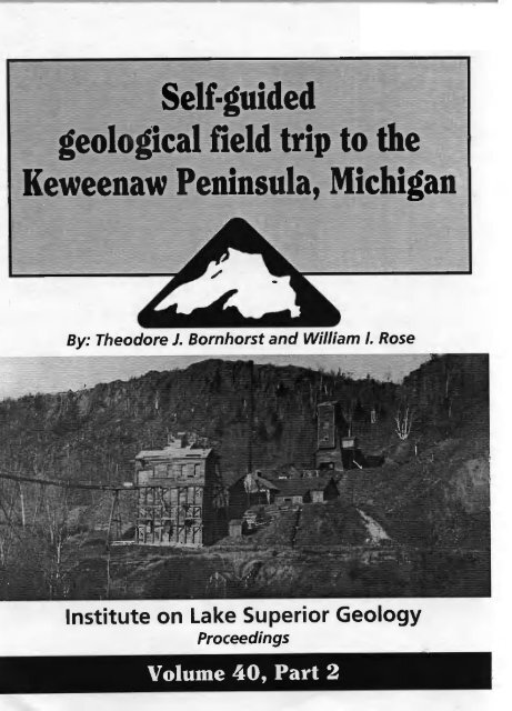
Self-guided Self-guided geological field trip to the<br />
Keweenaw Peninsula, Michigan<br />
By: By: Theodore J. Bornhorst and William I. I. Rose<br />
Department Department of Geological Engineering, Geology, and Geophysics<br />
Michigan Technological University, Houghton, Michigan 49931-1 49931-1295 295<br />
Published Published for<br />
<strong>40</strong>th Annual Meeting<br />
Institute on Lake Superior Geology<br />
Houghton, Houghton, Michigan Michigan<br />
May 11—14, ll-I4,1994 1994<br />
ISSN 1042-9964<br />
Cover photoÑClif photo—Cliff Mine drca circa early 1900s.<br />
Photo from Mlii MTU Archives and Copper Country Historical Collections; Donor Tony Vranesich.
PREFACE<br />
ACKNOWLEDGEMENTS<br />
TABLE OF CONTENTS CONTENTS<br />
ACKNOWLEDGEMENTS ii<br />
DEDICATION<br />
DEDICATION ii<br />
USING THIS GUIDE<br />
iv<br />
LIST OF STOPS<br />
LIST OF MAPS<br />
xii<br />
LIST OF FIGURES<br />
LIST OF TABLES<br />
xviii<br />
INDEX TO GEOLOGY ON MAPS<br />
xix<br />
GEOLOGY OF THE KEWEENAW PENINSULA<br />
1<br />
MAIN ROAD LOG AND STOP DESCRIPTION<br />
33<br />
LEG A - REDRIDGE REDRIDGE<br />
117<br />
LEG B - OWL CREEK<br />
124 1%<br />
LEG C - HORSESHOE HARBOR<br />
128<br />
LEG D - EASTSIDE EASTSWE OF OF THE KEWEENAW PENINSULA<br />
132<br />
LEG E E-932 - 932 CREEK<br />
144<br />
LEG F - FIVE MILE POINT<br />
149<br />
LEG G - COPPER CITY 155<br />
LEG G - COPPER CITY<br />
LEG H - MCLAIN STATE PARK<br />
158<br />
LEGI-L'ANSE LEG I - L'ANSE<br />
172<br />
REFERENCES<br />
REFERENCES 178<br />
&&<br />
i<br />
ii<br />
ii<br />
vi<br />
XV<br />
U'
iv<br />
USING 11118 THIS GUIDE GUIDE<br />
A NUMBER OF STOPS ARE ARE ON PRIVATE PRIVATE LAND. PLEASE RESPECT PRIVATE PROPERTY.<br />
PROPERTY.<br />
PROBLEMS OF ACCESS ARE MINIMAL, BUT THIS CAN QUICKLY CHANGE IF EVERYONE<br />
DOES NOT USE LOW PROFILE OUTDOOR PRINCIPLES AND ASK PERMISSION WHEN<br />
POSSIBLE. OLD MINE ROCK PILES ARE HAZARDOUS, SO COMMON SENSE MUST BE<br />
APPLIED.<br />
This guide is designed for geologists and geology students. It begins with an introductory description with<br />
figures and tables. The road log consists of a main log with sequentially numbered stops, maps, figures,<br />
and tables (sequence for figures and tables continues from introductory description) followed by separate<br />
legs. Each leg has separate sequentially numbered stops, maps, figures, and tables (leg numbers are<br />
preceded by the the letter letter of the leg).<br />
All Ml maps have north to the top. Most maps are 1:24,000 (1 cm = 2<strong>40</strong> m or I" 1" = 2000 ft) scale (Figure<br />
lb). ib). Several maps in Legs D D and and I are 1:168960 1:168960 (1 cm cm = 1689.6 m or 3/8 318" = I1 mile (5280 ft)). Dots<br />
follow the road traveled for the main road log, and open circles are used for the legs.<br />
The field trip stops are grouped below in topics to assist in design of your field trip.<br />
TOPIC TOPIC<br />
Glacial<br />
2, 3. 7, 16, 29, 33, A2, F2, Hi, H2, H3, H4, H5, H7, H9<br />
Rift-flanking<br />
clastic sedimentary<br />
rocks rocks<br />
10, 10, 11, 12, D5, D5, El, 11 I1<br />
Rift-filling<br />
dominantly clastic<br />
sedimentary rocks<br />
Rift-filling<br />
12, 22, 23, 24, 25, 26, 27, 28, A1, Al, A3, Cl, Fl, H6, H8<br />
dominantly dominantly igneous igneous<br />
rocks rocks<br />
1, 4, 6, 8, 14, 15, 16, 18, 19, 20, 21, 30, 31, Bi, Dl, El, F3, Gi<br />
Native Native Copper Copper<br />
Deposits<br />
5. 8, 9, 13, 15, 16, 17, 18, 28, 30, 32, 34, 81<br />
Scenic<br />
7, 16, 25, D4, D6<br />
We encourage you to be imaginative and make up your own subset of stops. To visit all the stops listed<br />
in this this guide guide would take take at least five five days. We have designed several several trips with different different emphasis emphasis based<br />
on about 10 stops per day. Stops are listed in in approximate order of visiting.<br />
Oneday One-day trip trip with emphasis glacial features<br />
A2, A2, 7, 33, Hi, HI, H2, 113, H3, H4, H5, H7, H9 (requires special permission)<br />
One-day Oneday trip with broad coverage of rift geology in the Houghton/Calumet HoughtonlCalumet area<br />
4, 5, 6, A1, Al, A3, A3. H8, 10, 12, 13, 15, 16
One-thy One-day trip with emphasis on mineral deposits<br />
4, 5, 8, 13, 15, 16, 17, 18, 30, El<br />
One-day trip with emphasis on igneous geology<br />
4, 6, 15, 16, 18, 19, 19, 20, 31, El, Gl G1<br />
One-thy One-day trip with broad coverage of geology and scenery<br />
4, 7, 10, 12, 13, 15, 16, 18, 24, 25, 27<br />
One-thy One-day trip with scenic overview and geology<br />
7, 16, 21, 22, 24, 25.28, 25, 28, Cl, D4, 04, D6 06<br />
Two-day trip with broad coverage of geology and scenery<br />
4, 5, 10, 12, 13, 15, 16, 18, 20, 21, 22, 25, 28, 30, Cl, H8, A3<br />
There are so many excellent stops we almost don't like to to make suggestions. We are not sure which stops<br />
are the most popular, popular, but our our guess is is the following: 4, 7, 10, 10, 12, 15, 16, 16, 18, 18, 21, 25, and 27.<br />
If you use this this guide, we would really like to hear about your experience. What stops did you like? What<br />
stops stops you you don't don't like? etc. etc. Piease Please drop drop a letter or postcard in the mail. With your comments and<br />
suggestions we èan can make this guide better.<br />
V
vi<br />
LIST OF STOPS<br />
The following list of stops can be used to help you design your<br />
self—guided self-guided geological field trip to the Keweenaw Peninsula. The<br />
location of stops are shown in Figure 1A. The appropriate maps for<br />
each stop and trip route are located in Figure lB. IB. We hope you<br />
enjoy enjoy seeing seeing the Keweenaw and its geology.<br />
STOP APPROPRIATE PAGE PAGE STOP DESCRIPTION<br />
MAP<br />
MAIN ROAD LOG<br />
1 (2) 33 Seventh seventh Street, City of Houghton<br />
(Portage Lake Volcanics [PLy]) [PLV])<br />
Houghton<br />
grooves)<br />
water tower (glacial<br />
2 (2) 34 Boughton water tower (glacial<br />
grooves )<br />
3 (2) 36 Hurontown (glacially carved caned basalt)<br />
4 (3) 39 South Range Quarry (Portage Lake<br />
Volcanics [PLy]) [PLV])<br />
5 (3) 42 Baltic Mine Shaft No. No. 3 3 (native<br />
copper copper deposit within within Portage Portage Lake Lake<br />
Volcanics [PLy]) [PLV])<br />
6 (2) 43 Sheldon Avenue, City city of Houghton<br />
(Portage (Portage Lake Volcanics Volcanics [PLy]) [PLV])<br />
7 (4) 44 Keweenaw Waterway Overlook<br />
Quincy Mine Adit (Portage Lake<br />
Volcanics [PLy]) [PLVI)<br />
8 (4) 48 Quincy Mine Mit (Portage Lake<br />
Quincy Mine Rock Piles (native<br />
copper copper deposit deposit within Portage Portage Lake<br />
Volcanics [PLy]) [PLV])<br />
9 (4) 53 Quincy Mine Rock Piles (native<br />
M-26 near Tamarack (Jacobsville<br />
Sandstone)<br />
10 (6) 56 M-26 near Tamarack (Jacobsville<br />
Sandstone)<br />
11 (7) 59 Hungarian Falls Falls (Keweenaw Fault)<br />
12 (8) 64 Natural Wall Ravine (Keweenaw Fault) Fault)<br />
13 (9) 68 Wolverine wolverine Mine Mine Shaft Shaft No. 2 (native<br />
copper deposit deposit within Portage Portage Lake<br />
Volcanics [PLy]) [PLV])<br />
14 (9) 74 Scales Creek creek (Portage Lake Volcanics<br />
[PLVI) r PLVI )
LIST OF STOPS STOPS (Cont'd.)<br />
STOP APPROPRIATE PAGE<br />
MAP<br />
STOP DESCRIPTION<br />
DESCRIPTION<br />
15<br />
(9) 74 Allouez ~llouez (conglomerate in Portage<br />
Lake Volcanics Volcanics [PLy]) [PLV])<br />
16<br />
(9) 75 Bumbletown Hill (Allouez Gap Fault<br />
and Portage Lake Volcanics) ~olcanics)<br />
17<br />
(11)<br />
82 8 2 Cliff Nine Mine (native copper vein<br />
deposit)<br />
18<br />
(12)<br />
83 Phoenix phoenix Mine (native copper vein<br />
deposit and Portage Lake ~ ake volcanics Volcanics<br />
[PLy]) [PLVI )<br />
19<br />
(12) 87 8 7 Eagle River (Portage Lake Volcanics<br />
[PLy]) [PLVI )<br />
20<br />
(12) 89 8 9 M-26, Eagle River (Portage Lake<br />
volcanics Volcanics [PLy]) [PLVI)<br />
21<br />
(12) 89 Eagle Eagle River River Falls (contact of<br />
Portage Lake Volcanics and Copper<br />
Harbor Harbor Conglomerate)<br />
Conglomerate)<br />
22 (14) 90 Eagle Harbor Lighthouse (Lake Shore<br />
Traps) Traps )<br />
23 (16) 93 Silver River (Copper Harbor<br />
Conglomerate)<br />
Conglomerate)<br />
24 (16) 96 Esrey Park (Lake Shore Traps)<br />
25 (17) 98 9 8 Brockway Mountain Viewpoint<br />
26 (17) 100 Hebard Park park (Copper Harbor<br />
Conglomerate)<br />
Conglomerate)<br />
27 (17) 100 Dan's Point (Copper Harbor<br />
Conglomerate)<br />
Conglomerate)<br />
28 (18) 104 Fort Wilkins State Park (native<br />
copper veins within Copper Harbor<br />
Conglomerate)<br />
29 (20) 105 Mandan (Mandan esker)<br />
30 (21) 105 Delaware Mine (native copper<br />
deposit within Portage Lake<br />
Volcanics Volcanics [PLy]) [PLVI)<br />
vii
LIST LIST OF STOPS (Cont'd.)<br />
STOP APPROPRIATE APPROPRIATE PAGE STOP STOP DESCRIPTION<br />
DESCRIPTION<br />
MAP<br />
31 3 1<br />
(21) 110 US-41 near Delaware (Portage Lake<br />
Volcanics Volcanics [PLy]) [PLV] )<br />
32<br />
(10) 113 Mohawk Mohawk Mine (native copper deposit<br />
within within Portage Lake Volcanics Volcanics<br />
[PLy]) [PLVI )<br />
33 3 3<br />
(24) 114 Calumet Calumet (glacial grooves)<br />
34<br />
(24) 116 Osceola Mine (native copper deposit<br />
within Portage Lake Volcanics<br />
[PLy]) r PLVI )<br />
LEG A Redridge<br />
Al A1<br />
(A2) 117 Houghton Canal Road (Copper Harbor<br />
Conglomerate)<br />
Conglomerate)<br />
A2<br />
(A2) 117 Cole's Creek Creek (glacial (glacial sediments)<br />
sediments)<br />
A3<br />
(AS) 120 Redridge Cliffs Cliffs (Freda Sandstone)<br />
LEG B Owl Creek<br />
El Bl (B2) 124 Owl Creek (Portage (Portage Lake volcanics Volcanics<br />
[PLy] [PLV] and Copper Falls Mine)<br />
LEG C Horseshoe Harbor<br />
Cl (C2) 131 13 1 Horseshoe Horseshoe Harbor Harbor (Copper HarborS Harbor<br />
Conglomerate)<br />
LEG LEG D Eastside of the 1(eweenaw Keweenaw Peninsula<br />
Dl (D2) (D2 132 Mount Bohemia (diorite stock within<br />
the Portage Portage Lake Volcanics Volcanics [PLy]) [PLV])<br />
D2 (Dl) 136 13 6 Bete Grise (white sand beach from<br />
Jacobsville Jacobsville Sandstone)<br />
D3 (02) (D2) 137 Haven Park (Portage Lake Volcanics<br />
[PLy] [PLV] near the Keweenaw Keweenaw Fault)<br />
D4 (Dl) 139 South Point point (view of the tip of the<br />
Keweenaw Peninsula)<br />
DS D5 (Dl) 139 Eastern Keweenaw Peninsula<br />
(Jacobsville (Jacobsville Sandstone) Sandstone)
LIST OF STOPS (Cont'd.) (C0nt8d.)<br />
STOP APPROPRIATE PAGE STOP DESCRIPTION<br />
MAP<br />
D6 (D3) 141<br />
D6 (D3) 141 Gay (stamp sands)<br />
LEG E 932 creek Creek<br />
El (E2) 144 932 creek Creek (Keweenaw Fault)<br />
LEG F Five Mile Point<br />
Fl (Fl) 149 W.C. Verde ~erde Roadside ~oadside Park (Copper<br />
Harbor Conglomerate)<br />
F2 (F3) 149 Allouez Gap (kettles)<br />
F3 (F3) 153 North of Abmeek Ahmeek (Portage Lake<br />
Volcanics [PLy]) [PLV] )<br />
LEG G Copper City<br />
Gl (Gi) (GI) 155 copper Copper City Rhyolite ~hyolite (Portage Lake<br />
Volcanics [PLy)) [PLV])<br />
LEG H Mctain McLain State Park<br />
Hl HI (Hl) (HI) 158 Red Jacket ~acket (glacial sand and<br />
gravel)<br />
H2 (Hl) 158 West Tamarack (glacial gravEls) gravels)<br />
H3 (H2) 161 Cloverland Clwerland Road (Washburn Stage. Stage<br />
beach ridges)<br />
H4 (H4) 161 Lake Annie (glacial lake baymouth<br />
bar)<br />
H5 (H3) 161 Sand Ridges M-203 (Nipissing beach<br />
ridges)<br />
H6 (H3) 165 McLain State Park (Freda Sandstone)<br />
137 .<br />
(H5)<br />
165 Till along M—203 M-203 (till)<br />
H8 (H6) 168 Hancock Rancock Campground campground (Nonesuch Shale)<br />
H9 (136) 168 Superior Sand and Gravel<br />
(glaciofluvial sediments)<br />
LEG I L'Anse<br />
--<br />
Gay (stamp sands)<br />
gravel )<br />
bar )<br />
fl I1 (12) 174 L'Anse Red Rocks (Jacobsville<br />
Sandstone) Sands tone )<br />
ix
Figure<br />
Route and Stop Map<br />
iF 2P 3P<br />
Kilometers<br />
I4><br />
Route<br />
Number<br />
A..... Leg Route and<br />
Stop Number
Figure 1B:<br />
Index of 1:24,000 Scale Maps<br />
'Vt<br />
I<br />
AS<br />
Q 1p 2Q<br />
1<br />
Kilometers<br />
H<br />
3<br />
3<br />
H2<br />
F3<br />
See Map Ii<br />
F2<br />
See Map 12<br />
El<br />
13<br />
'V<br />
15<br />
A6<br />
IC'<br />
...'<br />
...<br />
LI<br />
Region Covered<br />
by Map Number<br />
Main Route and<br />
Stop Number<br />
Leg Route and<br />
Stop Number
xli<br />
MAP MAP 1<br />
MAP 2<br />
MAP MAP 3<br />
MAP 4<br />
MAP 55<br />
MAP MAP 6<br />
MAP 7<br />
MAP 8<br />
MAP 9<br />
MAP MP 10<br />
MAP 11<br />
MAP 12<br />
MAP 13<br />
MAP 14<br />
MAP 15<br />
MAP 16<br />
MAP 17<br />
MAP 18<br />
MAP 19<br />
MAP 20<br />
MAP 21<br />
MAP 22<br />
MAP 23<br />
MAP 24<br />
LIST OF MAPS<br />
34 34<br />
35<br />
<strong>40</strong><br />
45<br />
54<br />
55<br />
60 60<br />
63<br />
67<br />
77<br />
83 83<br />
84<br />
91<br />
92 92.<br />
94 94<br />
95<br />
99 99<br />
101<br />
106 106<br />
107<br />
108<br />
111 Ill<br />
112<br />
115
UST LIST OF MAPS (Cont'd.) (Cont'd.)<br />
MAP MAP Al A1<br />
118<br />
MAP A2<br />
119<br />
MAP A3<br />
121<br />
MAP A4<br />
122<br />
MAP AS A5<br />
123<br />
MAP 81 Bl<br />
125<br />
MAP 82 B2<br />
126<br />
MAP Cl<br />
129<br />
MAP MAP •C2 C2<br />
130<br />
MAP Dl<br />
133<br />
MAP D2<br />
134<br />
MAP D3<br />
142<br />
MAP El<br />
145<br />
MAP E2<br />
146<br />
MAP Fl<br />
150<br />
MAP F2 fl 151<br />
MAP F3 fl 152<br />
MAP Cii Gl<br />
156<br />
MAP HI<br />
159<br />
MAP H2<br />
162<br />
MAP MAP 113 H3<br />
163<br />
MAP H4<br />
164<br />
MAP H5<br />
166<br />
Xlii
xiv<br />
MAP 1-16 H6<br />
MAP Ii<br />
MAP I1<br />
MAP 12<br />
LIST OF OF MAPS (Cont'd.)<br />
169<br />
173<br />
175
LIST OF FIGURES FIGURES<br />
Figure Figure 1: Index map of route, stops and 1:24,000 scale maps. x<br />
Figure 2: Location Location of the Keweenaw Peninsula Peninsula native native copper copper district district 2<br />
Figure 3:<br />
Geology Geology of the Lake Superior segment of the Mideontinent Midcontinent rift<br />
system. 3<br />
Figure 4:<br />
Temporal progression of major geologic events of the North<br />
American rift system. 5<br />
Figure 5:<br />
Map showing showing the the Midcontient Midcontient rift system in relation to the<br />
Grenville front front tectonic tectonic zone (GVFZ). (GFTZ). 6<br />
Figure Figure 6: Geologic map map of the Keweenaw Peninsula. Peninsula. 7<br />
Figure 7:<br />
Geologic Geologic map map and stratigraphic stratigraphic column of the the central central Keweenaw Keweenaw<br />
Peninsula. Peninsula. 8<br />
Figure 8:<br />
Columnar stratigraphic section of the Keweenaw Fault in the<br />
Calumet-Mohawk Calumet-Mohawk area. 9<br />
Figure 9:<br />
Generalized Generalized stratigraphic stratigraphic section of the Portage Portage Lake Lake Volcanics Volcanics from from<br />
Victoria to Copper Harbor. 13<br />
Figure Figure 10: 10: Schematic cartoon of the depositional environment of the<br />
Copper Copper Harbor Harbor Conglomerate. Conglomerate. 15<br />
Figure Figure 11:<br />
Faults Faults and minor folds in the central Keweenaw Peninsula. 17 17<br />
Figure Figure 12:<br />
Paragenesis of secondary secondary minerals minerals in flow flow top deposits and veins,<br />
and and conglomerate conglomerate deposits. deposits. 21<br />
Figure Figure 13:<br />
Distribution of amygdule- and vein-filling minerals in the Calumet<br />
cross section of the PLV. PLy. 22<br />
Figure 14:<br />
Figure 14: Speculative ice-marginal positions during the Wisconsin ice retreat. 28<br />
Figure 15: Enlarged view view of ice-marginal ice-marginal positions positions during during the the Wisconsin Wisconsin ice<br />
retreat. 29<br />
Figure 16:<br />
Speculative ice-marginal positions during the Wisconsin ice retreat. 28<br />
End moraine of the Keweenaw Bay Lobe glacier. 30<br />
Figure 16; End moraine of the Keweenaw Bay Lobe glacier. 30<br />
Figure 17: Keweenaw Keweenaw Bay lobe lobe glacier glacier and position position of glacial Lake Duluth. 30<br />
Figure 18: Physiographic divisions of the central Keweenaw Peninsula. 31<br />
F&?&<br />
Page<br />
xv
xvi<br />
LIST OF FIGURES FIGURES (Cont'd.)<br />
Figure 19: High High level drainage through the Portage Gap.<br />
31<br />
Figure 20: Geologic profile of the South Range Quarry.<br />
38<br />
Figure 21: Cross section A-A' on MAP 2.<br />
41<br />
Figure 22: View from Portage overlook facing south.<br />
46<br />
Figure 23: The Quincy Mine location.<br />
49<br />
Figure 24: 24; Sketch map of the Quincy and Hancock Mines.<br />
50<br />
Figure 25: Geologic cross section for Maps H6, 4, and 5. 5.<br />
51<br />
Figure 26: Contoured concentrations of Pb and Sn in Torch Lake.<br />
57<br />
Figure 27: Relationships of Jacobsville Jacohsville Sandstone.<br />
58<br />
Figure 28: Geologic sketch map of the Hungarian Falls Palls area.<br />
61<br />
Figure 29: Geologic sketch map of the Natural Wall Ravine.<br />
65<br />
Figure 30: Geologic map and cross section, section. Wolverine Mine, and vicinity. 69<br />
Figure 31: Thickness Thickness of the Kearsarge flow (top) from Isle Royale to Mandan. 70<br />
Figure 32: Paragenesis Paragenesis of secondary minerals in the Kearsarge amygdaloid. 71<br />
Figure 33: Cross section of Kearsarge amygdaloid showing the banding banding of<br />
mineral assemblage.<br />
72<br />
Figure 34: 34. Thickness Thickness of the Kingston Conglomerate Conglomerate at the Kingston Mine. 78<br />
Figure 35: Outcrop map of the Allouez-Bumbletown Hill area.<br />
79<br />
Figure 36: Physiographic Physiographic and glacial features of the Allouez Gap.<br />
80<br />
Figure 37: Map and section of the Greenstone flow between Seneca and the<br />
Cliff Mine.<br />
81<br />
Figure 38: Map and section of the Greenstone flow near Phoenix.<br />
86<br />
Figure 39: Stratigraphy of the Portage Lake Volcanics above the Greenstone<br />
Flow.<br />
88<br />
Figure <strong>40</strong>: Stratigraphic column of the Lake Shore Traps.<br />
97
Figure 41:<br />
LIST LIST OF FIGURES FIGURES (Cont'd.) (Cont'd.)<br />
Measured stratigraphic sections from Horseshoe Harbor and Dan's<br />
Point. Point.<br />
Figure Dl: Geologic map showing andesitic dikes near Mount Bohemia.<br />
135<br />
Figure D2:<br />
Figure D3:<br />
Geologic sketch map of part of the Keweenaw Fault in the vicinity<br />
ofDeerLake.<br />
of Deer Lake.<br />
Geologic map showing the location of rhyolites on the eastern tip<br />
of the Keweenaw Peninsula.<br />
Figure El: Location of the region of chalcocite mineralization.<br />
147<br />
Figure Flgure Hi: HI: Physiographic and glacial features west of Calumet.<br />
160<br />
Figure 112: H2: Results of gravity measurements across Bear Lake.<br />
167<br />
Figure H3:<br />
Figure Figure 114: H4:<br />
Geologic section through the Hancock "fairground" tezrace terrace glacial<br />
deposit.<br />
Physiography and glacial features of the northern part of Portage<br />
Lake. Lake.<br />
Figure Flgure Ii: 11: Geologic sketch map and cross section of L' L'Anse Anse redrocks.<br />
177<br />
103<br />
138<br />
1<strong>40</strong><br />
170<br />
171<br />
xvii
xviii<br />
LIST LIST OF TABLES TABLES<br />
Table 1: Avenge Average and representative geochemical data for least altered lavas<br />
of the Portage Lake Volcanics.<br />
12<br />
Table 2: Stages of glacial lakes in the Lake Superior Basin.<br />
27<br />
Table 3:<br />
Major-element composition of the Kearsarge flow.<br />
Table 3: Major-element composition of the Kearsarge flow. 69<br />
Table 4: <strong>Volume</strong> percent amygdule minerals from mapped assemblages<br />
shown in Figure 33.<br />
72<br />
Table 5: Avenge Average major-element composition of the Scales Creek flow. 79<br />
Table 6: Avenge Average composition of of the Greenstone Flow. How.<br />
87<br />
Table El: Chemical composition of intrusive plug on 932 Creek.<br />
148<br />
Table 01: Gl: Chemical types of rhyolites within the PLV.<br />
157
INDEX TO TO GEOLOGY GEOLOGY ON MAPS<br />
Map No. Quadrangle<br />
Reference<br />
1 MTLJ MTU Campus Map<br />
White, 1956; Hase, 1973<br />
2 Chassell Chassell<br />
White, White, 1956<br />
3 South Range, Chassell<br />
White White and Wright, Wright, 1956; White, White, 1956<br />
4 Chassell, Hancock<br />
White, 1956; Cornwall and Wright,<br />
1956a<br />
5 Chassell, Chassell, Hancock<br />
White, 1956; Cornwall and Wright,<br />
1956a<br />
6 Laurium<br />
Cornwall and Wright, I 1956b 956b<br />
7 Laurium<br />
Cornwall and and Wright, Wright, 1 1956b 956b<br />
8 Laurium<br />
Cornwall Cornwall and and Wright, Wright, 1956b<br />
9 Ahmeek Ahmeek White and and others, others, 1953<br />
10 Mohawk<br />
Davidson Davidson and and others, others, 1955<br />
11 Mohawk<br />
Davidson and and others, others, 1955<br />
12 Phoenix<br />
Cornwall, 1954a 1954a<br />
13 Eagle Harbor Harbor<br />
Cornwall and and Wright, Wright, 1954<br />
14 Eagle Harbor<br />
Cornwall and and Wright, Wright, 1954<br />
15 Delaware<br />
Cornwall, Cornwall, 1 1954b 954b<br />
16 Delaware<br />
Cornwall, I 1954b 954b<br />
17 Lake Medora Medora<br />
Cornwall, Cornwall, 1 1954c 954c<br />
18 Lake Medora, Medora, Fort Wilkins Wilkins Cornwall, Cornwall, I 1954; 954c; Cornwall, Cornwall, 1955<br />
19 Lake Medora Medora<br />
Cornwall, 1954c<br />
20 Delaware Delaware<br />
Cornwall, 1954b 1954b<br />
21 Delaware<br />
Cornwall, 1954b<br />
22 Eagle Harbor<br />
Cornwall Cornwall and and Wright, Wright, 1954<br />
XIX xix
xx<br />
23 Eagle Harbor<br />
Cornwall and Wright, 1954; 1954;' Cornwall,<br />
1954a<br />
24 Laurium Laurium<br />
Cornwall Cornwall and Wright, 19561, 1956b<br />
Al Chassell<br />
White, 1956<br />
A2 Chassell,Hancock Chassel1,Hancock<br />
White, 1956; Cornwall and Wright,<br />
1956a<br />
A3 Oskar<br />
Cornwall and Wright, 1956a; White and<br />
Wright, Wright, 1956<br />
A4 Oskar<br />
White, 1968<br />
AS Beacon Beacon Hill Hill<br />
White, 1968<br />
B 1 Eagle Eagle Harbor<br />
Cornwall and Wright, 1954<br />
B2 Eagle Eagle Harbor Harbor<br />
Cornwall Cornwall and and Wright, Wright, 1954<br />
Cl Fort Fort Wilkins, Wilkins, Lake Medora Medora<br />
Cornwall, Cornwall, 1954c; 1954~; Cornwall, Cornwall, 1955<br />
C2 Fort Fort Wilkins Wilkins<br />
Cornwall, Cornwall. 1955<br />
Dl Michigan Michigan DNR-Keweenaw DNR-Keweenaw and<br />
Houghton Houghton Counties Counties White, White, 1968<br />
D2 Delaware<br />
Cornwall, Cornwall, 1 1954b 954b<br />
D3 Gay<br />
White, White, 1968<br />
El Eagle Harbor<br />
Cornwall and Wright, 1954<br />
E2 Eagle Harbor, Bruneau Bmflea~ Creek Wright Wright and Cornwall, Cornwall, I 1954b 954b<br />
Fl Phoenix<br />
Cornwall, 1954a<br />
F2 Phoenix,Mohawk,Ahmeek Ph0enix.Mohawk.Ahmee.k<br />
Cornwall, 1954a 1954a; Davidson and others,<br />
1955; 1955; White White and others, 1953<br />
p3 Ahmeek<br />
White White and others, others. 1953<br />
01 Ahmeek,Mohawk<br />
White and and others, 1953; Davidson Davidson and<br />
others, 1955<br />
Hi Laurium<br />
C~rnwall Cornwall and Wright, 1956b; Hughes,<br />
I 1963 963<br />
H2 Hancock, Hancock. Muggen Muggen Creek Creek<br />
Cornwall Cornwall and Wright, Wright, 1956a
H3 Hancock Cornwall and Wright, 1956á; 1956a; Warren,<br />
1981<br />
H4 Hancock<br />
H5 Hancock, Oskar Cornwall and Wright, 1956a<br />
H6 Hancock Hancock Cornwall and Wright, 1956a<br />
I1 Ii Michigan DNR-Houghton County White, 1968<br />
¶2 12 Michigan DNR-Baraga County White, 1968<br />
xxi
GEOLOGY OF TilE THE KEWEENAW PENINSULA, MICHIGAN<br />
INTRODUCTION<br />
Geology<br />
The Keweenaw Peninsula is located on the margin of Lake Superior. The geology of the<br />
Keweenaw Peninsula consists of two quite distinct episodes. The bedrock is composed of consolidated<br />
rocks depo<strong>site</strong>d between about 1100 and 1000 million years ago (Ma) as part of the Midcontinent rift<br />
system of North America. The bedrock is overlain by unconsolidated glacial sediments depo<strong>site</strong>d during<br />
the the past 2 million million years years as part of Pleistocene Pleistocene continental continental glaciation glaciation of North America. America. The field trip<br />
contains contains stops stops to to view view both bedrock and glacial materials. Because Because the the cultural cultural history history of the the Keweenaw Keweenaw<br />
Peninsula is is so dominated dominated by the mining mining of native copper copper from from the the bedrock, bedrock, more more emphasis emphasis is placed on<br />
the geology of the bedrock.<br />
BEDROCK BEDROCK GEOLOGY GEOLOGY<br />
This description of the bedrock bedrock geology of the Keweenaw Peninsula was taken from a combination<br />
of of Bornhorst Bornhorst (in press). press), Bornhorst (1992), (1992), and Bomhorst Bomhorst and others (1983) (1983) without without specific citation or<br />
quotation.<br />
Midcontlnent Midcontinent Rift System<br />
The Keweenaw Peninsula Peninsula is on the margin margin of the the Lake Lake Superior Superior segment of the the Midcontinent rift<br />
system. The Midcontinent %dcontinent rift system extends northeasterly from Kansas to Lake Superior and then<br />
southeasterly through lower Michigan (Fig. 2). It was formed at about 1100 Ma by extensional thinning<br />
of the the rigid rigid Precambrian Superior Superior crustal crustal block. Present Present day day crystal crustal thickness in the Lake Lake Superior region region<br />
is between <strong>40</strong> <strong>40</strong> and 50 km, km. which is thicker than adjacent areas (Halls, 1982).<br />
Beneath Beneath Lake Lake Superior Superior the the rift rift is is filled filled with with more more than than 25 25 km km of volcanic rocks, rocks, including including about<br />
10 km of Portage Lake Volcanics (PLy) (PLV) (Fig. 2) (Cannon and others, 1989; Hinzc Hinze and others, 1990;<br />
Cannon, 1992). The PLy, PLV, with a a total thickness of of about 5 km of of rift-filling volcanic rocks, is is exposed<br />
on the Keweenaw Peninsula. Large volumes of magma magma were extruded in response to a period of rifting rifting<br />
over over an an asthenospheric asthenospheric mantle mantle plume plume (Hutchiinson (Hutchinson and others, others, 1990). 1990). Rift magmatism extended from 1109 1109<br />
to 1087 (Davis (Davis and Paces, Paces, 1990; Paces Paces and and Miller, Miller, 1993). 1993). The PLV of the Keweenaw Peninsula erupted<br />
during during a 2 2 to to 3 million year year span of time, at about 1095 Ma (Davis and Paces, 1990). It is part of a vast vast<br />
association association of igneous igneous rocks rocks of similar age, including including the the Duluth Duluth Gabbro Gahbro (Fig. 3).<br />
A thick thick succession succession of rift-filling rift-filling clastic clastic sedimentary rocks overlie the rift-filling rift-filling volcanic volcanic rocks,<br />
and represent a a change from a period dominated by volcanism, to one dominated by sedimentation. While<br />
magmatic activity waned, subsidence of of the rift basin continued as the thermal anomaly of the<br />
asthenospheric plume decayed decayed (Cannon and and Hinze, Hinze, 1992; 1992; Hutchinson Hutchinson and others, others, 1990). 1990). A total total thickness thickness<br />
of up to 8 km of rift-filling clastic sedimentary rocks exist beneath the center of Lake Superior, with a<br />
maximum exposed thickness in in the western Upper Upper Peninsula of of Michigan, of 6 km km (Fig. (Fig. 2) 2) (Cannon, 1992; 1992;<br />
Cannon Cannon and and others, others, 1989). These clastic sedimentary rocks are dominated by red-colored conglomerates<br />
conglomerates<br />
(Copper Harbor Conglomerate) and and red-colored sandstones (Freda (Freda Sandstone), with with a thin intervening gray gray<br />
to black black shale (Nonesuch (Nonesuch Shale). Shale). Late in the thermal subsidence phase of the rift. Cannon and others<br />
(1989) and and Hinze Hinze and others (1990) propose that mature red-colored sandstones sandstones (Jacobsville (Jacobsville Sandstone) Sandstone)<br />
was was depo<strong>site</strong>d across the the entire basin. The age of these these rift-filling sedimentary sedimentary strata strata is poorly constrained, constrained,<br />
but is is likely between between about 1085 and 1060 Ma.<br />
1
2 Geology<br />
A<br />
B<br />
Shoreline Slate<br />
en ra'r F—I?.,.<br />
GLIMPCE GLIMPCE Line Line A<br />
EXPLANATION<br />
EXPLANATION<br />
Yj Jaoobsville Jacobtvillc Sandstone (Middle Proterozoic)<br />
Yb Bayfield Group (Middle Proterozoic)<br />
Yo Ozonto Oronto Group (Middle Proterozoic) Prokrowic)<br />
Yp Pflge Portage Lake Lakc Volcanics Volcinio, (Middle Protezozoic) Proterozoic)<br />
Yu Undivided Middle Proterozoic Protauwic rocks older<br />
than than Portage Portage Lake Volcanics Volcanics<br />
Ag GnSss Gneiss (Archean)<br />
Figure Figure 2: (a) Location of the Keweenaw Keweenaw Peninsula native copper copper district district within the North American<br />
Midcontinent rift system (from Bornhorst, Bomhorst, in in press). The large large black black area contains all major<br />
deposits, the two smaller areas contain minor deposits. (b) Interpretative cross-section across the<br />
Lake Superior segment of the Midcontinent rift system by Cannon and others (1989) from<br />
seismic-reflection profile Line A.<br />
.<br />
Superior ~uitou shot<br />
&& Islands, 3000 Shod. {.<br />
3 5: Lower ~rotnowic?<br />
- -<br />
.8 At<br />
10- Faultblocks<br />
or introsivu<br />
151<br />
Yu At<br />
Shore<br />
I
A<br />
B<br />
1100<br />
NMddgan<br />
fanas ?JWMto,idn NE MI wow<br />
Th—<br />
AWg nBe ROpuwk,<br />
Figure 3: (a) Geology of the Lake Superior segment of of the Midcontinent rift system (from Paces and<br />
Miller, 1993). High precision U-Pb dates axe are listed below abbreviated major igneous rock units:<br />
BBC, Beaver Bay Complex; CCD, Canton Carlton County dikes; CC, Coldwell Complex; LS, Logan sills;<br />
LST, Lake Shore Traps; MPF, Mamainse Point Formation; MBD, Marquette-Baraga dikes; MC,<br />
Mellen Intrusive Complex; MW, MIF, Michipicoten Island Formation; NSVG. NSVG, North Shore Volcanic<br />
Group; PIll, PRI, Pigeon River intrusives; PLV, Portage Lake Volcanics; PMG, Powder Mill Group;<br />
PD, Pukaskwa dikes; OVG, Osler Osier Group. (b) (b) Absolute age correlation for igneous rock units of<br />
the Midcontinent rift system (from Paces and Miller, 1993).<br />
Geology 3
4 occiogy<br />
The last phase phase of the Midcontinent Midcontinent rift system was characterized characterized by a transformation transformation of original<br />
graben bounding bounding normal faults into reverse faults (Fig. 2 and 4). The Keweenaw Fault Fault is now now a low- to<br />
high-angle reverse fault, but originally was a major graben bounding growth fault (Cannon and others,<br />
1989). 1989). The Keweenaw Fault has several kilometers of reverse displacement displacement which caused steepening steepening of of<br />
already already tilted strata strata (due to to syn-depositional downwarpage). downwarpage). Faults, Faults, fractures, and and broad broad open open folds within<br />
rift-filling strata strata of the the Keweenaw Peninsula developed in response to this compressional event (White,<br />
1968; Butler and Burbank, 1929). Over Over 3 km of red-colored shallow dipping sandstone (Jacobsville<br />
Sandstone) was was depo<strong>site</strong>d depo<strong>site</strong>d during during and after after active active reverse reverse movement along the Keweenaw Fault in a rift- rift-<br />
flanking basin basin (Fig. 2 and and 4). 4). Cannon and others (1993) have determined determined that high-angle high-angle reverse reverse faulting faulting<br />
occurred about about 1060 + ± 20 20 Ma, Ma, based based on reset reset Rb-Sr Rb-Sr biotite ages within within older Precambrian basement rocks rocks<br />
near near the Michigan-Wisconsin border. The The timing and probable cause of of this compressional compressional event event is<br />
continental collision along the Grenville front (Fig. 5) (Cannon, 1994; Cannon and Hinze, 1992; Hoffman,<br />
1989). This regional compression phase may have have started started as early early as 1080 Ma Ma (Cannon, (Cannon, 1994), and and was<br />
likely completed completed by 10<strong>40</strong> Ma, based based on thermal thermal models models (Price (Price and McDowell, McDowell, 1993; Price Price and others, in<br />
review). review).<br />
The rocks of the Midcontinent rift system were subsequently overlain by Paleozoic sedimentary<br />
rocks associated with the Michigan basin. An isolated outlier of Ordovician limestone at Limestone<br />
Mountain and Sherman Hill occurs about 35 km krn south of Houghton, and is underlain underlain by rift-flanking basin<br />
filling filling Jacobsville Sandstone. The Paleozoic geologic geologic processes were largely atectonic. The Paleozoic<br />
rocks rocks were removed by erosion from the Keweenaw Peninsula.<br />
The present present day landscape of the Keweenaw Peninsula is strongly influenced by Pleistocene<br />
glaciation, especially by features associated with withdrawal of the Wisconsin ice sheet about about 15-8<br />
thousand thousand years ago.<br />
Bedrock Stratigraphy of of the Keweenaw Keweenaw Peninsula<br />
The The bedrock bedrock of the Keweenaw Keweenaw Peninsula Peninsula is composed composed of subaerial subaerial volcanic volcanic rocks rocks and clastic clastic<br />
sedimentary sedimentary rocks rocks of the the Keweenawan Supergroup (Fig. 6). The volcanic volcanic and sedimentary sedimentary rocks on the the<br />
northwest side of the Keweenaw Peninsula generally dip moderately toward Lake Superior (Fig. 7) and<br />
include the PLV, PLy, Copper Harbor Conglomerate, Nonesuch Shale and the Freda Sandstone (Fig. 8). The<br />
Jacobsville Jacobsville Sandstone, Sandstone, which fills a rift-filling rift-filling basin on the southeast southeast side side of much much of of the Keweenaw Keweenaw<br />
Peninsula, is in in fault contact contact with the the PLV along the the Keweenaw Fault. The Jacobsville Sandstone Sandstone is<br />
younger than the Freda Sandstone and related to a late phase of regional compression. The bedrock strata<br />
are are unconformably capped by Pleistocene glacial deposits.<br />
Portage Lake Volcanics (PLV)<br />
The The Portage Portage Lake Lake Volcanics Volcanics are composed composed of a succession succession of more more than than 200 200 individual individual subaerial subaerial<br />
tholeiitic basaltic lava flows with a total exposed thickness of 2500 to 5200 m m on the Keweenaw<br />
Peninsula, Peninsula, with the base base truncated truncated by by the Keweenaw Keweenaw Fault Fault (Butler (Butler and and Burbank, Burbank, 1929; Huber, Huber, 1975;<br />
White, White, 1968) (Fig. 9). Rhyolitic volcanic and subvolcanic rocks comprise less than 1 volume % of the the<br />
PLV. Dikes of intermediate composition cut the exposed volcanic volcanic pile, but but are as a whole uncommon.<br />
A diorite stock stock intrudes intrudes the the base of of the the PLV PLV at at Mt. Bohemia. Bohemia. Interfiow Interflow reddish-colored reddish-colored conglomerate conglomerate and<br />
sandstone units total less than 5 volume % of the PLV PLV (Merk (Merk and and Jirsa, Jirsa, 1982), 1982). but but increase in in abundance abundance<br />
toward toward the the top of the the formation. formation. These rift-filling volcanic rocks rocks are are comparable to the rift zones of East<br />
Africa Africa and Iceland Iceland (Nicholson, (Nicholson, 1992; Basaltic Basaltic Volcanism Study Project, Project, 1981; 1981; Chase Chase and Gilmer, Gilmer, 1973;<br />
Green, Green, 1977 and and 1982; White White 1960 and and 1972). 1972). Lavas flowed away from feeders along the axis of the rift<br />
zone. zone. During intervals of quiescence, sediments were transported transported from from the edges edges toward toward the the center of of the the
__..,.Native Copper Mineralization<br />
/ Regional Compression<br />
Faulting and Sedimentation<br />
Native Copper Mineralization<br />
Regional Compression<br />
\Reverse Faulting and Sedimentation<br />
-- --<br />
Thermal Subsidence ÑÑÈ¥Cl P Clastic Sedimentation<br />
Sedimentation —<br />
Plume-Induced Plume-induced Rifting Rifting ~~luBasaltic<br />
w- Basaltic Maginatism<br />
Magmatism --<br />
I I I I I I I —— I<br />
1110 1100 1090 1080 1070 1060 1050 10<strong>40</strong><br />
Ma<br />
—Is<br />
S Sedmentaty Rocks<br />
0<br />
0<br />
Volcanic Rocks<br />
Pte-Keweenawan basement<br />
Figure Figure 4: Temporal progression progression of major geologic events of the North American mnenciiit mtucununeni Midcontinent rift nn system. sy~~itt. Schematic ~i.~ciiiaub cross-sections i-WW-ao-uuna of m<br />
development of of the rift from fromcannon Cannon and others (1989). (a) An initial broad crustal cnzstal sag filled with volcanic rocks is followed by extension,<br />
which results results in in normal normal growth growth faults and eruption of large volumes of plume-induced basalt into the central graben. (b) After volcanism<br />
wanes, thermal subsidence continues with the basin progressively filled with clastic sediments. (c) The last phase of development of the<br />
rift is regional compression which inverts original graben bounding faults into reverse faults. This results in the the uplift uplift of of buried rift strata,<br />
erosion, erosion, and exposure exposure of the the PLV PLV in the Keweenaw Keweenaw Peninsula. Peninsula. Compression generated faults/fracwres faults/fractures provided for upward movement I<br />
and focussing of ore fluids into permeable and porous tops of basalt lava lava flows and interflow interflow sedimentary rocks within the Portage Lake<br />
Volcanics (Figure (Figure and caption caption entirely entirely from from Bomhorst, Bornhorst, in press). ut<br />
U'
6 Geology<br />
B<br />
$1 D /<br />
0<br />
--7'<br />
E<br />
:Z0<br />
Figure Figure 5: (a) Map showing the Midcontinent rift system in in relationship to the Grenville front font tectonic<br />
zone (GFTZ) (from Cannon. Cannon, 1994). Compression along the Grenville front was toward the<br />
northwest. (b) Cross sections of the Midcontinent rift system of locations given in in (a) (from<br />
Cannon, 1994). 1994).<br />
<strong>40</strong>
1<br />
88°<br />
1<br />
KEY<br />
ri1<br />
ri<br />
[MI 3*cthnWeS<br />
Iicolxvillc<br />
-w-<br />
StiaolU<br />
Fnda Swddons<br />
n<br />
IEl<br />
Naiesidt Nonesuch Miii. State<br />
Copper OperHtltot-iloroenIt<br />
Ilaiboc Congicuixale<br />
Porcupine<br />
FI<br />
Val,<br />
Porcupine VoiceS<br />
Posge it VMcSa<br />
Powder Mill Gicup<br />
IYiI<br />
Mallen lnhuuive Caipin<br />
?<br />
El<br />
Major Fault<br />
2<br />
Kilometers<br />
Figure 6: Geologic map of the Keweenaw Peninsula. The box shows the location of Figures 7 and 11 (from Bornhorst, 1992).<br />
Figure 6: Geologic map of the Keweenaw Peninsula. The box shows the location of Figures 7 and 11 (from Bomhorst, 1992). '-a -J<br />
I
8 Gcology<br />
Sandstone<br />
Upto 1mm+<br />
Freda Sandstone<br />
ujl10360011+<br />
Figure 7: Geologic map and stratigraphic column of the central Keweenaw Peninsula showing attitude attitude<br />
of bedding, major major faults faults and and fractures, and and major major native native copper copper deposits deposits (modified (modified from from White, White,<br />
1968; from from Bornhorst, Bomhorst, 1992). Stratigraphic nomenclature of Cannon and Nicholson (1992).<br />
Major Major native copper deposits (total production of refined copper) are marked by numerals: 1.<br />
Calumet and and Hecla Hecla Conglomerate Conglomerate (1,922 million kg), 2. Kearsarge flow top (1,029 (1,029 million kg), kg),<br />
3. Baltic Baltic flow flow top top (839 (839 million kg), 4. Pewabic Pewabic flow tops (490 (490 million kg), 5. Osceola Osceola flow flow top top<br />
(263 (263 million kg), and 6. Isle Isle Royale flow top (155 (155 million kg). Total district production equals<br />
5,013 5,013 million kg of refined copper. Location given in Figure 2.
a<br />
b<br />
cl<br />
Lava unit<br />
Lava unit<br />
FREDA SANDSTONE<br />
AND<br />
NONESUCH SHALE<br />
b<br />
Lava unit<br />
Geology 9<br />
COPPER COPPER HARBOR HARBOR<br />
CONGLOMERATE<br />
PORTAGE LAKE<br />
LAVA SERIES<br />
Figure 8: Columnar stradgraphic stratigraphic section northwest of the Keweenaw Fault in the Calumet-Mohawk area<br />
(from White and others, 1953).<br />
C
10 Geology<br />
Allouez Allouez conglomerate<br />
conglomerate<br />
(No. 15)<br />
Houghton Houghton conglomerate<br />
conglomerate<br />
(No. 14) 14)<br />
pi Iroquois flow<br />
PC -calumet •Calumet and Hecla<br />
conglomerate<br />
(No. 13)<br />
Osceola flow<br />
Figure Figure 8 contInued. continued.<br />
:Hao conglomerate<br />
(No. 17)<br />
—? i<br />
Ashbed flow<br />
PP Pewabic West conclomerate<br />
conglomerate<br />
(No. 16)<br />
Greenstone flow<br />
Kingston conglomerate<br />
conglomerate<br />
(No. 12)<br />
Portage Lake<br />
Volcanics<br />
de<br />
IÑ<br />
%Searsarge flow<br />
Wolverine sandstone<br />
(No. 9)<br />
POC - Old Old Colony Colony sandstone sandstone<br />
(unnumbered)<br />
Scales Creek flow<br />
pcc I 1 copper Copper city City flow<br />
&St. St. Louis Louis conglomerate<br />
conglomerate<br />
(No. (No.6) 6)
Geology (ISogy 11<br />
rift. A complex comptex sub-mature caliche soil profile within the interfiow interflow Calumet and Hecia Hecla Conglomerate at<br />
the Centennial Mine suggests a temperate or tropical climate (Kalliokoski and Welch, 1985).<br />
Basalts Basalts of the PLV are relatively primitive, magnesia-rich, high-alumina olivine tholeiites and are<br />
typically aphyric (Paces, (Paces. 1988). Olivine tholeiites are the most abundant, followed by primitive olivine<br />
tholeiites, with lesser amounts of quartz tholeiites, and iron-rich olivine tholeiites (Table 1). Also shown<br />
in Table Table 1, are the minor amounts of basaltic ande<strong>site</strong>, ande<strong>site</strong>, ande<strong>site</strong>, dacite, dacite, and rhyolite rhyolite that interfinger with<br />
the basalts. Geochemical stratigraphy within the basalts is cyclical with minor and major cycles<br />
superimposed on an overall trend toward more primitive compositions. Basaltic magmas were apparently<br />
derived by partial melting of relatively shallow, sub-continental upper mantle, with younger basalts being<br />
more primitive, primitive, with little or no contamination by crustal material (Paces and Bell, 1989). The overall overall<br />
compositional trend toward younger, less contaminated primitive magmas can be explained by repeated<br />
dike injection and magma eruption at the rift axis that gradually modified the continental cmst crust through<br />
which magmas must pass, and by by progressive progressive crustal thinning, which provided more efficient efficient transport transport<br />
of magmas magmas to to the surface without without residence in intracmstal intracrustal chambers. Model Model calculations calculations show show that that major major<br />
geochemical cycles cycles are due to to fractional fractional crystallization and replenishment in large large magma magma chambers near near<br />
the crust/mantle crust/mantle interface interface (Paces, (Paces, 1988). Minor cycles and silicic rocks result from from closed system<br />
fractional crystallization in small magma chambers within the crust. Eruption in an oxidizing subaerial<br />
environment resulted in degassing of volatiles, particularly SO2 SO, (Cornwall, 195 1951~). ic), that created a sulfursulfurdeficient environment which favored the later deposition of native copper.<br />
Primary Primary magmatic magmatic differentiation differentiation has long been recognized within tholeiitic flows (Broderick,<br />
1935; Broderick Broderiek and and Hohl, 1935; Cornwall, 1951 1951a a and b). For example, the Greenstone Flow, the thickest<br />
individual individual flow in the the formation formation (Fig. (Fig. 9), 9). is chemically chemically stratified due due to internal internal differentiation differentiation (Cornwall,<br />
195 1951b; ib; Longo, 1983). The present-day composition composition of the volcanic rocks was also effected by deuteric<br />
or diagenic diagenic alteration alteration of olivine and and glass to hydrous hydrous minerals, the most important of which is chlorite.<br />
Livnat Livnat and and others others (1976) (1976) used used 8D 3D and and 6'o 8"O to to show that the basalts have undergone extensive isotopic<br />
exchange with low-temperature meteoric meteoric waters waters prior to metamorphism/hydrothennal metamorphism/hydrothermal mineralization. mineralization. After After<br />
emplacement, the the volcanic volcanic pile pile was subjected subjected to extensive extensive low-temperature, low-temperature, low-pressure<br />
hydrothedmetamorphic hydrothermal/metamorphic alteration (see Fig. 10). The PLV on the Keweenaw Peninsula are a classic<br />
locality of abundant and widespread low temperature alteration minerals. Penetrative deformation did not<br />
accompany the metamorphic episode, and primary textures are preserved even in the most intensely<br />
recrystallized areas.<br />
A typical subaerial lava flow has an average avenge total thickness of of about 10 to 20 m (range from 1<br />
to to 450 m), and consists of a massive (vesicle-free) (vesicle-free) interior interior capped by a a vesicular vesicular flow flow top top (Paces, (Paces, 1988;<br />
White, 1960). A A few of the thicker flows and interfiow interflow sedimentary sedimentary rocks rocks can can be traced laterally along<br />
strike for up up to about 90 kin, km, although although many flows have much less continuity in in strike direction. The<br />
Scales Scales Creek, Creek, Kearsarge, Kearsarge, and and Greenstone Greenstone Flows Rows are the best documented documented laterally laterally continuous continuous flows flows (Fig.<br />
9). 9), with the Greenstone Flow able to be correlated to Isle Royale (Huber, 1975; Longo, 1982). The<br />
uppermost 5 to to 20% of most individual lava flows is vesicular, with between 5 and 50% vesicles.<br />
Because vesicles are commonly filled with secondary minerals, flow tops in local terminology are<br />
amygdaloids, amygdaloids, and and brecciated flow flow tops tops are are fragmental fragmental amygdaloids. White (1968) estimated estimated that 21% of<br />
the lava lava flows flows in in the PLV are fragmental fragmental amygdaloids (brecciated). The Copper City Flow (Fig. 9) is<br />
dated 1096 + ± 1.8 My and and the the Greenstone Bow flow is is 1094 2 ± 1.5 My (Davis and Paces, 1990). Based on<br />
these data. data, Paces and Bell Bell (1989) (1989) inferred that the PLV was was erupted empted in about about 2-3 million million years, years, which which<br />
represents represents a rate rate that that is similar to younger rift and flood basalt sequences.<br />
Interflow sedimentary sedimentary rocks, with thicknesses from a a few cm up to about <strong>40</strong> m, are important important<br />
stratigraphic markers in an an otherwise otherwise monotonous succession of basalt lava lava flows. flows. In drill core,
12<br />
Table 1: Avenge Average and representative geochemical data for least altered lavas of the Portage Lake<br />
Volcanics (from Paces, 1988). Tholeiites were grouped by Ni content.<br />
POT QT1 QT2 LOT IOT FOT AND DAC RHY RHY<br />
Ni(ppm) <strong>40</strong>0-300 300-250 250-200 200-100 100-15<br />
n=5 n=9 n=14 n=8 n=6 n=l n=1 n=1<br />
S102 47.82 47.34 48.03 48.55 49.94 56.39 68.44 77.89<br />
A1203 15.89 15.27 15.32 15.12 13.28 13.78 15.17 12.77<br />
Fe01 9.77 11.82 1232 12.86 14.91 9.87 4.46 1.11<br />
MgO 12.44 11.69 9.85 9.06 7.78 5.52 1.14 0.17<br />
CaO 10.58 10.24 10.16 9.65 6.64 5.10 1.<strong>40</strong> 0.01<br />
Na20 2.04 2.10 2.25 2.31 2.91 3.94 4.74 3.67<br />
K20 0.19 0.22 0.33 0.42 1.43 2.27 3.86 4.28<br />
'PlO2 0.98 1.13 135 1.35 1.60 2.34 1.83 0.51 0.08<br />
P2O3 0.16 0.19 0.22 0.25 0.36 1.00 0.19 0.01<br />
pzos 0.16 0.19 0.22 0.25 0.36 1.00 0.19 0.01<br />
MnO 0.14 0.15 0.16 0.16 0.18 0.24 0.30 0.08 0.01<br />
PPM<br />
Ni<br />
Cu<br />
Zr<br />
326<br />
37<br />
78<br />
279<br />
51 5 1<br />
85<br />
231 23 1<br />
73<br />
101<br />
172<br />
86<br />
126<br />
54<br />
126<br />
212<br />
10<br />
5<br />
430<br />
7<br />
13<br />
573<br />
5<br />
61 6 1<br />
145<br />
FeO, total Fe as FeO<br />
FeO, total Fe as FeO<br />
POT<br />
POT Primitive olivine tholeiite<br />
OT1 Olivine tholelite tholeiite<br />
0T2 OT2 Olivine tholeiite<br />
LOT IOT Intermediate 'Intermediate olivine tholeiite<br />
FOT Iron-rich olivine and quartz tholeiites<br />
AND Ande<strong>site</strong><br />
DAC Dacite<br />
RHY Rhyolite
Meters<br />
3OO<br />
0<br />
300<br />
6OO<br />
9W<br />
l8<br />
Upper Limit of Epidote in Flows<br />
Upper Limit of of Quartz Qoani in in Flows "'--d<br />
Lower Limit of Prehnite in Flows - ' '. -...*<br />
Exceptionally Thick Lava flows Flows ww<br />
Location of of Mine within<br />
Siratigiaphic Stratigraphic Section<br />
L<br />
. IU<br />
6<br />
I q&, I o aa<br />
3 6<br />
Figure 9: 9: Generalized stratigraphic section of the Portage Lake Volcanics from Victoria to to Copper Harbor<br />
(modified (modified from Stoiber and Davidson; 1959, from Bornhorst, Bomhorst, 1992). Location of of the the major native<br />
copper mines are shown in in context with the the major stratigraphic marker horizons and with with<br />
stratigraphic limits of associated amygdule- and vein-filling minerals. See See Figure 2 2 for for location<br />
of Victoria and Copper Harbor. Hartor.<br />
\<br />
13
14<br />
Geology<br />
sedimentary material in an underlying basalt flow top allows the horizon to be recognized, even where<br />
the bed itself itself is missing (White, (White, 1968). Interflow Interfiow sedimentary rocks are dominated by well-lithified<br />
pebble-to-boulder conglomerate with lesser amounts of interbedded sandstone and occasional significant<br />
thicknesses thicknesses of<br />
siltstone and and shale. Conglomerates are characterized by sub-rounded-to-angular pebbles-to-boulders<br />
(pebbles typical) in a sandy matrix. Clast lithologies are predominantly felsic, although in detail,<br />
considerable variation exists within and between specific beds, reflecting diversity in source terrane, terrane.<br />
White (1968) interprets most interflow sedimentary beds as alluvial fan deposits laid down on essentially<br />
flat-lying lava flows by streams flowing toward the center of the rift basin now under Lake Superior.<br />
The sediment interbeds, in all but the uppermost part of the PLV, PLy, have been given names and are shown<br />
on the maps included in this self-guided geological field trip (Fig. 8 and 9).<br />
Copper Rarbor Harbor Conglomerate<br />
The The Copper Harbor Harbor Conglomerate Conglomerate conformably overlies overlies and and locally interfingers with the PLV (Fig.<br />
6, 6.7, 7, and 8). It is a red-brown basinward-thickening wedge of volcanogenic clastic sediments that varies<br />
in thickness from about 100 to 1800 m, in, and fmes fines distally and upsection, reflecting a waning sediment<br />
supply due to progressive erosion of the source area (Elmore, 1984). Sandstones are lithic graywackes,<br />
and conglomerates are composed of volcanic clasts with a ratio of of mafic-to-intermediate + siicic silicic<br />
composition of about 2:1 21 (Daniels, 1982). Daniels (1982) and Elmore (1984) have interpreted the Copper<br />
Harbor Harbor Congloñierate Conglomerate as a fining upward upward prograding progradiig alluvial alluvial fan complex complex (Fig. (Fig. 10). The The prevailing<br />
climate was likely arid with seasonal high rainfall (Elmore, 1983; Kalliokoski, 1986). Algal stromatolites,<br />
which formed in shallow, medial fan lakes and possibly abandoned channels on the alluvial fan surface,<br />
occur occur in the the upper part of the Copper Harbor Conglomerate (Elmore, 1983).<br />
The middle portion of the Copper Harbor Conglomerate (northeast of Calumet) includes a<br />
succession of lava flows known collectively as as the Lake Shore Traps (Lane, 1911) (Fig. 7, see<br />
stratigraphic column). The maximum exposed thickness of the Lake Shore Traps is 600 m near the the tip of<br />
the Keweenaw Peninsula, where the unit is composed of 31 lava flows and one interfiow interflow conglomerate<br />
(Diehl and Haig, in press). The composition of the Lake Shore Traps is more variable than the PLV;<br />
ranging from Fe-rich olivine tholeiites at the base, to Fe-rich olivine-bearing tholeiitic basaltic ande<strong>site</strong>s,<br />
to tholeütic tholeiitic ande<strong>site</strong>s at the top (Paces and Bornhorst, 1985). Geochemical stratigraphic relationships can<br />
be explained by a combination of fractional crystallization, parental magma replenishment, and wall rock<br />
assimilation. Davis and Paces (1990) report a U-Pb age on zircon of 1087 + ± 1.6 Ma for the Lake Shore<br />
Traps. Traps.<br />
Nonesuch Shale<br />
The Nonesuch Shale, with a maximum thickness of 215 m, is a succession of siltstones; shales;<br />
carbonate carbonate laminates; and minor sandstones with low-to-moderate amounts of total carbon, that overlie and<br />
interfinger interfmger with the Copper Harbor Conglomerate Conglomerate (Fig. (Fig. 7 and 8). Elmore Elmore and and others (1989) recognize<br />
three genetic assemblages: marginal lacustrine (sandflat-mudflat complex), lacustrine (progressively<br />
shallowing perennial perennial lake), and lacustrine-to-fluvial. lacustrine-to-fluvial. In the lacustrine assemblage, bottom conditions of<br />
the lake lake were were anoxic; anoxic, but but became became oxic oxic as the lake shallowed. shallowed. Copper sulfides and native copper in<br />
economic quantities are hosted by the Nonesuch Shale at the White Pine Mine (Mauk and others, 1992).<br />
Freda Sandstone<br />
The Freda Sandstone is a cyclic succession of red-brown ferruginous sandstone, siltstone, and<br />
mudstone overlying and gradational with the Nonesuch Shale (Fig. 7 and 8). B). The exposed thickness of
BASINWARD —<br />
Geology<br />
Figure 10: Schematic cartoon of of the depositional environment of the Copper Harbor Conglomerate with<br />
coalescing alluvial fans, braided stream and flood plain deposits, and shallow ephemeral lakes or<br />
abandoned stream channels containing containimg strornatolitic stromatolitic deposits (from Daniels, Daniels. 1982).<br />
15<br />
FINE<br />
GRAINED<br />
CHANNEL<br />
FILL a<br />
FLOOD<br />
PLAIN<br />
DEPOSITS
16<br />
the Freda Sandstone Sandstone is greater than 3700 m as the top is not exposed. It is dominantly fluvial in origin, origin,<br />
with greater greater compositional compositional maturity than the Copper Copper Harbor Conglomerate Conglomerate (Daniels, 1982).<br />
Jacobsville Sandstone<br />
The Jacobsvile Jacobsville Sandstone is a a red-to-bleached white coarse-to-fme-grained coarse-to-fine-grained feldspathic and<br />
quartzose quartzose sandstone sandstone with varying amounts of siltstone, shale, and conglomerate. It is in unconformable<br />
contact contact with Early Proterozoic Proterozoic and Archean rocks to the the east, east, and is in fault contact with the PLY PLV along<br />
the Keweenaw Keweenaw Fault on the southeast southeast side of the Keweenaw Keweenaw Peninsula. Peninsula. Some active reverse movement<br />
along the the fault fault occurred occurred during during deposition deposition of at at least least part of the the formation formation (Kalliokoski, (Kalliokoski, 1988; Hedgman, Hedgman,<br />
1992). The The Jacobsville strata, over 3,000 m thick, are completely devoid of igneous rocks and were<br />
fluvially depo<strong>site</strong>d depo<strong>site</strong>d in a rift flanking basin (Kalliokoski, (Kalliokoski, 1982). The rock rock has has been been quarried quarried extensively extensively<br />
and was used as a building stone in many buildings buildings in the Copper Country and throughout throughout the midwest.<br />
Structure of the Keweenaw Keweenaw Peninsula<br />
The Keweenaw strata dip moderately northwesterly toward the center of the rift (Lake Superior),<br />
and their dip angles decrease toward the top of the section (Fig. 7). Angular divergence in dip from the<br />
top of the Copper Harbor Conglomerate to the base of the PLY of about 200, is due to syn-depositional<br />
downwarping before deposition of the Nonesuch Shale (White, 1968). A similar amount of syndepositional<br />
downwarping occurred during deposition of the Nonesuch Shale and uppermost Freda<br />
Sandstone. The remaining tilting of the beds occurred during reverse movement along the Keweenaw<br />
Fault. Bedding in the Jacobsville Sandstone dips less than 50 The Keweenaw strata dip moderately northwesterly toward the center of the rift (Lake Superior),<br />
and their dip angles decrease toward the top of the section (Fig. 7). Angular divergence in dip from the<br />
top of the Copper Harbor Conglomerate to the base of the PLV of about 20° is due to syn-depositional<br />
downwarping before deposition of the Nonesuch Shale (White, 1968). A similar amount of syndepositional<br />
downwarping occurred during deposition of the Nonesuch Shale and uppermost Freda<br />
Sandstone. The remaining tilting of the beds occurred during reverse movement along the Keweenaw<br />
Fault. Bedding in the Jacobsville Sandstone dips less than 5' in most areas, areas, except except near near the Keweenaw<br />
Fault, where dips steepen to vertical in response response to drag along along the fault. fault.<br />
Dips Dips of specific specific horizons horizons tend tend to steepen steepen 200 20' to to 300 30' along strike strike from from northeast northeast to southwest southwest of the the major major<br />
area of native copper deposits, yielding a gently twisted surface (Fig. 7; 7; White, 1968). The strike of<br />
bedding bedding changes changes to a more east-west east-west orientation at the northern end of this twist. twist.<br />
Broad Broad open open synclines synclines and anticlines, anticines, with wavelengths of around 10 km and various orientations, orientations,<br />
are superimposed superimposed on the regional regional dip (Fig. 11). Faults with displacement and mineralized mineralized tension breaks<br />
are are common near the crests of anticlines anticlines (Butler and Burbank, Burbank, 1929). 1929). These post-depositional post-depositional folds are<br />
likely related related to to the Keweenaw Keweenaw Fault (White, 1968).<br />
Faults<br />
The Keweenaw Keweenaw Fault Fault is the major fault in the Keweenaw Keweenaw Peninsula. Peninsula. It is a low- to high-angle<br />
reverse fault which marks the border of the main rift-filling volcanic volcanic and and sedimentary rocks rocks with with riftriftflanking sedimentary sedimentary rocks. rocks. The Keweenaw Fault was originally a graben-bounding graben-bounding normal fault that, late<br />
in the the history of the rift, rift, was was transformed into a high-angle reverse fault (Cannon and others, 1989). The<br />
reverse movement is possibly related to Grenvillian compression (Cannon, 1994).<br />
The Keweenaw Fault strikes more or less parallel to the bedding of the PLV (Fig. 6 and 7).<br />
Measured dips dips of the the fault plane range from 70° 70' to 20°14 20% and are generally generally sub-parallel to to dips of of the the PLV PLV<br />
(Butler and Burbank, 1929). The Keweenaw Fault is not a single fault, and in places branches diverge<br />
up to 0.8 0.8 km from the main fault (Butler and Burbank, Burbank, 1929). 1929). Where exposed, the Keweenaw Fault is<br />
denoted denoted by up up to 4 m of gouge of red clay-to-breccia clay-to-breccia (Brojanigo, (Brojanigo, 1984). Basalt flows within several lOOs 100s<br />
of of meters of of the the fault fault are broken and brecciated; brecciated; with fractures fractures filled with calcite, calcite, laumontite, laumontite, and chlorite.<br />
In In mines mines opened near the fault, many fractures subparallel to bedding include fillings of native copper.<br />
The St. Louis deposit, the target of a recent evaluation, consists of shear-controlled native copper within<br />
a a fault, fault, about about 150 m from, from, and subparallel subparallel to, the main Keweenaw Keweenaw Fault Fault (it (it has has potential potential open open pit pit reserves reserves
Geology 17<br />
Figure flgure U: 11: Faults and and minor folds in in the the central Keweenaw Peninsula (modified from from White, 1968; 1968; from from<br />
Bornhorst, Bomhorst, 1992). Major mines and symbols listed in Figure 7. Location given in in Figure 2.
18 Geology<br />
18 Geology<br />
of 8 million tons, grading 0.8 % copper; Northern Miner, 1990).<br />
Several reverse reverse faults, faults, including including the the Hancock Hancock and and Isle Isle Royale Royale Faults, Faults, cut cut the the PLV PLV at higher higher angles<br />
to bedding bedding than than the Keweenaw Keweenaw Fault, with horizontal horizontal displacement displacement of 200 m and 50 m, respectively<br />
(Butler (Butler and and Burbank, 1929). 1929). High-angle faults striking north-to-northwest north-to-northwest are common common in the the area of the<br />
major native native copper deposits near near the the crest crest of a regional regional anticlinal anticlinal (twist) structure structure (Fig. 7). Displacement<br />
Displacement<br />
along these faults varies from none (tension fractures) to to around 100 m (Butler and Burbank, 1929). A<br />
number of of small tabular vein deposits of native native copper- copper-- well well known known for for masses masses of native native copper weighing<br />
many tons, but not economically important because of the limited dimensions-are dimensions--are localized along these<br />
cross fractures just beneath the thickest basalt flow in the district, the Greenstone Row. flow, Flow tops and<br />
conglomerates are mineralized adjacent to these veins (Butler and Burbank, 1929).<br />
Throughout Throughout the PLV, PLy, numerous faults or slips exist exist parallel parallel to to the strike strike and dip of the beds, but<br />
these are often difficult to recognize and the amount of displacement displacement is impossible to determine. Such<br />
faults, denoted by clay gouge, are common on the top of conglomerate beds, which are perhaps a better<br />
slip slip zone zone than than between basalts basalts (Butler and Burbank, 1929). At the Delaware Mine, red clay fault gouge<br />
is a minimum of 20 cm thick at at the the contact between the Allouez Conglomerate and the overlying<br />
Greenstone How, flow, and is composed of vermiculite and smectite with minor calcite (Schleiss, 1986).<br />
Mineralization Mineralization and Alteration Alteration<br />
The Peninsula is the location of a dormant billiondollar billion-dollar copper mining district. From 1845 to<br />
1968 the mines of the Keweenaw native copper district produced about 11 billion pounds of refmed refined<br />
copper (Weege and Pollack, 1971). 1971). Small persistent persistent quantifies quantities of native silver silver (less (less than 0.1%; 0.1%; White, White,<br />
1968) 1968) accompany the native copper. The major ore producing horizons horizons are are geographically geographically restricted restricted to<br />
a 45 km-long belt within within the the PLV PLV in the the Keweenaw Keweenaw Peninsula Peninsula (Fig. (Fig. 2 and 9). A close relationship relationship in both<br />
time and space exists between native copper mineralization and alteration in the PLV (Fig. 12 and 13).<br />
The native native copper copper deposits deposits of of the Keweenaw Keweenaw Peninsula are unique unique in the the geological record, except<br />
for similar similar occurences on a much smaller scale. The uniqueness of the deposit has confounded<br />
conventional wisdom from the beginning of exploration exploration (Krause, 1992) when Douglass Houghton Houghton believed<br />
that that the native native copper copper found in float and vein occurences at the surface reflected supergene alteration of<br />
a sulfide sulfide ore. ore. Today, even after extensive mining, there is still no agreement agreement among experts about exactly<br />
how the the deposits deposits formed. formed.<br />
Nature of Ore Bodies<br />
Native copper occurs in brecciated and amygdaloidal flow tops (58.5% of production), interfiow interflow<br />
conglomerate beds (39.5% of production), and cross vein systems (about 2% of production) (Fig. 7 and<br />
9). The four largest deposits in the district produced 85% of the S 5 billion kg total district production at<br />
an average average grade grade of about 2%.<br />
Lava Flow Flow Tops Tops<br />
Brecciated flow tops tops (fragmental (fragmental amygdaloid) are much more common common hosts for native copper<br />
deposits than unbrecciated amygdaloidal flow tops (White, 1968). Flow Flow top top deposits deposits are between between a<br />
footwall footwall of barren basalt basalt in in the massive interior interior of the same same flow flow and a a hanging hanging wall of barren barren basalt basalt in in<br />
the the succeeding flow. Deposits in brecciated amygdaloidal flow tops grade grade downward and laterally laterally to<br />
amygdaloidal basalt with low low or barren barren ore ore grades. Both distribution of brecciated flow top and contained<br />
native native copper copper is irregular. Usually Usually native copper is more abundant abundant near the top and bottom bottom of the the
Geology<br />
brecciated interval of the flow top, but in exceptionally rich ore shoots, the entire brecciated flow top<br />
contains significant significant copper copper (White, (White, 1968). In some cases, rich ore shoots are located in tongues of<br />
brecciated flow top within massive basalt (Weege and Schillinger, 1962). In general, stope heights are<br />
from 3 to 5 m. For major ore ore bodies, the strilce strike length ranges from 1.5 to 11 kin, km, with dip length from<br />
1.5 to 2.6 km (Butler and Burbank, Burbanlc, 1929; White, 1968). Ore shoots have a wide variety of shapes, some<br />
are elongate with widths of 30 to 150 m, and lengths from 50 m to around 600 m with a preferred<br />
orientation, orientation, whereas whereas others others are irregular irregular with with no no preferred preferred orientation orientation (White, (White, 1968). 1968). Autointrusive Autointrusive bodies bodies<br />
in the flow top can localize ore shoots (Weege and Pollack, 1971), and a number of deposits are in the<br />
tops of, or just below, exceptionally thick flows (Butler (Butter and Bin-bank, Burbank, 1929; White, 1968). White (1968)<br />
suggested that thicker flows concentrate bedding slip in adjacent layers, resulting in more fracturing.<br />
Conglomerates<br />
Conglomerates<br />
Although Although interflow interfiow conglomerate beds beds make up only a a small volume volume of the PLV PLY (
20 Geology<br />
Keweenaw Keweenaw Peninsula. Persistent Persistent small quantities quantities of native native silver silver (less (less than than 0.1%; White, White, 1968) 1968) kcompany accompany<br />
the native copper. Most of of the native copper carries a small amount of arsenic in solid solution (less than<br />
0.5% arsenic in total copper + silver + arsenic, typically typically less than 0.2%; Broderick, Broderick, 1929). Copper-nickel<br />
Copper-nickel<br />
arsenides, arsenides, particularly particularly common common in the Kearsarge Kearsarge deposit (Stoiber (Stoiber and Davidson, Davidson, 1959), occur occur in veins veins that that<br />
are paragenetically late (Butler and Burbank, 1929; 1929; Moore, 1971). Within Within the native copper deposits,<br />
chalcocite, chalcocite, also also paragenetically late, occurs as small small veins cutting flow top deposits, and as coatings coatings on<br />
joints joints with calcite in conglomerate deposits (White, 1968).<br />
Several Several copper copper sulfide sulfide deposits deposits occur occur in in flow tops tops near near the the base base of the PLV PLV within within the the Keweenaw Keweenaw<br />
Peninsula Peninsula in association association with with mafic mafic intrusive intrusive rocks rocks (Broderick (Broderick and and others., others., 1946; Robertson, Robertson, 1975).<br />
Chalcocite is is the principal principal ore ore mineral mineral with rare, rare, paragenetically paragenetically late, late, native native copper (Woodruff and others.,<br />
1992; Wilkin and Bornhorst, Bornhorst, unpublished data). One deposit is now now the target of possible new mining<br />
activity, activity, with probable reserves of 3.1 million tons, grading 2.95% copper (Northern Miner, 1990). The The<br />
relationship between these copper sulfide deposits and the native copper deposits is conjecture, conjecture, and is<br />
discussed more at Stop El. El.<br />
Flow tops and interflow sedimentary rocks were were altered altered pervasively by by hydrothermal hydrothermal fluids,<br />
producing low-temperature low-temperature metamorphic mineral assemblages (Fig. 12 12 and 13). The minerals minerals occur as<br />
amygdule and vein fiffings, fillings, and as whole rock replacements in the most permeable penneable units. Intensity and and<br />
degree of of alteration alteration varies as a function of position within individual individual flows, position position in the volcanic pile,<br />
and and proximity proximity to to cross-cutting cross-cutting fractures. fractures. While flow tops are intensively altered, massive interiors of lava<br />
flows are are much much less altered, and hydrothermal hydrothermal alteration is limited to the vicinity vicinity of faults faults and fractures.<br />
Some Some original original igneous igneous minerals minerals are are present present in the the massive massive interiors interiors of flows, but secondary secondary minerals minerals exist exist<br />
in in all flows flows regardless regardless of their their thickness thickness (Scofield, 1976; Paces, 1988). The geochemical geochemical composition composition of<br />
many many flow interiors interiors are are only only slightly slightly modified modified by by secondary hydrothermal processes, and and represent represent original original<br />
igneous igneous composition. Thus, the interiors of lava flows flows acted acted as aquicludes with respect to the<br />
paleohydrothermal system. system.<br />
A close close relationship relationship in time exists between native copper mineralization mineralization and secondary minerals<br />
formed during during alteration alteration of the the PLY, PLV, although although individual individual deposits deposits may may not not exactly exactly follow follow the the district-wide district-wide<br />
paragenesis (Fig. (Fig. 12). 12). Metamorphic Metamorphic zoning based on distribution distribution of amygdule-filling amygdule-filling minerals, minerals, equivalent equivalent<br />
to to zeolite and and prehnite-pumpellyite facies, facies, varies vertically (Fig. 13) 13) and laterally (Fig. 9) within the PLV. PLY.<br />
On the tip of the Keweenaw Peninsula Peninsula (Fig. (Fig. 6), 6). zeolite zeolite minerals exist through most of the stratigraphic stratigraphic<br />
section with epidote appearing appearing only in in the basal 750 m (Cornwall, 1955; Cornwall Cornwall and White, 1955),<br />
indicating lower metamorphic metamorphic grades extend extend deeper deeper into the PLV. PLY. The major native copper mines are all<br />
within a a section containing containing epidote, epidote, and near near the appearance of quartz (Fig. 9; Stoiber and Davidson,<br />
1959). 1959). A detailed study by Stoiber and Davidson (1959) of the Kearsarge deposit shows that native<br />
copper is is much much more irregularly irregularly distributed distributed than secondary mineral zones although a general correlation correlation<br />
exists between grade and the variation of quartz and microcline (see Stop 13). Broderick (1929) and<br />
Livnat (1983) (1983) showed showed that the the metamorphic metamorphic mineral zones (isograds) within within the the PLV PLY dip dip shallowly toward toward<br />
Lake Superior, Superior, compared to the volcanic strata which which dip moderately, moderately, implying implying that the volcanic units<br />
were were tilted tilted prior to metamorphism and associated native copper mineralization.<br />
mineralization.<br />
Age Constraints for Native Copper Deposits<br />
Native Native copper copper found in both stratabound lodes lodes and in veins is accompanied by the same gangue<br />
minerals (Butler and Burbank, 1929; Broderick, 1931; White, 1968), 1968). indicating contemporaneous<br />
epigenetic epigenetic deposition. deposition. Native copper mineralization is younger than the Copper Harbor Conglomerate,<br />
which hosts rare veins of calcite and native copper. White (1968) interpreted the age of native copper<br />
mineralization as after deposition of much or all all of the Freda Sandstone, and has an undetermined
A Flow Top Deposits<br />
r<br />
and Veins Ccmglomerate Conglomerate Deposits<br />
K-Feldspar<br />
— —- TitHe<br />
Pu—I—<br />
- LIS<br />
nfln<br />
re- -<br />
Coppa<br />
—<br />
Datolile<br />
Silver<br />
p<br />
—-<br />
Qunt<br />
Saicite -—<br />
Ctm<br />
Anaild<br />
Sulphidcs<br />
—-<br />
pe<br />
(npaSe)<br />
Launiontite<br />
- -<br />
Suiphatca<br />
(bathe, anhydrite, gypsum<br />
Relative Relative Agea<br />
Age Relative Age<br />
Abundant AbuiKtuit Not abqmdat dnnitt<br />
B<br />
widespread Widespread Minerals<br />
Geology 21<br />
albite, calcite, chlorite, epidote, hematite, laumontite, laumontite, native native<br />
copper, prehnite, puxapellyite, pumpellyite, quartz, sphene<br />
Locally Important Minerals<br />
anaicixne, analcime, ankerite, ankerite, arsenides, chabazite, chalcedony, clay minerals,<br />
datolite, datolite, heulandite, heulandite, native ssilver,<br />
ilver, natrolite, orthoclase/microcline,<br />
sericite, sulfates, suif sulfides, ides, thompsoni thompsonite t e<br />
Rare Minerals<br />
apophyllite, atacamite, bowlingite, brucite, chlorastrolite,<br />
chrysocolla, cuprite, fauja<strong>site</strong>, fluorite, powellite, serpentine,<br />
stilbite, tenorite, tourmaline, whitneyite, wairakiite<br />
Figure 12: (a) Paragenesis of secondary minerals in flow top deposits and veins, and conglomerate<br />
deposits (modified from Ruder Butler and Burbank, 1929; from Bornhorst, 1992). (b) List List of secondary<br />
minerals within the Portage Lake Volcanics of the Keweenaw Peninsula (compiled from Butler<br />
and Burbank, 1929; Stoiber and Davidson, 1959; Jolly and Smith, 1972).
22 22 Geology<br />
Top of Portage<br />
Lake Volcanica I<br />
Native Copper M ii<br />
Calumet Section<br />
NativeCoppaMifles I I I<br />
%ofDislrict % of District<br />
i<br />
IWQoincy --<br />
38%C&B<br />
5% Osceola 0sceola --<br />
21 21%KeÈrs* % Kearsarge --<br />
3%IsleR<br />
38%C&H --<br />
3%IsleRoyç - -<br />
17%Baltic 17% Baltic - -<br />
Kewetuw Keweenaw Fault -<br />
Metamorphic Zones<br />
and Temperature Estimates<br />
ofLivnat(1983)<br />
of Livnat (1983)<br />
A<br />
B<br />
__2600C<br />
Dppearance isa appearance of of common<br />
1 . IauntonÜte laumontite<br />
I Cc<br />
Disappearance of ferrian<br />
I preimite<br />
I D IM<br />
I<br />
.c32SOCNOadiflOlitt<br />
Figure 13: Distribution of of amygdule- and and vein-filling minerals in in the Calumet cross section of of the PLV<br />
(compiled from Livnat, 1983; Stoiber and Davidson, 1959; from Bornhorst, Bornhoist, 1992). Vertical<br />
distribution of secondary minerals is is similar throughout the area of the major native copper mines<br />
listed on the vertical stratigraphic stratipphic column (see Fig. 7 and 9 for mine locations).<br />
I<br />
Epidote &quartz present<br />
a c<br />
I<br />
I -awe<br />
I<br />
Disappearance of f&mI
elationship with respect to the Jacobsville Sandstone--although Sandstone-although minor amounts of native copper copper at the<br />
bottom of a 1,100 m drill hole within the the Jacobsville Sandstone near Rice Lake (Weege, personal<br />
communication) communication) suggests that mineralization mineralization post dates deposition of of at least some of the the Jacobsville Jacobsville<br />
Sandstone. Sandstone. Broderick Broderick (1929, 1931), 1931), Butler and and Burbank Burbank (1929), (1929). Broderick Broderick and others (1946), (1946). White White<br />
(1968). (1968), Weege and others (1972) and other other geologists, have pointed out the close connection connection between<br />
native copper mineralization and deformation related to to the Keweenaw Fault. At the White White Pine Pine Mine,<br />
Mauk Mauk and and others others (1992 (1992 and and this this volume) volume) show show evidence for two distinct episodes of copper mineralization:<br />
mineralization:<br />
1) main main stage copper sulfides and subordinate native native copper formed formed during diagenesis diagenesis of the Nonesuch<br />
Shale, and 2) second second stage native native copper copper and subordinate subordinate copper copper sulfide sulfide synchronous synchronous with thrust faulting.<br />
The thrust faults are interpreted as contemporaneous with the Keweenaw Fault, leading to the the<br />
interpretation by Mauk and others (1992) that second stage copper at White Pine Mine is related to to the<br />
native copper deposits of the the Keweenaw Peninsula. Peninsula. Based on field relations relations native copper mineralization<br />
mineralization<br />
is is younger than than deposition deposition of rift-filling rift-filling volcanic volcanic and ahd sedimentary sedimentary rocks, and and likely synchronous synchronous with<br />
reverse reverse faulting and earliest deposition deposition of rift-flanking sedimentary sedimentary rocks. rocks.<br />
Bornhorst Bornhorst and and others others (1988) (1988) used the Rb-Sr method on on amygdule-fihling amygdule-filling microcline; microcline; calcite;<br />
epidote; and chlorite to determine the absolute absolute age of mineralization mineralization as between 1060 and 1047 Ma (+ (±<br />
- — 20 Ma), Ma), which is similar to an approximate age of Keweenaw reverse faulting of 1060 Ma (Cannon and<br />
others., others., 1993). Thus, Thus, both both field field relationships relationships and radiometric radiometric dating suggest an age of native native copper<br />
mineralization mineralization of about 1060 to to 1050 Ma, some 30 Ma after rift-filling volcanism, but contemporaneous<br />
contemporaneous<br />
with reverse faulting along the Keweenaw Fault (Fig. 4).<br />
Genetic Model Model For Native Copper Deposits<br />
Genetic models for the native copper deposits of the Keweenaw Peninsula call upon epigenetic<br />
ore-bearing fluids related related to either either magmatic magmatic (Broderick, (Broderick, 1929; Butler Butler and and Burbank, Burbank, 1929; Broderick and<br />
others, others, 1946) or burial metamorphic processes processes (Stoiber (Stoiber and Davidson, 1959; 1959; White, White, 1968; Jolly, 1974).<br />
Conclusive evidence evidence does not exist against either hypothesis. The The localization localization of native native copper copper deposits deposits<br />
in the the Keweenaw Keweenaw Peninsula Peninsula may favor a magmatic hypothesis, but the widespread distribution of native<br />
copper in Keweenawan basalts argues for widespread regional ore fluids related to burial metamorphic<br />
processes. The age of mineralization mineralization some 30 Ma after most Keweenawan Keweenawan magmatic magmatic activity activity also suggests suggests<br />
direct direct magmatic processes are are not important important for ore genesis. Stable Stable isotope isotope data data are are consistent consistent with with burial burial<br />
metamorphism, but cannot rule out magmatic hypotheses (Livnat, Gvnat, 1983). Although evidence is is not<br />
conclusive, cumulative cumulative arguments arguments favor formation of ore fluids during burial metamorphism metamorphism of the rift<br />
rocks.<br />
The The source source of native native copper copper is is possibly the rift-filling basalts. Dissolution Dissolution of only only a few ppm of<br />
copper copper from from the the over 18 km of basalt in the rift during burial metamorphism yields more than adequate<br />
amounts of copper (White, 1968). Copper may have been initially tied up in Fe-Ti oxides (Cornwall and<br />
Rose, 1957) with subsequent oxidation releasing copper during burial metamorphism of the lava flows in<br />
the the deep parts parts of the the volcanic volcanic pile pile within within the the rift (Jolly, (Jolly, 1974). In this way, burial metamorphism of riftriftfillingfilling basalts at at temperatures of 300°C 300° to 500°C 500° could could result result in the generation generation of a Cu-rich ore fluid.<br />
Stable isotope isotope data on secondary secondary minerals minerals indicate that burial-derived burial-derived fluids fluids probably probably were modified<br />
evaporated intermontane intermontane meteoric meteoric water water (Kelly, (Kelly, personal personal communication; Livnat, Livnat, 1983).<br />
Cornwall (1956) suggested that the the ore fluids had much lower sulfur content than magmatic<br />
hydrothermal hydrothermal fluids, fluids, as as copper copper sulfides sulfides are are uncommon. Degassing of sulfur from subaerial erupted erupted lava<br />
flows flows would would result result in low low residual residual sulfur sulhr contents, contents, and burial burial metamorphism metamorphism of this this low sulfur source rock rock<br />
would yield a low sulfur ore fluid. fluid Fluid inclusion studies suggest the ore fluids were Ca-Na brines (5<br />
to 10 weight weight % salinity) (Livnat, &inat, 1983). 1983). Copper was likely transported transported as a chloride complex, complex, and and its<br />
23
24 oeoiogy<br />
abundance in the ore fluids could have been as high as 2,000 ppm, based on assumed amounts of copper<br />
and water derived from metamorphism and thermodynamic solubility solubiity of copper (Jolly, 1974). However,<br />
fluids extracted extracted from inclusions in in alteration minerals contained less than about about 200 ppm Cu (Livnat,<br />
1983).<br />
Temperature history models (McDowell and others, 1992; Price and McDowell, McDoweU, 1993; Price and<br />
others, in review) predict that the PLV in the center of the rift was likely dehydrated as much as 10 to<br />
15 m.y. prior to ore ore deposition. These fluids could have have slowly migrated toward the edge of the filled<br />
rift, where millions millions of years after their generation generation they were available available to be tapped and focused focused into into oreore- bearing horizons. horizons. Alternatively, temperatures temperatures of buried basalt on the flanks of the rift were sufficiently<br />
high to have been the source of ore-bearing fluids. A sufficient mass of copper exists in basalt strata on<br />
the flanks of the rift, thus the ore fluids need to be tapped only some few (
ooiogy 25<br />
(Weege (Weege and and others, others, 1972) which which is consistent consistent with with ore ore fluid movement movement up up the the fault and and then then up-dip up-dip along along<br />
the penneable permeable conglomerate. conglomerate. The deposit has a a higher grade up-dip, where hydrothermal fluids were<br />
focused by lateral lateral (strike direction) direction) thinning thinning of the permeable conglomerate conglomerate (Butler and Burbank, 1929).<br />
Within Within the the Allouez Allouez Gap Fault zone, brecciated brecciated and recemented recemented native native copper copper and alteration minerals<br />
(Butler and Burbank, Burbank, 1929) 1929) indicate indicate that movement along the fault occurred occurred before, during, and after<br />
deposition deposition of native copper.<br />
Northeast of the major native copper district, district, small vein vein deposits deposits are localized just beneath the<br />
thickest basalt basalt flow in the district, the Greenstone Flow, with permeable flow tops and conglomerates<br />
mineralized adjacent to these veins. A reasonable model is one in which hydrothermal fluids moved up<br />
along cross cross fractures fractures until until stopped stopped by the impermeable impermeable massive interior interior of the Greenstone Greenstone Flow. Flow.<br />
Broderick Broderick and and others others (1946) (1946) noted noted that that the the Keweenaw Keweenaw Fault Fault would make make an an ideal ideal conduit conduit for ore<br />
fluids. Although no deposits are located along the main fault itself, fluid movement movement along the Keweenaw Keweenaw<br />
Fault and adjacent rocks is indicated by highly altered rocks and by several small native copper deposits<br />
along along nearby nearby subparallel subparallel branch branch faults. It is likely that the Keweenaw Fault was an important factor in<br />
the the paleohydrologic paleohydrologic system system with intersecting intersecting subsidiary subsidiary faults faults or permeable permeable stratigraphic stratigraphic horizons, such<br />
as as flow flow top or conglomerates, conglomerates, providing secondary conduits. Like the the Keweenaw Fault, Fault, in other districts districts<br />
main main faults are are often often not not or little little mineralized mineralized (Sibson, (Sibson, 1987). 1987). NW-SE directed regional compression compression (Fig.<br />
2 and 5) could have caused the generally NE-trending Keweenaw Keweenaw Fault to to be under tight compression,<br />
whereas whereas perpendicular perpendicular structures structures would be under under dilation dilation stress and more open for fluid movement.<br />
The intersection of major subsidiary faults with locally thick permeable horizons is a key factor<br />
in in localization of ore. Faults may have behaved as valves and become highly permeable pathways<br />
immediately postfailure (Sibson and others., 1988; Sibson, 1990) with periodic upward movement of<br />
hotter, sulfur-poor, burial metamorphic fluids into permeable horizons. Fluid Fluid flow flow in small fractures<br />
cutting the massive interior of lava lava flows flows (e.g., Deloule and Turcotte, 1989) may have also also been been an<br />
important mechanism for the upward transport transport of ore fluids. fluids. White (1968) suggested that permeability<br />
due due to fracturing fracturing was more important than primary permeability for the movement of of ore fluids. At the<br />
horizon horizon of of ore ore deposition, deposition, fluid fluid pressures pressures were were likely likely greater than than hydrostatic, hydrostatic, but but less less than than lithostatic (e.g.,<br />
Powley, 1990). 1990). The pressure was dependent on the height of rocks above the horizon of ore deposition<br />
("mountains' ("mountains" in section c in Fig. 4) 4) maintained by compressional uplift rather than stratigraphic depth.<br />
Mixing Mixing of ore fluids channeled channeled upward upward through through faults faults and and fractures fractures with with cooler, cooler, more dilute<br />
resident fluids may have have been been an important important mechanism mechanism for for precipitation precipitation of of native native copper. copper. Oxygen Oxygen isotope isotope<br />
data for calcite shows shows about a 10 per mu mil spread spread at a a given given stratigraphic depth, and and for for less less data data on quartz, quartz.<br />
the spread is about 5 per SI mil (Livnat, &mat, 1983). This spread could be interpreted as due to fluid mixing.<br />
Wells (1925) (1925) and and Richards Richards and and Spooner Spooner (1986) suggest that copper deposition resulted from mixing of<br />
fluids of different salinities and and sources. sources. The needed needed reducing reducing conditions for for precipitation precipitation of native native copper copper<br />
seems seems to rule out mixing of ore ore fluids fluids with oxidized oxidized groundwaters. groundwaters. The oxidation of magnetite to to hematite hematite<br />
and and the the prograde prograde metamorphic metamorphic reaction reaction of of pumpellyite pumpellyite to epidote epidote occurred occurred along along with with native native copper copper<br />
deposition, deposition, and and also could have have provided provided reducing reducing conditions conditions needed needed for the the deposition deposition of native native copper copper<br />
(Jolly, (Jolly, 1974). 1974). Reduction of the ore fluids during deposition of native copper copper would would have have yielded yielded copper copper<br />
sulfides if sulfur was present in the fluids, confirming the low sulfur character of ore fluids. Overall, Overall, a<br />
combination combination of fluid fluid mixing; mixing; fluid-rock fluid-rock interaction; interaction; and cooling cooling may have have caused caused precipitation precipitation of native native<br />
copper. copper.<br />
The onset of of a compressional phase late in the history of the rift provided a network of<br />
faults/fractures that integrated the plumbing system and allowed for easier and more rapid upward<br />
movement movement of of fluids. fluids. Major faults were principal pathways pathways for for focussing focussing of of ore ore fluids fluids where where they they intersect<br />
intersect
26 Geology<br />
locally thick permeable strata. The Midcontinent rift system does not seem unusual in in either igneous<br />
activity or in geothermal gradient, as compared to other rifts (Hutchinson and others, 1990). Low grade<br />
burial metamorphism/alteration metamorphismlalteration of mafic volcanics is observed throughout the world, yet native copper ore<br />
deposits of the Keweenaw Peninsula are unique. Major compressional faulting late in the history of the<br />
Midcontinent rift distinguishes it it from other flood basalt provinces. The superposition of this deformation<br />
event on temporally available "burial" metamorphic fluids being generated via the thermal pulse related<br />
to rifting, may have provided the critical component in the genetic model of the native copper deposits.<br />
The thick section of basalts in the rift and a high geothermal gradient may have also played a role<br />
(Nicholson and others, 1992), 1992). albeit secondary, in the genesis of the native copper deposits. The<br />
localization of large native copper deposits within the Keweenaw Peninsula may be controlled by several<br />
factors, including favorable geometric orientation within the regional compression stress field; abundant<br />
faults, fractures, and broad open folds as compared with other areas of the rift; and coincidence of flow<br />
tops tops and and conglomerates, conglomerates, which which are thickest thickest in the the Keweenaw Keweenaw Peninsula, Peninsula, with with abundant abundant faults faults and fractures. fractures.<br />
Since much of the Midcontinent rift system is buried, perhaps another area of native copper deposits<br />
remains remains hidden.<br />
Despite Despite over over 100 years years of research research on on the the native native copper copper deposits of of the Keweenaw Peninsula, Peninsula, there<br />
remains many unanswered questions, from a small to a large scale. While While our ow understanding of this<br />
district slowly improves, the exact reasons for the large native copper deposits in the the Keweenaw Peninsula<br />
will likely likely remain remain speculative speculative for years to come.<br />
GLACIAL GEOLOGY<br />
Over the the past past two million years the Keweenaw Peninsula has been effected by four four stages stages of<br />
continental continental glaciation. Each subsequent glacial advance significantly modified or obliterated the effects<br />
of previous previous glaciations glaciations except except for for major major bedrock bedrock basins basins (Warren, (Warren, 1981). 1981). Glacial Glacial features features of the the Keweenaw Keweenaw<br />
Peninsula are related to advance and retreat retreat of glaciers glaciers of the Wisconsin Wisconsin Stage (the most recent stage of<br />
glaciation). glaciation).<br />
During During the maximum maximum extent extent of Wisconsin Wisconsin glaciation, glaciation, an an ice ice sheet sheet extended extended as as far far south south as central<br />
Illinois and Ohio (Fig. 14). The entire Keweenaw Keweenaw Peninsula Peninsula was covered by up to 3000 m of ice during<br />
the maximum glaciation (Sugden, 1977). The source area of the ice sheet was in the vicinity of James<br />
Bay (Fig. 14). The Keweenaw Peninsula tended tended to deflect deflect the flow of of ice, especially when the ice sheet<br />
was thinner thinner during during advance advance and retreat, retreat, and and caused caused two two major major lobes lobes of the ice ice sheet sheet (Warren, (Warren, 1981) 1981) (Fig. (Pig.<br />
15). 15). The Keweenaw Bay lobe made the final advance advance and and retreat retreat of the ice ice sheet sheet about about 13,000 13,000 years years ago.<br />
An end moraine moraine (a linear mound of till) till) marks the llimit it of this lobe (Fig. 16). The Keweenaw Bay lobe<br />
moved moved from from east east to to west west in the the vicinity vicinity of of Houghton, Houghton, whereas whereas farther further south, south, it moved southward southward (Warren, (Warren,<br />
1981). 1981).<br />
As the ice sheet retreated retreated (melted (melted back), back), the the very large large volumes volumes of water water filled filled the the Lake Lake Superior Superior<br />
basin, turning it into a glacial lake. Shoreline features features allows various stages of glacial lakes within within the<br />
Lake Lake Superior Superior basin to to be recognized. recognized. The Duluth Glacial Lake was the longest lived of the glacial lakes<br />
(Regis, 1993) and was bordered bordered on the east by the Keweenaw Keweenaw Bay Lobe (Fig. 17). There are numerous<br />
post-Duluth post-Duluth Glacial Glacial Lake Lake Stages of the Lake Lake Superior basin, basin, with 10 10 stages stages recognized in the western western Lake Lake<br />
Superior Superior basin basin (Table (Table 2). 2). The levels of the glacial lakes depended depended on the the position position of the the ice ice front, front, outlets, outlets,<br />
and and crustal rebound (Regis, 1993). Isostatic rebound after glacial retreat causes the shoreline of the glacial<br />
lakes lakes to tilt southward (Wanen, (Warren, 1981). Hughes (1963) documented 5 post-Duluth shorelines in the<br />
western side of the Keweenaw Keweenaw Peninsula, Peninsula, and since none of them extend north north of Allouez Gap (Fig. (Fig. 18;<br />
see Stop Stop 16) the ice front was in that position position (Warren, 1981). The lack of shoreline features features in the<br />
eastern Keweenaw Keweenaw Peninsula indicates that this area was still occupied by glacial ice (Clark and others, others,
• -<br />
Geology 27<br />
Table 2: Stages of of glacial lakes in in the the Lake Superior basin basim (from Farrand, 1960).<br />
Ian S<br />
fla.tta at !lmtia St 1. fl)<br />
a_.n<br />
*11_n S<br />
Isle .fl<br />
Ga S ---<br />
----—-•-<br />
-<br />
4<br />
IeoO<br />
sabavit<br />
.<br />
a.lt<br />
.<br />
I l32n<br />
..-——<br />
*ljon<br />
611<br />
61*<br />
flfl.sS,t<br />
631<br />
633<br />
*100<br />
is. .hs.t<br />
3S00<br />
— tat of lard. (2)<br />
I.tflttta La 3ta5 51* 561<br />
— 'WithS of InC<br />
Sorts.<br />
590<br />
613<br />
north of isle<br />
app., Nst-Stao<br />
a<br />
651<br />
8500<br />
mow mat-<br />
670 PottI slore i.e<br />
IsSaamc<br />
boner<br />
w 691<br />
72*<br />
112 712<br />
750<br />
nt 733<br />
77*<br />
Ñà I..,.' r Isp Ñ<br />
7-TI 771<br />
319<br />
819 3*7 a*T<br />
905<br />
813<br />
S3<br />
9*1<br />
Po.t—flldsn to.<br />
border (linen I.<br />
to 1.n.V ?totanla -<br />
Iarq.sstte-St*tfloa—<br />
M.b.r17° s.ntu.s)<br />
909<br />
MBHltMi Snttou<br />
9*9<br />
949<br />
Ms.hbvfl v.hbwm<br />
1092 1022<br />
lo** 104*<br />
Ion<br />
NOCV&t Hwh<br />
1087<br />
ulishIridSe<br />
HlihferldU<br />
1131<br />
3,ib-Dtsliath<br />
~uft-~lll~tll 117Ã 1178<br />
1.2'24 122*<br />
mluu<br />
DUI,Itb<br />
1236<br />
a<br />
l1<br />
905<br />
1123<br />
1167<br />
121*<br />
ir<br />
1269<br />
1292<br />
10.220<br />
IsrIp V. ideps mint
28 28 ~eology<br />
52<br />
4..<br />
44.<br />
4O<br />
LZOSO — •4_ ——— _. __s•,<br />
— —a—.—,<br />
t77 .<br />
t<br />
.—7—h.P.<br />
- Sr<br />
WISCONSIN ICE ICE RETREAT from ceital central North North America America. Note Note major malor ice re surge. surge. or or readvance. readvance. In In<br />
the Lake Superior Sunenor basin (from V. V K. K Prest, Rest. 1969, 1969. Geological Geologcal Survey of of Canada Canada Map Map 1257A). 1257Al<br />
(Fia 46)<br />
Figure 14: Speculative ice-marginal ice-marginal positions positions during during the Wisconsin ice retreat from central North<br />
America (from Huber, 1975; Prest, 1969).
Peninsula.<br />
Keweenaw<br />
ice major the Note<br />
the over pattern withdrawal and basin Superior Lake the in readvance<br />
during positions ice-marginal of view Enlarged 15: Figure<br />
1969). Prest, (from retreat ice Wisconsin the<br />
Gedogy
30 Geology<br />
Miles<br />
o 50<br />
o 80<br />
Kilometers<br />
Figure 16: End moraine of the Keweenaw Bay lobe glacier (from Kalliokoski, 1976; Warren, 1981).<br />
LAKE<br />
DULUTH<br />
KEWEENAW<br />
BAY LOBE<br />
'I "1 t1<br />
/<br />
/<br />
Figure 17: Keweenaw Bay lobe glacier and position of glacial Lake Duluth at the 1250 foot elevation<br />
(from (from Warren, 1981).<br />
— I,<br />
/<br />
/<br />
—<br />
/7'<br />
/'<br />
C,<br />
/<br />
j_ I<br />
——
Geology 31<br />
Figure 18: Physiographic divisions of the central Keweenaw Peninsula (from Hughes, 1963).<br />
Figure 18: Physiographic divisions of the central Keweenaw Peninsula (from Hughes, 1963).<br />
LAKE<br />
WASH BURN<br />
Figure 19: High level drainage through the Portage Gap during the Lake Washburn Washbwn stage of of the Lake<br />
Superior basin (from Warren, 1981).
32<br />
1994). As the water level dropped from its Lake Duluth high, water drained through the Portage Gap<br />
(Fig. 19). Warren (1981) provides evidence of this drainage drainage in the form of terraces and water-scoured<br />
surfaces. The Huron Creek Channel is the drainage through Portage Gap (see Map A2). After After the<br />
Wisconsin glacier glacier retreated retreated from from the the Lake Lake Superior Superior basin, basin, the level level of of water water receded receded to the level of Lake<br />
Superior. Superior.<br />
Many Many glacial glacial features are evident in the Keweenaw Peninsula, both erosional and depositional.<br />
Erosional glacial features include smoothed bedrock surfaces (very common in the Keweenaw Peninsula),<br />
grooves, striations, and chatter marks. Depositional features include sediments directly depo<strong>site</strong>d from<br />
the the melting melting glacier glacier (till) (till) and and those those sediments sediments depo<strong>site</strong>d by glacial glacial meltwaters. meltwaters. Various types of moraines<br />
(accumulation (accumulation of of glacial glacial deposits) deposits) are are made of till. Although an end moraine is present present in the Keweenaw Keweenaw<br />
Peninsula (Fig. (Fig. 16), 16). an an estimated estimated 80% 80% of of the Keweenaw Keweenaw Peninsula is is covered covered by hummocky, hummocky, boulder-rich<br />
glacial glacial sediment sediment ground ground moraine moraine (Hughes, (Hughes, 1963). 1963). Glacial deposits of water-laid water-laid origin include: outwash,<br />
eskers, eskers, deltas, deltas, kames, kames, channel channel deposits, deposits, and more (Regis, 1993).
MAIN MAIN ROAD LOG AND AND STOP DESCRIPTIONS<br />
MainRoadLog<br />
Reminder. The notes throughout all the logs on the bedrock of the Keweenaw Peninsula were compiled<br />
from Bornhorst (in press), Bornhorst (1992), and Bornhorst and others (1983) without specific citation or<br />
quotation to these particular references.<br />
The Seaman Mineral Museum, The Mineralogical Museum of Michigan, is located on the campus of<br />
Michigan Technological University (see campus map on back cover page). The museum has the world's<br />
finest display of minerals from the Keweenaw Peninsula native copper district. We highly recommend<br />
a a visit to the museum either before before or after your field trip. trip. Plan to spend at least two hours in in the<br />
museum (Map 1).<br />
CUMULATIVE MILEAGE (mileage from previous entry)<br />
MAP MAPII<br />
0.0 Assemble at the Memorial Union Building on the campus of Michigan Technological University.<br />
Begin the field trip from the circular drive located on the northeast side of the Memorial Union<br />
Building. The Michigan Tech campus is located on a kame terrace to the south of Portage Lake.<br />
Turn right out of the circle drive.<br />
0.05 Turn Turn left.<br />
0.1 Immediately after, alter, turn right on Townsend DriveAJS-41. Drive/US-41. The Quincy Mine can be seen on the<br />
skyline skyline ridge. ridge.<br />
0.45 Left turn on Agate Street, and up the steep hill on the south side of the Portage Lake channel.<br />
We We are climbing climbing off the kame kame terrace terrace to to an area area of of scattered scattered bedrock bedrock outcrops of the the PLV covered covered<br />
by varying thicknesses of glacial sediments.<br />
MAP 2<br />
0.7 0.7 Turn Turn right on Seventh Street.<br />
0.9 STOP 1: Seventh Street, City of of Houghton (Portage Lake Volcanics [PLY]) [PLV)<br />
This This stop stop is is marked marked by a prominent prominent ridge ridge of ophitic basalt; basalt; an outcrop of the the Scales Creek<br />
Flow. Plow. It It is is one of the great Keweenawan lava flows which can be traced continuously continuously for a strike<br />
length of more than 160 km along the Peninsula. It It is about about 70 70 m m thick, has an amygdaloidal<br />
top which is typically not resistent to erosion, and a prominent, ridge-forming, ophitic massive massive<br />
interior. The ridge at this <strong>site</strong> can be followed down hill all the way to Shelden Avenue, where<br />
it it is covered covered by glacial deposits, and and can be traced traced across the the valley valley where where it passes beneath beneath the<br />
Ripley School, a prominent brick building across Portage Lake. This bearing, about N30°E, N30"E, is the<br />
regional strike of the PLV, PLY, which dip about 50Â 50° to the NW. Another Another clue to the attitude attitude of the<br />
rock rock is given by by the Quincy @ncy #2 shaft house on the horizon, horizon, which which heads heads up up an inclined inclined shaft. It<br />
is down-dip down-dip along along the amygdaloidal amygdaloidal ore ore bodies bodies of lava lava flows flows and over 2000 m higher in the PLY PLV<br />
section. section. Throughout the PLV section between Baltic and Mohawk, most amygdaloid amvedaloid and and<br />
conglomerate zones are effected by well developed zeolite and prehnite-pumpeilyite prehnite-pum&ilyite facies<br />
metamorphism metamorphism and by widely variable variable native Cu mineralization. At this <strong>site</strong> the amygdaloids amvgdaloids just iust<br />
below the Scales Creek cAk Flow are strongly mineralized. One mine, mine, the Shelden ~helde~~~olumbian,<br />
Columbian,<br />
operated operated just a few few hundred hundred meters meters to the east east in the early 1900's. This same horizon is exploited<br />
by a series of shafts called Isle Royale Mines (see mileage 3.75 for description), for several<br />
kilometers kilometers to to the SW.<br />
33
• -<br />
•= • 4* -<br />
___<br />
A Bedrock<br />
4;9c.s<br />
; I<br />
•(ThV4' -<br />
tc1Vl'r' p<br />
Mineral<br />
k.wnnaw W.tnw.y<br />
1<br />
'<br />
r<br />
1 -<br />
7<br />
1EcELe1.<br />
I<br />
floor) Po,rtage Lake<br />
- r- /<br />
-<br />
Lake ()R .r 'N IFSId Michigan mchnoiogical univ.rslty<br />
-, r<br />
rA c",'<br />
Lrfl /f 2<br />
-A,-VoIcanlcs nw-°<br />
4 L.'.f p 'flA fl thYTh - J<br />
floor) Geology<br />
kC!_ C' 1ItF<br />
__________________________<br />
12<br />
aco V e an s one<br />
tioughton, Michigan 49031-1295<br />
utq<br />
32 & -<br />
I .aI.IO1.ImIIOO sod &tudsnl S.Mcia 3' Coid Hall Food S•Mc• 'a4 iQ Y'<br />
EoincSEoq9yR..OtJItslCsotSc 42 FacIHhI..Mng.olsotStOrtOl €C 9<br />
-' it. ' , ,,Sh.rmanFl*Id —<br />
- / 12 Mln.r.lsdMMflslEflQlflllIlfl9 49 WnSMeIOfl.OIRSSOWC•S -.<br />
/<br />
- -<br />
-<br />
Pthr1'X' %.ç4S%<br />
—<br />
-<br />
- -— -<br />
('C 7<br />
Au.<br />
C:$t!<br />
II Poqnt,yhnSlllolS ol od Rnntcli<br />
-<br />
34 MsoiodiL UnIon<br />
P P Pwklr.g Lol<br />
Hmw<br />
K1w1fl* RUWth Cnls',<br />
1.1.11 BuIlding, Hsncock<br />
Poitag. LS• Gall Coui HO.JØIIOO<br />
(7 kA<br />
- — - I z:<br />
p<br />
— Q' R<br />
tJa
Map3<br />
M1I0ROSdLOS<br />
35
36 MathRoadLog<br />
Portage Lake valley is the most obvious geomorphological feature, and its origin was<br />
thoroughly investigated investigated by by Warren (1981). The valley formed in a fault zone typical typical of that<br />
which which crosscuts crosscuts the the Keweenawan Keweenawan stratigraphy stratigraphy elsewhere. A bedrock valley more than 200 m deep<br />
formed formed along along the the fault fault as a result result of stream superposition superposition through through a cover cover of flat-lying flat-lying sediments.<br />
This valley, valley, like others on on the Keweenaw Keweenaw Peninsula, was deepened deepened and widened widened by glacial erosion erosion<br />
in a fashion similar to the Finger Lake Lake region of New York State. The complex glacial deposits,<br />
consisting consisting of moraines; moraines; terraces; varved clays; and gravels, gravels, were the result of the pattern of ice<br />
retreat from from the region, region, which which had profound profound and complex complex effects effects on the drainage patterns.<br />
1.0 Turn Turn left on Portage Street.<br />
1.15 Grand Portage Mine rock piles on the left.<br />
1.35 We are near the Houghton water tower. Walk toward the metal triangular structure (used for<br />
surveys) surveys) on the left side of Portage Street (east).<br />
STOP 2: 2: Houghton water tower (glacial grooves)<br />
The exposed basalt has a glacially smoothed surface with a number of parallel glacial<br />
grooves grooves that that trend trend about about N65%, N65°E, which is consistent consistent with Stop 3. The grooves near the tower are<br />
about 10 cm deep and 15 cm wide.<br />
At this stop, stop, the the Scales Scales Creek Creek Ridge (flow) is exposed exposed higher on the south south slope slope of the<br />
Portage Lake 'valley. valley. To the east of the prominent ridge, many mine openings from the the series<br />
of Isle Royale shafts exist. Adam Adams Township takes its water supply from mines lower in the<br />
stratigraphic section which are are now filled with water, and is the source of water for Hancock and<br />
several several other other towns. towns. Using water from mines for drinking drinking is only possible possible because because the local local rocks rocks<br />
are almost completely devoid of any minerals, such as pyrite, that break down in oxidizing surface<br />
and groundwaters to produce acid waters. The lack of acid waters keeps keeps most ore and gangue<br />
minerals in the rocks and remain immobile. Therefore, the water from the mine isof drinking<br />
quality.<br />
1.45 Turn right on Sharon Avenue. Across Sharon Avenue is the City of Houghton fire station.<br />
1.95 Turn left at the flashing light on Main Street, heading into Hurontown.<br />
2.2 Turn Turn right on Frederick Street.<br />
2.25 On On the the left side of of the the road just before Huron Street are low exposures of basalt.<br />
STOP 3: Hurontown (glacially carved basalt)<br />
The The small knobs knobs of basalt represent represent excellent excellent examples examples of glacially carved carved and smoothed smoothed<br />
basalt within within the Keweenaw Keweenaw Peninsula. Peninsula. The knobs knobs are asymmetric asymmetric with with a gentle, gentle, smooth smooth slope slope<br />
on on one one side and a a steep, steep, irregular irregular side side oppo<strong>site</strong>. This morphology morphology is is that that of of a roches roches moutonnees,<br />
moutonnees,<br />
formed formed by glacial abrasion abrasion on the gentle smooth slope with plucking plucking steepening steepening the oppo<strong>site</strong> side<br />
as ice moves over the ridge. ridge. Glacial grooves and the roches moutonnees moutonnees indicate indicate ice movement movement<br />
from N60°E. N60%<br />
Return to Main Street.
2.35 2.35 Turn right right on Main Street toward Dodgeville.<br />
3.0 Charter Charter Township Township of Portage Portage water water tower tower on on the the right. right.<br />
MainRoadLag<br />
3.55 3.55 Entering Dodgeville. On the right side of the road is one of the prominent Isle Royale Mine rock<br />
piles.<br />
3.75 3.75 Center of Dodgeville. At this time (May, 1994), the Isle Royale Mine rock piles from Shaft No.<br />
4 4 and 5 are visible on the right side of the road (west), but these piles of mine rocks are slowly<br />
being removed removed as as crushed crushed rock. rock. The mine rocks are relatively relatively inert, containing containing no acid generating generating<br />
minerals such as pyrite. Native copper, the dominant dominant metallic mineral mineral in the rocks, rocks, is stable in in<br />
the the surface surface oxidizing oxidizing environment. Further, Further, the mine rocks contain contain only background background levels of<br />
pollutants such such as Pb. Thus, these mine rocks can beused be used as ordinary crushed stone. These<br />
mine rocks are off limits to collecting.<br />
Rocks Rocks from from these these Isle Royale Mine rock piles piles are scattered throughout throughout the the City of Houghton for<br />
decorative purposes and to minimize erosion. While the rock piles themselves are off limits for<br />
collecting, excellent specimens can be gathered from the public right-of-way in the City of of<br />
Houghton. A description of the Isle Royale Mine is provided as a general background. background.<br />
The The Isle Royale Mine worked the top of the Isle Royale Plow. Flow. Production Production from from the the Isle Isle Royale<br />
Amygdaloid began in 1855, and the mine closed in in 1948. A total of about 160 million kg of<br />
refined refined copper copper was was removed removed from from this this mine mine (Weege (Weege and Pollack, 1971). The The Arcadian Arcadian Mine Mine (see<br />
Map 4) may also work the Isle Royale Amygdaloid.<br />
The Isle Royale plow flow varies in thickness, thickness, hut but is about about 22 to 46 m thick thick and and lies just below below the<br />
Scales Creek How Flow discussed discussed in Stop 1. 1. The flow dips about 50 to 60° 60Â to the northwest (Fig. 20), 20).<br />
with with a gentle fold accounting for the the curvature, and and is characterized by a fragmental zone; banded<br />
amygdaloid; a foot inclusion zone; and a massive main trap. The fragmental zone consists of<br />
irregular irregular fragments fragments of amygdaloid amygdaloid and fme-grained fine-grained basalt ranging from small grains to to tabular<br />
blocks blocks several several meters meters in long direction. direction. The vesicles and spaces between the fragments are filled<br />
with secondary minerals. The banded handed amygdaloid amygdaloid is an unbroken rock body over considerable<br />
area area with amygdules amygdules abundant abundant at at certain certain horizons, giving this zone a handed banded appearance. Below<br />
the fragmental zone, or banded amygdaloid, is is the foot inclusion zone which is indefinite patches<br />
or inclusions of amygdaloid basalt. The foot inclusion zone grades into massive basalt practically<br />
devoid of amygdules (summarized from Butler and Burbank, 1929).<br />
Stoiber (unpublished data) studied rock piles from four shafts of the Isle Royale Mine and made<br />
the following estimate of the percentage of alteration minerals: quartz, 26-59%; calcite, 5-39%;<br />
prehnite, prehnite, 6-32%; 6-32%; pumpellyite, pumpellyite, 1-17%; epidote, epidote, 1-10%; 1-10%; sericite, sericite, 0-12%; 0-12%; chlorite, chlorite, 0-3%; 0-3%; K-feldspar, K-feldspar,<br />
0-trace. Good specimens of alteration minerals, and less commonly native copper, can be<br />
collected from the mine rock throughout the Houghton area.<br />
4.25 4.25 The junction to the Green Acres Road. Thrn Turn right. right.<br />
4.6 On the the left is the location of the former Isle Royale Shaft No. 6. As of 1994, the once large mine<br />
rock rock pile pile is nearly gone.<br />
5.45 The junction of M-26 at the Copper Country Mall. Make a left left turn.<br />
37
A<br />
Copper Harbor<br />
Conglomerate<br />
Copper Harbor<br />
Portage Lake Volcanics<br />
Portage Lake Volcanics<br />
ISLE ROVALE ROYALE<br />
Keweenaw<br />
NO. 2 SHAFT fault<br />
Figure 20: Cross section A-A' on Map 2 (from White, 1956). Abbreviations are as follows for the Portage Lake Volcanics (P) and its subunits:<br />
Pewabic West Conglomerate (pp), (pp). Greenstone flow (pg), Allouez Conglomerate (pa), (pa). Calumet and Hecla Conglomerate (pe), (pc), Kingston<br />
Conglomerate (pkc). (pkc), National Sandstone (pn), Kearsarge flow (pk), Wolverine Sandstone (pw). (pw), Scales Creek flow (psc), Bohemia<br />
Conglomerate (pb), St. Louis Conglomerate (ps), Baltic Conglomerate (pbc), and Unnamed Conglomerate (pu).<br />
A'<br />
'ooq 100V<br />
500' 5.w<br />
Jacobsvllle<br />
Sandstone<br />
Sea leveL level<br />
-500'<br />
-bOO' -1000'<br />
-1500'<br />
Jacobsville<br />
Sandstone<br />
-2000'<br />
U)<br />
00<br />
I<br />
I
MAP3 MAP 3<br />
7.05 Atlantic Mine is on the right. Continue Continue on M-26. M-26.<br />
7.8 An An outcrop outcrop of PLV PLV is on the right.<br />
Main Mtia Road Hoed Log 39<br />
8.4 Turn Turn right onto onto a dirt dm road about 200 m before the sign that says: South Range Village Limit.<br />
Proceed about 150 m (a church church is on on the left) to an open "parking" area on the right, just before<br />
the road goes up hill. At the far end of the open area is a path which goes goes up up a steep slope<br />
through a notch up the hill hill another another 60 meters meters to Stop 4. 4.<br />
STOP 4: South Range Quarry (Portage Lake Volcanics [PLY]) [PLV])<br />
Volcanic Volcanic textures textures and and structures structures typical typical of moderate-to-thick moderate-to-thick subaerial suhaerial lava flows within<br />
the PLV are well exposed in this old quarry. As one traverses up-section upsection into and through the<br />
quarry (Fig. 21), 21), one crosses crosses over over a 4 m thick interfiow interflow conglomerate conglomerate bed bed exposed exposed in the path,<br />
overlain by by an 18 m thick Java lava flow (the amygdaloidal flow top is exposed just as you enter the<br />
quarry itself), followed followed by a complete complete section section through through a 42 42 m thick ophitic basalt flow (the bulk<br />
of the quarry walls), and finally, the lowermost 17 m of the overlying ophitic lava flow (at the<br />
northwest end of the quarry). The quarry is positioned in about the middle of the PLVs'<br />
stratigraphic section. Locally, lava flows flows strike approximately N45% N45°E (subparallel to the<br />
northwestern northwetem shoreline of the Keweenaw Peninsula) and dip dip toward the center of the rift (Lake<br />
Superior) at about 60°. 60". In the cross section of the PLV through this area, all dips are about 60°. 60'.<br />
Dips Dips in the sedimentary section overlying overlying the PLV to the NW flattens to subhorizontal on the<br />
shoreline of the Keweenaw Peninsula.<br />
Laterally continuous interfiow interflow sedimentary beds provide critical stratigraphic markers<br />
within an otherwise uniform volcanic pile (PLV). (PLy). The unit exposed below below the quarry has been<br />
correlated with the National Sandstone, a marker bed in the Mass-Rockland Mass-Rocldand area. This marker<br />
is a massively bedded, pebble-cobble framework conglomerate, composed of of silicic-withsilicic-withsubordinate mafic, volcanic subangular-to-subrounded clasts, within a matrix mathx of poorly-sorted<br />
poorly-sorted<br />
medium-to-coarse sand of similar composition.<br />
The basalts in in this portion portion of the PLV are mainly olivine tholeiites erupted as thick. thick,<br />
ponded ponded subaerial subaerial lava lava sheets. sheets. The principal lava flow exposed exposed in the the quarry quarry walls walls illustrates illustrates many many<br />
of the volcanological volcanological features features observable observable in cross section. The top and bottom of this lava flow<br />
are are exposed exposed at at the the two two ends ends of the quarry and consist consist of aphanitic aphanitic chilled basalt. It was depo<strong>site</strong>d<br />
directly on on top top of the the underlying lava flow, flow, so its base occurs where where amygdules amygdules disappear disappear abruptly<br />
in the top of of the underlying underlying flow. The upper surface of the the main main flow was brecciated slightly slightly by<br />
movement of lava after after the formation of an upper crust, but rapidly grades downward to an<br />
unbrecciated, highly vesicular flow top. Note the the variation in vesicle size and distribution<br />
downward downward in the flow. The flow top breccia (locally called fragmental fragmental amygdaloid) amygdaloid) is laterally laterally<br />
discontinuous for this flow. Slow cooling of the lava flow caused solidification solidification toward the flow<br />
interior interior at a rate which allowed allowed development development of subophitic suhophitic to ophitic ophitic textures textures (large (large oikocrysts oikocrysts of<br />
clinopyroxene enclosing a felted framework of An-rich plagioclase and intergranular olivine). The<br />
resulting massive, non-vesicular flow interior constitutes about two-thirds of the flow. Before<br />
fmal final solidification, small amounts of volatile-rich, differentiated residual liquid were concentrated<br />
in in thin discontinuous zones and lenses. Many of these are subparallel to the bottom and top<br />
surfaces of the flow. A typical pegmatoid zone consists of a 4 4 cm to 1.3 m m core of of vesicular vesicular<br />
basalt surrounded by a 4 to 9 9 cm border zone at the top and bottom. The vesicular core of the<br />
pegmatoid pegmatoid zones zones contains contains coarse coarse laths laths of Ab-rich Ab-rich plagioclase, prisms of Fe-rich Fe-rich cl'iopyroxene clinopyroxene and
Main Road Log<br />
per H<br />
Conglom<br />
bor<br />
r'ç;r<br />
21<br />
Ii<br />
4<br />
a cobsville San<br />
I<br />
.<br />
-.'<br />
dstone<br />
sJztt<br />
—7<br />
MAP 3
QUARR<br />
RX ax<br />
S.<br />
I<br />
Brecciated<br />
Basalt Basil!<br />
0<br />
Meters<br />
15<br />
Amygdaloidal<br />
Bnslt Bmit II *5x5<br />
xxx.<br />
Massive Massive Pegmatite<br />
Pegmañte<br />
Basalt Buih<br />
Layers<br />
Main Road Log<br />
41<br />
conglomerate bed<br />
Figure 21: Geologic profile of of the the South Range quarry along the northeast wall (modified from Cornwall, Comwall,<br />
1951; White, 1971b; from Bornhorst, Bomhorst, 1992). Location of the quarry is is shown in in Map 13, 13, Sec.<br />
17. 17, T54N, T54N. R34W.
42<br />
ukoadLog<br />
abundant Fe-Ti oxides, as well as accessory minerals such as apatite and zircon. The border zone<br />
is composed of a medium-to-coarse grained aggregate of albite/oligoclase, albiteloligoclase, augite, ilmenite, and<br />
magnetite. Pegmatoid zones toward the the top of the flow are more vesicular. Zircons Zircons extracted<br />
from pegmatoids within thick PLV basalt flows flows have have yielded yielded high-precision U-Pb U-Pb dates (e.g.,<br />
Davis and Paces, 1990). Numerous thin pegmatoids are exposed in the quarry walls, as well as<br />
in the glacially-polished surfaces above and to the north of the quarry.<br />
The The effects effects of regional regional hydrothermal hydrothermal alteration alteration can can be observed observed within within the vesicular flow<br />
top and pegmatoid zones. Vesicles are filled with a variety of secondary minerals including<br />
quartz, epidote, prehnite, prehnite, calcite, pumpellyite, pumpellyite. chlorite chlorite and traces of native copper. Pseudomorphic<br />
replacement of basalt by fine-grained secondary minerals in the prehnite-pumpellyite facies<br />
(epidote, olive green; pumpellyite, pale bluish green) is most intense where permeability was<br />
highest. The massive interior of the flow is only only a little little altered except in the vicinity of selected<br />
fractures. Alteration along the interior fractures is characterized by a green-to-red cherty rock,<br />
representing representing nearly nearly complete complete pseudomorphic pseudomorphic replacement of the basalt. The massive massive interior interior was<br />
a a relatively impermeable horizon in the paleohydrologic system. Fracturing during late<br />
compression (reverse (reverse movement movement along along the Keweenaw Fault) provided provided limited limited pathways for upward upward<br />
movement movement of ore fluids.<br />
Outside of the Quarry and to the north are a series of glacially grooved outcrops in which<br />
the exposures of the pegmatitic zones are spectacular.<br />
8.7 8.7 Return from Stop 4. Take a right turn on M-26, going into the town of South Range.<br />
9.2 At the stop sign in South Range, take a left turn.<br />
9.4 Turn right at the church, immediately followed by a a left turn (the whole road jogs to the left).<br />
9.5 9.5 Entering Entering the town of Baltic.<br />
9.6 Turn right.<br />
10.0 The The main road tams turns to to the left, but go go to to the right right on a a small paved road, driving past a a coiicrete concrete<br />
building building toward toward some very large mine rock piles.<br />
10.2 STOP 5: Baltic Mine Shaft No. 3 3 (native copper deposit within Portage Lake Volcanics [PLy]) [PLV])<br />
The Baltic, Champion, and Trimountain Mines worked the Baltic How How top deposit.<br />
Native copper copper is irregularly distributed through the flow top, ranging from from minute specks to<br />
masses masses weighing weighing several several tons. The Baltic Baltic Mine, Mine, third third largest producer producer in the Keweenaw Keweenaw native native<br />
copper district, opened about 1898. 1898, while the remaining two mines which worked this flow top<br />
opened in 1902. Total production from the Baltic Mine was about 8<strong>40</strong> million kg of refined<br />
copper. The amygdaloid was mined for about 7 km along strike, and to the 38th level (1000 m)<br />
in the the Baltic Mine. The lode dips 70°NW 70¡N and had an average avenge stoping width of 5 to 8 m.<br />
The massive interior of the Baltic Flow How is ophitic and varies considerably in thickness<br />
from about 50 to 70 m. m. The flow top is is breccia with a thickness of 17 17 m or more where<br />
mineralized, to less than 1 m of vesicular to massive basalt where unmined. The abundant<br />
minerals associated with copper are quartz, pumpellyite, epidote, and carbonate. Paragenetically<br />
late late copper sulfldes, sulfides, chalcocite, some bornite, bomite, and and rare chalcopyrite are unusually unusually abundant
MSRoa4I.og<br />
compared to the district as as a whole. The sulfides occur in fissures associated with carbonate that<br />
dip 75° 75' to 90°, 90° and strike nearly parallel with the lode. Most of the rock pile at at this this stop is<br />
amygdaloidal basalt, with the following estimated percentages of amygdule-filling minerals:<br />
calcite, 91%; quartz, 5%; epidote, 3%; chlorite, 1% (R.E. Stoiber, unpublished data).<br />
Paragenetically, epidote and chlorite are early; calcite, quartz, and native copper are intermediate;<br />
while copper copper sullides sulfides and carbonates are late (Fig. 12 Introduction). Excellent Excellent specimens specimens of of<br />
chalcocite can be be found found on this rock pile, along with native copper.<br />
Butler and and Burbank (1929) (1929) recognized two distinct periods of alteration within the<br />
Keweenaw Peninsula Peninsula native copper copper district. The earliest alteration was oxidation, causing the<br />
development of hematite, which in in turn, produced reddened reddened basalt. This oxidation oxidation could<br />
essentially represent represent deuteric deuteric alteration shortly shortly after alter eruption. The second period of alteration alteration was<br />
probably after after the flows flows had been tilted. This period was complex and and resulted in deposition deposition of<br />
native copper. It is divisible into three substages: substages: 1) an early stage of deposition of epidote,<br />
pumpellyite pumpellyite quartz, calcite, most of the native native copper copper and minor minor prehnite, prehnite, alkali feldspar, and<br />
laumontite; 2) 2) an intermediate intermediate stage characterized by the development development of sericite with quartz,<br />
calcite, anhydrite, gypsum and minor barite; and 3) a fmal final stage of copper sulfides and arsenical<br />
copper accompanied by calcite, sericite, quartz, chlorite, and specular hematite occurring in<br />
numerous veinlets. veinlets.<br />
10.4 Retrace route through Baltic.<br />
10.9 At the stop sign in Baltic, turn left to go back in the direction of South Range.<br />
11.1 Turn right, immediately followed at the church by a left turn.<br />
11.3 In the center of South Range, take a right turn off M-26.<br />
11.8 11.8 Passing the South Range Quarry, Stop 4.<br />
MAP MAP22<br />
14.75 On the right is is the Green Acres Road to to Dodgeville that we previously followed.<br />
15.6 Stoplight at Sharon Avenue. Continue straight ahead.<br />
16.05 The Canal Road junction. This road road is used used in in Leg A -- Houghton Houghton Canal Canal Road. Road.<br />
16.5 Between the Junction of M-26 and US-41, stay right and continue ahead on US-41 (Marquette)<br />
past the gas stations on the right.<br />
16.95 An excellent outcrop of basalt with exposed vesicular flow top (amygdaloid) on both sides of the<br />
road. Move to the far left lane.<br />
17.1 Make a left U-turn back onto US-41, going one way back through the City of Houghton. Stay<br />
in in the the left lane.<br />
17.2 17.2 Turn Turn off US-41 into the Burger King parking lot.<br />
STOP 6: Shelden Avenue, City of of Houghton (Portage Lake Volcanics [PLVI) [PLY)<br />
West of of the the restaurant, an an unbrecciated amygdaloidal flow flow top top with with an an underlying massive<br />
43
44 MsmkoadLog<br />
interior is well well exposed (also to the south along the highway). The flow flow top is strongly strongly altered altered<br />
with with amygdule ainygdule minerals minerals characteristic characteristic of the prehnite-pumpellyite facies. fades. The green color is due<br />
to the abundance of epidote. The massive flow interior below the altered flow top, is essentially<br />
unaltered except where thin pegmatoid zones cross it. Pegmatoid zones are discussed at Stop 4.<br />
This stop is an alternate to the South Range Quarry Stop 4.<br />
17.65 Turn right on US-41/M-26 US41/M-26 and cross the Portage Lake Lift Bridge into Hancock.<br />
The bridge bridge was was built built in 1957, and is designed designed to accommodate accommodate Great Lakes Lakes ore ore boats, boats, whose whose<br />
captains prefer the Keweenaw Waterway route (Portage Lake) to rounding Keweenaw point in<br />
stormy stormy weather. weather. The present bridge abuts the Hancock Hancock side of of the the canal canal at at approximately approximately the <strong>site</strong> <strong>site</strong><br />
of the old Quincy Mill, where the tramway descended Quincy Hill from the mines.<br />
MAP 44<br />
17.9 17.9 Turn Turn left on US-41 US41 into Hancock.<br />
18.1 Turn right, immediately followed by US-41 going to the left, but go straight at 17.4.<br />
18.25 Bear to the left on White Street.<br />
18.75 The junction between White Street and Lincoln Drive which is US-41; turn right.<br />
The fenced fenced ground near this locality surrounds surrounds an an area of caved ground, which is thought to be<br />
related related to shallow stopes stopes of the Hancock Mine. The detection detection and and distribution distribution of such such openings openings<br />
is is a a problem of of considerable considerable concern concern to to local local authorities since since many many mines mines had shallow shallow workings, workings,<br />
since towns grew up adjacent to mines, and since maps of the underground workings are<br />
incomplete and/or andtor inaccurate.<br />
19.05 Turn off US-41 US41 to the right to the overlook of the Keweenaw Waterway or Portage Lake, which<br />
is Stop 7.<br />
STOP 7: Keweenaw Waterway Overlook<br />
This This overlook, overlook, near near the the crest crest of Quincy Quiicy Hill, allows a broad overview of the Keweenaw<br />
Waterway. From east to west (left to right), the features which can be seen are (Fig. 22):<br />
1)<br />
On the skyline across Keweenaw Bay, the knobby terrain of of the Huron Mountains. The<br />
mountains are underlain by Archean gneisses and and granites of the Michigan portion of the<br />
Wawa Wawa subprovince subprovince of the Superior Province Province of Canada. Canada.<br />
2) In the foreground, foreground, the flat flat topography topography is characteristic characteristic of areas areas of Jacobsville Jacobsville Sandstone, Sandstone,<br />
which has has typical typical dips of less than 100. 10". The Jacobsville extends from from the Keweenaw Keweenaw<br />
Fault, which which crosses crosses the waterway at the east end of the MTU MTh campus, across Keweenaw<br />
Bay, and to to the north of the Huron Mountains. Mountains.<br />
3)<br />
Within the town of of Houghton, several ridges of resistent massive massive interior interior basalt basalt lava flows<br />
can be traced downhill. The most prominent ridge is the Scales Creek Row Flow horizon,<br />
where Stop Stop 1 was was made. The attitude of the Portage Lake Flows and the alteration of<br />
tesistent resistent flow flow interiors interiors and interfiow interflow conglomerates conglomerates with less less resistant resistant tops, makes <strong>site</strong><br />
investigation work critical for some construction projects. Investigations are necessary<br />
to accurately determine depths to bedrock, and to make hydrologic interpretations. For
Map5 Mmii Road Log 45<br />
MAP
Figure 22: View from Portage overlook facing south (from Bornhorst and others, others, 1983). Notable features include: 1) 1) Huron Mountains, 2) FlatFlat- lying Jacobsville terrain, 3A) Scales Creek flow Flow ridge, 3B) Michigan Technological University Student Development Complex, 4A)<br />
Houghton water tower at Isle Royale Shaft #1, #I, 4B) Isle Isle Royale mine rock pile #4,4C) #4, 4C) Isle Royale mine rock pile #5,4D) #5, 4D) Wheelkate Bluff<br />
(Trimountain), 5) Highway M-26, 6) Contact between the Portage Lake Volcanics and the Copper Harbor Conglomerate, 7) Houghton<br />
County Courthouse, 8) Quincy Smelter, 9) Michigan Technological University main campus.<br />
a0<br />
I<br />
£
4)<br />
5) 5)<br />
6) 6)<br />
MainRoadLog 47<br />
example, <strong>site</strong> investigations of the extensive area south of the main campus, where the<br />
Michigan Tech Student Development Complex (visible from the overlook) is now located,<br />
provided the focus of several Master's theses for students in Geological Engineering at<br />
Michigan Tech (Stevens, 1971; Hase, 1973). A general map, map, showing showing the detailed detailed<br />
bedrock geology of the City of Houghton (Holcomb, 1975) is used by developers in the<br />
area. area.<br />
On the skyline directly on the oppo<strong>site</strong> side of the waterway, and beginning at the<br />
Houghton water tower (black, orange and yellow), is a series of mine minewaste-rock waste-rock piles<br />
from the Isle Royale Mine (flow top deposit) that extend into the distance along the strike<br />
of the PLy. PLV. The knob on on the the skyline is is Wheelkate Bluff near South Range, just south<br />
of Stop Stop 4, which is one of several resistant bedrock highs.<br />
To the north of the divided state Highway 26, are glacial-fluvial deposits.<br />
To the right, the waterway extends across the upper contact of the PLV to the Copper<br />
Harbor Conglomerate, Nonesuch Shale, and Freda Sandstone. Leg A A follows the<br />
Houghton side of of the waterway waterway with stops observing observing the the Copper Harbor Conglomerate<br />
Conglomerate<br />
(along the waterway), waterway), and and the Freda Freda Sandstone Sandstone (along (along the Lake Superior shoreline at<br />
Redridge). Redridge).<br />
This, This, and other major bedrock valleys valleys in in the the area, were formed by stream superposition<br />
as ancient rivers eroded through flat-lying flat-lying Paleozoic rocks and into the tilted Keweenawan<br />
strata. The valleys were greatly deepened by glacial erosion during the Pleistocene.<br />
During During a pause pause in the retreat retreat of of the Keweenaw Bay sub-lobe at the the end of the the Wisconsin Wisconsin<br />
glaciation, a a waterway waterway was was established that that allowed allowed eastward drainage across the peninsula<br />
toward toward lower lower lake lake levels levels to to the east. east. First, drainage occurred in the Portage Gap (between<br />
Houghton Houghton and and Hancock) Hancock) while while a a tongue of ice ice remained remained in in what what is now western Portage<br />
Lake. As the ice retreated further, the valley now occupied by Portage Lake was formed<br />
by by the the eastward eastward drainage drainage of of successively successively lower proglacial proglacial lakes lakes in western western Lake Superior.<br />
Torch Torch Lake Lake was formed formed by by a trapped trapped block block of of ice ice which which later later melted melted in place place to form the<br />
lake lake basin (Warren, 1981).<br />
The Keweenaw Peninsula was named after an Indian word for portage route. Dredging,<br />
completed in 1873, was necessary at both the northern northern and and southern southern ends, ends, to make Portage<br />
Lake Lake accessible accessible to Lake Superior shipping.<br />
Houghton was named for Douglass Houghton, the geologist who sparked the Michigan<br />
copper mining boom by publishing his Michigan State Geologist Report in 1841. The<br />
town was seWed settled in 1852 and is the <strong>site</strong> of several historic buildings, the most important<br />
of which which is the Houghton County Courthouse (1887). (1887). It's It's a prominent yellow brick<br />
building with Jacobsville Sandstone facing and a copper roof that sits on the hill above<br />
the main part of town.<br />
Hancock Hancock was settled in 1859. 1859. Across the road and just just slightly uphill is the Quincy Hill<br />
House (1871). (1871), the Quiincy Quincy Mine manager's house. The Quincy No. 6 Mine shaft house<br />
(flow top deposit) deposit) dominates dominates the skyline behind the viewpoint. A map map of the the Quincy Quiincy<br />
operations in its heyday is given in Figure 23. The inclined No. 2 shaft descends at<br />
nearly a 45' 45° angle, more than 3 km (1.7 km vertical) below the surface. The surface<br />
projection of the area mined is shaded on Map 4.
48 MainkoadLog<br />
Main Road Log<br />
19.05 19.05 Turn right, back onto US-41 going up the hill.<br />
19.5 19.5 A prominent outcrop of basalt with glacial grooves.<br />
19.6 19.6 Turn right to Stop 8.<br />
19.7 19.7 Quincy Steam Hoist.<br />
We're in the center of the Quincy Mine area at Shaft No. 6 and the Quincy Steam Hoist (Fig. 23).<br />
The Quincy Quiincy Steam Hoist is the largest steam steam mine hoist in in the world. This great machine, machine,<br />
invented by Bruno Nordberg and installed in 1920, could lift a 10 ton ore load at a rate of more<br />
than 1000 1000 m per per minute. The hoist is still in pristine condition and a full museum of the Quincy<br />
Mine is maintained maintained inside inside the building building as well. well. The hoist can can be vi<strong>site</strong>d during the summer<br />
months for an admission charge. charge. Tours of the Quincy Mine Adit, connecting connecting with with the Quincy Quincy<br />
workings, start at the the hoist hoist and is operated by the Quincy Mine Hoist Association. For For an<br />
admission admission charge, charge, vans shuttle shuttle visitors visitors to the underground underground workings, workings, where where excellent excellent crosscrosssections of lava lava flows with with native native copper-mineralized copper-mineralized rock can be observed. The Quincy Quincy Mining Mining<br />
Company earned the name "Old Reliable" because it it paid dividends so regularly. Lankton and<br />
Hyde (1982) (1982) provide an outstanding outstanding historical account of the Quincy Mining Company. The<br />
geology of the Quincy Mine and connecting adit is described below as Stop 8.<br />
STOP STOP 8: Quincy Mine Adit (Portage Lake Volcanics [PLV])<br />
The Quincy Quincy Mine Adit connects connects with the Quincy Mine (Pig. (Fig. 24) and is owned owned by the<br />
Quincy Quincy Mine Mine Hoist Association. The Michigan Tech Mine Mine (the mine mine adit) description description is revised revised<br />
from Bornhorst Bomhorst and McDowell McDowell (1992) (1992) and and Bomhorst Bomhorst and others. (1986).<br />
The Quincy Quincy Mine Adit was once a drainage tunnel for the Quiincy Quincy Mine. Michigan Michigan Tech<br />
students in Mining Engineering expanded the adit (since 1976) to its present present size. The adit<br />
intersects intersects old old workings workings of the the Quincy Quincy Mine, one one of the the major major producers in the the district district with 10%<br />
of total district district production. production. The The adit adit is 700 m in length; length; 5 x 5 m in cross-section; cross-section; and and leads to<br />
the the No. 5 shaft area on the seventh level of the Quincy Mine, Mine, where where it divides divides into several drifts<br />
that are used for mining and rock mechanics research and teaching (Figs. 24).<br />
Exposed Exposed at at this this <strong>site</strong> of the Keweenaw Keweenaw Peninsula Peninsula native copper district (Figs. (Figs. 2 and 4) are<br />
two two classic classic aspects: 1) in in an an inclined inclined sequence sequence of basaltic basaltic flows, a long, long, high open stope stope follows follows<br />
a major horizon of mineralized flow tops (Pewabic); and 2) an oblique fault (Hancock Fault)<br />
offsets offsets the the basalts and and forms forms the the southwestern limit for the Pewabic orebody. A segment of this<br />
fault was was mineralized and mined at the Hancock Mine, where about 365 m of of the fault was<br />
opened down to the 12th level level (300 (300 m vertical). This fault may have been a feeder through which<br />
the mineralizing solutions reached the favorable Pewabic Flow tops.<br />
The The Quincy Quincy Mine Mine began began operations operations on on the the Pewabic Pewabic Row Flow tops tops in 1856 1856 and and ended ended in in 1967. 1967.<br />
The mine was was developed along a series of parallel flow tops by 8 shafts--on shafts-on 85 levels--to levels-to aa<br />
vertical depth of 1675 m. m. The orebodies decrease in dip from 55° 55' at the surface, to 350 35' at the<br />
bottom levels (Fig. 25). By 1925, the mine mine had sold about 330 million kg of copper and 2 x lo9 io<br />
g (71 (71 x 10' 106 oz) silver. Production to to 1968 totaled 490 million kg of copper, ranking it fourth in<br />
the the district. district. The Pewabic flows Flows at at the Quincy Mine are relatively thin and are difficult to follow,<br />
unless the top of the flow has been mapped in detail (Butler and Burbank, 1929). The flows are<br />
texturally distinctly porphyritic with large feldspar phenocrysts, and some of the the thicker thicker flows
QUINCY MINE LOCATION<br />
HOUSIING AND COMMUNITY STRUCTURES<br />
C0 k920<br />
trJ *are<br />
C asaa. Ø.ttVWS&<br />
If *#vdot Qtgt',<br />
It C,u,qIic tht,rh and ATtSfl<br />
J /mica- Q ~atlwtie.~wtiond~neac~<br />
m-<br />
4 CW*3 Clericsamaence KS a Jame,MeaqetSnIö7WOfV<br />
Mint qpa<br />
w tstEg<br />
—a --<br />
] am H-Svaqv and Company<br />
a ~ine~fflcs franklui ismrv<br />
6.ffwwMychSHmaenos #4 UfwMmilctWot<br />
franklin id,oo<br />
7. cacwra/wnence 15 ~w~w~sn¥~chool;/rantti<br />
t ftSMI&1 iotc(; &&tU<br />
a AbmY ~MU- W<br />
it ÇPwaHicSchoo<br />
aw,bE; 3G'Ot<br />
a tfumcw¥3cfwo<br />
Figure 23: The The Quincy Mine location (from Lankton and and Hyde, 1982).<br />
1!It cr !<br />
t..._ t t<br />
— a, a.n'<br />
— — _.•_<br />
I<br />
.1<br />
S
A B<br />
'.7<br />
I I I ° — " :• :<br />
C,<br />
Figure 24: (a) Sketch map of the Quincy and the Hancock Mines (from Bornhorst and others, 1986). The Quincy Mine workings follow several<br />
Figure 24: (a) Sketch map of the Quincy and the Hancock Mines (from Bomhorst and others, 1986). The Quincy Mine workings follow several<br />
parallel flow tops (Pewabic). These flow tops are not mineralized south of of the Hancock Fault. The Hancock Mine operated on the<br />
Hancock Fault. Stippled pattern represents projections of of mine workings to to the horizontal. The Quincy Mine Adit (MTU Mine on on figure)<br />
provides access to the Allouez Conglomerate, the Hancock Fault, and open stopes of the Pewabic deposit. Same scale for map and N-S<br />
section. (b) Geology of of the Quincy Quincy Mine Adit Adit with the portal-to-A section joining the remainder of the adit at A' (from Bornhorst and<br />
others, others, 1986). The old stopes on the Pewabic deposit extend only short distances southwest southwest of of the No. 5 shaft; mineralization terminates<br />
at the Hancock Fault such that neither neither the fault nor the southern portion of the Pewabic flow tops contain significant native copper. The<br />
stopes in the vicinity of the No. 7 shaft follow an an amygdaloid 200 m stratigraphically above the Pewabic deposit. B, C, and F refer to<br />
thick flows in in the adit.<br />
I-,,<br />
C<br />
I<br />
I
B",<br />
SW<br />
.S.s lent<br />
.1007<br />
• .xcq<br />
"0.<br />
Copper Harbor<br />
Con9lomerate<br />
FIgure 25: Geological cross section from B to B' on Map H6, B' to B" on Map 4, B" to B" on Map 5. This cross section illustrates the general<br />
geologic relationships of the Keweenaw Peninsula. The Portage Lake Volcanics are overlain successively by the Copper Harbor<br />
Conglomerate, the Nonesuch Shale, and the Freda Sandstone. The Portage Lake Volcanics are in fault (reverse) contact with the younger<br />
Jacobsville Sandstone (see Fig. 2 Introduction). Abbreviations for the Portage Lake Volcanics (p) are as follows: Hancock Conglomerate<br />
(phc), Pewabic West Conglomerate (pp), Greenstone flow (pg), Allouez Conglomerate (pa), Cahimet and Hecla Conglomerate (pc),<br />
Kingston Conglomerate (pkc), Kearsarge flow (pk), Scales Creek fbi (psc), Bohemia Conglomerate (pb), St. Louis Conglomerate (ps).<br />
Ut<br />
-S
52 MzinRoadI.og<br />
have an ophitic texture. The flow tops are arc characterized (Butler and Burbank, 1929) by cavernous<br />
zones or layers 1 to 1.5 m thick, thick, large gas cavities, and coalescing vesicles. Layers can form form<br />
connected openings for 3 to 30 m, and a series of such openings provided an almost continuous<br />
path for the flow of mineralizing hydrothermal solutions. Where coalescing is well developed in<br />
the Pewabic Amygdaloid, there may be 2 to 10 layers. There is every gradation from coalesced<br />
layers of vesicles, to to those that show only a a moderate tendency to collect in layers. Brecciated<br />
flow tops are not characteristic of the Pewabic Flows flows as they are for other flow top deposits.<br />
Quartz and calcite are abundant cavity- and amygdule-filling amygdule-fluing secondary minerals, with pumpeilyite pumpellyite<br />
and epidote less abundant. Chlorite is present in amygdules in the base of the flows, except near<br />
veins where it is replaced by quartz or calcite. Prehnite is present but not common, and<br />
laumontite is mostly confined to veins. Datolite was reported from upper levels of the mine, but<br />
not lower levels. Several prominent veins extend through the mine, dipping at high angles. The<br />
veins are mostly filled with calcite, laumontite, quartz, and epidote and are similar to minerals<br />
found found in the flow tops (Butler and Burbank, 1929). These veins probably help integrate the<br />
paleohydrologic system for the movement of ore fluids.<br />
The adit exposes 12 lava flows beneath the Allouez Conglomerate, Conglomerate, dipping about 50° 50'<br />
northwest, northwest, with with several several thick thick flows flows noted noted on on Figure Figure 24. 24. The Greenstone Greenstone Flow, How, which lies directly<br />
above above the Allouez Allouez Conglomerate, Conglomerate, can can be traced traced for 50 km km northeast--where northeast--where it is is 430 430 m thick--and thick--and<br />
to Isle Royale on Lake Superior, 100 km north. An excellent example of a clay gouge associated<br />
with a bedding plane fault fault of unknown displacement occurs at at the top of the Allouez<br />
Conglomerate. Conglomerate. Such faults are found throughout the district, especially on the top of conglomerate<br />
beds. beds.<br />
At the the Quincy Quincy Mine, Mine, the Pewabic Pewabic How flow tops tops are about 100 m stratigraphically stratigraphically (120 m<br />
horizontally) horizontally) above above the the Allouez Allouez Conglomerate. Conglomerate. About 12 lava flows occur in this interval in the<br />
adit, but the Pewabic Rows Flows are barren at this location on the south side of the Hancock Hancock Fault.<br />
Above Above the Allouez Allouez Conglomerate, Conglomerate, 14 more more lava flows occur occur before the Hancock Fault Fault is reached; reached;<br />
about 425 425 m from the the entrance. The Hancock Fault is marked by a distinctive distinctive clay gouge (almost<br />
pure pure comn<strong>site</strong>) corren<strong>site</strong>) and and a a green corren<strong>site</strong>-rich, brecciated brecciated alteration alteration zone adjacent adjacent to thegouge. the, gouge. The<br />
fault is best exposed in the small drift leading to the No. 7 shaft area, where small exploratory<br />
stopes were made in a a flow top that occurs 200 m m stratigraphically above the Pewabic lode lode on the<br />
southwest southwest side of the the Hancock Fault. No native copper-rich flow tops occur at the stratigraphic<br />
position position of the Michigan Tech adit southwest of the Hancock Fault. In the the flow flow tops tops of the the adit, adit,<br />
amygdule-filling minerals minerals include quartz; calcite; pumpellyite; epidote; chlorite; laumontite; laumontite; and<br />
native native copper. Rimmed amygdules suggest early prehnite and chlorite, followed followed by quartz, then<br />
chlorite, and and lastly lastly calcite calcite (Bumgarner, (Bumgarner, 1980). Some Some of the Pewabic Pewabic lode lode has been been mined mined by by<br />
students so so they can run experiments. The ore grade is about 1.75% copper.<br />
Return to the main road. mad.<br />
19.85 Turn right on US-41.<br />
MAP4 MAP 4<br />
21.05 Turn right on Arcadian Road. On the left side, immediately after the turn, are arc some of the Quincy<br />
Mine Mine rock rock piles, piles, nearest nearest to Shaft Shaft No. 1. This is Stop 9. Please respect private property signs and<br />
stay within the public right-of-way.<br />
STOP 9: Quincy Mine Rock Piles (native copper deposit within Portage Lake Volcanics [PLV])<br />
Refer to Stop 8 for a a description of the Quincy Mine, which worked the Pewabic
MainRo.dLog<br />
Amygdaloid. In the Pewabic, quartz is the most abundant secondary mineral associated with<br />
native copper, but calcite is also abundant. Pumpellyite, epidote, and chlorite are common but<br />
not abundant and prehnite is present. Laumontite and datolite are common in in upper levels but not<br />
lower lower levels. levels.<br />
However, the majority of the rock at this stop is amygdaloidal-to-massive basalt.<br />
Secondary minerals are mostly quartz and calcite with lesser amounts of pumpellyite followed by<br />
epidote. Paragenetically, epidote and pumpellyite seem to be early, whereas quartz; calcite; and<br />
native native copper copper formed later.<br />
MAP 5<br />
20.5 Entering Pewabic, another one of the communities that sprung up around the Quincy operations,<br />
with most of the houses built and owned by the company. Several ethnically distinct<br />
neighborhoods existed "on 'on the hill" in the early 1900's. In all, more than 6,000 people lived on<br />
the hill in 1905.<br />
21.45 There is a "Y "Y" in in the the road; road, take the the right hand branch, which is is essentially a straight road, with<br />
a sign saying Arcadian Scenic View.<br />
21.7 Passing a radio tower on the right, we are now crossing the Scales Creek Flow Row at the top of the<br />
small small ridge ridge (see (see Map Map 5). 5). The Arcadian Mine worked worked an amygdaloid amygdaloid just below below the Scales Scales Creek Creek<br />
Row. Flow. The amygdaloid may correlate with the Isle Royale Amygdaloid Arnygdaloid discussed at Stop 2.<br />
North of the road is Shaft No. I 1 of the Arcadian Mine. Stoiber (unpublished data) studied the<br />
rock pile from Shaft No. 1 and estimated the percentages of non-metallic non-metallic secondary minerals: minerals:<br />
calcite, 43%; 43%; prehnite, prehnite, 25%; 25%; quartz, quartz, 16%: K-feldspar, K-feldspar, 8%; epidote, epidote, 6%; pumpdllyite, pumpellyite, 1%; chlorite, chlorite,<br />
1%; and laumontite, laumontite, trace.<br />
22.4 To the right of the road you can see the largest part of Portage Lake, Keweenaw Bay, and the<br />
Huron Mountains. Much of the field of view is is basically flat-lying Jacobsville terrane.<br />
22.6 The The road turns to the right and changes to gravel.<br />
22.8 We're descending descending off the Portage Portage Lake Lake Volcanic Volcanic Series Series by crossing the Keweenaw Keweenaw Fault and onto<br />
Jacobsville Jacobsville Sandstone. Sandstone.<br />
24.0 We We are descending the hill and and have have a view of the Isle Royale sands across Portage Lake in<br />
Houghton; they are tailings from the Isle Royale Mine.<br />
24.15 The junction with M-26; take a left turn at the Portage Lake Coal Dock. Dock.<br />
24.6 24.6 Entering Dollar Bay on M-26.<br />
MAP MAP66<br />
26.2 26.2 An exposure exposure of flat-lying cross-bedded redbeds of the Jacobsville Jacobsvilie Sandstone on the left side side of<br />
the the road road (northwest (northwest side).<br />
26.9 Entering Entering the small small town of Mason. Mason was the <strong>site</strong> of company company housing housing for for the the Quincy Quincy Mill Mill<br />
operations from from 1890.<br />
27.5 27.5 On On the right side of the road road is an old old dredge dredge which which is stuck in tailings in Torch Lake. This is<br />
the the C&H C&H dredge dredge #1, #1, built built in 1913, which was bought by the Quiincy Quincy Mill in 1955 1955 and used until<br />
1967. 1967.<br />
53
p<br />
54 Main Roll Log
., / ,,/<br />
,tG -<br />
4't( ,,<br />
r ,'<br />
NA??<br />
Nt4L5Q<br />
NAL3<br />
I -'<br />
C NEt4P-9A TIC-<br />
N8I EXPLORATION<br />
41012<br />
H<br />
S<br />
IT-'-'.<br />
/<br />
A<br />
I,<br />
II<br />
II<br />
Is<br />
5--<br />
p.-<br />
Cl)<br />
—<br />
41 \ 14—<br />
UI<br />
1 -<br />
S<br />
5—<br />
•.c,_\_-,_<br />
— —<br />
—<br />
---,<br />
-,<br />
—-.<br />
-<br />
I<br />
-<br />
______/_\_<br />
- —'l- —<br />
- /<br />
-. .- '1\ 1stc$<br />
--\E -:<br />
-<br />
Cr<br />
1.-<br />
1'<br />
-7<br />
—<br />
4<br />
- / -<br />
'*1-<br />
W;; 7<br />
'I 4<br />
S<br />
I' - - #—)<br />
/<br />
p<br />
S<br />
uiney Mill<br />
Main Road ¼<br />
I<br />
I<br />
/<br />
1/<br />
• —<br />
<strong>40</strong><br />
C,<br />
/ 0<br />
'V<br />
/ 1* c) Ii<br />
7<br />
602<br />
26<br />
-<br />
—<br />
fi —IL<br />
II<br />
j7 c==_v<br />
' / 7 z —'' 7—jF<br />
—,Vf'_-—<br />
-<br />
,'t:/<br />
- - - -<br />
/_<br />
/<br />
56$<br />
:--.<br />
55<br />
- -St.--<br />
I<br />
t- -L<br />
—N<br />
Map5 MAP
56 ~ali<br />
~oad ~og<br />
You may pull to the right of the mad road and view the dredge at your leisure. This is the Torch Lake<br />
Superfund Site. The <strong>site</strong> was used as a giant tailings pond for both the Calumet & Hecla and<br />
Quincy operations. Torch Lake has been more than 20% filled with stamp sands from both the<br />
amygdaloid and conglomerate ore bodies of of the district. The relatively inert stamp sands have a<br />
much stronger aesthetic impact than a chemical one. On stamp sands, little vegetation grows, and<br />
on the surface of poorly drained ponds, toxic levels of Cu may be found. Other trace elements<br />
that may be elevated and of environmental concern include Cr, As, and Ag.<br />
In the 1 1970s, 970s, tumorous sauger caught by by fishermen in in Torch Lake were the focal point of<br />
environmental concern, and the <strong>site</strong> was eventually designated as a superfund <strong>site</strong>. No cause for<br />
the tumor was ever definitively defmitively determined, and sauger, which live in murky water, are no longer<br />
found in Torch Lake, which is less turbid now than it was when tailings was entering it regularly.<br />
One interesting result of the environmental studies on the lake, was the observation of a bottom<br />
sediment plume in the lake (Fig. 26) which was highly enriched in Sn and Pb. These enrichments<br />
are not part of the geochemistry of native Cu deposits, and are believed to be due to mill wastes<br />
which date to the post war era (1945-68) when electrical wastes from a large part of the midwest<br />
were channeled through the Calumet & Hecla mill at Tamarack.<br />
27.7 Now Now we we pass pass the the remains remains of of the the main main buildings buildings of the Quincy Quincy Mill, built in 1890 1890 to accommodate<br />
accommodate<br />
steam steam stamps. stamps. The mill was required when the Quincy Quiincy operation operation expanded expanded to the Pewabic Pewab'ic Lode.<br />
28.0 28.0 Along the road on the left are more outcrops of flat-lying Jacobsville Sandstone.<br />
STOP 10: M-26 near Tamarack (Jacobsville Sandstone)<br />
The Jacobsville Jacobsvile Sandstone is a fluvial succession of feldspathic and quartzose quartwse sandstones,<br />
conglomerates, conglomerates, siltstones, siltstones, and shales up to 1,000 m thick thick (Fig. 27) Filling filling a rift-flanking rift-flanking basin basin<br />
(Kalliokoski, 1982). There are no interbedded lava flows or cross-cutting dikes. The age of the<br />
Jacobsville is inferred infened on the basis of geologic geologic evidence to be about 1070 to to 1030 m.y. old. The<br />
Jacobsville Sandstone is in fault contact with the PLV along the Keweenaw Fault on the southeast<br />
side side of the Keweenaw Peninsula. Some active movement along the the fault occurred during<br />
deposition of at least part of the Jacobsville Sandstone (Kalliokoski, 1988; Hedgman, 1992).<br />
Ancient current directions in the Keweenaw Peninsula are to the northeast and east, which<br />
suggests suggests transport transport to to deeper deeper parts parts of a basin located located northeast northeast of Keweenaw Bay (Fig. 21b). West<br />
of Lake Lake Gogebic, thickness thickness and current directions suggest another deep part to to the basin. East of<br />
Calumet, near the Keweenaw Fault (Stop 12), the Jacobsville Jacobsville Sandstone contains boulders of<br />
basalt--which suggests a topographic high in in the PLV north of the fault during this period of<br />
Jacobsville sedimentation—due sedimentation-due to to reverse movement along the Keweenaw fault. Jacobsville Jacobsville<br />
sedimentation sedimentation was the last event associated associated with the development development of the Mid-continent Mid-continent rift system<br />
in the Keweenaw Peninsula and was preceded by a long period of cratonic stability.<br />
Lithology of sandstones sandstones of the Jacobsville Sandstone varies from subarkose to quartz<br />
sublithic arenite. There are some beds of arkose and quartz arenite. Grain size varies from fine<br />
to coarse. Quartz grains show evidence of volcanic and metamorphic origin. Microcline is<br />
relatively relatively unaltered unaltered and and plagioclase plagioclase is unaltered- unaltered- to highly-altered. Other clasts include: volcanic<br />
rocks, rocks, schist, shale, and the minerals: epidote, biotite, muscovite, and chlorite. chlorite. Sandstone varies<br />
in color color from red to a cream-white cream-white or purplish-red purplish-red color. The color depends on the alteration of<br />
ferromagnesian minerals and the amount of iron oxide depo<strong>site</strong>d depo<strong>site</strong>d as rims on feldspar grains.<br />
Ripple marked bedding surfaces and cross-bedding are common in some localities. Sandstones<br />
are are fluvial, and conglomerates probably represent alluvial alluvial fan deposits (summarized from
TORCH LAKE SEDIMENT<br />
ANOMALIES IN ppm pprn<br />
MeinRoadLog 57<br />
Figure 26: Contoured concentrations of Pb and Sn Sn in in sediment and stamp sand in in Torch Lake and<br />
vicinity (from Rose and others. others, 1986).
58 MsinRowlLng<br />
A B<br />
C<br />
Figure 27: Relationships of of Jacobsville Sandstone (from Kalliokoski, 1982). A. A. Thickness of of Jacobsvilte Jacobsville<br />
Sandstone with minimum thickness denoted by by '+'. B. Current directions in in the the Jacobsville<br />
Sandstone. C. Location of possible source areas of iron formation and of of staurolitic<br />
metasedimentaiy clasts.<br />
I<br />
><br />
Current Directions<br />
Km.
Kalliokoski, 1982).<br />
Main MainRoidLfl Road Log 59<br />
The outcrop at this stop (Stop 10), lo), about 120 m long and 3 m high, displays features<br />
characteristic of the fluvial Jacobsville Sandstone. At the northeast end of the outcrop, the section<br />
exposes red shale and red-brown siltstone at the level of the highway. They are overlain by two<br />
fining-upward sequences of conglomerate and red, red-brown, and white crossbedded sandstone.<br />
The lower conglomerate bed is planar and can be traced 30 m to the southwest, along with the<br />
underlying shale and siltstone. Farther to the southwest, the section is almost entirely crossbedded<br />
red sandstone, in beds 0.2 m to to 1.0 1.0 m thick, some of of which are are contorted, conspicuously<br />
crossbedded, and color mottled. Crossbeds show a northeasterly transport direction.<br />
The sandstone consists of almost equal parts of rounded-to-subrounded quartz, feldspars,<br />
and lithic fragments. Clasts in the lower conglomerate are predominately subangular, felsic<br />
volcanic in composition, with subordinate mafic volcanic rocks. The entire section can be<br />
interpreted as a a shaly flood plain sequence overlain by sandy fluvial deposits. The Jacobsville<br />
Sandstone fills a rift-flanking basin southeast of the rift proper.<br />
At this stop, the character of the Jacobsville Sandstone can be compared and contrasted<br />
to Jacobsville that will be seen at Stop 11 and Stop 12.<br />
28.3 28.3 On On the right is Torch Lake.<br />
28.7 Enter Tamarack City. On the right side of the road are tailings which have been revegetated. The<br />
tailings are part of the mill operation of the Calumet & Hecia Hecla Company Mines and of the Calumet<br />
region, which have major mills located at Tamarack and Hubbell.<br />
29.15 On the left side of of the road are the footings from one of the Tamarack Mills.<br />
MAP 7<br />
29.6 On the right side of the road are the remains of a steam stamp mill.<br />
29.7 Turn left, going going up the the hill toward Stop 9. Follow the paved paved road which which jogs a little to the left<br />
and goes up the hill.<br />
29.85 Cross the old Copper Range railroad grade.<br />
30.0 30.0 A A sign indicating indicating the Hungarian Hungarian Falls. This is the lower part of the falls, continue going up the<br />
hill, hill, straight straight ahead. ahead.<br />
30.25 The junction of a a four-wheel drive road is to the left. Stop here and walk toward the Tamarack<br />
Reservoir/Hungarian Falls upper part, where excellent exposures of Jacobsville Sandstone are<br />
found near the Keweenaw Fault.<br />
STOP STOP 11: Hungarian Falls (Keweenaw Fault)<br />
Hungarian Falls is is located near the Keweenaw Fault (Fig. 28). The Keweenaw Fault is<br />
a reverse reverse fault fault that that juxtaposes juxtaposes older older PLV and the younger Jacobsviile Jacobsville Sandstone. Sandstone. In this locality,<br />
the Keweenaw Keweenaw Fault presumably presumably dips at a high high angle angle to the west, west, similar similar to that illustrated illustrated in<br />
Figure 25. 25. At the surthee, surface, the Keweenaw Fault varies from a single fault plane plane to a more complex complex<br />
fault zone, such as described near Lac La Belle (Leg D, mileage 5.85). The structural relationship<br />
of beds near the fault also varies from steepened dips to folds. In general, the dip of the PLV and
Map8<br />
60 MOIDROa4LOg — I<br />
Map6<br />
I<br />
I<br />
I<br />
I<br />
I<br />
I<br />
1<br />
I
metal grat<br />
z —<br />
feet<br />
fails<br />
100<br />
D<br />
Tamarack<br />
reservoir<br />
Jacobsville<br />
sandstone<br />
fault<br />
basalt<br />
Conglomerate<br />
Main ~m Ro.d ~ oLog ~og d 61 61<br />
Jacobsvilie<br />
sandstone<br />
Figure 28: Geologic sketch map of the Hungarian Falls area (unpublished map by J.M. Robertson, 1973,<br />
from Bomhorst and others, 1983). Basalt and conglomerate are part of the Figure 28: Geologic sketch map of the Hungarian Falls area (unpublished map by J.M. Robertson. 1973.<br />
from Bomhorst and others. 1983). Basalt and conglomerate are pan of the Portage Pomge Lake<br />
Volcanics. Note that north is is toward the left margin of of the page.
62 Main zinRoadI.og Road Log<br />
Jacobsville Sandstone steepen appropriately as one approaches the fault.<br />
At Hungarian Falls, the fault contact causes very little deformation of the Jacobsville<br />
Sandstone, which is only tilted slightly. To the west of the fault, at this <strong>site</strong>, the Portage lake<br />
Volcanics are unusually shallow dipping. If not viewed in the context of many other localities,<br />
the fault might not be recognized as such a profound feature and could appear as a conformable<br />
contact. The contrast between the fault exposure here at Hungarian Falls and that at the Natural<br />
Wall, Stop 12 (the next stop), is striking, and illustrates the structural variability of rocks along<br />
this this major feature.<br />
The PLV PLY near the Keweenaw Fault at Hungarian Falls consists of basaltic lava flows with<br />
interbedded conglomerate. Interbedded interbedded sediments make up a small part of of the the stratigraphic section<br />
of the PLY PLV and are found as relatively thin, widely separated beds. However, here and at a<br />
number of other localities in the Keweenaw Peninsula, conglomerates within the PLV PLY are either<br />
near, or at, the fault contact.<br />
Walking downstream, along the stream to the upper and lower falls, allows examination<br />
of good exposures of Jacobsville Sandstone with cross bedding; interbedded shaly and<br />
conglomeratic horizons; and many typical arkosic redbed sedimentary rocks.<br />
30.25 Go back to the cars and go back down the hill to Tamarack City.<br />
30.8 Stop sign. Stamp mill remains are straight ahead. Turn left on M-26.<br />
30.9 Entering Hubbell. Hubbell.<br />
31.5 On the right are the Calumet & Hecla Mill buildings that are now being used for small industries.<br />
Torch Torch Lake Lake is still on the right with many of the tailings in the lake.<br />
32.4 Entering the the town of Lake Linden. The Houghton County Historical Museum is on the right side<br />
of the road. The building (1917) was donated by the C&H (Calumet and Hecla) Company to the<br />
Houghton County Historical Society in in 1963. Among the best displays are scale models of<br />
underground mines and a rich photographic record of the boom copper days.<br />
33.2 Turn right on Ninth Street (the so-called Bootjack Road) in Lake Linden.<br />
33.35 Turn left two blocks after 32.2. Follow the signs to the Lakes Drive-In Drive-in Theater. This is Gregory<br />
Street. Street.<br />
MAP 8<br />
34.3 On the left side of of the road is the Lake Lake Linden cemetery. The road road heads north along the Trap<br />
Rock River Valley. On the left side of the road, at at the top of of the steep slope, is is the Keweenaw<br />
Fault. On the right side of the road, is is flat-lying Jacobsville terrane. The Trap Rock River<br />
follows another of the glacially eroded, deep bedrock valleys described by Warren Wamn (1981).<br />
35.5 Pavement ends.<br />
35.6 The The gravel gravel road road bears bears to the right.<br />
35.9 Cross a bridge over the Trap Rock River.
Main Road Log 63<br />
MAP
64 M-i" i Log<br />
36.0 36.0 Thrn Turn left at the Trap Rock Schoothouse. Schoolhouse.<br />
36.0 36.0 Cross the Trap Rock River again.<br />
36.7 36.7 Turn left on another dirt road that begins to go up hill.<br />
37.1 Cross the railroad grade of the Copper Copper Range Railway. Access to the Natural Wall Ravine for<br />
mapping mapping purposes purposes can be gained gained by walking walking a a couple hundred hundred yards yards to the left left along along this this railroad railroad<br />
grade grade until until the first first major major valley, valley, and then walking up the stream valley. The traverse traverse begins begins in<br />
Jacobsville Sandstone, Sandstone, crosses the the Keweenaw Keweenaw Fault, and and ends ends in the the PLV PLV at at the the head head of of the stream<br />
valley. As the the road road parallels the the stream valley a few hundred meters to the north, it is is<br />
recommended that one return via overland and the road.<br />
37.2 Poor Poor exposures exposures of flat-lying flat-lying conglomerate beds within the Jacobsville Sandstone are on the left left<br />
side side of the road.<br />
37.4 Stop Stop here and follow a path on the the left side side of the the road, road, about 200 m, for for an overlook of the<br />
Natural Natural Wall Wall Ravine. Ravine. The bottom of the ravine provides an excellent traverse across the<br />
Keweenaw Fault. To gain access to the bottom of the ravine, go back down the road 0.3 miles<br />
to mileage 36.1.<br />
STOP STOP 12: Natural Wall Ravine (Keweenaw Fault)<br />
slope.<br />
There There is a ravine ravine overlook overlook about 200 m south south of the gravel road at the top of of a steep<br />
This locality is in Jacobsville Sandstone and just east of the Keweenaw Fault (Fig. 29).<br />
The The Natural Natural Wall is a vertical bed of resistant trough-bedded sandstone that forms an erosional<br />
wall on the the south south side of the ravine. The Jacobsville Sandstone in this area consists of<br />
conglomerate; sandstone; and shaly horizons, possibly accumulating as the lower portion of the<br />
formation formation dragged dragged along along the the Keweenaw Fault. The attitudes of beds in the creek bottom change<br />
from flat-lying, about about 1 km to the the east of the fault; to east-dipping; eastdipping; and and finally finally to vertical, vertical, and<br />
then then the the beds beds are folded folded as the Keweenaw Keweenaw Fault is approached. approached. West of the fault the PLV dip to<br />
the WNW at 35-<strong>40</strong>°. 35-<strong>40</strong>'. The latest movement on the Keweenaw Fault is reverse, but the fault<br />
originated as a a major normal nonnal growth fault on the southeast margin of the Midcontinent rift rift system<br />
(Cannon and and others, 1990). 1990). Deposition of the Jacobsville Sandstone Sandstone was was controlled controlled by the the same<br />
compressional compressional tectonism tectonism that that produced produced the Keweenaw Fault. Also at this locality, the Jacobsville<br />
Sandstone Sandstone contains contains abundant boulder sized clasts of felsic felsic and mafic volcanic rocks, similar to<br />
Keweenawan volcanic rocks. The Keweenawan volcanic rocks were exposed and undergoing<br />
erosion erosion during during Jacobsville Jacobsville sedimentation as a result of uplift uplift along the Keweenaw Fault.<br />
38.95 The beginning of pavement; we air are entering the town of Laurium.<br />
39.7 Turn Turn left, followed followed immediately by a right right turn turn at the next stop sign on School Street.<br />
39.8 The The junction junction of of School School Street and and Calumet Calumet Avenue, Avenue, which is US-41. Turn right. This is Calumet,<br />
Michigan, the center of the Michigan Copper District, and the <strong>site</strong> of the Calumet & Hecla Hecla<br />
headquarters. Here, Edwin Hurlbut discovered the Calumet Conglomerate load in the early<br />
1860's, 1860's, which was to become become the the most most important ore body in the whole district. Greater Greater Calumet Calumet<br />
(including (including Red Jacket, Jacket, Blue Jacket, Yellow Jacket, Laurium Laurium and Rambaultown) Rambaultown) had a population
a Keweenaw a aa a u aa Fault a aa<br />
Natural Wall<br />
.1?<br />
1<br />
"<br />
CALUMET AND U' (\ HECLA<br />
HECLA<br />
1 m I .<br />
+<br />
11111111 I I I I I I I<br />
\\<br />
i/'<br />
-I It<br />
___<br />
Math Log<br />
Portage Lake Volcanics<br />
Jacobsville Sandstone<br />
65<br />
0 2<br />
91=<br />
it SCALE SCALE<br />
In thousands of feet<br />
^<br />
I I I.<br />
i\<br />
I. I I<br />
GRAPE GRADE<br />
I. 111111.<br />
Figure 29: Geologic sketch map of the Natural Wall Ravine (from Bornhorst and others, 1983). Note<br />
that north north is toward the right margin margin of the page.
66<br />
MainRotdLfl<br />
of 33,000 in 1910. Among the many historic buildings, are the Calumet Theater (1900) and the<br />
C&H Community Library Building (1898). Immediately behind the Calumet High School and<br />
the blue water tower is the surface location of the great Calumet & Hecla Conglomerate, the<br />
"Mother Lode" of the district and the principal ore body where more than one third of all<br />
Michigan copper was mined. Excavations of a cross section of this great ore body is planned as<br />
part part of the new Keweenaw National Historic Park.<br />
MAP MAP 9<br />
41.0 Entering Centennial. Centennial.<br />
41.3 On the left side of the road you can see the Centennial Mine Shaft No. 6. After closing in 1968,<br />
this this mine mine was dewatered dewatered in the mid- mid-1970's 1970's by by Homestake, Homestake, but the the operation operation has since been<br />
abandoned.<br />
The Centennial Mine Shaft Nos. 3 and 6 worked the Calumet and Hecla Conglomerate. The ore<br />
body lies up-dip and northeast from the main ore body in the C&H Conglomerate mined by the<br />
Calumet and Hecla Mine in the Calumet area. The C&H Conglomerate yielded about 1.9 billion<br />
kg kg of mfmed refined copper, the largest lode in the district, and is over one-third of the total production<br />
from the Keweenaw native copper district (total district production of about 5 billion kg). The<br />
C&H lode had the highest average grade in the district of 2.85% Cu per ton of rock rock treated<br />
(Weege (Weege and and Pollack, Pollack, 1971).<br />
The The Calumet Calumet and and Hecla Hecla Conglomerate Conglomerate can be followed along strike for more than 65 krn. km. Along Along<br />
most of this length, length, it is less less than than about about 1 m thick. thick. In the the Calumet Calumet area, area, it averages averages over 3 m<br />
thick and tends to thicken with depth. The bed consists of north trending, thicker and thinner<br />
zones zones representing representing channels. At the Centennial Centennial Mine Mine Shaft Shaft Nos. 3 and 6, 6, thickness thickness is is often less<br />
than 3 m and the C&H Conglomerate was depo<strong>site</strong>d in a tributary stream channel. The pebbles<br />
in the conglomerate at Centennial are almost all quartz-feldspar phenocrystic rhyolite. rhyolite. The<br />
pebbles pebbles in the main main channel channel conglomerate conglomerate are quite quite a varied varied suite suite of rhyolite and and granophyre, granophyre, with with<br />
some quartz-feldspar phenocrystic phenocrystic rhyolite. Main Main and and tributary channel channel conglomerates conglomerates tend to be<br />
coarser and and contain less less fine fine material material where it's thicker. thicker. Outside of the 1.5 m thickness thickness contours,<br />
the bed bed is usually usually shaly or sandy. At Centennial, copper mineralization tends to occur in bands<br />
with the bed, and the intensity is related to the type and amount of interstitial material and<br />
location of pinch-outs pinch-outs or barriers. bathers. Higher grade areas are related related to conglomerate with with coarse coarse sand sand<br />
or small small pebbles pebbles as interstitial interstitial material, material, especially especially when when pebbles pebbles and sand sand grains grains are quartzquartzfeldspar phenocrystic rhyolite. Evidence also strongly suggests that the mineralized mineralized areas follow<br />
the axis axis of stream channels channels and grade is highest adjacent adjacent to to the 1.5 m thickness contour, where<br />
the conglomerate bed increases greatly in thickness thickness down-dip. These pinch-outs pinch-outs localized localized ore<br />
deposition from from mineralizing solutions that that were were migrating migrating up-dip. Sedimentological relationships relationships<br />
are important important in exploring the conglomerate ore bodies (summarized (summarized from from Weege and Pollack,<br />
1971). 197 1).<br />
41.6 Entering Kearsarge, Michigan.<br />
42.1 42.1 A A stone stone boat boat on the right side of the road.<br />
42.3 mm Turn right right onto onto Water Street, just before the Wolverine Market. Market. Continue straight straight ahead ahead on the the<br />
main main paved paved road.<br />
42.5 Park along along the the road and walk about about 100 m to the north. Mine Mine rock rock piles piles are are on both both the right and<br />
left sides of the road. Keep to the left side; the ones on the right side of the road (south)—on (south)-on the
Map<br />
Map 10 MthaRoMtOS 6')<br />
MAr
68 MainRoadLog<br />
other side side of some old buildings—are buildings-are dangerous because of bad ground. Mining in this area was<br />
very shallow (Shaft No. 3). BEWARE: STAY ON THE PATHWAYS because these are OLD<br />
mined areas.<br />
STOP 13: Wolverine Mine Shaft No. 2 2 (native copper deposit within Portage Lake Volcanics<br />
[PLW) [PLVII)<br />
The Kearsarge Flow top deposit was worked by the Wolverine Mme Mine and seven other<br />
mines: Centennial, South Kearsarge, North Kearsarge, Ahmeek, Allouez, Mohawk, and Seneca<br />
(Fig. 30). Production of copper from the Kearsarge Row Flow top began in 1887 and stopped in 1967.<br />
About About 1026 million kg of refined copper were produced at an average grade of 1.05% Cu, making<br />
the Kearsarge deposit the largest flow top deposit and the second largest ore producer in the<br />
district. Underground workings are continuous for more than 12 km and extend down-dip as<br />
much as 2,500 m. The Kearsarge deposit is one of the best documented orebodies in the district<br />
(Stoiber and Davidson, 1959; Butler and Burbank, 1929).<br />
The The Kearsarge Kearsarge Flow flow has been recognized for a distance of about 55 km km along along strike. It It<br />
lies directly above the Wolverine Sandstone and dips between 35 and <strong>40</strong>" <strong>40</strong>° NW (Fig. 30).<br />
Stratigraphic and textural relationships make this flow easily recognized. It It has an amygdaloid amygddoid<br />
top that ranges from near zero up to 10 m in thickness. In the the productive area, the flow top is<br />
a brecciá. breccia. Individual fragments are generally less than 15 cm in greatest dimension, and contain<br />
numerous small amygdules. The flow top breccia makes up the uppermost part of of the flow,<br />
grading grading downward downward into into layered layered cellular cellular amygdaloid, amygdaloid, with with amygdules abundant at certain certain horizons. horizons.<br />
This This zone grades downward, downward, first, first, into a a zone zone of fewer fewer and and larger larger amygdules amygdules with with fewer fewer layered layered<br />
structures, and then into into massive basalt (Table 3). Just below the flow top is a distinct plagioclase<br />
porphyritic basalt. The abundance and size of the plagioclase phenocrysts in this zone is variable,<br />
but they can make up a large percentage of the rock, and can be up to 2.5 cm in length. This<br />
zone is is probably the result of plagioclase floating during in situ situ crystallization of the the flow.<br />
Specimens with abundant abundant plagioclase phenocrysts phenocrysts can be found on this rock pile. The porphyritic porphyritic<br />
zone grades downward into massive aphyric basalt. The top of the Kearsarge Flow in. in the mined<br />
area area has has an average thickness thickness of around around 2 m.<br />
The The basalt basalt in in the the Kearsarge Flow flow is well oxidized oxidized and and has been affected affected by two two types types of<br />
alteration: alteration: albitization and pumpellyitization. pumpellyitization, Albitized basalt is about 60% euhedral euhedral albite albite laths laths<br />
set set in a fine-grained to to cryptocrystalline cryptocrystalliine groundmass. Pumpellyitized basalt consists of finefmegrained pumpellyite pumpellyite pseudomorphically pseudomorphically replacing replacing plagioclase. plagioclase.<br />
The amygdule amygdule and and interfragmental interfragmental space-filling space-filling gangue gangue minerals minerals in the the Kearsarge deposit<br />
are generally (in order of most to least abundant): calcite, epidote, K-feldspar, quartz, and lesser<br />
amounts of chlorite, prehnite, pumpellyite, laumontite, and sericite. Native copper is closely<br />
associated with the secondary amygdule minerals (Stoiber and Davidson, 1959). The secondary<br />
mineral mineral assemblages vary both both temporally temporally and and spatially within within the productive area.<br />
Paragenétically, Paragenetically, chlorite; epidote; microclime; microcline; and prehnite are early-formed minerals, and the<br />
latest-formed minerals are quartz; native copper; calcite; and chlorite (Fig. 31). A zonal<br />
stratabound stratabound arrangement arrangement of amygdule minerals in the the Kearsarge Kearsarge deposit deposit is is seen in the Ahmeek<br />
Shaft No. No. 3 (Fig. 32 and Table Table 4). The zones zones are are approximately approximately parallel parallel to bedding bedding but irregularly irregularly<br />
distributed distributed laterally. From the bottom to the top of the flow top, are five major mineral<br />
assemblages: assemblages: 1) 1) chlorite chlorite 2 ± calcite calcite ± 2 microcline, microclime, 2) quartz-epidote, quartz-epidote, 3) calcite-epidote, calcite-epidote, 4) calcitecalcitemicrocline ± epidote, and 5) chlorite-calcite ± microcline. The last assemblage is found in the<br />
microcline + epidote, and 5) chlorite-calcite + microcline. The last assemblage is found in the
nil.<br />
A<br />
a<br />
ppm Cu 90<br />
Mrnnaoasl.og<br />
Figure 30: Geologic map and cross section showing the Kearsarge Flow, How, Wolverine Mine, and vicinity<br />
(modified from White and others, 1953; from Bornhorst Bomhorst and others, 1983). Stop 13 is the<br />
Wolverine Mine Shaft No. 2 mine rock pile. Abbreviations are as follows: Iroquois flow (pi);<br />
Calumet Calumet and and Hecla Hecia Conglomerate (pc); Osceola flow flow (po); Kingston Kingston Conglomerate Conglomerate (pkc); (pkc);<br />
Wolverine Sandstone (pw); Old Colony Sandstone Sandstone (poe); (poc); St. Louis Conglomerate Conglomerate (ps).<br />
<strong>40</strong>00 It<br />
Weight Percent<br />
Si02 sio;<br />
48.55<br />
A1203<br />
*lz03<br />
Fe203*<br />
16.51 16.51<br />
11.54<br />
Table 3: Major-element composition of of the Kearsarge Kemarge<br />
flow (from Stoiber and Davidson, 1959).<br />
This is a weighted average avenge exclusive of the<br />
top 12 feet feet and thus represents a close<br />
approximation to the original composition of<br />
the theflow. flow.<br />
MgO<br />
CaO<br />
Na20<br />
K20<br />
Ti02 Ti09<br />
p205 P205<br />
Mno<br />
HZ@+<br />
H20— H20-<br />
6.68<br />
9.44<br />
2.82 2. 82<br />
0.58<br />
1.49<br />
0.18<br />
0.16<br />
2.06<br />
0.63<br />
'32 CO2<br />
Total<br />
0.15 0.15<br />
100.79<br />
100.79<br />
69<br />
A'
70 MtnRosdLOg<br />
,<br />
=m<br />
sw SW ME NE<br />
90'- 90<br />
Producbve<br />
jMes1<br />
Thickncss60<br />
meters<br />
30<br />
Top of Wolverine<br />
Top Sandstone of Wolverine 4 s- H e 1iz M "s<br />
9<br />
C<br />
C<br />
.a<br />
ea<br />
S.-<br />
Â¥ N"s u I s N I<br />
a, / a 5<br />
N.<br />
, 4—<br />
- I<br />
- / N.<br />
, / N\<br />
1 \<br />
/<br />
/ SOUTH So.rrH<br />
'CENTENNIAL KEARSARGE wRm<br />
ALLOW ALLOUEZ<br />
WOLVERINE<br />
KEARSARGE<br />
AHMEEK<br />
— — -r—<br />
OF<br />
a k?1 Vexy Vqhighgnde-are<br />
high grade copperore<br />
— e Upper Upper limit of quartz quat<br />
dd -<br />
— — — * Lower limit lint of micncine microcliae<br />
6<br />
5<br />
MOHAWK<br />
c— —<br />
N<br />
MINING<br />
+<br />
0 600 1200<br />
N<br />
N<br />
N<br />
I I I<br />
SCALE<br />
SCALE<br />
meters metess<br />
N<br />
N<br />
SENECA N<br />
Figure 31: Thickness of of the Kearsarge flow (top) from Isle Royale to Mandan (south of Copper Harbor)<br />
showing location of the productive area (modified from Butler and Burbank, 1929; from<br />
Bomhorst, Bornhorst, 1992) (see Fig. 7 and 9 for location). The mined Kearsarge flow top top (largest flow top<br />
deposit, with 1026 million kg of refined copper production) is bisected by the Allouez Gap Fault<br />
(bottom) with the high grade copper zone northeast of the fault associated with abundant<br />
subparallel faults and fractures. Distribution of amygdule-filling quartz (over 10% on hatchured<br />
side) and amygdule-filling aniygdule-filling K-feldspar/microclie K-feldspar/microcline (absent below below line) roughly correlates with with native<br />
copper copper (modified from from Stoiber and Davidson, 1959; 1959; from from Bornhorst, Bomhorst, 1992). 1992). Amygdule-filling<br />
Arnygdule-filling<br />
calcite and epidote are present throughout the mine. The Kearsarge flow dips about 350 35' to <strong>40</strong>° <strong>40</strong>Â<br />
northwest northwest and all data projected to to a horizontal horizontal plane. plane.<br />
—
CHLORITE<br />
MICROCLINE<br />
Pr•hnlti<br />
Prehnlte<br />
Mimi flt•<br />
Hematlte<br />
EPIDO EPIDOTE TE<br />
Pump .IyIt.<br />
Pumpel/ylte<br />
Quartz<br />
Quartz<br />
Ssrlclt•<br />
Serlclte<br />
Nativi Copper<br />
Natlve Copper<br />
CALCITE<br />
Early<br />
Early<br />
TIME<br />
TIME<br />
OILIllIIIIIIIIllIIIji.<br />
MainkoadLog 71<br />
11111110 IIIOIIIIIIIIVV<br />
Late<br />
Late<br />
Figure Figure 32: Paragenesis of of secondary minerals in in the Kearsarge Amygdaloid Amygdaloid at the Wolverine Wolverine Mine Shaft<br />
No. 2 (from Bornhorst Bomhorst and and others, others, 1988). 1988). The relationships are based based on a megascopic and thin<br />
section section study study of samples samples from from the Shaft Shaft No. 2 mine rock pile. Compare Compare to to district-wide district-wide synthesis synthesis<br />
of paragenesis given in Figure 12.
i 72 jnRoadLOg<br />
SOUTH sanH WORTH Th<br />
— we.<br />
—<br />
— —— —.. çttt.::::tt caftftrwadoM<br />
7
MiukoadLog 73<br />
base of the overlying flow (north hanging wall comer corner in Fig. 32). The zoning may be explained<br />
by deposition deposition of secondary secondary minerals from a a hydrothermal solution moving along a a permeable<br />
channel. Chlorite and microcline microcliie would have have been been depo<strong>site</strong>d first, along the outer limits of the<br />
solution channel; followed by by quartz and epidote in the center of the the channel; and and finally,<br />
deposition of calcite in the remaining openings. This observation is consistent with the<br />
paragenetic relationships seen in individual samples. No strict correlation exists between the<br />
stratabound zoning and the grade of native-copper mineralization (Stoiber and Davidson, 1959).<br />
The amygdule minerals minerals and grade of copper mineralization vary with depth. The quartz quartz<br />
content is considerably less than 10% at shallower shallower depths, and and generally averages about 15%<br />
within the quartz zone. An irregular increase in quartz content occurs within the quartz zone with<br />
increasing depth. The amount of native copper present is much more irregular than the depth<br />
variation of the mineral zones. The richest copper ore appears to follow the boundary for >10% >lo%<br />
quartz. The lower limit of microcline may also mark the limit of of significant copper<br />
mineralization. mineralization. On a regional scale, the Kearsarge Flow lies within the quartz and prehnite zones.<br />
Detailed data suggests that quartz- and prehnite-free "islands" 'islands' are present within the regional<br />
zones.<br />
Microcline, Microcline, calcite, calcite, chlorite, chlorite, and epidote epidote separated separated from amygdules amygdules from rocks collected<br />
off of this rock pile were used by Bornhorst Bomhorst and others (1988) to provide an absolute age of<br />
mineral precipitation. The microcline, calcite, and epidote all precipitated simultaneously with<br />
native copper, as as indicated indicated by textural evidence such as inclusions of native copper and crosscrosscutting veinlets. Application of of the Rb-Sr method to these minerals suggests an age of<br />
mineralization of between 1060 and 1047 m.y. my. (+1- (+I- — - 20 m.y.). m.y.). These results are consistent consistent with with<br />
other data from the Midcontinent rift system.<br />
The Allouez Allouez Gap Gap Fault bisects the thickest segment of the Kearsarge Flow flow along its 55<br />
km strike length (Fig. 33). Higher grade and production occur northeast of the fault where<br />
fractures fractures parallel parallel to to the the fault fault are are more more abundant. abundant. Within Within the the Allouez Allouez Gap Gap Fault Fault zone, zone, early early epidote epidote<br />
and quartz quartz were were brecciated brecciated and and recemented recemented by more calcite; calcite; quartz; quartz; and native copper. Finally,<br />
after after another another major major episode episode of of brecciation, brecciation, the the fault fault zone zone was recemented recemented with calcite; calcite; quartz; quartz; and and<br />
lesser laumontite (Butler and Burbank, 1929). The data are clear indications that movement along<br />
the fault occurred before, during, and after deposition of native copper. The fault apparently<br />
provided ore fluids to to the permeable flow top. The coincidence of the fault with the relatively<br />
thick flow top resulted resulted in the second largest deposit in the district.<br />
At the Wolverine Mine Shaft No. 2 rock pile, you will have the opportunity to see see a<br />
variety variety of of mineral assemblages and their theft paragenetic relationships. For the Shaft Nos. 1 and 2<br />
rock piles as a a whole, Stoiber (unpublished data) estimated the following percentage of<br />
amygdaloidal minerals: minerals: calcite, 51%; microcline, microcliie, 38%; epidote, 10%; 10%; prehnite, 1%; and quartz,<br />
trace. In the vicinity of the Shaft Nos. 2 and 3 rock piles, one can find outcrops of the Kearsarge<br />
flow Plow interior. Native copper can be found in specimens from this rock pile. This, This, and other<br />
Kearsarge Mine rock piles, illustrate the complexity of flow top ore bodies bodies in the Keweenaw<br />
Peninsula Peninsula native native copper district.<br />
42.5 Continue on the same road and in the same direction as before (east), away from Kearsarge.<br />
43.1 Stop at the din dirt road junction to the right. We are now in the vicinity of Scales Creek, which is<br />
the type section of the Scales Creek Creek Plow. Flow. This is the same flow seen at Stop 1, about 22 km to<br />
the south, in Houghton.
74 MainRoadL.og<br />
STOP 14: Scales Creek (Portage Lake Volcanics [PLVfl [PLY)<br />
This stop provides an opportunity to to view the Scales Creek Flow, a regionally extensive<br />
basaltic flow. It has been traced for more than 30 km along strike in the Keweenaw Peninsula.<br />
Outcrops of the Scales Creek Flow can be seen on both sides of the main road and along Scales<br />
Creek, just north and paralleling the road. This flow was studied, from drill cores northeast of<br />
here, by Scofield Scofield (1976). The The Scales Creek Flow is is characteristically ophitic, with an an amygdaloidal<br />
top and and base, base, and and a massive massive interior. interior. The massive interior is, for the most part, geochemically<br />
geochemically<br />
unaltered (Table 5), with the following estimated modes: plagioclase, <strong>40</strong>%; pyroxene, 48%;<br />
olivine, 10%; and opaque oxides, oxides. 2%. Primary plagioclase; pyroxene; and opaque oxides can be<br />
found, found, but olivine is pseudomorphically pseudomorphically replaced by talc; serpentine; and/or andlor chlorite. Although<br />
the massive interior of the flow contains both primary and secondary minerals, it remained a<br />
chemically closed system except for water flowing away from fractures that cut the interior. The<br />
massive massive nature of the interior inhibited movement of hydrothermal fluids. In the amygdaloidal<br />
amygdaloidal<br />
flow top, no primary minerals are present; all have been replaced by a suite of secondary<br />
alteration products. Plagioclase is now albite with some replacement by sericite, chlorite, and<br />
pumpellyite; clinopyroxene is replaced by chlorite; olivine is replaced by chlorite, epidote and<br />
pumpellyite; and opaque oxides are altered to hematite and sphene (Scofield, 1976).<br />
43.1 43.1 Turn around and retrace the route back to US-41. US41<br />
43.7 43.7 Passing the Wolverine Mine rock piles (Stop 11).<br />
43.9 43.9 Turn Turn right on US-41 US41 at Wolverine Market.<br />
45.2 45.2 Entering the Village of Allonez. Allouez. We have an excellent view of the southeast side of a prominent<br />
ridge. This ridge is held up by the Greenstone Flow, which is the thickest, and volumetrically,<br />
largest single flow within the PLV. It will be seen at Stop 16.<br />
45.4 Turn left on a paved road called Bumbletown Road, just before a gas station. station,<br />
45.6 45.6 Stay on the main paved road, bearing right.<br />
45.75 Park on on the right right at the dirt road. Walk the road to the mine rock piles of the Allouez<br />
Conglomerate Mine.<br />
STOP 15: Allouez (conglomerate in in Portage Lake Volcanics [PLY]) [PLV])<br />
The rock rock piles piles here here are from from the Allouez Allouez Conglomerate Conglomerate Mine, Mine, which which operated operated from 1869<br />
to 1892 and produced about 1.2 million kg of copper. The Allouez Allouez Conglomerate is one of a<br />
small number of of interfiow interflow sedimentary horizons horizons within the PLV (Fig. 9). 9). These These sedimentary sedimentary<br />
horizons are are important for for stratigraphic stratigraphic correlations within within the the otherwise monotonous pile of of basalt basalt<br />
lava lava flows of the PLY. PLV. This bed can be traced along strike strike from the tip of the Keweenaw<br />
Peninsula west and south, to at least the the Mass area, a strike length of more than 120 km. It is one<br />
of the most continuous sedimentary sedimentary horizons in the Keweenaw Peninsula. The The Allouez<br />
Conglomerate Conglomerate is is exposed exposed in in underground workings at Stop 8--Quincy Mine Adit, Hancock--and<br />
in underground workings at Stop 30--the 30Ñth Delaware Mine. It is stratigraphically just below the<br />
Greenstone Greenstone Flow, Flow, the the thickest thickest flow flow in the the PLY--prominent PLV-prominent in the the northern northern half of the Keweenaw Keweenaw<br />
Peninsula. Like other irnerflow interflow conglomerate beds within the PLY, PLV, the Allouez AUouez Conglomerate<br />
consists consists of of mostly conglomerate with with lesser lesser amounts amounts of sandstone sandstone and siltstone. siltstone. These red-colored
MainkoadLog Mill Rod Log 75<br />
clastic sedimentary rocks where depo<strong>site</strong>d in a terrestrial alluvial fan environment with dominant<br />
transport of sediment from the margins of the rift, toward the center (current center of Lake<br />
Superior) Superior) during a hiatus of volcanic activity.<br />
The rock piles from the Allouez Allouez Conglomerate Conglomerate illustrate illustrate features features of of interfiow interflow sedimentary sedimentary<br />
beds of the PLy. PLV. The rock piles provide an excellent view of "clean" conglomerate. The largest<br />
boulders in this conglomerate are about 65 cm in diameter, and the median size is about 8 cm.<br />
A pebble count of boulders more than 20 cm across gave the following results: results: mafic rock, mostly<br />
amygdaloidal, 16%; quartz porphyry, 36%; feldspar porphyry, 11%; and granophyre, 37% (White,<br />
197 1971b). lb). The heterogeneity of this assortment suggests a less restricted source terrane than the one<br />
that supplied the Kingston ~in~ston and Houghton Conglomerates in this area. For example, the Kingston<br />
is made up almost entirely of fragments of quartz-feldspar porphyry, but bedded red sandstone can<br />
also also be found in some specimens.<br />
Little Little evidence evidence of native copper mineralization mineralization is present in this rock pile. Occasionally,<br />
Occasionally,<br />
one can can find a specimen with native copper filling the void space between between clasts and grains.<br />
Calcite and chlorite are the dominant pore-filling secondary minerals. In slabs, almost every<br />
feldspar phenocryst is associated with a tiny speck of of native copper (Kalliokoski, personal<br />
communication, communication, 1988). 1988). Thin black veinlets cutting cutting the the Allouez Conglomerate Conglomerate are calcite, full of<br />
chalcocite chalcocite dust. dust. Supergene alteration resulting from the downward downward percolation percolation of groundwater is<br />
rare in Keweenawan native copper deposits of the Keweenaw Peninsula. Here however, the<br />
effects effects of supergene alteration is quite visible as chrysocolla; chrysocolla; malachite; malachite; and and cuprite cuprite are present<br />
in numerous numerous samples.<br />
45.75 Continue on the main paved road to to the top of of Bumbletown Hill.<br />
46.1 Turn Turn right on Cedar Street.<br />
46.3 The top of Bumbletown Hill near the communication towers. The hill is visible to the northwest<br />
while while traveling traveling from Calumet to Allouez.<br />
STOP 16: Bumbletown Hill (Allouez Gap Fault)<br />
Bumbletown Hill is located on the southwest southwest side side of the Allouez Gap, a north-trending<br />
valley. The valley follows the Allouez Gap Fault, a zone of faults and fractures, along which the<br />
PLV PLV and Keweenaw Keweenaw Fault Fault are are offset. offset. At this gap, the strike of the the PLV PLV swings swings from from about about N35°E N35'E<br />
to N50°E. N50T.<br />
From From this this location location on a clear day, day, Isle Isle Royale Royale may may be be seen--80 seen<strong>40</strong> km to to the the northwest--and<br />
the Huron Mountains may be seen beyond Keweenaw Bay-60 Bay--60 km to the southeast. The land<br />
slopes slopes very gradually gradually to to the the northwest toward Lake Superior, as it does does throughout most of the<br />
length of the the Keweenaw Peninsula. The southeast flank of the the Keweenaw Peninsula has a steeper<br />
slope at the skyline, following following approximately the line of the Keweenaw Fault. The low-lying<br />
plain between the fault and Keweenaw Bay. Bay, is underlain by flat-lying Jacobsville Jacobsville Sandstone.<br />
Looking northeast along the strike of the PLV, PLy, one can see the cuesta form of the ridge<br />
upheld by the Greenstone How. flow. At Bumbletown Hill, this flow is only 85 m thick, but it thickens<br />
abruptly to more than <strong>40</strong>0 m at the near end of the cuesta ridge. To the right of the Greenstone<br />
ridge, the more distant hills are formed by lava flows lower in the section.
76 l.ainao.dIog<br />
~ain ~oad ~og<br />
The Allouez Allouez Gap Fault follows follows the SE SE trending valley, valley, near near the relatively new headframe.<br />
Almost every permeable horizon near the Allouez Gap Fault contains above average amounts of<br />
native copper; nowhere else else in the district are there so many mineralized beds. About 60% of the<br />
district production production can be be linked linked to the fault fault as as a primary primary pathway pathway for ore fluids. fluids. The fault bisects<br />
the Kearsarge Kearsarge deposit, which is the second largest producer in in the district (Fig. 32). The line of<br />
rock piles demarking its its location is a little more than 1500 m southeast of Bumbletown Hill. The<br />
large "new" headframe, 2000 m east of the hilltop, is the Kingston Mine. This small deposit<br />
produced 9 million kg of copper (1963-1968), (1963-1968). and is bisected by the Allouez Gap Fault (Fig. 34).<br />
About 1200 m of the hilltop is a deposit, at N65°E, N65¡E which produced 15 million kg of copper<br />
(1944-1964) from the Houghton Conglomerate and the Iroquois Flow How top. The rock piles just<br />
below the hill top at Stop 15 are from mines in the Allouez AUouez Conglomerate which produced 34<br />
million kg of copper.<br />
The The outcrops on the top and upper slopes of Bumbletown Hill represent a series of basalt<br />
and ande<strong>site</strong> flows; some flows are slightly porphyritic. They range up to 20 m in thickness, and<br />
as a group are stratigraphically equivalent and lithologically similar to those whose tops were<br />
mined at the Quincy Quincy Mine, Mine, just north of Hancock. Hancock. Unlike the basaltic basaltic flows found below the<br />
Houghton Conglomerate, these flows have little lateral/strike direction continuity. Two flows<br />
pinch out on the top of Bumbletown Hill (Fig. 35) (White, 1971b).<br />
Some of the the exposed flow tops on Bumbletown Hill are slabby slabby pahoehoe pahoehoe layers which<br />
have experienced runout of much of the mass of the lava flows.<br />
The Greenstone Flow is exposed in a series of outcrops 160-300 m southeast of the<br />
hilltop. Its Its thick amygdaloidal top is exposed at the end of a a private private roadway 200 m m southsouthsoutheast of the the hilltop. Columnar fine-grained fine-grained basalt and ophitic ophitic basalt basalt can be seen in exposures<br />
farther down the slope.<br />
Allouez Allouez Gap is an important important physiographic physiographic feature feature of the Keweenaw Keweenaw Peninsula Peninsula (Fig. 18).<br />
It contains contains the largest largest accumulation of glacial sediments north of Portage Lake. The The gap is the<br />
lowest lowest elevation elevation that that cuts cuts across across the the peninsula peninsula between between Portage Lake Lake and and the the tip of the the peninsula peninsula<br />
(Regis, 1983). A number of kettles along a northwest trend occur within the gap (Fig. 36).<br />
Retrace the route back to US-4 US-41. 1.<br />
47.2 47.2 At At the junction junction with US-41, turn left and cross into Keweenaw County from Houghton County.<br />
48.1 Entering Ahmeek.<br />
48.4 The junction to Cliff Drive. Turn left on Cliff Drive.<br />
MAP 10<br />
48.65 Passing Seneca Lake on the right right side of the mad. We are driving driving along along strike, near the base of<br />
the the Greenstone Greenstone Flow. Flow. Along the road are several small outcrops outcrops of basalt, basalt, mostly mostly on the left left side side<br />
of the road.<br />
51.7 At this point, the Greenstone Greenstone Flow Flow abruptly abruptly thickens to nearly <strong>40</strong>0 m (Fig. 37). It dips dips northward northward<br />
at about about 25° 25' toward toward the center of the Midcontinent rift. This This lava lava flow flow can be traced along much<br />
of the Keweenaw and has been stratigraphically and geochemically geochemicaily correlated with a similar unit<br />
on Isle Isle Royale, Royale, 90 90 km km away, away, on the the other other side of the the rift. rift. Thus, the areal extent of this great flow<br />
exceeds 5000 5000 km2, km2, and its volume is on the order of 800-1500 km3, according to White (1960)<br />
-
10 MSRoadLog 77<br />
MAP 10
78 78 MainRoadLog<br />
~ain ~oad ~og<br />
LEGEND<br />
Melen mi OVERBURDEN<br />
0 80 165 250 330<br />
MINED OUT AREAS<br />
0 250 500 750 loo0<br />
Feet<br />
Contour Interval - 5 feet 1 SHAFTS AND LEVELS<br />
Figure 34: Thickness of the Kingston Conglomerate at the Kingston Mine showing the bisecting Allouez<br />
Gap Fault (modified from Weege and others, 1972; from Bornhorst, 1992). Ore ends abruptly at<br />
the thickness pinch-down on the southwest end of the deposit with some of the highest grades in<br />
the mine next to the pinch-down whereas the eastern edge of the orebody is gradational. The<br />
bottom level is 350 m deep on the incline at <strong>40</strong>0.<br />
Figure 34: Thickness of the Kingston Conglomerate at the Kingston Mine showing the bisecting Allouez<br />
Gap Fault (modified from Weege and others, 1972; from Bornhorst, 1992). Ore ends abruptly at<br />
the thickness pinch-down on the southwest end of the deposit with some of the highest grades in<br />
the mine next to the pinch-down whereas the eastern edge of the orebody is gradational. The<br />
bottom level is 350 m deep on the incline at <strong>40</strong>'.<br />
.<br />
HORIZONTAL PLAN MAP
MainRoedLog 79<br />
Figure 35: Outcrop map of of the the Allouez-Bumbletown Hill area (from White, 1971b).<br />
Table 5: Avenge Average composition of three samples from<br />
the<br />
the<br />
massive<br />
massive<br />
part<br />
part<br />
of<br />
of<br />
the<br />
the<br />
Scales<br />
Scales<br />
Creek flow<br />
flow<br />
(from<br />
(from<br />
Scofield, 1976).<br />
S i02<br />
20 3<br />
Fe203*<br />
MgO<br />
OSt £0 LA<br />
AMYGDALOID<br />
00 1000 2000 FEET<br />
I-- I -- I I I I I<br />
sio2<br />
MI30<br />
CaO<br />
Na20<br />
K20<br />
K2Â<br />
Ti0,<br />
Ti02<br />
Total<br />
weight Weight Percent<br />
47.57<br />
16. 16.10 10<br />
12.54<br />
7.67<br />
10.00<br />
2.24<br />
2.24<br />
0.29<br />
- 1.43<br />
97.84
80 MainRoudLog<br />
Iloo•. - —<br />
GREENs ro,sj<br />
- . .,—-_..<br />
-=-. ot-ra•-<br />
941!<br />
SL1F'St 0<br />
sano OW4ES<br />
I o5jTHI%;<br />
—1<br />
• b-<br />
—.-<br />
-— 4..<br />
Figure 36: Physiographic and glacial features of Allouez Gap (from Hughes. Hughes, 1963).<br />
1<br />
2'--.<br />
——_GAP ::.. -'<br />
876'<br />
--<br />
-.<br />
--
/<br />
/ /<br />
//<br />
/ /<br />
/ /<br />
/ /<br />
// /'• A;z.:<br />
/ / /<br />
/ / :;<br />
f / / /<br />
i tPgt//<br />
/ /UOpSJ/o/<br />
EM<br />
'IV!<br />
/ 'ii'<br />
I/I<br />
/<br />
Ø?Pi'<br />
1/ /___._<br />
1 //<br />
/i /<br />
Ii /<br />
/<br />
I;<br />
.1<br />
/,/<br />
/ /<br />
// /<br />
SCALE<br />
t<br />
ityille<br />
Thickness<br />
Thickness<br />
(feet)<br />
RoadLog<br />
Figure 37: Geologic sketch map and stratigraphic section showing vertical zones within the Oreenstone Greenstone<br />
flow between between Seneca Seneca and and the Cliff Cliff Mine Mine (from Longo, Longo, 1983).<br />
680<br />
285<br />
225<br />
'op of Flow<br />
81<br />
Top of Flow<br />
Vesiculated Flow Top<br />
EM: Columnar columnar Jointed<br />
Melanophyre<br />
UOp: uop: Upper Ophite<br />
Pg: Pg 3rd Pegmatoid Zone<br />
—Sub—ophite<br />
Pg: 2nd Pegtnatoid Zone<br />
Z sub—opizite<br />
Pg: 1st Peginatoid Zone<br />
Lop: LOpE Lower Ophite<br />
Vertical Scale: 1"=200' 1"200'
82 hflRoadLog<br />
and Longo (1983). (1983). It rivals the compo<strong>site</strong> Roza Ron flow How (Columbia R.) as the largest known lava<br />
flow flow on Earth. The Greenstone Flow typically shows spectacularly developed pegmatites, ophitic<br />
horizons, and columnar jointed areas. The pegmatoid zone within the Greenstone Flow flow near this<br />
location is unusually thick (Fig. 37). 37), and the ophitic zones are relatively unaltered. Longo (1983)<br />
has shown that the composition of these these zones zones are are remarkably constant and demonstrated the the great great<br />
chemical similarity of the composition of the Isle Royale and Keweenaw ophitic exposures of the<br />
Greenstone Plow. Flow. The rapid thickening of the Greenstone Flow flow at this point was suggested by<br />
White (pers. comm., 1982) to be caused by the separation of the upper part of the flow into<br />
multiple flow units, which appear to be separate flows. To the the north, the flow may be be a<br />
continuous, single flow unit, while to the south, it may have been made up of many flow units.<br />
MAP MAP 10 and 11<br />
52.1 52.1 Crossing the Gratiot Gtatiot River.<br />
MAP MAP 11<br />
52.7 We are now driving on the southeast side of the prominent ridge which is held up by the<br />
Greenstone Flow.<br />
54.6 54.6 This is the <strong>site</strong> of the Cliff Mine, which was the first mine in in the district, and operated<br />
discontinuously from 1845 to 1887. The rock piles and old footings for the mine building are<br />
mainly on the the left left side of the road road and the town <strong>site</strong>, <strong>site</strong>, of of which which little little remains, is is on on the right side<br />
of of the road.<br />
STOP 17: Cliff Mine (native copper vein deposit)<br />
(see cover photo)<br />
The Cliff Mine worked worked the the Cliff Cliff Fissure from from 1845 1845 to to 1887, 1887, and and produced a total total of about about<br />
38 million lbs. Ibs. of refined copper; copper; the the productive portion portion lies under the Greenstone Flow. The<br />
Cliff Cliff Fissure Fissure is nearly at at right right angles to the attitude of bedding and dips steeply to to the east. Most Most<br />
of of the mineralization mineralization was was confined confined to to the fissure, fissure, although some some amygdaloids amygdaloids were mineralized<br />
(summarized from from Butler Butler and Burhank, Burbank, 1929). Many large masses of native copper were mined<br />
from from the Cliff Mine Mine and larger masses masses weighed up to 100 tons. One large 100 ton, ton mass could<br />
not not be blasted, blasted, so so it had had to to be be cut by by hand into into smaller pieces pieces (Clarke, (Clarke, 1976). 1976). Among Among the fissures, fissures,<br />
the the Cliff was the most productive of silver. In addition to native copper and silver, the Cliff Mine<br />
produced the following minerals (not in order of abundance): calcite, epidote, chlorite, chlorite, laumóntite, laumontite,<br />
prehnite, prefinite, clatolite, datolite, thomsonite, chlorastrolite, chiorastrolite, galena, apophyllite, adularia, gypsum, sphalerite,<br />
pyrite, pyrite, and surface oxidation minerals.<br />
The The Greenstone Flow Flow at this this locality locality is is mainly mainly ophitic ophitic basalt basalt and and sometimes sometimes shows shows quite<br />
well developed coarse columnar jointing. The Greenstone How Flow is described described in more detail at<br />
mileage 50.7. 50.7.<br />
55.2 55.2 The The junction of US-411M-26. US-41/M-26. Turn left (north).<br />
MAP MAP 12<br />
55.5 55.5 Entering Phoenix.<br />
56.6 56.6 Turn Turn left on a dirt road just before (0.1 mile) the junction between US-41 US-4l and M-26. It It is is about<br />
100 m from the paved road to the base of the Phoenix Mine rock pile which is Stop 14.
Map<br />
Map 12 MtoRLsg 83<br />
MAP
84 itin Road Loz<br />
Map 11 1.
MainRo*diog 85<br />
STOP 18: Phoenix Mine (native copper vein deposit and Portage Lake Volcanics [PLy]) [PLV])<br />
The Phoenix Mine worked numerous veins below the Greenstone Flow. Like the Cliff<br />
Mine Mine discussed discussed at Stop 17, 17, the the Phoenix Phoenix Mine was one of of the earlier earlier mines mines in the district and<br />
operated off and on from 1849 to 1917. The vein was worked to a vertical depth of about 300<br />
m, with varied grade grade (average grade around 1.5%). Since Since the vein vein cuts thin thin lava flow tops, no<br />
milling mining was was done done on on adjacent adjacent mineralized mineralized flow tops. The The Phoenix Phoenix Mine Mine produced produced a a total of about about<br />
17 million lbs. Ibs. of refmed refined copper (Butler and Burbank, 1929). It also worked the Ashbed Ashbed<br />
Amygdaloid where it is mineralized, in the vicinity of vein copper occurrences. The Phoenix<br />
Mine rock pile is notable for halfbreeds (native copper plus native silver), spectacularly,<br />
crystallized analcite analcite and chlorastrolitic pumpellyite (Michigan "greenstone"). Listed Listed below below are<br />
some other minerals that have been reported in the Phoenix Mine area (Clarke, 1974a):<br />
pumpellyite, pumpellyite, chlorite, natrolite, and apophyllute. apophyllite.<br />
To look at the Greenstone Greenstone Plow flow you must climb over the rock pile and then pass one of<br />
the fissure zones just above the shaft. Proceed Proceed ahead ahead and climb to to the base of the steep cliffs,<br />
which are composed of a portion of the massive flow interior of the Greenstone Flow, flow, an<br />
enormous lava flow over <strong>40</strong>0 m m thick, and perhaps representing the greatest single outpouring of<br />
lava on Earth.<br />
A very coarse ophitic zone occurs near the base of of the Greenstone Flow (Fig. 38). By<br />
following the exposures along the cliff, the pegmatoid; subophitic; and ophitic zones can all be<br />
observed. From the top of the Greenstone Ridge, there is a view of the strike of this great flow<br />
and of the town <strong>site</strong> of Phoenix, which had a population of 1,000 from 1877-1887.<br />
The The Greenstone Greenstone Flow Flow has been identified identified for for a distance of 90 km along along the the length of the<br />
Keweenaw Peninsula, as well as as throughout the length of Isle Royale, Royale, 90 km northwest on the<br />
oppo<strong>site</strong> limb limb of the the Lake Lake Superior Superior Sync Syncline. line. The extent is 5000 5000 km2 with volume volume of 800 800 to 1500 1500<br />
km3 km3 (Longo, 1983; White, 1960). Very slow solidification of this great great mass mass of magma allowed<br />
extensive in-situ magmatic magmatic differentiation, resulting in a massive, massive, ophitic ophitic zone zone at at the base of the<br />
flow; an overlying overlying zone zone of intercalated intercalated subophitic subophitic and and pegmatoidal pegmatoidal layers; layers; an upper upper ophitic zone; zone;<br />
and a fine-grained, vesicular flow top (Cornwall, 1951 195la a and ii). b). The lower ophitic zone<br />
experienced rates rates of undercooling low enough to allow growth of clinopyroxene cinopyroxene oikocrysts oikocrysts up up to<br />
5 5 cm in diameter.<br />
The geochemical composition of the Greenstone Greenstone Flow flow magma is more evolved evolved than than typical<br />
olivine olivine tholeiites; tholeütes; which which constitute constitute the greatest greatest volume of the PLV. PLy. Primitive Primitive olivine tholeiite tholeiite and<br />
quartz tholeiite occur between the Greenstone Plow Flow and the top of the PLV. Generally, magmas<br />
become become more more primitive and less crustally crustally contaminated with time during during the the Midcontinent Midcontinent rift rift<br />
development, reflecting reflecting changes changes in magmatic and tectonic processes. A model of magmatic magmatic and and<br />
rift evolution evolution based based on PLV data involves primitive parental magma modification modification by complex,<br />
open-system open-system fractional crystallization in large large reservoirs at the the base base of the thinned crust (Paces,<br />
1988). 1988). The resulting olivine tholeiite tholeiite magma magma is either either erupted erupted at the the surface surface or or supplied supplied to smaller smaller<br />
chambers at higher higher levels where further farther crystallization produces evolved tholeiites and silicic silicic<br />
rocks. rocks.<br />
The The chemistry chemistry and petrology of differentiation of the Greenstone Flow flow was described described in<br />
papers by Cornwall (1951a. 1951b).
86 ill ~ oad<br />
86 Main Road Log ~og<br />
7<br />
/<br />
SCALE<br />
0 Imul. 1 mil.<br />
PHOENIX<br />
-<br />
Thickness<br />
(feet)<br />
u Ii Iii Ill<br />
Top of Flow Plow<br />
Ml: Ml: Melanophyric Zone<br />
IJOp: UOp: Upper Ophite<br />
Pg: Pegniatoid Pegmatoid Lenses Lenses<br />
with intercalated lenses<br />
of Of ophites and sub—ophites<br />
sub-ophites<br />
-<br />
Sub-ophite<br />
-Pg: Pegmatoid Zone<br />
Pg: Peginatoid Zone<br />
Sub—ophite<br />
....—Pg: Pegmatoid Zone<br />
- Sub—ophite Sub-ophite<br />
—Pg: Pegntatoid Zone<br />
-Pg: Pegmatoid Zone<br />
- Pg: Pegmatoid Zone<br />
Lop: LOP: Lower Ophite<br />
Bottom of Flow<br />
Vertical Scale: l"—200' 1"-200'<br />
Figure Figure 38: Geologic sketch map and stratigraphic section showing zonation of the Greenstone flow near<br />
Phoenix, Michigan (from Longo. Longo, 1983).
Table 6: Avenge Average composition of of the Greenstone Flow (Longo, 1983).<br />
Si02 SiO,<br />
wt.%<br />
46.7<br />
Ba<br />
rrn<br />
104<br />
A1203 FeO'<br />
15.1<br />
12.8<br />
Cr<br />
Cu<br />
214<br />
66<br />
MgO Mgo<br />
CaO CaO<br />
7.8<br />
9.9<br />
La<br />
Mn<br />
11<br />
1680<br />
Na20 Na,O<br />
K@ K20<br />
TiO, Ti02<br />
2.1<br />
0.4<br />
1.2<br />
Ni<br />
Rb<br />
Sc<br />
186<br />
S<br />
28<br />
p205 P205 0.14<br />
Sn<br />
Sr<br />
6<br />
259<br />
Y 14<br />
Zn 84<br />
Zr 92<br />
'Total Total Fe as FeO.<br />
~ain Road ~ori Log ~ o t 87<br />
56.8 Thm Turn left on M-26 toward Eagle River. Cross Central Creek and begin to drive perpendicular to<br />
strike and and cross cross the Greenstone Flow.<br />
56.9 56.9 At ~t 9:00 (on the left), the Phoenix rock piles and cliffs of the Greenstone Greenstone Flow are readily visible.<br />
57.1 57.1 Cross Cross Eagle River.<br />
-<br />
57.2 57.2 Outcrops of the Greenstone Flow are to the left of the road. Exceptionally coarse ophitic texture,<br />
with individual pyroxenes pyroxenes up up to 5 cm cm can can be be found on on these exposures, exposures, which which represent represent the slower<br />
cooling middle of the flow.<br />
57.6 There is a pull-out pull-out on the right hand side of the road. road, flows Flows above the Greenstone flow Flow can be<br />
seen along Eagle River. The river is about about 25 m from the side of the road and in this locality,<br />
there are are many many deep pools. You can follow the river downstream downstream from from here here all all the the way to to Eagle Eagle<br />
River, River, looking at many flow contacts. This can't be done in the high water periods of spring.<br />
At Stop Stop 19, just up the road, one can begin a traverse along Eagle River. River.<br />
57.9 57.9 Pull over at a poorly maintained dirt road pull-out pull-out on the right. At this locality, Eagle River<br />
crosses the the Ashbed. There is a very sharp bend bend in Eagle River north of the Ashbed Flow. From<br />
here here it is possible to begin a traverse along Eagle River either upstream or downstream.<br />
STOP 19: Eagle River (Portage Lake Volcanics [PLV])<br />
Eagle River, Jacobs Creek, and Owl Creek each make excellent stream traverses of the<br />
PLY. PLV. At ~t this point, approximately at the Ashbed, a traverse along the stream north to to Eagle River<br />
allows allows excellent excellent observations observations of the upper stratigraphy of of the PLV. PLy. The Ashbed is described at<br />
Stop Stop 20.<br />
Eagle River traverses the section shown in Figure 39; along along the the traverse, traverse, you you see: 1)<br />
excellent sections through individual lava flows showing amygdaloidal amygddoidal tops, and massive<br />
melaphyric, glomeroporphyritic, or or ophitic flow interiors; 2) 2) the best section of entablature<br />
columnar columnar jointed basalt basalt in the the Keweenaw Keweenaw Peninsula, which can be reached reached overland by walking<br />
walking
88 MaiDROSI.Sg<br />
~ i m aid L-<br />
lo-<br />
-<br />
I<br />
—I of Copper Sitor ,t—,,eiete<br />
Dø.liic fl.-s mans flow pqmstutic<br />
DØatic flo.t ffi 'tow cnirwlitic<br />
.ofiyrtv thief rboss sJ'fltfy<br />
Ila,.tl00r,l,ntic aM ophitic<br />
COPPER COPPB HARBOR<br />
CONGLOMERATE<br />
CONGL<br />
conglomerate (No. 17)<br />
Mj,bed amygdlo,dfl'd IrwISPAYflt.<br />
MSn'tm; thtwr -' uloa.ropflqd*<br />
ed pegtn.tittc<br />
0_f_s<br />
Finr.mS nwIsoNnt. pomtrit'c<br />
Gacat.roPofDiiwitic Glonwrmofdhnttielk- ISO.,<br />
.umr(hiltion*<br />
Upoer chill son,<br />
Pme'ttMnne<br />
• Optsitic bewail —<br />
Â¥Greenston<br />
Greenstone flow<br />
PORTAGE LAKE<br />
PORTAGE LAKE<br />
LAVA LAVA SERIES SERIES<br />
Figure 39: Stratigraphy of of the the Portage Lake Volcanics above the Greenstone flow in in the vicinity of Eagle<br />
River River and Phoenix, Michigan (from Cornwall and Wright, 1954).<br />
I
Main MainRoadI.og Road Log 89<br />
a few hundred meters downstream; and 3) interbedding of sediments with the lava flows, which<br />
becomes becomes more more prevalent prevalent up section. If If you decide to to take this traverse, it's best to just resign<br />
yourself to wet feet. The traverse is not advisable in the spring because of high water.<br />
58.0 Pull over oppo<strong>site</strong> to the outcrops on the left side of the road.<br />
STOP 20: M-26, Eagle River (Portage Lake Volcanics [PLV])<br />
The The Ashbed Ashbed is a very distinctive distinctive horizon that can be traced over a distance distance of almost almost 25<br />
km tan in outcrop and drill holes. It It is is the vesicular zone below the Hancock Conglomerate (Fig. 39<br />
and Map 12). The Ashbed is exposed on the SE end of the outcrop (away from Lake Superior),<br />
and is overlain on the NW end by the massive interior of the overlying basalt lava flow dipping<br />
about 225°NW 5W (toward (toward Lake Lake Superior). Superior). The weathered weathered outcrop outcrop has has a rubbly rubbly appearance, appearance, but in the<br />
water-washed low exposures in the drainage ditch alongside the road, 5 to 15 cm cm diameter clasts<br />
of vesicular basalt set in in a fine matrix is clearly visible. The clasts clasts are subrounded, and in<br />
general, the Ashbed is a jumble of vesicular basalt fragments and an interstitial brown-to-gray,<br />
fine-grained matrix. The secondary minerals filling the void spaces are calcite, quartz, chlorite,<br />
and minor epidote. Some vesicles contain minute flecks of Cu (White, 1971b). Small mines were<br />
found along this horizon in many places, from Atlantic Mine (near Stop 3) to Owl Creek (Stop<br />
Bl). Bi).<br />
The The Ashbed Ashbed includes includes rocks rocks characterized characterized as pyroclastic, and those interpreted interpreted by Johnson Johnson<br />
(1985) (1985) as hyaloclastite. On Eagle River, the Ashbed is is only the pyroclastic horizon and<br />
stratigraphically separate is another horizon consisting of a pillowed lava sequence overlain by<br />
hyaloclastite (Johnson, 1985). The pillows are about 50 cm cm in diameter with red oxidized<br />
margins. margins.<br />
58.3 58.3 Go downhill toward Lake Superior. Superior, which is visible at the treeline.<br />
58.6 The Evergreen Cemetery on the left was established in 1843.<br />
58.9 Entering Eagle River. On the left is the road to Five Mile Point (begin Leg F - Five Mile Point<br />
58.9 Entering Eagle River. On the left is the road to Five Mile Point (begin Leg F - Five Mile Point<br />
here). The stone monument is a a memorial to Douglass Houghton who was the first State State<br />
Geologist Geologist of Michigan. He did pioneering geologic geologic studies studies in the Keweenaw Keweenaw Peninsula. Peninsula. In 1845,<br />
he drowned off Eagle River.<br />
59.1 Cross Eagle River on the Eagle River Bridge. Park NE of the bridge.<br />
STOP 21: Eagle River Falls (contact of Portage Lake Lake Volcanics and Copper Harbor<br />
Conglomerate)<br />
The falls occur occur at at the contact contact between between the top of the PLV PLV and and the base base of the Copper Copper<br />
Harbor Harbor Conglomerate. There are some some spectacular potholes that have developed on on this face. If if<br />
the water water is low, like it is sometimes sometimes in the summer, summer, you can see ropy ropy surfaces surfaces on flows at the<br />
top top of of the PLV which which indicate indicate the flow was erupted from a vent to the north north (the center of the<br />
rift now under Lake Superior). The contact dips about 30Â 30° NNW. The contact relationships<br />
suggest very little erosion between the flow and deposition of the conglomerate beds of the<br />
Copper Harbor Conglomerate. Under the bridge, one can get a good view of the lithology of the<br />
lower part of the the Copper Harbor Conglomerate. It consists of mostly rhyolite pebble<br />
conglomerates, conglomerates, but includes includes many many sandstone sandstone and and even even some shale beds.
90 itoñ<br />
Follow Follow M-26 with a sharp left turn, just after the bridge.<br />
59.2 59.2 Sharp right turn.<br />
MAP 13 13<br />
62.15 Jacobs Creek Falls. From this point, one can begin a traverse up Jacobs Creek that ends near the<br />
Arnold Mine on the Garden City Road. There are excellent exposures of the upper part of the<br />
PLV along Jacobs Creek. For those who are hardy, the stream offers virtually continuous<br />
exposures through thin pahoehoe flows, especially in in the firs first several hundred meters. This is a<br />
steep and rough traverse, and should not be attempted in high water periods.<br />
64.0 Great Sand Sand Bay. bay. The me sand WIU dunes uunca at the US
G.ct<br />
'.0
____<br />
"C<br />
pS<br />
j—' L_ JL) _rç - A ot 1W V<br />
rDor uLe ff<br />
/<br />
Lake Superior<br />
"HARBOR Stop 22<br />
....VrT iv .<br />
:<br />
!-><br />
Boat Ramp<br />
bOf J<br />
62 r<br />
7- elate 4<br />
r " \ A 4 : kf I<br />
-<br />
/' C -<br />
- v '<br />
-<br />
'7<br />
---<br />
B14 ;Yg()<br />
:4 ?-<br />
ff<br />
MQthfl4 : a,"<br />
- — -<br />
'Copper Harbor Con9lomerate2 Y<br />
• at<br />
, trit v /<br />
—— iv<br />
- - I/I<br />
C<br />
p<br />
J<br />
s VoIcanic :•<br />
-<br />
A )M44k<br />
-<br />
N 6to<br />
-u 977.)) ' —' -<br />
()/J)J<br />
cope.. f<br />
' -'C
Harbor Harbor and outcrops outcrops of the the Lake Lake Shore Traps. Traps.<br />
Main RoatI Roa4 Log Log 93<br />
The amygdaloidal amygdaloidal mineralization mineralization and alteration seen in the the Lake Lake Shore Shore Traps Traps is generally generally<br />
lower lower grade zeolite facies facies than the PLV, PLy, but mineralization mineralization includes includes zeolites; zeolites; calcite, calcite; chrysocolla;<br />
chlorite; datolite; and abundant agate. The flows have segregation cylinders and numerous<br />
sandstone sandstone dikes, and and also have numerous numerous mineralized slickenside surfaces surfaces that could could reflect reflect the<br />
subsidence of the rift sequence.<br />
At the Lake Breeze Resort, just south of the lighthouse (PLEASE, (PLEASE, ask permission, and<br />
NO NO HAMMERS), HAMMERS), the the point point that that projects projects into into the the harbor harbor has an exposure exposure of beautifully preserved<br />
pahoehoe surfaces.<br />
Return Return to M-26.<br />
67.25 Turn left and follow M-26 along Eagle Harbor.<br />
67.4 67.4 The junction of M-26 and Garden City Road. Stay on M-26. The The Owl Owl Creek Leg Leg (Leg B) begins begins<br />
here.<br />
67.5 67.5 The harbor at Eagle Harbor is controlled by the occurrence of units which are called the Lake<br />
Shore Shore Traps. Traps. These basalt flows are a member member of the PLV, PLy, is interbedded interbedded with conglomerates of<br />
the the Copper Harbor Conglomerate, and and typically fonn form resistant ridges. There There are excellent<br />
exposures of of the the Lake Lake Shore Shore Traps Traps that that occur occur at the the Eagle Harbor Harbor Lighthouse, continue along the the<br />
shore through Grand Marais Harbor, into Agate Harbor, and eastward through Copper Harbor.<br />
68.25 The junction to the left goes to the Eagle Harbor Marina. Continue ahead on M-26.<br />
MAP 15<br />
69.4 69.4 A view of Grand rand Marais Harbor. Hèbor. On the right hand side, you can see the offshore islands and<br />
ridges which are are controlled by the occurrence of the Lake Shore Traps. We are driving along a<br />
conglomerate conglomerate ridge.<br />
70.0 70.0 The road road passes along along the the shores shores of Lake Lake Bailey on the right side of this conglomerate conglomerate ridge. The<br />
ridges throughout throughout the the Copper Copper Harbor Conglomerate tend to be held up by the conglomerates, and and<br />
the valleys are underlain by the more easily eroded sandy and shaly members within the<br />
conglomerate. On the oppo<strong>site</strong> side of Lake Bailey Bailey (on the right), right), is Mount Mount Lookout. Lookout. The contact contact<br />
between the Copper Harbor Conglomerate and the PLV runs through the back side of Mt.<br />
Lookout. Lookout.<br />
70.15 On the left side of of the the road there are exposures of the sandstone members of the Copper Harbor<br />
Conglomerate.<br />
MAP 16<br />
71.55 Crossing Silver River. Pull over for Stop 23.<br />
STOP 23: Silver River (Copper Harbor Conglomerate)<br />
This stop consists consists of of excellent excellent exposures, here at Silver River and 0.1 miles east of the<br />
Junction of M-26 M-26 with with the Brockway Brockway Mountain road, on the the left left side of the road.<br />
The The Copper Copper Harbor Harbor Conglomerate Conglomerate is well exposed in this area along the Silver River. At<br />
Eagle River Falls (Stop 21). 21), one had the opportunity to look at the basal beds of the Copper
Lake Superior<br />
_r.Laj. - - .rr )<br />
C-<br />
tJ.<br />
G<br />
nr-rc4<br />
- -- A<br />
tVVZ& '(I -';7<br />
0<br />
1<br />
- (; ,I<br />
(\ ç\<br />
e I. øpP<br />
_: ie-'-<br />
-_<br />
110 — g2 — -<br />
fYif( (I<br />
-<br />
rç<br />
Portage<br />
-.<br />
— 2J<br />
gCJ C'<br />
Tt' rr -F — —<br />
:'—L'-- ,,<br />
--TraP9<br />
I<br />
___<br />
Lake naL' -:Ty\ 1001<br />
9rj5ECongIomerate AG<br />
\t<br />
-<br />
——poo —s," - _i _-n— — —<br />
-<br />
- _rooo—--- —- -r - -<br />
— — - -- - -<br />
-<br />
2<br />
I<br />
-<br />
- ç-- —<br />
/1<br />
take Vo<br />
canics<br />
1.<br />
- ' -—- )fl<br />
/<br />
c0-a-<br />
'c<br />
-<br />
t'-<br />
—c----4 _Ic—C-'4'<br />
2—'<br />
--<br />
/<br />
_) (<br />
•. jioo '1<br />
3<br />
—_<br />
-.<br />
'15t±<br />
Cs— ,—North<br />
p:s.<br />
— -- -<br />
— -a—• 1' —<br />
itv1 - 1<br />
•/ çfl..r<br />
GreeflSt0 FION.."<br />
'roo( iC° •<br />
-(ç-- \\<br />
'-I<br />
I<br />
0<br />
J
1 P<br />
—
96 MaiD Road Log<br />
Harbor Conglomerate. Now, we are stratigraphically in the more central part of the formation,<br />
just below lava flow interbeds of the Lake Shore Traps. At Stop 26 and 27, one will get the<br />
opportunity to look at at the upper part of the foymation. The lithology of the sediments here can<br />
be compared to those of other stops.<br />
Exposures along the Brockway Mountain mad pmvide provide a strike section within the Copper<br />
Harbor Conglomerate, allowing one walking along the outcrop to observe lateral facies changes.<br />
The First large exposure on the west end is about 5 m high, and at the base is a red colored, very<br />
fme-to-medium fine-to-medium grained sandstone, about 3.5 m thick, overlain by massive conglomerate. The<br />
conglomerate is clast-supported with mostly pebbles, and occasional boulders up up to to 20 cm in<br />
diameter. The pebbles tend to be composed of subequal amounts of mafic and felsic lithologies,<br />
whereas the the boulders tend to be rhyolite or granophyre. The conglomerates of the Copper Harbor<br />
Conglomerate are part of an alluvial fan complex with sediments being shed off of the flanks of<br />
the rift into the center, i.e., toward Lake Superior.<br />
71.65 The junction to to Brockway Mountain Drive. We are going to come back to this point, but we are<br />
going to first take a side trip to Esrey Park. Go to the left on M-26.<br />
72.15 We are now at at the shore of of Lake Superior, where there are dipping lava flows of the Lake Shore<br />
Traps. The mad follows the shore approximately parallel to the strike of the lava flows.<br />
72.45 Pull &ll left into Esrey Park.<br />
STOP 24. 24: Esrey Park (Lake Shore Traps)<br />
The basalts cropping out at Esrey Park occur within the Copper Harbor Conglomerate,<br />
some 800-1000 m above the PLV. PLy. They are a part of a a succession of Fe-rich olivine tholeiite,<br />
basaltic ande<strong>site</strong>, and ande<strong>site</strong> lava flows known collectively as the Lake Shore Traps (an informal informal<br />
member within the Copper Harbor Conglomerate) (Fig. <strong>40</strong>). This succession is thickest at the tip<br />
of of the the Keweenaw Keweenaw Peninsula Peninsula (approximately (approximately 600 600 m), and thins toward the the east (on Manitou Island)<br />
and and toward the the west-southwest, where the lava flows pinch out near Calumet (a total strike length<br />
of of about 90 1cm). km). Individual lava flows vary in thickness fmm from about 4 to <strong>40</strong> m and exhibit<br />
volcanological features similar to to flood basalts of of the PLV. PLy. The lowermost mafic flows were<br />
depo<strong>site</strong>d as ponded sheets while upper ande<strong>site</strong> flows may have formed a low, positive<br />
topographic feature such as a shield volcano.<br />
Magmatic variation within lava flows at the tip of the Keweenaw Keweenaw Peninsula Peninsula imply imply that<br />
fractional crystallization of plagioclase, cliopyroxene, clinopyroxene, olivine, Fe-Ti oxide, apatite, and zircon<br />
played an important role in the petrogenesis of the Lake Shore Trap magmas (Paces and<br />
~omhorst, Bornhorst, 1985). Additional processes of parental magma replenishment and possible wall rock<br />
assimilation however, are required to to explain geochemical-stratigraphic relationships.<br />
The large large outcrop outcrop between the parking parking lot lot and and the shore shore is a massive massive flow flow interior of fine- finegrained,<br />
grained, Fe-rich Fe-rich olivine olivine tholeiitic tholeiitic basalt. The flows strike parallel to the shoreline and dip 20-30° 20-30'<br />
toward the lake. The upper portion of this flow is not exposed, but the top of the underlying<br />
basalt flow flow can can be seen at the the shoreline shoreline on either either side of the large outcrop. Because of its higher<br />
stratigraphic level within within the the rift-fill rift-fill sequence, sequence, the degree degree of metamorphism/alteration in the Lake Lake<br />
Shore Traps is much lower than in the PLy. PLV. Zeolite Zeolite facies facies metamorphism, metamorphism, as opposed opposed to<br />
prehnite-pumpellyite, affected the flow top and depo<strong>site</strong>d chalcedony; laumontite; analcite; calcite;<br />
and smectite smectite in in amygdules. amygdules. Massive Massive flow interiors interiors of of the the Lake Lake Shore Shore Traps Traps often often retain retain relict relict
Copper<br />
Harbor<br />
Conglomerate<br />
Freda Sandstone<br />
and<br />
Nonesuch Nomwdl Shale Sink<br />
outer<br />
LST<br />
ILST<br />
11ev..<br />
-S<br />
middle<br />
LST<br />
lava.<br />
iow<br />
I d<br />
LST<br />
eves laVal<br />
Portage Lake<br />
Volcanics Volcanlcs<br />
(a)<br />
(a)<br />
IBVBS<br />
SAMPLED UNITS<br />
w 7=<br />
flows<br />
lower<br />
? lava<br />
Jnows<br />
Main Reed Log 97<br />
Figure <strong>40</strong>: Stratigraphic column of of the the Lake Lake Shore Shore Traps [LST] from the the eastern tip tip of of the the Keweenaw<br />
Peninsula (from DieM Diehl and Haig, in in press).<br />
m<br />
600<br />
500<br />
<strong>40</strong>0<br />
300-<br />
200—<br />
100-<br />
0—<br />
mlddi.<br />
LST
98<br />
olivine olivine and and glassy, glassy, intersertal intersertal mesostatis mesostatis in contrast contrast to the the PLV, PLy, where where both olivine and intersertal intersertal<br />
glass are invariably replaced by Mg-Fe phyllosilicates.<br />
phyllosiicates.<br />
From the the east end of the large basalt ridge next to the parking lot, walk about 100 m east<br />
along the shore to to see the flow top of the underlying flow. flow. This well well exposed flow top top is<br />
composed composed of vesicular vesicular basalt, typical of a pahoehoe flow top. The vesicles are partially filled with<br />
laumontite, chlorite, calcite, and quartz.<br />
72.55 Turn around and head back toward the junction of Brockway Mountain Drive.<br />
73.35 Take a a sharp left turn onto the Brockway Mountain Drive, more exposures of the Copper Harbor<br />
Conglomerate described at Stop 23, can be seen. We will drive for several kilometers kilometers along a<br />
conglomerate ridge with many conglomerate exposures. In spring and fall a very diverse hawk<br />
migration occurs occurs along this ridge. The ridge summit allows very close observations because the<br />
birds often follow the ridge top.<br />
MAP 17<br />
78.35 At the summit of Brockway Mountain, take a right turn in a short distance, to the observation <strong>site</strong>.<br />
STOP 25: Brockway Mountain Viewpoint<br />
This This high conglomerate conglomerate ridge reaches an elevation elevation of over <strong>40</strong>0 m, with excellent views<br />
of the the ridge ridge and valley topography topography of the the northern northern shore shore of the Keweenaw Keweenaw Peninsula. Peninsula. Underfoot, Underfoot,<br />
the Copper Harbor Conglomerate dips about 200 20' to the north.<br />
To To the west, west, the Lake Lake Shore Shore Traps Traps form form island island chains on a a prominent ridge ridge in the the vicinity vicinity<br />
of Agate Agate Harbor and and Esrey Park. Copper Harbor Conglomerate Conglomerate is is found found in in the the drowned drowned valleys valleys<br />
and along along the outer ridge jutting jutting into Agate Harbor Harbor and and projecting projecting into a smaller island chain.<br />
The reefs reefs of the the Lake Lake Shore Shore Traps Traps and Copper Copper Harbor Harbor Conglomerate Conglomerate along along the the Keweenaw' Keweenaw's s north north<br />
shore shore are the <strong>site</strong> of numerous shipwrecks.<br />
Lake Bailey Bailey (with (with the small small island) and and Lake Upsom occupy a topographically topographically low valley valley<br />
on a finer-grained clastic horizon within the Copper Harbor Conglomerate.<br />
Just Just to to the south of Lake Bailey, is the conglomerate conglomerate ridge of Mt. Lookout, marking the<br />
contact contact between the the Copper Copper Harbor Harbor Conglomerate and the PLV. PLy.<br />
The inland lake almost directly south, is Lake Medora, and just before the lake is a<br />
prominent ridge which marks marks the the stratigraphic stratigraphic position of the Greenstone Greenstone How. flow.<br />
In the distance, farther to the south across Lake Medora, is Mount Bohemia, a dioritic<br />
stock-sized stock-sized intrusion. intrusion.<br />
To the southwest, southwest, a distant distant ridge ridge with with white white buildings buildings on on it marks Gratiot Mountain, Mountain,<br />
which is underlain underlain by andesitic andesitic dikes dikes and small rhyolite rhyolite bodies that cut cut the the PLV. PLV.<br />
To To the east east are are the communities of Copper Harbor and Lake Fanny Hooe, bee, both of which<br />
occupy occupy the same same stratigraphic horizon horizon as Lake Bailey. Copper Copper Harbor Harbor was was a boom town in in 1843,<br />
following following the initial initial discovery discovery of native native copper copper in the Keweenaw Keweenaw Peninsula. In 1844 Fort Wilkins<br />
was was built built on the shores of Lake Fanny Fanny Hooe; it is now a a state state park. The lighthouse was built in<br />
1866. 1866.<br />
-
- r------<br />
.0<br />
Luke asi;zID — .. ___ —<br />
Th - — -c--- -<br />
,1 t— —- -z--T<br />
Stop 27<br />
-- - -- -<br />
Copper ri<br />
•_•.<br />
Lake<br />
c £ —- - - — — -<br />
p p<br />
'-'t_±i_ISc 1c1i2 CS<br />
TIk - - -<br />
--<br />
I V<br />
zcT>TT1<br />
/ ,_jI<br />
-- - - -'<br />
I 44,<br />
er<br />
-<br />
- -",' _L<br />
Shr Traps _—<br />
-<br />
____j<br />
___<br />
Lake Superior<br />
Harbor jj 26 Conglomerate<br />
IT<br />
—<br />
-.. --7<br />
Lake<br />
— - nr-c<br />
-- - C—--tfl-fl -<br />
--<br />
-<br />
Trap<br />
ReTaTC<br />
- -B-0 4'
100<br />
To the the east on the skyline, beyond Copper Harbor, lies East Ridge, a prominent<br />
conglomerate conglomerate hill.<br />
To the north on the skyline 65 km away, is Isle Royale, which is visible on a clear day.<br />
The skyline of Isle Royale is formed by the Oreenstone Greenstone Flow, as it is on the Peninsula.<br />
Follow the road downhill toward Copper Harbor.<br />
78.35 Turn to to the right and follow the road straight ahead toward Copper Harbor, going downhill and<br />
continuing along the ridge which has excellent views all the way down.<br />
MAP IS 18<br />
81.9 81.9 There is a pull-out on the right hand side of the road that gives an excellent view of Copper<br />
Harbor and Lake Fanny Hooe. Copper Harbor is controlled by the occurrence of the Lake Shore<br />
Traps. The islands offshore, including Porters Island, are underlain by by lava flows. From the<br />
Copper Harbor Marina, with a a small boat, you can have access to excellent exposures of the the Lake<br />
Shore Traps along the edges of Copper Harbor. Harbor. There are exposures of the Copper Harbor<br />
Conglomerate along the road descending into Copper Harbor.<br />
83.0 At the the junction at M-26, M-26, turn turn left.<br />
MAP 17<br />
84.7 We come come to to the the shore of the the lake lake again, past the blowhole called the Devil's Washtub. If you<br />
stop here by the right side of the mad road and take a short walk along the conglomerate along the<br />
shore, you come to wave washed exposures of the conglomerate at the Devil's Washtub. (This is<br />
PRIVATE PROPERTY.)<br />
85.25 On the left is is a public access to the lake shore and exposures of the Copper Harbor Conglomerate.<br />
85.55 Pull over on the right at at the Keweenaw County Park.<br />
STOP 26: Hlebard Hebard Park (Copper Harbor Conglomerate)<br />
Excellent exposures of the Copper Harbor Conglomerate are exposed at this public<br />
locality. At this point, the Copper Harbor Conglomerate Conglomerate is stratigraphically stratigraphically above above the Lake Lake Shore<br />
Traps. Traps. See Stop 27 27 for further description of of the Copper Harbor Conglomerate.<br />
86.35 Pull over to the right at the gift shop. The next stop is PRIVATE PROPERTY. PROPERTY. Ask permission<br />
at the gift shop. DO NOT USE ROCK HAMMERS AT THIS STOP.<br />
STOP 27: Dan's Point (Copper Harbor Conglomerate)<br />
Walk about 20 m to the shore of Lake Superior, to look at the lithology of the Copper<br />
Harbor Conglomerate and an occurrence of stromatolites in wave washed exposures. Please do<br />
not remove stromatolites from the outcrop, specimens can be found on the pebble beach.<br />
The The Copper Copper Harbor Harbor Conglomerate Conglomerate ranges from 490 m m thick near near the Wisconsin border,<br />
to to about 1310 m in the Kewesnaw Keweenaw Peninsula. As a whole, the formation is a red-brown,<br />
basinward-thickening wedge of of fluvial siliciclastic siiciclastic conglomerates and sandstones that was<br />
depo<strong>site</strong>d in the rift basin after flood basalt volcanism (PLV). The Dan's Point outcrop shows<br />
a a proportion proportion of of lithologies lithologies that is characteristic characteristic of the upper two-thirds of the the formation. formation.<br />
Directly Directly above, above, and locally locally interfingering interfingering with with the lava lava flows of of the PLV, PLy, is a thin-to-thick thin-to-thick
ore•<br />
Lake Superior<br />
Copper<br />
*<br />
HAYS (PIt,st.URGH 6<br />
£XPLORATION<br />
Lake<br />
arbor - —<br />
•<br />
I • .<br />
V<br />
/ -<br />
—V. . ... —--.<br />
,.• /.- _/ .-.....<br />
.<br />
I<br />
0-.
102 102 Mtin ?,bin Road Rend Log Los<br />
bedded, bedded, coarse basal conglomerate facies consisting of well-rounded, well-rounded, poorly sorted clasts of mauicmaiicto-silicicto-silicic volcanic rock fragments. These, and the higher conglomerates, generally are are clastclastsupported and show a ratio of mafic-to-silicic intermediate clasts clasts of about 2:1 21 (Elmore, (Elmore, 1984).<br />
The sandstones are predominantly red-brown, subangular-to-angular lithic graywackes which<br />
exhibit current-ripples; foreset and trough-cross beds; and parting lineations. Minor shale and<br />
siltstone siltstone interbeds interbeds show desiccation features. In the conglomerate conglomerate and coarse sandstones, the<br />
abundant calcite cement probably was depo<strong>site</strong>d as vadose vadose carbonate or caliche calicbe (Kalliokoski,<br />
1986). 1986). In the upper two-thirds of the formation on on the Keweenaw Keweenaw Peninsula, represented represented by this<br />
outcrop, sandstone interbeds are more abundant. There are also laminated cryptoalgal carbonate<br />
horizons occurring as laterally-linked stromatolites, that are draped over cobbles, as laterally-linked<br />
contorted layers layers in mudstone-siltstone mudstone-siltstone and and as poorly poorly developed developed mats mats in coarse coarse sandstone sandstone (Elmore,<br />
1983).<br />
The depositional environment of the Copper Harbor Conglomerate has been interpreted<br />
as a prograding alluvial fan complex (Fig. 10) with proximal-to-distal braided stream and sheet<br />
flood flood facies facies on coalesced coalesced alluvial alluvial fans and sand flats (Elmore, 1984). The The region region was was nearly nearly<br />
equatorial in geographic geographic position and the the climate was was probably probably arid arid with a seasonal rainfall pattern pattern<br />
conducive to flashy flashy streams streams and to the development of vadose carbonate (Kalliokoski, 1986).<br />
Isolated cryptoalgal carbonate carbonate and ooid lenses formed in shallow, medial fan lakes lakes and and possibly possibly<br />
abandoned abandoned or or low-water low-water stream stream channels which received very little little sediment sediment (Elmore, (Elmore, 1983).<br />
, The stratigraphic stratigraphic section section of the Copper Copper Harbor Harbor Conglomerate Conglomerate exposed at Dan's Point<br />
consists consists of about about 30 30 m of interbedded interbedded conglomerates and sandstones (Fig. 41). Clast-supported<br />
Clast-supported<br />
conglomerate beds consist of rounded, cobble- to boulder-sized boulder-sized clasts with a matrix of coarse<br />
sand-sized sand-sized subangular subangular grains cemented with carbonate and iron oxide. Clasts Clasts are predominantly<br />
predominantly<br />
of siicic silicic volcanics, with subordinate basalt; pyroclastic; plutonic; and metamorphic lithic<br />
fragments. Several fmer finer grained grained interbeds interbeds higher higher in the exposed exposed section section exhibit exhibit crossbeds, crossbeds, current current<br />
lineations, Jineations, current current ripples, parting parting lineation, lineation, and and reduction reduction spots. In particular, one one should note<br />
the calcite-rich calcite-rich zones zones that that represent represent vadose vadose carbonate carbonate or or paleocaliche. paleocaliche, and and the the white stromatolite stromatolite<br />
(genus (genus Colleria) horizons. Along one of these calcite zones, algal growth occurred during a<br />
period of depositional quiescence and was halted by an influx of of silty material followed by<br />
renewed conglomerate conglomerate deposition. deposition.<br />
Several Several <strong>site</strong>s <strong>site</strong>s for for public public access access to the lakeshore and the the Copper Harbor Conglomerate occur occur<br />
for up to about about 0.6 miles west of Dan's Point. We will retrace our route back toward the<br />
Brockway Mountain Drive junction.<br />
86.35 Turn around and go back toward Copper Harbor on M-26. M-26.<br />
MAP 18<br />
89.7 At the junction of of Erockway Brockway Mountain Drive. To the left is a junction junction to the Copper Harbor<br />
Marina. Marina. Continue straight ahead on M-26 to Copper Harbor.<br />
90.15 The junction between M-26 and US-41 US-41 in Copper Copper Harbor. Continue straight ahead toward Fort<br />
Wilkins Wilkins State Park.<br />
Copper Harbor was suddenly a boom town in 1843, following the discovery of copper in the<br />
vicinity. Porter's Island was the <strong>site</strong> of the first government government land land office and in 1844, 1844, Fort Fort Wilkins<br />
(Stop (Stop 28) was was built built on the shores of Lake Fanny Hooe, to protect the miners from potentially<br />
hostile hostile Indians. Indians. The lighthouse was built in 1866.
A<br />
B<br />
B<br />
Slrrt.<br />
0<br />
.r<br />
e.P. ,<br />
t ct9j<br />
:n<br />
U-.--<br />
n r— .—<br />
tLcuj<br />
o3.93J<br />
t, °_Oo .1<br />
4?<br />
a Ooids<br />
T,o.4, as beinq<br />
Ib*u,IS i......a...<br />
Wove a,d cnt nppt<br />
a oosa<br />
MainRoadLog 103<br />
Figure 41: (a) Measured stratigraphic sections from Horseshoe Harbor (B) and Dan's Point (D) with<br />
current current direction direction rose rose diagrams. (b) Schematic cartoon of the depositional environment which<br />
fostered growth of stromatolites in temporarily abandoned medial-fan stream channels (from<br />
Elmore,, Elmore,. 1981).<br />
a
104 MäiRog<br />
91.6 Entrance Entrance to Fort Wilkins Willcins State Park. There is a fee to enter the state park. The The entrance entrance pass is is<br />
also valid for for McLain McLain State State Park, vi<strong>site</strong>d at Stop Stop H6 on the McLain Leg. Upon entrance entrance into the<br />
park, pull pull into the parking lot lot and and proceed proceed to the park store. store. The Fort has many excellent excellent exhibits<br />
illustrating the the mining mining history history of the Keweenaw Peninsula. Peninsula.<br />
STOP STOP 28: 28: Fort Wilkins Wikins State Park (native copper veins within Copper Harbor Conglomerate)<br />
Port Fort Wilkins is now now a state state park with camping camping facilities facilities and a museum. Much Much exploration<br />
activity took place in the immediate vicinity of the fort, and there are shafts and exploration pits<br />
all all along along the land between Lake Lake Fanny Hooe Hoot and the Harbor, mostly from exploration exploration in the<br />
1843-1846 period. period. Just north of the park store, several pits provide evidence of early mining<br />
activity by European settlers. The Pittsburgh and Boston Mining Company operated here In in the<br />
18<strong>40</strong>'s on a vein of native copper within the Copper Harbor Conglomerate, the vein was reported<br />
to be up to 0.3 m wide. This venture was not profitable.<br />
In 1853, and for several decades decades thereafter, mining activity took place south of the fort fort<br />
in a series of workings called the Clark Mine. The mineralization is of the fissure and amygdaloid<br />
type and consists of prehnite, epidote, analcite, quartz, laumontite, adularia, microcline, chlorite,<br />
datolite, calcite, and several copper minerals including chalcocite, cuprite, and tenorite as well as as<br />
native copper. Agates are conspicuous in vesicular basalt of the Lake Shore Traps here, and the<br />
area area is is well known for datolite collecting. collecting.<br />
An occurrence of manganese minerals in a fissure accounts for the name of Manganese<br />
Lake, south of Lake Fanny Hooe (refer to Map ). The manganese minerals found here were<br />
pyrolu<strong>site</strong>, manganite, braunite, braunite, and orientite. The Estivant Estivant Pine tract represents a part of of the<br />
Clark Mine lands which were deeded to the C&G Company in 1942, and are now a nature<br />
preserve, containing the last virgin pine tracts in the Upper Peninsula.<br />
Oppo<strong>site</strong> Oppo<strong>site</strong> Fort Wilkins on one of the Park Park trails trails that crossed crossed US-41, US-41, is a view view of the<br />
Copper Harbor Lighthouse. Near the point of the lighthouse on the shore facing the big lake, is<br />
the the sight of the famous "green rock. rock". The "green rock" is a vein seen by early voyagers and was<br />
described by Douglass Houghton; it it is one of the localities that focused early interest in the<br />
Copper Country. Country. Houghton himself may have never really understood the uniqueness of the<br />
district, district, as as the the conventional conventional wisdom then, was that it was was the the surficial surficial alteration alteration of a a sulfide sulfide ore.<br />
But Houghton promoted the district well (Krause, 1993).<br />
Horseshoe Horseshoe Harbor Harbor has excellent excellent exposures exposures of the the Copper Copper Harbor Harbor Conglomerate Conglomerate and and<br />
interbedded interbedded algal algal stromatolites stromatolites can be reached via the Horseshoe Horseshoe Harbor Leg. Keweenaw Keweenaw Point, Point,<br />
East Bluff, and other points of interest can be reached by continuing on the unmarked dirt road<br />
which goes goes eastward eastward from from the the end end of US-4 US-41 I and are are discussed discussed in the the Horseshoe Horseshoe Harbor Harbor Leg.<br />
91.7 Entrance to Fort Wilkins State Park. Retrace the route back toward Copper Harbor. The<br />
Horseshoe Harbor Leg begins here.<br />
93.15 The junction of M-26 and US-41. Turn left on US-41, south out of Copper Harbor.<br />
94.25 Nice exposures of of the Copper Harbor Conglomerate are to the left of the road as we are going up up<br />
the the hill.<br />
94.6 94.6 Entrance to the Keweenaw Mountain Lodge and Golf Course. During the Great Depression of<br />
the 1930's, 1930's, the unemployment unemployment rate in Keweenaw County was around 70 to 80%. Keweenaw Keweenaw
Mill MainkoadLog Rod Log 105<br />
County's Boani Board of Trustees submitted a proposal to the Civil Works Administration (C.W.A.) and<br />
became one of the first work projects within the Federal programs. Most of the present buildings<br />
were completed on the 167 acre <strong>site</strong> in 1935 with Federal funds. Revenue from operations have<br />
allowed several new cottages (after a report by J. W. Jackson). The lodge has accommodations<br />
and an excellent atmosphere for eating.<br />
MAP MAP 19<br />
97.5 97.5 Lake Lake Medora Medora on the right side of the road.<br />
MAP MAP 20 20<br />
100.35 The junction on the left goes to Mandan. Mandan now is only only a few houses, but but it it had 300<br />
residents in 1910. 1910. Continue ahead on US-41.<br />
100.6 The The mad road to the left is the entrance entrance to the outer outer portion of the the Keweenaw Peninsula, Peninsula, all on poorly<br />
maintained dirt roads. To visit Mount Houghton and Keweenaw Point, you may exit here. here.<br />
100.8 On the left hand side of the road is a swamp lying east of a north-south trending esker.<br />
100.9 A small road on the right. Pull over and park here. Proceed on foot to view the esker.<br />
STOP 29: Mandan (Mandan esker)<br />
The Mandan esker, featured in many geological lab exercises, is clearly visible on Map<br />
as as a north-south trending trending topographic ridge with up to 25 m of relief from near Clear Lake. The The<br />
ridge is composed composed of coarse coarse Pleistocene Pleistocene sand sand and and gravel, gravel, and and was was depo<strong>site</strong>d depo<strong>site</strong>d by glacial glacial meitwater meltwater<br />
flowing flowing in a subglacial tunnel. The esker sediments are not exposed along the road, but can be<br />
viewed by walking along the ridge toward the south to an old railroad cut (Regis personal<br />
communication, communication, 1992). This stop is best in the fall or spring due to the dense foliage.<br />
MAP 21<br />
103.4 The junction of the road road to Lac La Belle. Continue ahead on US-4 US-41. 1. The The Eastside Eastside Keweenaw Keweenaw<br />
Peninsula Peninsula Leg begins here and ends in Lake Linden.<br />
104.05 The dirt road road to the right goes to Stop 30 30 at the Delaware Mine. Turn right on the dirt road and<br />
follow follow the the signs to the Delaware Mine.<br />
104.2 STOP 30: 30: Delaware Mine Mine (native (native copper deposit within Portage Lake Volcanics [PLV])<br />
The Delaware Mine is is open to tours during during the summer months. At this stop, stop, one one has the<br />
opportunity to to look at the rock piles from the Delaware Mine and to to visit (for a fee) the the<br />
underground underground workings. workings. The other opportunity opportunity to to visit visit underground workings workings is at Stop Stop 8.<br />
The Delaware Mine is a typical vein deposit situated below the Greenstone Flow. It<br />
operated from 1848 to 1887, with a total production of about 3.5 million kg of refined copper<br />
(Butler and Burbank, Bill-bank, 1929). Overall, it was not a profitable venture. The early and major<br />
production was from from a native copper-bearing vein, vein, the Stoughtenburgh Vein, which which was mined<br />
for 265 m m on strike, strike, to to a depth of 330 m. The productive section was below the Allouez<br />
Conglomerate. Three shafts were opened in 1881 to mine copper from the adjacent Allouez<br />
Conglomerate. The Delaware Mine was first known as the Northwest Mine. The current current<br />
accessible accessible mine mine was was mapped mapped and described by Schleiss (1986).<br />
Two thin basalt flows are exposed in two crosscuts on the first-level drift. They strike<br />
E-W and dip 25°N. 25W. The flows have fme-grained fine-grained massive interiors and amygdaloidal flow tops,
C<br />
a.,<br />
/ 1—'<br />
—z-"U/' -<br />
0pL 4.<br />
_5<br />
V<br />
,-K<br />
) -<br />
S<br />
0*<br />
-ii)<br />
-Th<br />
C<br />
-a<br />
4r<br />
V<br />
Is)<br />
0<br />
-JT:<br />
/rr0!<br />
-t_ UJ' ,<br />
cT.<br />
-I / /,5)---<br />
I __iJ<br />
--C - - --<br />
' /____-<br />
-<br />
-— - - - I -- - —<br />
*iS<br />
- )<br />
- f__f V C——.<br />
J[ 'i2<br />
N<br />
JU<br />
14<br />
- 15_ —<br />
C-<br />
Y r-JTT<br />
- N)<br />
.- --.--+-<br />
1Th- \\ \<br />
i f7'<br />
/<br />
•__<br />
'I---<br />
-o
____<br />
MainRciadLog 107<br />
C Stop 29... -- /<br />
l'cç -<br />
CUtWL<br />
" H44ç' f; *Nj<br />
iqe<br />
Mandan' ç —<br />
/ "\ If )d' ?<br />
)<br />
_ ___<br />
_______<br />
* )W >+tc<br />
e ' cr r2cKrcSE?4T<br />
b'<br />
Ctcrrt4, 'I<br />
ftP:4r::<br />
—- / °°J ((/ 'Fr Th .-.. ,.j---t.- c N—<br />
z —_2::- I Bohemia C<br />
N)\ %— '<br />
:<br />
_2<br />
)<br />
/ J a c ob s<br />
— -r -- I<br />
MAP 2C
1s)<br />
I'.)<br />
cL3'—'4( _iia'—---'<br />
' - I<br />
= H?E- _\<br />
t—-- -T' "4t-9 \>-\<br />
ci DLR CL ''0O.(<br />
- C' pbC-<br />
——<br />
I —-- 51(_<br />
r i—r-= - " -- ( -— — — —<br />
'5<br />
Zt<br />
— —<br />
- —:<br />
-Tt5<br />
——r- - >.-..___ 4— &r>_c-2-J<br />
- —<br />
-<br />
0<br />
-,<br />
p - _-<br />
-<br />
C<br />
H<br />
- S<br />
v<br />
—<br />
/Stop 30;<br />
—- — ' Dela a>— •- -<br />
- "Stop31<br />
[<br />
/ N<br />
'c't Jf<br />
______<br />
________________<br />
t<br />
—<br />
\__<br />
—<br />
0<br />
::-<br />
r-<br />
'— K<br />
_xc \ -,<br />
r<br />
t1D)lp a -<br />
22 —----'--<br />
JZ/ S<br />
68<br />
I<br />
-<br />
- —<br />
1'__ ea 2Cr-i<br />
___<br />
: ¶i5i!St - L<br />
N )<br />
—<br />
/ *00<br />
\c'<br />
!v<br />
r<br />
-<br />
- - V __<br />
- -<br />
1,'c— çto'H I<br />
X<br />
000<br />
I
MainRo.dLng 109<br />
with amygdules predominantly filled with calcite. A weathered zone on the top of the uppermost<br />
of the two basalt flows is overlain by the Allouez Conglomerate. The Allouez is the only unit<br />
along the first-level, and currently is the only accessible level. It is 8 m thick; is composed of<br />
rounded-to-subangular clasts up to 30 cm in diameter; composed of rhyolite, granophyre, and rare<br />
basalt; and is supported by a matrix of sand. There is an interbedded lens of fine- to mediummediumgrained red sandstone and is is overlain by the Greenstone Flow, which crops out up the bluff above<br />
the mine, mine, but but is not exposed exposed in the mine.<br />
The The principal principal accessible portion of the Stoughtenburgh Stoughtenburgh Vein is about 35 cm wide. Here,<br />
as in all veins in the mine, calcite is the main main filling. filling. The paragenetic sequence is minor quartz,<br />
microcline, microcine, and muscovite; followed by minor native copper and abundant calcite; in turn,<br />
followed by minor chalcocite. In the Allouez Allouez Conglomerate, Conglomerate, the epigenetic minerals consist of<br />
calcite with minor minor amounts of quartz quartz and and microcline filling the interstices between matrix and<br />
clasts, and sporadic native copper within the matrix.<br />
The only faults faults in the the mine mine are bedding bedding plane plane faults, at the upper upper and and lower contacts of<br />
the conglomerate. The fault in the hanging wall is denoted by more than 18 cm of clay fault<br />
gouge (vermiculite and smectite) with introduced calcite. The The footwall footwall bedding plane fault fault is<br />
denoted by a 2 to 5 cm thick layer of gouge, consisting of chlorite with lesser amounts of calcite;<br />
microcliine; microcline; quartz; and native copper. The amount of displacement along these faults is unknown.<br />
In In the first-level drift drift of the Delaware Mine there are a large number of parallel- to sub-parallel<br />
fractures, filled with calcite. The fractures, known as tension fractures, can be subdivided into a a<br />
major major northwest-striking northwest-striking set and a minor northeast-striking northeast-striking set.<br />
A model for the Delaware fissure vein-conglomerate lode mineralization mineralization begins with<br />
copper bearing fluids fluids along permeable flow flow tops and conglomerates. Faults and fractures<br />
produced during during late late compression--reverse compression--reverse Keweenaw Keweenaw fault motion—integrated motion-integrated the the paleohydrologic<br />
system and allowed effective effective movement of ore fluids. The steeply dipping tension fractures<br />
(veins) were efficient efficient pathways for fluid movement. The fluids migrated upward and laterally<br />
through these open open fractures fractures and were were diverted beneath beneath the thick, unfaulted, unfaulted, massive interior of<br />
the Greenstone Row Flow so that fluids moved moved laterally from from the fractures into the Allouez<br />
Conglomerate. Ore Ore minerals were depo<strong>site</strong>d, probably in response to a combination of fluid<br />
mixing; mixing; cooling cooling of the solution; and fluid wall-rock reactions.<br />
The Delaware Delaware Mine rock pile, pile, as with with other vein vein deposits deposits in the Keweenaw, Keweenaw, is a notable<br />
locality locality for for datolite. datolite. Also included in reports about the rock pile are these minerals: chlorastrolite,<br />
chlorastrolite,<br />
prehnite, calcite, calcite, laumontite, laumontite, analcite, analcite, chlorite, epidote, native copper and native silver (Clarke,<br />
1975; 1975; Zelenka, Zelenka, 1978).<br />
104.35 The junction of the Delaware Mine and IJS-4 US-41. 1. Left Left turn on IJS-4 US-41 1 and continue continue ahead ahead towani toward<br />
Phoenix.<br />
104.45 Exposures of basalts of the PLV on the right side of the road. Massive basalt on the east end of<br />
the outcrop is cut by several fracture zones trending N30W. N30°W. The orientation of these fractures<br />
is similar to those in the Delaware Mine. Mine. The fractures fractures contain minor amounts of native copper.<br />
104.8 104.8 Pull over on the right hand (north) side of the road just before the outcrops. outcrops,
110 t.4aiuadI.og<br />
STOP 31 31: US-41 near Delaware (Portage Lake Volcanics [PLY]) [PLV])<br />
The character of basalt lava flows within the PLV PLY can be observed at at this locality. The<br />
strike of the flows is about E-W here, roughly parallel to the orientation of the road, thus you are<br />
looking at a strike-parallel section. The The lower half of the 5 m high outcrop face consists of<br />
vesicular basalt with a rubbly appearance. In the center of the outcrop, a large egg-shaped mass<br />
of more more dense dense basalt basalt is surrounded by vesicular basalt. The vesicles dominantly are are filled filled with with<br />
calcite, prehnite, prehnite. and chlorite. The character of this this flow flow top represents represents a a pahoehoe flow with<br />
limited brecciation. This is overlain by flne-grained fine-grained massive massive basalt basalt with subvertical subvertical joints of the<br />
next stratigraphically higher flow. The contact between these two flows is is irregular. Note that that<br />
no sediment exists between these flows. The lack of sediment between flows is a common<br />
feature, feature, and and is is indicative indicative of a rapid rate of extrusion. Where Where sediment sediment horizons horizons exist, exist, the the temporal temporal<br />
composition of the basalts often suggest the end of a cycle, and is consistent with a hiatus in in<br />
volcanic activity. The flows at at this locality are stratigraphically below the Greenstone Flow.<br />
MAP MAP 22<br />
107.0 Ahead are cliffs of the Greenstone Flow. The road nears the basal contact of the flow.<br />
108.3 An exposure exposure of of one of the flows beneath the Greenstone Flow. How.<br />
109.1 To the right, one can see the Greenstone Ridge in the background. In the foreground is the ghost<br />
town of ofcentral Central and its associated rock piles.<br />
109.45 109.45 A junction of paved roads to the right and left. Continue ahead on US-41. The road mad to the left<br />
goes goes to to Gratiot Gratiot Lake and is the start of Leg E E - 932 Creek. The road to the right goes toward the<br />
ghost ghost town of Central and the Central rock piles.<br />
The Central Mine worked a fissure vein striking nearly at right angles to bedding and dipping<br />
steeply steeply to the east. The mine operated operated from from 1854 to 1898 and produced produced about 52 million Ibs. lbs. of<br />
copper. The fissure extends from just below the Greenstone Greenstone Flow to to the Kearsarge Kearsarge Conglomerate.<br />
A A strike fault at the Kearsarge Kearsarge Conglomerate Conglomerate offsets the vein to the west, and below .this this it is not<br />
mineralized.<br />
The town town of Central Central was settled settled in 1854 mainly by Cornish Cornish immigrants. immigrants. Although Although the area was<br />
mostly abandoned after the the mine closed, the descendants of of these immigrants, now now living all<br />
across the country, hold hold a yearly yearly reunion in July at the town <strong>site</strong>. Later immigrant immigrant groups to the<br />
copper mining mining towns included: included: Italian, German, German, Croatian, Croatian, and Finnish Finnish people. people.<br />
MAP 23<br />
110.8 A junction of a road mad to the right. Continue ahead on US-41. The road to the right connects with<br />
Leg B -Owl -Owl Creek, at mileage 60.3.<br />
11 111.9 1.9 Another view of the ENE striking Greenstone Flow How holding up the prominent ridge.<br />
112.6 Again another another excellent view of the the Greenstone Greenstone How flow ridge.<br />
MAP 11<br />
113.4 The junction junction of M-26 M-26 and US41 US-41 at Phoenix. Phoenix. Continue Continue ahead ahead on US-41. For an alternate route<br />
to Ahmeek with two stops, go to Leg F - Five Mile Point. This leg begins begins near the settlement settlement<br />
of Eagle Eagle River.<br />
113.5 On the the right is the road toward Stop 18. Continue on US-41.
N)<br />
-I<br />
I<br />
a.
112 Maini Log
113.8 Cross Cross the the West West Branch Branch of the Eagle River.<br />
MSiDROIdLog 113<br />
114.9 The junction junction of US-41 US41 and Cliff Drive. Bear Bear left on US-41. Another excellent excellent view of the<br />
Greenstone Row flow ridge.<br />
116.2 On the left is a small park and the snow 'thermometer" "thermometer" showing the amount of snowfall in the<br />
Keweenaw Keweenaw Peninsula. Peninsula.<br />
117.7 Cross Gratiot River.<br />
MAP 10<br />
118.6 The open <strong>site</strong> on the left was a lumber mill which closed in the 1980's.<br />
119.4 119.4 Entering Entering Mohawk.<br />
119.5 On the left side of the road are mine rock piles from the Mohawk Mine.<br />
119.7 Turn left on 3rd Street in Mohawk and proceed past the school toward the Keweenaw County<br />
garage.<br />
119.8 Park Park at the rock piles of the Mohawk Mine.<br />
STOP 32: Mohawk Mine (native copper deposit within Portage Lake Volcanics (PLY]) [PLV])<br />
The Kearsarge Flow flow top deposit deposit was was worked worked by the the Mohawk Mohawk Mine Mine and seven seven other other mines: mines:<br />
Centennial, Centennial, South South Kearsarge, Kearsarge, Wolverine, North Kearsarge, Ahmeek, Mohawk, and Seneca. Seneca. The<br />
Mohawk Mohawk Mine Mine consisted consisted of 6 6 different different shafts shafts along about 3 km km of strike strike length length of the ore body.<br />
The The Mohawk was opened opened in 1902 with production production ending ending in 1967 from the Kearsarge deposit.<br />
Total production of refmed refined copper from the Kearsarge Flow top was 1026 million kg. The The<br />
Kearsarge Kearsarge deposit deposit is described described in detail at Stop 13. The rock rock piles piles at this locality locality are are from the<br />
No. No. 3 shaft. R. E. Stoiber made the following estimate of the percentages of the the. secondary<br />
minerals: minerals: calcite, 73%; K-feldspar (red and pink), 24%; prehnite, 1%; epidote, 1%; and quartz,<br />
trace. The Mohawk Mine is is notable for the occurrence of veins containing Cu-Ni arsenides.<br />
Return to US-41.<br />
119.9 Turn Turn left on US-41 US41 toward Calumet.<br />
120.6 120.6 The hill hill on the skyline with with the the four towers on it is Bumbletow' Hill, the location of Stop 16.<br />
MAP 9<br />
121.3 The junction of 1.15-41 US41 and Cliff Drive (Cliff Drive was followed earlier in the field trip) just just<br />
before before Ahmeek. Ahmeek.<br />
121.6 The junction of US41 US-41 and the road from Five Mile Point. This is the end of Leg F - Five Mile Mile<br />
Point. Point.<br />
122.4 122.4 The road to the left goes to Copper City. This is the start of Leg G - Copper City.<br />
122.5 122.5 Enter Houghton County.<br />
122.55 The road to the right goes to Stops 15 and 16. Continue on US-41.
114 Main Road Log<br />
114 MainRotdLOg<br />
123.8 The The road on the left goes to Stops 13 and 14.<br />
124.8 Settlement Settlement of Centennial.<br />
125.45 The junction of US-41 US41 and M-203 on the north edge of CalumetLaurium. Calumet/Laurium. This is the start of Leg<br />
H - McLain State Park, an alternate alternate route back to Hancock. Continue ahead on US-41. US-41.<br />
MAP MAP 24<br />
126.15 Turn right at the flashing light toward the center of Calumet Caluinet on Red Jacket Street. After the turn<br />
on the left, is the "Welcome to Calumet" sign and a large piece of of float copper. Float copper is<br />
masses of native copper plucked by glaciers from veins and lodes during the latest Pleistocene<br />
glaciation. Later, the masses of native copper were depo<strong>site</strong>d with other sediments as the glaciers<br />
retreated, about 10,000 years ago. Float copper of varying sizes are still being found by farmers fanners<br />
and and during construction of buildings. buildings. On the right and ahead, are basalt block buildings buildings that were<br />
the the former headquarters of the Calumet and Hecla Consolidated Copper Company, which was the<br />
largest mining company in the Keweenaw Peninsula.<br />
126.2 Turn right on Mine Street, going one-way toward the school and water tower. Straight ahead is<br />
the historic historic downtown Calumet, which is part of the Keweenaw National Historical Park. The The<br />
Coppertown Museum is 0.2 miles ahead on the left, and offers an overview of the C&H Mining<br />
Company.<br />
126.3 126.3 The Calumet school is on the left. An old stack is visible at 2:00. 200.<br />
126.4 The water tower is on the left. At 9:00, about 100 m beyond the tower, is an old stone building<br />
which which houses 200 200 km of of locatable locatable drill core core owned by Gordon Gordon Peterson. Peterson. The fenced area at 7:00,<br />
is is the location location of the Red Jacket Jacket Headframe, Headframe, it it sits above above the Calumet Calumet and Hecla ConglomerateConglomeratehostedhosted<br />
native native copper copper deposit--the largest largest single deposit deposit in the the Keweenaw Keweenaw Peninsula. Peninsula.<br />
126.45 Just at the end of an old sandstone building, building, turn turn left on the the gravel gravel road road entrance entrance to the school school<br />
parking lot. Park on the right and walk about 50 m ahead on the right to a low outcrop.<br />
STOP 33: Calumet (glacial grooves)<br />
Basalt Basalt of of the the PLV PLV is exposed exposed in this this low, glacially smoothed smoothed outcrop. This stop provides<br />
an opportunity to to observe observe exceptionally well-developed well-developed glacial grooves. The The grooves are oriented<br />
about about E-W with a a crest-to-crest spacing of about 25 cm and amplitude of of 3 to to 5 cm. Mineralized Mineralized<br />
segregation segregation cylinders cylinders in the lava lava flow are resistant resistant to the glacier, so flow flow direction direction vectors are<br />
spectacularly shown.<br />
126.5 Turn around and return to Mine Street and turn left (one-way).<br />
126.6 Stop sign. Turn right onto Church Street. The Peterson Funeral Home is on the left.<br />
126.65 A stop sign at the junction with USA US-41. 1. Turn right toward Hancock.<br />
126.95 Flashing light again. Continue straight ahead this time.<br />
127.9 Southern edge of Calumet. The Osceola Mine Shaft No. 13 can be seen on the right side of the<br />
road behind behind the Holiday gas station.
Stop 3<br />
Os, - -<br />
Map 9MamRoadLog<br />
4
116 MainkoadLog<br />
128.0 Turn Turn right on Millionaire Street just beyond the Holiday gas station.<br />
128.15 Turn left onto Church Street, just before the old mine headframe.<br />
128.5 A four-way junction, junction, continue straight ahead. ahead,<br />
128.6 PUll Pull over alongside the road and walk to the rock piles on the right side of the road (northwest).<br />
STOP 34: Osceola Mine (native copper deposit within Portage Lake Volcanics [PLy]) [PLV])<br />
The Osceola Osceola Mine Mine worked worked the Osceola Osceola Amygdaloid Amygdaloid in the Calumet Calumet area. Production from<br />
the Osceola Amygdaloid began in 1879 and continued until 1920, when mining activity stopped.<br />
The mine reopened reopened in 1925 and production production continued until 1968. A total of about 600 million<br />
lbs Ibs of refmed refined copper was removed from this mine, which ranks fifth in production in the<br />
Keweenaw Keweenaw native copper district. The amygdaloid was developed for about about four miles along<br />
strike and to a depth of 1372 m along incline (823 m vertically) (summarized from Weege Weege and<br />
Pollack, Pollack, 1971).<br />
The The Osceola Osceola Flow Row is ophitic basalt and varies in thickness thickness from 11 to 64 m. The thickest thickest<br />
part of the flow, near Calumet, Calumet, has has been the most productive. The Osceola Row Flow has been traced<br />
from from the the Cliff Mine Mine to to the Arcadian Arcadian Mine. In the Calumet area, the flow strikes N35°E N35-E and dips<br />
around around 37°NW. 37W. The top of the flow is a well well developed developed fragmental amygdaloid consisting of well well<br />
oxidized, oxidized, reddish, reddish, annular annular fragments fragments of vesicular vesicular lava which typically typically range in size from a few<br />
cm up to 30 cm in diameter. The lode ranged in thickness from 30 cm up to and sometimes<br />
greater greater than 18 m. Amygdules and the voids in the brecciated brecciated flow top are filled mostly with<br />
calcite, calcite, epidote, epidote, K-feldspar, K-feldspar, chlorite, and and native native copper. Quartz Quartz is present present in certain areas and and also also<br />
minor amounts amounts of prehnite, prehnite, pumpellyite, pumpellyite, laumontite, and and analcite are found. The fragmental<br />
amygdaloid is frequently frequently interrupted by sill-like layers of dense dense basalt, basalt, which which may have been<br />
emplaced emplaced by injection of lava from the interior of the flow into the solidified, brecciated crust.<br />
The dense basalt basalt layers provided provided bathers barriers to the movement of mineralizing mineralizing solutions. Native Native<br />
copper copper in the Osceola ranges from disseminated-to- small masses up to an inch inch in diameter, to<br />
large large masses masses weighing weighing hundreds hundreds of lbs. Ibs. (summarized from Weege and Pollack, 1971 1971;Butler ;Butler and<br />
Burbank, 1929).<br />
The Osceola Osceola Shaft No. No. 6 is at the southwest southwest end end of the the ore body, body, and was the richest part<br />
of the the deposit. deposit. A bather barrier zone is is believed to to have funnelled mineralizing solutions moving up-dip,<br />
resulting in the high copper contents. Textures and and colors, characteristic of fragmental<br />
amygdaloid, amygdaloid, can be be seen in this rock rock pile. An estimate was made by Stoiber (unpublished data)<br />
of the percentages of the secondary minerals: calcite, 59%; microcline, 29%; prehnite, 4%;<br />
epidote, 1%; quartz, 1%; and chlorite, 5%. Pumpellyite, laumontite, native copper, copper, and the<br />
minerals minerals listed listed above above can be found on this rock pile. Bleaching of the basalt in the vicinity of<br />
native copper copper can be seen in individual specimens.<br />
Retrace Retrace the the route route back back to to US-41. Turn right on US-41 to return return to to Hancock/Houghton Hancock/Houghton or or turn turn left left<br />
to return to Calumet for the junction junction of Leg H - McLain McLain State Park, at M-203 on the far end of<br />
Calumet.<br />
END END OF MAIN MAIN ROAD LOG
LEG A REDRIDGE<br />
lap 117<br />
Mileage<br />
MAP A1 Al<br />
0.0 Begin Leg A from the circular drive located on the northeast side of the Memorial Union Building<br />
on the campus of Michigan Technological University.<br />
0.05 0.05 Turn left.<br />
0.1 Immediately after, turn right on on Townsend DriveIUS-4 Drive~US-41. 1. The Quincy Mine can be seen on the<br />
skyline ridge. Continue on US-41 through Houghton.<br />
0.7 On the left is Burger King and Stop 6. 6,<br />
0.85 The stop light in Houghton.<br />
1.15 1.15 Intersection, follow M-26 toward Ontonogan.<br />
1.7 Turn Turn right on Canal Road.<br />
MAP MAP A2<br />
2.5 2.5 Stop Al: Houghton Canal Road (Copper Harbor Conglomerate)<br />
Copper Harbor Conglomerate is exposed along the south side of the road. It is mostly<br />
red-brown conglomerate composed of clasts of rhyolite (—50%), (-SO%), granophyre (—<strong>40</strong>%), (-<strong>40</strong>%), and basalt<br />
(-10%) (—10%) with typical diameters of of about 1 cm and maximum diameter of of <strong>40</strong> <strong>40</strong> cm. Clasts are matrix<br />
supported with occasional 45 cm thick, discontinuous lenses of clast-supported conglomerate,<br />
cemented with sparry sparry calcite (possibly paleocaliche). Conglomerate Conglomerate beds on the order of 1 m<br />
thick alternate with 15 to 25 cm thick thick beds beds of very fine to coarse coarse red-brown red-brown sandstone. Such Such<br />
lithologies are typical of the Copper Harbor Conglomerate, which was was depo<strong>site</strong>d in alluvial fans.<br />
The attitude of bedding is is N20°E, N20"E, 39W. 39%'. Stratigraphic position of of the Copper Harbor<br />
Conglomerate is shown in Figures 2, 6, and 25.<br />
Continue Continue on on the Houghton Houghton Canal Road.<br />
3.75 Pleistocene glacial fluvial sand and gravel at Cole's Creek.<br />
Stop A2: Cole's Creek (glacial sediments)<br />
A A variable variable thickness thickness of unconsolidated Pleistocene Pleistocene glacial sediments cover much of the<br />
bedrock bedrock of of the the Keweenaw Keweenaw Peninsula. The Keweenaw Peninsula has probably probably been modified by<br />
all of the major glacial episodes of the Pleistocene. Pleistocene. During maximum glaciation, the entire<br />
Keweenaw Peninsula is believed to to have been overridden by by around 3000 m of of ice. The final<br />
glacial advance and stillstand stillstand over the the Keweenaw Peninsula was made by the the Keweenaw Keweenaw Bay<br />
Lobe, Lobe, marked marked by an end moraine of the Wisconsin Stage (Fig. 15) (Warren, 1981).<br />
The earliest earliest recognized recognized channel channel cut by drainage through the Portage Portage Gap area, area, is is the<br />
Huron Channel (Map ). The channel channel is waterworn waterworn bedrock bedrock due to a southward flow of water.<br />
Since there is no delta at the southern end of this channel, perhaps the source of water was a large<br />
lake where glacial sediments had time to settle before the water was removed. The drainage<br />
pattern pattern through the Portage Portage Gap is shown in Pig. Fig. IS. 18.
V. V V2 I E,.d' e'Jk<br />
)' F..<br />
'j[ CITY'\\ II F<br />
iitc<br />
4 •.pAWC<br />
*<br />
TANTO<br />
C'<br />
r)<br />
882'<br />
n=.. /lr.<br />
p<br />
4, I<br />
Al<br />
ZPL%H Stop<br />
k<br />
- Delta Kamed<br />
5/<br />
—A i<br />
3<br />
- $O'?qNE çt<br />
,'tc,°...9)<br />
+ /<br />
—1<br />
'V.<br />
,,<br />
kr4t2/<br />
-D
120 Legs<br />
This locality, locality, part of a delta kame, is just west west of the Huron Huron Creek Channel. Channel. The sands<br />
and gravels gravels in this dissected dissected ridge ridge show show strong evidence evidence of being depo<strong>site</strong>d depo<strong>site</strong>d by a braided stream,<br />
closely closely associated with with a glacier. Extreme variations in grain size and sorting occur within a a<br />
distance of a few meters, meters, which which suggests differing flow regimes during deposition. Poorly- to<br />
well-worked well-worked unconsolidated unconsolidated sands predominate, predominate, but poorly poorly sorted cobble-to-pebble cobble-to-pebble gravels are also<br />
present. present. The gravel lenses may be seen near the top and bottom of the exposure, and numerous<br />
cut-and-fill cut-and-fill structures structures are present. Toward Toward the the left side of the the cut, individual individual resistant resistant bedding bedding in<br />
the sands is visible. On the right side of the cut, contorted bedding within the sand layers is<br />
visible. This deformation deformation is a result of post-depositional post-depositional slumping of the unconsolidated unconsolidated sands.<br />
MAP A3<br />
5.85 Turn left (west) toward Redridge and Freda.<br />
MAP A4<br />
9.45 The road curves curves to the left.<br />
MAP MAP A5 A5<br />
11.55 The settlement of Redridge. Redridge.<br />
11.85 Turn right toward Lake Superior, just past the guardrail. Follow the main dirt road to Lake<br />
Superior by either foot or auto.<br />
12.25 Stop A3: Redridge Cliffs (Freda Sandstone)<br />
At the edge of Lake Superior, is a large area of gray-to-black gray-to-black "stamp" sands. The sands<br />
were produced during processing of of the native copper ores shipped by train to a mill here<br />
(Redridge). The steel structure on the oppo<strong>site</strong> side side of the the paved road at the turnoff, turnoff, is an old<br />
dam dam which provided water for the mill. The old smoke stack is the principal ruins ruins of the mill<br />
here. here. The stamp sands were depo<strong>site</strong>d in Lake Superior as tailings from the mill. Since pyrite<br />
and and other potential acid- acid- producing minerals are virtually absent in the the ores of the Keweenaw<br />
Peninsula, these sands do not yield acid drainage. The elemental constituents of the sands are<br />
contained in minerals that are relatively insoluble, except under acid conditions. Thus, without<br />
acid waters, the constituents are locked in place. This minimizes minimizes the environmental. environmental impact of<br />
these sands. sands. Walk to, and along, the beach to the red-colored red-colored cliffs. During the walk, you can<br />
see sections sections of of the stamp sands cut by wave action.<br />
Freda Sandstone is well exposed in a 20 meter high wave-cut cliff on the shoreline of<br />
Lake Lake Superior, Superior, and is composed composed of red very fine fme sandstone-to-siltstone. sandstone-to-siltstone. Sub-parallel Sub-parallel to bedding, bedding,<br />
about about 20 20 to <strong>40</strong> cm thick, red color alternates with with 3 to 5 cm thick thick of gray color (reduced) (reduced) without without<br />
striking differences in grain size. Mica is readily visible on bedding plane surfaces. The The<br />
lithologies exposed are typical of the Freda Sandstone, which was depo<strong>site</strong>d in a fluvial<br />
environment. environment. Bedding dips shallowly toward Lake Superior, Superior, about about N-S strike, and 5°W 5W dip.<br />
Prominent joints joints in in this this exposure exposure are are spaced spaced about 2.5 m m apart, apart, striking N38W N38°W and dipping dipping 88W.<br />
Irregular subvertical subvertical gray zones follow the joints. This is one of many many spots spots along along the shore of<br />
Lake Superior where canoes offer an excellent way to see the geology. If you launch here (don't<br />
go if the surf is up), paddle westward to Freda for spectacular sandstone cliffs.<br />
End End of of Leg A - Retrace route to Houghton.
C<br />
— ———<br />
II<br />
I,<br />
Si<br />
-<br />
lags<br />
MAP A3
122<br />
Map A3<br />
Map MAP A4
•0<br />
0<br />
4)<br />
0<br />
U)<br />
Map A4<br />
.)4Jo Jt2<br />
123<br />
MAP A5
124 Legs<br />
LEG B OWL CREEK CREEK<br />
MAP MAP B I1<br />
0.0 0.0 At •At Eagle Harbor, M-26. Turn right on Garden City Roa Road d at the head hea d of the bay.<br />
1.05 Them There is is a dirt road that goes off to the left. From this dirt road, just a few hundred meters up<br />
hill. hill, you can begin a traverse upstream on Eliza Creek to get to to the exposures of the Portage Lake<br />
Lava Flows Flows of this region.<br />
1.15 Crossing Eliza Creek. You can also begin a traverse upstream on Eliza Elua Creek from here.<br />
MAP B2 B2<br />
2.5 The The road road to the right goes downhill. If you follow this road several hundred meters, you will<br />
reach the 30-mile stamp sands; which are the tailings from the Copper Falls mining operation.<br />
From this stamp sand, you can gain access to the bottom of Owl Creek, and can begin a 2 to 3<br />
hour traverse upstream to to the bridge along this road. road, If you continue upstream beyond the bridge,<br />
you will reach a poor rock pile along Owl Creek from the Copper Falls mining operation. By<br />
climbing out of the creek bed, to the east, one can reach a dirt road which will come out on the<br />
main road at mileage 2.7 just ahead.<br />
2.6 2.6 Road to the the left goes uphill uphill to the rock piles of the Copper Falls Mine, which is part of Stop B Bl 1<br />
described below. below.<br />
STOP Bl: Bi: Owl Creek (Portage Lake Volcanics and Copper Falls Mine)<br />
Owl Creek is another of the streams that cuts across the upper part of the PLV. PLY. The<br />
traverse begins downstream, where the base of the Copper Harbor Conglomerate and top of the<br />
PLV PLY interfinger. interfmger. Excellent exposures of interbedded conglomerate/sandstone and lava lava flows flows along along<br />
the the bed and sides of Owl Creek are visible, as well as several well exposed amygdaloidal flows.<br />
The Copper Falls Mining Company worked several fissures and the Ashbed Amygdaloid.<br />
The mine operated from 1847 to 1893, producing about 18 million lbs. of refined refmed copper from the the<br />
Ashbed Amygdaloid, and about 9 million Ibs. lbs. from fissures; mostly the Owl Creek Fissure.<br />
Copper Copper Falls Falls was the only only mine in the north end of the district district above above the the Greenstone Greenstone Flow Row that<br />
paid dividends, but was not a profitable venture (summarized from Butler and Burbank, 1929).<br />
The The Owl Owl Creek Creek vein starts near the base base of the Copper Copper Harbor Harbor Conglomerate Conglomerate and extends extends<br />
through through the Portage Portage Lake Volcanic Volcanic Series, Series, probably into the Greenstone Greenstone Flow. The vein was<br />
productive only in the vicinity vicinity of the Ashbed Amygdaloid Amygdaloid (described also at at Stop 20). The The<br />
Ashbed Rows Flows are porphyritic and scoriaceous, scoriaceous, with a notable clastic component. In some<br />
localities, pebbles and boulders of amygdaloid are set in a sandy matrix. Johnson (1985) studied<br />
the Ashbed exposed upstream of the road on Owl Creek. Here the Ashbed consists of a broken<br />
pillowed lava breccia (hyaloclastite). The hyaloclastite contains angular fragments of vesicular<br />
basalt ranging in size from ash-sized ash-sized to blocks. The larger fragments often have distinct rinds,<br />
whereas smaller fragments are finely fractured, like perlitic texture. This horizon is interpreted<br />
as subaqueously subaqueously emplaced. It is the only documented subaqueous-emplaced volcanic horizon<br />
within the PLV of the Keweenaw Peninsula (see also Stop 20).<br />
The mineralization of the Ashbed Amygdaloid is similar to that found in other<br />
amygdaloids in the Keweenaw Peninsula. At the Copper Falls Mine, the following are the more<br />
abundant abundant minerals: calcite, quartz, epidote, and pumpellyite. Datolite Datolite is abundant abundant in the Ashbed
' -rapS<br />
Lake Superior -<br />
£AQLEHARBOR -It,-- rs 0 hg - -<br />
H<br />
Boat Ramp<br />
: : 1-: 1"<br />
1*AsA 2 erat 0<br />
cofl9 0<br />
,- f't..CJ cr'719J sN-:s't<br />
JatHarbor. - £7, -, - ,<br />
:4 4 C0n° r I<br />
( pj<br />
b ,<br />
e(-;C<br />
a +<br />
a<br />
— / -<br />
tCopper Harbor Conqiomerate rY 4<br />
-<br />
V<br />
- 4
—I<br />
C<br />
ft . .<br />
cy<br />
pot0<br />
• HMj<br />
-- k_Si<br />
606 — 4-.t 0<br />
circV<br />
4.'Trtt-!i'i<br />
'9fl4'29' 7.<br />
/<br />
,_J-,<br />
I -" — — 4._ /. - I.. t__a_a.____..__—r+<br />
or Harbor CongIomerate<br />
-<br />
0<br />
4-<br />
(<br />
_______<br />
______________<br />
yT<br />
-C
ten 127<br />
near fissures, such as Owl Creek. Native copper was more abundant toward the top part of the<br />
deposit. Also reported in the Copper Fails Falls area are these minerals: laumontite, prehnite, native<br />
silver, adularia, adularia, analcime, apophyllite, fauja<strong>site</strong>, natrolite, and stilbite (summarized (summarized from Butler and<br />
Burbank, 1929; 1929; Clarke, 1974b). I 974b). The Copper Pails Falls Mine is stratigraphically the highest in the<br />
Keweenaw native copper district, and is near the top of the pumpellyite zone (see Figs. 8 and 12<br />
in in the the Introduction).<br />
Introduction).<br />
2.7 Cross Owl Creek.<br />
3.0 A dirt road that slants to the left goes to the old town <strong>site</strong> of Copper Falls. Copper Pails Falls was<br />
settled settled in about about 1846, 1846, and and had had a population population of of 500 in 1877. 1877. Today, there are a handful of<br />
residents. residents.<br />
3.7 On the right is a roadside park with a tower. From the top of this tower, there is an excellent<br />
view of Isle Royale on a clear day. You can also see some of of the ridge-vailey ridge-valley topography, due<br />
to the dipping lava flows and conglomerates in this part of the section.<br />
4.4 The junction of a dirt road on the right. Continue ahead on the paved road. Prom From this road, a<br />
short distance to the the west, west, there there is is access access to Jacobs Creek, Creek, the <strong>site</strong> <strong>site</strong> of the the Arnold Arnold Mine, along along the<br />
Ashbed Amygdaloid. This is the end of a traverse one can make across the upper part of the<br />
PLV. PLY. It It is is recommended to begin the traverse at the lower end of Jacobs Creek, where it crosses<br />
M-26. This is is a very tough traverse with many steep and dangerous points within it. Excellent<br />
exposures of many individual lava flows are along Jacobs Creek. At the Arnold Mine, one of the<br />
nearly conformable massive dikes is exposed in the streaxnbed. streambed. Geologic traverses made along<br />
Eagle River (Stop 19), Owl Creek (Stop B Bl), 1), and Jacobs Creek allow one to look in detail at<br />
lateral variations in the upper part of the PLY. PLV.<br />
4.6 Cross Jacobs Creek.<br />
END OF LEG LEG B - Continue ahead on the paved road to reach US-41, or turn around and retpm return to Eagle<br />
Harbor.
__<br />
128 ~ e v<br />
LEG C HORSESHOE HARBOR<br />
MAP C1 Cl<br />
0.0 Start Lee Leg C at the entrance to Fort Wilkins State Park. Park, east of Copper -. Harbor. Continue ahead<br />
to to the east (away from Copper Harbor.)<br />
0.15 On On the left is is a a trail for for access to the shoreline of Copper Harbor. The basalt flows of the Lake<br />
Shore Shore Traps Traps are are exposed exposed along - the lakeshore.<br />
MAPC2 MAP C2<br />
1.05 The end of the paved road. This is the end of US-41, which goes south from here all the way to<br />
the southern tip of Florida. Continue ahead on the poorly maintained gravel road. The road is<br />
easily easily traversed traversed with with a regular passenger passenger car.<br />
1.5 1.5 At the ridge crest.<br />
1.65 1.65 On the right, a ridge of Copper Harbor Conglomerate is visible.<br />
1.95 The crest of a ridge with a dirt road on the left, which goes steeply downhill. This dirt road goes<br />
to to Horseshoe Harbor. It is not recommended that you drive this road with a regular passenger car.<br />
Park and proceed on foot along the dirt din road toward Horseshoe Harbor.<br />
If you continue on the main road (straight ahead), you can gain access to the region around<br />
Keweenaw Point (it is private land). Of greatest geologic interest is the region around High Rock<br />
Bay, accessible by four-wheel drive vehicles. North of the end of the road, the Lake Shore Traps<br />
are exposed in a series of rocky wave-washed outcrops that allow examination of the<br />
physical/solidification features of Keweenawan lava flows.<br />
Walking Distance (A typical pace--2 pace-2 steps--is about 5 ft.)<br />
FEET<br />
(Approximate)<br />
0 The parked cars on the gravel road is at the crest of the ridge. This ridge is supported by tilted<br />
beds of Copper Harbor Conglomerate. Conglomerate. Begin walking downhill (it is steep) on the poorly<br />
maintained dirt mad.<br />
1750 A glacially polished outcrop of basalts of the Lake Shore Traps.<br />
2700 On the left is is a a ridge of of basalt of of the the Lake Shore Traps, which are a a sequence of of mafic-tomafic-tointermediate lava flows within the Copper Harbor Conglomerate. The Lake Shore Traps are<br />
described more at Stop Stop 24. Continue on the main road.<br />
2850 Copper Harbor Conglomerate outcrops on the left and in the road bed. Just ahead, the basalt of<br />
the Lake Shore Shore Traps Traps are seen in the road mad bed. We are now near near the upper upper contact of the Lake<br />
Shore Traps and conglomerates conglomerates of the Copper Harbor Conglomerate.<br />
3000 Lake Lake Shore Traps basalt outcrops in the road mad bed.<br />
<strong>40</strong>00 Lake Shore Traps basalt outcrops on the left.<br />
5300 Several Several pullouts pullouts for autos autos are on the right.
,-D<br />
C<br />
-I<br />
àIHarbor<br />
Pode.<br />
— V<br />
ci<br />
Copper<br />
3F32<br />
ENA'W<br />
3<br />
e --<br />
6z=p !zz?j<br />
SSclKSfl) !U_flw))<br />
!T...<br />
Es<br />
o rafl JtiL-ji<br />
/<br />
_<br />
___ __<br />
______<br />
Lake Superior<br />
CopperHaruo<br />
Lighthouse —••<br />
Copper Hero0<br />
___<br />
____ _____ ________<br />
_____ ____ ________<br />
.<br />
rate<br />
— a me<br />
-<br />
5erHarbor 620?. . 1;*.t 603<br />
S<br />
e<br />
1 h557/j1000<br />
— HAYS (Psi<br />
S<br />
/<br />
C a<br />
Lake L*<br />
-<br />
Lake Fa Hooe<br />
620<br />
I<br />
'I<br />
-.<br />
C -'<br />
A ci<br />
..<br />
Mud-,<br />
k1 L' :N f H<br />
> : 2<br />
..<br />
SE<br />
\ SON<br />
Lake / '<br />
.<br />
-zV Lake<br />
L<br />
4Jk$.<br />
- -<br />
)o<br />
Fiow '\ 1)PL<br />
-L<br />
L<br />
b<br />
p3I<br />
aI<br />
C) ¥<br />
F0 ll<br />
I<br />
Sit<br />
È
5375 The major trail to Horseshoe Harbor is on the left. Follow that trail downhill.<br />
Reset Distances<br />
0 At the dirt road and the trail to Horseshoe Harbor, going downhill.<br />
Legs 131<br />
60 Horseshoe Horseshoe Harbor sign. Horseshoe Harbor is a part of the Michigan Chapter of The Nature<br />
Conservancy. Please do not collect rocks.<br />
450 450 Copper Harbor Conglomerate outcrops in the path.<br />
1350 At Horseshoe Harbor beach. Proceed left (north) toward the rock ridges along the Lake Superior<br />
shoreline. Follow the prominent ridge to the left (west). It is recommended to walk along the<br />
lowland just landward of the ridge (south). Stop Cl is at the far west end of this ridge, where<br />
there there are are excellent excellent exposures exposures of stromatolites.<br />
stromatolites.<br />
Stop Cl: Horseshoe Harbor (Copper Harbor Conglomerate)<br />
PLEASE DO NOT REMOVE ROCKS<br />
The Copper Harbor Conglomerate at the east end on Horseshoe Harbor is composed of<br />
red clast-supported conglomerate with a 5 m thick bed of shale, sandstone, conglomerate, and<br />
stromatolite (Fig. 41). The conglomerate is composed of pebble-to-cobble, well-rounded clasts<br />
dominated by rhyolite and corresponds to conglomerate facies as described by Elmore (1984).<br />
These conglomerates are interpreted as an alluvial fan deposit shed toward the center of the rift.<br />
The stromatolites are associated with conglomerate, trough cross-stratified sandstone, and<br />
conglomerate-mudstone (Elmore, 1983). The stromatolites, Collenia undosa species (Cornwall,<br />
1955), 1955). are intermittently found from here to Dan's Point (Stop 27). Elmore (1983) describes the<br />
various forms of stromatolites, including laterally linked bedded, oncolites, and poorly developed<br />
mats. The typical stromatolite is a hemispheroid, about 15 cm thick and up to <strong>40</strong> cm in diameter,<br />
and is often draped over cobbles. Contorted stromatolites may be due to soft sediment<br />
deformation during compaction. Ooids, oncolites, and intra clast limestone (stromatolite and oolite<br />
fragments) fragments) occur within stromatolites. stromatolites. The stromatolites stromatolites are cryptalgal cryptalgal deposits deposits in abandoned abandoned<br />
stream stream channels channels (Fig. 41). 41).<br />
Horseshoe Harbor is worth the the time to to visit for its beautiful scenery alone. The exposures<br />
of stromatolites are the best of the Keweenaw Peninsula.<br />
END END OF OF LEG C - Return to the vehicles and proceed back to Copper Harbor.<br />
~eo 131
132<br />
LEG I) D EAST EAST SIDE SIDE OF THE KEWEENAW PENINSULA<br />
PEN1NSTIT.A<br />
MAP MAP Dl<br />
0.0 The junction of the road to Lac La Belle. Turn left and go down hill toward Mt. Bohemia.<br />
MAP MAP D2<br />
3.5 On the left side of the road is a a large outcrop of amygdaloidal basalt of the PLy. PLV. These These<br />
exposures are flows in the lower part of the formation, below the Scales Creek Flow.<br />
3.9 A dirt road turning off the main road to to the the left. This is is STOP Dl at Mt. Bohemia. It is about<br />
a one half mile walk up this road mad to the summit of Mt. Bohemia; the road is a four-wheel drive<br />
vehicle vehicle road.<br />
STOP Dl: Mount Bohemia (diorite stock within the the Portage Lake Volcanics [PLV])<br />
Walk the the road to the summit summit of Mount Bohemia. The road crosses flows of the PLY. PLV.<br />
The diorite and granophyre intrusive complex crops out to the southeast of the summit. Intrusive<br />
stocks are not common in the Keweenaw Peninsula, most occur in the lower part of the PLV and<br />
are rhyolitic in composition. Mount Bohemia is the only occurrence of a diorite stock in the<br />
Keweenaw Keweenaw Peninsula. Peninsula.<br />
An intrusive stock of diorite and granophyre crops out on the south slope of Mount<br />
Bohemia ~ohemia (Map Dl). The majority of of the Mount Bohemia stock is is an altered, massive, mediummedium- to coarse-grained, miarolitic diorite. The pre-alteration mineral assemblage consists of 45 to 50%<br />
sodic plagioclase, 30 to 50% mafic minerals (augite and hornblende), and up to 3% quartz<br />
(Sikkila, 1984). Magnetite is found throughout the stock, and in small areas exceeds 15%.<br />
Apatite and sphene are also present in trace amounts. The southeast portion of the stock consists<br />
of quartz diorite with approximately 60% sodic plagioclase, 30% quartz, 7% biotite, and 3%<br />
quartz. quartz. The central core is a a fine- to to coarse-grained, niiarolitic miarolitic granophyre. The major<br />
constituents of the granophyre are sodic sdc plagioclase, quartz, and granophyric intergrowths of<br />
quartz and feldspar with lesser amounts of orthoclase, sericite, hornblende, apatite, sphene,<br />
magnetite, and chlorite. Miarolitic cavities are lined with quartz, albite, calcite, chalcopyrite, and<br />
chalcocite chalcocite (Cornwall, (Cornwall, 1954).<br />
The diorite and granophyre at Mt. Bohemia intrude basaltic lava flows of the lower part<br />
of the the PLV. PLY. The basalts are slightly metamorphosed at the contact. The intrusive intrusive body is is cut cut by<br />
the the Lac Lac La Belle Fissure Fissure which trends north-northwest. north-northwest. This This fissure is mineralized with copper copper<br />
sulfides, mostly chalcopyrite and bomite bornite with a a gangue of calcite, chlorite, and quartz (Juilland,<br />
1965).<br />
The stock has been moderately-to-strongly altered. Secondary potassium feldspar is<br />
observable throughout throughout the stock. Hand specimens have the misleading misleading appearance of syenite,<br />
because because of of the potassium feldspar and and secondary secondary fine-grained fine-grained hematite hematite after magnetite. Alteration<br />
products include serpentine serpentine (after mafics), epidote (after plagioclase and mafics), calcite calcite (after<br />
plagioclase), actinolite (after pyroxene), sericite (after plagioclase), plagioclase), and chlorite (after (after mafics).<br />
Sikkila Sildcila (1984) reports reports a correlation correlation between between alteration alteration and the the cross-cutting Lac La Belle Belle Fissure, Fissure,<br />
indicating a a preferential channeling of hydrothermal hydrothermal fluids. Secondary Secondary geochemical geochemical variations variations in in<br />
the stock also also tend to correlate with respect to the fissure. The The grade of alteration of the Mount<br />
Bohemia Bohemia stock stock is is higher higher than than the surrounding PLV. PLY. Actinolite has not been observed within the<br />
PLY. PLV. Both the grade and character of alteration may have been been the the result result of of a local local hydrothermal<br />
hydrothermal<br />
system related to the stock itself, rather than to the regional hydrothermal hydrothemal system, which produced
.0<br />
Stop D5<br />
Stop 06<br />
Ia.<br />
SCALE 1:168960<br />
(1 cm = 1689.6 m or 3/8" = 1 mile)
A<br />
C<br />
~m~gdoloids ond dike projected to 1300'elevotion<br />
General geology and drill hole locations in the Mount Bohemia area (modified from a preliminary Calumet<br />
General geology and drill hole locations in the Mount Bohemia area (modified from a prcldnary Calumet<br />
and Hecla Heda Mining Company map).<br />
B<br />
CA/op/i. — — —<br />
Pam pe/ly/te<br />
Set/cite ———<br />
Epidot. ——<br />
Ougrtz —?— — —<br />
Mic,odllne ———<br />
Co/c/I. ——<br />
Hematite (fall)<br />
Suit/fls<br />
Paragenetic sequence of secondary minerals<br />
in the dikes.<br />
Secondary secondary minerals Vesicte- Vesicle- Fracture- Fracture-<br />
MINERAL in in dike matrix fillings fillings fillings fillinQS<br />
Chlorite Chlorlle 0 . Â 00<br />
Epidote 0 . .<br />
0 G Cuartz Quart2 0 a •0<br />
Calcite<br />
0 0 •<br />
c01cite 0 0 Â<br />
5cr/cite Sericite 0 - — — -<br />
Pumpelfy/te<br />
Pumpellyile 0 -<br />
0 0 —<br />
— Microci/ne Microcline - - 0<br />
—<br />
0 G<br />
Hematite  0 0<br />
P/rite Pyrite G0 Sa Sa<br />
Copper suit/des suffices a S<br />
0<br />
S0<br />
Native Nolive Copper - 0 0<br />
.common ¥Mino ORafe -Absent<br />
Nonpyrogenic Nonpyroeenic Minerals in the Dikes<br />
Paragenesis of of opaque minerals in dikes in dikes and and flow flo<br />
tops at Mount Bohemia.<br />
Figure Dl: Geologic map showing andesitic dikes near Mount Bohemia and occurrence and patagenesis paragenesis<br />
of secondary and opaque ininemls minerals in the dikes (from Robertson, 1975).<br />
D MINERAL<br />
Pyrogenic<br />
Isp<br />
Deuteric Hydrothermal Supergene<br />
Henna! lie I<br />
Pyrit.<br />
——<br />
-<br />
Cho/capynte ——— -7—<br />
Go/coo Galena<br />
Spbo/erit.<br />
Pink bonnie<br />
—-—<br />
—— —<br />
Purple born/ic<br />
9/penile<br />
—________<br />
0/up/cit.<br />
Cho/cocite<br />
Hematite II<br />
Cove//it.<br />
Drill Hole<br />
"mmnlnm<br />
—__________<br />
—
136 En'<br />
the native native copper copper deposits. Mount Bohemia stock a bears resemblance to a porphyry copper<br />
system.<br />
Andesitic dikes are found in the the vicinity vicinity of Mt. Bohemia (Fig. (Fig. 35a), and average about about<br />
5 m in thickness. The dikes intrude intrude flows of the PLV. PLy. Two flow tops are shown in Figure 35a<br />
as as alpha alpha and beta. beta. The dikes and amygdaloidal amygdaloidal flow flow tops tops carry copper sulfides. Copper Copper sulfates sulfides<br />
in other parts of the district are found typically as fracture fillings, and native copper is the<br />
dominant dominant ore ore mineral of the Keweenaw Peninsula. A variety variety of secondary and and opaque opaque minerals minerals<br />
are found found in the dikes and and flow flow tops (Fig. Dl). Copper sulfides are paragenetic paragenetically ally late. The<br />
copper and sulfur in this occurrence is believed to be of direct magmatic origin. The atypical<br />
copper copper sulfide sulfide mineralized flow tops and dikes also also may have have been related related to to the magma source<br />
that that produced produced the the Mount Mount Bohemia Bohemia stock stock and and ande<strong>site</strong> dikes, dikes, rather than than the regional hydrothermal<br />
system system (Robertson, 1975).<br />
4.3 4.3 At the turnoff to Mt. Bohemia. Go straight ahead (south) toward Lac La Belle, down hill.<br />
4.7 A junction of roads at Lac La Belle. Turn right (west) along the shore of Lac La Belle. For the<br />
stop at Bete Grise, turn left and continue until the Bete Grise sand beach.<br />
To Bete Grise, turn left. (See Map Dl, there is no mileage logged to Bete Grise and back)<br />
stop Stop D2: Bete Gris.e Grise (white sand beach from Jacobsville Sandstone)<br />
The white sand beach is derived from Jacobsville Sandstone and is is typical of beaches on<br />
the east side of the Keweenaw Peninsula, whereas on the west side, the beaches are are often often of<br />
pebbles from the Copper Copper Harbor Harbor Conglomerate. Conglomerate. Black Black sand sand beaches on on the the Keweenaw Peninsula<br />
are crushed crushed mine rock derived from milling of native copper ores.<br />
Bete Bete Grise Grise is located on the shore shore of Keweenaw Xeweenaw Bay on the Keweenaw Fault. Along the the<br />
shoreline, east of the point where the road reaches the the shore, are several exposures of the<br />
Keweenaw Keweenaw Fault Fault which crosses on- and off-shore several times. A canoe or small small boat boat is a good<br />
way to to visit these areas. areas. Also to the east, are several of the rhyolite bodies which are chiefly<br />
found in the lower part of the PLV. PLy. Three tenths of a mile north of Bete Grise, a four-wheel<br />
drive road continues continues east of the paved road to Smith's Fisheries. The The road mad intersects intersects the the Bare Hill Hill<br />
Rhyolite body, which is a shallow intrusive. Beyond the end of the road at Smith's Smith's Fisheries, Fisheries, a<br />
trail trail continues eastward along the shore to the mouth of the Montreal River. From here, one may<br />
traverse up river to several falls--over falls~over fine outcrops of basaltic flows, ash flow tuffs, and a rhyolite<br />
dome--or continue along the shore to the Fish Cove rhyolite, a compositionally zoned shallow<br />
intrusive intrusive (Bornhorst, 1975). Inland, and not far from Bete Grise, is the Mt. Houghton Rhyolite,<br />
an extrusive extrusive rhyolite rhyolite dome dome with prominent flow banding and block and ash flow deposits deposits on its its<br />
flanks. Mt. Houghton is best approached approached from the Mandan Mandan Road (Map 20). See Stop D4 (this<br />
leg), leg), for more on rhyolites.<br />
Rhy&es lthyolites make up less than 1% of the mass of the PLV, PLy, as seen in outcrops on the<br />
Keweenaw. Considerable textural variety of rhyolites are found, including intrusive and extrusive<br />
rhyolite and even small ignimbrites. The abundance and variety of rhyolitic boulders and cobbles<br />
within the interflow interfiow conglomerates however, however, demands demands that that a a large number of of rhyolitic source source areas<br />
must underlie the Jacobsville, south and east of the Keweenaw Fault.<br />
Return to the the junction at Lac La Belle.
MAPD2 MAP D2<br />
Behind, Behiid, is an excellent view of Mount Bohemia &scriW described at Stop Dl.<br />
5.1<br />
5.2 Pull over to the right at Haven Park.<br />
5.3<br />
Stop 1)3: D3 Haven Haven Park (Portage Lake Volcanics IIPLV] PLVI near the Keweenaw Fault)<br />
Legs 137<br />
The exposures at the waterfalls provide an excellent view of the PLV adjacent to the<br />
Keweenaw Fault. At this thi~s locality, locahty, the Keweenaw Fault is oriented subparallel to the slope face<br />
(and the road), and is is less than 100 m to the south (toward Lac La Belle) of the exposures at the<br />
waterfalls. In addition, in this general area several faults cut the PLV nearly perpendicular to the<br />
Keweenaw Fault. Basalt at the base of the falls is overlain by conglomerate, and in turn, overlain<br />
by by basalt. The conglomerate is unnamed (Cornwall, 1954) and is an interfiow inteflow sedimentary<br />
horizon within the PLV. PLY. Conglomerate beds are common at, or near, the exposed expozed base of the<br />
PLY PLV close to the Keweenaw Fault. The rocks of the PLV here, and elsewhere adjacent to the<br />
Keweenaw Fault, are typically quite fractured and altered. The basalt is cut by closely spaced<br />
fractures that trend subparallel and perpendicular to probable bedding beddiig (subparallel to the<br />
Keweenaw Fault) that yield 1 to to 2 2 cm rectangular pieces of basalt. The rock is quite altered, with<br />
a lot of veinlets up to 1 cm wide, and a dominant orientation orientation subparallel subparallel to to the the Keweenaw Keweenaw Fault. Fault.<br />
Secondary minerals include laumontite, calcite, chlorite, and hematite. The grade of regional<br />
alteration varies systematically within the PLV (see Fig. in Introduction), with the highest grades<br />
lower in the PLY. PLV. Paragenetically late lower grade assemblages are superimposed on higher<br />
grades where suff~cient sufficient porosity and permeability still exits, such as as at at this stop. The alteration<br />
minerals here, here, and and at at other other locations locations near the Keweenaw Keweenaw Fault, are characterized by by low low grade grade and<br />
late minerals such as laumontite. Some localities 1ocaIities have abundant higher grade assemblages near<br />
the fault, with with clear superimposed superimposed lower lower grade assemblages. assemblages. This suggests that the Keweenaw<br />
Fault was a long-lived long-Iived conduit of hydrothermal fluids.<br />
Continue west on the paved road.<br />
Highly fractured and altered basalt of the PLV PLY is exposed on the right side of the road, road.<br />
5.85 River Side Park at Little Gratiot River. This Thk locality, locd~ty, and the remaining remainiig localities on this kg, leg, are<br />
south and east of the Keweenaw Fault, with the principal bedrock being behg Jacobsville Sandstone.<br />
The Jacobsville Sandstone is the typical rock unit juxtaposed against the PLV by the Keweenaw<br />
Fault.<br />
However, at the west end of Lac La Belle, in the vicinity of Deer Lake, the rocks south of the<br />
Keweenaw Fault are Portage Lake Basalts (Fig. D2). These basalts may represent the lowest<br />
stratigraphic horizons exposed in the PLY. PLV. The area has been studied by geological and<br />
geophysical methods by DeGraff (1976), (1976). whose model for the development of this IS unusual feature<br />
is shown graphically in Fig. 36. It is yet another example of the deformation along the high-angle<br />
reverse Keweenaw Fault. A traverse down the Little L'lttle Gratiot River from the Lac La Belle-Gay<br />
Road crosses cmsses many many outcrops of the basalts. The fault-bounded, tilted body of the PLV PLV was<br />
defined by a dense array of magnetic and gravity profiles and a few key drillholes. The attitude<br />
of the beds was altered by the faulting, but the rocks, like the rest of the PLV, PLy, have normal n o d<br />
magnetic magnetic . polarity. polarity.<br />
MAP Dl<br />
7.4 7.4 End of Lac La Belle.
-I<br />
I<br />
Prior to faulting.<br />
N S<br />
41<br />
* Bchent<br />
To Dswsr.<br />
Sandstone stilt exposed north<br />
of thu Keweenaw Fault.<br />
I P<br />
Porlag. Lske Volosolca<br />
Classical fault contact between<br />
basalt and sandstone.<br />
N S<br />
\<br />
Jacobsvllls Ssndslons \<br />
Basalts and sandstones in a<br />
block south of the fault are exposed<br />
and dip to the sooth.<br />
I<br />
iji 'Litu. orstIot<br />
RI,.'<br />
IT-<br />
N S<br />
Basalt, and sandstones in a<br />
block south of the fault are oxposed<br />
and overturned.<br />
Figure D2:• Geologic sketch map of part of the Keweenaw Fault in the vicinity of Deer Lake, where the Portage Lake Volcanics are found south<br />
of the Keweenaw Fault. At right, schematic cross sections show stages in the development of the Keweenaw Fault at Deer Lake as<br />
envisioned by DeGraff (1976). p = PLy, J = Jacobsville.
9.4 9.4 Behind, Behind, is a view of Mount Bohemia.<br />
10.5 Along Along the shore shore of Lake Superior.<br />
11.7 At At South South Point. Point.<br />
Stop Dk D4: South Point (view of of the the tip tip of of the the Keweenaw Peninsula)<br />
Le12 J39<br />
South Point, being on the southern southem end of Bete Grise Bay. Bay, provides an excellent view of<br />
the tip tip of the Keweenaw Peninsula--visible Peninsula-visible on the the far right (northeast) (northeast) (Fig. D3).<br />
At 1:00, l:W, facing facing perpendicular to the shoreline, is Fish Cove Knob, a rhyolite intrusive<br />
body into the base base of the PLV PLY (Bornhorst, (Bomhorst. 1975). The rhyolites at Fish Cove Knob contain sparse spme<br />
phenocrysts of feldspar feldspar and quartz. quartz.<br />
At 12:00, 12:00, is a light-colored bare rock bluff which is part of the Bare Hill Rhyolite. Bare Bare<br />
Hill consists of several sills of rhyolite, containing sparse phenoczysts phenocrysts of feldspar and quartz<br />
(Comwall, (Cornwall, 1954).<br />
At 10:00, 10:00, facing facing perpendicular perpendicular to the shoreline, shoreline, is Mount Mount Houghton, Houghton, a rhyolite rhyolite dome dome<br />
complex withii within the lower section of the FTV. PLy. Rhyolite at Mount Houghton is aphyric with wellwelldeveloped flow foliation. Several beds of conglomerate, interclated with basal& basalts of the PLV, PLy, are<br />
detritus detritus shed off the rhyolite dome.<br />
The Keweenaw Fault follows the Lake Superior shorehe shoreline from south south of of Mount Houghton<br />
to to Keweenaw Keweenaw Point.<br />
Rhyolite intrusive and extrusive rocks mks occur stratigraphically below the Bohemia<br />
Conglomerate Conglomerate (Fig. D3). The Bohemia Conglomerate Conglomerate is stratigraphically stratigraphically in in the lower lower part part of the the<br />
PLY. PLV. The older Keweenawan North Shore Yolcanic Volcanic Group contains frequent frequent rhyolites, rhyolites, similar similar<br />
to the proportion proportion found found in the lower PLY PLV (Green, (Green, 1982). Nicholson (1992) proposed Iceland as<br />
a modem volcanological voIcanological analog analog for rhyolites rhyolites within within the Midcontinent Midcontinent rift system. Within-rift<br />
central volcanic complexes in Iceland are localized accumulations of of basalts-to-rhyolites,<br />
basalts-to-rhyolites,<br />
surrounded by basalts erupted empted from fissures (Walker, 1966). The distal part of these central<br />
volcanoes may be a good model for rhyolites within the PLY. PLV.<br />
12.7 Point Isabelle is on the left.<br />
13,O 13.0 Good exposures of Jacobsville Sandstone on the shoreline extend from here to the roadside roads&<br />
pullover. The Jacobsville Sandstone yields excellent light-colored light-colored sand beaches. beaches.<br />
13.3 13.3 The roadside roadside pullover pullover is on the left.<br />
15.1 15.1 Excellent low low exposures exposures of of Jacobsville Jacohsville Sandstone are on the the left.<br />
STOP D5: Eastern Keweenaw Peninsula (Jacobsville (Jacohsville Sandstone)<br />
Jacobsville Sandstone is well exposed exposed along the Lake Superior shore at at this location. The The<br />
character character of the Jacobsville Sandstone illustrated illustrated here here is typical of many exposures elsewhere.<br />
Here, the medium- md~um- to coarse-grained coarse-grained sandstones sandstones are red-colored red-colored with with characteristic characteristic circular circular white
1<strong>40</strong><br />
- -<br />
I2<br />
25<br />
25<br />
30<br />
oNGLOMT - - - - - - - -<br />
30<br />
50<br />
----------<br />
Mt. Houghton<br />
- __-I__ a<br />
.... EXPLANATION<br />
:.:.:./<br />
jJacobsviIle ~acobsville Sandstone<br />
Copper Copper Harbor Harbor Conglomerate<br />
. . . . Portage Lake bke Volcanics Volcanlcs<br />
D:iLow—TiO2 ~ o w - l basalts i ~ ~<br />
High—TiO2 basalts and<br />
,<br />
andesitic flows<br />
....../; . ........<br />
. . .<br />
— - — - 0<br />
5 MILES<br />
Bohemia conglomerate<br />
............<br />
0 5 MILES<br />
...........<br />
. . . . . . . . . .<br />
! Strike and dip<br />
.<br />
.<br />
.<br />
.<br />
.<br />
.<br />
.<br />
.<br />
.<br />
.<br />
.<br />
.<br />
.<br />
.<br />
.<br />
. . w Strike and dip<br />
........<br />
.......<br />
0<br />
5 KILOMETERS<br />
: :.q<br />
i 0<br />
5 KILOMFERS ee3 Horizontal bed<br />
....... ...... .<br />
.<br />
.<br />
.<br />
.<br />
. . .<br />
.<br />
.<br />
.<br />
. .<br />
a Individual rhyolite or or ciastic clastic bodies<br />
Figure D3: D3 Geologic map showing the location of rhyolites on the eastern tip of the Keweenaw Peninsula<br />
(from Nicholson, 1992).<br />
35<br />
35 -\<br />
Montreal River<br />
25<br />
50 A- .<br />
Fish Cove<br />
Fish Cove knob<br />
Keystone Point
eduction spots up to about 2.5 cm in diameter. Well developed white reduced zones of variable<br />
thickness are subparallel to bedding. bedd'mg. Some zones within withim the sandstones show cross-bedding and<br />
others contain mud chips. For a further description of the Jacobsville Sandstone, refer to Stop 10.<br />
17.5 Burnette Burnette Park is on the left. It has lakeshore exposures of Jacobsville Sandstone with a sand<br />
beach. Well-developed Welldeveloped cross bedding bedd'mg is visible in the sandstone exposed here. On On a clear day<br />
the Huron Mountains are visible across the Keweenaw Bay.<br />
18.3 Outcrops of Jacobsville Sandstone along the Keweenaw Bay/Lake BayLake Superior shoreline.<br />
19.0 The road to the right goes gees to Betsy. Continue ahead.<br />
23.6 Hermit Hermit Bay is on the right.<br />
25.2 Cross Cross the Tobacco Tobacco River at at its mouth mouth with Lake Lake Superior. The Huron Mountains are visible<br />
across Keweenaw Bay on a clear day. The black sand beach is a result of longshore drift of the<br />
basalt mine tailings dumped into Lake Superior from 1902 to 1932.<br />
25.9 Road access to the Gay Stamp Sands. Continue on the paved road.<br />
MAPD3 MAP D3<br />
26.0 The Gay smokestack is on the left.<br />
Stop D6: 96: Gay (stamp sands)<br />
Walk Walk toward toward the stack and Lake Lake Superior. Superior. This vantage point provides an excellent view<br />
of Lake Superior and Keweenaw Bay. On a clear day, the Huron Mountains are clearly visible<br />
on the horizon across Keweenaw Bay. The Huron Mountains consist of a core of Archean<br />
granitoid granitoid rocks, rocks, unconformably unconformab~y overlain overlain by by Early Proterozoic deformed and metamorphosed<br />
sedimentary sedimentary rocks. Keweenaw Bay however, is underlain by Jacobsville Sandstone with Early<br />
Proterozoic Proterozoic metasedimentary rocks cropping out on the oppo<strong>site</strong> oppo<strong>site</strong> shore shore of Keweenaw Keweenaw Bay (Stop<br />
II). 11). The nearly flat-lying Jacobsville Sandstone extends from the Keweenaw Keweenaw Fault contact with<br />
the the PLy, PLV, about 8 km N/NW, NNW, to to the oppo<strong>site</strong> side of of Keweenaw Bay, about 35 km. The The<br />
Jacobsville Jacobsville Sandstone Sandstone fills a rift-flanking rifi-flanking basin.<br />
The The Gay Gay Stamp Stamp Sands are visible visible in the the foreground. foreground. The sands accrued accmed from the Mohawk Mohawk<br />
and Wolverine Wolverine Mills Mills as tons of crushed cmshed rock were milled milled to extract the copper they contained.<br />
The twin mills began processing processing in 1902, with the Wolverine Wolverine Mill Mill working working until until 1922 and the<br />
Mohawk Mohawk Mill running until 1932.<br />
Both Both companies companies began began their their processing processing plants plants in in the town town of of Gay because of of the proximity<br />
of water-covered areas in which they could could dispose dispose of their tailings. Lumbering was previously<br />
the main occupation occupation of the town, also because because of the accessibility accessibility to the Bay, Bay, which which they used to<br />
float float their logs to the larger shipping areas.<br />
Conveyor Conveyor belts belts were used used to transport transport the sands sands away away from from the plants, plants, and water was used<br />
to transport them even further into Keweenaw Bay.<br />
Access can be obtained at mileage 25.9. If If you you walk walk along along the beach, beach, you you can see an<br />
erosion erosion scarp scarp of the stamp sands. Within Within the the accumulation, accumulation, stratfied stratified beds and and cross cross cutting cutting<br />
141
4--<br />
I<br />
-e -•-<br />
—<br />
4. -<br />
a-Zt"A.- t.<br />
._a-..t__; :4;;ve.:.s.<br />
-<br />
0<br />
1* ,— e<br />
A 4_-e —<br />
.C,4<br />
._<br />
.ot<br />
.— .1- — - —<br />
4 *<br />
. —<br />
-<br />
S -4• --<br />
Ct 0<br />
• a<br />
-I<br />
- I- -<br />
ci<br />
CA)
layers--as layers-as the slurry found new directions in its progress toward Keweenaw Bay—am Bay-are evident. evident<br />
NOTE: When approaching the edge of the sands facing the bay, do not go too close to the edge<br />
because the cliff face could give way.<br />
Erosion of the shoreline and a right lateral longshore current caused the toe of the fan to<br />
be dispersed south toward Traverse Point and beyond. beyond. Accumulations Accumulations at Traverse Point are the<br />
cause of the tombolo that connects the island to the mainland now. At that point, some of the<br />
sands sands were were diverted diverted into the the middle middle of Keweenaw Keweenaw Bay, Bay. but the majority majority of of the sand was kept<br />
along the shore by wave refraction, to be depo<strong>site</strong>d further farther south.<br />
Continue ahead.<br />
26.1 Take a left turn in Gay on Main Street.<br />
26.3 Leave Gay with a sharp right turn.<br />
MAP MAP Dl<br />
30.0 The The road to the left goes to Big Traverse Bay (about 1.5 miles).<br />
30.8 The road bends right, then left.<br />
35.0 Gently Gently rolling farm land.<br />
36.4 The The view view ahead ahead is of a topographic topographic slope that follows follows the trace of the Keweenaw Keweenaw Fault. At the<br />
top of the slope, the PLV are exposed. The slope face to here is underlain by Jacobsville Jacobsville<br />
Sandstone. Sandstone. The road goes downhill into the Traprock Valley. Valley.<br />
36.7 Turn left at the stop sign toward Lake Linden.<br />
37.6 The slope related to the Keweenaw Fault is again visible on the right.<br />
38.1 At the stop sign, turn right toward Lake Linden, and immediately immediately cross the Traprock Traprock River near<br />
the mouth with Portage Lake. Left, the road goes to to Jacobsville via Dreamland.<br />
38.6 Gregory Gregory Street Street is on the left, which goes to the Natural Natural Wall Wall in the main road log at mileage 37.4.<br />
38.7 The junction of 9th Street with M-26 in Lake Linden. Turn left on M-26 to return to Houghton, floughton,<br />
or right to go to Calumet/Laurium.<br />
END OF LEG 1) D<br />
143
144 -<br />
LEG E 932 CREEK<br />
MAP El<br />
0.0 0.0 Start Start Lee Leg E E at the the junction junction of of US-41 US41 and Gratiot Lake Lake Road. Road. North of US-41 US41 is the Central Mine.<br />
~roceedon<br />
Proceed on the paved Gratiot Lake Road, immediately after the junction on the left, there are<br />
stamp sands from the Central Mine. The copper content of the sands restricts plant growth.<br />
1.3 1.3 The road traverses nearly perpendicular to strike, and goes down downsection section across the PLY. PLV.<br />
2.65 The entrance to an abandoned Calumet Air Force Station is on the left. Continue Continue ahead with<br />
slow, gradual gradual descent. descent.<br />
MAP E2<br />
4.1 4.1 Gratiot Gratiot Lake Lake is visible visible ahead. ahead. It is on the south side of the Keweenaw Keweenaw Fault Fault and underlain underlain by flatflatlyinglying Jacobsville Jacobsville Sandstone bedrock. We are are on the tilted lava flows of the PLY. PLV.<br />
4.25 Pull over to the side side of the road. road. Walk along the road road toward toward an an A-frame A-frame building. building. The slope<br />
ahead ahead along along the paved road is the topographic expression of the Keweenaw Fault.<br />
Walking Distance (A typical pace--2 steps--is steps-is about 5 feet.)<br />
Feet<br />
(Approximate)<br />
00 Junction Junction of the paved road and the dirt road is to the the east.<br />
180 A-Frame building. Bear right (N70°E) (N70¡E along the now forested road.<br />
280 280 Now you you are going downhill.<br />
880 880 Continue N5W N50°E over a a berm on an abandoned road.<br />
1000 1000 Outcrops Outcrops are are on the right.<br />
1150 The The outcrops outcrops on the right right are are the fist first part of Stop Stop El. El. Proceed Proceed ahead ahead another another 25 25 ft. ft. to 932 Creek Creek<br />
and and go upstream upstream slightly to some outcrops adjacent to the Keweenaw Fault.<br />
Stop El: 932 Creek (Keweenaw Fault)<br />
The The outcrops outcrops on the right side of the road consists of altered and fractured basa.lts basalts of the<br />
PLV PLV intruded intruded by a a plug plug of basaltic basaltic ande<strong>site</strong> ande<strong>site</strong> (Table El). El). The fme-grained fine-grained texture suggest that this<br />
plug was shallowly emplaced. The basaltic ande<strong>site</strong> plug is highly altered and contains<br />
disseminated disseminated chalcocite. chalcocite.<br />
This This locality locality is at the the base base of the the PLY, PLV, near near the the Keweenaw Keweenaw Fault. Fault. Rhyolite extrusive and<br />
intrusive rocks, and and mafic-to-intermediate matic-to-intermediate intrusive rocks are much more common in the<br />
stratigraphically lower part of the PLV (Fig. El). The mafic-to-intermediate intrusive rocks are<br />
known known to contain contain copper sulfides sulfides (Broderick and others, 1946), (Fig. El). Deposits discovered<br />
to date (there are 7) contain 0.1 to 4.5 million million tons of ore, with with 2.5 to 3.0% Cu as chalcocite in<br />
vienlets; amygdules; amygdules; and disseminations (Woodruff and others, 1994). Most of the sulfur sulfur in the<br />
basalts basalts of of the the PLV PLV was lost by degassing during during subaerial subaerial eruptions. eruptions. Mineralizing Mineralizing fluids fluids generated generated<br />
from from within the PLV PLY should be low in sulfur. Woodruff Woodruff and and others others (1994) suggest that the little
" t<br />
-': \ '<br />
0— ,- t<br />
I '<br />
Ilfr<br />
,A ç<br />
C12-.J<br />
3 032<br />
___<br />
Begin<br />
9 I] St<br />
(_ c V7<br />
t1f<br />
(<br />
025 — '4 j..S .s -<br />
& -<br />
-'<br />
t-<br />
3*:<br />
.tI 3t<br />
MAP
B<br />
0<br />
1<br />
E<br />
.0<br />
"V.<br />
(SR<br />
743<br />
S<br />
a<br />
0<br />
MAP E
n<br />
EXPLANATION<br />
a Jacobwllle Sandstone<br />
Lap 147<br />
Figure El: Location of the region of chalcocite mineralization in context with the geology of the<br />
Keweenaw Peninsula (from Woodruff and others, 1994).<br />
Leo<br />
a Freda Sandatone<br />
Nonefuch Formation<br />
a Copper Harbor Conglomerah<br />
0 Portage bke Volcanics
148<br />
available sulfur sulfut was was stripped stripped from mineralizing fluids fluids by progressive progressive oxidation oxidation during during chalcocite<br />
deposition, but dissolved copper remained in residual fluids, allowing for deposition of native native<br />
copper. copper. The relationship between the chalcocite and native copper is uncertain.<br />
Jacobsville Sandstone is is exposed in in 932 Creek just below the road. A short distance<br />
upstream, the beds in the Jacobsville Jacobsville Sandstone Sandstone are nearly vertical, vertical, making highly fractured fractured and<br />
altered basalts of the PLV visible in the creek bottom. The Keweenaw Fault (a reverse fault), is<br />
poorly exposed here, just as it is elsewhere. Beds of the Jacobsville Sandstone are dragged into<br />
a near-vertical near-vertical position position by by reverse reverse motion motion along along the fault. Downstream, Downstream, the attitude of the<br />
Jacobsville Jacobsville Sandstone shallows to the typical, typical, less than 100 10' dip. The The Keweenaw Keweenaw Fault was initially<br />
a graben-bounding normal fault along the edge of the Midcontinent rift system. During During<br />
compression, compression, at about about 1060 Ma, Ma, the Keweenaw Fault was inverted into a high-angle reverse fault.<br />
Table El: El: Chemical composition composition of the intrusive plug plug on 932 Creek near Gratiot Lake. It is a<br />
median of 3 analyses. analyses. The low total is probably due to 1420. $0. Unpublished data of Bornhorst. Bomhorst.<br />
WT% PPM<br />
Si02 53.61 Cr 42<br />
A1203 14.48 Ni 14<br />
Fe203 8.69 Rb 30<br />
MgO 2.93 Sc 20<br />
CaO 8.54 Sr 65<br />
Na20 4.71 Zn 145 145<br />
1(20 0.77 Zr 351 35 1<br />
Ti02 1.30<br />
P205 0.54<br />
MnO 0.13<br />
CuS 0.32<br />
96.02 96.02<br />
-<br />
END END OF LEG LEG B E - RETRACE ROUTE BACK BACK TO CARS CARS AND TO (15-41. US-41.
LEG F FIVE MILE POINT<br />
Legs 149<br />
MAP Fl<br />
0.0 Just west of Eagle River, start Lee Leg - F on the paved road to Five Mile Point. Make a left turn on<br />
the road to Five ~ ive Mile Point.<br />
0.5 On the right side of the road for some distance, there are sand dunes from a past high stand of<br />
the Lake Nipissing Stage of the Lake Superior basin. Ahead the road bends left.<br />
0.8 Ahead, a view of Five Mile Point.<br />
1.5 An excellent view of Lake Superior at 3:00, with sand dunes along the road.<br />
1.8 Cross Cross the Silver River. River. Sand dunes continue alongside the mad. road.<br />
2.2 Pull over on the right side of the road into the roadside park.<br />
Stop Fl: W.C. Verde Roadside Park (Copper Harbor Conglomerate)<br />
The road is at the level of sand dunes dunes from the Lake Lake Nipissing Nipissing Stage Stage of the Lake Superior<br />
basin. The unconsolidated Holocene sands rest unconformably on Precambrian Copper Harbor<br />
Conglomerate exposed at the lake shore here. At the Lake Superior shoreline, one can observe<br />
the Copper Harbor Conglomerate, which continues both ways from here along the shoreline for<br />
about 0.5 km west and 2.5 km east. It interfingers interfingers with, with, and overlies, the PLV PLV (Fig. (Fig. 6), 6). and at<br />
this point, it is composed of pebble-to-cobble conglomerate with interclated red sandstone. The<br />
Copper Harbor Conglomerate is in the subsurface under Lake Superior and crops out again on Isle<br />
Royale Royale (Fig. 2).<br />
MAPF2 MAP F2<br />
3.8 On On the right right side of the road is a mm-off turn-off to the Five Mile Point lighthouse. You must get<br />
permission permission to enter this area. In the front yard of the lighthouse, is a thin lava flow of the Lake<br />
Shore Traps with the Copper Harbor Conglomerate above and below it.<br />
4.1 Seven Mile Point beach mm-off turn-off on the right side of the road. Along this beach beach are many<br />
exposures exposures of the Copper Harbor Conglomerate.<br />
MAP MAP F3 P3<br />
9.5 Cross the Gratiot River.<br />
10.45 Ahmeek Cemetary is on the left.<br />
10.55 mm Turn right at at the the south end of of the cemetary. cemetery.<br />
10.65 Pull over to the right.<br />
Stop F2: Allouez Gap (kettles)<br />
~ee 149<br />
This locality is just northeast of the Allouez Gap, the lowest bedrock bedrock gap between the tip rip<br />
of the Keweenaw Keweenaw Peninsula Peninsula and Portage Lake (Fig. 17). This This gap lead to a concentration of<br />
outwash outwash from the retreating retreating Wisconsin Wisconsin glacier. A fan of outwash extends northwest to the level<br />
of glacial Lake Nipissing (Fig. 36). Northwest of the gap, the outwash is pitted and channeled
apF2
Lake Shore T<br />
65O—<br />
2<br />
151
I-,'<br />
m<br />
Is)<br />
ca
Legs 153<br />
with 14 kettles along a northwest trend (Regis, 1993) (Fig. 36). On the left, at the 867 foot<br />
elevation, is a shallow depression representative of a kettle. Ahead, a few tenths of a mile on the<br />
right, are more depressions. The best kettle is at the 816 foot elevation. It is to to the northwest<br />
near the edge of MAP P3 F3 and has a diameter of 100 m and a depth of about 25 m (Regis, 1993).<br />
Ahead Ahead 0.1 miles miles on the right, is the former Calumet Calumet landfill landfill in a kettle. kettle.<br />
10.75 10.75 Turn right on the paved road mad toward Ahmeek.<br />
11.25 Outcrops of basalt are on the left side of the road. road<br />
Stop F3: North of of Ahmeek (Portage Lake Volcanics [PLV])<br />
A thin basalt flow of the PLy, PLV, just above the Greenstone Flow, forms an outcrop which<br />
displays well-developed columnar jointing. The Greenstone Plow itself shows spectacular<br />
columnar jointing in some areas, most notably, notably, along along the palisades palisades shown shown on Isle Royale, where<br />
columns 2 2 m or more in diameter are found. found. In a few areas, the colonnade/entablature jointing jointing<br />
pattern described in the Columbia River flood basalts, is well-developed in in the Greenstone. On<br />
the Keweenaw, Keweenaw, columnar columnar jointed jointed exposures exposures in in thin thin flow flow sequences sequences are are rare, rare, probably probably because because the<br />
underlying horizons were not water-saturated water-saturated when covered by the next lava flow.<br />
11.5 At the stop sign, go straight ahead.<br />
11.6 Another Another stop sign. sign. Turn left, and after one block, turn right.<br />
~ess 153<br />
12.8 Turn right, and immediately immediately following, is a stop sign in front of a church. Join US-41 US41 by turning<br />
right. Directly ahead at about 11:00, is the Kingston Mine; a a shallow mine that worked worked the<br />
Kingston Kingston Conglomerate.<br />
Conglomerate.<br />
This mine is said to be the only significant native- copper deposit in the region that was not<br />
discovered and worked initially by the Copper Culture Indians. Calumet and Hecla, Inc.<br />
discovered discovered it via diamond drilling by Randy Weege in 1962 and is described by Weege and others<br />
(1972). (1972). Production from 1965 to 1974, totalled 900,000 kg of copper from about 90,000 tonnes<br />
of ore.<br />
The original lava surface on which an an interfiow interflow conglomerate was depo<strong>site</strong>d, had numerous<br />
primary primary irregularities. As this surface rotated slowly through the horizontal horizontal during during filling of the<br />
rift basin, some of the depressions on the surface formed shallow shallow ponds ponds and and drainages drainages for low<br />
velocity velocity streams, streams, in which which fine-grained tine-grained sediments sediments were depo<strong>site</strong>d. Only after further farther rotation rotation of<br />
the the surface were were stream gradients gradients sufficient sufficient to transport transport coarser coarser gravels, gravels, and to deposit deposit them them as<br />
prograding sheets. The deposition of the sediment was was sufficiently slow, and the climate<br />
sufficiently sufficiently warm and moist, so that calcium carbonate carbonate accumulated accumulated in the the sediment sediment in in horizontal horizontal<br />
zones, zones, as caliche. caliche.<br />
The Kingston Mine Mine is located in one of these interflow conglomerates; a bed 0.3 to 30 30 m thick, thick.<br />
and traceable for 100 km along strike. strike. Depressions on the footwall lava surface, exposed in the<br />
mine, mine, have have fillings fillings of of reddish shale and siltstone, which measure as much as 15 m in thickness<br />
and 30 to 100 m in diameter. This unit is overlain by about 10 to 15 m of massive to faintly<br />
bedded, distinctly cmss-bedded, cross-bedded, and graded-bedded conglomerate and minor sandstone. Where<br />
the original lava surface was topographically higher, the conglomerate rests directly on a basalt<br />
footwall.<br />
footwall.
154<br />
In comparison with other conglomerates within the PLy, PLV, the Kingston Conglomerate shows<br />
several unusual characteristics. For example, the clasts are composed almost entirely of a single<br />
lithology: dark red to reddish-brown quartz and feldspar porphyritic rhyolite. Also, the clasts have<br />
a high angularity and small average size (about 8 mm), with the largest pebbles being about 10<br />
cm in size. The matrix, generally <strong>40</strong> to 60% of the sediment by volume, consists of fme-grained fine-grained<br />
quartz, feldspar, feldspar, chlorite, martite, martite, specular hematite, and caliche-derived calcite cement<br />
(Kalliokoski, (Kalliokoski, 1986). Where the calcite content is low, the cement is quartz.<br />
Fluvial planar- and cross-beds are shown by variations in in grain size and color, and in the<br />
abundance of matrix, matrix, composed composed of dark chlorite chlorite and calcite cement. <strong>Part</strong>s of the conglomerate<br />
that are poorly bedded and contain little matrix (—20% (-20% matrix) appear to have dis-aggregated in<br />
situ. In some large samples, calcite and dark chlorite occur in different parts of beds. Calcite (as<br />
caliche) may have precipitated along zones with larger clasts; less matrix; and probable greater<br />
horizontal transmissivity, but not in zones with abundant clay (chlorite) in which permeability<br />
might have been less. The source of the conglomerate was a proximal, southerly located upland<br />
with with friable, unweathered quartz-feldspar quartz-feldspar porphyritic porphyritic rhyolite rhyolite from from which the sediment sediment was water- water-<br />
transported with minimal abrasion and sorting.<br />
Mining was was done on four levels along two segments segments of the Kingston Kingston Conglomerate, Conglomerate, with 1000<br />
m in total length (Fig. 34). Native copper is is co-extensive with an irregularly distributed, fmefmegrained hematite pigmentation and kaohite kaolinite alteration. A hematite pigmentation in feldspar<br />
phenocrysts phenoerysts produced the reddish color in in the conglomerate. In places, the rock has lost its red red<br />
color due to the hydrothennal hydrothermal leaching of iron. The mineralization decreases gradually along<br />
strike, strike, where the conglomerate conglomerate thins or contains epidote.<br />
Native copper occurs within the conglomerate as generally generally continuous zones zones of mineable<br />
thicknesses and grades along the footwall (43% of the mined copper) and hanging wall (33%);<br />
normally, minor mineralization (—10%) (-10%) occurs along the central portions of the conglomerate.<br />
Weege Weege and others (1972) describes several empirical empirical relationships relationships between between ore distribution and<br />
conglomerate conglomerate lithology. One important ore control is considered to be the thickness of of the<br />
conglomerate: conglomerate: there there is little or no ore where where the thickness is is less than 10 m. m. Another Mother possibility possibility<br />
that represents a control over permeability: permeability: where the base of the conglomerate is "muddy"--as<br />
in a a basal depression--ore depression-ore may may be be absent absent along along this this basal zone, zone, but it it may occur nearby at higher<br />
stratigraphic stratigraphic levels levels in the conglomerate.<br />
Permeability of the the host host conglomerate conglomerate is the the fundamental control on the the distribution distribution of native<br />
copper. The Kingston deposit is bisected bisected by the Allouez Allouez Gap Fault (Fig. 34). The conglomerate<br />
is well mineralized in the fault zone itself. At the southwest end of the mine, the conglomerate<br />
thins and ore grade is the best in the mine. The thinned conglomerate could have provided an<br />
excellent barrier to ore fluid movement, if mineralizing solutions moved parallel to strike rather<br />
than simply simply up-dip (Weege and others, 1972). These data are consistent consistent with the the Allouez Allouez Gap Gap<br />
Fault Fault as a principal principal pathway pathway for ore fluid, fluid, moving moving outward from the fault fault into the conglomerate.<br />
conglomerate.<br />
END END OF LEG F
LEG G COPPER CiTY CITY<br />
Lep 155<br />
MAP G1 01<br />
0.0 0.0 Start at the junction of US-41 US41 and the paved road to Copper City in Allouez. This is is 0.1 mile<br />
northeast of the Houghton and Keweenaw County line, just inside Keweenaw County.<br />
0.65 Enter Copper City.<br />
0.8 0.8 Ahmeek Street, Street, on the left, goes toward the Kingston Mine, continue straight ahead.<br />
0.85 At the stop sign, continue straight ahead.<br />
1.05 A sharp bend in the road to the right. right.<br />
1.15 At the junction, continue straight ahead toward Lake Linden. The road to the left goes to Gay.<br />
1.25 A Asharpbendinroadtotheleft<br />
sharp bend in road to the left.<br />
1.7 Going Going downhill. At At the skyline, the low, smooth terrane (underlain by relatively flat-lying<br />
Jacobsville Sandstone) Sandstone) is visible. We are are driving driving on the tilted basalts of the PLY. PLV.<br />
1.75 A road sign on the right.<br />
1.8 An An open field on the right.<br />
1.9 A A dirt dirt path on on the right. Park and walk walk to Stop Stop GI. 01.<br />
STOP Gi: Gl: Copper City Rhyolite (Portage Lake Volcanics [PLy]) [PLY)<br />
Walk along the dirt road/path roadlpath parallel to to the tree line, about 70 m, then waljc walkabout about 170<br />
m toward toward the the tree line line (N45°W). (N45¡W) Small low-lying scattered outcrops outcrops and float rhyolite occur here,<br />
and can be found elsewhere further west within the tree covered area.<br />
The Copper City rhyolite is poorly exposed throughout the body. The rhyolite is white<br />
on weathered surfaces and red-brown on fresh broken surfaces, it is fine-grained with abundant<br />
phenocrysts of quartz. Since exposures are of poor quality, it is not known whether this body of<br />
rhyolite is intrusive or extrusive, although the published geologic map shows contacts as crosscross- cutting; making the body more likely intrusive (subvolcanic) (Davidson and others, 1955).<br />
Stratigraphically, this body is is within the lower part of the PLY PLV exposed on the Keweenaw<br />
Peninsula, and below the Bohemia Conglomerate (Fig. ). Bodies of rhyolite are much more<br />
common in the lower stratigraphic section of the PLV, PLy, although still volumehically volumetrically minor. Just<br />
downhill downhill from here, the PLY PLV are truncated by the Keweenaw Fault.<br />
Recently, Nicholson (1992), as summarized below, has recognized two chemical types of<br />
rhyolite in the Keweenaw Peninsula: Types I and 11 (Table Gl). 01). Type I rhyolites contain between<br />
71 to 76 weight percent Si02 SiO, (generally less than 75 weight percent SiO,), Si02), and fall near the border border<br />
between peraluminous and metalurninous, metaluminous, with less than 2 % normative corundum. The<br />
peraluminous character of some Type I rhyolites may be due to alteration. Type H I1 rhyolites have<br />
greater than 75 weight percent SiOy Si02, and are slightly peraluminous. High contents of Th and Rb<br />
distinguish Type Type II 11 rhyolites from hum Type I. I. The rhyolites of the PLV are part of a bimodal basalt-
PiP
~eo 157<br />
rhyolite association, typical of extensional tectonic settings such as the Midcontinent rift system.<br />
Type I rhyolites of the PLV are similar to to moderate-silica rhyolites from other areas, such as<br />
Iceland, with bimodal basalt-rhyolite association. Type II rhyolites of the PLY PLV are similar to a<br />
select subset of high-silica rhyolites, termed topaz rhyolites. Topaz rhyolites are notable for<br />
enriched lithophile lithophie elements, sometimes to economic levels. The Copper City rhyolite is the only<br />
recognized Type U II rhyolite within the PLV, PLy, the other rhyolites are all Type I. Overall, the setting<br />
of basalt and rhyolite in the PLY PLV is is comparable to to Iceland (Nicholson, 1992).<br />
Table (31. Gl. Chemical Types of Rhyolites within<br />
the PLV (from Nicholson. Nicholson, 1992).<br />
Major Type I Type UII<br />
oxides: N=3 N=31 1 N=4<br />
Sb2 SiO, 73.84 75.74<br />
Ti02 TiO, 0.12 0.05<br />
A1203 A1A 13.65<br />
Fe203 F a 0.66<br />
13.28<br />
0.44<br />
FeO<br />
MnO<br />
1.32<br />
0.03<br />
0.87<br />
0.04<br />
MgO 0.23 0.14<br />
CaO 0.25 1.38<br />
Na20 N%0 3.23 2.48<br />
1(20 K,O 6.64 5.60<br />
P205 P A 0.03 0.02<br />
Total 100.00 100.04<br />
Trace<br />
elements:<br />
Nb 41 51<br />
Rb 112 465<br />
Sr 55 28<br />
Zr 2<strong>40</strong> 144<br />
Y 56 74<br />
La 30.3 12.0<br />
Sm 6.57 6.9<br />
Yb 5.55 7.68<br />
Hf 7.53 6.3<br />
Ta 2.91 4.9<br />
Th 15.09 63.0<br />
End of Leg (3 G - Retrace route to US-41.
158<br />
LEG II H McI,AIN M~LAIN STATE PARK<br />
MAP HI Hi<br />
0 The junction of US-41M-26 US-4i/M-26 and M-203, at the edge of Calumet. Turn right on M-203.<br />
0.55 The Village Limit of Calumet. Continue straight ahead.<br />
1.0 Turn right just west of an open playing field (on the right side, after the turn.)<br />
1.1 Turn right.<br />
1.2<br />
Turn left just before a red sandstone block building. On the left is the concrete capped Red Jacket<br />
Mine. Mine.<br />
1.3 At a sand and gravel pit.<br />
Stop HI: Hi: Red Jacket (glacial sand and gravel)<br />
The Pleistocene sands and gravels at this locality are interpreted as depo<strong>site</strong>d in<br />
perforation kames and crevasse fillings. The deposits show both cross-bedding and channeling,<br />
due to the glacial-fluvial sediments being depo<strong>site</strong>d in perforations and crevasses in the ice. These<br />
deposits, and the esker to the north of here (Fig. HI, Hi, location B), are characteristic of the glacial<br />
ice margin (summarized from Regis, 1993).<br />
Retrace route and return to M-203.<br />
1.6 At the junction of M-203, turn right--away right~away from Calumet.<br />
1.95 Turn right, onto Tamarack Waterworks Road.<br />
2.25 The road bends left.<br />
2.45 At the crest of the West Tamarack Moraine, the view of Lake Superior on the horizon is excellent.<br />
2.5 Pull Pull over to the right.<br />
Stop 112: H2: West Tamarack (glacial gravels)<br />
The West Tamarack Moraine is composed of cobbles-to-boulders in a sand matrix. This<br />
moraine extends for about 10 1cm, km, with a a width of of about 1.5 km in the south, several 100 m in<br />
the north (Fig. Hi), HI), and a thickness of around 20 m. The north-south trending West Tamarack<br />
Moraine has a gender gentler west slope, which is interpreted by Hughes (1963) as indicating underwater<br />
deposition, except at the extreme north end (summarized from Regis, 1993).<br />
Retrace route and return to M-203.<br />
3.05 Turn right on M-203.<br />
4.0 Lakeview Lakeview Cemetery Cemetery is on the right.
~eo 159<br />
MapH2 MAP Hi
A-. a-,<br />
a-..<br />
7.,<br />
-<br />
it—. -flair.<br />
-. -: -<br />
__fl.r.<br />
.-,<br />
- -<br />
4.<br />
I<br />
I. V<br />
?iC; t 4<br />
a- --S - -<br />
JL<br />
a<br />
-a — -<br />
4-<br />
--'4:.'<br />
t<br />
24..<br />
I<br />
ec.<br />
-<br />
Figure Hi: Physiographic and glacial features west of Calumet (from Hughes. I963). A. West Tamarack moraine, subaerial portion; B. esker.<br />
C. sand plain; D. boulder ridge; E. delia kame; F. Centennial hill; G. Tamarack hill; H. Swedetown hilt.
4.3 4.3 The junction at the road to the Calumet Waterworks Park. Continue on M-203.<br />
MAP H2<br />
6.0 Turn left left onto Cloverland Road. The road goes uphill.<br />
6.35 Pull Pull over, over, alongside alongside the road.<br />
Stop 113: H3: Cloverland Road (Washburn Stage beach ridges)<br />
Legs 161<br />
This This stop is at the elevation elevation of the Washburn Washburn Stage of the Lake Superior basin (Table 2).<br />
Here, one one can view a pair pair of NE-SW trending beach ridges about 1.5 m high in the open field.<br />
The two ridges ridges are only about 1 m apart and their associated sediment sediment is well sorted medium<br />
sand. sand. The elevation at this glacial lake stage varied between between 10<strong>40</strong> to 1051 ft, which which is about 4<strong>40</strong><br />
ft ft above above the the present-day present-day elevation elevation of Lake Superior. The Washburn Washburn Stage Stage has has the the most most traceable traceable<br />
features, next to the Nipissing Stage (summarized from Regis, 1993).<br />
Return to M-203.<br />
6.7 6.7 Turn left onto M-203.<br />
9.2 The The road to the right is Lakeshore Drive, which goes to the Calumet Township Waterworks Park.<br />
The road to the left is Sale Salo Road, which goes to the Bear Lake Rhyolite and Stop H4. The Bear<br />
Lake Rhyolite cuts the Freda Sandstone bedrock, and is the youngest known igneous activity in<br />
the Keweenaw Peninsula. Peninsula. The Bear Bear Lake Lake Rhyolite is a minimum of 1054 1054 Â ± 34 my. m.y. years years old,<br />
based on a KJAr KIAr age date (White, 1968). The mileage to H4 is not logged, but just follow the<br />
directions given in the stop description, H4.<br />
Continue on M-203 toward Stop 115. H5.<br />
Stop H4: Lake Annie (glacial lake baymouth bar)<br />
Directions to Lake Annie Stop (not logged): Turn left onto Salo Road and continue due south for<br />
1.0 miles from the turnoff, where the road bends sharp right (west). At about 1.5 miles, turn left<br />
(south). Continue straight ahead (south) and at about 4.35 miles there is is a "Y" "Y' in the road, stay<br />
right. On the left, at at about 5.3 miles, is is a a sand and gravel pit, MAP 114. H4.<br />
The Pleistocene glacial sediments at this stop represent a baymouth bar, related to either<br />
the Shoreline V or Washburn glacial lake stage (Table 2). This ridge is composed of sand with<br />
little gravel. Near the east edge of the pit, the sand is is capped by till (summarized from Regis,<br />
1993).<br />
MAP MAP H3<br />
9.9 Sand ridges on the right, at the east end of McLain State Park.<br />
Stop Stop 11$: H5: Sand Ridges M-203 (Nipissing (Nipissing beach ridges) ridges)<br />
These subaqueous beach sand ridges are related to Glacial Lake Nipissing, which was<br />
about 10 m above the current level of Lake Superior--approximately 4,000 4,000 to 5,000 years ago.<br />
The Nipissing Stage features are usually close to those of Lake Superior, but sometimes are are more<br />
prominent. prominent.<br />
The north end of Portage Lake opened into two channels during the Nipissing stage, one
0'<br />
t.J<br />
lc'olc<br />
'-S<br />
-D<br />
— —
4<br />
,628<br />
\' COAST<br />
' GUARD<br />
\\a;srA<br />
o<br />
Stop H6<br />
BM<br />
_ ______ _____<br />
Ii<br />
Legs 163<br />
It<br />
S11 ELEYAT '-'<br />
eQ2<br />
Stop H5flf-S<br />
MA$<br />
IJ )75(U?<br />
S' t:kar Lake GravitY Traver_.J J gfL7a7<br />
'Cl<br />
5; ,, t:c.<br />
J<br />
Map H4<br />
Rhyolite<br />
U<br />
MAP H3
MAP
~eo 165<br />
was the current channel, the other was the Bear Lake Channel. The two were separated by an<br />
island. Sand closed off both channds channels (the current-day channel was dredged by the Army Corps<br />
of Engineers for ship traffic), and eventually filled in the Bear Lake channel described below<br />
(summarized from Regis, 1993).<br />
10.1 Bear Lake is on the left side of the mad. Cross on top of the filled glacial Bear Lake channel.<br />
10.1 Bear Lake is on the left side of the road. Cross on top of the filled glacial Bear Lake channel.<br />
The Bear Lake Channel (Map H3) represents a deep bedrock valley, and is an extension of the<br />
Keweenaw Waterway. The Waterway was dredged to the west of McLain Park because the<br />
distance was less, but also because the Bear Lake Channel is a much more profound feature, with<br />
more than 600 ft to bedrock. The definition of this, and similar bedrock valleys, is shown shown by<br />
gravity data. One such traverse, plotted on the map, is displayed as Figure H2.<br />
11.0 Turn right at the entrance to McLain McLain State State Park Park and and the other edge of the Bear Lake Channel.<br />
Camping Camping facilities facilities are are located here.<br />
You can park on the side of M-203 oppo<strong>site</strong> to the entrance and wallc walk into the park, or pay the<br />
vehicle fee at the entrance (the same park sticker is is valid for Stop 28). Enter the park and stop<br />
at the main open area. Walk toward Lake Superior and the children's play equipment.<br />
Stop 116: H6: McLain State Park (Freda Sandstone)<br />
Freda Sandstone is exposed along the shore of Lake Superior, depending upon the level<br />
of the lake. Blocks and slabs of Freda Freda Sandstone can be be found along along the beach however, however,<br />
regardless regardless of the lake level. It consists of red colored interbedded fme fine sandstone and siltstone,<br />
and the red color is interrupted interrupted by white reduced zones and spots. The Freda Sandstone Sandstone was was the<br />
last last rift-filling rift-filling clastic sediment, and was depo<strong>site</strong>d in a fluvial environment.<br />
11.8 Continue on M-203. The road to the right is to the Coast Guard Guard Station; Station; the road road to the left is<br />
the Bear Lake Road, the location of gravity traverse.<br />
12.8 The access road to Lily Pond.<br />
At this this point, point, the end end moraine moraine of the the Keweenaw Keweenaw Lobe, a great great mass mass of glacial glacial ice which which was was<br />
stabilized stabilized here during the Wisconsin glaciation, is crossed (Fig. 16). The regional regional distribution distribution of<br />
this this moraine is plotted in Figure 15. The positions positions of of lobes as they they retreated at the the end end of of the<br />
Wisconsin period are shown in Figure 14.<br />
MAP H5<br />
16.1 High High Point Point Road, continue ahead on M-203.<br />
17.85 Exposures on a vertical road cut.<br />
Stop 117: H7: Till along M-203 (till)<br />
The The 5 S m m high high vertical face face exposes exposes a matrix-supported matrix-supported sediment: diamict. It It is is a hard hard and and<br />
compact till with cobbles set in a a fme matrix. Carbonate cement causes the hard character, character, and<br />
is is likely likely an older till (summarized by Regis, 1993).<br />
17.95 A high cut of of glaciofluvial sediment on the left.<br />
Legs
MAP
0<br />
0<br />
9<br />
8<br />
7<br />
6<br />
5<br />
0<br />
— I<br />
-2<br />
-3<br />
C<br />
200<br />
BEAR LAKE<br />
I<br />
I I I — I I I<br />
4 6 8 IC 12 14<br />
S<br />
Legs 167<br />
Figure 112: H2: Results of gravity measuxements measurements across the Bear Lake traverse plotted in Map H3 (from<br />
Warren, Warren. 1981). At At the top is is the Bouguer anomaly with regional trend. In In the the middle diagram, diagram.<br />
the regional trend is subtracted to get the solid line which is is compared with the the modelled<br />
topography QC's). (X's). The bottom diagram is is the model of of the valley and the the density difference of of<br />
the bedrock (Freda Sandstone) and the valley fill.<br />
IC<br />
x<br />
ten 167
168<br />
18.6 18.6 Hancock City City limit.<br />
MAP MAP H6<br />
18.7 Cross Swedetown Creek. To the northeast along Swedetown Creek are exposures of Freda Freda<br />
Sandstone. Sandstone.<br />
19.05 Hancock Campground is is on the right (Stop 118), H8), and Superior Sand and Gravel is on the left (Stop<br />
H9).<br />
STOP 118: H8: Hancock Campground (Nonesuch Shale)<br />
Follow the paved road to the boat launch. Tell the attendant you are going to look at rocks. On<br />
the shore of Portage Lake, the Nonesuch Shale is exposed. An abandoned quarry is located NE<br />
of the the boat boat launch.<br />
The The Nonesuch Nonesuch is stratigraphically stratigraphically between the the Copper Harbor Conglomerate Conglomerate and Frecla Freda<br />
Sandstone (Fig. (Pig. 5).<br />
The Nonesuch crops out around around the margin of the quarry and lakeshore lakeshore at this stop. It<br />
is a fme- fine- to to medium-grained, gray-to-reddish brown sandstone with subordinate interbedded,<br />
reddish-brown laminated siltstone and and shale (Cornwall and Wright, 1 1956a). 956a). The attitude of<br />
bedding is about N30?3, N30°E, 25W. 25W. As As a whole, the Nonesuch Shale consists primarily of siltstone<br />
and shale, shale, with subordinate subordinate amounts of sandstone, depo<strong>site</strong>d in in a lacustrine environment. It can<br />
be distinguished distinguished from from the formations formations above above and below below by its generally generally grayish grayish color. color. Most Most<br />
Nonesuch is a rippled, laminated siltstone with reddish-gray reddish-gray partings. Lithologically, Lithologically, siltstones siltstones<br />
and sandstones of the Nonesuch are composed of around 30 to <strong>40</strong> % rock fragments and 60 to<br />
70 % mineral grains. The rock fragments are mostly volcanic with a 2:1 ratio of mafic-to-silicic<br />
+ intermediate composition (Daniels, (Daniels, 1982). The Nonesuch Nonesuch Shale Shale at Hancock Hancock Campground Campground is<br />
some 60 km northeast of the thicker section near White Pine, and likely represents lacustrine-tolacustrine-tofluvial facies (Elmore (Elmore and and others, others, 1989). 1989). The dip of the underlying underlying Copper Harbor Conglomerate<br />
Conglomerate<br />
at at Stop Al A1 is 39W 39%' and overlying Freda Sandstone at the Lake Superior shoreline at Stop A3 is<br />
SW. 5T. This shallowing of dip up-section is typical of the rift-filling rift-filling strata, strata, and and is mostly mostly due to<br />
syn-depositional syndepositional down warping of the rift-filling strata.<br />
Stop 119: H9: Superior Sand and Gravel (glaciofluvial sediments)<br />
YOU MUST GET PERMISSION TO ENTER THIS LOCATION.<br />
Sand Sand and and gravel gravel terraces terraces occur occur all all along the Portage Portage Gap, but most are less that 1.5 km krn<br />
long, long, and are related related to ice margin features. features. The Fairground Terrace, being mined here, consists<br />
of of three zones (Fig. (Fig. 113 H3 and H4). 114). Massive Massive lacustrine lacustrine sand is overlain (in channels) channels) by a poorly<br />
sorted sorted gravel with a pinkish color. The pink color color is the the result of a a significant significant amount amount of silt and and<br />
clay. Some till is is included in the poorly poorly sorted sorted gravel. gravel. At the top, the coarse, purplish purplish gravels gravels<br />
lack the pinkish color, and was likely depo<strong>site</strong>d in a deltaic environment. The Michigan Tech<br />
Terrace Terrace formed formed at the same time.<br />
The The glaciofluvial glaciofluvial sediments sediments formed formed during during the last last glacial glacial retreat, retreat, about about 8,000 years years ago. ago.<br />
Glacial Glacial ice ice was abutted against the Keweenaw Keweenaw Fault slope slope from from the the east for a protracted period<br />
of time, with with a tongue tongue of ice in the Portage Portage Gap. Gap. The post-Duluth post-DuIuth glacial lake drained eastward<br />
through the Gap (summarized (summarized from Regis, Regis, 1993).<br />
END END OF LEG H - CONTINUE ON M-203 INTO HANCOCK.
H6<br />
I I<br />
MAP H6<br />
169
170<br />
Isgs<br />
Figure 113: H3: Geologic section through the Hancock "Fairground" terrace glacial deposit (from Hughes,<br />
1963).
a Legs 171<br />
a-'-' O. rj-,<br />
-t -<br />
ap3t-4E<br />
Figure Figure H4: Physiography and glacial features of of the northern part of of Portage Lake (from Hughes, 1963).<br />
-.
172<br />
t.cgs<br />
LEG I L'ANSE<br />
MAP I1 Ii<br />
0.0 Begin at the Memorial Memorial Union Building on the campus of Michigan Technological University. The<br />
campus is built on glacial sediments underlain by the PLV PLY (see MAP MAP 1).<br />
0.1 Turn Turn left (east) (east) onto onto US-41. NOTE: Stay on US-41 US-41 all the way way to Stop Ii. 11.<br />
0.6 The middle middle of of Wadsworth Dormitory overlies the Keweenaw Fault. As you follow follow US-41 US-41 past past<br />
the dorm, dorm, the underlying bedrock is is now Jacobsville Sandstone, and will continue to be<br />
Jacobsville Sandstone all the way to Stop #1. #I.<br />
0.7 East entrance/access entrancelaccess road to to the Michigan Tech campus.<br />
1.2 On the the left is a view of Isle Royale Sands and the Portage Waterway. The The dark-colored sands are<br />
crushed crushed basalt. basalt. The native copper mineralized basalt flow top lodes were processed by stamp<br />
mills primarily along along the margin of Portage Lake, Torch Lake, and Lake Superior. In those days,<br />
the waste crushed crashed basalt was dumped into the adjacent water. Fortunately, the native copper ore<br />
deposits of the Keweenaw Peninsula contain little, if any, acid-generating sulfide minerals--such<br />
as pyrite--so pyrite-so that the actual rock waste is as inert in the surface environment as as natural rock<br />
exposures. exposures.<br />
2.7 On the left is an excellent view of Portage Lake.<br />
6.8 Enter Enter Chassel. Chassel.<br />
9.0 Crossing the Sturgeon River and its associated sloughs. The Sturgeon River discharges into<br />
Portage Portage Lake, Lake, forming forming a bid's bird's foot delta. The sloughs are an excellent wildlife wildlife area where where a<br />
diverse diverse list of birds nest. It is a recommended canoe launching spot.<br />
12.7 The rolling terrane here is glacially carved from the underlying Jacobsville Sandstone, and<br />
veneered veneered with a variable variable thickness thickness of glacial sediment. sediment.<br />
15.6 Yiewing Viewing Keweenaw Keweenaw Bay of Lake Superior.<br />
20.5 Grover Grover Diilman, Dillman, Baraga Cliff, Cliff, Roadside Pullover is on the left left toward Keweenaw Keweenaw Bay of of Lake Lake<br />
Superior. Behind the fenced in area is a 21 m high exposure of Jacobsville Sandstone. These<br />
exposures can be seen from the Keweenaw Bay shoreline in L'Anse.<br />
21.8 Enter Keweenaw Bay Indian Reservation.<br />
22.3 An excellent excellent view across Keweenaw Bay. At the 10:00 position is a good view of the the western western<br />
end end of the the Huron Huron Mountains. Mountains. This area consists of an Archean Archean core core composed composed of of granitoid granitoid rocks rocks<br />
unconformably unconfonnably overlain by early Proterozoic sedimentary rocks of the Marquette Range<br />
Supergroup (Klasner and others, 1991).<br />
24.3 A good view of L'Anse across Keweenaw Bay. The black sand beaches beaches are made of the the same same<br />
crushed crushed basalt mine mine rock rock as as the the Isle Isle Royale Royale Sands Sands near near Houghton. Houghton. The bedrock here, Jacobsville Jacobsville<br />
Sandstone, Sandstone, yields yields white sand beaches.
SCALE 1:168960 (1 cm = 1689.6 in or 3/8' = 1 mile) AP
174 ten<br />
MAY12 MAP I2<br />
26.8 Entering Entering Baraga.<br />
27.3 The The junction junction of of US-41 US41 and and M-35; stay on US-41. At the 10:00 position is a view across<br />
Keweenaw Bay with L'Anse Red Rocks cliff exposures (Stop 11) Ii) in the background.<br />
28.7 Baraga State Park.<br />
29.1 The head of Keweenaw Bay.<br />
29.4 L'Anse Red Rocks are visible straight ahead.<br />
30.1 Pull over to the side of the road--being road-being careful of traffic. It is recommended that you turn around<br />
and pull over on this end (the downhill end, near Lake Superior) of the guardrail on the pebble<br />
beach. Walk along the Keweenaw Bay shoreline toward the tree line (there is a path) to begin<br />
Stop #1, which is the unconformity between the early Proterozoic Michigamme Formation of the<br />
Marquette Range Supergroup (cleaved slate) and the Jacobsville Sandstone. After After viewing viewing the<br />
lower part, you may either climb the steep bank to the highway, or retrace the path and emerge<br />
onto the highway by the cars, where you can cross the street and proceed to walk along the cliff<br />
exposures of the Jacobsville Sandstone.<br />
BE EXTRA CAREFUL OF TRAFFIC!!<br />
Stop 11: Ii: L'Anse Red Red Rocks (Jacobsville Sandstone)<br />
In the Lake Superior syncline portion of the Midcontinent rift zone, the Jacobsville<br />
Sandstone is a thick (+900 m) redbed sequence of fluvial sandstones; conglomerates; siltstones;<br />
and shales, completely devoid of lava flows and cross cutting dykes. On the north and south sides<br />
of Lake Superior, the formation occurs as inward-dipping, fault-bounded depositional wedges.<br />
These are separated by regional reverse faults from the strata that are more axial on the inner side<br />
of the basin, the PLy, PLV, and the Oronto and Bayfield Groups of similar red sandstones.<br />
The sandstone lithology consists of arkose, subarkose, quartz, sub-lithic arenite, and<br />
quartzite. Locally, there are well developed massive sandstone-shale sequences representing point<br />
bar-overbank bar-overbank facies, facies, and in in drill drill cores, cores, there there are are several several hundreds of meters of upward fining beds, beds,<br />
5 to 30 cm thick, which is characteristic of fluvial, possibly braided, stream deposits. The cement<br />
varies from from authigenic clay to calcite calcite and and zeolite. Conglomerates with clasts of Lower Proterozoic<br />
and Archean lithologies, are locally abundant and laterally extensive, particularly west and east<br />
of of Lake Lake Gogebic. Gogebic. In places, places, there are also clasts derived from Keweenawan Keweenawan volcanic rocks.<br />
Jacobsville Jacobsville sedimentation was preceded preceded by volcanic quiescence; cratonic cratonic stability; and and<br />
weathering, so that chemically resistant debris such as quartz and iron-formation became<br />
concentrated in the source areas. Erosion was initIated initiated by late Keweenawan warping, perhaps<br />
accompanied by movement movement along the Keweenaw Fault. Vigorous marginal fluvial systems<br />
developed on the south side from uplands dominated by ridges of iron-formation. The resistant<br />
debris debris was was depo<strong>site</strong>d depo<strong>site</strong>d in in alluvial alluvial fans. fans. Later sediments were were also also derived derived from a Keweenawan Keweenawan age<br />
basaltic basaltic and felsic felsic volcanic volcanic terrane. On burial, the sandstone underwent underwent low-grade low-grade alteration alteration so<br />
that that the the present present matrix matrix mineralogy mineralogy changes from microclhe-plagioclase-kaol'inite-montmorillonite<br />
microcline-plagioclase-kaolinite-montmorillonite<br />
near near the the surface, to microcline-montmorillonite-illite microcline-montmorillonite-illite (chlorite) (chlorite) at depth.<br />
At the top of the cliff is a locally fabricated sheet copper statue of Bishop Fredric Baraga
SCALE 1:168960 (1 cm = 1689.6 m or 3/8" = 1 mile) MAP
176 12gz<br />
(1797-1868); (1797-1868); a Roman Catholic Catholic priest born in Yugoslavia, who worked among among the Indians Indians and<br />
early white settlers.<br />
The 20 m section, divided into lower (below the highway on the shoreline) and upper<br />
parts (above highway), shows many of the characteristics of of this fluvial redbed formation. The<br />
sandstone rests on Lower Proterozoic Michigamme Michiganune Formation Slate which displays a reddish<br />
discoloration along joints, possibly denoting pre-Jacobsville weathering. At the inner edge of the<br />
slate outcrop, under the overhang, there are parallel striations on on the surface of of the slate. These<br />
striations striations were were interpreted interpreted by Murry Murry (1955) (1955) as having having been been produced produced by by pre-Jacobsville pre-Jacobsville glaciation, glaciation,<br />
and by Kalliokoski (1982), as produced by a more recent lakeward sliding of the Jacobsville<br />
Sandstone on top of the regionally inclined slate surface (Fig. 11).<br />
At the base of the Jacobsviile, Jacobsville, the wide wide variety variety of clasts in the polymictic framework<br />
conglomerate resemble lithologies in igneous, sedimentary, and metamorphic Archean and Lower<br />
Proterozoic rocks that outcrop some tens of kilometers to the south and southwest. Note the<br />
abundance of pebbles of vein quartz and iron-formation. The sandstone immediately above the<br />
conglomerate display foresets and troughs.<br />
The upper part of the Jacobsville section, section, above above the level of the highway, consists<br />
predominantly of fme- fine- to medium-grained reddish brown-to-tan feldspathic-to-sublithic quartz<br />
sandstone, with minor red silty shale (east, left). The sandstone ranges from from well-bedded to<br />
massive. Some beds are up to I 1 m thick and show conspicuous foresets overlain by planar beds<br />
and and thin, continuous layers of quartz pebble lag conglomerate. Some Some surfaces surfaces are are current current ripple ripple<br />
marked. marked. A convoluted sandstone bed above a planar bedding bedding surface surface suggests suggests that sedimentation<br />
sedimentation<br />
was on on a slope.<br />
END OF LEG I - RETRACE ROUTE TO TO HOUGHTON<br />
HOUGHTON
B<br />
A Izgs<br />
In. .nI<br />
- W,LAfl vast<br />
scsia - - w,<br />
u.s.<br />
5— A'<br />
I1.1.; ..ta.g rs-rwn Ijasntnd; w.11.ert.4i 1a.p—.eM<br />
fl erSbs4L 114 4 (a ia.c1s.t..<br />
Figure Ii: 11: (a) (a) Geologic sketch map and cross-section cross-section of L'Anse L'Anse redrocks redrocks (from 1962 Michigan College College<br />
of Mining and Technology, Technology, NSF Summer Summer Conference Conference guidebook). guidebook). Sandstone is equivalent equivalent to the<br />
Jacobsville Sandstone, slate is equivalent to the Early Proterozoic Michigammc Michigamme Formation, the<br />
contact is an angular unconformity. (b) Strañgraphic Stratigraphic section of the Jacobsville Sandstone at<br />
L'Anse Redrocks (from Able. Able, 1985).<br />
A<br />
Dik.<br />
(a. ad, n. fI.l—ts.t*.d, ..fl—..rt.d; IkiMrPM... b—Maj<br />
U—.l. tn..—b.441; .1 1..cS.1.t; .s(tis<br />
.Si.. tt i.cnnl dnp.s .n—fl beddtfl nfl... .1<br />
.tlyi.( i.t.sL.<br />
sL.Ai ..ttMd net...., flw.bM v.U.ercMI lnp—...i.<br />
cn..SddL.t; .a.t Near b4dI; .fla (tic rifl..<br />
.,k — — Sn tanlad .ithS. Sst.r..1; d.<br />
i.a.cl..t.i •h—l lain •eantt.<br />
SU&- flI.-ncy ii.. tf 1.1.1 24.1 d1.41s tSS.k1 2.d-m lai..t.d te sMy<br />
$.arb.dd.4i . aU—iteM snesbiddia *54 .,,-...—gLSL,<br />
SS,.aULC .ini..; —. •i IS IflSI .....-"'.- - - .-1Ul,<br />
c r*-1 MUM* .-là te k. '0 I0 —.<br />
,&.",-,.".,> - -u-.-u<br />
LI<br />
w<br />
~eo 177 177
178<br />
creaces<br />
REFERENCES<br />
Abel, CD., C.D., 1985, Petrology and sedimentology of the Jacobsville Sandstone (Northern Michigan) and<br />
Bayfield Group (Northern Wisconsin) (MS. Thesis): University of Wisconsin-Madison, 294p.<br />
Basaltic Volcanism Study Project, 1981, Basaltic volcanism on the terrestrial planets: Perganton Pergamon Press,<br />
Inc., New York, 1286p.<br />
Bornhorst, Bornhorst, T.J., in press, Tectonic context of native native copper copper deposits of the North American American Midcontinent<br />
rift system: Geological Society of America, special paper.<br />
Bomhorst, Bornhorst, T.J., 1992, Michigan Tech earth science laboratory and experimental experimental mine connecting connecting with the<br />
Quincy Quincy native native copper copper mine, mine, Michigan: Michigan: Society Society of Economic Economic Geologists Guidebook Guidebook Series, Series, v. 13, 13,<br />
l97p. 197p.<br />
,<br />
(edit), 1992, Keweenawan copper deposits of western upper Michigan: Society of Economic<br />
Geologists Guidebook Series, v. 13, 197 197p. p.<br />
Bornhorst, Bomhorst, T.J., Kalliokoski, J., and Paces, J., 1986, The Keweenaw Native-Copper District: in Brown,<br />
A.C. AC. and Kirkham, Kirkham, R.V. (eds.), Proterozoic Proterozoic sediment-hosted sediient-hosted stratiform stratiform copper copper deposits deposits on Upper Upper<br />
Michigan and Belt Supergroup of Idaho and Montana, Geological Association of Canada,<br />
Mineralogical Mineralogical Association Association of Canada, Canada, Canada Canada Geophysics Geophysics Union, Union, Joint Annual Annual Meeting, Meeting, Ottawa Ottawa<br />
1986, Field Field Trip Trip 1 Guidebook, Guidebook, p. 21-36.<br />
Bornhorst, T.J., Paces, J.B., lB., Grant, N.K., Obradovich, J.D., and Huber, N.K., 1988, Age of native copper<br />
mineralization, mineralization, Keweenaw Peninsula, Michigan: Economic Geology, v. 83, p. 619-625.<br />
Bornhorst, Bomhorst, T.J., Rose, W.I. W.L Jr., and Paces, J.B., 1983, Field guide to the geology of of the Keweenaw<br />
Peninsula, Michigan: 29th Annual Institute on Lake Superior Geology, Houghton, Michigan, v.<br />
29, part 1, 116p. ll6p.<br />
Bornhorst, T.J. TI. and Whiteman, R.C., 1992, The Caledonia native copper mine, Michigan: Society of<br />
Economic Geologists Guidebook Series, v. 13, p. 139-144.<br />
Broderick, T.M., TM., 1929, Zoning in Michigan copper deposits and its significance: Economic Geology, v.<br />
24, 24. p. 149-162, 311-326.<br />
, 1931, Fissure Fissure vein and lode relations in Michigan Michigan copper copper deposits: deposits: Economic Economic Geology, v. 26,<br />
p. 8<strong>40</strong>-856.<br />
, 1935, 1935, Differentiation in lavas of the Michigan Keweenawan: Geologic Society of America<br />
Bulletin, Bulletin, v. 46, p. 503-558.<br />
Broderic, Broderic, T.M. and and HohI, Hohl, C.D., 1935, 1935, Differentiation in traps and ore ore deposition: deposition: Economic Economic Geology, Geology, v.<br />
64, 64, p. 342-346. 342-346.<br />
Broderick, T.M., Hohl, C.D., and and Eidemiller, H.N., 1946, 1946, Recent contributions to the geology of of the<br />
Michigan Michigan copper copper district: district: Economic Economic Geology, Geology, v. v. 41, 41, p. 675-725. 675-725.
_________ __________ _________<br />
Refnica 179<br />
Brojanigo, Brojanigo, A., 1984, Keweenaw Fault: Structures and sedimentology (M.S. (MS. Thesis): Michigan<br />
Technological Technological University, Houghton, 124p. l24p.<br />
Bumgarner, El., 1980, The geology of of the the Portage Lake Volcanics in the M.T.U. Mining Laboratory,<br />
Hancock, Michigan (M.S. (MS. Thesis): Michigan Technological University, Houghton, l38p. 138~.<br />
Butler, B.S., and Burbank, W.S., 1929, The copper deposits of Michigan: U.S. Geologial Survey<br />
Professional Professional Paper 144, 238p.<br />
Cannon, W.F., 1992, The Midcontinent rift in the Lake Superior region with emphasis on its geodynamic<br />
evolution: evolution: Tectonophysics, Tectonophysics, v. 213, p. 41-48.<br />
,1994, 1994, Closing Closing of the Midcontinent rift--a far-field effect of Grenvillian Grenvihian compression: compression: Geology,<br />
v. 22, p. 155-158.<br />
Cannon, Cannon, W.F., W.F., Green, Green, A.G., Hutchinson, Hutchiison, D.R., D.R., Lee, Lee, M., Milkereit, Milkereit, B., Behrendt, J.C., Halls, H.C., Green, Green,<br />
J.C., Dickas, Dickas, A.B., Morey, Morey, G.B., Sutcliffe, Sutcliffe, R., and Spencer, C., 1989, The North American<br />
Midcontinent rift beneath Lake Superior from GLIMPCE seismic reflection proffling: profiling: Tectonics,<br />
v. 8, p. 305-332.<br />
Cannon, W.F., and abd Hinze, W.J., 1992, Speculations on the origin of the North American Midcontinent rift:<br />
Tectonophysics, ~e~tono~h~sics, v. 213, p. 49-55.<br />
Cannon, Cannon, W.F. and Nicholson, Nicholson, S.W., 1992, Revisions Revisions of Stratigraphic Stratigraphic Nomenclature Nomenclature within within the the Keweenaw Keweenaw<br />
Supergroup Supergroup of Northern Northern Michigan: Michigan: U.S. Geological Geological Survey Survey Bulletin Bulletin 1970-A,B, p. A1-A8.<br />
Cannon, W.F., Peterman, Z.E., Z.E., and and Sims, P.K., 1990, Structural and isotopic evidence for Middle<br />
Proterozoic Proterozoic thrust thrust faulting faulting of Archean Archean and and Early Proterozoic Proterozoic rocks near near Gogebic Range, Range, Michigan Michigan<br />
and Wisconsin: Wisconsin: 36th Annual Institute on Lake Lake Superior Geology, Thunder Thunder Bay, Ontario, Ontario, v. 36,<br />
part 1, p. 11-13.<br />
,1993, 1993, Crustal-scale thrusting and origin origin of the Montreal River monocline-a monocine--a 35-km-thick cross<br />
section section of the Midcontinent rift in northern Michigan Michigan and Wisconsin: Tectonics, v. 12, no: no.' 3, p.<br />
728-744.<br />
Chase, Chase, C.G. and Gilmer, T.H., 1973, Precambrian plate tectonics: tectonics: the Mid-Continent Mid-Continent gravity gravity high: Earth<br />
and Planetary Planetary Science Letters, Letters, v. 21, p. 70-78.<br />
Clark, Clark. J.A., J.A.. Hendriks, M., M.. Timmermans, Tiennans. T.J., Struck, Stmck, C., Hilverda, K.J., 1994, Glacial isostatic<br />
deformation of the Great Lakes region: Geological Society of America Bulletin, v. 106, p. 19-31.<br />
Cornwall, H.R., 195 1951% la, Differentiation in lavas of the Keweenawan Series and the origin of the copper<br />
deposits deposits of Michigan: Michigan: Geological Society of America Bulletin, v. 62, p. 159-201.<br />
, 1951b, 1951b. Differentiation in magmas magmas of the the Keweenawan Keweenawan Series: Series: Journal Journal of Geology, Geology, v. v. 59, p.<br />
15 151-172. 1-172.<br />
, l951c, 1951~. Ilmenite, magnetite, magnetite, hematite, and copper in lavas of the Keweenawan Series:<br />
Economic Economic Geology. Geology, v. 46. 46, p. 51-67.
_________ _________•<br />
__________•<br />
__________ _________<br />
180<br />
180 geratnces Reference*<br />
-<br />
1954a, 1954a. Bedrock geology of of the Phoenix quadrangle, Michigan: U.S. US. Geological Survey<br />
Geological Quadrangle Quadrangle Maps of the United States Map GQ 34.<br />
1954b, Bedrock Bedrock geology geology of the Delaware quadrangle, Michigan: U.S. Geological Survey<br />
Geological Geological Quadrangle Quadrangle Maps Maps of the United States Map GQ 51.<br />
, 1954c, 1954c, Bedrock geology of the Lake Medora quadrangle, Michigan: U.S. Geological Survey<br />
Geological Quadrangle Maps of the United States Map GQ 52.<br />
, 1955, Geologic map of the Fort Wilkins quadrangle, Michigan: U.S. Geological Survey<br />
Geologic Quadrangle Maps of the United States Map GQ-74.<br />
, 1956, A summary of ideas on the origin of native copper deposits: Economic Geology, v. 51,<br />
p. 615-631.<br />
Cornwall, Cornwall, H.R. and Rose, H.J.,Jr., H.J.3.. 1957, Minor elements in Keweenawan lavas, Michigan: Geochemica<br />
et Cosmochimica Cosmochimica Acta, v. 12, p. 209-224.<br />
Cornwall, Cornwall, H.R. and White, W.S., W.S., 1955, Bedrock geology of the Manitou Island quadrangle, Michigan:<br />
U.S. US. Geological Geological Survey Geologic Geologic Quadrangle Quadrangle Maps Maps of the United States Map GQ-73.<br />
Cornwall, H.R. and Wright, J.C., 1954, Bedrock geology of the Eagle Harbor quadrangle, Michigan: U.S.<br />
Geological Survey Geologic Quadrangle Maps of the United States Map GQ 36.<br />
, 1956a, 1956a, Geologic map of the Hancock quadrangle, Michigan: U.S. Geological Survey Mineral<br />
Investigations Field Studies Map MF 46.<br />
-<br />
Investigations Field Studies Map MF 46.<br />
195th, 1956b, Geologic map of the Laurium quadrangle, Michigan: U.S. US. Geological Survey Mineral<br />
Investigations Investigations Field Studies Map MF 47.<br />
Daniels, P.A., Jr., 1982, Upper Precambrian sedimentary rocks: Oronto Group, Michigan-Wisconsin:<br />
' Geological Society of America Memoir 156, p. 107-133.<br />
Davidson, Davidson, E.S., Espenshade, Espenshade, G.H., White, White, W.S. and and Wright, Wright, J.C., 1955. 1955, Bedrock Bedrock geology of the the Mohawk Mohawk<br />
quadrangle, quadrangle, Michigan: Michigan: U.S. U.S. Geological Survey Geologic Quadrangle Quadrangle Maps Maps of the United States<br />
Map GQ 54.<br />
Davis, Davis, D.W., and Paces, J.B., 1990, Time resolution of geologic events events on the Keweenaw Keweenaw Peninsula Peninsula and<br />
implications implications for development development of the Midcontinent Midcontinent rift system: Earth Earth Planet Planet Science Letters, v. 97,<br />
p. 54-64.<br />
DeGraff, J.M., 1976, Structural and age relationships relationships of rocks associated associated with with the Lac La Belle magnetic<br />
anomaly, anomaly, Keweenaw Keweenaw County County (M.S. (MS. Thesis): Thesis): Michigan Michigan Technological Technological University, University, Houghton, Houghton, 130p.<br />
Deloule, Deloule, E., and Turcotte, Turcotte, D.L., D.L., 1989, The flow of hot brines brinesin in cracks and the formation formation of ore deposits:<br />
Economic Economic Geology, Geology, v. 84, p. 2217-2225.<br />
Diehl, J.F. and Haig, T.D., in press, A paleomagnetic study of the lava flows within the Copper Harbor<br />
Conglomerate, Michigan: new results and implications: Canadian Journal of Earth Sciences, v. 31.<br />
.
_________ __________<br />
Rda.ca 181<br />
Elmore, R.D., 1981, The Copper Harbor Conglomerate and and Nonesuch Shale: Shale: sedimentation in in a<br />
Precambrian intracontinental rift, rift. Upper Upper Michigan Michigan (Ph.D. (Ph.D. Dissertation): University of Michigan,<br />
Ami Ann Arbor, l92p. 192p.<br />
, 1983, Precambrian non-marine stromatolites stromatolites in alluvial fan deposits, the Copper Harbor<br />
Conglomerate, upper Michigan: Sedimentology, v. 30, p. 829-842.<br />
, 1984, The Copper Harbor Conglomerate: A late Precambrian fming-upward fining-upward alluvial fan<br />
sequence in northern Michigan: Geological Geological Society Society of America America Bulletin, v. 95, p. 610-617.<br />
Elmore, R.D., Milavec, Miavec, G.J., GJ., Imbus, S.W., and Engel, M.H., 1989, The Precambrian Nonesuch Formation<br />
of the North American Mid-continent rift, sedimentology and organic geochemical aspects of<br />
lacustrine lacustrine deposition: deposition: Precambrian Research, v. 43, p. 191-213.<br />
Farrand, Farrand, W.R., 1960, Former Former shorelines shorelines in western western and northern northern Lake Lake Superior Superior Basin Basin (Unpublished (Unpublished Ph.D.<br />
Dissertation Dissertation No. No. 5366): University University of Michigan, Michigan, Ann Arbor, 226p.<br />
Green, J.C., 1977, Keweenawan plateau volcanism in the Lake Superior region: Geological Association<br />
of Canada Canada Special Paper No. 16, p. <strong>40</strong>7-422.<br />
_, 1982, Geology of Keweenawan extrusive rocks: Geological Society of America Memoir 156,<br />
P. p. 47-55.<br />
Hase, H.W., Jr., 1973, Geological-geophysical <strong>site</strong> investigation of a portion of the Student Development<br />
Complex, Michigan Technological University, Houghton County, Michigan (M.S. (MS. Thesis): Thesis):<br />
Michigan Michigan Technological Technological University, University, Houghton, Houghton, 3Sp. 35p.<br />
Halls, H.C., 1982. 1982, Crustal thickness in the Lake Superior region: Geological Society of America Memoir<br />
156, p. 239-243.<br />
Hedgman, Hedgman, C.A.. C.A., 1992. 1992, Provenance Provenance and tectonic setting of the Jacobsville Sandstone, from Ironwood to<br />
Keweenaw Keweenaw Bay, Michigan Michigan (M.S. (MS. Thesis): Thesis): University University of Cincinnati, Cincinnati, Cincinnati, lSSp. 158p.<br />
Hinze, Hinze, W.J., Braile, L.W., and Chandler, V.W., 1990, A geophysical profile of the southern margin of the<br />
Midcontinent rift system in western Lake Superior: Tectonics, v. 9, p. 303-310.<br />
Hoffman. Hoffman, P. F., F., 1989, Precambrian geology and tectonic tectonic history history of of North North America: in Bally, A.W., and<br />
Palmer, A.R., eds., eds.. The Geology of North America-An overview, Boulder, Colorado, Geological<br />
Society Society of America, The Geology of North America, v. A, p. 447-512.<br />
Hither, Huber, N.K., 1975, The geologic story of Isle Royale National Park: U.S. Geological Survey Bulletin<br />
1309, 1309,66p. 66p.<br />
Hughes, Hughes, J.D., 1963, Physiography of a six quadrangle quadrangle area area in the Keweenaw Peninsula Peninsula north of Portage Portage<br />
Lake Lake (Ph.D. Dissertation): Dissertation): Northwestern University, University, Evanston, IL, 229p.<br />
Hutchinson, Hutchinson, D.R., White, White, R.S., Cannon, Cannon, W.F., and Schulz, K.J., 1990, Keweenaw Keweenaw hot spot: Geophysical Geophysical<br />
evidence for a 1.1 Ga mantle plume beneath the Midcontinent Rift System: Journal of Geophysical<br />
Research, v. 95, p. 10, 869-10, 884.
__________<br />
182<br />
gcfneaces<br />
Johnson, Johnson, R.C., 1985, Documentation of a subaqueously emplaced volcanic horizon in the Upper Portage<br />
Lake Volcanics, Keweenaw Peninsula, Michigan (abst.): Institute on Lake Superior Geology<br />
<strong>Proceedings</strong>, 31st Annual Meeting, Kenora, Kenon, Ont., v. 31, part 1, I, p. 38-39.<br />
Jolly, W.T., 1974, Behavior of Cu, Zn, and Ni during prehnite-pumpellyite prehnite-pumpeilyite rank metamorphism of the<br />
Keweenawan Keweenawan basalts, basalts, northern northern Michigan: Michigan: Economic Economic Geology, Geology, v. 69, p. 1118-1125.<br />
Jolly, W.T., and Smith, R.E., 1972, Degradation and metamorphic differentiation of the Keweenawan lavas<br />
of northern Michigan, U.S.A.: Journal of Petrology, v. 13, p. 273-309.<br />
Kalliokoski, Kalliokoski, J., 1976, End moraine map of of northern Michigan-Wisconsin: Michigan-Wisconsin: Michigan Michigan Technological<br />
Technological<br />
University University Press, Geologic Map Series, Map 11A. hA.<br />
, 1982, 1982, Jacobsville Sandstone: Geological Geological Society of America America Memoir Memoir 156, p. 147-155. 147-155.<br />
, 1986. 1986, Calcium carbonate cement (caliche) in Keweenawan sedimentary rocks (—1.1 (-1.1 Ga),<br />
-<br />
Upper Upper Peninsula Peninsula of Michigan: Michigan: Precambrian Precambrian Research, Research, v. 32, p. 243-259.<br />
1988, Jacobsville Jacobsville Sandstone: An up-date: update: in Upper Keweenawan rift-fill sequence MidMid- continent rift nft system, Michigan: Michigan Basin Geological Society 1988 FaIl Fall Guidebook, p. 127-136.<br />
Kalliokoski, Kalliokoski, J., and and Welch, Welch, E.J., EJ., 1985, Keweenawan-age Keweenawan-age caliche paleosol in in the the lower part part of of the Calumet<br />
and Hecla Hwla Conglomerate, Conglomerate, Calumet, Calumet, Michigan: Michigan: Geological Society Society of America Bulletin, v. 96, p.<br />
1188-1193.<br />
Kiasner, Klasner, J.S., Ojakangas, Ojakangas, R.W., Schulz, KJ., KJ., and LaBerge, G.L., 1991, Nature Nature and style of deformation<br />
in the foreland of the Early Proterozoic Penokean Orogen, Northern Michigan: U.S. Geological Geological<br />
Survey Survey Bulletin Bulletin 1904-K, 22p.<br />
Krause, Krause, D.J, D.J. 1992, The The making making of a mining mining district: district: Keweenawan Keweenawan Native Native Copper Copper 1500-1870: 1500-1870: Wayne Wayne State<br />
University Press, Detroit, 297p.<br />
Lane, Lane, A.C., A.C., 1911, The Keweenaw Keweenaw series of Michigan: Michigan Michigan Geological Geological and Biological Biological Survey<br />
Publication Publication 6, (Geology series 4), 4). v. 2, 983p.<br />
Lankton, Lankton, L.D. L.D. and Hyde, Hyde, C.K., 1982, Old Reliable Reliable - an illustrated illustrated history history of the the Quincy Quincy Mining Mining Company: Company:<br />
The Quincy Mine Hoist Association, Inc., Hancock, Michigan, Michigan, lS9p. 159p.<br />
Livnat, Livnat, A., 1983, Metamorphism Metamorphism and copper mineralization of the Portage Lake Lava Series, northern<br />
Michigan (Ph.D. Dissertation): University of Michigan, Ann Arbor, 292p.<br />
Livnat, A.. A., Rye, R.O. and Kelly, W.C., 1976, Stable-isotope and fluid fluid inclusion inclusion studies of the Keweenaw Keweenaw<br />
copper district, district, northern northern Michigan Michigan (abs.): Geological Geological Society Society of America America Abstracts Abstracts with Programs, Programs,<br />
v. 8, p. 980-981.<br />
Longo, A.A., 1982, A geochemical correlation, with correlative inferences from petrographic and<br />
paleomagnetic data, of the Greenstone Greenstone flow, Keweenaw Keweenaw Peninsula Peninsula and and Isle Royale, Michigan<br />
(abs.): 28th Annual Institute on Lake Lake Superior Geology, v. 28. 28, part 1, p. 22-23.<br />
, 1983, A geochemical correlation, with correlative inferences from petrographic and
Refaaica 183<br />
paleomagnetic data, of the Greenstone flow, Keweenaw Peninsula and Isle Royale, Michigan<br />
(M.S. (MS. Thesis): Michigan Technological University, Houghton, l98p. 198p.<br />
Mauk, J.L., Brown, A.C., Seasor, R.W., and Eldridge, C.S., 1992, Geology and geochemistry of the White<br />
Pine sediment-hosted sediment-hosted stratiform copper deposit. deposit, Michigan.<br />
McDowell, McDowell, S.D., Price, K.L., Huntoon, Huntoon, J., and Bornhorst, Bomhorst, 1.1., T.J., 1992, Thermal Thermal modeling modeling and and illite/smectite<br />
illitekmectite<br />
geothermometry geothermometry of the Precambrian Precambrian Oronto Oronto Group, Group, Wisconsin Wisconsin and and Michigan Michigan (abs.): (abs.): 38th Annual<br />
Institute on Lake Superior Geology Program and Abstracts, v. 38, P. p. 59-60.<br />
Merk, Merk. G.P.. G.P., and Jirsa, M.A., 1982, Provenance and tectonic significance of the Keweenawan interflow<br />
sedimentary sedimentary rocks: Geological Geological Society of America Memoir 156, p. 97-105.<br />
Monette, C.J., 1988, The Gay, Michigan story: Thirty-first of a Local History Series, v. 31, l2Op. 120p.<br />
Moore, P.B., 1971, Copper-nickel arsenides of the Mohawk No. 2 mine, Mohawk, Keweenaw Co.,<br />
Michigan: American Mineralogist, v. v. 56, 1319-1331.<br />
Murray, R.C., 1955, Late Keweenawan or Early Cambrian glaciation in upper Michigan: Geological<br />
Society of America Bulletin, v. 66, p. 341-344.<br />
Nicholson, S.W., S.W., 1992, Geochemistry, Geochemistry, petrography, and volcanology of rhyolites of the Portage Lake<br />
Volcanics, Keweenaw Peninsula, Michigan: U.S. Geological Survey Bulletin 1 1970-A.B, 970-A.B, p. p. B Bl- 1-<br />
B57.<br />
Nicholson, S.W., Cannon, W.F., and Schulz, K.J., 1992 Metallogeny Metallogeny of the Midcontinent Midcontinent rift system of<br />
North America: Precambrian Res., v. 58, p. 355-386.<br />
Northern Miner, 1990, Great Lakes hits high grade zones with iritill infill drilling: drilling: Northern Northern Miner, Miner, v. 76, no.<br />
32, p. 3.<br />
Paces, J.B., 1988, Magmatic processes, evolution and mantle source characteristics contributing to the<br />
petrogenesis of Midcontinent rift basalts: Portage Lake Volcanics, Keweenaw Peninsula, Michigan<br />
(Ph.D. Dissertation): Michigan Technological University, Houghton, 413p. 4l3p.<br />
Paces, Paces, J.B., J.B., and Bell, K., 1989, Non-depleted Non-depleted sub-continental subcontinental mantle mantle beneath beneath the Superior Superior Province Province of the<br />
Canadian Canadian Shield: Shield: Nd-Sr Nd-Sr isotopic isotopic and trace element evidence from Midcontinent Midcontinent rift basalts:<br />
Geochemica et Cosmochimica Cosmochiica Acta, v. 53, p. 2023-2035.<br />
Paces, J.B., and Bornhorst, T.J., 1985, Geology and and geochemistry of lava flows within the Copper Harbor<br />
Conglomerate, Keweenaw Peninsula, Michigan: 31st Annual Institute on Lake Superior Geology<br />
<strong>Proceedings</strong>, Kenora, Ontario, p. 71-72.<br />
Paces, J.B., and Miller, S.D., J.D., Jr., 1993, Precise U-Pb ages of Duluth Complex Complex and related mafic intrusions,<br />
northeastern Minnesota: Geochronological insights to physical, petrogenetic, paleomagnetic, and<br />
tectonomagmatic tectonomagmatic processes associated with the 1.1 Ga =dcontinent Midcontinent rift system: system: Journal Journal of<br />
Geophysical Research, v. 98, p. 13,997-14.013.<br />
13,997-14,013.<br />
Powley, D.E., 1990, Pressures and hydrogeology in petroleum basins: Earth Science Reviews, v. 29, p.<br />
215-226.
_________<br />
184 iteruencc* ~ef- -<br />
184<br />
Prest, V.K., 1969, Retreat Retreat of Wisconsin Wisconsin and recent recent ice in North America: America: Geological Geological Survey Survey of Canada Canada<br />
Map Map 1257A.<br />
Price, K.L., Huntoon, J.E., and McDowell, S.D., in review, Thermal history of the 1.1 Ga Nonesuch<br />
Fonnation, Formation, North American Midcontinent Midwntinent tilt rift at White Pine, Michigan: American Association of<br />
Petroleum Petroleum Geologists Geologists Bulletin. Bulletin.<br />
Price, K.L., and McDowell, McDoweIl, S.D., 1993, ilhite/smectite nlitefsmectite geothermometry geothermometry of the Proterozoic Proterozoic Oronto Omnto Group,<br />
Midcontinent Midcontinent rift system: Clays and Clay Minerals, v. 41, p. 134-147.<br />
Regis, R., 1993, Field guide to the glacial geology of of the the central Keweenaw Peninsula, Michigan<br />
(unpublished (unpublished class report): Michigan Technological University, Z3p. 23p.<br />
Richards, J.P., and Spooner, Spooner, E.T.C., 1986, Native copper copper deposition by mixing of high temperature, temperature, high<br />
salinity fluids fluids of possible magmatic association association with cool dilute groundwaters, Keweenaw Keweenaw<br />
Peninsula, Peninsula, Michigan: Geological Geological Society of America Abstracts with Programs, v. 18, p. 730.<br />
Robertson, Robertson, J.M., 1975, Geology Geology and mineralogy mineralogy of some copper sulfide deposits deposits near Mount Bohemia,<br />
Keweenaw Keweenaw County, County, Michigan: Economic Economic Geology, v. 70, p. 1202-1224.<br />
Rose, W.1., W.I., Bomhorst, Bornhorst, T.J., Ti., Chesner, C.A., Leddy, D.G., Lodise, L., and Symonds, R.B., 1986, Heavy<br />
metals in sediments and mining wastes of Torch Lake, Michigan: unpublished report, report, pp. 119-151.<br />
Schleiss, Schleiss, W.A., W.A., 1986, 1986, A study study of vein mineralization mineralization and wall wall rock rock alteration alteration at the Delaware Delaware mine, mine,<br />
Keweenaw Keweenaw County, County, Michigan Michigan (M.S. Thesis): Thesis): Michigan Michigan Technological Technological University, University, Houghton, Houghton, 86p.<br />
Scofield, N., N., 1976, Mineral chemistry applied to interrelated albitization, pumpellyitization pumpellyitization and native<br />
copper redistribution in some Portage Lake basalts, Michigan (Ph.D. Dissertation): Michigan<br />
Technological Technological University, University, Houghton, 144p.<br />
Sibson, R.H., 1987, Earthquake rupturing mpturing as a mineralizing agent in hydrothermal systems: Geology, v.<br />
15, p. 701-704.<br />
, 1990, Conditions for fault-valve behaviour: Geological Society of London Special<br />
Publication Publication No. 54, p. 14-28.<br />
Sibson, R.H., Robert, F., and Poulsen, K.H., 1988, High-angle reverse faults, fluid-pressure cycling, and<br />
mesothermal gold-quartz deposits: Geology, v. 16, p. 551-555.<br />
Sildcila, Sikkila, K, 1984, 1984, Petrographic and and geochemical study of the the Mount Mount Bohemia Bohemia Stock, Portage Lake<br />
Volcanics, Keweenaw Peninsula, Michigan Michigan (abst.); Institute on Lake Superior Geology<br />
<strong>Proceedings</strong>, 30th Annual Meeting, Wausau, WI, v. 30, pan part 1, p. 72.<br />
Stoiber, Stoiber, R.E., R.E., and and Davidson, Davidson, E.S., E.S., 1959, Amygdule Amygdule mineral mineral zoning in the Portage Portage Lake Lava Series,<br />
Michigan copper district: Economic Geology, v. 54, p. 1250-1277, 1444-1460.<br />
Sugden, D.E., 1977, Reconstruction of the morphology, dynamics and thermal characteristics of the<br />
Laurentide Laurentide ice sheet at its maximum: Arctic and Alpine Alpine Res., v. 9, p. 21-47.<br />
Walker, Walker, G.P.L., 1966, Acid volcanic rocks in Iceland: Bulletin Volcanologique, Volcanologique, v. 29, p. 375-<strong>40</strong>2.<br />
-
_________<br />
__________ _________<br />
Warren, Warren, E.J., EJ., I 1981, 981, The bedrock topography of the Keweenaw Peninsula, Michigan (Ph.D. Dissertation):<br />
Michigan Technological University, Houghton, 169p. l69p.<br />
Weege, R.J., and Pollack, J.P., 1971. 1971, Recent developments in native-copper district of Michigan: Society<br />
of Economic Geologists Field Conference, Michigan Copper District, September 30 - October 2, 2,<br />
1971, 1971, p. p. 18-43.<br />
Weege, R.J., RI., Pollock, 1.?., J.P., and the Calumet Division Geological Staff; Staff, 1972, The geology of two new<br />
mines in the native copper district: Economic Geology, v. 67, p. 622-633.<br />
Weege, R.J., and Schillinger, Schilliiger, A.W., 1962, Footwall mineralization in Osceola amygdaloid, Michigan native<br />
copper district: A.LM.E. A.I.M.E. Transactions, v. 223. 223, p. 344-350.<br />
Wells, R.C., 1925, Chemistry of deposition of native copper from ascending solutions: U.S. US. Geological<br />
Survey Bulletin 778, 71p.<br />
White, W.S., 1956, Geologic map of the Chassell Quadrangle, Michigan: U.S. Geological Survey Mineral<br />
Investigations Field Studies Map MF 43.<br />
, 1960, The Keweenawan lavas of Lake Lake Superior, Superior, an an example example of flood basalts: American<br />
Journal of Science, Science, v. 258A, p. 367-374.<br />
, 1968, The The native-copper native-copper deposits deposits of northern northern Michigan: in in Ridge, Ridge, J.D., ed., Ore Deposits Deposits of<br />
the United States, 1933-1967 (the (the Graton Graton Sales volume): American Institute of Mining,<br />
-<br />
Metallurgical, and Petroleum Engineering, New York, Yo& p. 303-325.<br />
197 1971b. lb. Field Trip A-2 -- - Houghton to Calumet via South Range quarry and Eagle River:<br />
Society of Economic Geologists. Geologists, Guidebook Guidebook for Field Conference, Michigan Copper District, District, Sept.<br />
30-Oct. 30-Oct. 2, 2, 1971. 1971, p. 68-75.<br />
. .<br />
, 1972, Keweenawan flood basalts and continental rifting: Geological Geological Society Society of America<br />
Abstracts Abstracts with with Programs, Programs, v. 4, p. 732-734.<br />
White, White, W.S., Cornwall, Cornwall, H.R., and Swanson, Swanson, R.W., 1953, Bedrock geology of the the Ahmeek Ahmeek quadrangle, quadrangle,<br />
Michigan: Michigan: U.S. US. Geological Geological Survey Survey Geologic Geologic Quadrangle Maps Maps of the United States States Map Map GQ 27.<br />
White, White, W.S. and Wright, Wright, J.C., J.C., 1956, Geologic Geologic map of the South Range quadrangle, Michigan: U.S.<br />
Geological Survey Mineral Investigations Field Studies Map Map MF 48.<br />
Woodruff, L.G., CannOn, Cannon, W.F., and Back, J.M., 1994, Chalcocite mineralization in the the Portage Lake<br />
Volcanics of the Midcontinent Midcontinent rift, rift, Keweenaw Keweenaw Peninsula, Michigan Michigan (abst.): Institute on Lake<br />
Superior Geology <strong>Proceedings</strong>, <strong>40</strong>th Annual Meeting, Houghton, MI, v. <strong>40</strong>, part 1, p. 77-78.<br />
Wright, J.C., and Cornwall, H.R., 1954b, 1954b. Geologic map of the Bmneau Bruneau Creek quadrangle, quadrangle. Michigan: US. U.S.<br />
Geological Survey Geologic Quadrangle Maps of the United States.<br />
185
Figure 1A: IA:<br />
Route and Stop Map<br />
'V<br />
Fridi<br />
t<br />
N<br />
I<br />
1<br />
South<br />
Rings<br />
Q 'p 2p 3p<br />
Kilometers<br />
5.<br />
ES.<br />
Main Route and<br />
Stop Number<br />
Leg Route and<br />
Stop Number
Figure 1B:<br />
Index of 1:24,000 Scale Maps<br />
Kilometers<br />
See Map Ii<br />
See Map<br />
99<br />
A69<br />
5...-.<br />
Region Covered<br />
by Map Number<br />
Route and<br />
Number<br />
Leg Route and<br />
Stop Number