

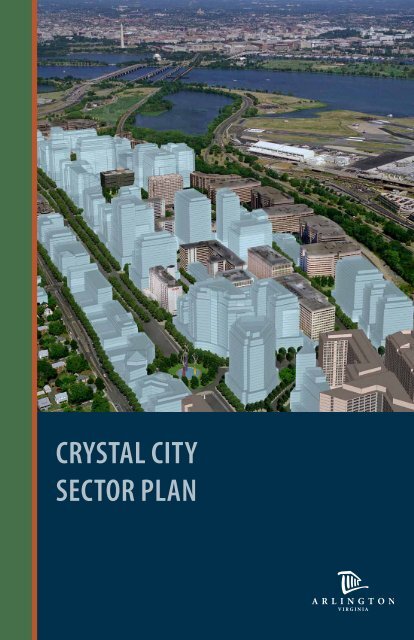
Crystal City sector plan
SeYLp
SeYLp

You also want an ePaper? Increase the reach of your titles
YUMPU automatically turns print PDFs into web optimized ePapers that Google loves.
<strong>Crystal</strong> <strong>City</strong><br />
<strong>sector</strong> <strong>plan</strong><br />
A R L I N G T O N<br />
V I R G I N I A
Project ACKNOWLEDGEMENTS<br />
and Credits<br />
Arlington County Board:<br />
Jay Fisette, Chairman<br />
Christopher Zimmerman, Vice-Chairman<br />
Barbara Favola, Member<br />
Mary Hynes, Member<br />
J. Walter Tejada, Member<br />
<strong>Crystal</strong> <strong>City</strong> Task Force:<br />
Marty Almquist, (Chair) Economic Development Commission<br />
Terry Savela, (Vice-Chair) Planning Commission<br />
Christer Ahl, Resident Representative<br />
Paul Benda, Transportation Commission<br />
Mitch Bonanno, Major Property Owner/Developer<br />
Joel Cohen, Business Tenant*<br />
Sally Cooper, Resident Representative*<br />
Barbara Landes, Business Tenant<br />
Jerry Norris, Economic Development Commission<br />
Wendy Rahm, Commission for the Arts*<br />
Steve Rosenberg, Commission for the Arts<br />
Daryl South, Major Property Owner/Developer<br />
Ted Saks, Aurora Highlands Civic Association<br />
Neal Sigmon, Park and Recreation Commission<br />
Harmar Thompson, Major Property Owner/Developer<br />
Maria Zimmerman, Transportation Commission*<br />
* Former Task Force Members<br />
Arlington County Management Team:<br />
Michael Brown, County Manager<br />
Ron Carlee, Former County Manager**<br />
Barbara Donnellan, Deputy County Manager<br />
Gabriela Acurio, Assistant County Manager<br />
Susan Bell, Director, DCPHD<br />
Terry Holzheimer, Director, AED<br />
Dinesh Tiwari, Director, DPRCR<br />
Robert Brosnan, Division Chief, DCPHD, Planning Division<br />
Dennis Leach, Division Chief, DES, Transportation Division<br />
Stephen Del Giudice, Bureau Chief, DES, Transit Bureau<br />
Lisa Grandle, Division Chief, DPRCR, Park Development Division<br />
Claude Williamson, Supervisor, DCPHD, Planning Division<br />
2
Adopted by THE Arlington COunty Board on September 28, 2010<br />
LONG RANGE PLANNING COMMITTEE<br />
PARTICIPANTS:<br />
Rosemary Ciotti, Planning Commission<br />
Steve Cole, Planning Commission<br />
Peter Fallon, Planning Commission<br />
Brian Harner, Planning Commission<br />
Nancy Hunt, Planning Commission<br />
Inta Malis, Planning Commission<br />
Charles Monfort, Planning Commission<br />
Terry Savela, Planning Commission<br />
Terry Serie, Planning Commission<br />
Steve Sockwell, Planning Commission<br />
Christer Ahl, <strong>Crystal</strong> <strong>City</strong> Resident Representative<br />
Paul Benda, Transportation Commission<br />
Mitch Bonanno, Major Property Owner/Developer<br />
Bruce Cameron, Aurora Highlands Civic Association<br />
Michael Dowell, Aurora Highlands Civic Association (alternate)<br />
Patty Joyce, Arlington Ridge Civic Association (alternate)<br />
Aaron Lien, Environment and Energy Conservation Commission<br />
Christopher Mailander, Arlington Ridge Civic Association<br />
Jerry Norris, Economic Development Commission<br />
Brooks Rainwater, Environment and Energy Conservation Commission<br />
(alternate)<br />
Neal Sigmon, Park and Recreation Commission<br />
Harmar Thompson, Major Property Owner/Developer<br />
Charles Walter, Arlington Ridge Civic Association (alternate)<br />
Lawrence Withers, Housing Commission<br />
James Whittaker, <strong>Crystal</strong> <strong>City</strong> Resident Representative<br />
Project Consultants:<br />
Torti Gallas and Partners<br />
John Torti, President<br />
Paul Mortensen, Associate Principal<br />
Robert Goodill, Principal<br />
Chaiwat Pilanun, Principal<br />
Maurice Walters, Principal<br />
Mike Nicolaus, Principal<br />
Laurence Brady, Associate<br />
Elena Romero-Bostan<br />
Lindsay Ringwelski<br />
Timothy Zork<br />
Raquel Raimundez-Spellacy<br />
Brian Tomaino<br />
Kalinda Brown<br />
Greyson Goon<br />
Abdul Muzikir<br />
Chase Eatherly<br />
Kimley-Horn and Associates<br />
DMJM Harris | AECOM<br />
EDAW<br />
Economics Research Associates<br />
Nelson\Nygaard Consulting Associates<br />
Robert Charles Lesser & Company<br />
Vladislav Yeliseyev, Architectural Illustrations<br />
Arlington County Project Team:<br />
Anthony Fusarelli, Project Coordinator, DCPHD, Planning Division<br />
Justin Clarke**, Molly Just** Margaret Tulloch Rhodes, & Robert Ruiz,<br />
DCPHD, Planning Division<br />
David Cristeal & Sarah Pizzo, DCPHD, Housing Division<br />
Richard Best & Bridget Obikoya, DES<br />
Carol Ann Perovshek** & Diane Probus, DPRCR<br />
Alexander Iams, Cynthia Richmond, and Marc McCauley, AED<br />
** Former Employees<br />
This study was prepared under contract with Arlington County, Virginia, with financial support from the Office of Economic Adjustment,<br />
Department of Defense. The content reflects the views of Arlington County and does not necessarily reflect the views of the Office of Economic<br />
Adjustment.<br />
Project Credits<br />
3
Table of Contents<br />
Executive summary 6<br />
Overview 7<br />
Summary 8<br />
1. Understanding Existing Conditions 10<br />
1.1 Background 11<br />
1.1.1 The History of <strong>Crystal</strong> <strong>City</strong> 11<br />
1.2 The Impact of Regional Growth 12<br />
1.2.1 <strong>Crystal</strong> <strong>City</strong> Planning Area and Vicinity 14<br />
1.2.2 The <strong>Crystal</strong> <strong>City</strong> Planning Area 18<br />
1.2.3 Existing General Land Use Plan 20<br />
1.2.4 Existing Zoning 21<br />
1.3 The Planning Process 22<br />
1.3.1 Background and Purpose 22<br />
1.3.2 About this Document 23<br />
2. Policy Framework 24<br />
2.1 Vision Statement 25<br />
2.2 Goals and Objectives 26<br />
2.3 policy Directives 28<br />
3. <strong>Crystal</strong> <strong>City</strong> master <strong>plan</strong> 30<br />
3.1 Introduction 31<br />
3.2 The Illustrative concept Plan 32<br />
3.3 district Overviews 34<br />
3.3.1 Northeast Gateway 34<br />
3.3.2 Central Business District 36<br />
3.3.3 The Entertainment District 38<br />
3.3.4 South End 40<br />
3.3.5 Northwest Gateway 41<br />
3.3.6 West Side 42<br />
3.4 environmental Sustainability 44<br />
3.5 Block Structure 46<br />
3.6 Transportation 48<br />
3.6.1 Overview and Recommendations 48<br />
3.6.2 Street Network and Circulation Patterns 49<br />
3.6.3 Street Typology 50<br />
3.6.4 Pedestrian and Bicycle Accommodation 52<br />
3.6.5 Existing and Proposed Transit Conditions 54<br />
3.6.6 Proposed Transitway 56<br />
3.6.7 Proposed Multi-Modal Transfer Facility 58<br />
3.6.8 Street Configuration and Network 60<br />
3.6.9 Street-by-Street Recommendations 60<br />
3.6.10 Parking and TDM Measures 72<br />
3.6.11 Transportation Demand Management (TDM) 73<br />
3.7 Public Realm 74<br />
3.7.1 Overview 74<br />
3.7.2 Streets and Sidewalks 74<br />
3.7.3 Urban Forest Canopy Coverage 75<br />
4
3.7.4 Public Open Space 75<br />
3.7.5 Public Art 88<br />
3.7.6 Public Realm and the Underground 89<br />
3.8 Density and Built Form 90<br />
3.8.1 Overview 90<br />
3.8.2 Density Distribution and Massing 92<br />
3.8.3 High/Low Density Zones 92<br />
3.8.4 Density Yield 92<br />
3.8.5 Allowable Building Heights and Tapering Strategies 94<br />
3.8.6 Tower Coverage and Building Envelopes 98<br />
3.8.7 Designing the Skyline 100<br />
3.9 Land Use and Use Mix 102<br />
3.9.1 Housing 102<br />
3.9.2 Retail Uses 102<br />
3.9.3 Preferred Retail Locations 106<br />
3.9.4 Cultural Resources 108<br />
3.9.5 Community Services 109<br />
3.9.6 Parking 110<br />
3.9.7 Service and Loading 110<br />
3.10 Sanitary and Stormwater Infrastructure 112<br />
3.11 Design Guidelines 114<br />
3.11.1 Building Massing 114<br />
3.11.2 Building Setback Profiles 116<br />
3.11.3 Architectural Features 118<br />
3.11.4 Building Frontage 120<br />
3.11.5 Public Sidewalk Frontage 122<br />
3.11.6 Public Space Landscaping 126<br />
4. Implementation 130<br />
4.1 Introduction 131<br />
4.2 Implementation 132<br />
4.2.1 Plan Adoption 132<br />
4.2.2 Land Use and Zoning 132<br />
4.2.3 Affordable Housing 136<br />
4.2.4 Transportation 137<br />
4.2.5 Public Open Space 140<br />
4.2.6 Community Building 142<br />
4.2.7 Environmental Sustainability 143<br />
4.2.8 Economic Development 143<br />
4.2.9 Ongoing Monitoring of Implementation 146<br />
4.3 Implementation matrix 147<br />
Appendices and Glossary 150<br />
Appendices<br />
A.1 Adoption Resolution 152<br />
A.2 Transportation Resolution 153<br />
A.3 Board Guidance 154<br />
A.4 FAA Feasibility Review of Building Heights 156<br />
Glossary 160<br />
Table of contents<br />
5
Executive summary<br />
The <strong>Crystal</strong> <strong>City</strong> Sector Plan represents the results<br />
of a community <strong>plan</strong>ning effort to develop a<br />
preferred vision for the next generation of<br />
development in <strong>Crystal</strong> <strong>City</strong>.<br />
6
Overview<br />
The <strong>Crystal</strong> <strong>City</strong> Sector Plan represents the results of a community<br />
<strong>plan</strong>ning effort to develop a preferred vision for the next generation<br />
of development in <strong>Crystal</strong> <strong>City</strong> throughout the next 40 years. This<br />
document sets forth this vision, through a statement of community<br />
aspirations, a policy framework to guide future actions, and a<br />
conceptual master <strong>plan</strong>. It also includes analysis of <strong>Crystal</strong> <strong>City</strong>’s<br />
regional context, urban form, existing and future transportation<br />
requirements, demographic and market forecasts, and the<br />
consequences of Base Realignment and Closure (BRAC) legislation.<br />
Other neighborhood <strong>plan</strong>ning strategies, such as increasing the quality<br />
and quantity of public open space, provision of affordable housing, and<br />
recommendations for building a sustainable future are also included.<br />
Executive summary<br />
7
“ Cities are<br />
perpetually<br />
unfinished serial<br />
creations... The<br />
form of the<br />
city develops<br />
through a<br />
continuous<br />
reworking<br />
over the traces<br />
of what came<br />
before. This<br />
nonstop<br />
evolution of use<br />
and form is both<br />
inevitable and<br />
desirable.”<br />
ken Greenberg<br />
Architect and Urban Designer<br />
Summary<br />
<strong>Crystal</strong> <strong>City</strong> Today<br />
Just across the Potomac River from<br />
Washington, D.C. and adjacent to Ronald<br />
Reagan Washington National Airport, <strong>Crystal</strong><br />
<strong>City</strong> has become one of Arlington’s largest<br />
concentrations of density and jobs. Its<br />
adjacency to the Pentagon and Pentagon <strong>City</strong><br />
(rounding out the Jefferson Davis Corridor)<br />
has directly influenced <strong>Crystal</strong> <strong>City</strong>’s growth<br />
and development. Today, the Jefferson Davis<br />
and Rosslyn-Ballston corridors comprise<br />
Arlington’s two designated high-density,<br />
mixed-use corridors where development is<br />
focused around existing Metrorail stations.<br />
In recent years, new development has been<br />
limited in <strong>Crystal</strong> <strong>City</strong>, primarily due to near<br />
full build-out conditions under existing<br />
land use guidelines. Until recently, with the<br />
build-out of nearby development sites, the<br />
potential for <strong>Crystal</strong> <strong>City</strong>’s second generation<br />
of redevelopment has largely remained<br />
unexplored, until now.<br />
In 2005, Arlington faced the<br />
recommendations of the Base Realignment<br />
and Closure Commission (BRAC), which<br />
became federal law. This law calls for the U.S.<br />
Department of Defense (DoD) to relocate<br />
17,000 jobs from Arlington to nearby military<br />
bases. These relocations would vacate almost<br />
4.2 million square feet of office space in the<br />
County. In response, the Arlington County<br />
Board quickly appointed a BRAC Transition<br />
Task Force to assess the full impact of these<br />
requirements and develop recommendations<br />
for remediation, especially within <strong>Crystal</strong><br />
<strong>City</strong>. Among other proposals, the Task Force<br />
recommended a formal <strong>plan</strong>ning process<br />
for <strong>Crystal</strong> <strong>City</strong> to create a vision for its<br />
revitalization.<br />
This <strong>plan</strong>ning initiative was launched in early<br />
2006 when the County Board appointed the<br />
<strong>Crystal</strong> <strong>City</strong> Planning Task Force, comprised of<br />
a diverse group of community stakeholders.<br />
The County Board charged the Task Force<br />
with identifying <strong>plan</strong>ning issues for the future<br />
development of <strong>Crystal</strong> <strong>City</strong>, reviewing a<br />
policy framework and concept <strong>plan</strong> generated<br />
by County staff and consultants, and advising<br />
the Board on the final staff recommendations.<br />
Over two years, through a series of public<br />
meetings, site visits, and a community design<br />
charrette, a wide range of goals, <strong>plan</strong> ideas,<br />
transportation proposals, and density and<br />
program assessments have been considered<br />
and discussed at length. This document is<br />
the culmination of these collaborative efforts<br />
to chart a preferred vision for the future of<br />
<strong>Crystal</strong> <strong>City</strong>. Furthermore, at the time of the<br />
writing of this Sector Plan, <strong>Crystal</strong> <strong>City</strong> was<br />
being considered as a high priority area by<br />
the community-wide Community Energy and<br />
Sustainability Task Force, which could result<br />
in future recommended actions that align<br />
with but may go beyond those specifically<br />
recommended in this Plan.<br />
Chapter One of this document provides<br />
background on <strong>Crystal</strong> <strong>City</strong> and the <strong>plan</strong>ning<br />
process. It includes analyses of <strong>Crystal</strong> <strong>City</strong>’s<br />
position in the region, contextual conditions<br />
in and around the <strong>plan</strong>ning area, and a<br />
summary description of the community<br />
process to develop this <strong>plan</strong>.<br />
A Policy Framework for <strong>Crystal</strong> <strong>City</strong><br />
Chapter Two presents the Policy Framework.<br />
This framework includes a Vision Statement<br />
that creates a mental image of <strong>Crystal</strong> <strong>City</strong>’s<br />
desired overall characteristics in the future.<br />
The Vision Statement is supported by a series<br />
of Goals and Objectives that outline the<br />
principal aspirations of the <strong>plan</strong> along with<br />
specific steps directed at achieving each<br />
goal. These elements are embodied within<br />
the Policy Directives, which outline the major<br />
recommendations and guidance for action on<br />
all future redevelopment in <strong>Crystal</strong> <strong>City</strong>.<br />
Through the process, a desired vision was<br />
identified and supported with primary goals<br />
to achieve as part of the future <strong>Crystal</strong> <strong>City</strong>.<br />
Issues related to land use, public streets and<br />
open spaces, architecture and built form,<br />
transportation, environmental and economic<br />
sustainability and transitions to adjacent<br />
neighborhoods were all identified as areas<br />
of interest. Ultimately, seven goals were<br />
established to outline the key aspirations for<br />
the revitalization of <strong>Crystal</strong> <strong>City</strong>:<br />
Create a high quality public realm that<br />
strengthens the sense of place<br />
Provide a mix of uses balancing office,<br />
residential, retail, cultural, and civic uses<br />
among several defined neighborhood<br />
centers<br />
Relate architectural and urban design to<br />
the human scale<br />
Enhance multimodal access and<br />
connectivity<br />
Incorporate sustainable and green<br />
building principles into all urban and<br />
architectural design<br />
Preserve the integrity of the singlefamily<br />
neighborhood to the west<br />
Ensure <strong>Crystal</strong> <strong>City</strong>’s long-term<br />
economic sustainability<br />
Each of these goals is supported by a set<br />
of specific objectives that help direct and<br />
gauge progress in achieving the stated goals.<br />
Many of the objectives are also addressed<br />
in the Policy Directives, the Master Plan,<br />
or implementation recommendations. The<br />
major recommendations for guidance on all<br />
future redevelopment proposals in <strong>Crystal</strong><br />
<strong>City</strong> embodied in the Policy Directives are<br />
organized among eight categories:<br />
Land Use and Complete Community<br />
Building Form and Heights<br />
Density<br />
Public Open Spaces<br />
Sustainable Design and Development<br />
Transportation<br />
Housing Mix and Affordability<br />
Improvement Implementation<br />
The <strong>Crystal</strong> <strong>City</strong> Master Plan<br />
Chapter Three presents the <strong>Crystal</strong> <strong>City</strong> Master<br />
Plan, a comprehensive framework for guiding<br />
future growth and development within<br />
the <strong>plan</strong>ning area. Its several components<br />
include:<br />
The Illustrative Concept Plan<br />
Policy Directives (from Chapter Two)<br />
and Corresponding Policy Maps<br />
Density and Building Form Proposals<br />
Use and Program Mix Proposals<br />
Street Configuration Guidelines<br />
8
Transit Proposals and Recommendations<br />
Park and Open Space Proposals<br />
Retail and Commercial Development<br />
Strategies<br />
Sustainability Strategies and Guidelines<br />
Cultural Resource Guidelines<br />
Community Service Guidelines<br />
Parking, Service, and Loading Strategies<br />
Architectural and Frontage Design<br />
Guidelines<br />
The Illustrative Concept Plan has been the<br />
primary means to develop and test ideas<br />
for growth and improvement in <strong>Crystal</strong> <strong>City</strong>.<br />
Multiple iterations of the Illustrative Concept<br />
Plan were developed, including four schemes<br />
from the Community Charrette that were<br />
subsequently united into an earlier draft <strong>plan</strong><br />
(the 1.5 Alternative). Through Task Force<br />
meetings, community fora, County Board<br />
work sessions, and a variety of agency and<br />
stakeholder meetings, the elements of the 1.5<br />
Alternative were tested, vetted and developed<br />
to produce the Illustrative Concept Plan<br />
presented in Chapter Three. The <strong>plan</strong> includes<br />
a reconfigured street network, enhancements<br />
to existing public open spaces, proposals<br />
for new public open space, sites for either<br />
new development and/or redevelopment,<br />
and many other urban design components.<br />
The Illustrative Concept Plan is not a specific<br />
development <strong>plan</strong> for sites in <strong>Crystal</strong> <strong>City</strong><br />
but a tool for understanding a shared vision<br />
of <strong>Crystal</strong> <strong>City</strong>’s future form, as well as for<br />
gauging how future development proposals<br />
fit within and conform to this overall vision.<br />
The Policy Directives in Chapter Two and<br />
Policy Maps in Chapter Three communicate<br />
the intent of the Master Plan, and help<br />
inform future implementation efforts. In<br />
December of 2008, the County Board<br />
adopted the Illustrative Concept Plan<br />
and Policy Framework (Vision Statement,<br />
Goals and Objective, Policy Directives,<br />
and corresponding Policy Maps) to guide<br />
future development. After adoption of<br />
these elements, the Long Range Planning<br />
Committee of the Planning Commission<br />
initiated a special process to conduct a<br />
technical review of the first full draft of the<br />
<strong>plan</strong>. Now fully integrated into the <strong>Crystal</strong><br />
<strong>City</strong> Sector Plan, the Policy Directives provide<br />
guidance on decisions about density and land<br />
use, transportation infrastructure, parks and<br />
open space, and many other issues effecting<br />
the future of <strong>Crystal</strong> <strong>City</strong>.<br />
A variety of Design Guidelines are provided<br />
throughout Chapter Three, addressing street<br />
and frontage configuration, building massing,<br />
height, tapering, and architectural design.<br />
These guidelines incorporate common<br />
best practices, as well as standards typically<br />
applied in Arlington County. These guidelines<br />
also provide recommendations for future<br />
design proposals so that they might best<br />
conform to the spirit of the <strong>plan</strong>.<br />
Taking the Next Steps<br />
The <strong>Crystal</strong> <strong>City</strong> Sector Plan offers more than a<br />
simple remedy for the pressing circumstances<br />
arising from BRAC and an aging stock of<br />
office buildings. Rather, this Plan offers a<br />
comprehensive vision for the future of <strong>Crystal</strong><br />
<strong>City</strong>, with an emphasis on improving the<br />
quality of the public realm. Opportunities<br />
to responsibly increase density, advance<br />
sustainability, provide energy security,<br />
increase residential offerings, enhance<br />
and expand a multi-faceted transportation<br />
system, increase the quality and quantity of<br />
public open space, and promote high-quality<br />
urban design have all been explored and<br />
incorporated into this document.<br />
executive summary<br />
Historic Aerial View of <strong>Crystal</strong> <strong>City</strong> - 1976<br />
9
1. Understanding Existing<br />
Conditions<br />
<strong>Crystal</strong> <strong>City</strong> has benefitted from its location across<br />
the Potomac River from Downtown Washington D.C.,<br />
and proximity to a major crossroads of regional<br />
transportation and transit facilities.<br />
10
1.1 Background<br />
<strong>Crystal</strong> <strong>City</strong>’s urban form has been shaped largely through decades of<br />
private <strong>sector</strong> development, without a guiding long-range community<br />
<strong>plan</strong> for the area. Nearby, ongoing development in Pentagon <strong>City</strong><br />
and Potomac Yard is creating a more seamless pattern of high-density,<br />
mixed-use development, blurring the boundaries between these<br />
neighborhoods. Nevertheless, <strong>Crystal</strong> <strong>City</strong> remains the largest high<br />
density mixed-use neighborhood in south Arlington, and one of<br />
Arlington’s primary “economic engines.” Almost four decades after<br />
its first high-rise building was built, <strong>Crystal</strong> <strong>City</strong> is approaching full<br />
build-out within the scope of existing land use <strong>plan</strong>s. Looking forward,<br />
any potential for additional growth will need to balance competing<br />
priorities, while improving the quality of life within <strong>Crystal</strong> <strong>City</strong>.<br />
The 2005 BRAC recommendations have had an immediate impact<br />
on Arlington, since it is a well established center for DoD and related<br />
contractor occupancies. BRAC expressly targeted these uses for<br />
relocation to sites outside of Arlington and <strong>Crystal</strong> <strong>City</strong>. In response,<br />
Arlington established a BRAC Transition Task Force that developed 34<br />
recommendations to transform the potential negative impacts into real<br />
opportunities. One of their specific recommendations included “the<br />
initiation of a <strong>plan</strong>ning process that develops and advocates a vision,<br />
analyzes fiscal and economic impacts, and provides a framework for<br />
the physical redevelopment of <strong>Crystal</strong> <strong>City</strong>.” As a result, this Sector Plan<br />
embodies the community’s aspirations for addressing the impacts from<br />
BRAC by guiding future reinvestment in <strong>Crystal</strong> <strong>City</strong> to achieve their<br />
desired, shared vision.<br />
1.1.1 The History of <strong>Crystal</strong> <strong>City</strong><br />
<strong>Crystal</strong> <strong>City</strong> has benefitted from its location across the Potomac River<br />
from Downtown Washington, D.C. and proximity to a major crossroads<br />
of regional transportation and transit facilities. Since the founding of<br />
the Federal <strong>City</strong>, waterways, railroads, bridges, highways, and airports<br />
have provided easy access to and from this location, shaping its<br />
evolution and making <strong>Crystal</strong> <strong>City</strong> a prime location for commercial and<br />
residential growth.<br />
Before 1960, much of <strong>Crystal</strong> <strong>City</strong> was devoted to low intensity<br />
industrial uses such as brickyards, warehouses, and other constructionrelated<br />
activities. Auto-oriented and rail-associated uses such as<br />
motels, storage yards, iron fabricating factories, junk yards, and a drivein<br />
theater prevailed along with many vacant and underutilized tracts.<br />
However, the corridor’s proximity to Reagan National Airport, the<br />
Pentagon, and Washington, D.C. soon stimulated major redevelopment<br />
initiatives for the area. In the mid-1960s, a growing demand for office<br />
space outside of the Washington, D.C., central business district made<br />
Arlington locations more attractive and led to <strong>Crystal</strong> <strong>City</strong>’s early<br />
development into an urban center. <strong>Crystal</strong> <strong>City</strong>’s first generation of<br />
<strong>plan</strong>ned development comprised mixed-use development of office,<br />
apartment, and hotel buildings, with an internal retail spine located<br />
east of Jefferson Davis Highway. The name “<strong>Crystal</strong> <strong>City</strong>” was taken from<br />
one of the early apartment buildings, the <strong>Crystal</strong> House (1900 S. Eads<br />
Street), and the large crystal chandelier that graced its lobby.<br />
As development continued, new apartment and hotel buildings were<br />
constructed west of Jefferson Davis Highway. Meanwhile, the federal<br />
government’s decision in the late 1960s to locate the U.S. Patent Office<br />
and the Institute of Defense Analysis in <strong>Crystal</strong> <strong>City</strong> stimulated more<br />
construction of office and residential buildings supporting federal<br />
government uses. With the July 1977 opening of the <strong>Crystal</strong> <strong>City</strong> Metro<br />
Station, and the Virginia Railway Express (VRE) station a few years later,<br />
<strong>Crystal</strong> <strong>City</strong>’s market reach was greatly expanded, positioning it as a<br />
major regional employment center. Millions of square feet of mixeduse<br />
development have been built to date, leading to <strong>Crystal</strong> <strong>City</strong>’s<br />
status as one of the region’s primary activity centers.<br />
understanding existing conditions<br />
11
“ This sets the<br />
chief mission for<br />
the city of the<br />
future: that of<br />
creating a visible<br />
regional and<br />
civic structure,<br />
designed to make<br />
man at home with<br />
his deeper self<br />
and his larger<br />
world...”<br />
Lewis Mumford<br />
20th Century american<br />
Historian<br />
1.2 The Impact of Regional Growth<br />
Regional Growth Trends<br />
Development pressure on <strong>Crystal</strong> <strong>City</strong> is part of a larger trend observed throughout the<br />
Washington Metropolitan Area. Recent forecasts anticipate rapid growth throughout the region<br />
over the next two decades. The most recent Metropolitan Washington Council of Governments<br />
(COG) report on regional growth projects that by 2030, the region will gain 1.2 million new jobs<br />
and 1.6 million new residents 1 .<br />
This projected growth, however, is not expected to occur uniformly throughout the region 2 .<br />
Figure 1.2.1 identifies the COG region’s major nodes of employment and density, referred to as<br />
“activity centers” and based on COG’s Round 7.0 Forecasts (Table 1.2.1). These activity centers<br />
are becoming increasingly dispersed, often along major transportation corridors. The central<br />
jurisdictions, composed of Washington, D.C., Arlington County, and the <strong>City</strong> of Alexandria, are<br />
projected to account for only 20% of employment growth and 13% of population growth in the<br />
region, but will remain the largest concentration of employment in region. By comparison, the<br />
inner suburbs 3 are projected to account for about one-half of regional employment growth<br />
and 41% of population growth. The outer suburbs 4 account for 28% of projected regional<br />
employment growth, and nearly one-half of projected population growth. Total job growth in<br />
Northern Virginia is forecast to expand by 61%, which will far exceed the projected growth for<br />
the Maryland suburbs (38%) and the District of Columbia (18%) 5 . Collectively, these numbers<br />
suggest that the Northern Virginia jurisdictions within the Washington Metropolitan Area will<br />
experience the largest share of projected regional growth, and that the greatest development<br />
pressure will occur in the outer jurisdictions of Northern Virginia.<br />
Regional Development Patterns<br />
The likely consequence of this projected pattern of growth is sprawl. The negative<br />
consequences of sprawl are well documented and understood 6 . Increased traffic congestion,<br />
loss of farmland and wilderness areas, costly and inefficient expansion of infrastructure,<br />
and unsustainable consumption of fuel and other natural resources are just a few of the<br />
associated negative consequences. To counter the adverse impacts that stem from dispersed<br />
growth, regional governments are increasingly adopting Smart Growth policies as an integral<br />
component of their <strong>plan</strong>ning efforts. Building upon Arlington’s past experience with Smart<br />
Growth <strong>plan</strong>ning, the <strong>Crystal</strong> <strong>City</strong> Sector Plan is an opportunity to demonstrate Arlington’s<br />
continued commitment to these practices.<br />
Table 1.2.1 - Regional Activity center<br />
1 Downtown Washington 31 Dulles East<br />
2 Federal Center/Southwest/Navy Yard 32 Dulles West<br />
3 Georgetown 33 Fairfax Center<br />
4 Monumental Core 34 I-95 Corridor/Engineer Proving Ground<br />
5 New York Avenue 35 Springfield<br />
6 Eisenhower Avenue 36 <strong>City</strong> of Fairfax - George Mason University<br />
7 Downtown Alexandria 37 Md. 85/355 Evergreen Point<br />
8 Ballston/Virginia Square 38 Downtown Leesburg<br />
9 Clarendon/Court House 39 Corporate Dulles<br />
10 <strong>Crystal</strong> <strong>City</strong> 40 Germantown<br />
11 Pentagon <strong>City</strong> 41 North Frederick Avenue<br />
12 Rosslyn 42 Rockville Town Center<br />
13 Friendship Heights 43 Shady Grove/King Farm/Life Sciences Center<br />
14 Bailey’s Crossroads/Skyline 44 White Oak<br />
15 Bethesda CBD 45 US 1 Green Line<br />
16 Silver Spring CBD 46 Greenbelt<br />
17 White Flint 47 New Carrollton<br />
18 Twinbrook 48 Route 1<br />
19 The Pentagon 49 Konterra*<br />
20 Herndon 50 Potomac Mills<br />
21 Merrifield/Dunn Loring 51 Airport/Monocacy Boulevard<br />
22 Reston East 52 Urbana<br />
23 Reston West 53 Route 28 North<br />
24 Tysons Corner 54 Largo Center<br />
25 National Institutes of Health 55 National Harbor<br />
26 Rock Spring park 56 Bull Run - Sudley Area<br />
27 Beauregard Street 57 Innovation<br />
28 Waldorf Commercial 58 Gainesville*<br />
29 Beltway South 59 Woodbridge*<br />
30 Dulles Corner<br />
*New Activity Center. CBD = Central Business district<br />
1 Metropolitan Washington Council of Governments (COG), Pub. No. 20078315., “Growth Trends to 2030: Cooperative Forecasting in<br />
the Washington Region”, Fall 2007, p. 3. (Figures are based on COG’s Round 7.1 Forecasts)<br />
2 The region in these reports is comprised of jurisdiction included in the federal definition of the Metropolitan Statistical Area that<br />
includes COG member jurisdictions and three additional counties, Stafford in Virginia, and Calvert and Charles in Maryland. See<br />
Growth Trends to 2030 for a full list.<br />
3 Counties immediately adjacent to (bordering) the central jurisdictions.<br />
4 The balance of the MSA at its periphery.<br />
5 Ibid.<br />
6 For a concise and very readable exposition on the issue of sprawl and suggested remedies, see Suburban Nation: The Rise of<br />
Sprawl and the Decline of the American Dream, Duany, Plater-Zybert, and Speck, 2000.<br />
12
Cog Activity Centers<br />
Figure 1.2.1<br />
Based on Maps and Data Provided in COG Publication 20078299: Metropolitan Washington Regional Activity Centers and Clusters<br />
0 500 1000<br />
0 500 1000<br />
0 600 1200<br />
0 600 1200<br />
Legend<br />
XX<br />
XX<br />
XX<br />
XX<br />
XX<br />
Regional Activity Centers<br />
COg Inner Jurisdictions<br />
DC Core<br />
Mixed-Use Center<br />
Employment Center<br />
Suburban Employment Center<br />
Emerging Employment Center<br />
Primary road<br />
Secondary Road<br />
Regional Transit System<br />
METRO Station<br />
Red Line<br />
Yellow Line<br />
Orange Line<br />
Blue Line<br />
Green Line<br />
Commuter Rail Line<br />
understanding existing conditions<br />
13
George Washington Memorial Parkway<br />
Rosslyn - Ballston<br />
Corridor<br />
National Mall<br />
Arlington Boulevard<br />
Arlington<br />
Cemetery<br />
Columbia Pike<br />
Glebe Road<br />
Shirley Highway<br />
<strong>Crystal</strong><br />
<strong>City</strong><br />
Reagan National<br />
Airport<br />
Jefferson Davis Highway<br />
Legend<br />
Primary road<br />
Secondary Road<br />
Tertiary Road<br />
Regional Transit System<br />
METRO Station<br />
Red Line<br />
Yellow Line<br />
Orange Line<br />
Blue Line<br />
Green Line<br />
Commuter Rail Line<br />
Alexandria<br />
Analysis of Surrounding Context - Figure 1.2.2<br />
0 500<br />
1.2.1 <strong>Crystal</strong> <strong>City</strong><br />
Planning Area and Vicinity<br />
The 260-acre <strong>Crystal</strong> <strong>City</strong> Planning Area for<br />
this document is a sub-area of the 391-acre<br />
<strong>Crystal</strong> <strong>City</strong> Metro Station Area, which also<br />
includes Long Bridge Park (the North Tract),<br />
Potomac Yard (the South Tract), and the South<br />
End service area. The Metro Station Area is<br />
itself part of the Jefferson Davis Corridor that<br />
also includes Pentagon <strong>City</strong>. The Jefferson<br />
Davis Corridor is one of Arlington’s highdensity,<br />
mixed-use neighborhoods focused<br />
around a Metrorail station. As shown in<br />
Figure 1.2.2, this corridor is connected to<br />
the region by an extensive transportation<br />
network that includes Shirley Highway/I-395,<br />
Jefferson Davis Highway/US Route 1, the<br />
George Washington Parkway, Metrorail’s Blue<br />
& Yellow Lines, the CSX/VRE Railroad Lines,<br />
and Reagan National Airport.<br />
The boundaries for both the Planning<br />
Area and Metro Station Area are shown in<br />
Figure 1.2.3. (The North and South Tracts<br />
were excluded from the <strong>plan</strong>ning area due<br />
to recently completed <strong>plan</strong>ning efforts<br />
specific to those areas.) Selected 2005<br />
demographic estimates for the <strong>Crystal</strong> <strong>City</strong><br />
Planning Area, summarized in Table 1.2.2,<br />
report a population of about 8,100 residents<br />
in roughly 5,000 households. Projections<br />
for 2030 anticipate a 28% increase in the<br />
County’s total number of housing units,<br />
however during the same period, the number<br />
of housing units in the study area is forecast<br />
to increase by nearly 70%. For the same<br />
period, <strong>Crystal</strong> <strong>City</strong>’s workforce is expected to<br />
increase by 22%, compared to a County wide<br />
increase of 40%. While a good portion of this<br />
future projected growth in households and<br />
jobs will be absorbed by the development<br />
underway in the Potomac Yard/South Tract<br />
area, additional development capacity could<br />
be provided within <strong>Crystal</strong> <strong>City</strong> to keep pace<br />
with these projections.<br />
0 600<br />
As shown in Figure 1.2.4 (p. 16), the<br />
Jefferson Davis Corridor abuts the Aurora<br />
Highlands and Arlington Ridge residential<br />
neighborhoods to the west, the Pentagon to<br />
the north, and Reagan National Airport to the<br />
east. Also, the Long Bridge Park/North Tract<br />
area to the north and the mixed-use Potomac<br />
Yard development to the south are technically<br />
within the Jefferson Davis Corridor. Because<br />
these places surround and have immediate<br />
access to <strong>Crystal</strong> <strong>City</strong>, they provide the<br />
context for creating a <strong>Crystal</strong> <strong>City</strong> <strong>plan</strong> that<br />
Table 1.2.2 - Households, Population, and<br />
Employment Estimates (2005)<br />
<strong>Crystal</strong> <strong>City</strong> Planning Area<br />
Count<br />
% of County<br />
Households 5,000 5.4%<br />
Population 8,100 4.1%<br />
Employment 23,600 12.1%<br />
14
espects development impacts, transitions,<br />
connectivity, synergy, accessibility, energy<br />
use, safety, and economic development<br />
within the shared areas. Below is a more<br />
detailed discussion of the physical, social, and<br />
operational interrelationships between these<br />
areas.<br />
Aurora Highlands and Arlington Ridge<br />
Neighborhoods<br />
Situated immediately to the west of <strong>Crystal</strong><br />
<strong>City</strong> are the mostly single-family residential<br />
neighborhoods of Aurora Highlands and<br />
Arlington Ridge. Much of the development<br />
in these neighborhoods predate the first<br />
generation of mixed-use development in<br />
<strong>Crystal</strong> <strong>City</strong>, when the area comprising <strong>Crystal</strong><br />
<strong>City</strong> and Pentagon <strong>City</strong> was home to industrial<br />
and auto-oriented uses such as brickyards,<br />
junk yards, and drive-in movie theaters. As<br />
<strong>Crystal</strong> <strong>City</strong> and Pentagon <strong>City</strong> evolved over<br />
the past four decades, deliberate efforts were<br />
made to establish height and bulk transitions<br />
between the high-density growth pattern in<br />
these new development areas and the lowerdensity,<br />
existing residential neighborhoods<br />
to the west. This <strong>plan</strong> for the next generation<br />
of redevelopment in <strong>Crystal</strong> <strong>City</strong> will carefully<br />
manage development patterns and land<br />
use characteristics along this edge to retain<br />
and reinforce this transition strategy. The<br />
importance of retaining this transition<br />
strategy was highlighted in 2008, when much<br />
of Aurora Highlands received the largelyhonorific<br />
historical designation of inclusion in<br />
the National Register of Historic Places.<br />
In the development of this <strong>plan</strong>, a number of<br />
<strong>plan</strong>ning issues related to the surrounding<br />
Aurora Highlands and Arlington Ridge<br />
neighborhoods were identified, including:<br />
Tapering down in building heights<br />
and scale from <strong>Crystal</strong> <strong>City</strong> to the<br />
neighborhoods;<br />
Potential transportation impacts<br />
resulting from <strong>plan</strong>ned future<br />
development, including the potential<br />
for an increase in cut-through traffic on<br />
neighborhood streets;<br />
Avoiding new street connections<br />
between the street grid in <strong>Crystal</strong> <strong>City</strong><br />
and the Aurora Highlands and Arlington<br />
Ridge neighborhoods;<br />
Improving pedestrian and bicycle<br />
connectivity to and from <strong>Crystal</strong> <strong>City</strong><br />
to allow safe and enjoyable travel<br />
to experience the area’s increasing<br />
amenities;<br />
“Restaurant Row” along 23rd Street S.<br />
between Eads and Fern Streets was<br />
identified as a major community asset<br />
with local businesses that should be<br />
preserved or protected;<br />
Parking challenges for Restaurant Row<br />
retailers need to be addressed;<br />
Interest in reinvestment into their<br />
neighborhood public open spaces as<br />
demands on these spaces are likely to<br />
increase with a growing Jefferson Davis<br />
Corridor;<br />
<strong>Crystal</strong> <strong>City</strong> Metro Station Area<br />
Figure 1.2.3<br />
The <strong>Crystal</strong> <strong>City</strong> Planning Area, outlined in red, is<br />
a sub-area of the MSA and the primary focus of<br />
this <strong>plan</strong>ning initiative.<br />
Interest in other potential impacts on<br />
their neighborhoods and community<br />
facilities.<br />
Pentagon <strong>City</strong><br />
The Pentagon <strong>City</strong> Metro Station Area<br />
comprises 234 acres to the west of <strong>Crystal</strong><br />
<strong>City</strong>. Pentagon <strong>City</strong> has easy access to <strong>Crystal</strong><br />
<strong>City</strong> as well as Interstate 395, the Blue and<br />
Yellow Metrorail lines, and is home to major<br />
retail development, including the Fashion<br />
Centre at Pentagon <strong>City</strong> and Pentagon Row.<br />
Over time, Pentagon <strong>City</strong> has redeveloped<br />
with a rich mix of office, retail, hotel rooms,<br />
and residential units. The recent approvals of<br />
the Metropolitan Park Phased Development<br />
Site Plan (PDSP) and Pentagon Centre PDSP<br />
will enhance the overall development<br />
mix in Pentagon <strong>City</strong> with continued<br />
transit-oriented development. Portions of<br />
Pentagon <strong>City</strong> lie within the boundaries<br />
of the Aurora Highlands and Arlington<br />
Pentagon <strong>City</strong><br />
Legend<br />
Aurora<br />
Highlands<br />
The Pentagon<br />
West<br />
Side<br />
Jefferson Davis Highway<br />
Service<br />
Area<br />
<strong>Crystal</strong> <strong>City</strong> Planning Area<br />
<strong>Crystal</strong> <strong>City</strong> Metro Station Area<br />
Long Bridge<br />
Park<br />
(North Tract)<br />
East<br />
Side<br />
Potomac Yard<br />
(South Tract)<br />
Ridge Civic Associations, underscoring the<br />
interrelationship and overlap among these<br />
neighboring areas.<br />
Pentagon<br />
As the headquarters of the U.S. Department of<br />
Defense, the Pentagon is located immediately<br />
north of the <strong>Crystal</strong> <strong>City</strong> Planning Area across<br />
Interstate 395. While the Pentagon is the<br />
world’s largest office building by floor area, it<br />
is also a major transit hub including a Metro<br />
station as well as a recently completed major<br />
intermodal transit center. Even though it is<br />
isolated from Pentagon <strong>City</strong> and <strong>Crystal</strong> <strong>City</strong><br />
by Interstate 395, there are opportunities<br />
for enhancing pedestrian connectivity<br />
and energy needs among these areas. The<br />
federal government has long-term <strong>plan</strong>s that<br />
envision more environmentally friendly and<br />
sustainable development on its property.<br />
Reagan National<br />
Airport<br />
understanding existing conditions<br />
0 500 1000<br />
0 600 12<br />
15
Neighborhoods Adjacent to <strong>Crystal</strong> <strong>City</strong> - Figure 1.2.4<br />
16<br />
Reagan National Airport<br />
Reagan National Airport is the nearest<br />
commercial airport to Washington, D.C.<br />
and is centrally located within the greater<br />
Washington metropolitan region, serving<br />
approximately 18.5 million passengers per<br />
year. For many visitors arriving by air, it serves<br />
as a gateway into Arlington County, <strong>Crystal</strong><br />
<strong>City</strong>, and the metropolitan area. Its proximity<br />
to <strong>Crystal</strong> <strong>City</strong> offers many benefits, such as<br />
immediate access to destinations throughout<br />
the nation that are just one Metrorail stop<br />
and one flight away. The airport also ensures<br />
a strong market base for the neighborhood’s<br />
hotel operators. This <strong>plan</strong> for <strong>Crystal</strong> <strong>City</strong> and<br />
its recommended implementation actions<br />
are intended to maintain and protect the<br />
viability of the airport’s continued operations.<br />
To this end, the County worked with staff at<br />
the Federal Aviation Administration (FAA)<br />
and interested stakeholders on an FAAlead<br />
feasibility analysis that looked at the<br />
anticipated first 15 years of development<br />
proposed in the <strong>Crystal</strong> <strong>City</strong> Sector Plan<br />
to discern any potential impacts to flight<br />
operations and surveillance conditions.<br />
Initial findings from the feasibility study are<br />
summarized in Appendix 4.<br />
Long Bridge Park<br />
Long Bridge Park will be a new park and<br />
state-of-the-art aquatics, health and fitness<br />
facility in the north end of <strong>Crystal</strong> <strong>City</strong>.<br />
Current <strong>plan</strong>s envision a very energy efficient<br />
and architecturally stunning swimming<br />
and exercise venue set within a dynamic<br />
recreational complex that will feature four fullsize<br />
athletic fields with views of Washington,<br />
D.C. Arlington residents have expressed an<br />
interest in having more swimming pools and<br />
trails and this project is being undertaken in<br />
response to those desires. Long Bridge Park’s<br />
proximity to <strong>Crystal</strong> <strong>City</strong> will offer convenient<br />
access to the facility’s array of both active and<br />
passive amenities. Immediately south of Long<br />
Bridge Park, several redevelopment projects<br />
have been approved which will help connect<br />
the mixed use development in <strong>Crystal</strong> <strong>City</strong><br />
with the park.<br />
Potomac Yard<br />
Potomac Yard is envisioned to be a transitand<br />
pedestrian-oriented neighborhood,<br />
reinforcing an urban lifestyle with a rich mix<br />
of uses, including:<br />
2.1 million square feet of office space;<br />
225,000 square feet of retail space and a<br />
grocery store;<br />
1,500 residential units; and<br />
600 hotel rooms.<br />
The proposed development features a<br />
transportation network that creates an active<br />
and memorable pedestrian environment<br />
that is well-connected to public transit. This<br />
will be accomplished by providing a street<br />
network to accommodate pedestrians,<br />
bicyclists and vehicles; a complete network of<br />
sidewalks and trails; and a dedicated transitway,<br />
to ultimately accommodate a streetcar<br />
system. At nearly two acres, the Center Park<br />
is envisioned as the grand outdoor room of<br />
Potomac Yard and is intended to serve as the<br />
focal point of public life there, with public<br />
art and opportunities for special events and<br />
programs.
Image provided in partnership with Pictometry International<br />
View of Reagan National Airport<br />
View of Long Bridge Park from <strong>Crystal</strong> <strong>City</strong><br />
What is Smart Growth<br />
Smart Growth is an expanding movement<br />
within the <strong>plan</strong>ning, environmental, and<br />
development community trying to change<br />
the way development occurs in our cities<br />
and suburbs nationwide. The effort is lead<br />
by organizations such as the Smart Growth<br />
Network, a partnership of federal, state and<br />
local governments with such diverse groups<br />
as developers, environmentalists, historic<br />
preservation advocates, various professional<br />
organizations, and diverse interests in the<br />
real estate industry. Launched by the U.S.<br />
Environmental Protection Agency in 1996, this<br />
group has developed and promoted a number<br />
of strategies, including a set of principles that<br />
can guide state and local <strong>plan</strong>ning efforts 1 :<br />
Create a Range of Housing Opportunities<br />
and Choices: Providing a diversity of good<br />
quality housing for people of all income levels<br />
and tenures is an integral component in any<br />
Smart Growth strategy.<br />
1 Source: Smart Growth Online, Smart Growth Network,<br />
http://www.smartgrowth.org/default.asp.<br />
View of Potomac Yard and <strong>Crystal</strong> <strong>City</strong><br />
Create Walkable Neighborhoods: Walkable<br />
communities are desirable places to live, work,<br />
learn, worship and play, promote healthy<br />
exercise, and are accessible to people of all<br />
ages.<br />
Foster Distinctive, Attractive Communities<br />
with a Strong Sense of Place : Communities<br />
and stakeholders should craft a vision<br />
and set of standards for development and<br />
construction which respond to community<br />
values of regional history, architectural<br />
quality, and distinctiveness.<br />
Make Development Decisions Predictable,<br />
Fair and Cost Effective: Development<br />
opportunities should be embraced by the<br />
private <strong>sector</strong>.<br />
Mix Land Uses: Mixed land uses are a critical<br />
component of a pedestrian-friendly place to<br />
live.<br />
Preserve Open Space, Farmland, and<br />
Critical Environmental Areas: Preserved<br />
and enhanced natural and man-made open<br />
View of west side above Aurora Highlands<br />
spaces bolster local economies, safeguard<br />
critical environmental areas, protect natural<br />
habitat for <strong>plan</strong>t and animal communities,<br />
improve quality of life, and focus new growth<br />
into existing communities.<br />
Provide a Variety of Transportation Choices:<br />
Providing choices in transportation for people<br />
of all ages is a key component of Smart<br />
Growth and protecting the environment.<br />
Strengthen and Direct Development<br />
Towards Existing Communities: Direct<br />
development towards communities served by<br />
existing infrastructure, in order to conserve<br />
open space, minimize development and<br />
community costs, and preserve natural<br />
resources.<br />
Take Advantage of Compact Building<br />
Design: Incorporate more compact building<br />
design as an alternative to conventional,<br />
environmentally unsustainable and land<br />
consumptive development.<br />
understanding existing conditions<br />
17
18<br />
Table 1.2.3 - Planning Area Summary<br />
Area of Study<br />
Gross Area<br />
Acres Square Feet<br />
West Side 103 4,483,640<br />
East Side 157 6,834,360<br />
Total 260 11,318,000<br />
Legend<br />
Single Family Residential<br />
Town-house Multi-family<br />
residential<br />
Highway<br />
Mid- and high-rise mixed<br />
use<br />
Forested Buffer<br />
Low Scale Industrial/<br />
Commercial<br />
1.2.2 The <strong>Crystal</strong> <strong>City</strong><br />
Planning Area<br />
The <strong>Crystal</strong> <strong>City</strong> Planning Area illustrated in<br />
Figure 1.2.3 (p. 15) is bounded by 10th Street<br />
and Army-Navy Drive to the north, 32nd<br />
Street to the south, Eads and Fern Streets to<br />
the west, and the CSX rail right of way to the<br />
east. The total <strong>plan</strong>ning area is 260 acres,<br />
with the east side of Jefferson Davis Highway<br />
comprising approximately 157 acres or 60%<br />
of the study area. The breakdown of the<br />
<strong>plan</strong>ning area between the east and west<br />
sides is provided in Table 1.2.3.<br />
Edge Conditions<br />
A variety of edge conditions define the<br />
<strong>plan</strong>ning area, as depicted in Figure 1.2.5.<br />
To the north, medium density, mixed-use<br />
development prevails in close proximity<br />
to I-395 and Long Bridge Park. The edge<br />
along the Pentagon <strong>City</strong> Metro Station Area<br />
is mostly characterized as medium to high<br />
density mixed-use development, with some<br />
light industrial usage to be phased out on<br />
the Metropolitan Park site that has PDSPapproval<br />
for around 2,200 residential units<br />
and 300 hotel rooms. The eastern edge is<br />
predominately wooded, consisting of the CSX<br />
railroad right of way and George Washington<br />
Parkway, with Reagan National Airport<br />
beyond. The southeastern edge borders<br />
the mixed-use Potomac Yard development<br />
area. The southwestern edge borders a light<br />
industrial and service zone. The western edge<br />
along Eads and Fern Streets is where <strong>Crystal</strong><br />
<strong>City</strong> abuts the Aurora Highlands single family<br />
neighborhood.<br />
Site Analysis<br />
The Planning Area has many recognizable<br />
elements as shown in Figure 1.2.6. These<br />
elements fall into five distinct categories:<br />
districts, paths, edges, activity centers, and<br />
landmarks. The districts represent identifiable<br />
geographic areas within <strong>Crystal</strong> <strong>City</strong>. Paths<br />
represent the principal corridors of movement<br />
through <strong>Crystal</strong> <strong>City</strong>. Edges are either visual<br />
and/or physical barriers or areas with notable<br />
changes in character. Activity centers are<br />
nodes of concentrated activity within a<br />
district. Similarly, landmarks are prominent<br />
objects in the landscape, and can assist in<br />
navigation and orientation.<br />
The dominant element of <strong>Crystal</strong> <strong>City</strong> today<br />
is Jefferson Davis Highway, which acts both<br />
as a path and an edge barrier separating the<br />
east and west sides. Due in part to <strong>Crystal</strong><br />
<strong>City</strong>’s elongated shape and the strong edge<br />
condition along Jefferson Davis Highway,<br />
east-west district divisions are much clearer<br />
than north-south divisions. The airport<br />
viaduct and ramps also create a strong barrier<br />
condition that defines the South End district.<br />
The circulatory network in <strong>Crystal</strong> <strong>City</strong> is<br />
characterized by a hierarchy of paths, with<br />
Jefferson Davis Highway serving as a primary<br />
thruway and regional commuter route.<br />
Principal local paths include <strong>Crystal</strong> Drive,<br />
Eads Street, and the cross streets ranging<br />
from 12th Street to the north to 23rd Street to<br />
the south. Other streets in the northern and<br />
southern districts are often less used either<br />
because of limited access, poor connectivity,<br />
or single direction traffic flow. In many cases,<br />
streets are configured as feeder and service<br />
access roads, with little or no pedestrian<br />
accommodation or connectivity.<br />
Principal edge conditions include the<br />
western border with Aurora Highlands,<br />
where medium-density mixed-use<br />
development rapidly transitions to a lower<br />
density, residential neighborhood. The least<br />
penetrable edge is to the east side, where<br />
<strong>Crystal</strong> <strong>City</strong> abuts the wooded CSX railroad<br />
right of way and the George Washington<br />
Parkway.<br />
Principal activity centers include the Metro<br />
Station entrance on 18th Street, the retail<br />
shops on <strong>Crystal</strong> Drive between 20th and 23rd<br />
Streets, and the area known as “Restaurant<br />
Row” on the west side along 23rd Street.<br />
Landmarks include features such as the Water<br />
Park along <strong>Crystal</strong> Drive, the Doubletree Hotel<br />
which marks the gateway when entering<br />
<strong>Crystal</strong> <strong>City</strong> from the north, and the Airport<br />
Viaduct in the south end as it crosses over<br />
Jefferson Davis Highway en route to the<br />
airport.<br />
The <strong>Crystal</strong> <strong>City</strong> Underground<br />
One important component of <strong>Crystal</strong> <strong>City</strong> not<br />
shown in this diagram is the Underground.<br />
The Underground is a climate controlled<br />
interior pedestrian concourse lined in some<br />
areas by retail shops serving residents,<br />
workers, and visitors. Many residents and<br />
employees in <strong>Crystal</strong> <strong>City</strong> are familiar with<br />
the Underground and the convenience it<br />
affords. However, for unfamiliar visitors, the<br />
Underground may be difficult to find and<br />
navigate. This study will provide opportunities<br />
to improve how people perceive <strong>Crystal</strong> <strong>City</strong>’s<br />
retail experience from the Underground<br />
and streetscapes, and provide a clear<br />
and understandable system for all users.<br />
Additionally, the <strong>plan</strong> will include a strategy<br />
for preservation of the Underground’s distinct<br />
positive attributes, including its ability to<br />
extend the reach of transit.<br />
Redevelopment Opportunities<br />
Although <strong>Crystal</strong> <strong>City</strong> is mostly built-out<br />
under the existing <strong>plan</strong>ning and zoning<br />
parameters, both near- and long-term<br />
redevelopment opportunities may exist<br />
within the <strong>plan</strong>ning area should additional<br />
growth potential be provided. An analysis<br />
of potential redevelopment sites is provided<br />
in Figure 1.2.7. The diagram also identifies<br />
potential new development sites that could<br />
be created through the proposed removal<br />
of selected inefficient highway ramps or<br />
realignment and merging of certain streets<br />
(such as Clark and Bell Streets). Additionally,<br />
areas with potential as infill sites with<br />
good street frontage are also identified.<br />
According to property owners, some existing<br />
office buildings that are now or soon will<br />
be obsolete have also been identified as<br />
candidates for demolition and redevelopment<br />
within the <strong>plan</strong>ning period. This diagram<br />
demonstrates the many opportunities for<br />
growth in <strong>Crystal</strong> <strong>City</strong> through a combination<br />
of redevelopment, in-fill development, and<br />
development on new sites.<br />
Edge Conditions - Figure 1.2.5<br />
0 500 1000 0 500 1000
Analysis of Existing Conditions<br />
Redevelopment Opportunities<br />
Legend<br />
Edge<br />
Path*<br />
Element Major Minor<br />
Path as Edge<br />
Neighborhood /<br />
District<br />
Node / destination<br />
Landmark<br />
* Dashed Line indicates underground concourse<br />
Legend<br />
New Development site<br />
Potential Redevelopment Site<br />
Building to Remain<br />
understanding existing conditions<br />
Figure 1.2.6<br />
<strong>Crystal</strong> <strong>City</strong> has distinct areas with identifiable characteristics framed 0 by<br />
Figure 1.2.7<br />
500 This figure identifies 1000 buildings anticipated to remain 0 over the <strong>plan</strong>’s 5000 lifetime, 1000 500<br />
differing edge conditions. There is also a network of paths and streets that<br />
connect these areas. A number of landmarks are also identified, which help<br />
contribute to the identity of <strong>Crystal</strong> <strong>City</strong>. This diagram identifies these 0 various<br />
possible new sites for development, and likely redevelopment sites within<br />
<strong>Crystal</strong> <strong>City</strong>. Each site provides opportunities to either stimulate the<br />
redevelopment 600 of obsolete 1200building, or to better 0define the edges along 600 0 600 1200<br />
characteristics and their spatial relationship.<br />
public parks and streets in order to enhance the public realm.<br />
19
1.2.3 Existing General<br />
Land Use Plan<br />
In most areas, development in <strong>Crystal</strong> <strong>City</strong><br />
reflects the existing General Land Use Plan<br />
(GLUP) designations within the area, as shown<br />
in Figure 1.2.8. High-density residential and<br />
office uses with ground level retail activity<br />
(internal or street facing) prevail in the core<br />
area between Jefferson Davis Highway and<br />
<strong>Crystal</strong> Drive. Low-medium density mixed<br />
use development exists east of <strong>Crystal</strong> Drive,<br />
within the <strong>Crystal</strong> Park site <strong>plan</strong>. The area<br />
between Jefferson Davis Highway and Eads<br />
Street is <strong>plan</strong>ned for high density residential<br />
development. Densities of residential<br />
development taper down to the west towards<br />
Aurora Highlands, as do commercial and<br />
industrial <strong>plan</strong>ned densities and activity. Low<br />
density residential development with single<br />
family detached, duplex, and low-rise multi<br />
family dwelling building types are located<br />
beyond <strong>Crystal</strong> <strong>City</strong>’s western boundary into<br />
Aurora Highlands.<br />
The majority of <strong>Crystal</strong> <strong>City</strong> was developed<br />
beginning in the 1960s, continuing through<br />
the 1980s with large office, residential and<br />
hotel buildings. A recent change to the GLUP<br />
converted Service Industry parcels in the<br />
Potomac Yard South Tract to a “striped” land<br />
use pattern of 2/3 Low Office-Apartment-<br />
Hotel and 1/3 Medium Residential. At<br />
the same time land in the North Tract<br />
was converted from Service Industry to a<br />
combination of Low Office-Apartment-Hotel<br />
and Public. These land use changes were<br />
associated with the approval of the Potomac<br />
Yard PDSP.<br />
In most areas, development has progressed<br />
consistent with the General Land Use Plan,<br />
or in areas where development predates<br />
the GLUP designations, the GLUP map has<br />
been amended to reflect prevailing land use<br />
and development patterns. In fact, very few<br />
properties in the <strong>Crystal</strong> <strong>City</strong> Planning Area<br />
remain available for redevelopment under<br />
the existing GLUP (as of 2008), especially<br />
in the core area. Under the existing GLUP,<br />
Existing General Land Use Plan<br />
20<br />
For Complete Legend, see Arlington GLUP Map at<br />
www.arlingtonva.us/departments/cphd/<strong>plan</strong>ning/docs/<br />
CPHDPlanningDocsGLUP.aspx<br />
Figure 1.2.8
Existing Zoning<br />
the majority of low-scale commercial sites<br />
available for redevelopment are concentrated<br />
in the southwestern portion of the <strong>plan</strong>ning<br />
area, south of 23rd Street and east of Eads<br />
Street. However, based on the latest available<br />
figures for projected development potential<br />
based on the existing GLUP, approximately<br />
3,200 medium- to high-density residential<br />
units, 143,000 square feet of office space,<br />
9,300 square feet of retail space, and 640<br />
hotel rooms could still be constructed, after<br />
appropriate rezonings and site <strong>plan</strong> approvals.<br />
Figure 1.2.9<br />
1.2.4 Existing Zoning<br />
The existing zoning in the <strong>Crystal</strong> <strong>City</strong><br />
Planning Area is mostly consistent with the<br />
GLUP, with some exceptions. Figure 1.2.9<br />
illustrates the existing zoning pattern for the<br />
<strong>plan</strong>ning area. Over the years, the County<br />
Board has rezoned properties either as a<br />
result of land use and zoning studies, or<br />
with the approval of special exception site<br />
<strong>plan</strong> projects consistent with the GLUP. The<br />
mixed-use high density core area, defined<br />
by Jefferson Davis Highway, 12th Street, and<br />
<strong>Crystal</strong> Drive, is primarily zoned “C-O”, with the<br />
<strong>Crystal</strong> Plaza apartment community zoned<br />
“RA4.8” and other small remnants of land<br />
zoned “M-2”. The area east of <strong>Crystal</strong> Drive is<br />
zoned “C-O-1.5,” reflecting low- to mediumdensity<br />
mixed use development within the<br />
<strong>Crystal</strong> Park site <strong>plan</strong>.<br />
West of Jefferson Davis Highway, properties<br />
that have been redeveloped consistent with<br />
the GLUP’s high-residential designation for<br />
the area are zoned primarily “RA-H-3.2”, while<br />
properties with commercial office or retail<br />
buildings in this swath are zoned either “C-O”,<br />
“C-2”, or “C-M”. Especially south of 23rd Street,<br />
low-rise commercial properties on land zoned<br />
“C-2” or “C-M” have not yet been redeveloped<br />
to reflect the County’s long-range vision for<br />
the area. Existing zoning along 23rd Street,<br />
or “Restaurant Row”, is primarily a mix of<br />
“C-2” and “C-O”, with the medium density<br />
residential blocks north towards 15th Street<br />
zoned “RA6-15” and “RA4.8”, with the post<br />
office site at the corner of Eads and 18th<br />
Streets zoned “CM”.<br />
zoning classifications<br />
C-1 Local Commercial Districts<br />
C-1-O limited commercial professional<br />
office building districts<br />
C-2 service commercial - community<br />
business districts<br />
CM limited industrial districts<br />
C-O commercial office building,<br />
hotel and multi-family dwelling<br />
districts<br />
C-O-1.5 commercial office building, hotel<br />
and apartment districts<br />
C-O-2.5 commercial office building, hotel<br />
and apartment districts<br />
M-1 light industrial districts<br />
M-2 service industrial districts<br />
P-S<br />
public service districts<br />
R2-7 two-family and town house<br />
dwelling districts<br />
R-5 one-family, restricted two-family<br />
dwelling districts<br />
RA-4.8 multi-family dwelling districts<br />
RA6-15 apartment dwelling districts<br />
RA7-16 apartment dwelling districts<br />
RA8-18 apartment dwelling districts<br />
S-3A special districts<br />
For Complete Legend and list of zoning classifications, see Arlington<br />
zoning Map at www.co.arlington.va.us/departments/cphd/<strong>plan</strong>ning/<br />
zoning/CPHDPlanningZoningOffice.aspx<br />
understanding existing conditions<br />
21
“ Make no little<br />
<strong>plan</strong>s; they have<br />
no magic to stir<br />
men’s blood and<br />
probably will<br />
themselves not be<br />
realized. Make big<br />
<strong>plan</strong>s; aim high in<br />
hope and work,<br />
remembering<br />
that a noble,<br />
logical diagram<br />
once recorded<br />
will not die.”<br />
Daniel Burnham<br />
19th Century american<br />
Architect and Urban Designer<br />
1.3 The Planning Process<br />
1.3.1 Background and<br />
Purpose<br />
This <strong>plan</strong>ning process began in 2005 when<br />
the County Board appointed the BRAC<br />
Transition Task Force to address issues<br />
related to the recently enacted base closure<br />
legislation. With the anticipated loss of 3.2<br />
million square feet of office space leased<br />
to government tenants and contractors<br />
in <strong>Crystal</strong> <strong>City</strong> alone, the County faced a<br />
significant economic challenge. A primary<br />
recommendation of the BRAC Transition<br />
Task Force was the initiation of a formal<br />
<strong>plan</strong>ning process for <strong>Crystal</strong> <strong>City</strong> that could<br />
address issues arising from BRAC while<br />
defining a vision for <strong>Crystal</strong> <strong>City</strong>’s future. By<br />
the fall of 2006, the <strong>plan</strong>ning process was<br />
launched with the first <strong>Crystal</strong> <strong>City</strong> Task Force<br />
meeting. The Task Force, appointed by the<br />
Arlington County Board, represented various<br />
stakeholders within the greater <strong>Crystal</strong> <strong>City</strong><br />
community. Their meetings provided a<br />
regular platform for intense discussion and<br />
evaluation. Their primary responsibilities<br />
included providing a forum for community<br />
feedback, helping to identify <strong>plan</strong>ning issues,<br />
and reviewing and commenting on the<br />
proposed policy framework and concept <strong>plan</strong><br />
generated by County staff and consultants. A<br />
series of meetings and events were organized<br />
to develop a community vision for <strong>Crystal</strong><br />
<strong>City</strong>. These included:<br />
<strong>Crystal</strong> <strong>City</strong> Task Force Meetings<br />
More than 30 meetings were held on a<br />
regular basis, were open to the public<br />
and served as the primary means for<br />
presenting and discussing advances<br />
in the <strong>plan</strong>ning effort. The Task Force<br />
efforts were completed with the County<br />
Board adoption of the Policy Framework.<br />
The Camp Out - Field observations<br />
were made on a number of weekday<br />
and weekend visits at different times of<br />
the day. Observations and assessments<br />
were made on the level and intensity<br />
of activity on the streets and in the<br />
restaurants, shops, Underground, and<br />
parks and open spaces throughout the<br />
course of a typical week.<br />
The <strong>Crystal</strong> <strong>City</strong> Walking Tour - This<br />
event offered the public an opportunity<br />
to walk the neighborhood with the<br />
project team. The event allowed<br />
participants to identify what they did<br />
and did not like about <strong>Crystal</strong> <strong>City</strong>’s<br />
existing environment, and suggest<br />
changes for the future.<br />
Stakeholder Meetings - These<br />
meetings were held throughout<br />
the process to gather information<br />
on potential development and<br />
redevelopment opportunities and<br />
to discuss in detail the concerns<br />
of individual stakeholders in the<br />
community. Principal among these were<br />
resident groups, property owners and<br />
developers, office and retail business<br />
representatives, and representatives<br />
of commissions, federal and state<br />
agencies, and other entities with some<br />
jurisdictional stake in the process.<br />
development of multiple possible<br />
scenarios for the future of <strong>Crystal</strong> <strong>City</strong>,<br />
discuss issues and concerns, suggest<br />
ideas, and attend and comment on<br />
presentations of the several concept<br />
<strong>plan</strong> alternatives that emerged from the<br />
charrette.<br />
Transportation Walking Tour - This<br />
event offered the community an<br />
opportunity to tour <strong>Crystal</strong> <strong>City</strong> and<br />
review issues related to traffic, transit,<br />
and other transportation issues.<br />
Regional Partners Transportation<br />
Working Sessions - These sessions were<br />
organized to solicit comments from<br />
regional transportation organizations<br />
such as Washington Metropolitan Area<br />
Transit Authority (WMATA), VRE, Virginia<br />
Department of Transportation (VDOT),<br />
the Metropolitan Washington Airport<br />
Authority (MWAA), National Park Service<br />
(NPS) and others whose operations are<br />
impacted by the <strong>plan</strong>ning effort.<br />
Task Force Transit Subcommittee<br />
Due to the complexity of the longterm<br />
transit options considered in the<br />
<strong>plan</strong>ning process, a subcommittee<br />
was formed to review options and<br />
recommend a final alignment of the<br />
<strong>plan</strong>ned surface transitway.<br />
Community Forums - Held on a<br />
periodic basis, these events allowed<br />
the community to comment directly<br />
on the evolution of the concept <strong>plan</strong><br />
alternatives and refinements.<br />
County Board Work Sessions - These<br />
sessions enabled the County Board to<br />
assess progress in the <strong>plan</strong>ning efforts<br />
and provide direction and guidance<br />
moving forward.<br />
Long Range Planning Committee<br />
After adoption of the Policy Framework<br />
and development of a first draft <strong>plan</strong>, a<br />
special process was initiated to conduct<br />
a technical review of the <strong>plan</strong> to ensure<br />
completeness and consistency with the<br />
Policy Framework.<br />
Collectively, these events have provided<br />
the community with multiple platforms to<br />
explore issues and ideas associated with a<br />
<strong>plan</strong> for <strong>Crystal</strong> <strong>City</strong>’s future. In addition, all<br />
events, updates and information were posted<br />
and advertised on a County website available<br />
throughout the process. As a product of this<br />
process, the <strong>Crystal</strong> <strong>City</strong> Sector Plan provides<br />
all stakeholders of <strong>Crystal</strong> <strong>City</strong> with a vision<br />
of what their community wants to achieve,<br />
as well as a standard by which all future<br />
development proposals can be evaluated.<br />
The Community Charrette - This<br />
week-long event gave the community<br />
an opportunity to observe the<br />
22<br />
The <strong>Crystal</strong> <strong>City</strong> Walking Tour
1.3.2 About this Document<br />
The <strong>Crystal</strong> <strong>City</strong> Sector Plan is a guiding<br />
document for future reinvestment and<br />
development in <strong>Crystal</strong> <strong>City</strong>. It includes a<br />
concept master <strong>plan</strong> supported by a policy<br />
framework and guidelines that addresses<br />
significant <strong>plan</strong>ning and development topics.<br />
This document provides the community and<br />
stakeholders with a refined vision and guiding<br />
framework for future development in <strong>Crystal</strong><br />
<strong>City</strong>, with a special focus on urban design,<br />
building form and height, land use, public<br />
open space, environmental sustainability,<br />
energy use, transportation and transit, and<br />
other key attributes of the built environment<br />
and public realm. Its principal objective is to<br />
guide future development to be consistent<br />
with this preferred vision.<br />
For County staff and public officials,<br />
this document is a guide for future<br />
implementation actions intended to realize<br />
the <strong>plan</strong>. Specifically, this document provides<br />
the necessary guidance required to:<br />
Amend the General Land Use Plan<br />
(GLUP) to reflect changes in both the<br />
kind and balance of uses described in<br />
the <strong>plan</strong>;<br />
Amend the Zoning Ordinance to<br />
implement the <strong>plan</strong>;<br />
Amend the Master Transportation Plan<br />
and other master <strong>plan</strong>ning documents<br />
used to guide transportation <strong>plan</strong>ning<br />
efforts county-wide;<br />
Evaluate private development proposals<br />
for consistency with the vision of the<br />
Master Plan;<br />
Recommend public use easements and/<br />
or the acquisition of property for public<br />
use within the <strong>plan</strong>ning area;<br />
Include the <strong>Crystal</strong> <strong>City</strong> area for a<br />
potential district energy scale project<br />
in the forthcoming Arlington County<br />
Community Energy Plan.<br />
Chapter Two presents the Policy Framework,<br />
which includes the Vision Statement, Goals<br />
and Objectives, and Policy Directives. Chapter<br />
Three presents the Master Plan, as well as a set<br />
of urban and architectural design guidelines<br />
to inform public and private development<br />
and infrastructure proposals. Chapter Four<br />
includes a description of the anticipated next<br />
steps and implementation recommendations,<br />
which are followed by appendices and a<br />
glossary of terms used throughout this<br />
document.<br />
Among the materials included in the<br />
appendices are several documents and<br />
resolutions that were included in the County<br />
Board’s action to adopt the <strong>Crystal</strong> <strong>City</strong><br />
Sector Plan in September 2010. In particular,<br />
the September 28, 2010, document titled,<br />
“Board Guidance for the Implementation and<br />
Elaboration of the <strong>Crystal</strong> <strong>City</strong> Sector Plan”<br />
includes the Board’s affirmation that the Goals<br />
and Objectives of this <strong>plan</strong> articulate their<br />
vision for a rebuilt <strong>Crystal</strong> <strong>City</strong>, and provides<br />
additional guidance on several specific<br />
areas of the <strong>plan</strong> (See Appendix 3). To the<br />
extent that the Board guidance differs from<br />
recommendations in the Sector Plan, the<br />
wording and intent of the Board Guidance<br />
shall govern.<br />
Image provided in partnership with Pictometry International<br />
Aerial View of <strong>Crystal</strong> <strong>City</strong><br />
understanding existing conditions<br />
The Community Charrette<br />
Transportation Walking Tour<br />
Community Forums<br />
23
2. Policy Framework<br />
<strong>Crystal</strong> <strong>City</strong> will become a complete community<br />
where one may grow up and grow old. It will offer<br />
the ability to live-out every stage of life, a place to<br />
experience childhood, enjoy the activities of a young<br />
adult, work, raise a family, and live comfortably and<br />
securely in later years.<br />
24
2.1 Vision Statement<br />
<strong>Crystal</strong> <strong>City</strong> is one of Arlington’s great urban centers and is well<br />
positioned for future success. In this vision, <strong>Crystal</strong> <strong>City</strong> will grow into a<br />
community of neighborhoods with active, pedestrian-focused streets,<br />
quality architecture, and a rich urban character. Principal features will<br />
include:<br />
Well-defined public and complete streets that provide equally for<br />
traffic and pedestrians, and are great places to experience;<br />
Very high quality public parks that are accessible to all;<br />
Vibrant street-level retail throughout <strong>Crystal</strong> <strong>City</strong> to attract and<br />
serve residents, workers and visitors alike;<br />
The calming and humanizing of Jefferson Davis Highway with<br />
expansive landscaping and attractive building frontages along its<br />
edge;<br />
Fully integrated and accessible multi-modal transit that links<br />
neighborhoods and communities within <strong>Crystal</strong> <strong>City</strong> and beyond;<br />
and<br />
A full mix of uses typical of a complete, urban community.<br />
<strong>Crystal</strong> <strong>City</strong> will comprise a vibrant mix of housing, office, retail, hotel,<br />
cultural, and civic uses. This will be a place full of life in daytime and<br />
nighttime hours where people will want to see and be seen. <strong>Crystal</strong><br />
<strong>City</strong> will become a complete community where one may grow up and<br />
grow old. It will offer the ability to live-out every stage of life, a place to<br />
experience childhood, enjoy the activities of a young adult, work, raise<br />
a family, and live comfortably and securely in later years. Within this<br />
<strong>plan</strong>, one might envision a young couple meeting a group of friends<br />
after work for drinks, a light dinner and to watch the Nationals baseball<br />
game on TV, before walking to a local nightclub to listen to live music<br />
into the late hours. At the same time, a retired couple living in a new<br />
apartment overlooking the Potomac River, might be slowly strolling<br />
by all the new storefronts along <strong>Crystal</strong> Drive as workers and area<br />
residents pass by along the street. This couple eventually sits down to<br />
a wonderful dinner before going to one of the local black-box theaters<br />
to see the opening of a locally written play. In this vision, <strong>Crystal</strong> <strong>City</strong><br />
has become one of the vibrant urban centers of a thriving Arlington<br />
County.<br />
This vision is by no means guaranteed in the absence of a deliberate<br />
effort to make it happen. Forces such as BRAC and the associated<br />
loss of tenants, the replacement of aging office buildings, an ever<br />
expanding demand on transportation infrastructure, and the need<br />
to accommodate more residents as the region continues to grow<br />
increasingly compel change within <strong>Crystal</strong> <strong>City</strong>. The absence of any<br />
coherent, proactive <strong>plan</strong> for <strong>Crystal</strong> <strong>City</strong> could result in a decline of<br />
urban form and quality of life. The principal intent of the <strong>Crystal</strong> <strong>City</strong><br />
Sector Plan is to explore how change and growth should take form.<br />
This vision anticipates growth, meets the demands of an evolving<br />
marketplace, and seeks to preserve the best qualities and features of<br />
the existing urban fabric while minimizing disruptions to residents.<br />
Above all else, it seeks to utilize this unique opportunity to revitalize<br />
<strong>Crystal</strong> <strong>City</strong>’s urban environment for the benefit of all who live and<br />
work there now, as well as in the future.<br />
<strong>Crystal</strong> <strong>City</strong>’s existing assets and potential for sustainable growth are<br />
nearly unparalleled in the region. Its close proximity to the Potomac<br />
River overlooking the monuments of the national mall ideally position<br />
<strong>Crystal</strong> <strong>City</strong> to continue as one of Arlington County’s principal transitoriented<br />
urban centers. Adjacent to Reagan National Airport and<br />
featuring highly used transit stations for Metro and the Virginia<br />
Railway Express, <strong>Crystal</strong> <strong>City</strong> today possesses one of the highest transit<br />
modal shares in the nation with extensive links to the Washington<br />
Metropolitan Area . Furthermore, <strong>Crystal</strong> <strong>City</strong> offers a mixed-use<br />
environment of existing office, hotel, residential, and retail buildings<br />
near the heart of the nation’s capital, and is well positioned to improve<br />
and grow with expanded transit options. This vision builds on these<br />
successes in transit and urban form by introducing a new surface<br />
transitway system that will offer greater connectivity and accessibility<br />
to neighborhoods and communities in and around Arlington County.<br />
A key feature any vision should explore is how to use existing and<br />
proposed buildings to better frame and give definition to streets and<br />
public spaces as places of shared civic use. A first priority is to create<br />
active streetscapes that promote pedestrian use, foster increased retail<br />
activity and growth, and generally create a “sense of place” in an urban<br />
setting. This “sense of place” will be further strengthened by providing<br />
distinct neighborhoods with high-quality sustainable architecture,<br />
and additional civic, cultural, recreational, and community amenities<br />
which feature public art and are both attractive and safe. In the future,<br />
landscaped streets and sidewalks, bicycle lanes and trails, interior<br />
public walkways connecting to transit, walkways and streets lined with<br />
bustling restaurants, local and national retailers, cultural venues and<br />
neighborhood services will all enliven <strong>Crystal</strong> <strong>City</strong> and provide for an<br />
active public realm.<br />
This statement and the following Goals and Objectives have guided<br />
and directed <strong>plan</strong>ning efforts, and will empower all participants to<br />
evaluate through the lens of a shared vision the many <strong>plan</strong>s and<br />
proposals that will be presented to the <strong>Crystal</strong> <strong>City</strong> community, both<br />
now and in the future.<br />
policy framework<br />
25
2.2 Goals and Objectives<br />
This vision for <strong>Crystal</strong> <strong>City</strong> is expressed<br />
through the following seven goals and<br />
supporting objectives:<br />
1. Create a High Quality Public Realm<br />
that Strengthens the Sense of Place.<br />
Coordinate the public realm so that the<br />
street system, transit system, sidewalks<br />
and interior walkway system, and a<br />
variety of public open spaces work<br />
together to establish the framework<br />
around which redevelopment shall<br />
occur.<br />
Improve the urban form and pedestrian<br />
experience while enhancing streetlevel<br />
activity and connectivity for all<br />
users by designing smaller, tree-lined<br />
neighborhood blocks.<br />
Target existing underutilized paved<br />
spaces for consolidation into<br />
development sites before impacting<br />
existing green spaces.<br />
Increase the amount of high-quality,<br />
accessible and “usable” public open<br />
space in <strong>Crystal</strong> <strong>City</strong>.<br />
Create a variety of accessible public<br />
spaces that are strategically phased and<br />
located throughout <strong>Crystal</strong> <strong>City</strong>. These<br />
public spaces should be appropriately<br />
sized, designed, and programmed<br />
to attract, serve and support the<br />
anticipated population of residents,<br />
workers, and visitors including their<br />
recreation, leisure, social and cultural<br />
needs.<br />
Acknowledge residual open spaces<br />
between buildings for their ability to<br />
provide visual relief and a calming<br />
influence.<br />
Establish at least one primary, centrally<br />
located public space that can serve as<br />
the “heart” of <strong>Crystal</strong> <strong>City</strong> and a venue<br />
for significant, programmed community<br />
events.<br />
Integrate cultural venues with public<br />
spaces, streets, and interior walkways<br />
in an effort to increase visibility and<br />
accessibility, create synergy between<br />
uses, and increase pedestrian activity<br />
levels overall.<br />
Provide attractions and/or amenities in<br />
the interior walkway system and along<br />
streets to stir interest and to encourage<br />
an active round-the-clock street life,<br />
such as public art, streetscape furniture,<br />
wayfinding, retail and cultural venues.<br />
2. Provide a Mix of Uses by balancing<br />
office, residential, retail, cultural,<br />
and civic uses among several defined<br />
neighborhood centers.<br />
Define <strong>Crystal</strong> <strong>City</strong> by its neighborhoods,<br />
including the northern neighborhood,<br />
the central Metro station district, the<br />
entertainment district along <strong>Crystal</strong><br />
Drive, and the hotel district to the south.<br />
Create a more even balance between<br />
residential and office uses and daytime<br />
and evening populations, and maintain<br />
an economically sustainable hotel base.<br />
Improve the availability of primary<br />
elements of daily living within <strong>Crystal</strong><br />
<strong>City</strong>.<br />
Create a thriving “Class A” office<br />
environment.<br />
Provide a mix of housing options to<br />
accommodate households with differing<br />
income levels, family composition, and<br />
accessibility requirements.<br />
Provide varied cultural and civic facilities<br />
and uses (such as theaters, emergency<br />
service facilities, health care, day care,<br />
urgent medical care, meeting spaces,<br />
etc.) for all age groups, and strategically<br />
locate them near transit centers,<br />
public spaces, and restaurants to<br />
promote those venues and help define<br />
neighborhood centers.<br />
Encourage a diverse mix of retail<br />
spaces, including grocery stores, to<br />
maintain and attract local retail and<br />
neighborhood services in addition to<br />
major and national retailers.<br />
Create a safe environment for all by<br />
mixing uses, programming activities<br />
in public spaces and through design<br />
techniques that foster social activity,<br />
interaction, and visibility.<br />
3. Relate Architectural and Urban<br />
Design to the Human Scale.<br />
Create new buildings where the base<br />
of at least one or two stories relates to<br />
the street level and the top creates a<br />
meaningful connection to the sky.<br />
Use wide expanses of glass for the base<br />
of building retail spaces to promote<br />
street activity.<br />
Use building massing and elevations to<br />
create and frame the public realm and to<br />
preserve and enhance views from within<br />
the public realm.<br />
Create distinct and defined block edges.<br />
Provide a meaningful and careful<br />
transition from the core of <strong>Crystal</strong><br />
<strong>City</strong> to the adjacent single family<br />
neighborhood.<br />
Establish identifiable landscape, public<br />
art, or architectural features at gateway<br />
locations between <strong>Crystal</strong> <strong>City</strong> and<br />
adjoining lower-density residential<br />
neighborhoods.<br />
4. Enhance Multimodal Access and<br />
Connectivity.<br />
Improve transportation and landuse<br />
connections within and beyond<br />
<strong>Crystal</strong> <strong>City</strong> through transit-oriented<br />
development.<br />
Enhance <strong>Crystal</strong> <strong>City</strong>’s transit orientation<br />
with new and better transit services and<br />
facilities designed to meet the future<br />
needs of <strong>Crystal</strong> <strong>City</strong>, and to further<br />
encourage residents, workers, and<br />
visitors to select transit over personal<br />
vehicles.<br />
Enhance <strong>Crystal</strong> <strong>City</strong>’s multimodal<br />
transportation infrastructure by<br />
designing transit facilities as integral<br />
architectural elements and improving<br />
overall transit, pedestrian, and bicycle<br />
access and connectivity.<br />
Provide high quality surface transit<br />
service that has travel times competitive<br />
with private automobiles, attracts riders,<br />
reduces automobile dependency, and<br />
limits roadway congestion.<br />
26<br />
High Quality Public Parks - Boston, MA Varied Civic Spaces - Barcelona, ES Great Places to Sit and Eat
Enhance the urban quality of <strong>Crystal</strong> <strong>City</strong><br />
by strengthening the urban street grid.<br />
Create a hierarchy of streets to facilitate<br />
automobile, transit, bike, and pedestrian<br />
use.<br />
Create vibrant, pedestrian oriented<br />
streets through the better use of<br />
sidewalks, streetscapes, and open space<br />
areas to improve space for pedestrians,<br />
bicyclists, parking, and transit.<br />
Transform Jefferson Davis Highway<br />
(Route 1) into an asset of the overall<br />
multimodal transportation network.<br />
Supply appropriate parking to support<br />
a vibrant mix of uses while discouraging<br />
unnecessary single occupancy vehicle<br />
use.<br />
Maximize the use of all parking<br />
resources through measures such as<br />
Transportation Demand Management<br />
(“TDM”).<br />
Maintain and improve connections<br />
to the interior walkway system<br />
both vertically and horizontally as<br />
development occurs while maintaining<br />
its connectivity to Metrorail and creating<br />
linkages to transitway stations.<br />
Enhance the utility and safety of the<br />
bicycle network as part of the <strong>Crystal</strong><br />
<strong>City</strong> transportation network.<br />
Provide better connections to Reagan<br />
National Airport and the surrounding<br />
regional transportation network.<br />
Provide comprehensive wayfinding for<br />
all users.<br />
5. Incorporate Sustainable and Green<br />
Building Principles into all Urban<br />
and Architectural Design.<br />
Consider environmental sustainability<br />
and overall energy efficiency as integral<br />
parts of all aspects of building design<br />
and development.<br />
Design buildings and neighborhoods<br />
using the best available technologies<br />
and processes feasible to protect the<br />
local environment (stormwater quality,<br />
waste reduction, heat island reduction)<br />
and the regional environment (climate<br />
change, Chesapeake Bay protection, air<br />
quality).<br />
Design and build new buildings to<br />
meet county policies on sustainable<br />
development.<br />
6. Preserve the Integrity of the Single-<br />
Family Neighborhood to the West.<br />
Taper buildings up in scale and height,<br />
west to east, from Fern Street to Eads<br />
Street between 18th and 23rd Streets,<br />
so that buildings along the east side of<br />
Fern Street are compatible in scale and<br />
form and have stepbacks that respond<br />
appropriately to the single-family homes<br />
on the west side of Fern Street.<br />
Taper buildings up in scale and height,<br />
west to east, across Eads Street between<br />
23rd Street and Fort Scott Drive, so<br />
that buildings along the east side of<br />
Eads Street are compatible in scale and<br />
form and have stepbacks that respond<br />
appropriately to the single-family homes<br />
on the west side of Eads Street.<br />
Provide improved pedestrian, bike<br />
and other connections between<br />
<strong>Crystal</strong> <strong>City</strong> and adjacent single-family<br />
neighborhoods, to help reduce the<br />
barrier effect of Jefferson Davis Highway.<br />
Direct traffic to major arterials and<br />
multi-modal network elements, and<br />
avoid street designs that increase cut<br />
thru traffic into adjacent single-family<br />
neighborhoods.<br />
7. Ensure <strong>Crystal</strong> <strong>City</strong>’s Long-Term<br />
Economic Sustainability.<br />
To the extent possible, <strong>plan</strong> at the block<br />
level or in increments of multiple blocks<br />
in order to realize a balanced mix of uses<br />
accompanied by sufficient open spaces<br />
and service and cultural uses.<br />
Create a vision <strong>plan</strong> which ensures that<br />
new development can be economically<br />
viable.<br />
Provide flexibility to phase development<br />
to meet market conditions, support<br />
timely redevelopment of properties<br />
most impacted by BRAC, encourage<br />
redevelopment, and address future<br />
public improvements.<br />
Promote public/private partnerships for<br />
achieving community enhancements.<br />
Provide assistance to property owners,<br />
tenants, and small businesses during<br />
the BRAC transition and <strong>Crystal</strong> <strong>City</strong><br />
redevelopment.<br />
Maintain and encourage a robust hotel<br />
environment at <strong>Crystal</strong> <strong>City</strong>.<br />
Recognize the importance of Reagan<br />
National Airport and the key elements<br />
of its economic viability in the long-term<br />
sustainability of the county.<br />
Strengthen <strong>Crystal</strong> <strong>City</strong>’s competitive<br />
edge with other close-in jurisdictions<br />
and localities in the Washington, D.C.<br />
region in attracting and retaining private<br />
<strong>sector</strong> users of Class A office space.<br />
Acknowledge and respect <strong>Crystal</strong><br />
<strong>City</strong>’s existing populations during<br />
redevelopment activities and minimize<br />
any associated potential negative<br />
impacts to their quality of life.<br />
policy framework<br />
Multimodal Transportation - Barcelona, ES Integrated Transit - Houston, TX Sustainable Roof Garden - Chicago, IL<br />
27
“Human and<br />
moral factors<br />
must always be<br />
considered. They<br />
must never be<br />
missing from<br />
policies and<br />
from public<br />
discussion. “<br />
Herman Kahn<br />
American military strategist<br />
and systems theorist<br />
2.3 policy Directives<br />
In order to achieve the vision and goals and<br />
objectives for <strong>Crystal</strong> <strong>City</strong>, a series of Policy<br />
Directives, or major recommendations for<br />
guidance on future decisions relating to<br />
public and private reinvestment, are outlined<br />
as follows. (Policy Maps referenced in the<br />
directives below can be found in Chapter<br />
Three, the <strong>Crystal</strong> <strong>City</strong> Master Plan).<br />
Land Use and Complete Community (LU)<br />
LU 1) Ensure ample and diverse<br />
opportunities for work, recreation and<br />
entertainment within <strong>Crystal</strong> <strong>City</strong> to<br />
create an active, 18-hour per day street<br />
life. <strong>Crystal</strong> <strong>City</strong> will be an economically<br />
and socially vibrant neighborhood,<br />
supporting a healthy mix of residents<br />
and visitors seven days a week.<br />
LU 2) Attain an ultimate build out in the<br />
<strong>Crystal</strong> <strong>City</strong> Planning Area with more<br />
residential than office Gross Floor Area<br />
(GFA) to reach an evening population<br />
at least half the daytime population<br />
and to steadily improve the resident to<br />
employment balance.<br />
LU 3) Establish recommended land<br />
uses for each block in the <strong>Crystal</strong> <strong>City</strong><br />
Planning Area as shown on the Land Use<br />
Map to guide actual use mixes proposed<br />
within block-level Phased Development<br />
Site Plans. Recommend some blocks<br />
to have specific minimum percentages<br />
for certain land uses, as outlined on the<br />
Land Use Map. (See page 103)<br />
LU 4) Designate specific areas in <strong>Crystal</strong><br />
<strong>City</strong> for ground floor retail uses that<br />
are accessible from sidewalks, the<br />
interior pedestrian concourse, or both,<br />
as shown on the Retail Frontage and<br />
Interior Pedestrian Concourse Map, and<br />
strategically locate interior retail to not<br />
detract from street level retail areas.<br />
(See page 107)<br />
LU 5) Engage critical County service<br />
providers and stakeholders, such as<br />
police, fire, schools and emergency<br />
response services, in <strong>plan</strong>ning for<br />
and implementing the infrastructure<br />
necessary to accommodate future<br />
demand for service provision as <strong>Crystal</strong><br />
<strong>City</strong> grows.<br />
LU 6) Create tools and incentives to<br />
establish a strong presence of desired<br />
cultural and community-oriented<br />
facilities (such as theaters, large format<br />
grocery stores, day care and medical<br />
facilities) in the core of <strong>Crystal</strong> <strong>City</strong>.<br />
Building Form and Heights (B)<br />
B 1) Establish build-to lines for the<br />
<strong>Crystal</strong> <strong>City</strong> Planning Area along the<br />
perimeter of development blocks as<br />
demarcated on the Build to Lines Map.<br />
(See page 47)<br />
B 2) Establish absolute maximum<br />
building heights (in feet) for all blocks in<br />
the <strong>Crystal</strong> <strong>City</strong> Planning Area, as shown<br />
on the Building Heights Map. (See page<br />
95)<br />
B 3) Require proposed development<br />
projects in <strong>Crystal</strong> <strong>City</strong> to submit their<br />
projects for review by Federal Aviation<br />
Administration (FAA) when they file a<br />
site <strong>plan</strong> application with the County,<br />
and secure notice from FAA that the<br />
project is not a hazard to air navigation<br />
before a County Board public hearing is<br />
scheduled for formal action on the site<br />
<strong>plan</strong> application.<br />
B 4) Undertake future study (as needed)<br />
to develop alternative physical <strong>plan</strong>ning<br />
parameters for achieving <strong>plan</strong>ned<br />
densities should the FAA determine<br />
that currently <strong>plan</strong>ned heights are not<br />
feasible for airport operations.<br />
B 5) Establish maximum building tower<br />
coverages, measured above the fifth<br />
floor, for all blocks within the <strong>Crystal</strong> <strong>City</strong><br />
Planning Area, as shown on the Tower<br />
Coverage Map. (See page 99)<br />
B 6) Require minimum horizontal<br />
separation of 60 feet between building<br />
towers above the fifth floor to ensure<br />
light, air, relief, and respite to outdoor<br />
and indoor spaces.<br />
B 7) Apply bulk/<strong>plan</strong>e height controls,<br />
as shown in the Bulk Plane Angle Map,<br />
near identified parks and plazas to limit<br />
shadows on and ensure natural daylight<br />
to such spaces. (See page 97)<br />
Density (D)<br />
D 1) Establish base densities for each<br />
block in the <strong>Crystal</strong> <strong>City</strong> Planning Area,<br />
as shown on the Base Density Map. (See<br />
page 93)<br />
D 2) Allow for optional increases over<br />
the base density (as shown in the 2008<br />
GLUP) within the maximum building<br />
height limits on sites in <strong>Crystal</strong> <strong>City</strong>, in<br />
return for extraordinary community<br />
benefits outlined in this <strong>plan</strong>, at the<br />
County Board’s discretion.<br />
D 3) Utilize a tear-down credit (or<br />
similar mechanism) to encourage<br />
redevelopment that furthers <strong>Crystal</strong><br />
<strong>City</strong> Planning goals and achieves public<br />
improvements, while retaining overall<br />
economic feasibility by recognizing the<br />
significant cost of demolishing existing<br />
major assets.<br />
Public Open Spaces (P)<br />
P 1) Provide, at a minimum, all public<br />
open spaces as indicated on the Public<br />
Open Space Map in accordance with the<br />
general size outlined in the Open Space<br />
Inventory Table on the map. (See page<br />
79)<br />
P 2) Address the displacement of<br />
existing public open spaces by<br />
concurrently providing comparable<br />
or enhanced spaces, either through<br />
development of new park sites or<br />
through improvements to existing open<br />
spaces along with public easement<br />
dedications.<br />
P 3) Allow low-scale infill development<br />
on the existing open space in front of<br />
2121 <strong>Crystal</strong> Drive only after the Center<br />
Park on Block J-K is realized.<br />
P 4) Establish County control over all<br />
public open spaces shown on the Public<br />
Open Space Map through either public<br />
dedication/acquisition or public-use and<br />
access easements set in perpetuity.<br />
P 5) Increase tree canopy coverage in<br />
<strong>Crystal</strong> <strong>City</strong> by meeting or exceeding<br />
28
the most current applicable goals in the<br />
County’s Urban Forest Master Plan (and<br />
in no case below existing levels of tree<br />
canopy coverage), and by strategically<br />
installing street trees, where feasible, in<br />
areas where redevelopment is projected<br />
for later phases.<br />
P 6) Achieve dedicated publicly<br />
accessible tree-lined pedestrian routes<br />
through large urban blocks that provide<br />
for safe and attractive passage and<br />
connectivity between buildings.<br />
Sustainable Design and Development (S)<br />
S 1) Reach, at a minimum, operational<br />
carbon neutrality in <strong>Crystal</strong> <strong>City</strong><br />
through actions such as energy<br />
efficiencies, maximizing vegetated<br />
areas, comprehensive water and<br />
stormwater management <strong>plan</strong>ning,<br />
efficient use and conservation of all<br />
resources, and provision of exceptional<br />
access to transit, in order to align with<br />
County goals and to enhance its overall<br />
economic and environmental position in<br />
the region.<br />
S 2) Uphold the County’s then current<br />
highest and best environmental<br />
sustainability standards for all<br />
projects, including renovation and<br />
redevelopment projects throughout<br />
<strong>Crystal</strong> <strong>City</strong>.<br />
S 3) Design, construct, and manage<br />
all public and private spaces, streets,<br />
infrastructure, and buildings to help<br />
the <strong>Crystal</strong> <strong>City</strong> Plan meet selected<br />
certification standards under the United<br />
States Green Building Council’s (USGBC)<br />
LEED Neighborhood Development<br />
program.<br />
Transportation (T)<br />
T 1) Address and manage the <strong>Crystal</strong><br />
<strong>City</strong> multimodal transportation system<br />
to accommodate future <strong>plan</strong>ned growth<br />
in the area. Ensure that such system<br />
meets the needs of residents to travel<br />
from <strong>Crystal</strong> <strong>City</strong> for work, pleasure, and<br />
other reasons; that individuals working<br />
but not residing in <strong>Crystal</strong> <strong>City</strong> can<br />
easily and economically travel to <strong>Crystal</strong><br />
<strong>City</strong> via transit, pedestrian and bicycle<br />
thoroughfares, and other transportation<br />
modes; and that others can also easily<br />
access <strong>Crystal</strong> <strong>City</strong> for business, visiting<br />
residents, entertainment, recreation,<br />
shopping, etc.<br />
T 2) Establish a revised street network<br />
for <strong>Crystal</strong> <strong>City</strong> as shown in the<br />
Street Network and Typology Map, in<br />
accordance with and to be reflected in<br />
the County’s Master Transportation Plan.<br />
(See page 51)<br />
T 3) Expand County control over all<br />
streets and rights of way through public<br />
ownership, dedication, or public-use<br />
easements set in perpetuity.<br />
T 4) Improve the safety and quality of<br />
pedestrian travel by providing elements<br />
such as sufficient sidewalk clear zones,<br />
adequate space for street trees and<br />
landscape elements, and reduced<br />
pedestrian crossing distances.<br />
T 5) Maintain continuity and safety<br />
and minimize temporary disruptions<br />
for pedestrians, bicyclists, motorists,<br />
and transit users during all phases of<br />
construction throughout <strong>Crystal</strong> <strong>City</strong>,<br />
including in the interior pedestrian<br />
concourse.<br />
T 6) Maintain an interior pedestrian<br />
concourse from 12th Street to 23rd<br />
Street, as shown conceptually on the<br />
Retail Frontage and Interior Pedestrian<br />
Concourse Map that extends the reach<br />
of transit, provides frequent connections<br />
to sidewalks, and is adequately flexible<br />
to permit creative design solutions for<br />
new development. (See page 107)<br />
T 7) Locate and consolidate building<br />
loading and service access points to<br />
secondary and tertiary streets and alleys<br />
where feasible, as recommended in the<br />
Services and Loading Map. (See page<br />
111)<br />
T 8) Implement the proposed<br />
alignment and enhanced surface transit<br />
technology (streetcar), as shown on the<br />
Surface Transitway Map, and design<br />
stations as integral elements of the built<br />
environment. (See page 57)<br />
T 9) Establish additional access points<br />
to the <strong>Crystal</strong> <strong>City</strong> Metro Station in the<br />
vicinity of the <strong>Crystal</strong> Drive and 18th<br />
Street intersection.<br />
T 10) Create a multi-modal transfer<br />
area in the short-term on 18th Street<br />
under Jefferson Davis Highway, while<br />
working to integrate long-term future<br />
development adjacent to the existing<br />
Metro Station entrance with an<br />
enhanced multi-modal transfer facility<br />
situated at the ground floor.<br />
T 11) Establish near-term parking ratios<br />
for new projects that range from a<br />
maximum of 1 space per 750sf and/or<br />
a minimum of 1 space per 1,000sf for<br />
office uses and between 1 and 1.125<br />
spaces per residential dwelling unit<br />
(or apply the County’s most current<br />
parking management policies), while<br />
maximizing the sharing of parking space<br />
by various users and addressing shortterm<br />
visitor and retail parking needs in<br />
<strong>Crystal</strong> <strong>City</strong>.<br />
T 12) Apply Transportation Demand<br />
Management (TDM) measures that<br />
reinforce the use of a smaller parking<br />
supply.<br />
T 13) Develop a <strong>plan</strong> to ensure that<br />
conditions are created to unify <strong>Crystal</strong><br />
<strong>City</strong> into a single, seamless community<br />
by sufficiently and effectively finding<br />
mechanisms for pedestrians, vehicular<br />
traffic, bicycle traffic, transit, and<br />
commerce to flow over, under, or in<br />
some other way not be impeded by the<br />
Jefferson Davis Highway.<br />
Housing Mix and Affordability (H)<br />
H 1) Increase the committed affordable<br />
housing stock in <strong>Crystal</strong> <strong>City</strong> by<br />
developing implementation tools that<br />
encourage the provision of on-site or<br />
nearby off-site affordable units.<br />
H 2) Develop implementation tools to<br />
ensure a housing mix with a sufficiently<br />
broad range of sizes and price points<br />
such that:<br />
• those who work in <strong>Crystal</strong> <strong>City</strong> have<br />
affordable opportunities to live there;<br />
• households of various sizes,<br />
composition, and accessibility<br />
requirements are accommodated.<br />
H 3) Maximize a stock of committed<br />
affordable housing within <strong>Crystal</strong><br />
<strong>City</strong>. To the extent that a developer’s<br />
affordable housing commitment is not<br />
met by providing such housing within<br />
the <strong>Crystal</strong> <strong>City</strong> Planning Area, work to<br />
ensure that such housing is provided as<br />
close to <strong>Crystal</strong> <strong>City</strong> as feasible.<br />
H 4) Apply the Affordable Housing<br />
Ordinance and create special provisions<br />
for increased Zoning Ordinance density<br />
that achieve up to 20 percent of Gross<br />
Floor Area (GFA) above the 2008 GLUP<br />
as committed affordable dwelling units,<br />
to increase <strong>Crystal</strong> <strong>City</strong>’s affordable<br />
housing stock, and allow affordable<br />
dwelling units to be provided in new or<br />
existing buildings.<br />
H5) Leverage existing and potential<br />
future tools to add a total of between<br />
550 and 1,200 committed affordable<br />
housing units in the <strong>Crystal</strong> <strong>City</strong><br />
Planning Area by 2050.<br />
Improvement Implementation (I)<br />
I 1) Develop financing tools beyond<br />
traditional community benefit to pay<br />
for infrastructure and other public<br />
improvements essential to the spirit of<br />
the illustrative <strong>plan</strong> in recognition of<br />
(1): the transformational nature of the<br />
<strong>Crystal</strong> <strong>City</strong> redevelopment <strong>plan</strong>; (2): the<br />
limitations of developer contributions<br />
due to the high cost of demolitionreplacement<br />
projects; and, (3) the need<br />
to implement the enhanced surface<br />
transit (streetcar) at the beginning of the<br />
redevelopment process.<br />
I 2) Review future redevelopment<br />
activities in <strong>Crystal</strong> <strong>City</strong> at a Phased<br />
Development Site Plan (PDSP) level, in<br />
accordance with the block boundaries<br />
outlined in the Build-To Lines Map,<br />
either prior to or concurrent with final<br />
site <strong>plan</strong>s to ensure overall feasibility of<br />
achieving major <strong>plan</strong> improvements.<br />
policy framework<br />
29
3. <strong>Crystal</strong> <strong>City</strong><br />
master <strong>plan</strong><br />
This Master Plan is a compilation of an Illustrative<br />
CONCEPT Plan, Framework Policies, Design and Policy<br />
Diagrams, and other descriptive elements that<br />
together frame a vision for the future of <strong>Crystal</strong><br />
<strong>City</strong>.<br />
30
3.1 Introduction<br />
The <strong>Crystal</strong> <strong>City</strong> Master Plan details the envisioned future of <strong>Crystal</strong><br />
<strong>City</strong>. It includes an Illustrative Concept Plan, relevant maps, and other<br />
elements to guide the future development and revitalization of <strong>Crystal</strong><br />
<strong>City</strong>. The Master Plan also includes <strong>plan</strong>ning recommendations for<br />
land use, transportation, public open space, sustainability and green<br />
building practices, density, affordable housing, program, and other<br />
topics that address urban design and public policy decision-making.<br />
In the following pages, the final <strong>Crystal</strong> <strong>City</strong> Master Plan is illustrated<br />
and described. It should be noted that many of the illustrations and<br />
diagrams are representational in nature and do not recommend or<br />
direct specific detailed designs for any given site.<br />
<strong>Crystal</strong> <strong>City</strong> Master Plan<br />
31
3.2 The Illustrative concept Plan<br />
The Illustrative Concept Plan (Figure 3.2.2)<br />
shows a potential future for <strong>Crystal</strong> <strong>City</strong><br />
consistent with the Policy Framework. The<br />
<strong>plan</strong> incorporates key urban elements<br />
and design strategies to enhance <strong>Crystal</strong><br />
<strong>City</strong>’s districts and create a great place<br />
with a built environment that shapes great<br />
streets, sidewalks, and public open spaces.<br />
Principal among these elements are a legible<br />
framework of streets and blocks, high-quality<br />
parks and plazas, vibrant streetfront retail<br />
areas, an integrated transit network, and a<br />
balanced mix of uses. The Illustrative Concept<br />
Plan represents just one way properties<br />
could be developed in accordance with the<br />
recommendations set forth in the Policy<br />
Directives, and the exact location, scale<br />
and design character of public and private<br />
improvements may ultimately vary in detail,<br />
but should be consistent with the spirit of this<br />
<strong>plan</strong>.<br />
The Illustrative Concept Plan embodies<br />
primary urban design objectives and features,<br />
including park and plaza locations, building<br />
types, building heights, building massing,<br />
12th Street S<br />
15th Street S<br />
18th Street S<br />
23rd Street S<br />
S. Eads Street<br />
Jefferson Davis Highway / US1<br />
20th Street S<br />
S. Clark Street<br />
26th Street S<br />
<strong>Crystal</strong> Drive<br />
and street configuration throughout the<br />
<strong>plan</strong>ning area. It does not specify a particular<br />
development <strong>plan</strong> for any given site, but<br />
rather communicates an acceptable direction<br />
and level of development consistent with<br />
the stated goals, objectives, and policies<br />
of this document. Applicants should gain<br />
from this <strong>plan</strong> a clear understanding of the<br />
community’s expectations for support and<br />
approval. The Illustrative Concept Plan in<br />
combination with the policies, diagrams,<br />
tables, guidelines, images, and descriptions in<br />
the following sections, constitute the <strong>Crystal</strong><br />
<strong>City</strong> Master Plan.<br />
The preceding Goals and Objectives are<br />
expressed in this Illustrative Concept Plan<br />
and other components of the Master Plan.<br />
Many of <strong>Crystal</strong> <strong>City</strong>’s best characteristics<br />
will be maintained and enhanced, and will<br />
serve as inspiration for future development<br />
and improvements. In particular, the<br />
internal pedestrian circulation and resulting<br />
connectivity to transportation options in the<br />
<strong>Crystal</strong> <strong>City</strong> Underground will be retained, but<br />
sections may be relocated in some instances,<br />
to adapt to redevelopment above ground.<br />
Other significant features of the <strong>plan</strong> include:<br />
Creation of clearly defined and well<br />
connected streets lined with cultural<br />
and retail uses. A vibrant and cohesive<br />
street environment would be created<br />
by introducing build-to lines, a diverse<br />
mix of uses, and well-defined building<br />
envelope standards;<br />
Improved pedestrian, transit, bicycle,<br />
and vehicular connectivity and<br />
circulation throughout the <strong>plan</strong>ning<br />
area;<br />
Increased quality, accessibility, and<br />
quantity of parks, plazas, and other<br />
public open spaces and places;<br />
Emphasis on near-term introduction<br />
of public parks and cultural amenities,<br />
while providing flexibility in<br />
development phasing.<br />
The <strong>plan</strong> proposes a number of unique new<br />
features for <strong>Crystal</strong> <strong>City</strong>, including:<br />
1<br />
2<br />
3<br />
Jefferson Davis Boulevard – Today<br />
Jefferson Davis Highway divides <strong>Crystal</strong><br />
<strong>City</strong> into two distinctly separate areas.<br />
The <strong>plan</strong> maintains the capacity of this<br />
major transportation corridor yet unites<br />
the two sides of <strong>Crystal</strong> <strong>City</strong> by creating<br />
a central boulevard lined with wide<br />
sidewalks with large street trees, active<br />
building entrances, and amenities one<br />
would expect on a major urban street;<br />
A New Clark-Bell Street –Clark and<br />
Bell Streets are merged to form a new<br />
north-south street between Jefferson<br />
Davis Boulevard and <strong>Crystal</strong> Drive. This<br />
street will substantially improve traffic<br />
performance of intersections at 20th<br />
and 23rd Streets with Jefferson Davis<br />
Boulevard, and will create several new<br />
street addresses on underutilized land;<br />
Surface Transitway – A new surface<br />
transitway alignment and system will<br />
offer enhanced connectivity within<br />
and beyond Potomac Yard and <strong>Crystal</strong><br />
<strong>City</strong>, with connections to Columbia Pike<br />
and the Pentagon <strong>City</strong> and Braddock<br />
Road (Alexandria) Metro stations.<br />
The transitway alignment would be<br />
4<br />
5<br />
6<br />
7<br />
8<br />
employed incrementally as the phased<br />
realignment of Clark-Bell Street allows.<br />
A new multimodal transfer area in the<br />
vicinity of the existing Metro station<br />
entrance is also recommended to<br />
provide clear and efficient transfers for<br />
users among various modes of transit;<br />
Center Park - A new, two-acre central<br />
park, programmed for active use, which<br />
will be the principal gathering space<br />
for the entire community. Concerts,<br />
festivals, pick-up games, and family<br />
picnics are just a few of the activities<br />
anticipated for this park;<br />
Metro Market Square – A new plaza<br />
located along 18th Street between<br />
<strong>Crystal</strong> Drive and Clark-Bell Street<br />
will provide a retail destination in the<br />
heart of <strong>Crystal</strong> <strong>City</strong>, with visual and<br />
pedestrian connections to the multiple<br />
transit options of Metro, bus, VRE, and<br />
future transit;<br />
National Circle at 26th Street – Replacing<br />
the existing highway access ramps to<br />
Reagan National Airport, this new traffic<br />
circle will establish a dramatic gateway<br />
to the airport and to <strong>Crystal</strong> <strong>City</strong> from<br />
the south that is both functional and<br />
symbolic, permitting uninterrupted<br />
through traffic flow along Jefferson<br />
Davis Boulevard while retaining the<br />
boulevard edge crucial to a successful<br />
urban avenue;<br />
Water Park – While an existing feature,<br />
the Water Park on <strong>Crystal</strong> Drive between<br />
18th and 15th Streets will be retained<br />
and enhanced as a community focal<br />
point. Possible improvements include<br />
retail programming along the park’s<br />
edges as well as improved connections<br />
to the VRE station and the Mount Vernon<br />
trail connector;<br />
Market Plazas - New squares are <strong>plan</strong>ned<br />
along Clark-Bell Street’s intersections<br />
with 23rd Street and the new 25th<br />
Street. They will be neighborhood<br />
gathering places- a spot to meet friends,<br />
shop, have coffee, or dine al fresco at a<br />
local café;<br />
• New Neighborhood Parks (unlabeled) –<br />
Several new or modified neighborhood<br />
parks are proposed, including the new<br />
15th Street Park, a reconfigured park<br />
on <strong>Crystal</strong> Drive at the intersection of<br />
the new 25th Street, and others at 12th<br />
and Clark Streets, 22nd and Fern Streets,<br />
and at 27th Street and Jefferson Davis<br />
Boulevard. As part of the overall open<br />
space network, all dwelling units and<br />
commercial buildings will be within a 3<br />
minute walk of a public open space.<br />
The introduction of these features within<br />
the <strong>plan</strong> will be phased and coordinated on<br />
an on-going basis. As market conditions<br />
support specific building projects, the <strong>plan</strong><br />
will provide a guide for coordinating the<br />
construction of new streets, open spaces, civic<br />
and cultural venues, and other amenities.<br />
32<br />
Existing Conditions, Figure 3.2.1<br />
Existing 0 Illustrative 500 Plan Circa 20071000 0 500 1000
Illustrative Concept Plan<br />
Figure 3.2.2<br />
12th Street S<br />
8<br />
15th Street S<br />
7<br />
5<br />
18th Street S<br />
23rd Street S<br />
S. Eads Street<br />
Jefferson Davis Boulevard / US1<br />
6<br />
1<br />
Clark - Bell Street<br />
20th Street S<br />
<strong>Crystal</strong> Drive<br />
3<br />
8<br />
2<br />
8<br />
4<br />
12th Street S<br />
15th Street S<br />
Northwest<br />
Gateway<br />
18th Street S<br />
West<br />
Side<br />
S. Eads Street<br />
Jefferson Davis Boulevard / US1<br />
23rd Street S<br />
Clark - Bell Street<br />
Northeast<br />
Gateway<br />
Central<br />
Business<br />
District<br />
20th Street S<br />
Entertainment<br />
District<br />
<strong>Crystal</strong> Drive<br />
26th Street S<br />
Legend<br />
26th Street Viaduct<br />
South<br />
End<br />
Proposed Districts<br />
Existing or approved Building<br />
Potential building<br />
Surface TRansitway<br />
0 500 1000<br />
<strong>Crystal</strong> <strong>City</strong> Master Plan<br />
Note: Potential buildings shown are for illustrative<br />
0 500 1000<br />
0 500 1000<br />
purposes only and do not represent the final<br />
building location mass and form or architectural<br />
0design of future buildings. 600 1200<br />
0 600 1200<br />
0 600 1200<br />
33
3.3 district Overviews<br />
View East at 15th Street Garden Park<br />
As one of Arlington’s eight Metrorail Station<br />
areas, <strong>Crystal</strong> <strong>City</strong> can be understood and<br />
envisioned as a collection of six identifiable<br />
districts. The Illustrative Concept Plan<br />
(Figure 3.2.2) includes a depiction of the<br />
areas pertaining to each of the six districts:<br />
Northeast Gateway, Central Business District,<br />
Entertainment District, South End, Northwest<br />
Gateway, and West Side. The narrative that<br />
follows presents a detailed overview outlining<br />
the <strong>plan</strong>’s key recommendations within each<br />
district.<br />
3.3.1 Northeast Gateway<br />
Buildings and Development<br />
The Northeast Gateway includes the two<br />
blocks north of 15th Street, south of 10th<br />
Street and east of Jefferson Davis Boulevard.<br />
The Master Plan proposes the introduction of<br />
a new 15th Street Park (Figure 3.3.2), removal<br />
of the outboard highway ramps and elevated<br />
Clark Street, replacement of the Crowne<br />
Plaza Hotel building, and the introduction<br />
of new buildings on the land formerly<br />
accommodating the 15th Street ramps, and<br />
on private property north of 12th Street. A<br />
small infill structure is also envisioned along<br />
Clark-Bell Street near the garage ramp serving<br />
the <strong>Crystal</strong> Gateway buildings (1215, 1225,<br />
and 1235 Clark Street).<br />
Transportation<br />
The intersection of Clark Street and 15th<br />
Street is reconfigured to permit northsouth,<br />
two-way vehicular travel through the<br />
intersection. The introduction of two-way<br />
traffic flow is proposed on <strong>Crystal</strong> Drive<br />
north of 15th Street. North of 12th Street, a<br />
proposed new street would provide better<br />
connectivity to 10th Street, helping to<br />
strengthen the urban grid. As a long term<br />
vision, the current Jefferson Davis Highway<br />
ramps are reconfigured as center-inboard<br />
ramps, reducing their effective footprint and<br />
allowing new buildings and sidewalks along<br />
Jefferson Davis Boulevard.<br />
Public Open Space<br />
Public open space improvements include<br />
providing an improved entrance park for and<br />
direct pedestrian connection to the <strong>plan</strong>ned<br />
Long Bridge Park immediately north of the<br />
study area. This park will be achieved on the<br />
existing privately owned green space situated<br />
at the northeast edge of <strong>Crystal</strong> Drive. The<br />
balance of the park could be programmed<br />
for public active and passive recreation. In<br />
addition, a reconfiguration of 15th Street<br />
provides a concourse park as a place for<br />
respite, while increasing the amount of usable<br />
open space and opportunities for tree canopy<br />
in the immediate area.<br />
Annotated Plan Legend<br />
1 Gateway Park – This park will provide active<br />
and passive recreational opportunities and<br />
will include a trail that connects Long Bridge<br />
Park and <strong>Crystal</strong> <strong>City</strong>, near <strong>Crystal</strong> Drive and<br />
12th Street.<br />
2<br />
3<br />
4<br />
5<br />
6<br />
15th Street Garden Park – This is a passive<br />
picturesque park located in the heart of the<br />
mixed-use community at 15th Street between<br />
Clark-Bell and <strong>Crystal</strong> Drive.<br />
10th Street Connection – This new connector<br />
street will link 10th and 12th Streets and<br />
provide a direct connection to development<br />
north of 12th Street and to the west.<br />
New Clark-Bell Street – This new north/south<br />
street offers improved pedestrian, vehicular<br />
and transit circulation throughout <strong>Crystal</strong> <strong>City</strong><br />
and will provide needed relief to cross street<br />
intersections at Jefferson Davis Boulevard.<br />
Jefferson Davis Boulevard – Jefferson Davis<br />
Highway will be modified into a six-lane<br />
boulevard with landscaped sidewalks and<br />
median making it a unifying feature of <strong>Crystal</strong><br />
<strong>City</strong>.<br />
New Ramps at Jefferson Davis Boulevard – By<br />
relocating ramps to the middle of Jefferson<br />
Davis Boulevard, new buildings will be able to<br />
front directly onto the boulevard, creating a<br />
grand tree-lined urban boulevard.<br />
34
3<br />
12th Street S<br />
12th Street S<br />
Jefferson Davis Hwy / Us1<br />
<strong>Crystal</strong> Drive<br />
Jefferson Davis Boulevard / US1<br />
Clark - Bell Street<br />
4<br />
<strong>Crystal</strong> Drive<br />
1<br />
6<br />
15th Street S<br />
2<br />
15th Street S<br />
5<br />
Legend<br />
New Development site<br />
Potential Redevelopment Site<br />
Legend<br />
Street Improvement<br />
Intersection Improvement<br />
Existing Conditions - Figure 3.3.1 Proposed Plan - Figure 3.3.2<br />
500 1000<br />
0 5000 1000 500 1000<br />
0 500 1000<br />
600 1200<br />
0 600 0 600 1200 1200<br />
0 600 1200<br />
<strong>Crystal</strong> <strong>City</strong> Master Plan<br />
Existing Conditions 3D view - Figure 3.3.3 Proposed 3D Plan View - Figure 3.3.4<br />
35
Aerial View view of Center Park and 18th Street Metro Market Square<br />
3.3.2 Central Business<br />
District<br />
Buildings and Development<br />
Centered on 18th Street, this area is<br />
envisioned as the Central Business District<br />
for <strong>Crystal</strong> <strong>City</strong>, oriented around the existing<br />
Metro Station entrance, Metro Market Square<br />
and Center Park (Figure 3.3.6). This area east<br />
of Jefferson Davis Boulevard is framed by<br />
15th Street to the north and 20th Street to the<br />
south. Most of the existing buildings within<br />
the <strong>Crystal</strong> Square and <strong>Crystal</strong> Mall site <strong>plan</strong>s<br />
are envisioned as future redevelopment sites.<br />
With the realignment of Clark-Bell Street, new<br />
development sites are created along Jefferson<br />
Davis Boulevard where outboard ramps and<br />
the Clark Street fly-over would be removed.<br />
This <strong>plan</strong> also includes new development<br />
added to or replacing structures to the north<br />
and south of Water Park. While a Class A office<br />
district is envisioned around 18th Street,<br />
increased residential program is also <strong>plan</strong>ned<br />
for the edges of this district. Given its<br />
proximity to Metro, the <strong>plan</strong> shows building<br />
heights up to the allowable maximum of<br />
300 feet, and a higher percentage of new<br />
development and building replacement<br />
within this core district.<br />
Transportation<br />
With the convergence of the existing and<br />
proposed public transportation components<br />
in <strong>Crystal</strong> <strong>City</strong> (Metro, transit, VRE, bus,<br />
carpool), this location is optimally positioned<br />
to support additional commercial density.<br />
As the existing Metro Station entrance will<br />
be retained, a second entrance to the Metro<br />
station is envisioned in the proximity of 18th<br />
Street and <strong>Crystal</strong> Drive. While the ultimate<br />
vision calls for access to the second Metro<br />
Station entrance from east and west of <strong>Crystal</strong><br />
Drive, nearer-term access improvements<br />
to the station can be made as part of the<br />
Metro Market Square project by providing<br />
improved access to the underground level<br />
retail and subsequently the Metro station<br />
itself. Additional major transportation<br />
improvements include a new multi-modal<br />
station near Clark-Bell and 18th Streets, that<br />
would connect Metrorail with the surface<br />
transitway, commuter and local buses, and<br />
pedestrians and bicyclists. In terms of<br />
additional streets, the evaluation of a shared,<br />
managed space between the Metro Market<br />
Square and buildings on the north side of the<br />
space should occur at the PDSP level, based<br />
on specific phasing and operation conditions.<br />
If such a space is deemed appropriate at that<br />
time, it should be primarily for ‘front-door’<br />
drop-off and pick-up and short-term delivery,<br />
but should not be used for access to parking<br />
garage entrances or building service areas or<br />
similar purposes.<br />
Public Open Space<br />
The Central Business District will contain<br />
three of the largest open spaces proposed<br />
in the <strong>plan</strong>. The existing Water Park will<br />
be retained as an important landmark and<br />
amenity for <strong>Crystal</strong> <strong>City</strong>. Additional retail<br />
frontage is proposed for the north and south<br />
ends of the park, to help activate the space<br />
and enhance its role as a destination with<br />
more café and restaurant programming.<br />
Other civic uses could also front on the park,<br />
such as a public library, a public multi-media<br />
center, and/or a bicycle storage/rental/shower<br />
facility. The proposed Metro Market Square<br />
is envisioned as a vibrant pedestrian center<br />
and marketplace, with robust retail frontage,<br />
market shed and kiosks, and café seating.<br />
Traversed by commuters, its programming<br />
will entice many to linger and enjoy the space.<br />
By contrast, the Center Park is imagined as a<br />
multi-purpose park accommodating informal<br />
everyday activity and large gatherings,<br />
such as open-air concerts and festivals. The<br />
Plan proposes a large lawn for seating large<br />
crowds, informal gatherings for sport, or a<br />
simple stroll with a friend. Required terracing<br />
to manage grade differences along the 20th<br />
Street edge will contribute to the aesthetic<br />
and visual interest of the space. Over time,<br />
this district and these open spaces will take<br />
on an image as the heart of <strong>Crystal</strong> <strong>City</strong>.<br />
Annotated Plan Legend<br />
1<br />
2<br />
3<br />
4<br />
5<br />
6<br />
7<br />
Center Park – As the centerpiece of <strong>Crystal</strong> <strong>City</strong>,<br />
this park will function as an active focal point<br />
for surrounding activities.<br />
Metro Market Square – This will celebrate<br />
the existing and future second entrance to<br />
Metro and will be a retail oriented square<br />
with market structures for fairs, carnivals and<br />
farmers’ market activities.<br />
Multi-Modal Station – A new multi-modal<br />
station directly connects Metro to the<br />
transitway, commuter and local buses, and<br />
pedestrian and bicycle networks.<br />
New Metro Entrance – A new entrance to<br />
Metro is proposed at the east end of Metro<br />
Market Square providing direct access to the<br />
station from <strong>Crystal</strong> Drive and the VRE.<br />
Water Park – While the general configuration<br />
and features of the park will be preserved,<br />
activating program features will be added<br />
to both the northern and southern edges.<br />
The northern edge will be enhanced with<br />
improvements to the VRE station, including<br />
a possible lining of retail facing the park. The<br />
southern edge might include improvements<br />
such as a public or privately operated bicycle<br />
storage, rental, and retail center.<br />
Connections to VRE – Additional development<br />
at the VRE Station will allow for commuter<br />
connections to civic and retail uses, and<br />
covered connections to <strong>Crystal</strong> Drive and the<br />
future Metro Entrance.<br />
Jefferson Davis Boulevard – Jefferson Davis<br />
Highway becomes a six-lane boulevard<br />
making it a more unifying element of the<br />
<strong>Crystal</strong> <strong>City</strong> public realm.<br />
36
15th Street S<br />
15th Street S<br />
Jefferson Davis Hwy / Us1<br />
South Clark Street<br />
18th Street S<br />
Jefferson Davis Boulevard / US1<br />
3<br />
Clark - Bell Street<br />
2<br />
18th Street S<br />
4<br />
5<br />
6<br />
<strong>Crystal</strong> Drive<br />
7<br />
1<br />
<strong>Crystal</strong> Drive<br />
20th Street S<br />
20th Street S<br />
Legend<br />
New Development site<br />
Potential Redevelopment Site<br />
Legend<br />
Street Improvement<br />
Intersection Improvement<br />
Existing Conditions - Figure 3.3.5 Proposed Plan - Figure 3.3.6<br />
500 1000<br />
0 500 0 1000 500 1000<br />
0 500 1000<br />
600 1200<br />
0 6000 1200 600 1200<br />
0 600 1200<br />
<strong>Crystal</strong> <strong>City</strong> Master Plan<br />
Existing Conditions 3D view - Figure 3.3.7 Proposed Plan 3D View - Figure 3.3.8<br />
37
View of 23rd Street Plaza from Clark-Bell<br />
3.3.3 The Entertainment<br />
District<br />
Buildings and Development<br />
Just south of the Central Business District,<br />
the Entertainment District will become<br />
recognized throughout the region for its<br />
many offerings in culture and the arts,<br />
complemented by a robust and active<br />
restaurant and retail experience. This area<br />
is located east of Jefferson Davis Boulevard<br />
between 20th Street and the new 25th<br />
Street. Much of the success of this district will<br />
build on the entertainment, restaurant, and<br />
retail program already in place along <strong>Crystal</strong><br />
Drive, 23rd Street and in the Underground.<br />
Much of the proposed new construction<br />
will be accommodated on the footprints of<br />
demolished existing structures. This district<br />
is envisioned with additional density focused<br />
around 23rd Street, with maximum building<br />
heights immediately north of 23rd Street<br />
comparable to those in the Central Business<br />
District. While additional commercial<br />
development will be accommodated, the<br />
<strong>plan</strong> also calls for a greater relative increase in<br />
residential development in this area.<br />
Transportation<br />
A substantial realignment of Clark-Bell<br />
Street is proposed, which will create new<br />
sites for development along Jefferson Davis<br />
Boulevard. Between 20th and 23rd Streets,<br />
the <strong>plan</strong> envisions that the western most<br />
portions of the <strong>Crystal</strong> Plaza apartment<br />
buildings are removed to provide the land<br />
needed for the new street alignment. While<br />
this is the preferred approach, an alternative<br />
strategy that may be considered includes<br />
realigning Clark-Bell Street through the<br />
apartment buildings, by removing one or<br />
two floors of habitable space above the<br />
realigned street. Under this alternative<br />
approach, building form and massing for new<br />
development on this block between Clark-Bell<br />
Street and Jefferson Davis Boulevard must<br />
be carefully composed in order to ensure<br />
adequate permeation of daylight and air in<br />
this area.<br />
Public Open Space<br />
The principal district center will be a new<br />
23rd Street Plaza, or market square (Figure<br />
3.3.10) located on the northeast corner of<br />
23rd and Clark-Bell Streets. The square will<br />
be programmed with retail frontage, café<br />
zones, and landscaping and hardscape<br />
elements appropriate for an active pedestrian<br />
urban space. A new 25th Street plaza is also<br />
proposed as a centrally located public space<br />
to serve the surrounding populations south<br />
of 23rd Street, while a reconfigured and<br />
enhanced recreational park proposed for the<br />
terminus of 25th Street could accommodate<br />
gatherings and other activities. There are<br />
opportunities for public art in these plazas<br />
and indeed throughout the district. Public<br />
art would reinforce the existing cultural and<br />
artistic character of the district.<br />
Annotated Plan Legend<br />
1 23rd Street Plaza – This active retail plaza with<br />
benches, a fountain, café seating, civic art,<br />
and landscape will be the heart of the 23rd<br />
Street retail spine.<br />
2<br />
3<br />
4<br />
5<br />
6<br />
25th Street – This new east/west street will<br />
divide the superblock into smaller pieces<br />
to increase connectivity and pedestrian<br />
accessibility.<br />
New Clark-Bell Street - This realigned north/<br />
south street allows greater pedestrian,<br />
vehicular and transit circulation and<br />
will provide needed relief to cross street<br />
intersections at Jefferson Davis Boulevard.<br />
25th Street Plaza – This plaza will provide a<br />
central pedestrian gathering space within<br />
the new multi-block configuration between<br />
<strong>Crystal</strong> Drive and Jefferson Davis Boulevard.<br />
<strong>Crystal</strong> Park – A recreational park created<br />
at the terminus of the new 25th Street will<br />
provide residents and workers an area for<br />
active recreation at the south end of <strong>Crystal</strong><br />
<strong>City</strong>.<br />
Mid-Block Parks – These small neighborhood<br />
parks will provide pathways to connect<br />
neighborhoods while also inviting people to<br />
slow down to view unique landscaping and<br />
park elements.<br />
38
20th Street S<br />
20th Street S<br />
Jefferson Davis Hwy / Us1<br />
<strong>Crystal</strong> Drive<br />
Jefferson Davis boulevard / US1<br />
6<br />
Clark - Bell Street<br />
3<br />
1<br />
<strong>Crystal</strong> Drive<br />
23rd Street S<br />
23rd Street S<br />
4<br />
25th Street S<br />
2<br />
5<br />
Legend<br />
New Development site<br />
Potential Redevelopment Site<br />
Legend<br />
Street Improvement<br />
Intersection Improvement<br />
Existing Conditions - Figure 3.3.9<br />
Proposed Plan - Figure 3.3.10<br />
500 1000<br />
0 5000 1000 500 1000<br />
0 500 1000<br />
600 1200<br />
0 600 0 600 1200 1200<br />
0 600 1200<br />
<strong>Crystal</strong> <strong>City</strong> Master Plan<br />
Existing Conditions 3D view - Figure 3.3.11 Proposed Plan 3D View - Figure 3.3.12<br />
39
1<br />
26th Street S<br />
26th Street S<br />
Jefferson Davis Hwy / US1<br />
<strong>Crystal</strong> Drive<br />
Jefferson Davis Boulevard / US1<br />
3<br />
2<br />
<strong>Crystal</strong> Drive<br />
Legend<br />
New Development site<br />
Potential Redevelopment Site<br />
Legend<br />
Street Improvement<br />
Intersection Improvement<br />
40<br />
Existing Conditions - Figure 3.3.13<br />
Proposed Plan - Figure 3.3.14<br />
500 1000<br />
0 5000 1000 500 1000<br />
3.3.4 South End<br />
600 Buildings and 1200 Development 0 600 1200<br />
This district includes the blocks at the southern-most tip of <strong>Crystal</strong> <strong>City</strong><br />
east of Jefferson Davis Boulevard. It includes the two blocks just north<br />
of 26th Street created by the construction of the proposed 25th Street,<br />
as well as the sites across <strong>Crystal</strong> Drive just south of the proposed<br />
<strong>Crystal</strong> Park. Below 26th Street, it includes the two remaining blocks<br />
of the east side <strong>plan</strong>ning area, which begin the transition to the<br />
Potomac Yard neighborhood to the south. The district today mostly<br />
consists of office and hotel buildings. One new multi-family building,<br />
the Concord, is bringing more residential use into the mix. New<br />
development sites made available in the <strong>plan</strong> propose more residential<br />
buildings be provided in the district, with the objective of creating a<br />
better balance of uses within the combined South End/North Potomac<br />
Yard district.<br />
Transportation<br />
An important, yet very long-term new feature of the district will<br />
be National Circle, the reconfiguration of the airport access ramp,<br />
providing improved pedestrian circulation across 26th Street<br />
along Jefferson Davis Boulevard. Additional road improvements<br />
include the realignment of S. Clark Street south of 26th Street to<br />
recover development sites along Jefferson Davis Boulevard, and<br />
the realignment of 27th Street between <strong>Crystal</strong> Drive and Jefferson<br />
Davis Boulevard. Another significant feature will be the entry of the<br />
transitway into <strong>Crystal</strong> <strong>City</strong> along <strong>Crystal</strong> Drive, with two proposed<br />
stops, one adjacent to the EPA Building, the other at the intersection of<br />
the proposed 25th Street.<br />
Public Open Space<br />
The Master Plan proposes the creation of two new open spaces and<br />
the preservation and enhancement of one existing open space in the<br />
0 600 South Side. The 1200 existing open space at 0the southern-most 600tip of <strong>Crystal</strong><br />
<strong>City</strong>, between <strong>Crystal</strong> Drive and Jefferson Davis Boulevard will be<br />
preserved, with proposals to enhance its appearance and accessibility<br />
to the public. Improvements could include new landscaping,<br />
particularly the <strong>plan</strong>ting of trees, and the addition of walkways and<br />
seating areas. The reconfiguration of 27th Street will permit the<br />
creation of a new public open space at the southeast corner of 27th<br />
Street and Jefferson Davis Boulevard. This open space should possess<br />
a high public profile, with active landscaping, seating areas, and<br />
opportunities for public art. One block to the north, the <strong>plan</strong> proposes<br />
another public open space between the realignment of Clark-Bell<br />
Street and Jefferson Davis Boulevard. This open space will provide an<br />
important pedestrian link between the Boulevard and Clark-Bell Street<br />
just south of the proposed National Circle.<br />
Annotated Plan Legend<br />
1200<br />
1<br />
2<br />
3<br />
0 500 1000<br />
National Circle – This prominent new feature will not only provide<br />
an exciting new entrance to the airport, but will improve pedestrian<br />
circulation along Jefferson Davis Boulevard, creating a connection<br />
between the blocks north and south of 26th Street. The removal of<br />
the side ramps associated with the overpass will provide additional<br />
development sites, by virtue of the simpler configuration of the traffic<br />
circle.<br />
Clark Street Realignment – The alignment of S. Clark Street has<br />
been adjusted in the block south of 26th Street to improve potential<br />
development sites along Jefferson Davis Boulevard and provide a new<br />
green space in the block.<br />
27th Street Realignment – The segment of 27th Street between <strong>Crystal</strong><br />
Drive and Jefferson Davis Boulevard will be realigned to provide a more<br />
regular block configuration and improve the efficiency of the intersections<br />
at both ends. The open space will be consolidated into a more usable<br />
space at the northwest corner of the south block.
Army Navy Dr<br />
Army Navy Dr<br />
12 th Street S<br />
Jefferson Davis Hwy / US1<br />
12 th Street S<br />
S. Eads Street<br />
S. Eads Street<br />
Jefferson Davis Boulevard / US1<br />
15 th Street S<br />
15 th Street S<br />
Legend<br />
New Development site<br />
Potential Redevelopment Site<br />
Legend<br />
Street Improvement<br />
Intersection Improvement<br />
Existing Conditions - Figure 3.3.15<br />
Proposed Plan - Figure 3.3.16<br />
500 1000<br />
0 5000 1000 500 1000<br />
3.3.5 Northwest Gateway<br />
600 Buildings and 1200 Development 0 600 0 600 1200<br />
Public Open Space<br />
1200<br />
0 600 1200<br />
The Northwest Gateway district includes the two blocks north of 15th<br />
Street, and is bounded by the current Jefferson Davis Highway to<br />
the east, Eads Street to the west, and Army-Navy Drive and I-395 to<br />
the north. Most of the buildings on these two blocks are residential,<br />
with some hotel and office buildings, and a small amount of ground<br />
Public Open Space improvements include a commitment to preserve<br />
the existing open space located at the southeast corner of Eads and<br />
12th Streets. Creative landscaping and benches will make the park<br />
more inviting for small groups to gather or for workers to enjoy during<br />
their breaks.<br />
floor retail. The Concept Plan envisions all of the existing residential<br />
and hotel buildings remaining in place through the <strong>plan</strong>ning period.<br />
The potential for redeveloping existing structures at two sites is<br />
identified in the <strong>plan</strong>, one at the northwest corner of the northern<br />
block (currently occupied by an office building), the other located at<br />
the northeast corner of the south block, presently occupied by a freestanding<br />
garage structure. The block also includes two potential infill<br />
sites. One is located adjacent to the office building identified above as<br />
a potential redevelopment.<br />
Transportation<br />
The street network in this district will remain largely unchanged.<br />
However, two important transportation improvements will occur. In<br />
the near-term, 12th Street will be reconfigured to accommodate the<br />
transitway, with travel in both directions. Just beyond the <strong>plan</strong>ning<br />
area boundary across Eads Street, it is anticipated that 12th Street will<br />
be extended between Eads and Fern Streets. As a long term vision, the<br />
south-bound exit ramp from Jefferson Davis Highway will be removed<br />
and replaced as part of the center-inboard ramp configuration. Finally,<br />
a duplicate segment of Eads St. near the Army Navy Drive intersection<br />
would be vacated to simplify the roadway network in this location, and<br />
to facilitate a new development opportunity to define that corner.<br />
0 500 1000<br />
<strong>Crystal</strong> <strong>City</strong> Master Plan<br />
41
42<br />
View of Eads Street towards 23rd Street S<br />
3.3.6 West Side<br />
Buildings and Development<br />
This district includes all the blocks within<br />
the <strong>plan</strong>ning area boundary west of<br />
Jefferson Davis Boulevard and south<br />
of 15th Street. The Master Plan for this<br />
district balances preservation of the Aurora<br />
Highlands neighborhood to the west with<br />
potential development in the <strong>plan</strong>ning<br />
area that incorporates reduced <strong>plan</strong>ned<br />
building heights for most blocks south<br />
of 20th Street and limiting cut-through<br />
traffic in the neighborhood by directing<br />
vehicles towards arterial streets. The narrow<br />
blocks between Eads Street and Jefferson<br />
Davis Boulevard north of 23rd Street will<br />
see some redevelopment, mostly on the<br />
southernmost block. An opportunity for<br />
infill development on the northeast corner<br />
of the block south of 15th Street would occur<br />
with the reconfiguration of the highway<br />
on/off ramps, creating new frontage on<br />
Jefferson Davis Boulevard. On the two<br />
large blocks to the west, the <strong>plan</strong> anticipates<br />
the existing residential building will stay<br />
in place with some residential infill, mostly<br />
three story multi-family buildings located<br />
along Fern Street. At the corner of 18th<br />
Street and Eads Street, the post office site is<br />
envisioned for redevelopment possibly of<br />
residential use. While it’s understood that<br />
the USPS does not envision maintaining the<br />
free standing building at this location, they<br />
wish to maintain a retail presence in the<br />
vicinity, which is strongly supported by the<br />
community. At Restaurant Row (500 block<br />
of 23rd Street), the <strong>plan</strong> visualizes preserving<br />
and retaining small, neighborhood oriented<br />
retailers. Should redevelopment occur in this<br />
area, such retailers should be accommodated,<br />
to help support active streetscapes.<br />
Recommended building envelopes in this<br />
<strong>plan</strong> provide deliberate tapering down<br />
to the west, while offering flexibility for<br />
development at the corner of 22nd and Eads<br />
Streets to help achieve parking to support<br />
the 23rd Street retailers. In a similar manner,<br />
the blocks south of 23rd Street between<br />
Eads Street and Jefferson Davis Boulevard<br />
provide multiple opportunities for infill and<br />
redevelopment, with a tapering strategy that<br />
steps-down height from the Jefferson Davis<br />
Boulevard frontage to three-story heights<br />
along Eads Street. At the very southern end,<br />
parcels under current County ownership<br />
are currently used to accommodate the ART<br />
operations center, a use which is anticipated<br />
to continue into the future.<br />
Transportation<br />
The West Side will benefit from many<br />
of the street and intersection proposals<br />
in the Master Plan. Creating complete<br />
streets throughout the district, which<br />
will accommodate pedestrians, bicyclists,<br />
bus riders, and motorists, is an important<br />
objective. Improvements to the configuration<br />
of intersections along Jefferson Davis<br />
Boulevard, particularly at 20th and 23rd<br />
Streets, will relieve traffic congestion within<br />
the district. As a long-term proposal, the<br />
reconfiguration and removal of the highway<br />
on/off ramps at 15th and 26th Streets will<br />
improve the frontage along both Eads Street<br />
and Jefferson Davis Boulevard in these<br />
locations.<br />
Public Open Space<br />
The Master Plan includes preservation of<br />
existing open space and the provision of<br />
new public open space within the West Side<br />
neighborhood. Existing open spaces, such<br />
as those at the southwest corner of Eads and<br />
15th Streets, and at the southwest corner of<br />
Eads and 20th Streets are to be preserved<br />
and enhanced with improved public access<br />
and amenities. A new public park is proposed<br />
for the northeast corner of Fern and 22nd<br />
Street, which will have neighborhood serving<br />
facilities within walking distance for residents<br />
from nearby Aurora Highlands and <strong>Crystal</strong><br />
<strong>City</strong>.<br />
A series of open spaces are <strong>plan</strong>ned for the<br />
blocks south of 23rd Street between Eads<br />
Street and Jefferson Davis Boulevard. Many<br />
of these open spaces align with the streets<br />
west of Eads Street, providing a pedestrian<br />
connection to the boulevard. The proposed<br />
open space at the southern end of these<br />
blocks (see Figure 3.3.18, Item #7) provides<br />
the potential to interconnect open spaces<br />
between the existing Eads Park on the west<br />
side to the proposed park directly across<br />
Jefferson Davis Boulevard south of 27th<br />
Street.<br />
Annotated Plan Legend<br />
1 Infill Frontage – As a long-term objective,<br />
the removal and reconfiguration of the<br />
highway on/off ramps at 15th Street will<br />
create an infill opportunity to provide building<br />
frontage along Jefferson Davis Boulevard with<br />
sidewalks and building entrances.<br />
2<br />
3<br />
4<br />
5<br />
6<br />
7<br />
22nd Street Park – This new park will provide<br />
neighborhood serving recreational facilities.<br />
Restaurant Row – While the Master Plan<br />
anticipates only some near-term infill<br />
development on the blocks immediately<br />
north and south of 23rd Street, the <strong>plan</strong><br />
provides a long-term vision to ensure that the<br />
scale and density of any future development<br />
is appropriate for the surrounding<br />
neighborhood.<br />
23rd Street Intersection – As part of the<br />
general reconfiguration of the intersection at<br />
Jefferson Davis Boulevard, some modification<br />
to the western side of the intersection can<br />
be anticipated to improve the intersections<br />
performance and reduce traffic congestion.<br />
Pedestrian Connections – A series of open<br />
spaces are proposed for the blocks south<br />
of 23rd Street that will provide connections<br />
between the neighborhoods within a park<br />
setting. These small parks will be designed<br />
with interactive park elements and seating<br />
for residents to enjoy between Eads Street and<br />
Jefferson Davis Boulevard.<br />
Removal of Highway Ramps – As a long-term<br />
vision, the removal of the highway ramp as<br />
part of the National Circle reconfiguration will<br />
provide an opportunity to create new building<br />
sites on the land between Eads Street and<br />
Jefferson Davis Boulevard.<br />
New Park – A new park is provided near the<br />
intersection of Fort Scott Drive and Eads<br />
Street. The park will include active recreational<br />
facilities that will be selected to compliment<br />
facilities in Eads Park and will include paths,<br />
shade trees, and seating.
1<br />
18th Street S<br />
18th Street S<br />
S. Eads Street<br />
2<br />
S. Eads Street<br />
23rd Street S<br />
23rd Street S<br />
3 4<br />
Jefferson Davis Hwy / US1<br />
5<br />
5<br />
6<br />
5<br />
6<br />
Fort Scott Dr<br />
eads park eads park<br />
Legend<br />
Legend<br />
Fort Scott Dr<br />
New Development site<br />
Street Improvement<br />
Potential Redevelopment Site<br />
Intersection Improvement<br />
7<br />
Jefferson Davis Boulevard / US1<br />
<strong>Crystal</strong> <strong>City</strong> Master Plan<br />
Existing Conditions - Figure 3.3.17 Proposed Plan - Figure 3.3.18<br />
500 1000 0 5000 1000 500 1000 0 500 1000<br />
43
In order to help frame and implement<br />
the vision, goals and objectives of the<br />
Plan, in December 2008 the County<br />
Board adopted a set of Policy Directives,<br />
introduced in Chapter 2. These Policy<br />
Directives reappear in the margins<br />
throughout Chapter 3 whenever they<br />
support more specific guidance outlined<br />
in the Master Plan.<br />
S 1<br />
S 2<br />
S 3<br />
Policy<br />
Reach, at a minimum, operational<br />
carbon neutrality in <strong>Crystal</strong> <strong>City</strong><br />
through actions such as energy<br />
efficiencies, maximizing vegetated<br />
areas, comprehensive water and<br />
stormwater management <strong>plan</strong>ning,<br />
efficient use and conservation<br />
of all resources, and provision of<br />
exceptional access to transit, in<br />
order to align with County goals<br />
and to enhance its overall economic<br />
and environmental position in the<br />
region.<br />
Uphold the County’s then current<br />
highest and best environmental<br />
sustainability standards for all<br />
projects, including renovation and<br />
redevelopment projects throughout<br />
<strong>Crystal</strong> <strong>City</strong>.<br />
Design, construct, and manage all<br />
public and private spaces, streets,<br />
infrastructure, and buildings to help<br />
the <strong>Crystal</strong> <strong>City</strong> Plan meet selected<br />
certification standards under the<br />
United States Green Building<br />
Council’s (USGBC) LEED Neighborhood<br />
Development program.<br />
3.4 Environmental Sustainability<br />
Environmental sustainability will be an<br />
integral element of all future development<br />
guided by the <strong>Crystal</strong> <strong>City</strong> Sector Plan. The<br />
vision for <strong>Crystal</strong> <strong>City</strong> as a vital, mixed-use<br />
neighborhood with increased densities<br />
and a neutral carbon balance is a vision<br />
for an environmentally sustainable place.<br />
Improving the jobs/housing balance will<br />
offer significant benefits for reducing traffic<br />
congestion and commute times, air quality,<br />
economic and fiscal conditions, and quality<br />
of life. The <strong>plan</strong>ned improvements to public<br />
open spaces and increases in tree canopy<br />
will support broader sustainability goals of<br />
encouraging walking, physical activity, and<br />
time spent outdoors. The Plan’s guidelines<br />
for wider sidewalks, adequate bike lanes,<br />
and more street trees will provide appealing<br />
and comfortable pedestrian environments<br />
to promote pedestrian and bicyclist activity,<br />
bringing public health benefits through<br />
increased physical activity. With an array<br />
of transportation choices and an existing<br />
40% non-automobile modal split for trips,<br />
<strong>plan</strong>ning for growth in <strong>Crystal</strong> <strong>City</strong> is a<br />
key sustainable element of the Plan. As a<br />
testament to the many ways in which <strong>Crystal</strong><br />
<strong>City</strong> is already and will become even more<br />
of a sustainable neighborhood through the<br />
Plan, the draft elements of the <strong>Crystal</strong> <strong>City</strong><br />
Sector Plan were submitted as a Leadership<br />
in Energy and Environmental Design (LEED)<br />
for Neighborhood Development (ND) pilot<br />
program project administered by the United<br />
States Green Building Council’s (USGBC’s), and<br />
received a LEED-ND “Certified” rating.<br />
At the adoption of this Plan, the County is in<br />
the process of bringing together community<br />
leaders as part of a Community Energy and<br />
Sustainability (CES) Task Force in an effort to<br />
identify actions to ensure Arlington’s energy<br />
and sustainability future. The CES Task Force<br />
is charged with guiding the development of<br />
a Community Energy Plan (CEP) for Arlington,<br />
which will establish energy goals and<br />
strategies that will become a foundation for<br />
creating an Energy Master Plan for the County.<br />
The CEP will offer strategies to ensure reliable<br />
and affordable energy supplies, demonstrate<br />
the County’s long-term commitment to<br />
environmental responsibility, and enhance<br />
Arlington’s economic competitiveness. It is<br />
anticipated that upon its completion, the CEP<br />
will include an array of recommended action<br />
items, many of which may apply and should<br />
be implemented as part of redevelopment<br />
efforts in <strong>Crystal</strong> <strong>City</strong>. The greater Arlington<br />
community’s interest in seeing a district<br />
energy scale project implemented in <strong>Crystal</strong><br />
<strong>City</strong> showcases the potential economic,<br />
energy, security, and environmental benefits<br />
associated with such a project.<br />
Notwithstanding recommendations that<br />
may come out of the Community Energy<br />
Plan, particular building level strategies are<br />
typically encouraged to ensure that each built<br />
structure is as beneficial for the environment<br />
as possible. While meeting a “Certified”<br />
rating under the USGBC’S LEED program is<br />
often a minimum goal, the County strives for<br />
and encourages new buildings to achieve<br />
certification at the “Silver” level or above.<br />
Also part of the LEED programs themselves,<br />
a range of strategies from alternative energy<br />
production or distribution methods to<br />
rainwater harvesting should be considered<br />
when <strong>plan</strong>ning and designing buildings,<br />
in order to meet the County’s then-current<br />
highest and best sustainability standards for<br />
development projects as they come forward.<br />
By applying sustainability standards in the<br />
design and review of all new development,<br />
the design focus of projects should be on<br />
maximizing energy efficiency, minimizing<br />
carbon footprints, and dramatically reducing<br />
generated waste. Potential components of<br />
sustainable development for new site and<br />
building construction in <strong>Crystal</strong> <strong>City</strong> should<br />
include the following:<br />
Development:<br />
Reference the framework and<br />
sustainability intent of the LEED-ND<br />
program as general guidance to ensure<br />
that the <strong>plan</strong>ning and construction<br />
of individual buildings positively<br />
contribute to the overall sustainability of<br />
the <strong>Crystal</strong> <strong>City</strong> area.<br />
Conduct an energy demand assessment<br />
to determine how any proposed<br />
buildings relate to benchmark energy<br />
efficiency standards.<br />
Establish a target balance between<br />
office and residential uses, expressed<br />
as a percentage of total gross floor area<br />
(GFA).<br />
Establish a minimum quantity of<br />
moderate- and low-income residential<br />
units to be provided in all new site <strong>plan</strong><br />
residential development, to enable<br />
citizens with a wide range of economic<br />
levels and age groups to live within<br />
<strong>Crystal</strong> <strong>City</strong>.<br />
Continue the farmer’s market within<br />
<strong>Crystal</strong> <strong>City</strong> to minimize environmental<br />
impacts associated with transporting<br />
food over long distances and increase<br />
direct access to fresh food.<br />
Encourage <strong>Crystal</strong> <strong>City</strong> residents,<br />
employees and visitors to travel more<br />
frequently by bus, transitway, Metro,<br />
VRE, carpool, bicycle or walking<br />
in order to minimize use of single<br />
occupancy vehicles and to reduce traffic<br />
congestion.<br />
Promote optimal energy efficiency, and<br />
educate tenants and residents on how<br />
to attain greater efficiencies.<br />
Promote purchase of sustainable energy<br />
through local power companies.<br />
Site and Building Construction:<br />
Encourage the best available technology<br />
at the time development occurs for<br />
green infrastructure and low impact<br />
development.<br />
Include retrofits of redevelopment<br />
projects to the best available pollution<br />
control technology.<br />
Encourage district heating and cooling<br />
and distributed energy systems, and if<br />
new buildings pre-date these systems,<br />
such buildings should be district energy<br />
system ready.<br />
Encourage building and site<br />
deconstruction strategies and programs<br />
that minimize waste and maximize<br />
building and materials reuse.<br />
Maximize sustainable stormwater<br />
strategies through the use of low impact<br />
44
development practices, such as pervious<br />
paving, infiltration tree pits, rain gardens<br />
and bioretention swales, green roofs.<br />
Encourage the integration of rainwater<br />
harvesting systems into the design and<br />
construction of public open spaces.<br />
Maximize use of native, drought tolerant<br />
<strong>plan</strong>t and tree species.<br />
Maintain good indoor air quality<br />
through the use of zero emission or low<br />
off-gassing adhesives, paints and other<br />
materials.<br />
Maximize natural day-lighting in all<br />
buildings.<br />
Utilize the most advanced water<br />
conservation technologies for interior<br />
(toilets, faucets, etc.) and exterior<br />
(irrigation, water features, etc.)<br />
applications available at the time of<br />
construction or redevelopment.<br />
Utilize grey-water recycling for nonpotable<br />
water needs, where feasible.<br />
Promote use of non-carbon energy<br />
production at each building.<br />
Use Energy Star rated and Water Sense<br />
fixtures, equipment and appliances to<br />
minimize energy and water use.<br />
Farmer’s Market - Boston, MA<br />
Energy Efficient Appliances<br />
Pervious Paving - Beijing, CN<br />
Green Roof - New York, NY<br />
Green Building<br />
The International Panel on Climate Change<br />
reported in 2007 that buildings contribute<br />
38 percent of CO2 emissions from fossil<br />
fuel combustion in the U.S. and 15 percent<br />
of global greenhouse gas emissions.<br />
Transportation contributes another 33<br />
percent to CO2 emissions from fossil fuel<br />
combustion in the U.S. and 14 percent of<br />
global greenhouse gas emissions. Most<br />
transportation emissions are due to auto<br />
travel, with over 60 percent of the U.S. CO2<br />
emissions from personal vehicle use. If the<br />
U.S. is to slow the onset of climate change,<br />
cities will need to reduce resource use, vehicle<br />
travel, and the loss of open space.<br />
Green Building is a collection of design and<br />
construction strategies that significantly<br />
reduce or eliminate the negative<br />
environmental impacts of a building<br />
while providing healthy indoor space for<br />
its occupants. Building green requires an<br />
integrated design approach that looks at<br />
all components of a building project and<br />
evaluates the interrelationships among<br />
the building, its specific components, its<br />
surroundings, and its occupants. This<br />
approach means different things for each<br />
project.<br />
For <strong>Crystal</strong> <strong>City</strong>, it can include incorporating<br />
energy and water efficient systems,<br />
fixtures and appliances, creating healthy<br />
indoor environments (good daylight and<br />
ventilation, and reduced exposure to<br />
toxic chemicals), reducing waste during<br />
construction and building operation, using<br />
materials that minimize the impact on the<br />
regional environment, purchasing regionally<br />
produced building materials over national or<br />
internationally produced products, and/or<br />
using recycled or recyclable materials for<br />
construction. Green buildings have many<br />
benefits including more efficient and cost<br />
effective use of building resources, significant<br />
energy and operational savings, increased<br />
productivity and reduced absenteeism among<br />
occupants, and reduced stormwater and air<br />
pollution impacts. Recent analysis of existing<br />
green buildings shows that the upfront cost<br />
of building green ranges from 0-5% of total<br />
construction cost. However, green buildings<br />
have many benefits that can recoup these<br />
upfront costs within a short period of time.<br />
These benefits include better use of building<br />
resources, significant operational savings, and<br />
increased workplace productivity.<br />
<strong>Crystal</strong> <strong>City</strong> Master Plan<br />
45
B 1<br />
Policy<br />
Establish build-to lines for the<br />
<strong>Crystal</strong> <strong>City</strong> Planning Area along the<br />
perimeter of development blocks as<br />
demarcated on the Build-to Lines<br />
Map.<br />
3.5 Block Structure<br />
A main objective of the <strong>plan</strong> is to create a<br />
well-defined network of street rights-of-way<br />
and a recognizable block structure. Street<br />
rights-of-way are important elements of the<br />
public realm, usually defined in urban settings<br />
by building façades. The perception of a<br />
neighborhood is largely dependent upon<br />
the quality and character of its streets. By<br />
establishing a common line for building<br />
facades at the edge of a street or open space,<br />
called a Recommended Build-To Line (RBL),<br />
this <strong>plan</strong> establishes a clear spatial figure<br />
of streets and open spaces. Collectively,<br />
the proposed RBLs provide a mechanism to<br />
ensure future buildings will cohesively frame<br />
a well-defined and recognizable structure<br />
of quality streets and open spaces, or public<br />
realm.<br />
One method to better understand the<br />
relationship between buildings and the public<br />
realm spaces they create is the use of a figureground<br />
diagram. In such a diagram, building<br />
footprints are depicted as a uniform black fill,<br />
creating a positive or solid figure on a white<br />
(or negative) ground, which represents the<br />
space between buildings. For example, Figure<br />
3.5.1 is a figure-ground diagram for existing<br />
conditions in and around <strong>Crystal</strong> <strong>City</strong>. The<br />
contrast between the loose configuration<br />
of buildings in the core of <strong>Crystal</strong> <strong>City</strong> and<br />
the readily identifiable grid of the Aurora<br />
Highlands neighborhood is clearly evident.<br />
In areas east of the current Jefferson Davis<br />
Highway, it can be difficult to distinguish<br />
where one block ends and another begins,<br />
largely due to an absence of any hierarchy<br />
in the dimension of spaces that separate<br />
buildings or a clear delineation of street<br />
edges. To improve these conditions, the<br />
spatial clarity of the public realm should be<br />
strengthened and reinforced so that streets<br />
and blocks can be more clearly recognized in<br />
<strong>Crystal</strong> <strong>City</strong>.<br />
The first step in creating a block framework is<br />
to utilize RBLs to create a clear perimeter edge<br />
for each block. This would require all new<br />
construction to engage a majority of the RBL<br />
along all its principal street frontages. Figure<br />
3.5.3 establishes a system of RBLs for <strong>Crystal</strong><br />
<strong>City</strong> consistent with the Illustrative Concept<br />
Plan, and includes a network of street rightsof-way<br />
of designated widths, and reciprocal<br />
block perimeters. RBLs are also established<br />
to define those proposed open spaces that<br />
will have limited flexibility in location and<br />
orientation and are illustrated to represent<br />
the approximate demarcation between the<br />
public open space and sidewalk. The street<br />
width recommendations in Figure 3.5.3<br />
should be understood as general guidance<br />
when considering future new streets or<br />
street reconfigurations, within the context of<br />
this <strong>plan</strong>. In some instances, where certain<br />
east-west cross streets may or may not<br />
accommodate temporary transit routes, street<br />
and right-of-way widths may be adjusted<br />
somewhat, dependent upon further analysis<br />
of the surface transitway system. Section<br />
3.11 provides standards and guidelines for<br />
complying with build-to recommendations.<br />
Applying the same figure-ground<br />
diagramming technique to the Illustrative<br />
Concept Plan conveys a clear effect on the<br />
structure of blocks and streets. The proposed<br />
figure-ground relationship in Figure 3.5.2<br />
exhibits a more coherent urban pattern than<br />
currently exists. Now each cluster of buildings<br />
forms a recognizable block with a defined<br />
edge at its perimeter. The positioning of<br />
buildings gives priority to the width of street<br />
rights-of-way, further reinforcing the figure of<br />
each block and open space. Important streets<br />
such as <strong>Crystal</strong> Drive, 15th, 18th and 23rd<br />
Streets, and even Jefferson Davis Boulevard<br />
are more readily identifiable within the<br />
configuration of building footprints and block<br />
clusters. The impact on the form of the public<br />
realm is also easily observed in the threedimensional<br />
representation of the Illustrative<br />
Master Plan. For example, in the before and<br />
after representations on the center block(s)<br />
for the Entertainment District (Figures 3.3.11<br />
and 3.3.12, p. 39), the loose, tower-in-the-park<br />
quality of the block is replaced with two new<br />
blocks that have clearly defined edges and<br />
nodes. These images also show how streets<br />
are more clearly defined, and how this quality<br />
in turn reinforces the reading of the blocks.<br />
The overall effect is the creation of attractive,<br />
walkable streets and accessible, dynamic<br />
public open spaces.<br />
46<br />
Figure Ground - Existing<br />
0 500 1000<br />
Figure 3.5.1<br />
Figure Ground - Proposed<br />
0 0 500 500 1000 1000<br />
Figure 3.5.2<br />
0 5<br />
0 600 1200<br />
0 0 600 600 1200 1200<br />
0
Build-To Lines Map<br />
Figure 3.5.3<br />
A<br />
100' 100'<br />
B<br />
80'<br />
160'<br />
C<br />
D<br />
80'<br />
120'<br />
V<br />
100'<br />
F<br />
G1<br />
170'<br />
G2<br />
E<br />
110'<br />
140' 80'<br />
100'<br />
110'<br />
110'<br />
I<br />
j<br />
80'<br />
110'<br />
k<br />
H<br />
100'<br />
100'<br />
100'<br />
L<br />
M1<br />
M2<br />
M3<br />
U<br />
140'<br />
80'<br />
60'<br />
N<br />
80' 100' 110'<br />
O<br />
Q1<br />
80'<br />
Q2<br />
100'<br />
P<br />
160'<br />
300'<br />
DIA<br />
Q3<br />
110'<br />
170'<br />
80'<br />
Q4<br />
115'<br />
W<br />
R<br />
160'<br />
160'<br />
S3<br />
T<br />
S1<br />
70'<br />
80'<br />
S2<br />
Legend<br />
x<br />
Concept Plan Block<br />
Build-To Line<br />
General Street Center line<br />
Open Space within Build-To Lines<br />
Note:<br />
1. Numbers represent distance from building face to building<br />
face. Final dimensions subject to ADJUSTMENT, depending<br />
upon proposed transitway REQUIREMENTS<br />
2. Portions of <strong>Crystal</strong> Dr. may Maintain Existing 98 foot rightof-way<br />
width at pinch point condition.<br />
3. Recommended Build-To Lines established between public<br />
open spaces and street rights-of-way represent the<br />
approximate demarcation between the public open space<br />
and sidewalk.<br />
0 500 1000<br />
<strong>Crystal</strong> <strong>City</strong> Master Plan<br />
0 500 1000<br />
0 500 1000<br />
0 600 1200<br />
0 600 1200<br />
47<br />
0 600 1200
3.6 Transportation<br />
View North on Jefferson Davis Boulevard at National Circle<br />
3.6.1 Overview and<br />
Recommendations<br />
The Master Plan’s transportation elements<br />
are critical in ensuring continued ease of<br />
movement in, through, and around <strong>Crystal</strong><br />
<strong>City</strong>. Growth in the Jefferson Davis Corridor<br />
is expected to expand in the coming<br />
years, as new construction in <strong>Crystal</strong> <strong>City</strong>,<br />
Pentagon <strong>City</strong>, Potomac Yard, and points<br />
south increases the employment and<br />
residential densities of the area. This growth<br />
will increase demands on the existing<br />
transportation infrastructure, and will require<br />
investments to expand the capacity of the<br />
overall system. This Plan seeks to balance<br />
any proposed investments in transportation<br />
infrastructure with improvements in the<br />
efficiency and effectiveness of the existing<br />
network, so that the maximum benefit<br />
can be delivered at the lowest cost. To this<br />
end, improvements in <strong>Crystal</strong> <strong>City</strong> should<br />
support and enhance existing transportation<br />
systems, and embrace currently <strong>plan</strong>ned<br />
improvements in order to create an optimally<br />
utilized multimodal transportation system.<br />
Additional improvements will also be needed<br />
going forward, such as construction of a<br />
streetcar rail system and realignment of<br />
Clark-Bell Street. Relevant transportation<br />
matters in <strong>Crystal</strong> <strong>City</strong> have been studied<br />
and analyzed as part of the overall <strong>plan</strong>ning<br />
process, and the findings are provided in the<br />
supporting document titled “<strong>Crystal</strong> <strong>City</strong>:<br />
Multimodal Transportation Study”. The key<br />
recommendations include:<br />
Maintain the capacity of the current<br />
Jefferson Davis Highway while<br />
enhancing its physical environment into<br />
an urban boulevard, and direct traffic<br />
primarily to arterial streets to minimize<br />
adverse impacts of cut through traffic<br />
into surrounding neighborhoods;<br />
Realign Clark-Bell Street and other<br />
existing streets and introduce new<br />
streets to create a finer-grained road<br />
network, increase the functionality of<br />
traffic intersections, and improve overall<br />
circulation throughout <strong>Crystal</strong> <strong>City</strong>;<br />
Enhance connections between<br />
existing public transportation modes<br />
(Metro, VRE, bus, and carpools) with<br />
improvements such as a Multimodal<br />
Transportation Center, an additional<br />
Metro Station entrance, stronger<br />
linkages to the VRE station entrance<br />
from <strong>Crystal</strong> Drive and Water Park, and<br />
better utilization of the Underground<br />
pedestrian network as a link to multiple<br />
transit modes;<br />
Create Complete Streets that<br />
accommodate the transportation needs<br />
of all surface transportation users,<br />
motorists, transit riders, bicyclists, and<br />
pedestrians, and that are designed<br />
to support the type and character of<br />
<strong>plan</strong>ned/existing adjacent land uses;<br />
Introduce a new surface transit system<br />
with connections to other networks<br />
beyond <strong>Crystal</strong> <strong>City</strong>;<br />
Phase and coordinate transportation<br />
improvements through the timing of<br />
building demolition and construction<br />
through the PDSP review process;<br />
Adopt and implement Parking and<br />
Transportation Demand Management<br />
(TDM) strategies to better utilize existing<br />
and future parking facilities, and reduce<br />
dependence on single-occupancy<br />
vehicles;<br />
Improve laneage and reduce one-way<br />
streets, for better traffic flow and street<br />
utilization consistent with load forecasts;<br />
Extend and enhance the bikeway and<br />
trail system of <strong>Crystal</strong> <strong>City</strong>, particularly its<br />
connections to the regional trail system<br />
and Reagan National Airport.<br />
The findings of the transportation study and<br />
its recommendations are fully expressed<br />
in the goals, objectives, and policies of this<br />
document, and have served as a primary<br />
48
Existing and Proposed Streets Existing Traffic Patterns Proposed Traffic Patterns<br />
Legend<br />
Existing Road<br />
Proposed Road - Major Config.<br />
Proposed Road - Minor Config.<br />
Legend<br />
Existing One Way Traffic<br />
Legend<br />
Proposed Two Way Traffic<br />
proposed One Way Traffic<br />
0<br />
1200<br />
Figure 3.6.1 Figure 3.6.2 Figure 3.6.3<br />
0 0 500 500 1000 1000<br />
driver for development of the <strong>Crystal</strong><br />
<strong>City</strong> Master Plan. The key transportation<br />
components 0 of 0 the Plan 600 are discussed 600 in the 1200 1200<br />
following sections.<br />
3.6.2 Street Network and<br />
Circulation Patterns<br />
The Master Plan proposes a number of<br />
improvements to the street network<br />
within the <strong>Crystal</strong> <strong>City</strong> <strong>plan</strong>ning area. An<br />
examination of the existing street network<br />
reveals a number of problems the proposed<br />
<strong>plan</strong> should address. The current street<br />
network is dominated by the three principal<br />
north-south streets, <strong>Crystal</strong> Drive, Jefferson<br />
Davis Highway, and Eads Street. Clark and Bell<br />
Streets are currently separate and disjointed,<br />
and limit overall circulation. One-way streets<br />
occur with unnecessary frequency and<br />
impede efficient circulation.<br />
Shown in Figure 3.6.1, the proposed street<br />
network greatly simplifies the system. The<br />
Clark Street fly-over ramp is removed and<br />
Clark and Bell Streets are merged into a<br />
common alignment, located as far to the<br />
east from Jefferson Davis Boulevard as<br />
conditions permit. This realignment creates<br />
several new blocks, similar in dimension<br />
to the blocks found on the west side of<br />
0 0 500 500 1000 1000<br />
Jefferson Davis Boulevard. As a long-term<br />
objective, the outboard ramps at 15th<br />
Street are reconfigured to a tighter inboard<br />
0 0 600 600 1200 1200<br />
configuration, which also contributes land to<br />
the new blocks. This restructuring of ramps<br />
also permits the new Clark-Bell Street to<br />
form a through intersection at 15th Street,<br />
eliminating the need for the loop, and freeing<br />
land for a reconfiguration of 15th Street to<br />
include area for a Garden Park.<br />
Further south, 20th Street is aligned east<br />
and west to permit a cleaner intersection at<br />
Jefferson Davis Boulevard. The intersection<br />
at 23rd Street and Jefferson Davis Boulevard<br />
is simplified with the narrowing of 23rd<br />
Street on the east side, and the relocation<br />
of the Clark-Bell intersection further east.<br />
Clark-Bell Street is realigned south of 23rd<br />
Street, and together with the introduction<br />
of the new 25th Street, permits the creation<br />
of a rational circulation pattern for those<br />
blocks. The ramps and overpass to the<br />
airport are removed and replaced with an<br />
at-grade traffic circle, which also provides<br />
uninterrupted traffic movement on Jefferson<br />
Davis Boulevard with an underpass below the<br />
circle. A new viaduct ramps down to grade<br />
at the circle, completing the connection<br />
to the airport. It should be noted that<br />
the achievement of the National Circle is<br />
envisioned as a long-term objective, given<br />
0 500 1000<br />
challenges associated with the federally<br />
owned property around National Circle that<br />
is on long-term lease to the Metropolitan<br />
0 600 1200<br />
Washington Airports Authority (MWAA)<br />
beyond 2050.<br />
West of Jefferson Davis Boulevard, a new<br />
segment of 12th Street between Eads and<br />
Fern Streets is <strong>plan</strong>ned just beyond the<br />
<strong>plan</strong>ning area boundary. No additional<br />
streets are <strong>plan</strong>ned between Eads Street and<br />
Jefferson Davis Boulevard between 23rd and<br />
32nd Streets, to reinforce preservation of<br />
the residential neighborhoods to the west.<br />
Nevertheless, the County still adheres to its<br />
adopted policy of generally enhancing the<br />
street grid by breaking up large blocks, and<br />
any future efforts to redevelop such areas not<br />
anticipated in this Sector Plan should seek<br />
to provide additional cross streets east of<br />
Jefferson Davis Highway.<br />
In addition to a simplified network of streets,<br />
the Master Plan proposes changes in existing<br />
traffic patterns. One-way streets can limit<br />
circulation options, inhibit wayfinding,<br />
promote speeding, and deprive streets of<br />
necessary vitality. Furthermore, even with<br />
the improved street network proposed in<br />
the Master Plan, <strong>Crystal</strong> <strong>City</strong>’s street grid is<br />
relatively limited in the number of streets<br />
available and the number of access points at<br />
its periphery. As a result, one-way travel on<br />
<strong>Crystal</strong> <strong>City</strong> Master Plan<br />
49
T 2<br />
T 3<br />
T 4<br />
T 13<br />
Policy<br />
Establish a revised street network<br />
for <strong>Crystal</strong> <strong>City</strong> as shown in the<br />
Street Network and Typology<br />
Map, in accordance with and to be<br />
reflected in the County’s Master<br />
Transportation Plan.<br />
Expand County control over all<br />
streets and rights of way through<br />
public ownership, dedication, or<br />
public-use easements set in perpetuity.<br />
Improve the safety and quality<br />
of pedestrian travel by providing<br />
elements such as sufficient sidewalk<br />
clear zones, adequate space<br />
for street trees and landscape<br />
elements, and reduced pedestrian<br />
crossing distances.<br />
Develop a <strong>plan</strong> to ensure that conditions<br />
are created to unify <strong>Crystal</strong><br />
<strong>City</strong> into a single, seamless community<br />
by sufficiently and effectively<br />
finding mechanisms for pedestrians,<br />
vehicular traffic, bicycle traffic,<br />
transit, and commerce to flow over,<br />
under, or in some other way not<br />
be impeded by the Jefferson Davis<br />
Highway.<br />
a single street can severely limit movement<br />
throughout the network, and compel a<br />
motorist to seek convoluted routes to reach<br />
his or her destination. The <strong>plan</strong> proposes the<br />
elimination of one-way traffic flow wherever<br />
possible, to be replaced with two-way streets.<br />
As illustrated in Figure 3.6.2, a number of<br />
one-way conditions currently exist in <strong>Crystal</strong><br />
<strong>City</strong>, and while negotiation of the street<br />
network is possible, for those unfamiliar with<br />
the circulation pattern, it can be confusing,<br />
frustrating, and difficult to navigate. Figure<br />
3.6.3 shows the Master Plan’s proposed<br />
traffic patterns. The new street network<br />
will eliminate all one-way streets from the<br />
<strong>plan</strong>ning area, except for a stretch of <strong>Crystal</strong><br />
Drive south of 27th Street South, where the<br />
Y-intersection with Jefferson Davis Boulevard<br />
will only permit northbound traffic flow.<br />
In summary, these changes will dramatically<br />
simplify the street network in <strong>Crystal</strong> <strong>City</strong>.<br />
The difference between the existing street<br />
network and what is proposed in the <strong>plan</strong>, can<br />
be observed in Figures 3.6.4 and 3.6.5. Along<br />
the entire length of Jefferson Davis Boulevard,<br />
changes in the ramps, laneage, and<br />
intersections permit the transformation of the<br />
highway into an urban boulevard with wide<br />
landscaped usable sidewalks and real building<br />
frontages. The system of ramps and service<br />
roads along the current Jefferson Davis<br />
Highway are removed, releasing a substantial<br />
quantity of land for future development.<br />
The street network is more legible overall,<br />
thereby improving connectivity, circulation,<br />
intersection functionality, and way-finding. By<br />
simplifying the street network, an important<br />
first step is provided towards fulfilling the<br />
goal of creating Complete Streets, which have<br />
the necessary configuration, connectivity, and<br />
capacity to accommodate multiple modes of<br />
traffic movement.<br />
3.6.3 Street Typology<br />
Under this <strong>plan</strong>, each street is assigned as<br />
a specific type of arterial or neighborhood<br />
street, using the same classification system<br />
used in the County’s Master Transportation<br />
Plan (MTP). These street type classifications<br />
address whether a street is arterial or local,<br />
identify the general land use character of<br />
the frontage, and provide general guidelines<br />
on modes, laneage, dimensions, and other<br />
design characteristics. Figure 3.6.6 illustrates<br />
the proposed street typology under the<br />
<strong>Crystal</strong> <strong>City</strong> Master Plan. Supporting<br />
information on conceptual designs for streets<br />
within the network are included elsewhere in<br />
this document and provide greater detail on<br />
the potential configuration and furnishings of<br />
streets within the <strong>plan</strong>ning area.<br />
While the MTP provides the overall vision<br />
of the streets and their network, the more<br />
detailed recommendations in this Plan, such<br />
as those illustrated in street cross sections,<br />
should be used as guidance in instances<br />
where the two documents may diverge.<br />
Recommended street widths and capacities<br />
have been designed to carry forecasted<br />
traffic loads while providing for complete<br />
streets. Collectively, the proposed street<br />
classifications presented in Figure 3.6.6 will<br />
serve as a primary guide for the rebalancing,<br />
redesigning, and rebuilding of <strong>Crystal</strong> <strong>City</strong>’s<br />
streets to become complete streets that<br />
provide for all modes of travel as well as serve<br />
the adjacent land uses.<br />
50<br />
Existing Street Network<br />
Figure 0 3.6.4500 1000<br />
1200<br />
Proposed Street Network<br />
0 Figure 0 3.6.5 500 500 1000 1000<br />
0 600 1200 1200<br />
0<br />
0
Street Network and<br />
Typology Map<br />
Figure 3.6.6<br />
Legend<br />
Type A (Retail-Oriented mixed-use<br />
arterial)<br />
Type B (Urban Mixed-Use Arterial)<br />
Existing<br />
Type B (Urban Mixed-Use Arterial)<br />
Proposed or Realigned<br />
Type F (Regional Connector)<br />
Urban Center Local Existing<br />
Urban Center Local Proposed<br />
Neighborhood Minor<br />
Alley Proposed 1<br />
Note:<br />
Additional Alleys are encouraged beyond those indicated on<br />
the Map.<br />
0 500 1000<br />
<strong>Crystal</strong> <strong>City</strong> Master Plan<br />
0 500 1000<br />
0 500 1000<br />
0 600 1200<br />
0 600 1200<br />
51<br />
0 600 1200
52<br />
3.6.4 Pedestrian and<br />
Bicycle Accommodation<br />
To provide for future growth and maintain<br />
mobility in <strong>Crystal</strong> <strong>City</strong>, providing safe and<br />
efficient pedestrian and bicycle facilities<br />
is essential. Walking and biking have<br />
innumerable benefits to personal and<br />
societal health, traffic conditions, livability,<br />
sustainability, and an area’s vibrancy. Most<br />
trips, even those made by car or transit, begin<br />
with walking. This alone necessitates design<br />
of places that accommodate pedestrians. For<br />
<strong>Crystal</strong> <strong>City</strong>, it is essential that over time, walk<br />
trips represent a greater proportion of all trips<br />
made. The pedestrian and bicycle networks<br />
should be interconnected, consistent, and<br />
safe and serve the area’s residents, employees,<br />
and visitors. Great, not just adequate,<br />
sidewalks should be provided on both sides<br />
of every street. Crossings must be highly<br />
visible and provide adequate time for safe<br />
pedestrian passage. Generally, pedestrian<br />
accommodations should include:<br />
6-foot wide (minimum) sidewalks:<br />
most are 8- and 10-feet wide minimum<br />
exclusive of 2-foot building setback (see<br />
page 123 for additional guidelines on<br />
sidewalk conditions),<br />
5-foot wide minimum utility/landscape<br />
strips; generally larger on Jefferson Davis<br />
Boulevard,<br />
High-visibility crosswalks,<br />
Pedestrian count-down heads at all<br />
signalized intersections and pedestrian<br />
crossings. Signals must provide<br />
adequate time for safe pedestrian<br />
passage,<br />
Pedestrian push buttons where the<br />
pedestrian signal phase needs to be<br />
called,<br />
Bulb-outs where necessary to shadow<br />
on-street parking and reduce crosswalk<br />
distances at intersections,<br />
Median pedestrian refuges on streets<br />
wider than 60 feet, curb to curb,<br />
Pedestrian level lighting.<br />
Existing Sidewalk on <strong>Crystal</strong> Drive<br />
Bicycle Accommodation<br />
General guidance for bicycle facilities is<br />
outlined in the following:<br />
Bicycle lanes are generally 5 feet in width,<br />
but may be reduced to 4 feet adjacent to<br />
the curb where there are space restrictions.<br />
Bicycle lanes must maintain at least 5 feet in<br />
width adjacent to on-street parking to avoid<br />
“door zone” issues. Shared lanes should be<br />
adequately signed or marked using indicators<br />
such as “sharrows,” route signage, and “Share<br />
the Road” signage. Where they may occur,<br />
cycle tracks are generally 5 to 8 feet in width,<br />
but can be wider depending on anticipated<br />
use. Cycle tracks must maintain 2 to 5 feet<br />
separation from parking or travel lanes. With<br />
less separation, physical barriers such as<br />
bollards should be incorporated.<br />
Pedestrian and Bicycle Trail<br />
Pedestrian and Bicycle Network<br />
<strong>Crystal</strong> <strong>City</strong> has an existing sidewalk and<br />
bikeways network, and is well-served by the<br />
regional bikeway and trails network. The<br />
Mount Vernon Trail runs east of <strong>Crystal</strong> <strong>City</strong><br />
along the George Washington Memorial<br />
Parkway and the Four Mile Run Trail is south of<br />
<strong>Crystal</strong> <strong>City</strong> along Four Mile Run. To improve<br />
accommodations for pedestrian and bicyclists<br />
as <strong>Crystal</strong> <strong>City</strong> evolves over time, the following<br />
are recommended:<br />
A trail connection from <strong>Crystal</strong> Drive to<br />
the Long Bridge Park multiuse trail,<br />
Modification of the <strong>Crystal</strong> <strong>City</strong><br />
connection to the Mount Vernon Trail<br />
south of the Water Park to improve trail<br />
visibility, aesthetics, lighting, and width,<br />
Direct pedestrian and bicycle<br />
connection from the Mount Vernon<br />
Trail to Terminal A of Reagan National<br />
Airport,<br />
Direct pedestrian and bicycle<br />
connection from the Mount Vernon Trail<br />
to Terminal C of Reagan National Airport,<br />
Parallel pedestrian and bicycle facilities<br />
along Route 233 (Airport Viaduct) from<br />
<strong>Crystal</strong> <strong>City</strong> to Reagan National Airport<br />
with a connection to the Mount Vernon<br />
Trail,<br />
Pedestrian and bicycle connection<br />
across Jefferson Davis Boulevard to<br />
S. Eads Street in conjunction with the<br />
reconfigured Route 233/Jefferson Davis<br />
Boulevard interchange,<br />
Trail connection from the Four Mile Run<br />
Trail to Potomac Yard/<strong>Crystal</strong> <strong>City</strong>,<br />
Continued maintenance of the<br />
pedestrian tunnel at the Jefferson Davis<br />
Boulevard/23rd Street S. intersection<br />
until it is gradually phased out in<br />
coordination with future redevelopment<br />
and improvements to the Jefferson<br />
Davis Boulevard and 23rd Street South<br />
intersection,<br />
Streetscape enhancements on 18th<br />
Street S. in the vicinity of Metro and<br />
under the Jefferson Davis Boulevard<br />
bridge,<br />
Streetscape enhancements on 12th<br />
Street S. in the vicinity of the Jefferson<br />
Davis Boulevard bridge,<br />
Pedestrian-level wayfinding throughout<br />
<strong>Crystal</strong> <strong>City</strong>,<br />
Adequate bicycle parking throughout<br />
<strong>Crystal</strong> <strong>City</strong>,<br />
Consistent with Arlington County’s<br />
Master Transportation Plan, provide<br />
bicycle parking upgrades at the <strong>Crystal</strong><br />
<strong>City</strong> Metrorail station and consider<br />
<strong>Crystal</strong> <strong>City</strong> as a candidate for a fullservice<br />
bicycle station.<br />
Pedestrian Tunnel<br />
Figures 3.6.7 and 3.6.8 indicate the<br />
recommended network of pedestrian and<br />
bicycle facilities throughout <strong>Crystal</strong> <strong>City</strong>.<br />
The Plan supports improved transit, bicycle<br />
and pedestrian-friendly improvements to<br />
strengthen the connections both within<br />
<strong>Crystal</strong> <strong>City</strong> and between <strong>Crystal</strong> <strong>City</strong> and<br />
adjacent neighborhoods in all directions.<br />
Over time, sidewalk accommodations should<br />
continue to be assessed and upgraded as<br />
part of development projects to adequately<br />
accommodate the prevailing flows of people<br />
travelling to and from <strong>Crystal</strong> <strong>City</strong>. In addition<br />
to <strong>Crystal</strong> <strong>City</strong>’s surface pedestrian network<br />
is the extensive system of internal walkways<br />
and corridors. The existing Underground<br />
is a set of internal paths and plazas, lined<br />
by retail in certain locations, that extends<br />
from 12th Street S. to 23rd Street S. between<br />
Jefferson Davis Boulevard and <strong>Crystal</strong> Drive.<br />
The Underground provides an alternative<br />
to walking along sidewalks, allowing<br />
pedestrians to travel from place-to-place in<br />
climate controlled and traffic-free conditions.<br />
Recognizing the value of this existing system,<br />
it is recommended to preserve its connectivity<br />
over-time with the understanding that the<br />
current layout may need to be modified to<br />
support the area’s redevelopment.<br />
Pedestrian Bridges and Tunnels<br />
Aside from the Underground, there are also<br />
several exterior pedestrian bridges and<br />
tunnels currently located throughout <strong>Crystal</strong><br />
<strong>City</strong>. Generally, the pedestrian bridges<br />
were built with development in <strong>Crystal</strong>
26th Street S<br />
26th Street S<br />
Existing and Proposed pedestrian ways<br />
Existing and Proposed Bike Routes<br />
12th Street S<br />
12th Street S<br />
10 Min. Walk<br />
10 Min. Walk<br />
15th Street S<br />
10 Min. Walk<br />
Clark-Bell Street<br />
VRE<br />
15th Street S<br />
10 Min. Walk<br />
Clark-Bell Street<br />
VRE<br />
18th Street S<br />
18th Street S<br />
S. Eads Street<br />
20th Street S<br />
<strong>Crystal</strong> Drive<br />
S. Eads Street<br />
20th Street S<br />
<strong>Crystal</strong> Drive<br />
23rd Street S<br />
23rd Street S<br />
Jefferson Davis Highway / US1<br />
Clark-Bell Street<br />
Jefferson Davis Highway / US1<br />
Clark-Bell Street<br />
Legend<br />
VRE<br />
Metro Lines<br />
Existing Sidewalks Both Sides<br />
of Street<br />
Recommended Sidewalk Both<br />
Sides of Street<br />
Recommended Sidewalk<br />
Single Side of Street<br />
Existing Trail<br />
Recommended Trail<br />
Legend<br />
VRE<br />
Metro Lines<br />
Existing Bike Lane<br />
Recommended Bike Lane<br />
Existing Bike Route<br />
Recommended Bike Route<br />
Recommended cycle track<br />
Existing Trail<br />
Recommended Trail<br />
Figure 3.6.7<br />
500 1000<br />
Figure 3.6.8<br />
0 5000 1000 500 1000<br />
<strong>City</strong> to provide a pedestrian circulation system separate from and to Jefferson Davis Boulevard. To address the removal of this tunnel,<br />
above the vehicular traffic on the streets. Enhancing the street-level the project to reconfigure this entire intersection will include a strong<br />
600 pedestrian experience 1200 through sidewalk 0 and street improvements, 600 0 600 1200 focus on improving 1200conditions for pedestrians 0 to cross the 600roadway in 1200<br />
redevelopment, and other infrastructure modifications is a major<br />
a safe environment.<br />
objective of this Plan. To achieve this objective, the Plan recommends<br />
no new pedestrian bridges, and the removal of the existing pedestrian<br />
bridges in <strong>Crystal</strong> <strong>City</strong>, either as part of a redevelopment project or as<br />
a stand-alone initiative. To address the removal of these pedestrian<br />
bridges, projects that improve at-grade pedestrian crossings should<br />
continue to be advanced. Recent examples of projects that improve<br />
conditions for and safety of pedestrians to address the removal of<br />
pedestrian bridges include the two signalized at-grade pedestrian<br />
crosswalks across <strong>Crystal</strong> Drive between 23rd and 20th Streets.<br />
Other than the tunnel components of the <strong>Crystal</strong> <strong>City</strong> Underground,<br />
the primary pedestrian tunnel currently in <strong>Crystal</strong> <strong>City</strong> is located under<br />
the current Jefferson Davis Highway at its intersection with 23rd<br />
Street. In order to facilitate the reconfiguration of this intersection and<br />
the narrowing of the 23rd Street right-of-way, this Plan recommends<br />
the phased removal of the pedestrian tunnel under Jefferson<br />
Davis Boulevard. The exact phasing of the removal of this tunnel<br />
should be determined in coordination with future <strong>plan</strong>ning for the<br />
reconfiguration of 23rd Street east of Clark-Bell and ultimately through<br />
0 500 1000<br />
Bicycle Sharing Program<br />
Arlington County is in the process of developing a bicycle-sharing<br />
program. The intent is to replace car trips with bicycle trips and<br />
increase the reach of transit by providing a reliable and convenient<br />
means to get to and from distant destinations. Arlington County is<br />
working to have a pilot program in operation by mid-2010, as a joint<br />
project with the District of Columbia government and <strong>Crystal</strong> <strong>City</strong> BID.<br />
Initial <strong>plan</strong>s call for the first rollout of nearly 100 bicycles to be located<br />
in <strong>Crystal</strong> <strong>City</strong> and Pentagon <strong>City</strong>, among bicycle stations located at<br />
Metrorail stations, near connections to regional trails, and adjacent<br />
to other activity nodes. The system would allow customers to checkout<br />
and return a bicycle by using their mobile phone to receive a<br />
random lock access and return code. Customers would pay an annual<br />
fee to subscribe to the program. The first half hour of rental would be<br />
free and a fee would be charged for further use. Bicycle stations are<br />
currently proposed for nearly a dozen locations throughout <strong>Crystal</strong><br />
<strong>City</strong>, including at the Metrorail station, near the VRE station, and at<br />
locations along <strong>Crystal</strong> Drive.<br />
<strong>Crystal</strong> <strong>City</strong> Master Plan<br />
53
Existing Mass Transit Modes<br />
12th Street S<br />
10 Min. Walk<br />
Existing Transit Center<br />
15th Street S<br />
VRE<br />
10 Min. Walk<br />
18th Street S<br />
S. Eads Street<br />
20th Street S<br />
<strong>Crystal</strong> Drive<br />
23rd Street S<br />
Bike and Pedestrian Connection to Airport<br />
Jefferson Davis Highway / US1<br />
S. Clark Street<br />
26th Street S<br />
VRE Station in <strong>Crystal</strong> <strong>City</strong><br />
3.6.5 Existing and Proposed Transit<br />
Conditions<br />
<strong>Crystal</strong> <strong>City</strong> has easy access to multiple modes of public transit (Figure<br />
3.6.9). The Metro Station provides an easy connection to the greater<br />
region. The VRE station provides an extended commuter reach south<br />
along the I-95 corridor and west to Manassas. Metrobus service is<br />
provided throughout <strong>Crystal</strong> <strong>City</strong>, including a transfer station located at<br />
18th and S. Bell Street. This Master Plan proposes a significant amount<br />
of new development resulting in a more even balance between office<br />
and residential uses. This improved balance will result in greater choice<br />
in the way people travel to, from, and within <strong>Crystal</strong> <strong>City</strong>.<br />
The future transportation network in <strong>Crystal</strong> <strong>City</strong> is proposed as a<br />
system of streets, transit services, bikeways, trails, and sidewalks<br />
that currently exist and/or will be expanded and enhanced as the<br />
<strong>plan</strong> is realized. Beyond the creation of a surface transitway system<br />
described in Section 3.6.6 (p. 56), other actions will continue to be<br />
taken in current project and <strong>plan</strong>ning efforts to enhance the transit<br />
environment. For instance, bus stops have been incorporated into the<br />
design of Long Bridge Park and the reconstruction of Old Jefferson<br />
Davis Highway, laying the groundwork for accommodating bus service<br />
to those locations in the future.<br />
Legend<br />
VRE<br />
Metro Lines<br />
Bus Line 9A and 9e<br />
Bus Line 9S<br />
Bus Line 10A<br />
Bus Line 23A and 23C<br />
Figure 3.6.9<br />
0 500 1000<br />
0 600 1200<br />
The availability of transit options in 2007 allowed for an observed<br />
modal split of approximately 40% transit to 60% auto use. With<br />
the introduction of the surface transitway and a greater balance<br />
of residential to commercial uses, this modal split is anticipated<br />
to increase to a 50% transit to auto use within the <strong>plan</strong>ning period.<br />
Opportunities for new or expanded bus routes to help support this<br />
modal split will be examined on an ongoing basis. The MTP-Transit<br />
Element identifies priority corridors for improving bus transit service,<br />
which included the current Jefferson Davis Highway and S. Glebe<br />
Road corridors. Additionally, the County will continue to work with<br />
WMATA on a regular basis to analyze effectiveness of existing bus<br />
service in and around <strong>Crystal</strong> <strong>City</strong> and opportunities for upgraded<br />
service, including consideration of circulator-transit service that would<br />
connect residential areas west of Jefferson Davis Highway to the new<br />
transitway. Finally, with consideration to <strong>plan</strong>ned future study for<br />
regional high speed rail through this area, sufficient space and access<br />
to <strong>Crystal</strong> Drive in the vicinity of the VRE station should be reserved in<br />
case opportunities arise to integrate such facilities with <strong>Crystal</strong> <strong>City</strong>.<br />
0 600 1200<br />
0 500 1000<br />
54
Building Bridging<br />
over Streets<br />
Curb to Curb: 36’<br />
Column to<br />
Column: 42’<br />
Building to Water Park<br />
Curb: 65’<br />
Curb to Curb: 55’<br />
West Sidewalk: 9’<br />
18th Street<br />
Pinch Point on <strong>Crystal</strong> Drive<br />
Building Bridging<br />
over Streets<br />
Curb to Curb: 31’<br />
Column to<br />
Column: 44’<br />
20th Street<br />
Building to<br />
Building: 93’<br />
Curb to Curb: 50’<br />
West Sidewalk: 20’<br />
500 1000<br />
23rd Street<br />
Building to<br />
Building: 97’<br />
Curb to Curb: 59’<br />
West Sidewalk: 22’<br />
Building to<br />
Building: 116’<br />
Curb to Curb: 57’<br />
West Sidewalk: 22’<br />
Pinch Point at S Clark Street and 18th Street<br />
Pinch Points Diagram - Figure 3.6.10<br />
The Pinch Points Diagram identifies existing<br />
conditions that limit street reconfiguration<br />
options due to the narrowing of streets between<br />
existing buildings, conditions likely to persist<br />
throughout the <strong>plan</strong>ning period. These<br />
points are narrower than the optimal street<br />
right-of-way widths, however study of the<br />
Illustrative Concept Plan demonstrates that<br />
sufficient dimension exists at these points to<br />
accommodate the desired street configuration<br />
and program, provided sidewalks or other street<br />
elements are adjusted down in width to the<br />
lower range of acceptable widths. See Section<br />
3.6.9 and Section 3.11.5 for more information.<br />
Transit AND WALKABLE COMMUNITIES<br />
600 1200<br />
Transit systems, and particularly a streetcar<br />
system as proposed for the <strong>Crystal</strong> <strong>City</strong><br />
Transitway, are very effective as a means to<br />
connect and shape neighborhoods. They<br />
connect neighborhoods by linking activities<br />
and destinations to a greater regional transit<br />
network. They shape neighborhoods by<br />
stimulating redevelopment, supporting active<br />
uses, promoting public-private investments,<br />
and creating places where people want to be.<br />
Ultimately any transit mode should support<br />
the pedestrian experience and create great<br />
and interesting walkable places.<br />
Walkability is the key to any neighborhood’s<br />
transportation network. The creation of<br />
a walkable community provides the most<br />
affordable transportation system any<br />
community can <strong>plan</strong>, design, construct,<br />
and maintain. Walkable communities<br />
lead to more social interaction, greater<br />
physical fitness, and lower crime rates.<br />
Such communities allow greater mobility<br />
for those who might have limited access<br />
to auto transportation, such as children<br />
and seniors. Through the development of<br />
walkable communities with transit options,<br />
neighborhoods become more livable places.<br />
This in turn promotes a better quality of life<br />
for the people who live, work, shop, and play<br />
within these communities.<br />
The goal of a walkable community is to give<br />
people a range of transportation choices<br />
and encourage them to select the mode that<br />
makes the most sense for any given trip.<br />
According to a Portland, Oregon study, done<br />
by Parsons Brinckerhoff Quade and Douglas,<br />
with Cambridge Systematics and Calthorpe<br />
Associates in 1993, people who live in<br />
pedestrian-friendly neighborhoods:<br />
Make four times as many walking and<br />
biking trips;<br />
Make three times as many transit trips;<br />
Bicycle Rental - Barcelona, ES<br />
Take fewer car trips; and<br />
Drive fewer miles every day.<br />
The transportation choices people make<br />
every day have a direct impact on the shape<br />
of our neighborhoods, and the impact our<br />
actions have on the environment and the<br />
preservation of natural systems.<br />
<strong>Crystal</strong> <strong>City</strong> Master Plan<br />
Streetcar - Toronto, CA<br />
55
T 1<br />
T 8<br />
T 9<br />
Policy 3.6.6 Proposed<br />
TransitWay<br />
Address and manage the <strong>Crystal</strong> <strong>City</strong><br />
multimodal transportation system<br />
to accommodate future <strong>plan</strong>ned<br />
growth in the area. Ensure that<br />
such system meets the needs of residents<br />
to travel from <strong>Crystal</strong> <strong>City</strong> for<br />
work, pleasure, and other reasons;<br />
that individuals working but not<br />
residing in <strong>Crystal</strong> <strong>City</strong> can easily<br />
and economically travel to <strong>Crystal</strong><br />
<strong>City</strong> via transit, pedestrian and<br />
bicycle thoroughfares, and other<br />
transportation modes; and that<br />
others can also easily access <strong>Crystal</strong><br />
<strong>City</strong> for business, visiting residents,<br />
entertainment, recreation, shopping,<br />
etc.<br />
Implement the proposed alignment<br />
and enhanced surface transit<br />
technology (streetcar), as shown<br />
on the Surface Transitway Map, and<br />
design stations as integral elements<br />
of the built environment.<br />
Establish additional access points to<br />
the <strong>Crystal</strong> <strong>City</strong> Metro Station in the<br />
vicinity of the <strong>Crystal</strong> Drive and 18th<br />
Street intersection.<br />
The addition of a dedicated surface<br />
transitway to <strong>Crystal</strong> <strong>City</strong>’s existing system<br />
of transportation options is a critical public<br />
infrastructure component of the <strong>plan</strong>. Figure<br />
3.6.11 illustrates the proposed surface<br />
transitway configuration consistent with<br />
the vision, goals and objectives of the <strong>plan</strong><br />
that will include streetcars or trolleys as the<br />
vehicular mode. While the <strong>plan</strong> envisions<br />
the system running within dedicated lanes,<br />
sharing lanes with traffic in select locations is<br />
also technologically feasible if circumstances<br />
warrant and permit such a traffic pattern. The<br />
proposed transitway’s energy needs should<br />
be incorporated into the recommended<br />
district energy scale project feasibility study.<br />
Further study during the implementation<br />
phase of the <strong>plan</strong>ning process will address<br />
these issues.<br />
The recommended transitway alignment,<br />
shown in Figure 3.6.11, is described as a<br />
“couplet” alignment, where northbound and<br />
southbound lines are split between Clark-Bell<br />
Street and <strong>Crystal</strong> Drive. Both lines would<br />
follow <strong>Crystal</strong> Drive south of the 26th Street<br />
viaduct, then split to the north, and rejoin<br />
at the intersection of Clark-Bell and 12th<br />
Streets. Between 12th and 26th Streets,<br />
several options are proposed for where<br />
the south-bound line might connect from<br />
Clark-Bell Street to <strong>Crystal</strong> Drive: 18th Street,<br />
23rd Street, and 26th Street. These options<br />
are provided to assist interim phasing as<br />
permitted with redevelopment, with a final<br />
cross-over alignment proposed at 26th Street.<br />
Streetcar - Houston, TX<br />
56<br />
Streetcar - Portland, OR
18th Street S<br />
Surface Transitway Map<br />
Figure 3.6.11<br />
12th Street S<br />
15th Street S<br />
Jefferson Davis Boulevard / US1<br />
Clark - Bell Street<br />
VRE<br />
20th Street S<br />
S. Eads Street<br />
<strong>Crystal</strong> Drive<br />
23rd Street S<br />
26th Street S<br />
Legend<br />
Proposed near-term TransitWay<br />
alignment<br />
Proposed mid-term TransitWay<br />
alignment<br />
Proposed Long-term TransitWay<br />
alignment<br />
Metro Line<br />
VRE<br />
Proposed Transit Stop<br />
Existing Metro Station entrance<br />
Potential Second entrance to Metro<br />
Note:<br />
The locations of the proposed transit stops shown on this<br />
map are illustrative and general, with final locations to be<br />
determined through future study, analysis, and <strong>plan</strong>ning.<br />
0 500 1000<br />
<strong>Crystal</strong> <strong>City</strong> Master Plan<br />
0 500 1000<br />
0 500 1000<br />
0 600 1200<br />
0 600 1200<br />
57<br />
0 600 1200
26th Street S<br />
T 10<br />
12th Street S<br />
Policy 3.6.7 Proposed<br />
15th Street S<br />
Create a multi-modal transfer area<br />
in the short-term on 18th Street<br />
under Jefferson Davis Highway,<br />
while working to integrate longterm<br />
future development adjacent<br />
to the existing Metro Station<br />
entrance with an enhanced multimodal<br />
transfer facility situated at<br />
the ground floor.<br />
Multi-Modal Transfer<br />
Facility<br />
Connectivity to public transportation is one<br />
of <strong>Crystal</strong> <strong>City</strong>’s most important assets. No<br />
place in <strong>Crystal</strong> <strong>City</strong> better represents this<br />
value then the Metro Station entrance at the<br />
corner of 18th and S. Clark Streets. With direct<br />
connection to the <strong>Crystal</strong> <strong>City</strong> Underground,<br />
a bus transfer-station situated curb side at<br />
the surface entrance, and the VRE station one<br />
block away, the blocks immediately adjacent<br />
to this site currently possess the highest<br />
transit mode split in <strong>Crystal</strong> <strong>City</strong>, approaching<br />
50% 1 .<br />
The addition of the surface transitway will<br />
create the potential to expand this high<br />
transit mode split to additional blocks<br />
surrounding the Metro Station, increasing<br />
the prominence of this transit node in the<br />
Jefferson Davis Corridor. Furthermore, the<br />
creation of the Metro Market Square in the<br />
Concept Plan at this location is intended<br />
to raise the visibility and stature of this<br />
important transportation node (see Figure<br />
3.6.12).<br />
An important recommendation of the <strong>Crystal</strong><br />
<strong>City</strong> Multimodal Transportation Study was<br />
the creation of a multi-modal transportation<br />
facility at this location. As proposed in the<br />
Master Plan, this facility would elevate the<br />
visibility of public transportation options<br />
available in <strong>Crystal</strong> <strong>City</strong>, and improve the<br />
functionality, ease of use, and quality of the<br />
experience for public transportation in <strong>Crystal</strong><br />
<strong>City</strong>.<br />
A concept <strong>plan</strong> for the multi-modal<br />
transportation facility is provided in Figure<br />
3.6.13. This facility would unite and coordinate<br />
access among Metrorail, the surface transitway,<br />
bus, VRE, and ride-sharing within a<br />
single facility. Redevelopment on the block<br />
north of 18th Street between the current<br />
Jefferson Davis Highway and <strong>Crystal</strong> Drive will<br />
provide an opportunity to build the proposed<br />
alignment of Clark-Bell Street, implement<br />
the transitway and station, and construct the<br />
1 <strong>Crystal</strong> <strong>City</strong> Multimodal Transportation Study, Arlington<br />
County Division of Transportation, February 2010, pp. 19-<br />
20.<br />
proposed structures on the recovered land<br />
between Jefferson Davis Boulevard and Clark-<br />
Bell Street. The concept <strong>plan</strong> for the facility<br />
envisions a bus transfer station located in<br />
the podium of the new building erected on<br />
the northwest corner of 18th and Clark-Bell<br />
Streets, which would also incorporate the<br />
surface entrance to the Metro Station. The<br />
south-bound transitway, aligned to the west<br />
side of Clark-Bell Street, would provide a stop<br />
in front of the facility, allowing easy transfer<br />
to Metro subway and bus service. Ride-share<br />
pick-up and drop-off sites would be provided<br />
adjacent to the facility. Bicycle racks and<br />
locker storage could also be provided at the<br />
facility.<br />
Consistent with the concept for this area<br />
as a vibrant retail center, the multi-modal<br />
transportation facility includes a lining of<br />
retail shops along Clark-Bell Street, taking full<br />
advantage of the high-volume of pedestrian<br />
foot-traffic that will occur. The provision of<br />
street-level retail will raise the experiential<br />
quality of utilizing public transportation at<br />
this facility, encouraging more use by workers,<br />
visitors, and residents.<br />
Utilizing the Metro’s entrance access to the<br />
<strong>Crystal</strong> <strong>City</strong> Underground, the facility would<br />
readily tie into the pedestrian concourse<br />
system, providing weather-protected access<br />
throughout <strong>Crystal</strong> <strong>City</strong>. The addition of<br />
a second Metro entrance on <strong>Crystal</strong> Drive<br />
would improve access to the pedestrian<br />
concourse system, VRE and the multi-modal<br />
transportation facility. Improvements to the<br />
VRE station might include a below-grade<br />
pedestrian connection under <strong>Crystal</strong> Drive<br />
to the Underground and Metro, providing a<br />
complete, weather-protected connection to<br />
the VRE from the multi-modal transportation<br />
facility. Figure 3.6.14 shows the conceptual,<br />
cross-sectional relationships between the<br />
various modes of transit tied together by this<br />
facility.<br />
During construction of the new facility, the<br />
existing bus transfer station can be relocated<br />
to 18th Street, below the Route 1 overpass.<br />
This will facilitate continued transfer<br />
between bus and subway service during the<br />
construction period.<br />
18th Street S<br />
23rd Street S<br />
S. Eads Street<br />
Jefferson Davis Boulevard / US1<br />
Clark - Bell Street<br />
20th Street S<br />
<strong>Crystal</strong> Drive<br />
Jefferson Davis Highway<br />
Bus Transfer<br />
Station<br />
Metro<br />
Entrance<br />
Transitway<br />
Station<br />
Clark-Bell Stree<br />
0 500 1000<br />
58<br />
0 600 1200<br />
Key Plan - Figure 3.6.12 Multi-Modal Transfer Facility - Proposed Section A-A’ - Figure 3.6.14
Clark-Bell Street<br />
Existing Metro Entrance<br />
Buses Platform<br />
curb-side pick-up and drop-off<br />
Transit<br />
Stop<br />
A’<br />
Existing Bus Stop<br />
A<br />
Metro station<br />
Entrance<br />
Metro market square<br />
18th Street S<br />
Legend<br />
Retail<br />
Residential<br />
Ground<br />
Parking<br />
Proposed Multi-Modal Station 0 - Figure 500 3.6.13 1000<br />
0 500 1000<br />
Existing Bus Stop<br />
0 600 1200<br />
0 600 1200<br />
t<br />
Metro Platform<br />
Underground Concourse<br />
To VRE<br />
<strong>Crystal</strong> Drive<br />
<strong>Crystal</strong> <strong>City</strong> Master Plan<br />
59
Concept Master Plan<br />
3.6.8 Street Configuration and Network<br />
Aerial View to the North<br />
Streets are an important component of<br />
the public realm, both in terms of their<br />
transportation function and urban character.<br />
Roadbeds must be configured and sized<br />
to accommodate travel lanes for various<br />
vehicular modes (cars, buses, streetcars,<br />
bicycles), and provide parking lanes where<br />
feasible. The recommended number of<br />
travel lanes for a particular street is informed<br />
by the traffic load studies examined in the<br />
supporting Multimodal Transportation<br />
Study. Sidewalk widths must be similarly<br />
sized to accommodate anticipated<br />
pedestrian volumes, as well as furnishing and<br />
landscaping objectives. Additional decisions<br />
must be made on the need or desirability of<br />
medians, intersection bulb-outs, and other<br />
street elements.<br />
The diagrams provided in this section<br />
illustrate how the various components<br />
that comprise a street can typically be<br />
accommodated within the rights-of-way<br />
(ROWs) specified in the Build-to Lines Map<br />
(Figure 3.5.3, p. 47). Although specified rightof-way<br />
widths are intended to apply uniformly<br />
along a street, some existing structures<br />
may encroach into proposed rights-of-way,<br />
as has been documented in the Pinch-<br />
Points Diagram, Figure 3.6.10 (p. 55). The<br />
dimensions for street elements shown in the<br />
street-section diagrams represent a typical<br />
condition selected along a street’s course,<br />
providing guidance on the design intent for<br />
that street. Each street configuration has<br />
been reviewed along its entire course where<br />
the specified right-of-way width applies, to<br />
ensure that encroachments and/or pinch<br />
points can be reasonably accommodated. For<br />
example, minor adjustments in the width of<br />
sidewalks or medians, or whether parking is<br />
allowed on one or both sides of the street, can<br />
provide sufficient flexibility to accommodate<br />
these encroachments. Should encroaching<br />
buildings be replaced in the future, successor<br />
structures respecting the Build-to Lines<br />
should require only minor reconfiguration of<br />
curbs and sidewalks along their frontage to<br />
achieve the desired street section.<br />
Each typical street configuration is<br />
documented with a section dimensioning<br />
each component, a corresponding <strong>plan</strong>, and<br />
a three-dimensional representation. Key<br />
<strong>plan</strong>s are provided on each page indicating<br />
which segment of a given street is addressed,<br />
with the understanding that the segment<br />
best represents a typical condition along that<br />
street and final details may vary. Also, where<br />
this Plan’s build-to lines, cross-sections, and<br />
sidewalk width design guidelines depict<br />
varying information regarding roadway<br />
sections, the overall building to building<br />
right-of-way section should take precedence.<br />
Finally, the conditions shown in these sections<br />
should be understood as general guidelines<br />
for typical conditions, which are subject to<br />
further and more specific refinement during<br />
future PDSP and Final Site Plan review<br />
processes.<br />
3.6.9 Street-by-Street<br />
Recommendations<br />
<strong>Crystal</strong> Drive<br />
<strong>Crystal</strong> Drive will be a retail-oriented mixeduse<br />
arterial street (Type A per the County<br />
Master Transportation Plan classification)<br />
providing north-south connectivity. <strong>Crystal</strong><br />
Drive will become two-way entirely from 12th<br />
to 27th Streets. <strong>Crystal</strong> Drive will also include<br />
part of the surface transitway alignment. The<br />
proposed transitway would run in a dedicated<br />
northbound lane on <strong>Crystal</strong> Drive from<br />
26th to 12th Streets, with occasional stops.<br />
The southbound alignment is ultimately<br />
envisioned on Clark-Bell Street between 12th<br />
and 26th Streets. However, as an interim<br />
condition, southbound transitway vehicles<br />
may run in mixed traffic along portions of<br />
<strong>Crystal</strong> Drive until Clark-Bell Street is fully<br />
realigned.<br />
Clark-Bell Street<br />
Clark-Bell Street will be significantly<br />
reconfigured as an urban mixed-use<br />
arterial street (Type B) offering north-south<br />
connectivity. Removing elevated portions<br />
of the street and providing greater distance<br />
from Jefferson Davis Boulevard at critical<br />
locations will establish a more regular street<br />
grid and create new development sites. The<br />
street will provide for two-way travel. New<br />
buildings along the west side of the street<br />
60
will better frame both Clark-Bell Street and<br />
Jefferson Davis Boulevard. As mentioned<br />
above, the southbound alignment of the<br />
surface transitway is ultimately envisioned on<br />
Clark-Bell Street north of 26th Street, but will<br />
likely be phased in over time as the street is<br />
reconfigured in stages.<br />
Jefferson Davis Highway<br />
Jefferson Davis Highway will become an<br />
attractive urban boulevard and unifying<br />
element of <strong>Crystal</strong> <strong>City</strong>. The laneage and<br />
capacity of this regional connector (Type F)<br />
roadway will be maintained, but not expanded.<br />
Its environment will be improved with new<br />
buildings and streetscapes that address<br />
the street. In <strong>Crystal</strong> <strong>City</strong>, Jefferson Davis<br />
Boulevard will generally have 140’ to 160’<br />
between building faces. Grade separations<br />
at 12th, 15th, and 18th Streets will remain,<br />
although the <strong>plan</strong> includes a reconfigured,<br />
more urban interchange at 15th Street.<br />
Between 20th and 26th Streets the street<br />
would remain at grade, and south of 26th<br />
Street traffic would be trenched under a<br />
newly created National Circle, with service<br />
roadways that provide access to the airport<br />
with ramps connecting to the roadway’s<br />
through travel lanes. The design and<br />
operations of the circle must continue to<br />
accommodate commercial vehicle access<br />
to and from the airport, as this is its only<br />
permitted access point.<br />
Eads Street<br />
Eads Street will be an urban mixed-use arterial<br />
street (Type B) paralleling Jefferson Davis<br />
Boulevard. North of 23rd Street, the proposed<br />
110’ between building faces provides space<br />
for a parking lane, bicycle lane, and two<br />
travel lanes on each side of the street, with<br />
sidewalks nearly 20’ wide and left turn lanes<br />
at major intersections. South of 23rd Street,<br />
improved sidewalk widths should be achieved<br />
with redevelopment. The existing center<br />
medians will be retained.<br />
Fern Street<br />
Fern Street will continue to be classified as an<br />
urban mixed-use arterial street (Type B) north<br />
of 18th Street. Between 18th and 24th Streets,<br />
Fern Street is envisioned as a neighborhood<br />
minor street.<br />
Ball Street<br />
This new segment of Ball Street will be created<br />
to connect 10th and 12th Streets in <strong>Crystal</strong><br />
<strong>City</strong>’s north end, to improve access and loading<br />
for development in this area. The creation<br />
of this street is envisioned to be achieved in<br />
concert with the <strong>plan</strong>ned new development<br />
on the north side of 12th Street, and the design<br />
of its cross-section will be for a low speed and<br />
low volume local residential and access street.<br />
This new street would also have adequate<br />
sidewalks in the design linking a clear path for<br />
these new residents to the rest of <strong>Crystal</strong> <strong>City</strong><br />
and the Metro/VRE station. The curb-to-curb<br />
width will vary depending on whether the<br />
design includes on-street parking lanes, with<br />
a goal of minimizing the amount of pavement<br />
and maximizing street trees.<br />
12th Street<br />
12th Street will be an urban mixed-use<br />
arterial street (Type B) connecting <strong>Crystal</strong><br />
<strong>City</strong> and Pentagon <strong>City</strong>. 12th Street will also<br />
accommodate two-way travel for its entire<br />
length, with 100’ between building faces.<br />
12th Street also includes the alignment of<br />
the surface transitway. On-street parking will<br />
occur where right-of-way widths permit. East<br />
of Clark-Bell Street, a new connection to 10th<br />
Street is identified to strengthen the urban<br />
grid in this area.<br />
15th Street<br />
15th Street will be a retail-oriented mixed-use<br />
arterial street (Type A) east of Eads Street and<br />
an urban mixed-use arterial street (Type B)<br />
west of Eads Street. East of Jefferson Davis<br />
Boulevard, its alignment is simplified, with<br />
two one-way travel ways enclosing a new<br />
concourse park east of Clark-Bell Street. With<br />
15th Street connecting to Pentagon <strong>City</strong>,<br />
opportunities for ground floor retail should<br />
be encouraged to strengthen this linkage.<br />
In later phases, the <strong>plan</strong> envisions a major<br />
reconfiguration of the 15th Street / Jefferson<br />
Davis Boulevard interchange. Depending on<br />
timing, alignment, and available resources,<br />
other, lower-cost alternatives to achieving<br />
similar ends could be explored (such as<br />
tucking the existing out-board ramps closer<br />
to the through lanes) that would still create<br />
new development sites.<br />
18th Street<br />
18th Street will be a retail-oriented mixeduse<br />
arterial street (Type A) east of Eads Street<br />
and urban mixed-use arterial street (Type<br />
B) west of Eads Street, again connecting to<br />
Pentagon <strong>City</strong>. While its alignment would<br />
stay the same, the space within 18th Street<br />
would be reallocated somewhat within its<br />
110’ width. The north edge of 18th Street will<br />
border a new Metro Market Plaza open space<br />
between Clark-Bell Street and <strong>Crystal</strong> Drive,<br />
with ground floor retail uses strengthening<br />
the pedestrian oriented focus of this area. The<br />
110’ dimension would provide sufficient space<br />
for a wide sidewalk, parking lane, bicycle lane,<br />
and two travel lanes in each direction.<br />
20th Street<br />
20th Street will be a retail-oriented mixed-use<br />
arterial street (Type A) that connects <strong>Crystal</strong><br />
Drive with Eads Street, crossing Jefferson<br />
Davis Boulevard at grade. Its alignment<br />
would generally remain the same. 20th<br />
Street will be an important entry point into<br />
the heart of <strong>Crystal</strong> <strong>City</strong> given its adjacency<br />
and orientation to the new Center Park.<br />
20th Street will generally have a right-ofway<br />
dimension of 100’ between building<br />
faces. This dimension provides sufficient<br />
space for two travel lanes and one parking<br />
lane in each direction, and wide sidewalks.<br />
20th Street is also envisioned as a lively retail<br />
street, an expansion of the <strong>Crystal</strong> Drive and<br />
Underground retail nearby.<br />
22nd Street<br />
22nd Street will remain a neighborhood<br />
minor street that connects Eads and Fern<br />
Streets. As a local street, 22nd Street will<br />
primarily provide local access to adjacent<br />
properties, with on-street parking and<br />
adequate sidewalks. The 80’ dimension<br />
between building faces would be allocated to<br />
achieve the optimal cross-section to achieve<br />
these goals.<br />
23rd Street<br />
In <strong>Crystal</strong> <strong>City</strong> 23rd Street will be a retailoriented<br />
mixed-use arterial street (Type A).<br />
East of Jefferson Davis Boulevard, the roadway<br />
will be reconfigured by removing the center<br />
median and accommodating two-way travel<br />
in the southern half of the existing right-ofway.<br />
The realignment of Clark-Bell Street<br />
and new intersection with 23rd Street will<br />
simplify the intersection with Jefferson Davis<br />
Boulevard, improving its overall performance.<br />
These changes will also help create a new<br />
23rd Street market plaza and pocket park at<br />
the northwest corner of the <strong>Crystal</strong> Drive and<br />
23rd Street. Ground floor retail will expand<br />
upon the strong retail presence already in<br />
the area. The general guidance for the 23rd<br />
Street cross-section includes a building face<br />
to building face dimension of 110’. This<br />
dimension would provide sufficient space for<br />
a wide sidewalk, parking lane, bicycle lane,<br />
and two travel lanes in each direction.<br />
25th Street<br />
25th Street is a proposed new street between<br />
<strong>Crystal</strong> Drive and Jefferson Davis Boulevard<br />
splitting the block south of 23rd Street. With<br />
an 80’ dimension between building faces, the<br />
proposed street has an urban center local<br />
designation, and would strengthen access<br />
into and connectivity through this large<br />
block. The roadway terminates at <strong>Crystal</strong><br />
Drive directly across from a reconfigured<br />
and enhanced <strong>Crystal</strong> Park. The street also<br />
provides access to a new urban plaza at the<br />
northeast corner of its intersection with Clark-<br />
Bell Street.<br />
26th Street<br />
26th Street will continue to provide ground<br />
level connectivity north and south of the<br />
airport access road. As an urban mixed-use<br />
arterial street (Type B), 26th Street north of<br />
the viaduct will accommodate two-way traffic<br />
between <strong>Crystal</strong> Drive and Clark-Bell Street,<br />
providing the ultimate cross-over location<br />
for the surface transitway, once Clark-Bell<br />
is realigned through this block. With 70’<br />
between the building face and airport access<br />
road, adequate dimensions are provided for<br />
13.5’ sidewalks, a 12’ transit lane, a travel lane<br />
in each direction, and on-street parking along<br />
the north edge of the street.<br />
Also a Type B street, 26th Street south of<br />
the airport access road will be a particularly<br />
important street segment if the future<br />
National Circle and airport access road project<br />
is engineered to preclude the continuation of<br />
Clark-Bell Street under the access road. This<br />
segment would continue to provide access<br />
into the block from <strong>Crystal</strong> Drive as it does<br />
today.<br />
27th Street<br />
27th Street will be an urban mixed-use<br />
arterial street (Type B) between Potomac<br />
Avenue and Jefferson Davis Boulevard.<br />
Beyond minor street realignments, this street<br />
will be converted to two-way travel. The<br />
street space would be allocated to achieve<br />
desired transportation facilities within the 80’<br />
dimension between building faces.<br />
<strong>Crystal</strong> <strong>City</strong> Master Plan<br />
61
19’ Sidewalk and<br />
2’ Curb and Gutter<br />
11’ Travel<br />
Lane<br />
11’ Travel<br />
Lane<br />
11’ Travel<br />
Lane<br />
11’ Travel<br />
Lane<br />
11’ Travel<br />
Lane<br />
33’ Curb to Curb 32’ Median<br />
33’ Curb to Curb<br />
11’ Travel<br />
Lane<br />
19’ Sidewalk and<br />
2’ Curb and Gutter<br />
140’ Build-To Line<br />
The cross sections illustrated herein<br />
generally communicate the ultimate<br />
recommended conditions, and interim<br />
conditions not shown herein may apply on<br />
a temporary basis as dictated by project<br />
phasing.<br />
A-A’ - Jefferson Davis blvd at 23rd Streets S<br />
19’ Sidewalk and<br />
2’ Curb and Gutter<br />
11’ Travel<br />
Lane<br />
11’ Travel<br />
Lane<br />
11’ Travel<br />
Lane<br />
11’ Travel<br />
Lane<br />
11’ Travel<br />
Lane<br />
33’ Curb to Curb 32’ Median<br />
33’ Curb to Curb<br />
11’ Travel<br />
Lane<br />
19’ Sidewalk and<br />
2’ Curb and Gutter<br />
140’ Build-To Line<br />
12th Street S<br />
Jefferson Davis Boulevard / US1<br />
15th Street S<br />
18th Street S<br />
S. Eads Street<br />
20th Street S<br />
A A’<br />
<strong>Crystal</strong> Drive<br />
B B’<br />
23rd Street S<br />
Clark - Bell Street<br />
C C’<br />
26th Street S<br />
62<br />
Key Plan - Figure 3.6.15<br />
500 1000<br />
600 1200<br />
Figure 3.6.16
B-b’ - <strong>Crystal</strong> Drive - North of 23rd Street S<br />
c-c’ - <strong>Crystal</strong> Drive - South of 26th Street S<br />
5’ Bike<br />
Lane<br />
11’ Travel<br />
Lane<br />
11’ Travel<br />
14’ Platform<br />
12’ Transit<br />
Lane<br />
Lane<br />
w/ Parking Beyond<br />
12’ Transit<br />
Lane<br />
16’ Sidewalk 66’ Curb to Curb<br />
13’ Sidewalk<br />
95’ Built-To Line<br />
8’ 5’ 11’ Travel/ 11’ Turning 11’ Travel 12’ Transit<br />
Parking Bike Transit Lane Lane 1’ Lane<br />
Lane Lane<br />
17.5’ Sidewalk 59’ Curb to Curb<br />
23.5’ Sidewalk<br />
Existing Condition to Remain (Estimated)<br />
100’ Built-To Line<br />
8’ 5’ 11’ Travel/ 11’ Turning 11’ Travel 12’ Transit<br />
Parking Bike Transit Lane Lane 1’ Lane<br />
Lane Lane<br />
17.5’ Sidewalk 59’ Curb to Curb<br />
23.5’ Sidewalk<br />
5’ Bike<br />
Lane<br />
11’ Travel<br />
Lane<br />
11’ Travel<br />
14’ Platform<br />
12’ Transit<br />
Lane<br />
Lane<br />
w/ Parking Beyond<br />
12’ Transit<br />
Lane<br />
16’ Sidewalk 66’ Curb to Curb<br />
13’ Sidewalk<br />
100’ Built-To Line<br />
Existing Condition to Remain (Estimated)<br />
95’ Built-To Line<br />
<strong>Crystal</strong> <strong>City</strong> Master Plan<br />
Figure 3.6.17 Figure 3.6.18<br />
63
26th Street S<br />
D-D’ - 23rd Streets S<br />
8’<br />
Parking<br />
13’ Shared<br />
Travel / Bike Lane<br />
11’ Travel<br />
Lane<br />
1’<br />
12’ Transit<br />
Lane<br />
11’ Travel<br />
Lane<br />
8’<br />
Parking<br />
16.5’ Sidewalk 77’ Curb to Curb<br />
16.5’ Sidewalk<br />
110’ Built-To Line 13’ Shared<br />
Travel / Bike Lane<br />
8’<br />
Parking<br />
13’ Shared<br />
Travel / Bike Lane<br />
11’ Travel<br />
Lane<br />
1’<br />
12’ Transit<br />
Lane<br />
11’ Travel<br />
Lane<br />
8’<br />
Parking<br />
16.5’ Sidewalk 77’ Curb to Curb<br />
16.5’ Sidewalk<br />
110’ Built-To Line 13’ Shared<br />
Travel / Bike Lane<br />
12th Street S<br />
Jefferson Davis Boulevard / US1<br />
15th Street S<br />
E E’<br />
18th Street S<br />
20th Street S<br />
<strong>Crystal</strong> Drive<br />
S. Eads Street<br />
23rd Street S<br />
Clark - Bell Street<br />
D D’<br />
64<br />
Key Plan - Figure 3.6.19<br />
500 1000<br />
600 1200<br />
Figure 3.6.20
E-E’ - Clark - Bell Street<br />
E-E’ - Clark - Bell Street Alternate<br />
14’<br />
Sidewalk<br />
12’ Transit<br />
Lane<br />
11’ Travel<br />
Lane<br />
1’<br />
11’ Travel<br />
Lane<br />
54’ Curb to Curb<br />
8’<br />
Parking<br />
6’<br />
Cycle<br />
Track<br />
5’ Landscape<br />
Strip<br />
12’<br />
Sidewalk<br />
16’<br />
Sidewalk<br />
12’ Transit<br />
Lane<br />
11’ Travel<br />
Lane<br />
1’<br />
11’ Travel<br />
Lane<br />
48’ Curb to Curb<br />
5’ 8’<br />
Bike Parking<br />
Lane<br />
16’<br />
Sidewalk<br />
80’ Built-To Line<br />
80’ Built-To Line<br />
<strong>Crystal</strong> <strong>City</strong> Master Plan<br />
Figure 3.6.21<br />
Figure 3.6.22<br />
65
26th Street S<br />
“ In a quality city,<br />
a person should<br />
be able to live<br />
their entire life<br />
without a car,<br />
and not feel<br />
deprived”.<br />
Paul Bedford<br />
Canadian <strong>City</strong> Planner<br />
METRO MARKET<br />
SQUARE<br />
19’ Sidewalk<br />
8’ 5’<br />
Parking Bike<br />
Lane<br />
11’ Travel<br />
Lane<br />
F-F’ - 18th Streets S<br />
11’ Travel<br />
Lane<br />
1’<br />
12’ Transit<br />
Lane<br />
75’ Curb to Curb<br />
110’ Built-To Line<br />
11’ Travel<br />
Lane<br />
11’ Travel<br />
Lane<br />
5’<br />
Bike<br />
Lane<br />
16’ Sidewalk<br />
METRO MARKET<br />
SQUARE<br />
19’ Sidewalk<br />
8’ 5’<br />
Parking Bike<br />
Lane<br />
11’ Travel<br />
Lane<br />
11’ Travel<br />
Lane<br />
1’<br />
12’ Transit<br />
Lane<br />
75’ Curb to Curb<br />
11’ Travel<br />
Lane<br />
11’ Travel<br />
Lane<br />
5’<br />
Bike<br />
Lane<br />
16’ Sidewalk<br />
110’ Built-To Line<br />
12th Street S<br />
Jefferson Davis Boulevard / US1<br />
15th Street S<br />
18th Street S<br />
S. Eads Street<br />
20th Street S<br />
F F’<br />
G G’<br />
<strong>Crystal</strong> Drive<br />
23rd Street S<br />
Clark - Bell Street<br />
66<br />
Key Plan - Figure 3.6.23<br />
500 1000<br />
600 1200<br />
Figure 3.6.24
G-G’ - 20th Street S<br />
8’<br />
Parking<br />
11’ Travel<br />
Lane<br />
11’ Travel<br />
Lane<br />
1’<br />
11’ Travel<br />
Lane<br />
11’ Travel<br />
Lane<br />
8’<br />
Parking<br />
19.5’ Sidewalk 61’ Curb to Curb<br />
19.5’ Sidewalk<br />
100’ Built-To Line<br />
8’<br />
Parking<br />
11’ Travel<br />
Lane<br />
11’ Travel<br />
Lane<br />
1’<br />
11’ Travel<br />
Lane<br />
11’ Travel<br />
Lane<br />
8’<br />
Parking<br />
19.5’ Sidewalk 61’ Curb to Curb<br />
19.5’ Sidewalk<br />
100’ Built-To Line<br />
Existing 20th Street Configuration<br />
<strong>Crystal</strong> <strong>City</strong> Master Plan<br />
Figure 3.6.25<br />
Existing 20th Street Configuration<br />
67
H-H’ - 26th Streets S<br />
5’<br />
Swk<br />
10’ Travel<br />
Lane<br />
10’ Travel<br />
Lane<br />
15 ’ 11’ Travel 11’ Travel 11’ Travel 11’ Travel<br />
12’ Transit 11’ Travel<br />
Sidewalk Lane Lane 1’ Lane Lane 2’<br />
Lane Lane 1’<br />
20’ Curb to Curb 5’<br />
60’ Airport Viaduct 13.5’<br />
43’ Curb to Curb<br />
Sidewalk<br />
Sidewalk<br />
160’ Built-To Line<br />
11’ Travel<br />
Lane<br />
8’<br />
Parking<br />
13.5’<br />
Sidewalk<br />
12th Street S<br />
15th Street S<br />
Jefferson Davis Boulevard / US1<br />
I I’<br />
18th Street S<br />
20th Street S<br />
<strong>Crystal</strong> Drive<br />
S. Eads Street<br />
23rd Street S<br />
Clark - Bell Street<br />
H H’<br />
26th Street S<br />
68<br />
Key Plan - Figure 3.6.26<br />
500 1000<br />
600 1200<br />
Figure 3.6.27
I-I’ - 15th Street S<br />
7’<br />
Parking<br />
11’ Travel<br />
Lane<br />
11’ Travel<br />
Lane<br />
7’<br />
Parking<br />
16.5’ Sidewalk 30’ Curb to Curb<br />
77’ Park<br />
30’ Curb to Curb<br />
16.5’ Sidewalk<br />
12’<br />
Sared Travel/<br />
Bike Lane<br />
170’ Built-To Line<br />
Note: Shared multi-use path to be included in design of concourse park between <strong>Crystal</strong> Drive and 15th Street.<br />
12’<br />
Sared Travel/<br />
Bike Lane<br />
7’<br />
Parking<br />
11’ Travel<br />
Lane<br />
11’ Travel<br />
Lane<br />
7’<br />
Parking<br />
16.5’ Sidewalk 30’ Curb to Curb<br />
77’ Park<br />
30’ Curb to Curb<br />
16.5’ Sidewalk<br />
12’<br />
Sared Travel/<br />
Bike Lane<br />
170’ Built-To Line<br />
Note: Shared multi-use path to be included in design of concourse park between <strong>Crystal</strong> Drive and 15th Street.<br />
12’<br />
Sared Travel/<br />
Bike Lane<br />
<strong>Crystal</strong> <strong>City</strong> Master Plan<br />
Figure 3.6.28<br />
69
26th Street S<br />
17.5’ Sidewalk w/<br />
2’ Curb and Gutter<br />
35’ Curb to Curb 4’<br />
10’ 11’ Lane<br />
Recovery On-Ramp<br />
4’<br />
47’ Curb to Curb<br />
160’ Built-To Line<br />
11’ Lane 11’ Lane<br />
Off-Ramp Off-Ramp<br />
4’ 35’ Curb to Curb<br />
17.5’ Sidewalk w/<br />
2’ Curb and Gutter<br />
J-J’ - Jefferson Davis Hwy at 15th Streets S<br />
11’ Travel<br />
Lane<br />
11’ Travel<br />
Lane<br />
11’ Travel<br />
Lane<br />
11’ Travel<br />
Lane<br />
11’ Travel<br />
Lane<br />
11’ Travel<br />
Lane<br />
17.5’ Sidewalk w/<br />
2’ Curb and Gutter<br />
35’ Curb to Curb 4’<br />
10’ 11’ Lane<br />
Recovery On-Ramp<br />
4’<br />
47’ Curb to Curb<br />
160’ Built-To Line<br />
11’ Lane 11’ Lane<br />
Off-Ramp Off-Ramp<br />
4’ 35’ Curb to Curb<br />
17.5’ Sidewalk w/<br />
2’ Curb and Gutter<br />
12th Street S<br />
Jefferson Davis Boulevard / US1<br />
15th Street S<br />
J J’<br />
18th Street S<br />
20th Street S<br />
<strong>Crystal</strong> Drive<br />
S. Eads Street<br />
23rd Street S<br />
Clark - Bell Street<br />
K K’<br />
70<br />
Key Plan - Figure 3.6.29<br />
500 1000<br />
600 1200<br />
Figure 3.6.30
K-K’ - Jefferson Davis Hwy at 26th Street S<br />
<strong>Crystal</strong> <strong>City</strong> Master Plan<br />
Figure 3.6.31<br />
71
3.6.10 Parking and TDM<br />
Measures<br />
Parking<br />
Parking and curb space are valuable resources<br />
in <strong>Crystal</strong> <strong>City</strong>. Currently there is intense<br />
competition for curb space among various<br />
users and double parked vehicles are a<br />
common sight. A recent survey showed that<br />
there are over 700 metered on-street parking<br />
spaces in <strong>Crystal</strong> <strong>City</strong>, and half of these have<br />
12 hour meters that support all-day parking.<br />
Additionally, there are over 20,000 off-street<br />
parking spaces located in about 60 garages or<br />
surface parking lots. Parking and curb space<br />
issues will need to be carefully addressed<br />
for each development or redevelopment<br />
project. One of the overall goals of the <strong>plan</strong><br />
is to convert any on-street private spaces or<br />
reserved parking areas to public on-street<br />
parking through redevelopment projects.<br />
While the majority of <strong>Crystal</strong> <strong>City</strong> is densely<br />
developed, some sites, particularly west of<br />
the current Jefferson Davis Highway, have<br />
surface parking lots. A 2005 study of the retail<br />
area along the 500 block of 23rd Street South<br />
(Restaurant Row) showed that while onstreet<br />
parking spaces were often congested,<br />
spaces in private lots were underutilized.<br />
This study found employees often compete<br />
with customers for parking spaces, further<br />
constricting the supply of convenient<br />
parking. Management of parking and curb<br />
space is essential to advance the economic<br />
competitiveness of the area.<br />
Multi-space Meters<br />
curb side uses<br />
The optimum configuration of curb<br />
space depends on the specific land uses<br />
and businesses served. As a result, the<br />
recommended curb side uses could vary by<br />
block. In general, the highest priority will<br />
be given to safety features like fire hydrants,<br />
curb nubs for pedestrians, and sight lines for<br />
drivers. The next priority would be for public<br />
multi-user vehicles (e.g. bus stops and taxistands),<br />
followed by periodic/temporary uses<br />
(e.g. car-share, shuttles and private buses,<br />
vending, loading and deliveries, and slug<br />
lines), dedicated short-term parking (e.g.<br />
paratransit drop off and short term meters),<br />
and lastly the long-term parking of vehicles<br />
(e.g. tour buses, valet parking and all-day<br />
meters). This order of priority ensures that<br />
each space maximizes its potential to support<br />
the transportation infrastructure, advance the<br />
economic well-being of the County, and serve<br />
the greatest number of users.<br />
Time restrictions and designation of spaces<br />
may be used to optimize the use of curb<br />
space and to give priority to the appropriate<br />
users at appropriate times. In such a highdemand<br />
area, the County anticipates<br />
charging for curb space use through permits<br />
or meters. As sites develop or redevelop,<br />
curb space uses must be re-evaluated and<br />
reconfigured appropriately. Additional<br />
parking opportunities may be created along<br />
street frontages by replacing single-space<br />
meters and delineated parking space lines<br />
with multi-space meters and parking lanes<br />
without delineated spaces. New parking<br />
lanes or spaces may be created by restriping<br />
existing streets and narrowing overly-wide<br />
travel lanes. Remnant areas in parking lanes<br />
or garages may be dedicated for the exclusive<br />
use of small vehicles such as scooters,<br />
bicycles, and motorcycles. Street features<br />
such as curb nubs, fire hydrants and bus stops<br />
must be appropriately located to maximize<br />
available curb space length and versatility.<br />
The number and sizes of driveway curb cuts<br />
must be minimized in order to achieve longer<br />
lengths of available curb space.<br />
With increased street-level retail and<br />
businesses, the demand for short-term onstreet<br />
parking is expected to increase. Multispace<br />
meters have recently been introduced<br />
in <strong>Crystal</strong> <strong>City</strong> and will continue to be<br />
installed on appropriate blocks in the future.<br />
If warranted, meter hours in certain parking<br />
districts (groups of blocks) may be extended<br />
into the evening, or variable pricing may be<br />
introduced during peak hours of usage.<br />
off-street parking<br />
Most existing development in <strong>Crystal</strong> <strong>City</strong><br />
has been approved through the County’s<br />
special exception site <strong>plan</strong> process and this<br />
trend is anticipated to continue. Special<br />
exception projects encourage development<br />
to be evaluated and regulated on a sitespecific<br />
basis. The Zoning Ordinance<br />
identifies a minimum parking requirement<br />
for special exception projects which may<br />
differ by zoning district. In addition, the<br />
Zoning Ordinance allows the County Board<br />
to adjust the requirement where it finds<br />
the standards for approval have been met<br />
overall. These development processes play<br />
an important role in supporting land use<br />
and transportation policies that encourage<br />
sustainable development. These processes<br />
also enable the County to advance its broader<br />
policy of ensuring that minimum parking<br />
needs are met and excessive parking is not<br />
built.<br />
With <strong>Crystal</strong> <strong>City</strong>’s rich mix of transportation<br />
choices, the flexibility of these processes<br />
should continue to be used to apply a more<br />
appropriate parking requirement that takes<br />
into account other factors including, but not<br />
limited to, site location, accessibility to transit,<br />
transportation demand management (TDM)<br />
measures, trends in parking demand, and<br />
management strategies for parking spaces.<br />
The recommended parking requirement for<br />
office buildings in <strong>Crystal</strong> <strong>City</strong> is between<br />
1 space per 750 square feet (1:750) and<br />
72<br />
Garage Display Board
1 space per 1,000 square feet (1:1,000).<br />
The recommended parking requirement<br />
for residential buildings is 1.125 spaces<br />
per dwelling unit. Adjustment of parking<br />
requirements below the Zoning Ordinance<br />
standards will go hand-in-hand with<br />
facilitating and increasing support for other<br />
modes of travel through TDM measures and<br />
the provision of transportation infrastructure.<br />
Sharing of existing and future off-street<br />
parking spaces should be encouraged<br />
whenever possible to increase utilization of<br />
the transportation infrastructure. Through<br />
the special exception process, shared parking<br />
arrangements are encouraged where: parking<br />
spaces in garages built by private developers<br />
are shared with the general public; parking<br />
spaces are shared by various groups using<br />
the spaces at different/complementary<br />
times of the day or week; unused or excess<br />
parking spaces in existing or future garages<br />
are shared to satisfy the parking requirements<br />
of other proximate developments through<br />
off-site agreements; parking spaces are<br />
shared among all users of the garage (i.e.<br />
no reserved spaces). Arlington County has<br />
a policy that enables new projects to have<br />
a reduced amount of parking when they<br />
incorporate specialized projects such as<br />
affordable housing. It is expected that <strong>Crystal</strong><br />
<strong>City</strong> property owners will consider this option<br />
as they redevelop their properties.<br />
Commuter Direct Homepage<br />
Surface parking lots can degrade the<br />
quality of the built environment, and are a<br />
suboptimal use of highly accessible urban<br />
land. The recommended build-to lines and<br />
building envelope parameters will help<br />
achieve the desirable street cross-section<br />
and character. Future surface parking lots<br />
are strongly discouraged in <strong>Crystal</strong> <strong>City</strong>,<br />
particularly in locations between the curb and<br />
the building façade.<br />
3.6.11 Transportation<br />
Demand Management (TDM)<br />
The Importance of Managing Demand<br />
If not managed effectively, the increase in<br />
transportation demand and, more specifically,<br />
vehicular traffic, that results from projected<br />
local and regional growth will far exceed the<br />
existing and <strong>plan</strong>ned capacity of streets and<br />
intersections in <strong>Crystal</strong> <strong>City</strong>. Such congestion<br />
could have a negative impact upon the<br />
quality of life and business climate in <strong>Crystal</strong><br />
<strong>City</strong> and surrounding areas. Fortunately, the<br />
County’s experience with TDM has a proven<br />
record of success in reducing vehicular traffic,<br />
especially along the Metrorail corridors.<br />
Aggressive partnerships among the County,<br />
developers, and businesses in <strong>Crystal</strong> <strong>City</strong><br />
can enhance the effectiveness of TDM to<br />
accommodate the <strong>plan</strong>ned growth and<br />
preserve the area’s attraction as place to live,<br />
work, play, and shop.<br />
Mobile Commuter Store<br />
The County treats TDM as both a collection<br />
of guiding principles underlying its<br />
development and growth policies, and as<br />
an array of services provided by Arlington<br />
County Commuter Services (ACCS), which<br />
together reduce demand for travel by single<br />
occupant vehicles (SOVs). The pedestrianfriendly,<br />
multi-modal design of <strong>Crystal</strong> <strong>City</strong><br />
and the provision of many transportation<br />
options, services, and tools to ensure people<br />
understand those options are fundamental<br />
parts of the County’s TDM policy. The<br />
concentrated implementation of TDM services<br />
in <strong>Crystal</strong> <strong>City</strong> will further improve access<br />
while minimizing congestion and parking<br />
demand.<br />
Implementation of TDM Strategies<br />
The County’s Transportation Demand and<br />
System Management (TDSM) element of its<br />
Master Transportation Plan was adopted in<br />
December 2008. The TDSM element lays out<br />
TDM policies and implementation actions,<br />
and it is hereby adopted by reference as part<br />
of the transportation recommendations of<br />
this Master Plan. As the TDSM element is<br />
amended in future years, those amendments<br />
will also be considered to apply to <strong>Crystal</strong> <strong>City</strong>.<br />
The TDM policies of the Master Transportation<br />
Plan most relevant to <strong>Crystal</strong> <strong>City</strong> are<br />
summarized in the following:<br />
Policy 1: Incorporate comprehensive<br />
TDM <strong>plan</strong>s for all site <strong>plan</strong>s and use-permit<br />
developments to minimize vehicular trips<br />
and maximize the use of other transportation<br />
options.<br />
Policy 2: Incorporate TDM measures with<br />
respect to all existing public buildings and<br />
facilities, irrespective of redevelopment status.<br />
Explore strategies and incentives to achieve<br />
TDM measures in existing private buildings.<br />
Policy 3: Require regular travel surveys of<br />
new development with TDM <strong>plan</strong>s and link to<br />
performance measures to enable follow-up<br />
actions. Undertake biennial evaluations of<br />
the effectiveness of the County’s TDM policies<br />
and private-<strong>sector</strong> compliance with TDM<br />
commitments, and implement revisions as<br />
warranted.<br />
Policy 4: Apply TDM programs to nonwork<br />
travel, as well as commuting, for<br />
resident, visitor and employee trips through<br />
informational displays, website, promotional<br />
campaigns and mailings of materials.<br />
ACCS manages and facilitates implementation<br />
of these policies by providing TDM services<br />
in a multi-layered strategy, much of this in<br />
partnership with developers and businesses<br />
in the community.<br />
Development Projects: As new site <strong>plan</strong><br />
projects, renovations, or redevelopments are<br />
proposed , the County’s TDM staff negotiates<br />
with developers during the approval process<br />
to prepare a TDM <strong>plan</strong> appropriate for the<br />
development. ACCS provides assistance<br />
to developers and property managers to<br />
make it easier for them to effectively fulfill<br />
the requirements of their TDM <strong>plan</strong>s. These<br />
TDM <strong>plan</strong>s provide important benefits to<br />
the properties and their occupants while<br />
reducing traffic and parking load.<br />
Employers, Hotels, and Residential Properties:<br />
Arlington Transportation Partners (ATP)<br />
works with agents of individual businesses to<br />
provide a full range of TDM business services<br />
that benefit the companies as well as their<br />
tenants, guests or customers. These include<br />
such services as setting up commuter benefit<br />
programs and tax-free financial incentives<br />
to use transit, personalized transportation<br />
packages, carpool formation assistance,<br />
telework assistance, lobby transportation<br />
information displays, and regular promotion<br />
of the range of transportation options<br />
available. Additionally, education and<br />
marketing should be used to encourage<br />
parking managers to unbundle parking from<br />
the cost of renting or owning a unit, introduce<br />
parking cash-out, or reduce or remove<br />
monthly parking subsidies.<br />
Individual Assistance Services: ACCS also<br />
provides information and assistance to<br />
individual commuters, residents, or visitors<br />
through its www.Commuterpage.com family<br />
of websites, online transit fare sales, bus<br />
stop information, marketing services, and<br />
individual assistance and pass sales at the<br />
<strong>Crystal</strong> <strong>City</strong> Commuter Store.<br />
<strong>Crystal</strong> <strong>City</strong> Master Plan<br />
Commuter Store<br />
73
3.7 Public Realm<br />
View East at 15th Street Garden Park<br />
P 5<br />
P 6<br />
T 5<br />
Policy<br />
Increase tree canopy coverage in<br />
<strong>Crystal</strong> <strong>City</strong> by meeting or exceeding<br />
the most current applicable goals<br />
in the County’s Urban Forest Master<br />
Plan (and in no case below existing<br />
levels of tree canopy coverage), and<br />
by strategically installing street<br />
trees, where feasible, in areas<br />
where redevelopment is projected<br />
for later phases.<br />
Achieve dedicated publicly accessible<br />
tree-lined pedestrian routes<br />
through large urban blocks that<br />
provide for safe and attractive<br />
passage and connectivity between<br />
buildings.<br />
Maintain continuity and safety and<br />
minimize temporary disruptions for<br />
pedestrians, bicyclists, motorists,<br />
and transit users during all phases<br />
of construction throughout <strong>Crystal</strong><br />
<strong>City</strong>, including in the interior pedestrian<br />
concourse.<br />
3.7.1 Overview<br />
This Plan envisions a diverse, vibrant, and<br />
pedestrian-friendly public realm, with welldefined<br />
complete streets and high-quality<br />
public open spaces. Currently, a number<br />
of existing spaces in <strong>Crystal</strong> <strong>City</strong> meet this<br />
definition, are valued by the community,<br />
and are complemented by accessible public<br />
open spaces in the surrounding area. Figure<br />
3.7.1 (p. 76) shows the Master Plan’s proposed<br />
public open space network relative to the<br />
existing and <strong>plan</strong>ned public open spaces<br />
nearby, such as the multi-phased Long Bridge<br />
Park with Phase I outdoor currently under<br />
construction. These public open spaces and<br />
streetscapes provide accessible amenities and<br />
a good foundation for future enhancements<br />
to the public realm as recommended in this<br />
Plan.<br />
In the context of <strong>Crystal</strong> <strong>City</strong>, public and<br />
private open spaces play clearly different<br />
roles. Public open spaces, such as the Water<br />
Park and the courtyard at 2121 <strong>Crystal</strong> Drive,<br />
are basic parts of the public realm. Although<br />
privately owned, such spaces are highly<br />
accessible to the public and foster impromptu<br />
or organized gathering and diverse activities.<br />
Both of these examples benefit from their<br />
<strong>Crystal</strong> Drive frontage, with its surrounding<br />
retail and pedestrian activity. New public<br />
open spaces resulting from the Plan should<br />
likewise have great visibility, significant<br />
open frontages along streets, and an array of<br />
amenities and activities throughout the year.<br />
In contrast, private open space is often<br />
perceived as or is physically less accessible,<br />
sometimes by means of barriers such as walls<br />
and fences. In <strong>Crystal</strong> <strong>City</strong>, many interior<br />
block private open spaces have limited<br />
visibility from streets (see Figure 3.7.2,<br />
p. 78) while others physically restrict access<br />
to the public. For example, the elevated<br />
plaza unifying the <strong>Crystal</strong> Gateway site <strong>plan</strong><br />
is physically accessible to those familiar<br />
with the space and willing to negotiate their<br />
way from the sidewalk, between buildings,<br />
and into the center of the block. In other<br />
instances, courtyards can provide amenities<br />
for the residents of specific buildings, as they<br />
do at the <strong>Crystal</strong> Square and <strong>Crystal</strong> Plaza<br />
apartments, where access to these spaces<br />
is physically restricted to building residents.<br />
Accessibility issues aside, private open space<br />
allows light and air to penetrate the interior of<br />
blocks and may provide facilities to meet the<br />
recreational needs of tenants, both benefits<br />
that should be continued in the future.<br />
However, lacking universal accessibility and<br />
often programmed for limited activities,<br />
private open space does not serve the same<br />
role as public open space. As <strong>Crystal</strong> <strong>City</strong><br />
grows, emphasis will be placed on creating<br />
public open spaces that are universally<br />
accessible and have strong presence along<br />
the street, and are clearly distinct from private<br />
open spaces.<br />
Figure 3.7.3 (p. 79) shows the Master Plan’s<br />
recommended public open space network.<br />
Proposed street-facing parks and plazas are<br />
fully public and accessible to all, while interior<br />
open spaces become private or semi-private,<br />
primarily the realm of the surrounding<br />
buildings’ inhabitants. The new public open<br />
spaces and streets are better-defined by a<br />
more continuous line of buildings along their<br />
edges. In this way, public open spaces and<br />
active streetscapes come together to provide<br />
increased accessibility and visibility. As the<br />
Master Plan is implemented, the design of the<br />
proposed open spaces will be further refined<br />
with continued <strong>plan</strong>ning and management<br />
efforts to better define their program and fully<br />
explore their potential. The main objective is<br />
a much improved and complete public realm,<br />
which includes places where people will<br />
participate in the daily civic life of <strong>Crystal</strong> <strong>City</strong>.<br />
74
3.7.2 Streets and<br />
Sidewalks<br />
The public realm of the street resides within<br />
rights-of-way framed by the urban block,<br />
previously described in Section 3.5 - Block<br />
Structure. The pedestrian experience is<br />
completely shaped by the character and<br />
program of the streetscape. The zone<br />
between the roadway curb and the building<br />
face, called frontage, will include a number of<br />
program elements which vary based on the<br />
building frontage types. In the Master Plan,<br />
frontage types fall into the basic categories<br />
of retail, commercial, civic, and residential.<br />
The preferred urban frontage types are<br />
retail or residential uses, and since their<br />
respective characters are easily contrasted,<br />
a clear character may emerge for each street<br />
type. Retail streetscapes typically have wide<br />
sidewalks with retail displays and signage.<br />
Street trees line the curb and typically utilize<br />
tree pits with decorative metal fences or<br />
grates. Additional spaces can be provided for<br />
café seating, retail display, or benches.<br />
Residential streets, on the other hand,<br />
typically are lower intensity environments,<br />
with landscaping often between the sidewalk<br />
and the building face. Non-retail commercial<br />
frontage is generally similar to retail frontage,<br />
but lacks the vitality and character of an active<br />
retail frontage. Civic frontage can be similar<br />
to commercial frontage, but with landscaped<br />
areas and plazas that create engaging places<br />
for people to gather.<br />
In the Master Plan, all streets will be fully<br />
landscaped and furnished to enhance the<br />
pedestrian experience. The area dedicated<br />
to active landscaped streetscapes and<br />
sidewalks will increase from 3.9 acres to over<br />
22 acres through <strong>plan</strong> build-out, a substantial<br />
increase. Landscaped street setbacks will<br />
be provided where appropriate, all within<br />
the stipulations of block RBLs and frontage<br />
requirements. The use of medians and traffic<br />
islands will be minimized, to promote shorter<br />
walking distances at crosswalks. On-street<br />
parking and drop-off areas will be created<br />
throughout the <strong>plan</strong>ning area to help buffer<br />
the pedestrian from moving traffic, provide<br />
convenient short-term parking for shoppers,<br />
and allow more parking options for visitors.<br />
3.7.3 Urban Forest Canopy<br />
Coverage<br />
In keeping with the County’s goal of having<br />
a sustainable urban forest that contributes to<br />
the health and livability of its community, the<br />
Master Plan includes a policy directive (P 5)<br />
to maintain and expand upon the existing<br />
level of tree canopy coverage throughout<br />
the implementation of this <strong>plan</strong>. Currently,<br />
the estimated tree canopy coverage in the<br />
<strong>Crystal</strong> <strong>City</strong> <strong>plan</strong>ning area is 17.6%, which<br />
exceeds the current goal of Arlington<br />
County’s Urban Forest Master Plan for central<br />
business districts. As the <strong>plan</strong> advances, 17.6%<br />
canopy coverage will be the baseline for the<br />
<strong>plan</strong>ning area with the long-term goal of<br />
increasing this percentage by maximizing tree<br />
<strong>plan</strong>ting along streets, in public spaces, and<br />
private property. As development proceeds,<br />
design proposals should take full advantage<br />
of all tree <strong>plan</strong>ting opportunities, providing<br />
adequate space and engineering solutions<br />
that maximize root growth and tree health. In<br />
addition, opportunities will likely arise where<br />
landscape <strong>plan</strong>s are updated for existing<br />
buildings, which should also maximize tree<br />
<strong>plan</strong>ting opportunities. Developers should<br />
follow the County Landscape Standards which<br />
provide <strong>plan</strong>ting details and help inform the<br />
design of underground structures required<br />
to support healthy trees <strong>plan</strong>ted in an urban<br />
environment such as along streets and above<br />
building structures.<br />
Although many of <strong>Crystal</strong> <strong>City</strong>’s streets are<br />
lined with trees, a number of street sections<br />
are treeless or have mature landscaping that<br />
has not been maintained adequately. These<br />
areas will likely remain in this condition until<br />
they are redeveloped. In the near-term,<br />
the County recommends <strong>plan</strong>ting trees<br />
along streets and sites or refurbishing old<br />
landscaping at locations that are not likely<br />
to be redeveloped within the next 20 years.<br />
These additional trees will help mitigate<br />
potential loss of canopy coverage in the first<br />
phases of redevelopment and will create<br />
cohesive, tree-lined streets throughout the<br />
<strong>sector</strong>. Suggested locations for targeting<br />
additional street tree <strong>plan</strong>ting in the near<br />
term are discussed in the Public Open Space<br />
implementation actions in Chapter 4.<br />
3.7.4 Public Open Space<br />
Public open space in urban areas takes<br />
many forms, such as plazas, parks, squares,<br />
and greenways. These spaces can differ<br />
substantially in type, particularly with respect<br />
to programming, character, size, landscaping,<br />
and uses. When <strong>plan</strong>ned as a system, public<br />
open spaces should provide a range of<br />
activities and programming to meet the<br />
needs and interests of the community. A<br />
well-designed system will provide activities<br />
and programs for people of all ages and will<br />
encourage social gatherings. The intent of<br />
this <strong>plan</strong> is to create well-designed, highquality<br />
public open spaces that will contribute<br />
significantly to the quality of life in <strong>Crystal</strong> <strong>City</strong><br />
as it grows in the future.<br />
Defining the Public Realm<br />
The public realm is the shared civic space<br />
of the city. It consists of two principal<br />
elements: public open spaces, such as plazas,<br />
squares, and parks, and street rights-of-way.<br />
Both elements are defined and framed by<br />
the building façades forming their edges.<br />
Though described as public, ownership<br />
of the public realm can be either public or<br />
private; the defining characteristic is universal<br />
accessibility. In this way, some streets may<br />
include setbacks for yards or other zones<br />
in which the pedestrian typically does not<br />
encroach, yet which are visually accessible<br />
and part of the public experience. The public<br />
realm is that common civic space of the<br />
street and square, framed by buildings, and<br />
providing an urban environment with active<br />
street-life and a recognizable “sense of place.”<br />
Conversely, the private realm is defined by<br />
limited accessibility and visual checks. It<br />
is normally confined to the space between<br />
or behind buildings, or to the interior of<br />
blocks. These spaces provide breathing room<br />
between buildings, and allow penetration<br />
of light and air into the block interior. In an<br />
urban setting, the components of the private<br />
realm include back yards, side yards, courts,<br />
and private drives and are often fenced<br />
or walled off to limit access and maintain<br />
adequate security. Sometimes these areas<br />
may have a semi-public quality which means<br />
they are visually accessible to the public, yet<br />
physical access is still controlled by the private<br />
owner.<br />
Just as buildings define streets and public<br />
open spaces, a coherent network of streets<br />
Festive Park Atmosphere - Boston, MA<br />
Park Water Features - Barcelona, ES<br />
and open spaces also defines and gives<br />
structure to the collective urban setting.<br />
Consequently, the more successful buildings<br />
are in defining the public realm, the more<br />
effective the public realm will be in defining<br />
the framework and character of the city. Clear<br />
perception of the urban framework improves<br />
wayfinding (both vehicular and pedestrian),<br />
contributes to an active pedestrian<br />
experience, and promotes economic and<br />
social vitality. A complete public realm is<br />
programmed and furnished in a manner<br />
appropriate to its various frontage types, with<br />
paving, landscaping, street lighting, street<br />
furnishings, public art, and other amenities<br />
that enrich the pedestrian experience.<br />
<strong>Crystal</strong> <strong>City</strong> Master Plan<br />
75
110<br />
rd<br />
Arlington<br />
Cemetery<br />
George Washington Memorial Parkway<br />
public open space in the jefferson davis corridor<br />
244<br />
Long Bridge<br />
Park<br />
Park side Cafe<br />
Columbia Pike<br />
Virginia<br />
Highlands<br />
Park<br />
12th Street S<br />
10 Min. Walk<br />
Garden Pergola<br />
395<br />
James W. Haley<br />
Park<br />
10 Min. Walk<br />
Nelly Custis<br />
Park<br />
Fort Scott<br />
Park<br />
S Glebe Road<br />
15th Street S<br />
Eads<br />
Park<br />
18th Street S<br />
23rd Street S<br />
S. Eads Street<br />
Jefferson Davis Boulevard / US1<br />
Jefferson Davis Highway<br />
Clark-Bell Street<br />
Clark-Bell Street<br />
<strong>Crystal</strong><br />
<strong>City</strong><br />
26th Street S<br />
20th Street S<br />
10 Min. Walk<br />
<strong>Crystal</strong> Drive<br />
Potomac<br />
Yards<br />
Four Mile Run<br />
Trail<br />
1<br />
Legend<br />
Existing and Proposed parks and<br />
plazas (in <strong>Crystal</strong> <strong>City</strong> Plan)<br />
Existing and Proposed Private open<br />
Space (in <strong>Crystal</strong> <strong>City</strong> Plan)<br />
Existing and approved open space in<br />
nearby neighborhoods<br />
Public Water Feature<br />
The Public Open Space policy directives<br />
will guide the establishment of a cohesive<br />
system of high-quality open spaces, recalibrate<br />
the balance between types and<br />
uses, and provide permanent public access<br />
to the open spaces either through public-use<br />
easements or through County ownership.<br />
The policy directives also reflect the desire of<br />
the community to minimize the impact from<br />
loss of existing open spaces by having new<br />
or improved existing open spaces provided<br />
as spaces are lost. As redevelopment occurs<br />
in <strong>Crystal</strong> <strong>City</strong>, preserving and creating high<br />
quality public open spaces for the community<br />
will remain a key priority.<br />
The Master Plan focuses on improving the<br />
quality and utilization of public open space,<br />
whether new or proposed, by increasing<br />
accessibility, visibility, programming, and<br />
appearance. Thus more usable spaces, such<br />
as retail plazas, civic parks, and recreational<br />
parks with direct access to the street are<br />
preferred over office plazas, landscaped<br />
medians, and landscaped street setbacks. An<br />
additional objective is to more effectively<br />
distinguish between private and public<br />
spaces, and help reinforce a strong sense of<br />
Figure 3.7.1<br />
openness and accessibility to those spaces<br />
<strong>plan</strong>ned for public use. In some cases, existing<br />
open spaces are underperforming. Repeated<br />
observation of the existing open spaces<br />
reveals that some are currently underutilized<br />
both during the weekday and on weekends.<br />
In other instances, existing open spaces<br />
are <strong>plan</strong>ned for preservation, as their form,<br />
accessibility, and programming contribute to<br />
the overall goals and policy objectives of the<br />
Master Plan.<br />
OPEN SPACE PLANNING RECOMMENDATIONS<br />
As individual site <strong>plan</strong>s are proposed<br />
for <strong>Crystal</strong> <strong>City</strong>, the County should look<br />
for opportunities to increase the public<br />
open space beyond what is shown in the<br />
Public Open Space Map (Figure 3.7.3);<br />
When existing public open space is<br />
displaced by new development, the<br />
developer will concurrently provide the<br />
County with either a new comparable<br />
public open space in <strong>Crystal</strong> <strong>City</strong> or<br />
with an improved existing public<br />
open space in <strong>Crystal</strong> <strong>City</strong> or adjacent<br />
neighborhoods, including a public<br />
easement dedication where applicable;<br />
Active recreation facilities should be<br />
incorporated into new and existing<br />
public open spaces in <strong>Crystal</strong> <strong>City</strong>. Table<br />
3.7.1 – Open Space Design Concepts,<br />
identifies several of the 26 open spaces<br />
that are recommended for active<br />
recreational facilities. Active recreational<br />
facilities could include tennis, basketball<br />
and volleyball courts, and other outdoor<br />
amenities including playgrounds,<br />
community canine areas, a skateboard<br />
facility, petanque courts or other<br />
facilities desired by the community;<br />
Site <strong>plan</strong> applications should include<br />
a variety of active recreational<br />
facilities within the development<br />
that will contribute toward meeting<br />
the recreational needs of their<br />
future tenants. Innovative designs<br />
for recreational facilities should be<br />
utilized and may include facilities on<br />
the rooftops , interior, or exterior of<br />
buildings. Public accessibility to these<br />
facilities should be explored on a project<br />
by project basis; and<br />
76
Community Canine Areas (CCA) should<br />
be built to serve <strong>Crystal</strong> <strong>City</strong> residents<br />
and the adjacent residential community.<br />
Future CCA’s can be located in either one<br />
of the public open spaces shown in the<br />
Public Open Space Map, Figure 3.7.3 or<br />
public open space adjacent to <strong>Crystal</strong><br />
<strong>City</strong>.<br />
The <strong>plan</strong> calls for the creation of at least one<br />
primary, centrally located public space to<br />
serve as a venue for significant, programmed<br />
events for the entire community. The location<br />
of this space, the Center Park, is currently<br />
proposed for the northeast corner of 20th and<br />
Clark-Bell Streets. A complete list of all the<br />
proposed and retained public open spaces<br />
is provided in the Table 3.7.1 - Open Space<br />
Design Concepts.<br />
The information included in the table<br />
is intended to offer guidance for the<br />
development of a public open space system.<br />
The community will have an opportunity<br />
to comment on the types of facilities in<br />
each of the public open spaces as special<br />
exception site <strong>plan</strong>s are processed through<br />
Arlington County’s site <strong>plan</strong> review system.<br />
The table provides the target size of each<br />
space, whether a space has a fixed location<br />
and orientation (shown in Table 3.7.1 in<br />
the Defined by Build-To Lines column)<br />
and provides a preliminary park design<br />
recommendation for the site.<br />
For open spaces that are not fixed by Build-to<br />
Lines, the Public Open Space Map provides<br />
a suggested approximate location, with the<br />
understanding that the final location and<br />
orientation will be resolved with individual<br />
site <strong>plan</strong> applications.<br />
In addition to the public open spaces<br />
themselves, another goal for improving<br />
the public realm is to increase pedestrian<br />
connectivity and permeability through some<br />
of <strong>Crystal</strong> <strong>City</strong>’s largest superblocks. Many of<br />
<strong>Crystal</strong> <strong>City</strong>’s blocks are several times larger<br />
than conventional city blocks, and present<br />
challenges for pedestrians trying to traverse<br />
such blocks using sidewalks and outdoor<br />
paths. Consistent with Policy Directive P6,<br />
this Plan recommends that opportunities<br />
be explored as part of future development<br />
proposals to achieve dedicated, publicly<br />
accessible tree-lined pedestrian routes.<br />
Existing Gateway Park<br />
Existing Water Park<br />
<strong>Crystal</strong> <strong>City</strong> Master Plan<br />
Proposed Center Park<br />
77
Policy<br />
P 1<br />
P 2<br />
P 3<br />
P 4<br />
Provide, at a minimum, all public<br />
open spaces as indicated on the<br />
Public Open Space Map in accordance<br />
with the general size outlined<br />
in the Open Space Inventory Table<br />
on the map.<br />
Address the displacement of<br />
existing public open spaces by<br />
concurrently providing comparable<br />
or enhanced spaces, either through<br />
development of new park sites or<br />
through improvements to existing<br />
open spaces along with public easement<br />
dedications.<br />
Allow low-scale infill development<br />
on the existing open space in front<br />
of 2121 <strong>Crystal</strong> Drive only after the<br />
Center Park on Block J-K is realized.<br />
Establish County control over all<br />
public open spaces shown on the<br />
Public Open Space Map through<br />
either public dedication/acquisition<br />
or public-use and access easements<br />
set in perpetuity.<br />
Active Retail Plaza - Santana Row, CA<br />
Table 3.7.1 - Open space Design Concepts<br />
Park<br />
Number*<br />
Name<br />
Size<br />
(SQ.<br />
sf.)**<br />
Defined<br />
By Build-<br />
To Lines<br />
Park Design Recommendation<br />
1<br />
North<br />
Gateway Plaza 14,200 No Open space with a path, benches and other park elements<br />
such as a water element or other attractive feature<br />
2 Gateway Park 54,500 yes Design Concept Provided, see page 84<br />
3 Garden Park 33,500 Yes Design Concept Provided, see page 80<br />
4<br />
Water Park<br />
(Improvements)<br />
60,000<br />
Yes<br />
(existing)<br />
Design Concept Provided, see page 85<br />
5 Pocket PARK 7,800 No<br />
Landscaped space with interactive elements (see<br />
definition below) to activate the space, a path, and<br />
seating<br />
6<br />
Metro market<br />
square<br />
43,900 yes Design Concept Provided, see page 83<br />
7 Center Park 74,200 yes Design Concept Provided, see page 81<br />
8 PARK/Plaza 9,700 no<br />
Park with trees, gardens and benches along a path<br />
connecting the park to <strong>Crystal</strong> Drive<br />
9 Pocket PARK 8,400 no<br />
Landscaped space with interactive elements to activate<br />
the space, a path, and seating<br />
10 23RD sT plaza 13,000 yes Design Concept Provided, see page 82<br />
11 Plaza 3,300 no<br />
Landscaped plaza with tables and seating for outdoor<br />
dining<br />
12 25TH sT plaza 15,000 yes Design Concept Provided, see page 86<br />
13 <strong>Crystal</strong> park 38,000 yes Design Concept Provided, see page 87<br />
14 PARK/plaza 13,900 No<br />
Park with a plaza incorporating seating and flower<br />
gardens interspersed throughout the site<br />
15 Park 17,800 yes<br />
Active recreational facilities could include sport courts<br />
and open space combined with tables and seating under<br />
shade trees<br />
16 Park 18,500 no<br />
Prominent landscaping incorporating trees and possibly<br />
public art to create “gateway” to <strong>Crystal</strong> <strong>City</strong>, some open<br />
interior space, with a path to connect <strong>Crystal</strong> Drive and<br />
Jefferson Davis Hwy, and seating.<br />
17 Plaza 5,100 no Landscaped corner with trees and paths with seating<br />
18<br />
PARK/plaza<br />
(Existing)<br />
6,000<br />
19 PARK/plaza 7,700<br />
yes<br />
(existing)<br />
yes<br />
(existing)<br />
Landscaped corner with trees and paths<br />
Landscaped space with interactive elements to activate<br />
the space, a path, and seating<br />
20 Park 19,400 no Park with neighborhood serving facilities<br />
21 Pocket PARK*** 6,400 yes<br />
A neighborhood park with interactive elements to<br />
activate the space, a path, and seating<br />
22 Pocket PARK*** 7,400 yes<br />
A neighborhood park with interactive elements to<br />
activate the space, a path, and seating<br />
23 Pocket PARK*** 5,000 yes<br />
A neighborhood park with interactive elements to<br />
activate the space, a path, and seating<br />
24 Pocket PARK*** 5,000 no<br />
A neighborhood park with interactive elements to<br />
activate the space, a path, and seating<br />
25 Pocket PARK*** 5,000 no<br />
A neighborhood park with interactive elements to<br />
activate the space, a path, and seating<br />
26 PARK/plaza 21,000 no<br />
Design park with active recreation facilities that<br />
complement Eads Park, paths, shade trees and seating<br />
78<br />
1000<br />
600 1200<br />
Legend<br />
Open Space<br />
Elevated terrace<br />
Existing Public Realm<br />
Figure 3.7.2<br />
0 500 1000<br />
0 600 1200<br />
* Park number corresponds to Public Open Space Map (Figure 3.7.3)<br />
** Estimated target size subject to refinement<br />
*** These pocket parks should be designed to include coordinated interactive features, focal points or activities to create a connection<br />
between them.<br />
Interactive elements: sculptures, art, water features or unique landscape design that stimulates people to participate in an activity, think<br />
creatively or provides amusement. These could be as simple as pavers designed to form a maze, decorative wind turbines, a water pump for kids<br />
or climbable statues.
Public Open Space Map<br />
Figure 3.7.3<br />
12th Street S<br />
17<br />
1<br />
2<br />
15th Street S<br />
18<br />
5<br />
Clark-Bell Street<br />
3<br />
4<br />
6<br />
18th Street S<br />
7<br />
20<br />
19<br />
23rd Street S<br />
S. Eads Street<br />
Jefferson Davis Boulevard / US1<br />
9<br />
20th Street S<br />
8<br />
10 11<br />
<strong>Crystal</strong> Drive<br />
21<br />
22<br />
Clark-Bell Street<br />
12<br />
13<br />
23<br />
24<br />
25<br />
26<br />
14<br />
15<br />
16<br />
26th Street S<br />
Legend<br />
XX<br />
Park Number<br />
Public Open Space<br />
0 500 1000<br />
<strong>Crystal</strong> <strong>City</strong> Master Plan<br />
0 500 1000<br />
0 500 1000<br />
0 600 1200<br />
0 600 1200<br />
79<br />
0 600 1200
“If you design<br />
communities for<br />
automobiles,<br />
you get more<br />
automobiles.<br />
If you design<br />
them for<br />
people, you get<br />
walkable, livable<br />
communities”.<br />
1 - 15th Street Garden Park<br />
Clark - Bell Street<br />
Parris Glendening<br />
Former Governor of<br />
Maryland<br />
Christine Todd<br />
Whitman<br />
Former Governor of New<br />
Jersey<br />
15th Street S<br />
15th Street S<br />
<strong>Crystal</strong> Drive<br />
12th Street S<br />
80<br />
15th Street S<br />
18th Street S<br />
23rd Street S<br />
S. Eads Street<br />
Jefferson Davis Boulevard / US1<br />
Key Plan - Figure 3.7.4<br />
500 1000<br />
600 1200<br />
Clark - Bell Street Clark/Bell Street<br />
2<br />
26th Street S<br />
1<br />
20th Street S<br />
<strong>Crystal</strong> Drive<br />
Garden Park - Barcelona, ES<br />
Positioned as the central feature of the 15th<br />
Street reconfiguration between <strong>Crystal</strong><br />
Drive and Clark-Bell Street, the 15th Street<br />
Park will be a quiet, neighborhood-oriented<br />
green space. The proposed size of 33,500<br />
square feet and the curb-to-curb width of<br />
approximately 80 feet provides ample room<br />
to create a lush experience of flower gardens<br />
featuring seasonally colored trees and flowers,<br />
including some grand trees at the heart of the<br />
space. Paved walks and seating areas with<br />
benches will provide neighborhood residents<br />
and workers a quiet place to relax. Also<br />
included in this concept are flower gardens<br />
around a central water feature and pavilion,<br />
which will serve as focal points for the park.<br />
Sustainable features such as water filtration<br />
gardens, native <strong>plan</strong>t species, and pervious<br />
paving should be incorporated in the design.<br />
A meandering, multi-use trail is envisioned<br />
as an integrally designed element of the park<br />
that could also accommodate bicyclists in a<br />
more passive way to complement the more<br />
active bicycle facilities provided in the street.
2 - Center Park<br />
Clark - Bell Street<br />
20th Street S<br />
Center Park, located at the intersection of<br />
Clark-Bell and 20th Streets, is intended to be<br />
the centerpiece of <strong>Crystal</strong> <strong>City</strong>, and to act as<br />
a focal point for all surrounding activities.<br />
Envisioned as an open space with a civic<br />
character, it will be the largest park in <strong>Crystal</strong><br />
<strong>City</strong> with a target size of 74,200 square feet.<br />
The size of the space would allow for a wide<br />
variety of uses, such as passive recreation,<br />
exhibitions, concerts, festivals, cafés, some<br />
temporary kiosk retail, and evening outdoor<br />
movies. Retail uses are envisioned on the<br />
Bryant Park - New York, NY<br />
north and east sides of the park, with the<br />
possibility of a retail arcade at the north<br />
end which could be enclosed in the winter<br />
months. A prominent vertical architectural<br />
feature could be located at the southwest<br />
corner of the park to signal a point of entry<br />
and gathering when arriving from Jefferson<br />
Davis Boulevard. A strong link between 18th<br />
and 20th Streets should also be considered<br />
with a grand stair/seating area located along<br />
the 20th Street frontage serving as one<br />
possible strategy to negotiate the grade<br />
Outdoor Activities<br />
differences. Much of the park should be<br />
pervious and predominantly grass. Special<br />
art features could be incorporated into the<br />
landscape and architecture of the park, and<br />
artistic lighting should highlight the park<br />
during the evenings. Cisterns within the<br />
park and adjacent buildings could capture<br />
rainwater for park irrigation. Wind turbines<br />
and/or solar panels could be used in artistic<br />
ways to educate visitors and to supply power<br />
for park events.<br />
<strong>Crystal</strong> <strong>City</strong> Master Plan<br />
81
3 - 23rd Street Plaza<br />
Clark - Bell Street<br />
23rd Street S<br />
12th Street S<br />
82<br />
15th Street S<br />
18th Street S<br />
23rd Street S<br />
S. Eads Street<br />
Jefferson Davis Boulevard / US1<br />
Key Plan - Figure 3.7.5<br />
500 1000<br />
600 1200<br />
Clark - Bell Street Clark/Bell Street<br />
3<br />
26th Street S<br />
4<br />
20th Street S<br />
<strong>Crystal</strong> Drive<br />
Active Plaza - Cambridge, MA<br />
This new retail plaza will be located at the<br />
corner of 23rd and Clark-Bell Streets, with<br />
at-grade access from 23rd Street. The target<br />
size is 13,000 square feet. Retail uses are<br />
envisioned on the north and east sides of the<br />
plaza, with pervious paving and landscaping<br />
appropriate for an active retail venue. The<br />
building wing to the north should have a<br />
noteworthy design that helps create a sense<br />
of place to the park backdrop, with a level of<br />
transparency that helps activate the space<br />
and enliven the plaza at night. This will<br />
be a neighborhood gathering place, with<br />
benches, café seating, and a fountain or<br />
sculptural piece at the center of the plaza.<br />
This space could provide a direct entrance to<br />
the underground or could be linked to the<br />
existing access point at 23rd Street through<br />
a creative streetscape design that celebrates<br />
the connection between the underground<br />
entryway and the plaza.
4 - metro Market Square<br />
Clark - Bell Street<br />
18th Street S<br />
Metro Market Square is located along 18th<br />
Street between Clark-Bell and <strong>Crystal</strong> Drive<br />
and will have a target size of 43,900 square<br />
feet. This space will provide for and celebrate<br />
a new entrance to the Metro Station at the<br />
east end of the plaza and will be a primary<br />
center of retail activity. The ground <strong>plan</strong>e<br />
of Metro Market Square will be finished<br />
primarily in hard surfaces which will allow<br />
for market uses, temporary pushcart retail,<br />
public gatherings, outdoor entertainment,<br />
Retail Square - Boston, MA<br />
and a variety of related uses. Metro Market<br />
Square could also create an opportunity for<br />
crafting a permanent market building arcade<br />
along the length of the plaza which could<br />
be used for a local farmer’s market, arts and<br />
crafts festivals, and/or carnivals. The head<br />
house on the east end of the market arcade<br />
could be the new entry to the Metro Station.<br />
A major connection across 18th Street to the<br />
Center Park should be emphasized in the<br />
plaza design. Small water features, benches,<br />
Retail Square - Boston, MA<br />
café seating, larger interactive sculptures,<br />
chess tables, bosques of trees, and similar<br />
features should be incorporated into the<br />
overall design. Pervious paving, artistic wind<br />
turbines, and/or solar panels on the roof of<br />
the market building could all be incorporated<br />
into the design.<br />
<strong>Crystal</strong> <strong>City</strong> Master Plan<br />
83
5 - gateway Park<br />
<strong>Crystal</strong> Drive<br />
12th Street S<br />
5<br />
15th Street S<br />
18th Street S<br />
23rd Street S<br />
S. Eads Street<br />
Jefferson Davis Boulevard / US1<br />
Clark - Bell Street Clark/Bell Street<br />
20th Street S<br />
<strong>Crystal</strong> Drive<br />
6<br />
Existing Gateway Park - <strong>Crystal</strong> <strong>City</strong><br />
84<br />
Key Plan - Figure 3.7.6<br />
500 1000<br />
600 1200<br />
26th Street S<br />
Gateway Park is a proposed reconfiguration<br />
of the landscaped parcels at the northern<br />
terminus of <strong>Crystal</strong> Drive. This park will include<br />
an entrance into the new Long Bridge Park<br />
north of <strong>Crystal</strong> <strong>City</strong> and will have a target size<br />
of 54,500 square feet. It is anticipated that the<br />
Long Bridge Park Es<strong>plan</strong>ade will directly tie into<br />
a path that leads through the park to <strong>Crystal</strong><br />
Drive and 12th Street. The vision for this park<br />
includes neighborhood serving recreational<br />
facilities such as tennis or volleyball courts,<br />
a playground, benches, and picnic tables.<br />
The park may also feature pedestrian-scaled<br />
lighting which ties into the Long Bridge Park<br />
lighting design, pervious paving and rain<br />
gardens. The design for Gateway Park should<br />
integrate the Long Bridge Park Es<strong>plan</strong>ade as a<br />
coordinated element whose character, design,<br />
and width continues through the space toward<br />
<strong>Crystal</strong> Drive.
6 - water Park<br />
<strong>Crystal</strong> Drive<br />
The Water Park is one of <strong>Crystal</strong> <strong>City</strong>’s public<br />
spaces most valued by the community, and<br />
a true landmark along <strong>Crystal</strong> Drive. Much of<br />
what exists today is proposed to remain, and<br />
be publicly acquired or controlled through<br />
public-use easements. Any proposed changes<br />
should occur along its edges, where retail<br />
and pedestrian uses <strong>plan</strong>ned to the north<br />
and south of the park, and across <strong>Crystal</strong><br />
Drive, will provide more destination activity.<br />
Existing Water Park - <strong>Crystal</strong> <strong>City</strong><br />
Some minor design modifications could be<br />
incorporated that would allow greater access<br />
and visibility into the park, particularly with<br />
regard to the upper terrace area. As this<br />
park is the head of the bicycle connection<br />
to the George Washington Parkway, one use<br />
that could be incorporated into an adjacent<br />
building might be a public or privately<br />
operated bicycle storage, rental, and retail<br />
center with locker rooms and shower facilities<br />
Existing Water Park - <strong>Crystal</strong> <strong>City</strong><br />
for bicycle commuters. While several smallscaled,<br />
minor improvements could enhance<br />
this space even further, care should be taken<br />
to not over-program or design the park in<br />
a way that results in unnecessary clutter or<br />
otherwise restricts enjoyment of the space.<br />
<strong>Crystal</strong> <strong>City</strong> Master Plan<br />
85
7- 25th Street Plaza<br />
Clark - Bell Street<br />
25th Street S<br />
12th Street S<br />
15th Street S<br />
18th Street S<br />
23rd Street S<br />
S. Eads Street<br />
Jefferson Davis Boulevard / US1<br />
Clark - Bell Street Clark/Bell Street<br />
20th Street S<br />
<strong>Crystal</strong> Drive<br />
7 8<br />
Active Retail Plaza - Pentagon Row<br />
86<br />
Key Plan - Figure 3.7.7<br />
500 1000<br />
600 1200<br />
26th Street S<br />
The 25th Street Plaza is proposed as a<br />
component of the new streetscape that<br />
would be created with the introduction of<br />
25th Street through the block south of 23rd<br />
Street. Located on the northeast corner of<br />
the intersection with Clark-Bell Street, the<br />
plaza will provide a neighborhood gathering<br />
place featuring retail frontage along its north<br />
and east sides. The plaza will feature a blend<br />
of hardscape and greenscape elements,<br />
including patterned paving, lawn panels,<br />
tree bosques, benches, café seating, and<br />
a fountain or sculptural piece as a central<br />
anchor. Additional features could include<br />
pervious paving, water filtration gardens,<br />
demonstration wind turbines and solar<br />
panels.
8 - <strong>Crystal</strong> Park<br />
<strong>Crystal</strong> Drive<br />
<strong>Crystal</strong> Park is a proposed improvement of<br />
an existing recreation area along <strong>Crystal</strong><br />
Drive, near the eastern end of the new 25th<br />
Street. As proposed, the new park would<br />
reside between the southernmost <strong>Crystal</strong> Park<br />
building and the proposed development east<br />
of <strong>Crystal</strong> Drive and north of 26th Street. It<br />
has a target size of 38,000 square feet and is<br />
intended for predominately recreational uses.<br />
Tot Lot Area - Barcelona, ES<br />
It will be framed with trees, and may include<br />
athletic courts as well as a playground with<br />
bench seating for on-looking parents. While<br />
this area today is used in part to meet the<br />
requirements of an adjacent child day care<br />
facility, this space is envisioned as a public park<br />
in the future. If a childcare facility remains in<br />
this area, a strategy will be needed for how the<br />
outdoor space requirements are met.<br />
Active Park - Barcelona, ES<br />
<strong>Crystal</strong> <strong>City</strong> Master Plan<br />
87
“What is art but a<br />
way of seeing?“<br />
Saul Bellow<br />
Canadian Writer<br />
3.7.5 Public Art<br />
Redevelopment in <strong>Crystal</strong> <strong>City</strong> affords an<br />
excellent opportunity to introduce and<br />
expand the County’s public art program as an<br />
integral component of the master <strong>plan</strong>ning<br />
process. In general, the County’s Public Spaces<br />
Master Plan and Public Art Master Plan call<br />
for the creation of a network of civic spaces<br />
hosting a range of community functions<br />
including recreation, cultural programs,<br />
and public gathering. These <strong>plan</strong>s provide a<br />
conceptual framework for the improvement<br />
of existing spaces and the creation of new<br />
outdoor public spaces, in <strong>Crystal</strong> <strong>City</strong> and<br />
countywide.<br />
High quality public art, on a foundation<br />
of strong urban design, architecture, and<br />
landscape architecture, can distinguish<br />
<strong>Crystal</strong> <strong>City</strong>’s built environment. Public art<br />
marks civic space, and through a variety<br />
of media and scales, enriches individuals’<br />
experience of place. In accord with the<br />
Public Art Master Plan, public art should be<br />
selectively incorporated into streetscapes,<br />
public and private buildings, parks, transit and<br />
infrastructure. County staff will coordinate<br />
public art by working with important<br />
partners such as the <strong>Crystal</strong> <strong>City</strong> BID and<br />
Metropolitan Washington Airports Authority.<br />
The Public Art Master Plan lists civic spaces,<br />
transit ways, and significant entryways as<br />
priority locations for public art in <strong>Crystal</strong> <strong>City</strong>.<br />
Public art should be an integral part of the<br />
design and redevelopment of the Plaza at<br />
23rd Street and Clark-Bell Street, the Center<br />
Park at 20th Street and Clark-Bell Street, and<br />
the Metro Plaza at 18th Street and Clark-Bell<br />
Street. Particular focus should be given to<br />
the Center Park and adjacent civic building<br />
as the civic center of <strong>Crystal</strong> <strong>City</strong>. As points<br />
of congregation, public transportation stops<br />
and routes are prime locations for integrated<br />
art. As the transitway is further defined, a<br />
public artist should be part of the design<br />
team. Public art can also be an effective tool<br />
for marking the entry points into <strong>Crystal</strong> <strong>City</strong>.<br />
Most prominently, the Airport Circle and<br />
Airport Access Road should include public<br />
art in the circle and/or to enliven a future<br />
pedestrian path to the airport. Redesign along<br />
12th Street including the park at <strong>Crystal</strong> Drive<br />
and Old Jefferson Davis Highway should<br />
include public art to mark the link between<br />
<strong>Crystal</strong> <strong>City</strong> and Pentagon <strong>City</strong>. Finally, the<br />
Southern Triangle entrance to <strong>Crystal</strong> <strong>City</strong><br />
might also be marked with public art.<br />
Private <strong>sector</strong> participation in the County’s<br />
public art program strengthens the County’s<br />
public realm. Integrated public art on private<br />
development sites can enliven <strong>Crystal</strong> <strong>City</strong><br />
by transforming spaces into places that<br />
challenge or delight. Contributions to the<br />
County’s Public Art Fund supplement public<br />
dollars and can be aggregated to create<br />
public art for public places, streetscape, and<br />
infrastructure. While there are appropriate<br />
locations for art in private development, the<br />
nature of the redevelopment in <strong>Crystal</strong> <strong>City</strong><br />
reinforces the bias stated in the Public Art<br />
Master Plan for site <strong>plan</strong> contributions to the<br />
Public Art Fund.<br />
The Cultural Resources discussion in Section<br />
3.9.4 describes further recommendations<br />
pertaining to future cultural resources in<br />
<strong>Crystal</strong> <strong>City</strong>.<br />
Permanent Art Work - Barcelona, ES<br />
Temporary Art Work - Florida<br />
88<br />
Performing Arts - Boston, MA<br />
Interactive Art - Silver Spring, MD
23rd Street S<br />
12th Street S<br />
15th Street S<br />
18th Street S<br />
Legend<br />
S. Eads Street<br />
Jefferson Davis Highway / US1<br />
Retail Fronting the Street<br />
Underground Retail<br />
Corridor<br />
S. Clark Street<br />
26th Street S<br />
Retail Space<br />
20th Street S<br />
<strong>Crystal</strong> Drive<br />
Existing Underground System<br />
500 Figure 3.7.8 1000<br />
0 500 1000<br />
600 1200<br />
0 600 1200<br />
Office / Residential<br />
Underground<br />
Concourse<br />
Parking<br />
3.7.6 Public Realm and the Underground<br />
At the heart of <strong>Crystal</strong> <strong>City</strong>’s civic and retail core is one of its most<br />
distinctive features, the <strong>Crystal</strong> <strong>City</strong> Underground. Originally conceived<br />
as a modern, interior retail “street” separated from the negative<br />
effects of automobile traffic and inclement weather, the Underground<br />
provides an enclosed corridor throughout the east side of <strong>Crystal</strong><br />
<strong>City</strong>, with convenient access to restaurants, retail, services, and transit<br />
(Figure 3.7.8). Direct links to the office, hotel, and residential buildings<br />
allow people to move about <strong>Crystal</strong> <strong>City</strong> without having to go outside.<br />
As such, the Underground has been an integral part of <strong>Crystal</strong> <strong>City</strong>’s<br />
public realm.<br />
In the Master Plan, the Underground will be preserved in much of<br />
its current form, although new development that replaces existing<br />
buildings will require an evolution in both its form and program.<br />
The Underground will have improved access to, and frontage on,<br />
the street, which in some cases may lead to street level crossings<br />
where it’s not feasible to continue the Underground below the street.<br />
Combined, these efforts will enhance the pedestrian experience,<br />
promote economic vitality, and integrate the Underground into the<br />
larger public realm of <strong>Crystal</strong> <strong>City</strong>. (For more information regarding the<br />
recommendations for the Underground, see Section 3.9.3.) The new<br />
and existing elements of the Underground should include:<br />
Retail Space<br />
A continuous pedestrian connection extending from 12th Street<br />
south to 23rd Street with connections to hotels on the west side<br />
of Jefferson Davis Boulevard,<br />
Vertical connections to the lobbies of buildings above,<br />
Connections to Metro and other modes of public transportation,<br />
Convenient access to parking,<br />
Mid-block access to streets,<br />
Direct connections between street-fronting retail and the interior<br />
corridor and retail uses,<br />
New cultural and arts features such as theaters, playhouses,<br />
galleries, and exhibit space, all located within the Underground<br />
with both interior and exterior marquee frontage,<br />
Clear and effective wayfinding signage and other elements that<br />
help orient pedestrians,<br />
An active Public Art program with projects specifically targeted<br />
for the Underground.<br />
In many ways, streetscapes and the Underground currently work<br />
separately and against each other rather than reinforcing their<br />
interdependence. The Master Plan proposes a more seamless<br />
relationship where pedestrians experience an increased permeability<br />
between the Underground and retail uses facing public streets. As<br />
shoppers move more freely between interior and exterior retail, these<br />
uses will begin to complement one another, fostering a stronger retail<br />
environment in every part of <strong>Crystal</strong> <strong>City</strong>. The goal is to establish a<br />
dynamic pedestrian experience that grows and supports a robust<br />
marketplace, while creating an attractive, interesting, and fun<br />
community and civic life.<br />
<strong>Crystal</strong> Drive<br />
<strong>Crystal</strong> <strong>City</strong> Master Plan<br />
Relationship of the Underground Concourse to Street-Front Retail - Proposed Section<br />
Figure 3.7.9<br />
89
Concept Master Plan<br />
3.8 Density and Built Form<br />
Aerial View of <strong>Crystal</strong> <strong>City</strong>’s Potential Build-Out<br />
3.8.1 Overview<br />
It is well established policy in Arlington<br />
County to focus high density development<br />
within its two Metrorail corridors: The Rosslyn-<br />
Ballston Corridor and the Jefferson Davis<br />
Corridor. Current projections (2005-2030)<br />
indicate that 89% of all future job growth,<br />
and 84% of future household growth in the<br />
County will occur within these two areas 1 .<br />
The Jefferson Davis Corridor consists of<br />
the <strong>Crystal</strong> <strong>City</strong> and Pentagon <strong>City</strong> Metro<br />
Station Areas. Within the <strong>Crystal</strong> <strong>City</strong> Metro<br />
Station Area, which also includes Potomac<br />
Yard and Long Bridge Park (North Tract),<br />
projections over the same period anticipate<br />
a 64% increase in jobs, and a 48% increase in<br />
households 2 .<br />
<strong>Crystal</strong> <strong>City</strong> will undoubtedly accommodate<br />
some of the future growth projected by COG.<br />
Early in the <strong>plan</strong>ning effort, several studies to<br />
1 Growth Trend to 2030: Cooperative Forecasting in the<br />
Washington Region, MWCOG, Fall 2007, pp. 15-16.<br />
2 Metropolitan Washington: Regional Activity Centers and<br />
Clusters, MWCOG, 2007, pp. 4-5.<br />
assess future demand for office, residential,<br />
hotel, and other uses within <strong>Crystal</strong> <strong>City</strong> were<br />
conducted to assist in the development<br />
of the Master Plan. While temporary<br />
demand for specific uses is projected to<br />
vary over time, the studies suggest that<br />
there is sufficient demand into the future for<br />
additional commercial, residential, and retail<br />
development within <strong>Crystal</strong> <strong>City</strong>. In the face<br />
of these growth projections and pending<br />
impacts from BRAC, the additional density<br />
proposed under this <strong>plan</strong> reflects analyses of<br />
the future vision of <strong>Crystal</strong> <strong>City</strong>, a workable<br />
and sufficiently improved transportation<br />
network, market demand, the maintenance<br />
of <strong>Crystal</strong> <strong>City</strong> as a major economic engine<br />
for the County, and meeting regional<br />
responsibilities for future growth.<br />
Within the <strong>Crystal</strong> <strong>City</strong> <strong>plan</strong>ning area, there<br />
has been limited new development since<br />
the mid-1990s, primarily due to the lack of<br />
building sites and the near build-out under<br />
the existing General Land Use Plan (GLUP)<br />
and zoning regulations. Meanwhile, many<br />
of <strong>Crystal</strong> <strong>City</strong>’s older commercial office<br />
buildings are losing their competitive edge<br />
in the current office market due to their age,<br />
condition, or configuration. Replacement of<br />
these structures may be financially difficult<br />
if allowable densities are limited by existing<br />
GLUP and zoning regulations. While similar<br />
circumstances may also apply to residential<br />
and hotel buildings and retail space, the<br />
actual challenges involved in replacing<br />
existing buildings will vary on a case by<br />
case basis. All of these factors suggest that<br />
the density currently permitted under the<br />
GLUP and Zoning Code may inhibit the full<br />
redevelopment of existing buildings, and<br />
may result in the retention of aging buildings<br />
that may or may not undergo renovations.<br />
Consequently, <strong>Crystal</strong> <strong>City</strong> may be illpositioned<br />
to accommodate and absorb the<br />
additional workers and residents anticipated<br />
under current forecasts. The county could<br />
miss the opportunity to strengthen a top<br />
90
employment center and an important<br />
source of local tax revenue if policy steps<br />
accommodating greater capacity are not<br />
undertaken.<br />
From the inception of the <strong>plan</strong>ning process,<br />
a number of assumptions about density were<br />
explored to help guide the design of the<br />
Master Plan. From these discussions, a set of<br />
key assumptions emerged:<br />
BRAC and other office-tenant<br />
repositioning offered an opportunity<br />
to replace some aging structures, if<br />
sufficient additional density could<br />
be provided to render the projects<br />
financially viable,<br />
Land utilization in <strong>Crystal</strong> <strong>City</strong>, both in<br />
terms of the street network and building<br />
placement, could be improved and yield<br />
additional building sites,<br />
Permitting additional density would<br />
provide opportunities and resources to<br />
improve the physical environment in<br />
<strong>Crystal</strong> <strong>City</strong>, primarily in the public realm,<br />
Any increase in density would also<br />
require increases in the quality and<br />
quantity of public open space,<br />
The <strong>plan</strong>ned increase in development<br />
will necessitate the identified<br />
<strong>plan</strong>ned improvements to the overall<br />
transportation network in order to<br />
maintain sufficient levels of mobility for<br />
<strong>Crystal</strong> <strong>City</strong> residents, employees, and<br />
patrons,<br />
The provision of additional density<br />
would allow <strong>Crystal</strong> <strong>City</strong> to absorb the<br />
anticipated demand for additional<br />
commercial and residential space<br />
reflected in County and regional<br />
demographic forecasts,<br />
The provision of any additional density<br />
would need to be balanced with<br />
community concerns about the quality<br />
of life in <strong>Crystal</strong> <strong>City</strong>.<br />
These assumptions, in concert with the<br />
Goals and Objectives of Chapter 2, were the<br />
foundation for the vision that emerged in<br />
the Master Plan. The opportunity to increase<br />
density is utilized in the Master Plan to craft<br />
a vision of a new urban environment where<br />
buildings clearly shape public space and<br />
increase the quality of the public realm.<br />
<strong>Crystal</strong> <strong>City</strong> Master Plan<br />
91
92<br />
D 1<br />
D 2<br />
D 3<br />
Policy<br />
Establish base densities for each<br />
block in the <strong>Crystal</strong> <strong>City</strong> Planning<br />
Area, as shown on the Base Density<br />
Map.<br />
Allow for optional increases over the<br />
base density (as shown in the 2008<br />
GLUP) within the maximum building<br />
height limits on sites in <strong>Crystal</strong><br />
<strong>City</strong>, in return for extraordinary<br />
community benefits outlined in this<br />
<strong>plan</strong>, at the County Board’s discretion.<br />
Utilize a tear-down credit (or<br />
similar mechanism) to encourage<br />
redevelopment that furthers <strong>Crystal</strong><br />
<strong>City</strong> Planning goals and achieves<br />
public improvements, while retaining<br />
overall economic feasibility by<br />
recognizing the significant cost of<br />
demolishing existing major assets.<br />
12th Street S<br />
15th Street S<br />
Legend<br />
18th Street S<br />
23rd Street S<br />
S. Eads Street<br />
Jefferson Davis Boulevard / US1<br />
High Density<br />
Medium Density<br />
Low Density<br />
20th Street S<br />
Clark-Bell Street Clark-Bell Street<br />
26th Street S<br />
Density Distribution<br />
00 0 500 1000<br />
Figure 3.8.1<br />
<strong>Crystal</strong> Drive<br />
3.8.2 Density Distribution<br />
and Massing<br />
The physical form proposed for <strong>Crystal</strong> <strong>City</strong><br />
will be guided by parameters that stipulate<br />
the general placement and massing of any<br />
new buildings within the block structure<br />
described in this document. As it evolved<br />
through the <strong>plan</strong>ning process, the Illustrative<br />
Concept Plan was studied to generate rules<br />
that will guide the future built-form of<br />
<strong>Crystal</strong> <strong>City</strong>. Massing rules were explored<br />
for their ability to yield new buildings that<br />
work together to shape a high-quality public<br />
realm. Likewise, opportunities to create new<br />
development sites through the identification<br />
of underutilized land resources were also<br />
examined.<br />
The methods used for controlling the<br />
placement and massing of buildings in the<br />
Illustrative Concept Plan include:<br />
High/low density zones, which govern<br />
the distribution of density throughout<br />
the <strong>plan</strong>ning area based on criteria such<br />
as access to transit, existing context, and<br />
land use objectives;<br />
Allowable building height, which is<br />
governed by factors such as existing<br />
context, desire for a more diverse<br />
skyline, and density objectives;<br />
Bulk <strong>plan</strong>e angles, which control heights<br />
along particular frontages in order to<br />
preserve day lighting and minimize<br />
shadows within designated open<br />
spaces;<br />
Tapers and setbacks, which reduce bulk<br />
and sculpt the massing of buildings,<br />
Tower coverage, which determines the<br />
maximum allowable coverage of floor<br />
plates above a building’s podium base,<br />
relative to the total land area of the<br />
block,<br />
Tower and building spacing, which<br />
establishes a minimum separation<br />
between buildings, particularly<br />
multistory towers.<br />
Each of these items was derived from and<br />
tested with the Illustrative Concept Plan,<br />
and subsequently used to map a set of rules<br />
and policies that should apply throughout<br />
the <strong>plan</strong>ning area. The set of diagrams that<br />
follows illustrates the density, coverage, and<br />
massing policies of the Master Plan.<br />
3.8.3 High/Low Density<br />
Zones<br />
Under the Master Plan, the largest increases of<br />
density are concentrated in a limited number<br />
of locations. Figure 3.8.1 identifies three<br />
principal areas within the <strong>plan</strong>ning area that<br />
were identified as most suitable to receive<br />
the largest share of new density. Generally,<br />
the largest increases in density will occur on<br />
the East Side of Jefferson Davis Boulevard,<br />
with the largest concentrations located along<br />
18th Street adjacent to the Metro Station,<br />
and along 23rd Street, at the heart of the<br />
Entertainment District. Also, Figure 3.8.2<br />
maps the spatial distribution of base densities<br />
throughout the <strong>plan</strong>ning area. For the<br />
purposes of this <strong>plan</strong>, standard site <strong>plan</strong> base<br />
density refers to maximum <strong>plan</strong>ned densities<br />
for a particular area according to the GLUP<br />
designations as they exist in 2008. Under this<br />
<strong>plan</strong>, standard site <strong>plan</strong> base density will be<br />
an important factor in helping to determine<br />
how density above the established base could<br />
be permitted, and what expectations may be<br />
associated with such additional density.<br />
3.8.4 Density Yield<br />
Early in the <strong>plan</strong>ning process, the existing<br />
density in <strong>Crystal</strong> <strong>City</strong> was inventoried and<br />
summarized. Every existing building was<br />
entered into a database, recording the<br />
location, height, typical floor area, floor area<br />
by use, and total gross floor area (GFA) for<br />
each building. Uses were broken down by<br />
office, retail, hotel, residential, Underground<br />
circulation, and service. The resulting<br />
database was used as the basis for measuring<br />
potential increases in density under the<br />
Master Plan.<br />
Existing development in the <strong>Crystal</strong> <strong>City</strong><br />
<strong>plan</strong>ning area is measured at approximately<br />
24.7 million square feet. About 17.1 million<br />
square feet, or 69% of this total is located east<br />
of the current Jefferson Davis Highway, and<br />
7.6 million square feet, or 31% is located on<br />
the west side. As of 2008, about 44% of total<br />
density in the <strong>plan</strong>ning area is designated as<br />
office use, located almost exclusively on the<br />
east side. Combined hotel and residential use<br />
constitutes about 52% of total density, with a<br />
moderately larger inventory of such space on<br />
the west side. Retail use is measured at about<br />
850,000 square feet, with approximately 84%<br />
of the total located on the east side.<br />
The Illustrative Concept Plan models a<br />
density increase of approximately 61% by<br />
around 2050 over existing conditions. Market<br />
analyses indicate sufficient projected market<br />
demand for such additional growth in <strong>Crystal</strong><br />
<strong>City</strong>. The Illustrative Concept Plan and related<br />
use mix policies also propose an increased<br />
share of residential program in the overall<br />
use mix, which the studies also indicate is<br />
supportable by market demands. While the<br />
modeling of the Illustrative Concept Plan<br />
is based on assumptions regarding specific<br />
land uses on a building by building basis, the<br />
flexibility provided in the policy directives and<br />
Master Plan elements may result in a build<br />
out that varies somewhat from the modeled<br />
projections.<br />
To establish a baseline for measuring<br />
potential increases in density, the Base<br />
Density Map (Figure 3.8.2) records maximum<br />
<strong>plan</strong>ned densities envisioned under the<br />
existing GLUP illustrated in Figure 1.2.8.<br />
Density is recorded as a Floor Area Ratio (FAR)<br />
value or in dwelling units per acre for certain<br />
designations. The provision of standard site<br />
<strong>plan</strong> base density values is intended only as<br />
a means of gauging increases in density over<br />
currently <strong>plan</strong>ned densities, and in no way<br />
implies a limit on FAR within the Master Plan.<br />
Ultimate density limitations are determined<br />
by Master Plan features such as building<br />
height limits, tower coverage limits, setbacks,<br />
and other standards that influence building<br />
placement, massing, and bulk.
Base Density Map<br />
Figure 3.8.2<br />
12th Street S<br />
23rd Street S<br />
15th Street S<br />
18th Street S<br />
S. Eads Street<br />
Jefferson Davis Boulevard / US1<br />
Clark-Bell Street Clark-Bell Street<br />
20th Street S<br />
<strong>Crystal</strong> Drive<br />
26th Street S<br />
Legend<br />
Base density (FAR) 1<br />
1.5 (com.) or 72 du/acre (res.)<br />
2.5 (com.) or 115 du/acre (res.)<br />
3.24 (res. only)<br />
3.8 (com.) or 4.8 (res.)<br />
Open Space within Build-To Lines<br />
Note:<br />
1. Base Density to be applied to site area associated with<br />
development proposals.<br />
2. The 1.5 FAR or 72 dwelling unit/acre category for base<br />
density does not imply that either use could be permitted<br />
on a site; the Land Use Map, Figure 3.9.1, depicts recommended<br />
uses for each site.<br />
0 500 1000<br />
<strong>Crystal</strong> <strong>City</strong> Master Plan<br />
0 500 1000<br />
0 500 1000<br />
0 600 1200<br />
0 600 1200<br />
93<br />
0 600 1200
B 2<br />
B 3<br />
B 4<br />
B 6<br />
Policy<br />
Establish absolute maximum building<br />
heights (in feet) for all blocks in<br />
the <strong>Crystal</strong> <strong>City</strong> Planning Area, as<br />
shown on the Building Heights Map.<br />
Require proposed development<br />
projects in <strong>Crystal</strong> <strong>City</strong> to submit<br />
their projects for review by Federal<br />
Aviation Administration (FAA) when<br />
they file a site <strong>plan</strong> application with<br />
the County, and secure notice from<br />
FAA that the project is not a hazard<br />
to air navigation before a County<br />
Board public hearing is scheduled<br />
for formal action on the site <strong>plan</strong><br />
application.<br />
Undertake future study (as needed)<br />
to develop alternative physical<br />
<strong>plan</strong>ning parameters for achieving<br />
<strong>plan</strong>ned densities should the FAA<br />
determine that currently <strong>plan</strong>ned<br />
heights are not feasible for airport<br />
operations.<br />
Require minimum horizontal separation<br />
of 60 feet between building<br />
towers above the fifth floor to<br />
ensure light, air, relief, and respite<br />
to outdoor and indoor spaces.<br />
12th Street S<br />
15th Street S<br />
4<br />
12<br />
1<br />
12<br />
18th Street S<br />
10<br />
2<br />
20<br />
17<br />
1<br />
18<br />
16<br />
17<br />
15<br />
22<br />
11<br />
4<br />
2<br />
15<br />
16<br />
4<br />
21<br />
15<br />
15<br />
12<br />
11<br />
8<br />
15<br />
12<br />
12<br />
11<br />
11 11 11<br />
12 12<br />
1<br />
1<br />
1<br />
12<br />
15<br />
11<br />
11<br />
11<br />
3.8.5 Allowable Building<br />
Heights and Tapering<br />
Strategies<br />
The Master Plan proposes increased<br />
maximum building heights across much of<br />
<strong>Crystal</strong> <strong>City</strong>. Contextual conditions, areas<br />
targeted for increased density, and other<br />
considerations informed the proposed height<br />
limits. Figure 3.8.5, the Building Heights Map,<br />
depicts recommended maximum building<br />
heights for all <strong>Crystal</strong> <strong>City</strong> sites. Figure 3.8.5<br />
illustrates the maximum height limits for<br />
rentable floor area; modest additional height<br />
may be allowed for architectural features or<br />
penthouses, to be determined through the<br />
Zoning Ordinance. These recommended<br />
maximum building heights correspond<br />
with the heights depicted in the Illustrative<br />
Concept Plan renderings, which reflect a<br />
preferred vision for the future <strong>Crystal</strong> <strong>City</strong>. In<br />
order to encourage redevelopment in certain<br />
instances, there may need to be flexibility<br />
regarding building heights specifically for<br />
existing site <strong>plan</strong> buildings that exceed<br />
recommended <strong>plan</strong> heights, examined on a<br />
case by case basis. Flexibility, if any, should<br />
only be considered in instances where the<br />
resulting redevelopment significantly furthers<br />
<strong>plan</strong> goals, such as an improved transition<br />
between <strong>Crystal</strong> <strong>City</strong> and surrounding single<br />
family residential neighborhoods, and where<br />
such development would not be achievable<br />
unless such flexibility were allowed. In certain<br />
cases, such as the corner of 22nd Street<br />
and Eads Street where the key objective is<br />
for parking to support 23rd Street retailers,<br />
<strong>plan</strong> heights are recommended to help<br />
achieve particular goals. At this specific site,<br />
an additional 35 feet may be achieved by<br />
providing additional parking for Restaurant<br />
Row businesses. Finally, the depths of<br />
height limit zones for all sites in <strong>Crystal</strong> <strong>City</strong>,<br />
where noted on the map, are intended to be<br />
somewhat flexible to account for site-specific<br />
conditions that may warrant reasonable<br />
adjustments.<br />
Tapers and Setback<br />
Tapering refers to adjustments in building<br />
heights in response to contextual changes.<br />
In addition to varied maximum building<br />
heights, facade setbacks and other forms of<br />
architectural expression can shape overall<br />
building massing. These techniques allow<br />
tapering, articulating, or mitigating the<br />
apparent mass of a building in relation to its<br />
context, reduce bulk, increase penetration of<br />
light and air, and provide opportunities for<br />
visual interest and architectural expression. In<br />
conjunction with maximum building heights,<br />
tapers, setbacks and other architectural<br />
features are integrated into the Plan to<br />
achieve harmonious relationships among<br />
buildings.<br />
Tower and Building Spacing<br />
This Master Plan is designed to improve<br />
<strong>Crystal</strong> <strong>City</strong>’s urban character, particularly<br />
at street level. Recommended build-to lines<br />
are primarily used to achieve this objective.<br />
These build-to guidelines call for a continuous<br />
building edge along streets, generally up<br />
to the five-story podium height. Where<br />
conditions require podium division, partywalls<br />
can be utilized to sustain continuity at<br />
the street edge. Any podium gaps should be<br />
limited to 40 feet wide regardless of minimum<br />
frontage requirements, except for garage or<br />
service entrances, where breaks in the facade<br />
(including entrances) for vehicular ways<br />
should at most be 25 feet wide.<br />
Above the fifth-floor podium, all portions<br />
of a building are designated as a tower<br />
component, and must maintain a minimum<br />
separation distance of 60 feet from adjacent<br />
towers. This separation will maintain<br />
privacy between tower views, allow ample<br />
penetration of light and air onto street<br />
rights-of-way and the interiors of blocks, and<br />
provide relief in the massing and bulk of each<br />
block. In a few select instances, exceptions<br />
to this rule may be considered where existing<br />
conditions and retained buildings present<br />
major challenges to achieving the full 60 feet<br />
of separation.<br />
Height Feasibility Studies with the FAA<br />
The County and the Federal Aviation<br />
Administration (FAA) cooperatively evaluated<br />
potential impacts of the Plan on regional<br />
airspace and operations around Reagan<br />
National Airport. The results of the analysis<br />
are chronicled in a Feasibility Study report,<br />
located in the Appendices, and the findings<br />
will carry through to future reviews of<br />
individual buildings.<br />
12<br />
4 4<br />
12<br />
4<br />
1 1<br />
23rd Street S<br />
S. Eads Street<br />
10<br />
8<br />
4<br />
Jefferson Davis Highway / US1<br />
14<br />
12<br />
20th Street S<br />
S. Clark Street<br />
12<br />
12<br />
26th Street S<br />
12<br />
16<br />
18<br />
18<br />
12<br />
12 12<br />
12<br />
12<br />
1 1 4<br />
12<br />
12<br />
13<br />
2<br />
12<br />
12 2<br />
12 12<br />
<strong>Crystal</strong> Drive<br />
11<br />
12<br />
2<br />
11<br />
2<br />
12<br />
2<br />
11<br />
2<br />
11<br />
Additional Setbacks in<br />
Middle of Building<br />
60’ Min..<br />
Building Top should have<br />
Distinct Appearance<br />
Top<br />
Middle<br />
Max. Height<br />
14<br />
10<br />
10<br />
60’ Min.<br />
Podium<br />
Legend<br />
1 - 4 Stories<br />
5 - 10 stories<br />
11 - 14 stories<br />
15 - 17 Stories<br />
18 - 21 Stories<br />
Limit Tower Footprint<br />
Above Podium<br />
Existing Building Heights<br />
00 0 500 1000<br />
94<br />
Figure 3.8.3<br />
Building Massing Strategies<br />
Figure 3.8.4
Building Heights Map<br />
Figure 3.8.5<br />
12th Street S<br />
150’<br />
15th Street S<br />
85’<br />
85’<br />
120’<br />
130’<br />
18th Street S<br />
130’<br />
23rd Street S<br />
S. Eads Street<br />
65’<br />
65’<br />
65’<br />
Jefferson Davis Boulevard / US1<br />
400’<br />
250’<br />
250’<br />
250’<br />
20th Street S<br />
150’<br />
Clark-Bell Street Clark-Bell Street<br />
26th Street S<br />
250’<br />
370’<br />
<strong>Crystal</strong> Drive<br />
Legend<br />
35’<br />
60’<br />
75’<br />
110’<br />
150’<br />
200’<br />
250’<br />
300’<br />
Open Space within Build-To Lines<br />
Notes:<br />
1. Hatching indicates the lower height for infill. The greater<br />
height is for block scale development<br />
2. A Dimension, when shown on the map, establishes the<br />
position of a boundary between different height zones<br />
3. An Additional 2 to 3 stories may be considered in 300' zones<br />
along 18th and 23rd Streets.<br />
4. In instances where existing building heights exceed the<br />
building heights set forth in this Plan, such buildings<br />
shall not be deemed non-conforming by the adoption or<br />
implementation of this Plan and nothing in the Plan shall<br />
restrict or prohibit the reconstruction, redevelopment, or<br />
maintenance of such buildings in accordance with their<br />
existing building heights as permitted in their applicable<br />
zoning district and approved site <strong>plan</strong>.<br />
0 500 1000<br />
<strong>Crystal</strong> <strong>City</strong> Master Plan<br />
0 500 1000<br />
0 500 1000<br />
0 600 1200<br />
0 600 1200<br />
95<br />
0 600 1200
B 7<br />
Policy<br />
Apply bulk/<strong>plan</strong>e height controls, as<br />
shown in the Bulk Plane Angle Map,<br />
near identified parks and plazas to<br />
limit shadows on and ensure natural<br />
daylight to such spaces.<br />
Bulk Angle Height Controls<br />
Figure 3.8.7 indicates frontages where<br />
building form is further restricted to preserve<br />
sun exposure and minimize shadow on<br />
public open spaces. As part of this <strong>plan</strong>ning<br />
process, solar studies informed additional<br />
setback requirements necessary to maintain<br />
desirable solar exposure. A target criteria is<br />
that most public open spaces should have<br />
no less than 55% solar exposure at any time<br />
between the hours of 11:00 a.m. and 3:00 p.m.<br />
on either the vernal or autumnal equinox.<br />
Bulk <strong>plan</strong>e angles were established along the<br />
frontage of each affected open space, the<br />
maximum angle of setback determined by<br />
the sun’s altitude and the frontage distance<br />
from the edge of the space (see Figure 3.8.6).<br />
The legend of Figure 3.8.7 lists each of the<br />
restricted frontages and specifies the related<br />
setback requirements.<br />
Sun Studies at Equinox<br />
0 500 1000<br />
11:00 am<br />
0 0 500 500 1000 1000<br />
12:00 p.m.<br />
0 500 1000<br />
0 600 1200<br />
0 0 600 600 1200 1200<br />
0 600 1200<br />
Bulk Angle<br />
Height<br />
0 500 Figure 3.8.6<br />
1000<br />
96<br />
Positioning the Bulk Plane<br />
2:00 p.m.<br />
0 0 500 500 1000 1000<br />
0 600 1200<br />
0 0 600 600 1200 1200<br />
3:00 p.m.<br />
0 500 1000<br />
0 600 1200
Bulk Plane Angle Map<br />
Figure 3.8.7<br />
12th Street S<br />
15th Street S<br />
18th Street S<br />
23rd Street S<br />
S. Eads Street<br />
Jefferson Davis Boulevard / US1<br />
Clark-Bell Street Clark-Bell Street<br />
F A<br />
E<br />
250’<br />
D<br />
A<br />
A A<br />
A B<br />
200’<br />
A<br />
180’<br />
H<br />
C<br />
200’<br />
G<br />
250’<br />
20th Street S<br />
<strong>Crystal</strong> Drive<br />
26th Street S<br />
Legend<br />
Frontage<br />
a<br />
b<br />
c<br />
d<br />
e<br />
f<br />
g<br />
h<br />
Height and angle<br />
Height: 140' / Angle 50˚<br />
Height: 120' / Angle 50˚<br />
Height: 200' / Angle 50˚<br />
Height: 180' / Angle 50˚<br />
Height: 180' / Angle 43˚<br />
Height: 220' / Angle 50˚<br />
Height: 160' / Angle 43˚<br />
Height: 100' / Angle 50˚<br />
Open Space within Build-To Lines<br />
Note:<br />
A dimension, when provided on the map, establishes a frontage<br />
length for the bulk <strong>plan</strong>e requirement, otherwise the requirement<br />
applies to the entire frontage.<br />
0 500 1000<br />
<strong>Crystal</strong> <strong>City</strong> Master Plan<br />
0 500 1000<br />
0 500 1000<br />
0 600 1200<br />
0 600 1200<br />
97<br />
0 600 1200
B 5<br />
Policy<br />
Establish maximum building tower<br />
coverages, measured above the<br />
fifth floor, for all blocks within the<br />
<strong>Crystal</strong> <strong>City</strong> Planning Area, as shown<br />
on the Tower Coverage Map.<br />
3.8.6 Tower Coverage and<br />
Building Envelopes<br />
A primary goal of the Master Plan is to create<br />
a great public realm framed by attractive<br />
architectural façades that promotes a highquality<br />
pedestrian experience. To meet this<br />
goal, block coverage requirements will focus<br />
on tower footprints above any podium base,<br />
providing more flexibility in how the podium<br />
provides the integrity of the street edge<br />
at the base of all structures. The proposed<br />
five-story podium height allows a low-rise<br />
building format to frame all the primary<br />
streets of <strong>Crystal</strong> <strong>City</strong>, with no limitations on<br />
building coverage for areas within the buildto<br />
lines. Meanwhile, tower footprint elements<br />
are controlled to promote the distribution of<br />
density in discrete massing elements above<br />
the podiums, emphasizing the use of towers<br />
over continuous building bars with fewer<br />
separations. One of the primary objectives<br />
of limits on tower coverage is to promote the<br />
penetration of light and air into the center<br />
of blocks, and to permit interior views to the<br />
outside.<br />
Figure 3.8.9, the Tower Coverage Map, shows<br />
the allowable tower coverage by sub-zone<br />
and block. The public open space areas<br />
defined by build-to lines on each block<br />
are excluded from the calculation, so that<br />
each percentage reflects the buildable area<br />
denoted within build-to lines. While tower<br />
coverage varies from block to block, blocks<br />
with smaller and narrower dimensions<br />
generally permit greater tower coverage than<br />
blocks where the net buildable area is larger<br />
and broader. This is because smaller, narrow<br />
blocks rely more on street rights-of-way and<br />
dedicated open space to provide light and<br />
air exposure, while larger and broad blocks<br />
require lesser coverage above the podium to<br />
ensure ample light and air within the larger<br />
block interiors. Permitted tower coverage is<br />
also related to the use-mix associated with<br />
each block, so that blocks with a greater<br />
percentage of residential and hotel use are<br />
associated with lesser tower coverage. The<br />
tower occupancies specified in Figure 3.8.9<br />
express a maximum permissible coverage.<br />
However, other requirements and guidelines<br />
within this document may preclude achieving<br />
this maximum allowance when applied to the<br />
particular circumstances of any given block.<br />
Collectively, build-to lines, building height,<br />
tower coverage, tower separation, and tower<br />
setback parameters are the factors that will<br />
determine achievable densities under the<br />
Master Plan. Building height restrictions,<br />
street-face build-to guidelines, and internal<br />
block site boundaries determine the basic<br />
buildable envelope for any development<br />
proposal.<br />
Figure 3.8.8 illustrates a hypothetical building<br />
envelope established by the combination of<br />
height and bulk parameters. The envelope<br />
defines the limits of massing options. With the<br />
addition of coverage requirements, bulk <strong>plan</strong>e<br />
requirements, tower separation requirements,<br />
and the design guidelines encouraging<br />
additional tower setbacks, a complete set<br />
of criteria for exploring allowable building<br />
form(s) is provided. Any resulting density is<br />
derived directly from these form-giving rules,<br />
rather than a formulaic and generic limit on<br />
floor area ratio.<br />
Illustration of Buildable Envelope<br />
Podium<br />
Tower<br />
Legend<br />
Tower Envelope<br />
Tower<br />
Podium<br />
98<br />
Figure 3.8.8
Tower Coverage Map<br />
Figure 3.8.9<br />
12th Street S<br />
15th Street S<br />
18th Street S<br />
23rd Street S<br />
S. Eads Street<br />
Jefferson Davis Boulevard / US1<br />
Clark-Bell Street Clark-Bell Street<br />
20th Street S<br />
<strong>Crystal</strong> Drive<br />
26th Street S<br />
Legend<br />
Percent of net buildable area 1<br />
65%<br />
75%<br />
85%<br />
Open Space within Build-To Lines<br />
1. Net buildable area as measured within block Build-To<br />
lines. Tower coverage measured above fifth floor and/or<br />
building podium.<br />
0 500 1000<br />
<strong>Crystal</strong> <strong>City</strong> Master Plan<br />
0 500 1000<br />
0 500 1000<br />
0 600 1200<br />
0 600 1200<br />
99<br />
0 600 1200
3.8.7 Designing the Skyline<br />
The <strong>Crystal</strong> <strong>City</strong> skyline will change<br />
significantly as a result of the Master Plan<br />
build out. By increasing allowable height in<br />
certain areas, replacing some buildings, and<br />
creating new building sites, the appearance<br />
of the skyline from any number of vantage<br />
points will be affected. By identifying key<br />
locations that would best be served by<br />
additional height and density, a simultaneous<br />
strategy was developed to taper the skyline<br />
to increase its variation. In order to better<br />
understand and study the consequences of<br />
the massing provisions incorporated into the<br />
Master Plan, computer models of existing and<br />
proposed conditions were prepared, as shown<br />
throughout this document. The general<br />
tapering strategy, diagrammed in<br />
Figure 3.8.10, illustrates an idea of building<br />
heights stepping up and down, with areas<br />
of taller buildings clustered together, while<br />
a relatively constant height is maintained for<br />
the podium bases.<br />
Before and after profiles from the computer<br />
models show the skyline from both northern<br />
and eastern vantage points (Figures 3.8.11-<br />
14). Both of the existing profiles (north and<br />
east) show little variation in the profile of<br />
the skyline. The proposed northern profile<br />
presents a more compressed effect, but a<br />
general tapering up from the eastern edge,<br />
cresting between <strong>Crystal</strong> Drive and Jefferson<br />
Davis Boulevard, and tapering down again<br />
to the west can be observed. The view from<br />
the east of the proposed skyline shows a<br />
distinct pattern of tapering, with clusters of<br />
height and bulk around 18th Street, and to a<br />
lesser degree around 23rd Street. The overall<br />
effect is a more varied and visually interesting<br />
skyline than exists today, with a stronger<br />
visual marker for where the activity centers<br />
reside within <strong>Crystal</strong> <strong>City</strong>.<br />
Aerial View of <strong>Crystal</strong> <strong>City</strong> looking East<br />
Aerial View of <strong>Crystal</strong> <strong>City</strong> looking North<br />
23rd Street S<br />
20th Street S<br />
Existing Skyline from East Side - Figure 3.8.13<br />
23rd Street S<br />
20th Street S<br />
100<br />
Proposed Skyline from East Side - Figure 3.8.14
Top<br />
Middle<br />
Podium<br />
Skyline Strategy - Figure 3.8.10<br />
Gateway Park<br />
Jefferson Davis Hwy / US1<br />
Existing Skyline from North Side - Figure 3.8.11<br />
Gateway Park<br />
Jefferson Davis Hwy / US1<br />
Proposed Skyline from North Side - Figure 3.8.12<br />
18th Street S<br />
18th Street S<br />
Water Park<br />
Water Park<br />
15th Street S<br />
15th Street S<br />
Gateway Park<br />
Gateway Park<br />
<strong>Crystal</strong> <strong>City</strong> Master Plan<br />
101
3.9 Land Use and Use Mix<br />
LU 1 Ensure ample and diverse opportunities<br />
for work, recreation and<br />
entertainment within <strong>Crystal</strong> <strong>City</strong><br />
to create an active, 18-hour per day<br />
street life. <strong>Crystal</strong> <strong>City</strong> will be an<br />
economically and socially vibrant<br />
neighborhood, supporting a healthy<br />
mix of residents and visitors seven<br />
days a week.<br />
LU 2 Attain an ultimate build out in the<br />
<strong>Crystal</strong> <strong>City</strong> Planning Area with<br />
more residential than office Gross<br />
Floor Area (GFA) to reach an evening<br />
population at least half the daytime<br />
population and to steadily improve<br />
the resident to employment balance.<br />
LU 3 Establish recommended land uses<br />
for each block in the <strong>Crystal</strong> <strong>City</strong><br />
Planning Area as shown on the Land<br />
Use Map to guide actual use mixes<br />
proposed within block-level Phased<br />
Development Site Plans. Recommend<br />
some blocks to have specific<br />
minimum percentages for certain<br />
land uses, as outlined on the Land<br />
Use Map.<br />
H 1<br />
H 2<br />
H 3<br />
Policy<br />
Increase the committed affordable<br />
housing stock in <strong>Crystal</strong> <strong>City</strong> by<br />
developing implementation tools<br />
that encourage the provision of<br />
on-site or nearby off-site affordable<br />
units.<br />
Develop implementation tools to<br />
ensure a housing mix with a sufficiently<br />
broad range of sizes and<br />
price points such that:<br />
• those who work in <strong>Crystal</strong> <strong>City</strong><br />
have affordable opportunities to<br />
live there;<br />
• households of various sizes,<br />
composition, and accessibility<br />
requirements are accommodated.<br />
Maximize a stock of committed affordable<br />
housing within <strong>Crystal</strong> <strong>City</strong>.<br />
To the extent that a developer’s<br />
affordable housing commitment is<br />
not met by providing such housing<br />
within the <strong>Crystal</strong> <strong>City</strong> Planning<br />
Area, work to ensure that such housing<br />
is provided as close to <strong>Crystal</strong><br />
<strong>City</strong> as feasible.<br />
In certain areas, the General Land Use Plan<br />
(GLUP) may need to be adjusted to realize the<br />
vision of the Master Plan. The existing GLUP<br />
for <strong>Crystal</strong> <strong>City</strong> is shown in Figure 1.2.8 (p. 20).<br />
Currently, the GLUP shows office-apartmenthotel<br />
use designations ranging from low to<br />
high density on the east side of the current<br />
Jefferson Davis Highway, while the west side<br />
is characterized exclusively as residential and<br />
hotel, ranging from medium to high density,<br />
with the exceptions of the service commercial<br />
designation for Restaurant Row on 23rd Street<br />
and industrial service district at the south<br />
end. In terms of desired use mix, on the east<br />
side of Jefferson Davis Boulevard, the Master<br />
Plan envisions a continued mix of uses, with<br />
a notable increase in the share of residential<br />
uses. On the west side, the current GLUP<br />
shows only residential and hotel use, while<br />
the Master Plan also introduces some office<br />
use on the blocks between Jefferson Davis<br />
and Eads Street. In general, the GLUP would<br />
require modifications to reflect changes in<br />
density and the use-mix balance presented in<br />
the Master Plan. Specific recommendations<br />
on potential amendments to the GLUP are<br />
discussed in more detail in Chapter 4.<br />
The Land Use Map, Figure 3.9.1, shows the<br />
proposed mix of uses developed in the<br />
Master Plan. The legend indicates allowable<br />
uses by zone, with minimum percentage<br />
requirements for some uses in certain areas.<br />
The Land Use Map does not specify the<br />
precise balance of uses for any given zone,<br />
beyond the minimums already described,<br />
and even then, there should be flexibility<br />
in meeting these minimums when doing<br />
so would further other goals of the Plan. In<br />
addition to this map, Policy LU 2 should be<br />
used continuously as a guide to ensure that<br />
residential gross floor area is being developed<br />
to match and ultimately exceed office floor<br />
area in the <strong>plan</strong>ning area. Additionally,<br />
in some instances, the existing zoning<br />
categories may not allow for the heights and<br />
densities envisioned in the Master Plan. In<br />
addition to potential GLUP amendments,<br />
Zoning Ordinance amendments may<br />
be needed as well to establish the tools<br />
necessary to implement the <strong>plan</strong>. Such<br />
amendments will provide an opportunity to<br />
review allowable uses and make adjustments<br />
to be more particular about desired uses or<br />
exclude any uses inconsistent with the intent<br />
of the Master Plan.<br />
3.9.1 Housing<br />
Increasing the quantity, availability, and<br />
affordability of housing in <strong>Crystal</strong> <strong>City</strong> is<br />
a central tenet of the Master Plan. Recent<br />
forecasts show demand for housing in the<br />
Planning Area could increase 95% by 2030,<br />
putting pressure on an already tight housing<br />
market. Under the Master Plan, a proposed<br />
increase in residential GFA of just over 70% by<br />
2050 should help to keep pace with much of<br />
this demand, thereby channeling significant<br />
residential development into an area already<br />
served by transit, which will be supplemented<br />
with new surface transit technology. The<br />
anticipated growth in housing inventory is<br />
associated with a projected increase of nearly<br />
100% in <strong>Crystal</strong> <strong>City</strong>’s residential population<br />
during the <strong>plan</strong>ning period. While an overall<br />
increased inventory of housing is a key goal<br />
of the <strong>plan</strong>, an increased diversity in housing<br />
types and price points, including affordable<br />
housing, will be necessary to achieve<br />
the vision for <strong>Crystal</strong> <strong>City</strong> as a complete<br />
community catering to the needs of all<br />
demographics.<br />
Within the Planning Area, current housing<br />
types are exclusively multi-family units,<br />
consisting of condominiums and rental<br />
apartments. Census data for 2000 indicate<br />
the percentage of households with one<br />
or two occupants constituted over 90% of<br />
all households in <strong>Crystal</strong> <strong>City</strong>, a number<br />
unlikely to have changed much since that<br />
time. This pattern and research on existing<br />
inventories suggest that most units in <strong>Crystal</strong><br />
<strong>City</strong> are either one or two bedrooms in size.<br />
Accommodating larger families will be a<br />
challenge going forward, since providing<br />
units with three bedrooms or more has not<br />
been the norm. Existing residential buildings<br />
are typically 12 to 18 stories in height, while<br />
some new buildings introduced on the<br />
west side are lower in height (either built or<br />
approved site <strong>plan</strong>s). The size of residential<br />
buildings proposed in the Master Plan ranges<br />
from three-story buildings with relatively<br />
small footprints located on the western<br />
edge of the <strong>plan</strong>ning area to high-rise multifamily<br />
residential towers located in the core<br />
neighborhoods of the east side. With a focus<br />
on increasing the range of residential building<br />
types, number of bedrooms per unit, and<br />
overall price points, the <strong>plan</strong> will be better<br />
suited to encourage the development of a<br />
more diverse mix of housing types, although<br />
additional tools may be needed to achieve<br />
the vision.<br />
As outlined in the Policy Directives pertaining<br />
to housing, ensuring the provision of<br />
affordable housing within <strong>Crystal</strong> <strong>City</strong> is<br />
a critical objective of the Plan. Providing<br />
affordable opportunities for those who work<br />
in <strong>Crystal</strong> <strong>City</strong> to be able to live there will<br />
also go a long way towards advancing the<br />
sustainability objectives of the <strong>plan</strong>. With<br />
new and redevelopment projects, affordable<br />
housing units will be achieved on-site or<br />
nearby off-site through the application of the<br />
Affordable Dwelling Unit (ADU) Ordinance, in<br />
addition to recommended special provisions<br />
that would pertain to projects exceeding the<br />
<strong>plan</strong>ned standard site <strong>plan</strong> base density. As a<br />
long-term <strong>plan</strong>ning goal, this Plan establishes<br />
a range of achieving between 550 and 1,200<br />
additional committed affordable housing<br />
units in the <strong>Crystal</strong> <strong>City</strong> Planning Area by<br />
2050, depending upon how much of the<br />
affordable housing contribution required by<br />
the Ordinance is achieved in the way of units<br />
versus cash contributions. Also, where it’s not<br />
feasible to achieve such units in <strong>Crystal</strong> <strong>City</strong>,<br />
consideration may also be given to achieving<br />
the associated affordable dwelling units in<br />
nearby areas also served by transit, such as<br />
Pentagon <strong>City</strong>. More specific details on the<br />
recommended strategies and tools aimed to<br />
help achieve the above goals are detailed in<br />
Chapter 4, Implementation.<br />
3.9.2 Retail Uses<br />
To support the vision of a complete urban<br />
community with a vibrant and attractive<br />
public realm, the Master Plan envisions a<br />
diverse and robust retail environment for<br />
<strong>Crystal</strong> <strong>City</strong>. The types, quantity, and mix<br />
of retail establishments proposed in the<br />
Master Plan should satisfy the demand for<br />
neighborhood-oriented retail serving the<br />
102
Land Use Map<br />
Figure 3.9.1<br />
12th Street S<br />
15th Street S<br />
18th Street S<br />
23rd Street S<br />
S. Eads Street<br />
Jefferson Davis Boulevard / US1<br />
Clark - Bell Street Clark - Bell Street<br />
250’<br />
250’<br />
20th Street S<br />
<strong>Crystal</strong> Drive<br />
370’<br />
26th Street S<br />
Legend<br />
land use designation<br />
Residential, Hotel<br />
Residential, Commercial, Hotel, or<br />
Mixed-Use<br />
Residential, Commercial, Hotel, or<br />
Mixed-Use: minimum 40% Residential or<br />
Hotel<br />
Residential, Commercial, Hotel, or<br />
Mixed-Use: minimum 60% Residential or<br />
Hotel<br />
Residential, Commercial, Hotel, or<br />
Mixed-Use: minimum 70% Office<br />
Planning Block Boundary<br />
Open Space within Build-To lines<br />
Note:<br />
A Dimension, when shown on the map, establishes the position of<br />
a boundary between different land use zones.<br />
0 500 1000<br />
<strong>Crystal</strong> <strong>City</strong> Master Plan<br />
0 500 1000<br />
0 500 1000<br />
0 600 1200<br />
0 600 1200<br />
103<br />
0 600 1200
H 4<br />
H5<br />
Apply the Affordable Housing Ordinance<br />
and create special provisions<br />
for increased Zoning Ordinance density<br />
that achieve up to 20 percent<br />
of Gross Floor Area (GFA) above the<br />
2008 GLUP as committed affordable<br />
dwelling units, to increase <strong>Crystal</strong><br />
<strong>City</strong>’s affordable housing stock, and<br />
allow affordable dwelling units<br />
to be provided in new or existing<br />
buildings.<br />
Leverage existing and potential future<br />
tools to add a total of between<br />
550 and 1,200 committed affordable<br />
housing units in the <strong>Crystal</strong> <strong>City</strong><br />
Planning Area by 2050.<br />
LU 4 Designate specific areas in <strong>Crystal</strong><br />
<strong>City</strong> for ground floor retail uses<br />
that are accessible from sidewalks,<br />
the interior pedestrian concourse,<br />
or both, as shown on the Retail<br />
Frontage and Interior Pedestrian<br />
Concourse Map, and strategically<br />
locate interior retail to not detract<br />
from street level retail areas.<br />
T 6<br />
Policy<br />
Maintain an interior pedestrian<br />
concourse from 12th Street to 23rd<br />
Street, as shown conceptually on<br />
the Retail Frontage and Interior<br />
Pedestrian Concourse Map that extends<br />
the reach of transit, provides<br />
frequent connections to sidewalks,<br />
and is adequately flexible to permit<br />
creative design solutions for new<br />
development.<br />
residents, workers, and visitors of <strong>Crystal</strong> <strong>City</strong>.<br />
Convenience and services retail, as well as<br />
restaurants of all sorts, should continue to<br />
populate the neighborhood.<br />
The community expressed a very strong<br />
desire to achieve establishments such as<br />
a full service grocery store or a hardware<br />
store in <strong>Crystal</strong> <strong>City</strong> to serve its daily needs.<br />
The location of retail establishments will<br />
vary generally among street-fronting retail<br />
space, internal retail space accessible from<br />
the Underground, or hybrid spaces with<br />
access from both. The <strong>plan</strong> encourages<br />
enhanced visibility and accessibility to retail<br />
establishments, expansion in the quantity<br />
and type of retail establishments, and greater<br />
synergy between the street-front and internal<br />
retail spaces.<br />
About the <strong>Crystal</strong> <strong>City</strong> Retail Analysis<br />
The County commissioned Economics<br />
Research Associates to conduct a retail<br />
analysis of current and future conditions<br />
in <strong>Crystal</strong> <strong>City</strong>. The retail analysis measured<br />
demand from residents, workers, and<br />
visitors, based on the projected build out of<br />
residential, office and hotel uses in the Draft<br />
1.5 Alternative of the <strong>plan</strong> (“the draft <strong>plan</strong>”).<br />
The demand was calculated for three major<br />
retail categories: General Apparel, Furnishings,<br />
and Other (GAFO); Convenience and Services;<br />
and Food and Beverage Away from Home.<br />
GAFO includes items such as books, clothes,<br />
music and electronics. Convenience and<br />
Services includes food stores (including<br />
grocery), pharmacies, dry cleaners, fitness<br />
centers, financial services, and health and<br />
beauty stores. Food and Beverage Away from<br />
Home refers to restaurants. Additional uses<br />
considered in the analysis but not quantified<br />
in the total demand (because they are outside<br />
the three major categories) include education,<br />
civic, arts, entertainment, and medical<br />
services.<br />
The analysis projected demand for<br />
1,339,000 gross square feet of retail upon<br />
build out of the draft <strong>plan</strong>. The draft <strong>plan</strong><br />
supplied 1,795,474 gross square feet of<br />
retail space, with the expectation that the<br />
uses not included in the total demand<br />
(education, civic, arts, entertainment and<br />
medical services), the transitions inherent in<br />
redevelopment and regular vacancies would<br />
tighten the relationship between supply<br />
and demand. In forming the final Illustrative<br />
Plan, the retail supply was reduced to about<br />
1,500,000 gross square feet, consistent with<br />
the overall reduction in gross square footage<br />
of all uses.<br />
Demand and Trends by Retail Category<br />
The <strong>Crystal</strong> <strong>City</strong> <strong>plan</strong> would bring an increase<br />
in residents while maintaining strong office<br />
and hotel markets. Accordingly the retail<br />
demand in <strong>Crystal</strong> <strong>City</strong> would shift from<br />
an employee and visitor-driven market to<br />
a more balanced market, with households<br />
comprising a greater proportion of the<br />
total captured expenditures than they do<br />
today. The increase in residential use and<br />
the continuing strength of the employee<br />
and visitor markets mean that demand for<br />
the convenience and services and food and<br />
beverage-driven retail categories would<br />
remain predominant. While some demand<br />
is expected for general and specialty retail<br />
stores in the GAFO category, the majority of<br />
this demand will likely be satisfied by existing<br />
retail supply in the Pentagon <strong>City</strong> Mall and<br />
other retail nearby.<br />
Matching Retail Categories to Types of<br />
Retail Frontage<br />
The analysis matched the projected demand<br />
by retail type to the three types of retail<br />
frontage in <strong>Crystal</strong> <strong>City</strong>: internal space in the<br />
underground mall system; external space<br />
with a traditional street-level orientation;<br />
and hybrid space with both internal and<br />
external access points. Table 3.9.1 represents<br />
total retail demand in <strong>Crystal</strong> <strong>City</strong> at build<br />
out, including the 850,000 square feet<br />
existing today. Of the 850,000 existing square<br />
feet, about 380,000 is internal space. The<br />
projection shows that demand for internal<br />
space remaining at the current level or<br />
below, with opportunities for new retail<br />
being strongest in the street-level and hybrid<br />
spaces.<br />
These targets would change the distribution<br />
of internal to external (or hybrid) frontage<br />
from approximately 50-50 (%) today to about<br />
25-75 (%) at build out. As such the external<br />
and hybrid spaces would compete for the<br />
majority of new retail, with the internal areas<br />
maintaining about the current amount of<br />
space and geared toward convenience and<br />
service uses. The street-front and hybrid space<br />
are better suited for destination uses that<br />
require higher visibility, such as restaurants<br />
and grocery stores. The internal retail<br />
comprises a substantial existing supply that<br />
would, for some period of time, potentially<br />
be a competitor and reduce demand for atgrade,<br />
street-front retail. Additionally, some of<br />
the ground level spaces targeted for potential<br />
retail uses could be programmed to provide<br />
space for the array of civic and culturally<br />
oriented uses that collectively help contribute<br />
towards a complete urban community, as<br />
identified elsewhere in this <strong>plan</strong>.<br />
Table 3.9.1 - <strong>plan</strong>ning targets for retail gfa by frontage type at build out<br />
internal frontage only<br />
retail type target square feet<br />
gafo 15% - 20% 36,000 - 47,000<br />
convenience and service 25% - 30% 157,000 - 188,000<br />
f&b away from home 20% - 25% 95,000 - 119,000<br />
subtotal 21% - 26% 288,000 - 354,000<br />
external and shared frontage<br />
retail type target square feet<br />
gafo 80% - 85% 190,000 - 201,000<br />
convenience and service 70% - 75% 439,000 - 470,000<br />
f&b away from home 75% - 80% 356,000 - 380,000<br />
subtotal 74% - 79% 985,000 - 1,051,000<br />
104
Overall, the majority of the retail should be<br />
located on the east side of the highway to<br />
meet the desires for clustering and visibility.<br />
Some convenience-oriented retail should<br />
be located on the west side to serve those<br />
residents, however all destination retail<br />
should be located on the east side.<br />
Guidance from the Retail Analysis about<br />
Successful Retail<br />
The retail analysis also provides guidance<br />
about how to create successful retail<br />
developments. Successful retail relies on<br />
a combination of factors: whether there is<br />
sufficient ongoing market support, how<br />
well the retail mix responds to the needs of<br />
multiple market segments, the competitive<br />
retail context, the ability to attract and sustain<br />
viable tenants, and whether the project is<br />
designed in a manner that accommodates the<br />
functional and operational requirements of<br />
retail, food & beverage and consumer service<br />
tenants. The presence of market demand<br />
for retail does not necessarily mean that<br />
demand can be captured. Several elements<br />
influence the success in and feasibility of<br />
capturing dollars; typically successful retail<br />
in urban environments has the following<br />
characteristics:<br />
Contiguous storefronts with distinct<br />
storefront design, limited or no gaps<br />
(parks, office buildings, parking lots,<br />
blank facades, etc.) between retail<br />
clusters, and preferably on “double<br />
loaded” streets with activating retail uses<br />
on both sides,<br />
Stores with individual street entrances<br />
at grade level, limited or no arcade or<br />
internally circulated space,<br />
Balance of auto and pedestrian focused<br />
design (i.e. two-way, two lane streets<br />
and wide sidewalks),<br />
Adequate and affordable parking for the<br />
market that does not obstruct or inhibit<br />
the retail and pedestrian environment,<br />
Storefronts that are appropriately sized<br />
and have good quality design that<br />
suits retailers’ operational needs and is<br />
attractive to potential target customers,<br />
A strong retail presence with a critical<br />
mass of tenants; a well thought out<br />
tenant mix that is balanced and appeals<br />
to the targeted customer groups,<br />
Primary customer markets (residents,<br />
employees, visitors, etc.) have welldefined<br />
and comfortable ways to access<br />
the retail,<br />
Aesthetically pleasing, carefully<br />
designed, and well-maintained public<br />
space, and<br />
Access to a competitively priced and<br />
reliable energy supply.<br />
Guidance from the Economic<br />
Development Commission about<br />
Successful Retail<br />
Additional guidance about how to address<br />
retail in <strong>Crystal</strong> <strong>City</strong> can be drawn from<br />
the Arlington Economic Development<br />
Commission (EDC) report, titled<br />
Recommendations for Successful Retail<br />
in Arlington. While not an official County<br />
adopted <strong>plan</strong>ning or policy document,<br />
the report outlines characteristics of<br />
successful retail and provides an array of<br />
recommendations regarding Arlington<br />
County retail policies. To highlight just one,<br />
the document recommends the County’s<br />
Retail Action Plan should be updated in<br />
a way that may support appropriately<br />
concentrated retail nodes where businesses<br />
can thrive, benefit from synergies with other<br />
complementary uses and contribute to an<br />
exciting and vibrant streetscape (The EDC<br />
report can be referenced for a full review of<br />
related recommendations).<br />
Application of the Retail Action Plan<br />
Adopted by the County Board in 2001, the<br />
Retail Action Plan serves as a formal policy<br />
document to guide retail development in<br />
Arlington. While its primary geographic<br />
focus is on the five Metro Station areas<br />
comprising the Rosslyn-Ballston Corridor, it<br />
includes several aspects of broader guidance<br />
that can be applied outside of these specific<br />
<strong>Crystal</strong> <strong>City</strong> Master Plan<br />
View of <strong>Crystal</strong> Drive from 23rd Street S<br />
105
26th Street S<br />
LU 4 Designate specific areas in <strong>Crystal</strong><br />
<strong>City</strong> for ground floor retail uses<br />
that are accessible from sidewalks,<br />
the interior pedestrian concourse,<br />
or both, as shown on the Retail<br />
Frontage and Interior Pedestrian<br />
Concourse Map, and strategically<br />
locate interior retail to not detract<br />
from street level retail areas.<br />
T 6<br />
Policy<br />
Maintain an interior pedestrian<br />
concourse from 12th Street to 23rd<br />
Street, as shown conceptually on<br />
the Retail Frontage and Interior<br />
Pedestrian Concourse Map that extends<br />
the reach of transit, provides<br />
frequent connections to sidewalks,<br />
and is adequately flexible to permit<br />
creative design solutions for new<br />
development.<br />
12th Street S<br />
locations (furthermore, future updates to<br />
the Retail Action Plan could be expanded to<br />
include other areas throughout the County).<br />
Its guiding principles for retail strategy<br />
development and urban design principles and<br />
guidelines should continue to be referenced<br />
when considering future retail in <strong>Crystal</strong> <strong>City</strong>,<br />
even as the Retail Action Plan may evolve over<br />
time through various updates.<br />
3.9.3 Preferred Retail<br />
Locations<br />
As discussed in Section 3.7 - Public Realm,<br />
retail street frontage is an indispensable<br />
component in any active neighborhood.<br />
The Master Plan provides a network of<br />
retail frontages along streets, public spaces,<br />
and within the Underground. Figure 3.9.3<br />
shows the preferred location for retail street<br />
frontage throughout <strong>Crystal</strong> <strong>City</strong>. This figure<br />
distinguishes those frontages required to<br />
provide retail versus those where retail would<br />
be permitted if proposed. The basis of this<br />
approach is to identify the priority areas for<br />
ground floor retail without over prescribing<br />
an amount of retail that is not supported<br />
by market demand. For required retail<br />
frontages, it is understood that portions of<br />
the frontages may include lobbies, entrances,<br />
and other elements, while still maintaining a<br />
predominantly retail character. On the east<br />
side, retail frontage has been coordinated<br />
with the Underground to encourage shared<br />
access both from the Underground and<br />
the street. In general, the most active retail<br />
will be located within the Central Business<br />
District centered on 18th Street and the<br />
Entertainment District centered on 23rd<br />
Street, as well as on <strong>Crystal</strong> Drive. Major<br />
retail plazas are provided within the <strong>plan</strong>, the<br />
most important at the Metro station on 18th<br />
Street, and others along Clark-Bell Street, at<br />
23rd and 25th Streets respectively. Although<br />
this Plan expands retail uses throughout<br />
<strong>Crystal</strong> <strong>City</strong>, its primary intent is to create<br />
concentrations of retail around major activity<br />
nodes. In that spirit, retail activities in the<br />
Underground should be prioritized generally<br />
in the proximity of the Metro Station entrance<br />
north of 18th Street, as well as in the 2100<br />
Shops in the center of the block between<br />
20th and 23rd Streets. Cultural, civic, or<br />
other commercial, including office, uses<br />
may be considered in the balance of the<br />
Underground space.<br />
Retail building fronts should be composed in<br />
a manner that encourages active streetscape<br />
environments (additional recommendations<br />
on retail frontage are detailed in Sections<br />
3.11.4-6). In destination retail locations<br />
such as the Metro Market Plaza and the<br />
Entertainment District, activating retail (GAFO,<br />
Service, and Food & Beverage establishments)<br />
are preferred over office front retail,<br />
professional services, and other program<br />
inconsistent with a dynamic pedestrian<br />
experience.<br />
Retail Frontage on <strong>Crystal</strong> Drive<br />
The Master Plan provides several retailoriented<br />
public open spaces intended as<br />
neighborhood activity centers. These retail<br />
plazas should be intensely programmed to<br />
promote the retail experience and social<br />
interaction. Varied program elements can<br />
be employed to achieve the desired effect.<br />
Café and restaurant seating zones can be<br />
integrated into the look and feel of the space,<br />
retail kiosks with merchandise, food and<br />
beverage, and other services can be provided,<br />
and features such as ice skating rinks, game<br />
boards, interactive fountains, movable seating<br />
and other such elements that promote the<br />
plaza as a destination should be incorporated.<br />
15th Street S<br />
18th Street S<br />
<strong>Crystal</strong> Drive<br />
20th Street S<br />
23rd Street S<br />
Jefferson Davis Highway / US1<br />
S. Eads Street<br />
S. Clark Street<br />
Legend<br />
On - street Retail<br />
Underground<br />
Underground connection<br />
New Street Retail<br />
Existing Street Retail<br />
106<br />
1000<br />
600 1200<br />
Existing Retail Location<br />
Figure 3.9.2<br />
0 500 1000<br />
0 600 1200<br />
Existing Underground Retail<br />
Proposed Underground Retail<br />
Retail Frontage on <strong>Crystal</strong> Drive<br />
Corridor
18th Street S<br />
Retail Frontage and Interior<br />
Pedestrian Concourse Map<br />
Figure 3.9.3<br />
12th Street S<br />
15th Street S<br />
Jefferson Davis Boulevard / US1<br />
20th Street S<br />
23rd Street S<br />
S. Eads Street<br />
<strong>Crystal</strong> Drive<br />
Clark - Bell Street<br />
26th Street S<br />
Legend<br />
Required On-Street Retail Frontage 1,2<br />
Interior Pedestrian Concourse Retail,<br />
Cultural and Civic uses Allowed<br />
Proposed Conceptual Internal<br />
Pedestrian Connection<br />
Open Space within Build-To Lines<br />
Note:<br />
1. Retail is permitted but not required on all other frontages<br />
2. Required retail Frontages should be predominantly retailoriented,<br />
but may include space for lobbies, entrances, and<br />
other elements.<br />
0 500 1000<br />
<strong>Crystal</strong> <strong>City</strong> Master Plan<br />
0 500 1000<br />
0 500 1000<br />
0 600 1200<br />
0 600 1200<br />
107<br />
0 600 1200
Policy<br />
LU 5 Engage critical County service<br />
providers and stakeholders, such as<br />
police, fire, schools and emergency<br />
response services, in <strong>plan</strong>ning for<br />
and implementing the infrastructure<br />
necessary to accommodate<br />
future demand for service provision<br />
as <strong>Crystal</strong> <strong>City</strong> grows.<br />
LU 6 Create tools and incentives to<br />
establish a strong presence of<br />
desired cultural and communityoriented<br />
facilities (such as theaters,<br />
large format grocery stores, day care<br />
and medical facilities) in the core of<br />
<strong>Crystal</strong> <strong>City</strong>.<br />
3.9.4 Cultural Resources<br />
Cultural offerings such as theater, cinema,<br />
art exhibits, and galleries are an essential<br />
element of city life. No other group of<br />
activities may be as closely identified with<br />
the urban experience and the quality of life<br />
in an urban setting. These activities not only<br />
enrich the lives of <strong>Crystal</strong> <strong>City</strong>’s residents<br />
and workers, but also provide destination<br />
activities drawing visitors from across the<br />
region.<br />
As the Plan unfolds, multiple opportunities<br />
will arise to invest in the cultural resources of<br />
<strong>Crystal</strong> <strong>City</strong>, particularly with respect to the<br />
unique program and space configurations<br />
required to accommodate them. Theater<br />
and cinema lobbies with grand marquees<br />
can front onto streets, with the bulk of their<br />
program embedded within the block or<br />
in the Underground. Private galleries will<br />
require frontage with a strong pedestrian<br />
presence to provide walk-in traffic. Public<br />
exhibit spaces are often subsidized, and can<br />
be flexible in their location over time. The<br />
Master Plan has recognized the overlap in<br />
these program requirements. For example,<br />
as the Underground is transformed, a robust<br />
cultural program should be included in any<br />
reconfiguration so that space design can<br />
address particular functional requirements.<br />
Public exhibit spaces, for example, can occupy<br />
locations along the internal walkway system<br />
either on a temporary basis as space becomes<br />
available, or on a more permanent basis as<br />
funding permits.<br />
Ideally, the location of these cultural<br />
resources should be within the heart of<br />
the Entertainment District, but the Plan<br />
offers flexibility in their placement. Careful<br />
coordination within project phasing will<br />
be required to ensure these resources are<br />
provided and delivered in a timely manner.<br />
The principal desires for future cultural<br />
elements within the Master Plan include:<br />
Two 125-seat black box theaters,<br />
ideally with 18-foot high ceilings,<br />
specifically designed and programmed<br />
to accommodate fledgling, as well as<br />
professional theater companies; it is<br />
expected that together, these theaters<br />
will require approximately 10,000-20,000<br />
square feet depending on the size of the<br />
support spaces that are needed for each<br />
facility,<br />
One 200-250 seat rectangular<br />
proscenium theater, configured<br />
to accommodate a variety of<br />
performance types, such as plays, dance<br />
performances, concerts, etc.; high<br />
ceilings and a space unobstructed by<br />
columns will be necessary; this theater<br />
will require at least 15,000 SF,<br />
Artists’ Village – artist studios can be<br />
provided in the Underground as space<br />
becomes available and galleries for<br />
showing work can be provided at street<br />
level.<br />
These elements represent the minimum<br />
objectives of the Plan; other proposals<br />
for additional and other types of cultural<br />
amenities are encouraged, and should be<br />
reviewed in the context of their contribution<br />
to the overall intent of the Master Plan.<br />
Theater Entrance Part of Pedestrian<br />
Experience - Washington, D.C.<br />
Lobby Activates Street - Washington, D.C.<br />
108<br />
Marquee Lights up Street at Night -<br />
Silver Spring, MD<br />
Theater one Part of Mixed-use Building -<br />
Toronto, CA
3.9.5 Community Services<br />
For <strong>Crystal</strong> <strong>City</strong> to become a place that meets<br />
its population’s daily needs, it must offer<br />
an array of community and civic amenities.<br />
The facilities and services listed below help<br />
create a successful, safe and self-sufficient<br />
community. As <strong>Crystal</strong> <strong>City</strong> grows, ongoing<br />
monitoring and <strong>plan</strong>ning is needed to ensure<br />
service provision keeps up with increased<br />
demands. Program requirements for County<br />
services were reviewed to gauge perceived<br />
need. The Plan recognizes that community<br />
services could be public or private, provided<br />
in existing or new development, and possibly<br />
collocated for convenience and efficiency.<br />
The anticipated near-term and potential<br />
future needs and areas to monitor are<br />
described below, along with preferences on<br />
potential locations or site characteristics for<br />
these services.<br />
Future community facilities and services in<br />
<strong>Crystal</strong> <strong>City</strong> will likely be achieved as part of<br />
private redevelopment projects (possibly<br />
through public-private partnerships),<br />
or programmed in existing spaces, and<br />
discussions in Chapter 4 identify density<br />
exemptions as one of the incentivebased<br />
strategies to realizing such spaces.<br />
The full-block PDSP approach provides<br />
the opportunity to discuss potential<br />
accommodations for any needed community<br />
facility. The incremental nature of PDSPs<br />
provides flexibility to try to achieve specific<br />
facilities at a point in time that optimally<br />
matches anticipated demands. In this<br />
way, the Plan’s recommendations offer the<br />
flexibility to align needs with spaces as<br />
circumstances arise over time.<br />
Anticipated Near-Term Needs<br />
(listed in no particular order)<br />
Police Substation – the Police Department<br />
identified a need for a police substation<br />
in <strong>Crystal</strong> <strong>City</strong>, to service the growing<br />
population. Ideally, the substation space<br />
would be centrally located, be at ground level<br />
with a public entrance, and offer direct access<br />
to below grade parking for police vehicles.<br />
Target Locations: East of Jefferson Davis<br />
Highway, generally between 15th and 20th<br />
Streets, with street frontage near the Metro<br />
Station; may be a hybrid space also having<br />
Underground frontage.<br />
EMS/Fire Station – <strong>Crystal</strong> <strong>City</strong> is served<br />
by the newly constructed Fire Station 5<br />
– Jefferson District/Aurora Highlands.<br />
Additional service capacity may be needed<br />
to support <strong>Crystal</strong> <strong>City</strong>, particularly its<br />
southern extent (including Potomac Yards),<br />
due to increases in vertical response times,<br />
population, and density. The exact need<br />
relating to additional service capacity should<br />
be determined through future studies.<br />
Target Locations: If needed, several options<br />
for a future fire station include: 1) On Site:<br />
within the base of a redevelopment project,<br />
south of 23rd Street with easy access to major<br />
arterials; 2) Off-site: new station on County<br />
property at the intersection of S. Glebe Road<br />
and S. Lang Street, either as an additional or<br />
relocated station; or 3) Off-site: expansion of<br />
existing facilities at Station 5.<br />
Day care Facilities – Increased residential<br />
and employee populations in <strong>Crystal</strong> <strong>City</strong><br />
will likely increase demand for child day care<br />
facilities. The several existing facilities in<br />
<strong>Crystal</strong> <strong>City</strong> will likely need to be supported<br />
by additional facilities to meet demands.<br />
Recently, Arlington Economic Development<br />
studied the issue of achieving child care<br />
facilities in the County’s transit corridors,<br />
and developed recommended policies and<br />
actions to overcome existing challenges. The<br />
study’s recommended potential strategies<br />
include development incentives for additional<br />
density, modifying the County’s retail<br />
policies to allow child care centers to occupy<br />
appropriate retail locations, and identifying<br />
partnership opportunities for child care<br />
work force development. Regardless of the<br />
outcome of these recommended actions,<br />
various strategies should be explored to<br />
ensure an adequate supply of child day care<br />
facilities in <strong>Crystal</strong> <strong>City</strong>.<br />
Target Locations: Within existing or new<br />
development, preferably street level or hybrid<br />
retail space in the Underground, or part of<br />
a larger multi-purpose community or civic<br />
venue. Space also needed to provide required<br />
outdoor play area.<br />
Grocery Stores – As of 2009, there are no<br />
full-service grocery stores within the <strong>Crystal</strong><br />
<strong>City</strong> study area. (Full-service grocery stores are<br />
considered those that stock a wide array of<br />
food products, typically including vegetables,<br />
fruits, meat, poultry, dairy products,<br />
breadstuffs, etc.) Nearby stores in Pentagon<br />
<strong>City</strong> and Potomac Yard are nearly a mile away<br />
from the center of <strong>Crystal</strong> <strong>City</strong>. Grocery stores<br />
in urban areas can become cornerstones<br />
of great places to live and key components<br />
of a neighborhood’s center. These stores<br />
can be successful at a smaller scale (such as<br />
between 15,000-30,000 square feet), sized<br />
appropriately to accommodate the local<br />
population. This Plan envisions one or more<br />
full-service grocery stores to better serve<br />
the <strong>Crystal</strong> <strong>City</strong> population. Achieving this<br />
will offer <strong>Crystal</strong> <strong>City</strong> residents fresh, healthy,<br />
and affordable food options, and increased<br />
proximity to these stores will encourage more<br />
walking or bicycling trips. Additional growth<br />
should increase the market demand for such<br />
uses in <strong>Crystal</strong> <strong>City</strong>.<br />
Target Locations: Within existing or new<br />
development, preferably street level or<br />
hybrid retail space in the Underground,<br />
highly visible and accessible from the public<br />
realm. A central site near 18th Street would<br />
be well situated to serve the neighborhood.<br />
Additional establishments elsewhere may also<br />
be established as the population increases.<br />
Urgent Care Facilities – While Virginia<br />
Hospital Center is within five miles of <strong>Crystal</strong><br />
<strong>City</strong>, the community strongly desires a local<br />
urgent care facility. In addition to traditional<br />
walk-in medical care facilities, the growing<br />
trend among pharmacy retailers that provide<br />
walk-in clinic services through their retail<br />
outlet should be explored.<br />
Target Locations: Within existing or new<br />
development, preferably street level or hybrid<br />
retail space in the Underground, that is highly<br />
visible from the public realm.<br />
Potential Future Needs / Areas to<br />
Monitor<br />
(listed in no particular order)<br />
Schools –The ability to <strong>plan</strong> for adequate<br />
school capacity amid fluctuations in student<br />
populations is critical to the health and<br />
stability of schools countywide. As a matter of<br />
course, the County will continue to regularly<br />
monitor student populations and proactively<br />
<strong>plan</strong> for future service and facility needs.<br />
Based on current district boundaries, students<br />
residing in <strong>Crystal</strong> <strong>City</strong> would attend Oakridge<br />
Elementary School, Gunston Middle School<br />
and Wakefield High School.<br />
Based on generation rates prevalent today<br />
in <strong>Crystal</strong> <strong>City</strong> (0.03 students per housing<br />
unit), the Plan is projected to increase student<br />
figures by 170 students by 2040, or an<br />
average increase of approximately 5 students<br />
per year. Alternative student projections were<br />
also developed using the current generation<br />
rates in Clarendon, Courthouse, and Virginia<br />
Square (0.07 students per housing unit),<br />
to estimate potential impact if <strong>Crystal</strong> <strong>City</strong><br />
attracts more family households over time.<br />
Based on this assumption, there would be a<br />
net increase of 360 students by 2040, or an<br />
average increase of 12 students per year<br />
Target Locations: If needed, additional school<br />
capacity could be created by: 1) Expanding<br />
or reconstructing an existing school; 2)<br />
Constructing a new school at an off-site<br />
location; or 3) Constructing a new school<br />
on-site, incorporated into a redevelopment<br />
project with an urban form. Under this<br />
option, all opportunities to include other<br />
community-oriented facilities, such as an<br />
adult education center, preschool child<br />
development center, or district energy<br />
system, could be explored.<br />
Polling Places – County polling places are<br />
venues at which voters may cast their vote<br />
on election days. As of 2009, the two polling<br />
places in <strong>Crystal</strong> <strong>City</strong> include the Water<br />
Park Towers building and the <strong>Crystal</strong> Plaza<br />
apartments. As it has grown in the past, the<br />
County has addressed an increase in voters in<br />
the Metrorail corridors by using larger venues,<br />
redrawing precinct boundaries, and creating<br />
new precincts (with new polling places). As<br />
<strong>Crystal</strong> <strong>City</strong>’s population grows in the future,<br />
the potential need for additional polling<br />
places should be monitored.<br />
Target Locations: If additional polling places<br />
are needed, such places could be achieved<br />
through redevelopment. While the two<br />
existing venues are residential apartment<br />
buildings, future polling places could be<br />
located in public facilities if they were to<br />
be built in <strong>Crystal</strong> <strong>City</strong>. Otherwise, locating<br />
polling places in multifamily residential<br />
buildings could suffice, so long as they are<br />
open to the public on all Election Days and<br />
handicap accessible. Ideally, the selected<br />
location should be centrally located to the<br />
precinct it serves.<br />
Community Center/Learning Center/Civic<br />
Center – A place(s) with a number of venues<br />
and programs that enrich an active civic<br />
lifestyle would be an amenity for <strong>Crystal</strong><br />
<strong>City</strong>. These types of centers could cater to a<br />
spectrum of the population, with a diverse<br />
array of programming and facility offerings.<br />
Elements could include meeting rooms,<br />
classrooms, lecture halls, a library/technology/<br />
media center, and/or supporting retail<br />
such as a bookstore and café, and relevant<br />
programming based on population interests<br />
and needs.<br />
Target Locations: An ideal location for such<br />
a facility would be adjacent to Center Park<br />
or Metro Market Square, or another location<br />
having a quality of civic prominence.<br />
<strong>Crystal</strong> <strong>City</strong> Master Plan<br />
109
T 11<br />
T 12<br />
T 7<br />
Policy 3.9.6 Parking<br />
Establish near-term parking ratios<br />
for new projects that range from<br />
a maximum of 1 space per 750sf<br />
and/or a minimum of 1 space per<br />
1,000sf for office uses and between<br />
1 and 1.125 spaces per residential<br />
dwelling unit (or apply the County’s<br />
most current parking management<br />
policies), while maximizing the<br />
sharing of parking space by various<br />
users and addressing short-term<br />
visitor and retail parking needs in<br />
<strong>Crystal</strong> <strong>City</strong>.<br />
Apply Transportation Demand<br />
Management (TDM) measures that<br />
reinforce the use of a smaller parking<br />
supply.<br />
Locate and consolidate building<br />
loading and service access points to<br />
secondary and tertiary streets and<br />
alleys where feasible, as recommended<br />
in the Services and Loading<br />
Map.<br />
Garage Elevations Designed to Fit<br />
Seamlessly into Streetscape - Arlington, VA<br />
The Master Plan proposes that future parking<br />
be provided primarily below-grade, but may<br />
allow above-grade structures embedded<br />
within building podiums where warranted.<br />
Locations to construct additional parking<br />
capacity, even in the full build-out of the<br />
Master Plan are limited. Providing parking<br />
at current (2008) parking space ratios will be<br />
difficult to sustain. As density increases, the<br />
parking load coming from single occupancy<br />
vehicle (SOV) trips could potentially grow<br />
beyond the physical capacity for structured<br />
parking within the Plan. Since other costs<br />
are associated with SOV trips such as<br />
traffic congestion, infrastructure wear and<br />
maintenance, increased fuel consumption,<br />
and diminished air quality, the Master<br />
Plan includes provisions for encouraging<br />
reduced reliance on the car, consistent with<br />
established County policy.<br />
Arlington has adopted and continues to<br />
employ TDM policies to reduce dependence<br />
on the car. In general, these policies use<br />
strategies that shift person-trips away from<br />
SOVs to a mode split that favors public<br />
transportation, ride-sharing, and other modes<br />
of transport. Furthermore, in the County’s<br />
recently updated Master Transportation<br />
Plan – Parking and Curb Space Management<br />
Element, there is wide recognition that<br />
current parking requirements in the zoning<br />
code are more geared towards auto-oriented<br />
areas and by-right development. In transit<br />
oriented areas, there has been a recent trend<br />
to reduce the required amount of parking<br />
in new site <strong>plan</strong> developments, consistent<br />
with the County’s vision of encouraging<br />
more efficient modes of travel and reducing<br />
the share of SOV trips. To avoid provision of<br />
excessive parking in future projects, parking<br />
requirements in these areas will be adjusted<br />
to match anticipated travel patterns. In this<br />
Master Plan, a range between a maximum of 1<br />
space per 750sf and/or a minimum of 1 space<br />
per 1,000sf for office uses, and between 1 and<br />
1.125 spaces per residential dwelling units are<br />
recommended to adequately accommodate<br />
anticipated parking demand, prevent the<br />
provision of excessive parking, and reflect<br />
and support other transportation policies.<br />
Parking is currently provided in <strong>Crystal</strong> <strong>City</strong><br />
in a number of ways. On the east side, most<br />
parking is located in below-grade garages,<br />
with some metered spaces located on-street<br />
and other reserved spaces in small surface<br />
lots. Below-grade garages primarily provide<br />
parking capacity for office workers, residents,<br />
and hotel patrons, with some additional<br />
capacity to park business and retail visitors.<br />
Retail and business visitors are the principal<br />
users of on-street parking. The easy access to<br />
these spaces, their time constraints, and their<br />
adjacency to retail make them an attractive<br />
alternative to spaces in parking garages.<br />
development per the Master Plan. Above<br />
grade parking is strongly discouraged, but<br />
may be permitted if all the parking needed<br />
to meet the requirements could not be<br />
accommodated underground. Additionally,<br />
above grade parking, where it occurs, should<br />
be lined either with active programmed<br />
space or treated with enhanced architectural<br />
façades, depending upon its relationship to<br />
the public realm.<br />
3.9.7 Service and Loading<br />
It is the intent of the Master Plan to limit the<br />
visibility of loading facilities, service entrances,<br />
and garage doors on or from the street.<br />
Ideally, these functions would be located on<br />
alleys or on other centralized courts or areas<br />
within the block where consolidated service<br />
and loading could occur to service a building<br />
or multiple buildings. Examples of where<br />
this could occur include the properties along<br />
the west side of Clark-Bell between 15th and<br />
23rd Streets. Properties along the east side of<br />
Eads Street would also benefit from common<br />
service courts, although south of 23rd Street<br />
the <strong>plan</strong>ned locations for open spaces<br />
may present some challenges requiring<br />
creative design solutions. However, where<br />
circumstances do not permit such an alley<br />
or consolidated area, Figure 3.9.4 identifies<br />
segments of street frontage within the <strong>plan</strong><br />
where these functions would be encouraged.<br />
When located on a street frontage, the width<br />
of the access point should be minimized, and<br />
architectural treatments such as specialty<br />
doors and gates should be utilized to mitigate<br />
the visual impact. Access points requiring<br />
a curb cut should be located a sufficient<br />
distance from any street intersection so as<br />
not to disrupt traffic flow, and other actions<br />
should be taken to minimize potential conflict<br />
with other transportation network users.<br />
110<br />
First Floor Retail at Garage - Arlington, VA<br />
On the west side, which is dominated by<br />
residential uses, a mix of below-grade<br />
garages, above-grade structured parking,<br />
surface lots, and on-street parking is present.<br />
Retail parking is provided on the street and<br />
in surface lots associated with particular<br />
business establishments. Parking for<br />
residential uses is mostly provided belowgrade,<br />
or in surface parking lots.<br />
Generally speaking, below-grade structured<br />
parking is the preferred treatment for any new<br />
off-street parking resources associated with
Services and Loading Map<br />
Figure 3.9.4<br />
12th Street S<br />
15th Street S<br />
Align To RBL<br />
Jefferson Davis Boulevard / US1<br />
Clark - Bell Street<br />
Align To RBL<br />
18th Street S<br />
Align To RBL<br />
20th Street S<br />
23rd Street S<br />
S. Eads Street<br />
Align To RBL<br />
<strong>Crystal</strong> Drive<br />
Align To RBL<br />
26th Street S<br />
Legend<br />
Generally Preferred Frontage where<br />
Loading, Service, and Garage Entrances<br />
are located on a street<br />
Open Space within Build-To Lines<br />
Note:<br />
1. Wherever possible, alleys should be provided within blocks<br />
and service, loading, and garage entrances should be<br />
located at these alleys rather than on street frontages<br />
2. Wherever possible, service and parking entrances shall not<br />
be located on type A or B streets.<br />
0 500 1000<br />
<strong>Crystal</strong> <strong>City</strong> Master Plan<br />
0 500 1000<br />
0 500 1000<br />
0 600 1200<br />
0 600 1200<br />
111<br />
0 600 1200
3.10 Sanitary<br />
and Stormwater<br />
Infrastructure<br />
Environmental quality is a critical element of<br />
the overall quality of life for any community,<br />
as it is for <strong>Crystal</strong> <strong>City</strong>. A variety of natural<br />
and man made factors can contribute to an<br />
area’s level of environmental quality, which<br />
can help shape, and be shaped by, existing<br />
and future development in <strong>Crystal</strong> <strong>City</strong>. The<br />
design, maintenance, and operations of the<br />
water, sanitary, and stormwater infrastructure<br />
serving the <strong>Crystal</strong> <strong>City</strong> area today and in the<br />
future will have a significant impact on the<br />
local environmental quality conditions. In<br />
aggregate, future redevelopment in <strong>Crystal</strong><br />
<strong>City</strong> provides significant opportunities<br />
to improve the quality of the natural<br />
environment in and around the <strong>Crystal</strong> <strong>City</strong><br />
area.<br />
The further concentration of <strong>Crystal</strong> <strong>City</strong>’s<br />
already compact growth will continue to help<br />
reduce regional environmental impacts in a<br />
number of ways, by consuming relatively less<br />
land, providing opportunities for transit or<br />
non-motorized travel, and the like. Much of<br />
<strong>Crystal</strong> <strong>City</strong> was developed before modernday<br />
local environmental statutes that address<br />
water quality and quantity issues (such as<br />
the Chesapeake Bay Preservation Ordinance<br />
and Stormwater Detention Ordinance) took<br />
effect. This means that techniques that are<br />
commonplace in new construction and<br />
redevelopment projects, including enhanced<br />
landscaping and managed stormwater<br />
runoff for instance, should create positive<br />
environmental benefits over time.<br />
Filterra Stormwater Bioretention Filtration<br />
System<br />
Several of the County’s Comprehensive Plan<br />
documents are relevant to informing future<br />
decisions and ongoing policy and programs<br />
relating to these environmental infrastructure<br />
elements. The Water Distribution System<br />
Master Plan (1992), Sanitary Sewer System<br />
Master Plan (2002), Stormwater Master Plan<br />
(1996), and Chesapeake Bay Preservation<br />
Ordinance and Plan (2003 and 2001,<br />
respectively) (which is supported by the<br />
County’s 2001 Watershed Management Plan)<br />
will all continue to play a major role in guiding<br />
current and future decisions involving these<br />
systems.<br />
Rain Garden for Stormwater Collection and<br />
Filtration<br />
Three pressure zone or service area. Based<br />
on existing conditions and trends, overall the<br />
water system should have adequate supply<br />
and capacity to meet future demands. Over<br />
time, it’s anticipated that the system could<br />
require that some water mains be updated,<br />
on an as needed basis.<br />
Redevelopment is an excellent opportunity<br />
to evaluate and replace aging portions of the<br />
water system while pipes are exposed due<br />
to construction, street realignment, etc. This<br />
opportunity should be capitalized upon by<br />
working with developers to upgrade existing<br />
infrastructure where mains may be old or<br />
undersized for the proposed redevelopment.<br />
Particular attention should be paid to fire<br />
flow capacity of the existing system and the<br />
demands likely to be placed on the system<br />
as a result of redevelopment at greater<br />
densities. Recent experience generally has<br />
shown that with new building construction,<br />
more efficient technologies and water saving<br />
fixtures are having substantial positive<br />
effects on reducing any increased demand<br />
from new construction and corresponding<br />
additional residents, workers, and visitors.<br />
As a result, water demand on the County’s<br />
system has remained relatively level or<br />
only increased slightly over the past 17 to<br />
18 years. Furthermore, it should be noted<br />
that water conservation is also an effective<br />
energy conservation measure. As such, water<br />
conservation is not just an issue of ensuring<br />
there is enough water for ecosystems and<br />
humans alike, but is also an important<br />
component of reducing our carbon footprint.<br />
Water System Infrastructure<br />
Water service to the study area is provided<br />
the County’s Water, Sewer, and Streets Bureau,<br />
and the area falls within the system’s Gravity<br />
112<br />
Alley with Permeable Paving - Chicago, IL
Sanitary Sewer System Infrastructure<br />
Sanitary sewer service is available throughout<br />
the <strong>Crystal</strong> <strong>City</strong> Planning Area and is provided<br />
by the County’s Water, Sewer, & Streets<br />
Bureau. The Potomac Interceptor is the<br />
major sewer line and sewershed serving the<br />
<strong>Crystal</strong> <strong>City</strong> area. Currently, the existing sewer<br />
pipes near <strong>Crystal</strong> <strong>City</strong> are nearing or at full<br />
capacity, and may present potential longterm<br />
capacity issues. The nearing capacity<br />
of segments of the infrastructure network<br />
is not unique to <strong>Crystal</strong> <strong>City</strong>, as increased<br />
growth countywide has the potential to place<br />
a strain on local sewer capacity in certain<br />
locations. As one example of addressing<br />
capacity issues, in 2009, the County Board<br />
approved implementation of the Potomac<br />
Interceptor sewer system replacement project<br />
that will double the capacity of the existing<br />
system serving Rosslyn. This, in addition<br />
to other projects in the future, will allow<br />
Arlington to support future growth and<br />
better manage weather-related events, such<br />
as larger-than-normal flows that can cause<br />
sewer back-ups. Future efforts should include<br />
coordination with developers to evaluate<br />
the capacity needs of redevelopment and<br />
incorporate increased infrastructure needs<br />
into redevelopment <strong>plan</strong>s and the County<br />
Capital Improvement Plan. As redevelopment<br />
also provides opportunities to replace<br />
sewer laterals, the existing system should<br />
be evaluated as redevelopment occurs to<br />
determine the need for pipe replacements.<br />
Green Roof - Arlington, VA<br />
Sanitary waste is ultimately piped to the<br />
County’s Wastewater Treatment Plan, located<br />
along S. Glebe Road, and into Four Mile<br />
Run after it’s been treated. The increased<br />
designed capacity of 40+ million gallons per<br />
day was <strong>plan</strong>ned in 2001 to accommodate<br />
anticipated growth in the County beyond<br />
2020. Increased awareness and water saving<br />
devices/appliances have helped reduce<br />
anticipated increased volume even with<br />
additional growth. With the completion of<br />
the current upgrade project, the <strong>plan</strong>t has<br />
sufficient capacity to accommodate growth<br />
in the County beyond 2020 based on current<br />
regulatory requirements and development<br />
of <strong>Crystal</strong> <strong>City</strong>, Pentagon <strong>City</strong>, Roslyn-Ballston<br />
corridor and Columbia Pike. That said, while<br />
capacity is not the issue, it is likely new<br />
environmental regulations may necessitate<br />
additional construction or improvements<br />
at the <strong>plan</strong>t (as well as at other wastewater<br />
treatment <strong>plan</strong>ts) before 2020 even if there<br />
were no new development in the County.<br />
Stormwater Infrastructure<br />
The study area falls within the boundaries of<br />
three stormwater watersheds in the County.<br />
Most of <strong>Crystal</strong> <strong>City</strong> is included within the<br />
Roaches Run watershed (191.6 acres), while<br />
some of the area (67.8 acres) drains to Four<br />
Mile Run. Located immediately north of<br />
<strong>Crystal</strong> <strong>City</strong>, Roaches Run itself is a nature<br />
preserve that is impacted by stormwater runoff<br />
from the surrounding area. The amount<br />
of existing impervious surface in <strong>Crystal</strong> <strong>City</strong><br />
as of 2009 is estimated at 188.6 acres, or<br />
approximately 72.7% of the total <strong>plan</strong>ning<br />
area. While the exact quantity of impervious<br />
surface in <strong>Crystal</strong> <strong>City</strong> through build out<br />
of this <strong>plan</strong> is impossible to predict with<br />
certainty, an order or magnitude estimate<br />
of 190.7 acres, or 73.5% of the <strong>plan</strong>ning area<br />
has been arrived at based on the Illustrative<br />
Concept Plan scenario. Based on these<br />
assumptions, impervious surface in <strong>Crystal</strong><br />
<strong>City</strong> (without regard to the stormwater<br />
management techniques and standards<br />
described in the next paragraphs) is generally<br />
expected to remain about the same or<br />
increase slightly as a result of <strong>plan</strong> build out.<br />
Currently, the Commonwealth of Virginia is<br />
in the process of updating their Statewide<br />
Stormwater Management Regulations, with<br />
an anticipated implementation date of 2011.<br />
Based on the draft under final revision in<br />
September 2009, these standards will be<br />
more stringent than current controls for<br />
stormwater quality and quantity. Specifically,<br />
there will be a standard to reduce stormwater<br />
pollution from redevelopment by 10% to<br />
20%. This standard will govern all of the<br />
parcel level redevelopment that will occur in<br />
<strong>Crystal</strong> <strong>City</strong>. At this time, it is recommended<br />
that these standards guide the stormwater<br />
<strong>plan</strong>ning and performance standards for the<br />
area, rather than coming up with standards<br />
outside of this regulatory process.<br />
For the public rights-of-way in <strong>Crystal</strong> <strong>City</strong>,<br />
which are generally unregulated by such<br />
parcel-level stormwater management<br />
requirements, a similar net reduction goal<br />
should be pursued: reduce ‘functional’<br />
impervious area by at least 10 percent<br />
throughout <strong>Crystal</strong> <strong>City</strong> through the reduction<br />
of impervious surfaces, the use of permeable<br />
materials, and/or stormwater treatment for<br />
Urban Bioswale - Portland, OR<br />
runoff from equivalent levels of impervious<br />
area. Recognizing that streetscape/block<br />
level stormwater management is often more<br />
challenging than at the parcel level, some<br />
flexibility is needed when this numerical goal<br />
cannot be met exactly on a case-by-case<br />
basis. The 10% net reduction goal should<br />
be viewed for <strong>Crystal</strong> <strong>City</strong> as a whole. In the<br />
spirit of flexibility and encouraging creative<br />
solutions in a complex urban environment,<br />
engineered pervious surface techniques such<br />
as permeable paving can be used to help<br />
meet impervious surface reduction goals<br />
for the public rights-of-way. Additionally,<br />
redevelopment should provide opportunities<br />
for streetscape retrofits, such as bioswales<br />
and stormwater tree pits – these strategies<br />
should be explored, potentially as part of<br />
public-private partnerships through the site<br />
development process.<br />
<strong>Crystal</strong> <strong>City</strong> Master Plan<br />
113
3.11 Design Guidelines<br />
6<br />
Architectural Features Encroachment<br />
Middle Top<br />
Tower<br />
Max Allowable Height<br />
1<br />
65 Feet<br />
Podium<br />
7<br />
Podium Separation<br />
Requirement<br />
2<br />
Min. Frontage Requirements<br />
5<br />
Podium Height<br />
4<br />
Encroachment<br />
3<br />
Required Building Frontage<br />
8<br />
Base Frontage<br />
These design guidelines communicate<br />
general objectives relating to preferred<br />
streetscape and building design and massing<br />
characteristics of future projects in <strong>Crystal</strong><br />
<strong>City</strong>. The purpose of the guidelines is to point<br />
a direction and to inform the response to<br />
specific development proposals. These are<br />
guidelines and not rules (unless particular<br />
items are ultimately codified within the<br />
Zoning Ordinance). At the same time, these<br />
guidelines are intended to be flexible, to<br />
recognize the economic and program forces<br />
that influence the form of buildings and<br />
development, and to acknowledge that the<br />
vision for <strong>Crystal</strong> <strong>City</strong> can be achieved by<br />
a variety of means and methods. Should<br />
certain elements of the guidelines prove<br />
infeasible or undesirable as a project<br />
advances through stages of increasing design<br />
detail, projects should consider alternative<br />
strategies that achieve the main objectives<br />
outlined below.<br />
Many of the guidelines pertaining to building<br />
form and massing are aimed at allowing<br />
adequate sunlight to reach public streets<br />
and open spaces, as well as achieving a level<br />
of architectural interest, articulation, and<br />
sculpting currently lacking in <strong>Crystal</strong> <strong>City</strong>.<br />
Building setbacks from the vertical <strong>plan</strong>e<br />
illustrated in this section, as well as changes<br />
in material, color, texture, and a variety of<br />
other forms of architectural expression may<br />
be employed to meet these goals in a diverse<br />
manner. In considering building form and<br />
massing of specific projects, site area and<br />
orientation, building use, and typical floor<br />
plates for such uses all impact the ability to<br />
follow the recommended guidelines or the<br />
need to employ other creative strategies.<br />
Guidelines pertaining to ground level<br />
building and public sidewalk frontages and<br />
landscaping are intended to provide a human<br />
scale, comfortable walking environment, and<br />
good wayfinding.<br />
3.11.1 Building Massing<br />
The form and massing of all new or<br />
substantially renovated buildings should<br />
consist of a podium, middle, and top. The<br />
podium is the lower five to six stories of a<br />
building, as described throughout the Master<br />
Plan. The middle and top are collectively<br />
called the tower. The middle is that portion of<br />
a tower which begins above the podium base<br />
and includes all stories above, except for the<br />
building top. The top is generally the upper<br />
two to four stories of a tower, and often has a<br />
massing and appearance distinct from middle<br />
of the building.<br />
Building Height<br />
Building height is the measure of the<br />
combined heights of the podium and any<br />
tower. Height will be determined as follows:<br />
1<br />
Maximum Allowable Height: The<br />
combined height of the podium and<br />
tower shall not exceed the heights<br />
shown on Figure 3.8.5 (Building Heights<br />
Map, p. 95) for its site, as measured<br />
per the requirements of the Zoning<br />
Ordinance.<br />
Note: Bulk Plane Height Controls: Additional<br />
limits on building heights may be required<br />
as shown on Figure 3.8.7 (Bulk Plane Angle<br />
Map, p. 97). The height of each bulk <strong>plan</strong>e is<br />
measured vertically from the center point of<br />
its linear frontage along the Recommended<br />
Build-to Line (RBL) impacted by any bulk<br />
<strong>plan</strong>e controls.<br />
Podium<br />
The massing, scale, and façade composition<br />
of the podium base should, as a principal<br />
objective, define and reinforce the quality of<br />
the public realm. To that end:<br />
2<br />
3<br />
Minimum Frontage Requirements:<br />
All podiums should engage the RBL<br />
within zero to two feet for a minimum of<br />
80% of the street frontage, and podium<br />
façades should not be built more than<br />
10 feet behind the RBL at any point.<br />
Required Building Frontage: Every<br />
building should have at least one<br />
podium frontage on an RBL, for a<br />
minimum lineal extent of 65 feet along<br />
the RBL.<br />
114
14<br />
Building Tops<br />
15 Mechanical Penthouse<br />
13 Forming Towers<br />
9<br />
Top of Podium<br />
11 Tower Separation<br />
110 Feet<br />
12 Tower Coverage<br />
10<br />
Location of Parking in<br />
Podium<br />
4<br />
5<br />
6<br />
7<br />
8<br />
Encroachment: No building or part<br />
thereof should encroach within the<br />
right-of-way of any street or open space,<br />
except as described in Section 3.11.4<br />
Building Frontage (p. 120), and in the<br />
additional guidelines stated here.<br />
Podium Height: The maximum height<br />
of any podium should not exceed 65<br />
feet.<br />
Architectural Features Encroachment:<br />
For frontages targeted for architectural<br />
features (see Section 3.11.3<br />
Architectural Features on p. 118), the<br />
podium and all portions of the tower<br />
above may encroach up to four feet<br />
beyond the RBL for one-third of the total<br />
building frontage.<br />
Podium Separation Requirement:<br />
Where a podium base does not<br />
occupy an entire site and no party-wall<br />
condition exists, the podium should<br />
maintain a minimum separation<br />
distance of 40 feet from all other<br />
adjacent buildings, except when the<br />
separation is for an alley or other<br />
vehicular way, which should typically be<br />
25 feet wide.<br />
Base Frontage: The ground floor of the<br />
podium base should be distinguished<br />
with a pedestrian friendly quality and<br />
9<br />
10<br />
Towers<br />
11<br />
appear to have a greater height than<br />
the floors above. The ground floor and<br />
second story may be combined in a<br />
single façade composition to achieve<br />
this effect.<br />
Top of the Podium: The top of the<br />
podium should have a horizontal<br />
architectural unity through the use of<br />
cornices or other banding projections<br />
placed at the top of the upper most floor<br />
of the podium.<br />
Location of Parking in Podiums:<br />
Structured parking that occupies a<br />
podium should be lined with actively<br />
programmed space or an enhanced<br />
architectural façade, depending on<br />
its location and relationship to public<br />
streets and open spaces. Generally,<br />
active liners are preferred along major<br />
streets and public open spaces, and are<br />
a lesser priority along minor streets or<br />
alleys. All ground floor podium parking<br />
fronting streets and public open spaces<br />
should have a podium liner, except for<br />
garage entry doors not to exceed 25 feet<br />
in width.<br />
Tower Separation: Towers shall<br />
maintain a minimum separation<br />
distance of 60 feet above the podium<br />
base from all adjacent towers either on<br />
the same site or on any adjacent sites.<br />
12<br />
13<br />
14<br />
15<br />
Tower Coverage: Expressed as a<br />
percentage of the site area within<br />
designated RBLs and Lot Lines, and<br />
measured just above the podium base,<br />
values shall not exceed those provided<br />
on Figure 3.8.9 (Tower Coverage Map).<br />
Forming Towers: Tower massing<br />
should allow light, air, and views to<br />
penetrate into and through blocks. For<br />
commercial office uses, tower floor plate<br />
sizes above the podium base should<br />
generally not exceed: 35,000 square<br />
feet up to 250 feet of height, or 30,000<br />
square feet above 250 feet of height.<br />
For all other uses, tower floor plate<br />
sizes above the podium base should<br />
generally not exceed: 40,000 square<br />
feet up to 250 feet of height; or 30,000<br />
square feet above 250 feet of height. In<br />
general, towers should be configured<br />
such that no block has less than two<br />
towers.<br />
Building Tops: A distinctive top,<br />
consisting of the upper two to four<br />
floors of a tower, should be provided<br />
through a change in at least two of the<br />
following features - window rhythm,<br />
apparent floor height, setbacks, sculpted<br />
form, or materials.<br />
Mechanical Penthouse: The walls of<br />
all penthouse structures should be<br />
setback from the edge of the roof a<br />
distance no less than the height of the<br />
wall. All penthouse structures should<br />
have enhanced façade treatments of a<br />
quality and character consistent with<br />
the building’s tower façade.<br />
<strong>Crystal</strong> <strong>City</strong> Master Plan<br />
115
3.11.2 Building Setback<br />
Profiles<br />
In order to achieve aesthetically interesting<br />
and attractive buildings, this Plan generally<br />
prefers buildings in <strong>Crystal</strong> <strong>City</strong> to be<br />
sculpted using multiple setbacks or tapers<br />
along facades of buildings that face streets<br />
and public open spaces. However, a single<br />
setback approach should also be considered<br />
when multiple setbacks may not be warranted<br />
or desired. The text below provides additional<br />
guidance on how the building mass for the<br />
podium, tower and top of buildings should<br />
generally be treated. Given that each site and<br />
project is unique, factors such as site area<br />
and orientation, program, and typical floor<br />
plate sizes for such uses must be considered<br />
in the application of these guidelines. Aside<br />
from massing strategies, creative treatment of<br />
materials, colors, textures, and other elements<br />
of architectural expressions should also be<br />
employed in order to achieve architectural<br />
excellence in <strong>Crystal</strong> <strong>City</strong>.<br />
Podiums (Base)<br />
Building podiums should generally engage<br />
the Build-to Lines as recommended in Section<br />
3.11.1. Podiums, especially their ground level<br />
spaces, should not be setback from the Buildto<br />
Line and should meet the back of sidewalk.<br />
Towers (Middle)<br />
Massing and setbacks for the middle tower<br />
portion of a building may be approached in<br />
two manners:<br />
Multiple Setback Approach<br />
With the Plan’s form-based approach, the<br />
achievable density on any given site is<br />
determined by a number of parameters,<br />
including the pertinent Build-to Lines,<br />
maximum building heights, bulk-<strong>plan</strong>e<br />
angles, tower coverage limits, and minimum<br />
separation between towers. In the absence<br />
of an absolute numeric limit on FAR, it is<br />
conceivable that buildings could be proposed<br />
that rise straight up from the Build-to Line to<br />
the maximum building height (except where<br />
bulk-<strong>plan</strong>e angles are called for). In order<br />
to avoid this condition, in this approach the<br />
tower of a building should be set back from<br />
its base to better define the street space<br />
for the pedestrian experience and provide<br />
architecturally interesting buildings. In order<br />
to ensure these goals are met by projects<br />
that would otherwise fill the absolute<br />
Multiple Setback Approach<br />
Major Street Profile Major Street Profile Minor Street Profile<br />
116
uilding envelope, multiple setbacks from<br />
the Build-to Line should be designed into<br />
the building tower as it rises upward (see<br />
massing examples below). The degree and<br />
number of setbacks may vary depending<br />
on the character of the abutting street and<br />
surrounding development.<br />
Building frontages and their setback character<br />
should vary, partly depending upon whether<br />
their location is on a major or minor street, or<br />
on an open space. Generally, frontages along<br />
major streets and on public open spaces<br />
may have the most shallow setback depths,<br />
while frontages on minor streets may have<br />
somewhat deeper setbacks. Frontages along<br />
Eads Street south of 23rd Street should have<br />
the most deliberate and generous setbacks,<br />
given their relationship across from low-scale<br />
residential neighborhood on the west side of<br />
Eads Street.<br />
Single Setback Approach<br />
Single Setback Approach<br />
Rather than employing a series of multiple<br />
setbacks at increasing heights, in this<br />
approach a building may also be successfully<br />
designed as a discrete tower with a single,<br />
simple setback above the podium level.<br />
Depending on the tower floor plate size and<br />
location of the tower relative to its specific<br />
site, this approach may allow as much, if not<br />
greater, relief and levels of sunlight to reach<br />
surrounding areas compared to the multiple<br />
setback approach. In addition, having a mix<br />
of buildings in <strong>Crystal</strong> <strong>City</strong> that use single<br />
and multiple setback approaches will avoid<br />
having a sense of monotony in the overall<br />
building form, and should ultimately provide<br />
for a more varied skyline. Similar to the<br />
generally preferred approach for multiplesetback<br />
buildings, buildings employing<br />
single setbacks at the podium level should<br />
incorporate such setbacks at depths that<br />
relate to the specifics of their site and<br />
surrounding context.<br />
Tops<br />
Building tops should be designed to<br />
achieve a distinctive profile, and mechanical<br />
penthouses should be integrated as part of<br />
the overall building design. In addition to<br />
changes in other architectural features such<br />
as materials, colors, and textures, building<br />
tops should employ some degree of sculpting<br />
to set it apart from the rest of the building.<br />
Regardless of whether the building tower<br />
design uses the multiple or single setback<br />
approach, it is generally recommended that<br />
the upper two to four floors of all buildings<br />
should be no closer than 20 feet from the<br />
Build-to Line, unless the proposed design<br />
of the building top involves a dramatically<br />
creative architectural treatment that is<br />
integral to the overall composition of the<br />
building, such as proposed in the next<br />
section, Architectural Features.<br />
Eads Street South of 23rd Street<br />
Major Street Profile<br />
Minor Street Profile<br />
Eads Street Profile<br />
<strong>Crystal</strong> <strong>City</strong> Master Plan<br />
117
3.11.3 Architectural<br />
Features<br />
An important objective of the Master Plan<br />
is the creation of landmark architectural<br />
features at signature sites that establish a<br />
distinct identity of place, symbolically mark<br />
gateways and significant points of interest,<br />
and contribute to the visual and architectural<br />
character of the <strong>Crystal</strong> <strong>City</strong> streetscape.<br />
The Architectural Features Map (Figure<br />
3.11.1) identifies locations in the Illustrative<br />
Concept Plan where special architectural<br />
features would contribute to this objective.<br />
The diagram also identifies frontages where<br />
coordination in the composition of façades<br />
to create a more unified architectural theme<br />
would signify the prominence of selected<br />
locations. To this end:<br />
Innovative architectural expression<br />
should be given wide latitude in<br />
featured locations; guidelines on<br />
massing and setbacks are relaxed.<br />
Architectural features range from a<br />
special corner treatment to a complete<br />
building tower.<br />
Feature locations are often paired; each<br />
location should respond in a reciprocal<br />
manner as part of a larger urban-design<br />
composition.<br />
Coordinated frontages should mutually<br />
respond in massing, materials, and<br />
architectural language to visually unify<br />
the common space or street they frame.<br />
Where recommended architectural<br />
feature locations overlap with bulk<strong>plan</strong>e<br />
angles, consideration may be<br />
given for flexibility for portions of such<br />
frontages to vary somewhat from bulk<strong>plan</strong>e<br />
angles.<br />
Example of Architectural Feature Locations at 18th Street<br />
Corner Feature<br />
Symbolic Entrance - Boston, MA<br />
118<br />
Corner Feature - Bethesda, MD<br />
Change in Facade Treatment
Architectural Features Map<br />
Figure 3.11.1<br />
12th Street S<br />
23rd Street S<br />
15th Street S<br />
18th Street S<br />
S. Eads Street<br />
Jefferson Davis Boulevard / US1<br />
Clark - Bell Street Clark/Bell Street<br />
20th Street S<br />
<strong>Crystal</strong> Drive<br />
26th Street S<br />
Legend<br />
Architectural Feature<br />
Coordinated frontage<br />
0 500 1000<br />
<strong>Crystal</strong> <strong>City</strong> Master Plan<br />
0 500 1000<br />
0 500 1000<br />
0 600 1200<br />
0 600 1200<br />
119<br />
0 600 1200
3.11.4 Building Frontage<br />
Retail/commercial Frontage<br />
Retail frontage includes a number of features<br />
intended to support an active streetscape.<br />
For the <strong>Crystal</strong> <strong>City</strong> Master Plan, frontage and<br />
RBLs are the same, consequently most of the<br />
elements of private frontage abut or encroach<br />
on public frontage. Retail frontage guidelines,<br />
in order to be successful, must identify, and<br />
promote building and façade elements<br />
characteristic of retail establishments in a<br />
robust urban setting. To that end:<br />
1<br />
2<br />
3<br />
4<br />
5<br />
6<br />
7<br />
8<br />
Minimum clear height in retail space<br />
should be 15 feet.<br />
A limited set of building frontage<br />
elements, such as bays, balconies,<br />
cornices, and blade signage may<br />
encroach and project across an RBL for<br />
a distance not to exceed 42 inches, so<br />
long as the designated sidewalk clear<br />
zone is not narrowed to less than six<br />
feet. Where they occur, supports for such<br />
structures should not encroach within<br />
the designated clear zone.<br />
Marquees, fixed canopies, and other<br />
over-head entry features may encroach<br />
beyond the RBL more than four feet, but<br />
should not project into or beyond the<br />
Street Tree and Furnishing zone.<br />
Retail awnings may encroach and<br />
project across an RBL for a distance not<br />
to exceed six feet.<br />
Retail awnings, marquees, fixed<br />
canopies, cornices, balconies, and other<br />
overhead projections must maintain a<br />
projecting minimum clear height of nine<br />
feet (10 feet is required for signs).<br />
Provide display windows amounting<br />
to a minimum of 50% of the surface<br />
area of the ground floor façade, with<br />
the area between 3 and 8 feet above<br />
grade reaching a minimum of 80%<br />
transparency.<br />
Retail floors should match the grade of<br />
exterior sidewalk to the extent feasible.<br />
A continuous signage band above<br />
ground floor fenestration should be<br />
incorporated into the design of the<br />
façade.<br />
• Retail entries should be spaced along<br />
a frontage at intervals that encourage<br />
active streetscapes, with retail entrances<br />
not more than 60 feet apart on average.<br />
• Principal entrances for all new retail<br />
should be located on street frontages.<br />
• Arcades on street frontages are not<br />
recommended.<br />
• Paved surfaces should extend to<br />
the building face, with landscaping<br />
elements limited to movable <strong>plan</strong>ters.<br />
• Within the café/display zone, some<br />
fencing and partitioning between<br />
establishments can be permitted.<br />
Otherwise, these areas should remain<br />
accessible for pedestrian movement.<br />
Retail Frontage - Bethesda, MD<br />
retail/commercial building frontage<br />
8<br />
3<br />
1 6<br />
4<br />
5<br />
7<br />
Street Tree Zone<br />
2<br />
Street<br />
120<br />
Retail Frontage - Bethesda, MD
esidential building frontage<br />
Residential Frontage<br />
On streets where residential buildings without<br />
a retail base occur, street frontage should<br />
express the more passive and quiet character<br />
of a residential neighborhood. To that end:<br />
1<br />
All residential lobby entrances should<br />
front onto streets, and opportunities for<br />
ground floor residential units having<br />
individual street entrances should be<br />
explored.<br />
2<br />
Lobby entrances should be at grade,<br />
with a minimum clear height of 12 feet<br />
in the lobby.<br />
2<br />
1<br />
3<br />
1<br />
4<br />
Street Tree Zone<br />
Street<br />
3<br />
4<br />
Ground floor residential units should<br />
typically be elevated a minimum of 24<br />
inches above the exterior grade along<br />
the RBL.<br />
A limited set of building frontage<br />
elements, such as bays, balconies,<br />
cornices, stoops, and shading elements<br />
may encroach and project across an RBL<br />
for a distance not to exceed six feet.<br />
• All handicap ramps should be internal to<br />
buildings.<br />
• Landscaping areas may be permitted<br />
between the pedestrian clear zone and<br />
the building face.<br />
<strong>Crystal</strong> <strong>City</strong> Master Plan<br />
Residential Frontage - Arlington, VA<br />
Residential Frontage - Washington, D.C.<br />
121
3.11.5 Public Sidewalk Frontage<br />
Public sidewalk frontage describes the configuration of the sidewalk,<br />
landscaping, and street furnishings in the area between the street curb<br />
and the RBL. To the extent that any portion of a building is setback<br />
from the RBL creating additional sidewalk area, these guidelines<br />
should be applied as appropriate to that extended area. Table<br />
3.11.1 summarizes typical sidewalk design parameters. The street<br />
configuration diagrams in Section 3.6.9 identify two general ranges<br />
of overall sidewalk widths, by which the various components of the<br />
sidewalk can be specified. Table 3.11.2 is provided for the special case<br />
of Jefferson Davis Boulevard. Within the sidewalk width categories,<br />
components are specified by frontage type. Again, Jefferson Davis<br />
Boulevard is a special case, where the configuration is specified by<br />
locations along its course, rather than by frontage type. In some<br />
instances, a range of component-widths are provided for flexibility<br />
tailored to specific circumstances. The components of the public<br />
sidewalk frontage are:<br />
Sidewalk Clear Zone: Intended to provide unobstructed<br />
passage for pedestrians along the course of a sidewalk. A range of<br />
dimensions are provided based on the overall sidewalk width and<br />
the frontage type.<br />
Optional Door<br />
Swing Zone<br />
15 to 18 feet - Commercial/Mixed<br />
6’ Min. Street Tree and<br />
Furnishing Zone<br />
6’ Min. Clear Zone<br />
15’ to 18’<br />
Cafe/Shy Zone<br />
Varies<br />
Tree Pit with<br />
Bioswale @ 30’<br />
O.C.<br />
Bicycle Racks<br />
Porous Pavers<br />
Bench<br />
Street Light<br />
Cafe<br />
Tables<br />
Concrete<br />
Cafe<br />
Tables<br />
Legend<br />
Jefferson Davis Blvd<br />
- North of 18th St.<br />
Jefferson Davis blvd<br />
- South of 18th St.<br />
18’ to 22’ Comm./Mixed<br />
15’ to 18’ Residential<br />
15’ to 18’ Comm./Mixed<br />
12’ to 15’ Comm./Mixed<br />
122<br />
Key Plan - Figure 3.11.3<br />
500 1000 0 500 1000<br />
Retail Sidewalk - Bethesda, MD
15 to 18 Feet - Residential<br />
18 to 22 Feet - Commercial/Mixed<br />
Optional Door<br />
Swing Zone<br />
Optional Door<br />
Swing Zone<br />
6.5’ Min. Continous<br />
Planting Strip<br />
6’ Clear Zone<br />
15’ to 18’<br />
Residential Shy Zone<br />
Varies<br />
6’ Min. - 7’ Max. Street Tree<br />
and Furnishing Zone<br />
6’ Min. Clear Zone<br />
18’ to 22’<br />
Cafe/Shy Zone<br />
Varies<br />
Tree Pit with<br />
Bioswale @ 30’<br />
O.C.<br />
Bicycle Racks<br />
Planters<br />
Planting Strip<br />
with Bioswale<br />
@ 30’ O.C.<br />
Porous Pavers<br />
Bench<br />
Ornamental Tree<br />
Street Light<br />
Street Light<br />
Concrete<br />
Cafe<br />
Tables<br />
Concrete<br />
Cafe Tables with<br />
Temporary<br />
Fencing<br />
Table 3.11.1 - Typical Sidewalks<br />
Sidewalk Width 15 to 18 ft 18 to 22 ft<br />
Frontage Type Commercial/Mixed Residential Only Commercial/Mixed<br />
Sidewalk Clear Zone 6 ft min. 6 ft min. 6 ft min.<br />
Street Tree and Furnishing Zone 6 ft min. 6 ft min. 6 ft min. / 7 ft max.<br />
Café/Shy Zone Varies N/A Varies<br />
Residential Shy Zone N/A Varies N/A<br />
Paving Materials Concrete/Pavers Concrete Concrete/Pavers<br />
Tree Pit Size 5’ x 12’ min. 5’ x 12’ min. 5’ x 12’ min.<br />
Tree Pit Grates Preferred Permitted Permitted<br />
Tree Pit Landscaping Permitted Permitted Preferred<br />
Continuous Planting Strip Not Permitted Preferred, 6.5 ft Min. Not Permitted<br />
<strong>Crystal</strong> <strong>City</strong> Master Plan<br />
123
Street Tree and Furnishing Zone: This zone is immediately<br />
adjacent to the curb and is defined primarily by street trees<br />
contained either in tree pits or <strong>plan</strong>ting strips; this zone may<br />
include furnishings such as lampposts, benches, trash receptacles,<br />
<strong>plan</strong>ters, and similar street furnishings. On some commercial<br />
frontages, this zone may be integrated with a café zone,<br />
described below.<br />
Café/Shy Zone: This zone only occurs on commercial frontages.<br />
In addition to café seating in front of restaurants and cafés, this<br />
zone can be used for outdoor retail display and other retailrelated<br />
activities. In the absence of such uses, the zone can be<br />
furnished with benches, <strong>plan</strong>ters, and other items consistent with<br />
a retail environment. This zone may be located either adjacent<br />
to the building frontage, or integrated with the Street Tree<br />
and Furnishing Zone, in which case the zone should be no less<br />
than the required width of the Street Tree and Furnishing Zone.<br />
The position of the Café/Shy Zone should be the same for all<br />
businesses along a block frontage.<br />
Residential Shy Zone: This zone only occurs on residential<br />
frontages and is intended primarily as a landscape buffer<br />
between the building face and the sidewalk Clear Zone.<br />
Landscaping elements may include door yards, raised integrated<br />
<strong>plan</strong>ters, and other continuous <strong>plan</strong>ting beds. The shy zone may<br />
be paved, but should be furnished with benches, <strong>plan</strong>ters, and<br />
other items consistent with a residential frontage.<br />
Retail Sidewalk - Washington, D.C.<br />
Paving Materials: Paved surfaces may consist of special paving,<br />
untreated poured concrete, or some combination of these<br />
surfaces. However, for the portion of the sidewalk comprising the<br />
Clear Zone, the treatment shall be concrete or stamped concrete.<br />
Additionally, choice and installation of paving materials must be<br />
ADA compliant, and should reference the most current Arlington<br />
County standards restricting use of beveled edge pavers and<br />
providing specifications for decorative concrete applications.<br />
Tree Pit Size: Tree pits should be detailed using Arlington County<br />
Landscape Standards.<br />
Tree Pit Grates: Specifies whether grates are a preferred choice<br />
for the tree pit, are a permitted option, or are not permitted. In<br />
general, Tree Pit Grates should be employed on narrow (15-18<br />
feet) commercial sidewalks that limit the width of the pedestrian<br />
throughway. In these instances, utilizing an open, landscaped<br />
tree pit, either with or without a low fence, can create a tripping<br />
hazard for pedestrians and/or result in trampling of roots and<br />
ground cover.<br />
Tree Pit Landscaping: Specifies whether landscaping in an<br />
open tree pit is a preferred choice, is a permitted option, or is<br />
not recommended. In general, Tree Pit Landscaping should be<br />
employed on wider (18 feet or greater) sidewalks with an ample<br />
pedestrian Clear Zone. In addition to the tree, the tree pit may<br />
include flowering <strong>plan</strong>ts and shrubs, however, no <strong>plan</strong>ts with<br />
thorns or other sharp protrusions should be used, and these<br />
<strong>plan</strong>ts should be maintained below a height of 42 inches.<br />
Cafe Seating - Bethesda, MD<br />
124<br />
Continuous Planting Strip: Tree pits may be replaced in<br />
specified conditions with a Continuous Landscaping Strip <strong>plan</strong>ted<br />
with street trees and other <strong>plan</strong>ts and shrubs, or just trees and<br />
grass. The tables specify whether a Continuous Planting Strip is a<br />
preferred choice, is a permitted option, or is not recommended.<br />
In general, <strong>plan</strong>ting strips should be used on frontages with lower<br />
intensity of uses and where there is no adjacent on-street parking.<br />
Other components of the public sidewalk frontage that are the same<br />
regardless of sidewalk width or frontage type are:<br />
Tree Spacing: Use Arlington County standards, with 30 feet on<br />
center typical.<br />
Light Fixture Type: Use Carlisle light; single globe, 12 foot pole<br />
along Fern Street, for all other streets, use double globe, 16 foot<br />
pole. Fixtures along Jefferson Davis Boulevard may use light<br />
extension arms over traffic lanes. Extension arms for banners,<br />
flower baskets and similar enhancements are encouraged.<br />
Cobra fixtures and the like are not permitted. Generally, the<br />
County maintains a focus on improving the overall performance<br />
of County and Dominion Power owned street lights with<br />
an emphasis on improving energy efficiency and reducing<br />
maintenance and life cycle costs.<br />
Light Fixture Spacing: 100 to 120 feet on Fern Street; for all<br />
other streets, 60 to 90 feet.<br />
Commercial Sidewalk - Washington, D.C.
Jefferson Davis Hwy - North of 18th St<br />
Jefferson Davis Hwy - South of 18th St.<br />
Optional Door<br />
Swing Zone<br />
Optional Door<br />
Swing Zone<br />
8’ Min. - 10’ Max. Street Tree<br />
and Furnishing Zone<br />
18’ to25’<br />
6’ Min.- 8’ Max.<br />
Clear Zone<br />
Shy Zone<br />
Varies<br />
5’ Min. - 6’ Max. Street Tree<br />
and Furnishing Zone<br />
6’ Min. Clear Zone<br />
18’ to 24’<br />
Shy Zone - Varies<br />
Street Light<br />
Street Light<br />
Porous Pavers<br />
Bench<br />
Concrete<br />
Planter<br />
Porous Pavers<br />
Concrete<br />
Extended Tree<br />
Pit with<br />
Bioswale<br />
Trees @ 30’ O.C.<br />
Planter<br />
Tree Pit with<br />
Bioswale @ 30’<br />
O.C.<br />
Table 3.11.2 - Jefferson Davis Sidewalks<br />
Sidewalk Width Up to 25 feet Up to 25 feet<br />
Frontage Location North of 18th St. South of 18th St.<br />
Sidewalk Clear Zone 6 ft min. / 8 ft max. 6 ft min. / 8 ft max.<br />
Street Tree and Furnishing Zone 8 ft min. / 10 ft max. 5 ft min. / 6 ft max.<br />
Café/Shy Zone Varies Varies<br />
Residential Shy Zone Varies Varies<br />
Paving Materials Concrete/Pavers Concrete/Pavers<br />
Tree Pit Size 8’ x 25’ min. 5’ x 12’ min.<br />
Tree Pit Grates Not Permitted Not Permitted<br />
Tree Pit Landscaping Preferred Preferred<br />
Tree Spacing 30 ft o.c. typ. 30 ft o.c. typ.<br />
<strong>Crystal</strong> <strong>City</strong> Master Plan<br />
125
“Lowly,<br />
unpurposeful<br />
and random<br />
as they appear,<br />
sidewalk<br />
contacts are the<br />
small change<br />
from which a<br />
city’s wealth of<br />
public life must<br />
grow”<br />
Jane Jacobs<br />
American-born Canadian<br />
urbanist, writer and activist<br />
3.11.6 Public Space Landscaping<br />
Street and open space Furnishings<br />
Sidewalk Pavements<br />
The overall intent for sidewalks is a warm<br />
colored, richly textured floor within a<br />
complete streetscape palette. Acceptable<br />
materials include poured in place concrete<br />
or pressed concrete pavers outside the Clear<br />
Zone, in a warm gray to tan range of color.<br />
Pressed concrete paver shapes should be<br />
limited to square or rectangular forms and<br />
patterns should have no more than three<br />
colors of pavers. In areas of streetscape<br />
reconstruction, porous pressed concrete<br />
pavers should be provided in a five foot<br />
band along the curb line, in alignment with<br />
the tree pits. In this manner, rainwater can<br />
percolate into the tree pit and contribute to<br />
the nourishment of the trees, while reducing<br />
storm water runoff. Additionally, sidewalk<br />
pavements must be ADA compliant, and<br />
should reference the most current Arlington<br />
County standards restricting use of beveled<br />
edge pavers.<br />
Benches<br />
Benches should be provided throughout<br />
the streetscape for the comfort and<br />
convenience of pedestrians. Benches should<br />
be contemporary in character and made<br />
of sustainably harvested wood, steel, or a<br />
combination of the two materials. Lengths<br />
may vary from four feet to eight feet in<br />
length. Benches with backs and armrests<br />
are preferred over backless benches for user<br />
comfort. A minimum of two benches per 100<br />
linear feet of streetscape is recommended.<br />
Planters<br />
Tree Pits and Fencing<br />
Freestanding <strong>plan</strong>ter pots can add to the<br />
color and texture of the streetscape. These<br />
should be provided within the shy zone<br />
or other furnishing zones, since any such<br />
<strong>plan</strong>ters would be furnished, installed, and<br />
maintained by the adjoining building owner<br />
or tenant. Planters should be simple in profile,<br />
contemporary in form, and precast concrete<br />
or cast stone in material. These should be a<br />
minimum of three feet square or round and a<br />
maximum of six feet square or round.<br />
Tree pits are openings in the sidewalk<br />
pavement for street trees and are typically<br />
filled with groundcovers. Tree pits without<br />
tree grates are preferable, as they can contain<br />
additional low-profile <strong>plan</strong>ts which enrich<br />
the streetscape, cleanse the air, and soak up<br />
rainwater. These open tree pits should be<br />
surrounded by a low steel fence or edge that<br />
defines the opening, protects the tree, and<br />
prevents trampling of roots and groundcover.<br />
Such fencing should be 6 to 12 inches<br />
in height. When such tree pit fencing is<br />
provided, each tree within a block or building<br />
front should receive the fencing, for a uniform<br />
appearance.<br />
126
Trash receptacles Bicycle Racks Bollards<br />
Litter collection is a key to a cleaner, greener<br />
<strong>Crystal</strong> <strong>City</strong>. A single type of trash receptacle<br />
is recommended for unity and recognition by<br />
users. The preferred trash receptacle should<br />
be steel in material, with a removable lid<br />
or a side panel for ease of collection. A top<br />
compartment for recycling of cans and bottles<br />
is recommended. If these criteria cannot<br />
be met, then each trash receptacle should<br />
be partnered with one that is exclusively<br />
for recycled cans and bottles. One trash<br />
receptacle per 100 linear feet of streetscape is<br />
recommended.<br />
Bicycle travel for commuting and recreation<br />
is a key part of the transformation of<br />
<strong>Crystal</strong> <strong>City</strong>. A single type of bicycle rack<br />
is recommended for unity and recognition<br />
by users. Primary factors influencing the<br />
selection and installation of bicycle racks<br />
include functionality and adaptability/<br />
flexibility to different settings and clearances.<br />
Bicycle parking should be provided to<br />
accommodate two bicycles per 100 linear feet<br />
of streetscape.<br />
Bollards are markers that separate pedestrian<br />
areas from automobile ways, promoting a safe<br />
pedestrian environment. They also establish<br />
a rhythmic element within a streetscape,<br />
and can be an important aesthetic design<br />
component. Bollards should be provided<br />
where there is no raised curb to separate a<br />
pedestrian walk from a vehicular lane. These<br />
should be simple in profile, contemporary in<br />
form, and steel in material. They should not<br />
exceed 3’-6” in height and should be spaced<br />
between five and eight feet on-center for<br />
effective spatial definition.<br />
Tree Grates Tables and Chairs Cafe Fencing<br />
Tree grates are an elegant solution to the<br />
accommodation of a tree pit within a narrow<br />
sidewalk, as they allow pedestrians to walk<br />
over the tree pit, avoid trip hazards, and<br />
prevent trampling of the tree’s roots. Tree<br />
grates should be composed of durable<br />
materials, preferably steel, and simple in<br />
form. All tree grates should have breakaway<br />
frames that allow for the growth of the tree<br />
trunk over time.<br />
For sidewalk cafés and other purposes,<br />
moveable tables and chairs are important<br />
additions to the usability and comfort of<br />
a streetscape. Recommended materials<br />
include steel, aluminum, and sustainably<br />
harvested wood. Well-designed and durable<br />
furnishings made from recycled plastics are<br />
also encouraged. Many tables have central<br />
openings to accommodate umbrella shading,<br />
which extends the useful season for outdoor<br />
seating and is strongly encouraged.<br />
Outdoor dining areas are encouraged on<br />
sidewalks, either in the café shy zone adjacent<br />
to the building face or at curb side. For<br />
some retailers, a defined zone is vital to their<br />
business, and thus, temporary fencing or<br />
corralling of seating is desired. Such fencing<br />
is acceptable, as long as it is clearly moveable,<br />
with posts affixed to bases and not anchored<br />
permanently into the ground. Such temporary<br />
fencing should be two to three feet in height<br />
and may be of wood, steel, or aluminum.<br />
Railings may be fixed or flexible (rope or<br />
cable). Café fencing shall not encroach<br />
upon the sidewalk Clear Zone within any<br />
streetscape.<br />
<strong>Crystal</strong> <strong>City</strong> Master Plan<br />
127
“The tree is more<br />
than first a seed,<br />
then a stem, then<br />
a living trunk,<br />
and then dead<br />
timber. The tree is<br />
a slow, enduring<br />
force straining<br />
to win the sky.”<br />
Antoine de Saint-<br />
Exupéry<br />
French Writer and Aviator<br />
Street Trees<br />
Table 1.11.3 - Recommended Street/Shade Trees<br />
(3” Caliper at Installation Minimum)<br />
Scientific Name<br />
Common Name<br />
Acer rubrum<br />
Red Maple<br />
Betula Nigra ‘dura heat’<br />
River Birch<br />
Celtis occidentalis Hackberry<br />
Ginkgo biloba<br />
Ginkgo<br />
Gleditsia triacanthos ‘inermis’<br />
Honey Locust<br />
Liquidambar Styraciflua ‘rotundiloba’ Seedless Sweetgum<br />
Liriodendron Tulipifera<br />
Tulip Tree<br />
Platanus acerifolia<br />
London Plane Tree<br />
Quercus Coccinea<br />
Scarlet Oak<br />
Quercus Palustrus<br />
Pin Oak<br />
Quercus Phellos<br />
Ulmus Americana Allee<br />
Ulmus Americana ‘new harmony’ Chinese Elm<br />
Zelkova serrata<br />
Willow Oak<br />
American Elm<br />
American ElmUlmus Parvifolia<br />
Zelkova<br />
Table 1.11.4 - Recommended Flowering Trees<br />
(8’-10’ height at Installation Minimum)<br />
Scientific Name<br />
Common Name<br />
Cercis canadensis<br />
Lagerstroemia indica<br />
Magnolia soulangeana<br />
Prunus yedoensis<br />
Redbud<br />
Crape Myrtle<br />
Saucer Magnolia<br />
Japanese Cherry<br />
128<br />
Red Maple<br />
Hackberry
View East at 15th Street Garden Park<br />
<strong>Crystal</strong> <strong>City</strong> Master Plan<br />
Saucer Magnolia American Elm Zelkova<br />
129
4. Implementation<br />
The purpose of this <strong>plan</strong> is to establish the overall<br />
future vision for <strong>Crystal</strong> <strong>City</strong> and to provide a<br />
framework to guide public and private investment<br />
for the physical revitalization of the area.<br />
130
4.1 Introduction<br />
The intent of this chapter is to identify some of the more tangible<br />
actions that need to be undertaken to implement the <strong>plan</strong>, rather than<br />
repeating all of the recommendations outlined in the Plan’s first three<br />
chapters. Therefore, the recommendations in this chapter include<br />
the more action-oriented elements of the <strong>plan</strong>, and may provide an<br />
expanded description of how these actions should be pursued.<br />
Organized by the following categories, the actions below are<br />
recommended to implement the <strong>Crystal</strong> <strong>City</strong> Sector Plan (also see<br />
Section 4.3, Implementation Matrix):<br />
Land Use and Zoning<br />
Affordable Housing<br />
Transportation<br />
Public Open Space<br />
Community Building<br />
Environmental Sustainability<br />
Economic Development<br />
Ongoing Monitoring and Evaluation of Plan Implementation<br />
In addition to the narrative description of action items provided in this<br />
chapter, an Implementation Matrix is also provided that summarizes<br />
each action item with corresponding information on timing,<br />
responsible agency(ies), mechanism(s), and potential funding sources.<br />
Implementation<br />
131
I 1<br />
I 2<br />
Policy - Building Improvement Form and<br />
Implementation Heights (B) (I)<br />
Develop financing tools beyond traditional<br />
community benefit to pay<br />
for infrastructure and other public<br />
improvements essential to the spirit<br />
of the illustrative <strong>plan</strong> in recognition<br />
of (1): the transformational<br />
nature of the <strong>Crystal</strong> <strong>City</strong> redevelopment<br />
<strong>plan</strong>; (2): the limitations of<br />
developer contributions due to the<br />
high cost of demolition-replacement<br />
projects; and, (3) the need to<br />
implement the enhanced surface<br />
transit (streetcar) at the beginning<br />
of the redevelopment process.<br />
Review future redevelopment<br />
activities in <strong>Crystal</strong> <strong>City</strong> at a Phased<br />
Development Site Plan (PDSP)<br />
level, in accordance with the block<br />
boundaries outlined in the Phased<br />
Development Site Plan Block Map,<br />
either prior to or concurrent with<br />
final site <strong>plan</strong>s to ensure overall<br />
feasibility of achieving major <strong>plan</strong><br />
improvements.<br />
4.2 Implementation<br />
4.2.1 Plan Adoption<br />
Action 1: Adopt the <strong>Crystal</strong> <strong>City</strong> Sector<br />
Plan.<br />
The purpose of this <strong>plan</strong> is to establish<br />
the overall future vision for <strong>Crystal</strong> <strong>City</strong><br />
and to provide a framework to guide<br />
public and private investment for the<br />
physical revitalization of the area. The <strong>plan</strong><br />
also contains recommendations to help<br />
implement this vision, focusing on land<br />
use and zoning, urban design guidelines,<br />
economic development and revitalization,<br />
housing, transportation (including transit)<br />
infrastructure, and public open space.<br />
As with all County <strong>sector</strong> <strong>plan</strong>s and special<br />
area <strong>plan</strong>s, this <strong>Crystal</strong> <strong>City</strong> Sector Plan is<br />
a guiding document for the community<br />
to reference when considering future<br />
reinvestment and development proposals in<br />
<strong>Crystal</strong> <strong>City</strong>. It does not in and of itself modify<br />
any entitlements or development rights that<br />
exist at the time of Plan adoption, but rather<br />
it communicates a preferred vision for the<br />
type of development the County would like<br />
to see achieved through proposed phased<br />
development site <strong>plan</strong>s and final site <strong>plan</strong>s.<br />
In combination with this Sector Plan, future<br />
Zoning Ordinance amendments implemented<br />
post <strong>plan</strong>-adoption will establish a framework<br />
for how bonus density above existing<br />
maximum <strong>plan</strong>ned density levels may be<br />
achieved. The Sector Plan communicates the<br />
types of improvements that are envisioned<br />
both at a site-specific and area-wide level; as<br />
appropriate, specific site <strong>plan</strong> conditions will<br />
address the timing of those improvements.<br />
4.2.2 Land Use and Zoning<br />
This Plan establishes a new vision for the next<br />
generation of redevelopment in <strong>Crystal</strong> <strong>City</strong>,<br />
and will require changes to the land use and<br />
zoning frameworks. While certain changes<br />
will be necessary, the end goal of fostering<br />
<strong>Crystal</strong> <strong>City</strong>’s evolution into a vibrant, mixeduse,<br />
transit oriented and pedestrian friendly<br />
commercial and residential neighborhood<br />
will remain quite similar to the goals generally<br />
established for Arlington’s Metro Station<br />
areas. Land uses will continue to include a rich<br />
mix that provides for 18-hour per day activity<br />
while simultaneously helping to balance the<br />
demands on the transportation infrastructure.<br />
Planning and zoning parameters defining<br />
allowable building heights and development<br />
capacities will also reinforce the established<br />
approach of focusing greatest building<br />
heights and activities towards the center of<br />
the Metro Station area, with building heights<br />
and densities carefully transitioning down<br />
towards the boundaries with surrounding<br />
lower density neighborhoods. The major<br />
General Land Use Plan and Zoning changes<br />
needed to facilitate the Plan are generally<br />
outlined below.<br />
General Land Use Plan Actions<br />
Action 2: Designate the “<strong>Crystal</strong> <strong>City</strong><br />
Coordinated Redevelopment District”.<br />
(See Figure 4.2.1)<br />
The GLUP is the primary policy guide for<br />
the future development of the County. As<br />
such, the GLUP should be amended to reflect<br />
the new vision for <strong>Crystal</strong> <strong>City</strong> as expressed<br />
in this <strong>Crystal</strong> <strong>City</strong> Sector Plan. First, the<br />
boundaries of the study area, to be known as<br />
the “<strong>Crystal</strong> <strong>City</strong> Coordinated Redevelopment<br />
District,” should be delineated on the GLUP.<br />
The creation of this district would signal that<br />
all properties within its boundaries would<br />
be eligible for the special regulations and<br />
incentives recommended in the Plan and<br />
subject to urban design guidelines. Text<br />
describing the vision and goals for this district<br />
also should be added to the GLUP booklet<br />
and map.<br />
Action 3: Change land use designations<br />
and other elements on the GLUP map. (See<br />
Figure 4.2.1 and 4.2.2)<br />
In order to help implement the new <strong>Crystal</strong><br />
<strong>City</strong> vision, existing land use patterns on the<br />
GLUP should be changed. Currently, the<br />
study area is designated a mix of “Medium”<br />
Residential, “High-Medium” Residential, “High”<br />
Residential, “Service Commercial”, “Service<br />
Industry,” “Public,” “Low” Office-Apartment-<br />
Hotel and “High” Office-Apartment-Hotel.<br />
Much of the study area is shown with a<br />
striping pattern, the color and width of the<br />
stripes indicating the type and percentage<br />
of uses desired. As the Plan speaks to the<br />
recommended future use mix for <strong>Crystal</strong><br />
<strong>City</strong>, there is no longer a need for the striping<br />
as amending the GLUP to solid colors for<br />
those designations would still allow for<br />
the full range of both existing and <strong>plan</strong>ned<br />
residential, commercial, and hotel uses.<br />
Changes to the GLUP should include the<br />
following:<br />
Change from a mix of “Low” Office-<br />
Apartment-Hotel and “Medium”<br />
Residential to solely “Low” Office-<br />
Apartment-Hotel for the area east of<br />
<strong>Crystal</strong> Drive from 12th Street South to<br />
the Airport Viaduct.<br />
Change from a mix of “High” Office-<br />
Apartment-Hotel and “High” Residential<br />
to solely “High” Office-Apartment-Hotel<br />
for the area east of Jefferson Davis<br />
Highway and west of <strong>Crystal</strong> Drive, from<br />
12th Street South to just south of 27th<br />
Street South.<br />
Change from a mix of “High” Residential<br />
and “Public” to “High” Office-Apartment-<br />
Hotel for the area bounded by Jefferson<br />
Davis Highway, South Eads Street, Army<br />
Navy Drive and a line level with the<br />
northeast corner of Eads Park.<br />
Add 26 triangle symbols, used to<br />
symbolize the general locations of<br />
open space, to the GLUP, to reflect the<br />
<strong>plan</strong>ned open spaces within the <strong>Crystal</strong><br />
<strong>City</strong> Coordinated Redevelopment<br />
District.<br />
Change the street network on the GLUP<br />
within the <strong>Crystal</strong> <strong>City</strong> Coordinated<br />
Redevelopment District to reflect the<br />
<strong>plan</strong>ned street configuration.<br />
Amend the boundary of the <strong>Crystal</strong> <strong>City</strong><br />
Metro Station Area on the back of the<br />
GLUP map to include the properties<br />
between South Eads Street and South<br />
Fern Street that front the south side of<br />
23rd Street South.<br />
132
Existing General Land Use Plan - November 2009<br />
Callouts for Proposed Changes to GLUP<br />
C<br />
A<br />
Legend<br />
a<br />
designated<br />
b<br />
change<br />
c<br />
change<br />
proposed changes<br />
crystal city<br />
coordinated redevelopment<br />
district 1<br />
to low o-a-h<br />
to high o-a-h<br />
C<br />
C<br />
Open Space 1<br />
Note:<br />
1. This area is designated as the <strong>Crystal</strong> <strong>City</strong> Coordinated<br />
Redevelopment District (CCCRD). For more detailed<br />
recommendations on land use, building heights and form,<br />
transportation, open space, and other recommendations<br />
in the CCCRD, please refer to cHAPTER 3, <strong>Crystal</strong> <strong>City</strong> Sector<br />
Plan.<br />
C<br />
C<br />
B<br />
0 500 1000<br />
0 600 1200<br />
0 500 1000<br />
0 600 1200<br />
C<br />
C<br />
C<br />
C<br />
C<br />
B<br />
A<br />
C<br />
C<br />
C<br />
C<br />
B<br />
C<br />
C<br />
Figure 4.2.1<br />
For Complete Legend, see Arlington GLUP Map at<br />
www.arlingtonva.us/departments/cphd/<strong>plan</strong>ning/docs/<br />
CPHDPlanningDocsGLUP.aspx<br />
Implementation<br />
133
Zoning Ordinance Actions<br />
Action 4: Amend the Zoning Ordinance<br />
to include a new district, “C-O <strong>Crystal</strong><br />
<strong>City</strong>,” and determine an applicable<br />
framework for addressing community<br />
benefits associated with additional density<br />
permitted under this new district.<br />
This new Zoning district will be specifically<br />
designed to implement the recommendations<br />
of the Plan and to encourage a mix of<br />
office, hotel, residential, and retail uses<br />
within the <strong>Crystal</strong> <strong>City</strong> Coordinated<br />
Redevelopment District. At the time of final<br />
Phased Development Site Plan application,<br />
owners or developers of property within<br />
the redevelopment district may request a<br />
rezoning of their properties to “C-O <strong>Crystal</strong><br />
<strong>City</strong>” in order to develop through the special<br />
exception site <strong>plan</strong> process to achieve the<br />
<strong>plan</strong>ned additional density and height by<br />
proposing projects that meet the goals,<br />
policies and recommendations of the Plan.<br />
Elements anticipated for inclusion in this<br />
new zoning district include requirements<br />
regarding use mix, base densities, building<br />
heights, bulk-<strong>plan</strong>e angles, tower coverage,<br />
affordable housing and off-street parking.<br />
Projects will be expected to be consistent<br />
with the general vision established in the<br />
Plan.<br />
The Zoning Ordinance amendment to<br />
create this district should be structured to<br />
implement the ultimately selected approach<br />
for handling the provision of community<br />
benefits associated with redevelopment.<br />
Redevelopment should be organized at<br />
the block level, or at a scale that does not<br />
preclude achieving the Plan improvements.<br />
The landowner(s) on each block should<br />
submit and gain approval for a joint Phased<br />
Development Site Plan (PDSP) for the block<br />
on which their site or sites are located<br />
before or concurrent with the first site <strong>plan</strong><br />
application for an individual development<br />
project. Blocks currently subject to an<br />
approved joint site <strong>plan</strong> comprising multiple<br />
buildings and owners should be redeveloped<br />
through a joint PDSP, which may include<br />
an amended joint final site <strong>plan</strong> or the<br />
subdivision of a joint site <strong>plan</strong> into individual<br />
pieces. In all cases, applicants should meet<br />
with staff at the beginning of the project<br />
design process to refine and agree upon<br />
the appropriate boundaries for a PDSP on a<br />
case-by-case basis. In cases of significantly<br />
fragmented property ownership, the County<br />
may facilitate all parties involved in initiating<br />
conversations around a joint PDSP. Where a<br />
PDSP is proposed for less than a full-block,<br />
the applicant must demonstrate how such<br />
an approach would not preclude <strong>plan</strong>ned<br />
improvements. Generally, establishing<br />
full-block PDSPs are a lower priority for<br />
blocks that do not address critical common<br />
infrastructure elements, such as: reconfigured<br />
street network, new or enhanced public<br />
open space, combined parking facilities, new<br />
transit infrastructure, major utility relocations,<br />
or segments of the Underground. PDSP<br />
submissions linking development across<br />
multiple contiguous blocks (or only separated<br />
by a public right-of-way) should be explored<br />
to the extent that such linkages help balance<br />
economic feasibility issues for projects that<br />
would expedite the achievement of <strong>plan</strong>ned<br />
improvements.<br />
In order to ensure that future redevelopment<br />
in <strong>Crystal</strong> <strong>City</strong> takes place in a well-balanced<br />
manner, the Phased Development Site<br />
Plan process should be used to outline<br />
the appropriate phasing and timing of<br />
development relative to the achievement<br />
of critical public infrastructure specific to<br />
that PDSP. Administrative Regulation 4.1<br />
Governing the Submittal of Site Plans should<br />
be referenced for additional information<br />
on the requirements regarding PDSP and<br />
ultimately final site <strong>plan</strong> submissions.<br />
Furthermore, as site <strong>plan</strong> proposals are being<br />
developed for new buildings, designs for such<br />
projects must take into consideration existing<br />
adjacent uses/buildings and pertinent<br />
factors, including but not limited to, spatial<br />
separation, shadows, window placement,<br />
orientation, height, tapering, open space,<br />
location of access/loading and general design<br />
compatibility.<br />
Other Planning Framework Actions<br />
Action 5: Establish the recommended<br />
Build-to Lines throughout the <strong>Crystal</strong> <strong>City</strong><br />
<strong>plan</strong>ning area with redevelopment.<br />
The build-to lines recommended in this <strong>plan</strong><br />
will largely define <strong>Crystal</strong> <strong>City</strong>’s public realm<br />
and will effect future development for the<br />
better. Given the conceptual character of the<br />
build-to lines recommended in the <strong>plan</strong> and<br />
the absence of any intent to codify the buildto<br />
lines through the County’s regulations,<br />
some flexibility is needed in establishing<br />
exactly where build to lines are located, and<br />
will largely be done in a consistent manner on<br />
a case-by-case basis.<br />
Build-to lines should be located and<br />
registered when either private redevelopment<br />
projects or public street improvements are<br />
proposed within <strong>Crystal</strong> <strong>City</strong>. At the time<br />
of such proposals, staff should review the<br />
preliminary project <strong>plan</strong>s for consistency with<br />
the street cross-sections recommended in<br />
the Plan. Based on these cross-sections and<br />
existing conditions, projects would provide<br />
a build-to line that accommodates (or does<br />
not preclude) the desired right-of-way widths<br />
in coordination with existing conditions,<br />
recognizing that interim conditions that differ<br />
from the cross-sections included in this <strong>plan</strong><br />
are anticipated as a result of project phasing.<br />
For certain locations, a centerline could be<br />
used as a reference point. In other locations,<br />
such as along 23rd Street South between<br />
<strong>Crystal</strong> Drive and Jefferson Davis Highway,<br />
the centerline is expected to shift. In these<br />
instances, the build-to line may need to be<br />
referenced from other existing elements.<br />
Using this example, one recommended<br />
approach would be to establish the south<br />
build-to line based upon the location of<br />
the north façade of the Buchanan House<br />
apartment building, and establish the north<br />
build-to line by off-setting the south line by<br />
110 feet (the recommended right-of-way<br />
width).<br />
In instances where streets are fully<br />
realigned or new streets are to be created,<br />
establishment of the build to lines should<br />
occur as part of the Phased Development Site<br />
Plan (PDSP) and final Site Plan review process.<br />
(Indeed, a primary reason for including a<br />
PDSP process is to ensure that major street<br />
relocations or the construction of new streets<br />
through a block are <strong>plan</strong>ned in a coordinated<br />
fashion, notwithstanding property ownership<br />
patterns.) In such instances, the PDSP<br />
submission should be reviewed by staff to<br />
ensure the correct street alignment and<br />
location that provides for functioning streets<br />
and intersections, and build-to lines could<br />
then be determined correspondingly based<br />
upon desired right-of-way dimensions. The<br />
street locations and build-to lines determined<br />
through the PDSP process should be affirmed<br />
in subsequent tasks related to final Site Plan<br />
reviews and approval.<br />
134<br />
Multifamily Housing in <strong>Crystal</strong> <strong>City</strong>
Proposed General Land Use Plan<br />
(With Proposed MTP Revised Street Network)<br />
Legend<br />
proposed changes<br />
designated crystal city<br />
coordinated redevelopment<br />
district 1<br />
Open Space<br />
Note:<br />
1. This area is designated as the <strong>Crystal</strong> <strong>City</strong> Coordinated<br />
Redevelopment District (CCCRD). For more detailed<br />
recommendations on land use, building heights and form,<br />
transportation, open space, and other recommendations<br />
in the CCCRD, please refer to cHAPTER 3, <strong>Crystal</strong> <strong>City</strong> Sector<br />
Plan.<br />
0 500 1000<br />
0 500 1000<br />
0 600 1200<br />
0 600 1200<br />
Implementation<br />
Figure 4.2.2<br />
135
Prioritize use of affordable housing<br />
contributions received through new site<br />
<strong>plan</strong> projects in the <strong>Crystal</strong> <strong>City</strong> Coordinated<br />
Redevelopment District for Affordable<br />
Housing Investment Fund (AHIF) loans<br />
for projects in <strong>Crystal</strong> <strong>City</strong> to commit<br />
additional affordable units and to extend<br />
the affordability term of existing committed<br />
affordable units approaching expiration.<br />
Action 9: Meet the County’s Goals and<br />
Targets for Affordable Housing.<br />
Review and evaluate proposals in the context<br />
of Arlington’s Goals and Targets for Affordable<br />
Housing and ensure that projects meet<br />
appropriate housing targets.<br />
136<br />
Lofts 590<br />
4.2.3 Affordable Housing<br />
Affordable housing is a key policy interest<br />
throughout Arlington County. Within <strong>Crystal</strong><br />
<strong>City</strong> and other Metro Station Areas, there is a<br />
particular need for new affordable housing<br />
options. Existing and new programs should<br />
be utilized to ensure that the creation<br />
of affordable housing is part of the next<br />
generation of redevelopment in <strong>Crystal</strong><br />
<strong>City</strong>. Based on existing tools and practices<br />
employed by the County, below are a series of<br />
recommendations directed at increasing the<br />
quantity of affordable housing in this area. If<br />
additional tools are developed in the future,<br />
they should be evaluated to determine if they,<br />
too, can be effective in helping to achieve the<br />
affordable housing goals of this Plan.<br />
AFFORDABLE HOUSING Actions<br />
Action 6: Employ Policy Directive H4 of<br />
this Plan, in addition to the Affordable<br />
Housing Ordinance, to achieve committed<br />
affordable housing units through the<br />
realization of bonus density.<br />
The affordable housing requirements for<br />
site <strong>plan</strong> projects outlined in the Zoning<br />
Ordinance (commonly referred to as the<br />
“Affordable Housing Ordinance”) apply to all<br />
site <strong>plan</strong> projects with a density greater than<br />
1.0 Floor Area Ration (FAR). The Ordinance<br />
allows developers to choose whether to<br />
provide on-site or off-site units using an<br />
Ordinance-specified percentage of the<br />
increased gross floor area (GFA) above 1.0 FAR<br />
for the density up to the General Land Use<br />
Plan maximum or a cash contribution based<br />
on annually established rates.<br />
In addition, this Plan recommends that with<br />
the creation of the <strong>Crystal</strong> <strong>City</strong> Coordinated<br />
Redevelopment District, a policy be<br />
established whereby the achievement of<br />
additional committed affordable housing<br />
units will be negotiated for projects that are<br />
approved above the base densities outlined<br />
in this Plan. For residential projects that<br />
exceed the maximum standard site <strong>plan</strong> base<br />
density, the goal is that 20 percent of the<br />
gross floor area above the standard site <strong>plan</strong><br />
base density be provided as units affordable<br />
up to 60% of the area median income (AMI)<br />
on site. Applicants may submit an alternative<br />
affordable housing <strong>plan</strong> for consideration by<br />
the County Board. For commercial projects<br />
that exceed the maximum standard site <strong>plan</strong><br />
base density, an additional contribution will<br />
be negotiated based upon the amount of<br />
additional density, subject to the County<br />
policy at the time of the site <strong>plan</strong> application.<br />
In the context of all desired community<br />
benefits potentially achievable through the<br />
realization of this Plan, affordable housing<br />
is a high-priority. The goals described above<br />
can be viewed as aspirational, and establish<br />
general benchmarks to constantly aim for<br />
while recognizing they may not be achieved<br />
in all cases. Given existing conditions,<br />
economic feasibility challenges, and other<br />
factors, the ability that committed affordable<br />
housing may be achieved as part of an<br />
individual site <strong>plan</strong> will vary on a project-byproject<br />
basis. Furthermore, as provided in<br />
the Zoning Ordinance, in instances where<br />
the County Board determines that there are<br />
other compelling public priorities that may<br />
best be addressed by a particular site <strong>plan</strong><br />
application, the Board may approve the total<br />
or partial substitution of the committed<br />
affordable units or cash contributions that<br />
could have otherwise been achieved as part<br />
of the project. The future evolution of <strong>Crystal</strong><br />
<strong>City</strong> in accordance with the Plan will require<br />
such flexibility in order to realize both the<br />
preferred vision for <strong>Crystal</strong> <strong>City</strong> as well as<br />
additional committed affordable units in the<br />
area. Without redevelopment, the ability to<br />
achieve any new committed affordable units<br />
in <strong>Crystal</strong> <strong>City</strong> is severely limited, and so a<br />
balanced and flexible approach is needed to<br />
best respond to the specifics of an individual<br />
project at the time of its application.<br />
Action 7: Assist in developing long-term<br />
affordability <strong>plan</strong>s.<br />
Conducting outreach to property owners<br />
with market-affordable units and those with<br />
committed affordable units approaching<br />
expiration is recommended to develop a<br />
long-term affordability <strong>plan</strong>, which could<br />
include use of Low Income Housing Tax<br />
Credits and/or County funding to rehabilitate<br />
the units and preserve affordability. Work<br />
with <strong>Crystal</strong> <strong>City</strong> multifamily property owners<br />
to explore ways to preserve the market rate<br />
affordable units for years to come.<br />
Action 8: Prioritize use of site <strong>plan</strong> cash<br />
contributions for projects within the<br />
<strong>plan</strong>ning area.<br />
Action 10: Utilize affordable housing<br />
financing tools.<br />
Utilize an array of financing tools to achieve<br />
the Plan’s Policy Directives for housing,<br />
including:<br />
Low Income Housing Tax Credit (LIHTC)<br />
& other rental financing tools;<br />
Moderate Income Purchase Assistance<br />
Program and (MIPAP+) financing tool<br />
to help moderate income households<br />
purchase new or renovated for-sale<br />
units.<br />
Action 11: Work with the Housing<br />
Commission and other interested<br />
stakeholders to consider numeric goals<br />
and options for using other financing<br />
resources or tools that may be available or<br />
created.<br />
The Housing Commission’s Tools & Trends<br />
subcommittee meets on a regular basis to<br />
examine the County’s affordable policies<br />
and practices related to land use and zoning<br />
tools. Working with staff, this subcommittee<br />
would organize a process and time line that<br />
would result in recommendations addressing<br />
achievement of affordable housing as<br />
described in the <strong>Crystal</strong> <strong>City</strong> Plan.<br />
Action 12: Encourage construction and<br />
utilization of accessible units.<br />
Continue development emphasis on the<br />
provision of affordable accessible units in<br />
numbers beyond the minimums required by<br />
construction/renovation codes. Implement<br />
leasing and marketing guidelines which<br />
maximize the possibility that such units<br />
are leased by households which need the<br />
accessible features, upon both initial and<br />
subsequent lease-ups.<br />
North Tract Lofts
The following are locations where the existing<br />
street typology does not match the typology<br />
recommended in this Plan, and therefore<br />
their typologies should be redesignated in<br />
accordance with this Plan’s recommendations:<br />
12th Street between Eads Street and<br />
Army Navy Drive; from Urban Center<br />
Local (non-arterial) to Type B-Primarily<br />
Urban Mixed-Use;<br />
15th Street between Eads Street and<br />
<strong>Crystal</strong> Drive; from Type B-Primarily<br />
Urban Mixed-Use to Type A-Primarily<br />
Retail Oriented Mixed-Use;<br />
Metro Station in <strong>Crystal</strong> <strong>City</strong><br />
4.2.4 Transportation<br />
This Plan’s transportation elements will<br />
influence the travel access and options<br />
that people will have in the <strong>Crystal</strong> <strong>City</strong><br />
area. Improvements to the multimodal<br />
transportation network will focus on<br />
ensuring safe, comfortable access for<br />
everyone. Achieving these improvements<br />
will necessitate both public and private<br />
commitment towards funding a renewed<br />
infrastructure system for <strong>Crystal</strong> <strong>City</strong> (to<br />
be discussed further in the Economic<br />
Development section of this chapter). The<br />
County’s approach to achieving complete<br />
streets and a robust transit system will<br />
be applied to give greater priority to<br />
transit users, pedestrians and bicyclists.<br />
Effectively managed vehicular volumes<br />
and driver behavior will also ensure safe<br />
passage for those in surrounding residential<br />
neighborhoods. Encouraging everyone in<br />
<strong>Crystal</strong> <strong>City</strong> and surrounding neighborhoods<br />
to utilize transit, walking, bicycling, and<br />
other alternative forms of transportation will<br />
help increase connectivity while minimizing<br />
adverse impacts on the road network. To this<br />
end, off-street pedestrian and bicycle facilities<br />
will be improved to strengthen critical nonmotorized<br />
connections to local and regional<br />
facilities such as the Mount Vernon Trail<br />
and Four Mile Run Trail. With these efforts,<br />
a typical rush hour commute in the future<br />
<strong>Crystal</strong> <strong>City</strong> will exhibit people getting<br />
around by almost every available mode,<br />
strengthening <strong>Crystal</strong> <strong>City</strong>’s position as a truly<br />
multimodal community.<br />
In the realm of transit, <strong>Crystal</strong> <strong>City</strong> will see<br />
enhancements to existing Metrorail and<br />
VRE service. A new surface transitway<br />
system (streetcar) will be a great addition<br />
to the transportation network, providing<br />
local mobility within <strong>Crystal</strong> <strong>City</strong> while also<br />
connecting with the <strong>plan</strong>ned Columbia<br />
Pike system and Alexandria’s <strong>plan</strong>ned<br />
network. Even though a substantial focus on<br />
transportation improvements for this Plan will<br />
be within <strong>Crystal</strong> <strong>City</strong> and Pentagon <strong>City</strong>, the<br />
performance of the larger system surrounding<br />
these areas will also be examined. As<br />
<strong>Crystal</strong> <strong>City</strong> grows and matures, ongoing<br />
monitoring will continue to assess whether<br />
resulting traffic impacts are occurring in the<br />
local street network, and if so, appropriate<br />
mitigation will be identified. As part of these<br />
efforts, the County will continue to analyze<br />
development proposals in the context<br />
of a project’s transportation impacts and<br />
proposed mitigating strategies, including<br />
Transportation Impact Assessments (TIAs),<br />
sidewalk improvements, and other measures.<br />
Transportation Demand Management<br />
(TDM) programs will continue to minimize<br />
unnecessary impacts on the transportation<br />
network in and around <strong>Crystal</strong> <strong>City</strong>, and traffic<br />
calming opportunities will continue to be<br />
implemented for qualifying areas. Wayfinding<br />
improvements can be made to establish<br />
community entrances at neighborhood<br />
boundaries involving identifiable landscape,<br />
public art, or architectural features to<br />
reinforce neighborhood identity and<br />
aesthetics.<br />
Transportation Actions<br />
Action 13: Amend the Master<br />
Transportation Plan (Street Typology<br />
Map) to illustrate the recommended<br />
future street network in <strong>Crystal</strong> <strong>City</strong> and<br />
re-designate the typology of select street<br />
segments as needed. (See Figure 4.2.2 and<br />
4.2.3)<br />
The purpose of the Master Transportation<br />
Plan (MTP), a component of the County’s<br />
Comprehensive Plan, is to guide those<br />
who make or explain decisions that affect<br />
Arlington’s transportation network, help<br />
the public understand the rationale behind<br />
the decisions, and assist stakeholders who<br />
choose to advocate for better implementation<br />
of County transportation policy. The role<br />
of the MTP is to promote effective travel<br />
and accessibility for the County’s residents,<br />
workers, and visitors through the year 2030,<br />
and it provides a policy framework to guide<br />
the development of projects and programs,<br />
advance the County’s goals and objectives,<br />
and help direct investment.<br />
To help accommodate <strong>plan</strong>ned growth in<br />
<strong>Crystal</strong> <strong>City</strong>, the MTP should be amended<br />
to adopt the reconfigured street network<br />
envisioned in this Plan. In the future,<br />
as areas of <strong>Crystal</strong> <strong>City</strong> are proposed for<br />
redevelopment, staff, residents, and other<br />
stakeholders should refer to the MTP when<br />
forming decisions relating to the street<br />
network.<br />
In 2008, the MTP was updated to establish<br />
a new arterial street typology to augment<br />
the existing functional classification system.<br />
The purpose of using a new typology is to<br />
better address the broader aspects of street<br />
function, such as framing building lots, setting<br />
block lengths, providing public space, and<br />
accommodating public transit and bicycle<br />
and pedestrian travel. For additional detail on<br />
the impact of the re-designations proposed<br />
below, please refer to the County MTP.<br />
18th Street between Eads and <strong>Crystal</strong><br />
Drive; from Type B-Primarily Urban<br />
Mixed-Use to Type A-Primarily Retail<br />
Oriented Mixed-Use;<br />
20th Street between Eads and <strong>Crystal</strong><br />
Drive; from Type B-Primarily Urban<br />
Mixed-Use to Type A-Primarily Retail<br />
Oriented Mixed-Use;<br />
<strong>Crystal</strong> Drive between 20th Street and<br />
15th Street; from Type B-Primarily Urban<br />
Mixed-Use to Type A-Primarily Retail<br />
Oriented Mixed-Use;<br />
<strong>Crystal</strong> Drive between 23rd Street and<br />
26th Street; from Type B-Primarily Urban<br />
Mixed-Use to Type A-Primarily Retail<br />
Oriented Mixed-Use;<br />
Clark-Bell Street between 23rd Street<br />
and 27th Street; from Urban Center<br />
Local (non-arterial) to Type B-Primarily<br />
Urban Mixed-Use;<br />
26th Street between Clark-Bell Street<br />
and <strong>Crystal</strong> Drive; from Urban Center<br />
Local (non-arterial) to Type B-Primarily<br />
Urban Mixed-Use;<br />
27th Street between Jefferson Davis<br />
Highway and <strong>Crystal</strong> Drive; from Urban<br />
Center Local (non-arterial) to Type B-<br />
Primarily Urban Mixed-Use;<br />
<strong>Crystal</strong> Drive between 27th Street and<br />
33rd Street; from Urban Center Local<br />
(non-arterial) to Type B-Primarily Urban<br />
Mixed-Use; and<br />
Fern Street between 18th Street and<br />
19th Street; from Type B-Primarily Urban<br />
Mixed-Use to Neighborhood Minor<br />
(non-arterial).<br />
Action 14: Manage the reconstruction<br />
and reconfiguration of <strong>Crystal</strong> <strong>City</strong>’s<br />
recommended Street and Transit<br />
Networks over time by strategically<br />
sequencing projects based on levels<br />
of priority as identified in the County<br />
Capital Improvements Program (CIP) and<br />
the ability to execute such projects with<br />
or without the redevelopment projects<br />
necessary to physically accommodate such<br />
construction.<br />
Redevelopment in <strong>Crystal</strong> <strong>City</strong> will offer the<br />
opportunity to modify the transportation<br />
system to better serve all transportation<br />
modes – walking, transit use, bicycle riding,<br />
and driving. This Plan is premised on the<br />
expectation that over the next 50 years,<br />
buildings will be renovated, reconfigured, or<br />
demolished and replaced. Amid this change<br />
among private real properties, an improved<br />
Implementation<br />
137
system of public streets, intersections, trails,<br />
and transit services will need to emerge<br />
in phases to attract and support new<br />
development conditions. Specific details on<br />
how each recommended improvement could<br />
be sequenced over time in relation to existing<br />
or anticipated surrounding conditions are<br />
provided in the <strong>Crystal</strong> <strong>City</strong> Multimodal<br />
Transportation Study supporting document<br />
to this Plan.<br />
The <strong>Crystal</strong> <strong>City</strong> Sector Plan includes<br />
enhanced transit infrastructure, new streets,<br />
the realignment and reconfiguration<br />
of existing streets, major intersection<br />
reconfigurations, and a variety of<br />
improvements to non-motorized travel<br />
facilities. It will not be possible to implement<br />
recommended transportation network<br />
modifications in a single phase. Rather,<br />
the phasing of these transportation<br />
improvements is largely dependent upon<br />
the pace and timing of redevelopment<br />
and the phased implementation of the<br />
transitway, although anticipated phasing<br />
<strong>plan</strong>s are provided for general guidance<br />
in the Multimodal Transportation Study. It<br />
is expected that interim alignments not<br />
depicted in the <strong>plan</strong> for streets proposed to<br />
be realigned will need to be accommodated<br />
in order to allow for the incremental<br />
realignment of such streets achieved through<br />
the phasing of redevelopment.<br />
Action 15: Establish the proposed<br />
enhanced surface transitway system<br />
ultimately with streetcar technology<br />
and amend the Master Transportation<br />
Plan (Transit Network Map) to reflect the<br />
phased alignment recommended in this<br />
Plan.<br />
The <strong>Crystal</strong> <strong>City</strong>/Potomac Yard Transitway is<br />
a joint project by Arlington County and the<br />
<strong>City</strong> of Alexandria with the goal of providing<br />
a high capacity and high quality surface<br />
transit system in the five-mile corridor<br />
between the Pentagon and Pentagon <strong>City</strong><br />
and the Braddock Road Metrorail Station.<br />
The proposed system would connect<br />
the proposed Columbia Pike Streetcar in<br />
Pentagon <strong>City</strong> and the <strong>Crystal</strong> <strong>City</strong> Metrorail<br />
Station, and serve the new development in<br />
Potomac Yard. As recommended in this Plan,<br />
streetcar is the preferred technology for the<br />
transitway and should be implemented in a<br />
phased approach as facilitated by the timing<br />
of specific redevelopment projects.<br />
Action 16: Establish the new second<br />
entrance to the <strong>Crystal</strong> <strong>City</strong> Metro Station<br />
as recommended at the intersection of<br />
<strong>Crystal</strong> Drive and 18th Street.<br />
Access to the <strong>Crystal</strong> <strong>City</strong> Metrorail Station<br />
will be significantly improved by the creation<br />
of a second entrance, located in the vicinity<br />
of <strong>Crystal</strong> Drive and 18th Street. Given the<br />
significant cost of this improvement and the<br />
existing situation of mid-platform fare gates<br />
at the <strong>Crystal</strong> <strong>City</strong> station, an interim solution<br />
to improved access could be achieved via a<br />
covered connection to the mezzanine level of<br />
the station as part of <strong>plan</strong>ned improvements<br />
to the development located along the north<br />
side of 18th Street. However, the ultimate<br />
vision includes a new second direct entrance<br />
to the Metro station from the sidewalk or<br />
plaza environment around this intersection.<br />
Action 17: Develop a Strategy for<br />
Enhancing the Multi-Faceted Role that the<br />
Underground serves in the <strong>Crystal</strong> <strong>City</strong><br />
Community.<br />
As noted in several different parts of the<br />
Plan and as confirmed in Policy T6 which<br />
specifically deals with the Underground, this<br />
feature of <strong>Crystal</strong> <strong>City</strong> as it exists today already<br />
serves a multitude of different functions. In<br />
the context of several important objectives<br />
of the Plan, however, there is scope for<br />
substantial improvement.<br />
A strategy needs to be established from<br />
the outset, to serve as guidance during<br />
redevelopment, and to help ensure continued<br />
and improved efficacy of the following<br />
functions: a) facilitating and encouraging the<br />
increased use of public transit by providing<br />
a convenient and protected pathway to the<br />
Metro entrance(s) and the <strong>plan</strong>ned multimodal<br />
transit center; b) providing an added<br />
dimension to the walkability of <strong>Crystal</strong><br />
<strong>City</strong>; c) containing space for retaining retail<br />
suited for interior locations as a complement<br />
to storefront retail while also providing<br />
additional access to such storefront retail;<br />
and d) offering excellent opportunities<br />
for the positioning of community/County<br />
services, arts & entertainment facilities, and<br />
community gathering space.<br />
Action 18: Amend the Master<br />
Transportation Plan (Bike and Trail<br />
Network Map) to reflect an enhanced<br />
pedestrian and bicycle network in the<br />
<strong>Crystal</strong> <strong>City</strong> area, and provide additional<br />
pedestrian and bicycle connectivity<br />
to public transit and the adjacent<br />
neighborhoods.<br />
This Plan includes enhanced pedestrian<br />
facilities within the <strong>sector</strong> <strong>plan</strong> area and<br />
connectivity to the adjacent commercial and<br />
residential areas. The Plan also highlights<br />
pedestrian travel from both the Metro and<br />
the proposed street car system to existing<br />
buildings and proposed redevelopment.<br />
As part of the implementation of this Plan<br />
a second entrance to the Metro Station will<br />
be needed at 18th Street and <strong>Crystal</strong> Drive<br />
because of the pedestrian connectivity<br />
between the Metro system and the proposed<br />
streetcar facility to the existing and future<br />
buildings.<br />
The Plan also focuses on an expanded<br />
bicycle network both within <strong>Crystal</strong> <strong>City</strong> and<br />
linking regional and local activity centers to<br />
the <strong>sector</strong> <strong>plan</strong> area. North/South bicycle<br />
travel will be on a revised one-way pair with<br />
travel southbound on <strong>Crystal</strong> Drive and<br />
travel northbound on Clark-Bell Street. New<br />
or improved access to Long Bridge Park,<br />
Potomac Yard, Mount Vernon Trail, Four Mile<br />
Run Trail, and National Airport will also be top<br />
priorities within the Plan.<br />
Action 19: Employ Parking and<br />
Transportation Demand Management<br />
(TDM) Strategies for future redevelopment<br />
in <strong>Crystal</strong> <strong>City</strong>.<br />
In general, the Parking and Curb Space<br />
Management Element of the County’s Master<br />
Transportation Plan provides guidance<br />
in developing <strong>Crystal</strong> <strong>City</strong> Sector Plan<br />
recommendations. Specifically within <strong>Crystal</strong><br />
<strong>City</strong>, the Plan recommends a parking ratio<br />
138
Existing Master TRANSPORTATION Plan Map - December 2008<br />
Callouts for Proposed Changes to MTP<br />
Legend<br />
a<br />
change<br />
b<br />
change<br />
c<br />
change<br />
proposed changes<br />
to type a - primarily<br />
retail oriented mixed-use<br />
to type b - primarily<br />
urban mixed-use<br />
to neighborhood<br />
minor<br />
0 500 1000<br />
0 500 1000<br />
0 600 1200<br />
0 600 1200<br />
Figure 4.2.3<br />
For Complete Legend, see Arlington MTP Map at<br />
www.arlingtonva.us/Departments/EnvironmentalServices/dot/<br />
<strong>plan</strong>ning/m<strong>plan</strong>/mtp/MTP_Draft.aspx<br />
Implementation<br />
139
minimum of 1 space per 750 square feet to a<br />
maximum of 1 space per 1,000 square feet for<br />
office uses, and between 1 and 1.125 spaces<br />
per residential dwelling unit to support<br />
redevelopment and provide a better street<br />
and curb side environment. The curb side<br />
areas will provide locations for safety features,<br />
bus stops, taxi stands, car sharing places,<br />
deliveries, valet parking, and tour bus parking,<br />
with the balance accommodating short term<br />
parking spaces.<br />
The Transportation Demand Management<br />
(TDM) Strategies will be based on the<br />
County’s Master Transportation Plan – TDM<br />
Element. In <strong>Crystal</strong> <strong>City</strong>, TDM is both a set<br />
of guiding principles underlying Arlington’s<br />
development policy, and a set of services<br />
provided by Arlington County Commuter<br />
Services (ACCS) which together reduce<br />
demand for travel by single occupant vehicles<br />
(SOVs). The pedestrian-friendly, multi-modal<br />
design of <strong>Crystal</strong> <strong>City</strong> and the provision of<br />
many transportation options are intrinsic<br />
parts of the County’s TDM policy which are<br />
complemented by the services of ACCS<br />
to make sure that people understand and<br />
use the available alternatives to SOV travel.<br />
The Transportation Demand Management<br />
strategies outlined in the Sector Plan will<br />
enable more commuting trips into <strong>Crystal</strong><br />
<strong>City</strong> to be made by non-SOV modes of travel.<br />
The <strong>plan</strong> recommends a decrease in the SOV<br />
mode share of the office worker commute<br />
trips. The mode split shifts will happen<br />
over the life of the <strong>plan</strong> as transit and nonmotorized<br />
transportation options increase<br />
and parking ratios are readjusted with new<br />
development. The future land use mix will<br />
also support additional non-SOV travel as new<br />
residents will be within walking distance of<br />
frequent high quality transit for travel within<br />
<strong>Crystal</strong> <strong>City</strong> into the District of Columbia and<br />
regionally within Northern Virginia.<br />
Action 20: Continue regular periodic<br />
monitoring of transportation impacts that<br />
may occur in <strong>Crystal</strong> <strong>City</strong> and surrounding<br />
neighborhoods, and implement mitigation<br />
measures as needed.<br />
Periodic monitoring of vehicular traffic<br />
volumes, speeds, and accidents in <strong>Crystal</strong><br />
<strong>City</strong> and adjacent neighborhoods should<br />
be continued into the future as part of<br />
the County’s regular traffic data collection<br />
program to monitor any potential changes<br />
in travel patterns that may occur over time.<br />
Examples of specific streets that will be<br />
monitored regularly include <strong>Crystal</strong> Drive,<br />
Clark-Bell Street, 15th Street, 18th Street, 23rd<br />
Street, and Arlington Ridge Road, among<br />
others. The maximum allowable threshold<br />
for the <strong>Crystal</strong> <strong>City</strong> area will be a five percent<br />
increase in average daily vehicle trips through<br />
2030, and trip growth on no local street<br />
shall exceed five percent growth as a result<br />
of development in <strong>Crystal</strong> <strong>City</strong> before 2030.<br />
As standard procedure, proposed site <strong>plan</strong><br />
developments will continue to submit to the<br />
County traffic impact analyses that depict<br />
projected traffic impacts from individual<br />
projects. In instances where traffic pattern<br />
changes significantly reduce safety, mitigation<br />
and other necessary improvements will<br />
be considered for implementation, based<br />
upon the standards and criteria of the<br />
Neighborhood Traffic Calming program that<br />
focus on safety and speed issues. If mitigation<br />
is needed, funding will be ensured to<br />
implement improvements in a timely fashion.<br />
Examples of potential mitigation strategies<br />
include increased transportation demand<br />
management resources in <strong>Crystal</strong> <strong>City</strong> to<br />
direct trips away from single occupancy<br />
vehicles, additional bus service to make<br />
transit more attractive, and working with<br />
regional partners on other efforts. Respecting<br />
the Plan’s measures to direct traffic to major<br />
arterials and multi-modal network elements<br />
and to avoid street designs that increase cut<br />
through traffic into adjacent single-family<br />
neighborhoods should prevent or limit any<br />
resulting notable changes in traffic patterns.<br />
Action 21: Continue to explore<br />
opportunities for additional cross-streets<br />
and pedestrian passageways to enhance<br />
overall accessibility and circulation<br />
conditions by breaking up the existing<br />
super block pattern of development.<br />
The series of <strong>plan</strong> recommendations<br />
pertaining to block structure, street<br />
network, pedestrian connections, and<br />
similar components are based largely on<br />
assumptions regarding areas expected<br />
to redevelop versus areas that are not.<br />
Accordingly, the <strong>plan</strong> calls for new and<br />
or improved streets and other pedestrian<br />
only connections in a number of locations<br />
where future development activity was<br />
assumed. Even still, it is possible that areas<br />
not anticipated for redevelopment will be<br />
proposed for redevelopment. In such cases,<br />
the <strong>plan</strong>ning and design of these projects<br />
must include conversations that thoroughly<br />
explore the potential for new street and<br />
pedestrian connections not currently<br />
depicted in the recommended street network<br />
and Illustrative Concept Plan.<br />
4.2.5 Public Open Space<br />
The public open space elements of this Plan<br />
will provide for a network of high-quality<br />
and well-distributed parks and plazas to<br />
meet the growing demands for active and<br />
passive recreational facilities in and around<br />
<strong>Crystal</strong> <strong>City</strong>. Given the limited amount of<br />
vacant land available for additional public<br />
open space uses in the local area, the<br />
Plan focuses on improving and increasing<br />
the quantity and quality of public open<br />
spaces in <strong>Crystal</strong> <strong>City</strong>, through either:<br />
1) Preservation of and enhancements/<br />
improvements to an existing open space;<br />
or 2) Provision of new open space. These<br />
options support the <strong>plan</strong>’s goal of ensuring<br />
that over the course of redevelopment<br />
the quality and quantity of public open<br />
space is improved and the <strong>plan</strong>ned public<br />
open space network is achieved. Achieving<br />
these goals will necessitate both public<br />
and private commitment towards funding<br />
and implementing an improved open<br />
space network in the <strong>Crystal</strong> <strong>City</strong> area<br />
(to be discussed more in the Economic<br />
Development section of this chapter).<br />
While people often frequent the open<br />
spaces closest to them, they also travel<br />
the lengths necessary to enjoy spaces<br />
programmed to meet their own specific<br />
interests. It is anticipated that parks outside<br />
the <strong>Crystal</strong> <strong>City</strong> <strong>plan</strong>ning boundaries will<br />
be used by the new residents in <strong>Crystal</strong><br />
<strong>City</strong>. Parks such as Eads Park and Virginia<br />
Highlands Park should be examined for<br />
needed improvements to ensure adequate<br />
recreational facilities are available for the<br />
adjacent neighborhoods and the new <strong>Crystal</strong><br />
<strong>City</strong> residents. As new open spaces such as<br />
Long Bridge Park, Center Park in Potomac<br />
Yards, and Metropolitan Park are opened<br />
they will expand the recreational resources<br />
significantly and become components of an<br />
active and vital <strong>Crystal</strong> <strong>City</strong> community. These<br />
adjacent or nearby open spaces, combined<br />
with the timely achievement of the public<br />
open spaces identified within <strong>Crystal</strong> <strong>City</strong><br />
as redevelopment ensues, will be critical to<br />
achieving the high quality of life envisioned<br />
for <strong>Crystal</strong> <strong>City</strong> and nearby residents.<br />
Furthermore, nothing in the Concept Plan<br />
or the following Action Steps should be<br />
interpreted as displacing the smaller sitespecific<br />
gathering places and green spaces<br />
that may be appropriate to individual site<br />
<strong>plan</strong>s.<br />
Public Open Space Actions<br />
Action 22: Create, improve, and or<br />
maintain public open spaces in <strong>Crystal</strong><br />
<strong>City</strong> at the locations and general target<br />
sizes indicated in the Public Open Space<br />
Map (Figure 3.7.3.) and Open Space Design<br />
Concepts Table (Table 3.7.1).<br />
With each redevelopment proposal, there will<br />
be opportunities to reconfigure the sidewalk<br />
and open space systems of the public realm<br />
in <strong>Crystal</strong> <strong>City</strong>. Figure 3.7.3 shall be used as a<br />
guide when making future decisions about<br />
proposed development that has an impact<br />
on the geography of the overall open space<br />
network. Likewise, the general open space<br />
sizes and park design recommendations<br />
noted in Table 3.7.1 shall also inform the<br />
configuration of future development that<br />
140
facilitates the achievement of these spaces.<br />
It is critical that the spaces not only meet<br />
the recommended sizes, but that they are<br />
also designed free of any non-recreational<br />
facilities, structures, or access that would<br />
inhibit the recreational use of the space (such<br />
as large utility boxes, storage facilities, etc.).<br />
Open spaces that are noted as being defined<br />
by build-to lines have locations that are<br />
generally fixed, while spaces not defined by<br />
build-to lines have greater flexibility in their<br />
exact location. In all cases, their size should<br />
achieve the target size listed in Table 3.7.1.<br />
Some of the spaces included in the map exist<br />
today and should be targeted for physical<br />
improvements and new assurances of public<br />
access. In addition, as individual site <strong>plan</strong>s<br />
are proposed for <strong>Crystal</strong> <strong>City</strong>, opportunities<br />
should be pursued to increase the public<br />
open space beyond what is shown in Figure.<br />
3.7.3.<br />
Action 23: Phase the displacement of<br />
any existing public open space with the<br />
creation of new public open space or with<br />
commensurate physical improvements<br />
to an existing public open space. Ensure<br />
either public access easements or public<br />
ownership in all instances.<br />
In 2009, <strong>Crystal</strong> <strong>City</strong> has approximately 10.6<br />
acres of existing public open space, much<br />
of which is located east of <strong>Crystal</strong> Drive. As<br />
the <strong>plan</strong> envisions the infill of some of these<br />
open spaces in order to allow for the creation<br />
of new public open spaces more equally<br />
distributed throughout the area, the relative<br />
timing of the loss of existing public open<br />
spaces and creation of new such spaces, or<br />
major physical improvements to existing<br />
spaces, will require careful attention. To this<br />
end, redevelopment proposals that will result<br />
in the loss of an existing public open space<br />
that is widely used by and accessible to the<br />
general public should only be approved when<br />
the proposal includes a viable strategy for<br />
concurrently achieving a new public open<br />
space as outlined in the Plan. Or, when no<br />
new public open space is envisioned for a<br />
particular area, timely execution of physical<br />
improvements to existing public open<br />
spaces can also fulfill the requirement. With<br />
regard to the proposed infill development<br />
at the existing public open space in front of<br />
2121 <strong>Crystal</strong> Drive, Policy Directive P3 was<br />
established to ensure that this space that<br />
is highly valued by the community is not<br />
lost prior to the creation of Center Park. In<br />
all cases, new and or improved public open<br />
spaces will require public access easements or<br />
public ownership when they are addressed as<br />
part of a development proposal.<br />
Action 25: Continually explore<br />
opportunities that arise through individual<br />
site <strong>plan</strong>s, phased development site <strong>plan</strong>s,<br />
and redesign of other public and private<br />
spaces to provide additional green park<br />
spaces and other public open spaces,<br />
including public access to rooftops,<br />
beyond those identified on the public open<br />
space map. In addition, consider enhanced<br />
treatments to pedestrian connections<br />
linking park spaces.<br />
To complement the public open space<br />
network to be achieved through Action 22,<br />
this task focuses on a continual effort to seek<br />
potential additional open space, of various<br />
kinds, that could be achieved in the course<br />
of reviewing and approving individual site<br />
<strong>plan</strong> development proposals. This effort is<br />
particularly important should there be the<br />
opportunity to achieve additional open space<br />
through the redevelopment of areas not<br />
envisioned in the Plan.<br />
Action 26: Encourage the inclusion of a<br />
diverse mix of active recreational facilities<br />
within residential and commercial<br />
developments to help meet the needs of<br />
<strong>Crystal</strong> <strong>City</strong>’s future populations.<br />
Site <strong>plan</strong> applications should include active<br />
recreational facilities within the development<br />
that will contribute toward meeting the<br />
recreational needs of their residents and<br />
employees. A new development could<br />
include rooftop pools, indoor and outdoor<br />
courts, outdoor Petanque courts, as well as<br />
other innovative designs that are ideal for<br />
urban areas. The potential for public access<br />
to these facilities should be explored on a<br />
project by project basis.<br />
Action 27: Adequately maintain and<br />
improve, as needed, recreational facilities<br />
in surrounding areas that directly<br />
service the needs of the <strong>Crystal</strong> <strong>City</strong> and<br />
neighboring populations.<br />
For purposes of this <strong>plan</strong>ning effort, the<br />
identification of new public open spaces was<br />
correlated geographically with the extent<br />
of the <strong>plan</strong>ning area for redevelopment.<br />
However, the <strong>plan</strong>ning area boundaries, as<br />
discussed elsewhere in this <strong>plan</strong>, often do not<br />
function as actual boundaries in terms of the<br />
daily lives of workers, visitors, and residents<br />
of the area. In the future as occurs today, it’s<br />
envisioned that people will utilize the existing<br />
open space facilities outside of but easily<br />
accessible to <strong>Crystal</strong> <strong>City</strong>. As the population<br />
in the area increases the County will strive to<br />
meet additional demands on the parks with<br />
additional or upgraded facilities as funding<br />
becomes available.<br />
Action 24: Ensure that a balance<br />
between active and passive recreational<br />
opportunities is achieved in the <strong>Crystal</strong><br />
<strong>City</strong> public open space network.<br />
The park design concepts and<br />
recommendations presented in this Plan<br />
should serve as a starting point for future<br />
discussions on the appropriate design<br />
and development of each individual park.<br />
As land becomes available through the<br />
redevelopment time line, the County should<br />
initiate a formal master <strong>plan</strong>ning process for<br />
significant public open spaces that will be<br />
publicly owned.<br />
Action 28: Maximize opportunities to<br />
increase tree canopy coverage throughout<br />
<strong>Crystal</strong> <strong>City</strong>.<br />
Public open spaces should be designed with<br />
increased tree canopy coverage in mind while<br />
balancing the specific programmatic needs of<br />
the site. Site <strong>plan</strong> applications should include<br />
landscape <strong>plan</strong>s that incorporate schemes for<br />
robust tree <strong>plan</strong>tings as part of streetscapes,<br />
courtyards, and surrounding landscape areas.<br />
Furthermore, the County should pursue nearterm<br />
street tree <strong>plan</strong>ting opportunities in<br />
areas where near- or mid-term redevelopment<br />
is not envisioned, especially as part of local<br />
roadway improvement projects.<br />
Implementation<br />
141
Action 29: Develop a more detailed<br />
strategy for ensuring the creation of Center<br />
Park.<br />
A more detailed strategy or set of strategies<br />
for achieving Center Park should be<br />
developed following <strong>plan</strong> adoption. Any<br />
such strategies should be developed with<br />
consideration for broader County open space<br />
policies, practices, and tools and may involve<br />
linkages or trigger mechanisms that connect<br />
the timing of potential future redevelopment<br />
projects with the provision of Center Park.<br />
4.2.6 Community Building<br />
Along with reinvestment in existing and<br />
investment in future civic services, the<br />
quality of life in <strong>Crystal</strong> <strong>City</strong> envisioned in<br />
this <strong>plan</strong> will benefit from a strong focus on<br />
community and on activities that strengthen<br />
the local sense of community. One of the<br />
most effective ways to further these efforts is<br />
through an active civic association presence<br />
and regular and ongoing participation in<br />
the County’s Neighborhood Conservation<br />
programs. Following completion of<br />
the Aurora Highlands update to its<br />
Neighborhood Conservation Plan in 2008,<br />
the Arlington Ridge Civic Association is<br />
now in the earliest stages of updating its<br />
Neighborhood Conservation Plan. Through<br />
the ongoing monitoring of local conditions<br />
and the progress on desired improvements,<br />
neighborhoods can continue to ensure<br />
that a high quality of life is maintained and<br />
strengthened.<br />
For most of the <strong>Crystal</strong> <strong>City</strong> Planning Area,<br />
there is no existing civic association (as of<br />
2009). While <strong>Crystal</strong> <strong>City</strong> has a Business<br />
Improvement District (BID), the lack of a<br />
formal civic association has often been<br />
addressed to date by condominium<br />
associations working together as needed to<br />
address relevant concerns and interests. To<br />
ensure the same level of importance and<br />
priority with respect to Arlington’s other civic<br />
associations, residents within <strong>Crystal</strong> <strong>City</strong><br />
could benefit by pursuing the formation of<br />
their own civic association. Interested parties<br />
from <strong>Crystal</strong> <strong>City</strong>’s residential population<br />
could work with appropriate County<br />
departments to pursue this idea and the<br />
benefits it may bring.<br />
<strong>Crystal</strong> <strong>City</strong> Charrette<br />
Community Building ActionS<br />
Action 30: Encourage the formation of a<br />
new civic association(s) in <strong>Crystal</strong> <strong>City</strong>.<br />
East of Eads Street, the area within <strong>Crystal</strong><br />
<strong>City</strong> does not fall within the boundaries<br />
of an existing civic association. As <strong>Crystal</strong><br />
<strong>City</strong>’s residential population continues to<br />
expand through the build out of this <strong>plan</strong>, the<br />
potential need or desire for a civic association<br />
to help organize the local community may<br />
also grow. If there is interest at the local level,<br />
efforts to organize a new civic association<br />
should be directed through the appropriate<br />
channels, and would be supported by groups<br />
such as the Civic Federation, County staff, and<br />
the County Board.<br />
Action 31: Continue working with the<br />
<strong>Crystal</strong> <strong>City</strong> Business Improvement District<br />
(BID) and other parties to maintain<br />
event programming and branding as a<br />
high priority and help contribute to the<br />
neighborhood’s overall vitality.<br />
While the Plan establishes a framework for<br />
developing a physically improved <strong>Crystal</strong><br />
<strong>City</strong>, ongoing efforts have been underway<br />
for several years to help improve <strong>Crystal</strong><br />
<strong>City</strong>’s attractiveness, customer appeal,<br />
marketability, profitability, and ultimately its<br />
asset values. Established in April 2006, the<br />
<strong>Crystal</strong> <strong>City</strong> Business Improvement District<br />
(BID) is a public-private partnership that is<br />
committed to promoting and showcasing the<br />
area as a world-class destination for visitors,<br />
employees and residents. In this way, the BID<br />
has been one tool used to date to improve the<br />
County’s local and regional competitiveness<br />
by managing an array of activities, particularly<br />
marketing (branding/promotion/placemaking)<br />
and the staging of community<br />
events.<br />
Action 32: In areas adjacent to <strong>Crystal</strong> <strong>City</strong>,<br />
employ the Neighborhood Conservation<br />
program or other appropriate County<br />
programs as a means of achieving desired<br />
capital improvement projects.<br />
The Neighborhood Conservation program<br />
is a unique grass roots initiative that utilizes<br />
County bond funds for capital improvement<br />
projects in neighborhoods. The program<br />
ensures that neighborhood improvements<br />
are tailored to the needs of participating<br />
Civic Associations through extensive public<br />
outreach and staff support in <strong>plan</strong>ning,<br />
design and construction. Improvements<br />
typically include the installation of sidewalks,<br />
curbs, gutters, traffic management solutions,<br />
park improvements, street lighting and other<br />
similar capital improvement projects.<br />
Through the Neighborhood Conservation<br />
program, residents commit to conserve and<br />
improve their neighborhoods’ character<br />
by preparing and regularly updating a<br />
Neighborhood Conservation Plan that<br />
reflects community needs; participating in<br />
the Neighborhood Conservation Advisory<br />
Committee (NCAC); and by nominating<br />
<strong>plan</strong>-based improvement projects for<br />
bond funding. Once a Neighborhood<br />
Conservation Plan is accepted by the County<br />
Board, the neighborhood is qualified to<br />
seek Neighborhood Conservation funds<br />
to implement specific projects. Citizens<br />
of Aurora Highlands and Arlington Ridge<br />
and County staff should continue to work<br />
collectively to find mutually acceptable<br />
solutions to neighborhood goals.<br />
Community Participation in Planning the<br />
Future of <strong>Crystal</strong> <strong>City</strong><br />
Action 33: Provide Community Amenities.<br />
In order for <strong>Crystal</strong> <strong>City</strong> to become a<br />
sustainable and self-sufficient “urban village,”<br />
various community amenities must be<br />
provided. Residential, office, retail, hotel and<br />
entertainment development are not enough.<br />
Day care facilities, grocery stores, community<br />
meeting spaces, elder care facilities, adult<br />
leisure/learning centers, civic centers, urgent<br />
and general health care facilities and the<br />
like are integral components of a complete<br />
community where residents, workers and<br />
visitors may live, work and play. As <strong>Crystal</strong><br />
<strong>City</strong> redevelops, demand for such amenities<br />
will increase. Through the site <strong>plan</strong> process,<br />
County staff will encourage developers<br />
to provide such amenities as part of their<br />
community benefits packages.<br />
Action 34: Provide Civic Services.<br />
In addition to community amenities and<br />
infrastructure, polling places, a school, a fire<br />
station, a police sub-station, a recreation<br />
center, a library and other civic services are<br />
also necessary to building a truly mixed-use<br />
community that is safe, secure, self-reliant and<br />
vibrant. Just beyond the <strong>Crystal</strong> <strong>City</strong> <strong>plan</strong>ning<br />
area are existing or emerging facilities that<br />
provide some of these key services to existing<br />
residents – Aurora Hills Community Center<br />
and Library, and Long Bridge Park; these<br />
and other civic services will be provided as a<br />
matter of course by the County government<br />
as <strong>Crystal</strong> <strong>City</strong> redevelops and defined service<br />
need benchmarks are reached. The County<br />
will closely monitor population numbers and<br />
proactively <strong>plan</strong> for future needs, including<br />
services and facilities. Plans will be developed<br />
in the context of the surrounding area and<br />
overall service network. For example, the<br />
number of school age children currently<br />
living in and projected to live in <strong>Crystal</strong> <strong>City</strong><br />
will be monitored and interim and long-term<br />
<strong>plan</strong>s will be developed to ensure adequate<br />
bus routes, facilities, and the like. As space is<br />
limited, creative opportunities to incorporate<br />
these program elements into larger<br />
development projects or joint-facilities will be<br />
explored and encouraged.<br />
142
4.2.7 environmental<br />
sustainability<br />
The theme of environmental sustainability<br />
is woven throughout the vision, principles,<br />
and recommendations of this Plan. Basic<br />
traditional neighborhood <strong>plan</strong>ning principles<br />
of harmoniously mixing uses in close<br />
proximity and the application of urban design<br />
strategies that balance the needs of all users<br />
will result in a neighborhood that is inherently<br />
more attractive for walking, bicycling, and<br />
using other modes of non-motorized travel<br />
– all activities that will help reduce the area’s<br />
carbon footprint. Providing a variety of<br />
transportation options and providing a rich<br />
mix of uses within the neighborhood will also<br />
allow for increased resident and employee<br />
populations in an already developed area<br />
with existing infrastructure, which is a much<br />
more environmentally friendly practice than<br />
redirecting the growth in a sprawling fashion<br />
at the edge of the region. Furthermore,<br />
redevelopment of older buildings with<br />
outdated and inefficient building systems<br />
that are replaced with modern buildings<br />
consisting of state-of-the-art technologies<br />
and fixtures will provide the opportunities<br />
to be more environmentally friendly in a<br />
number of ways, including improvements<br />
in energy efficiency, water efficiency, and<br />
stormwater management, to name a few.<br />
Finally, as the County is currently undertaking<br />
an effort towards developing a Community<br />
Energy Plan, there is also the potential for<br />
environmental and energy benefits to be had<br />
from yet to be determined recommendations<br />
that may result from that process in a way that<br />
impacts energy provision in <strong>Crystal</strong> <strong>City</strong> in the<br />
future.<br />
While environmental benefits are likely<br />
to inherently result from redevelopment,<br />
continued focus is needed on development<br />
related actions that will influence the built<br />
environment in <strong>Crystal</strong> <strong>City</strong> and its overall<br />
environmental impacts. The actions specified<br />
below build off the recommendations in<br />
Chapter 3 and are aimed to help maximize<br />
<strong>Crystal</strong> <strong>City</strong>’s environmentally sustainability in<br />
the future.<br />
Environmental Sustainability Actions<br />
Action 35: Determine District Energy<br />
Options.<br />
There are different district energy system<br />
options and configurations that could be<br />
used in <strong>Crystal</strong> <strong>City</strong>. Creating an Integrated<br />
Energy Master Plan (IEMP) will help determine<br />
the most viable options that will improve<br />
<strong>Crystal</strong> <strong>City</strong>’s economic competitiveness,<br />
energy supply, pricing, and reliability, provide<br />
benefits to property owners and developers,<br />
and reduce greenhouse gas emissions related<br />
to <strong>Crystal</strong> <strong>City</strong> activities.<br />
Action 36: Continue Green Building<br />
programs and other initiatives to ensure<br />
individual buildings are constructed to be<br />
as environmentally friendly as feasible.<br />
Over the past decade, the County has<br />
established the common practice of<br />
encouraging the development of both<br />
private and public projects, particularly<br />
large office, high-rise residential, and mixed<br />
use projects, to be designed, built, and<br />
operated as environmentally responsible<br />
buildings. As of the writing of this Plan, the<br />
County typically uses the United States Green<br />
Building Council’s Leadership in Energy and<br />
Environmental Design (LEED) green building<br />
rating system as a standard for measuring<br />
the comprehensive green approach of<br />
each project. This Plan recognizes that<br />
over time, other rating systems may evolve<br />
and be adapted for use by the County, in<br />
order to ensure that development into<br />
the future meets the highest standards for<br />
environmental sustainability.<br />
4.2.8 ECONOMIC DEVELOPMENT<br />
Following the BRAC action of 2005, Arlington<br />
County examined the fiscal implications of<br />
job losses, vacant space and older buildings<br />
left behind in <strong>Crystal</strong> <strong>City</strong>. The analysis<br />
demonstrated a substantial opportunity cost<br />
in maintaining the status quo in which BRACaffected<br />
buildings would empty and then be<br />
re-leased. Following that analysis, the County<br />
decided to address the adverse economic<br />
impacts by initiating a <strong>plan</strong> to ensure the<br />
area’s future sustainability for its residents,<br />
workers and businesses. The <strong>plan</strong> creates<br />
opportunities for new buildings, parks and<br />
transportation systems, and positions <strong>Crystal</strong><br />
<strong>City</strong> to thrive in the post-BRAC era.<br />
Achieving the <strong>plan</strong>’s goals requires major<br />
infrastructure investment in transit,<br />
roadway, and open space improvements.<br />
This investment is expected to return to the<br />
County in additional tax revenues significantly<br />
above the current levels. An analysis of the<br />
estimated tax benefits from the master <strong>plan</strong><br />
projects a cumulative net gain of $772.9<br />
million in tax revenues contrasted with $233.7<br />
million of investment in improvements over<br />
the first twenty years. On an annual basis, tax<br />
revenues from <strong>Crystal</strong> <strong>City</strong> are projected to<br />
nearly double the current level by 2030.<br />
This Plan establishes a vision and sets the<br />
stage for a qualitatively and quantitatively<br />
more valuable <strong>Crystal</strong> <strong>City</strong> community.<br />
Estimated tax revenues from redevelopment<br />
and costs of improvements to support<br />
this redevelopment were considered<br />
in determining recommended funding<br />
mechanisms to meet these costs. The<br />
following is an overview of the <strong>Crystal</strong> <strong>City</strong><br />
<strong>plan</strong> costs and revenues to illustrate how<br />
investment in the early years yields returns in<br />
the future.<br />
The tools associated with the proposed<br />
recommendations depend on<br />
redevelopment; and redevelopment depends<br />
on infrastructure, so it is important to<br />
‘seed’ <strong>Crystal</strong> <strong>City</strong> in the initial years. This<br />
investment has already begun with $7 million<br />
spent or committed to <strong>Crystal</strong> <strong>City</strong> (pre-<strong>plan</strong>)<br />
improvements. Use of traditional CIP funding<br />
sources will continue in Phase 1 (2011 – 2015),<br />
with a more diverse set of funding sources<br />
taking shape as redevelopment generates<br />
additional revenue.<br />
Revenues Associated with Redevelopment<br />
Net new tax revenues are expected to<br />
generally increase throughout the <strong>plan</strong>ning<br />
period, with some dips and climbs caused<br />
by the churning inherent in redevelopment.<br />
Tax base growth will be moderate in Phase 1<br />
compared to other phases because it will take<br />
a few years for new buildings to come online.<br />
It also depends on when BRAC would hit the<br />
hardest. Tax base growth would pick up in<br />
Phase 2 (2016 – 2020), with BRAC behind and<br />
the opportunity for more infill and ‘two-forone’<br />
redevelopments (or projects where one<br />
existing building is being torn down and<br />
replaced with two new buildings).<br />
Chart 4.2.1 shows both the challenge (paying<br />
up front costs) and the opportunity (future<br />
net new tax revenues exceeding costs) of this<br />
Implementation<br />
Green Roofs Can Provide an Urban Amenity<br />
143
<strong>plan</strong>. Phase 1 is projected to have $72 million<br />
in improvements costs and about $32 million<br />
in net new tax revenue. Phase 2 is projected<br />
to have $90 million in improvements costs<br />
and about $167 million in net new tax<br />
revenue. In both phases, this illustration<br />
assumes that the revenue is unleveraged with<br />
bonds or debt. In other words, the revenues<br />
illustrated in Figure 1 do not account for other<br />
potential funds the County could access by<br />
executing bonds that could be paid off by this<br />
additional revenue stream.<br />
In the phases beyond 2020, net new tax<br />
revenues continue to outpace improvements<br />
costs. The net increase in revenues over 20<br />
years is projected to be $772.9 million, which<br />
would exceed the expected improvements<br />
costs over that period ($233 million) by more<br />
than three times.<br />
Improvements Necessary to Support<br />
Redevelopment<br />
Improvements vary in size, scope and<br />
cost, and have relationships to specific<br />
sites and <strong>Crystal</strong> <strong>City</strong> as a whole. For the<br />
purposes of this discussion, site-level<br />
improvements are physically or functionally<br />
linked to a development project, which<br />
are typical improvements common in site<br />
<strong>plan</strong> projects in Arlington. Neighborhoodlevel<br />
improvements are part of systems in<br />
<strong>Crystal</strong> <strong>City</strong> and beyond, which are more<br />
typical of public infrastructure to support a<br />
geographical area or the community overall.<br />
Table 4.2.1 shows examples of site-level and<br />
neighborhood-level improvements.<br />
Chart 4.2.1 - Costs - Revenues Illustration<br />
Based on 100 pct of Net New Taxes, Base Year 2010<br />
The County typically achieves site-level<br />
improvements through Special Exception<br />
provisions of the Zoning Ordinance.<br />
Neighborhood-level transit, roadways, and<br />
open space often require dedicated, multiyear<br />
funding sources supported through the<br />
County’s CIP process. These financing tools<br />
are discussed in the next section. While there<br />
are instances where typical site <strong>plan</strong>s have<br />
provided elements such as construction<br />
of a new street segment or plaza, the<br />
significant scale of existing development to<br />
be redeveloped in tandem with the major<br />
scope of infrastructure improvements<br />
<strong>plan</strong>ned for <strong>Crystal</strong> <strong>City</strong> push these categories<br />
of elements into neighborhood-level<br />
improvements. However, in addition to the<br />
multi-year funding sources supported by<br />
the CIP, projects would be able to exceed<br />
densities shown in the Base Densities Map<br />
by providing development contributions<br />
towards achieving these neighborhood-level<br />
improvements depending on project financial<br />
feasibility. The following provides examples<br />
of neighborhood-level improvements, and a<br />
project representing each type.<br />
Cost of Improvements<br />
Staff estimated costs for neighborhoodlevel<br />
transit, roadway and open space<br />
improvements during the first twenty<br />
years (2011 – 2030) of redevelopment.<br />
Estimates include construction of transit<br />
components, major roadway improvements,<br />
and construction of physical improvements<br />
to open spaces. Estimates do not include<br />
site-level improvements such as utility<br />
relocations, Leadership in Energy and<br />
Environmental Design (LEED) elements, public<br />
art installations, streetscape improvements,<br />
land area for roads, land area for parks and<br />
Transportation Demand Management<br />
elements, as such costs would be addressed<br />
during the redevelopment of specific sites.<br />
Table 4.2.3 summarizes estimated costs<br />
by type and by phase for neighborhoodlevel<br />
transit, roadway, and open space<br />
improvements. The costs depicted herein<br />
reflect order of magnitude cost estimates for<br />
<strong>plan</strong>ning purposes, and will be subject to<br />
refinement as these projects are advanced.<br />
Project-by-Project Implications<br />
Source: RCLCO and AED<br />
Implementing the <strong>Crystal</strong> <strong>City</strong> <strong>plan</strong> has two<br />
main barriers: (1) building the infrastructure,<br />
and (2) persuading property owners to<br />
choose a more risky and time-consuming<br />
redevelopment option over a safer renovation<br />
option. Renovation does not serve the<br />
<strong>plan</strong> well because it fails to realign building<br />
footprints and, by extension, the street, open<br />
space, and transit networks. It also generates<br />
less tax revenue than redevelopment.<br />
Therefore the County needs redevelopment<br />
to be the economically viable choice, and<br />
is encouraging redevelopment through<br />
potential increases in density recommended<br />
in this Plan. By responsibly <strong>plan</strong>ning for<br />
additional development as well as identifying<br />
and funding the costs of public infrastructure<br />
needed to support future development in<br />
<strong>Crystal</strong> <strong>City</strong>, the County is poised to turn<br />
this Plan into an investment that over time<br />
results in substantial revenues returned to the<br />
County from the initial investment. Actual<br />
results will vary on a project-by-project basis.<br />
The returns, shown as tax revenues gained,<br />
from three projects are illustrated in Chart<br />
4.2.2, which shows the difference between<br />
existing and future tax revenues from three<br />
projects proposed in the <strong>Crystal</strong> <strong>City</strong> <strong>plan</strong>.<br />
The three different projects represent high,<br />
medium and low density replacement. The<br />
high is an instance where two new buildings<br />
replace one existing building (<strong>Crystal</strong> Plaza<br />
5); the medium density level represents the<br />
<strong>plan</strong>’s typical density replacement factor<br />
of 2.5, with one new building replacing an<br />
existing building (<strong>Crystal</strong> Mall 1); the low<br />
density level is a case where a mediumsized<br />
new building replaces an existing<br />
building (<strong>Crystal</strong> Square 3). In these<br />
instances, the annual tax revenue increase<br />
for redevelopment ranges from $1,728,928 to<br />
$5,896,240.<br />
Providing a Set of Tools to Fund and<br />
Facilitate Implementation of the <strong>Crystal</strong><br />
<strong>City</strong> Plan<br />
To pursue the funding of <strong>plan</strong> level projects<br />
to achieve the public infrastructure<br />
critical to the <strong>Crystal</strong> <strong>City</strong> Plan in a timely<br />
fashion, the County should consider the<br />
Table 4.2.1 - improvements<br />
Site-level Improvements<br />
Affordable Housing 1<br />
Leed rating 1<br />
utility Relocations 2<br />
Public Art Fund<br />
Streetscape<br />
Improvements<br />
Land Area Reserved for<br />
Roads / Parks / plazas /<br />
ped areas<br />
TDM Measures<br />
Neighborhood-level<br />
Improvements<br />
Transit Network<br />
Roadway Network<br />
Open Space Physical<br />
Improvements<br />
NOTES:<br />
1. Projects could earn above the site <strong>plan</strong> base densities by<br />
providing more than the standard requirements or expectations<br />
for affordable housing and LEED ratings. Otherwise,<br />
projects can earn above the site <strong>plan</strong> base densities through<br />
contributions towards achieving neighborhood level<br />
improvements.<br />
2. Treatment of utility relocations will depend on specific site<br />
<strong>plan</strong> filings, when it can be better determined whether such<br />
relocations are typical of those achieved through standard site<br />
<strong>plan</strong>s or whether they should be treated as part of basic county<br />
infrastructure.<br />
Table 4.2.2 - improvements examples<br />
Neighborhood<br />
Level<br />
Improvement<br />
Transit<br />
Roadways<br />
Open Space<br />
Improvements<br />
Examples<br />
Streetcar,<br />
metro Station,<br />
Entrances, Street<br />
Facilities.<br />
Street<br />
Reconstruction,<br />
Reconfiguration,<br />
Extension, Ramps,<br />
Interchanges.<br />
Build-out of park<br />
and plaza spaces.<br />
Key PROJECT<br />
Streetcar from<br />
county line to<br />
pentagon <strong>City</strong>.<br />
Realignment<br />
and<br />
reconstruction<br />
of Clark-Bell<br />
Street.<br />
Construction<br />
of Center Park<br />
between 18th<br />
- 20th streets.<br />
144
following recommendations to facilitate<br />
implementation of the <strong>Crystal</strong> <strong>City</strong> Plan. As<br />
outlined below, a varied combination of<br />
funding sources is recommended given the<br />
public-private partnership nature of achieving<br />
<strong>plan</strong>ned infrastructure improvements. While<br />
the list below includes the recommended<br />
set of tools at the time of <strong>plan</strong> adoption, it is<br />
possible that other funding sources and tools<br />
may become available throughout the life of<br />
the <strong>plan</strong> and consideration of such tools is not<br />
precluded.<br />
Chart 4.2.2 - Annual Tax Revenues: Before & After Redevelopment<br />
High - Medium - Low Density Replacement Projects<br />
Action 37: Create a special section of the<br />
Arlington County Capital Improvement<br />
Program (CIP) for <strong>Crystal</strong> <strong>City</strong> Plan<br />
improvements. Evaluate the six-year <strong>plan</strong><br />
every two years, as part of the biennial<br />
update to the CIP, to identify priority<br />
projects and best align infrastructure with<br />
redevelopment goals.<br />
Funding for the <strong>Crystal</strong> <strong>City</strong> Plan CIP items<br />
will come from a combination of sources<br />
including Transportation Investment Funding,<br />
state and federal transportation dollars, paygo<br />
funds, debt financing, and tax increment or<br />
other tax sources. All of the County’s normal<br />
financing mechanisms to support public<br />
improvements should be used in <strong>Crystal</strong> <strong>City</strong>.<br />
Among these are the following:<br />
Federal and state- transit funds may<br />
operate on a matching basis, or they<br />
may be obtained as initiatives arise.<br />
Federal programs meriting special<br />
attention include Small Starts and New<br />
Starts. State programs may match local<br />
investments in transit at 25 percent<br />
of the local commitment. Federal and<br />
state highway programs are included<br />
as applicable for road work. The County<br />
will continue to aggressively pursue<br />
state and federal grants for <strong>Crystal</strong> <strong>City</strong><br />
transportation projects.<br />
County sources include the<br />
Transportation Investment Fund and the<br />
pay-go and debt financing functions.<br />
The Transportation Investment Fund is<br />
currently supported by a countywide<br />
commercial real estate tax of 12.5 cents<br />
per $100 of assessed value. It could<br />
be short-term funding or security on<br />
longer-term obligations. For debt<br />
financing the County issuance options<br />
include IDA annual appropriation bonds<br />
and general obligation bonds. General<br />
obligation bonds are backed by the<br />
County’s general taxing power and<br />
are the lowest cost financing option.<br />
They are included in the County’s debt<br />
limitations and subject to referenda. IDA<br />
appropriation-backed bonds typically<br />
bear a slightly higher interest rate than<br />
general obligation bonds. However,<br />
the interest rate would be several<br />
percentage points lower than those<br />
in the non-rated (i.e. Tax Increment<br />
Finance, Community Development<br />
Authority (CDA)) bond markets, which<br />
do not have County credit support. In<br />
the process of developing biennial<br />
CIP programs for <strong>Crystal</strong> <strong>City</strong> public<br />
infrastructure, staff will evaluate how the<br />
proposed financing mechanisms and<br />
level of debt will impact the County’s<br />
debt capacity.<br />
In many cases, <strong>plan</strong>ned public infrastructure<br />
improvements cannot be implemented<br />
until adjacent redevelopment is undertaken,<br />
and vice versa. As an example, the <strong>plan</strong>ned<br />
redevelopment along the north side of 23rd<br />
Street between Jefferson Davis Highway<br />
and <strong>Crystal</strong> Drive cannot occur without the<br />
reconfiguration of 23rd Street. Similarly, the<br />
full realignment of Clark-Bell Street between<br />
20th and 23rd Streets cannot be achieve<br />
until the existing <strong>Crystal</strong> Plaza 1 and Plaza<br />
6 buildings are redeveloped. Therefore,<br />
discussions surrounding the biennial review<br />
of the CIP should include conversations<br />
with major property owners/developers<br />
in <strong>Crystal</strong> <strong>City</strong> to ensure that the timing of<br />
<strong>plan</strong>ned improvements reflected in the CIP<br />
are accurately aligned with the intended<br />
time frames for construction of pertinent<br />
redevelopment projects.<br />
Action 38: Utilize Tax Increment Funding<br />
(TIF) to support the implementation<br />
of <strong>plan</strong>ned public infrastructure<br />
improvements in <strong>Crystal</strong> <strong>City</strong>.<br />
The proposed TIF approach provides a<br />
mechanism to collect incremental tax<br />
revenue to support public infrastructure<br />
improvements, either as a revenue stream for<br />
issued bonds or in a pay-as-you-go fashion.<br />
TIF is a tool that is associated with a specific<br />
geographic area within which a portion of the<br />
incremental tax revenues are directed to carry<br />
out improvements. As currently conceived,<br />
the boundaries of the proposed district would<br />
Table 4.2.3 - Estimated Neighborhood-Level Improvements to 2030<br />
Pre-Plan Phase 1 Phase 2 Phase 3<br />
Uses (Paid) 2011 - 15 2016 - 20 2021 - 30 Total by Type<br />
Transit $2,812,500 $36,187,500 $64,000,000 $50,000,000 $150,187,500<br />
Roadways open<br />
Space<br />
$4,200,000 $28,400,000 $19,000,000 $1,000,000 $48,400,000<br />
Improvements $0 $7,945,000 $7,504,000 $19,688,000 $35,137,000<br />
Total By Phase $7,012,500 $72,532,500 $90,504,000 $70,688,000 $233,724,500<br />
Source: RCLCO and AED<br />
include the <strong>Crystal</strong> <strong>City</strong> Metro Station area<br />
(inclusive of Potomac Yard), and may also<br />
include the Pentagon <strong>City</strong> Metro Station area.<br />
Once the district is created and the<br />
geographic area defined, a baseline should<br />
be established immediately so that during<br />
the first CIP cycle (FY2011-16), incremental<br />
tax revenue growth could be tracked above<br />
the baseline. In the process of developing<br />
a TIF mechanism, a specific percentage of<br />
the tax increment will be identified as the<br />
relative amount of new tax revenue that will<br />
be placed into a TIF fund to support the cost<br />
of infrastructure projects within the district,<br />
with the remaining balance going into the<br />
General Fund to support Countywide services.<br />
Once put into effect the district would allow<br />
financing as needed.<br />
Throughout the process, staff also considered<br />
CDA financing for inclusion among the<br />
recommended funding tools. A CDA is a<br />
quasi-governmental authority with the<br />
power to issue bonds to pay for infrastructure<br />
improvements in a targeted area. The Virginia<br />
Code authorizes CDAs under the Virginia<br />
Water and Waste Authorities Act, Title 15.2,<br />
Chapter 51.<br />
Ultimately the CDA is not part of this package<br />
because it does not offer meaningful<br />
functions beyond those the County can<br />
execute through a TIF district or other<br />
mechanisms. Moreover where financing<br />
options between CDA and County overlap,<br />
the County is often in a position to achieve<br />
a lower cost. For example, CDA bonds are<br />
unrated, which means they would have a<br />
much higher borrowing cost and may be<br />
harder to sell than County-issued bonds,<br />
which carry top ratings. Application of County<br />
credit support to a financing mechanism that<br />
is supported by a TIF district offers the County<br />
greater control. Lastly, the CDA could present<br />
unintended consequences with respect to<br />
governance and repayment responsibility.<br />
Regardless, creation of a CDA would require<br />
a substantial amount of legal, financial and<br />
public policy analysis, which would take six to<br />
twelve months to complete. A TIF district can<br />
be created much more simply and does not<br />
preclude consideration of a CDA at any point<br />
in the future.<br />
Implementation<br />
145
Action 39: Establish a <strong>Crystal</strong> <strong>City</strong> Fund.<br />
The proposed <strong>Crystal</strong> <strong>City</strong> Fund would<br />
function like the existing Rosslyn Fund. Where<br />
negotiated community benefit contributions<br />
result from redevelopment projects, such<br />
contributions could be cash payments into<br />
a fund dedicated to public improvements or<br />
other community enhancements with public<br />
purposes within <strong>Crystal</strong> <strong>City</strong>.<br />
Other Economic DEVELOPMENT ACTIONS<br />
Action 40: Employ Density Exemptions for<br />
Priority Community Oriented Services.<br />
This Plan places a strong focus on facilitating<br />
<strong>Crystal</strong> <strong>City</strong>’s maturation to facilitate<br />
the establishment of a complete, urban<br />
community. In developing this Plan, an array<br />
of specific community and neighborhood<br />
oriented uses and facilities were identified<br />
as critical to supporting the “complete<br />
community” vision for <strong>Crystal</strong> <strong>City</strong>. In order<br />
to encourage the provision of these types of<br />
uses and facilities as part of redevelopment<br />
projects whenever appropriate and feasible,<br />
the regulatory and policy framework should<br />
be tailored to recognize such facilities as<br />
potential community benefits. Examples of<br />
high priority uses and facilities that satisfy<br />
the “complete community” ambitions should<br />
include the following uses:<br />
Urgent Medical Care Facilities;<br />
Child/Adult day Care Centers;<br />
Community/Civic Centers, Cultural<br />
Facilities, Educational Facilities, or<br />
Meeting Spaces;<br />
Full Service Grocery Stores;<br />
Police or Fire Stations;<br />
Rehearsal or Performance Space for<br />
Arts/Culture Groups; and<br />
Polling Places.<br />
To the extent that these facilities and<br />
services can be provided as part of future<br />
redevelopment projects, consideration<br />
should be given to exempting the density<br />
programmed for such spaces from the<br />
overall density calculations. Additionally,<br />
other creative public-private partnership<br />
<strong>Crystal</strong> <strong>City</strong> Task Force Session<br />
opportunities should be explored whereby<br />
any of these facilities are not being wholly<br />
provided for by the public <strong>sector</strong>.<br />
Action 41: Continue Coordination Efforts<br />
with FAA and Related Stakeholders.<br />
The collaboration of the County and the<br />
FAA to evaluate potential impacts of<br />
increased building heights in the Plan on<br />
regional airspace and operations around<br />
Reagan National Airport was a critical step<br />
in ensuring that Plan implementation would<br />
not adversely effect airport operations. The<br />
evaluation’s results indicate no significant<br />
issues relating to buildings assumed for the<br />
first increment based on existing conditions.<br />
Approval of the buildings in the second and<br />
third increments would require a technology<br />
called radar track fusion between multiple<br />
radar installations in the region. While this<br />
technology is anticipated to be in place<br />
before the second increment buildings,<br />
ongoing coordination between the County<br />
and FAA would provide opportunities for<br />
regular information sharing and pertinent<br />
status updates. The County and FAA should<br />
reconvene on an annual or biannual basis to<br />
reassess the proposals and likely timing of<br />
redevelopment and implementation of new<br />
technologies (i.e. track fusion and GPS).<br />
4.2.9 ongoing monitoring<br />
and evaluation of <strong>plan</strong><br />
implementation<br />
Action 42: Working with a new Board- or<br />
County Manager-established Review<br />
Council for <strong>Crystal</strong> <strong>City</strong>, comprised<br />
of both residents of <strong>Crystal</strong> <strong>City</strong> and<br />
representatives of business owners,<br />
commercial property owners, and adjacent<br />
civic associations, implement an ongoing<br />
monitoring and evaluation process to<br />
ensure the achievement of Plan objectives<br />
and identify areas that may require<br />
modification.<br />
Components of this process would include:<br />
a) Outlining the format and data required<br />
for a biennial report to the County Board<br />
on progress on implementation actions,<br />
any areas of nonconformance with the<br />
Plan resulting from by-right development<br />
or negotiated through site <strong>plan</strong>, adverse<br />
impacts of Plan implementation, changes<br />
in occupancy rates of office space and<br />
hotel rooms, traffic counts on roads<br />
within or connecting to the Plan area,<br />
achievement of community services,<br />
parks, and other community amenities,<br />
and other elements identified by the<br />
Review Council, County Board, or staff.<br />
b) Establishing and implementing a meeting<br />
schedule for the Review Council that<br />
provides for interim progress reports by<br />
staff and for review of the biennial report<br />
developed by staff.<br />
Action 43: Working with representatives<br />
of the adjacent civic associations and<br />
representatives from the Review Council<br />
and Planning Commission, conduct a<br />
follow-up effort to develop additional<br />
urban design guidelines addressing the<br />
transition area between <strong>Crystal</strong> <strong>City</strong> and<br />
the single-family home neighborhoods.<br />
While the Sector Plan includes macro level<br />
<strong>plan</strong>ning recommendations pertaining to the<br />
area on the east side of Eads and Fern Streets,<br />
it does not get into the next level of detail<br />
that depicts, in a detailed fashion, what the<br />
vision truly is for the transition and edge area<br />
between <strong>Crystal</strong> <strong>City</strong> and the neighborhoods.<br />
A new effort should be worked into the CPHD,<br />
Planning Division work <strong>plan</strong> for a study or<br />
<strong>plan</strong> that better defines what the transition<br />
should be like, and could include design<br />
guidelines to help communicate that vision.<br />
Should a community wide <strong>plan</strong>ning effort be<br />
undertaken to review edge conditions in the<br />
County, this effort could be folded into that<br />
<strong>plan</strong>ning process.<br />
146<br />
Learning Center Precedent
4.3 Implementation matrix<br />
item<br />
no.<br />
implementation ActionS Timing 1 implementing<br />
agency(s)<br />
mechanism(s)<br />
funding source(s)<br />
1. Adopt the <strong>Crystal</strong> <strong>City</strong> Sector Plan ST County Board<br />
2. Designate the “<strong>Crystal</strong> <strong>City</strong> Coordinated Revitalization District” .<br />
(See Figure 4.2.1)<br />
Land use and zoning<br />
General Land Use Plan (GLUP) Actions<br />
ST<br />
CPHD<br />
3. Change land use designations and other elements on the GLUP<br />
Map. (See Figure 4.2.1 and 4.2.2)<br />
a.) Change from a mix of “Low” Office-Apartment-Hotel and<br />
“Medium” Residential to solely “Low” Office-Apartment-<br />
Hotel for the area east of <strong>Crystal</strong> Drive from 12th Street<br />
South to the Airport Viaduct.<br />
b.) Change from a mix of “High” Office-Apartment-Hotel and<br />
“High” Residential to solely “High” Office-Apartment-Hotel<br />
for the area east of Jefferson Davis Highway and west of<br />
<strong>Crystal</strong> Drive, from 12th Street South to just south of 27th<br />
Street South.<br />
ST<br />
ST<br />
ST<br />
CPHD<br />
CPHD<br />
CPHD<br />
c.)<br />
Change from a mix of “High” Residential and “Public” to<br />
“High” Office-Apartment-Hotel for the area bounded by<br />
Jefferson Davis Highway, South Eads Street, Army Navy<br />
Drive and a line level with the northeast corner of Eads Park.<br />
ST<br />
CPHD<br />
d.) Add 26 triangle symbols to the GLUP to indicate the general<br />
locations of public open space, to reflect the <strong>plan</strong>ned open<br />
spaces within the <strong>Crystal</strong> <strong>City</strong> Coordinated Revitalization<br />
District.<br />
e.) Change the street network on the GLUP within the <strong>Crystal</strong><br />
<strong>City</strong> Coordinated Revitalization District to reflect the<br />
<strong>plan</strong>ned street configuration.<br />
ST<br />
ST<br />
CPHD<br />
CPHD<br />
f.)<br />
Amend the boundary of the <strong>Crystal</strong> <strong>City</strong> Metro Station Area<br />
on the back of the GLUP map to include the properties<br />
between South Eads Street and South Fern Street that front<br />
the south side of 23rd Street South.<br />
4. Amend the Zoning Ordinance to include a new district, “C-<br />
O <strong>Crystal</strong> <strong>City</strong>”, and determine an applicable framework for<br />
addressing community benefits associated with additional density<br />
permitted under this new district.<br />
ST<br />
zoning ordinance Actions<br />
ST<br />
CPHD<br />
CPHD<br />
5. Establish the recommended Build-to Lines throughout the <strong>Crystal</strong><br />
<strong>City</strong> <strong>plan</strong>ning area with redevelopment.<br />
Other Planning Framework Actions<br />
O<br />
DES<br />
CPHD<br />
Special Exception<br />
6. Employ Policy Directive H4 of this Plan, in addition to the<br />
Affordable Housing Ordinance, to achieve committed affordable<br />
housing units through the realization of bonus density.<br />
AFFORDABLE HOUSING<br />
O CPHD Special Exception<br />
7. Assist in developing long-term affordability <strong>plan</strong>s. O CPHD Low Income<br />
Housing Tax<br />
Credits; Other<br />
County<br />
8. Prioritize use of site <strong>plan</strong> cash contributions for projects within the<br />
<strong>plan</strong>ning area.<br />
O CPHD Special Exception AHIF Loans;<br />
Developer<br />
Contributions<br />
9. Meet the County’s Goals and Targets for Affordable Housing. O CPHD Special Exception<br />
10. Utilize affordable housing financing tools. O CPHD Low Income<br />
Housing Tax<br />
Credits; Moderate<br />
Income Purchase<br />
Assistance<br />
Program; Other<br />
11. Work with the Housing Commission and other interested<br />
stakeholders to consider numeric goals and options for using<br />
financial resources or tools that may be available or created.<br />
1 C-Completed; O-Ongoing; ST - Short Term (1-2 years); MT - Mid Term (3-5 years); LT - Long Term (5 years or longer)<br />
O<br />
CPHD<br />
12. Encourage construction and utilization of accessible units. O CPHD<br />
Implementation<br />
147
item<br />
no.<br />
implementation ActionS Timing 1 implementing<br />
agency(s)<br />
mechanism(s)<br />
funding source(s)<br />
13. Amend the Master Transportation Plan (Street Typology Map)<br />
to illustrate the recommended future street network in <strong>Crystal</strong><br />
<strong>City</strong> and re-designate the typology of select street segments as<br />
needed. (See Figure 4.2.2 and 4.2.3).<br />
14. Manage the reconstruction and reconfiguration of <strong>Crystal</strong><br />
<strong>City</strong>’s recommended Street and Transit Networks over time by<br />
strategically sequencing projects based on levels of priority as<br />
identified in the County Capital Improvements Program (CIP)<br />
and the ability to execute such projects with or without the<br />
redevelopment projects necessary to physically accommodate<br />
such construction.<br />
15. Establish the proposed enhanced surface transitway system<br />
ultimately with streetcar technology and amend the Master<br />
Transportation Plan (Transit Network Map) to reflect the phased<br />
alignment recommended in this Plan.<br />
16. Establish the new second entrance to the <strong>Crystal</strong> <strong>City</strong> Metro<br />
Station as recommended at the intersection of <strong>Crystal</strong> Drive and<br />
18th Street.<br />
17. Develop a strategy for enhancing the multi-faceted role that the<br />
Underground serves in the <strong>Crystal</strong> <strong>City</strong> community.<br />
transportation<br />
ST<br />
DES<br />
O DES CIP Local, State,<br />
Federal, and<br />
Other<br />
MT DES CIP Local, State,<br />
Federal, and<br />
Other<br />
LT DES CIP Local, State,<br />
Federal, and<br />
Other<br />
LT<br />
CPHD<br />
DES<br />
18. Amend the Master Transportation Plan (Bike and Trail Network<br />
Map) to reflect an enhanced pedestrian and bicycle network in the<br />
<strong>Crystal</strong> <strong>City</strong> area, and provide additional pedestrian and bicycle<br />
connectivity to public transit and the adjacent neighborhoods.<br />
19. Employ Parking and Transportation Demand Management (TDM)<br />
Strategies for future redevelopment in <strong>Crystal</strong> <strong>City</strong>.<br />
20. Continue regular periodic monitoring of transportation impacts<br />
that may occur in <strong>Crystal</strong> <strong>City</strong> and surrounding neighborhoods,<br />
and implement mitigation measures as needed.<br />
21. Continue to explore opportunities for additional cross-streets<br />
and pedestrian passageways to enhance overall accessibility and<br />
circulation conditions by breaking up the existing super block<br />
pattern of development.<br />
O DES Local, State,<br />
Federal, and<br />
Other<br />
O DES Special Exception<br />
O<br />
O<br />
DES<br />
CPHD<br />
DES<br />
Special Exception<br />
148<br />
Open Space Activities in <strong>Crystal</strong> <strong>City</strong>
item<br />
no.<br />
implementation ActionS Timing 1 implementing<br />
agency(s)<br />
mechanism(s)<br />
funding source(s)<br />
22. Create, improve, and or maintain public open spaces in <strong>Crystal</strong> <strong>City</strong><br />
at the locations and general target sizes indicated in the Public<br />
Open Space Map (Figure 3.7.3.) and Open Space Design Concepts<br />
Table (Table 3.7.1).<br />
23. Phase the displacement of any existing public open space with the<br />
creation of new public open space or with commensurate physical<br />
improvements to an existing public open space. Ensure either<br />
public access easements or public ownership in all instances.<br />
24. Ensure that a balance between active and passive recreational<br />
opportunities is achieved in the <strong>Crystal</strong> <strong>City</strong> public open space<br />
network.<br />
25. Continually explore opportunities that arise through individual<br />
site <strong>plan</strong>s, phased development site <strong>plan</strong>s, and redesign of other<br />
public and private spaces to provide additional green park spaces<br />
and other public open spaces, including public access to rooftops,<br />
beyond those identified on the public open space map. In<br />
addition, consider enhanced treatments to pedestrian connections<br />
linking park spaces.<br />
26. Encourage the inclusion of a diverse mix of active recreational<br />
facilities within residential and commercial developments to help<br />
meet needs of <strong>Crystal</strong> <strong>City</strong>’s future populations.<br />
27. Adequately maintain and improve, as needed, recreational<br />
facilities in surrounding areas that directly service the needs of the<br />
<strong>Crystal</strong> <strong>City</strong> and neighboring populations.<br />
28. Maximize opportunities to increase tree canopy coverage<br />
throughout <strong>Crystal</strong> <strong>City</strong>.<br />
PUBLIC OPEN SPACE<br />
O<br />
O<br />
O<br />
O<br />
PRCR<br />
CPHD<br />
PRCR<br />
CPHD<br />
DES<br />
PRCR<br />
PRCR<br />
CPHD<br />
Special Exception<br />
CIP<br />
Special Exception<br />
Special Exception<br />
CIP<br />
O PRCR Special Exception<br />
O<br />
O<br />
PRCR<br />
PRCR<br />
DES<br />
Special Exception<br />
Local, Other<br />
29. Develop a more detailed strategy for ensuring the creation of<br />
Center Park.<br />
ST<br />
PRCR<br />
CPHD<br />
AED<br />
30. Encourage the formation of a new civic association(s) in <strong>Crystal</strong><br />
<strong>City</strong>.<br />
COMMUNITY BUILDING<br />
MT<br />
CPHD<br />
31. Continue working with the <strong>Crystal</strong> <strong>City</strong> Business Improvement<br />
District (BID) and other parties to maintain event programming<br />
and branding as a high priority and help contribute to the<br />
neighborhood’s overall vitality.<br />
32. In areas adjacent to <strong>Crystal</strong> <strong>City</strong>, employ the Neighborhood<br />
Conservation program or other appropriate County programs as a<br />
means of achieving desired capital improvement projects.<br />
MT<br />
O<br />
AED<br />
CPHD<br />
CPHD<br />
33. Provide Community Amenities. O CPHD Special Exception;<br />
Other<br />
34. Provide Civic Services. O CMO/County<br />
Board<br />
environmental sustainability<br />
35. Determine District Energy Options. ST DES<br />
36. Continue Green Building programs and other initiatives to ensure<br />
individual buildings are constructed to be as environmentally<br />
friendly as feasible.<br />
37. Create a special section of the Arlington County Capital<br />
Improvement Program (CIP) for <strong>Crystal</strong> <strong>City</strong> Plan improvements.<br />
Evaluate the six-year <strong>plan</strong> every two years, as part of the biennial<br />
update to the CIP, to identify priority projects and best align<br />
infrastructure with redevelopment goals.<br />
O<br />
ECONOMIC DEVELOPMENT<br />
ST; O<br />
CPHD<br />
DES<br />
CPHD<br />
DES<br />
PRCR<br />
AED<br />
CPHD<br />
Special Exception;<br />
Other<br />
Special Exception;<br />
Other<br />
38. Utilize Tax Increment Funding (TIF) to support the implementation<br />
of <strong>plan</strong>ned public infrastructure improvements in <strong>Crystal</strong> <strong>City</strong>.<br />
ST; O<br />
AED<br />
DMF<br />
39. Establish a <strong>Crystal</strong> <strong>City</strong> Fund. ST AED<br />
DMF<br />
40. Employ density exemptions for priority community oriented<br />
services.<br />
41. Continue coordination efforts with FAA and related stakeholders. O AED<br />
CPHD<br />
42. Working with a new Board- or County Manager-established<br />
Review Council for <strong>Crystal</strong> <strong>City</strong>, comprised of both residents of<br />
<strong>Crystal</strong> <strong>City</strong> and representatives of business owners, commercial<br />
property owners, and adjacent civic associations, implement<br />
an ongoing monitoring and evaluation process to ensure the<br />
achievement of Plan objectives and identify areas that may require<br />
modification.<br />
43. Working with representatives of the adjacent civic associations<br />
and representatives from the Review Council and Planning<br />
Commission, conduct a follow-up effort to develop additional<br />
urban design guidelines addressing the transition area between<br />
<strong>Crystal</strong> <strong>City</strong> and the single-family home neighborhoods.<br />
1 C-Completed; O-Ongoing; ST - Short Term (1-2 years); MT - Mid Term (3-5 years); LT - Long Term (5 years or longer)<br />
Special Exception<br />
O CPHD Special Exception<br />
Ongoing Monitoring and Evaluation of Plan Implementation<br />
ST<br />
MT<br />
DES<br />
PRCR<br />
AED<br />
CPHD<br />
DES<br />
PRCR<br />
AED<br />
CPHD<br />
Implementation<br />
149
150<br />
Appendices and Glossary
Appendices and Glossary<br />
151
“ Adoption of this<br />
<strong>plan</strong> reflects the<br />
extraordinary<br />
capacity<br />
and spirit of<br />
Arlington. BRAC<br />
could have<br />
devastated this<br />
neighborhood.<br />
Instead, we are<br />
using it as an<br />
opportunity<br />
to re-imagine<br />
a thriving<br />
community... This<br />
is a landmark<br />
achievement<br />
that provides<br />
the vision and<br />
the roadmap<br />
to ensure an<br />
exciting future<br />
for <strong>Crystal</strong> <strong>City</strong>.”<br />
Appendix 1<br />
RESOLUTION TO ADOPT CRYSTAL CITY SECTOR PLAN<br />
Adopted by the Arlington County Board on September 28, 2010<br />
WHEREAS, the County Board of Arlington County has been presented with a proposed<br />
<strong>Crystal</strong> <strong>City</strong> Sector Plan to serve as a long range <strong>plan</strong>ning guide for the redevelopment and<br />
revitalization of <strong>Crystal</strong> <strong>City</strong> over the next forty years; and<br />
WHEREAS, due to 2005 Base Realignment and Closure (BRAC) Commission recommendations<br />
and subsequent federal law, approximately 13,000 jobs are projected to leave <strong>Crystal</strong> <strong>City</strong>,<br />
resulting in the vacancy of more than 3 million square feet of commercial office space in a very<br />
compressed time line, making it one of the areas in the country most heavily impacted by BRAC;<br />
and<br />
WHEREAS, <strong>Crystal</strong> <strong>City</strong> is home to Arlington’s largest commercial office district and largest hotel<br />
<strong>sector</strong> and is a significant economic engine for the County, the vitality of which may be greatly<br />
effected by job relocations required by and associated with BRAC; and<br />
WHEREAS, to maintain and enhance the economic sustainability of <strong>Crystal</strong> <strong>City</strong>, the proposed<br />
Sector Plan includes an array of revitalization <strong>plan</strong>ning strategies to encourage private and<br />
public investment into <strong>Crystal</strong> <strong>City</strong>, inclusive of proposed phased development site <strong>plan</strong>s,<br />
redevelopment site <strong>plan</strong>s and capital improvement projects; and<br />
WHEREAS, the proposed Sector Plan communicates a preferred vision for <strong>Crystal</strong> <strong>City</strong> as a<br />
complete, urban community, and a vibrant and attractive urban village, with new and improved<br />
public open spaces, streets, and streetcar facilities along with other <strong>plan</strong> improvements of highquality;<br />
and<br />
WHEREAS, redevelopment of existing assets is needed to achieve the vision of the <strong>plan</strong>,<br />
including achieving specific public infrastructure elements, enhancing <strong>Crystal</strong> <strong>City</strong>’s qualities as<br />
a great urban place, and ensuring its future success and optimal performance as an attractive<br />
and healthy multimodal, transportation-oriented, mixed-use, urban core, and in many instances,<br />
redevelopment will require the demolition of existing major buildings with significant market<br />
value; and<br />
WHEREAS, the fulfillment of the <strong>plan</strong>’s goals will help collectively transform <strong>Crystal</strong> <strong>City</strong>’s public<br />
realm, and will provide the County with the ability to positively and proactively respond to the<br />
pending impacts from BRAC in a way that brings significant beneficial value to the County; and<br />
Jay Fisette<br />
County Board Chairman<br />
WHEREAS, the collective set of contextual conditions in <strong>Crystal</strong> <strong>City</strong>, including anticipated<br />
impacts from BRAC and the intent to gradually transform the neighborhood’s public<br />
infrastructure, set it distinctly apart from other high-density mixed use areas in the County and<br />
warrant implementation strategies of special consideration.<br />
NOW, THEREFORE, be it resolved that based on the aforementioned considerations,<br />
deliberations, and all public comments, the County Board of Arlington County finds that the<br />
proposed <strong>Crystal</strong> <strong>City</strong> Sector Plan set forth in Exhibits 1-A and 1-B should be, and is hereby,<br />
approved.<br />
152
Appendix 2<br />
RESOLUTION AFFIRMING ARLINGTON COUNTY’S COMMITMENT TO THE IMPLEMENTATION OF<br />
TRANSPORTATION INFRASTRUCTURE FOR CRYSTAL CITY SPECIFICALLY THE CONSTRUCTION AND<br />
OPERATION OF A REVISED STREET SYSTEM AND STREETCAR LINE<br />
Adopted by the Arlington County Board<br />
on September 28, 2010<br />
WHEREAS, the County Board of Arlington<br />
County has been presented with a proposed<br />
<strong>Crystal</strong> <strong>City</strong> Sector Plan to serve as the long<br />
range <strong>plan</strong>ning guide for the redevelopment<br />
and revitalization of <strong>Crystal</strong> <strong>City</strong> over the next<br />
forty years; and<br />
WHEREAS, the Sector Plan communicates<br />
a preferred vision for <strong>Crystal</strong> <strong>City</strong> as a<br />
complete, urban community, and a vibrant<br />
and attractive urban village, with new and<br />
improved public open spaces, streets and<br />
streetcar facilities along with other <strong>plan</strong><br />
improvements of high quality; and<br />
WHEREAS, the Sector Plan projects a near<br />
doubling of <strong>Crystal</strong> <strong>City</strong> residents and a 50%<br />
increase in jobs over the life of the Plan; and<br />
WHEREAS, the <strong>Crystal</strong> <strong>City</strong> Sector Plan<br />
recommends the implementation of several<br />
transportation components providing for<br />
improved mobility and accessibility through<br />
expanding travel options for residents,<br />
workers and visitors to <strong>Crystal</strong> <strong>City</strong> inclusive of<br />
expanded transit facilities/services centered<br />
on a new streetcar line, as well as expanded<br />
facilities to improve conditions for walking<br />
and bicycling; and<br />
WHEREAS, the <strong>Crystal</strong> <strong>City</strong> Sector Plan<br />
also focuses on transportation demand<br />
management, reductions in vehicular traffic,<br />
and the protection of adjacent residential<br />
areas from increased vehicular traffic and<br />
safety impacts; and<br />
WHEREAS, the success of the <strong>Crystal</strong> <strong>City</strong><br />
Plan requires a multi-modal transportation<br />
infrastructure to achieve the vision of an<br />
urban environment where reliance on the<br />
automobile is not required, to accommodate<br />
new development, and to minimize adverse<br />
impacts on the performance of the street<br />
network; and<br />
WHEREAS, achieving expeditious<br />
construction and operation of the streetcar<br />
and supporting street projects is necessary<br />
to meet the transportation and development<br />
demands contained in the Plan; and<br />
NOW, THEREFORE, be it resolved that the<br />
Arlington County Board as an integral part<br />
of its approval and adoption of the <strong>Crystal</strong><br />
<strong>City</strong> Sector Plan AND this Transportation<br />
Infrastructure Implementation Resolution<br />
hereby commits to the construction and<br />
operation of a revised street system and<br />
streetcar line as described in the Plan and,<br />
directs that all prudent and necessary steps<br />
be expeditiously undertaken to construct<br />
the necessary infrastructure and operate a<br />
streetcar line according to the routing and<br />
system parameters prescribed in the <strong>Crystal</strong><br />
<strong>City</strong> Sector Plan.<br />
BE IT FURTHER RESOLVED, that the County<br />
Manager is directed to immediately take all<br />
prudent and practicable implementation<br />
actions - including those actions listed in<br />
the following table and all matters requiring<br />
County Board approval - for the construction<br />
and operation of the system using tax<br />
increment financing (TIF) and other available<br />
funding sources. Recognizing the need to<br />
move forward with the proposed capital<br />
program in an expeditious manner, the<br />
financing <strong>plan</strong>, while not precluding the<br />
use of federal or state funding, shall not be<br />
contingent upon their use.<br />
Action<br />
Table a1 - implementation actions<br />
schedule<br />
Establishment of Tax Increment Financing Area<br />
Advertisement September 2010<br />
Adoption October 2010<br />
TIF Fund effective January 2011<br />
Initial Funding of Transportation Infrastructure Implementation as part of FY2010 close-out process October 2010<br />
Transportation Infrastructure Implementation Plan November 2010<br />
Contingency Funding<br />
Start-up staffing<br />
Procurement Methodologies (e.g. Design-build, design-bid-build, etc.)<br />
Rights-of-way<br />
Engineering<br />
Contract Preparation/Administration<br />
Streetcar Program<br />
A&E Contractor Selection for Preliminary Engineering and Environmental Documentation December 2010<br />
CB Contract Award January 2011<br />
Appendices and Glossary<br />
153
154<br />
Appendix 3<br />
Board Guidance for the<br />
Implementation and<br />
Elaboration of the <strong>Crystal</strong><br />
<strong>City</strong> Sector Plan<br />
Adopted by the Arlington County Board<br />
on September 28, 2010<br />
(NOTE: To the extent that the Board guidance<br />
differs from recommendations in the Sector<br />
Plan, the wording and intent of the Board<br />
Guidance shall govern.)<br />
The County Board affirms that the Goals and<br />
Objectives adopted by the County Board<br />
in December 13, 2008 (p. 26-27) articulate<br />
our vision for a rebuilt <strong>Crystal</strong> <strong>City</strong>. It further<br />
affirms that the Policy Directives, adopted<br />
at the same meeting (p. 28-29), provide<br />
additional guidance for future <strong>Crystal</strong> <strong>City</strong><br />
decision-making. The <strong>Crystal</strong> <strong>City</strong> Sector Plan<br />
(“Sector Plan”) is an expression of the Goals,<br />
Objectives, and Policy Directives, based on<br />
the best information available today.<br />
We expect the Goals and Objectives to<br />
provide a clear vision for the next 40 years.<br />
At the same time, we fully expect that this<br />
particular Sector Plan, like other long-range<br />
Arlington <strong>plan</strong>s, will be revisited and modified<br />
as necessary during the remaking of <strong>Crystal</strong><br />
<strong>City</strong>. In areas of the Sector Plan noted below,<br />
the Board anticipates continued work and<br />
<strong>plan</strong>ning (to include PDSPs, park master<br />
<strong>plan</strong>s, site <strong>plan</strong>s, etc.). We hereby establish a<br />
<strong>Crystal</strong> <strong>City</strong> Citizen Review Council (CCCRC)<br />
to provide, with staff support, on-going<br />
monitoring and evaluation of all dimensions<br />
of the Sector Plan to assure achievement of<br />
the Goals and Objectives over the life of the<br />
Sector Plan (see “f “below).<br />
a) Housing<br />
The County Board affirms its commitment<br />
to creating a mixed income community with<br />
a sufficiently broad range of housing sizes<br />
and price points so that those who work in<br />
<strong>Crystal</strong> <strong>City</strong> have affordable opportunities to<br />
live there. Recognizing that application of the<br />
Arlington Housing Ordinance (Section 36H.6<br />
of the Arlington County Zoning Ordinance)<br />
has the potential to contribute significantly<br />
to the AHIF fund, we specifically charge the<br />
CCCRC and the Housing Commission - aided<br />
by applicable findings from the Columbia<br />
Pike Housing Study - with searching for and<br />
recommending new ways to achieve at least<br />
800 additional committed or market rate<br />
affordable units above the 1,200 committed<br />
affordable units projected in the Sector Plan<br />
in <strong>Crystal</strong> <strong>City</strong> at build-out.<br />
b) Public Space<br />
The County Board asserts that sufficient,<br />
appropriate public spaces in the envisioned<br />
built-out, urban environment are critical to<br />
the livability of <strong>Crystal</strong> <strong>City</strong>. We confirm the<br />
Sector Plan’s aspiration of a high quality open<br />
space within a short walk of every building in<br />
the <strong>sector</strong>. We look forward to the creation of<br />
an integrated system of well-<strong>plan</strong>ned, urban<br />
public spaces that serve a range of users<br />
who have varying needs - including at least<br />
one significant “center space” - recognizing<br />
that additional discussion of placement and<br />
orientation of open space may occur during<br />
the development of PDSPs. Opportunities<br />
to achieve public open spaces above those<br />
identified in the Sector Plan should be<br />
explored in each PDSP and achieved, where<br />
feasible, with an aspiration for 14-15 acres of<br />
the land area east of Jefferson Davis Highway<br />
realized as publicly-available open space.<br />
Furthermore, we commit to integrating Long<br />
Bridge Park as a major open space attraction<br />
for <strong>Crystal</strong> <strong>City</strong>.<br />
c) Connectivity<br />
The County Board confirms that a vibrant<br />
pedestrian realm is a critical Sector Plan<br />
Goal. The Board also recognizes that the<br />
<strong>Crystal</strong> <strong>City</strong> block structures on the maps<br />
in the Plan depict many superblocks with<br />
perimeters that limit connectivity and<br />
that may discourage pedestrian activity.<br />
Opportunities to create additional crossstreets<br />
and pedestrian passageways on the<br />
east side of Jefferson Davis Highway and<br />
not depicted on the adopted maps should<br />
be explored and encouraged. As the Sector<br />
Plan is implemented, to assure the free flow<br />
of commerce, enhance connectivity and/or<br />
achieve other important Sector Plan goals,<br />
floor plates or building footprints may need to<br />
be reoriented or adjusted.<br />
d) Transportation Infrastructure<br />
Recognizing that success of the Sector<br />
Plan depends critically upon substantial<br />
increases in the non-automobile mode share,<br />
both to accommodate new development<br />
and to minimize adverse impacts on the<br />
performance of the street network that would<br />
result from significant increases in vehicular<br />
traffic, the County Board is committed to<br />
providing the multi-modal transportation<br />
infrastructure necessary to achieve the vision<br />
of an urban environment where reliance<br />
on the automobile is not required. To that<br />
end the Board will establish a Tax Increment<br />
Financing (TIF) district and develop and<br />
implement a <strong>plan</strong> with clear public mileposts<br />
that are not contingent upon federal or<br />
state funding and that achieves the desired<br />
streetcar and associated street projects as<br />
expeditiously as possible while preserving the<br />
on-going functionality of the transportation<br />
system supporting this vital mixed-use area.<br />
(see Resolution Affirming Arlington County’s<br />
Commitment to the Implementation of<br />
Transportation Infrastructure for <strong>Crystal</strong> <strong>City</strong>.)<br />
e) Energy<br />
The County Board encourages landowners as<br />
part of all <strong>Crystal</strong> <strong>City</strong> development proposals<br />
to explore energy options, including<br />
district energy, that improve <strong>Crystal</strong> <strong>City</strong>’s<br />
economic competitiveness, supply flexibility<br />
and reliability; create pricing that benefits<br />
property owners and tenants; and reduce<br />
green house gas emissions in the area. To help<br />
meet the Sector Plan’s sustainability goals, all<br />
building design, construction, renovation and<br />
maintenance should result in substantially<br />
better energy performance. Both renovation<br />
and construction projects should be<br />
designed and built with a preference for easy<br />
conversion to district energy systems.
f) Monitoring Progress on the Plan - The<br />
<strong>Crystal</strong> <strong>City</strong> Citizen Review Council (CCCRC)<br />
The County Board establishes a standing<br />
<strong>Crystal</strong> <strong>City</strong> Citizen Review Council,<br />
comprised of <strong>Crystal</strong> <strong>City</strong> (CC) residents,<br />
CC business owners, CC landowners,<br />
adjacent civic association representatives,<br />
and a representative from each of the<br />
Planning, Housing, Environment and Energy<br />
Conservation, Parks and Recreation, and<br />
Transportation Commissions with support<br />
from County staff. The CCCRC will:<br />
evaluate progress on all dimensions of<br />
the Sector Plan as well as identify any<br />
adverse impacts,<br />
• dimensions include progress<br />
on implementation actions, any<br />
areas of nonconformance with<br />
the Plan resulting from by-right<br />
development or negotiated through<br />
site <strong>plan</strong>, adverse impacts of<br />
Plan implementation, changes in<br />
occupancy rates of office space and<br />
hotel rooms, traffic counts on roads<br />
within or connecting to the Plan<br />
area, achievement of community<br />
services, parks, and other community<br />
amenities, and other elements<br />
identified by the Review Council,<br />
County Board, or staff;<br />
monitor traffic impacts on major<br />
streets and, based on adopted criteria<br />
and 2010 baseline data, refer the<br />
implementation of neighborhood street<br />
mitigation measures to the NTCC where<br />
appropriate;<br />
monitor the expansion, contraction,<br />
and enhancement of open space under<br />
the Sector Plan, and continually explore<br />
opportunities for obtaining additional<br />
open space (for instance in connection<br />
with PDSP/SP processes);<br />
consider, in collaboration with the<br />
Planning Commission, additional<br />
urban design guidelines that address<br />
the transition areas west of Jefferson<br />
Davis Highway and adjacent to the<br />
single family home neighborhoods as a<br />
supplement to the Sector Plan;<br />
consider, with the Housing Commission,<br />
numeric goals and options for additional<br />
financing resources or tools to help<br />
fully achieve the County’s vision<br />
of <strong>Crystal</strong> <strong>City</strong> as a mixed housing<br />
community that accommodates<br />
households with differing income levels,<br />
family composition and accessibility<br />
requirements.<br />
The CCCRC shall report and make<br />
recommendations as necessary to the Board<br />
at a minimum every two years in the spring<br />
of even numbered years using criteria, data<br />
and formats developed collaboratively with<br />
staff. The CCCRC shall meet no less than<br />
twice a year and a reporting schedule on<br />
key dimensions of the Sector Plan will be<br />
established by the CCCRC leadership in<br />
conjunction with staff.<br />
Appendices and Glossary<br />
155
Appendix 4<br />
FAA Feasibility Review of<br />
Building Heights<br />
The County and the Federal Aviation<br />
Administration (FAA) joined efforts to evaluate<br />
potential impacts of the <strong>plan</strong> on regional<br />
airspace and operations around Reagan<br />
National Airport. County and landowner<br />
representatives approached the FAA to enlist<br />
the agency’s participation in making sure<br />
the <strong>plan</strong> for <strong>Crystal</strong> <strong>City</strong> is coordinated with<br />
airport and airspace interests. Accordingly, the<br />
FAA convened an interagency working group<br />
to measure the impact of the proposed <strong>plan</strong><br />
on airspace operations. The County provided<br />
the working group with building height and<br />
location data based on a phased build-out<br />
scenario, consistent with the Illustrative Plan,<br />
so that impacts could be modeled over time<br />
and thereby inform potential mitigation<br />
strategies.<br />
The evaluation focused on three five-year<br />
build out increments through 2025, as this<br />
fifteen-year time frame was agreed to be the<br />
most pertinent and helpful in identifying<br />
any potential impacts and mitigations. The<br />
group studied all impacts normally assessed<br />
by the FAA in reviewing a proposed building<br />
in the Washington D.C. area, including<br />
navigation, radar, flight procedures, radio<br />
communications, and review by the United<br />
States armed forces. Buildings were evaluated<br />
individually, and special consideration was<br />
given to the cumulative impacts of the<br />
buildings on radar coverage.<br />
The results of the analysis are chronicled in a<br />
Feasibility Study report from the FAA, which<br />
includes the effects that each building, and<br />
the buildings altogether, would have on<br />
regional airspace and operations around<br />
Reagan National Airport. The impacts on flight<br />
procedures (Terminal Instrument Procedures,<br />
or TERPS) from each building are noted in<br />
the report, along with direction for potential<br />
mitigations. The TERPS impacts would be<br />
addressed during the future aeronautical<br />
review process when a developer files a<br />
project with the FAA. The impacts to TERPS do<br />
not suggest a need to adjust <strong>plan</strong>ned building<br />
heights, provided the proposed mitigations<br />
are pursued when the project is filed.<br />
In terms of radar coverage, the buildings<br />
analyzed for the first increment will not<br />
derogate radar services currently provided to<br />
air traffic operations in the region. Approval<br />
of the buildings in the second and third<br />
increments would require a technology<br />
called radar track fusion between the radar<br />
installations at Reagan National Airport and<br />
Potomac Tracon. This technology joins the<br />
capacity of multiple radar signals into one<br />
view, which would fill any gaps affecting<br />
a single installation. If radar track fusion is<br />
operational at this location and can resolve<br />
line-of-sight vertical shielding issues, the<br />
radar impacts from buildings in the second<br />
and third increments would be resolved.<br />
Reagan National Airport<br />
The FAA and the County will reassess the<br />
proposals in 3 to 5 years to update the status<br />
of redevelopment and new technologies<br />
(i.e., track fusion and GPS). The County has<br />
received a letter from FAA to formalize this<br />
as a <strong>plan</strong>ned next step. The County has<br />
Determination notices for each building<br />
feasibility case, documenting the findings<br />
from the Obstruction Evaluation process.<br />
These notices will be on record at FAA, and<br />
as actual projects arise, they will be tagged<br />
(via latitude and longitude) to the feasibility<br />
case completed during this process. This will<br />
provide context for the submittals and help<br />
expedite reviews. The full Feasibility Study<br />
report, a letter from the FAA, Determination<br />
notices, and a list that connects buildings in<br />
the Illustrative Plan to their FAA case numbers<br />
are all included as follows.<br />
156<br />
Reagan National Airport
<strong>Crystal</strong> <strong>City</strong> Development Feasibility Study<br />
FAA Summary for Increments 1, 2, 3<br />
10/28/2009<br />
Reference Attachments:<br />
Impact List_<strong>Crystal</strong> <strong>City</strong>.xls<br />
<strong>Crystal</strong> <strong>City</strong> OE Division Responses.pdf<br />
INCREMENT # 1 2011-2015<br />
SUMMARY<br />
Flight Procedures<br />
Buildings M1, M2:<br />
Building J1:<br />
Impacts to circling minima can be mitigated by not allowing aircraft to circle to<br />
the west of DCA.<br />
Impacts to circling minima can be mitigated by not allowing aircraft to circle to<br />
the west of DCA.<br />
Impacts to LPV approach Runway 33 can be mitigated either by lowering the<br />
building by 15.5 feet AGL or by raising the approach minima with concurrence<br />
of local users through public circularization process.<br />
Radar:<br />
Buildings M1, M2, J1:<br />
Awaiting Potomac Tracon response for review of RADES radar coverage maps<br />
at higher altitudes.<br />
11/13/09- Fred Ninger, Support Specialist – Procedures, Potomac TRACON<br />
540-349-7515<br />
Potomac TRACON has no objection to the proposed development by Arlington<br />
County, as presented to the FAA in the <strong>Crystal</strong> <strong>City</strong> Redevelopment Proposal -<br />
Increment 1 (for 2015).<br />
We have reviewed pertinent documents and believe that the buildings proposed<br />
in this increment will not derogate radar services currently provided to air traffic<br />
operations in the Washington, DC Metropolitan area.<br />
Note: 1. DCA ATCT indicates no significant adverse effect at low altitudes.<br />
2. Approval of Increment 1 Radar impact does not imply that buildings above 170 feet AGL can be<br />
constructed in future increments without future technology.<br />
Navaids<br />
Buildings MVR, MVO, NTL:<br />
FAA is requesting further modeling to evaluate these buildings and their impact to the Rosslyn LDA. These cases<br />
are not part of <strong>Crystal</strong> <strong>City</strong> analysis. However, there will be adverse operational impact to the Runway 19 SBR GS<br />
and we anticipate further restrictions right of course. Preliminary conclusion for Increment 1 limits the building<br />
heights as follows: MVO to 35’ AGL, MVR to 43’ AGL and NTL to 45’ AGL pending further modeling.<br />
INCREMENT # 2 2016-2020<br />
Flight Procedures<br />
Building M4:<br />
Building J2:<br />
Impacts mitigated with 1A survey.<br />
Impacts to circling minima can be mitigated by not allowing aircraft to circle to<br />
the west of DCA.<br />
Building M3:<br />
Building M5:<br />
Building M6:<br />
Impacts to circling minima can be mitigated by not allowing aircraft to circle to<br />
the west of DCA.<br />
Impacts to circling minima can be mitigated by not allowing aircraft to circle to<br />
the west of DCA.<br />
Impacts to LPV approach Runway 33 can be mitigated either by lowering the<br />
building by 23.5 feet AGL or by raising the approach minima with concurrence<br />
of local users through public circularization process.<br />
Impacts to circling minima can be mitigated by not allowing aircraft to circle to<br />
the west of DCA.<br />
Impacts to LPV approach Runway 33 can be mitigated either by lowering the<br />
building by 21.5 feet AGL or by raising the approach minima with concurrence<br />
of local users through public circularization process.<br />
Radar:<br />
Buildings J2, M3, M4, M5, M6, M7, U5:<br />
No impact to full filed AGL heights provided Radar Fusion tracking is operational at DCA/PCT to resolve line-ofsight<br />
vertical shielding. Otherwise, 170 feet AGL will be the Do Not Exceed height for these proposals.<br />
Navaids:<br />
Buildings J2, M3, M4, M5, M6, M7, U5:<br />
NAVAIDS impact to DCA VOR: ATC operational mitigation, i.e., no change to signal in space (impact).<br />
Recognition that signals in space impacts is not operationally significant. The proposed heights filed create<br />
additional vertical screening to the VOR. It is predicted that these restrictions will increase to approximately 10K<br />
feet at 20 nautical miles to the west of DCA. Therefore, building heights were lowered to ensure existing VOR<br />
restrictions are not increased.<br />
Appendices and Glossary<br />
157
Impacts to LPV approach Runway 33 can be mitigated either by lowering the<br />
building by 21.5 feet AGL or by raising the approach minima with concurrence<br />
of local users through public circularization process.<br />
Radar:<br />
Buildings J2, M3, M4, M5, M6, M7, U5:<br />
No impact to full filed AGL heights provided Radar Fusion tracking is operational at DCA/PCT to resolve line-ofsight<br />
vertical shielding. Otherwise, 170 feet AGL will be the Do Not Exceed height for these proposals.<br />
Navaids:<br />
Buildings J2, M3, M4, M5, M6, M7, U5:<br />
NAVAIDS impact to DCA VOR: ATC operational mitigation, i.e., no change to signal in space (impact).<br />
Recognition that signals in space impacts is not operationally significant. The proposed heights filed create<br />
additional vertical screening to the VOR. It is predicted that these restrictions will increase to approximately 10K<br />
feet at 20 nautical miles to the west of DCA. Therefore, building heights were lowered to ensure existing VOR<br />
restrictions are not increased.<br />
INCREMENT # 3 2021-2030<br />
Flight Procedures<br />
Building J3:<br />
Impacts to circling minima can be mitigated by not allowing aircraft to circle to<br />
the west of DCA.<br />
Impacts to LPV approach Runway 33 can be mitigated either by lowering the<br />
building by 73.5 feet AGL or by raising the approach minima with concurrence<br />
of local users through public circularization process<br />
Building J4:<br />
Impacts to circling minima can be mitigated by not allowing aircraft to circle to<br />
the west of DCA.<br />
Impacts to LPV approach Runway 33 can be mitigated either by lowering the<br />
building by 26.3 feet AGL or by raising the approach minima with concurrence<br />
of local users through public circularization process.<br />
1A Survey is required for this building.<br />
Radar:<br />
Buildings A1, G3, J3, and J4: No impact to full filed AGL heights provided Radar Fusion tracking is operational at<br />
DCA/PCT to resolve line-of-sight vertical shielding. Otherwise, 170 feet AGL will be the Do Not Exceed height for<br />
these proposals.<br />
Navaids<br />
Buildings G3, J3, J4: NAVAIDS impact to DCA VOR: ATC operational mitigation, i.e., no change to signal<br />
in space (impact). Recognition that signals in space impacts is not operationally significant. The proposed heights<br />
filed create additional vertical screening to the VOR. It is predicted that these restrictions will increase to<br />
approximately 10K feet at 20 nautical miles to the west of DCA. Therefore, building heights were lowered to ensure<br />
existing VOR restrictions are not increased.<br />
crystal city oe case number<br />
Table a.1 - FAA Building analysis<br />
building<br />
name<br />
flight procedures ifr effect radar impact navaids impact (19l gs) proponent field<br />
height<br />
increment #1<br />
2011-2015<br />
increment #2<br />
2016-2020<br />
increment #3<br />
2021-2030<br />
radar mitigation<br />
cases<br />
Note 1:<br />
Note 2:<br />
Note 3:<br />
Note 4:<br />
Note 5:<br />
1a survey 4D agl (feet) agl (feet) agl (feet)<br />
09-aea-0157-oe j1 284.5 agl 233.6 agl note 2 no impact 300<br />
09-aea-0159-oe m1 274.3 agl 237.3 agl note 2 no impact 300<br />
09-aea-0160-oe m2 274.3 agl 237.3 agl note 2 no impact 300<br />
09-aea-0161-oe u3 no impact no impact no impact 60<br />
09-aea-0162-oe u4 no impact no impact no impact 60<br />
09-aea-0163-oe mvr 62 msl 43.5 agl no impact 43’ recommended note 4 67<br />
09-aea-0164-oe mvo 56 msl 19.0 agl no impact 35’ recommended note 4 92<br />
09-aea-0165-oe ntl 45 msl 28.2 agl no impact 45’ recommended note 4 65<br />
09-aea-0166-oe b1 no impact no impact no impact 110<br />
09-aea-0167-oe e1 no impact no impact no impact 123<br />
09-aea-0168-oe e2 no impact no impact no impact 110<br />
09-aea-0169-oe h1 no impact no impact no impact 60<br />
09-aea-0170-oe h2 no impact no impact no impact 35<br />
09-aea-0171-oe h3 no impact no impact no impact 35<br />
09-aea-0172-oe h4 no impact no impact no impact 35<br />
09-aea-0173-oe j2 280.5 agl 243.5 agl note 3 142.5 note 5 300<br />
09-aea-0174-oe m7 no impact note 3 178.4 note 5 200<br />
09-aea-0175-oe m3 271.5 agl 234.5 agl note 3 156.5 note 5 300<br />
09-aea-0176-oe m4 dne 1a 234.5 agl note 3 155.5 note 5 250<br />
09-aea-0178-oe m5 226.5 agl n/a note 3 150.5 note 5 250<br />
09-aea-0179-oe m6 228.5 agl n/a note 3 192.5 note 5 250<br />
09-aea-0180-oe u5 no impact note 3 no impact 200<br />
09-aea-0181-oe a1 no impact note 3 no impact 200<br />
09-aea-0182-oe g3 no impact note 3 130.7 note 5 200<br />
09-aea-0183-oe j3 226.5 agl n/a note 3 147.5 note 5 300<br />
09-aea-0184-oe<br />
09-aea-0360-oe<br />
09-aea-0361-oe<br />
j4<br />
223.7 agl<br />
(note1)<br />
n/a note 3 181.7 note 5 250<br />
09-aea-0362-oe<br />
This building must have a 1A survey. Require all buildings to have a 1A survey.<br />
ATC indicates no adverse effect. Does not apply to buildings above 170 feet AGL in future increments.<br />
No impact only if Radar Fusion is in place to resolve line-of-sight shielding, otherwise 170 feet AGL. Do Not Exceed recommendation.<br />
Further analysis by Ohio University to model and Flight Standards input.<br />
NAVAIDS impact to DCA VOR: ATC operational mitigation, i.e., no change to signal space (impact). Recognition that signal in space impacts are not operationally significant, it<br />
is recognized that restrictions would be increased. Jim Caulfield will discuss mitigation with Obstruction Evaluation Service for navigational impact to VOR.<br />
158
S. MEADE ST.<br />
S. INGE ST.<br />
S. GROVE ST.<br />
S. FOX ST.<br />
GEO<br />
MEM<br />
BIA PIKE<br />
MEMORIAL HIGHWAY<br />
I-395<br />
I-395<br />
.<br />
D. SOUTHGATE RD.<br />
19TH RD. S.<br />
. S.<br />
HENRY G. SHIRLEY MEMORIAL HIGHWAY<br />
INTERSTATE 395<br />
I-395<br />
COLUMBIA PIKE<br />
ARMY NAVY DR.<br />
19TH ST. 19TH S. ST. S.<br />
S. ARLINGTON RIDGE RD.<br />
19TH RD. S.<br />
21ST ST. S.<br />
S. ARLINGTON RIDGE RD.<br />
22ND ST. S.<br />
INTERSTATE 395<br />
HENRY G. SHIRLEY MEMORIAL HIGHWAY<br />
ARMY NAVY DR.<br />
9758<br />
S. ARLINGTON RIDGE RD.<br />
S. NASH ST.<br />
S. ARLINGTON RIDGE RD.<br />
S. LYNN ST.<br />
S. LYNN ST.<br />
S. NASH ST.<br />
S. ARLINGTON RIDGE RD.<br />
S. LYNN ST.<br />
17TH ST. S.<br />
18TH ST. S.<br />
19TH ST. S.<br />
S. LYNN ST.<br />
S. KENT ST.<br />
16TH ST. S.<br />
20TH ST. S. 20TH ST. S.<br />
S. ARLINGTON RIDGE RD.<br />
24TH ST. S.<br />
21819<br />
9848<br />
S. ARLINGTON RIDGE RD.<br />
S. LANG ST.<br />
FORT SCOTT DR.<br />
S. LYNN ST.<br />
S. LYNN ST.<br />
22ND ST. S.<br />
S. KNOLL ST.<br />
S. KNOLL ST.<br />
23RD RD. S.<br />
25TH ST. S.<br />
26TH ST. S.<br />
S. ARLINGTON RIDGE RD.<br />
S. LANG ST.<br />
15TH S T. S.<br />
OAKCREST RD. OAKCREST RD.<br />
(RTE. 244)<br />
23RD ST. S.<br />
FORT SCOTT DR.<br />
S. LYNN ST.<br />
26TH RD. S.<br />
28TH ST. S.<br />
COLUMBIA PIKE<br />
WASHINGTON BLVD. (RTE. 27)<br />
9848a<br />
COLUMBIA PIKE<br />
S. LYNN ST.<br />
(RTE. 244)<br />
WASHINGTON BLVD. (RTE. 27)<br />
9702<br />
HENRY G. SHIRLEY MEMORIAL HIGHWAY (INTERSTATE 395)<br />
ARMY NAVY DR.<br />
10737<br />
S. LYNN ST.<br />
S. KENT ST.<br />
S. KENT ST.<br />
26TH ST. S.<br />
S.<br />
S. ARLINGTON RIDGE RD.<br />
S. GLEBE RD.<br />
9939<br />
OAKCREST RD.<br />
S. JOYCE ST.<br />
17747<br />
21ST ST. S.<br />
23RD RD. S.<br />
26TH ST. S.<br />
FORT SCOTT DR.<br />
S. KENT ST.<br />
JUNE ST.<br />
S. JUNE ST.<br />
ARMY NAVY DR.<br />
10438<br />
S. JOYCE ST.<br />
22ND ST. S.<br />
S. JUNE ST.<br />
S. JUNE ST.<br />
S. JOYCE ST.<br />
S. JUNE ST.<br />
27TH ST. S.<br />
S. JOYCE ST.<br />
S. JOYCE ST.<br />
26TH<br />
RD. S.<br />
OAKCREST RD.<br />
S.<br />
S. JOYCE ST. S. JOYCE ST.<br />
S. JOYCE ST.<br />
S. JOYCE ST.<br />
S.<br />
JOYCE ST.<br />
39392d<br />
39392c<br />
39392a<br />
S. JOYCE ST.<br />
S. JOYCE ST.<br />
S. JOYCE ST.<br />
S. JOYCE ST.<br />
S. JOYCE ST.<br />
FORT SCOTT<br />
DRIVE<br />
OAKCREST RD.<br />
39392e<br />
S. JOYCE ST.<br />
JOYCE<br />
ST.<br />
15TH ST. S.<br />
S. INGE ST.<br />
S. INGE ST.<br />
28TH ST. S.<br />
COLUMBIA PIKE<br />
(RTE. 244)<br />
ARMY NAVY DR.<br />
39391a<br />
39391<br />
16TH ST. S.<br />
17TH ST. S.<br />
21ST ST. S.<br />
22ND ST. S.<br />
26TH ST. S.<br />
WASHINGTON BLVD. (RTE. 27)<br />
26TH RD. S.<br />
10233<br />
18TH ST. S.<br />
FORT SCOTT DR.<br />
S. INGE ST.<br />
S. IVES ST.<br />
10343d<br />
10343e<br />
26TH RD. S.<br />
8461<br />
15TH ST. S.<br />
S. IVES ST.<br />
S. IVES ST.<br />
S. IVES ST.<br />
S. IVES ST.<br />
S. IVES<br />
ST.<br />
S. GLEBE RD.(RTE. 120)<br />
HENRY G. SHIRLEY MEMORIAL HIGHWAY<br />
10343<br />
S. IVES ST.<br />
INTERSTATE 395<br />
10343b<br />
10343c<br />
26TH PL. S.<br />
S. IVES ST.<br />
WASHINGTON BLVD.<br />
19TH ST. S.<br />
20TH ST. S.<br />
23RD ST. S.<br />
24TH ST. S.<br />
25TH ST. S.<br />
S. H ILL S T.<br />
31ST ST. S.<br />
S. HAYES ST.<br />
26TH ST. S.<br />
FORT SCOTT DR.<br />
S. HILL ST.<br />
(RTE. 27)<br />
ARMY NAVY DR.<br />
10343g<br />
10343f<br />
10343a<br />
S. HAYES ST.<br />
S. HAYES ST.<br />
26TH PL. S.<br />
S. HIGH ST.<br />
S. HAYES ST.<br />
S. HAYES ST.<br />
HENRY G. SHIRLEY<br />
MEMORIAL HIGHWAY<br />
INTERSTATE 395<br />
8568 8600<br />
8546<br />
8386<br />
Legend<br />
building<br />
39392b<br />
8461a<br />
7543<br />
crystal city metro station area<br />
pentagon city metro station area<br />
0 500 1000<br />
0 600 1200<br />
S. HAYES ST.<br />
9327<br />
15TH ST. S.<br />
21ST ST. S.<br />
22ND ST. S.<br />
S. HAYES ST.<br />
31ST ST. S.<br />
S. HAYES ST.<br />
S. GLEBE RD.<br />
0 500 1000<br />
10987<br />
10576<br />
9712<br />
40878<br />
FORT SCOTT<br />
DR.<br />
0 600 1200<br />
S. HAYES ST.<br />
18TH ST. S.<br />
10639<br />
40870<br />
S. GRANT ST.<br />
S. GRANT ST.<br />
S. GROVE ST.<br />
31ST ST. S.<br />
S. GLEBE RD.<br />
S. GRANT ST.<br />
S. FERN ST.<br />
15TH ST. S.<br />
9232<br />
S. FERN ST.<br />
17779<br />
19TH ST. S.<br />
S. GRANT ST.<br />
26TH PL. S.<br />
S. GRANT ST.<br />
S. GRANT ST.<br />
20TH ST. S.<br />
21ST ST. S.<br />
S. FERN ST.<br />
HENRY G. SHIRLEY MEMORIAL HIGHWAY<br />
10599<br />
7304<br />
MET3<br />
MET2<br />
S. FERN ST.<br />
22ND ST. S.<br />
23RD ST. S.<br />
24TH ST. S.<br />
25TH ST. S<br />
ARMY NAVY DR.<br />
26TH ST. S<br />
S. GRANT ST.<br />
FORT SCOTT DR.<br />
29TH ST. S.<br />
29TH RD. S.<br />
S. GLEBE RD.<br />
INTERSTATE 395<br />
HENRY G. SHIRLEY MEMORIAL HWY<br />
INTERSTATE 395<br />
45463<br />
S. FERN ST.<br />
29TH ST. S.<br />
31ST ST. S.<br />
7C<br />
H2<br />
MET4<br />
S. FERN ST.<br />
(RTE.<br />
MET5<br />
H3<br />
7B<br />
H4<br />
40<br />
41<br />
S. FERN ST.<br />
S. FERN ST.<br />
120)<br />
43<br />
S. FERN ST.<br />
S. EADS ST.<br />
18TH ST. S.<br />
S. EADS ST. S. EADS ST.<br />
MET6<br />
MET7<br />
S. EADS ST.<br />
MET8<br />
7A<br />
E1<br />
10D<br />
42<br />
H1<br />
4B<br />
46 47 49<br />
4A<br />
S. EADS ST.<br />
26TH RD. S.<br />
S. EADS ST.<br />
11TH ST. S.<br />
33<br />
A1<br />
39B<br />
2_44_45<br />
3<br />
S. EADS ST.<br />
S. EADS ST.<br />
12TH ST. S.<br />
18<br />
25B<br />
S. EADS ST.<br />
E2<br />
15TH ST. S.<br />
39A<br />
51 52<br />
53<br />
S. EADS ST.<br />
S. EADS ST.<br />
29B<br />
56<br />
S. EADS ST.<br />
23<br />
S. EADS ST.<br />
14<br />
15<br />
15A<br />
21C<br />
54<br />
55<br />
34<br />
6<br />
27<br />
JEFFERSON DAVIS HWY.<br />
JEFFERSON DAVIS HWY.<br />
JEFFERSON DAVIS HWY.<br />
JEFFERSON DAVIS HWY.<br />
(U.S. RTE. 1) JEFFERSON DAVIS HWY.<br />
S. GLEBE RD.<br />
(U.S. RTE. 1)<br />
23RD ST. S.<br />
(U.S. RTE. 1)<br />
FORT SCOTT DR.<br />
57<br />
58<br />
18TH ST. S.<br />
(U.S. RTE. 1)<br />
(U.S. RTE. 1)<br />
JEFFERSON DAVIS HWY.<br />
20TH ST. S.<br />
JEFFERSON DAVIS HWY.<br />
JEFFERSON DAVIS HWY.<br />
S. CLARK ST.<br />
(U.S.RTE.1)<br />
(RTE.<br />
(U.S.RTE.1)<br />
27TH ST. S.<br />
CRYSTAL DRIVE<br />
JEFFERSON DAVIS HWY.<br />
(U.S. RTE. 1)<br />
110)<br />
INTERSTATE 395<br />
ARMY NAVY DR.<br />
21B<br />
21A<br />
35<br />
8A<br />
8<br />
17<br />
32<br />
25A<br />
1<br />
30<br />
12TH ST. S.<br />
18A<br />
29A<br />
22<br />
19A<br />
31A<br />
31C<br />
S.CLARK ST.<br />
S.CLARK ST.<br />
S. CLARK ST.<br />
JEFFERSON DAVIS HWY.<br />
JEFFERSON DAVIS HWY.<br />
(U.S.RTE.1)<br />
S. CLARK ST.<br />
35TH ST S<br />
S CLARK ST<br />
(RTE. 110)<br />
HENRY G. SHIRLEY MEMORIAL HWY.<br />
JEFFERSON DAVIS HWY.<br />
13E<br />
(U.S.RTE.1)<br />
S. CLARK ST.<br />
J4<br />
M6<br />
M5<br />
M4<br />
M3<br />
13A<br />
S. CLARK ST.<br />
S CLARK ST.<br />
33RD ST S<br />
S CLARK ST<br />
J3<br />
S. BELL ST.<br />
29TH ST S<br />
S. BELL ST.<br />
JPOD1<br />
24A<br />
31B<br />
19B<br />
5D<br />
5C<br />
23RD ST. S.<br />
26TH ST. S.<br />
15TH ST. S.<br />
13C<br />
13C1<br />
ROUTE 233<br />
26TH ST. S.<br />
S BALL ST<br />
16A<br />
CRYSTAL DRIVE<br />
35TH ST S<br />
20C<br />
20A<br />
11B<br />
POTOMAC<br />
AVENUE<br />
S BALL ST<br />
OLD JEFFERSON DAVIS HWY.<br />
20TH ST. S.<br />
13G<br />
13D<br />
13B<br />
24B<br />
S. GLEBE RD.<br />
16B<br />
M7<br />
M2<br />
S. CLARK ST.<br />
10TH ST. S.<br />
28<br />
20B<br />
11A<br />
9B<br />
13H<br />
MVO<br />
14TH RD. S.<br />
16C<br />
18TH ST. S.<br />
13F<br />
POTOMAC AVE<br />
MVR<br />
CRYSTAL DR.<br />
12TH ST. S.<br />
11C<br />
5H<br />
M8<br />
5F<br />
5E<br />
J2<br />
POTOMAC AVE<br />
G3<br />
INTERSTATE 395<br />
16D<br />
J1<br />
CRYSTAL DR.<br />
S. BALL ST.<br />
10TH ST.<br />
S.<br />
20DEF<br />
37B<br />
37A<br />
M1<br />
U5<br />
61<br />
B1<br />
CRYSTAL DR.<br />
CRYSTAL DR.<br />
CRYSTAL DR.<br />
BOUNDARY DRIVE<br />
U4<br />
HENRY G. SHIRLEY MEMORIAL HIGHWAY<br />
6TH ST. S.<br />
62<br />
26H<br />
26I<br />
26N<br />
U3<br />
GEORGE WASHINGTON MEMORIAL PARKWAY<br />
OLD JEFFERSON DAVIS HWY.<br />
NTL<br />
26G<br />
26E<br />
26A<br />
26B<br />
26D<br />
26F<br />
GEORGE WASHINGTON MEMORIAL PARKWAY<br />
26C<br />
ROUTE 233<br />
GEORGE WASHINGTON MEMORIAL PARKWAY<br />
GEORGE WASHINGTON MEMORIAL PARKWAY<br />
INTERSTATE 395<br />
GEORGE WASHINGTON<br />
MEMORIAL PARKWAY<br />
HENRY G. SHIRLEY MEMORIAL HIGHWAY<br />
GEORGE WASHINGTON MEMORIAL PARKWAY<br />
GEORGE WASHINGTON MEMORIAL PARKWAY<br />
INTERSTATE 395<br />
GEORGE WASHINGTON MEMORIAL PARKWAY<br />
BOUNDARY DR.<br />
increment 3 building map - 2025<br />
Figure A.1<br />
OLD JEFFERSON DAVIS HWY.<br />
GEORGE WASHINGTON<br />
MEMORIAL PARKWAY<br />
OLD JEFFERSON DAVIS HWY.<br />
GEORGE WASHINGTON<br />
MEMORIAL PARKWAY<br />
GEORGE WASHINGTON MEMORIA<br />
Appendices and Glossary<br />
159
Glossary<br />
The definitions listed below are intended<br />
to serve as supporting information for this<br />
<strong>plan</strong>ning document. Where terms appear in<br />
both this glossary and in the Arlington County<br />
Zoning Ordinance (as of September, 2010),<br />
their definitions are consistent. However, as<br />
definitions may evolve, the Zoning Ordinance<br />
should be referenced for the most current<br />
official definitions at future points in time.<br />
Finally, in select instances, multiple definitions<br />
are provided for a term if it is used with a<br />
notably different meaning than how it is<br />
defined in the Zoning Ordinance. (Some of<br />
the Definitions are adapted from the Smart<br />
Code by Duany Plater-Zyberk and Company).<br />
Standard Site Plan Base Density:<br />
the maximum standard site <strong>plan</strong> densities<br />
<strong>plan</strong>ned for a particular area according to the<br />
GLUP designations as they exist in 2008. Base<br />
densities for the <strong>Crystal</strong> <strong>City</strong> Planning Area<br />
are recorded in the Base Density Map, Figure<br />
3.8.2.<br />
Block:<br />
the aggregate of private lots, passages,<br />
rear lanes and alleys, circumscribed by<br />
thoroughfare rights-of-way.<br />
Block Face:<br />
the aggregate of all the building façades on<br />
one side of a block. The Block Face provides<br />
the context for establishing spatial clarity and<br />
architectural harmony along the course of a<br />
thoroughfare.<br />
Boulevard:<br />
a thoroughfare designed for high vehicular<br />
capacity and moderate speed. Boulevards<br />
are long-distance thoroughfares traversing<br />
urbanized areas.<br />
BRAC (Base Realignment and Closure<br />
Commission) :<br />
a commission chartered by Congress<br />
to provide recommendations for the<br />
reconfiguration of military base operations<br />
throughout the country; its 2005<br />
recommendations to move a substantial<br />
quantity of military operations in Arlington<br />
(<strong>Crystal</strong> <strong>City</strong> in particular) out of the county<br />
and onto nearby military bases was the<br />
impetus for the current <strong>plan</strong>ning effort.<br />
Buildable Area:<br />
the area of a lot within which a structure<br />
can be placed after the minimum yard and<br />
open space requirements of the Zoning<br />
Ordinance have been met, less any area<br />
needed to meet the minimum requirements<br />
for streets, sidewalks, or other similar public<br />
improvements.<br />
Building Footprint:<br />
the area of a two-dimensional <strong>plan</strong>e<br />
circumscribing the perimeter of a building<br />
as it engages the ground <strong>plan</strong>e or another<br />
designated <strong>plan</strong>e.<br />
Building Configuration:<br />
the form of a building, based on its massing,<br />
private frontage, and height.<br />
Building Type:<br />
a structure category determined by function,<br />
uses, disposition, and configuration, including<br />
frontage and height.<br />
Build-To Line:<br />
a line established along a street or open space<br />
frontage extending the full width of the lot,<br />
that defines the block face and establishes<br />
building placement. Lines established<br />
between public open spaces and street<br />
rights-of-way represent the approximate<br />
demarcation between the public open space<br />
and sidewalk.<br />
Bulk Plane Angle:<br />
a virtual sloping <strong>plan</strong>e, collinear with a<br />
Frontage Line, that begins at a specified<br />
height and slopes back at specified angle over<br />
the Buildable Area; used to control building<br />
setbacks with the objective of mitigating<br />
shadow impacts on public space.<br />
Civic:<br />
the term defining not-for-profit organizations<br />
dedicated to arts, culture, education,<br />
recreation, government, transit, and<br />
municipal parking.<br />
Civic Building:<br />
a building designed specifically for a civic<br />
function. The intensity of intended use by the<br />
public is a strong indicator of the prominence<br />
such a building should be given in the<br />
surrounding urban context.<br />
Civic Space:<br />
an outdoor area dedicated for public<br />
use. Civic Space types are defined by the<br />
combination of certain physical constants<br />
including the relationship between their<br />
intended use, their size, their landscaping and<br />
their fronting buildings.<br />
COG (Metropolitan Washington Council of<br />
Governments):<br />
a regional organization of Washington area<br />
local governments that address regional<br />
responses to such issues as the environment,<br />
affordable housing, economic development,<br />
health and family concerns, human services,<br />
population growth, public safety, and<br />
transportation. COG collects, analyzes, and<br />
disseminates a broad array of demographic<br />
and forecast data for the Washington<br />
metropolitan region.<br />
Complete Streets:<br />
a multimodal design configuration for streets<br />
that accommodate all users, including<br />
pedestrians, bicyclists, bus riders, transit users,<br />
and motorists.<br />
Context:<br />
surrounding built environment, principally<br />
defined by the massing, frontage, and<br />
architectural character of buildings, as well<br />
as the elements, character, and quality of the<br />
public realm.<br />
Density:<br />
a measure of the number of people<br />
occupying a standard measure of land area.<br />
By assigning increments of building area or<br />
dwelling units to each person, density can<br />
be expressed either as: 1) the gross floor<br />
area of all buildings on a lot (in square feet)<br />
occupying a lot; 2) the gross floor area of<br />
all buildings on a lot divided by the lot area,<br />
usually expressed as a Floor-Area Ratio; or<br />
3) the number of dwelling units within a<br />
standard measure of land area, usually given<br />
as units per acre.<br />
Easement:<br />
a right granted to one property owner<br />
(often a public entity) to make use of the<br />
land of another property owner for a limited<br />
purpose, such as a Right-of-Way or Public-Use<br />
Easement. Easements may be specified for<br />
a fixed period of time, a fixed but renewable<br />
duration, or be set in perpetuity.<br />
Elevation:<br />
an exterior wall of a building not along a<br />
Frontage Line. See: Façade<br />
Encroachment:<br />
projection, extension, or placement of<br />
building elements beyond a regulating line<br />
controlling building disposition.<br />
Enhanced Façade:<br />
a podium garage façade that is elevated in<br />
material and design expression to mask the<br />
garage use behind.<br />
Entrance, Principal:<br />
the main point of access of pedestrians into a<br />
building.<br />
Façade:<br />
the exterior wall of a building that is set along<br />
a Frontage, typically a Build-To Line (see<br />
Elevation; Frontage).<br />
FAR (Floor Area Ratio):<br />
the gross floor area of all buildings on a lot<br />
divided by the lot area.<br />
Frontage:<br />
all the property fronting on one side of a<br />
street between the two nearest intersecting<br />
streets, or other natural barriers. Also, for the<br />
purposes of this Plan, the frontage comprises<br />
the zone between the facade of a building<br />
and the curb of the street on which the<br />
building fronts. Frontage typically includes<br />
street elements such as sidewalks, street trees,<br />
cafe seating, and similar elements. Frontage<br />
also includes elements of the building<br />
facade that directly impact the pedestrian<br />
experience.<br />
Frontage Line:<br />
those block or lot lines that coincide with a<br />
public frontage, right-of-way, and/or Build-To<br />
Line.<br />
Frontage Occupancy:<br />
Minimum percentage of the linear length of a<br />
building’s façade that must engage the Build-<br />
To Line.<br />
GLUP (General Land Use Plan):<br />
the primary policy guide for land use and<br />
<strong>plan</strong>ning decisions in Arlington County. The<br />
primary instrument of the GLUP is a map<br />
color-coding each area of the county with a<br />
designated land use. It establishes the overall<br />
character, extent and location of various land<br />
uses, and serves as a way to communicate<br />
that policy to citizens, interested parties and<br />
to the Arlington County Board for guidance in<br />
development and preservation decisions. The<br />
GLUP is typically amended in response to new<br />
Sector Plans, other county-initiated <strong>plan</strong>ning<br />
efforts, or individual requests pertaining to<br />
specific property.<br />
Illustrative Concept Plan:<br />
a <strong>plan</strong> drawing illustrating in comprehensive<br />
form the primary conceptual ideas of a Master<br />
Plan. Such a <strong>plan</strong> only conveys a general<br />
intent of the Master Plan, and does not<br />
specify precise design outcomes for individual<br />
building sites.<br />
Infill:<br />
a development project constructed within<br />
existing urban fabric.<br />
Lot Line:<br />
a line of record bounding a lot which divides<br />
one (1) lot from another lot or forms a public<br />
or private street or any other public or private<br />
space.<br />
160
Major Street:<br />
for the purposes of this <strong>plan</strong>, a street with a<br />
Right-of-Way greater than 80 feet in width.<br />
Massing:<br />
a term used to describe the physical volume,<br />
shape, or bulk of a building.<br />
Master Plan:<br />
a comprehensive <strong>plan</strong>ning instrument that<br />
describes with narrative, policies, illustrations,<br />
and maps an overall development concept for<br />
a new or revitalized neighborhood or city.<br />
Minor Street:<br />
for the purposes of this <strong>plan</strong>, a street with a<br />
Right-of-Way 80 feet or less in width.<br />
Mixed Use:<br />
multiple functions within the same building<br />
through superimposition or adjacency, or in<br />
multiple buildings within the same area by<br />
adjacency. Mixed use is one of the principles<br />
of TND development from which many of its<br />
benefits are derived, including compactness,<br />
pedestrian activity, and parking space<br />
reduction.<br />
Metro Station Area:<br />
a designation for a geographic area<br />
surrounding a Metrorail station. When used<br />
in Arlington land-use <strong>plan</strong>ning, each area<br />
boundary is defined by a combination of<br />
major transportation routes, neighborhood<br />
boundaries, and Census geography, and<br />
generally includes the land within one quarter<br />
mile of the station entrance.<br />
Multimodal Transportation:<br />
transportation that includes more than one<br />
type of travel method, such as walking and<br />
bicycling.<br />
Net Developable Area, Net Site Area:<br />
see Buildable Area.<br />
Party Wall:<br />
a condition along a lot line where adjacent<br />
buildings abut, and may share a common<br />
wall.<br />
PDSP (Phased Development Site Plan):<br />
a site <strong>plan</strong> approval process in Arlington<br />
County (Administrative Regulation 4.1)<br />
available to sites greater than 20 acres in size,<br />
or a smaller area as authorized and accepted<br />
by the County Manager.<br />
Plinth:<br />
a story partially buried in a sloping grade with<br />
at least one frontage providing a walkout<br />
condition. Often provides a base for multiple<br />
structures residing above.<br />
Podium:<br />
a multi-story building base that may<br />
support one or more building towers above.<br />
Multiple podiums may occupy a single block<br />
frontage, and party-wall conditions between<br />
podiums is common. Any parking structure<br />
constructed above grade in located in a<br />
podium and screened from view on principal<br />
thoroughfares.<br />
Podium Liner:<br />
a portion of the building podium with<br />
occupiable program space specifically<br />
designed to mask a parking garage from a<br />
frontage.<br />
Policy Framework:<br />
the composite of the Vision Statement, Goals<br />
& Objectives, and Policy Directives; together<br />
they provide a narrative of the community’s<br />
aspirations, as well as recommendations and<br />
action-oriented policies for achieving their<br />
vision.<br />
Private Frontage:<br />
the privately held layer between the frontage<br />
or Build-To Line and the principal building<br />
façade. The structures and landscaping within<br />
the Private Frontage may be held to specific<br />
standards.<br />
Public Frontage:<br />
the area between the curb of the vehicular<br />
lanes and the frontage or Build-To Line.<br />
Elements of the Public Frontage include the<br />
type of curb, pedestrian clear zone, <strong>plan</strong>ters,<br />
street trees and streetlights.<br />
Public Realm:<br />
that area of the built environment dedicated<br />
to public accessibility and use, commonly<br />
composed of streets, sidewalks, and public<br />
open spaces such as parks, squares and<br />
plazas. The public realm is spatially defined<br />
by the buildings, both public and private,<br />
fronting its edges.<br />
Retail Frontage:<br />
Frontage that require the provision of shop<br />
fronts, causing the ground level of buildings<br />
to be available for retail use.<br />
Right-of-Way:<br />
a designation on the Build-To Lines Map<br />
(Figure 3.5.3) assigning a dimension,<br />
measured from Build-To Line to Build-To Line,<br />
that shall delineate the course and width of<br />
a street, inclusive of all travel lanes, parking<br />
lanes, and sidewalks; more generally, a public<br />
use easement, usually for a strip of land, that<br />
provides a path or route for public access or<br />
infrastructure.<br />
Sense of Place:<br />
the experiential quality of an urban setting<br />
that fosters a sense of genuine human<br />
connection and belonging, making one feel<br />
that a place is distinctive and unique.<br />
Setback:<br />
the distance which a building is required to be<br />
“set back” from a lot line or from the nearest<br />
building or structure.<br />
Sidewalk Clear Zone:<br />
the portion of the public sidewalk space<br />
provided expressly for accessible pedestrian<br />
mobility. It is usually located between the<br />
“landscape & utility” zone and the building<br />
shy or “café” zone. This space is unobstructed<br />
and is constructed of materials and patterns<br />
that provide a relatively smooth surface that<br />
complies with ADA accessibility standards.<br />
Sidewalk Shy Zone:<br />
a subzone of public and private frontage<br />
between the building façade and the<br />
sidewalk throughway furnished according to<br />
the public frontage program. For commercial<br />
frontages, it is usually paved and may include<br />
such elements as café seating or out-door<br />
retail displays. On residential frontages, it may<br />
include landscaping elements such as a door<br />
yard, raised <strong>plan</strong>ters, or seating areas.<br />
Sidewalk Street Tree Zone:<br />
a subzone of the sidewalk between the street<br />
curb and the sidewalk throughway, principally<br />
occupied by tree pits and street trees.<br />
Street:<br />
for purposes of this <strong>plan</strong>, a public<br />
thoroughfare defined by a right-of-way as<br />
delineated in the Build-To Lines Map (Figure<br />
3.5.3).<br />
Streetscape:<br />
the urban element that establishes the major<br />
part of the public realm. The streetscape is<br />
composed of thoroughfares (travel lanes for<br />
vehicles and bicycles, parking lanes for cars),<br />
public frontage (sidewalks, shy zones) as<br />
well as the visible private frontages (building<br />
façades and elevations, yards, fences,<br />
awnings, etc.), and the amenities of the public<br />
frontages (street trees and <strong>plan</strong>tings, benches,<br />
streetlights, etc.).<br />
Structured Parking:<br />
a means of providing parking above grade<br />
in building podiums containing two or more<br />
stories of parking. Also Parking Structure.<br />
Tower:<br />
a discrete, multi-story building component<br />
located above a podium base composed of<br />
stories that comprise the middle and top of<br />
the building’s overall massing.<br />
Tower Coverage:<br />
area of tower footprint expressed as a<br />
percentage of a site’s or block’s buildable area.<br />
Traffic Circle:<br />
a road configuration at a street intersection<br />
that channels intersecting traffic around a<br />
circular open space. The direction of traffic<br />
flow is one-way, with traffic entering the circle<br />
yielding to traffic in the circle. A traffic circle<br />
may be signalized or not; if not, it is often<br />
referred to as a Roundabout.<br />
Transit:<br />
any type of local public transportation (i.e.,<br />
bus system, passenger rail, shuttle services,<br />
etc.).<br />
Underground, The:<br />
an internal pedestrian concourse system,<br />
often lined with retail, that connects most<br />
buildings on the east side of <strong>Crystal</strong> <strong>City</strong>,<br />
and a some buildings on the west side. The<br />
system provides access to shopping and<br />
transit in a climate-controlled environments.<br />
Sector Plan:<br />
the result of a detailed <strong>plan</strong>ning process<br />
which examines a Metro Station area,<br />
usually within a larger County <strong>plan</strong>ning area<br />
such as the Rosslyn-Ballston Corridor or<br />
Jefferson-Davis Corridor, and makes specific<br />
recommendations on land use, zoning,<br />
transportation, utilities, urban design and<br />
community facilities. Such <strong>plan</strong>s, including<br />
this one, serve to guide development in the<br />
area under consideration and are used by<br />
citizens, property owners, the development<br />
community, staff, advisory groups and elected<br />
officials in the review of specific projects.<br />
Appendices and Glossary<br />
161
162
Department of Community Planning, Housing & Development<br />
Planning Division<br />
2100 Clarendon Boulevard, Suite 700<br />
Arlington, Virginia 22201<br />
A R L I N G T O N<br />
V I R G I N I A<br />
703.228.3525<br />
www.arlingtonva.us