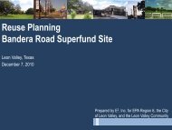
Reuse Assessment for the Bandera Road Superfund Site
Bandera Reuse Assessment PPT 6/4/10 - Leon Valley
Bandera Reuse Assessment PPT 6/4/10 - Leon Valley

You also want an ePaper? Increase the reach of your titles
YUMPU automatically turns print PDFs into web optimized ePapers that Google loves.
<strong>Reuse</strong> <strong>Assessment</strong> <strong>for</strong> <strong>the</strong> <strong>Bandera</strong><br />
<strong>Road</strong> <strong>Superfund</strong> <strong>Site</strong><br />
Leon Valley, Texas<br />
June 2010<br />
Prepared by E 2 , Inc. <strong>for</strong> EPA Region 6, <strong>the</strong> City<br />
of Leon Valley, and <strong>the</strong> Leon Valley Community<br />
1
Overview<br />
• <strong>Reuse</strong> <strong>Assessment</strong> Purpose<br />
• Background and Timeline<br />
• Planning and Development Initiatives<br />
• <strong>Site</strong> Characterization<br />
• Future Use Strategies<br />
• Recommendations<br />
2
3<br />
<strong>Reuse</strong> <strong>Assessment</strong> Purpose
<strong>Reuse</strong> <strong>Assessment</strong> Purpose<br />
This <strong>Reuse</strong> <strong>Assessment</strong> report was funded by <strong>the</strong> EPA <strong>Superfund</strong> Redevelopment<br />
Initiative and produced by E 2 Inc <strong>for</strong> EPA Region 6, <strong>the</strong> City of Leon Valley and <strong>the</strong><br />
Leon Valley Community. The <strong>Superfund</strong> Redevelopment Initiative was founded to “help<br />
communities return <strong>Superfund</strong> sites to productive use.” 1<br />
Stakeholders interviewed or contacted included representatives of EPA, <strong>the</strong> City of<br />
Leon Valley, <strong>the</strong> source area site owners, <strong>the</strong> <strong>Bandera</strong> <strong>Road</strong> Community Advisory<br />
Group (CAG), TxDOT, Bexar County and Halff Associates.<br />
Additionally, <strong>the</strong> report was presented in draft <strong>for</strong>m to Leon Valley residents and<br />
community members at <strong>the</strong> April 22, 2010 CAG meeting, and feedback from <strong>the</strong>se<br />
stakeholders was also included in <strong>the</strong> final report.<br />
1<br />
US EPA. <strong>Reuse</strong> <strong>Assessment</strong>s: A Tool to Implement The <strong>Superfund</strong> Land Use Directive. Memorandum signed June 4, 2001 from Larry Reed to <strong>the</strong> <strong>Superfund</strong> National Policy<br />
Managers, Regions 1-10.<br />
4
<strong>Reuse</strong> <strong>Assessment</strong> Purpose<br />
<strong>Reuse</strong> <strong>Assessment</strong> Purpose<br />
• Identify reasonably anticipated future land<br />
uses and associated remedial considerations.<br />
• Identify interim revitalization strategies <strong>for</strong> <strong>the</strong><br />
city given <strong>the</strong> long-term cleanup and potential<br />
<strong>for</strong> stigma related to <strong>the</strong> <strong>Superfund</strong> site.<br />
5
6<br />
Background and Timeline
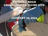
<strong>Site</strong> Background<br />
<strong>Bandera</strong> <strong>Road</strong> <strong>Superfund</strong> <strong>Site</strong><br />
• Groundwater plume with at least two sources that originate in Leon Valley<br />
– Savings Square Shopping Center<br />
– Pilgrim Cleaners<br />
• Plume was identified by TCEQ in 2004<br />
• Placed on <strong>the</strong> National Priorities List in 2007<br />
• Primary contaminants of concern are<br />
chlorinated solvents<br />
• EPA is conducting an ongoing investigation to<br />
identify <strong>the</strong> extent of <strong>the</strong> plume<br />
– 6 private wells identified as contaminated and<br />
residents connected to public water<br />
– Public wells in vicinity of site have not been<br />
impacted<br />
– 2 vapor mitigation systems have been installed<br />
near <strong>the</strong> Savings Square Shopping Center<br />
to address vapor intrusion<br />
– No additional vapor intrusion issues expected<br />
7
Timeline<br />
Timeframe Remedial Timeline <strong>Reuse</strong> Planning Tasks<br />
Nov 2009 -<br />
Early 2010<br />
Spring 2010<br />
April 2010<br />
Summer 2010<br />
Fall 2010<br />
Winter 2010<br />
Early 2011<br />
Ongoing<br />
investigation<br />
Discussion of<br />
potential<br />
technologies<br />
Draft RI/FS<br />
Proposed Plan<br />
Record of Decision<br />
Ga<strong>the</strong>r community and stakeholder<br />
input and coordinate with Leon Valley’s<br />
planning ef<strong>for</strong>ts<br />
Develop a site characterization and<br />
revitalization strategies<br />
<strong>Site</strong> visit to share draft characterization<br />
and strategies<br />
Develop a final reuse report<br />
summarizing site reuse<br />
characterization, reuse considerations<br />
and stakeholder goals.<br />
8
Planning and Development Initiatives<br />
SDAT Study| “El Verde by 2020” | Redevelopment Master Plan<br />
Tree Challenge | STEP Grant | Fiesta Dodge Plans<br />
9
Planning and Development Initiatives<br />
Sustainable Design <strong>Assessment</strong> Team (SDAT) Study<br />
• A broad planning assessment to help frame future policies and<br />
sustainable solutions<br />
• Project principles look <strong>for</strong> <strong>the</strong> intersection of <strong>the</strong> three “E”s<br />
(environment, economics and equity) to create:<br />
– Physical basis <strong>for</strong> prosperity<br />
– Demand <strong>for</strong> products and services<br />
– Sense of place<br />
10
Planning and Development Initiatives<br />
Additional City Initiatives<br />
• “El Verde by 2020”<br />
• Leon Valley Redevelopment<br />
Master Plan<br />
• Leon Valley Tree Challenge<br />
• <strong>Bandera</strong> <strong>Road</strong> Landscaping<br />
(STEP Grant)<br />
• Fiesta Dodge Plans<br />
Town Center Concept Plan<br />
Source: Leon Valley SDAT – El Verde 2020 report<br />
11
Planning and Development Initiatives<br />
Regional Initiatives<br />
• Crystal Hills Park (planned)<br />
• Huebner and Leon Creek Community Plan Update<br />
• Bexar County Floodplain<br />
Project<br />
• <strong>Bandera</strong> <strong>Road</strong> Landscaping<br />
(STEP Grant)<br />
• Bus Rapid Transit access<br />
12
City Initiatives<br />
Leon Valley Land Use Goals<br />
• Protect <strong>the</strong> city’s groundwater supply from<br />
contamination by <strong>the</strong> groundwater plume and/or future<br />
industrial activities<br />
• Guide and support redevelopment along <strong>Bandera</strong> <strong>Road</strong><br />
– Create a Town Square and Town Center<br />
– Create a sense of place<br />
– Attract young professionals by promoting a live/work<br />
environment<br />
• Promote sustainability through <strong>the</strong> Sustainability<br />
Overlay and o<strong>the</strong>r city initiatives<br />
13
<strong>Site</strong> Characterization<br />
Regional: Residential and Economic Centers<br />
Local: Zoning and Future Land Use | Development Context<br />
14
<strong>Site</strong> Characterization<br />
Regional Context<br />
• Residential growth along W Loop 1604 and in Helotes<br />
• Local universities and colleges provide jobs and attract young<br />
professionals<br />
• Major employers in <strong>the</strong> area include:<br />
– Medical research facilities (SW Research Institute, UTSA Health Sciences)<br />
– USAA (5 miles from LV; 27,000 new jobs)<br />
• Regional attractions include Sea World, Six Flags Fiesta<br />
Texas, The Rim and downtown San Antonio<br />
• Leon Valley is located on a major travel route between<br />
downtown San Antonio and surrounding centers (<strong>Bandera</strong><br />
<strong>Road</strong>)<br />
15
<strong>Site</strong> Characterization<br />
Figure 1: Regional Context<br />
16
<strong>Site</strong> Characterization<br />
17<br />
Zoning and Redevelopment Master Plan<br />
• Zoning<br />
– <strong>Bandera</strong> and Grissom <strong>Road</strong>s are primary commercial corridors<br />
– A mix of residential, commercial and industrial uses are present in<br />
Leon Valley<br />
• Redevelopment Master Plan Areas<br />
– Town Square to be located at Four Corners intersection<br />
– Town Center to be located along <strong>Bandera</strong><br />
and Grissom<br />
– Sustainability Overlay requirements will<br />
affect most areas with business, retail or<br />
commercial zoning<br />
– Commercial and Industrial Overlay<br />
requirements will affect <strong>the</strong> sou<strong>the</strong>astern<br />
part of <strong>Bandera</strong> <strong>Road</strong>
<strong>Site</strong> Characterization<br />
Figure 2: Leon Valley Zoning<br />
18
<strong>Site</strong> Characterization<br />
Figure 3: Redevelopment Master Plan Areas<br />
19
<strong>Site</strong> Characterization<br />
New Development Projects<br />
• Redevelopment Master Plan areas will guide development<br />
along <strong>Bandera</strong><br />
• New residential neighborhoods south of <strong>Bandera</strong> target<br />
young professionals<br />
• Floodplain Annexation Zone<br />
– Properties along <strong>the</strong> sou<strong>the</strong>ast side of El Verde <strong>Road</strong> are being<br />
annexed <strong>for</strong> a floodplain zone by Bexar County<br />
• Future commercial areas include:<br />
– Four Corners and <strong>the</strong> intersection of <strong>Bandera</strong>/Grissom<br />
– Former Fiesta Dodge location<br />
• Potential transportation projects include:<br />
– Potential town center road extension<br />
– <strong>Bandera</strong> <strong>Road</strong> landscaping<br />
20
<strong>Site</strong> Characterization<br />
Figure 4: New Development<br />
21
<strong>Site</strong> Characterization<br />
Natural Assets<br />
• Creeks include Leon, Huebner and Zarzamora<br />
• Existing open space along Huebner Creek<br />
• Future open space created by <strong>the</strong> Bexar County floodplain<br />
project<br />
– Potential to incorporate trail grading into construction<br />
• Trails located in:<br />
– Leon Creek Greenway<br />
– Crystal Hills Park (proposed)<br />
– Raymond Rimkus Park<br />
– North of Raymond Rimkus Park along<br />
Huebner Creek<br />
22
<strong>Site</strong> Characterization<br />
Figure 5: Natural Assets<br />
23
<strong>Site</strong> Characterization<br />
Reasonably Anticipated Future Land Use<br />
• Future land use in <strong>the</strong> area of <strong>the</strong> <strong>Bandera</strong> <strong>Road</strong><br />
<strong>Superfund</strong> <strong>Site</strong> is likely to include residential,<br />
recreational, commercial and industrial uses.<br />
• Current land use plans and initiatives seek to green <strong>the</strong><br />
city and increase <strong>the</strong> amount of time residents and<br />
visitors spend outdoors.<br />
• One source area is located inside Leon Valley’s Town<br />
Center area, which is targeted <strong>for</strong> redevelopment.<br />
24
<strong>Site</strong> Characterization<br />
Figure 7: Reasonably Anticipated Future Land Use<br />
25
<strong>Site</strong> Characterization<br />
Remedial Considerations<br />
• Remedial features are likely to be located at <strong>the</strong> source<br />
sites and may create minimal constraints on use.<br />
• <strong>Reuse</strong> in areas beyond <strong>the</strong> source sites is more likely to be<br />
impacted by <strong>Superfund</strong> stigma than by remedial features.<br />
26
<strong>Site</strong> Characterization<br />
Remedial Considerations<br />
• Possible remedial features include:<br />
– Flush mounted monitoring wells across <strong>the</strong> plume area<br />
– Groundwater treatment wells at <strong>the</strong> source sites<br />
Typical well<br />
Example of a flush-mount monitoring well<br />
27
Future Use Strategies<br />
Development Options | Scenario Context<br />
Future Use Scenarios | Remedial Considerations<br />
28
Future Use Strategies<br />
<strong>Reuse</strong> <strong>Assessment</strong> Purpose<br />
• Identify reasonably anticipated future land<br />
uses and associated remedial considerations.<br />
• Identify interim revitalization strategies <strong>for</strong> <strong>the</strong><br />
city given <strong>the</strong> long-term cleanup and potential<br />
<strong>for</strong> stigma related to <strong>the</strong> <strong>Superfund</strong> site.<br />
29
Future Use Strategies<br />
Strategic Goals<br />
• Leverage <strong>the</strong> value of existing assets and <strong>the</strong><br />
momentum of planned revitalization projects to<br />
counter potential <strong>Superfund</strong> stigma<br />
• Enhance Leon Valley’s image as <strong>the</strong><br />
“Greenest Little City in Texas”<br />
• Implement SDAT Principles:<br />
– Physical basis <strong>for</strong> prosperity<br />
– Demand <strong>for</strong> products and services<br />
– Sense of place<br />
30
City Initiatives<br />
Sustainable Design <strong>Assessment</strong> Team (SDAT) Study<br />
Additional recommendations included:<br />
– Incorporate sustainable “green infrastructure” elements<br />
• Low impact development components in site planning and stormwater management<br />
• Increase tree canopy cover<br />
• Implement trail linkages<br />
– Leverage existing open spaces<br />
• Use open spaces to create a “sense of place”<br />
• Make natural open areas a prominent part of<br />
<strong>the</strong> City<br />
– Introduce unifying streetscape components<br />
• Improve conditions <strong>for</strong> pedestrians<br />
• Use landscaping components to create<br />
“green streets”<br />
<strong>Bandera</strong> <strong>Road</strong> existing right-of-way<br />
Source: SDAT Study<br />
31
Future Use Strategies<br />
Green Infrastructure (GI): a framework <strong>for</strong> understanding <strong>the</strong><br />
valuable services that nature provides <strong>for</strong> <strong>the</strong> human environment and<br />
integrating <strong>the</strong>se natural assets into development plans. At a regional or<br />
municipal scale it <strong>for</strong>ms a patchwork of open space that can guide growth<br />
and preservation.<br />
– Habitat<br />
– Community<br />
– Water<br />
– Mobility<br />
– Energy and Materials<br />
Examples of analysis mapping of GI systems (open space/habitat, bike/equestrian trails and population density to<br />
park size) <strong>for</strong> <strong>the</strong> Los Angeles River Revitalization project.<br />
Source: http://councilcommittee.lacity.org/lariver/map.htm<br />
32
Green Infrastructure<br />
Future Use Strategies<br />
– At a site scale, it integrates functions and utilizes natural processes to<br />
make communities more healthy and enjoyable.<br />
Examples of a natural drainage systems in arid climates<br />
33
Future Use Strategies<br />
Economic Value of Green Infrastructure<br />
Investing in GI can yield tangible benefits <strong>for</strong> residents,<br />
businesses and municipalities:<br />
– Property values increase near green space.<br />
– Green spaces near places of work increase productivity, and<br />
businesses attract and retain more motivated staff in green<br />
settings<br />
– GI can reduce energy costs by countering summer<br />
temperatures.<br />
– GI can alleviate pressure on storm water management<br />
systems by reducing <strong>the</strong> velocity and amount of runoff.<br />
– Shoppers stay longer and spend more in commercial areas<br />
with landscaping and tree canopy cover.<br />
34
Future Use Strategies<br />
Integrate green infrastructure planning into <strong>the</strong><br />
city’s current and future infrastructure projects<br />
through three future use strategies:<br />
1. Greenway<br />
2. Green streets<br />
3. Green links<br />
35
Future Use Strategies<br />
Strategy 1: Create a Huebner Creek Greenway.<br />
Existing Assets<br />
• Raymond Rimkus Park and trails<br />
• Natural Area and trails<br />
• Trail north of Raymond Rimkus along Huebner<br />
Creek<br />
Planned Revitalization Projects<br />
• Crystal Hills Park and trails<br />
• Floodplain Annexation and potential trail grading<br />
Bob Jones Trail, San Luis Obispo, CA<br />
Source: Los Angeles Times<br />
36
<strong>Site</strong> Characterization<br />
Figure 8: Huebner Creek Greenway<br />
37
Future Use Strategies<br />
Huebner Creek Greenway - Potential Action Steps<br />
• Coordinate with San Antonio to support development of<br />
Crystal Hills Park.<br />
• Coordinate with County to integrate a paved trail into <strong>the</strong><br />
floodplain project.<br />
• Improve accessibility of <strong>the</strong> trails in <strong>the</strong> Leon Valley<br />
Historical Society natural area in order to continue<br />
greenway.<br />
• Seek funding to ensure full connectivity and to add<br />
entrance signage to <strong>the</strong> greenway.<br />
38
Future Use Strategies<br />
Strategy 2: Select a green streets network to target<br />
<strong>for</strong> tree planting and natural drainage features.<br />
Suggested street selection criteria:<br />
• Intersects <strong>Bandera</strong> <strong>Road</strong><br />
• Connects to <strong>the</strong> proposed Huebner Creek Greenway<br />
• Provides access to an existing amenity or attraction<br />
Existing Assets<br />
• Existing attractions and amenities<br />
• 10,000 Trees Program<br />
Planned Revitalization Projects<br />
• Potential landscaping along <strong>Bandera</strong> <strong>Road</strong><br />
Street-tree plantings and swale<br />
Highpoint Community, Seattle<br />
Source: SvR Design Company<br />
39
<strong>Site</strong> Characterization<br />
Figure 9: Green Streets Network<br />
40
Future Use Strategies<br />
Green Streets Network - Potential Action Steps<br />
• Negotiate with TxDOT to integrate bike lanes, natural<br />
drainage and tree planting into <strong>Bandera</strong> <strong>Road</strong><br />
• Target tree planting to designated streets connecting<br />
neighborhoods to <strong>Bandera</strong>, Huebner Creek Greenway and<br />
local amenities<br />
• Apply <strong>for</strong> grant funding to ensure all green streets have<br />
connected trails or sidewalks.<br />
• Integrate natural drainage to improve stormwater on green<br />
streets draining to creeks<br />
• Coordinate with new developments to ensure street<br />
improvements facilitate green street vision.<br />
41
Future Use Strategies<br />
Strategy 3: Build green links to connect to <strong>the</strong><br />
Leon Creek Greenway.<br />
Existing Assets<br />
• Leon Creek Greenway<br />
• Leon Valley trails network<br />
Planned Revitalization Projects<br />
• Crystal Hills Park and trails<br />
• Potential landscaping along <strong>Bandera</strong> <strong>Road</strong><br />
• Community Commercial land use plan <strong>for</strong><br />
<strong>Bandera</strong> <strong>Road</strong> between Leon Valley and <strong>the</strong><br />
Leon Creek Greenway<br />
Barcelona, Spain<br />
Source: Staff photo<br />
42<br />
Integrating bicycle mobility<br />
and stormwater function<br />
into city streets<br />
Stormwater Planters, Los Angeles, CA<br />
Source: Mia Lehrer + Associates
<strong>Site</strong> Characterization<br />
Figure 10: Green Links<br />
43
Future Use Strategies<br />
Regional Green Links - Potential Action Steps<br />
• Conduct feasibility study to determine<br />
most suitable trail access and<br />
connector points to <strong>the</strong> North Leon<br />
Creek Greenway.<br />
• Apply <strong>for</strong> funding to acquire land<br />
or easement and construct connectors<br />
and signage.<br />
• Add Huebner Creek Greenway to<br />
regional greenway maps and signage.<br />
• Integrate bike lanes and signage along<br />
Grissom and Poss <strong>Road</strong>s<br />
• Initiate recreational programming in <strong>the</strong><br />
own Center to create a destination <strong>for</strong><br />
greenway users and shoppers<br />
44
<strong>Site</strong> Characterization<br />
Figure 11: Greenway, Green Streets, Green Links<br />
45
Future Use Strategies<br />
Town Center Revitalization<br />
• Redevelopment planning process has moved into<br />
second phase<br />
• A master plan <strong>for</strong> <strong>the</strong> Town Square and Town<br />
Center areas of <strong>the</strong> city is expected in Fall 2010<br />
• Revitalization Strategies may in<strong>for</strong>m <strong>the</strong><br />
redevelopment planning process as stakeholders<br />
discuss what elements should be incorporated into<br />
<strong>the</strong> master plan<br />
46
Figure 12: Town Center Revitalization<br />
47<br />
<strong>Site</strong> Characterization
Future Use Strategies<br />
Town Center Revitalization – Potential Actions Steps<br />
• Focus street greening ef<strong>for</strong>ts on Poss, Grissom and <strong>Bandera</strong><br />
<strong>Road</strong>s.<br />
• Identify funding <strong>for</strong> a natural drainage pilot project to connect<br />
Raymond Rinkus Park and <strong>the</strong> Town Square.<br />
• Integrate bike lanes and signage along Poss and Grissom<br />
<strong>Road</strong>s to draw regional greenway users and o<strong>the</strong>r<br />
pedestrians and cyclists into <strong>the</strong> Town Center.<br />
• Purchase a parcel to use as green gateway into <strong>the</strong> Town<br />
Center; programming could include green space, a paved<br />
trail, and/or an outdoor farmers market.<br />
• Create marketing materials <strong>for</strong> <strong>the</strong> Town Center that<br />
emphasize an integrated recreational-commercial sense of<br />
place.<br />
48
Future Use Strategies<br />
49<br />
Summary<br />
• Leon Valley has a proactive approach to sustainability<br />
• Numerous existing sustainability initiatives could provide a<br />
foundation <strong>for</strong> counteracting potential <strong>Superfund</strong>-related<br />
stigma<br />
• Suggested strategies include<br />
developing an intentional green<br />
infrastructure network based on:<br />
– Greenway<br />
– Green Streets<br />
– Green Links<br />
• These strategies may in<strong>for</strong>m <strong>the</strong> Town<br />
Center master plan and future city<br />
planning and economic development<br />
initiatives<br />
Example of a tree-lined pathway, Volunteer<br />
Park, Seattle<br />
Source: SvR Design Company
50<br />
Recommendations
Recommendations<br />
• Leon Valley’s Economic Development Department could seek to align economic<br />
development analysis from <strong>the</strong> Buxton Company report with <strong>the</strong> strategies and<br />
recommendations of this reuse assessment.<br />
• The City of Leon Valley could identify and pursue sources of funding <strong>for</strong> green<br />
infrastructure pilot projects that support <strong>the</strong> proposed future use strategies.<br />
• The City of Leon Valley could use <strong>the</strong> strategies as a discussion tool with<br />
stakeholders during <strong>the</strong> second phase of redevelopment planning <strong>for</strong> <strong>the</strong> Town<br />
Center and adopt elements of <strong>the</strong> strategies into <strong>the</strong> Sustainability Overlay Design<br />
Standards as appropriate.<br />
• EPA could provide in<strong>for</strong>mation on <strong>Superfund</strong> liability and <strong>the</strong> steps necessary to<br />
obtain a com<strong>for</strong>t letter to <strong>the</strong> City of Leon Valley and local property owners.<br />
• The City of Leon Valley and EPA could collaborate with source area site owners on<br />
aligning site-specific redevelopment or revitalization plans with remedial design.<br />
51
Appendix A<br />
Planning Initiatives: City of Leon Valley<br />
SDAT Study| “El Verde by 2020” | Redevelopment Master Plan<br />
Tree Challenge | STEP Grant | Fiesta Dodge Plans<br />
52
City Initiatives<br />
Sustainable Design <strong>Assessment</strong> Team (SDAT) Study<br />
• A broad planning assessment to help frame future policies and<br />
sustainable solutions<br />
• Project principles look <strong>for</strong> <strong>the</strong> intersection of <strong>the</strong> three “E”s<br />
(environment, economics and equity) to create:<br />
– Physical basis <strong>for</strong> prosperity<br />
– Demand <strong>for</strong> products and services<br />
– Sense of place<br />
53
City Initiatives<br />
Sustainable Design <strong>Assessment</strong> Team (SDAT) Study<br />
• Identified economic health of <strong>the</strong> <strong>Bandera</strong> <strong>Road</strong> Corridor as key<br />
to city’s long-term sustainability<br />
• Recommended 5 kick-off projects:<br />
– Create a <strong>Bandera</strong> <strong>Road</strong> Vision Document<br />
– Poss <strong>Road</strong> Reconstruction<br />
– LEED Construction Initiative<br />
– Promote development of a town center at<br />
<strong>the</strong> intersection of <strong>Bandera</strong> and Poss<br />
<strong>Road</strong>s (<strong>the</strong> “Four Corners”)<br />
– Initiate a street tree planting program<br />
54
City Initiatives<br />
“El Verde by 2020” Plan<br />
• City Council resolution passed in February 2009 to ensure<br />
environmental sustainability through:<br />
– Becoming carbon neutral<br />
– Preserving and expanding <strong>the</strong> tree canopy<br />
– Promoting green home and business construction to<br />
achieve 20% of structures being completely green<br />
– Pursuing water consumption reduction, alternative<br />
irrigation sources and xeriscaping<br />
• The City of Leon Valley will adopt measures to<br />
reach <strong>the</strong>se goals by 2020<br />
55
City Initiatives<br />
Leon Valley Redevelopment Master Plan<br />
• Overlay Districts provide land use, design and site plan<br />
guidance<br />
– Sustainability Overlay District: create an identity <strong>for</strong> Leon Valley and<br />
integrate sustainable design principles<br />
– Commercial and Industrial Overlay:<br />
provide building standards and use<br />
clarifications <strong>for</strong> commercial and<br />
industrial area in sou<strong>the</strong>astern<br />
Leon Valley<br />
• Town Square: located at 4 Corners<br />
• Town Center: located along<br />
<strong>Bandera</strong> and Poss <strong>Road</strong>s<br />
Town Center Concept Plan<br />
Source: Leon Valley SDAT – El Verde 2020 report<br />
56
City Initiatives<br />
Leon Valley Tree Challenge<br />
• City tree planting program aims to plant 10,000 trees by 2020<br />
• Every citizen in Leon Valley will be asked to plant one tree in <strong>the</strong><br />
City from now until <strong>the</strong> year 2020<br />
• Periodic tree give-aways to <strong>the</strong> first 100 residents<br />
• Funding sources need to be identified<br />
in order to purchase <strong>the</strong> trees<br />
57
STEP Grant<br />
City Initiatives<br />
• Leon Valley submitted an application in December 2009 to take<br />
over landscaping of <strong>Bandera</strong> <strong>Road</strong> within <strong>the</strong> city limits,<br />
including:<br />
– Major landscaping initiatives in <strong>the</strong> Town Center area<br />
– Entrance landscaping at <strong>the</strong> north entrance to Leon Valley and at <strong>the</strong><br />
flyover entrance to <strong>the</strong> south<br />
• A final funding decision is expected by summer 2010<br />
58
City Initiatives<br />
Fiesta Dodge Plans<br />
• Leon Valley would like this property to become a<br />
mixed use area that includes residential uses and<br />
exemplifies <strong>the</strong> Sustainability Overlay Standards<br />
• Leon Valley is pursuing a number of funding<br />
sources <strong>for</strong> <strong>the</strong> site including:<br />
– Brownfields Grant Application (<strong>for</strong>thcoming)<br />
– HUD Sustainable Communities planning grant<br />
(<strong>for</strong>thcoming)<br />
59
City Initiatives<br />
Leon Valley Land Use Goals<br />
• Protect <strong>the</strong> city’s groundwater supply from<br />
contamination by <strong>the</strong> groundwater plume and/or future<br />
industrial activities<br />
• Guide and support redevelopment along <strong>Bandera</strong> <strong>Road</strong><br />
– Create a Town Square and Town Center<br />
– Create a sense of place<br />
– Attract young professionals by promoting a live/work<br />
environment<br />
• Promote sustainability through <strong>the</strong> Sustainability<br />
Overlay and o<strong>the</strong>r city initiatives<br />
60
Appendix B<br />
Additional Planning Initiatives<br />
Crystal Hills Park | Huebner and Leon Creeks Community Plan Update<br />
Floodplain Annexation | Transportation Plans<br />
61
Crystal Hills Park Master Plan<br />
City of San Antonio, July 2008<br />
Additional Planning Initiatives<br />
• 47.5 acre community park (3 acres in Leon Valley, 44.5 acres in San<br />
Antonio)<br />
• Divided by Huebner Creek; surrounded by new residential development<br />
• Master plan includes:<br />
– Dog park<br />
– Skate Park<br />
– 2.5 miles of trails<br />
– Multi-use courts<br />
– Disc-golf course<br />
– Natural areas<br />
– Playground and picnic<br />
facilities<br />
62
Additional Planning Initiatives<br />
Huebner and Leon Creeks Community Plan Update<br />
City of San Antonio, August 2009<br />
• Ef<strong>for</strong>t to update area land use plan to <strong>the</strong> north of Leon Valley<br />
• Community commercial<br />
uses planned between<br />
Leon Valley and <strong>the</strong> Leon<br />
Creek Greenway<br />
• Uses include offices,<br />
professional services, and<br />
retail uses that are<br />
accessible to bicyclists<br />
and pedestrians<br />
63
Additional Planning Initiatives<br />
Bexar County Floodplain Project<br />
• Current channel will be widened from 150’ to 400’<br />
– Concrete pilot channel<br />
– Restored/planted banks<br />
• Recreation and Amenity Opportunities<br />
– Opportunity to link Raymond Rimkus Park and <strong>the</strong> Crystal Hills<br />
Park<br />
– Enough space <strong>for</strong> trails or small<br />
pocket parks/overlooks<br />
– Bexar County is willing to coordinate<br />
with Leon Valley to accommodate new<br />
trails in floodplain project grading plans<br />
– Leon Valley would be responsible <strong>for</strong><br />
trail construction and O&M<br />
64
Additional Planning Initiatives<br />
Transportation<br />
• <strong>Bandera</strong> <strong>Road</strong><br />
– TxDOT has no plans at this time to add additional traffic<br />
capacity<br />
– Operational improvements, such as turn lanes, may be<br />
a possibility<br />
• Bus Rapid Transit Access<br />
– Mayor Riley is working with VIA<br />
to explore <strong>the</strong> possibility of<br />
expanding Bus Rapid Transit to<br />
Leon Valley via Wurzbach <strong>Road</strong><br />
65
Appendix C<br />
EPA Contacts<br />
66
Contacts<br />
To obtain additional in<strong>for</strong>mation about reuse planning or <strong>the</strong><br />
<strong>Bandera</strong> <strong>Road</strong> <strong>Superfund</strong> <strong>Site</strong>, please contact:<br />
– Casey Luckett Snyder, EPA <strong>Superfund</strong> <strong>Reuse</strong> Coordinator<br />
(Luckett.Casey@epa.gov, 214.665.7393)<br />
– Chris Villarreal, EPA Remedial Project Manager<br />
(Villarreal.Chris@epa.gov , 214.665.6758)<br />
67