Heritage Assets
(Attachment: 3)Item 4 Heritage Assets SPD - Borough of Poole
(Attachment: 3)Item 4 Heritage Assets SPD - Borough of Poole

You also want an ePaper? Increase the reach of your titles
YUMPU automatically turns print PDFs into web optimized ePapers that Google loves.
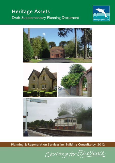
<strong>Heritage</strong> <strong>Assets</strong><br />
Draft Supplementary Planning Document<br />
Planning & Regeneration Services inc Building Consultancy, 2012
Public Consultation & Adoption<br />
The consultation on this document starts on 26th April and will run for 8 weeks.<br />
The results of this consultation will be reported to committee on 12th January 2012 prior to the<br />
document being taken forward for formal adoption by the Borough of Poole as part of its Local<br />
Development Framework in due course.<br />
This document forms part of the evidence base for the Local Development Framework for<br />
Poole.<br />
<strong>Heritage</strong> <strong>Assets</strong> - Draft Supplementary Planning Document: Publication Details<br />
The purpose of this document<br />
This Supplementary Planning Document has been produced in line with Government Policy which sets out<br />
the criteria for designating these <strong>Heritage</strong> <strong>Assets</strong> in Planning Policy 5: Planning for the Historic Environment<br />
(2010) PPS5.<br />
Production Team<br />
Stephen Thorne<br />
Hazel Brushett<br />
Head of Planning & Regeneration Services inc Building Consultancy<br />
Conservation Officer<br />
Design: Borough of Poole<br />
Further information<br />
Planning and Regeneration Services inc Building Consultancy:<br />
Civic Centre<br />
Poole BH15 2RU Tel. 01202 633433<br />
Email enquiries: planning@poole.gov.uk www.boroughofpoole.com/planning
Contents<br />
Introduction 4<br />
Part 1<br />
The Characteristics of the Historic Environment<br />
of the Borough of Poole 6<br />
Part 2 The National Policy Framework 8<br />
Part 3<br />
Assessing Proposals affecting all<br />
<strong>Heritage</strong> <strong>Assets</strong> or their Settings 10<br />
3.1 <strong>Heritage</strong> <strong>Assets</strong> 10<br />
3.2 The Setting of <strong>Heritage</strong> <strong>Assets</strong> 13<br />
3.3 The Demolition or Loss of Significance of <strong>Heritage</strong> <strong>Assets</strong> 14<br />
3.4 Scheduled Monuments 15<br />
3.5 Listed Buildings 16<br />
3.6 Protected Wreck Sites and Marine <strong>Heritage</strong> 17<br />
3.7 Registered Parks and Gardens 18<br />
3.8 Conservation Areas 19<br />
3.9 Local <strong>Heritage</strong> <strong>Assets</strong> 39<br />
Part 4 Sustainability 43<br />
Part 5 Contacts and Further Information 44<br />
Part 6 Glossary of Terms 45<br />
Part 7<br />
Appendices<br />
Appendix A: List of <strong>Heritage</strong> <strong>Assets</strong> 47<br />
1 Scheduled Monuments 47<br />
Listed Buildings 53<br />
3 Protected Wreck Sites and Marine <strong>Heritage</strong> 60<br />
4 Registered Parks and Gardens 61<br />
5 Conservation Areas 61<br />
6 Local <strong>Heritage</strong> <strong>Assets</strong> 62<br />
Appendix B: <strong>Heritage</strong> Asset Repairs 75
Introduction<br />
The historic environment is all around us. In its broadest sense the historic environment includes<br />
everything that reflects of human history. Recognising Poole’s rich cultural and built history is the first step<br />
in considering proposals affecting sites that have either national or local architectural or historic interest.<br />
It is not only the landmark and listed buildings which create Poole’s special character and distinctiveness<br />
but also, buildings such as churches, schools, chapels and public buildings that demonstrate social history<br />
and display high quality architecture.<br />
Purpose of this Supplementary Planning Document<br />
This Supplementary Planning Document (SPD) has been produced to provide guidance and information<br />
to owners, occupiers, agents, developers and anyone interested in history environment, to help them<br />
care for Poole’s historic environment. It is a general guide of the sort of things that should be considered<br />
when undertaking works to the historic environment.<br />
The SPD is intended to supplement relevant policies contained within Poole’s adopted Local Development<br />
Framework (LDF) documents, which provide the statutory Development Plan for the Borough. The SPD<br />
is a material consideration for decision making in respect of planning applications relating to, or affecting<br />
heritage assets in Poole. It has been prepared in accordance with requirements of the Planning and<br />
Compulsory Purchase Act 2004 (as amended) and associated regulations and guidance on Supplementary<br />
Planning Documents.<br />
The SPD sits within the Local Development Framework as show in the diagram below.<br />
Local Development<br />
Scheme Adopted<br />
August 2011<br />
Poole’s<br />
Local<br />
Development<br />
Framework<br />
Annual<br />
Monitoring<br />
Report<br />
Statement of<br />
Community<br />
Involvement Adopted<br />
2006<br />
Supplementary Planning<br />
Documents<br />
l<br />
Parking & Highway Layout<br />
in Development<br />
Affordable Housing<br />
l<br />
Core Strategy<br />
Adopted<br />
February 2009<br />
Site Specific Allocations<br />
& Development<br />
Management Policies<br />
April 2012<br />
Adopted<br />
Proposals Map<br />
April 2012<br />
Delivering Poole’s<br />
Infastructure<br />
Development Plan<br />
April 2012<br />
Other Development Plans<br />
l<br />
Dorset Heathland (Joint)<br />
l<br />
l<br />
Dorset Gypsy & Travellers (Joint)<br />
Minerals Core Strategy<br />
Project Plan Required<br />
Optional<br />
Current ‘saved’ Supplmentary Planning Guidance:<br />
l<br />
l<br />
l<br />
l<br />
l<br />
l<br />
The Landscape and Natural Environment Design Code<br />
Sustainable Urban Drainage Systems (SUDS)<br />
- Guidance for Developers<br />
‘A Design Code’<br />
Planning Obligations: Recreation Contributions<br />
Travel Plans<br />
Shoreline Character Areas<br />
l<br />
l<br />
l<br />
l<br />
l<br />
Planning and Urban Design Guidance for the<br />
Central Area of Poole - Vol. 1, 2 & 3<br />
Percent for Art<br />
Transport Contribution Scheme<br />
Shopfronts & Shop Signs Guidance<br />
Maintaining the Appearance of your House<br />
Supplmentary Planning Documents in Production:<br />
l<br />
Our Streets and Spaces<br />
l<br />
Dorset Heathland Planning Framework<br />
l<br />
South East Dorset Transport Contributions Scheme 2<br />
l<br />
<strong>Heritage</strong> <strong>Assets</strong>
What are <strong>Heritage</strong> <strong>Assets</strong>?<br />
<strong>Heritage</strong> <strong>Assets</strong> is the name given to those aspects of the environment that have significance because of<br />
their historic, archaeological, architectural or artistic interest, and that add social, cultural and economic<br />
value.<br />
Maintaining these heritage assets, helps to retain a high quality historic environment and this itself ensures<br />
that a place is interesting and worth visiting, it can encourage tourism and add to the economic viability<br />
of an area. Where <strong>Heritage</strong> <strong>Assets</strong> possess a level of interest that justifies designation they are afforded<br />
protection against detrimental changes. These include:<br />
• Designated <strong>Heritage</strong> <strong>Assets</strong>;<br />
• World <strong>Heritage</strong> Sites; Scheduled Monuments;<br />
• Listed Buildings;<br />
• Protected Wreck Sites;<br />
• Registered Parks and Gardens;<br />
• Registered Battlefields and<br />
• Conservation Areas.<br />
There are many heritage assets which do not meet the criteria for statutory listing or scheduling but still<br />
make a significant contribution to the character and appearance and culture of the Borough of Poole.<br />
These designated and undesignated heritage assets form the character of Poole and the way the Borough<br />
is experienced. Areas rich in heritage assets are usually places that people want to live in and visit.
1The Characteristics of the Historic<br />
Environment of the Borough of Poole<br />
The special character of Poole is determined by its geographical position and its history of<br />
development<br />
Poole is a vibrant port set within one of the largest natural harbours in the world. The port and peninsula<br />
to the north, has been in use from medieval times, but today the oyster gatherers and fishermen of the<br />
past have been largely replaced by tourism, with ferries, tour boats operators and small boats.<br />
Today the High Street is managing to maintain its vibrancy in difficult economic conditions and together<br />
with The Quay it has several restaurants and entertainments these together with the museum attract<br />
many visitors. The main shopping streets are linked by small pedestrian lanes, unfortunately many of<br />
these are in poor condition and undervalued.<br />
The historic assets not only in the old town but throughout the Borough of Poole add to the quality of the<br />
environment and give Poole its unique character. These <strong>Heritage</strong> <strong>Assets</strong> are a non renewable resource<br />
which must be retained for future generations to enjoy.
A comprehensive history of the Borough of Poole is given in the “Town Centre <strong>Heritage</strong>: Character<br />
Statement parts 1 and 2.”<br />
Ancient monuments are mainly in the rural hinterland but some are clustered within the town centre<br />
showing with the Guildhall and Town Cellars being scheduled ancient monuments, these mark the<br />
early history of the borough. Its maritime history as an important trading port makes The Quay an<br />
important tourist destination, with reminders of important manufacturing industries such as ceramics<br />
and boatbuilding. The Borough has a wealth of structures of railway engineering and architecture;<br />
imposing brick viaducts, tower above Surrey Road, the railway embankments are pierced by brick arches<br />
at Hamworthy and Ashley Cross and crossed by fine Road Bridge at Station Road which forms a group<br />
with the historic station.<br />
Bespoke street furniture is a special characteristic of Poole with Listed street lights in the Old Town,<br />
decorative sewer vents and tram boxes and other street furniture are embellished with Borough of<br />
Poole motifs and coats of arms.<br />
Well articulated and designed commercial buildings such as banks, public houses and churches form the<br />
back bone of busy shopping streets and give them individual character. The rapid expansion of Poole at<br />
the end of the 19th century has led to historic suburbs with residential and commercial buildings of high<br />
architectural quality.<br />
Second World War structures such as dragon’s teeth at Surrey Road mark an important phase in Poole’s<br />
history but their significance is often unnoticed.<br />
In contrast to the town centre and suburbs, the north of the Borough has a more rural character with<br />
historic farmsteads including Moortown and Knighton Farm and grand country houses such as Merley<br />
House, Upton House and Canford School. This part of the borough also includes historic villages and<br />
hamlets such as Canford Magna Ashington and Oakley Lane.<br />
The history of ceramics in Poole is evident with decorative plaques adding to the area’s history. This is<br />
particularly apparent in the Old Town with plaques on the Waterfront Museum, the Harbour Master’s<br />
and Dolphin Quay buildings. These plaques which are characteristic of Poole add vibrancy and interest<br />
to the buildings.<br />
This entire wide spectrum of heritage assets is identified in Appendix A of this document; they make<br />
the borough more inviting and interesting. Recognising, retaining and valuing them is essential if we are<br />
to maintain the areas character and ensure that Poole is a distinctive and attractive place to visit or to<br />
live and work in.
2The National Policy Framework<br />
SPDs must be consistent with national planning policy and with the local development plan. The following<br />
documents have been taken into account when writing this SPD:<br />
The draft National Planning Policy Framework (NPPF), states that Local Planning Authorities:<br />
• “should set out a strategy for the conservation and enjoyment of the historic environment.”,<br />
and that<br />
• “the historic environment and its heritage assets should be conserved and enjoyed for the<br />
quality of life they bring to this and future generations.”<br />
The NPPF sets out the Government’s economic, environmental and social planning policies which<br />
articulate the vision of sustainable development to be interpreted and applied to meet local aspirations. The<br />
NPPF is likely to replace Planning Policy Guidance PPGs and Planning Policy Statements PPS documents<br />
that provided national planning guidance on a wide range of topics. This included PPS 5: Planning for the<br />
Historic Environment which provided the national policy framework for the consideration of planning<br />
matters relating to the historic environment.<br />
The NPPF includes a specific section (paragraphs 176 – 191), which identifies the Government’s objectives<br />
for planning for the historic environment. These are to:-<br />
• Conserve heritage assets in a manner appropriate to their significance; and<br />
• Contribute to our knowledge and understanding of our past by capturing evidence from the<br />
historic environment and making this publicly available, particularly where a heritage asset is<br />
to be lost.<br />
In addition it advises Local Planning Authorities to:<br />
• Sustain and enhance the significance of the heritage asset<br />
• Ensure that new development make a positive contribution to local character and<br />
distinctiveness<br />
• Require applicants to describe the significance of the heritage asset and its setting and assess<br />
the effects of any proposal on that significance<br />
• Require a desk top assessment or a field evaluation where appropriate on sites with<br />
archaeological potential.<br />
• Assess the significance of the asset and the impact of any proposal on that significance.<br />
• Not take into account deliberate neglect or damage to the heritage asset in considering any<br />
proposal.<br />
• Require any harm or loss to have clear and convincing justification. The greater the harm<br />
the greater the justification.<br />
• Where harm is substantial require that harm to be outweighed by public benefit and where<br />
there is no other possible use for the site.<br />
• Weigh the presumption in favour of sustainable development against harm or loss to the<br />
significance of a heritage asset.
• Ensure that new development will proceed after any loss of significance or damage to a heritage<br />
asset has occurred.<br />
• Ensure that loss of a positive building in a conservation area is treated as substantial harm to<br />
a heritage asset.<br />
• Ensure that proposals within conservation areas or their settings enhance their significance.<br />
• Ensure that non-designated assets of archaeological interest are treated in the same way as<br />
designated assets.<br />
• Ensure that applications for enabling development are considered carefully to ensure that the<br />
benefits to the asset outweigh the disadvantages of departing from policy.<br />
• Require developers to record the historic environment and make that information available<br />
to the general public.<br />
In addition to the national policy guidance provided by the NPPF, designated <strong>Heritage</strong> <strong>Assets</strong> are protected<br />
by national legislation. <strong>Assets</strong> can be Scheduled, Statutorily Listed or Registered. Scheduled Monuments<br />
have the greatest protection in law and Statutorily Listed <strong>Assets</strong> also have comprehensive protection.<br />
Registered Wreck Sites, archaeological sites and Conservation Areas also have protection, but Registered<br />
Parks and Gardens and Locally Listed Buildings have no national protection although the affect of any<br />
development on these assets is a material planning consideration.<br />
Local Policy<br />
Parkstone Cemetery<br />
The Poole Core Strategy and, in particular, the Site Specific<br />
Allocations and Development Management Policies DPD’s are<br />
the LDF documents that provide the local policies relating to<br />
Poole’s <strong>Heritage</strong> <strong>Assets</strong>.<br />
Policy DM 2: <strong>Heritage</strong> <strong>Assets</strong>, of the Site Specific Allocations<br />
and Development Management Policies DPD, provides the<br />
framework which proposals affecting any heritage asset in<br />
Poole will be expected to address.<br />
The Poole Core Strategy, adopted in February 2009,<br />
emphasises the importance of <strong>Heritage</strong> <strong>Assets</strong> in Strategic<br />
Objective 6: To Deliver High Quality, Distinctive and Self-<br />
Reliant Places where the role of assets such as Listed Buildings<br />
and Scheduled Ancient Monuments is recognised in creating<br />
a sense of place and the importance of local identity and<br />
character is identified in PCS23.<br />
Further clarification on the legislative regimes which apply to<br />
specific <strong>Heritage</strong> <strong>Assets</strong> is given in the chapters relating to<br />
each particular asset:
3Assessing Propsals affecting all <strong>Heritage</strong><br />
<strong>Assets</strong> or their Setting<br />
When considering an application affecting a <strong>Heritage</strong> Asset or its setting, the council will consider the<br />
proposal to ensure that the special character of the <strong>Heritage</strong> Asset, together with its setting is not<br />
detrimentally affected by the proposal. The effect of a development on any <strong>Heritage</strong> Asset or its setting<br />
will be a material consideration in determining any planning application.<br />
3.1 <strong>Heritage</strong> <strong>Assets</strong><br />
There is a huge resource of information available for anyone interested in the historic environment.<br />
Information can be obtained from local history books in the library; old ordnance survey maps, or title<br />
deeds, these may be kept at the county records or archives office or at the office of the Local Planning<br />
Authority, the Historic Environment Record (HER) held by Dorset County Council and the internet.<br />
Many heritage assets are built of local materials and reflect local character. The material and colour of<br />
roofs and walls, the pattern and style of fenestration may all indicate a distinctive local style or indicate<br />
an historic era of building or upgrading.<br />
A first stage in looking at a heritage asset is to examine it within its context. This might be within a town<br />
centre, Suburban Street or within the countryside. From this inspection it should be possible to identify<br />
its significance and assess which features which is part of the original asset and others that are recent<br />
additions or out of character with the property or others nearby. Historic features such as windows,<br />
doors, chimneys and roof coverings are important both to the character of the asset and the street scene<br />
and should be retained.<br />
All proposals should take account of:-<br />
• Information in the Historic Environment Record (HER)<br />
• Archaeological Interest either known or potential<br />
• Architectural and Artistic Interest<br />
• Historic Interest due to current and passed associations with<br />
important people or uses<br />
• The setting of the Asset this can including the immediate<br />
vicinity or the street scene<br />
• The historic arrangement and layout of buildings.<br />
• Attractive views into, out of and through the site.<br />
• The relative enclosure or openness of the site.<br />
• Landscape features, existing and proposed.<br />
• Other natural features e.g. topography<br />
• Historic and proposed surface treatments<br />
• Historic boundaries and layouts<br />
The information will need to be presented on its own or as part of the Design and Access statement<br />
which accompanies the application, where one is required.<br />
In designing new development affecting non Designated <strong>Heritage</strong> <strong>Assets</strong>, reference should be made to all<br />
relevant government guidance including the NPPF; CABE: By Design and the council’s advice on design<br />
in Development Management Policies DM 1: Design and DM 2: <strong>Heritage</strong> <strong>Assets</strong> contained in the Site<br />
Specific Allocations and development Management Policies DPD, together with A Design Code SPG.<br />
10
A subservient extension to a local designated asset; 11 De Mauley Road<br />
Where applications are likely to impact on archaeological sites, whether known or potential, the council<br />
will not consider any proposals, unless an adequate archaeological assessment, such as a desk top appraisal,<br />
is received as part of the application.<br />
In the case of commemorative plaques on buildings, which are not themselves <strong>Heritage</strong>s <strong>Assets</strong>, if that<br />
building is demolished then there will be a requirement to reposition that plaque as near as possible to<br />
its original position on the new development.<br />
Trees, hedgerows, walls, gateways, railings and field<br />
boundaries can also contribute to character and “sense of<br />
place”. Large historic properties often have formal gardens<br />
or landscaped settings. Terraced houses can have the rhythm<br />
of their elevations reinforced by front and side boundaries,<br />
gates and pathways. The impact on this landscape setting will<br />
be a material consideration in assessing any proposals.<br />
If the character and setting of the asset have been analysed,<br />
this will enable its significance i.e. those features which are<br />
important to the historic environment to be identified and<br />
therefore retained.<br />
D Day Plaque designated for its artistic<br />
merit repositioned on Dolphin Quays<br />
11
43 Knighton Lane –Local <strong>Heritage</strong> Asset<br />
Many of the heritage assets on the list are traditional buildings and structures. Any repairs to traditional<br />
buildings should be sympathetic in terms of design, materials used and methods employed. Further<br />
guidance on repairs to heritage assets is given in Appendix B: “Repairs to <strong>Heritage</strong> <strong>Assets</strong>”.<br />
It is important that the significance of a heritage asset is enhanced or better revealed in any alterations<br />
and extensions. In order to ensure this significance of the heritage asset should be assessed before any<br />
proposed alteration is proposed. Historic architectural features should be preserved or, enhanced or<br />
the significance better revealed by any proposal. In assessing any proposals where this is not the case the<br />
overall public benefit will be assessed against the harm to the <strong>Heritage</strong> <strong>Assets</strong> or to its setting. Consent<br />
for any proposals will only be given if the public benefits of that proposal outweigh the harm to the<br />
<strong>Heritage</strong> Asset.<br />
If you own, or are looking to own, a heritage asset, you should be aware that the needs of a particular<br />
owner are not the prime consideration when considering whether works to a heritage asset are desirable<br />
or necessary.<br />
Generally the best way of securing the future of heritage assets is to keep them in active use. The original<br />
use of the building is usually the most preferable since any change of use will necessitate some degree of<br />
adaptation. Therefore, any proposal for the change of use of a heritage asset will need to demonstrate<br />
the range of uses considered and that the use proposed is the use which has the minimum detrimental<br />
effect on the character and fabric of the heritage asset. This may not be the most profitable use.<br />
If a heritage asset already has a well established use, then in proposing any alterations and/or extensions,<br />
the applicant needs to first assess the elements of the heritage asset that give it is special character. Many<br />
heritage assets can accept some sensitive alterations or extensions which respect this special character<br />
to accommodate existing or proposed uses.<br />
In some heritage assets, changes over time can narrate the history of the asset and are themselves of<br />
importance. It is seldom appropriate or necessary to strip away layers of the asset’s development to<br />
reveal an “ideal” phase of the asset’s history.<br />
Sensitive alterations and extensions may be acceptable where it can be demonstrated that these changes<br />
secure the future of the asset. However, every asset is different and in some cases a single minor alteration<br />
or a progression of successive changes can be detrimental to the special character of the asset and will<br />
not be considered acceptable.<br />
12
Achieving a proper balance between the special interest of an asset and proposals for alterations and<br />
extensions requires careful consideration and often flexibility of both the applicant and the Local Planning<br />
Authority (LPA).<br />
Extensions to <strong>Heritage</strong> <strong>Assets</strong> should relate appropriately in scale and massing and should be subservient<br />
to the Asset. These extensions can relate to the existing Asset in terms of similar, architectural language or<br />
be contemporary and complementary, but in either case should enhance and better reveal the significance<br />
of the asset. If an historic approach is adopted, then the extension should be historically accurate in<br />
terms of design, detailing, materials, colour and scale. If contemporary then high quality designs, details<br />
and materials are essential.<br />
Baptist Church, Ashley Road – Local <strong>Heritage</strong> Asset<br />
3.2 The Setting of <strong>Heritage</strong> <strong>Assets</strong><br />
The area around a historic asset is known as its setting. The setting includes the land around the structure,<br />
but can also include the street on which it stands or the surrounding countryside.<br />
Where proposals are likely to impact on the surrounding landscape or setting of the asset the council will<br />
not consider the proposals unless an adequate assessment of the affect of the proposal on that setting<br />
is received as part of the application alone or as part of the Design and Access Statement where one is<br />
required .<br />
New development which affects the setting of a <strong>Heritage</strong> Asset should ensure the significance of that<br />
setting is enhanced or better revealed. Development should preserve positive settings and enhance those<br />
that are poor and should address positioning, layout, design and landscaping.<br />
13
Parkstone Park: A heritage asset with landscape quality forms the setting to the surrounding buildings<br />
3.3 The Demolition or Loss of Significance of <strong>Heritage</strong> <strong>Assets</strong><br />
A planning permission which includes demolition of a <strong>Heritage</strong> Asset will only be permitted where<br />
the applicant can demonstrate that the significance of the asset has been fully assessed and that the<br />
development is of such high quality that the significance of the <strong>Heritage</strong> Asset to be lost is outweighed<br />
by the public benefit of that development. In such cases the loss of that significance will be tied to the<br />
overall benefit of that development and there will also be a recording condition tied to the demolition<br />
or loss of significance.<br />
The demolition or loss of significance of heritage assets will<br />
only be acceptable in exceptional circumstances where<br />
there are overwhelming public benefits and the applicant<br />
has demonstrated that all attempts to find new users and<br />
uses has failed. Consent for demolition will not be given just<br />
for economic reasons.<br />
In addition, government guidance in the NPPF is quite clear<br />
that any harm to, or loss of, a designated heritage asset would<br />
require clear and convincing justification. Substantial harm<br />
to or loss of designated heritage assets such as scheduled<br />
monuments, protected wreck sites, grade I and II* Listed<br />
Buildings, grade I and II* Registered Parks and Gardens and<br />
World <strong>Heritage</strong> Sites, should be wholly exceptional. In fact,<br />
any loss of significance should be outweighed by public benefit<br />
and that the loss of a positive building in a conservation area<br />
is “substantial harm to a designated asset”. The list of all<br />
Historic <strong>Assets</strong> in Poole is given in Appendix A<br />
Different types of <strong>Heritage</strong> <strong>Assets</strong> have individual<br />
requirements and considerations, as follows:-<br />
Parkstone Library: Local <strong>Heritage</strong> Asset<br />
within Ashley Cross Conservation Area<br />
14
3.4 Scheduled Ancient Monuments<br />
Protection is given to scheduled monuments under the Ancient Monuments and Archaeological Areas<br />
Act 1979. A scheduled monument cannot be occupied as a dwelling, used as a place of worship or be<br />
protected under the Protection of Wrecks Act 1973. There is no appeal against the scheduling process.<br />
English <strong>Heritage</strong> advises the department of Culture Media and Sport on proposed new Scheduled<br />
Monuments.<br />
Applications for scheduled monument consent must also be made to English <strong>Heritage</strong> and not to the Local<br />
Planning Authority. However, the affect of any works which require planning permission or listed building<br />
consent on a Scheduled Monument, or its setting, is a material planning consideration and any proposals<br />
which require planning permission and which will have a negative affect on a Scheduled Monument or<br />
its setting is unlikely to gain support<br />
A scheduled monument is a nationally important archaeological site or historic building which has<br />
protection in law against unauthorised change. To be scheduled a monument must have:-<br />
• Been in use for a significant length of time;<br />
• Have a value of rarity, i.e. there are few examples of this type of monument;<br />
• Show evidence from historic investigations that informs its significance;<br />
• Have a degree of completeness which conveys the size, shape and function of the site;<br />
• Be under threat to the survival of the site from natural agencies, tourism or development;<br />
• How well the monument represents diverse or similar types and whether it contains unique<br />
features;<br />
• Have the potential to contribute to knowledge through further study.<br />
Scaplens Court: A scheduled monument<br />
15
It is illegal to undertake any works within an area designated as part of the monument without first<br />
gaining Scheduled Monument Consent this includes repairs to the scheduled monument. Consent is<br />
required for any works to a scheduled monument, even if those works are like for like repairs. In Poole<br />
we have some monuments which are also Listed Buildings and are in use e.g. The Waterfront Museum,<br />
the Guildhall and Scaplens Court.<br />
For further information contact:<br />
www.english-heritage.org.uk/caring/listed/scheduled-monuments<br />
3.5 Listed Buildings<br />
Listed buildings are protected under the Planning<br />
(Listed Buildings and Conservation Areas Act) 1990.<br />
The statutory list of Buildings of Special Architectural<br />
or Historic Interest is compiled by English <strong>Heritage</strong>.<br />
The majority of the buildings were added to the<br />
list after a countrywide survey. However further<br />
buildings can be added at any time - this is known as<br />
‘spot listing’.<br />
The listing of a building lays a duty of care on the<br />
owner of the building to keep it and any curtilage<br />
structures in good repair. The Local Planning Authority<br />
has powers to ensure that this duty of care is carried<br />
out. The legislation gives protection to the whole of<br />
the building, both interior and exterior. It also covers<br />
anything which is physically attached to the building.<br />
As well as the building itself, the listing also includes<br />
any curtilage object or structure which forms part<br />
of the grounds and has done so since 1st July 1948.<br />
These structures have the same protection as the<br />
main listed building.<br />
Almshouses Church Street – Grade II listed buildings<br />
The Customs House, The Quay<br />
Information can be found on:<br />
National <strong>Heritage</strong> List for England http://list.english-heritage.org.uk<br />
& www.helm.org.uk<br />
16
The government has defined the criteria for judging if a building should be listed, as follows:-<br />
• Architectural interest<br />
• Historic Interest<br />
• Close Historical Associations<br />
• Group Value<br />
The following categories are usually listed:<br />
• All buildings before 1700 in anything like their original condition<br />
• Most buildings between 1700 and 1840<br />
• Between 1840 and 1914 most are listed, although some selection is necessary<br />
• Only selected buildings after 1914 are listed.<br />
• Buildings less than 30 years old are only listed if they are outstanding and under threat.<br />
• Buildings under ten years old are not listed.<br />
These listed buildings fall into three categories:<br />
• Grade II: Most listed buildings, over 400,000 countrywide.<br />
• Grade II*: Only 4% are this grade<br />
• Grade I: With less than 2% of the listings, this is the highest grade of listing. Buildings of this<br />
grade are considered to be of national importance.<br />
The law is the same for all grades of listed buildings.<br />
Anyone can apply to have a building added to the list. Requests to have a building listed should be made<br />
to English <strong>Heritage</strong>.<br />
Any request for listing should include:-<br />
• The address of the building;<br />
• The reasons why you believe it may merit listing;<br />
• Clear original external and internal photographs;<br />
• The name and contact details of the owner; and<br />
• A location map.<br />
3.6 Protected Wreck Sites and Marine <strong>Heritage</strong><br />
The National <strong>Heritage</strong> Act 2002 gave English <strong>Heritage</strong> responsibility for underwater archaeology within<br />
English waters. Wrecks are protected by the Protection of Wrecks Act 1973. Under this legislation it is<br />
an offence to remove any part of a wreck or anything contained within the wreck unless this is carried<br />
out under a licence granted by the Secretary of State. The Secretary of State can also designate an area<br />
around the wreck as a prohibited area for health and safety reasons. It is an offence to enter a prohibited<br />
area. English <strong>Heritage</strong> also has powers under the Ancient Monuments and Archaeological Areas Act<br />
1979 and National <strong>Heritage</strong> Act 1983.<br />
17
Poole Harbour has been important historically as a Port and evidence of human activity dates back to<br />
before the Iron Age. The long history of occupation, with excellent preservation of submerged structures<br />
and artefacts, has resulted in Poole harbour being identified as one of the most important sites for coastal<br />
archaeology in the country.<br />
Dorset’s HER and the maritime section of the National Monuments Record (NMR) contains information<br />
on the numerous archaeological sites in and around the harbour. The receiver of Wreck is also a useful<br />
source of information, since legally, any material recovered from wrecks in United Kingdom waters must<br />
be reported to them. Together with the United Kingdom Hydrographic Office (UKHO), these are the<br />
prime sources for information on marine archaeology.<br />
3.7 Registered Parks and Gardens<br />
When a Park and Garden is nationally recognised as being of importance by being included on the<br />
national register of Parks and Gardens, it does not make it immune from development. However, Local<br />
Planning Authorities must consider their historic importance when considering applications which affect<br />
them and/or their setting. The Garden History Society must be consulted on any applications affecting<br />
Registered Parks and Gardens.<br />
There are four Registered Parks and Gardens within the Borough of Poole: Poole Park and Compton<br />
Acres which are also Conservation Areas, Poole Cemetery at Oakdale and Coy Pond Gardens, which<br />
is mostly within Bournemouth.<br />
As with other <strong>Heritage</strong> <strong>Assets</strong>, the fact that these are Registered Parks and Gardens is a material<br />
planning consideration when assessing proposals which affect these important landscapes or their<br />
setting. Applications which are detrimental to the significance of these assets or their setting will not<br />
gain support.<br />
Poole Park<br />
Cross at Poole Cemetery<br />
18
3.8 Conservation Areas<br />
Houses in Heckford Park Conservation area<br />
The Borough of Poole has 23 Conservation Areas, all with rather different characteristics.<br />
The purpose of this document is to provide general advice on conservation areas. Where there<br />
is a comprehensive, up to date, conservation area appraisal then that will take precedence over<br />
this document.<br />
The practice of identifying conservation areas dates from the passing of the Civic Amenities Act,<br />
1967. The government recognised the importance of protecting areas in contrast to individual<br />
buildings, from inappropriate developments and wholesale demolition in areas identified, at that<br />
time, for slum clearances. Therefore, while unique buildings may be individually important, it is<br />
the group value and layout of buildings on their plots and their setting, together with street design,<br />
public open space, trees and other vegetation, which contribute to the nature and identity of a<br />
place. Taken as a whole, these attributes are considered to form the character of a conservation<br />
area.<br />
The 1967 legislation is iterated in The Town and Country Planning Act 1990 and The Planning (Listed<br />
Buildings and Conservation Areas) Act 1990. The legislation empowers local planning authorities to<br />
exercise their duty by reviewing existing conservation areas, designating new areas, and publishing<br />
up-to-date appraisals and management proposals for the preservation and enhancement of these<br />
conservation areas.<br />
Various categories of development that would normally be allowed without planning permission are<br />
more restricted in Conservation Areas. These are in addition to the normal planning requirements<br />
and include:-<br />
• Cladding any part of the exterior of a dwelling house with stone, artificial stone, pebble<br />
dash, timber, plastic or tiles;<br />
• Extensions where the enlarged part of the dwelling house would extend beyond a wall<br />
forming a side elevation of the original dwelling house; or<br />
• Extensions where enlarged part of the dwelling house would have more than one storey<br />
and extend beyond the rear wall of the original dwelling house.<br />
19
Conservation area designation introduces control over the demolition of most buildings within it.<br />
Consent is required for the demolition of:-<br />
• A building greater than 115 cubic meters<br />
• A wall over 1 metre high fronting a public highway<br />
• A wall over 2 metres high elsewhere<br />
• A pre 1914 agricultural building<br />
• An entire building except its façade<br />
The National Planning Policy Framework confirms that the demolition of a positive building within a<br />
conservation area is considered to be substantial harm to a designated asset.<br />
In addition, anyone proposing to cut down or prune a tree in a conservation area is required to give the<br />
Local Planning Authority six weeks notice.<br />
The Historic Environment is an extremely important, non-renewable resource. Therefore any proposals<br />
affecting it will be judged appropriately against the criteria as set out in the NPPF, together with relevant<br />
Core Strategy Policies in particular DM1 and DM2.<br />
High quality contextual designs for new housing, and development using sustainable construction able<br />
to meet the rigours of climate change will be promoted within conservation areas.<br />
Not all elements of a conservation area will contribute to its significance. Any new development should<br />
enhance or better reveal the significance of the conservation area.<br />
The purpose of designating conservation areas is to safeguard and maintain the special overall character<br />
of structures and the surrounding soft and hard landscaping that combines to make each area unique<br />
while allowing developments that enhance and enrich them.<br />
Preserving or enhancing the area is a material<br />
consideration in the Planning Authorities handling<br />
of development proposals that are outside the CA,<br />
but would affect its setting or views into or out of<br />
the area.<br />
All new extensions and alterations should relate<br />
to, and compliment, the scale, proportions, quality,<br />
colours, textures and detailing of existing traditional<br />
materials.<br />
Designs for replacement buildings should make<br />
a positive contribution to the character and local<br />
distinctiveness of the conservation area. The<br />
consideration of design should include scale, height,<br />
massing, alignment, materials and use.<br />
Positive building in Chester Road<br />
Conservation Area<br />
20
As a basic principle, planning applications for replacement<br />
buildings must be approved by the planning authority<br />
before any demolition can take place. Buildings and<br />
structures that make a neutral or negative impact on<br />
the conservation area may be demolished provided that<br />
proposals for replacement buildings enhance or better<br />
reveal the significance of the conservation area.<br />
Designs for replacement developments will be carefully<br />
reviewed for their relationship to neighbouring<br />
buildings. Landscaping, frontages and orientations<br />
will also serve as a guide to siting new buildings. The<br />
choice of materials should be complimentary and reflect<br />
the local environment and colour palette. Existing<br />
roofing materials and forms are particularly important<br />
to consider when designing new buildings. Relevant<br />
guidance on design and local character are set out in<br />
Core Strategy policy PCS 23: Local Distinctiveness and<br />
Site Specific Allocations and Development Management<br />
Policies DPD policy DM 1: Design.<br />
Fine well designed building in Chester Road<br />
conservation area, with an unfortunate flat<br />
roofed dormer.<br />
Guidance on repairs to historic buildings is given in<br />
“Repairs to <strong>Heritage</strong> <strong>Assets</strong>” Appendix B.<br />
Inappropriate infill development in Heckford<br />
Park Conservation Area<br />
House showing traditional details: Slate roof,<br />
finials, chimney and barge board.<br />
21
The retention of healthy trees is essential to maintain the<br />
high landscape quality, amenity interest and shelter. Trees and<br />
vegetation also maintain the biodiversity of the environment<br />
Hard landscaping used to create driveways, boundary walls<br />
and other garden structures may be harmful to trees.<br />
UPVC Replacement windows<br />
mar this fine façade<br />
Many large trees within conservation areas are protected<br />
from development and inappropriate treatments by Tree<br />
Preservation Orders (TPO)s. Trees that contribute to the<br />
character, appearance and amenity of the conservation area<br />
should be retained, protected and maintained in a healthy<br />
condition. Works to protected trees can be carried out only<br />
after written application is made to the Planning Authority’s<br />
Tree Officer and a decision notice issued agreeing to the<br />
work. Anyone proposing to carry out works to trees, without<br />
TPOs, in the Conservation Area is required to give the Tree<br />
Officer six weeks prior notice in writing. Full technical details<br />
are needed in an application or written notice to justify the<br />
tree works. The removal of trees proven to be dead, dying<br />
and dangerous is normally agreed. The pruning of trees<br />
should also be justified and not wholly based on reasons of<br />
aesthetics and convenience. There are requirements to plant<br />
replacement trees and landowners may be contacted if trees<br />
are not replanted.<br />
Conservation Area Consent is normally required for the demolition of boundary walls. Demolition is<br />
required for any gate and wall which is more than 1 metre high, if abutting a highway, public footpath,<br />
waterway or public open space or more than 2 metres high in other situations.<br />
Trees framing the entrance to Chester Road Conservation Area<br />
22
Important front boundary wall<br />
Brick front boundary walls are often an important feature which contributes to the character of an area.<br />
The removal of these walls to create parking and hard standings to the front to the property is considered<br />
to be detrimental to the character of a conservation area and is unlikely to gain support.<br />
Within conservation area there is a presumption in favour of retaining significant, buildings that contribute<br />
to the character of the area. Where buildings are proposed for demolition account will be taken of the<br />
architectural merits of the building and its role within the historic development of the area. Consideration<br />
will also be given to the effect of demolition on neighbouring buildings, the area as a whole and the<br />
surrounding character.<br />
Design which is inappropriate to its context, or which fails to take the opportunities available for improving<br />
the character and quality of an area and the way it functions is unlikely to be acceptable. What is important<br />
is not that new buildings should directly imitate earlier styles but that a simple approach if it fits in or<br />
contrasts the new with the old. It is essential that new development:-<br />
• relates well to the character and history of the place without overly dominating the plot;<br />
• fits comfortably within the pattern of existing houses and road access;<br />
• respects the scale, massing, proportions and window to wall ratios of neighbouring buildings<br />
and their materials and orientation; and<br />
• Maintains important views from the highway where they exist and creates new views wherever<br />
possible.<br />
23
Climate change will require designs for sustainable<br />
construction that meet future demands for low<br />
energy consumption, extreme temperatures and<br />
weather events and good drainage.<br />
New traffic management schemes and treatments<br />
of ground surfaces and street furniture should<br />
enhance the character and appearance of the<br />
conservation area and be planned to minimise<br />
negative impacts on the historic environment.<br />
Inappropriate infill development within Chester Road<br />
conservation Area<br />
Street furniture, telecommunications installations,<br />
signs and advertisements should be carefully<br />
designed and sited to minimise the amount<br />
of street clutter in any given location. When<br />
considering the siting of new street furniture, the<br />
cumulative effect of the new and existing furniture<br />
should be taken into account.<br />
Permanent signs and advertisements on commercial premises, recreational facilities and hoardings for<br />
new developments under construction, should be designed to be discrete and appropriate for the site<br />
and building with particular care taken to keep scale, materials, lighting and colours in context with the<br />
conservation area, or its setting.<br />
Telecommunications installations including masts and related structures should be designed and located<br />
so as to not adversely impact upon the Conservation Area.<br />
Site planning and management of hard and soft landscaping projects should take account of landscape,<br />
trees, open space and wildlife in an integrated way. Early consultation with the Borough of Poole’s<br />
specialist officers is advisable for tree work, large projects and difficult sites.<br />
Changes in the character and appearance of the conservation area, including authorised developments<br />
will be monitored by the Local Planning Authority. The effects of these developments will be reviewed<br />
and this document modified or specific actions proposed as necessary to address issues arising from the<br />
review process.<br />
The applicant is required to provide sufficient information to enable the Local Planning Authority to<br />
assess the impact of the proposal on the significance of the heritage asset. Any proposal which does not<br />
provide sufficient information will be considered invalid.<br />
Any development affecting a heritage asset or its setting should enhance or better reveal the significance<br />
of the asset.<br />
24
Guidelines for Development<br />
The following codes have been developed to inform agents and applicants how applications will be<br />
assessed in conservation areas to ensure that the character of the area is maintained<br />
Code 1:<br />
Urban Grain<br />
Grain refers to the pattern of the arrangement of street blocks, plots and their buildings within a settlement.<br />
Although grain is measured on a sliding scale, in general, small and frequent plot subdivisions give an area<br />
fine grain, whilst large and infrequent subdivisions give a coarse grain.<br />
Failure to respect the established grain of an area will erode the character of the area. It is important to<br />
retain the established building line, common setbacks, orientation, gaps between buildings and frontage<br />
treatments.<br />
Plot amalgamation, severance or sub-division, and back land development can all have an impact on<br />
the area’s character. Where land is to be divided, it is expected that new development will respect the<br />
established grain of the area. This type of development must be undertaken with regard to local context,<br />
topography, grain, views and character to ensure building lines and plot sizes enhance or better reveal<br />
the significance of the area. High fences at entrances to new access roads should be avoided and the<br />
provision of sight-lines for junctions should not be detrimental to the streetscene.<br />
In some parts of the Borough, large rear gardens can attract proposals for back land development. This<br />
can erode the openness of an area and such proposals will be critically assessed to ensure the character<br />
of the area is maintained. Gardens should be of a size similar to existing gardens in the area.<br />
Attempting to fit too many houses<br />
on this land forces houses to back<br />
onto the street, creates site lines<br />
which are detrimental to the<br />
streetscene & a poor relationship<br />
between dwellings & access<br />
This site can easily accommodate<br />
two dwellings which are of similar<br />
scale & massing to the surrounding<br />
houses<br />
However, two dwellings will not always<br />
be appropriate. Design detail &<br />
character are also important.<br />
Justification: The layout and frequency of buildings determines the character of an area, new development<br />
to respect this so that local distinctiveness is retained and enhanced.<br />
Where it is proposed to demolish and replace an existing structure, the new structure should be orientated<br />
on site in a similar way to the existing. Designing primary façades parallel to the highway may not preserve<br />
local distinctiveness. Designs diverging from the orientation and footprint of the original structure are<br />
unlikely to be approved unless fully justified.<br />
25
Traditional building with primary façade<br />
orientated away from the street<br />
The orientation and design of replacement structures<br />
should demonstrate they do not contribute to additional<br />
or excessive overlooking of nearby properties.<br />
Justification: There is variety in the orientation of buildings<br />
which is characteristic of many conservation areas.<br />
Developments which site the principal elevation parallel to<br />
the road erode local distinctiveness in areas where variety<br />
in orientation is characteristic.<br />
Where redevelopment or extensions are proposed<br />
existing gaps between buildings and boundaries should be<br />
maintained. The new or altered building and its outbuildings<br />
should not normally be closer to the boundary than the<br />
existing as this will impact the openness of the site. Where<br />
the replacement or extended building would be larger or<br />
taller than the existing it will often be necessary to site the<br />
proposed building further away from the front boundary<br />
in order to maintain existing gaps.<br />
Care should be taken to avoid development or extensions that would visually associate the mass of one<br />
building with another, on the same or adjoining sites, as this is detrimental to the openness of the area.<br />
Extensions should avoid attached walls and structures that would visually give the impression of a<br />
continuous width of development across the plot.<br />
Proposals for side or rear extensions, or<br />
outbuildings, will be assessed to ensure<br />
openness and views through the site are<br />
retained. In order to maintain the character<br />
of the area, proposals that would result in<br />
50% or more of the site being given over<br />
to built form and hard standing are unlikely<br />
to be viewed favourably.<br />
Even though proposals for development<br />
may appear to have impacts hidden from<br />
public view, they still have an impact on the<br />
character of the area and will be assessed<br />
accordingly. Support will not be given for<br />
development that may set an undesirable Gaps between buildings contribute to local distinctiveness<br />
precedent or proposals which are an<br />
incremental change which will development would adversely affect the character of the area will not<br />
be supported.<br />
Justification: The replacement of existing buildings and structures with larger developments can lead to a<br />
loss of space between buildings the openness of the area, reduce the dominance of soft landscape over<br />
built form and be detrimental to character and appearance.<br />
26
Some highway improvements have been quite damaging, resulting in unresolved spaces and loss of quality<br />
townscape<br />
Road layouts and design should enhance the character of the historic environment.<br />
Proposals to surface private non-made up roads with tarmac or similar surface treatments require planning<br />
permission. Non-made up roads with existing gravel or stone surfaces should be retained wherever<br />
possible. The reinstatement of gravel or stone surfaces will normally be supported.<br />
Justification: In historic areas, the appearance of an un- metalled road in comparison with a metalled road<br />
adds to the character of the area.<br />
There is a presumption in favour of preserving all structures that positively influence the character and<br />
appearance of an area.<br />
The demolition of buildings, walls or other structures which are considered heritage assets can have a<br />
detrimental impact on the established character and grain of an<br />
area. Such development will only be permitted where:<br />
• The character or appearance of the area would be<br />
preserved or enhanced as a result of their removal.<br />
• Replacement buildings or structures would preserve or<br />
enhance the character or appearance of the area.<br />
• The structure is not important individually or as part of<br />
a group, the removal of which would be detrimental to<br />
the character or appearance of the area.<br />
• There are substantial public benefits that outweigh the<br />
loss of the heritage asset.<br />
• The nature of the asset prevents reasonable use of the<br />
site<br />
• No viable uses for the asset can be found<br />
• Redeveloping the site outweighs the loss of the asset<br />
The demolition of positive buildings<br />
requires convincing justification<br />
Where the proposal is for demolition of a building which contributes to a conservation area the Local<br />
Planning Authority will require evidence to be provided that the building has been marketed at a realistic<br />
price and terms for at least six months.<br />
27
Within conservation areas, consent for demolition will not be given unless there are acceptable and<br />
detailed plans for any redevelopment, that ensure the significance of the area is preserved or enhanced<br />
and prevent the creation of a vacant site.<br />
Justification: <strong>Heritage</strong> <strong>Assets</strong> are a finite resource and as such their demolition will only be supported in<br />
exceptional circumstances.<br />
Code 2:<br />
Landscape & Biodiversity<br />
Landscape refers to the character and appearance of land, including its shape, form, and ecology, natural<br />
and man-made features. It also includes open space planting and boundaries.<br />
Trees that contribute to the character of the area in terms of their character or appearance should be<br />
retained and protected from development. Where trees need to be removed to enable development,<br />
replacement trees of similar character will be required with a full landscape plan.<br />
Trees contribute to local distinctiveness, often forming a strong backdrop to development<br />
Proposals for development should respect and maintain the trees and other vegetation in the area. They<br />
should not impose developments where the built form would become the dominant element within the<br />
site unless the site is in the urban parts of the Borough.<br />
New buildings should be sited away from existing trees to avoid future demands for pruning or felling due<br />
to loss of light and amenity, or concerns over safety in adverse weather. In considering the appropriate<br />
scale of development for any site, garages and other ancillary buildings, amenity space, garden features<br />
and parking will all be taken into account.<br />
Tree and shrub planting within sites should be of a scale and character typical of the area.<br />
The LPA will may require management of trees to be undertaken as part of the planning approval.<br />
Local topography can have a major impact on development. The ridge and hills surrounding the harbour<br />
are prominent features that can be seen from a significant distance away, including from the water.<br />
Important open spaces in the Borough include parks and cemeteries, four of which are designated as<br />
Registered Parks and Gardens, playing fields, cricket grounds, the heath, harbour, informal wooded areas<br />
and private gardens. All of these contribute the character and biodiversity of the Borough. Development<br />
affecting open space must be designed to retain the openness of the area and protect biodiversity.<br />
28
Open space can provide places for recreation as well as habitats for biodiversity<br />
Ecological surveys of properties with extensive woodland or vegetation are should be carried out in<br />
advance of preparing development proposals. Development affecting protected wildlife such as bats,<br />
badgers, reptiles and amphibians must provide suitable mitigation.<br />
Justification: The loss of trees and/or boundary planting can be detrimental to the character and appearance<br />
of the area. New development should provide replacement planting.<br />
Development proposals should retain important existing views. These could be short and informal,<br />
enclosed by buildings or vegetation. Or, they could be open and grand, such as views to and from the<br />
Quay.<br />
View towards the Quay from the water, showing the varied skyline and prominence of buildings.<br />
New development should reflect local context. In some parts of the Borough built form is only glimpsed<br />
through vegetation, in other areas it is fully visible. Development on high land or the ridge should not<br />
become a dominant feature in the hillside or on the skyline, cause a material alteration to the topography,<br />
or result in the felling of prominent trees.<br />
Development on high land should respect topography and remain subservient to landscape<br />
29
Justification: Development that alters views could be detrimentally to the character and appearance of<br />
the conservation area.<br />
Planning permission is required for the erection of front boundary walls and gates, and Conservation<br />
Area Consent is needed for the demolition of walls over 1 meter high fronting a highway or 2 meters<br />
high elsewhere. In some conservation areas, Article 4 Directions have been imposed that mean any<br />
works adjacent to a highway requires consent. Applicants are advised to contact the Council to check<br />
whether their property is covered by an Article 4 Direction in the Ashington, Beach Road, Branksome<br />
Park, Canford Magna and Oakley Lane conservation areas.<br />
Front boundary walls often contribute to the character of a conservation area. Therefore, the demolition<br />
of these walls is unlikely to gain consent.<br />
Some characteristic boundary walls and treatments<br />
Stone and brick walls, decorative iron railings and gates, hedges, trees and shrubs have all been used<br />
to define boundaries within the Borough. New development will be expected to respect characteristic<br />
boundary treatments.<br />
Some different types of boundaries<br />
The installation of close boarded or panel fences on boundaries fronting the highway is not considered<br />
appropriate within a conservation area as they create unwelcome blank frontages. These are not<br />
characteristic, and fail to preserve the character of the area.<br />
Gates should be open in design and no more than 2m in height. In some parts of the Borough local<br />
context will require a lower gate. Entrances should be designed to be discrete within the streetscene.<br />
Wing walls, which curve into the bell mouth of the entrance, should be avoided as they unduly emphasise<br />
its presence.<br />
30
A positive, subservient entrance<br />
A prominent unacceptable entrance<br />
31
Proposals that involve significant engineering works to driveways such as the creation of basement<br />
parking areas will not normally be supported. This development is incongruous with historic areas and<br />
has a detrimental impact on the landscape. The creation of ramps, retaining walls and other engineering<br />
works can damage nearby trees, and be visually jarring within the site and the streetscene.<br />
Increasing areas of hard landscaping to driveways or patio areas can shift the balance between built form<br />
and landscape.<br />
Wherever alterations to, or the creation of new boundaries are proposed, plans should be submitted<br />
to show the boundary with full landscape Streetscene drawings are useful to illustrate the boundary in<br />
its context.<br />
Justification: Boundary treatments vary throughout the Borough, proposals for new or replacement<br />
boundary treatments should reflect the dominant, boundary form of the area and reinforce character.<br />
Code 3:<br />
Density and Mix<br />
Density refers to the amount of development on a given piece of land and the range of uses. Density<br />
influences the intensity of development, and in combination with the mix of uses, can affect a place’s<br />
vitality and viability. Density can be described as plot ratio, the number of dwellings per hectare, or<br />
number of habitable rooms per hectare.<br />
Density in Broadstone is at its highest on the Broadway, but decreases as one<br />
moves east along Dunyeats Road<br />
Increased density with flatted development leads to the erosion of boundaries. It can result in the<br />
replacement of front gardens with hard standings for parking areas, creating a poor relationship with<br />
the street, and reinforcing vehicular dominance.<br />
Justification: Proposals that would result in 50% or more of the site being covered by buildings or hard<br />
standings erode the character of the area and will not be supported.<br />
32
Code 4:<br />
Height, Scale & Mass<br />
Height can be expressed in terms of the number of floors, height of a parapet or ridge, overall height,<br />
or combinations of these. Height determines the impact of development on views, vistas, skylines, and<br />
also has an impact on the streetscene and street enclosure.<br />
Perceived height: 3 storeys Perceived height: 2 storeys Perceived height:2 storeys<br />
Historic buildings in the Borough are generally 2-3 storeys in height, with limited taller development on<br />
the Quay reaching 5-6 storeys. The height of new development should reflect local context to avoid<br />
overly dominant development.<br />
A ratio of building height to street or space<br />
width, and height relative to particular<br />
landmarks, background buildings or strategic<br />
views should be considered as part of any<br />
proposal.<br />
Scale refers to the size of a building in relation<br />
to its surroundings, or the size of parts of a<br />
building or its details, particularly in relation<br />
to the size of a person – human scale.<br />
Massing is the combined effect of the<br />
arrangement, volume and shape of a<br />
building or group of buildings in relation to<br />
other buildings and spaces. It is the threedimensional<br />
expression of the amount of<br />
development on a given piece of land.<br />
Catslide roofs can work well on split-level sites where the<br />
impact of high vertical faces of wall could otherwise have a<br />
significant visual impact.<br />
Monolithic form… …can be broken up at … and be extended<br />
roof level to reduce bulk,<br />
sympathetically to retain the<br />
mass and scale…<br />
integrity of the original building.<br />
33
Where replacement buildings are proposed, it is expected that the mass of the new building will relate<br />
closely to that of the original. Extensions should be designed to remain subservient to the main building.<br />
Ridge heights should be lower than the existing ridge, and building lines should be stepped-in to reinforce<br />
their secondary nature.<br />
Justification: Overly dominant buildings are detrimental to the character of the plot and streetscene. The<br />
height, scale and mass of development should reinforce local distinctiveness.<br />
Code 5:<br />
Architectural Details<br />
Detail refers to the craftsmanship, building techniques, decoration, styles and elevational treatments of a<br />
building or structure. It includes building elements such as openings and bays, entrances and colonnades,<br />
balconies and roofscape, height, orientation and the rhythm of the façade, solid-glazed ratios and<br />
proportions.<br />
High quality architecture that respects its context will be supported. Traditional details can be characteristic<br />
of an area, it is not essential that design mimics or tries to replicate existing buildings as this often results<br />
in poor quality replicas.<br />
What is important is that new buildings reinforce the character of the area. Good architecture is to do<br />
with the successful co-ordination of proportions, materials, colour and details. Particular care should be<br />
given to corners, roof lines and how the building meets the ground.<br />
A selection of architectural details<br />
34
It is considered that this appropriate architecture can be achieved in two ways:<br />
• Authentically replicating historic design, including materials, proportions and building details.<br />
• Designing a modern building picking up references from the historic buildings in the area and<br />
reworking them to create a 21st Century interpretation.<br />
Justification: The scale, proportion and design of architectural features and ornament are an important<br />
consideration in ensuring new development relates comfortably to local context.<br />
Code 6:<br />
Materials<br />
Materials give texture, colour and pattern to development. They should be durable, and reinforce local<br />
distinctiveness. Materials which are characteristic contribute to the attractiveness and the character of<br />
the area.<br />
Traditional buildings in the Borough have been constructed of mainly red, but in some areas, yellow/buff<br />
coloured brick. Roofs are covered with clay tiles or natural slates. Timber sash windows are common.<br />
Site context analysis will identify the predominant materials in a particular area.<br />
A selection of materials<br />
35
Used carefully, materials can integrate new development into an area. Extensions to buildings in<br />
conservation areas should usually be constructed in materials that match the original building unless there<br />
is appropriate justification provided as to why this should not be the case.<br />
While it is not necessary that new buildings should exactly match their neighbours they should reinforce<br />
local distinctiveness by using local materials and detailing.<br />
Justification: Structures that are not built of materials characteristic to an area are likely to be discordant<br />
elements which detrimentally affect the character of the area and fail to enhance local distinctiveness.<br />
Code 6: Developments on secondary frontages:<br />
Where buildings have two frontages, with the primary frontage to the street and the secondary frontage<br />
to a rear or side service lane, new buildings accessed from the lane should reflect the style of the main<br />
building and reinforce local distinctiveness through the use of materials and details characteristic of the<br />
area.<br />
Small scale buildings such as garages, garden rooms or home offices may be appropriate on these<br />
secondary frontages.<br />
Justification: Because these frontages are subservient, development should remain ancillary to the<br />
main building. In many cases, this type of development will enable the character and appearance of the<br />
secondary frontage to be improved.<br />
Code 7: Flats over Shops<br />
The conversion of vacant floors over commercial units to office or residential uses will be welcomed. This<br />
will keep buildings in use, and provided natural surveillance from a residential population in commercial<br />
areas.<br />
Justification: Buildings benefit from being in use and are more likely to be maintained if occupiers for the<br />
whole building can be found.<br />
Many secondary frontages would<br />
benefit from improvement<br />
Flats over shops<br />
36
Code 8: Street Furniture, Signs and Telecommunications Installations<br />
Street furniture, telecommunications infrastructure and signs should be carefully designed and sited to<br />
minimise clutter and ensure the character and appearance of the area is preserved or enhanced. When<br />
considering the siting of new street furniture the cumulative effect of the new and existing furniture will<br />
be taken into account.<br />
All signage on buildings should be designed and located to compliment the building and its setting without<br />
adversely affecting the amenity of the site or surrounding area.<br />
In conservation areas with a commercial element, proposals for changes to shopfronts and signage will<br />
be assessed to ensure the new shopfront and signage enhances the character of the conservation area.<br />
In all cases, signs and advertisements will be assessed against the criteria in the Shopfront and Shop<br />
Signs.<br />
Telecommunications Installations, including masts, equipment cabins and associated paraphernalia should<br />
be designed and sited to minimise visual intrusion and avoid the introduction of uncharacteristic features<br />
or clutter in the streetscene. The cumulative impact of telecom installations will be taken into account<br />
when considering proposals for masts and equipment within the vicinity of an existing installation.<br />
The siting of telecoms installations should minimise any adverse impacts on existing trees and landscape<br />
and service trenches should be sited to minimise damage to root systems. Additional landscape planting<br />
may be required to integrate a proposal into its setting.<br />
Justification: The siting of street furniture, signage and telecommunications equipment could adversely<br />
impact the appearance of the area.<br />
Inappropriate signage in terms of scale, materials, colour and siting<br />
37
Code 9: Evening and Night<br />
Time Culture<br />
In commercial areas, applications for<br />
longer opening hours or changes of use<br />
to create more public houses or “take<br />
aways” will be assessed to ensure there<br />
is no detrimental effect on the character<br />
of the area.<br />
Developments that include decking to<br />
provide outside sitting areas will also Outside sitting areas need to be carefully designed<br />
be assessed to ensure the character of<br />
the area is not adversely affected. Decking can result in street clutter, trip hazards, privatisation of the<br />
public realm and make it difficult to clean the street. The highest design quality for decking is necessary<br />
to ensure attractiveness of the area is not eroded.<br />
Justification: The needs of commercial premises need to be balanced against the impact of their<br />
establishments on the public realm. Drinking establishments and outdoor seating areas can add vibrancy<br />
to a street, but the cumulative impact on the historic environment can be detrimental<br />
Code 10:<br />
Design<br />
Contemporary designs are appropriate where<br />
they contribute to the character of the area. The<br />
rationale for any design should be fully explained in<br />
the Design & Access Statement.<br />
All new development within the setting of historic<br />
areas should be designed so that:<br />
• Proposals can be successfully integrated into<br />
the fabric and context of the site, and wider<br />
locality where large schemes are proposed.<br />
• In parts of the Borough with diverse<br />
architectural styles, one particular style<br />
does not become the dominant form of Embedded public art: Trading Posts, by Simon<br />
architecture.<br />
Watkinson<br />
• Proposals are not uncharacteristically bold, prominent or jarring with the prevailing character<br />
of the area.<br />
• Trees and landscape are retained and where appropriate reinforced to ensure that striking<br />
contemporary designs do not harm the delicate balance between built form and landscape.<br />
• Public art can be included where large and/or gateway sites come forward for development.<br />
The public artist should be commissioned at the earliest stage as an integral member of the<br />
design team.<br />
Justification: In order to maintain the character of the historic environment, new development must<br />
positively contribute to local distinctiveness.<br />
38
3.9 Local <strong>Heritage</strong> <strong>Assets</strong><br />
In recognition of the contribution these other <strong>Heritage</strong><br />
<strong>Assets</strong> make to the historic environment of Poole, the<br />
Council has recognised their importance by creating a<br />
’Local List’, in line with Government Policy. In addition,<br />
a Development Management Policy DM 2: <strong>Heritage</strong><br />
<strong>Assets</strong> has been included the Site Specific Allocations and<br />
Development Management Policies (adopted xxxx 2012),<br />
to give them appropriate protection.<br />
A local heritage asset is defined as:-<br />
“A building, monument, site, place, area or landscape<br />
positively identified as having a degree of significance<br />
meriting consideration in planning decisions. <strong>Heritage</strong> <strong>Assets</strong><br />
are valued components of the Historic Environment”<br />
Although Local <strong>Heritage</strong> <strong>Assets</strong> are not protected from<br />
demolition by national legislation, the NPPF is clear that the<br />
effect on such an asset, or its setting, is a material planning<br />
consideration.<br />
These non-designated locally important <strong>Heritage</strong> <strong>Assets</strong> can be found throughout the borough not just<br />
in areas of obvious heritage interest such as the town centre.<br />
These local <strong>Heritage</strong> <strong>Assets</strong> can include:-<br />
• Known archaeological sites and areas of archaeological<br />
significance;<br />
• Historic landscapes, landscape features;<br />
• Parks and gardens and cemeteries;<br />
• Unscheduled Ancient Monuments;<br />
• Locally Listed Buildings and other features; and<br />
• Cultural Artefacts (Pottery Plaques, Sculptures etc.)<br />
Lloyds Bank Ashley Road<br />
A Local <strong>Heritage</strong> Asset<br />
The growing Government emphasis on localism, gives added<br />
significance and importance to the production of Local Lists,<br />
especially, in areas such as Poole. Locally important schools,<br />
churches, World War I and II artefacts and railway structures, street<br />
furniture, marine heritage and ceramics combine to form Poole’s<br />
distinct character. Compiling a list of these local <strong>Heritage</strong> <strong>Assets</strong>,<br />
which contribute to the local character and distinctiveness, is<br />
considered important by the Local Authority, to safeguard Poole’s<br />
individual identity and character.<br />
Pound Sign, Blandford Road<br />
A Local <strong>Heritage</strong> Asset<br />
39
The Court of Appeal ruling on 25th March 2011, in favour of SAVE Britain’s <strong>Heritage</strong> now means that<br />
non-residential buildings now require planning permission for demolition, even outside conservation<br />
areas.<br />
The List of Buildings of Local Importance was<br />
included as part of the Poole Local Plan First<br />
Alteration (Adopted March 2004) in Appendix 1.<br />
Since then, government guidance has changed to<br />
include a broader remit of <strong>Heritage</strong> <strong>Assets</strong> and<br />
suggests that it is good practice to include this<br />
within Local Development Frameworks.<br />
Wall at Ropewalk, Blandford Road<br />
A Local <strong>Heritage</strong> Asset<br />
The evidence base for this SPD has included<br />
information posted on the Borough’s Website,<br />
surveys of the Borough, consultations with local<br />
residents and other interested parties, press<br />
releases, and consultation on the accompanying<br />
Development Management Policy DM2: <strong>Heritage</strong><br />
Asset, contained in the Site Specific Allocations<br />
and Development Management Policies DPD.<br />
A Local <strong>Heritage</strong> Asset is not the same as a Community Asset, Community <strong>Assets</strong> are assets owned or<br />
managed by the local community including those transferred from the Local Authority. These assets are<br />
wide ranging but often centred on buildings or land. Local <strong>Heritage</strong> <strong>Assets</strong> could also be Community<br />
<strong>Assets</strong><br />
Maintaining heritage assets is important to the quality of life in Poole. Doing so helps to retain a high<br />
quality historic environment and this ensures that a place is interesting and worth visiting, it can encourage<br />
tourism and add to the economic viability of an area.<br />
The inclusion of a building on a Local List does not affect planning rights, any permitted development<br />
rights or deemed consents remain unchanged.<br />
Criteria for the Selection of <strong>Heritage</strong><br />
<strong>Assets</strong> for the Local List<br />
To comply with government guidance and in addition to<br />
those <strong>Assets</strong> which have statutory protection, a list of Local<br />
<strong>Heritage</strong> <strong>Assets</strong> which are valued by the local community, has<br />
been compiled. To be on the local list <strong>Assets</strong> do not need to<br />
be of importance nationally or to meet the criteria which is<br />
applicable to designated asset or be of national importance<br />
they just need to be of local importance and to comply with<br />
The following criteria.<br />
Angel Memorial, Parkstone Cemetery<br />
40
Most <strong>Assets</strong> on the list meet more than one of these criteria:-<br />
A. Historic Interest:<br />
Historic association<br />
These assets will have an association with a well known person(s) or events of national or local<br />
interest: Some assets such as the D Day Plaque commemorate a specific event.<br />
Social Interest<br />
These historic assets can also indicate social development: Railway stations, arches and viaducts<br />
mark the coming of the railway to Poole. The remaining tram control boxes, sewer vent and<br />
other street furniture which is special to Poole come from an era when the Borough of Poole was<br />
commissioning bespoke items to reinforce its identity.<br />
B. Architectural Interest:<br />
These assets can be designed by a well known architect of national or local reputation; or more<br />
commonly the architect is unknown but they are of good quality and design, reflecting period detail<br />
and style. The parades of shops at Ashley Cross are in this category they have Arts and Crafts<br />
influences and embellishments. These have group value and are well defined areas of townscape.<br />
These assets give this area of Poole a strong individual character<br />
<strong>Assets</strong> with architectural interest can also be landmarks: Buildings which form a focal point and are,<br />
special value within certain building types; banks, churches or public houses often have Architectural<br />
Interest. The Methodist church in the High Street meets this criteria.<br />
C. Artistic Interest:<br />
Produced by a well known local manufacturer or Artist with strong local associations; Carter Tiles<br />
and the Poole Pottery Plaques originally from the Poole Pottery building on the Quay and now<br />
reinstalled on Dolphin Quay are in this category as are, items of public art a such as the Lifeboat<br />
Man at the Royal National Lifeboat Institution in West Quay Road.<br />
D. Having special landscape quality;<br />
This quality is most obvious in Poole in the cemeteries and parks. Parkstone Cemetery and Parkstone<br />
Park both meet this criteria.<br />
E. Having important Archaeological potential;<br />
The Old Town in its entirety has archaeological significance which dates back to mediaeval times.<br />
Hamworthy’s history is even earlier with evidence of Roman occupation. Because archaeological<br />
significance is often hidden, it may only become apparent during the application process. However,<br />
the potential for archaeological significance needs to be addressed in any proposal where there is<br />
a high archaeological potential.<br />
A <strong>Heritage</strong> Asset only needs to meet one of these criteria for inclusion on the list. The proposed list<br />
given in Appendix A, and includes an assessment of the above criteria that the entries are considered<br />
to meet.<br />
41
Notification<br />
Owners of Local <strong>Heritage</strong><br />
<strong>Assets</strong> will be notified in<br />
writing that an asset is to be<br />
included in the list, together<br />
with a description of the<br />
criteria for listing and an<br />
indication of which of the<br />
criteria it is considered that<br />
the Asset meets.<br />
All Local <strong>Heritage</strong> <strong>Assets</strong> Signal Box, Hamworthy Junction<br />
will also be added to the<br />
Council’s Historic Environment Record.<br />
This is available via the <strong>Heritage</strong> Gateway at www.heritagegateway.<br />
org.uk.<br />
Adding to the Local <strong>Heritage</strong> <strong>Assets</strong> List<br />
Tram Control Box: North Road<br />
The Local List is a dynamic document and the general public and other interested parties are encouraged<br />
to propose additions which they consider meet the adoption criteria. Further nominations will be carefully<br />
considered against the assessment criteria. Proposals for inclusion on the list must include;<br />
• the address/location,<br />
• a description of the Asset,<br />
• at least one photograph of the Asset<br />
• an appraisal of how it is considered that the Asset meets the criteria for inclusion.<br />
Any proposed additions will be assessed and will go through a robust assessment process before validation<br />
and adoption.<br />
Owners may challenge the inclusion of an<br />
Asset on the list by demonstrating why<br />
they consider that it does not meet any<br />
of the assessment criteria. If appropriate,<br />
consideration will then be given to<br />
removing the Asset from the list.<br />
Former Post Office with holographic sign,<br />
Phone Box and Post Box Lilliput Road<br />
42
4Sustainability<br />
The Borough of Poole is committed to caring for the environment and the principle of sustainability.<br />
Our vision of Poole is of a beautiful place to live, work, learn and play that we take pride in passing on to<br />
future generations. To achieve our vision we will integrate the principles of sustainability across all our<br />
activities and encourage others to do the same.<br />
Tackling the effects of a changing climate is a priority outcome for the area. This is reflected in our<br />
corporate plans and Local Area Agreements, which show the high level of expectation, set in response<br />
to demands by our community partners for tough targets on carbon reduction.<br />
The Borough of Poole is committed to reducing carbon emissions from its own operations and estate and<br />
has implemented a Carbon Management Plan to reduce carbon emissions by 25% BY 2013. In ‘getting<br />
our own houses in order’ this provides us with the strong community leadership credentials to enable<br />
the community action needed to deliver an area-based carbon reduction targets.<br />
In March 2010, the Council was selected along with its Bournemouth Borough and Dorset County Council<br />
partners to participate in a national pilot group in the DECC Local Carbon Framework initiative.<br />
The Council expects the highest sustainability outcomes in all new development. Development should<br />
seek to incorporate and re-use historic buildings and structures in the interests of sustainability, rather<br />
than demolish and re-build. Wherever possible, existing buildings should be reused or recycled thereby<br />
saving energy that would otherwise be expended on demolition, construction work and the transportation<br />
and production of materials. Where new buildings or structures are proposed, they should be designed<br />
for a long life and be capable of adaptation to other uses later in life.<br />
Spaces must also be designed for adaptability in changing social and economic times, and accord with<br />
the Our Streets & Spaces SPD.<br />
Materials with low embodied energy and those from renewable, local sources should be utilised to<br />
reinforce Poole’s vernacular style.<br />
Core Strategy Policies PCS 31 - 35 deal with sustainable energy. The general principles for sustainable<br />
development will apply to proposals for changes to heritage assets including complying with the Code<br />
for Sustainable Homes and Building Regulation requirements where appropriate. However, applicants<br />
will be required to demonstrate that this can be achieved while retaining the significance of the <strong>Heritage</strong><br />
Asset.<br />
<strong>Assets</strong> which the local community consider make a significant contribution to local character and<br />
distinctiveness form part of the cultural heritage of Poole. They are finite resources, which once lost<br />
cannot be replaced.<br />
43
5Contacts and Further Information<br />
For more information on heritage assets, or if you want advice on the repair of historic buildings please<br />
telephone 01202 633343 or e-mail h.brushett@poole.gov.uk<br />
If you wish to discuss any proposals other than repair then you should be aware that the Borough of Poole<br />
has a structured pre-application process. Pre-application advice forms are available on line or from:<br />
Planning and Regeneration Services<br />
Borough of Poole<br />
Civic Centre<br />
Poole<br />
Dorset<br />
BH15 2RU<br />
For further information on <strong>Heritage</strong> <strong>Assets</strong> the following sites are useful:<br />
www.heritagegateway.org.uk<br />
www.imagesofengland.org.uk<br />
www.legislation.gov.uk<br />
Scheduled Monuments www.culture.gov.uk/ScheduledMonuments.pdf<br />
www.english-heritage.org.uk/caring/listing/scheduled-monuments/sceduling<br />
Planning (Listed Buildings and Conservation Areas Act) 1990 www.hmso.gov.uk/actsuk/acts1990/UKpga_<br />
1990009_en_1.htm<br />
Protection of Wrecks Act 1973” www.legislation.gov.uk/ukpga/1973/33<br />
Poole Maritime Trust www.poolemaritimetrust.org<br />
Poole Harbour Commission www.phc.co.uk<br />
Poole Aquatic Management Plan www.pooleharbouraqui.co.uk<br />
National <strong>Heritage</strong> List for England http://list.english-heritage.org.uk<br />
www.helm.org.uk<br />
Ancient Monuments & Archaeological Areas Act 1979<br />
www.legislation.gov.ukpga/1979/46<br />
Parks and Gardens<br />
www.parksandgardens.ac.uk<br />
www.spab.org.uk<br />
www.victorian-society.org.uk<br />
www.periodproperty.com<br />
www.buildingconservation.com<br />
www.listedpropertyownersclub.co.uk<br />
General Guidance on Conservation Areas<br />
Repairs to<strong>Heritage</strong> <strong>Assets</strong><br />
44
6Glossary of Terms<br />
Archaeological Interest: Evidence a heritage asset may hold of past human activity. <strong>Heritage</strong> assets with<br />
archaeological interest are the primary source of evidence about the substance and evolution of places,<br />
and of the people and cultures that made them. These heritage assets are part of the record of the past<br />
that begins with traces of early humans and continues to be created and destroyed.<br />
Architectural and Artistic Interest: These are interests in the design and general aesthetics of a place.<br />
They can arise from conscious design or fortuitously from the way the heritage asset has evolved.<br />
More specifically, architectural interest is an interest in the art or science of the design, construction,<br />
craftsmanship and decoration of buildings and structures of all types. Artistic interest or other creative<br />
skills, such as pottery, ceramic tiles or sculpture.<br />
Article 4 Directions: Additional planning controls removing Permitted Development Rights from buildings<br />
or areas to ensure the retention of traditional details.<br />
Buildings of Local Architectural or Historic Interest: Historically buildings identified by the Local Planning<br />
Authority as being important to the history and character of their local environment. Such buildings have<br />
been placed on a ‘local list’ but are not of sufficient merit to justify being placed on the national Statutory<br />
List. These are now known as <strong>Heritage</strong> <strong>Assets</strong>.<br />
Built <strong>Heritage</strong>: The stock of historic buildings, street furniture, bridges, industrial structures, monuments<br />
and other manmade features not only within the Borough of Poole but throughout the country.<br />
Conservation Area: A Designated Asset for an area of townscape either urban or rural which, because of<br />
its special architectural and historic character, is considered worthy of preservation and enhancement.<br />
Development Plan Documents (DPDs): Spatial planning documents subject to independent examination<br />
and prepared by the relevant plan-making authority.<br />
Conservation: The process of maintaining and managing change to a heritage asset in a way that sustains<br />
and where appropriate enhances its significance.<br />
Designated <strong>Heritage</strong> Asset: A World <strong>Heritage</strong> Site, Scheduled Monument, Listed Building, Protected<br />
Wreck Site, Registered Park and Garden, Registered Battlefield or Conservation Area, which has been<br />
recognised as such under the relevant legislation.<br />
Enabling Development: Development that would be unacceptable in planning terms, but for the fact<br />
that it would bring heritage assets benefits sufficient to justify it being carried out and which could not<br />
otherwise be achieved.<br />
<strong>Heritage</strong> Asset: A building, monument, site, place area or landscape positively identified as having a degree<br />
of significance meriting consideration in planning decisions. <strong>Heritage</strong> <strong>Assets</strong> are valued components of the<br />
historic environment. They include designated heritage assets and further assets identified by the local<br />
planning authority during the process of decision making or through the plan-making process, including<br />
local listing.<br />
Historic Environment: All aspects of the environment results from the interaction between people and<br />
places through time, including all surviving physical remains of past human activity, whether visible, buried<br />
or submerged, and landscaped and planted or managed flora. Those elements of the historic environment<br />
that hold significance are called heritage assets.<br />
45
Historic Environment Record (HER): Historic environment records are information services that seek to<br />
provide access to comprehensive and dynamic resources relating to the historic environment of a defined<br />
geographic area for public benefit and use. Typically, they comprise databases linked to a geographic<br />
information system (GIS), and associated reference material, together with a dedicated staffing resource.<br />
The Historic Environment Record (HER) for the Borough of Poole is held by Dorset County Council.<br />
Historic Interest: An interest in past lives and events, including pre-historic. <strong>Heritage</strong> assets can illustrate<br />
or be associates with them. <strong>Heritage</strong> assets with historic interest not only provide a material record<br />
of our nation’s history, but can also provide an emotional meaning for communities derived from their<br />
collective experience of a place and can symbolise wider values such as faith and cultural identity.<br />
Listed Building(s): Those structures, buildings or groups of buildings which, because of their special<br />
architectural or historic interest, have been placed on the ‘Statutory List’ on the advice of English <strong>Heritage</strong>.<br />
This entitles buildings to special protection. In Poole there are over 200 of these.<br />
Local Development Framework (LDF): A portfolio of Local Development Documents that provide a<br />
framework for delivering the spatial planning strategy for the area. It also contains a number of other<br />
documents including the Annual Monitoring Report (AMR) and any ‘saved’ plans that affect the area.<br />
Local Development Document (LDD): Either a Development Plan Document or a Supplementary Planning<br />
Document contained in a Local Development Framework.<br />
Permitted Development Rights: Development which does not require planning permission.<br />
Registered Parks and Gardens: Areas which, due to their, landscape quality, historic layout or architectural<br />
ornament, are of special interest. These are designated by English <strong>Heritage</strong> under the National <strong>Heritage</strong><br />
Act 1983. In Poole there are four of these.<br />
Setting: The surroundings in which a heritage asset is experienced. Its extent is not fixed and may change<br />
as the asset and its surroundings evolve. Elements of a setting may make a positive or negative contribution<br />
to the significance of an asset, may affect the ability to appreciate that significance or may be neutral.<br />
Schedule of Ancient Monuments: A national list of structures and monuments worthy of protection<br />
due to their historic significance. The list is drawn up by English <strong>Heritage</strong> and they are responsible for<br />
managing these Historic <strong>Assets</strong>.<br />
Significance: The value of a heritage asset to this and future generations because of its heritage interest.<br />
That interest may be archaeological, architectural, artistic or historic<br />
Supplementary Planning Documents (SPDs): Documents covering a wide range of issues on which<br />
the plan-making authority wishes to provide guidance to supplement the policies and proposals in<br />
Development Plan Documents. They do not form part of the development plan or are subject to<br />
independent examination.<br />
46
7Appendix A: <strong>Heritage</strong> <strong>Assets</strong> List<br />
1. Scheduled Monuments<br />
As extracted from the Sites and Monuments Record<br />
No Description Grid Ref SAM<br />
361 Fern Barrow SZ 067 926 843<br />
362 Barrow SZ 054 943<br />
363a Barrow SZ 057 943<br />
363b Cremation SZ 057 943<br />
364a Barrow SZ 057 943<br />
364b Cremation SZ 057 943<br />
365a Barrow SZ 042 951 111a<br />
365b Burial SZ 042 951<br />
366 Barrow SZ 027 953<br />
367 Barrow SZ 028 953 111c<br />
368 Barrow SZ 030 953 111b<br />
369 Barrow SZ 023 955 111d<br />
370 Barrow SZ 023 955 111e<br />
371 Barrow SZ 023 955 111f<br />
372 Barrow SZ 023 955 111g<br />
373 Barrow SZ 024 956 111j<br />
374 Barrow SZ 019 959 111k<br />
375 Barrow SZ 019 959<br />
376 Barrow SZ 047 960<br />
377 Barrow SZ 044 962 112b<br />
378 Barrow SZ 043 961 111p<br />
379 Barrow SZ 035 962 111o<br />
380 Barrow SZ 026 963 111l<br />
381 Barrow SZ 025 964 111m<br />
382 Barrow SZ 015 966 651<br />
383 Barrow SZ 019 968<br />
384 Barrow SZ 019 968<br />
385 Barrow SZ 026 969 111n<br />
386 Barrow SZ 020 973<br />
387 Barrow SZ 020 973<br />
388 Barrow SZ 006 975 117a<br />
47
No Description Grid Ref SAM<br />
389 Barrow SZ 008 975<br />
390 Barrow SZ 008 974 117b<br />
391 Barrow SZ 008 975 117d<br />
392 Barrow SZ 008 975 117e<br />
393 Barrow SZ 009 974<br />
394 Barrow SZ 009 974<br />
395 Barrow SZ 010 974 117c<br />
396a Barrow SY 996 975 116e<br />
396b Burial SY 397 975 116e<br />
397a Barrow SY 996 975 116e<br />
397b Burial SY 996 975 116e<br />
398a Barrow SY 997 975 116c<br />
398b Burial SY 997 975 116c<br />
399 Barrow SY 997 976<br />
400a Barrow SY 996 977 116b<br />
400b Burial SY 996 977 116b<br />
400c Burial SY 996 977 116b<br />
401a Barrow SY 996 977 116a<br />
401b Burial SY 996 977 117a<br />
401c Burial SY 996 977 117a<br />
402a Settlement SZ 002 904<br />
402b Settlement SZ 002 904<br />
402c Burial SZ 003 906<br />
402d Salt works SZ 003 906<br />
403 Settlement SY 978 916<br />
404a Settlement SZ 009 917<br />
404b Find SZ 009 917<br />
406 Burial SZ 005 990<br />
407 Find SZ 010 984<br />
408 Find SZ 001 965<br />
409 Find SZ 018 989<br />
410 Find SZ 025 980<br />
411 Find SZ 032 980<br />
412 Find SZ 031 970<br />
413a Find SZ 048 961<br />
413b Burial SZ 048 961<br />
414 Find SZ 014 952<br />
415 Find SZ 045 951<br />
416 Find SZ 038 909<br />
417 Gibbett SZ 023 004<br />
418 Windmill SZ 020 902<br />
48
No Description Grid Ref SAM<br />
419 Find SZ 016 902<br />
420 Find SZ 010 900<br />
421 Find SZ 011 901<br />
422 Pound SZ 020 921<br />
423 Gatehouse SZ 012 909<br />
424 Find SZ 050 949<br />
425 Find SZ 030 910<br />
426 Settlement SZ 009 906<br />
427 Building SZ 008 903<br />
428 Settlement SZ 010 905<br />
429 Settlement SZ 011 904<br />
430 Settlement SZ 008 904<br />
431 Settlement SZ 008 904<br />
432 Find SZ 038 939<br />
433 Well SZ 013 920<br />
434 Mill SZ 003 904<br />
435 Find SZ 006 903<br />
436 Town Cellars SZ 009 903 44<br />
437 The Guildhall SZ 010 906<br />
438 Customs House (Deleted) SZ 009 903 752<br />
439 Town Wal SZ 008 903 566<br />
440 Scaplens Court SZ 009 904 71<br />
441 Find SZ 000 910 650<br />
442 Own Dyke SZ 012 909/SZ 014 909<br />
443 Find SZ 031 931<br />
445 Find SZ 043 945<br />
446 Roman Road SZ 002 903<br />
447 Roman Road SZ 995 981/993950650<br />
448 Find SY 998 960<br />
449 Find SY 000 960<br />
450 Barrow SY 995 975<br />
451 Barrow SY 997 966<br />
452 Find SY 985 918<br />
453 Find SY 999 904<br />
454a Roman Road SY 000 904/992 950<br />
454b Roman Road SY 991 919<br />
454c Roman Road SY 991 925<br />
455a Feature SY 996 808<br />
455b Unclassified SY 996 908<br />
455c Settlement SY 997 907<br />
456 Find SY 993 908<br />
49
No Description Grid Ref SAM<br />
457 Find SY 981 908<br />
458 Find SY 997 906<br />
459 Mound SZ 068 931<br />
460 Barrow SZ 069 928<br />
461 Find SZ 063 934<br />
462 Find SZ 065 923<br />
463 Find SZ 062 932<br />
464 Find SZ 054 920<br />
465 Find SZ 056 919<br />
466 Settlement SZ 031 976<br />
467 Find SZ 032 983<br />
468 Park SZ 038 987<br />
469 Find SZ 023 955<br />
470 Barrow SZ 033 960<br />
471 Settlement SZ 033 905<br />
472 Find SZ 011 917<br />
473 Find SZ 012 943<br />
474 Find SZ 013 897<br />
475 Unclassified SY 000 929<br />
476 Find SZ 031 989<br />
477 Find SZ 062 930<br />
478a Find SZ 046 974<br />
478b Find SZ 046 974<br />
478c Find SZ 046 974<br />
478d Find SZ 046 974<br />
479a Settlement SZ 001 904<br />
479b Settlement SZ 001 904<br />
480 Salt Works SY 992 926<br />
481a Field System SZ 043 968<br />
481b Field System SZ 043 968<br />
481c Settlement SZ 043 968<br />
481d Settlement SZ 043 968<br />
482 Settlement SZ 005 902<br />
483 Find SZ 014 919<br />
484 Barrow SZ 019 962<br />
485 Find SY 995 933<br />
486a Salt Works SZ 008 904<br />
486b Structure SZ 008 904<br />
486c Find SZ 008 904<br />
487a Enclosure SZ 051 964<br />
487b Find SZ 053 964<br />
50
No Description Grid Ref SAM<br />
488 Find SZ 053 973<br />
488a Find SZ 053 974<br />
488b Find SZ 054 974<br />
489 Find SZ 039 967<br />
490 Find SZ 032 934<br />
491 Find SZ 032 928<br />
492 Find SZ 023 955<br />
493 Find SZ 051 961<br />
494 Feature SZ 003 903<br />
495 Feature SY 999 006<br />
496 Fort SZ 001 905<br />
497a Crop mark SZ 048 978<br />
497b Find SZ 048 978<br />
497c Find SZ 048 978<br />
498 Feature SZ 041 974<br />
498a Feature SZ 046 974<br />
498b Find SZ 046 974<br />
498c Find SZ 046 974<br />
498d Burial SZ 046 974<br />
499a Enclosure SZ 041 970<br />
499b Settlement SZ 041 970<br />
499c Settlement SZ 041 970<br />
499d Field System SZ 041 970<br />
499e Field System SZ 041 970<br />
500a Settlement SZ 042 970<br />
500b Settlement SZ 042 970<br />
500c Burial SZ 042 970<br />
501 Find SZ 043 973<br />
502 Find SZ 045 978<br />
503 Find SZ 044 974<br />
504 Find SZ 045 975<br />
505 Find SZ 048 975<br />
506a Find SZ 050 971<br />
506b Find SZ 050 971<br />
507a Find SZ 042 982<br />
507b Find SZ 042 982<br />
508a Find SZ 044 980<br />
508b Find SZ 044 980<br />
509a Feature SZ 045 974<br />
509b Feature SZ 045 974<br />
509c Feature SZ 045 974<br />
51
No Description Grid Ref SAM<br />
510a Feature SZ 045 973<br />
510b Feature SZ 045 973<br />
511 Find SZ 031 988<br />
512a Field System SZ 046 968<br />
512b Field System SZ 046 968<br />
512c Field System SZ 046 968<br />
512d Field System SZ 046 968<br />
512e Feature SZ 046 968<br />
512f Feature SZ 046 968<br />
513 Brickworks SZ 024 941<br />
514a Building SZ 009 904<br />
514b Find SZ 009 904<br />
515a Find SY 000 904<br />
515b Find SY 000 904<br />
517 Garden SZ 053 896<br />
518 Martello Tower SZ 058 892<br />
519a Salt Works SZ 008 905<br />
519b Feature SZ 008 905<br />
520 Find SZ 014 92<br />
521a Feature SZ 052 975<br />
521b Feature SZ 052 975<br />
522 Cemetery SZ 012 905<br />
523a Settlement SY 993 929<br />
523b Salt works SY 993 929<br />
524 Find SY 985 904<br />
525 Settlement SZ 012 907<br />
526 Pill Box SZ 056 893<br />
527 Find SZ 040 985<br />
528 Settlement SZ 043 982<br />
529 Settlement SZ 043 982<br />
SZ 044 977<br />
530 Settlement SZ 041 979<br />
531 Buried Soil SZ 044 983<br />
532 Burial SZ 040 987<br />
533a Midden SZ 007 902<br />
533b Dockyard SZ 007 902<br />
533c Find SZ 007 902<br />
534 Midden SZ 009 903<br />
535 Midden SZ 011 903<br />
537 Feature SZ 042 994<br />
538 Feature SZ 036 977<br />
539 Roman Military Site SZ 000 992 736<br />
52
2. Listed Buildings<br />
It should be noted that the listing covers not only the main building but anything physically attached to<br />
the building together with anything that<br />
Address Period Grade Date Listed<br />
Ashley Road<br />
Church of St. John the Evangelist c.1902/3 II 13/9/95<br />
Blandford Road<br />
5-11 (odds) Mid C19 II 4/12/89<br />
19 Mid C19 II 4/12/89<br />
War memorial St Michael’s Hamworthy II 28/092011<br />
158 (The Old Rectory) c.1650 II* 14/6/54<br />
Bournemouth Road<br />
Church of St. Osmund C20 II* 30/6/80<br />
Broadstone Park<br />
Broadstone War Memorial 1921 II 26/3/2008<br />
Canford Magna<br />
11-15 (consecutive) c.1840 II 30/6/80<br />
16-20 (consecutive) c.1840 II 30/6/80<br />
21 & 22 C19 II 30/6/80<br />
Canford School c.1825 I 14/6/54<br />
Court House C17 II 30/6/80<br />
John of Gaunt’s Kitchen C15 I 14/6/54<br />
Lodge of Canford School c.1850 II 30/6/80<br />
Nineveh Court, attached carriage arch & screen wall c.1851 I 14/6/54<br />
Canford Village hall c.1866 II 10/2/94<br />
Parish Church of Canford Magna Late Saxon I 14/6/54<br />
Chest Tomb of Admiral Russell –approx. 18m east of<br />
the Parish Church<br />
Headstone-approx. 9 meters south-east of south porch<br />
of the Parish Church<br />
1821 II 13/9/95<br />
C18 II 13/9/95<br />
Hyghfoldes C18 II 30/6/80<br />
Merley Court & attached front gateway & walls C18 II 30/6/80<br />
The Brook and attached rear stable C18 II 14/6/54<br />
Church Street<br />
1&3 C18 II 13/9/54<br />
2 (See under No. 14 St James Close)<br />
4&6 C18 II 14/6/54<br />
8 C18 II 13/9/54<br />
9 c.1700 II 14/6/54<br />
10 C18 II 14/6/54<br />
14 C18 II 14/6/54<br />
53
Address Period Grade Date Listed<br />
27 &29 (Ashley Cottage) C19 II 28/5/74<br />
31 (Blenheim House) C18 II 14/6/54<br />
Church of St. James Rebuilt 1819-21 II* 14/6/54<br />
Walls & railing to south & west sides of Church of St.<br />
James<br />
C19 II 28/5/74<br />
St. George’s Almshouses C15 II 28/5/74<br />
St. James’s Church Hall 1862 II 28/5/74<br />
Commercial Road<br />
45(Tower House) C19 II 30/6/80<br />
Crichel Mount Road<br />
19 (Landfall) & attached screen walls 1938/9 II 16/1/81<br />
Dear Hay Lane<br />
3 (The Brewers Arms Public House) C18 II 30/06/80<br />
Haven Road<br />
St. Ann’s Hospital 1909/12 II* 5/10/80<br />
High Street<br />
Grand Parade (Nos, 1-7) C18 II 28/11/88<br />
2 C19 II 13/9/95<br />
4 (see under paradise Street) II<br />
6 (The King’s Head Hotel) C16 II 14/6/54<br />
8 (The Antelope Hotel) C16 II 14/6/54<br />
10 C16 II 14/6/54<br />
12 &14 Late C16 II 14/6/54<br />
19 &18a C19 II 28/5/74<br />
20 C16 II 28/5/74<br />
22 C1800 II 28/5/74<br />
24 &26 C18 II 14/6/54<br />
25 & 27 C18 II 28/5/74<br />
28 & 28A C18 II 14/6/54<br />
29 C17 II 28/5/74<br />
30 C16-C17 II 14/6/54<br />
31 &33 C18-C19 II 28/5/74<br />
32 C16-C17 II 14/6/54<br />
34 &36 & No. 1 New Street c.1830 II 28/5/74<br />
40 & 42 C19 II 28/5/74<br />
48 & 48A C16 II 30/6/80<br />
50,50a & 52 ( & Nos. 1,3 &5 New Orchard) C18 II 27/1/95<br />
73 C16 II* 30/6/80<br />
75 C16 II 30/6/80<br />
79 &79a C18 II 30/6/80<br />
87,89 1704 II 14/6/54<br />
54
Address Period Grade Date Listed<br />
90 & 92 C18 II 14/6/54<br />
91 C19 II 28/11/88<br />
94 C19 II 14/6/54<br />
96 & 96a C18 II 14/6/54<br />
98 1617-19 II 14/6/54<br />
102 & 102A C19 II 14/6/54<br />
117 C19 II 28/11/88<br />
135 & 137 C19 II 28/11/88<br />
143-149 (odds) 1819 II 28/11/88<br />
151 & No. 80 Lagland Street C1800 II 28/11/88<br />
153 (Beech Hurst) 1798 II* 14/6/54<br />
Scaplens Court Museum C15 I 14/6/54<br />
Garden Boundary wall to Scaplens Court Museum C19 II 28/5/74<br />
Hill Street<br />
20 C18 II 30/6/80<br />
34 C19 II 28/11/88<br />
Baptist Chapel C1815 II 30/6/80<br />
Knighton Lane<br />
44 & 45 C19 II 13/9/95<br />
The Farmhouse Knighton House C17 II 30/6/80<br />
Lagland Street<br />
80 see under 151 High Street II<br />
Lake Drive<br />
75 (The Boat House) 1936 II 21/12/94 1936 II 21/12/94<br />
Levet’s lane<br />
Garden wall to rear of 4 Market street C18/C19 II 28/5/74<br />
Garden wall to rear of 6 Market Street C18/C19 II 28/5/74<br />
Longfleet Road<br />
1&3 C19 II 30/6/80<br />
Church of St. Mary 1830-33 II 13/9/95<br />
Magna Road<br />
South Lodge to Canford School 1850 II 30/6/80<br />
Gate and piers at South Lodge C19 II 14/6/54<br />
Mansfield Road<br />
Water Tower C19 II 13/9/95<br />
Market Close<br />
2 C18-C19 II 14/6/54<br />
4 C18 II 16/6/54<br />
25 (Sir Peter Thompson House) 1746-9 II 14/6/54<br />
Market Street<br />
1 C18 II 14/6/54<br />
55
Address Period Grade Date Listed<br />
3 C18 II 14/6/54<br />
Garden wall to rear of 4 Market Street<br />
4 C18 II 14/6/54<br />
6 C16 II 14/6/54<br />
Garden wall to rear of 6 Market Street<br />
5&7 C18 II 14/6/54<br />
8 (Mary Tudor Cottage) C18 & earlier II 14/6/54<br />
9 (Bowden House) C18 II 14/6/54<br />
10 & 12 1762 II 14/6/54<br />
11 (Pickwick Cottage) C19 II 14/6/54<br />
13 1722 II 14/6/54<br />
15 (The Guildhall tavern) Early C19 II 28/5/74<br />
17 Late C18 II 28/5/74<br />
18 1797 II 14/6/54<br />
19 Late C18 II 28/5/74<br />
20 Mid 18 II 14/6/54<br />
21 & 23 (The Crown Hotel) C18, C19 II 28/5/74<br />
22 Late C18 II 28/5/74<br />
24 Late C18 II 28/5/74<br />
28 (The Angel Public House) C18 II 28/5/74<br />
33 C17 II 22/6/89<br />
The Guildhall 1761 II* 14/6/54<br />
New Orchard<br />
1,3 & 5 (see Nos. 50,50a & 52 High Street)<br />
New Street<br />
1 (see No, 34 & 36 High Street)<br />
3 & 5 Mid C18 II 14/6/54<br />
Oakley Hill<br />
Canford Bridge 1813 II 14/6/54<br />
Lady Wimborne’s bridge 1853 II 28/11/91<br />
Wimborne Lodge Mid C19 II 30/6/80<br />
Piers, gates and railings to Wimborne Lodge Mid C19 II 13/9/95<br />
Oakley Lane<br />
2 & 4 Mid C19 II 13/9/95<br />
6 & 8 Mid C19 II 13/9/95<br />
10 & 12 Mid C19 II 13/9/95<br />
11 C17 II 30/6/80<br />
17 Mid C19 II 30/6/80<br />
19 Mid C19 II 30/6/80<br />
Paradise Street<br />
Town Cellar attached to Waterfront Museum C15 I 14/6/54<br />
56
Address Period Grade Date Listed<br />
Gaol attached to north end of Town Cellar 1820 II 14/6/54<br />
Waterfront Museum C19 II 28/5/74<br />
Parr Street<br />
55 & 57 Early C19 II 30/6/80<br />
Church of St. Peter Late C19 II 28/5/74<br />
St. Peter’s Primary School 1833 II 30/6/80<br />
Pinewood Road<br />
Packe Family Mausoleum Mid C19 II 10/8/81<br />
Poole Park<br />
Poole Municipal War Memorial Late C20 II 22/09/09<br />
Pottery Road<br />
27 (Canford Cottage) Late C17 II 7/9/93<br />
Prosperous Street<br />
The Old meeting house Late C17 II 14/6/54<br />
St Aldhelm’s road<br />
Parish Church of St. Aldhelm 1892/94 II* 14/6/54<br />
St. James’s Close<br />
2 West End House Mid C18 II* 14/6/54<br />
6 Mid C18 II 14/6/54<br />
8 C.1760 II 14/6/54<br />
10 Late C18 II 14/6/54<br />
14 Early-Mid C18 II 14/6/54<br />
24 Late C18 –C19 II 14/6/54<br />
The Rectory & No. 20 1786 II 14/6/54<br />
Garden Wall to north of Rectory C18 –C19 II 28/5/74<br />
Gates and Railings between The Rectory & No. 20 C18 II 28/5/74<br />
St Peter’s Road<br />
13 (Danecourt Rooms) C.1840 II 28/5/74<br />
Sarum Street<br />
4 Late C18 II 28/5/74<br />
Skinner Street<br />
United Reform Church c.1777 II* 14/6/54<br />
Strand Street<br />
10 Early C19 II 14/6/54<br />
Tatnam Road<br />
82 (Tatnam Farmhouse) Early C19 II 30/6/80<br />
Thames Street<br />
1 (Kinges Halle) C15 II* 14/6/54<br />
3 (King Charles Inn) Late C16 II 14/6/54<br />
5<br />
7<br />
57
Address Period Grade Date Listed<br />
9 (Quayside House) Late C18 II 14/6/54<br />
Boundary wall to rear of Nos. 5, 7, & 9 Late C15 II 14/6/54<br />
10 Early C19 II 14/6/54<br />
11 (Mansion House) c.1776 II* 14/6/54<br />
19 & 21 (Poole House) c. 1730 II 14/6/54<br />
23 & 25 C19 II 14/6/54<br />
The Quay<br />
The Aquarium (Boatshift Warehouse) Early/Mid C19 II 12/11/74<br />
The Quay Public House Early C19 II 12/11/74<br />
Custom House 1781 II* 14/6/54<br />
Grace House Mid C19 II 28/5/74<br />
Old Harbour Office 1822 II 14/6/54<br />
Portsmouth Hoy public House Late C18 II 28/5/74<br />
The Poole Arms Public House Early C17 II 28/5/74<br />
Newfoundland House C18 & C19 II 28/5/74<br />
Upton Road<br />
Upton House Early C19 II* 8/8/72<br />
Water Tower Road<br />
21 (Yaffle House) 1930 II 28/11/88<br />
Water Tower 1894 II 30/6/80<br />
West Quay Road<br />
10-13 (consecutive) Early C19 II 30/6/80<br />
West Street<br />
32 (Joliffe House) c.1730 II 14/6/54<br />
Balston Terrace Nos 1 &2 Late C18 II 28/5/74<br />
Balston Terrace Nos 3 &4 Late C18 II 28/5/74<br />
Western Avenue<br />
12a (Wildwood) 1973-5 II 1/2/2007<br />
Western Road<br />
Church of All Saints 1857/77 II 13/9/95<br />
Memorial cross 11 metres north of All Saints Church 1907 II 13/9/95<br />
Memorial cross 12 metres north of All Saints Church 1909 II 13/9/95<br />
Willett Road<br />
Merley Hall Farmhouse Late C17 II 14/6/54<br />
Worgret Road<br />
Church of St. George 1959/60 II 25/9/98<br />
58
Address Period Grade Date Listed<br />
STREET FEATURES<br />
Church Street<br />
Lamp post outside No. 31 Late C19 II 28/5/74<br />
Lamp post approx. 2 m south-west of Church of St.<br />
James<br />
Lamp post approx. 5m south east of Church of St.<br />
James<br />
Lamp post approx. 6m north of St. James’s Church<br />
hall<br />
Cinnamon Lane<br />
Late C19 II 28/5/74<br />
Late C19 II 28/5/74<br />
Late C19 II 28/5/74<br />
Lamp post approx. 30m north west of rear of No 10<br />
High Street<br />
Late C19 II 28/5/74<br />
Lamp post approx. 2m south east of rear of St George’s<br />
Almshouses<br />
Late C19 II 28/5/74<br />
Lamp post approx. 3m to the rear of 3 Market Street Late C19 II 28/5/74<br />
Lamp post approx. 10m to the rear of 9 Market<br />
Street<br />
Late C19 II 28/5/74<br />
Lamp post approx. 5m to the north west of 10 High<br />
Street<br />
Late C19 II 28/5/74<br />
Lamp post adjacent to rear boundary of No. 24 High<br />
Street<br />
Late C19 II 28/5/74<br />
Lamp post at junction with New Street Late C19 II 28/5/74<br />
Lamp post approx. 2 m north west of rear of No. 14<br />
High street<br />
Late C19 II 28/5/74<br />
Levet’s lane<br />
Lamp post approx. 15m north east of Rectory, St<br />
James’s Close<br />
Late C19 II 28/5/74<br />
Market Close<br />
Lamp post approx 1 m east of No.2 Late C19 II 28/5/74<br />
Market Street<br />
Lamp post approx 2 m southeast of No.2 Late C19 II 28/5/74<br />
Lamp post approx 1 m east of No. 12 Late C19 II 28/5/74<br />
Lamp post approx 10 m south of No. 18 Late C19 II 28/5/74<br />
Lamp post approx 2 m east of No.20 Late C19 II 28/5/74<br />
Lamp post at the north corner of No.33 Late C19 II 28/5/74<br />
Lamp post approx 2 m north of No.35 Late C19 II 28/5/74<br />
Lamp post approx 3 m south of No. 15 Market Street<br />
(The Guildhall Tavern)<br />
Late C19 II 28/5/74<br />
Paradise Street<br />
Lamp post south of Town Cellar Late C19 II 28/5/74<br />
St James Close<br />
Lamp post approx 15 m southeast of No.2 Late C19 II 28/5/74<br />
Lamp post approx 6 m east of No.8 Late C19 II 28/5/74<br />
Lamp post approx 3 m southeast of No.14 Late C19 II 28/5/74<br />
59
Address Period Grade Date Listed<br />
Lamp post approx 20 m southwest of The Rectory Late C19 II 28/5/74<br />
Lamp post approx 1 m south of No.4 Late C19 II 28/5/74<br />
Lamp post at junction with Thames Street Late C19 II 28/5/74<br />
Thames Alley<br />
Lamp post approx 2 m east of No.2 Late C19 II 28/5/74<br />
Lamp post approx 2 m north of No.10 Late C19 II 28/5/74<br />
Lamp post approx 2 m southeast of No.1 Thames<br />
Mews<br />
Late C19 II 28/5/74<br />
Thames Street<br />
Lamp post approx 5 m east of No.5 Late C19 II 28/5/74<br />
Lamp post at junction with West Street Late C19 II 28/5/74<br />
Thames Street<br />
Lamp post approx 5 m east of No.5 Late C19 II 28/5/74<br />
Lamp post at junction with West Street Late C19 II 28/5/74<br />
Lamp post at junction of 2 central walks in Thames<br />
Mews<br />
Late C19 II 28/5/74<br />
Lamp post at south end of central walk in Thames<br />
Mews<br />
Late C19 II 28/5/74<br />
Lamp post approx 2 m east of No. 9 Late C19 II 28/5/74<br />
Lamp post approx 3 m east of No.11 Late C19 II 28/5/74<br />
Lamp post approx 5 m east of No. 23 Late C19 II 28/5/74<br />
The Quay<br />
Four bollards in front of Custom House C18 II 28/5/74<br />
Lamp post at junction with Paradise Street Late C19 II 28/5/74<br />
Town Beam Repaired 1947 II 28/5/74<br />
3. Protected Wreck Sites & Marine<br />
<strong>Heritage</strong><br />
Site Date Found<br />
Cleavel Point and Green Island Causeway<br />
250BC<br />
Iron Age Long Boat 300BC 1964<br />
Studland Bay Wreck 1984<br />
Swash Channel Wreck 1630 2004<br />
Roman Ceramics<br />
Bronze Age Axe<br />
60
4. Registered Parks & Gardens<br />
Site<br />
Grade<br />
O t h e r<br />
Designations<br />
Poole Park II Conservation Area<br />
Compton Acres II Conservation Area<br />
Poole (Oakdale) Cemetery<br />
Coy Pond Gardens<br />
II<br />
II*#<br />
# Mostly in Bournemouth<br />
5. Conservation Areas<br />
Area Designated Appraisal Amended Art 4 Dir<br />
Ashington Jan 2002 Yes<br />
Ashley Cross June 1987 Aug 1991 No<br />
Beach Road Oct 1990 Yes<br />
Branksome Park March 1981 Dec 2006 Yes<br />
Brunstead Road July 1989 May 2000 No<br />
Canford Cliffs July 1989 No<br />
Canford Cliffs North Feb 2002 No<br />
Canford Magna June 1977 Dec1992 Yes<br />
Chester Road June 2010 Dec 2010 No<br />
Compton Acres Oct 2003 No<br />
Evening Hill Feb 1992 No<br />
Harbour Heights Mar 2004 No<br />
Haven Road Oct 2003 No<br />
Heckford Park June 2006 Dec 2006 No<br />
High Street Jan 1986 No<br />
Oakley Lane Apr 1987 Dec 1992 Yes<br />
Old Town Feb 1974 Dec 1992 No<br />
Poole Park July 1995 Oct 1996 No<br />
Poole Quay Aug 1981 Dec 1992 No<br />
Ridgeway & Broadstone Park Oct 2004 July 2009 July 2009 No<br />
Sandbanks Oct 2003 Dec 2008 No<br />
The Avenue<br />
Dec 1992<br />
July 1989<br />
May 2000 No<br />
Tudor Road/Golf Links Road Oct 2004 July 2009 July 2009 No<br />
61
6. Local <strong>Heritage</strong> <strong>Assets</strong><br />
Key:<br />
(*) = Within a conservation area<br />
(+) = Lady Wimborne Cottages<br />
A<br />
A<br />
A<br />
= Existing Entry on Locally Important Building List<br />
= Proposed Additions<br />
= Proposed Deletions<br />
Lilliput Lodge, 1 Alington Road (*)<br />
Shore Lodge, 6 & 8 Alington Road (*)<br />
Lilliput House, 7 Alington Road<br />
Holly Hill, 9 Alington Road (*)<br />
Bell Cottage, 10 Alington Road (*)<br />
Little Court, 11 Alington Road (*)<br />
12 Alington Road (*) B<br />
18 Alington Road (*) B<br />
18 Ardmore Road B<br />
Little Manor, Arrowsmith Road (+)<br />
Appledore, Arrowsmith Road (+)<br />
Spinney Cottage, Arrowsmith Road<br />
Yaffle Wood, Arrowsmith Road<br />
Little Thatch, Arrowsmith Road<br />
89-98 (inclusive) Ashington Lane (+) (*) B<br />
502-506 (even) Ashley Road (former police station)<br />
B<br />
The Pavilion, Sandbanks, Car Park, Banks Road<br />
123 Banks Road B<br />
22 Bingham Avenue B<br />
29-39 (odd) Bingham Avenu B<br />
Carters Almshouses, Blandford Road<br />
Wall at Old Ropewalk, Blandford Road<br />
Blandford Lodge, 444 Blandford Road<br />
262-272 (even) Blandford Road (+)<br />
Hamworthy First School, junction of Blandford Road/Tuckers Lane<br />
1-25 (odd) Bournemouth Road (including shopfronts at 7, 9 & 11) (*) B<br />
Post Office, 27 Bournemouth Road (*)<br />
A<br />
B<br />
B<br />
B<br />
B<br />
B<br />
B<br />
B<br />
B<br />
B<br />
B<br />
A,B<br />
A,B<br />
A,B<br />
B<br />
B<br />
B<br />
62
2-18 (even) Bournemouth Road (including shopfronts at 2, 4 & 8) (*) B<br />
40 Bournemouth Road B<br />
41 & 43 Bournemouth Road B<br />
Library, Britannia Road (*)<br />
Britannia Hotel, Britannia Road (*)<br />
24-30 (even) Britannia Road (*) B<br />
1 Brunstead Place (*) B<br />
2 Brunstead Road (*) B<br />
17 Brunstead Road (*) B<br />
Bagatelle, 8 Burton Road (*)<br />
The Wick (including wall to SW), 10 Burton Road (*)<br />
Highways, 5 Bury Road (*)<br />
Upwood Manor, 14 Bury Road (*)<br />
Bel Esguard, 23 Bury Road (*)<br />
Lodge, Branksome Cemetery<br />
C<br />
Headmaster’s House, Canford School, Canford Magna (*)<br />
Salisbury House, Canford School, Canford Magna (*)<br />
Gisborough Hall, Canford School, Canford Magna (*)<br />
Beaufort House, Canford School, Canford Magna (*)<br />
Stable Court, Canford School, Canford Magna (*)<br />
The Cedars, Canford School, Canford Magna (*)<br />
The Lorifers, Canford School, Canford Magna (*)<br />
The Art Block, Canford School, Canford Magna (*)<br />
Block to west of Canford School,Canford Magna (*)<br />
Suspension foot bridge over River Stour, Canford Magna (*)<br />
‘Sancroft’ (flats – former Sanatorium), Canford Magna (*)<br />
Old School Cottage, Canford Magna (*)<br />
Warehouse, Castle Street (behind Quay Amusements) (*)<br />
Chaddesley Gate, 29 Chaddesley Glen<br />
Chaddesley House, 9-11 Chaddesley Wood Road<br />
Harbour Court, Harbour Heights Estate, Chaddesley Glen<br />
18 Cliff Drive B<br />
15 & 17 Chapel Lane (*)<br />
Cricket Pavillion, Charborough Road, Broadstone park<br />
War Memorial Sculpture, Charborough Road, Broadstone Park<br />
Park Keepers Lodge, No. 37 Charborough Road<br />
1-11(odd) Church Road(*)<br />
23-33 (odd) Church Road (including shopfronts at 25, 31 & 33) (*) B<br />
35 & 39 Church Road (*) B<br />
1-3 Church Street<br />
11-13 (odd) Church Street (*) B<br />
B<br />
B<br />
B<br />
B<br />
B<br />
B<br />
B<br />
A,B<br />
A,B<br />
B<br />
B<br />
A,B<br />
B<br />
B<br />
B<br />
A,B<br />
A,B<br />
63
39 Cliff Drive B<br />
The Rowans, 49 Cliff Drive (*)<br />
Orton Rigg, 53 Cliff Drive (*)<br />
Holly Lodge Commercial Road<br />
35 Commercial Road B<br />
83-91 (odd) Commercial Road (including shopfront at 83) (*) B<br />
111 Commercial Road, (including shopfront) (*) B<br />
113 Commercial Road (*) B<br />
125 Commercial Road (*)<br />
127 Commercial Road, (including shopfront) (*) B<br />
153 Commercial Road, (Lloyds Bank) (*) B<br />
Lady Russell Coles House, Constitution Hill Road<br />
Highfield House, Courtenay Road<br />
Tinker‘s Revel, 8 Crichel Mount Road (*)<br />
Crichel Place, 23 Crichel Mount Road (*)<br />
White Gates, 1 Dalkeith Road (*)<br />
Bybrook, 3 Dalkeith Road (*)<br />
Longfleet Lodge , Darby‘s Lane North (+)<br />
11 De Mauley Road(*) B<br />
The Lodge, Oakdale Cemetery, Dorchester Road<br />
South Chapel, Oakdale Cemetery, Dorchester Road<br />
North Chapel, Oakdale Cemetery, Dorchester Road<br />
Rowington Hall (Flats 1-4), Dover Close, Branksome Park<br />
2 Dover Road, Branksome Park A<br />
4 Dover Road, Branksome Park A<br />
Wessex Bowling Club Dunyeats Road<br />
19 Dunyeats Road (Broadstone County First School) A,B<br />
21 Dunyeats Road, (Community and Arts Centre) A,B<br />
86 Dunyeats Road B<br />
E<br />
3 Erpingham Road (*) B<br />
St. Kitts, 3 Ettrick Road (*)<br />
Casa Pina, 4 Ettrick Road (*)<br />
Ettrick House, 10 Ettrick Road (*)<br />
Yaffle Hill, 14 Ettrick Road (*)<br />
Ettrick Rise, 16 Ettrick Road (*)<br />
B<br />
F<br />
56 Fernside Road (Hennings Park Farm) B<br />
160-170 (even) Fernside Road (+) B<br />
4 Flaghead Road<br />
D<br />
B<br />
B<br />
B<br />
B<br />
B<br />
B<br />
B<br />
B<br />
B<br />
B<br />
A,B<br />
A,B<br />
A,B<br />
A<br />
A,B<br />
B<br />
B<br />
B<br />
B<br />
64
Poole Crematorium, Gravel Hill<br />
South Road School, Green Road<br />
90-110 (even) Green Road A<br />
H<br />
Conning Tower, Harbour Heights Estate (*), Haven Road<br />
B<br />
The Hermitage, Hermitage Road<br />
3-11 (odd) High Street (*) B<br />
13 High Street (and warehouse to rear used as garage) (*) B<br />
16 & 18 High Street (*) B<br />
37 High Street (*) B<br />
Bowling Green Alley, rear of 58 High Street (*)<br />
63 High Street (*)<br />
64A High Street (*)<br />
65 High Street (*)<br />
68 High Street (*) B<br />
69 High Street (*)<br />
77 High Street (*) B<br />
78A High Street (*)<br />
80-83 (inclusive) High Street (*) B<br />
93-99 (inclusive) High Street (*) B<br />
96,96A High Stree B<br />
104 High Street (*) B<br />
111-115 (inclusive) High Street (*) B<br />
119 High Street (*) B<br />
120 & 122 High Street (*) B<br />
134 High Street (Burger King) (*) B<br />
139 High Street (*) B<br />
141 High Street (Post Office) (*) B<br />
148,150 High Street B<br />
153A High Street (*)<br />
161 High Street (*) B<br />
171 High Street (*) B<br />
70 Higher Blandford Road B<br />
7-9 (inclusive) Holly Hedge Lane B<br />
Highmoor, Ipswich Road (*)<br />
B<br />
K<br />
43 Knighton Road B<br />
Knighton Farm Barns, Knighton Lane<br />
B<br />
L<br />
53 & 55 Lagland Street A,B<br />
G<br />
I<br />
A,B<br />
A,B<br />
B<br />
B<br />
B<br />
B<br />
B<br />
65
57-59 (odd) Lagland Street, (Norton’s Library) B<br />
49 & 51 Lake Road (+) B<br />
57 & 59 Lake Road (+) B<br />
118 & 120 Lake Road (+) B<br />
128 & 130 Lake Road (+) B<br />
141 Lake Road (Fiddlers Lock) B<br />
143 Lake Road (Lake Farm) B<br />
145 & 147 Lake Road B<br />
25, 27 Lake Road B<br />
Morley House, 28 Lakeside Road (*)<br />
Woodlands, 30 Lakeside Road (*)<br />
Former Post Office, 22 Lilliput Road<br />
Gablehurst, 2 Lindsay Road (*)<br />
Park Manor, 8 Lindsay Road (*)<br />
B<br />
M<br />
5 Market Close (*) B<br />
6 Market Close (*) B<br />
St. Catherines, 1 Maxwell Road (*)<br />
The Myrtles, 2 Maxwell Road (*)<br />
Higher Merley Farm, off Merley Park Road<br />
Ashfield, Merley Park Road (+)<br />
Tubbs Cottage, Merley Park Road (+)<br />
Moortown Farm, Moortown Lane<br />
Moortown Lodge, Moortown Lane<br />
The Sheiling, 2 Mornish Road (*)<br />
14 Mornish Road (Coach House) (*) B<br />
Balholm Grange, 17 Mornish Road (*)<br />
B<br />
N<br />
23 Nelson Road (*) B<br />
27 Nelson Road (*) B<br />
41 Nelson Road (* B<br />
5-9 (odd) New Orchard (*) B<br />
Former Yacht Club Pavilion, New Quay Road<br />
A,B<br />
O<br />
1 Oakley Hill (including Les Bouviers) B<br />
9 Oakley Hill (thatched cottage) B<br />
2-16 (even) Oakley Lane (*) (+) A,B<br />
22-28 (even) Oakley Lane (*) (+) A,B<br />
5-7 (odd) Oakley Lane (*) B<br />
23 & 25 Oakley Lane (*) B<br />
Cruxton Dairy Farm, Oakley Lane (*)<br />
3-10 Old Coastguard Road A,B<br />
B<br />
B<br />
B<br />
B<br />
B<br />
B<br />
B<br />
A,B<br />
A,B<br />
A,B<br />
A,B<br />
B<br />
66
P<br />
1 & 1a Parr Street (*) B<br />
19-39 (odd) Parr Street, (including shopfront at 31) (*) B<br />
63 & 65 Parr Street (*)<br />
Cricket Pavilion, Poole Park<br />
Banks Chambers (shopfronts), 7 & 8 Penn Hill Avenue<br />
‘Penn Central Bar’, 106 Pen Hill Avenue<br />
22 Penn Hill Avenue B<br />
Bathing Station, Branksome Chine, Pinecliff Road<br />
Twin Cedars, 2 Pinewood Road (*)<br />
8 & 10 Pinewood Road (*) B<br />
16-20 (even) Pinewood Road (*) B<br />
24-30 (even) Pinewood Road (*)<br />
R<br />
No. 2 Audlem Lodge & No. 4 Audlem Cottage, Ridgeway<br />
14 Ridgeway B<br />
32 Ridgeway B<br />
34 & 36 Ringwood Road (+) B<br />
42 & 44 Ringwood Road (+)<br />
Carmelite Convent, St. Aldhelms Road (*)<br />
5(odd) St. Peters Road (*)<br />
7 (odd) St. Peters Road (*)<br />
9 (odd) St. Peters Road (*) B<br />
2a Salterns Road (*)<br />
13 Salterns Way B<br />
Civic Centre, Sandbanks Road (*)<br />
Civic Centre Annex, Sandbanks Road<br />
Law Courts, Sandbanks Road<br />
215 & 217 Sandbanks Road (+) A,B<br />
223, 225 & 227 Sandbanks Road B<br />
278-289 Sandbanks Road B<br />
Tap Corner of Sandbanks Road, Elgin Road<br />
25 Sandbourne Road B<br />
45 Shaftesbury Road B<br />
Bob Hann House, Shillito Road<br />
The Pavillion, Banks Road<br />
1 Station Road (*) B<br />
6-30 (even) Station Road B<br />
(shopfronts at 16,18,24,26 & 28) (*)<br />
32 & 34 Station Road, (including shopfronts) (*) B<br />
S<br />
B<br />
A,B<br />
B<br />
B<br />
A,B<br />
B<br />
B<br />
A,B<br />
A,B<br />
A,B<br />
B<br />
A,B<br />
B<br />
67
T<br />
27 & 29 The Avenue (*) B<br />
Blue Cedars, 31 The Avenue (*)<br />
36 The Avenue B<br />
Inverary, 48 The Avenue (*)<br />
Woodmore Court, 50 The Avenue (*)<br />
Cairnton, 52 The Avenue (*)<br />
Teak House Lodge & Gates, The Avenue<br />
The Bridge House, The Quay (*)<br />
Yeatmans Old Mill, The Quay (*)<br />
Piplers, The Quay (*)<br />
Purbeck Pottery, The Quay (*)<br />
Harbourside Pottery Shop, The Quay (*)<br />
The Lifeboat Station, The Quay (*)<br />
Poole Lifting Bridge, The Quay<br />
Warehouse 23-27 (inclusive), Barber’s Wharf, The Quay (*)<br />
3 Tower Road (*)<br />
4 Tower Road (*) B<br />
6 Tower Road (*) B<br />
10 Tower Road (*) B<br />
Three Gates, 6 Tower Road West (*)<br />
Ettrick Lodge, 8 Tower Road West (*)<br />
The White House, 10 Tower Road West (*)<br />
B<br />
W<br />
5-12 (inc) West Street B<br />
18 Western Avenue (*) B<br />
Cliff Lodge, Western Road (*)<br />
The Vicarage, Western Road (*)<br />
31 Western Road (*) B<br />
41 Western Road (*) B<br />
Canford Cliffs Library, Western Road (*)<br />
The Teak House, Westminster Road<br />
10 Westminster Road (*) B<br />
12 Westminster Road (*) B<br />
19 Westminster Road (*) B<br />
Whitehills, 21 Westminster Road (*)<br />
Scout Hall, West Quay Road<br />
Merton Grange, Wheelers Lane<br />
Wilderton, 2 Wilderton Road (*)<br />
Wilderton Lodge, 5 Wilderton Road West (*)<br />
Lake Farm (farmhouse and farm buildings to west)<br />
Willett Road (*)<br />
B<br />
B<br />
B<br />
B<br />
B<br />
A,B<br />
A,B<br />
A,B<br />
A,B<br />
A,B<br />
A,B<br />
A,B<br />
B<br />
B<br />
B<br />
B<br />
A,B<br />
B<br />
B<br />
A,B<br />
B<br />
B<br />
B<br />
B<br />
68
Barns at Merley Hall Farm (West of listed farmhouse)<br />
Willett Road (*)<br />
100 & 101 Willett Road (+) (*) B<br />
Hants and Dorset Bus Depot., Wimborne Road<br />
Ecclesiastical<br />
Masonic Hall, Ashley Road<br />
SPECIAL HERITAGE ASSET CATEGORIES<br />
Chapel behind Blockbusters, Ashley Road<br />
Baptist Chapel, Ashley Road<br />
St. John The Evangelist Church Hall, Ashley Road<br />
Methodist Church, Ashley Road<br />
B<br />
Lych Gate, St Michaels Church, Blandford Road,<br />
Brick Chapel, Branksome Cemetery<br />
Baptist Church, Buckland Road<br />
Old Chapel, Cabots Lane<br />
Salvation Army Hall, Davis Road<br />
Parkstone Congregational Church, Commercial Road (*)<br />
Parkstone Gospel Hall, 3 Churchill Road<br />
D<br />
The Cross, Poole Cemetery, Dorchester Road<br />
Methodist Church, High Street (*)<br />
St Mary’s Church Rooms, Kingston Road<br />
Church of Holy Angels, Lilliput Road<br />
M<br />
St. John the Evangelist Baptist Church, Macaulay Road<br />
Former Ashington Mission Church, Merley Park Road<br />
Methodist Church, 291 Ringwood Road<br />
Evangelical Church, 337 Ringwood Road<br />
St Johns Church Hall, Surrey Road<br />
A<br />
C<br />
H<br />
K<br />
L<br />
R<br />
S<br />
A<br />
A,B<br />
A,B<br />
A,B<br />
A,B<br />
A,B<br />
A,B<br />
A,B<br />
A,B<br />
A,B<br />
A,B<br />
A,B<br />
A,B<br />
A,B<br />
A,B<br />
A,B<br />
A,B<br />
A,B<br />
A,B<br />
69
National Westminster Bank, Ashley Road<br />
Lloyds Bank, Ashley Road<br />
HSBC Bank, Ashley Road<br />
Lloyds Bank, Commercial Road (*)<br />
BANKS<br />
A<br />
H<br />
106 High Street (Midland Bank) (*) A,B<br />
PUBLIC HOUSES<br />
A<br />
Victoria Cross , Ashley Road<br />
Potters Arms, 21 Blandford Road<br />
The Sloop, Commercial Road<br />
Central Hotel Public House, Commercial Road (*)<br />
Royal Oak and Gas Tavern, 1 East Street<br />
Pure Drop Inn, 7 East Street<br />
Old Harry, 88 High Street (*)<br />
George Hotel, Kingland Road<br />
Foundry Arms, 58 Lagland Street<br />
The Cockleshell, 63 Lagland Street<br />
M<br />
Broadstone Hotel, Station Approach/Moor Road<br />
Ferryman, New Quay Road<br />
Flying Boat (The Swan), Old Orchard<br />
Bricklayers Arms, Parr Street (*)<br />
The Albion, Ringwood Road<br />
Shah of Persia, Ringwood Road<br />
Parkstone Hotel, Station Road (*)<br />
C<br />
B<br />
C<br />
E<br />
H<br />
K<br />
L<br />
N<br />
O<br />
P<br />
R<br />
S<br />
A,B<br />
A,B<br />
A,B<br />
A,B<br />
A,B<br />
A,B<br />
A,B<br />
A,B<br />
A,B<br />
A,B<br />
A,B<br />
A,B<br />
A,B<br />
A,B<br />
A,B<br />
A,B<br />
A,B<br />
A,B<br />
A,B<br />
A,B<br />
A,B<br />
70
The Jolly Sailor, The Quay (*)<br />
The Lord Nelson, The Quay (*)<br />
Queen Mary, 68 West Street<br />
Tatnum, Wimborne Road<br />
Alexandra Park<br />
Castleman Trailway<br />
Coy Pond Gardens<br />
Parkstone Cemetery<br />
Parkstone Park<br />
T<br />
W<br />
IMPORTANT LANDSCAPE FEATURES<br />
A<br />
Poole Park including all lodges, gates & historic ancillary buildings (*)<br />
STREET FURNITURE<br />
A<br />
Bollard on corner of Carlton Grove, Ashley Road<br />
B<br />
Pound Sign, Blandford Road<br />
Victorian Post Box, 5 Bournemouth Road<br />
County Gates, Branksome Park (Rebuilt)<br />
Welcome to Poole Sign, Branksome Promenade<br />
Sewer Outlet, Chester Road (*)<br />
Victorian Post Box, 16 Church Street (*)<br />
Victorian Post Box, Croft Road<br />
Level Crossing Gate, Cromer Road<br />
Memorial Clock Tower, Commercial Road (*)<br />
L<br />
Edward VIII pillar box and phone box outside number 22 Lilliput Road<br />
Edward VIII pillar box on corner with Overlinks Drive, Links Road<br />
Tram Control Unit, North Road<br />
Sewer Outlet, North Road<br />
Welcome to Poole sign, Panorama Road<br />
Town Boundary Post, Pound Lane<br />
Phone Boxes Poole Park, Parkstone Road (*)<br />
Sea wall and street lights, Shore Road (*part)<br />
C<br />
P<br />
C<br />
P<br />
S<br />
A,B<br />
A,B<br />
A,B<br />
A,B<br />
A,B,D<br />
A,B,D<br />
A,B,D<br />
A,B,D<br />
A,B,D<br />
A,B,D<br />
A<br />
A,B<br />
A<br />
A<br />
A,B,D<br />
A<br />
A<br />
A<br />
A<br />
A,B<br />
A<br />
A<br />
A<br />
A<br />
A<br />
A<br />
A<br />
A,B<br />
71
Victorian Post Box, Tatnam Crescent (*)<br />
Maritime Bollards, The Quay (*)<br />
Victorian Post Box, 16 Tower Road<br />
RAILWAY HERITAGE<br />
B<br />
Twin Railway Bridges, Blandford Road<br />
Twin Railway Bridges, Bourne Valley Road<br />
Railway Bridge Coy Pond Road<br />
Sewer Outlet Hill Street<br />
Signal Box, Hamworthy Station, Junction Road<br />
Hamworthy Railway Station, Junction Road<br />
Railway Bridge, Sandbanks Road<br />
Parkstone BR Station, Station Road (*)<br />
Railway Bridge, Station Road (*)<br />
Railway Viaducts, Surrey Road<br />
Railway Bridge, Wallisdown Road<br />
Gas Towers, Branksome<br />
Former Brewery, Hill Street<br />
Chimney, Lake Road<br />
Engine House, Pilkingtons<br />
Lion Works, Wallisdown Road<br />
W<br />
C<br />
H<br />
J<br />
S<br />
W<br />
INDUSTRIAL HERITAGE<br />
B<br />
Quay Glass & adjoining building (corner of Dee Way), West Quay Road<br />
H<br />
L<br />
W<br />
Poole Boat Park, (corner Wilkins Way), West Quay Road<br />
Crustacea Plaques, Dolphin Quays (*)<br />
Lustre Plaque, Dolphin Quays (*)<br />
Art Nouveau Panel, Dolphin Quays (*)<br />
D-Day Plaque, Dolphin Quays (*)<br />
PLAQUES<br />
D<br />
A<br />
A A<br />
A<br />
A<br />
A<br />
A<br />
A,B<br />
A<br />
A,B<br />
A<br />
A<br />
A<br />
A<br />
A,B<br />
A<br />
A,B<br />
A,B<br />
A,B<br />
A,B<br />
A,C,D<br />
A,C,D<br />
A,C,D<br />
A,C,D<br />
72
G<br />
Blue Plaque, Annunzio Paolo Mantovani, Greensleeves<br />
Blue Plaque to Henry Lamb, Hill Street<br />
Floral Plaque, Old Orchard (*)<br />
Plaque to King Charles II, Old Orchard *(*)<br />
P<br />
Plaque to Marconi, Sandbanks Hotel, Panorama Road<br />
S<br />
Plaque Alfred Russell Wallace, Broadstone Library, Storey Lane<br />
Overlord Plaque, The Quay (*)<br />
Tiled Plaques, Barbers Wharf, The Quay<br />
H<br />
O<br />
Blue Plaque, Lord Nelson, The Quay<br />
Y<br />
Plaque, Victor Watkins, York Road, Broadstone<br />
T<br />
WWII REMNANTS<br />
B<br />
Pillbox, Branksome Chine<br />
L<br />
Dragons Teeth, St Mary Church Car Park, Longfleet Road<br />
Dragons Treeth, Allotments, Melstock Road<br />
Air Raid Shelter, Allotments off Sandbanks Road<br />
Dragons Teeth, Sandbourne Road<br />
Pillbox, Siemens site, Sopers Lane<br />
Air Raid Shelter, Siemens site, Sopers Lane<br />
M<br />
Police Observation Post, Siemens site, Sopers Lane<br />
Pillbox, Sterte Road<br />
Dragons Teeth, Surrey Road<br />
Pillbox, The Quay (*)<br />
S<br />
T<br />
ART<br />
A<br />
Tile Mural, Sainsbury’s, Alder Park<br />
B<br />
Sculpture, Propellorhead Garden, Branksome<br />
C<br />
A<br />
A<br />
D<br />
A<br />
D<br />
D<br />
A<br />
A,C,D<br />
A<br />
A<br />
A<br />
A<br />
A<br />
A<br />
A<br />
A<br />
A<br />
A<br />
A<br />
C<br />
C<br />
73
Tattooed Sculpture, Cabot Lane/Broadstone Way<br />
Coat of Arms, Poole Library, Dolphin Centre<br />
Tile Mosaic, Dolphin Centre<br />
F<br />
Sculpture Whirling Mandala, Tescos, Fleetsbridge<br />
Sculpture The Craftsman, B&Q, Fleetsbridge<br />
Clock, High Street<br />
Sculpture, Adams Surgery, Longfleet<br />
Sculpture, Merk House, Seldown<br />
Sailing By, Shapwick Road<br />
Parallel plotter, The Quay<br />
Memory and Tide Lines, The Quay<br />
Baden Powell Statue, The Quay<br />
Sculpture Ribs, The Quay<br />
Boomerang, Tower Park<br />
Wall Sculpture, Tower Park<br />
Anchor, The Quay<br />
Sculpture Sea Music –The Quay<br />
Mural Discovery Building, Wallisdown Road<br />
Lifeboat Man, RNLI, West Quay Road<br />
D<br />
H<br />
L<br />
S<br />
T<br />
W<br />
C<br />
A,C<br />
C<br />
C<br />
C<br />
A,B,C,D<br />
C<br />
C<br />
C<br />
C<br />
C<br />
C<br />
C<br />
C<br />
C<br />
C<br />
C<br />
D<br />
B,C<br />
74
7Appendix B: <strong>Heritage</strong> <strong>Assets</strong> Repairs<br />
This appendix is not intended to be comprehensive or give detailed advice on the repair of historic<br />
assets in Poole. It is just intended to give an outline of how historic assets in Poole should be treated.<br />
Many of the historic assets in Poole are historic buildings dating from the Victorian and Edwardian eras.<br />
Traditional roof materials are predominately slate and tile and walls are usually constructed of red orange<br />
and sometimes yellow brick. Decorative terracotta tile or plaques are also very characteristic of Poole,<br />
and maintaining them can also be important to retaining the character of these assets.<br />
Original roof coverings<br />
should be retained<br />
Roof Structure should be<br />
checked regulary<br />
Leaky gutters can cause<br />
extensive problems<br />
Repointing<br />
should be<br />
minimised<br />
Rainwater goods<br />
need cleaning out<br />
regularly<br />
Flashings to porches<br />
should be inspected<br />
regulary<br />
Traditional windows<br />
should be repaired not<br />
replaced<br />
Gulleys need regular<br />
cleaning<br />
Brick arches should be<br />
repaired to match<br />
Glazing bars & early<br />
glass should be retained<br />
The best method of conserving heritage assets is to carry out regular maintenance. This prevents assets<br />
decaying to such an extent that the must be restored or in the worst instance demolished. Restoration<br />
to replace lost original features is often inappropriate. Frequent minor repairs to conserve the original<br />
fabric are the most economic option in maintaining heritage assets. It is best practice to retain as many<br />
historic features as possible.<br />
Where repair works are unavoidable, traditional materials and methods should always be used to maintain<br />
the integrity of the asset.<br />
75
Roof Coverings<br />
Traditional slate roof<br />
In historic buildings type of roof covering is important in<br />
defining the character of the historic environment. Roof<br />
coverings are exposed to the elements and therefore<br />
may need repairing more often than other features. When<br />
repairing a roof any original tiles or slates should be salvaged<br />
and re-used. Any new replacements should exactly match<br />
the original in material, colour and style. Machine made tiles<br />
can look very different to hand made. Natural materials<br />
should never be replaced with concrete as concrete<br />
tiles weigh considerably more and can compromise the<br />
stability of the roof, devalue your property and harm its<br />
character.<br />
Changing the height and shape of the roof will require<br />
planning permission and listed building consent if the<br />
building is listed.<br />
Traditional clay tile roofs<br />
Fine traditional chimney<br />
Chimneys<br />
Like roof coverings chimneys are affected by the weather<br />
but also by chemicals in smoke. Even redundant chimneys<br />
and chimney pots should be retained, since they form part<br />
of the character of a building and the street.<br />
Rainwater Goods<br />
Traditional rainwater goods<br />
Down pipes and gutters on historic properties are often in<br />
cast iron but may even be in lead, elm or oak. Although Cast iron is more expensive than UPVC it will<br />
last much longer. Gutter brackets can also be important to the character of a building. Lead guttering<br />
and down pipes will last for hundreds of years if properly maintained.<br />
To check whether gutters and down pipes are working properly, it is useful to stand outside when it is<br />
raining and see where the water goes.<br />
76
Brickwork and Stonework<br />
DECORATIVE BRICKWORK<br />
Stretcher<br />
English Bond<br />
Header<br />
Queen Closer<br />
Perpendicular joint<br />
(perpend)<br />
English Garden<br />
Wall Bond<br />
Bed joint<br />
Flemish Bond<br />
Flemish Garden<br />
Wall Bond<br />
Brick and stone walls generally need little maintenance. Original pointing is important to character and<br />
can give an indication as to the age of the building. Slightly recessed pointing does not mean that a wall<br />
needs repointing. Only powdery failed mortar should be repointed. Repointing with mortar harder than<br />
the brick or stone can cause serious decay, but removing hard cement mortar can cause damage to the<br />
arises (edges) of brick or stone. In historic walls it is generally appropriate to recess new mortar slightly<br />
so that the joints do not become dominant. Extensive re-pointing of walls in listed buildings requires<br />
consent but in any case the Local Planning Authority should be contacted before extensive repointing<br />
is carried out.<br />
77
Inappropriate cement mortar, applied on damaged stonework emphasising the joints<br />
POINTING FOR HISTORIC ASSETS<br />
Appropriate<br />
Unsuitable<br />
Recessed<br />
Flush with eroded arrises<br />
Flush/<br />
penny struck<br />
Weather struck<br />
“Tuck”<br />
pointing<br />
“strap”<br />
Coating walls in waterproof materials will cause, not alleviate, damp problems. Only surfaces that are<br />
already painted should be painted. The paint should be porous such as limewash or distemper.<br />
To alter the character of a heritage asset painting walls that have not been painted before or by changing<br />
the colour dramatically needs listed building consent as does removing paint, plaster or render from<br />
existing walls.<br />
78
Timber Frames<br />
It is not appropriate to expose timber framing that was originally hidden. Timbers that were meant to<br />
be seen usually have decorative features such as chamfers or mouldings. Oak beams were normally<br />
not painted but left to weather naturally. Paint can often be removed by poultice strippers; however, a<br />
pristine finish may not be achievable and over zealous stripping may need to unacceptable loss of historic<br />
fabric.<br />
Decayed timbers can usually be repaired and in listed buildings should not be removed without listed<br />
building consent.<br />
Doors and Windows<br />
Traditional doors and windows should be repaired<br />
not replaced. New sections of timber can be inserted<br />
using traditional joinery methods. Replacing timber<br />
doors with UPVC or aluminium will detract from the<br />
character of the building. The loss of original windows<br />
and doors will remove character and decrease the<br />
properties value.<br />
Dampness in Buildings<br />
In historic buildings it is not always possible or even<br />
desirable to remove damp completely. It is important<br />
to identify the cause of any unacceptable dampness<br />
before taking any remedial action. Treat the problem<br />
not the symptom. Common causes of dampness<br />
include; poor ventilation, high outside ground levels,<br />
leaking or blocked down pipes and gutters, defective<br />
flashings (lead work) around chimneys and hard<br />
external cement rendering or waterproof paint.<br />
Sash window of Georgian style with flat gauged<br />
arch in rubbing bricks and recessed frame<br />
79
We can give you help to read<br />
or understand this information.<br />
(01202) 633321<br />
Text<br />
Relay<br />
18001 01202 633321<br />
boroughofpoole.com/accessibility<br />
Further Information<br />
Planning & Regeneration Services including Building Consultancy,<br />
Borough of Poole, Civic Centre, Poole, Dorset BH15 2RU<br />
Tel: 01202 633343 or 633321 Email: h.brushett@poole.gov.uk<br />
Internet: Read & download the document from www.boroughofpoole.com/planning<br />
(Free internet access in all Poole libraries)<br />
This document is available for viewing at the Planning & Regeneration Services including<br />
Building Consultancy Reception, Civic Centre, Poole