What do conservation practitioners want from remote sensing?
Report: What do conservation practitioners want from remote sensing?
Report: What do conservation practitioners want from remote sensing?
- No tags were found...

You also want an ePaper? Increase the reach of your titles
YUMPU automatically turns print PDFs into web optimized ePapers that Google loves.
<strong>What</strong> <strong>do</strong> <strong>conservation</strong> <strong>practitioners</strong> <strong>want</strong><br />
<strong>from</strong> <strong>remote</strong> <strong>sensing</strong>?<br />
Photo credits:<br />
0
Authors<br />
Rhys Green 1 , r.green@zoo.cam.ac.uk<br />
Graeme Buchanan 2 , graeme.buchanan@rspb.org.uk<br />
Rosamunde Almond 3 , r.almond@jbs.cam.ac.uk<br />
1<br />
Department of Zoology, University of Cambridge<br />
2 RSPB<br />
3<br />
Cambridge Conservation Initiative<br />
On behalf of the project champions group:<br />
Mike Adam (United Nations Environment Programme World Conservation Monitoring Centre)<br />
Claire Fitzgerald (United Nations Environment Programme World Conservation Monitoring Centre)<br />
Ian May (BirdLife International)<br />
Ruth Swetnam (Staffordshire University)<br />
The Remote Sensing for Biodiversity Conservation project was funded by the CCI Conservation<br />
Futures Shared Challenges Programme<br />
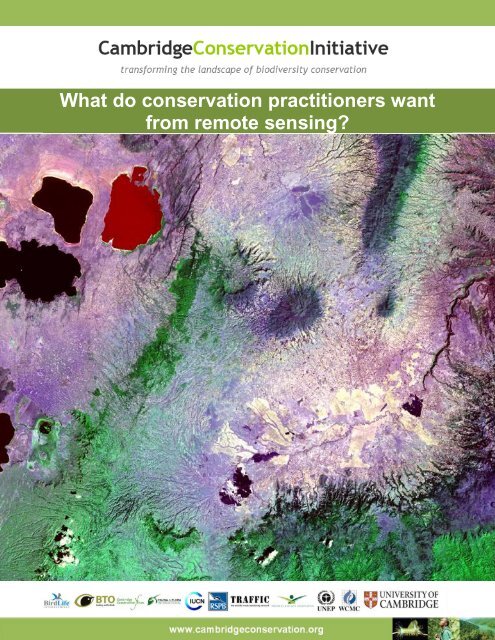
Front page photo credit:<br />
Landsat TM images (NASA Landsat Program, 1990) around Important Bird Areas (IBAs) ET047, ET048 and ET054 in Ethiopia<br />
1
Contents<br />
Introduction .......................................................................................................................................... 3<br />
Part 1: Requirements of <strong>conservation</strong> users of <strong>remote</strong> <strong>sensing</strong> ...................................................... 5<br />
1.1 Habitat extent, distribution and inventory ................................................................................. 5<br />
1.2 Change in habitat extent and distribution ................................................................................. 6<br />
1.3 Habitat structure and features .................................................................................................. 6<br />
1.4 Effectiveness of protected areas and other land management interventions ............................ 7<br />
1.5 Drivers of habitat loss, degradation and overexploitation of natural resources ......................... 7<br />
1.6 Impacts of climatic change on biodiversity ............................................................................... 9<br />
1.7 Ecosystem services ................................................................................................................. 9<br />
1.8 Remote <strong>sensing</strong> based alert systems for timely detection of damage to key sites ................... 9<br />
Part 2: General concerns about the applicability of <strong>remote</strong> <strong>sensing</strong> to <strong>conservation</strong> .................. 11<br />
2.1 Multi-temporal and real time analyses ................................................................................... 11<br />
2.2 Data verification ..................................................................................................................... 11<br />
2.3 Access to and promotion of data sets .................................................................................... 12<br />
2.4 Information on data sets ........................................................................................................ 12<br />
2.5 Capacity needs ...................................................................................................................... 12<br />
Annex ................................................................................................................................................. 14<br />
Background to the user needs workshops ...................................................................................... 14<br />
The Shared Challenges Programme (May 2008 to June 2012) ........................................................ 14<br />
Remote <strong>sensing</strong> for biodiversity <strong>conservation</strong>................................................................................... 14<br />
Notes <strong>from</strong> the User Needs Workshops in each CCI Partner organisation ................................... 15<br />
Royal Society for the Protection of Birds (RSPB): 18 January 2010 ................................................. 15<br />
UNEP World Conservation Monitoring Centre (UNEP-WCMC): Monday 1st February 2010 ............ 18<br />
BirdLife International, 11 th February 2010 ......................................................................................... 20<br />
Fauna & Flora International (FFI), 15 th February 2010 ...................................................................... 22<br />
British Trust for Ornithology (BTO): Monday 1st February 2010 ....................................................... 25<br />
2
Introduction<br />
The data collected by earth observation <strong>remote</strong> <strong>sensing</strong> is a powerful tool for <strong>conservation</strong> and in such<br />
a rapidly changing field, it is essential that <strong>conservation</strong>ists working with satellite imagery and the<br />
experts behind it work together to make the most of the technology and convert the results into action<br />
for <strong>conservation</strong>.<br />
This Cambridge Conservation Initiative (CCI) Shared Challenges Programme project aims identify the<br />
information that <strong>conservation</strong> <strong>practitioners</strong> actually need <strong>from</strong> earth observation <strong>remote</strong> <strong>sensing</strong> data,<br />
and, importantly, to increase collaboration between <strong>conservation</strong> community ‘users’ and the technical<br />
experts. It will also raise awareness across <strong>conservation</strong> organisations and researchers of the potential<br />
for <strong>remote</strong> <strong>sensing</strong> to inform their work.<br />
This project consists of the following four stages.<br />
Stage 1:<br />
Stage 2:<br />
Stage 3:<br />
Stage 4:<br />
Discuss the unrealised potential value of <strong>remote</strong> <strong>sensing</strong> in addressing problems<br />
in biodiversity <strong>conservation</strong> policy and practice with experts on <strong>conservation</strong> policy<br />
and practice in interested CCI member organisations. This was achieved through<br />
workshops held at five organisations. Applications of <strong>remote</strong> <strong>sensing</strong> with available and<br />
potentially achievable methods were identified and summarised in a <strong>do</strong>cument <strong>from</strong><br />
each workshop.<br />
Synthesis of results <strong>from</strong> all the user needs workshops. A User Needs Assessment<br />
(this <strong>do</strong>cument) lists potential applications and identifies the obstacles to their<br />
realisation. This report is to be discussed with <strong>remote</strong> <strong>sensing</strong> technical experts in CCI<br />
partner organisations, including the University of Cambridge<br />
Communication of the results of the User Needs Assessment to centres of<br />
excellence in <strong>remote</strong> <strong>sensing</strong> techniques and large-scale data processing. The aim is to<br />
find specialists in these areas who are willing to talk to <strong>conservation</strong> <strong>practitioners</strong> and<br />
policy experts about how to develop their proposals further.<br />
A workshop at which <strong>conservation</strong> <strong>practitioners</strong> and policy experts attempt to identify<br />
useful projects that could be implemented immediately and otherwise to inform research<br />
and development on the most important unresolved questions.<br />
Stage 1: User needs workshops (January and February, 2010)<br />
The Shared Challenges Programme held five workshops in early 2010 to identify the needs of people<br />
who use of <strong>remote</strong> <strong>sensing</strong> data <strong>from</strong> within the CCI partners. These ‘user needs’ were held in:<br />
1. RSPB (18 th January)<br />
2. UNEP-WCMC (1 st February)<br />
3. BTO (1 st February)<br />
4. BirdLife International (11 th February)<br />
5. FFI (15 th February)<br />
In total, 71 staff attended these workshops together with, project ‘champions’ <strong>from</strong> the organising<br />
group, drawn <strong>from</strong> each of the participating organisations. They were present to achieve similarity<br />
across workshops in the way in which the discussion was conducted. Each workshop began with a<br />
presentation in which the principles of <strong>remote</strong> <strong>sensing</strong> were outlined and examples of existing types of<br />
applications to <strong>conservation</strong> and upcoming technical developments were described; after which an<br />
open discussion took place.<br />
3
Stage 2 and 3: This report and the communication of the results<br />
This report is a synthesis of discussions at all the workshops and is presented according to:<br />
1. Requirements of <strong>conservation</strong> users of <strong>remote</strong> <strong>sensing</strong><br />
2. General concerns about the applicability of <strong>remote</strong> <strong>sensing</strong> to <strong>conservation</strong><br />
3. Tools and capacity needs.<br />
The reports <strong>from</strong> each workshop can be found in the Annex.<br />
Stage 4: A final workshop on the 31 st March 2011<br />
On the, the final workshop in the series brought together <strong>conservation</strong> <strong>practitioners</strong> and technical<br />
experts <strong>from</strong> a range of organisations including NASA and the European Commission’s Joint Research<br />
Centre (JRC) with those <strong>from</strong> 11 CCI partners to discuss new developments in <strong>remote</strong> <strong>sensing</strong><br />
techniques and how these could be applied to <strong>conservation</strong>.<br />
A full list of the external organisations involved in this workshop included:<br />
<br />
<br />
<br />
<br />
<br />
<br />
<br />
<br />
<br />
<br />
<br />
<br />
The Centre for Ecology and Hydrology (CEH)<br />
JRC (the Joint Research Centre, European Commission)<br />
Kings College, Lon<strong>do</strong>n<br />
Leeds University<br />
NASA Headquarters, the Science Mission Directorate<br />
Specto Natura<br />
Stanford University<br />
University of Leicester<br />
University of Louvain, Belgium<br />
University of Oxford<br />
University of Wageningen<br />
WWF-Germany<br />
Conservation impact<br />
This work raised the profile of CCI organisations involvement in <strong>remote</strong> <strong>sensing</strong> for <strong>conservation</strong>,<br />
strengthened existing collaborations and built new partnerships between <strong>remote</strong> <strong>sensing</strong> ‘users’ and<br />
‘providers’, as well as identifying the need for both sides to communicate more. It helped raise<br />
awareness across CCI of the value of <strong>remote</strong> <strong>sensing</strong> to <strong>conservation</strong>; and should ultimately increase<br />
the contribution that <strong>remote</strong> <strong>sensing</strong> makes to the work that CCI <strong>do</strong>es and help to fully realise its<br />
potential for <strong>conservation</strong>.<br />
More information about this work and other CCI catalyzed and funded projects can be found on the CCI<br />
website at www.cambridge<strong>conservation</strong>.org<br />
4
Part 1: Requirements of <strong>conservation</strong> users of <strong>remote</strong> <strong>sensing</strong><br />
1.1 Habitat extent, distribution and inventory<br />
Problems<br />
Conservationists need reliable data on the extent and location of important habitats for biodiversity<br />
<strong>conservation</strong>. Key applications include assessing the extent of important habitats within protected<br />
areas. Many examples were discussed in workshops, including Biodiversity Action Plan (BAP) habitats<br />
in the UK, habitats specified in the EU Habitats Directive, habitats for birds in Important Bird Areas<br />
globally and a wide range of habitats beyond, including, forests.<br />
Habitat definitions appropriate for <strong>conservation</strong> needs often <strong>do</strong> not match the, often broader, <strong>remote</strong><br />
<strong>sensing</strong>-based classifications of land cover that are available. Some biologically important sub-divisions<br />
of habitat are difficult to discriminate <strong>from</strong> land cover, even for habitats whose total extent is relatively<br />
easy to measure by <strong>remote</strong> <strong>sensing</strong> (e.g. forest). Some important and distinctive habitats for<br />
biodiversity occur in small patches and are not well mapped by large scale land cover inventories.<br />
Examples include bamboo and white sand forests in the Amazon.<br />
Although <strong>remote</strong> <strong>sensing</strong> measurements of forest extent is well-developed, other habitats of particular<br />
importance to biodiversity <strong>conservation</strong> present varying degrees of difficulty when it comes to mapping<br />
their extent, or variation within them, using <strong>remote</strong> <strong>sensing</strong>. Examples include steppes, savannah and<br />
other grasslands, wetlands, intertidal mud and sand flats, salt marshes, sea grass beds, mangroves<br />
and coral reefs.<br />
It is often difficult to discriminate some modified land cover types <strong>from</strong> important natural ones for<br />
<strong>conservation</strong>. For example, natural <strong>from</strong> sown or otherwise modified grasslands and plantations <strong>from</strong><br />
some types of natural forest.<br />
Some important habitats vary in location <strong>from</strong> year to year, or more rapidly, and some may only be<br />
evident at a particular time of year. This limits the availability of accurate inventory data. Examples<br />
include temporary wetlands and vegetated areas in arid and semi-arid areas for nomadic birds and<br />
intertidal mud and sand flats in dynamic estuaries and deltas.<br />
Cloud cover limits the availability of inventory data for some important habitats, such as montane<br />
forests.<br />
Priorities for development<br />
Improved <strong>remote</strong> <strong>sensing</strong> methods for discriminating important subdivisions of land cover that reflect<br />
important habitats that have often merged into broader categories.<br />
Improved <strong>remote</strong> <strong>sensing</strong> methods for mapping the extent of, and variation within, land covers that<br />
relate to key habitats, especially savannah, natural grasslands (including steppes), wetlands, intertidal<br />
mud and sand flats, salt marshes, sea grass beds, mangroves and coral reefs.<br />
5
1.2 Change in habitat extent and distribution<br />
Problems<br />
Surveillance of change in habitat extent is essential for many <strong>conservation</strong> activities. Losses of habitats<br />
such as forests, wetlands, natural grasslands, savannas, intertidal habitats sea grass beds, mangroves<br />
and coral reefs caused by conversion to human use are major pressures on biodiversity.<br />
Conservationists need frequent accurate measurements of the extent of these habitats that are directly<br />
comparable with previous assessments. However, the limitations as to which land covers and<br />
subdivisions of broad land cover can be surveyed by <strong>remote</strong> <strong>sensing</strong> methods, identified in the section<br />
on Habitat extent, distribution and inventory also apply to measures of change in extent. Information on<br />
change in extent of habitats is an important indicator of change in biodiversity, as in the case of the<br />
CBD biodiversity indicators, but is only used reliably and on a wide scale for forests. Even for forests,<br />
differences exist among research groups in estimates of the rate of loss. These technical problems<br />
make assessments of impacts on biodiversity problematic.<br />
An important problem is the comparability of land cover inventories made at different times, and hence<br />
the accuracy of measurements of change. There are often differences in the methods used in<br />
classifying habitats and compiling inventories that render them incapable of being compared with<br />
previous assessments. In addition, techniques for allowing for bias caused by atmospheric conditions<br />
and other effects may not be applied correctly and there may be insufficient validation by groundtruthing;<br />
both of which limit the accuracy of these measurements of change assessment with<br />
confidence.<br />
Priorities for development<br />
Improvements and wider availability of <strong>remote</strong> <strong>sensing</strong> methods for increasing the accuracy of<br />
comparisons across time in measurements of land cover / habitat extent and distribution.<br />
Improvements and wider availability of methods for validation of measures of change of land cover /<br />
habitat extent.<br />
Improved <strong>remote</strong> <strong>sensing</strong> methods and wider availability of techniques for measuring changes in the<br />
extent of key habitats, especially savannah, natural grasslands (including steppes), wetlands, intertidal<br />
mud and sand flats, salt marshes, sea grass beds, mangroves and coral reefs.<br />
1.3 Habitat structure and features<br />
Problems<br />
Some subtle features of habitats are determinants of their value for biodiversity or in providing<br />
ecosystem services. Conservationists require information on these features which may affect the<br />
distribution of species, their value for carbon storage or their part in regulating the hydrological cycle.<br />
Examples for terrestrial habitats include tree, shrub or grass species composition, canopy cover, tree<br />
size distribution, density of dead trees, three-dimensional forest structure, understory characteristics,<br />
vegetation architecture and the timing and duration snow and ice cover.<br />
Documentation of the spread of invasive exotic plant species harmful to natural communities is a<br />
special case of where precise discrimination of species composition would be valuable to <strong>conservation</strong>.<br />
For aquatic environments, key variables include biological productivity of marine areas, sea surface<br />
temperature, frequency of marine and freshwater algal blooms, plankton density, seasonality of extent<br />
of sea ice cover, including polynas, sediment type of intertidal zones, bathymetry of intertidal zones<br />
6
(and hence the duration of tidal coverage), the mobility of intertidal mud and sand flats, volume and<br />
seasonal pattern or river flows and species identity of emergent marsh vegetation.<br />
Priorities for development<br />
Improved <strong>remote</strong> <strong>sensing</strong> methods for making fine discriminations between vegetation types, such as<br />
tree or bush community structures and invasive plant species. Multi-temporal analyses to exploit<br />
differing seasonal patterns of reflectance characteristics might have more potential for this.<br />
Radar altimetry and LiDAR methods could be applied to more <strong>conservation</strong>-related problems to<br />
determine vegetation architecture, three-dimensional structure and high-resolution topography.<br />
Use of more frequent images to monitor seasonal land cover changes within habitats, which may<br />
indicate attributes of the habitat important to species that live in it. Examples include the duration and<br />
timing of the growing season, flooding and snow and ice cover, which affect habitat suitability for a wide<br />
range of organisms.<br />
1.4 Effectiveness of protected areas and other land management interventions<br />
Problems<br />
Areas designated for <strong>conservation</strong> (protected areas) are the most widely applied <strong>conservation</strong><br />
intervention, but quantitative large-scale information on their effectiveness is sparse.<br />
A similar situation applies to interventions to moderate the effects of human uses of land, such as agroenvironment<br />
schemes, wildlife-friendly agricultural product certification schemes and sustainable forest<br />
management and logging.<br />
Priorities for development<br />
Improved access to processed or unprocessed <strong>remote</strong> <strong>sensing</strong> data on land cover change, or methods<br />
for tracking changes in near real time within and adjacent to sites of recognised <strong>conservation</strong><br />
importance or value.<br />
Improved statistical modelling approaches for discriminating causal effects of designations and<br />
interventions on rates of habitat loss or modification <strong>from</strong> potentially confounding variations due to<br />
topography, soil type, etc.<br />
1.5 Drivers of habitat loss, degradation and overexploitation of natural resources<br />
Problems<br />
Conservationists often <strong>want</strong> to be able to quantify the drivers and pressures on biodiversity and<br />
habitats. For example, rates of deforestation may have been measured, but the replacement land cover<br />
may only be vaguely known. Information on rates of change <strong>from</strong> natural habitat to plantation, urban,<br />
cropland, pasture and aban<strong>do</strong>ned land (including desert) needs to be available in more detail. The<br />
types of crops being grown on cropland converted <strong>from</strong> forest are an indication of the economic drivers<br />
of habitat loss. We acknowledge that many of these topics are currently being explored, and have<br />
presented technical problems. However, we add our support to many of these efforts.<br />
Logging of selected tree species may reduce the value of natural habitats for biodiversity without<br />
causing obvious changes in land cover. Imagery of a higher temporal resolution is required to<br />
sufficiently monitor these activities.<br />
7
Overgrazing of natural and semi-natural habitats by <strong>do</strong>mesticated livestock is a common cause of<br />
habitat degradation. While some studies have attempted to track changes in grazing pressure, there<br />
<strong>do</strong>es not yet appear to be a standard approach to <strong>do</strong>ing this. Improved quantification through seasonal<br />
<strong>remote</strong> <strong>sensing</strong>-data of the extent and magnitude of extensive livestock grazing would be valuable.<br />
For rivers, water bodies and wetlands, <strong>do</strong>cumentation of changes in land cover and evidence of mining<br />
and other point sources of pollution in catchments and on coasts would aid in assessing risks to<br />
biodiversity <strong>from</strong> changes in river flows and pollution. Large-scale mapping of changes in water control<br />
infrastructure (new dams, canals, reservoirs, etc) would also indicate potentially harmful changes in<br />
river flows.<br />
Sedimentation, eutrophication and other pollution are frequent causes of damage to biodiversity in<br />
lakes, wetlands, coastal lagoons and shallow seas. Quantification by <strong>remote</strong> <strong>sensing</strong> methods of the<br />
frequency and magnitude of these effects, and potentially alerts, would be valuable to <strong>conservation</strong>ists.<br />
Better data on the distribution of, and changes in roads and settlements would provide proxy<br />
information on pressures leading to overexploitation <strong>from</strong> extraction of timber and fuel wood and<br />
hunting of birds and mammals in nearby natural habitats<br />
Overexploitation of marine animals and associated bycatch have caused vast and lasting damage to<br />
biodiversity. More information on the distribution and magnitude of fishing effort would be helpful in<br />
identifying areas and species at particular risk and the location of illicit activities.<br />
Priorities for development<br />
Identification by <strong>remote</strong> <strong>sensing</strong>-methods of changes in the extent and distribution of cropland<br />
(including crop types), plantations, pasture, settlements (including urban areas) and aban<strong>do</strong>ned<br />
cropland and pasture.<br />
Remote <strong>sensing</strong>-based data on transition rates between the various types of land cover described<br />
above and between those and natural habitats.<br />
Remote <strong>sensing</strong>-based methods for quantifying the frequency and magnitude of marine and freshwater<br />
sedimentation and pollution events.<br />
Remote <strong>sensing</strong>-based methods for detecting and quantifying selective logging.<br />
Remote <strong>sensing</strong>-based methods for detecting and quantifying mines and other point sources of water<br />
and atmospheric pollution.<br />
Improvement and wider availability of Remote <strong>sensing</strong>-based methods for measuring the frequency,<br />
extent and location of fires.<br />
Remote <strong>sensing</strong>-based methods for quantifying livestock grazing.<br />
Better methods for quantifying and disseminating information on changes in the extent and distribution<br />
of built infrastructure, including settlements, roads, electric lighting, canals and water control structures.<br />
Improved modelling of relationships between land use change in catchments and <strong>do</strong>wnstream changes<br />
in rivers, lakes, wetlands and coastal marine systems.<br />
Improved data on changes in the extent of urban areas and their populations and demands for<br />
resources.<br />
Development of Remote <strong>sensing</strong> methods for quantifying the at-sea distribution of fishing effort.<br />
8
1.6 Impacts of climatic change on biodiversity<br />
Problems<br />
Climatic change will have significant impacts on biodiversity <strong>conservation</strong>. Quantification of changes in<br />
tree lines, vegetation type, timing of leafing of deciduous plants, snow and ice cover, flooding, soil<br />
moisture and sea surface temperature are valuable indicators of ecologically relevant trends. Long time<br />
series data on these changes will become increasingly important to <strong>conservation</strong>ists.<br />
Priorities for development<br />
Development of Remote <strong>sensing</strong>-based indicators of effects of climatic change on water availability.<br />
Possibilities include soil moisture deficit, water deficit, etc.<br />
Remote <strong>sensing</strong> measurements of responses to climatic change such as changes in the elevation of<br />
treelines, spread of trees and shrubs into tundra, changes in sea ice extent and characteristics,<br />
changes in the extent of freshwaters, changes in the timing and frequency of seasonal events<br />
(greening, floods, snowmelt, etc).<br />
1.7 Ecosystem services<br />
Problems<br />
Conservationists increasingly recognise the value of quantifying the monetary values of ecosystem<br />
services provided by wild species and the habitats. This provides additional arguments for<br />
<strong>conservation</strong>. Such quantification would be especially desirable for designated sites such as Protected<br />
Areas and Important Bird Areas.<br />
Services requiring more robust quantification include above and below ground carbon stocks in habitats<br />
other than forests e.g. mangroves, grasslands and peatlands. Data is also needed about carbon<br />
storage and sequestration value in oceans, and for measurement of carbon fluxes (though this is<br />
difficult). Hydrological services such as reliable water supply, clean water and reduction of flood risk are<br />
important benefits of many habitats that are also valuable for biodiversity.<br />
Priorities for development<br />
Remote <strong>sensing</strong>-based measurement of most hydrological variables such as stream and river flows,<br />
sediment loads, and flooding in regions where direct measurements are difficult. Methods already exist<br />
to estimate precipitation <strong>from</strong> cloudiness. The objective would be to provide data for hydrological<br />
models to quantify effects on stream flow and sediment of retaining natural vegetation in catchments.<br />
Remote <strong>sensing</strong>-based measures of river flows might be compared with and calibrated using long-term<br />
global databases of river flows <strong>from</strong> direct gauging.<br />
1.8 Remote <strong>sensing</strong> based alert systems for timely detection of damage to key sites<br />
Problems<br />
Important sites for biodiversity, including sites allocated high levels of legal protection, are frequently<br />
damaged by human activities such as logging, clearance of natural vegetation and its replacement by<br />
cropland or pasture and increased incursions of hunters. Regional, national and international<br />
<strong>conservation</strong> agencies are often unaware of these changes until it is too late to <strong>do</strong> anything to counter<br />
them.<br />
9
The number and extent of sites at risk is large and many of them are <strong>remote</strong> and have no, few or<br />
poorly-resourced <strong>conservation</strong> staff. Hence, damaging changes are difficult to detect rapidly.<br />
Examples of the types of sites at risk and damaging processes include deforestation and logging in<br />
protected forests, ploughing up of Central Asian steppes for arable agriculture, fires in peatlands and<br />
forests, increased hunting of mammals and birds in forests and other habitats due to increased access<br />
via new roads and spread of settlements and new irrigation infrastructure leading to clearance of<br />
natural habitats for agriculture.<br />
Some changes might be relatively easy to detect, such as ploughing up of steppe grassland, peatland<br />
and forest fires and clear-felling of forests. Others would require high resolution imagery and either<br />
sophisticated software or many human eyes and brains to analyse (e.g. a narrow road or canal<br />
developments).<br />
We acknowledge that near real time fire event data are available, and potentially under used by the<br />
<strong>conservation</strong> community. These data may be of use in identifying sites where land cover may be<br />
changing. A better understanding of what these fire events mean for <strong>conservation</strong> is needed to<br />
understand which should be taken as indicators of change, and which ignored.<br />
Priorities for development<br />
A <strong>remote</strong> <strong>sensing</strong>-based near real-time alert system for important sites for biodiversity would be<br />
valuable and widely used.<br />
The system would alert a nature <strong>conservation</strong> agency, based on near real time data to enable<br />
responses to occur in good time to affect outcomes. Quantitative measures would not necessarily be<br />
required- just the alert with an acceptable rate of false alarms and missed incidents. The alert might be<br />
followed up with a special quantitative analysis of habitat change.<br />
Such a system could be extended to provide an amber early-warning alert system for developments<br />
near to but outside sites that are likely to affect their integrity in the future, such as the spread of a road<br />
network towards a site or building of secondary development adjacent to an existing road network.<br />
If an automatic system proves impractical then a citizen science approach might be taken, with<br />
members of the public each a<strong>do</strong>pting a site and regularly receiving and inspecting images or accessing<br />
a website to compare them by eye and then sending the alert of an apparently significant change to a<br />
central co-coordinator for checking using Remote <strong>sensing</strong> or on the ground by people who live near the<br />
site.<br />
A worthwhile study to assess the usefulness of this approach would be to retrospectively analyse<br />
images of important <strong>conservation</strong> sites that have been damaged and a matched set of similar sites that<br />
were not and to estimate the time at which Remote <strong>sensing</strong>-based measures could have raised the<br />
alarm and how reliable that alarm (false positives and negatives) would be.<br />
10
Part 2: General concerns about the applicability of <strong>remote</strong> <strong>sensing</strong> to<br />
<strong>conservation</strong><br />
2.1 Multi-temporal and real time analyses<br />
Problems<br />
Because <strong>remote</strong> <strong>sensing</strong> platforms, classifications and analysis evolve it is difficult to <strong>do</strong> reliable multitemporal<br />
analyses to measure changes over time.<br />
There is a trade-off between high image resolution and the area covered by imagery and frequency of<br />
passes over an area of interest. Selecting the type of imagery appropriate to a particular <strong>conservation</strong><br />
problem is a significant challenge to field programmes<br />
The rapid availability of regularly updated information <strong>from</strong> satellite imagery is important to those<br />
involved in managing and monitoring threats to biodiversity. Remote <strong>sensing</strong> has an important and<br />
largely unfulfilled role to play in alerting interested parties to processes, such as land cover change, that<br />
threaten biodiversity in time for intervention to be practical.<br />
Priorities for development<br />
Further development of techniques for improving the comparability of time series of quantitative <strong>remote</strong><br />
<strong>sensing</strong> assessments would be useful, as would increasing the accessibility and ease of use of such<br />
methods.<br />
Development of ‘alert systems’ for threatening changes e.g. in land use, with rapid data processing and<br />
dissemination of alerts. These would also require a system for checking validity and learning <strong>from</strong> false<br />
positives and negatives.<br />
2.2 Data verification<br />
Problems<br />
It is essential to define acceptable degrees of error and have verification / ground-truthing at a level<br />
sufficient to check that they are being fulfilled. There is a danger that excessive reliance on unvalidated<br />
<strong>remote</strong> <strong>sensing</strong> results will lead to damaging errors.<br />
There was some discussion about the accuracy of data for local, site-based decision-making. To aid<br />
improvement, field data obtained by <strong>conservation</strong> organisations could be used to ground truth imagery.<br />
Priorities for development<br />
A format for uploading or submitting ancillary/ground truthing data for integration with <strong>remote</strong> <strong>sensing</strong><br />
data could be created. Platforms such as Google Earth that allow people to upload images of sites may<br />
be useful providing there can be some verification of spatial accuracy.<br />
The potential of citizen science programmes to ground truth <strong>remote</strong> <strong>sensing</strong> data was discussed in<br />
several of the workshops. There could be a citizen science programme in which members of the public<br />
have cheap GPS loggers fitted to cameras or phones and can send in geo-referenced habitat photos to<br />
a central co-coordinator which could be used to ground-truth Remote <strong>sensing</strong> based inventories and<br />
measurements of habitat change. This could also be valuable in verifying incidents identified by a<br />
<strong>remote</strong> <strong>sensing</strong> alert system<br />
11
2.3 Access to and promotion of data sets<br />
Problems<br />
The constraint to maximising use of <strong>remote</strong> <strong>sensing</strong> is not necessarily on what <strong>remote</strong> sensors can <strong>do</strong>,<br />
but how this gets to users. Once a new application is developed it is often published in the <strong>remote</strong><br />
<strong>sensing</strong> literature but not rolled out for practical use. How <strong>do</strong> we incentivise roll-out? (e.g. selective<br />
logging is possible to <strong>do</strong> but nobody is <strong>do</strong>ing it systematically).<br />
Remote <strong>sensing</strong> has great potential value in raising awareness on the ground about changes to<br />
important areas for biodiversity. This requires better access to Remote <strong>sensing</strong> products by local<br />
people and better integration of <strong>remote</strong> <strong>sensing</strong> with ground-based surveys mapped with GPS and<br />
fixed point photography georeferenced with GPS.<br />
Whilst the development of web-based interactive maps and high resolution images are useful, the<br />
ability to <strong>do</strong>wnload data is also important to organisations in order to spatially analysis data based on<br />
their own needs.<br />
Remote sensors/data providers <strong>do</strong> not ‘advertise their wares’ to potential <strong>conservation</strong> users. For<br />
example, NASA has recently opened up its archives of LANDSAT data in time series, but this launch<br />
had really low profile within the <strong>conservation</strong> community. Given that we presumably have some form of<br />
archiving of <strong>remote</strong> sensed data that has not all been analysed yet, and that could be analysed better in<br />
the future – what is the awareness and sharing being <strong>do</strong>ne with that global archive resource?<br />
Though a number of data sets are coming on board for free there is still an issue of cost of accessing<br />
<strong>remote</strong> <strong>sensing</strong> data.<br />
Priorities for development<br />
Data providers (including e.g. European initiatives such as GMES) should consider different types of<br />
funding structure for different organisations so that <strong>conservation</strong> charities can get an affordable rate.<br />
2.4 Information on data sets<br />
Problem<br />
There is a need for greater transparency on confidence we can place in <strong>remote</strong> <strong>sensing</strong> data<br />
classifications; and to make good use of derived data sets it is important to have information on issues<br />
behind the data.<br />
Priorities for development<br />
Provision of improved information on calibration and interpretation of images can help with<br />
interpretation of unexpected findings (e.g. for land classification it is helpful to know the land<br />
classification allocated and the ‘next likely’ classification).<br />
2.5 Capacity needs<br />
There was considerable discussion across workshops on how staff of <strong>conservation</strong> organisations could<br />
be provided with improved training and tools so as to make better and more efficient use of imagery.<br />
Examples included:<br />
12
A wiki system for disseminating and exchanging information and experience (this could be an<br />
internal wiki hosted by CCI). This could contain, for example links to directories of images<br />
available for particular areas with details of date, cloud cover and cost; Toolkits of image<br />
analysis methods custom-built for <strong>conservation</strong> needs, methods for adjusting imagery to<br />
increase the comparability of habitat classifications of the same area using images <strong>from</strong><br />
different dates; and shared reference libraries of reflectance characteristics of important<br />
habitats.<br />
CCI could maintain a directory of people interested in <strong>remote</strong> <strong>sensing</strong> analyses and outputs in<br />
Cambridge. CCI could also facilitate workshops where people present their latest work with<br />
<strong>remote</strong> <strong>sensing</strong> products, with the possibility for improved coordination and knowledge<br />
exchange.<br />
One workshop suggested it would also be good to have more people in a ‘translator’ role- i.e.<br />
people whom one could approach and who could give advice on how and whether their <strong>remote</strong><br />
<strong>sensing</strong> needs could be met; the best data sets to use; issues with using that data set etc. It is<br />
difficult for some organisations to have the capacity to <strong>do</strong> this in house. This would probably<br />
require a new role and an additional post.<br />
There is great potential for the CCI partnership to facilitate meeting some of the above needs but this<br />
require more thought with regards to:<br />
<br />
<br />
<br />
<br />
The cost associated with sharing information between organisations<br />
Organisational cultures which may discourage sharing information<br />
IP issues and data licensing which may prevent the sharing of information.<br />
The capacity of organisations to maintain accurate and up-to date information<br />
13
Annex<br />
Background to the user needs workshops<br />
The Shared Challenges Programme (May 2008 to June 2012)<br />
This CCI Programme aimed to establish a new and coordinated process across the Cambridge<br />
Conservation community to catalyze a new series discussions and activities that identify and address<br />
key challenges facing biodiversity <strong>conservation</strong>.<br />
Over the last four years, the Shared Challenges Programme helped to catalyze over 40 workshops,<br />
discussions and reports, involving more than 200 people <strong>from</strong> across CCI and beyond in a broad range<br />
of collaborative projects.<br />
These projects cover topics <strong>from</strong> exploring new applications of <strong>remote</strong> <strong>sensing</strong> technology to climate<br />
change impacts on biodiversity, linkages between poverty and biodiversity; and reviewing potential<br />
impacts of geoengineering technology on biodiversity. Specific policy-focused projects have included:<br />
discussing ways in which CCI can support the Intergovernmental Science-Policy Platform on<br />
Biodiversity and Ecosystem Services (IPBES); input into policy that will monitor the biodiversity impacts<br />
of REDD+ initiatives; and assessing the biodiversity impacts of the European Energy Directive on<br />
biodiversity.<br />
Remote <strong>sensing</strong> for biodiversity <strong>conservation</strong><br />
This Shared Challenges Project consists of the following stages.<br />
1. Discuss the unrealised potential value of <strong>remote</strong> <strong>sensing</strong> data in addressing problems in<br />
biodiversity <strong>conservation</strong> policy and practice with experts on <strong>conservation</strong> policy and<br />
practice in interested CCI member organisations. This is being <strong>do</strong>ne by means of a series of<br />
workshops at each of five organisations. Applications of <strong>remote</strong> <strong>sensing</strong> with available and<br />
potentially achievable methods are to be identified and summarised in a <strong>do</strong>cument <strong>from</strong><br />
each workshop.<br />
2. Synthesis of results <strong>from</strong> all of the workshops into a User Needs Assessment which lists<br />
potential applications and identifies the obstacles to their realisation. This stage will include<br />
discussion with <strong>remote</strong> <strong>sensing</strong> technical experts in CCI partner organisations, including the<br />
University of Cambridge<br />
3. Communication of the results of the User needs Assessment to centres of excellence in<br />
<strong>remote</strong> <strong>sensing</strong> techniques and large-scale data processing. This aims to find specialists in<br />
these areas who would be willing to talk to <strong>conservation</strong> <strong>practitioners</strong> and policy experts.<br />
4. Workshop at which <strong>conservation</strong> <strong>practitioners</strong> and policy experts attempt to identify useful<br />
projects that could be implemented immediately and otherwise to inform research and<br />
development on the most important unresolved questions.<br />
The first user needs workshop in Stage 1 was held on 18 January 2010 at RSPB and was organised<br />
and chaired by Dr Tim Stowe, Director of the International Division of RSPB. The other workshops will<br />
be completed by mid February. The RSPB workshop was attended by 18 RSPB staff, mostly <strong>from</strong><br />
policy and practice parts of the organisation. Staff with UK, European and international remits took part.<br />
Two staff <strong>from</strong> UNEP-WCMC and one <strong>from</strong> BirdLife International were also present. These were all<br />
members of the project champions group and responsible for organising similar workshops in those<br />
organisations. This was <strong>do</strong>ne to achieve similarity across workshops in the way in which the discussion<br />
was conducted.<br />
14
Notes <strong>from</strong> the User Needs Workshops in each CCI Partner organisation<br />
Royal Society for the Protection of Birds (RSPB): 18 January 2010<br />
The RSPB is the largest wildlife <strong>conservation</strong> organisation in Europe, with over one<br />
million members. The RSPB works to secure the <strong>conservation</strong> of biodiversity - especially<br />
wild birds and their habitats – through research, education, habitat management and<br />
advocacy. Its work is based upon sound science wherever possible, and works in the UK<br />
and internationally.<br />
Introduction<br />
The meeting began with a PowerPoint presentation by Dr Graeme Buchanan <strong>from</strong> the Conservation<br />
Science Department of RSPB in which the principles of <strong>remote</strong> <strong>sensing</strong> were outlined and examples of<br />
existing types of applications to <strong>conservation</strong> and upcoming technical developments were described.<br />
This presentation had been developed jointly with all members of the project champions group and will<br />
also be used, with minor modifications, at the other workshops.<br />
Notes <strong>from</strong> the discussion<br />
The following suggestions about potential <strong>remote</strong> <strong>sensing</strong> applications emerged <strong>from</strong> discussions.<br />
1. Remote <strong>sensing</strong> could be applied more widely to deliver <strong>conservation</strong>ists’ habitat inventory<br />
needs. Cases discussed included UK, European and global examples. The extent of most of<br />
the 45 UK Biodiversity Action Plan (BAP) habitats is unknown or poorly known. Specialists<br />
involved in UK BAP <strong>do</strong> not have the means to measure the extent or the proportions of the<br />
habitat within and outside designated sites. Similar points were made about habitats specified in<br />
the EU Habitats Directive and for global inventories of many important habitats for birds and<br />
other biodiversity, including IBAs. Coverage of habitats by various kinds of designated sites is a<br />
recurrent problem. Another frequent problem is that definitions of habitat appropriate for<br />
<strong>conservation</strong> needs <strong>do</strong> not match the, often broader, <strong>remote</strong> <strong>sensing</strong>-based classifications that<br />
are available. Some biologically important sub-divisions of habitat are difficult to discriminate<br />
among, but techniques such as multi-temporal image analysis could help more than at present.<br />
Whilst considerable progress has been made in measuring the extent of forests, there is<br />
insufficient readily available technical ability to accurately measure the extent of other habitats<br />
of great importance, such as savannah, natural grasslands, wetlands, mangroves and coral<br />
reefs.<br />
2. Remote <strong>sensing</strong> could be applied more widely to deliver surveillance of change in habitat extent<br />
at UK, European and global levels. In addition to the limitations identified for inventory<br />
applications (see above) there is the additional problem of how comparable <strong>remote</strong> <strong>sensing</strong>based<br />
habitat inventories compiled at different times are and hence how precisely habitat loss<br />
can be measured. There are technical fixes for comparability problems due to differences in<br />
images caused by e.g. atmospheric conditions, but they are often not applied properly or their<br />
effectiveness is not validated by ground-truthing. The same limitations apply as in (1) as to<br />
which habitats are least well catered for. Extension of <strong>remote</strong> <strong>sensing</strong>-based measures to<br />
habitats other than forest is important for national, regional and global post-2010 indicators of<br />
habitat extent.<br />
3. Remote <strong>sensing</strong> could be applied to measuring the effectiveness of designated areas for<br />
<strong>conservation</strong> by measuring changes in extent of habitat within such areas and comparing rates<br />
of change with areas of the same habitat outside. Some of this is being <strong>do</strong>ne, but the limitations<br />
in (2) affect reliability and scope- especially of what types of habitats can be monitored. Similar<br />
questions about the effectiveness of agro-environment schemes in protecting farmland habitats<br />
could also be addressed.<br />
15
4. Remote <strong>sensing</strong> could be used more to quantify slow changes in the state of important areas for<br />
biodiversity- not just rapid alternations due to conversion to human use. Examples include the<br />
spread of reeds or bushes into the habitats of sedge-dependent aquatic warblers in Polish IBAs,<br />
trends in flood frequency or timing in wetland reserves or IBAs, etc.<br />
5. Remote <strong>sensing</strong> might prove to be of great value in providing an alert system for developments<br />
with potential to damage selected important sites for biodiversity (e.g. IBAs, Harapan, Gola,<br />
Central Asian steppes). The system would compare images obtained at different times and<br />
automatically detect significant changes, such as fires, clearing of forest, construction work, etc.<br />
The system would then alert a nature <strong>conservation</strong> body. Image comparison would need to be<br />
sufficiently frequent to allow <strong>conservation</strong> responses to occur in good time to affect outcomes.<br />
This differs <strong>from</strong> (2) in that quantitative measures would not be required- just the alert with an<br />
acceptable rate of false alarms and missed incidents. The alert might be followed up with a<br />
special quantitative analysis of habitat change, as in (2). If an automatic system proves<br />
impractical then members of the public might each a<strong>do</strong>pt a site and receive images or access a<br />
website to compare them by eye and then send the alert of an apparently significant change to<br />
a central co-ordinator for checking using <strong>remote</strong> <strong>sensing</strong> or on the ground by people who live<br />
near the site. Many potential examples of the use of such a system were mentioned. Some<br />
changes might be relatively easy to detect, such as ploughing up of Central Asian steppes for<br />
arable agriculture or peatland and forest fires. Others would require high resolution imagery and<br />
either sophisticated software or many human eyes and brains to analyse (e.g. a narrow road or<br />
canal developments). Such a system could be extended to provide an amber early-warning alert<br />
system for developments near to but outside sites that are likely to affect their integrity in the<br />
future, such as the spread of a road network towards a site or building of secondary<br />
development adjacent to an existing road network. A worthwhile study to assess the usefulness<br />
of this approach would be to retrospectively analyse images of important <strong>conservation</strong> sites that<br />
have been damaged and a matched set of similar sites that were not and to estimate the time at<br />
which <strong>remote</strong> <strong>sensing</strong>-based measures could have raised the alarm and how reliable that alarm<br />
(false positives and negatives) would be.<br />
6. There was considerable discussion of how <strong>remote</strong> <strong>sensing</strong> and GIS-trained staff of <strong>conservation</strong><br />
organisations could be provided with improved training and tools so as to make better and more<br />
efficient use of imagery. Examples included toolkits of generalisable image analysis methods<br />
custom-built for <strong>conservation</strong>, a wiki system for disseminating and exchanging information and<br />
experience, and shared reference libraries of reflectance characteristics of important habitats. A<br />
tool that allows sets of images <strong>from</strong> different times to be put on the screen together and<br />
compared is under development and is an example of the kind of simple tool that could be<br />
especially useful if <strong>conservation</strong> users across a range of organisations were to a<strong>do</strong>pt it.<br />
7. There could be a citizen science programme in which members of the public have cheap GPS<br />
loggers fitted to cameras or phones and can send in georeferenced habitat photos to a central<br />
co-ordinator which could be used to ground-truth <strong>remote</strong> <strong>sensing</strong> based inventories and<br />
measurements of habitat change. This could also be valuable in verifying incidents identified by<br />
the alert system (see 5).<br />
8. More use could be made of <strong>remote</strong> <strong>sensing</strong> in quantifying ecosystem services. For example,<br />
measurement of carbon stocks and, ideally though with difficulty, fluxes.<br />
9. Remote <strong>sensing</strong> could be used to quantify broad associations between species abundance on<br />
farmed land and agricultural productivity. The biodiversity data would need to come <strong>from</strong> field<br />
surveys, but <strong>remote</strong> <strong>sensing</strong> could be used to get a measure of agricultural production, e.g. by<br />
integrating under an annual NDVI vs. time curve.<br />
16
10. Remote <strong>sensing</strong> might be used to measure fishing effort in areas where illicit fishing has<br />
negative impacts on biodiversity. It might be difficult to count fishing boats themselves over<br />
large enough areas <strong>from</strong> satellite data but perhaps the cloud trails induced by their exhaust<br />
gases or trawl tracks in shallow seas could be used.<br />
11. Remote <strong>sensing</strong> might be more widely used to quantify <strong>conservation</strong> impacts of river flows and<br />
their seasonal pattern and sediment discharges. This is relevant to floodplain wetland<br />
<strong>conservation</strong> and estuaries and deltas. Remote <strong>sensing</strong>-based measure of river flows might be<br />
compared with and calibrated using long-term global databases of river flows <strong>from</strong> direct<br />
gauging.<br />
12. Remote <strong>sensing</strong> could be more widely used to quantify the drivers of loss of natural habitats.<br />
Changes <strong>from</strong> natural habitat to plantation, agricultural or urban, cropland to pasture or<br />
aban<strong>do</strong>ned land, desertification and regeneration of forest and other habitats on aban<strong>do</strong>ned<br />
land need to be available in more detail. Remote <strong>sensing</strong> surveillance of the development of<br />
road networks is also in this category.<br />
13. Remote <strong>sensing</strong>-based habitat inventories for classes of land designated by governments as<br />
priorities for development, agricultural conversion and plantation, such as “degraded land”<br />
would be valuable.<br />
Some more detailed suggestions related to these headings have been contributed by participants after<br />
the meeting and will be used by the champions group.<br />
17
UNEP World Conservation Monitoring Centre (UNEP-WCMC): Monday 1st<br />
February 2010<br />
UNEP-WCMC is a collaboration between the United Nations Environment<br />
Programme and WCMC 2000, a UK-based charity. It undertakes synthesis,<br />
analysis and dissemination of global biodiversity knowledge, providing<br />
authoritative, strategic and timely information for conventions, countries,<br />
organisations and companies to use in the development and implementation<br />
of their policies and decisions.<br />
Attendees:<br />
Mike Adam<br />
Simon Blyth<br />
Sharon Brookes<br />
Amy Milam<br />
Santosh Gaikwad<br />
Susannah Clements<br />
Claire Fitzgerald<br />
Wendy Foden<br />
Tim Johnson<br />
Val Kapos<br />
Francine Kershaw<br />
Sarah Moon<br />
Alison Rosser<br />
Jason Sali<br />
Susan Walker<br />
Jonathan Winn<br />
Terri Young<br />
Vineet Katariya<br />
Corinna Ravilious<br />
Susannah O’Hanlon<br />
Simone Sabatier<br />
Introduction<br />
The workshop began with a PowerPoint presentation by Claire Fitzgerald (Informatics) which outlined<br />
the principles of <strong>remote</strong> <strong>sensing</strong> and examples of <strong>remote</strong> <strong>sensing</strong> applications to <strong>conservation</strong><br />
problems. After some questions/clarifications, attendees were asked to discuss some of their needs<br />
<strong>from</strong> <strong>remote</strong> <strong>sensing</strong> data and ideas for new applications.<br />
Notes <strong>from</strong> the discussion<br />
Points <strong>from</strong> the discussion are below, divided into i) Broad/fundamental points about the applicability<br />
and usefulness of <strong>remote</strong> <strong>sensing</strong> for <strong>conservation</strong> research policy and practice ii) Information needs<br />
<strong>from</strong> CCI – what could CCI <strong>do</strong> as a collective community to help inform and progress use of <strong>remote</strong><br />
<strong>sensing</strong> data in Cambridge iii) User needs <strong>from</strong> <strong>remote</strong> <strong>sensing</strong> iv) Other user needs- e.g. for types of<br />
data and models.<br />
The draft note <strong>from</strong> the workshop was circulated to participants for comment and to allow additional<br />
thoughts or ideas to be added.<br />
1. Broad/fundamental points:<br />
<br />
<br />
The constraint to maximising use of <strong>remote</strong> <strong>sensing</strong> is not necessarily on what <strong>remote</strong> sensors<br />
can <strong>do</strong>, but how this gets to users. Once a fancy new application is developed it is often<br />
published in the <strong>remote</strong> <strong>sensing</strong> literature (and developers go onto the next thing) and not rolled<br />
out for practical use. How <strong>do</strong> we incentivise roll-out? (e.g. selective logging is possible to <strong>do</strong> but<br />
nobody is <strong>do</strong>ing it systematically).<br />
Because <strong>remote</strong> <strong>sensing</strong> platforms, classifications and analysis keep changing it is really hard<br />
to <strong>do</strong> multi-temporal analyses to compare data sets over time. If we could persuade the <strong>remote</strong><br />
<strong>sensing</strong> community to back-calibrate new data and developments with previous data sets,<br />
providing using some comparability algorithm, this would be very useful.<br />
18
It is still important to have verification/ground truthing (danger some customers/<strong>do</strong>nors are<br />
underestimating this and already asking people to cancel field work etc. in favour of only using<br />
<strong>remote</strong> <strong>sensing</strong>)<br />
There is a need for greater transparency on confidence we can place in <strong>remote</strong> <strong>sensing</strong> data<br />
classifications<br />
There is potential for greater partnership with others that have data that is not released for<br />
general consumption e.g. MapAction are a charity to whom real time and near time satellite<br />
imagery is <strong>do</strong>nated by commercial distributors who have ability to direct satellites to areas of<br />
interest, and might have lots of useful data.<br />
There is potential for greater use of citizen science- ways of getting lots of people to classify<br />
different images. This can be combined with ground truthing<br />
Usefulness of Google earth is limited by the fact it is a mosaic of imagery with different spatial<br />
and temporal resolutions. It would be useful to have dates for images (not just year) so that we<br />
can pick up seasonal changes.<br />
Given that we presumably have some form of archiving of <strong>remote</strong> sensed data that has not all<br />
been analysed yet, and that could be analysed better in the future – what is the awareness and<br />
sharing being <strong>do</strong>ne with that global archive resource? – how <strong>do</strong> people know where it is and<br />
what it covers?<br />
2. Information needs (<strong>from</strong> CCI)<br />
<br />
<br />
<br />
It would be useful to have a directory of people interested in <strong>remote</strong> <strong>sensing</strong>/using <strong>remote</strong><br />
<strong>sensing</strong> in Cambridge<br />
Could CCI establish some kind of blog/forum forum on <strong>remote</strong> <strong>sensing</strong>? This could include<br />
basic information on <strong>remote</strong> <strong>sensing</strong>, ‘what’s new’, who is <strong>do</strong>ing what and best practice<br />
guidelines for using different data sets etc.<br />
WCMC are investigating potential of using citizen science and are intending to pilot the Berkley<br />
web tool for some image classification across the world’s protected areas. They would welcome<br />
ideas for this analysis.<br />
3. User needs <strong>from</strong> <strong>remote</strong> <strong>sensing</strong><br />
Carbon and carbon sequestration<br />
Identification and prioritisation of areas for carbon storage and sequestration- mangroves, salt<br />
marshes etc. (e.g. there is still not a decent global map of the world’s peatlands). Estimating<br />
carbon stocks of different habitats. Estimating below ground carbon (in mangroves, peat forests<br />
etc.). Soil carbon and change over time.<br />
Degradation<br />
Global (and other scale) assessments and maps of degradation within different habitat typesgrasslands,<br />
forests etc. And the same for marine and coastal<br />
<br />
<br />
Lots has been <strong>do</strong>ne on siltation but this has not been rolled out <strong>from</strong> the original research.<br />
As a related point, given that biodiversity work is interested in change and the relative degraded<br />
level of sites - but also needs to know the accuracy of <strong>remote</strong> <strong>sensing</strong> work – what is the<br />
potential to develop and maintain a list of global network of representative sites of known<br />
habitats types – by different stages of “status” e.g. pristine to degraded at known points over<br />
time that could be used for current or future ground truthing of <strong>remote</strong> <strong>sensing</strong> products – e.g.<br />
provided as a resource to <strong>remote</strong> <strong>sensing</strong> developers; but could also be used in future studies<br />
17
to look back at change over time by having known sites of certain status on certain dates? This<br />
could be compiled based on existing ground surveyed information <strong>from</strong> the many <strong>conservation</strong><br />
and government agencies around the world, but could also incorporate input <strong>from</strong> the Citizen<br />
Science community. This could lead to increased awareness of the accuracy levels of certain<br />
<strong>remote</strong> <strong>sensing</strong> products?<br />
Forestry<br />
Measuring and monitoring selective logging and other forms of forest degradation<br />
<br />
Global deforestation and change over time<br />
Habitat extent and structure<br />
Forest structure/habitat structure<br />
<br />
<br />
<br />
<br />
Decent wetland and dryland data sets<br />
Habitat data at better resolution on a global scale - including distinctive habitat types occurring<br />
at small scales, e.g. bamboo and white sand forests in the Amazon – links to forest structure<br />
questions<br />
Montane habitats- being able to geo-reference satellite data with topography (ortho-rectify).<br />
Cloud cover used to be a huge problem. Has there been any improvement in these data sets?<br />
(Improvements in DEM’s)<br />
Distinguishing natural vs. non natural and degraded grassland areas<br />
Land use and agriculture<br />
Good data on what crops are growing where<br />
Land cover change over time- need comparability across time of land cover data sets for 30<br />
years or so and the ability to backtrack changes at particular sites<br />
Freshwater<br />
Freshwater data- understanding freshwater habitats and change e.g. eutrophication in<br />
freshwater systems<br />
<br />
Flows and features in freshwater systems- particular dams and irrigation (also to help inform<br />
projections of water availability under different climate change scenarios)<br />
Marine<br />
Deep sea habitat types- once get off coastal reefs it is not currently possible to establish habitat<br />
types at any greater depth, unless there is new technology for this? Is it possible to <strong>do</strong> this using<br />
3D? Also some kind of techniques involving analysis of ripples on the surface?<br />
<br />
<br />
<br />
Sea grasses, salt marshes, and cold water corals- data bases are still made up mainly of only<br />
point data sets.<br />
Ecological and biologically significant areas in oceans e.g. areas with high biological productivity<br />
including real time data through seasons (could use IMO fishing data for this- can we get at<br />
fisheries data?)<br />
Ocean areas of high value in terms of carbon sequestration<br />
Development, mining etc.<br />
Roads- we are still using DCW based mostly on data <strong>from</strong> 1970s? It is possible to get better<br />
data sets but these are not freely available, and certainly not at global scale-[Possibly because<br />
of defence implications]. These would be very useful for scenarios of potential agricultural<br />
expansion etc.<br />
18
Global map of increase in mobile phones and masts (could be a proxy for rapid development in<br />
an area)<br />
Maps/ evidence of artisanal industry/activities – e.g. mining, fishery/ agriculture. Mapping areas<br />
of biodiversity and different extractive industries. Probably possible at large industry level but<br />
what about artisanal level?<br />
Oil spills<br />
Carbon value of land (FFI encouraging their corporate partners to know this to help with<br />
alternative land use values and looking for relevant data at the moment)<br />
Urbanisation trends- is there an urbanisation data set and has this been projected forward<br />
(something similar to European artificial land cover using CORINE?)<br />
Some groups are <strong>do</strong>ing ‘global’ cities analyses but these aren’t actually global- they are<br />
choosing largest cities in world and <strong>do</strong>ing these but we need truly global data sets to help see<br />
where biggest expansions have been and where there might be biggest ones in the future<br />
Species distributions<br />
Spatial distribution of alien species- spreads of certain kinds of spatially distinctive invasive<br />
species and locations of other distinctive habitats e.g. bamboo forests<br />
<br />
Ability to map species ranges against data we have on their preferences (habitat types etc.) at<br />
global scale<br />
4. Other data/model needs<br />
Climate change risk – cc risk index that can be associated with habitats and biodiversity. IUCN<br />
project on this recently found climate change data sets were extremely variable and they did not<br />
have time and expertise to bring models <strong>do</strong>wn to one format. It would be useful if a technical<br />
expert could get all the relevant cc models into one system for analysis against biodiversity data<br />
sets.<br />
Global projections of sea level rise. [This is controversial because of the political implications of<br />
having these maps or of them being wrong but some people e.g. Mark Mulligan at Kings, are<br />
<strong>do</strong>ing something on this].<br />
19
BirdLife International, 11 th February 2010<br />
BirdLife International is a global partnership of <strong>conservation</strong> organisations<br />
that strives to conserve birds, their habitats and global biodiversity, working<br />
with people towards sustainability in the use of natural resources. BirdLife<br />
Partners operate in over 100 countries and territories worldwide and<br />
collaborate on regional work programmes in every continent.<br />
Attendees<br />
Muhtari Aminu-Kano,<br />
Mark Balman,<br />
Leon Bennun,<br />
Graeme Buchanan (RSPB),<br />
Gill Bunting,<br />
Stuart Butchart,<br />
Nigel Collar,<br />
Lincoln Fishpool,<br />
Rhys Green (RSPB),<br />
Ben Lascelles,<br />
Ian May,<br />
Sarah Moon,<br />
Rob Munroe,<br />
Ruth Swetnam (University of Cambridge),<br />
Andy Symes, Phil Taylor<br />
David Thomas.<br />
Introduction<br />
A user needs workshop in Stage 1 was held on 11 February 2010 at BirdLife International and was<br />
organised by Ian May and chaired by Leon Bennun. Other workshops have been or will be conducted<br />
at RSPB, UNEP-WCMC, FFI and BTO. The BirdLife International workshop was attended by 14<br />
BirdLife staff. Also present were members of the project champions group <strong>from</strong> RSPB and the<br />
University of Cambridge. They were present to achieve similarity across workshops in the way in which<br />
the discussion was conducted.<br />
The meeting began with a PowerPoint presentation by Dr Graeme Buchanan <strong>from</strong> the Conservation<br />
Science Department of RSPB in which the principles of <strong>remote</strong> <strong>sensing</strong> were outlined and examples of<br />
existing types of applications to <strong>conservation</strong> and upcoming technical developments were described.<br />
This presentation had been developed jointly with all members of the project champions group and is<br />
being used, with minor modifications, at the other workshops.<br />
Notes <strong>from</strong> the discussion<br />
The following suggestions about potential <strong>remote</strong> <strong>sensing</strong> applications emerged <strong>from</strong> discussions.<br />
1. It was asked whether technical developments might make it possible to apply <strong>remote</strong> <strong>sensing</strong><br />
directly to mapping bird distributions. Potential examples include measuring the distribution of<br />
flamingo flocks among Rift Valley lakes, mapping the distribution and approximate size of<br />
seabird colonies and mapping at-sea distributions of large albatrosses or concentrations of them<br />
around fishing vessels. It was recognised that these applications might be beyond the limits of<br />
existing techniques.<br />
2. Remote <strong>sensing</strong> might be more widely applied to measuring and mapping livestock grazing as a<br />
driver of bird habitat quality. For example, the distribution of species such as Sidamo lark and<br />
sociable lapwing are known to be strongly influenced by the intensity of grazing. Patterns<br />
created by livestock activity in and around penning areas and watering sites might provide a<br />
quantifiable signature.<br />
3. Remote <strong>sensing</strong> could be used more widely to quantify the distribution of important habitat<br />
features for seabirds. These include polynyas in sea ice (e.g. for eiders) and concentrations of<br />
plankton.<br />
20
4. Remote <strong>sensing</strong>-based habitat assessments could be used to identify areas of potential species<br />
distribution to assist in the prioritization of survey effort. This is already being <strong>do</strong>ne with some<br />
success for species with precise and measurable habitat requirements (e.g. Aquatic warbler,<br />
Sidamo lark). This technique could also be used to identify areas of potential high interest which<br />
are yet to be surveyed for a variety of species based on analysis of the currently known valuable<br />
habitats and then using their parameters to prioritise surveys in less studied areas.<br />
5. Remote <strong>sensing</strong> could be used to measure some ecosystem services provided by Important<br />
Bird Areas. As well as the use of <strong>remote</strong> <strong>sensing</strong>, including lidar, to measure above-ground<br />
carbon stocks and biomass in vegetation, the idea was raised of <strong>remote</strong> <strong>sensing</strong>-based<br />
measurement of hydrological variables such as precipitation (via cloudiness), stream and river<br />
flows, sediment loads, flooding etc in regions where direct measurements are difficult. The<br />
objective would be to provide data for hydrological models to quantify effects on streamflow and<br />
sediment of retaining natural vegetation in catchments.<br />
6. A <strong>remote</strong> <strong>sensing</strong>-based alert system for Important Bird Areas would be valuable. This would<br />
involve near real time identification of threats to IBAs <strong>from</strong> development, fires, etc.<br />
7. It would be beneficial to extend the range of important bird habitats whose area can be<br />
monitored using <strong>remote</strong> <strong>sensing</strong>. Although forest extent can be measured with <strong>remote</strong> <strong>sensing</strong>,<br />
difficulties are encountered in measuring the amount of forest with particular characteristics<br />
such as above ground biomass storage, species composition, canopy cover, tree size<br />
distribution, density of dead trees, understory characteristics and other vegetation architecture<br />
features which are often key variables for birds or potentially important in assessing forests in<br />
relation to international mechanisms such as REDD. In addition, there are entire habitats<br />
important for birds, such as wetlands, intertidal zones, savannas and natural grasslands, for<br />
which <strong>remote</strong> <strong>sensing</strong>-based inventory studies are limited in scope because of technical<br />
difficulty.<br />
8. Remote <strong>sensing</strong> has much potential for monitoring habitat changes in Important Bird Areas. In<br />
addition to current limits on extra capacity for extending this work, there are also technical<br />
limitations on what can be achieved for certain habitats (see 5).<br />
9. Remote <strong>sensing</strong> could provide useful information changes in the distribution of potential drivers<br />
of habitat change and direct impacts of human activities on birds such as increases in the areas<br />
used for specific crops (e.g. coffee, oil palm), clear-felling, roads (as a measure of access for<br />
hunting, logging etc), settlements, dams, canals and fishing activity. This could also include the<br />
identification of individual trucks, boats etc if higher resolution imagery is available.<br />
10. Remote <strong>sensing</strong> measurements of responses to climatic change are likely to be increasingly<br />
important for <strong>conservation</strong>. For example, changes in the elevation of treelines, spread of trees<br />
and shrubs into tundra, changes in sea ice extent and characteristics, changes in the extent of<br />
freshwaters, changes in the timing and frequency of seasonal events (greening, floods,<br />
snowmelt, etc).<br />
11. Large-scale <strong>remote</strong> <strong>sensing</strong> studies of the distribution of rainfall and greening in arid zones<br />
could be valuable in studies of factors affecting arid zone birds like bustards.<br />
12. Suggestions were made about increasing access by staff of <strong>conservation</strong> organisations to<br />
resources that could make their use of <strong>remote</strong> <strong>sensing</strong> easier and of higher quality. These<br />
included: (a) directories of images available for particular areas with details of date, cloud cover<br />
and cost, (b) reference data for reflectance characteristics of selected habitats, (c) methods for<br />
adjusting imagery to increase the comparability of habitat classifications of the same area using<br />
images <strong>from</strong> different dates, (d) tools to make visual comparisons of series of images for the<br />
same site easier.<br />
21
Fauna & Flora International (FFI), 15 th February 2010<br />
FFI acts to conserve threatened species and ecosystems<br />
worldwide, choosing solutions that are sustainable, based on<br />
sound science and take account of human needs. FFI works<br />
through global and regional programmes of <strong>conservation</strong> and<br />
community projects in Eurasia, Africa, Asia-Pacific and the<br />
Americas.<br />
Attendees:<br />
Stuart Paterson;<br />
Bruce Liggitt;<br />
Chloe Hodgkinson;<br />
Esther Bertram;<br />
Amy Hinsley;<br />
Nicky Jenner;<br />
Helen Nyul;<br />
Berry Mulligan;<br />
Maria Karlstetter;<br />
Jason Sali;<br />
Dr. Ruth Swetnam (University of Cambridge);<br />
Dr. Rhys Green (RSPB).<br />
Introduction<br />
A user needs workshop in Stage 1 was held on 15 February 2010 at Fauna & Flora International (FFI)<br />
and was organised and chaired by Jason Sali. Other workshops have been or will be conducted at<br />
RSPB, UNEP-WCMC, BirdLife International and BTO.<br />
The FFI workshop was attended by 10 FFI staff representing the majority of FFI’s regional and thematic<br />
programmes. Also present were two members of the project champions group <strong>from</strong> RSPB and the<br />
University of Cambridge. They were present to achieve similarity across workshops in the way in which<br />
the discussion was conducted.<br />
The meeting began with a PowerPoint presentation by Dr Ruth Swetnam (University of Cambridge) in<br />
which the principles of <strong>remote</strong> <strong>sensing</strong> were outlined and examples of existing types of applications to<br />
<strong>conservation</strong> and upcoming technical developments were described. This presentation had been<br />
developed jointly with all members of the project champions group and is being used, with minor<br />
modifications, at the other workshops.<br />
Notes <strong>from</strong> the discussion<br />
The following suggestions about potential <strong>remote</strong> <strong>sensing</strong> applications emerged <strong>from</strong> discussions.<br />
1) Broader Issues:<br />
Capacity (both within the organisation and local partners)<br />
The need to develop capacity both internally and across the range of partner organisations was<br />
acknowledged.<br />
Data sharing and platforms to access data<br />
(see below)<br />
Data verification<br />
There was some discussion about the accuracy of data for local, site-based decision-making.<br />
Acknowledged that accuracy is not always sufficient; to aid improvement, field data obtained by FFI in<br />
the course of programmes could be of some value to <strong>remote</strong> <strong>sensing</strong> data processors if a format for<br />
uploading or submitting could be created. Issues of data quality and reliability would need to be<br />
overcome. The integration of imprecise and observational field data may aid in improving the<br />
interpretation of <strong>remote</strong> <strong>sensing</strong> data. Platforms such as Google Earth, (obvious first, but not<br />
22
necessarily best), that allow people to upload images of sites may be useful providing there can be<br />
some verification of spatial accuracy.<br />
Remote <strong>sensing</strong> – ‘snapshot in time’ and the trade-off between detail, size and frequency of image<br />
availability, and; interpretation and use of information in real-time – how can it provide information for<br />
managers?<br />
The immediacy of data was an issue for those involved in managing and monitoring threats to<br />
biodiversity. Whilst <strong>remote</strong> <strong>sensing</strong> can, for example, identify the presence of a vessel within a Marine<br />
PA, further monitoring and tracking is not possible. This may then be an opportunity for those involved<br />
in marine policy – all vessels should have a unique <strong>remote</strong> <strong>sensing</strong> detectible “marker” or vessel name<br />
painted such that is it visible <strong>from</strong> above.<br />
New, more detailed platforms also trade off both the physical area of image coverage (tile?) and the<br />
time between when images are taken as the sensor passes over an area again. Determining both the<br />
quality and quantity of data required is a significant challenge to field programmes.<br />
For those involved in day-to-day management of protected areas and natural resources. Remote<br />
<strong>sensing</strong>-based near real-time alert system for important sites for biodiversity would be valuable and<br />
widely used. This would involve identification of threats <strong>from</strong> development, fires and other changes.<br />
This application could perhaps be developed as collaboration between a consortium of <strong>conservation</strong><br />
bodies and e.g. Google Earth.<br />
2) Data Sharing and user platforms<br />
Remote <strong>sensing</strong> has great potential value in raising awareness on the ground about changes to<br />
important areas for biodiversity. This requires better access to <strong>remote</strong> <strong>sensing</strong> products by local people<br />
and better integration of <strong>remote</strong> <strong>sensing</strong> with ground-based surveys mapped with GPS and fixed point<br />
photography georeferenced with GPS.<br />
Increased access for staff of <strong>conservation</strong> organisations to data and other resources that could make<br />
their use of <strong>remote</strong> <strong>sensing</strong> easier and of higher quality would be desirable. These included: (a)<br />
directories of images available for particular areas with details of date, cloud cover and cost, (b)<br />
reference data for reflectance characteristics of selected habitats, (c) methods for adjusting imagery to<br />
increase the comparability of habitat classifications of the same area using images <strong>from</strong> different dates,<br />
(d) tools to make visual comparisons of series of images for the same site easier.<br />
This requires some thought with regards to:<br />
Cost associated sharing information between organisations<br />
Organisational cultures which may discourage sharing information<br />
IP issues and data licensing which may prevent the sharing of information.<br />
Whilst the development of web-based interactive maps and high resolution images are useful, the<br />
ability to <strong>do</strong>wnload data is also important to organisations in order to spatially analysis data based on<br />
their own needs and criteria.<br />
3) Potential needs and uses:<br />
Ecosystem services and climate change<br />
Remote <strong>sensing</strong>-based assessments of ecosystem services are valuable, but it would be desirable to<br />
have accurate assessments for individual sites. For example, there are global assessments of aboveground<br />
carbon based upon RS but results for particular protected areas might be quite unreliable<br />
unless based on detailed research. Could there be a programme with calls for and assesses priority<br />
areas?<br />
Development of RS-based indicators of climatic change would be valuable. Possibilities include soil<br />
moisture deficit, water deficit, etc.<br />
23
Habitat extent and structure.<br />
Remote <strong>sensing</strong>-based habitat inventories and accurate monitoring of the extent of habitats that are<br />
difficult to assess by this means at present would be valuable. Examples include freshwater wetlands,<br />
coastal marshes, peatlands, natural grassland and savannas.<br />
The use of LiDAR for obtaining 3 dimensional information about forest structure, roughness and density<br />
offers many advantages; it is however localised and like traditional aerial photography, must be<br />
specifically commissioned.<br />
Carbon.<br />
Remote <strong>sensing</strong>-based assessments of carbon stocks in habitats other than forest are important. It<br />
would be especially useful to <strong>do</strong> this for grasslands and peatlands.<br />
Data is also needed about carbon storage and sequestration value in oceans – similar to that in maps<br />
of terrestrial carbon.<br />
FFI recently completed study of carbon storage value of Asian steppe grasslands<br />
Forest degradation.<br />
Remote <strong>sensing</strong>-based measures of the spread of human influence on the environment would be<br />
valuable, including mapping of cropland and pasture, artificial lights at night, roads, settlements and<br />
other infrastructure. There is scope for better <strong>remote</strong> <strong>sensing</strong>-based assessment of alteration of<br />
habitats short of full-scale conversion to human use. For example, assessment of levels of degradation<br />
or conversion, either through agriculture, selective logging, fire-setting or other means.<br />
Hydrology<br />
Remote <strong>sensing</strong> might be used to measure hydrological variables such as precipitation (via cloudiness,<br />
e.g. TRMM), stream and river flows, sediment loads, flooding etc in regions where direct measurements<br />
are difficult. The objective would be to provide data for hydrological models to quantify effects on<br />
streamflow and sediment of retaining natural vegetation in catchments and to assess water availability<br />
and abstraction by people.<br />
Marine<br />
There was particular interest about how <strong>remote</strong> <strong>sensing</strong> can assist in monitoring and measuring marine<br />
activities. This included:<br />
Monitoring of fish stocks<br />
Identifying and tracking vessels fishing illegally or with protected areas<br />
<br />
<br />
Remote <strong>sensing</strong> ability to detect wave and / or sea-bed disturbance by long-line trawlers.<br />
Remote <strong>sensing</strong> capacity to monitor vessel movements though a possible “pollutant trail” or<br />
heat emissions (either into the water or air)<br />
Development and industry related<br />
Remote <strong>sensing</strong> data measuring emissions <strong>from</strong> industrial activities would be useful. Heavy metals,<br />
carbon dioxide, nitrogen and sulphur oxides and of marine and fresh waters by a wide range of air and<br />
water-borne pollutants might be susceptible to monitoring by <strong>remote</strong> <strong>sensing</strong> methods.<br />
Grasslands<br />
Is there potential for <strong>remote</strong> <strong>sensing</strong> data to assess steppe grasslands more effectively? Or is this an<br />
issue where the technology exists, but is not filtering to users? Tools such as the NDVI are available,<br />
and <strong>remote</strong> <strong>sensing</strong> is able to measure nutrient value; how can this data be processed, communicated<br />
and used more effectively?<br />
Draft notes by Rhys Green, Ruth Swetnam and Jason Sali.<br />
24
British Trust for Ornithology (BTO): Monday 1st February 2010<br />
The BTO is an independent scientific research trust, investigating<br />
the populations, movements and ecology of wild birds in the British<br />
Isles. In a partnership between amateurs and professionals, the<br />
BTO conducts high-quality, impartial research in field ornithology<br />
and provides scientific evidence and advice on priority issues in<br />
bird <strong>conservation</strong>.<br />
Attendees:<br />
Ali Johnston<br />
David Noble<br />
Gavin Siriwardena<br />
Graham Austin<br />
Mark Crick (JNCC)<br />
Rob Robinson<br />
Sarah Moon (CCI)<br />
Simon Gillings<br />
Staffan Roos (by phone)<br />
Stuart Newson<br />
Tim Harrison<br />
Introduction<br />
This workshop was held as part of Cambridge Conservation Initiative (CCI) collaboration on <strong>remote</strong><br />
<strong>sensing</strong> through the CCI Shared Challenges Project. This work will consist of the following stages:<br />
1. Discuss the unrealised potential value of <strong>remote</strong> <strong>sensing</strong> data in addressing problems in<br />
biodiversity <strong>conservation</strong> policy and practice with experts on <strong>conservation</strong> policy and<br />
practice in interested CCI member organisations. This is being <strong>do</strong>ne by means of a series of<br />
workshops at each of five organisations.<br />
2. Synthesis of results <strong>from</strong> all of the workshops into a User Needs Assessment which lists<br />
potential applications and identifies the obstacles to their realisation. This stage will include<br />
discussion with <strong>remote</strong> <strong>sensing</strong> technical experts in CCI partner organisations, including the<br />
University of Cambridge<br />
3. Communication of the results of the User needs Assessment to centres of excellence in<br />
<strong>remote</strong> <strong>sensing</strong> techniques and large-scale data processing. This aims to find specialists in<br />
these areas who would be willing to talk to <strong>conservation</strong> <strong>practitioners</strong> and policy experts.<br />
4. Workshop at which <strong>conservation</strong> <strong>practitioners</strong> and policy experts attempt to identify useful<br />
projects that could be implemented immediately and otherwise to inform research and<br />
development on the most important unresolved questions.<br />
The workshop began with a power point presentation by Sarah Moon (on behalf of Graeme Buchanan)<br />
which outlined the principles of <strong>remote</strong> <strong>sensing</strong> and examples of <strong>remote</strong> <strong>sensing</strong> applications to<br />
<strong>conservation</strong> problems. Then attendees were asked to discuss some of their needs <strong>from</strong> <strong>remote</strong><br />
<strong>sensing</strong> data and ideas for new applications.<br />
Points <strong>from</strong> the discussion are below, divided into i) Broad points about the applicability and usefulness<br />
of <strong>remote</strong> <strong>sensing</strong> ii) Needs <strong>from</strong> CCI – what could CCI <strong>do</strong> as a collective community to help inform and<br />
progress use of <strong>remote</strong> <strong>sensing</strong> data in Cambridge iii) User needs <strong>from</strong> <strong>remote</strong> <strong>sensing</strong>.<br />
1. Broad/fundamental points:<br />
<br />
All agreed that presenting user needs cases to <strong>remote</strong> sensors and data providers will be<br />
useful. Being clearer about what sort of things we <strong>want</strong> will ensure that they <strong>do</strong> not dismiss<br />
useful data as ‘noise’<br />
25
It is often difficult to measure change over time (e.g. in land cover) with data sets derived <strong>from</strong><br />
<strong>remote</strong> <strong>sensing</strong> because new data are often improved (e.g. with improved metho<strong>do</strong>logies) and<br />
cannot be compared to older ones. It would be useful if new data could be calibrated in some<br />
way with older data sets so that it is possible to measure change over time.<br />
Though a number of data sets are coming on board for free there is still an issue of cost of<br />
accessing <strong>remote</strong> <strong>sensing</strong> data. Data providers (including e.g. European initiatives such as<br />
GMES) should consider different types of funding structure for different organisations so that<br />
<strong>conservation</strong> charities can get an affordable rate.<br />
To make good use of derived data sets it is important to have information on issues behind the<br />
data. It is important to know processing history, and having information on calibration and<br />
interpretation of images can help you interpret things you <strong>do</strong>n’t expect (e.g. if you can know the<br />
land classification allocated and the ‘next likely’ classification).<br />
Google Earth was agreed to be a very user friendly interface and it would be good to have other<br />
data sets available behind this same type of easy interface. Google Earth itself would be more<br />
useful if it provided access on a systematic basis to historical images.<br />
Remote sensors/data providers <strong>do</strong> not ‘advertise their wares’ to potential <strong>conservation</strong> users.<br />
For example, NASA has recently opened up its archives of LANDSAT data in time series, but<br />
this launch had really low profile.<br />
It would be good to have more people in a ‘translator’ role- i.e. people whom BTO /other<br />
<strong>conservation</strong> organisations could approach and who could advise them of how and whether<br />
their <strong>remote</strong> <strong>sensing</strong> needs could be met, the best data sets to use, issues with using that data<br />
set etc. It is difficult to have the capacity to <strong>do</strong> this in house. [This could also be relevant for CCI<br />
to consider]. It was noted that the NERC ‘National centre for Earth Observation ‘<strong>do</strong>es aim to<br />
perform a similar function.<br />
Mark Crick (JNCC) alerted attendees to the development of the European GMES (Global<br />
Monitoring for Environment and Security) programme. This is aiming to provide a range of data<br />
sets and products, including high resolution imagery on selected areas and has the potential to<br />
meet some of the needs of <strong>conservation</strong> organisations. Work is ongoing at the moment to<br />
identify the most useful products and it is important for the <strong>conservation</strong> community not just to<br />
input but (later) to test some of the GMES products and report back on how useful they are. It is<br />
likely that some of the data provided will be open access and some not, but access might be<br />
facilitated by partnerships with others e.g. government Departments.<br />
2. Needs <strong>from</strong> CCI<br />
It would be useful for CCI to consider how it could, on an ongoing basis, facilitate information exchange<br />
on <strong>remote</strong> <strong>sensing</strong> including availability of derived data sets and how people are using them. One<br />
useful type of activity would be a workshop where people present their latest work with <strong>remote</strong> <strong>sensing</strong><br />
products, with the possibility for interaction (e.g. a ‘speed dating’ format).<br />
3. User needs <strong>from</strong> <strong>remote</strong> <strong>sensing</strong><br />
Wetlands/coastal<br />
<br />
Land cover<br />
<br />
Wetlands- loss of habitats around UK coasts. Intertidal habitats and how they have changed<br />
One constraint of habitat modelling using LANDSAT is that land cover types are often too crudefor<br />
birds the important variable is often within a category (though overlaying with Ordnance<br />
Survey data might help)<br />
26
It would be useful to have more multiple images each year to see seasonal differences in<br />
vegetation<br />
Generally land classifications/coverage for intertidal habitats are not so good as they are for<br />
terrestrial or marine<br />
Annually updated land cover data for bird surveys would be very useful.<br />
Habitat availability<br />
<br />
<br />
Remote <strong>sensing</strong> images of <strong>remote</strong> arctic areas- to give better information on these habitats for<br />
waterbirds including data on snow melt, scrub encroachment etc.<br />
Better <strong>remote</strong> <strong>sensing</strong> information on habitat availability, particularly in relation to water bodies.<br />
New gravel pits and reservoirs are made fairly regularly but it is difficult to get updated<br />
information on these.<br />
Habitat structure<br />
<br />
<br />
More LIDAR data of woodlands to get structural data including spectrum of heights for different<br />
habitats. This has been <strong>do</strong>ne but has it been rolled out to a large area?<br />
This would also be useful for intertidal habitats - below high tide images and data for estuaries<br />
Habitat quality<br />
BTO have used NDVI data to try to get measurements of habitat quality. This is easier in -<br />
highly seasonal habitats- but for many habitats in north-west Europe this is more difficult. It<br />
would be good to be able to measure not just landscape but also quality of landscape in terms<br />
of productivity<br />
27