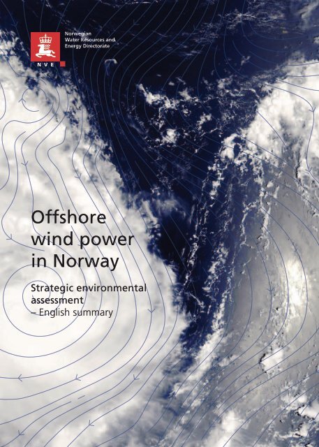
Offshore wind power in Norway
english summ_WEB_080513
english summ_WEB_080513
- No tags were found...

Create successful ePaper yourself
Turn your PDF publications into a flip-book with our unique Google optimized e-Paper software.
<strong>Offshore</strong><br />
<strong>w<strong>in</strong>d</strong> <strong>power</strong><br />
<strong>in</strong> <strong>Norway</strong><br />
Strategic environmental<br />
assessment<br />
– English summary<br />
2
This is an english summary of<br />
”NVE-rapport 47-12 Havv<strong>in</strong>d – strategisk konsekvensutredn<strong>in</strong>g”<br />
Norwegian water resources and energy directorate (NVE)<br />
Middelthunsgate 29, P.O.Box 5091 Majorstua, N-0301 Oslo, <strong>Norway</strong><br />
Email: nve@nve.no Phone+ 47 22 95 95 95<br />
Web: www.nve.no
1 Introduction<br />
<strong>Offshore</strong> renewable energy production <strong>in</strong> <strong>Norway</strong> is governed<br />
by the <strong>Offshore</strong> Energy Act. Under this act, the construction of<br />
offshore <strong>w<strong>in</strong>d</strong> <strong>power</strong> and other renewable energy production<br />
units/facilities at sea can only take place after the Norwegian<br />
Government has opened specific geographical zones for<br />
licence applications. The open<strong>in</strong>g of zones requires that a strategic<br />
environmental assessment (SEA) is carried out. The work<br />
with the SEA has been carried out by the Norwegian Water<br />
Resources and Energy Directorate (NVE) and was presented to<br />
the M<strong>in</strong>istry of Oil and Energy (OED) on January 4, 2013. The<br />
M<strong>in</strong>istry will decide which zones are to be opened for licence<br />
applications.<br />
Several other directorates and government bodies apart<br />
from the NVE have contributed with their expertise <strong>in</strong> the<br />
SEA, and NVE wishes to thank the Norwegian Directorate of<br />
Nature Management, The Norwegian Directorate for Fisheries,<br />
The Norwegian Coastal Adm<strong>in</strong>istration, and the Norwegian<br />
Petroleum Directorate for their <strong>in</strong>volvement.<br />
This document summarises the ma<strong>in</strong> f<strong>in</strong>d<strong>in</strong>gs <strong>in</strong> the SEA<br />
and NVE’s recommendations to the OED.<br />
The SEA is carried out on an overall level, and is not a<br />
substitute for project-specific impact assessments. The goal of<br />
the SEA is to provide the best possible basis for decid<strong>in</strong>g which<br />
of the zones should be opened for licence applications.<br />
The 15 zones considered <strong>in</strong> the SEA <strong>in</strong>clude zones considered<br />
for bottom-fixed <strong>in</strong>stallations and float<strong>in</strong>g turb<strong>in</strong>es. In total,<br />
the 15 zones have a capacity from 4600–12600 MW, with<br />
an estimated normal production of 19–50 TWh. On average,<br />
<strong>w<strong>in</strong>d</strong> speeds are considerably more favourable offshore than<br />
onshore, and the capacity factor of turb<strong>in</strong>es is estimated to be<br />
<strong>in</strong> the range of 36–50%.<br />
The areas differ <strong>in</strong> size. The two southernmost zones,<br />
Sørlige Nordsjø I and Sørlige Nordsjø II, cover areas of 1300<br />
km 2 and 2500 km 2 respectively. The areas of the zones<br />
considered for float<strong>in</strong>g turb<strong>in</strong>es range from 500–1000 km 2 ,<br />
and the zones considered for bottom-fixed <strong>in</strong>stallations range<br />
from 50–300 km 2 . In total, the areas considered cover a<br />
total area of 9000 km 2 , approximately 1% of the Norwegian<br />
Exclusive Economic Zone.<br />
<strong>Offshore</strong> turb<strong>in</strong>es are <strong>in</strong>creas<strong>in</strong>g <strong>in</strong> size, with larger turb<strong>in</strong>e<br />
blades and <strong>in</strong>creased <strong>in</strong>stalled capacity. In the SEA, turb<strong>in</strong>es<br />
with an <strong>in</strong>stalled capacity of 10 MW per unit are considered1.<br />
It is estimated that the levelised cost of energy <strong>in</strong> the considered<br />
zones will be 90–120 øre/kWh <strong>in</strong> 2020, with <strong>in</strong>vestment<br />
costs <strong>in</strong> the range of 26-31 MNOK/MW.<br />
Develop<strong>in</strong>g <strong>w<strong>in</strong>d</strong> <strong>power</strong> projects <strong>in</strong> the Norwegian zones<br />
poses technical challenges. Deep waters, excessive wave<br />
heights, and non-homogeneous seabed conditions make the<br />
Norwegian zones less likely to be developed <strong>in</strong> the near future.<br />
However, European trends show a clear tendency towards <strong>w<strong>in</strong>d</strong><br />
<strong>power</strong> projects be<strong>in</strong>g consented and planned <strong>in</strong> deeper waters.<br />
The <strong>w<strong>in</strong>d</strong> resources off the Norwegian coast are generally<br />
more favourable than <strong>in</strong> other European zones. As technology<br />
matures and costs are reduced, it is therefore likely that development<br />
of the Norwegian zones will be cost-competitive with<br />
other European offshore <strong>w<strong>in</strong>d</strong> projects post-2020. However,<br />
develop<strong>in</strong>g offshore projects <strong>in</strong> the Norwegian zones are likely<br />
to rema<strong>in</strong> more expensive than develop<strong>in</strong>g onshore <strong>w<strong>in</strong>d</strong> projects<br />
on the Norwegian ma<strong>in</strong>land <strong>in</strong> the conceivable future.<br />
Norwegian <strong>in</strong>dustries are world-lead<strong>in</strong>g <strong>in</strong> offshore and<br />
subsea construction, and many companies are export<strong>in</strong>g<br />
technology and know-how to offshore <strong>w<strong>in</strong>d</strong> developers all over<br />
Europe. A development of offshore <strong>w<strong>in</strong>d</strong> <strong>in</strong> <strong>Norway</strong> would<br />
strengthen Norwegian know-how, allow<strong>in</strong>g the <strong>in</strong>dustry to specialise<br />
<strong>in</strong> develop<strong>in</strong>g offshore <strong>w<strong>in</strong>d</strong> <strong>in</strong> deeper waters.<br />
1 For production and cost estimates, turb<strong>in</strong>es with known effect curves <strong>in</strong><br />
the 6–7 MW range were used.<br />
3
2 Environmental impacts<br />
2.1 Birds<br />
Impacts on seabirds and migrat<strong>in</strong>g birds are found to be small<br />
to moderate <strong>in</strong> all zones. Assessments have been carried out<br />
for breed<strong>in</strong>g populations <strong>in</strong>, and close to, the 15 zones. The<br />
zones where <strong>w<strong>in</strong>d</strong> farms are considered to have the least impact<br />
on birds are Sørlige Nordsjø I and Sørlige Nordsjø II, and<br />
Sandskallen - Sørøya nord. These zones are located far away<br />
from established bird colonies and the zones have low bird<br />
densities. For all the other zones, negative impacts on birds are<br />
found to be moderate, with differences <strong>in</strong> impact levels with<strong>in</strong><br />
the zones.<br />
presence of <strong>w<strong>in</strong>d</strong> farms <strong>in</strong> the zones Sandskallen - Sørøya<br />
nord, Stadthavet, and Utsira nord would generate the highest<br />
pollution potential. In total, <strong>w<strong>in</strong>d</strong> farm development <strong>in</strong><br />
Utsira nord and Stadthavet are associated with the highest<br />
environmental risk. It is, however, important to note that the<br />
actual risk of accidents is considered as low <strong>in</strong> all zones.<br />
2.2 Fish, mar<strong>in</strong>e mammals and benthic<br />
organisms<br />
Negative impacts of <strong>w<strong>in</strong>d</strong> farms on fish are found to be small<br />
or even non-detectable. The exceptions are <strong>in</strong> the zones<br />
Stadthavet, Frøyabanken and Sørlige Nordsjø II, where<br />
construction can have impacts on blue l<strong>in</strong>gs, haddocks and<br />
sandeels respectively. Impacts can be reduced by not allow<strong>in</strong>g<br />
construction work dur<strong>in</strong>g spawn<strong>in</strong>g-periods.<br />
Killer whales are sensitive to sound. Noise from the construction<br />
phase can have an impact on their behaviour, possibly<br />
prevent<strong>in</strong>g them from hunt<strong>in</strong>g close to construction sites.<br />
It is found that behavioural impacts can be expected <strong>in</strong> an area<br />
of 8 km around the construction site. Behavioural impacts for<br />
killer whales can be expected <strong>in</strong> the northern zones, and measures<br />
should be taken to prevent noise-generat<strong>in</strong>g construction<br />
activities <strong>in</strong> periods when presence of killer whales can be<br />
expected.<br />
Impacts on benthic organisms depend on the size and<br />
form of the <strong>w<strong>in</strong>d</strong> turb<strong>in</strong>e foundations. In general, impacts are<br />
found to be small to moderate with<strong>in</strong> the 15 assessed zones.<br />
However, both the seabed geology and ecology are poorly mapped<br />
<strong>in</strong> many of the zones, and specific impacts on benthos will<br />
need to be studied closer <strong>in</strong> later project-specific assessments.<br />
2.3 Environmental risk<br />
In the SEA, environmental risk is measured as the potential<br />
for a given type of accident to occur, and the severity of the<br />
pollution potential of said accident. The relative potential for<br />
accidents is highest <strong>in</strong> the zones Utsira nord, Stadthavet,<br />
Frøyabanken, Frøyagrunnene and Olderveggen, while the<br />
4
3 Impact on bus<strong>in</strong>ess and public <strong>in</strong>terests<br />
There is a potential for value-creation by develop<strong>in</strong>g offshore<br />
<strong>w<strong>in</strong>d</strong> <strong>power</strong>. The value-creation related to develop<strong>in</strong>g the<br />
proposed zones is estimated to 98–111 MNOK/MW over the<br />
lifetime of the projects. Labour demand is estimated to be <strong>in</strong><br />
the region of 71–86 man-labour years/MW over the lifetime of<br />
the project, most of which (80%) will be associated with the<br />
construction phase.<br />
3.1 Petroleum <strong>in</strong>terests<br />
Potential impacts for the petroleum <strong>in</strong>dustry are related to the<br />
petroleum resource potential with<strong>in</strong> each zone. The highest petroleum<br />
resource potential is found with<strong>in</strong> Sørlige Nordsjø I and<br />
II, and the conflict of <strong>in</strong>terests is therefore considered to be<br />
highest here. With<strong>in</strong> the zones Stadthavet and Frøyabanken,<br />
the resource potential is also considerable. The Norwegian<br />
Petroleum Directorate nevertheless assumes that the coexistence<br />
of <strong>w<strong>in</strong>d</strong> <strong>power</strong> and petroleum <strong>in</strong>stallations is possible<br />
with<strong>in</strong> all zones.<br />
3.2 Shipp<strong>in</strong>g<br />
W<strong>in</strong>d farm development <strong>in</strong> the zones Frøyabanken and Træna<br />
vest is expected to cause the highest impact on shipp<strong>in</strong>g. Also,<br />
development <strong>in</strong> the zones Olderveggen and Trænafjorden can<br />
adversely affect shipp<strong>in</strong>g due to their location <strong>in</strong> relation to<br />
established shipp<strong>in</strong>g lanes and leads. The Norwegian Coastal<br />
Adm<strong>in</strong>istration has proposed new boundaries for some of the<br />
zones due to conflicts with exist<strong>in</strong>g leads. Co-existence between<br />
<strong>w<strong>in</strong>d</strong> <strong>power</strong> and shipp<strong>in</strong>g is possible <strong>in</strong> most of the areas,<br />
but may require alterations of exist<strong>in</strong>g leads and rearrang<strong>in</strong>g of<br />
beacons/lighthouses.<br />
3.3 Fisheries<br />
The Norwegian Directorate for Fisheries has made a general<br />
conclusion that co-existence between <strong>w<strong>in</strong>d</strong> farms and fishery<br />
activities will not be possible with<strong>in</strong> a zone. The Directorate<br />
recommends that 7 of the 15 areas are not opened for licence<br />
applications. These zones are Sandskallen - Sørøya nord,<br />
Nordmela, Olderveggen, Frøyagrunnene, Trænafjorden -<br />
Selvær, Træna vest and Nordøyan - Ytre Vikna.<br />
3.4 Landscape<br />
Visual impacts from offshore <strong>w<strong>in</strong>d</strong> turb<strong>in</strong>es on the landscape<br />
generally <strong>in</strong>crease the closer the turb<strong>in</strong>es are situated to shore.<br />
Development of the zones Gimsøy nord and Nordmela will<br />
yield the highest negative impacts on landscape as the zones<br />
are close to shore and the landscape is considered vulnerable<br />
to the visual <strong>in</strong>trusion represented by the <strong>w<strong>in</strong>d</strong> turb<strong>in</strong>es.<br />
W<strong>in</strong>d farm development <strong>in</strong> the zones Trænafjorden - Selvær,<br />
Nordøyan - Ytre Vikna, Utsira nord and Frøyagrunnene will also<br />
impact the surround<strong>in</strong>g landscape. Nevertheless, the visual<br />
impact from <strong>w<strong>in</strong>d</strong> turb<strong>in</strong>es is not considered to be unacceptable<br />
<strong>in</strong> any of the 15 zones.<br />
3.5 Outdoor recreation and tourism<br />
The presence of offshore <strong>w<strong>in</strong>d</strong> turb<strong>in</strong>es can have an impact<br />
on leisure yacht<strong>in</strong>g and fish<strong>in</strong>g activities <strong>in</strong> the developed<br />
areas through restricted access and complicat<strong>in</strong>g navigation.<br />
However, it is generally the visual <strong>in</strong>trusion of the turb<strong>in</strong>es<br />
that is considered to represent the most important impact for<br />
outdoor activities. Visual <strong>in</strong>trusion is expected to be strongest<br />
<strong>in</strong> the zones Gimsøy nord and Nordøyan - Ytre Vikna.<br />
Nevertheless, the visual impact from <strong>w<strong>in</strong>d</strong> turb<strong>in</strong>es on outdoor<br />
activities is not considered to be unacceptable <strong>in</strong> any of the 15<br />
zones.<br />
<strong>Offshore</strong> <strong>w<strong>in</strong>d</strong> <strong>power</strong> is also found to have a potential<br />
negative impact on tourism <strong>in</strong> some zones. This is particularly<br />
the case <strong>in</strong> the zone Nordmela. Impact is also expected<br />
to be negative <strong>in</strong> the zones Gimsøy nord and Frøyagrunnene.<br />
In the zone Utsira nord, however, a slight positive impact on<br />
tourism is expected.<br />
3.6 Historical monuments and cultural<br />
heritage sites<br />
W<strong>in</strong>d <strong>power</strong> development <strong>in</strong> the zones will not directly impact<br />
any known historical monuments or cultural heritage sites.<br />
However, development <strong>in</strong> the zones Trænafjorden, Selvær<br />
and Gimsøy nord may result <strong>in</strong> some visual impact on cultural<br />
heritage sites.<br />
3.7 Other <strong>in</strong>terests<br />
The zones Gimsøy nord and Utsira nord overlap with areas<br />
used by the Norwegian Air Force and the Norwegian Navy for<br />
practice purposes, and development of <strong>w<strong>in</strong>d</strong> <strong>power</strong> will be <strong>in</strong><br />
direct conflict with today’s use of the areas. In Gimsøy nord,<br />
5
development of <strong>w<strong>in</strong>d</strong> <strong>power</strong> is not recommended as long as the<br />
area is <strong>in</strong> use by the Norwegian Navy. When it comes to Utsira<br />
nord, however, only a small part of the proposed development<br />
area overlaps with the military tra<strong>in</strong><strong>in</strong>g area. Subsequently, the<br />
potential conflict of <strong>in</strong>terest <strong>in</strong> this area can be easily avoided<br />
by not develop<strong>in</strong>g <strong>in</strong> the overlapp<strong>in</strong>g areas.<br />
W<strong>in</strong>d <strong>power</strong> development <strong>in</strong> the proposed zones will not<br />
impact meteorological or civil aviation radars. The Norwegian<br />
Meteorological Institute and Av<strong>in</strong>or recommend that <strong>w<strong>in</strong>d</strong> turb<strong>in</strong>es<br />
are not sited closer than 5 and 10 km from meteorological<br />
and aviation radars respectively.<br />
Utsira nord is the only zone where there are pipel<strong>in</strong>es on<br />
the seabed. The pipel<strong>in</strong>es are located <strong>in</strong> the south-eastern<br />
corner of the zone. There are no subsea <strong>power</strong> cables <strong>in</strong> any of<br />
the zones.<br />
6
4 F<strong>in</strong>d<strong>in</strong>gs <strong>in</strong> the SEA and NVE’s recommendations to OED<br />
Figure 4.1: Zones considered for offshore<br />
<strong>w<strong>in</strong>d</strong> <strong>power</strong> <strong>in</strong> <strong>Norway</strong>. Category<br />
<strong>in</strong>dicates NVE’s recommendations<br />
for the further process based on the<br />
degree of possibilities and challenges<br />
regard<strong>in</strong>g <strong>w<strong>in</strong>d</strong> <strong>power</strong> development.<br />
See the text for description of the<br />
categories.<br />
7
The 15 zones considered <strong>in</strong> the SEA are located along the<br />
Norwegian coast from the Barents Sea <strong>in</strong> the north to the<br />
southern parts of the North Sea. In the follow<strong>in</strong>g the ma<strong>in</strong><br />
results from the SEA <strong>in</strong> each zone will be presented along with<br />
NVE’s recommendations to the OED .<br />
Based on the results from the SEA, NVE has divided the<br />
considered zones <strong>in</strong>to three categories:<br />
> > Category A: W<strong>in</strong>d <strong>power</strong> development with<strong>in</strong> the zone<br />
is technically and economically feasible, and will have<br />
relatively few negative impacts. Grid connection is possible<br />
before 2025.<br />
> > Category B: W<strong>in</strong>d <strong>power</strong> development with<strong>in</strong> the zone will<br />
have challenges related to either technical aspects or conflict<br />
of <strong>in</strong>terests/negative impacts. The challenges might<br />
be resolved <strong>in</strong> the future through technology development,<br />
grid measures and/or mitigation measures. NVE considers<br />
that zones <strong>in</strong> this category can be opened when technology<br />
matures, or when exist<strong>in</strong>g use of the areas changes.<br />
> > Category C: W<strong>in</strong>d <strong>power</strong> development with<strong>in</strong> the zone represents<br />
greater challenges than <strong>in</strong> the other two categories.<br />
Conflicts of <strong>in</strong>terest <strong>in</strong> the areas are not easily resolved.<br />
Foreseen negative impacts are still considered acceptable.<br />
Zones <strong>in</strong> this category should not be opened at the<br />
expense of zones <strong>in</strong> the two other categories.<br />
8
4.1 Sandskallen - Sørøya nord<br />
Figure 4.2: The most important<br />
known activities and environmental<br />
<strong>in</strong>terests <strong>in</strong> and around<br />
Sandskallen - Sørøya nord.<br />
Description<br />
This zone is located <strong>in</strong> the Barents Sea, approximately 14<br />
km outside Sørøya <strong>in</strong> F<strong>in</strong>nmark County. Average <strong>w<strong>in</strong>d</strong> speed<br />
is estimated to 9.4 m/s, and the zone covers an area of 260<br />
km 2 . There is moderate shipp<strong>in</strong>g activity <strong>in</strong> the area, ma<strong>in</strong>ly<br />
consist<strong>in</strong>g of fish<strong>in</strong>g vessels and freighters. Traffic patterns<br />
must be adjusted to ensure safe passage for ships if the area<br />
is developed for <strong>w<strong>in</strong>d</strong> <strong>power</strong>. The fish<strong>in</strong>g activity <strong>in</strong> the area is<br />
high, with fish<strong>in</strong>g ma<strong>in</strong>ly from larger vessels. A low density of<br />
seabirds <strong>in</strong> the area suggests that the area can be developed<br />
with little or no impact for seabirds. Care must be taken to<br />
m<strong>in</strong>imize impacts for puff<strong>in</strong>s, black-backed gulls and blacklegged<br />
kittiwakes. There are also harbour seals <strong>in</strong> the area.<br />
NVE’s comments<br />
With water depths vary<strong>in</strong>g between 40 and 80 meters, this<br />
zone can be suitable for both float<strong>in</strong>g and bottom-fixed<br />
technology. Relative to the other zones, <strong>w<strong>in</strong>d</strong> conditions are<br />
not among the best, but the <strong>w<strong>in</strong>d</strong> resources <strong>in</strong> the zone are<br />
considered as superior to onshore <strong>w<strong>in</strong>d</strong> resources <strong>in</strong> F<strong>in</strong>nmark,<br />
and also superior to those of many exist<strong>in</strong>g European offshore<br />
projects. It is expected that electricity demands will rise <strong>in</strong> the<br />
region due to an <strong>in</strong>crease <strong>in</strong> m<strong>in</strong><strong>in</strong>g and petroleum activity.<br />
Development of <strong>w<strong>in</strong>d</strong> <strong>power</strong> <strong>in</strong> the zone might impact local<br />
fishery activities, and the Norwegian Directorate of Fisheries<br />
recommends that this zone is not opened for development<br />
of <strong>w<strong>in</strong>d</strong> <strong>power</strong>. NVE still considers that parts of the zone can<br />
be opened with limited impacts on fisheries. However, care<br />
must be taken to ensure that fish<strong>in</strong>g <strong>in</strong>terests are appropriately<br />
<strong>in</strong>cluded <strong>in</strong> the plann<strong>in</strong>g process.<br />
Category: A<br />
9
4.2 Vannøya nordøst<br />
Figure 4.3: The most important<br />
known activities and environmental<br />
<strong>in</strong>terests <strong>in</strong> and around Vannøya<br />
nordøst.<br />
Description<br />
This zone is located <strong>in</strong> the Barents Sea close to Vannøya <strong>in</strong> the<br />
municipality of Karlsøy, Troms County. Average <strong>w<strong>in</strong>d</strong> speed is<br />
estimated to 9.2 m/s, and the zone covers an area of 154 km 2 .<br />
Grid access will require significant <strong>in</strong>vestments, and is not likely<br />
to be available until 2025. Shipp<strong>in</strong>g activity <strong>in</strong> the area is low,<br />
and consists mostly of smaller fish<strong>in</strong>g vessels. There is limited<br />
exist<strong>in</strong>g knowledge of seabird activity <strong>in</strong> the area. It is known,<br />
however, that there are herr<strong>in</strong>g gulls and black-backed gulls <strong>in</strong><br />
the area, and that kittiwakes and razorbills are us<strong>in</strong>g the area<br />
for forag<strong>in</strong>g. There are established populations of harbour seals<br />
<strong>in</strong> the area, and killer whales can be present dur<strong>in</strong>g w<strong>in</strong>ter.<br />
NVE’s comments<br />
With water depths between 20 and 80 m, the zone can be suitable<br />
for both float<strong>in</strong>g and bottom-fixed technology. However,<br />
<strong>in</strong>vestment costs are considered to be higher than average if<br />
compared to the other zones. This is ma<strong>in</strong>ly related to vary<strong>in</strong>g<br />
<strong>w<strong>in</strong>d</strong> resources across the zone and high costs associated<br />
with ga<strong>in</strong><strong>in</strong>g grid access. If <strong>w<strong>in</strong>d</strong> <strong>power</strong> development is carried<br />
out with<strong>in</strong> this zone, care must be taken to m<strong>in</strong>imize potential<br />
negative impacts on mar<strong>in</strong>e mammals dur<strong>in</strong>g the construction<br />
phase.<br />
Category: B<br />
10
4.3 Auvær<br />
Figure 4.4: The most important<br />
known activities and environmental<br />
<strong>in</strong>terests <strong>in</strong> and around Auvær.<br />
Description<br />
This zone is located <strong>in</strong> the Barents Sea, approximately 15 km<br />
outside Kvaløya <strong>in</strong> Troms County. The zone covers an area of<br />
105 km 2 , and the average <strong>w<strong>in</strong>d</strong> speed is estimated to 9.3 m/s.<br />
Grid access will require significant <strong>in</strong>vestments. There is relatively<br />
high fish<strong>in</strong>g activity <strong>in</strong> the area. The zone overlaps partially<br />
with Auvær Nature Reserve, and <strong>in</strong>cludes a w<strong>in</strong>ter<strong>in</strong>g area for<br />
mar<strong>in</strong>e ducks and an important area for common eider ducks<br />
and terns. The zone also overlaps with a forag<strong>in</strong>g area for<br />
guillemots and auks. Killer whales can be present dur<strong>in</strong>g parts<br />
of the year.<br />
NVE’s comments<br />
With water depths between 20 and 40 m, this zone is suitable<br />
for bottom-fixed <strong>in</strong>stallations. Although depths alone suggest<br />
low <strong>in</strong>vestment costs, distance to exist<strong>in</strong>g <strong>in</strong>frastructure<br />
and vary<strong>in</strong>g <strong>w<strong>in</strong>d</strong> conditions with<strong>in</strong> the zone suggest high<br />
levelised cost of energy (LCOE) compared to the other zones.<br />
Develop<strong>in</strong>g of <strong>w<strong>in</strong>d</strong> <strong>power</strong> <strong>in</strong> the zone can have impacts on<br />
seabirds and fisheries, and parts of the zone overlaps with<br />
Auvær nature reserve. NVE recommends that the part of the<br />
zone which overlaps with the nature reserve should be excluded<br />
from future development considerations.<br />
Category: B<br />
11
4.4 nordmela<br />
Figure 4.5: The most important<br />
known activities and environmental<br />
<strong>in</strong>terests <strong>in</strong> and around Nordmela.<br />
Description<br />
Nordmela is located close to the island Andøya <strong>in</strong> the municipality<br />
of Andøy, Nordland County. Average <strong>w<strong>in</strong>d</strong> speed <strong>in</strong> this<br />
zone is estimated to 9.2 m/s, and the zone covers an area of<br />
332 km2. Grid access will require significant <strong>in</strong>vestments, and<br />
might not be possible until after 2025. The island of Andøya<br />
is an important area for many seabirds, and two nest<strong>in</strong>g cliffs<br />
are located adjacent to the zone. With<strong>in</strong> the zone there are<br />
breed<strong>in</strong>g sites for razorbills, puff<strong>in</strong>s, guillemots and kittiwakes.<br />
On Andøya, there are also important areas for barnacle geese<br />
and p<strong>in</strong>k-footed geese. With<strong>in</strong> the <strong>in</strong>fluence area, there are<br />
also important areas for harbour seals. Killer whales are known<br />
to be present dur<strong>in</strong>g w<strong>in</strong>ter. Parts of the zone overlap with<br />
Skogvoll Nature Reserve. Shipp<strong>in</strong>g activity <strong>in</strong> the area consists<br />
of freighters and fish<strong>in</strong>g vessels, and <strong>w<strong>in</strong>d</strong> farm development<br />
with<strong>in</strong> the area will trigger a need for changes <strong>in</strong> exist<strong>in</strong>g routes<br />
<strong>in</strong> the area. Any <strong>w<strong>in</strong>d</strong> turb<strong>in</strong>es erected with<strong>in</strong> the zone will be<br />
visible from Andøya.<br />
NVE’s comments<br />
With water depths vary<strong>in</strong>g between 20 and 80 m, this zone can<br />
be suitable for both bottom-fixed and float<strong>in</strong>g <strong>in</strong>stallations. The<br />
<strong>w<strong>in</strong>d</strong> resources are vary<strong>in</strong>g with<strong>in</strong> the zone, though the best<br />
<strong>w<strong>in</strong>d</strong> resources are found <strong>in</strong> the areas furthest from the shore.<br />
Grid access is difficult and will require significant <strong>in</strong>vestments.<br />
There are important fish<strong>in</strong>g activities <strong>in</strong> the area. The potential<br />
for conflict of <strong>in</strong>terests between <strong>w<strong>in</strong>d</strong> farm development and<br />
local fisheries is considered as high.<br />
Category: C<br />
12
4.5 Gimsøy nord<br />
Figure 4.6: The most important<br />
known activities and environmental<br />
<strong>in</strong>terests <strong>in</strong> and around Gimsøy<br />
Description<br />
Gimsøy nord is located northwest of Gimsøy <strong>in</strong> the municipality<br />
of Vågan, Nordland County. Average <strong>w<strong>in</strong>d</strong> speed <strong>in</strong> the area<br />
is estimated to 8.9 m/s, and the zone covers an area of 245<br />
km2. Grid access is unproblematic <strong>in</strong> the area. A large part of<br />
the zone co<strong>in</strong>cides with a tra<strong>in</strong><strong>in</strong>g area used by the Norwegian<br />
Navy. It is assumed that development of the area cannot commence<br />
while the Navy are actively us<strong>in</strong>g the area for tra<strong>in</strong><strong>in</strong>g<br />
purposes. The zone is also located with<strong>in</strong> an area important<br />
for seabirds, with many species overw<strong>in</strong>ter<strong>in</strong>g <strong>in</strong> the area or<br />
us<strong>in</strong>g the zone for forag<strong>in</strong>g. In addition, a bird migration route<br />
from Svalbard crosses the zone. With<strong>in</strong> the <strong>in</strong>fluence area of<br />
the zone there are locations with high densities of harbour seal,<br />
and killer whales might be present dur<strong>in</strong>g w<strong>in</strong>ter. Parts of the<br />
zone overlap with Hovsflesa Nature Reserve.<br />
There is dense traffic <strong>in</strong> the area, mostly consist<strong>in</strong>g of<br />
freighters and fish<strong>in</strong>g vessels. Fish<strong>in</strong>g activity with<strong>in</strong> the area<br />
is high, mostly <strong>in</strong>volv<strong>in</strong>g smaller fish<strong>in</strong>g vessels. The zone is<br />
located close to shore, and a <strong>w<strong>in</strong>d</strong> farm development <strong>in</strong> the<br />
area will be visible from areas where landscape values are of<br />
national importance.<br />
NVE’s comments<br />
With water depths between 20 and 40 m, this zone is considered<br />
to be suitable for bottom-fixed <strong>in</strong>stallations only. The area<br />
is considered to be suitable both technically and economically,<br />
but NVE recommends that this area is not given priority due to<br />
the high possible impacts for birdlife, and high visual impact<br />
on the surround<strong>in</strong>g landscape. Moreover, development of<br />
offshore <strong>w<strong>in</strong>d</strong> <strong>power</strong> with<strong>in</strong> this zone is not consistent with the<br />
Navy’s current use of the area.<br />
Category: C<br />
13
4.6 Trænafjorden – Selvær<br />
Figure 4.7: The most important<br />
known activities and environmental<br />
<strong>in</strong>terests <strong>in</strong> and around<br />
Trænafjorden - Selvær.<br />
Description<br />
Trænafjorden - Selvær is located <strong>in</strong> the Norwegian Sea, approximately<br />
26 km from the Nordland County coast. The zone is<br />
divided <strong>in</strong> two sub-areas where Trænafjorden is the southernmost<br />
and Selvær the northernmost area. The latter sub-area<br />
is an area with many smaller islands and access to this part<br />
of the zone might be challeng<strong>in</strong>g. This zone covers an area of<br />
197 km2, and average <strong>w<strong>in</strong>d</strong> speed is measured to 10 m/s. The<br />
zone, and especially the Selvær sub-area, is used as a forag<strong>in</strong>g<br />
area for migrat<strong>in</strong>g barnacle geese, and there are known areas<br />
of coral reefs with<strong>in</strong> the zone.<br />
Traffic is dense <strong>in</strong> the zone, and the Trænafjorden sub-area<br />
is the most heavily trafficked of all the zones considered. The<br />
traffic consists ma<strong>in</strong>ly of fish<strong>in</strong>g vessels and passenger ferries.<br />
There is also high fish<strong>in</strong>g activity with<strong>in</strong> the zone. A <strong>w<strong>in</strong>d</strong> farm<br />
development with<strong>in</strong> the zone will be visible from populated<br />
areas like Husøya, and from cultural heritage sites on the<br />
islands.<br />
NVE’s comments<br />
With water depths <strong>in</strong> the zone vary<strong>in</strong>g between 0 and 60<br />
meters, the area can be suitable for both bottom-fixed and<br />
float<strong>in</strong>g <strong>in</strong>stallations. The <strong>w<strong>in</strong>d</strong> resources are good across the<br />
zone, but <strong>w<strong>in</strong>d</strong> farm development with<strong>in</strong> the Selvær sub-area<br />
will offer challenges regard<strong>in</strong>g access. The zone is located far<br />
from exist<strong>in</strong>g grid <strong>in</strong>frastructure, and grid access will require<br />
significant <strong>in</strong>vestments. Development of <strong>w<strong>in</strong>d</strong> <strong>power</strong> <strong>in</strong> the area<br />
can have impact on fisheries and on birdlife, and will be visible<br />
from the islands of Træna.<br />
Category: B<br />
14
4.7 Træna vest<br />
Figure 4.8: The most important<br />
known activities and environmental<br />
<strong>in</strong>terests <strong>in</strong> and around Træna vest.<br />
Description<br />
Træna west is located <strong>in</strong> the Norwegian Sea, approximately<br />
45 km off the Nordland County coastl<strong>in</strong>e. This zone covers an<br />
area of 773 km2, and average <strong>w<strong>in</strong>d</strong> speed <strong>in</strong> the area is estimated<br />
to 9.8 m/s. Occurrences of horse mussels and sponges<br />
have been registered <strong>in</strong> the area, and these nature types are<br />
categorized as threatened by OSPAR. Very little is currently<br />
known about seabird activity <strong>in</strong> the area.<br />
There are shipp<strong>in</strong>g routes through the zone. The traffic<br />
<strong>in</strong> the area is largely consist<strong>in</strong>g of offshore supply ships and<br />
freighters. However, chemical freighters and fish<strong>in</strong>g vessels<br />
also use the area. Fish<strong>in</strong>g activity <strong>in</strong> the zone is high.<br />
The zone is located far away from shore, and <strong>w<strong>in</strong>d</strong> <strong>power</strong><br />
development will not cause any visual impacts.<br />
NVE’s comments<br />
With water depths between 181 and 352 meters, this zone is<br />
suitable for float<strong>in</strong>g <strong>in</strong>stallations. Grid connection is considered<br />
to be impossible before 2030 and will require significant<br />
<strong>in</strong>vestments. The <strong>w<strong>in</strong>d</strong> resources <strong>in</strong> the area are considered as<br />
lower than <strong>in</strong> the other zones considered for float<strong>in</strong>g <strong>in</strong>stallations.<br />
Based on exist<strong>in</strong>g knowledge, a development <strong>in</strong> the area<br />
will not have significant impact on environmental <strong>in</strong>terests.<br />
Impacts from <strong>w<strong>in</strong>d</strong> <strong>power</strong> developments on birdlife are not<br />
considered, however, due to lack of exist<strong>in</strong>g data.<br />
Category: B<br />
15
4.8 Nordøyan - Ytre Vikna<br />
Figure 4.9: The most important<br />
known activities and environmental<br />
<strong>in</strong>terests <strong>in</strong> and around Nordøyan<br />
– Ytre Vikna.<br />
Description<br />
Nordøyan - Ytre Vikna is located <strong>in</strong> the Norwegian Sea, more<br />
than 10 km off the island Ytre Vikna <strong>in</strong> the municipality of<br />
Vikna. Average <strong>w<strong>in</strong>d</strong> speed <strong>in</strong> the area is estimated to 9.7 m/s,<br />
and the zone is cover<strong>in</strong>g an area of 140 km2. Traffic density<br />
<strong>in</strong> the area is low, and traffic consists ma<strong>in</strong>ly of smaller fish<strong>in</strong>g<br />
vessels. The zone is located <strong>in</strong> an area considered as important<br />
to seabirds and there are colonies of kittiwakes, puff<strong>in</strong>s,<br />
razorbills and guillemots close to the zone. Fruflesa and<br />
Nordøyan Nature Reserves are located adjacent to the zone.<br />
Parts of the zone are located close to shore, and a <strong>w<strong>in</strong>d</strong><br />
<strong>power</strong> development <strong>in</strong> these parts of the zone will consequently<br />
have visual impacts on the landscape.<br />
NVE’s comments<br />
With water depths of less than 60 meters <strong>in</strong> most of the zone,<br />
this zone is considered for bottom-fixed <strong>in</strong>stallations. The<br />
depths, however, are vary<strong>in</strong>g greatly with<strong>in</strong> the zone, and<br />
development of <strong>w<strong>in</strong>d</strong> <strong>power</strong> is considered to be challeng<strong>in</strong>g.<br />
Grid connection will require upgrad<strong>in</strong>g of onshore grid, but is<br />
considered possible. Development of <strong>w<strong>in</strong>d</strong> <strong>power</strong> might impact<br />
bird life <strong>in</strong> the area, and might also have impacts on local fish<strong>in</strong>g<br />
activities, as the smaller vessels us<strong>in</strong>g the area have few<br />
alternative sites.<br />
Category: B<br />
16
4.9 Frøyabanken<br />
Figure 4.10: The most important<br />
known activities and environmental<br />
<strong>in</strong>terests <strong>in</strong> and around<br />
Frøyabanken.<br />
Description<br />
Frøyabanken is located approximately 34 km off the coast, and<br />
covers an area of 819 km2. Average <strong>w<strong>in</strong>d</strong> speed is estimated<br />
to 9.8 m/s. There is a spawn<strong>in</strong>g area for haddock with<strong>in</strong> the<br />
zone, but impacts for this species are considered to be few.<br />
The zone also overlaps with spawn<strong>in</strong>g areas for cod and<br />
redfish.<br />
Traffic density <strong>in</strong> this zone is relatively low, with traffic<br />
consist<strong>in</strong>g of larger ships and tow<strong>in</strong>g vessels. Tow<strong>in</strong>g and other<br />
activity <strong>in</strong> the area is mostly related to petroleum <strong>in</strong>stallations,<br />
and it must be noted that tow<strong>in</strong>g vessels have lower manoeuvrability<br />
than other vessels. There is also fish<strong>in</strong>g activity <strong>in</strong><br />
the area.<br />
NVE’s comments<br />
With water depths between 160 and 310 meters, the area is<br />
suitable for float<strong>in</strong>g <strong>in</strong>stallations. The <strong>w<strong>in</strong>d</strong> resources are considered<br />
as low compared to the other areas suited for float<strong>in</strong>g <strong>in</strong>stallations.<br />
Grid connection will require significant <strong>in</strong>vestments,<br />
and might not be possible until after 2030. Develop<strong>in</strong>g <strong>w<strong>in</strong>d</strong><br />
<strong>power</strong> <strong>in</strong> the zone will have the highest impact on shipp<strong>in</strong>g<br />
activities compared to the other zones. Also, the zone overlaps<br />
with spawn<strong>in</strong>g areas for haddock, which is considered to be<br />
an important commercial species. Impacts from <strong>w<strong>in</strong>d</strong> <strong>power</strong><br />
development on bird life <strong>in</strong> this zone are unknown due to lack<br />
of exist<strong>in</strong>g data.<br />
Category: B<br />
17
4.10 Stadthavet<br />
Figure 4.11: The most important<br />
known activities and environmental<br />
<strong>in</strong>terests <strong>in</strong> and around Stadthavet.<br />
Description<br />
Stadthavet is located <strong>in</strong> the Northern Sea, approximately 58<br />
km from the coast of Nordfjord <strong>in</strong> Sogn and Fjordane County.<br />
The zone covers an area of 520 km2. Average <strong>w<strong>in</strong>d</strong> speed<br />
with<strong>in</strong> the zone is estimated to 11 m/s, and this zone is considered<br />
to have the overall roughest weather conditions of the<br />
15 zones considered. The zone overlaps with around 20% of<br />
<strong>Norway</strong>’s sole spawn<strong>in</strong>g area for blue l<strong>in</strong>g, a Red List-classified<br />
fish species. Construction noise may impact the behaviour<br />
of this species, and construction and other noise-generat<strong>in</strong>g<br />
activities should be avoided dur<strong>in</strong>g the spawn<strong>in</strong>g periods. Coral<br />
reefs are registered close to the zone, but not with<strong>in</strong> the zone.<br />
Fish<strong>in</strong>g activity <strong>in</strong> the area is high.<br />
NVE’s comments<br />
With water depths between 170 and 210 meters, this zone<br />
is suitable for float<strong>in</strong>g <strong>in</strong>stallations. The <strong>w<strong>in</strong>d</strong> resources <strong>in</strong> the<br />
area are excellent, but rough weather condition might limit<br />
accessibility of the zone. Grid connection will require significant<br />
<strong>in</strong>vestments, and might not be possible until after 2030.<br />
Development <strong>in</strong> the zone might have impact on blue l<strong>in</strong>g,<br />
a species which is on the Norwegian Red List. In a case of<br />
<strong>w<strong>in</strong>d</strong> <strong>power</strong> development <strong>in</strong> the area, care needs to be taken<br />
to m<strong>in</strong>imize impacts on blue l<strong>in</strong>g. Due to rough climate, and<br />
moderate shipp<strong>in</strong>g activity, <strong>w<strong>in</strong>d</strong> <strong>power</strong> development of the<br />
zone also carries higher environmental risks than the other<br />
considered zones.<br />
Category: B<br />
18
4.11 Olderveggen<br />
Figure 4.12: The most important<br />
known activities and environmental<br />
<strong>in</strong>terests <strong>in</strong> and around<br />
Olderveggen.<br />
Description<br />
Olderveggen covers an area of 76 km2, and is located <strong>in</strong> the<br />
North Sea outside Måløy, <strong>in</strong> Sogn and Fjordane County. This<br />
zone is located close to the zone Frøyagrunnene. Average <strong>w<strong>in</strong>d</strong><br />
speed is estimated to 10.8 m/s. With water depths between<br />
5 and 60 meters, the zone is considered for bottom-fixed<br />
structures. Both Olderveggen and Frøyagrunnene are located<br />
close to shore, and <strong>in</strong> close proximity to exist<strong>in</strong>g <strong>in</strong>frastructure.<br />
Either one of the two zones, but not both, can be connected<br />
to the exist<strong>in</strong>g grid before 2025. Olderveggen is located close<br />
to the ma<strong>in</strong> shipp<strong>in</strong>g lane to Måløy, Sandane and Olden, all of<br />
which are cruise dest<strong>in</strong>ations. There is also high fish<strong>in</strong>g activity<br />
with<strong>in</strong> the zone<br />
Olderveggen is also close to several bird colonies and many<br />
important nest<strong>in</strong>g areas for seabirds <strong>in</strong> the Sogn and Fjordane<br />
region. Parts of the area that is covered by the zone is considered<br />
to be an important area for several Red List-classified<br />
species, and parts of the nature reserve Vestste<strong>in</strong>en is located<br />
with<strong>in</strong> the area.<br />
NVE’s comments<br />
Olderveggen is located close to the zone Frøyagrunnene. The<br />
two zones are mutually exclud<strong>in</strong>g, and NVE recommends that<br />
Frøyagrunnene is opened before Olderveggen. For more <strong>in</strong>fo<br />
see NVE comments Frøyagrunnene 4.12.<br />
Category: B<br />
19
4.12 Frøyagrunnene<br />
Figure 4.13: The most important<br />
known activities and environmental<br />
<strong>in</strong>terests <strong>in</strong> and around<br />
Frøyagrunnene.<br />
Description<br />
Frøyagrunnene covers an area of 58 km2, and is located<br />
10 km southwest of Bremangerlandet <strong>in</strong> Sogn and Fjordane<br />
County. Average <strong>w<strong>in</strong>d</strong> speed <strong>in</strong> this zone is estimated to 10<br />
m/s. With water depths between 5-60 meters, the zone is<br />
considered for bottom-fixed structures. The zone is located<br />
close to the zone Olderveggen. Both zones are located close to<br />
exist<strong>in</strong>g <strong>in</strong>frastructure and there is grid capacity <strong>in</strong> the exist<strong>in</strong>g<br />
grid, allow<strong>in</strong>g one of the two zones to be connected before<br />
2025.<br />
Traffic <strong>in</strong> the area consists mostly of freighters and fish<strong>in</strong>g<br />
vessels, and the area is used extensively for fish<strong>in</strong>g. If the<br />
zone is developed for <strong>w<strong>in</strong>d</strong> <strong>power</strong> the traffic patterns must be<br />
adjusted. The zone is located relatively close to shore, and any<br />
<strong>w<strong>in</strong>d</strong> farm development will be visible from parts of the coast,<br />
<strong>in</strong>clud<strong>in</strong>g the tourist dest<strong>in</strong>ation Kalvåg. Developments will also<br />
be visible from Hurtigruten, a popular ferry/cruise l<strong>in</strong>er, which<br />
sail<strong>in</strong>g route passes the zone.<br />
considered to be lower <strong>in</strong> Frøyagrunnene than <strong>in</strong> Olderveggen.<br />
The Directorate for Fisheries has considered both zones as<br />
one, and recommends that neither of the zones is opened.<br />
Category: A<br />
NVE’s comments<br />
The zones Frøyagrunnene and Oldeveggen are <strong>in</strong> close<br />
proximity to each other and are technically similar zones.<br />
Both zones have water depths between 5 and 60 meters and<br />
<strong>w<strong>in</strong>d</strong> conditions are excellent. Of the zones close to shore <strong>in</strong><br />
shallow water, Frøyagrunnen and Olderveggen are considered<br />
to be those with the highest technical feasibilities. Both zones<br />
are also close to exist<strong>in</strong>g <strong>in</strong>frastructure, and there is currently<br />
grid capacity for one of the two zones. NVE recommends that<br />
Frøyagrunnene is opened for development before Olderveggen<br />
due to possible impacts for shipp<strong>in</strong>g and seabirds, which are<br />
20
4.13 Utsira nord<br />
Figure 4.14: The most important<br />
known activities and environmental<br />
<strong>in</strong>terests <strong>in</strong> and around Utsira nord.<br />
Description<br />
Utsira nord is located west of Haugesund, approximately 22<br />
km off the coast. The closest populated area is Utsira. The<br />
zone covers an area of 1010 km2, and average <strong>w<strong>in</strong>d</strong> speed<br />
<strong>in</strong> the area is 10.2 m/s. The area is heavily trafficked, ma<strong>in</strong>ly<br />
by larger freighters and fish<strong>in</strong>g vessels. Many of the freighters<br />
are carry<strong>in</strong>g potentially pollut<strong>in</strong>g cargo. Parts of the zone<br />
co<strong>in</strong>cide with a tra<strong>in</strong><strong>in</strong>g area used by the Norwegian Air Force.<br />
Development <strong>in</strong> the zone will be visible from parts of the island<br />
of Utsira.<br />
NVE’s comments<br />
With water depths between 185 and 280 meters, this zone is<br />
considered for float<strong>in</strong>g structures. The <strong>w<strong>in</strong>d</strong> conditions <strong>in</strong> this<br />
zone are among the best of the 15 considered zones, and the<br />
foreseen negative impacts of a <strong>w<strong>in</strong>d</strong> <strong>power</strong> development <strong>in</strong> the<br />
area are relatively few. The area is, however, heavily trafficked.<br />
This, coupled with its proximity to shore, means a development<br />
<strong>in</strong> this zone may be associated with a relatively high environmental<br />
risk. NVE recommends that this zone is opened for<br />
<strong>w<strong>in</strong>d</strong> <strong>power</strong> development, but stresses that such a development<br />
will require close co-ord<strong>in</strong>ation with the Norwegian<br />
Coastal Adm<strong>in</strong>istration to ensure navigational <strong>in</strong>terests are<br />
ma<strong>in</strong>ta<strong>in</strong>ed.<br />
Category: A<br />
21
4.14 Sørlige Nordsjø I<br />
Figure 4.15: The most important<br />
known activities and environmental<br />
<strong>in</strong>terests <strong>in</strong> and around Sørlige<br />
Nordsjø I.<br />
Description<br />
Sørlige Nordsjø I is located <strong>in</strong> the southern parts of the North<br />
Sea, some 150 km off the Norwegian coast. Average <strong>w<strong>in</strong>d</strong><br />
speed <strong>in</strong> the area is estimated to 10.5 m/s, and the zone<br />
covers an area of 1375 km2. The distance to the nearest grid<br />
connection po<strong>in</strong>t is approximately 200km. Petroleum sectoractivity<br />
is high <strong>in</strong> the southern North Sea, and this zone is<br />
located between the petroleum fields Yme and Ula.<br />
NVE’s comments<br />
The zones Sørlige Nordsjø I and Sørlige Nordsjø II are located<br />
relatively close to each other and are technically similar zones.<br />
These two zones have therefore been evaluated together. See<br />
Sørlige Nordsjø II (4.15) for more <strong>in</strong>formation.<br />
Category: A<br />
22
4.15 Sørlige Nordsjø II<br />
Figure 4.16: The most important<br />
known activities and environmental<br />
<strong>in</strong>terests <strong>in</strong> and around Sørlige<br />
Nordsjø II.<br />
Description<br />
Sørlige Nordsjø II is located some 140 km off the southern<br />
coast of <strong>Norway</strong>. This zone is the largest of all the considered<br />
zones, cover<strong>in</strong>g an area of 2591 km2. W<strong>in</strong>d speed <strong>in</strong> the<br />
zone is estimated to 10.5 m/s. The distance to the nearest<br />
grid connection po<strong>in</strong>t is approximately 200km. Petroleum<br />
sector-activity is high <strong>in</strong> the southern North Sea, and this zone<br />
is located between the petroleum fields Ekofisk and Tor. The<br />
area is heavily trafficked, with most of the traffic relat<strong>in</strong>g to the<br />
petroleum <strong>in</strong>dustry.<br />
Parts of the zone overlap with around 20% of <strong>Norway</strong>’s<br />
spawn<strong>in</strong>g grounds for sandeel, an ecologically important<br />
species.<br />
NVE’s comments<br />
NVE recommends that both Sørlige Nordsjø I and Sørlige<br />
Nordsjø II are opened for development. This is due to excellent<br />
<strong>w<strong>in</strong>d</strong> conditions, and due to the relatively low impact of develop<strong>in</strong>g<br />
the zones. The areas both have water depths between 40<br />
and 70 meters, and NVE has considered that both float<strong>in</strong>g and<br />
bottom-fixed structures could be feasible <strong>in</strong> the zones. There<br />
is, however, only grid capacity to handle electricity production<br />
from one of the two zones <strong>in</strong> the foreseeable future. NVE does<br />
not want to prioritise one of the zones over the other as they<br />
are both very similar <strong>in</strong> regard to both technical feasibility and<br />
possible negative impacts. There are some small differences,<br />
however, such as a slightly lower traffic density <strong>in</strong> Sørlige<br />
Nordsjø II. Both areas overlap with spawn<strong>in</strong>g areas for sandeel,<br />
and if <strong>w<strong>in</strong>d</strong> <strong>power</strong> development is carried out <strong>in</strong> one or both<br />
areas, NVE recommends that appropriate measures are taken<br />
to prevent disturbances dur<strong>in</strong>g the sandeel spawn<strong>in</strong>g periods.<br />
Category: A<br />
23