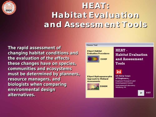
HEAT Habitat Evaluation and Assessment Tools
HEAT: Habitat Evaluation and Assessment Tools HEAT ... - U.S. Army
HEAT: Habitat Evaluation and Assessment Tools HEAT ... - U.S. Army

You also want an ePaper? Increase the reach of your titles
YUMPU automatically turns print PDFs into web optimized ePapers that Google loves.
<strong>HEAT</strong>:<br />
<strong>Habitat</strong> <strong>Evaluation</strong><br />
<strong>and</strong> <strong>Assessment</strong> <strong>Tools</strong><br />
The rapid assessment of<br />
changing habitat conditions <strong>and</strong><br />
the evaluation of the effects<br />
these changes have on species,<br />
communities <strong>and</strong> ecosystems<br />
must be determined by planners,<br />
resource managers, <strong>and</strong><br />
biologists when comparing<br />
environmental design<br />
alternatives.
<strong>HEAT</strong>:<br />
<strong>Habitat</strong> <strong>Evaluation</strong><br />
<strong>and</strong> <strong>Assessment</strong> <strong>Tools</strong><br />
Many techniques (e.g., population<br />
assessments, qualitative matrices,<br />
life-history modeling, <strong>and</strong> habitat<br />
evaluation techniques) have been<br />
developed to investigate <strong>and</strong><br />
predict environmental impacts on<br />
ecological systems at numerous<br />
scales with varying degrees of<br />
success.
<strong>HEAT</strong>:<br />
<strong>Habitat</strong> <strong>Evaluation</strong><br />
<strong>and</strong> <strong>Assessment</strong> <strong>Tools</strong><br />
Advances in technology have led<br />
many agencies to automate <strong>and</strong><br />
distribute automated<br />
environmental evaluation tools to<br />
users.<br />
The value <strong>and</strong> validity of these<br />
packages depends greatly on their<br />
objectivity, repeatability, <strong>and</strong><br />
efficiency.<br />
To guarantee their constant use by<br />
the users, these systems must be<br />
easy to apply, cost-effective, <strong>and</strong><br />
instantly responsive.
<strong>HEAT</strong>:<br />
<strong>Habitat</strong> <strong>Evaluation</strong> <strong>and</strong><br />
<strong>Assessment</strong> <strong>Tools</strong><br />
The US Army Engineer Research<br />
<strong>and</strong> Development Center’s<br />
Environmental Laboratory<br />
(ERDC-EL) develops <strong>and</strong> adapt<br />
methods <strong>and</strong> models to quantify<br />
<strong>and</strong> document the effects of<br />
Corps activities under<br />
Environment, Flood <strong>and</strong> Storm<br />
Risk Management, <strong>and</strong><br />
Navigation Business areas in<br />
terms of Threatened <strong>and</strong><br />
Endangered species, ecosystem<br />
services <strong>and</strong> benefits through<br />
research, application,<br />
facilitation, knowledge<br />
management, <strong>and</strong> technical<br />
support.<br />
Spatial<br />
Analyses<br />
Environmental<br />
Analyses<br />
Cost<br />
Analyses<br />
Ecosystem Benefits Team
<strong>HEAT</strong>:<br />
<strong>Habitat</strong> <strong>Evaluation</strong><br />
<strong>and</strong> <strong>Assessment</strong> <strong>Tools</strong><br />
The <strong>Habitat</strong> <strong>Evaluation</strong> <strong>and</strong><br />
<strong>Assessment</strong> <strong>Tools</strong> (<strong>HEAT</strong>) software<br />
was developed to provide a userfriendly<br />
(intuitive), flexible, <strong>and</strong><br />
efficient means to conduct <strong>Habitat</strong><br />
<strong>Evaluation</strong> Procedures (HEP) <strong>and</strong><br />
the Hydrogeomorphic Approach to<br />
Wetl<strong>and</strong> <strong>Assessment</strong>s (HGM), using<br />
Microsoft® Windows programming<br />
capabilities.
<strong>HEAT</strong> Modules<br />
The sheer number of calculations necessary<br />
to conduct a HEP or HGM evaluation in a<br />
study necessitates the use of automated<br />
systems to complete the assessments in a<br />
timely manner.<br />
ERDC-EL has developed <strong>HEAT</strong> – <strong>Habitat</strong><br />
<strong>Evaluation</strong> <strong>and</strong> <strong>Assessment</strong> <strong>Tools</strong> to address<br />
this need.<br />
Currently comprised of two evaluation MS<br />
Access 2003 modules:<br />
• EXHEP: EXpert <strong>Habitat</strong> <strong>Evaluation</strong><br />
Procedures, <strong>and</strong><br />
• EXHGM: EXpert Hydrogeormorphic<br />
Approach to Wetl<strong>and</strong> <strong>Assessment</strong>s<br />
The system provides a fully automated<br />
interface to facilitate simultaneous HEP <strong>and</strong><br />
HGM assessments.
System Capabilities<br />
<strong>HEAT</strong> was designed to process large<br />
quantities of data quickly <strong>and</strong><br />
efficiently, h<strong>and</strong>ling a large number of<br />
index models simultaneously.<br />
Each model can incorporate any<br />
number of:<br />
- Cover types<br />
- Variables<br />
- Functions<br />
- Target Years<br />
These capabilities support the<br />
examination of complex studies with<br />
large numbers of permutations.
<strong>HEAT</strong> Applications<br />
Developed to address<br />
any occasion, the<br />
<strong>HEAT</strong> tools can be<br />
used in restoration,<br />
planning & design, <strong>and</strong><br />
any type of wetl<strong>and</strong><br />
impact assessments.
<strong>HEAT</strong> Applications Nationwide<br />
(1993 – Present)<br />
Training (10)<br />
Case Studies<br />
(23)<br />
Technology<br />
Transfer<br />
(29)
10<br />
Clear Creek FDR<br />
Feasibility Study<br />
(Galveston District)<br />
• Over the last 100 years, the cumulative<br />
effects of urban development along the<br />
Clear Creek (southern Texas) has led<br />
to substantial increases in flooding<br />
directly attributed to both the<br />
narrowing of the floodplain <strong>and</strong> the<br />
construction of buildings <strong>and</strong><br />
infrastructure in the region’s floodprone<br />
areas.<br />
• In 1999, the USACE Galveston District<br />
initiated a feasibility study to revise<br />
past efforts <strong>and</strong> formulate new<br />
solutions to address the Clear Creek<br />
problems, <strong>and</strong> contacted ERDC-ELin<br />
2003 to assist in these endeavors using<br />
<strong>HEAT</strong>’s EXHEP Module.<br />
• 2 Community-based index models<br />
were developed <strong>and</strong> applied in the<br />
impact <strong>and</strong> mitigation assessments:<br />
• Floodplain Forest<br />
• Coastal Wet Prairie<br />
Average Annual <strong>Habitat</strong> Units (AAHUs)<br />
200<br />
150<br />
100<br />
50<br />
0<br />
Clear Creek Forest Gains from Mitigation Plans - Floodplain Forest<br />
180<br />
118<br />
112<br />
109<br />
78<br />
59<br />
46<br />
34 34<br />
20<br />
9 9<br />
0 0<br />
ER-6-A1a<br />
ER-6-A1b<br />
ER-6-A2a<br />
ER-4-C1<br />
ER-5-C1<br />
ER-4-C2<br />
ER-5-C2<br />
ER-4-D<br />
ER-3-E<br />
ER-2-F<br />
ER-2-G<br />
ER-2-I<br />
ER-5-Xa<br />
ER-5-Xb
11<br />
Arizona Feasibility<br />
Studies<br />
(Los Angeles District)<br />
• Over the last century, Arizona’s riverine<br />
wetl<strong>and</strong>s have been exposed to significant<br />
anthropogenic pressures yielding highly<br />
degraded wetl<strong>and</strong> ecosystems that today are<br />
poised on the brink of collapse.<br />
• Between 2002 <strong>and</strong> 2009, the U.S. Army Corps<br />
of Engineers (USACE) (Los Angeles District,<br />
Phoenix Field Office) was authorized to study<br />
these critical ecosystems in 6 separate<br />
ecosystem restoration studies.<br />
• They contacted ERDC-EL in 2002 to assist in<br />
these endeavors using <strong>HEAT</strong><br />
• 10 Functional Capacity Indices were<br />
developed <strong>and</strong> applied in the 6 individual<br />
ecosystem restoration assessments:<br />
• Maintenance of Characteristic Dynamics<br />
• Dynamic Surface Water Storage/Energy<br />
Dissipation<br />
• Long Term Surface Water Storage<br />
• Dynamic Subsurface Water Storage<br />
• Nutrient Cycling<br />
• Detention of Imported Elements <strong>and</strong><br />
Compounds<br />
• Detention of Particles<br />
• Maintain Characteristic Plant Communities<br />
• Maintain Spatial Structure of <strong>Habitat</strong><br />
• Maintain Interspersion <strong>and</strong> Connectivity<br />
Biogeochemistry <strong>Habitat</strong> Functions Functions<br />
Species Richness<br />
Vegetative Volume<br />
Hydrologic Functions<br />
Functional Capacity Units<br />
(Averaged Across All Functions)<br />
Wetl<strong>and</strong> Indicator Score<br />
Algal Growth<br />
2500<br />
Hydroregime<br />
Invasives<br />
Decayed Woody Alterations Debris<br />
Herbaceous Cover<br />
Sediment Leaf Litter Delivery<br />
2000 Shrub<br />
Fine Floodprone<br />
Canopy<br />
Woody Debris Area<br />
Cover<br />
Tree Canopy Cover<br />
Coarse Woody Debris<br />
Flood Frequency<br />
Adjacent L<strong>and</strong>use<br />
1500 Floodprone Frequency Area<br />
Buffer Width<br />
Surface Topography Inflow<br />
Vegetative Layering<br />
Vegetative Subsurface Volume Inflow<br />
1000<br />
Coarse Woody Debris<br />
Coarse Algal Woody Growth Debris<br />
Nutrient Cycling<br />
Maintenance of Characteristic<br />
Channel<br />
Maintain<br />
Dynamics<br />
Characteristic<br />
Plant Community<br />
Dynamic Surface Water Storage<br />
<strong>and</strong> Energy Dissipation<br />
Removal <strong>and</strong>/or Detention of<br />
Imported Elements<br />
Maintain Spatial<br />
Structure of <strong>Habitat</strong><br />
Fine Woody Debris<br />
Leaf Litter<br />
Flood Frequency<br />
500 Leaf Litter<br />
Soil Porosity<br />
Long-term Surface<br />
Topography<br />
Adjacent L<strong>and</strong>use<br />
Water Storage<br />
Vegetative Volume<br />
Soil Porosity<br />
Buffer Width<br />
0Subsurface Floodprone Inflow Area<br />
Flood 2002 Frequency 2021 2031 2041 2051 2061<br />
Topography<br />
Calendar Years<br />
Topography<br />
Plan Fine A Woody - HIGH Debris<br />
Plan B - HIGH Plan C - HIGH Dynamic Subsurface Plan D - LOW<br />
Saturated<br />
Contiguousness<br />
Soil Depth<br />
Plan A - MED Plan B - MED Plan C - MED Water Detention Storage of Particulates<br />
Maintain Interspersion Plan STATUS QUO<br />
Coarse Woody Debris<br />
Tributary Plan A - Connections LOW Plan B - LOW Plan C - LOW <strong>and</strong> Connectivity Future Without Project<br />
Sediment Delivery<br />
Adjacent L<strong>and</strong>use<br />
Vegetative Volume<br />
Buffer Width
12<br />
Middle Rio Gr<strong>and</strong>e<br />
Feasibility Study<br />
(Albuquerque District)<br />
• Over the last century, the Middle Rio<br />
Gr<strong>and</strong>e was subjected to significant<br />
anthropogenic pressures producing a<br />
highly degraded ecosystem that today<br />
is poised on the brink of collapse.<br />
• In 2002, the USACE Albuquerque<br />
District was authorized to conduct a<br />
Reconnaissance study focused on a 17-<br />
mile long stretch of the Rio Gr<strong>and</strong>e<br />
flowing through the city of<br />
Albuquerque, New Mexico.<br />
• The District contacted ERDC-EL to help<br />
using the using <strong>HEAT</strong>’s EXHEP Module.<br />
• 1 model was developed <strong>and</strong> applied for<br />
the bosque riparian community<br />
Reach 5 Reach 4 Reach 3 Reach 2<br />
Reach 1 Reach<br />
HEP-only Results MCDA Results<br />
Acres Acres<br />
Established Total<br />
Established Total<br />
<strong>and</strong>/or Actionable Output Total Reach<br />
<strong>and</strong>/or Actionable Output Total Reach<br />
Alternative Preserved Rehabilitated Acres (AAHUs) Cost<br />
Alternative Preserved Rehabilitated Acres (MCDA) Cost<br />
Plan 1-J 651 449 1,100 222 $44,051,967 Plan 1-B 1,012 78 1,090 0.1 $4,678,476<br />
Plan 1-K 593 507 1,100 231 $46,175,444 Plan 1-L 795 322 1,117 0.27 $16,947,740<br />
Plan 1-M 359 767 1,126 264 $60,467,428 Plan 1-J 651 449 1,100 0.57 $44,051,967<br />
Plan 1-M 359 767 1,126 0.74 $60,467,428<br />
Reach<br />
Reach 1<br />
Plan 2-F 546 23 569 139 $2,587,414 Plan 2-F 546 23 569 0.14 $2,587,414<br />
Plan 2-B 499 75 574 155 $8,435,531 Plan 2-G 382 195 577 0.36 $12,614,421<br />
Plan 2-K 307 270 577 172 $21,049,952 Plan 2-J 277 300 577 0.44 $21,677,892<br />
Plan 2-M 97 501 598 176 $82,938,153<br />
Plan 2-M 97 501 598 0.59 $82,938,153<br />
Reach 2<br />
Plan 3-A 435 73 508 100 $6,688,739 Plan 3-F 351 165 516 0.45 $11,834,865<br />
Plan 3-B 288 228 516 110 $11,832,260<br />
Plan 3-H 167 357 524 0.54 $18,981,868<br />
Plan 3-H 167 357 524 118 $18,981,868<br />
Reach 3<br />
Plan 4-F 661 68 729 34 $4,165,340 Plan 4-A 671 67 738 0.17 $5,045,227<br />
Plan 4-H 582 164 746 62 $10,501,885 Plan 4-B 596 137 733 0.28 $9,522,505<br />
Plan 4-K 336 419 755 108 $29,299,072<br />
Plan 4-K 336 419 755 0.68 $29,299,072<br />
Reach 4<br />
Plan 5-G 435 208 643 155 $7,731,650 Plan 5-G 435 208 643 0.28 $7,731,650<br />
Plan 5-H 433 210 643 157 $15,990,607 Plan 5-H 433 210 643 0.36 $15,990,607<br />
Plan 5-K 187 458 645 0.46 $27,591,666<br />
Reach 5
So how does it work?<br />
• There are 12 steps to complete when applying HEP in an ecosystem<br />
evaluation.<br />
1. Build a multi-disciplinary evaluation team.<br />
2. Define the project.<br />
3. Map the site’s cover types or PWAAs.<br />
4. Select, modify <strong>and</strong>/or create index model(s).<br />
5. Conduct a baseline inventory.<br />
6. Perform data management <strong>and</strong> statistical analyses.<br />
7. Calculate baseline conditions.<br />
8. Set goals <strong>and</strong> objectives, <strong>and</strong> establish the assessment’s<br />
temporal scale.<br />
9. Generate without-project conditions <strong>and</strong> calculate outputs.<br />
10. Generate with-project conditions <strong>and</strong> calculate outputs.<br />
11. Perform trade-offs.<br />
12. Report the results of the analyses.
So how does it work?<br />
• Once a model or models have been<br />
selected/developed (Step 4), <strong>and</strong> the evaluation<br />
team has inventoried the site using the model’s<br />
parameters (i.e., Step 5), it becomes necessary<br />
to generate outputs [<strong>Habitat</strong> Units (HUs)].<br />
• It is at this point the <strong>HEAT</strong> software can be fully<br />
deployed. A series of steps have been devised<br />
to move through this process quickly <strong>and</strong><br />
cleanly:<br />
1. Gather the pertinent information,<br />
2. Setup the models in EXHEP,<br />
3. Associate the models,<br />
4. Enter the baseline data <strong>and</strong> generate<br />
baseline results,<br />
5. Enter the without-project conditions <strong>and</strong><br />
calculate the effects,<br />
6. Enter the with-project conditions <strong>and</strong><br />
calculate the effects, <strong>and</strong><br />
7. Recycle the datafile <strong>and</strong> evaluate<br />
alternative designs.<br />
<strong>HEAT</strong><br />
Engine<br />
RESULTS<br />
Baseline Baseline Design A1 Design A1<br />
<strong>Evaluation</strong> Species HSI AAHU's HSI HU's<br />
Downy Woodpecker 1.00 37.33 0.50 18.67<br />
Song Sparrow 0.50 10.00 0.84 16.80<br />
Yellow Warbler 0.81 9.88 0.50 6.14<br />
Marsh Wren 0.00 0.00 0.50 5.00<br />
River Otter 0.43 23.71 1.00 55.15<br />
Western Meadowlark 0.34 9.04 0.50 13.25<br />
Mule Deer 0.35 27.00 0.04 3.04<br />
Chukar 0.00 0.00 0.30 3.00<br />
California Quail 1.00 117.15 0.06 6.81<br />
Ring-necked Pheasant 0.39 41.45 0.02 1.73<br />
Mallard 0.40 10.00 1.00 25.00<br />
Canada Goose 1.00 20.00 0.50 10.00<br />
Table 1 below provides a comprehensive<br />
review of the current baseline conditions <strong>and</strong><br />
contrasts these to the effects of Design A1 on<br />
the critical species found within the area.<br />
Table 1: Results of the environmental impacts for<br />
Mill Creek if Design A1 is implimented.
What to pull together<br />
It is also important to gather all<br />
information supporting the application of<br />
the models prior to setting up the software.<br />
Collect basic information (i.e., references,<br />
cover types, variables, sampling protocols,<br />
SI curves, HSI formulas, etc.) early on. The<br />
software can be setup incrementally as this<br />
information becomes available, but<br />
analysis cannot commence without these<br />
basics.<br />
Component Items Example<br />
<strong>Evaluation</strong> Data<br />
Baseline, end of construction, <strong>and</strong> life of the project (including<br />
additional years when needed).<br />
Example:<br />
Target<br />
TY Calendar Year<br />
Years<br />
0 2002<br />
1 2003<br />
51 2053<br />
Baseline acres per cover type<br />
Acres Without-project acres per cover type<br />
With-project acres per cover type for each alternative<br />
Baseline means/modes per cover type<br />
Variables Without-project means/modes per cover type<br />
With-project means/modes per cover type for each alternative<br />
Component Items Example<br />
Background Information<br />
Model Specifics<br />
Project<br />
Name<br />
Alternative<br />
Name<br />
Methods<br />
Model(s)<br />
<strong>and</strong> Life<br />
Requisite<br />
Names<br />
Cover<br />
Type(s)<br />
Variables<br />
SI Curves<br />
LRSI <strong>and</strong><br />
HSI<br />
Formulas<br />
Mill Creek Ecosystem Restoration Study<br />
Design 1<br />
Model References <strong>and</strong> Support Documentation<br />
Model Modifications<br />
List of <strong>Evaluation</strong> Team Members<br />
Goals <strong>and</strong> Objectives<br />
Data Management Strategies<br />
<strong>Evaluation</strong> Strategies (including tradeoff approaches)<br />
Field Sampling Team <strong>and</strong> Metadata (include locations,<br />
assumptions, dates, etc.)<br />
Species/Community <strong>and</strong> life requisites (both short-h<strong>and</strong><br />
names or codes <strong>and</strong> detailed descriptions).<br />
Examples:<br />
Model: Slider Turtle<br />
Life Requisite: Food <strong>and</strong> Cover<br />
Short-h<strong>and</strong> names or codes <strong>and</strong> detailed descriptions<br />
Examples:<br />
Deciduous Forested Wetl<strong>and</strong>s<br />
Herbaceous Wetl<strong>and</strong>s<br />
Freshwater Lakes<br />
Riverine<br />
Deciduous Scrub-Shrub Wetl<strong>and</strong><br />
Short-h<strong>and</strong> names or codes, detailed descriptions, sampling<br />
protocols, <strong>and</strong> data management (statistical) activities.<br />
Examples:<br />
Emergent <strong>and</strong> submerged vegetation<br />
Water depth<br />
Water regime<br />
Water temperature<br />
Velocity<br />
X,Y coordinates for all variables included in the model(s).<br />
For example: 0,0.2,90,1,100,1<br />
Mathematical algorithms for each function in each wetl<strong>and</strong><br />
subclass.<br />
Example:<br />
IndexSliderTur tle = Minimum of (LRSIFoodCover or<br />
LRSIWQ or LRSI WaterTemp)<br />
(Continued)
So how does it work?<br />
Step 1: Model Setup
How does it Work?<br />
Step 1: Model Setup
How does it Work?<br />
Step 1: Model Setup
How does it Work?<br />
Step 2: Model Association
How does it Work?<br />
Step 2: Model Association
How does it Work?<br />
Step 3: Field Data Entry
How does it Work?<br />
Step 3: Field Data Entry
How Does It Work?<br />
Step 4: Calculate Baseline HUs<br />
Click This Button Now
How Does It Work?<br />
Step 5: Define & Calculate Without Project
How Does It Work?<br />
Step 5: Define & Calculate Without Project - Acres
How Does It Work?<br />
Step 5: Define & Calculate Without Project - Variables
How Does It Work?<br />
Step 6: Define & Calculate With Project<br />
Click This Button Now
How Does It Work?<br />
Step 7: Review & Report Results - Setup
How Does It Work?<br />
Step 7: Review & Report Results - Analysis
How Does It Work?<br />
Step 7: Review & Report Results
Other Features
Fast Keys – your best<br />
friend!<br />
• Ctrl + c<br />
• Ctrl + v<br />
• Ctrl + Enter<br />
• Ctrl + z<br />
• Esc<br />
Copy<br />
Paste<br />
Hard<br />
Return<br />
Undo<br />
HELP! GET<br />
ME OUTTA<br />
HERE!
Support<br />
Software<br />
Demonstrations<br />
On-Site Installation<br />
Training Workshops<br />
User Guides<br />
On-Site Technical<br />
Consultations<br />
Website:<br />
http://www.wes.army.<br />
mil/el/emrrp/analyt.ht<br />
ml
Summary<br />
Flexible Programming -<br />
Interchangeable<br />
Dynamic Linkages to<br />
Reports<br />
Multiple Applications<br />
Full Support Available