

SATELLITES
79acdad3-f02e-41fc-ae04-b41571484899
79acdad3-f02e-41fc-ae04-b41571484899
- No tags were found...

Create successful ePaper yourself
Turn your PDF publications into a flip-book with our unique Google optimized e-Paper software.
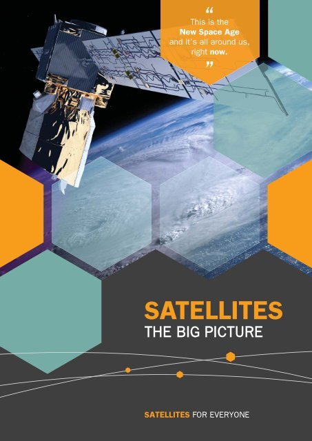
“ This is the<br />
New Space Age<br />
and it’s all around us,<br />
right now.<br />
”<br />
<strong>SATELLITES</strong><br />
THE BIG PICTURE<br />
<strong>SATELLITES</strong> FOR EVERYONE
The UK Space<br />
Industry Employs<br />
29,000<br />
People<br />
<strong>SATELLITES</strong><br />
BENEFITTING THE WORLD<br />
BENEFITTING<br />
THE UK<br />
We live in a satellite enabled age. The satellites flying above us are not<br />
abstract agents of science but part of the critical life support system we all<br />
depend on, every day.<br />
Satellites provide us with insight, collect and distribute vast quantities of data<br />
and give us a detailed picture of what is really happening in our world.<br />
There is a global market for satellite data<br />
and the UK is at the forefront of providing<br />
satellite solutions to the world.<br />
UK Government and industry are<br />
committed to growing a £40 billion<br />
UK industry by 2030.<br />
£250bn<br />
Global<br />
Satellite<br />
Market<br />
£400bn<br />
Global<br />
Satellite<br />
Market<br />
COMMUNICATIONS<br />
TEMPERATURE CHANGE<br />
CROP HEALTH<br />
POLLUTION LEVELS<br />
ICE MELT<br />
NATURAL DISASTERS<br />
FLOOD RISK<br />
INTERNATIONAL TRADE<br />
Agritech<br />
Future cities<br />
UK Growth will be achieved through a<br />
mix of space infrastructure and spaceenabled<br />
services, with the aim to grow<br />
downstream revenues.<br />
With long standing expertise in satellite<br />
manufacture and data applications,<br />
combined with an entrepreneurial outlook,<br />
the UK is well placed to take advantage of<br />
the changing landscape ahead.<br />
2010<br />
£9bn<br />
UK<br />
Market<br />
Share<br />
2030<br />
£40bn<br />
UK<br />
Market<br />
Share<br />
With the capability to deliver live imagery in awe-inspiring detail, higher<br />
bandwidth communication and increased positioning accuracy, we are<br />
entering a new, dynamic phase in how satellites affect our lives and spurring<br />
the development of new enterprises, technologies and whole new business<br />
sectors across the planet.<br />
MANUFACTURE<br />
AND INSTRUMENTS<br />
SERVICES AND<br />
APPLICATIONS<br />
This brochure aims to illustrate how you can benefi t from satellites and be<br />
part of a £400bn global opportunity.<br />
Atmospheric alert<br />
2010 2030 2010 2030<br />
Front cover photo courtesy of ESA<br />
£1bn £3bn £8bn £37bn<br />
2 <strong>SATELLITES</strong> FOR EVERYONE THE BIG PICTURE<br />
FOR MORE INFORMATION info@satellites4everyone.co.uk 3
SATELLITE<br />
BASICS<br />
“<br />
There<br />
are over<br />
1000 active<br />
satellites<br />
in orbit<br />
”<br />
Photo courtesy of ESA<br />
HOW CAN THEY<br />
BENEFIT YOU?<br />
Are you a…<br />
Satellite types<br />
There are commercial, scientific, and military<br />
satellites in orbit. The majority are commercial<br />
and can be split into three different types.<br />
Policy Maker Entrepreneur Scientist Developer Researcher<br />
Satellite services are becoming increasingly available<br />
and affordable, enabling innovative solutions and new<br />
developments in many industries.<br />
They can support your businesses, ventures and<br />
personal projects in an ever growing number of<br />
exciting ways.<br />
Student<br />
Satellite orbits<br />
There are several different orbits that satellites follow depending on their purpose.<br />
GEO<br />
LEO (Low Earth Orbit) – between<br />
180 and 800km. Typically Earth<br />
observation satellites, whose close<br />
orbits enable better visibility of the<br />
Earth’s surface. The International<br />
Space Station follows a LEO.<br />
HEO<br />
Earth Observation Communication Navigation<br />
MEO (Medium Earth Orbit) – at<br />
approx. 20,000km. These are<br />
mainly GPS and other positioning<br />
satellites, often networked together<br />
to create a ‘constellation’, allowing<br />
broader coverage.<br />
1 2 3<br />
LEO<br />
MEO<br />
HEO (High Elliptical Orbit) –<br />
elliptical orbits speed around the<br />
bottom of their path, and slow<br />
towards the top, allowing them to<br />
spend more time in sight of a<br />
certain area.<br />
GEO (Geosynchronous Orbit)<br />
– at approx. 35,800km. Typically<br />
communication, TV, and weather<br />
satellites, they stay over the same<br />
point of the equator by matching the<br />
direction and speed of the Earth’s<br />
rotation. This means that from the<br />
ground they appear motionless.<br />
DID YOU KNOW?<br />
<strong>SATELLITES</strong> CAN BE USED TO…<br />
Create digital<br />
maps of farms<br />
allowing farmers<br />
to analyse soil<br />
composition and<br />
monitor crop<br />
health<br />
Analyse carbon<br />
storage of a<br />
forest, the value<br />
of which can be<br />
used to achieve<br />
more sustainable<br />
development<br />
Monitor wind<br />
velocity and<br />
pollution levels<br />
creating air<br />
quality reports<br />
Measure<br />
ground movement<br />
to millimetre<br />
precision<br />
Provide a<br />
time signal to<br />
picosecond<br />
accuracy<br />
Spot road<br />
faults and monitor<br />
traffic flows to<br />
ensure better<br />
quality roads and<br />
driving conditions<br />
Identify and<br />
categorise land<br />
use in a city to<br />
help map urban<br />
development<br />
Deliver reliable<br />
broadband<br />
services to remote<br />
locations<br />
Track the flow of<br />
people and goods<br />
in and out of a<br />
country, city, or a<br />
single building<br />
Determine the<br />
rate of water<br />
evaporation in<br />
irrigated crops<br />
enabling efficient<br />
water resource<br />
management<br />
...and will soon be able to deliver<br />
imagery in near real time<br />
SO HOW DO THEY DO IT?<br />
Start<br />
6 Hours 12 Hours<br />
4 <strong>SATELLITES</strong> FOR EVERYONE THE BIG PICTURE<br />
FOR MORE INFORMATION info@satellites4everyone.co.uk 5
1 Satellite collects<br />
2<br />
data<br />
Data is transmitted<br />
to a ground station<br />
EARTH<br />
OBSERVATION<br />
Swath width<br />
3<br />
Data is processed<br />
and released<br />
Earth Observation (EO) satellites help us to monitor and protect<br />
our environment, manage our resources, respond to global<br />
humanitarian disasters and enable sustainable development.<br />
They provide essential information on a vast number of areas, including;<br />
ocean salinity, ice thickness, crop health and air quality.<br />
EO satellites can be divided into two types based on how they capture<br />
imagery; passive and active.<br />
The width of the area viewed by<br />
the satellite is termed the swath<br />
width. Satellites with different<br />
swath widths have different revisit<br />
times, which is the time between<br />
observations at the same point on<br />
the Earth. Typically large swath<br />
satellites can revisit the same<br />
location with a higher frequency.<br />
EO satellites travel on a range of different orbits, offering varying perspectives<br />
of the Earth. Most satellites do not continuously collect data due to limitations<br />
in power and memory. Some offer regular and reliable data acquisition while<br />
others may be more ad-hoc, collecting only 5 or 10 minutes worth of data in<br />
a 90 minute orbit. Data is stored on-board the satellite until it is in sight of a<br />
ground station to downlink the data.<br />
The time between an image being taken and being available to download can<br />
range between a month to a few minutes and is getting quicker all the time.<br />
As satellites are owned by different companies there are several data<br />
providers, each with their own pricing structure.<br />
PASSIVE EO <strong>SATELLITES</strong><br />
detect radiation refl ected<br />
off the Earth’s surface<br />
such as visible light and<br />
infrared. Passive satellites<br />
generally aren’t able to<br />
work through clouds.<br />
Approximate max<br />
resolution 50cm<br />
ACTIVE EO <strong>SATELLITES</strong><br />
transmit energy towards<br />
the earth and measure the<br />
returned signal which provides<br />
information about the Earth’s<br />
surface. In general, they are<br />
able to see through cloud.<br />
Approximate max<br />
resolution 25cm<br />
The cost for 1km 2 of land can vary between free and $190 depending on data<br />
provider though increasingly, archives of free data are being made available<br />
for processing and analysis.<br />
The satellite’s ability to detect<br />
certain wavelengths of light is<br />
called its spectral resolution.<br />
Different materials such as water,<br />
soil, vegetation and buildings<br />
interact in different ways with each<br />
wavelength, making them<br />
uniquely discernible. This means<br />
if you know the type of object<br />
you are trying to observe there<br />
will be an optimum wavelength<br />
for your purpose.<br />
1 2 3<br />
© European Space Imaging / DigitalGlobe Image Copyright © Satellite Application Catapult Ltd 2014<br />
EO satellites also have differing<br />
spatial resolutions, a measure of<br />
the observable detail in an image,<br />
from sub-meter to tens of kms. The<br />
higher the spatial resolution, the<br />
lower the swath width.<br />
1<br />
2<br />
3<br />
10m resolution<br />
10m resolution zoomed<br />
0.5m resolution of the<br />
same area<br />
While high resolutions are used<br />
to see the world in detail, low<br />
resolutions have useful applications<br />
over large areas.<br />
EO APPLICATION EXAMPLE<br />
FLOOD WARNINGS<br />
The Challenge<br />
By 2050, the global cost of fl ood and<br />
storm damage has been estimated to<br />
reach £600bn and will continue to grow<br />
as the climate becomes more volatile.<br />
The Satellite Solution<br />
Satellite data can analyse soil<br />
composition and moisture content,<br />
measure fl ood water depth and from this<br />
calculate likely water fl ow characteristics.<br />
This information has been implemented<br />
into a 95% accurate fl ood model which<br />
can be used to predict the impact of<br />
fl ood events.<br />
The Result<br />
Insurance sector can set more appropriate premiums for<br />
their customers<br />
Government agencies can better prepare for flood events<br />
Planning policy can be based on more accurate forecasts<br />
Businesses and homeowners can understand and address<br />
their own flood risk<br />
6 <strong>SATELLITES</strong> FOR EVERYONE THE BIG PICTURE<br />
FOR MORE INFORMATION info@satellites4everyone.co.uk 7
1 2<br />
COMMUNICATION<br />
<strong>SATELLITES</strong><br />
Communication satellites power our insatiable<br />
appetite for data on the go, from images and videos to<br />
broadband internet access.<br />
Today, over 1.4 billion smartphones are in use. This<br />
equates to one in every fi ve people on our planet<br />
accessing ‘apps’ and data on the move. If we add TV,<br />
radio and the internet, then telecommunications are as<br />
integral to our daily lives as access to fuel and water.<br />
How they work:<br />
Communication satellites<br />
are essentially relays,<br />
allowing information to be<br />
passed around the globe via<br />
space in a number of ways:<br />
They link ships crossing the oceans, provide<br />
communications for aircraft, connect people in<br />
remote areas not serviced by cellular or fi bre optic<br />
networks and enable disaster response teams to<br />
keep in touch when ground-level infrastructure<br />
has collapsed.<br />
Put simply, communication satellites can connect<br />
people in different locations anywhere on Earth.<br />
HANDOVER PERIOD<br />
The types of data that can be sent via satellite include:<br />
Voice Text Image Video<br />
Data transfer rates currently range from 15kbps to 10mbps though in the<br />
future we will see transfer rates around the 30mbps mark, closer to what<br />
we are used to for traditional web browsing. Some providers now offer pay<br />
monthly tariffs rather than per kb rates, that may be cheaper for constant or<br />
heavy data applications.<br />
The cost of antennas can range from<br />
about £200 -£11,000 depending on<br />
the size, power and service provider.<br />
3 4<br />
When using a constellation to<br />
transfer data there is a point at<br />
which a “handover” must occur<br />
between two satellites. This can be<br />
troublesome for data applications<br />
that require a constant connection,<br />
such as video streaming. Different<br />
transmission types will suit<br />
different data types, depending on<br />
the service required.<br />
Example costs for<br />
mobile services:<br />
Voice call = typically<br />
£0.75/min<br />
Word document<br />
(100kb) = 40p<br />
Image (1mb) = £4<br />
1 minute video<br />
(20mb) = £80<br />
Costs for fi xed services<br />
e.g. satellite TV are<br />
much cheaper.<br />
They use 3 types of orbits:<br />
COMMS APPLICATION EXAMPLE<br />
TELEMEDICINE<br />
The Challenge<br />
Only 3 GEO satellites are needed to<br />
provide coverage to most of the Earth,<br />
the exception being the poles. Once an<br />
antenna is pointed at a GEO satellite, a<br />
constant connection can be established,<br />
making them perfect for streaming data.<br />
LEO satellite constellations<br />
(a group of several satellites) can<br />
provide continuous cover to one<br />
location. There are usually multiple<br />
satellites moving in and out of sight<br />
of a given position at any time.<br />
HEO satellites can be used to<br />
provide constant signal to areas<br />
where GEO satellites are unable.<br />
They have slow speed at the top<br />
of the orbit meaning they can<br />
provide coverage to one location<br />
for long periods of time.<br />
Access to immediate healthcare<br />
advice for people who work in remote<br />
areas or who have restricted mobility<br />
is often of poor quality and coverage.<br />
The Satellite Solution<br />
Whilst the maritime sector has<br />
been an early adopter, governments<br />
and the land-based medical<br />
profession are exploring the potential<br />
for telemedicine using satellite<br />
telecommunications technology.<br />
The Result<br />
Sailors and mainland users can transmit and receive high<br />
quality audio and video calls on satellite phones from<br />
anywhere in the world<br />
1.7 million people in the UK who rely on telemedicine will get<br />
improved services<br />
In 2012 a study of 6000 patients showed a 20% reduction in<br />
emergency admissions and a 45% reduction in mortality rates<br />
8 <strong>SATELLITES</strong> FOR EVERYONE THE BIG PICTURE<br />
FOR MORE INFORMATION info@satellites4everyone.co.uk 9
Navigation satellites provide us with essential information that is used for:<br />
Logistics<br />
Synchronisation<br />
of power stations<br />
GLOBAL<br />
NAVIGATION<br />
SATELLITE SYSTEMS (GNSS)<br />
Personal<br />
navigation<br />
Timing for<br />
financial<br />
transactions<br />
The future<br />
Global Navigation Satellite Systems (GNSS) provide<br />
us with two essential pieces of information; position<br />
and time. The most well-known navigation satellite is<br />
GPS (Global Positioning System). Anything enabled<br />
with a GPS receiver can be used for navigation.<br />
The device uses data from the satellites to pin point<br />
its location. This is achieved by measuring the<br />
time taken for a satellite signal to reach your device<br />
and from this determining your distance from the<br />
satellite. This, compared against your distance from<br />
other surrounding satellites, is used to work out your<br />
global position.<br />
GPS is driving a whole new<br />
business sector based on geolocation<br />
services. Entrepreneurs<br />
are changing the way we search<br />
for property, using time rather than<br />
distance travelled, helping us to<br />
connect with friends and fi nd local<br />
services, track endangered species<br />
and even catch a cab.<br />
use every day. Once a device is GPS<br />
enabled it can provide a range of<br />
resilient and accurate global services<br />
and solutions.<br />
GPS works outdoors, however<br />
the signal can be blocked by<br />
high buildings or landscape.<br />
By combining it with developing<br />
technologies such as lowpowered<br />
Bluetooth and Wi-Fi,<br />
we may soon be able to<br />
accurately track items no<br />
matter where they are.<br />
GPS enabled technology is getting<br />
smaller and cheaper, allowing it to<br />
be embedded into the devices we<br />
On-board precision<br />
clock transmits time signal<br />
Device’s<br />
internal clock<br />
receives time<br />
signal<br />
GNSS APPLICATION EXAMPLE<br />
REDUCING<br />
FUEL COSTS<br />
The Challenge<br />
With rising fuel prices, monitoring and<br />
analysis of fuel consumption is key to<br />
assessing possible ways of reducing<br />
costs. The use of a cost effective and<br />
Navigation by satellite requires a<br />
minimum of four satellites. Due to<br />
their distribution around the globe,<br />
you will normally be in view of at<br />
least 10 at any one time.<br />
GPS was created by the US<br />
Department of Defence and is<br />
maintained by the United States<br />
government. It is freely accessible<br />
for anyone to use. The current<br />
system delivers accuracy to 10m.<br />
GPS III, the next generation of GPS<br />
is currently in development. When<br />
fully operational it will be accurate<br />
to around one meter.<br />
Galileo is the European GNSS<br />
which is scheduled to provide<br />
early services from 2016. Once<br />
the full system is deployed it will<br />
also offer one meter accuracy and<br />
the increased number of satellites<br />
will mean a more resilient, robust,<br />
and reliable service.<br />
non-disruptive technology is important to<br />
busy logistics and delivery fi rms.<br />
The Satellite Solution<br />
A telematics system, based on satellite<br />
navigation, was installed in fl eet vehicles.<br />
This provided information on driving<br />
behaviour, vehicle performance and<br />
helped dispatchers plan optimum<br />
routes accordingly.<br />
The Result<br />
Fuel consumption and cost is reduced<br />
Deliveries are planned more efficiently<br />
Optimised servicing interval reducing cost per vehicle<br />
10 <strong>SATELLITES</strong> FOR EVERYONE THE BIG PICTURE<br />
FOR MORE INFORMATION info@satellites4everyone.co.uk 11
3<br />
Cost of satellite manufacture is reducing<br />
Small, light and cheap satellites will transform the industry<br />
How they measure up to their larger brethren<br />
WHY IS THE<br />
COST FALLING?<br />
There are three main factors contributing to decreasing cost.<br />
2000 $10,000/lb<br />
Atlas V, Delta IV<br />
1m<br />
1<br />
Cost of launch is reducing<br />
2015 $1,000/lb<br />
WorldView-3<br />
Pleiades-1A<br />
Skysat<br />
Dove<br />
Falcon 9, Falcon Heavy<br />
Operator: Digital Globe<br />
Weight: 2,800kg<br />
Cost: $180bn<br />
Operator: CNES/ Airbus D&S<br />
Weight: 940kg<br />
Cost: $424m<br />
Operator: Skybox Imaging<br />
Weight: 120kg<br />
Cost: $20m<br />
Operator: Planet Labs<br />
Weight: 5kg<br />
Cost: $60k<br />
2025 $100/lb<br />
Photo courtesy of ESA<br />
2<br />
Hardware is getting smaller, smarter and cheaper<br />
Re-usable and<br />
suborbital launch<br />
1998 2006 2012<br />
The UK is leading a revolution in<br />
satellite manufacturing with small<br />
satellites such as CubeSats.<br />
CubeSats are transforming the<br />
accessibility of satellite data. Online<br />
build instructions and hardware<br />
options are proving popular with<br />
space agencies, small companies,<br />
universities and schools. With crowdfunding<br />
start-ups pitching a price tag<br />
of around £25,000 for build costs,<br />
entrepreneurs are unlocking the<br />
ability for all of us to enter space.<br />
Actual size of a CubeSat<br />
10cm x 10cm x 10cm<br />
The development and build cycle of a CubeSat<br />
is now around 18 months. This cycle can give<br />
the equivalent of 10 years of experience as<br />
when working on a larger satellite, providing<br />
vital training and technology validation for the<br />
next generation of space experts. This enables<br />
innovation which may not be economically<br />
feasible during development of larger satellites.<br />
One key to CubeSat success and acceptance<br />
is their affordable launch. They achieve this<br />
by sharing space in a rocket with a bigger<br />
primary satellite. CubeSats are deployed after<br />
the primary satellite has been sent into its<br />
desired orbit.<br />
Compact Disc Memory Stick SD Card<br />
(Secure Digital)<br />
Photo courtesy of Pumpkin Inc.<br />
12 <strong>SATELLITES</strong> FOR EVERYONE THE BIG PICTURE<br />
FOR MORE INFORMATION info@satellites4everyone.co.uk 13
Photos courtesy of ESA<br />
WHERE DO<br />
YOU GO FROM HERE?<br />
Satellites are a technological<br />
enabler, supporting countless<br />
innovations and development<br />
in a multitude of industries and<br />
locations.<br />
This information booklet is intended<br />
to give you an insight into how<br />
satellites work, to help you make a<br />
better informed decision about how<br />
they may be able to help you.<br />
With satellite hardware and data<br />
costs falling and with a range of<br />
government support available, now<br />
is a better time than ever to utilise<br />
this diverse technology and be<br />
part of one of the UK’s fastest<br />
growing industries.<br />
To find out more about<br />
how satellites could be<br />
applied to solve your<br />
problems, how you<br />
could gain access to<br />
data, find case studies,<br />
develop your own<br />
satellite technology<br />
service, or if you simply<br />
want to learn more,<br />
contact us at:<br />
info@satellites4everyone.co.uk<br />
Photo courtesy of ESA<br />
14 <strong>SATELLITES</strong> FOR EVERYONE THE BIG PICTURE<br />
FOR MORE INFORMATION info@satellites4everyone.co.uk 15
<strong>SATELLITES</strong> FOR EVERYONE THE BIG PICTURE<br />
SATELLITE APPLICATIONS CATAPULT<br />
Electron Building, Fermi Avenue, Harwell Oxford,<br />
Didcot, Oxfordshire, OX11 0QR, UK<br />
Telephone: 01235 567999 sa.catapult.org.uk<br />
@Satellites4E<br />
Copyright © Satellite Applications Catapult Ltd 2014