


You also want an ePaper? Increase the reach of your titles
YUMPU automatically turns print PDFs into web optimized ePapers that Google loves.
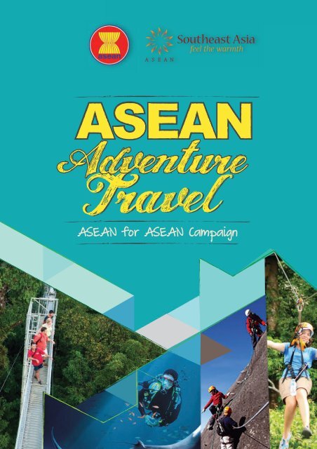
<strong>Adventure</strong> travel in Southeast Asia doesn’t<br />
get better than this!<br />
This handy guide contains just some examples of the many exciting ways to<br />
enjoy Southeast Asia. The ten <strong>ASEAN</strong> nations offer a diverse wealth of natural<br />
attractions and challenging terrains, perfect for indulging in a variety of outdoor<br />
pursuits such as biking, trekking, hiking, climbing and camping. The seemingly<br />
endless coastlines coupled with the abundance of inland river waterways in this<br />
part of the world also make water-based activities a popular pursuit in this region,<br />
whether it’s surfing in Thailand, scuba diving in Malaysia, kayaking in Viet Nam or<br />
kitesurfing in The Philippines. On top of that, annual running marathons across<br />
Southeast Asia not only allow visitors to stay active but also provide sightseeing<br />
from a different perspective.<br />
To find out more about soft adventure opportunities all across the ten <strong>ASEAN</strong><br />
nations, visit: www.aseantourism.travel<br />
Thailand Indonesia Malaysia<br />
Singapore<br />
Myanmar<br />
Laos<br />
Viet Nam<br />
2 |<strong>ASEAN</strong> ADVENTURE TRAVEL |<br />
Brunei Philippines Cambodia
MYANMAR<br />
LAOS<br />
VIET NAM<br />
THAILAND<br />
South China Sea<br />
CAMBODIA<br />
Philippine Sea<br />
PHILIPPINES<br />
Map<br />
Malacca Strait<br />
BRUNEI<br />
MALAYSIA<br />
SINGAPORE<br />
Indian Ocean<br />
Sunda Strait<br />
INDONESIA<br />
Lombok Strait<br />
Contents<br />
BRUNEI | 04<br />
CAMBODIA | 07<br />
INDONESIA | 09<br />
LOAS | 13<br />
MALAYSIA | 14<br />
MYANMAR | 17<br />
PHILIPPINES | 18<br />
SINGAPORE | 19<br />
THAILAND | 20<br />
VIET NAM | 24<br />
BRUNEI CAMBODIA INDONESIA<br />
LAOS MALAYSIA MYANMAR<br />
PHILIPPINESS INGAPORE THAILAND<br />
VIET NAM<br />
| <strong>ASEAN</strong> ADVENTURE TRAVEL | 3
Ministry of Industry and<br />
Primary Resources<br />
Jalan Menteri Besar<br />
Bandar Seri Begawan – BB3910<br />
Brunei Darulsalam<br />
Tel: (673) 238 2822 / (673) 238 2832<br />
Fax: (673) 238 2824 / (673) 238 2807<br />
Email: info@bruneiourism.travel<br />
Website: www.bruneitourism.travel<br />
ULU TEMBURONG NATIONAL PARK<br />
The jewel in Brunei’s impressive crown of natural attractions, this 500 km² (193 sqm) National<br />
Park is covered by pristine tropical rainforest teeming with amazing ecological diversity, allowing<br />
visitors to easily and safely experience the real primeval Borneo jungle, complete with a thrilling<br />
set of interconnected canopy walkways towering above the treetops and offering 360° views of a<br />
natural environment undisturbed by civilisation for as far as the eyes can see.<br />
The easily accessible National Park, located in the sparsely inhabited district of Temburong that<br />
is separated from the rest of the country by a sliver of Malaysia, is only two hours away from<br />
the capital by a boat, bus and native longboat trip that in itself feels like an adventure. Day trips<br />
4 |<strong>ASEAN</strong> ADVENTURE TRAVEL |
to a pristine rainforest environment are therefore a possibility, allowing a wider audience, or those<br />
with little time available, to enjoy such an experience. For those with more time on their hands,<br />
an overnight or two in the rainforest can be a more fulfilling way to discover and appreciate this<br />
environment. Accommodation choices range from simple but comfortable tour-operator-run lodges<br />
downriver from the Park, to the elegantly appointed Ulu Ulu Resort located inside the Park. Night<br />
walks, river activities and greeting the morning sun from above the tree canopies are some of the<br />
strong experiences one can enjoy when staying overnight.<br />
Outside the Park, local communities living in traditional longhouses or in rural villages can be visited,<br />
with some even accommodating tourists in homestay style.<br />
BERAKAS FOREST RECREATION PARK<br />
Muara–Tutong Highway, BANDAR SERI<br />
BEGAWAN – This forest reserve which is located<br />
just off the Muara–Tutong Highway, about 10<br />
kilometres from the capital, covers 199 hectares<br />
of rolling hills covered with heath down to the<br />
coastline where a deserted white sandy beach<br />
stretches invitingly for kilometres in each<br />
direction. The drive into the park is along a<br />
well-posted road that leads past several picnic<br />
shelters, toilets and a lookout tower to a parking<br />
area conveniently located beside the beach.<br />
Open daily 7.45am-6.00pm, admission is free.<br />
LAKE MERIMBUN<br />
TUTONG – Lake Merimbun, 27 kilometres inland from Tutong, has developed into a popular picnic spot<br />
attracting large crowds on Sundays. The shallow freshwater lake is about 500 metres long by 150 metres<br />
wide, fringed by swamp and long grass. In the middle of the lake is an island. Elevated wooden walkways<br />
criss-cross the lake connecting the shore and island at several points. Pavilions built off the walkways<br />
provide benches, tables and shade for picnics.<br />
| <strong>ASEAN</strong> ADVENTURE TRAVEL | 5
MENDARAM WATERFALL<br />
BELAIT – the tranquil Mendaram Waterfall is enclosed by tall trees. The water feeds a deep pool<br />
that is excellent for swimming. The path to the waterfall starts 3.5 kilometres from the end of the<br />
sealed road at Labi on the left hand side. It is signposted Wasai Kadir. Stepping stones lead across<br />
a stream where the path rises steeply on the opposite bank. Further on, it rises steeply again to<br />
skirt a large boulder fall. Here the path can be treacherous, particularly during the wet season.<br />
The walks to the waterfall take about 15 minutes.<br />
BUKIT SHAHBANDAR FOREST<br />
RECREATION PARK<br />
Muara–Tutong Highway, BANDAR SERI<br />
BEGAWAN – Bukit Shahbandar spills over 70<br />
hectares of undulating land close to the main<br />
Muara–Tutong Highway. A network of wellmaintained<br />
and signposted paths criss-cross the<br />
area, and hill peaks and observation towers have<br />
panoramic views towards Muara, across Bandar<br />
Seri Begawan and over Jerudong. Here you will<br />
find the most challenging and wildest trails in<br />
the capital. Climb well-marked footpaths and<br />
have fun sighting plentiful wildlife (including<br />
monkeys), or just take in breathtaking views of<br />
BSB. Alternatively, cycling enthusiasts can take<br />
the mountain bike trail which gets tough in<br />
parts.<br />
This park is one of the most popular trekking<br />
trails among the locals. Open daily 7.45am-<br />
6.00pm, admission is free.<br />
6 |<strong>ASEAN</strong> ADVENTURE TRAVEL |
Ministry of Tourism of Cambodia<br />
Lot 3A, St. 169, Veal Vong Commune,<br />
Prampi Makara District,<br />
Phnom Penh, Kingdom of Cambodia.<br />
Tel: (855) 23 88 49 74<br />
(Department of Administration<br />
& General Affairs) Tel: (855) 23 88 50 39<br />
(Department of Marketing & Promotion)<br />
Email: info@tourismcambodia.org<br />
Website: www.tourismcambodia.org<br />
KOH RONG SAMLOEM<br />
Koh Rong Samloem is known for its diving and snorkelling, with outfitters Eco Sea, The Dive Shop<br />
and Coral Gardens Dive Centre all based here and others from the mainland like Scuba Nation<br />
running trips here. Eco Sea sunk a boat in August 2014 to create an artificial reef just off M’Pai Bei<br />
village, though the natural reefs are teeming with enough life to keep you entertained underwater.<br />
Many of the places to stay on the island rent out snorkelling gear.<br />
This island stretches from south-east to north-west, encompassing an area of 78 sq. km. The terrain<br />
is predominantly hilly with a sizable mountain (316 meters) at the island’s north-west. The hills<br />
provide water for countless creeks and estuaries. The island’s interior is almost completely forested,<br />
concealing a number of seasonal waterfalls. Koh Rong has around 43 kilometers of delicate beaches.<br />
Tourists can enjoy scuba diving to explore marine life there.<br />
| <strong>ASEAN</strong> ADVENTURE TRAVEL | 7
SIHANOUKVILLE<br />
Cambodia’s Sihanoukville may top the backpackers’<br />
hitlist, but it’s what lies offshore that has caught our<br />
eye. Song Saa Private Island in the Koh Rong Islands<br />
is an eco-luxe escape spread over a pair of pristine<br />
isles, with thatch and stone villas dotted among<br />
the jungle canopy or lolling above the sea. Being<br />
green-minded has never been so glamorous.<br />
SOKHA BEACH<br />
Sokha Beach is located in Preah Sihanouk province,<br />
about 230km from Phnom Penh. Its fine, siliconlike<br />
sand squeaks loudly underfoot. The tiny<br />
eastern end of Sokha Beach is open to the public<br />
and rarely crowded. The rest is part of the exclusive<br />
Sokha Beach Resort. Tourists can also enjoy diving,<br />
swimming, snorkeling at Sokha Beach.<br />
OCHHEUTEAL BEACH<br />
Located in Commune 3, Preah Sihanouk Province,<br />
Ochheuteal is the most popular beach with the<br />
most beautiful sand, shallow water, and tranquil<br />
sea. The Ochheuteal Beach boasts thatched-roof<br />
shacks and seafood bars very popular with budget<br />
travellers. It also has several seaside restaurants<br />
and bars catering for a cocktail or dinner party.<br />
A nearby hotel offers holiday bungalows and a<br />
beautiful dining room overlooking the spectacular<br />
sea. Tourists can enjoy swimming and scuba diving<br />
organised by the Golden Sand Hotel.<br />
Koh Dèk Koul Resort<br />
Koh Dèk Koul is a small island located about 7km<br />
off the coast of Preah Sihanouk City, in southern<br />
Cambodia. The exclusive Mirax Resort is based on<br />
Koh Dèk Koul. Tourists can enjoy scuba diving and<br />
relax there.<br />
8 |<strong>ASEAN</strong> ADVENTURE TRAVEL |
Ministry of Tourism,<br />
Republic of Indonesia<br />
Sapta Pesona Building<br />
Jl. Medan Merdeka Barat No.17<br />
Jakarta 10110, Indonesia<br />
Tel: (62) 21 3838167<br />
Fax: (62) 21 3810401<br />
Email: representative@indonesia.travel<br />
Website: www.indonesia.travel<br />
RAJA AMPAT ISLAND<br />
The Raja Ampat islands are truly natural<br />
phenomenon with enormous biological<br />
diversity. The amazing marine landscape<br />
means that underwater photography should<br />
be on top your list during your stay. Raja<br />
Ampat or ‘Four Kings’ is the name given to<br />
these islands and comes from a local myth.<br />
The four major islands found here are Waigeo,<br />
Misool (which is home to ancient rock<br />
paintings), Salawati and Batanta.<br />
The territory within the islands of the Four<br />
Kings is enormous, covering 9.8 million acres<br />
of land and sea, home to 540 types of corals,<br />
more than 1,000 types of coral fish and 700<br />
types of molluscs. This makes it the most<br />
diverse living library for the world’s coral reef<br />
and underwater biota. According to a report<br />
developed by The Nature Conservancy and<br />
Conservation International, around 75% of<br />
the world’s species live here. When divers first<br />
arrive here their excitement is palpable.<br />
| <strong>ASEAN</strong> ADVENTURE TRAVEL | 9
KOMODO NATIONAL PARK<br />
The Komodo Dragon (Varanus komodoensis) is an endangered species which can only be found in<br />
the Komodo National Park (KNP) in East Nusa Tenggara (NTT). Because of the unique and rare nature<br />
of this animal, KNP was declared a World Heritage Site by UNESCO in 1986. The park includes three<br />
major islands, Komodo, Rinca and Padar as well as numerous smaller islands, together totalling 603km²<br />
of land. The total size of Komodo National Park is presently 1,817km². Proposed extensions of 25km²<br />
of land (Banta Island) and 479km² of marine waters would bring the total surface area up to 2,321km².<br />
KNP has a rich and amazing underwater sea biotica. Divers claim that Komodo waters are one of<br />
the best diving sites in the world. It has fascinating underwater scenery. You can find 385 species of<br />
beautiful corals, mangrove forests and seaweeds as a home for thousands of fish species, 70 types<br />
of sponges, 10 types of dolphins, 6 types of whales, green turtles and various types of sharks and<br />
stingrays.<br />
10 |<strong>ASEAN</strong> ADVENTURE TRAVEL |
TANJUNG PUTING<br />
Tanjung Puting is located in Central Kalimantan.<br />
The area was originally declared as a game reserve<br />
in 1935 and became a national park in 1982. The<br />
park, which covers a territory the size of Bali, is<br />
home to an amazing array of wildlife including its<br />
world famous orang utans. The park is also home to<br />
monkeys, birds and other wildlife, not to mention<br />
the pristine vegetation of the jungle itself. This is<br />
a world-famous natural treasure which attracts a<br />
growing number of international visitors each year.<br />
Because the vegetation of Tanjung Puting supports<br />
a large population of animals, this park is one of<br />
the most important areas in Southeast Asia for<br />
the preservation of primates, birds, reptiles and<br />
fish. The incredible jungle surrounds make this an<br />
amazing place to visit if you’re after a truly outdoor<br />
adventure. It is an oasis of pure clean air, a clear<br />
night sky and a home to the gentle people of<br />
the jungle – the orang utans. The orang utans are<br />
undoubtedly the best-known inhabitants of the<br />
park, made famous through the work of the Orang<br />
Utan Research and Conservation Program based at<br />
the Camp Leakey research station. Camp Leakey is<br />
an orang utan preserve and the site of the longest<br />
continuous study of any wild animal in the history<br />
of science. With around three quarters of the world’s<br />
orang utan population living on Borneo, this park<br />
is the ideal place to see these incredible creatures<br />
in the wild.<br />
| <strong>ASEAN</strong> ADVENTURE TRAVEL | 11
MOUNT KELIMUTU NATIONAL PARK<br />
Mt. Kelimutu National Park is the smallest among<br />
six national parks in the stretch between Bali and<br />
the Nusatenggara islands. Its size obviously does<br />
not matter much when it offers one of the most<br />
spectacular wonders that nature has to offer. There<br />
are three lakes on the mountain sharing the same<br />
name, Kelimutu, meaning ‘the boiling lake’. Each<br />
has its own colors and a local name. But all are<br />
believed to be the resting place of departed souls.<br />
Unlike the Blue Lake in Mt. Gambier, South<br />
Australia, that changes colour from blue to cold<br />
steel grey within a predictable period, or Lake<br />
Yudamari in Mt. Nakadake, Japan, that changes<br />
from blue-green to green, the Kelimutu lakes are<br />
unpredictable as to when and what colour they<br />
will change into. Sometimes, the colours are blue,<br />
green, and black, and at some other times they<br />
turn to white, red, and blue. The last time a traveller<br />
saw them, one was dark brown, just like a pond of<br />
chocolate. Previously, the east lake was red and the<br />
middle lake was blue.<br />
MOUNT BROMO<br />
Mount Bromo is a part of the Bromo Tengger<br />
Semeru National Park that covers a massive area<br />
of 800 square kilometres. From a vantage point<br />
on Mount Penanjakan (2,770 meters above sea<br />
level), 2.5 hours from Malang, visitors from around<br />
the world come to see the sunrise over Mt. Bromo.<br />
From this spot the vista is magnificent. Experience<br />
the remarkable Tengger Caldera, Java’s largest, with<br />
its 10km barren desert-like sea of sand. Within the<br />
caldera rise the deeply fissured volcanic cones of<br />
Batok and Bromo – the latter is still active with a<br />
cavernous crater from which smoke blows skyward.<br />
The eerie landscape has spurned countless legends and myths. Mt. Bromo has particular significance<br />
for the Tengger people who believe that this was the site where a brave prince sacrificed his life for<br />
his family. The people here appease the Gods once a year during the annual Kasada festival where<br />
offerings of vegetables, chickens and money are thrown into the crater of the volcano.<br />
12 |<strong>ASEAN</strong> ADVENTURE TRAVEL |
Department of Tourism Marketing, Ministry of Information,<br />
Culture and Tourism<br />
P.O. Box: 3556, Lane Xang Avenue, Vientiane Capital, Lao PDR.<br />
Tel: (856) 21 212251 Ext 103 or 101<br />
Email: info@tourismlaos.org<br />
Website: www.tourismlaos.org<br />
ROCK CLIMBING THE KHAMMOUANE KARSTS<br />
The climbing area near Thakhek called “Pha<br />
Tam Kam” is hidden in a small valley which<br />
ends in the back of the beautiful Xiengliab<br />
Cave (12 km outside from Thakhek).<br />
You will find wonderful routes with tufa’s,<br />
sintering and face climbing. The gigantic roof<br />
with routes ranging from 6b+ to around 8a<br />
is unique. So far there is a total of 150 routes<br />
ranging from 4 to around 8b. Be it advanced<br />
climber or beginner, you will have a lot of<br />
challenges and amusement!<br />
For the beginner and advanced climbers,<br />
Green Climbers home staff offer climbing<br />
classes. For those who travel without climbing<br />
gear it is possible to rent a harness, climbing<br />
shoes, a rope, quick draws and a belay device.<br />
ROCK CLIMBING IN VANG VIENG<br />
Over the past years, Green Discovery has been working with climbers from all around the world to<br />
develop climbing in Vang Vieng area. Two areas were developed with a total of 50 routes ranging<br />
from 5a to 8a+ (French) with all the classic steep limestone jaggy stuff so Climb and enjoy!<br />
Approximately: 15 minutes’ transfer / 1-hour instruction / 3-4 hours climbing per day If you know<br />
anybody with a drill and the skill let them know that there’s a plethora of rocks in shady crags by the<br />
river just waiting for some traffic!<br />
| <strong>ASEAN</strong> ADVENTURE TRAVEL | 13
Malaysia Tourism Promotion Board<br />
( Tourism Malaysia)<br />
Southeast Asia Division<br />
Level 3, Tower 1, No 2, Jalan P5/6<br />
Precinct 5, 62200 Putrajaya<br />
Tel: (603) 8891 8000<br />
Fax: (603) 8891 8282<br />
Website: www.tourismmalaysia.gov.my<br />
VIA FERRATA MOUNT KINABALU<br />
The majestic Mount Kinabalu is one of the highest mountains in South East Asia standing at<br />
4095.2 metres.<br />
There are two trails to get to the top, Summit Trail and Mesilau Trail. While you do not need special<br />
skills to climb, you must at least have the basic fitness level. Both trails offer fantastic view and the<br />
opportunity to encounter amazing plants.<br />
Apart from traditional mountain climbing, visitors can also experience the Mountain Torq, the<br />
world’s highest, and Asia’s first, Via Ferrata or ‘iron road’ at 3,200m to 3,800m above sea level. The<br />
various routes on the northern rock faces of Mount Kinabalu consist of a ‘trail’ that is made up<br />
of iron rungs, palettes, cables and rails. Depending on the preferred difficulty level, visitors can<br />
enroll in various activities such as the intro to single pitch or multi pitch sports climbing, intro to<br />
rappelling (abseiling) and introduction to rope ascending.<br />
14 |<strong>ASEAN</strong> ADVENTURE TRAVEL |
DIVING IN MABUL ISLAND<br />
Mention Mabul Island and visions of swaying<br />
coconut trees and idyllic water villages come to<br />
mind. And that’s just above the water. Located<br />
only about 15 minutes by speedboat from the<br />
famous Sipadan Island, Mabul has gained its<br />
own recognition as one of the best muck-diving<br />
(a term used to describe limited visibility dives<br />
at shallow sites with usually sandy bottoms) sites<br />
in the world.<br />
Mabul is a small oval-shaped island fringed by<br />
sandy beaches and perched on the northwest<br />
corner of a larger 200-hectare reef. The reef is on<br />
the edge of the continental shelf and the seabed<br />
surrounding the reef slopes out to 25–30m deep.<br />
Mabul is also renowned for its amazing<br />
array of macrolife, making it an underwater<br />
photographer’s dream location to capture<br />
some of the rarest ecological species on film.<br />
Flamboyant cuttlefish, blue-ringed octopus,<br />
spike-fin gobies, frogfish and moray eels are<br />
just some of the spectacular critters you will<br />
encounter beneath the waters of Mabul.<br />
Although all the excitement is underwater, you<br />
can always set your scuba gear aside for a day<br />
to laze on Mabul’s soft sand to work on your tan.<br />
CAVING IN MULU CAVES<br />
The cave is probably the largest natural limestone<br />
cave in Peninsular Malaysia. Located within the<br />
vicinity of Gopeng, 24km south of Ipoh, the cave<br />
is approximately 1.5km long. Made up of five<br />
huge domes with a ceiling resembling coconut<br />
shells, each dome had different formations of<br />
stalagmites and stalactites. The domes also differ<br />
from one another in terms of temperature, water<br />
level, content of limestone and marble.<br />
| <strong>ASEAN</strong> ADVENTURE TRAVEL | 15
GUNUNG LEDANG/MOUNT OPHIR<br />
Shrouded in mystical legends and folklore,<br />
Gunung Ledang continues to charm and<br />
intrigue locals and visitors alike. According to<br />
the legend of the Princess of Gunung Ledang,<br />
the Sultan of Melaka wanted the Princess’<br />
hand in marriage and she, not wanting to<br />
marry him, demanded that the Sultan present<br />
her with seven jars of women’s tears, seven<br />
trays of mosquitoes’ hearts and seven bowls of<br />
the Sultan’s son’s blood. After he was unable to<br />
meet these impossible requests,<br />
she fled to the mountain and continues to live<br />
in a hidden cave, to this day.<br />
The mountain is ideal for a myriad of outdoor<br />
activities with challenging mountain trails, icy<br />
waterfalls, and exotic flora and fauna, including<br />
many species of birds. At the relatively flat<br />
summit, which is 1,276m above sea level, a<br />
panoramic view of the Straits of Melaka and<br />
even the Sumatran coastline can been seen<br />
on a clear day. Sagil Waterfall is also a popular<br />
picnic spot at the base of the mountain.<br />
TREE TOP WALK SUNGAI SEDIM<br />
The 950m-long Tree Top Walk in the Sedim<br />
River Recreation Park is the longest canopy<br />
walk in the world. The Tree Top Walk Sedim<br />
River was built within the lowland of<br />
dipterocarp compartment 15 of Gunung Inas<br />
Forest Reserve.<br />
The spectacular view you get when you stroll<br />
through the jungle canopy is the main draw<br />
for visitors from far and wide to this quiet, allnatural<br />
corner of Kedah.<br />
Strolling high above the ground of this<br />
primeval rainforest affords visitors an<br />
unexpected and exciting perspective. Call it<br />
a “monkey’s eye view”. Visitors will enjoy the<br />
fabulous sight of rushing streams and truly<br />
fascinating flora and fauna – all from 50m up!<br />
16 |<strong>ASEAN</strong> ADVENTURE TRAVEL |
Ministry of Hotels and Tourism<br />
Building No. 33, Nay Pyi Taw<br />
The Republic of the Union of Myanmar<br />
Tel: (95) 67 406454,406061,<br />
406130, 406248<br />
Email: mo.moht@mptmail.net.mm,<br />
dg.dht@mptmail.net.mm, dg.dhtd@<br />
mptmail.net.mm<br />
Website: www.myanmartourism.org<br />
BIKING AROUND MANDALAY<br />
Using the historic town of Mandalay as a jumping off point, cyclists can experience a truly<br />
“authentic” Myanmar. Discover the city’s narrow alleyways and bustling markets, as well as the<br />
surrounding areas. It’s a short bike ride to cultural treasures such as the Shwenandaw Monastery,<br />
the Kuthodaw Pagoda, and the outsize Buddha in repose at Mahamuni Pagoda. Moving into the<br />
countryside, the paved roads give way to gravel and mud trails, and the river valley surroundings<br />
come into their own, revealing a relaxing, natural panorama. The road to Amarapura takes you<br />
across the U Bein Bridge, the longest teak bridge in the world, and eventually leads to the former<br />
royal capital of Ava.<br />
The river valley terrain around Mandalay is easiest to cycle during the cooler and drier months<br />
between October and February.<br />
DIVING THE MERGUI ARCHIPELAGO<br />
Although they are geographically located in Myanmar, the waters of the Mergui Archipelago – a<br />
chain of over 800 islands in the Andaman Sea – can only be reached by liveaboard dive boats that<br />
leave from the nearby Thai ports of Phuket, Khao Lak and Ranong. The dive sites here have only<br />
been open to the international dive community since 1997 so the reefs are still pristine. And with<br />
over 36,000 square km of marine territory, much of the area remains unexplored. It requires about<br />
10 days to dive around the archipelago’s top sites, including mysterious caves, rock walls and<br />
massive seamounts. Surprisingly, there is an abundance of marine life to see as well.<br />
The liveaboard tours operate from October to May, when water conditions are optimum, and from<br />
Thailand the boats stop in Myanmar at Kaw Thaung for immigration purposes. Visiting divers must<br />
bring passports and a USD 200 visa fee.<br />
| <strong>ASEAN</strong> ADVENTURE TRAVEL | 17
Tourism Promotions Board,<br />
Philippines<br />
4th Floor, Legaspi Towers<br />
300 Roxas Boulevard, Manila<br />
Philippines 1004<br />
Tel: (63) 2 525 9318 to 27<br />
Fax: (63) 2 521 6165<br />
Email: info@tpb.gov.ph<br />
Website: tpb.gov.ph<br />
WHALE SHARK ADVENTURE<br />
DONSOL – WHALESHARK ADVENTURE & TOURS<br />
Swim and interact with WHALE SHARKs, the largest gentle fish in the world! Go for island hopping,<br />
take a dip in crystal-clear waters or a splash in our natural hot and cold spring resort! Opt for<br />
diving at world-famous Manta Bowl with the sightings of Oceanic Manta rays, Treshershark and<br />
Hammerheads or catch the splendour of our water panorama! Climb our mountains and trek<br />
the majestic Mayon Volcano.<br />
EL-NIDO<br />
El Nido really is a magical place. From its<br />
ageless towering marble cliffs to its white<br />
sandy beaches with crystal clear water,<br />
many refer to it as paradise. There are over<br />
50 beaches to discover, so many in fact that<br />
sometimes you feel as if you are on your own<br />
secluded private beach. You will also find<br />
enchanting lagoons with tranquil turquoisegreen<br />
water, caves that can take you to hidden<br />
beaches, and a very diverse variety of wildlife.<br />
MOUNT PINATUBO<br />
There is more to the lava-filled valleys and<br />
boulders – the true gem of Mt. Pinatubo is its<br />
crater lake. You can view this famous lake after<br />
2.5 hours of trekking.<br />
PUERTO PRINCESA SUBTERRANEAN RIVER<br />
Puerto Princesa’s pride is easily the Puerto Princesa Subterranean River (or Underground River), a UNESCO<br />
World Heritage Site and one of the New 7 Wonders of Nature.<br />
The 8.2km river, said to be the longest navigable underground river in the world, winds its way underneath<br />
a mountain range, through the St. Paul Underground River Cave, before going out into the South China<br />
Sea. The journey through the cave system alone is 24 kilometers long.<br />
The entire area where the Underground River is located is actually a national park and a model of<br />
biodiversity. More than 800 plant species, including almost 300 trees, 195 bird species, 30 mammals, 19<br />
reptiles and eight bat species call this area home.<br />
18 |<strong>ASEAN</strong> ADVENTURE TRAVEL |
Source: Resorts World Sentosa<br />
Singapore Tourism Board<br />
Tourism Court<br />
1 Orchard Spring Lane<br />
Singapore 247729<br />
Tel: (65) 6736 6622<br />
Fax: (65) 6736 9423<br />
Website: www.yoursingapore.com<br />
RESORTS WORLD SENTOSA (RWS) – SHARK DIVE AND OPEN OCEAN DIVE<br />
OPEN OCEAN DIVE<br />
Immerse yourself in the awe-inspiring Open Ocean habitat, the centrepiece of S.E.A. Aquarium.<br />
Descend up to 12 metres to marvel at majestic manta rays, groupers, and schools of fish swimming<br />
in unison for an unforgettable close encounter with the ocean’s gentle giants.<br />
Note: SCUBA-certification is required.<br />
SHARK DIVE<br />
Experience the thrill of swimming with the apex<br />
predators of the seas! Dive into our Shark Seas Habitat<br />
for the rare opportunity to get up close and personal<br />
with over 100 sharks from 12 different species, including<br />
the endangered scalloped hammerhead shark, silvertip<br />
shark and sandbar shark.<br />
Source: Resorts World Sentosa<br />
| <strong>ASEAN</strong> ADVENTURE TRAVEL | 19
Tourism Authority of Thailand<br />
1600 New Phetchaburi Road, Makkasan,<br />
Ratchathevi, Bangkok 10400, THAILAND<br />
Tel: (662) 250 5500<br />
TAT Contact Center: 1672<br />
Website: www.tourismthailand.org<br />
FAMOUS DIVE SITES OF THE ANDAMAN SEA: MU KO LANTA NATIONAL PARK<br />
Mu Ko Lanta National Park in Krabi province is a<br />
destination for famous dive sites of the Andaman<br />
Sea among divers from all over the world, as it is<br />
blessed with an abundance of natural resources,<br />
both on land and in the water. It consists of over<br />
20 beautiful islands and comprises beach forests,<br />
mangrove forests and an intriguing collection of<br />
marine life. Hin Daeng, Hin Muang and Mu Ko Ha<br />
are the famous dive sites in Mu Ko Lanta National<br />
Park. “Hin Daeng” or “red rock” is one of the world’s<br />
top ten dive spots with the dazzling array of red<br />
soft corals that cover the pinnacle making the rock<br />
glowing red during beautiful sunset while “Hin<br />
Muang” or “purple rock” is full of soft corals, sea<br />
anemone, and a remarkable variety of fish.<br />
Divers can enjoy spotting an amazing range of<br />
marine creatures; such as, lobster, ghost pipefish,<br />
and squid. If lucky, divers might spot barracuda,<br />
manta rays, moray eels, leopard sharks, whale<br />
sharks, and grey reef sharks.<br />
20 |<strong>ASEAN</strong> ADVENTURE TRAVEL |
DIVING WITH THE GIANT WHALE<br />
SHARK: MU KO CHUMPHON<br />
There are over 41 islands in Chumphon Sea,<br />
however, only 7-8 islands have popular and<br />
beautiful diving spots especially Ngam Islands.<br />
The undersea world around the “Ko Ngam Noi<br />
and Ko Ngam Yai” is full of huge brain corals,<br />
staghorn corals and colourful sea anemones<br />
dancing to the rhythm of the stream. These corals<br />
and sea anemones provide food and shelter<br />
for various species of colourful sea fish such as<br />
butterfly fish, clownfish, angelfish, rabbit fish, etc.<br />
If you are lucky, you might see the friendly giant<br />
whale shark swimming around to find food in the<br />
waters of these two islands. The most beautiful<br />
diving spot in Chumphon Sea is at “Ko Lak Ngam”<br />
with the approximate depth of 9-20 m. Here you<br />
will find the amazing colourful branches of one<br />
of the thickest black coral reefs in Thailand. You<br />
can also see the red sea whip, large colonies of<br />
sea anemone, schools of different species of fish<br />
and a large number of phyllidia coelestis.<br />
About a 100m away from the North of Ko Ngam<br />
Yai, you can see a pile of rocks known as “Hin<br />
Phae” that is full of Black corals, Sea whip and<br />
Corallimorph. It is a home of big fish like Whale<br />
shark, Barracuda, Round batfish, Red snapper,<br />
Jackfish and large schools of yellow stripe trevally<br />
swimming around including Leopard shark and<br />
Stingray.<br />
“Ran Pet & Ran Kai” are two small islands that have the very rich deep-sea coral reefs containing black<br />
corals in different colours-light yellow, white and gold, as well as Red neptune’s cup sponge, Red<br />
sea whip, Yellow-band fusilier and Saw blade shrimp. “Ko Mattra” is the best snorkelling spot in the<br />
area with massive coral and brain coral reefs, white clownfish with black spots and small Rabbit fish.<br />
Moreover, there are several small coral reefs under the sea around “Ko Thalu” and “Ko Langka Chio”<br />
which are homes of big fish such as Rabbit fish, Fusilier and sometimes Blacktip reef shark.<br />
Know Before You Go<br />
“You can most often see the whale shark in April. By the way, the National Park does offer boat trips<br />
for tourists”<br />
Recommendation<br />
“Stay over at Mattra Island”<br />
<strong>Travel</strong> Info<br />
From Chumphon town, drive along Highway 4001 for about 7km to Tha Yang Pier. Lots of local buses<br />
and taxis can take you there. An easier way is to book a tour package with Chumphon Cabana Resort.<br />
| <strong>ASEAN</strong> ADVENTURE TRAVEL | 21
THE BEST DIVE SITE IN THAILAND; VISITING A CONDOMINIUM OF MARINE LIFE:<br />
MU KO SURIN<br />
The Surin Islands comprise five main islands,<br />
including two large islands consisting of Ko Surin<br />
Nuea and Ko Surin Tai which are adjacent to each<br />
other like twin islands. They are separated by the<br />
200m-width shallow sea where “Richelieu Rock” –<br />
one of the best places in the world to encounter<br />
whale sharks and a vast array of spectacular marine<br />
life – is located. With a depth of 5-37m towards<br />
the south of the dive site and colourful soft corals<br />
decking the intricate peppering of granite pinnacles,<br />
it deserves at least three dives where you will still<br />
keep discovering new stuff. Tigertail Seahorses,<br />
Ghostpipe fish, Frogfish, Octopus, Cuttlefish, many<br />
different varieties of Scorpionfish, Lionfish, Pipefish,<br />
Cleaner shrimps, Moray eels including White Mouth<br />
Morays, Rays, Nudibranchs, Barracuda, Trivially, Jacks,<br />
Tuna, Groupers, Harlequin shrimps and more make<br />
Richelieu Rock their home – like a condominium for<br />
marine animals.<br />
The other three islands (Ko Mangkon, Ko Klang and<br />
Ko Torinla) are small rock islands with some dwarf<br />
trees and rainforest plants. They are a source of<br />
the biggest and best fertile shallow coral reef in<br />
Thailand, and in many places the reefs have grown<br />
right up to just 1m or so below the water’s surface,<br />
bringing the marine life that much closer to the<br />
snorkeler, particularly at Ko Torinla in the south and<br />
Ko Mangkon in the west. Here, you will be amazed<br />
with very healthy coral reefs in different colours.<br />
Other snorkeller sites that are worth to visit include<br />
Mai Ngam Bay and Suthep Bay.<br />
RAINFOREST ADVENTURE IN THE MAJESTIC TREETOPS: CHIANG MAI<br />
Take an adventure and enjoy the scenic jungle from the top view. An unique sling tour at the top of<br />
the tree will show you a green fertile tropical jungle and raise your adrenaline as you will glide along<br />
the zipline on a very high tree that you cannot see its top with your bare eyes through different layers<br />
of the rainforest canopy in pretty much the same fashion like the monkeys.<br />
The next thing you hear is the sound of your own shriek and see different kinds of birds flying around,<br />
apes, and boars running below.<br />
22 |<strong>ASEAN</strong> ADVENTURE TRAVEL |
RAPPELLING INTO THE SINKHOLE: UNLOCK THE WORLD MYSTERY SPIRIT<br />
WELL CAVE<br />
The Spirit Well Cave, also known in Thai as “Tham Nam<br />
Bo Phi”, is Lahu people’s spirit cave. It is considered the<br />
biggest and deepest sinkhole in Thailand with a size<br />
as big as two football fields. The most amazing part is<br />
the 140m depth, measured from the opening to the<br />
lowest point. The only way in and out is by one-hour<br />
rappelling down and two-hour climbing up the ropes.<br />
Cavers have to trust their lives with 2 strings of ropes<br />
and a few pieces of equipment for rappelling to the<br />
lush rainforest down there.<br />
Once reaching the floor of the sinkhole, you will<br />
be stunned by thousands of beautiful stalactites in<br />
different sizes on the ceiling of this vast cave. The fault<br />
lines of rock layers at the cave’s wall, as well as piles<br />
of rocks falling down on the slopes, which is covered<br />
with fine-grained dust, provide evidence of its age<br />
which is thousands of years. You will feel like you have<br />
journeyed back to the pre-historic era, especially when<br />
you look around and find that you are surrounded by<br />
lush green rainforest and the sound of birds chirping<br />
from the deep forest far away. After sunset, fog will<br />
descend downwards to the bottom of the sinkhole. At<br />
sunrise, you will see the golden sun shining down the<br />
hole, making it even more excitingly mysterious.<br />
| <strong>ASEAN</strong> ADVENTURE TRAVEL | 23
Viet Nam National Administration of<br />
Tourism<br />
80 Quan Su Str., Hoan Kiem Dist., Ha Noi,<br />
Viet Nam<br />
Tel: (84-4) 3942 3760, Fax: (84-4) 3942 4115<br />
Website: www.vietnamtourism.com<br />
BACH MA MOUNTAIN<br />
Location: Bach Ma (White Horse) Mountain<br />
is located in Phu Loc District, 60km from the<br />
south of Hue City.<br />
Characteristic: It is about 1,450m above sea<br />
level in a transition zone of the northern and<br />
southern climate, so it bears a temperate<br />
climate, similar to Sa Pa, Tam Dao, Da Lat, etc.<br />
There, the green vegetation is abundant all<br />
year round. The animals are also rich with<br />
chirps and calls all day and night which sound<br />
both wild and familiar. Bach Ma Mount also<br />
has many limpid brooks and picturesque<br />
waterfalls. Sixteen kilometres on Cau Hai-<br />
Bach Ma road, after turning left and walking<br />
for 20 to 30 minutes, tourists will also find<br />
the magnificent 400m-high, 20m-wide Do<br />
Quyen Waterfall which suddenly appears as if<br />
it were suspended in the sky. In the summer,<br />
rhododendron flowers bloom on both sides of<br />
the fall like two huge flowery silk carpets. At<br />
the centre of the resort is Bac (Silver) Waterfall,<br />
only 10m-high and 40m-wide, looking like a<br />
spotless white curtain swayed by the wind.<br />
More than half a century ago, the French<br />
recognised the beauty of Bach Ma and began<br />
24 |<strong>ASEAN</strong> ADVENTURE TRAVEL |
to develop it. Within five years (1942-1946), 139<br />
villas were continuously built under the foliage<br />
of old trees and by sheer cliffs. From the top of<br />
Bach Ma, people can view landscapes of Hai<br />
Van Pass, Tuy Van Mount, Cau Hai Lagoon with<br />
heaving fishing boats and even the shimmering<br />
electrical lights of Hue city at night as well as the<br />
huge and boundless Eastern Sea.<br />
Visiting Bach Ma Mountain, visitors do not miss<br />
the opportunity to conquer a series of unique<br />
trails only for people who love wildlife. It takes<br />
at least one day to explore each trail without any<br />
special climbing equipment. There are five trails<br />
for visitors to choose, including Tri Sao Trail, Do<br />
Quyen Waterfall Trail, Ngu Ho Waterfall Trail, Hai<br />
Vong Dai Trail and Rung Cho Den Trail, of which<br />
Hai Vong Dai is the most popular trail.<br />
CU LAO CHAM (CHAM ISLANDS)<br />
Location: Cu Lao Cham (Cham Islands) is situated in Tan Hiep Commune, Hoi An City, about 20<br />
kilometres off the Cua Dai coast.<br />
Characteristics: It consists of eight islets set very close together in the shape of an arc – Hon Lao, Hon<br />
Kho Me, Hon Kho Con, Hon Tai, Hon Dai, Hon La, Hon Mo and Hon Ong – serving as a protective barrier<br />
for the ancient town. The area is renowned for its beauty, clean and vast biodiversity with pristine<br />
white sandy beaches and crystal-clear water.<br />
From Cua Dai coast, after about 20 minutes by hydrofoil or 25 to 30 minutes by high-speed canoe<br />
or if someone wants to enjoy the beautiful view from tourist boat, which will take about 60 to 90<br />
| <strong>ASEAN</strong> ADVENTURE TRAVEL | 25
minutes depending on the weather, travellers will<br />
reach Cu Lao Cham, which is abundant in tourism<br />
potential. Various tourist activities are offered to<br />
meet almost all tourist demands. Tourists can relax,<br />
go hunting, fishing and get the chance to view sea<br />
swallow’s nests clinging to the towering cliff. Tourists<br />
can admire the beauty of corals by diving. The best<br />
season for diving is summer (from June to the end<br />
of August) when sunlight is strongest. Cu Lao Cham<br />
is popular for its seafood and delicacies (octopuses,<br />
lobsters, fish’s fin, abalone, kaki, cholonia’s eggs<br />
and birds’ nests) and fascinating souvenirs (pearls,<br />
conches and tortoise’s shells).<br />
FANSIPAN MOUNTAIN<br />
Location: Fansipan Mountain is located 9km<br />
southwest of Sa Pa Townlet in the Hoang Lien<br />
Mountain Range<br />
Characteristics: Fansipan is known as “the Roof of<br />
Indochina” at the height of 3,143m. It is acknowledged<br />
as one of the very few eco-tourist spots in Viet Nam,<br />
with about 2,024 flora varieties and 327 fauna species.<br />
The topography of Fansipan is varied. Muong Hoa<br />
Valley, at the lowest altitude of 950-1,000m, is created<br />
by a narrow strip of land at the base of the east side<br />
of the mountain.<br />
The summit of Fansipan is accessible all year round,<br />
but the best time to make the ascent is from mid-<br />
October to mid-November, and again in March.<br />
Foreigners prefer to book Fansipan tours between<br />
October and December, as this period is more often<br />
than not free from the heavy rains that obstruct the<br />
jaunt. But the Vietnamese prefer their tours to the<br />
peak of the mountain from February to April, as it is<br />
not so cold then. However, the best time for a trek to<br />
the top of mountain is from the end of February to<br />
the start of March, when the flowers all flourish and<br />
climbers may see carpets of brilliant blossoms, from<br />
violets and orchids to rhododendrons and Aglaia’s.<br />
26 |<strong>ASEAN</strong> ADVENTURE TRAVEL |
HON MUN ISLAND<br />
Location: Hon Mun Island is situated on the south<br />
of Nha Trang Bay, Nha Trang City, Khanh Hoa<br />
Province.<br />
Characteristic: Hon Mun has high-rise cliffs with<br />
dangerous wattles forming caves and grottoes,<br />
with stones are as black as ebony, which could<br />
rarely be found in other areas.<br />
In the black stone caves of Hon Mun, flocks of<br />
swallow migrate to the area every year to build<br />
their nests. Due to the island’s location adjacent<br />
to the hot sea-currents from the equator, which is<br />
an ideal condition for corals and various types of<br />
tropical sea creatures, the sea bed of Hon Mun is<br />
home to an abundant and diverse group of marine<br />
species, providing an interesting and useful place<br />
for researchers, oceanographers and tourists to<br />
learn more about marine life.<br />
In Hon Mun, visitors can dive or take grass-bottom<br />
boats to admire the colourful coral and sea<br />
creatures.<br />
LANGBIANG MOUNTAIN<br />
Location: In Lac Duong Town, Lac Duong District,<br />
in the Central Highlands province of Lam Dong,<br />
about 12km north of the centre of Da Lat City.<br />
Characteristics: The mountain is well known for its<br />
primeval and mighty scenery and is said to be the<br />
rooftop of the Lam Vien plateau. The mountain<br />
has two peaks, with one reaching a height of<br />
2,169m and the other, 1,950m.<br />
The 1,950m peak can be reached by trekking a<br />
long zigzagging path through a pine forest or<br />
driving self-supported cars. At the peak, there is a<br />
flower garden, statues of K’lang and H’biang and<br />
souvenir shops. From here, visitors can view as far<br />
as Vang (Gold) and Bac (Silver) streams winding<br />
below and the entire Da Lat City far away.<br />
A trip to conquer the 2,169m peak will<br />
challenge visitors physically. Visitors can take<br />
the same road to the 1,950m peak but will<br />
then need to make a right turn into another<br />
path as they get nearer to the peak. The peak<br />
can be reached by trekking through primeval<br />
forests in changeable weather for at least two<br />
hours and then climbing up steep mountain<br />
cliffs for two hours more.<br />
| <strong>ASEAN</strong> ADVENTURE TRAVEL | 27
Published by<br />
Tourism Malaysia, Ministry of Tourism and Culture, Malaysia<br />
Your Free Copy<br />
ALL RIGHTS RESERVED. No portion of this publication may be reproduced in<br />
whole or part without the written permission of the publisher. While every effort<br />
has been made to ensure that the information contained herein is correct at<br />
the time of publication, Tourism Malaysia shall not be held liable for any errors,<br />
omissions or inaccuracies which may occur.<br />
November 2015