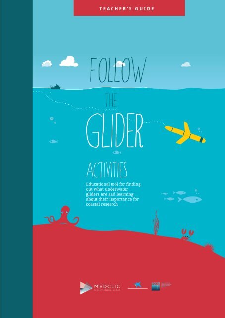
LIBRO DEL PROFESOR ENG 7

Create successful ePaper yourself
Turn your PDF publications into a flip-book with our unique Google optimized e-Paper software.
Follow the Glider is an educational tool developed by CEFAS (Centre for<br />
Environment, Fisheries & Aquaculture Science), IMEDEA (Mediterranean<br />
Institue for Advanced Studies, CSIC-UIB), and SOCIB (Balearic Islands<br />
Coastal Observing and Forecasting System) as part of the FP7–JERICO<br />
European project, and is based on the glider monitoring tool that is<br />
avaliable at www.socib.es and has been adapted for student use at<br />
www.followtheglider.com.<br />
Medclic: the Mediterranean just a Click Away project, jointly produced by “la Caixa” Foundation<br />
and SOCIB..<br />
Direction<br />
Àngels Garau<br />
Tomeu Canyellas<br />
Joaquín Tintoré<br />
Coordination<br />
Àngels Garau<br />
Tomeu Canyellas<br />
Alberto Jarabo (Quindrop Producciones Audiovisuales)<br />
Contents<br />
Marta Hierro (MOM Works)<br />
Àngels Garau<br />
Art direction & ilustration<br />
Luis Ozonas (Ozonas Disseny Gràfic)
TABLE OF CONTENTS<br />
1. Introduction ................................................................................................................2<br />
2. Project Description ................................................................................................. 3<br />
2.1 Target Audience ......................................................................................... 3<br />
2.2 Basic Skills ...................................................................................................4<br />
2.3 Overall Objectives ....................................................................................5<br />
2.4 Methodology ..............................................................................................5<br />
2.5 Contents ........................................................................................................6<br />
3. Activities .......................................................................................................................6<br />
3.1 Objectives of the Activities ................................................................. 3<br />
3.2 Classroom Materials .............................................................................. 3<br />
4. Assessment ...................................................................................................................7<br />
ACTIVITIES<br />
1 Discover a Glider and Follow It ............................................................. 9<br />
2 Your Glider Mission .................................................................................... 10<br />
3 Building a Glider ........................................................................................... 11<br />
4 The Amazing Story of the Floating Egg<br />
and the Colored Ice Cubes ....................................................................... 12<br />
5 The Water Layer Trick ................................................................................. 13<br />
6 Thermocline: A Transition Zone ............................................................15<br />
7 The Ocean’s Smallest Creatures .......................................................... 16<br />
8 The Fisherman ................................................................................................18<br />
9 And Yet It Moves ............................................................................................19<br />
10 A Fabulous Team ......................................................................................... 20<br />
1
1. INTRODUCTION<br />
Follow the Glider enables students and teachers to follow the course of<br />
ocean gliders in almost real time, examine past missions, understand the<br />
data provided by these autonomous underwater vehicles, and recognize the<br />
importance of coastal research for developing predictive models and facing<br />
phenomena such as climate change. Follow the Glider is a multilingual tool<br />
developed in the Balearic Islands and aimed at European school children, as<br />
well as anyone with interest in this technology.<br />
This educational tool was developed by CEFAS (Centre for Environment, Fisheries<br />
& Aquaculture Science), IMEDEA (Mediterranean Institue for Advanced<br />
Studies, CSIC-UIB), and SOCIB (Balearic Islands Coastal Observing and Forecasting<br />
System) as part of the FP7–JERICO European project, and is based on<br />
the glider monitoring tool that is available at www.socib.es. The contents, videos,<br />
and graphs, as well as a glider monitoring tool adapted for student use,<br />
are available at www.followtheglider.com<br />
The JERICO European project aims to develop a network to coordinate the activities<br />
of different European coastal observatories, share experiences, and<br />
set up an organizational structure that will guarantee a regular, ongoing, and<br />
sustainable supply of environmental information and marine environment<br />
products in European coastal areas. In order to support the marine environment<br />
and biodiversity, understand climate change, and make better predictions<br />
as to its impact, facilitating sustainable use of marine resources. For<br />
this purpose, it is essential for the project to promote awareness of coastal<br />
research among children. This was how Follow the Glider was born.<br />
The Mediterranean Institute for Advanced Studies (IMEDEA) is a research<br />
center jointly governed by the Spanish National Research Council (CSIC) and<br />
the University of the Balearic Islands (UIB). This institute develops scientific<br />
and technical interdisciplinary research in the area of natural resources. Its<br />
framework is the ocean and coastal areas, including islands. Currently, IME-<br />
DEA’s activity is centered on the effects of global change on these ecosystems<br />
and how to achieve an integrated and sustainable management of coastal areas.<br />
ICTS SOCIB is a Coastal Ocean Observing and Forecasting System located in<br />
the Balearic Islands. SOCIB is a multi-platform distributed and integrated<br />
system that provides streams of oceanographic data and modelling services<br />
to support operational oceanography in a European and international framework,<br />
therefore also contributing to the needs of marine and coastal research<br />
in a global change context. SOCIB’s objectives also include specific efforts in<br />
education, scientific culture, dissemination, and communication to the general<br />
public.<br />
2
2. PROJECT DESCRIPTION<br />
2.2 TARGET AUDIENCE estinatarios<br />
This project aims to provide teaching materials for students aged 10 to 16 and<br />
offer an introduction to coastal and marine research in the Mediterranean<br />
Sea.<br />
The set of educational resources offered here strives to give students a better<br />
understanding of what environmental or marine research involves, while<br />
also providing them with an opportunity to turn the information they receive<br />
into a tool for acquiring knowledge in different subjects from their curriculum.<br />
Although in the conceptual basis for the science curriculum subjects<br />
are drawn from disciplines such as physics, chemistry, biology, and geology,<br />
these are combined in connection with areas of work and study that call for a<br />
cross-curricular approach, such as the environment, climate, or the universe.<br />
The teaching materials provided here are a complementary resource within<br />
a broader exploration of gliders and coastal research, and include a series of<br />
activities that have been conceived to facilitate reflective learning and active<br />
student participation.<br />
In addition to the option of monitoring gliders’ activities, the website provides<br />
visual explanations of how these devices work and how to interpret data<br />
such as salinity, temperature, and the amount of chlorophyll and oxygen in<br />
the seawater. Teachers will find a specific area aimed at helping them use the<br />
tool in a directed way using classroom activities.<br />
The activities are aimed at a wide range of students, and have been developed<br />
considering the diversity of personal skills and socio-cultural backgrounds.<br />
The activities involve varying degrees of difficulty, but can be undertaken by<br />
any group, regardless of its nature. In any case, teachers will always be the<br />
ones to determine the appropriateness for the needs of each specific group,<br />
and can make whatever alterations they see fit for each setting.<br />
3
2.2 BASIC SKILLS<br />
The basic curriculum skills addressed in this project are the following:<br />
Literacy<br />
The scientific and technological language used here is specialized language that<br />
contains terminology referring to oceanography, laboratory concepts, fieldwork,<br />
methods, and procedures. Understanding this terminology is one of the aims of the<br />
activity.<br />
Math<br />
The procedures for researching and analyzing the data provided by gliders require<br />
knowledge of how to interpret graphs and representations, and using mathematical<br />
models.<br />
Knowledge of and Interaction with the Physical World<br />
This skill involves students learning about scientific work, specifically the coastal<br />
research work carried out in the Balearic Islands.<br />
Information Processing and Digital Skills<br />
The website helps students work on procedures related to seeking and processing<br />
information.<br />
Society and Citizenship<br />
This project’s contribution involves giving relevance to the procedural contents of<br />
coastal research, emphasizing the role of science in society.<br />
Arts and Culture<br />
Observation, intuition, and creative skills are linked to science and the arts. These<br />
skills can be addressed in depth through hands-on activities related to the concepts<br />
at hand. Learning specific terminology broadens students’ cultural horizons, while<br />
their interest in their environment and closest physical surroundings also involves<br />
learning more about their own culture.<br />
Learning to Learn<br />
The ability to solve problems develops this basic skill. It puts students to the test,<br />
raising questions about their environment for which they will have to come up with<br />
well thought-out answers and share them with their fellow students.<br />
Autonomy and Personal Initiative<br />
Scientific activities reinforce problem-solving skills and the development of one’s<br />
own criteria.<br />
4
2.3. OVERALL OBJECTIVES<br />
• Help students learn what ocean gliders are and their importance for ocean<br />
research.<br />
•<br />
Enable students to monitor the gliders that SOCIB currently has in operation in the<br />
Balearic Sea.<br />
• Learn to interpret the information provided by gliders.<br />
•<br />
•<br />
Raise awareness of coastal and ocen research among students.<br />
Integrate environmental knowledge as a basic element for students’ overall<br />
education.<br />
•<br />
Implement strategies that enable individual work and active, responsible<br />
collaboration in cooperative learning.<br />
•<br />
Raise awareness of the need to protect the environment, supporting suntainable<br />
use and an appreciation of nature.<br />
• Provide tools for teachers, whose role is key for mediating the teaching-learning<br />
process.<br />
• Foster scientific vocation.<br />
2.4. METHODOLOGY<br />
It is important to use the appropriate methodology, the one closest to the most broadly<br />
accepted approaches in science education, such as the acknowledgement of prior ideas<br />
and the value attached to acquiring new knowledge.<br />
Students must have an active role throughout the entire process, and should see cooperative<br />
work as the best way to solve scientific problems.<br />
We recommend beginning the activities by reflecting on the need to learn about the<br />
marine environment, both for the conservation of its ecosystems and for a sustainable<br />
use of its resources. Next, we present gliders as a tool for researching coastal and ocean<br />
water, showing students what they are and how they work. Lastly, students monitor the<br />
gliders’ courses, drawing conclusions based on the provided data. All of this is completed<br />
with specific activities related to interesting aspects of gliders and the marine<br />
ecosystem.<br />
Description of How the Tool Is Used<br />
Follow the Glider enables us to monitor the gliders that SOCIB and IMEDEA currently<br />
have on missions in the Balearic Sea.<br />
The tool shows where the gliders are in almost-real time, as well as their course and the<br />
data they have collected on the missions they have completed. With this information,<br />
activities can be performed over time, following a glider’s course; data from previous<br />
missions can be analyzed as well.<br />
The website offers information about what gliders are and how to interpret some of the<br />
data they collect. Bearing in mind that gliders provide a huge amount of information<br />
about a variety of parameters, we have selected four that strike us as particularly sig-<br />
5
nificant and especially relevant for observing the ocean. Among the physical parameters,<br />
Follow the Glider offers information about water salinity and temperature. In<br />
terms of biochemical parameters, students will be able to examine chlorophyll and<br />
oxygen data.<br />
2.5. CONTENTS<br />
Concepts of Oceanography<br />
Explanation and practice of basic concepts such as density, salinity, temperature,<br />
buoyancy and stratification. Description of phenomena such as upwelling, the thermocline<br />
and the movement of ocean currents.<br />
The Marine Environment<br />
Conservation of ecosystems and sustainable use of resources.<br />
Scientific Knowledge<br />
Acknowledging the role of scientific knowledge in technological development and in<br />
people’s lives; valuing the contributions of the natural sciences to address the needs<br />
of human beings and improve their living conditions, participating in their conservation,<br />
protection, and improvement.<br />
Using information technologies as reference instruments. Interpreting data and information<br />
about nature and using that information to increase our insight into the<br />
natural environment.<br />
Presentation of ICTS SOCIB. Introducing the ICTS SOCIB as a multi-platform system<br />
in Operational Oceanography, Marine Technology and Sustainability in the Balearic<br />
Islands, which offers support to operational oceanography at the European and international<br />
framework system, obtaining a coastal and ocean management based in<br />
science.<br />
Gliders and Their Role in Research<br />
What gliders are and how they work. Structure, functions, and uses.<br />
Interpreting Data and Drawing Conclusions<br />
Measurement parameters. Practical applications.<br />
3. ACTIVITIES<br />
Follow the Glider offers a series of activities aimed at different grade groups, ranging<br />
from ages 10 to 16. Teachers will choose the activities they consider most appropriate<br />
given their students’ prior knowledge and interests.<br />
3.1 OBJECTIVES OF THE ACTIVITIES<br />
Conceptual Objectives<br />
• Learn what ocean gliders are and how important their role is in coastal and ocean<br />
research.<br />
6
• Correctly interpret the information provided by gliders.<br />
•<br />
Learn about the current status of Balearic coastal research.<br />
Procedural Objectives<br />
•<br />
•<br />
•<br />
Analyze the data collected by gliders and interpret them correctly.<br />
Explore prior knowledge of the subject as well as recently acquired knowledge.<br />
Generate hypotheses and draw conclusions.<br />
Attitude Objectives<br />
•<br />
•<br />
•<br />
Show an interest in scientific research.<br />
Be aware of the need to protect the environment.<br />
Develop an analytical and critical sense that leads students to participate in<br />
efforts and campaigns aimed at improving the environment.<br />
3.2 CLASSROOM MATERIALS<br />
The teaching approach involves offering suggestions for work that can be used partially<br />
or entirely. In turn, these can be a source of inspiration for new ideas.<br />
Resources are offered so that, taking into consideration basic aspects such as the<br />
nature of the subject matter, the setting, their own skills, and the students’ skills,<br />
teachers can use additional materials as they see fit.<br />
The ultimate aim is to get students to learn in a reflective, critical way, reinforcing<br />
their problem solving skills. Therefore, they have to engage in the process actively.<br />
Teachers must promote participation and help support it. The role of students must<br />
be active, participating in their own learning process.<br />
4. ASSESSMENT<br />
We view assessment as a stage that provides an opportunity to stop and think about<br />
the performed activities and their results.<br />
Our objective is to have feedback from our users in order to improve certain aspects<br />
and assess the participants’ degree of satisfaction. To do so, we invite you to visit<br />
www.followtheglider.com and fill in the assessment questionnaire.<br />
7
GLIDER<br />
THE<br />
ACTIVITIES<br />
TEACHER’S GUIDE<br />
Before they begin any of the activities, students should be<br />
given a guided explanation of the theoretical content of the<br />
Follow the Glider book; they could also watch the videos and<br />
explore the online glider monitoring tool. For the explanation,<br />
the teacher can use the Follow the Glider Power Point<br />
presentation.<br />
Next, the teacher will choose the activities he or she considers<br />
most appropriate for the students’ grade and interest<br />
level.<br />
8
ACTIVITY<br />
1<br />
DISCOVER A GLIDER AND FOLLOW IT<br />
GRADE LEVEL Ages 10-12<br />
DESCRIPTION<br />
Students will find out more about gliders in an entertaining activity,<br />
consolidating the knowledge they have just acquired about what gliders<br />
are. At the end of exercise, we recommend that teachers walk their students<br />
through the www.followtheglider.com website and the online monitoring<br />
tool, choosing one of the missions and analyzing aspects such as salinity,<br />
temperature, chlorophyll, and oxygen, according to the students' grade and<br />
interest level.<br />
OBJECTIVES<br />
• Identify the parts of a glider.<br />
• Develop an interest in oceanographic concepts.<br />
• Learn about the glider monitoring tool at www.followtheglider.com<br />
• Interpret the information provided by the glider.<br />
MATERIALS<br />
• Colored pencils<br />
• Interactive whiteboard or a computer with an Internet connection and a<br />
projector<br />
SUGGESTED<br />
APPROACH<br />
Students will work individually coloring the illustration, and they can work as<br />
a team to identify the parts of a glider. The monitoring activity should be led<br />
by the teacher, whose questions will engage students and get them to think<br />
about the data provided by the glider.<br />
SUGGESTIONS<br />
Visit www.followtheglider.com<br />
SOLUTIONS<br />
1. Sensors<br />
2. Piston<br />
3. Antenna<br />
4. Navigation bay<br />
5. Scientific bay<br />
3<br />
Antenna<br />
5<br />
Navigation bay<br />
4<br />
Scientific<br />
bay<br />
2<br />
Piston<br />
1<br />
Sensors<br />
9
ACTIVITY<br />
2<br />
YOUR GLIDER MISSION<br />
GRADE LEVEL Ages 12-16<br />
DESCRIPTION<br />
The students become glider pilots, and, as such, they will have to solve<br />
problems and make decisions about its operation. Students will also act as<br />
scientific researchers, analyzing the data that the gliders collect.<br />
OBJECTIVES<br />
• Apply the knowledge acquired about how gliders work and the parameters<br />
they analyze.<br />
• Interpret the information provided by the glider.<br />
• Understand basic concepts of oceanography.<br />
• Encourage analytical thought, reasoning, and decision-making.<br />
• Spark interest in scientific methods.<br />
MATERIALS<br />
• Interactive whiteboard or computer with an Internet connection and a<br />
projector<br />
• Pen or pencil<br />
SUGGESTED<br />
APPROACH<br />
Students can work individually or in small groups. If they choose to work<br />
in groups, it is important to stress the value of fostering discussion among<br />
students, encouraging them all to participate and highlighting teamwork<br />
and joint decision making.<br />
SUGGESTIONS<br />
• Visit www.followtheglider.com<br />
• Watch the micro-videos suggested in the activity while answering the<br />
survey questions.<br />
SOLUTIONS<br />
1. a<br />
2. b<br />
3. b<br />
4. b<br />
5. b<br />
6. LOOK UP THE ANSWERS IN “How do we read the<br />
data we receive from a glider?”<br />
7. The more salt there is in the water, the heavier it<br />
becomes (it’s denser). Since it’s heavier, it goes<br />
down to the bottom. That’s why deep water is saltier<br />
(red) than water near the surface (blue).<br />
8. The water near the surface tends to be warmer than<br />
deep water because sunlight heats it up. However,<br />
if the glider moves through an area where it’s been<br />
raining or it’s very cold, the surface water may also<br />
be very cold, so it’s marked in blue on the graph. In<br />
fact, one of the things that can cool the sea down<br />
is a major storm.<br />
9. a<br />
10. Mechanical failure. Collisions with boats, fishing<br />
nets, or buoys. Battery failure. Communication failures<br />
due to the glider or to the satellites. Low-density<br />
waters that don’t allow the glider to come back<br />
up to the surface. Molluscs or remoras that don’t<br />
let the glider come back up to the surface.<br />
11. Forecasting the movements of currents, eddies,<br />
etc., and making forecast models like the ones that<br />
are used for the weather. They enable us to: know<br />
where an oil spill is might spread; know how the<br />
oceans are reacting to climate change; predict how<br />
severe winter storms affect the sea.<br />
10
ACTIVITY<br />
3<br />
BUILDING A GLIDER<br />
GRADE LEVEL Ages 12-18<br />
DESCRIPTION<br />
The student builds a glider, comes up with hypotheses about its buoyancy,<br />
and experiments with it in a fish tank.<br />
OBJECTIVES<br />
• Introduce the concepts of density and buoyancy to students.<br />
• Help students understand how gliders work.<br />
• Apply knowledge of density and buoyancy to the ways gliders move.<br />
• Reinforce analytical skills.<br />
MATERIALS<br />
• Interactive whiteboard or computer with an Internet connection and a<br />
projector<br />
• Large fish tank with fresh water, coarse salt, kitchen scale, two 60cc<br />
syringes, Plexiglas, scissors, saw, hot glue or another strong glue, yellow<br />
and black electrical tape, and a large measuring cup.<br />
SUGGESTED<br />
APPROACH<br />
Students can work in groups to build their gliders, come up with hypotheses,<br />
and conduct their experiments. One session may not be enough time for<br />
them to build their gliders and try them out. Teachers could plan to break<br />
the activity into two sessions, one for building the gliders and the other for<br />
experiment with the models. The teacher should evaluate students’ skills<br />
beforehand in order to decide whether to plan for one or two sessions.<br />
SUGGESTIONS<br />
• Visit http://coseenow.net/files/2010/08/15-Ocean-Robots.pdf<br />
• Visit www.followtheglider.com<br />
SOLUTIONS<br />
Activity written by Kate Florio, Liberty Science Center.<br />
6 The glider that was filled with saltwater is denser.<br />
Since the water it contains is denser than fresh water,<br />
the glider sinks in the fish tank.<br />
On real glider missions the piston fills up or empties<br />
out a chamber with saltwater in order to make the<br />
glider go up or down in the water column.<br />
11
ACTIVITY<br />
4<br />
THE AMAZING STORY OF THE FLOATING EGG<br />
AND THE COLORED ICE CUBES<br />
GRADE LEVEL Ages 10-12<br />
DESCRIPTION<br />
Students will perform two simple experiments about the density of objects.<br />
They will come up with working hypotheses and think about the results they<br />
obtain.<br />
OBJECTIVES<br />
• Introduce the concepts of density, salinity, and temperature to students.<br />
• Relate these concepts to how gliders work.<br />
• Encourage searching for information and reinforce analytical skills.<br />
MATERIALS<br />
Interactive whiteboard or computer with an Internet connection and a<br />
projector<br />
Two large clear glasses, salt, water, and two raw eggs.<br />
Fish tank or large, deep glass container, food coloring, ice cube tray, salt.<br />
SUGGESTED<br />
APPROACH<br />
Students can work individually or in small groups. They should take notes<br />
about the hypotheses they come up with, the results of their experiments,<br />
and their conclusions.<br />
For the ice cube experiment, the teacher can make the ice cubes in advance.<br />
Into one half of the tray, pour food-colored water. Using a different color,<br />
pour very salty water into the other half of the tray. Freeze overnight.<br />
SOLUTIONS<br />
EXPERIMENT 1: THE EGG THAT FLOATS... OR DOESN’T<br />
3 The water that’s in saltwater floats, because saltwater<br />
is denser than fresh water.<br />
4 The formula for water is H 2 0, which means two atoms<br />
of hydrogen and one of oxygen. Salt is composed<br />
of sodium chloride. Therefore, instead of<br />
containing only hydrogen and oxygen, saltwater<br />
also has atoms of sodium and chloride. And because<br />
there are more particles in saltwater than<br />
in fresh water, it is denser.<br />
5 To go down, a glider increases its density by filling<br />
up with seawater. To go up, it empties the water<br />
out, reducing its density.<br />
EXPERIMENT 2: THE COLORED ICE CUBES<br />
4 In both cases, the colored ice cubes will sink in the<br />
fish tank water. That’s because the fish tank water<br />
is warmer than the ice cubes: cold water is denser<br />
than warm water, so all the ice cubes will sink in<br />
the tap water.<br />
However, the water in the salty ice cubes sinks even<br />
faster than the fresh water cubes. That’s because<br />
salt makes the density of the ice cubes even greater.<br />
Fresh water ice cubes: they are denser than<br />
the fish tank water because of their temperature<br />
(they are colder).<br />
Saltwater ice cubes are denser due to their<br />
temperature (they are colder) and their salinity.<br />
12
ACTIVITY<br />
5<br />
THE WATER LAYER TRICK<br />
GRADE LEVEL Ages 10-16<br />
DESCRIPTION<br />
Students will create masses of water with different densities according to<br />
their temperature and salinity, and then will observe their stratification<br />
when they mix them together in the same container. Stratification is what<br />
occurs in ocean, and it is one of the things visible with glider’s data.<br />
OBJECTIVES<br />
• Understand the concepts of density, salinity, and temperature.<br />
• Learn the concept of stratification.<br />
• Relate the experiment to how gliders work.<br />
• Encourage generating hypotheses, observation, and analytical skills.<br />
• Understand the scientific information provided in a newspaper.<br />
• Understand basic concepts of oceanography.<br />
MATERIALS<br />
• Interactive whiteboard or computer with an Internet connection and a<br />
projector<br />
• Rectangular fish tank with a divider panel<br />
• Bottle of water with dissolved salt (about 75 grams of salt dissolved in 1<br />
liter of water)<br />
• Food coloring in two different colors<br />
• Ice<br />
• Measuring cups<br />
* If these materials were not available, the experiment could be done with<br />
basic household items, as you can see in the following video:<br />
https://www.youtube.com/watch?v=a9KwKVnlsio<br />
The required materials for this version are:<br />
• Four identical glass jars<br />
• Two bottles of water (one hot and one cold)<br />
• Two small pieces of construction paper<br />
• Food coloring in two different colors<br />
* Another even simpler alternative is:<br />
https://www.youtube.com/watch?v=6RMLG1JjMSs.<br />
For this one, the required materials are:<br />
• Two glass jars<br />
• Salt<br />
• Food coloring<br />
• Rectangular plastic container (food storage container)<br />
• Tap water<br />
13
SUGGESTED<br />
APPROACH<br />
Before performing the experiment, students will generate a hypothesis based<br />
on the knowledge they have acquired about density, salinity, temperature,<br />
and stratvification. Next, the teacher will conduct the experiment with help<br />
from the students, who will end up drawing conclusions from what they have<br />
experienced. Last, the students will apply those conclusions to the conditions<br />
in the sea as well as to the data collected by the glider.<br />
SUGGESTIONS<br />
• Before you start, review the page on density, buoyancy, and salinity.<br />
• Visit www.followtheglider.com<br />
SOLUTIONS<br />
EXPERIMENT 1<br />
4 Saltwater is denser than fresh water.<br />
5 Since it is denser, the saltwater settles at the bottom of the tank, and the fresh<br />
water rises to the top. In between, a thin layer develops: that is the thermocline..<br />
EXPERIMENT 2<br />
3 Cold water is denser than warm water<br />
4 Since it is denser, the cold water settles at the bottom of the tank, and the warm<br />
water rises to the top. In between, a thin layer develops: that is the thermocline<br />
14
ACTIVITY<br />
6<br />
THERMOCLINE: A TRANSITION ZONE<br />
GRADE LEVEL Ages 10-16<br />
DESCRIPTION<br />
Students will learn what happens within the thermocline: the layer of water<br />
that separates two other masses of water with different densities. The<br />
thermocline is the subject of a huge amount of research because of how<br />
important its consequences are. The teacher will ask the students questions,<br />
and they will have to provide the answers based on the knowledge they have<br />
acquired about density, salinity, temperature, and stratification.<br />
OBJECTIVES<br />
• Understand the concepts of density, salinity, temperature, and<br />
stratification.<br />
• Relate the experiment to the way gliders work.<br />
• Encourage generating hypotheses, observation, and analytical skills.<br />
• Understand basic concepts of oceanography.<br />
MATERIALS<br />
Interactive whiteboard or computer with an Internet connection and a<br />
projector<br />
Pen or pencil<br />
SUGGESTED<br />
APPROACH<br />
We recommend planning this activity as a continuation of Activity 5. If the<br />
teacher prefers to plan it separately, we suggest playing a video that shows<br />
the experiment from Activity 5, as well as its illustrations. Students can<br />
work in pairs, in small groups, or individually. The teacher should encourage<br />
discussing the answers as part of the group debate.<br />
SUGGESTIONS<br />
• Before you start, review the page on density, buoyancy, and salinity, as<br />
well as the information about stratification from Activity 5.<br />
• Visit www.followtheglider.com<br />
SOLUTIONS<br />
1. It’s summertime. The thermocline is very strong<br />
because the difference in temperature between the<br />
surface water and the deep water is greater.<br />
2. We say that the thermocline is a border because it<br />
is the layer that separates the more dense water<br />
from the less dense water. It is hard for oxygen and<br />
nutrients to cross this border, so if they’re at the<br />
bottom, they are unable to rise up to the surface<br />
water.<br />
3. Storms cool down the surface of the ocean, so the<br />
water becomes denser and sinks. The water also<br />
gets stirred up, the thermocline breaks, and the<br />
waters mix.<br />
4. The thermocline is strongest in summer. That is<br />
the time when the water near the surface runs out<br />
of oxygen and nutrients; the nutrients at the bottom<br />
cannot cross the thermocline to get up to the<br />
surface. Later on, in the fall, when the waters mix,<br />
the oxygen and nutrients rise up; the water near<br />
the surface is enriched and provides food for many<br />
species. *See the graph in the STUDENT BOOK.<br />
15
ACTIVITY<br />
7<br />
THE OCEAN’S SMALLEST CREATURES<br />
GRADE LEVEL Ages 10-16<br />
DESCRIPTION<br />
Students will learn about plankton and how a glider can measure certain<br />
biochemical parameters, such as the concentration of oxygen and chlorophyll,<br />
which can provide information about the amount of phytoplankton there are<br />
in the areas it travels through. There will be a strong emphasis on the need<br />
to protect plankton in order to ensure the existence of all the other species<br />
in the ocean.<br />
OBJECTIVES<br />
• Provide knowledge about plankton.<br />
• Understand biochemical parameters measured by gliders, such as the<br />
concentration of oxygen and chlorophyll.<br />
• Stress the need to protect the balance of the marine ecosystem.<br />
MATERIALS<br />
• Interactive whiteboard or computer with an Internet connection and a<br />
projector<br />
• Pen or pencil<br />
SUGGESTED<br />
APPROACH<br />
We recommend planning this activity jointly with Activity 8 (Let’s Go Fishing).<br />
However, this activity can also be done on its own, with students working<br />
individually or in small groups.<br />
SUGGESTIONS<br />
Visit www.followtheglider.com, specifically the “What it measures” section.<br />
SOLUCIONES<br />
1. One very simple thing to do is to look at its color.<br />
Sometimes seawater looks greenish. Chlorophyll is<br />
green, so that green color in the water may be an<br />
indication of a large presence of chlorophyll, and<br />
hence of phytoplankton.<br />
2. Phytoplankton are considered primary producers<br />
because they are the base of the food chain. They<br />
transform sunlight into energy, which allows them<br />
to grow. In turn, they become food for other species,<br />
which become their consumers.<br />
3. Phytoplankton are referred to as the ocean’s lungs,<br />
because when they photosynthesize they release<br />
oxygen. They are the source of 50% of the oxygen in<br />
the atmosphere. Without photosynthesis, the global<br />
balance would be broken, because a shortage of<br />
oxygen would have terrible consequences for the<br />
preservation of life on Earth.<br />
4. The organisms that form phytoplankton are very<br />
light because if they weigh less, they don’t sink. If<br />
they sank, they wouldn’t have access to sunlight<br />
and couldn’t survive.<br />
5. The teacher can find reference material for interpreting<br />
these graphs at www.followtheglider.com,<br />
under the “What it measures” section.<br />
6. Gliders can provide us with data that help us learn<br />
about the abundance or scarcity of phytoplankton.<br />
These data enable us to analyze the causes and, if<br />
necessary, take measures to ensure their balance<br />
and survival.<br />
7. The oil would form a layer on the surface of the<br />
ocean that would block sunlight and the exchange<br />
of gases with the atmosphere. The phytoplankton<br />
would be unable to photosynthesize, and therefore<br />
would die. The other species that feed on phyto-<br />
16
plankton would also suffer the consequences, as<br />
part of a chain reaction. Although the effect on<br />
larger animals may not be death, they may suffer<br />
poisoning and illnesses due to the toxic components<br />
in the oil spill.<br />
8. The greatest threat of marine pollution, and perhaps<br />
the least known, is the disappearance of phytoplankton,<br />
the base of all food chains and the regulator<br />
of atmospheric CO 2 , absorbing carbon from<br />
the atmosphere and bringing it into the food chain.<br />
The organisms that make up phytoplankton are<br />
very sensitive to pollution. In the Southern Hemisphere,<br />
for example, an alarming drop in phytoplankton<br />
production has been observed. This is due<br />
to an increase in ultraviolet radiation as a consequence<br />
of the depletion of the ozone layer in recent<br />
decades. This is one of the examples of how global<br />
environmental problems are closely interconnected<br />
and feed into each other.<br />
Phytoplankton*<br />
Primary<br />
producer<br />
Zooplankton<br />
Primary<br />
consumer<br />
Small fish<br />
Secondary<br />
consumer<br />
Large fish<br />
Tertiary consumer<br />
17
ACTIVITY<br />
8<br />
THE FISHERMAN<br />
GRADE LEVEL Ages 12-16, especially around age 13<br />
DESCRIPTION<br />
OBJECTIVES<br />
MATERIALS<br />
SUGGESTED<br />
APPROACH<br />
SUGGESTIONS<br />
Students play the role of fishermen and try out a practical application of<br />
what they have learned about the thermocline and plankton to find out<br />
where they can find most fish.<br />
• Understand the concepts of density, salinity, temperature, and<br />
stratification.<br />
• Broaden their knowledge of plankton.<br />
• Interpret biochemical parameters such as concentrations of oxygen and<br />
chlorophyll.<br />
• Relate their experience in the activity to how gliders work<br />
• Encourage generating hypotheses, observation, and analytical skills.<br />
• Understand basic concepts of oceanography.<br />
• Interactive whiteboard or computer with an Internet connection and a<br />
projector<br />
• Pen or pencil<br />
We recommend planning this activity jointly with Activity 7 (The Ocean’s<br />
Smallest Creatures) or 6 (Thermocline: A Border). However, the teacher may<br />
choose to do the activity on its own, referring to the theoretical information<br />
from the units mentioned above.<br />
• Before you begin, review the concepts of density, salinity, temperature,<br />
thermocline, and plankton.<br />
• Visit www.followtheglider.com<br />
SOLUTIONS<br />
1. Phytoplankton are the plankton that photosynthesize;<br />
they are mostly microscopic algae. These organisms<br />
weight very little, and this enables them<br />
to stay near the surface and receive sunlight, which<br />
is essential for them to photosynthesize and transform<br />
that sunlight into food. To absorb the sun’s<br />
energy, they need chlorophyll, and in doing so, they<br />
release oxygen. Gliders can collect data about chlorophyll<br />
and oxygen concentrations, and therefore<br />
tell us whether there is more or less phytoplankton<br />
in a given area. Phytoplankton is considered a<br />
primary producer and is a source of food for tiny<br />
organisms, and other very large ones as well, such<br />
as certain whale species. The teacher can show the<br />
students an illustration of the food chain from the<br />
previous activity.<br />
2. Phytoplankton need nutrients and sunlight. There<br />
are more nutrients in the cold bottom water. However,<br />
there is only sunlight near the surface. The<br />
area where these two factors meet would offer the<br />
appropriate setting for a greater presence of phytoplankton.<br />
3. Gliders can’t give us direct data about phytoplankton,<br />
but they can give us data about chlorophyll,<br />
temperature, and oxygen concentrations, which<br />
together help us determine where there is more<br />
phytoplankton.<br />
4. The area where the surface water near the sunlight<br />
meets the deep, nutrient-rich water is called the<br />
thermocline. The point of the activity is to have<br />
students relate the temperature and chlorophyll<br />
graphs and reach this conclusion on their own.<br />
5. Supposedly, a situation with riled-up waters would<br />
be good for fishing because wind on the surface or<br />
storms can help break the thermocline, allowing<br />
for the deep, nutrient-rich water to flow upward.<br />
This, in turn, leads to a proliferation of phytoplankton,<br />
which all the other species feed on.<br />
6. Yes, because of their high concentration of nutrients.<br />
18
ACTIVITY<br />
9<br />
AND YET IT MOVES<br />
GRADE LEVEL Ages 12-16<br />
DESCRIPTION<br />
Students will discover surface and deep ocean currents, as well as the<br />
consequences that a change in this system of currents would have and the<br />
ways in which gliders can help us monitor this phenomenon.<br />
OBJECTIVES<br />
• Identify surface and deep ocean currents.<br />
• Relate the concepts of density, salinity, temperature, and stratification.<br />
• Think about climate change.<br />
• Understand the importance of gliders as monitors of ocean currents.<br />
• Encourage generating hypotheses, observation, and analytical skills.<br />
MATERIALS<br />
• Interactive whiteboard or computer with an Internet connection and a<br />
projector<br />
• Long rectangular container (for example, a baking pan)<br />
• Drinking straws<br />
• Water<br />
• Black pepper<br />
SUGGESTED<br />
APPROACH<br />
Some of the questions involve applying the concepts of temperature, salinity,<br />
density and stratification addressed in previous activities. If these activities<br />
have not been done in the classroom, the teacher should suggest reading the<br />
information provided in previous pages and help students find the answers.<br />
SUGGESTIONS<br />
• Before you begin, review the concepts of salinity, temperature, density,<br />
stratification, etc.<br />
• Visit www.followtheglider.com<br />
SOLUTIONS<br />
1. The water will start moving clockwise in a circle.<br />
That is how currents move, creating ocean gyres.<br />
2. At the Poles, cold currents are formed, pushing cold<br />
water towards the Equator and helping to cool the<br />
Tropics. This water pushes out the bodies of water<br />
in the Tropics, which in turn move up towards the<br />
north, carrying heat toward the Poles. This helps to<br />
make the coast in the north less cold and to make<br />
the coast in the south less warm. That is why ocean<br />
currents are known as the Earth’s thermostat.<br />
3. If there were a major thaw in the area around<br />
Greenland, water would be less salty and therefore<br />
not dense enough to sink to great depths. Therefore,<br />
it would not be replaced by the warm current<br />
coming up from the Equator. In other words, the<br />
circulation system would come to a standstill. One<br />
of the first consequences would be that the cold<br />
water from the Poles would not cool off the coasts<br />
in the Tropics, and the warm water from the Tropics<br />
would not warm up the northern coasts. This could<br />
lead to a severe change in climate. It would also affect<br />
the exchange of nutrients between deep water<br />
and surface water, and therefore the entire marine<br />
ecosystem.<br />
4. Gliders can become our spies in the ocean. The information<br />
they give us about temperature and salinity<br />
enables us to be alert and detect any changes<br />
that may threaten the current balance.<br />
19
ACTIVITY<br />
10<br />
A FABULOUS TEAM<br />
GRADE LEVEL Ages 10-16<br />
DESCRIPTION<br />
OBJECTIVES<br />
MATERIALS<br />
SUGGESTED<br />
APPROACH<br />
SUGGESTIONS<br />
The activity suggests that students discover the people behind everything we<br />
have told them about in former activities. The technicians and researchers at<br />
the SOCIB will show what they do and convey their motivation. Students will<br />
reflect on these profiles, find out which they identify with most, and realize<br />
the amount of people it takes to carry out large-scale projects. Students<br />
will also be introduced to other technological resources used for coastal<br />
observation.<br />
• Stimulate scientific vocations.<br />
• Provide further knowledge about how gliders work and their scientific<br />
applications.<br />
• Find out about other technological resources used by SOCIB.<br />
• Realize the value of the research performed by SOCIB.<br />
• Interactive whiteboard or computer with an Internet connection and a<br />
projector<br />
• Pen or pencil<br />
Teachers can relate this activity to some of the other ones that focused on<br />
how gliders work. In this case, it is important to not repeat the videos that<br />
students already watched in previous activities. Most of the questions in this<br />
activity are open-ended, and aim to elicit an emotional connection between<br />
the students and the contents we are communicating. It is essential for the<br />
teacher to convey how exciting and relevant the tasks and elements in the<br />
activity are, so as to motivate scientific vocations. If the teacher identifies<br />
especially motivated students, we suggest that he or she follow up on their<br />
curiosity and interest, guiding them to pursue it further, especially in the<br />
case of high school students who need orientation for their future careers.<br />
• Visit www.followtheglider.com<br />
• Visit www.socib.es<br />
SOLUTIONS<br />
1. High-frequency (HF) radar provides real-time data<br />
about the surface current in the Ibiza Channel.<br />
2. The coastal research vessel allow us to research the<br />
ocean and monitor some variables in real time, in order<br />
to increase scientific knowledge of the Western<br />
Mediterranean.<br />
3. They are surface drifters, autonomous platforms used<br />
for observing and predicting ocean currents.<br />
4. They provide information such as air and ocean temperature,<br />
sea level, atmospheric pressure, salinity,<br />
wind speed, current speed, and wave height.<br />
5. SOCIB collects satellite data and generates images<br />
of areas such as the Western Mediterranean and the<br />
Balearic Islands. They use these data to map ocean<br />
surface temperature, topography, currents, and chlorophyll<br />
content, among other factors.<br />
6. The Data Centre is the core of SOCIB. Through it, SOCIB<br />
is developing and implementing a general data management<br />
system to guarantee international standards,<br />
quality assurance and inter-operability.<br />
7. To develop predictive models, such as weather forecast<br />
models. These can help us know where an oil spill<br />
is going to move and enable us to contain it. It also can<br />
tell us how the oceans are reacting to climate change,<br />
how winter storms affect the ocean, and how to take<br />
better care of our Marine Protected Areas.<br />
20