


You also want an ePaper? Increase the reach of your titles
YUMPU automatically turns print PDFs into web optimized ePapers that Google loves.
Aerial Survey Techniques Applied for Stockpile Progress Measurements 23<br />
FRANK SMOLDERS<br />
has worked overseas for more than twenty<br />
years for DEME (Dredging, Environmental<br />
& Marine Engineering) in various survey<br />
and operational roles and has spent<br />
numerous years primarily in the Far East,<br />
Africa, the Middle East and the Indian<br />
subcontinent. After having created land for<br />
the future in Abu Dhabi waters, he is<br />
currently employed as Survey Manager for<br />
DIAP-SHAPJV on JIWE project in Singapore.<br />
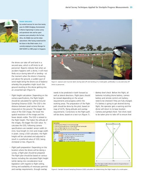
the drone can take off and land in a<br />
secured area, which is off-limits to all<br />
personnel. Reports indicate that when an<br />
accident happens with a drone, it will most<br />
likely occur during take-off or landing – at<br />
the moment when the drone is hovering<br />
just above the ground, a sudden gust of<br />
wind might bring the drone out of balance<br />
whereby the propellers might touch the<br />
ground resulting in the drone getting into<br />
an unwanted spin (Figure 5).<br />
- Flight height calculation: Depending on the<br />
camera specifications, the flight height<br />
should be calculated for optimal Ground<br />
Sampling Distance (GSD). The GSD is the<br />
distance between pixel centres that are<br />
measured on the ground. The bigger the<br />
value of the GSD image, the lower the<br />
spatial resolution of the image and the<br />
fewer details visible. The GSD is related to<br />
the flight height. The higher the altitude of<br />
the images, the bigger the GSD value. To<br />
calculate the GSD, following camera<br />
specifications are needed: sensor width (in<br />
mm), focal length (in mm) and image width<br />
in pixels. Using a GSD calculator, the flight<br />
height will be calculated and adjusted to<br />
result in a preferred value of GSD, being<br />
2cm/pixel or less. (Figure 6).<br />
- Flight path preparation: Depending on the<br />
location where the drone will be doing a<br />
survey, a flight plan should be prepared.<br />
The flight plan should be based on various<br />
factors including the calculated flight height<br />
(while taking into consideration local<br />
legislation with regards to flight ceiling,<br />
timing and availability of necessary permits)<br />
and overlap requirements. Enough overlap<br />
Figure 5. Special care must be taken during take-off and landing of a multicopter, preferably in a secured area offlimits<br />
to personnel.<br />
needs to be predicted in both forward as<br />
well as lateral directions. Flight plans should<br />
be revised depending on the actual<br />
requirements and progress within the<br />
working areas. The preparation of the flight<br />
path should be done by the pilot, based on<br />
map of GCPs, flying altitude and overlap<br />
requirements. Corrections to the flight path<br />
will be done, based on a test run (Figure 7).<br />
- Battery level check: Before the flight, all<br />
batteries including drone battery, camera<br />
battery and remote control unit battery,<br />
need to be checked if they are fully charged.<br />
If a battery is going to get drained during<br />
flight, the operator gets a warning and the<br />
drone will return to its base location.<br />
- Camera and gimbal check: Test shots need<br />
to be taken prior to take off to ensure that<br />
Figure 6. Sample Ground Sampling Distance (GSD) calculator for determining the flight height of a multicopter.