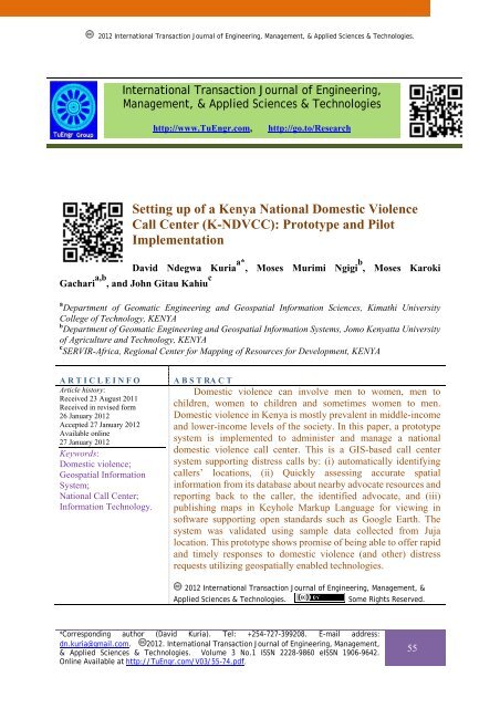
Setting up of a Kenya National Domestic Violence Call Center (K ...
Setting up of a Kenya National Domestic Violence Call Center (K ...
Setting up of a Kenya National Domestic Violence Call Center (K ...

Create successful ePaper yourself
Turn your PDF publications into a flip-book with our unique Google optimized e-Paper software.
2012 International Transaction Journal <strong>of</strong> Engineering, Management, & Applied Sciences & Technologies.<br />
International Transaction Journal <strong>of</strong> Engineering,<br />
Management, & Applied Sciences & Technologies<br />
http://www.TuEngr.com, http://go.to/Research<br />
<strong>Setting</strong> <strong>up</strong> <strong>of</strong> a <strong>Kenya</strong> <strong>National</strong> <strong>Domestic</strong> <strong>Violence</strong><br />
<strong>Call</strong> <strong>Center</strong> (K-NDVCC): Prototype and Pilot<br />
Implementation<br />
David Ndegwa Kuria a* , Moses Murimi Ngigi b , Moses Karoki<br />
Gachari a,b , and John Gitau Kahiu c<br />
a<br />
Department <strong>of</strong> Geomatic Engineering and Geospatial Information Sciences, Kimathi University<br />
College <strong>of</strong> Technology, KENYA<br />
b<br />
Department <strong>of</strong> Geomatic Engineering and Geospatial Information Systems, Jomo <strong>Kenya</strong>tta University<br />
<strong>of</strong> Agriculture and Technology, KENYA<br />
c<br />
SERVIR-Africa, Regional <strong>Center</strong> for Mapping <strong>of</strong> Resources for Development, KENYA<br />
A R T I C L E I N F O<br />
Article history:<br />
Received 23 August 2011<br />
Received in revised form<br />
26 January 2012<br />
Accepted 27 January 2012<br />
Available online<br />
27 January 2012<br />
Keywords:<br />
<strong>Domestic</strong> violence;<br />
Geospatial Information<br />
System;<br />
<strong>National</strong> <strong>Call</strong> <strong>Center</strong>;<br />
Information Technology.<br />
A B S T RA C T<br />
<strong>Domestic</strong> violence can involve men to women, men to<br />
children, women to children and sometimes women to men.<br />
<strong>Domestic</strong> violence in <strong>Kenya</strong> is mostly prevalent in middle-income<br />
and lower-income levels <strong>of</strong> the society. In this paper, a prototype<br />
system is implemented to administer and manage a national<br />
domestic violence call center. This is a GIS-based call center<br />
system s<strong>up</strong>porting distress calls by: (i) automatically identifying<br />
callers’ locations, (ii) Quickly assessing accurate spatial<br />
information from its database about nearby advocate resources and<br />
reporting back to the caller, the identified advocate, and (iii)<br />
publishing maps in Keyhole Mark<strong>up</strong> Language for viewing in<br />
s<strong>of</strong>tware s<strong>up</strong>porting open standards such as Google Earth. The<br />
system was validated using sample data collected from Juja<br />
location. This prototype shows promise <strong>of</strong> being able to <strong>of</strong>fer rapid<br />
and timely responses to domestic violence (and other) distress<br />
requests utilizing geospatially enabled technologies.<br />
2012 International Transaction Journal <strong>of</strong> Engineering, Management, &<br />
Applied Sciences & Technologies. Some Rights Reserved.<br />
*Corresponding author (David Kuria). Tel: +254-727-399208. E-mail address:<br />
dn.kuria@gmail.com. 2012. International Transaction Journal <strong>of</strong> Engineering, Management,<br />
& Applied Sciences & Technologies. Volume 3 No.1 ISSN 2228-9860 eISSN 1906-9642.<br />
Online Available at http://TuEngr.com/V03/55-74.pdf.<br />
55
1. Introduction<br />
<strong>Domestic</strong> violence, defined as abuse involving intimate partners, is the most common<br />
cause <strong>of</strong> injury to women (Chambliss et al 1995). <strong>Domestic</strong> violence occurs and can involve<br />
men to women, men to children, women to children and sometimes women to men. Frequently,<br />
the violence is a combination <strong>of</strong> physical, sexual and psychological abuse that occurs in a cyclic<br />
and intensifying pattern that can ultimately result in serious assaults with weapons or even<br />
death (UNICEF, 2000). <strong>Domestic</strong> violence also encompasses economic control and progressive<br />
social isolation. It is acknowledged that domestic violence is prevalent in all racial, educational,<br />
geographic and socio-economic segments <strong>of</strong> society. The results, from a baseline survey among<br />
women in Nairobi, (FIDA, 1998) identified the various modes in which domestic violence is<br />
propagated in <strong>Kenya</strong> as captured in Figure 1.<br />
Figure 1: Varying definitions <strong>of</strong> domestic violence.<br />
Some factors that precipitate domestic violence have been identified as discussed hereafter.<br />
Men who show inadequacy, jealousy or controlling, suspicious behavior are more likely to be<br />
involved in spouse violence. <strong>Domestic</strong> violence in <strong>Kenya</strong> has been a long standing issue, with<br />
experts showing that it is on the rise (Majtenyi, 2010). <strong>Domestic</strong> violence in pregnancy is also<br />
highly correlated with the male patient’s use <strong>of</strong> injectable drugs. Gielen et al (1994) found that<br />
better education opportunities for women were associated with higher risks <strong>of</strong> domestic<br />
violence, serving to redress the balance <strong>of</strong> power within the relationship and bolster the man’s<br />
self-esteem and control.<br />
56 David KURIA, Moses NGIGI, Moses GACHARI and John KAHIU
With rising levels <strong>of</strong> poverty, rape incidences have increased in the urban areas (Gullota,<br />
2006). <strong>Domestic</strong> violence in <strong>Kenya</strong> is mostly prevalent in middle-income and lower-income<br />
levels <strong>of</strong> the society. The rising levels <strong>of</strong> crime have also demonstrated new trends in the type <strong>of</strong><br />
crime that women are experiencing, such as rape from carjacking. In 2009, a total <strong>of</strong> 3496<br />
incidences <strong>of</strong> <strong>of</strong>fences against morality (including rape, defilement, incest, among other<br />
<strong>of</strong>fences) were reported, with the number rising to 3972 representing an increase <strong>of</strong> 14%<br />
(<strong>Kenya</strong> Police, 2010).<br />
Currently there is no <strong>National</strong> <strong>Domestic</strong> <strong>Violence</strong> <strong>Call</strong> Centre in the country. The current<br />
modus operandi is that any domestic violence related distress calls are made to the police as<br />
victims usually do not know <strong>of</strong> any other sources <strong>of</strong> help. The police in turn have to rely on the<br />
description provided by the caller in order for them to locate the appropriate services. The most<br />
obvious choice for acquiring such information would be through paper-based inventory<br />
systems such as maps. This is cumbersome with respect to storage, retrieval, analysis and data<br />
<strong>up</strong>date. Consequently, this process is more <strong>of</strong>ten than not slow, cumbersome and unreliable<br />
since in some cases police even have to ask their colleagues, casually, <strong>of</strong> the nearest services<br />
within the area depending on where the call is coming from. This also leads to reluctance by<br />
victims to report these cases and hence, suffer ‘silently’ without getting pr<strong>of</strong>essional help be it<br />
legal and/or medical. It should be appreciated that even a few seconds <strong>of</strong> giving vital<br />
information can save victims lives.<br />
1.1 Concepts applied in the research<br />
A Geographical Information System (GIS) can assist in alleviating the suffering <strong>of</strong> victims<br />
by providing a streamlined set <strong>of</strong> tools allowing quick and efficient retrieval <strong>of</strong> location<br />
information, storing <strong>of</strong> such information and performing sophisticated spatial analyses. In this<br />
research the following concepts are applied and an overview <strong>of</strong> each is given.<br />
Buffering: It involves the creation <strong>of</strong> a zone <strong>of</strong> a specified width around a point, line or<br />
polygonal area. The resulting buffer is a new polygon, which can be used in queries to<br />
determine which entities occur either within or outside the defined buffer zone (Aron<strong>of</strong>f, 1989).<br />
This technique was used to create buffers based on user-defined distances.<br />
Spatial selection: This involves the selection <strong>of</strong> features that are within or outside the boundary<br />
defined by another feature dataset i.e. spatial intersection. The help providers were selected<br />
*Corresponding author (David Kuria). Tel: +254-727-399208. E-mail address:<br />
dn.kuria@gmail.com. 2012. International Transaction Journal <strong>of</strong> Engineering, Management,<br />
& Applied Sciences & Technologies. Volume 3 No.1 ISSN 2228-9860 eISSN 1906-9642.<br />
Online Available at http://TuEngr.com/V03/55-74.pdf.<br />
57
ased on those which were within the buffer zones created from the buffering technique defined<br />
above. It performs such a task as: “Select all help providers within 1km radius from call origin<br />
location”.<br />
Cartography: Cartography can be described as the graphic principles s<strong>up</strong>porting the art,<br />
science, and techniques used in making maps or charts (Longley et al, 2005). The visualization<br />
<strong>of</strong> maps used to display the base map elements, base stations, help providers and common<br />
reference points were highly customized for the system view settings such that the scale and<br />
elements to be shown were highly optimized in terms <strong>of</strong> visual perception.<br />
Interpolation: This is the process by which a surface is created, usually a raster data set,<br />
through the input <strong>of</strong> data collected at a number <strong>of</strong> sample points. There are several forms <strong>of</strong><br />
interpolation, with each treating data differently, depending on the properties <strong>of</strong> the data set.<br />
Interpolation is justified on the basis <strong>of</strong> the “spatial autocorrelation principle” which recognizes<br />
that data collected at any position will have a great similarity to, or influence <strong>of</strong> those locations<br />
within its immediate neighbourhood. Interpolation was used to create raster datasets from<br />
number <strong>of</strong> calls values in the <strong>Call</strong> Origin feature class; this raster was used in the subsequent<br />
analysis when selecting suitable sites for setting <strong>up</strong> emergency help centers in an area.<br />
Map algebra: This is the process <strong>of</strong> adding, subtracting, multiplying, and dividing maps by<br />
applying mathematical operations to map themes. Map algebra utilities allow the user to specify<br />
mathematical relationships between map layers (Longley et al, 2005; Melnick, 2002). This<br />
technique is used to add the cell values <strong>of</strong> the raster datasets which will be used when selecting<br />
the best site for setting <strong>up</strong> an emergency domestic violence help center based on the criteria<br />
specified<br />
Database requirements: A GIS must allow the operator to: (a) Incorporate (import) data from<br />
outside sources. The method <strong>of</strong> <strong>up</strong>dating the database that is to be employed in the system is by<br />
manually entering the data; this done by creating new geographic objects <strong>of</strong> interests. This<br />
technique is used to add a relatively small amount <strong>of</strong> new objects at a time. The DBMS will<br />
allow for error checking as new records are created or existing ones are <strong>up</strong>dated. The system<br />
will also the provide the ability to create data files that can be exported to other systems in a<br />
common format which can be imported in other systems; in this case, creating KML format <strong>of</strong><br />
the existing datasets.<br />
(b) Easily <strong>up</strong>date and alter data. Another common task will be <strong>up</strong>dating or editing the database.<br />
Since no user can foresee all future data needs and applications, the system will provide ways to<br />
easily modify refine or correct the database. Attribute data are seldom static. Therefore,<br />
58 David KURIA, Moses NGIGI, Moses GACHARI and John KAHIU
maintaining the currency <strong>of</strong> the data depends on <strong>up</strong>dating the capability.<br />
(c) Query the database. This refers to manipulating the database to answer specific data-related<br />
questions through a process known as database analysis. GIS systems take this a step further by<br />
performing spatial queries. The database management system (DBMS) s<strong>of</strong>tware that is part <strong>of</strong> a<br />
GIS provides these capabilities.<br />
This concept <strong>of</strong> spatially-enabled databases gives rise to a specialized DBMS referred to as<br />
geodatabase which is a database with extensions for storing, indexing, querying and<br />
manipulating geographic information and spatial data. The main benefit <strong>of</strong> a geodatabase is in<br />
the ‘database type’ capabilities that it gives to spatial data. Some <strong>of</strong> these capabilities include<br />
easy access <strong>of</strong> spatial data, the ability to easily link and join data tables, indexing and gro<strong>up</strong>ing<br />
<strong>of</strong> spatial datasets independent <strong>of</strong> s<strong>of</strong>tware platform.<br />
GIS open standards: These are specifications developed to address specific interoperability<br />
challenges between different formats and different kinds <strong>of</strong> spatial processing systems<br />
spearheaded by the Open Geospatial Consortium (OGC, 2006). It aims to come <strong>up</strong> with<br />
standard geographic file formats or components which are compatible with existing GIS<br />
systems and for the future even for customized mapping systems. Some <strong>of</strong> these formats<br />
include Geographic Mark<strong>up</strong> Language (GML), Keyhole Mark<strong>up</strong> Language (KML) (Google,<br />
2008, Wikipedia 2006), Web Map Service (WMS), Web Feature Service (WFS), and Simple<br />
Features (SFS). <strong>National</strong> Spatial Data Infrastructures (SDI), specifically the proposed <strong>Kenya</strong><br />
<strong>National</strong> SDI, require spatial information for sustainable development and economic decision<br />
making by different stakeholders involved and open standards facilitate the implementation <strong>of</strong><br />
these initiatives; as such, the <strong>Call</strong> Centre system will solve part <strong>of</strong> the problem by publishing<br />
data held in the geodatabase to KML format for viewing in various systems which are freely<br />
downloadable from the internet. Most common <strong>of</strong> these are Google Earth, ArcGIS Explorer,<br />
GRASS GIS, and Quantum GIS. The main advantages <strong>of</strong> KML are: (a) it speeds the<br />
development <strong>of</strong> web-based mapping applications; (b) It encourages greater interoperability <strong>of</strong><br />
existing GIS products; (c) It ensures easier movement <strong>of</strong> data between applications<br />
1.1.1 System analysis and design<br />
System design involves the generation <strong>of</strong> a design document which serves as a blue-print<br />
for the proposed system (Epstein, 1993). This document includes graphical depictions <strong>of</strong> the<br />
system structure as well as contextual material, which documents the pre- and post- conditions<br />
*Corresponding author (David Kuria). Tel: +254-727-399208. E-mail address:<br />
dn.kuria@gmail.com. 2012. International Transaction Journal <strong>of</strong> Engineering, Management,<br />
& Applied Sciences & Technologies. Volume 3 No.1 ISSN 2228-9860 eISSN 1906-9642.<br />
Online Available at http://TuEngr.com/V03/55-74.pdf.<br />
59
<strong>of</strong> the system components.<br />
1.2 Research objectives<br />
This research therefore set out to develop “an on-screen GIS based solution that<br />
automatically identifies the general geographic area <strong>of</strong> the incoming phone number, allows<br />
search and selection <strong>of</strong> the appropriate services from a database <strong>of</strong> providers, map the location<br />
<strong>of</strong> the selection and is able to publish these maps in KML format.”<br />
This objective is set to be achieved by satisfying the following sub-objectives: (i) enable an<br />
advocate to focus on a caller’s individual needs such as the language (<strong>Kenya</strong> has 42 ethnic<br />
communities), medical, financial and psychological needs; (ii) decreased time required to find<br />
resources for the caller; (iii) move the caller to a safe place more quickly; (iv) act as a decision<br />
s<strong>up</strong>port tool on recommending sites for new help centers; (v) enhance information availability<br />
by publishing in open source standards.<br />
2. Methodology<br />
When designing any custom GIS solution, analysis <strong>of</strong> the functionality <strong>of</strong> the required<br />
output is necessary. This might include harnessing the strengths <strong>of</strong> each function and putting<br />
them together to solve real world problems in as short a time as possible (Stroustr<strong>up</strong>, 2009). As<br />
such the <strong>Kenya</strong> <strong>National</strong> <strong>Domestic</strong> <strong>Violence</strong> <strong>Call</strong> Centre (K-NDVCC) system brings together<br />
such techniques as cartographic modeling to represent features, raster analysis to selected sites<br />
to provide a comprehensive system to administer and manage most, if not all, spatially-related<br />
activities in a call centre. It is important to note that the results given by the system are<br />
dependent on the quality and integrity <strong>of</strong> the data held in the geodatabase. Also, they are<br />
dependent on the continual <strong>up</strong>date <strong>of</strong> the database with time; hence, maintenance is an integral<br />
part <strong>of</strong> the development cycle <strong>of</strong> the system.<br />
2.1 Pilot study area<br />
Figure 2 show the study area considered in this work for testing the prototype. It is one <strong>of</strong><br />
the sixteen locations in the larger Thika district <strong>of</strong> Kiambu County. It is a cosmopolitan<br />
location hosting the Jomo <strong>Kenya</strong>tta Univeristy <strong>of</strong> Agriculture and Technology which is the<br />
engine for most <strong>of</strong> the economic activities. It is relatively dry experiencing low rainfall and<br />
with temperatures ranging from 20°C - 35°C from the cold periods (June – July) and the hot<br />
periods (January – March). It had a population <strong>of</strong> 43,500 according to the 1999 census and a<br />
60 David KURIA, Moses NGIGI, Moses GACHARI and John KAHIU
population density <strong>of</strong> between 264 – 416 persons per km 2 (NCAPD, 2005).<br />
Figure 2: The pilot study area (Juja location) used for testing the prototype.<br />
2.2 Database design<br />
In order to come <strong>up</strong> with a compact and efficient database, the design process aimed to<br />
address the following issues: (i) The spatial database platform or environment to use; (ii) The<br />
kind <strong>of</strong> data that will be stored in the database; (c) The projection <strong>of</strong> this data i.e. whether<br />
projected or geographic; (d) The organization <strong>of</strong> the object classes such as tables, feature<br />
classes, topology rules and shapefiles.<br />
Figure 3: The call center data model.<br />
*Corresponding author (David Kuria). Tel: +254-727-399208. E-mail address:<br />
dn.kuria@gmail.com. 2012. International Transaction Journal <strong>of</strong> Engineering, Management,<br />
& Applied Sciences & Technologies. Volume 3 No.1 ISSN 2228-9860 eISSN 1906-9642.<br />
Online Available at http://TuEngr.com/V03/55-74.pdf.<br />
61
The overall aim was to design a database that met the system requirements and performed<br />
well. Consequently, a good design ensures that data retrieval is fast and efficient. Figure 3<br />
shows the data model adopted in this research. Tables 1 – 4 shows the spatial object classes<br />
created together with their individual properties/attributes:<br />
Table 1: Help providers feature class.<br />
Field Name Data Type Domain Name<br />
Name* String -<br />
Alias String -<br />
Category* String Provider Category<br />
Contact Person* String -<br />
Night Contact Person String -<br />
Counsel Service* Boolean -<br />
Medical Service* Boolean -<br />
Location* String -<br />
Table 2: Common reference point feature class.<br />
Field Name Data Type Domain Name<br />
Name* String -<br />
Alias String -<br />
Description* String -<br />
Table 3: <strong>Call</strong> history feature class.<br />
Field Name Data Type Domain Name<br />
<strong>Call</strong> Location* String -<br />
Time <strong>of</strong> <strong>Call</strong>* Date/Time -<br />
Sex <strong>of</strong> <strong>Call</strong>er* String <strong>Call</strong>er Gender<br />
<strong>Domestic</strong> <strong>Violence</strong> String <strong>Call</strong> Nature<br />
Category*<br />
Age* Integer -<br />
Marital Status* String Marital Status<br />
Comments String -<br />
User* String -<br />
Table 4: <strong>Call</strong> origin/Base station feature class.<br />
Field Name Data Type Domain Name<br />
Name* String -<br />
Unique Code Identifier String -<br />
Location* String -<br />
Number <strong>of</strong> <strong>Call</strong>s* Long -<br />
Area Category* String Area Category<br />
2.3 System analysis and design<br />
System analysis involved careful study <strong>of</strong> the requirements with regard to development <strong>of</strong><br />
62 David KURIA, Moses NGIGI, Moses GACHARI and John KAHIU
the solution. It entailed: (i) Fact finding – This was done by building undersatanding <strong>of</strong> the<br />
reporting mechainisms currently in place addressing domestic violence. From this<br />
understanding, the strengths and weaknsess <strong>of</strong> the mechanisms will be identified and used to<br />
inform the formulation <strong>of</strong> strategies to address the limitations. (ii) Recording <strong>of</strong> facts – This<br />
was done at every stage where all the data acquired was verified, checked for relevance and<br />
then recorded for use. (iii) Compiling <strong>of</strong> data – All the collected data was compiled to form<br />
a meaningful sequence <strong>of</strong> activities to be done to achieve the objectives.<br />
System design was the most crucial stage in this research where features <strong>of</strong> the new system<br />
were specified. The activities involved in system design were: (a) Program flowcharting,<br />
which is a detailed data flow diagram (DFD) <strong>of</strong> the project activities. (b) Design <strong>of</strong> the<br />
graphical depiction required to make the flow <strong>of</strong> the program logical and consistent with the<br />
flowcharts constructed. (c) Design <strong>of</strong> the geodatabase to accommodate the geographic<br />
datasets required to run the system, and (d) Design <strong>of</strong> the required output formats. The design<br />
<strong>of</strong> the system was structured, since it is the blue print <strong>of</strong> the automated solution to a given<br />
problem (Stroustr<strong>up</strong>, 2009; Tucker et al, 1995). The tools and techniques used for design<br />
include: (a) Flowcharts; (b) Data Flow Diagrams; (c) Data Dictionary; (d) Structured English<br />
and (e) Decision table. The system developed in this research comprises <strong>of</strong> 4 modules: (a)<br />
Display query-defined features; (b) Spatial Analysis; (c) Export to KML and (d) Database<br />
editing<br />
2.3.1 Display QueryDefined Features<br />
This is the main module which will provide the advocate with the interface to capture caller<br />
details (figure 4). The system will simulate the automatic call location by loading the location<br />
<strong>of</strong> the Base Stations (referred to as Master Switching Stations) in a list from where the advocate<br />
will select the specific location and then will quickly access accurate information about the<br />
nearby resources i.e. the help providers/centers.<br />
In this module, the location field <strong>of</strong> the <strong>Call</strong> Origin feature class is referenced by the system<br />
such that it populates the <strong>Call</strong> Location field in the <strong>Call</strong>er Details form. The advocate will then<br />
fill the particular caller needs, which once appropriately entered and the Query Command hit,<br />
the system will automatically create a buffer (whose distance is dependent on the area category<br />
*Corresponding author (David Kuria). Tel: +254-727-399208. E-mail address:<br />
dn.kuria@gmail.com. 2012. International Transaction Journal <strong>of</strong> Engineering, Management,<br />
& Applied Sciences & Technologies. Volume 3 No.1 ISSN 2228-9860 eISSN 1906-9642.<br />
Online Available at http://TuEngr.com/V03/55-74.pdf.<br />
63
<strong>of</strong> the call location i.e. urban, semi-urban or rural) and search for Help Provider features which<br />
are contained within the buffer. If a Help Provider centre (such as a Police Station) is found then<br />
a tag will be placed on the digital map identifying the characteristics <strong>of</strong> the feature; on the other<br />
hand, if no features are found, a user-defined increment will be applied on the initial buffer<br />
distance according to<br />
Buffer distance =Buffer distance + Increment<br />
The Buffer distance will be incremented 3 times and if no features are found then advocate<br />
will be notified that no features (Help Providers) were found.<br />
Figure 4: <strong>Call</strong>er detail form. Figure 5: Query settings interface.<br />
The system is customizable such that the minimum buffer and increment distance can be<br />
specified by the user or some defaults values can be used. If a user wishes to define the<br />
minimum buffer and incremental distance and save them in computer memory for future reuse.<br />
Figure 5 shows the interface for specifying the minimum and increments for the various land<br />
use categories.<br />
2.3.2 Spatial Analysis<br />
This module is used to generate suitability maps when one needs to set <strong>up</strong> an emergency<br />
help center in area based on specific parameters which directly influence its justification and<br />
existence. These parameters are subjective and are subject to modification and addition based<br />
on the specific needs which may arise once the system is <strong>up</strong> and running. These parameters are:<br />
(i) Number <strong>of</strong> domestic violence related calls received through each base station, (ii) the<br />
distance from nearest help facility, (iii) distance from the road, (iv) land use and (v) population.<br />
Figure 6 shows the spatial analysis dialog.<br />
64 David KURIA, Moses NGIGI, Moses GACHARI and John KAHIU
Figure 6: Spatial analysis dialog.<br />
Spatial analysis is based on cell-based modeling <strong>of</strong> each parameter meaning that they have<br />
to be in raster format in order for the analysis to take place. For the number <strong>of</strong> calls through each<br />
base station parameter, interpolation (kriging) <strong>of</strong> the numerical value <strong>of</strong> the calls for each base<br />
station is used to generate the raster surface; Euclidian (or straight line) distance is used to<br />
generate the numerical value distance <strong>of</strong> each source point to the next nearest point for both the<br />
distance from nearest help facility and distance from road parameters.<br />
Using geoprocessing tools available, the land use and population parameters are converted<br />
to raster datasets using land use type and population number respectively. A reclassification <strong>of</strong><br />
the values <strong>of</strong> the each cell <strong>of</strong> each raster participating in the analysis is done by altering the<br />
values <strong>of</strong> these cells. This is done so as to assign the values <strong>of</strong> the raster datasets to a common<br />
scale through relative weighting <strong>of</strong> the minimum and maximum <strong>of</strong> cell values within each raster<br />
dataset. In this case, a scale <strong>of</strong> 1 to 10 was used to reclassify the cells <strong>of</strong> each raster dataset, with<br />
1 being the most suitable and 10 the least suitable. Hence, the suitability criteria would be as<br />
follows: highest number <strong>of</strong> calls most suitable (assigned value 1 during reclassification) and<br />
least number <strong>of</strong> calls (assigned 10); should be further away from nearest help facility hence, the<br />
greater the distance the more suitable (assigned 1); should be nearer the road such that the<br />
smaller the distance the more suitable (assigned 1); in land use, town type <strong>of</strong> land use is most<br />
suitable (assigned 1) while forest least suitable, and since the study area (Thika) is within an<br />
agricultural zone then not all land uses are represented in the suitability modeling but the rest<br />
can always be included if the system were to be fully implemented countrywide; finally, should<br />
be in an area with high population such that the higher the population the more suitable<br />
*Corresponding author (David Kuria). Tel: +254-727-399208. E-mail address:<br />
dn.kuria@gmail.com. 2012. International Transaction Journal <strong>of</strong> Engineering, Management,<br />
& Applied Sciences & Technologies. Volume 3 No.1 ISSN 2228-9860 eISSN 1906-9642.<br />
Online Available at http://TuEngr.com/V03/55-74.pdf.<br />
65
(assigned 1). The final step involves weighting the reclassified raster datasets through map<br />
algebra and overlay techniques. The weighting is based on those specified in the SPATIAL<br />
ANALYSIS tab in the system settings. The output <strong>of</strong> the map algebra cell-addition is a new<br />
raster showing the classification <strong>of</strong> the suitability range <strong>of</strong> areas based on the parameters<br />
selected and the respective weights assigned.<br />
2.3.3 Export to KML<br />
This module simply exports the visible layers in the map or the map document to KML<br />
format; once they have been created, the user is requested whether to open them in Google<br />
Earth. The output paths to the two options can be set by the user in the KML EXPORT tab<br />
which are saved in a text document and as defaults to be loaded at the start <strong>of</strong> a new session.<br />
2.3.4 Database Management<br />
This module provides the necessary interface required to carry out routine database<br />
management tasks (add item, edit item and delete item) in the 3 core feature classes that<br />
uniquely identify the geodatabase i.e. Help Providers, Base Station and Common reference<br />
Points feature classes. It is designed in such a manner that the attribute fields for each feature<br />
class are clearly labeled requiring only the user to provide the correct corresponding values.<br />
With regard to the spatial coordinates <strong>of</strong> each feature, all that is required are the GPS<br />
Northings/Southings and Eastings decimal degrees values obtained in the field and the system<br />
will automatically convert them to the required Universal Transverse Mercator projected<br />
(UTM) coordinates.<br />
3. Data collection<br />
In this research, location data (x, y) <strong>of</strong> spatial objects such as help providers and mobile<br />
phone base stations were collected, with their corresponding non-spatial attributes such as<br />
name, location, and category were recorded.<br />
3.1 Data sources<br />
The main data capture methods used in the research were (a) Global Positioning Systems<br />
(GPS), (b) Google Earth and (c) Topographical maps<br />
3.1.1 GPS<br />
Global Positioning System is a space-based radio navigation system consisting <strong>of</strong> 24<br />
satellites and ground s<strong>up</strong>port, providing users with accurate information about their position<br />
66 David KURIA, Moses NGIGI, Moses GACHARI and John KAHIU
and velocity. Point features (i.e. help providers and base stations) positions were collected using<br />
GPS civilian signal gained an average accuracy <strong>of</strong> ±10m which was sufficient for this work. A<br />
Garmin GPS 60 was used and which enabled the accompanying names <strong>of</strong> the features to be<br />
recorded in its inbuilt memory for future transfer to a computer system. Non-spatial attribute<br />
information was recorded on paper against the name <strong>of</strong> the particular feature. The saved<br />
features were then transferred into a new database. Non-spatial attributes were directly entered<br />
into the database. The resulting database was merged with the geodatabase feature class to form<br />
a uniform database.<br />
3.1.2 Google Earth<br />
This is a virtual globe program which maps the earth by the s<strong>up</strong>erimposition <strong>of</strong> images<br />
obtained from satellite imagery, aerial photography and GIS 3D globe. For most part <strong>of</strong> the<br />
study area, the freely available remote sensing dataset <strong>of</strong> Google Earth was found to be <strong>of</strong><br />
adequate resolution. It was used to digitize road features due to coincidence with the GPS tracks<br />
over the same road features.<br />
3.1.3 Topographical Maps<br />
In reasearch, topographical maps for Juja and Thika were used to provide base data for<br />
digitizing road features in those instances where Google Earth imagery was <strong>of</strong> a coarse<br />
resolution or was severely impeded by cloud cover.<br />
3.2 Data processing<br />
This involved preparation <strong>of</strong> data into forms suitable for use within the GIS system. This<br />
involved projecting the vector data to their required reference, creating fields for each specific<br />
feature class. Generally, the tasks involved here encompass assigning map co-ordinates and<br />
spatial location, transforming between different reference systems, creating fields and<br />
assigning attributes to individual features. All the datasets in the geodatabase were projected to<br />
Universal Transverse Mercator (UTM) Zone 37 South.<br />
4. Results and discussion<br />
To verify the accuracy and correctness <strong>of</strong> the output <strong>of</strong> the program against the expected<br />
design procedures, sample system GIS routines were performed in parallel with those<br />
automated in the solution.<br />
*Corresponding author (David Kuria). Tel: +254-727-399208. E-mail address:<br />
dn.kuria@gmail.com. 2012. International Transaction Journal <strong>of</strong> Engineering, Management,<br />
& Applied Sciences & Technologies. Volume 3 No.1 ISSN 2228-9860 eISSN 1906-9642.<br />
Online Available at http://TuEngr.com/V03/55-74.pdf.<br />
67
Figure 7: <strong>Call</strong> center toolbox as a GIS extension.<br />
The sample sites used are within the study area and the results are assumed to be consistent even<br />
for other areas within the country implying scalability and extensibility. This is equivalent to<br />
testing the system by providing it with a specific problem in terms <strong>of</strong> particular domestic<br />
violence scenarios and assessing whether the results outputted by the system match with<br />
expected results, in some cases by manually carrying out the individual GIS techniques and<br />
using the outputs from one process as input to the subsequent process. This is done at a modular<br />
level on the four modules that constitute the system. These are uniquely gro<strong>up</strong>ed together in a<br />
separate toolbar with the commands clearly marked and contain tool tips which summarize the<br />
functionality <strong>of</strong> each command, and a settings tool which enables the user to customize the<br />
operations <strong>of</strong> the system. This toolbar is illustrated in figure 7.<br />
4.1 Automated help providers location<br />
Problem: A female caller in her mid-thirties, who is married, suffers from marital rape<br />
inflicted by her partner who is currently under medication for a sexually transmitted infection<br />
(STI). The locality <strong>of</strong> the call is coming from is Juja Town. The query distance parameters are<br />
set as in Table 5.<br />
Table 5: Automated help provider parameters.<br />
Area Category Minimum Distance Increment<br />
Urban Area 1500 100<br />
Semi Urban Area 2000 250<br />
Rural Area 3000 400<br />
68 David KURIA, Moses NGIGI, Moses GACHARI and John KAHIU
Figure 8 shows the origination <strong>of</strong> the distress call and based on the help provider<br />
parameters, the call center can inform the distressed caller the nearest help provider, including<br />
details <strong>of</strong> how to get to the help (moving her from the danger to safety), who to contact at the<br />
facility, the type <strong>of</strong> facility and the distance from the caller to the facility.<br />
The results are automatically written to the geodatabase allowing study <strong>of</strong> history and<br />
trends which maybe <strong>of</strong> importance to various stakeholders who may want to study these<br />
relationships and patterns together with dependent external factors. The table contents are<br />
reproduced in figure 9.<br />
(a)<br />
(b)<br />
Figure 8: <strong>Call</strong>er details input form (a) and the corresponding query results map (b).<br />
4.2 Database management<br />
Figure 9: geodatabase table results persisting the entries.<br />
The three main database tasks (add, edit and delete) for the three core feature classes (i.e.<br />
Common Reference Points, Help Providers and <strong>Call</strong> Origin) will not be highlighted in paper<br />
for each scenario. This module solves the following sample problems.<br />
Problem 1 (Insertion): The following data has been collected from the field using a GPS and<br />
*Corresponding author (David Kuria). Tel: +254-727-399208. E-mail address:<br />
dn.kuria@gmail.com. 2012. International Transaction Journal <strong>of</strong> Engineering, Management,<br />
& Applied Sciences & Technologies. Volume 3 No.1 ISSN 2228-9860 eISSN 1906-9642.<br />
Online Available at http://TuEngr.com/V03/55-74.pdf.<br />
69
details for the Help Provider recorded in a specially designed paper form. The spatial<br />
reference is given as: Southings = -1.165530°, Eastings = 36.96856°, with properties <strong>of</strong> the<br />
help centre are highlighted in a user form.<br />
Problem 2 (Update): Senate Hotel, stored in the database as a common reference point, has<br />
its name changed to Hill Springs Hotel.<br />
Problem 3 (Deletion): The mobile service provider has decided to discontinue and<br />
decommission the base station with the unique ID CTL9101X. Hence, this feature has to<br />
be deleted from the <strong>Call</strong> Origin database.<br />
4.3 Export geodatasets to KML<br />
Problem: Export the following geographic datasets that to KML format. They include<br />
Common Reference Points, Thika Town, <strong>Call</strong> Origin and Roads. The resulting file should<br />
be viewable in various freeware and open source s<strong>of</strong>tware s<strong>up</strong>porting this format.<br />
4.4 Spatial analysis<br />
Problem: A new emergency help centre is to be set<strong>up</strong> within Juja town. The minimum analysis<br />
area is to be 30 km 2 , the parameters that are to be included in the analysis are: Number <strong>of</strong><br />
calls (Weight - 60%), Distance to Nearest Help Centre (Weight - 35%) and Distance from<br />
Road (Weight- 5%). Figure 10 captures these settings. This allows users finer control on<br />
the weighting (relevance) <strong>of</strong> the layers (rasters) in determining the location <strong>of</strong> the new<br />
facility. The current user has selected the option <strong>of</strong> adding the suitability raster to the current<br />
view once the analysis is complete.<br />
Figure 10: Spatial analysis settings.<br />
70 David KURIA, Moses NGIGI, Moses GACHARI and John KAHIU
Figure 11: Spatial analysis results.<br />
Figure 11 shows the area suitability for setting <strong>up</strong> an emergency domestic violence help<br />
center as generated by the prototype system. Notice the classification is done automatically by<br />
the system based on 4 natural break classification categories – highlighted in the map legend by<br />
the green -outlined rectangle. The analysis is based on the parameters which are deemed to have<br />
the greatest influence but are subject to modification and enhancement if the system is adopted<br />
at the national level. The SPATIAL ANALYSIS parameters can be tweaked with different<br />
values to come <strong>up</strong> with various suitability scenarios<br />
5. Conclusion<br />
In this work, the prototype developed has shown the ability to quickly and efficiently<br />
connect a distressed caller to a help advocate who is also informed on the location <strong>of</strong> the<br />
caller so that immediate remedial actions can be taken to move him/her to safety. This system<br />
is thus able to minimise the risks <strong>of</strong> continued abuse by reducing the time taken to get to the<br />
aggrieved person. This system is also able to produce analyses that can be used to inform<br />
decisions on the location <strong>of</strong> new advocates, e.g. depending on the frequency <strong>of</strong> distress calls,<br />
levels <strong>of</strong> violence severity and distances to the nearest existing respondents.<br />
*Corresponding author (David Kuria). Tel: +254-727-399208. E-mail address:<br />
dn.kuria@gmail.com. 2012. International Transaction Journal <strong>of</strong> Engineering, Management,<br />
& Applied Sciences & Technologies. Volume 3 No.1 ISSN 2228-9860 eISSN 1906-9642.<br />
Online Available at http://TuEngr.com/V03/55-74.pdf.<br />
71
For each program module, the results obtained compared exceptionally well to those<br />
computed manually from digital maps showing the integrity <strong>of</strong> the system in terms <strong>of</strong><br />
accuracy and speed <strong>of</strong> data selection and display showing that it is possible to do complex<br />
spatial operations very fast. This is especially significant since every second lost before<br />
moving the caller to safety can have serious ramifications, sometimes to the extent <strong>of</strong> death.<br />
This solution has demonstrated its potential and it is necessary to fully automate all the<br />
GIS processes in the <strong>Call</strong> Centre system. An aspect that must be given due attention is the<br />
quality <strong>of</strong> the data that is referenced by the system as the accuracy <strong>of</strong> the information given by<br />
the advocate is solely dependent on the underlying database. This system used base stations as<br />
call originators for simplicity, however, in the eventual implementation, the actual call<br />
location can be identified by utilizing Global System for Mobile communication (GSM)<br />
technology, with very minimal modification to the source code. The synergy leading to GSM<br />
– based GIS services has huge potential in such fields as fleet management, logistics and<br />
stolen vehicle tracking applications, road-side assistance, medical emergency services and<br />
crime-response services. The same concepts can be applied in these applications such that<br />
their implementation and maintenance times will be much shorter as they will share the same<br />
components i.e. geographic datasets and automated GIS processes.<br />
While this system has been implemented based on the ArcGIS tm s<strong>of</strong>tware system, the<br />
concepts used in implementing the prototype are generic and it can thus be implemented in<br />
any other GIS platform such as GeoMedia tm , MapInfo tm , GRASS and Quantum GIS.<br />
6. Acknowledgements<br />
The authors acknowledge the s<strong>up</strong>port accorded to the research effort by the Jomo <strong>Kenya</strong>tta<br />
University <strong>of</strong> Agriculture and Technology with respect to data acquisition.<br />
7. References<br />
Aron<strong>of</strong>f, S., (1989). Geographic Information Systems: A management perspective, WDL<br />
Publications.<br />
Chambliss, L.R., Bay, C., and Jones R.F. (1995). “<strong>Domestic</strong> violence: An educational<br />
72 David KURIA, Moses NGIGI, Moses GACHARI and John KAHIU
imperative?” International Journal <strong>of</strong> Gynecology and Obstetrics. 51(3), pp. 295-295<br />
Epstein, R. G. (1993). The power <strong>of</strong> OOPS (abstract): heterogeneous data structures in C++.<br />
ACM SIGCSE Bulletin, 25(1), 311.<br />
Gielen A. C., O'Campo P. J., Faden R. R., Kass N. E., and Xiaonan Xue. (1994)<br />
“Interpersonal conflict and physical violence during the childbearing year.” Social<br />
science & medicine. 39 (6), pp. 781-787<br />
Google (2008). “KML Developer S<strong>up</strong>port”, KML 2.2 Reference.<br />
FIDA <strong>Kenya</strong> (1998). <strong>Domestic</strong> <strong>Violence</strong> in <strong>Kenya</strong> - Report <strong>of</strong> a Baseline Survey Among Women<br />
in Nairobi.<br />
<strong>Kenya</strong> Police, (2010). Annual Crime report 2010. Government Printers. Online<br />
(http://www.kenyapolice.go.ke/resources/Crime%20report%202010.pdf, accessed 4th<br />
June, 2011)<br />
Longley, P. A., Goodchild, M. F., Maguire, D. J. and Rhind, D. W., (2005). Geographic<br />
Information Systems and Science, 2nd Edtion. John Wiley and Sons.<br />
Majtenyi, Kathy (2010). Cases <strong>of</strong> <strong>Domestic</strong> violence increase in <strong>Kenya</strong>. Voice <strong>of</strong> America.<br />
Online<br />
(http://www.voanews.com/english/news/Cases-<strong>of</strong>-<strong>Domestic</strong>-<strong>Violence</strong>-Increase-in-Ken<br />
ya-86691287.html, accessed 2nd June 2011).<br />
Melnick, A., (2002). Introduction to geographic information systems in public health, Aspen<br />
Publishers.<br />
NCAPD (2005). Thika district: District strategic plan 2005 – 2010 for implementation <strong>of</strong> the<br />
national policy for sustainable development. Ministry <strong>of</strong> Planning and <strong>National</strong><br />
Development<br />
Open Geospatial Consortium (2005) Open Standards.<br />
Stroustr<strong>up</strong>, B., (2009). Programming: principles and practice using C++, Volume 10.<br />
Addison-Weslay.<br />
Thomas P. Gullotta, (2006). Interpersonal <strong>Violence</strong> in the African-American Community:<br />
Evidence-Based Prevention and Treatment Practices (Issues in Children's and<br />
Families' Lives), Springer Verlag.<br />
Tucker A. B., C<strong>up</strong>per, R. D., Bradley W. J, Epstein, R. G. and Kelemen, C. F. (1995).<br />
Fundamentals <strong>of</strong> Computing II: abstraction, data structures and large s<strong>of</strong>tware<br />
systems. Mc Graw Hill, Inc, New York, 1993;<br />
*Corresponding author (David Kuria). Tel: +254-727-399208. E-mail address:<br />
dn.kuria@gmail.com. 2012. International Transaction Journal <strong>of</strong> Engineering, Management,<br />
& Applied Sciences & Technologies. Volume 3 No.1 ISSN 2228-9860 eISSN 1906-9642.<br />
Online Available at http://TuEngr.com/V03/55-74.pdf.<br />
73
UNICEF, (2000). <strong>Domestic</strong> <strong>Violence</strong> against women and girls, 6. Florence, Italy: Innocenti<br />
Research Gro<strong>up</strong>.<br />
Wikipedia (2007). Keyhole Mark<strong>up</strong> Language.<br />
Dr.David Kuria is a Senior Lecturer in the department <strong>of</strong> Geomatic Engineering and Geospatial Information<br />
Science <strong>of</strong> the Kimathi University College <strong>of</strong> Technology. He received his B. Sc (Surveying) with Honors<br />
from the University <strong>of</strong> Nairobi (<strong>Kenya</strong>) in 1998. He holds an M. Sc (Photogrammetry and Geoinformatics)<br />
from the Stuttgart University <strong>of</strong> Applied Sciences (Germany) awarded in 2003. He undertook Ph. D. studies<br />
at the University <strong>of</strong> Tokyo (Japan) completing it in 2007. He has lectured for more than 4 years at the Jomo<br />
<strong>Kenya</strong>tta University <strong>of</strong> Agriculture and Technology. Dr. Kuria’s current interests are in webmapping, climate<br />
research and geospatial application development.<br />
Dr.Moses Ngigi is a Lecturer in the department <strong>of</strong> Geomatic Engineering and Geospatial Information<br />
Systems <strong>of</strong> the Jomo <strong>Kenya</strong>tta University <strong>of</strong> Agriculture and Technology. He received his B. Sc (Surveying)<br />
with Honors from the University <strong>of</strong> Nairobi (<strong>Kenya</strong>) in 1996. He holds an M. Sc (Photogrammetry and<br />
Geoinformatics) from the Stuttgart University <strong>of</strong> Applied Sciences (Germany) awarded in 2001. He<br />
undertook Ph. D. studies at the University <strong>of</strong> Tsukuba (Japan) completing it in 2007. He has lectured for more<br />
than 8 years at the Jomo <strong>Kenya</strong>tta University <strong>of</strong> Agriculture and Technology and at the <strong>Kenya</strong> Institute <strong>of</strong><br />
Surveying and Mapping. Dr. Ngigi’s current interests are in GIS applications in health and food security.<br />
Dr.Moses Gachari is a Senior Lecturer in department <strong>of</strong> Geomatic Engineering and Geospatial Information<br />
Systems at Jomo <strong>Kenya</strong>tta University <strong>of</strong> Agriculture Technology. He is currently seconded to Kimathi<br />
University College <strong>of</strong> Technology at the Department <strong>of</strong> Geomatic Engineering and Geospatial Information<br />
Science and is the Deputy Principal in-charge <strong>of</strong> Administration and Finance. He received his B.Sc<br />
(Surveying and Photogrametry) with Honors from the University <strong>of</strong> Nairobi (<strong>Kenya</strong>) in 1981. He holds an<br />
M.Sc. and PhD degrees from the University <strong>of</strong> Oxford (UK) in 1985 and 1996 respectively. Dr. Gachari has<br />
research interests in geospatial applications in development and environment.<br />
John Kahiu is a Technology Specialist currently engaged on the SERVIR-Africa project hosted at the<br />
Regional <strong>Center</strong> for Mapping <strong>of</strong> Resources for Development. He holds a B. Sc. (Geomatic Engineering and<br />
Geospatial Information Systems) from the Jomo <strong>Kenya</strong>tta University <strong>of</strong> Agriculture and Technology. Mr.<br />
Kahiu’s interests are in geospatial application development and webmapping.<br />
Peer Review: This article has been internationally peer-reviewed and accepted for publication<br />
according to the guidelines given at the journal’s website.<br />
74 David KURIA, Moses NGIGI, Moses GACHARI and John KAHIU