

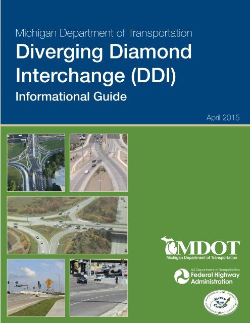
Diverging Diamond Interchange (DDI)
1Qs7atc
1Qs7atc

Create successful ePaper yourself
Turn your PDF publications into a flip-book with our unique Google optimized e-Paper software.
Michigan Department of Transportation<br />
<strong>Diverging</strong> <strong>Diamond</strong><br />
<strong>Interchange</strong> (<strong>DDI</strong>)<br />
Informational Guide<br />
April 2015
FOREWORD<br />
The Federal Highway Administration (FHWA) Every Day Counts (EDC) initiative is designed to identify<br />
and deploy innovation aimed at reducing project delivery time, enhancing safety and protecting the<br />
environment. In 2012, FHWA chose Intersection & <strong>Interchange</strong> Geometrics (IIG) to feature as one of<br />
the innovative technologies in EDC-2. Specifically, IIG consists of a family of alternative intersection<br />
designs that improve intersection safety while also reducing delay, and at lower cost and with fewer<br />
impacts than comparable traditional solutions.<br />
As part of the effort to mainstream these intersections, FHWA has produced a series of guides to<br />
help transportation professionals routinely consider and implement these designs. Concurrent with<br />
a <strong>Diverging</strong> <strong>Diamond</strong> <strong>Interchange</strong> (<strong>DDI</strong>) Informational Guide, FHWA developed and published guides<br />
for three other designs: Median U-turn (MUT), Displaced Left Turn (DLT), and Restricted Crossing<br />
U-turn (RCUT). These guides represent summaries of the current state of knowledge and practice,<br />
and are intended to inform project planning, scoping, design and implementation decisions.<br />
An electronic version of the FHWA <strong>DDI</strong> document is available on the Office of Safety website at<br />
http://safety.fhwa.dot.gov/. Additionally, limited quantities of hard copies are available from the<br />
Report Center; inquiries may be directed to report.center@dot.gov or 814-239-1160.<br />
In response to the growing interest in <strong>DDI</strong>s, the Michigan Department of Transportation has<br />
developed this <strong>DDI</strong> Informational Guide based on the August 2014 FHWA version. The Michigan<br />
guide will serve as the basis of future <strong>DDI</strong> design in the state of Michigan.<br />
Michigan Department of Transportation<br />
<strong>Diverging</strong> <strong>Diamond</strong> <strong>Interchange</strong> Informational Guide<br />
i
<strong>DDI</strong> INFORMATIONAL GUIDE TABLE OF CONTENTS<br />
CHAPTER 1 INTRODUCTION...................................................................................................1<br />
Overview of Alternative Intersections and <strong>Interchange</strong>s..................................................................1<br />
Intersection Control Evaluations and Considerations......................................................................1<br />
Organization of the Guidelines.........................................................................................................2<br />
Scope of the Guide..........................................................................................................................3<br />
<strong>DDI</strong> Overview...................................................................................................................................3<br />
Application.......................................................................................................................................4<br />
Geometric Design Considerations.................................................................................................10<br />
Resource Documents....................................................................................................................12<br />
CHAPTER 2 POLICY AND PLANNING.................................................................................14<br />
Planning Considerations for Alternative Intersections and <strong>Interchange</strong>s.......................................14<br />
Serving Pedestrians and Bicycles.................................................................................................14<br />
Traffic Volume Relationships..........................................................................................................15<br />
Stakeholder Outreach....................................................................................................................16<br />
Policy Considerations....................................................................................................................20<br />
Asset Management........................................................................................................................20<br />
Planning Considerations................................................................................................................21<br />
Planning Challenges......................................................................................................................22<br />
Project Performance Considerations.............................................................................................23<br />
Project Development Process.......................................................................................................24<br />
Summary of <strong>DDI</strong> Advantages and Disadvantages.........................................................................24<br />
CHAPTER 3 MULTIMODAL CONSIDERATIONS...............................................................26<br />
Design Principles and Approach...................................................................................................27<br />
Pedestrians....................................................................................................................................30<br />
Bicyclists........................................................................................................................................45<br />
Transit............................................................................................................................................49<br />
Heavy Vehicle Considerations.......................................................................................................51<br />
CHAPTER 4 SAFETY.................................................................................................................52<br />
Safety Principles............................................................................................................................52<br />
General Safety Concerns...............................................................................................................54<br />
Observed Safety Performance......................................................................................................57<br />
Incident Response Considerations................................................................................................63<br />
Safety Evaluation Considerations..................................................................................................63<br />
ii<br />
Michigan Department of Transportation<br />
<strong>Diverging</strong> <strong>Diamond</strong> <strong>Interchange</strong> Informational Guide
<strong>DDI</strong> INFORMATIONAL GUIDE TABLE OF CONTENTS<br />
CHAPTER 5 OPERATIONAL CHARACTERISTICS............................................................64<br />
Introduction....................................................................................................................................64<br />
Operational Considerations...........................................................................................................68<br />
Signal Timing and Coordination.....................................................................................................76<br />
Comparative Performance Studies................................................................................................83<br />
CHAPTER 6 OPERATIONAL ANALYSIS...............................................................................85<br />
Operational Analysis Tool Overview..............................................................................................86<br />
Planning-Level Analysis.................................................................................................................86<br />
Highway Capacity Manual (HCM) Analysis....................................................................................89<br />
Microsimulation Analysis...............................................................................................................94<br />
CHAPTER 7 GEOMETRIC DESIGN.......................................................................................99<br />
Design Approach...........................................................................................................................99<br />
Geometric Design Parameters.....................................................................................................100<br />
Geometric Design Principles.......................................................................................................106<br />
Alignment Alternatives................................................................................................................. 110<br />
Design Guidance......................................................................................................................... 117<br />
CHAPTER 8 SIGNAL, SIGNING, MARKING, AND LIGHTING......................................134<br />
Design Principles and Approach.................................................................................................134<br />
Signals.........................................................................................................................................135<br />
Signing.........................................................................................................................................144<br />
Pavement Markings..................................................................................................................... 151<br />
Lighting........................................................................................................................................158<br />
CHAPTER 9 CONSTRUCTION AND MAINTENANCE....................................................163<br />
Construction................................................................................................................................163<br />
Costs...........................................................................................................................................168<br />
Maintenance................................................................................................................................169<br />
Law Enforcement Needs.............................................................................................................169<br />
<strong>DDI</strong> INFORMATIONAL GUIDE REFERENCES.................................................................. 170<br />
Appendix A: Catalog of All Known Installations in the United States.......................................... 174<br />
Appendix B: Supplemental Operational and Safety Details........................................................177<br />
Appendix C: Marketing and Outreach Materials..........................................................................180<br />
Michigan Department of Transportation<br />
<strong>Diverging</strong> <strong>Diamond</strong> <strong>Interchange</strong> Informational Guide<br />
iii
<strong>DDI</strong> INFORMATIONAL GUIDE LISTS OF EXHIBITS<br />
Exhibit 1-1. Key characteristics of a <strong>DDI</strong>..........................................................................................4<br />
Exhibit 1-2. Locations of <strong>DDI</strong>s.........................................................................................................5<br />
Exhibit 1-3. First constructed <strong>DDI</strong> in Utah at Pioneer Crossing and I-15<br />
(American Fork, UT). (1) ...................................................................................................................6<br />
Exhibit 1-4. First constructed <strong>DDI</strong> in Georgia at Ashford Dunwoody Road<br />
near Perimeter Market. (2) ...............................................................................................................7<br />
Exhibit 1-5. First constructed <strong>DDI</strong> in Minnesota at Highway 15. (3) ...................................................7<br />
Exhibit 1-6. First constructed <strong>DDI</strong> in Idaho at I-86 and US-91/Yellowstone Highway<br />
(Pocatello-Chubbuck, ID). (4) ...........................................................................................................8<br />
Exhibit 1-7. Crossover location at the <strong>DDI</strong> located at SR 92 and I-15 (Utah County, UT). (5) .............8<br />
Exhibit 1-8. Overhead signing at the <strong>DDI</strong> located at SR 92 and I-15 (Utah County, UT). (5) ..............9<br />
Exhibit 1-9. Pedestrian crossing at the right-turn lane of the exit located at<br />
Pioneer Crossing and I-15 <strong>DDI</strong> (American Fork, UT). (6) ..................................................................9<br />
Exhibit 1-10. Sidewalk and recessed lighting located on the bridge at the<br />
Pioneer Crossing and I-15 <strong>DDI</strong> (American Fork, UT). (6) ................................................................10<br />
Exhibit 1-11. <strong>DDI</strong> (overpass) at 500 East American Fork (American Fork, UT). (1) ............................ 11<br />
Exhibit 1-12. <strong>DDI</strong> (underpass) at Dorsett Road and I-270 (St. Louis, MO). (7) ..................................12<br />
Exhibit 2-1. Relationship between volume and interchange type..................................................15<br />
Exhibit 2-2. Example video screen captures from UDOT<br />
of how to travel through a <strong>DDI</strong>. (1) .................................................................................................17<br />
Exhibit 2-3. Example video screen capture from Nevada DOT<br />
of how to travel through a <strong>DDI</strong>. (20) ................................................................................................17<br />
Exhibit 2-4. Fact sheet from Minnesota DOT<br />
on how various users travel through a <strong>DDI</strong>. (3) ..............................................................................18<br />
Exhibit 2-5. Public outreach brochure used by MoDOT. (7) .............................................................18<br />
Exhibit 2-6. Example public outreach brochure used by GDOT. (2) .................................................19<br />
Exhibit 2-7. Summary of <strong>DDI</strong> advantages and disadvantages.......................................................25<br />
Exhibit 3-1. Schematic of <strong>DDI</strong> right-of-way availability for multimodal facilities.............................27<br />
Exhibit 3-2. Center walkway at MO 13 (Springfield, MO). (14) ...........................................................28<br />
Exhibit 3-3. Outside walkway at Dorsett Road (Maryland Heights, MO). (14) ...................................29<br />
Exhibit 3-4. Shared-use path on outside at Harrodsburg Road (Lexington, KY). (14) .......................29<br />
Exhibit 3-5. Pedestrian facilities in center of <strong>DDI</strong> (Springfield, MO). (26) ...........................................31<br />
Exhibit 3-6. Pedestrian facilities on outside of <strong>DDI</strong> (Maryland Heights, MO). (26) ............................32<br />
Exhibit 3-7. Center walkway pedestrian safety and comfort..........................................................32<br />
Exhibit 3-8. Outside path/sidewalk pedestrian safety and comfort...............................................33<br />
Exhibit 3-9. Pedestrian-focused <strong>DDI</strong> – center walkway.................................................................34<br />
iv<br />
Michigan Department of Transportation<br />
<strong>Diverging</strong> <strong>Diamond</strong> <strong>Interchange</strong> Informational Guide
<strong>DDI</strong> INFORMATIONAL GUIDE LISTS OF EXHIBITS<br />
Exhibit 3-10. Pedestrian-focused <strong>DDI</strong> – outside walkway..............................................................35<br />
Exhibit 3-11. Pedestrian-vehicle conflict points at <strong>DDI</strong> with center walkway.................................36<br />
Exhibit 3-12. Pedestrian-vehicle conflict points at <strong>DDI</strong> with outside walkways.............................37<br />
Exhibit 3-13. Pedestrian-vehicle conflict points at conventional diamond.....................................38<br />
Exhibit 3-14. Pedestrian-vehicle conflict points at conventional diamond<br />
with pedestrian crossing of arterial.............................................................................................38<br />
Exhibit 3-15. Pedestrian-vehicle conflict point comparison...........................................................39<br />
Exhibit 3-16. Example of pedestrian crossing at free-flow left onto freeway. (6) ..............................39<br />
Exhibit 3-17. Pedestrian markings to indicate directionality<br />
of traffic (Maryland Heights, MO). (14) ............................................................................................40<br />
Exhibit 3-18. Channelization toward center crosswalk. (26) ..............................................................42<br />
Exhibit 3-19. Channelization toward outside crosswalk. (26) ............................................................42<br />
Exhibit 3-20. Example of pedestrian wayfinding provision at <strong>DDI</strong> via curbing. (26 )..........................43<br />
Exhibit 3-21. Example of pedestrian wayfinding provision at <strong>DDI</strong> using an urban fence. (26) ..........44<br />
Exhibit 3-22. Bicycle lane maintained through <strong>DDI</strong> between crossovers. (20) ..................................45<br />
Exhibit 3-23. Bicycle provisions on shared-use path. (14) ................................................................46<br />
Exhibit 3-24. Bicyclist in travel lane at <strong>DDI</strong> crossover. (14) ................................................................46<br />
Exhibit 3-25. Visualization of bicycle lane, approach of first crossover into <strong>DDI</strong>. (20) .......................47<br />
Exhibit 3-26. Visualization of bicycle lane, approach of second crossover out of <strong>DDI</strong>. (20) ..............48<br />
Exhibit 3-27. Schematic for bicycle lane placement on right side of vehicular traffic....................48<br />
Exhibit 3-28. Aerial view of <strong>DDI</strong> with center-running light rail<br />
at I-494 and 34th Avenue in Bloomington, MN. (29) .......................................................................50<br />
Exhibit 4-1. Conflict point diagram for <strong>DDI</strong>....................................................................................52<br />
Exhibit 4-2. Conflict point diagram for conventional diamond.......................................................53<br />
Exhibit 4-3. Conflict point comparison..........................................................................................53<br />
Exhibit 4-4. Oncoming traffic for the right turn at the exit ramp....................................................55<br />
Exhibit 4-5. Oncoming traffic for the left turn at the exit ramp......................................................55<br />
Exhibit 4-6. Conflict zones at ramp terminal intersection..............................................................59<br />
Exhibit 4-7. Wrong-way maneuvers at five <strong>DDI</strong> sites along with<br />
crossover angle and crossroad AADT.........................................................................................61<br />
Exhibit 4-8. Southbound outer-most lane closed and marked with pavement markings. (26) .........62<br />
Exhibit 4-9. Pavement marking used to channel vehicles through crossovers. (26) .........................62<br />
Exhibit 5-1. Key operational characteristics of a <strong>DDI</strong>.....................................................................64<br />
Exhibit 5-2. Naming convention of movements at a <strong>DDI</strong> (east-west cross street).........................65<br />
Exhibit 5-3. Operational consideration zones for <strong>DDI</strong>s..................................................................66<br />
Michigan Department of Transportation<br />
<strong>Diverging</strong> <strong>Diamond</strong> <strong>Interchange</strong> Informational Guide<br />
v
<strong>DDI</strong> INFORMATIONAL GUIDE LISTS OF EXHIBITS<br />
Exhibit 5-4. Operational considerations at <strong>DDI</strong>s............................................................................67<br />
Exhibit 5-5. Queue spillback into <strong>DDI</strong> from downstream adjacent signal. (14) ..................................68<br />
Exhibit 5-6. Different lane configurations at three-lane <strong>DDI</strong>s........................................................69<br />
Exhibit 5-7. Left-lane utilization prediction for two-lane <strong>DDI</strong> crossovers. (14) ...................................70<br />
Exhibit 5-8. Field-measured speed parameters for <strong>DDI</strong> sites. (14) ...................................................71<br />
Exhibit 5-9. Queue spillback caused by heavy traffic volumes and a no-RTOR condition. (14) .......72<br />
Exhibit 5-10. Ramp meter with added lane for queue storage at a <strong>DDI</strong>. (6) .....................................73<br />
Exhibit 5-11. Weaving maneuver and conflict points for <strong>DDI</strong> right turn from freeway....................73<br />
Exhibit 5-12. Lane separation for heavy and emergency vehicle accommodation. (26) ...................74<br />
Exhibit 5-13. Phasing schematic with exit ramp queue clearance phase......................................76<br />
Exhibit 5-14. Simplified <strong>DDI</strong> timing sequence................................................................................77<br />
Exhibit 5-15. Example use of overlap phases in <strong>DDI</strong> timing sequence..........................................78<br />
Exhibit 5-16. <strong>DDI</strong> timing favoring cross street versus turns...........................................................79<br />
Exhibit 5-17. Time-space diagram for corridor of conventional intersections................................80<br />
Exhibit 5-18. Time-space diagram for corridor with <strong>DDI</strong>................................................................81<br />
Exhibit 5-19. Example of percent demand starvation....................................................................82<br />
Exhibit 5-20. Before-after interchange delay comparison at two <strong>DDI</strong>s. (14) .....................................84<br />
Exhibit 6-1. Cap-X planning-level tool screen capture. (39) ..............................................................87<br />
Exhibit 6-2. LOS criteria for <strong>DDI</strong>s (based on HCM Exhibit 22-11). (9) ...............................................89<br />
Exhibit 6-3. HCM methodology for <strong>DDI</strong> evaluation (adapted from HCM Exhibit 22-14). (9) ..............91<br />
Exhibit 6-4. Input data for HCM <strong>DDI</strong> evaluation (based on HCM Exhibit 22-15). (9) .........................92<br />
Exhibit 6-5. Concept of look-back distance in simulation.............................................................96<br />
Exhibit 6-6. Simulation speed settings..........................................................................................97<br />
Exhibit 7-1 <strong>DDI</strong> characteristics.......................................................................................................99<br />
Exhibit 7-2. Examples of various cross-sections utilized at overpasses<br />
in the United Sates (26) ................................................................................................................101<br />
Exhibit 7-3. Examples of various cross-sections utilized at underpasses<br />
in the United States. (26) ..............................................................................................................103<br />
Exhibit 7-4. Conventional diamond interchange overlaid with a <strong>DDI</strong> design. (13) ...........................104<br />
Exhibit 7-5. An oversized load making a left turn onto I-44 at MO 13 (Springfield, MO). (16) .........107<br />
Exhibit 7-6. Vehicle paths through crossover...............................................................................109<br />
Exhibit 7-7. Alignment alternatives that minimize cross-sections over or under a bridge. (14) ........ 111<br />
Exhibit 7-8. Alignment alternatives to minimize the distance between<br />
crossovers and amount of reverse curvature. (14) ........................................................................ 113<br />
vi<br />
Michigan Department of Transportation<br />
<strong>Diverging</strong> <strong>Diamond</strong> <strong>Interchange</strong> Informational Guide
<strong>DDI</strong> INFORMATIONAL GUIDE LISTS OF EXHIBITS<br />
Exhibit 7-9. Example of horizontal alignment and cross-sections<br />
for under and overpass designs that minimize the distance between crossovers. (14) ............... 114<br />
Exhibit 7-10. Symmetrical alignment with no reverse curves between<br />
crossovers (Dorsett Road., Maryland Heights, MO). (26) ............................................................. 115<br />
Exhibit 7-11. Cross-sectional distances for a symmetrical alignment<br />
with no reverse curves between crossovers (Dorsett Road., Maryland Heights, MO). (26) ......... 116<br />
Exhibit 7-12. Shifted alignment south of centerline (red) with no<br />
reverse curves between crossovers (Pioneer Crossing, American Fork, UT). (26) ....................... 116<br />
Exhibit 7-13. Cross-sectional distances for a shifted alignment with no<br />
reverse curves between crossovers (Pioneer Crossing, American Fork, UT). (26) ....................... 117<br />
Exhibit 7-14. Speed-radius relationship. (42) ................................................................................... 118<br />
Exhibit 7-15. Barriers and traffic islands to discourage wrong-way movements. (26) .....................120<br />
Exhibit 7-16. Tangent length approaching and departing the crossover......................................121<br />
Exhibit 7-17. Auxiliary left-turn lane between crossovers.............................................................123<br />
Exhibit 7-18. Auxiliary left-turn lane developed prior to the first crossover.................................. 124<br />
Exhibit 7-19. Auxiliary lane, shared left and through, developed prior to the first crossover....... 124<br />
Exhibit 7-20. Auxiliary through-lane developed prior to the first crossover..................................125<br />
Exhibit 7-21. Entry ramp right-turn yield control - no acceleration lane.......................................126<br />
Exhibit 7-22. Entry ramp free right and left-turns with acceleration lanes...................................127<br />
Exhibit 7-23. Entry ramp left-turn yield control - no acceleration lane.........................................128<br />
Exhibit 7-24. Exit ramp left turn with yield control.......................................................................129<br />
Exhibit 7-25. Exit ramp left turn with signal control.....................................................................129<br />
Exhibit 7-26. Alignment of exit ramp right and left turn movements............................................ 131<br />
Exhibit 7-27. Median barriers blocking ISD for exit ramp right turns............................................132<br />
Exhibit 8-1. <strong>DDI</strong> standard phasing scheme..................................................................................135<br />
Exhibit 8-2. Considerations for one versus two controllers at a <strong>DDI</strong>...........................................137<br />
Exhibit 8-3. Example of a single controller with four rings servicing<br />
protected pedestrian and vehicle movements on all approaches............................................137<br />
Exhibit 8-4. Example of two controllers with two rings servicing<br />
protected pedestrian and vehicle movements on all approaches............................................138<br />
Exhibit 8-5. Restricted signal head visibility from opposing movement mast arm. (26) ..................139<br />
Exhibit 8-6. Supplemental signal on right for an inbound movement at a <strong>DDI</strong>. (26) .......................139<br />
Exhibit 8-7. Supplemental signal on left for an outbound movement at a <strong>DDI</strong>. (26) ........................140<br />
Exhibit 8-8. Supplemental signal for a <strong>DDI</strong> exit ramp from freeway. (26) ........................................140<br />
Exhibit 8-9. Type 2 crossover signals with a type 1 supplemental signal on left. (26) .................... 141<br />
Michigan Department of Transportation<br />
<strong>Diverging</strong> <strong>Diamond</strong> <strong>Interchange</strong> Informational Guide<br />
vii
<strong>DDI</strong> INFORMATIONAL GUIDE LISTS OF EXHIBITS<br />
Exhibit 8-10. Undesirable use of single pole with two pedestrian push-buttons<br />
and insufficient separation of the two detectable warning surfaces. (26) .................................... 141<br />
Exhibit 8-11. <strong>DDI</strong> splitter island with pedestrian signals on same side........................................142<br />
Exhibit 8-12. <strong>DDI</strong> splitter island with diagonal pedestrian signals................................................142<br />
Exhibit 8-13. Pedestrian signal and push-button on outside<br />
of crossover (pedestrian facilities in center). (14) ..........................................................................143<br />
Exhibit 8-14. Pedestrian signal for left turn onto freeway<br />
(pedestrian facilities on outside). (14) ............................................................................................143<br />
Exhibit 8-15. Estimated locations for required overhead guide sign structures. (26) ......................145<br />
Exhibit 8-16. Required signs on <strong>DDI</strong> approach (single direction only). (26) .....................................146<br />
Exhibit 8-17. Required signs at <strong>DDI</strong> crossover. (26) ......................................................................... 147<br />
Exhibit 8-18. Required signs at <strong>DDI</strong> freeway exit ramp (single direction only). (26) .........................149<br />
Exhibit 8-19. Required signs at <strong>DDI</strong> freeway entrance ramp (single direction only). (26) .................150<br />
Exhibit 8-20. Example centerline and edge line pavement markings at a <strong>DDI</strong>. (26) ........................152<br />
Exhibit 8-21. Lane line markings at crossover and ramp terminal approaches. (26) .......................153<br />
Exhibit 8-22. Use of short skip lines to delineate an exclusive<br />
left-turn lane onto a limited access facility. (26) ............................................................................154<br />
Exhibit 8-23. Channelizing lines and vane islands at the exit ramp. (26) .........................................154<br />
Exhibit 8-24. Lane use arrows at the crossover intersection. (26) ...................................................155<br />
Exhibit 8-25. Stop bar locations at the intersection crossover and exit ramp terminal. (26) ...........155<br />
Exhibit 8-26. Transverse (A) and special emphasis (B) crosswalk markings at a <strong>DDI</strong>. (26) .............156<br />
Exhibit 8-27. Engraved pedestrian pavement marking – “Look Left.” (26) ......................................157<br />
Exhibit 8-28. Continuous interchange lighting in an urban setting. (26) ..........................................160<br />
Exhibit 8-29. Partial interchange lighting in a suburban setting.<br />
Lighting on the ramps is provided as a transition. (26) .................................................................160<br />
Exhibit 8-30. Partial interchange lighting in a suburban setting. (26) ..............................................161<br />
Exhibit 8-31. Recessed lighting in <strong>DDI</strong> center walkway. (14) ...........................................................162<br />
Exhibit 9-1. Example of construction staging using an existing structure. (47) ...............................165<br />
Exhibit 9-2. Self-propelled modular transporter (SPMT) brings<br />
superstructure to <strong>DDI</strong> location. (48) ..............................................................................................166<br />
Exhibit 9-3. Construction staging using pre-cast construction methods. (48) ................................167<br />
Exhibit 9-4. Construction cost estimates. (14) ................................................................................168<br />
viii<br />
Michigan Department of Transportation<br />
<strong>Diverging</strong> <strong>Diamond</strong> <strong>Interchange</strong> Informational Guide
CHAPTER 1 INTRODUCTION<br />
Overview of Alternative Intersections and <strong>Interchange</strong>s<br />
Alternative intersections and interchanges offer the potential to improve safety and reduce delay at a<br />
lower cost and with fewer impacts than traditional solutions. However, transportation professionals<br />
are generally unfamiliar with many alternative intersection and interchange forms, partially because<br />
some forms have only a few installations in operation or because installations are concentrated in a<br />
few states. Furthermore, at the national level, well-documented and substantive resources needed<br />
for planning, analysis, design, and public outreach and education, were limited.<br />
Concurrent with a <strong>Diverging</strong> <strong>Diamond</strong> <strong>Interchange</strong> (<strong>DDI</strong>) Informational Guide, the Federal Highway<br />
Administration (FHWA) developed and published informational guides for three other alternative intersection<br />
forms: Median U-Turn (MUT), Restricted Crossing U-Turn (RCUT), and Displaced Left Turn<br />
(DLT). These guides are intended to increase awareness of these specific alternative intersections<br />
and interchanges and provide guidance on how to plan, design, construct, and operate them. These<br />
guides supply transportation professionals with summaries of the current state of knowledge, which<br />
can be used to support decisions when considering and potentially selecting alternative intersection<br />
and interchange forms for appropriate applications.<br />
Intersection Control Evaluations snd Considerations<br />
The term “intersection” means the junction of two or more street facilities. In some cases, this may<br />
specifically mean an “at-grade” intersection form. In others, it may include the junction of two or<br />
more streets requiring partial or complete grade separation (“interchanges”). A number of state and<br />
city transportation agencies have or are implementing intersection control evaluation processes or<br />
policies as a means of integrating the widest range of intersection forms as project solutions. For<br />
example, California, Indiana, Minnesota, and Wisconsin have policies or processes to objectively<br />
consider and select the most appropriate intersection form for a given project context.<br />
RETURN TO TABLE OF CONTENTS <br />
Many of the policies or processes include common objectives in selecting the optimal or preferred<br />
intersection control alternative for a given project context. The common elements generally include<br />
but are not limited to the following:<br />
• Understanding the intended context, and how operations, safety, and geometry fit that<br />
context for each intersection or corridor including intended users (pedestrians, bicyclists,<br />
passenger cars, transit vehicles, freight, emergency responders, and oversize/overweight<br />
[OSOW] vehicles)<br />
• Identifying and documenting the overall corridor or intersection context including the built,<br />
natural, and community environment and the intended performance outcomes of the<br />
intersection form<br />
Michigan Department of Transportation<br />
<strong>Diverging</strong> <strong>Diamond</strong> <strong>Interchange</strong> Informational Guide 1
CHAPTER 1 INTRODUCTION<br />
• Considering and assessing a wide range of traffic control strategies and other practical improvement<br />
concepts to identify worthy project-level technical evaluation<br />
• Comparing engineering and economic analysis results of practical alternatives that consider<br />
implementation costs, performance benefits and impacts (safety, multimodal, operations, environment,<br />
etc.), and the estimated service life of alternatives<br />
Organization of the Guidelines<br />
This guide has been structured to address the needs of a variety of readers, including the general<br />
public, policymakers, transportation planners, operations and safety analysts, and conceptual and<br />
detailed designers. This chapter distinguishes <strong>DDI</strong>s from conventional interchanges and provides an<br />
overview of each chapter in this guide. The remaining chapters in this guide increase in the level of<br />
detail provided.<br />
RETURN TO TABLE OF CONTENTS <br />
Chapter 2: Policy and Planning—This chapter provides guidance on when to consider alternative<br />
interchanges in general and <strong>DDI</strong>s in particular. The transportation professional should consider policies,<br />
project challenges, and performance measures, as well as the project development process<br />
throughout the duration of the project to balance trade-offs.<br />
Chapter 3: Multimodal Considerations—This chapter provides an overview of multimodal facilities at<br />
<strong>DDI</strong>s and how various types of users can be safely integrated into the design. Guidance for pedestrian<br />
and bicycle facilities is also discussed in this chapter.<br />
Chapter 4: Safety—This chapter summarizes the safety performance at <strong>DDI</strong>s based on studies completed<br />
by state agencies and recent research efforts. Although the documented safety performance<br />
of <strong>DDI</strong>s is limited, information about conflict points, wrong-way maneuvers, and emergency services<br />
at <strong>DDI</strong>s are discussed in this chapter.<br />
Chapter 5: Operational Characteristics—This chapter provides information on the unique operational<br />
characteristics of <strong>DDI</strong>s and how they affect elements such as traffic signal phasing and coordination.<br />
The chapter also provides guidance for practitioners related to design elements such as driveways<br />
that may affect the operational performance of <strong>DDI</strong>s. It is intended to prepare readers for conducting<br />
operational analysis as described in Chapter 6.<br />
Chapter 6: Operational Analysis—This chapter presents an overview of the approach and tools<br />
available for conducting a traffic operations analysis of a <strong>DDI</strong>.<br />
Chapter 7: Geometric Design—This chapter describes the typical <strong>DDI</strong> design approach and provides<br />
guidance for geometric features. It requires input from the chapters on multimodal considerations<br />
(Chapter 3), safety assessment (Chapter 4), and traffic operational analysis (Chapters 5 and 6).<br />
Chapter 8: Signal, Signing, Marking, and Lighting—This chapter presents information relating to the<br />
design and placement of traffic control devices at <strong>DDI</strong>s, including traffic signals, signs, pavement<br />
markings, and intersection lighting.<br />
Chapter 9: Construction and Maintenance—This chapter focuses on the constructability and maintenance<br />
of a <strong>DDI</strong>.<br />
2<br />
Michigan Department of Transportation<br />
<strong>Diverging</strong> <strong>Diamond</strong> <strong>Interchange</strong> Informational Guide
CHAPTER 1 INTRODUCTION<br />
An Appendix is included at the end of this guide for the purpose of providing more detailed information<br />
about many of the resources and best practices presented in the guide. The Appendix contains<br />
the following information:<br />
• A - Catalog of All Known Installations in the United States as of August 2014<br />
• B - Supplemental Operational and Safety Details<br />
• C - Marketing and Outreach Materials<br />
• D - Supplemental Construction and Design Details<br />
Scope of the Guide<br />
This document provides information and guidance on planning and designing a <strong>DDI</strong> for a variety of<br />
typical conditions commonly found in Michigan. To the extent possible, the guide provides information<br />
on the wide array of potential users as it relates to the interchange form. The scope of this guide<br />
is to provide general information, planning techniques, evaluation procedures for assessing safety<br />
and operational performance, design guidelines, and principles to be considered for selecting and<br />
designing a <strong>DDI</strong>. This guide does not include specific legal or policy requirements; however, Chapter<br />
2 provides information on planning topics and considerations when investigating intersection control<br />
forms. This first edition of the <strong>Diverging</strong> <strong>Diamond</strong> <strong>Interchange</strong> Informational Guide has been developed<br />
from best practices and prior research. As more <strong>DDI</strong>s are built, the opportunity to conduct research<br />
that refines and develops better methods will result in improved future editions of this guide.<br />
<strong>DDI</strong> Overview<br />
The diverging diamond interchange (<strong>DDI</strong>) is also known as a double crossover diamond (DCD) and is<br />
an alternative to the conventional diamond interchange or other alternative interchange forms. The<br />
primary difference between a <strong>DDI</strong> and a conventional diamond interchange is the design of directional<br />
crossovers on either side of the interchange. This eliminates the need for left-turning vehicles<br />
to cross the paths of approaching through vehicles. By shifting cross-street traffic to the left side of<br />
the street between the signalized crossover intersections, vehicles on the crossroad making a left<br />
turn on to or off of ramps do not conflict with vehicles approaching from other directions.<br />
RETURN TO TABLE OF CONTENTS <br />
The <strong>DDI</strong> design has shown to improve the operations of turning movements to and from the freeway<br />
facility and significantly reduces the number of vehicle-to-vehicle conflict points compared to a conventional<br />
diamond interchange. The <strong>DDI</strong> also reduces the severity of conflicts, as conflicts between<br />
left-turning movements and the opposing through movement are eliminated. The remaining conflicts<br />
are reduced to merge conflicts for turning movements, and the reduced-speed crossover conflict of<br />
the two through movements. Chapter 4 provides additional discussion of these conflict points and<br />
<strong>DDI</strong> safety benefits.<br />
Michigan Department of Transportation<br />
<strong>Diverging</strong> <strong>Diamond</strong> <strong>Interchange</strong> Informational Guide 3
CHAPTER 1 INTRODUCTION<br />
`Exhibit 1.1 illustrates an example of a <strong>DDI</strong> and highlights the key features of this interchange design.<br />
RETURN TO TABLE OF CONTENTS <br />
Exhibit 1-1. Key characteristics of a <strong>DDI</strong>.<br />
The street segment between the crossovers can be designed as an underpass or overpass,<br />
depending on the site characteristics. The interchange design will be directly affected by whether<br />
or not the arterial passes over or under the limited access facility. In most cases, <strong>DDI</strong>s designed<br />
with a crossroad as an overpass offer the most design flexibility in serving pedestrians. The majority<br />
of <strong>DDI</strong>s evaluated have reconstructed existing diamond interchanges, and the decision to go over<br />
or under the limited access facility had already been determined.<br />
Application<br />
<strong>DDI</strong>s have been implemented in many different locations with a variety of design features. This<br />
section includes photos of several of these locations and some of the different environments and<br />
design features of the constructed <strong>DDI</strong>. Exhibit 1-2 shows the location of existing and planned <strong>DDI</strong>s<br />
in the United States, as of August 2014. The Appendix documents installations of <strong>DDI</strong>s in locations<br />
in the United States.<br />
4<br />
Michigan Department of Transportation<br />
<strong>Diverging</strong> <strong>Diamond</strong> <strong>Interchange</strong> Informational Guide
CHAPTER 1 INTRODUCTION<br />
Exhibit 1-2. Locations of <strong>DDI</strong>s.<br />
Exhibits 1-3 to 1-6 show several of the <strong>DDI</strong>s recently constructed in the United States<br />
Exhibits 1-7 to 1-10 show some of the unique features of a <strong>DDI</strong>, such as the crossover location,<br />
overhead signing, pedestrian crossing location and markings, sidewalk location, and recessed<br />
lighting on the bridge<br />
for pedestrians.<br />
RETURN TO TABLE OF CONTENTS <br />
Michigan Department of Transportation<br />
<strong>Diverging</strong> <strong>Diamond</strong> <strong>Interchange</strong> Informational Guide 5
CHAPTER 1 INTRODUCTION<br />
RETURN TO TABLE OF CONTENTS <br />
Exhibit 1-3. First constructed <strong>DDI</strong> in Utah at Pioneer Crossing and I-15 (American Fork, UT). (1)<br />
6<br />
Michigan Department of Transportation<br />
<strong>Diverging</strong> <strong>Diamond</strong> <strong>Interchange</strong> Informational Guide
CHAPTER 1 INTRODUCTION<br />
Exhibit 1-4. First constructed <strong>DDI</strong> in Georgia at Ashford Dunwoody Road near Perimeter Market. (2)<br />
RETURN TO TABLE OF CONTENTS <br />
Exhibit 1-5. First constructed <strong>DDI</strong> in Minnesota at Highway 15. (3)<br />
Michigan Department of Transportation<br />
<strong>Diverging</strong> <strong>Diamond</strong> <strong>Interchange</strong> Informational Guide 7
CHAPTER 1 INTRODUCTION<br />
RETURN TO TABLE OF CONTENTS <br />
Exhibit 1-6. First constructed <strong>DDI</strong> in Idaho at I-86 and US-91/Yellowstone Highway (Pocatello-Chubbuck). (4)<br />
Exhibit 1-7. Crossover location at the <strong>DDI</strong> located at SR 92 and I-15 (Utah County, UT). (5)<br />
8<br />
Michigan Department of Transportation<br />
<strong>Diverging</strong> <strong>Diamond</strong> <strong>Interchange</strong> Informational Guide
CHAPTER 1 INTRODUCTION<br />
Exhibit 1-8. Overhead signing at the <strong>DDI</strong> located at SR 92 and I-15 (Utah County, UT). (5)<br />
RETURN TO TABLE OF CONTENTS <br />
Exhibit 1-9. Pedestrian crossing at the right-turn lane of the exit located at<br />
Pioneer Crossing and I-15 <strong>DDI</strong> (American Fork, UT). (6)<br />
Michigan Department of Transportation<br />
<strong>Diverging</strong> <strong>Diamond</strong> <strong>Interchange</strong> Informational Guide 9
CHAPTER 1 INTRODUCTION<br />
RETURN TO TABLE OF CONTENTS <br />
Exhibit 1-10. Sidewalk and recessed lighting located on the bridge at the<br />
Pioneer Crossing and I-15 <strong>DDI</strong> (American Fork, UT). (6)<br />
Geometric Design Considerations<br />
The fundamental design features of the <strong>DDI</strong> are the directional crossovers on either side of the<br />
interchange, which ultimately improve the operations of turning movements to and from the freeway<br />
facility. The geometric design necessary to allow for these crossover movements results in the use of<br />
reverse curvatures in advance of the interchange as vehicular traffic is directed to the right before it<br />
can cross to the left.<br />
Several overarching principles guide users in conceptualizing and designing <strong>DDI</strong>s. The following<br />
principles may support <strong>DDI</strong> concept development, considering the context of the interchange and<br />
nearby adjacent intersections:<br />
• Accommodate design vehicles at the crossover ramp terminal junctions.<br />
• Promote reduced and consistent design speeds through the interchange.<br />
• Channelize inbound and outbound movements in the crossover design at each intersection<br />
to guide drivers to use the intended lanes and discourage wrong-way movements.<br />
• Create a vehicle path alignment directing vehicles into appropriate receiving lanes.<br />
10<br />
Michigan Department of Transportation<br />
<strong>Diverging</strong> <strong>Diamond</strong> <strong>Interchange</strong> Informational Guide
CHAPTER 1 INTRODUCTION<br />
<strong>DDI</strong> concept design involves balancing and optimizing trade-offs associated with user performance,<br />
capacity, costs, maintenance, and construction staging, among other items. For instance, considering<br />
heavy vehicle design at the crossover may lead designers to contemplate larger design radii<br />
or wider lanes; however, this could promote higher speeds through the crossover for other vehicle<br />
types. Instead, to provide adequate facilities for the design vehicle while maintaining safe speeds for<br />
other motorists, designers may want to consider designs that offset one or more of the approaches<br />
to the <strong>DDI</strong>. This method may increase street alignment radii, resulting in comparatively narrower<br />
lanes to serve design vehicle over tracking. These and other tradeoffs of <strong>DDI</strong> geometric design are<br />
discussed in detail in Chapter 7.<br />
Exhibits 1-11 and 1-12 illustrate typical designs for an overpass and underpass at a <strong>DDI</strong>.<br />
RETURN TO TABLE OF CONTENTS <br />
Exhibit 1-11. <strong>DDI</strong> (overpass) at 500 East American Fork (American Fork, UT). (1)<br />
Michigan Department of Transportation<br />
<strong>Diverging</strong> <strong>Diamond</strong> <strong>Interchange</strong> Informational Guide 11
CHAPTER 1 INTRODUCTION<br />
RETURN TO TABLE OF CONTENTS <br />
Resource Documents<br />
Exhibit 1-12. <strong>DDI</strong> (underpass) at Dorsett Road and I-270 (St. Louis, MO). (7)<br />
This <strong>DDI</strong> guide is supplemental to major resource documents including but not limited to:<br />
• A Policy on Geometric Design of Highways and Streets (American Association of<br />
State Highway and Transportation Officials [AASHTO] Green Book). (8)<br />
• Highway Capacity Manual (HCM). (9)<br />
• Michigan Manual on Uniform Traffic Control Devices (MMUTCD). (10)<br />
• Highway Safety Manual (HSM). (11)<br />
• Other research documents that appear in this guide and are more specialized to specific<br />
areas of the guide include various National Cooperative Highway Research Program<br />
(NCHRP) reports, Transportation Research Board (TRB) papers, and FHWA publications.<br />
12<br />
Michigan Department of Transportation<br />
<strong>Diverging</strong> <strong>Diamond</strong> <strong>Interchange</strong> Informational Guide
CHAPTER 1 INTRODUCTION<br />
The following supplemental resource documents related to the <strong>DDI</strong> are available:<br />
• FHWA Tech Brief on Double Crossover <strong>Diamond</strong>s (FHWA-HRT-09-054). (12)<br />
• FHWA Alternative Intersection/<strong>Interchange</strong>s: Informational Report (AIIR)<br />
(FHWA-HRT-09-060). (13)<br />
• FHWA Project DTFH61-10-C-00029: Operational and Safety Evaluation of Double Crossover<br />
<strong>Diamond</strong>s. Year 1 and Year 2 Project reports. (14)<br />
• FHWA Saxton Transportation Lab Project 13-002: HCM Chapters/Guidance for Alternative<br />
Intersections/<strong>Interchange</strong>s. New HCM methodologies for <strong>DDI</strong>. (15)<br />
• MODOT Report: Missouri’s Experience with the <strong>Diverging</strong> <strong>Diamond</strong> <strong>Interchange</strong>. (16)<br />
• MODOT <strong>Diverging</strong> <strong>Diamond</strong> <strong>Interchange</strong> Performance Evaluation (I-44 & Route 13). (17)<br />
• Kentucky Transportation Cabinet <strong>DDI</strong> Evaluation Study(18)<br />
• FHWA Driver Evaluation of the <strong>Diverging</strong> <strong>Diamond</strong> <strong>Interchange</strong> (FHWA-HRT-07-048). (19)<br />
RETURN TO TABLE OF CONTENTS <br />
Michigan Department of Transportation<br />
<strong>Diverging</strong> <strong>Diamond</strong> <strong>Interchange</strong> Informational Guide 13
CHAPTER 2 POLICY AND PLANNING<br />
This chapter contains guidance on how to consider alternative intersections and interchanges in<br />
general and a <strong>DDI</strong> in particular. This chapter also summarizes policy and planning considerations<br />
related to a <strong>DDI</strong>. The remaining chapters of this guide will provide specific details of the multimodal,<br />
safety, operations, geometric design, and traffic control features of a <strong>DDI</strong>.<br />
Alternative intersections are often initially considered for operational or safety needs, and other key<br />
factors may include spatial requirements and multimodal needs. This chapter provides approximate<br />
footprints for different types of <strong>DDI</strong>s to allow for planning-level screening and feasibility analysis.<br />
RETURN TO TABLE OF CONTENTS <br />
Planning Considerations for Alternative Intersections and <strong>Interchange</strong>s<br />
Alternative intersection evaluations may vary depending on the stage of the project development<br />
process. Each project stage can affect how each of the policy and technical considerations is assessed.<br />
While the operational, design, safety, human factors, and signing controls should be considered<br />
at every stage of the development process, a planning-level design evaluation may not require<br />
the same level of analysis or detailed evaluation as projects in later development stages. Evaluations<br />
should be as comprehensive as needed to answer key project questions for each unique project<br />
context.<br />
Serving Pedestrians and Bicycles<br />
A <strong>DDI</strong> offers an excellent opportunity to integrate multimodal facilities into an interchange.<br />
Almost all of the <strong>DDI</strong>s constructed to date included some combination of pedestrians, bicyclists,<br />
or transit facilities.<br />
The reduced number of signal phases can make it easier to serve nonmotorized movements<br />
compared to a multi-phase signal. The two-phase <strong>DDI</strong> signal in most cases provides sufficient time<br />
per phase to serve pedestrians. Any pedestrian clearance phases are further minimized, as crossing<br />
distances are shortened to only cross one direction of traffic at a time. Through the separation and<br />
channelization of the two directions of vehicular traffic, pedestrians only have to interact with one<br />
direction of traffic at a time. This simplifies the pedestrian gap acceptance process and reduces<br />
the risk for pedestrian-vehicle conflicts, provided pedestrians understand which direction traffic is<br />
coming from.<br />
The reduced crossing distances can also benefit bicyclists by reducing exposure time within the<br />
intersection (crossover) and minimizing the chance for vehicular conflicts. Some <strong>DDI</strong>s to date have<br />
been constructed with bicycle lanes through the crossovers, providing dedicated right of way for<br />
those road users. Several others have been constructed with bicycle facilities in the form of shareduse<br />
paths on the outside of the interchange.<br />
While there are many opportunities for multimodal accommodations at a <strong>DDI</strong>, these design elements<br />
are not without challenges. Chapter 3 of this guide discusses challenges and considerations, and provides<br />
recommendations for how to achieve safe and efficient provisions for multimodal users of a <strong>DDI</strong>.<br />
14<br />
Michigan Department of Transportation<br />
<strong>Diverging</strong> <strong>Diamond</strong> <strong>Interchange</strong> Informational Guide
CHAPTER 2 POLICY AND PLANNING<br />
Traffic Volume Relationships<br />
Exhibit 2-1 conceptually depicts the relationship of conventional intersections, alternative<br />
intersections, and grade separations in their ability to serve increasing traffic volumes.<br />
RETURN TO TABLE OF CONTENTS <br />
Exhibit 2-1. Relationship between volume and interchange type.<br />
Michigan Department of Transportation<br />
<strong>Diverging</strong> <strong>Diamond</strong> <strong>Interchange</strong> Informational Guide 15
CHAPTER 2 POLICY AND PLANNING<br />
The <strong>DDI</strong> is an alternative to the conventional diamond interchange, as well as other interchange<br />
forms like a single-point interchange or a partial cloverleaf. The primary difference between a <strong>DDI</strong><br />
and a conventional diamond interchange is the design of directional crossovers on either side of<br />
the interchange. This eliminates the need for left-turning vehicles to cross the paths of approaching<br />
through-vehicles. Cross-street traffic is shifted to the left side of the street between the signalized<br />
ramp intersections. Drivers on the cross street who are making a left turn onto the ramps are allowed<br />
to continue to the ramps without conflicting with opposing through-traffic and without stopping.<br />
The <strong>DDI</strong> design has shown to improve the operations of turning movements to and from the freeway<br />
facility, as well as significantly reduce the number of vehicle-to-vehicle conflict points compared to<br />
a conventional diamond interchange.<br />
RETURN TO TABLE OF CONTENTS <br />
Stakeholder Outreach<br />
Similar to other transportation projects, stakeholder outreach is a critical part of the overall planning<br />
process. Successfully implementing the first <strong>DDI</strong> in a community may benefit from explicit and<br />
proactive outreach and education to affected stakeholders and the general public. This would create<br />
opportunities to familiarize others with how the intersections work while creating opportunities<br />
to hear of general project and <strong>DDI</strong>-specific issues and considerations. Special considerations may<br />
include minimizing the likelihood of a wrong-way maneuver into opposing traffic. The greater the<br />
crossing angle, the more the intersection will appear to intersect in a familiar manner. Public information<br />
and educational campaigns prior to opening a <strong>DDI</strong> intersection can help promote an understanding<br />
of unique features. Creating multiple forums to engage the public (including presentations<br />
at local council or board meetings, briefs at community organization functions, and project-specific<br />
open house meetings) results in opportunities to listen to community interests and share objective<br />
information about the interchange form.<br />
Exhibit 2-2 and Exhibit 2-3 are two examples of using video animation to describe how to travel<br />
through a <strong>DDI</strong>. The video clip includes animation and narration to provide the general public with a<br />
clear message of how a <strong>DDI</strong> functions. Both videos were included on the Utah Department of Transportation<br />
(UDOT) and Nevada DOT project websites. Exhibit 2-4 is an example of a fact sheet of<br />
how to travel through a <strong>DDI</strong> with an emphasis on all users of the system. The fact sheet highlights<br />
how a pedestrian, bicyclist, and motorist would travel through a <strong>DDI</strong> in Minnesota.<br />
16<br />
Michigan Department of Transportation<br />
<strong>Diverging</strong> <strong>Diamond</strong> <strong>Interchange</strong> Informational Guide
CHAPTER 2 POLICY AND PLANNING<br />
Exhibit 2‐2. Example video screen captures from UDOT of how to travel through a <strong>DDI</strong>. (1)<br />
Exhibit 2‐3. Example video screen capture from Nevada DOT of how to travel through a <strong>DDI</strong>. (20)<br />
RETURN TO TABLE OF CONTENTS <br />
Michigan Department of Transportation<br />
<strong>Diverging</strong> <strong>Diamond</strong> <strong>Interchange</strong> Informational Guide 17
CHAPTER 2 POLICY AND PLANNING<br />
RETURN TO TABLE OF CONTENTS <br />
Exhibit 2‐4. Fact sheet from Minnesota DOT on how various users travel through a <strong>DDI</strong>. (3)<br />
Exhibit 2-5 is an example of a <strong>DDI</strong> explanation brochure used by Missouri Department of Transportation<br />
(MoDOT) for a <strong>DDI</strong>. Once the interchange is open to the public, monitoring driver behavior<br />
and using law enforcement as necessary to promote proper use of the new form can aid driver<br />
acclimation.<br />
Exhibit 2‐5. Public outreach brochure used by MoDOT. (7)<br />
18<br />
Michigan Department of Transportation<br />
<strong>Diverging</strong> <strong>Diamond</strong> <strong>Interchange</strong> Informational Guide
CHAPTER 2 POLICY AND PLANNING<br />
Exhibit 2-6 is an example of a <strong>DDI</strong> branding campaign used by Georgia Department of Transportation<br />
(GDOT) and local improvement district. The branding campaign included a website, a unique<br />
logo, and slogan titled, “Can You <strong>DDI</strong>? Arrive-Crossover-Drive.” This branding effort provides the<br />
public with an easy, identifiable look to this planned urban <strong>DDI</strong>.<br />
RETURN TO TABLE OF CONTENTS <br />
Exhibit 2‐6. Example public outreach brochure used by GDOT. (2)<br />
FHWA has created alternative intersection and interchange informational videos and video case<br />
studies, which can be viewed on the FHWA YouTube channel (https://www.youtube.com/user/US-<br />
DOTFHWA). (21) In addition, FHWA has developed alternative intersection brochures that can be<br />
found on the FHWA website (http://safety.fhwa.dot.gov). (22) Examples of this information are shown<br />
in the appendix.<br />
Michigan Department of Transportation<br />
<strong>Diverging</strong> <strong>Diamond</strong> <strong>Interchange</strong> Informational Guide 19
CHAPTER 2 POLICY AND PLANNING<br />
Policy Considerations<br />
Designing, operating, and managing a street and its intersections should align with the appropriate<br />
jurisdictional policies associated with that facility. The facility location and type can often dictate<br />
the appropriateness of the right of way and access management needs associated with alternative<br />
intersections. The degree to which motor vehicle throughput should or should not be prioritized over<br />
other modes also plays a role in determining the appropriateness of alternative intersections at<br />
specific locations.<br />
Some of the considerations that should be addressed before construction of a <strong>DDI</strong><br />
include the following:<br />
• Access management considerations.<br />
• Operational measures of effectiveness.<br />
RETURN TO TABLE OF CONTENTS <br />
• Pedestrian facilities with access and wayfinding for persons with disabilities,<br />
including the requirements of the Americans with Disabilities Act (ADA) and Section 504<br />
(the Rehabilitation Act). (23)<br />
• Bicycle facilities.<br />
• Managed lane scenarios, including ramp metering.<br />
• Snow removal and storage.<br />
• Design vehicle.<br />
• Incident management<br />
• Emergency response needs.<br />
Access Management<br />
The subject of adjacent intersections has been one of the biggest concerns noted by practitioners<br />
building and operating <strong>DDI</strong>s, as well as by academics who study the effects of <strong>DDI</strong>s on operations<br />
and safety. Adjacent intersections are problematic for many interchange configurations that may be<br />
considered as a replacement to conventional diamond interchanges; the specific issues relative to<br />
the <strong>DDI</strong> are discussed here.<br />
From an operational perspective, the <strong>DDI</strong>’s efficient two-phase signals provide much higher throughput<br />
than nearby adjacent signals that often allow many more signal phases. This, combined with the<br />
close proximity of the adjacent intersection, causes limited queue storage and spillback into the <strong>DDI</strong>.<br />
To the motoring public, the <strong>DDI</strong> design will often appear to be a wasted effort when in fact the <strong>DDI</strong> is<br />
operating as intended. Safety concerns arise for motorists turning right from an exit ramp and weaving<br />
across traffic to make a left at the adjacent intersection, especially if right turn on red (RTOR)<br />
operations are allowed at the exit ramps.<br />
20<br />
Michigan Department of Transportation<br />
<strong>Diverging</strong> <strong>Diamond</strong> <strong>Interchange</strong> Informational Guide
CHAPTER 2 POLICY AND PLANNING<br />
Transportation agencies considering the <strong>DDI</strong> with nearby signalized intersections and congested<br />
crossroads have had to make geometric and signal design modifications to nearby intersections.<br />
Some potential geometric treatments that could improve operations and/or safety include:<br />
Relocating an intersection to the next closest signalized intersection if nearby.<br />
This treatment was used at Dorsett Road in Maryland Heights, MO.<br />
Using grade separation to eliminate one or more signal phases at the intersection.<br />
This treatment was used at National Avenue in Springfield, MO, where a left turn into the hospital<br />
was modified to take a right, followed by another immediate right turn that looped around and under<br />
the crossroad using an underpass.<br />
Alternative intersection designs could be used to reduce the number of necessary<br />
signal phases at adjacent intersections along the corridor.<br />
This treatment has yet to be used in practice; however, an entire corridor of alternative intersection<br />
designs is being designed along Poplar Tent Road in Charlotte, NC.<br />
Planning Considerations<br />
Transportation professionals should address the following planning considerations when developing<br />
an alternative intersection design:<br />
• Community goals – Outside of formalized land use policies, cities and communities often have<br />
general goals that provide insights about the nature and character of their community. These<br />
goals can range from concepts that preserve a historic character or identified heritage. Some<br />
goals may be to create walkable communities or complete streets. Other goals can be to encourage<br />
economic development by preserving existing business or residential areas while<br />
encouraging thoughtful development. Regardless of the specific goals or vision, these considerations<br />
may influence street and intersection design.<br />
• Surrounding land uses and zoning – <strong>DDI</strong> intersections are well suited for suburban and urban<br />
environments. They are more challenging to implement on streets with nearby adjacent traffic<br />
signals or numerous driveways.<br />
RETURN TO TABLE OF CONTENTS <br />
• Project context – Key questions that help to identify key stakeholders for a particular project<br />
might include:<br />
- What is the purpose and function of the existing or planned road facilities?<br />
- What are the existing and planned land uses adjacent to and in the vicinity<br />
of the road facilities?<br />
- Who will likely desire to use the road facilities given the existing and planned land uses?<br />
- What are the existing and anticipated future socio-demographic characteristics of the<br />
populations adjacent to and in the vicinity of the existing or planned road facilities?<br />
Michigan Department of Transportation<br />
<strong>Diverging</strong> <strong>Diamond</strong> <strong>Interchange</strong> Informational Guide 21
CHAPTER 2 POLICY AND PLANNING<br />
- What are the perceived or actual shortcomings of the existing road facilities?<br />
- Who has jurisdiction over the facility?<br />
- Where is capital funding for the project originating (or expected to originate)?<br />
- Who will operate and maintain the facility?<br />
• Multimodal considerations – As with any street segment or intersection, each configuration<br />
must consider and serve the various users who currently or may be expected to use the facilities.<br />
This includes pedestrians and bicyclists and can also include users with special needs,<br />
such as the visually impaired, elderly users, or young users.<br />
• Access management – Access near a <strong>DDI</strong> needs to be restricted based on local, state, and<br />
federal requirements for intersection spacing.<br />
• Design vehicles – The interchange geometry will need to accommodate transit, emergency<br />
vehicles, freight, and potentially oversize and overweight (OSOW) vehicles.<br />
RETURN TO TABLE OF CONTENTS <br />
Planning Challenges<br />
The following are several challenges associated with planning <strong>DDI</strong>s:<br />
• Overpass or underpass – The decision to build over or under the limited access facility can<br />
have adverse effects on the operation and safety of various transportation modes.<br />
• Driver education – Successful implementations of <strong>DDI</strong>s are often preceded by public outreach<br />
and education campaigns, which are typically not conducted for conventional intersection<br />
improvements.<br />
• Driver expectation – <strong>DDI</strong>s relocate left-turn and through-movements at the crossovers from<br />
their conventional location. This is different from what most drivers would expect and must be<br />
accounted for in the intersection planning and design.<br />
• Multimodal accommodation – As with any street segment or intersection, each configuration<br />
must consider and serve the various users who currently or may be expected to use the<br />
facilities. This should always include pedestrians and bicyclists understanding that the exact<br />
provisions may necessarily vary from site to site. However, pedestrian facilities must always<br />
be made accessible. <strong>DDI</strong> intersections are generally compatible with transit as well.<br />
• Sufficient right-of-way – Right-of-way constraints may limit a designer’s ability to provide<br />
safe movement of vehicles through the crossover or limit the use of alternative design<br />
configurations.<br />
• Proximity to adjacent intersections – Nearby adjacent intersections have been found to hinder<br />
the ability of the <strong>DDI</strong> to process traffic as efficiently as it was intended.<br />
22<br />
Michigan Department of Transportation<br />
<strong>Diverging</strong> <strong>Diamond</strong> <strong>Interchange</strong> Informational Guide
CHAPTER 2 POLICY AND PLANNING<br />
Project Performance Considerations<br />
Measuring the effectiveness of a project’s overall performance depends on the nature or catalyst<br />
for the project. Understanding the intended specific operational, safety, and geometric performance<br />
context for each intersection or corridor including intended users can help determine project-specific<br />
performance measures. The project performance may be directly linked to the specific design choices<br />
and the specific performance of the alternatives considered. The project performance categories<br />
described below can influence and are influenced by the specific <strong>DDI</strong> design elements and their<br />
characteristics. (24)<br />
Accessibility<br />
Accessibility should be considered during the design of a <strong>DDI</strong> and follow current MDOT design<br />
standards, guidelines and policies that have been approved by the FHWA for use on the federal<br />
aid system and are based on such national guidance as ADA, etc. With respect to considering applicable<br />
intersection forms for a given project context, accessibility is defined broadly as the ability<br />
to approach a desired destination or potential opportunity for activity using highways and streets<br />
(including the sidewalks and/or bicycle lanes provided within those rights of way). This could include<br />
the ability for a large design vehicle to navigate an intersection as much as it might pertain to the<br />
application of snowmobiles or equestrian uses in some environments or conditions.<br />
Mobility<br />
Mobility is defined as the ability to move various users efficiently from one place to another using<br />
highways and streets. The term “mobility” can sometimes be associated with motorized vehicular<br />
movement and capacity. For the purposes of this guide, “mobility” is meant to be independent of<br />
any particular travel mode.<br />
Quality of Service<br />
Quality of service is defined as the perceived quality of travel by a road user. It is used in the 2010<br />
HCM to assess multimodal level of service (MMLOS) for motorists, pedestrians, bicyclists, and transit<br />
riders. Quality of service may also include the perceived quality of travel by design vehicle users<br />
such as truck or bus drivers.<br />
RETURN TO TABLE OF CONTENTS <br />
Reliability<br />
Reliability is defined as the consistency of performance over a series of time periods<br />
(e.g., hour-to-hour, day-to-day, year-to-year).<br />
Safety<br />
Safety is defined as the expected frequency and severity of crashes occurring on highways and<br />
streets. Expected crash frequencies and severities are often disaggregated by type, including whether<br />
or not a crash involves a nonmotorized user or a specific vehicle type (e.g., heavy vehicle, transit<br />
vehicle, motorcycle). In cases where certain crash types or severities are small in number, as is often<br />
the case with pedestrian- or bicycle-involved crashes, it may be necessary to review a longer period<br />
of time to gain a more accurate understanding.<br />
Michigan Department of Transportation<br />
<strong>Diverging</strong> <strong>Diamond</strong> <strong>Interchange</strong> Informational Guide 23
CHAPTER 2 POLICY AND PLANNING<br />
Project Development Process<br />
The project development process for a <strong>DDI</strong> follows the same procedures used for other projects<br />
done by MDOT. For further information, please refer to the MDOT Scoping Manual and other applicable<br />
documents on MDOT’s process for project development.<br />
Summary of <strong>DDI</strong> Advantages and Disadvantages<br />
As described in Chapter 1 and the previous sections of this chapter, <strong>DDI</strong>s have unique features and<br />
characteristics, including multimodal considerations, safety performance, operations, geometric design,<br />
spatial requirements, constructability, and maintenance.<br />
Exhibit 2-7 provides an overview of the primary advantages and disadvantages of <strong>DDI</strong>s for users,<br />
policymakers, designers, and planners should to understand when considering this type of alternative<br />
intersection form.<br />
RETURN TO TABLE OF CONTENTS <br />
24<br />
Michigan Department of Transportation<br />
<strong>Diverging</strong> <strong>Diamond</strong> <strong>Interchange</strong> Informational Guide
CHAPTER 2 POLICY AND PLANNING<br />
ADVANTAGES<br />
• Reduces conflicts between vehicles and pedestrians for<br />
most crossing movements<br />
• Opportunity to safely accommodate pedestrians and<br />
bicyclists through interchange<br />
• Creates shorter pedestrian crossing distance for some<br />
movements<br />
• Opportunity for bicycle lanes and multi-use paths through<br />
additional right of way (no left-turn lanes needed)<br />
• Provides two-stage crossing opportunities<br />
• Reduced conflict points over other interchange forms<br />
• Reduction from 10 to two crossing conflicts compared to<br />
standard diamond<br />
• Two-phase signals reduce lost time at interchange and<br />
increase capacity<br />
• Left-turns onto freeway may be free-flowing<br />
• Ability to coordinate through traffic or left turns from<br />
freeway<br />
• Potential for significant delay and travel time savings over<br />
standard diamond<br />
• Significantly reduced queue spillback potential, especially<br />
between ramp terminals<br />
• Provide full access control through interchange<br />
NONMOTORIZED USERS<br />
SAFETY<br />
OPERATIONS<br />
ACCESS MANAGEMENT<br />
DISADVANTAGES<br />
• Pedestrians may have to cross unsignalized, channelized<br />
right and left turns onto freeway<br />
• Pedestrians may be unaware what direction traffic is<br />
coming from<br />
• Center walkway may be unfamiliar to pedestrians<br />
• May have potential for wrong-way maneuvers at<br />
crossovers<br />
• Unusual sight distance considerations at crossovers and<br />
ramp movements<br />
• Potential lower right-turn capacity from freeway where<br />
RTOR not allowed<br />
• Challenging to coordinate through-traffic in both directions<br />
• Increased operational challenges at adjacent intersections<br />
due to crossover, two-phase operation at <strong>DDI</strong><br />
• Potential driver unfamiliarity with crossover design and<br />
merges from left<br />
• Does not allow exit ramp to entrance ramp movement<br />
• May require access control beyond interchange to prevent<br />
weaving maneuvers<br />
• May require relocating or removal of adjacent streets/<br />
driveways to accommodate crossover and reverse curves<br />
RETURN TO TABLE OF CONTENTS <br />
• Reduced speed through the interchange from crossover<br />
geometry and reverse curves<br />
• Generally fits within existing interchange right of way and<br />
bridge structure<br />
• Lower footprint compared to parclo interchanges<br />
• Generally fits on or under existing bridge structure<br />
• Low-cost design compared to other interchange forms<br />
• Less queuing on the arterial may reduce pavement rutting<br />
and wear<br />
TRAFFIC CALMING<br />
SPACE<br />
CONSTRUCTION AND MAINTENANCE<br />
• Turns onto the freeway may have high speeds due to<br />
lack of signal control<br />
• Some additional right of way width may be needed to<br />
accommodate crossovers at tight diamonds due to<br />
reverse curves<br />
• May require additional lighting due to unique geometry<br />
• Additional signs and pavement markings are needed<br />
beyond the levels of a conventional diamond interchange<br />
• More complex signal design requires early consideration<br />
in design<br />
• Maintenance of barriered center walkway - snow, ice,<br />
debris, etc. removal.<br />
Exhibit 2‐7. Summary of <strong>DDI</strong> advantages and disadvantages.<br />
Michigan Department of Transportation<br />
<strong>Diverging</strong> <strong>Diamond</strong> <strong>Interchange</strong> Informational Guide 25
CHAPTER 3 MULTIMODAL CONSIDERATIONS<br />
This chapter presents guidance for accommodating pedestrians, bicyclists, transit, and heavy vehicles<br />
at a <strong>DDI</strong>. While many existing interchanges do not have accommodations for pedestrians,<br />
bicyclists, or transit, almost all of the <strong>DDI</strong>s constructed to date included some combination of such<br />
facilities. The overall objective is to develop a design, regardless of the type of intersection, following<br />
the MDOT design guidelines in accordance with the Complete Streets Policy. A Complete Street<br />
is a facility that serves many types of users, including freight, transit, and nonmotorized users. This<br />
chapter discusses both the challenges and benefits of <strong>DDI</strong>s as an alternative intersection choice that<br />
is safe and efficient for multimodal users.<br />
Multimodal benefits of <strong>DDI</strong>s include:<br />
• Reduced overall right-of-way footprint compared to a conventional diamond interchange.<br />
RETURN TO TABLE OF CONTENTS <br />
• Two-phase traffic signal control with reduced pedestrian wait time.<br />
• Minimized crossing distances.<br />
• Simplification of conflicts to one-directional vehicular traffic.<br />
• Opportunities for bicycle lanes and multiuse paths through the interchange.<br />
Some of the challenges of multimodal provisions at <strong>DDI</strong>s include:<br />
• Altered travel paths with travel in the center of the interchange between vehicular lanes.<br />
• Traffic approaching from unexpected directions.<br />
• Unfamiliar signal phases.<br />
• Uncontrolled crossing of turn lanes.<br />
The reduced number of signal phases can make it easier to serve nonmotorized movements<br />
compared to a multi-phase signal. At multi-phase signals, the need to provide adequate pedestrian<br />
clearance may result in the pedestrian movement controlling the phase lengths, leading to longer<br />
cycle lengths and greater pedestrian delay. In contrast, vehicle movements typically control phase<br />
length at two-phase <strong>DDI</strong> signals, which most often provide sufficient time per phase to also serve<br />
pedestrians. Although pedestrian crossings at the crossovers are signalized, pedestrian crossings<br />
of the turn lanes to and from the freeway may not be signalized. These potentially uncontrolled<br />
crossing locations require special attention and consideration to assure pedestrian safety.<br />
A <strong>DDI</strong> avoids the need for left-turn pockets within the interchange, which frees up right of way<br />
compared to a conventional diamond. This right of way can be used for multimodal facilities in the<br />
form of sidewalks, bicycle lanes, or even transit facilities.<br />
26<br />
Michigan Department of Transportation<br />
<strong>Diverging</strong> <strong>Diamond</strong> <strong>Interchange</strong> Informational Guide
CHAPTER 3 MULTIMODAL CONSIDERATIONS<br />
At the crossover pedestrian signals, pedestrian clearance phases are generally short as crossing distances<br />
are shortened to only cross one direction of traffic at a time. At the same time, pre-timed <strong>DDI</strong><br />
signals can provide for extended pedestrian walk phase times, which can reduce pedestrian delay,<br />
and can provide added time for pedestrians with disabilities. The reduced crossing distances can<br />
also benefit bicyclists, who have a reduced exposure time within the crossover intersection, thereby<br />
minimizing the chance for vehicular conflicts.<br />
Finally, through the separation and channelization of the two directions of vehicular traffic,<br />
pedestrians interact with one direction of traffic at a time. This simplifies the pedestrian gap<br />
acceptance process and reduces the risk for pedestrian–vehicle conflicts, provided pedestrians<br />
understand which direction traffic is coming from at a given crossing.<br />
Design Principles and Approach<br />
The fundamental design features of the <strong>DDI</strong> are the ramp terminal intersection directional crossovers<br />
serving movements to and from the freeway facility. The geometric design necessary to allow<br />
for these crossover movements can result in reverse curvature in advance of the crossover. These<br />
“bulb-outs” can result in a locally wider right of way footprint and large channelization islands that<br />
provide opportunities for providing pedestrian and bicycle facilities. Similarly, the two directions of<br />
through-traffic within the interchange are often separated by a median (again, a function of the<br />
bulb-outs needed for the crossover), that could be used for a share-use pathway between the<br />
streets. These features result in several options for locating pedestrian and bicycle facilities, as<br />
illustrated in the schematic in Exhibit 3-1.<br />
RETURN TO TABLE OF CONTENTS <br />
Exhibit 3‐1. Schematic of <strong>DDI</strong> right-of-way availability for multimodal facilities.<br />
Michigan Department of Transportation<br />
<strong>Diverging</strong> <strong>Diamond</strong> <strong>Interchange</strong> Informational Guide 27
CHAPTER 3 MULTIMODAL CONSIDERATIONS<br />
Exhibit 3-1 illustrates possible locations for multimodal facilities in the center of the interchange<br />
or outside of the traffic lanes. Multimodal facilities on the outside are common for most transportation<br />
facilities and interchanges, but the <strong>DDI</strong> also provides room in the center between the two<br />
through-movements. Large channelization islands between the crossovers, bulb-outs, and channelized<br />
turn lanes provide additional room to locate facilities. The right of way can also be used to add<br />
bicycle lanes adjacent to the travel lanes.<br />
Anticipating Multimodal Needs, Behavior, and Patterns<br />
RETURN TO TABLE OF CONTENTS <br />
A fundamental challenge in developing any new intersection or interchange form is deciding how to<br />
best provide for pedestrian and bicycle movements, and anticipating the desire lines between different<br />
origins and destinations for these modes (e.g., how they travel through the intersection or interchange).<br />
Forecast volumes for non motorized users are rarely available, and if they are, they typically<br />
do not capture travel patterns within the intersection or interchange. However, the majority of <strong>DDI</strong>s<br />
constructed to date feature pedestrian and bicycle facilities. For many retrofit sites, the existing pedestrian<br />
and bicycle facilities were improved with construction of the <strong>DDI</strong>. For example, <strong>DDI</strong>s at MO<br />
13 in Springfield, MO; Dorsett Road in Maryland Heights, MO; and Harrodsburg Road in Lexington,<br />
KY, all added shared-use paths through the interchange (see Exhibits 3-2, 3-3, and 3-4).<br />
At all three of these sites, the construction of multimodal facilities was a priority for agencies, garnering<br />
positive feedback from local residents and users of the facility. At interchanges, land use<br />
development can sometimes lag interchange construction, resulting in pedestrian and bicycle needs<br />
to not be apparent from opening day. But early consideration and provision for pedestrian and bicycle<br />
movements should be a priority consideration for any <strong>DDI</strong>, and should be accounted for in even<br />
early design concepts.<br />
Exhibit 3‐2. Center walkway at MO 13 (Springfield, MO). (14)<br />
28<br />
Michigan Department of Transportation<br />
<strong>Diverging</strong> <strong>Diamond</strong> <strong>Interchange</strong> Informational Guide
CHAPTER 3 MULTIMODAL CONSIDERATIONS<br />
Exhibit 3‐3. Outside walkway at Dorsett Road (Maryland Heights, MO). (14)<br />
RETURN TO TABLE OF CONTENTS <br />
Exhibit 3‐4. Shared-use path on outside at Harrodsburg Road (Lexington, KY). (14)<br />
This chapter describes the unique characteristics of the four primary non-auto modes (pedestrians,<br />
bicyclists, transit, and heavy vehicles) that should be considered when analyzing and designing<br />
<strong>DDI</strong>s. The transportation professional needs to work to identify and understand the needs of these<br />
various users in order to produce a balanced design that serves them all.<br />
Michigan Department of Transportation<br />
<strong>Diverging</strong> <strong>Diamond</strong> <strong>Interchange</strong> Informational Guide 29
CHAPTER 3 MULTIMODAL CONSIDERATIONS<br />
Pedestrians<br />
The inclusion of pedestrian facilities should receive attention and consideration throughout the design<br />
process. This section describes <strong>DDI</strong> design features, considerations, and trade-offs relating to<br />
the pedestrian mode.<br />
Pedestrian facilities should be planned, designed, and constructed to emphasize pedestrian convenience<br />
and safety (personal safety as well as safety from vehicular traffic), which is achieved<br />
through appropriately sized sidewalks, vertical and horizontal separation from adjacent travel lanes,<br />
minimized pedestrian crossing distances, clearly defined pedestrian paths, adequate time to cross,<br />
and low vehicular speeds. Landscaping and other aesthetic treatments can contribute to a positive<br />
pedestrian experience.<br />
Pedestrians Outside Versus Center<br />
RETURN TO TABLE OF CONTENTS <br />
Pedestrian facilities can be provided as walkways outside the vehicular through-travelway or as a<br />
walkway in the median, between the vehicular directions of travel. For an overpass <strong>DDI</strong>, pedestrian<br />
facilities in the center of the interchange (within the median) may be recommended to minimize<br />
conflicts with left-turning traffic to and from the freeway and to allow crossing the interchange in<br />
all directions (i.e., travel along the arterial and crossing the arterial from one side to the other). For<br />
underpass <strong>DDI</strong>s, pedestrian walkways may need to be located on the outside to avoid conflicts with<br />
bridge columns placed between the two directions of vehicular traffic.<br />
A concern for outside pedestrian facilities is the lack of marked crosswalks to allow pedestrians to<br />
cross the arterial street at the <strong>DDI</strong>. While this has been the practice at many <strong>DDI</strong>s with outside facilities<br />
to date, it is not desirable as it requires pedestrians to travel to the next adjacent signal to cross<br />
the arterial. As many <strong>DDI</strong>s are associated with access management treatments and re-located adjacent<br />
intersections, the additional travel distance for pedestrians to the next crossing opportunity may<br />
be large, and may result in frequent non-compliance and jaywalking by pedestrians. It should be<br />
expected that pedestrians will need and want to cross the arterial, and the presence of transit facilities<br />
or certain types of development will only make this more likely. It is strongly recommended that<br />
all pedestrian movements be provided for at any intersection, including a <strong>DDI</strong> interchange.<br />
Exhibit 3-5 gives an example of a pedestrian facility located in the center of the <strong>DDI</strong> (MO 13 in<br />
Springfield, MO). Example 3-6 gives an example of an outside pedestrian walkway (Dorsett Road in<br />
Maryland Heights, MO). The center facility is at an arterial overpass, while the outside facility is at an<br />
arterial underpass. In general, both configurations are feasible for both arterial overpasses and underpasses,<br />
although with some challenges as discussed below. The exhibits further highlight which<br />
crossings have pedestrian signals, and which are unsignalized crossings.<br />
For pedestrian crossings without signals, vehicle movements should be controlled to assure pedestrian<br />
safety and comfort by controlling vehicle speeds, and supplementing the crossing with pedestrian<br />
traffic control devices as per the MDOT Guidance for Installation of Pedestrian Crosswalks on Michigan<br />
State Trunkline Highways. In some cases, a pedestrian signal may be needed to assure driver<br />
compliance with the pedestrian crossing. For multi-lane turns with pedestrian crossings, pedestrian<br />
signals are required to make the crossing accessible to pedestrians with disabilities. Additional infor-<br />
30<br />
Michigan Department of Transportation<br />
<strong>Diverging</strong> <strong>Diamond</strong> <strong>Interchange</strong> Informational Guide
CHAPTER 3 MULTIMODAL CONSIDERATIONS<br />
mation related to special consideration given to pedestrians with disabilities, including accommodating<br />
pedestrians with vision or mobility impairments, can be found in MDOT design standards, guidance<br />
and policy documents such as “Guidelines for the Use and Operation of Pedestrian Signals.”<br />
Exhibit 3‐5. Pedestrian facilities in center of <strong>DDI</strong> (Springfield, MO). (26)<br />
In the case of the overpass with center walkways in Exhibit 3-5, traffic signals are needed to control<br />
vehicle crossover movements. Pedestrian facilities to cross into the center can be co-located with<br />
these vehicle signals, and a pedestrian crossing phase provided with the concurrent vehicle phase.<br />
The right turns are shown as unsignalized pedestrian crossings and should be configured in a way<br />
to promote low vehicle speeds, good sight distance to the crosswalk, and high driver yielding behavior.<br />
In general, the center walkway needs to be separated by a barrier wall for pedestrian comfort<br />
and safety. If a separated center walkway with barrier is installed, considerations should be made to<br />
lighting (nighttime pedestrian activity) and maintenance (snow, ice, debris, etc.) of the center walkway.<br />
The center walkway should not be extended to adjacent intersections outside the interchange.<br />
RETURN TO TABLE OF CONTENTS <br />
In the case of the underpass with outside walkways in Exhibit 3-6, pedestrians in each direction<br />
cross four vehicle turn lanes with eight total pedestrian crossings. These can all be unsignalized, but<br />
may be signalized for pedestrian safety or enhanced with other treatments that may improve yielding.<br />
In this example, the right turn off the freeway is signalized, and the right turn to the freeway is<br />
unsignalized. Notice that in this case, no pedestrian crossing of the arterial street is provided, which<br />
is undesirable. An example is discussed in a later section of a pedestrian-focused design of a <strong>DDI</strong><br />
sidewalk along the perimeter that also allows for an arterial crossing.<br />
Michigan Department of Transportation<br />
<strong>Diverging</strong> <strong>Diamond</strong> <strong>Interchange</strong> Informational Guide 31
CHAPTER 3 MULTIMODAL CONSIDERATIONS<br />
Exhibit 3‐6. Pedestrian facilities on outside of <strong>DDI</strong> (Maryland Heights, MO). (26)<br />
RETURN TO TABLE OF CONTENTS <br />
The advantages and challenges of center and outside pedestrian facilities are summarized in<br />
Exhibits 3-7 and 3-8, respectively.<br />
STREET<br />
CROSSINGS<br />
ADVANTAGES<br />
• Crossing of the arterial street provided at <strong>DDI</strong><br />
for full pedestrian access<br />
• Crossing one direction of traffic at a time<br />
• Short crossing distances<br />
• No exposure to free-flowing left turns<br />
to freeway<br />
• Protected signalized crossing to walkway<br />
• Pedestrian clearance time generally provided in<br />
crossover signal phasing<br />
• Pedestrian delay to center minimized by short<br />
cycles at two-phase signals<br />
CHALLENGES<br />
• Crossing of free-flow right-turn movements<br />
to/from freeway<br />
• Pedestrians may not know to look to the right<br />
when crossing to center<br />
• Wait at center island dictated by length of<br />
signal phase for through traffic<br />
• Location of pedestrian signals can conflict with<br />
vehicular signals at crossovers<br />
WALKWAY<br />
FACILITY<br />
• Sidewalls provide a positive barrier between<br />
vehicular movements and pedestrians<br />
• Walls low enough to avoid “tunnel” effect that<br />
could impact pedestrian comfort<br />
• Recessed lighting can provide good illumination<br />
of walkway<br />
• Center walkway placement counter to typical<br />
hierarchy of street design<br />
• Potential discomfort from moving vehicles on<br />
both sides of walkway<br />
• Sign and signal control clutter<br />
• Maintenance of center walkway - keeping area<br />
clear of snow, ice, debris, etc.<br />
Exhibit 3‐7. Center walkway pedestrian safety and comfort.<br />
32<br />
Michigan Department of Transportation<br />
<strong>Diverging</strong> <strong>Diamond</strong> <strong>Interchange</strong> Informational Guide
CHAPTER 3 MULTIMODAL CONSIDERATIONS<br />
STREET<br />
CROSSINGS<br />
ADVANTAGES<br />
• Crossing one direction of traffic at a time<br />
• Ramp crossing distances are often shorter than<br />
through-traffic crossing distance due to fewer<br />
travel lanes<br />
CHALLENGES<br />
• Crossing of free-flow right-turn movements to/<br />
from freeway<br />
• Conflict with free-flow left turns to freeway,<br />
where fast vehicle speeds are likely<br />
(acceleration to freeway)<br />
• Crossing of the arterial street sometimes not<br />
provided at <strong>DDI</strong><br />
• Potential sight obstruction of pedestrian<br />
crossing left turns from behind barrier wall<br />
• Pedestrians may not know which direction to<br />
look in when crossing turn lanes<br />
• Unnatural to look behind to check for vehicles<br />
before crossing when traveling out of the <strong>DDI</strong><br />
(depends on angle of approach and direction<br />
of travel)<br />
• Signalized crossings require more<br />
complicated timing<br />
WALKWAY<br />
FACILITY<br />
• Extension of existing pedestrian network<br />
(natural placement on outside of travel lanes)<br />
• Pedestrian typically has view of path ahead<br />
(depends on sight lines and obstructions)<br />
• Walkway doesn’t conflict with center bridge<br />
piers (at underpass)<br />
• Opportunity to use right of way outside of<br />
bridge piers (at underpass)<br />
Exhibit 3‐8. Outside path/sidewalk pedestrian safety and comfort.<br />
• Need for widened structure on outside for<br />
overpass<br />
• Potential for additional right of way for<br />
underpass or construction of retaining wall<br />
under bridge<br />
• Need for additional lighting for underpass<br />
RETURN TO TABLE OF CONTENTS <br />
Michigan Department of Transportation<br />
<strong>Diverging</strong> <strong>Diamond</strong> <strong>Interchange</strong> Informational Guide 33
CHAPTER 3 MULTIMODAL CONSIDERATIONS<br />
Pedestrian-Focused <strong>DDI</strong> Design<br />
In general, pedestrian safety and comfort can be enhanced by reducing vehicle speeds, improving<br />
sight distances between drivers and pedestrians, and appropriately locating the crosswalks. At <strong>DDI</strong>s,<br />
the required channelized right and left-turn lanes to and from the freeway present an opportunity for<br />
pedestrian-focused designs through the use of reduced curve radii and other geometric changes.<br />
Exhibits 3-9 and 3-10 illustrate this concept for a <strong>DDI</strong> with center walkway and a <strong>DDI</strong> with outside<br />
facilities, respectively.<br />
RETURN TO TABLE OF CONTENTS <br />
Exhibit 3‐9. Pedestrian-focused <strong>DDI</strong> – center walkway.<br />
34<br />
Michigan Department of Transportation<br />
<strong>Diverging</strong> <strong>Diamond</strong> <strong>Interchange</strong> Informational Guide
CHAPTER 3 MULTIMODAL CONSIDERATIONS<br />
Exhibit 3‐10. Pedestrian-focused <strong>DDI</strong> – outside walkway.<br />
The key concepts underlying pedestrian-focused design of <strong>DDI</strong>s include four primary principles:<br />
• Tighten vehicle curve radii to reduce speeds at the crosswalk. Lower vehicle speeds have been<br />
linked in research to increased driver yielding rates, as well as lower risk of serious injury or<br />
death for the pedestrian in the case of a crash.<br />
RETURN TO TABLE OF CONTENTS <br />
• Provide adequate sight distance for vehicle approaches to crosswalks by locating the crosswalk<br />
in the tangent portion of the approach, or in the beginning portions of the curve. A crosswalk<br />
located in the middle of a large swooping turn is difficult for drivers to see and react to.<br />
Improved vehicle sight distance also provides enhanced pedestrian sight distance to make<br />
adequate gap crossing decisions at unsignalized crossings.<br />
• Provide adequate vehicle storage per MDOT design standards downstream of the crosswalks<br />
for yield-controlled vehicle movements. Similar to the crosswalk placement at roundabouts,<br />
this separates the driver decision points of yielding to pedestrians at the crosswalk and screening<br />
for gaps at the yield sign (place yield sign in accordance with MDOT’s Traffic Sign Design,<br />
Placement and Application Guidelines). It also prevents drivers waiting at the yield line from<br />
blocking the crosswalk with their vehicle.<br />
• Locate crosswalks per MDOT’s PAVE 945 pavement marking standards.<br />
Michigan Department of Transportation<br />
<strong>Diverging</strong> <strong>Diamond</strong> <strong>Interchange</strong> Informational Guide 35
CHAPTER 3 MULTIMODAL CONSIDERATIONS<br />
These configurations apply equally to <strong>DDI</strong>s with center walkway or outside pedestrian facilities. One<br />
key difference between the two is that the turn radius for the left turns to and from freeways can be<br />
selected independent of pedestrian considerations for the center walkway, because pedestrians do<br />
not cross these turn movements with a center walkway <strong>DDI</strong> configuration.<br />
Conflict Points<br />
RETURN TO TABLE OF CONTENTS <br />
Anywhere a pedestrian walkway crosses vehicular travel lanes, a pedestrian–vehicle conflict point<br />
exists. The number and type of conflict points for a <strong>DDI</strong> with center and outside walkways are<br />
illustrated in Exhibits 3-11 and 3-12, respectively. Note that a center walkway inherently enables<br />
pedestrians to cross from one side of the arterial to the other. For outside walkways, an opportunity<br />
to cross the arterial street should be provided, although some existing <strong>DDI</strong>s did not provide crossings<br />
of the arterial. In those cases, crossings of the arterial would have to take place at an upstream<br />
or downstream intersection, which is undesirable. The exhibits distinguish between conflict points<br />
where vehicles are stopped at signals or decelerating, and those where vehicles are more likely to be<br />
free-flowing or accelerating. Free-flow vehicles may also be present at the first type of conflict points<br />
(for example when the vehicle signal is green), but there are at least some intervals in the signal cycle<br />
where traffic is stopped at those locations. For the free-flow or accelerating conflict points, traffic<br />
rarely has to stop or slow down, other than when drivers yield to pedestrians.<br />
Exhibit 3‐11. Pedestrian-vehicle conflict points at <strong>DDI</strong> with center walkway.<br />
36<br />
Michigan Department of Transportation<br />
<strong>Diverging</strong> <strong>Diamond</strong> <strong>Interchange</strong> Informational Guide
CHAPTER 3 MULTIMODAL CONSIDERATIONS<br />
Exhibit 3‐12. Pedestrian-vehicle conflict points at <strong>DDI</strong> with outside walkways.<br />
Exhibit 3-11 shows a total of eight pedestrian-vehicle conflict points for the center walkway. Two of<br />
these conflict points are free-flowing or accelerating (right turns to the freeway), while the other six<br />
conflict points are stopped or decelerating, with traffic having to stop at regular intervals. For the<br />
outside walkway, a total of 12 conflict points exist if pedestrian facilities are also provided to cross<br />
the arterial street. Four of the conflict points are accelerating and the remaining eight are decelerating.<br />
The two additional accelerating conflict points, compared to a center walkway, are for the<br />
free-flowing left-turn movements onto the freeway. These movements require designers to use extra<br />
care and attention to assure a safe pedestrian crossing, as discussed below.<br />
Note that the diagrams depict a single lane in each direction of travel, while <strong>DDI</strong>s are typically constructed<br />
at interchanges were the arterial has multiple-through lanes in each direction. In practice, a<br />
mainline crossing will likely have more conflict points than a channelized turn lane crossing.<br />
For comparison, Exhibit 3-13 shows pedestrian-vehicle conflict points for a typical diamond<br />
interchange with channelized right turns. Exhibit 3-14 shows the pedestrian-vehicle conflict points<br />
for a typical diamond interchange with pedestrian crossing of the arterial. The diamond interchange<br />
has a total of eight conflict points for pedestrians, with four decelerating and four accelerating<br />
points. When a crossing of the arterial is provided, an additional four decelerating conflict points<br />
are created.<br />
RETURN TO TABLE OF CONTENTS <br />
Michigan Department of Transportation<br />
<strong>Diverging</strong> <strong>Diamond</strong> <strong>Interchange</strong> Informational Guide 37
CHAPTER 3 MULTIMODAL CONSIDERATIONS<br />
RETURN TO TABLE OF CONTENTS <br />
Exhibit 3‐13. Pedestrian-vehicle conflict points at conventional diamond.<br />
Exhibit 3‐14. Pedestrian-vehicle conflict points at conventional diamond with pedestrian crossing of arterial.<br />
In summary, a <strong>DDI</strong> with center walkways has six stopped or decelerating and two free-flow or<br />
accelerating conflict points, while the <strong>DDI</strong> with outside walkways has eight stopped and four<br />
free-flow conflicts. Overall, a <strong>DDI</strong> with center walkway minimizes the overall number of conflict<br />
points, including accelerating conflicts, while providing full access of pedestrians to also cross<br />
the arterial street.<br />
38<br />
Michigan Department of Transportation<br />
<strong>Diverging</strong> <strong>Diamond</strong> <strong>Interchange</strong> Informational Guide
CHAPTER 3 MULTIMODAL CONSIDERATIONS<br />
TYPE OF<br />
CONFLICT<br />
<strong>DDI</strong> WITH<br />
CENTER<br />
WALKWAY<br />
<strong>DDI</strong> WITH<br />
OUTSIDE<br />
WALKWAYS<br />
CONVENTIONAL<br />
DIAMOND<br />
CONVENTIONAL<br />
DIAMOND WITH<br />
PEDESTRIAN<br />
CROSSING<br />
Free-flow 2 4 4 4<br />
Stopped 6 8 4 8<br />
Total 8 12 8 12<br />
Exhibit 3‐15. Pedestrian-vehicle conflict point comparison.<br />
Free-Flow Left-Turn Conflict<br />
If the decision is made to place pedestrian facilities on the outside, the designer should pay close<br />
attention to placement, visibility, and vehicular speeds for the pedestrian crossing at the free-flowing<br />
left turn. Exhibit 3-16 shows one example of such a left-turn crossing. The image shows an exclusive<br />
left-turn lane approaching the crosswalk, with cars accelerating toward the freeway entrance ramp.<br />
The exhibit further shows potential visibility limitations for pedestrians crossing from the middle of<br />
the <strong>DDI</strong>. The waiting area is obstructed by a shadow in the photo, but even at other times of day the<br />
line of sight between the waiting position and the approaching truck in the left-turn lane is partially<br />
obstructed by the barrier wall on the bridge structure. Free-flowing vehicle movements, elevated<br />
speeds, acceleration, and insufficient sight distance can contribute to low yielding and an increased<br />
chance of conflicts at these crossing locations.<br />
RETURN TO TABLE OF CONTENTS <br />
Exhibit 3‐16. Example of pedestrian crossing at free-flow left onto freeway. (6)<br />
Michigan Department of Transportation<br />
<strong>Diverging</strong> <strong>Diamond</strong> <strong>Interchange</strong> Informational Guide 39
CHAPTER 3 MULTIMODAL CONSIDERATIONS<br />
To overcome the visibility and sight distance challenges, several potential treatments could<br />
be considered, including:<br />
• Revising the left-turn geometry toward a pedestrian-focused <strong>DDI</strong> design with reduced turn<br />
radii, reduced vehicle speeds, and improved sight distances as described above.<br />
• Relocating the crosswalk further upstream in the turn lane for improved sight distances.<br />
• Adding geometric modifications to control vehicular speeds in the vicinity of the crosswalk.<br />
• Installing rectangular rapid-flashing beacons (RRFBs) or other pedestrian-activated devices to<br />
alert drivers of the presence and crossing intent of a pedestrian as per MDOT’s Guidance for<br />
Installation of Pedestrian Crosswalks on Michigan State Trunkline Highways.<br />
RETURN TO TABLE OF CONTENTS <br />
• Providing a pedestrian-activated signal to supply a crossing opportunity with a steady red<br />
phase for vehicular traffic (an example of this treatment is shown in Chapter 8) if warranted by a<br />
signal study per MDOT’s Traffic Signals Unit in accordance with the Guidance for Installation of<br />
Pedestrian Crosswalks on Michigan State Trunkline Highway .<br />
While this discussion has focused on the channelized left turn to the freeway, similar considerations<br />
should be applied to channelized right-turn lanes to and from the freeway, and the channelized left<br />
turn from the freeway (if yield-controlled).<br />
Another key consideration for the left-turn crossing is that pedestrians may not be aware of the<br />
direction from which conflicting traffic is coming. While this is also true for the crossings of the<br />
mainline at the center walkway, it is a particular consideration for the left-turn crossings, as they are<br />
typically unsignalized. Some agencies have provided special pedestrian signs or pavement marking<br />
to guide the pedestrian, as shown in Exhibit 3-17. APS devices can provide this guidance with a<br />
speech message if an engineering study indicates APS devices are needed.<br />
Exhibit 3‐17. Pedestrian markings to indicate directionality of traffic (Maryland Heights, MO). (14)<br />
Accessibility considerations of <strong>DDI</strong>s are discussed further below and in Chapter 8.<br />
40<br />
Michigan Department of Transportation<br />
<strong>Diverging</strong> <strong>Diamond</strong> <strong>Interchange</strong> Informational Guide
CHAPTER 3 MULTIMODAL CONSIDERATIONS<br />
Signalized and Unsignalized Pedestrian Crossings<br />
Pedestrian crossings at a <strong>DDI</strong> can be signalized or unsignalized. For center walkways, the crossings<br />
from the channelization island to the center walkway are signalized, while the crossings from the island<br />
across the right-turn lanes are often unsignalized. Special attention to pedestrian visibility, sight<br />
distances, and vehicular speed control should be given to these channelized right-turn lanes. These<br />
considerations are not unique to a <strong>DDI</strong> and are similar in principle to channelized turn lanes at signalized<br />
intersections. For outside walkways, both the right-turn and left-turn channelized movements<br />
are crossed, and both may be unsignalized. Special considerations for the channelized left turns<br />
were given previously.<br />
The visibility of the pedestrian signals should be explored in the early stages of the design phase of<br />
the <strong>DDI</strong>, especially in the case of the narrow “noses” at the ends of the center walkway. Sight lines<br />
to and from the center walkway can further be obstructed by vehicles using the crossovers, as well<br />
as by poles and signage located in the median. The actual pedestrian signal may not be visible when<br />
approaching the crossing in the center walkway, and it may be unclear what the intended crossing<br />
direction is. Signal pole placement and orientation should be screened and selected carefully to assure<br />
that pedestrians can intuitively find and understand the intention of these traffic control devices.<br />
Pedestrian Channelization and Wayfinding<br />
Because the <strong>DDI</strong> crossover is unusual for drivers, human factor considerations are emphasized<br />
throughout the design process. Human factor considerations also apply to the pedestrian environment,<br />
which is different from what pedestrians are used to at conventional interchanges.<br />
With center walkways, crossing to the center of the street is unusual compared to the typical hierarchy<br />
of street design, in which pedestrian facilities are typically placed outside of vehicular traffic.<br />
This hierarchy is satisfied for outside walkways, but pedestrian discomfort can arise as pedestrians<br />
have to cross a freeway bridge or walk through an underpass adjacent to vehicular traffic. Depending<br />
on the design vehicle and speed of the <strong>DDI</strong>, the channelization islands separating the right- and<br />
left-turning movements can be quite large, and pedestrians need clear guidance and information on<br />
where they should and should not walk, and where they should and should not cross.<br />
RETURN TO TABLE OF CONTENTS <br />
Cut-through island designs can be used to provide positive guidance to pedestrians as to where<br />
walkway and crossing locations are provided. A cut-through walkway can guide the pedestrian<br />
directly to the intended crossing point and can be angled to support pedestrians in viewing<br />
oncoming vehicular traffic and potential conflicts. The channelization islands at <strong>DDI</strong>s provide the<br />
opportunity for wide walkways. The cut-through walkway should be at least 8-feet/wide to comfortably<br />
accommodate pedestrians, including those with wheelchairs and other mobility devices. The<br />
actual curb ramp landing should be aligned perpendicular to the street centerline, which minimizes<br />
crossing distance and orients pedestrians to access ramps.<br />
As an alternative to the cut-through design, landscaping (grass or gravel) can be used to define the<br />
boundaries of the pedestrian walkway and give pedestrians a sense of place in what can be very<br />
large channelization islands. Examples of cut-through and landscaping designs are provided in<br />
Exhibits 3-18 and 3-19, respectively.<br />
Michigan Department of Transportation<br />
<strong>Diverging</strong> <strong>Diamond</strong> <strong>Interchange</strong> Informational Guide 41
CHAPTER 3 MULTIMODAL CONSIDERATIONS<br />
Exhibit 3‐18. Channelization toward center crosswalk. (26)<br />
RETURN TO TABLE OF CONTENTS <br />
Exhibit 3‐19. Channelization toward outside crosswalk. (26)<br />
Accessibility Considerations<br />
Accessibility was previous described in Chapter 2 in the broader context of considering a project’s<br />
contextual environment and the ability for various users to approach a desired destination or potential<br />
opportunity for activity using highways and streets (including the sidewalks and/or bicycle lanes<br />
provided within those rights of way). Accessibility should be considered during the design of a <strong>DDI</strong><br />
and follow current MDOT design standards, guidelines and policies, which have been approved by<br />
the FHWA for use on the federal-aid system and are based on such national guidance as ADA, etc.<br />
Special consideration should be given to pedestrians with disabilities, including accommodating<br />
pedestrians with vision or mobility impairments. Being relatively new, specific guidance for<br />
“Accessible <strong>DDI</strong>s” is not yet available. However, general accessibility principles can be borrowed<br />
42<br />
Michigan Department of Transportation<br />
<strong>Diverging</strong> <strong>Diamond</strong> <strong>Interchange</strong> Informational Guide
CHAPTER 3 MULTIMODAL CONSIDERATIONS<br />
from other forms of intersections and applied here. See MDOT standard designs, guidance and policies<br />
for the latest applications. The United States Access Board provides many additional resources<br />
on accessibility and specific requirements for Accessible Public Rights of Way, which the transportation<br />
professional should refer to and be familiar with. (23) Current design specifics can be found in<br />
MDOT’s standard plans.<br />
The basic principles for accessible design can be divided into the pedestrian walkway and the pedestrian<br />
crossing location. For the pedestrian walkways, the following considerations apply:<br />
• Delineate the walkway through landscaping, curbing, or fencing to assist with wayfinding<br />
for blind pedestrians. Examples of such wayfinding provisions are shown in Exhibits 3-20<br />
and 3-21. Note the use of fencing under the bridge structure where landscaping is more<br />
difficult to maintain.<br />
• Provide sufficient space (length and width) and recommended slope rates for wheelchair users<br />
and other nonmotorized users, such as people pushing strollers, walking bicycles, and others,<br />
according to MDOT design standards.<br />
• Construct an appropriate landing with flat slope and sufficient size at crossing points<br />
per MDOT design standards.<br />
RETURN TO TABLE OF CONTENTS <br />
Exhibit 3‐20. Example of pedestrian wayfinding provision at <strong>DDI</strong> via curbing. (26)<br />
Michigan Department of Transportation<br />
<strong>Diverging</strong> <strong>Diamond</strong> <strong>Interchange</strong> Informational Guide 43
CHAPTER 3 MULTIMODAL CONSIDERATIONS<br />
Exhibit 3‐21. Example of pedestrian wayfinding provision at <strong>DDI</strong> using an urban fence. (26)<br />
RETURN TO TABLE OF CONTENTS <br />
For pedestrian crossing locations, these additional considerations apply:<br />
• Provide curb ramps and detectable warning surfaces at the end of curb ramps and transition<br />
to the street.<br />
• Locate push-buttons to be accessible by wheelchairs and adjacent to the crossing at a<br />
minimum separation of 10 feet.<br />
• Align the curb ramp landing according to current MDOT standards.<br />
• Crosswalk width through the intersection should be wide enough to permit pedestrian and<br />
wheelchairs to pass without delay from opposing directions, per MDOT design standards.<br />
The medians should provide sufficient storage for all nonmotorized users to safely wait when<br />
two stage crossing are required.<br />
• Pedestrians with vision, mobility, or cognitive impairments may benefit from targeted outreach<br />
and additional informational material created with these specific users in mind. These outreach<br />
materials include information on crosswalk placement and intended behavior, as well as<br />
answers to frequently asked questions. For blind pedestrians, materials need to be presented<br />
in an accessible format with sufficient description of all features of the <strong>DDI</strong> crossing.<br />
If an engineering study indicates accessible pedestrian signals are needed, then consider<br />
the following:<br />
• Provide audible speech message to communicate the direction of traffic (from left or from right)<br />
at all crossing points. Audible speech messages should be used where spacing between APS<br />
devices is less than 10 feet or where additional narrative for the expected direction of traffic is<br />
needed (from left or from right; see discussion in Chapter 8).<br />
• Provide accessible pedestrian signals with pushbutton locator tone at signalized crossings.<br />
44<br />
Michigan Department of Transportation<br />
<strong>Diverging</strong> <strong>Diamond</strong> <strong>Interchange</strong> Informational Guide
CHAPTER 3 MULTIMODAL CONSIDERATIONS<br />
Bicyclists<br />
Bicyclists at <strong>DDI</strong>s may be commuters or recreational users. While the latter category depends to<br />
some extent on adjacent land uses and the presence of bicycle facilities, bicycle commuters are<br />
commonplace in many locations and should be explicitly considered in the design of most <strong>DDI</strong>s.<br />
Bicycle-friendly design should focus on minimizing bicycle–vehicle conflicts, providing adequate<br />
lateral space between vehicles and bicycles, minimizing the speed differential between bicycles and<br />
vehicles, and managing any bicycle–pedestrian conflicts.<br />
Options for Bicycle Accommodation at <strong>DDI</strong>s<br />
Three basic options exist for accommodating bicyclists at a <strong>DDI</strong>. These options include providing:<br />
1. A marked bicycle lane through the <strong>DDI</strong>. For this option, pavement markings can reinforce to<br />
drivers that the bicycle lane is not a shoulder (Exhibit 3-22).<br />
2. A separated bicycle path or shared-use path (Exhibit 3-23).<br />
3. Shared-lane or on-street bicycle accommodations, which would mean that bicyclists would use<br />
the vehicular travel lane. For this option, sharrow markings can reinforce to drivers that bicyclists<br />
are legal road users (Exhibit 3-24).<br />
Each of these options may be viable in certain locations; the choice depends to a large extent on the<br />
expected use of the facility by bicyclists, the expected behavior of these bicyclists (commuter versus<br />
recreational), and the available right of way at the interchange. Without a bicycle lane, experienced<br />
bicyclists are likely to use the vehicular travel lanes (see Exhibit 3-24) while recreational bicyclists<br />
are more likely to use the sidewalk. But this may also lead to the interchange becoming or being<br />
perceived as an obstacle that would keep cyclists from using the facility.<br />
RETURN TO TABLE OF CONTENTS <br />
Exhibit 3‐22. Bicycle lane maintained through <strong>DDI</strong> between crossovers. (20)<br />
Michigan Department of Transportation<br />
<strong>Diverging</strong> <strong>Diamond</strong> <strong>Interchange</strong> Informational Guide 45
CHAPTER 3 MULTIMODAL CONSIDERATIONS<br />
Exhibit 3‐23. Bicycle provisions on shared-use path. (14)<br />
RETURN TO TABLE OF CONTENTS <br />
Exhibit 3‐24. Bicycle in travel lane at <strong>DDI</strong> crossover. (14)<br />
Conflict Points<br />
The conflict points for a bicycle using the street generally include two crossing conflicts at the crossover,<br />
four merging conflicts with traffic coming from the freeway, and four diverging conflicts for<br />
traffic moving to the freeway. Bicyclists using the sidewalk system or a shared-use path experience<br />
the same conflict points as pedestrian movements, which were discussed in a previous section.<br />
Sight distances should be checked for these conflict areas; walls, railings, tall landscaping, or other<br />
obstructions may limit sight distance.<br />
46<br />
Michigan Department of Transportation<br />
<strong>Diverging</strong> <strong>Diamond</strong> <strong>Interchange</strong> Informational Guide
CHAPTER 3 MULTIMODAL CONSIDERATIONS<br />
Bicycle Lane Guidance<br />
Bicycle lanes are recommended at a <strong>DDI</strong> to provide bicyclists with safe and convenient facilities to<br />
travel across the interchange. The bicycle lanes should be located to the right of the travel lanes for<br />
motorized traffic, which is generally where bicyclists expect to travel. Protected bicycle lanes are<br />
recommended where actual vehicle speeds exceed 35 mph, but add comfort for bicyclists for all<br />
facilities. Bicycle lanes wider than 5 feet may be appropriate on an arterial where the lanes would<br />
be placed adjacent to a concrete barrier. (27) For example, a 7-foot bicycle lane provides additional<br />
room between the bicyclist and the concrete barrier without encroaching on the travel lanes. Buffered<br />
bicycle lanes should be used when a bicycle lane width in excess of 7 feet is desired, as greater<br />
widths may encourage motor vehicle use.<br />
Green-colored pavement and/or dashed bicycle lane lines can be used to connect the solid bicycle<br />
lane lines at intersections. The bicycle lane should only be interrupted by stop bars at the signalized<br />
crossovers. The bicycle lane should continue through the exit ramps from freeway, where motorized<br />
traffic would generally be required to yield to arterial traffic, including cyclists. Where bicycle lanes<br />
cross exit ramps, the use of green colored pavement may increase cyclist visibility to motorists.<br />
Exhibits 3-25 and 3-26 show visualizations of a <strong>DDI</strong> bicycle lane in Reno, NV, that highlight some<br />
of these features. As of publication of this guide, green colored pavement bicycle lanes is an interim<br />
approval from FHWA. If desired a request shall be made to FHWA.<br />
RETURN TO TABLE OF CONTENTS <br />
Exhibit 3‐25. Visualization of bicycle lane, approach of first crossover into <strong>DDI</strong>. (20)<br />
Michigan Department of Transportation<br />
<strong>Diverging</strong> <strong>Diamond</strong> <strong>Interchange</strong> Informational Guide 47
CHAPTER 3 MULTIMODAL CONSIDERATIONS<br />
Exhibit 3‐26. Visualization of bicycle lane, approach of second crossover out of <strong>DDI</strong>. (20)<br />
RETURN TO TABLE OF CONTENTS <br />
Left versus Right-Side Bicycle Lane<br />
When bicycle lanes are provided, it is generally preferred to locate them to the right of motorized<br />
vehicle traffic, consistent with generally expected bicyclist behavior. At a <strong>DDI</strong> with a center barrier<br />
wall adjacent to a bicycle lane, the lane should provide adequate width to avoid cyclists from feeling<br />
“trapped.” It is recommended that the implementing agency works with the local bicycling community<br />
to discuss this and other issues. The right side bicycle lane configuration is shown in Exhibit 3-27.<br />
Exhibit 3‐27. Schematic for bicycle lane placement on right side of vehicular traffic.<br />
48<br />
Michigan Department of Transportation<br />
<strong>Diverging</strong> <strong>Diamond</strong> <strong>Interchange</strong> Informational Guide
CHAPTER 3 MULTIMODAL CONSIDERATIONS<br />
As an alternative, the bicycle lane could be marked on the left of the approach street, resulting in<br />
bicyclists being on the outside between the crossovers and away from the center buffer wall. This<br />
design is not preferred in most cases as it creates the need for bicyclists to shift lanes prior to the<br />
<strong>DDI</strong>, increases the risk of a diverge conflict with left-turn traffic to the freeway, and requires another<br />
lane change back to the right-hand side after the <strong>DDI</strong>. No <strong>DDI</strong>s to date have left-side bicycle lanes.<br />
Bicycle-Pedestrian Conflicts<br />
Potential pedestrian-bicycle conflicts exist in those cases where bicycles are expected to use the<br />
pedestrian walkway and sidewalk system. Just as there is a speed differential between motorized<br />
traffic and bicycles, there is also a speed differential between bicycles and pedestrians, unless bicyclists<br />
choose to dismount on the sidewalk. The minimum width of a shared-use path is typically ten<br />
feet. (28) Wider paths, or fully separated bicycle paths, may be needed in cases where high pedestrian<br />
and bicycle volumes are expected at a <strong>DDI</strong>, such as when a path or trail system goes through the<br />
interchange.<br />
Transit<br />
Buses on Arterial<br />
Buses operating on the arterial will benefit from the reduced number of signal phases and potentially<br />
lower delay when traveling through a <strong>DDI</strong>. In general, bus stops are not placed within interchanges<br />
unless there is transit service within the freeway corridor that stops at the interchange.<br />
Transit on Freeway<br />
If rail transit or a busway is located within the freeway right of way and a station is provided at the<br />
interchange, a wider median on the arterial would allow buses on the arterial to stop directly above<br />
or below the station. This would facilitate passenger transfers, with passengers boarding and alighting<br />
directly from a center walkway with an elevator and stairs connecting the walkway to the freeway<br />
station platform. The added median width would provide room for both the elevator and stairs, and<br />
for bus pullouts on the far side of the station access points to serve the bus stops.<br />
RETURN TO TABLE OF CONTENTS <br />
Another transit possibility is that express bus service is provided on the freeway and transit service<br />
is also provided on the arterial, with a transfer between the two services. At a conventional diamond<br />
interchange, the typical approach would be to have the express bus service exit using the exit ramp,<br />
cross the arterial at the ramp terminal intersection, and serve a far-side stop before re-entering the<br />
freeway via the entrance ramp. Because a <strong>DDI</strong> does not support through-movements between off<br />
and entrance ramps, an alternative configuration would be needed. One option would be a “freeway<br />
flyer” stop where a bus-only collector-distributor road is provided adjacent to the freeway between<br />
the ramps, providing a safe location for buses to stop and serve passengers. Transfers between the<br />
freeway express and the arterial transit service would be facilitated via the center walkway in much<br />
the same manner as described previously.<br />
Michigan Department of Transportation<br />
<strong>Diverging</strong> <strong>Diamond</strong> <strong>Interchange</strong> Informational Guide 49
CHAPTER 3 MULTIMODAL CONSIDERATIONS<br />
Light Rail on Arterial<br />
Median-running light rail could remain in the median and go “straight” at the crossover intersections,<br />
Light rail remaining in the median would be served by a dedicated signal phase at crossover intersections.<br />
Extra clearance between the light rail tracks and the adjacent travel lane may be required<br />
to accommodate the train’s dynamic envelope (and some form of positive separation may be desirable<br />
to discourage vehicles from encroaching onto the tracks when going through the curves at the<br />
crossover points).<br />
One such example of a median-running light rail line through a <strong>DDI</strong> is shown in Exhibit 3-28.<br />
This light rail line remains in the median through the <strong>DDI</strong>.<br />
RETURN TO TABLE OF CONTENTS <br />
Exhibit 3‐28. Aerial view of <strong>DDI</strong> with center-running light rail at I-494 and 34th Avenue in Bloomington, MN. (29)<br />
Geometric design considerations for a <strong>DDI</strong> with a center-running light rail include:<br />
• Crossover requires longer tangent length to clear rail line on straight trajectory.<br />
• The spacing of the crossovers needs to be long enough to store the entire length of the train,<br />
unless signal phasing allows the light rail to cross the entire <strong>DDI</strong> without stopping<br />
• Pedestrian facilities need to be located on the outside, or two center walkways are needed<br />
(with the light rail tracks in the middle).<br />
• Pedestrian crossings of the arterial street are possible, but placement of a median refuge<br />
area may be challenging due to the presence of the light rail tracks.<br />
• Drivers are more likely to feel they are on the “wrong” side of the road by seeing train<br />
movements to their right when between crossovers intersections.<br />
50<br />
Michigan Department of Transportation<br />
<strong>Diverging</strong> <strong>Diamond</strong> <strong>Interchange</strong> Informational Guide
CHAPTER 3 MULTIMODAL CONSIDERATIONS<br />
Traffic signal considerations for a <strong>DDI</strong> with center-running light rail include:<br />
• Added signal phase to serve light rail line through the crossover. This third phase can be<br />
served concurrent with both right and left turns from the freeway.<br />
• Signal stop bars moved additional distance away from crossover to prevent drivers from<br />
stopping too close to the light rail line.<br />
• Potential advance pavement markings and signing alerting drivers of the rail crossing.<br />
• Potential use of supplemental blank-out sign displaying a train graphic and message<br />
such as “Light Rail Crossing” when a train is approaching.<br />
Heavy Vehicle Considerations<br />
The geometry of crossover curves and channelized turn lanes should generally accommodate<br />
heavy vehicles without off-tracking over curbs or into adjacent lanes. Recommended lane widths<br />
and design details for channelized turn lanes are documented in Chapter 9 of the AASHTO Green<br />
Book. (8) At the time of writing, little guidance is available for the design of the successive curves<br />
associated with the crossover points, as this feature is unique to a <strong>DDI</strong>. In general, lane widths<br />
should be increased relative to the arterial’s typical section through these curves, and vehicle<br />
turning template software should be used to check the swept paths of trucks. Chapter 7 provides<br />
more detailed guidance on design techniques to accommodate heavy vehicles.<br />
RETURN TO TABLE OF CONTENTS <br />
Michigan Department of Transportation<br />
<strong>Diverging</strong> <strong>Diamond</strong> <strong>Interchange</strong> Informational Guide 51
CHAPTER 4 SAFETY<br />
<strong>DDI</strong>s, like many alternative intersection and interchange designs, offer several potential safety<br />
advantages compared to conventional designs. The best glimpse of safety comes from the first<br />
<strong>DDI</strong>s opened to traffic in Missouri and other states. This chapter provides the best overall assessment<br />
of safety at <strong>DDI</strong>s at this time based on studies completed by state agencies and recent<br />
research efforts.<br />
RETURN TO TABLE OF CONTENTS <br />
Safety Principles<br />
The number of conflict points present at an intersection and volume of conflicting traffic present may<br />
serve as a surrogate measure of interchange safety. Conflict points are defined by the location where<br />
the paths of various traffic modes cross, including motor vehicle, bicycle, or pedestrian movements.<br />
Vehicle-to-vehicle conflicts are most often described as merging, diverging, or crossing, where<br />
crossing conflicts represent the greatest risk for higher-severity crashes as they denote the location<br />
where severe angle collisions take place. Although traffic control devices can reduce the propensity<br />
for crashes by eliminating conflict points or controlling them through signing, signals, or pavement<br />
markings, traffic control and intersection geometry cannot completely eliminate the human error<br />
factor that contributes to collisions.<br />
Exhibits 4-1 and 4-2 present vehicle-to-vehicle conflicts for a conventional diamond interchange<br />
and a <strong>DDI</strong>, while Exhibit 4-3 provides a direct comparison of the conflicts present at both<br />
interchanges. This section focuses on vehicle-to-vehicle conflicts; bicycle and pedestrian<br />
conflicts are described in Chapter 3.<br />
Exhibit 4-1. Conflict point diagram for <strong>DDI</strong>.<br />
52<br />
Michigan Department of Transportation<br />
<strong>Diverging</strong> <strong>Diamond</strong> <strong>Interchange</strong> Informational Guide
CHAPTER 4 SAFETY<br />
Exhibit 4-2. Conflict point diagram for conventional diamond.<br />
CROSSING MERGING DIVERGING TOTAL<br />
Conventional <strong>Diamond</strong> 10 8 8 26<br />
<strong>Diverging</strong> <strong>Diamond</strong> 2 6 6 14<br />
Exhibit 4-3. Conflict point comparison.<br />
Conventional diamond interchanges have 26 conflict points, and <strong>DDI</strong>s have 14. The reduction in<br />
conflict points is related to the unique crossover movements. The crossovers remove all exit rampto-entrance<br />
ramp through-movements and eliminate several left-turning conflicts between the ramp<br />
and cross street. Crossing conflicts from left-turn movements are reduced from 10 to two. Theoretically<br />
speaking, the <strong>DDI</strong> offers a safety benefit due to reduced conflicts—especially crossing conflicts—and<br />
speed-controlling curvature of the crossover movements.<br />
RETURN TO TABLE OF CONTENTS <br />
Despite the theoretical safety benefits, the unusual design of the <strong>DDI</strong> creates concerns related to<br />
user expectation and perception errors. This chapter summarizes the most up-to-date safety data<br />
available, providing the profession an overall sense of the safety performance of the <strong>DDI</strong> compared<br />
to the conventional diamond interchange. The discussion highlights general areas of concern and<br />
describes safety performance measures in terms of crashes, conflicts, erratic maneuvers, and<br />
wrong-way maneuvers. Other safety considerations related to the <strong>DDI</strong> are also summarized.<br />
Michigan Department of Transportation<br />
<strong>Diverging</strong> <strong>Diamond</strong> <strong>Interchange</strong> Informational Guide 53
CHAPTER 4 SAFETY<br />
Human Factors Principles and Considerations<br />
Focus groups and surveys conducted near several <strong>DDI</strong>s captured the general public’s opinions. (14)<br />
Respondents generally reported that driving through a <strong>DDI</strong> interchange was no more complex than<br />
a conventional diamond interchange. However, respondents also reported it was common to observe<br />
confusion by other drivers at <strong>DDI</strong> interchanges. This finding suggests experienced commuters<br />
responding to the survey were not likely to experience driver confusion, but novice drivers with less<br />
exposure may initially have issues.<br />
RETURN TO TABLE OF CONTENTS <br />
The majority of participants in the focus groups didn’t use the pedestrian and bicycle facilities but<br />
the comments from the surveys expressed some concern with them. If the pedestrian walkway is<br />
designed to use the center of the road, designers should recognize that pedestrians will immediately<br />
want to go back to the left or right side of the road once they are past the crossover. Care should be<br />
taken to make sure that these facilities have good sight distance for pedestrians and drivers, and if<br />
insufficient gaps are not available, signalization or some other treatment may be necessary to make<br />
sure pedestrians or bicyclists who use the sidewalk are safely accommodated at crosswalks that are<br />
otherwise unsignalized. Last, if bicycle lanes are on the arterial, they should be maintained through<br />
the interchange and adequate operating space must be provided adjacent to any barrier on the<br />
right-hand side of the roadway between the two crossover intersections.<br />
General Safety Concerns<br />
As <strong>DDI</strong>s have opened across the United States in the past five years, the most common safety<br />
concerns perceived by the transportation profession are associated with exit ramp movements,<br />
heavy vehicles, bicyclists and pedestrians, and emergency vehicles. A brief summary of each<br />
concern is provided below:<br />
Right Turn at Exit Ramp<br />
Traffic between the two crossovers travels on the left side of the road, which is counter to the expectation<br />
of right-turning drivers from the freeway exit ramp. RTOR operation is often desired at this<br />
movement for capacity reasons, similar to the conventional diamond interchange. However, if RTOR<br />
operations are allowed, right-turning drivers may look on the wrong side of the road when checking<br />
for conflicting vehicles because traffic is crossed over. Intersection sight distance may also be limited<br />
by barriers or other obstacles between the crossovers. Design techniques to address these issues are<br />
provided in Chapter 7. Exhibit 4-4 shows the oncoming traffic for the right turn at the exit ramp.<br />
54<br />
Michigan Department of Transportation<br />
<strong>Diverging</strong> <strong>Diamond</strong> <strong>Interchange</strong> Informational Guide
CHAPTER 4 SAFETY<br />
Left Turn at Exit Ramp<br />
Exhibit 4-4. Oncoming traffic for the right turn at the exit ramp.<br />
Michigan law allows left turns on red (LTOR) from a one-way street to another one-way street and<br />
with the unique design of the <strong>DDI</strong>, these LTOR operations are allowed. However, there are safety<br />
concerns related to intersection sight distance and drivers looking down the wrong approach.<br />
Design techniques to address these issues are provided in Chapter 7. Exhibit 4-5 shows the<br />
oncoming traffic for the left turn at the exit ramp.<br />
RETURN TO TABLE OF CONTENTS <br />
Exhibit 4-5. Oncoming traffic for the left turn at the exit ramp.<br />
Michigan Department of Transportation<br />
<strong>Diverging</strong> <strong>Diamond</strong> <strong>Interchange</strong> Informational Guide 55
CHAPTER 4 SAFETY<br />
Heavy Vehicles<br />
Truck considerations at the ramp and crossover movements require curve radii and lane widths<br />
sufficient to accommodate trucks without off-tracking into adjacent lanes. Radii, crossover angle,<br />
and lane-width values that generally achieve this are presented in Chapter 7.<br />
Wrong-way Maneuvers<br />
RETURN TO TABLE OF CONTENTS <br />
At most interchanges, including conventional diamonds, wrong-way maneuver concerns are primarily<br />
related to drivers entering the freeway in the wrong direction. There is nothing inherent about the<br />
design of the <strong>DDI</strong> that would increase the likelihood of this, and the channelization of movements<br />
may decrease the likelihood of wrong-way maneuvers at freeway exit ramps. However, the crossovers<br />
on the cross street create the potential for wrong-way movements on the cross street. The results<br />
of a field study are presented later in this chapter, and design techniques to discourage wrongway<br />
maneuvers are presented in Chapter 7. In general, wrong-way maneuvers appear to occur more<br />
frequently at crossover intersections with flat crossover angles and during low-volume periods when<br />
conflicting vehicles are not present.<br />
Pedestrians<br />
Channelization of all turns onto and off of the ramps is required to discourage wrong-way maneuvers<br />
and to move ramp terminal intersections away from the crossover intersection. Channelization, especially<br />
for unsignalized turns, creates pedestrian safety concerns due to the potential for high speeds<br />
and sight distance limitations. Minimizing the radius and speed of channelized turns with crosswalks<br />
is recommended to improve pedestrian safety. Signalizing turns may also improve pedestrian safety.<br />
Many <strong>DDI</strong> designs have been associated with upgrades to pedestrian facilities and/or multi-use<br />
paths, and best practices for the designs of these facilities are still developing. Considerations<br />
include locating the pedestrian facilities (outside versus median), unusual crossing points, radius<br />
and speed of turning movements, and whether to signalize turns at exit ramps – especially left turns<br />
onto entrance ramps with walkways along the outside of the <strong>DDI</strong> where speeds are higher and there<br />
may be limited sight distance issues. Design guidance and other information can be found in<br />
Chapters 3 and 8.<br />
Bicyclists<br />
The right of way gained by eliminating left turn bays for entrance ramp movements can often be<br />
considered for bicyclists. Designers have several options for bicyclists, including using vehicle lanes,<br />
use of a shoulder, or use of a dedicated bicycle lane. For the latter two options, designers must<br />
carefully consider the amount of space necessary for safe travel next to the median barrier.<br />
Design guidance and other information can be found in Chapters 3 and 8.<br />
56<br />
Michigan Department of Transportation<br />
<strong>Diverging</strong> <strong>Diamond</strong> <strong>Interchange</strong> Informational Guide
CHAPTER 4 SAFETY<br />
Observed Safety Performance<br />
The primary measure of safety performance is long-term annual average crash frequency; however,<br />
there is little of this available for <strong>DDI</strong>s. Crash modification factors (CMFs) based on significant samples<br />
of data from treatment and reference sites that remove bias found in most safety studies, especially<br />
regression-to-the-mean, have not yet been developed. Therefore, this section provides initial<br />
safety effects from early <strong>DDI</strong> implementations and surrogate measures collected at several <strong>DDI</strong>s in<br />
a recent FHWA study. Other safety considerations, including wrong-way maneuvers, are discussed<br />
and data is provided where possible.<br />
Crash Observations<br />
Generally speaking, empirical safety studies are rarely conducted at interchanges. However, the<br />
unique design of the <strong>DDI</strong> has raised concerns from the general public, decision-makers, and within<br />
the transportation profession about its safety performance. Transportation agencies are eager to<br />
learn about the interchange safety performance as apprehensions about its design are often raised<br />
in public meetings and by the news media.<br />
Twenty-four <strong>DDI</strong>s have opened to traffic in the United States since the first <strong>DDI</strong> opened at MO 13<br />
and I-44 in Springfield, MO, and several state and local agencies have begun reporting initial crash<br />
results. Agencies should use caution when using these results as they likely contain biases found<br />
in before-after safety studies. Agencies should look for CMFs to be developed from U.S. data and<br />
published in the future. The initial safety findings are presented below.<br />
MO 13 at I-44 – Springfield, Missouri<br />
A comparison of five years of before data and one year of after data from the first <strong>DDI</strong> in the<br />
United States indicates: (16)<br />
• A decrease in total crashes.<br />
• A decrease in left-turn crashes.<br />
RETURN TO TABLE OF CONTENTS <br />
• “After” crash patterns similar to a conventional interchange.<br />
• No increase of any crash type.<br />
The analysis was a simple comparison of before/after data without adjustments for potential biases<br />
such as changes in volume or regression to mean.<br />
Michigan Department of Transportation<br />
<strong>Diverging</strong> <strong>Diamond</strong> <strong>Interchange</strong> Informational Guide 57
CHAPTER 4 SAFETY<br />
Harrodsburg Road (US-68) at KY 4 – Lexington, KY<br />
A comparison of four years of before data and two years of after data from the Lexington, KY,<br />
<strong>DDI</strong> indicates: (11)<br />
• On the two road segments between the crossover intersections and adjacent<br />
signalized intersections:<br />
- Total crashes increased on one segment and decreased on another.<br />
- Injury crashes remained about the same on both segments.<br />
• On the arterial within the interchange:<br />
- Total crashes increased and injury crashes decreased.<br />
- Sideswipe crashes increased and rear-end crashes decreased.<br />
RETURN TO TABLE OF CONTENTS <br />
The analysis was a simple comparison of before/after data without adjustments for potential biases<br />
such as changes in volume or regression to mean.<br />
Winton Road at I-590 – Rochester, NY<br />
A comparison of three years of before data and eight months of after data from the Rochester, NY,<br />
<strong>DDI</strong> indicates: (30)<br />
• Crashes decreased at the two crossover intersections, primarily due to the reduction<br />
of rear-end crashes<br />
• Crashes increased to a lesser extent at a conventional signalized intersection adjacent<br />
to the <strong>DDI</strong>, primarily due to an increase in overtaking crashes<br />
The analysis was a simple comparison of before/after data without adjustments for potential biases<br />
such as changes in volume or regression to mean. NYSDOT noted rear-end collisions at the adjacent<br />
intersection were still problematic but adjustments to signal offsets between the <strong>DDI</strong> and adjacent<br />
signal appear to be helping with progression. No incidents related to wrong-way movements were<br />
reported.<br />
Traffic Conflicts and Erratic Maneuvers<br />
Traffic conflicts are defined as events involving two or more moving vehicles approaching each other<br />
in such a way that a traffic collision would ensue unless at least one of the vehicles performs an<br />
emergency maneuver. (31) Erratic maneuvers are similar to conflicts but include single-vehicle events<br />
that have the potential to cause a collision. In an ongoing FHWA field study of seven <strong>DDI</strong>s, traffic<br />
conflicts and erratic maneuvers were used as surrogate safety measures since sufficient collision<br />
data requires several years to collect. (14) This study assumed the same factors resulting in crashes<br />
result in conflicts. In most cases, surrogate studies are typically accepted in practice while waiting<br />
for additional crash data; however, human observation is a complicated process that some argue<br />
provides too much subjectivity. As such, the findings provided in this guide related to conflicts and<br />
erratic maneuvers should be judged carefully and in light of initial safety studies conducted to date.<br />
58<br />
Michigan Department of Transportation<br />
<strong>Diverging</strong> <strong>Diamond</strong> <strong>Interchange</strong> Informational Guide
CHAPTER 4 SAFETY<br />
Each ramp terminal intersection was broken into eight potential conflict zones, shown in Exhibit 4-6.<br />
Of these potential conflict zones, conflict areas 1 through 4 were presumed to be the most critical for<br />
evaluating the safety performance and studied in the field. Conflicts were divided into a variety<br />
of categories (e.g., rear-end maneuver, lane-changing, and so on) and by severity maneuver<br />
(conflict or near-collision).<br />
Exhibit 4-6. Conflict zones at ramp terminal intersection.<br />
RETURN TO TABLE OF CONTENTS <br />
Conflict areas 1 and 2 correspond to the two approaches to the <strong>DDI</strong> crossover points. These areas<br />
were monitored for various conflicts and erratic maneuvers, including rear-end, wrong-way maneuvers,<br />
illegal U-turns, red-light-running, and lane-changing conflicts. Conflict area 3 corresponds to the<br />
left-turn maneuver exiting the freeway. Similarly, conflict area 4 corresponds to the right-turn maneuver<br />
exiting the freeway. The divergent conflicts in conflict areas 5 through 8 were not monitored since<br />
they are largely consistent with what would be expected at a conventional diamond interchange.<br />
A description of notable events from the seven <strong>DDI</strong>s studied is summarized below: (14)<br />
• Signal compliance and lane changing were the primary causes of traffic conflicts.<br />
• Some sites experienced an unusual amount of lane changing in the crossover intersection,<br />
while one site had considerable lane change events at the split of the exit ramp where a right<br />
and left were separated at the island. The lane change event was most often noted as a<br />
single-vehicle event (erratic maneuver).<br />
Michigan Department of Transportation<br />
<strong>Diverging</strong> <strong>Diamond</strong> <strong>Interchange</strong> Informational Guide 59
CHAPTER 4 SAFETY<br />
• Allowing exit ramp RTOR may be problematic when the arterial is an underpass because the<br />
bridge structure limits sight distance.<br />
• Where RTOR was allowed, several merge events were noted for the right-turn exit ramp. RTOR<br />
was allowed at two sites where the median barrier limited sight distance to oncoming vehicles.<br />
A modification in alignment of this movement to discourage drivers looking down the wrong<br />
approach was implemented after data collection for the project was complete.<br />
• U-turns were rare with the exception of one <strong>DDI</strong> where an adjacent intersection with a local<br />
street was converted to right-in-right-out control and residents of the street used the crossover<br />
intersection to make U-turns.<br />
Wrong-Way Maneuver Observations<br />
RETURN TO TABLE OF CONTENTS <br />
Wrong-way maneuvers are often identified by the public as a safety concern prior to the opening of<br />
a <strong>DDI</strong>. Plan drawings and simulations of <strong>DDI</strong>s in public meetings often give the impression that<br />
wrong-way maneuvers will be easy for drivers to unintentionally execute. This section summarizes<br />
the findings from a six-month monitoring effort of wrong-way maneuvers at five <strong>DDI</strong> locations and<br />
provides some basic findings related to factors that may lead to wrong-way maneuvers.<br />
Many engineers have hypothesized the crossover angle may affect the frequency of wrong-way<br />
maneuvers, and it is recommended the crossover angle be approximately 40-50 degrees (see the<br />
Geometric Design chapter for specifics). (13) Many <strong>DDI</strong>s have been built at sites with relatively low<br />
traffic volume along the cross street and higher left-turn volume onto the freeway, thus providing less<br />
conflicting traffic in the opposing lane to discourage a wrong-way maneuver.<br />
Exhibit 4-7 provides the number of wrong-ways identified at each site along with the crossover<br />
angles and crossroad annual average daily traffic (AADT) at each intersection. Intentional wrongway<br />
events made by construction vehicles or emergency vehicles were excluded from the analysis.<br />
Wrong-way maneuver rates at the interchange crossovers were low at most sites, ranging from<br />
0.3 to 24.5 wrong-way events per 1,000,000 vehicles. Crossover angles were measured using<br />
aerial photography and the centerline pavement markings in lieu of plan drawings. AADTs were<br />
found using state traffic volume maps.<br />
60<br />
Michigan Department of Transportation<br />
<strong>Diverging</strong> <strong>Diamond</strong> <strong>Interchange</strong> Informational Guide
CHAPTER 4 SAFETY<br />
SITE<br />
TOTAL WRONG<br />
WAYS<br />
(% OF TOTAL)*<br />
CROSSOVER<br />
ANGLES<br />
CROSS-STREET<br />
AADT<br />
WRONG-WAYS<br />
PER 1,000,000<br />
VEHICLES<br />
Bessemer Street and<br />
US-129, Alcoa, TN<br />
5 (3%) 47˚ / 52˚ 10,850 2.5<br />
Dorsett Road and I-270,<br />
Maryland Heights, MO<br />
16 (10%) 34˚ / 36˚ 46,000 1.9<br />
Front Street and I-435,<br />
Kansas City, MO<br />
Harrodsburg Road<br />
(US-68) and KY 4,<br />
Lexington, KY<br />
97 (62%) 32˚ / 28˚ 21,733 24.5<br />
2 (1%) 38˚ / 37˚ 38,463 0.3<br />
Winton Road and I-590,<br />
Rochester, NY<br />
* Total events after removing intentional wrong-way maneuvers<br />
36 (23%) 47˚ / 40˚ 24,984 7.9<br />
Exhibit 4-7. Wrong-way maneuvers at five <strong>DDI</strong> sites along with crossover angle and crossroad AADT.<br />
The frequency and rate of wrong-way maneuvers is considerably higher at Front Street than other<br />
sites. Some basic summaries for each site are provided based on the factors described earlier and<br />
other qualitative factors.<br />
Front Street: The low crossover angles at Front Street along with the low AADT and predominant<br />
left-turn-on-freeway movement may contribute to wrong-way maneuvers.<br />
RETURN TO TABLE OF CONTENTS <br />
Winton Road: Wrong-ways at Winton Road appear to be related to the low traffic volumes and<br />
predominant left turn onto the freeway. Another possible factor that may have led to some wrongway<br />
maneuvers at the southern intersection crossover was the removal of a third through-lane. The<br />
outermost lane was closed off with pavement markings as the additional capacity was not needed<br />
(Exhibit 4-8). This lack of guidance from a curb along the outside edge of the lane line seems to<br />
provide a greater opportunity for wrong-ways at this crossover. It may be more desirable to mark off<br />
the inside lane instead or provide improved channelization with curb rather than pavement markings.<br />
Michigan Department of Transportation<br />
<strong>Diverging</strong> <strong>Diamond</strong> <strong>Interchange</strong> Informational Guide 61
CHAPTER 4 SAFETY<br />
Exhibit 4-8. Southbound outer-most lane closed and marked with pavement markings. (26)<br />
RETURN TO TABLE OF CONTENTS <br />
Dorsett Road: The crossover angle at both intersection crossovers was smaller than all other sites,<br />
excluding Front Street. However, high traffic volumes at this site resulted in opposing vehicles generally<br />
being present at the crossover. Similar to outbound movements at Front Street, pavement markings<br />
were used instead of raised curb to guide inbound drivers through the crossover (Exhibit 4-9).<br />
Exhibit 4-9. Pavement marking used to channel vehicles through crossovers. (26)<br />
Bessemer Street: Crossover angles exceed the recommended values; however, the single-lane<br />
crossovers and curbing on approaches channelize vehicles to a greater extent than approaches with<br />
more lanes at other sites.<br />
Harrodsburg Road: Crossover angles are lower than recommended; however, high traffic volumes<br />
at this site resulted in opposing vehicles generally being present at the crossover.<br />
62<br />
Michigan Department of Transportation<br />
<strong>Diverging</strong> <strong>Diamond</strong> <strong>Interchange</strong> Informational Guide
CHAPTER 4 SAFETY<br />
The research team attempted to identify supplemental trends that might lead to wrong-way maneuvers.<br />
Several variables were considered, such as inbound versus outbound movements, time of day,<br />
vehicle type, weather, and peak versus off-peak travel times. Graphs of trends for each factor are<br />
presented in the Appendix. Summaries of these trends seem to indicate the following:<br />
• Wrong-way maneuvers were more likely to happen for inbound movements.<br />
• Wrong-ways were much more likely to take place during nighttime and off-peak times of day.<br />
These time periods would provide more opportunity to make a wrong-way with conflicting<br />
traffic on the opposing approach.<br />
• The majority of events took place during dry conditions; however, 11 (8 percent) wrong-ways<br />
did take place during rain or snow events. No corresponding data was recorded on the<br />
frequency of rain or snow events.<br />
• The predominant vehicle type was a passenger car or truck, with only three heavy vehicles<br />
making a wrong way at Dorsett Road (1) and Front Street (2).<br />
Incident Response Considerations<br />
The response times of emergency responders are a universal concern. The design of a <strong>DDI</strong> provides a<br />
much better experience for emergency vehicle responders. Several concerns are summarized below:<br />
• The barrier between travel directions and crossovers prevents passenger vehicles or emergency<br />
responders from driving on the wrong side of the road to pass or respond to broken down<br />
vehicles. This is similar to a conventional interchange with a divided arterial. In most cases, decreased<br />
delay and queuing at a <strong>DDI</strong> compared to a convention diamond interchange mitigates<br />
the need for travel on the wrong side of the road. Long-term video monitoring efforts at seven<br />
<strong>DDI</strong>s for a six-month period of time found no unusual problems clearing crashes. (14)<br />
• In most cases, decreased delay and queuing at a <strong>DDI</strong> compared to a conventional diamond<br />
interchange is beneficial to emergency vehicles. The right turn on the freeway exit ramp often<br />
does not allow RTOR, causing queues to be longer than at a conventional diamond. This may<br />
impede emergency vehicles making right turns off of the freeway.<br />
RETURN TO TABLE OF CONTENTS <br />
• Ramp-to-ramp movements are sometimes made by emergency vehicles when congestion on<br />
the freeway does not allow passage of an emergency vehicle. The unique crossover design of<br />
a <strong>DDI</strong> does not allow through-movements at the ramps, and strategies for mitigating this issue<br />
are limited.<br />
• If an incident happens at the crossover point, safe and quick clearance practices should<br />
be done to minimize impacts. Such items include steer it, clear it, moving vehicles and<br />
investigation at a safe location, etc.<br />
Safety Evaluation Considerations<br />
Although no CMFs exist for <strong>DDI</strong>s at this time, they will be available in the future. CMFs will be<br />
provided in a future edition of the Highway Safety Manual and on FHWA’s CMF Clearinghouse. (32)<br />
The CMF will likely apply to the entire interchange facility and not individual crossovers.<br />
Michigan Department of Transportation<br />
<strong>Diverging</strong> <strong>Diamond</strong> <strong>Interchange</strong> Informational Guide 63
CHAPTER 5 OPERATIONAL CHARACTERISTICS<br />
This chapter discusses the operational characteristics of <strong>DDI</strong>s, describes the different movements<br />
and operational considerations, introduces signal timing concepts for <strong>DDI</strong>s, and summarizes past<br />
comparative studies on <strong>DDI</strong> field performance. It is intended to help transportation professionals understand<br />
the unique operational characteristics of <strong>DDI</strong>s and prepare them for conducting operational<br />
analysis as described in Chapter 6.<br />
Introduction<br />
RETURN TO TABLE OF CONTENTS <br />
<strong>DDI</strong>s improve traffic flow for motorists turning left onto the freeway. By moving through-traffic to the<br />
left side of the street between the crossovers, left-turn movements onto the freeway do not conflict<br />
with opposing traffic. As opposed to conventional diamond interchanges where left-turning vehicles<br />
are stored between the two ramp terminals, no such turn storage is required at the <strong>DDI</strong>. This reduces<br />
the required width of the cross street, which can result in significant cost savings compared to<br />
conventional diamond interchanges.<br />
Traffic signals at <strong>DDI</strong>s operate with two-phase intervals compared to three at conventional diamond<br />
interchanges. This reduction in phase intervals improves overall signal efficiency and benefits<br />
through-traffic on the cross street and left-turn traffic from the freeway. Tight turn movements are<br />
accommodated similar to a conventional diamond. The reduction of signal phases is one of the<br />
fundamental principles underlying alternative intersection and interchange design.<br />
The key operational characteristics of a <strong>DDI</strong> are shown below in Exhibit 5-1.<br />
Exhibit 5‐1. Key operational characteristics of a <strong>DDI</strong>.<br />
64<br />
Michigan Department of Transportation<br />
<strong>Diverging</strong> <strong>Diamond</strong> <strong>Interchange</strong> Informational Guide
CHAPTER 5 OPERATIONAL CHARACTERISTICS<br />
Naming Convention for Movements<br />
A naming convention is introduced here to clearly define each of the critical origin-to-destination<br />
movements at the <strong>DDI</strong>. Each directional movement was named based on the direction of the origin<br />
and destination as shown in Exhibit 5-2.<br />
In Exhibit 5-2, through-movements on the crossroad are shown as E to W (east to west) or W to E<br />
movements. This orientation, rather than north of south, is arbitrary for the sake of discussion in<br />
this chapter.<br />
RETURN TO TABLE OF CONTENTS <br />
Exhibit 5‐2. Naming convention of movements at a <strong>DDI</strong> (east-west cross street).<br />
Michigan Department of Transportation<br />
<strong>Diverging</strong> <strong>Diamond</strong> <strong>Interchange</strong> Informational Guide 65
CHAPTER 5 OPERATIONAL CHARACTERISTICS<br />
Operational Zones<br />
<strong>DDI</strong>s have five unique operating zones: (1) Approach Zone; (2) Crossover Zone; (3) Exit Ramp Zone;<br />
(4) Entrance Ramp Zone; and (5) Departure Zone. These five zones are shown in Exhibit 5-3, followed<br />
by a discussion of key operational considerations.<br />
RETURN TO TABLE OF CONTENTS <br />
Exhibit 5‐3. Operational consideration zones for <strong>DDI</strong>s.<br />
The Approach Zone (A) refers to the segment of street between an upstream intersection and the<br />
first <strong>DDI</strong> crossover. Operational considerations in this zone include queue spillback, demand starvation<br />
(no traffic present when the signal phase is green, generally because it is held up at an upstream<br />
signal), and signal progression.<br />
The Crossover Zone (B) refers to the crossover intersection itself and the entries and exits of this<br />
intersection. Operational considerations in this zone include signal progression between crossovers,<br />
lane utilization of approach traffic, saturation flow rate at the crossover, and speed profiles through<br />
the crossover.<br />
The Exit Ramp Zone (C) refers to the area between the freeway diverge area and the cross street.<br />
Operational considerations in this zone include vehicle speed profiles, performance of right-turn<br />
movements, and performance of left-turn movements.<br />
The Entrance Ramp Zone (D) refers to the area between the second crossover and the freeway<br />
merge area. Operational considerations include speed profiles through the turns, the merge area<br />
capacity, and potential ramp metering effects.<br />
The Departure Zone (E) refers to the area between the second crossover and the next adjacent<br />
signal on the cross street. Operational considerations in this zone include queue spillback from the<br />
downstream signal into the <strong>DDI</strong>, signal progression, and weaving maneuvers from the freeway exit<br />
ramp to a left turn at the next downstream intersection.<br />
66<br />
Michigan Department of Transportation<br />
<strong>Diverging</strong> <strong>Diamond</strong> <strong>Interchange</strong> Informational Guide
CHAPTER 5 OPERATIONAL CHARACTERISTICS<br />
For all five zones, emergency vehicle accommodations are also a key operational consideration.<br />
Exhibit 5-4 summarizes operational considerations and their applicable zones, followed by<br />
additional discussion in the next section.<br />
# CONSIDERATION <strong>DDI</strong> ZONES DESCRIPTION<br />
1 Queue spillback A, E<br />
2 Demand starvation A<br />
3 Signal progression A, B, C, E<br />
4 Lane utilization B<br />
5 Saturation flow rates B<br />
6 Speed profiles B, C, D<br />
7 Left turn at exit ramp C<br />
8 Right turn at exit ramp C<br />
9 Ramp area merge capacity D<br />
10 Ramp metering impacts D<br />
11 Weaving maneuvers E<br />
12 Emergency vehicles A, B, C, D, E<br />
13<br />
Corridor improvement<br />
strategies<br />
A, E<br />
Spillback from <strong>DDI</strong> to adjacent signal or from<br />
that signal to the <strong>DDI</strong><br />
Green time at <strong>DDI</strong> external signal that does<br />
not serve any demand due to adjacent signal<br />
timing<br />
Ability to coordinate movements through the<br />
<strong>DDI</strong> (through-movement or turns)<br />
Equal versus unbalanced utilization of all<br />
approach lanes at the crossover<br />
The theoretical per-lane capacity through<br />
the <strong>DDI</strong><br />
Vehicle free-flow speeds through the various<br />
geometric elements of the <strong>DDI</strong><br />
Movement can be yield-controlled or<br />
signalized<br />
Movement can be free-flowing,<br />
yield-controlled, or signalized<br />
The right turn from cross street typically<br />
yields to free-flow left turn<br />
A ramp meter to control freeway entry<br />
volumes may impact <strong>DDI</strong> operations<br />
Right turns from freeway may have to weave<br />
across arterial lanes for downstream left turn<br />
Emergency vehicles will be present throughout<br />
the interchange<br />
Strategies for improving the corridor traffic<br />
flow with adjacent signalized intersections<br />
RETURN TO TABLE OF CONTENTS <br />
Exhibit 5‐4. Operational considerations at <strong>DDI</strong>s.<br />
A summary of the key operational considerations unique to <strong>DDI</strong>s is provided in the next section,<br />
along with <strong>DDI</strong>-specific design strategies where applicable.<br />
Michigan Department of Transportation<br />
<strong>Diverging</strong> <strong>Diamond</strong> <strong>Interchange</strong> Informational Guide 67
CHAPTER 5 OPERATIONAL CHARACTERISTICS<br />
Operational Considerations<br />
Queue Spillback<br />
<strong>DDI</strong>s generally have fewer signal phases than adjacent intersections and thus provide greater capacity<br />
and throughput. As a result, queue spillback is likely to occur in the departure zone where<br />
a downstream intersection cannot readily process all the demand processed by the more efficient<br />
upstream <strong>DDI</strong>. An example of this effect is shown in Exhibit 5-5.<br />
RETURN TO TABLE OF CONTENTS <br />
Exhibit 5‐5. Queue spillback into <strong>DDI</strong> from downstream adjacent signal. (14)<br />
Queues occur less frequently within the <strong>DDI</strong> because of more efficient signal operations (fewer<br />
phases). Thus, queuing tends to occur external to the <strong>DDI</strong>.<br />
Demand Starvation<br />
Demand starvation occurs when a signal phase is green and no traffic is present because it is held<br />
up at an upstream signalized intersection. Demand starvation is most likely to occur in the approach<br />
zone link where the capacity at the downstream end of the link (the approach to the first <strong>DDI</strong> crossover)<br />
is greater than the capacity of the upstream end of the link (the receiving approach from the<br />
adjacent intersection). When demand starvation occurs, the actual throughput of the <strong>DDI</strong> movement<br />
will be less than its potential capacity.<br />
Signal Progression<br />
Through-movements at a <strong>DDI</strong> cannot run concurrently due to the crossover and thus are required to<br />
operate with split phasing. As such, this limits the ability to progress movements through the interchange.<br />
Signal timing and progression is discussed in more detail further into this chapter.<br />
68<br />
Michigan Department of Transportation<br />
<strong>Diverging</strong> <strong>Diamond</strong> <strong>Interchange</strong> Informational Guide
CHAPTER 5 OPERATIONAL CHARACTERISTICS<br />
Lane Utilization<br />
<strong>Interchange</strong>s generally have unbalanced lane utilization because drivers making turning movements<br />
tend to preposition in advance of the interchange. Field observations show that pre-positioning is<br />
more likely to occur at a <strong>DDI</strong> compared to a conventional diamond interchange, resulting in lane<br />
imbalance. (14) Some of the lane imbalance is likely attributable to the lane configuration at the second<br />
crossover. In Exhibit 5-6, the top image represents a three-lane road with a left and through-shared<br />
lane at the second crossover, whereas the bottom image represents a three-lane road with an<br />
exclusive left-turn lane. The shared lane configuration is expected to result in a mix of left-turn and<br />
through-traffic in the leftmost lane at the first crossover, while the exclusive lane is expected to limit<br />
the left lane to left-turn traffic only.<br />
RETURN TO TABLE OF CONTENTS <br />
Exhibit 5‐6. Different lane configurations at three-lane <strong>DDI</strong>s.<br />
Michigan Department of Transportation<br />
<strong>Diverging</strong> <strong>Diamond</strong> <strong>Interchange</strong> Informational Guide 69
CHAPTER 5 OPERATIONAL CHARACTERISTICS<br />
Lane utilization at the first crossover may be imbalanced in both cases as a function of the amount<br />
of left-turning traffic in the traffic stream. Field observations indicate that left-lane utilization can be<br />
predicted by the left-turn demand ratio as seen in Exhibit 5-7.<br />
RETURN TO TABLE OF CONTENTS <br />
Saturation Flow Rate<br />
Exhibit 5‐7. Left-lane utilization prediction for two-lane <strong>DDI</strong> crossovers. (14)<br />
The unique geometric configuration of the crossover has been linked to reductions in saturation<br />
flow rate. FHWA’s Saxton Lab is currently developing a saturation flow prediction equation for<br />
<strong>DDI</strong> movements.<br />
Speed Profiles<br />
Free-flow speeds are limited by the geometrics of the <strong>DDI</strong>. Field studies at <strong>DDI</strong>s across the United<br />
States have shown that free-flow speeds through and between the crossovers are lower than the<br />
posted speed limit even without interaction effects of other traffic. Free-flow speeds for the left-turn<br />
and right-turn movements are also limited by geometry.<br />
Free-flow speeds impact the capacity of traffic movements. Speed-limiting geometry may be unexpected<br />
to drivers, and a transition zone in advance of a crossover (e.g., through the introduction of a<br />
reverse curve upstream of the crossover) may be beneficial. This is discussed further in Chapter 7.<br />
Free-flow speeds also directly impact the safety and comfort of pedestrian and bicycle movements<br />
at <strong>DDI</strong>s. For bicyclists in a shared lane or striped bicycle lane, faster speeds have been linked to a reduced<br />
quality of service for cyclists and further cause safety concerns. Faster speeds have also been<br />
correlated with a decreased propensity of drivers to yield to pedestrians at unsignalized crossings,<br />
as well as a greater chance of serious of injury or death in the event of a pedestrian-vehicle collision.<br />
As such, slow speeds through the interchange can greatly benefit nonmotorized users of the facility.<br />
70<br />
Michigan Department of Transportation<br />
<strong>Diverging</strong> <strong>Diamond</strong> <strong>Interchange</strong> Informational Guide
CHAPTER 5 OPERATIONAL CHARACTERISTICS<br />
Field free-flow speeds at seven <strong>DDI</strong>s are summarized in Exhibit 5-8.<br />
INTERCHANGE<br />
SPEED<br />
LIMIT<br />
(MPH)<br />
CROSSOVER<br />
SPEED (MPH)<br />
TURN SPEED<br />
FOR LEFTS<br />
FROM FREEWAY<br />
(MPH)<br />
SPEED BETWEEN<br />
CROSSOVERS<br />
(MPH)<br />
Avg. StdDev. Avg. StdDev. Avg. StdDev.<br />
MO 13, Springfield, MO 40 24.0 3.5 15.0 2.5 25.0 3.5<br />
National Avenue, Springfield, MO 40 25.0 3.0 21.0 2.9 29.0 4.0<br />
Bessemer Street, Alcoa, TN 35 26.0 2.5 15.5 3.0 32.0 4.0<br />
Dorsett Road, Maryland H., MO 30 26.0 3.0 23.5 3.0 31.0 4.0<br />
Harrodsburg Road., Lexington, KY 45 26.2 3.2 22.8 2.8 29.7 3.5<br />
Front Street, Kansas City, MO 35 24.1 3.1 20.0 3.2 26.8 3.1<br />
Winton Road, Rochester, NY 45 28.9 3.7 18.6 2.3 31.1 3.5<br />
Exhibit 5‐8. Field-measured speed parameters for <strong>DDI</strong> sites. (14)<br />
Exhibit 5-8 suggests the crossover speeds are fairly consistently in the 24 to 26 mph range independent<br />
of the speed limit. Similarly, the speed on or beneath a bridge between the crossovers appears<br />
to range from about 25 to 31 mph. Consequently, the geometric design of the <strong>DDI</strong> appears to control<br />
free-flow vehicle speeds more than the posted speed limit. This may reduce lane capacity but also<br />
offers traffic-calming benefits.<br />
Left Turn at Exit Ramp<br />
Left-turn movements from the freeway exit ramp at <strong>DDI</strong>s operate with either signal or yield control.<br />
Yield control is applied under low to moderate volume levels when left turns can generally get processed<br />
when the conflicting through-traffic is stopped at the nearby crossover.<br />
RETURN TO TABLE OF CONTENTS <br />
Chapter 3 provided a discussion and examples of pedestrian-focused <strong>DDI</strong> design, where a reduced<br />
radius and modified alignment of the left-turn movement for vehicles can lead to (a) reduced speeds<br />
at the crosswalk, and (b) improved sight distances between drivers and pedestrians.<br />
Signalization is the recommended control strategy for exit ramp left turns where pedestrian facilities<br />
are provided on the outside; this provides a safe crossing opportunity. For <strong>DDI</strong>s with center walkways<br />
and thus no pedestrian crossings at a left-turn exit ramp, refer to the MMUTCD for general<br />
guidance on choosing traffic control devices.<br />
<strong>DDI</strong>s may allow for left-turn-on-red (LTOR) operations if desired. The decision to allow or prohibit<br />
LTOR will depend on the particular site conditions. Adequate sight distance is a major consideration.<br />
In addition, ramps with multiple turning lanes may warrant consideration for prohibiting LTOR due to<br />
greater instance of driver confusion and dual turning vehicles obstructing each other's sight lines.<br />
Michigan Department of Transportation<br />
<strong>Diverging</strong> <strong>Diamond</strong> <strong>Interchange</strong> Informational Guide 71
CHAPTER 5 OPERATIONAL CHARACTERISTICS<br />
Right Turn at Exit Ramp<br />
In some cases, RTOR movements are prohibited at <strong>DDI</strong> exit ramps. Other states have done this<br />
frequently because conflicting traffic along the cross street travels from right-to-left instead of<br />
left-to-right, which is counter intuitive for most drivers. Like LTOR, the decision to allow or prohibit<br />
RTOR will depend on the particular site conditions. Adequate sight distance is a major consideration.<br />
In addition, ramps with multiple turning lanes may warrant consideration for prohibiting RTOR<br />
due to greater instance of driver confusion and dual turning vehicles obstructing each other's sight<br />
lines. In the cases where RTOR is prohibited, capacity for right-turn movements at exit ramps is<br />
generally lower at <strong>DDI</strong>s compared to conventional diamond interchanges where RTOR movements<br />
are allowed. This results in higher delay and longer vehicle queues for right-turn movements at <strong>DDI</strong>s<br />
compared to conventional interchange configurations. Exhibit 5-9 below shows a heavy right-turn<br />
movement at a <strong>DDI</strong> exit ramp.<br />
RETURN TO TABLE OF CONTENTS <br />
Exhibit 5‐9. Queue spillback caused by heavy traffic volumes and a no-RTOR condition. (14)<br />
Entrance Ramp Merge Capacity<br />
Right-turn movements from the cross street to the freeway typically operate with yield control in the<br />
presence of free-flow left-turning movements to the freeway. As such, the capacity of the right turn<br />
is a function of the conflicting left-turn traffic demand and the upstream crossover signal timing that<br />
affect arrival patterns for left-turning vehicles. For <strong>DDI</strong>s with high right-turning demands, additional<br />
lanes or alternate merge configurations may be appropriate.<br />
Ramp Metering Impacts<br />
Ramp metering is not currently used in Michigan, but it has the potential to be considered in the<br />
future. Ramp meters may be applied at entrance ramps to control the rate of flow from the entrance<br />
ramp to the freeway. Queue spillback from a ramp meter can adversely impact the operations of the<br />
<strong>DDI</strong>. This issue can be mitigated by providing additional storage prior to the ramp meter<br />
(Exhibit 5-10). An extended acceleration lane on the freeway could allow additional queue storage,<br />
as the ramp meter can be moved closer to the gore. An acceleration lane helps reduce turbulence<br />
at the ramp influence area by providing drivers with additional time to reach freeway speed.<br />
72<br />
Michigan Department of Transportation<br />
<strong>Diverging</strong> <strong>Diamond</strong> <strong>Interchange</strong> Informational Guide
CHAPTER 5 OPERATIONAL CHARACTERISTICS<br />
Exhibit 5‐10. Ramp meter with added lane for queue storage at a <strong>DDI</strong>. (6)<br />
Additional considerations for ramp meters include how to merge multiple entrance ramp lanes downstream<br />
of the meter, signal timing settings of the ramp meter, freeway mainline detection to set ramp<br />
meter timing, and queue spillback detection to potentially override the ramp meter. These topics are<br />
beyond the scope of this guide, but additional guidance on ramp metering is available in the FHWA<br />
Freeway Management and Operations Handbook and the FHWA Ramp Management and Control<br />
(33, 34)<br />
Handbook.<br />
Weaving Maneuvers<br />
Weaving maneuvers result when adjacent intersections are in close proximity to the <strong>DDI</strong> crossover<br />
signal, as shown in Exhibit 5-11. Many <strong>DDI</strong>s prohibit RTOR maneuvers from the freeway exit ramp.<br />
This has the benefit of reducing the number of conflicts associated with weaving maneuvers.<br />
Besides RTOR restrictions, weaving conflicts can be minimized by lengthening the distance to the<br />
adjacent intersection.<br />
RETURN TO TABLE OF CONTENTS <br />
Exhibit 5‐11. Weaving maneuver and conflict points for <strong>DDI</strong> right turn from freeway.<br />
Michigan Department of Transportation<br />
<strong>Diverging</strong> <strong>Diamond</strong> <strong>Interchange</strong> Informational Guide 73
CHAPTER 5 OPERATIONAL CHARACTERISTICS<br />
Emergency Vehicles<br />
Widened shoulders or separation of turn lanes with a vein island can allow emergency vehicles to<br />
bypass stopped vehicular traffic, as seen in Exhibit 5-12. Lane separation is typically provided to<br />
prevent off-tracking by heavy vehicles in turns, and the additional pavement creates the potential for<br />
emergency vehicles to pass other vehicles.<br />
RETURN TO TABLE OF CONTENTS <br />
Exhibit 5‐12. Lane separation for heavy and emergency vehicle accommodation. (26)<br />
Corridor Improvement Strategies<br />
Several strategies exist for improving the traffic flow of a <strong>DDI</strong> in a corridor context. Field observations<br />
at various <strong>DDI</strong>s in the United States have shown that often the observed operational concerns and<br />
queuing impacts at the <strong>DDI</strong> are in large part due to queue spillback effects and capacity constraints<br />
at downstream signals. This section discusses several strategies to help with corridor operations<br />
of a <strong>DDI</strong>.<br />
It is noted that each of the strategies below is geared at maximizing traffic flow and vehicle throughput<br />
through the <strong>DDI</strong> and adjacent signals. Any of the strategies below should be considered in light<br />
of trade-offs of this increased auto efficiency for other modes of transportation or other impacts.<br />
Optimize Timing and/or Meter Traffic at Upstream Signalized Intersections<br />
The adjacent signalized intersection downstream of a <strong>DDI</strong> should be optimized so that throughput<br />
can be maximized with minimal queue spillback into the <strong>DDI</strong>. If spillback still occurs, the throughput<br />
of the upstream adjacent signal can be artificially reduced to match the capacity of the downstream<br />
adjacent signal. This will reduce the chance for queue spillback through the outbound <strong>DDI</strong> movement.<br />
74<br />
Michigan Department of Transportation<br />
<strong>Diverging</strong> <strong>Diamond</strong> <strong>Interchange</strong> Informational Guide
CHAPTER 5 OPERATIONAL CHARACTERISTICS<br />
If a downstream adjacent signal does not pose problems with queue spillback into the <strong>DDI</strong>, the<br />
upstream adjacent signal should be looked at carefully to make sure that demand starvation is not<br />
occurring at the inbound <strong>DDI</strong> signal. The <strong>DDI</strong> signal is expected to provide for more throughput than<br />
the upstream adjacent signal. This creates an opportunity to use additional green time at the <strong>DDI</strong> to<br />
progress right and/or left turns from the side street at the upstream intersection.<br />
Eliminate Signal Phases at Adjacent Intersection<br />
With the <strong>DDI</strong> providing efficient two-phase operations, an agency may consider opportunities<br />
for also reducing phases at adjacent intersections. This will tend to increase the overall corridor<br />
throughput. For upstream and downstream intersections, phases could be eliminated by changing<br />
protected movements to permitted or permitted/protected movements, or by providing split sidestreet<br />
phasing where a low volume side street may be skipped.<br />
The above strategies are retrofit applications for existing intersections. For a new construction <strong>DDI</strong> or<br />
for major corridor improvement projects, other alternative intersections like the MUT and RCUT may<br />
provide additional benefits for a <strong>DDI</strong> corridor.<br />
Alternate Side-Street Phases<br />
The phasing scheme at an adjacent intersection to the <strong>DDI</strong> could be adjusted to provide additional<br />
capacity to a mainline approach while only allowing one or more side-street movements every other<br />
cycle. This unusual phasing scheme could be used in a time-of-day plan when through-traffic demand<br />
is high and when there is a great need for additional capacity to prevent queue spillback into<br />
the <strong>DDI</strong>. On the next cycle, the mainline is again serviced followed by the alternate minor approach.<br />
Half-Cycle<br />
Using half-cycles at some intersections may provide for improved progression of the off-peak traffic<br />
at the <strong>DDI</strong> by opening the green band more often. This would also discourage red light running at<br />
<strong>DDI</strong> intersections, which only run two phases as compared to other signals within the same system.<br />
Since the adjacent six- or eight-phase signals are likely to require longer cycle lengths, a half-cycle<br />
<strong>DDI</strong> can help reduce driver frustration due to long wait times at the crossover. Half-cycling may also<br />
be useful in progressing both the through-movement from the adjacent upstream signal and a potentially<br />
heavy left turn from the side street at that intersection. Half-cycling was employed recently<br />
at the first <strong>DDI</strong> in Atlanta, GA, with some success.<br />
RETURN TO TABLE OF CONTENTS <br />
Lead/Lag Phasing<br />
Lead/lag phasing allows signal designers flexibility to choose when to start the left-turn phase in a<br />
specific ring so that maximum bandwidth can be achieved along the coordinated movement for the<br />
purpose of progressing traffic. In a <strong>DDI</strong> corridor, lead/lag phasing at adjacent signals can help with<br />
progression of vehicle traffic to or from the <strong>DDI</strong>.<br />
Michigan Department of Transportation<br />
<strong>Diverging</strong> <strong>Diamond</strong> <strong>Interchange</strong> Informational Guide 75
CHAPTER 5 OPERATIONAL CHARACTERISTICS<br />
Queue Detection and Clearance<br />
At freeway exit ramps with high demands from left- or right-turn movements, preemption could be<br />
used to help flush queues that are on the verge of spilling back onto the freeway. The movement that<br />
is usually more problematic is the right turn since RTOR is often not allowed at a <strong>DDI</strong>. In a queue<br />
detection and clearance implementation, a loop detector is placed just downstream of the exit ramp<br />
gore. When the queue approaches the loop, the signal is preempted to call a dedicated phase for<br />
left and right turns from the ramp as shown in Exhibit 5-13. This ramp preemption method is used<br />
regularly by several states; the first known <strong>DDI</strong> location to use this method was in St. George, UT.<br />
RETURN TO TABLE OF CONTENTS <br />
Exhibit 5‐13. Phasing schematic with exit ramp queue clearance phase.<br />
Preemption provides a mechanism for alleviating excessive queuing (i.e., “flushing”); however, it<br />
should be used sparingly when other signal timing strategies and design strategies (i.e. longer ramps<br />
or more lanes) are infeasible. Preemption of a signal on a recurring basis could cause excessive delays<br />
and queues to form on the arterial.<br />
Signal Timing and Coordination<br />
The timing and coordination of signals at <strong>DDI</strong>s are unique compared to conventional diamond<br />
interchanges because <strong>DDI</strong> signals operate with “split phasing” to allow both crossover movements<br />
to proceed independently. This presents unique considerations for traffic operational analyses and<br />
signal design plans. This section describes the basic principles and considerations for timing signals<br />
along a <strong>DDI</strong>.<br />
Pre-Timed versus Actuated Control<br />
In a coordinated signal system, actuation is used to give additional time to heavy (mainline) movements<br />
if that time is not needed for oftentimes lower-volume side-street or turning movements.<br />
Through the use of detectors, the traffic signal measures the traffic demand at all movements continuously<br />
and allows minor movements to gap out if there is no traffic demand. This enhances the<br />
capacity and efficiency of the mainline movement.<br />
At the <strong>DDI</strong>, actuated control may not provide the same level of benefit as at a conventional intersection,<br />
as there is no “side-street” movement at the signal. The major street intersects with itself, and<br />
ramp turning movements run concurrent with the oftentimes higher-volume through-movements.<br />
As such, there is less of an opportunity for phases to gap out, and a pre-timed system may perform<br />
equally efficient as an actuated controller.<br />
76<br />
Michigan Department of Transportation<br />
<strong>Diverging</strong> <strong>Diamond</strong> <strong>Interchange</strong> Informational Guide
CHAPTER 5 OPERATIONAL CHARACTERISTICS<br />
Another argument for pre-timed operations at a <strong>DDI</strong> is the desire to achieve some level of traffic<br />
progression for both directions of traffic to the extent possible. A pre-timed signal assures that the<br />
green bands and progression opportunities are maintained across multiple cycles.<br />
While a pre-timed signal may be recommended at a <strong>DDI</strong>, actuated control offers some benefits.<br />
Example applications for actuated control at a <strong>DDI</strong> include an unusually heavy movement (that<br />
needs more time whenever possible) or an unusually low-demand movement (that can gap out<br />
without much impact on progression). When a very heavy movement is combined with an unusually<br />
low movement in the opposing direction, actuated control may provide opportunities to enhance<br />
flow for the predominant movement.<br />
Actuated control is also recommended for any pedestrian-only signals at the <strong>DDI</strong> (e.g., for pedestrians<br />
crossing the signalized left turn onto the freeway). The pedestrian movement is likely to have low<br />
and/or intermittent demand, and actuated signals limit impacts on vehicular traffic to the times when<br />
pedestrians are actually present.<br />
Phase Sequence and Timing<br />
<strong>DDI</strong> signals can be controlled by one or two controllers. Each crossover signal alternates between<br />
the two directions of the arterial, which are crossing each other. A simplified timing sequence is<br />
shown in Exhibit 5-14 for illustrative purposes.<br />
RETURN TO TABLE OF CONTENTS <br />
Exhibit 5‐14. Simplified <strong>DDI</strong> timing sequence.<br />
Michigan Department of Transportation<br />
<strong>Diverging</strong> <strong>Diamond</strong> <strong>Interchange</strong> Informational Guide 77
CHAPTER 5 OPERATIONAL CHARACTERISTICS<br />
For a single-controller configuration, typically one ring in the NEMA timing sequence is dedicated to<br />
each crossover. The resulting two-ring design for both crossovers typically does not employ a barrier.<br />
For example, in Exhibit 5-14, Ring 1 alternates between two phases for the east crossover, while<br />
ring 2 alternates between two phases for the west crossover. The transitions occur at different points<br />
in the cycle to create progression between the crossovers. Assignment of phases to these movements<br />
varies based on agency preference and capabilities of the specific controllers in use.<br />
Signalized right-turn and left-turn movements from the freeway run concurrent with the non-conflicting<br />
through-traffic in Exhibit 5-14. However, additional efficiency can be achieved by introducing additional<br />
phase intervals (such as dummy phases and overlap phases) into the <strong>DDI</strong> timing sequence<br />
to minimize loss time during all-red intervals. An example of this advanced <strong>DDI</strong> timing sequence is<br />
shown in Exhibit 5-15 and is employed at most <strong>DDI</strong>s across the country.<br />
RETURN TO TABLE OF CONTENTS <br />
Exhibit 5‐15. Example use of overlap phases in <strong>DDI</strong> timing sequence.<br />
78<br />
Michigan Department of Transportation<br />
<strong>Diverging</strong> <strong>Diamond</strong> <strong>Interchange</strong> Informational Guide
CHAPTER 5 OPERATIONAL CHARACTERISTICS<br />
Additional clearance time is needed at <strong>DDI</strong>s to allow the “outbound” crossover movement to sufficiently<br />
clear the right-turn movement at the exit ramp. Without an overlap phase, the “inbound”<br />
crossover movement must wait for the outbound movement to traverse the entire distance from the<br />
near side of the crossover intersection to the far side of the exit ramp, which can take up to seven<br />
seconds. With an overlap phase, the “inbound” crossover movement can begin after the “outbound”<br />
crossover movement clears the intersection (typically three to four seconds) and thus gain up to<br />
three seconds of green time per cycle. While this may seem subtle, it can result in significant gains in<br />
capacity and eliminate driver frustration associated with waiting at “empty” intersections.<br />
Favoring Cross Street versus Exit Ramps<br />
With the two-phase signal operation at the <strong>DDI</strong>, a signal designer has the option of favoring the left<br />
turns off the freeway. While most <strong>DDI</strong>s tend to favor the through-traffic on the cross street, the option<br />
of favoring the exit ramps is available for sites or time periods of heavy freeway to arterial demand;<br />
this is illustrated in Exhibit 5-16.<br />
Favoring Cross Street<br />
RETURN TO TABLE OF CONTENTS <br />
Favoring Exit Ramps<br />
Exhibit 5‐16. <strong>DDI</strong> timing favoring cross street versus turns.<br />
Michigan Department of Transportation<br />
<strong>Diverging</strong> <strong>Diamond</strong> <strong>Interchange</strong> Informational Guide 79
CHAPTER 5 OPERATIONAL CHARACTERISTICS<br />
Phasing favoring the cross street allows through-traffic on the arterial to pass through both crossover<br />
signals in one movement without stopping between crossovers. Phasing favoring the exit<br />
ramps allow the left turns off the freeway to proceed through the <strong>DDI</strong> in one movement. Notice that<br />
the left turns to freeways are equally accommodated with these two designs as that movement<br />
generally never stops at the second crossover unless a pedestrian signal is provided at the freeway<br />
entry ramp or there is queue spillback from the second crossover.<br />
Coordination<br />
Progression bandwidth at <strong>DDI</strong>s is generally wider than at adjacent signals. It is also “staggered” in<br />
both directions as the two directional crossovers cannot be green at the same time. Exhibit 5-17<br />
shows an illustration of the time-space diagram for a hypothetical four-intersection corridor with<br />
standard signalized intersections. The exhibit shows the through-movements in both directions<br />
receiving a green indication at the same time. At the equal intersection spacing and the correct<br />
progression speed (slope of the dashed lines in the figure), both directions of travel experience<br />
approximately equal bandwidth.<br />
RETURN TO TABLE OF CONTENTS <br />
Exhibit 5‐17. Time-space diagram for corridor of conventional intersections.<br />
80<br />
Michigan Department of Transportation<br />
<strong>Diverging</strong> <strong>Diamond</strong> <strong>Interchange</strong> Informational Guide
CHAPTER 5 OPERATIONAL CHARACTERISTICS<br />
Exhibit 5-18 shows the same hypothetical corridor, but with the two <strong>DDI</strong> crossovers at intersections<br />
2 and 3. The exhibit illustrates that since the <strong>DDI</strong> crossover cannot display green for both crossover<br />
movements simultaneously, the southbound bandwidth is interrupted. The progression in the<br />
example favors the northbound direction.<br />
Exhibit 5‐18. Time-space diagram for corridor with <strong>DDI</strong>.<br />
The example illustrates that coordination is possible at the <strong>DDI</strong>, but is likely to favor one direction<br />
of travel. Signal offsets can be shifted in other periods to favor the opposing direction, or to provide<br />
partial progression for both directions.<br />
If separate controllers are used for each ramp terminal intersection, communication should be provided<br />
between them to prevent clock drift from disrupting coordination.<br />
RETURN TO TABLE OF CONTENTS <br />
Michigan Department of Transportation<br />
<strong>Diverging</strong> <strong>Diamond</strong> <strong>Interchange</strong> Informational Guide 81
CHAPTER 5 OPERATIONAL CHARACTERISTICS<br />
Signal Spacing Considerations<br />
The spacing between the signalized ramp terminal intersections has a direct effect on the capacity<br />
of the <strong>DDI</strong>. Shorter spacing between the two signals will tend to provide higher capacity as signals<br />
can be better coordinated, and less time is need to travel between crossovers. However, the shorter<br />
spacing also results in less space for vehicle queues and potential for spillback from the downstream<br />
crossover into the upstream crossover.<br />
Larger spacing increases the chance for demand starvation at the downstream crossover signal<br />
for through-traffic. Exhibit 5-19 provides a theoretical example of the percent of unused time by<br />
through-vehicles at the second crossover due to the travel time between crossovers. The graph is<br />
based on an assumed vehicle speed of 30 mph and shows three different cycle lengths (80, 120,<br />
and 160 seconds). As spacing is increased, the travel time between crossovers takes up an increasing<br />
portion of the cycle, assuming both signals turn green at the same time. In practice, parts of this<br />
unused time may be captured by setting signal offsets to match the travel distance, but the opportunity<br />
for unused time still increases with larger spacing.<br />
RETURN TO TABLE OF CONTENTS <br />
Exhibit 5‐19. Example of percent demand starvation.<br />
82<br />
Michigan Department of Transportation<br />
<strong>Diverging</strong> <strong>Diamond</strong> <strong>Interchange</strong> Informational Guide
CHAPTER 5 OPERATIONAL CHARACTERISTICS<br />
Comparative Performance Studies<br />
Early <strong>DDI</strong> Studies<br />
In early <strong>DDI</strong> evaluation studies, MoDOT conducted simulation analyses of the <strong>DDI</strong> and a<br />
conventional diamond. (35) Some of the operational advantages of the <strong>DDI</strong> were as follows:<br />
• The <strong>DDI</strong> was likely to double the throughput of the left-turn lanes.<br />
• The <strong>DDI</strong> design had more storage capacity between the ramp terminals (550 feet for the <strong>DDI</strong><br />
compared to 350 feet for the compressed diamond).<br />
• The <strong>DDI</strong> allowed for simpler signal timing and geometry.<br />
• The smaller ramp intersections in a <strong>DDI</strong> enabled shorter clearance times and delays<br />
Chlewicki analyzed the <strong>DDI</strong> and compared results to the conventional diamond interchange. (36)<br />
The operational analysis was performed using Synchro® to compare phasing and geometrics,<br />
and SimTraffic TM for the simulation. Key findings were as follows:<br />
• Total delay for the <strong>DDI</strong> was three times less compared to a conventional diamond interchange.<br />
• Stop delay was four times less compared to a conventional diamond interchange.<br />
• The total number of stops was approximately half as those of a conventional<br />
diamond interchange.<br />
Bared, Edara, and Jagannathan conducted a study of two different designs of <strong>DDI</strong>s. (37)<br />
Key operational findings of that study include:<br />
• For higher traffic volumes, the <strong>DDI</strong> offered lower delays, fewer stops, lower stop times, and<br />
shorter queue lengths as compared to the performance of the conventional design. For lower<br />
volumes, the performance of the <strong>DDI</strong> and conventional diamond intersections were similar.<br />
RETURN TO TABLE OF CONTENTS <br />
• Service volumes for all signalized movements were higher for the <strong>DDI</strong> as compared to the<br />
conventional diamond. The service volume of left-turn movements was twice that of the corresponding<br />
left-turn service volumes of the conventional diamond. This analysis indicated the<br />
<strong>DDI</strong> design was operationally superior to the conventional diamond because exclusive left-turn<br />
lanes were not necessary for the <strong>DDI</strong>.<br />
• If a conventional diamond had six lanes on the bridge section (two through-lanes and one leftturn<br />
lane in each direction) and higher service volumes were needed, converting to a six-lane<br />
<strong>DDI</strong> instead of pursuing the more costly option of widening bridges and approaches to provide<br />
dual left lanes in each direction is viable.<br />
Michigan Department of Transportation<br />
<strong>Diverging</strong> <strong>Diamond</strong> <strong>Interchange</strong> Informational Guide 83
CHAPTER 5 OPERATIONAL CHARACTERISTICS<br />
Before and After Field Results<br />
In a before and after comparison of two <strong>DDI</strong>s in Kansas City, MO, and Rochester, NY, an<br />
FHWA-sponsored study found significant reductions in delay by converting a conventional diamond<br />
interchange to a <strong>DDI</strong>. Exhibit 5-20 shows the before-after interchange delay comparison results<br />
for both sites. (14)<br />
a) Kansas City, MO - AM Peak<br />
b) Kansas City, MO - PM Peak<br />
RETURN TO TABLE OF CONTENTS <br />
c) Rochester, NY - AM Peak<br />
d) Rochester, NY - PM Peak<br />
Exhibit 5‐20. Before-after interchange delay comparison at two <strong>DDI</strong>s. (14)<br />
The Kansas City <strong>DDI</strong> showed the largest improvements through conversion, with reductions of one<br />
to four LOS letter grades for directional movements between the before and after time periods. In the<br />
after period delay analysis, the interchange operated at LOS C or better for all movements, whereas<br />
several movements showed LOS F in the before period.<br />
At the Rochester <strong>DDI</strong>, during the before and after periods, all movements at the interchange operated<br />
at LOS D or better. Some movements experienced a better LOS in the before period, and some<br />
had a better LOS in the after period. Left turns from the arterial generally showed reductions in delay<br />
between the before and after periods, although the delay for some other movements increased.<br />
84<br />
Michigan Department of Transportation<br />
<strong>Diverging</strong> <strong>Diamond</strong> <strong>Interchange</strong> Informational Guide
CHAPTER 6 OPERATIONAL ANALYSIS<br />
The previous chapter presented operational characteristics unique to <strong>DDI</strong>s. To support decisions<br />
regarding the choice and design of a <strong>DDI</strong>, there needs to be an appropriate level of traffic operations<br />
analysis corresponding to the stage of the project development process. The level of analysis needs to<br />
be consistent with the available data, and that data needs to support the applied analysis tools. Vehicular<br />
traffic operations coincide with multimodal considerations. Final intersection configurations and<br />
associated signal timing should be in balance with multimodal needs for each unique project context.<br />
A <strong>DDI</strong> has two signalized intersections. As such, an operational analysis needs to consider the effects<br />
of and relationship between the multiple signals.<br />
Available data could include the following elements:<br />
• Average daily traffic (ADT).<br />
• Speed (posted, design, or 85th percentile).<br />
• Weekday and weekend peak hour turning movement counts.<br />
• Weekday and weekend off-peak turning movement counts.<br />
• Pedestrian volume at the intersection.<br />
• Bicycle volume at the intersection.<br />
• Proportion of the traffic stream composed of heavy vehicles.<br />
Measures of effectiveness are used to evaluate the operational efficiency of a particular design like<br />
the <strong>DDI</strong>. The FHWA Traffic Analysis Toolbox has identified the following seven basic measures of<br />
effectiveness: (38)<br />
RETURN TO TABLE OF CONTENTS <br />
• Travel time: average time spent by vehicles traversing a facility, including control delay,<br />
in seconds or minutes per vehicle.<br />
• Speed: rate of motion (expressed in distance per unit of time).<br />
• Delay: additional travel time experienced by travelers at speeds less than the free-flow<br />
(posted) speed (expressed in seconds or minutes).<br />
• Queues: length of queued vehicles waiting to be served by the system (expressed in distance<br />
or number of vehicles).<br />
• Stops: number of stops experienced by the section and/or corridor (based on a minimum<br />
travel speed threshold).<br />
• Density: number of vehicles on a street segment averaged over space (usually expressed<br />
in vehicles per mile or vehicles per mile per lane).<br />
Michigan Department of Transportation<br />
<strong>Diverging</strong> <strong>Diamond</strong> <strong>Interchange</strong> Informational Guide 85
CHAPTER 6 OPERATIONAL ANALYSIS<br />
• Travel time variance: a quantification of the unexpected non-recurring delay associated<br />
with excess travel demand (can be expressed in several ways).<br />
The final two measures, density and travel time variance, are less applicable to an interchange treatment<br />
than an uninterruped flow facility, but may still be considered during operational analysis. The<br />
most difficult performance measure to incorporate into <strong>DDI</strong> analysis is queuing. This is because the<br />
short spacing created between the intersections within the <strong>DDI</strong> may cause queue spillback when<br />
they are not coordinated. Individual performance measures such as queues, stops, and delay<br />
across multiple intersections of a typical vehicle progressed through the intersection provides<br />
more meaningful comparisons versus simply adding or averaging the performance measures from<br />
each intersection.<br />
Operational Analysis Tool Overview<br />
According to FHWA’s Traffic Analysis Tools, several tools are available to analyze traffic operations<br />
at intersections, including the following: (38)<br />
RETURN TO TABLE OF CONTENTS <br />
• Planning Level Analysis (such as critical lane volume and Cap-X).<br />
• Highway Capacity Manual (HCM) Analysis.<br />
• Microsimulation Analysis.<br />
One major factor distinguishing these three types of analysis is the level of time required to evaluate<br />
each scenario. HCM analysis may take several times as long as planning analysis, and microsimulation<br />
is typically an order of magnitude greater than HCM analysis. Planning-level tools are useful in<br />
the initial feasibility analysis and to conduct a high-level comparison of the approximate number of<br />
lanes for a <strong>DDI</strong>. An operational analysis using a deterministic method, such as the HCM, is useful to<br />
perform a more detailed peak-hour performance analysis and to estimate performance measures like<br />
delay, travel time, and queue lengths. (9) The HCM analysis may provide insight on additional geometric<br />
design and signal timing details. Microsimulation is useful for analysis of interactions between<br />
intersections<br />
Planning-Level Analysis<br />
Planning-level analysis methods are appropriate for conducting feasibility assessment, determining<br />
lane geometry, and comparing the operational performance of several interchange forms at a planning<br />
level. Planning-level analyses generally provide an assessment of the sufficiency of individual<br />
traffic signals at a <strong>DDI</strong> expressed in terms of capacity or volume-to-capacity ratio at the intersection<br />
level. Planning-level analysis methods generally do not estimate performance by individual lanes or<br />
approaches and they generally do not provide estimates of delay or queues. Planning-level analysis<br />
can be performed by hand or software.<br />
Two principal tools and methods are available for planning-level evaluation of <strong>DDI</strong>s:<br />
(1) a critical-movement analysis implemented in FHWA’s Cap-X tools, and (2) an interchange<br />
type selection methodology in the HCM. Both are introduced below, and details can be found<br />
in the referenced documents.<br />
86<br />
Michigan Department of Transportation<br />
<strong>Diverging</strong> <strong>Diamond</strong> <strong>Interchange</strong> Informational Guide
CHAPTER 6 OPERATIONAL ANALYSIS<br />
Critical Movement Analysis<br />
The Capacity Analysis for Planning of Junctions (CAP-X) developed by FHWA is a tool that can be<br />
used to evaluate selected types of innovative junction designs (eight intersections, five interchanges,<br />
and three roundabouts) using given peak flow volumes. (39) The intersections and interchanges are evaluated<br />
using the method of critical lane volume summation to provide planning capacity assessment<br />
at each crossing. The tool includes the ability to evaluate a <strong>DDI</strong>. Implemented in a spreadsheet workbook,<br />
CAP-X is a simple and cost-effective sketch-planning tool that will help users focus on more<br />
effective intersection/interchange designs prior to conducting more demanding traffic simulation.<br />
The inputs for the methodology include turning movement counts at both crossovers, heavy vehicle<br />
percentages, and the number of lanes at each point where two movements cross (the two crossovers,<br />
the two right-turn entry points from freeway, and the two left-turn entry points from the freeway). The<br />
method further allows for an estimation of impacts from a future-year growth rate. The outputs are<br />
the approximate v/c ratio at each of the six crossing points. Exhibit 6-1 is a screen capture from the<br />
spreadsheet that is downloadable from the Transportation Systems Institute website, A Federal Highway<br />
Administration Project in partnership with the Transportation Systems Institute at the University of<br />
Central Florida (note that Cap-X refers to the <strong>DDI</strong> as Double-Crossover <strong>Diamond</strong>, or DCD). (39)<br />
RETURN TO TABLE OF CONTENTS <br />
Exhibit 6‐1. Cap-X planning-level tool screen capture. (39)<br />
Michigan Department of Transportation<br />
<strong>Diverging</strong> <strong>Diamond</strong> <strong>Interchange</strong> Informational Guide 87
CHAPTER 6 OPERATIONAL ANALYSIS<br />
HCM <strong>Interchange</strong> Type Selection Procedure<br />
An alternative planning-level method is provided in the <strong>Interchange</strong> Ramp Terminal chapter of the<br />
2010 HCM. The <strong>Interchange</strong> Type Selection Procedure provides a method to quickly compare different<br />
interchange forms, including a conventional diamond, tight diamond, single-point diamond,<br />
roundabout interchange, and several partial cloverleaf interchange options. (9) The <strong>DDI</strong> was added to<br />
that procedure through research by FHWA and is expected to appear in future releases of the HCM.<br />
The HCM methodology is similarly based on the estimation of the sums of critical flow ratios through<br />
the interchange and their use to estimate interchange delay. A combination of simulation and field<br />
data was used to develop critical relationships for the methodology. Input variables for the methodology<br />
include interchange origin-destination (O/D) movements for the peak hour, the number of<br />
lanes for each movement, and the spacing between the two ramp terminals. Additional information<br />
is available in the 2010 HCM or the source report for the research. (9)<br />
Advantages and Disadvantages<br />
RETURN TO TABLE OF CONTENTS <br />
The key advantage of planning-level analysis approaches are that the methods can generally be<br />
applied quickly and with minimum resources. The methods make use of simplifications and assumptions<br />
that may or may not be appropriate for any given condition. The resulting high-level assessment<br />
of <strong>DDI</strong> performance is useful to determine the initial feasibility of a <strong>DDI</strong>, or to explore the necessary<br />
number of lanes based on a given set of design volumes.<br />
The key disadvantages of these approaches are an oversimplification of operational performance<br />
and a lack of consideration of signal timing and design details that may impact operations. Planning-level<br />
approaches do not consider time-of-day timing plans, coordination settings, or any of the<br />
unique signal timing attributes as discussed in Chapter 5.<br />
As a general rule, the planning-level results provide estimates of expected performance and are<br />
useful in informing the initial <strong>DDI</strong> feasibility and high-level design features. For example, if a planning-level<br />
analysis shows a v/c ratio of 1.3 for a <strong>DDI</strong>, it is unlikely that a more detailed operational<br />
analysis would show such a design to work satisfactorily. Similarly, if the planning-level analysis<br />
shows a peak-hour v/c ratio of 0.3, it is likely that the number of lanes could be reduced in the design.<br />
For any planning-level results that are close to a given v/c threshold, a more detailed operational<br />
analysis should be performed.<br />
Special Considerations<br />
An important consideration in the application of planning-level tools for <strong>DDI</strong>s is the assumed capacity<br />
of the <strong>DDI</strong> intersections. Field observations have shown that the capacity at the crossover<br />
approaches is slightly lower than at a conventional intersection approach for similar green-to-cycle<br />
ratios. (14) Similarly, the imbalanced lane utilization observed at many <strong>DDI</strong>s (external signal) reduces<br />
the potential throughput through the crossover. However, while these two <strong>DDI</strong> characteristics may<br />
suggest a reduction in the critical lane volume, the saturation flow and lane utilization effects are likely<br />
offset by reduced lost time in the two-phase signal operation.<br />
88<br />
Michigan Department of Transportation<br />
<strong>Diverging</strong> <strong>Diamond</strong> <strong>Interchange</strong> Informational Guide
CHAPTER 6 OPERATIONAL ANALYSIS<br />
Highway Capacity Manual (HCM) Analysis<br />
Highway Capacity Manual analysis tools are deterministic (similar to planning-level analysis tools)<br />
but provide more detailed performance measures, such as delay, travel time, and queue lengths, and<br />
assess performance at a lane-group level as opposed to an overall intersection level. HCM analysis<br />
is performed using software but individual calculations can be checked by hand.<br />
An HCM procedure specifically for <strong>DDI</strong> intersections is under development by FHWA. The procedure<br />
will be included in an update of the 2010 HCM, scheduled for completion in 2015. The <strong>DDI</strong> operational<br />
analysis methodology is planned to be incorporated in the HCM as part of Chapter 22: <strong>Interchange</strong><br />
Ramp Terminals. That chapter further contains analytical methods for evaluating diamond interchanges,<br />
partial cloverleaf interchanges, roundabout ramp terminal intersections, and single-point<br />
diamond interchanges. As such, the chapter and methodology will be well-suited for a high-level<br />
comparison of the <strong>DDI</strong> with other interchange forms.<br />
This section provides a high-level overview of the interchange LOS definition, computational steps,<br />
and input data requirements. For details, the reader is referred to the source chapter in the HCM. (9)<br />
Level of Service Definition<br />
The LOS of an interchange in the HCM is based on the sum of the control delay for each O/D movement.<br />
At a diamond interchange, a movement experiences delay at more than one location, and the<br />
individual delays are summed before determining the LOS. For example, a <strong>DDI</strong> through-movement<br />
or left turn from freeway could experience delay at two signals, while a left turn to the freeway only<br />
experiences delay at the first crossover (provided no ramp signals or queue spillback at the second<br />
crossover for left turns are present). The thresholds for LOS A through F are based on the signalized<br />
intersection methodology in the HCM, but multiplied by a factor of 1.5 (as opposed to 2.0) to reflect<br />
the fact that drivers tend to evaluate the two interchange signals as being part of the same system.<br />
The corresponding control delay thresholds are shown in Exhibit 6-2. That exhibit also shows that<br />
any movement receives an automatic LOS F if either the v/c ratio exceeds 1.0 or the queue-storage<br />
ratio, R Q<br />
, exceeds 1.0 (i.e., queue storage overflow).<br />
RETURN TO TABLE OF CONTENTS <br />
CONTROL DELAY<br />
(S/VEH)<br />
v/c < 1 and RQ < 1<br />
for Every Lane Group<br />
O/D LOG<br />
v/c > 1<br />
for Any Lane Group<br />
RQ > 1<br />
for Any Lane Group<br />
≤15 A F F<br />
>15–30 B F F<br />
>30–55 C F F<br />
>55–85 D F F<br />
>85–120 E F F<br />
>120 F F F<br />
Exhibit 6‐2. LOS criteria for <strong>DDI</strong>s (based on HCM Exhibit 22-11). (9)<br />
Michigan Department of Transportation<br />
<strong>Diverging</strong> <strong>Diamond</strong> <strong>Interchange</strong> Informational Guide 89
CHAPTER 6 OPERATIONAL ANALYSIS<br />
Computational Steps<br />
The basic methodology for operational analysis of a signalized interchange is shown in Exhibit 6-3.<br />
The method contains up to 10 steps, though not all may apply to every interchange. The steps are:<br />
1. Gather input data<br />
2. Estimate O/D flow rates from turning movement counts<br />
3. Adjust volumes for heavy vehicles and other factors<br />
3. Estimate lane utilization<br />
4. Estimate saturation flow rate<br />
5. Check queue length for internal links<br />
7. Estimate effective green adjustment due to interchange operations<br />
RETURN TO TABLE OF CONTENTS <br />
8. Estimate effective green adjustment for adjacent intersections, if applicable<br />
9. Calculate capacity and v/c ratio<br />
10. Estimate performance measures<br />
The interchange methodology mirrors much of the HCM signalized intersection method, but with<br />
additional consideration for imbalanced lane utilizations, additional saturation flow rate effects, additional<br />
lost time due to downstream queues, additional lost time due to demand starvation, and additional<br />
lost time due to interactions with closely spaced intersections. The last three lost-time effects<br />
translate into the effective green adjustments in steps 7 and 8 of the method.<br />
90<br />
Michigan Department of Transportation<br />
<strong>Diverging</strong> <strong>Diamond</strong> <strong>Interchange</strong> Informational Guide
CHAPTER 6 OPERATIONAL ANALYSIS<br />
RETURN TO TABLE OF CONTENTS <br />
Exhibit 6‐3. HCM methodology for <strong>DDI</strong> evaluation (adapted from HCM Exhibit 22-14). (9)<br />
Michigan Department of Transportation<br />
<strong>Diverging</strong> <strong>Diamond</strong> <strong>Interchange</strong> Informational Guide 91
CHAPTER 6 OPERATIONAL ANALYSIS<br />
Required Input Data<br />
A variety of input data are required to apply the HCM methodology for the evaluation of a <strong>DDI</strong>.<br />
These generally fall into the categories of geometric conditions, traffic conditions, and signalization<br />
conditions. Exhibit 6-4 shows all input data needed for the evaluation of a <strong>DDI</strong> using the HCM<br />
methodology.<br />
TYPE OF CONDITION<br />
PARAMETER<br />
RETURN TO TABLE OF CONTENTS <br />
GEOMETRIC CONDITIONS<br />
TRAFFIC CONDITIONS<br />
Area type<br />
Number of lanes (N)<br />
Average lane width (W, ft)<br />
Grade (G, %)<br />
Existence of exclusive left- or right-turn lanes<br />
Length of storage for each lane group (L a<br />
, ft)<br />
Distance corresponding to the internal storage between the two intersections<br />
in the interchange (D, ft)<br />
Distances corresponding to the internal storage between interchange<br />
intersections and adjacent closely spaced intersections (ft)<br />
Turning radii for all turning movements (ft)<br />
Demand volume by O/D or turning movement (V, veh/h)<br />
RTOR flow rates<br />
Base saturation flow rate (s 0<br />
, pc/hg/ln)<br />
Peak hour factor (PHF)<br />
Percent heavy vehicles (HV, %)<br />
Approach pedestrian flow rates (v ped<br />
, ped/h)<br />
Approach bicycle flow rates (v b<br />
, bicycles/h)<br />
Local bus stopping rate (N B<br />
, buses/h)<br />
Parking activity (N m<br />
, maneuvers/h)<br />
Arrival type (AT)<br />
Upstream filtering adjustment factor<br />
Approach speed (S A<br />
, mi/h)<br />
SIGNALIZATION<br />
CONDITIONS<br />
Type of signal control<br />
Phase sequence<br />
Cycle length (if appropriate) (C, s)<br />
Green times (if appropriate) (G, s)<br />
Yellow-plus-all-red change-and-clearance interval (intergreen) (Y, s)<br />
Offset (if appropriate)<br />
Maximum, minimum green, passage times, phase recall (for actuated control)<br />
Pedestrian push button<br />
Minimum pedestrian green (G p<br />
, s)<br />
Phase plan<br />
Exhibit 6‐4. Input data for HCM <strong>DDI</strong> evaluation (based on HCM Exhibit 22-15). (9)<br />
92<br />
Michigan Department of Transportation<br />
<strong>Diverging</strong> <strong>Diamond</strong> <strong>Interchange</strong> Informational Guide
CHAPTER 6 OPERATIONAL ANALYSIS<br />
Advantages and Disadvantages<br />
One of the advantages of the operational-level analysis approach in the HCM is that it balances<br />
operational detail with reasonable data input needs and analysis resource requirements. The HCM<br />
method provides more detailed output in the form of delays, travel time, and queue estimates than<br />
the planning-level method, while allowing for more customization and consideration of geometric<br />
variability and signal timing details. At the same time, its methods are typically applied more quickly<br />
than a more resource-intensive simulation analysis.<br />
Another key advantage of the HCM over simulation analysis is that the deterministic analysis framework<br />
offers consistency in performance estimation across analysts and interchange options. The<br />
HCM is generally regarded as the benchmark for operational performance estimation, and its equations<br />
and LOS stratification form the basis of comparison with other tools. While the HCM has limitations<br />
as discussed above, it does provide the consistency that agencies need for evaluating alternatives.<br />
The HCM is an international reference manual that is overseen by an independent committee<br />
of experts in the field, and thus is often the basis for policy decisions and LOS thresholds for interchange<br />
selection.<br />
Disadvantages of the HCM include a limited scope of applicable geometry and a lack of focus on<br />
network and system effects, including the interaction of the <strong>DDI</strong> with the freeway facility it serves.<br />
Other operational characteristics at the <strong>DDI</strong> not handled by existing HCM methodologies that may<br />
require simulation-based analysis include:<br />
• Queuing on the links between the two crossover signals.<br />
• Demand starvation at signalized approaches leaving the <strong>DDI</strong>.<br />
• Queue blockage of left-turn entrance ramp movements on shared lanes.<br />
• Impact of reverse curves on speed patterns and progression.<br />
• Estimation of pedestrian or bicycle level of service.<br />
RETURN TO TABLE OF CONTENTS <br />
• The effect of pedestrian and bicycle activity on vehicles.<br />
• The interaction between freeway and arterial traffic if queues from one facility<br />
impact operations on the other.<br />
Michigan Department of Transportation<br />
<strong>Diverging</strong> <strong>Diamond</strong> <strong>Interchange</strong> Informational Guide 93
CHAPTER 6 OPERATIONAL ANALYSIS<br />
Special Considerations<br />
The <strong>DDI</strong> procedure in the 2015 HCM update will implement many of the operational considerations<br />
discussed in Chapter 5. For example, the method will estimate saturation flow rates specific to <strong>DDI</strong>s,<br />
predict <strong>DDI</strong> lane utilization, and consider unique attributes of <strong>DDI</strong> signal timing in the performance<br />
estimation, such as demand starvation and other adjustments to the effective green time.<br />
One unique attribute of the HCM <strong>DDI</strong> method is that the signal timing input will be simplified to assume<br />
the more simple two-phase design introduced in Chapter 5, which runs the right and left turns<br />
from the freeway concurrent with the respective through-movement at the crossover. The method<br />
will allow the ability to evaluate the advanced use of overlap and dummy phases by adding a greater<br />
lost time to the respective turn phase. In essence, rather than extending the <strong>DDI</strong> through phase with<br />
the dummy phase, the HCM method will code the full overlap phase for the through-movement, and<br />
then subtract parts of that phase duration for the right/left turn through an additional lost time. The<br />
resulting green times to cycle length (g/C) ratio and movement capacity will be unchanged.<br />
RETURN TO TABLE OF CONTENTS <br />
Optimization<br />
One of the key considerations in <strong>DDI</strong> evaluation in an HCM context, as well as in a microsimulation<br />
environment, is the question of traffic signal optimization. The HCM does not include a methodology<br />
for optimizing <strong>DDI</strong> traffic signals, requiring the use of other tools for optimizing <strong>DDI</strong> signal timing<br />
plans prior to implementation in the HCM or simulation environment.<br />
To overcome this challenge, analysts to date have relied on off-the-shelf signal optimization tools<br />
like deterministic software available from private vendors to arrive at signal timing parameters for<br />
<strong>DDI</strong>s. Many of these approaches generally relied on “tweaking” existing software tools to adapt to<br />
the unique characteristics of <strong>DDI</strong>s, as opposed to being specifically geared at <strong>DDI</strong> optimization.<br />
A few sources in the literature have focused specifically on <strong>DDI</strong> optimization and more research is<br />
expected as <strong>DDI</strong>s become more common. (40) Due to some of the limitations in Synchro and other<br />
HCM-based methods, a microsimulation model (using Vissim or approved equal software) is strongly<br />
encouraged by MDOT and may be required on a project-by-project basis. Microsimulation and<br />
optimization are to be in accordance with the latest edition of the Michigan Signal Optimization<br />
Guidelines.<br />
Microsimulation Analysis<br />
Microsimulation tools employ a series of algorithms for car following, lane changing, and other<br />
parameters to model the movements and interaction of individual vehicles on a sub-second interval<br />
basis. Most of the simulation algorithms are stochastic in nature, meaning that they include one or<br />
more random variables and distribution of variables rather than a fixed deterministic input (e.g., for<br />
vehicle speed). For the evaluation of <strong>DDI</strong>s, simulation tools have been the status quo, as many were<br />
able to directly account for the unique geometry and signal timing of this interchange form. While<br />
other planning and operational tools have become available and can be highly useful in alternative<br />
selection and design refinement, simulation remains inherently suited for <strong>DDI</strong> analysis. Microsimulation<br />
analysis is performed exclusively using software.<br />
94<br />
Michigan Department of Transportation<br />
<strong>Diverging</strong> <strong>Diamond</strong> <strong>Interchange</strong> Informational Guide
CHAPTER 6 OPERATIONAL ANALYSIS<br />
A variety of simulation tools are available to model and evaluate <strong>DDI</strong>s. All microsimulation tools<br />
vary in user interface and the list of available features; a full discussion is beyond the scope of this<br />
guide. Among the more critical features that are required to accurately model the <strong>DDI</strong> is the ability<br />
to replicate the crossover geometry and accurately code the <strong>DDI</strong> signal timing sequence. The analyst<br />
should further review the list of calibration factors and validation parameters described below to<br />
assure that the selected tool can adequately provide these.<br />
Advantages and Disadvantages<br />
Many analysts to date have turned to microsimulation to estimate the operations of new and planned<br />
<strong>DDI</strong>s. Simulation tools have the clear advantage as, in many cases, they allow for flexible customization<br />
and configuration of geometry, signal timing, and other operational parameters. This allows for<br />
the direct estimation of <strong>DDI</strong> performance, rather than approximating certain effects through equations<br />
that may have derived based on only a few sites. Another key advantage of simulation is that<br />
the <strong>DDI</strong> can readily be evaluated as part of a broader network of intersections, as well as with consideration<br />
of interaction effects between the surface street and the freeway. Many simulation tools<br />
allow the modeling and evaluation of different modes of transportation, and thus incorporate evaluation<br />
of pedestrian, bicycle, and transit modes, as well as their interaction with vehicular traffic.<br />
In addition to an improved operational evaluation and extended features list, a simulation analysis<br />
provides visualization of traffic patterns and street geometry, which can be an invaluable asset for<br />
communicating operations and geometry of the still relatively new <strong>DDI</strong> configuration to a non-technical<br />
stakeholder audience. Especially in areas where <strong>DDI</strong>s have not been used previously, animation<br />
files generated by simulation are key tools to communicate the proposed design and expected<br />
operations to the public.<br />
The greatest disadvantage of simulation is the increased resource requirements, as every <strong>DDI</strong> model<br />
needs to be built and configured. Another limitation of simulation is the need to calibrate and validate<br />
the effort, as well as the potential implications of failing to do so. The analyst needs to understand<br />
the many unique operational attributes of the <strong>DDI</strong>, including saturation flow rate, speed profiles, lost<br />
time, etc., as well as how to replicate those in simulation.<br />
RETURN TO TABLE OF CONTENTS <br />
Related to the need for calibration and validation is an expected variability in the results of <strong>DDI</strong><br />
evaluations performed by different analysts. This lack of consistency in output can be an important<br />
limitation of a simulation analysis, especially for <strong>DDI</strong>s with estimated performance close to some<br />
threshold. In this case, a benchmarked analysis method like the one provided in the HCM may be<br />
considered to further inform the decision-making process.<br />
Michigan Department of Transportation<br />
<strong>Diverging</strong> <strong>Diamond</strong> <strong>Interchange</strong> Informational Guide 95
CHAPTER 6 OPERATIONAL ANALYSIS<br />
Calibration Factors<br />
The key calibration factors that serve as inputs into the simulation are:<br />
• Origin-destination volumes at the <strong>DDI</strong> and adjacent signals.<br />
• Look-back distances from route decision points to control lane positioning.<br />
• Field-measured free-flow speeds through the <strong>DDI</strong>, as well as geometrically constrained<br />
free-flow speeds at the crossover and for turning movements.<br />
• Field-implemented signal timing schemes as obtained from field controller settings<br />
at the <strong>DDI</strong> and adjacent signals.<br />
<strong>Interchange</strong> O/D route percentages are no different at a <strong>DDI</strong> than at a conventional interchange.<br />
O/D routes should be drawn through the entire interchange and adjacent signals.<br />
RETURN TO TABLE OF CONTENTS <br />
Look-back distance is the distance upstream from a diverge point at which simulated vehicles are<br />
affected by the diverge and initiate any necessary lane changes. In field observations of <strong>DDI</strong>s,<br />
drivers were observed to pre-position themselves well in advance of the <strong>DDI</strong> for downstream turning<br />
movements. (14) This phenomenon was especially pronounced for left-turning movements from arterial<br />
to freeway and impacted lane utilization at upstream signals. Consequently, the look-back distance<br />
for these movements should be specified in a way that it extends through the upstream signals.<br />
Exhibit 6-5 illustrates the look-back distance concept.<br />
Exhibit 6‐5. Concept of look-back distance in simulation.<br />
96<br />
Michigan Department of Transportation<br />
<strong>Diverging</strong> <strong>Diamond</strong> <strong>Interchange</strong> Informational Guide
CHAPTER 6 OPERATIONAL ANALYSIS<br />
For calibration, speeds at <strong>DDI</strong> crossovers were observed to be below the free-flow speeds on tangent<br />
sections of the arterial, as discussed in Chapter 5. It is therefore recommended to use speed<br />
reduction zones to control free-flow speed at crossovers and turns. The speed distributions should<br />
be modeled as normal distributions with mean and standard deviation estimated from field data or<br />
adapted from Chapter 5.<br />
Exhibit 6-6 shows the use of reduced speed areas to model slow speeds at turns and crossovers,<br />
and desired speed decision to switch between the approach speed limit and the generally lower observed<br />
speeds throughout the <strong>DDI</strong>.<br />
RETURN TO TABLE OF CONTENTS <br />
Exhibit 6‐6. Simulation speed settings.<br />
Michigan Department of Transportation<br />
<strong>Diverging</strong> <strong>Diamond</strong> <strong>Interchange</strong> Informational Guide 97
CHAPTER 6 OPERATIONAL ANALYSIS<br />
Validation Parameters<br />
Three key validation parameters are recommended for accurately modeling existing <strong>DDI</strong>s<br />
in simulation:<br />
1. <strong>Interchange</strong> travel times, as defined by travel time segments through the two <strong>DDI</strong> signals<br />
(through-routes), as well as left-turning routes through the <strong>DDI</strong> (to and from the freeway)<br />
2. Route travel times, as defined by travel time segments through the <strong>DDI</strong> and adjacent<br />
signals for through-movements, left turns from freeway to arterial, and left turns from<br />
arterial to freeway<br />
3. Comparison of average and 95th percentile queue lengths, estimated from maximum<br />
queue lengths on a per-cycle basis<br />
RETURN TO TABLE OF CONTENTS <br />
The interchange travel time includes the two <strong>DDI</strong> signals and any queues immediately upstream of<br />
the <strong>DDI</strong>. The route travel time segments include at a minimum the adjacent signals upstream and<br />
downstream of the <strong>DDI</strong>. For left-turn routes, the travel time segments start or end at the top of the<br />
freeway exit ramp or entrance ramp, respectively.<br />
The travel time data can be collected from travel time runs during field visits. A floating car technique<br />
should be employed to assure the travel time vehicle is representative of the travel stream. For the<br />
queue measurements, cycle-by-cycle queues can be observed through manual observation in the<br />
field on a per-lane basis. Detailed operational study protocols are documented in the FHWA<br />
<strong>DDI</strong> study. (14)<br />
98<br />
Michigan Department of Transportation<br />
<strong>Diverging</strong> <strong>Diamond</strong> <strong>Interchange</strong> Informational Guide
CHAPTER 7 GEOMETRIC DESIGN<br />
CHAPTER 7 GEOMETRIC DESIGN<br />
This chapter describes the typical <strong>DDI</strong> design approach and provides guidance for geometric<br />
features. It requires input from the multimodal considerations (Chapter 3), safety assessment<br />
(Chapter 4), and the traffic operational analysis (Chapters 5 and 6). The guidance in this chapter<br />
is intended to supplement national resources on intersections that apply basic design principles.<br />
Design Approach<br />
The geometric design of a <strong>DDI</strong> requires balancing competing objectives. Street geometry is intended<br />
to result in consistent speeds through interchange crossovers and ramp movements. The majority of<br />
the geometric parameters are governed by the design vehicle requirements. Therefore, designing a<br />
<strong>DDI</strong> requires carefully considering safety, operations, and geometric performance while accommodating<br />
the design vehicle and non-motorized users.<br />
The design objectives for any interchange can be different and depend upon the surrounding environment<br />
and project context. At urban locations, right-of-way (ROW) footprint, access management<br />
in the vicinity of the interchange, and pedestrian and bicycle considerations will likely influence many<br />
of the project design decisions. However, the cross street approach speed in the interchange influence<br />
area is likely established by the street. For rural locations, ROW is likely less constrained by<br />
adjacent land uses and there may or may not be pedestrian or bicycle facilities. The design vehicle<br />
and approach speeds may be relatively higher, compared to urban locations. Although location does<br />
govern some design decisions, the majority of decisions are independent of location. This chapter<br />
provides design guidance based on existing <strong>DDI</strong>s, relevant resource manuals, and the state-of-thepractice<br />
from experienced street design professionals. The primary focus of this chapter will be on<br />
the intersection crossover as this is the most defining characteristic of the <strong>DDI</strong>. A key secondary<br />
focus will be the cross street ramp terminal intersections.<br />
RETURN TO TABLE OF CONTENTS <br />
Exhibit 7-1 <strong>DDI</strong> characteristics.<br />
Michigan Department of Transportation<br />
<strong>Diverging</strong> <strong>Diamond</strong> <strong>Interchange</strong> Informational Guide 99
CHAPTER 7 GEOMETRIC DESIGN<br />
The contents of this chapter are intended to serve as guidance and should not be interpreted as a<br />
standard or rule. As with all street designs, designing a <strong>DDI</strong> is an iterative process where a variety of<br />
design objectives must be considered and balanced within site-specific constraints and project context.<br />
Maximizing the operational performance and safety for a <strong>DDI</strong>, while understanding the potential<br />
ROW and access management constraints, results in solutions adapted to each project’s unique<br />
location. Throughout this chapter, ranges of typical values will be provided for many geometric<br />
elements. However, deviating from these values does not automatically create a fatal flaw or unsafe<br />
condition, provided that the design principles and optimized operational performance for each user<br />
can be achieved.<br />
RETURN TO TABLE OF CONTENTS <br />
Geometric Design Parameters<br />
This section describes several design constraints common to a <strong>DDI</strong>. A multitude of topics surface<br />
when <strong>DDI</strong>s are considered in the planning and design stages; however, this section focuses on three<br />
unique areas that can readily be addressed in the early design stages. First, the decision to build<br />
over or under the limited access facility can affect the safety and operation of various transportation<br />
modes. Second, ROW constraints may limit a designer’s ability to provide desired vehicle alignments<br />
through the crossover. Last, and not unique to the <strong>DDI</strong>, is the proximity of adjacent signalized intersections<br />
to the interchange crossover movements. Nearby adjacent intersections have been found to<br />
hinder the ability to provide traffic to or receive traffic from the <strong>DDI</strong> as efficiently as it was intended.<br />
Overpass versus Underpass<br />
The interchange design will be directly affected by whether or not the arterial passes over or under<br />
the limited access facility. In most cases, <strong>DDI</strong>s with a crossroad designed as an overpass offer the<br />
most design flexibility in serving pedestrians. With a crossroad passing under the highway, bridge<br />
abutments and columns can impede sight distances. Horizontal alignments and curb radii may also<br />
be constrained by bridge and retaining wall elements. For new bridge projects, this factor could be<br />
considered during the preliminary design stage when analyzing existing grades of the limited access<br />
facility and crossroad. However, the majority of <strong>DDI</strong>s evaluated have reconstructed the existing diamond<br />
interchanges, and the decision to go over or under the limited access facility had already been<br />
determined.<br />
Overpass Designs<br />
Exhibit 7-2 provides several cross-sections observed at crossroad overpasses. Overpass designs<br />
can use a single, dual, or even triple-bridge structure. Most observed overpass <strong>DDI</strong>s use an existing<br />
single-bridge design, as seen in examples A–D. A single overpass is frequently the least expensive<br />
overpass design option as it usually uses an existing bridge. The center crosswalk is more feasible<br />
with an overpass as there are rarely obstructions that prevent its design. Center crosswalk designs<br />
for underpasses may be significantly more challenging if center bridge columns are present. Where<br />
mast arms are used for signalizing exit ramp movements, the mast can be accommodated in the<br />
center median if sufficient space is available in the crosswalk (example B). If sufficient space is not<br />
available, an option could be to install the mast on the outside of the structure (example C).<br />
100<br />
Michigan Department of Transportation<br />
<strong>Diverging</strong> <strong>Diamond</strong> <strong>Interchange</strong> Informational Guide
CHAPTER 7 GEOMETRIC DESIGN<br />
A) Center Walkway, Single Structure<br />
MO 13 - Springfield, MO<br />
B) Center Walkway, Single Structure<br />
Botts Road. 13 - Branson, MO<br />
C) Center Walkway, Single Structure<br />
Ashford Dunwoody Road – Dunwoody, GA<br />
D) Center Walkway, Single Structure<br />
MO 248 – Branson, MO<br />
E) Outside Walkway, Dual Structure<br />
S 500 E St. – American Fork, UT<br />
RETURN TO TABLE OF CONTENTS <br />
Exhibit 7-2 Examples of various cross-sections utilized at overpasses in the United States (26)<br />
Michigan Department of Transportation<br />
<strong>Diverging</strong> <strong>Diamond</strong> <strong>Interchange</strong> Informational Guide 101
CHAPTER 7 GEOMETRIC DESIGN<br />
Another advantage of an overpass design is the ability to add lanes to existing facilities by adding a<br />
parallel structure. This was the case in several designs in Utah (example E). An additional structure<br />
also provides distance for a tangent section between reverse curves. This becomes easier for the<br />
designer as the distance between the two through-movements is increased. Crossover alignments<br />
are discussed in more detail later in this chapter. To date, <strong>DDI</strong> facilities with multiple bridges have<br />
provided pedestrian facilities along the outside of the <strong>DDI</strong>; however, center walkway designs are also<br />
possible in those cases.<br />
Underpass Designs<br />
RETURN TO TABLE OF CONTENTS <br />
Underpass facilities tend to have less flexibility in their design. At an underpass facility, the ROW<br />
between the two crossover intersections is directly affected by any components of the bridge substructure.<br />
Since most U.S. <strong>DDI</strong>s are reconstructed from conventional diamond interchanges, the<br />
substructure components cannot be relocated. For instance, available ROW in the center of the<br />
street may be impacted if columns with interior bent caps are designed (or already exist) in the median<br />
or outside shoulders of the crossroad. For pedestrians, this poses limitations on locations for the<br />
pedestrian facilities (if at all) and, in the case where columns are in the median, limit the placement of<br />
lanes if unbalanced designs are under consideration.<br />
Several illustrations of crossroad underpass designs are provided in Exhibit 7-3. These show varying<br />
examples of column designs directly affecting the available ROW for vehicle lanes and pedestrian and<br />
bicycle facility considerations. Examples A and B provide limited ROW for vehicular traffic lanes. Pedestrian<br />
facilities were limited or non-existent. Examples C and D provide sufficient ROW for vehicular<br />
traffic and pedestrian facilities. Pedestrians were routed through the center as no columns were present<br />
in the median. Example D also provides some accommodation for bicycle lanes within the ROW.<br />
Examples E, F, and G each show examples of pedestrian facilities along the outside. Note the varying<br />
use of barrier protection between vehicles and pedestrians ranging from no protection or landscaping<br />
strip in example E to fencing and concrete barriers used in examples F and G, respectively.<br />
102<br />
Michigan Department of Transportation<br />
<strong>Diverging</strong> <strong>Diamond</strong> <strong>Interchange</strong> Informational Guide
CHAPTER 7 GEOMETRIC DESIGN<br />
A) No Walkway, Columns Outside<br />
SR-92 – American Fork, UT<br />
B) Single Walkway Outside, Columns in Median<br />
Thurbers Avenue – Providence, RI<br />
C) Center Walkway, Columns Outside:<br />
Front Street – Kansas City, MO<br />
D) Center Walkway, Bicycle Lane, Columns Outside<br />
Moana Lane – Reno, NV<br />
E) Outside Walkways with No Barrier, No Columns<br />
Winton Road – Rochester, NY<br />
F) Outside Walkways with Fencing, Columns in Median<br />
Dorsett Road – Maryland Heights, MO<br />
RETURN TO TABLE OF CONTENTS <br />
G) Outside Walkways with Barrier, Columns in Median and Outside<br />
Harrodsburg Road – Lexington, KY<br />
Exhibit 7-3 Examples of various cross-sections utilized at underpasses in the United States (26)<br />
Michigan Department of Transportation<br />
<strong>Diverging</strong> <strong>Diamond</strong> <strong>Interchange</strong> Informational Guide 103
CHAPTER 7 GEOMETRIC DESIGN<br />
Right of Way<br />
<strong>DDI</strong> configurations are similar to conventional diamond forms, but may have slightly different area<br />
or footprint requirements. In some cases, the <strong>DDI</strong> requires additional area and in others, less.<br />
Exhibit 7-4 provides a sample overlay of a <strong>DDI</strong> design over a conventional diamond interchange.<br />
The figure highlights footprint differences between a conventional diamond and <strong>DDI</strong>. Note that street<br />
footprint differences do not correspond to right-of-way differences if the area is between ramps and<br />
thus within the overall interchange footprint area.<br />
RETURN TO TABLE OF CONTENTS <br />
Exhibit 7-4 Conventional diamond interchange overlaid with a <strong>DDI</strong> design. (13)<br />
<strong>DDI</strong>s at reconfigured conventional diamond forms rarely require additional ROW. However, they may<br />
create conflicts with existing utilities, sidewalks, or drainage. The three areas differing between <strong>DDI</strong>s<br />
and conventional diamond forms are described below:<br />
1. Left-turn storage between intersections: The <strong>DDI</strong> eliminates storage needs for exclusive<br />
left-turn lanes on the crossroad that are necessary at a conventional diamond interchange.<br />
This area is often used for supplementary lanes or updated facilities dedicated to pedestrians<br />
or bicycles when an existing conventional diamond is converted to a <strong>DDI</strong> and the existing<br />
bridge is reused.<br />
2. Left-turn curve radii onto the limited access facility: Because vehicles travel on the left side of<br />
the road between the ramp terminal intersections, the design vehicle radius must be accommodated<br />
for the left turn onto the ramps. This requires additional pavement and potentially<br />
additional bridge structure in this area. Because this area is within the interchange, it does not<br />
require acquisition of additional ROW.<br />
104<br />
Michigan Department of Transportation<br />
<strong>Diverging</strong> <strong>Diamond</strong> <strong>Interchange</strong> Informational Guide
CHAPTER 7 GEOMETRIC DESIGN<br />
3. Right-turn curve radii onto the crossroad: Right-turning vehicles off the ramps may require a<br />
sharper angle of approach compared to the conventional diamond because drivers should be<br />
aligned perpendicular to the outbound crossover lanes if the right-turn movement is yield-controlled<br />
or if it is signalized and RTOR is allowed. A sharp approach angle provides a sightline<br />
helping to deter drivers from looking down the wrong approach for conflicting vehicles.<br />
Other ROW differences exist when comparing a <strong>DDI</strong> to a tight diamond (TDI) or skewed diamond interchange.<br />
A TDI generally has signalized ramp terminal intersections spaced 250 to 600 feet apart,<br />
and they are often relatively close to the interchange bridge. (41) Skewed interchanges with ramp<br />
terminal intersection spacing greater than the TDI have a decreased effective spacing because the<br />
distance between the intersections is reduced to account for vehicle swept paths and resulting stop<br />
bar locations. In either case, a <strong>DDI</strong> retrofit design may require locating crossover intersections further<br />
away from the bridge structure. This may be needed to accommodate the minimum curve radii<br />
and tangents through the crossovers to transition traffic to the opposing side of the road. In rural or<br />
suburban areas where ROW is sometimes more available, relocating the ramps may be possible. In<br />
confined urban areas or other constrained sites, it may be more difficult to implement a <strong>DDI</strong>.<br />
Access Management Considerations<br />
Access management is addressed in detail in Chapter 2, and some specific issues relative<br />
to the <strong>DDI</strong> are also discussed in this section.<br />
Adjacent intersection considerations are common when constructing new or reconstructing existing<br />
interchange configurations and should be assessed by those considering, implementing, and operating<br />
<strong>DDI</strong>s. In particular, the transportation professional should consider how the <strong>DDI</strong> will impact<br />
operations and safety.<br />
From an operational perspective, the <strong>DDI</strong>’s two-phase signals often provide higher throughput than<br />
can be provided from or served by adjacent signals. These adjacent signals infrequently have twophase<br />
signal control and are, relatively, less efficient than the <strong>DDI</strong> signalized ramp terminal intersections.<br />
This, combined with what can sometimes be the relatively close proximity of the adjacent intersection,<br />
provides inadequate queue storage at the adjacent intersection, which can result in queue<br />
spillback into the <strong>DDI</strong>. Similarly, adjacent signals with more than two phases may, in some conditions,<br />
not have the efficiency to serve the available capacity of the two-phase signals at the <strong>DDI</strong>.<br />
RETURN TO TABLE OF CONTENTS <br />
To the motoring public, the <strong>DDI</strong> design may appear to be ineffective when, in fact, the <strong>DDI</strong> is operating<br />
as intended. The distance between the <strong>DDI</strong> ramp terminal intersections can also exacerbate<br />
weaving conditions that arise from motorists turning right from an exit ramp and weaving across<br />
traffic to make a left at the adjacent intersection. Similar weaving can occur from through-traffic on<br />
the cross street weaving across right-turning traffic from the <strong>DDI</strong> exit ramp. This can potentially be<br />
countered by not permitting RTOR operations at the exit ramps.<br />
These operational conditions are similar to those of a conventional diamond interchange form. In<br />
new construction conditions, adjacent access spacing may trigger supplemental traffic operations<br />
analysis beyond the ramp terminal intersection analyses. These analyses results may help inform<br />
access management decisions and intersection spacing.<br />
Michigan Department of Transportation<br />
<strong>Diverging</strong> <strong>Diamond</strong> <strong>Interchange</strong> Informational Guide 105
CHAPTER 7 GEOMETRIC DESIGN<br />
Transportation agencies considering the <strong>DDI</strong> at locations with nearby signalized intersections and<br />
congested crossroads have made geometric and signal design modifications to nearby intersections.<br />
Some potential geometric treatments that may improve operations (and potentially also safety<br />
performance) include:<br />
• Closing the closest signalized intersection or converting it to unsignalized right-in/right-out control.<br />
These treatments were used at Dorsett Road in Maryland Heights, MO.<br />
• Using grade separation to eliminate one or more movements at the adjacent intersection. This<br />
treatment was used at National Avenue in Springfield, MO, where a left turn into a hospital was<br />
modified to take a right, followed by another immediate right turn, leading to an undercrossing<br />
passing under the crossroad and accessing the hospital.<br />
RETURN TO TABLE OF CONTENTS <br />
• Alternative intersection designs could potentially be used to reduce the number of necessary<br />
signal phases at adjacent intersections along the corridor. This treatment has yet to be used in<br />
practice; however, an entire corridor of alternative intersection designs is being designed along<br />
Poplar Tent Road in Charlotte, NC.<br />
Geometric Design Principles<br />
Several overarching principles guide users in conceptualizing and designing <strong>DDI</strong>s. The following<br />
principles may support <strong>DDI</strong> concept development, considering the context of the interchange and<br />
nearby adjacent intersections:<br />
• Accommodate design vehicles at the crossover ramp terminal junctions.<br />
• Promote reduced and consistent design speeds (25-35 mph) through the interchange.<br />
• Channelize inbound and outbound movements in the crossover design at each intersection<br />
to encourage drivers to use the intended lanes. Create a vehicle path alignment that directs<br />
vehicles into appropriate receiving lanes.<br />
<strong>DDI</strong> concept design involves balancing and optimizing trade-offs associated with user performance,<br />
capacity, costs, maintenance, and construction staging, among other items. For instance, considering<br />
heavy vehicle design at the crossover may lead designers to contemplate larger design radii<br />
or wider lanes; however, this could promote higher speeds through the crossover for other vehicle<br />
types. Instead, to provide adequate facilities for the design vehicle while maintaining safe speeds for<br />
other motorists, designers may want to consider designs resulting in offsetting one or more of the<br />
approaches to the <strong>DDI</strong>. This method may increase street alignment radii resulting in comparatively<br />
narrower lanes to serve design vehicles over tracking.<br />
Design Vehicle<br />
<strong>DDI</strong> configurations are affected by the need to accommodate the largest vehicle likely to use the<br />
interchange. Turning path requirements for this vehicle, referred to as the design vehicle, will dictate<br />
many of the dimensions of the <strong>DDI</strong>. Selecting the design vehicle and determining the corresponding<br />
swept paths using turning templates or a CAD-based vehicle turning path program will establish lane<br />
widths and channelization configurations.<br />
106<br />
Michigan Department of Transportation<br />
<strong>Diverging</strong> <strong>Diamond</strong> <strong>Interchange</strong> Informational Guide
CHAPTER 7 GEOMETRIC DESIGN<br />
Three key areas of the <strong>DDI</strong> are directly affected by the design vehicle: 1) through-movements at the<br />
crossover, 2) left turns at the exit ramp, and 3) right turns at the exit ramp. The first two areas are<br />
unique to the <strong>DDI</strong> with respect to interchange design; however, they build on concepts used for designing<br />
other street facilities such as roundabout and one-way street designs. The third area,<br />
right-turning vehicle paths, is not unique to <strong>DDI</strong>s.<br />
The choice of design vehicle will vary depending on the crossroad facility type and surrounding<br />
environment. Most often, state or local agencies and project stakeholders help determine the appropriate<br />
design vehicle for each site. Generally, the Michigan WB-62 is the design vehicle used in<br />
determining the radii to be used in turning movements at trunkline-to-trunkline intersections and<br />
interchanges.<br />
In some cases, it may be appropriate to consider different design vehicles for different approaches.<br />
For example, there may be oversized and overweight vehicles travelling certain routes through the<br />
interchange. These larger vehicles would need to be accounted for in the design of certain movements,<br />
with the balance of the movements designed to serve a smaller design vehicle. AASHTO<br />
Green Book provides dimensions and turning path requirements for a variety of highway vehicles. (8)<br />
Oversized vehicles may need to be considered at a <strong>DDI</strong> just like at any other interchange form.<br />
These vehicles often require a special permit to travel on the street; however, if they are expected<br />
to use the <strong>DDI</strong>, special consideration should be given to geometrics; signal height, placement, and<br />
installation; and, most importantly, to the structural soundness of the facility. Dimensions for special<br />
vehicles can be established by working with local haulers or the industry or agricultural enterprises<br />
served by those vehicles. CAD-based turning path programs allow the designer to customize the<br />
electronic template for these vehicles. An example of an oversized load making a left turn onto I-44<br />
from MO 13 in Springfield, MO, is provided in Exhibit 7-5.<br />
RETURN TO TABLE OF CONTENTS <br />
Exhibit 7‐5. An oversized load making a left turn onto I-44 at MO 13 (Springfield, MO). (16)<br />
Michigan Department of Transportation<br />
<strong>Diverging</strong> <strong>Diamond</strong> <strong>Interchange</strong> Informational Guide 107
CHAPTER 7 GEOMETRIC DESIGN<br />
Design Speed<br />
Design speed at a <strong>DDI</strong> affects the reverse curve radii and configuration through the two intersection<br />
crossovers. The crossovers’ chief purpose is to create the contraflow operations between the ramp<br />
terminal intersections that reduce signal phases for conflicting approaches. Target crossover angles<br />
of 40-50 degrees facilitate efficient passage through the crossover. The angle and resulting design is<br />
a product of considering ROW constraints outside the <strong>DDI</strong> and available cross-section over or under<br />
the bridge. Reverse curves provide the transition from parallel to conflicting through-movements.<br />
These curves provide the necessary approach angle through the crossover, but also act as a<br />
traffic-calming device to control speeds.<br />
RETURN TO TABLE OF CONTENTS <br />
The cross street and exit ramp left- and right-turn speeds should also be considered; however, their<br />
design is generally understood given the similarities to other interchanges. Factors directly influencing<br />
the design speed selection of a <strong>DDI</strong> are traffic volumes, percentage of trucks, ROW, and other<br />
existing safety performance and site context conditions. The assumed speeds for each of these<br />
movements will determine the minimum turning radius for each location. For the crossover movements,<br />
traffic operations and safety performance will benefit from designing for speeds ranging from<br />
25 to 35 mph. For exit ramp turning movements, considerations are similar to other service interchange<br />
forms and include pedestrian crossing conditions and intersection and stopping sight distance.<br />
Additional information related to design speed can be found in the Design Guidance section<br />
of this chapter.<br />
Crossover Design<br />
A crossover angle of approximately 40-50 degrees between opposing approaches is recommended.<br />
Research findings indicate a higher correlation between lower crossover angles and the likelihood<br />
for increased wrong-way maneuvers into opposing lanes. This is especially apparent at sites where<br />
the predominant movements are left turns on and off the limited access facility. Exhibit 7-6 shows<br />
vehicle paths through a crossover.<br />
Several factors influencing crossing angles:<br />
• Wrong-way maneuvers: Minimizing the likelihood of a wrong-way maneuver into opposing<br />
traffic is a key consideration in <strong>DDI</strong> design. The greater the crossing angle, the less the intersection<br />
will appear different than a conventional location. Minimizing skew angle is a common<br />
objective at any intersection type.<br />
• Right-of-way constraints: The surrounding environment will influence a <strong>DDI</strong> configuration. For<br />
instance, a reconstruction design may be constrained by bridge abutments and built-out developments<br />
on either side of the crossover. These constraints can make it difficult for designers<br />
to attain reverse curve crossover angles of 45 degrees or greater.<br />
108<br />
Michigan Department of Transportation<br />
<strong>Diverging</strong> <strong>Diamond</strong> <strong>Interchange</strong> Informational Guide
CHAPTER 7 GEOMETRIC DESIGN<br />
• Driver discomfort: Greater crossing angles require corresponding reverse curves. Smaller<br />
curve radii increase traffic-calming effects and promote reduce speeds. Overall speed profiles<br />
approaching, navigating crossovers, and departing the interchange ideally result in speed<br />
reductions between successive movements of less than 15 to 20 mph.<br />
• Exposure: As with any skewed intersection, larger crossing angles decrease the amount of<br />
time that a vehicle is exposed to conflicting traffic and reduce the potential for angle collisions.<br />
• Heavy vehicles: Greater crossing angles will increase the potential for overturning and<br />
centripetal forces acting on the driver. Minimizing speed reduction differences between<br />
successive geometric elements can mitigate this. Horizontal alignment upstream of, through,<br />
and departing <strong>DDI</strong>s that provides smooth and consistent speed transitions will better serve<br />
all motor vehicles.<br />
Path alignment at the crossovers should clearly direct vehicles to the receiving lanes. Reverse<br />
curves between crossovers should include sufficient tangent length between curves to provide a<br />
direct alignment. Curve radii in the middle of the crossover movements place the point of curvature<br />
or tangent in the intersection where drivers do not typically turn. A lack of tangents between reverse<br />
curves or indirect path alignments can lead to vehicle path overlap, or even worse, inadvertently<br />
guide motorists into opposing traffic. This is especially true for vehicles at rest behind the stop bar<br />
waiting for a green light.<br />
Additional information related to crossover design can be found in the Design Guidance section<br />
of this chapter.<br />
RETURN TO TABLE OF CONTENTS <br />
Exhibit 7‐6. Vehicle paths through crossover.<br />
Michigan Department of Transportation<br />
<strong>Diverging</strong> <strong>Diamond</strong> <strong>Interchange</strong> Informational Guide 109
CHAPTER 7 GEOMETRIC DESIGN<br />
Alignment Alternatives<br />
This section discusses various alignment alternatives for the <strong>DDI</strong> and the required intersection crossover<br />
separation for each alternative. The location of the two crossovers is highly dependent upon the<br />
spacing and location of the ramps. Queue storage needs must also be addressed. There is flexibility<br />
in placing crossovers when ROW is available; however, if more or less distance is needed between<br />
crossovers due to queue storage needs, reverse curve design, skew angle, or other constraints, the<br />
ramp entrance or exit locations will be affected.<br />
Minimizing the distance between crossovers can positively enhance traffic operations by increasing<br />
the distance to nearby signals. Reduced distances can also limit needed ROW. <strong>DDI</strong>s are typically<br />
designed using a symmetrical alignment. Several other options exist that can provide minimum<br />
cross-sections over or under a bridge or minimum distance between crossovers when ROW is<br />
at a premium.<br />
Minimize Cross-Sections Over or Under a Bridge<br />
RETURN TO TABLE OF CONTENTS <br />
There are three alignment alternatives resulting in a minimum cross-section along the crossroad regardless<br />
of whether the facility is an over- or underpass. These are presented graphically in<br />
Exhibit 7-7. These alternatives are common to reconstructing an existing conventional diamond<br />
interchange with limited cross-sections between the bridge abutments. Reducing the median width<br />
on the cross street is a way of minimizing the cross-section of the over- or undercrossing.<br />
Two specific alignment methods can be used to create alignments to reduce crossroad<br />
cross-section. These alignments use four reverse curves in each direction at each crossover,<br />
as shown in Exhibit 7-7:<br />
• Symmetrical Alignment (A): A symmetrical alignment where both streets are deviated to achieve<br />
the 45 degree crossover and then returned to the minimum cross-section. As noted earlier, this<br />
design has been used at constructed <strong>DDI</strong>s. Reducing the crossroad cross-section requires<br />
curvature combinations to narrow the crossroad between crossover intersections.<br />
• Shifted Alignments (B/C): This design approach shifts the alignment of one of the crossroad<br />
travelled ways to asymmetrically to achieve the 45 degree angle at each crossover intersection.<br />
This can be accomplished by shifting one of the streets to either side of the crossroad<br />
projected centerline. These alignment alternatives are used, as applicable, to adapt to site<br />
constraints or ROW restrictions. This approach may also facilitate traffic maintenance during<br />
construction by using the existing crossroad while a parallel bridge is constructed.<br />
110<br />
Michigan Department of Transportation<br />
<strong>Diverging</strong> <strong>Diamond</strong> <strong>Interchange</strong> Informational Guide
CHAPTER 7 GEOMETRIC DESIGN<br />
RETURN TO TABLE OF CONTENTS <br />
Exhibit 7‐7. Alignment alternatives that minimize cross-sections over or under a bridge. (14)<br />
Michigan Department of Transportation<br />
<strong>Diverging</strong> <strong>Diamond</strong> <strong>Interchange</strong> Informational Guide 111
CHAPTER 7 GEOMETRIC DESIGN<br />
Minimize the Distance between Crossovers and Amount of Reverse Curvature<br />
RETURN TO TABLE OF CONTENTS <br />
Reverse configurations that minimize cross-section between crossovers typically have at least four<br />
reverse curves in each direction at each crossover. The number of curves and providing needed tangents<br />
between reverse curves increases the overall spacing requirements between crossovers. Eliminating<br />
some of reverse curves reduces driver work load and allows shorter spacing. With a wider<br />
median, the number of reverse curves between the cross overs can be minimized. In new construction<br />
or reconstruction where sufficient width exists across the limited access facility, a wider median<br />
between crossover intersections can minimize the alignment deflection (amount reverse curvature)<br />
and the number of curves. These alternatives achieve minimum distances by reducing the number<br />
of reverse curves necessary between crossovers. There are five basic alternatives to minimize the<br />
distance between crossovers on the cross road. These alignment approaches result in as few as two<br />
reverse curves in each direction at each crossover. The alternative approaches are presented graphically<br />
in Exhibit 7-8. Using two reverse curves per crossover provides a spacing of approximately<br />
400 to 500 feet between the crossovers. This assumes the angle between the limited access facility<br />
and crossroad is close to 90 degrees. Removing the number of reverse curves reduces the opportunity<br />
for vehicle over-tracking, path alignment issues, and driver workload.<br />
The alternatives to minimize the distance between crossovers and amount of reverse curvature,<br />
as shown in Exhibit 7-8, are described as:<br />
• Symmetrical Alignment (A): The alignment is symmetrical to the crossroad centerline with<br />
both travelled ways of the crossroad realigned evenly to achieve the 45-degree crossing.<br />
• Offset Alignments (B/C): One of the crossroad travelled ways remains on the cross street<br />
centerline alignment. The other crossroad travelled way is realigned to one side of the crossroad<br />
centerline to achieve the 45-degree crossover. Either of these alignment alternatives may<br />
be used depending upon ROW availability.<br />
• Shifted Alignments (D/E): The alignment alternatives shift both crossroad travelled way<br />
alignments to either side of the crossroad centerline to achieve the 45-degree crossover. These<br />
may be used where there are ROW constraints on one side of the crossroad or the<br />
other. This concept is also applicable when the ROW constraints are in opposite quadrants<br />
on either side of the limited access facility.<br />
These alignment alternatives would be most appropriate with new construction, unconstrained<br />
reconstruction projects, and where the crossover intersections are located as far as possible from<br />
adjacent intersections. These approaches are most commonly used in reconstructed projects with<br />
a crossroad overpass configuration. In these conditions, an additional bridge is built parallel to the<br />
existing structure to provide the necessary space between the crossovers.<br />
Alignment A of Exhibit 7-8 displays the center lines of the crossroad travelled ways with cross-sectional<br />
dimensions and the distance between the crossover intersections. These dimensions apply<br />
to all alternative designs (alignments A-E) discussed in the exhibit. Based on the assumptions used,<br />
centerline-to-centerline dimensions require approximately 75 to 80 feet. These values may increase<br />
or decrease depending on treatments and dimensions outside the edge of pavement (EOP).<br />
112<br />
Michigan Department of Transportation<br />
<strong>Diverging</strong> <strong>Diamond</strong> <strong>Interchange</strong> Informational Guide
CHAPTER 7 GEOMETRIC DESIGN<br />
RETURN TO TABLE OF CONTENTS <br />
Exhibit 7‐8. Alignment alternatives to minimize the distance<br />
between crossovers and amount of reverse curvature. (14)<br />
Michigan Department of Transportation<br />
<strong>Diverging</strong> <strong>Diamond</strong> <strong>Interchange</strong> Informational Guide 113
CHAPTER 7 GEOMETRIC DESIGN<br />
To better understand the spacing required between the outer bridge abutments, the horizontal<br />
alignment and cross-sections are provided in Exhibit 7-9. The cross-sections shown include the<br />
crossroad over or under the limited access facility. The actual dimensions will vary based on lane<br />
widths, shoulder width, and bridge parapet wall design.<br />
RETURN TO TABLE OF CONTENTS <br />
Exhibit 7‐9. Example of horizontal alignment and cross-sections for under and<br />
overpass designs that minimize the distance between crossovers. (14)<br />
114<br />
Michigan Department of Transportation<br />
<strong>Diverging</strong> <strong>Diamond</strong> <strong>Interchange</strong> Informational Guide
CHAPTER 7 GEOMETRIC DESIGN<br />
For this specific geometric design, the distance between the crossover intersections is 410 to<br />
470 feet depending upon the bridge length or the width of the limited access facility over or under<br />
the crossroad. These ranges are provided to begin conceptual planning, and actual values will be<br />
determined via design refinements. With the crossroad over the limited access facility, the crossroad<br />
may be on two separate bridges. With the crossroad under the freeway, there is ample space for a<br />
pier between the two travelled ways protected by either a guardrail or concrete barrier. Pedestrians<br />
can be accommodated on the outside or median; however, if an overpass design is utilized with<br />
multiple bridge structures, the median treatment may require some additional considerations.<br />
Bicycle lanes can be added with widths ranging from 5 to 7 feet for those abutting the median<br />
barrier between the crossovers. More guidance on these facilities is provided in Chapter 3.<br />
Exhibit 7-10 provides an example of a <strong>DDI</strong> design at Dorsett Road in Maryland Heights, MO. This<br />
interchange uses a symmetrical design to minimize the distance between crossovers. ROW was<br />
constrained in all quadrants of this <strong>DDI</strong>. The crossroad and freeway intersect at an angle of approximately<br />
80 degrees, providing a total approximate distance between the interchange crossovers of<br />
500 feet. For comparative purposes, this would translate to a distance of 490 feet if perpendicular.<br />
Exhibit 7‐10. Symmetrical alignment with no reverse curves between crossovers<br />
(Dorsett Road, Maryland Heights, MO). (26)<br />
RETURN TO TABLE OF CONTENTS <br />
Michigan Department of Transportation<br />
<strong>Diverging</strong> <strong>Diamond</strong> <strong>Interchange</strong> Informational Guide 115
CHAPTER 7 GEOMETRIC DESIGN<br />
The cross-sectional distances for the example provided above are given in Exhibit 7-11. The<br />
cross-sectional distances between the edge of pavement and the outer barrier walls align well<br />
with the horizontal alignment example provided in Exhibit 7-9, which both provide three travel<br />
lanes in each direction.<br />
RETURN TO TABLE OF CONTENTS <br />
Exhibit 7‐11. Cross-sectional distances for a symmetrical alignment with no reverse curves<br />
between crossovers (Dorsett Road, Maryland Heights, MO) (26)<br />
Exhibit 7-12 provides an example of a <strong>DDI</strong> design at Pioneer Crossing in American Fork, UT.<br />
This crossroad overpass example minimizes the distance between crossovers. Right of way<br />
was constrained in both quadrants north of the <strong>DDI</strong>; however, ROW was available to the south to<br />
accommodate the interchange crossovers. An alignment shift of approximately 35 to 40 feet to the<br />
south was used to take advantage of the available ROW. The crossroad and freeway intersect at an<br />
angle of approximately 28 degrees, providing a total approximate distance between the interchange<br />
crossovers of 920 feet. For comparative purposes, a perpendicular crossing would have resulted<br />
in a crossing distance of approximately 430 feet.<br />
Exhibit 7‐12. Shifted alignment south of centerline (red) with no reverse curves<br />
between crossovers (Pioneer Crossing, American Fork, UT). (26)<br />
116<br />
Michigan Department of Transportation<br />
<strong>Diverging</strong> <strong>Diamond</strong> <strong>Interchange</strong> Informational Guide
CHAPTER 7 GEOMETRIC DESIGN<br />
The cross-sectional distances for the example provided above are given in Exhibit 7-13.<br />
The cross-sectional distances between the edge of pavement and the outer barrier walls align<br />
well with the horizontal alignment example provided in Exhibit 7-9, with the primary difference<br />
being the number of lanes: four lanes are present in both directions of travel at Pioneer Crossing<br />
instead of three.<br />
Exhibit 7‐13. Cross-sectional distances for a shifted alignment with no reverse curves<br />
between crossovers (Pioneer Crossing, American Fork, UT). (26)<br />
Design Guidance<br />
While the previous sections provided general geometric parameters and principles related to the<br />
<strong>DDI</strong>, this section provides more specific guidance to assist designers in configuring <strong>DDI</strong> components.<br />
The primary source for geometric design guidance is the AASHTO Green Book. (8) This chapter<br />
augments AASHTO Green Book guidance to support decisions with respect to <strong>DDI</strong>s.<br />
Design Speed<br />
RETURN TO TABLE OF CONTENTS <br />
The relationship between horizontal curvature and travel speed is documented in the AASHTO Green<br />
Book. The predicted speed associated with minimum radii can be determined using the equations<br />
provided below. The equations apply a simplified relationship between speed and radius based on<br />
the most common superelevation rates of +0.2 and -0.2 and the corresponding side friction factors<br />
based on assumed speeds.<br />
where<br />
V = predicted speed, mph<br />
R = radius of curve, ft<br />
e = superelevation, ft/ft<br />
V = 3.4415R 0.3861 , for e = +0.02<br />
V = 3.4414R 0.3673 , for e = -0.02<br />
Michigan Department of Transportation<br />
<strong>Diverging</strong> <strong>Diamond</strong> <strong>Interchange</strong> Informational Guide 117
CHAPTER 7 GEOMETRIC DESIGN<br />
Exhibit 7-14 provides a quick reference of the speed-curvature relationship for both superelevation<br />
rates. (42) For <strong>DDI</strong>s, it is reasonable to assume the superelevation rates and side friction factors used<br />
below will provide a reasonable estimate of speeds at crossover and ramp movements.<br />
RETURN TO TABLE OF CONTENTS <br />
Exhibit 7‐14. Speed-radius relationship. (42)<br />
Three key areas of the <strong>DDI</strong> are directly affected by the design vehicle: 1) through-movements at<br />
the crossover, 2) left turns at the exit ramp, and 3) right turns at the exit ramp. The first two areas<br />
are unique to the <strong>DDI</strong> with respect to interchange design; however, they build on concepts used for<br />
designing other street facilities such as roundabout and one-way street designs. The third area, right<br />
turning vehicle paths, is not new to <strong>DDI</strong>.<br />
For scenario 1, it is desirable for through-movements to progress though the crossover of a <strong>DDI</strong> at<br />
20 to 30 mph without encroachment of vehicles on adjacent lanes. This corresponds to minimum<br />
curve radii in the range of 100 to 300 feet, respectively. For designs minimizing the spacing between<br />
crossovers, a larger median width is required as there are no reverse curves (just the reverse curve of<br />
the crossover itself) on the closest side to the bridge abutments. This additional space is sometimes<br />
used to accommodate larger turning radii, which in turn requires smaller lane widths to accommodate<br />
design vehicle swept paths. The design speeds usually range from 25 to 35 mph, which correlates<br />
to minimum curve radii of approximately 175 to 400 feet, respectively.<br />
Field observations at five <strong>DDI</strong> sites documented average free-flow speeds through the crossovers<br />
for inbound and outbound movements ranging from of 22.3 to 31.1 mph. This corresponds to curves<br />
with radii between 180 to 350 feet. (14) Based on these findings, where space is available, design<br />
speeds upward of 35 mph can be used while providing narrower lane widths to serve the design<br />
vehicle swept path.<br />
118<br />
Michigan Department of Transportation<br />
<strong>Diverging</strong> <strong>Diamond</strong> <strong>Interchange</strong> Informational Guide
CHAPTER 7 GEOMETRIC DESIGN<br />
For scenarios 2 and 3, turning movements to and from ramp terminal intersections typically accommodate<br />
slower speeds in the realm of 15 to 20 mph, correlating to curve radii ranging from approximately<br />
50 to 100 feet. These design speeds are similar to other interchange forms. The <strong>DDI</strong> configuration<br />
has unique sight lines compared to other interchange forms; as such, the intersection design<br />
will reflect the need to provide sight angles specific to the upstream crossover movement.<br />
Crossover Design<br />
The MDOT Geometric Design Unit is currently recommending crossover angles ranging from 40 to<br />
50 degrees. MoDOT has made a similar recommendation, while UDOT recommends angles be 30<br />
degrees or greater. Generally speaking, it is desirable to provide the largest crossing angle while<br />
adapting to each site’s unique conditions.<br />
Based on documented ongoing research efforts, seven <strong>DDI</strong>s in various states used crossover angles<br />
ranging from 28 to 52 degrees. As noted in Chapter 4, lower crossover angles of 40 degrees or less<br />
had the highest number of wrong-ways movements, especially for sites that progressed traffic on<br />
and off the limited access facility and not along the crossroad. These initial findings seem to align<br />
well with recommendations made by MoDOT. However, there are <strong>DDI</strong> designs with crossover angles<br />
below 40 degrees that integrate different design criteria and features to discourage wrong-way<br />
movements.<br />
Commonly used treatments supplement the crossover angle as a means of discouraging wrongway<br />
movement at the crossovers include: signing at the gore, pavement markings, and signal heads<br />
with arrows. These treatments are summarized in more detail in Chapter 8. UDOT recommends<br />
installing a vertical barrier to block the line of sight of the opposing movement in the crossover area.<br />
This is intended as a means of discouraging right turns into the conflicting approach at the crossover.<br />
(43) Exhibit 7-15 illustrates the barrier versus a raised channelizing traffic island at the inbound<br />
and outbound approaches of two different <strong>DDI</strong>s. If this raised barrier is used, sight distances should<br />
be accommodated.<br />
RETURN TO TABLE OF CONTENTS <br />
Michigan Department of Transportation<br />
<strong>Diverging</strong> <strong>Diamond</strong> <strong>Interchange</strong> Informational Guide 119
CHAPTER 7 GEOMETRIC DESIGN<br />
1. Barrier Installation, Right Side,<br />
Entry Approach SR-92 – American Fork, UT<br />
2. Barrier Installation, Left Side, Exit Approach<br />
Pioneer Crossing, UT<br />
3. Traffic Island, Right Side, Entry Approach<br />
MO 13 - Springfield, MO<br />
4. Traffic Island, Left Side, Exit Approach<br />
MO 13 - Springfield, MO<br />
RETURN TO TABLE OF CONTENTS <br />
Exhibit 7‐15. Barriers and traffic islands to discourage wrong-way movements. (26)<br />
According to UDOT, these concrete walls emphasize the desired continuous movement through the<br />
crossover more effectively than raised traffic channelizing islands. While this treatment has not been<br />
evaluated to document its effectiveness in decreasing the likelihood of wrong-way maneuvers, it can<br />
be considered in addition to more traditional treatments.<br />
Tangent through Crossovers<br />
Tangent alignments through the crossover promote desired vehicle tracking and reduce driver workload<br />
by separating driving tasks. The tangent section in the reverse curves is consistent with fundamental<br />
highway design principles. The curve-tangent-curve sequence promotes a self-enforcing<br />
street. The curve of the crossover enforces the relatively slow desired target speed. The tangent creates<br />
a self-describing alignment and provides the means for drivers to see and prepare for the subsequent<br />
reverse curve of the crossover. These principles apply to any succession of reverse curves<br />
approaching, traveling through, and departing a <strong>DDI</strong>.<br />
120<br />
Michigan Department of Transportation<br />
<strong>Diverging</strong> <strong>Diamond</strong> <strong>Interchange</strong> Informational Guide
CHAPTER 7 GEOMETRIC DESIGN<br />
A tangent of approximately 100 feet is typically sufficient for most crossover designs. (16) The actual<br />
length may depend on the number of lanes being traversed and the crossover angle. The actual<br />
length should be adapted to the site-specific conditions, and as a minimum, result in 15 to 25 feet<br />
(approximately a car length) of tangent leading to the stop bar and 10 to15 feet past the projection<br />
of the theoretical edge of the opposing traffic travel path. The latter promotes drivers navigating<br />
the desired path alignment through and exiting the crossover. Some sites have utilized no tangent<br />
section in reverse curve design and raise path alignment concerns, such as those shown earlier in<br />
Exhibit 7-6. Exhibit 7-16 depicts tangent length approaching and departing the crossover.<br />
RETURN TO TABLE OF CONTENTS <br />
Exhibit 7‐16. Tangent length approaching and departing the crossover.<br />
While <strong>DDI</strong>s should include tangent sections, if none are provided, curves should be of sufficient<br />
radii to match intended operating speeds. Curve radii values corresponding to design speeds below<br />
intended operating speeds can lead to vehicles over-tracking intended travel paths. If <strong>DDI</strong>s are being<br />
considered with no tangent section throughout the intersection for all lanes, other guidance, such as<br />
signing, striping, and signal head placement, should be considered to aid drivers to the proper lane<br />
and provide adequate visibility to the signal heads.<br />
Michigan Department of Transportation<br />
<strong>Diverging</strong> <strong>Diamond</strong> <strong>Interchange</strong> Informational Guide 121
CHAPTER 7 GEOMETRIC DESIGN<br />
Lane Widths<br />
The lane widths of the crossover and ramp movement are determined based on the design vehicle<br />
and the likelihood of multiple heavy vehicles being side by side. Horizontal geometrics, such<br />
as curve radius, crossover angle, and tangent segments at the crossover, can influence lane width<br />
dimensions. Design vehicle swept paths using templates or software are useful for determining the<br />
necessary lane widths through different radius curves.<br />
Generally speaking and with other intersection design, smaller radius curves will require larger lane<br />
widths for the crossover, usually in the range of 15 feet. Where larger radii curves are used with large<br />
crossroad medians, lane widths ranging from 12 to 14 feet have been sufficient. Lane width dimensions<br />
should be adaptive to each project’s unique context.<br />
RETURN TO TABLE OF CONTENTS <br />
Lane widths for left and right-turn movements at entrance and exit ramp terminal intersections may<br />
be designed using similar methods for right-turn ramp designs (entry and exit) employed at conventional<br />
interchanges. Left-turn movements entering and exiting the crossroad function in the same<br />
fashion as right-turning movements at conventional diamond interchanges. Lane widths can be<br />
increased to accommodate design vehicles at entry or exit ramps, depending on the project context.<br />
Lane widths along the crossroad tangents typically range from 12 to 15 feet wide, depending on<br />
local design practice. Where necessary, lane widths should achieve their crossover lane width prior<br />
to the first curve approaching the crossover and at the end of the last curve departing the crossover.<br />
The intent would be to increase (on approach) and decrease (on departure) crossover lane widths<br />
through bridge abutments. The abutment may be a critical cross-sectional constraint.<br />
Shoulders<br />
Under most circumstances in street design, the outside shoulder is wider than the inside shoulder<br />
and is used by drivers needing to pull over. For <strong>DDI</strong>s, shoulder width requires extra consideration<br />
due to the outside shoulder becoming the inside shoulder in between the crossovers. Shoulder width<br />
for a <strong>DDI</strong> may be determined by ROW constraints, existing bridge width, constructability, swept path<br />
of the design vehicle, and/or necessity for speed control. Depending on specific site circumstances,<br />
shoulders can be omitted in areas where speed reduction is a priority. Wider shoulders may be encouraged<br />
in areas where deflection and off tracking are greater concerns. Raised curbs may be used<br />
either with or without shoulders, depending on site constraints.<br />
Adding and Dropping Lanes<br />
Auxiliary lanes may be beneficial at a <strong>DDI</strong> to serve weaving traffic. Auxiliary lanes serving turn lanes<br />
to and from entrance and exit ramp terminal intersections developed in advance of the crossover<br />
intersections could smooth traffic flow through the interchange. These turn lanes provide added<br />
capacity through the crossover intersections, particularly if they can be developed in advance of the<br />
interchange. Overhead signs can be used where these lanes develop with the appropriate messaging<br />
to communicate appropriate lane use.<br />
122<br />
Michigan Department of Transportation<br />
<strong>Diverging</strong> <strong>Diamond</strong> <strong>Interchange</strong> Informational Guide
CHAPTER 7 GEOMETRIC DESIGN<br />
Lanes can be added or dropped on the left or the right side of through-lanes onto the limited access<br />
facility. Several options exist for developing auxiliary lanes that become dedicated left or right lanes,<br />
shared through and left, and exclusive through-lanes. Lanes added or dropped approaching or<br />
departing the first crossover signal will allow drivers to pre-segregate themselves to the appropriate<br />
lane before the crossover and eliminate lane drop until after. This promotes an even lane distribution<br />
at the stop bar. Examples and descriptions are provided below.<br />
1. Dedicated left: Auxiliary left-turn lanes added to the left side of existing lanes can take two<br />
forms. These are most often used where heavier left turns onto the entry ramp are present. The<br />
first form adds the dedicated left turn-lane between the left turns from the exit and entry ramps<br />
as shown in Exhibit 7-17. This option does not provide additional capacity at the inbound<br />
crossover movement and is not preferred. It acts similar to a shared through and left-turn lane<br />
with an early entry. Limiting left-turn storage to the dimension between crossovers is similar to<br />
limiting the left-turn storage between ramp terminal intersections at a compressed diamond.<br />
In either configuration, the inadequate left-turn storage can result in queue spill back to the<br />
through lanes on the crossover.<br />
RETURN TO TABLE OF CONTENTS <br />
Exhibit 7‐17. Auxiliary left-turn lane between crossovers.<br />
The second option provides an auxiliary left-turn lane developed prior to the entry of the first<br />
crossover, as shown in Exhibit 7-18. This example shows the auxiliary lane develop approximately<br />
200 feet prior to the crossover. Traffic operations evaluations will guide storage lengths<br />
for each interchange location. However, there are several examples developing this lane<br />
1,000 feet prior to the crossover. The longer the length of this lane, the better the lane utilization<br />
is likely to be, improving capacity through the <strong>DDI</strong>. This configuration is similar to a tight<br />
diamond interchange configuration where left turns are developed in advance of the first ramp<br />
signalized ramp terminal intersection. In both cases, the left turn is advanced through the<br />
signal as a through-movement.<br />
Michigan Department of Transportation<br />
<strong>Diverging</strong> <strong>Diamond</strong> <strong>Interchange</strong> Informational Guide 123
CHAPTER 7 GEOMETRIC DESIGN<br />
Exhibit 7‐18. Auxiliary left-turn lane developed prior to the first crossover.<br />
RETURN TO TABLE OF CONTENTS <br />
2. Shared through and left: Auxiliary lanes added to the left or right side of existing lanes often<br />
take the form of a shared through and left turn. This option is most often used where low to<br />
moderate left turns onto the entry ramp are present. An example is provided in Exhibit 7-19.<br />
The auxiliary lane is added along the right side of the road after crossing the intersection (left).<br />
This lane is continued through the first crossover where a shared through and left turn split<br />
at the left-turn entry ramp, continuing the through-lane through the second crossover (right).<br />
Although the auxiliary lane was added on the right side of the road in this example, it would be<br />
more common to add the lane on the left side of existing lanes.<br />
When using a shared through and left design, designers are cautioned to ensure that there is<br />
sufficient distance between the lane split and the second crossover signal. Shared through/left<br />
lanes that split too close to the crossover signal may cause left turning drivers to think they are<br />
required to stop for the red light rather than free-flowing onto the freeway. This driver confusion<br />
can cause operational issues at the <strong>DDI</strong>. Special attention also needs to be paid to capacity<br />
and queue lengths to ensure the location of the lane split is not causing queues that prevent<br />
vehicles from entering the freeway.<br />
Exhibit 7‐19. Auxiliary lane, shared left and through, developed prior to the first crossover.<br />
124<br />
Michigan Department of Transportation<br />
<strong>Diverging</strong> <strong>Diamond</strong> <strong>Interchange</strong> Informational Guide
CHAPTER 7 GEOMETRIC DESIGN<br />
3. Exclusive through: Auxiliary lanes added to the left or right side of existing lanes sometimes<br />
continue through both interchange crossovers. This is not a common movement as the <strong>DDI</strong><br />
is not typically installed to service heavy through-movements. An example is provided in<br />
Exhibit 7-20.<br />
The upstream through and right turn are developed prior to the conventional intersection (left).<br />
This auxiliary lane initially shares the through and right turn; however, the right turn separates<br />
into a long storage lane a few hundred feet downstream, allowing this lane to be a dedicated<br />
through-lane when entering the first crossover. After crossing over to the left side of the road,<br />
this lane is continued through the <strong>DDI</strong> along the inside of the crossroad and back through the<br />
second crossover (right).<br />
Ramp Design<br />
Exhibit 7‐20. Auxiliary through-lane developed prior to the first crossover.<br />
This section provides guidance for traffic control at entry and exit ramp terminal intersections at<br />
<strong>DDI</strong>s. There are six basic types of traffic control options to accommodate left and right-turn movements.<br />
These control options are not unique to the <strong>DDI</strong> and are the same for all interchange forms.<br />
RETURN TO TABLE OF CONTENTS <br />
1. Stop control<br />
2. Yield control with no downstream acceleration lane<br />
3. Yield control with a downstream acceleration lane<br />
4. Signal control with right or left-turn-on-red (RTOR/LTOR)<br />
5. Signal control with no right or left-turn-on-red (RTOR/LTOR)<br />
6. Free turn with downstream acceleration lane<br />
For exit ramp right and left-turn movements at <strong>DDI</strong>s, sightlines through the crossover must be evaluated<br />
to provide designs with sufficient intersection sight distance for options 2 or 4. Traffic control<br />
assumptions discussed in this section assume these two safety considerations are addressed.<br />
Specific guidance on sightlines and intersection sight distance are discussed later in this chapter.<br />
Michigan Department of Transportation<br />
<strong>Diverging</strong> <strong>Diamond</strong> <strong>Interchange</strong> Informational Guide 125
CHAPTER 7 GEOMETRIC DESIGN<br />
Entrance Ramp Terminal Intersections<br />
The defining concept of a <strong>DDI</strong> is the removal of left-turn conflicts for vehicles turning left from the<br />
cross road onto a limited access facility. As such, left turns from the crossroad are free-flowing and<br />
unsignalized at the majority of <strong>DDI</strong>s constructed to date. However, at <strong>DDI</strong>s with outside pedestrian<br />
facilities, left turns from the cross-street conflict with pedestrians and signalization may be desirable.<br />
A separate pedestrian-activated signal or beaconing device (i.e., pedestrian hybrid beacon, rectangular<br />
rapid flashing beacon, etc.) may be installed to bring attention to the crossing, making the<br />
movement safer. This topic is discussed in more detail in Chapter 3.<br />
Assuming the left-turn entry ramp is unobstructed, the right-turn entry ramp will take one of two<br />
basic designs: yield control with no acceleration lane and free turn with acceleration lane. These are<br />
described along with an illustration below in Exhibit 7-21 and Exhibit 7-22. The geometric considerations<br />
for pedestrians crossing the entrance ramp are discussed further in Chapter 3.<br />
RETURN TO TABLE OF CONTENTS <br />
• Yield control with no acceleration lane: This choice of traffic control is often dictated by<br />
conflicting traffic volumes, the downstream merge point onto the limited access facility, and/or<br />
available ROW. It is most often used where low to moderate turning movements are present for<br />
the left or right turn. The left and right turn-lane can either be shared or exclusive.<br />
Exhibit 7‐21. Entry ramp right turn yield control - no acceleration lane.<br />
126<br />
Michigan Department of Transportation<br />
<strong>Diverging</strong> <strong>Diamond</strong> <strong>Interchange</strong> Informational Guide
CHAPTER 7 GEOMETRIC DESIGN<br />
• Free turn with acceleration lane: This form of traffic control is preferred if entry ramp volumes<br />
are significantly high for left or right turns. The downstream merge point onto the limited access<br />
facility should be designed no differently than other interchange designs. The left and right-turn<br />
lane can either be shared or exclusive.<br />
A left-turn movement at the entrance ramp may be very low in comparison to a right turn<br />
movement. Heavy right-turn movements that are required to yield to low volume free-flow left<br />
turns have been shown to have considerable conflicts at one of seven sites studied in recent<br />
research efforts. (14) In this case, it is permissible to have the left turn yield to the right turn as<br />
shown in Exhibit 7-23. Ideally, the left-turn treatment would also be used at the opposing entrance<br />
ramp terminal for consistency. Designers should verify that queues will not back up into<br />
the arterial through-lanes if the left turn is shared.<br />
RETURN TO TABLE OF CONTENTS <br />
Exhibit 7‐22. Entry ramp free right and left turns with acceleration lanes.<br />
Michigan Department of Transportation<br />
<strong>Diverging</strong> <strong>Diamond</strong> <strong>Interchange</strong> Informational Guide 127
CHAPTER 7 GEOMETRIC DESIGN<br />
RETURN TO TABLE OF CONTENTS <br />
Exhibit 7‐23. Entry ramp left turn yield control - no acceleration lane.<br />
Exit Ramp Terminal Intersections – Left Turns<br />
<strong>DDI</strong>s have separate lanes for left and right-turning traffic on different sides of the crossover intersection<br />
to allow unopposed turns onto the cross street. Removing left-turn conflicts from opposing<br />
through-movements provides a similar movement to exit ramp right*turn movements. Although the<br />
traffic conflicts are similar, the traffic control options are limited due to several factors, such as<br />
proximity to the two crossovers and limited cross-section of the bridge. The left-turn traffic control<br />
at the exit ramp terminal intersections will take on one of three basic forms as described below<br />
and illustrated in Exhibit 7-24 and 7-25.<br />
• Yield control with no acceleration lane: This can be used where low to moderate traffic volumes<br />
exist for the left-turn movement. A yield movement should have sufficient time to maneuver<br />
when the opposing through-movement is stopped by a traffic signal at the crossover signal.<br />
• Signal control with no LTOR: This can be used where moderate to high traffic volumes exist for<br />
the left-turn movement. It can be used for single or dual-lane configurations. This form of signal<br />
control is more favorable than LTOR allowed because traffic is controlled by the signal.<br />
128<br />
Michigan Department of Transportation<br />
<strong>Diverging</strong> <strong>Diamond</strong> <strong>Interchange</strong> Informational Guide
CHAPTER 7 GEOMETRIC DESIGN<br />
• Signal control with LTOR: <strong>DDI</strong>s are typically not designed with LTOR operations. However,<br />
Michigan laws allow LTOR onto a one-way street. The unique design of the <strong>DDI</strong> allows an opportunity<br />
to use LTOR operations, if site conditions support this maneuver and sight distance<br />
can be provided. Since LTOR creates a downstream weave through the next crossover, the distance<br />
to the downstream crossover will be a consideration. If weaving or queuing could create<br />
undesirable operations, LTOR might not be appropriate. LTOR operation is most favorable for<br />
single left-turn signalized approaches.<br />
Stop control is not recommended. Options using an acceleration lane downstream of the exit ramp<br />
left turn are not recommended since downstream signal may result in queue conflicts and or insufficient<br />
distance for safe weaving maneuvers on the cross road.<br />
Exhibit 7‐24. Exit ramp left-turn with yield control.<br />
RETURN TO TABLE OF CONTENTS <br />
Exhibit 7‐25. Exit ramp left turn with signal control.<br />
Michigan Department of Transportation<br />
<strong>Diverging</strong> <strong>Diamond</strong> <strong>Interchange</strong> Informational Guide 129
CHAPTER 7 GEOMETRIC DESIGN<br />
Exit Ramp Terminal Intersections – Right Turns<br />
<strong>DDI</strong>s have separate lanes for left and right turning traffic to allow unopposed turns onto the cross<br />
street. The right-turn exit ramp is the most complex ramp movement to design as it depends on<br />
conflicting traffic volumes and the type and location of access downstream along the crossroad.<br />
These concepts are not unique to the <strong>DDI</strong>. An analysis procedure from the Institute of Transportation<br />
Engineers (ITE) “Freeway and <strong>Interchange</strong> Geometric Design Handbook” can be used to determine<br />
the distances required between intersections. (41) Similar to other interchange or arterial traffic operations<br />
analysis, traffic simulation software can be a helpful tool to evaluate design options.<br />
For the purposes of this section, the type and location of downstream access is similar to other<br />
interchange right-turn exit ramp terminal intersection considerations. The downstream access could<br />
be one or more of the following:<br />
A. Right-in/right-out (RIRO)<br />
B. Two-way stop control (TWSC)<br />
RETURN TO TABLE OF CONTENTS <br />
C. Signal control<br />
D. A combination of RIRO and TWSC or RIRO and signal control.<br />
The right-turn traffic control at exit ramp terminal intersections will consist of one of six basic<br />
configurations (noted at the start of this ramp design section) depending on the type and location<br />
of the four downstream access points mentioned above. As right turns at <strong>DDI</strong>’s are often heavy yet<br />
capacity constrained, considering the traffic control treatment is an important step in the design of<br />
the interchange.<br />
Angle of Approach<br />
Ideally, intersecting roads should meet at right angles. The crossover through-movements are a<br />
special condition discussed earlier in this chapter; however, exit ramp right and left-turn alignment at<br />
a <strong>DDI</strong> creates a condition where some drivers may look down the wrong approach. In other words,<br />
depending on the crossroad alignment, the drivers may be looking at the departing traffic that has<br />
been transposed by the crossover. At the ramp terminal intersection, separate approach lanes will<br />
be provided for left and right-turn movements. The approach angles for each movement should be<br />
considered separately as each has a unique conflict with differing through-movements from the<br />
crossover. This is shown in Exhibit 7-26.<br />
Although a right-angle alignment is usually desired, angles above 60 degrees are often permitted by<br />
agencies and result in a relatively small reduction in visibility compared to 90 degree intersections.<br />
For the <strong>DDI</strong>, more acute angles help facilitate yield control movements or where RTOR is allowed<br />
at signal controlled movements. The acute angle reduces the likelihood of looking down the wrong<br />
approach for available gaps in traffic. Acute angles can also result in undesirable viewing angles depending<br />
on where a driver stops for an available gap in conflicting traffic. The angle of approach can<br />
affect ROW needs, especially if trucks are taken into account, as acute angles tend to limit visibility<br />
for those drivers more so than passenger car drivers.<br />
130<br />
Michigan Department of Transportation<br />
<strong>Diverging</strong> <strong>Diamond</strong> <strong>Interchange</strong> Informational Guide
CHAPTER 7 GEOMETRIC DESIGN<br />
For sites with limited available ROW and capacity limitations for the left or right exit ramp terminal<br />
intersection movements, glare screens have been used to assist drivers looking down the correct<br />
approach.<br />
Sight Distance<br />
Drivers approaching or departing an intersection should have an unobstructed view of traffic control<br />
devices and sufficient length along the crossroad to safely navigate the intersection. Insufficient sight<br />
distance is a significant factor in street crashes and near collisions. As with any other intersection,<br />
<strong>DDI</strong> intersections should provide stopping sight distance (SSD) and intersection sight distance (ISD).<br />
Stopping Sight Distance<br />
Exhibit 7‐26. Alignment of exit ramp right and left-turn movements.<br />
SSD is the distance required by a driver to perceive and react to an object in the road and come to a<br />
complete stop before colliding with the object. SSD should be provided at every point of the <strong>DDI</strong> and<br />
on each approach where yield control is used.<br />
RETURN TO TABLE OF CONTENTS <br />
Calculation of stopping sight distance for <strong>DDI</strong>s is similar to other intersection and interchange<br />
designs. Please refer to the MDOT Sight Distance Guidelines document for further information on<br />
necessary SSD requirements and calculation. Contact the Geometric Design Unit with any additional<br />
questions on how to apply these guidelines to the <strong>DDI</strong>.<br />
Intersection Sight Distance<br />
ISD is the distance along a clear line of sight allowing a stopped driver from a minor approach to<br />
accept an appropriate gap in traffic when entering or crossing the major road. For a <strong>DDI</strong>, the minor<br />
approach is the exit ramp terminal. As drivers cannot cross from the exit ramp to the entrance ramp<br />
(i.e., crossing the major road), only traffic entering the major road as a left or right turn is considered.<br />
Michigan Department of Transportation<br />
<strong>Diverging</strong> <strong>Diamond</strong> <strong>Interchange</strong> Informational Guide 131
CHAPTER 7 GEOMETRIC DESIGN<br />
At <strong>DDI</strong>s, ISD constraints will be most prevalent at exit ramp left and right turns where yield control<br />
movements are provided. Yield control movements in this case refer to standard yield signs, RTOR<br />
at signals, flashing operations, or even power outages.<br />
Calculation of intersection sight distance for <strong>DDI</strong>s is similar to other intersection and interchange<br />
designs. Please refer to the MDOT Sight Distance Guidelines document for further information on<br />
necessary ISD requirements and calculation. Contact the Geometric Design Unit with any additional<br />
questions on how to apply these guidelines to the <strong>DDI</strong>.<br />
Appropriate ISD tied to the designed angle of approach is needed to support RTOR signal operations<br />
for exit ramp right turns. Assuming the angle of approach is designed such that drivers do not<br />
look down the wrong approach, the RTOR should only be allowed if ISD values are attained. If used,<br />
a median barrier between the crossovers can block driver sightlines. The end of the median barrier<br />
wall could be truncated or the wall height reduced to provide sufficient sight distance. Exhibit 7-32<br />
demonstrates the lack of sight distance caused by median walls along crossroads under and over a<br />
limited access facility.<br />
RETURN TO TABLE OF CONTENTS <br />
Exhibit 7‐27. Median barriers blocking ISD for exit ramp right turns.<br />
132<br />
Michigan Department of Transportation<br />
<strong>Diverging</strong> <strong>Diamond</strong> <strong>Interchange</strong> Informational Guide
CHAPTER 7 GEOMETRIC DESIGN<br />
Transit<br />
Transit accommodations at a <strong>DDI</strong> have similar considerations as other intersection locations. This<br />
includes locating transit stops and the complementary pedestrian and bicyclist facilities. Chapter 3<br />
addressed multimodal considerations in general and those general considerations would need to<br />
be adapted if transit stops are provided at a <strong>DDI</strong>. Transit stops at a <strong>DDI</strong> would follow the basic categories<br />
as any other intersection: nearside and farside stops in relation to the ramp terminal intersections.<br />
For instance, a transit stop just downstream of a <strong>DDI</strong> with a stop located in the outside<br />
lane will indirectly affect capacity while stops are taking place. Nearside stops may conflict with<br />
right-turning traffic destined to the entrance ramp. Or transit stops could be located at crossovers<br />
near the stop bar. The location of near or farside transit stop locations will influence the type of<br />
pedestrian facilities provided at a <strong>DDI</strong>. Transit stops and pedestrian crossing locations could influence<br />
the type of pedestrian facilities provided (inside or outside pedestrian facilities). In theory, the<br />
best means of serving transit stops could dictate the configuration of a <strong>DDI</strong>. As with any transit stop<br />
location, the corresponding pedestrian facilities could influence pedestrian/transit user behavior. <strong>DDI</strong><br />
layouts and associated transit stops that discourage jaywalking or other unintended safety consequences<br />
will be most desirable.<br />
RETURN TO TABLE OF CONTENTS <br />
Michigan Department of Transportation<br />
<strong>Diverging</strong> <strong>Diamond</strong> <strong>Interchange</strong> Informational Guide 133
CHAPTER 8 SIGNAL, SIGNING,<br />
MARKING, AND LIGHTING<br />
This chapter provides guidance on the use and installation of traffic control devices at a <strong>DDI</strong> to inform,<br />
guide, and control various traffic modes, such as motorists, pedestrians, and bicycles. Details<br />
are provided on various elements of signals, signing, pavement marking, and lighting. Where appropriate,<br />
several key issues that arise during the design of traffic control plans are discussed, as well as<br />
the trade-offs and any potential solutions that could be considered to mitigate challenges that arise.<br />
RETURN TO TABLE OF CONTENTS <br />
The Michigan Manual on Uniform Traffic Control Devices (MMUTCD) remains the primary source for<br />
guidance and standards related to traffic control devices. (10) This chapter is intended to augment and<br />
interpret existing MMUTCD language for application to <strong>DDI</strong>s. The MMUTCD should be the overruling<br />
and primary source for traffic control device guidance, with this chapter providing supplemental<br />
information related to the <strong>DDI</strong>.<br />
Design Principles and Approach<br />
The key principle behind signalization, signing, and marking is to provide guidance to drivers, pedestrians,<br />
and bicyclists on how to act and how to travel through an intersection or interchange. The<br />
use of consistent and clear traffic control devices enhances driver understanding and expectancy of<br />
the interchange they are about to traverse. With the unique geometric configuration of the <strong>DDI</strong>, traffic<br />
control devices need to be applied and implemented carefully to assure that drivers understand what<br />
behavior is expected from them.<br />
In applying traffic control devices to a <strong>DDI</strong>, there are four primary objectives and messages that are<br />
conveyed to motorists and other travel modes:<br />
1. Priority describes which movement has the right of way at a crossing or conflict point. Priority<br />
is controlled through signalization or regulatory signage (yield sign), as well as supplemented<br />
with pavement markings where appropriate (stop bar). If necessary, advanced warning signs<br />
may be geared at informing drivers of an upcoming conflict point and priority control.<br />
2. Directional guidance informs drivers about upcoming turning movements, as well as preventing<br />
movements against the intended direction of traffic (at the crossover). Directional guidance<br />
is provided through signing and pavement markings.<br />
3. Lane choice communicates to drivers which lane to choose and pre-position them to complete<br />
a specific movement, such as the left turn onto the freeway. The lane choice at a <strong>DDI</strong> generally<br />
follows driver expectations to where drivers choose the right lane to turn right, and the left lane<br />
to turn left (as opposed to, for example, a cloverleaf interchange where a driver turns right to go<br />
left). Lane choice is communicated through signing and especially pavement marking.<br />
4. Information about other aspects of the interchange and surrounding area are provided mostly<br />
through signage. Informational signs are not necessary at a <strong>DDI</strong> and can contribute to the visual<br />
clutter, which distracts drivers from other necessary information.<br />
134<br />
Michigan Department of Transportation<br />
<strong>Diverging</strong> <strong>Diamond</strong> <strong>Interchange</strong> Informational Guide
CHAPTER 8 SIGNAL, SIGNING, MARKING, AND LIGHTING<br />
Signals<br />
There are several key decisions to be made when designing the traffic signals at a <strong>DDI</strong>. Each of<br />
these decisions has a significant impact on the signal timing, as well as the programming and wiring<br />
for signal technicians. Involving operations and maintenance personnel in the early stages decision-making<br />
process helps to ensure the design will meet their needs. Operations and maintenance<br />
personnel will also be familiar with the design parameters well in advance of the <strong>DDI</strong> opening.<br />
To maximize safety and comfort of pedestrians and bicycles, all turning movements from the freeway<br />
should initially be assumed as signalized. While in some cases signalization of these movements<br />
may not be necessary for vehicular capacity, signalized turns are strongly desired to provide safe<br />
crossing opportunities for pedestrians.<br />
Signalization Principles<br />
Chapter 5 introduced basic signalization principles at a <strong>DDI</strong>, and these concepts are expanded in<br />
the discussion below with some additional detail. Exhibit 8-1 shows a common signal timing configuration<br />
that has been employed at <strong>DDI</strong>s in the United States to date. The design is able to run both<br />
crossovers on a single controller by assigning one ring to each of the crossovers.<br />
RETURN TO TABLE OF CONTENTS <br />
Exhibit 8‐1. <strong>DDI</strong> standard phasing scheme.<br />
Michigan Department of Transportation<br />
<strong>Diverging</strong> <strong>Diamond</strong> <strong>Interchange</strong> Informational Guide 135
CHAPTER 8 SIGNAL, SIGNING, MARKING, AND LIGHTING<br />
At the heart of the <strong>DDI</strong> signal design are the signals at the crossover intersection that operate with<br />
main-line split phasing. As was discussed in Chapter 5, the two through-phases at each crossover<br />
simply alternate between inbound and outbound traffic. All other phases for left and right turns generally<br />
run concurrent with either the inbound or outbound movement.<br />
The <strong>DDI</strong> signal plan generally uses four overlap phases for the four through-phases (two, four, six,<br />
or eight, as applicable) and also includes a short dummy phase in each overlap. This dummy phase<br />
is timed to provide sufficient clearance time for the opposing through-traffic to clear the concurrent<br />
turning movements.<br />
Chapter 5 provided additional options for potential configuration of the <strong>DDI</strong> signals, including a single-ring<br />
design and a four-ring design with signalized pedestrian crossings on the outside.<br />
Overlap Phasing<br />
RETURN TO TABLE OF CONTENTS <br />
If signals are installed for exit-ramp movements (left or right), an overlap should be used to provide<br />
necessary clearance time of the through-movements prior to starting the left- and right-turn exit<br />
ramp movements. Providing this overlap allows the opposing through to start several seconds earlier<br />
than it otherwise would because the clearance interval at the crossover can be shorter. This use<br />
of overlap phasing is independent of the choice to use a single or multiple controllers at the interchange.<br />
The use of overlaps is recommended for enhanced signal operational efficiency and reduced driver<br />
frustration. Without the overlaps, through-traffic at the crossover may have to wait an additional<br />
five to 10 seconds after all opposing vehicles have cleared the crossing point. This additional wait<br />
time should be avoided for the simple two-phase crossover junction.<br />
Overlaps change the wiring plan for the signal controllers and their use at <strong>DDI</strong>s may be unfamiliar<br />
to signal technicians. Signal system operators implementing the signal plans in the field or making<br />
future updates or fine tuning adjustments based on changes in demand or other needs also need to<br />
understand the intended use of the overlaps.<br />
Controllers<br />
Due to the relatively low number of phases at <strong>DDI</strong> traffic signals, it is possible to run both<br />
crossovers/ramp terminal intersections on a single controller. This is the overwhelming choice by<br />
<strong>DDI</strong> designers to date. However, several states are weighing the trade-offs and considering multiple<br />
controllers. The trade-offs of each are listed in Exhibit 8-2.<br />
With a single controller, several of the movements are controlled via overlaps using between two and<br />
four rings. The interaction between the two <strong>DDI</strong> traffic signals is critical, so using one traffic controller<br />
is appealing to maintain progression regardless of traffic volume or communication reliability.<br />
For example, late at night when coordination with adjacent signals major is not desirable, the interchange<br />
signals can run in free mode because the single controller will keep movements within the<br />
interchange synced. A single controller also prevents coordination problems due to early gap outs.<br />
136<br />
Michigan Department of Transportation<br />
<strong>Diverging</strong> <strong>Diamond</strong> <strong>Interchange</strong> Informational Guide
CHAPTER 8 SIGNAL, SIGNING, MARKING, AND LIGHTING<br />
Using two signal controllers, on the other hand, allows more flexibility and design transparency. By<br />
using two controllers, the offset between the two intersections can be modified easily throughout the<br />
day to adjust priorities for progression. The more straightforward phasing design for the two-controller<br />
<strong>DDI</strong> simplifies the job of developing timing plans for the interchange as well as programming the<br />
signal controllers and wiring the cabinets. This makes the design more understandable to operators<br />
and technicians, and may better accommodate use of older controllers. Some of the downsides of<br />
a two controller design can also be mitigated using pre-timed operations and/or including backup<br />
means such as GPS units to prevent clocks from drifting.<br />
SINGLE-SIGNAL CONTROLLER<br />
TWO-SIGNAL CONTROLLERS<br />
+ Reduced hardware cost<br />
+ Used at most existing <strong>DDI</strong>s<br />
+ Avoids need to set up communication<br />
between controllers<br />
+ Improved flow during “free running” signal operation (late<br />
night)<br />
- Increased need for wiring across <strong>DDI</strong><br />
- More complicated signal design and cabinet set-up<br />
Note: pros are shown with a (+) and cons with a (-).<br />
+ Ability to better control offsets<br />
+ More flexibility if all turns are signalized<br />
+ More transparency in signal design and<br />
cabinet set up<br />
- Need for controllers to communicate<br />
- Additional hardware and installation cost<br />
- May result in undesirable gap out situations<br />
during low volume periods<br />
Exhibit 8‐2. Considerations for one versus two controllers at a <strong>DDI</strong>.<br />
A sample single-controller phasing diagram is shown in Exhibit 8-3. In this four ring design, rings<br />
1 and 3 are each used to control one of the crossovers; rings 2 and 4 are used to control the two<br />
signalized pedestrian crossings across the left-turn movements onto the freeway (pedestrian facilities<br />
on the outside).<br />
RETURN TO TABLE OF CONTENTS <br />
Exhibit 8‐3. Example of a single controller with four rings servicing protected<br />
pedestrian and vehicle movements on all approaches.<br />
Michigan Department of Transportation<br />
<strong>Diverging</strong> <strong>Diamond</strong> <strong>Interchange</strong> Informational Guide 137
CHAPTER 8 SIGNAL, SIGNING, MARKING, AND LIGHTING<br />
A sample phasing diagram for a <strong>DDI</strong> with two controllers is shown in Exhibit 8-4. The more<br />
simplistic phasing design for the two-controller <strong>DDI</strong> simplifies the job of developing timing plans<br />
for the interchange as well as programming the signal controllers and wiring the cabinets.<br />
For one existing <strong>DDI</strong> in Utah, the decision to use two controllers was driven by a voltage loss that<br />
would be too high due to the length of the wiring from one side of the <strong>DDI</strong> to the other. While this<br />
impact may seem trivial, an important goal for any signal designer should be to make the design as<br />
understandable as possible to operators and technicians. The more standard the signal design, the<br />
more quickly technicians can respond to and resolve field issues.<br />
RETURN TO TABLE OF CONTENTS <br />
Signal Equipment Location<br />
Exhibit 8‐4. Example of two controllers with two rings servicing protected<br />
pedestrian and vehicle movements on all approaches.<br />
This section discusses guidance for signalization of the <strong>DDI</strong>, including an overview signal head<br />
placement, mast arm configurations, detector placement, and pedestrian signal provisions. The focus<br />
of the section is on the technical aspects of traffic signals at a <strong>DDI</strong>; a discussion of signal operations<br />
is provided above and in Chapter 5.<br />
Signal Head Placement<br />
Stopping sight distance must be provided at all signalized and yield-controlled approaches to the<br />
<strong>DDI</strong>. The visibility of the signal heads and the distance to clearly view traffic signal heads must be<br />
considered for all movements. This is especially true at the crossovers where the small curve radii<br />
leading into the curve can impede visibility of the signal head. The crossover signals are typically<br />
placed on the opposing side of the intersection to allow for the necessary set-back from the stop bar.<br />
Signals placed on the opposite side of the crossover provide motorists an additional visual cue to<br />
guide into the appropriate travel lanes. The trade-off of this downstream placement is that it may be<br />
difficult to see the signal heads from a distance due to the crossover curvature. When adequate visibility<br />
of the signals is not provided, supplemental near-side signals can be used to provide advanced<br />
warning to drivers.<br />
138<br />
Michigan Department of Transportation<br />
<strong>Diverging</strong> <strong>Diamond</strong> <strong>Interchange</strong> Informational Guide
CHAPTER 8 SIGNAL, SIGNING, MARKING, AND LIGHTING<br />
A less common alternative strategy is to use a single mast arm with signal heads in both directions.<br />
This strategy does not provide the same guidance through the intersection; however, green arrows<br />
in the bulb assembly can be used to assist with proper direction. A single mast arm installation<br />
generally provides drivers better visibility of the signal heads when approaching the crossover.<br />
Mast arms should not impede the visibility of signals. This blocked view is most frequent with the<br />
mast arm assembly of one approach impeding visibility of the other approach. The mast arms for<br />
ramp turning movements can have a similar effect. An example of these visibility effects for an<br />
outbound <strong>DDI</strong> movement approaching the crossover is shown in Exhibit 8-5.<br />
Supplemental Signals<br />
Exhibit 8‐5. Restricted signal head visibility from opposing movement mast arm. (26)<br />
Supplemental signal heads are recommended when the visibility of the overhead-mounted signal<br />
heads at the crossover are not provided for approaching traffic due to the placement of mast arms<br />
and the configuration of the crossover. Other geometric elements, such as the vertical alignment of<br />
bridge structures, may further impede visibility of the signals. Supplemental advanced signals may<br />
help improve visibility of the signals in these cases. Examples of supplemental signals at <strong>DDI</strong>s are<br />
shown in Exhibits 8-6, 8-7, and 8-8.<br />
RETURN TO TABLE OF CONTENTS <br />
Exhibit 8‐6. Supplemental signal on right for an inbound movement at a <strong>DDI</strong>. (26)<br />
Michigan Department of Transportation<br />
<strong>Diverging</strong> <strong>Diamond</strong> <strong>Interchange</strong> Informational Guide 139
CHAPTER 8 SIGNAL, SIGNING, MARKING, AND LIGHTING<br />
Exhibit 8‐7. Supplemental signal on left for an outbound movement at a <strong>DDI</strong>. (26)<br />
RETURN TO TABLE OF CONTENTS <br />
Types of Signal Heads<br />
Exhibit 8‐8. Supplemental signal for a <strong>DDI</strong> exit ramp from freeway. (26)<br />
The following discussion distinguishes three types of signal heads:<br />
• Type 1: red, yellow, and green balls<br />
• Type 2: red ball, yellow and green arrows<br />
• Type 3: red, yellow, and green arrows<br />
The MDOT Signals Unit recommends using Type 2 for <strong>DDI</strong>s. Type 3 would be used<br />
for protected-only left (or right) turns where left (or right) on red is disallowed.<br />
140<br />
Michigan Department of Transportation<br />
<strong>Diverging</strong> <strong>Diamond</strong> <strong>Interchange</strong> Informational Guide
CHAPTER 8 SIGNAL, SIGNING, MARKING, AND LIGHTING<br />
Pedestrian Signals<br />
Exhibit 8‐9. Type 2 crossover signals with a type 1 supplemental signal on left. (26)<br />
When pedestrian signals or pushbuttons are provided at a <strong>DDI</strong>, they must comply with MDOT’s<br />
“Guidelines for the Use and Operation of Pedestrian Signals”. An expert in accessibility installations<br />
may need to be consulted for specialized applications and signal installations at a <strong>DDI</strong> to ensure that<br />
the crossings are accessible to and usable by all users as required by ADA.<br />
Exhibit 8-10 shows an example of an undesirable pedestrian push-button installation with the<br />
push-button for the two directions on the same pole. The lack of separation may make it difficult for<br />
pedestrians to distinguish which push-button is intended for which crossing.<br />
RETURN TO TABLE OF CONTENTS <br />
Exhibit 8‐10. Undesirable use of single pole with two pedestrian push-buttons,<br />
and insufficient separation of the two detectable warning surfaces. (26)<br />
Michigan Department of Transportation<br />
<strong>Diverging</strong> <strong>Diamond</strong> <strong>Interchange</strong> Informational Guide 141
CHAPTER 8 SIGNAL, SIGNING, MARKING, AND LIGHTING<br />
Given that the “point” of the median island does not provide adequate room to allow the pedestrian<br />
push-buttons to be on separate poles and sufficiently separated, it is recommended that the<br />
poles are located on the opposite side of the waiting area where the island is generally wider. This<br />
is shown in Exhibit 8-11. Alternatively, pedestrian push-buttons could be separated diagonally, with<br />
the push-buttons being consistently to the right of the pedestrian (in direction of travel), as shown in<br />
Exhibit 8-12.<br />
In general, wider islands are strongly recommended to provide a true refuge area for pedestrians of<br />
at least 6 feet in length. This assures a minimum of 2 feet between the detectable warnings for the<br />
two directions, as well as adequate storage for wheelchair users.<br />
RETURN TO TABLE OF CONTENTS <br />
Exhibit 8‐11. <strong>DDI</strong> splitter island with<br />
pedestrian signals on same side.<br />
Exhibit 8‐12. <strong>DDI</strong> splitter island with<br />
diagonal pedestrian signals.<br />
For both options above, the splitter has to be at least 6-feet-wide in the direction of pedestrian travel<br />
to provide sufficient waiting area for a wheelchair user. A wider island may be desired to provide additional<br />
storage, passing ability for multiple wheelchair users, and a 10-foot separation of pedestrian<br />
push-buttons.<br />
If possible, the crosswalk may be moved back from the crossover by some small distance to result<br />
in a wider splitter island, and provide the necessary space for two pushbuttons on separate poles.<br />
However, this would require the vehicle stop bar to be moved back accordingly, which can have<br />
other implications for visibility.<br />
142<br />
Michigan Department of Transportation<br />
<strong>Diverging</strong> <strong>Diamond</strong> <strong>Interchange</strong> Informational Guide
CHAPTER 8 SIGNAL, SIGNING, MARKING, AND LIGHTING<br />
The placement of pedestrian signals is more straightforward for the crossing towards the median island<br />
and the crossing of a right- or left-turn lane. In both cases, only a single pole is needed. Reach<br />
ranges for wheelchair users need to be carefully measured and considered in installation. An example<br />
of a pedestrian signal crossing toward the median island is shown in Exhibit 8-13; an example of<br />
a pedestrian crossing for a left turn onto the freeway is shown in Exhibit 8-14. For both examples,<br />
the cut-through widths as shown could be increased further to enhance the pedestrian experience<br />
and to allow opposing pedestrian movements (including wheelchairs) to pass, especially given the<br />
additional right of way already provided in the channelization island.<br />
Exhibit 8‐13. Pedestrian signal and push-button on outside<br />
of crossover (pedestrian facilities in center). (14)<br />
RETURN TO TABLE OF CONTENTS <br />
Exhibit 8‐14. Pedestrian signal for left turn onto freeway<br />
(pedestrian facilities on outside). (14)<br />
Bicycle Signals<br />
There are no known installations of bicycle signals at <strong>DDI</strong>s at this time. If bicycles remain in the street<br />
on bicycle lanes, they are controlled by vehicular signals and bicycle signals are unnecessary. If bicycles<br />
use a shared-use path such as a center walkway, bicycle signals could supplement pedestrian<br />
signals and reinforce the intended route of travel for bicyclists.<br />
Michigan Department of Transportation<br />
<strong>Diverging</strong> <strong>Diamond</strong> <strong>Interchange</strong> Informational Guide 143
CHAPTER 8 SIGNAL, SIGNING, MARKING, AND LIGHTING<br />
Signing<br />
This section covers permanent signing placement to be used at <strong>DDI</strong>s in Michigan. Proper signing can<br />
be an effective aid in moving drivers through the <strong>DDI</strong> correctly. Errors in signing or sign clustering can<br />
cause driver confusion, so careful attention should be paid when designing the signing for <strong>DDI</strong>s.<br />
The unique design of the <strong>DDI</strong> has led to several techniques for signing the interchange for vehicles,<br />
but pedestrian and bicycle signage is generally not unique to <strong>DDI</strong>s and is briefly mentioned in this<br />
document. Agencies should consult the MMUTCD and MDOT’s Traffic Sign Design, Placement, and<br />
Application Guidelines (TSDPAG) for further details related to placement and installation of signs.<br />
The following information can also be found in the TSDPAG Appendix E.<br />
Sizes of these signs shall match the required size per the current version of the MMUTCD and the<br />
TSDPAG. While the exhibits in these guidelines only cover one direction of traffic, the opposite<br />
direction shall be constructed in the same design fashion.<br />
Estimated Locations for Required Overhead Guide Sign Structures<br />
RETURN TO TABLE OF CONTENTS <br />
Exhibit 8-15 shows the estimated locations where overhead sign structures are required at a<br />
<strong>DDI</strong> interchange. There shall be a minimum of four sign structures located on the crossroad<br />
(two per direction) and there shall be a minimum of two sign structures on the ramps exiting from<br />
the freeway (one per exit ramp). All overhead sign structures shall be outside of the clear zone or be<br />
protected by permanent barrier. All ramps located to the left shall have guide signs with the E1-5Pb<br />
(“Left” Exit Plaque). The design of overhead guide signs are dependent on the final <strong>DDI</strong> geometry.<br />
Some of the examples shown will not apply to each <strong>DDI</strong> design; therefore, care should be taken to<br />
identify and address items specific or unique to each <strong>DDI</strong> design.<br />
• Location 1 – The sign structure at Location 1 shall contain a guide sign directing traffic to the<br />
first freeway entrance ramp. It is highly recommended that an advance guide sign be placed for<br />
the following freeway entrance ramp shown at Location 2. Examples of signs to be placed at<br />
Location 1 are shown in Exhibit 8-15.<br />
• Location 2 – The sign structure at Location 2 shall contain a guide sign directing traffic to the<br />
second freeway entrance ramp. If desired, another guide sign may be placed at this location that<br />
serves as guidance to through-traffic. If the design of the <strong>DDI</strong> calls for an underpass, the sign<br />
structure at Location 2 may be omitted if the required signing is placed on the bridge in advance<br />
of this location. Examples of signs to be placed at Location 2 are shown in Exhibit 8-15.<br />
• Location 3 – The sign structures at Location 3 shall contain multiple guide signs that direct<br />
traffic exiting the freeway to the proper crossroad direction. Examples of signs to be placed at<br />
Location 3 are shown in Exhibit 8-15.<br />
144<br />
Michigan Department of Transportation<br />
<strong>Diverging</strong> <strong>Diamond</strong> <strong>Interchange</strong> Informational Guide
CHAPTER 8 SIGNAL, SIGNING, MARKING, AND LIGHTING<br />
Exhibit 8-15. Estimated locations for required overhead guide sign structures.<br />
RETURN TO TABLE OF CONTENTS <br />
Michigan Department of Transportation<br />
<strong>Diverging</strong> <strong>Diamond</strong> <strong>Interchange</strong> Informational Guide 145
CHAPTER 8 SIGNAL, SIGNING, MARKING, AND LIGHTING<br />
Required Signs on <strong>DDI</strong> Approach (Single Direction Only)<br />
Exhibit 8-16 shows the signs required on the approach to the first crossover at a <strong>DDI</strong>. As required<br />
in the MMUTCD and the MDOT TSDPAG, all necessary signs approaching freeway ramps shall be<br />
included in the design. These signs are not included in this figure.<br />
W24-1 Modified (Double Reverse Curve): This sign shall be placed at the appropriate distance<br />
(See Table 3 in the MDOT TSDPAG) in advance of the first curve on the approach to a <strong>DDI</strong>. This<br />
sign will let the motorist know of the geometric changes that the <strong>DDI</strong> presents. When used, the<br />
W24-1 Modified shall be combined with a W13-1P (advisory speed plaque). If possible, this<br />
sign should be placed on both sides of the roadway.<br />
W12-1 (Double Down Arrow Sign – Gore Area): There shall be a W12-1 sign placed in the gore<br />
area as the first exit ramp splits from the main roadway.<br />
RETURN TO TABLE OF CONTENTS <br />
W11-2 (Pedestrian Crossing Signs): Pedestrian crossing signs shall be used at any pedestrian<br />
crossing where vehicle movements are not controlled by a traffic signal, stop sign (R1-1), or<br />
yield sign (R1-2). When used, the pedestrian crossing sign shall be combined with a W16-7P<br />
(angled-down arrow). These signs shall be placed on both the left-hand and right-hand side of<br />
the road.<br />
Exhibit 8-16. Required signs on <strong>DDI</strong> approach (single direction only). * = If necessary (see guidance)<br />
146<br />
Michigan Department of Transportation<br />
<strong>Diverging</strong> <strong>Diamond</strong> <strong>Interchange</strong> Informational Guide
CHAPTER 8 SIGNAL, SIGNING, MARKING, AND LIGHTING<br />
Required Signs at <strong>DDI</strong> Crossover<br />
Exhibit 8-17 shows the signs required at <strong>DDI</strong> crossovers.<br />
R3-3 (No Turns): The R3-3 signs shall be placed on either side of the roadway at the<br />
<strong>DDI</strong> crossover.<br />
R5-1/R5-1a (Do Not Enter/Wrong Way Combination Signs): The R5-1/R5-1a combination<br />
sign shall be placed on either side of the roadway at the <strong>DDI</strong> crossover facing the direction<br />
opposing traffic. At these specific locations, reflective panels for sign supports are optional.<br />
For ease of installation, it is recommended that the R3-3 signs and the R5-1/R5-1a combination<br />
signs be placed on the same supports, erected back-to-back.<br />
R4-7/R4-8 (Keep Right/Keep Left Signs): A R4-7 or R4-8 sign shall be erected in the nose<br />
of the crossover island.<br />
RETURN TO TABLE OF CONTENTS <br />
Exhibit 8-17. Required signs at <strong>DDI</strong> crossover.<br />
Michigan Department of Transportation<br />
<strong>Diverging</strong> <strong>Diamond</strong> <strong>Interchange</strong> Informational Guide 147
CHAPTER 8 SIGNAL, SIGNING, MARKING, AND LIGHTING<br />
Required Signs at <strong>DDI</strong> Freeway Exit Ramp (Single Direction Only)<br />
Exhibit 8-18 shows the signs required at the point where freeway exit ramps meet up with traffic<br />
going through the <strong>DDI</strong>. The signing used at a freeway ramp terminus shall be the same as is required<br />
in the MDOT TSDPAG. This includes the use of 4-foot bottom height and reflective panels on the<br />
Do Not Enter/Wrong Way signs. R6-1L (one way) signs shall be installed on top of the intersection<br />
control signs (stop or yield signs). If the intersection is controlled by a traffic signal, stop signs<br />
(R1-1) or yield signs (R1-2) shall not be used. If the intersection is controlled by a traffic signal,<br />
independent R6-1L signs shall be installed at the approximate location where intersection control<br />
signs would be.<br />
Additional R5-1/R5-1a (Do Not Enter/Wrong Way Combination Sign): The additional R5-1/<br />
R5-1a sign shall be placed across the street and angled so the signs can be seen by the ramp<br />
traffic as they look for oncoming traffic.<br />
RETURN TO TABLE OF CONTENTS <br />
Additional R6-1L (One Way Sign): An additional R6-1L shall be placed across the street from<br />
the freeway ramp traffic and shall be the enlarged size (54 inches x 18 inches). The sign shall<br />
be erected in target position of the ramp.<br />
M8 Series Sign: There shall be an M8 series sign erected in advance of the bridge with<br />
the appropriate arrow angle.<br />
W11-2 (Pedestrian Crossing): In the event the freeway exit ramp merges with crossroad<br />
traffic and is not controlled by a traffic control device, pedestrian crossing signs must be used<br />
if a pedestrian crossing is present. When used, the pedestrian crossing sign shall be combined<br />
with a W16-7P (angled-down arrow). If possible, these signs shall be placed on both the lefthand<br />
and right-hand side of the road.<br />
W8-13 (Bridge Ices Before Road): The W8-13 shall be placed at the appropriate distance<br />
(See Table 3 in the MDOT TSDPAG) in advance of the bridge. This sign is optional if the<br />
posted speed limit is 40 mph or lower.<br />
148<br />
Michigan Department of Transportation<br />
<strong>Diverging</strong> <strong>Diamond</strong> <strong>Interchange</strong> Informational Guide
CHAPTER 8 SIGNAL, SIGNING, MARKING, AND LIGHTING<br />
Exhibit 8-18. Required signs at <strong>DDI</strong> freeway exit ramp (single direction only). * = If necessary (see guidance)<br />
RETURN TO TABLE OF CONTENTS <br />
Michigan Department of Transportation<br />
<strong>Diverging</strong> <strong>Diamond</strong> <strong>Interchange</strong> Informational Guide 149
CHAPTER 8 SIGNAL, SIGNING, MARKING, AND LIGHTING<br />
Required Signs at <strong>DDI</strong> Freeway Entrance Ramp (Single Direction Only)<br />
Exhibit 8-19 shows the signs required at the point where freeway entrance ramps split off from the<br />
traffic going through the <strong>DDI</strong>. The signing used at a freeway entrance ramp shall be the same as is<br />
required in the MDOT TSDPAG.<br />
R3-33 Modified (Left Lane Must Exit) (Optional): The R3-33 Modified sign shall be used<br />
in situations when the farthest left lane must use the freeway entrance ramp. This sign shall<br />
be used in accordance with appropriate overhead guide signs.<br />
W12-1 (Double Down Arrow Sign – Gore Area): There shall be a W12-1 sign placed in the<br />
gore area as the first exit ramp splits from the main roadway.<br />
W11-2 (Pedestrian Crossing): In the event the freeway entrance ramp is not controlled by a traffic<br />
control device, pedestrian crossing signs must be used if a pedestrian crossing is present. When<br />
used, the pedestrian crossing sign shall be combined with a W16-7P (angled-down arrow). If possible,<br />
these signs shall be placed on both the left-hand and right-hand side of the road.<br />
RETURN TO TABLE OF CONTENTS <br />
Exhibit 8-19. Required signs at <strong>DDI</strong> freeway entrance ramp (single direction only) * = If necessary (see guidance)<br />
150<br />
Michigan Department of Transportation<br />
<strong>Diverging</strong> <strong>Diamond</strong> <strong>Interchange</strong> Informational Guide
CHAPTER 8 SIGNAL, SIGNING, MARKING, AND LIGHTING<br />
Miscellaneous Signs<br />
“Look Left” Sign: This sign will be added to the Michigan SHS manual for standardization. This<br />
sign is intended to remind pedestrian traffic to look to their left before crossing the street at<br />
free-flow ramp situations. This sign shall be placed only so pedestrians can see it.<br />
W12-1 (Double Down Arrow Sign): This sign shall be placed at the gore point of the freeway<br />
exit ramp where the crossroad directional traffic splits apart.<br />
The signs in these exhibits shall be present at all times when signing a <strong>DDI</strong> except as mentioned in<br />
the preceding paragraphs. Engineering judgment may be applied to deviate from these guidelines.<br />
Pavement Markings<br />
In general, striping for a <strong>DDI</strong> should be standardized to maintain consistency and efficiency. Typical<br />
pavement markings for <strong>DDI</strong>s delineate the vehicle entry and exit approaches of ramps and crossovers<br />
and provide direction for bicycle and pedestrian movements when in the pavement ROW. This<br />
section discusses the application of pavement markings in the interchange influence area that are<br />
unique and may vary between sites constructed at this time. Examples of pavement marking layouts<br />
used at several <strong>DDI</strong>s in other states are provided in the Appendix.<br />
Centerlines and Edge Lines<br />
Travel on the left side of the road at a <strong>DDI</strong> creates an unusual situation for the application of longitudinal<br />
pavement markings. The MMUTCD, which not does explicitly address <strong>DDI</strong>s, states that white<br />
line markings shall delineate the separation of traffic flows in the same direction or the right-hand<br />
edge of the street, and that yellow line markings shall delineate the separation of traffic travelling in<br />
opposite directions or the left-hand edge of the streets of divided highways and one-way streets or<br />
ramps. The pavement marking designs employed along the crossed-over sections of street are quite<br />
different across states and even within states in some cases. A pavement marking design example is<br />
provided in Exhibit 8-22 based on practices to date. This example does not reflect a standard.<br />
RETURN TO TABLE OF CONTENTS <br />
Michigan Department of Transportation<br />
<strong>Diverging</strong> <strong>Diamond</strong> <strong>Interchange</strong> Informational Guide 151
CHAPTER 8 SIGNAL, SIGNING, MARKING, AND LIGHTING<br />
RETURN TO TABLE OF CONTENTS <br />
Exhibit 8‐20. Example centerline and edge line pavement markings at a <strong>DDI</strong>. Ramp terminal<br />
gore areas will transition from 12-inch white gore markings to standard edge lines. (26)<br />
The traffic driving on the left side of the road is unique to the <strong>DDI</strong> (shown in blue). At most <strong>DDI</strong>s,<br />
yellow lines have been used on the left side of travel lanes in these areas and white lines have been<br />
used on the right side of travel lanes, as if each direction of travel is a one-way street. However, if<br />
treated as a single, two-way facility, this configuration places white rather than yellow lines between<br />
the two (wrong-way) directions of travel. The channelizing turn islands have three gore locations,<br />
each where a merge or diverge occurs. As is done for other merge/diverge locations involving<br />
interchange ramps, these areas will be marked with standard 12-inch white gore markings to the<br />
22-foot point, where the markings will change to edge lines of the appropriate color.<br />
Lane Lines<br />
As per the MMUTCD, lane lines should be used at multilane approaches. For <strong>DDI</strong>s, solid lane lines<br />
are, at a minimum, recommended to discourage lane changing in the immediate vicinity of the crossover<br />
and ramp terminal approaches, as shown in Exhibit 8-21.<br />
There are several benefits to providing solid lane lines, including:<br />
• Reducing the likelihood of side-swipe crashes due to last minute lane changes at an approach<br />
• Discouraging lane changing immediately before crosswalks, which reduces the likelihood of<br />
multiple threat crashes between vehicles and pedestrians<br />
152<br />
Michigan Department of Transportation<br />
<strong>Diverging</strong> <strong>Diamond</strong> <strong>Interchange</strong> Informational Guide
CHAPTER 8 SIGNAL, SIGNING, MARKING, AND LIGHTING<br />
Solid lane lines are recommended on the cross street at the crossover departures. These will extend<br />
through crossover curves but not to any merge or departure maneuvers at the entry and exit ramps.<br />
The addition of solid lane lines at the departure with solid lines at the approach can discourage drivers<br />
from cutting across multiple lanes to obtain a faster path through the reverse curves of the intersection<br />
crossover.<br />
Exhibit 8‐21. Lane line markings at crossover and ramp terminal approaches. (26)<br />
RETURN TO TABLE OF CONTENTS <br />
Line extensions can be helpful for directing turning and crossover vehicles. Exhibit 8-22 shows line<br />
extensions used in the crossover to show the alignment to receiving lanes, which is similar to those<br />
used at many conventional intersection configurations. The aerial shows line extensions along the<br />
outer portion of the outermost lanes in the crossover, which is not always used in design, but is<br />
recommended to provide additional channelization. Line extensions shall be used for dual left-turn<br />
lanes from the exit ramp and any other dual turns, also shown in Exhibit 8-23.<br />
Michigan Department of Transportation<br />
<strong>Diverging</strong> <strong>Diamond</strong> <strong>Interchange</strong> Informational Guide 153
CHAPTER 8 SIGNAL, SIGNING, MARKING, AND LIGHTING<br />
Dotted lane lines are sometimes used to delineate an exclusive left-turn lane onto the limited access<br />
facility, as shown in Exhibit 8-22.<br />
Exhibit 8‐22. Use of short skip lines to delineate an exclusive left-turn lane onto a limited access facility. (26)<br />
RETURN TO TABLE OF CONTENTS <br />
White channelizing lines are often used at exit and entry ramp movements with multiple lanes. If needed,<br />
use channelizing islands (“vane islands”) to create painted islands between multiple entry lanes of<br />
a single approach. These painted islands are thought to provide additional deflection and typically use<br />
chevron markings in the neutral area of the island. An example is provided in Exhibit 8-23.<br />
Exhibit 8‐23. Channelizing lines and vane islands at the exit ramp. (26)<br />
154<br />
Michigan Department of Transportation<br />
<strong>Diverging</strong> <strong>Diamond</strong> <strong>Interchange</strong> Informational Guide
CHAPTER 8 SIGNAL, SIGNING, MARKING, AND LIGHTING<br />
Lane Use Arrows<br />
Lane use arrows, along with intersection lane control signs, provide the best opportunity to guide<br />
motorists correctly through the interchange. Lane use arrows shall be placed in all travel lanes on<br />
both sides of the crossover intersections, as shown in Exhibit 8-24.<br />
Stop Bars<br />
Exhibit 8‐24. Lane use arrows at the crossover intersection. (26)<br />
For <strong>DDI</strong>s, stop bars will be used at signalized intersection approaches of crossovers and ramps.<br />
The stop bar defines where vehicles should stop in response to a signal.<br />
Two stop bar lane configurations are used at the <strong>DDI</strong> approaches, staggered and straight, as shown<br />
in Exhibit 8-25. Staggered stop bars are recommended, especially at ramp terminals with RTOR or<br />
LTOR operations to allow drivers to see past the vehicle in the inside lane of a multi-lane approach.<br />
Since the crossovers are always signalized, staggered versus straight has no immediate benefit.<br />
RETURN TO TABLE OF CONTENTS <br />
Exhibit 8‐25. Stop bar locations at the intersection crossover and exit ramp terminal. (26)<br />
Michigan Department of Transportation<br />
<strong>Diverging</strong> <strong>Diamond</strong> <strong>Interchange</strong> Informational Guide 155
CHAPTER 8 SIGNAL, SIGNING, MARKING, AND LIGHTING<br />
Pedestrian Markings<br />
Pedestrian crosswalk markings should be installed at all pedestrian crossing locations at <strong>DDI</strong>s<br />
in urban and suburban locations. Crosswalk markings provide guidance to pedestrians who are<br />
navigating a <strong>DDI</strong> while also providing a visual cue to drivers of where pedestrians may be present<br />
in the street.<br />
Where pedestrian crossings are expected, markings must be used to legally establish a crosswalk.<br />
Standard crosswalk markings are most commonly installed at <strong>DDI</strong>s because they are less likely to<br />
be confused among other unique pavement markings (especially with center crosswalk designs),<br />
and they are less expensive to install than longitudinal markings. An example of a <strong>DDI</strong> with transverse<br />
markings is provided in the Part A of Exhibit 8-29; note the wear on several of the crossings.<br />
Crosswalk markings that are longitudinal to vehicular traffic flow are generally more visible. These<br />
marking types are known as special emphasis crosswalk markings. An example of special emphasis<br />
crosswalks at a <strong>DDI</strong> is provided in Part B of Exhibit 8-26.<br />
RETURN TO TABLE OF CONTENTS <br />
Special emphasis crosswalk markings shall be installed when crossing a free-flow movement,<br />
such as an uncontrolled ramp. Transverse crosswalks shall be installed at all signalized and stop<br />
controlled locations. Specific design details can be found in MDOT PAVE-945.<br />
Exhibit 8‐26. Transverse (A) and special emphasis (B) crosswalk markings at a <strong>DDI</strong>. (26)<br />
156<br />
Michigan Department of Transportation<br />
<strong>Diverging</strong> <strong>Diamond</strong> <strong>Interchange</strong> Informational Guide
CHAPTER 8 SIGNAL, SIGNING, MARKING, AND LIGHTING<br />
Look Left<br />
Regardless of whether pedestrian facilities are provided along the outside or in the center median,<br />
a unique issue with pedestrian crossings at <strong>DDI</strong>s is the propensity to look the wrong direction for<br />
gaps in traffic. One treatment that could be considered in addition to supplemental signing and/or<br />
speech messages used with APS devices, is a recessed pavement marking such as the one shown<br />
in Exhibit 8-27. This treatment, although unusual, could be helpful to pedestrians and is relatively<br />
inexpensive to install and maintain. The installation process requires that a small section of pavement<br />
be grooved prior to marking installation. This provides protection against snow plows and<br />
wheel friction, which reduces the maintenance needs for the marking.<br />
Exhibit 8‐27. Engraved pedestrian pavement marking – “Look Left.”. (26)<br />
RETURN TO TABLE OF CONTENTS <br />
Bicycle Lanes<br />
Guidance on the placement of bicycle lanes is provided in Chapter 3. In general, <strong>DDI</strong>s do not have<br />
unique requirements for bicycle pavement markings.<br />
Michigan Department of Transportation<br />
<strong>Diverging</strong> <strong>Diamond</strong> <strong>Interchange</strong> Informational Guide 157
CHAPTER 8 SIGNAL, SIGNING, MARKING, AND LIGHTING<br />
Lighting<br />
This section provides basic guidance for street lighting designers, along with state and local agencies<br />
regarding the design and application of street lighting. It is not intended to be a detailed guide,<br />
as lighting designs often vary depending on project existing conditions and agency internal policies,<br />
though they should meet minimum guidelines found in various resource documents. As such, this<br />
section is provided as a resource for policymakers and the design and construction community to<br />
evaluate the need, potential benefits, and even applicable references when considering street<br />
lighting at <strong>DDI</strong>s. The 2005 AASHTO Street Lighting Design Guide and Illuminating Engineering<br />
Society’s (IES) The Lighting Handbook, 10th edition offer more detailed recommendations on lighting<br />
levels and configurations that should be used at interchange influence areas. (44, 45) In addition,<br />
Michigan-specific street lighting policies should be followed when necessary. As the <strong>DDI</strong> is a unique<br />
interchange design, agency policies regarding street lighting at these facilities may need to include<br />
specifications specific to this interchange design.<br />
RETURN TO TABLE OF CONTENTS <br />
The FHWA Highway Design Handbook for Older Drivers and Pedestrians provides recommendations<br />
for fixed-lighting installations and certain interchange configurations. (46) Although this handbook does<br />
not constitute a new standard of practice, it provides considerations for fixed-lighting installations<br />
by practitioners with respect to the decision-making processes for the elderly and pedestrians. The<br />
possible considerations for where to add fixed lighting include:<br />
• Where an increased potential for wrong-way movements is expected either<br />
through crash identification or engineering judgment<br />
• Where shifts in lane assignment, turn-only assignment, or pavement width forces a<br />
path-following adjustment at or near the intersection<br />
• Where twilight or nighttime pedestrian volumes are high<br />
• Entering and exiting <strong>DDI</strong> ramp locations<br />
Although there is limited crash data available with respect to wrong-way movements at <strong>DDI</strong>s, there is<br />
presumably an increased chance that these movements will take place given the unusual crossover<br />
design. Findings on wrong-way maneuvers, presented in Chapter 4, suggest this is the case. In addition,<br />
reverse curve designs with limited tangents through the crossover, unusual lane assignment<br />
patterns at approaches, and even changes in lane width through the crossovers provide significant<br />
opportunities for last minute adjustments to lane assignment. These two considerations alone provide<br />
reasonable concern with respect to the decision-making process of some drivers and an obvious<br />
need for fixed lighting at the <strong>DDI</strong>. (46)<br />
Based on these concerns, the handbook makes the following recommendation at interchanges: (46)<br />
Complete interchange lighting (CIL) is the preferred practice, but where a CIL system is not<br />
feasible to implement, a partial interchange lighting (PIL) system comprised of two high-mast<br />
installations (e.g. 60 to 150 feet) with two to 12 luminaires per structure per ramp is recommended,<br />
with one fixture located on the inner ramp curve near the gore and one fixture located<br />
on the outer curve of the ramp midway through the controlling curvature.<br />
158<br />
Michigan Department of Transportation<br />
<strong>Diverging</strong> <strong>Diamond</strong> <strong>Interchange</strong> Informational Guide
CHAPTER 8 SIGNAL, SIGNING, MARKING, AND LIGHTING<br />
AASHTO provides warrants for CIL and PIL systems. (44) Although these warrants do not represent<br />
a requirement to provide lighting, they do provide a mechanism for designers to make sound design<br />
decisions on how to provide adequate lighting. Warrants for CIL and PIL systems are based on<br />
conditions, including traffic volume, interchange spacing, adjacent light use, and night-to-day crash<br />
ratios. Generally speaking, it will be desirable to provide PIL systems at rural <strong>DDI</strong> locations as a minimum<br />
requirement, but consideration should be given to CIL designs. CIL lighting will be desirable on<br />
bridge designs in urban and suburban areas.<br />
Pole spacing options at <strong>DDI</strong> crossroads will be highly variable based on several factors, such as:<br />
• The type of system deployed (CIL or PIL)<br />
• The types of poles being considered (high-mast poles, mast arms, post-top, etc.)<br />
• <strong>Interchange</strong> area being considered (e.g., inbound approaches, ramps, between<br />
the crossover, etc.)<br />
• Surrounding environment<br />
• Width of the bridge(s)<br />
• Clear zone considerations<br />
• Pedestrian traffic volume<br />
At sites that are a part of a CIL, lighting should be used on the entry and exit ramps for continuity. If<br />
continuous freeway lighting is not provided, such as the case with PIL systems, it is recommended<br />
that lighting be provided on the ramps to transition into the interchange given the unique design.<br />
Most often, mast arm and davit-style lighting will be used along the ramps.<br />
When pedestrian walkways are provided along the outside of the crossroad, high-mast lighting will<br />
usually be more effective than mast arm, truss, or davit-style lighting. This provides more options for<br />
installing high-mast arms as sufficient clear zone outside the crossroad and the median are optimal.<br />
This option requires fewer poles than other methods, though their maintenance costs may be higher<br />
in some cases. Additional under bridge/overpass lighting may also be desired. An example of a CIL<br />
system with high-mast lighting (six luminaires each) at the crossovers is provided in Exhibit 8-28.<br />
In this example, crosswalks are not present in the median and high-mast lighting is used on the outside.<br />
If sufficient clear zone were available, it is possible to install high mast poles in the median also.<br />
RETURN TO TABLE OF CONTENTS <br />
Sites with pedestrian facilities in the median will typically have mast arm or davit-style lighting<br />
installed along the cross road; however, it is possible to install high mast along the outside as well,<br />
provided there is sufficient clear zone. This pole type requires more poles than high-mast types,<br />
though they are typically easier to maintain. An example of a PIL system is provided in Exhibit 8-29<br />
where lighting is provided on the ramps to transition off and onto the dark limited access facility.<br />
The lighting at the ramps show key merge and diverge points at the entry and exit ramps. Post-top<br />
lighting is used along the bridge for aesthetics. An example of a PIL system with no lighting on the<br />
ramps is provided in Exhibit 8-30.<br />
Michigan Department of Transportation<br />
<strong>Diverging</strong> <strong>Diamond</strong> <strong>Interchange</strong> Informational Guide 159
CHAPTER 8 SIGNAL, SIGNING, MARKING, AND LIGHTING<br />
RETURN TO TABLE OF CONTENTS <br />
Note: Transparent circular and triangular shapes only describe basic lighting characteristics<br />
and not necessarily the zone being lighted.<br />
Exhibit 8‐28. Continuous interchange lighting in an urban setting. (26)<br />
Note: Transparent circular and triangular shapes only describe basic lighting characteristics and<br />
not necessarily the zone being lighted.<br />
Exhibit 8‐29. Partial interchange lighting in a suburban setting.<br />
Lighting on the ramps is provided as a transition. (26)<br />
160<br />
Michigan Department of Transportation<br />
<strong>Diverging</strong> <strong>Diamond</strong> <strong>Interchange</strong> Informational Guide
CHAPTER 8 SIGNAL, SIGNING, MARKING, AND LIGHTING<br />
Note: Transparent triangular shapes only describe basic lighting characteristics and<br />
not necessarily the zone being lighted.<br />
Exhibit 8‐30. Partial interchange lighting in a suburban setting. (26)<br />
RETURN TO TABLE OF CONTENTS <br />
Michigan Department of Transportation<br />
<strong>Diverging</strong> <strong>Diamond</strong> <strong>Interchange</strong> Informational Guide 161
CHAPTER 8 SIGNAL, SIGNING, MARKING, AND LIGHTING<br />
Where pedestrian crosswalks are provided in the medians, such as in Exhibit 8-31, recessed lighting<br />
is recommended in the median barrier walls for reasons described in Chapter 3.<br />
Pedestrian Lighting<br />
The lighting design for the pedestrian facilities at a <strong>DDI</strong> should follow the same considerations as at<br />
other interchanges. For arterial underpasses, these considerations include adequate illumination of<br />
the pedestrian facilities under the bridge structure, as well as lighting on pedestrian walkways and<br />
crossing points.<br />
RETURN TO TABLE OF CONTENTS <br />
For center walkway locations, recessed LED lighting as shown in Exhibit 8-31 provides an opportunity<br />
to illuminate the walkway without the need for additional street lights. Street lights may be<br />
difficult to place in a constrained right of way and should not be placed within the walkway where it<br />
would form an obstacle for pedestrians. The recessed lighting feature can provide adequate illumination<br />
without introducing such obstacles, but illumination levels should always be checked against<br />
the appropriate federal, state, or local standards. Illumination levels of pedestrian pathways should<br />
take into account low-vision users, especially in cases where ambient light may be blocked through<br />
structures or retaining walls.<br />
Exhibit 8‐31. Recessed lighting in <strong>DDI</strong> center walkway. (14)<br />
162<br />
Michigan Department of Transportation<br />
<strong>Diverging</strong> <strong>Diamond</strong> <strong>Interchange</strong> Informational Guide
CHAPTER 9 CONSTRUCTION AND MAINTENANCE<br />
This chapter provides an overview of the general considerations of constructing and maintaining a<br />
<strong>DDI</strong>. It also discusses law enforcement considerations. While there are differences in constructing,<br />
maintaining, and providing law enforcement at a <strong>DDI</strong> compared to a conventional diamond interchange,<br />
none of the differences are likely large enough to overshadow the safety and operational<br />
effects discussed in previous chapters.<br />
Construction<br />
Implementing a <strong>DDI</strong> poses some challenges in maintaining traffic flow during construction; however,<br />
the thought processes are really no different than with other designs. Sequencing of construction<br />
can use several strategies depending on factors such as whether the facility is an overpass or underpass;<br />
if an overpass, how many structures are being built and are any existing structures already<br />
in place, nearby detour routes, and the traffic demands of the facility, to name a few. Each of these<br />
factors also has significant effects on the costs of implementing a <strong>DDI</strong> design. As there are many<br />
staging options that could be considered, this section will provide some options that could be considered<br />
based on the design constraints of the site.<br />
Construction Staging<br />
Compared to other interchange forms, such as partial cloverleaf designs, tight diamond interchanges<br />
(TDI), and single point diamond interchanges (SPDI), the <strong>DDI</strong> typically takes much less time to construct,<br />
particularly for upgrades of existing diamonds. This is especially true if the design is a retrofit<br />
that allows for the use of the existing bridge structure. MoDOT conducted constructability analysis of<br />
a TDI and SPDI versus a <strong>DDI</strong>, and it was concluded that <strong>DDI</strong> construction would last a single season<br />
and TDI or SPDI construction would last two seasons or more. (16) This is consistent with findings from<br />
other agencies.<br />
RETURN TO TABLE OF CONTENTS <br />
This section will provide some examples of how staging could be implemented based on a few interchanges<br />
constructed across the United States. The primary consideration for construction staging<br />
is new construction, additional structures, or true retrofit designs. Sites with retrofit designs are most<br />
common to date. Questions to consider include:<br />
• Can the interchange be closed?<br />
• Is the existing pavement going to be used or replaced?<br />
• Is additional cross-section necessary to accommodate future traffic?<br />
• When are the best times to switch traffic between various stages of the project?<br />
Sites constructed in locations where no interchange currently exists will cause the least disruption<br />
to traffic. Sites that can be fully closed by detouring traffic to nearby interchanges provide the best<br />
accommodations for construction agencies but at a cost to drivers. For most agencies, <strong>DDI</strong>s will be<br />
constructed while accommodating most of the existing traffic demands already in place.<br />
Michigan Department of Transportation<br />
<strong>Diverging</strong> <strong>Diamond</strong> <strong>Interchange</strong> Informational Guide 163
CHAPTER 9 CONSTRUCTION AND MAINTENANCE<br />
If original pavement will be used in place, switching traffic to a <strong>DDI</strong> configuration early can be accommodated.<br />
Oftentimes, simply resurfacing can facilitate the traffic switch. Switching traffic early<br />
will usually reduce the amount of temporary pavement needed during construction. Switching traffic<br />
later is most often done when considerable pavement replacement is necessary. The latter method<br />
is most commonly implemented and usually uses half-at-a-time construction phasing; an example is<br />
provided in Exhibit 9-1. No different than normal interchange design considerations, portions of the<br />
available cross-section must be cordoned off using raised barriers to allow construction activities to<br />
take place.<br />
Existing diamond interchange lane configuration.<br />
RETURN TO TABLE OF CONTENTS <br />
Stage 1. Partial interchange lane configuration, eastbound lanes under construction.<br />
Stage 2. Partial interchange lane configuration, pedestrian center crosswalk under construction.<br />
164<br />
Michigan Department of Transportation<br />
<strong>Diverging</strong> <strong>Diamond</strong> <strong>Interchange</strong> Informational Guide
CHAPTER 9 CONSTRUCTION AND MAINTENANCE<br />
Stage 3. Partial interchange lane configuration, westbound lanes under construction.<br />
Stage 4. Full interchange lane configuration, median barrier in ROW.<br />
Stage 4. Final interchange lane configuration prior to opening of <strong>DDI</strong>.<br />
Exhibit 9-1. Example of construction staging using an existing structure. (47)<br />
RETURN TO TABLE OF CONTENTS <br />
Michigan Department of Transportation<br />
<strong>Diverging</strong> <strong>Diamond</strong> <strong>Interchange</strong> Informational Guide 165
CHAPTER 9 CONSTRUCTION AND MAINTENANCE<br />
Where new structures must be completed, the design is usually constructed with less interference<br />
to normal traffic operations. Structures can be built in place or constructed off-site and driven in<br />
using a self-propelled modular transporter (SPMT). An example of a pre-constructed concrete girder<br />
system being driven to the site is provided in Exhibit 9-2. This technique has been used with great<br />
success for many bridge projects in Utah. (48) Although these bridge design techniques will usually<br />
require more upfront costs, UDOT is seeing cost come down as contractors become more comfortable<br />
with the technique. Recent transport and installation of a parallel bridge took less than six hours<br />
to complete.<br />
RETURN TO TABLE OF CONTENTS <br />
Exhibit 9-2. Self-propelled modular transporter (SPMT) brings<br />
superstructure to <strong>DDI</strong> location. (48)<br />
166<br />
Michigan Department of Transportation<br />
<strong>Diverging</strong> <strong>Diamond</strong> <strong>Interchange</strong> Informational Guide
CHAPTER 9 CONSTRUCTION AND MAINTENANCE<br />
Exhibit 9-3 shows the construction staging used at one of the UDOT sites where a prefabricated<br />
bridge was rolled into place. The middle picture shows the short transition where the structure was<br />
installed in less than one day.<br />
The staging of newly constructed bridge designs is not dependent on the technique used to build<br />
the structure. In fact, the illustration provided in Exhibit 9-3 could easily represent a more typical<br />
design that constructs the bridge in place.<br />
Staging techniques just prior to opening the <strong>DDI</strong> are also dependent on whether the site is a retrofit<br />
or new construction. For retrofit designs, the entire interchange will likely need to be closed for a<br />
short period of time. In some designs, the right-turn movements on and off the limited access facility<br />
are allowed while the crossovers are tied in and striped. This is usually done in a period of two to<br />
three days over a weekend. A different tie-in method used may include one of the crossovers being<br />
closed at a time, allowing one of the left-turn movements from the limited access facility to still take<br />
place. When the first crossover is complete, the other crossover is tied in using a similar technique.<br />
This method can be employed over a short period of time also, usually a weekend. For designs with<br />
new structures, a common time frame is needed to do the tie-ins.<br />
RETURN TO TABLE OF CONTENTS <br />
Exhibit 9-3. Construction staging using pre-cast construction methods. (48)<br />
Michigan Department of Transportation<br />
<strong>Diverging</strong> <strong>Diamond</strong> <strong>Interchange</strong> Informational Guide 167
CHAPTER 9 CONSTRUCTION AND MAINTENANCE<br />
Costs<br />
One of the primary advantages of the <strong>DDI</strong> is the reduced costs associated with the design and<br />
construction compared to other typical interchange designs. In fact, this is the primary reason <strong>DDI</strong>s<br />
have taken a strong foothold in the transportation community in the past five years. In addition, the<br />
footprint of the <strong>DDI</strong> can often fit within the existing right of way and on an existing bridge, making it<br />
less expensive and faster to construct compared to other interchange forms previously noted in this<br />
chapter. Structural costs are the primary driving factor in how much interchanges cost, making the<br />
<strong>DDI</strong> particularly attractive if being considered as a retrofit of an existing structure.<br />
The actual costs of designing and constructing a <strong>DDI</strong> are highly variable based on the factors described<br />
above and other site-specific elements, particularly if a design is newly constructed versus a<br />
retrofit. Construction costs at several facilities constructed to date are provided in Exhibit 9-4.<br />
RETURN TO TABLE OF CONTENTS <br />
INTERCHANGE<br />
LOCATION<br />
OPEN TO<br />
TRAFFIC<br />
CONSTRUCTION<br />
COST<br />
RETROFIT<br />
Bessemer Street at US-129 Alcoa, TN 2010 $2.9 million Yes<br />
MO 13 at I-44 Springfield, MO 2009 $3.2 million Yes<br />
Winton Road at I-590 Rochester, NY 2012 $4.5 million Yes<br />
National Avenue at US-60 Springfield, MO 2012 $8.2 million Yes<br />
Timpanogos Highway at I-15 Lehi, UT 2011 $8.5 million Yes<br />
Mid Rivers at I-70 St. Peters, MO 2013 $14 million No<br />
CR 120 at Highway 15 St. Cloud, MN 2013 $17.5 million No<br />
Pioneer Crossing at I-15<br />
American Fork,<br />
UT<br />
Exhibit 9-4. Construction cost estimates. (14)<br />
2010 $22 million No<br />
Among several retrofit <strong>DDI</strong>s constructed to date, costs ranged from approximately $3 million to<br />
$8.5 million. The more expensive retrofit design at National Avenue incorporated an underpass<br />
facility at the adjacent intersection, while the <strong>DDI</strong> at Timpanogos Highway added an additional<br />
bridge to the interchange.<br />
Among several new <strong>DDI</strong>s constructed to date, costs ranged from $14 million to $22 million.<br />
168<br />
Michigan Department of Transportation<br />
<strong>Diverging</strong> <strong>Diamond</strong> <strong>Interchange</strong> Informational Guide
CHAPTER 9 CONSTRUCTION AND MAINTENANCE<br />
Maintenance<br />
General maintenance considerations for a <strong>DDI</strong> are not significantly different than other interchange<br />
forms, though the following should be considered:<br />
• Lighting: High-mast systems are often more expensive to deploy, yet easier to maintain as<br />
they are usually installed in locations with easy access and outside the lane lines. Maintenance<br />
is done by lowering the luminaire ring from the mast head to the base using a winch and motor,<br />
making them accessible at the ground or using a small cherry picker.<br />
• Pavement markings: Pavement marking will need to be inspected and maintained more<br />
frequently than with normal interchange designs. The unique crossover design should be<br />
well marked at all times to make sure the lanes are easily seen to help prevent path overlap.<br />
Pavement marking wear will take place much faster as the full lane widths are often used<br />
when negotiating the reverse curves.<br />
Snow Removal<br />
Consistent for all types of interchanges, snow removal strategies focus on systematically pushing<br />
snow to the outside of the street. The <strong>DDI</strong> designer needs to work collaboratively with snowplow<br />
operators to provide end treatments that delineate curb locations (i.e., surface mounted delineators).<br />
Snowplow operators will need to become familiar with the <strong>DDI</strong> configuration and develop a sequence<br />
for plowing the different travel paths. Through-lanes are typically plowed as part of a corridor.<br />
Law Enforcement Needs<br />
The channelization of vehicle movements at a <strong>DDI</strong> creates a relatively “self-enforcing” interchange.<br />
Unlike many other alternative intersections and interchanges, there are no desired movements prohibited<br />
with signing and pavement marking alone.<br />
Unique law enforcement needs of a <strong>DDI</strong> are primarily related to the opening period. Enforcement<br />
during this period could help drivers become familiar with the crossed-over nature of the arterial and<br />
reduce unintentional wrong-way maneuvers. Enforcement may be most beneficial during low volume,<br />
nighttime hours when there is a decreased likelihood of opposing vehicles that would naturally<br />
help drivers avoid a wrong-way maneuver.<br />
RETURN TO TABLE OF CONTENTS <br />
Michigan Department of Transportation<br />
<strong>Diverging</strong> <strong>Diamond</strong> <strong>Interchange</strong> Informational Guide 169
<strong>DDI</strong> INFORMATIONAL GUIDE REFERENCES<br />
1. Utah Department of Transportation (UDOT). <strong>Diverging</strong> <strong>Diamond</strong> <strong>Interchange</strong> web page.<br />
www.udot.utah.gov/1100southddi/diverging-diamond-interchange.php<br />
2. Georgia Department of Transportation. <strong>Diverging</strong> <strong>Diamond</strong> <strong>Interchange</strong> web page.<br />
www.perimetercid.org/canyouddi/what-is-the-ddi.html<br />
3. Minnesota Department of Transportation (MnDOT). <strong>Diverging</strong> <strong>Diamond</strong> <strong>Interchange</strong><br />
web page. http://www.dot.state.mn.us/d3/hwy15ddi/Driving.html<br />
4. Idaho Transportation Department (ITD). Photo Credit.<br />
5. Rodegerdts, L. Photo Credit.<br />
6. Daleiden, A. Photo Credit.<br />
RETURN TO TABLE OF CONTENTS <br />
7. Missouri Department of Transportation. <strong>Diverging</strong> <strong>Diamond</strong> <strong>Interchange</strong> web page.<br />
www.modot.org/southwest/major_projects/Greene/documents/<strong>DDI</strong>Explanation-Trifold.pdf<br />
8. American Association of State Highway and Transportation Officials (AASHTO).<br />
A Policy on the Geometric Design of Highways and Streets. Washington, D.C.:<br />
AASHTO, 2011.<br />
9. Transportation Research Board (TRB). Highway Capacity Manual (HCM).<br />
Washington, D.C.: TRB, National Research Council (NRC), 2010.<br />
10. Federal Highway Administration (FHWA). Manual on Uniform Traffic Control Devices.<br />
Washington, D.C.: U.S. Department of Transportation (USDOT), 2009.<br />
11. AASHTO. Highway Safety Manual, 1st Edition. Washington, DC: AASHTO, 2010.<br />
12. FHWA. Techbrief: Double Crossover <strong>Diamond</strong>s, Report No. FHWA-HRT-09-054,<br />
October 2009.<br />
13. FHWA. Alternative Intersection/<strong>Interchange</strong>s: Informational Report (AIIR),<br />
Report No. FHWA-HRT-09-060. Washington, D.C.: USDOT, 2010.<br />
14. FHWA, Field Evaluation of Double Crossover <strong>Diamond</strong> <strong>Interchange</strong>s. Contractor’s draft<br />
submittal. Project No. DTFH61-10-C-00029. March, 2014<br />
15. FHWA, HCM Chapters/Guidance for Alternative Intersections/<strong>Interchange</strong>s,<br />
New HCM methodologies for <strong>DDI</strong> interchange. Saxton Transportation Lab<br />
Project 13-002. To be published.<br />
170<br />
Michigan Department of Transportation<br />
<strong>Diverging</strong> <strong>Diamond</strong> <strong>Interchange</strong> Informational Guide
<strong>DDI</strong> INFORMATIONAL GUIDE REFERENCES<br />
16. Missouri Department of Transportation (MoDOT). Missouri’s Experience with the <strong>Diverging</strong><br />
<strong>Diamond</strong> <strong>Interchange</strong>. MoDOT Report No. OR10- 02. Jefferson City, MO: MoDOT, 2010.<br />
17. Chilukuri, V., et al. MoDOT <strong>Diverging</strong> <strong>Diamond</strong> <strong>Interchange</strong> Performance Evaluation<br />
(I-44 & Route 13). MoDOT Report No. OR11-012. Jefferson City, MO: MoDOT, 2011.<br />
18. HNTB. Kentucky Transportation Cabinet <strong>DDI</strong> Evaluation Study, Presentation. 2009<br />
ACEC-KY/FHWA/KYTC Partnering Conference. http://transportation.ky.gov/Highway-<br />
Design/Conference%20Presentation/HNTB%20Divering%20<strong>Diamond</strong>%20<strong>Interchange</strong>s.pdf.<br />
19. FHWA, Techbrief: Driver Evaluation of the <strong>Diverging</strong> <strong>Diamond</strong> <strong>Interchange</strong>,<br />
Report No. FHWA-HRT-07-048, April 2012.<br />
20. Nevada Department of Transportation. <strong>Diverging</strong> <strong>Diamond</strong> <strong>Interchange</strong> web page.<br />
www.nevadadot.com/Traveler_Info/Safety/<strong>Diverging</strong>_<strong>Diamond</strong>_<strong>Interchange</strong>.aspx<br />
21. FHWA, USDOT FHWA Information Videos web page.<br />
www.youtube.com/user/USDOTFHWA<br />
22. FHWA, Safety Program Informational Brochures, web page. http://safety.fhwa.dot.gov.<br />
23. ADA.gov. “Information and Technical Assistance on the Americans with Disabilities Act.”<br />
www.ada.gov/2010ADAstandards_index.htm<br />
24. Ray, B. et al., NCHRP 15-34A: Performance-Based Analysis of Geometric Design of<br />
Highways and Streets, Contractor Final Report. Washington, DC: Transportation<br />
Research Board of the National Academies, 2014.<br />
25. FHWA and AASHTO. Results of Joint AASHTO/FHWA Context Sensitive Solutions Strategic<br />
Planning Process, Summary Report. Raleigh, NC.: Center for Transportation and the<br />
Environment, North Carolina State University, 2007.<br />
RETURN TO TABLE OF CONTENTS <br />
26. Google Inc. Google Earth. Accessed July 2014.<br />
28. National Association of City Transportation Officials (NACTO). Urban Bikeway Design Guide.<br />
New York, NY: NACTO, 2012.<br />
27. AASHTO. Guide for the Development of Bicycle Facilities, 4th Edition. Washington, DC:<br />
AASHTO, 2012.<br />
29. MAC & Kimley-Horn & Associates, Inc. Photo Credit.<br />
Michigan Department of Transportation<br />
<strong>Diverging</strong> <strong>Diamond</strong> <strong>Interchange</strong> Informational Guide 171
<strong>DDI</strong> INFORMATIONAL GUIDE REFERENCES<br />
30. New York State Department of Transportation (NYSDOT). Traffic Data.<br />
31. Institute of Transportation Engineers. Manual of Transportation Engineering Studies,<br />
2nd Edition. Washington, D.C.: ITE, 2010.<br />
32. FHWA. Crash Modifications Factors (CMF) Clearinghouse. www.cmfclearinghouse.org/<br />
33. FHWA. Freeway Management and Operations Handbook. FHWA Report No.:<br />
FHWA-OP-04-003. Washington, D.C., 2003.<br />
34. FHWA. Ramp Management and Control Handbook. FHWA Report No.: FHWA-HOP-06-001.<br />
Washington, D.C., 2006<br />
RETURN TO TABLE OF CONTENTS <br />
35. Messer, C., et al., NCHRP Synthesis 345, “Single Point Urban <strong>Interchange</strong> Design<br />
and Operations Analysis.” Washington, D.C.: Transportation Research Board of the<br />
National Academies, 1991.<br />
36. Chlewicki, Gilbert. New <strong>Interchange</strong> and Intersection Designs: The Synchronized<br />
Split-Phasing Intersection and the <strong>Diverging</strong> <strong>Diamond</strong> <strong>Interchange</strong>. Anaheim, CA:<br />
2nd Urban Street Symposium, 2003.<br />
37. Bared, J. G., Edara, P. K. and Jagannathan, R. Design and Operational Performance<br />
of Double Crossover <strong>Interchange</strong> and <strong>Diverging</strong> <strong>Diamond</strong> <strong>Interchange</strong>.<br />
In Transportation Research Record 1912 (2005).<br />
38. FHWA. Traffic Analysis Tools web page.<br />
www.ops.fhwa.dot.gov/trafficanalysistools/index.htm<br />
39. Federal Highway Administration, University of Central Florida. CAP-X web page.<br />
http://tsi.cecs.ucf.edu/index.php/cap-x/release-info.<br />
40. Xu, H., Liu, H., Tian, Z., and Zhang, W. Control Delay Calculation at <strong>Diverging</strong> <strong>Diamond</strong><br />
<strong>Interchange</strong>s. In Transportation Research Record 2257, (2011).<br />
41. Institute of Transportation Engineers (ITE). Freeways and <strong>Interchange</strong> Geometric Design<br />
Handbook. Washington, D.C.: ITE, 2005.<br />
42. Rodegerdts, L., et al., NCHRP Report 672, Roundabouts: An Informational Guide,<br />
Second Edition. Washington, D.C.: Transportation Research Board of the National<br />
Academies, 2010.<br />
172<br />
Michigan Department of Transportation<br />
<strong>Diverging</strong> <strong>Diamond</strong> <strong>Interchange</strong> Informational Guide
<strong>DDI</strong> INFORMATIONAL GUIDE REFERENCES<br />
43. UDOT <strong>Diverging</strong> <strong>Diamond</strong> <strong>Interchange</strong> (<strong>DDI</strong>) Observations and Experiences.<br />
Prepared by I-15 CORE Traffic Team, Eric Rasband, UDOT, and Taylor Forbush<br />
and Kelly Ash, Horrocks Engineers. Report No. UT-12.05. April 2012.<br />
44. AASHTO. Roadway Lighting Design Guide. Washington, D.C.: AASHTO, 2005.<br />
45. Illuminating Engineering Society of North America (IESNA). Recommended Practices<br />
for Roadway Lighting. New York, NY: IESNA, 2000.<br />
46. Staplin, L., K. Lococo, S. Byington, and D. Harkey. Highway Design Handbook for<br />
Older Driversand Pedestrians. Report No. FHWA-RD-01-103. Washington, D.C.:<br />
USDOT, 2001.<br />
47. Burgess and Nipple (B&N). <strong>Diverging</strong> <strong>Diamond</strong> <strong>Interchange</strong>, Presentation.<br />
www.in.gov/indot/files/FTWD_<strong>Diverging</strong><strong>Diamond</strong>PP1_110711.pdf<br />
48. RoadsBridges.com, True Pioneer web page.<br />
www.roadsbridges.com/sites/default/files/22_<strong>DDI</strong>%20in%20Utah.indd.pdf<br />
RETURN TO TABLE OF CONTENTS <br />
Michigan Department of Transportation<br />
<strong>Diverging</strong> <strong>Diamond</strong> <strong>Interchange</strong> Informational Guide 173
APPENDIX A CATALOG OF ALL KNOWN<br />
INSTALLATIONS IN THE UNITED STATES<br />
<strong>DDI</strong>s have been implemented in many different locations with a variety of design features.<br />
This appendix shows an inventory of 36 <strong>DDI</strong>s constructed to date at the time of this publication.<br />
Exhibit A-1 presents location information for all known installations of <strong>DDI</strong>s in the United States.<br />
INTERCHANGE LOCATION BUILT URL<br />
I-70 at US-6/US-50<br />
Grand Junction,<br />
CO<br />
2014<br />
www.coloradodot.info/projects/<br />
i70exit26grandjunctionddi<br />
RETURN TO TABLE OF CONTENTS <br />
I-285 at Ashford<br />
Dunwoody Road<br />
I-85 at Pleasant<br />
Hill Road<br />
US-91/Yellowstone<br />
Highway at I-86<br />
Atlanta, GA 2012<br />
Duluth, GA 2013<br />
Chubbock, ID 2013<br />
www.perimetercid.org/factsheets/Ashford_<br />
Dunwoody_<strong>Diverging</strong>_<strong>Diamond</strong>.pdf<br />
http://itd.idaho.gov/projects/d5/<br />
Chubbuck<strong>Interchange</strong>/dd<strong>Interchange</strong>Video.html<br />
I-35 at Homestead Lane Edgerton, KS 2013 http://i35swjohnsoncointerchange.ksdot.org/<br />
Harrodsburg Road &<br />
New Circle Road<br />
MD 295 at Arundel Mills<br />
Boulevard<br />
Lexington, KY 2011<br />
Hanover, MD 2012<br />
I-494 at 34th Street Bloomington, MN 2013<br />
Highway 15 at County<br />
Road 120<br />
www.kentucky.com/2011/08/16/1846182/<br />
motorists-navigate-new-harrodsburg.html<br />
www.roads.maryland.gov/pages/ddi.<br />
aspx?PageId=397<br />
http://bloomingtonmn.gov/cityhall/<br />
dept/pubworks/engineer/streets/curr_<br />
proj/2014301/2014301.htm<br />
St. Cloud, MN 2013 www.dot.state.mn.us/d3/hwy15ddi/<br />
US-52 at New Olmstead<br />
County Road 12<br />
I-70 at Woods<br />
Chapel Road<br />
Oronoco, MN 2013<br />
Blue Springs, MO 2014<br />
http://duluth.patch.com/articles/bridge-at-i-85-<br />
and-pleasant-hill-road-reopening-sunday-atnoon<br />
www.dot.state.mn.us/d6/newsrels/13/H52/9-<br />
3elkrun.html<br />
www.modot.org/kansascity/major_projects/<br />
Woods_Chapel_<strong>Diverging</strong>_<strong>Diamond</strong>.htm<br />
174<br />
Michigan Department of Transportation<br />
<strong>Diverging</strong> <strong>Diamond</strong> <strong>Interchange</strong> Informational Guide
APPENDIX A CATALOG OF ALL KNOWN INSTALLATIONS IN THE UNITED STATES<br />
INTERCHANGE LOCATION BUILT URL<br />
US-65 at MO-248 Branson, MO 2011<br />
http://bransontrilakesnews.com/news_free/<br />
article_901ecb74-123f-11e1-ad73-<br />
001cc4c002e0.html<br />
I-70 at Stadium<br />
Boulevard<br />
US-67 v Columbia<br />
Street<br />
Columbia, MO 2013<br />
Farmington, MO 2012<br />
www.modot.org/central/major_projects/<br />
<strong>Diverging</strong><strong>Diamond</strong>.htm<br />
http://dailyjournalonline.com/farmington-press/<br />
news/local/new-diverging-diamond-overpass-<br />
opens/article_469bdaa0-f790-11e1-9164-<br />
001a4bcf887a.html<br />
I-44 at Range Line Road Joplin, MO 2013<br />
www.modot.org/southwest/major_projects/<br />
RangeLineRoadI-44<strong>DDI</strong>.htm<br />
I-435 at Front Street Kansas City, MO 2012<br />
MO-150 v Botts Road Kansas City, MO 2012<br />
I-44 at MO-13 Springfield, MO 2009<br />
US 60 at MO 13 Springfield, MO 2013<br />
US-60 at National<br />
Avenue<br />
US-65 at East Chestnut<br />
Expressway<br />
Springfield, MO 2010<br />
www.kansascity.com/2012/05/24/3626389/newdiverging-diamond-interchange.html<br />
www.modot.org/kansascity/major_projects/<br />
Botts_Road.htm<br />
www.modot.org/southwest/major_projects/<br />
greene/i-44androute13.html<br />
www.modot.org/southwest/major_projects/<br />
Greene/I-44andRoute13.html<br />
http://douglascountyherald.com/2010/07/15/<br />
traffic-changes-in-springfield-national-avenuejames-river-freeway/<br />
Springfield, MO 2012 http://ozarksfirst.com/fulltext?nxd_id=719172<br />
RETURN TO TABLE OF CONTENTS <br />
I-70 at Mid River’s<br />
Mall Drive<br />
St Peter’s, MO 2013<br />
www.modot.org/stlouis/i-70andmidriversmalldriv<br />
edivergingdiamondinterchange.htm<br />
I-270 at Dorsett Road St Louis, MO 2010<br />
www.modot.org/stlouis/links/<br />
<strong>Diverging</strong><strong>Diamond</strong><strong>Interchange</strong>.htm<br />
I-580/US-395 at<br />
Moana Lane<br />
Reno, NV 2012<br />
www.rgj.com/article/20121121/<br />
NEWS/121121013/Freeway-interchange-Moana-<br />
Reno-now-open-traffic<br />
I-590 at Winton Road Rochester, NY 2012 www.dot.ny.gov/590winton<br />
Michigan Department of Transportation<br />
<strong>Diverging</strong> <strong>Diamond</strong> <strong>Interchange</strong> Informational Guide 175
APPENDIX A CATALOG OF ALL KNOWN INSTALLATIONS IN THE UNITED STATES<br />
INTERCHANGE LOCATION BUILT URL<br />
I-270 at Roberts Road Columbus, Ohio 2013<br />
I-95 at Thurbers Avenue Providence, RI 2013<br />
www.dot.state.oh.us/districts/D06/<br />
projects/270Roberts/Pages/default.aspx<br />
http://en.wikipedia.org/wiki/<strong>Diverging</strong>_diamond_<br />
interchange<br />
US-129 at<br />
Bessemer Street<br />
Alcoa, TN 2010<br />
www.gspnet.com/News/Projects/<strong>Diverging</strong>-<br />
<strong>Diamond</strong>-<strong>Interchange</strong>-<strong>DDI</strong>-Design-Completed<br />
I-15 at Pioneer Crossing/<br />
Main Street<br />
American Fork,<br />
UT<br />
2010<br />
www.udot.utah.gov/main/uconowner.<br />
gf?n=10172614219775523<br />
I-15 at S 500 E Street<br />
American Fork,<br />
UT<br />
2011<br />
www.udot.utah.gov/main/uconowner.<br />
gf?n=10172614219775523<br />
RETURN TO TABLE OF CONTENTS <br />
I-15 at SR-92<br />
(Timpanogos Highway)<br />
SR-201 at Bangerter<br />
Highway<br />
American Fork,<br />
UT<br />
West Valley City,<br />
UT<br />
2011<br />
2011<br />
www.udot.utah.gov/main/uconowner.<br />
gf?n=10172614219775523<br />
www.udot.utah.gov/main/uconowner.<br />
gf?n=10172614219775523<br />
I-15/84 at US-91 Salt Lake City, UT 2013 www.udot.utah.gov/1100southddi/<br />
I-15 at St. George<br />
Boulevard<br />
I-64 at US-15<br />
St. George, UT 2013<br />
Zion Crossroads,<br />
VA<br />
2014<br />
I-25 at College Drive Cheyenne, WY 2013<br />
www.udot.utah.gov/projects/<br />
f?p=250:2007:0::NO:2007:P2007_EPM_PROJ_<br />
XREF_NO,P2007_PROJECT_TYPE_IND_<br />
FLAG:8431,A<br />
www.virginiadot.org/projects/culpeper/<br />
zioncrossroads.asp<br />
www.wyomingnews.com/articles/2013/11/17/<br />
news/01top_11-17-13.txt<br />
Exhibit A-1. Known installations of <strong>DDI</strong>s in the United States.<br />
176<br />
Michigan Department of Transportation<br />
<strong>Diverging</strong> <strong>Diamond</strong> <strong>Interchange</strong> Informational Guide
APPENDIX B SUPPLEMENTAL OPERATIONAL<br />
AND SAFETY DETAILS<br />
This appendix highlights the wrong-way maneuver trends of the findings from a six-month monitoring<br />
effort of wrong-way maneuvers at five <strong>DDI</strong> locations. Exhibit 4-8 illustrates the trends associated<br />
with inbound versus outbound movements, time-of-day, vehicle type, weather, and peak versus<br />
off-peak travel times.<br />
Inbound versus Outbound<br />
RETURN TO TABLE OF CONTENTS <br />
Michigan Department of Transportation<br />
<strong>Diverging</strong> <strong>Diamond</strong> <strong>Interchange</strong> Informational Guide 177
APPENDIX B SUPPLEMENTAL OPERATIONAL AND SAFETY DETAILS<br />
Time of Day<br />
RETURN TO TABLE OF CONTENTS <br />
Peak versus Off-Peak<br />
178<br />
Michigan Department of Transportation<br />
<strong>Diverging</strong> <strong>Diamond</strong> <strong>Interchange</strong> Informational Guide
APPENDIX B SUPPLEMENTAL OPERATIONAL AND SAFETY DETAILS<br />
Vehicle Type<br />
Weather<br />
RETURN TO TABLE OF CONTENTS <br />
Exhibit B-1. Wrong-way maneuver trends.<br />
Michigan Department of Transportation<br />
<strong>Diverging</strong> <strong>Diamond</strong> <strong>Interchange</strong> Informational Guide 179
APPENDIX C MARKETING AND<br />
OUTREACH MATERIALS<br />
This appendix provides some examples of <strong>DDI</strong> Public Outreach Material Examples.<br />
FHWA has created alternative intersection and interchange informational videos and video case<br />
studies, which can be viewed on the FHWA YouTube channel (www.youtube.com/user/USDOTF-<br />
HWA). Exhibit C-1 is an example of the type of information provided in the video for the <strong>Diverging</strong><br />
<strong>Diamond</strong> <strong>Interchange</strong>.<br />
RETURN TO TABLE OF CONTENTS <br />
Exhibit C-1. FHWA <strong>Diverging</strong> <strong>Diamond</strong> <strong>Interchange</strong> informational video.<br />
180<br />
Michigan Department of Transportation<br />
<strong>Diverging</strong> <strong>Diamond</strong> <strong>Interchange</strong> Informational Guide
APPENDIX C MARKETING AND OUTREACH MATERIALS<br />
In addition, FHWA has developed alternative intersection brochures that can be found on the FHWA<br />
website at http://safety.fhwa.dot.gov. An example of the <strong>Diverging</strong> <strong>Diamond</strong> <strong>Interchange</strong> brochure is<br />
shown in Exhibit C-2 .<br />
Exhibit C-2. FHWA <strong>Diverging</strong> <strong>Diamond</strong> <strong>Interchange</strong> brochure.<br />
RETURN TO TABLE OF CONTENTS <br />
Michigan Department of Transportation<br />
<strong>Diverging</strong> <strong>Diamond</strong> <strong>Interchange</strong> Informational Guide 181
APPENDIX C MARKETING AND OUTREACH MATERIALS<br />
The following are several examples from state and local agencies, although various others are<br />
available online for additional information and guidance.<br />
Educational Videos<br />
Several agencies have developed educational videos as part their outreach with <strong>DDI</strong>s. Examples<br />
weblinks are provided below for access to these videos.<br />
• Route 13 and I-44 <strong>DDI</strong> in Springfield, MO<br />
http://www.youtube.com/watch?v=B5JtZMPTNAY<br />
• I-270 and Dorsett Road <strong>DDI</strong> in St. Louis, MO<br />
http://www.youtube.com/watch?v=JIypFKBz4YI<br />
• I-70 and Mid Rivers Mall Drive <strong>DDI</strong> in St. Peters, MO<br />
http://www.youtube.com/watch?v=yH72Q504nPs<br />
RETURN TO TABLE OF CONTENTS <br />
• Chubbock, ID <strong>DDI</strong><br />
http://itd.idaho.gov/projects/d5/Chubbuck<strong>Interchange</strong>/dd<strong>Interchange</strong>Video.html<br />
• North Carolina DOT<br />
www.youtube.com/watch?v=HD-0QnUlLOQ<br />
• UDOT <strong>DDI</strong>s<br />
www.youtube.com/watch?v=LqE1Z77ccwQ&index=3&list=PLB029E1D3EB77E979<br />
www.youtube.com/watch?v=v20qJmnD-PE&index=2&list=PLB029E1D3EB77E979<br />
www.youtube.com/watch?v=xWHEi8baCPE<br />
Brochures and Fact Sheets<br />
• Exhibit C-3 illustrates a fact sheet from the MoDOT I-270 and Dorsett Road<br />
<strong>DDI</strong> project in Maryland Heights, MO.<br />
• Exhibit C-4 illustrates a fact sheet from the MoDOT Kansas Expressway and James River<br />
Freeway <strong>DDI</strong> project in Springfield, MO.<br />
• Exhibit C-5 illustrates a project website for <strong>DDI</strong>s in Gwinnett County, GA.<br />
• Exhibit C-6 illustrates a project website for the I-590 and Winton Road<br />
<strong>DDI</strong> project in Rochester, NY.<br />
• Exhibit C-7 illustrates page one of three pages of a newsletter for the I-590 and Winton Road<br />
<strong>DDI</strong> project in Rochester, NY.<br />
• Exhibit C-8 illustrates page two of three pages of a newsletter for the I-590 and Winton Road<br />
<strong>DDI</strong> project in Rochester, NY.<br />
• Exhibit C-9 illustrates page three of three pages of a newsletter for the I-590 and Winton Road<br />
<strong>DDI</strong> project in Rochester, NY.<br />
182<br />
Michigan Department of Transportation<br />
<strong>Diverging</strong> <strong>Diamond</strong> <strong>Interchange</strong> Informational Guide
APPENDIX C MARKETING AND OUTREACH MATERIALS<br />
• Exhibit C-10 illustrates page one of a six-slide public presentation for the Union Cross<br />
<strong>DDI</strong> project in Winston-Salem, NC.<br />
• Exhibit C-11 illustrates page two of a six-slide public presentation for the Union Cross<br />
<strong>DDI</strong> project in Winston-Salem, NC.<br />
• Exhibit C-12 illustrates page three of a six-slide public presentation for the Union Cross<br />
<strong>DDI</strong> project in Winston-Salem, NC.<br />
• Exhibit C-13 illustrates page four of a six-slide public presentation for the Union Cross<br />
<strong>DDI</strong> project in Winston-Salem, NC.<br />
• Exhibit C-14 illustrates page five of a six-slide public presentation for the Union Cross<br />
<strong>DDI</strong> project in Winston-Salem, NC.<br />
• Exhibit C-15 illustrates page six of a six-slide public presentation for the Union Cross<br />
<strong>DDI</strong> project in Winston-Salem, NC.<br />
• Exhibit C-16 illustrates a project website and explanation of “how to drive through the<br />
<strong>DDI</strong>” for the I-270 and Roberts Road <strong>DDI</strong> project in Ohio.<br />
• Exhibit C-17 illustrates page one of a two-page brochure from the Wisconsin DOT<br />
<strong>DDI</strong> project near Janesville, WI.<br />
• Exhibit C-18 illustrates page two of a two-page brochure from the Wisconsin DOT<br />
<strong>DDI</strong> project near Janesville, WI.<br />
RETURN TO TABLE OF CONTENTS <br />
Michigan Department of Transportation<br />
<strong>Diverging</strong> <strong>Diamond</strong> <strong>Interchange</strong> Informational Guide 183
APPENDIX C MARKETING AND OUTREACH MATERIALS<br />
RETURN TO TABLE OF CONTENTS <br />
Exhibit C-3. Fact sheet from the MoDOT I-270 and Dorsett Road <strong>DDI</strong> project in Maryland Heights, MO.<br />
184<br />
Michigan Department of Transportation<br />
<strong>Diverging</strong> <strong>Diamond</strong> <strong>Interchange</strong> Informational Guide
APPENDIX C MARKETING AND OUTREACH MATERIALS<br />
RETURN TO TABLE OF CONTENTS <br />
Exhibit C-4. Fact sheet from the MoDOT Kansas Expressway and James River Freeway<br />
<strong>DDI</strong> project in Springfield, MO.<br />
Michigan Department of Transportation<br />
<strong>Diverging</strong> <strong>Diamond</strong> <strong>Interchange</strong> Informational Guide 185
APPENDIX C MARKETING AND OUTREACH MATERIALS<br />
RETURN TO TABLE OF CONTENTS <br />
Exhibit C-5. Project website for <strong>DDI</strong>s in Gwinnett County, GA.<br />
186<br />
Michigan Department of Transportation<br />
<strong>Diverging</strong> <strong>Diamond</strong> <strong>Interchange</strong> Informational Guide
APPENDIX C MARKETING AND OUTREACH MATERIALS<br />
Exhibit C-6. Project website for the I-590 and Winton Road <strong>DDI</strong> project in Rochester, NY.<br />
RETURN TO TABLE OF CONTENTS <br />
Michigan Department of Transportation<br />
<strong>Diverging</strong> <strong>Diamond</strong> <strong>Interchange</strong> Informational Guide 187
APPENDIX C MARKETING AND OUTREACH MATERIALS<br />
RETURN TO TABLE OF CONTENTS <br />
Exhibit C-7. Page one of a three-page newsletter for the I-590 and Winton Road <strong>DDI</strong> project in Rochester, NY.<br />
188<br />
Michigan Department of Transportation<br />
<strong>Diverging</strong> <strong>Diamond</strong> <strong>Interchange</strong> Informational Guide
APPENDIX C MARKETING AND OUTREACH MATERIALS<br />
RETURN TO TABLE OF CONTENTS <br />
Exhibit C-8. Page two of a three-page newsletter for the I-590 and Winton Road <strong>DDI</strong> project in Rochester, NY.<br />
Michigan Department of Transportation<br />
<strong>Diverging</strong> <strong>Diamond</strong> <strong>Interchange</strong> Informational Guide 189
APPENDIX C MARKETING AND OUTREACH MATERIALS<br />
RETURN TO TABLE OF CONTENTS <br />
Exhibit C-9. Page three of a three-page newsletter for the I-590 and Winton Road <strong>DDI</strong> project in Rochester, NY.<br />
190<br />
Michigan Department of Transportation<br />
<strong>Diverging</strong> <strong>Diamond</strong> <strong>Interchange</strong> Informational Guide
APPENDIX C MARKETING AND OUTREACH MATERIALS<br />
Exhibit C-10. Page one of a six-slide public presentation for the Union Cross <strong>DDI</strong> project in Winston-Salem, NC.<br />
RETURN TO TABLE OF CONTENTS <br />
Exhibit C-11. Page two of a six-slide public presentation for the Union Cross <strong>DDI</strong> project in Winston-Salem, NC.<br />
Michigan Department of Transportation<br />
<strong>Diverging</strong> <strong>Diamond</strong> <strong>Interchange</strong> Informational Guide 191
APPENDIX C MARKETING AND OUTREACH MATERIALS<br />
RETURN TO TABLE OF CONTENTS <br />
Exhibit C-12. Page three of a six-slide public presentation for the Union Cross <strong>DDI</strong> project in Winston-Salem, NC.<br />
Exhibit C-13. Page four of a six-slide public presentation for the Union Cross <strong>DDI</strong> project in Winston-Salem, NC.<br />
192<br />
Michigan Department of Transportation<br />
<strong>Diverging</strong> <strong>Diamond</strong> <strong>Interchange</strong> Informational Guide
APPENDIX C MARKETING AND OUTREACH MATERIALS<br />
Exhibit C-14. Page five of a six-slide public presentation for the Union Cross <strong>DDI</strong> project in Winston-Salem, NC.<br />
RETURN TO TABLE OF CONTENTS <br />
Exhibit C-15. Page six of a six-slide public presentation for the Union Cross <strong>DDI</strong> project in Winston-Salem, NC.<br />
Michigan Department of Transportation<br />
<strong>Diverging</strong> <strong>Diamond</strong> <strong>Interchange</strong> Informational Guide 193
APPENDIX C MARKETING AND OUTREACH MATERIALS<br />
RETURN TO TABLE OF CONTENTS <br />
Exhibit C-16. Project website and explanation of “how to drive through the <strong>DDI</strong>”<br />
for the I-270 and Roberts Road <strong>DDI</strong> project in Ohio.<br />
194<br />
Michigan Department of Transportation<br />
<strong>Diverging</strong> <strong>Diamond</strong> <strong>Interchange</strong> Informational Guide
APPENDIX C MARKETING AND OUTREACH MATERIALS<br />
Exhibit C-17. Page one of a two-page brochure from the Wisconsin DOT <strong>DDI</strong> project near Janesville, WI.<br />
RETURN TO TABLE OF CONTENTS <br />
Exhibit C-18. Page one of a two-page brochure from the Wisconsin DOT <strong>DDI</strong> project near Janesville, WI.<br />
Michigan Department of Transportation<br />
<strong>Diverging</strong> <strong>Diamond</strong> <strong>Interchange</strong> Informational Guide 195
Front and back cover photos property of Federal Highway Administration