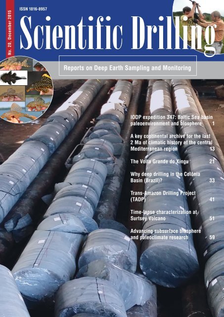
Scientific Drilling
sd_20_2015_web
sd_20_2015_web

You also want an ePaper? Increase the reach of your titles
YUMPU automatically turns print PDFs into web optimized ePapers that Google loves.
No. 20, December 2015<br />
ISSN 1816-8957<br />
<strong>Scientific</strong> <strong>Drilling</strong><br />
Reports on Deep Earth Sampling and Monitoring<br />
IODP expedition 347: Baltic Sea basin<br />
paleoenvironment and biosphere 1<br />
A key continental archive for the last<br />
2 Ma of climatic history of the central<br />
Mediterranean region 13<br />
The Volta Grande do Xingu 21<br />
Why deep drilling in the Colônia<br />
Basin (Brazil)? 33<br />
Trans-Amazon <strong>Drilling</strong> Project<br />
(TADP) 41<br />
Time-lapse characterization at<br />
Surtsey Volcano 51<br />
Advancing subsurface biosphere<br />
and paleoclimate research 59
Editorial preface<br />
Dear readers,<br />
With two workshop reports and one progress report, the present<br />
volume of <strong>Scientific</strong> <strong>Drilling</strong> puts a special focus on planned and<br />
running scientific drilling projects in the South American tropics, so<br />
far a “terra incognita” for deep scientific drilling.<br />
One workshop report (p. 33) discusses the feasibility and the<br />
expectations of deep drilling of the Colônia structure at the southwest<br />
margin of the city of São Paulo, a circular structure of 3.6km in<br />
diameter and unknown origin. Deep scientific drilling of the structure<br />
is required to provide a means of deriving its origin. Moreover, the<br />
Colônia Basin has remained a closed basin system ever since its<br />
formation, making the sedimentary infill an extended and unique<br />
paleoenvironmental record for the Southern Hemisphere tropics.<br />
The evolution of plant biodiversity in the Amazon forests and the<br />
biodiversity response to changes in the physical environment,<br />
including climate, tectonism, and landscape, were addressed by the<br />
Trans-Amazon drilling workshop (p. 41). To archive these goals, long<br />
sedimentary records from each of the major sedimentary basins<br />
across the heart of the Brazilian Amazon are required.<br />
Sediment cores were already collected from the Xingu River<br />
(p. 21) and from floodplain lakes of the Volta Grande, a particularly<br />
fluvial landscape of the Xingu River's downstream sector, to<br />
improve our knowledge on the origin of the Volta Grande, its fluvial<br />
dynamics, and its late Quaternary changes in vegetation, hydrology<br />
and biogeochemistry. <strong>Scientific</strong> drilling will also provide valuable<br />
information to forecast future impacts on biodiversity resulting from<br />
the operation of the Belo Monte hydropower plant.<br />
Linking bio- and geosciences was an important target of other<br />
scientific drilling efforts. The International Ocean Discovery Program<br />
(IODP) Expedition 347 (p. 1) cored sediments from different settings<br />
of the Baltic Sea covering the last glacial-interglacial cycles. The main<br />
aim was to study the geological development of the Baltic Sea in<br />
relation to the extreme climate variability of the region with changing<br />
ice cover and major shifts in temperature, salinity and biological<br />
communities. The European Consortium for Ocean Research <strong>Drilling</strong><br />
(ECORD) mission-specific platform drilling recovered 1.6km of core<br />
from nine sites, four of which were additionally cored for microbiology.<br />
A new drilling campaign at the Surtsey Volcano (p. 51) will use the<br />
natural laboratory of the Surtsey tephra above and below sea level<br />
to shed light on hydrothermal seawater–rock interactions in rift<br />
zone volcanism, the succession of early microbial life, and microbial<br />
interactions with basaltic tephra using volcanological, microbial,<br />
geochemical, mineralogical, and geoarchaeological approaches.<br />
A more general approach, namely to help advance deep biosphere<br />
and paleoclimate research by identifying needed improvements in<br />
scientific drilling planning and available technology, sample collection<br />
and initial analysis, and long-term storage of subsurface samples and<br />
data was topic of a IODP/ICDP/DCO/J-DESC/MagellanPlus workshop<br />
(p. 59).<br />
An 82m long core was recovered from the central eastern Fucino<br />
Basin (p. 13) in June 2015. The major goals of this drilling were to<br />
collect a continuous record back to marine isotope stage 6, to assess<br />
the quality of the lacustrine sedimentary succession, to explore the<br />
sensitivity of different paleoclimatic proxies, and to document the<br />
presence of widespread tephras useful for regional to extra-regional<br />
correlation.<br />
Your Editors<br />
Ulrich Harms, Thomas Wiersberg, Gilbert Camoin,<br />
James Natland, and Tomoaki Morishita<br />
Aims & scope<br />
<strong>Scientific</strong> <strong>Drilling</strong> (SD) is a multidisciplinary journal<br />
focused on bringing the latest science and news from<br />
the scientific drilling and related programs to the<br />
geosciences community. <strong>Scientific</strong> <strong>Drilling</strong> delivers<br />
peer-reviewed science reports from recently completed<br />
and ongoing international scientific drilling<br />
projects. The journal also includes reports on Engineering<br />
Developments, Technical Developments,<br />
Workshops, Progress Reports, and news and updates<br />
from the community.<br />
Editorial board<br />
Ulrich Harms (editor in chief),<br />
Gilbert Camoin, Tomoaki Morishita,<br />
James Natland, and Thomas Wiersberg<br />
sd-editors-in-chief@mailinglists.copernicus.org<br />
Additional information<br />
ISSN 1816-8957 | eISSN 1816-3459<br />
Copernicus Publications<br />
Bahnhofsallee 1e<br />
37081 Göttingen<br />
Germany<br />
Phone: +49 551 90 03 39 0<br />
Fax: +49 551 90 03 39 70<br />
editorial@copernicus.org<br />
production@copernicus.org<br />
http://publications.copernicus.org<br />
View the online library or learn<br />
more about <strong>Scientific</strong> <strong>Drilling</strong> on:<br />
www.scientific-drilling.net<br />
Cover figures:<br />
Insert1: Diversity of the 644 suckermouth armored<br />
catfish species (Loricariidae) in the<br />
Xingu River, with an emphasis on lithophilous species<br />
(Sawakuchi et al., this volume).<br />
Insert2: <strong>Drilling</strong> of core CO 14-1 performed during<br />
the excursion to the Colônia structure (Ledru et al.,<br />
this volume).
Contents<br />
Science Reports<br />
1<br />
IODP expedition 347: Baltic Sea basin paleoenvironment and biosphere<br />
T. Andrén, B. Barker Jørgensen, C. Cotterill, S. Green,<br />
and the IODP expedition 347 scientific party<br />
13<br />
A key continental archive for the last 2 Ma of climatic history of the central<br />
Mediterranean region: A pilot drilling in the Fucino Basin, central Italy<br />
B. Giaccio, E. Regattieri, G. Zanchetta, B. Wagner, P. Galli, G. Mannella, E. Niespolo,<br />
E. Peronace, P. R. Renne, S. Nomade, G. P. Cavinato, P. Messina, A. Sposato, C. Boschi,<br />
F. Florindo, F. Marra, and L. Sadori<br />
Progress Reports<br />
News & Views<br />
21<br />
The Volta Grande do Xingu: reconstruction<br />
of past environments and forecasting of<br />
future scenarios of a unique Amazonian<br />
fluvial landscape<br />
Workshop Reports<br />
33<br />
Why deep drilling in the Colônia Basin<br />
(Brazil)?<br />
41<br />
Trans-Amazon <strong>Drilling</strong> Project (TADP):<br />
origins and evolution of the forests, climate,<br />
and hydrology of the South American<br />
tropics<br />
51<br />
Time-lapse characterization of hydrothermal<br />
seawater and microbial interactions with<br />
basaltic tephra at Surtsey Volcano<br />
59<br />
Advancing subsurface biosphere and paleoclimate<br />
research: ECORD–ICDP–DCO–J-<br />
DESC–MagellanPlus Workshop Series Program<br />
Report
Sci. Dril., 20, 1–12, 2015<br />
www.sci-dril.net/20/1/2015/<br />
doi:10.5194/sd-20-1-2015<br />
© Author(s) 2015. CC Attribution 3.0 License.<br />
Science Reports<br />
IODP expedition 347: Baltic Sea basin paleoenvironment<br />
and biosphere<br />
T. Andrén 1 , B. Barker Jørgensen 2 , C. Cotterill 3 , S. Green 3 , and the IODP expedition 347 scientific party *<br />
1 School of Natural Sciences, Technology and Environmental Studies Södertörn University, Sweden<br />
2 Center for Geomicrobiology Department of Bioscience, Aarhus University, Denmark<br />
3 British Geological Survey, Edinburgh, UK<br />
* A full list of authors and their affiliations appears at the end of the paper.<br />
Correspondence to: T. Andrén (thomas.andren@sh.se)<br />
Received: 27 September 2015 – Accepted: 23 November 2015 – Published: 17 December 2015<br />
Abstract. The Integrated Ocean <strong>Drilling</strong> Program (IODP) expedition 347 cored sediments from different settings<br />
of the Baltic Sea covering the last glacial–interglacial cycle. The main aim was to study the geological<br />
development of the Baltic Sea in relation to the extreme climate variability of the region with changing ice cover<br />
and major shifts in temperature, salinity, and biological communities. Using the Greatship Manisha as a European<br />
Consortium for Ocean Research <strong>Drilling</strong> (ECORD) mission-specific platform, we recovered 1.6 km of core<br />
from nine sites of which four were additionally cored for microbiology. The sites covered the gateway to the<br />
North Sea and Atlantic Ocean, several sub-basins in the southern Baltic Sea, a deep basin in the central Baltic<br />
Sea, and a river estuary in the north.<br />
The waxing and waning of the Scandinavian ice sheet has profoundly affected the Baltic Sea sediments. During<br />
the Weichselian, progressing glaciers reshaped the submarine landscape and displaced sedimentary deposits from<br />
earlier Quaternary time. As the glaciers retreated they left a complex pattern of till, sand, and lacustrine clay,<br />
which in the basins has since been covered by a thick deposit of Holocene, organic-rich clay. Due to the stratified<br />
water column of the brackish Baltic Sea and the recurrent and widespread anoxia, the deeper basins harbor<br />
laminated sediments that provide a unique opportunity for high-resolution chronological studies.<br />
The Baltic Sea is a eutrophic intra-continental sea that is strongly impacted by terrestrial runoff and nutrient<br />
fluxes. The Holocene deposits are recorded today to be up to 50 m deep and geochemically affected by diagenetic<br />
alterations driven by organic matter degradation. Many of the cored sequences were highly supersaturated with<br />
respect to methane, which caused strong degassing upon core recovery. The depth distributions of conservative<br />
sea water ions still reflected the transition at the end of the last glaciation from fresh-water clays to Holocene<br />
brackish mud. High-resolution sampling and analyses of interstitial water chemistry revealed the intensive mineralization<br />
and zonation of the predominant biogeochemical processes. Quantification of microbial cells in the<br />
sediments yielded some of the highest cell densities yet recorded by scientific drilling.<br />
1 Introduction<br />
The Baltic Sea basin (BSB) is one of the world’s largest<br />
intra-continental basins, occupying 373 000 km 2 and with a<br />
drainage area 4 times this size (Fig. 1). Its mean depth is<br />
∼ 54 m, although a few relatively deep basins exist (e.g.,<br />
the eastern Gotland Basin, 248 m, and the Landsort Deep,<br />
459 m). The BSB has served as depositional sink throughout<br />
at least the last during the last glacial cycle and its sediments<br />
comprise a unique high-resolution archive of the paleoenvironmental<br />
history of the large drainage area, the basin<br />
itself, and the neighboring gateways to the North Sea. The<br />
location of the BSB in the heartland of the recurring Scandinavian<br />
ice sheet (SIS) has resulted in a complex developmental<br />
history, characteristic of many glaciated regions of the<br />
Northern Hemisphere: repeated glaciations of different magnitudes,<br />
sensitive responses to sea-level and gateway thresh-<br />
Published by Copernicus Publications on behalf of the IODP and the ICDP.
2 T. Andrén et al.: IODP expedition 347: Baltic Sea basin paleoenvironment and biosphere<br />
Bothnian Bay<br />
Norway<br />
M0062<br />
M0061<br />
Finland<br />
Oslo<br />
Sweden<br />
Helsinki<br />
Russia<br />
Skagerrak<br />
Landsort<br />
Kattegat<br />
Deep<br />
Gotland<br />
Denmark M0060<br />
Deep<br />
Öresund<br />
M0067 Great Belt<br />
Hanö Basin<br />
Kobenhavn M0064<br />
Arkona M0065 & M0066<br />
M0059 Basin<br />
Bornholm<br />
Basin<br />
Germany<br />
Stockholm<br />
Poland<br />
M0063<br />
Russia<br />
Lithuania<br />
Estonia<br />
Latvia<br />
Figure 1. Bathymetric map of the Baltic Sea with the nine coring<br />
sites, M0059 to M0067. Source: IODP Leg 347 expedition Report.<br />
old changes, large shifts in sedimentation patterns, and high<br />
sedimentation rates.<br />
The geographical position of the BSB makes it a unique<br />
link between the Eurasian and the northwest European terrestrial<br />
records and as such also serves as a link to the North<br />
Atlantic marine records and the Greenland ice cores.<br />
The high sedimentation rates (100–500 cm/1000 years) of<br />
the BSB provide an excellent opportunity to reconstruct in<br />
some parts climate variability of global importance controlled<br />
by, for example, changes in meridional overturning<br />
circulation (MOC), the North Atlantic Oscillation (NAO),<br />
and the Arctic oscillation (AO). These paleoenvironmental<br />
reconstructions offers a unique resolution from a marinebrackish<br />
setting as some of the sediments can even be<br />
resolved on inter-annual timescales. This makes the BSB<br />
highly suitable for sediment coring from the last glacial cycle<br />
and a unique location to achieve scientific objectives of<br />
high-resolution paleoceanography and paleoclimate studies,<br />
as comparable sequences cannot be retrieved anywhere in the<br />
surrounding onshore regions.<br />
2 Glacial–interglacial history of the Baltic Sea basin<br />
The BSB has undergone many glaciations during the Quaternary.<br />
During the last interglacial (the Eemian, marine isotope<br />
stage (MIS) 5e), the BSB was a larger and more saline sea<br />
than the present Baltic Sea (Funder et al., 2002). Only fragments<br />
of the Baltic glacial history are known. However, we<br />
do know that a Baltic glacial event occurred during MIS 4<br />
as recorded in sediments from northwest Finland at ∼ 64 ◦ N<br />
Figure 2. (a) Estimated extension of the Scandinavian ice sheet at<br />
11.7 ky BP just prior to the final drainage of the Baltic Ice Lake.<br />
Dark blue: Atlantic Ocean, light blue: Baltic Ice Lake. (b) Extension<br />
of the Littorina Sea during the time of maximum salinity in the<br />
Baltic basin at ca. 6 ky BP. Source: Andrén et al. (2011).<br />
(Salonen et al., 2007). The first Baltic ice lobe that advanced<br />
into Denmark is dated to ∼ 55–50 ky BP (thousand years before<br />
present; Houmark-Nielsen, 2007). From detailed correlations<br />
and dating of southwestern Baltic glacial stratigraphies<br />
(Houmark-Nielsen and Kjær, 2003), it is proposed that<br />
the southwestern Baltic experienced two major ice advances<br />
during MIS 3, at ∼ 50 and 30 ky BP. However, the latter is<br />
highly debated (e.g., Kjellström et al., 2010). This enigmatic<br />
period between ∼ 50 and 25 ky BP, with its partly incompatible<br />
records, was followed by a complex glaciation in the<br />
southern BSB (Houmark-Nielsen and Kjær, 2003) leading up<br />
to the Last Glacial Maximum.<br />
Deglaciation of the southern BSB between 22 and<br />
16 ky BP was complex, with major deglacial phases interrupted<br />
by some intriguing SIS still stands and re-advances<br />
(Houmark-Nielsen and Kjær, 2003; Larsen et al., 2009), possibly<br />
as surges.<br />
Earlier studies have suggested that the Younger Dryas cold<br />
event (12.9 to 11.6 ky BP) was caused by freshwater runoff<br />
from the Laurentide (American) ice sheet slowing the Atlantic<br />
MOC (Marshall and Clark, 1999). However, state-ofthe-art<br />
climate models require a continuous freshwater forcing<br />
to produce millennia-long cold events (Liu et al., 2009)<br />
and there are indications of substantial freshwater forcing<br />
from the BSB predating the final drainage from the Baltic<br />
Ice Lake (e.g., Björck, 1995; Bennicke and Jensen, 2013).<br />
During the final drainage of the Baltic Ice Lake at<br />
∼ 11.7 ky BP (Fig. 2a), almost 8000 km 3 of freshwater was<br />
released rapidly into the North Atlantic (Jakobsson et al.,<br />
2007).<br />
The next Baltic Sea stage, the Yoldia Sea, coincided with<br />
the onset of the Holocene epoch (Walker et al., 2009) and the<br />
associated rapid warming. In fact, the thicknesses of glacial<br />
varves in the northwestern Baltic proper and δ 18 O values in<br />
ice cores from the Greenland Ice Core Project (GRIP) display<br />
a noticeably similar pattern over a 150-year-long tran-<br />
Sci. Dril., 20, 1–12, 2015<br />
www.sci-dril.net/20/1/2015/
T. Andrén et al.: IODP expedition 347: Baltic Sea basin paleoenvironment and biosphere 3<br />
sition period from Younger Dryas to pre-Boreal (Andrén et<br />
al., 1999, 2002). These records show a distinct increase in<br />
sedimentation rate as the ice sheet began to melt and rapidly<br />
retreat. The following few hundred years were characterized<br />
by rapid deglaciation of the SIS. Relative sea-level lowering<br />
of the Yoldia Sea played an important role and were the<br />
result of a combination of rapid regression in the recently<br />
deglaciated regions and normal regression rates in southern<br />
Sweden (1.5–2 m/100 years).<br />
As the outlets to the west became shallower, subsequent<br />
damming forced the water level inside the Baltic Basin to<br />
rise and the next stage began, the Ancylus Lake. The sediments<br />
of this large freshwater lake generally contain little<br />
organic material, which may be explained as a result of the<br />
large meltwater inflow to the Baltic from the final deglaciation<br />
of the SIS and also a result of erosion of the young soils<br />
from the recently deglaciated drainage area. This created a<br />
lake environment with low nutrient input and hence low productivity.<br />
The freshwater environment did not enable the formation<br />
of a halocline but led to a well-mixed, oxygenated<br />
waterbody. The relatively common sulfide-banded sediments<br />
of this stage can probably be explained by later H 2 S diffusion<br />
from overlying, organic-rich Holocene sediments (Sohlenius<br />
et al., 2001).<br />
The global melting of the large ice sheets over a couple of<br />
millennia caused a 30 m rise in absolute sea level (Lambeck<br />
and Chappell, 2001). A consequence of this was the flooding<br />
of the Öresund Strait, believed to be the main gateway for<br />
the onset of the marine Littorina Sea stage. The outlets/inlets<br />
through Öresund and Great Belt widened and became deeper,<br />
resulting in greater water flow and gradually increasing salinity.<br />
The onset of the Littorina Sea stage can often be recognized<br />
as a marked lithologic change in Baltic Sea sediment<br />
cores. The onset is represented by a distinct increase<br />
in organic content and an increasing abundance of brackishmarine<br />
diatoms (e.g., Sohlenius et al., 2001).<br />
Periods of deep-water hypoxia in the open Baltic Basin<br />
are evident in the sediment record as extended sequences of<br />
laminated sediment. The Littorina Sea (Fig. 2b) experienced<br />
a sustained period of elevated salinity and resulting hypoxia<br />
between 8 and 4 ky BP (Zillén et al., 2008). After ∼ 4 ky BP,<br />
the salinity decreased gradually and oxygen concentrations<br />
increased in the bottom waters.<br />
The human population growth and large-scale changes in<br />
land use that occurred in the Baltic Sea watershed during the<br />
Medieval period between AD 750 and 1300 has been suggested<br />
as a triggering mechanism behind the expansion of<br />
hypoxia that again occurred at this time (Zillén et al., 2008).<br />
Alternative hypotheses suggest that the development of hypoxia<br />
in the open Baltic Sea over the past 1000 years has<br />
mainly been driven by the climate system (e.g., Kabel et al.,<br />
2012).<br />
3 <strong>Scientific</strong> objectives<br />
The objectives of expedition 347 are categorized below.<br />
Geology and climate development objectives include the<br />
following:<br />
– to increase our understanding of the climate system and<br />
the sea-level dynamics of the last interglacial, including<br />
the climatic oscillations at the transition between MIS<br />
6 and MIS 5e, and in the initial, climatically oscillating<br />
part of the last glacial (MIS 5d–5a);<br />
– to analyze environmental conditions during the warmest<br />
interval of MIS 5e to elucidate possible future scenarios<br />
during warmer climate and higher sea-level stands;<br />
– to evaluate how strongly the SIS responded, in time and<br />
space, to North Atlantic climate forcing during the last<br />
glacial, and to what extent the dynamic alterations of the<br />
SIS had an impact on the North Atlantic climate system;<br />
– to understand the feedbacks between the waterbody of<br />
the BSB, the SIS, and the North Atlantic circulation;<br />
– to determine to what degree the glacier oscillations of<br />
the SIS margin were synchronous on both sides of the<br />
main ice divide, centered along the Scandinavian mountain<br />
chain, and whether the ice advances into the southern<br />
BSB can be recognized as large-scale surges;<br />
– to describe how the highly oscillating climate pattern of<br />
MIS 3 is recorded at the northeast margin of the North<br />
Atlantic in long and continuous sediment sequences in<br />
the BSB;<br />
– to analyze if there are solar forcing signals in the<br />
melting record of the shrinking ice sheet or in the<br />
precipitation-related fluvial system;<br />
– to reconstruct river discharge (and thereby also precipitation)<br />
with annual resolution, several millennia back in<br />
time;<br />
– to determine how the in- and outflows to the Baltic<br />
Sea have varied over time, and how this is related to<br />
changes in large-scale atmospheric circulation and sea<br />
level (threshold depths);<br />
– to analyze how the general precipitation pattern, which<br />
is linked to the dominating AO–NAO system over<br />
the northern circum-Atlantic and circum-Arctic region,<br />
change during the Holocene.<br />
Microbiology and geochemistry objectives include the following:<br />
– to understand how microbial cell numbers are controlled<br />
in relation to depth, age, lithology, and other environmental<br />
parameters in relatively young and organicrich<br />
marine sediments;<br />
www.sci-dril.net/20/1/2015/ Sci. Dril., 20, 1–12, 2015
4 T. Andrén et al.: IODP expedition 347: Baltic Sea basin paleoenvironment and biosphere<br />
– to determine the diversity and activity of subsurface microbial<br />
communities through metagenomic, metatranscriptomic,<br />
and single-cell genomic analyses;<br />
– to determine whether the predominant microorganisms<br />
are selected by environmental conditions prevailing in<br />
the subsurface today;<br />
– to determine whether the sub-seafloor microbial communities<br />
reflect past environmental conditions, e.g., seawater<br />
or freshwater, cold or temperate climate, oxic or<br />
anoxic bottom water;<br />
– to analyze whether viruses and unicellular eukaryotes<br />
play a role in the subsurface sediments;<br />
– to model and interpret past climate and paleoenvironment<br />
of the Baltic Sea basin from geochemical proxies;<br />
– to analyze how the major glacial–interglacial shifts in<br />
the Baltic Sea affect sediment geochemistry today;<br />
– to understand how nutrient loading, organic productivity<br />
and hypoxia have varied in the Baltic Sea throughout<br />
the Holocene and what are the forcing factors.<br />
4 Coring operations and strategy<br />
The drilling platform chosen for expedition 347 was the<br />
Greatship Manisha, an IMO (International Maritime Organization)<br />
Class II dynamically positioned vessel with geotechnical<br />
coring capability (Fig. 3a). The mobilization took place<br />
in Falmouth prior to transit to Kiel, Germany, where the<br />
ESO (ECORD (European Consortium for Ocean Research<br />
<strong>Drilling</strong>) Science Operator) expedition project managers and<br />
offshore science party participants boarded the vessel following<br />
a pre-cruise scientific meeting in Copenhagen. Operations<br />
were conducted between 12 September and 1 November,<br />
with demobilization of the vessel occurring back in Falmouth<br />
on 5 and 6 November. In total, 37.1 days of expedition<br />
347 were spent operational on station, 8.5 days in transit<br />
between sites, 1.3 days in port, 1.3 days on standby at station<br />
because of weather, and 1.8 days on equipment-related<br />
downtime.<br />
The vessel was equipped with a large moon pool and Geoquip<br />
GMTR 120 heave-compensated derrick, with a 120 metric<br />
ton capacity top drive. Pipe handling was carried out using<br />
a proprietary semiautomated handling system utilizing<br />
a pipe handling crane with grab, a remotely operated iron<br />
roughneck, and a proprietary catwalk system. A 4 m stroke<br />
passive heave compensation (semiactive under development)<br />
was achieved using nitrogen gas as a compensation buffer<br />
with Olmsted valve slingshot protection. The rig was used in<br />
association with a 12 metric ton seabed template, fitted with<br />
clamps and seabed transponder, to provide the reaction force<br />
for in-hole tools. Wireline operation of the core barrel was<br />
conducted through the top drive.<br />
Five methods of wireline coring were employed in addition<br />
to open-hole drilling using a non-coring assembly. The<br />
primary coring tool was a piston corer system (PCS), operated<br />
by advancing the core barrel into the formation through<br />
hydraulic pushing. However, where formation lithologies<br />
were either unconsolidated, noncohesive, friable or very<br />
hard, an extended coring system (ECS), non-rotating core<br />
barrel system (NRCB), push coring assembly (PCA), or hammer<br />
sampler (HS) were employed. The HS was the most rudimentary<br />
system used during this expedition, consisting of a<br />
built-in hammer, which was raised and lowered onto an anvil<br />
over a few meters distance. This tool was used to obtain a<br />
spot sample when open-holing through coarser-grained deposits,<br />
or when conventional coring methods had been unable<br />
to acquire a sample. The non-coring assemble (NCA)<br />
used a Tricone Rock Roller drill bit to plug the hole in the<br />
main core bit to advance without recovery.<br />
The core collected was 62 mm in diameter. The maximum<br />
core run length was 3.3 m. However, the length of a core<br />
run was chosen to maximize core recovery and quality while<br />
maintaining hole stability, even at the expense of overall<br />
penetration speed. When attempting to capture a lithologic<br />
interface, as defined from seismic profiles, the run lengths<br />
were often shortened by raising the corer above the bottom<br />
of the borehole by a known height prior to pressuring the<br />
drill string. In some instances, the hole was advanced by<br />
open holing – drilling ahead without recovering sediments.<br />
This was done in difficult lithologies that could not be recovered<br />
conventionally to enable recovery of other lithologies<br />
beneath these intervals or when recovery (composite or from<br />
an individual hole) of an interval had already reached > 90 %,<br />
and the scientific rationale was to try and get deeper within<br />
the time constraints. The advance varied from a small offset<br />
of 0.5 m to ensure maximum core overlap between holes in<br />
some locations to a more regular spacing of 3 m through the<br />
till lithologies to monitor when or whether the lithology was<br />
changing.<br />
At the Ångermanälven River estuary site (M0061), there<br />
were initial restrictions on coring the upper 50 cm of sediment<br />
due to potential heavy metal contamination from industry.<br />
This was relaxed on assessment on-site. At Hanö Bay,<br />
Bornholm basin, and Anholt loch sites (M0064, M0065, and<br />
M0060, respectively), downpipe camera or ROV (remotely<br />
operated vehicle) surveys were conducted prior to commencing<br />
coring, due to the potential for dumped WWII munitions<br />
on the seabed. In addition, restrictions were placed on coring<br />
the upper 2m of sediment at Bornholm Basin (M0065) due<br />
to the risk of dumped chemical munitions.<br />
Offshore, the cores from paleo-oceanographic designated<br />
holes were carefully curated by ESO staff before ephemeral<br />
physical (multi-sensor core logger, MSCL) and geochemical<br />
properties were measured and preliminary core catcher samples<br />
taken. Initial lithological and micropaleontological descriptions<br />
were conducted by visual inspection through the<br />
liner and by using core catcher materials. No further sam-<br />
Sci. Dril., 20, 1–12, 2015<br />
www.sci-dril.net/20/1/2015/
T. Andrén et al.: IODP expedition 347: Baltic Sea basin paleoenvironment and biosphere 5<br />
Figure 3. (a) The geotechnical vessel, Greatship Manisha (of Singapore) equipped with a drilling derrick. (b) View from the derrick over<br />
the drill deck at mid-ship and the “science garden” to the aft. Image copyright ECORD/IODP.<br />
pling, core splitting, or analysis work was undertaken offshore.<br />
On microbiological designated holes, samples were taken<br />
on the drill floor from the cut ends of core sections to capture<br />
ephemeral properties, including methane gas and contamination<br />
tracer quantities. The cores were then curated and run<br />
through a fast-track MSCL prior to extensive sampling in the<br />
designated laboratory containers (Fig. 3b) for microbiological<br />
research and for interstitial water analyses. In total > 5800<br />
samples were taken offshore.<br />
All cores, core catchers, headspace gas samples, interstitial<br />
water splits, and digital data were transferred to the<br />
Integrated Ocean <strong>Drilling</strong> Program (IODP) core repository<br />
in Bremen, Germany (BCR), at the end of the offshore<br />
phase. Prior to the start of the Onshore Science Party (OSP),<br />
additional thermal conductivity measurements and natural<br />
gamma radiation measurements were conducted on whole<br />
core sections. The complete science party, as well as ESO<br />
and BCR personnel and student helpers, met at the BCR from<br />
22 January to 21 February to split, analyze, and sample the<br />
cores according to standard IODP procedures, and for postcruise<br />
scientific research.<br />
5 Preliminary expedition results<br />
In the following we present selected preliminary results from<br />
leg 347 on lithology, biostratigraphy, dating, geochemistry,<br />
and microbiology. By these chosen examples we briefly summarize<br />
how the expedition met some of the objectives outlined<br />
above.<br />
5.1 Little Belt (sites M0059 and M0067)<br />
The lithology consists of diamicton interlayered with sand<br />
and silt in the lower part of the core (Fig. 4a). These layers<br />
give OSL (optically stimulated luminescence) ages between<br />
ca. 362 ky BP at 146 m b.s.f. (meters below seafloor)<br />
and ca. 103 ky BP at 108 m b.s.f. This means that the sediments<br />
between these two levels have recorded MIS 5. The recovered<br />
stratigraphy is, however, fragmented but represents<br />
nonetheless a unique archive of a Pleistocene time window<br />
never recovered before in the Baltic Sea. On top of this unit,<br />
at ∼ 90–83 m b.s.f., is a 11 m thick sandy deposit with silt<br />
and clay laminas. The OSL date from these sediments is<br />
ca. 44 ky BP.<br />
From 82 to 52 m b.s.f., glacial ice lake sediment is deposited<br />
as varved glacial clay displaying thick varves in the<br />
lower part and thinner varves deposited distal to the retreating<br />
ice margin in the upper part. This unit is erosionally truncated<br />
and marked by a 2 cm thick sandy-silty layer at 52 m<br />
b.s.f. displaying an upwards coarsening, which indicates deposition<br />
during a rapid regression. The contact upwards to<br />
the overlaying gyttja clay is sharp and possibly also erosional.<br />
At site M0059 we recovered 52 m of Holocene sediment<br />
with a correspondingly high-mean sedimentation rate of 5–<br />
7 mm year −1 based on four radiocarbon dates received so far.<br />
The diatom flora in this unit of organic-rich clay has recorded<br />
a sharp transition from freshwater to fully marine conditions<br />
at ca. 48 m b.s.f., indicating a rapid marine transgression<br />
(Fig. 4c). It should be noted, however, that final conclusions<br />
cannot be drawn until the sequence has become more thoroughly<br />
analyzed.<br />
From site M0067 we only recovered ca. 4.4 m of Holocene<br />
mud on top of medium to coarse sand interlayered with silt<br />
www.sci-dril.net/20/1/2015/ Sci. Dril., 20, 1–12, 2015
6 T. Andrén et al.: IODP expedition 347: Baltic Sea basin paleoenvironment and biosphere<br />
Figure 4. Little Belt, site M0059. (a)Lithostratography with ages: green is ages derived from 14 C dating given in cal yr BP and red is ages<br />
derived from OSL dating given in ky BP. (b) Section 347-M0059A-16H-2 from 52 m b.s.f. shows the hiatus sand horizon of unit II at the<br />
transition from the varved clay sequence of Unit III into the laminated black organic-rich clay of subunit Ib. Inset: close-up of the coarsegrained,<br />
poorly sorted sand hiatus marking a low stand. (c) Relative distributions of diatom taxa according to their preferred habitat salinity.<br />
(d) Examples of interstitial water chemistry: diffraction-based salinity, alkalinity, and ammonium. Different symbols show data from different<br />
holes.<br />
and clay, interpreted having a glaciofluvial ice-proximal origin.<br />
There is obviously a large hiatus at this site.<br />
The depth distributions of conservative seawater ions in<br />
the interstitial water showed a distinct drop from seawater<br />
salinity in the Holocene sequence to a minimum in salinity<br />
in the underlying glacial ice lake clay (Fig. 4d). Interestingly,<br />
chloride-based salinity calculations did not show a<br />
broad maximum at 10–30 m b.s.f. as did the diffraction-based<br />
salinity, which is affected by all ions in the interstitial water.<br />
The difference is due to very high DIC (dissolved in-<br />
Sci. Dril., 20, 1–12, 2015<br />
www.sci-dril.net/20/1/2015/
T. Andrén et al.: IODP expedition 347: Baltic Sea basin paleoenvironment and biosphere 7<br />
organic carbon) and ammonium concentrations that add to<br />
the diffraction-based salinity. These data reflect extremely<br />
high rates of organic matter mineralization in the 50 m deep,<br />
organic-rich Holocene clay. Thus, alkalinity values were up<br />
to 200 mM, which is probably a new IODP record, while ammonium<br />
reached 40 mM.<br />
5.2 Kattegat (site M0060)<br />
From site M0060 we cored a > 200 m deep, almost continuous<br />
record that consists of an 84 m diamict unit, in the lowermost<br />
part of the core. On top of this unit alternating sandy<br />
and silty sequences are recorded with a unit between 79 and<br />
6 m b.s.f. that consists of varved glacial clay indicating deposition<br />
in a glacial lake or marginal marine environment. It<br />
is possible that this varved unit records freshwater outflow<br />
from the Baltic basin, and it is therefore anticipated that it<br />
will give a yearly resolution.<br />
A gradually decreasing salinity was recorded down to<br />
ca. 125 m b.s.f. at this site below, which the salinity increased<br />
distinctly again. Together with the foraminifera and ostracode<br />
records this indicates a marine provenance of the sediments<br />
below this level. Throughout the hole, cores also displayed<br />
abundant snail and bivalve shells that will be useful<br />
for both dating and environmental reconstruction.<br />
The sediment had surprisingly low mineralization rates<br />
with mainly sulfate reduction and iron reduction as the dominant<br />
terminal processes of organic matter oxidation. Methane<br />
appeared only at depths between 100 and 170 m b.s.f. This<br />
methane is possibly not produced on site in the low-organic<br />
diamict unit but may have been transported over a distance<br />
via the over-pressured sandy aquifer.<br />
5.3 Ångermanälven River estuary (sites M0061 and<br />
M0062)<br />
These two northernmost sites were selected as it was known<br />
that annual varves have been deposited over several thousand<br />
years and are still being formed at the mouth of the river.<br />
The many hundred years of varved sequences collected at<br />
these sites will be correlated with and included in the socalled<br />
Swedish Time Scale, a continuous varve chronology<br />
covering the time span from ca. 13 300 clay-varve years BP<br />
to the present.<br />
At both sites ca. 20 m of sediments were recovered, which<br />
displayed varves that were 4–10 cm thick in the lower part<br />
and only a few millimeters thick in the upper part. At site<br />
M0061 organic-rich mud in the uppermost 8 m displayed a<br />
brackish influence that was evident from both the foraminifer<br />
and ostracode fauna and from the diatom flora. It is noteworthy<br />
that this is the first report of foraminifers and ostracodes<br />
in sediments of Holocene age this far north in the Baltic Sea.<br />
5.4 Landsort Deep (site M0063)<br />
In the Landsort Deep, which is the deepest basin in the Baltic<br />
Sea, we cored to a depth of 95 m b.s.f. in a water depth of<br />
437 m. At the deepest part between 95.8 and 93.4 m b.s.f. the<br />
sediment consists of a clast-poor sandy diamicton overlaid by<br />
a 53 m thick unit of varved glacial clay. This uniquely long<br />
varve sequence may enable a correlation to the Greenland<br />
ice core record (cf. Andrén et al., 1999, 2002). The varves<br />
can possibly comprise as much as 2,000 years in one continuous<br />
sedimentary record and may have recorded, with annual<br />
resolution, the entire Younger Dryas as well as its onset and<br />
termination (Fig. 5). In the upper part of this varved unit at<br />
41.5 m b.s.f. a weak brackish influence is recorded in both<br />
the ostracode fauna and in the diatom flora, which is interpreted<br />
as representing the short brackish phase of the Yoldia<br />
Sea stage.<br />
The overlaying grey homogenous clay converts gradually<br />
into a laminated organic-rich mud and the first substantial<br />
inflows of marine water are registered at 28 m b.s.f., as observed<br />
from a decrease in freshwater and increase in brackish<br />
water diatom species and an increased abundance of<br />
foraminifers. This first inflow is also registered as an increasing<br />
salinity in the chemistry of the pore-water and probably<br />
represents the transition from the lacustrine Ancylus Lake<br />
stage to the brackish-marine Littorina Sea stage.<br />
The uppermost 28 m of the cored sediments consists of a<br />
laminated organic-rich mud, sometimes referred to as clay<br />
gyttja in Baltic Sea geological literature. This type of sediment<br />
indicates that the deepest part of the Landsort Deep has<br />
been anoxic/hypoxic during the last ca. 7000 years. So far we<br />
have only one 14 C date from this unit at 24.6 m b.s.f. yielding<br />
an age of 5850 ± 120 cal yr BP.<br />
5.5 Hanö Bay (site M0064)<br />
Four holes were drilled at this site of which three recovered<br />
an almost 30 m long unit of clast-rich, stratified, muddy diamicton<br />
on top of a unit of sandy clayey silt with thin intervals<br />
of diamicton. Varved glacial clay deposited on top of<br />
this diamicton consisted of two different sub-units, a lower<br />
dark-brownish-grey clay and an upper dark-greyish-brown<br />
clay separated by a 2–3 cm thick organic-rich (LOI, loss on<br />
ignition; ca. 8 %) brown silty clay (84–87 cm in section (b),<br />
Fig. 6). This unit has been 14 C dated in two cores and the<br />
mean age of the unit is 45 700±1500 cal yr BP, which means<br />
that this lower varved clay sequence was deposited during a<br />
deglaciation much older than the latest one.<br />
5.6 Bornholm Basin (sites M0065 and M0066)<br />
The lithologies from these two sites are quite similar. The<br />
lowermost 40 m of the stratigraphy consists of the same two<br />
different types of varved glacial clays as at site M0064 although<br />
more expanded. Also at site M0065 the two clay units<br />
are separated by a homogenous dark-grey layer, here with a<br />
www.sci-dril.net/20/1/2015/ Sci. Dril., 20, 1–12, 2015
8 T. Andrén et al.: IODP expedition 347: Baltic Sea basin paleoenvironment and biosphere<br />
Figure 6. Hanö Bay, site M0064. Examples of varved glacial clay<br />
(a and b) and diamicton (c, d). The greyish brown unit between 84<br />
and 87 cm separating the two different types of varved glacial clays<br />
in section b have an age of 45 700 ± 1500 cal yr BP.<br />
5.7 Microbiology<br />
Figure 5. Landsort Deep, site M0063. Lithostratigraphy with insets<br />
(a) laminated Littorina Sea mud (section 347-M0063C-12H-2) and<br />
(b) varved Baltic Ice Lake glacial clay (section 347-M0063C-34H-<br />
2).<br />
thickness of 60 cm, which probably corresponds to the dated<br />
layer at site M0064.<br />
A shift from freshwater to brackish conditions is recorded<br />
in the diatom flora at 10 m b.s.f. and most probably represents<br />
the Ancylus Lake–Littorina Sea transition (Fig. 7). The lowermost<br />
part of this unit is laminated whereas the upper 9 m is<br />
homogenous and contains abundant mollusk shell fragments<br />
indicating well-oxygenated bottom water conditions.<br />
Cell enumeration was done on board the Greatship Manisha<br />
by two different approaches. One was the well-established<br />
epifluorescence counting of samples in which cells had been<br />
DNA stained with the fluorescent dye, acridine orange. The<br />
other was flow cytometry whereby cells were first extracted<br />
quantitatively from the sediment and DNA stained with the<br />
fluorescent dye, SYBR (Synergy Brands Inc.) green. In the<br />
flow cytometer, which was provided by the Kochi Core<br />
Repository, these cells were counted automatically at a high<br />
rate, which increased the capacity for onboard cell counts.<br />
Importantly, comparison of the two techniques provided very<br />
similar cell numbers in most sediments studied. In some<br />
sediment intervals, however, flow cytometry provided lower<br />
numbers than fluorescence microscopy. This could be explained<br />
by incomplete detachment of cells from exopolysaccharide<br />
particles, which prevented counting in the flow cytometer<br />
but still enabled microscopic counting.<br />
Microbial cell abundances were extremely high at all sites<br />
studied, even exceeding 10 10 cells cm −3 in the Bornholm<br />
Basin, a new record for the IODP. Cell numbers also remained<br />
surprisingly high at depth. This is in accordance with<br />
the high organic carbon content in the Holocene deposits and<br />
the high sedimentation rates. As an example from site M0059<br />
in Little Belt, the cell density was 10 9 cells cm −3 at the sediment<br />
surface and dropped only by 1 order of magnitude at the<br />
bottom of the Holocene at 50 m b.s.f. where the sediment had<br />
an estimated age of > 9000 years (Fig. 8a). Cell numbers for<br />
site M0063 in the Landsort Deep (Fig. 8b) provided another<br />
example of a good correspondence between the two enumeration<br />
techniques in the lower part of the hole but showed an<br />
increasing divergence towards the sediment surface due to<br />
the described incomplete dispersion of cells.<br />
Sci. Dril., 20, 1–12, 2015<br />
www.sci-dril.net/20/1/2015/
T. Andrén et al.: IODP expedition 347: Baltic Sea basin paleoenvironment and biosphere 9<br />
Figure 7. Bornholm Basin, site M0065. Relative distribution of diatom<br />
taxa according to their preferred habitat salinity.<br />
When drilling the holes for microbiology at four sites, contamination<br />
tests were carried out (Smith et al., 2000; Lever et<br />
al., 2006). A perfluorocarbon (PFC) tracer was pumped continuously<br />
into the drilling fluid and samples were taken from<br />
three radial positions in each core immediately upon recovery<br />
and cutting on the drill deck. As a new procedure for<br />
IODP, samples were also taken routinely from fluid remaining<br />
in the core liner. Since this represents the fluid to which<br />
the cores were exposed when taken in situ, these fluid samples<br />
optimally represent the relevant contamination tracer<br />
concentration. The results showed that the concentration of<br />
the tracer that arrived at the bottom of the drill hole was<br />
mostly much lower than the expected target concentration.<br />
The conclusion is that this sampling procedure of liner fluid<br />
should be implemented on future IODP expeditions. Also<br />
the land-based analytical procedure for PFC was improved<br />
relative to IODP standard by heating samples while rotating<br />
before headspace sampling and GC-ECD (gas chromatography<br />
with electron capture detector) analysis (M. A. Lever,<br />
unpublished). Furthermore, this procedure is recommended<br />
for future deep biosphere expeditions when analyzing a PFC<br />
tracer.<br />
During expedition 347, a large number of samples were<br />
taken for many different land-based research groups and for<br />
many different types of analysis. In fact, the requested sampling<br />
frequency was so high in the upper sediment intervals<br />
that most of the core was subsampled and it was occasionally<br />
difficult to accommodate all the requests. In order to<br />
minimize the impact of high levels of sampling, graphical<br />
sampling schemes were developed in advance for each core.<br />
For the sampling of whole round cores, a small computer<br />
program was developed to facilitate the sampling plan (Marshall,<br />
2014). It was also of great advantage on this expedition<br />
that samples for land-based studies that relied on live microorganisms<br />
could be off-loaded from the Greatship Manisha<br />
to a small boat and thereby arrived in the receiving laboratories<br />
in Denmark, Germany, and the UK within a few days<br />
to a week after coring of each microbiology hole.<br />
Since it was not possible on this mission-specific platform<br />
to perform any microbiological analyses other than<br />
cell counts, samples needed to be fixed and/or frozen to<br />
be preserved for later studies in land-based laboratories.<br />
Freezing may damage cell structures and can be a problem<br />
for studies that depend on intact cells, such as fluorescence<br />
in situ hybridization (FISH or CARD-FISH). However,<br />
a new CAS (Cells Alive System) freezer technique,<br />
provided by the Kochi Core Repository, was available on<br />
board. By this technique samples are cooled during exposure<br />
to a high-frequency alternating electromagnetic field. When<br />
the temperature reaches −10 ◦ C the electromagnetic field is<br />
switched off and freezing happens almost instantaneously,<br />
which prevents the formation of ice crystals of a size that<br />
damages cell structures.<br />
6 Conclusions and future work<br />
The OSL ages from site M0059 indicate that we reached at<br />
least some 350 ky back in time. Without having all dates at<br />
hand, we assume that at site M0060 we recovered sediments<br />
dating back to the previous interglacial. This means that the<br />
lower part of the holes from these two sites may cover the end<br />
of MIS 6, MIS 5, and MIS 4, although with partly fragmented<br />
stratigraphies.<br />
Sediments of MIS 3 age have been recovered and dated<br />
at site M0059 and site M0064 and are most probably also<br />
present in the sediments from site M0065 and perhaps also<br />
M0066. The recovered sediments, of pro-glacial sandur at<br />
site M0059 and organic-bearing clay at site M0064 and<br />
M0065, indicate an ice-free event in the middle of the Wewww.sci-dril.net/20/1/2015/<br />
Sci. Dril., 20, 1–12, 2015
10 T. Andrén et al.: IODP expedition 347: Baltic Sea basin paleoenvironment and biosphere<br />
Figure 8. Cell numbers from (a) Little Belt, site M0059, and (b) the Landsort Deep, site M0063. Red diamonds: cell counts by fluorescence<br />
microscopy (AODC, acridine orange direct counts); blue circles: cell counts by flow cytometry. The solid black line is a global regression<br />
line of prokaryote cell numbers with depth, while the dashed lines are upper and lower 95 % prediction limits for the regression line (Roussel<br />
et al., 2008).<br />
ichselian glacial with an age of 44 ± 4 ky BP. Ongoing analyses<br />
of sediments from these sites may shed new light on the<br />
history of the BSB and the behavior of the SIS during the<br />
enigmatic MIS 3.<br />
Varved glacial clays deposited from the retreating SIS<br />
have been recovered at all drilled sites, which makes environmental<br />
reconstructions possible with annual resolution.<br />
Especially notable are the 52 m long varved sequences from<br />
site M0063, possibly containing as much as 2000 varves and<br />
probably covering the entire Younger Dryas. This unique<br />
varved sequence will give us new insights into how the SIS<br />
responded to climate fluctuations, including the slow cooling<br />
at the beginning and the rapid warming at the end of the stadial.<br />
It will also give new information on the position of the<br />
ice margin and thereby improve the correlation between ice<br />
margin positions in eastern Sweden and southwestern Finland<br />
during the Younger Dryas.<br />
It should be noted that glacial varves have traditionally<br />
been assigned to the latest deglaciation but the two units<br />
of varved glacial clay separated by an organic-bearing clay<br />
with an age of 45 700 ± 1500 cal yr BP indicates a different<br />
scenario at site M0064. It is obvious that only the upper<br />
varved sequence was deposited during the latest deglaciation<br />
whereas the lower sequence represents an earlier deglaciation.<br />
Sediments of Holocene age have been recovered at most<br />
drilled sites but at sites M0059 and M0063 the thickness of<br />
these sediments is spectacular, ca. 52 m at site M0059 and<br />
ca. 45 m at site M0063. The extremely high sedimentation<br />
rates at these two sites presented the possibility to reconstruct<br />
the environmental response to climate warming leading up<br />
to the Holocene thermal maximum, occurring some 8000 to<br />
5000 years ago, with a resolution never reached before in the<br />
Baltic Sea area. It will, for example, be possible to detect<br />
small variations in, e.g., salinity, nutrient status, temperature,<br />
ice cover, and periods of hypoxia/anoxia, possibly with an<br />
annual resolution.<br />
Mission-specific platforms routinely work in shallow waters,<br />
and so protocols are already in place to maximize the<br />
quality and amount of core recovered when working in these<br />
environments, building on the knowledge gained from four<br />
previous expeditions. However, the scope of the offshore microbiological<br />
program was something not undertaken before<br />
on an MSP (mission-specific platforms). Thanks to the early<br />
and extensive input and support from the microbiological<br />
community, we were able to achieve a successful sampling<br />
campaign. However, a detailed post-cruise review has shown<br />
areas in which additional protocols need to be established in<br />
order to improve results in this discipline, e.g., the addition<br />
of the contamination tracer to the drilling fluid at higher concentrations.<br />
During expedition 347, four sites were selected for detailed<br />
studies of geochemistry and microbiology. Nearly<br />
6000 samples were taken offshore for interstitial water analyses<br />
and microbiological studies. The many chemical analyses<br />
done on board the Greatship Manisha and during the onshore<br />
phase have generated data of outstanding quality and detail.<br />
The results provide novel insights into the geochemical con-<br />
Sci. Dril., 20, 1–12, 2015<br />
www.sci-dril.net/20/1/2015/
T. Andrén et al.: IODP expedition 347: Baltic Sea basin paleoenvironment and biosphere 11<br />
sequences of glacial to interglacial and fresh-water to marine<br />
transitions combined with shifts from low-organic lateglacial<br />
clay to high organic Holocene clay with extremely<br />
high sedimentation rates. These data will be supplemented<br />
by a large diversity of inorganic, organic, and isotope geochemical<br />
analyses in laboratories around the world.<br />
Detailed contamination tracer measurements were made<br />
during the expedition with improved methods relative to previous<br />
IODP standards. Off-loading of microbiology samples<br />
shortly after drilling enabled cultivation experiments and<br />
studies of microbial activity to be done in land-based laboratories<br />
and thereby overcome the limited laboratory facilities<br />
on the drillship. A comparison of microbial cell counting<br />
techniques showed that flow cytometry can provide data of<br />
equally good quality as microscopic counts and thereby may<br />
enhance the capacity for cell quantification on future drilling<br />
expeditions. A new CAS technology enables the freezing of<br />
microbiology samples for sensitive post-cruise microbiology<br />
studies that require intact DNA/RNA and cell membranes.<br />
A large number of samples are currently being analyzed in<br />
many different laboratories and will provide metagenomic,<br />
metatranscriptomic, and meta-metabolomic data as well as<br />
specific data on microbial process rates, cultivation-based<br />
microbial diversity, and other information for archaea, bacteria,<br />
and eukaryotic microorganisms as well as viruses.<br />
Based on the preliminary lithological, biostratigraphic, paleomagnetic,<br />
dating, geochemical, and microbiological data,<br />
we conclude that expedition 347 accomplished most of the<br />
objectives that we had outlined in IODP proposal 672. This<br />
was indeed a successful expedition.<br />
The full expedition report is available for download from<br />
http://publications.iodp.org/.<br />
Team members<br />
E. Andrén, J. Ash, T. Bauersachs, B. Cragg, A.-S. Fanget,<br />
A. Fehr, W. Granoszewski, J. Groeneveld, D. Hardisty,<br />
E. Herrero-Bervera, O. Hyttinen, J. B. Jensen, S. Johnson,<br />
M. Kenzler, A. Kotilainen, U. Kotthoff, I. P. G. Marshall,<br />
E. Martin, S. Obrochta, S. Passchier, N. Quintana Krupinski,<br />
N. Riedinger, C. Slomp, I. Snowball, A. Stepanova,<br />
S. Strano, A. Torti, J. Warnock, N. Xiao, and R. Zhang.<br />
Acknowledgements. We thank the captain and crew of the<br />
Greatship Manisha, the operations superintendents and all the<br />
expedition staff and technicians, whose outstanding professional<br />
support ensured the successful drilling, sampling, and measurements<br />
on expedition 347. We also thank the excellent management,<br />
staff and students at the IODP Bremen Core Repository at<br />
MARUM, Bremen, for ensuring a very effective and productive<br />
onshore sampling party. We thank the proponents and other<br />
colleagues, who were engaged in the preparation of IODP proposal<br />
672 for their great efforts that made this expedition happen.<br />
Edited by: U. Harms<br />
Reviewed by: S. Björck and one anonymous referee<br />
References<br />
Andrén, T., Björck, J., and Johnsen, S.: Correlation of Swedish<br />
glacial varves with the Greenland (GRIP) oxygen isotope record,<br />
J. Quaternary Sci., 14, 361–371, doi:10.1002/(SICI)1099-<br />
1417(199907)14:43.0.CO;2-R, 1999.<br />
Andrén, T., Lindeberg, G., and Andrén, E.: Evidence of the final<br />
drainage of the Baltic Ice Lake and the brackish phase of the<br />
Yoldia Sea in glacial varves from the Baltic Sea, Boreas, 31, 226–<br />
238, doi:10.1111/j.1502-3885.2002.tb01069.x, 2002.<br />
Andrén, T., Björck, S., Andrén, E., Conley, D., Zillén, L., and Anjar,<br />
J.: The development of the Baltic Sea basin during the last<br />
130 000 years, in: The Baltic Sea Basin, edited by: Harff, J.,<br />
Björck, S., and Hoth, P., Springer, 75–97, doi:10.1007/978-3-<br />
642-17220-5_4, 2011.<br />
Bennicke, O. and Jensen, J. B.: A Baltic Ice Lake lowstand of the<br />
latest Allerød age in the Arkona Basin, southern Baltic Sea, Geol.<br />
Surv. Den. Greenl., 28, 17–20, 2013.<br />
Björck, S.: A review of the history of the Baltic Sea, 13.0–8.0 ka BP,<br />
Quat. Int., 27, 19–40, 1995.<br />
Funder, S., Demidov, I., and Yelovicheva, Y.: Hydrography and<br />
mollusc faunas of the Baltic and the White Sea–North Sea seaway<br />
in the Eemian, Palaeogeogr. Palaeocl., 184, 275–304, 2002.<br />
Houmark-Nielsen, M.: Extent and age of middle and late Pleistocene<br />
glaciations and periglacial episodes in southern Jylland,<br />
Denmark, Bull. Geol. Soc. Den., 55, 9–35, 2007.<br />
Houmark-Nielsen, M. and Kjær, K. H.: Southwest Scandinavia, 40–<br />
15 kyr BP: palaeogeography and environmental change, J. Quaternary<br />
Sci., 18, 769–786, 2003.<br />
Jakobsson, M., Björck, S., Alm, G., Andrén, T., Lindeberg, G., and<br />
Svensson, N.-O.: Reconstructing the Younger Dryas ice dammed<br />
lake in the Baltic Basin: bathymetry, area and volume, Global<br />
Planet. Change, 57, 355–370, 2007.<br />
Kabel, K., Moros, M., Porsche, C., Neumann, T., Adolphi, F., Andersen,<br />
T. J., Siegel, H., Gerth, M., Leipe, T., Jansen, E., and<br />
Sinninghe-Damsté, J. S.: Impact of climate change on the Baltic<br />
Sea ecosystem over the past 1,000 years, Nature Climate Change,<br />
2, 871–874, 2012.<br />
Kjellström, E., Brandefelt, J., Näslund, J.-O., Smith, B., Strandberg,<br />
G., Voelker, A. H. L., and Wohlfarth, B.: Simulated climate<br />
conditions in Europe during the marine isotope Stage 3 stadial,<br />
Boreas, 39, 436–456, 2010.<br />
Lambeck, K. and Chappell, J.: Sealevel change through the last<br />
glacial cycle, Science, 292, 679–686, 2001.<br />
Larsen, N. K., Knudsen, K. L., Krohn, C. F., Kronborg, C., Murray,<br />
A. S., and Nielsen, O. B.: Late Quaternary icesheet, lake and sea<br />
history of southwest Scandinavia – a synthesis, Boreas, 38, 732–<br />
761, 2009.<br />
Lever, M. A., Alperin, M., Engelen, B., Inagaki, F., Nakagawa,<br />
S., Steinsbu, B. O., Teske A., and IODP Expedition 301 Scientists:<br />
Trends in basalt and sediment core contamination during<br />
IODP Expedition 301, Geomicrobiol. J., 23, 517–530,<br />
doi:10.1080/01490450600897245, 2006.<br />
Liu, Z., Otto-Bliesner, B. L., He, F., Brady, E. C., Tomas, R., Clark,<br />
P. U., Carlson, A. E., Lynch-Stieglitz, J., Curry, W., Brook, E., Erwww.sci-dril.net/20/1/2015/<br />
Sci. Dril., 20, 1–12, 2015
12 T. Andrén et al.: IODP expedition 347: Baltic Sea basin paleoenvironment and biosphere<br />
ickson, D., Jacob, R., Kutzbach, J., and Cheng, J.: Transient Simulation<br />
of Last Deglaciation with a New Mechanism for Bølling-<br />
Allerød Warming, Science, 17, 310–314, 2009.<br />
Marshall, I. P. G.: Corganiser: a web-based software tool for planning<br />
time-sensitive sampling of whole rounds during scientific<br />
drilling, Sci. Dril., 18, 1–4, doi:10.5194/sd-18-1-2014, 2014.<br />
Marshall, S. J. and Clark, G. K. C.: North American freshwater<br />
runoff through the last glacial cycle, Quaternary Res., 52, 300–<br />
315, 1999.<br />
Roussel, E. G., Bonavita, M.-A. C., Querellou, J., Cragg,<br />
B. A., Webster, G., Prieur, D., and Parkes, R. J.: Extending<br />
the subseafloor biosphere, Science, 320, 1046,<br />
doi:10.1126/science.1154545, 2008.<br />
Salonen, V.-P., Kaakinen, A., Kultti, S., Miettinen, A., Eskola, K.<br />
O., and Lunkka, J. P.: Middle Weichselian glacial event in the<br />
central part of the Scandinavian Ice Sheet recorded in the Hiturapit,<br />
Ostrobothnia, Finland, Boreas, 37, 38–54, 2007.<br />
Smith, D. C., Spivack, A. J., Fisk, M. R., Haveman, S. A.,<br />
Staudigel, H., and the Leg 185 Shipboard <strong>Scientific</strong> Party:<br />
Methods for quantifying potential microbial contamination<br />
during deep ocean coring, ODP Tech. Note, 28, p. 1–19,<br />
doi:10.2973/odp.tn.28.2000, 2000.<br />
Sohlenius, G., Emeis, K.-C., Andrén, E., Andrén, T., and Kohly, A.:<br />
Development of anoxia during the fresh–brackish water transition<br />
in the Baltic Sea, Mar. Geol., 177, 221–242, 2001.<br />
Walker, M., Johnsen, S., Olander Rasmussen, S., Popp, T., Steffensen,<br />
J.-P., Gibbard, P., Hoek, W., Lowe, J., Andrews, J.,<br />
Björck, S., Cwynar, L. C., Hughen, K., Kershaw, P., Kromer, B.,<br />
Litt, T., Lowe, D. J., Nakagawa, T., Newham, R., and Schwander,<br />
J.: Formal definition and dating of the GSSP (Global Stratotype<br />
Section and Point) for the base of the Holocene using the Greenland<br />
NGRIP icecore, and selected auxiliary records, J. Quaternary<br />
Sci., 24, 3–17, doi:10.1002/jqs.1227, 2009.<br />
Zillén, L., Conley, D. J., Andrén, T., Andrén, E., and Björck, S.: Past<br />
occurrences of hypoxia in the Baltic Sea and the role of climate<br />
variability, environmental change and human impact, Earth Sci.<br />
Rev., 91, 77–92, 2008.<br />
Sci. Dril., 20, 1–12, 2015<br />
www.sci-dril.net/20/1/2015/
Sci. Dril., 20, 13–19, 2015<br />
www.sci-dril.net/20/13/2015/<br />
doi:10.5194/sd-20-13-2015<br />
© Author(s) 2015. CC Attribution 3.0 License.<br />
Science Reports<br />
A key continental archive for the last 2 Ma of climatic<br />
history of the central Mediterranean region: A pilot<br />
drilling in the Fucino Basin, central Italy<br />
B. Giaccio 1 , E. Regattieri 1 , G. Zanchetta 2 , B. Wagner 3 , P. Galli 1,4 , G. Mannella 2 , E. Niespolo 5 ,<br />
E. Peronace 1 , P. R. Renne 5,6 , S. Nomade 7 , G. P. Cavinato 1 , P. Messina 1 , A. Sposato 1 , C. Boschi 8 ,<br />
F. Florindo 9 , F. Marra 9 , and L. Sadori 10<br />
1 Istituto di Geologia Ambientale e Geoingegneria, CNR, Rome, Italy<br />
2 Dipartimento di Scienze della Terra, UniPI, Pisa, Italy<br />
3 Institute of Geology and Mineralogy, University of Cologne, Cologne, Germany<br />
4 Dipartimento di Protezione Civile Nazionale, Rome, Italy<br />
5 Department of Earth and Planetary Science, University of California, Berkeley, USA<br />
6 Berkeley Geochronology Center, Berkeley, USA<br />
7 Laboratoire des Sciences du Climat et de l’Environnement (CEA-CNRS-UVSQ), Gif-Sur-Yvette, France<br />
8 Istituto di Geoscienze e Georisorse, CNR, Pisa, Italy<br />
9 Istituto Nazionale di Geofisica Vulcanologia, Rome, Italy<br />
10 Dipartimento di Biologia Ambientale, University of Rome “La Sapienza”, Rome, Italy<br />
Correspondence to: B. Giaccio (biagio.giaccio@cnr.it)<br />
Received: 9 September 2015 – Revised: 10 November 2015 – Accepted: 15 November 2015 – Published: 17 December 2015<br />
Abstract. An 82 m long sedimentary succession was retrieved from the Fucino Basin, the largest intermountain<br />
tectonic depression of the central Apennines. The basin hosts a succession of fine-grained lacustrine sediments<br />
(ca. 900 m-thick) possibly continuously spanning the last 2 Ma. A preliminary tephrostratigraphy study allows<br />
us to ascribe the drilled 82 m long record to the last 180 ka. Multi-proxy geochemical analyses (XRF scanning,<br />
total organic/inorganic carbon, nitrogen and sulfur, oxygen isotopes) reveal noticeable variations, which are interpreted<br />
as paleohydrological and paleoenvironmental expressions related to classical glacial–interglacial cycles<br />
from the marine isotope stage (MIS) 6 to present day. In light of the preliminary results, the Fucino sedimentary<br />
succession is likely to provide a long, continuous, sensitive, and independently dated paleoclimatic archive of<br />
the central Mediterranean area.<br />
1 Introduction<br />
Understanding the spatio-temporal variability, the magnitude,<br />
and the different expressions of Quaternary orbital and<br />
millennial-scale paleoclimatic changes across regions is a<br />
frontier challenge of modern paleoclimatology (e.g. EPICA<br />
community members, 2006). Addressing this issue requires<br />
the acquisition of regionally representative high-resolution<br />
and well-dated records of climatic variability.<br />
In this framework, the Fucino paleolake in central Italy<br />
(Fig. 1a) should add a nodal point in the western, currently<br />
vacant area of a network of long terrestrial Mediterranean<br />
records (including e.g. the Dead Sea (Neugebauer et al.,<br />
2014), Lake Van (Litt and Anselmetti, 2014), Lake Ohrid<br />
(Wagner et al., 2009), and the Tenaghi Philippon (Pross et al.,<br />
2015)). Indeed, among the central Italy intermountain tectonic<br />
depressions, it is probably one of the oldest and the only<br />
one that hosts a continuous, lacustrine succession since the<br />
late Plio–Quaternary (Fig. 1b). The site is also ideal because<br />
of its proximity to Quaternary peri-Tyrrhenian volcanic centres<br />
(Fig. 2) that on occasion deposited tephras in the basin<br />
that serve today as important chronological marker beds (e.g.<br />
Giaccio et al., 2012, 2015; Regattieri et al., 2015). This is a<br />
crucial requirement for comparing intra- and inter-regional<br />
Published by Copernicus Publications on behalf of the IODP and the ICDP.
14 B. Giaccio et al.: A pilot drilling in the Fucino Basin, central Italy<br />
Figure 1. Reference map of the Fucino Plain with a representative seismic line. (a) Shaded relief of the Fucino Plain showing the location<br />
of the GeoLazio (GL), Telespazio (TS), Strada Provinciale 20 (SP) and Fucino 1 and 3 (F1–3; this study) boreholes. Dashed blue lines<br />
are the isochrones (in ms) of the Plio–Quaternary basin infilling with respect to the Quaternary master faults (red bold lines) responsible<br />
for the asymmetrical (half-graben) basin geometry. Dotted green lines are the traces of the available seismic lines. (b) Seismic line 3 (see<br />
trace in panel a) showing the internal architecture of the Plio–Quaternary continental deposits of the Fucino Basin along a W–E-oriented<br />
profile. The projected location of the GL, SP, and F1–3 boreholes is also shown. A, B, C: main unconformities; Seq. 2: Messinian foredeep<br />
sediments; Seq. 3: Pliocene fluvial and alluvial deposits; Seq. 4: Quaternary lacustrine and fluvial deposits. The figure and the information<br />
were compiled with some modifications from Cavinato et al. (2002), Galli et al. (2012), and Patacca et al. (2008).<br />
paleoclimatic records, based on different dating methods, for<br />
evaluating the temporal relationship between them and with<br />
respect to the main climatic forcing (e.g. orbital).<br />
With this purpose, an 82 m long core was recovered from<br />
the central eastern Fucino Basin (F1–3 in Fig. 1) in June<br />
2015. The major goals of this drilling were to (i) collect<br />
a continuous record back to MIS (marine isotope stage)<br />
6, (ii) assess the quality of the lacustrine sedimentary succession,<br />
(ii) explore the sensitivity of different paleoclimatic<br />
proxies, and (iii) document the presence of widespread<br />
tephras useful for regional to extra-regional correlation and<br />
their suitability for 40 Ar/ 39 Ar dating.<br />
2 Geological setting and general background<br />
The Fucino Basin (Fig. 1) is one of the largest intermountain<br />
depressions formed during the Plio–Quaternary extensional<br />
phase along the Apennine Chain (e.g. D’Agostino et<br />
al., 2001) within the earlier fold-and-thrust-belt system (e.g.<br />
Patacca and Scandone, 2007). Its opening was mainly driven<br />
by a major 110–130 ◦ N trending fault system (Galadini and<br />
Galli, 2000; Fig. 1a), which led to the formation of a typical<br />
half graben with up to ∼ 900 m of thick Quaternary deposits<br />
in the hanging wall of the master faults (Cavinato et al.,<br />
2002; Fig. 1b). Prior to the drainage, undertaken first by Romans<br />
in 1st century AD and then at the end of the 19th century<br />
(e.g. Galadini and Galli, 2001), the Fucino Basin hosted<br />
the largest lake (∼ 150 km 2 , 20 m maximum water depth) of<br />
peninsular Italy.<br />
In the past decades, several cores were drilled in the Fucino<br />
Basin for scientific and geotechnical purposes (Fig. 1).<br />
A preliminary palynological study of the 200 m long Geo-<br />
Lazio core (GL in Fig. 1) led to the conclusion that the upper<br />
65 m of the succession would span the last 130 ka (Follieri<br />
et al., 1986). However, the dating of a thick tephra layer at<br />
∼ 101 m depth yielded an age of 540 ± 9 ka (Follieri et al.,<br />
1991), hardly compatible with this chronological framework.<br />
Later, Narcisi (1994) analysed two foiditic tephra occurring<br />
Sci. Dril., 20, 13–19, 2015<br />
www.sci-dril.net/20/13/2015/
B. Giaccio et al.: A pilot drilling in the Fucino Basin, central Italy 15<br />
Figure 2. Location of the Fucino Basin with respect to the main<br />
volcanic districts of central and southern Italy (age in brackets represent<br />
the interval of volcanic activity). It is in a good range of<br />
distance with respect to the Quaternary tephra sources and in a<br />
favourable position with respect to the prevailing eastward direction<br />
of the stratospheric winds and hence for tephra dispersion. The<br />
locations of Sulmona and Campo Felice are also shown.<br />
in the GeoLazio and Telespazio cores (TS in Fig. 1), at ∼ 12–<br />
14 m depth, which, on the basis of their peculiar glass major<br />
element composition, were attributed to the eruptive units Albano<br />
5–7 (Giaccio et al., 2007), from a cluster of Colli Albani<br />
eruptions dated between 40 and 36 ka (Giaccio et al., 2009).<br />
Finally, the tephrostratigraphic study of a 30 m deep borehole<br />
(SP in Fig. 1a) drilled close to the GeoLazio site, and<br />
in a comparable range of the isochrones of the Quaternary<br />
infill (Fig. 1a), allowed for the recognition of some relevant<br />
tephra markers spanning between ca. 18 and ca. 160 ka (Authors’<br />
unpublished data; Fig. 3). All of these chronological<br />
constraints lead us to a reinterpretation of the chronology of<br />
the GeoLazio pollen record, spanning the MIS 1–9 interval,<br />
suggesting that the Fucino succession extends continuously<br />
at least back to ∼ 540 ka (Fig. 3).<br />
3 Material and methods<br />
3.1 <strong>Drilling</strong> site selection and procedure<br />
The drilling site was selected using an evaluation of sedimentation<br />
rate obtained from the new interpretation of the Geo-<br />
Lazio pollen profile (Fig. 3) and the general sedimentary–<br />
tectonic architecture of the basin (Fig. 1). With the aim to recover<br />
a record spanning back into MIS 6, we selected an area<br />
located some kilometres eastward from the GeoLazio and SP<br />
core sites, i.e. toward the depocentre where the isochrones<br />
are deeper (Fig. 1). Therefore, this site provided us the opportunity<br />
of recovering a succession more expanded than the<br />
GeoLazio core.<br />
At the selected site (42.00 ◦ N, 13.56 ◦ E), two parallel cores<br />
were recovered. The first hole (F1) was drilled down to a field<br />
depth of 75 m and the second hole (F3) down to 56.25 m. The<br />
length of the single recovered core section was 1.5 m, with an<br />
Figure 3. Revised depth–age curve for the GeoLazio arboreal<br />
pollen (AP) profile (Follieri et al., 1986) based on the recognition<br />
of marker tephra layers in core SP (Fig. 1) and on the dating of the<br />
layer at ∼ 101 m of depth in core GeoLazio (Follieri et al., 1991).<br />
After revision, the resulting AP curve shows a variability, which<br />
correlates quite well the benthic δ 18 O stack (Lisiecki and Raymo,<br />
2005) from MIS 9 to today.<br />
overlap of 75 cm between the two holes, in order to obtain a<br />
complete sedimentary succession for the upper part of the<br />
sequence. Samples from core catchers were taken directly in<br />
the field, whereas the rest of the cores were stored in a dark<br />
and cool place for further analyses.<br />
3.2 Laboratory work<br />
3.2.1 Lithological analyses and XRF scanning<br />
Core opening and core description was carried out at the laboratory<br />
of the University of Cologne, Germany. Immediately<br />
after core opening, a surface scan of each core section was<br />
carried out with a line scan camera from an Itrax core scanner<br />
(Cox, Sweden). Further analyses included XRF (X-ray<br />
fluorescence) scanning carried out with a chromium (Cr) X-<br />
ray source at 30 kV and 55 mA at 2.5 mm resolution and 10 s<br />
integration time.<br />
3.2.2 Geochemical analyses on core catcher material<br />
Total carbon (TC), total inorganic carbon (TIC), total nitrogen<br />
(TN), total sulfur (TS), and stable oxygen isotope compositions<br />
were carried out on discrete samples from the top<br />
of each core catcher. Samples were dried in an oven at 50 ◦ C.<br />
After disaggregation and sieving, the fraction below 100 µm<br />
was powdered and homogenized for geochemical analyses.<br />
Stable isotope analyses were performed on samples with<br />
> 20 % carbonate content using a GasBench II (Thermo <strong>Scientific</strong>)<br />
coupled to a Delta XP IRMS (Finnigan) at the Inwww.sci-dril.net/20/13/2015/<br />
Sci. Dril., 20, 13–19, 2015
16 B. Giaccio et al.: A pilot drilling in the Fucino Basin, central Italy<br />
Figure 4. Provisional tephrochronological framework of the Fucino F1–3 composite stratigraphy. The provisional correlation of some of<br />
the F1–F3 tephras – which are also depicted by peaks in K, Rb, and Sr – has been tentatively established on their stratigraphic order and<br />
lithological features compared to the tephra successions from the local cores of Fucino SP and the chronologically recalibrated GeoLazio<br />
and cores from the surrounding basins of Campo Felice (Giraudi and Giaccio, 2015) and Sulmona (Giaccio et al., 2012; Regattieri et al.,<br />
2015) (Fig. 2).<br />
stitute of Geosciences and Earth Resources of the Italian<br />
National Research Council (IGG-CNR) of Pisa (Italy). Carbonate<br />
samples of ∼ 0.15 mg of total CaCO 3 were dissolved<br />
in H 3 PO 4 (100 %) for 1 h at 70 ◦ C. All the results are reported<br />
relative to the V-PDB (Vienna Pee Dee Belemnite)<br />
international standard and corrected using the international<br />
standards NBS-18 (National Bureau of Standards) and a set<br />
of three internal standards. The analytical uncertainties for<br />
δ 18 O and δ 13 C are 0.17 and 0.15 ‰ respectively. TN and TS<br />
were determined with a vario Micro cube combustion CNS<br />
elemental analyser (Elementar, Germany) after combustion<br />
at 1150 ◦ C at the University of Cologne, Germany. TC and<br />
TIC were measured with a DIMATOC 200 (DIMATEC, Germany)<br />
at the University of Cologne, Germany. TOC was calculated<br />
by subtracting TIC from TC.<br />
4 First results and preliminary discussion<br />
Both cores are composed of grey lacustrine calcareous marl,<br />
with a variable proportion of clay. A preliminary 82 m long<br />
composite succession is based on visual correlation after core<br />
opening and using the line scan images from the Itrax core<br />
scanner (Cox Analytical, Sweden) and the Corewall software<br />
package (Corelyzer 2.0.1). Core sections that looked<br />
disturbed from the coring process were not included in the<br />
core composite. Although, theoretically, the drilling depths<br />
should have avoided gaps between the individual runs in each<br />
hole, overlapping sequences in the lower part of the F3 hole<br />
indicated gaps of around 20 cm between the individual runs<br />
of the F1 hole due to core expansion after recovery. We therefore<br />
assumed 20 cm gaps between the F1 sequences, where<br />
there were no overlapping F3 sequences; i.e. for the depths<br />
> ∼ 55 m. Based on the core composite stratigraphy, Ca, K,<br />
Ti, Rb, and Sr data from XRF scanning were compiled to<br />
produce an overview profile.<br />
At least 16 centimetric to decimetric thick and relatively<br />
coarse-grained tephra layers were identified along the composite<br />
core, several of which are also clearly marked by<br />
prominent spikes in K, Rb, and Sr (Fig. 4). A provisional<br />
correlation of some of the tephras has been tentatively established<br />
based on their stratigraphic order and lithological<br />
features (e.g. overall tephra colour, thickness, grain size, assortment<br />
of the mineral and lithic components, and colour<br />
and shape of the juvenile clasts) compared to the local tephra<br />
successions from the Fucino core SP and the chronologically<br />
recalibrated GeoLazio core (Fig. 3) and cores from the<br />
surrounding basins of Campo Felice (Giraudi and Giaccio,<br />
2015) and Sulmona (Giaccio et al., 2012; Regattieri et al.,<br />
2015) (Figs. 3, 4). Although the lack of robust geochemical<br />
data renders it premature to propose an age model based<br />
on tephrochronology alone, general tephrostratigraphic consistency<br />
allows us to ascribe the investigated successions<br />
to the MIS 6–1 period. The resulting sedimentation rate<br />
would range between ∼ 0.3 and 0.6 mm a −1 , with a mean of<br />
∼ 0.45 mm a −1 , which is substantially higher than that of the<br />
GeoLazio/SP succession (∼ 0.2 mm a −1 ; Fig. 3).<br />
Sci. Dril., 20, 13–19, 2015<br />
www.sci-dril.net/20/13/2015/
B. Giaccio et al.: A pilot drilling in the Fucino Basin, central Italy 17<br />
Figure 5. Proxy series plotted on preliminary composited depth.<br />
From bottom, provisional age control points based on the supposed<br />
recognition of the tephra layers as shown in Fig. 4: δ 18 O TIC , total<br />
inorganic carbon (TIC %), total organic carbon (TOC %), TOC / TN<br />
ratio, total sulfur (TS %) (all from the same core catcher samples),<br />
and Ti and Ca from XRF scanning; thick lines are 20 pt running<br />
averages, note that the Ti scale is reversed. Blue/pink shadowing indicates<br />
marine isotope stages (MIS) following the correlation proposed<br />
in Fig. 4. The provisional sub-stage subdivision of the MIS 5<br />
is also shown.<br />
Geochemical and biogeochemical analyses from core<br />
catcher material show significant variability, with major<br />
trends consistent between the different proxies and with XRF<br />
data for Ca and Ti (Fig. 5). There is a strong (r = 0.95) negative<br />
correlation between Ca and Ti. Due to this strong anticorrelation<br />
and to the fact that Ca and TIC depth series show<br />
nearly identical patterns of variation, we assume that both<br />
proxies are mainly related by authigenic (i.e. biomediated)<br />
precipitation of calcite. The amount of calcite in the sediments<br />
depends on lake primary productivity, temperature, the<br />
input of Ca from the catchment (e.g. Gierlowsky-Kordesh,<br />
2010; Vogel et al., 2010), and the preservation of calcite as a<br />
function of organic matter (OM) decomposition and bacterial<br />
CO 2 release in the bottom waters (e.g. Müller et al., 2006).<br />
Also, TOC is mainly a function of changes in organic production<br />
in the lake and of changes in catchment vegetation (Leng<br />
et al., 2013), and, along with TIC, it tends to be higher during<br />
warmer and wetter periods (i.e. interglacials/interstadials).<br />
During these periods, calcite (TIC × 8.33) and organic matter<br />
(TOC × ∼ 2.5) derived from TIC and TOC may form up to<br />
> 90% of the total sediments (Fig. 5). This suggests the negligible<br />
contribution of clastic, minerogenic input from catchment<br />
erosion and is consistent with the low Ti concentration<br />
(e.g. Vogel et al., 2010). δ 18 O TIC of most Mediterranean<br />
lakes is instead considered a proxy for the balance of precipitation<br />
vs. lake evaporation (e.g. Roberts et al., 2008), with<br />
higher or lower values related to decreasing or increasing<br />
moisture conditions, respectively.<br />
The TOC / TN ratio is often related to the source of the<br />
OM and generally reflects the proportion of aquatic (macrophytes<br />
and phytoplankton) vs. terrestrial plants, with higher<br />
values indicating prevailing allochthon (terrestrial) input for<br />
the OM (Meyers and Ishiwatari, 1995), i.e. enhanced development<br />
of vegetation in the lake catchment. However, some<br />
sections in the core indicate TOC / TN ratios as low as ∼ 2<br />
(Fig. 5). As this is too low for natural substances, selective<br />
decomposition of OM could have taken place and may have<br />
affected the TOC / TN ratio. In addition, very low amounts<br />
of TOC or TN, which are close to the detection limits, may<br />
have biased the TOC / TN ratio. TS is related to variations<br />
in OM production and in redox conditions within the lake.<br />
In our record, the high positive correlation between TS and<br />
TOC (r = 0.70) and their similar patterns suggest that higher<br />
S values are related to the development of anoxic conditions<br />
at the bottom of the lake due to increasing productivity and/or<br />
lake stratification.<br />
Based on their paleoclimatic/paleoenvironmental significance,<br />
the consistent variations in all of the presented proxies<br />
(Fig. 5) perfectly match the timescale proposed by the<br />
preliminary tephrochronological framework (Fig. 4). Indeed,<br />
lower precipitation (higher δ 18 O TIC ), reduced lake productivity<br />
(lower TIC, TOC, and TS), contraction of terrestrial vegetation<br />
(lower TOC / TN ratio), and increase in catchment erosion<br />
(higher Ti) correspond to the colder glacial conditions of<br />
the MIS 6 and MIS 4–2 (Fig. 5). During the glacial part of the<br />
MIS 5 and the interglacial MIS 5.5 and MIS 1, warmer and<br />
wetter climate conditions, promoting primary productivity<br />
and vegetation development, are instead apparent. Interestingly,<br />
although the temporal resolution of the proxy obtained<br />
from the core catcher (δ 18 O, TIC, TOC, TOC / CN, and TS)<br />
is very low (∼ 2 ka, based on the preliminary estimation<br />
of the sedimentation rate of ca. 0.45 mm a −1 ) the interstadial/stadial<br />
pattern during the MIS 5 is also recorded by conwww.sci-dril.net/20/13/2015/<br />
Sci. Dril., 20, 13–19, 2015
18 B. Giaccio et al.: A pilot drilling in the Fucino Basin, central Italy<br />
current variations in all the investigated proxies (Fig. 5). This<br />
notion is corroborated also by the similarities of the Fucino<br />
record with the high-resolution oxygen isotope time series<br />
from the Sulmona Basin (Regattieri et al., 2015, Fig. 4). Indeed,<br />
although the two series are correlated only by means of<br />
the preliminary tephrostratigraphic analyses (Fig. 4), across<br />
the four presumably common tephras, the F1–3 δ 18 O TIC profile<br />
seems to show the same pronounced millennial-scale<br />
fluctuations documented in the Sulmona record (Fig. 4).<br />
5 Conclusions<br />
The first multiproxy analyses performed on the newly acquired<br />
82 m long core from Fucino lake sediments, along<br />
with the reinterpretation of the previous data, suggest that<br />
i. the entire lacustrine succession in the Fucino Basin extends<br />
continuously at least up to ∼ 540 ka and, by extrapolating<br />
the sedimentation rate (0.4–0.5 mm a −1 ) to<br />
the maximum depth of ca. 900 m, possibly 2 Ma back ;<br />
ii. the Fucino sediments include several tephra layers from<br />
the surrounding peri-Tyrrhenian volcanic centres, most<br />
of which are suitable for both indirect (geochemical fingerprinting)<br />
and direct ( 40 Ar/ 39 Ar) dating;<br />
iii. the geochemical and biogeochemical properties alongside<br />
the pollen record suggest a high sensitivity of the<br />
Fucino lacustrine sediments to the climatic and environmental<br />
changes.<br />
In order to explore the full potential of the Fucino succession,<br />
further investigations, including detailed tephra analyses,<br />
14 C and 40 Ar/ 39 Ar geochronology, and high-resolution<br />
biogeochemical, stable isotope, paleontological, and paleomagnetic<br />
analyses are in progress. Nevertheless, the present<br />
preliminary results make the Fucino Basin a good candidate<br />
for a deep-drilling project, which could provide one of the<br />
longest continuous records for studying, at both orbital and<br />
millennial scale, the Quaternary paleoclimatic history of the<br />
central Mediterranean area, possibly 2 Ma back.<br />
Acknowledgements. We thank Michele and Valentino Pietrantoni<br />
for having kindly hosted us and for having permitted to<br />
perform the drilling in their farm. Alison Pereira is thanked for field<br />
help during the drilling. Alex Francke and Niklas Leicher provided<br />
valuable help during core management at the University of Koln.<br />
Edited by: U. Harms<br />
Reviewed by: J. Brigham-Grette and one anonymous referee<br />
References<br />
Cavinato, G. P., Carusi, C., Dall’Asta, M., Miccadei, E., and Piacentini,<br />
T.: Sedimentary and tectonic evolution of Plio–Pleistocene<br />
alluvial and lacustrine deposits of Fucino Basin (central Italy),<br />
Sediment. Geol., 148, 29–59, 2002.<br />
D’Agostino, N., Jackson, J. A., Dramis, F., and Funiciello, R.: Interactions<br />
between mantle upwelling, drainage evolution and active<br />
normal faulting: an example from the central Apennines (Italy),<br />
Geophys. J. Int., 147, 475–497, 2001.<br />
EPICA community members: One-to-one coupling of glacial climate<br />
variability in Greenland and Antarctica, Nature, 444, 195–<br />
198, 2006.<br />
Follieri, M., Magri, D., and Sadori, L.: Late Pleistocene Zelkova<br />
extinction in central Italy, New Phytol., 103, 269–273, 1986.<br />
Follieri, M., Magri, D., Sadori, L., and Villa, I. M.: Palinologia e<br />
datazione radiometrica 39Ar/40 Ar di un sondaggio nella piana<br />
del Fucino (Abruzzo), Workshop evoluzione dei bacini neogenici<br />
e loro rapporti con il magmatismo Plio-Quaternario nell’area<br />
tosco-laziale, Pisa, 12–13 June 1991, 90–92, 1991.<br />
Galadini, F. and Galli, P.: Active tectonics in the central Apennines<br />
(Italy) – input data for seismic hazard assessment, Nat. Hazards,<br />
22, 225–270, 2000.<br />
Galadini, F. and Galli, P.: Archaeoseismology in Italy: case studies<br />
and implications on long-term seismicity, J. Earthquake Eng., 5,<br />
35–68, 2001.<br />
Galli, P., Messina, P., Giaccio, B., Peronace, E., and Quadrio, B.:<br />
Early Pleistocene to Late Holocene activity of the Magnola Fault<br />
(Fucino Fault System, central Italy), B. Geofis. Teor. Appl., 53,<br />
435–458, 2012.<br />
Giaccio, B., Sposato, A., Gaeta, M., Marra, F., Palladino, D. M.,<br />
Taddeucci, J., Barbieri, M., Messina, P., and Rolfo, M. F.: Middistal<br />
occurrences of the Albano Maar pyroclastic deposits and<br />
their relevance for reassessing the eruptive scenarios of the most<br />
recent activity at the Colli Albani Volcanic District, Central Italy,<br />
Quaternary Int., 171–172, 160–178, 2007.<br />
Giaccio, B., Marra, F., Hajdas, I., Karner, D. B., Renne, P. R., and<br />
Sposato, A.: 40Ar/39Ar and 14C geochronology of the Albano<br />
maar deposits: Implications for defining the age and eruptive<br />
style of the most recent explosive activity at Colli Albani Volcanic<br />
District, Central Italy, J. Volcanol. Geoth. Res., 185, 203–<br />
213, 2009.<br />
Giaccio, B., Nomade, S., Wulf, S., Isaia, R., Sottili, G., Cavuoto, G.,<br />
Galli, P., Messina, P., Sposato, A., Sulpizio, R., and Zanchetta,<br />
G.: The late MIS 5 Mediterranean tephra markers: A reappraisal<br />
from peninsular Italy terrestrial records, Quaternary Sci. Rev.,<br />
56, 31–45, 2012.<br />
Giaccio, B., Regattieri, E., Zanchetta, G., Nomade, S., Renne, P. R.,<br />
Sprain, C. J., Drysdale, R. N., Tzedakis, P. C., Messina, P., Scardia,<br />
G., Sposato, A., and Bassinot, F.: Duration and dynamics of<br />
the best orbital analogue to the present interglacial, Geology, 43,<br />
603–606, 2015.<br />
Gierlowsky-Kordesch, E. H.: Lacustrine carbonates, in: Developments<br />
in Sedimentology 61, 2–50, 2010.<br />
Giraudi, C. and Giaccio, B.: The Middle Pleistocene glaciations<br />
on the Apennnines (Italy): New chronologcial data<br />
and considerations about the preservation of the glacial deposits,<br />
Geological Society, London, Special Publications, 433,<br />
doi:10.1144/SP433.1, in press, 2015.<br />
Sci. Dril., 20, 13–19, 2015<br />
www.sci-dril.net/20/13/2015/
B. Giaccio et al.: A pilot drilling in the Fucino Basin, central Italy 19<br />
Leng, M. J., Wagner, B., Boehm, A., Panagiotopoulos, K., Vane, C.<br />
H., Snelling, A., Haidon, C.; Woodley, E., Voegel, H., Zanchetta,<br />
G., and Baneschi, I.: Understanding past climatic and hydrological<br />
variability in the Mediterranean from Lake Prespa sediment<br />
isotope and geochemical record over the Last Glacial cycle, Quaternary<br />
Sci. Rev., 66, 123–136, 2013.<br />
Lisiecki, L. E. and Raymo, M. E.: A Pliocene-Pleistocene stack of<br />
57 globally distributed benthic d18O records, Paleoceanography,<br />
20, PA1003, doi:10.1029/2004PA001071, 2005.<br />
Litt, T. and Anselmetti, F. S.: Lake Van deep drilling project PALE-<br />
OVAN, Quaternary Sci. Rev., 104, 1–7, 2014.<br />
Meyers, P. A. and Ishiwatari, R.: Organic matter accumulation<br />
records in lake sediments, in: Physics and chemistry of lakes,<br />
edited by: Lerman, A., Imboden, D., and Gat, J., Springer, Berlin,<br />
279–328, 1995.<br />
Müller, B., Wang, Y., and Wehrli, B.: Cycling of calcite in hard<br />
water lakes of different trophic states, Limnol. Oceanogr., 51,<br />
1678–1688, 2006.<br />
Narcisi, B.: Caratteristiche e possibile provenienza di due livelli<br />
piroclastici nei depositi del Pleistocene superiore della Piana del<br />
Fucino (Italia centrale), Rendiconti dell’Accademia dei Lincei,<br />
Scienze Fisiche e Naturali, 5, 115–123, 1994.<br />
Neugebauer, I., Brauer, A., Schwab, M., Waldmann, N. D., Enzel,<br />
Y., Kitagawa, H., Torfstein, A., Frank, U., Dulski, P., Agnon, A.,<br />
Ariztegui, D., Ben-Avraham, Z., Goldstein, S. L., and Stein, M.:<br />
Lithology of the long sediment record recovered by the ICDP<br />
Dead Sea Deep <strong>Drilling</strong> Project (DSDDP), Quaternary Sci. Rev.,<br />
102, 149–165, 2014.<br />
Patacca, E. and Scandone, P.: Geology of the Southern Apennines,<br />
Bollettino della Società Geologica Italiana, 7, 75–119, 2007.<br />
Patacca, E., Scandone, P., Di Luzio, E., Cavinato, G., and Parotto,<br />
M.: Structural architecture of the central Apennines: interpretation<br />
of the CROP 11 seismic profile from the Adriatic<br />
coast to the orographic divide, Tectonics, 27, TC3006,<br />
doi:10.1029/2005TC001917, 2008.<br />
Pross, J., Koutsodendris, A., Christanis, K., Fischer, T., Fletcher,<br />
W. J., Hardiman, M., Kalaitzidis, S., Knipping, M., Kotthoff,<br />
U., Milner, A. M., Müller, U. C., Schmiedl, G., Siavalas, G.,<br />
Tzedakis, P. C., and Wulf, S.: The 1.35-Ma-long terrestrial climate<br />
archive of Tenaghi Philippon, northeastern Greece: Evolution,<br />
exploration and perspectives for future research, Newsl.<br />
Stratigr., 48, 253–276, 2015.<br />
Regattieri, E., Giaccio, B., Zanchetta, G., Drysdale, R. N., Galli, P.,<br />
Nomade, S., Peronace, E., and Wulf, S.: Hydrological variability<br />
over the Apennines during the Early Last Glacial precession<br />
minimum, as revealed by a stable isotope record from Sulmona<br />
basin, Central Italy, J. Quaternary Sci., 30, 19–31, 2015.<br />
Roberts, N., Jones, M. D., Benkaddur, A., Eastwood, W. J., Filippi,<br />
M. L., Frogley, M. R., Lamb, H. F., Leng, M. J., Reed, J. M.,<br />
Stein, M., Stevens, L., Valero-Garcès, B., and Zanchetta, G.: Stable<br />
isotope records of Late Quaternary climate and hydrology<br />
from Mediterranean lakes: the ISOMED synthesis, Quaternary<br />
Sci. Rev., 27, 2426–2441, 2008.<br />
Vogel, H., Wagner, B., Zanchetta, G., Sulpizio, R., and Rosén, P.:<br />
A paleoclimate record with tephrochronological age control for<br />
the last glacial-interglacial cycle from Lake Ohrid, Albania and<br />
Macedonia, J. Paleolimnol., 44, 295–310, 2010.<br />
Wagner, B., Lotter, A. F., Nowaczyk, N., Reed, J. M., Schwalb, A.,<br />
Sulpizio, R., Valsecchi, V., Wessels, M., and Zanchetta, G.: A<br />
40,000-year record of environmental change from ancient Lake<br />
Ohrid (Albania and Macedonia), J. Paleolimnol., 41, 407–430,<br />
2009.<br />
www.sci-dril.net/20/13/2015/ Sci. Dril., 20, 13–19, 2015
Sci. Dril., 20, 21–32, 2015<br />
www.sci-dril.net/20/21/2015/<br />
doi:10.5194/sd-20-21-2015<br />
© Author(s) 2015. CC Attribution 3.0 License.<br />
Progress Reports<br />
The Volta Grande do Xingu: reconstruction of past<br />
environments and forecasting of future scenarios<br />
of a unique Amazonian fluvial landscape<br />
A. O. Sawakuchi 1 , G. A. Hartmann 2 , H. O. Sawakuchi 3 , F. N. Pupim 1 , D. J. Bertassoli 1 , M. Parra 4 ,<br />
J. L. Antinao 5 , L. M. Sousa 6 , M. H. Sabaj Pérez 7 , P. E. Oliveira 1 , R. A Santos 1 , J. F. Savian 8 ,<br />
C. H. Grohmann 4 , V. B. Medeiros 1 , M. M. McGlue 9 , D. C. Bicudo 10 , and S. B. Faustino 10<br />
1 Institute of Geosciences, University of São Paulo, Rua do Lago, 562, São Paulo, SP, 05508-080, Brazil<br />
2 Coordination of Geophysics, National Observatory, Rua General José Cristino, 77,<br />
Rio de Janeiro, RJ, 20921-400, Brazil<br />
3 Environmental Analysis and Geoprocessing Laboratory, Center for Nuclear Energy in Agriculture,<br />
University of São Paulo, Av. Centenário, 303, Piracicaba, SP, 13400-970, Brazil<br />
4 Institute of Energy and Environment, University of São Paulo, Av. Prof. Luciano Gualberto 1289,<br />
São Paulo, SP, 05508-010, Brazil<br />
5 Desert Research Institute, Division of Earth and Ecosystems Sciences, 2215 Raggio Parkway,<br />
Reno, NV 89512, USA<br />
6 Federal University of Pará, Campus de Altamira, Rua Coronel José Porfírio, 2514,<br />
Altamira, PA, 68372-040, Brazil<br />
7 The Academy of Natural Sciences, 1900 Benjamin Franklin Parkway, Philadelphia, PA 19103, USA<br />
8 Institute of Geosciences, Federal University of Rio Grande do Sul. Avenida Bento Gonçalves, 9500,<br />
Porto Alegre, RS, 91501-970, Brazil<br />
9 Department of Earth and Environmental Sciences, University of Kentucky, Lexington, KY 40506, USA<br />
10 Department of Ecology, Instituto de Botânica, SMA. Av. Miguel Stéfano, 3687,<br />
São Paulo, SP, 04301-012, Brazil<br />
Correspondence to: A. O. Sawakuchi (andreos@usp.br)<br />
Received: 26 August 2015 – Revised: 6 November 2015 – Accepted: 15 November 2015 – Published: 17 December 2015<br />
Abstract. The Xingu River is a large clearwater river in eastern Amazonia and its downstream sector, known as<br />
the Volta Grande do Xingu (“Xingu Great Bend”), is a unique fluvial landscape that plays an important role in<br />
the biodiversity, biogeochemistry and prehistoric and historic peopling of Amazonia. The sedimentary dynamics<br />
of the Xingu River in the Volta Grande and its downstream sector will be shifted in the next few years due to<br />
the construction of dams associated with the Belo Monte hydropower project. Impacts on river biodiversity and<br />
carbon cycling are anticipated, especially due to likely changes in sedimentation and riverbed characteristics.<br />
This research project aims to define the geological and climate factors responsible for the development of the<br />
Volta Grande landscape and to track its environmental changes during the Holocene, using the modern system<br />
as a reference. In this context, sediment cores, riverbed rock and sediment samples and greenhouse gas (GHG)<br />
samples were collected in the Volta Grande do Xingu and adjacent upstream and downstream sectors. The reconstruction<br />
of past conditions in the Volta Grande is necessary for forecasting future scenarios and defining<br />
biodiversity conservation strategies under the operation of Belo Monte dams. This paper describes the scientific<br />
questions of the project and the sampling surveys performed by an international team of Earth scientists and<br />
biologists during the dry seasons of 2013 and 2014. Preliminary results are presented and a future workshop is<br />
planned to integrate results, present data to the scientific community and discuss possibilities for deeper drilling<br />
in the Xingu ria to extend the sedimentary record of the Volta Grande do Xingu.<br />
Published by Copernicus Publications on behalf of the IODP and the ICDP.
22 A. O. Sawakuchi et al.: The Volta Grande do Xingu<br />
1 Introduction<br />
The Xingu River is the third largest tributary of the Amazon<br />
River and the second largest clearwater river system in<br />
South America. Its downstream reach comprises an anomalous<br />
bedrock anastomozing system (Wohl and Merritt, 2001)<br />
known as the Volta Grande do Xingu (“Xingu Great Bend”).<br />
The channel morphology of the Xingu River in the Volta<br />
Grande is characterized by multiple flow-path channels with<br />
rapids flowing over fractured basement rocks. The tremendous<br />
size and morphological complexity of the rapids, combined<br />
with a high variation in water level between the dry<br />
and wet seasons, make the Volta Grande do Xingu a unique<br />
environment for Amazonian biodiversity (Zuanon, 1999; Camargo<br />
et al., 2004; Acselrad et al., 2009; Camargo and Ghilardi,<br />
2009; Nogueira et al., 2010). Compared to other Amazonian<br />
rivers, the Xingu River also stands out due to its relatively<br />
high spatial and temporal variability in methane emissions<br />
(Sawakuchi et al., 2014) and changes in land use as a<br />
result of historic and prehistoric settlements (Heckenberger<br />
et al., 2003).<br />
The main channel of the Volta Grande has been impounded<br />
and will be partially diverted for operation of the<br />
Belo Monte hydropower plant (Fearnside, 2006; Sousa and<br />
Reid, 2010; Sabaj Pérez, 2015), its construction expected to<br />
be complete during the second half of 2016. That project<br />
has prompted great debate surrounding the tradeoffs between<br />
energy generation and socioenvironmental impacts.<br />
The seasonal water level variation and flood pulse in the<br />
Volta Grande do Xingu will be determined by the dam’s operation<br />
and energy production. Changes in river substrate<br />
and loss of environmental diversity are expected under the<br />
Belo Monte scenario. The trapping of sediments upstream<br />
and decrease in the water flow downstream of the impoundment<br />
dam will negatively affect biodiversity through the loss<br />
of various river substrates and benthic habitats. The trapping<br />
of fine-grained sediment in the in-stream and off-stream<br />
reservoirs can stimulate the production of greenhouse gases<br />
(GHG). The shift from bedrock/sand to mud substrates is expected<br />
to increase GHG emissions, based on comparisons<br />
of CH 4 emissions from the Xingu rapids and the ria sectors<br />
(Sawakuchi et al., 2014). Also, agricultural activities have increased<br />
deforestation rates in the Xingu River catchment during<br />
recent decades, which will favor runoff and will improve<br />
hydropower generation in the short term, but may reduce hydropower<br />
potential in the long term as a result of lower precipitation<br />
throughout the catchment (Stickler et al., 2013).<br />
The possible negative feedback response of the lower Xingu<br />
to deforestation and hydropower projects requires urgent attention.<br />
Reconstruction of past hydrology, sediment supply,<br />
vegetation and ecological conditions in the Xingu catchment<br />
is critical to evaluate the long-term state and sensitivity of the<br />
Xingu River and analogous clear waters such as the Tapajós<br />
and Tocantins rivers, especially in the context of global<br />
climate change and regional anthropogenic disturbance. The<br />
characterization of past changes in vegetation and sedimentation<br />
rates allows one to track drought and flood events and<br />
their impacts on the Volta Grande ecosystem. Understanding<br />
changes in river substrate induced by anthropogenic or<br />
natural changes in hydrology is important because riverbed<br />
characteristics play a key role in aquatic ecology and GHG<br />
production.<br />
This project comprises a multidisciplinary research team<br />
working to improve knowledge on the origin of the Volta<br />
Grande do Xingu, the reconstruction of its Late Quaternary<br />
changes in vegetation, hydrology and biogeochemistry, and<br />
related effects on biodiversity. Additionally, we expect that<br />
a better understanding of the fluvial dynamics of the Volta<br />
Grande do Xingu on scales from hundreds to thousands of<br />
years before present will yield valuable insights to forecast<br />
future environmental scenarios. The Belo Monte Dam complex<br />
will directly affect the Volta Grande by flooding approximately<br />
382 km 2 over an 80 river km stretch of the Xingu<br />
channel, and dewatering another 90 river km below the impoundment<br />
dam with a reduction in flood pulse magnitude<br />
and variability (Sabaj Pérez, 2015). Tracking past changes in<br />
the Xingu River flow will establish natural baselines to evaluate<br />
future environmental changes due to the Belo Monte. In<br />
this context, sediment cores were collected in the Xingu ria<br />
and floodplain lakes of the Volta Grande. Riverbed rock and<br />
sediment samples and GHGs emitted from the river channel<br />
and areas that will be flooded by the Belo Monte dams were<br />
collected to characterize the Volta Grande do Xingu before<br />
the dam’s operation. This report presents the questions that<br />
motivated the project, the location and characteristics of sediment<br />
cores, and preliminary data obtained after sampling.<br />
2 Site description<br />
The Xingu is an Amazonian clearwater river (Sioli, 1985),<br />
with a bedload dominated by fine to coarse sand, low suspended<br />
load and neutral to slightly alkaline waters (pH approximately<br />
7.3). After the confluence with the Iriri River,<br />
the Xingu flows NE and bends 90 ◦ at the transition between<br />
the Amazon craton basement and the Amazon sedimentary<br />
basin (Fig. 1). After flowing to the SE for around 60 km, the<br />
Xingu bends 90 ◦ again to the NE. It continues to flow over<br />
basement rocks for another 60 km until its last 90 ◦ bend,<br />
where it crosses the sedimentary rocks at the border of the<br />
Amazon basin. Those three sequential 90 ◦ bends form the<br />
Volta Grande do Xingu and compose an exceptionally complex<br />
planform that is unique among large tropical rivers. In<br />
this sector, the Xingu is a bedrock river characterized by a 4–<br />
5 km wide channel segmented into multiple interconnected<br />
crisscross channels with rapids bounding sediment bars covered<br />
by riparian vegetation and rainforest. The origin of<br />
Sci. Dril., 20, 21–32, 2015<br />
www.sci-dril.net/20/21/2015/
A. O. Sawakuchi et al.: The Volta Grande do Xingu 23<br />
Figure 2. (a) Stabilized sediment bar (island) covered by forest<br />
vegetation nearby the Pimental dam site. (b) Deforested sediment<br />
bar to be flooded by the Belo Monte reservoir. Picture from island<br />
adjacent (upstream) to the Pimental dam site. (c) Rapids in the<br />
downstream sector of the Volta Grande. (d) Xingu ria downstream<br />
of the Volta Grande. Pictures taken during the dry season (November<br />
2014).<br />
this particular channel morphology is still under debate. The<br />
Xingu flows as a bedrock-dominated river until it enters the<br />
Amazon sedimentary basin through a singular channel about<br />
0.5 km wide at its narrowest point and up to 80 m deep (Sabaj<br />
Pérez, 2015). At the transition, it suddenly drops from elevations<br />
of 60–90 to 5–20 m and shifts to a lowland Amazonian<br />
river with a single slack water channel under the influence of<br />
tides (the “Xingu ria”). The Xingu ria channel can reach up<br />
to 14 km in width, flowing straight for about 180 km until it<br />
reaches the Amazon River. The upstream sector of the Xingu<br />
ria is occupied by a complex of stabilized bars, the Tabuleiro<br />
do Embaubal archipelago, which is formed by the trapping<br />
of sands that bypass the Volta Grande. Figure 2 shows some<br />
fluvial landscapes characterizing the Xingu River within the<br />
studied sector.<br />
Figure 1. Simplified geological map of the Volta Grande do Xingu<br />
and Xingu ria, eastern Amazonia (Bahia et al., 2004). Lithologies:<br />
(A) Archean gneisses, granodiorites and granitoids (Xingu<br />
complex) and metavolcanic and metasedimentary rocks; (PP) intrusive<br />
suites: Paleoproterozoic granites, granodiorites and charnockites;<br />
(Ou) Ordovician–Devonian organic-rich shales and sandstones<br />
(Trombetas group); (Dm1–Dm2–Du) Middle–Upper Devonian<br />
shales, siltstones and sandstones (Urupadi and Curuá groups);<br />
(J) Triassic–Jurassic diabase (Penatecaua formation); (K) Alter<br />
do Chão formation: sandstones and conglomerates; (EN) Eocene–<br />
Neogene undifferentiated sediments and laterite crusts; (Q) undifferentiated<br />
Quaternary sediments. The red bar indicates the position<br />
of the main Belo Monte dam (Pimental site).<br />
3 <strong>Scientific</strong> questions<br />
This project deals with the characterization of the present<br />
sedimentary dynamics and reconstruction of past environmental<br />
conditions of the Volta Grande during the Quaternary.<br />
The description of the present state of the Volta Grande<br />
will provide a reference scenario to track past environmental<br />
changes. It is also a fundamental exercise to evaluate future<br />
changes due to the Belo Monte Dam complex. The reconstruction<br />
of paleogeography, paleovegetation and paleohydrology<br />
will shed light on how the Volta Grande do Xingu<br />
achieved its present geomorphological and ecological complexity,<br />
allowing us to evaluate the long-term variability of<br />
www.sci-dril.net/20/21/2015/ Sci. Dril., 20, 21–32, 2015
24 A. O. Sawakuchi et al.: The Volta Grande do Xingu<br />
river dynamics. The main scientific questions motivating this<br />
project are the following.<br />
A. What is the age of the rapids of the Volta Grande?<br />
The rapids of the Volta Grande do Xingu play a major<br />
role in aquatic diversity and endemism, particularly<br />
for fishes. The uplift and exhumation histories of the<br />
bedrock channels will be studied at multiple timescales<br />
through cosmogenic nuclides ( 10 Be) measured in sediments<br />
and bedrock and (U-Th)/He and fission track<br />
thermochronometry in apatite retrieved from basement<br />
samples in the Volta Grande and from dikes and sills<br />
cutting through sedimentary rocks farther to the north,<br />
in the Amazon sedimentary basin domain. Surface exposure<br />
ages of rapids and waterfalls, as well as catchment<br />
erosion rates, will be determined through 10 Be<br />
measurements. Thermochronometry techniques will reveal<br />
the age and rates of rock exhumation from depths<br />
less than 1–4 km. By comparing differences in exhumation<br />
rates in different localities, a minimum age for potential<br />
differential uplift along the Volta Grande will be<br />
constrained. This information is a critical step towards<br />
assessing how and when the Volta Grande achieved its<br />
rich and endemic diversity of rheophilic fishes and other<br />
aquatic organisms.<br />
B. What effect did Quaternary precipitation changes have<br />
on river sediment supply? Changes in sediment composition<br />
and sedimentation rate through time will be<br />
compared with the precipitation changes in the South<br />
American Monsoon System (SAMS). This will allow<br />
us to evaluate the response of fluvio-hydrological variables<br />
such as water turbidity and river level seasonality<br />
to Quaternary climate changes. Age models to constrain<br />
environmental indicators (e.g., geochemistry, environmental<br />
magnetism) will be supported by 14 C and optically<br />
stimulated luminescence (OSL) dating. The reconstruction<br />
of the sediment supply through time also<br />
affords insights into shifts in channel morphology, especially<br />
with regards to the building and erosion of sediment<br />
bars covering bedrock within the rapids.<br />
C. How did riparian vegetation respond to Holocene climatic<br />
and anthropogenic changes? Various palynological<br />
studies carried out in Amazonia suggest that during<br />
the Late Holocene, drought episodes and human interference<br />
in the landscape were non-uniform in time and<br />
space, suggesting that the period may have been unusually<br />
dynamic with respect to climate (Bush et al.,<br />
2014). Other studies also point to evidence of increase<br />
in frequency of anthropogenic and climate-related fires,<br />
with significant changes in vegetation (McMichael et<br />
al., 2012a, b). Archaeological evidence suggests that<br />
human settlement of the Xingu River catchment dates<br />
to the Middle Holocene (e.g., Silva and Rebellato,<br />
2003). Terra Preta de Índio, pottery and petroglyphs are<br />
widespread along river banks of the Xingu, including<br />
the Volta Grande site. Changes in land use for agriculture<br />
and mining activities have intensified in the Xingu<br />
catchment during the last several decades. Thus, the<br />
history of human occupation of eastern Amazonia and<br />
changes in vegetation induced by anthropogenic activities<br />
over the last decades to few millennia could be<br />
recorded in sediments from floodplain lakes and from<br />
the Xingu ria. We expect to generate a high-resolution<br />
record of paleovegetation and sedimentation rates for<br />
tracking of decadal to millennial anthropogenic and climate<br />
changes in the Xingu River catchment.<br />
D. How do the carbon budget and GHG emissions respond<br />
to changes in sediment supply and river level?<br />
Riverbed sediment type, suspended sediment concentration<br />
and changes in water depth throughout the year can<br />
drastically influence GHG emissions from Amazonian<br />
rivers. The lower Xingu River (ria sector) has the greatest<br />
CH 4 flux among the main Amazon River tributaries<br />
(Sawakuchi et al., 2014). Thus, a significant share of the<br />
CH 4 flux from the future reservoirs might be attributed<br />
to the previous natural river emission, compensating for<br />
the emission from impounded water to some extent.<br />
On the other hand, bacteria in oxic soils tend to consume<br />
atmospheric CH 4 , and after flooding those soils<br />
become an important hotspot of CH 4 production fueling<br />
the reservoir. Although hydroelectric reservoirs generally<br />
have lower carbon emission per energy production<br />
than thermal energy supply (Ometto et al., 2013),<br />
such reservoirs are far from neutral for GHG emissions<br />
(Almeida et al., 2013). Nevertheless, most of the<br />
available information regarding GHG emissions from<br />
reservoirs does not take into account the natural emissions<br />
of GHG from the running river and soil consumption<br />
before flooding. CH 4 and CO 2 flux measurements<br />
from rivers and soil in areas directly affected by the<br />
Belo Monte reservoirs, before impoundment, were performed<br />
to serve as a baseline to track future changes in<br />
fluxes caused by the reservoirs. The Xingu ria is considered<br />
a depositional system analogous to the Belo Monte<br />
hydroelectric reservoirs. In this way, CH 4 production<br />
and flux within muddy sediments from the Xingu ria<br />
are well suited to inform decadal to millennial changes<br />
in GHG emissions and carbon budget due to changes<br />
in the water column and riverbed. Deposition rates, carbon<br />
concentration and GHG concentrations measured in<br />
sediment cores of the ria sector provide constraint values<br />
on how substrate changes in the reservoirs will affect<br />
carbon sink and GHG production and emission over<br />
decadal to millennial timescales.<br />
Sci. Dril., 20, 21–32, 2015<br />
www.sci-dril.net/20/21/2015/
A. O. Sawakuchi et al.: The Volta Grande do Xingu 25<br />
Figure 3. (a) Location of sediment cores (XC01 to XC06), surface sediments, rock and gas samples retrieved in the Volta Grande do Xingu<br />
and the Xingu ria. Elevation data from SRTM. (b, c, d) Sediment cores were collected in the ria and floodplain lakes. Satellite images from<br />
Google Earth.<br />
4 Sampling of sediment cores, riverbed rocks and<br />
greenhouse gases<br />
Field surveys were performed during the dry seasons of 2013<br />
and 2014. Sites for coring in the Xingu ria were selected<br />
based on water depth profiles coupled with riverbed sediment<br />
sampling. Cores were collected in deeper portions of<br />
the channel covered by muddy sediments. Deeper zones of<br />
perennial floodplain lakes and the Xingu ria were the targets<br />
for coring, since they represent accumulation sites characterized<br />
by relatively continuous deposition of fine-grained<br />
sediments throughout the year. Eight sediment cores were<br />
retrieved from the Xingu ria and from nearby floodplain<br />
lakes. Sediment cores were collected in water depths from<br />
1 m (floodplain lakes) to 18 m (ria), the latter depths (ria) by<br />
divers. The cores were collected using PVC tubes of up to<br />
6 m in length and percussion into the substrate. Samples of<br />
riverbed bedrock surfaces and sands were collected in rapids<br />
and waterfalls for determination of surface exposure ages,<br />
erosion rates and basement cooling and exhumation history.<br />
Parallel surveys by a team of ichthyologists will allow us to<br />
evaluate ecological relationships between fishes and riverbed<br />
characteristics. Floating chambers were used to measure CO 2<br />
and CH 4 fluxes from the river channel and water samples<br />
were used to analyze gas concentration and stable carbon isotope<br />
ratio via headspace extraction (Sawakuchi et al., 2014).<br />
Static chambers were used to measure CO 2 and CH 4 fluxes<br />
from soil to atmosphere on stabilized bars and along river<br />
margins that will be flooded by the Belo Monte reservoir.<br />
Figure 3 shows the locations of sediment cores and surface<br />
sediment, rock and gas samples. Table 1 lists the water depth,<br />
retrieved sediment column and geographical coordinates of<br />
each sediment core.<br />
www.sci-dril.net/20/21/2015/ Sci. Dril., 20, 21–32, 2015
26 A. O. Sawakuchi et al.: The Volta Grande do Xingu<br />
Table 1. Sediment cores retrieved in the Xingu ria and floodplain lakes of the Xingu and Iriri rivers.<br />
Setting Core code Water depth Retrieved sediment Latitude Longitude<br />
(m) thickness (cm) (deg.) (deg.)<br />
Xingu floodplain lake XC01-1 1 200 −3.214142 −52.188714<br />
XC01-2 1 120 −3.214277 −52.190118<br />
Xingu ria XC02-1 13 300 −2.412991 −52.027668<br />
XC03 10 370 −1.708922 −52.279840<br />
XC04 18 516 −2.604619 −52.012447<br />
XC05 13 470 −2.556209 −52.016087<br />
Iriri floodplain lake XC06 1.5 230 −3.816163 −52.672267<br />
5 Project development<br />
5.1 Cosmogenic nuclides and landscape evolution<br />
Sampled sediments from lateral bars in the Volta Grande<br />
(Fig. 3a) that were targeted for cosmogenic 10 Be analysis<br />
of catchment-wide average erosion rates were processed at<br />
the Desert Research Institute (quartz purification) and Dalhousie<br />
University (extraction of Be target material for AMS<br />
(accelerator mass spectrometry) as BeO) in 2014, following<br />
protocols adapted from Kohl and Nishiizumi (1992).<br />
BeO targets extracted from the samples were analyzed by<br />
10 Be / 9 Be ratios at Lawrence Livermore National Laboratory.<br />
Estimated values for catchment-wide 10 Be production<br />
rates were calculated from averaging individual production<br />
obtained pixel-by-pixel and scaled by altitude in a 1 km DEM<br />
for the catchment above the sampling point (Table 2). We are<br />
currently refining that estimate by considering shielding by<br />
topography, but given the low relief of the area, it should<br />
not change the results by more than 1–2 %. Volta Grande<br />
denudation rates are of a similar order of magnitude compared<br />
to rates recorded for the Xingu further upstream, near<br />
São José do Xingu (the latter as published by Wittmann et<br />
al., 2011, and also based on recalculated rates using recent<br />
10 Be production rate estimates; those values are shown in<br />
Table 2). Denudation rates along the Xingu main stem are<br />
50 % higher than those from the tributaries (Iriri and Bacajaí<br />
rivers). We interpret the lower denudation rates for the<br />
Xingu tributaries as indicative of a stable landscape during<br />
the Late Pleistocene–Holocene for the specific region in the<br />
immediate vicinity of the Volta Grande. The apparent age<br />
or averaging period (von Blanckenburg, 2005) derived from<br />
the Iriri and Bacajaí samples is 70–100 ka (Table 2). The homogeneous<br />
and low (0.01 mm a −1 ) denudation rates indicate<br />
that differences in landscape activity between the catchment<br />
upstream of Sao José do Xingu (Wittman et al., 2011) and<br />
upstream of the Volta Grande are not significant and that the<br />
present-day landscape configuration at the catchment scale<br />
probably has an age of several tens of thousands of years.<br />
A better understanding of denudation along outcrops in the<br />
Xingu main stem nevertheless will be given by bedrock samples<br />
that were taken at two different strath levels above the<br />
river level. Those two levels were sampled at different elevations<br />
above the main flow surface (i.e., relative to the 2013<br />
September low stage flow) and at different points along the<br />
river. Analyses are still in progress and final AMS measurements<br />
will be performed following preparation of samples<br />
with an improved low 10 Be / 9 Be ratio carrier at the Desert<br />
Research Institute during 2015. The results will help us to<br />
further check whether the landscape as a whole is relatively<br />
old (similar, high 10 Be concentrations on both landscape and<br />
bedrock surfaces, suggesting saturation; cf. Lal, 1991) or<br />
whether younger surfaces appear in certain landscape positions<br />
showing recently abraded or plucked bedrock portions<br />
at lower 10 Be concentrations (Fujioka et al., 2015). If 10 Be<br />
bedrock concentrations are low enough (i.e., an order of magnitude<br />
less than overall sand concentrations), we will attempt<br />
to measure in situ cosmogenic 14 C in the quartz we have already<br />
purified. This will allow for the analysis of potentially<br />
young (i.e., Late Quaternary) erosion events in the main stem<br />
via a paired isotope study (e.g., Hippe et al., 2014). It must<br />
be noted that the 10 Be bedrock study by itself does not intend<br />
to provide direct ages for bedrock exposure, but rather acts<br />
as a guide to implement subsequent tests. An apatite fission<br />
track and (U-Th)/He thermochronology will be used to constrain<br />
older landscape evolution events recorded in the Volta<br />
Grande.<br />
5.2 Fish diversity and riverbed complexity<br />
The morphology and composition of Xingu River substrates<br />
are extremely important for aquatic ecology and biodiversity.<br />
The Volta Grande is dominated by substrates consisting of<br />
fractured bedrocks, iron oxide crusts, gravels and sands. Iron<br />
oxide crusts allow for the formation of complex morphologies<br />
in the riverbed. The Xingu ria has a more homogeneous<br />
riverbed mainly covered by organic-rich mud, with sand deposition<br />
in the ria head and on the shallow marginal portions<br />
of the channel. The substrate complexity in the Volta Grande<br />
offers more niche space, and is hypothesized to be a driver of<br />
diversity among rheophilic fishes in the Volta Grande compared<br />
to the Xingu ria. An old and stable system of clearwater<br />
and complex braids with rocky rapids might account for<br />
the exceptionally diverse fish fauna, especially with respect<br />
Sci. Dril., 20, 21–32, 2015<br />
www.sci-dril.net/20/21/2015/
A. O. Sawakuchi et al.: The Volta Grande do Xingu 27<br />
Table 2. Fluvial sand 10 Be concentration and calculated catchment-wide average denudation rates for catchments above sampling points in<br />
the Xingu River and the Iriri and Bacajaí tributaries. Production rates obtained by averaging pixel-by-pixel the production rates calculated<br />
according to the Lal (1991) and Stone (2000) scaling scheme, using the global production rate in Heyman (2014). Full data set given<br />
only for samples measured in this study. For comparison of final results, we also present the final 10 Be data by Wittmann et al. (2011).<br />
AMS 10 Be / 9 Be ratio for the blank: 2.019 ± 0.425 × 10 −15 . Standard used for normalization 07KNSTD3110, with a 10 Be / 9 Be ratio of<br />
2.85×10 −12 . Samples measured after adding a Be carrier solution of density 1.013 g mL −1 , at a concentration of 282 ppm Be. Carrier added<br />
to blank: 0.825 g.<br />
Sample location, Grain size Measured AMS Be 10 Be concentration Latitude Longitude Average production Denudation rate Apparent<br />
sample ID (µm) 10 Be / 9 Be carrier (10 5 atom g −1 ) (deg) (deg) rate (atom g −1 y −1 ) (10 −3 mm y −1 ) (ky) age<br />
(Lat/long) ratio (10 −13 ) (g)<br />
Iriri before Xingu 250–710 4.8 ± 0.09 0.828 2.42 ± 0.07 −3.823547 −52.677468 3.2 ± 0.2 8.49 ± 0.08 70.6<br />
(XIN13-01)<br />
Xingu before Iriri 250–710 3.6 ± 0.06 0.822 1.78 ± 0.05 −4.038006 −52.594669 3.6 ± 0.2 13.2 ± 1.26 45.6<br />
(XIN13-07)<br />
Xingu downstream 250–710 4.2 ± 0.08 0.824 2.1 ± 0.06 −3.362553 −51.733718 3.5 ± 0.2 10.7 ± 1.0 55.9<br />
Bacajaí (XIN13-20C)<br />
Bacajaí 250–710 6.9 ± 0.13 0.818 3.45 ± 0.095 −3.588783 −51.763820 3.03 ± 0.2 6 ± 0.57 108.7<br />
(XIN13-26)<br />
Wittmann et al. (2011)<br />
sample location<br />
(Value<br />
recalculated)<br />
Xingu near São José 125–250 – – 2.55 ± 0.19 −10.763321 −53.099340 5.1 ± 0.3 13 ± 1.2 46.1<br />
do Xingu<br />
Xingu near São José 250–500 – – 2.32 ± 0.19 −10.763321 −53.099340 5.1 ± 0.3 14 ± 1.3 42.0<br />
do Xingu<br />
Xingu near São José 250–500 – – 2.25 ± 0.96 −10.763321 −53.099340 5.1 ± 0.3 15 ± 1.4 40.5<br />
do Xingu<br />
to lithophilic and rheophilic species like loricarid catfishes<br />
(Fig. 4). Furthermore, the clarity of the water may enhance<br />
the effects of substrate composition and coloration on the<br />
color patterns of fishes, especially lithophilic species. Thus,<br />
the concentration of suspended sediments and its variation<br />
due to changes in hydrology and vegetation cover may play<br />
an important role in fish evolution and ecology. Changes in<br />
riverbed complexity and fish diversity will be monitored during<br />
operation of Belo Monte dams. Digital elevation models<br />
(DEMs) such as SRTM (Farr et al., 2007) and ASTER<br />
GDEM (Tachikawa et al., 2011) and bathymetric surveys will<br />
provide information for morphometric analysis (Grohmann,<br />
2004; Grohmann et al., 2007) of the Volta Grande region and<br />
correlation with niche segregation among fishes.<br />
5.3 Core description and sampling<br />
To date, two sediment cores (XC01-2 and XC05) have been<br />
opened for description and sub-sampling. Sediment core<br />
XC01-2 was collected in a floodplain lake under 1 m water<br />
depth, and it consists of ∼ 123 cm of sediments (Table<br />
1). The lowermost portion (123–78 cm) presents medium<br />
to coarse sand with an overall fining upward pattern. Finegrained<br />
muddy sediments with colors varying from dark gray<br />
(78–29 cm) to brown (29–0 cm) cover the sandy unit (Fig. 5).<br />
Three samples of wood sediments for radiocarbon dating and<br />
three samples for OSL dating were retrieved from the muddy<br />
and sandy beds, respectively. The XC05 sediment core was<br />
Figure 4. Diversity of sucker mouth armored catfishes (Loricariidae)<br />
in the Xingu River, with emphasis on lithophilous species.<br />
Clockwise from upper left: Peckoltia vittata, Parancistrus nudiventris,<br />
Panaque armbrusteri, Scobinancistrus sp., Scobinancistrus aureatus,<br />
Squaliforma sp., Leporacanthicus heterodon, Ancistrusranunculus.<br />
Center upper: Baryancistrus xanthellus. Center lower:<br />
Spectracanthicus zuanoni.<br />
collected in the middle portion of the Xingu ria under a water<br />
depth of 13 m and comprises a sediment column of ∼ 470 cm<br />
(Table 1). This sediment core is characterized by dark gray<br />
to brown muds with rare fragments of plant material (Fig. 5).<br />
www.sci-dril.net/20/21/2015/ Sci. Dril., 20, 21–32, 2015
28 A. O. Sawakuchi et al.: The Volta Grande do Xingu<br />
deposition since the Middle Holocene, with the floodplain<br />
lake established approximately 4318 ± 278 years ago.<br />
5.5 Magnetic analysis<br />
Figure 5. (a) Retrieving of the XC03 core during November of<br />
2014. (b) Sampling of the XC05 core (470 cm) for magnetic analysis.<br />
This core is composed of homogenous organic muddy sediments.<br />
(c) Sediment column of the XC01-2 core, with a bottom<br />
sand layer covered by dark gray to brown muds.<br />
Sediment samples for measurements of CH 4 concentration<br />
were collected at 10 cm intervals immediately (4–5 h) following<br />
coring, to avoid CH 4 oxidation. Samples for quartz OSL<br />
dating and for radiocarbon dating of particulate organic matter<br />
were collected at intervals of 30 to 40 cm. Samples for<br />
pollen/spore, diatoms, magnetic minerals, and organic and<br />
inorganic sediment geochemistry analyses were collected at<br />
2 cm intervals.<br />
5.4 OSL and 14 C dating<br />
The samples at 120 and 84 cm depth from core XC01-<br />
2 were prepared for quartz OSL dating in the Luminescence<br />
and Gamma Spectrometry Laboratory of the Institute<br />
of Geosciences of the University of São Paulo.<br />
These samples represent the sand bed (bar top) underlying<br />
muddy sediments of the floodplain lake. Equivalent<br />
doses (De) were estimated using the single-aliquot regenerative<br />
(SAR) dose protocol (Murray and Wintle, 2003)<br />
in multigrain aliquots (180–250 µm grain size). Equivalent<br />
doses were calculated using 24 aliquots per sample and<br />
the Central Age Model (Galbraith et al., 1999). Radiation<br />
dose rates were calculated through radionuclide concentrations<br />
measured using high-resolution gamma spectrometry.<br />
Samples at 120 and 84 cm presented sediment<br />
deposition ages of 6987 ± 513 years (De = 5.89 ± 0.20 Gy;<br />
dose rate = 0.843 ± 0.055 Gy ka −1 ) and 4318 ± 278 years<br />
(De = 3.58 ± 0.10 Gy; dose rate = 0.829 ± 0.048 Gy ka −1 ),<br />
respectively. Thus, sediment core XC01-2 records sediment<br />
Environmental magnetism techniques are used to investigate<br />
the formation, transportation, and depositional and postdepositional<br />
alterations of magnetic minerals in sediments<br />
(Thompson and Oldfield, 1986; Evans and Heller, 2003).<br />
Changes in the concentration, grain size and shape of magnetic<br />
minerals are related to climate through processes affecting<br />
sediment composition and texture, such as weathering<br />
conditions, vegetation type and erosion rates in the sediment<br />
source areas.<br />
Magnetic susceptibility measurements of core XC05 were<br />
performed at the Paleomagnetic Laboratory of the Institute<br />
of Astronomy, Geophysics and Atmospheric Sciences,<br />
University of São Paulo (IAG/USP). Paleomagnetic specimens<br />
from the XC05 sediment core were collected using cubic<br />
plastic boxes (8 cm 3 ) placed side-by-side continuously<br />
with orientation to the top–bottom, totaling 194 specimens<br />
(Fig. 5b). Low-field magnetic susceptibility of each specimen<br />
was measured using a Kappabridge MFK1-FA system<br />
(AGICO Ltd) with two different frequencies of 976 and<br />
15 616 Hz in a 200 A m −1 field at room temperature (Dearing<br />
et al., 1996). Magnetic susceptibility values vary from<br />
∼ 2.8 × 10 −8 to ∼ 1.8 × 10 −7 m 3 kg −1 (Fig. 6). Some strong<br />
variations (peaks) may indicate variations in sedimentation<br />
rate or different magnetic minerals present in the XC05 core.<br />
Additional magnetic analyses will be applied to determine<br />
the magnetic carriers and their nature.<br />
5.6 CH 4 production and emission<br />
The Xingu ria has lake-like sedimentary dynamics and<br />
thereby serves as an analogous setting for the future of Belo<br />
Monte’s reservoirs. Many insights about future changes in<br />
GHG emissions can be obtained through the study of CH 4<br />
and CO 2 dissolved in the water and within the sediments of<br />
the Xingu ria. To this end, we measured natural emissions<br />
of GHG and collected gas samples extracted from pore water<br />
of the XC05 core to evaluate the effect of sediment texture<br />
and composition on the production and flux of CH 4 and CO 2 .<br />
CH 4 and CO 2 flux measurements from rivers were performed<br />
according to Sawakuchi et al. (2014) using simultaneously<br />
five floating chambers. At the same time, surface waters were<br />
collected to determine gas concentration in the water after<br />
headspace extraction. Dissolved gas concentration was calculated<br />
using Henry’s law adjusted for temperature (Wiesenburg<br />
and Guinasso, 1979). Fluxes from soils were measured<br />
using static chambers and procedures similar to the used by<br />
Neu et al. (2011). Gas samples were analyzed on a Picarro<br />
Cavity Ring Down Spectroscopy Analyzer (model G2201-<br />
i). The CH 4 concentration in pore waters from the XC05<br />
core ranged from 0.1 to 24.5 % (Fig. 6). The stable carbon<br />
Sci. Dril., 20, 21–32, 2015<br />
www.sci-dril.net/20/21/2015/
A. O. Sawakuchi et al.: The Volta Grande do Xingu 29<br />
Figure 6. Low-field magnetic susceptibility by mass normalized of<br />
sediments and concentration CH 4 (vol-%) and stable carbon isotopes<br />
δ 13 C [CH 4 ] ‰ PDB in pore waters of XC05 sediment core.<br />
Data plotted as a function of depth.<br />
isotopes ratio (δ 13 C) in CH 4 varied from −70.4 to −56.9,<br />
pointing to a biogenic origin. More positive values of δ 13 C<br />
in CH 4 are related to higher magnetic susceptibility, suggesting<br />
a relationship between methane oxidation and concentration<br />
of magnetic minerals. Intervals with higher δ 13 C in CH 4<br />
could be related to oxygen-enriched pore waters, favoring the<br />
formation of authigenic iron oxides and increasing magnetic<br />
susceptibility. However, additional studies for characterization<br />
of magnetic mineral types are necessary to explain the<br />
relationship between CH 4 oxidation and magnetic susceptibility.<br />
Figure 6 shows the CH 4 and magnetic susceptibility<br />
data obtained for the XC05 core.<br />
5.7 Palynology and diatom analysis<br />
Analyses of pollen, spores (plants and algae), diatoms, sedimentary<br />
pigment degradation units (SPDU) and charred microparticles<br />
will be employed from the Xingu sediments as<br />
proxies for the identification of climatic forcing on forest dynamics<br />
versus human manipulation of the local vegetation<br />
in close interval sampling in the sediments. Diatom analysis<br />
in conjunction with SPDU will provide an indirect measurement<br />
of former lake levels, as well as determine possible<br />
episodes of marine water incursions into the ria system.<br />
Changes in river dynamics and vegetation will be studied<br />
through a proxy approach applied to the organic particles<br />
(charcoal, pollens, spores and diatoms) in sediment cores.<br />
Samples for palynological and diatom analysis were collected<br />
in intervals of 2 cm. Establishment of vegetation dynamics<br />
as influenced by global patterns of climatic change<br />
and local human manipulation of forest elements will also<br />
help to trace local surface processes, as they share a common<br />
temporal sequence. Lake levels, inferred from diatom and<br />
SPDU profiles, will allow for a better understanding of water<br />
depth variation in the lake system, and will provide means<br />
for a better interpretation of pollen and spore signals in lake<br />
sediments. In general, the combination of different biological<br />
proxies will permit the evaluation of human impact on the local<br />
Late Holocene landscape and the possible occurrence of<br />
cultural forests, which in turn may help explain the distribution<br />
pattern of Terra Preta de Índio sites in central Amazonia.<br />
Pollen analysis and associated biological indicators will result<br />
in a high-resolution paleocological record, which is lacking<br />
for the Xingu region. Preliminary palynological analyses<br />
of cores XC01-2 and XC05 indicate an abundant representation<br />
of arboreal taxa such as Cecropia, Cedrela, Cordia,<br />
Euphorbiaceae, Genipa, Fabaceae, Lecythidaceae, Mauritia,<br />
Melastomataceae, Moraceae, Myrtaceae and Pouteria<br />
and herbs belonging to the Cyperaceae and Poaceae families.<br />
Typical taxa of open vegetation are found in low percentages<br />
and concentration. Regarding diatoms, sediment<br />
cores XC01-2 and XC05 present well-preserved frustules<br />
with species variation along the core. Core XC01-2 presents<br />
at the base (122–98 cm) species of the genus Aulacoseira (A.<br />
granulata, A. ambigua, A. granulata var. australiensis), indicating<br />
a turbulent water environment. Diatoms are absent between<br />
98 and 70 cm in depth, suggesting a dry period. Great<br />
variability of genera such as Cyclotella, Discostella, Pinnularia,<br />
Encyonema, Staurosira, Aulacoseira and Eunotia is<br />
observed towards the core top (68–0 cm). Core XC05 shows<br />
diatoms throughout the entire retrieved sediment column, but<br />
with little variation among genera, pointing to a more uniform<br />
slack water environment. Representatives of the genera<br />
Surirella, Diploneis, Aulacoseira, Placoneis, Gomphonema,<br />
Encyonema and Eunotia were observed throughout this core.<br />
5.8 Geochemistry<br />
A comprehensive suite of geochemical analyses will be applied<br />
to sediment cores XC01-2 (floodplain lake site) and<br />
XC05 (southern Xingu ria site) in order to infer patterns of<br />
environmental change for the Xingu region. Downcore variability<br />
in organic and inorganic sedimentary components are<br />
commonly paired with biological proxy information (e.g.,<br />
from pollen, diatoms, benthic invertebrates, and fish fossils)<br />
in the study of evolving floodplain lake systems (McGlue et<br />
al., 2012; Moreira et al., 2013). Together, these data demonstrate<br />
how climate or human activities may influence water<br />
levels, hydrochemistry, marine connectivity, and ecological<br />
relationships. For cores XC01-2 and XC05, inorganic geochemistry<br />
will utilize carbonate coulometry and energy dispersive<br />
X-ray fluorescence (XRF) measurements collected<br />
at a 2 cm interval. Considering sedimentation rates expected<br />
for the coring sites, the 2 cm sampling interval is sufficient<br />
www.sci-dril.net/20/21/2015/ Sci. Dril., 20, 21–32, 2015
30 A. O. Sawakuchi et al.: The Volta Grande do Xingu<br />
to capture transitions in depositional processes that may be<br />
responding to natural or human modification of the surrounding<br />
land surface in the decadal to millennial timescales.<br />
XRF provides both major and trace element sediment chemistry,<br />
which allows a robust mineralogical model to be constructed<br />
and potentially affords new insights into dynamic<br />
Holocene limnological processes. Organic geochemistry will<br />
focus on elemental analysis and stable isotopes of carbon<br />
and nitrogen, which will be used to deduce trends in primary<br />
productivity, organic matter preservation, and provenance.<br />
The synthetic multi-proxy approach we have adopted<br />
will greatly expand paleo-record development for the region,<br />
which may hold promise for predicting the response of this<br />
unique aquatic ecosystem to future disturbances (Gell and<br />
Reid, 2014).<br />
6 Future activities<br />
A workshop is planned for 2016 to integrate and discuss<br />
results of environmental proxies in core sediments, cosmogenic<br />
nuclides, thermochronology data, greenhouse gases,<br />
and geological correlations with fish diversity. In addition to<br />
its unique ecological-landscape character, the Volta Grande<br />
do Xingu is also the first clearwater river threatened by the<br />
new round of hydropower expansion in the Brazilian Amazon.<br />
Thus, lessons from the Volta Grande act as a reference<br />
for evaluation of hydropower projects planned for other analogous<br />
rivers like the Tapajós River. Environmental impacts<br />
of the Belo Monte dams on the Volta Grande were evaluated<br />
based on sedimentation data for short time intervals (a few<br />
years), considering the size and complexity of the ecological<br />
system. Understanding past changes in hydrology, sedimentation<br />
and vegetation in decadal to millennial timescales<br />
will support more reliable predictions of future ecological<br />
scenarios. The major challenge of the project that will be<br />
addressed in the workshop is the integration among studies<br />
dealing with different timescales, from the geological evolution<br />
of the Volta Grande and its role in fish diversity to<br />
modern and future influence of anthropogenic activities on<br />
river substrates and GHG emissions. To extend the age of<br />
environmental reconstructions, future drilling to obtain deep<br />
sediment cores in the Xingu ria system will be discussed.<br />
Researchers and students interested in the Xingu project are<br />
welcome to join the workshop.<br />
Author contributions. H. O. Sawakuchi and D. J. Bertassoli<br />
performed greenhouse gas sampling and analyses. J. L. Antinao<br />
contributed to rock and sediment sampling for cosmogenic nuclides<br />
analyses and is performing analysis of 10 Be. M. Parra contributed<br />
to riverbed rock sampling and thermochronology analysis.<br />
L. M. Sousa and M. H. Sabaj Pérez contributed to fish collection and<br />
characterization of fish diversity and river substrate. P. E. Oliveira,<br />
R. A. Santos and V. B. Medeiros are contributing to palynology<br />
analysis and core description. G. A. Hartmann and J. F. Savian are<br />
contributing to magnetic analysis and 14 C dating. F. N. Pupim and<br />
C. H. Grohmann are contributing to geomorphological analysis and<br />
maps. F. N. Pupim and A. O. Sawakuchi are contributing to OSL<br />
dating. D. C. Bicudo and S. B. Faustino are contributing to diatom<br />
analysis. M. McGlue is contributing to geochemical analysis (XRF,<br />
C and N). A. O. Sawakuchi and G. A. Hartmann organized the coring<br />
collection and organized the writing of the manuscript, with<br />
contributions of all authors.<br />
Acknowledgements. We are very grateful for the outstanding<br />
support of divers Dani and Ronca, boat pilots Tonho and Nelson<br />
and cook Ilma during the field surveys. We thank the Editor<br />
Thomas Wiersberg and the reviewers, Antje Schwalb and Hella<br />
Wittmann-Oelze, for comments that substantially improved this<br />
paper. A. O. Sawakuchi thanks the FAPESP (grant no. 2011/06609-<br />
1). G. A. Hartmann thanks CAPES (grant AUXPE 2043/2014) and<br />
CNPq (grant 454609/2014-0). F. N. Pupim thanks FAPESP (grant<br />
no. 2014/23334-4). C. H. Grohmann is a research fellow of CNPq<br />
(306294/2012-5) and is co-funded by a collaborative Dimensions<br />
of Biodiversity BIOTA grant supported by grant no. 2012/50260-6,<br />
São Paulo Research Foundation (FAPESP), the National Science<br />
Foundation (NSF DEB-1241066), and the National Aeronautics<br />
and Space Administration (NASA). M. Sabaj Pérez and fieldwork<br />
were supported in part by the iXingu project, NSF DEB-1257813.<br />
J. F. Savian thanks CNPq (grant 457802/2014-6) and FAPERGS<br />
(grant 2329-2551/14-1).<br />
Edited by: T. Wiersberg<br />
Reviewed by: A. Schwalb and H. Wittmann-Oelze<br />
References<br />
Acselrad, H., Antonaz, D., Baines, S. G., Birindelli, J. L. O.,<br />
Buckup, P. A., Castro, E., Couto, R. C. S., Cunha, M. A. F.,<br />
Fearnside, P. M., Gorayeb, I., Hernández, F. M., Lima, F. C. T.,<br />
Magalhães, A. C., Magalhães, S. B., Marin, R. A., Medeiros, H.<br />
F., Mello, C. C. A., Molina, J., Ravena, N., Santos, G. M., Silva,<br />
J. M., Sevá Filho, A. O., Sousa Júnior, W. C., and Vainer, C. B.:<br />
Painel de Especialistas: Análise Crítica do Estudo de Impacto<br />
Ambiental do Aproveitamento Hidrelétrico de Belo Monte, Organizado<br />
por Sônia Maria Simões Barbosa Magalhães Santos e<br />
Francisco del Moral Hernandez, Belém, 29 Outubro 2009, 230<br />
pp., 2009.<br />
Almeida, R. M., Barros, N., Cole, J. J., Tranvik, L., and Roland,<br />
T.: CORRESPONDENCE: Emissions from Amazonian dams,<br />
Nature Climate Change, 3, p. 1005, doi:10.1038/nclimate2049,<br />
2013.<br />
Bahia, R. B. C., Faraco, M. T. L., Monteiro, M. A. S., and Oliveira,<br />
M. A. O.: Folha SA.22-Belém, in: Carta Geológica do Brasil<br />
ao Milionésimo. Sistema de Informações Geográficas. Programa<br />
Geologia do Brasil, edited by: Schobbenhaus, C., Gonçalves,<br />
J.H., Santos, J.O.S., Abram, M. B., Leão Neto, R., Matos, G.<br />
M. M., Vidotti, R. M., Ramos, M. A. B., and Jesus, J. D. A. de,<br />
CPRM, Brasilia, CD-ROM, 2004.<br />
Bush, M. B., McMichael, C., Raczka, M. F., Toledo, M. B., Power,<br />
M. J., Mayle, F. E., and de Oliveira, P. E.: The Holocene of<br />
the Amazon, in: Paleoclimas – Série Paleontologia: Cenários de<br />
Vida, Ed: Interciência, 5, 369–385, 2014.<br />
Sci. Dril., 20, 21–32, 2015<br />
www.sci-dril.net/20/21/2015/
A. O. Sawakuchi et al.: The Volta Grande do Xingu 31<br />
Camargo, M. and Ghilardi Jr., R.: Entre a terra, as águas e os<br />
pescadores do médio rio Xingu: uma abordagem ecológica,<br />
Belém, PA, 329 pp., 2009.<br />
Camargo, M., Giarrizzo, T., and Isaac, V.: Review of the geographic<br />
distribution of fish fauna of the Xingu River Basin,<br />
Brazil, Ecotropica, 10, 123–147, 2004.<br />
Dearing, J. A., Dann, R. J. L., Hay, K., Lees, J. A., Loveland, P. J.,<br />
Maher, B. A., and O’Grady, K.: Frequency-dependent susceptibility<br />
measurements of environmental materials, Geophys. J. Int.,<br />
124, 228–240, 1996.<br />
Evans, M. E. and Heller, F.: Environmental Magnetism: Principles<br />
and Applications of Enviromagnetics, Academic, San Diego,<br />
California, 299 pp., 2003.<br />
Farr, T. G., Rosen, P. A., Caro, E., Crippen, R., Duren, R., Hensley,<br />
S., Kobrick, M., Paller, M., Rodriguez, E., Roth, L., Seal, D.,<br />
Shaffer, S., Shimada, J., Umland, J., Werner, M., Oskin, M., Burbank,<br />
D., and Alsdorf, D.: The shuttle radar topography mission,<br />
Rev. Geophys., 45, RG2004, doi:10.1029/2005RG000183, 2007.<br />
Fearnside, P. M.: Dams in the Amazon: Belo Monte and Brazil’s<br />
hydroelectric development of the Xingu River Basin, Environ.<br />
Manage, 38, 16–27, 2006.<br />
Fujioka, T., Fink, D., Nanson, G., Mifsud, C., and Wende, R.:<br />
Flood-flipped boulders: In-situ cosmogenic nuclide modeling of<br />
flood deposits in the monsoon tropics of Australia, Geology, 45,<br />
43–46, 2015.<br />
Galbraith, R. F., Roberts, R. G., Laslett, G. M., Yoshida, H., and Olley,<br />
J. M.: Optical dating of single and multiple grains of quartz<br />
from Jinmium rock shelter, northern Australia: part I, experimental<br />
design and statistical models, Archaeometry, 41, 339–364,<br />
1999.<br />
Gell, P. and Reid, M.: Assessing change in floodplain wetland condition<br />
in the Murray Darling Basin, Australia, Anthropocene, 8,<br />
39–45, 2014.<br />
Grohmann, C. H.: Morphometric analysis in Geographic Information<br />
Systems: applications of free software GRASS and R, Computers<br />
& Geosciences, 30, 1055–1067, 2004.<br />
Grohmann, C. H., Riccomini, C., and Alves, F. M.: SRTM-based<br />
morphotectonic analysis of the Pocos de Caldas Alkaline Massif,<br />
southeastern Brazil, Computers & Geosciences, 33, 10–19, 2007.<br />
Heckenberger, M. J., Kuikuro, A., Kuikuro, U. T., Russell, J. C.,<br />
Schimidt, M., Fausto, C., and Franchetto, B.: Amazonia 1492:<br />
Pristine Forest or Cultural Parkland?, Science, 301, 1710–1714,<br />
doi:10.1126/science.1086112, 2003.<br />
Heyman, J.: Paleoglaciation of the Tibetan Plateau and surrounding<br />
mountains based on exposure ages and ELA depression estimates,<br />
Quaternary Sci. Rev., 91, 30–41, 2014.<br />
Hippe, K., Ivy-Ochs, S., Kober, F., Zasadni, J., Wieler, R., Wacker,<br />
L., Kubik, P. W., and Schlüchter, C.: Chronology of Lateglacial<br />
ice flow reorganization and deglaciation in the Gotthard Pass<br />
area, Central Swiss Alps, based on cosmogenic 10Be and in situ<br />
14C, Quat. Geochronol., 19, 14–26, 2014.<br />
Kohl, C. P. and Nishiizumi, K.: Chemical isolation of quartz<br />
for measurement of in situ-produced cosmogenic nuclides,<br />
Geochim. Cosmochim. Ac., 56, 3583–3587, 1992.<br />
Lal, D.: Cosmic ray labeling of erosion surfaces; in situ nuclide<br />
production rates and erosion models, Earth Planet. Sc. Lett., 104,<br />
424–439, 1991.<br />
McGlue, M. M., Silva, A., Zani, H., Corradini, F. A., Parolin, M.,<br />
Abel, E., Cohen, A. S., Assine, M. L., Ellis, G. S., Trees, M. A.,<br />
Kuerten, S., Gradella, F., and Rasbold, G. G.: Lacustrine records<br />
of Holocene flood pulse dynamics in the Upper Paraguay River<br />
watershed (Pantanal wetlands, Brazil), Quaternary Res., 78, 285–<br />
294, 2012.<br />
McMichael, C., Piperno, D. R., Bush, M. B., Silman, M. R., Zimmerman,<br />
A. R., Raczka, M. F., and Lobato, L. C.: Sparse pre-<br />
Columbian human habitation in western Amazonia, Science,<br />
336, 1429–1431, 2012a.<br />
McMichael, C., Bush, M. B., Piperno, D., Silman, M. R., Zimmerman,<br />
A. R., and Anderson, C.: Scales of pre-Columbian disturbance<br />
associated with western Amazonian lakes, The Holocene,<br />
22, 131–141, 2012b.<br />
Moreira, L. S., Moreira-Turcq, P., Turcq, B., Cordeiro, R. C.,<br />
Kim, J.-H., Caquineau, S., Magloire, M.-Y., Macario, K. D., and<br />
Sinninghe-Damsté, J. S.: Palaeohydrological controls on sedimentary<br />
organic matter in an Amazon floodplain lake, Lake<br />
Maracá (Brazil) during the late Holocene, The Holocene, 23,<br />
1903–1914, 2013.<br />
Murray, A. S. and Wintle, A. G.: The single aliquot regenerative<br />
dose protocol: potential for improvement in reliability, Radiat.<br />
Meas., 37, 377–381, 2003.<br />
Neu, V., Neill, C., and Krusche, A. V.: Gaseous and fluvial carbon<br />
export from an Amazon forest watershed, Biogeochemistry, 105,<br />
133–147, 2011.<br />
Nogueira, C., Buckup, P. A., Menezes, N. A., Oyakawa,<br />
O. T., Kasecker, T. P., Ramos Neto, M. B., and Silva,<br />
J. M. C. da: Restricted-range fishes and the conservation<br />
of Brazilian freshwaters, PLoS ONE, 5, e11390,<br />
doi:10.1371/journal.pone.0011390, 2010.<br />
Ometto, J. P., Cimbleris, A. C. P., Santos, M. A., Rosa, L. P., Abe,<br />
D., Tundisi, J. G., Stech, J. L., Barros, N., and Roland, F.: Carbon<br />
emission as a function of energy generation in hydroelectric<br />
reservoirs in Brazilian dry tropical biome, Energ. Policy, 58,<br />
109–116, 2013.<br />
Sabaj Pérez, M.: Where the Xingu Bends and Will Soon Break, Am.<br />
Sci., 103, 395–403, doi:10.1511/2015.117.395, 2015.<br />
Sawakuchi, H. O., Bastviken, D., Sawakuchi, A. O., Krusche,<br />
A. V., Ballester, M. V. R., and Richey, J.: Methane emissions<br />
from Amazonian Rivers and their contribution to the<br />
global methane budget, Glob. Change Biol., 20, 2829–2840,<br />
doi:10.1111/gcb.12646, 2014.<br />
Silva, F. A. and Rebellato, L.: Use space and formation of Terra<br />
Preta: the Asurini do Xingu case study, in: Amazonian dark<br />
earths: explorations in space and time, edited by: Lehmann, J.,<br />
Kern, D., Galser, B., and Woods, W. I., New York, Springer, 159–<br />
168, 2003.<br />
Sioli, H.: Amazônia: Fundamentos de Ecologia da Maior Região de<br />
Florestas Tropicais, EditoraVozes, Petrópolis, 72 pp. 1985.<br />
Sousa, W. C. and Reid, J. B.: Uncertainties in Amazon hydropower<br />
development: Risk scenarios and environmental issues around<br />
the Belo Monte dam, Water Alternatives, 3, 249–268, 2010.<br />
Stickler, C. M., Coe, M. T., Costa, M. H., Nepstad, D. C., McGrath,<br />
D. G., Dias, L. C. P., Rodrigues, H. O., and Soares-Filho, B. S.:<br />
Dependence of hydropower energy generation on forests in the<br />
Amazon basin at local and regional scales, P. Natl. Acad. Sci.<br />
USA, 110, 9601–9606, 2013.<br />
Stone, J. O.: Air pressure and cosmogenic isotope production, J.<br />
Geophys. Res.-Sol. Ea., 105, 23753–23759, 2000.<br />
www.sci-dril.net/20/21/2015/ Sci. Dril., 20, 21–32, 2015
32 A. O. Sawakuchi et al.: The Volta Grande do Xingu<br />
Tachikawa, T., Hato, M., Kaku, M., and Iwasaki, A.: Characteristics<br />
of ASTER GDEM version 2, Geoscience and Remote Sensing<br />
Symposium (IGARSS), 2011 IEEE International, 3657–3660,<br />
2011.<br />
Thompson, R. and Oldfield, F.: Environmental Magnetism, London,<br />
Allenand Unwin., doi:10.1007/978-94-011-8036-8, 1986.<br />
von Blanckenburg, F.: The control mechanisms of erosion and<br />
weathering at basin scale from cosmogenic nuclides in river sediment,<br />
Earth Planet. Sc. Lett., 237, 462–479, 2005.<br />
Wiesenburg, D. A. and Guinasso, N. L.: Equilibrium solubilities<br />
of methane, carbon-monoxide, and hydrogen in water and seawater,<br />
J. Chem. Eng. Data, 24, 356–360, 1979.<br />
Wittmann, H., von Blanckenburg, F., Maurice, L., Guyot, J.-L., Filizola,<br />
N., and Kubik, P. W.: Sediment production and delivery in<br />
the Amazon River basin quantified by in situ–produced cosmogenic<br />
nuclides and recent river loads, Geol. Soc. Am. Bull., 123,<br />
934–950, 2011.<br />
Wohl, E. E. and Merritt, D. M.: Bedrock channel morphology, Geol.<br />
Soc. Am. Bull., 113, 1205–1212, 2001.<br />
Zuanon, J.: História natural da ictiofauna de corredeiras do Rio<br />
Xingu, na região de Altamira, Pará, Unpublished Ph.D. dissertation,<br />
Instituto de Biologia da Universidade Estadual de Campinas,<br />
183 pp., 1999.<br />
Sci. Dril., 20, 21–32, 2015<br />
www.sci-dril.net/20/21/2015/
Sci. Dril., 20, 33–39, 2015<br />
www.sci-dril.net/20/33/2015/<br />
doi:10.5194/sd-20-33-2015<br />
© Author(s) 2015. CC Attribution 3.0 License.<br />
Why deep drilling in the Colônia Basin (Brazil)?<br />
Workshop Reports<br />
M.-P. Ledru 1 , W. U. Reimold 2 , D. Ariztegui 3 , E. Bard 4 , A. P. Crósta 5 , C. Riccomini 6 , A. O. Sawakuchi 6 ,<br />
and workshop participants<br />
1 ISEM, Montpellier University, CNRS, IRD, EPHE, France<br />
2 Museum für Naturkunde – Leibniz Institute for Evolution and Biodiversity Science, Unter den Linden 6,<br />
10099 Berlin, and Humboldt Universität zu Berlin, Germany<br />
3 Department of Earth Sciences, University of Geneva, Switzerland<br />
4 CEREGE Aix-Marseille University, CNRS, IRD, College de France, France<br />
5 Institute of Geosciences, University of Campinas, Campinas, SP, Brazil<br />
6 Institute of Geosciences, University of São Paulo, São Paulo, SP, Brazil<br />
Correspondence to: M.-P. Ledru (marie-pierre.ledru@ird.fr)<br />
Received: 17 February 2015 – Revised: 7 May 2015 – Accepted: 11 May 2015 – Published: 17 December 2015<br />
Abstract. The Colônia Deep <strong>Drilling</strong> Project held its first International Continental <strong>Scientific</strong> <strong>Drilling</strong> Program<br />
(ICDP) workshop in September 2014 at the University of São Paulo (Brazil). Twenty-seven experts from six<br />
countries discussed the feasibility and the expectations of a deep drilling in the structure of Colônia located<br />
at the southwestern margin of the city of São Paulo. After presenting the studies performed at the site during<br />
the last decades, participants focused on the objectives, priorities and detailed planning for a full deep-drilling<br />
proposal. An excursion to the site and new auger coring showed the importance of the Colônia site for studying<br />
the evolution of a tropical rainforest and to evaluate the interplay between the South American summer monsoon,<br />
the Intertropical Convergence Zone (ITCZ) and the southern Westerlies belt during the last 5 million years. In<br />
addition, deep drilling will eventually solve the still unresolved issue of the origin of the structure of Colônia as<br />
a result of meteorite impact or endogenous processes.<br />
1 The Colônia site<br />
In September 2014, an International Continental <strong>Scientific</strong><br />
<strong>Drilling</strong> Program (ICDP) sponsored workshop was organized<br />
in São Paulo (Brazil), gathering a large group of scientists<br />
involved in the study of various aspects of the Colônia structure.<br />
This circular structure of 3.6 km diameter is located in<br />
the coastal mountain range of Brazil, in the Atlantic Forest<br />
domain, at the periphery of the city of São Paulo (23 ◦ 52 ′′ S<br />
46 ◦ 42 ′ 20 ′′ W, 900 m a.s.l.; Fig. 1). The structure has been<br />
known, and its origin debated, since the early 1960s. The first<br />
geophysical investigations suggested that the basin could be<br />
as deep as 300 to 450 m, and results of several complementary<br />
geophysical methods have since been used to constrain<br />
the geometry of the crater-like structure and to provide a preliminary<br />
stratigraphic framework. The structure was formed<br />
in crystalline basement rocks, mostly granitic gneiss, some<br />
schists and quartzites of Neoproterozoic age (600–700 Ma;<br />
Hasui et al., 1975). Their presence provides the only available<br />
(maximum) age constraint for the formation of this<br />
structure. The near-circular rim is formed by a prominent<br />
annular ring of hills rising up to 125 m above the inner depression<br />
of Precambrian basement rocks. The basin stratigraphy<br />
essentially comprises organic-rich and fine-grained sediments<br />
(silt and clay), with intercalations of sandy mud.<br />
The presence of Precambrian rock fragments in a matrixsupported<br />
conglomerate found at ∼ 350 m depth points towards<br />
a fanglomeratic deposit derived from the highest parts<br />
of the outer rim and is most probably related to the initial<br />
infilling of the depression (Riccomini et al., 2011).<br />
Riccomini et al. (2011) discussed various alternative processes<br />
to explain the origin of the Colônia structure. Impact<br />
cratering has remained the preferred agent (e.g., Velazquez<br />
et al., 2014) despite a lack of unambiguous evidence. This<br />
impact hypothesis is supported by the overall geometry of<br />
the structure because the geology does not provide any other<br />
Published by Copernicus Publications on behalf of the IODP and the ICDP.
34 M.-P. Ledru et al.: Why deep drilling in the Colônia Basin (Brazil)?<br />
Figure 1. (a) Map of South America. The green area illustrates the present extent of the Atlantic rainforest and the red star indicates the<br />
location of Colônia. The site is located in a key position between the austral summer (north of Colônia) and winter (south of Colônia) rainfall<br />
pattern and atmospheric circulation. The northern circulation is dominant today with the activity of the South American summer monsoon<br />
(purple) and Intertropical Convergence Zone (ITCZ) seasonal shifts (light blue plain and dotted lines showing austral winter and summer<br />
positions, respectively). (b) 3-D view of the Colônia structure combining an Ikonos satellite image and a digital elevation model with a 6.5x<br />
vertical exaggeration. The red line indicates the present extent of the bog.<br />
plausible explanation for the formation of such a distinct circular<br />
shape by endogenic or exogenic processes. Riccomini<br />
et al. (2011) also noted that the current depth-to-diameter ratio<br />
is different from similarly sized and comparatively deeper<br />
known impact structures (e.g., Brent Crater, Ontario, attains<br />
a depth in the inner part of the basin of 1000 m). This was<br />
interpreted as indicating that the crater could have been substantially<br />
eroded since its formation. No datable material related<br />
to basin formation has been found at Colônia so far.<br />
Consequently, comprehensive drilling of the structure is required<br />
to provide a means of constraining its origin and to<br />
have a chance of obtaining datable material (Reimold et al.,<br />
2014).<br />
The Colônia Basin is a unique site for regional as well<br />
as global paleoclimatic investigations (Fig. 1a), as it has remained<br />
a closed basin system ever since its formation. Based<br />
on geophysical data by Riccomini et al. (2011), the continuous<br />
sedimentary infill could provide an extended and<br />
unique paleoenvironmental record for the Southern Hemisphere<br />
tropics and, in particular, for Atlantic tropical rainforest<br />
evolution. Much of what is currently known about the<br />
Colônia infill comes from sedimentological and palynological<br />
studies of the upper 8 m, which provided a record of<br />
130 ka (Fig. 2; Riccomini et al., 1991; Ledru et al., 2005,<br />
2009). In 2009, Ledru et al. estimated that the complete depositional<br />
record could span at least 1.5 to 2.5 Ma.<br />
2 <strong>Scientific</strong> issues<br />
The Colônia Basin is located on the southernmost influence<br />
of the South American subtropical monsoon (SASM) and the<br />
northernmost limit of polar air advections (Fig. 1a). Previous<br />
paleoclimatic studies have shown that these climatic limits<br />
have shifted during the last 130 ka. For instance, speleothem<br />
records from relatively close to the Colônia site show that<br />
orbital cycles, and more particularly the precession signal,<br />
control the distribution of regional precipitation (Cruz et al.,<br />
2005). Pollen analysis reveals that this precession signal has<br />
also paced phases of expansion and regression of the Atlantic<br />
rainforest (Ledru et al., 2009; Fig. 2). Consequently, Colônia<br />
offers an ideal site to test hypotheses of paleoecological<br />
responses to climate change; the impact of orbital cycles on<br />
tropical moisture regimes and water resources; the speciation<br />
of living organisms ranging from plants to ostracods; biodiversity<br />
processes; links of this area with the Amazon rainforest<br />
during several glacial–interglacial cycles; and to provide<br />
information on the Tertiary–Quaternary boundary in the<br />
Southern Hemisphere. Thus, drilling Colônia will allow us<br />
to test hypotheses relating to vegetation community compo-<br />
Sci. Dril., 20, 33–39, 2015<br />
www.sci-dril.net/20/33/2015/
M.-P. Ledru et al.: Why deep drilling in the Colônia Basin (Brazil)? 35<br />
Should impact melt rock be drilled, it may also contain<br />
a trace of the extraterrestrial projectile that might be<br />
amenable for identification of the projectile type. Pseudotachylitic<br />
breccia in the sub-basin basement could<br />
also be related to the basin-forming event and may be<br />
datable. Hydrothermal activity might have affected a<br />
crater-floor section and could become an important subject<br />
of chemical and petrographic investigation.<br />
2. What is the age of the structure?<br />
<strong>Drilling</strong> deep will allow searching for melt fragments<br />
where an absolute date may be established by radiometric<br />
dating using the 40 Ar/ 39 Ar method. Paleomagnetism<br />
will be performed continuously on the core to<br />
establish the magnetic stratigraphy, and combined optically<br />
stimulated luminescence (OSL) and radiocarbon<br />
datings will constrain the age model on the last<br />
four glacial/interglacial cycles. Additionally, statistical<br />
analyses will be used to compare changes in geo- and<br />
bio-indicators with neighboring speleothem and marine<br />
records as well as to identify hiatuses within the sediment<br />
deposit.<br />
Figure 2. Synthetic diagram showing, from top to bottom, the<br />
insolation at 20 ◦ S (from Berger and Loutre, 1991), the arboreal<br />
pollen (AP) frequencies, the floristic diversity index, and the community<br />
rate of change in the pollen record of Colônia during the last<br />
50 ka. The figure illustrates the relation between the forest expansion/regression<br />
phases and the pace of the precession signal (modified<br />
by L. Bremond and C. Favier in Prospectives Ecologie Tropicale<br />
2014).<br />
sition, ecosystem resilience, niche effectivity, and migratory<br />
response. Additionally, for the first time, the limits of deep<br />
microbial life can be investigated in a deep drilling project at<br />
this southern latitude.<br />
Several open questions regarding the Colônia structure can<br />
be answered only through deep drilling.<br />
1. What is the origin of this enigmatic basin structure?<br />
Rock samples retrieved from the drilling will be investigated<br />
for the occurrence of unambiguous shock<br />
(impact) metamorphic features, such as shatter cones<br />
and planar deformation features. Any possibly observed<br />
shatter cones will be investigated visually. Other microscopic<br />
shock features (e.g., planar deformation features<br />
– PDF) will be investigated by optical microscopy and,<br />
if required, by electron microscopic techniques. Should<br />
the structure be of impact origin, shock deformed minerals<br />
may occur in impact breccias, possibly even including<br />
impact melt rock. The latter would provide<br />
the best means for dating of the basin-forming event.<br />
3. How did the tropical Atlantic rainforest respond to several<br />
successive glacial–interglacial and orbital cycles?<br />
While the last glacial maximum is the expression of<br />
the eccentricity element of the orbital cycle, paleoclimatic<br />
reconstructions from speleothems (116 ka) suggest<br />
that the precessional element of the orbital cycle<br />
was rather the main driver for changes in precipitation<br />
regimes in eastern South America (Cruz et al., 2005).<br />
However, spectral analysis on arboreal pollen frequencies<br />
on three long Quaternary records of vegetation in<br />
the tropics (Fuquene, 1 Ma, Bogota et al., 2011; Lynch<br />
Crater, 230 ka, Kershaw et al., 2007; Colônia, 130 ka,<br />
Ledru et al., 2009) revealed the imprint of the three orbital<br />
cycles, eccentricity, obliquity and precession, in<br />
the past distribution and composition of the rainforest.<br />
This new field of research still needs more long record<br />
studies.<br />
4. What are the evolutional processes of tropical species?<br />
While most Amazon and Atlantic forest species started<br />
to diverge during the Tertiary, a large number of<br />
new species emerged during the Quaternary. Recently,<br />
phylogeographers working in the Atlantic rainforest<br />
showed that diversification and molecular timescales are<br />
not always correlated with successive glacial maxima<br />
(Ribas et al., 2012). Long records will contribute to<br />
characterizing the nature of the link between divergence<br />
and changes in the Earth’s total thermal energy.<br />
5. How did changes in the equator–pole temperature gradient<br />
impact on the distribution of the Atlantic rainforest?<br />
www.sci-dril.net/20/33/2015/ Sci. Dril., 20, 33–39, 2015
36 M.-P. Ledru et al.: Why deep drilling in the Colônia Basin (Brazil)?<br />
The long pollen records of Fuquene in Colombia (Bogota<br />
et al., 2011) and Lynch Crater in Australia (Kershaw<br />
et al., 2007) show that the variability of the temperature<br />
gradient between low and high latitudes defines<br />
the strength and position of the South American summer<br />
monsoon on the continent and is paced by the obliquity<br />
signal at ∼ 40 ka. The high-resolution record of Potrok<br />
Aike, obtained from a previous ICDP-sponsored lake<br />
drilling project (Zolitschka et al., 2013), will be used<br />
to define the shifts of the wind belts and their impact<br />
on the SASM amplitude and intensity at the latitude of<br />
Colônia during the late glacial as well as to characterize<br />
the link between low- and high-latitude circulation.<br />
6. What is the link to Amazon rainforest and to Andean<br />
forest?<br />
A possible link between the Amazon and Atlantic<br />
forests was observed in northeastern Brazil during the<br />
late glacial and between the Andean and Atlantic forests<br />
in southeastern Brazil during the last glacial (Ledru et<br />
al., 2009). How often were these links repeated during<br />
the Cenozoic?<br />
7. What is the nature and extension of the subsurface microbial<br />
biosphere in this environment?<br />
Peat bogs are significant contributors to the global carbon<br />
cycle, acting as large repositories of atmospheric<br />
carbon and containing over one-third of the organic carbon<br />
in global soils. Emissions of methane and CO 2<br />
greenhouse gases occur primarily by two processes:<br />
methanogenesis and methane oxidation that are closely<br />
associated with microbial activity (Ariztegui et al.,<br />
2015). Determining their activity in both the peat bog<br />
and the older lacustrine sediments will provide unique<br />
information about microbial activity in contrasting environmental<br />
conditions (glacial–interglacial) and their<br />
record in the sediments.<br />
3 Outcomes of the São Paulo workshop on Colônia<br />
deep drilling<br />
Twenty-seven scientists from six countries (Australia, Brazil,<br />
France, Germany, Switzerland, and the USA) participated in<br />
a workshop in São Paulo, Brazil, from 26 to 29 September<br />
2014, to discuss scientific priorities and logistical requirements<br />
for accomplishing a deep drilling project at Colônia.<br />
The workshop was held at the Geosciences Institute of the<br />
University of São Paulo (USP). This location allowed students<br />
and faculty of the USP to actively participate in the<br />
workshop and closely interact with the science team.<br />
Several invited speakers introduced the aspects that constitute<br />
the backbone of the Colônia project, including presentations<br />
on<br />
1. a comparison of the Colônia structure with similarly<br />
sized impact structures in South America and elsewhere;<br />
2. relevant Quaternary geological and paleoecological research;<br />
3. review of the late Quaternary climatic controls based on<br />
stable isotope records;<br />
4. the paleoecological potential of Colônia sediments and<br />
plausible links to planned projects on tropical biodiversity<br />
processes in the Atlantic rainforest;<br />
5. methods and problems related to age modeling of Quaternary<br />
sediments;<br />
6. investigating the subsurface biosphere in peat bog and<br />
lacustrine sediments; and<br />
7. technical issues of deep drilling.<br />
Additionally, several speakers presented results of previous<br />
drilling projects with emphasis on ICDP procedures and<br />
projects (F. Anselmetti, Switzerland; U. Harms, Germany; J.<br />
Overpeck, USA).<br />
One full day was spent visiting the Colônia site located in<br />
the municipality of São Paulo some 42 km south of the city<br />
center. The group could familiarize itself with the logistical<br />
facilities offered by the relative proximity to the city, with<br />
accessible roads right into the basin and a track leading towards<br />
the center of the shallow bog. Using a Russian corer, a<br />
14 m long sediment record was retrieved from the bog during<br />
this excursion (Fig. 3). This new core will provide datable<br />
material to clarify existing issues concerning the currently<br />
available age model. Furthermore, this core has shown the<br />
presence of laminated lake sediments below the topmost peat<br />
(Fig. 4).<br />
A number of new aspects arose during the workshop, including<br />
the following.<br />
– Results of reconnaissance seismic-reflection surveys<br />
suggest that the basin of the Colônia structure contains a<br />
thicker sedimentary sequence than previously thought.<br />
Further seismic investigations are needed to cover the<br />
entire structure, including the previously non-analyzed<br />
centralmost section, and to better constrain the best<br />
drilling location (Fig. 5).<br />
– Sediment cores collected in 1989 were 7 and 8 m long,<br />
showing the presence of a thick and compacted peat<br />
(Riccomini et al., 2005). However, the lacustrine deposits<br />
in the new 14 m long core retrieved during the<br />
workshop open up new research perspectives.<br />
– Preliminary luminescence data obtained at the Luminescence<br />
and Gamma Spectrometry Laboratory of the<br />
University of Sao Paulo (LEGAL-USP) during the<br />
Sci. Dril., 20, 33–39, 2015<br />
www.sci-dril.net/20/33/2015/
M.-P. Ledru et al.: Why deep drilling in the Colônia Basin (Brazil)? 37<br />
Figure 3. The drilling of core CO 14-1 performed during the excursion<br />
to the structure of Colônia. Photo credit: Marie-Pierre Ledru.<br />
night after coring showed quartz and potassium-feldspar<br />
grains suitable for optically stimulated luminescence<br />
(OSL) dating. Aliquots of potassium-feldspar grains<br />
indicated good infrared (IR) stimulated luminescence<br />
and post-IR signals able to recover a radiation equivalent<br />
dose up to at least 600 Gy. Aliquots of quartz<br />
grains presented high blue-stimulated luminescence and<br />
isothermal thermoluminescence (ITL) signals suitable<br />
for measurement of doses up to 150 and 500 Gy, respectively.<br />
The luminescence signals tested would be suitable<br />
for dating of sediments back to at least 400 ka, considering<br />
radiation dose rates of 1.2 and 1.7 Gy ka −1 , respectively<br />
measured for quartz and potassium feldspar.<br />
Other luminescence signals such as thermal transfer<br />
OSL and violet stimulated luminescence (VSL) can be<br />
tested as alternatives to extend the age range, possibly<br />
beyond the Quaternary.<br />
– Paleomagnetic tests performed on a short core collected<br />
in 2010 had already provided the presence of a good<br />
magnetic signal, which will make magnetostratigraphy<br />
an additional dating tool for the part of the record older<br />
than the Brunhes–Matuyama boundary (0.78 Ma).<br />
– Qualitative and semi-quantitative determinations of the<br />
mineral assemblage will complete the lithological description<br />
of the Colônia sedimentary sequence. The<br />
crystallinity index is expected to increase in the lacustrine<br />
sediment succession, with respect to mineralogy in<br />
the present bog. Detrital mineral input allows inferring<br />
of the degree of weathering at the time of deposition,<br />
whereas authigenic minerals are controlled by the bio-<br />
Figure 4. Sediments of the 14 sections of core CO 14-1 showing<br />
grey lacustrine deposits below 9 m depth, a transition between peat<br />
and lacustrine deposits between 9 and 8 m, and peat in the upper<br />
section.<br />
geochemical cyclicity within the paleo-lake. Additionally,<br />
detailed mineralogical investigations might provide<br />
information on whether cryptotephras are preserved in<br />
the Colônia sequence and can be used as another dating<br />
tool.<br />
– Stable isotopes on organic matter (nitrogen and organic<br />
carbon isotope composition) and on bulk carbonates<br />
(carbon and oxygen isotopes) will be used as potential<br />
proxies for nutrient cycling, carbon sources, and climatic<br />
change.<br />
– The lacustrine sections will be investigated for biological<br />
remains such as diatoms and ostracods allowing a<br />
quantitative estimation of lake level changes and associated<br />
variations in water chemistry.<br />
4 Opportunities and tasks<br />
The workshop participants concluded that additional pilot<br />
data must be acquired before presenting a full proposal in<br />
January 2016. In the course of the coming months, the newly<br />
retrieved core will be extensively analyzed, including nondestructive<br />
X-ray diffraction (XRD) analysis of bulk powder<br />
samples; stable isotope analysis; paleomagnetism; OSL<br />
and radiocarbon dating; and ostracod and diatom analysis.<br />
An improvement of the presently available geophysical<br />
data is critical. New gravimetric data have already been acwww.sci-dril.net/20/33/2015/<br />
Sci. Dril., 20, 33–39, 2015
38 M.-P. Ledru et al.: Why deep drilling in the Colônia Basin (Brazil)?<br />
Figure 5. (a) Satellite view of the structure of Colônia showing the location of the 2010 seismic section (red line) and the sections planned<br />
for 2015. (b) Results of the 2010 seismic section along the Colônia structure (common depth point (CDP) trace interval = 1 m). The bright<br />
red and blue colours show the uninterpreted sedimentary infill of the basin(from Riccomini et al., 2011).<br />
quired and an additional seismic data acquisition campaign<br />
is planned for the dry season of 2015 (May–July; Fig. 5a).<br />
A second workshop of PIs and scientific team members<br />
was called for February 2015 at the University of Campinas,<br />
in the city of Campinas (Brazil). The main objective for this<br />
meeting was the discussion of progress and organization to<br />
acquire additional seismic profiles covering the central part<br />
of the structure, as well as debate of the preliminary results<br />
of the new core. Presentations by and about tender drilling<br />
companies allowed assessing of the budget requirements for<br />
drilling operations to be comprehensive but economic.<br />
Participants in the workshop<br />
Flavio Anselmetti, Daniel Ariztegui, Laurent Augustin, Laurent<br />
Bremond, Manoel Cardoso, Ana Carolina Carnaval,<br />
Marlei Chamani, Cristiano Chiessi, Alvaro Crósta, Francisco<br />
Cruz, Paulo De Oliveira, Thomas Fairchild, Charly<br />
Favier, José Antonio Ferrari, Maria Judite Garcia, Uli Harms,<br />
Fred Jourdan, Marie-Pierre Ledru, Vanda Medeiros, Cristina<br />
Miyaki, Grace Oliveira, Jonathan Overpeck, Vania Pivello,<br />
Renato Prado, Fabiano Pupim, Fresia Ricardi-Branco, Rudney<br />
de Almeida Santos, Wolf Uwe Reimold, Claudio Riccomini,<br />
Patricia Roeser, Lucy Sant’Anna, André Sawakuchi,<br />
Giancarlo Scardia, Tim Shanahan, Nicolás Strikis, Ricardo<br />
Trindade, Marcos Vasconcelos, Ilana Wainer, Suely Yoshinaga<br />
Pereira, and numerous other colleagues and students<br />
that listened to the presentations.<br />
Acknowledgements. We thank ICDP for financial support of<br />
the workshop and the 27 participants in the Colônia Deep <strong>Drilling</strong><br />
workshop for their contributions and enthusiastic support of the<br />
planned drilling in the Colônia Basin. We are most grateful to<br />
U. Harms of the ICDP central office in Potsdam for his technical<br />
advice and encouragement to further develop this project. We<br />
thank L. Augustin and the Centre de Carottage et de Forage<br />
National (C2FN) at the Institut National des Sciences de l’Univers<br />
(INSU), France, L. Bremond and C. Favier for the coring during<br />
the workshop, and P. R. dos Santos (Vice Director of the Institute<br />
of Geosciences of the University of São Paulo, USP) for his warm<br />
welcome, and the professors and students at USP that provided<br />
a great meeting venue. This research is partially co-funded by<br />
FAPESP (BIOTA, 2013/50297-0), NSF (DEB 1343578) and<br />
NASA, through the Dimensions of Biodiversity Program.<br />
Edited by: G. Camoin<br />
Reviewed by: D. Hodell and B. Zolitschka<br />
References<br />
Ariztegui, D., Thomas, C., and Vuillemin, A.: Present and future of<br />
subsurface biosphere studies in lacustrine sediments through scientific<br />
drilling, Internat. J. Earth Sci., doi:10.1007/s00531-015-<br />
1148-4, 2015.<br />
Berger, A. and Loutre, M. F.: Insolation values for the climate of<br />
the last 10 million of years, Quaternary Sci. Rev., 10, 297–317,<br />
1991.<br />
Bogotá, R. G., Groot, M. H. M., Hooghiemstra, H., Lourens, L.<br />
J., Van Der Linden, M., and Berrio, J. C.: Rapid climate change<br />
from north andean Lake Fúquene pollen records driven by obliquity:<br />
Implications for a basin-wide biostratigraphic zonation for<br />
the last 284 ka, Quaternary Sci. Rev., 30, 3321–3337, 2011.<br />
Cruz, F. W., Burns, S. J., Karmann, I., Sharp, W. D., Vuille, M.,<br />
Cardoso, A. O., Ferrari, J. A., Silva Dias, P. L., and Viana, O.<br />
J.: Insolation-driven changes in atmospheric circulation over the<br />
past 116000 years in subtropical Brazil, Nature, 434, 63–66,<br />
2005.<br />
Hasui Y., Carneiro, C. D. R., and Coimbra, A. M.: The Ribeira<br />
folded belt, Revista Brasileira de Geociências, 5, 257–266, 1975.<br />
Kershaw, A. P., Bretherton, S. C., and Van Der Kaars, S.: A complete<br />
pollen record of the last 230 ka from Lynch’s crater, northeastern<br />
Australia, Palaeogeogr. Palaeoecol., 251, 23–45, 2007.<br />
Ledru, M.-P., Rousseau, D.-D., Cruz, F. W. J., Karmann, I., Riccomini,<br />
C., and Martin, L.: Paleoclimate changes during the last<br />
100 ka from a record in the Brazilian Atlantic rainforest region<br />
and interhemispheric comparison, Quaternary Res., 64, 444–450,<br />
2005.<br />
Ledru, M.-P., Mourguiart, P., and Riccomini, C.: Related changes<br />
in biodiversity, insolation and climate in the Atlantic rainforest<br />
Sci. Dril., 20, 33–39, 2015<br />
www.sci-dril.net/20/33/2015/
M.-P. Ledru et al.: Why deep drilling in the Colônia Basin (Brazil)? 39<br />
since the last interglacial, Palaeogeogr. Palaeoecol., 271, 140–<br />
152, 2009.<br />
Prospective Ecologie Tropicale: INEE CNRS, 6, 3, 2014.<br />
Reimold, W. U., Ferrière, L., Deutsch, A., and Koeberl, C.: Impact<br />
controversies: Impact recognition criteria and related issues, Meteorit.<br />
Planet. Sci., 49, 723–731, 2014.<br />
Ribas, C. C., Aleixo, A., Nogueira, A. C. R., Miyaki, C. Y., and<br />
Cracraft, J.: A palaeobiogeographic model for biotic diversification<br />
within Amazonia over the past three million years, P. Roy<br />
Soc. B-Biol. Sci., 279, 681–689, 2012.<br />
Riccomini, C., Turcq, B., Martin, L., Moreira, M. Z., and Lorscheitter,<br />
M. L.: The Colônia astrobleme, Brasil, Revista do Instituto<br />
Geológico, 12, 87–94, 1991.<br />
Riccomini C., Turcq, B., Ledru, M.-P., Sant’Anna, L. G., and<br />
Ferrari, J. A.: Cratera de Colônia, SP – Provável astroblema<br />
com registros do paleoclima quaternário na Grande São Paulo,<br />
in: Sítios Geológicos e Paleontológicos do Brasil, edited by:<br />
Winge, M., Schobbenhaus, C., Berbert-Born, M., Queiroz, E. T.,<br />
Campos, D. A., and Souza, C. R. G., http://sigep.cprm.gov.br/<br />
sitio116/sitio116.pdf (last access: 28 May 2015), 2005.<br />
Riccomini, C., Crósta, A. P., Prado, R. L., Ledru, M.-P., Turcq, B.<br />
J., Sant’Anna, L. G., Ferrari, J. A., and Reimold, W. U.: The<br />
Colônia Structure, São Paulo, Brazil, Meteorit. Planet. Sci., 46,<br />
1630–1639, 2011.<br />
Velázquez, V. F., Colonna, J., Martins Sallun, A. E., Azevedo Sobrinho,<br />
J. M., Sallun Filho, W., and Paiva Jr, P. C. A.: The Colônia<br />
Impact Crater: Geological Heritage and Natural Patrimony in<br />
the Southern Metropolitan Region of São Paulo, Brazil, Geoheritage,<br />
6, 283–290, 2014.<br />
Zolitschka, B., Anselmetti, F., Ariztegui, D., Corbella, H., Francus,<br />
P., Lücke, A., Maidana, N. I., Ohlendorf, C., Schäbitz, F.,<br />
and Wastegård, S.: Environment and climate of the last 51000<br />
years new insights from the Potrok Aike maar lake Sediment<br />
Archive <strong>Drilling</strong> prOject (PASADO), Quaternary Sci. Rev., 71,<br />
1–12, 2013.<br />
www.sci-dril.net/20/33/2015/ Sci. Dril., 20, 33–39, 2015
Sci. Dril., 20, 41–49, 2015<br />
www.sci-dril.net/20/41/2015/<br />
doi:10.5194/sd-20-41-2015<br />
© Author(s) 2015. CC Attribution 3.0 License.<br />
Trans-Amazon <strong>Drilling</strong> Project (TADP): origins and<br />
evolution of the forests, climate, and hydrology of the<br />
South American tropics<br />
Workshop Reports<br />
P. A. Baker 1,2 , S. C. Fritz 3 , C. G. Silva 4 , C. A. Rigsby 2,5 , M. L. Absy 6 , R. P. Almeida 7 , M. Caputo 8 ,<br />
C. M. Chiessi 7 , F. W. Cruz 7 , C. W. Dick 9 , S. J. Feakins 10 , J. Figueiredo 11 , K. H. Freeman 12 , C. Hoorn 13 ,<br />
C. Jaramillo 14 , A. K. Kern 7 , E. M. Latrubesse 15 , M. P. Ledru 16 , A. Marzoli 17 , A. Myrbo 18 , A. Noren 18 ,<br />
W. E. Piller 19 , M. I. F. Ramos 20 , C. C. Ribas 6 , R. Trnadade 21 , A. J. West 10 , I. Wahnfried 22 , and<br />
D. A. Willard 23<br />
1 Earth and Ocean Sciences, Duke University, Durham, NC 27708, USA<br />
2 Yachay Tech University, San Miguel de Urcuquí, Imbabura, Ecuador<br />
3 Earth and Atmospheric Sciences, University of Nebraska – Lincoln, Lincoln, NE 68588-0340, USA<br />
4 Departamento de Geologia, Universidade Federal Fluminense, Niterói, Brazil<br />
5 Department of Geological Sciences, East Carolina University, Greenville, NC, USA<br />
6 Instituto Nacional de Pesquisas da Amazônia, Manaus, Brazil<br />
7 School of Arts, Sciences and Humanities, Universidade de São Paulo, São Paulo, Brazil<br />
8 Geoarte Consultoria Geológica e Artística Ltda, Belém, Brazil<br />
9 Department of Ecology and Evolutionary Biology, University of Michigan, Ann Arbor, MI, USA<br />
10 Department of Earth Sciences, University of Southern California, Los Angeles, CA, USA<br />
11 OGX Oil and Gas, Brazil<br />
12 Department of Geosciences, Pennsylvania State University, State College, PA, USA<br />
13 Institute for Biodiversity and Ecosytem Dynamics, University of Amsterdam, Amsterdam, the Netherlands<br />
14 Smithsonian Tropical Research Institute, Panama City, Panama<br />
15 Department of Geography, University of Texas, Austin, TX, USA<br />
16 Institut de Recherche pour le Développement, Université de Montpellier, Montpellier, France<br />
17 Dipartimento di Geoscienze, Universitá Degli Studi di Padova, Padua, Italy<br />
18 Limnological Research Center, University of Minnesota – Twin Cities, Minneapolis, MN, USA<br />
19 Institute of Earth Sciences, Universität Graz, Graz, Austria<br />
20 Museu Paraense Emílio Goeldi, Pára, Brazil<br />
21 Faculdade de Oceanografia, Universidade do Estado do Rio de Janeiro, Rio de Janeiro, Brazil<br />
22 Departamento de Geociências, Universidade Federal do Amazonas, Manaus, Brazil<br />
23 US Geological Survey, Reston, VA, USA<br />
Correspondence to: P. A. Baker (pbaker@duke.edu)<br />
Received: 17 September 2015 – Revised: 13 November 2015 – Accepted: 30 November 2015<br />
– Published: 17 December 2015<br />
Abstract. This article presents the scientific rationale for an ambitious ICDP drilling project to continuously<br />
sample Late Cretaceous to modern sediment in four different sedimentary basins that transect the equatorial<br />
Amazon of Brazil, from the Andean foreland to the Atlantic Ocean. The goals of this project are to document the<br />
evolution of plant biodiversity in the Amazon forests and to relate biotic diversification to changes in the physical<br />
environment, including climate, tectonism, and the surface landscape. These goals require long sedimentary<br />
records from each of the major sedimentary basins across the heart of the Brazilian Amazon, which can only<br />
be obtained by drilling because of the scarcity of Cenozoic outcrops. The proposed drilling will provide the<br />
first long, nearly continuous regional records of the Cenozoic history of the forests, their plant diversity, and<br />
Published by Copernicus Publications on behalf of the IODP and the ICDP.
42 P. A. Baker et al.: Trans-Amazon <strong>Drilling</strong> Project<br />
the associated changes in climate and environment. It also will address fundamental questions about landscape<br />
evolution, including the history of Andean uplift and erosion as recorded in Andean foreland basins and the<br />
development of west-to-east hydrologic continuity between the Andes, the Amazon lowlands, and the equatorial<br />
Atlantic. Because many modern rivers of the Amazon basin flow along the major axes of the old sedimentary<br />
basins, we plan to locate drill sites on the margin of large rivers and to access the targeted drill sites by navigation<br />
along these rivers.<br />
1 Introduction<br />
The origin of the great biodiversity observed in tropical<br />
South America has spurred debate for well over a hundred<br />
years (Darwin, 1859; Agassiz and Agassiz, 1868; Wallace,<br />
1878) and remains one of the foundational problems in modern<br />
science. Wallace (1878) suggested that low tropical extinction<br />
rates, resulting from a relatively equitable and stable<br />
tropical climate, enabled the progressive accumulation<br />
of species throughout the Cenozoic, a hypothesis that has<br />
been termed the “museum” model. In contrast, the “cradle”<br />
model (Stebbins, 1974) posits that most tropical diversity<br />
arose from episodic pulses of speciation associated with climatic<br />
and geological drivers (Richardson et al., 2001). Some<br />
propose that the majority of present-day species originated<br />
prior to the Pleistocene (Hoorn et al., 2010) and that species<br />
origination rates were shaped primarily by geological agents<br />
of vicariance, such as Andean uplift, tectonic arches, marine<br />
incursions, fluvial barriers, and the expansion of megawetlands.<br />
Others argue for significant Quaternary diversification,<br />
influenced by the temporal and spatial dynamism of<br />
regional climate (Rull, 2011). These different interpretations<br />
of the patterns and drivers of tropical biodiversity can best be<br />
resolved by recovering the entire Cenozoic record of plant<br />
diversity in the Amazon region itself and by placing these<br />
biotic data into a well-resolved geologic, climatic, phylogenetic,<br />
and biogeographic framework.<br />
We propose an ambitious ICDP drilling project that will<br />
continuously sample Upper Cretaceous to modern sediment<br />
to 1–2 km depth at five sites in four different ancient sedimentary<br />
basins that transect the equatorial Amazon region of<br />
Brazil, from the Andean foreland to the Atlantic Ocean margin<br />
(Fig. 1). The overarching goals of this project are (1) to<br />
document the assembly of Amazon plant diversity across the<br />
entire basin throughout the entire history of the angiospermdominated<br />
megathermal forests, and (2) to determine how<br />
the evolution of the physical environment, including climate,<br />
tectonism, and landscape change, has shaped the generation<br />
and distribution of neotropical plant diversity and the origins<br />
of its species and higher-level taxa. These goals require<br />
long sedimentary records distributed across the continent,<br />
which, in most of the Amazon region, can only be obtained<br />
by drilling.<br />
The Cenozoic geology of the westernmost (proximal Andean)<br />
and easternmost (offshore Foz do Amazonas basin)<br />
parts of the Amazon region is better known than that of the<br />
central Brazilian Amazon, where we propose to drill. In the<br />
far western Peruvian, Ecuadorean, and Colombian Amazon,<br />
ongoing uplift of Andean foreland basin sequences provides<br />
outcrops of Cenozoic sediments that are relatively easily accessed.<br />
Yet even here, complete and continuous sections are<br />
non-existent. Beyond the eastern limit of the Amazon region,<br />
on the Ceará Rise far offshore of the mouth of the Amazon,<br />
drilling during ODP Leg 154 recovered long sequences<br />
of sediment with some Amazonian provenance (Dobson et<br />
al., 2001; Harris and Mix, 2002). Even longer stratigraphic<br />
records were recovered in industry exploration wells on the<br />
Amazon slope and shelf, which were dated using marine microfossils.<br />
But these sections are poor records of continental<br />
history, because they are distal to the Amazon basin itself<br />
and because continental indicators of climate and biotic history<br />
are greatly diluted by marine influences. In the heart of<br />
the central Brazilian Amazon, Cenozoic outcrops are scarce,<br />
vegetation-covered, and deeply weathered – the critical sedimentary<br />
sequences are only available in the subsurface. And,<br />
despite extensive hydrocarbon exploration undertaken in this<br />
region, including many deep drill cores and thousands of<br />
kilometers of seismic lines, little is known about the nonpetroleum-bearing<br />
shallow (Cenozoic age) part of the sedimentary<br />
record, which holds key information about the evolution<br />
of the modern rainforest and the establishment of the<br />
Amazon river drainage system. Most of the samples that are<br />
still available are decades old, composed only of cuttings, undated,<br />
in poor condition, and sometimes contaminated, and<br />
also relatively difficult to access even by Brazilian scientists.<br />
Thus, collecting continuous, fresh drill cores from the central<br />
Amazon region is critical.<br />
In March 2015, we held a 3-day ICDP-sponsored workshop<br />
at the Instituto Nacional de Pesquisas da Amazônia in<br />
Manaus, Brazil, to discuss the scientific framework for the<br />
TADP, to identify and begin to resolve technical and logistical<br />
issues, and to further develop the international team<br />
needed for carrying out the drilling and associated science.<br />
Thirty scientists from eight nations in the Americas and Europe<br />
attended. The first day included overview presentations<br />
on the history of the Amazon forest and its biodiversity and<br />
on the geologic history of the Amazon and Andes, as well as<br />
presentations on recent research results on more specific topics.<br />
The second day was devoted to small group discussions<br />
of methodological and logistical issues, followed by discus-<br />
Sci. Dril., 20, 41–49, 2015<br />
www.sci-dril.net/20/41/2015/
P. A. Baker et al.: Trans-Amazon <strong>Drilling</strong> Project 43<br />
Figure 1. Geologic map of the Amazon region. Note that the newly revised geologic map of Brazil shows that the sedimentary cover of the<br />
Amazon basin is Cenozoic (not Cretaceous as shown here; see Caputo, 2011). Also shown are the locations of seismic lines in Figs. 2 and 3<br />
and proposed drill sites. Drill site locations are shown for the Acre (AC), Solimões (SO), Amazon (AM), and Marajó (MA) basins. Each of<br />
these basins is separated from the adjoining basin by structural arches, as shown on the figure.<br />
sions on how to develop the drilling plans and effectively<br />
interface with ICDP, IODP, various Brazilian organizations,<br />
and other related international efforts. The final day featured<br />
a field trip led by Edgardo Latrubesse, visiting the flooded<br />
Igapó forests and white sand beaches along the Rio Negro, as<br />
well as the “Meeting of the Waters” at the confluence of the<br />
black-water Rio Negro and the white-water Rio Solimões.<br />
2 The geographic framework of the Brazilian<br />
Amazon<br />
South America is a continent, more so than any other, whose<br />
land surface is dominated by large rivers. Many of these<br />
modern rivers flow along the major axes of old sedimentary<br />
basins. The Brazilian Amazon region itself (Fig. 1) is largely<br />
comprised of a series of east–west trending basins that began<br />
accumulating sediments in the Paleozoic, overlying and<br />
bounded north and south by Precambrian continental basement<br />
rocks. From west to east these basins are the Acre,<br />
Solimões, Amazon, Marajó, and Foz do Amazonas (which<br />
includes the Amazon deep-sea fan); all of these basins have<br />
several kilometers of sediment fill (Cunha, 2007; Cunha et<br />
al., 2007; Figueiredo et al., 2007; Filho et al., 2007, Zalán<br />
and Matsuda, 2007). This geographic coincidence is significant<br />
for the proposed drilling, because it means that the<br />
modern Amazon river provides easy access to several different<br />
sites where, by drilling along the river margins, we<br />
can access nearly the entire Cenozoic history of the Amazon<br />
forest and its climate. Each of the Amazon sedimentary<br />
basins is separated from its neighbor by structural highs that<br />
displace basement rocks, have been reactivated many times<br />
in the Phanerozoic, and, in some cases, may remain active<br />
to the present day. From west to east these structural features<br />
are the Iquitos Arch, Purus Arch, Gurupá Arch, and<br />
an un-named structural high Amazon basin. Some of these<br />
features have previously been posited as topographic highs<br />
that played a role in the development of Amazon transcontinental<br />
drainage (Figueiredo et al., 2009) or the origins<br />
of Amazon biodiversity (Patton et al., 2000; Ribas et al.,<br />
2011).<br />
3 The temporal development of the Amazon basin<br />
and its forests<br />
In the Cretaceous, the South American continent occupied<br />
nearly the same latitude as today, but its tropical forests were<br />
dominated by gymnosperms and ferns and hence were completely<br />
different than modern forests (Morley, 2000; Graham,<br />
2011; Jaramillo, 2012). The rise of angiosperms in the Early<br />
Cretaceous initiated major changes in the structure, funcwww.sci-dril.net/20/41/2015/<br />
Sci. Dril., 20, 41–49, 2015
44 P. A. Baker et al.: Trans-Amazon <strong>Drilling</strong> Project<br />
tion, and composition of the forest, changes that may have<br />
been influenced by the nearby Chicxulub impact event at the<br />
Cretaceous–Tertiary boundary. That event and the ensuing<br />
cascade of environmental responses brought about extinction<br />
of an estimated 48–70 % of the neotropical terrestrial<br />
plant species (de la Parra, 2009). The subsequent expansion<br />
of angiosperm megathermal forests has been linked to greenhouse<br />
climates (Morley, 2000; Fine and Ree, 2006), and studies<br />
from northern South America suggest that species diversity<br />
of forest plants increased in the early Cenozoic under<br />
warm conditions (Jaramillo et al., 2006), with the development<br />
of the neotropical rainforest at the onset of the Eocene<br />
(Morley, 2000). Palynofloral data from multiple sections in<br />
Colombia and Venezuela that span the Paleocene through<br />
Early Miocene (65 to 20 Ma) suggest maximum diversity at<br />
the Paleocene–Eocene Thermal Maximum (PETM) as a result<br />
of rapid plant diversification and biogeographic mixing<br />
(Jaramillo et al., 2006, 2010), followed by a subsequent decline,<br />
a pattern that mirrors global temperature reconstructions<br />
(Jaramillo et al., 2006). At least on the face of it, given<br />
the scant data, it appears that the early–mid-Cenozoic climatic<br />
“optimum” was an evolutionary “optimum”, inviting<br />
the suggestion that rainforest plant taxa may survive and<br />
thrive in future global warming scenarios (Willis et al., 2010;<br />
Dick et al., 2013). Yet all of these studies of palynofloral diversity<br />
through time were undertaken outside the margins<br />
of the modern Amazon basin itself. Furthermore, no Paleogene<br />
sediments have been recovered and described from<br />
the Brazilian Amazon, and the published data from Neogene<br />
sequences from exploration wells and outcrops are largely<br />
from western Amazonia (Hoorn, 1993; Silva-Caminha et al.,<br />
2010). Thus, our knowledge of the history of the forests and<br />
forest diversity in the core of the Amazon Basin, and the<br />
associated climate history, is almost nonexistent. Recovering,<br />
dating, and analyzing Paleogene sediments from the drill<br />
cores for the first time is a major objective of this project.<br />
A fundamental premise of much previous research on the<br />
history of South American tropical forests is that Andean surface<br />
uplift played a major role in the origin and distribution<br />
of neotropical biodiversity (Hoorn et al., 2010). Andean uplift<br />
sundered populations east and west, promoting their biological<br />
differentiation; it created new high-elevation habitats;<br />
it altered precipitation patterns and amounts; and it provided<br />
nutrients to the adjacent lowland rivers and forests.<br />
The Andes developed along a Cenozoic convergent margin,<br />
where the oceanic Nazca plate subducts beneath South<br />
America. The Andes of Ecuador, Peru, and Bolivia consist<br />
of two parallel ranges: the Western Cordillera (WC) magmatic<br />
arc and the Eastern Cordillera (EC) fold-thrust belt.<br />
The timing of surface uplift and its spatial variation remain<br />
very poorly known, particularly in the case of the WC. Recent<br />
investigations in southern Peru suggest that modern WC<br />
elevations were attained about ∼ 19–16 Ma (Saylor and Horton,<br />
2014). EC deformation and exhumation began in the<br />
Eocene with the so-called Incaic Orogeny (Megard, 1978;<br />
McQuarrie, 2002; Elger et al., 2005; Gillis et al., 2006). In<br />
contrast, in the northern Bolivian Altiplano, which lies between<br />
the WC and EC, Garzione et al. (2006) and Ghosh<br />
et al. (2006) concluded that surface uplift was rapid and occurred<br />
between ∼ 10 and 6 Ma. But their clumped isotopic<br />
paleoaltimetry estimates have been challenged (Ehlers and<br />
Poulsen, 2009; Poulsen et al., 2010; Insel et al., 2010; Garreaud<br />
et al., 2010; Barnes et al., 2008. In general, the emerging<br />
data suggest that the timing, rates, and mechanisms of<br />
uplift are not spatially uniform (Saylor and Horton, 2014).<br />
One of the best ways to constrain Andean uplift and erosion<br />
history and to disentangle the influences of climate and topography<br />
in affecting Andean isotopic records will be to determine<br />
the provenance and paleoclimate history of the everlowland<br />
sediments in drill cores recovered from the proposed<br />
drill site in the Acre foreland basin.<br />
Much of western Amazonia was composed of actively<br />
subsiding foreland basins from the early Cenozoic to the<br />
present and, throughout this time, received sediments eroded<br />
from the Andes. In the early Cenozoic, the Amazon basin<br />
may have drained westward, then northward, while only<br />
the eastern third of the craton drained toward the Atlantic.<br />
At some later time, with estimates ranging widely between<br />
Miocene and Pleistocene, the Amazon system became a<br />
transcontinental fluvial basin (Hoorn et al., 2010; Latrubesse<br />
et al., 2010), and Andean sediments first reached the Atlantic<br />
basin.<br />
Prior to establishment of trans-Amazon drainage, by some<br />
accounts, the Purus Arch (Fig. 1) formed the western limit of<br />
proto-Amazon drainage, possibly as late as the Pleistocene<br />
(Vega et al., 2006; Mapes, 2009). A counter point of view is<br />
that the Purus Arch was tectonically inactive during all of the<br />
Cenozoic and played no role as a drainage divide. Instead, it<br />
may have been the Gurupá Arch (Fig. 1), having undergone<br />
more than 5 km of total uplift since the opening of the Atlantic<br />
(Caputo, 2011), which was the key hydrologic barrier<br />
to eastward flow of the early Amazon. Yet the role of the Gurupá<br />
Arch in Amazon hydrology and biogeography has never<br />
been discussed in the literature.<br />
During the Miocene, sedimentary sequences of the Pebas<br />
Formation in Peru or the equivalent Solimões Formation in<br />
Brazil reached a maximum thickness of 1100 m in the Acre<br />
Basin. However, interpretations of the age and depositional<br />
environment of these sediments are varied and controversial.<br />
Wesselingh (2006) argued for the existence of a longlived<br />
(15 Ma) freshwater mega-lake or mega-wetland bisecting<br />
western Amazonia during the entire Early and Middle<br />
Miocene. Several studies from the early 1990s (Nutall, 1990;<br />
Hoorn, 1993) suggested that recurrent marine transgressions<br />
into the Amazon basin occurred during global sea-level high<br />
stands of the Miocene, and Räsänen et al. (1995) proposed<br />
that these extended all the way to southern Peru in the Late<br />
Miocene. In more recent literature, marine incursions or tidal<br />
influences of variable timing and spatial extent have been<br />
posited in multiple sedimentary models for Amazonia (e.g.,<br />
Sci. Dril., 20, 41–49, 2015<br />
www.sci-dril.net/20/41/2015/
P. A. Baker et al.: Trans-Amazon <strong>Drilling</strong> Project 45<br />
Hovikoski et al., 2010; Hoorn et al., 2010; Boonstra et al.,<br />
2015). Yet the sedimentary structures and trace fossils proposed<br />
as marine are not uniquely associated with tidal systems<br />
(e.g., Westaway, 2006; Latrubesse et al., 2010). Constraining<br />
the nature and timing of the Amazon sedimentary<br />
environment with new drill cores across the basin is important,<br />
because many of these inadequately constrained aspects<br />
of the geological evolution of the Andes and Amazon have<br />
been invoked in biogeographic and phylogeographic models<br />
as barriers to gene flow and drivers of species diversification.<br />
Controversy also surrounds the role of climate in driving<br />
neotropical speciation. Some argue that the majority<br />
of present-day species originated prior to the Pleistocene<br />
(Hoorn et al., 2010) and that species origination rates were<br />
largely independent of climate, thus shaped primarily by geological<br />
agents of vicariance, including uplift, marine incursions,<br />
mega-wetlands, riverine barriers, and arches. For example,<br />
Ribas et al. (2011) documented phylogenetic patterns<br />
in the flightless birds, the trumpeters (Aves Psophia), and<br />
demonstrated that their evolutionary history follows that of<br />
major lowland Amazon river drainages, suggesting a fundamental<br />
role for fluvial evolution, not climate variability,<br />
in bird diversification over the last 3 Ma. In contrast, other<br />
workers argue that species origins in the Amazon were the<br />
direct result of climate variability or at least that climate<br />
played a significant role (Rull, 2011). An early model of<br />
climate-influenced speciation is the refugia hypothesis (Haffer,<br />
1969), which posits that during Pleistocene dry periods,<br />
the Amazon forest contracted into refugia and that populations<br />
isolated in these refugia underwent accelerated rates of<br />
diversification. Although most data suggest that the refugia<br />
hypothesis may not be correct in its original definition (Rull,<br />
2011), this does not negate the possibility of considerable diversification<br />
during the Quaternary associated with climateinduced<br />
vegetation fragmentation and expansion (e.g., Cheng<br />
et al., 2013). These (and many other) different interpretations<br />
of the rates and drivers of tropical biodiversity can only begin<br />
to be resolved by recovering the entire Cenozoic record<br />
of plant diversity in the Amazon region itself and placing the<br />
biotic data into a well-resolved geologic, climatic, phylogenetic,<br />
and biogeographic framework.<br />
4 Major questions to be addressed by drilling<br />
1. What is the history of plant diversity across the Amazon<br />
basin? Is the Amazon a “museum”, steadily accumulating<br />
diversity through time? Or does diversity covary<br />
with global temperature, perhaps as a result of areal<br />
expansion of the tropics? How does diversity respond<br />
to specific environmental drivers, such as Andean uplift?<br />
Are there any clear extinction events throughout<br />
the Amazon forest? What is the sequence of turnover<br />
of dominant plant families and genera across the basin?<br />
When did Andean-centered plant taxa expand across the<br />
basin? What was the nature of biotic change in the Amazon<br />
region across the Cretaceous–Paleogene boundary<br />
(e.g., de la Parra, 2009)? Contemporary α-diversity of<br />
trees is highest in western Amazonia, where precipitation<br />
is higher and soils are more fertile than farther<br />
east (ter Steege and RAINFOR, 2010). Did this westto-east<br />
gradient persist throughout the Cenozoic? Is climate<br />
and diversity in some parts of the Amazon (for example,<br />
in the presently wetter western Amazon) more<br />
stable through time than in other regions? The species<br />
composition of the contemporary Amazon forest differs<br />
significantly between different localities (ter Steege et<br />
al., 2013), so reconstructing past biodiversity requires<br />
sampling across the entire region. Thus, non-similarity<br />
between paleo-biota from tropical and subtropical latitudes<br />
(Jaramillo and Cardenas, 2013) does not preclude<br />
the possibility that both latitudes hosted a continuous<br />
Amazon-type rainforest.<br />
2. What is the history of tropical South American climate<br />
from the Late Cretaceous to today? Does the Cenozoic<br />
thermal history of the Amazon region mirror the global<br />
history that we deduce from the deep-sea oxygen isotopic<br />
record (Zachos et al., 2001)? Were thermal optima<br />
relatively wet or dry periods? The Held and Soden<br />
(2006) model predicts a wetter Amazon in past thermal<br />
maxima and a drier Amazon in past cold periods.<br />
Was this in fact the case? Or did an east–west equatorial<br />
precipitation dipole persist throughout the whole<br />
Cenozoic as has been reconstructed from late Quaternary<br />
speleothems (Cheng et al., 2013)? Did the progressive<br />
widening of the Atlantic Ocean and the developing<br />
east–west equatorial Pacific zonal sea surface temperature<br />
gradient during the Cenozoic imprint themselves<br />
on the hydrologic record of the Amazon? Is there any<br />
evidence for increasing dryness during the Cenozoic as<br />
has been reconstructed for other tropical localities (e.g.,<br />
Sepulchre et al., 2006)?<br />
3. What is the history of Andean uplift and erosion as<br />
recorded in Andean foreland basins? The Acre foreland<br />
basin is ideal for this purpose, because it is sufficiently<br />
proximal to the Andes to receive detrital input, yet sufficiently<br />
distal from the Andes to have a relatively slow<br />
and continuous rate of accumulation of finer-grained<br />
sediment most amenable to paleoecological study. We<br />
expect Andean provenance to be well recorded in both<br />
the Acre and the Solimões basins. Specifically we will<br />
test the alternative hypotheses (1) that the portion of<br />
the Andes located to the west of this region was highstanding<br />
and provided sediment to the Acre Basin<br />
throughout the entire Cenozoic, or (2) that the Andes<br />
only underwent significant uplift in the Late Miocene.<br />
4. When did west-to-east hydrologic continuity develop<br />
between the Amazon basin and the equatorial Atlantic?<br />
www.sci-dril.net/20/41/2015/ Sci. Dril., 20, 41–49, 2015
46 P. A. Baker et al.: Trans-Amazon <strong>Drilling</strong> Project<br />
Figure 2. Seismic reflection profile from the Acre Basin (location of line shown in Fig. 1). The proposed drill hole location (AC) and previous<br />
drill hole location (2JMST1AC) are shown.<br />
Did the Purus Arch act as an ancient hydrologic divide<br />
between eastward and westward drainage? Did the Gurupá<br />
Arch form the ultimate divide between the western<br />
Amazon drainages and the Atlantic Ocean? Did these<br />
structural arches serve as geographic barriers as posited<br />
by Patton et al. (2000)? Did the main-stem Amazon or<br />
its major tributaries present barriers to taxa inhabiting<br />
opposite banks of the rivers (e.g., Ribas et al., 2011)?<br />
Can we date the origins of the through-flowing Amazon,<br />
providing better constraints for molecular dating<br />
of taxonomic divergence (Baker et al., 2014)?<br />
The thickest volumes of the entire Central Atlantic Magmatic<br />
Province (CAMP, Marzoli et al., 1999) are preserved<br />
in the sedimentary basins of the Amazon. Workshop participant,<br />
Andrea Marzoli, discussed the exciting potential for<br />
drilling into this key stratigraphic unit to uncover its volume,<br />
origins, and timing of formation. CAMP magmatism<br />
caused rapid global perturbations through the emission of<br />
volcanic gases and was associated with the break-up of Pangaea,<br />
the opening of the Atlantic Ocean, and the mass extinction<br />
event at the Triassic–Jurassic boundary (Marzoli et<br />
al., 2004; Schoene et al., 2010; Ruhl et al., 2011). Intruded<br />
magmas occur within the Paleozoic sedimentary sequences<br />
of the Amazon and Solimões basins (Fig. 3) and reach up<br />
to a kilometer in thickness and can be traced over distances<br />
of nearly 1000 km. Geochemical and geochronological analysis<br />
of these extensive units can be used to test hypotheses<br />
regarding the origins of CAMP and its global impacts.<br />
The outcropping sedimentary formations of the Amazon<br />
basin also host one of the largest aquifers in the world (Wahnfried<br />
and Soares, 2012). Workshop participant, Ingo Wahnfried,<br />
argued that the drilling of the Cenozoic and older sediments<br />
of the Amazon region will provide important constraints<br />
on the volume, age, geochemistry, flow rates, and<br />
residence time of groundwater units and the connectivity of<br />
surficial and shallow units with deeper transmissive layers.<br />
The aquifers are important conduits between surface and the<br />
subsurface environments, and access to aquifers may also<br />
provide important insights into biogeochemical processes, as<br />
well as the deep biosphere and the diversity of Amazonian<br />
subsurface microbial communities.<br />
5 Potential new drilling targets emerging from<br />
workshop discussions<br />
6 Site selection and logistics of drilling<br />
We have reviewed seismic reflection and well log data from<br />
all four of the continental Brazilian Amazon basins, and we<br />
have identified five continental drilling sites, all easily accessible,<br />
located on pre-existing seismic lines, and located near<br />
pre-existing drill holes with available well log and lithologic<br />
data. We are working with the Brazilian drilling company<br />
Geosol to develop a detailed proposal for carrying out the<br />
drilling operations, employing either a Boart Longyear LF or<br />
Atlas Copco CT 20 drill rig. Both have capabilities to drill to<br />
more than 1500 m with HQ diameter cores or nearly 2500 m<br />
with N diameter cores. The drill sites will all be located on<br />
the margins of large navigable rivers (the Juruá, the Amazon,<br />
the Straits of Breves), allowing transport of equipment<br />
and personnel by barge. <strong>Drilling</strong> will involve offloading the<br />
drilling vehicle at a port or temporary landing and installation<br />
on a pre-prepared drilling pad. All personnel will be housed<br />
in a hotel boat adjacent to the drill site. All drilling will be<br />
undertaken with blow-out prevention due to the possibility<br />
of encountering shallow gas accumulations in this region.<br />
<strong>Drilling</strong> muds will be chosen with consideration to minimizing<br />
contamination for organic geochemistry while maximizing<br />
core recovery and drilling rate.<br />
Sci. Dril., 20, 41–49, 2015<br />
www.sci-dril.net/20/41/2015/
P. A. Baker et al.: Trans-Amazon <strong>Drilling</strong> Project 47<br />
Figure 3. Seismic reflection profile from the Solimões Basin (location of line shown in Fig. 1). Here, the Alter do Chão Formation is<br />
illustrated to be Cenozoic (Caputo, 2011), not Cretaceous, as previously believed. Multiple diabase sills and interbedded sediments unconformably<br />
underlie Cenozoic sediments in this region. The proposed (SB) drill hole will encounter the same stratigraphic column as shown in<br />
the seismic line, but is located more accessibly on the Rio Juruá.<br />
In the westernmost Acre Basin, thick Cenozoic foreland<br />
basin sequences will require our deepest drilling, perhaps<br />
2 km total depth, in order to reach the Cretaceous–Paleogene<br />
boundary (Fig. 2). In the Solimões Basin site (Fig. 3), a thinner<br />
sequence of the Mio-Pliocene Solimões Formation conformably<br />
overlies the Paleocene-to-Miocene-age (Caputo,<br />
2011) Alter do Chão Formation that, in turn, unconformably<br />
overlies the “Penatecaua” diabase sills. In this site, we aim<br />
to recover a sequence of 750 m of Cenozoic sediments overlying<br />
a complete sequence (ca. 900 m total) of four diabase<br />
sills and interbedded sediments.<br />
On the eastern flank of the Purus Arch, we will drill a site<br />
in the western Amazon basin where the Cenozoic sequence<br />
is substantially thinner than in the Solimões Basin. A second<br />
Amazon site will be located in the far eastern part of the<br />
basin on the western flank of the Gurupá Arch, where Cenozoic<br />
sediments are appreciably thicker than farther west. This<br />
latter site will be paired with a site on the eastern flank of the<br />
Gurupá Arch in the northwestern part of the Marajó Basin,<br />
where the Cenozoic sequence is ∼ 1 km thick, shows considerable<br />
marine influence, and can be dated by marine biostratigraphy.<br />
It is expected that correlation will be possible<br />
across the Gurupá Arch over the small distance separating<br />
these two sites. In the Marajó site, we expect that the first appearance<br />
of detritus with Andean provenance will allow us<br />
to date the onset of trans-continental drainage. Elsewhere in<br />
the Marajó Basin, rapid (and ongoing) subsidence led to deposition<br />
of a Cenozoic sequence as much as 10 km thick, far<br />
beyond our drilling capabilities.<br />
Dating the Cenozoic, mostly fluvial, sediments of the<br />
Amazon has been challenging. We expect this to be undertaken<br />
by a combination of paleomagnetic stratigraphy, palynostratigraphy,<br />
U–Pb geochronology, and marine biostratigraphy<br />
in the eastern sites proximal to the Atlantic Ocean.<br />
Key measurements to be undertaken on all drill cores are<br />
pollen identification and quantification to determine biodiversity<br />
and its change through time (Jaramillo et al., 2006,<br />
2010); organic geochemical measurements that record past<br />
climate, yet are relatively insensitive to diagenetic alteration<br />
(Freeman and Pancost, 2014); microfossils and geochemical<br />
measurements on carbonate units that can differentiate between<br />
fresh, brackish, and marine environments (Gross et al.,<br />
2011, 2013); and provenance studies using U–Pb or Nd–Sm<br />
or other measurements that will allow dating of connectivity<br />
of basins across the continent (Mapes, 2009).<br />
Author contributions. P. A. Baker, S. C. Fritz, and C. G. Silva<br />
wrote the manuscript, and Rigsby contributed to the section on site<br />
selection. Other co-authors attended the workshop and contributed<br />
to the discussion of the ideas and plans presented here.<br />
Acknowledgements. We thank U. Harms and ICDP for funding<br />
and facilitating the workshop that motivated this article and Renato<br />
de Franca and colleagues for hosting the workshop at INPA.<br />
Supported by NSF (FESD) #1338694 to P. A. Baker, S. C. Fritz,<br />
and colleagues. Any use of trade, firm, or product names is for<br />
descriptive purposes only and does not imply endorsement by the<br />
US Government.<br />
Edited by: T. Wiersberg<br />
Reviewed by: T. Johnson and one anonymous referee<br />
www.sci-dril.net/20/41/2015/ Sci. Dril., 20, 41–49, 2015
48 P. A. Baker et al.: Trans-Amazon <strong>Drilling</strong> Project<br />
References<br />
Agassiz, L. and Agassiz, E.: A Journey in Brazil, Ticknor and<br />
Fields, Boston, MA, USA, 540 pp., 1868.<br />
Baker, P. A., Fritz, S. C., Dick, C. W., Eckert, A. J., Horton, B.<br />
K., Manzoni, S., Ribas, C. C., Garzione, C. N., and Battisti, D.<br />
S.: The emerging field of geogenomics: constraining geological<br />
problems with genetic data, Earth Science Reviews, 135, 38–47,<br />
2014.<br />
Barnes, J. B., Ehlers, T. A., McQuarrie, N., O’Sullivan, P. B.,<br />
and Tawackol, S.: Thermochronometer record of central Andean<br />
plateau growth, Bolivia (19.5 degrees S), Tectonics, 27, TC3003,<br />
doi:10.1029/2007TC002174, 2008.<br />
Boonstra, M., Ramos, M. I. F., Lammertsma, E. I., Antoine, P.-O.,<br />
and Hoorn, C.: Marine connections of Amazonia: Evidence from<br />
foraminifera and dinoflagellate cysts (early to middle Miocene,<br />
Colombia/Peru), Palaeogeography, Palaeoclimatology, Palaeoecology,<br />
417, 176–194, 2015.<br />
Caputo, M. V.: Discussão sobre a Formação Alter do Chão e o Alto<br />
de Monte Alegre, Contribuições à Geologia da Amazônia, 7, 7–<br />
23, 2011.<br />
Cheng, H., Sinha, A., Cruz, F. W., Wang, X., Edwards, R. L.,<br />
d’Horta, F. M., Ribas, C. C., Vuille, M., Stott, L. S., and Auler, A.<br />
S.: Climate change patterns in Amazonia and biodiversity, Nature<br />
Communications, 4, 1411, doi:10.1038/ncomms2415, 2013.<br />
Cunha, P. R. C: Bacia do Acre, Boletim de Geociências da Petrobras,<br />
15, 207–215, 2007.<br />
Cunha, P. R. C., Melo, J. H. G., and Silva, O. B.: Bacia do Amazonas,<br />
Boletim de Geociências da Petrobras, 15, 227–251, 2007.<br />
Darwin, C. W.: On the Origin of Species by Means of Natural Selection<br />
or the Preservation of Favored Races in the Struggle for<br />
Life, John Murray, London, 502 pp., 1859.<br />
de la Parra, F.: Palynological changes across the Cretaceous-<br />
Tertiary boundary in Colombia, South America, MS Thesis, University<br />
of Florida, 105 pp., 2009.<br />
Dick, C. W., Lewis, S. L., Maslin, M., and Bermingham,<br />
E.: Neogene origins and implied warmth tolerance of Amazon<br />
tree species, Ecology and Evolution, 3, 162–169,<br />
doi:10.1002/ece3.441, 2013.<br />
Dobson, D. M., Dickens, G. R., and Rea, D. K.: Terrigenous sediments<br />
on Ceara Rise: A Cenozoic record of South American<br />
orogenesis and erosion, Palaeogeography, Palaeoclimatology,<br />
Palaeoecology, 165, 215–229, 2001.<br />
Ehlers, T. A. and Poulsen, C. J.: Influence of Andean uplift on climate<br />
and paleoaltimetry estimates, Earth and Planetary Science<br />
Letter, 290, 238–248, 2009.<br />
Elger, K., Oncken, O., and Glodny, J.: Plateau-style accumulation<br />
of deformation: Southern Altiplano, Tectonics, 24, TC4020,<br />
doi:10.1029/2004TC001675, 2005.<br />
Filho, J. R. W., Eiras, J. F., and Vaz, P. T.: Bacia do Solimóes, Boletim<br />
de Geociências da Petrobras, 15, 217–225, 2007.<br />
Figueiredo, J., Zalán, P. V., and Soares, E. F.: Bacia da Foz do Amazonas,<br />
Boletim de Geociências da Petrobras, 15, 299–309, 2007.<br />
Figueiredo, J., Hoorn, C., van der Ven, P., and Soares, E.: Late<br />
Miocene onset of the Amazon River and the Amazon deep-sea<br />
fan: Evidence from the Foz do Amazonas Basin, Geology, 37,<br />
619-622, 2009.<br />
Fine, P. V. A. and Ree, R. H.: Evidence for a time-integrated<br />
species-area effect on the latitudinal gradient in tree diversity,<br />
American Naturalist, 168, 786–804, 2006.<br />
Freeman K. H. and Pancost R. D.: Biomarkers for terrestrial plants<br />
and climate, in: Organic Biogeochemistry, edited by: Falkowski,<br />
P. and Freeman, K., Treatise on Geochemistry, Elsevier, Amsterdam,<br />
12, 395–416, 2014.<br />
Garreaud, R., Molina, A., and Farias, M.: Andean uplift and Atacama<br />
hyperaridity: A climate modeling perspective, Earth Planet.<br />
Sc. Lett., 292, 39–50, 2010.<br />
Garzione, C. N., Molnar, P., Libarkin, J. C., and MacFadden, B. J.:<br />
Rapid late Miocene rise of the Bolivian Altiplano: Evidence for<br />
removal of mantle lithosphere, Earth Planet. Sc. Lett., 241, 543–<br />
556, 2006.<br />
Ghosh, P., Garzione, C. N., and Eiler, J. M.: Rapid uplift of the Altiplano<br />
revealed through 13 C- 18 O bonds in paleosol carbonates,<br />
Science, 311, 511–515, 2006.<br />
Gillis, R. J., Horton, B. K., and Grove, M.: Thermochronology,<br />
geochronology, and upper crustal structure of the<br />
Cordillera Real: Implications for Cenozoic exhumation<br />
of the central Andean plateau, Tectonics, 25, TC6007,<br />
doi:10.1029/2005TC001887, 2006.<br />
Graham, A.: The age and diversification of terrestrial New World<br />
ecosystems through Cretaceous and Cenozoic time, Am. J. Bot.,<br />
98, 336–351, 2011.<br />
Gross, M., Piller, W. E., Ramos, M. I., and Silva Paz, J. D.: Late<br />
Miocene sedimentary environments in south-western Amazonia<br />
(Solimões Formation; Brazil), J. S. Am. Earth Sci., 32, 169–181,<br />
2011.<br />
Gross, M., Ramos, M. I., Caporaletti, M., and Piller, W. E.: Ostracodes<br />
(Crustacea) and their palaeoenvironmental implications<br />
for the Solimões Formation (Late Miocene; Western Amazonia/Brazil),<br />
J. S. Am. Earth Sci., 42, 216–241, 2013.<br />
Haffer, J.: Speciation in Amazonian forest birds, Science, 165, 131–<br />
137, 1969.<br />
Harris, S. E. and Mix, A. C.: Climate and tectonic influences on<br />
continental erosion of tropical South America, 0–13 Ma, Geology<br />
30, 447–450, 2002.<br />
Held, I. M. and Soden, B. J.: Robust responses of the hydrological<br />
cycle to global warming, J. Climate, 19, 5686–5699, 2006.<br />
Hoorn, C.: Marine incursions and the influence of Andean tectonics<br />
on the Miocene depositional history of northwestern Amazonia,<br />
Palaeogeography, Palaeoclimatology, Palaeoecology, 105, 267–<br />
309, 1993.<br />
Hoorn, C., Wesselingh, F. P., ter Steege, H., Bermudez, M. A.,<br />
Mora, A., Sevink, J., Sanmartin, I., Sanchez-Meseguer, A., Anderson,<br />
C. L., Figueiredo, J. P., Jaramillo, C., Riff, D., Negri,<br />
F. R., Hooghiemstra, H., Lundberg, J., Stadler, T., Sarkinen, T.,<br />
and Antonelli, A.: Amazonia through time: Andean uplift, climate<br />
change, landscape evolution, and biodiversity, Science, 330,<br />
927–931, 2010.<br />
Hovikoski, J., Wesselingh, F. P., Räsänen, M., Gingras, M., and<br />
Vonhof, H. B.: Marine influence in Amazonia: evidence from the<br />
geological record, in: Amazonia: Landscape and Species Evolution,<br />
edited by: Hoorn, C. and Wesselingh, F., Wiley Blackwell,<br />
Chichester, 143–161, 2010.<br />
Insel, N., Poulsen, C. J., and Ehlers, T. A.: Influence of the Andes<br />
Mountains on South American moisture transport, convection,<br />
and precipitation, Clim. Dynam., 35, 1477–1492, 2010.<br />
Sci. Dril., 20, 41–49, 2015<br />
www.sci-dril.net/20/41/2015/
P. A. Baker et al.: Trans-Amazon <strong>Drilling</strong> Project 49<br />
Jaramillo, C.: Historia Geológica del Bosque Húmedo Neotropical,<br />
Revista de la Academia Colombiana de Ciencias Exactas, Físicas<br />
y Naturales, 36, 57–77, 2012.<br />
Jaramillo, C. and Cardenas, A.: Global warming and neotropical<br />
rainforests: a historical perspective, Annual Reviews of Earth and<br />
Planetary Sciences, 41, 741–766, 2013.<br />
Jaramillo, C., Rueda, M. J., and Mora, G.: Cenozoic plant diversity<br />
in the Neotropics, Science, 311, 1893–1896, 2006.<br />
Jaramillo, C., Ochoa, D., Contreras, L., Pagani, M., Carvajal-Ortiz,<br />
H., Pratt, L.M., Krishnan, S., Cardona, A., Romero, M., Quiroz,<br />
L., Rodriguez, G., Rueda, M., de la Parra, F., Moron, S., Green,<br />
W., Bayona, G., Montes, C., Quintero, O., Ramirez, R., Mora, A.,<br />
Schouten, S., Bermudez, H., Navarrete, R. E., Parra, F., Alvaran,<br />
M., Osorno, J., Crowley, L. J., Valencia, V., and Vervoort, J.: Effects<br />
of rapid global warming at the Paleocene-Eocene boundary<br />
on neotropical vegetation, Science, 330, 957–961, 2010.<br />
Latrubesse, E. M., Cozzuol, M., da Silva-Caminha, S. A. F., Rigsby,<br />
C. A., Absy, M. L., and Jaramillo, C.: The Late Miocene paleogeography<br />
of the Amazon Basin and the evolution of the Amazon<br />
River system, Earth Science Reviews, 99, 99–124, 2010.<br />
Mapes, R. W.: Past and present provenance of the Amazon River,<br />
PhD thesis, University of North Carolina, Chapel Hill, 185 pp.,<br />
2009.<br />
Marzoli, A., Renne, P. R., Piccirillo, E. M., Ernesto, M., Bellieni,<br />
G., and De Min, A.: Extensive 200 million years old continental<br />
flood basalts from the Central Atlantic Magmatic Province,<br />
Science, 284, 616–618, 1999.<br />
Marzoli, A., Bertrand, H., Knight, K., Cirilli, S., Buratti, N., Verati,<br />
C., Nomade, S., Renne, P., Youbi, N., Martini, R., Allenbach,<br />
K., Neuwerth, R., Rapaille, C., Zaninetti, L., and Bellieni, G.:<br />
Synchrony of the Central Atlantic magmatic province and the<br />
Triassic-Jurassic boundary climatic and biotic crisis, Geology 32,<br />
973–976, 2004.<br />
McQuarrie, N.: The kinematic history of the central Andean foldthrust<br />
belt, Bolivia: Implications for building a high plateau,<br />
Geol. Soc. Am. Bull., 114, 950–963, 2002.<br />
Megard, F.: Etude geologique des Andes du Peru central, Memoires<br />
ORSTOM 86, 517 pp., 1978.<br />
Morley, R. J.: Origin and Evolution of Tropical Rain Forests, John<br />
Wiley & Sons, Chichester, UK, 362 pp., 2000.<br />
Nutall, C. P.: A review of the Tertiary non marine molluscan faunas<br />
of the Pebasian and other inland basins of north-western South<br />
America, Bulletin of the British Museum of Natural History Geology,<br />
45, 165–371, 1990.<br />
Patton, J. L., da Silva, M. N. F., and Malcolm, J. R.: Mammals of<br />
the Rio Juruá and the evolutionary and ecological diversification<br />
of Amazonia, Bulletin of the American Museum Natural History,<br />
244, 1–306, 2000.<br />
Poulsen, C. J, Ehlers, T. A., and Insel, N.: Onset of convective rainfall<br />
during gradual Late Miocene rise of the Central Andes, Science,<br />
328, 490–493, 2010.<br />
Räsänen, M., Linna, A. M., Santos, J. C. R., and Negri, F. R.: Late<br />
Miocene tidal deposits in the Amazonian foreland basin, Science,<br />
269, 386–389, 1995.<br />
Ribas, C. C., Aleixo, A., Nogeuira, A. C. R., Miyaki, C. Y., and<br />
Cracraft, J.: Amazonia over the past three million years, Proceedings<br />
of the Royal Society of London B, 279, 681–689,<br />
doi:10.1098/rspb.2011.1120, 2011.<br />
Richardson, J. E., Pennington, R. T., Pennington, T. D., and<br />
Hollingsworth, P. M.: Rapid diversification of a species-rich<br />
genus of neotropical rain forest trees, Science, 293, 2242–2245,<br />
2001.<br />
Ruhl, M., Bonis, N. R., Reichard, G. J., Sinninghe Damsté, J. S.,<br />
and Kürschner, W. M.: Atmospheric carbon injection linked to<br />
end-Triassic mass extinction, Science, 333, 430–434, 2011.<br />
Rull, V.: Neotropical biodiversity: timing and potential drivers,<br />
Trends in Ecology and Evolution, 26, 508–513, 2011.<br />
Saylor, J. E. and Horton, B. K.: Nonuniform surface uplift of the<br />
Andean plateau revealed by deuterium isotopes in Miocene volcanic<br />
glass from southern Peru, Earth Planet. Sc. Lett., 387, 120–<br />
131, 2014.<br />
Schoene, B., Guex, J., Bartolini, A., Schaltegger, U., and Blackburn,<br />
T. J.: Correlating the end-Triassic mass extinction and flood<br />
basalt volcanism at the 100 ka level, Geology, 38, 387–390, 2010.<br />
Sepulchre, P., Ramstein, G., Fluteau, F., Schuster, M., Tiercelin, J.-<br />
J., and Brunet, M.: Tectonic uplift and eastern Africa aridification,<br />
Science, 313, 1419–1423, 2006.<br />
Silva-Caminha, S. A. F., Jaramillo, C., and Absy, M. L.: Neogene<br />
palynology of the Solimoes Basin, Palaophytologie, 284, 13–79,<br />
2010.<br />
Stebbins, G. L.: Flowering Plants: Evolution above the Species<br />
Level, Belknap, 480 pp., 1974.<br />
ter Steege, H. and RAINFOR: Contribution of current and historical<br />
processes to patterns of tree diversity and composition of Amazonia,<br />
in: Amazonia: landscape and species evolution, edited by:<br />
Hoorn, C. and Wesselingh, F. P., Wiley-Blackwell, Chichester,<br />
349–359, 2010.<br />
ter Steege, H., Pitman, N. C. A., Sabatier, D. et al.: Hyperdominance<br />
in the Amazonian tree flora, Science, 342, 6156,<br />
doi:10.1126/science.1243092, 2013.<br />
Vega, A. M., Nogueira, A. C. R., Mapes, R. W., and Coleman, D. S.:<br />
A late-Miocene delta-lacustrine system in the eastern Solimoes<br />
basin: prelude to the modern Amazon, Geological Society of<br />
America Abstracts, 38, p. 144, 2006.<br />
Wahnfried, I. and Soares, E. A. A.: Água Subterrânea na Amazônia:<br />
Importância, Estado Atual do Conhecimento e Estratégias<br />
de Pesquisa, Revista Ciência e Ambiente 44, 30–40, 2012.<br />
Wallace, A. R.: Tropical Nature and Other Essays, Macmillan, New<br />
York, 356 pp., 1878.<br />
Wesselingh, F. P.: Miocene long-lived lake Pebas as a stage of<br />
mollusk radiations, with implications for landscape evolution in<br />
western Amazonia, Scripta Geologica, 133, 1–17, 2006.<br />
Westaway, R.: Late Cenozoic fluvial sequences in western Amazonia:<br />
fluvial or tidal? J. S. Am. Earth Sci., 21, 120–134, 2006.<br />
Willis, K. I., Bennett, K. D., Bhagwat, S. A., and Birks, H. J. B.:<br />
4 ◦ C and beyond: what does this mean for biodiversity in the<br />
past?, Syst. Biodivers., 8, 3–9, 2010.<br />
Zachos, J., Pagani, M., Sloan, L., and Billups, K.: Trends, rhythms,<br />
and aberrations in global climate 65 ma to present, Science, 292,<br />
686–693, 2001.<br />
Zalán, P. V. and Matsuda, N. S.: Bacia do Marajó, Boletim de Geociências<br />
da Petrobras, 15, 311–319, 2007.<br />
www.sci-dril.net/20/41/2015/ Sci. Dril., 20, 41–49, 2015
Sci. Dril., 20, 51–58, 2015<br />
www.sci-dril.net/20/51/2015/<br />
doi:10.5194/sd-20-51-2015<br />
© Author(s) 2015. CC Attribution 3.0 License.<br />
Time-lapse characterization of hydrothermal seawater<br />
and microbial interactions with basaltic tephra at<br />
Surtsey Volcano<br />
Workshop Reports<br />
M. D. Jackson 1 , M. T. Gudmundsson 2 , W. Bach 3 , P. Cappelletti 4 , N. J. Coleman 5 , M. Ivarsson 6 ,<br />
K. Jónasson 7 , S. L. Jørgensen 8 , V. Marteinsson 9 , J. McPhie 10 , J. G. Moore 11 , D. Nielson 12 ,<br />
J. M. Rhodes 13 , C. Rispoli 4 , P. Schiffman 14 , A. Stefánsson 2 , A. Türke 3 , T. Vanorio 15 ,<br />
T. B. Weisenberger 16 , J. D. L. White 17 , R. Zierenberg 14 , and B. Zimanowski 18<br />
1 Department of Civil and Environmental Engineering, University of California Berkeley, California, USA<br />
2 Nordvulk, Institute of Earth Sciences, University of Iceland, Reykjavík, Iceland<br />
3 University of Bremen, Department of Geosciences, Bremen, Germany<br />
4 Dipartimento di Scienze della Terra, dell’Ambiente e delle Risorse (DiSTAR), University FEDERICO II,<br />
Naples, Italy<br />
5 Department of Pharmaceutical, Chemical and Environmental Science, University of Greenwich, Kent, UK<br />
6 Department of Palaeobiology, Swedish Museum of Natural History, Stockholm, Sweden<br />
7 Icelandic Institute of Natural History, Gardabaer, Iceland<br />
8 Centre for Geobiology, Department of Biology, University of Bergen, Norway<br />
9 Matís, Food Safety, Environment & Genetics, Reykjavík, Iceland, Agricultural University of Iceland,<br />
Hvanneyri, 311 Borgarnes, Iceland<br />
10 Department of Earth Sciences, University of Tasmania, Hobart, Australia<br />
11 U.S. Geological Survey, Menlo Park, California, USA<br />
12 DOSECC Exploration Services, 2075 Pioneer Rd., Salt Lake City, Utah, USA<br />
13 Department of Geosciences, University of Massachusetts, Amherst, USA<br />
14 Department of Geology, University of California Davis, California, USA<br />
15 Stanford Rock Physics Laboratory, Geophysics Department, Stanford, California, USA<br />
16 ÍSOR, Iceland GeoSurvey, Reykjavík, Iceland<br />
17 Geology Department, University of Otago, Dunedin, New Zealand<br />
18 Institut für Geographie und Geologie, Universität Würzburg, Würzburg, Germany<br />
Correspondence to: M. D. Jackson (mdjjackson@gmail.com)<br />
Received: 19 March 2015 – Revised: 14 July 2015 – Accepted: 31 July 2015 – Published: 17 December 2015<br />
Abstract. A new International Continental <strong>Drilling</strong> Program (ICDP) project will drill through the 50-yearold<br />
edifice of Surtsey Volcano, the youngest of the Vestmannaeyjar Islands along the south coast of Iceland,<br />
to perform interdisciplinary time-lapse investigations of hydrothermal and microbial interactions with basaltic<br />
tephra. The volcano, created in 1963–1967 by submarine and subaerial basaltic eruptions, was first drilled in<br />
1979. In October 2014, a workshop funded by the ICDP convened 24 scientists from 10 countries for 3 and a<br />
half days on Heimaey Island to develop scientific objectives, site the drill holes, and organize logistical support.<br />
Representatives of the Surtsey Research Society and Environment Agency of Iceland also participated. <strong>Scientific</strong><br />
themes focus on further determinations of the structure and eruptive processes of the type locality of Surtseyan<br />
volcanism, descriptions of changes in fluid geochemistry and microbial colonization of the subterrestrial deposits<br />
since drilling 35 years ago, and monitoring the evolution of hydrothermal and biological processes within the<br />
tephra deposits far into the future through the installation of a Surtsey subsurface observatory. The tephra deposits<br />
provide a geologic analog for developing specialty concretes with pyroclastic rock and evaluating their long-term<br />
performance under diverse hydrothermal conditions. Abstracts of research projects are posted at http://surtsey.<br />
icdp-online.org.<br />
Published by Copernicus Publications on behalf of the IODP and the ICDP.
52 M. D. Jackson et al.: Time-lapse characterization of hydrothermal seawater<br />
Figure 1. The location of Surtsey Volcano within the southernmost<br />
extension of the Eastern Icelandic rift zone (scale bar of 50 km; after<br />
Trønnes, 2002). Colors refer to compositional trends in basaltic<br />
rocks (Jakobsson et al., 2008).<br />
1 Introduction<br />
The very young volcanic island of Surtsey, which formed<br />
over a 3.5-year episode of eruptions along the southern<br />
offshore extension of the SE Icelandic volcanic rift zone<br />
(Figs. 1, 2), represents a world-class example of a rift zone<br />
volcano that has grown from the seafloor in historic time.<br />
The Surtsey eruption was thoroughly documented beginning<br />
in November 1963, when a plume of ash first broke the sea<br />
surface, until the termination of subaerial lava flow activity in<br />
June 1967. Surtsey was designated a UNESCO World Heritage<br />
site in 2008 and “has been protected since its birth,<br />
providing the world with a pristine natural laboratory” for<br />
study of earth and biological processes (Baldursson and Ingadóttir,<br />
2007). An International Continental <strong>Drilling</strong> Program<br />
(ICDP) workshop on Heimaey Island in October 2014<br />
convened 24 scientists from 10 countries and representatives<br />
from the Surtsey Research Society, who developed the scientific<br />
objectives of the Surtsey Underwater volcanic System<br />
for Thermophiles, Alteration processes and INnovative<br />
Concretes (SUSTAIN) drilling project (Jackson, 2014). The<br />
project will include the eventual installation of an in situ<br />
Surtsey subsurface observatory for monitoring hydrothermal<br />
microbial life and changes in the physical and compositional<br />
properties of associated hydrothermal fluids, which will complement<br />
the 50 years of observations of plant and animal life<br />
on the surface of Surtsey.<br />
The 181 m deep hole drilled within the eastern tephra cone<br />
in 1979 (Fig. 3a) was sponsored by the US Geological Survey<br />
and the Icelandic Institute of Natural History. It has<br />
Figure 2. Surtsey Volcano in eruption, 30 November 1963 (Terry<br />
Mann, courtesy of Robert Carson).<br />
provided well-constrained information about the substructure<br />
and stratigraphy of the volcano, as well as the nature of<br />
its hydrothermal system, which continues to be manifested<br />
by steam vents at the surface (Jakobsson and Moore, 1986,<br />
1992; Jakobsson et al., 2013). Investigations of the core and<br />
downhole temperature measurements described the petrologic<br />
characteristics of the basaltic tephra, partially altered<br />
to palagonite tuff, the thermal conditions and nature of hydrothermal<br />
alteration, and the authigenic mineral growth of a<br />
rare aluminous calcium-silicate-hydrate and zeolite mineral<br />
assemblage above and below sea level (Fig. 3b). These minerals,<br />
Al-tobermorite and phillipsite, have cation exchange<br />
capabilities for certain radionuclides and heavy metals and<br />
have been the focus of laboratory syntheses of concretes<br />
for hazardous waste encapsulations (Komarneni and Roy,<br />
1983; Komarneni, 1985; Trotignon et al., 2007; Cappelletti<br />
et al., 2011; Coleman et al., 2014). In the SUSTAIN drilling<br />
project, time-lapse investigations of dynamic secondary mineral<br />
assemblages in the altered tephra deposits will yield information<br />
from a geological analog for the long-term performance<br />
behavior of specialty concretes formulated with pyroclastic<br />
rock. The results of these investigations will advance<br />
technological developments initiated by ancient Roman en-<br />
Sci. Dril., 20, 51–58, 2015<br />
www.sci-dril.net/20/51/2015/
M. D. Jackson et al.: Time-lapse characterization of hydrothermal seawater 53<br />
gineers, who developed pozzolanic concretes with this same<br />
mineral assemblage that have maintained their integrity despite<br />
centuries-long exposure to seawater (Brandon et al.,<br />
2014). A recent study of hot fluids in the 1979 drill hole<br />
(Fig. 3b) has identified for the first time potentially indigenous<br />
thermophilic bacteria and archaea deep in the center<br />
of an isolated Neogene volcanic island (Marteinsson et al.,<br />
2015). In the SUSTAIN project, studies of microbial colonization<br />
of the altered subterrestrial tephra and hydrothermal<br />
fluids could provide new insights into archaeal lineages in<br />
the very young biosphere and, possibly, contribute to understanding<br />
the nature of the archaeal ancestor of eukaryote organisms<br />
(Spang et al., 2015).<br />
Two holes through the 50-year-old deposits, designed in<br />
collaboration with the Icelandic National Planning and Environment<br />
Agencies to protect the sensitive habitats of the<br />
Surtsey Natural Reserve, will be drilled at a site within<br />
∼ 5 m of the 1979 hole (Fig. 3a). A vertical drill hole,<br />
∼ 210 m deep, will explore pore water chemistry, microbiology,<br />
and microbiological–water–rock interactions and compare<br />
the present state of hydrothermal alteration with that in<br />
the 35-year-old drill core. The hole will be cased with anodized<br />
aluminum for future Surtsey subsurface observatory<br />
studies. A ∼ 300 m long inclined hole with steel casing will<br />
intersect tephra deposits, dikes and other vent facies beneath<br />
the crater; provide additional information on deep stratigraphy<br />
and submarine structure below the 181 m depth of the<br />
1979 hole; and investigate the changing temperatures and<br />
the compositions of whole-rock, glass and mineral assemblages<br />
of the hydrothermal system. Slim-hole logging sondes<br />
will be deployed from a motorized winch to the base of the<br />
holes at 200–300 m depth. Sensors will acquire equilibrated<br />
temperature measurements, total natural gamma to log lithological<br />
variations; electrical resistivity and self-potential to<br />
show variations in fluid salinity and influences of alteration<br />
processes; and sonic P-wave velocity and magnetic susceptibility<br />
to show possible variations in compaction, alteration,<br />
and authigenic mineralogy. Core segments from the inclined<br />
hole will be oriented to ±1 ◦ of azimuthal accuracy to further<br />
evaluate the internal structure, stratigraphy, composition and<br />
mineralogy of the volcanic edifice.<br />
2 Workshop goals<br />
The SUSTAIN drilling project will use the natural laboratory<br />
of the Surtsey tephra above and below sea level, and interdisciplinary<br />
volcanological, microbial, geochemical, mineralogical,<br />
and geoarchaeological research programs to undertake<br />
scientific investigations situated within the larger ICDP<br />
research themes of the evolution of hydrothermal seawater–<br />
rock interactions in rift zone volcanism, the succession of<br />
early microbial life, and the development of industrial resources,<br />
using the alteration processes of palagonitized tuff<br />
Figure 3. Hydrothermal alteration of Surtsey deposits (after Jackson,<br />
2014). (a) Schematic cross section (Jakobsson et al., 2009)<br />
shows inferred feeder dikes, palagonitization of basaltic tuff in<br />
2004, the 1979 drill hole, and the two planned ICDP drill holes.<br />
(b) Temperatures in the 1979 hole. Lines adjacent to the 1980<br />
curve show greatest abundance of authigenic analcite (blue), Altobermorite<br />
and phillipsite (orange), and anhydrite (red). Downhole<br />
water sampling in 2009 and microbiological analyses reveal<br />
diverse subterrestrial bacterial sequences and Methanobacterialesblackbox[CE]Please<br />
note that when written individually only<br />
the “genus” devision names withing the taxonomic clasification system<br />
are italicized, it seems that Methanobacteriales refers to an “order”<br />
of the system. For future reference, does Methanobacteriales<br />
fall under a different set of taxonomy and nomenclature rules?-like<br />
archaeal sequences at 172 m (54 ◦ C) (site 1) and an archaeal community<br />
dominated by Archaeoglobus-like 16S rRNA sequences at<br />
145 m (80 ◦ C) (site 2) (Jakobsson and Moore, 1986; Olafsson and<br />
Jakobsson, 2009; Marteinsson et al., 2015).<br />
as models for creating sustainable, high-performance concretes<br />
with pyroclastic rocks.<br />
2.1 Subaerial and submarine structures of the type<br />
locality of Surtseyan volcanism<br />
Descriptions of the episodic eruptions at Surtsey from 1963<br />
to 1967 provide the most comprehensive record of Surtseyanstyle<br />
emergent volcanic activity and island rift zone volcanism<br />
in the world (Thórarinsson, 1967). Questions remain,<br />
www.sci-dril.net/20/51/2015/ Sci. Dril., 20, 51–58, 2015
54 M. D. Jackson et al.: Time-lapse characterization of hydrothermal seawater<br />
Figure 4. Structural models of Surtsey, showing the shallow crater hypothesis (a, d) (Thórarinsson, 1969) and the diatreme hypothesis (b,<br />
e) (Moore, 1985). Red lines on (d) and (e) show the planned drill holes. Although the occurrence of a layer of pillow at the bottom of the<br />
formation cannot be ruled out (model shown in a), no pillow mound is included in (d) as neither was it detected in the 1979 drill hole nor<br />
in gravity modeling (Thorsteinsson and Gudmundsson, 1999). The geological map of Surtsey (c) shows the helipad, the Pálsbær II hut, and<br />
1979 drill site.<br />
however, about the earliest submarine part of the edifice,<br />
which was not observed during initial studies of the volcano<br />
(Fig. 4). The role of seawater interaction with hot magma and<br />
temporal variations in magmatic volatile content in driving<br />
subaerial explosive eruptions will also be investigated. New<br />
drilling will clarify Surtsey’s early history and submarine<br />
structural anatomy and provide interdisciplinary perspectives<br />
into explosive eruptive processes and how volcanic facies,<br />
structural discontinuities, pyroclast size and vesicularity provide<br />
a template for hydrothermal fluid flow, heat transfer, diagenetic<br />
and biogenetic alteration processes, and temporal<br />
changes in porosity and rock physics properties.<br />
2.2 Fluid geochemistry and microbial colonization of<br />
subsurface deposits<br />
Surtsey is an isolated oceanic island that has provided an<br />
exceptionally well-monitored laboratory of world-wide significance<br />
for the investigation of biological colonization and<br />
succession on and in basaltic tephra deposits. Furthermore,<br />
the temperature range recorded in the 1979 hole (Fig. 3b)<br />
is ideal for studying the extreme temperature conditions of<br />
chemosynthetic life. A subsurface biome comprising bacteria<br />
and archaea has recently been observed in fluids extracted<br />
from the 1979 hole below 145 m depth (Fig. 3b). This subsurface<br />
microbial community is quite possibly indigenous, since<br />
it occurs below a > 120 ◦ C thermal barrier at 100 m depth<br />
that prevents the downward dissemination of surface organisms<br />
(Marteinsson et al., 2015). Microbial colonization has<br />
been recognized as one of the primary drivers of alteration<br />
in ridge crest seafloor basalts and has important implications<br />
for global element budgets, seafloor and seawater exchange,<br />
and biogeochemical cycles (Thorseth et al., 2001; Furnes et<br />
al., 2007; Santelli et al., 2008; Edwards et al., 2012). Investigating<br />
the nature and extent of the subseafloor biosphere has<br />
Sci. Dril., 20, 51–58, 2015<br />
www.sci-dril.net/20/51/2015/
M. D. Jackson et al.: Time-lapse characterization of hydrothermal seawater 55<br />
become an important scientific goal of research programs, including<br />
the International Ocean Discovery Program (IODP).<br />
It is, however, exceedingly difficult and costly to investigate<br />
these processes through drilling at depths of oceanic ridge<br />
systems. <strong>Drilling</strong> into Surtsey’s active hydrothermal system<br />
will provide a new window into the subterrestrial biome at<br />
relatively low cost and in an exceptionally well-constrained<br />
drill site that already has a proven record of success. The<br />
subseafloor pressure at the Surtsey subsurface observatory at<br />
< 0.2 km depth will be lower than that typical of the neovolcanic<br />
zone of mid-ocean ridges at ∼ 2.5 km depth. This<br />
means that more phase separation (boiling) can occur in this<br />
shallow environment at temperatures relevant to microbial<br />
metabolism. Because many of the energy-rich substances capable<br />
of supporting autotrophic life (e.g., H 2 , H 2 S, CH 4 ) partition<br />
into the vapor phase, we may expect to see higher redox<br />
gradients and more spatial diversity in microhabitats in this<br />
environment compared to those that could be investigated on<br />
the ridge crest.<br />
2.3 Evolving hydrothermal processes and tephra<br />
alteration<br />
Comparisons of new cores with the 1979 core and original<br />
samples of the newly erupted deposits will give precise<br />
information about the time-integrated evolution of fluid–<br />
rock interactions. These include the alteration of basaltic<br />
glass to form palagonite, at variable temperature and fluid<br />
chemistry, and associated secondary mineral nucleation and<br />
growth (Fig. 3a). Palagonite is a metastable alteration product<br />
of fresh basaltic glass that has interacted with aqueous<br />
solutions and lost Si, Al, Mg, Ca, Na and K, gained H 2 O,<br />
and become preferentially enriched in Ti and Fe (Stroncik<br />
and Schmincke, 2002). Recent compositional analyses of the<br />
Surtsey magma series provide a reference for the original<br />
compositions of these deposits (Schipper et al., 2015). The<br />
ongoing hydrothermal alteration and lithification of tephra<br />
has great relevance to the longevity of the island since it is the<br />
progressive formation of palagonitized tuff, rather than capping<br />
lavas, that provides resistance to incessant marine erosion<br />
(Moore et al., 1992; Jakobsson et al., 2013). The Surtsey<br />
hydrothermal system is one of the few localities worldwide<br />
that is actively producing an authigenic Al-tobermorite<br />
and zeolite assemblage (Jakobsson and Moore, 1986). Tobermorite,<br />
Ca 5 Si 6 O 16 (OH) 2<br />
4H2 O, with 11 Å c axis interlayer<br />
spacing is formed by the action of hydrous fluids on<br />
basic igneous rocks, such as the amygdules in Paleogene<br />
lavas in contact with hydrothermal fluids on the Island of<br />
Skye, Scotland (Livingstone, 1988). It also occurs among<br />
the alteration products at the cement–rock interface of toxic<br />
and nuclear waste repositories (Gaucher and Blanc, 2006). It<br />
is a candidate sorbent for nuclear and hazardous waste encapsulation<br />
owing to its ion-exchange behavior which arises<br />
from the facile replacement of labile interlayer cations (Coleman<br />
et al., 2014). Al-tobermorite and phillipsite also occur<br />
as the principal cementitious mineral phases in the volcanic<br />
ash–lime mortar of ancient Roman concrete harbor structures.<br />
These mortars bind zeolitic tuff and carbonate rock<br />
coarse aggregate in piers, breakwaters, and fish ponds that<br />
have remained stable in Mediterranean seawater for 2000<br />
years (Jackson et al., 2013a, b). Little is known, however,<br />
about how hydrothermal chemistry and phase-stability relationships<br />
in Al-tobermorite and zeolite mineral assemblages<br />
evolve as a function of time, temperature, fluid interactions,<br />
and microbial activity. The new cores will therefore provide a<br />
real-time geologic analog for understanding the evolving microstructures<br />
and macroscopic physical properties of tuff and<br />
sustainable concrete prototypes with pozzolanic pyroclastic<br />
rocks under the variable hydrothermal conditions of the engineered<br />
barriers of waste repositories.<br />
3 Characterization of the 50-year-old deposits<br />
The collaborative research investigations to be undertaken by<br />
the scientific team of the SUSTAIN drilling program focus on<br />
three ICDP research themes: volcanic systems and geothermal<br />
regimes, the geobiosphere, and natural resources as applied<br />
to pyroclastic rock concretes in the sustainable built environment.<br />
3.1 Anatomy of 1963–1967 Surtsey deposits and<br />
eruptive processes<br />
The subaerial tuff cones of Surtsey are constructed from deposits<br />
produced by intermittent tephra-finger jets and from<br />
continuous uprush eruptions. Continuous uprush lasted for<br />
several minutes to several hours and produced eruption jets<br />
100–250 m in diameter and 500–2000 m in height forming<br />
up to 9 km high eruption columns (Thórarinsson, 1967). The<br />
new drill holes should clarify whether the lower part of the<br />
edifice contains a mound of submarine pillow lavas (Fig. 4a)<br />
(Thórarinsson, 1967) or tephra (White and Houghton, 2000)<br />
that preserves the initial submarine depositional phase of the<br />
eruption, or a deep funnel filled with slumped and downfaulted<br />
subaerial deposits (Fig. 4b) (Moore, 1985). We can<br />
therefore test which of two contrasting models best represents<br />
the true structure of the island: the shallow crater model<br />
(Fig. 4a) (Thórarinsson, 1967; Jakobsson and Moore, 1992;<br />
Jakobsson et al., 2013) where any diatreme that may have<br />
formed is narrow, leaving the pre-eruption seafloor relatively<br />
intact underneath the volcanic edifice, or the diatreme model<br />
(Fig. 4b) (Moore, 1985) that has wide, funnel shaped, tephrafilled<br />
diatremes that extend a few hundred meters into the<br />
pre-eruption seafloor. The new oriented cores should help us<br />
define these volcanic structures. For example, do the primary<br />
layering and pre-solidification slump planes dip steeply inward<br />
toward the vent of the volcano (Fig. 4e) as observed<br />
in unoriented cores from the 1979 drill hole (Moore, 1985)<br />
or do beds dip gently outward away from the vent (Fig. 4d)<br />
as suggested by a shallow crater model? Deepening of the<br />
www.sci-dril.net/20/51/2015/ Sci. Dril., 20, 51–58, 2015
56 M. D. Jackson et al.: Time-lapse characterization of hydrothermal seawater<br />
inclined hole may resolve the disparity in the two models regarding<br />
the width of the subseafloor diatreme structure and<br />
may possibly intersect the outer wall of the diatreme if it is<br />
sufficiently narrow. Analyses of core from the inclined hole<br />
should also provide information about how the onset of fragmentation,<br />
submarine transport of tephra, and deposition in<br />
the submarine environment differs from what is represented<br />
in subaerial deposits. The extent to which Surtsey’s activity<br />
was predominantly phreatomagmatic, versus the degree<br />
to which it involved substantial volatile-driven magmatic explosivity<br />
has important implications for predicting potential<br />
hazards to air traffic from future Surtseyan-type eruptions.<br />
These processes can be clarified with rigorous analysis of deposits<br />
(e.g., Schipper et al., 2010, 2015) combined with experiments<br />
using remelted material from the island (Büttner<br />
et al., 2002).<br />
3.2 Monitoring hydrothermal processes 50 years after<br />
the Surtsey eruptions<br />
The current model for Surtsey’s hydrothermal system hypothesizes<br />
that cooling of dike intrusions in the eruptive centers<br />
of the eastern and western craters (Stefansson et al.,<br />
1985) provides the heat to drive hydrothermal convection,<br />
which results in palagonitization of the tephra and induration<br />
of the core of the island (Fig. 3a). The high heat of vaporization<br />
of water means that significant heat transfer occurs<br />
isothermally by release of steam through the tephra pile, as<br />
indicated by the isothermal (100 ◦ C) portion of the temperature<br />
profile measured in 1980 before the well bore filled with<br />
water (Fig. 3b). The new cores will further clarify the extent<br />
and nature of the intrusive system and how early residual<br />
heat in the tephra might have influenced hydrothermal<br />
processes. New studies of the cooling hydrothermal system,<br />
the roles of meteoric water and tidal flux, salinity, pH, sulfur<br />
cycling, and possible microbial oxidation of iron in both<br />
new holes will further elucidate water–rock interactions, and<br />
the progressive palagonitization and consolidation of glassy<br />
basalt deposits through abiotic and/or biotic processes (Walton,<br />
2008; Pauly et al., 2011). Determination of rates of reaction<br />
and phase-stability relationships in the evolving Surtsey<br />
tuff as a function of time, temperature, and fluid interactions<br />
will provide an exceptionally well-constrained geological<br />
analog for innovative, pyroclastic rock concrete encapsulations<br />
of hazardous wastes that use ancient Roman concrete<br />
as a prototype (Jackson et al., 2013b). The formation<br />
of Al-tobermorite and phillipsite in massive Roman seawater<br />
concrete harbor structures is in part controlled by elevated<br />
temperature that arises during formation of poorly crystalline<br />
calcium-aluminum-silicate-hydrate (C-A-S-H) cementitious<br />
binder due to exothermic reactions, but these processes are<br />
poorly understood (Jackson et al., 2013a). The ion-exchange<br />
selectivity of the 11 Å tobermorite and zeolitic mineral assemblages<br />
for Cs + and Sr 2+ will be determined experimentally<br />
on samples of Surtsey tuff at certain critical horizons<br />
(Fig. 3b) (Cappelletti et al., 2011; Coleman et al., 2014). The<br />
changes in macroscopic rock physics and mechanical properties,<br />
such as strength and elastic moduli, that these rock–<br />
fluid interactions produced in the pyroclastic deposits will<br />
also be investigated (Vanorio and Kanitpanyacharoen, 2015).<br />
These processes have implications for the larger-scale stabilization<br />
of the Surtseyan-style volcanic edifice against erosion,<br />
including subglacial edifices formed in eruptions under<br />
ice (Jarosch et al., 2008).<br />
3.3 Active microbial processes and fluid geochemistry<br />
In recent years the deep biosphere has been shown to be<br />
an immense habitat for microbial life, and these findings<br />
have wide reaching implications for global geochemical cycling<br />
(Orcutt et al., 2011). Although there is increasing exploration<br />
of the deep biosphere, mainly due to advances in<br />
drilling technologies and underwater equipment, one fundamental<br />
environment remains unexplored: the “zero age” upper<br />
crust. This province is exceptionally interesting since it<br />
is here that the first microbial colonization and interaction<br />
with basaltic rocks takes place. Exploration of the microbial<br />
colonization of Surtsey tephra could therefore give otherwise<br />
unavailable insights into the origins of rock-dwelling<br />
microorganisms. The diversity, abundance, and function of<br />
potentially endemic communities of microorganisms will be<br />
analyzed by DNA extraction and next generation sequencing<br />
of metagenomes and 16S rRNA genes. The functioning of<br />
the microbiome will be investigated by transcriptomic analysis<br />
and strain isolations (Marteinsson et al., 2015).<br />
Assessments of the geochemical composition of hydrothermal<br />
seawater, reaction progress associated with<br />
water–rock–microbiological interaction and inorganic chemical<br />
energy available in the hydrothermal system, will be<br />
combined with equilibrium reaction models to describe<br />
affinities for chemosynthesis and tephra alteration and provide<br />
constraints on the potential energy available for microbial<br />
metabolism. The design of the Surtsey subsurface observatory<br />
is similar to that of observatories installed during<br />
recent IODP expeditions (Fisher et al., 2011; Edwards et<br />
al., 2012). After drilling, incubation chambers (e.g., Toner<br />
et al., 2013) will be deployed inside slotted sections of the<br />
aluminum casing to facilitate further microbial, geochemical<br />
and hydrological studies in isolated sections of the drill hole<br />
above sea level (< 60–70 m below the surface (mbs) at the<br />
drill site), in the highest temperature regime (70–140 mbs),<br />
and below the high temperature regime (> 140 mbs) (Fig. 3b).<br />
The new studies of potentially indigenous subsurface microbial<br />
life in the vertical hole will be the first systematic, longitudinal<br />
study of microbial colonization of an isolated neovolcanic<br />
island at successive depths from the surface to the<br />
seafloor.<br />
Sci. Dril., 20, 51–58, 2015<br />
www.sci-dril.net/20/51/2015/
M. D. Jackson et al.: Time-lapse characterization of hydrothermal seawater 57<br />
Participants of the ICDP SUSTAIN workshop<br />
The drilling project collaborators and science team, as well as<br />
abstracts describing scientific objectives, are posted at http:<br />
//surtsey.icdp-online.org.<br />
Acknowledgements. We thank the ICDP for their generous<br />
support of the 2014 workshop and SUSTAIN drilling program.<br />
Sveinn Jakobsson, Icelandic Institute of Natural History, Hallgrímur<br />
Jónasson, The Icelandic Centre for Research, and Ingvar<br />
A. Sigurðsson, South Iceland Institute for Natural History, took<br />
part in the workshop and contributed their expertise. Þórdís<br />
Bragadóttir, Environment Agency of Iceland, explained regulations<br />
on conservation and project permission procedures in Iceland.<br />
Edited by: T. Morishita<br />
Reviewed by: M. Jutzeler and one anonymous referee<br />
References<br />
Baldursson, S. and Ingadóttir, Á.: Nomination of Surtsey for the<br />
UNESCO World Heritage List. Icelandic Institute of Natural History,<br />
Reykjavik, 2007.<br />
Brandon, C., Hohlfelder, R. H., Jackson, M. D., and Oleson, J. P.:<br />
Building for Eternity: the History and Technology of Roman<br />
Concrete Engineering in the Sea, Oxbow Books, Oxford, 327<br />
pp., 2014.<br />
Büttner, R., Dellino, P., La Volpe, L., Lorenz, V., and Zimanowski,<br />
B.: Thermohydraulic explosions in phreatomagmatic eruptions<br />
as evidenced by the comparison between pyroclasts and products<br />
from Molten Fuel Coolant Interaction experiments, J. Geophys.<br />
Res. Solid Earth, 107, 2277, doi:10.1029/2001JB000511, 2002.<br />
Cappelletti, P., Rapisardo, G., de Gennaro, B., Colella, A., Langella,<br />
A., Graziano, S. F., Bish, D. L., and de Gennaro, M.: Immobilization<br />
of Cs and Sr in aluminosilicate matrices derived from natural<br />
zeolites, J. Nucl. Materials, 414, 451–457, 2011.<br />
Coleman, N. J., Li, Q., and Raza, A.: Synthesis, structure and performance<br />
of calcium silicate ion exchangers from recycled container<br />
glass, Physicochem. Probl. Mi., 50, 5–16, 2014.<br />
Edwards, K. J., Wheat , C. G., Orcutt, B. N., Hulme, S., Becker, K.,<br />
Jannasch, H., Haddad, A., Pettigrew, T., Rhinehart, W., Grigar,<br />
K., Bach, W., Kirkwood, W., and Klaus, A.: Design and deployment<br />
of borehole observatories and experiments during IODP<br />
Expedition 336, Mid-Atlantic Ridge flank at North Pond, in: Proceedings<br />
of the Integrated Ocean <strong>Drilling</strong> Program, edited by:<br />
Edwards, K. J., Bach, W., and Klaus, A., 336, Integrated Ocan<br />
<strong>Drilling</strong> Program Management International, Inc., Tokyo, 2012.<br />
Fisher, A. T., Wheat, C. G., Becker, K., Cowen, J., Orcutt, B.,<br />
Hulme, S., Inderbitzen, K., Turner, A., Pettigrew, T. L., Davis,<br />
E. E., Jannasch, H., Grigar, K., Adudell, R., Meldrum, R., Macdonald,<br />
R., and Edwards, K. J.: Design, deployment, and status of<br />
borehole observatory systems used for single-hole and cross-hole<br />
experiments, IODP Expedition 327, eastern flank of Juan de Fuca<br />
Ridge, in: Proceedings of the Integrated Ocean <strong>Drilling</strong> Program,<br />
edited by: Fisher, A. T., Tsuji, T., and Petronotis, K., 327, Integrated<br />
Ocean <strong>Drilling</strong> Program Management International, Inc.,<br />
Tokyo, 2011.<br />
Furnes, H., Banerjee, N. R., Staudigel, H., Muehlenbachs, K.,<br />
McLoughlin, N., de Wit, M., and Van Kranendonk, M.: Comparing<br />
petrographic signatures of bioalteration in recent to<br />
Mesoarchean pillow lavas: Tracing subsurface life in oceanic igneous<br />
rocks, Precambrian Res., 158, 156–176, 2007.<br />
Gaucher, E. C. and Blanc, P.: Cement/clay interactions - A review:<br />
Experiments, natural analogues, and modeling, Waste Manage.,<br />
26, 776–788, 2006.<br />
Jackson, M. D.: New proposed drilling at Surtsey Volcano,<br />
Iceland, Eos Trans, American Geophysical Union, 95, 488,<br />
doi:10.1002/2014EO510006, 2014.<br />
Jackson, M. D., Chae, S. R., Mulcahy, S. R., Meral, C., Taylor, R.,<br />
Li, P., Emwas, A.-H., Moon, J., Yoon, S., Vola, G., Wenk, H.-R.,<br />
and Monteiro, P. J. M.: Unlocking the secrets of Al-tobermorite<br />
in Roman seawater concrete, Am. Mineral., 98, 1669–1687,<br />
2013a.<br />
Jackson, M. D., Moon, J., Gotti, E., Taylor, R., Chae, S. R., Kunz,<br />
M., Emwas, A.-H., Meral, C., Guttmann, P., Levitz, P., Wenk, H.-<br />
R., and Monteiro, P. J. M.: Material and elastic properties of Altobermorite<br />
in ancient Roman seawater concrete, J. Am. Ceram.<br />
Soc., 96, 2598–2606, 2013b.<br />
Jakobsson, S. P. and Moore, J. G.: Hydrothermal minerals and alteration<br />
rates at Surtsey volcano, Iceland, Geol. Soc. Am. Bull.,<br />
97, 648–659, 1986.<br />
Jakobsson, S. P. and Moore, J. G.: The Surtsey Research <strong>Drilling</strong><br />
Project of 1979, Surtsey Res., 9, 76–93, 1992.<br />
Jakobsson, S. P., Jónasson, K., and Sigurdsson, I. A.: The three igneous<br />
rock series of Iceland, Jökull, 58, 117–138, 2008.<br />
Jakobsson, S. P., Thors, K., Vésteinsson, Á. T., and Ásbjörnsdóttir,<br />
L.: Some aspects of the seafloor morphology at Surtsey volcano:<br />
the new multibeam bathymetric survey of 2007, Surtsey Res., 12,<br />
9–20, 2009.<br />
Jakobsson, S. P., Moore, J. G., and Thorseth, I. H.: Palagonitization<br />
and lithification of Surtsey tephra, Proceedings of the Surtsey<br />
50th Anniversary Conference, 12–15 August 2013, 2013.<br />
Jarosch, A. H., Gudmundsson, M. T., Högnadóttir, T., and Axelsson,<br />
G.: The progressive cooling of the hyaloclastite ridge at<br />
Gjálp, Iceland, 1996–2005, J. Volcanol. Geoth. Res., 170, 218–<br />
229, 2008.<br />
Komarneni, S.: Phillipsite in Cs Decontamination and Immobilization,<br />
Clays Clay Miner., 33, 145–151, 1985.<br />
Komarneni, S. and Roy, D.: Tobermorites: A new family of cation<br />
exchangers, Science, 221, 647–648, 1983.<br />
Livingstone, A.: Reyerite, tobermorite, calcian analcime and bytownite<br />
from amygdules in Skye basalt, Mineralogical Magazine,<br />
52, 711–713, 1988.<br />
Marteinsson, V., Klonowski, A., Reynisson, E., Vannier, P., Sigurdsson,<br />
B. D., and Ólafsson, M.: Microbial colonization in<br />
diverse surface soil types in Surtsey and diversity analysis<br />
of its subsurface microbiota, Biogeosciences, 12, 1191–1203,<br />
doi:10.5194/bg-12-1191-2015, 2015.<br />
Moore, J. G.: Structure and eruptive mechanisms at Surtsey Volcano,<br />
Iceland, Geological Magazine, 122, 649–661, 1985.<br />
Moore, J. G., Jakobsson, S. P., and Holmjarn, J.: Subsidence of Surtsey<br />
volcano, 1967–1991, Bull. Volcanol., 55, 17–24, 1992.<br />
Olafsson, M. and Jakobsson, S. P., Chemical composition of hydrothermal<br />
water and water-rock interactions on Surtsey volcanic<br />
island: A preliminary report, Surtsey Res., 12, 29–38, 2009.<br />
www.sci-dril.net/20/51/2015/ Sci. Dril., 20, 51–58, 2015
58 M. D. Jackson et al.: Time-lapse characterization of hydrothermal seawater<br />
Orcutt, B. N., Sylvan, J. B., Knab, N. J., and Edwards, K. J.: Microbial<br />
ecology of the dark ccean above, at, and below the seafloor,<br />
Microbiol. Mol. Biol. R., 75, 361–422, 2011.<br />
Pauly, B. D., Schiffman, P., Zierenberg, R. A., and Clague, D.<br />
A.: Environmental and chemical controls on palagonitization,<br />
Geochem. Geophy. Geosy., 12, 1–26, 2011.<br />
Santelli, C. M., Orcutt, B. N., Banning, E., Bach, W., Moyer, C. L.,<br />
Sogin, M. L., Staudigel, H., and Edwards, K. J.: Abundance and<br />
diversity of microbial life in ocean crust, Nature, 453, 653–656,<br />
2008.<br />
Schipper, C. I., White, J. D. L., Houghton, B. F., Shimizu, N., and<br />
Stewart, R. B.: Explosive submarine eruptions driven by volatilecoupled<br />
degassing at Lo‘ihi Seamount, Hawai‘i, Earth Planet.<br />
Sci. Lett., 295, 497–510, 2010.<br />
Schipper, C. I., Jakobsson, S. P., White, J. D. L., Palin, J. M., and<br />
Bush-Marcinowski, T.: The Surtsey Magma Series, <strong>Scientific</strong><br />
Reports, 5, 11498, doi:10.1038/srep11498, 2015.<br />
Spang, A., Saw, J. H., Jørgensen, S. L., Zaremba-Niedzwiedzka, K.,<br />
Martijn, J., Lind, A. E., van Eijk, R., Schleper, C., Guy, L., and<br />
Ettema, T. G. G.: Complex archaea that bridge the gap between<br />
prokaryotes and eukaryotes, Nature, 521, 173–179, 2015.<br />
Stefansson, V., Axelsson, G., Sigurdsson, O., Gudmundsson, G.,<br />
and Steingrimsson, B.: Thermal condition of Surtsey, J. Geodyn.,<br />
4, 91–106, 1985.<br />
Stroncik, N. and Schmincke H.-U.: Palagonite – a review, Int. J.<br />
Earth Sci., 91, 680–697, 2002.<br />
Thórarinsson, S.: Surtsey. The New Island in the North Atlantic,<br />
The Viking Press, New York, 1967.<br />
Thórarinsson, S.: Sídustu thaettir Eyjaelda (English summary: The<br />
last phases of the Surtsey eruption), Náttúrufraedingurinn, 38,<br />
113–135, 1969.<br />
Thorsteinsson, T. and Gudmundsson, M. T.: Gravity model studies<br />
of the volcanic island Surtsey, Iceland, Jökull, 47, 89–96, 1999.<br />
Thorseth, I. H., Torsvik, T., Torsvik, V., Daae, F. L., and Pedersen,<br />
R. B.: Diversity of life in ocean floor basalt, Earth Planet. Sci.<br />
Lett., 194, 31–37, 2001.<br />
Toner, B. M., Lesniewski, R. A., Marlow, J. J., Briscoe, L. J., Santelli,<br />
C. M., Bach, W., Orcutt, B. N., and Edwards, K. J.: Mineralogy<br />
drives bacterial biogeography of hydrothermally inactive<br />
seafloor sulfide deposits, Geomicrobiol. J., 30, 313–326, 2013.<br />
Trønnes, R. G.: Geology and geodynamics of Iceland, Nordic Volcanological<br />
Institute, University of Iceland, 1–19, 2002.<br />
Trotignon, L., Devallois, V., Peycelon, H., Tiffreau, C., and Bourbon,<br />
X.: Predicting the Long Term Durability of Concrete Engineered<br />
Barriers in a Geological Repository for Radioactive<br />
Waste, Phys. Chem. Earth, Parts A/B/C, 32, 259–274, 2007.<br />
Vanorio, T. and Kanitpanyacharoen, W.: Rock physics of<br />
fibrous rocks akin to Roman concrete explains uplifts<br />
at Campi Flegrei Caldera, Science, 349, 6248, 617–621,<br />
doi:10.1126/science.aab1292, 2015.<br />
Walton, A. W.: Microtubules in basalt glass from Hawaii <strong>Scientific</strong><br />
<strong>Drilling</strong> Project #2 phase 1 core and Hilina slope, Hawaii: evidence<br />
of the occurrence and behavior of endolithic microorganisms,<br />
Geobiology, 6, 351–364, 2008.<br />
White, J. D. L. and Houghton, B. F.: Surtseyan and related eruptions,<br />
in: Encyclopedia of Volcanoes, edited by: Sigurdsson, H.,<br />
Houghton, B., McNutt, S., Rymer, H., and Stix, J., Academic<br />
Press, New York, 495–512, 2000.<br />
Sci. Dril., 20, 51–58, 2015<br />
www.sci-dril.net/20/51/2015/
Sci. Dril., 20, 59–65, 2015<br />
www.sci-dril.net/20/59/2015/<br />
doi:10.5194/sd-20-59-2015<br />
© Author(s) 2015. CC Attribution 3.0 License.<br />
Advancing subsurface biosphere and paleoclimate<br />
research: ECORD–ICDP–DCO–J-DESC–MagellanPlus<br />
Workshop Series Program Report<br />
Workshop Reports<br />
H. J. Mills 1 , J. de Leeuw 2 , K.-U. Hinrichs 3 , F. Inagaki 4 , and J. Kallmeyer 5<br />
1 Division of Natural Sciences, University of Houston Clear Lake, Houston, TX, USA<br />
2 NIOZ Royal Netherlands Institute for Sea Research, the Netherlands<br />
3 MARUM Center for Marine Environmental Sciences, University of Bremen, Bremen, Germany<br />
4 Kochi Institute for Core Sample Research, Japan Agency for Marine-Earth Science and Technology<br />
(JAMSTEC), Kochi, Japan<br />
5 GFZ German Research Centre for Geosciences, Potsdam, Germany<br />
Correspondence to: H. J. Mills (geobiolab@gmail.com)<br />
Received: 2 March 2015 – Revised: 20 May 2015 – Accepted: 26 May 2015 – Published: 17 December 2015<br />
Abstract. The proper pre-drilling preparation, on-site acquisition and post-drilling preservation of high-quality<br />
subsurface samples are crucial to ensure significant progress in the scientifically and societally important areas<br />
of subsurface biosphere and paleoclimate research. Two of the four research themes of IODP and ICDP<br />
and one of the four research areas of the Deep Carbon Observatory (DCO) focus on the subsurface biosphere.<br />
Increasing understanding of paleoclimate is a central goal of IODP and incorporated within the scope of the<br />
IMPRESS program, the successor of the IMAGES program. Therefore, the goal of our IODP–ICDP–DCO–J-<br />
DESC–MagellanPlus-sponsored workshop was to help advance deep biosphere and paleoclimate research by<br />
identifying needed improvements in scientific drilling planning and available technology, sample collection and<br />
initial analysis, and long-term storage of subsurface samples and data. Success in these areas will (a) avoid<br />
biological and other contamination during drilling, sampling, storage and shipboard/shore-based experiments;<br />
(b) build a repository and database of high-quality subsurface samples for microbiological and paleoclimate research<br />
available for the scientific community world-wide over the next decades; and (c) standardize, as much as<br />
possible, microbiological and paleoclimate drilling, sampling and storage workflows to allow results and data<br />
to be comparable across both space and time. A result of this workshop is the development and suggested implementation<br />
of new advanced methods and technologies to collect high-quality samples and data for the deep<br />
biosphere and paleoclimate scientific communities to optimize expected substantial progress in these fields. The<br />
members of this workshop will enhance communication within the scientific drilling community by crafting a<br />
handbook focused on pre-drilling, drilling and post-drilling operations.<br />
1 <strong>Scientific</strong> rationale<br />
For nearly two decades, a multidisciplinary, international effort<br />
has been conducted to describe the living subsurface biosphere.<br />
Although most research was conducted in the marine<br />
systems with the support of the International Ocean<br />
Discovery Program (IODP) and its predecessors (DSDP,<br />
ODP), exploration of the terrestrial subsurface biosphere<br />
through the International Continental <strong>Scientific</strong> <strong>Drilling</strong> Program<br />
(ICDP) has substantially increased in recent years. Microbial<br />
communities have been characterized in numerous<br />
sediment types representing a multitude of geologic ages,<br />
geochemical conditions, and geophysical constraints (IODP<br />
– Parkes et al., 2005; Schippers et al., 2005; Morono et al.,<br />
2011; Mills et al., 2012a; ICDP – Heim, 2011; Colwell and<br />
D’Hondt, 2013; Lau et al., 2014). As IODP embarks on a<br />
new decade, the time is right to coalesce the strengths and<br />
address the weaknesses from previous studies to re-develop<br />
Published by Copernicus Publications on behalf of the IODP and the ICDP.
60 H. J. Mills et al.: Advancing subsurface biosphere and paleoclimate research<br />
and implement a plan to improve and standardize subsurface<br />
biosphere exploration. Due to the more individual or small<br />
group nature of drilling projects within ICDP, the European<br />
Consortium for Ocean Research <strong>Drilling</strong> (ECORD) and the<br />
Deep Carbon Observatory (DCO), the need for standardized<br />
biological sampling, processing and analysis becomes even<br />
more important.<br />
The demand for biological samples has and will continue<br />
to increase as a result of the larger commitment to biology<br />
in the DCO and the new science plans of both IODP (2011)<br />
and ICDP (2014). The biological scientific goals within these<br />
groups focus on (a) the origin, composition and global significance<br />
of subsurface communities, (b) the scarcity of nutrients<br />
and energy and the limits of life in the subsurface, (c) the<br />
impact of environmental change on subsurface ecosystems<br />
and biodiversity and (d) the impact of subsurface communities<br />
on paleo-environmental and paleoclimate proxies, minerals<br />
and hydrocarbon reservoirs. Without the ability to compare<br />
results of multiple expeditions and access to properly<br />
acquired samples, these goals cannot be achieved. The biosphere<br />
community is aware of this challenge and understands<br />
the need for standardizing sample collection procedures, initial<br />
analysis protocols and long-term storage techniques (Orcutt<br />
et al., 2013; Kieft et al., 2015). We recognize that education<br />
of the broader drilling community is also required as<br />
many efforts related to biological sampling and characterization<br />
are seen as disruptive to normal core flow and description.<br />
A unique challenge for the deep biosphere community has<br />
been fully communicating our requirements and resources<br />
to the drilling community. Biologists understand the need<br />
for collaborative data sets that characterize the chemical,<br />
physical and geological parameters of the sample. In many<br />
ways the drilling community views the biologist as a sink for<br />
drilling data; we use the data others produce but contribute<br />
little information in return to overall sample analysis. However,<br />
biologists can be a valuable source of subsurface data<br />
when consulted during core description and preservation efforts.<br />
By including biologically relevant chemical, physical<br />
and geological parameters within standard data sets, biologists<br />
can determine active microbial processes that may have<br />
altered or continue to alter parameters measured by other<br />
groups. The presence of active biological processes within<br />
retrieved samples can also have detrimental effects on legacy<br />
cores (Mills et al., 2012b). It is time for other disciplines<br />
to engage with biologists and biogeochemists in discussions<br />
about the effects of a living biosphere on the subsurface environment.<br />
For example, the application of proxies in paleoclimatology<br />
has become crucially important to reconstruct<br />
paleo-environmental settings and paleoclimate change. Since<br />
these proxies are based on organic compounds (biomarkers)<br />
and abundances and/or speciation of inorganic constituents,<br />
including stable isotope compositions, we must understand<br />
how these geochemical entities are affected by the microbial<br />
communities within the subsurface biosphere.<br />
To further advance biosphere exploration in the scientific<br />
drilling community, a multidisciplinary team, including a<br />
molecular biologist, an ecologist, geochemists, and geologists,<br />
from nine countries assembled in Seoul, South Korea.<br />
The group represented leaders in the field of subsurface biosphere<br />
exploration in both the marine and terrestrial systems<br />
and possessed knowledge of prior similar workshops and initiatives<br />
to standardize subsurface biosphere techniques. The<br />
motivation for this workshop emerged during presentations<br />
and discussions at the Chikyu+10 meeting (Tokyo, 21–23<br />
April 2013) and represents a successful extension from that<br />
meeting. Initial plans for this workshop exclusively focused<br />
on IODP-related research, but during the ICDP Science Conference<br />
in Potsdam, Germany (11–14 November 2013), it became<br />
clear that subsurface biosphere exploration faces the<br />
same challenges in both the marine and terrestrial realm.<br />
Therefore, the conveners broadened the workshop to cover<br />
additional programs including ICDP, DCO, and IMPRESS.<br />
Together these groups, and new ones to follow, have the potential<br />
to make a significant impact in subsurface biosphere<br />
research, the fastest developing field within the drilling community.<br />
Results from this workshop will be crucial in the development<br />
of the procedures required to accomplish the goals<br />
set forth in the new science plans and promoted through new<br />
initiatives.<br />
One of our main goals in organizing this workshop was<br />
to advance the efforts of previous workshops. The 7th IODP<br />
<strong>Scientific</strong> Technology Panel that met on 28–30 July 2008 in<br />
Edmonton, Canada, expressed the need to standardize the biological<br />
sampling process and improve mechanisms for completing<br />
biological research within IODP. While procedural<br />
and policy changes have been implemented as a result of<br />
this 2008 meeting, several key challenges remained insufficiently<br />
addressed, including standard sub-sampling techniques<br />
for frozen samples, time- and redox-sensitive measurements,<br />
and submission of microbiology data and samples.<br />
ICDP first addressed subsurface biosphere research at<br />
their 2005 Science conference (Horsfield et al., 2007). In<br />
Potsdam 2009, an international workshop on the integration<br />
of deep biosphere research into ICDP listed potential drilling<br />
targets as well as technical and logistical prerequisites (Mangelsdorf<br />
and Kallmeyer, 2010). The growing strengths of<br />
DCO and IMPRESS provide additional momentum to subsurface<br />
biosphere exploration while presenting new and diverse<br />
challenges that must also be considered. Incorporating<br />
individuals present at these and other past meetings as well as<br />
those active within these different research communities was<br />
viewed as vital to the success of our workshop. In addition,<br />
individuals knowledgeable of new techniques and technologies<br />
were invited to address needs realized since the conclusion<br />
of the previous meetings. An open format for the workshop<br />
provided time for these groups to address past, present<br />
and future needs of the growing subsurface biosphere community.<br />
Sci. Dril., 20, 59–65, 2015<br />
www.sci-dril.net/20/59/2015/
H. J. Mills et al.: Advancing subsurface biosphere and paleoclimate research 61<br />
2 The workshop<br />
The Advancing Subsurface Biosphere and Paleoclimate Research<br />
workshop took place in Seoul, South Korea, on 21–<br />
23 August 2014, directly before the International Society for<br />
Microbial Ecology (ISME) meeting, also in Seoul. Twentyeight<br />
junior and senior scientists with experience in the<br />
geomicrobiological and biogeochemical components of the<br />
IODP, ICDP, DCO and IMPRESS (the successor of IM-<br />
AGES) programs representative of the global community of<br />
subsurface microbiology, participated in this workshop and,<br />
for the first time, were able to speak with one solid voice. The<br />
idea for this workshop was developed during the Chikyu+10<br />
workshop in April 2013, but had roots in many workshops,<br />
meetings and discussions over the last several years. Since<br />
the Chikyu+10 workshop, the idea to have a community discussion<br />
on standard protocols for microbiological drilling,<br />
sample handling and long-term sample storage developed<br />
rapidly with the interest and support of ICDP and DCO. Timing<br />
was important for these discussions since IODP, ICDP<br />
and DCO are at the beginning of new 10- and 5-year science<br />
plans with large geomicrobiological and paleoclimate components.<br />
The overall aim of our workshop was to develop shared<br />
sampling and long-term storage strategies partly based on already<br />
existing white and scientific papers and to implement<br />
these strategies through standardized protocols for all drilling<br />
platforms, i.e., “traditional drilling” with the JOIDES Resolution,<br />
Chikyu and MSP/ICDP platforms. A decision was<br />
made during the workshop planning to expand the goal for<br />
standardization to much less expensive seabed drilling and<br />
long piston core operations from additional research vessels.<br />
Initial workshop discussions were dedicated to providing<br />
background information on the current state of deep life research<br />
and proxy-based paleoclimatology within long-term<br />
scientific plans for IODP, ICDP, DCO and IMPRESS. In addition,<br />
presentations on subsurface microbiology and proxybased<br />
paleoclimatology highlighted the benefits of conducting<br />
geomicrobiological and paleoclimate research by acquiring<br />
high-quality microbiological samples, even when the expedition<br />
may focus on other scientific disciplines. At the<br />
end of day 1 and the start of day 2, most participants gave<br />
short 10–15 min talks describing their specific research activities.<br />
Presentations emphasized their needs and experience<br />
with key aspects of pre-drilling, drilling, onboard sample<br />
handling, in-repository sample handling and long-term<br />
storage. Topics included sample frequency, contamination<br />
checks, core flow, geochemical measurements, cell enumeration,<br />
sample archives, data submission, staffing needs, education<br />
and collaborations with other scientific disciplines. Discussions<br />
that followed the presentations identified an apparent<br />
communication gap between the scientific drilling community<br />
and deep biosphere researchers that is inhibiting the<br />
progress of the entire community. The lack of communication<br />
was said to affect each stage of exploration from the predrilling<br />
planning stages through the drilling process to the<br />
post-drilling analysis. Misconceptions included the technical<br />
requirements for biological sampling, the frequency and<br />
targets for biological research, and sample preservation and<br />
storage. These issues are discussed below.<br />
3 Enhance communications and expectations<br />
Workshop participants suggested a three-level approach to<br />
improve the communication and expectation of biological research<br />
for upcoming drilling operations to help develop and<br />
implement a feasible set of standardized protocols for microbiological<br />
drilling, sample handling and long-term storage.<br />
Where possible, we took into account the diversity of<br />
drilling operations, i.e., “traditional” drilling, seabed drilling<br />
and long piston coring. While the expectations listed below<br />
are more specific to IODP, a similar level-based structure<br />
with program-specific expectation should be discussed and<br />
determined with these expectations acting as the catalyst for<br />
future discussion. The levels suggested are as follows.<br />
3.1 Level 1: expeditions with few to no<br />
geomicrobiological components<br />
Expectation: a technician trained in microbiology sampling<br />
will be on board. There will be low-frequency core sampling<br />
with no onboard contamination checks. Proposals listing this<br />
level for biology will not receive support from the biosphere<br />
community to improve rank when evaluated by the IODP<br />
proposal evaluation panel. Support will be provided to determine<br />
ways to enhance the biological components within<br />
the drilling plan and to demonstrate how these enhancements<br />
will help increase the scientific output of the expedition.<br />
3.2 Level 2: expeditions with a modest<br />
geomicrobiological component<br />
Expectation: at least one of the sailing scientists will be a<br />
microbiologist. A technician trained in microbiology sampling<br />
will also be on board. There will be more frequent core<br />
sampling with onboard contamination checks completed and<br />
limited supporting geochemistry compared to a Level 1 expedition.<br />
Proposals listed at this level will receive some support<br />
from the biosphere community to improve rank when evaluated<br />
by the IODP proposal evaluation panel. Support will be<br />
provided to determine ways to further enhance the biological<br />
components within the drilling plan and to demonstrate how<br />
these enhancements will help increase the scientific output of<br />
the expedition.<br />
3.3 Level 3: expeditions with a significant or<br />
predominant geomicrobiological component<br />
Expectation: two sailing scientists should be microbiologists.<br />
A technician trained in microbiology sampling will also be<br />
www.sci-dril.net/20/59/2015/ Sci. Dril., 20, 59–65, 2015
62 H. J. Mills et al.: Advancing subsurface biosphere and paleoclimate research<br />
on board. There will be frequent core sampling with full<br />
onboard contamination checks, onboard cell counting, extended<br />
geochemical analysis and onboard CAS freezing facilities.<br />
For information on CAS freezing, please see Morono<br />
et al. (2015). Proposals listed at this level will receive full<br />
support from the biosphere community to improve rank when<br />
evaluated by the IODP proposal evaluation panel. Expedition<br />
advertisements and promotion within the biosphere community<br />
will ensure adequate pre-expedition planning, and onshore<br />
and offshore research, and post-expedition data and<br />
sample preservation will be made possible.<br />
These levels are meant to promote proper communication<br />
of scientific expectations and requirements between expedition<br />
leaders and participants, an area that is currently plagued<br />
with misconceptions from both sides. Early communication<br />
during the proposal-writing phase will help guide sample requests<br />
and operational expectations of the chief scientists,<br />
biologists and drilling operators. The level approach was further<br />
refined through three subgroups organized based on an<br />
expedition planning and operation timeline. The groups were<br />
focused on predrilling and drilling, onboard sample processing<br />
and post-cruise legacy samples and data. Greater detail<br />
for these levels will be provided in the handbook being written<br />
by workshop participants. Details describing the handbook<br />
are provided below in Sect. 5.<br />
4 Legal requirements for microbiological sampling<br />
within the economic exclusive zone (EEZ) through<br />
scientific drilling<br />
During the workshop, we discussed possible legal requirement<br />
issues for microbiological samples regarding the<br />
Nagoya Protocol on Access and Benefit-Sharing (ABS, http:<br />
//www.cbd.int/abs/). Briefly, the Nagoya Protocol on Access<br />
to Genetic Resources and the Fair and Equitable sharing of<br />
Benefits Arising from their Utilization to the Convention on<br />
Biological Diversity (CBD) is an international agreement at<br />
the government level, which aims at sharing the benefits arising<br />
from the utilization of genetic resources in a fair and equitable<br />
way. The Nagoya Protocol, created for greater legal<br />
certainty and transparency for both providers and users of<br />
genetic resources, was enacted on 12 October 2014, with the<br />
support of 57 countries. The Nagoya Protocol specified obligations<br />
to support compliance with the domestic legislation<br />
or regulatory requirements of the contracting party providing<br />
genetic resources, and contractual obligations reflected in<br />
mutually agreed terms. The contracting parties of the Nagoya<br />
Protocol are to take measures to ensure genetic resources utilized<br />
within their jurisdiction have been accessed in accordance<br />
with prior informed consent (PIC), and that mutually<br />
agreed terms (MAT) have been established, as required by<br />
another contracting party.<br />
The United Nations Convention on the Law of the Sea<br />
(UNCLOS) establishes a plan of sovereignty over parts of<br />
the seas. The resources of the seas within state jurisdiction<br />
covered by UNCLOS are then accessed and shared according<br />
to the procedure established by the CBD and the Nagoya<br />
Protocol. The interaction of UNCLOS and the CBD means<br />
that the access regime of the CBD extends to all genetic resources<br />
(both terrestrial and marine) within the coastal state’s<br />
jurisdiction. In this regard, the legal regulation is highly relevant<br />
to the deep biosphere-related sampling through IODP<br />
and other academic activities in the economic exclusive zone<br />
(EEZ). For example, during an IODP drilling project in the<br />
EEZ of a certain country, the samples used for biology are<br />
considered genetic resources belonging to that country, and<br />
should be taken following the regulations of the domestic law<br />
through the PIC and MAT. The complicacy of the Nagoya<br />
Protocol is that not all the party countries have already established<br />
the regulations and systems. Moreover, implementation<br />
of the Nagoya Protol in national legal systems has led<br />
to very diverse regulations that are different in each country.<br />
This might make microbiological sampling with IODP difficult<br />
when the drilling sites are located within the EEZ of a<br />
nation. ICDP drilling operations are affected as well.<br />
Given the situation, the workshop participants recognized<br />
that it is important to share the knowledge among the IODP<br />
community and discuss possible issues that should be addressed<br />
properly before the drilling expedition at the IODP<br />
implementation organization level. Other organizations will<br />
have similar difficulties with the Nagoya Protocol and should<br />
also establish a working protocol to remain in compliance<br />
while not interfering with the biological exploration of the<br />
subsurface.<br />
5 DEEP BIO Handbook<br />
By the end of the workshop, a full handbook for microbiological<br />
and proxy-based paleoclimate drilling operations was<br />
determined to be both necessary and possible. The Deep<br />
Earth Exploration for Paleoclimate and Biosphere Investigation<br />
and Observation (DEEP BIO) Handbook is meant to<br />
promote proper communication of scientific expectations and<br />
requirements between expedition leaders and participants, an<br />
area that is currently plagued with misconceptions from both<br />
sides. As a result of discussions during the workshop, participants<br />
and selected experts were asked to assist in the writing<br />
of the handbook’s four main sections: (1) Pre-drilling<br />
preparations and planning; (2) On-site operations; (3) Postdrilling<br />
processing and storage; and (4) Future Development<br />
(Table 1). Opportunities for community involvement in the<br />
writing process are discussed below.<br />
Workshop participants, organized in breakout groups,<br />
identified multiple key points within each handbook section<br />
to help describe the needs of the biosphere community and<br />
where the biosphere community should be more proactive<br />
and involved. The early stages of proposal writing and planning<br />
were seen as a key time point for increased input from<br />
Sci. Dril., 20, 59–65, 2015<br />
www.sci-dril.net/20/59/2015/
H. J. Mills et al.: Advancing subsurface biosphere and paleoclimate research 63<br />
Table 1. Sections and topics to be included in the DEEP BIO Handbook.<br />
Handbook section<br />
Pre-drilling preparations and planning<br />
On-site operations<br />
Post-drilling processing and storage<br />
Future development<br />
Initial topics for discussion<br />
Proposal writing involvement<br />
Sample request writing and expectation<br />
Procedure/methods/protocol preparations<br />
1 Figure 1.<br />
Contamination check technology and application<br />
Personnel needs<br />
Efficient 2 and sterile sampling procedure<br />
On-site analysis in support of biological objectives<br />
Storage 3 requirements to maximize sample viability<br />
Repository requests and sample availability<br />
Technologies 4 for drilling, sampling and storage<br />
On-site technique developments<br />
Advances in data management<br />
5 <br />
the biosphere community. Early activity in the proposal writing<br />
process will promote the inclusion of specific biological<br />
objectives within the main science plan and help alleviate<br />
misconceptions about the operational demand of biological<br />
sampling. Thus, sample requests, as well as drilling procedures,<br />
methods and protocols, should be discussed among<br />
all proponents in order to include a biological perspective of<br />
the overall goals of the drilling project. To accomplish biological<br />
inclusion in the proposal writing stage, monitoring<br />
of submitted proposals, involvement on planning committees<br />
and communication within the biosphere community are required.<br />
The section describing on-site operations will focus on<br />
personnel needs, quality assurance and quality control protocols<br />
including the use of contamination checks, standardizing<br />
sampling procedures and requirements to increase efficiency<br />
and reduce core disruption, and on-site analysis protocols<br />
to maximize post-drilling research potential. Discussions<br />
were stimulated by recent work by Lloyd et al. (2013)<br />
6 <br />
that illustrated how different molecular methods used in multiple<br />
laboratories produced inconsistent results and thus sug-<br />
7 <br />
gested standardizing protocols to help link data sets. A standardized,<br />
high-throughput cell counting method, presented<br />
8 <br />
by Yuki Morono (Fig. 1), will be included in the handbook<br />
as one of the recommendations for on-site analysis (Morono 9 <br />
et al., 2013). Additional methods will be considered with the<br />
understanding that the handbook should be updated as technologies<br />
advance.<br />
10 <br />
Post-drilling preservation of both samples and data will<br />
be detailed in the third section. This will include recommendations<br />
as to how these resources can be made more accessible<br />
to a broader community. Additional mechanisms for<br />
sample storage and data archiving will be examined. Shifts<br />
in the metabolically active microbial community structure<br />
have been previously observed in cores under standard IODP<br />
storage conditions, suggesting alterations of the physical and<br />
<br />
<br />
<br />
<br />
<br />
SYBR-SPAMs<br />
(Sediment Background Signals)<br />
Calibration<br />
Beads<br />
<br />
Subseafloor<br />
Microbial Cells<br />
<br />
Figure 1. Standardization of cell counting techniques. The determination<br />
of cell abundance is a basic measurement common to<br />
most subsurface microbial community descriptions. An automated<br />
flow cytometer system can be used to determine cell abundances<br />
with high reproducibility and at a high sample rate (Morono et al.,<br />
2008). This method can be used repeatedly at multiple drill sites<br />
to reduce human errors and provide better connectivity between<br />
projects. (Figure is being used with permission from Yuki Morono;<br />
Morono et al., 2013.)<br />
chemical characteristics (Mills et al., 2012b). The advanced<br />
preservation techniques and cryo-sampling procedures currently<br />
being used in the Kochi Core Repository DeepBIOS<br />
program led by Nan Xiao will described. Recommendations<br />
will be made to expand this program.<br />
In the Future Development section, drilling technologies<br />
such as gel coring and large diameter side-wall coring will be<br />
www.sci-dril.net/20/59/2015/ Sci. Dril., 20, 59–65, 2015
64 H. J. Mills et al.: Advancing subsurface biosphere and paleoclimate research<br />
highlighted to increase community discussion on sampling<br />
needs. This section will be used to help build new initiatives<br />
and discussions. It is our goal that new innovations will help<br />
advance biosphere exploration beyond the current challenges<br />
with the understanding that more challenges will be realized.<br />
Techniques and technologies in this section may be moved to<br />
other sections as they become more widely used.<br />
The handbook will be initially tested during IODP expedition<br />
planning, drilling and post-expedition operations to determine<br />
feasibility and then used to train technicians and scientists.<br />
Protocols and procedures specific to different ocean<br />
and terrestrial drilling platforms, as well as within the repositories,<br />
will be included. Community involvement is welcome<br />
during the writing of this handbook. If you would like to contribute<br />
and be involved, please contact Heath Mills at geobiolab@gmail.com.<br />
The handbook will be designed to accommodate<br />
regular updates so that it may continue to guide subsurface<br />
exploration in the future.<br />
The workshop successfully brought together an energetic<br />
and knowledgeable group that worked efficiently toward our<br />
goal of improving subsurface biosphere exploration. The key<br />
focal point discussed for moving forward was improving<br />
communication within the drilling community to improve<br />
overall understanding of the requirements and expectations<br />
for biosphere exploration. Deliverables from this workshop<br />
include an EOS newsletter article (Mills et al., 2014), this paper<br />
and a handbook to be written by workshop participants<br />
with community input.<br />
Acknowledgements. We thank ECORD, ICDP, DCO, J-DESC<br />
and MagellanPlus for providing financial support to the workshop.<br />
We also thank N. Xiao for presenting the issue of microbiological<br />
sampling within the economic exclusive zone through scientific<br />
drilling. In addition, we would like to acknowledge the logistical<br />
support and overall assistance provided by J.-H. Lee.<br />
Edited by: T. Wiersberg<br />
Reviewed by: B. Horsfield and one anonymous referee<br />
References<br />
Colwell, F. S. and D’Hondt, S.: Nature and Exteme of the Deep<br />
Biosphere, in: Carbon in Earth. Mineralogical Society of America<br />
and Geochemical Society, Reviews in Mineralogy and Geochemistry,<br />
edited by: Hazen, R. H., Jones, A. P., and Baross, J.<br />
A., 75, 547–566, doi:10.2138/rmg.2013.75.17, 2013.<br />
Heim, C.: Terrestrial deep biosphere, in: Encyclopedia of geobiology,<br />
edited by: Reitner, J. and Thiel, V., Dordrecht, The Netherlands,<br />
Springer ScienceCBusiness Media B.V., 871–876, 2011.<br />
Horsfield, B., Kieft, T., Amann, H., Franks, S., Kallmeyer, S.,<br />
Mangelsdorf, K., Parkes, J., Wagner, W., Wilkes, H., and Zink,<br />
K.-G.: The GeoBiosphere, edited by: Harms, U., Koeberl, C.,<br />
and Zoback, M. D., Continental <strong>Scientific</strong> <strong>Drilling</strong>: A Decade<br />
of Progress and Challenges for the Future, Berlin-Heidelberg<br />
(Springer), 163–211, 2007.<br />
ICDP: Unraveling the complexities of planet earth: science plan for<br />
2014–2019, edited by: Horsfield, B., Knebel, C., Ludden, J., and<br />
Hyndman, R, International Continental <strong>Scientific</strong> <strong>Drilling</strong> Program,<br />
Potsdam, Germany, 2014.<br />
IODP: Science plan for 2013–2023: Illuminating earth’s past,<br />
present and future, Integrated Ocean <strong>Drilling</strong> Program Management<br />
International, Washington DC, 2011.<br />
Kieft, T. L., Onstott, T. C., Ahonen, L., Aloisi, V., Colwell, F. S.,<br />
Engelen, B., Fendrihan, S., Gaidos, E., Harms, U., Head, I.,<br />
Kallmeyer, J., Kiel Reese, B., Lin, L.-H., Long, P. E., Moser, D.<br />
P., Mills, H., Sar, P., Schulze-Makuch, D., Stan-Lotter, H., Wagner,<br />
D., Wang, P.-L., Westall, F., and Wilkins, M. J.: Workshop<br />
to develop deep-life continental scientific drilling projects, Sci.<br />
Dril., 19, 43–53, doi:10.5194/sd-19-43-2015, 2015.<br />
Lau, M. C. Y., Cameron, C., Magnabosco, C., Brown, C. T.,<br />
Schilkey, F., Grim, S., Hendrickson, S., Pullin, M., Sherwood<br />
Lollar, B., van Heerden, E., Kieft, T. L., and Onstott, T. C.: Phylogeny<br />
and phylogeography of functional genes shared among<br />
seven terrestrial subsurface metagenomes reveal N-cycling and<br />
microbial evolutionary relationships, Front. Microbiol., 5, 531,<br />
doi:10.3389/fmicb.2014.00531, 2014.<br />
Lloyd, K. G., May, M. K., Kevorkian, R. T., and Steen, A. D.: Metaanalysis<br />
of quantification methods shows that archaea and bacteria<br />
have similar abundances in the subseafloor, Appl. Environ.<br />
Microbiol., 79, 7790–7799, 2013.<br />
Mangelsdorf, K. and Kallmeyer, J.: Integration of Deep Biosphere<br />
Research into the International Continental <strong>Scientific</strong><br />
<strong>Drilling</strong> Program, Sci. Dril., 10, 46–55, doi:10.5194/sd-10-46-<br />
2010, 2010.<br />
Mills, H. J., Reese, B. K., Shepard, A. K., Riedinger, N., Murano,<br />
Y., and Inagaki, F.: Characterization of the metabolically<br />
active bacterial populations in subseafloor Nankai Trough sediments<br />
above, within and below the sulfate-methane transition<br />
zone, Front. Microbiol., 3, 113, doi:10.3389/fmicb.2012.00113,<br />
2012a.<br />
Mills, H. J., Reese, B. K., and St. Peter, C.: Characterization of microbial<br />
population shifts during sample storage, Front. Microbiol.,<br />
3, 49, doi:10.3389/fmicb.2012.00049, 2012b.<br />
Mills, H. J., de Leeuw, J., Kinrichs, K. U., Inagaki, F., and<br />
Kallmeyer, J.: Advancing Sub-Surface Biosphere and Paleoclimate<br />
Research MagellanPlus Workshop – 21–23 August 2014,<br />
Seoul (South Korea), ECORD Newsletter, 23, p. 21, 2014.<br />
Morono, Y., Terada, T., Masui, N., and Inagaki, F.: Improved and<br />
automated cell count system for rapid enumeration of microbial<br />
cells in the deep subsurface, Geochem. Cosmochim. Ac., 72,<br />
A651–A651, 2008.<br />
Morono, Y., Terada, T., Nishizawa, M., Ito, M., Hillion, F., Takahata,<br />
N., Sano, Y., and Inagaki, F.: Carbon and nitrogen assimilation<br />
in deep subseafloor microbial cells, P. Natl. Acad. Sci. USA,<br />
108, 18295–18300, 2011.<br />
Morono, Y., Terada, T., Kallmeyer, J., and Inagaki, F.: An improved<br />
cell separation technique for marine subsurface sediments:<br />
applications for high-throughput analysis using flow cytometry<br />
and cell sorting, Environ. Microbiol., 15, 2841–2849,<br />
doi:10.1111/1462-2920.12153, 2013.<br />
Morono, Y., Terada, T., Yamamoto, Y., Xiao, N., Hirose, T., Sugeno,<br />
M., Ohwada, N., and Inagaki, F.: Intact preservation of environmental<br />
samples by freezing under an alternating magnetic<br />
Sci. Dril., 20, 59–65, 2015<br />
www.sci-dril.net/20/59/2015/
H. J. Mills et al.: Advancing subsurface biosphere and paleoclimate research 65<br />
field, Environ. Microbio. Rep., 7, 243–251, doi:10.1111/1758-<br />
2229.12238, 2015.<br />
Orcutt, B. N., LaRowe, D. E., Biddle, J. E., Colwell, F. S., Glazer,<br />
B. T., Reese, B. K., Kirkpatrick, J. B., Lapham, L. L., Mills, H.<br />
J., Sylvan, J. B., Wankel, S. D., and Wheat, C. G.: Microbial<br />
activity in the marine deep biosphere: progress and prospects,<br />
Front. Microbiol., 4, 1–14, doi:10.3389/fmicb.2013.00189, 2013.<br />
Parkes, R. J., Webster, G., Cragg, B. A., Weightman, A. J., Newberry,<br />
C. J., Ferdelman, T. G., Kallmeyer, J., Jørgensen, B. B.,<br />
Aiello, I. W., and Fry, J. C.: Deep sub-seafloor prokaryotes stimulated<br />
at interfaces over geologic time, Nature, 436, 390–394,<br />
2005.<br />
Schippers, A., Neretin, L. N., Kallmeyer, J., Ferdelman, T. G.,<br />
Cragg, B. A., Parkes, R. J., and Jørgensen, B. B.: Prokaryotic<br />
cells of the deep sub-seafloor biosphere identified as living bacteria,<br />
Nature, 433, 861–864, 2005.<br />
www.sci-dril.net/20/59/2015/ Sci. Dril., 20, 59–65, 2015
News & Views • News & Views • News & Views • News & Views • News & Views<br />
ECORD School of Rock 2015<br />
Giving continuity to the success of the first<br />
ECORD School of Rock (SOR), held in France in<br />
2014, this year's event took place in Portugal from<br />
8 to 10 July. The workshop entitled "Investigar e<br />
estudar a Terra sob o fundo do mar" was held at the<br />
Loulé Secondary School (ESL) and was attended<br />
by 35 teachers from all over Portugal. Its main goal<br />
was to educate participants about the International<br />
Ocean Discovery Program (IODP), scientific<br />
ocean drilling and Earth science through the interaction<br />
with expedition scientists and former teachers<br />
at sea. To achieve that objective, the 3-daylong<br />
workshop included presentations, given by<br />
scientists, and practical hands-on sessions, developed<br />
and tested by scientists and educators who<br />
sailed on board the JOIDES Resolution (see http://<br />
ecord-sor2015.blogspot.pt/?view=snapshot). The<br />
ECORD SOR 2015 participants went home with a<br />
vast amount of information and a new appreciation<br />
for how world-class, cutting edge science is conducted.<br />
In future they will be able to use what they<br />
have learned to enhance the teaching of science in<br />
their schools, to share ideas with other teachers,<br />
and to encourage their students to explore a wide<br />
variety of opportunities in the world of scientific<br />
exploration.<br />
Helder Pereira, education officer during IODP<br />
Exp. 339 and science teacher at Loulé Secondary<br />
School, Portugal.<br />
ICDP training courses on<br />
lake drilling and project<br />
management<br />
Two International Continental <strong>Scientific</strong> <strong>Drilling</strong><br />
Program (ICDP) training courses were held in<br />
Fall 2015. The ICDP Training Course on Lacustrine<br />
Sediment <strong>Drilling</strong> at Lake Ohrid and Lake<br />
Prespa, Macedonia, from 14 to 16 September was<br />
attended by 20 scientists from 15 countries who<br />
followed lectures and performed practical exercises<br />
related to scientific drilling of lacustrine sediments.<br />
Practical exercises included interpretation<br />
of data from seismic surveys to define the best<br />
possible drilling locations, drill core opening, and<br />
core handling. Principal investigators (PIs) from<br />
successfully completed ICDP lake drilling projects<br />
(SCOPSCO, Towuti) provided valuable insights<br />
into the planning and execution of lake drilling<br />
campaigns. Other lectures covered topics such as<br />
downhole logging, pre-site studies, on-site sample<br />
handling, storage and analysis, data management,<br />
funding and support by the ICDP, and outreach.<br />
Among the highlights of the training course were<br />
the visits to the UWITEC barge to see a small piston<br />
coring system in operation and to an airgun<br />
boat for seismic surveys, both at Lake Prespa.<br />
A total of 22 PIs, project managers and leading<br />
scientists of upcoming continental scientific drilling<br />
projects were invited to the ICDP Training<br />
Course on Planning, Management and Execution<br />
of Continental <strong>Scientific</strong> <strong>Drilling</strong> Projects, from<br />
19 to 21 October 2015, at the Geo-Zentrum KTB.<br />
This training course touched upon relevant aspects<br />
for managing a scientific drilling project, including<br />
proposal writing and multi-source fundraising,<br />
drilling engineering basics, HSSE (health, safety,<br />
security and environment), on-site management,<br />
sample handling and curation, downhole logging<br />
planning and execution, and outreach.<br />
USSSP office at the<br />
Lamont-Doherty Earth<br />
Observatory<br />
In March of 2015, the Lamont-Doherty Earth<br />
Observatory (LDEO) of Columbia University<br />
entered into a 5-year cooperative agreement with<br />
the U.S. National Science Foundation to manage<br />
the U.S. Science Support Program (USSSP) associated<br />
with the International Ocean Discovery<br />
Program (IODP). The USSSP is responsible for<br />
providing financial and managerial support for<br />
many components of the U.S. IODP effort, including<br />
program planning and development (through<br />
funding of workshops), expedition participation<br />
(by providing a salary for sailing scientists), and<br />
pre-drilling activities, among numerous other program<br />
elements. The new USSSP office at LDEO<br />
will also manage a diverse portfolio of education<br />
and outreach activities, including a new collaboration<br />
with the American Museum of Natural History<br />
in New York City.<br />
The USSSP is advised by the 10-member U.S.<br />
Advisory Committee for <strong>Scientific</strong> Ocean <strong>Drilling</strong><br />
(USAC), now under the leadership of Chair Beth<br />
Christensen of Adelphi University. Dr. Christensen<br />
has participated on numerous ODP (Ocean <strong>Drilling</strong><br />
Program) and IODP expeditions and pursues<br />
research on climate and sea level change, paleoceanography,<br />
and reef sediments. USAC provides<br />
advisory assistance to the USSSP with workshop<br />
and pre-drilling activity reviews, expedition<br />
staffing nominations, panel membership selection,<br />
graduate student fellowship awards, and other activities.<br />
The website for the new U.S. Science Support<br />
Program can be found at usoceandiscovery.org.<br />
Australian membership<br />
of IODP now funded<br />
until 2020<br />
The Australian Minister for Education and<br />
Training, the Honourable Simon Birmingham,<br />
recently announced that the Australian Research<br />
Council has granted funding for another 5 years<br />
to an Australian IODP consortium. With additional<br />
funding from our 16 Australian scientific partners<br />
we have nearly AUD 2.9 million p.a., and we<br />
expect further funding from four New Zealand<br />
partners so that ANZIC (the Australian and New<br />
Zealand IODP Consortium) can continue as an important<br />
Southern Hemisphere partner. The present<br />
exchange rate would enable us to continue at our<br />
present satisfactory level within the IODP.<br />
This grant is a credit to all those who were directly<br />
involved in the funding bid and indeed to<br />
all those who have been involved in our IODP activities.<br />
Of course, our past performance has made<br />
this success possible. Australia and New Zealand<br />
are very significant scientific partners in the IODP,<br />
as nicely illustrated by the number of ANZIC-led<br />
expeditions planned for our region in the next<br />
few years. The USA, Europe and Japan make the<br />
IODP possible by providing all the logistical and<br />
storage capabilities, and we are extremely grateful<br />
to them.<br />
Over the next 3 years, Australasia’s offshore<br />
jurisdiction and neighbouring regions will be a<br />
major focus of IODP activity. Five regional IODP<br />
expeditions are scheduled for the period from 2015<br />
to 2018 and four more may be scheduled before<br />
2020. At this moment, four JOIDES Resolution<br />
expeditions and one alternative platform expedition<br />
will be in our general region. The JOIDES<br />
Resolution successfully drilled the Indonesian<br />
Throughflow Expedition 356 off northwestern<br />
Australia in August and September 2015, before<br />
heading westward for an extensive Indian Ocean<br />
campaign. The two Australian port calls were an<br />
opportunity to share cutting edge science with<br />
pupils from local schools and scientists from universities<br />
and the petroleum industry. We had the<br />
pleasure of hosting the Assistant Minister for Science,<br />
the Honourable Karen Andrews, in Darwin,<br />
and she expressed great interest in the JOIDES<br />
Resolution and the IODP science program.<br />
Stephen Gallagher (Expedition 356 Co-chief<br />
Scientist), Brad Clement (JOIDES Resolution Science<br />
Director), Australian Assistant Minister for<br />
Science Karen Andrews, and Neville Exon (AN-<br />
ZIC Program Scientist) talking during the Darwin<br />
port call of the JOIDES Resolution.<br />
Five Australians took part in Expedition 356,<br />
which drilled six holes – south to north from 28°S<br />
to 18°S. It was designed to investigate the last 5<br />
million years of Earth's history, including changes<br />
in the flow of the huge ocean currents south and<br />
west of the Indonesian straits, as sea levels rose<br />
and fell by about 140m; associated changes in<br />
Australia’s climate; and unusual tectonic events.<br />
About 5000m of sediments and sedimentary rocks<br />
were recovered and described and will be subject<br />
to extensive further scientific examination. The<br />
main results will be published in leading science<br />
journals.<br />
Expedition 369 off southwestern Australia, dealing<br />
with southern Cretaceous climate and tectonics<br />
and scheduled for late 2017, will be the next<br />
JOIDES Resolution expedition in purely Australian<br />
waters. It is designed to investigate a broad suite<br />
of questions: the rise and collapse the Cretaceous<br />
hothouse, oceanic anoxic events, Cretaceous deep<br />
and intermediate water circulation, Cenozoic paleoceanography,<br />
basement composition and depositional<br />
history, and the Gondwanan breakup.<br />
In early 2016 we intend to publish a major review<br />
detailing all ANZIC activities in the first<br />
phase of the IODP, in which we were involved<br />
from 2008 to 2013.<br />
Neville Exon, ANZIC Program Scientist<br />
The open-access ICDP and IODP journal<br />
www.scientific-drilling.net
Schedules<br />
IODP – Expedition schedule http://www.iodp.org/expeditions/<br />
USIO operations Platform Dates Port of origin<br />
1 359 Maldives Monsoon JOIDES Resolution 30 Sep–30 Nov 2015 Darwin, Colombo<br />
2 360 Indian Ridge Moho JOIDES Resolution 30 Nov–30 Jan 2016 Colombo / Port<br />
Louis, Mauritius<br />
3 361 Southern African<br />
Climates and Agulhas<br />
JOIDES Resolution 30 Jan–31 Mar 2016 Port Louis /<br />
Capetown<br />
Current Density Profile<br />
ECORD operations Platform Dates Port of origin<br />
4 364 Chixulub Impact MSP Apr–May 2016 TBD<br />
Crater (jointly with ICDP)<br />
CDEX operations Platform Dates Port of origin<br />
5 365 NanTroSEIZE Shallow Chikyu 26 Mar–27 Apr 2016 TBD<br />
Megasplay LTBMS<br />
ICDP – Project schedule http://www.icdp-online.org/projects/<br />
ICDP project <strong>Drilling</strong> dates Location<br />
1 Songliao Basin Apr 2014–Dec 2016 Songliao Basin, China<br />
2 MexiDrill Dec 2015–Feb 2016 Chalco Basin, Mexico<br />
3 Oman Feb–May 2016 Oman<br />
4 Koyna Jan–Nov 2015 Koyna, India<br />
Locations<br />
90°N<br />
60°N<br />
30°N<br />
0°<br />
30°S<br />
60°S<br />
90°S<br />
180° 150°W 120°W 90°W 60°W 30°W 0° 30°E 60°E 90°E 120°E 150°E 180°<br />
N<br />
IODP<br />
ICDP<br />
2<br />
4<br />
180° 150°W 120°W 90°W 60°W 30°W 0° 30°E 60°E 90°E 120°E 150°E 180°<br />
Topographic/Bathymetric world map with courtesy from NOAA (Amante, C. and B.W. Eakins, 2009. ETOPO1 1 Arc-<br />
Minute Global Relief Model: Procedures, Data Sources and Analysis. NOAA Technical Memorandum NESDIS NGDC-<br />
24. National Geophysical Data Center, NOAA. doi:10.7289/V5C8276M).<br />
3<br />
2<br />
3<br />
1<br />
4<br />
1<br />
5<br />
90°N<br />
60°N<br />
30°N<br />
0°<br />
30°S<br />
60°S<br />
90°S<br />
View the online library or learn more about <strong>Scientific</strong> <strong>Drilling</strong> www.scientific-drilling.net